Quick filters:
Ostend map Stock Photos and Images
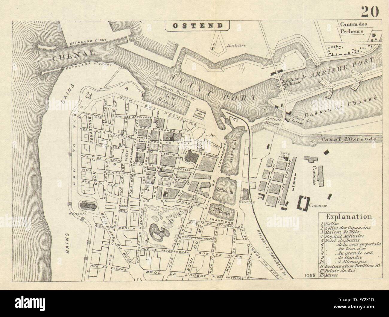 OSTEND OOSTENDE OSTENDE: Antique town plan. City map. Belgium. BRADSHAW 1890 Stock Photohttps://www.alamy.com/image-license-details/?v=1https://www.alamy.com/stock-photo-ostend-oostende-ostende-antique-town-plan-city-map-belgium-bradshaw-102711881.html
RFFY2X1D–OSTEND OOSTENDE OSTENDE: Antique town plan. City map. Belgium. BRADSHAW 1890
 Ostend Map by Priorato Stock Photohttps://www.alamy.com/image-license-details/?v=1https://www.alamy.com/stock-photo-ostend-map-by-priorato-140476094.html
RMJ4F6KA–Ostend Map by Priorato
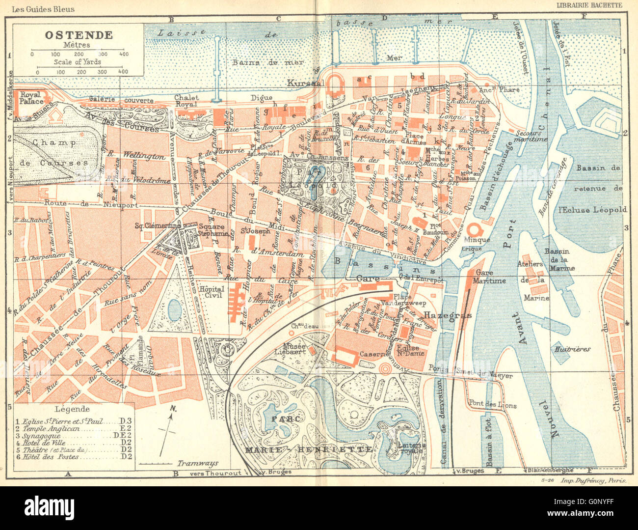 BELGIUM: Ostend Oostende Ostende. Town city ville plan carte map, 1924 Stock Photohttps://www.alamy.com/image-license-details/?v=1https://www.alamy.com/stock-photo-belgium-ostend-oostende-ostende-town-city-ville-plan-carte-map-1924-103744803.html
RFG0NYFF–BELGIUM: Ostend Oostende Ostende. Town city ville plan carte map, 1924
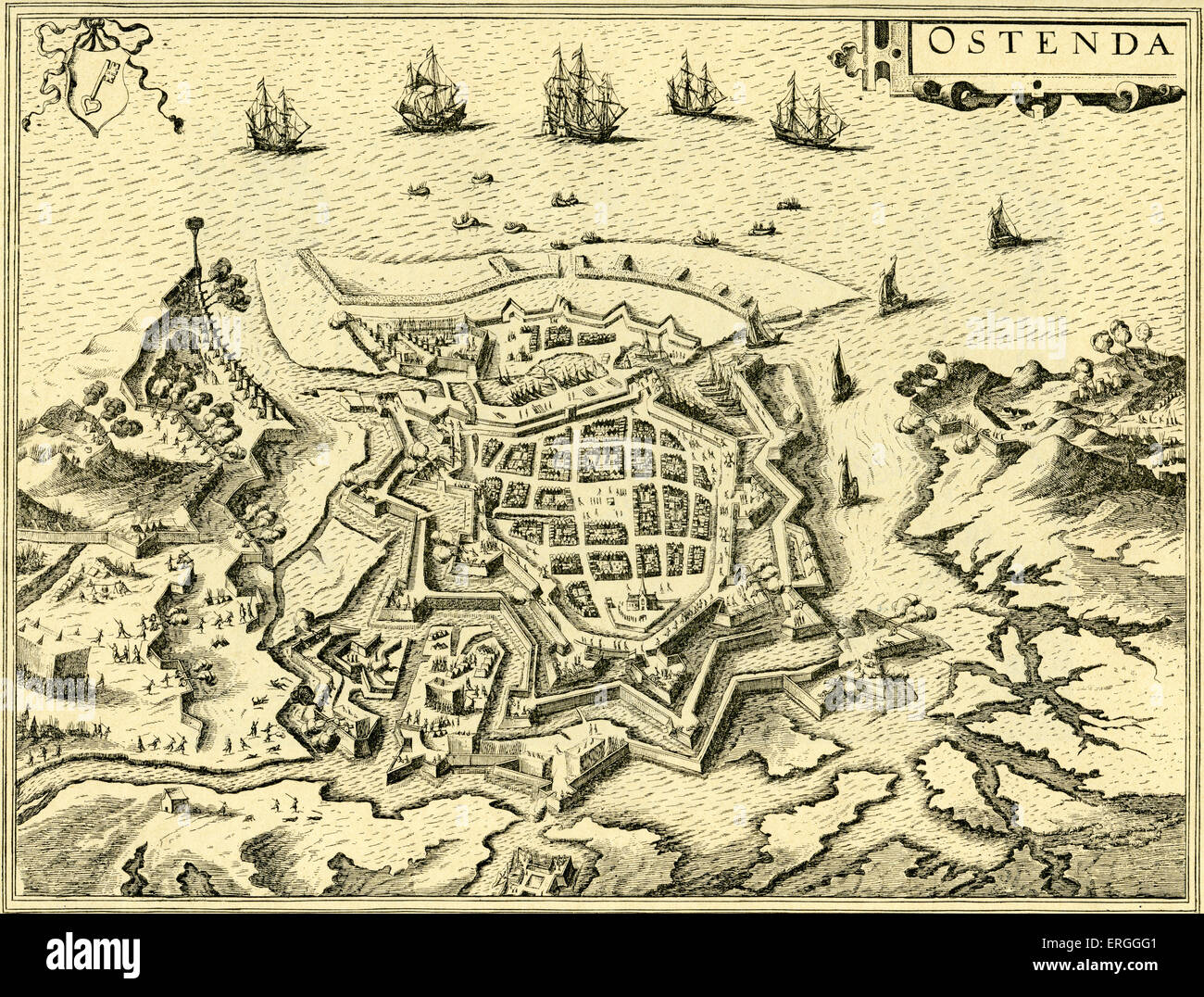 Map of Ostend (during the siege of 1601 - 04 ?) in 'Civitas Oreis Terrarum' by Braun and Hogenberg. Book 6: 1574 - 1618. Stock Photohttps://www.alamy.com/image-license-details/?v=1https://www.alamy.com/stock-photo-map-of-ostend-during-the-siege-of-1601-04-in-civitas-oreis-terrarum-83342785.html
RMERGGG1–Map of Ostend (during the siege of 1601 - 04 ?) in 'Civitas Oreis Terrarum' by Braun and Hogenberg. Book 6: 1574 - 1618.
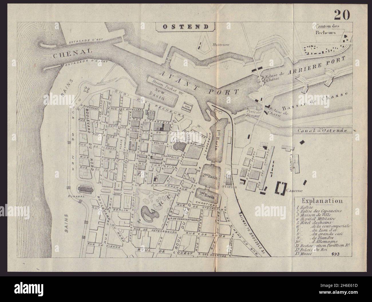 OSTEND OOSTENDE OSTENDE antique town plan city map. Belgium. BRADSHAW 1893 Stock Photohttps://www.alamy.com/image-license-details/?v=1https://www.alamy.com/ostend-oostende-ostende-antique-town-plan-city-map-belgium-bradshaw-1893-image451469577.html
RF2H6E61D–OSTEND OOSTENDE OSTENDE antique town plan city map. Belgium. BRADSHAW 1893
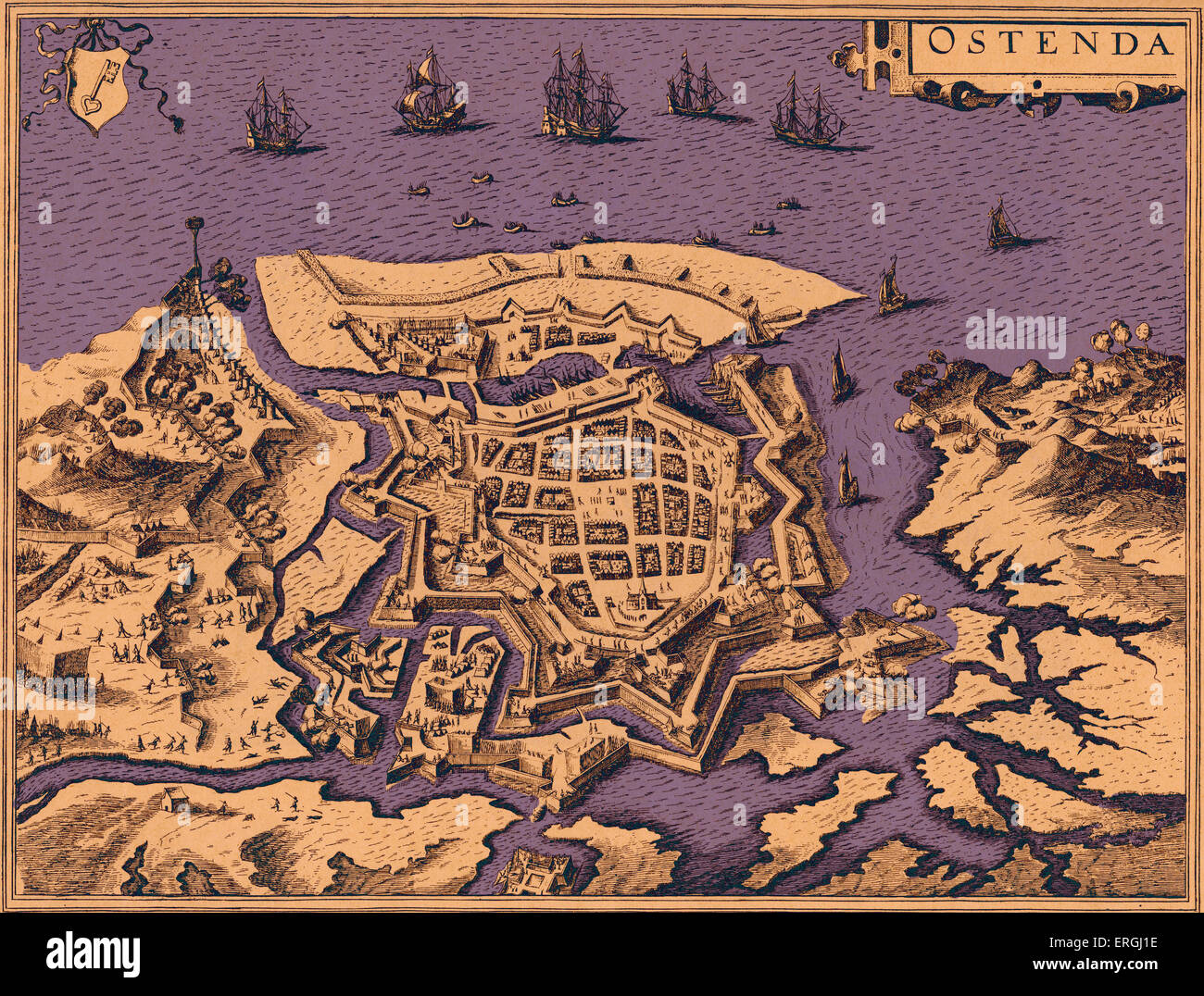 Map of Ostend (during the siege of 1601 - 04 ?) in 'Civitas Oreis Terrarum' by Braun and Hogenberg. Book 6: 1574 - 1618. Stock Photohttps://www.alamy.com/image-license-details/?v=1https://www.alamy.com/stock-photo-map-of-ostend-during-the-siege-of-1601-04-in-civitas-oreis-terrarum-83343946.html
RMERGJ1E–Map of Ostend (during the siege of 1601 - 04 ?) in 'Civitas Oreis Terrarum' by Braun and Hogenberg. Book 6: 1574 - 1618.
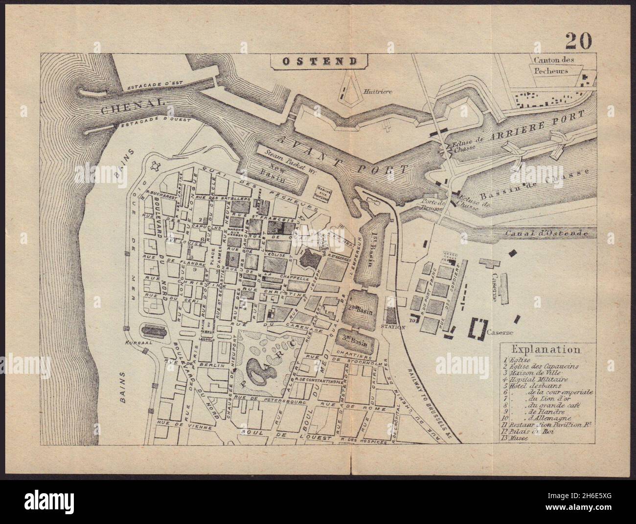 OSTEND OOSTENDE OSTENDE antique town plan city map. Belgium. BRADSHAW 1892 Stock Photohttps://www.alamy.com/image-license-details/?v=1https://www.alamy.com/ostend-oostende-ostende-antique-town-plan-city-map-belgium-bradshaw-1892-image451469496.html
RF2H6E5XG–OSTEND OOSTENDE OSTENDE antique town plan city map. Belgium. BRADSHAW 1892
 A PLAN OF the Town & FORTIFICATIONS of OSTend. Map information: Title: A PLAN OF the Town , FORTIFICATIONS of OSTend. 104.75. Date of publication: c. 1720-1760. Item type: 1 map Medium: pen and ink with coloured wash Dimensions: 45.0 x 33.5 cm Former owner: George III, King of Great Britain, 1738-1820 Stock Photohttps://www.alamy.com/image-license-details/?v=1https://www.alamy.com/a-plan-of-the-town-fortifications-of-ostend-map-information-title-a-plan-of-the-town-fortifications-of-ostend-10475-date-of-publication-c-1720-1760-item-type-1-map-medium-pen-and-ink-with-coloured-wash-dimensions-450-x-335-cm-former-owner-george-iii-king-of-great-britain-1738-1820-image401701433.html
RM2E9F27N–A PLAN OF the Town & FORTIFICATIONS of OSTend. Map information: Title: A PLAN OF the Town , FORTIFICATIONS of OSTend. 104.75. Date of publication: c. 1720-1760. Item type: 1 map Medium: pen and ink with coloured wash Dimensions: 45.0 x 33.5 cm Former owner: George III, King of Great Britain, 1738-1820
 Ostend town city plan. Belgium. BRADSHAW c1853 old antique map chart Stock Photohttps://www.alamy.com/image-license-details/?v=1https://www.alamy.com/ostend-town-city-plan-belgium-bradshaw-c1853-old-antique-map-chart-image622793746.html
RF2Y56KNP–Ostend town city plan. Belgium. BRADSHAW c1853 old antique map chart
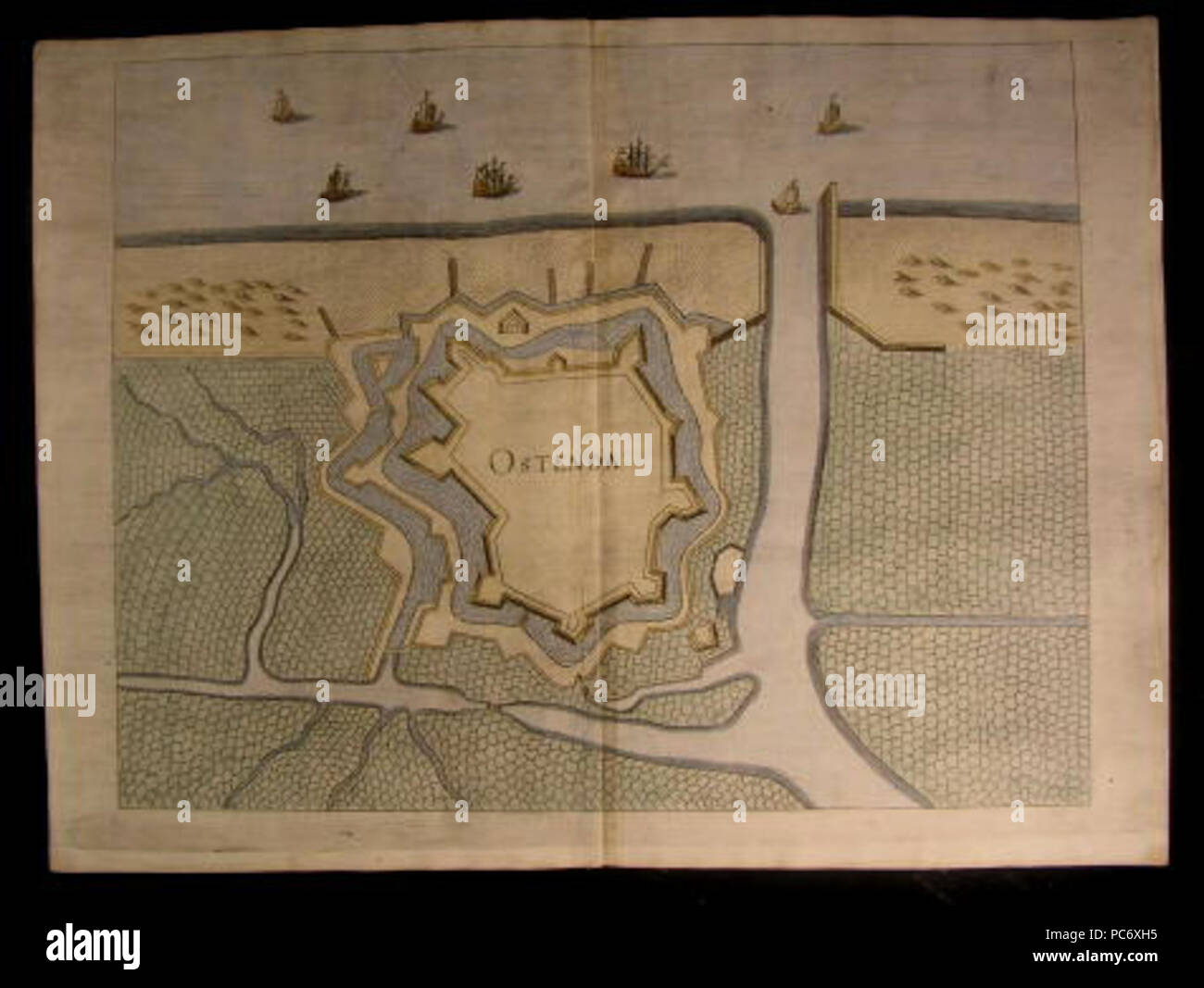 459 Ostend, Map by Priorato Stock Photohttps://www.alamy.com/image-license-details/?v=1https://www.alamy.com/459-ostend-map-by-priorato-image214052865.html
RMPC6XH5–459 Ostend, Map by Priorato
 BELGIUM. Ostend. Oostende. town city plan 1882 old antique map chart Stock Photohttps://www.alamy.com/image-license-details/?v=1https://www.alamy.com/belgium-ostend-oostende-town-city-plan-1882-old-antique-map-chart-image473301418.html
RF2JE0MP2–BELGIUM. Ostend. Oostende. town city plan 1882 old antique map chart
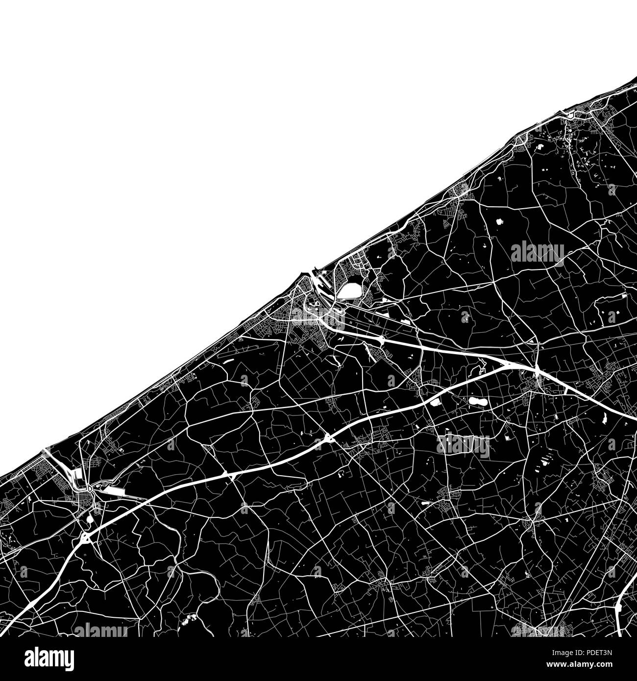 Area map of Ostend, Belgium. Dark background version for infographic and marketing. This map of Ostend, Flemish Region, contains streets, waterways Stock Vectorhttps://www.alamy.com/image-license-details/?v=1https://www.alamy.com/area-map-of-ostend-belgium-dark-background-version-for-infographic-and-marketing-this-map-of-ostendflemish-region-contains-streets-waterways-image214841193.html
RFPDET3N–Area map of Ostend, Belgium. Dark background version for infographic and marketing. This map of Ostend, Flemish Region, contains streets, waterways
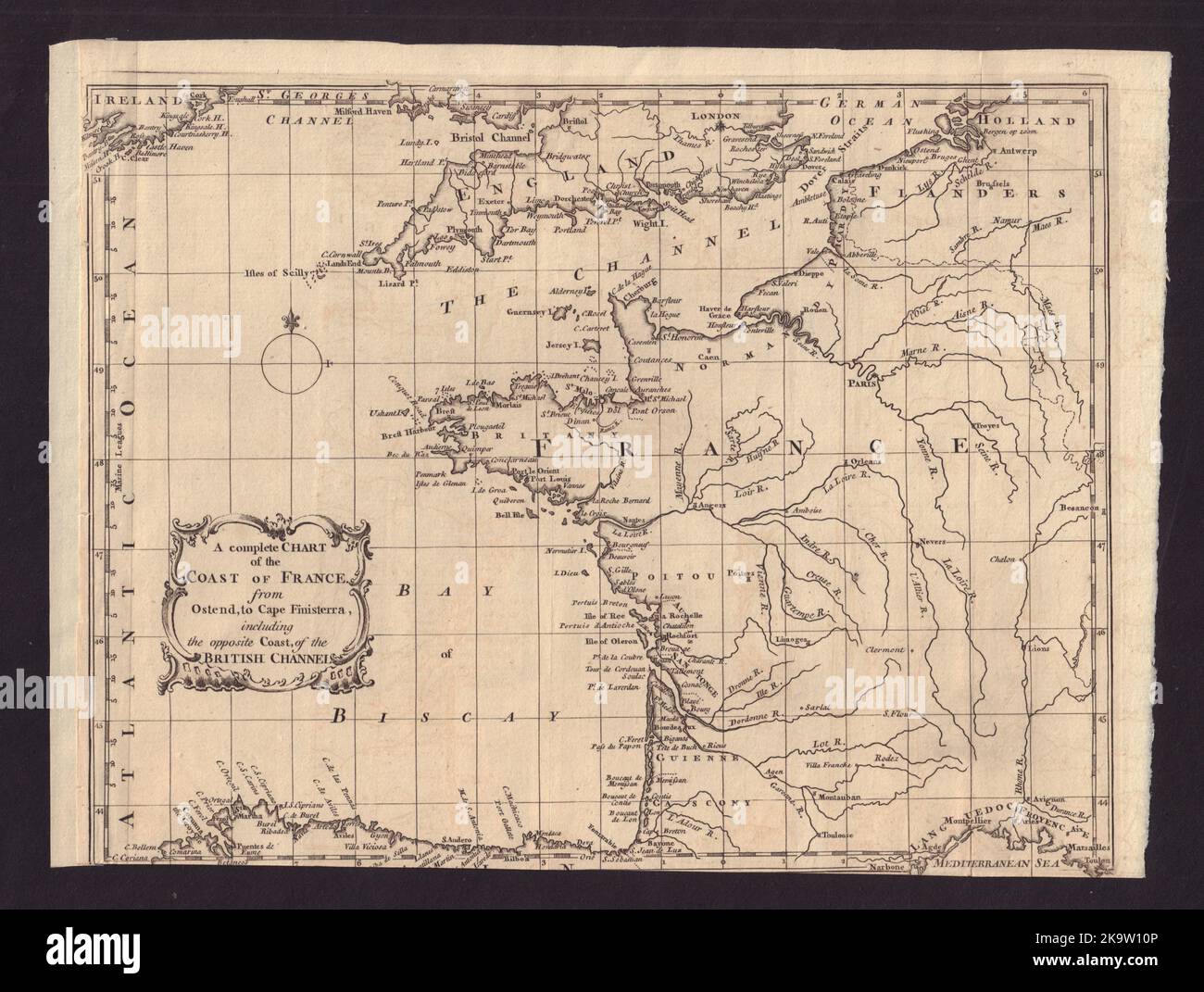 Chart of the coast of France from Ostend to Cape Finisterra… GENTS MAG 1758 map Stock Photohttps://www.alamy.com/image-license-details/?v=1https://www.alamy.com/chart-of-the-coast-of-france-from-ostend-to-cape-finisterra-gents-mag-1758-map-image487971814.html
RF2K9W10P–Chart of the coast of France from Ostend to Cape Finisterra… GENTS MAG 1758 map
 Ostend, Map by Priorato Stock Photohttps://www.alamy.com/image-license-details/?v=1https://www.alamy.com/stock-photo-ostend-map-by-priorato-136663156.html
RMHX9F70–Ostend, Map by Priorato
 Ostend, Map by Priorato. Stock Photohttps://www.alamy.com/image-license-details/?v=1https://www.alamy.com/ostend-map-by-priorato-image405687289.html
RM2EG0J7N–Ostend, Map by Priorato.
 Siege of Ostend, 1601-1604, The siege of Ostend in the years MDCI, MDCII, MDCIII and MDCIV (title on object), Siege of Ostend. Map of the defense and offensive lines around the city and in the surrounding area, on the left Spinola's quarters, on the right Archduke Albrecht's quarters. At the bottom two cartouches with the title and the legends A-R and 1-34. Top left an inset with a map of the city in 1641., print, print maker: anonymous, after print by: anonymous, Northern Netherlands, 1700 - 1749, paper, etching, height, 275 mm × width, 362 mm Stock Photohttps://www.alamy.com/image-license-details/?v=1https://www.alamy.com/siege-of-ostend-1601-1604-the-siege-of-ostend-in-the-years-mdci-mdcii-mdciii-and-mdciv-title-on-object-siege-of-ostend-map-of-the-defense-and-offensive-lines-around-the-city-and-in-the-surrounding-area-on-the-left-spinolas-quarters-on-the-right-archduke-albrechts-quarters-at-the-bottom-two-cartouches-with-the-title-and-the-legends-a-r-and-1-34-top-left-an-inset-with-a-map-of-the-city-in-1641-print-print-maker-anonymous-after-print-by-anonymous-northern-netherlands-1700-1749-paper-etching-height-275-mm-width-362-mm-image606624832.html
RM2X6X44G–Siege of Ostend, 1601-1604, The siege of Ostend in the years MDCI, MDCII, MDCIII and MDCIV (title on object), Siege of Ostend. Map of the defense and offensive lines around the city and in the surrounding area, on the left Spinola's quarters, on the right Archduke Albrecht's quarters. At the bottom two cartouches with the title and the legends A-R and 1-34. Top left an inset with a map of the city in 1641., print, print maker: anonymous, after print by: anonymous, Northern Netherlands, 1700 - 1749, paper, etching, height, 275 mm × width, 362 mm
 Map of the port of OSTENDA - Ostend (Oostende / Ostende), Belgium circa 1618. The Siege of Ostend, 1601 to 1604, of which it was said that 'the Spanish assailed the unassailable and the Dutch defended the indefensible', cost 80,000 dead or wounded, making it the single bloodiest battle of the Eighty Years' War. A truce followed but the result was that the port became a haven for pirates (Dunkirkers) and privateers. x Stock Photohttps://www.alamy.com/image-license-details/?v=1https://www.alamy.com/map-of-the-port-of-ostenda-ostend-oostende-ostende-belgium-circa-1618-the-siege-of-ostend-1601-to-1604-of-which-it-was-said-that-the-spanish-assailed-the-unassailable-and-the-dutch-defended-the-indefensible-cost-80000-dead-or-wounded-making-it-the-single-bloodiest-battle-of-the-eighty-years-war-a-truce-followed-but-the-result-was-that-the-port-became-a-haven-for-pirates-dunkirkers-and-privateers-x-image369937248.html
RM2CDT2MG–Map of the port of OSTENDA - Ostend (Oostende / Ostende), Belgium circa 1618. The Siege of Ostend, 1601 to 1604, of which it was said that 'the Spanish assailed the unassailable and the Dutch defended the indefensible', cost 80,000 dead or wounded, making it the single bloodiest battle of the Eighty Years' War. A truce followed but the result was that the port became a haven for pirates (Dunkirkers) and privateers. x
 Ostend, West Flanders, Belgium high resolution vector map with city boundaries and editable paths. White outlines for main roads. Many detailed paths. Stock Vectorhttps://www.alamy.com/image-license-details/?v=1https://www.alamy.com/ostend-west-flanders-belgium-high-resolution-vector-map-with-city-boundaries-and-editable-paths-white-outlines-for-main-roads-many-detailed-paths-image458419985.html
RF2HHPRA9–Ostend, West Flanders, Belgium high resolution vector map with city boundaries and editable paths. White outlines for main roads. Many detailed paths.
 Ostend, Regierungsbezirk Darmstadt, DE, Germany, Hesse, N 50 6' 58'', N 8 43' 19'', map, Cartascapes Map published in 2024. Explore Cartascapes, a map revealing Earth's diverse landscapes, cultures, and ecosystems. Journey through time and space, discovering the interconnectedness of our planet's past, present, and future. Stock Photohttps://www.alamy.com/image-license-details/?v=1https://www.alamy.com/ostend-regierungsbezirk-darmstadt-de-germany-hesse-n-50-6-58-n-8-43-19-map-cartascapes-map-published-in-2024-explore-cartascapes-a-map-revealing-earths-diverse-landscapes-cultures-and-ecosystems-journey-through-time-and-space-discovering-the-interconnectedness-of-our-planets-past-present-and-future-image629540501.html
RM2YG6199–Ostend, Regierungsbezirk Darmstadt, DE, Germany, Hesse, N 50 6' 58'', N 8 43' 19'', map, Cartascapes Map published in 2024. Explore Cartascapes, a map revealing Earth's diverse landscapes, cultures, and ecosystems. Journey through time and space, discovering the interconnectedness of our planet's past, present, and future.
 Inspired by Siege of Ostend, 1706, Plan de la ville d'Ostende, Map of the siege of Ostend by the Allies under Henry of Nassau, lord of Ouwerkerk, besieged from June 17, taken on July 6, 1706. Top left a cartouche with the title and legends 1-57 in French. Bottom left a cartouche listing the regiments, Reimagined by Artotop. Classic art reinvented with a modern twist. Design of warm cheerful glowing of brightness and light ray radiance. Photography inspired by surrealism and futurism, embracing dynamic energy of modern technology, movement, speed and revolutionize culture Stock Photohttps://www.alamy.com/image-license-details/?v=1https://www.alamy.com/inspired-by-siege-of-ostend-1706-plan-de-la-ville-dostende-map-of-the-siege-of-ostend-by-the-allies-under-henry-of-nassau-lord-of-ouwerkerk-besieged-from-june-17-taken-on-july-6-1706-top-left-a-cartouche-with-the-title-and-legends-1-57-in-french-bottom-left-a-cartouche-listing-the-regiments-reimagined-by-artotop-classic-art-reinvented-with-a-modern-twist-design-of-warm-cheerful-glowing-of-brightness-and-light-ray-radiance-photography-inspired-by-surrealism-and-futurism-embracing-dynamic-energy-of-modern-technology-movement-speed-and-revolutionize-culture-image459379741.html
RF2HKAFF9–Inspired by Siege of Ostend, 1706, Plan de la ville d'Ostende, Map of the siege of Ostend by the Allies under Henry of Nassau, lord of Ouwerkerk, besieged from June 17, taken on July 6, 1706. Top left a cartouche with the title and legends 1-57 in French. Bottom left a cartouche listing the regiments, Reimagined by Artotop. Classic art reinvented with a modern twist. Design of warm cheerful glowing of brightness and light ray radiance. Photography inspired by surrealism and futurism, embracing dynamic energy of modern technology, movement, speed and revolutionize culture
 Siege of Ostend, 1601-1604 The Belegh Ostend in the Jaeren MDCI, MDCII, MDCIII and MDCIV (title object) Siege of Ostend. Map of the defensive and attacking lines around the city and in the surrounding area, left the quarter Spinola, right quarter of Archduke Albrecht. At the bottom of two cartridges with the title and the legends A-R and 1-34. Top left a bet with a city map in 1641. Manufacturer : printmaker: anonymous to print by: anonymous place manufacture: Northern Netherlands Date: 1700 - 1749 Physical features: etching material: paper Technique: etching Dimensions: plate edge: H 275 mm × Stock Photohttps://www.alamy.com/image-license-details/?v=1https://www.alamy.com/siege-of-ostend-1601-1604-the-belegh-ostend-in-the-jaeren-mdci-mdcii-mdciii-and-mdciv-title-object-siege-of-ostend-map-of-the-defensive-and-attacking-lines-around-the-city-and-in-the-surrounding-area-left-the-quarter-spinola-right-quarter-of-archduke-albrecht-at-the-bottom-of-two-cartridges-with-the-title-and-the-legends-a-r-and-1-34-top-left-a-bet-with-a-city-map-in-1641-manufacturer-printmaker-anonymous-to-print-by-anonymous-place-manufacture-northern-netherlands-date-1700-1749-physical-features-etching-material-paper-technique-etching-dimensions-plate-edge-h-275-mm-image348177643.html
RM2B6CT3R–Siege of Ostend, 1601-1604 The Belegh Ostend in the Jaeren MDCI, MDCII, MDCIII and MDCIV (title object) Siege of Ostend. Map of the defensive and attacking lines around the city and in the surrounding area, left the quarter Spinola, right quarter of Archduke Albrecht. At the bottom of two cartridges with the title and the legends A-R and 1-34. Top left a bet with a city map in 1641. Manufacturer : printmaker: anonymous to print by: anonymous place manufacture: Northern Netherlands Date: 1700 - 1749 Physical features: etching material: paper Technique: etching Dimensions: plate edge: H 275 mm ×
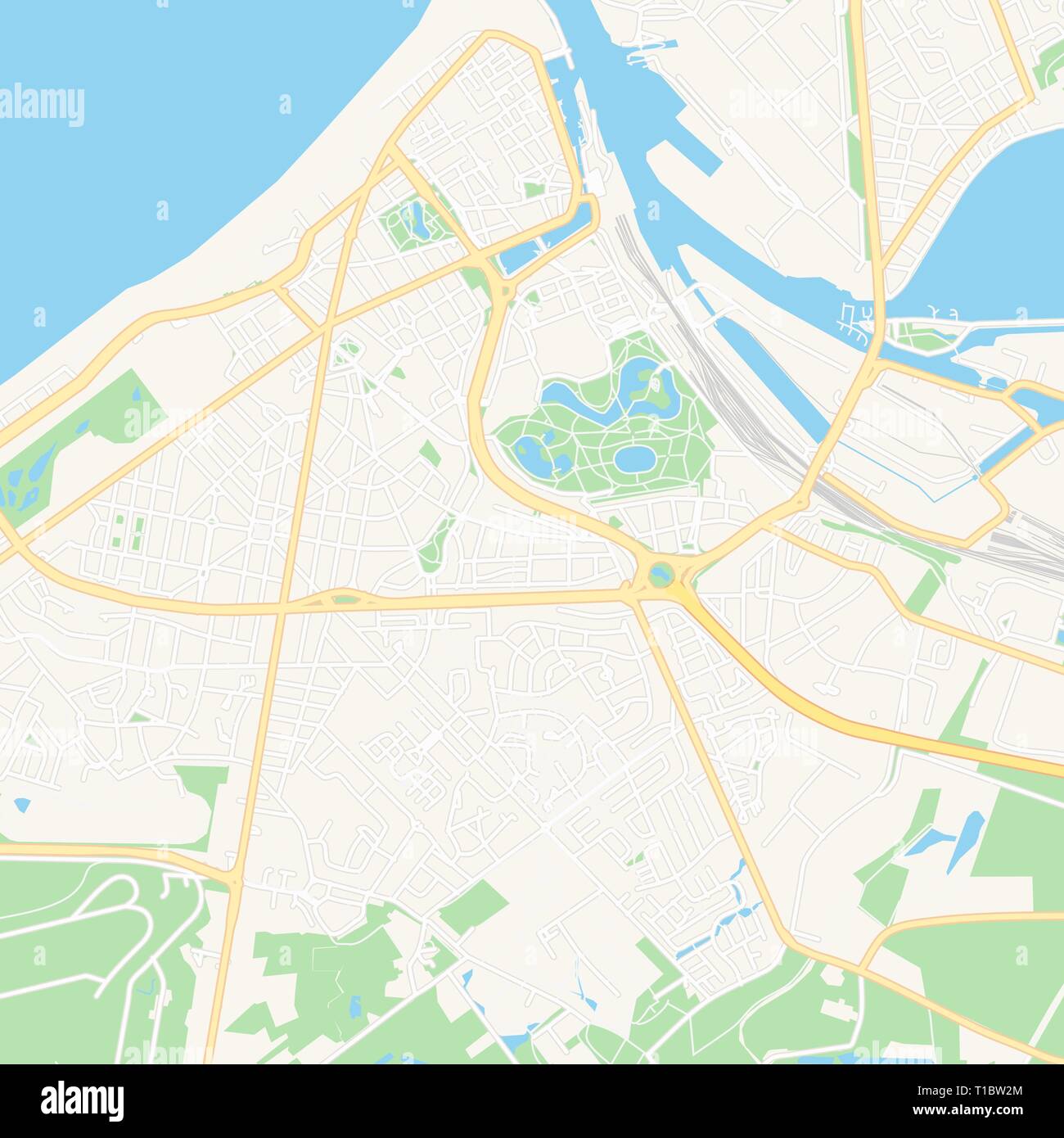 Printable map of Ostend , Belgium with main and secondary roads and larger railways. This map is carefully designed for routing and placing individual Stock Vectorhttps://www.alamy.com/image-license-details/?v=1https://www.alamy.com/printable-map-of-ostend-belgium-with-main-and-secondary-roads-and-larger-railways-this-map-is-carefully-designed-for-routing-and-placing-individual-image241820956.html
RFT1BW2M–Printable map of Ostend , Belgium with main and secondary roads and larger railways. This map is carefully designed for routing and placing individual
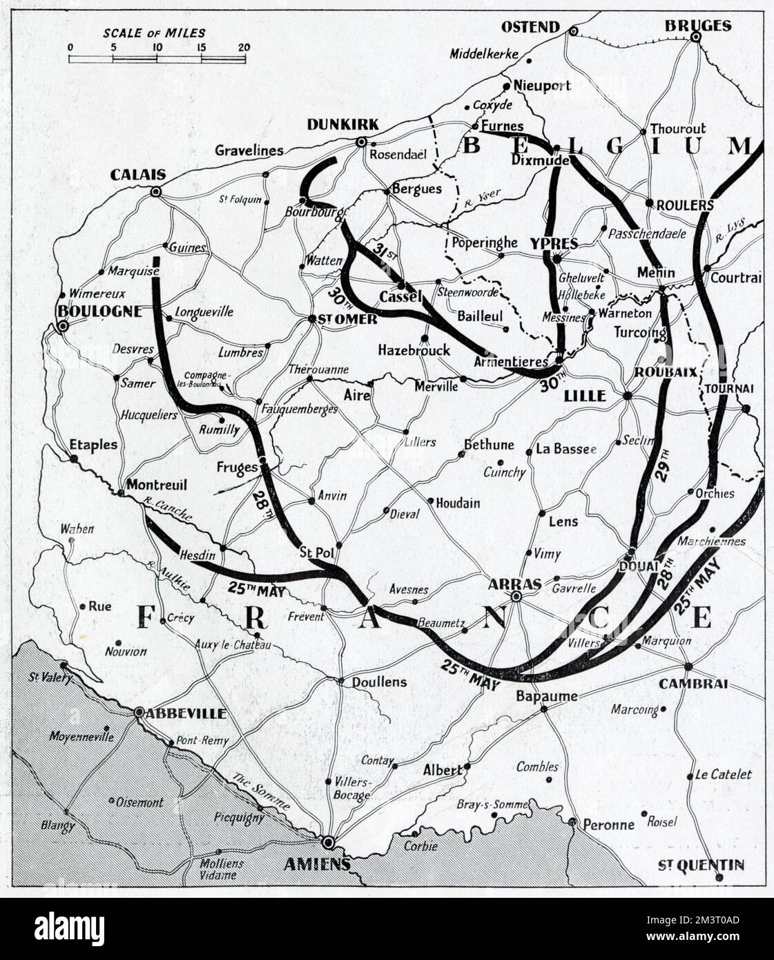 Map of France and Belgium, evacuation from Dunkirk, WW2 Stock Photohttps://www.alamy.com/image-license-details/?v=1https://www.alamy.com/map-of-france-and-belgium-evacuation-from-dunkirk-ww2-image501471781.html
RM2M3T0AD–Map of France and Belgium, evacuation from Dunkirk, WW2
 Oostende pinned on a map of Belgium Stock Photohttps://www.alamy.com/image-license-details/?v=1https://www.alamy.com/stock-photo-oostende-pinned-on-a-map-of-belgium-125207230.html
RFH7KK2P–Oostende pinned on a map of Belgium
 Napoleonic map. Mouth of Scheldt river (Bouches-de-L'Escaut). It was a department of the First French Empire which was formed in 1810, when the Kingdom of Holland was annexed by France. (Netherlands). Scheldt is an European river which born in France, crosses Belgium and empties into the North Sea forming an estuary. Atlas de l'Histoire du Consulat et de l'Empire. History of the Consulate and the Empire of France under Napoleon by Marie Joseph Louis Adolphe Thiers (1797-1877). Drawings by Dufour, engravings by Dyonnet. Edited in Paris, 1864. Stock Photohttps://www.alamy.com/image-license-details/?v=1https://www.alamy.com/napoleonic-map-mouth-of-scheldt-river-bouches-de-lescaut-it-was-a-department-of-the-first-french-empire-which-was-formed-in-1810-when-the-kingdom-of-holland-was-annexed-by-france-netherlands-scheldt-is-an-european-river-which-born-in-france-crosses-belgium-and-empties-into-the-north-sea-forming-an-estuary-atlas-de-lhistoire-du-consulat-et-de-lempire-history-of-the-consulate-and-the-empire-of-france-under-napoleon-by-marie-joseph-louis-adolphe-thiers-1797-1877-drawings-by-dufour-engravings-by-dyonnet-edited-in-paris-1864-image231603308.html
RMRCPCAM–Napoleonic map. Mouth of Scheldt river (Bouches-de-L'Escaut). It was a department of the First French Empire which was formed in 1810, when the Kingdom of Holland was annexed by France. (Netherlands). Scheldt is an European river which born in France, crosses Belgium and empties into the North Sea forming an estuary. Atlas de l'Histoire du Consulat et de l'Empire. History of the Consulate and the Empire of France under Napoleon by Marie Joseph Louis Adolphe Thiers (1797-1877). Drawings by Dufour, engravings by Dyonnet. Edited in Paris, 1864.
 A late 19th century map of Belgium and the Netherlands -Une carte de la Belgique et des Pays-Bas de la fin du XIXe siècle -Een kaart van België en Nederland uit de late 19e eeuw - Stock Photohttps://www.alamy.com/image-license-details/?v=1https://www.alamy.com/a-late-19th-century-map-of-belgium-and-the-netherlands-une-carte-de-la-belgique-et-des-pays-bas-de-la-fin-du-xixe-sicle-een-kaart-van-belgi-en-nederland-uit-de-late-19e-eeuw-image624620246.html
RM2Y85WDX–A late 19th century map of Belgium and the Netherlands -Une carte de la Belgique et des Pays-Bas de la fin du XIXe siècle -Een kaart van België en Nederland uit de late 19e eeuw -
 Siege of Ostend, 1601-1604, 1700 - 1749 print Siege of Ostend. Map of the defense and attack lines around the city and in the surrounding area, on the left the quarter of Spinola, on the right the quarter of Archduke Albrecht. At the bottom two cartouches with the title and the legends A-R and 1-34. At the top left a bet with a map of the city in 1641. Northern Netherlands paper etching Victory, position was Oostende Stock Photohttps://www.alamy.com/image-license-details/?v=1https://www.alamy.com/siege-of-ostend-1601-1604-1700-1749-print-siege-of-ostend-map-of-the-defense-and-attack-lines-around-the-city-and-in-the-surrounding-area-on-the-left-the-quarter-of-spinola-on-the-right-the-quarter-of-archduke-albrecht-at-the-bottom-two-cartouches-with-the-title-and-the-legends-a-r-and-1-34-at-the-top-left-a-bet-with-a-map-of-the-city-in-1641-northern-netherlands-paper-etching-victory-position-was-oostende-image595262549.html
RM2WGCFCN–Siege of Ostend, 1601-1604, 1700 - 1749 print Siege of Ostend. Map of the defense and attack lines around the city and in the surrounding area, on the left the quarter of Spinola, on the right the quarter of Archduke Albrecht. At the bottom two cartouches with the title and the legends A-R and 1-34. At the top left a bet with a map of the city in 1641. Northern Netherlands paper etching Victory, position was Oostende
![Queens, Vol. 1, Double Page Plate No. 39; Part of Ward 5; Farrockaway; [Map bounded by Park Ave., Southampton Ave., Ostend Ave., Dover Ave., Brighton Ave., Essex Ave., Norfolk Ave., Oxford Ave., Henley Ave., Suffolk Ave., Dennison Ave., Montauk Ave., Chester Ave.; Including Winthrop Ave., Orienta Ave., Pelham Ave., Monmouth Ave., Lincoln Ave., Bay Ave., Columbus Ave., Westend Ave., 10th Ave., Triton Ave., Washington Ave., Newport Ave., Bayside Drive.] 1907 Stock Photo Queens, Vol. 1, Double Page Plate No. 39; Part of Ward 5; Farrockaway; [Map bounded by Park Ave., Southampton Ave., Ostend Ave., Dover Ave., Brighton Ave., Essex Ave., Norfolk Ave., Oxford Ave., Henley Ave., Suffolk Ave., Dennison Ave., Montauk Ave., Chester Ave.; Including Winthrop Ave., Orienta Ave., Pelham Ave., Monmouth Ave., Lincoln Ave., Bay Ave., Columbus Ave., Westend Ave., 10th Ave., Triton Ave., Washington Ave., Newport Ave., Bayside Drive.] 1907 Stock Photo](https://c8.alamy.com/comp/2YRC98M/queens-vol-1-double-page-plate-no-39-part-of-ward-5-farrockaway-map-bounded-by-park-ave-southampton-ave-ostend-ave-dover-ave-brighton-ave-essex-ave-norfolk-ave-oxford-ave-henley-ave-suffolk-ave-dennison-ave-montauk-ave-chester-ave-including-winthrop-ave-orienta-ave-pelham-ave-monmouth-ave-lincoln-ave-bay-ave-columbus-ave-westend-ave-10th-ave-triton-ave-washington-ave-newport-ave-bayside-drive-1907-2YRC98M.jpg) Queens, Vol. 1, Double Page Plate No. 39; Part of Ward 5; Farrockaway; [Map bounded by Park Ave., Southampton Ave., Ostend Ave., Dover Ave., Brighton Ave., Essex Ave., Norfolk Ave., Oxford Ave., Henley Ave., Suffolk Ave., Dennison Ave., Montauk Ave., Chester Ave.; Including Winthrop Ave., Orienta Ave., Pelham Ave., Monmouth Ave., Lincoln Ave., Bay Ave., Columbus Ave., Westend Ave., 10th Ave., Triton Ave., Washington Ave., Newport Ave., Bayside Drive.] 1907 Stock Photohttps://www.alamy.com/image-license-details/?v=1https://www.alamy.com/queens-vol-1-double-page-plate-no-39-part-of-ward-5-farrockaway-map-bounded-by-park-ave-southampton-ave-ostend-ave-dover-ave-brighton-ave-essex-ave-norfolk-ave-oxford-ave-henley-ave-suffolk-ave-dennison-ave-montauk-ave-chester-ave-including-winthrop-ave-orienta-ave-pelham-ave-monmouth-ave-lincoln-ave-bay-ave-columbus-ave-westend-ave-10th-ave-triton-ave-washington-ave-newport-ave-bayside-drive-1907-image633981060.html
Queens, Vol. 1, Double Page Plate No. 39; Part of Ward 5; Farrockaway; [Map bounded by Park Ave., Southampton Ave., Ostend Ave., Dover Ave., Brighton Ave., Essex Ave., Norfolk Ave., Oxford Ave., Henley Ave., Suffolk Ave., Dennison Ave., Montauk Ave., Chester Ave.; Including Winthrop Ave., Orienta Ave., Pelham Ave., Monmouth Ave., Lincoln Ave., Bay Ave., Columbus Ave., Westend Ave., 10th Ave., Triton Ave., Washington Ave., Newport Ave., Bayside Drive.] 1907 Stock Photohttps://www.alamy.com/image-license-details/?v=1https://www.alamy.com/queens-vol-1-double-page-plate-no-39-part-of-ward-5-farrockaway-map-bounded-by-park-ave-southampton-ave-ostend-ave-dover-ave-brighton-ave-essex-ave-norfolk-ave-oxford-ave-henley-ave-suffolk-ave-dennison-ave-montauk-ave-chester-ave-including-winthrop-ave-orienta-ave-pelham-ave-monmouth-ave-lincoln-ave-bay-ave-columbus-ave-westend-ave-10th-ave-triton-ave-washington-ave-newport-ave-bayside-drive-1907-image633981060.htmlRM2YRC98M–Queens, Vol. 1, Double Page Plate No. 39; Part of Ward 5; Farrockaway; [Map bounded by Park Ave., Southampton Ave., Ostend Ave., Dover Ave., Brighton Ave., Essex Ave., Norfolk Ave., Oxford Ave., Henley Ave., Suffolk Ave., Dennison Ave., Montauk Ave., Chester Ave.; Including Winthrop Ave., Orienta Ave., Pelham Ave., Monmouth Ave., Lincoln Ave., Bay Ave., Columbus Ave., Westend Ave., 10th Ave., Triton Ave., Washington Ave., Newport Ave., Bayside Drive.] 1907
 . English: Ostend, Map by Priorato . 10 September 2010. Galaezzo Gualdo Priorato 459 Ostend, Map by Priorato Stock Photohttps://www.alamy.com/image-license-details/?v=1https://www.alamy.com/english-ostend-map-by-priorato-10-september-2010-galaezzo-gualdo-priorato-459-ostend-map-by-priorato-image187560225.html
RMMW42YD–. English: Ostend, Map by Priorato . 10 September 2010. Galaezzo Gualdo Priorato 459 Ostend, Map by Priorato
 Exhibition showing old map inside the pentagonal Fort Napoleon at Ostend, Belgium Stock Photohttps://www.alamy.com/image-license-details/?v=1https://www.alamy.com/stock-photo-exhibition-showing-old-map-inside-the-pentagonal-fort-napoleon-at-29581647.html
RMBM3FKB–Exhibition showing old map inside the pentagonal Fort Napoleon at Ostend, Belgium
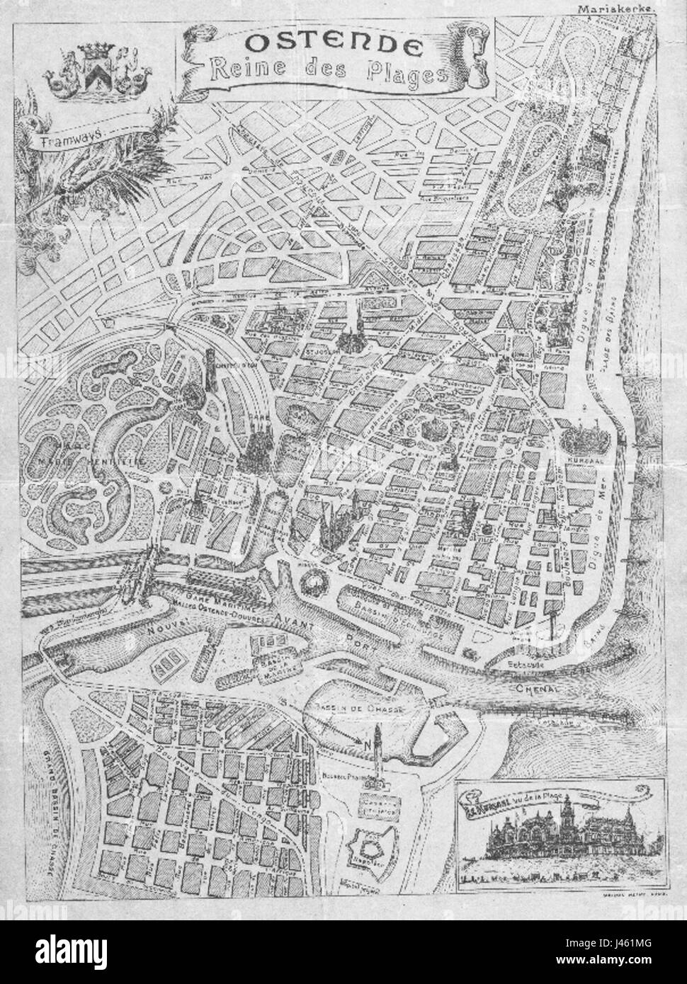 Old map of Ostend by Heins, Balthasar, Florentius Stock Photohttps://www.alamy.com/image-license-details/?v=1https://www.alamy.com/stock-photo-old-map-of-ostend-by-heins-balthasar-florentius-140274640.html
RMJ461MG–Old map of Ostend by Heins, Balthasar, Florentius
 Pas-de-Calais Belgium coast profile. Ostend Dunkirk Calais MOUNT & PAGE 1758 map Stock Photohttps://www.alamy.com/image-license-details/?v=1https://www.alamy.com/pas-de-calais-belgium-coast-profile-ostend-dunkirk-calais-mount-page-1758-map-image599872622.html
RF2WRXFJ6–Pas-de-Calais Belgium coast profile. Ostend Dunkirk Calais MOUNT & PAGE 1758 map
 Topographic relief map of OSTEND, BELGIUM Stock Vectorhttps://www.alamy.com/image-license-details/?v=1https://www.alamy.com/topographic-relief-map-of-ostend-belgium-image544689597.html
RF2PJ4N3W–Topographic relief map of OSTEND, BELGIUM
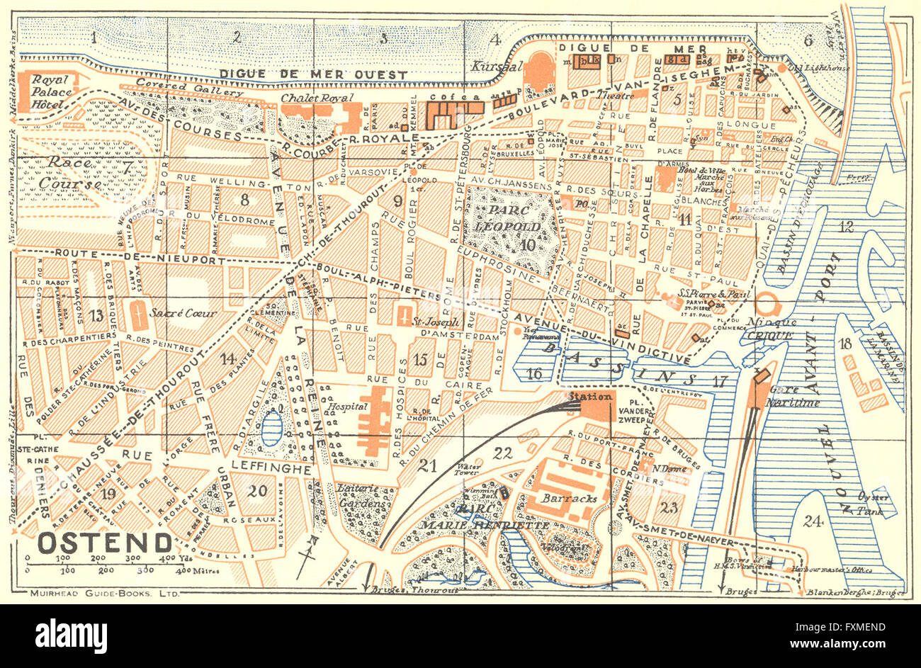 BELGIUM: Ostend, 1929 vintage map Stock Photohttps://www.alamy.com/image-license-details/?v=1https://www.alamy.com/stock-photo-belgium-ostend-1929-vintage-map-102483513.html
RFFXMEND–BELGIUM: Ostend, 1929 vintage map
 Siege of Ostend, 1601-1604, Ostenda obsessa et capta ab Alberto et Isabella (...) (title on object), Ostenda (title on object), Siege of Ostend. Map of the defense and offensive lines around the city and in the surrounding area, on the left Spinola's quarters, on the right Archduke Albrecht's quarters. At the bottom two cartouches with the title and the legends A-R and 1-34. Top left an inset with a map of the city in 1641. On a double page taken from Blaeu's City Book, printed on the back with text in Latin., print, print maker: anonymous, Northern Netherlands, 1647 - 1649, paper, etching Stock Photohttps://www.alamy.com/image-license-details/?v=1https://www.alamy.com/siege-of-ostend-1601-1604-ostenda-obsessa-et-capta-ab-alberto-et-isabella-title-on-object-ostenda-title-on-object-siege-of-ostend-map-of-the-defense-and-offensive-lines-around-the-city-and-in-the-surrounding-area-on-the-left-spinolas-quarters-on-the-right-archduke-albrechts-quarters-at-the-bottom-two-cartouches-with-the-title-and-the-legends-a-r-and-1-34-top-left-an-inset-with-a-map-of-the-city-in-1641-on-a-double-page-taken-from-blaeus-city-book-printed-on-the-back-with-text-in-latin-print-print-maker-anonymous-northern-netherlands-1647-1649-paper-etching-image606624812.html
RM2X6X43T–Siege of Ostend, 1601-1604, Ostenda obsessa et capta ab Alberto et Isabella (...) (title on object), Ostenda (title on object), Siege of Ostend. Map of the defense and offensive lines around the city and in the surrounding area, on the left Spinola's quarters, on the right Archduke Albrecht's quarters. At the bottom two cartouches with the title and the legends A-R and 1-34. Top left an inset with a map of the city in 1641. On a double page taken from Blaeu's City Book, printed on the back with text in Latin., print, print maker: anonymous, Northern Netherlands, 1647 - 1649, paper, etching
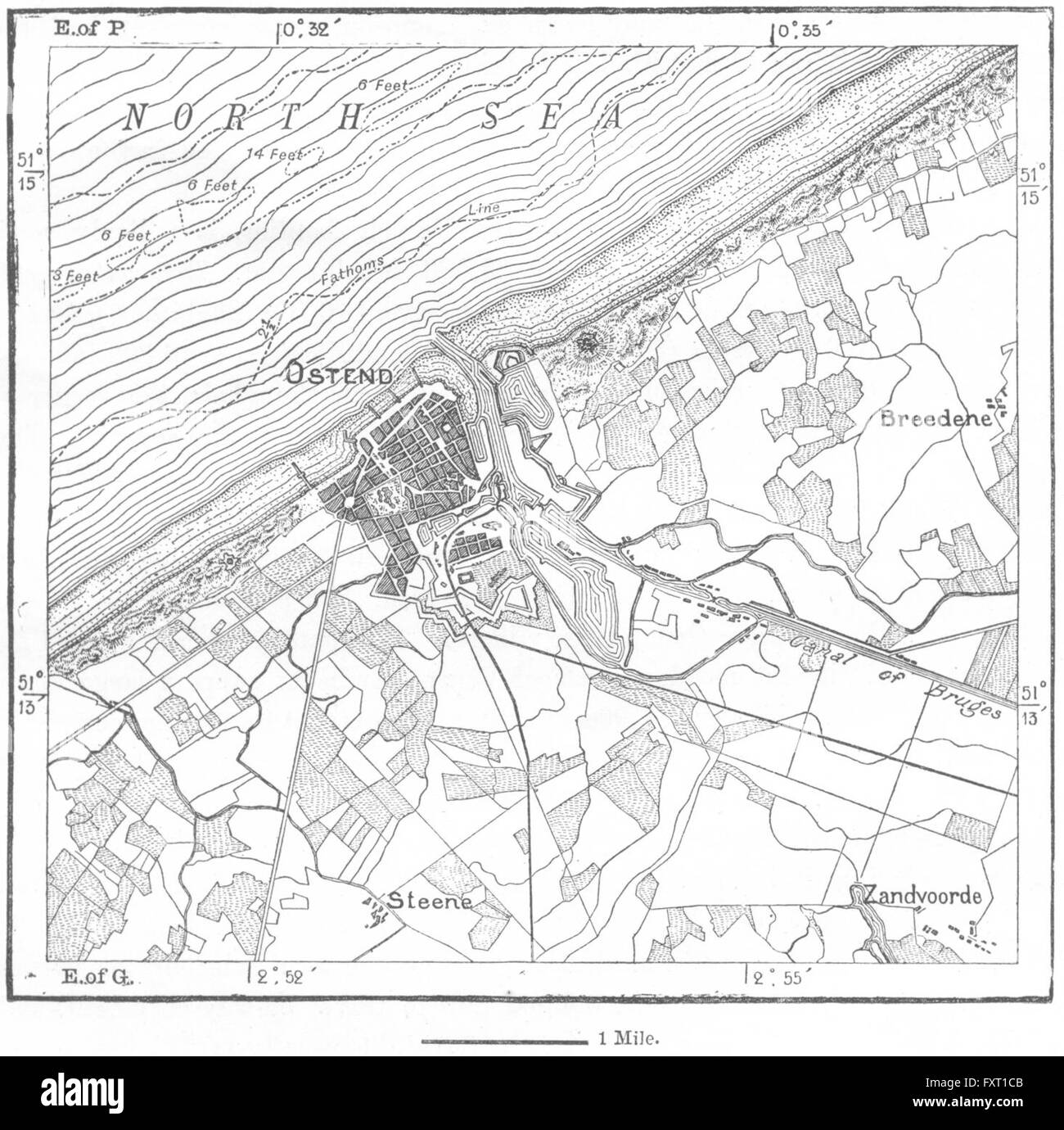 BELGIUM: Ostend, sketch map, c1885 Stock Photohttps://www.alamy.com/image-license-details/?v=1https://www.alamy.com/stock-photo-belgium-ostend-sketch-map-c1885-102560875.html
RFFXT1CB–BELGIUM: Ostend, sketch map, c1885
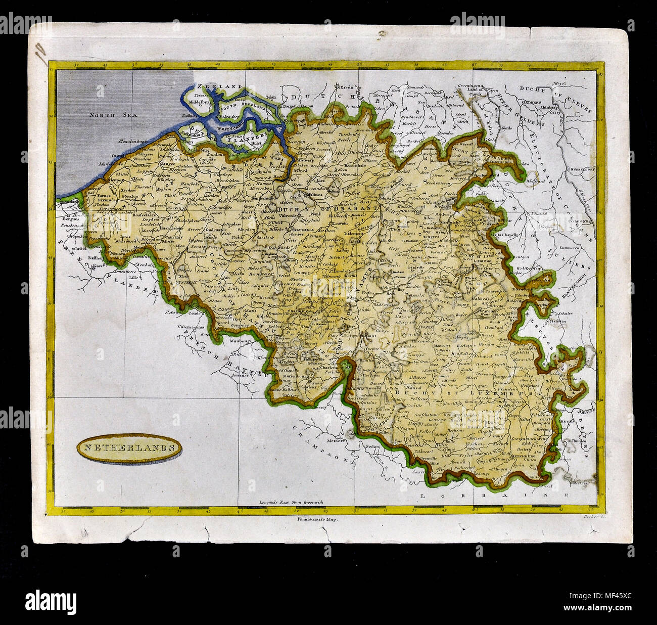 1804 Arrowsmith Map - Belgium - Brussels Gent Luxembourg Europe Stock Photohttps://www.alamy.com/image-license-details/?v=1https://www.alamy.com/1804-arrowsmith-map-belgium-brussels-gent-luxembourg-europe-image181415988.html
RFMF45XC–1804 Arrowsmith Map - Belgium - Brussels Gent Luxembourg Europe
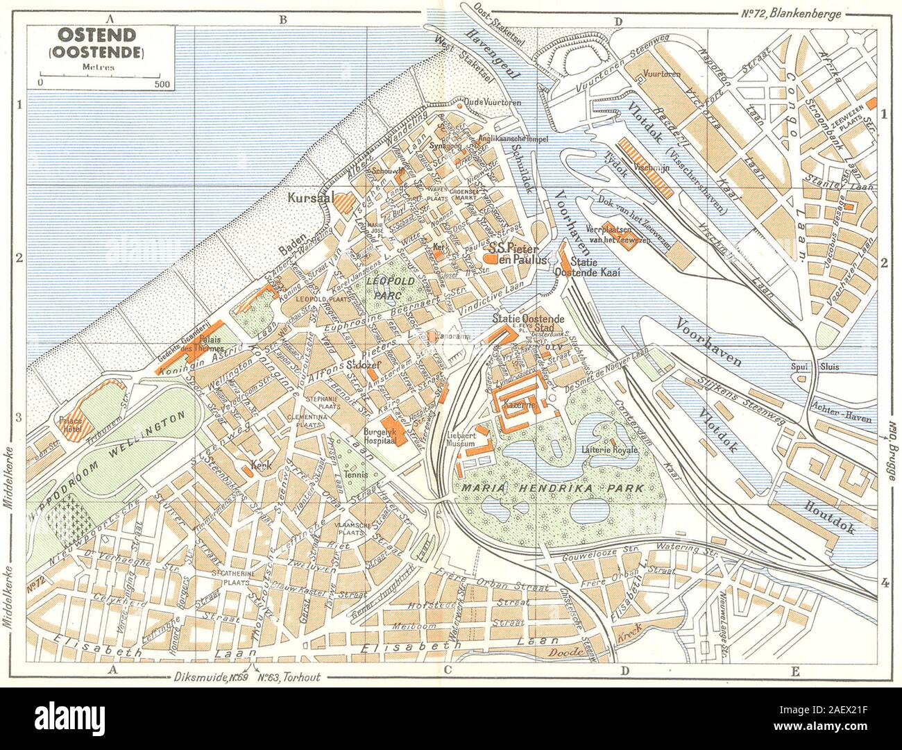 BELGIUM. Ostend (Oostende) 1950 old vintage map plan chart Stock Photohttps://www.alamy.com/image-license-details/?v=1https://www.alamy.com/belgium-ostend-oostende-1950-old-vintage-map-plan-chart-image336174539.html
RF2AEX21F–BELGIUM. Ostend (Oostende) 1950 old vintage map plan chart
 Bornheim/Ostend, Regierungsbezirk Darmstadt, DE, Germany, Hesse, N 50 7' 26'', N 8 42' 47'', map, Cartascapes Map published in 2024. Explore Cartascapes, a map revealing Earth's diverse landscapes, cultures, and ecosystems. Journey through time and space, discovering the interconnectedness of our planet's past, present, and future. Stock Photohttps://www.alamy.com/image-license-details/?v=1https://www.alamy.com/bornheimostend-regierungsbezirk-darmstadt-de-germany-hesse-n-50-7-26-n-8-42-47-map-cartascapes-map-published-in-2024-explore-cartascapes-a-map-revealing-earths-diverse-landscapes-cultures-and-ecosystems-journey-through-time-and-space-discovering-the-interconnectedness-of-our-planets-past-present-and-future-image629369710.html
RM2YFX7DJ–Bornheim/Ostend, Regierungsbezirk Darmstadt, DE, Germany, Hesse, N 50 7' 26'', N 8 42' 47'', map, Cartascapes Map published in 2024. Explore Cartascapes, a map revealing Earth's diverse landscapes, cultures, and ecosystems. Journey through time and space, discovering the interconnectedness of our planet's past, present, and future.
 Inspired by Siege of Ostend, 1706, Plan de la ville d'Ostende, Map of the siege of Ostend by the Allies under Henry of Nassau, lord of Ouwerkerk, besieged from 17 June, taken on 6 July 1706. Top left a cartouche with the title and legends 1-57 in French. Bottom left a cartouche listing the regiments, Reimagined by Artotop. Classic art reinvented with a modern twist. Design of warm cheerful glowing of brightness and light ray radiance. Photography inspired by surrealism and futurism, embracing dynamic energy of modern technology, movement, speed and revolutionize culture Stock Photohttps://www.alamy.com/image-license-details/?v=1https://www.alamy.com/inspired-by-siege-of-ostend-1706-plan-de-la-ville-dostende-map-of-the-siege-of-ostend-by-the-allies-under-henry-of-nassau-lord-of-ouwerkerk-besieged-from-17-june-taken-on-6-july-1706-top-left-a-cartouche-with-the-title-and-legends-1-57-in-french-bottom-left-a-cartouche-listing-the-regiments-reimagined-by-artotop-classic-art-reinvented-with-a-modern-twist-design-of-warm-cheerful-glowing-of-brightness-and-light-ray-radiance-photography-inspired-by-surrealism-and-futurism-embracing-dynamic-energy-of-modern-technology-movement-speed-and-revolutionize-culture-image459380222.html
RF2HKAG4E–Inspired by Siege of Ostend, 1706, Plan de la ville d'Ostende, Map of the siege of Ostend by the Allies under Henry of Nassau, lord of Ouwerkerk, besieged from 17 June, taken on 6 July 1706. Top left a cartouche with the title and legends 1-57 in French. Bottom left a cartouche listing the regiments, Reimagined by Artotop. Classic art reinvented with a modern twist. Design of warm cheerful glowing of brightness and light ray radiance. Photography inspired by surrealism and futurism, embracing dynamic energy of modern technology, movement, speed and revolutionize culture
 Ostend, Auckland, New Zealand, Auckland, S 36 47' 53'', E 175 2' 24'', map, Timeless Map published in 2021. Travelers, explorers and adventurers like Florence Nightingale, David Livingstone, Ernest Shackleton, Lewis and Clark and Sherlock Holmes relied on maps to plan travels to the world's most remote corners, Timeless Maps is mapping most locations on the globe, showing the achievement of great dreams Stock Photohttps://www.alamy.com/image-license-details/?v=1https://www.alamy.com/ostend-auckland-new-zealand-auckland-s-36-47-53-e-175-2-24-map-timeless-map-published-in-2021-travelers-explorers-and-adventurers-like-florence-nightingale-david-livingstone-ernest-shackleton-lewis-and-clark-and-sherlock-holmes-relied-on-maps-to-plan-travels-to-the-worlds-most-remote-corners-timeless-maps-is-mapping-most-locations-on-the-globe-showing-the-achievement-of-great-dreams-image457970297.html
RM2HH29P1–Ostend, Auckland, New Zealand, Auckland, S 36 47' 53'', E 175 2' 24'', map, Timeless Map published in 2021. Travelers, explorers and adventurers like Florence Nightingale, David Livingstone, Ernest Shackleton, Lewis and Clark and Sherlock Holmes relied on maps to plan travels to the world's most remote corners, Timeless Maps is mapping most locations on the globe, showing the achievement of great dreams
 Beleg van Oostende, 1601-1604 Ostend was besieged and captured by Albert and Isabella (titel op object) that (titel op object) Siege of Ostend. Map of the defensive and attacking lines around the city and in the surrounding area, left the quarter Spinola, right quarter of Archduke Albrecht. At the bottom of two cartridges with the title and the legends A-R and 1-34. Top left a bet with a city map in 1641 on a double sheet taken from the Cities Book Blaeu, printed on the back with text in Latijn. Manufacturer : printmaker: anonymous place manufacture: Northern Netherlands Date: 1647 - 1649 Phys Stock Photohttps://www.alamy.com/image-license-details/?v=1https://www.alamy.com/beleg-van-oostende-1601-1604-ostend-was-besieged-and-captured-by-albert-and-isabella-titel-op-object-that-titel-op-object-siege-of-ostend-map-of-the-defensive-and-attacking-lines-around-the-city-and-in-the-surrounding-area-left-the-quarter-spinola-right-quarter-of-archduke-albrecht-at-the-bottom-of-two-cartridges-with-the-title-and-the-legends-a-r-and-1-34-top-left-a-bet-with-a-city-map-in-1641-on-a-double-sheet-taken-from-the-cities-book-blaeu-printed-on-the-back-with-text-in-latijn-manufacturer-printmaker-anonymous-place-manufacture-northern-netherlands-date-1647-1649-phys-image348177625.html
RM2B6CT35–Beleg van Oostende, 1601-1604 Ostend was besieged and captured by Albert and Isabella (titel op object) that (titel op object) Siege of Ostend. Map of the defensive and attacking lines around the city and in the surrounding area, left the quarter Spinola, right quarter of Archduke Albrecht. At the bottom of two cartridges with the title and the legends A-R and 1-34. Top left a bet with a city map in 1641 on a double sheet taken from the Cities Book Blaeu, printed on the back with text in Latijn. Manufacturer : printmaker: anonymous place manufacture: Northern Netherlands Date: 1647 - 1649 Phys
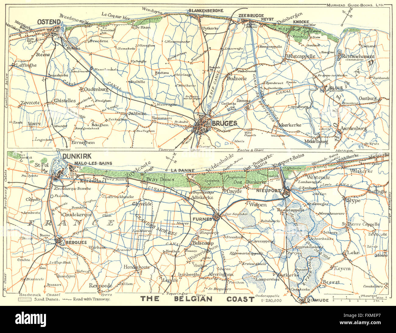 BELGIUM: Belgian coast Ostend Bruges Dunkirk, 1929 vintage map Stock Photohttps://www.alamy.com/image-license-details/?v=1https://www.alamy.com/stock-photo-belgium-belgian-coast-ostend-bruges-dunkirk-1929-vintage-map-102483535.html
RFFXMEP7–BELGIUM: Belgian coast Ostend Bruges Dunkirk, 1929 vintage map
 1877 Migeon Map - Netherlands - Holland Belgium Luxembourg Brussels Amsterdam Stock Photohttps://www.alamy.com/image-license-details/?v=1https://www.alamy.com/stock-photo-1877-migeon-map-netherlands-holland-belgium-luxembourg-brussels-amsterdam-172919438.html
RFM194E6–1877 Migeon Map - Netherlands - Holland Belgium Luxembourg Brussels Amsterdam
 BELGIAN COAST. Brugge Ostend Dunkirk Nieuwpoort Blankenberghe. Belgium, 1920 map Stock Photohttps://www.alamy.com/image-license-details/?v=1https://www.alamy.com/stock-photo-belgian-coast-brugge-ostend-dunkirk-nieuwpoort-blankenberghe-belgium-110481134.html
RFGBMRPP–BELGIAN COAST. Brugge Ostend Dunkirk Nieuwpoort Blankenberghe. Belgium, 1920 map
 Siege of Ostend, 1601-1604, 1647 - 1649 print Siege of Ostend. Map of the defense and attack lines around the city and in the surrounding area, on the left the quarter of Spinola, on the right the quarter of Archduke Albrecht. At the bottom two cartouches with the title and the legends A-R and 1-34. At the top left a bet with a map of the city in 1641. On a double sheet taken from the city book of Blaeu, printed on the rear with text in Dutch. paper etching Victory, position was Oostende Stock Photohttps://www.alamy.com/image-license-details/?v=1https://www.alamy.com/siege-of-ostend-1601-1604-1647-1649-print-siege-of-ostend-map-of-the-defense-and-attack-lines-around-the-city-and-in-the-surrounding-area-on-the-left-the-quarter-of-spinola-on-the-right-the-quarter-of-archduke-albrecht-at-the-bottom-two-cartouches-with-the-title-and-the-legends-a-r-and-1-34-at-the-top-left-a-bet-with-a-map-of-the-city-in-1641-on-a-double-sheet-taken-from-the-city-book-of-blaeu-printed-on-the-rear-with-text-in-dutch-paper-etching-victory-position-was-oostende-image594239291.html
RM2WENX7R–Siege of Ostend, 1601-1604, 1647 - 1649 print Siege of Ostend. Map of the defense and attack lines around the city and in the surrounding area, on the left the quarter of Spinola, on the right the quarter of Archduke Albrecht. At the bottom two cartouches with the title and the legends A-R and 1-34. At the top left a bet with a map of the city in 1641. On a double sheet taken from the city book of Blaeu, printed on the rear with text in Dutch. paper etching Victory, position was Oostende
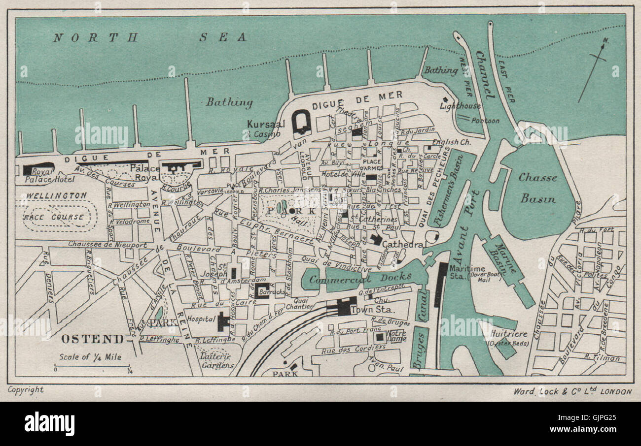 OSTEND vintage town/city plan. Belgium. WARD LOCK, 1926 vintage map Stock Photohttps://www.alamy.com/image-license-details/?v=1https://www.alamy.com/stock-photo-ostend-vintage-towncity-plan-belgium-ward-lock-1926-vintage-map-114821565.html
RFGJPG25–OSTEND vintage town/city plan. Belgium. WARD LOCK, 1926 vintage map
 . English: Ostend, Map by Priorato . 10 September 2010. Galaezzo Gualdo Priorato 459 Ostend, Map by Priorato Stock Photohttps://www.alamy.com/image-license-details/?v=1https://www.alamy.com/english-ostend-map-by-priorato-10-september-2010-galaezzo-gualdo-priorato-459-ostend-map-by-priorato-image188072518.html
RMMWYCBJ–. English: Ostend, Map by Priorato . 10 September 2010. Galaezzo Gualdo Priorato 459 Ostend, Map by Priorato
 OSTEND OOSTENDE OSTENDE. Antique town plan. City map. Belgium. BRADSHAW 1895 Stock Photohttps://www.alamy.com/image-license-details/?v=1https://www.alamy.com/stock-photo-ostend-oostende-ostende-antique-town-plan-city-map-belgium-bradshaw-114550052.html
RFGJA5N8–OSTEND OOSTENDE OSTENDE. Antique town plan. City map. Belgium. BRADSHAW 1895
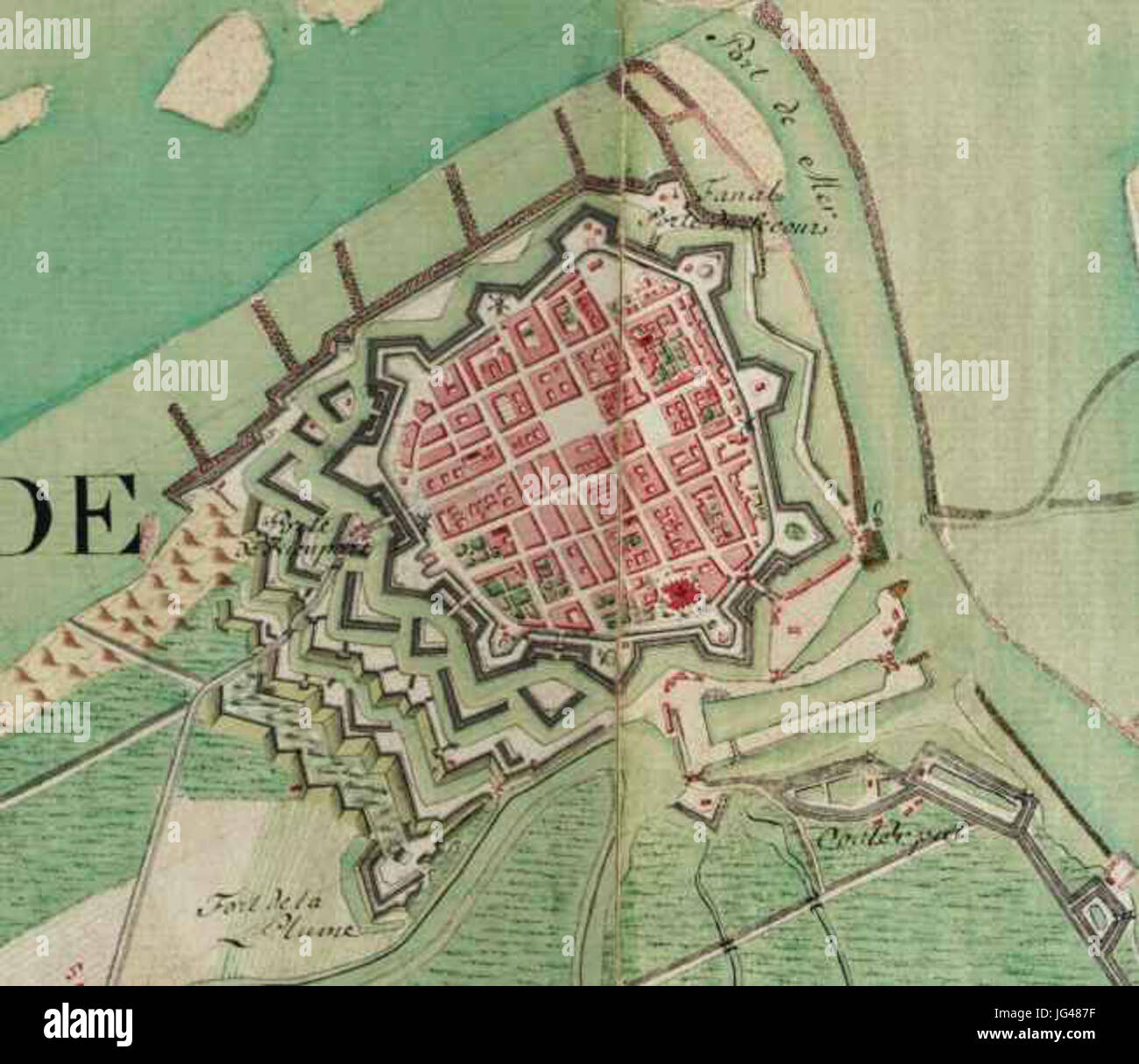 Ostend Belgium 3B Ferraris Map Stock Photohttps://www.alamy.com/image-license-details/?v=1https://www.alamy.com/stock-photo-ostend-belgium-3b-ferraris-map-147611731.html
RMJG487F–Ostend Belgium 3B Ferraris Map
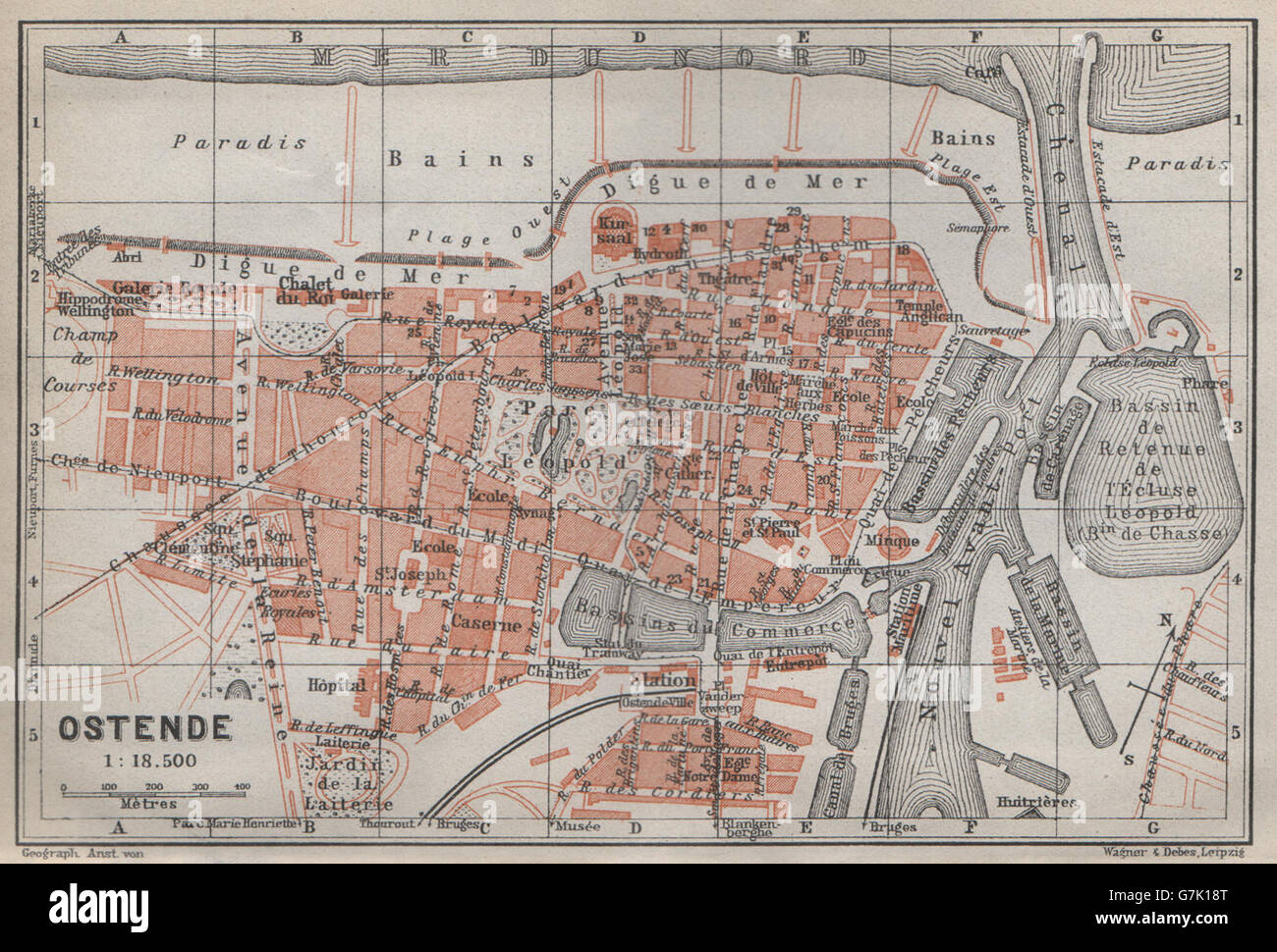 OOSTENDE OSTEND OSTENDE antique town city plan. Belgium carte, 1910 old map Stock Photohttps://www.alamy.com/image-license-details/?v=1https://www.alamy.com/stock-photo-oostende-ostend-ostende-antique-town-city-plan-belgium-carte-1910-107982920.html
RFG7K18T–OOSTENDE OSTEND OSTENDE antique town city plan. Belgium carte, 1910 old map
 Street roads map of OSTEND, BELGIUM Stock Vectorhttps://www.alamy.com/image-license-details/?v=1https://www.alamy.com/street-roads-map-of-ostend-belgium-image544689435.html
RF2PJ4MX3–Street roads map of OSTEND, BELGIUM
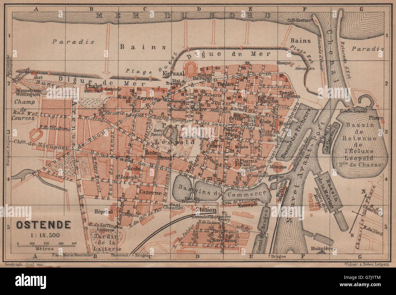 OOSTENDE OSTEND OSTENDE antique town city plan. Belgium carte, 1905 old map Stock Photohttps://www.alamy.com/image-license-details/?v=1https://www.alamy.com/stock-photo-oostende-ostend-ostende-antique-town-city-plan-belgium-carte-1905-107981796.html
RFG7JYTM–OOSTENDE OSTEND OSTENDE antique town city plan. Belgium carte, 1905 old map
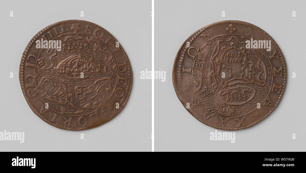 Surrender of Ostend and capture of Sluis, Copper Medal. Front: map of the city of Sluis, inscription within the inscription. Reverse: map of Ostend within a Greek script, Sluis, Ostend, anonymous, Dordrecht, 1604, copper (metal), striking (metalworking), d 3 cm × w 5.92 Stock Photohttps://www.alamy.com/image-license-details/?v=1https://www.alamy.com/surrender-of-ostend-and-capture-of-sluis-copper-medal-front-map-of-the-city-of-sluis-inscription-within-the-inscription-reverse-map-of-ostend-within-a-greek-script-sluis-ostend-anonymous-dordrecht-1604-copper-metal-striking-metalworking-d-3-cm-w-592-image261389979.html
RMW579GB–Surrender of Ostend and capture of Sluis, Copper Medal. Front: map of the city of Sluis, inscription within the inscription. Reverse: map of Ostend within a Greek script, Sluis, Ostend, anonymous, Dordrecht, 1604, copper (metal), striking (metalworking), d 3 cm × w 5.92
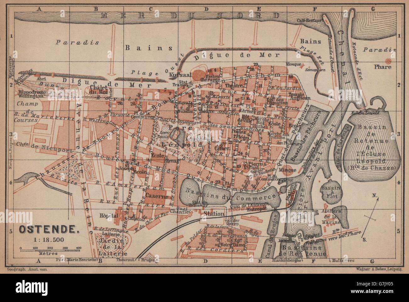 OOSTENDE OSTEND OSTENDE antique town city plan. Belgium carte, 1901 old map Stock Photohttps://www.alamy.com/image-license-details/?v=1https://www.alamy.com/stock-photo-oostende-ostend-ostende-antique-town-city-plan-belgium-carte-1901-107981109.html
RFG7JY05–OOSTENDE OSTEND OSTENDE antique town city plan. Belgium carte, 1901 old map
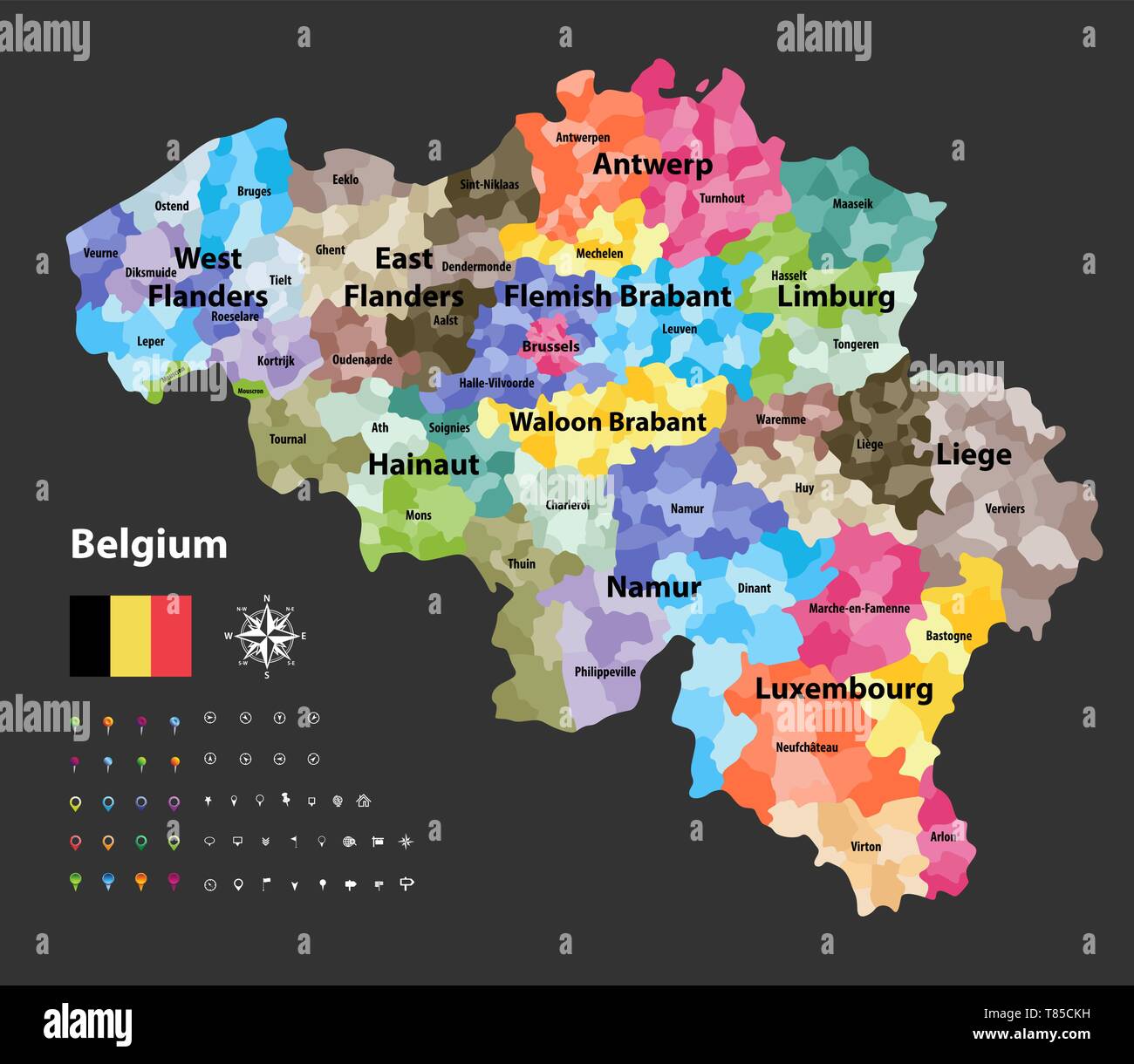 Belgium map showing the provinces and administrative subdivisions (municipalities), colored by arrondissements Stock Vectorhttps://www.alamy.com/image-license-details/?v=1https://www.alamy.com/belgium-map-showing-the-provinces-and-administrative-subdivisions-municipalities-colored-by-arrondissements-image245982117.html
RFT85CKH–Belgium map showing the provinces and administrative subdivisions (municipalities), colored by arrondissements
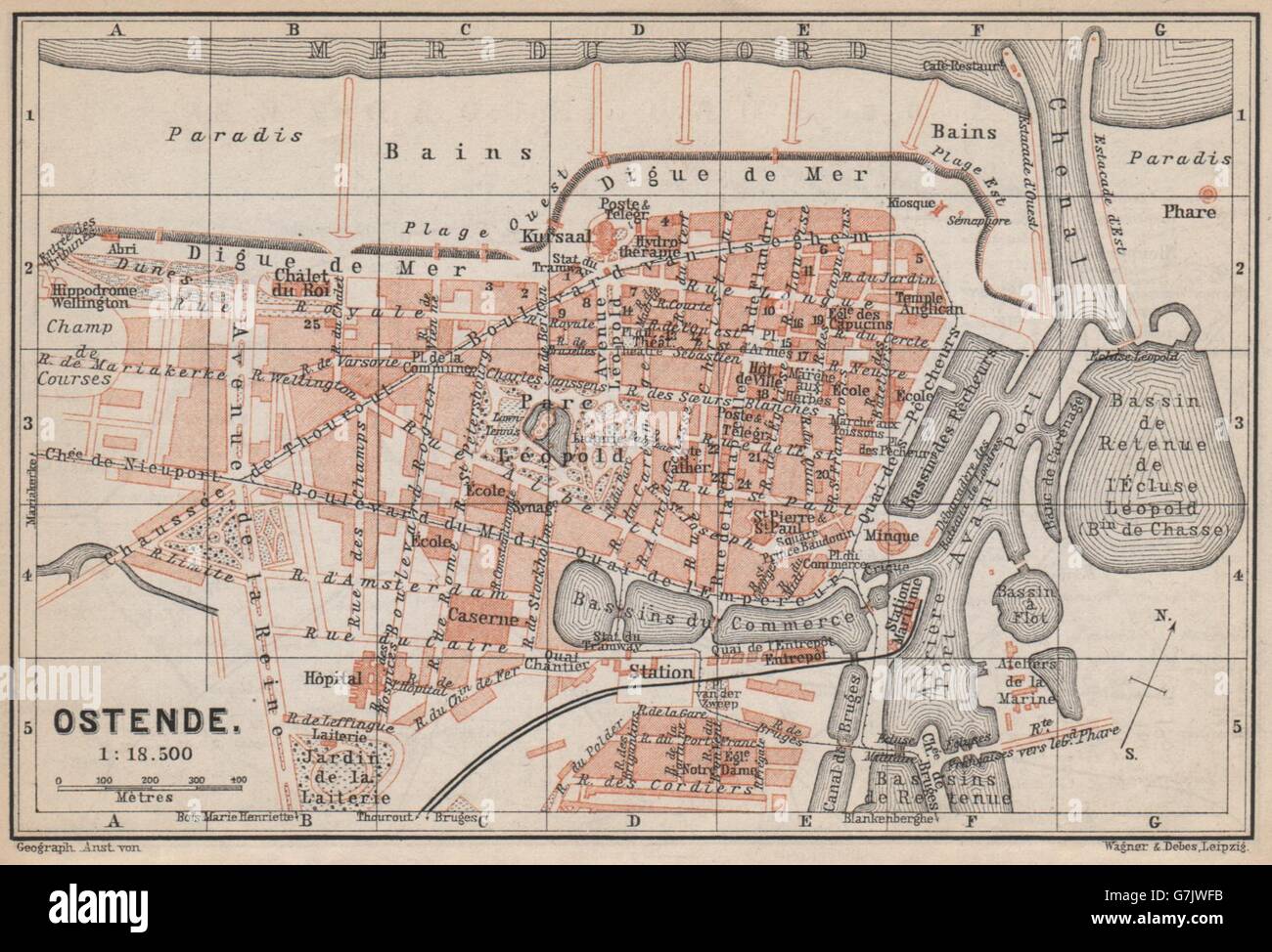 OOSTENDE OSTEND OSTENDE antique town city plan. Belgium carte, 1897 old map Stock Photohttps://www.alamy.com/image-license-details/?v=1https://www.alamy.com/stock-photo-oostende-ostend-ostende-antique-town-city-plan-belgium-carte-1897-107979967.html
RFG7JWFB–OOSTENDE OSTEND OSTENDE antique town city plan. Belgium carte, 1897 old map
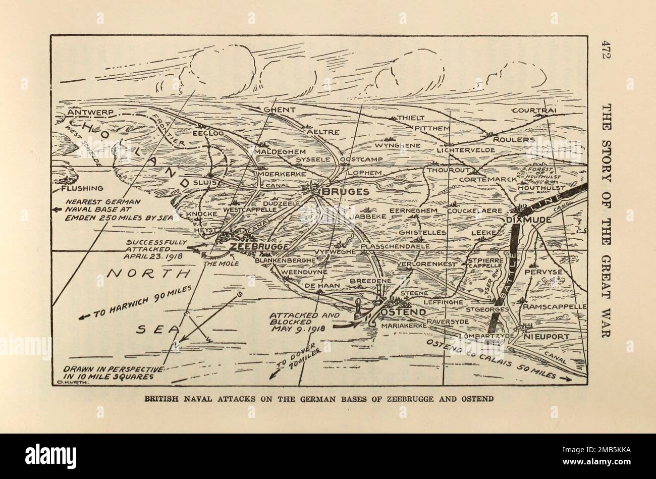 British Naval Attacks on the German bases of Zeebrugge and Ostend in Belgium from the book The story of the great war; the complete historical records of events to date DIPLOMATIC AND STATE PAPERS by Reynolds, Francis Joseph, 1867-1937; Churchill, Allen Leon; Miller, Francis Trevelyan, 1877-1959; Wood, Leonard, 1860-1927; Knight, Austin Melvin, 1854-1927; Palmer, Frederick, 1873-1958; Simonds, Frank Herbert, 1878-; Ruhl, Arthur Brown, 1876- Volume VII Published 1920 Stock Photohttps://www.alamy.com/image-license-details/?v=1https://www.alamy.com/british-naval-attacks-on-the-german-bases-of-zeebrugge-and-ostend-in-belgium-from-the-book-the-story-of-the-great-war-the-complete-historical-records-of-events-to-date-diplomatic-and-state-papers-by-reynolds-francis-joseph-1867-1937-churchill-allen-leon-miller-francis-trevelyan-1877-1959-wood-leonard-1860-1927-knight-austin-melvin-1854-1927-palmer-frederick-1873-1958-simonds-frank-herbert-1878-ruhl-arthur-brown-1876-volume-vii-published-1920-image505987086.html
RF2MB5KKA–British Naval Attacks on the German bases of Zeebrugge and Ostend in Belgium from the book The story of the great war; the complete historical records of events to date DIPLOMATIC AND STATE PAPERS by Reynolds, Francis Joseph, 1867-1937; Churchill, Allen Leon; Miller, Francis Trevelyan, 1877-1959; Wood, Leonard, 1860-1927; Knight, Austin Melvin, 1854-1927; Palmer, Frederick, 1873-1958; Simonds, Frank Herbert, 1878-; Ruhl, Arthur Brown, 1876- Volume VII Published 1920
 Art inspired by Siege of Ostend, 1706, Plan de la ville d'Ostende, Map of the siege of Ostend by the Allies under Henry of Nassau, lord of Ouwerkerk, besieged from June 17, taken on July 6, 1706. Top left a cartouche with the title and legends 1-57 in French. Bottom left a cartouche, Classic works modernized by Artotop with a splash of modernity. Shapes, color and value, eye-catching visual impact on art. Emotions through freedom of artworks in a contemporary way. A timeless message pursuing a wildly creative new direction. Artists turning to the digital medium and creating the Artotop NFT Stock Photohttps://www.alamy.com/image-license-details/?v=1https://www.alamy.com/art-inspired-by-siege-of-ostend-1706-plan-de-la-ville-dostende-map-of-the-siege-of-ostend-by-the-allies-under-henry-of-nassau-lord-of-ouwerkerk-besieged-from-june-17-taken-on-july-6-1706-top-left-a-cartouche-with-the-title-and-legends-1-57-in-french-bottom-left-a-cartouche-classic-works-modernized-by-artotop-with-a-splash-of-modernity-shapes-color-and-value-eye-catching-visual-impact-on-art-emotions-through-freedom-of-artworks-in-a-contemporary-way-a-timeless-message-pursuing-a-wildly-creative-new-direction-artists-turning-to-the-digital-medium-and-creating-the-artotop-nft-image459724687.html
RF2HKX7ER–Art inspired by Siege of Ostend, 1706, Plan de la ville d'Ostende, Map of the siege of Ostend by the Allies under Henry of Nassau, lord of Ouwerkerk, besieged from June 17, taken on July 6, 1706. Top left a cartouche with the title and legends 1-57 in French. Bottom left a cartouche, Classic works modernized by Artotop with a splash of modernity. Shapes, color and value, eye-catching visual impact on art. Emotions through freedom of artworks in a contemporary way. A timeless message pursuing a wildly creative new direction. Artists turning to the digital medium and creating the Artotop NFT
 Ostend, West Flanders, Belgium, Flanders, N 51 12' 55'', E 2 55' 37'', map, Timeless Map published in 2021. Travelers, explorers and adventurers like Florence Nightingale, David Livingstone, Ernest Shackleton, Lewis and Clark and Sherlock Holmes relied on maps to plan travels to the world's most remote corners, Timeless Maps is mapping most locations on the globe, showing the achievement of great dreams Stock Photohttps://www.alamy.com/image-license-details/?v=1https://www.alamy.com/ostend-west-flanders-belgium-flanders-n-51-12-55-e-2-55-37-map-timeless-map-published-in-2021-travelers-explorers-and-adventurers-like-florence-nightingale-david-livingstone-ernest-shackleton-lewis-and-clark-and-sherlock-holmes-relied-on-maps-to-plan-travels-to-the-worlds-most-remote-corners-timeless-maps-is-mapping-most-locations-on-the-globe-showing-the-achievement-of-great-dreams-image444869861.html
RM2GRNG19–Ostend, West Flanders, Belgium, Flanders, N 51 12' 55'', E 2 55' 37'', map, Timeless Map published in 2021. Travelers, explorers and adventurers like Florence Nightingale, David Livingstone, Ernest Shackleton, Lewis and Clark and Sherlock Holmes relied on maps to plan travels to the world's most remote corners, Timeless Maps is mapping most locations on the globe, showing the achievement of great dreams
 Siege of Ostend, 1601-1604 Ostenda obsessa et capta ab Alberto et Isabella (title object) Oostende (title object) Siege of Ostend. Map of the defensive and attacking lines around the city and in the surrounding area, left the quarter Spinola, right quarter of Archduke Albrecht. At the bottom of two cartridges with the title and the legends A-R and 1-34. Top left a bet with a city map in 1641 on a double sheet taken from the Cities Book Blaeu, printed on the back with text in Nederlands. Manufacturer : printmaker: anonymous place manufacture: Northern Netherlands Date: 1647 - 1649 Physical feat Stock Photohttps://www.alamy.com/image-license-details/?v=1https://www.alamy.com/siege-of-ostend-1601-1604-ostenda-obsessa-et-capta-ab-alberto-et-isabella-title-object-oostende-title-object-siege-of-ostend-map-of-the-defensive-and-attacking-lines-around-the-city-and-in-the-surrounding-area-left-the-quarter-spinola-right-quarter-of-archduke-albrecht-at-the-bottom-of-two-cartridges-with-the-title-and-the-legends-a-r-and-1-34-top-left-a-bet-with-a-city-map-in-1641-on-a-double-sheet-taken-from-the-cities-book-blaeu-printed-on-the-back-with-text-in-nederlands-manufacturer-printmaker-anonymous-place-manufacture-northern-netherlands-date-1647-1649-physical-feat-image348177629.html
RM2B6CT39–Siege of Ostend, 1601-1604 Ostenda obsessa et capta ab Alberto et Isabella (title object) Oostende (title object) Siege of Ostend. Map of the defensive and attacking lines around the city and in the surrounding area, left the quarter Spinola, right quarter of Archduke Albrecht. At the bottom of two cartridges with the title and the legends A-R and 1-34. Top left a bet with a city map in 1641 on a double sheet taken from the Cities Book Blaeu, printed on the back with text in Nederlands. Manufacturer : printmaker: anonymous place manufacture: Northern Netherlands Date: 1647 - 1649 Physical feat
 'Ostende'. Oostende/Ostend. Fortifed town/city plan. Belgium. DE FER, 1705 map Stock Photohttps://www.alamy.com/image-license-details/?v=1https://www.alamy.com/stock-photo-ostende-oostendeostend-fortifed-towncity-plan-belgium-de-fer-1705-115451994.html
RFGKR85E–'Ostende'. Oostende/Ostend. Fortifed town/city plan. Belgium. DE FER, 1705 map
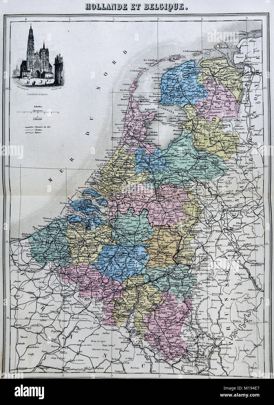 1877 Migeon Map - Netherlands - Holland Belgium Luxembourg Brussels Amsterdam Stock Photohttps://www.alamy.com/image-license-details/?v=1https://www.alamy.com/stock-photo-1877-migeon-map-netherlands-holland-belgium-luxembourg-brussels-amsterdam-172919439.html
RFM194E7–1877 Migeon Map - Netherlands - Holland Belgium Luxembourg Brussels Amsterdam
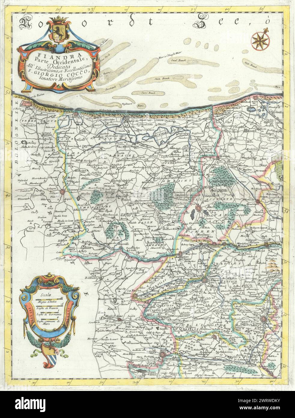 Flandra parte occidentale. Flanders. France/Belgium. CORONELLI 1696 old map Stock Photohttps://www.alamy.com/image-license-details/?v=1https://www.alamy.com/flandra-parte-occidentale-flanders-francebelgium-coronelli-1696-old-map-image599849151.html
RF2WRWDKY–Flandra parte occidentale. Flanders. France/Belgium. CORONELLI 1696 old map
 Siege of Ostend, 1601-1604, 1647 - 1649 print Siege of Ostend. Map of the defense and attack lines around the city and in the surrounding area, on the left the quarter of Spinola, on the right the quarter of Archduke Albrecht. At the bottom two cartouches with the title and the legends A-R and 1-34. At the top left a bet with a map of the city in 1641. On a double sheet taken from the city book of Blaeu, printed on the back with text in Latin. Northern Netherlands paper etching Victory, position was Oostende Stock Photohttps://www.alamy.com/image-license-details/?v=1https://www.alamy.com/siege-of-ostend-1601-1604-1647-1649-print-siege-of-ostend-map-of-the-defense-and-attack-lines-around-the-city-and-in-the-surrounding-area-on-the-left-the-quarter-of-spinola-on-the-right-the-quarter-of-archduke-albrecht-at-the-bottom-two-cartouches-with-the-title-and-the-legends-a-r-and-1-34-at-the-top-left-a-bet-with-a-map-of-the-city-in-1641-on-a-double-sheet-taken-from-the-city-book-of-blaeu-printed-on-the-back-with-text-in-latin-northern-netherlands-paper-etching-victory-position-was-oostende-image595295097.html
RM2WGE0Y5–Siege of Ostend, 1601-1604, 1647 - 1649 print Siege of Ostend. Map of the defense and attack lines around the city and in the surrounding area, on the left the quarter of Spinola, on the right the quarter of Archduke Albrecht. At the bottom two cartouches with the title and the legends A-R and 1-34. At the top left a bet with a map of the city in 1641. On a double sheet taken from the city book of Blaeu, printed on the back with text in Latin. Northern Netherlands paper etching Victory, position was Oostende
 BELGIAN NORTH SEA COAST. Bruges Ostende Diksmuide Niuewpoort. Belgium, 1901 map Stock Photohttps://www.alamy.com/image-license-details/?v=1https://www.alamy.com/stock-photo-belgian-north-sea-coast-bruges-ostende-diksmuide-niuewpoort-belgium-107981141.html
RFG7JY19–BELGIAN NORTH SEA COAST. Bruges Ostende Diksmuide Niuewpoort. Belgium, 1901 map
 . English: Ostend, Map by Priorato . 10 September 2010. Galaezzo Gualdo Priorato 401 Ostend, Map by Priorato Stock Photohttps://www.alamy.com/image-license-details/?v=1https://www.alamy.com/english-ostend-map-by-priorato-10-september-2010-galaezzo-gualdo-priorato-401-ostend-map-by-priorato-image188831948.html
RMMY6124–. English: Ostend, Map by Priorato . 10 September 2010. Galaezzo Gualdo Priorato 401 Ostend, Map by Priorato
 BELGIAN NORTH SEA COAST. Bruges Ostende Diksmuide Niuewpoort. Belgium, 1897 map Stock Photohttps://www.alamy.com/image-license-details/?v=1https://www.alamy.com/stock-photo-belgian-north-sea-coast-bruges-ostende-diksmuide-niuewpoort-belgium-107979980.html
RFG7JWFT–BELGIAN NORTH SEA COAST. Bruges Ostende Diksmuide Niuewpoort. Belgium, 1897 map
![The Siege of Ostend: or, the New Troy ... Reprinted from the “Proceedings of the Huguenot Society,” etc. [With plates and a map.] Stock Photo The Siege of Ostend: or, the New Troy ... Reprinted from the “Proceedings of the Huguenot Society,” etc. [With plates and a map.] Stock Photo](https://c8.alamy.com/comp/J53DH0/the-siege-of-ostend-or-the-new-troy-reprinted-from-the-proceedings-J53DH0.jpg) The Siege of Ostend: or, the New Troy ... Reprinted from the “Proceedings of the Huguenot Society,” etc. [With plates and a map.] Stock Photohttps://www.alamy.com/image-license-details/?v=1https://www.alamy.com/stock-photo-the-siege-of-ostend-or-the-new-troy-reprinted-from-the-proceedings-140832748.html
The Siege of Ostend: or, the New Troy ... Reprinted from the “Proceedings of the Huguenot Society,” etc. [With plates and a map.] Stock Photohttps://www.alamy.com/image-license-details/?v=1https://www.alamy.com/stock-photo-the-siege-of-ostend-or-the-new-troy-reprinted-from-the-proceedings-140832748.htmlRMJ53DH0–The Siege of Ostend: or, the New Troy ... Reprinted from the “Proceedings of the Huguenot Society,” etc. [With plates and a map.]
!['Map showing the Canal System connecting Zeebrugge and Ostend with Bruges', First World War, (c1920). The Belgian ports of Ostend and Zeebrugge were connected to the city of Bruges via canals. From "The Great World War: A History", Volume IX, edited by Frank A Mumby. [The Gresham Publishing Company Ltd, London, c1920] Stock Photo 'Map showing the Canal System connecting Zeebrugge and Ostend with Bruges', First World War, (c1920). The Belgian ports of Ostend and Zeebrugge were connected to the city of Bruges via canals. From "The Great World War: A History", Volume IX, edited by Frank A Mumby. [The Gresham Publishing Company Ltd, London, c1920] Stock Photo](https://c8.alamy.com/comp/2A8E7XT/map-showing-the-canal-system-connecting-zeebrugge-and-ostend-with-bruges-first-world-war-c1920-the-belgian-ports-of-ostend-and-zeebrugge-were-connected-to-the-city-of-bruges-via-canals-from-quotthe-great-world-war-a-historyquot-volume-ix-edited-by-frank-a-mumby-the-gresham-publishing-company-ltd-london-c1920-2A8E7XT.jpg) 'Map showing the Canal System connecting Zeebrugge and Ostend with Bruges', First World War, (c1920). The Belgian ports of Ostend and Zeebrugge were connected to the city of Bruges via canals. From "The Great World War: A History", Volume IX, edited by Frank A Mumby. [The Gresham Publishing Company Ltd, London, c1920] Stock Photohttps://www.alamy.com/image-license-details/?v=1https://www.alamy.com/map-showing-the-canal-system-connecting-zeebrugge-and-ostend-with-bruges-first-world-war-c1920-the-belgian-ports-of-ostend-and-zeebrugge-were-connected-to-the-city-of-bruges-via-canals-from-quotthe-great-world-war-a-historyquot-volume-ix-edited-by-frank-a-mumby-the-gresham-publishing-company-ltd-london-c1920-image332227808.html
'Map showing the Canal System connecting Zeebrugge and Ostend with Bruges', First World War, (c1920). The Belgian ports of Ostend and Zeebrugge were connected to the city of Bruges via canals. From "The Great World War: A History", Volume IX, edited by Frank A Mumby. [The Gresham Publishing Company Ltd, London, c1920] Stock Photohttps://www.alamy.com/image-license-details/?v=1https://www.alamy.com/map-showing-the-canal-system-connecting-zeebrugge-and-ostend-with-bruges-first-world-war-c1920-the-belgian-ports-of-ostend-and-zeebrugge-were-connected-to-the-city-of-bruges-via-canals-from-quotthe-great-world-war-a-historyquot-volume-ix-edited-by-frank-a-mumby-the-gresham-publishing-company-ltd-london-c1920-image332227808.htmlRM2A8E7XT–'Map showing the Canal System connecting Zeebrugge and Ostend with Bruges', First World War, (c1920). The Belgian ports of Ostend and Zeebrugge were connected to the city of Bruges via canals. From "The Great World War: A History", Volume IX, edited by Frank A Mumby. [The Gresham Publishing Company Ltd, London, c1920]
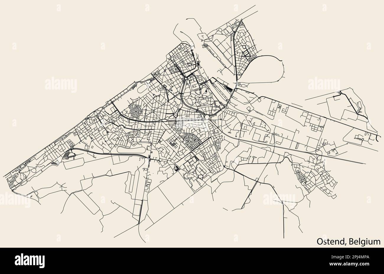 Street roads map of OSTEND, BELGIUM Stock Vectorhttps://www.alamy.com/image-license-details/?v=1https://www.alamy.com/street-roads-map-of-ostend-belgium-image544689330.html
RF2PJ4MPA–Street roads map of OSTEND, BELGIUM
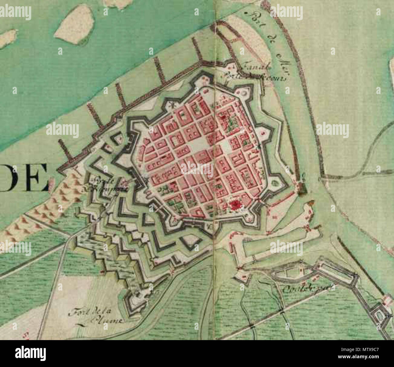 459 Ostend, Belgium ; Ferraris Map Stock Photohttps://www.alamy.com/image-license-details/?v=1https://www.alamy.com/459-ostend-belgium-ferraris-map-image187433575.html
RMMTX9C7–459 Ostend, Belgium ; Ferraris Map
 Surrender of Ostend and capture of Sluis, Silver Medal. Front: map of the city of Sluis, inscription within the inscription. Reverse: map of Ostend within a Greek script, Sluis, Ostend, anonymous, Dordrecht, 1604, silver (metal), striking (metalworking), d 3 cm × w 5.93 Stock Photohttps://www.alamy.com/image-license-details/?v=1https://www.alamy.com/surrender-of-ostend-and-capture-of-sluis-silver-medal-front-map-of-the-city-of-sluis-inscription-within-the-inscription-reverse-map-of-ostend-within-a-greek-script-sluis-ostend-anonymous-dordrecht-1604-silver-metal-striking-metalworking-d-3-cm-w-593-image261389977.html
RMW579G9–Surrender of Ostend and capture of Sluis, Silver Medal. Front: map of the city of Sluis, inscription within the inscription. Reverse: map of Ostend within a Greek script, Sluis, Ostend, anonymous, Dordrecht, 1604, silver (metal), striking (metalworking), d 3 cm × w 5.93
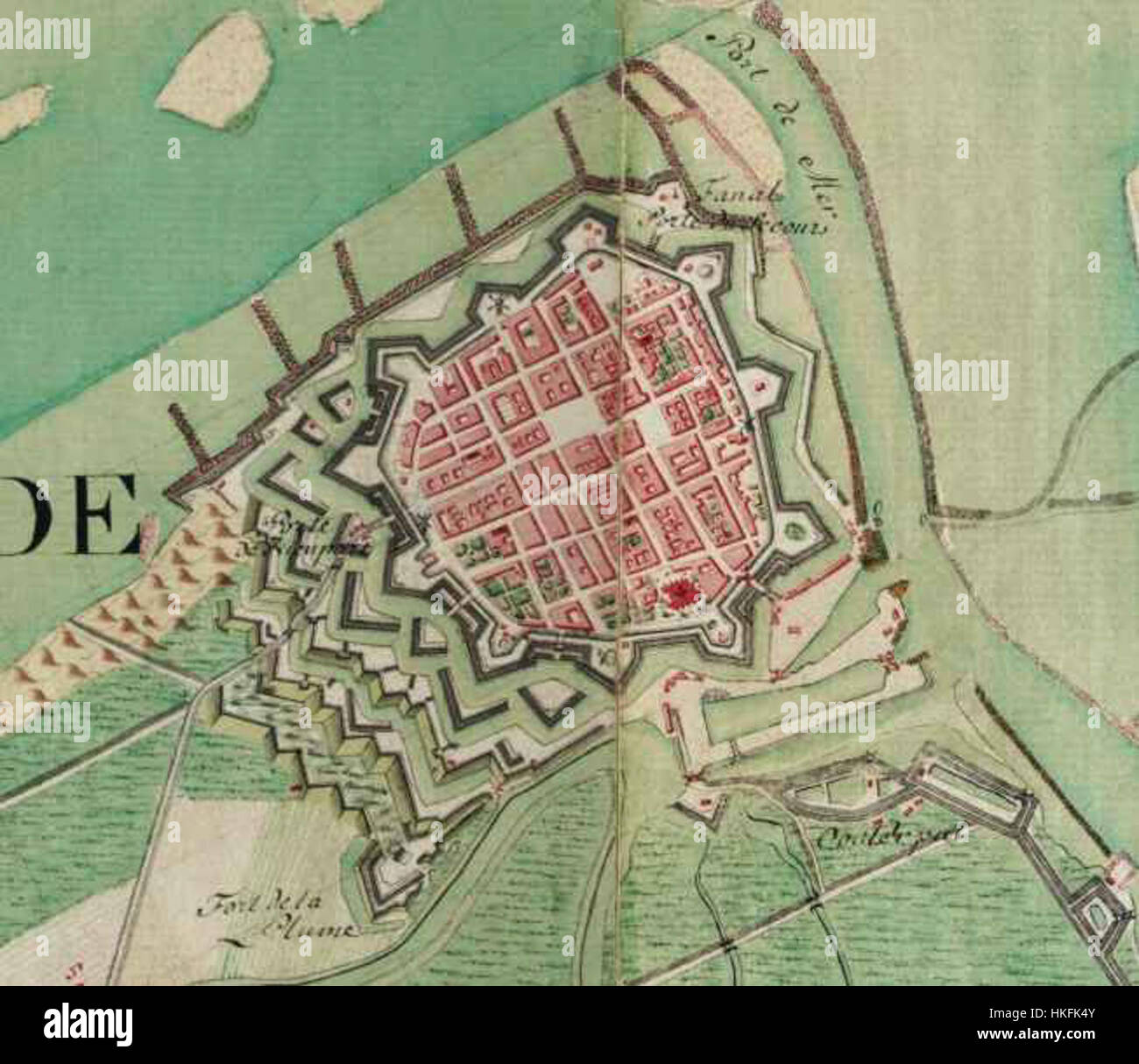 Ostend, Belgium ; Ferraris Map Stock Photohttps://www.alamy.com/image-license-details/?v=1https://www.alamy.com/stock-photo-ostend-belgium-ferraris-map-132495355.html
RMHKFK4Y–Ostend, Belgium ; Ferraris Map
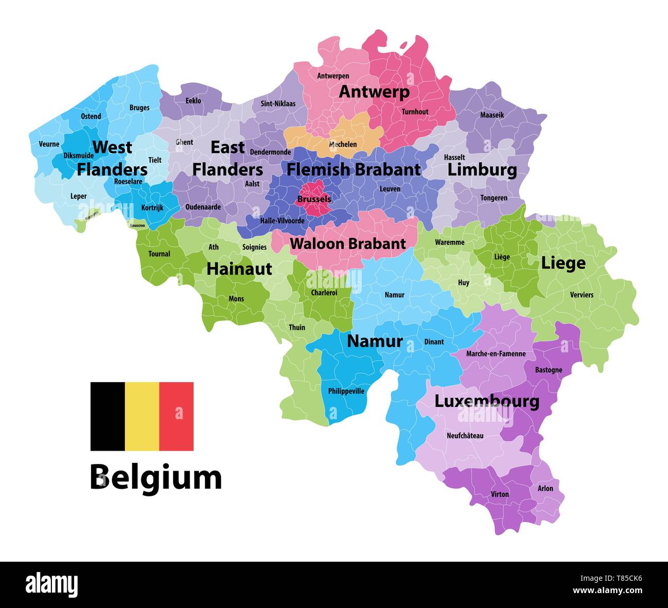 Belgium map showing the provinces and administrative subdivisions (municipalities), colored by arrondissements Stock Vectorhttps://www.alamy.com/image-license-details/?v=1https://www.alamy.com/belgium-map-showing-the-provinces-and-administrative-subdivisions-municipalities-colored-by-arrondissements-image245982106.html
RFT85CK6–Belgium map showing the provinces and administrative subdivisions (municipalities), colored by arrondissements
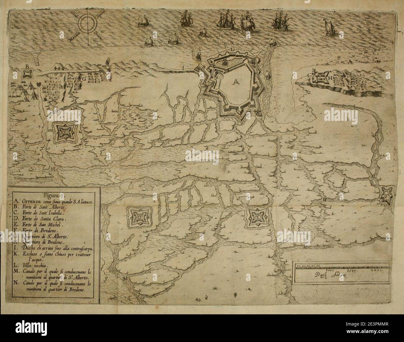 Map of Ostend 1601. Stock Photohttps://www.alamy.com/image-license-details/?v=1https://www.alamy.com/map-of-ostend-1601-image398181639.html
RM2E3PMMR–Map of Ostend 1601.
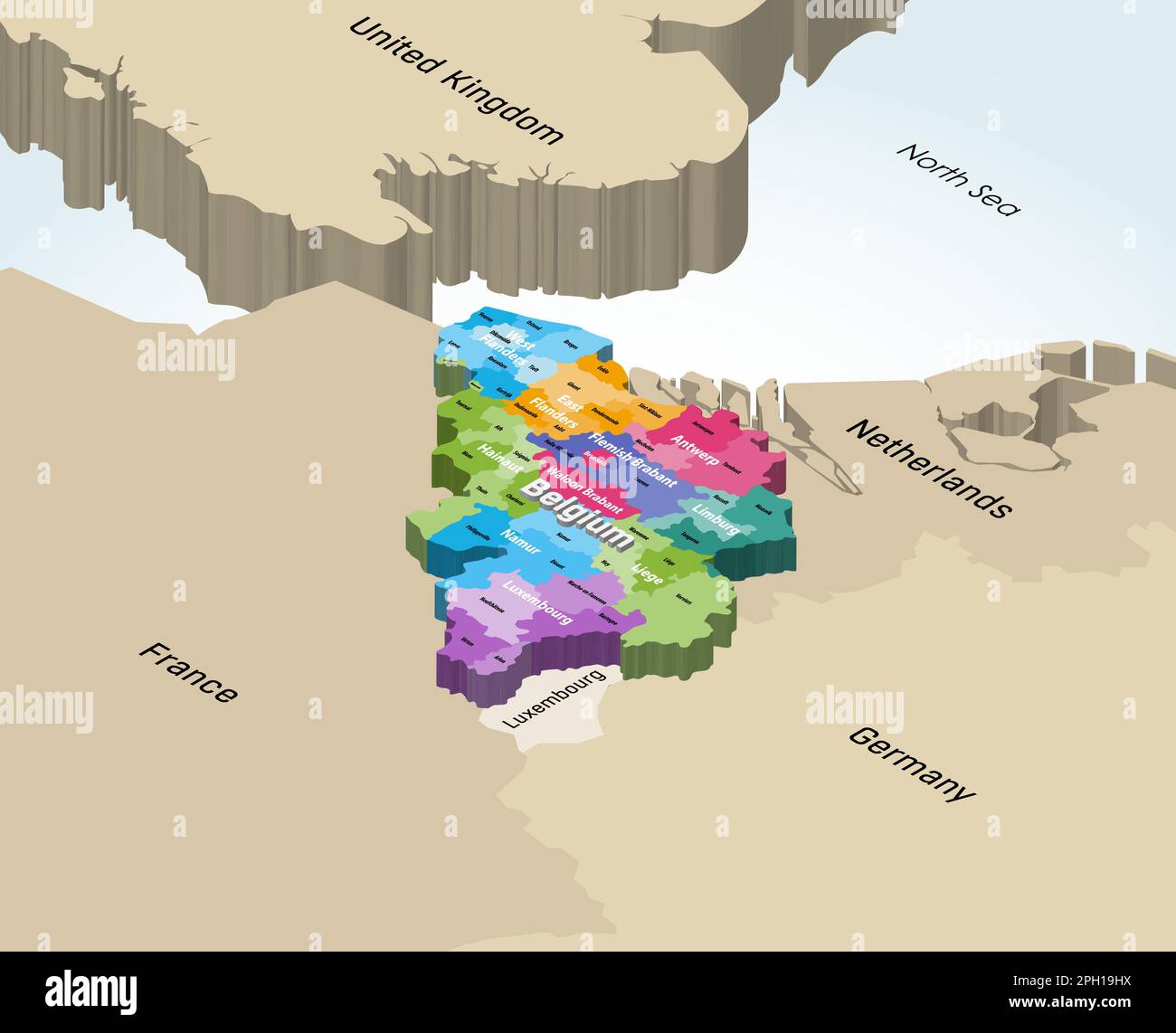 Belgium 3d (isometric) vector map colored by provinces with neighbouring countries Stock Vectorhttps://www.alamy.com/image-license-details/?v=1https://www.alamy.com/belgium-3d-isometric-vector-map-colored-by-provinces-with-neighbouring-countries-image544000070.html
RF2PH19HX–Belgium 3d (isometric) vector map colored by provinces with neighbouring countries
 Art inspired by Siege of Ostend, 1706, Plan de la ville d'Ostende, Map of the siege of Ostend by the Allies under Henry of Nassau, lord of Ouwerkerk, besieged from 17 June, taken on 6 July 1706. Top left a cartouche with the title and legends 1-57 in French. Bottom left a cartouche, Classic works modernized by Artotop with a splash of modernity. Shapes, color and value, eye-catching visual impact on art. Emotions through freedom of artworks in a contemporary way. A timeless message pursuing a wildly creative new direction. Artists turning to the digital medium and creating the Artotop NFT Stock Photohttps://www.alamy.com/image-license-details/?v=1https://www.alamy.com/art-inspired-by-siege-of-ostend-1706-plan-de-la-ville-dostende-map-of-the-siege-of-ostend-by-the-allies-under-henry-of-nassau-lord-of-ouwerkerk-besieged-from-17-june-taken-on-6-july-1706-top-left-a-cartouche-with-the-title-and-legends-1-57-in-french-bottom-left-a-cartouche-classic-works-modernized-by-artotop-with-a-splash-of-modernity-shapes-color-and-value-eye-catching-visual-impact-on-art-emotions-through-freedom-of-artworks-in-a-contemporary-way-a-timeless-message-pursuing-a-wildly-creative-new-direction-artists-turning-to-the-digital-medium-and-creating-the-artotop-nft-image459724935.html
RF2HKX7RK–Art inspired by Siege of Ostend, 1706, Plan de la ville d'Ostende, Map of the siege of Ostend by the Allies under Henry of Nassau, lord of Ouwerkerk, besieged from 17 June, taken on 6 July 1706. Top left a cartouche with the title and legends 1-57 in French. Bottom left a cartouche, Classic works modernized by Artotop with a splash of modernity. Shapes, color and value, eye-catching visual impact on art. Emotions through freedom of artworks in a contemporary way. A timeless message pursuing a wildly creative new direction. Artists turning to the digital medium and creating the Artotop NFT
 Ostend, Regierungsbezirk Darmstadt, Germany, Hesse, N 50 6' 58'', E 8 43' 19'', map, Timeless Map published in 2021. Travelers, explorers and adventurers like Florence Nightingale, David Livingstone, Ernest Shackleton, Lewis and Clark and Sherlock Holmes relied on maps to plan travels to the world's most remote corners, Timeless Maps is mapping most locations on the globe, showing the achievement of great dreams Stock Photohttps://www.alamy.com/image-license-details/?v=1https://www.alamy.com/ostend-regierungsbezirk-darmstadt-germany-hesse-n-50-6-58-e-8-43-19-map-timeless-map-published-in-2021-travelers-explorers-and-adventurers-like-florence-nightingale-david-livingstone-ernest-shackleton-lewis-and-clark-and-sherlock-holmes-relied-on-maps-to-plan-travels-to-the-worlds-most-remote-corners-timeless-maps-is-mapping-most-locations-on-the-globe-showing-the-achievement-of-great-dreams-image439381049.html
RM2GERF09–Ostend, Regierungsbezirk Darmstadt, Germany, Hesse, N 50 6' 58'', E 8 43' 19'', map, Timeless Map published in 2021. Travelers, explorers and adventurers like Florence Nightingale, David Livingstone, Ernest Shackleton, Lewis and Clark and Sherlock Holmes relied on maps to plan travels to the world's most remote corners, Timeless Maps is mapping most locations on the globe, showing the achievement of great dreams
 23.07.2018. Ostend, Belgium. A sign advising people not to urinate in Ostend. Credit: Ant Palmer/Alamy Stock Photohttps://www.alamy.com/image-license-details/?v=1https://www.alamy.com/23072018-ostend-belgium-a-sign-advising-people-not-to-urinate-in-ostend-credit-ant-palmeralamy-image545616493.html
RF2PKJYB9–23.07.2018. Ostend, Belgium. A sign advising people not to urinate in Ostend. Credit: Ant Palmer/Alamy
 Queens, Vol. 1, Double Page Plate No. 16; Part of Ward 4; Jamaica; [Map bounded by Jericho Turnpike, Hempstead and Jamaica Plank Road, First Ave., Queens Boulevard, 2nd Ave., 3rd Ave., 4th Ave., 5th Ave., Sherwood Ave., 6th Ave., Franklin Ave., Clinton Ave., Springfield Road, Creed Ave., Wertlans Ave., Albany Ave., Crystal Ave., Delevan Ave., Euclid Ave., Fillmore Ave., Hudson Ave., Linden Ave., Queens Parkway, Preston Ave., Dewey Ave., Grant Ave., Hollis Ave., Lynn Ave., Catharine Ave., Madison Ave., Findlay Ave., Ostend Ave.; Including Bennett St., West Whittier St., Hugo St., Seymour St., A Stock Photohttps://www.alamy.com/image-license-details/?v=1https://www.alamy.com/queens-vol-1-double-page-plate-no-16-part-of-ward-4-jamaica-map-bounded-by-jericho-turnpike-hempstead-and-jamaica-plank-road-first-ave-queens-boulevard-2nd-ave-3rd-ave-4th-ave-5th-ave-sherwood-ave-6th-ave-franklin-ave-clinton-ave-springfield-road-creed-ave-wertlans-ave-albany-ave-crystal-ave-delevan-ave-euclid-ave-fillmore-ave-hudson-ave-linden-ave-queens-parkway-preston-ave-dewey-ave-grant-ave-hollis-ave-lynn-ave-catharine-ave-madison-ave-findlay-ave-ostend-ave-including-bennett-st-west-whittier-st-hugo-st-seymour-st-a-image633980907.html
RM2YRC937–Queens, Vol. 1, Double Page Plate No. 16; Part of Ward 4; Jamaica; [Map bounded by Jericho Turnpike, Hempstead and Jamaica Plank Road, First Ave., Queens Boulevard, 2nd Ave., 3rd Ave., 4th Ave., 5th Ave., Sherwood Ave., 6th Ave., Franklin Ave., Clinton Ave., Springfield Road, Creed Ave., Wertlans Ave., Albany Ave., Crystal Ave., Delevan Ave., Euclid Ave., Fillmore Ave., Hudson Ave., Linden Ave., Queens Parkway, Preston Ave., Dewey Ave., Grant Ave., Hollis Ave., Lynn Ave., Catharine Ave., Madison Ave., Findlay Ave., Ostend Ave.; Including Bennett St., West Whittier St., Hugo St., Seymour St., A
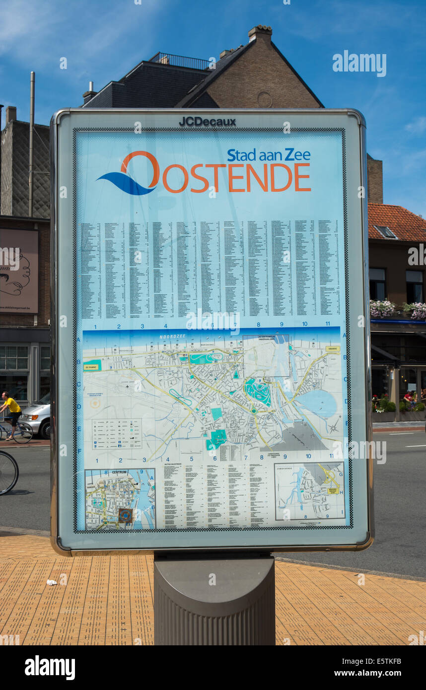 an outdoor street guide and tourist information map close to Ostend railway station Stock Photohttps://www.alamy.com/image-license-details/?v=1https://www.alamy.com/stock-photo-an-outdoor-street-guide-and-tourist-information-map-close-to-ostend-72456927.html
RME5TKFB–an outdoor street guide and tourist information map close to Ostend railway station
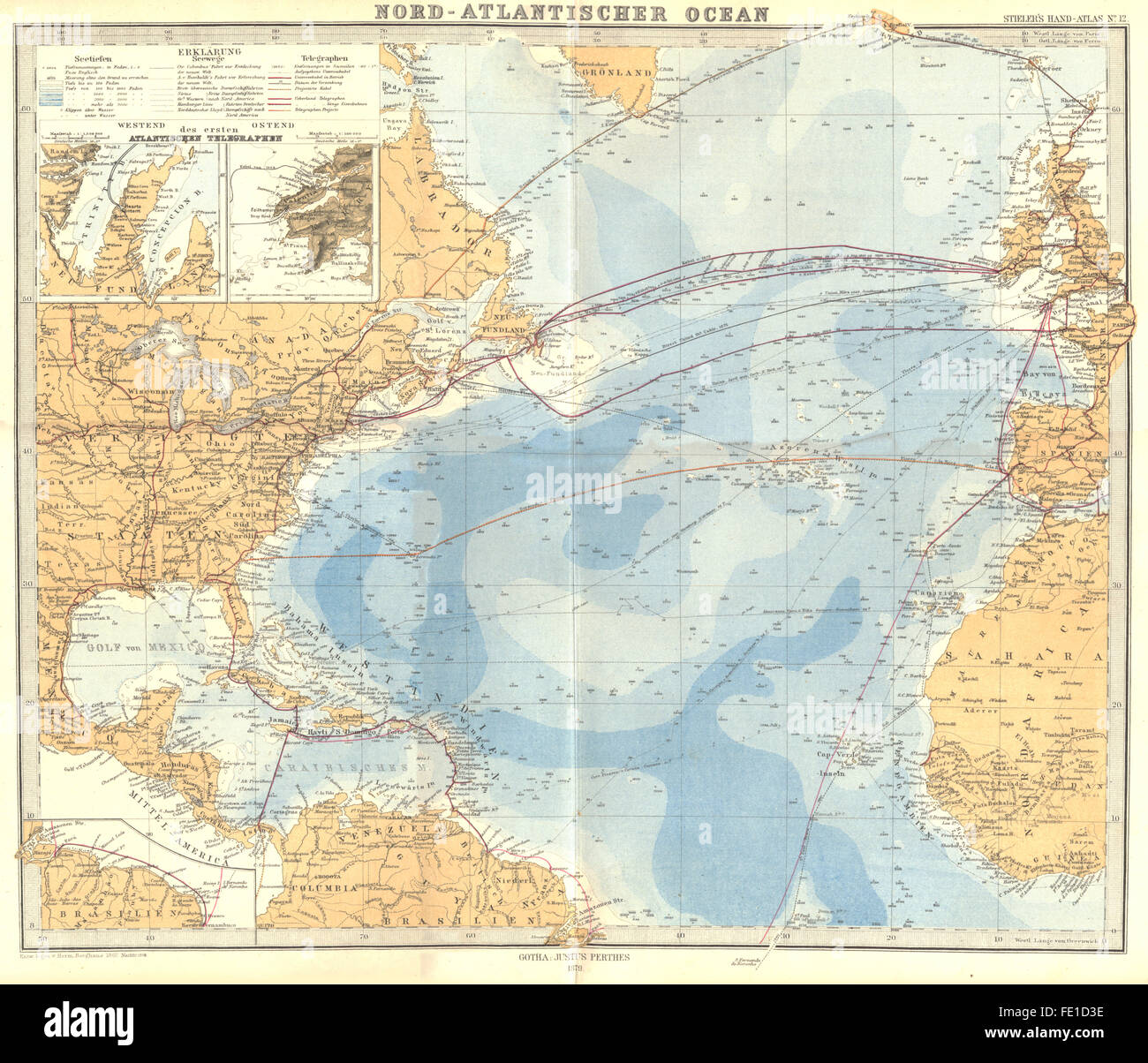 NORD ATLANTISCHER: Telegraphen; N Atlantic, 1879 antique map Stock Photohttps://www.alamy.com/image-license-details/?v=1https://www.alamy.com/stock-photo-nord-atlantischer-telegraphen-n-atlantic-1879-antique-map-94689266.html
RFFE1D3E–NORD ATLANTISCHER: Telegraphen; N Atlantic, 1879 antique map
![The Coast from Gravelines to Ostend Author Desmaretz, John Peter 104.38. Date of publication: [1715 or later] Item type: 1 map Medium: ink and watercolour, on 16 sheets Dimensions: 134.7 x 375.3 cm Former owner: George III, King of Great Britain, 1738-1820 Stock Photo The Coast from Gravelines to Ostend Author Desmaretz, John Peter 104.38. Date of publication: [1715 or later] Item type: 1 map Medium: ink and watercolour, on 16 sheets Dimensions: 134.7 x 375.3 cm Former owner: George III, King of Great Britain, 1738-1820 Stock Photo](https://c8.alamy.com/comp/2E9F005/the-coast-from-gravelines-to-ostend-author-desmaretz-john-peter-10438-date-of-publication-1715-or-later-item-type-1-map-medium-ink-and-watercolour-on-16-sheets-dimensions-1347-x-3753-cm-former-owner-george-iii-king-of-great-britain-1738-1820-2E9F005.jpg) The Coast from Gravelines to Ostend Author Desmaretz, John Peter 104.38. Date of publication: [1715 or later] Item type: 1 map Medium: ink and watercolour, on 16 sheets Dimensions: 134.7 x 375.3 cm Former owner: George III, King of Great Britain, 1738-1820 Stock Photohttps://www.alamy.com/image-license-details/?v=1https://www.alamy.com/the-coast-from-gravelines-to-ostend-author-desmaretz-john-peter-10438-date-of-publication-1715-or-later-item-type-1-map-medium-ink-and-watercolour-on-16-sheets-dimensions-1347-x-3753-cm-former-owner-george-iii-king-of-great-britain-1738-1820-image401699653.html
The Coast from Gravelines to Ostend Author Desmaretz, John Peter 104.38. Date of publication: [1715 or later] Item type: 1 map Medium: ink and watercolour, on 16 sheets Dimensions: 134.7 x 375.3 cm Former owner: George III, King of Great Britain, 1738-1820 Stock Photohttps://www.alamy.com/image-license-details/?v=1https://www.alamy.com/the-coast-from-gravelines-to-ostend-author-desmaretz-john-peter-10438-date-of-publication-1715-or-later-item-type-1-map-medium-ink-and-watercolour-on-16-sheets-dimensions-1347-x-3753-cm-former-owner-george-iii-king-of-great-britain-1738-1820-image401699653.htmlRM2E9F005–The Coast from Gravelines to Ostend Author Desmaretz, John Peter 104.38. Date of publication: [1715 or later] Item type: 1 map Medium: ink and watercolour, on 16 sheets Dimensions: 134.7 x 375.3 cm Former owner: George III, King of Great Britain, 1738-1820
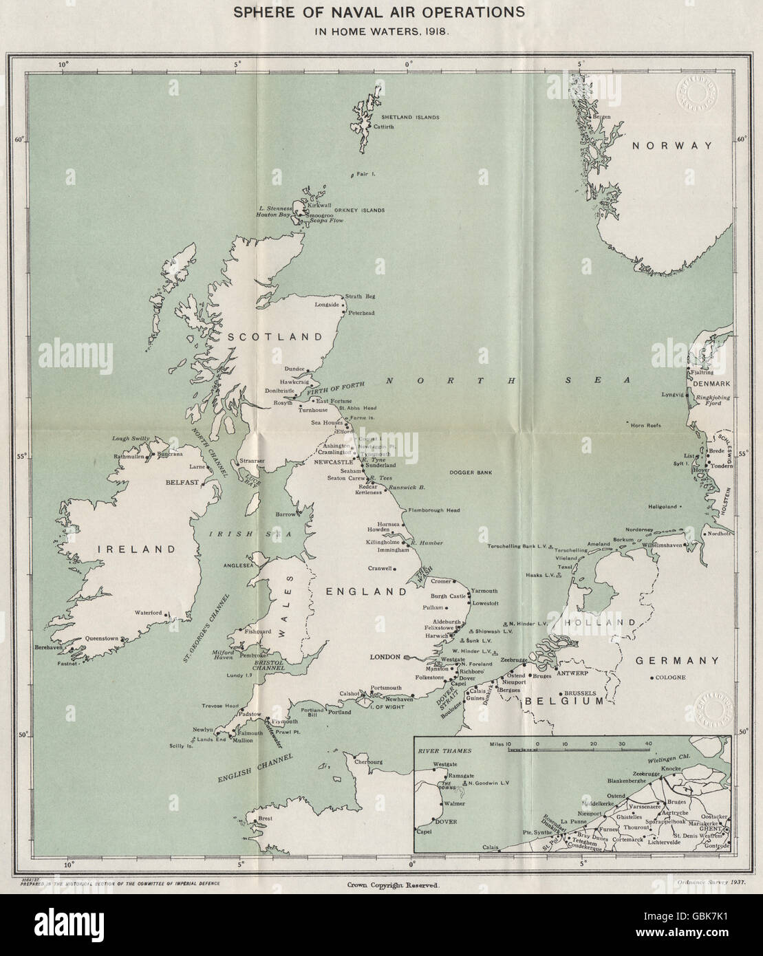 FIRST WORLD WAR: Sphere of Naval Air operations in home waters, 1918, 1937 map Stock Photohttps://www.alamy.com/image-license-details/?v=1https://www.alamy.com/stock-photo-first-world-war-sphere-of-naval-air-operations-in-home-waters-1918-110446533.html
RFGBK7K1–FIRST WORLD WAR: Sphere of Naval Air operations in home waters, 1918, 1937 map
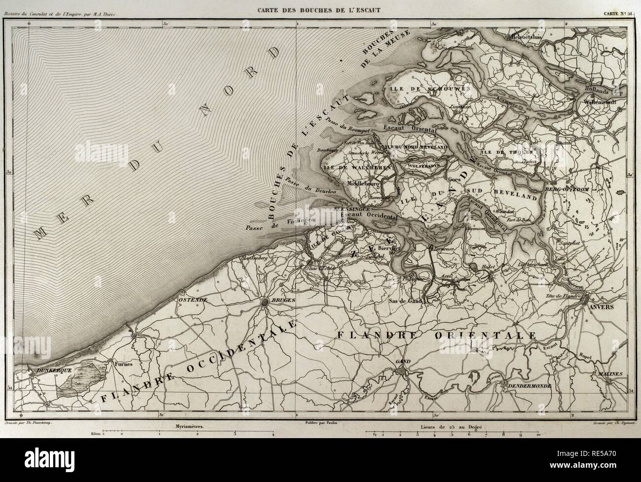 Napoleonic map. Mouth of Scheldt river (Bouches-de-L'Escaut). It was a department of the First French Empire which was formed in 1810, when the Kingdom of Holland was annexed by France. (Netherlands). Scheldt is an European river which born in France, crosses Belgium and empties into the North Sea forming an estuary. Atlas de l'Histoire du Consulat et de l'Empire. History of the Consulate and the Empire of France under Napoleon by Marie Joseph Louis Adolphe Thiers (1797-1877). Drawings by Dufour, engravings by Dyonnet. Edited in Paris, 1864. Stock Photohttps://www.alamy.com/image-license-details/?v=1https://www.alamy.com/napoleonic-map-mouth-of-scheldt-river-bouches-de-lescaut-it-was-a-department-of-the-first-french-empire-which-was-formed-in-1810-when-the-kingdom-of-holland-was-annexed-by-france-netherlands-scheldt-is-an-european-river-which-born-in-france-crosses-belgium-and-empties-into-the-north-sea-forming-an-estuary-atlas-de-lhistoire-du-consulat-et-de-lempire-history-of-the-consulate-and-the-empire-of-france-under-napoleon-by-marie-joseph-louis-adolphe-thiers-1797-1877-drawings-by-dufour-engravings-by-dyonnet-edited-in-paris-1864-image232457764.html
RMRE5A70–Napoleonic map. Mouth of Scheldt river (Bouches-de-L'Escaut). It was a department of the First French Empire which was formed in 1810, when the Kingdom of Holland was annexed by France. (Netherlands). Scheldt is an European river which born in France, crosses Belgium and empties into the North Sea forming an estuary. Atlas de l'Histoire du Consulat et de l'Empire. History of the Consulate and the Empire of France under Napoleon by Marie Joseph Louis Adolphe Thiers (1797-1877). Drawings by Dufour, engravings by Dyonnet. Edited in Paris, 1864.
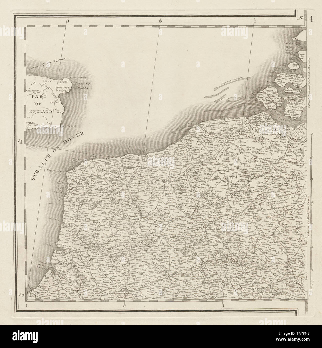 Northern France. Nord Pas-de-Calais. Western Belgium. CHAUCHARD 1800 old map Stock Photohttps://www.alamy.com/image-license-details/?v=1https://www.alamy.com/northern-france-nord-pas-de-calais-western-belgium-chauchard-1800-old-map-image247691284.html
RFTAY8N8–Northern France. Nord Pas-de-Calais. Western Belgium. CHAUCHARD 1800 old map
![The Siege of Ostend: or, the New Troy ... Reprinted from the “Proceedings of the Huguenot Society,” etc. [With plates and a map.] Stock Photo The Siege of Ostend: or, the New Troy ... Reprinted from the “Proceedings of the Huguenot Society,” etc. [With plates and a map.] Stock Photo](https://c8.alamy.com/comp/J546F4/the-siege-of-ostend-or-the-new-troy-reprinted-from-the-proceedings-J546F4.jpg) The Siege of Ostend: or, the New Troy ... Reprinted from the “Proceedings of the Huguenot Society,” etc. [With plates and a map.] Stock Photohttps://www.alamy.com/image-license-details/?v=1https://www.alamy.com/stock-photo-the-siege-of-ostend-or-the-new-troy-reprinted-from-the-proceedings-140849160.html
The Siege of Ostend: or, the New Troy ... Reprinted from the “Proceedings of the Huguenot Society,” etc. [With plates and a map.] Stock Photohttps://www.alamy.com/image-license-details/?v=1https://www.alamy.com/stock-photo-the-siege-of-ostend-or-the-new-troy-reprinted-from-the-proceedings-140849160.htmlRMJ546F4–The Siege of Ostend: or, the New Troy ... Reprinted from the “Proceedings of the Huguenot Society,” etc. [With plates and a map.]
 A view of Bruges, with a plan of Bruges, and a map of the canal between Bruges and Ostend . A View of Bruges, with a Plan of Bruges, and a Map of the Canal between Bruges and Ostend. Source: Maps K.Top.104.46. Stock Photohttps://www.alamy.com/image-license-details/?v=1https://www.alamy.com/a-view-of-bruges-with-a-plan-of-bruges-and-a-map-of-the-canal-between-bruges-and-ostend-a-view-of-bruges-with-a-plan-of-bruges-and-a-map-of-the-canal-between-bruges-and-ostend-source-maps-ktop10446-image226991132.html
RMR589E4–A view of Bruges, with a plan of Bruges, and a map of the canal between Bruges and Ostend . A View of Bruges, with a Plan of Bruges, and a Map of the Canal between Bruges and Ostend. Source: Maps K.Top.104.46.
 Topographic relief map of OSTEND, BELGIUM Stock Vectorhttps://www.alamy.com/image-license-details/?v=1https://www.alamy.com/topographic-relief-map-of-ostend-belgium-image544689590.html
RF2PJ4N3J–Topographic relief map of OSTEND, BELGIUM
 459 Ostend, Belgium ; Ferraris Map Stock Photohttps://www.alamy.com/image-license-details/?v=1https://www.alamy.com/459-ostend-belgium-ferraris-map-image213957090.html
RMPC2GCJ–459 Ostend, Belgium ; Ferraris Map
 The capture of Sluis outweighs the loss of Ostend, Silver Medal. Front: map of maritime landscape. Reverse: inscription., Sluis, Zeeland, Oostende, West-Vlaanderen, Staten-Generaal, Gerard van Bylaer, Dordrecht, 1604, silver (metal), striking (metalworking), d 5.4 cm × w 52.77 Stock Photohttps://www.alamy.com/image-license-details/?v=1https://www.alamy.com/the-capture-of-sluis-outweighs-the-loss-of-ostend-silver-medal-front-map-of-maritime-landscape-reverse-inscription-sluis-zeeland-oostende-west-vlaanderen-staten-generaal-gerard-van-bylaer-dordrecht-1604-silver-metal-striking-metalworking-d-54-cm-w-5277-image261386917.html
RMW575K1–The capture of Sluis outweighs the loss of Ostend, Silver Medal. Front: map of maritime landscape. Reverse: inscription., Sluis, Zeeland, Oostende, West-Vlaanderen, Staten-Generaal, Gerard van Bylaer, Dordrecht, 1604, silver (metal), striking (metalworking), d 5.4 cm × w 52.77
 Old map of Ostend by Heins, Balthasar, Florentius Stock Photohttps://www.alamy.com/image-license-details/?v=1https://www.alamy.com/stock-photo-old-map-of-ostend-by-heins-balthasar-florentius-132428531.html
RMHKCHXB–Old map of Ostend by Heins, Balthasar, Florentius
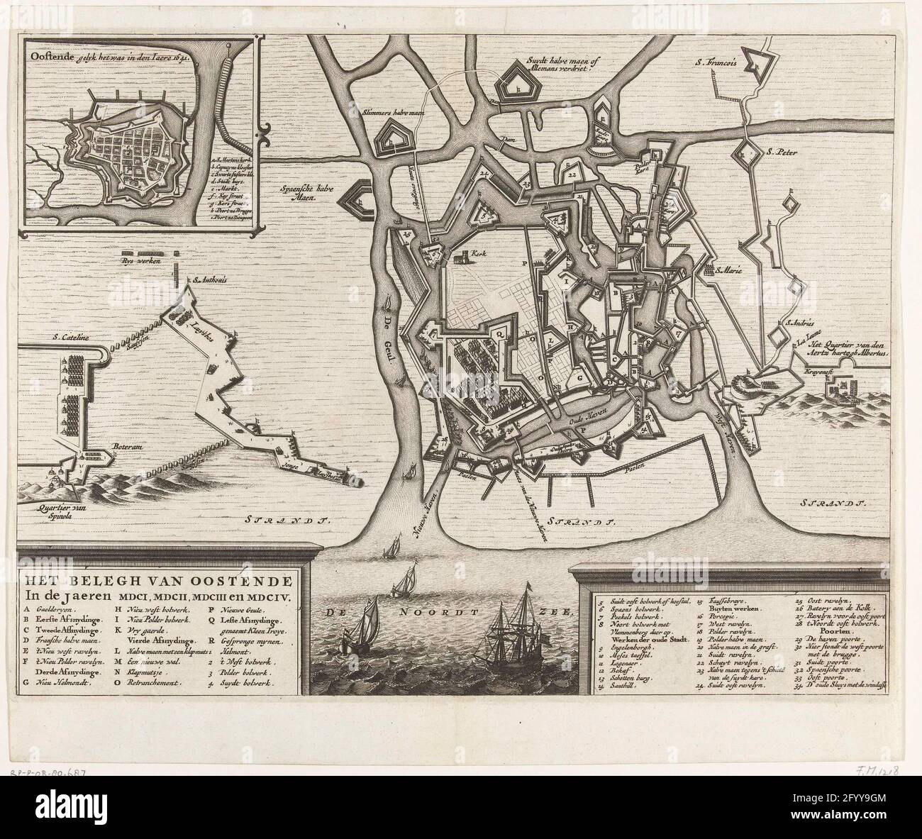 Siege from Ostend, 1601-1604; The investment of Ostend in the Jaeren MDCI, MDCII, MDCIII and MDCIV. Siege from Ostend. Map of the defense and attack lines around the city and in the surrounding area, left the quarter of Spinola, the quarter of Aartshertog Albrecht quarter. At the bottom of two cartouches with the title and the legendas A-R and 1-34. At the top left a bet with a city map in 1641. Stock Photohttps://www.alamy.com/image-license-details/?v=1https://www.alamy.com/siege-from-ostend-1601-1604-the-investment-of-ostend-in-the-jaeren-mdci-mdcii-mdciii-and-mdciv-siege-from-ostend-map-of-the-defense-and-attack-lines-around-the-city-and-in-the-surrounding-area-left-the-quarter-of-spinola-the-quarter-of-aartshertog-albrecht-quarter-at-the-bottom-of-two-cartouches-with-the-title-and-the-legendas-a-r-and-1-34-at-the-top-left-a-bet-with-a-city-map-in-1641-image430244772.html
RM2FYY9GM–Siege from Ostend, 1601-1604; The investment of Ostend in the Jaeren MDCI, MDCII, MDCIII and MDCIV. Siege from Ostend. Map of the defense and attack lines around the city and in the surrounding area, left the quarter of Spinola, the quarter of Aartshertog Albrecht quarter. At the bottom of two cartouches with the title and the legendas A-R and 1-34. At the top left a bet with a city map in 1641.
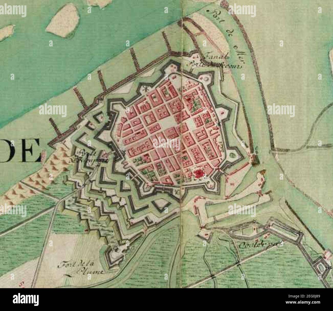 Ostend, Belgium ; Ferraris Map. Stock Photohttps://www.alamy.com/image-license-details/?v=1https://www.alamy.com/ostend-belgium-ferraris-map-image405687305.html
RM2EG0J89–Ostend, Belgium ; Ferraris Map.
 Siege from Ostend, 1601-1604; Ostenda Obsessa et Capta AB Alberto et Isabella (...); Ostenda. Siege from Ostend. Map of the defense and attack lines around the city and in the surrounding area, left the quarter of Spinola, the quarter of Aartshertog Albrecht quarter. At the bottom of two cartouches with the title and the legendas A-R and 1-34. Top left a bet with a map of the city in 1641. On a double magazine taken from the cities book of Blaeu, printed on the back with text in Latin. Stock Photohttps://www.alamy.com/image-license-details/?v=1https://www.alamy.com/siege-from-ostend-1601-1604-ostenda-obsessa-et-capta-ab-alberto-et-isabella-ostenda-siege-from-ostend-map-of-the-defense-and-attack-lines-around-the-city-and-in-the-surrounding-area-left-the-quarter-of-spinola-the-quarter-of-aartshertog-albrecht-quarter-at-the-bottom-of-two-cartouches-with-the-title-and-the-legendas-a-r-and-1-34-top-left-a-bet-with-a-map-of-the-city-in-1641-on-a-double-magazine-taken-from-the-cities-book-of-blaeu-printed-on-the-back-with-text-in-latin-image430981550.html
RM2G14WA6–Siege from Ostend, 1601-1604; Ostenda Obsessa et Capta AB Alberto et Isabella (...); Ostenda. Siege from Ostend. Map of the defense and attack lines around the city and in the surrounding area, left the quarter of Spinola, the quarter of Aartshertog Albrecht quarter. At the bottom of two cartouches with the title and the legendas A-R and 1-34. Top left a bet with a map of the city in 1641. On a double magazine taken from the cities book of Blaeu, printed on the back with text in Latin.
 Inspired by Map of West Flanders, 1707, Carte particuliere des environs de Bruges, Ostende, Damme, l'Ecluse et autres, Map of West Flanders with the cities of Bruges, Ostend, Damme and Sluis, 1707. Part of a bundled collection of plans of battles and cities renowned in the War of the Spanish, Reimagined by Artotop. Classic art reinvented with a modern twist. Design of warm cheerful glowing of brightness and light ray radiance. Photography inspired by surrealism and futurism, embracing dynamic energy of modern technology, movement, speed and revolutionize culture Stock Photohttps://www.alamy.com/image-license-details/?v=1https://www.alamy.com/inspired-by-map-of-west-flanders-1707-carte-particuliere-des-environs-de-bruges-ostende-damme-lecluse-et-autres-map-of-west-flanders-with-the-cities-of-bruges-ostend-damme-and-sluis-1707-part-of-a-bundled-collection-of-plans-of-battles-and-cities-renowned-in-the-war-of-the-spanish-reimagined-by-artotop-classic-art-reinvented-with-a-modern-twist-design-of-warm-cheerful-glowing-of-brightness-and-light-ray-radiance-photography-inspired-by-surrealism-and-futurism-embracing-dynamic-energy-of-modern-technology-movement-speed-and-revolutionize-culture-image459380212.html
RF2HKAG44–Inspired by Map of West Flanders, 1707, Carte particuliere des environs de Bruges, Ostende, Damme, l'Ecluse et autres, Map of West Flanders with the cities of Bruges, Ostend, Damme and Sluis, 1707. Part of a bundled collection of plans of battles and cities renowned in the War of the Spanish, Reimagined by Artotop. Classic art reinvented with a modern twist. Design of warm cheerful glowing of brightness and light ray radiance. Photography inspired by surrealism and futurism, embracing dynamic energy of modern technology, movement, speed and revolutionize culture
 Ostend, Auckland, NZ, New Zealand, Auckland, S 36 47' 53'', N 175 2' 24'', map, Cartascapes Map published in 2024. Explore Cartascapes, a map revealing Earth's diverse landscapes, cultures, and ecosystems. Journey through time and space, discovering the interconnectedness of our planet's past, present, and future. Stock Photohttps://www.alamy.com/image-license-details/?v=1https://www.alamy.com/ostend-auckland-nz-new-zealand-auckland-s-36-47-53-n-175-2-24-map-cartascapes-map-published-in-2024-explore-cartascapes-a-map-revealing-earths-diverse-landscapes-cultures-and-ecosystems-journey-through-time-and-space-discovering-the-interconnectedness-of-our-planets-past-present-and-future-image633978730.html
RM2YRC69E–Ostend, Auckland, NZ, New Zealand, Auckland, S 36 47' 53'', N 175 2' 24'', map, Cartascapes Map published in 2024. Explore Cartascapes, a map revealing Earth's diverse landscapes, cultures, and ecosystems. Journey through time and space, discovering the interconnectedness of our planet's past, present, and future.
 23.07.2018. Ostend, Belgium. Sint-Petrus-en-Pauluskerk, church, cathedral in Ostend. Credit: Ant Palmer/Alamy Stock Photohttps://www.alamy.com/image-license-details/?v=1https://www.alamy.com/23072018-ostend-belgium-sint-petrus-en-pauluskerk-church-cathedral-in-ostend-credit-ant-palmeralamy-image545616161.html
RF2PKJXYD–23.07.2018. Ostend, Belgium. Sint-Petrus-en-Pauluskerk, church, cathedral in Ostend. Credit: Ant Palmer/Alamy
 Siege machines and a plan of the siege of Ostend, 1601-1604 Different types of siege equipment used by Spinola during siege of Ostend by the Spanish army, first under Albrecht and later under Spinola from 1601-1604. Right a map of the city with the surrounding land with all fortifications and military camps belegeraars. Manufacturer : printmaker Abraham Jacobus Wendel (listed building) printmaker Pieter Willem Marinus Trap (listed property) to print by French High Mountain ( workshop) Place manufacture: the Netherlands Date: 1855 - 1857 Physical characteristics: lithography material: paper tec Stock Photohttps://www.alamy.com/image-license-details/?v=1https://www.alamy.com/siege-machines-and-a-plan-of-the-siege-of-ostend-1601-1604-different-types-of-siege-equipment-used-by-spinola-during-siege-of-ostend-by-the-spanish-army-first-under-albrecht-and-later-under-spinola-from-1601-1604-right-a-map-of-the-city-with-the-surrounding-land-with-all-fortifications-and-military-camps-belegeraars-manufacturer-printmaker-abraham-jacobus-wendel-listed-building-printmaker-pieter-willem-marinus-trap-listed-property-to-print-by-french-high-mountain-workshop-place-manufacture-the-netherlands-date-1855-1857-physical-characteristics-lithography-material-paper-tec-image348178631.html
RM2B6CWB3–Siege machines and a plan of the siege of Ostend, 1601-1604 Different types of siege equipment used by Spinola during siege of Ostend by the Spanish army, first under Albrecht and later under Spinola from 1601-1604. Right a map of the city with the surrounding land with all fortifications and military camps belegeraars. Manufacturer : printmaker Abraham Jacobus Wendel (listed building) printmaker Pieter Willem Marinus Trap (listed property) to print by French High Mountain ( workshop) Place manufacture: the Netherlands Date: 1855 - 1857 Physical characteristics: lithography material: paper tec