Oxford pennsylvania map Cut Out Stock Images
 Oxford, Chester County, US, United States, Pennsylvania, N 39 47' 7'', S 75 58' 43'', map, Cartascapes Map published in 2024. Explore Cartascapes, a map revealing Earth's diverse landscapes, cultures, and ecosystems. Journey through time and space, discovering the interconnectedness of our planet's past, present, and future. Stock Photohttps://www.alamy.com/image-license-details/?v=1https://www.alamy.com/oxford-chester-county-us-united-states-pennsylvania-n-39-47-7-s-75-58-43-map-cartascapes-map-published-in-2024-explore-cartascapes-a-map-revealing-earths-diverse-landscapes-cultures-and-ecosystems-journey-through-time-and-space-discovering-the-interconnectedness-of-our-planets-past-present-and-future-image621260098.html
RM2Y2MRGJ–Oxford, Chester County, US, United States, Pennsylvania, N 39 47' 7'', S 75 58' 43'', map, Cartascapes Map published in 2024. Explore Cartascapes, a map revealing Earth's diverse landscapes, cultures, and ecosystems. Journey through time and space, discovering the interconnectedness of our planet's past, present, and future.
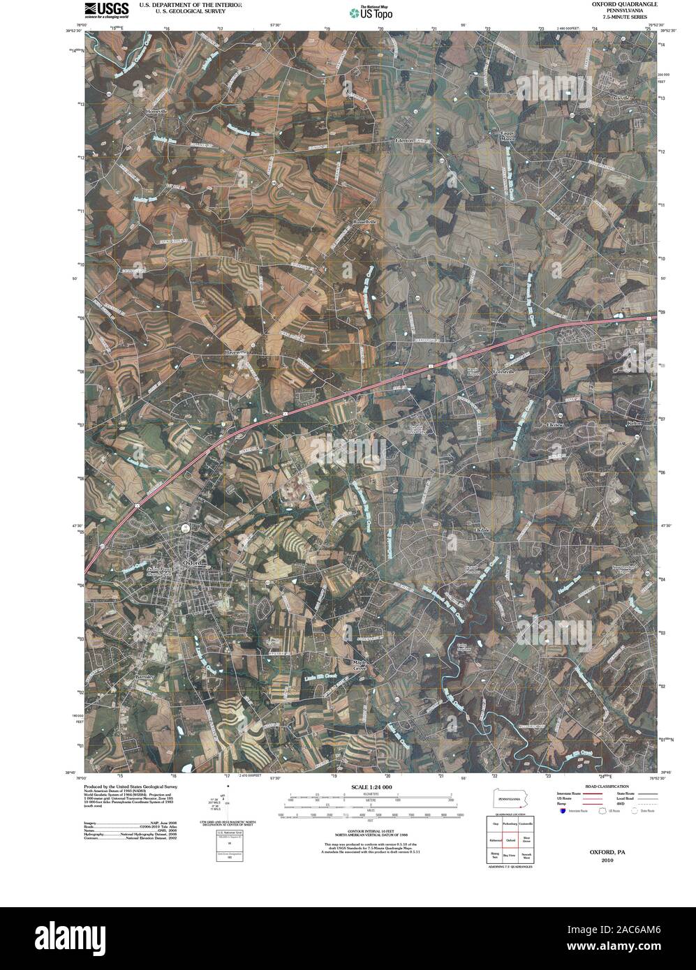 USGS TOPO Map Pennsylvania PA Oxford 20100604 TM Restoration Stock Photohttps://www.alamy.com/image-license-details/?v=1https://www.alamy.com/usgs-topo-map-pennsylvania-pa-oxford-20100604-tm-restoration-image334512982.html
RM2AC6AM6–USGS TOPO Map Pennsylvania PA Oxford 20100604 TM Restoration
 Oxford, Chester County, US, United States, Pennsylvania, N 39 47' 7'', S 75 58' 43'', map, Cartascapes Map published in 2024. Explore Cartascapes, a map revealing Earth's diverse landscapes, cultures, and ecosystems. Journey through time and space, discovering the interconnectedness of our planet's past, present, and future. Stock Photohttps://www.alamy.com/image-license-details/?v=1https://www.alamy.com/oxford-chester-county-us-united-states-pennsylvania-n-39-47-7-s-75-58-43-map-cartascapes-map-published-in-2024-explore-cartascapes-a-map-revealing-earths-diverse-landscapes-cultures-and-ecosystems-journey-through-time-and-space-discovering-the-interconnectedness-of-our-planets-past-present-and-future-image621157923.html
RM2Y2G57F–Oxford, Chester County, US, United States, Pennsylvania, N 39 47' 7'', S 75 58' 43'', map, Cartascapes Map published in 2024. Explore Cartascapes, a map revealing Earth's diverse landscapes, cultures, and ecosystems. Journey through time and space, discovering the interconnectedness of our planet's past, present, and future.
 USGS TOPO Map Pennsylvania PA Oxford 223728 1992 24000 Restoration Stock Photohttps://www.alamy.com/image-license-details/?v=1https://www.alamy.com/usgs-topo-map-pennsylvania-pa-oxford-223728-1992-24000-restoration-image334513103.html
RM2AC6ATF–USGS TOPO Map Pennsylvania PA Oxford 223728 1992 24000 Restoration
 Oxford Village, Philadelphia County, US, United States, Pennsylvania, N 40 2' 24'', S 75 5' 58'', map, Cartascapes Map published in 2024. Explore Cartascapes, a map revealing Earth's diverse landscapes, cultures, and ecosystems. Journey through time and space, discovering the interconnectedness of our planet's past, present, and future. Stock Photohttps://www.alamy.com/image-license-details/?v=1https://www.alamy.com/oxford-village-philadelphia-county-us-united-states-pennsylvania-n-40-2-24-s-75-5-58-map-cartascapes-map-published-in-2024-explore-cartascapes-a-map-revealing-earths-diverse-landscapes-cultures-and-ecosystems-journey-through-time-and-space-discovering-the-interconnectedness-of-our-planets-past-present-and-future-image621304482.html
RM2Y2PT5P–Oxford Village, Philadelphia County, US, United States, Pennsylvania, N 40 2' 24'', S 75 5' 58'', map, Cartascapes Map published in 2024. Explore Cartascapes, a map revealing Earth's diverse landscapes, cultures, and ecosystems. Journey through time and space, discovering the interconnectedness of our planet's past, present, and future.
 USGS TOPO Map Pennsylvania PA Oxford 223730 1999 24000 Restoration Stock Photohttps://www.alamy.com/image-license-details/?v=1https://www.alamy.com/usgs-topo-map-pennsylvania-pa-oxford-223730-1999-24000-restoration-image334513040.html
RM2AC6AP8–USGS TOPO Map Pennsylvania PA Oxford 223730 1999 24000 Restoration
 Oxford Circle, Philadelphia County, US, United States, Pennsylvania, N 40 3' 0'', S 75 4' 18'', map, Cartascapes Map published in 2024. Explore Cartascapes, a map revealing Earth's diverse landscapes, cultures, and ecosystems. Journey through time and space, discovering the interconnectedness of our planet's past, present, and future. Stock Photohttps://www.alamy.com/image-license-details/?v=1https://www.alamy.com/oxford-circle-philadelphia-county-us-united-states-pennsylvania-n-40-3-0-s-75-4-18-map-cartascapes-map-published-in-2024-explore-cartascapes-a-map-revealing-earths-diverse-landscapes-cultures-and-ecosystems-journey-through-time-and-space-discovering-the-interconnectedness-of-our-planets-past-present-and-future-image621298101.html
RM2Y2PG1W–Oxford Circle, Philadelphia County, US, United States, Pennsylvania, N 40 3' 0'', S 75 4' 18'', map, Cartascapes Map published in 2024. Explore Cartascapes, a map revealing Earth's diverse landscapes, cultures, and ecosystems. Journey through time and space, discovering the interconnectedness of our planet's past, present, and future.
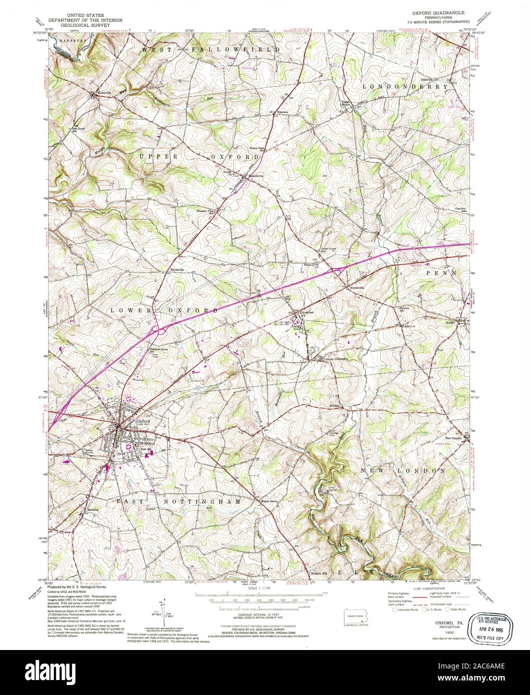 USGS TOPO Map Pennsylvania PA Oxford 223727 1992 24000 Restoration Stock Photohttps://www.alamy.com/image-license-details/?v=1https://www.alamy.com/usgs-topo-map-pennsylvania-pa-oxford-223727-1992-24000-restoration-image334512990.html
RM2AC6AME–USGS TOPO Map Pennsylvania PA Oxford 223727 1992 24000 Restoration
 Oxford Valley, Bucks County, US, United States, Pennsylvania, N 40 10' 52'', S 74 51' 58'', map, Cartascapes Map published in 2024. Explore Cartascapes, a map revealing Earth's diverse landscapes, cultures, and ecosystems. Journey through time and space, discovering the interconnectedness of our planet's past, present, and future. Stock Photohttps://www.alamy.com/image-license-details/?v=1https://www.alamy.com/oxford-valley-bucks-county-us-united-states-pennsylvania-n-40-10-52-s-74-51-58-map-cartascapes-map-published-in-2024-explore-cartascapes-a-map-revealing-earths-diverse-landscapes-cultures-and-ecosystems-journey-through-time-and-space-discovering-the-interconnectedness-of-our-planets-past-present-and-future-image621236941.html
RM2Y2KP1H–Oxford Valley, Bucks County, US, United States, Pennsylvania, N 40 10' 52'', S 74 51' 58'', map, Cartascapes Map published in 2024. Explore Cartascapes, a map revealing Earth's diverse landscapes, cultures, and ecosystems. Journey through time and space, discovering the interconnectedness of our planet's past, present, and future.
 USGS TOPO Map Pennsylvania PA Oxford 171453 1953 24000 Restoration Stock Photohttps://www.alamy.com/image-license-details/?v=1https://www.alamy.com/usgs-topo-map-pennsylvania-pa-oxford-171453-1953-24000-restoration-image334512854.html
RM2AC6AFJ–USGS TOPO Map Pennsylvania PA Oxford 171453 1953 24000 Restoration
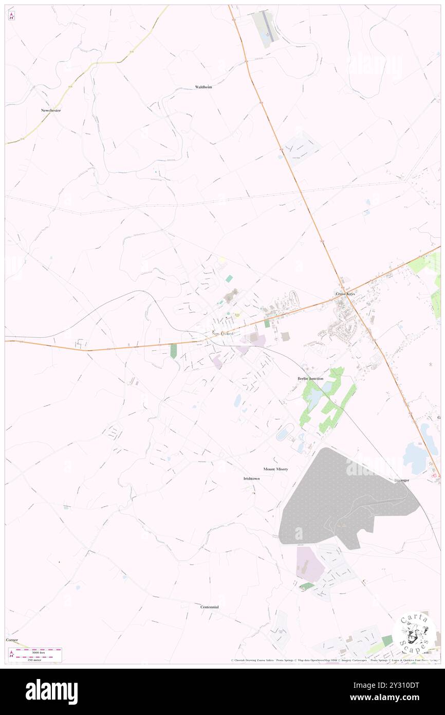 New Oxford, Adams County, US, United States, Pennsylvania, N 39 51' 49'', S 77 3' 20'', map, Cartascapes Map published in 2024. Explore Cartascapes, a map revealing Earth's diverse landscapes, cultures, and ecosystems. Journey through time and space, discovering the interconnectedness of our planet's past, present, and future. Stock Photohttps://www.alamy.com/image-license-details/?v=1https://www.alamy.com/new-oxford-adams-county-us-united-states-pennsylvania-n-39-51-49-s-77-3-20-map-cartascapes-map-published-in-2024-explore-cartascapes-a-map-revealing-earths-diverse-landscapes-cultures-and-ecosystems-journey-through-time-and-space-discovering-the-interconnectedness-of-our-planets-past-present-and-future-image621439556.html
RM2Y310DT–New Oxford, Adams County, US, United States, Pennsylvania, N 39 51' 49'', S 77 3' 20'', map, Cartascapes Map published in 2024. Explore Cartascapes, a map revealing Earth's diverse landscapes, cultures, and ecosystems. Journey through time and space, discovering the interconnectedness of our planet's past, present, and future.
 USGS TOPO Map Pennsylvania PA Oxford 171455 1953 24000 Restoration Stock Photohttps://www.alamy.com/image-license-details/?v=1https://www.alamy.com/usgs-topo-map-pennsylvania-pa-oxford-171455-1953-24000-restoration-image334512876.html
RM2AC6AGC–USGS TOPO Map Pennsylvania PA Oxford 171455 1953 24000 Restoration
 New Oxford, Adams County, US, United States, Pennsylvania, N 39 51' 49'', S 77 3' 20'', map, Cartascapes Map published in 2024. Explore Cartascapes, a map revealing Earth's diverse landscapes, cultures, and ecosystems. Journey through time and space, discovering the interconnectedness of our planet's past, present, and future. Stock Photohttps://www.alamy.com/image-license-details/?v=1https://www.alamy.com/new-oxford-adams-county-us-united-states-pennsylvania-n-39-51-49-s-77-3-20-map-cartascapes-map-published-in-2024-explore-cartascapes-a-map-revealing-earths-diverse-landscapes-cultures-and-ecosystems-journey-through-time-and-space-discovering-the-interconnectedness-of-our-planets-past-present-and-future-image621413229.html
RM2Y2YPWH–New Oxford, Adams County, US, United States, Pennsylvania, N 39 51' 49'', S 77 3' 20'', map, Cartascapes Map published in 2024. Explore Cartascapes, a map revealing Earth's diverse landscapes, cultures, and ecosystems. Journey through time and space, discovering the interconnectedness of our planet's past, present, and future.
 Township of Lower Oxford, Chester County, US, United States, Pennsylvania, N 39 48' 20'', S 75 59' 24'', map, Cartascapes Map published in 2024. Explore Cartascapes, a map revealing Earth's diverse landscapes, cultures, and ecosystems. Journey through time and space, discovering the interconnectedness of our planet's past, present, and future. Stock Photohttps://www.alamy.com/image-license-details/?v=1https://www.alamy.com/township-of-lower-oxford-chester-county-us-united-states-pennsylvania-n-39-48-20-s-75-59-24-map-cartascapes-map-published-in-2024-explore-cartascapes-a-map-revealing-earths-diverse-landscapes-cultures-and-ecosystems-journey-through-time-and-space-discovering-the-interconnectedness-of-our-planets-past-present-and-future-image633882392.html
RM2YR7RCT–Township of Lower Oxford, Chester County, US, United States, Pennsylvania, N 39 48' 20'', S 75 59' 24'', map, Cartascapes Map published in 2024. Explore Cartascapes, a map revealing Earth's diverse landscapes, cultures, and ecosystems. Journey through time and space, discovering the interconnectedness of our planet's past, present, and future.
 Township of Upper Oxford, Chester County, US, United States, Pennsylvania, N 39 50' 33'', S 75 57' 11'', map, Cartascapes Map published in 2024. Explore Cartascapes, a map revealing Earth's diverse landscapes, cultures, and ecosystems. Journey through time and space, discovering the interconnectedness of our planet's past, present, and future. Stock Photohttps://www.alamy.com/image-license-details/?v=1https://www.alamy.com/township-of-upper-oxford-chester-county-us-united-states-pennsylvania-n-39-50-33-s-75-57-11-map-cartascapes-map-published-in-2024-explore-cartascapes-a-map-revealing-earths-diverse-landscapes-cultures-and-ecosystems-journey-through-time-and-space-discovering-the-interconnectedness-of-our-planets-past-present-and-future-image633804479.html
RM2YR4827–Township of Upper Oxford, Chester County, US, United States, Pennsylvania, N 39 50' 33'', S 75 57' 11'', map, Cartascapes Map published in 2024. Explore Cartascapes, a map revealing Earth's diverse landscapes, cultures, and ecosystems. Journey through time and space, discovering the interconnectedness of our planet's past, present, and future.
 Oxford Manor, Montgomery County, US, United States, Pennsylvania, N 40 14' 14'', S 75 19' 23'', map, Cartascapes Map published in 2024. Explore Cartascapes, a map revealing Earth's diverse landscapes, cultures, and ecosystems. Journey through time and space, discovering the interconnectedness of our planet's past, present, and future. Stock Photohttps://www.alamy.com/image-license-details/?v=1https://www.alamy.com/oxford-manor-montgomery-county-us-united-states-pennsylvania-n-40-14-14-s-75-19-23-map-cartascapes-map-published-in-2024-explore-cartascapes-a-map-revealing-earths-diverse-landscapes-cultures-and-ecosystems-journey-through-time-and-space-discovering-the-interconnectedness-of-our-planets-past-present-and-future-image620835086.html
RM2Y21DDJ–Oxford Manor, Montgomery County, US, United States, Pennsylvania, N 40 14' 14'', S 75 19' 23'', map, Cartascapes Map published in 2024. Explore Cartascapes, a map revealing Earth's diverse landscapes, cultures, and ecosystems. Journey through time and space, discovering the interconnectedness of our planet's past, present, and future.
 Borough of Oxford, Chester County, US, United States, Pennsylvania, N 39 47' 9'', S 75 58' 48'', map, Cartascapes Map published in 2024. Explore Cartascapes, a map revealing Earth's diverse landscapes, cultures, and ecosystems. Journey through time and space, discovering the interconnectedness of our planet's past, present, and future. Stock Photohttps://www.alamy.com/image-license-details/?v=1https://www.alamy.com/borough-of-oxford-chester-county-us-united-states-pennsylvania-n-39-47-9-s-75-58-48-map-cartascapes-map-published-in-2024-explore-cartascapes-a-map-revealing-earths-diverse-landscapes-cultures-and-ecosystems-journey-through-time-and-space-discovering-the-interconnectedness-of-our-planets-past-present-and-future-image633777908.html
RM2YR3258–Borough of Oxford, Chester County, US, United States, Pennsylvania, N 39 47' 9'', S 75 58' 48'', map, Cartascapes Map published in 2024. Explore Cartascapes, a map revealing Earth's diverse landscapes, cultures, and ecosystems. Journey through time and space, discovering the interconnectedness of our planet's past, present, and future.
 Township of Oxford, Adams County, US, United States, Pennsylvania, N 39 50' 56'', S 77 2' 37'', map, Cartascapes Map published in 2024. Explore Cartascapes, a map revealing Earth's diverse landscapes, cultures, and ecosystems. Journey through time and space, discovering the interconnectedness of our planet's past, present, and future. Stock Photohttps://www.alamy.com/image-license-details/?v=1https://www.alamy.com/township-of-oxford-adams-county-us-united-states-pennsylvania-n-39-50-56-s-77-2-37-map-cartascapes-map-published-in-2024-explore-cartascapes-a-map-revealing-earths-diverse-landscapes-cultures-and-ecosystems-journey-through-time-and-space-discovering-the-interconnectedness-of-our-planets-past-present-and-future-image633840880.html
RM2YR5XE8–Township of Oxford, Adams County, US, United States, Pennsylvania, N 39 50' 56'', S 77 2' 37'', map, Cartascapes Map published in 2024. Explore Cartascapes, a map revealing Earth's diverse landscapes, cultures, and ecosystems. Journey through time and space, discovering the interconnectedness of our planet's past, present, and future.
 Borough of New Oxford, Adams County, US, United States, Pennsylvania, N 39 51' 46'', S 77 3' 19'', map, Cartascapes Map published in 2024. Explore Cartascapes, a map revealing Earth's diverse landscapes, cultures, and ecosystems. Journey through time and space, discovering the interconnectedness of our planet's past, present, and future. Stock Photohttps://www.alamy.com/image-license-details/?v=1https://www.alamy.com/borough-of-new-oxford-adams-county-us-united-states-pennsylvania-n-39-51-46-s-77-3-19-map-cartascapes-map-published-in-2024-explore-cartascapes-a-map-revealing-earths-diverse-landscapes-cultures-and-ecosystems-journey-through-time-and-space-discovering-the-interconnectedness-of-our-planets-past-present-and-future-image633911052.html
RM2YR940C–Borough of New Oxford, Adams County, US, United States, Pennsylvania, N 39 51' 46'', S 77 3' 19'', map, Cartascapes Map published in 2024. Explore Cartascapes, a map revealing Earth's diverse landscapes, cultures, and ecosystems. Journey through time and space, discovering the interconnectedness of our planet's past, present, and future.
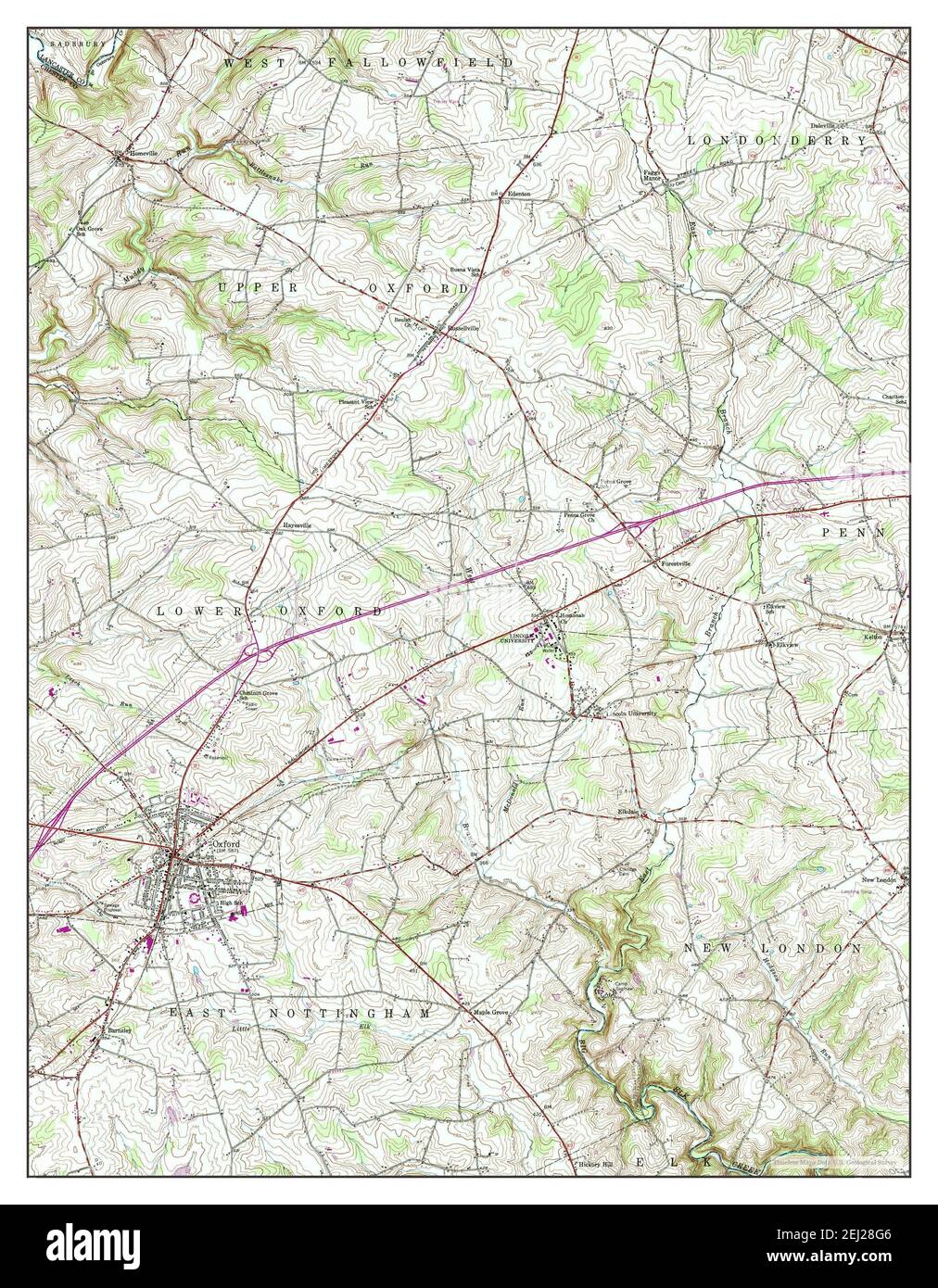 Oxford, Pennsylvania, map 1992, 1:24000, United States of America by Timeless Maps, data U.S. Geological Survey Stock Photohttps://www.alamy.com/image-license-details/?v=1https://www.alamy.com/oxford-pennsylvania-map-1992-124000-united-states-of-america-by-timeless-maps-data-us-geological-survey-image406952902.html
RM2EJ28G6–Oxford, Pennsylvania, map 1992, 1:24000, United States of America by Timeless Maps, data U.S. Geological Survey
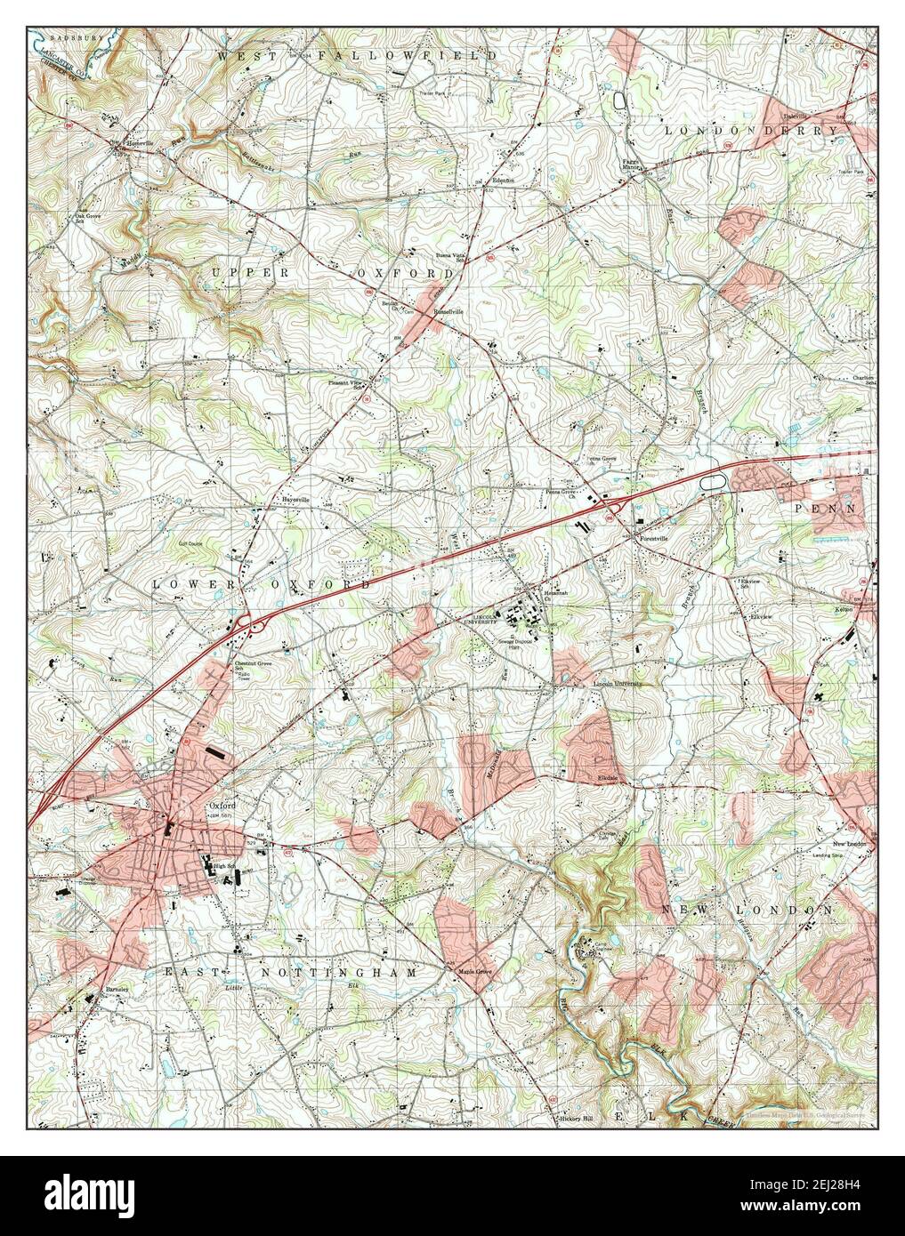 Oxford, Pennsylvania, map 1999, 1:24000, United States of America by Timeless Maps, data U.S. Geological Survey Stock Photohttps://www.alamy.com/image-license-details/?v=1https://www.alamy.com/oxford-pennsylvania-map-1999-124000-united-states-of-america-by-timeless-maps-data-us-geological-survey-image406952928.html
RM2EJ28H4–Oxford, Pennsylvania, map 1999, 1:24000, United States of America by Timeless Maps, data U.S. Geological Survey
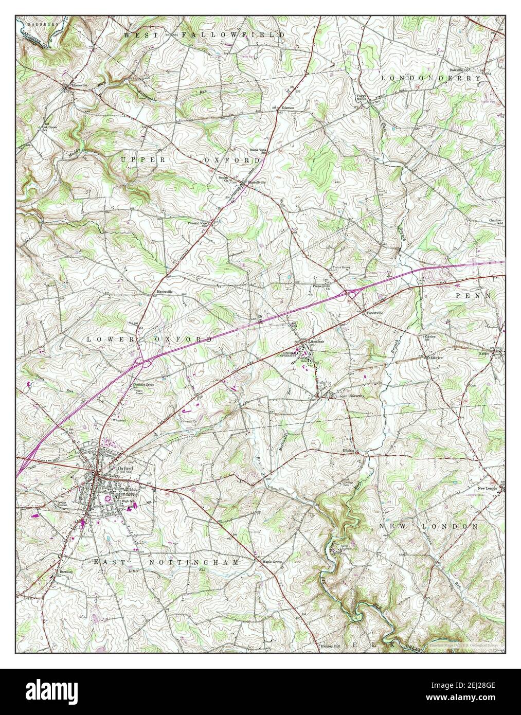 Oxford, Pennsylvania, map 1992, 1:24000, United States of America by Timeless Maps, data U.S. Geological Survey Stock Photohttps://www.alamy.com/image-license-details/?v=1https://www.alamy.com/oxford-pennsylvania-map-1992-124000-united-states-of-america-by-timeless-maps-data-us-geological-survey-image406952910.html
RM2EJ28GE–Oxford, Pennsylvania, map 1992, 1:24000, United States of America by Timeless Maps, data U.S. Geological Survey
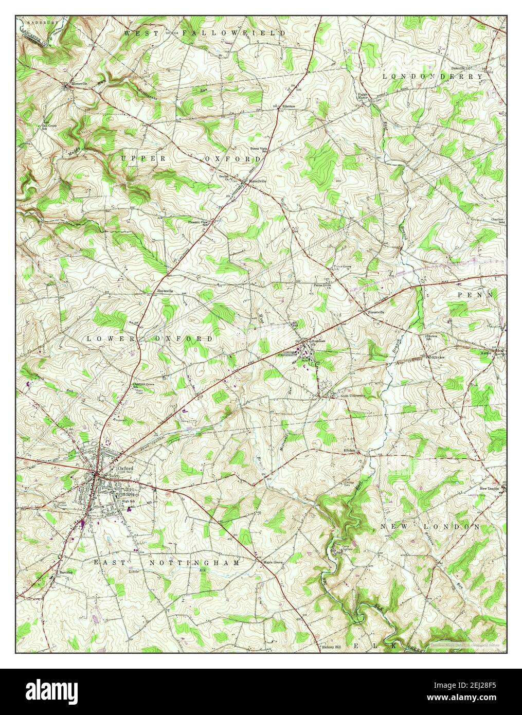 Oxford, Pennsylvania, map 1953, 1:24000, United States of America by Timeless Maps, data U.S. Geological Survey Stock Photohttps://www.alamy.com/image-license-details/?v=1https://www.alamy.com/oxford-pennsylvania-map-1953-124000-united-states-of-america-by-timeless-maps-data-us-geological-survey-image406952873.html
RM2EJ28F5–Oxford, Pennsylvania, map 1953, 1:24000, United States of America by Timeless Maps, data U.S. Geological Survey
 Oxford, Pennsylvania, map 1953, 1:24000, United States of America by Timeless Maps, data U.S. Geological Survey Stock Photohttps://www.alamy.com/image-license-details/?v=1https://www.alamy.com/oxford-pennsylvania-map-1953-124000-united-states-of-america-by-timeless-maps-data-us-geological-survey-image406952879.html
RM2EJ28FB–Oxford, Pennsylvania, map 1953, 1:24000, United States of America by Timeless Maps, data U.S. Geological Survey
 Oxford, Pennsylvania, map 1953, 1:24000, United States of America by Timeless Maps, data U.S. Geological Survey Stock Photohttps://www.alamy.com/image-license-details/?v=1https://www.alamy.com/oxford-pennsylvania-map-1953-124000-united-states-of-america-by-timeless-maps-data-us-geological-survey-image406952877.html
RM2EJ28F9–Oxford, Pennsylvania, map 1953, 1:24000, United States of America by Timeless Maps, data U.S. Geological Survey
 Oxford, Pennsylvania, map 1953, 1:24000, United States of America by Timeless Maps, data U.S. Geological Survey Stock Photohttps://www.alamy.com/image-license-details/?v=1https://www.alamy.com/oxford-pennsylvania-map-1953-124000-united-states-of-america-by-timeless-maps-data-us-geological-survey-image406952875.html
RM2EJ28F7–Oxford, Pennsylvania, map 1953, 1:24000, United States of America by Timeless Maps, data U.S. Geological Survey