Oyster bay new york on a map Stock Photos and Images
(8)See oyster bay new york on a map stock video clipsQuick filters:
Oyster bay new york on a map Stock Photos and Images
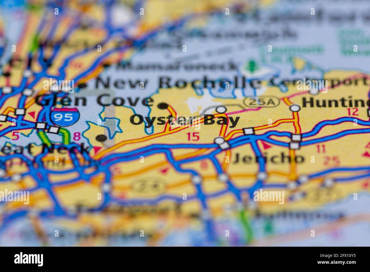
 Oyster Bay New York USA Shown on a Geography map or road map Stock Photohttps://www.alamy.com/image-license-details/?v=1https://www.alamy.com/oyster-bay-new-york-usa-shown-on-a-geography-map-or-road-map-image429052601.html
RM2FX10Y5–Oyster Bay New York USA Shown on a Geography map or road map
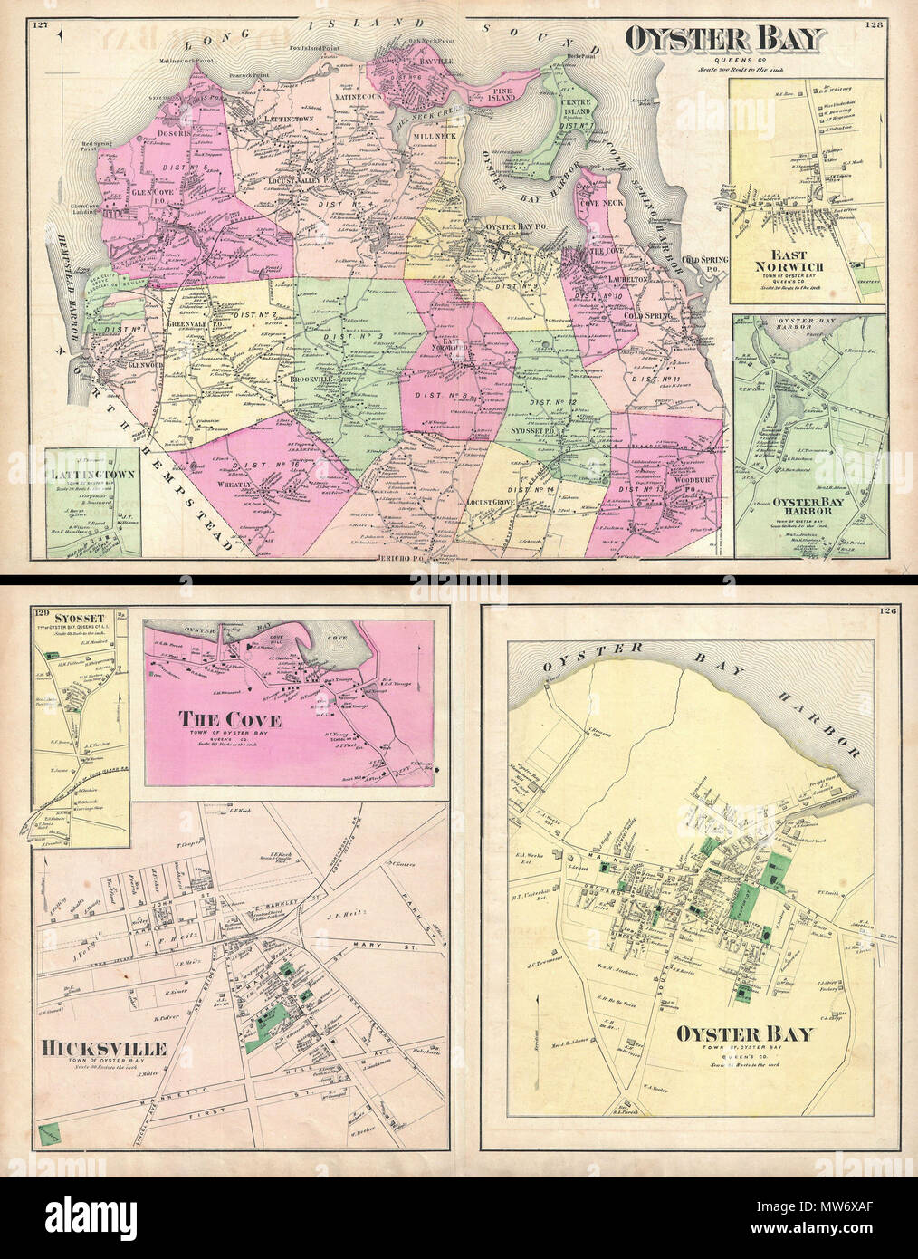
 . Oyster Bay, Queens Co. - Oyster Bay, Town of Oyster Bay, Queens Co. - Hicksville, Town of Oyster Bay. English: A scarce example of Fredrick W. Beers’ map of the Oyster Bay, Long Island, New York. Published in 1873. Oyster Bay side of map sheet covers from Hempstead Harbor eastward as far as Cold Spring Harbor. Bounded on the north by the Long Island Sound. Extends southward as far as Jericho. Inset maps depict Lattingtown, East Norwich, and Oyster Bay Harbor. Detailed to the level of individual buildings and properties. Includes the Northport and the Glen Cove Branches of the Long Island Ra Stock Photohttps://www.alamy.com/image-license-details/?v=1https://www.alamy.com/oyster-bay-queens-co-oyster-bay-town-of-oyster-bay-queens-co-hicksville-town-of-oyster-bay-english-a-scarce-example-of-fredrick-w-beers-map-of-the-oyster-bay-long-island-new-york-published-in-1873-oyster-bay-side-of-map-sheet-covers-from-hempstead-harbor-eastward-as-far-as-cold-spring-harbor-bounded-on-the-north-by-the-long-island-sound-extends-southward-as-far-as-jericho-inset-maps-depict-lattingtown-east-norwich-and-oyster-bay-harbor-detailed-to-the-level-of-individual-buildings-and-properties-includes-the-northport-and-the-glen-cove-branches-of-the-long-island-ra-image187622471.html
RMMW6XAF–. Oyster Bay, Queens Co. - Oyster Bay, Town of Oyster Bay, Queens Co. - Hicksville, Town of Oyster Bay. English: A scarce example of Fredrick W. Beers’ map of the Oyster Bay, Long Island, New York. Published in 1873. Oyster Bay side of map sheet covers from Hempstead Harbor eastward as far as Cold Spring Harbor. Bounded on the north by the Long Island Sound. Extends southward as far as Jericho. Inset maps depict Lattingtown, East Norwich, and Oyster Bay Harbor. Detailed to the level of individual buildings and properties. Includes the Northport and the Glen Cove Branches of the Long Island Ra
 A home geography of New York city . he Hudson river — which uniteat the southern end of the island in upper New York bay. On thenorth and the east are Spuy- ten Duyvil creek, the Harlemriver, and the East river. In sailing from The Nar-rows through upper NewYork bay and the East riverwe pass the following islands:Oyster, Liberty, Ellis, Gov-ernors, Black wells. Wards,and Randalls. Oyster islandis so small that it is not shownon this map. Next to the giant bridges,what is the most strikingobject in the waters aroundNew York city ? It is on anisland. What island is it on ?On one of the islands n Stock Photohttps://www.alamy.com/image-license-details/?v=1https://www.alamy.com/a-home-geography-of-new-york-city-he-hudson-river-which-uniteat-the-southern-end-of-the-island-in-upper-new-york-bay-on-thenorth-and-the-east-are-spuy-ten-duyvil-creek-the-harlemriver-and-the-east-river-in-sailing-from-the-nar-rows-through-upper-newyork-bay-and-the-east-riverwe-pass-the-following-islandsoyster-liberty-ellis-gov-ernors-black-wells-wardsand-randalls-oyster-islandis-so-small-that-it-is-not-shownon-this-map-next-to-the-giant-bridgeswhat-is-the-most-strikingobject-in-the-waters-aroundnew-york-city-it-is-on-anisland-what-island-is-it-on-on-one-of-the-islands-n-image338927822.html
RM2AKBDW2–A home geography of New York city . he Hudson river — which uniteat the southern end of the island in upper New York bay. On thenorth and the east are Spuy- ten Duyvil creek, the Harlemriver, and the East river. In sailing from The Nar-rows through upper NewYork bay and the East riverwe pass the following islands:Oyster, Liberty, Ellis, Gov-ernors, Black wells. Wards,and Randalls. Oyster islandis so small that it is not shownon this map. Next to the giant bridges,what is the most strikingobject in the waters aroundNew York city ? It is on anisland. What island is it on ?On one of the islands n
![. A state park plan for New York, with a proposal for the new park bond issue. Parks. /-/ A Fi B O R B A y. ""TA-^SilJfS— e.l MAP OF PROPERTIES TO BE ACQUIRED FOR THE PROPOSED SITE OF ROOSEVELT PARK OYSTER BAY. L.I. MASSAO COl-'MXY. rsJ.V. Please note that these images are extracted from scanned page images that may have been digitally enhanced for readability - coloration and appearance of these illustrations may not perfectly resemble the original work.. New York state association. Committee on state park plan. [New York, M. B. Brown printing & binding co. ] Stock Photo . A state park plan for New York, with a proposal for the new park bond issue. Parks. /-/ A Fi B O R B A y. ""TA-^SilJfS— e.l MAP OF PROPERTIES TO BE ACQUIRED FOR THE PROPOSED SITE OF ROOSEVELT PARK OYSTER BAY. L.I. MASSAO COl-'MXY. rsJ.V. Please note that these images are extracted from scanned page images that may have been digitally enhanced for readability - coloration and appearance of these illustrations may not perfectly resemble the original work.. New York state association. Committee on state park plan. [New York, M. B. Brown printing & binding co. ] Stock Photo](https://c8.alamy.com/comp/PG2EAB/a-state-park-plan-for-new-york-with-a-proposal-for-the-new-park-bond-issue-parks-a-fi-b-o-r-b-a-y-quotquotta-siljfs-el-map-of-properties-to-be-acquired-for-the-proposed-site-of-roosevelt-park-oyster-bay-li-massao-col-mxy-rsjv-please-note-that-these-images-are-extracted-from-scanned-page-images-that-may-have-been-digitally-enhanced-for-readability-coloration-and-appearance-of-these-illustrations-may-not-perfectly-resemble-the-original-work-new-york-state-association-committee-on-state-park-plan-new-york-m-b-brown-printing-amp-binding-co-PG2EAB.jpg) . A state park plan for New York, with a proposal for the new park bond issue. Parks. /-/ A Fi B O R B A y. ""TA-^SilJfS— e.l MAP OF PROPERTIES TO BE ACQUIRED FOR THE PROPOSED SITE OF ROOSEVELT PARK OYSTER BAY. L.I. MASSAO COl-'MXY. rsJ.V. Please note that these images are extracted from scanned page images that may have been digitally enhanced for readability - coloration and appearance of these illustrations may not perfectly resemble the original work.. New York state association. Committee on state park plan. [New York, M. B. Brown printing & binding co. ] Stock Photohttps://www.alamy.com/image-license-details/?v=1https://www.alamy.com/a-state-park-plan-for-new-york-with-a-proposal-for-the-new-park-bond-issue-parks-a-fi-b-o-r-b-a-y-quotquotta-siljfs-el-map-of-properties-to-be-acquired-for-the-proposed-site-of-roosevelt-park-oyster-bay-li-massao-col-mxy-rsjv-please-note-that-these-images-are-extracted-from-scanned-page-images-that-may-have-been-digitally-enhanced-for-readability-coloration-and-appearance-of-these-illustrations-may-not-perfectly-resemble-the-original-work-new-york-state-association-committee-on-state-park-plan-new-york-m-b-brown-printing-amp-binding-co-image216414083.html
. A state park plan for New York, with a proposal for the new park bond issue. Parks. /-/ A Fi B O R B A y. ""TA-^SilJfS— e.l MAP OF PROPERTIES TO BE ACQUIRED FOR THE PROPOSED SITE OF ROOSEVELT PARK OYSTER BAY. L.I. MASSAO COl-'MXY. rsJ.V. Please note that these images are extracted from scanned page images that may have been digitally enhanced for readability - coloration and appearance of these illustrations may not perfectly resemble the original work.. New York state association. Committee on state park plan. [New York, M. B. Brown printing & binding co. ] Stock Photohttps://www.alamy.com/image-license-details/?v=1https://www.alamy.com/a-state-park-plan-for-new-york-with-a-proposal-for-the-new-park-bond-issue-parks-a-fi-b-o-r-b-a-y-quotquotta-siljfs-el-map-of-properties-to-be-acquired-for-the-proposed-site-of-roosevelt-park-oyster-bay-li-massao-col-mxy-rsjv-please-note-that-these-images-are-extracted-from-scanned-page-images-that-may-have-been-digitally-enhanced-for-readability-coloration-and-appearance-of-these-illustrations-may-not-perfectly-resemble-the-original-work-new-york-state-association-committee-on-state-park-plan-new-york-m-b-brown-printing-amp-binding-co-image216414083.htmlRMPG2EAB–. A state park plan for New York, with a proposal for the new park bond issue. Parks. /-/ A Fi B O R B A y. ""TA-^SilJfS— e.l MAP OF PROPERTIES TO BE ACQUIRED FOR THE PROPOSED SITE OF ROOSEVELT PARK OYSTER BAY. L.I. MASSAO COl-'MXY. rsJ.V. Please note that these images are extracted from scanned page images that may have been digitally enhanced for readability - coloration and appearance of these illustrations may not perfectly resemble the original work.. New York state association. Committee on state park plan. [New York, M. B. Brown printing & binding co. ]
 . Oyster Bay, Queens Co. - Oyster Bay, Town of Oyster Bay, Queens Co. - Hicksville, Town of Oyster Bay. English: A scarce example of Fredrick W. Beers’ map of the Oyster Bay, Long Island, New York. Published in 1873. Oyster Bay side of map sheet covers from Hempstead Harbor eastward as far as Cold Spring Harbor. Bounded on the north by the Long Island Sound. Extends southward as far as Jericho. Inset maps depict Lattingtown, East Norwich, and Oyster Bay Harbor. Detailed to the level of individual buildings and properties. Includes the Northport and the Glen Cove Branches of the Long Island Ra Stock Photohttps://www.alamy.com/image-license-details/?v=1https://www.alamy.com/oyster-bay-queens-co-oyster-bay-town-of-oyster-bay-queens-co-hicksville-town-of-oyster-bay-english-a-scarce-example-of-fredrick-w-beers-map-of-the-oyster-bay-long-island-new-york-published-in-1873-oyster-bay-side-of-map-sheet-covers-from-hempstead-harbor-eastward-as-far-as-cold-spring-harbor-bounded-on-the-north-by-the-long-island-sound-extends-southward-as-far-as-jericho-inset-maps-depict-lattingtown-east-norwich-and-oyster-bay-harbor-detailed-to-the-level-of-individual-buildings-and-properties-includes-the-northport-and-the-glen-cove-branches-of-the-long-island-ra-image188898440.html
RMMY91TT–. Oyster Bay, Queens Co. - Oyster Bay, Town of Oyster Bay, Queens Co. - Hicksville, Town of Oyster Bay. English: A scarce example of Fredrick W. Beers’ map of the Oyster Bay, Long Island, New York. Published in 1873. Oyster Bay side of map sheet covers from Hempstead Harbor eastward as far as Cold Spring Harbor. Bounded on the north by the Long Island Sound. Extends southward as far as Jericho. Inset maps depict Lattingtown, East Norwich, and Oyster Bay Harbor. Detailed to the level of individual buildings and properties. Includes the Northport and the Glen Cove Branches of the Long Island Ra
![. A state park plan for New York, with a proposal for the new park bond issue. Parks. /-/ A Fi B O R B A y. ""TA-^SilJfS— e.l MAP OF PROPERTIES TO BE ACQUIRED FOR THE PROPOSED SITE OF ROOSEVELT PARK OYSTER BAY. L.I. MASSAO COl-'MXY. rsJ.V. Please note that these images are extracted from scanned page images that may have been digitally enhanced for readability - coloration and appearance of these illustrations may not perfectly resemble the original work.. New York state association. Committee on state park plan. [New York, M. B. Brown printing & binding co. ] Stock Photo . A state park plan for New York, with a proposal for the new park bond issue. Parks. /-/ A Fi B O R B A y. ""TA-^SilJfS— e.l MAP OF PROPERTIES TO BE ACQUIRED FOR THE PROPOSED SITE OF ROOSEVELT PARK OYSTER BAY. L.I. MASSAO COl-'MXY. rsJ.V. Please note that these images are extracted from scanned page images that may have been digitally enhanced for readability - coloration and appearance of these illustrations may not perfectly resemble the original work.. New York state association. Committee on state park plan. [New York, M. B. Brown printing & binding co. ] Stock Photo](https://c8.alamy.com/comp/RDFCXJ/a-state-park-plan-for-new-york-with-a-proposal-for-the-new-park-bond-issue-parks-a-fi-b-o-r-b-a-y-quotquotta-siljfs-el-map-of-properties-to-be-acquired-for-the-proposed-site-of-roosevelt-park-oyster-bay-li-massao-col-mxy-rsjv-please-note-that-these-images-are-extracted-from-scanned-page-images-that-may-have-been-digitally-enhanced-for-readability-coloration-and-appearance-of-these-illustrations-may-not-perfectly-resemble-the-original-work-new-york-state-association-committee-on-state-park-plan-new-york-m-b-brown-printing-amp-binding-co-RDFCXJ.jpg) . A state park plan for New York, with a proposal for the new park bond issue. Parks. /-/ A Fi B O R B A y. ""TA-^SilJfS— e.l MAP OF PROPERTIES TO BE ACQUIRED FOR THE PROPOSED SITE OF ROOSEVELT PARK OYSTER BAY. L.I. MASSAO COl-'MXY. rsJ.V. Please note that these images are extracted from scanned page images that may have been digitally enhanced for readability - coloration and appearance of these illustrations may not perfectly resemble the original work.. New York state association. Committee on state park plan. [New York, M. B. Brown printing & binding co. ] Stock Photohttps://www.alamy.com/image-license-details/?v=1https://www.alamy.com/a-state-park-plan-for-new-york-with-a-proposal-for-the-new-park-bond-issue-parks-a-fi-b-o-r-b-a-y-quotquotta-siljfs-el-map-of-properties-to-be-acquired-for-the-proposed-site-of-roosevelt-park-oyster-bay-li-massao-col-mxy-rsjv-please-note-that-these-images-are-extracted-from-scanned-page-images-that-may-have-been-digitally-enhanced-for-readability-coloration-and-appearance-of-these-illustrations-may-not-perfectly-resemble-the-original-work-new-york-state-association-committee-on-state-park-plan-new-york-m-b-brown-printing-amp-binding-co-image232064746.html
. A state park plan for New York, with a proposal for the new park bond issue. Parks. /-/ A Fi B O R B A y. ""TA-^SilJfS— e.l MAP OF PROPERTIES TO BE ACQUIRED FOR THE PROPOSED SITE OF ROOSEVELT PARK OYSTER BAY. L.I. MASSAO COl-'MXY. rsJ.V. Please note that these images are extracted from scanned page images that may have been digitally enhanced for readability - coloration and appearance of these illustrations may not perfectly resemble the original work.. New York state association. Committee on state park plan. [New York, M. B. Brown printing & binding co. ] Stock Photohttps://www.alamy.com/image-license-details/?v=1https://www.alamy.com/a-state-park-plan-for-new-york-with-a-proposal-for-the-new-park-bond-issue-parks-a-fi-b-o-r-b-a-y-quotquotta-siljfs-el-map-of-properties-to-be-acquired-for-the-proposed-site-of-roosevelt-park-oyster-bay-li-massao-col-mxy-rsjv-please-note-that-these-images-are-extracted-from-scanned-page-images-that-may-have-been-digitally-enhanced-for-readability-coloration-and-appearance-of-these-illustrations-may-not-perfectly-resemble-the-original-work-new-york-state-association-committee-on-state-park-plan-new-york-m-b-brown-printing-amp-binding-co-image232064746.htmlRMRDFCXJ–. A state park plan for New York, with a proposal for the new park bond issue. Parks. /-/ A Fi B O R B A y. ""TA-^SilJfS— e.l MAP OF PROPERTIES TO BE ACQUIRED FOR THE PROPOSED SITE OF ROOSEVELT PARK OYSTER BAY. L.I. MASSAO COl-'MXY. rsJ.V. Please note that these images are extracted from scanned page images that may have been digitally enhanced for readability - coloration and appearance of these illustrations may not perfectly resemble the original work.. New York state association. Committee on state park plan. [New York, M. B. Brown printing & binding co. ]
 . Oyster Bay, Queens Co. - Oyster Bay, Town of Oyster Bay, Queens Co. - Hicksville, Town of Oyster Bay. English: A scarce example of Fredrick W. Beers’ map of the Oyster Bay, Long Island, New York. Published in 1873. Oyster Bay side of map sheet covers from Hempstead Harbor eastward as far as Cold Spring Harbor. Bounded on the north by the Long Island Sound. Extends southward as far as Jericho. Inset maps depict Lattingtown, East Norwich, and Oyster Bay Harbor. Detailed to the level of individual buildings and properties. Includes the Northport and the Glen Cove Branches of the Long Island Ra Stock Photohttps://www.alamy.com/image-license-details/?v=1https://www.alamy.com/oyster-bay-queens-co-oyster-bay-town-of-oyster-bay-queens-co-hicksville-town-of-oyster-bay-english-a-scarce-example-of-fredrick-w-beers-map-of-the-oyster-bay-long-island-new-york-published-in-1873-oyster-bay-side-of-map-sheet-covers-from-hempstead-harbor-eastward-as-far-as-cold-spring-harbor-bounded-on-the-north-by-the-long-island-sound-extends-southward-as-far-as-jericho-inset-maps-depict-lattingtown-east-norwich-and-oyster-bay-harbor-detailed-to-the-level-of-individual-buildings-and-properties-includes-the-northport-and-the-glen-cove-branches-of-the-long-island-ra-image188134999.html
RMMX2833–. Oyster Bay, Queens Co. - Oyster Bay, Town of Oyster Bay, Queens Co. - Hicksville, Town of Oyster Bay. English: A scarce example of Fredrick W. Beers’ map of the Oyster Bay, Long Island, New York. Published in 1873. Oyster Bay side of map sheet covers from Hempstead Harbor eastward as far as Cold Spring Harbor. Bounded on the north by the Long Island Sound. Extends southward as far as Jericho. Inset maps depict Lattingtown, East Norwich, and Oyster Bay Harbor. Detailed to the level of individual buildings and properties. Includes the Northport and the Glen Cove Branches of the Long Island Ra
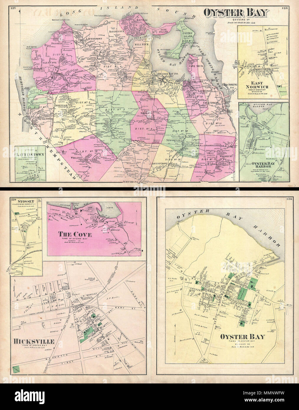
 . English: A scarce example of Fredrick W. Beers’ map of the Oyster Bay, Long Island, New York. Published in 1873. Oyster Bay side of map sheet covers from Hempstead Harbor eastward as far as Cold Spring Harbor. Bounded on the north by the Long Island Sound. Extends southward as far as Jericho. Inset maps depict Lattingtown, East Norwich, and Oyster Bay Harbor. Detailed to the level of individual buildings and properties. Includes the Northport and the Glen Cove Branches of the Long Island Railroad. On the verso, sheet is divided into three town plans. These include Oyster Bay, Hicksville and Stock Photohttps://www.alamy.com/image-license-details/?v=1https://www.alamy.com/english-a-scarce-example-of-fredrick-w-beers-map-of-the-oyster-bay-long-island-new-york-published-in-1873-oyster-bay-side-of-map-sheet-covers-from-hempstead-harbor-eastward-as-far-as-cold-spring-harbor-bounded-on-the-north-by-the-long-island-sound-extends-southward-as-far-as-jericho-inset-maps-depict-lattingtown-east-norwich-and-oyster-bay-harbor-detailed-to-the-level-of-individual-buildings-and-properties-includes-the-northport-and-the-glen-cove-branches-of-the-long-island-railroad-on-the-verso-sheet-is-divided-into-three-town-plans-these-include-oyster-bay-hicksville-and-image184877837.html
RMMMNWFW–. English: A scarce example of Fredrick W. Beers’ map of the Oyster Bay, Long Island, New York. Published in 1873. Oyster Bay side of map sheet covers from Hempstead Harbor eastward as far as Cold Spring Harbor. Bounded on the north by the Long Island Sound. Extends southward as far as Jericho. Inset maps depict Lattingtown, East Norwich, and Oyster Bay Harbor. Detailed to the level of individual buildings and properties. Includes the Northport and the Glen Cove Branches of the Long Island Railroad. On the verso, sheet is divided into three town plans. These include Oyster Bay, Hicksville and