Quick filters:
Pacific war map Stock Photos and Images
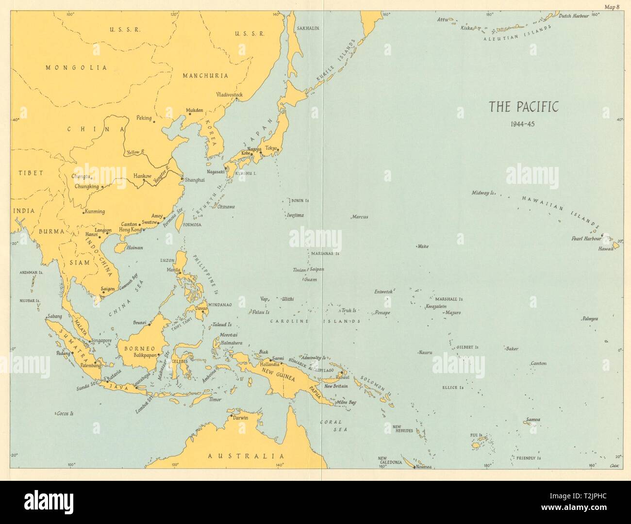 Pacific Ocean theatre 1944/45. World War 2 1965 old vintage map plan chart Stock Photohttps://www.alamy.com/image-license-details/?v=1https://www.alamy.com/pacific-ocean-theatre-194445-world-war-2-1965-old-vintage-map-plan-chart-image242587336.html
RFT2JPHC–Pacific Ocean theatre 1944/45. World War 2 1965 old vintage map plan chart
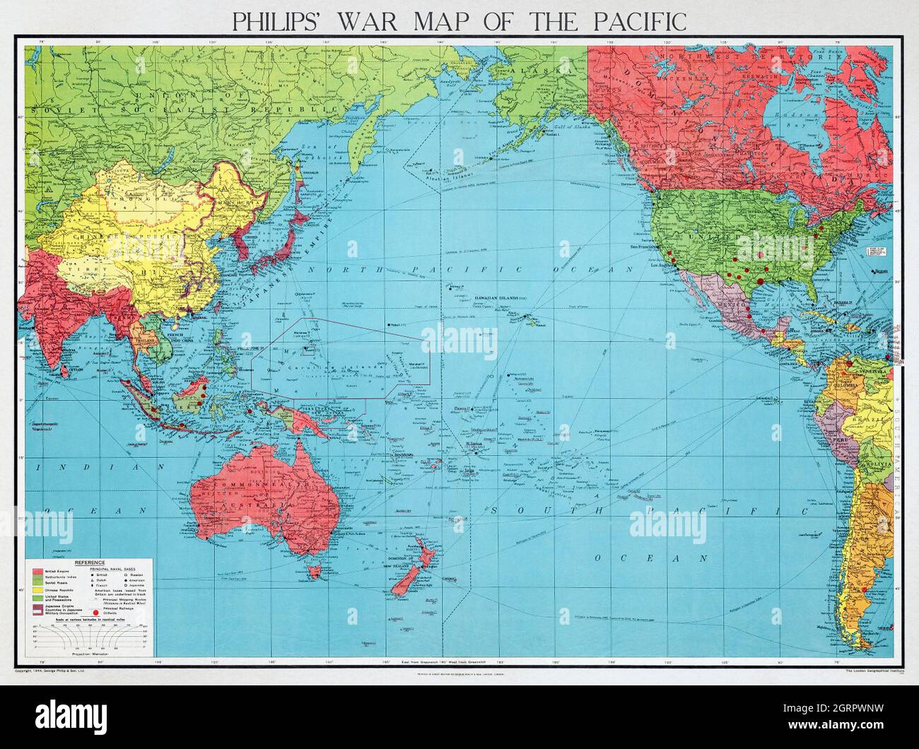 Philips' war map of the Pacific (1945) by George Philip and Son Limited. Stock Photohttps://www.alamy.com/image-license-details/?v=1https://www.alamy.com/philips-war-map-of-the-pacific-1945-by-george-philip-and-son-limited-image444899445.html
RM2GRPWNW–Philips' war map of the Pacific (1945) by George Philip and Son Limited.
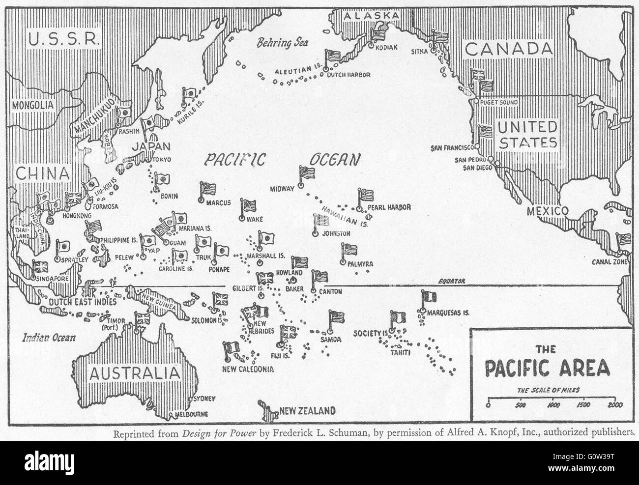 PACIFIC: The second world war: theatre, sketch map, 1942 Stock Photohttps://www.alamy.com/image-license-details/?v=1https://www.alamy.com/stock-photo-pacific-the-second-world-war-theatre-sketch-map-1942-103813636.html
RFG0W39T–PACIFIC: The second world war: theatre, sketch map, 1942
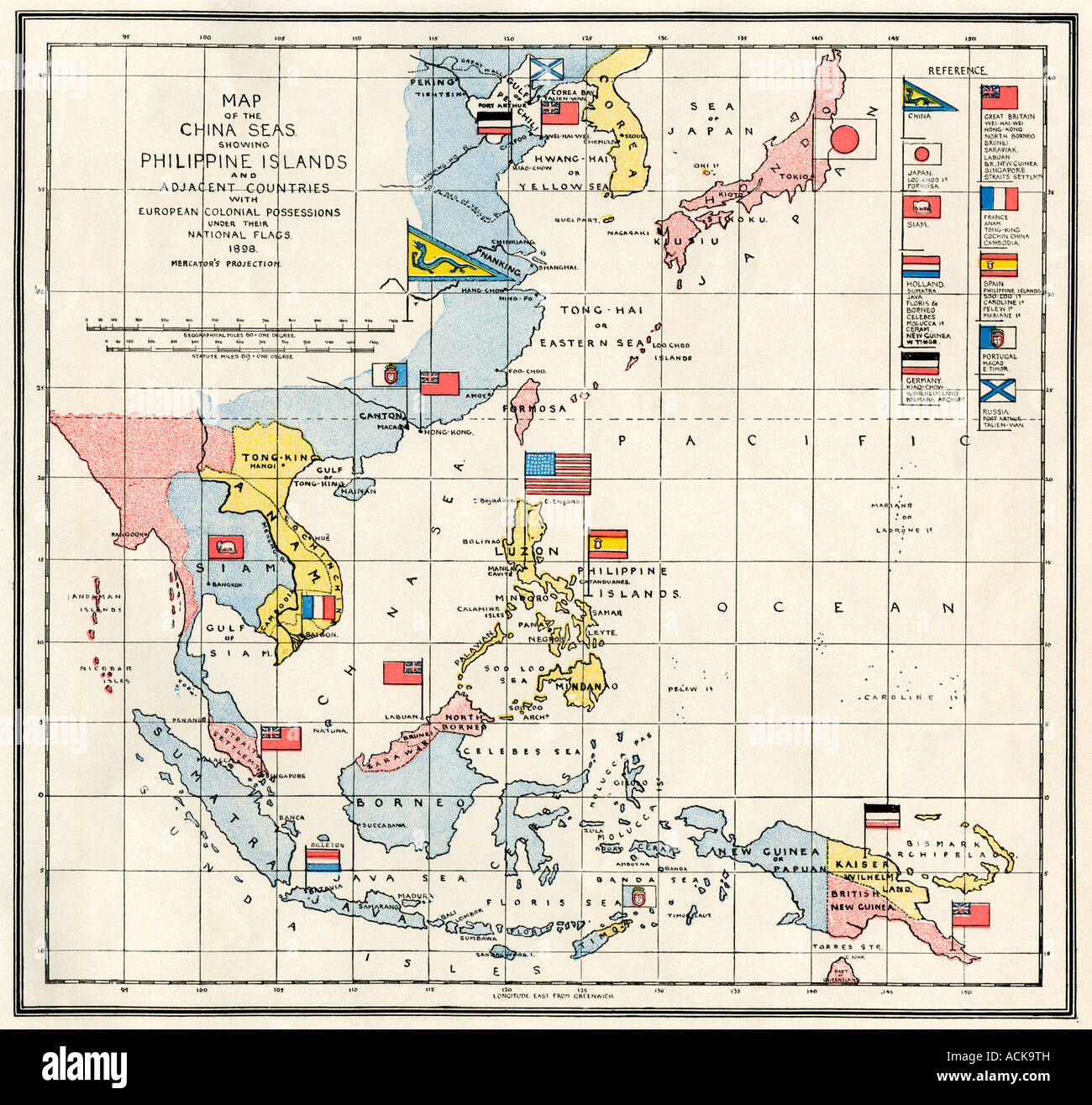 Map of the China Sea, the Philippines, and European colonies in the southeast Asia region 1898. Color lithograph Stock Photohttps://www.alamy.com/image-license-details/?v=1https://www.alamy.com/stock-photo-map-of-the-china-sea-the-philippines-and-european-colonies-in-the-13177648.html
RMACK9TH–Map of the China Sea, the Philippines, and European colonies in the southeast Asia region 1898. Color lithograph
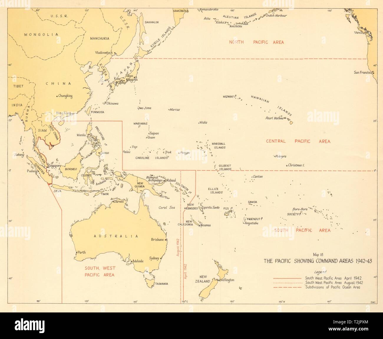 The Pacific showing Command Areas 1942-43. World War 2 1961 old vintage map Stock Photohttps://www.alamy.com/image-license-details/?v=1https://www.alamy.com/the-pacific-showing-command-areas-1942-43-world-war-2-1961-old-vintage-map-image242587596.html
RFT2JPXM–The Pacific showing Command Areas 1942-43. World War 2 1961 old vintage map
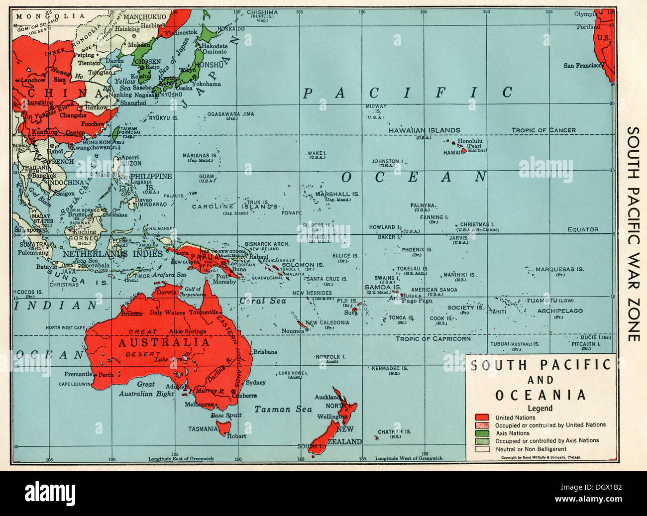 Old map of South Pacific War Zone in WWII, 1940's Stock Photohttps://www.alamy.com/image-license-details/?v=1https://www.alamy.com/old-map-of-south-pacific-war-zone-in-wwii-1940s-image62037446.html
RMDGX1B2–Old map of South Pacific War Zone in WWII, 1940's
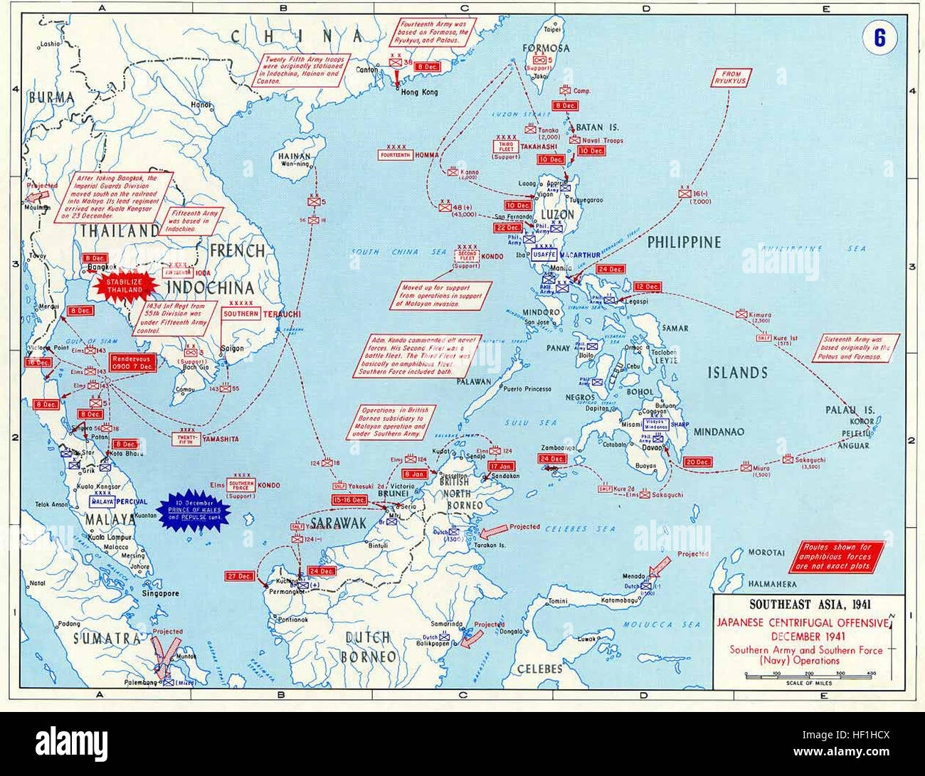 Pacific War - Southeast Asia 1941 - Map Stock Photohttps://www.alamy.com/image-license-details/?v=1https://www.alamy.com/stock-photo-pacific-war-southeast-asia-1941-map-129728058.html
RMHF1HCX–Pacific War - Southeast Asia 1941 - Map
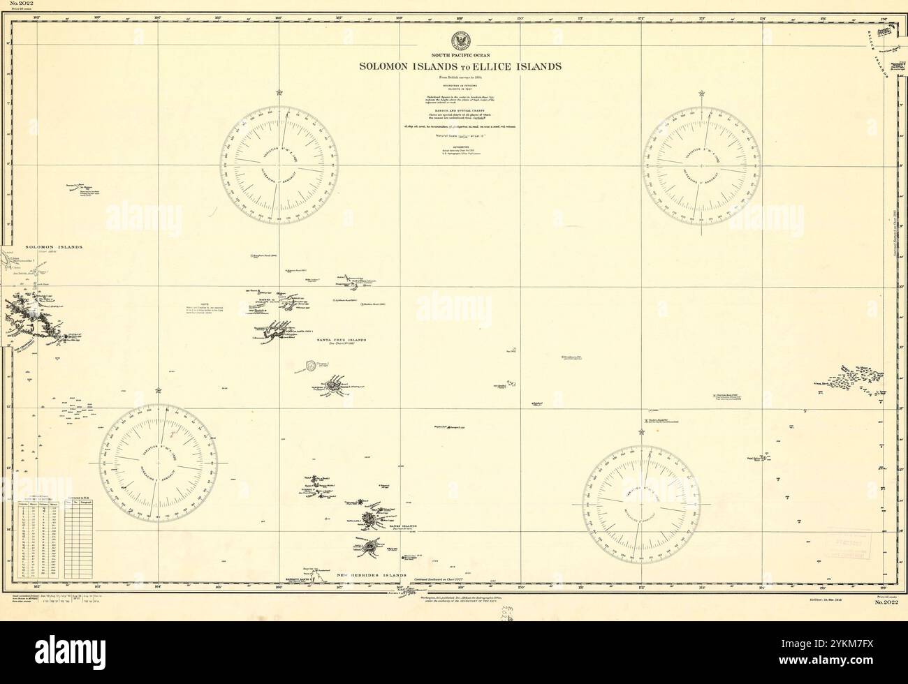 Solomon Islands to Ellice Islands - South Pacific Map from World War II Stock Photohttps://www.alamy.com/image-license-details/?v=1https://www.alamy.com/solomon-islands-to-ellice-islands-south-pacific-map-from-world-war-ii-image631696686.html
RM2YKM7FX–Solomon Islands to Ellice Islands - South Pacific Map from World War II
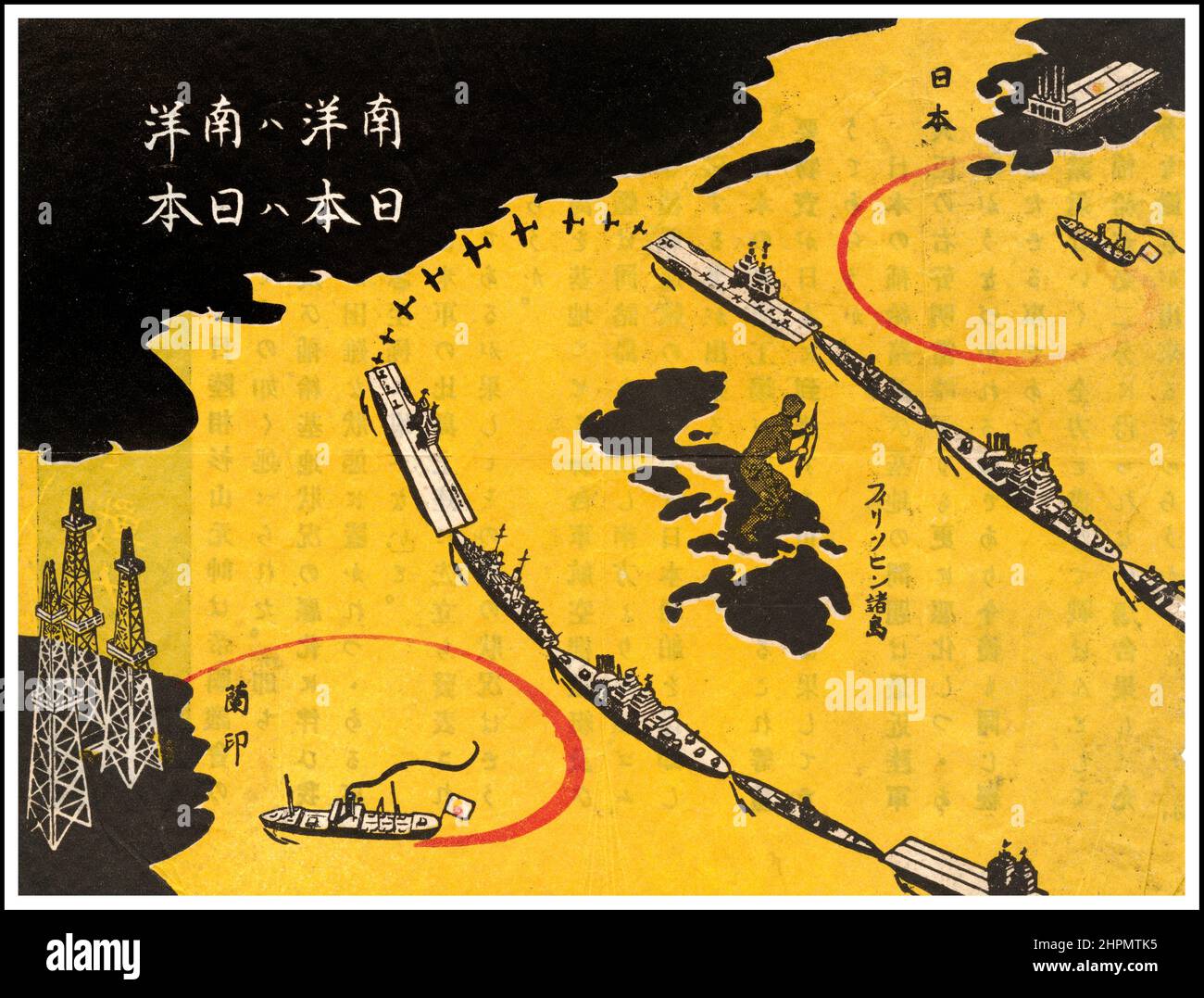 Vintage WW2 USA Propaganda leaflet dropped on Japan. Map produced by the Allied forces for distribution to Japanese soldiers. The title of the map 'The South Pacific is the South Pacific. Japan Is Japan.' The territory on the lower left is 'Netherlands East Indies,' and the land on the upper right is 'Japan.' In between are the Philippines (where Americans had landed) and a solid ring of allied aircraft carriers, submarines and other ships, keeping oil and other vital supplies from reaching Japanese munitions industries. Stock Photohttps://www.alamy.com/image-license-details/?v=1https://www.alamy.com/vintage-ww2-usa-propaganda-leaflet-dropped-on-japan-map-produced-by-the-allied-forces-for-distribution-to-japanese-soldiers-the-title-of-the-map-the-south-pacific-is-the-south-pacific-japan-is-japan-the-territory-on-the-lower-left-is-netherlands-east-indies-and-the-land-on-the-upper-right-is-japan-in-between-are-the-philippines-where-americans-had-landed-and-a-solid-ring-of-allied-aircraft-carriers-submarines-and-other-ships-keeping-oil-and-other-vital-supplies-from-reaching-japanese-munitions-industries-image461450393.html
RM2HPMTK5–Vintage WW2 USA Propaganda leaflet dropped on Japan. Map produced by the Allied forces for distribution to Japanese soldiers. The title of the map 'The South Pacific is the South Pacific. Japan Is Japan.' The territory on the lower left is 'Netherlands East Indies,' and the land on the upper right is 'Japan.' In between are the Philippines (where Americans had landed) and a solid ring of allied aircraft carriers, submarines and other ships, keeping oil and other vital supplies from reaching Japanese munitions industries.
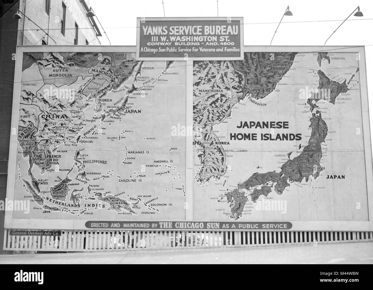 Public service map of the Pacific Theater of World War II on billboard in Chicago, ca. 1944. Stock Photohttps://www.alamy.com/image-license-details/?v=1https://www.alamy.com/stock-photo-public-service-map-of-the-pacific-theater-of-world-war-ii-on-billboard-174670045.html
RMM44WBW–Public service map of the Pacific Theater of World War II on billboard in Chicago, ca. 1944.
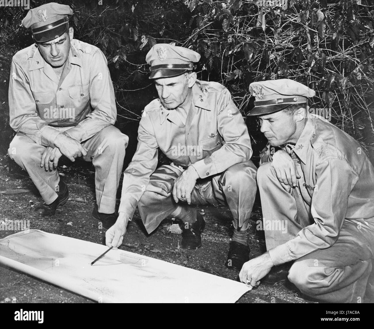 U.S. Army members reviewing a map in the South Pacific area, circa 1942. Stock Photohttps://www.alamy.com/image-license-details/?v=1https://www.alamy.com/stock-photo-us-army-members-reviewing-a-map-in-the-south-pacific-area-circa-1942-142214698.html
RFJ7AC8A–U.S. Army members reviewing a map in the South Pacific area, circa 1942.
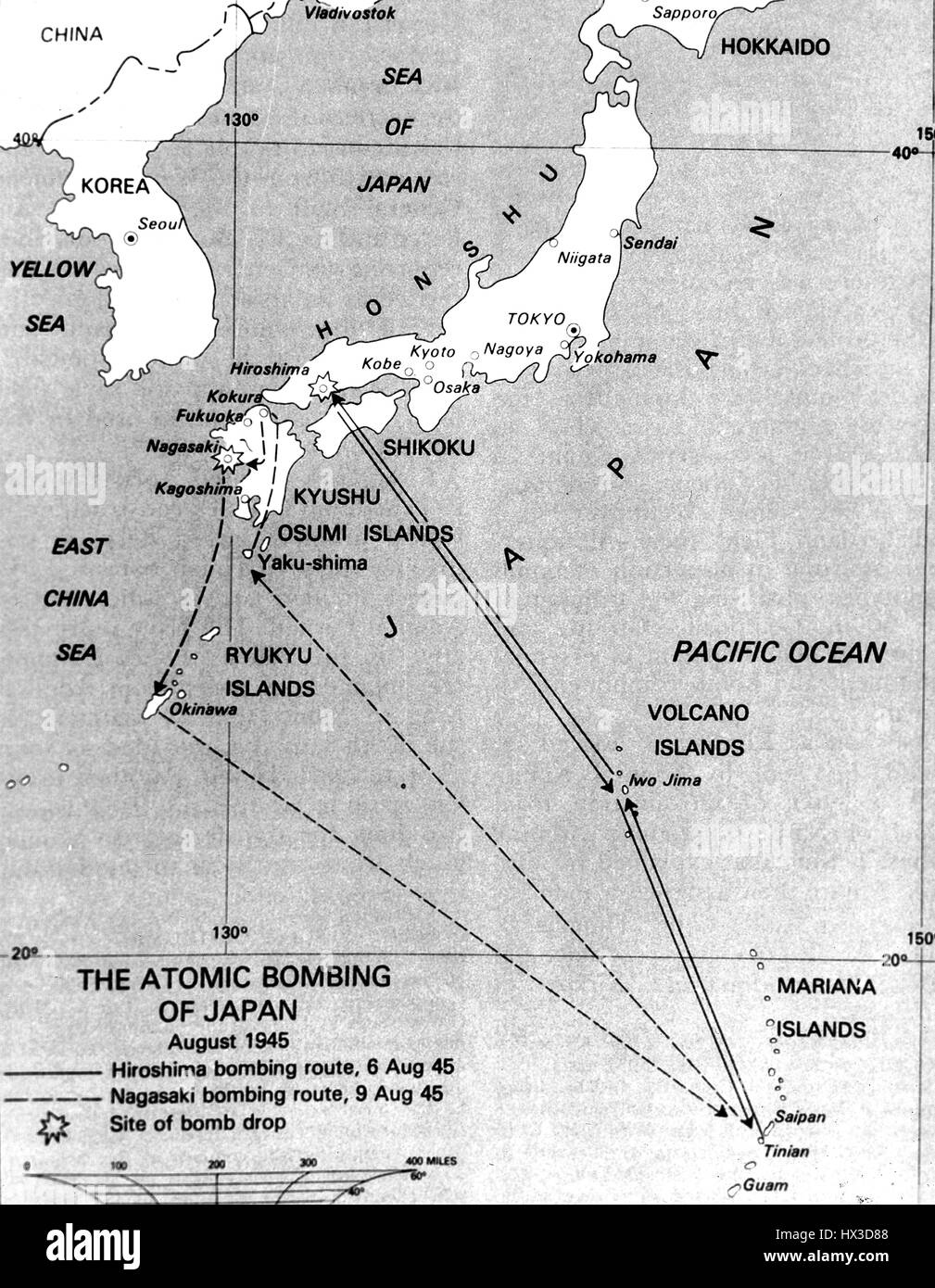 Map showing the location of the atomic bombings on Japan, 1945. Image courtesy US Department of Energy. Stock Photohttps://www.alamy.com/image-license-details/?v=1https://www.alamy.com/stock-photo-map-showing-the-location-of-the-atomic-bombings-on-japan-1945-image-136529912.html
RMHX3D88–Map showing the location of the atomic bombings on Japan, 1945. Image courtesy US Department of Energy.
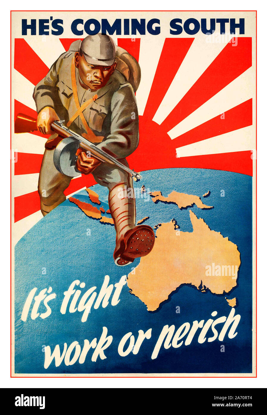 Vintage WW2 ‘He’s Coming South’ Australian 1942 propaganda poster. ‘It’s Fight Work or Perish’ Australia feared invasion by Imperial Japan following the Fall of Singapore. Illustration of Japanese soldier with Rising Sun Flag emblem behind striding over Australia map World War II Second World War Stock Photohttps://www.alamy.com/image-license-details/?v=1https://www.alamy.com/vintage-ww2-hes-coming-south-australian-1942-propaganda-poster-its-fight-work-or-perish-australia-feared-invasion-by-imperial-japan-following-the-fall-of-singapore-illustration-of-japanese-soldier-with-rising-sun-flag-emblem-behind-striding-over-australia-map-world-war-ii-second-world-war-image331318292.html
RM2A70RT4–Vintage WW2 ‘He’s Coming South’ Australian 1942 propaganda poster. ‘It’s Fight Work or Perish’ Australia feared invasion by Imperial Japan following the Fall of Singapore. Illustration of Japanese soldier with Rising Sun Flag emblem behind striding over Australia map World War II Second World War
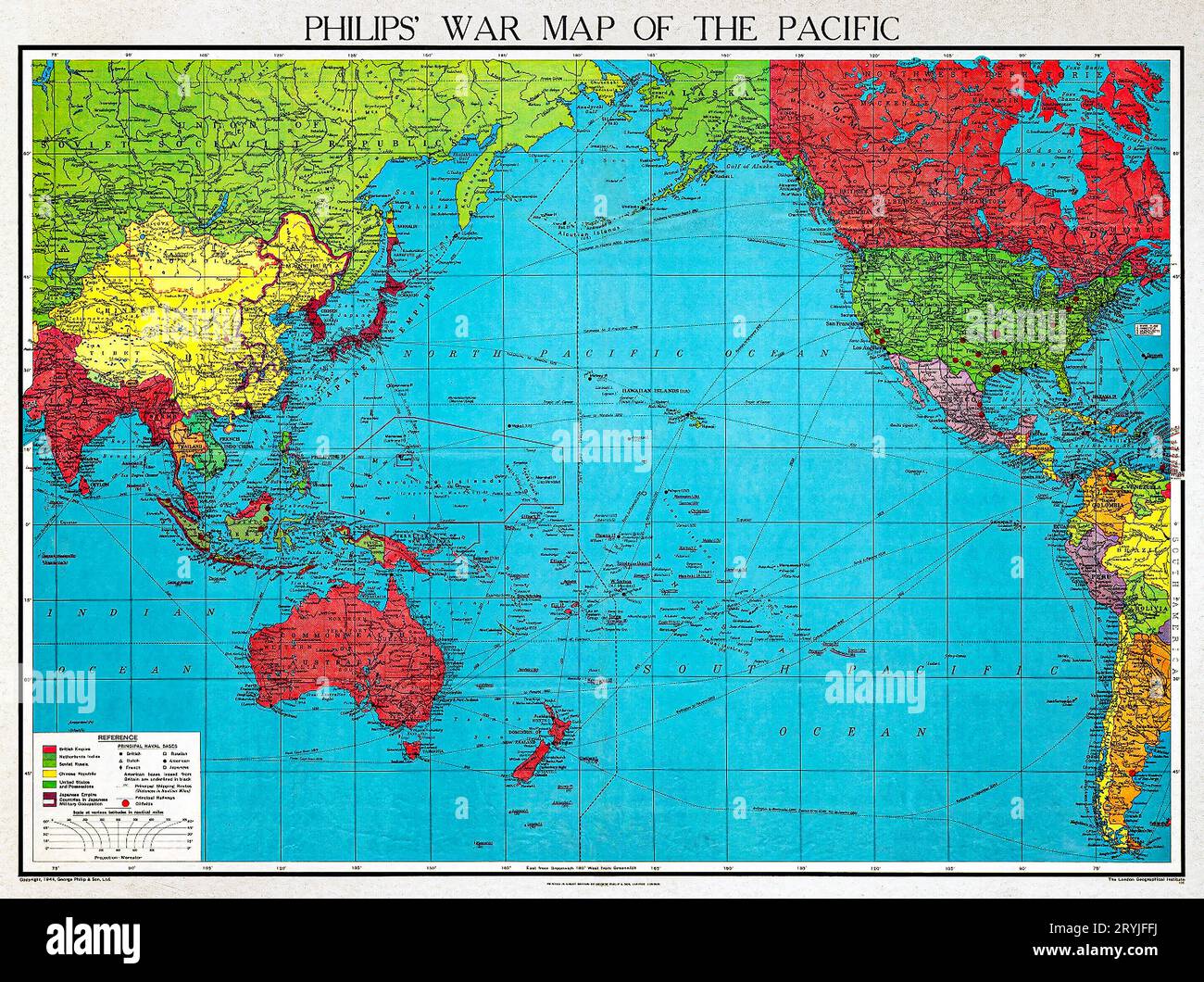 Philips' war map of the Pacific (1945) by George Philip and Son Limited. Stock Photohttps://www.alamy.com/image-license-details/?v=1https://www.alamy.com/philips-war-map-of-the-pacific-1945-by-george-philip-and-son-limited-image567734822.html
RM2RYJFFJ–Philips' war map of the Pacific (1945) by George Philip and Son Limited.
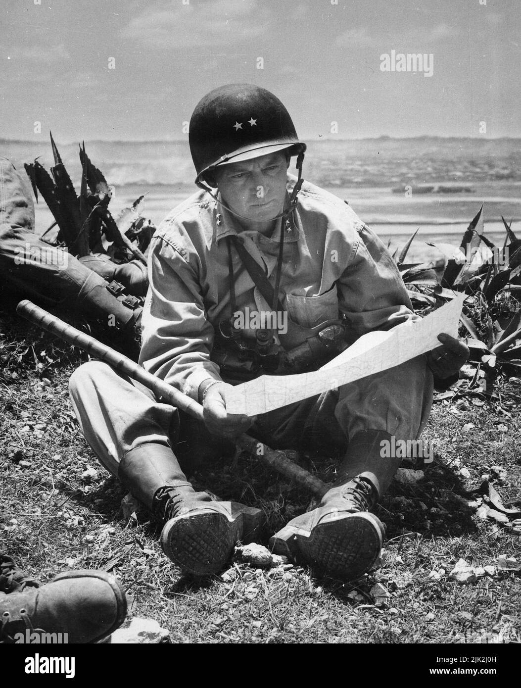 Marine Major General Lemuel Shepherd, commanding general of the 6th Marine Divison reading a map on Okinawa Stock Photohttps://www.alamy.com/image-license-details/?v=1https://www.alamy.com/marine-major-general-lemuel-shepherd-commanding-general-of-the-6th-marine-divison-reading-a-map-on-okinawa-image476416433.html
RM2JK2J0H–Marine Major General Lemuel Shepherd, commanding general of the 6th Marine Divison reading a map on Okinawa
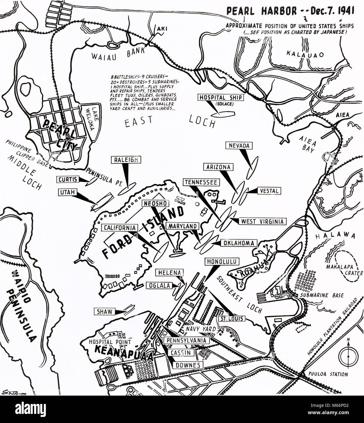 1940s DECEMBER 7 1941 MAP WITH POSITIONS OF US NAVY SHIPS AS CHARTED BY THE JAPANESE PRIOR TO THE ATTACK ON PEARL HARBOR HAWAII - q74705 CPC001 HARS ATTACK HAWAIIAN TRANSPORTATION NOSTALGIA NORTH AMERICA HARBOR HISTORIC NORTH AMERICAN ARMED OCCUPATION ISLANDS KNOWLEDGE NOBODY WORLD WARS WORLD WAR WORLD WAR TWO WORLD WAR II DECEMBER HI CONCEPTUAL STILL LIFE 7 MOBILITY WORLD WAR 2 ARMED FORCE CONFLICTING POSITIONS 1944 B&W BATTLING BLACK AND WHITE CHARTED DECEMBER 7 1944 HAWAIIAN ISLANDS INFAMY OLD FASHIONED PACIFIC ISLAND PRIOR Stock Photohttps://www.alamy.com/image-license-details/?v=1https://www.alamy.com/stock-photo-1940s-december-7-1941-map-with-positions-of-us-navy-ships-as-charted-175940942.html
RMM66PD2–1940s DECEMBER 7 1941 MAP WITH POSITIONS OF US NAVY SHIPS AS CHARTED BY THE JAPANESE PRIOR TO THE ATTACK ON PEARL HARBOR HAWAII - q74705 CPC001 HARS ATTACK HAWAIIAN TRANSPORTATION NOSTALGIA NORTH AMERICA HARBOR HISTORIC NORTH AMERICAN ARMED OCCUPATION ISLANDS KNOWLEDGE NOBODY WORLD WARS WORLD WAR WORLD WAR TWO WORLD WAR II DECEMBER HI CONCEPTUAL STILL LIFE 7 MOBILITY WORLD WAR 2 ARMED FORCE CONFLICTING POSITIONS 1944 B&W BATTLING BLACK AND WHITE CHARTED DECEMBER 7 1944 HAWAIIAN ISLANDS INFAMY OLD FASHIONED PACIFIC ISLAND PRIOR
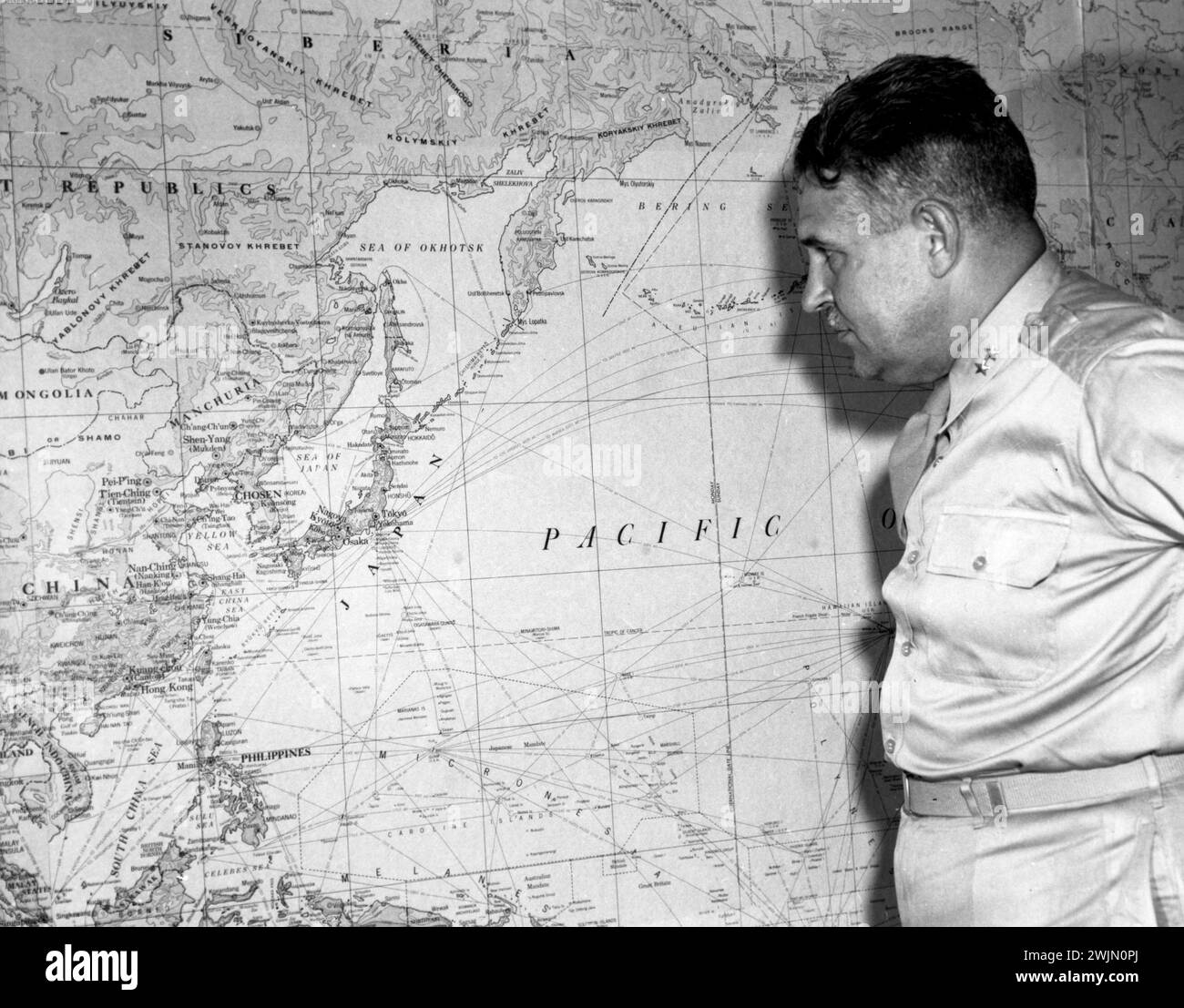 General Groves looking at a Pacific Ocean map at Oak Ridge. Groves was involved in the Atomic bombs that ended World War II. Stock Photohttps://www.alamy.com/image-license-details/?v=1https://www.alamy.com/general-groves-looking-at-a-pacific-ocean-map-at-oak-ridge-groves-was-involved-in-the-atomic-bombs-that-ended-world-war-ii-image596677946.html
RM2WJN0PJ–General Groves looking at a Pacific Ocean map at Oak Ridge. Groves was involved in the Atomic bombs that ended World War II.
![Tokyo war crimes trial. 'Lieut. Gen. Shizuo Yokoyama points to a map to give disposition of his 8th Division troops as he testifies in the trial in Manila of Lieut. Gen. Tomoyuki Yamashita, Japanese officer charged with being a war criminal. Next to Yokoyama is Capt. Jack Pace, ... member of the prosecution staff. Capt. Adolf Reel (arm akimbo), defense counsel, looks over Pace's shoulder. (Others unidentified) 11-23-45' [photo text] Gen. Yamashita was found guilty. After various legal appeals, he was hung on Feb. 23, 1946. To see my other WW II-related photos, Search: Prestor vintage WW II Stock Photo Tokyo war crimes trial. 'Lieut. Gen. Shizuo Yokoyama points to a map to give disposition of his 8th Division troops as he testifies in the trial in Manila of Lieut. Gen. Tomoyuki Yamashita, Japanese officer charged with being a war criminal. Next to Yokoyama is Capt. Jack Pace, ... member of the prosecution staff. Capt. Adolf Reel (arm akimbo), defense counsel, looks over Pace's shoulder. (Others unidentified) 11-23-45' [photo text] Gen. Yamashita was found guilty. After various legal appeals, he was hung on Feb. 23, 1946. To see my other WW II-related photos, Search: Prestor vintage WW II Stock Photo](https://c8.alamy.com/comp/2BE4979/tokyo-war-crimes-trial-lieut-gen-shizuo-yokoyama-points-to-a-map-to-give-disposition-of-his-8th-division-troops-as-he-testifies-in-the-trial-in-manila-of-lieut-gen-tomoyuki-yamashita-japanese-officer-charged-with-being-a-war-criminal-next-to-yokoyama-is-capt-jack-pace-member-of-the-prosecution-staff-capt-adolf-reel-arm-akimbo-defense-counsel-looks-over-paces-shoulder-others-unidentified-11-23-45-photo-text-gen-yamashita-was-found-guilty-after-various-legal-appeals-he-was-hung-on-feb-23-1946-to-see-my-other-ww-ii-related-photos-search-prestor-vintage-ww-ii-2BE4979.jpg) Tokyo war crimes trial. 'Lieut. Gen. Shizuo Yokoyama points to a map to give disposition of his 8th Division troops as he testifies in the trial in Manila of Lieut. Gen. Tomoyuki Yamashita, Japanese officer charged with being a war criminal. Next to Yokoyama is Capt. Jack Pace, ... member of the prosecution staff. Capt. Adolf Reel (arm akimbo), defense counsel, looks over Pace's shoulder. (Others unidentified) 11-23-45' [photo text] Gen. Yamashita was found guilty. After various legal appeals, he was hung on Feb. 23, 1946. To see my other WW II-related photos, Search: Prestor vintage WW II Stock Photohttps://www.alamy.com/image-license-details/?v=1https://www.alamy.com/tokyo-war-crimes-trial-lieut-gen-shizuo-yokoyama-points-to-a-map-to-give-disposition-of-his-8th-division-troops-as-he-testifies-in-the-trial-in-manila-of-lieut-gen-tomoyuki-yamashita-japanese-officer-charged-with-being-a-war-criminal-next-to-yokoyama-is-capt-jack-pace-member-of-the-prosecution-staff-capt-adolf-reel-arm-akimbo-defense-counsel-looks-over-paces-shoulder-others-unidentified-11-23-45-photo-text-gen-yamashita-was-found-guilty-after-various-legal-appeals-he-was-hung-on-feb-23-1946-to-see-my-other-ww-ii-related-photos-search-prestor-vintage-ww-ii-image352907613.html
Tokyo war crimes trial. 'Lieut. Gen. Shizuo Yokoyama points to a map to give disposition of his 8th Division troops as he testifies in the trial in Manila of Lieut. Gen. Tomoyuki Yamashita, Japanese officer charged with being a war criminal. Next to Yokoyama is Capt. Jack Pace, ... member of the prosecution staff. Capt. Adolf Reel (arm akimbo), defense counsel, looks over Pace's shoulder. (Others unidentified) 11-23-45' [photo text] Gen. Yamashita was found guilty. After various legal appeals, he was hung on Feb. 23, 1946. To see my other WW II-related photos, Search: Prestor vintage WW II Stock Photohttps://www.alamy.com/image-license-details/?v=1https://www.alamy.com/tokyo-war-crimes-trial-lieut-gen-shizuo-yokoyama-points-to-a-map-to-give-disposition-of-his-8th-division-troops-as-he-testifies-in-the-trial-in-manila-of-lieut-gen-tomoyuki-yamashita-japanese-officer-charged-with-being-a-war-criminal-next-to-yokoyama-is-capt-jack-pace-member-of-the-prosecution-staff-capt-adolf-reel-arm-akimbo-defense-counsel-looks-over-paces-shoulder-others-unidentified-11-23-45-photo-text-gen-yamashita-was-found-guilty-after-various-legal-appeals-he-was-hung-on-feb-23-1946-to-see-my-other-ww-ii-related-photos-search-prestor-vintage-ww-ii-image352907613.htmlRF2BE4979–Tokyo war crimes trial. 'Lieut. Gen. Shizuo Yokoyama points to a map to give disposition of his 8th Division troops as he testifies in the trial in Manila of Lieut. Gen. Tomoyuki Yamashita, Japanese officer charged with being a war criminal. Next to Yokoyama is Capt. Jack Pace, ... member of the prosecution staff. Capt. Adolf Reel (arm akimbo), defense counsel, looks over Pace's shoulder. (Others unidentified) 11-23-45' [photo text] Gen. Yamashita was found guilty. After various legal appeals, he was hung on Feb. 23, 1946. To see my other WW II-related photos, Search: Prestor vintage WW II
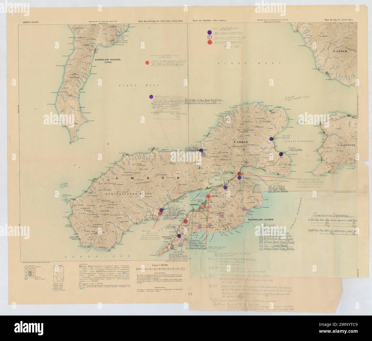 Colored Map of Ambon (WWII) Stock Photohttps://www.alamy.com/image-license-details/?v=1https://www.alamy.com/colored-map-of-ambon-wwii-image598672153.html
RF2WNYTC9–Colored Map of Ambon (WWII)
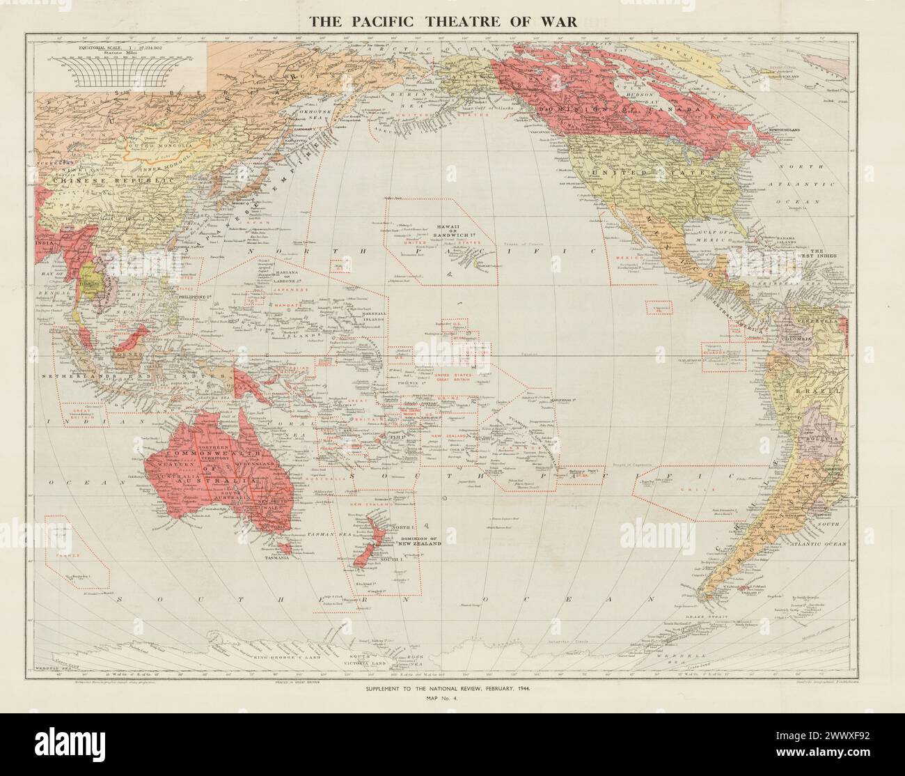 Vintage WWII Map. The Pacific theatre of war : supplement to the National Review / Stanford's Geographical Establishment 1944 Stock Photohttps://www.alamy.com/image-license-details/?v=1https://www.alamy.com/vintage-wwii-map-the-pacific-theatre-of-war-supplement-to-the-national-review-stanfords-geographical-establishment-1944-image601101678.html
RM2WWXF92–Vintage WWII Map. The Pacific theatre of war : supplement to the National Review / Stanford's Geographical Establishment 1944
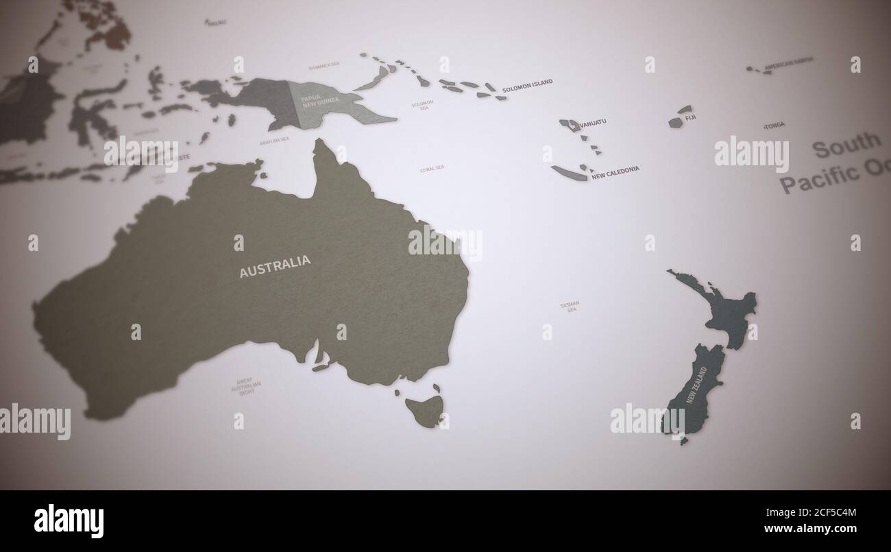 South Pacific Countries Map. Continental Vintage Map 3d Rendering. Stock Photohttps://www.alamy.com/image-license-details/?v=1https://www.alamy.com/south-pacific-countries-map-continental-vintage-map-3d-rendering-image370756868.html
RF2CF5C4M–South Pacific Countries Map. Continental Vintage Map 3d Rendering.
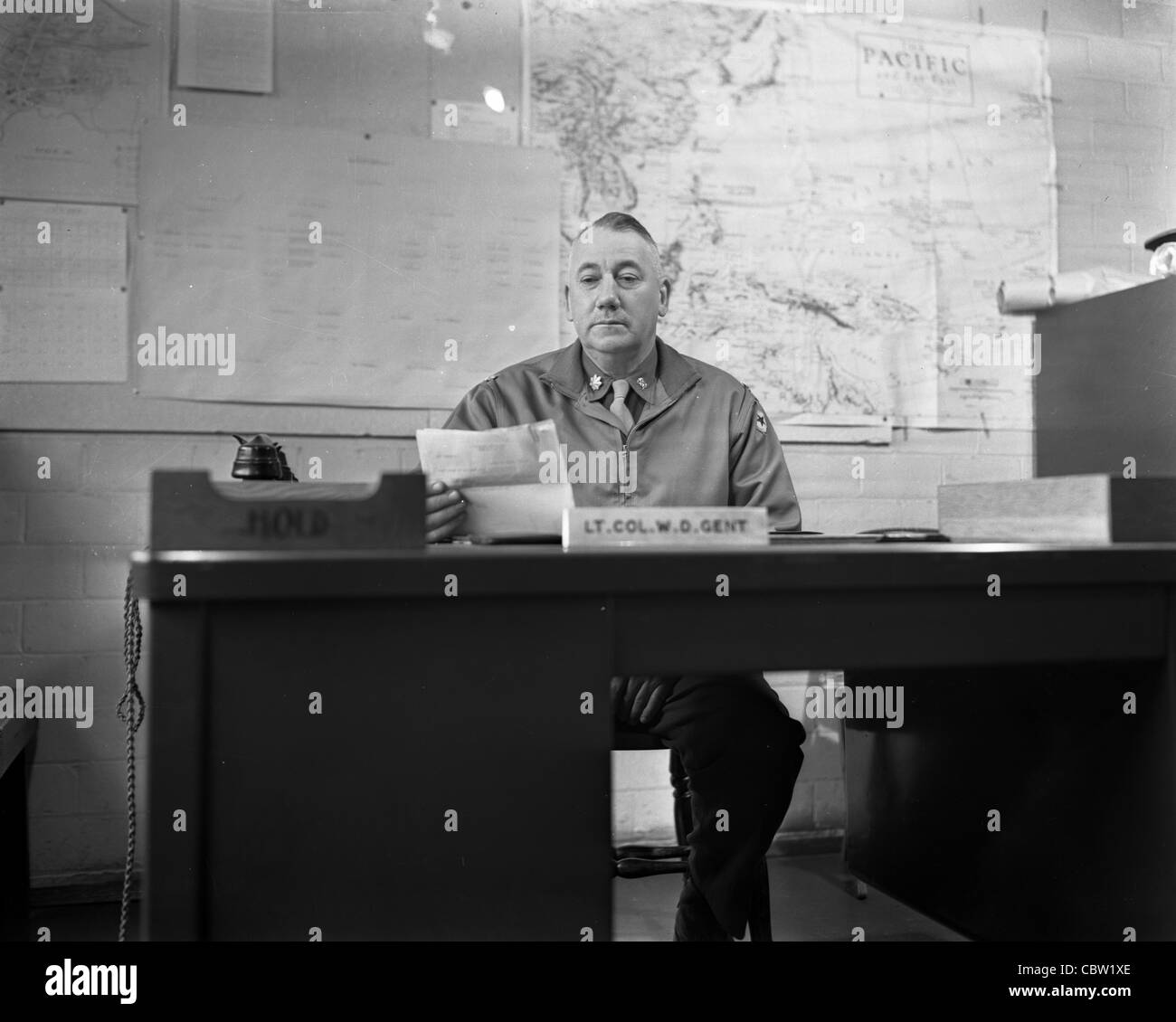 Photos of Europe and England during World War II. These are the personal photos of a U.S. Army photographer. Stock Photohttps://www.alamy.com/image-license-details/?v=1https://www.alamy.com/stock-photo-photos-of-europe-and-england-during-world-war-ii-these-are-the-personal-41732278.html
RMCBW1XE–Photos of Europe and England during World War II. These are the personal photos of a U.S. Army photographer.
 A old map of the Empire of Japan, pictured on an antique globe Stock Photohttps://www.alamy.com/image-license-details/?v=1https://www.alamy.com/a-old-map-of-the-empire-of-japan-pictured-on-an-antique-globe-image69168518.html
RFE0EW46–A old map of the Empire of Japan, pictured on an antique globe
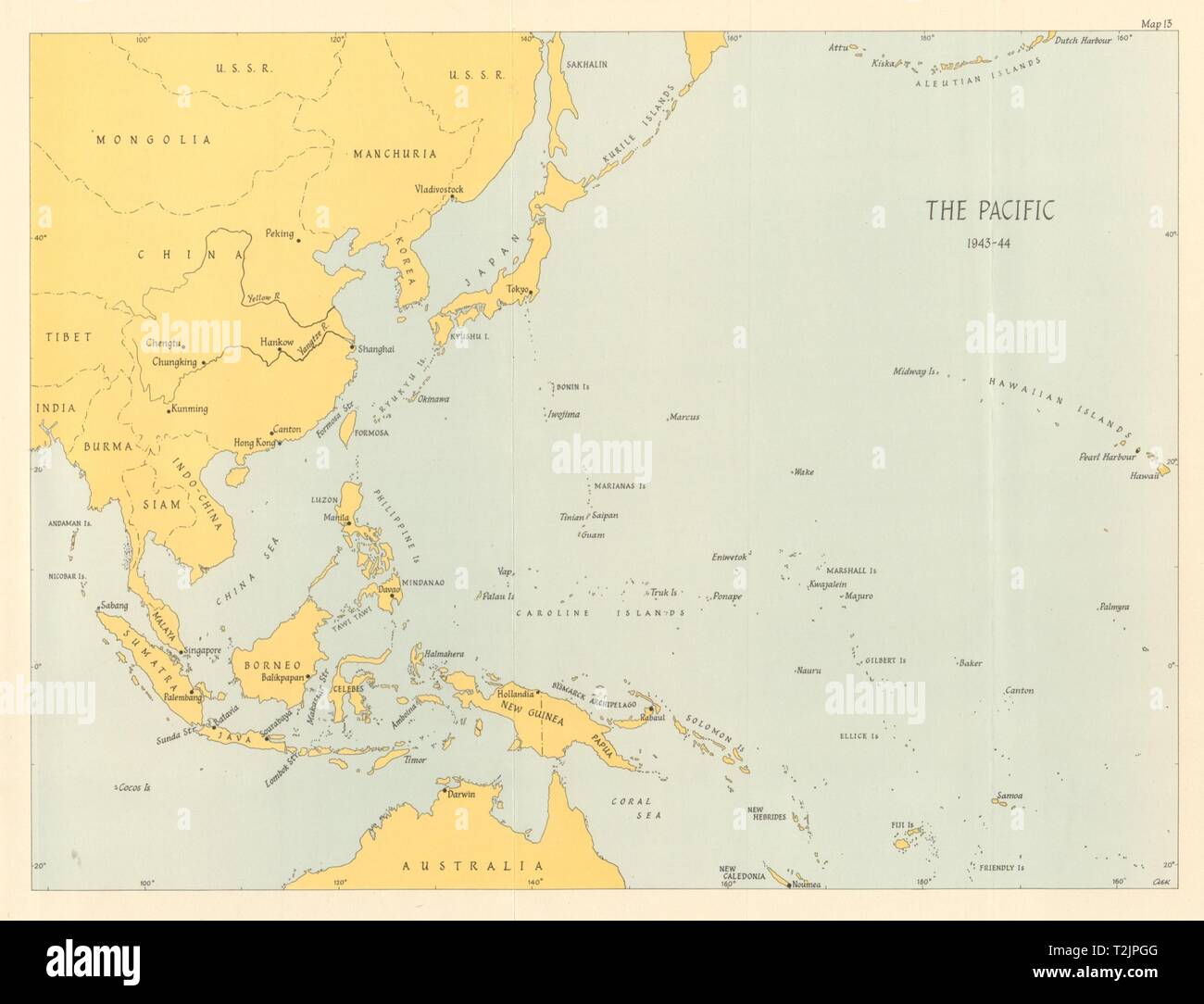 Pacific Ocean theatre 1943/44. World War 2 1961 old vintage map plan chart Stock Photohttps://www.alamy.com/image-license-details/?v=1https://www.alamy.com/pacific-ocean-theatre-194344-world-war-2-1961-old-vintage-map-plan-chart-image242587312.html
RFT2JPGG–Pacific Ocean theatre 1943/44. World War 2 1961 old vintage map plan chart
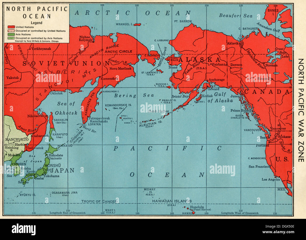 Old map of North Pacific War Zone in WWII, 1940's Stock Photohttps://www.alamy.com/image-license-details/?v=1https://www.alamy.com/old-map-of-north-pacific-war-zone-in-wwii-1940s-image62040286.html
RMDGX50E–Old map of North Pacific War Zone in WWII, 1940's
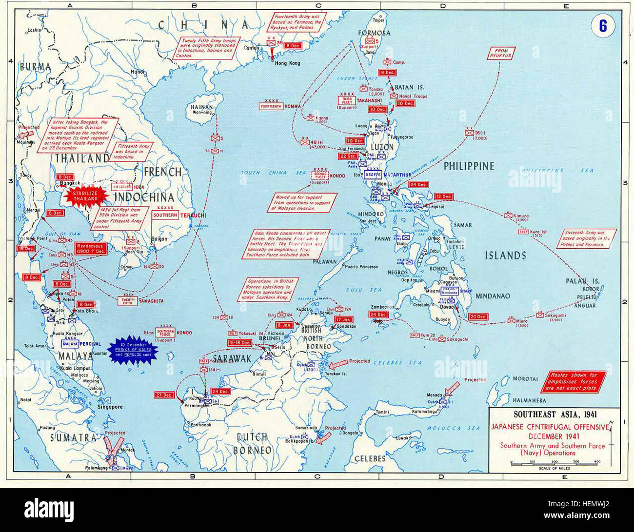 Pacific War - Southeast Asia 1941 - Map Stock Photohttps://www.alamy.com/image-license-details/?v=1https://www.alamy.com/stock-photo-pacific-war-southeast-asia-1941-map-129536906.html
RMHEMWJ2–Pacific War - Southeast Asia 1941 - Map
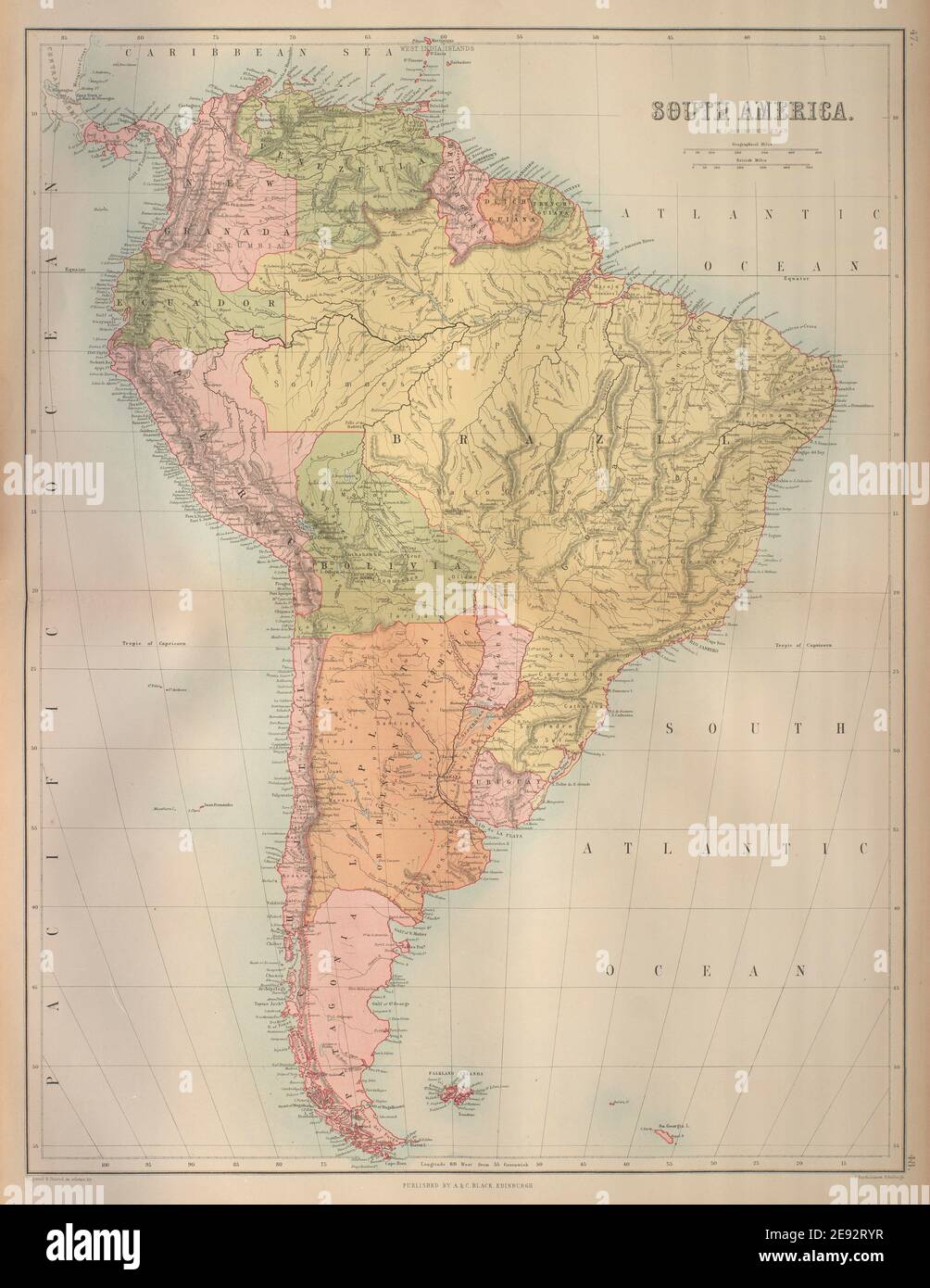 South America. Bolivia w/ Litoral pre War of the Pacific. BARTHOLOMEW 1870 map Stock Photohttps://www.alamy.com/image-license-details/?v=1https://www.alamy.com/south-america-bolivia-w-litoral-pre-war-of-the-pacific-bartholomew-1870-map-image401433083.html
RF2E92RYR–South America. Bolivia w/ Litoral pre War of the Pacific. BARTHOLOMEW 1870 map
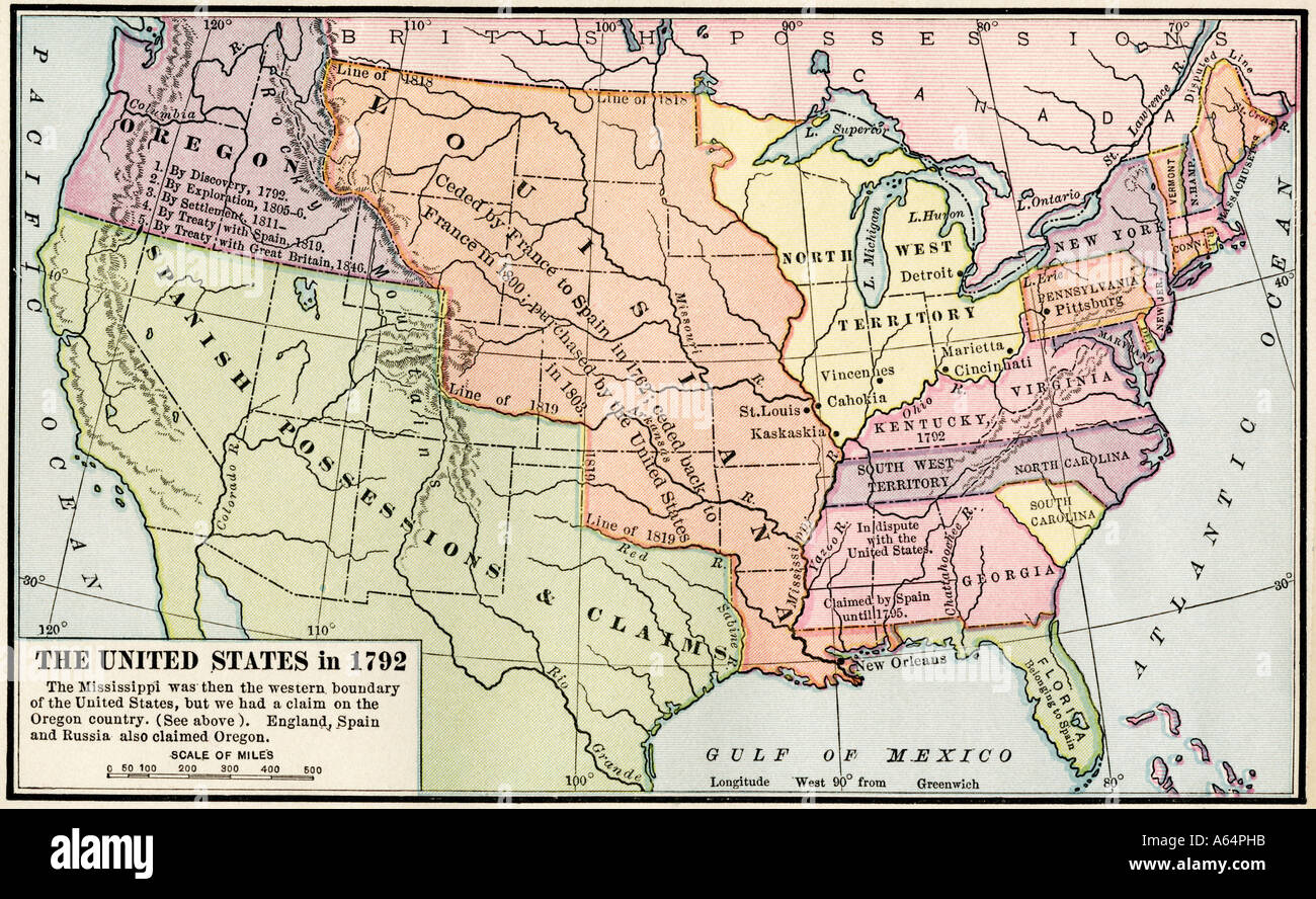 Map of the United States in 1792 showing colonial claims on Oregon Territory after the American Revolutionary War. Color lithograph Stock Photohttps://www.alamy.com/image-license-details/?v=1https://www.alamy.com/map-of-the-united-states-in-1792-showing-colonial-claims-on-oregon-image6548634.html
RMA64PHB–Map of the United States in 1792 showing colonial claims on Oregon Territory after the American Revolutionary War. Color lithograph
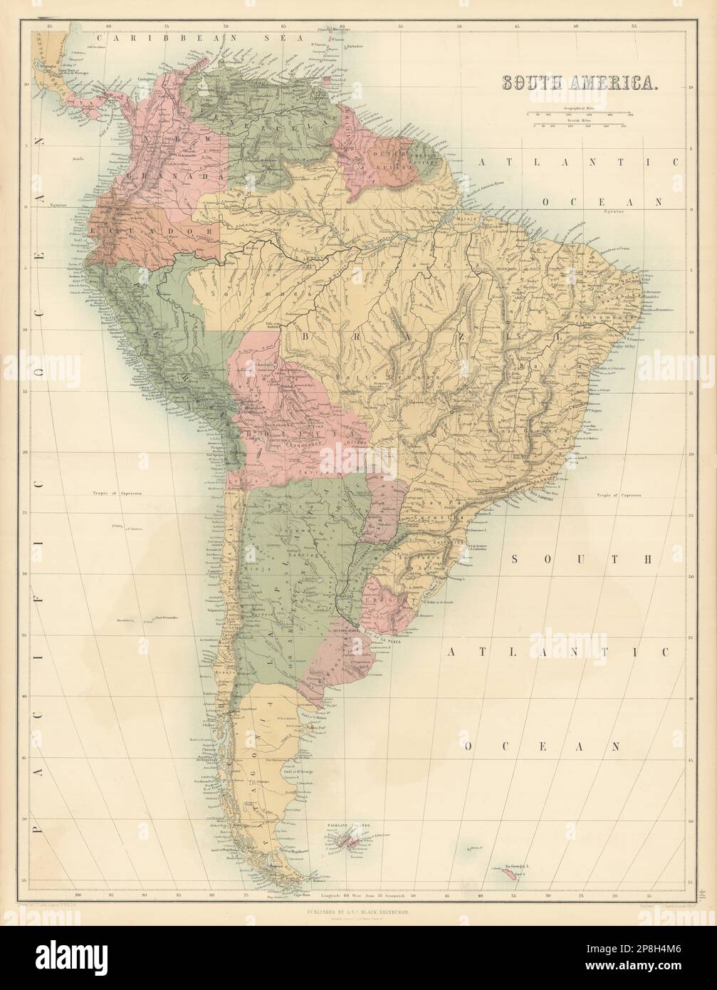 South America. Bolivia w/ Litoral pre War of the Pacific. BARTHOLOMEW 1862 map Stock Photohttps://www.alamy.com/image-license-details/?v=1https://www.alamy.com/south-america-bolivia-w-litoral-pre-war-of-the-pacific-bartholomew-1862-map-image538815542.html
RF2P8H4M6–South America. Bolivia w/ Litoral pre War of the Pacific. BARTHOLOMEW 1862 map
 Still Life of Army Nurse Corps Female, Medals, Pacific Theater, World War II Stock Photohttps://www.alamy.com/image-license-details/?v=1https://www.alamy.com/stock-photo-still-life-of-army-nurse-corps-female-medals-pacific-theater-world-31588036.html
RMBRAXT4–Still Life of Army Nurse Corps Female, Medals, Pacific Theater, World War II
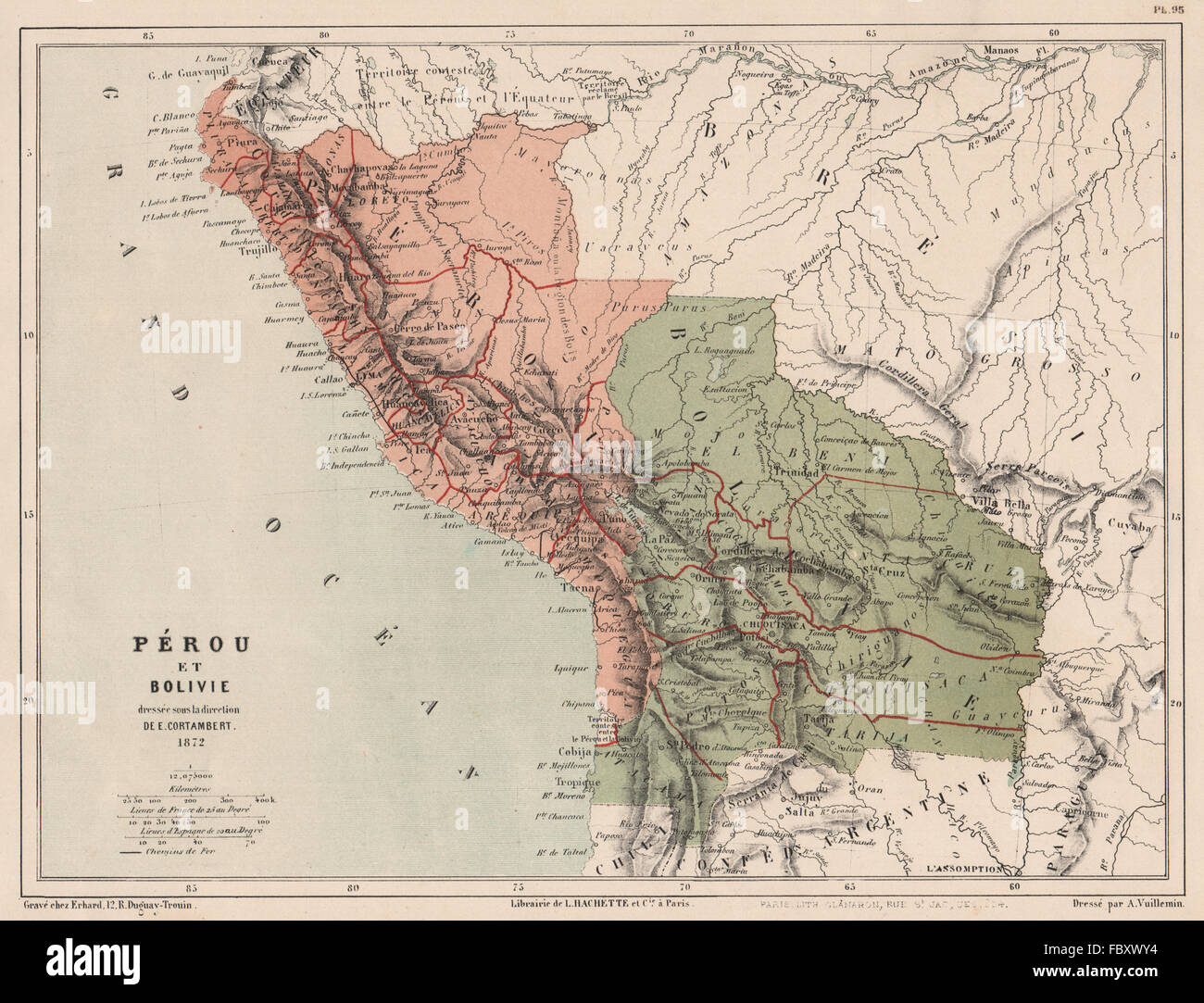 PERU & BOLIVIA with Littoral pre- War of the Pacific. Pérou et Bolivie, 1880 map Stock Photohttps://www.alamy.com/image-license-details/?v=1https://www.alamy.com/stock-photo-peru-bolivia-with-littoral-pre-war-of-the-pacific-prou-et-bolivie-93404168.html
RFFBXWY4–PERU & BOLIVIA with Littoral pre- War of the Pacific. Pérou et Bolivie, 1880 map
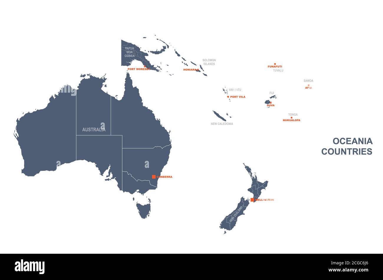 South pacific countries vector map. Stock Vectorhttps://www.alamy.com/image-license-details/?v=1https://www.alamy.com/south-pacific-countries-vector-map-image371520862.html
RF2CGC6J6–South pacific countries vector map.
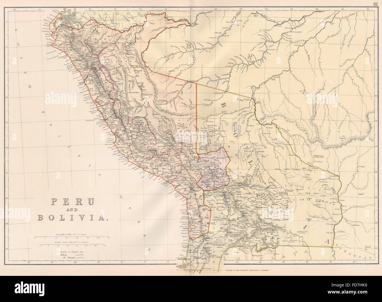 PERU & BOLIVIA W/LITORAL: < Pacific War borders.Planned La Paz railway, 1882 map Stock Photohttps://www.alamy.com/image-license-details/?v=1https://www.alamy.com/stock-photo-peru-bolivia-wlitoral-pacific-war-bordersplanned-la-paz-railway-1882-94209892.html
RFFD7HK0–PERU & BOLIVIA W/LITORAL: < Pacific War borders.Planned La Paz railway, 1882 map
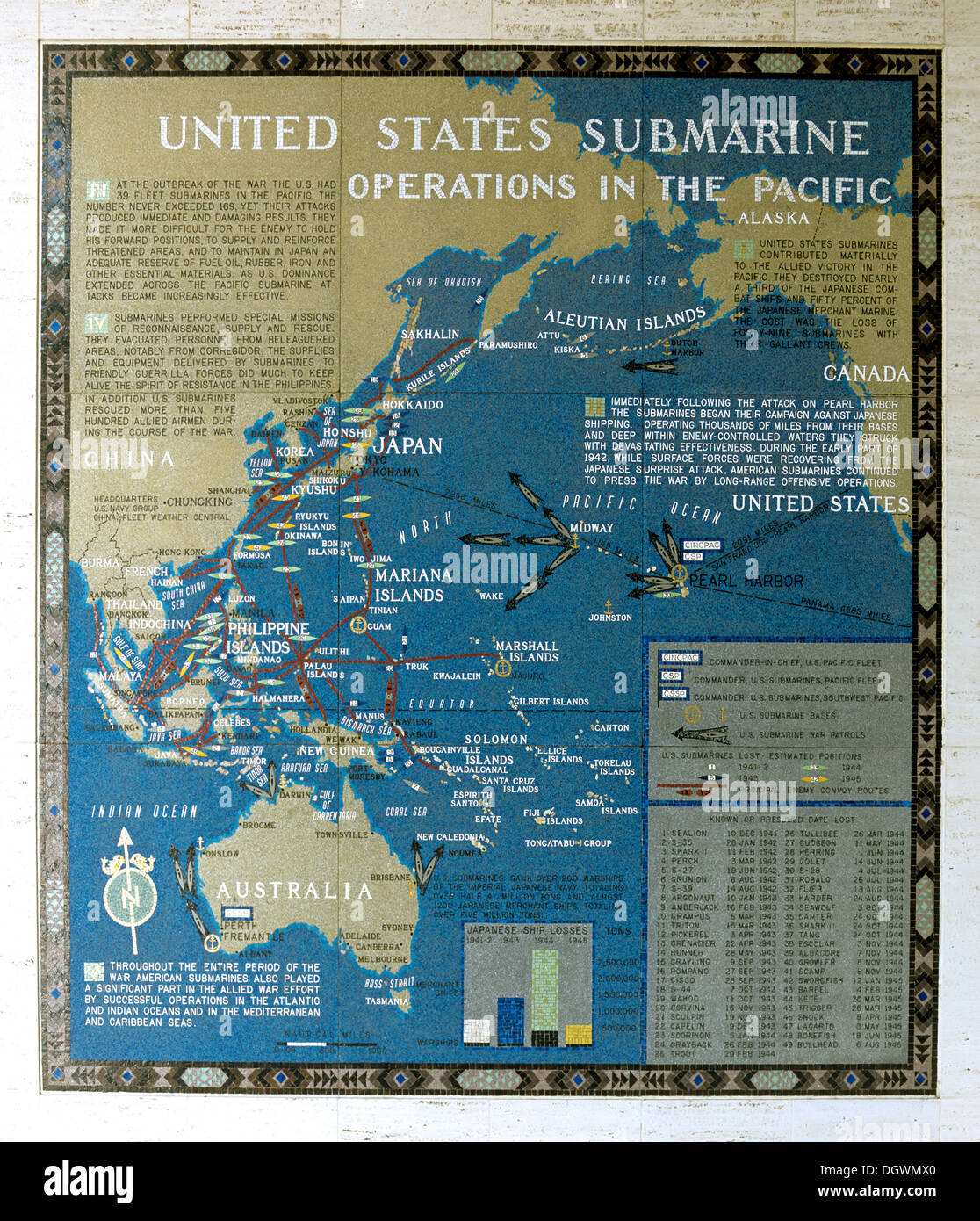 Mosaic map of the successfully completed American operations during the Pacific War, Submarine Operations in the Pacific Stock Photohttps://www.alamy.com/image-license-details/?v=1https://www.alamy.com/mosaic-map-of-the-successfully-completed-american-operations-during-image62030808.html
RMDGWMX0–Mosaic map of the successfully completed American operations during the Pacific War, Submarine Operations in the Pacific
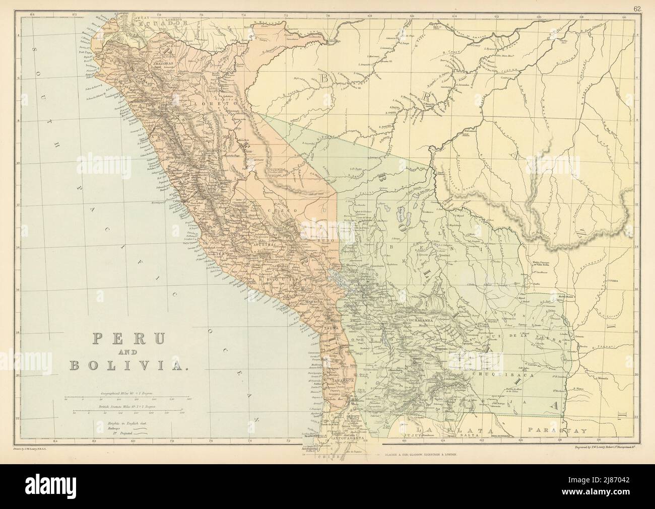 PERU & BOLIVIA W/LITORAL. < Pacific War borders.Planned La Paz railway 1886 map Stock Photohttps://www.alamy.com/image-license-details/?v=1https://www.alamy.com/peru-bolivia-wlitoral-pacific-war-bordersplanned-la-paz-railway-1886-map-image469750962.html
RF2J87042–PERU & BOLIVIA W/LITORAL. < Pacific War borders.Planned La Paz railway 1886 map
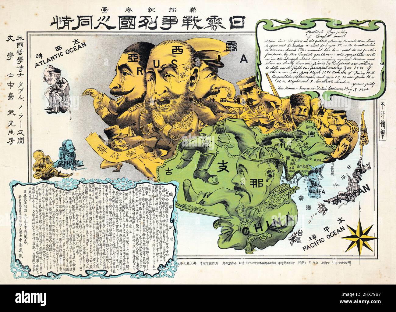 1904 Nomura Samurai Shokai Russo-Japanese War Serio-Comic Map of Asia Stock Photohttps://www.alamy.com/image-license-details/?v=1https://www.alamy.com/1904-nomura-samurai-shokai-russo-japanese-war-serio-comic-map-of-asia-image463611659.html
RM2HX79B7–1904 Nomura Samurai Shokai Russo-Japanese War Serio-Comic Map of Asia
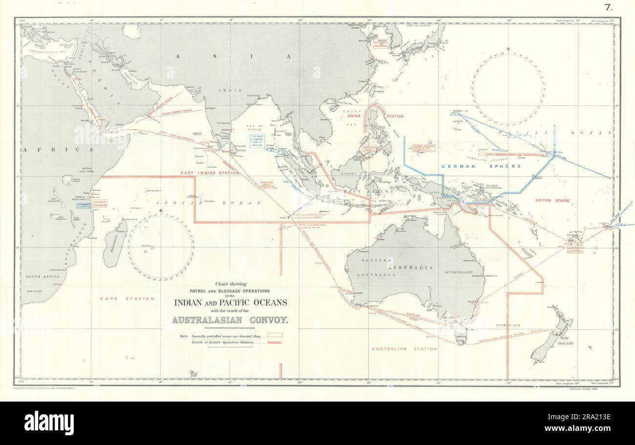 Indian & Pacific Oceans. Australasian Convoy 1914. First World War. 1920 map Stock Photohttps://www.alamy.com/image-license-details/?v=1https://www.alamy.com/indian-pacific-oceans-australasian-convoy-1914-first-world-war-1920-map-image556923122.html
RF2RA213E–Indian & Pacific Oceans. Australasian Convoy 1914. First World War. 1920 map
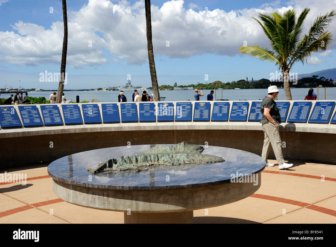 Remembrance Circle Map Diorama Honors Army Air Force Pearl Harbor Pacific National Monument Hawaii Stock Photohttps://www.alamy.com/image-license-details/?v=1https://www.alamy.com/stock-photo-remembrance-circle-map-diorama-honors-army-air-force-pearl-harbor-33985729.html
RMBY8541–Remembrance Circle Map Diorama Honors Army Air Force Pearl Harbor Pacific National Monument Hawaii
 The North-West Pacific 1945. Japan Korea China. World War Two 1969 old map Stock Photohttps://www.alamy.com/image-license-details/?v=1https://www.alamy.com/the-north-west-pacific-1945-japan-korea-china-world-war-two-1969-old-map-image622809305.html
RF2Y57BHD–The North-West Pacific 1945. Japan Korea China. World War Two 1969 old map
 Map of routes for a Pacific railroad : compiled to accompany the report of the Hon. Jefferson Davis, sec. of war in Office of P.R.R. Surveys, 1855 1857 Stock Photohttps://www.alamy.com/image-license-details/?v=1https://www.alamy.com/map-of-routes-for-a-pacific-railroad-compiled-to-accompany-the-report-of-the-hon-jefferson-davis-sec-of-war-in-office-of-prr-surveys-1855-1857-image633124528.html
RM2YP18P8–Map of routes for a Pacific railroad : compiled to accompany the report of the Hon. Jefferson Davis, sec. of war in Office of P.R.R. Surveys, 1855 1857
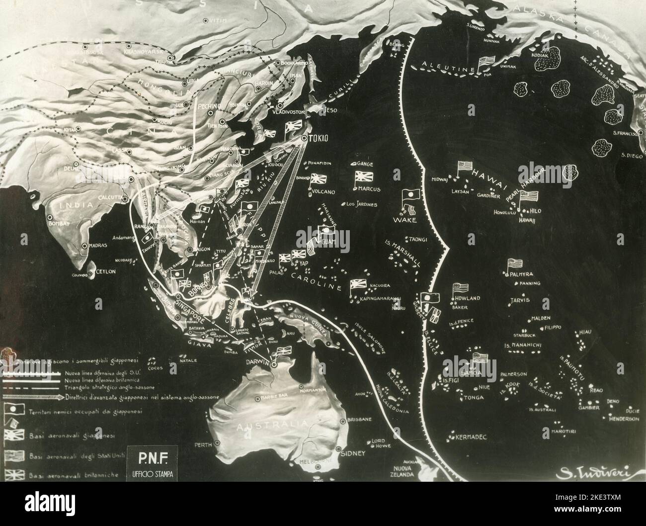 The War in the Pacific Front: Map of Far Asia, Australia, and the Pacific Islands from the National Fascist Party documentation, Italy 1942 Stock Photohttps://www.alamy.com/image-license-details/?v=1https://www.alamy.com/the-war-in-the-pacific-front-map-of-far-asia-australia-and-the-pacific-islands-from-the-national-fascist-party-documentation-italy-1942-image490580908.html
RM2KE3TXM–The War in the Pacific Front: Map of Far Asia, Australia, and the Pacific Islands from the National Fascist Party documentation, Italy 1942
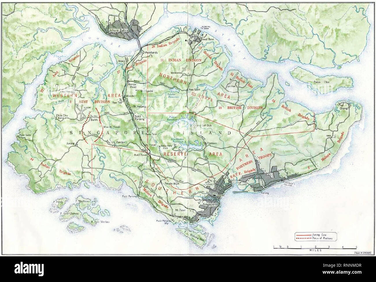 The disposition of Allied ground forces in Singapore in early February 1942, prior to the Battle of Singapore. Stock Photohttps://www.alamy.com/image-license-details/?v=1https://www.alamy.com/the-disposition-of-allied-ground-forces-in-singapore-in-early-february-1942-prior-to-the-battle-of-singapore-image237119619.html
RMRNNMDR–The disposition of Allied ground forces in Singapore in early February 1942, prior to the Battle of Singapore.
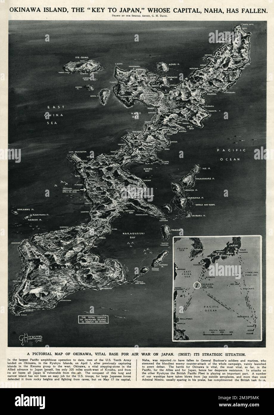 Map of Okinawa island by G. H. Davis Stock Photohttps://www.alamy.com/image-license-details/?v=1https://www.alamy.com/map-of-okinawa-island-by-g-h-davis-image501432083.html
RM2M3P5MK–Map of Okinawa island by G. H. Davis
 Hand Gesture Pacific Sign on the Background of the Map of Ukraine in the Colors of the Ukrainian Flag. Anti War Call, Symbol, Paper Sticker. Struggle Stock Vectorhttps://www.alamy.com/image-license-details/?v=1https://www.alamy.com/hand-gesture-pacific-sign-on-the-background-of-the-map-of-ukraine-in-the-colors-of-the-ukrainian-flag-anti-war-call-symbol-paper-sticker-struggle-image486802625.html
RF2K7YNM1–Hand Gesture Pacific Sign on the Background of the Map of Ukraine in the Colors of the Ukrainian Flag. Anti War Call, Symbol, Paper Sticker. Struggle
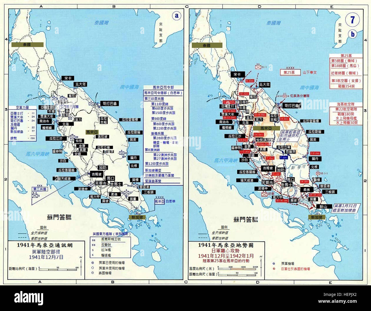 Pacific War - Malaya 1941-42 - Map (Chinese) Stock Photohttps://www.alamy.com/image-license-details/?v=1https://www.alamy.com/stock-photo-pacific-war-malaya-1941-42-map-chinese-129575546.html
RMHEPJX2–Pacific War - Malaya 1941-42 - Map (Chinese)
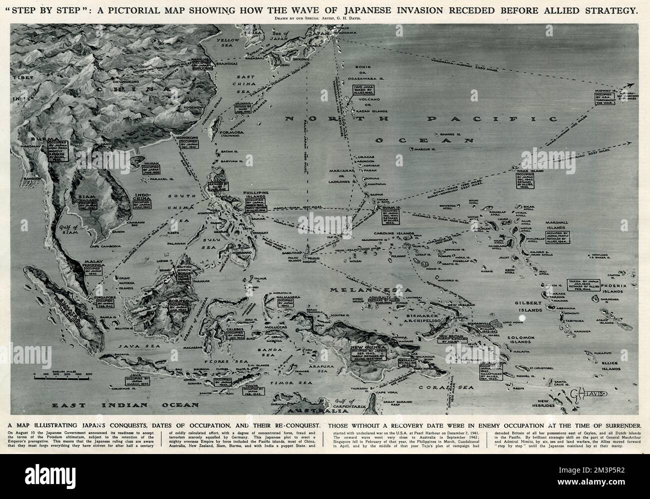 Map of Japanese invasion receding by G. H. Davis Stock Photohttps://www.alamy.com/image-license-details/?v=1https://www.alamy.com/map-of-japanese-invasion-receding-by-g-h-davis-image501432150.html
RM2M3P5R2–Map of Japanese invasion receding by G. H. Davis
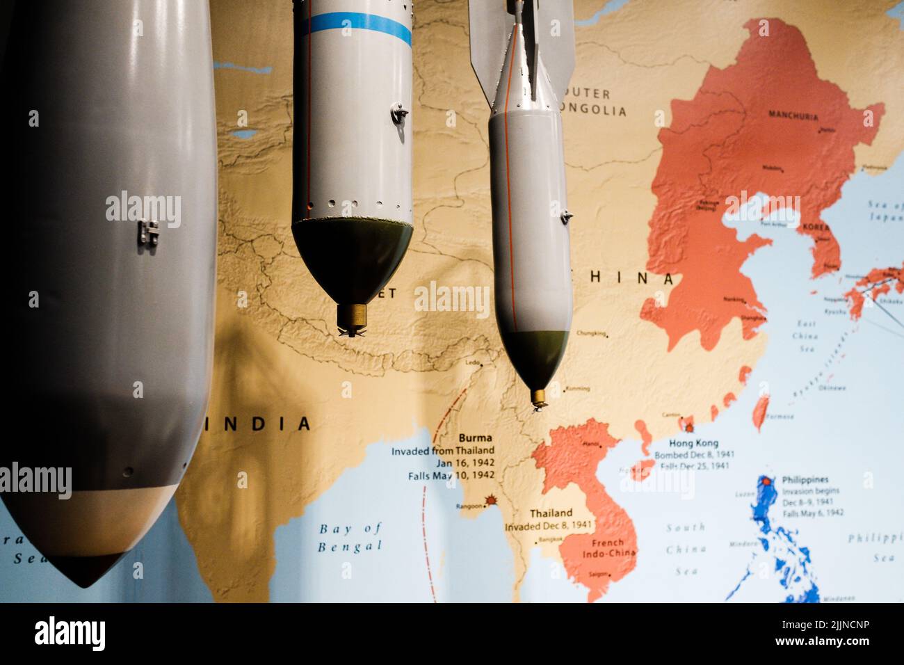 A Memorial site in Hawaii for World war 2 marked on map Stock Photohttps://www.alamy.com/image-license-details/?v=1https://www.alamy.com/a-memorial-site-in-hawaii-for-world-war-2-marked-on-map-image476214754.html
RF2JJNCNP–A Memorial site in Hawaii for World war 2 marked on map
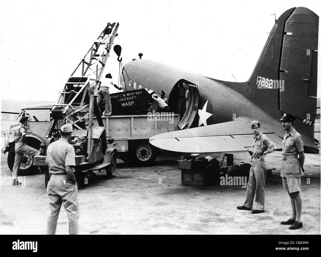 A C47 Dakota aircraft is loaded up with stores bound for US troops. Stock Photohttps://www.alamy.com/image-license-details/?v=1https://www.alamy.com/stock-photo-a-c47-dakota-aircraft-is-loaded-up-with-stores-bound-for-us-troops-41409176.html
RMCBA9R4–A C47 Dakota aircraft is loaded up with stores bound for US troops.
![Infographics of armies and weapons of the combatants during the Second World War and map of the European theater and the Pacific war during the conflict with the front lines and major battles. [Adobe Illustrator (.ai); 2480x3248]. Stock Photo Infographics of armies and weapons of the combatants during the Second World War and map of the European theater and the Pacific war during the conflict with the front lines and major battles. [Adobe Illustrator (.ai); 2480x3248]. Stock Photo](https://c8.alamy.com/comp/2NEC3Y4/infographics-of-armies-and-weapons-of-the-combatants-during-the-second-world-war-and-map-of-the-european-theater-and-the-pacific-war-during-the-conflict-with-the-front-lines-and-major-battles-adobe-illustrator-ai-2480x3248-2NEC3Y4.jpg) Infographics of armies and weapons of the combatants during the Second World War and map of the European theater and the Pacific war during the conflict with the front lines and major battles. [Adobe Illustrator (.ai); 2480x3248]. Stock Photohttps://www.alamy.com/image-license-details/?v=1https://www.alamy.com/infographics-of-armies-and-weapons-of-the-combatants-during-the-second-world-war-and-map-of-the-european-theater-and-the-pacific-war-during-the-conflict-with-the-front-lines-and-major-battles-adobe-illustrator-ai-2480x3248-image525182760.html
Infographics of armies and weapons of the combatants during the Second World War and map of the European theater and the Pacific war during the conflict with the front lines and major battles. [Adobe Illustrator (.ai); 2480x3248]. Stock Photohttps://www.alamy.com/image-license-details/?v=1https://www.alamy.com/infographics-of-armies-and-weapons-of-the-combatants-during-the-second-world-war-and-map-of-the-european-theater-and-the-pacific-war-during-the-conflict-with-the-front-lines-and-major-battles-adobe-illustrator-ai-2480x3248-image525182760.htmlRM2NEC3Y4–Infographics of armies and weapons of the combatants during the Second World War and map of the European theater and the Pacific war during the conflict with the front lines and major battles. [Adobe Illustrator (.ai); 2480x3248].
 COMMANDER IN CHEIF OF UNITED STATES FLEET Photo Shows: Admiral Ernest King, the Commander in Chief of the United States Fleet, inspecting a map of the Pacific war area in his office in the Navy Department at Washington US. A new picture just received in London 19 January 1942 Stock Photohttps://www.alamy.com/image-license-details/?v=1https://www.alamy.com/commander-in-cheif-of-united-states-fleet-photo-shows-admiral-ernest-king-the-commander-in-chief-of-the-united-states-fleet-inspecting-a-map-of-the-pacific-war-area-in-his-office-in-the-navy-department-at-washington-us-a-new-picture-just-received-in-london-19-january-1942-image624423545.html
RM2Y7TXGW–COMMANDER IN CHEIF OF UNITED STATES FLEET Photo Shows: Admiral Ernest King, the Commander in Chief of the United States Fleet, inspecting a map of the Pacific war area in his office in the Navy Department at Washington US. A new picture just received in London 19 January 1942
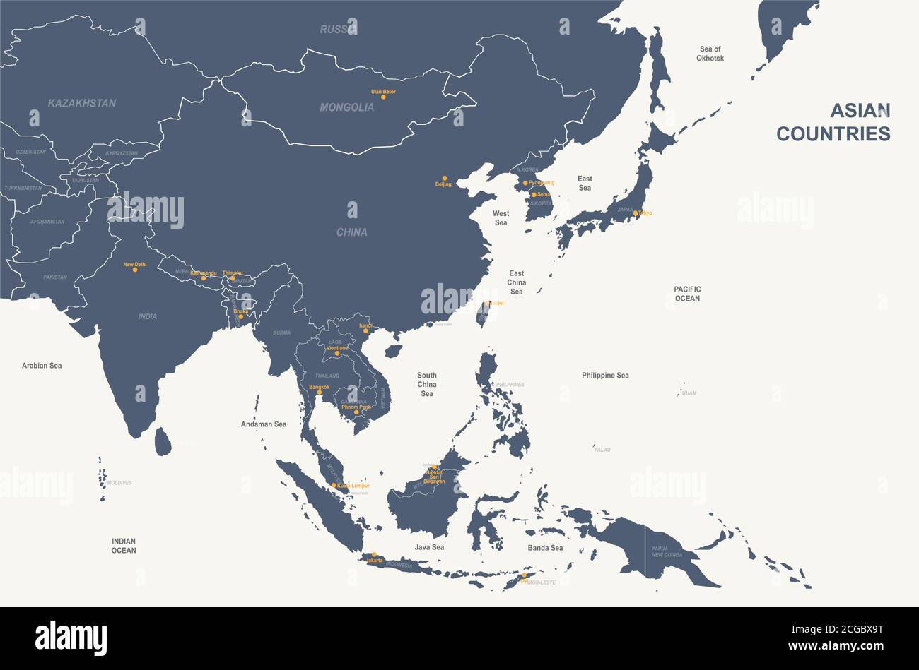 Asian countries named vector map. Stock Vectorhttps://www.alamy.com/image-license-details/?v=1https://www.alamy.com/asian-countries-named-vector-map-image371514356.html
RF2CGBX9T–Asian countries named vector map.
 White House Map Room, ca. 1943. U.S. Army Signal Corps Officer Al Cornelius stands between maps of the European and Pacific War Stock Photohttps://www.alamy.com/image-license-details/?v=1https://www.alamy.com/stock-photo-white-house-map-room-ca-1943-us-army-signal-corps-officer-al-cornelius-78823851.html
RMEG6MHF–White House Map Room, ca. 1943. U.S. Army Signal Corps Officer Al Cornelius stands between maps of the European and Pacific War
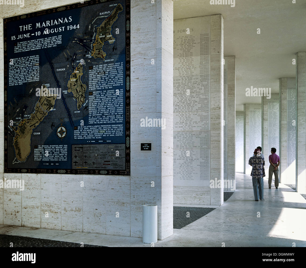 Mosaic map of the successfully completed American operations during the Pacific War, The Marianas, 1944 Stock Photohttps://www.alamy.com/image-license-details/?v=1https://www.alamy.com/mosaic-map-of-the-successfully-completed-american-operations-during-image62030807.html
RMDGWMWY–Mosaic map of the successfully completed American operations during the Pacific War, The Marianas, 1944
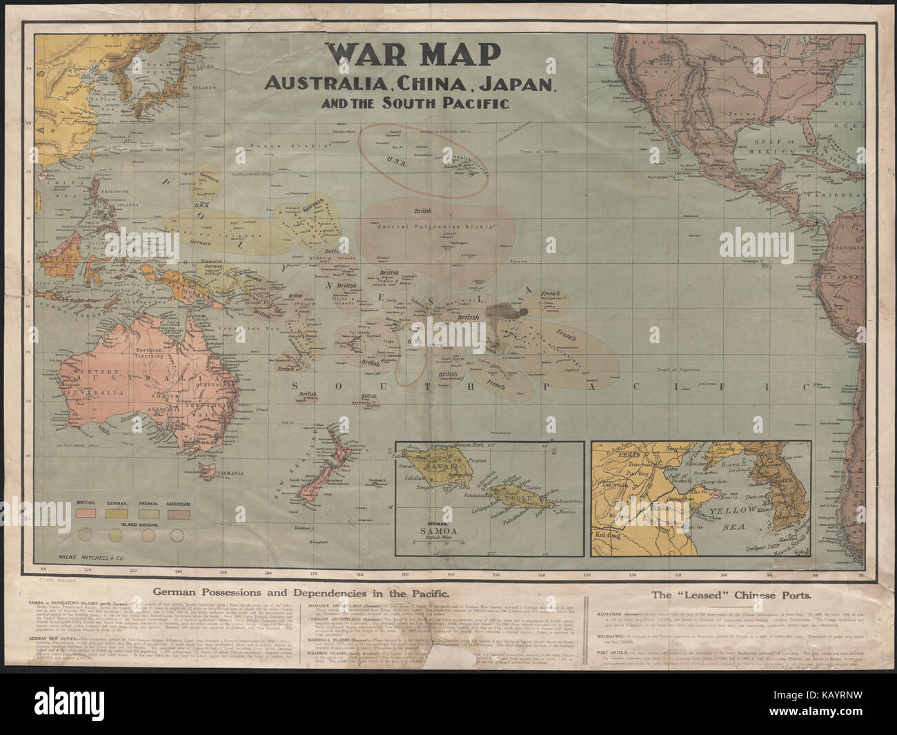 War map Australia, China, Japan, and the South Pacific (1914) Stock Photohttps://www.alamy.com/image-license-details/?v=1https://www.alamy.com/stock-image-war-map-australia-china-japan-and-the-south-pacific-1914-161651221.html
RMKAYRNW–War map Australia, China, Japan, and the South Pacific (1914)
 American patriotic propagand poster from time of World War II. 1941-1945 Stock Photohttps://www.alamy.com/image-license-details/?v=1https://www.alamy.com/american-patriotic-propagand-poster-from-time-of-world-war-ii-1941-1945-image415331907.html
RM2F3M02B–American patriotic propagand poster from time of World War II. 1941-1945
![[ 1890s Japan - Pan-Pacific Peace Exposition in Nagoya, 1937 ] — Map for the Nagoya Pan-Pacific Peace Exposition (名古屋汎太平洋平和博覧会, Nagoya Hantaiheiyo Heiwa Hakurankai), held in Nagoya, Aichi Prefecture, from March 15 to May 31, 1937 (Showa 12). Two months after the exposition closed, the Second Sino-Japanese War (1937–1945) started. 20th century vintage map. Stock Photo [ 1890s Japan - Pan-Pacific Peace Exposition in Nagoya, 1937 ] — Map for the Nagoya Pan-Pacific Peace Exposition (名古屋汎太平洋平和博覧会, Nagoya Hantaiheiyo Heiwa Hakurankai), held in Nagoya, Aichi Prefecture, from March 15 to May 31, 1937 (Showa 12). Two months after the exposition closed, the Second Sino-Japanese War (1937–1945) started. 20th century vintage map. Stock Photo](https://c8.alamy.com/comp/W8RKPN/1890s-japan-pan-pacific-peace-exposition-in-nagoya-1937-map-for-the-nagoya-pan-pacific-peace-exposition-nagoya-hantaiheiyo-heiwa-hakurankai-held-in-nagoya-aichi-prefecture-from-march-15-to-may-31-1937-showa-12-two-months-after-the-exposition-closed-the-second-sino-japanese-war-19371945-started-20th-century-vintage-map-W8RKPN.jpg) [ 1890s Japan - Pan-Pacific Peace Exposition in Nagoya, 1937 ] — Map for the Nagoya Pan-Pacific Peace Exposition (名古屋汎太平洋平和博覧会, Nagoya Hantaiheiyo Heiwa Hakurankai), held in Nagoya, Aichi Prefecture, from March 15 to May 31, 1937 (Showa 12). Two months after the exposition closed, the Second Sino-Japanese War (1937–1945) started. 20th century vintage map. Stock Photohttps://www.alamy.com/image-license-details/?v=1https://www.alamy.com/1890s-japan-pan-pacific-peace-exposition-in-nagoya-1937-map-for-the-nagoya-pan-pacific-peace-exposition-nagoya-hantaiheiyo-heiwa-hakurankai-held-in-nagoya-aichi-prefecture-from-march-15-to-may-31-1937-showa-12-two-months-after-the-exposition-closed-the-second-sino-japanese-war-19371945-started-20th-century-vintage-map-image263593197.html
[ 1890s Japan - Pan-Pacific Peace Exposition in Nagoya, 1937 ] — Map for the Nagoya Pan-Pacific Peace Exposition (名古屋汎太平洋平和博覧会, Nagoya Hantaiheiyo Heiwa Hakurankai), held in Nagoya, Aichi Prefecture, from March 15 to May 31, 1937 (Showa 12). Two months after the exposition closed, the Second Sino-Japanese War (1937–1945) started. 20th century vintage map. Stock Photohttps://www.alamy.com/image-license-details/?v=1https://www.alamy.com/1890s-japan-pan-pacific-peace-exposition-in-nagoya-1937-map-for-the-nagoya-pan-pacific-peace-exposition-nagoya-hantaiheiyo-heiwa-hakurankai-held-in-nagoya-aichi-prefecture-from-march-15-to-may-31-1937-showa-12-two-months-after-the-exposition-closed-the-second-sino-japanese-war-19371945-started-20th-century-vintage-map-image263593197.htmlRMW8RKPN–[ 1890s Japan - Pan-Pacific Peace Exposition in Nagoya, 1937 ] — Map for the Nagoya Pan-Pacific Peace Exposition (名古屋汎太平洋平和博覧会, Nagoya Hantaiheiyo Heiwa Hakurankai), held in Nagoya, Aichi Prefecture, from March 15 to May 31, 1937 (Showa 12). Two months after the exposition closed, the Second Sino-Japanese War (1937–1945) started. 20th century vintage map.
 Remembrance Circle Map Diorama Honors Army Air Force Pearl Harbor Pacific National Monument Hawaii Stock Photohttps://www.alamy.com/image-license-details/?v=1https://www.alamy.com/stock-photo-remembrance-circle-map-diorama-honors-army-air-force-pearl-harbor-33985756.html
RMBY8550–Remembrance Circle Map Diorama Honors Army Air Force Pearl Harbor Pacific National Monument Hawaii
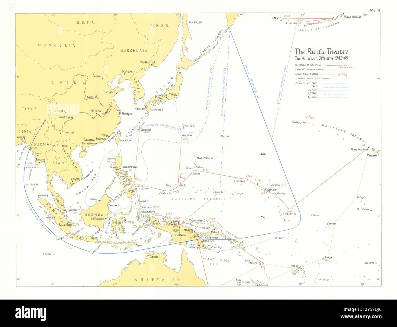 American offensive 1942-45. World War Two Pacific Theatre 1969 old vintage map Stock Photohttps://www.alamy.com/image-license-details/?v=1https://www.alamy.com/american-offensive-1942-45-world-war-two-pacific-theatre-1969-old-vintage-map-image622810900.html
RF2Y57DJC–American offensive 1942-45. World War Two Pacific Theatre 1969 old vintage map
 Map of the territory of the United States from the Mississippi to the Pacific Ocean : ordered by the hon. Jeff'n Davis, Secretary of War, to accompany the reports of the explorations for a railroad route 1857 by Warren, G. K. (Gouverneur Kemble), 1830-1882 Stock Photohttps://www.alamy.com/image-license-details/?v=1https://www.alamy.com/map-of-the-territory-of-the-united-states-from-the-mississippi-to-the-pacific-ocean-ordered-by-the-hon-jeffn-davis-secretary-of-war-to-accompany-the-reports-of-the-explorations-for-a-railroad-route-1857-by-warren-g-k-gouverneur-kemble-1830-1882-image633122959.html
RM2YP16P7–Map of the territory of the United States from the Mississippi to the Pacific Ocean : ordered by the hon. Jeff'n Davis, Secretary of War, to accompany the reports of the explorations for a railroad route 1857 by Warren, G. K. (Gouverneur Kemble), 1830-1882
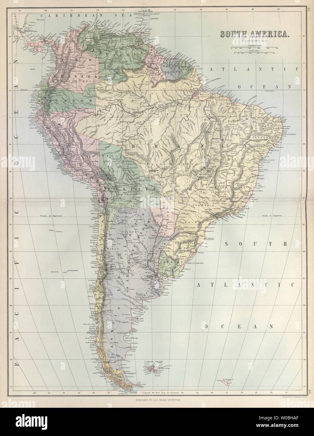 South America. Bolivia w/ Litoral pre War of the Pacific. BARTHOLOMEW 1882 map Stock Photohttps://www.alamy.com/image-license-details/?v=1https://www.alamy.com/south-america-bolivia-w-litoral-pre-war-of-the-pacific-bartholomew-1882-map-image258410615.html
RFW0BHAF–South America. Bolivia w/ Litoral pre War of the Pacific. BARTHOLOMEW 1882 map
 Map of the world showing the southern Atlantic with mini telescope and notebook Stock Photohttps://www.alamy.com/image-license-details/?v=1https://www.alamy.com/stock-photo-map-of-the-world-showing-the-southern-atlantic-with-mini-telescope-21796534.html
RFB7CWKJ–Map of the world showing the southern Atlantic with mini telescope and notebook
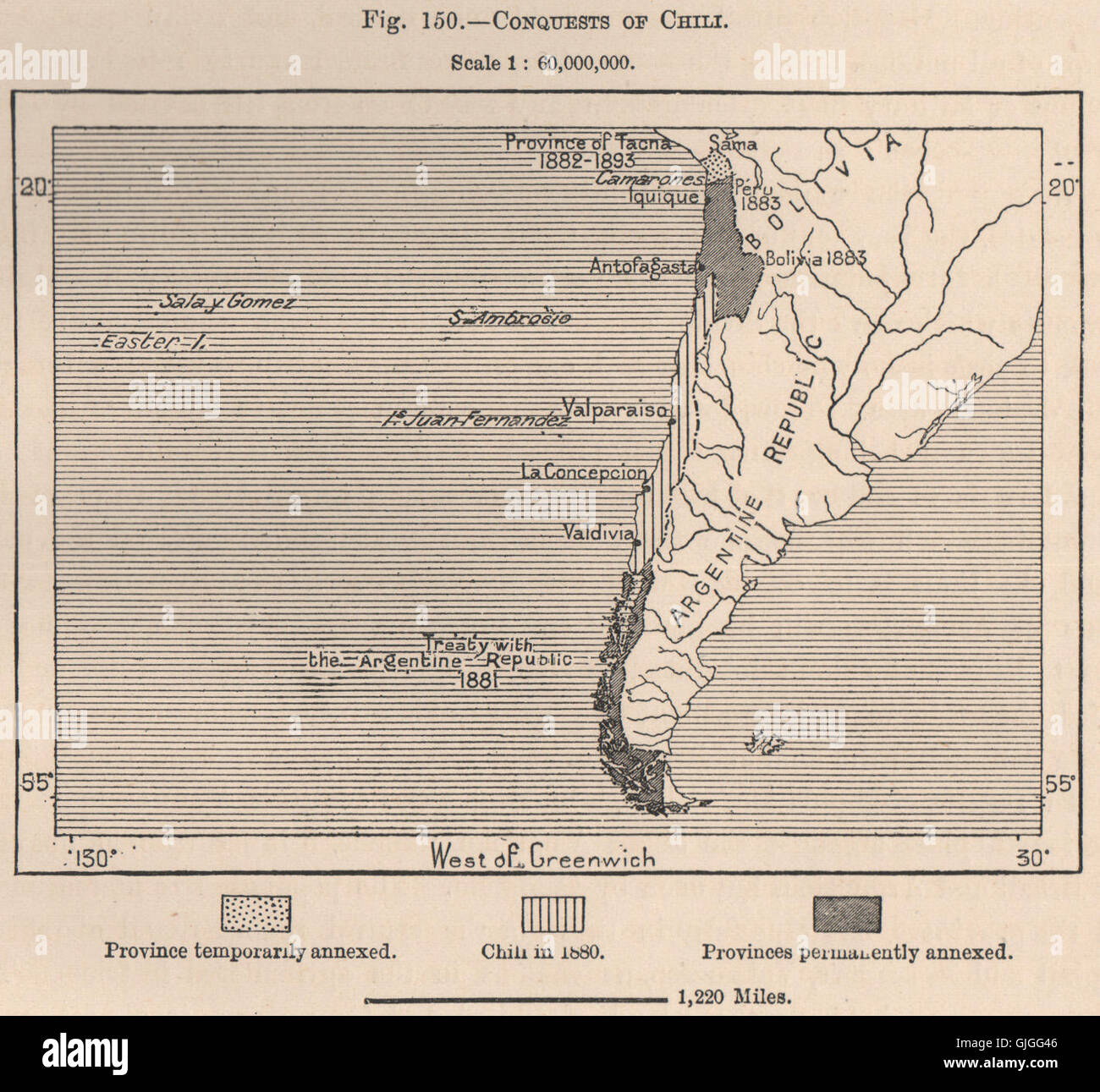 Conquests of Chile.1881 1882 1883.War of the Pacific.Argentina treaty, 1885 map Stock Photohttps://www.alamy.com/image-license-details/?v=1https://www.alamy.com/stock-photo-conquests-of-chile1881-1882-1883war-of-the-pacificargentina-treaty-114689910.html
RFGJGG46–Conquests of Chile.1881 1882 1883.War of the Pacific.Argentina treaty, 1885 map
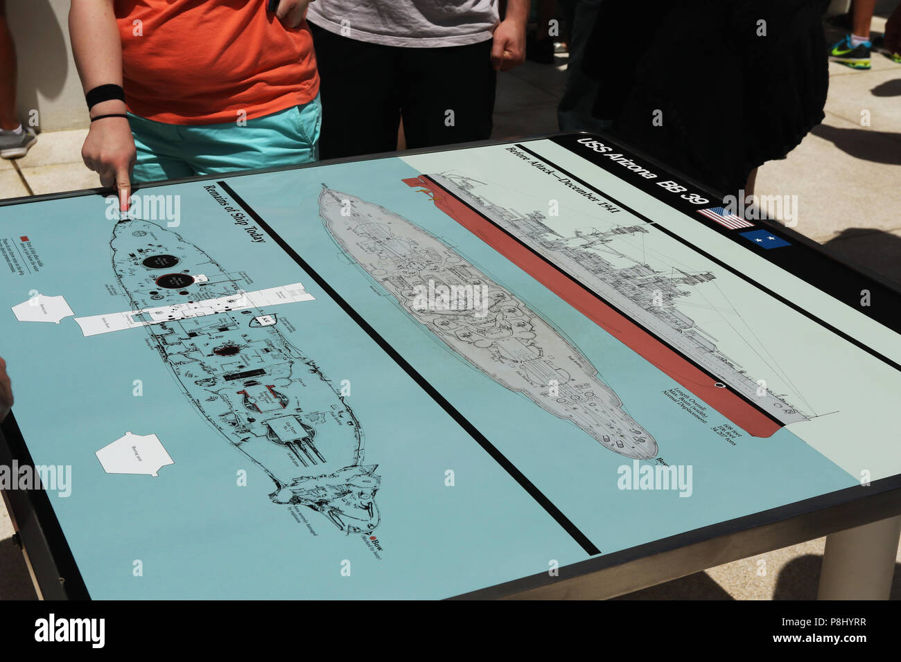 USS Arizona Memorial. Maps of the ship and Memorial. World War II Valor in the Pacific National Monument, Pearl Harbor, Honolulu, Oahu Island, Hawaii, Stock Photohttps://www.alamy.com/image-license-details/?v=1https://www.alamy.com/uss-arizona-memorial-maps-of-the-ship-and-memorial-world-war-ii-valor-in-the-pacific-national-monument-pearl-harbor-honolulu-oahu-island-hawaii-image211836683.html
RMP8HYRR–USS Arizona Memorial. Maps of the ship and Memorial. World War II Valor in the Pacific National Monument, Pearl Harbor, Honolulu, Oahu Island, Hawaii,
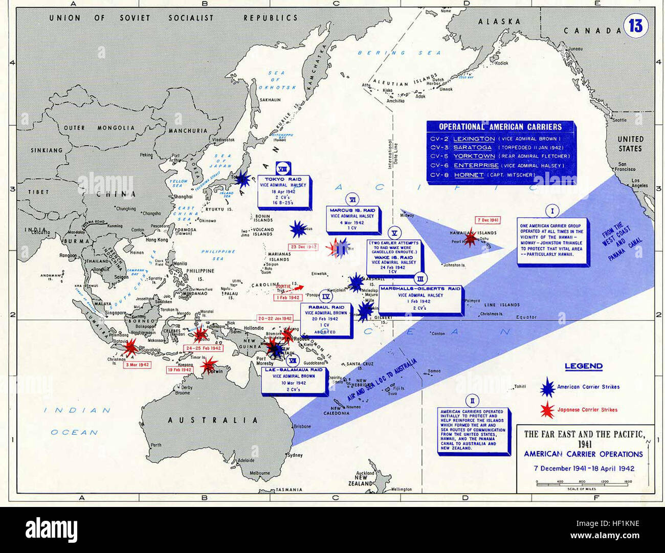 Pacific War - American Carrier OP 1941-42 - Map Stock Photohttps://www.alamy.com/image-license-details/?v=1https://www.alamy.com/stock-photo-pacific-war-american-carrier-op-1941-42-map-129729866.html
RMHF1KNE–Pacific War - American Carrier OP 1941-42 - Map
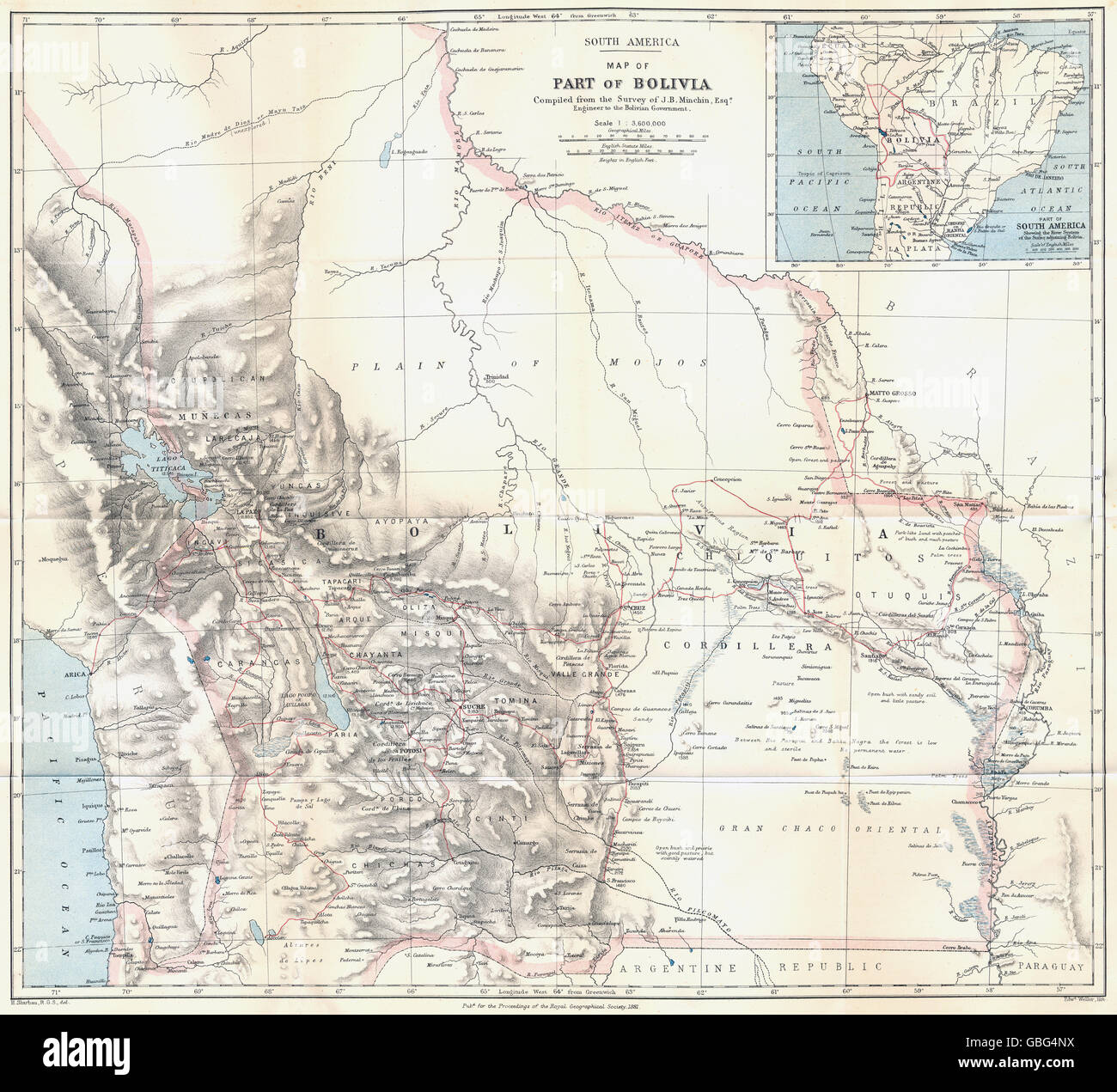 BOLIVIA: Pre War of the Pacific border changes. Surveyed Minchin. RGS, 1881 map Stock Photohttps://www.alamy.com/image-license-details/?v=1https://www.alamy.com/stock-photo-bolivia-pre-war-of-the-pacific-border-changes-surveyed-minchin-rgs-110378406.html
RFGBG4NX–BOLIVIA: Pre War of the Pacific border changes. Surveyed Minchin. RGS, 1881 map
 Map by Thomas James called The Platt of Sayling For The Discoverye Of A Passage Into The South Sea 1631-1632 The title of this map states clearly the intention of the voyage to North America undertaken by Captain James. He entered Hudson Bay to search for and hopefully discover a passage leading west into the Western (or Southern) Ocean. His purpose was not fulfilled. James shows on his map the wider arena of exploration in the quest for the Northwest Passage, by including the northern regions of Foxe Basin, Davis Strait and Baffin Bay. During his attempt he clarified the Stock Photohttps://www.alamy.com/image-license-details/?v=1https://www.alamy.com/map-by-thomas-james-called-the-platt-of-sayling-for-the-discoverye-of-a-passage-into-the-south-sea-1631-1632-the-title-of-this-map-states-clearly-the-intention-of-the-voyage-to-north-america-undertaken-by-captain-james-he-entered-hudson-bay-to-search-for-and-hopefully-discover-a-passage-leading-west-into-the-western-or-southern-ocean-his-purpose-was-not-fulfilled-james-shows-on-his-map-the-wider-arena-of-exploration-in-the-quest-for-the-northwest-passage-by-including-the-northern-regions-of-foxe-basin-davis-strait-and-baffin-bay-during-his-attempt-he-clarified-the-image631572063.html
RM2YKEGH3–Map by Thomas James called The Platt of Sayling For The Discoverye Of A Passage Into The South Sea 1631-1632 The title of this map states clearly the intention of the voyage to North America undertaken by Captain James. He entered Hudson Bay to search for and hopefully discover a passage leading west into the Western (or Southern) Ocean. His purpose was not fulfilled. James shows on his map the wider arena of exploration in the quest for the Northwest Passage, by including the northern regions of Foxe Basin, Davis Strait and Baffin Bay. During his attempt he clarified the
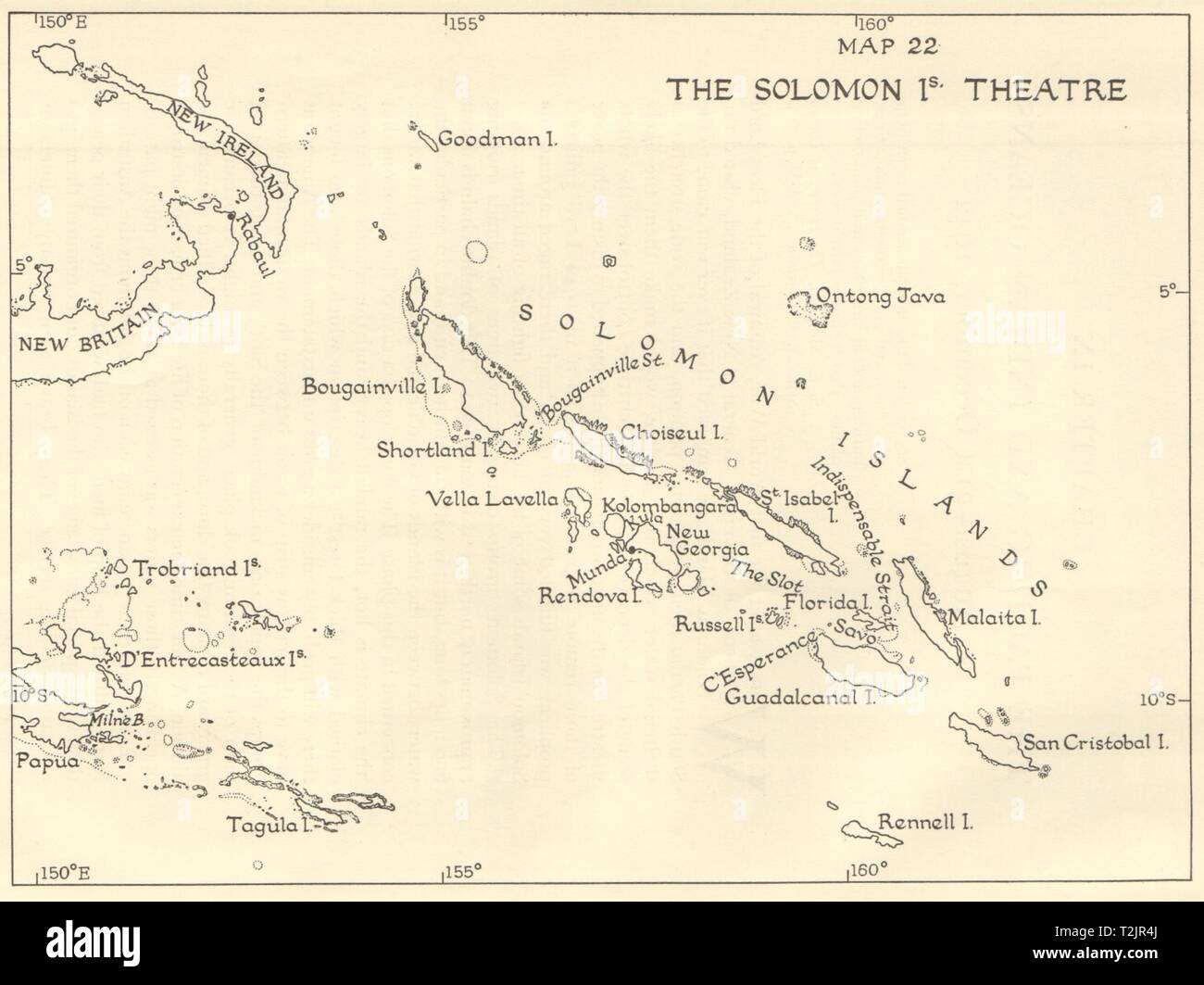 World War 2. The Solomon Islands Theatre. Pacific 1956 old vintage map chart Stock Photohttps://www.alamy.com/image-license-details/?v=1https://www.alamy.com/world-war-2-the-solomon-islands-theatre-pacific-1956-old-vintage-map-chart-image242587762.html
RFT2JR4J–World War 2. The Solomon Islands Theatre. Pacific 1956 old vintage map chart
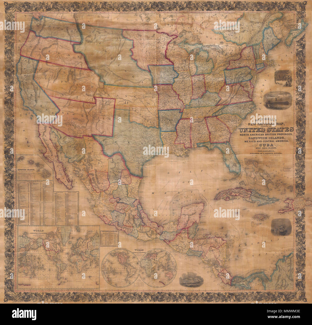 . English: This is the first edition of Mitchell’s important 1856 wall map of the United States, Mexico and the West Indies. Depictss the entire nation from Atlantic to Pacific with inset maps of the World on Mercator’s Projection and the World on Globular Projection, and Hawaii (The Sandwich Islands). In his important book on Mapping the Transmississippi West 1540-1861 , Wheat calls this map an “achievement” and describes it’s western portion in considerable detail. This wall map includes the territory acquired following the Mexican American war and was one of the best depictions of the West Stock Photohttps://www.alamy.com/image-license-details/?v=1https://www.alamy.com/english-this-is-the-first-edition-of-mitchells-important-1856-wall-map-of-the-united-states-mexico-and-the-west-indies-depictss-the-entire-nation-from-atlantic-to-pacific-with-inset-maps-of-the-world-on-mercators-projection-and-the-world-on-globular-projection-and-hawaii-the-sandwich-islands-in-his-important-book-on-mapping-the-transmississippi-west-1540-1861-wheat-calls-this-map-an-achievement-and-describes-its-western-portion-in-considerable-detail-this-wall-map-includes-the-territory-acquired-following-the-mexican-american-war-and-was-one-of-the-best-depictions-of-the-west-image184961378.html
RMMMWM3E–. English: This is the first edition of Mitchell’s important 1856 wall map of the United States, Mexico and the West Indies. Depictss the entire nation from Atlantic to Pacific with inset maps of the World on Mercator’s Projection and the World on Globular Projection, and Hawaii (The Sandwich Islands). In his important book on Mapping the Transmississippi West 1540-1861 , Wheat calls this map an “achievement” and describes it’s western portion in considerable detail. This wall map includes the territory acquired following the Mexican American war and was one of the best depictions of the West
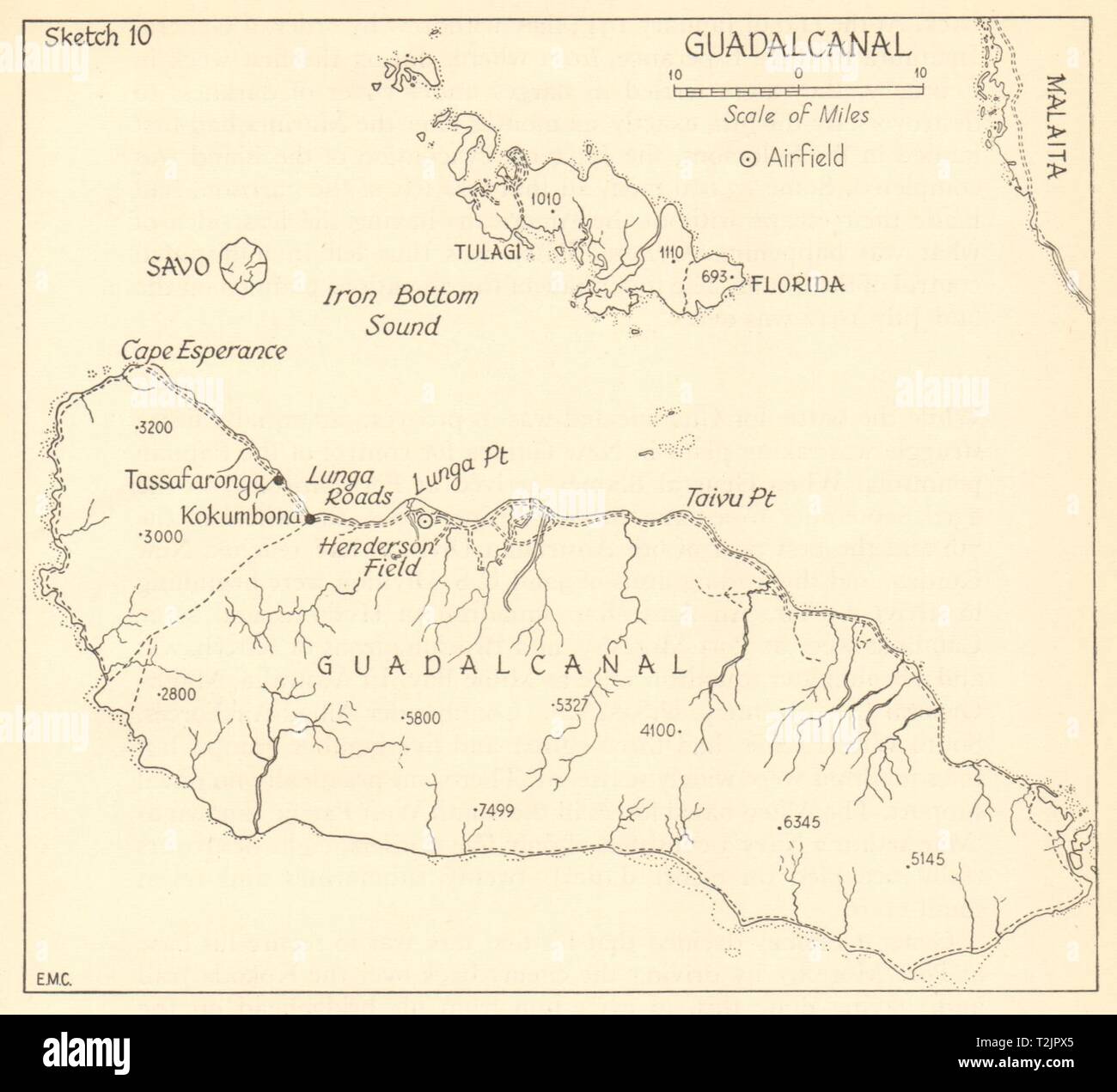 Guadalcanal Campaign 1942/3. World War 2. Pacific. Solomon Islands 1961 map Stock Photohttps://www.alamy.com/image-license-details/?v=1https://www.alamy.com/guadalcanal-campaign-19423-world-war-2-pacific-solomon-islands-1961-map-image242587581.html
RFT2JPX5–Guadalcanal Campaign 1942/3. World War 2. Pacific. Solomon Islands 1961 map
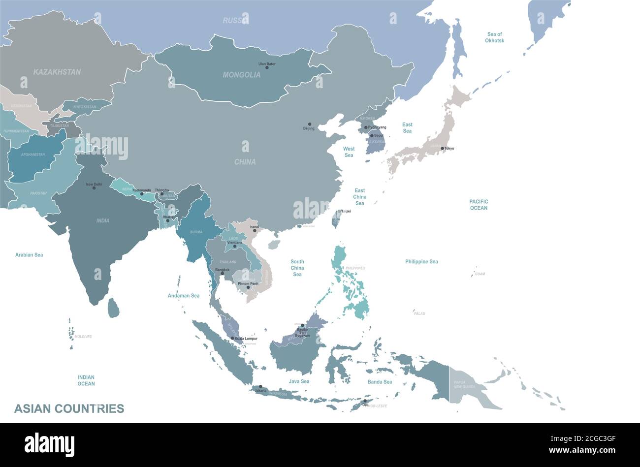 Asian countries named vector map. Stock Vectorhttps://www.alamy.com/image-license-details/?v=1https://www.alamy.com/asian-countries-named-vector-map-image371518463.html
RF2CGC3GF–Asian countries named vector map.
 Entrance of the National Museum of the Pacific War with map in the background. Stock Photohttps://www.alamy.com/image-license-details/?v=1https://www.alamy.com/entrance-of-the-national-museum-of-the-pacific-war-with-map-in-the-background-image458490413.html
RF2HHX15H–Entrance of the National Museum of the Pacific War with map in the background.
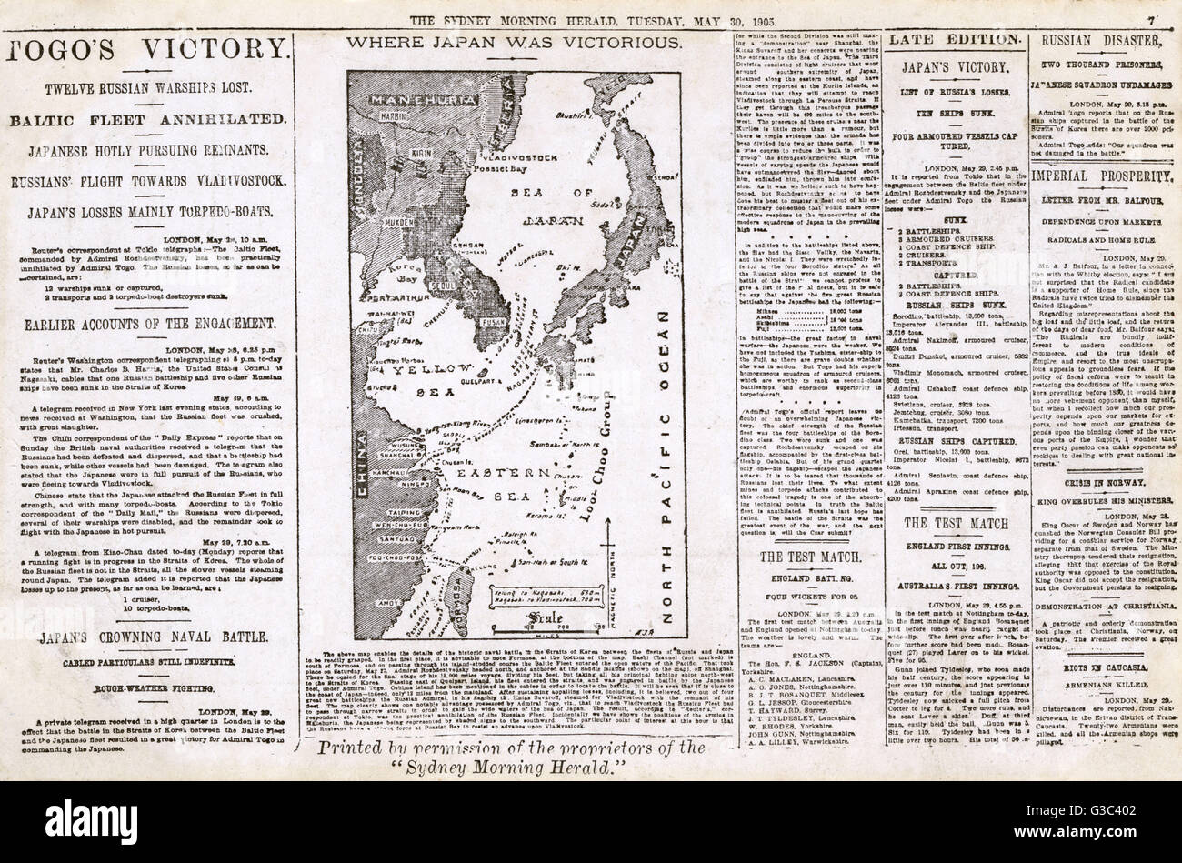 Postcard, Sydney Morning Herald for 30 May 1905, reproduction of a page containing a report on the Russo-Japanese War (1904-5), with a heading Togo's Victory and a map showing Japanese successes at sea. Date: 1905 Stock Photohttps://www.alamy.com/image-license-details/?v=1https://www.alamy.com/stock-photo-postcard-sydney-morning-herald-for-30-may-1905-reproduction-of-a-page-105372738.html
RMG3C402–Postcard, Sydney Morning Herald for 30 May 1905, reproduction of a page containing a report on the Russo-Japanese War (1904-5), with a heading Togo's Victory and a map showing Japanese successes at sea. Date: 1905
 Map of the territory of the United States from the Mississippi to the Pacific Ocean - ordered by the hon. Jeff'n Davis, Secretary of War, to accompany the reports of the explorations for a (NYPL b15898779-1260188) Stock Photohttps://www.alamy.com/image-license-details/?v=1https://www.alamy.com/stock-photo-map-of-the-territory-of-the-united-states-from-the-mississippi-to-148529620.html
RMJHJ318–Map of the territory of the United States from the Mississippi to the Pacific Ocean - ordered by the hon. Jeff'n Davis, Secretary of War, to accompany the reports of the explorations for a (NYPL b15898779-1260188)
 German threat to America and Panama: Lufthansa airlines in Latin America. A map showing how German-controlled airlines, capable of a converging war movement against the Panama Canal, were rivalling Pan-American Airways services in South America during the Second World War. Date: 1941 Stock Photohttps://www.alamy.com/image-license-details/?v=1https://www.alamy.com/german-threat-to-america-and-panama-lufthansa-airlines-in-latin-america-a-map-showing-how-german-controlled-airlines-capable-of-a-converging-war-movement-against-the-panama-canal-were-rivalling-pan-american-airways-services-in-south-america-during-the-second-world-war-date-1941-image501431814.html
RM2M3P5B2–German threat to America and Panama: Lufthansa airlines in Latin America. A map showing how German-controlled airlines, capable of a converging war movement against the Panama Canal, were rivalling Pan-American Airways services in South America during the Second World War. Date: 1941
 White House Map Room, ca. 1943. U.S. Army Signal Corps Officer Al Cornelius stands between maps of the European and Pacific War theaters. World War 2. (BSLOC 2014 8 132) Stock Photohttps://www.alamy.com/image-license-details/?v=1https://www.alamy.com/stock-photo-white-house-map-room-ca-1943-us-army-signal-corps-officer-al-cornelius-170506306.html
RMKWB6EX–White House Map Room, ca. 1943. U.S. Army Signal Corps Officer Al Cornelius stands between maps of the European and Pacific War theaters. World War 2. (BSLOC 2014 8 132)
 Remembrance Circle Map Diorama Honors Army Air Force Pearl Harbor Pacific National Monument Hawaii Stock Photohttps://www.alamy.com/image-license-details/?v=1https://www.alamy.com/stock-photo-remembrance-circle-map-diorama-honors-army-air-force-pearl-harbor-33985751.html
RMBY854R–Remembrance Circle Map Diorama Honors Army Air Force Pearl Harbor Pacific National Monument Hawaii
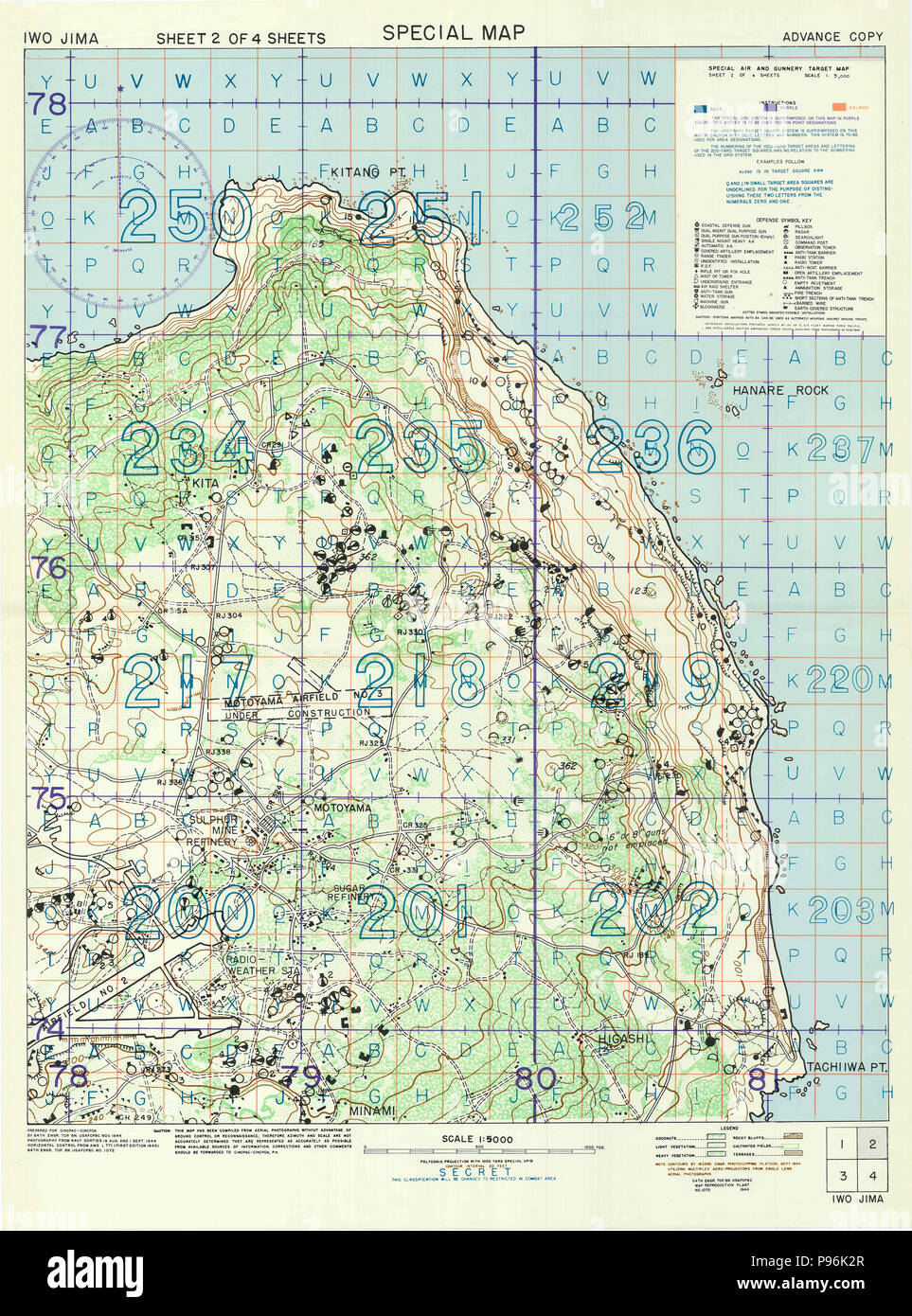 World War II Map - Special Air and Gunnery Target Map of Iwo Jima Fall 1944 Map Stock Photohttps://www.alamy.com/image-license-details/?v=1https://www.alamy.com/world-war-ii-map-special-air-and-gunnery-target-map-of-iwo-jima-fall-1944-map-image212203007.html
RMP96K2R–World War II Map - Special Air and Gunnery Target Map of Iwo Jima Fall 1944 Map
 Map of the territory of the United States from the Mississippi River to the Pacific Ocean: ordered by the Hon. Jeff'n Davis, Secretary of War, to accompany the reports of the explorations for a railroad route, made in accordance with the 10th & 11th sections of the Army appropriation, act of March 3rd, 1853 1858 by Bien, Julius, 1826-1909 Stock Photohttps://www.alamy.com/image-license-details/?v=1https://www.alamy.com/map-of-the-territory-of-the-united-states-from-the-mississippi-river-to-the-pacific-ocean-ordered-by-the-hon-jeffn-davis-secretary-of-war-to-accompany-the-reports-of-the-explorations-for-a-railroad-route-made-in-accordance-with-the-10th-11th-sections-of-the-army-appropriation-act-of-march-3rd-1853-1858-by-bien-julius-1826-1909-image633123368.html
RM2YP178T–Map of the territory of the United States from the Mississippi River to the Pacific Ocean: ordered by the Hon. Jeff'n Davis, Secretary of War, to accompany the reports of the explorations for a railroad route, made in accordance with the 10th & 11th sections of the Army appropriation, act of March 3rd, 1853 1858 by Bien, Julius, 1826-1909
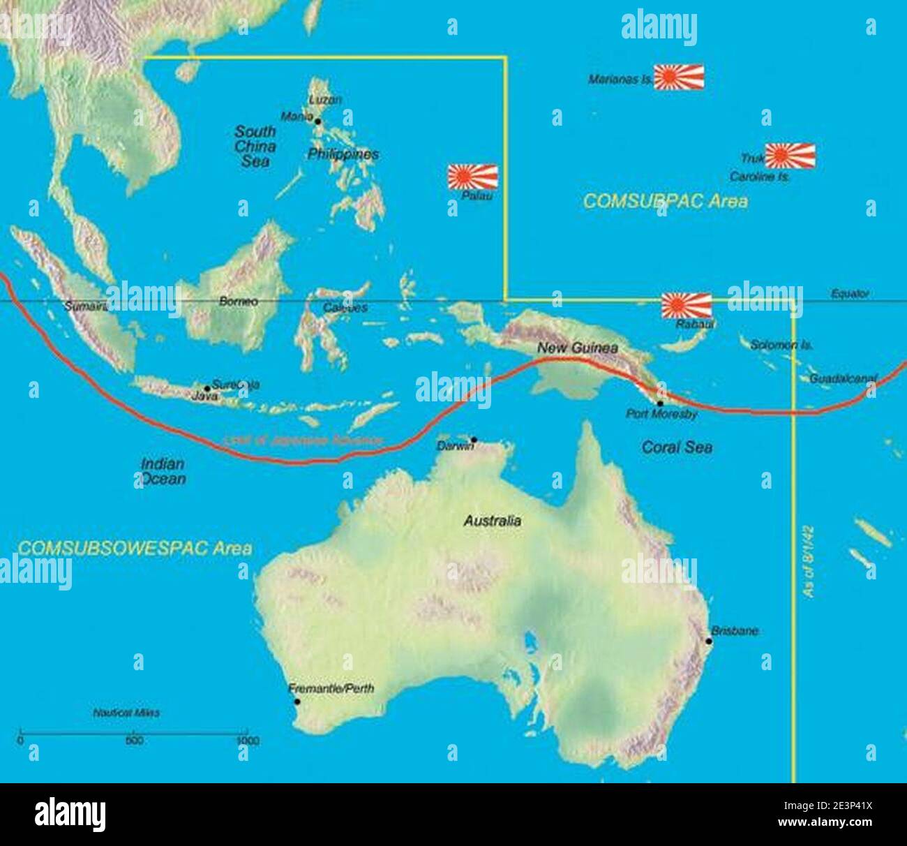 Map of United States Submarines Forces Southwest Pacific operating area World War 2 circa 1943. Stock Photohttps://www.alamy.com/image-license-details/?v=1https://www.alamy.com/map-of-united-states-submarines-forces-southwest-pacific-operating-area-world-war-2-circa-1943-image398168566.html
RM2E3P41X–Map of United States Submarines Forces Southwest Pacific operating area World War 2 circa 1943.
 War of the Pacific.1879-1883. Conflict between Chile and Peru and Bolivia. Plane of the bay and town of Pisagua. La Ilustracion Espanola y Americana, 1879. Stock Photohttps://www.alamy.com/image-license-details/?v=1https://www.alamy.com/war-of-the-pacific1879-1883-conflict-between-chile-and-peru-and-bolivia-plane-of-the-bay-and-town-of-pisagua-la-ilustracion-espanola-y-americana-1879-image220320279.html
RMPPCCNB–War of the Pacific.1879-1883. Conflict between Chile and Peru and Bolivia. Plane of the bay and town of Pisagua. La Ilustracion Espanola y Americana, 1879.
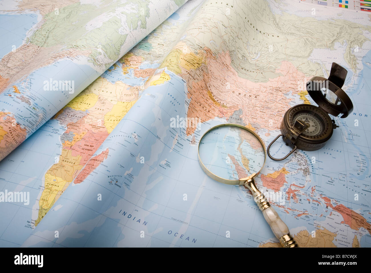 A world map with old world war ll compass and magnifying glass Stock Photohttps://www.alamy.com/image-license-details/?v=1https://www.alamy.com/stock-photo-a-world-map-with-old-world-war-ll-compass-and-magnifying-glass-21796514.html
RFB7CWJX–A world map with old world war ll compass and magnifying glass
 Stock Photohttps://www.alamy.com/image-license-details/?v=1https://www.alamy.com/-image225907410.html
RFR3EY5P–
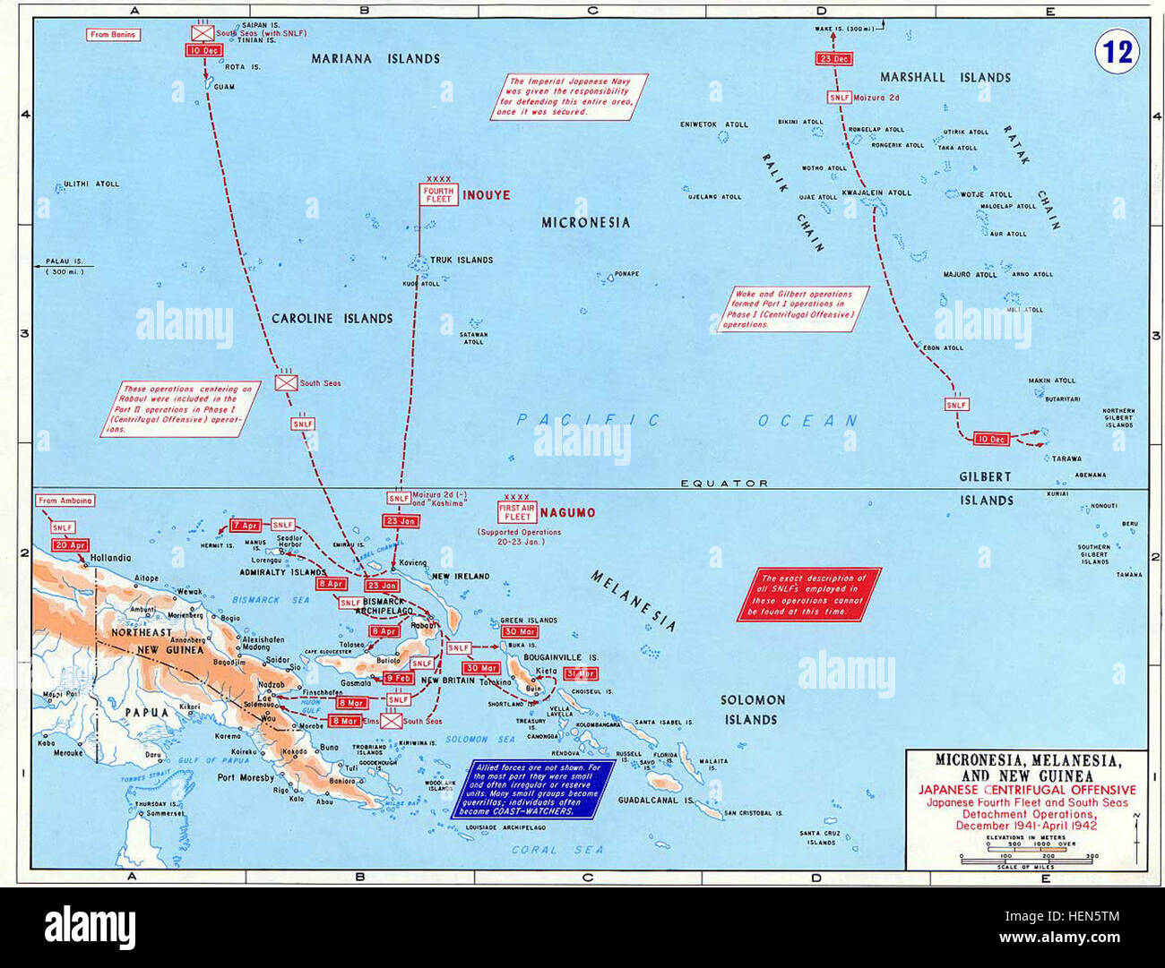 Pacific War - Micronesia, Melanesia and New Guinea 1941-42 - Map Stock Photohttps://www.alamy.com/image-license-details/?v=1https://www.alamy.com/stock-photo-pacific-war-micronesia-melanesia-and-new-guinea-1941-42-map-129543364.html
RMHEN5TM–Pacific War - Micronesia, Melanesia and New Guinea 1941-42 - Map
 WILLIAM SADLER, THE PACIFIC, 2010 Stock Photohttps://www.alamy.com/image-license-details/?v=1https://www.alamy.com/william-sadler-the-pacific-2010-image476954798.html
RM2JKY4KX–WILLIAM SADLER, THE PACIFIC, 2010
 White House Map Room, ca. 1943. U.S. Army Signal Corps Officer Al Cornelius stands between maps of the European and Pacific War Stock Photohttps://www.alamy.com/image-license-details/?v=1https://www.alamy.com/stock-photo-white-house-map-room-ca-1943-us-army-signal-corps-officer-al-cornelius-78823154.html
RMEG6KMJ–White House Map Room, ca. 1943. U.S. Army Signal Corps Officer Al Cornelius stands between maps of the European and Pacific War
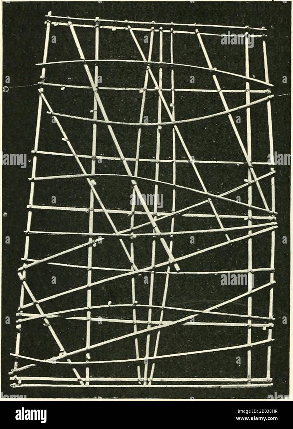 Marshall Islands stick charts were made by native Marshallese sailors to navigate the Pacific Ocean by canoe. The charts were a representation of major oceanic swell patterns and showed the ways the islands disrupted these patterns. Stick charts were primarily made from tied together coconut fronds, with island locations displayed on the charts with shells. Each chart was unique and interpretative that most could only be deciphered by the individual navigator who had made it. Stick charts came to an end after World War II, once new electronic technologies allowed for easier travel among islan Stock Photohttps://www.alamy.com/image-license-details/?v=1https://www.alamy.com/marshall-islands-stick-charts-were-made-by-native-marshallese-sailors-to-navigate-the-pacific-ocean-by-canoe-the-charts-were-a-representation-of-major-oceanic-swell-patterns-and-showed-the-ways-the-islands-disrupted-these-patterns-stick-charts-were-primarily-made-from-tied-together-coconut-fronds-with-island-locations-displayed-on-the-charts-with-shells-each-chart-was-unique-and-interpretative-that-most-could-only-be-deciphered-by-the-individual-navigator-who-had-made-it-stick-charts-came-to-an-end-after-world-war-ii-once-new-electronic-technologies-allowed-for-easier-travel-among-islan-image344279987.html
RM2B038HR–Marshall Islands stick charts were made by native Marshallese sailors to navigate the Pacific Ocean by canoe. The charts were a representation of major oceanic swell patterns and showed the ways the islands disrupted these patterns. Stick charts were primarily made from tied together coconut fronds, with island locations displayed on the charts with shells. Each chart was unique and interpretative that most could only be deciphered by the individual navigator who had made it. Stick charts came to an end after World War II, once new electronic technologies allowed for easier travel among islan
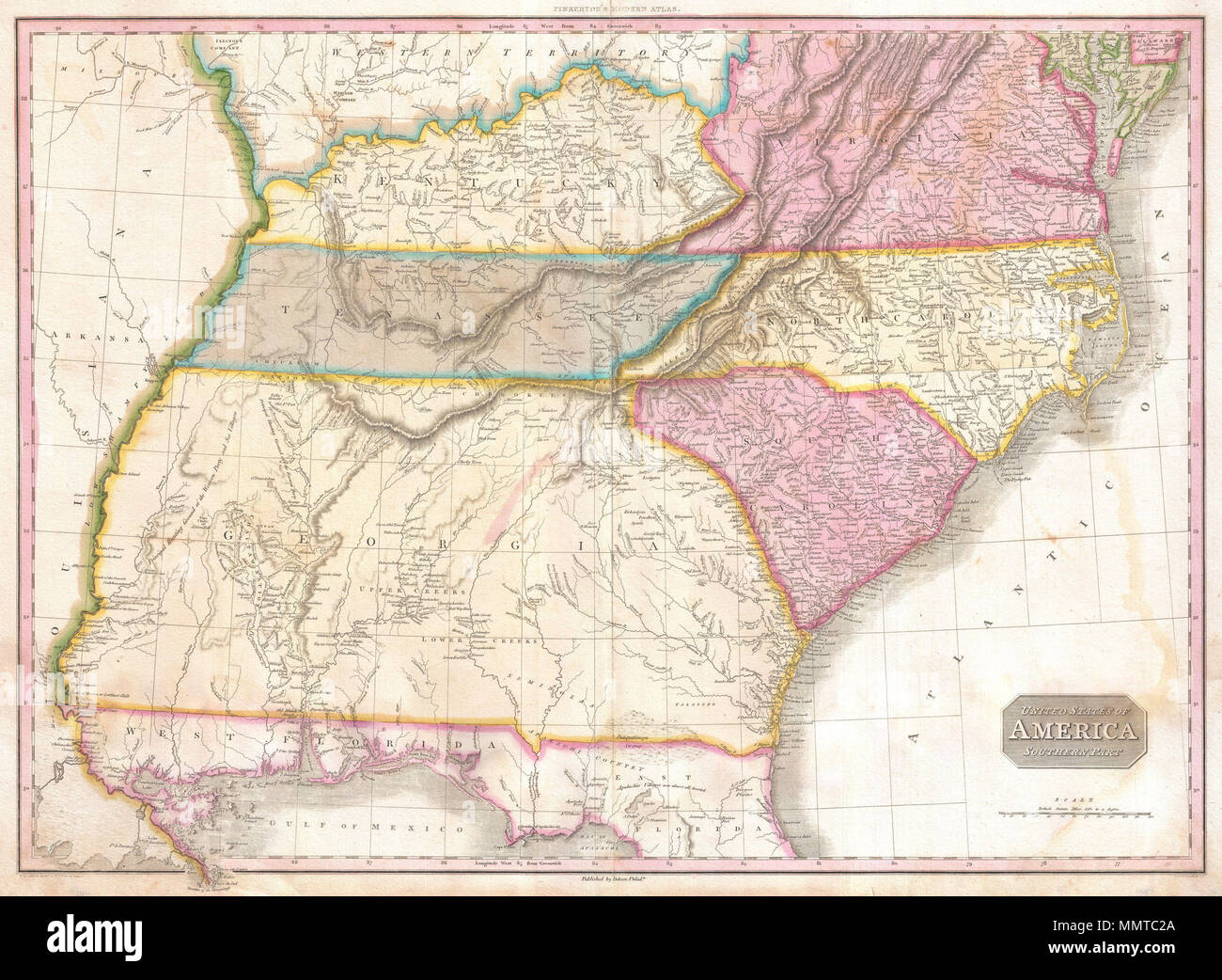 . English: A rare and important 1818 map of the southeastern part of the United States. Depicts from the Mississippi River eastward to the Pacific, extends north as far as Delaware and south as far as Florida and the Mississippi Delta. This map was created during the transitional period of expansion shortly following the American Revolutionary War. Shows Virginia, Kentucky, Tennessee, North Carolina, South Carolina and Georgia. Predates the formation of Ohio, Illinois, Indiana and Alabama. Florida was not yet part of the United States but would join one year after this map was printed in 1819 Stock Photohttps://www.alamy.com/image-license-details/?v=1https://www.alamy.com/english-a-rare-and-important-1818-map-of-the-southeastern-part-of-the-united-states-depicts-from-the-mississippi-river-eastward-to-the-pacific-extends-north-as-far-as-delaware-and-south-as-far-as-florida-and-the-mississippi-delta-this-map-was-created-during-the-transitional-period-of-expansion-shortly-following-the-american-revolutionary-war-shows-virginia-kentucky-tennessee-north-carolina-south-carolina-and-georgia-predates-the-formation-of-ohio-illinois-indiana-and-alabama-florida-was-not-yet-part-of-the-united-states-but-would-join-one-year-after-this-map-was-printed-in-1819-image184933122.html
RMMMTC2A–. English: A rare and important 1818 map of the southeastern part of the United States. Depicts from the Mississippi River eastward to the Pacific, extends north as far as Delaware and south as far as Florida and the Mississippi Delta. This map was created during the transitional period of expansion shortly following the American Revolutionary War. Shows Virginia, Kentucky, Tennessee, North Carolina, South Carolina and Georgia. Predates the formation of Ohio, Illinois, Indiana and Alabama. Florida was not yet part of the United States but would join one year after this map was printed in 1819
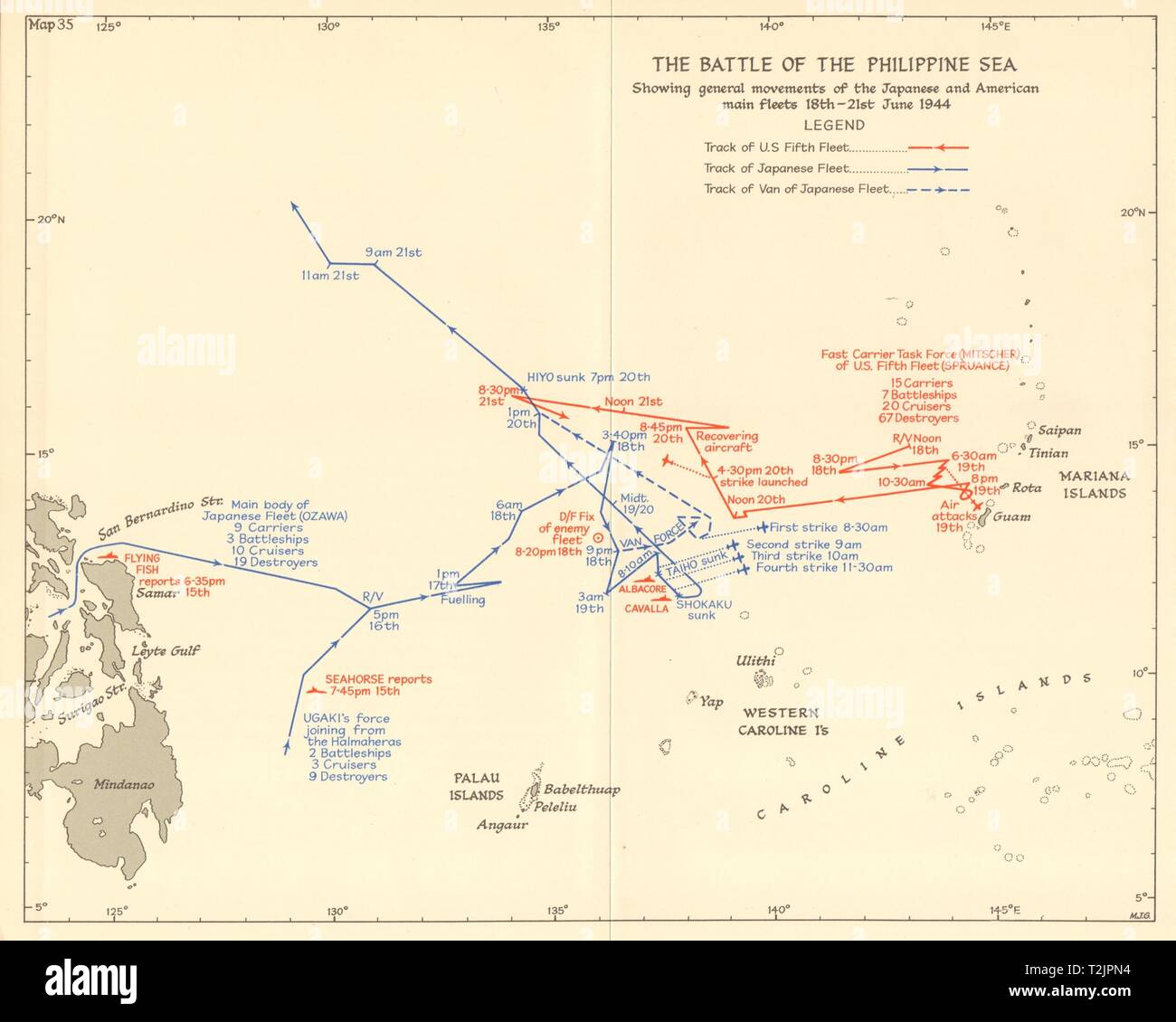 Battle of the Philippine Sea 18-21 June 1944. World War 2 Pacific. 1961 map Stock Photohttps://www.alamy.com/image-license-details/?v=1https://www.alamy.com/battle-of-the-philippine-sea-18-21-june-1944-world-war-2-pacific-1961-map-image242587440.html
RFT2JPN4–Battle of the Philippine Sea 18-21 June 1944. World War 2 Pacific. 1961 map
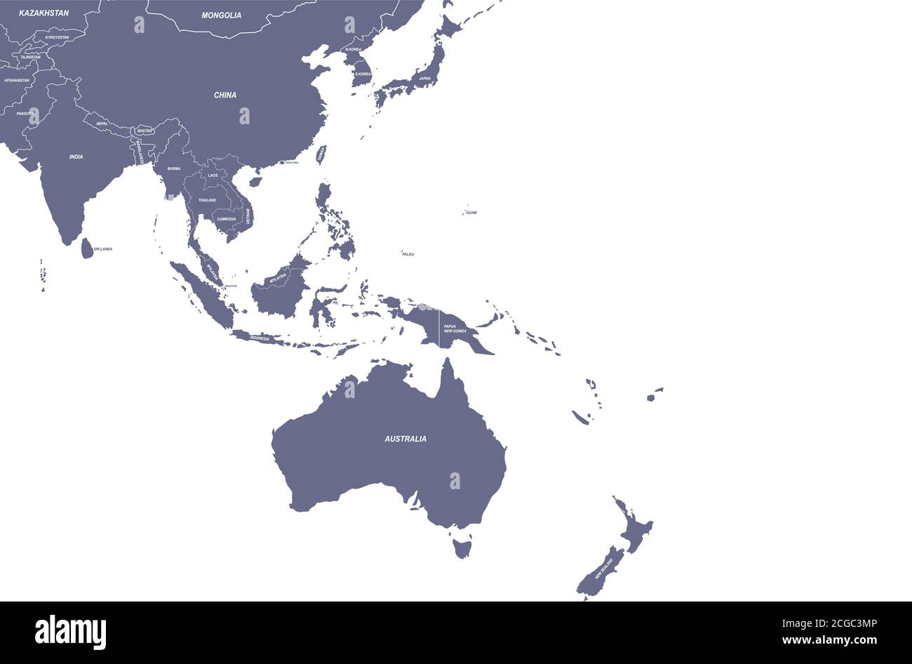 Asian countries named vector map. Stock Vectorhttps://www.alamy.com/image-license-details/?v=1https://www.alamy.com/asian-countries-named-vector-map-image371518582.html
RF2CGC3MP–Asian countries named vector map.
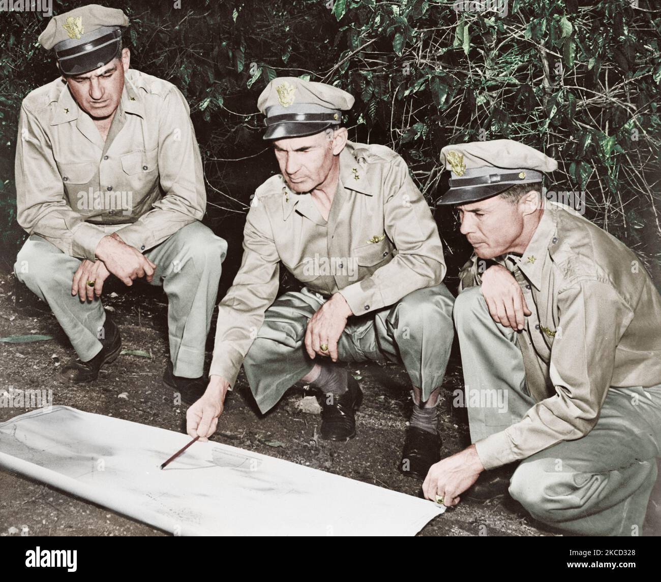 U.S. Army members reviewing a map in the South Pacific area, circa 1942. Stock Photohttps://www.alamy.com/image-license-details/?v=1https://www.alamy.com/us-army-members-reviewing-a-map-in-the-south-pacific-area-circa-1942-image489553968.html
RF2KCD328–U.S. Army members reviewing a map in the South Pacific area, circa 1942.
 Manila, Philippines - January 17, 2017: American War Cemetery Stock Photohttps://www.alamy.com/image-license-details/?v=1https://www.alamy.com/manila-philippines-january-17-2017-american-war-cemetery-image365951099.html
RF2C7AEA3–Manila, Philippines - January 17, 2017: American War Cemetery
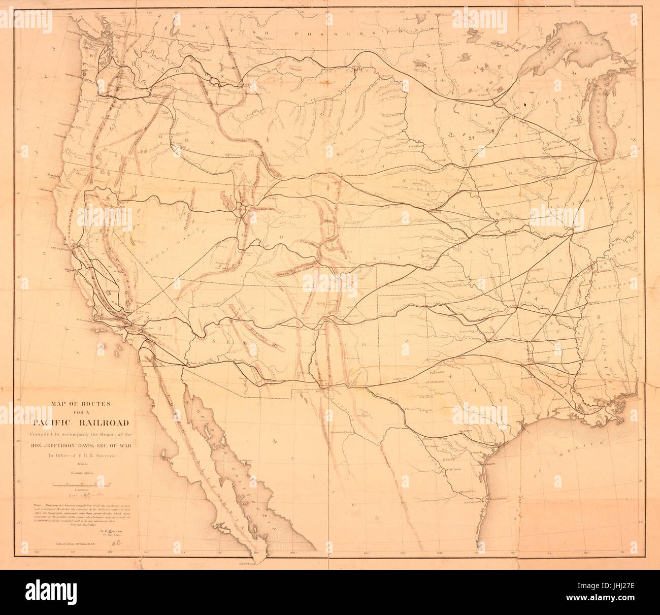 Map of routes for a Pacific railroad - compiled to accompany the report of the Hon. Jefferson Davis, sec. of war in Office of P.R.R. Surveys, 1855 (NYPL b15829340-HW039) Stock Photohttps://www.alamy.com/image-license-details/?v=1https://www.alamy.com/stock-photo-map-of-routes-for-a-pacific-railroad-compiled-to-accompany-the-report-148529010.html
RMJHJ27E–Map of routes for a Pacific railroad - compiled to accompany the report of the Hon. Jefferson Davis, sec. of war in Office of P.R.R. Surveys, 1855 (NYPL b15829340-HW039)
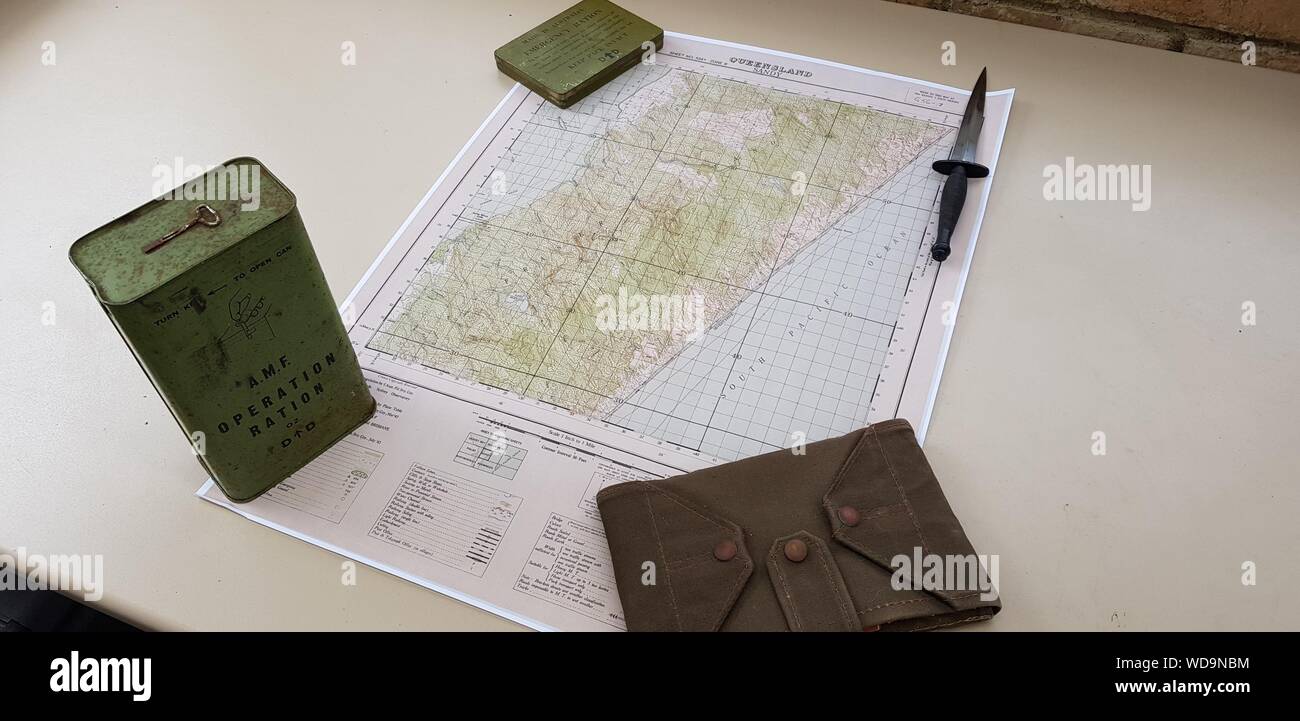 WWII Map of the Z Special Unit Training base on Fraser Island, QLD along with ration tins, commando dagger and map case Stock Photohttps://www.alamy.com/image-license-details/?v=1https://www.alamy.com/wwii-map-of-the-z-special-unit-training-base-on-fraser-island-qld-along-with-ration-tins-commando-dagger-and-map-case-image266360408.html
RFWD9NBM–WWII Map of the Z Special Unit Training base on Fraser Island, QLD along with ration tins, commando dagger and map case
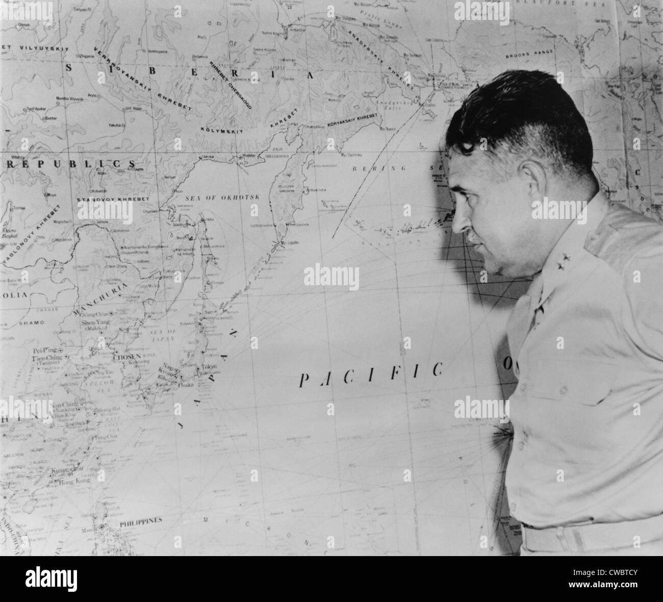 Major General Leslie Richard Groves, viewing a wall map of coastal East Asia and Japan, after the first use of the Atomic bomb Stock Photohttps://www.alamy.com/image-license-details/?v=1https://www.alamy.com/stock-photo-major-general-leslie-richard-groves-viewing-a-wall-map-of-coastal-50047787.html
RMCWBTCY–Major General Leslie Richard Groves, viewing a wall map of coastal East Asia and Japan, after the first use of the Atomic bomb
 Remembrance Circle Map Diorama Honors Army Air Force Pearl Harbor Pacific National Monument Hawaii Stock Photohttps://www.alamy.com/image-license-details/?v=1https://www.alamy.com/stock-photo-remembrance-circle-map-diorama-honors-army-air-force-pearl-harbor-33985747.html
RMBY854K–Remembrance Circle Map Diorama Honors Army Air Force Pearl Harbor Pacific National Monument Hawaii
 SAMOA national day banner with map, flag colors theme background and geometric abstract retro modern colorfull design with raised hands or fists. Stock Vectorhttps://www.alamy.com/image-license-details/?v=1https://www.alamy.com/samoa-national-day-banner-with-map-flag-colors-theme-background-and-geometric-abstract-retro-modern-colorfull-design-with-raised-hands-or-fists-image565707417.html
RF2RTA5G9–SAMOA national day banner with map, flag colors theme background and geometric abstract retro modern colorfull design with raised hands or fists.
 Explorations and surveys south of Central Pacific R.R., War Department: preliminary topographical map embracing in skeleton a portion only of the notes from surveys made in accordance with Par. II Special Orders No. 109 War Dept., March 18th, 1871 and letter of instructions of Brig. General A.A. Humphreys, Chief of Eng'rs, dated March 23rd, 1871 1872 by United States. Army. Corps of Engineers Stock Photohttps://www.alamy.com/image-license-details/?v=1https://www.alamy.com/explorations-and-surveys-south-of-central-pacific-rr-war-department-preliminary-topographical-map-embracing-in-skeleton-a-portion-only-of-the-notes-from-surveys-made-in-accordance-with-par-ii-special-orders-no-109-war-dept-march-18th-1871-and-letter-of-instructions-of-brig-general-aa-humphreys-chief-of-engrs-dated-march-23rd-1871-1872-by-united-states-army-corps-of-engineers-image633123549.html
RM2YP17F9–Explorations and surveys south of Central Pacific R.R., War Department: preliminary topographical map embracing in skeleton a portion only of the notes from surveys made in accordance with Par. II Special Orders No. 109 War Dept., March 18th, 1871 and letter of instructions of Brig. General A.A. Humphreys, Chief of Eng'rs, dated March 23rd, 1871 1872 by United States. Army. Corps of Engineers
 Map of the territory of the United States from the Mississippi to the Pacific Ocean; ordered by Jeff'n Davis, Secretary of War to accompany the reports of the explorations for a railroad route. Stock Photohttps://www.alamy.com/image-license-details/?v=1https://www.alamy.com/map-of-the-territory-of-the-united-states-from-the-mississippi-to-the-pacific-ocean-ordered-by-jeffn-davis-secretary-of-war-to-accompany-the-reports-of-the-explorations-for-a-railroad-route-image398169490.html
RM2E3P56X–Map of the territory of the United States from the Mississippi to the Pacific Ocean; ordered by Jeff'n Davis, Secretary of War to accompany the reports of the explorations for a railroad route.
 Map showing the United States and its dependent territories during World War One. The map is numbered 62,561 and is a photograph taken by the Signal Corps. It is a factual representation and does not have any creative elements. Stock Photohttps://www.alamy.com/image-license-details/?v=1https://www.alamy.com/map-showing-the-united-states-and-its-dependent-territories-during-world-war-one-the-map-is-numbered-62561-and-is-a-photograph-taken-by-the-signal-corps-it-is-a-factual-representation-and-does-not-have-any-creative-elements-image558531337.html
RM2RCK8BN–Map showing the United States and its dependent territories during World War One. The map is numbered 62,561 and is a photograph taken by the Signal Corps. It is a factual representation and does not have any creative elements.
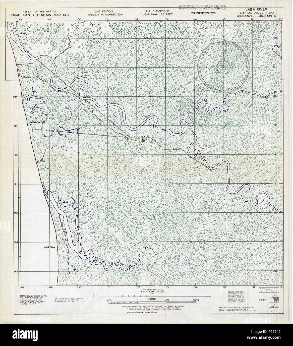 Map of Jaba River - 1943 - Bougainville - North Solomon Islands Map Stock Photohttps://www.alamy.com/image-license-details/?v=1https://www.alamy.com/map-of-jaba-river-1943-bougainville-north-solomon-islands-map-image212083874.html
RMP91742–Map of Jaba River - 1943 - Bougainville - North Solomon Islands Map