Quick filters:
Port arthur manchuria map Stock Photos and Images
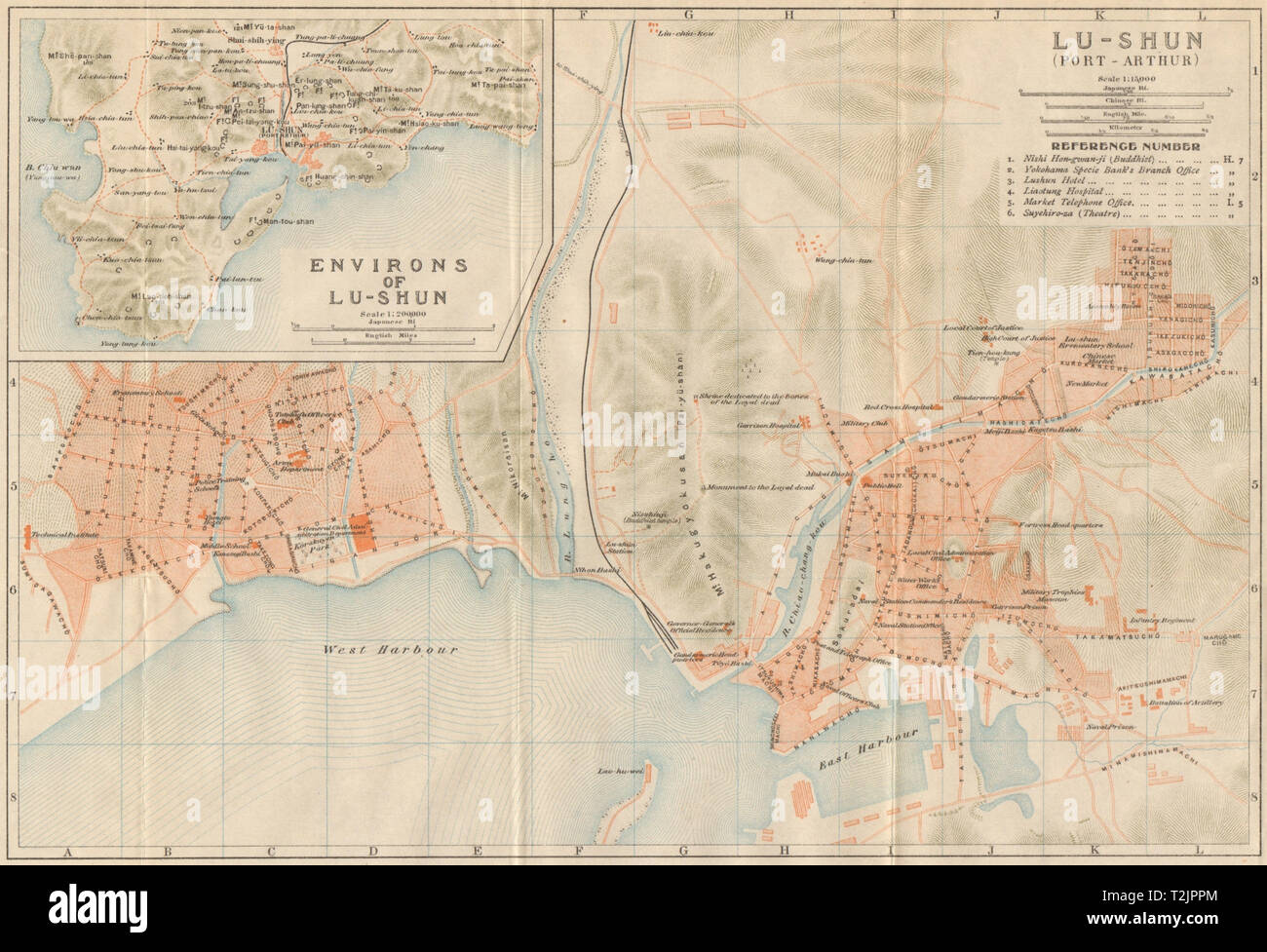 'Lu-shun (Port Arthur)'. Lushunkou, Dalian city plan. Liaoning, China 1913 map Stock Photohttps://www.alamy.com/image-license-details/?v=1https://www.alamy.com/lu-shun-port-arthur-lushunkou-dalian-city-plan-liaoning-china-1913-map-image242587484.html
RFT2JPPM–'Lu-shun (Port Arthur)'. Lushunkou, Dalian city plan. Liaoning, China 1913 map
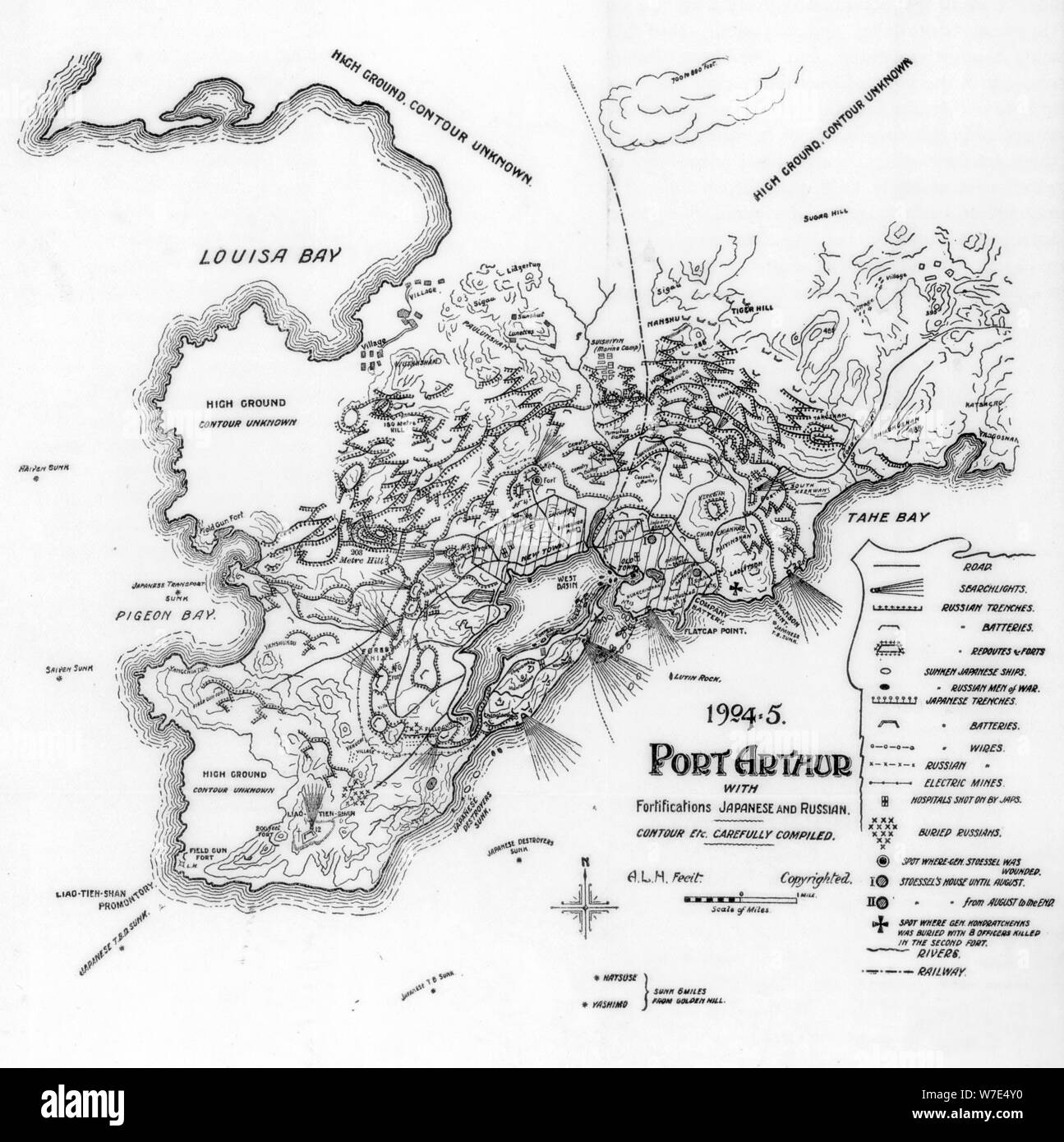 Port Arthur, Manchuria, showing Japanese and Russian fortifications, Russo-Japanese War, 1905. Artist: Unknown Stock Photohttps://www.alamy.com/image-license-details/?v=1https://www.alamy.com/port-arthur-manchuria-showing-japanese-and-russian-fortifications-russo-japanese-war-1905-artist-unknown-image262769332.html
RMW7E4Y0–Port Arthur, Manchuria, showing Japanese and Russian fortifications, Russo-Japanese War, 1905. Artist: Unknown
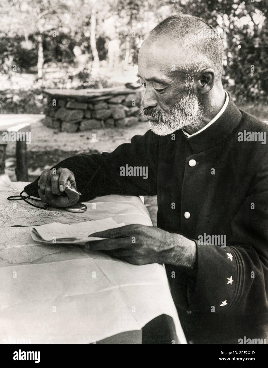 Port Arthur, Manchuria: September 13, 1904 Japanese General Nogi Maresuke studying his seige map at his headquaters during the Russo-Japanese War. Stock Photohttps://www.alamy.com/image-license-details/?v=1https://www.alamy.com/port-arthur-manchuria-september-13-1904-japanese-general-nogi-maresuke-studying-his-seige-map-at-his-headquaters-during-the-russo-japanese-war-image559401289.html
RM2RE2X1D–Port Arthur, Manchuria: September 13, 1904 Japanese General Nogi Maresuke studying his seige map at his headquaters during the Russo-Japanese War.
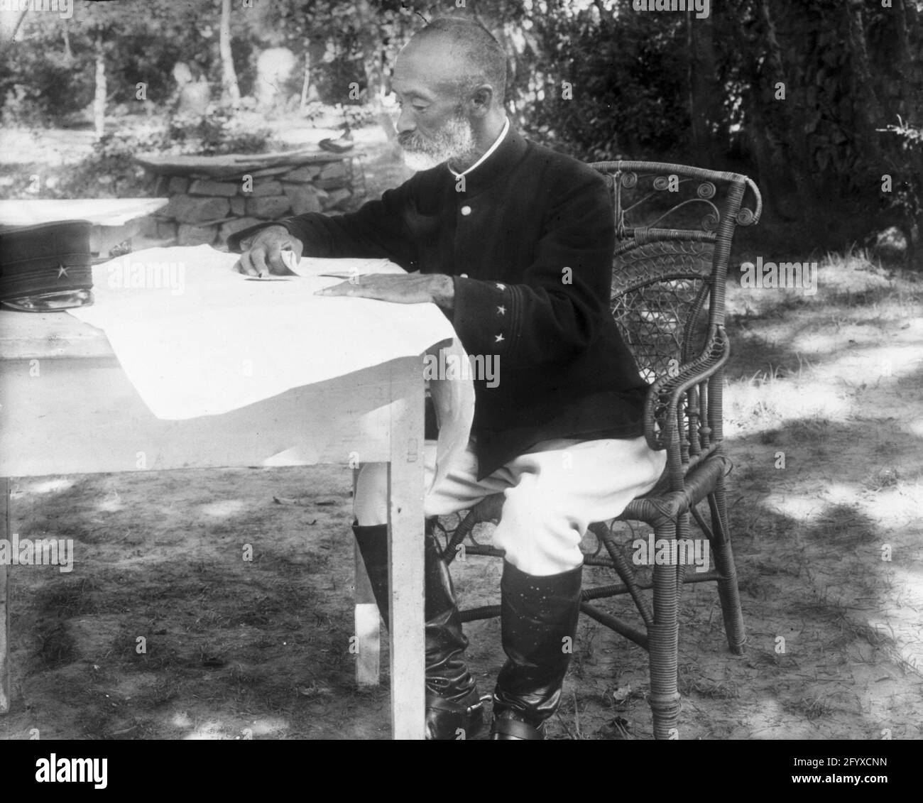 Japanese General Count Nogi Maresuke (1849 - 1912) seated at a table studying a map at the Japanese headquarters during the Russo-Japanese War, Port Arthur, China, 1904. (Photo by Burton Holmes) Stock Photohttps://www.alamy.com/image-license-details/?v=1https://www.alamy.com/japanese-general-count-nogi-maresuke-1849-1912-seated-at-a-table-studying-a-map-at-the-japanese-headquarters-during-the-russo-japanese-war-port-arthur-china-1904-photo-by-burton-holmes-image430225313.html
RM2FYXCNN–Japanese General Count Nogi Maresuke (1849 - 1912) seated at a table studying a map at the Japanese headquarters during the Russo-Japanese War, Port Arthur, China, 1904. (Photo by Burton Holmes)
 Map of Korea and Manchuria. Includes index map and insets of Vladivostok and Port Arthur. Relief shown by contours, hachures, form lines and spot heights.... , Korea ,former primary political entity Stock Photohttps://www.alamy.com/image-license-details/?v=1https://www.alamy.com/map-of-korea-and-manchuria-includes-index-map-and-insets-of-vladivostok-and-port-arthur-relief-shown-by-contours-hachures-form-lines-and-spot-heights-korea-former-primary-political-entity-image502712201.html
RM2M5TEF5–Map of Korea and Manchuria. Includes index map and insets of Vladivostok and Port Arthur. Relief shown by contours, hachures, form lines and spot heights.... , Korea ,former primary political entity
 Russo-Japanese War - 3rd Army Division at Battle of Shaho Stock Photohttps://www.alamy.com/image-license-details/?v=1https://www.alamy.com/stock-photo-russo-japanese-war-3rd-army-division-at-battle-of-shaho-105374907.html
RMG3C6NF–Russo-Japanese War - 3rd Army Division at Battle of Shaho
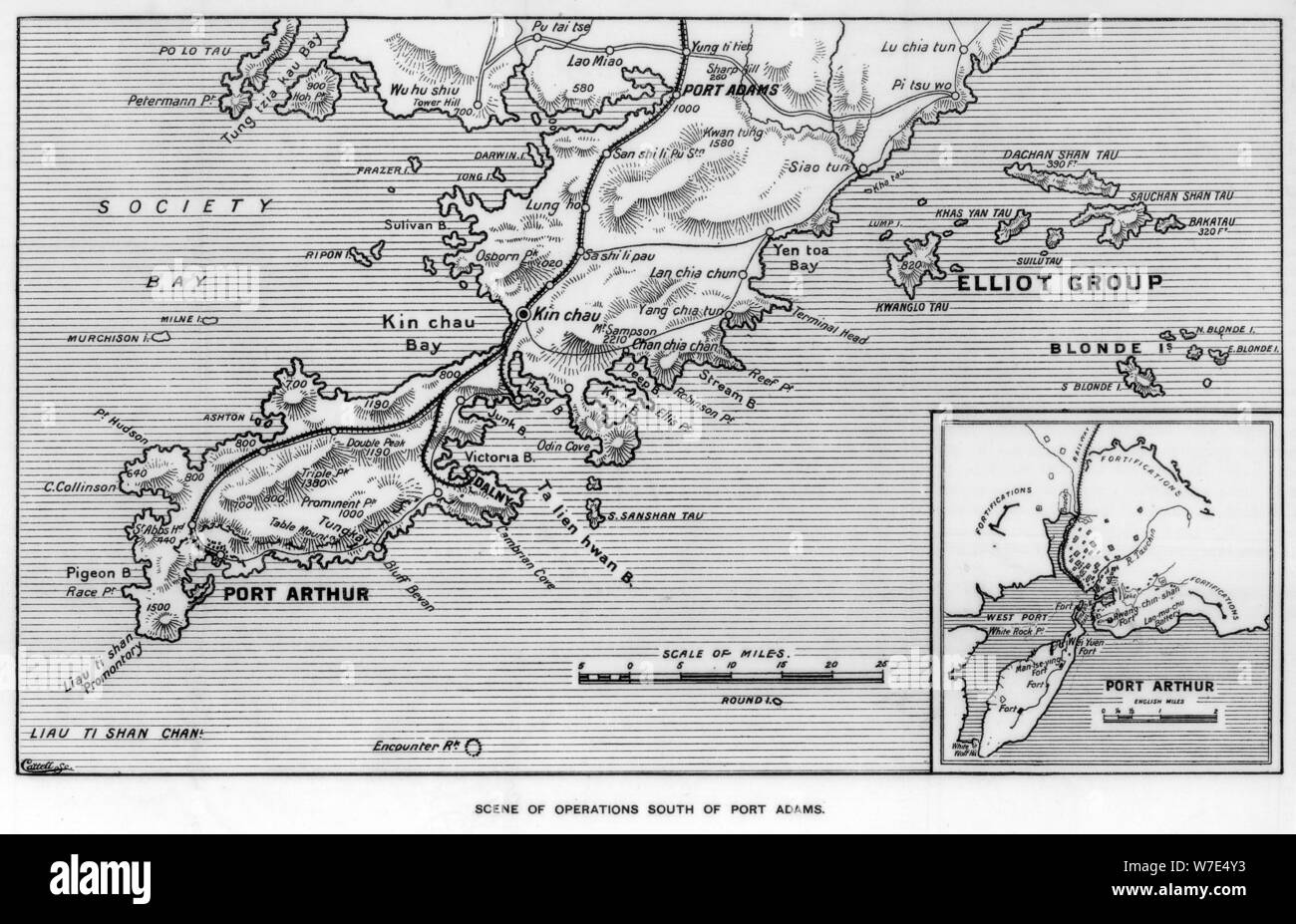 Scene of operations south of Port Adams, Manchuria, Russo-Japanese War, 1905. Artist: Unknown Stock Photohttps://www.alamy.com/image-license-details/?v=1https://www.alamy.com/scene-of-operations-south-of-port-adams-manchuria-russo-japanese-war-1905-artist-unknown-image262769335.html
RMW7E4Y3–Scene of operations south of Port Adams, Manchuria, Russo-Japanese War, 1905. Artist: Unknown
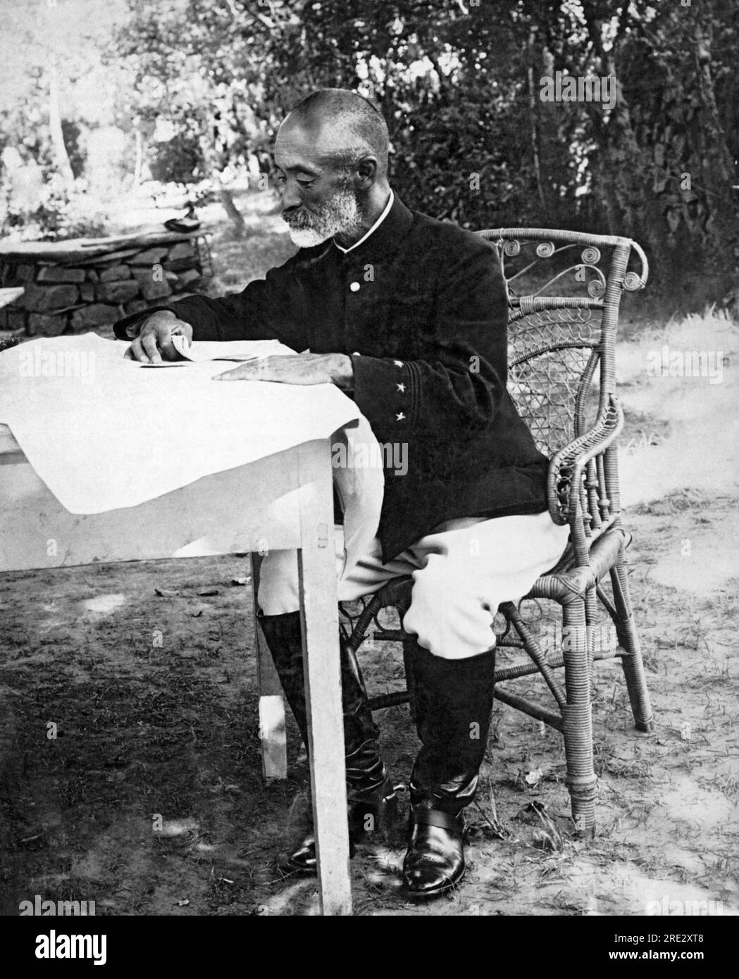 Port Arthur, Manchuria: September 13, 1904 Japanese General Nogi Maresuke studying his seige map at his headquaters during the Russo-Japanese War. Stock Photohttps://www.alamy.com/image-license-details/?v=1https://www.alamy.com/port-arthur-manchuria-september-13-1904-japanese-general-nogi-maresuke-studying-his-seige-map-at-his-headquaters-during-the-russo-japanese-war-image559401928.html
RM2RE2XT8–Port Arthur, Manchuria: September 13, 1904 Japanese General Nogi Maresuke studying his seige map at his headquaters during the Russo-Japanese War.
![Standard Russo-Japanese war map July 1904. Includes index, statistics for Russia and Japan, meaning of names and 2 insets. Insets: Port Arthur -- [Eurasia].... , North Korea South Korea China , Manchuria ,area Stock Photo Standard Russo-Japanese war map July 1904. Includes index, statistics for Russia and Japan, meaning of names and 2 insets. Insets: Port Arthur -- [Eurasia].... , North Korea South Korea China , Manchuria ,area Stock Photo](https://c8.alamy.com/comp/2M5W2DG/standard-russo-japanese-war-map-july-1904-includes-index-statistics-for-russia-and-japan-meaning-of-names-and-2-insets-insets-port-arthur-eurasia-north-korea-south-korea-china-manchuria-area-2M5W2DG.jpg) Standard Russo-Japanese war map July 1904. Includes index, statistics for Russia and Japan, meaning of names and 2 insets. Insets: Port Arthur -- [Eurasia].... , North Korea South Korea China , Manchuria ,area Stock Photohttps://www.alamy.com/image-license-details/?v=1https://www.alamy.com/standard-russo-japanese-war-map-july-1904-includes-index-statistics-for-russia-and-japan-meaning-of-names-and-2-insets-insets-port-arthur-eurasia-north-korea-south-korea-china-manchuria-area-image502724700.html
Standard Russo-Japanese war map July 1904. Includes index, statistics for Russia and Japan, meaning of names and 2 insets. Insets: Port Arthur -- [Eurasia].... , North Korea South Korea China , Manchuria ,area Stock Photohttps://www.alamy.com/image-license-details/?v=1https://www.alamy.com/standard-russo-japanese-war-map-july-1904-includes-index-statistics-for-russia-and-japan-meaning-of-names-and-2-insets-insets-port-arthur-eurasia-north-korea-south-korea-china-manchuria-area-image502724700.htmlRM2M5W2DG–Standard Russo-Japanese war map July 1904. Includes index, statistics for Russia and Japan, meaning of names and 2 insets. Insets: Port Arthur -- [Eurasia].... , North Korea South Korea China , Manchuria ,area