Ptolemaic world map Stock Photos and Images
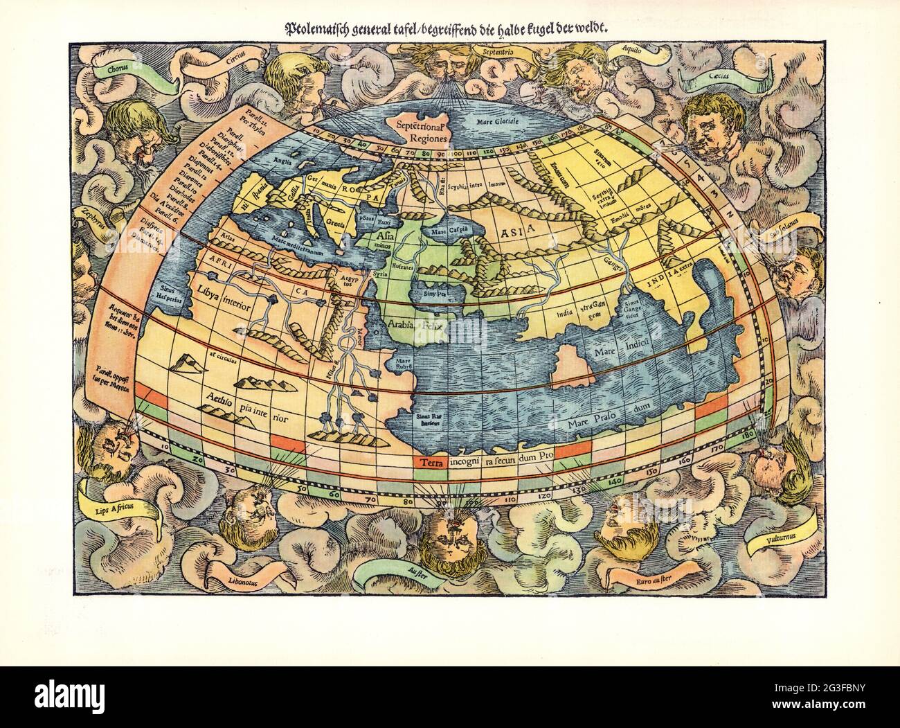 1550 Ptolemaic world map by Sebastian Münster Stock Photohttps://www.alamy.com/image-license-details/?v=1https://www.alamy.com/1550-ptolemaic-world-map-by-sebastian-mnster-image432441687.html
RM2G3FBNY–1550 Ptolemaic world map by Sebastian Münster
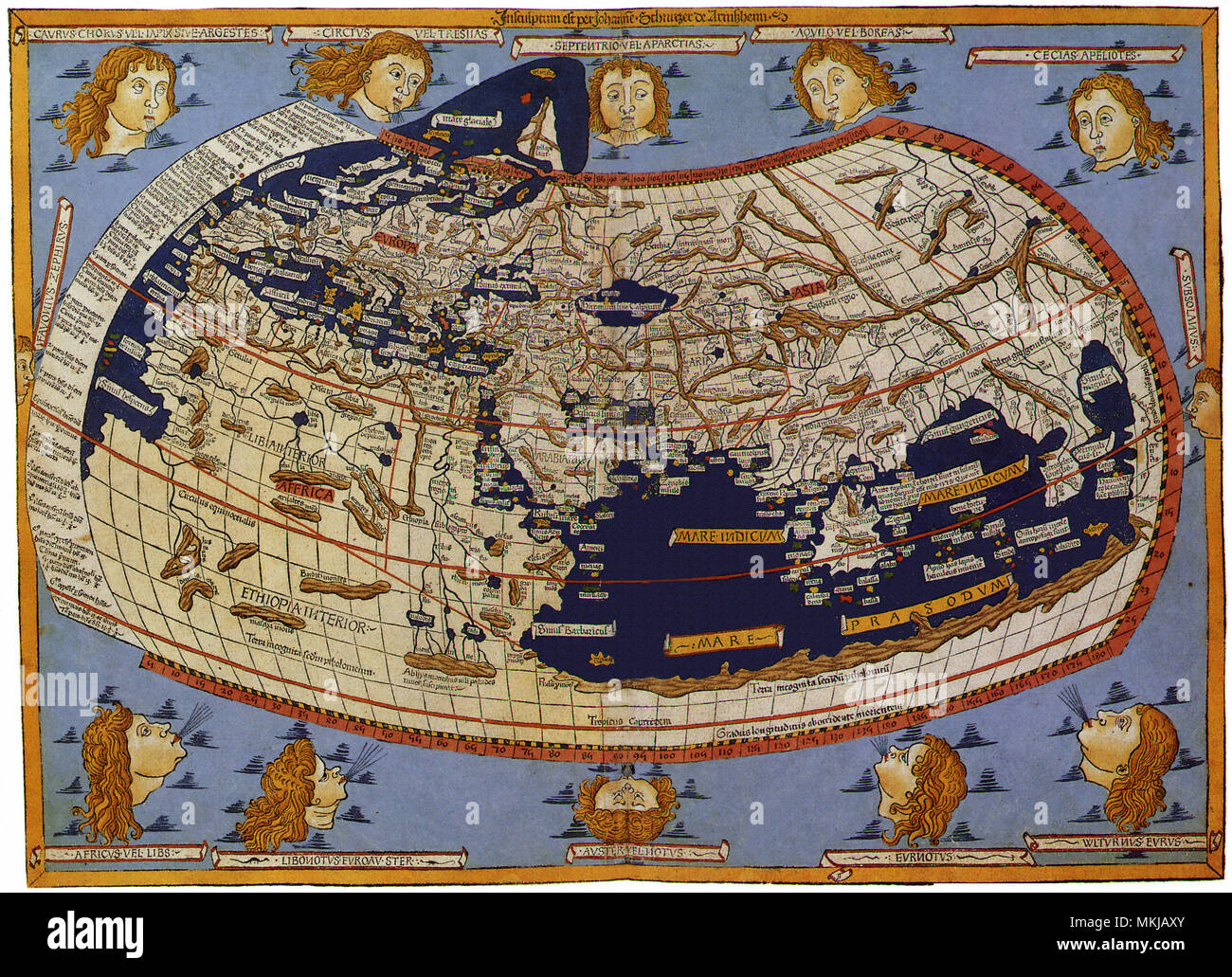 Old Map of the World Ptolemaic World, 1482 Stock Photohttps://www.alamy.com/image-license-details/?v=1https://www.alamy.com/old-map-of-the-world-ptolemaic-world-1482-image184185875.html
RMMKJAXY–Old Map of the World Ptolemaic World, 1482
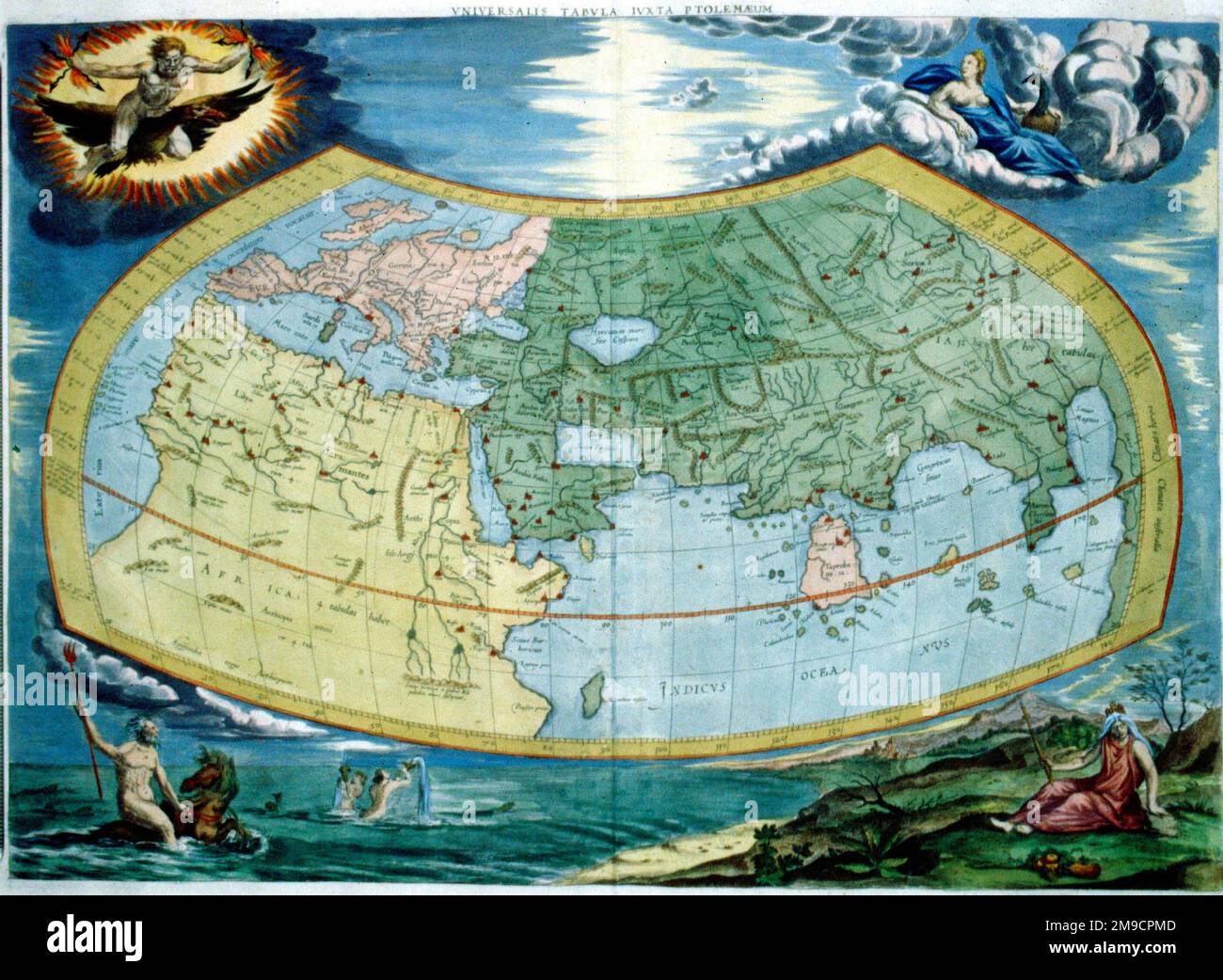 Ptolemaic Map of the World Stock Photohttps://www.alamy.com/image-license-details/?v=1https://www.alamy.com/ptolemaic-map-of-the-world-image504913821.html
RM2M9CPMD–Ptolemaic Map of the World
 Münster-Petri Ptolemaic world map. Stock Photohttps://www.alamy.com/image-license-details/?v=1https://www.alamy.com/mnster-petri-ptolemaic-world-map-image401900032.html
RM2E9T3GG–Münster-Petri Ptolemaic world map.
![Ptolemaic general panel, conceiving of the half andern weldt decryption., World map from the 16th century, Fig. 2, according to S. i, 1544, Sebastian Münster: Cosmographia. Beschreibung aller Lender durch Sebastianum Münsterum: in welcher begriffen aller Voelker, Herrschaften, Stetten, und namhafftiger Flecken, herkommen: Sitten, Gebreüch, Ordnung, Glauben, Secten und Hantierung durch die gantze Welt und fürnemlich Teütscher Nation [...]. Basel: durch Henrichum Petri, 1544 Stock Photo Ptolemaic general panel, conceiving of the half andern weldt decryption., World map from the 16th century, Fig. 2, according to S. i, 1544, Sebastian Münster: Cosmographia. Beschreibung aller Lender durch Sebastianum Münsterum: in welcher begriffen aller Voelker, Herrschaften, Stetten, und namhafftiger Flecken, herkommen: Sitten, Gebreüch, Ordnung, Glauben, Secten und Hantierung durch die gantze Welt und fürnemlich Teütscher Nation [...]. Basel: durch Henrichum Petri, 1544 Stock Photo](https://c8.alamy.com/comp/2A2RW9W/ptolemaic-general-panel-conceiving-of-the-half-andern-weldt-decryption-world-map-from-the-16th-century-fig-2-according-to-s-i-1544-sebastian-mnster-cosmographia-beschreibung-aller-lender-durch-sebastianum-mnsterum-in-welcher-begriffen-aller-voelker-herrschaften-stetten-und-namhafftiger-flecken-herkommen-sitten-gebrech-ordnung-glauben-secten-und-hantierung-durch-die-gantze-welt-und-frnemlich-tetscher-nation-basel-durch-henrichum-petri-1544-2A2RW9W.jpg) Ptolemaic general panel, conceiving of the half andern weldt decryption., World map from the 16th century, Fig. 2, according to S. i, 1544, Sebastian Münster: Cosmographia. Beschreibung aller Lender durch Sebastianum Münsterum: in welcher begriffen aller Voelker, Herrschaften, Stetten, und namhafftiger Flecken, herkommen: Sitten, Gebreüch, Ordnung, Glauben, Secten und Hantierung durch die gantze Welt und fürnemlich Teütscher Nation [...]. Basel: durch Henrichum Petri, 1544 Stock Photohttps://www.alamy.com/image-license-details/?v=1https://www.alamy.com/ptolemaic-general-panel-conceiving-of-the-half-andern-weldt-decryption-world-map-from-the-16th-century-fig-2-according-to-s-i-1544-sebastian-mnster-cosmographia-beschreibung-aller-lender-durch-sebastianum-mnsterum-in-welcher-begriffen-aller-voelker-herrschaften-stetten-und-namhafftiger-flecken-herkommen-sitten-gebrech-ordnung-glauben-secten-und-hantierung-durch-die-gantze-welt-und-frnemlich-tetscher-nation-basel-durch-henrichum-petri-1544-image328751077.html
Ptolemaic general panel, conceiving of the half andern weldt decryption., World map from the 16th century, Fig. 2, according to S. i, 1544, Sebastian Münster: Cosmographia. Beschreibung aller Lender durch Sebastianum Münsterum: in welcher begriffen aller Voelker, Herrschaften, Stetten, und namhafftiger Flecken, herkommen: Sitten, Gebreüch, Ordnung, Glauben, Secten und Hantierung durch die gantze Welt und fürnemlich Teütscher Nation [...]. Basel: durch Henrichum Petri, 1544 Stock Photohttps://www.alamy.com/image-license-details/?v=1https://www.alamy.com/ptolemaic-general-panel-conceiving-of-the-half-andern-weldt-decryption-world-map-from-the-16th-century-fig-2-according-to-s-i-1544-sebastian-mnster-cosmographia-beschreibung-aller-lender-durch-sebastianum-mnsterum-in-welcher-begriffen-aller-voelker-herrschaften-stetten-und-namhafftiger-flecken-herkommen-sitten-gebrech-ordnung-glauben-secten-und-hantierung-durch-die-gantze-welt-und-frnemlich-tetscher-nation-basel-durch-henrichum-petri-1544-image328751077.htmlRM2A2RW9W–Ptolemaic general panel, conceiving of the half andern weldt decryption., World map from the 16th century, Fig. 2, according to S. i, 1544, Sebastian Münster: Cosmographia. Beschreibung aller Lender durch Sebastianum Münsterum: in welcher begriffen aller Voelker, Herrschaften, Stetten, und namhafftiger Flecken, herkommen: Sitten, Gebreüch, Ordnung, Glauben, Secten und Hantierung durch die gantze Welt und fürnemlich Teütscher Nation [...]. Basel: durch Henrichum Petri, 1544
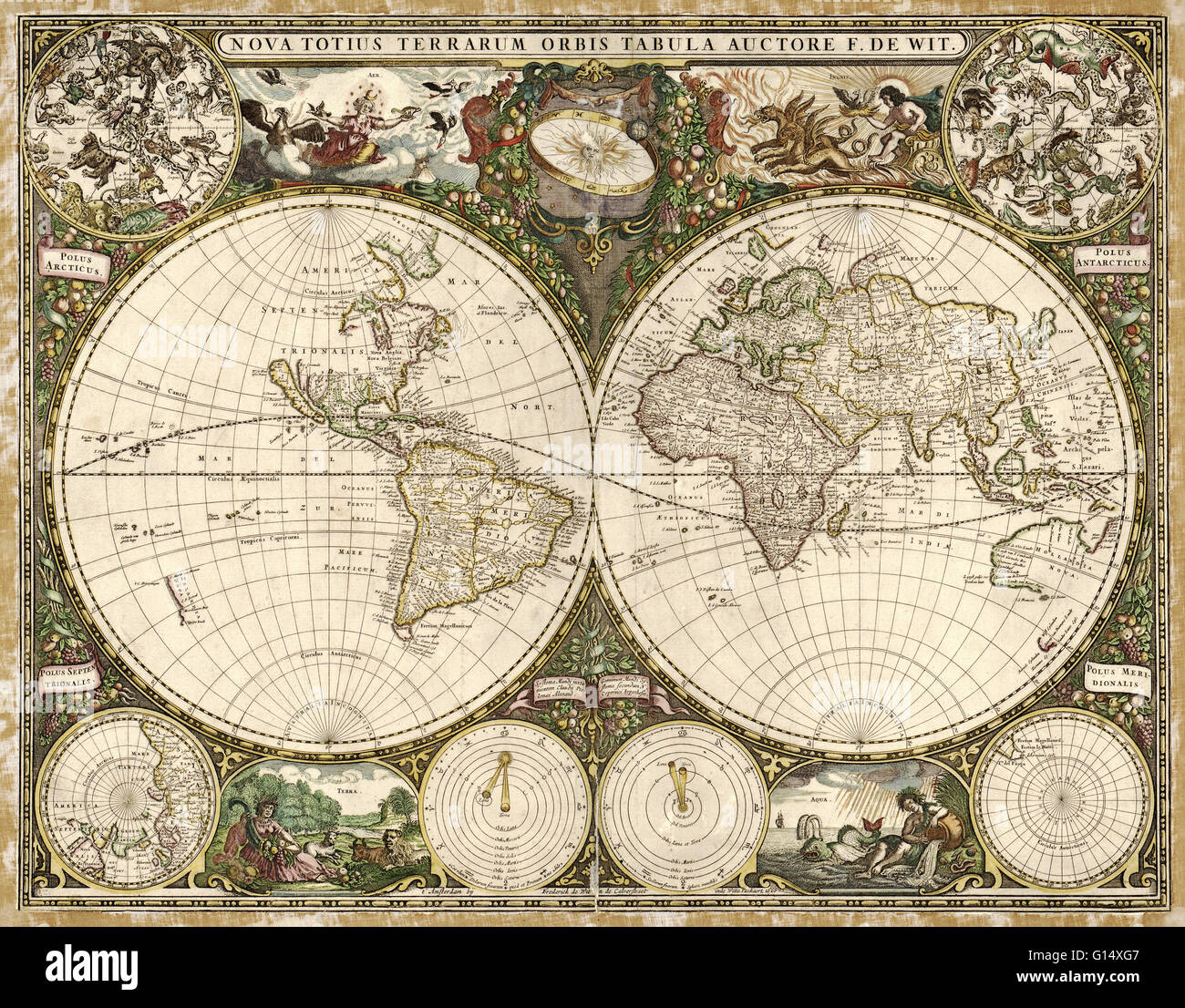 17th century map of the world. Published in Amsterdam in 1660, this map by the Dutch cartographer Frederick de Wit (c.1630-1706) shows the expanding exploration of the known world. The map divides the Earth into a western and eastern hemisphere. In the up Stock Photohttps://www.alamy.com/image-license-details/?v=1https://www.alamy.com/stock-photo-17th-century-map-of-the-world-published-in-amsterdam-in-1660-this-103985511.html
RMG14XG7–17th century map of the world. Published in Amsterdam in 1660, this map by the Dutch cartographer Frederick de Wit (c.1630-1706) shows the expanding exploration of the known world. The map divides the Earth into a western and eastern hemisphere. In the up
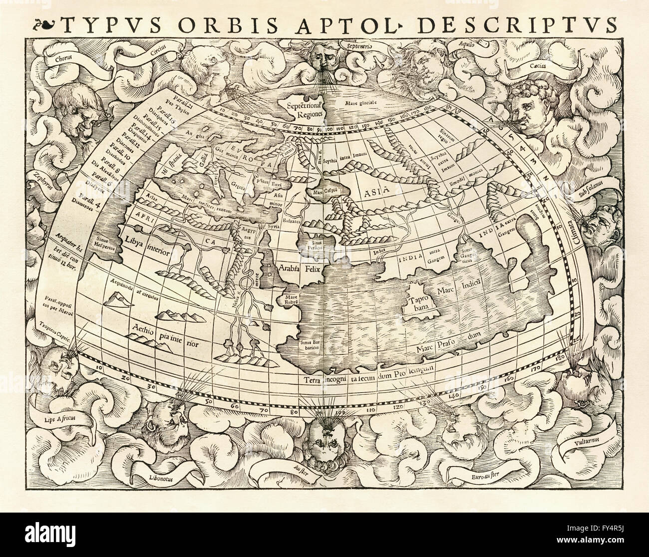 ‘Typus Orbis A Ptol. Desciptus’ Map of the world according to Claudius Ptolemy (100-170), Greco-Egyptian geographer and cartographer. See description for more information. Stock Photohttps://www.alamy.com/image-license-details/?v=1https://www.alamy.com/stock-photo-typus-orbis-a-ptol-desciptus-map-of-the-world-according-to-claudius-102753550.html
RMFY4R5J–‘Typus Orbis A Ptol. Desciptus’ Map of the world according to Claudius Ptolemy (100-170), Greco-Egyptian geographer and cartographer. See description for more information.
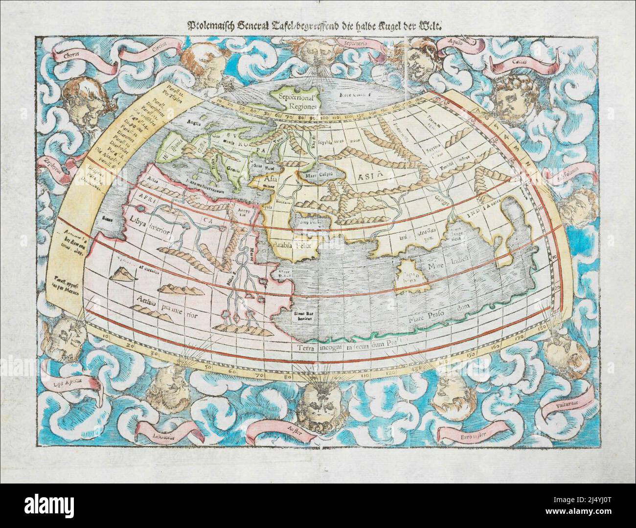 1550 Ptolemaic world map by Sebastian Münster Stock Photohttps://www.alamy.com/image-license-details/?v=1https://www.alamy.com/1550-ptolemaic-world-map-by-sebastian-mnster-image467745400.html
RM2J4YJ0T–1550 Ptolemaic world map by Sebastian Münster
![[The World]. Ptolemaic world map. Relief shown pictorially. Engraved on wood with place names in moveable type. Shows named national or geographical regions, rivers, mountains, deserts, seas. In margin: climactic notes and zodiacal signs. Appears in the author's Geographia, edited by Bernard Sylvanus. Venetiis : Per Iacobum Pentium de Leucho, anno Domini 1511. Text in Latin. Cataloging, conservation, and digitization made possible in part by The National Endowment for the Humanities: Exploring the human endeavor... Ptolemaic world map. Ptolemaic world map, World Stock Photo [The World]. Ptolemaic world map. Relief shown pictorially. Engraved on wood with place names in moveable type. Shows named national or geographical regions, rivers, mountains, deserts, seas. In margin: climactic notes and zodiacal signs. Appears in the author's Geographia, edited by Bernard Sylvanus. Venetiis : Per Iacobum Pentium de Leucho, anno Domini 1511. Text in Latin. Cataloging, conservation, and digitization made possible in part by The National Endowment for the Humanities: Exploring the human endeavor... Ptolemaic world map. Ptolemaic world map, World Stock Photo](https://c8.alamy.com/comp/2M5W0WM/the-world-ptolemaic-world-map-relief-shown-pictorially-engraved-on-wood-with-place-names-in-moveable-type-shows-named-national-or-geographical-regions-rivers-mountains-deserts-seas-in-margin-climactic-notes-and-zodiacal-signs-appears-in-the-authors-geographia-edited-by-bernard-sylvanus-venetiis-per-iacobum-pentium-de-leucho-anno-domini-1511-text-in-latin-cataloging-conservation-and-digitization-made-possible-in-part-by-the-national-endowment-for-the-humanities-exploring-the-human-endeavor-ptolemaic-world-map-ptolemaic-world-map-world-2M5W0WM.jpg) [The World]. Ptolemaic world map. Relief shown pictorially. Engraved on wood with place names in moveable type. Shows named national or geographical regions, rivers, mountains, deserts, seas. In margin: climactic notes and zodiacal signs. Appears in the author's Geographia, edited by Bernard Sylvanus. Venetiis : Per Iacobum Pentium de Leucho, anno Domini 1511. Text in Latin. Cataloging, conservation, and digitization made possible in part by The National Endowment for the Humanities: Exploring the human endeavor... Ptolemaic world map. Ptolemaic world map, World Stock Photohttps://www.alamy.com/image-license-details/?v=1https://www.alamy.com/the-world-ptolemaic-world-map-relief-shown-pictorially-engraved-on-wood-with-place-names-in-moveable-type-shows-named-national-or-geographical-regions-rivers-mountains-deserts-seas-in-margin-climactic-notes-and-zodiacal-signs-appears-in-the-authors-geographia-edited-by-bernard-sylvanus-venetiis-per-iacobum-pentium-de-leucho-anno-domini-1511-text-in-latin-cataloging-conservation-and-digitization-made-possible-in-part-by-the-national-endowment-for-the-humanities-exploring-the-human-endeavor-ptolemaic-world-map-ptolemaic-world-map-world-image502723472.html
[The World]. Ptolemaic world map. Relief shown pictorially. Engraved on wood with place names in moveable type. Shows named national or geographical regions, rivers, mountains, deserts, seas. In margin: climactic notes and zodiacal signs. Appears in the author's Geographia, edited by Bernard Sylvanus. Venetiis : Per Iacobum Pentium de Leucho, anno Domini 1511. Text in Latin. Cataloging, conservation, and digitization made possible in part by The National Endowment for the Humanities: Exploring the human endeavor... Ptolemaic world map. Ptolemaic world map, World Stock Photohttps://www.alamy.com/image-license-details/?v=1https://www.alamy.com/the-world-ptolemaic-world-map-relief-shown-pictorially-engraved-on-wood-with-place-names-in-moveable-type-shows-named-national-or-geographical-regions-rivers-mountains-deserts-seas-in-margin-climactic-notes-and-zodiacal-signs-appears-in-the-authors-geographia-edited-by-bernard-sylvanus-venetiis-per-iacobum-pentium-de-leucho-anno-domini-1511-text-in-latin-cataloging-conservation-and-digitization-made-possible-in-part-by-the-national-endowment-for-the-humanities-exploring-the-human-endeavor-ptolemaic-world-map-ptolemaic-world-map-world-image502723472.htmlRM2M5W0WM–[The World]. Ptolemaic world map. Relief shown pictorially. Engraved on wood with place names in moveable type. Shows named national or geographical regions, rivers, mountains, deserts, seas. In margin: climactic notes and zodiacal signs. Appears in the author's Geographia, edited by Bernard Sylvanus. Venetiis : Per Iacobum Pentium de Leucho, anno Domini 1511. Text in Latin. Cataloging, conservation, and digitization made possible in part by The National Endowment for the Humanities: Exploring the human endeavor... Ptolemaic world map. Ptolemaic world map, World
 Vintage historical Illustrated World Map. Ptolemaic Map of the World by Sebastian Münster, from Münster's edition of the Geographia, circa 1550s. Stock Photohttps://www.alamy.com/image-license-details/?v=1https://www.alamy.com/vintage-historical-illustrated-world-map-ptolemaic-map-of-the-world-by-sebastian-mnster-from-mnsters-edition-of-the-geographia-circa-1550s-image598427997.html
RM2WNGN0D–Vintage historical Illustrated World Map. Ptolemaic Map of the World by Sebastian Münster, from Münster's edition of the Geographia, circa 1550s.
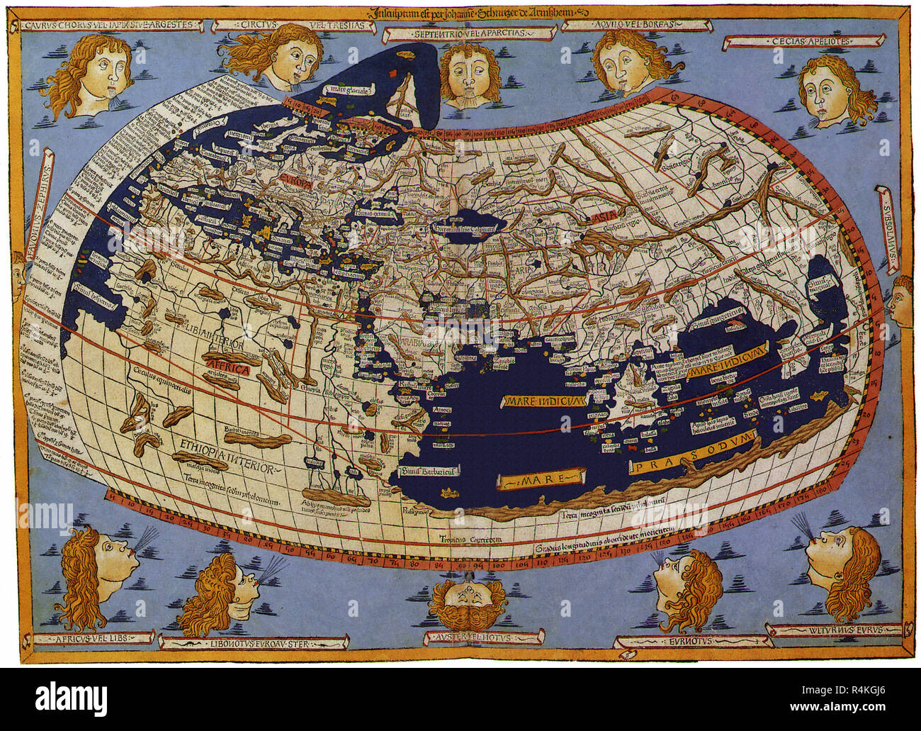 Old Map of the World Ptolemaic World, 1482, Johannes of Arnsheim. Stock Photohttps://www.alamy.com/image-license-details/?v=1https://www.alamy.com/old-map-of-the-world-ptolemaic-world-1482-johannes-of-arnsheim-image226623550.html
RMR4KGJ6–Old Map of the World Ptolemaic World, 1482, Johannes of Arnsheim.
 Vintage Printed and hand-coloured world map (woodcut). Loose map sheet from Fri's Ptolemaic edition. by cartographer: Laurent Fries. Date / Date: 1541 Stock Photohttps://www.alamy.com/image-license-details/?v=1https://www.alamy.com/vintage-printed-and-hand-coloured-world-map-woodcut-loose-map-sheet-from-fris-ptolemaic-edition-by-cartographer-laurent-fries-date-date-1541-image609716592.html
RM2XBXYMG–Vintage Printed and hand-coloured world map (woodcut). Loose map sheet from Fri's Ptolemaic edition. by cartographer: Laurent Fries. Date / Date: 1541
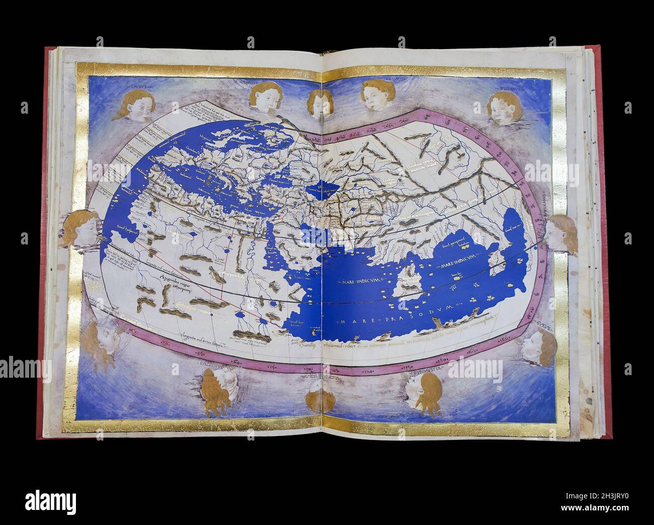 Ptolemy's world map. Ptolemy's Geography. Stock Photohttps://www.alamy.com/image-license-details/?v=1https://www.alamy.com/ptolemys-world-map-ptolemys-geography-image449727460.html
RF2H3JRY0–Ptolemy's world map. Ptolemy's Geography.
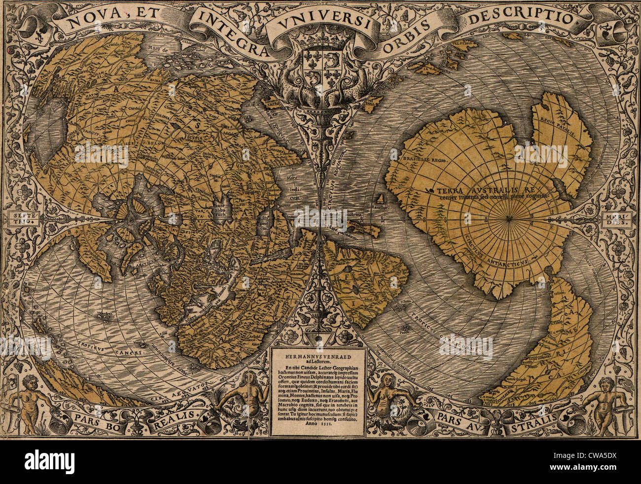 1531 world map showing Northern and Southern Hemispheres by Frenchman Oronce Fine (1494-1555). The map combines Ptolemaic Stock Photohttps://www.alamy.com/image-license-details/?v=1https://www.alamy.com/stock-photo-1531-world-map-showing-northern-and-southern-hemispheres-by-frenchman-50010966.html
RMCWA5DX–1531 world map showing Northern and Southern Hemispheres by Frenchman Oronce Fine (1494-1555). The map combines Ptolemaic
 . English: This is A. J. Johnson’s fine 1866 map of the world on a hemispherical projection. Offers a fascinating snapshot of the world during a period of rapid globalization and discovery. This is one of the first appearances of Lake Victoria on a Johnson map. Just to the south of Lake Victoria, Johnson also includes Lake Tanganyika. He is clearly identifying both the Ptolemaic Lakes of the Nile as he surrounds both with the Mountains of the Moon. He also identifies both Mt. Kenya and Mt. Kilimanjaro as part of this range - another Johnson first - though we know today that both mountains are Stock Photohttps://www.alamy.com/image-license-details/?v=1https://www.alamy.com/english-this-is-a-j-johnsons-fine-1866-map-of-the-world-on-a-hemispherical-projection-offers-a-fascinating-snapshot-of-the-world-during-a-period-of-rapid-globalization-and-discovery-this-is-one-of-the-first-appearances-of-lake-victoria-on-a-johnson-map-just-to-the-south-of-lake-victoria-johnson-also-includes-lake-tanganyika-he-is-clearly-identifying-both-the-ptolemaic-lakes-of-the-nile-as-he-surrounds-both-with-the-mountains-of-the-moon-he-also-identifies-both-mt-kenya-and-mt-kilimanjaro-as-part-of-this-range-another-johnson-first-though-we-know-today-that-both-mountains-are-image184967977.html
RMMMX0F5–. English: This is A. J. Johnson’s fine 1866 map of the world on a hemispherical projection. Offers a fascinating snapshot of the world during a period of rapid globalization and discovery. This is one of the first appearances of Lake Victoria on a Johnson map. Just to the south of Lake Victoria, Johnson also includes Lake Tanganyika. He is clearly identifying both the Ptolemaic Lakes of the Nile as he surrounds both with the Mountains of the Moon. He also identifies both Mt. Kenya and Mt. Kilimanjaro as part of this range - another Johnson first - though we know today that both mountains are
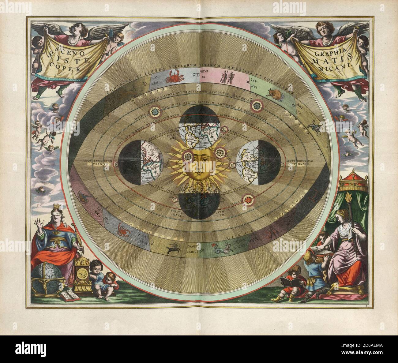 Title: Scenography of the Copernican world system. Engraving from Harmonia Macrocosmica Creator: Andreas Cellarius Date: c. 17th Medium: hand coloured engraving Location: The British Library Stock Photohttps://www.alamy.com/image-license-details/?v=1https://www.alamy.com/title-scenography-of-the-copernican-world-system-engraving-from-harmonia-macrocosmica-creator-andreas-cellarius-date-c-17th-medium-hand-coloured-engraving-location-the-british-library-image382547098.html
RM2D6AEMA–Title: Scenography of the Copernican world system. Engraving from Harmonia Macrocosmica Creator: Andreas Cellarius Date: c. 17th Medium: hand coloured engraving Location: The British Library
![. English: From Andreas Cellarius Harmonia Macrocosmica, 1660/61. Chart showing signs of the zodiac and the solar system with world at centre. Plate 2: SCENOGRAPHIA SYSTEMATIS MVNDANI PTOLEMAICI - Scenography of the Ptolemaic cosmography. Title: Scenographia systematis mvndani Ptolemaici [cartographic material]. Publisher: [Amsterdam : s.n., 1660] Physical Description: 1 map : col. ; 38 cm. in diam. Notes: '444' in top right hand margin in pencil. Rex Nan Kivell Collection Map NK 10241. Call Number: MAP NK 10241 Amicus Number: 9995246 Français : Extrait de l'Harmonia Macroscomica d'Andreas Cel Stock Photo . English: From Andreas Cellarius Harmonia Macrocosmica, 1660/61. Chart showing signs of the zodiac and the solar system with world at centre. Plate 2: SCENOGRAPHIA SYSTEMATIS MVNDANI PTOLEMAICI - Scenography of the Ptolemaic cosmography. Title: Scenographia systematis mvndani Ptolemaici [cartographic material]. Publisher: [Amsterdam : s.n., 1660] Physical Description: 1 map : col. ; 38 cm. in diam. Notes: '444' in top right hand margin in pencil. Rex Nan Kivell Collection Map NK 10241. Call Number: MAP NK 10241 Amicus Number: 9995246 Français : Extrait de l'Harmonia Macroscomica d'Andreas Cel Stock Photo](https://c8.alamy.com/comp/MMJYDB/english-from-andreas-cellarius-harmonia-macrocosmica-166061-chart-showing-signs-of-the-zodiac-and-the-solar-system-with-world-at-centre-plate-2-scenographia-systematis-mvndani-ptolemaici-scenography-of-the-ptolemaic-cosmography-title-scenographia-systematis-mvndani-ptolemaici-cartographic-material-publisher-amsterdam-sn-1660-physical-description-1-map-col-38-cm-in-diam-notes-444-in-top-right-hand-margin-in-pencil-rex-nan-kivell-collection-map-nk-10241-call-number-map-nk-10241-amicus-number-9995246-franais-extrait-de-lharmonia-macroscomica-dandreas-cel-MMJYDB.jpg) . English: From Andreas Cellarius Harmonia Macrocosmica, 1660/61. Chart showing signs of the zodiac and the solar system with world at centre. Plate 2: SCENOGRAPHIA SYSTEMATIS MVNDANI PTOLEMAICI - Scenography of the Ptolemaic cosmography. Title: Scenographia systematis mvndani Ptolemaici [cartographic material]. Publisher: [Amsterdam : s.n., 1660] Physical Description: 1 map : col. ; 38 cm. in diam. Notes: '444' in top right hand margin in pencil. Rex Nan Kivell Collection Map NK 10241. Call Number: MAP NK 10241 Amicus Number: 9995246 Français : Extrait de l'Harmonia Macroscomica d'Andreas Cel Stock Photohttps://www.alamy.com/image-license-details/?v=1https://www.alamy.com/english-from-andreas-cellarius-harmonia-macrocosmica-166061-chart-showing-signs-of-the-zodiac-and-the-solar-system-with-world-at-centre-plate-2-scenographia-systematis-mvndani-ptolemaici-scenography-of-the-ptolemaic-cosmography-title-scenographia-systematis-mvndani-ptolemaici-cartographic-material-publisher-amsterdam-sn-1660-physical-description-1-map-col-38-cm-in-diam-notes-444-in-top-right-hand-margin-in-pencil-rex-nan-kivell-collection-map-nk-10241-call-number-map-nk-10241-amicus-number-9995246-franais-extrait-de-lharmonia-macroscomica-dandreas-cel-image184813479.html
. English: From Andreas Cellarius Harmonia Macrocosmica, 1660/61. Chart showing signs of the zodiac and the solar system with world at centre. Plate 2: SCENOGRAPHIA SYSTEMATIS MVNDANI PTOLEMAICI - Scenography of the Ptolemaic cosmography. Title: Scenographia systematis mvndani Ptolemaici [cartographic material]. Publisher: [Amsterdam : s.n., 1660] Physical Description: 1 map : col. ; 38 cm. in diam. Notes: '444' in top right hand margin in pencil. Rex Nan Kivell Collection Map NK 10241. Call Number: MAP NK 10241 Amicus Number: 9995246 Français : Extrait de l'Harmonia Macroscomica d'Andreas Cel Stock Photohttps://www.alamy.com/image-license-details/?v=1https://www.alamy.com/english-from-andreas-cellarius-harmonia-macrocosmica-166061-chart-showing-signs-of-the-zodiac-and-the-solar-system-with-world-at-centre-plate-2-scenographia-systematis-mvndani-ptolemaici-scenography-of-the-ptolemaic-cosmography-title-scenographia-systematis-mvndani-ptolemaici-cartographic-material-publisher-amsterdam-sn-1660-physical-description-1-map-col-38-cm-in-diam-notes-444-in-top-right-hand-margin-in-pencil-rex-nan-kivell-collection-map-nk-10241-call-number-map-nk-10241-amicus-number-9995246-franais-extrait-de-lharmonia-macroscomica-dandreas-cel-image184813479.htmlRMMMJYDB–. English: From Andreas Cellarius Harmonia Macrocosmica, 1660/61. Chart showing signs of the zodiac and the solar system with world at centre. Plate 2: SCENOGRAPHIA SYSTEMATIS MVNDANI PTOLEMAICI - Scenography of the Ptolemaic cosmography. Title: Scenographia systematis mvndani Ptolemaici [cartographic material]. Publisher: [Amsterdam : s.n., 1660] Physical Description: 1 map : col. ; 38 cm. in diam. Notes: '444' in top right hand margin in pencil. Rex Nan Kivell Collection Map NK 10241. Call Number: MAP NK 10241 Amicus Number: 9995246 Français : Extrait de l'Harmonia Macroscomica d'Andreas Cel
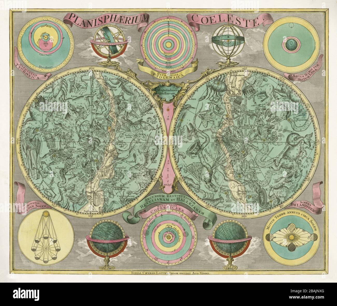 Hevelius style, Eimmart format; hemispheres, ecliptic pole to ecliptic, with non-Ptolemaic constellations. Authour: Lotter, Tobias Conrad 1772. Stock Photohttps://www.alamy.com/image-license-details/?v=1https://www.alamy.com/hevelius-style-eimmart-format-hemispheres-ecliptic-pole-to-ecliptic-with-non-ptolemaic-constellations-authour-lotter-tobias-conrad-1772-image350766264.html
RF2BAJNXG–Hevelius style, Eimmart format; hemispheres, ecliptic pole to ecliptic, with non-Ptolemaic constellations. Authour: Lotter, Tobias Conrad 1772.
![. English: From Andreas Cellarius Harmonia Macrocosmica, 1660/61. Chart showing signs of the zodiac and the solar system with world at centre. Plate 2: SCENOGRAPHIA SYSTEMATIS MVNDANI PTOLEMAICI - Scenography of the Ptolemaic cosmography. Title: Scenographia systematis mvndani Ptolemaici [cartographic material]. Publisher: [Amsterdam : s.n., 1660] Physical Description: 1 map : col. ; 38 cm. in diam. Notes: '444' in top right hand margin in pencil. Rex Nan Kivell Collection Map NK 10241. Call Number: MAP NK 10241 Amicus Number: 9995246 Français : Extrait de l'Harmonia Macroscomica d'Andreas Cel Stock Photo . English: From Andreas Cellarius Harmonia Macrocosmica, 1660/61. Chart showing signs of the zodiac and the solar system with world at centre. Plate 2: SCENOGRAPHIA SYSTEMATIS MVNDANI PTOLEMAICI - Scenography of the Ptolemaic cosmography. Title: Scenographia systematis mvndani Ptolemaici [cartographic material]. Publisher: [Amsterdam : s.n., 1660] Physical Description: 1 map : col. ; 38 cm. in diam. Notes: '444' in top right hand margin in pencil. Rex Nan Kivell Collection Map NK 10241. Call Number: MAP NK 10241 Amicus Number: 9995246 Français : Extrait de l'Harmonia Macroscomica d'Andreas Cel Stock Photo](https://c8.alamy.com/comp/MMH3XX/english-from-andreas-cellarius-harmonia-macrocosmica-166061-chart-showing-signs-of-the-zodiac-and-the-solar-system-with-world-at-centre-plate-2-scenographia-systematis-mvndani-ptolemaici-scenography-of-the-ptolemaic-cosmography-title-scenographia-systematis-mvndani-ptolemaici-cartographic-material-publisher-amsterdam-sn-1660-physical-description-1-map-col-38-cm-in-diam-notes-444-in-top-right-hand-margin-in-pencil-rex-nan-kivell-collection-map-nk-10241-call-number-map-nk-10241-amicus-number-9995246-franais-extrait-de-lharmonia-macroscomica-dandreas-cel-MMH3XX.jpg) . English: From Andreas Cellarius Harmonia Macrocosmica, 1660/61. Chart showing signs of the zodiac and the solar system with world at centre. Plate 2: SCENOGRAPHIA SYSTEMATIS MVNDANI PTOLEMAICI - Scenography of the Ptolemaic cosmography. Title: Scenographia systematis mvndani Ptolemaici [cartographic material]. Publisher: [Amsterdam : s.n., 1660] Physical Description: 1 map : col. ; 38 cm. in diam. Notes: '444' in top right hand margin in pencil. Rex Nan Kivell Collection Map NK 10241. Call Number: MAP NK 10241 Amicus Number: 9995246 Français : Extrait de l'Harmonia Macroscomica d'Andreas Cel Stock Photohttps://www.alamy.com/image-license-details/?v=1https://www.alamy.com/english-from-andreas-cellarius-harmonia-macrocosmica-166061-chart-showing-signs-of-the-zodiac-and-the-solar-system-with-world-at-centre-plate-2-scenographia-systematis-mvndani-ptolemaici-scenography-of-the-ptolemaic-cosmography-title-scenographia-systematis-mvndani-ptolemaici-cartographic-material-publisher-amsterdam-sn-1660-physical-description-1-map-col-38-cm-in-diam-notes-444-in-top-right-hand-margin-in-pencil-rex-nan-kivell-collection-map-nk-10241-call-number-map-nk-10241-amicus-number-9995246-franais-extrait-de-lharmonia-macroscomica-dandreas-cel-image184773090.html
. English: From Andreas Cellarius Harmonia Macrocosmica, 1660/61. Chart showing signs of the zodiac and the solar system with world at centre. Plate 2: SCENOGRAPHIA SYSTEMATIS MVNDANI PTOLEMAICI - Scenography of the Ptolemaic cosmography. Title: Scenographia systematis mvndani Ptolemaici [cartographic material]. Publisher: [Amsterdam : s.n., 1660] Physical Description: 1 map : col. ; 38 cm. in diam. Notes: '444' in top right hand margin in pencil. Rex Nan Kivell Collection Map NK 10241. Call Number: MAP NK 10241 Amicus Number: 9995246 Français : Extrait de l'Harmonia Macroscomica d'Andreas Cel Stock Photohttps://www.alamy.com/image-license-details/?v=1https://www.alamy.com/english-from-andreas-cellarius-harmonia-macrocosmica-166061-chart-showing-signs-of-the-zodiac-and-the-solar-system-with-world-at-centre-plate-2-scenographia-systematis-mvndani-ptolemaici-scenography-of-the-ptolemaic-cosmography-title-scenographia-systematis-mvndani-ptolemaici-cartographic-material-publisher-amsterdam-sn-1660-physical-description-1-map-col-38-cm-in-diam-notes-444-in-top-right-hand-margin-in-pencil-rex-nan-kivell-collection-map-nk-10241-call-number-map-nk-10241-amicus-number-9995246-franais-extrait-de-lharmonia-macroscomica-dandreas-cel-image184773090.htmlRMMMH3XX–. English: From Andreas Cellarius Harmonia Macrocosmica, 1660/61. Chart showing signs of the zodiac and the solar system with world at centre. Plate 2: SCENOGRAPHIA SYSTEMATIS MVNDANI PTOLEMAICI - Scenography of the Ptolemaic cosmography. Title: Scenographia systematis mvndani Ptolemaici [cartographic material]. Publisher: [Amsterdam : s.n., 1660] Physical Description: 1 map : col. ; 38 cm. in diam. Notes: '444' in top right hand margin in pencil. Rex Nan Kivell Collection Map NK 10241. Call Number: MAP NK 10241 Amicus Number: 9995246 Français : Extrait de l'Harmonia Macroscomica d'Andreas Cel
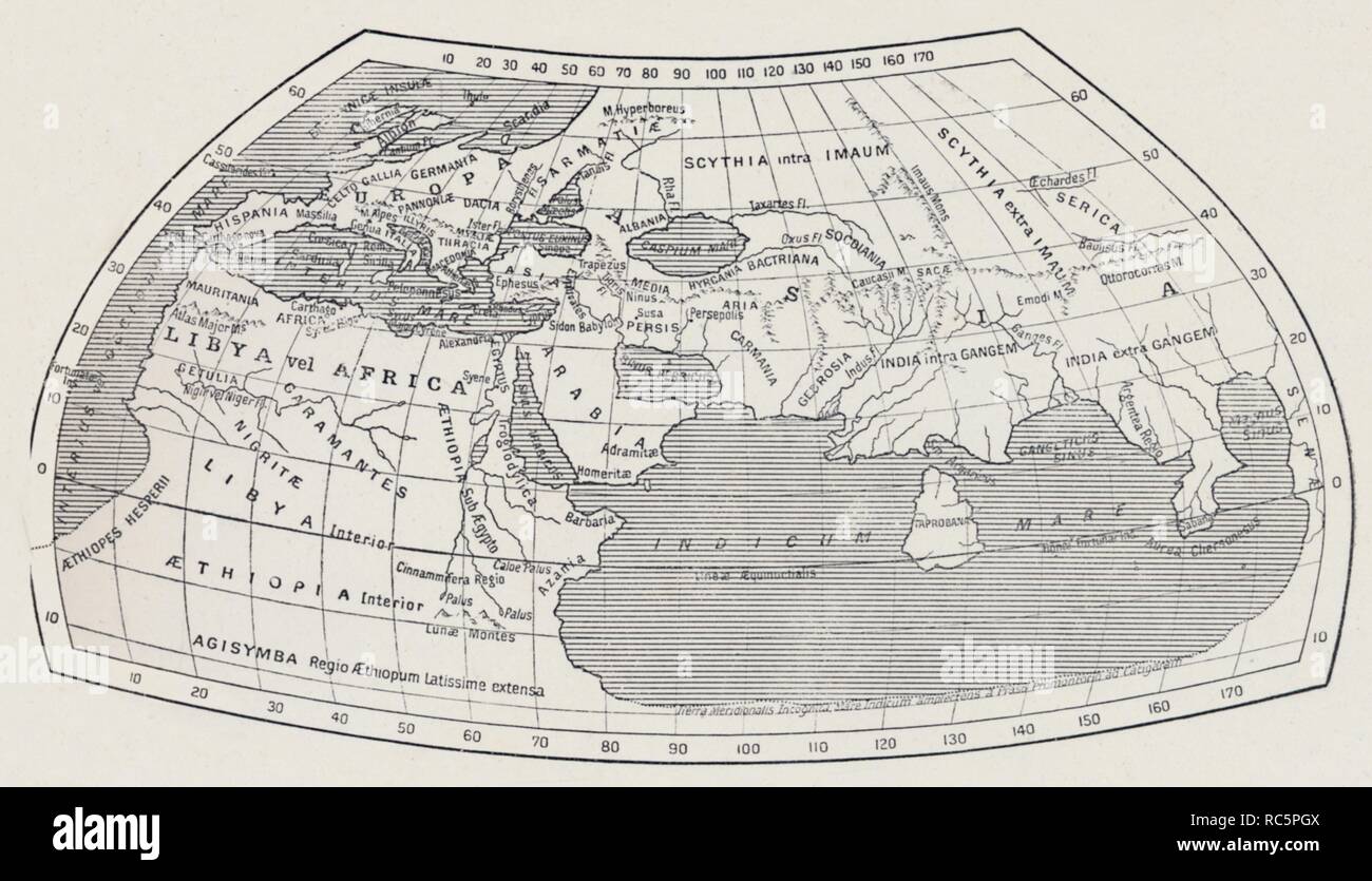 'Map of the World, According to Ptolemy', 1923. Creator: Agathodaemon of Alexandria. Stock Photohttps://www.alamy.com/image-license-details/?v=1https://www.alamy.com/map-of-the-world-according-to-ptolemy-1923-creator-agathodaemon-of-alexandria-image231238138.html
RMRC5PGX–'Map of the World, According to Ptolemy', 1923. Creator: Agathodaemon of Alexandria.
 Andreas Cellarius - The Ptolemaic Plane - The Machine Orbs Of The World Arranged In A Ptolemaic Plane - 1660 Stock Photohttps://www.alamy.com/image-license-details/?v=1https://www.alamy.com/andreas-cellarius-the-ptolemaic-plane-the-machine-orbs-of-the-world-arranged-in-a-ptolemaic-plane-1660-image469002415.html
RF2J70WA7–Andreas Cellarius - The Ptolemaic Plane - The Machine Orbs Of The World Arranged In A Ptolemaic Plane - 1660
 Ptolemaic Map of the World with heads of the winds Stock Photohttps://www.alamy.com/image-license-details/?v=1https://www.alamy.com/ptolemaic-map-of-the-world-with-heads-of-the-winds-image504913813.html
RM2M9CPM5–Ptolemaic Map of the World with heads of the winds
 1490 Ptolemaic world map. Stock Photohttps://www.alamy.com/image-license-details/?v=1https://www.alamy.com/1490-ptolemaic-world-map-image592059492.html
RM2WB6HWT–1490 Ptolemaic world map.
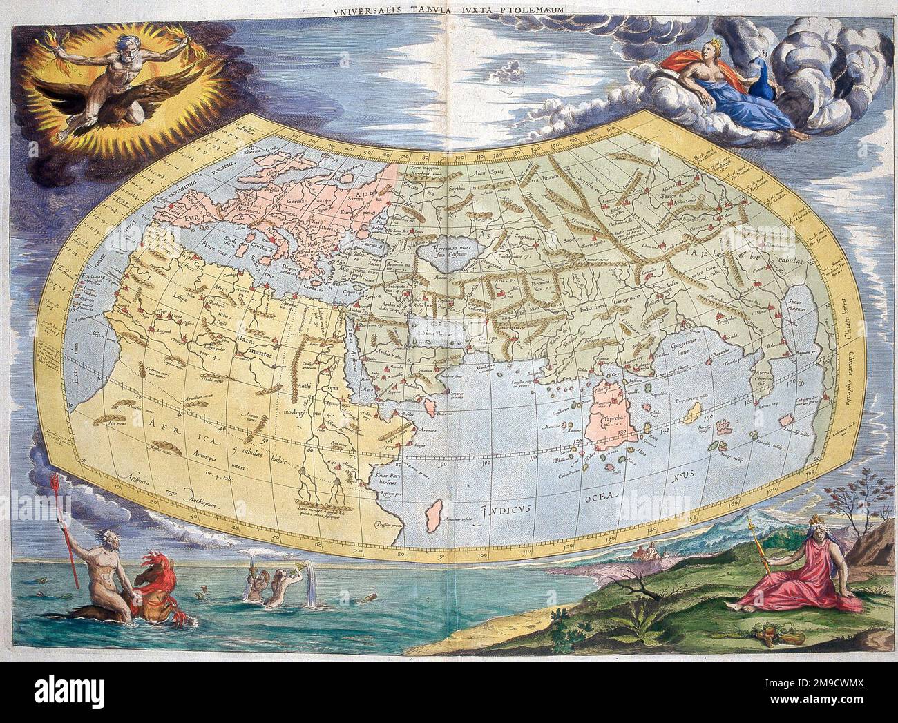 Map of the Old World according to Ptolemy, 2nd century Stock Photohttps://www.alamy.com/image-license-details/?v=1https://www.alamy.com/map-of-the-old-world-according-to-ptolemy-2nd-century-image504916186.html
RM2M9CWMX–Map of the Old World according to Ptolemy, 2nd century
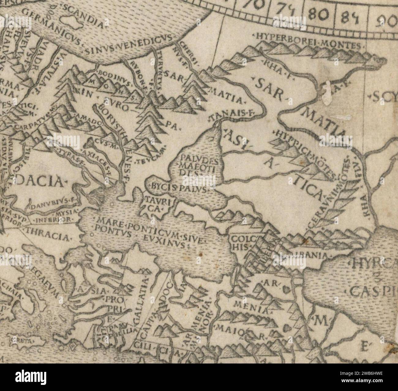 1490 Ptolemaic world map Tanais. Stock Photohttps://www.alamy.com/image-license-details/?v=1https://www.alamy.com/1490-ptolemaic-world-map-tanais-image592059482.html
RM2WB6HWE–1490 Ptolemaic world map Tanais.
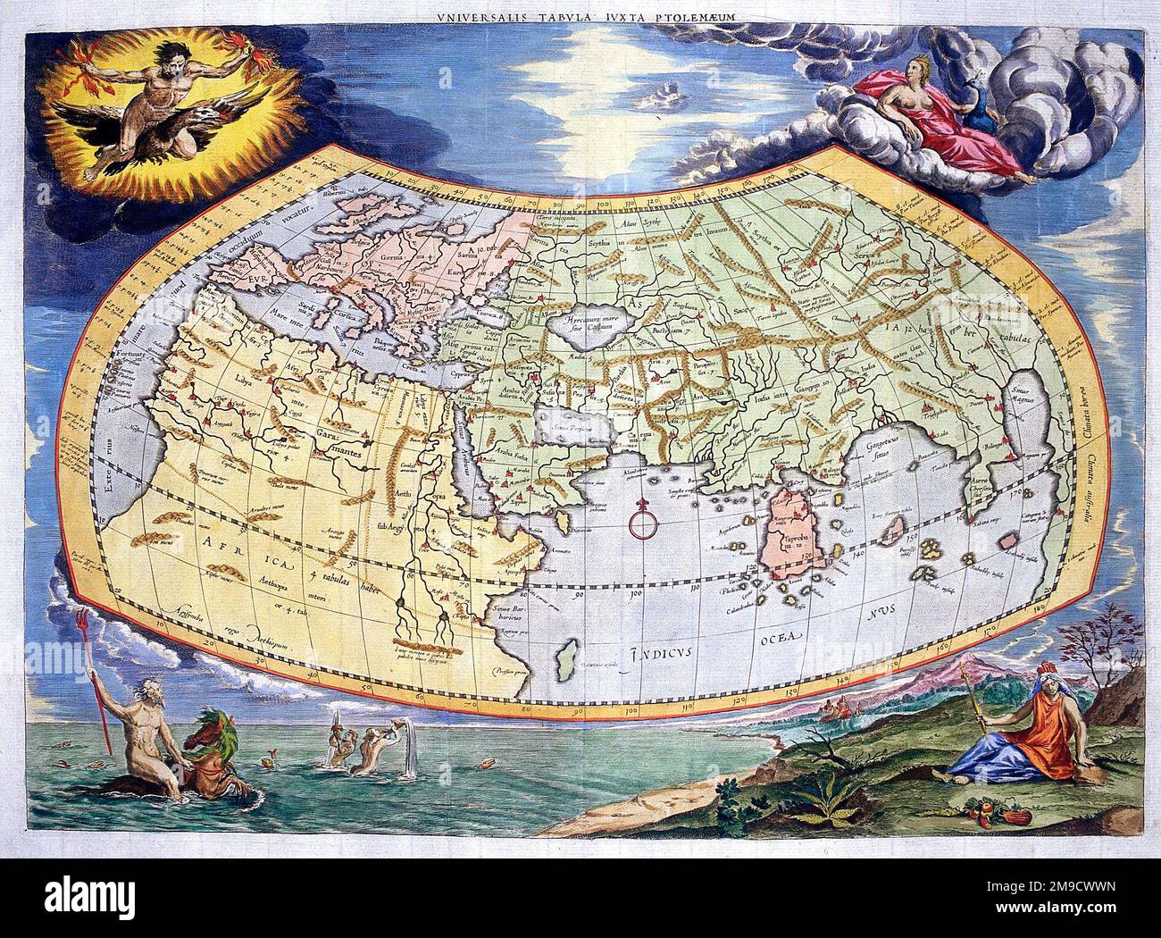 Map of the Old World according to Ptolemy, 2nd century Stock Photohttps://www.alamy.com/image-license-details/?v=1https://www.alamy.com/map-of-the-old-world-according-to-ptolemy-2nd-century-image504916321.html
RM2M9CWWN–Map of the Old World according to Ptolemy, 2nd century
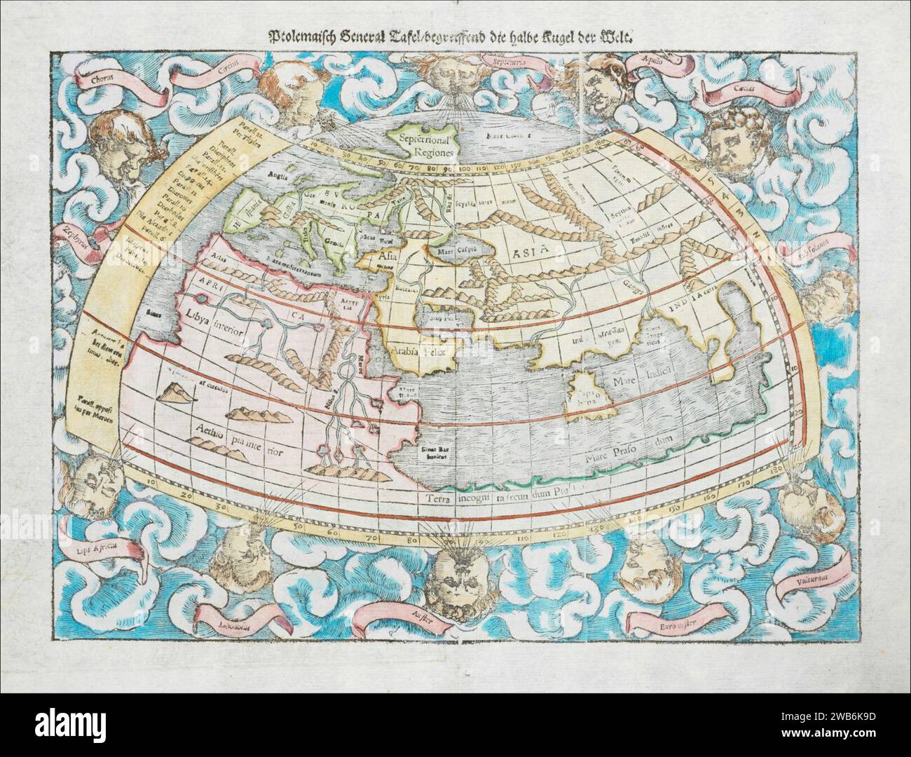 1550 Ptolemaic world map by Sebastian Münster. Stock Photohttps://www.alamy.com/image-license-details/?v=1https://www.alamy.com/1550-ptolemaic-world-map-by-sebastian-mnster-image592060601.html
RM2WB6K9D–1550 Ptolemaic world map by Sebastian Münster.
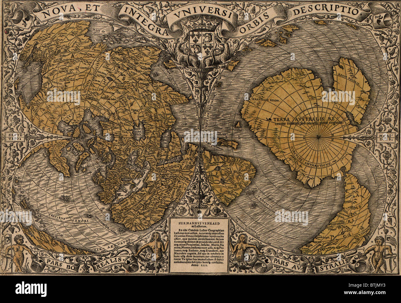 1531 world map showing Northern and Southern Hemispheres by Frenchman Oronce Fine (1494-1555). The map combines Ptolemaic concepts with new discoveries; Asia and North America are represented as one landmass, 'Terra Australis' combines Australia and Antarctica. Stock Photohttps://www.alamy.com/image-license-details/?v=1https://www.alamy.com/stock-photo-1531-world-map-showing-northern-and-southern-hemispheres-by-frenchman-32373687.html
RMBTJMY3–1531 world map showing Northern and Southern Hemispheres by Frenchman Oronce Fine (1494-1555). The map combines Ptolemaic concepts with new discoveries; Asia and North America are represented as one landmass, 'Terra Australis' combines Australia and Antarctica.
![[The World]. Map of the eastern hemisphere showing Europe, western Asia, and northern Africa. Waldseemüller's Ptolemaic map of 1513, redrawn and reduced in this publication by Laurent Fries. Relief shown pictorially. Includes names of places and natural features. Map border shows decorative windheads. Includes climatic and latitudinal notes. Appears in the author's Geographia, translated by Willibald Pirckheimer, with annotations by Joannes Regiomontanus. Argentoragi [i.e. Strasbourg] : Iohannes Grieningerus, communibus Iohannis Koberger impensis excudebat, anno a Christi Natiuitate 1525 tert Stock Photo [The World]. Map of the eastern hemisphere showing Europe, western Asia, and northern Africa. Waldseemüller's Ptolemaic map of 1513, redrawn and reduced in this publication by Laurent Fries. Relief shown pictorially. Includes names of places and natural features. Map border shows decorative windheads. Includes climatic and latitudinal notes. Appears in the author's Geographia, translated by Willibald Pirckheimer, with annotations by Joannes Regiomontanus. Argentoragi [i.e. Strasbourg] : Iohannes Grieningerus, communibus Iohannis Koberger impensis excudebat, anno a Christi Natiuitate 1525 tert Stock Photo](https://c8.alamy.com/comp/2M5W80J/the-world-map-of-the-eastern-hemisphere-showing-europe-western-asia-and-northern-africa-waldseemullers-ptolemaic-map-of-1513-redrawn-and-reduced-in-this-publication-by-laurent-fries-relief-shown-pictorially-includes-names-of-places-and-natural-features-map-border-shows-decorative-windheads-includes-climatic-and-latitudinal-notes-appears-in-the-authors-geographia-translated-by-willibald-pirckheimer-with-annotations-by-joannes-regiomontanus-argentoragi-ie-strasbourg-iohannes-grieningerus-communibus-iohannis-koberger-impensis-excudebat-anno-a-christi-natiuitate-1525-tert-2M5W80J.jpg) [The World]. Map of the eastern hemisphere showing Europe, western Asia, and northern Africa. Waldseemüller's Ptolemaic map of 1513, redrawn and reduced in this publication by Laurent Fries. Relief shown pictorially. Includes names of places and natural features. Map border shows decorative windheads. Includes climatic and latitudinal notes. Appears in the author's Geographia, translated by Willibald Pirckheimer, with annotations by Joannes Regiomontanus. Argentoragi [i.e. Strasbourg] : Iohannes Grieningerus, communibus Iohannis Koberger impensis excudebat, anno a Christi Natiuitate 1525 tert Stock Photohttps://www.alamy.com/image-license-details/?v=1https://www.alamy.com/the-world-map-of-the-eastern-hemisphere-showing-europe-western-asia-and-northern-africa-waldseemullers-ptolemaic-map-of-1513-redrawn-and-reduced-in-this-publication-by-laurent-fries-relief-shown-pictorially-includes-names-of-places-and-natural-features-map-border-shows-decorative-windheads-includes-climatic-and-latitudinal-notes-appears-in-the-authors-geographia-translated-by-willibald-pirckheimer-with-annotations-by-joannes-regiomontanus-argentoragi-ie-strasbourg-iohannes-grieningerus-communibus-iohannis-koberger-impensis-excudebat-anno-a-christi-natiuitate-1525-tert-image502729042.html
[The World]. Map of the eastern hemisphere showing Europe, western Asia, and northern Africa. Waldseemüller's Ptolemaic map of 1513, redrawn and reduced in this publication by Laurent Fries. Relief shown pictorially. Includes names of places and natural features. Map border shows decorative windheads. Includes climatic and latitudinal notes. Appears in the author's Geographia, translated by Willibald Pirckheimer, with annotations by Joannes Regiomontanus. Argentoragi [i.e. Strasbourg] : Iohannes Grieningerus, communibus Iohannis Koberger impensis excudebat, anno a Christi Natiuitate 1525 tert Stock Photohttps://www.alamy.com/image-license-details/?v=1https://www.alamy.com/the-world-map-of-the-eastern-hemisphere-showing-europe-western-asia-and-northern-africa-waldseemullers-ptolemaic-map-of-1513-redrawn-and-reduced-in-this-publication-by-laurent-fries-relief-shown-pictorially-includes-names-of-places-and-natural-features-map-border-shows-decorative-windheads-includes-climatic-and-latitudinal-notes-appears-in-the-authors-geographia-translated-by-willibald-pirckheimer-with-annotations-by-joannes-regiomontanus-argentoragi-ie-strasbourg-iohannes-grieningerus-communibus-iohannis-koberger-impensis-excudebat-anno-a-christi-natiuitate-1525-tert-image502729042.htmlRM2M5W80J–[The World]. Map of the eastern hemisphere showing Europe, western Asia, and northern Africa. Waldseemüller's Ptolemaic map of 1513, redrawn and reduced in this publication by Laurent Fries. Relief shown pictorially. Includes names of places and natural features. Map border shows decorative windheads. Includes climatic and latitudinal notes. Appears in the author's Geographia, translated by Willibald Pirckheimer, with annotations by Joannes Regiomontanus. Argentoragi [i.e. Strasbourg] : Iohannes Grieningerus, communibus Iohannis Koberger impensis excudebat, anno a Christi Natiuitate 1525 tert
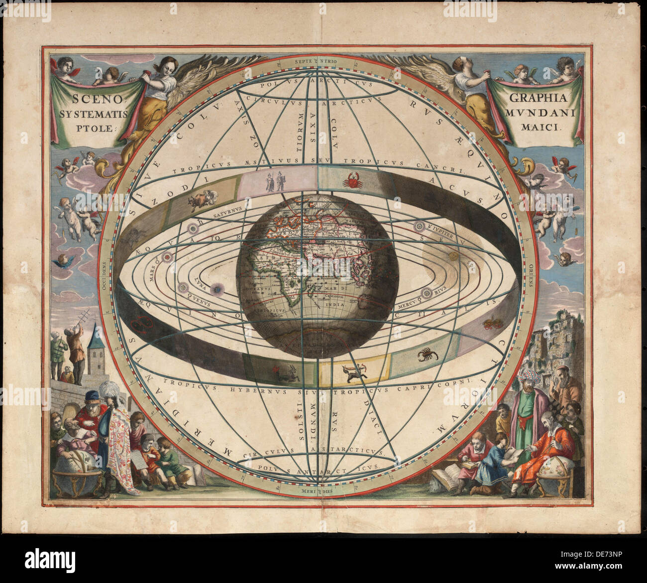 Scenography of the Ptolemaic cosmography (From Andreas Cellarius Harmonia Macrocosmica), c. 1660. Artist: Loon, Johannes van (c. 1611-1686) Stock Photohttps://www.alamy.com/image-license-details/?v=1https://www.alamy.com/scenography-of-the-ptolemaic-cosmography-from-andreas-cellarius-harmonia-image60392914.html
RMDE73NP–Scenography of the Ptolemaic cosmography (From Andreas Cellarius Harmonia Macrocosmica), c. 1660. Artist: Loon, Johannes van (c. 1611-1686)
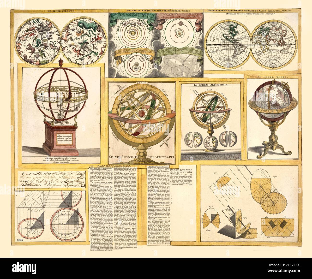 Collection of old images of astronomical objects, celestial and world maps. By Ferguson, publ. ca. 1770 Stock Photohttps://www.alamy.com/image-license-details/?v=1https://www.alamy.com/collection-of-old-images-of-astronomical-objects-celestial-and-world-maps-by-ferguson-publ-ca-1770-image571689228.html
RF2T62KCC–Collection of old images of astronomical objects, celestial and world maps. By Ferguson, publ. ca. 1770
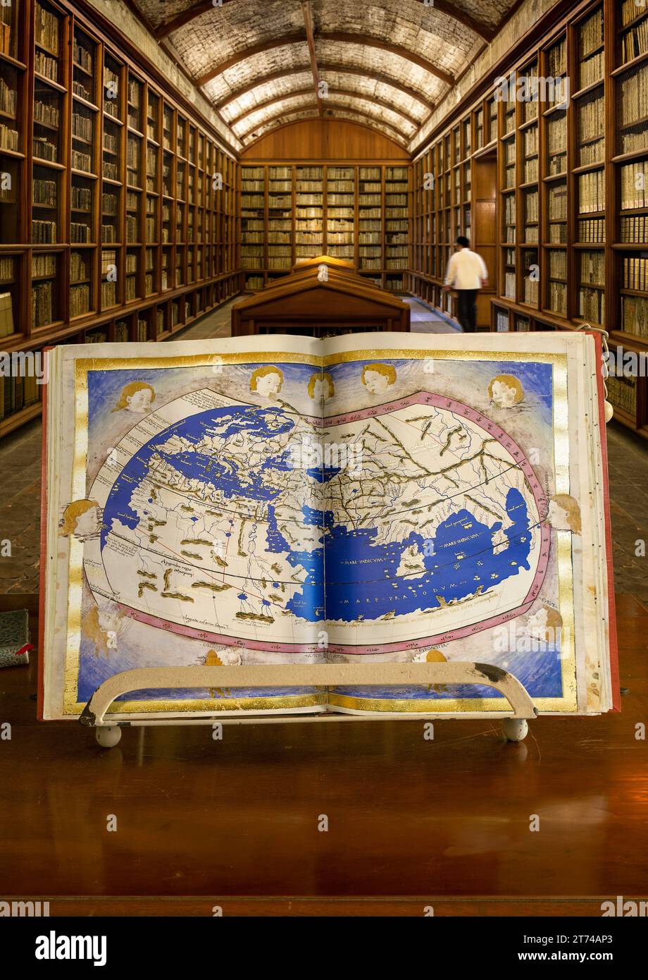 Ptolemy's world map, made by Nicolaus Germanus ca. 1470. Is part of the Manuscript codex of Ptolemy's Geography. Codex Urbinas Latinus 274. Stock Photohttps://www.alamy.com/image-license-details/?v=1https://www.alamy.com/ptolemys-world-map-made-by-nicolaus-germanus-ca-1470-is-part-of-the-manuscript-codex-of-ptolemys-geography-codex-urbinas-latinus-274-image572341003.html
RF2T74AP3–Ptolemy's world map, made by Nicolaus Germanus ca. 1470. Is part of the Manuscript codex of Ptolemy's Geography. Codex Urbinas Latinus 274.
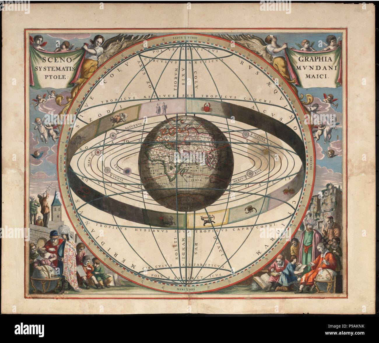 Scenography of the Ptolemaic cosmography (From Andreas Cellarius Harmonia Macrocosmica). Museum: PRIVATE COLLECTION. Stock Photohttps://www.alamy.com/image-license-details/?v=1https://www.alamy.com/scenography-of-the-ptolemaic-cosmography-from-andreas-cellarius-harmonia-macrocosmica-museum-private-collection-image212291343.html
RMP9AKNK–Scenography of the Ptolemaic cosmography (From Andreas Cellarius Harmonia Macrocosmica). Museum: PRIVATE COLLECTION.
 Inland Indian Ocean 1493 Stock Photohttps://www.alamy.com/image-license-details/?v=1https://www.alamy.com/inland-indian-ocean-1493-image184215321.html
RMMKKMEH–Inland Indian Ocean 1493
 Planisphaerium Ptolemaicium earth centred universe according to Ptolemy Stock Photohttps://www.alamy.com/image-license-details/?v=1https://www.alamy.com/planisphaerium-ptolemaicium-earth-centred-universe-according-to-ptolemy-image504916243.html
RM2M9CWPY–Planisphaerium Ptolemaicium earth centred universe according to Ptolemy
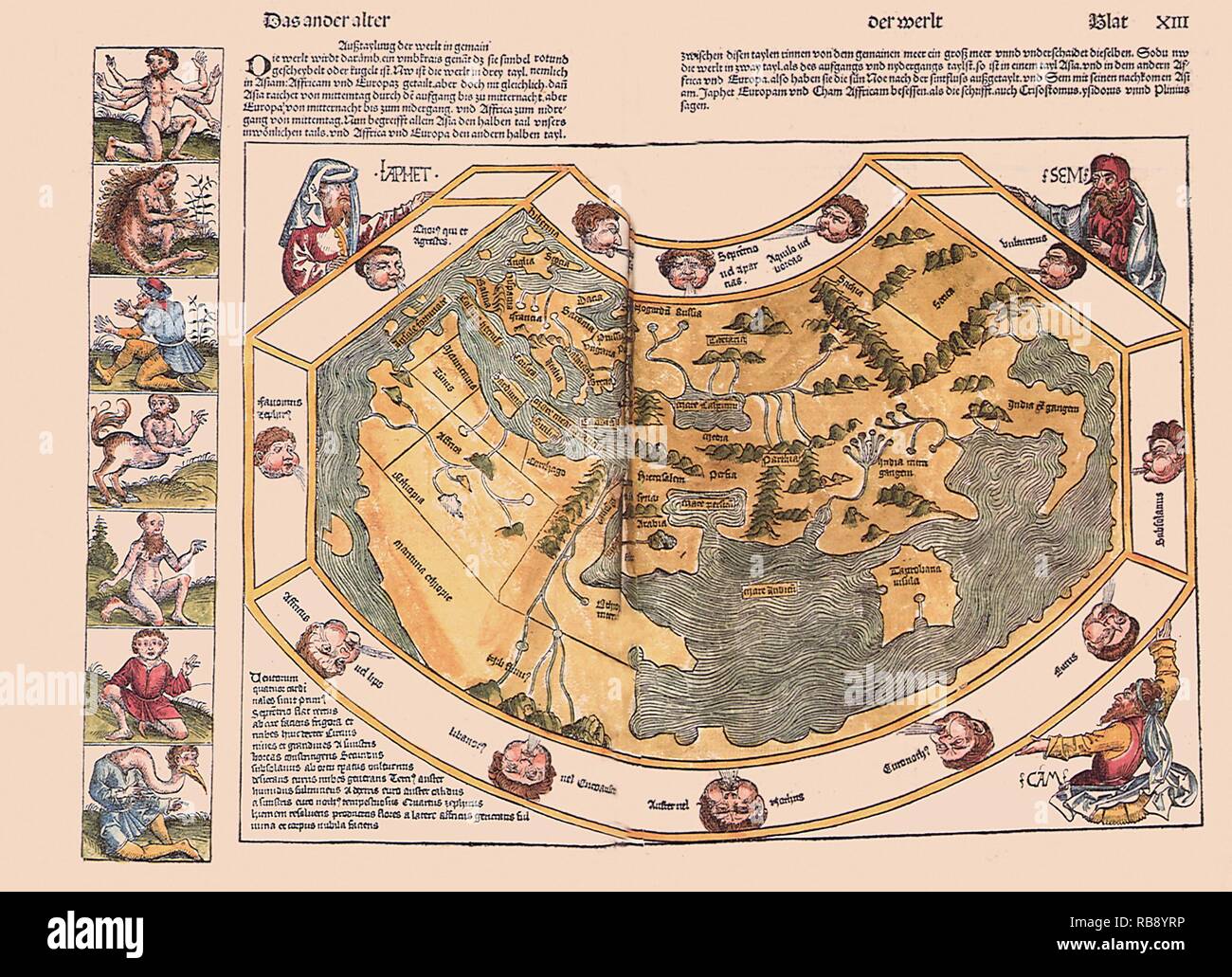 Inland Indian Ocean 1493 Stock Photohttps://www.alamy.com/image-license-details/?v=1https://www.alamy.com/inland-indian-ocean-1493-image230693450.html
RMRB8YRP–Inland Indian Ocean 1493
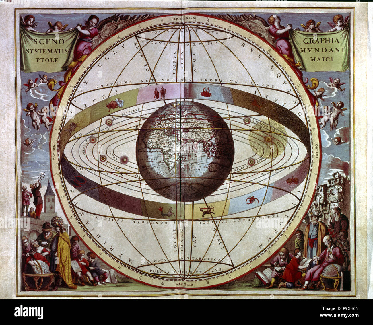 Macrocosm Harmony', engraving in the work 'Scenographia systematis mundani ptolemaici', 1661. Stock Photohttps://www.alamy.com/image-license-details/?v=1https://www.alamy.com/macrocosm-harmony-engraving-in-the-work-scenographia-systematis-mundani-ptolemaici-1661-image212421069.html
RMP9GH6N–Macrocosm Harmony', engraving in the work 'Scenographia systematis mundani ptolemaici', 1661.
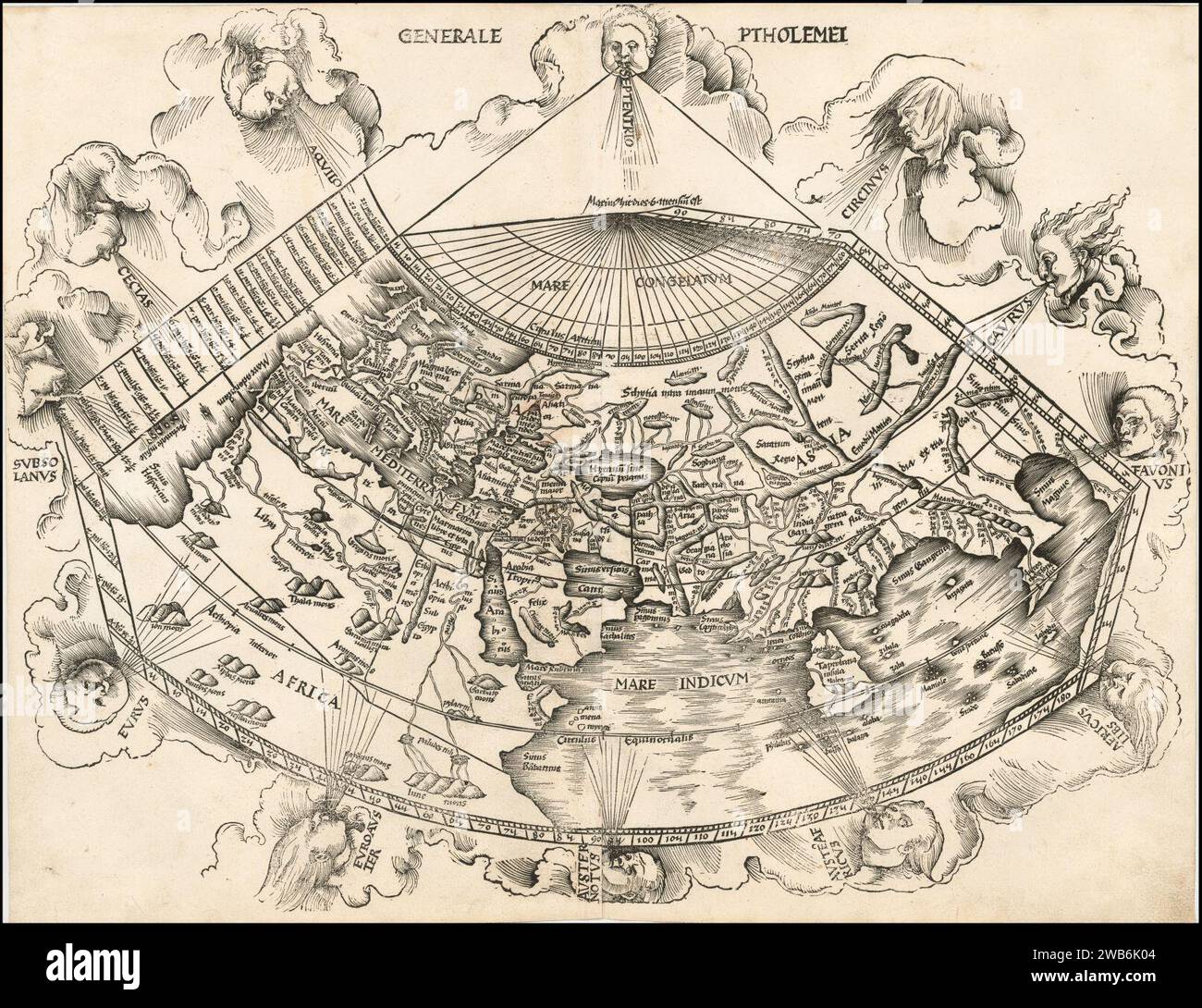 1513 Ptolemaic world map by Martin Waldseemüller. Stock Photohttps://www.alamy.com/image-license-details/?v=1https://www.alamy.com/1513-ptolemaic-world-map-by-martin-waldseemller-image592060340.html
RM2WB6K04–1513 Ptolemaic world map by Martin Waldseemüller.
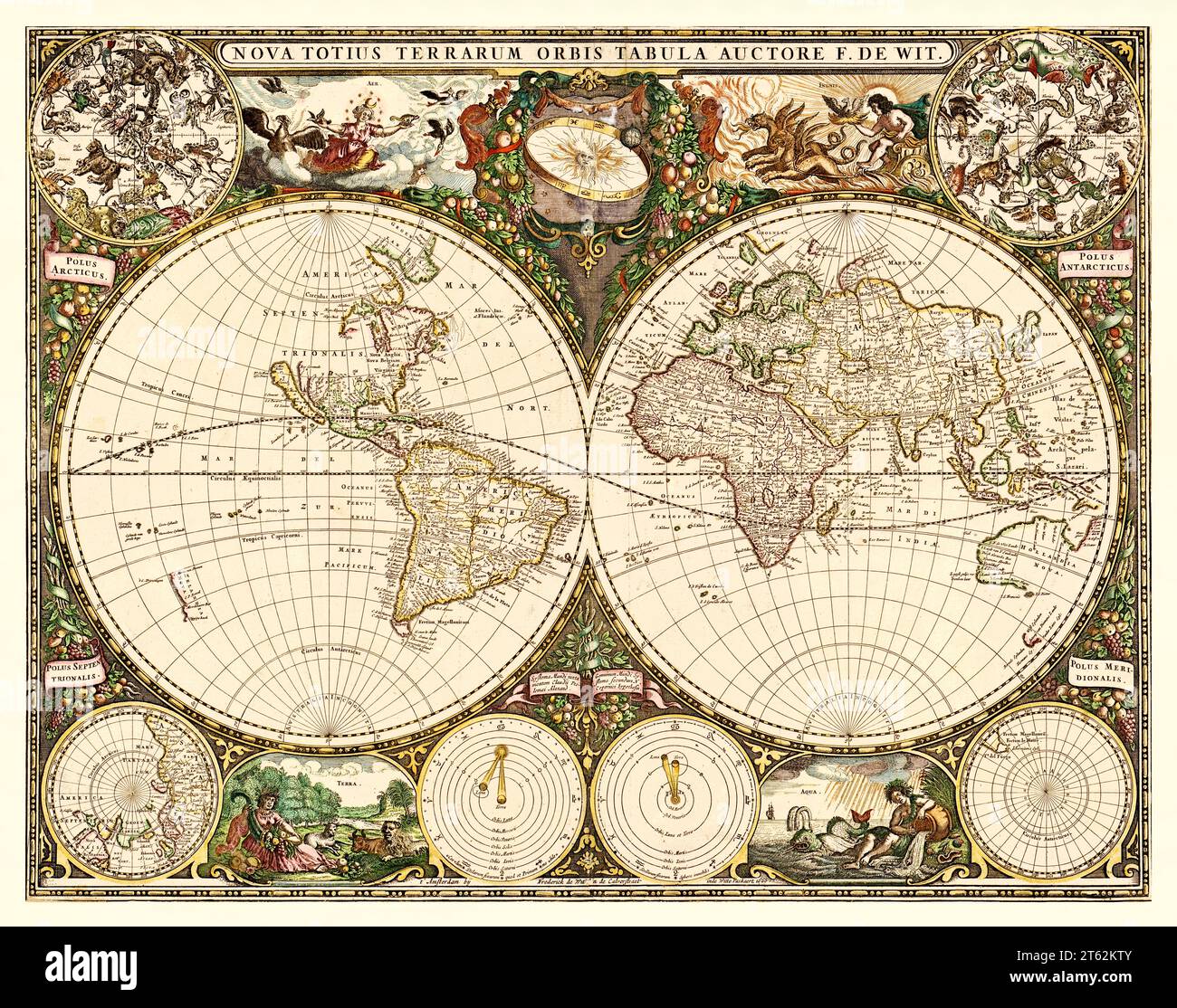 Old planisphere with celestial and geographical polar views and Ptolemaic and Copernican sistems. By De Wit, publ. in Amsterdam, 1660 Stock Photohttps://www.alamy.com/image-license-details/?v=1https://www.alamy.com/old-planisphere-with-celestial-and-geographical-polar-views-and-ptolemaic-and-copernican-sistems-by-de-wit-publ-in-amsterdam-1660-image571689579.html
RF2T62KTY–Old planisphere with celestial and geographical polar views and Ptolemaic and Copernican sistems. By De Wit, publ. in Amsterdam, 1660
 LIBRO OCTAVO DE GEOGRAFIA - COLONIA - 1584. Author: TOLOMEO, CLAUDIO. Location: SENADO-BIBLIOTECA-COLECCION. MADRID. SPAIN. Stock Photohttps://www.alamy.com/image-license-details/?v=1https://www.alamy.com/libro-octavo-de-geografia-colonia-1584-author-tolomeo-claudio-location-senado-biblioteca-coleccion-madrid-spain-image219860101.html
RMPNKDPD–LIBRO OCTAVO DE GEOGRAFIA - COLONIA - 1584. Author: TOLOMEO, CLAUDIO. Location: SENADO-BIBLIOTECA-COLECCION. MADRID. SPAIN.