Quick filters:
Rabaul map Stock Photos and Images
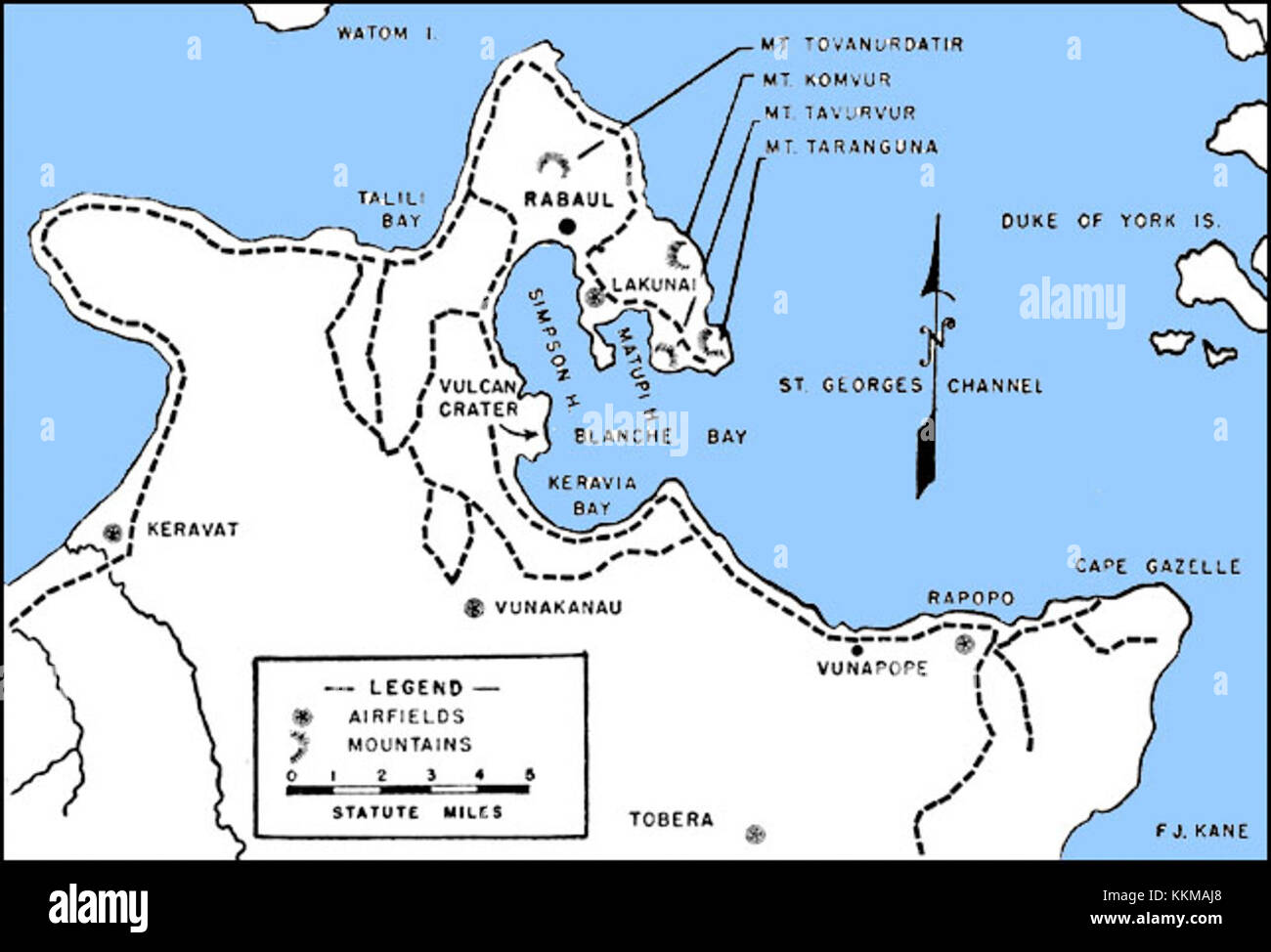 Rabaul - map Stock Photohttps://www.alamy.com/image-license-details/?v=1https://www.alamy.com/stock-image-rabaul-map-167019168.html
RMKKMAJ8–Rabaul - map
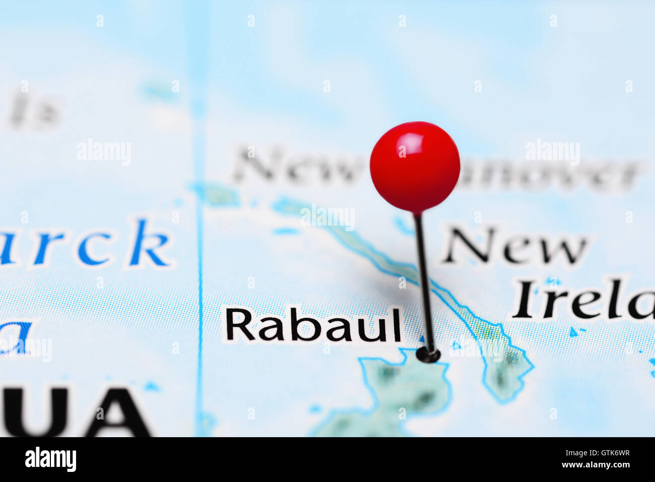 Rabaul pinned on a map of Papua New Guinea Stock Photohttps://www.alamy.com/image-license-details/?v=1https://www.alamy.com/stock-photo-rabaul-pinned-on-a-map-of-papua-new-guinea-118436467.html
RFGTK6WR–Rabaul pinned on a map of Papua New Guinea
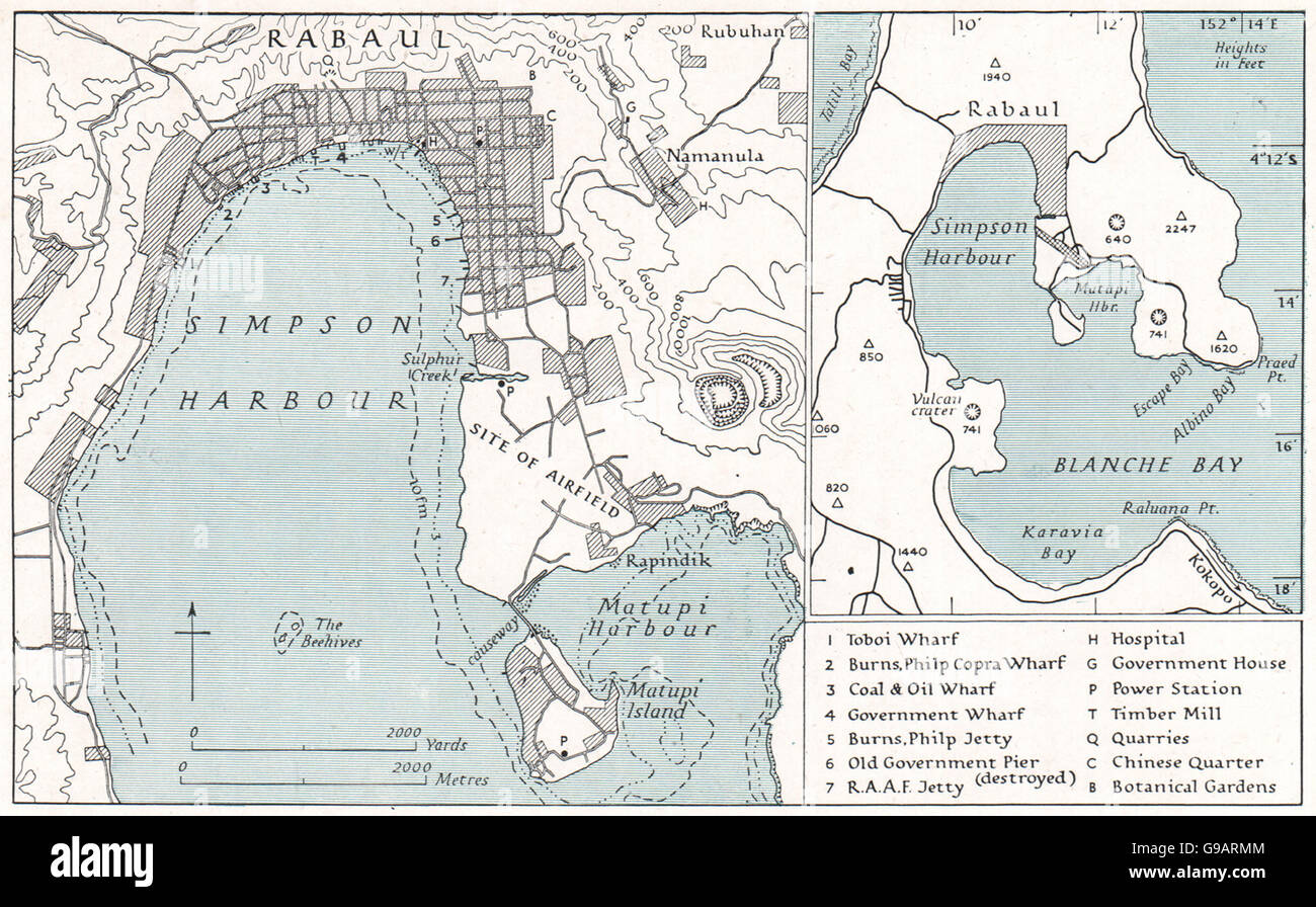 PAPAU NEW GUINEA: Rabaul. WW2 ROYAL NAVY INTELLIGENCE MAP, 1944 Stock Photohttps://www.alamy.com/image-license-details/?v=1https://www.alamy.com/stock-photo-papau-new-guinea-rabaul-ww2-royal-navy-intelligence-map-1944-109032244.html
RFG9ARMM–PAPAU NEW GUINEA: Rabaul. WW2 ROYAL NAVY INTELLIGENCE MAP, 1944
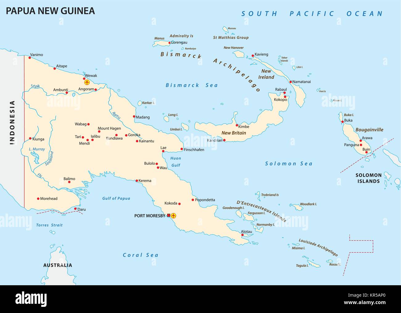 Papua New Guinea vector map Stock Vectorhttps://www.alamy.com/image-license-details/?v=1https://www.alamy.com/stock-image-papua-new-guinea-vector-map-169148616.html
RFKR5AP0–Papua New Guinea vector map
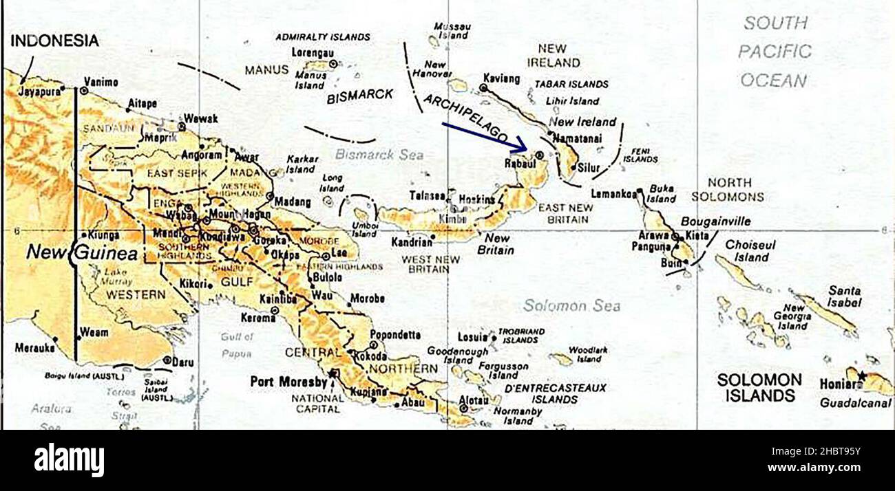 Papua New Guinea. Rabaul. ca. 1989 Stock Photohttps://www.alamy.com/image-license-details/?v=1https://www.alamy.com/papua-new-guinea-rabaul-ca-1989-image454764855.html
RM2HBT95Y–Papua New Guinea. Rabaul. ca. 1989
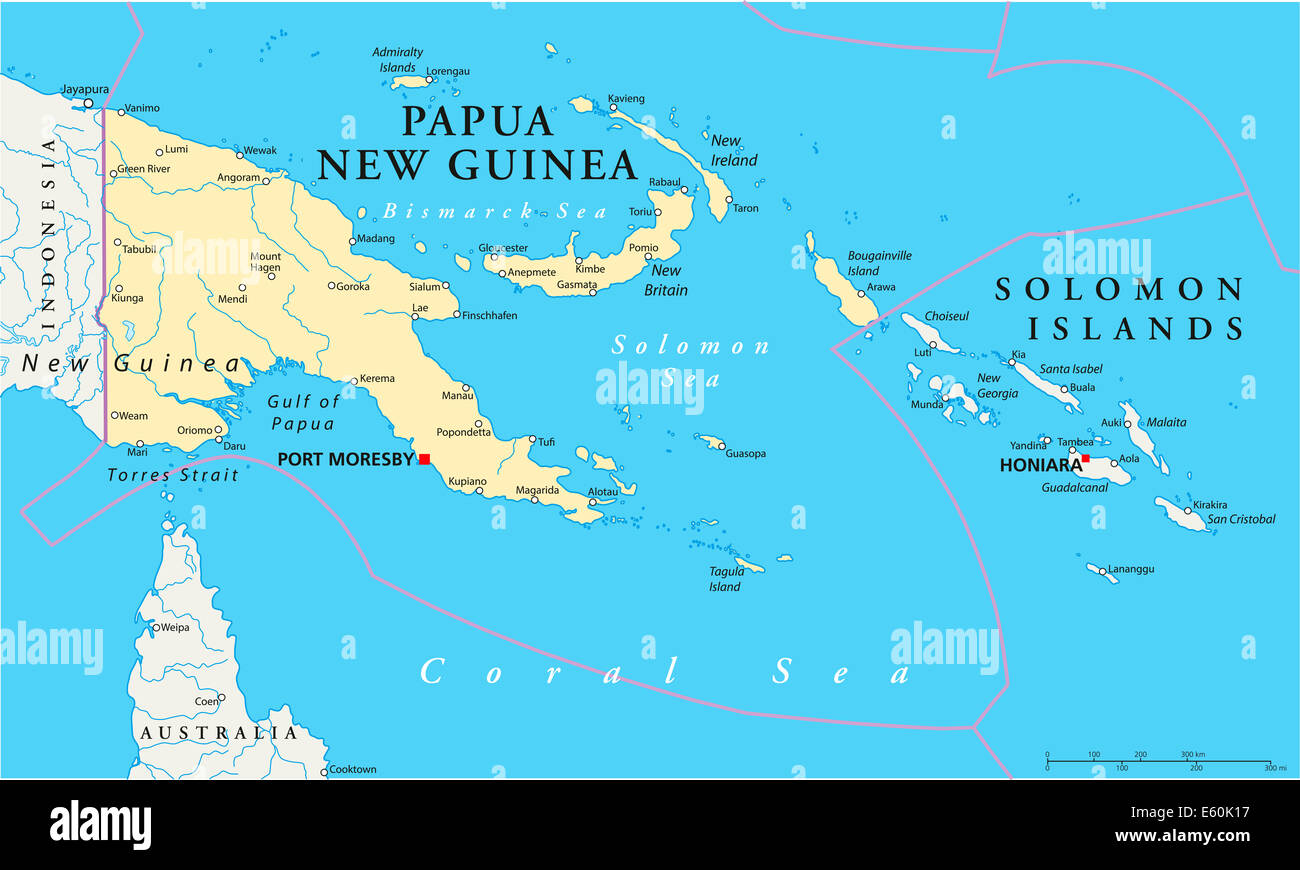 Papua New Guinea Political Map Stock Photohttps://www.alamy.com/image-license-details/?v=1https://www.alamy.com/stock-photo-papua-new-guinea-political-map-72544339.html
RFE60K17–Papua New Guinea Political Map
 Country Political Geographical Map of Papua New Guinea with Shadows Stock Photohttps://www.alamy.com/image-license-details/?v=1https://www.alamy.com/country-political-geographical-map-of-papua-new-guinea-with-shadows-image473678043.html
RF2JEHW4Y–Country Political Geographical Map of Papua New Guinea with Shadows
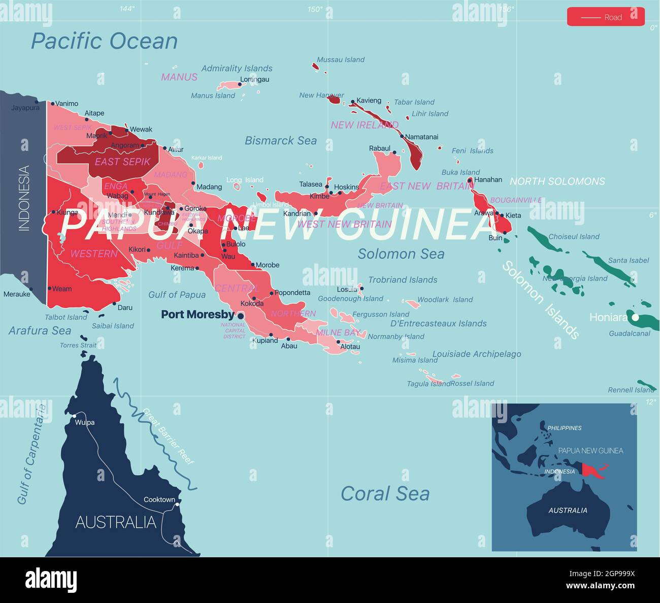 Papua New Guinea country detailed editable map with regions cities and towns, roads and railways, geographic sites. Vector EPS-10 file Stock Photohttps://www.alamy.com/image-license-details/?v=1https://www.alamy.com/papua-new-guinea-country-detailed-editable-map-with-regions-cities-and-towns-roads-and-railways-geographic-sites-vector-eps-10-file-image443986534.html
RF2GP999X–Papua New Guinea country detailed editable map with regions cities and towns, roads and railways, geographic sites. Vector EPS-10 file
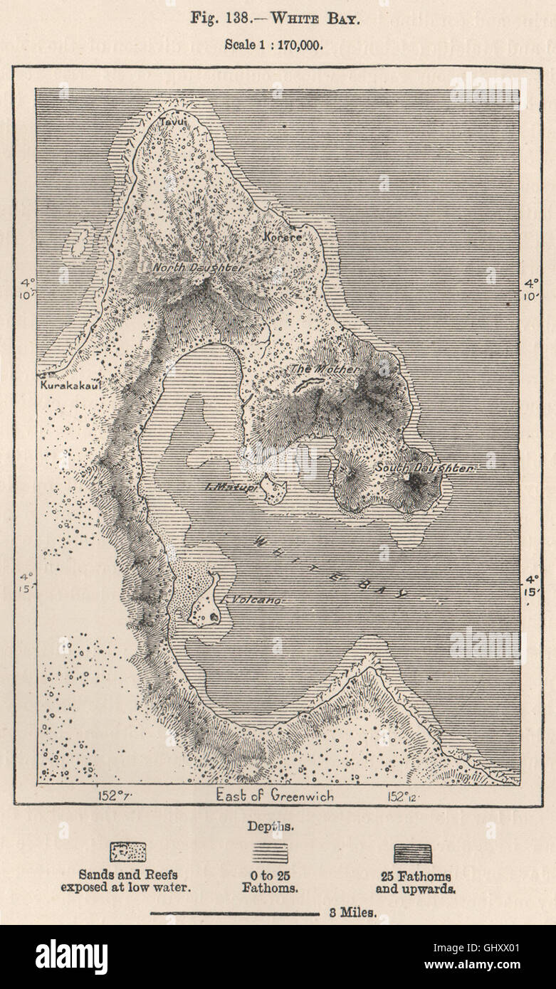 Blanche Bay, Rabaul, New Britain. Papua New Guinea. Melanesia, 1885 old map Stock Photohttps://www.alamy.com/image-license-details/?v=1https://www.alamy.com/stock-photo-blanche-bay-rabaul-new-britain-papua-new-guinea-melanesia-1885-old-114302497.html
RFGHXX01–Blanche Bay, Rabaul, New Britain. Papua New Guinea. Melanesia, 1885 old map
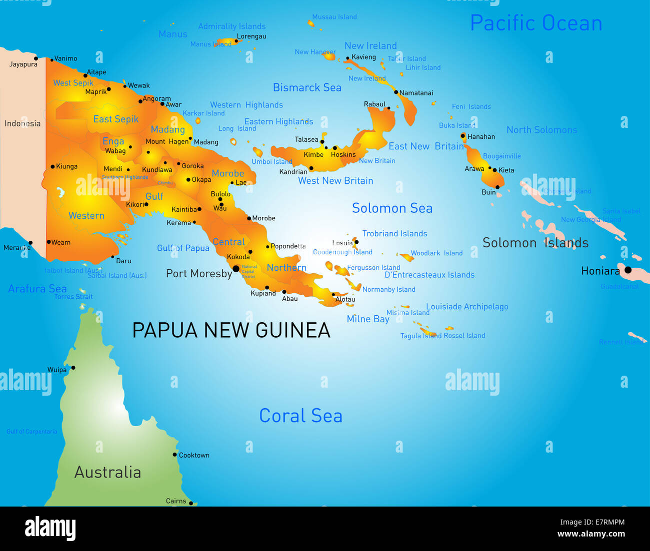 Papua New Guinea Stock Photohttps://www.alamy.com/image-license-details/?v=1https://www.alamy.com/stock-photo-papua-new-guinea-73665276.html
RFE7RMPM–Papua New Guinea
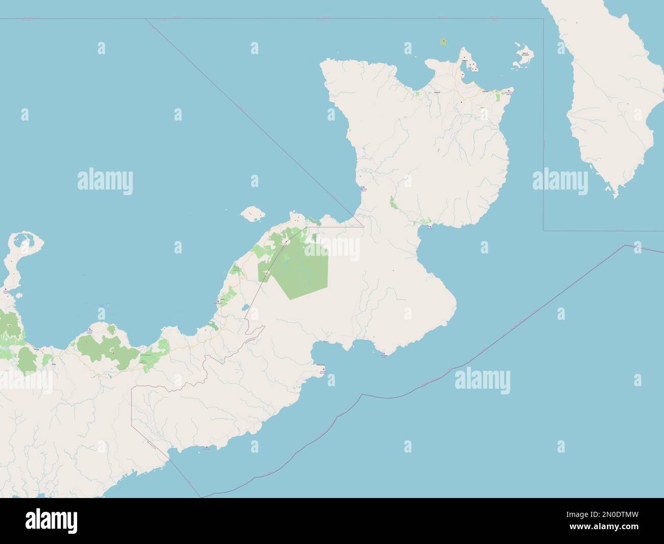 East New Britain, province of Papua New Guinea. Open Street Map Stock Photohttps://www.alamy.com/image-license-details/?v=1https://www.alamy.com/east-new-britain-province-of-papua-new-guinea-open-street-map-image516615817.html
RF2N0DTMW–East New Britain, province of Papua New Guinea. Open Street Map
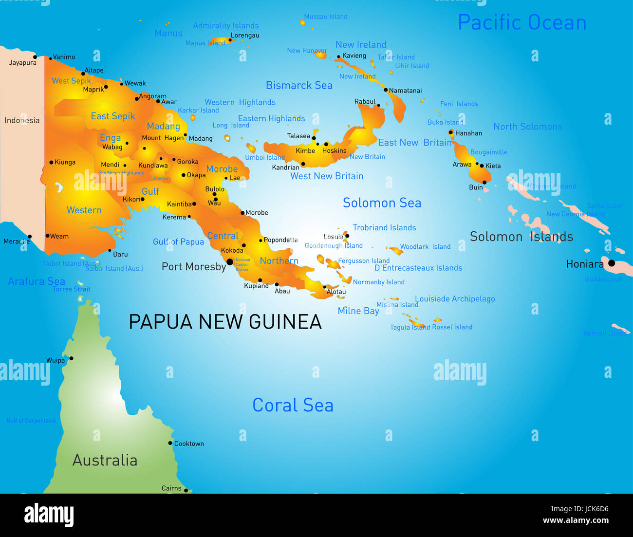 Vector color map of Papua New Guinea country Stock Photohttps://www.alamy.com/image-license-details/?v=1https://www.alamy.com/stock-photo-vector-color-map-of-papua-new-guinea-country-145480978.html
RFJCK6D6–Vector color map of Papua New Guinea country
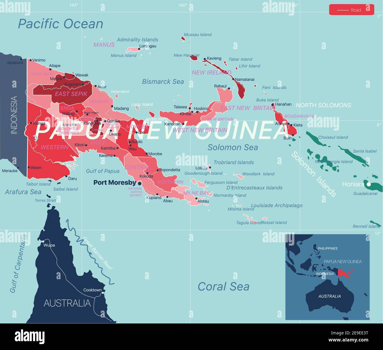 Papua New Guinea country detailed editable map with regions cities and towns, roads and railways, geographic sites. Vector EPS-10 file Stock Vectorhttps://www.alamy.com/image-license-details/?v=1https://www.alamy.com/papua-new-guinea-country-detailed-editable-map-with-regions-cities-and-towns-roads-and-railways-geographic-sites-vector-eps-10-file-image401688780.html
RF2E9EE3T–Papua New Guinea country detailed editable map with regions cities and towns, roads and railways, geographic sites. Vector EPS-10 file
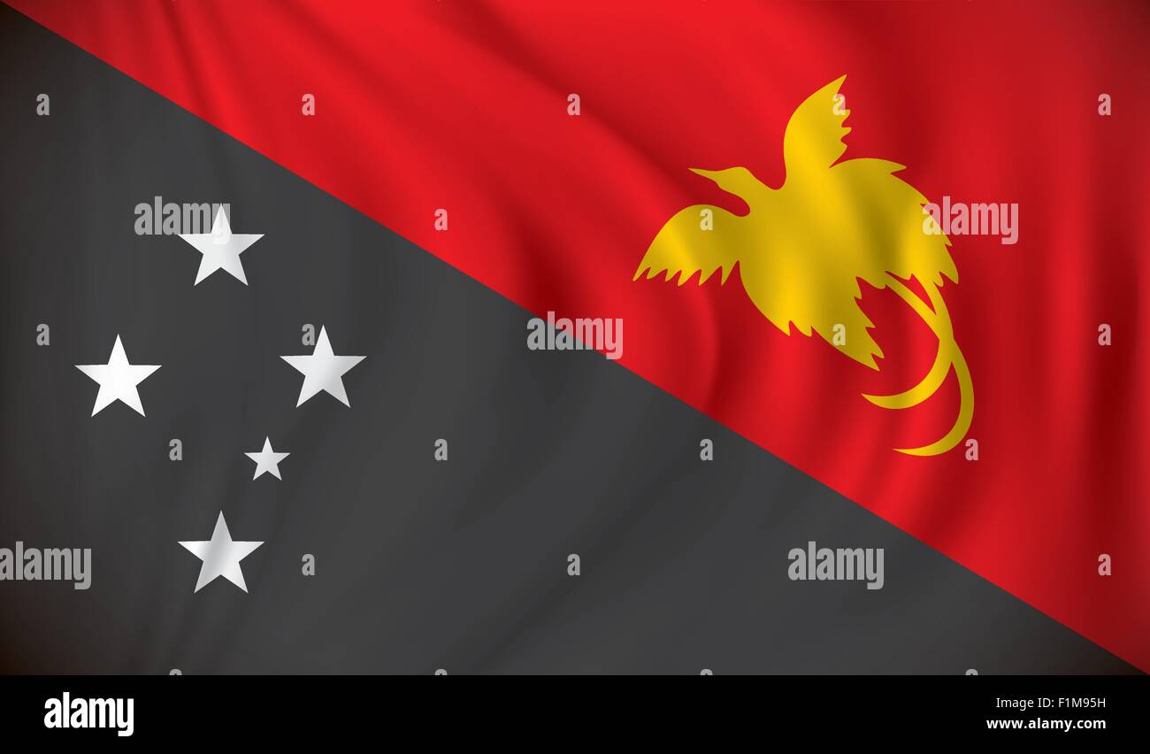 Flag of Papua New Guinea - vector illustration Stock Vectorhttps://www.alamy.com/image-license-details/?v=1https://www.alamy.com/stock-photo-flag-of-papua-new-guinea-vector-illustration-87112749.html
RFF1M95H–Flag of Papua New Guinea - vector illustration
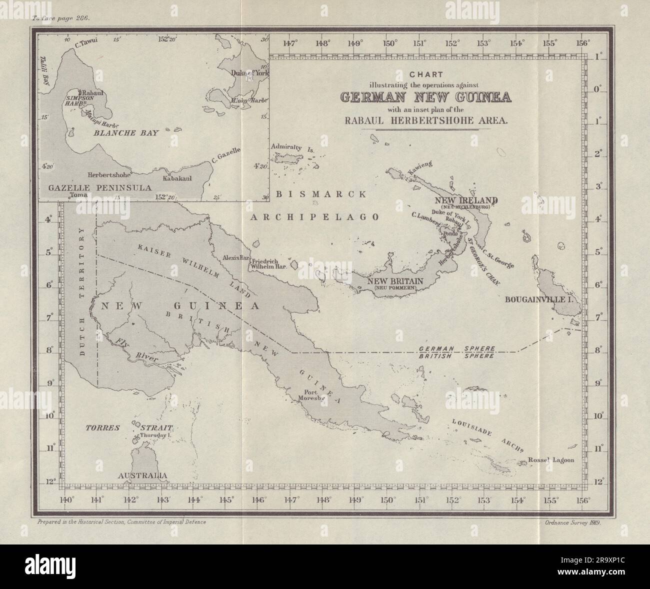 Australia Occupation of German New Guinea 1914. First World War. 1920 old map Stock Photohttps://www.alamy.com/image-license-details/?v=1https://www.alamy.com/australia-occupation-of-german-new-guinea-1914-first-world-war-1920-old-map-image556851720.html
RF2R9XP1C–Australia Occupation of German New Guinea 1914. First World War. 1920 old map
 . Bulletin of the British Ornithologists' Club. / tea, / » »»w „ Caoe 0'^°50"S.^-( St George i53°oTE Bo^B^lie Island Solomon Seo. Cape St George 0£f°50'S, 153°01'E Figure 1. Map of the route followed by the FeBrina in July-August 2007. Departed Kimbe Bay, New Britain, on the night of 26/27 July, then partially circumnavigated New Ireland from the north-east, visiting islands to the north, including the Feni group, and the type locality, eventually reaching the northern end of Bougainville, before cruising north through St George's Channel, and off Cape Lambert; and docking at Rabaul, Ne Stock Photohttps://www.alamy.com/image-license-details/?v=1https://www.alamy.com/bulletin-of-the-british-ornithologists-club-tea-w-caoe-050quots-st-george-i53ote-boblie-island-solomon-seo-cape-st-george-0f50s-15301e-figure-1-map-of-the-route-followed-by-the-febrina-in-july-august-2007-departed-kimbe-bay-new-britain-on-the-night-of-2627-july-then-partially-circumnavigated-new-ireland-from-the-north-east-visiting-islands-to-the-north-including-the-feni-group-and-the-type-locality-eventually-reaching-the-northern-end-of-bougainville-before-cruising-north-through-st-georges-channel-and-off-cape-lambert-and-docking-at-rabaul-ne-image233968957.html
RMRGJ5P5–. Bulletin of the British Ornithologists' Club. / tea, / » »»w „ Caoe 0'^°50"S.^-( St George i53°oTE Bo^B^lie Island Solomon Seo. Cape St George 0£f°50'S, 153°01'E Figure 1. Map of the route followed by the FeBrina in July-August 2007. Departed Kimbe Bay, New Britain, on the night of 26/27 July, then partially circumnavigated New Ireland from the north-east, visiting islands to the north, including the Feni group, and the type locality, eventually reaching the northern end of Bougainville, before cruising north through St George's Channel, and off Cape Lambert; and docking at Rabaul, Ne
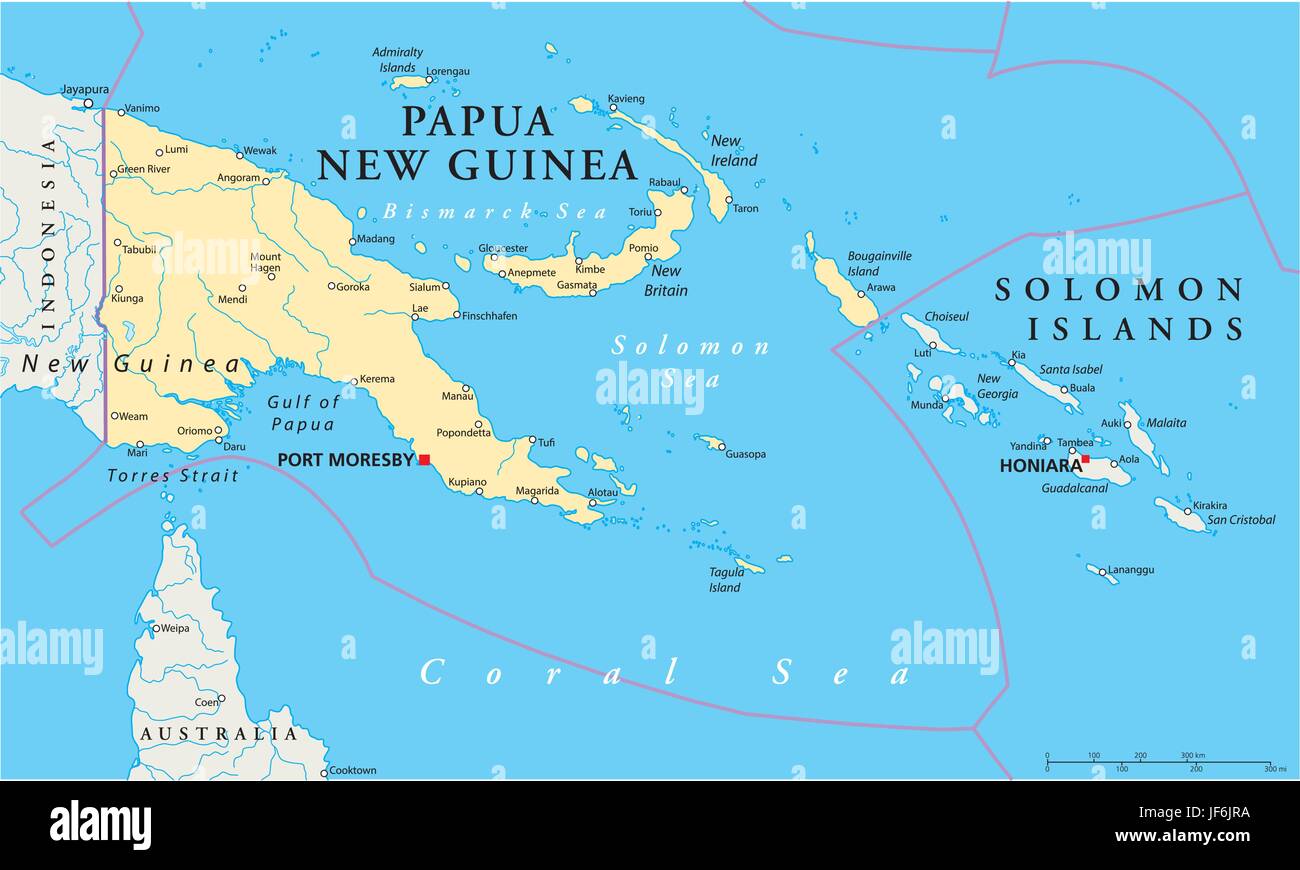 pacific, salt water, sea, ocean, water, guinea, map, atlas, map of the world, Stock Vectorhttps://www.alamy.com/image-license-details/?v=1https://www.alamy.com/stock-photo-pacific-salt-water-sea-ocean-water-guinea-map-atlas-map-of-the-world-147049262.html
RFJF6JRA–pacific, salt water, sea, ocean, water, guinea, map, atlas, map of the world,
RF2R8DN7Y–Grande-Terre icon. Round logo with island map and title. Stylish Grande-Terre badge with map. Vector illustration.
 Papua New Guinea Stock Photohttps://www.alamy.com/image-license-details/?v=1https://www.alamy.com/stock-photo-papua-new-guinea-80133675.html
RFEJAB8Y–Papua New Guinea
 1890s photo of Parkinson family Rabaul Stock Photohttps://www.alamy.com/image-license-details/?v=1https://www.alamy.com/stock-photo-1890s-photo-of-parkinson-family-rabaul-140472292.html
RMJ4F1RG–1890s photo of Parkinson family Rabaul
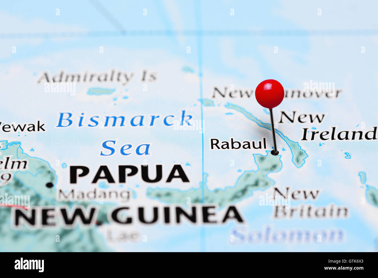 Rabaul pinned on a map of Papua New Guinea Stock Photohttps://www.alamy.com/image-license-details/?v=1https://www.alamy.com/stock-photo-rabaul-pinned-on-a-map-of-papua-new-guinea-118436475.html
RFGTK6X3–Rabaul pinned on a map of Papua New Guinea
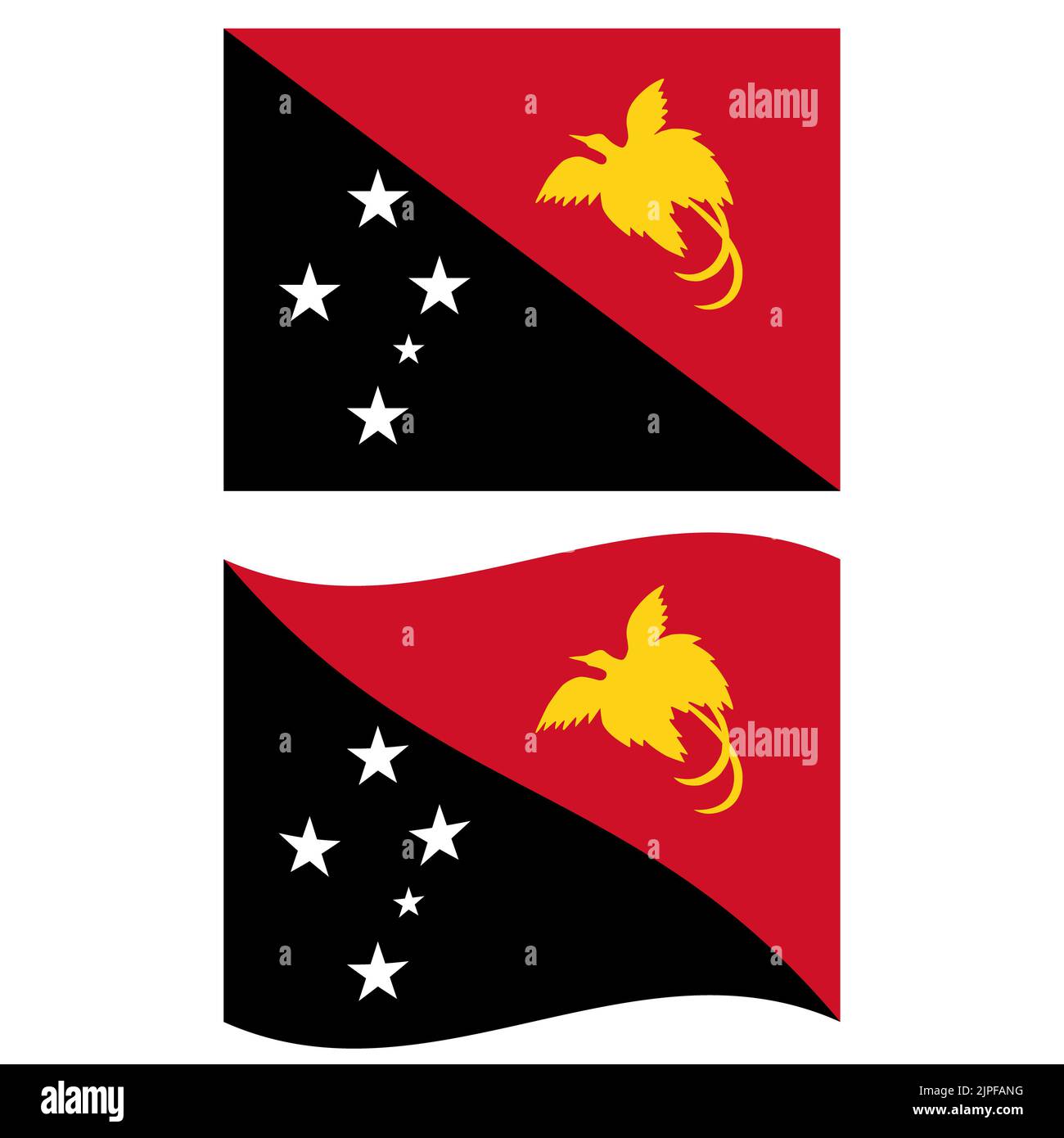 Flag of Papua New Guinea. Papua New Guinea national flag. Papua New Guinea waving flag. flat style. Stock Photohttps://www.alamy.com/image-license-details/?v=1https://www.alamy.com/flag-of-papua-new-guinea-papua-new-guinea-national-flag-papua-new-guinea-waving-flag-flat-style-image478540092.html
RF2JPFANG–Flag of Papua New Guinea. Papua New Guinea national flag. Papua New Guinea waving flag. flat style.
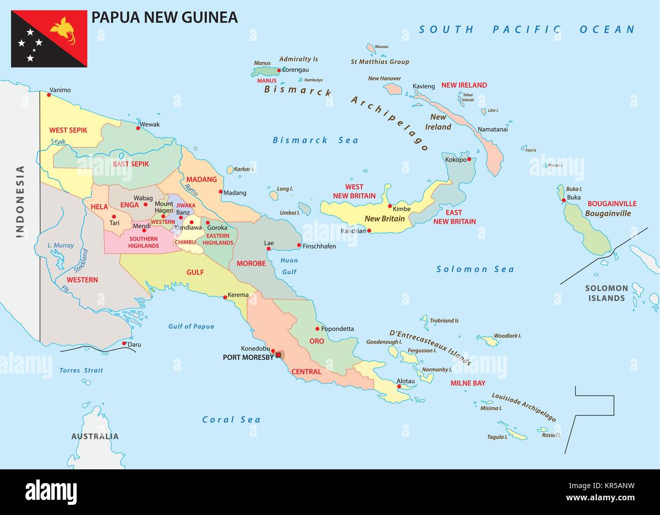 papua new guinea administrative and political vector map with flag Stock Vectorhttps://www.alamy.com/image-license-details/?v=1https://www.alamy.com/stock-image-papua-new-guinea-administrative-and-political-vector-map-with-flag-169148613.html
RFKR5ANW–papua new guinea administrative and political vector map with flag
 East New Britain, province of Papua New Guinea. High resolution satellite map Stock Photohttps://www.alamy.com/image-license-details/?v=1https://www.alamy.com/east-new-britain-province-of-papua-new-guinea-high-resolution-satellite-map-image516615814.html
RF2N0DTMP–East New Britain, province of Papua New Guinea. High resolution satellite map
 New Britain Sing Sing at Rabaul, with display of shell money Stock Photohttps://www.alamy.com/image-license-details/?v=1https://www.alamy.com/stock-photo-new-britain-sing-sing-at-rabaul-with-display-of-shell-money-140277985.html
RMJ46601–New Britain Sing Sing at Rabaul, with display of shell money
 East New Britain, province of Papua New Guinea. Low resolution satellite map Stock Photohttps://www.alamy.com/image-license-details/?v=1https://www.alamy.com/east-new-britain-province-of-papua-new-guinea-low-resolution-satellite-map-image516615809.html
RF2N0DTMH–East New Britain, province of Papua New Guinea. Low resolution satellite map
 Admiral Yamamoto in Rabaul 1943 Stock Photohttps://www.alamy.com/image-license-details/?v=1https://www.alamy.com/admiral-yamamoto-in-rabaul-1943-image155580174.html
RMK1382P–Admiral Yamamoto in Rabaul 1943
 East New Britain, province of Papua New Guinea. Grayscale elevation map with lakes and rivers Stock Photohttps://www.alamy.com/image-license-details/?v=1https://www.alamy.com/east-new-britain-province-of-papua-new-guinea-grayscale-elevation-map-with-lakes-and-rivers-image516615805.html
RF2N0DTMD–East New Britain, province of Papua New Guinea. Grayscale elevation map with lakes and rivers
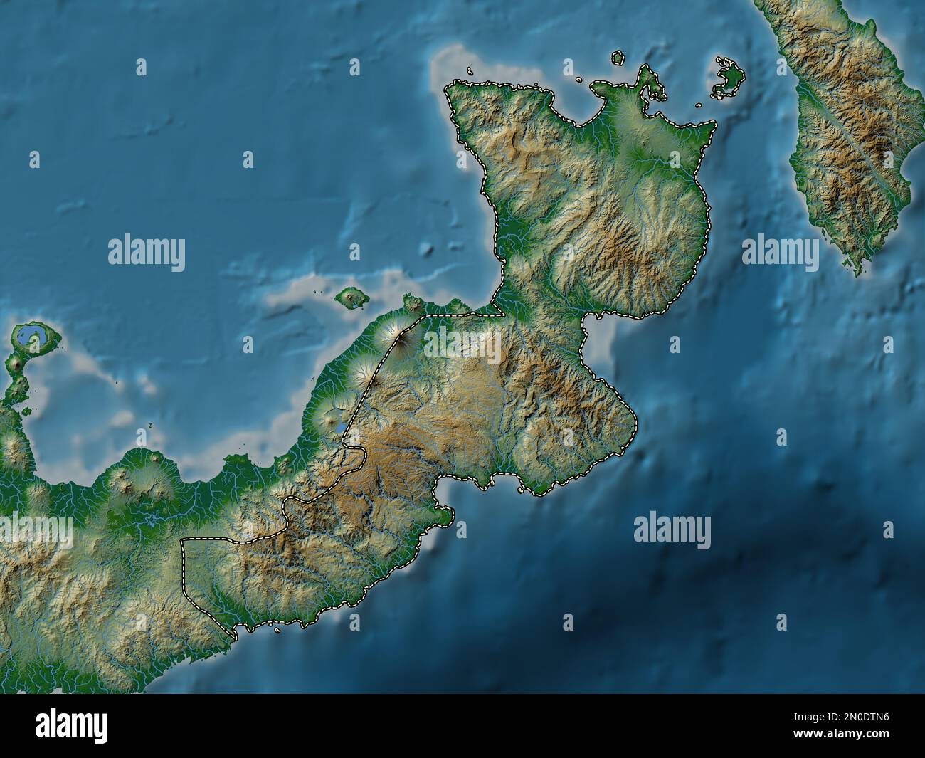 East New Britain, province of Papua New Guinea. Colored elevation map with lakes and rivers Stock Photohttps://www.alamy.com/image-license-details/?v=1https://www.alamy.com/east-new-britain-province-of-papua-new-guinea-colored-elevation-map-with-lakes-and-rivers-image516615826.html
RF2N0DTN6–East New Britain, province of Papua New Guinea. Colored elevation map with lakes and rivers
 East New Britain, province of Papua New Guinea. Bilevel elevation map with lakes and rivers Stock Photohttps://www.alamy.com/image-license-details/?v=1https://www.alamy.com/east-new-britain-province-of-papua-new-guinea-bilevel-elevation-map-with-lakes-and-rivers-image516615810.html
RF2N0DTMJ–East New Britain, province of Papua New Guinea. Bilevel elevation map with lakes and rivers
 East New Britain, province of Papua New Guinea. Elevation map colored in sepia tones with lakes and rivers Stock Photohttps://www.alamy.com/image-license-details/?v=1https://www.alamy.com/east-new-britain-province-of-papua-new-guinea-elevation-map-colored-in-sepia-tones-with-lakes-and-rivers-image516615760.html
RF2N0DTJT–East New Britain, province of Papua New Guinea. Elevation map colored in sepia tones with lakes and rivers
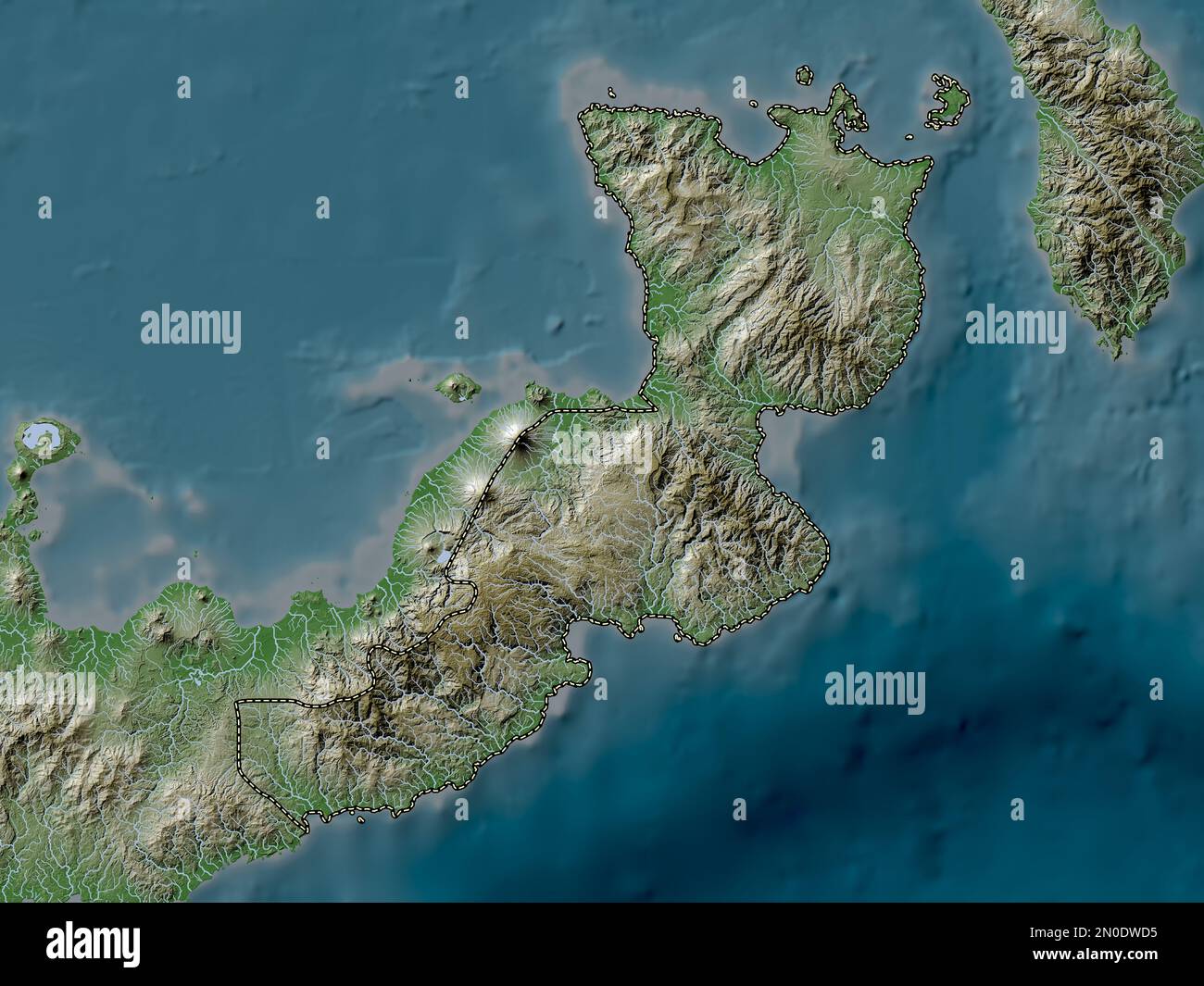 East New Britain, province of Papua New Guinea. Elevation map colored in wiki style with lakes and rivers Stock Photohttps://www.alamy.com/image-license-details/?v=1https://www.alamy.com/east-new-britain-province-of-papua-new-guinea-elevation-map-colored-in-wiki-style-with-lakes-and-rivers-image516616385.html
RF2N0DWD5–East New Britain, province of Papua New Guinea. Elevation map colored in wiki style with lakes and rivers
 East New Britain, province of Papua New Guinea. Bilevel elevation map with lakes and rivers. Locations and names of major cities of the region. Corner Stock Photohttps://www.alamy.com/image-license-details/?v=1https://www.alamy.com/east-new-britain-province-of-papua-new-guinea-bilevel-elevation-map-with-lakes-and-rivers-locations-and-names-of-major-cities-of-the-region-corner-image516615778.html
RF2N0DTKE–East New Britain, province of Papua New Guinea. Bilevel elevation map with lakes and rivers. Locations and names of major cities of the region. Corner
 East New Britain, province of Papua New Guinea. Bilevel elevation map with lakes and rivers. Locations of major cities of the region. Corner auxiliary Stock Photohttps://www.alamy.com/image-license-details/?v=1https://www.alamy.com/east-new-britain-province-of-papua-new-guinea-bilevel-elevation-map-with-lakes-and-rivers-locations-of-major-cities-of-the-region-corner-auxiliary-image516615789.html
RF2N0DTKW–East New Britain, province of Papua New Guinea. Bilevel elevation map with lakes and rivers. Locations of major cities of the region. Corner auxiliary
 East New Britain, province of Papua New Guinea. Colored elevation map with lakes and rivers. Locations and names of major cities of the region. Corner Stock Photohttps://www.alamy.com/image-license-details/?v=1https://www.alamy.com/east-new-britain-province-of-papua-new-guinea-colored-elevation-map-with-lakes-and-rivers-locations-and-names-of-major-cities-of-the-region-corner-image516615827.html
RF2N0DTN7–East New Britain, province of Papua New Guinea. Colored elevation map with lakes and rivers. Locations and names of major cities of the region. Corner
 East New Britain, province of Papua New Guinea. Open Street Map. Locations of major cities of the region. Corner auxiliary location maps Stock Photohttps://www.alamy.com/image-license-details/?v=1https://www.alamy.com/east-new-britain-province-of-papua-new-guinea-open-street-map-locations-of-major-cities-of-the-region-corner-auxiliary-location-maps-image516615794.html
RF2N0DTM2–East New Britain, province of Papua New Guinea. Open Street Map. Locations of major cities of the region. Corner auxiliary location maps
 East New Britain, province of Papua New Guinea. Colored elevation map with lakes and rivers. Locations of major cities of the region. Corner auxiliary Stock Photohttps://www.alamy.com/image-license-details/?v=1https://www.alamy.com/east-new-britain-province-of-papua-new-guinea-colored-elevation-map-with-lakes-and-rivers-locations-of-major-cities-of-the-region-corner-auxiliary-image516615813.html
RF2N0DTMN–East New Britain, province of Papua New Guinea. Colored elevation map with lakes and rivers. Locations of major cities of the region. Corner auxiliary
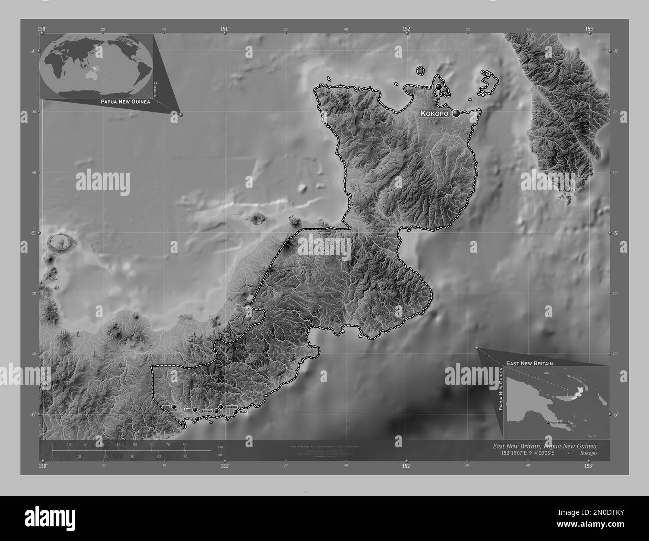 East New Britain, province of Papua New Guinea. Grayscale elevation map with lakes and rivers. Locations and names of major cities of the region. Corn Stock Photohttps://www.alamy.com/image-license-details/?v=1https://www.alamy.com/east-new-britain-province-of-papua-new-guinea-grayscale-elevation-map-with-lakes-and-rivers-locations-and-names-of-major-cities-of-the-region-corn-image516615791.html
RF2N0DTKY–East New Britain, province of Papua New Guinea. Grayscale elevation map with lakes and rivers. Locations and names of major cities of the region. Corn
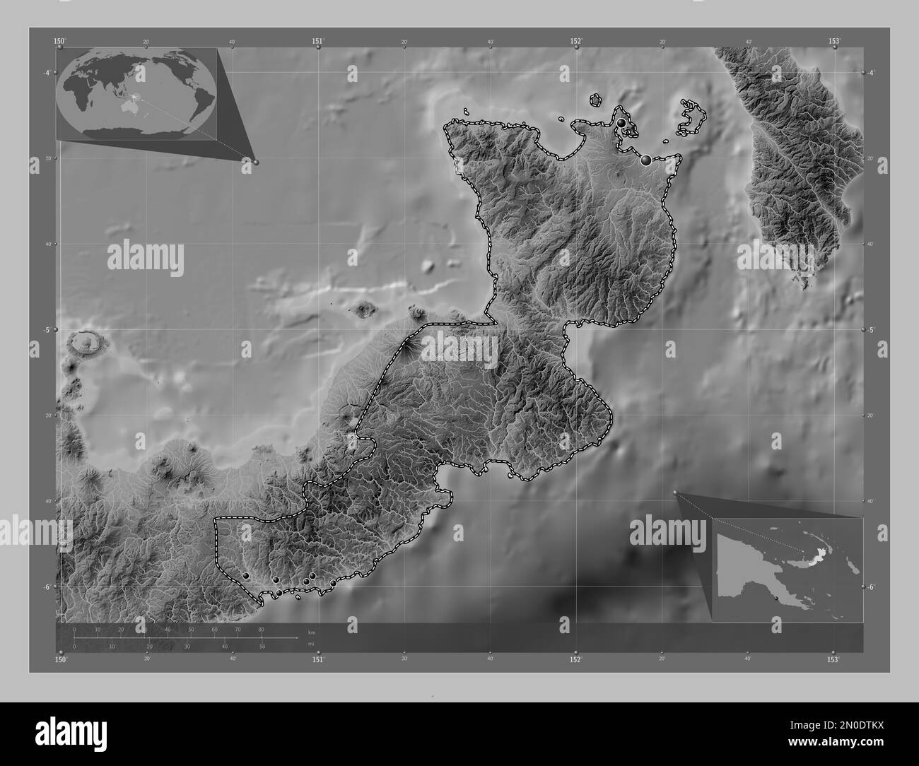 East New Britain, province of Papua New Guinea. Grayscale elevation map with lakes and rivers. Locations of major cities of the region. Corner auxilia Stock Photohttps://www.alamy.com/image-license-details/?v=1https://www.alamy.com/east-new-britain-province-of-papua-new-guinea-grayscale-elevation-map-with-lakes-and-rivers-locations-of-major-cities-of-the-region-corner-auxilia-image516615790.html
RF2N0DTKX–East New Britain, province of Papua New Guinea. Grayscale elevation map with lakes and rivers. Locations of major cities of the region. Corner auxilia
 East New Britain, province of Papua New Guinea. Low resolution satellite map. Locations of major cities of the region. Corner auxiliary location maps Stock Photohttps://www.alamy.com/image-license-details/?v=1https://www.alamy.com/east-new-britain-province-of-papua-new-guinea-low-resolution-satellite-map-locations-of-major-cities-of-the-region-corner-auxiliary-location-maps-image516615821.html
RF2N0DTN1–East New Britain, province of Papua New Guinea. Low resolution satellite map. Locations of major cities of the region. Corner auxiliary location maps
 East New Britain, province of Papua New Guinea. High resolution satellite map. Locations and names of major cities of the region. Corner auxiliary loc Stock Photohttps://www.alamy.com/image-license-details/?v=1https://www.alamy.com/east-new-britain-province-of-papua-new-guinea-high-resolution-satellite-map-locations-and-names-of-major-cities-of-the-region-corner-auxiliary-loc-image516615816.html
RF2N0DTMT–East New Britain, province of Papua New Guinea. High resolution satellite map. Locations and names of major cities of the region. Corner auxiliary loc
 East New Britain, province of Papua New Guinea. Low resolution satellite map. Locations and names of major cities of the region. Corner auxiliary loca Stock Photohttps://www.alamy.com/image-license-details/?v=1https://www.alamy.com/east-new-britain-province-of-papua-new-guinea-low-resolution-satellite-map-locations-and-names-of-major-cities-of-the-region-corner-auxiliary-loca-image516615824.html
RF2N0DTN4–East New Britain, province of Papua New Guinea. Low resolution satellite map. Locations and names of major cities of the region. Corner auxiliary loca
 East New Britain, province of Papua New Guinea. High resolution satellite map. Locations of major cities of the region. Corner auxiliary location maps Stock Photohttps://www.alamy.com/image-license-details/?v=1https://www.alamy.com/east-new-britain-province-of-papua-new-guinea-high-resolution-satellite-map-locations-of-major-cities-of-the-region-corner-auxiliary-location-maps-image516615812.html
RF2N0DTMM–East New Britain, province of Papua New Guinea. High resolution satellite map. Locations of major cities of the region. Corner auxiliary location maps
 East New Britain, province of Papua New Guinea. Open Street Map. Locations and names of major cities of the region. Corner auxiliary location maps Stock Photohttps://www.alamy.com/image-license-details/?v=1https://www.alamy.com/east-new-britain-province-of-papua-new-guinea-open-street-map-locations-and-names-of-major-cities-of-the-region-corner-auxiliary-location-maps-image516615801.html
RF2N0DTM9–East New Britain, province of Papua New Guinea. Open Street Map. Locations and names of major cities of the region. Corner auxiliary location maps
 East New Britain, province of Papua New Guinea. Elevation map colored in wiki style with lakes and rivers. Locations and names of major cities of the Stock Photohttps://www.alamy.com/image-license-details/?v=1https://www.alamy.com/east-new-britain-province-of-papua-new-guinea-elevation-map-colored-in-wiki-style-with-lakes-and-rivers-locations-and-names-of-major-cities-of-the-image516615822.html
RF2N0DTN2–East New Britain, province of Papua New Guinea. Elevation map colored in wiki style with lakes and rivers. Locations and names of major cities of the
 East New Britain, province of Papua New Guinea. Elevation map colored in sepia tones with lakes and rivers. Locations and names of major cities of the Stock Photohttps://www.alamy.com/image-license-details/?v=1https://www.alamy.com/east-new-britain-province-of-papua-new-guinea-elevation-map-colored-in-sepia-tones-with-lakes-and-rivers-locations-and-names-of-major-cities-of-the-image516616463.html
RF2N0DWFY–East New Britain, province of Papua New Guinea. Elevation map colored in sepia tones with lakes and rivers. Locations and names of major cities of the
 East New Britain, province of Papua New Guinea. Elevation map colored in sepia tones with lakes and rivers. Locations of major cities of the region. C Stock Photohttps://www.alamy.com/image-license-details/?v=1https://www.alamy.com/east-new-britain-province-of-papua-new-guinea-elevation-map-colored-in-sepia-tones-with-lakes-and-rivers-locations-of-major-cities-of-the-region-c-image516616439.html
RF2N0DWF3–East New Britain, province of Papua New Guinea. Elevation map colored in sepia tones with lakes and rivers. Locations of major cities of the region. C
 East New Britain, province of Papua New Guinea. Elevation map colored in wiki style with lakes and rivers. Locations of major cities of the region. Co Stock Photohttps://www.alamy.com/image-license-details/?v=1https://www.alamy.com/east-new-britain-province-of-papua-new-guinea-elevation-map-colored-in-wiki-style-with-lakes-and-rivers-locations-of-major-cities-of-the-region-co-image516616402.html
RF2N0DWDP–East New Britain, province of Papua New Guinea. Elevation map colored in wiki style with lakes and rivers. Locations of major cities of the region. Co
 East New Britain, province of Papua New Guinea. Solid color shape. Locations of major cities of the region. Corner auxiliary location maps Stock Photohttps://www.alamy.com/image-license-details/?v=1https://www.alamy.com/east-new-britain-province-of-papua-new-guinea-solid-color-shape-locations-of-major-cities-of-the-region-corner-auxiliary-location-maps-image516615716.html
RF2N0DTH8–East New Britain, province of Papua New Guinea. Solid color shape. Locations of major cities of the region. Corner auxiliary location maps
 East New Britain, province of Papua New Guinea. Solid color shape. Locations and names of major cities of the region. Corner auxiliary location maps Stock Photohttps://www.alamy.com/image-license-details/?v=1https://www.alamy.com/east-new-britain-province-of-papua-new-guinea-solid-color-shape-locations-and-names-of-major-cities-of-the-region-corner-auxiliary-location-maps-image516615806.html
RF2N0DTME–East New Britain, province of Papua New Guinea. Solid color shape. Locations and names of major cities of the region. Corner auxiliary location maps
 East New Britain, province of Papua New Guinea. Solid color shape Stock Photohttps://www.alamy.com/image-license-details/?v=1https://www.alamy.com/east-new-britain-province-of-papua-new-guinea-solid-color-shape-image516615808.html
RF2N0DTMG–East New Britain, province of Papua New Guinea. Solid color shape