Retaining river wall Cut Out Stock Images
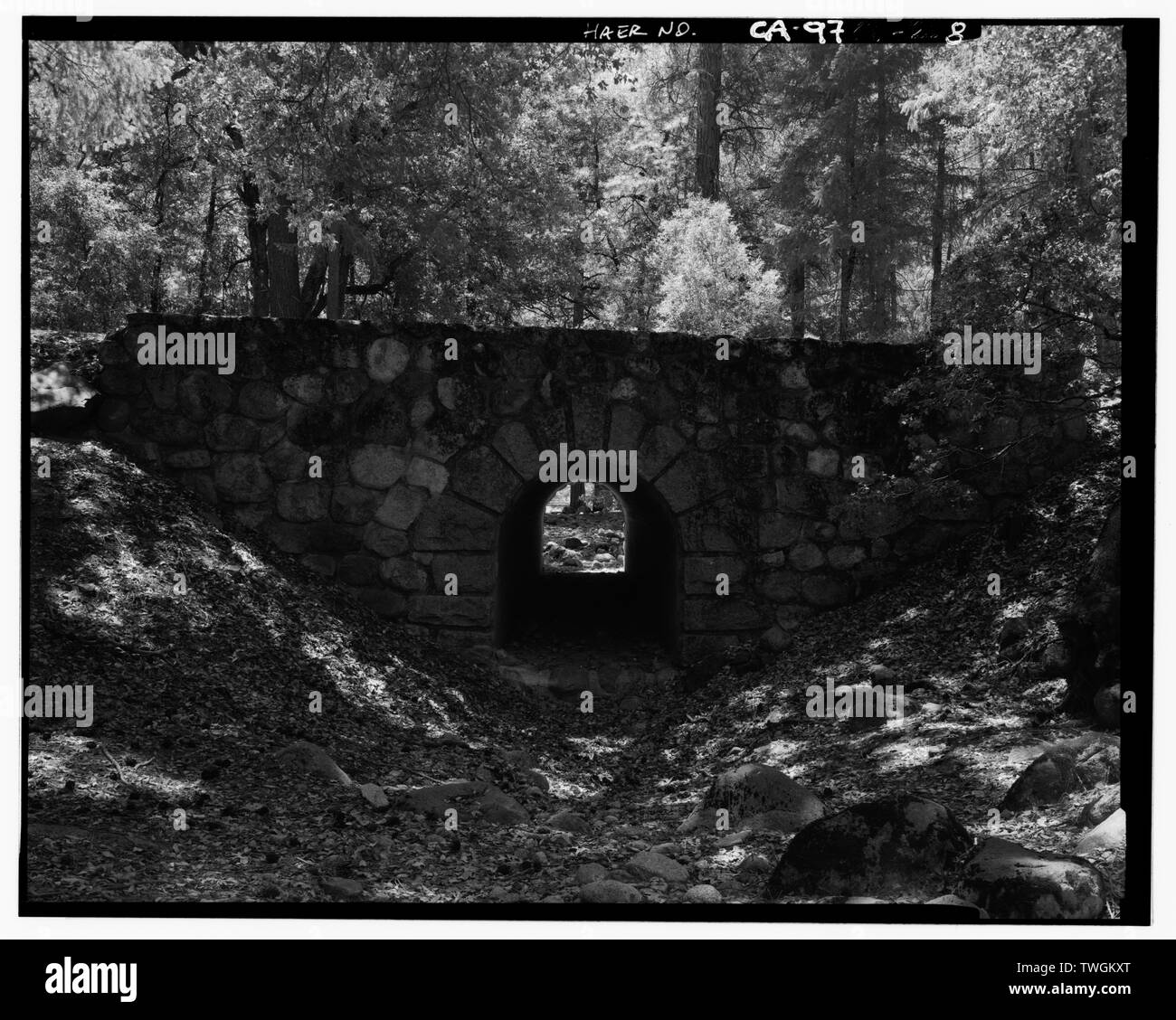 RETAINING WALL and WEST PORTAL OF CULVERT. - Happy Isles Bridge, Spanning Merced River on Service road, Yosemite Village, Mariposa County, CA Stock Photohttps://www.alamy.com/image-license-details/?v=1https://www.alamy.com/retaining-wall-and-west-portal-of-culvert-happy-isles-bridge-spanning-merced-river-on-service-road-yosemite-village-mariposa-county-ca-image256678432.html
RMTWGKXT–RETAINING WALL and WEST PORTAL OF CULVERT. - Happy Isles Bridge, Spanning Merced River on Service road, Yosemite Village, Mariposa County, CA
 FEBRUARY 6 1897. THE HARLEM RIVER SPEEDWAY NEW YORK CITY. SUPPLEMENT. RAISED WESTERLY SID EWALK NORTH OF WASHINGTON BRIDGE SHOWING RETAINING WALL AND UNFINISHED ROADWAY AT GRADE. HARLEM RIVER SPEEDWAY—UNFINISHED ROADWAY SOUTH OF HIGH BRIDGE SHOWING SOLID MASONRY TRENCHES IN WHICH TO PLANT SHADE TREES., scientific american, 1897-02-06 Stock Photohttps://www.alamy.com/image-license-details/?v=1https://www.alamy.com/february-6-1897-the-harlem-river-speedway-new-york-city-supplement-raised-westerly-sid-ewalk-north-of-washington-bridge-showing-retaining-wall-and-unfinished-roadway-at-grade-harlem-river-speedwayunfinished-roadway-south-of-high-bridge-showing-solid-masonry-trenches-in-which-to-plant-shade-trees-scientific-american-1897-02-06-image334340865.html
RM2ABXF55–FEBRUARY 6 1897. THE HARLEM RIVER SPEEDWAY NEW YORK CITY. SUPPLEMENT. RAISED WESTERLY SID EWALK NORTH OF WASHINGTON BRIDGE SHOWING RETAINING WALL AND UNFINISHED ROADWAY AT GRADE. HARLEM RIVER SPEEDWAY—UNFINISHED ROADWAY SOUTH OF HIGH BRIDGE SHOWING SOLID MASONRY TRENCHES IN WHICH TO PLANT SHADE TREES., scientific american, 1897-02-06
 ROAD AND RETAINING WALL BETWEEN CHANTICLEER POINT AND CROWN POINT. VIEW LOOKING 158 DEGREES SOUTH-SOUTHEAST. - Historic Columbia River Highway, Troutdale, Multnomah County, OR Stock Photohttps://www.alamy.com/image-license-details/?v=1https://www.alamy.com/road-and-retaining-wall-between-chanticleer-point-and-crown-point-view-looking-158-degrees-south-southeast-historic-columbia-river-highway-troutdale-multnomah-county-or-image256679201.html
RMTWGMX9–ROAD AND RETAINING WALL BETWEEN CHANTICLEER POINT AND CROWN POINT. VIEW LOOKING 158 DEGREES SOUTH-SOUTHEAST. - Historic Columbia River Highway, Troutdale, Multnomah County, OR
 Yonkers 40000 Rorse-Power Power House on the Hudson River. The Engine Room Will Contain Six Curtis Turb Generators. View of Excavated Easterly Portion of Grand Central Yard Looking South Showing Suburban Level and Steelwork for Carrying Upper Express Level. The Retaining Wall to the Left Fronts on Lexington Avenue., scientific american, 1906-10-11 Stock Photohttps://www.alamy.com/image-license-details/?v=1https://www.alamy.com/yonkers-40000-rorse-power-power-house-on-the-hudson-river-the-engine-room-will-contain-six-curtis-turb-generators-view-of-excavated-easterly-portion-of-grand-central-yard-looking-south-showing-suburban-level-and-steelwork-for-carrying-upper-express-level-the-retaining-wall-to-the-left-fronts-on-lexington-avenue-scientific-american-1906-10-11-image334351761.html
RM2ABY129–Yonkers 40000 Rorse-Power Power House on the Hudson River. The Engine Room Will Contain Six Curtis Turb Generators. View of Excavated Easterly Portion of Grand Central Yard Looking South Showing Suburban Level and Steelwork for Carrying Upper Express Level. The Retaining Wall to the Left Fronts on Lexington Avenue., scientific american, 1906-10-11
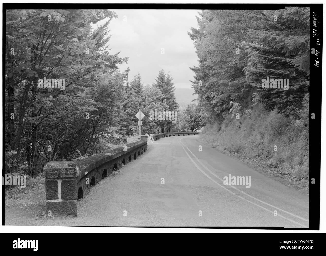 ROAD AND RETAINING WALL BETWEEN CHANTICLEER POINT AND CROWN POINT. VIEW LOOKING 24 DEGREES NORTH-NORTHEAST. - Historic Columbia River Highway, Troutdale, Multnomah County, OR Stock Photohttps://www.alamy.com/image-license-details/?v=1https://www.alamy.com/road-and-retaining-wall-between-chanticleer-point-and-crown-point-view-looking-24-degrees-north-northeast-historic-columbia-river-highway-troutdale-multnomah-county-or-image256679233.html
RMTWGMYD–ROAD AND RETAINING WALL BETWEEN CHANTICLEER POINT AND CROWN POINT. VIEW LOOKING 24 DEGREES NORTH-NORTHEAST. - Historic Columbia River Highway, Troutdale, Multnomah County, OR
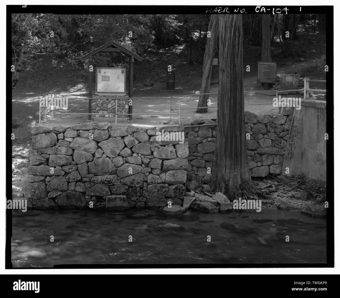 RETAINING WALL AND GAUGING STATION AT NE CORNER OF BRIDGE. - Old Happy Isles Bridge, Spanning Merced River on service road, Yosemite Village, Mariposa County, CA Stock Photohttps://www.alamy.com/image-license-details/?v=1https://www.alamy.com/retaining-wall-and-gauging-station-at-ne-corner-of-bridge-old-happy-isles-bridge-spanning-merced-river-on-service-road-yosemite-village-mariposa-county-ca-image256678305.html
RMTWGKP9–RETAINING WALL AND GAUGING STATION AT NE CORNER OF BRIDGE. - Old Happy Isles Bridge, Spanning Merced River on service road, Yosemite Village, Mariposa County, CA
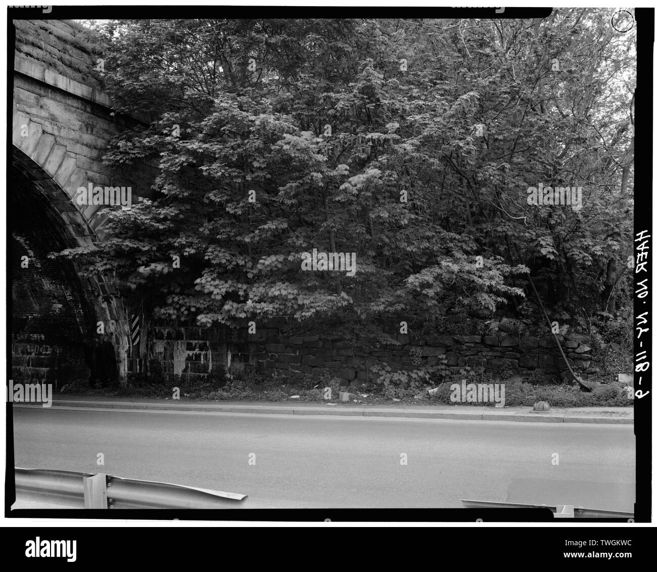 RETAINING WALL FROM EAST, NORTH SIDE OF NEPPERHAN AVENUE ARCH - Old Croton Aqueduct, Saw Mill River Culvert, Spanning Nepperhan Avenue, Yonkers, Westchester County, NY Stock Photohttps://www.alamy.com/image-license-details/?v=1https://www.alamy.com/retaining-wall-from-east-north-side-of-nepperhan-avenue-arch-old-croton-aqueduct-saw-mill-river-culvert-spanning-nepperhan-avenue-yonkers-westchester-county-ny-image256678392.html
RMTWGKWC–RETAINING WALL FROM EAST, NORTH SIDE OF NEPPERHAN AVENUE ARCH - Old Croton Aqueduct, Saw Mill River Culvert, Spanning Nepperhan Avenue, Yonkers, Westchester County, NY
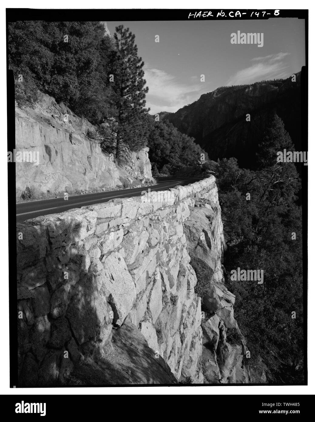 Retaining wall, .6 mi. west of tunnel -3, view facing SE. - Big Oak Flat Road, Between Big Oak Flat Entrance and Merced River, Yosemite Village, Mariposa County, CA Stock Photohttps://www.alamy.com/image-license-details/?v=1https://www.alamy.com/retaining-wall-6-mi-west-of-tunnel-3-view-facing-se-big-oak-flat-road-between-big-oak-flat-entrance-and-merced-river-yosemite-village-mariposa-county-ca-image256688101.html
RMTWH485–Retaining wall, .6 mi. west of tunnel -3, view facing SE. - Big Oak Flat Road, Between Big Oak Flat Entrance and Merced River, Yosemite Village, Mariposa County, CA
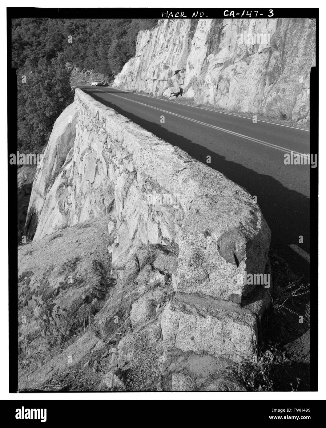 Retaining wall, .75 mi. west of tunnel -3, view facing NW. - Big Oak Flat Road, Between Big Oak Flat Entrance and Merced River, Yosemite Village, Mariposa County, CA Stock Photohttps://www.alamy.com/image-license-details/?v=1https://www.alamy.com/retaining-wall-75-mi-west-of-tunnel-3-view-facing-nw-big-oak-flat-road-between-big-oak-flat-entrance-and-merced-river-yosemite-village-mariposa-county-ca-image256688133.html
RMTWH499–Retaining wall, .75 mi. west of tunnel -3, view facing NW. - Big Oak Flat Road, Between Big Oak Flat Entrance and Merced River, Yosemite Village, Mariposa County, CA
 Retaining wall, just east of tunnel -1 on Big Oak Flat Road. - Big Oak Flat Road, Between Big Oak Flat Entrance and Merced River, Yosemite Village, Mariposa County, CA Stock Photohttps://www.alamy.com/image-license-details/?v=1https://www.alamy.com/retaining-wall-just-east-of-tunnel-1-on-big-oak-flat-road-big-oak-flat-road-between-big-oak-flat-entrance-and-merced-river-yosemite-village-mariposa-county-ca-image256688142.html
RMTWH49J–Retaining wall, just east of tunnel -1 on Big Oak Flat Road. - Big Oak Flat Road, Between Big Oak Flat Entrance and Merced River, Yosemite Village, Mariposa County, CA
 ROAD-LEVEL VIEW OF CROWN POINT VIADUCT AT REAR OF VISTA HOUSE SHOWING SIDEWALK, ROADWAY, AND STAIRCASE IN RETAINING WALL. - Historic Columbia River Highway, Crown Point Viaduct, Encircling Vista House at Crown Point, Troutdale, Multnomah County, OR Stock Photohttps://www.alamy.com/image-license-details/?v=1https://www.alamy.com/road-level-view-of-crown-point-viaduct-at-rear-of-vista-house-showing-sidewalk-roadway-and-staircase-in-retaining-wall-historic-columbia-river-highway-crown-point-viaduct-encircling-vista-house-at-crown-point-troutdale-multnomah-county-or-image256679783.html
RMTWGNK3–ROAD-LEVEL VIEW OF CROWN POINT VIADUCT AT REAR OF VISTA HOUSE SHOWING SIDEWALK, ROADWAY, AND STAIRCASE IN RETAINING WALL. - Historic Columbia River Highway, Crown Point Viaduct, Encircling Vista House at Crown Point, Troutdale, Multnomah County, OR