Quick filters:
Russian map Stock Photos and Images
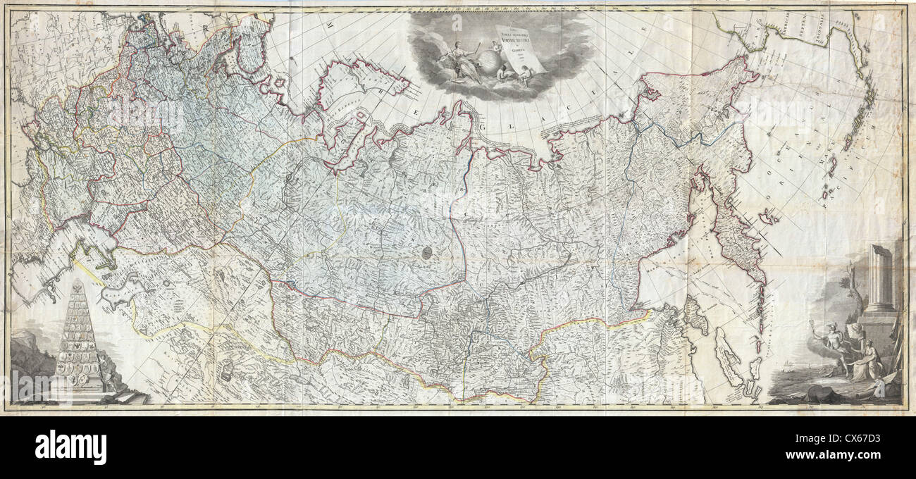 1787 Wall Map of the Russian Empire Stock Photohttps://www.alamy.com/image-license-details/?v=1https://www.alamy.com/stock-photo-1787-wall-map-of-the-russian-empire-50539359.html
RMCX67D3–1787 Wall Map of the Russian Empire
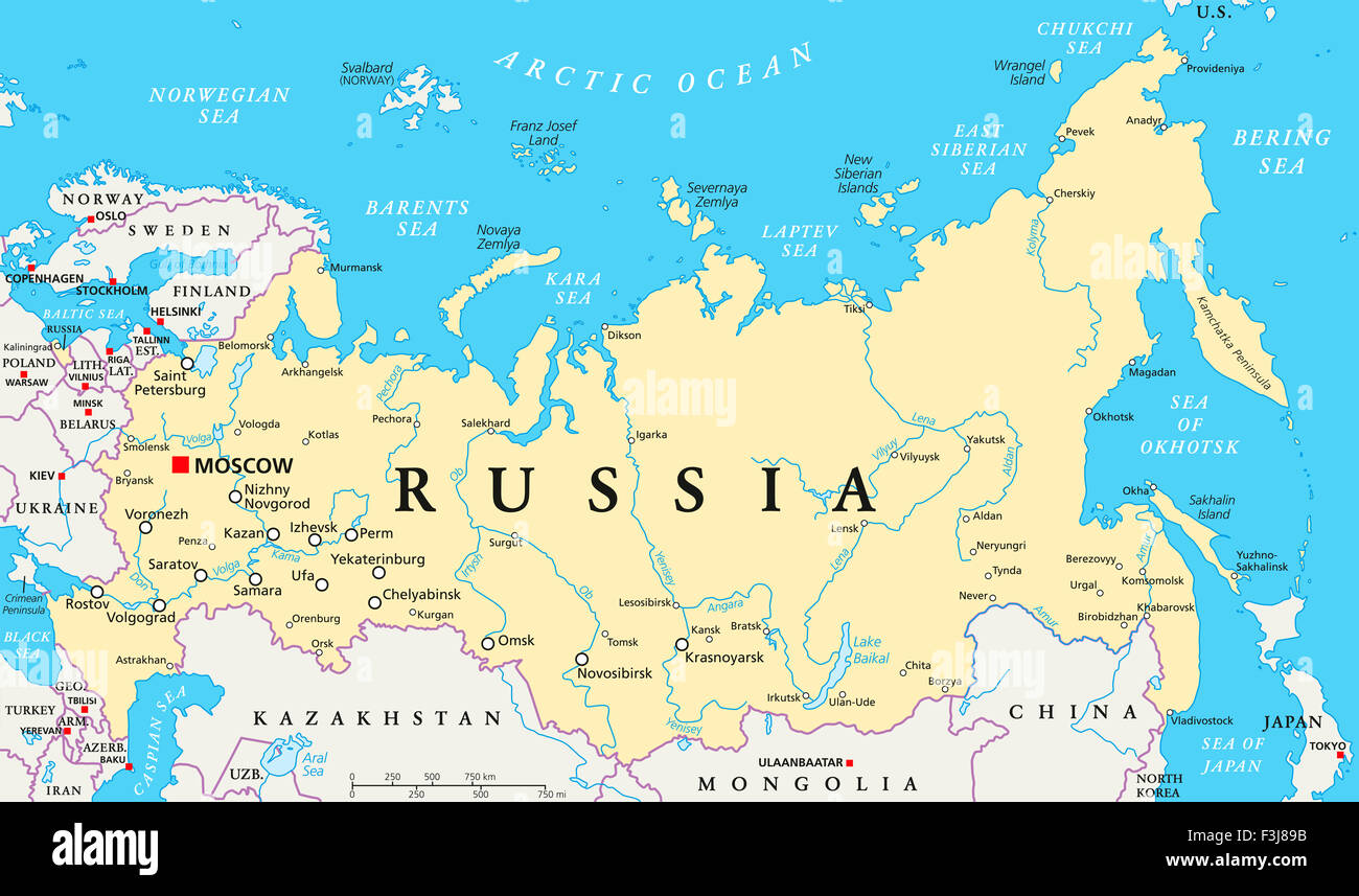 Russia political map with capital Moscow, national borders, important cities, rivers and lakes. English labeling and scaling. Stock Photohttps://www.alamy.com/image-license-details/?v=1https://www.alamy.com/stock-photo-russia-political-map-with-capital-moscow-national-borders-important-88297479.html
RFF3J89B–Russia political map with capital Moscow, national borders, important cities, rivers and lakes. English labeling and scaling.
 map of Russia. Flat cartoon of russian country with its famous landmarks. Cathedral, musk, bear and bridges. buildings, food and plants. Funny tourist Stock Vectorhttps://www.alamy.com/image-license-details/?v=1https://www.alamy.com/map-of-russia-flat-cartoon-of-russian-country-with-its-famous-landmarks-cathedral-musk-bear-and-bridges-buildings-food-and-plants-funny-tourist-image384335539.html
RF2D97YW7–map of Russia. Flat cartoon of russian country with its famous landmarks. Cathedral, musk, bear and bridges. buildings, food and plants. Funny tourist
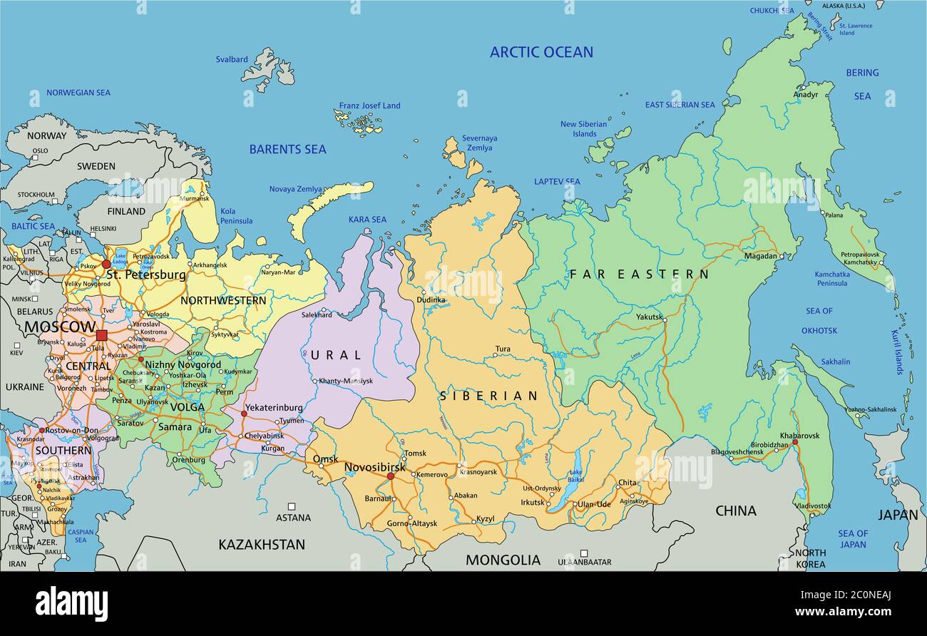 Russia - Highly detailed editable political map with labeling. Stock Vectorhttps://www.alamy.com/image-license-details/?v=1https://www.alamy.com/russia-highly-detailed-editable-political-map-with-labeling-image361889994.html
RF2C0NEAJ–Russia - Highly detailed editable political map with labeling.
 Russian map showing the Partition of the Ottoman Empire (1920-1923). Stock Photohttps://www.alamy.com/image-license-details/?v=1https://www.alamy.com/russian-map-showing-the-partition-of-the-ottoman-empire-1920-1923-image481951005.html
RM2K02NBW–Russian map showing the Partition of the Ottoman Empire (1920-1923).
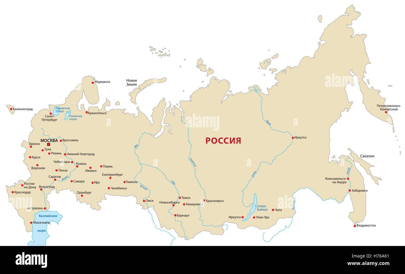 map of russia in cyrillic Stock Vectorhttps://www.alamy.com/image-license-details/?v=1https://www.alamy.com/stock-photo-map-of-russia-in-cyrillic-124914889.html
RFH76A61–map of russia in cyrillic
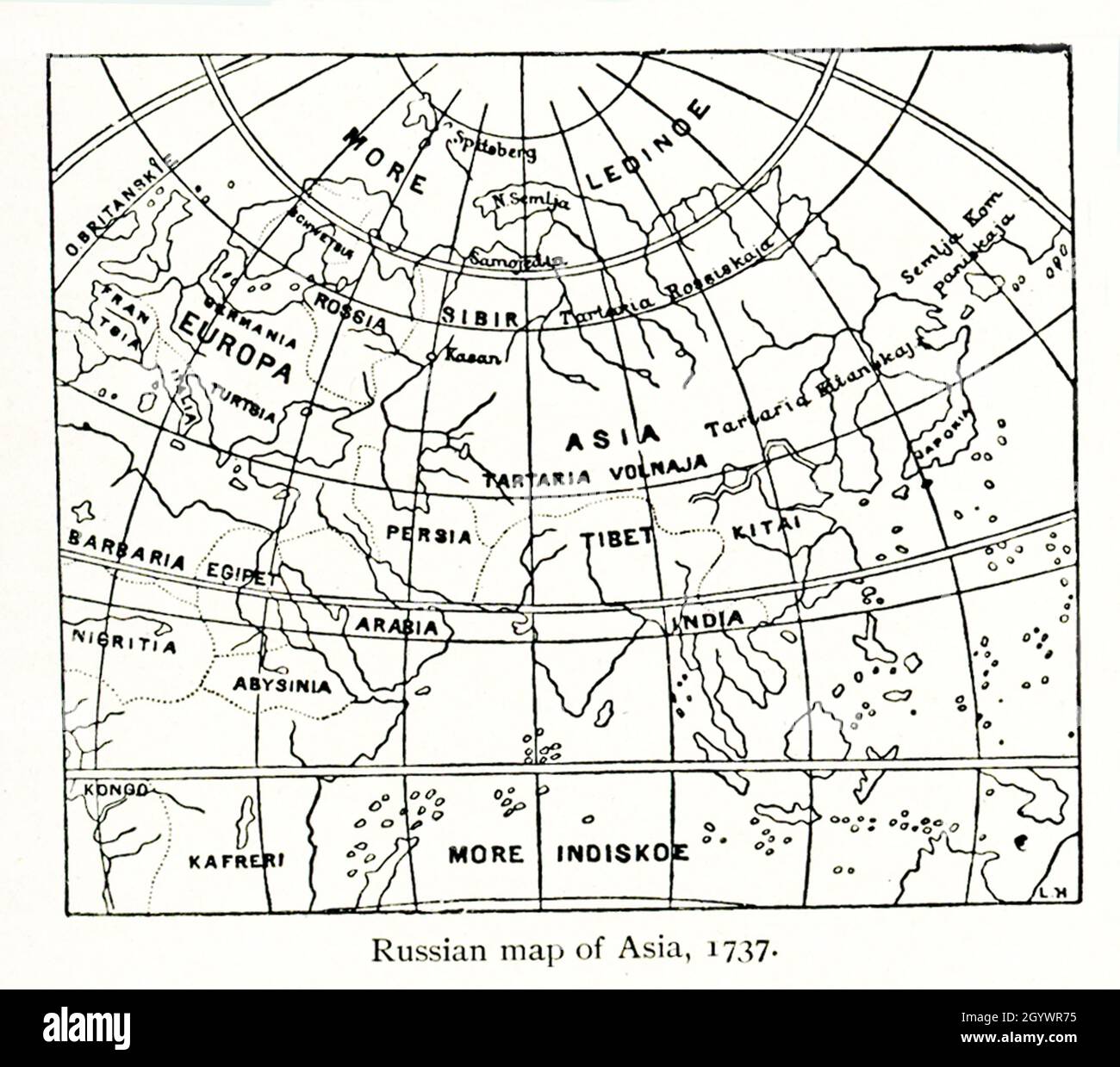 This Russian map shows how they pictured Asia in 1737. Stock Photohttps://www.alamy.com/image-license-details/?v=1https://www.alamy.com/this-russian-map-shows-how-they-pictured-asia-in-1737-image447421945.html
RF2GYWR75–This Russian map shows how they pictured Asia in 1737.
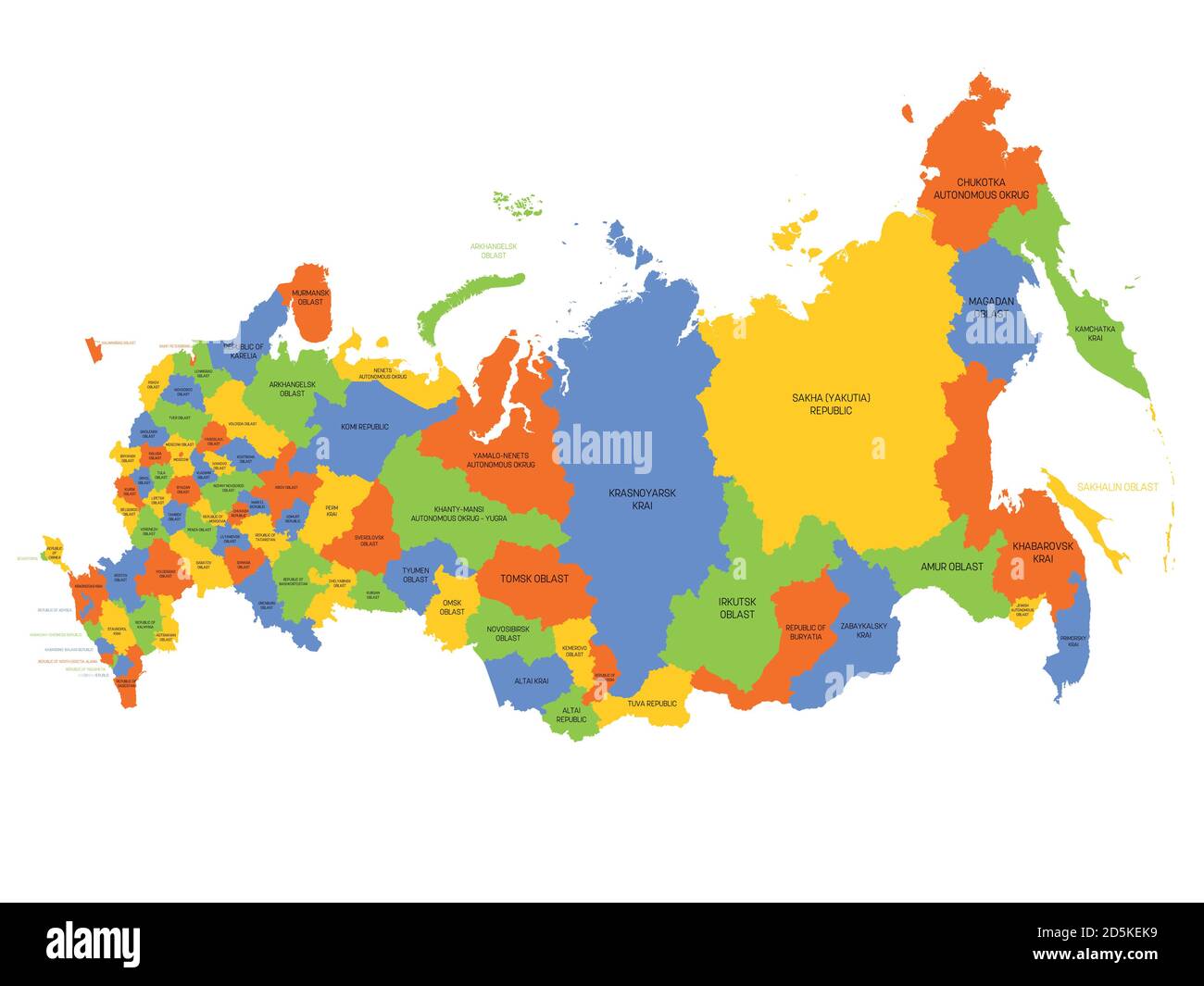 Political map of Russia, or Russian Federation. Federal subjects - republics, krays, oblasts, cities of federal significance, autonomous oblasts and autonomous okrugs. Simple flat vector map with labels. Stock Vectorhttps://www.alamy.com/image-license-details/?v=1https://www.alamy.com/political-map-of-russia-or-russian-federation-federal-subjects-republics-krays-oblasts-cities-of-federal-significance-autonomous-oblasts-and-autonomous-okrugs-simple-flat-vector-map-with-labels-image382129981.html
RF2D5KEK9–Political map of Russia, or Russian Federation. Federal subjects - republics, krays, oblasts, cities of federal significance, autonomous oblasts and autonomous okrugs. Simple flat vector map with labels.
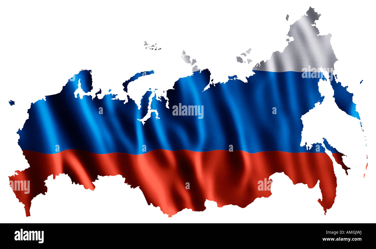 National flag of the Russian Federation as a map Russia Stock Photohttps://www.alamy.com/image-license-details/?v=1https://www.alamy.com/stock-photo-national-flag-of-the-russian-federation-as-a-map-russia-15259853.html
RFAMGJWJ–National flag of the Russian Federation as a map Russia
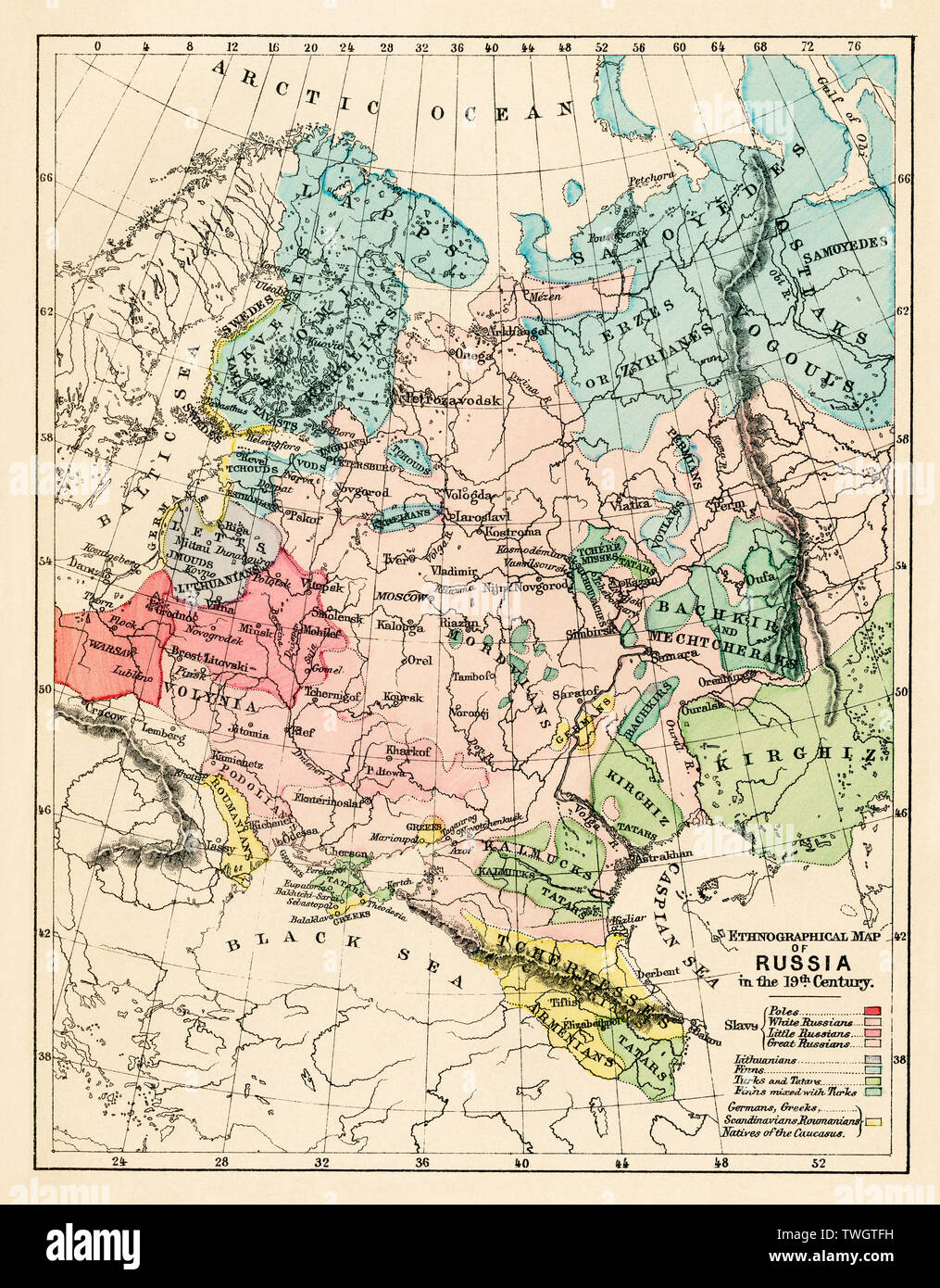 Ethnographic map of Russian Empire in the 19th century. Color lithograph Stock Photohttps://www.alamy.com/image-license-details/?v=1https://www.alamy.com/ethnographic-map-of-russian-empire-in-the-19th-century-color-lithograph-image256682037.html
RMTWGTFH–Ethnographic map of Russian Empire in the 19th century. Color lithograph
 Russian Map With Wooden Flag Stock Vectorhttps://www.alamy.com/image-license-details/?v=1https://www.alamy.com/stock-photo-russian-map-with-wooden-flag-147084130.html
RFJF878J–Russian Map With Wooden Flag
 This is a fragment of the map of Russian Empire of Peter The Great. This map was created by Sweden POWs approximately in 1725. Among other neighbouring states shown Empire of Kalmyks, the Dzungaria (highlighted by green color). Stock Photohttps://www.alamy.com/image-license-details/?v=1https://www.alamy.com/this-is-a-fragment-of-the-map-of-russian-empire-of-peter-the-great-this-map-was-created-by-sweden-pows-approximately-in-1725-among-other-neighbouring-states-shown-empire-of-kalmyks-the-dzungaria-highlighted-by-green-color-image603169303.html
RM2X18MGR–This is a fragment of the map of Russian Empire of Peter The Great. This map was created by Sweden POWs approximately in 1725. Among other neighbouring states shown Empire of Kalmyks, the Dzungaria (highlighted by green color).
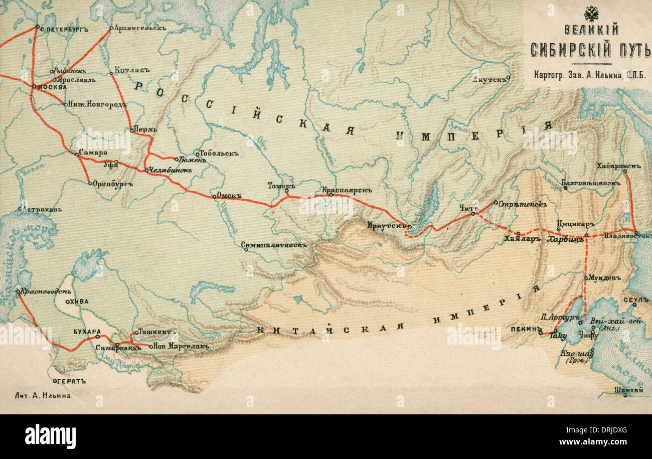 Map of the Russian Empire Stock Photohttps://www.alamy.com/image-license-details/?v=1https://www.alamy.com/map-of-the-russian-empire-image66174264.html
RMDRJDXG–Map of the Russian Empire
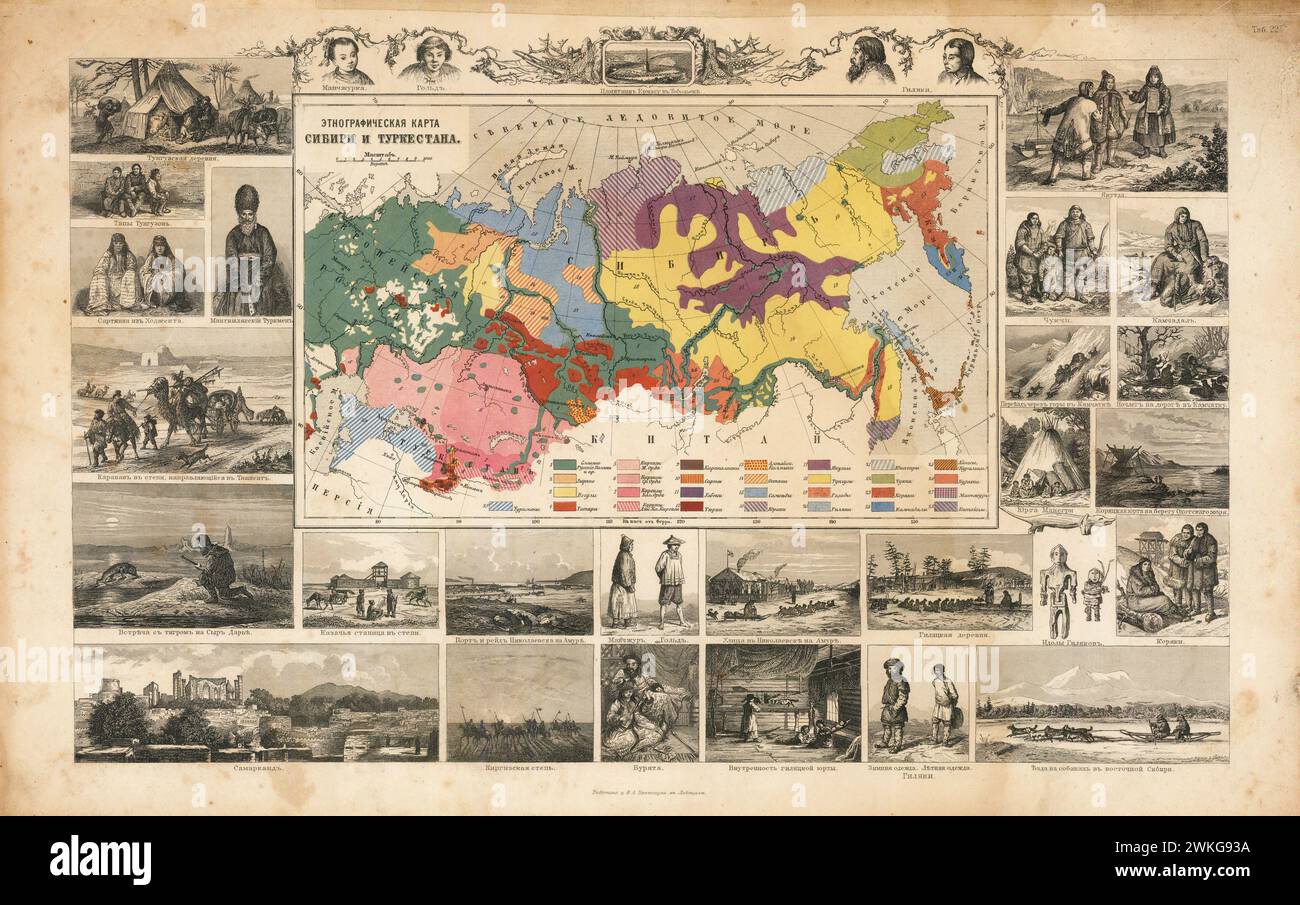 Ethnographic Russian Map of Siberia and Turkestan, 1890 Friedrich Arnold Brockhaus. antique map of Siberia and Central Asia . Stock Photohttps://www.alamy.com/image-license-details/?v=1https://www.alamy.com/ethnographic-russian-map-of-siberia-and-turkestan-1890-friedrich-arnold-brockhaus-antique-map-of-siberia-and-central-asia-image597189358.html
RM2WKG93A–Ethnographic Russian Map of Siberia and Turkestan, 1890 Friedrich Arnold Brockhaus. antique map of Siberia and Central Asia .
 A map of Kamtschatka engraved from the russian map by Tho Jefferys Stock Photohttps://www.alamy.com/image-license-details/?v=1https://www.alamy.com/stock-photo-a-map-of-kamtschatka-engraved-from-the-russian-map-by-tho-jefferys-139473105.html
RMJ2WFA9–A map of Kamtschatka engraved from the russian map by Tho Jefferys
 Russia 3d golden map Stock Photohttps://www.alamy.com/image-license-details/?v=1https://www.alamy.com/stock-photo-russia-3d-golden-map-26658905.html
RFBFABKN–Russia 3d golden map
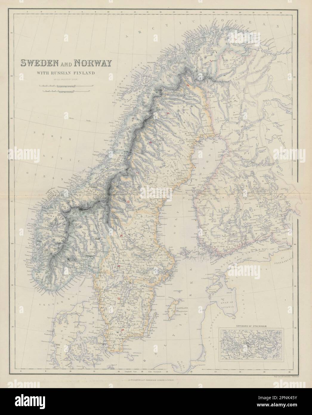 Sweden and Norway with Russian Finland. Scandinavia. SWANSTON 1860 old map Stock Photohttps://www.alamy.com/image-license-details/?v=1https://www.alamy.com/sweden-and-norway-with-russian-finland-scandinavia-swanston-1860-old-map-image546849575.html
RF2PNK45Y–Sweden and Norway with Russian Finland. Scandinavia. SWANSTON 1860 old map
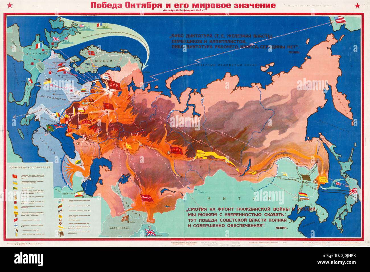 Pictorial map. Map of Russia, 1928, to illustrate the military successes of the Red Army in the Russian Civil War of 1917-1922. Stock Photohttps://www.alamy.com/image-license-details/?v=1https://www.alamy.com/pictorial-map-map-of-russia-1928-to-illustrate-the-military-successes-of-the-red-army-in-the-russian-civil-war-of-1917-1922-image465089070.html
RM2J0JHRX–Pictorial map. Map of Russia, 1928, to illustrate the military successes of the Red Army in the Russian Civil War of 1917-1922.
 Red Dot Map of Russia Stock Vectorhttps://www.alamy.com/image-license-details/?v=1https://www.alamy.com/stock-photo-red-dot-map-of-russia-115996026.html
RFGMM236–Red Dot Map of Russia
 map of russia russian national flag colors background Stock Photohttps://www.alamy.com/image-license-details/?v=1https://www.alamy.com/stock-photo-map-of-russia-russian-national-flag-colors-background-109567578.html
RFGA76FP–map of russia russian national flag colors background
 people shaking hands with Russian map flag illustration Stock Photohttps://www.alamy.com/image-license-details/?v=1https://www.alamy.com/stock-photo-people-shaking-hands-with-russian-map-flag-illustration-37060677.html
RFC4877H–people shaking hands with Russian map flag illustration
 Russian Map With Wooden Flag On A White Background Stock Photohttps://www.alamy.com/image-license-details/?v=1https://www.alamy.com/stock-photo-russian-map-with-wooden-flag-on-a-white-background-81740502.html
RFEMYGRJ–Russian Map With Wooden Flag On A White Background
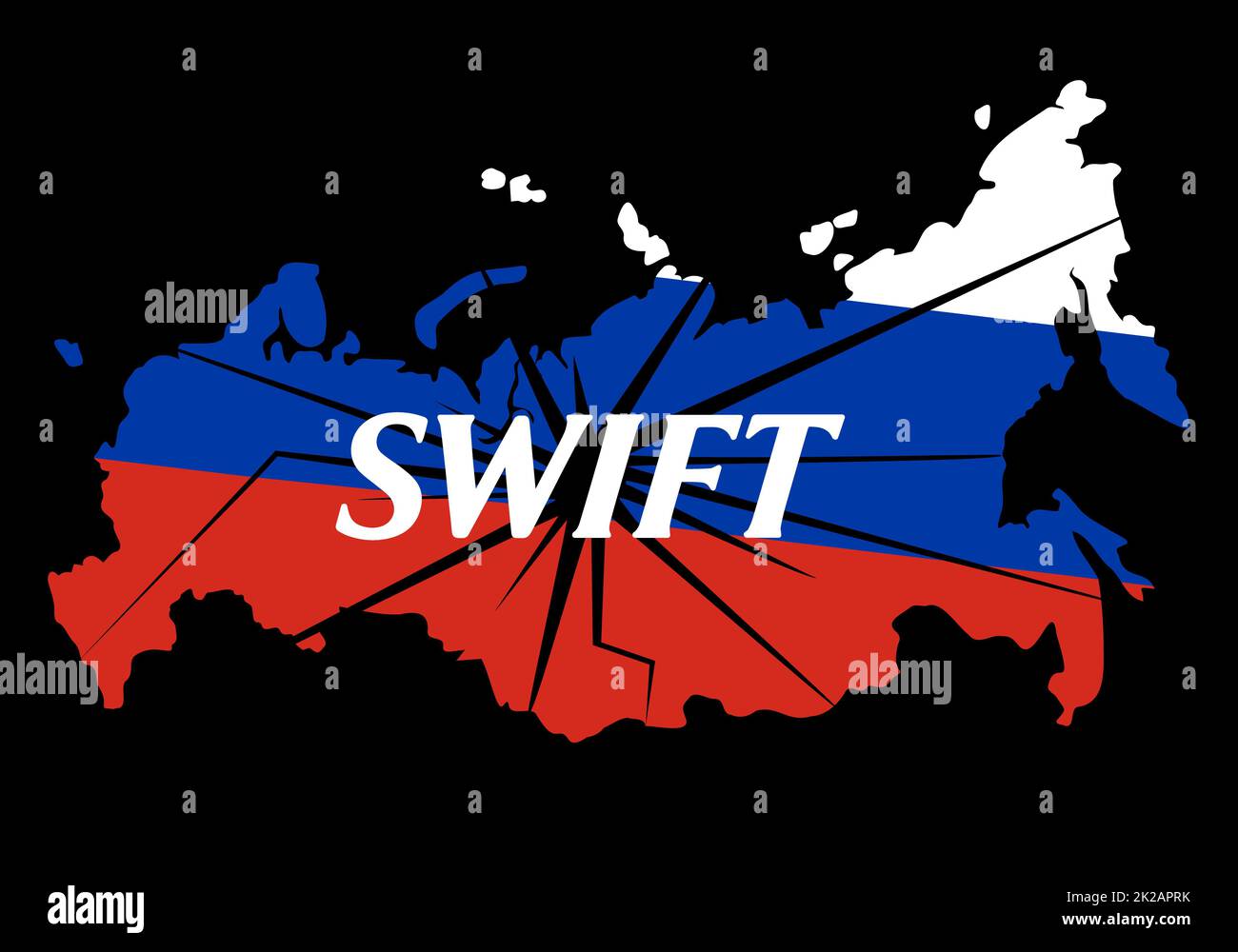 Prohibition of financial transactions in the Swift payment system. Conceptual text with Russian map at background. Sanctions against Russia, and disconnection from SWIFT through war against Ukraine. Stock Photohttps://www.alamy.com/image-license-details/?v=1https://www.alamy.com/prohibition-of-financial-transactions-in-the-swift-payment-system-conceptual-text-with-russian-map-at-background-sanctions-against-russia-and-disconnection-from-swift-through-war-against-ukraine-image483357047.html
RF2K2APRK–Prohibition of financial transactions in the Swift payment system. Conceptual text with Russian map at background. Sanctions against Russia, and disconnection from SWIFT through war against Ukraine.
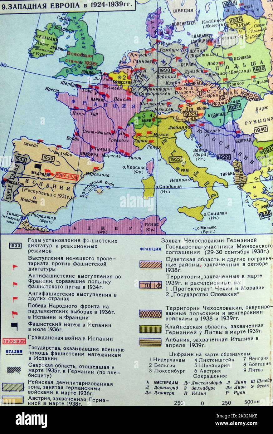 Soviet Russian map of Western Europe in 1924-1939. Stock Photohttps://www.alamy.com/image-license-details/?v=1https://www.alamy.com/soviet-russian-map-of-western-europe-in-1924-1939-image481951218.html
RM2K02NKE–Soviet Russian map of Western Europe in 1924-1939.
 Kyiv, Ukraine - November, 15 2022: Logo Payoneer financial system logo under red prohibition sign with Russian map at background. Sanctions against Russia, and disconnection from payments through war. Stock Photohttps://www.alamy.com/image-license-details/?v=1https://www.alamy.com/kyiv-ukraine-november-15-2022-logo-payoneer-financial-system-logo-under-red-prohibition-sign-with-russian-map-at-background-sanctions-against-russia-and-disconnection-from-payments-through-war-image547465069.html
RM2PPK57W–Kyiv, Ukraine - November, 15 2022: Logo Payoneer financial system logo under red prohibition sign with Russian map at background. Sanctions against Russia, and disconnection from payments through war.
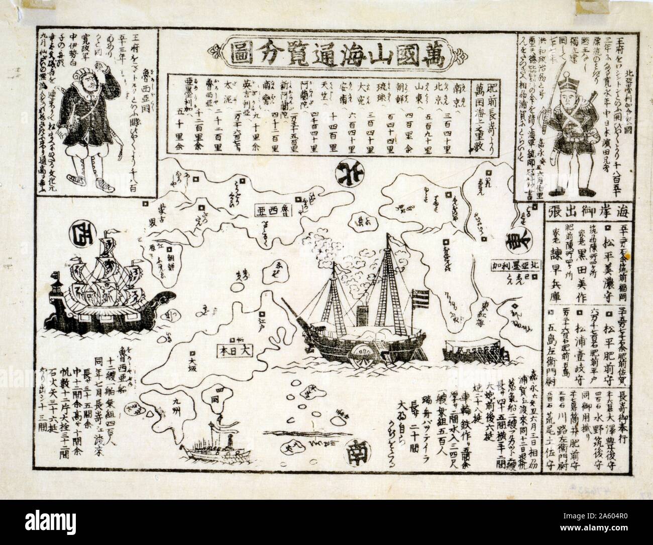 Japanese print shows a map of the world with an American & Russian ship on the seas. Said to be from 1850-1900. Stock Photohttps://www.alamy.com/image-license-details/?v=1https://www.alamy.com/japanese-print-shows-a-map-of-the-world-with-an-american-russian-ship-on-the-seas-said-to-be-from-1850-1900-image330688708.html
RM2A604R0–Japanese print shows a map of the world with an American & Russian ship on the seas. Said to be from 1850-1900.
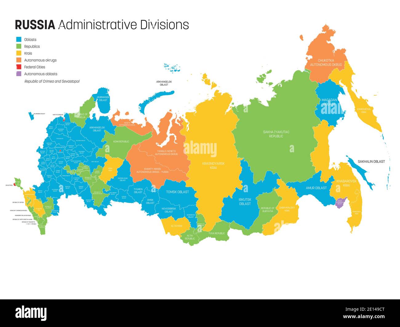 Political map of Russia, or Russian Federation divided by types of federal subjects - republics, krays, oblasts, cities of federal significance, autonomous oblasts and autonomous okrugs. Simple flat vector map with labels. Stock Vectorhttps://www.alamy.com/image-license-details/?v=1https://www.alamy.com/political-map-of-russia-or-russian-federation-divided-by-types-of-federal-subjects-republics-krays-oblasts-cities-of-federal-significance-autonomous-oblasts-and-autonomous-okrugs-simple-flat-vector-map-with-labels-image396548344.html
RF2E149CT–Political map of Russia, or Russian Federation divided by types of federal subjects - republics, krays, oblasts, cities of federal significance, autonomous oblasts and autonomous okrugs. Simple flat vector map with labels.
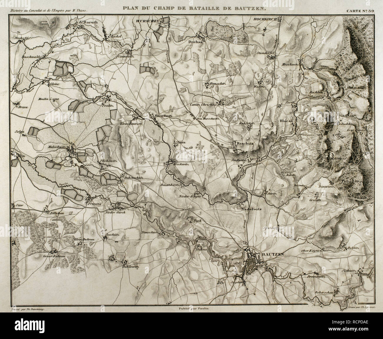 Napoleonic map. Battlefield of Bautzen (20-21 May 1813). A combined Russian-Prussian army was pushed back by Napoleon I. French victory. Atlas de l'Histoire du Consulat et de l'Empire. History of the Consulate and the Empire of France under Napoleon by Marie Joseph Louis Adolphe Thiers (1797-1877). Drawings by Dufour, engravings by Dyonnet. Edited in Paris, 1864. Stock Photohttps://www.alamy.com/image-license-details/?v=1https://www.alamy.com/napoleonic-map-battlefield-of-bautzen-20-21-may-1813-a-combined-russian-prussian-army-was-pushed-back-by-napoleon-i-french-victory-atlas-de-lhistoire-du-consulat-et-de-lempire-history-of-the-consulate-and-the-empire-of-france-under-napoleon-by-marie-joseph-louis-adolphe-thiers-1797-1877-drawings-by-dufour-engravings-by-dyonnet-edited-in-paris-1864-image231604086.html
RMRCPDAE–Napoleonic map. Battlefield of Bautzen (20-21 May 1813). A combined Russian-Prussian army was pushed back by Napoleon I. French victory. Atlas de l'Histoire du Consulat et de l'Empire. History of the Consulate and the Empire of France under Napoleon by Marie Joseph Louis Adolphe Thiers (1797-1877). Drawings by Dufour, engravings by Dyonnet. Edited in Paris, 1864.
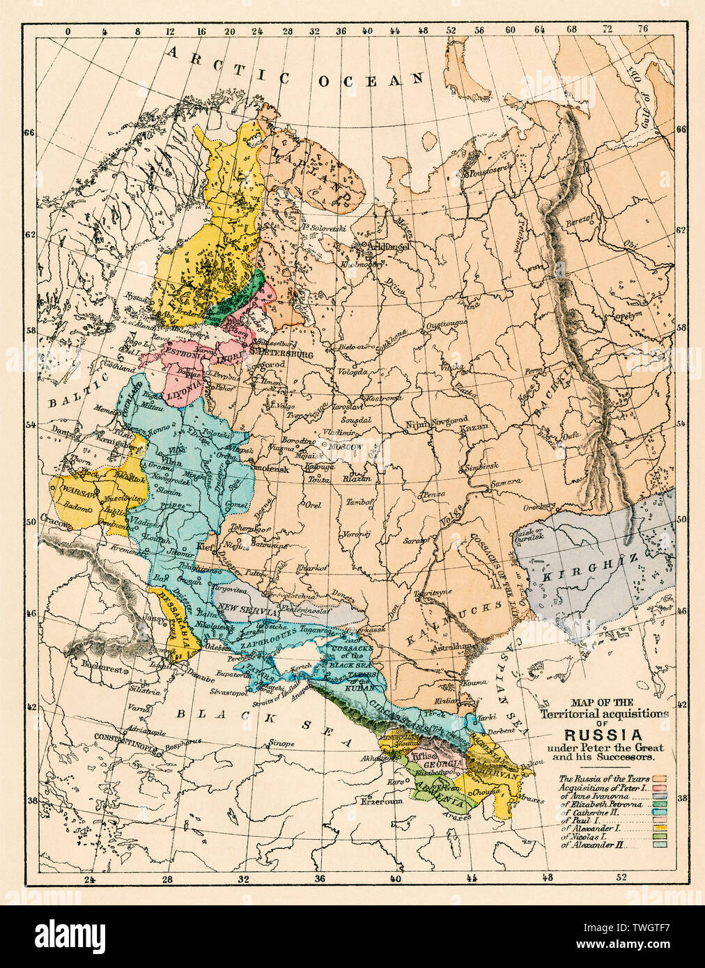 Map of Russian territory acquired under Peter I and later tsars. Color lithograph Stock Photohttps://www.alamy.com/image-license-details/?v=1https://www.alamy.com/map-of-russian-territory-acquired-under-peter-i-and-later-tsars-color-lithograph-image256682027.html
RMTWGTF7–Map of Russian territory acquired under Peter I and later tsars. Color lithograph
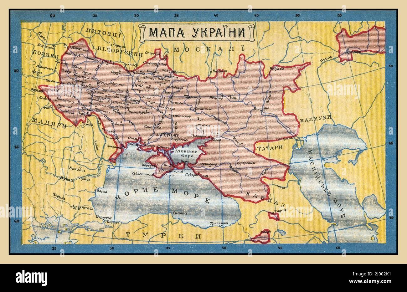 UKRAINE Vintage 1900s Map of Ukraine Old Ukraine historic poster postcard (1919) Text in Ukranian/Russian Country boundary borders in red Stock Photohttps://www.alamy.com/image-license-details/?v=1https://www.alamy.com/ukraine-vintage-1900s-map-of-ukraine-old-ukraine-historic-poster-postcard-1919-text-in-ukranianrussian-country-boundary-borders-in-red-image464682037.html
RM2J002K1–UKRAINE Vintage 1900s Map of Ukraine Old Ukraine historic poster postcard (1919) Text in Ukranian/Russian Country boundary borders in red
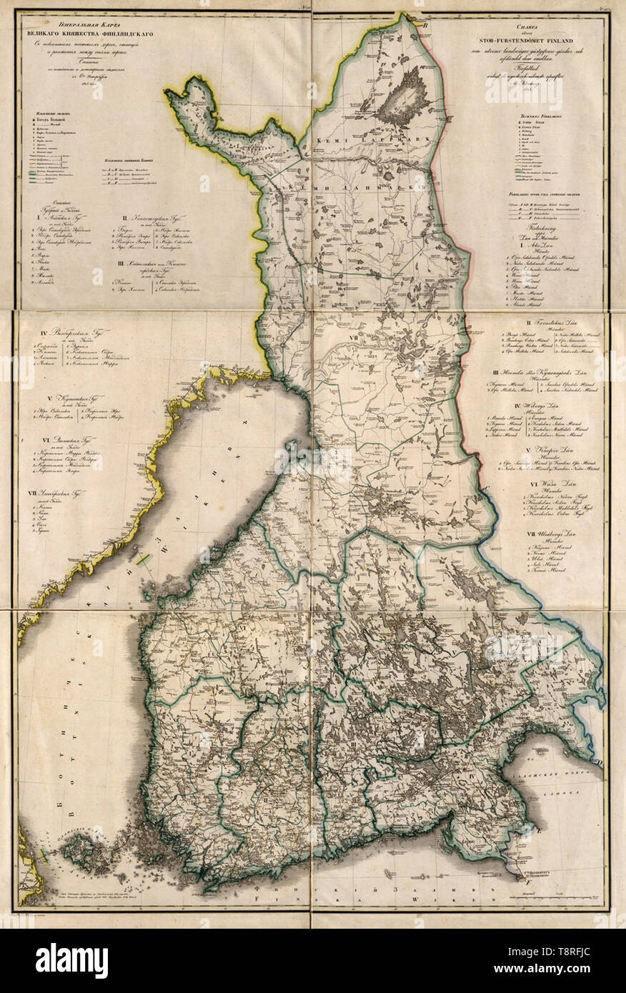 This 1825 map of the Grand Duchy of Finland is from a larger work, Geographical atlas of the Russian Empire, the Kingdom of Poland, and the Grand Duchy of Finland (Geograficheskii atlas Rossiiskoi imperii, tsarstva Pol'skogo i velikogo kniazhestva Finliandskogo), containing 61 maps of the Russian Empire. Compiled and engraved by Colonel V. P. Piadyshev, it reflects the detailed mapping carried out by Russian military cartographers in the first quarter of the 19th century Stock Photohttps://www.alamy.com/image-license-details/?v=1https://www.alamy.com/this-1825-map-of-the-grand-duchy-of-finland-is-from-a-larger-work-geographical-atlas-of-the-russian-empire-the-kingdom-of-poland-and-the-grand-duchy-of-finland-geograficheskii-atlas-rossiiskoi-imperii-tsarstva-polskogo-i-velikogo-kniazhestva-finliandskogo-containing-61-maps-of-the-russian-empire-compiled-and-engraved-by-colonel-v-p-piadyshev-it-reflects-the-detailed-mapping-carried-out-by-russian-military-cartographers-in-the-first-quarter-of-the-19th-century-image246379572.html
RMT8RFJC–This 1825 map of the Grand Duchy of Finland is from a larger work, Geographical atlas of the Russian Empire, the Kingdom of Poland, and the Grand Duchy of Finland (Geograficheskii atlas Rossiiskoi imperii, tsarstva Pol'skogo i velikogo kniazhestva Finliandskogo), containing 61 maps of the Russian Empire. Compiled and engraved by Colonel V. P. Piadyshev, it reflects the detailed mapping carried out by Russian military cartographers in the first quarter of the 19th century
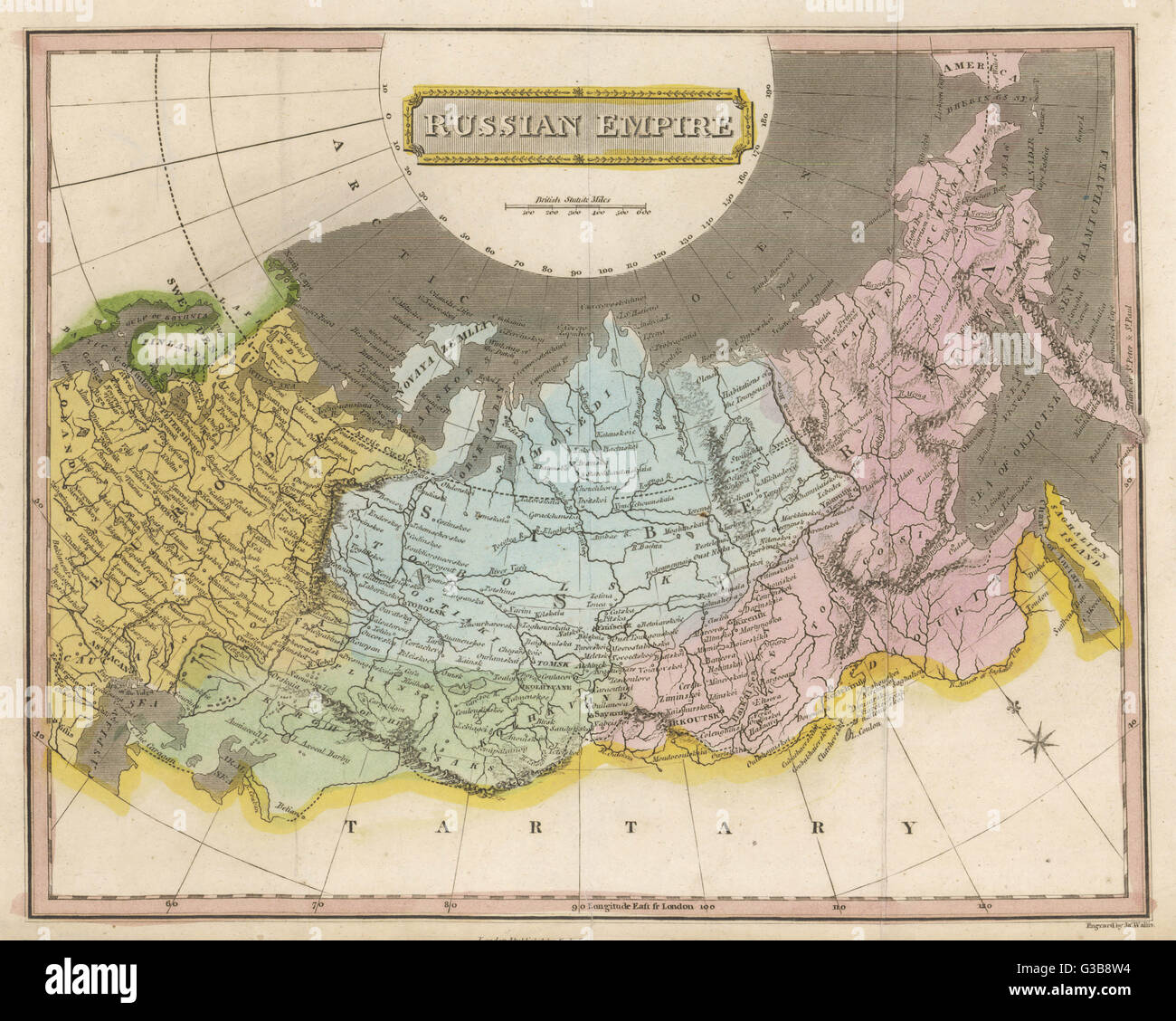 Map of the Russian Empire Date: circa 1800? Stock Photohttps://www.alamy.com/image-license-details/?v=1https://www.alamy.com/stock-photo-map-of-the-russian-empire-date-circa-1800-105354624.html
RMG3B8W4–Map of the Russian Empire Date: circa 1800?
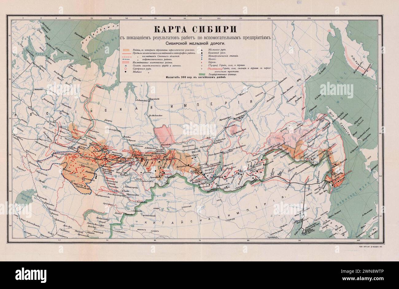 Vintage Russian Map Showing the Trans-Siberian Railroad. 1903 Stock Photohttps://www.alamy.com/image-license-details/?v=1https://www.alamy.com/vintage-russian-map-showing-the-trans-siberian-railroad-1903-image598256198.html
RM2WN8WTP–Vintage Russian Map Showing the Trans-Siberian Railroad. 1903
 Historical russian map showing territory named Ukraine in 11 century Stock Photohttps://www.alamy.com/image-license-details/?v=1https://www.alamy.com/stock-photo-historical-russian-map-showing-territory-named-ukraine-in-11-century-139935790.html
RMJ3JHEP–Historical russian map showing territory named Ukraine in 11 century
 Russia 3d silver map Stock Photohttps://www.alamy.com/image-license-details/?v=1https://www.alamy.com/stock-photo-russia-3d-silver-map-26090910.html
RFBECF66–Russia 3d silver map
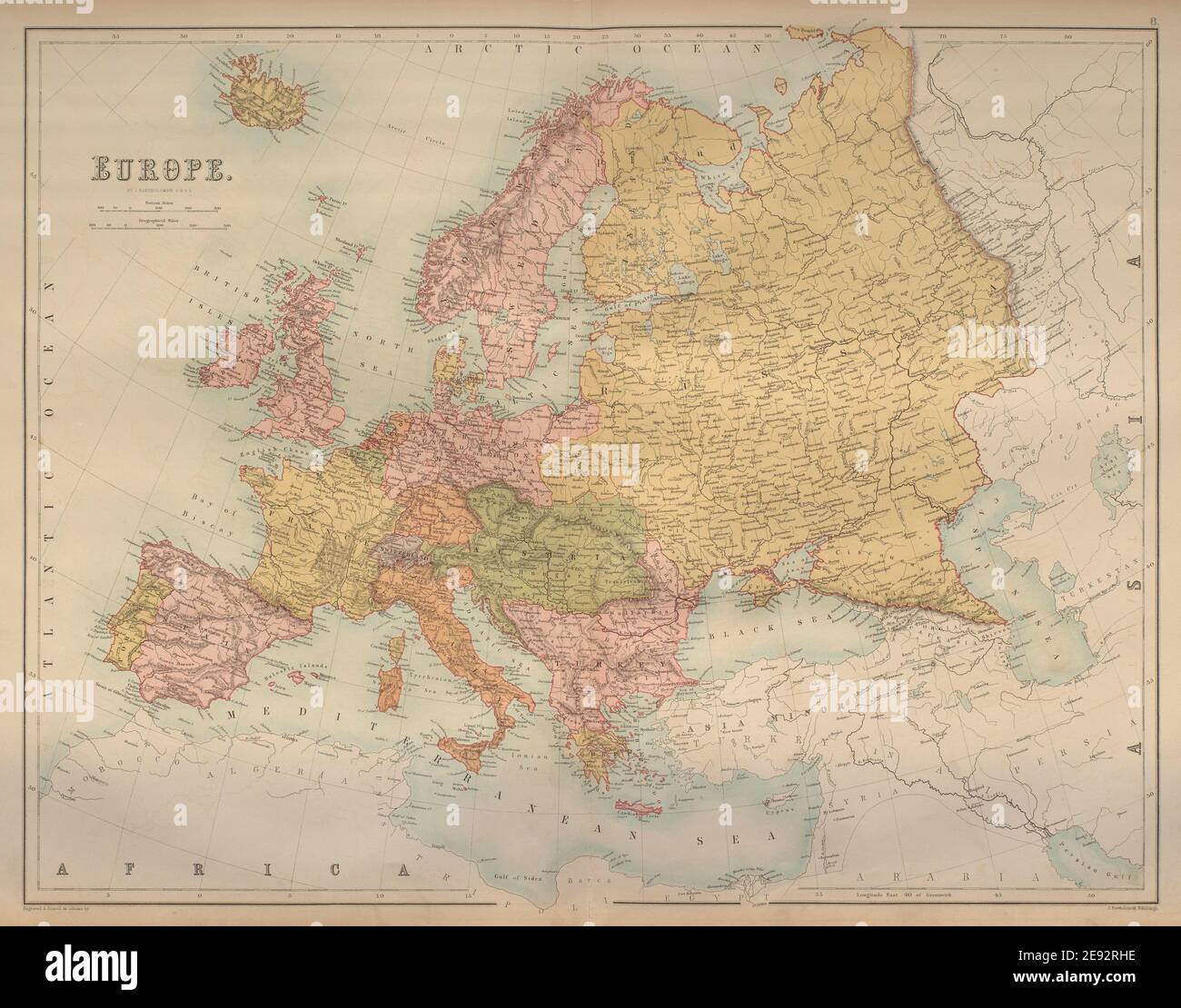 Europe. Austria Prussia Ottoman Russian Empires BARTHOLOMEW 1870 old map Stock Photohttps://www.alamy.com/image-license-details/?v=1https://www.alamy.com/europe-austria-prussia-ottoman-russian-empires-bartholomew-1870-old-map-image401432794.html
RF2E92RHE–Europe. Austria Prussia Ottoman Russian Empires BARTHOLOMEW 1870 old map
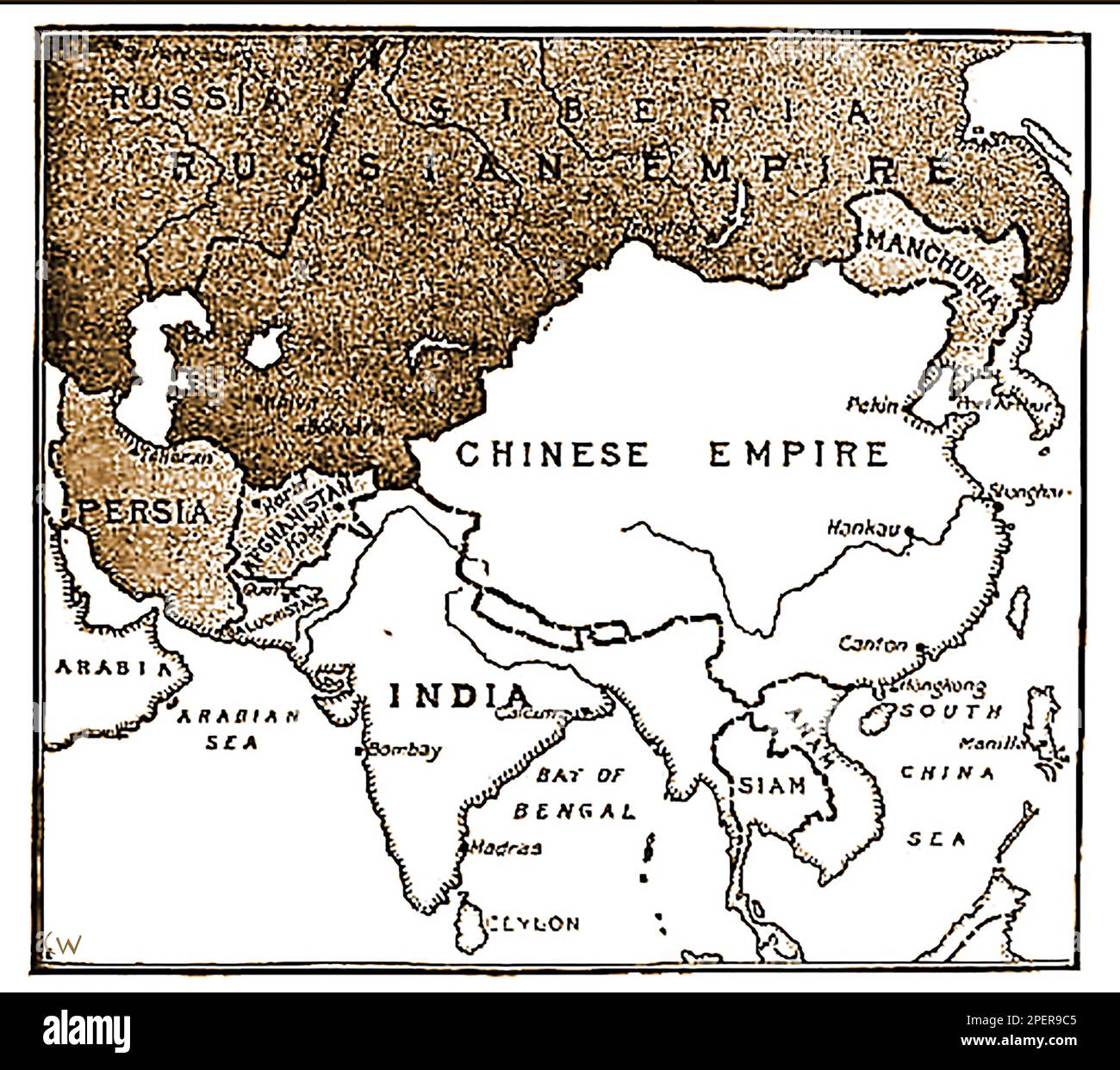 An 1892 map showing the advance of Russian forces on India. (In the 19th century Russia wanted to take India from British control?, a pan only defeated following the assassination of Russian Emperor Paul I -- Карта 1892 года, показывающая продвижение русских войск на Индию. (В 19-м веке Россия хотела отвести Индию из-под британского контроля?, пан побежден только по1892 ----का एक नक्शा जो भारत पर रूसी सेना की प्रगति को दर्शाता है। उल आई -сле убийства российского -- императора Павла I..-----1892 کا ایک نقشہ جس میں ہندوستان پر روسی افواج کی پیش قدمی کو دکھایا گیا ہے۔ میں -- Stock Photohttps://www.alamy.com/image-license-details/?v=1https://www.alamy.com/an-1892-map-showing-the-advance-of-russian-forces-on-india-in-the-19th-century-russia-wanted-to-take-india-from-british-control-a-pan-only-defeated-following-the-assassination-of-russian-emperor-paul-i-1892-19-1892-i-1892-image542638885.html
RM2PER9C5–An 1892 map showing the advance of Russian forces on India. (In the 19th century Russia wanted to take India from British control?, a pan only defeated following the assassination of Russian Emperor Paul I -- Карта 1892 года, показывающая продвижение русских войск на Индию. (В 19-м веке Россия хотела отвести Индию из-под британского контроля?, пан побежден только по1892 ----का एक नक्शा जो भारत पर रूसी सेना की प्रगति को दर्शाता है। उल आई -сле убийства российского -- императора Павла I..-----1892 کا ایک نقشہ جس میں ہندوستان پر روسی افواج کی پیش قدمی کو دکھایا گیا ہے۔ میں --
 1278 Russian map Armenia 1903 Stock Photohttps://www.alamy.com/image-license-details/?v=1https://www.alamy.com/1278-russian-map-armenia-1903-image213573277.html
RMPBD2W1–1278 Russian map Armenia 1903
 map of russia russian national flag colors background Stock Photohttps://www.alamy.com/image-license-details/?v=1https://www.alamy.com/stock-photo-map-of-russia-russian-national-flag-colors-background-110051334.html
RFGB17GP–map of russia russian national flag colors background
 abstract people holding Russian map sign with rippled flag illustration Stock Photohttps://www.alamy.com/image-license-details/?v=1https://www.alamy.com/stock-photo-abstract-people-holding-russian-map-sign-with-rippled-flag-illustration-37316645.html
RFC4KWN9–abstract people holding Russian map sign with rippled flag illustration
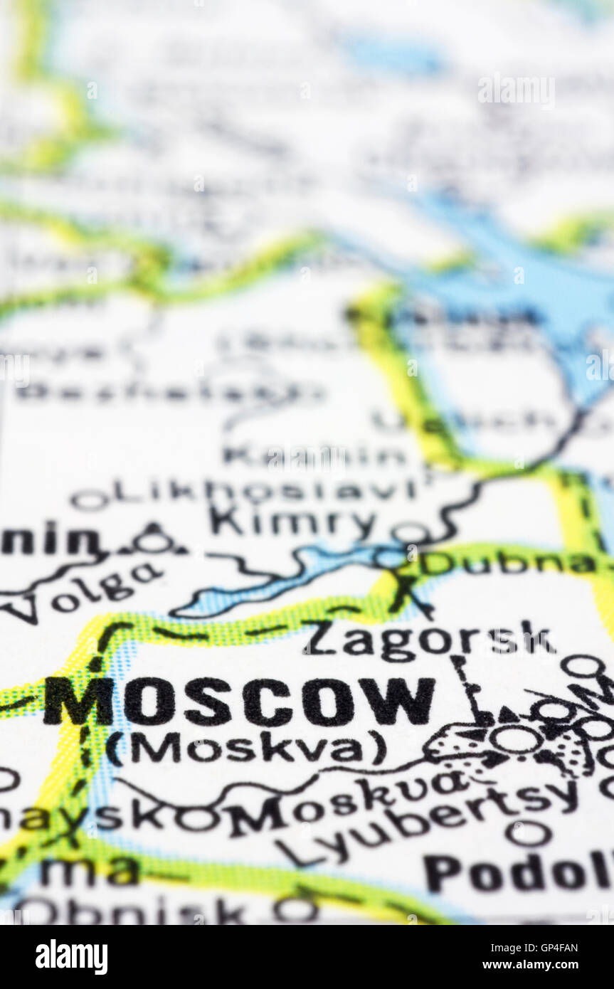 close up of Moscow on map, Russia Stock Photohttps://www.alamy.com/image-license-details/?v=1https://www.alamy.com/stock-photo-close-up-of-moscow-on-map-russia-116884509.html
RFGP4FAN–close up of Moscow on map, Russia
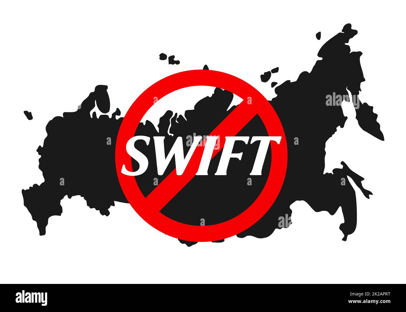 Banned swift financial system text under red prohibition sign with Russian map at background. Sanctions against Russia, and disconnection from swift through the war against with peaceful Ukraine. Stock Photohttps://www.alamy.com/image-license-details/?v=1https://www.alamy.com/banned-swift-financial-system-text-under-red-prohibition-sign-with-russian-map-at-background-sanctions-against-russia-and-disconnection-from-swift-through-the-war-against-with-peaceful-ukraine-image483357052.html
RF2K2APRT–Banned swift financial system text under red prohibition sign with Russian map at background. Sanctions against Russia, and disconnection from swift through the war against with peaceful Ukraine.
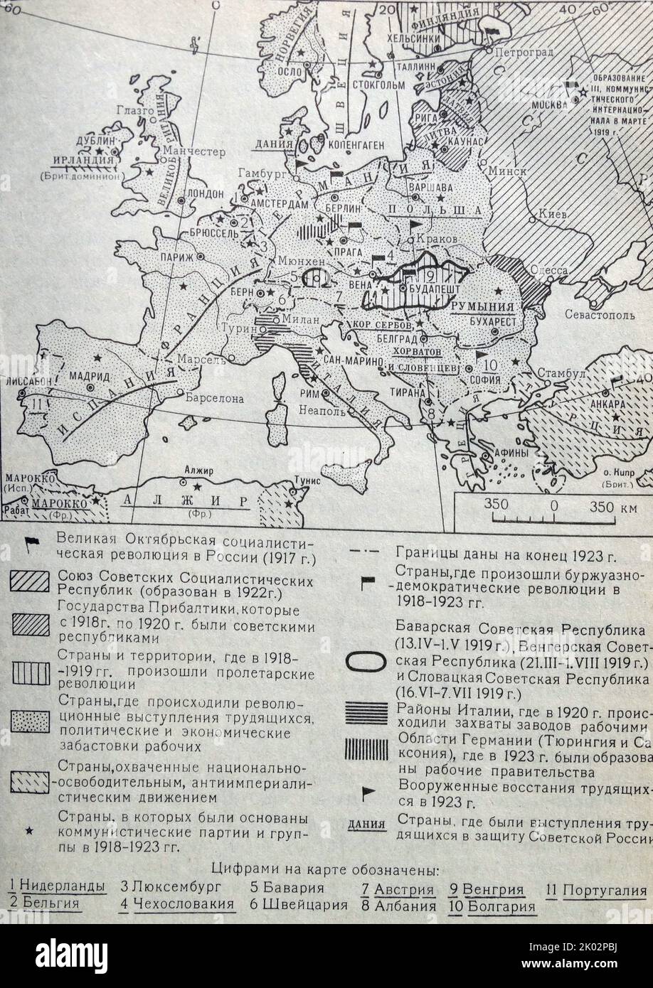 Russian map showing the October Socialist Revolution in Russia (1917). Stock Photohttps://www.alamy.com/image-license-details/?v=1https://www.alamy.com/russian-map-showing-the-october-socialist-revolution-in-russia-1917-image481951782.html
RM2K02PBJ–Russian map showing the October Socialist Revolution in Russia (1917).
 A map of Kamtschatka engraved from the russian map by Tho Jefferys Stock Photohttps://www.alamy.com/image-license-details/?v=1https://www.alamy.com/stock-photo-a-map-of-kamtschatka-engraved-from-the-russian-map-by-tho-jefferys-132433046.html
RMHKCRKJ–A map of Kamtschatka engraved from the russian map by Tho Jefferys
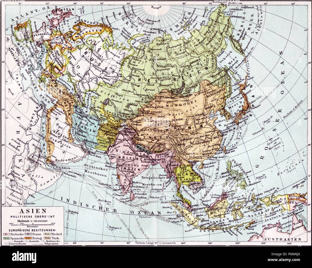 German map of Europe; Russia and Asia dated to 1890. The British India colony and Dutch East Indies are shown as well as The Russian Empire Stock Photohttps://www.alamy.com/image-license-details/?v=1https://www.alamy.com/german-map-of-europe-russia-and-asia-dated-to-1890-the-british-india-colony-and-dutch-east-indies-are-shown-as-well-as-the-russian-empire-image210408098.html
RMP68WJX–German map of Europe; Russia and Asia dated to 1890. The British India colony and Dutch East Indies are shown as well as The Russian Empire
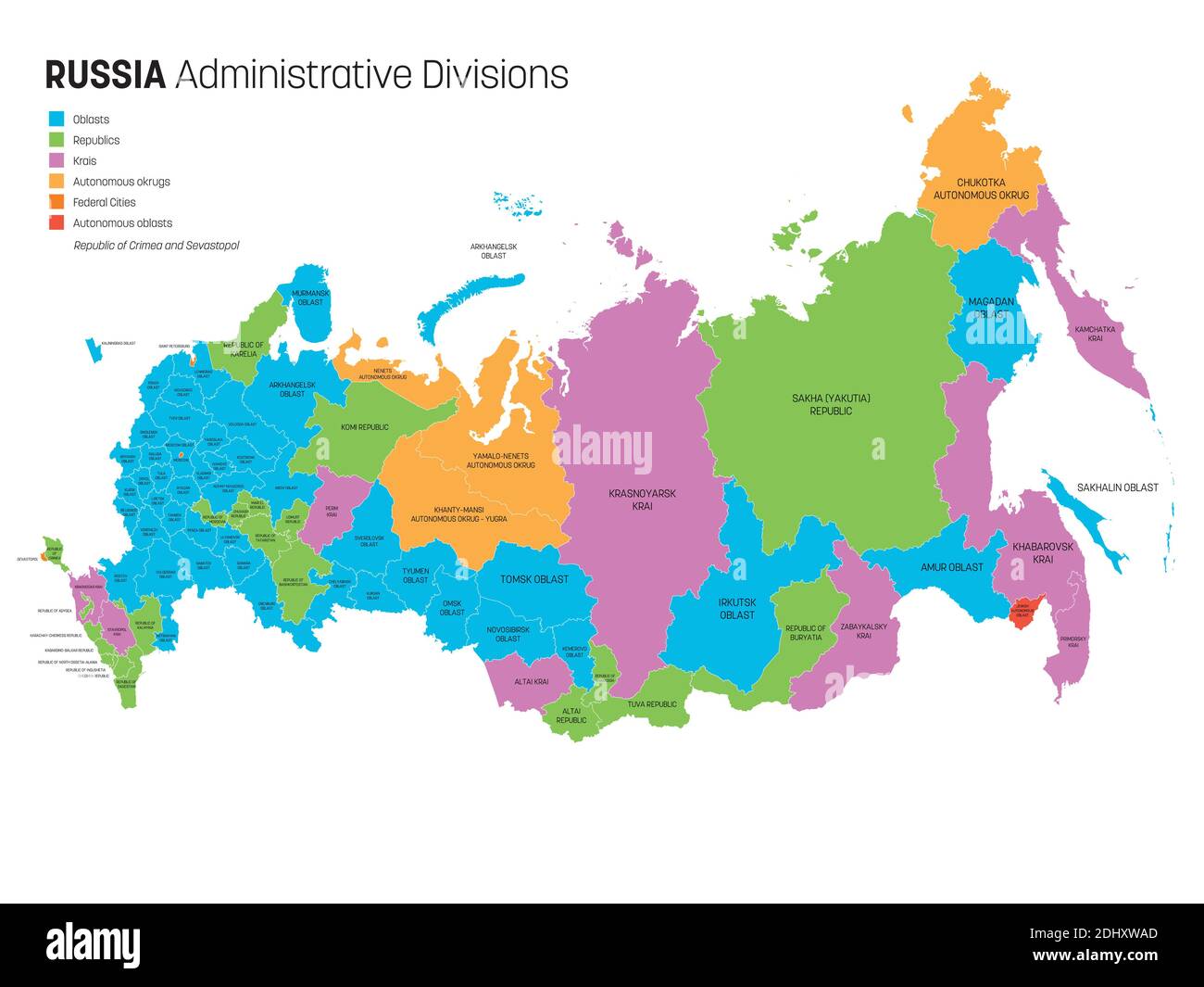 Political map of Russia, or Russian Federation divided by types of federal subjects - republics, krays, oblasts, cities of federal significance, autonomous oblasts and autonomous okrugs. Simple flat vector map with labels. Stock Vectorhttps://www.alamy.com/image-license-details/?v=1https://www.alamy.com/political-map-of-russia-or-russian-federation-divided-by-types-of-federal-subjects-republics-krays-oblasts-cities-of-federal-significance-autonomous-oblasts-and-autonomous-okrugs-simple-flat-vector-map-with-labels-image389667893.html
RF2DHXWAD–Political map of Russia, or Russian Federation divided by types of federal subjects - republics, krays, oblasts, cities of federal significance, autonomous oblasts and autonomous okrugs. Simple flat vector map with labels.
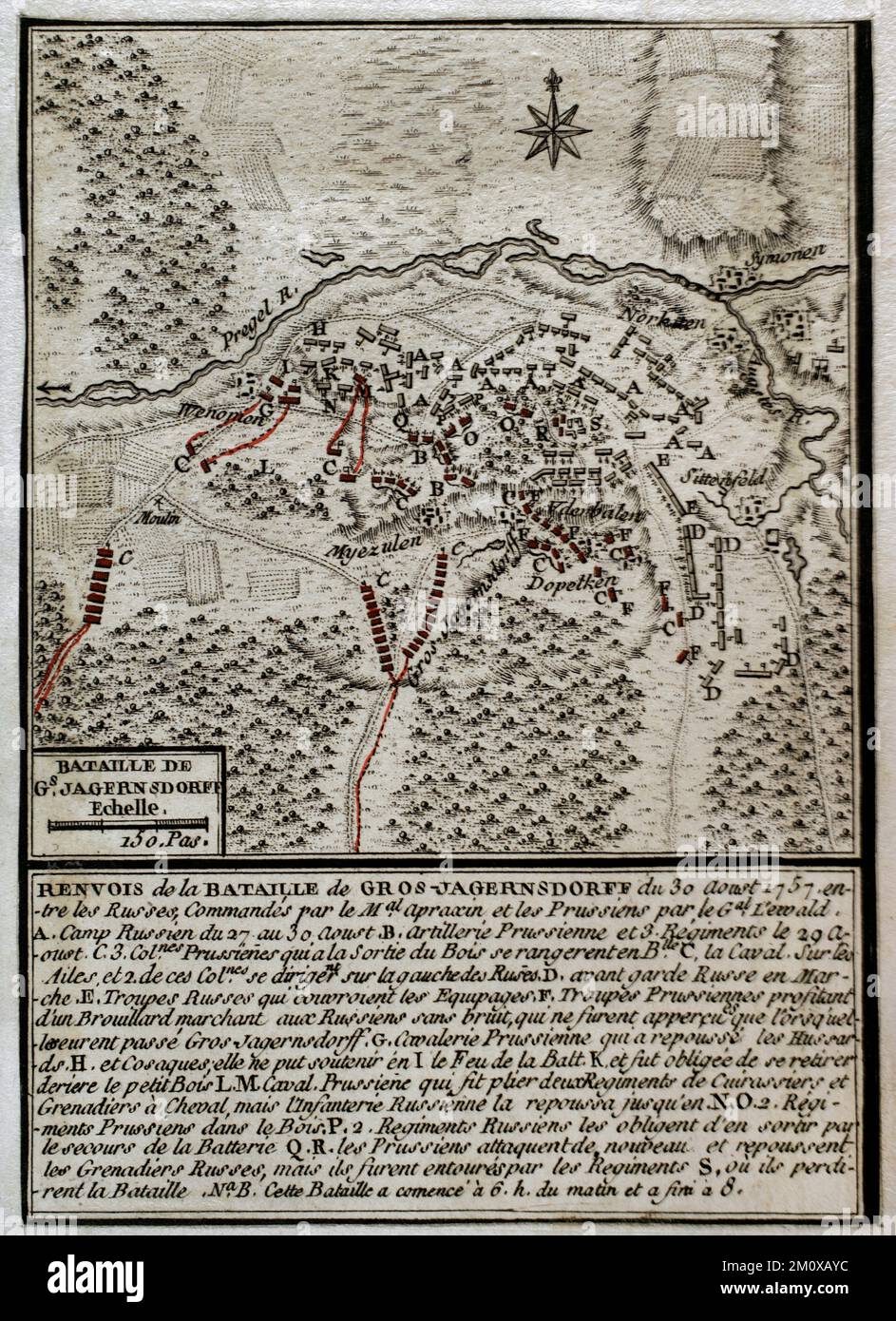 Seven Years War (1756-1763). Map of the Battle of Gross-Jägersdorf (August 30, 1757). East Prussia. The Russian Army, under the command of Field Marshal Stepan Fyodorovich Apraksin, defeated a smaller Prussian force led by Field Marshal Hans von Lehwaldt. It was the first battle in which Russia took part during the conflict. Published in 1765 by the cartographer Jean de Beaurain (1696-1771) as an illustration of his Great Map of Germany, with the events that took place during the Seven Years War. Etching and engraving. Military Historical Library of Barcelona (Biblioteca Histórico Militar de B Stock Photohttps://www.alamy.com/image-license-details/?v=1https://www.alamy.com/seven-years-war-1756-1763-map-of-the-battle-of-gross-jgersdorf-august-30-1757-east-prussia-the-russian-army-under-the-command-of-field-marshal-stepan-fyodorovich-apraksin-defeated-a-smaller-prussian-force-led-by-field-marshal-hans-von-lehwaldt-it-was-the-first-battle-in-which-russia-took-part-during-the-conflict-published-in-1765-by-the-cartographer-jean-de-beaurain-1696-1771-as-an-illustration-of-his-great-map-of-germany-with-the-events-that-took-place-during-the-seven-years-war-etching-and-engraving-military-historical-library-of-barcelona-biblioteca-histrico-militar-de-b-image499680032.html
RM2M0XAYC–Seven Years War (1756-1763). Map of the Battle of Gross-Jägersdorf (August 30, 1757). East Prussia. The Russian Army, under the command of Field Marshal Stepan Fyodorovich Apraksin, defeated a smaller Prussian force led by Field Marshal Hans von Lehwaldt. It was the first battle in which Russia took part during the conflict. Published in 1765 by the cartographer Jean de Beaurain (1696-1771) as an illustration of his Great Map of Germany, with the events that took place during the Seven Years War. Etching and engraving. Military Historical Library of Barcelona (Biblioteca Histórico Militar de B
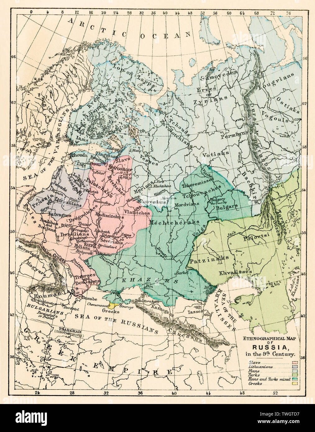 Ethnographic map of Russia in the 9th century. Color lithograph Stock Photohttps://www.alamy.com/image-license-details/?v=1https://www.alamy.com/ethnographic-map-of-russia-in-the-9th-century-color-lithograph-image256681971.html
RMTWGTD7–Ethnographic map of Russia in the 9th century. Color lithograph
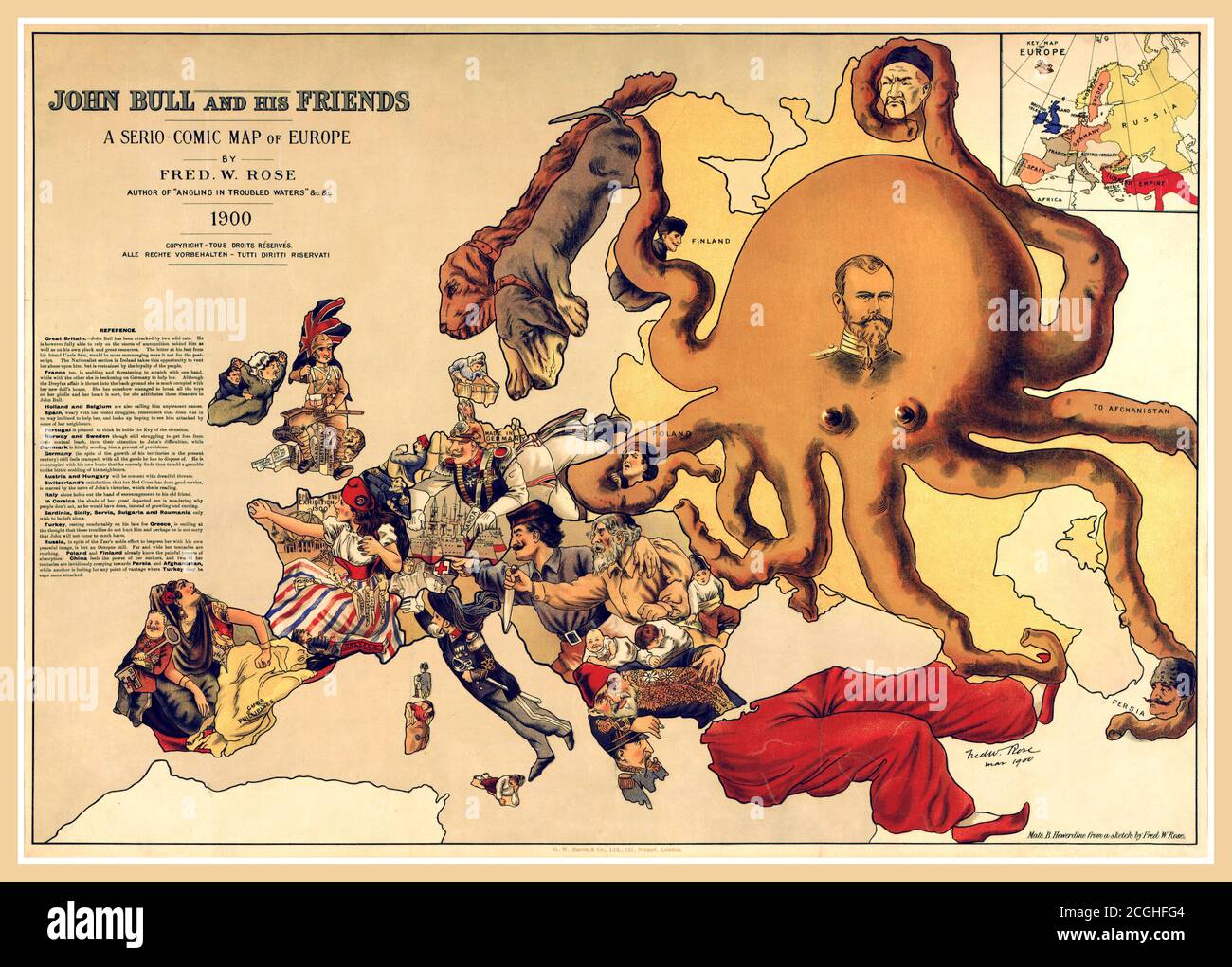 Vintage 1900 political caricature map, 'John Bull and his friends' by Frederick Rose of the countries of Europe, known as the Octopus Map from the brooding presence of the Russian Empire depicted as a massive octopus, whose tentacles stretch out towards Europe. Stock Photohttps://www.alamy.com/image-license-details/?v=1https://www.alamy.com/vintage-1900-political-caricature-map-john-bull-and-his-friends-by-frederick-rose-of-the-countries-of-europe-known-as-the-octopus-map-from-the-brooding-presence-of-the-russian-empire-depicted-as-a-massive-octopus-whose-tentacles-stretch-out-towards-europe-image371637620.html
RM2CGHFG4–Vintage 1900 political caricature map, 'John Bull and his friends' by Frederick Rose of the countries of Europe, known as the Octopus Map from the brooding presence of the Russian Empire depicted as a massive octopus, whose tentacles stretch out towards Europe.
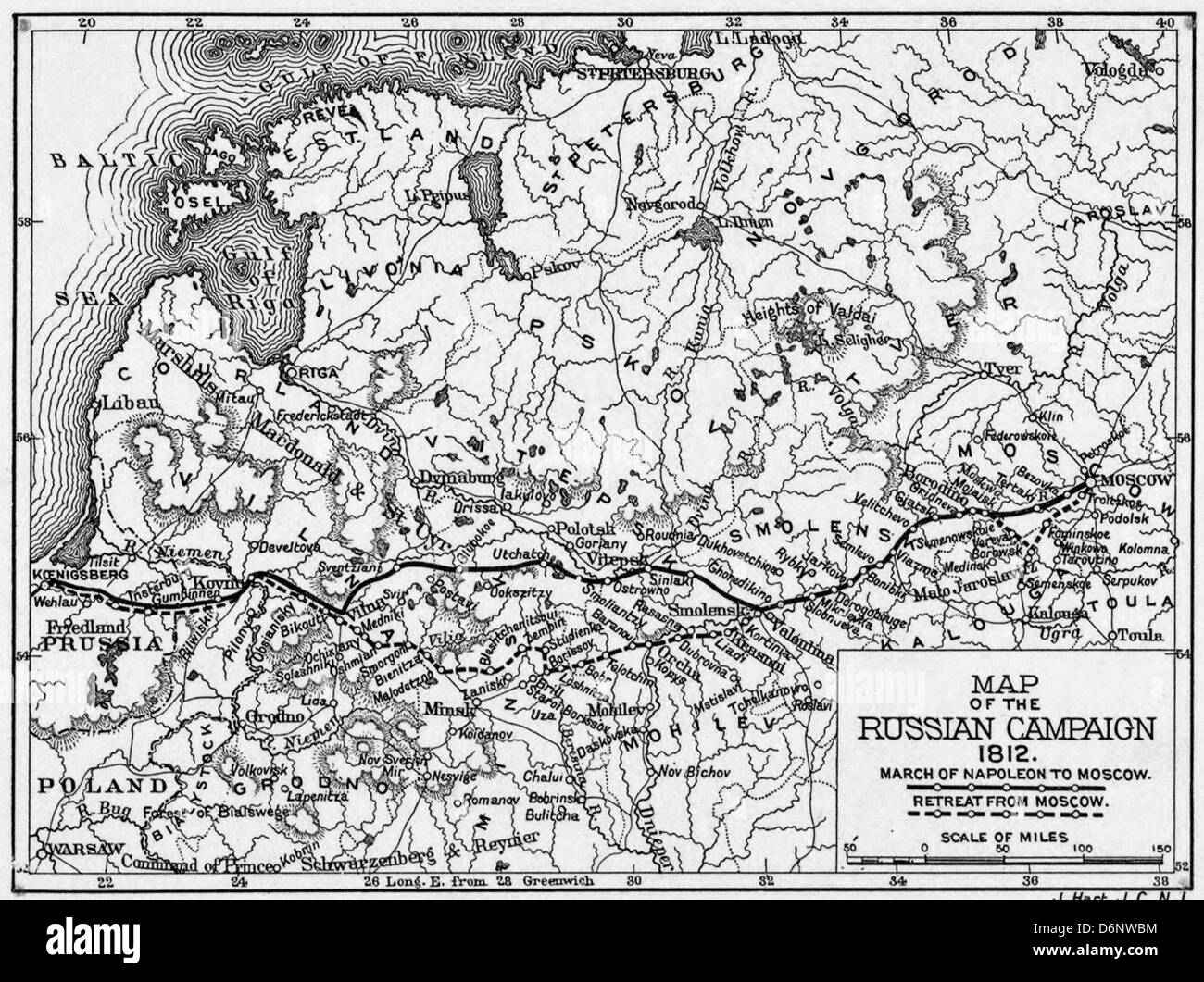 Map of Napoleon's Russian Campaign, 1812 Stock Photohttps://www.alamy.com/image-license-details/?v=1https://www.alamy.com/stock-photo-map-of-napoleons-russian-campaign-1812-55799960.html
RMD6NWBM–Map of Napoleon's Russian Campaign, 1812
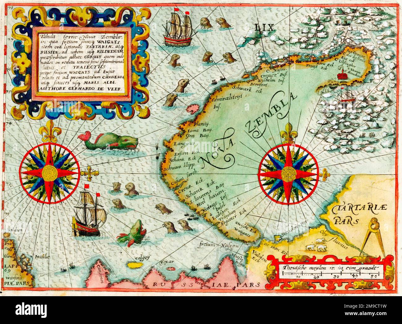 17th century Map of Nova Zembla, Russian Arctic Stock Photohttps://www.alamy.com/image-license-details/?v=1https://www.alamy.com/17th-century-map-of-nova-zembla-russian-arctic-image504914869.html
RM2M9CT1W–17th century Map of Nova Zembla, Russian Arctic
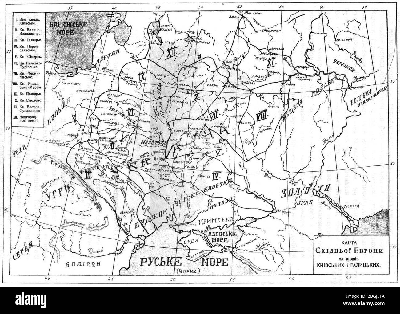 Historical russian map showing territory named Ukraine in 11 century. Stock Photohttps://www.alamy.com/image-license-details/?v=1https://www.alamy.com/historical-russian-map-showing-territory-named-ukraine-in-11-century-image354441342.html
RM2BGJ5FA–Historical russian map showing territory named Ukraine in 11 century.
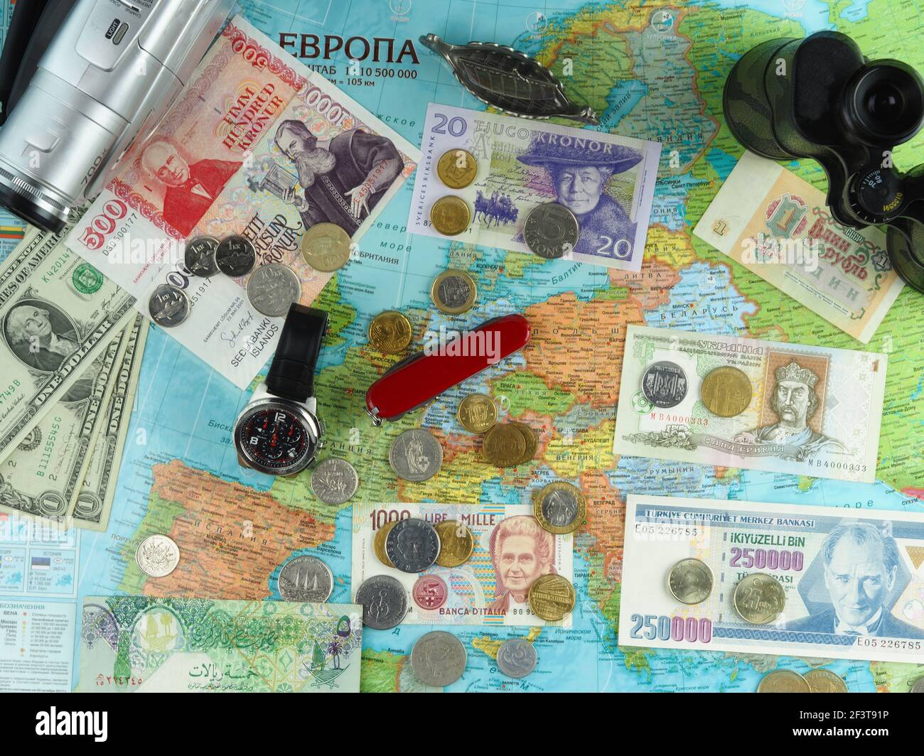 Travelling in Europe. Russian map of Europe and travel items Fled Lay. Stock Photohttps://www.alamy.com/image-license-details/?v=1https://www.alamy.com/travelling-in-europe-russian-map-of-europe-and-travel-items-fled-lay-image415426754.html
RF2F3T91P–Travelling in Europe. Russian map of Europe and travel items Fled Lay.
 Russia 3d map with national color Stock Photohttps://www.alamy.com/image-license-details/?v=1https://www.alamy.com/stock-photo-russia-3d-map-with-national-color-26528379.html
RFBF4D63–Russia 3d map with national color
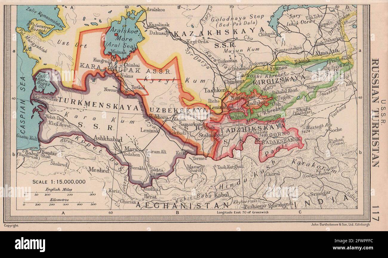 USSR Russian Turkistan Central Asia Turkmenistan Uzbekistan BARTHOLOMEW 1949 map Stock Photohttps://www.alamy.com/image-license-details/?v=1https://www.alamy.com/ussr-russian-turkistan-central-asia-turkmenistan-uzbekistan-bartholomew-1949-map-image428910368.html
RF2FWPFFC–USSR Russian Turkistan Central Asia Turkmenistan Uzbekistan BARTHOLOMEW 1949 map
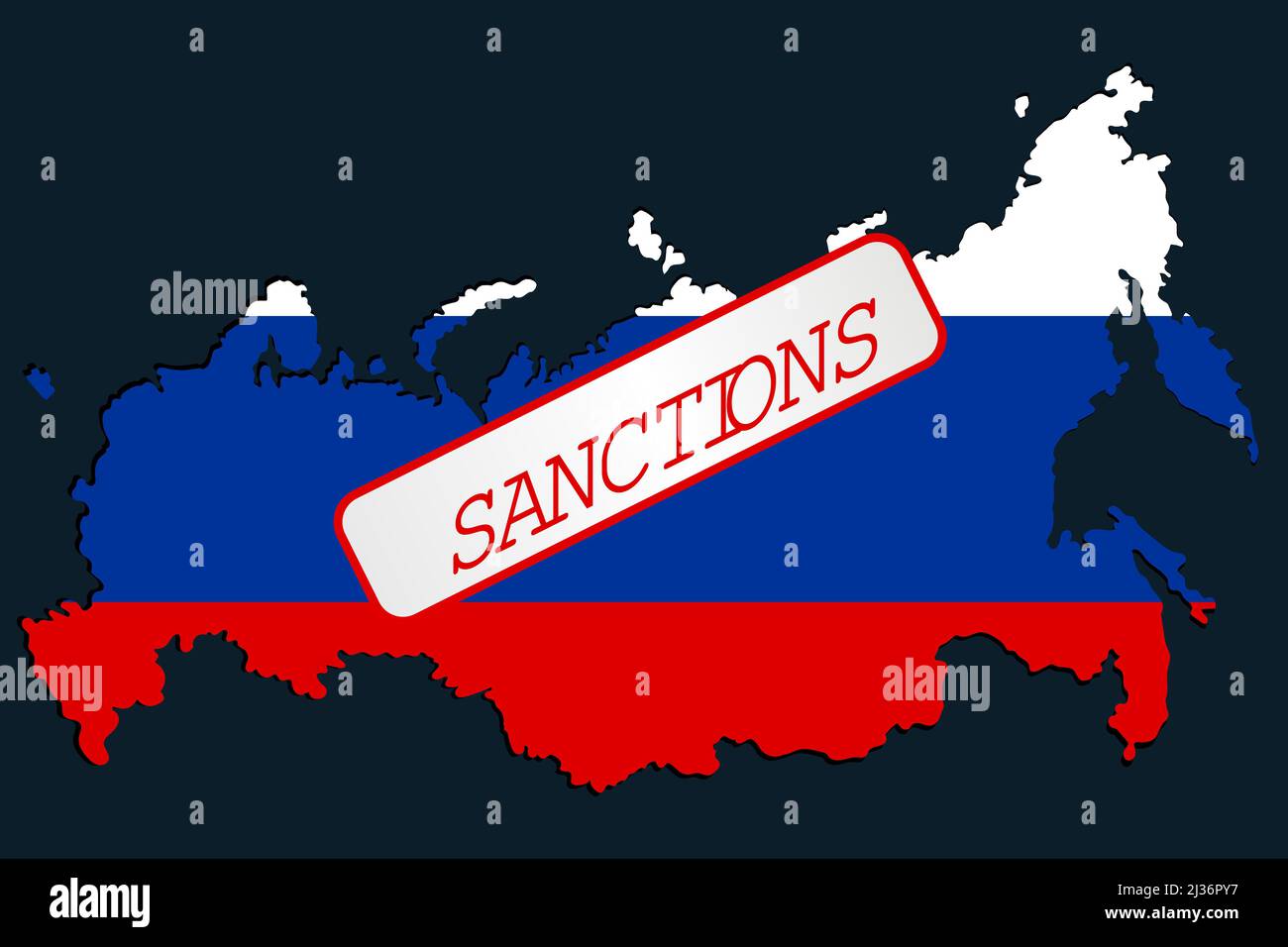 Sanctions against Russian Federation. Russian Map with restriction sign. Embargo and economucal crysis concept. Stock Vectorhttps://www.alamy.com/image-license-details/?v=1https://www.alamy.com/sanctions-against-russian-federation-russian-map-with-restriction-sign-embargo-and-economucal-crysis-concept-image466673627.html
RF2J36PY7–Sanctions against Russian Federation. Russian Map with restriction sign. Embargo and economucal crysis concept.
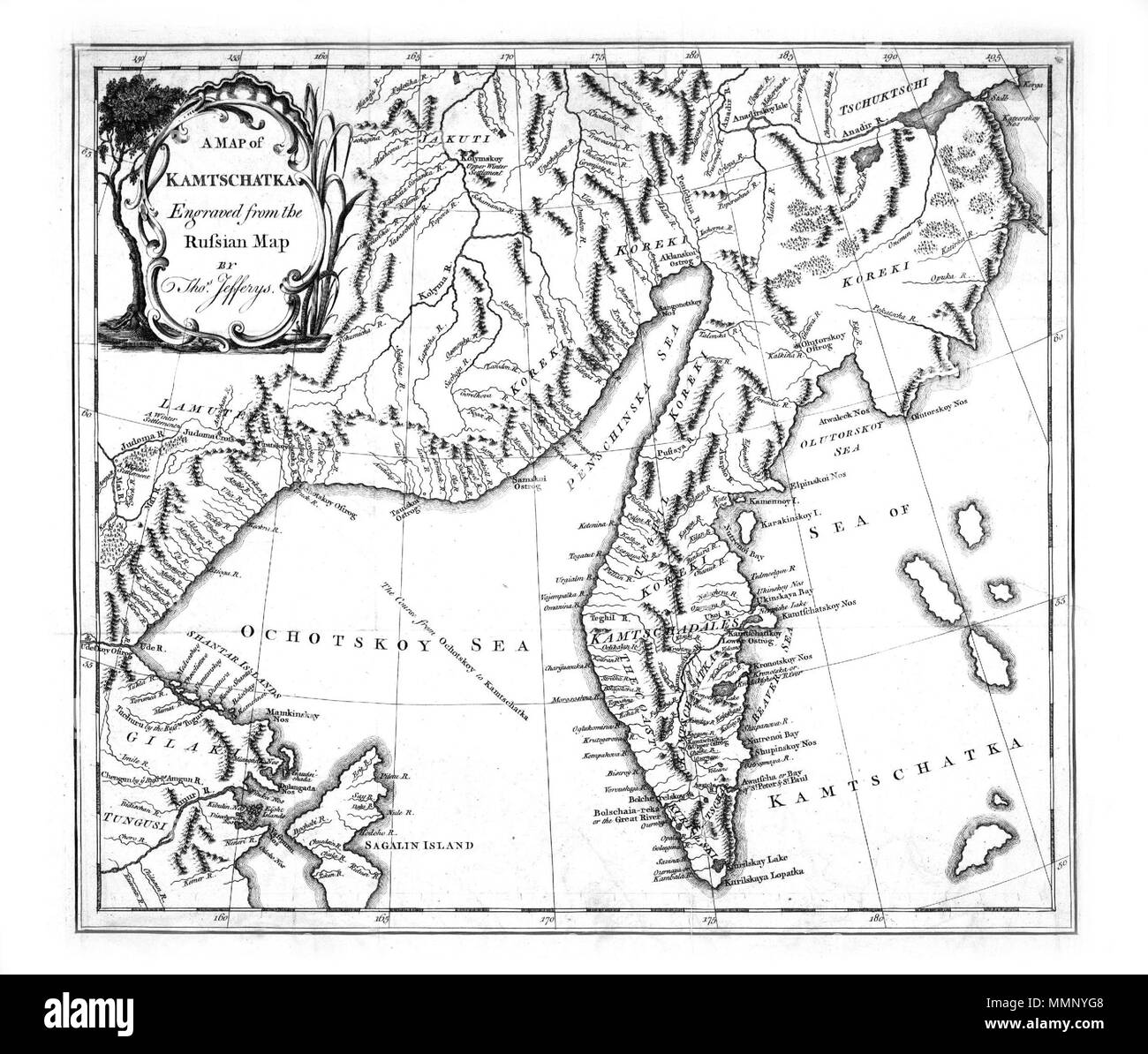 20 A map of Kamtschatka engraved from the russian map by Tho Jefferys Stock Photohttps://www.alamy.com/image-license-details/?v=1https://www.alamy.com/20-a-map-of-kamtschatka-engraved-from-the-russian-map-by-tho-jefferys-image184879416.html
RMMMNYG8–20 A map of Kamtschatka engraved from the russian map by Tho Jefferys
 map of russia russian national flag colors background Stock Photohttps://www.alamy.com/image-license-details/?v=1https://www.alamy.com/stock-photo-map-of-russia-russian-national-flag-colors-background-109567097.html
RFGA75XH–map of russia russian national flag colors background
 Circle of abstract people around Russian Federation map flag illustration Stock Photohttps://www.alamy.com/image-license-details/?v=1https://www.alamy.com/stock-photo-circle-of-abstract-people-around-russian-federation-map-flag-illustration-27944881.html
RFBHCYYD–Circle of abstract people around Russian Federation map flag illustration
 close up of Moscow on map, Russia Stock Photohttps://www.alamy.com/image-license-details/?v=1https://www.alamy.com/stock-photo-close-up-of-moscow-on-map-russia-116878225.html
RFGP47A9–close up of Moscow on map, Russia
 Ukraine, Rivne - February, 27 2022: Logo SWIFT financial system logo under red prohibition sign with Russian map at background. Sanctions against Russia, and disconnection from SWIFT through the war. Stock Photohttps://www.alamy.com/image-license-details/?v=1https://www.alamy.com/ukraine-rivne-february-27-2022-logo-swift-financial-system-logo-under-red-prohibition-sign-with-russian-map-at-background-sanctions-against-russia-and-disconnection-from-swift-through-the-war-image483353688.html
RF2K2AJFM–Ukraine, Rivne - February, 27 2022: Logo SWIFT financial system logo under red prohibition sign with Russian map at background. Sanctions against Russia, and disconnection from SWIFT through the war.
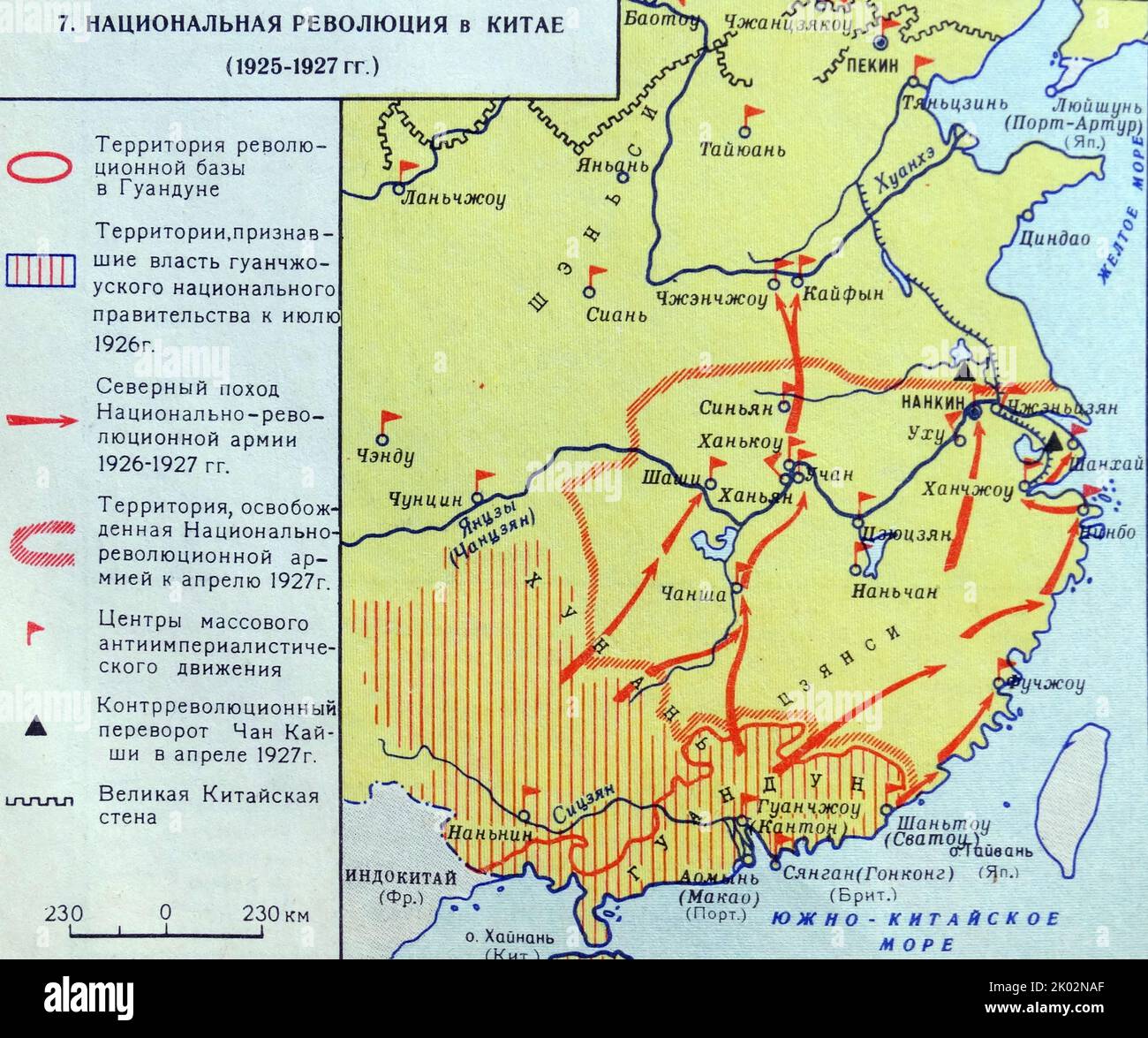 Russian map showing the National Revolution in China. (1925-1927). Stock Photohttps://www.alamy.com/image-license-details/?v=1https://www.alamy.com/russian-map-showing-the-national-revolution-in-china-1925-1927-image481950967.html
RM2K02NAF–Russian map showing the National Revolution in China. (1925-1927).
 Isolated Russian Federation map marker pin flat web design style. Stock Photohttps://www.alamy.com/image-license-details/?v=1https://www.alamy.com/stock-photo-isolated-russian-federation-map-marker-pin-flat-web-design-style-74815978.html
RME9M4F6–Isolated Russian Federation map marker pin flat web design style.
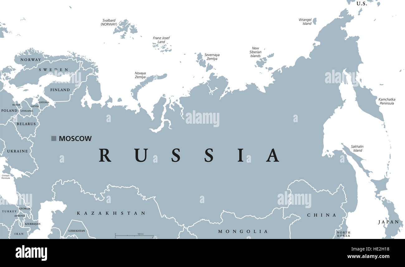 Russia political map with capital Moscow, national borders and neighbor countries. Russian Federation, a federal state. Stock Photohttps://www.alamy.com/image-license-details/?v=1https://www.alamy.com/stock-photo-russia-political-map-with-capital-moscow-national-borders-and-neighbor-129135028.html
RFHE2H18–Russia political map with capital Moscow, national borders and neighbor countries. Russian Federation, a federal state.
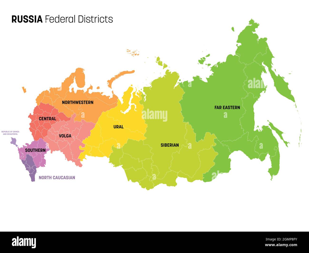 Colorful political map of Russia, or Russian Federation. Federal subjects - republics, krays, oblasts, cities of federal significance, autonomous oblasts and autonomous okrugs, divided by color into regions. Simple flat vector map with labels. Stock Vectorhttps://www.alamy.com/image-license-details/?v=1https://www.alamy.com/colorful-political-map-of-russia-or-russian-federation-federal-subjects-republics-krays-oblasts-cities-of-federal-significance-autonomous-oblasts-and-autonomous-okrugs-divided-by-color-into-regions-simple-flat-vector-map-with-labels-image443041983.html
RF2GMP8FY–Colorful political map of Russia, or Russian Federation. Federal subjects - republics, krays, oblasts, cities of federal significance, autonomous oblasts and autonomous okrugs, divided by color into regions. Simple flat vector map with labels.
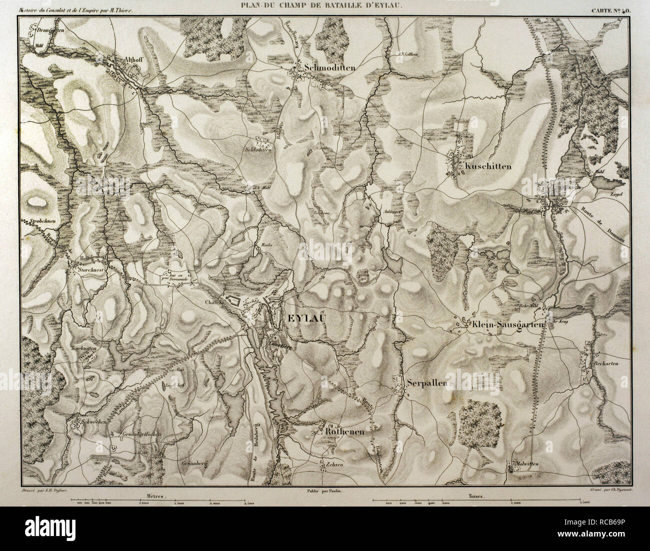 Map of battlefield of Eylau (ancient Prussian now Russia). 7th and 8 th February 1807. Belligerents: French Empire and Russian Empire. It was a part of the War of the Fourth Coalition, in the context of Napoleonic Wars. Atlas de l'Histoire du Consulat et de l'Empire. History of the Consulate and the Empire of France under Napoleon by Marie Joseph Louis Adolphe Thiers (1797-1877). Drawings by Dufour, engravings by Dyonnet. Edited in Paris, 1864. Stock Photohttps://www.alamy.com/image-license-details/?v=1https://www.alamy.com/map-of-battlefield-of-eylau-ancient-prussian-now-russia-7th-and-8-th-february-1807-belligerents-french-empire-and-russian-empire-it-was-a-part-of-the-war-of-the-fourth-coalition-in-the-context-of-napoleonic-wars-atlas-de-lhistoire-du-consulat-et-de-lempire-history-of-the-consulate-and-the-empire-of-france-under-napoleon-by-marie-joseph-louis-adolphe-thiers-1797-1877-drawings-by-dufour-engravings-by-dyonnet-edited-in-paris-1864-image231357106.html
RMRCB69P–Map of battlefield of Eylau (ancient Prussian now Russia). 7th and 8 th February 1807. Belligerents: French Empire and Russian Empire. It was a part of the War of the Fourth Coalition, in the context of Napoleonic Wars. Atlas de l'Histoire du Consulat et de l'Empire. History of the Consulate and the Empire of France under Napoleon by Marie Joseph Louis Adolphe Thiers (1797-1877). Drawings by Dufour, engravings by Dyonnet. Edited in Paris, 1864.
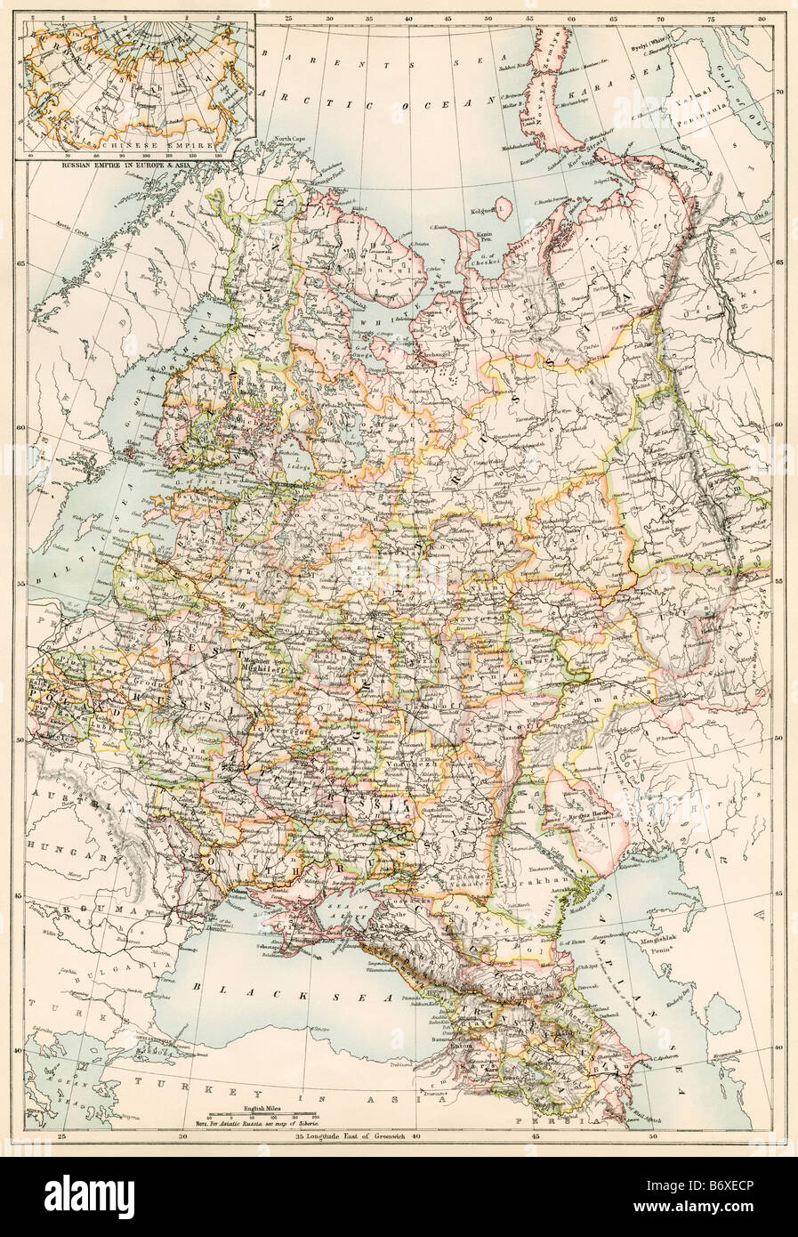 Map of Russia 1870s. Color lithograph Stock Photohttps://www.alamy.com/image-license-details/?v=1https://www.alamy.com/stock-photo-map-of-russia-1870s-color-lithograph-21480390.html
RMB6XECP–Map of Russia 1870s. Color lithograph
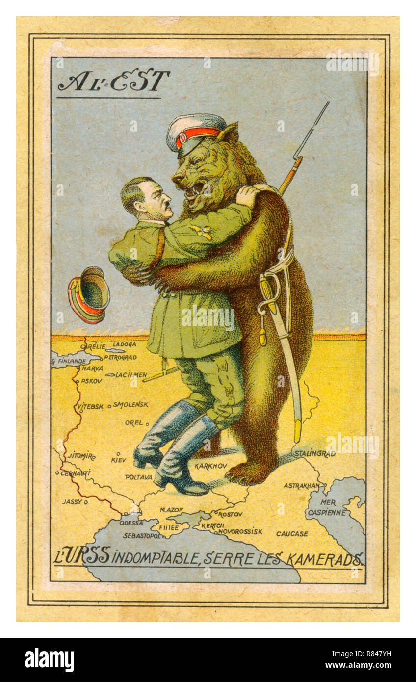 HITLER & RUSSIAN BEAR WW2 Vintage 1940's French Propaganda Postcard illustrating Adolf Hitler in a deadly embrace with a uniformed Red Army Russian Bear comrade standing on a map of the World War II Eastern Front Stock Photohttps://www.alamy.com/image-license-details/?v=1https://www.alamy.com/hitler-russian-bear-ww2-vintage-1940s-french-propaganda-postcard-illustrating-adolf-hitler-in-a-deadly-embrace-with-a-uniformed-red-army-russian-bear-comrade-standing-on-a-map-of-the-world-war-ii-eastern-front-image228746101.html
RMR847YH–HITLER & RUSSIAN BEAR WW2 Vintage 1940's French Propaganda Postcard illustrating Adolf Hitler in a deadly embrace with a uniformed Red Army Russian Bear comrade standing on a map of the World War II Eastern Front
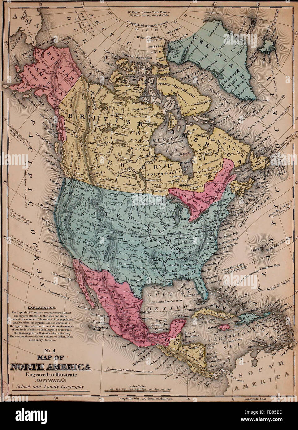 Map of North America, circa 1861. Map shows Alaska as Russian America Stock Photohttps://www.alamy.com/image-license-details/?v=1https://www.alamy.com/stock-photo-map-of-north-america-circa-1861-map-shows-alaska-as-russian-america-92992913.html
RMFB85BD–Map of North America, circa 1861. Map shows Alaska as Russian America
 Map of Russian North Lapland and Kola in 1600 Stock Photohttps://www.alamy.com/image-license-details/?v=1https://www.alamy.com/map-of-russian-north-lapland-and-kola-in-1600-image504915200.html
RM2M9CTDM–Map of Russian North Lapland and Kola in 1600
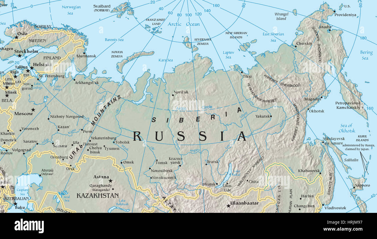 Map of Siberia Stock Photohttps://www.alamy.com/image-license-details/?v=1https://www.alamy.com/stock-photo-map-of-siberia-135020739.html
RMHRJM97–Map of Siberia
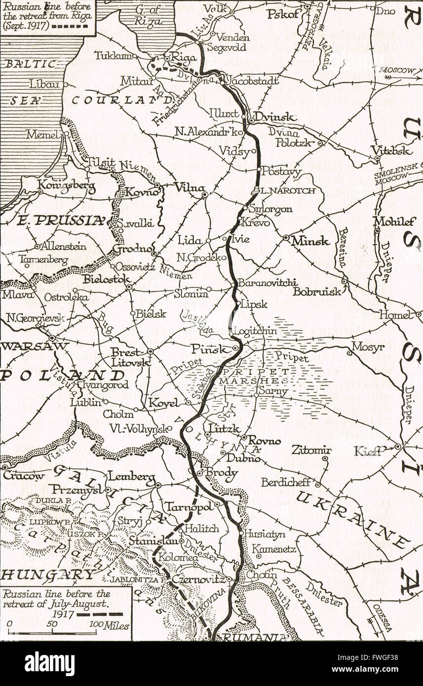 WW I Map of the Russian retreat from Riga Sept 1917 Stock Photohttps://www.alamy.com/image-license-details/?v=1https://www.alamy.com/stock-photo-ww-i-map-of-the-russian-retreat-from-riga-sept-1917-101781324.html
RMFWGF38–WW I Map of the Russian retreat from Riga Sept 1917
 Russia 3d golden map isolated in white Stock Photohttps://www.alamy.com/image-license-details/?v=1https://www.alamy.com/stock-photo-russia-3d-golden-map-isolated-in-white-23255106.html
RFB9RA3E–Russia 3d golden map isolated in white
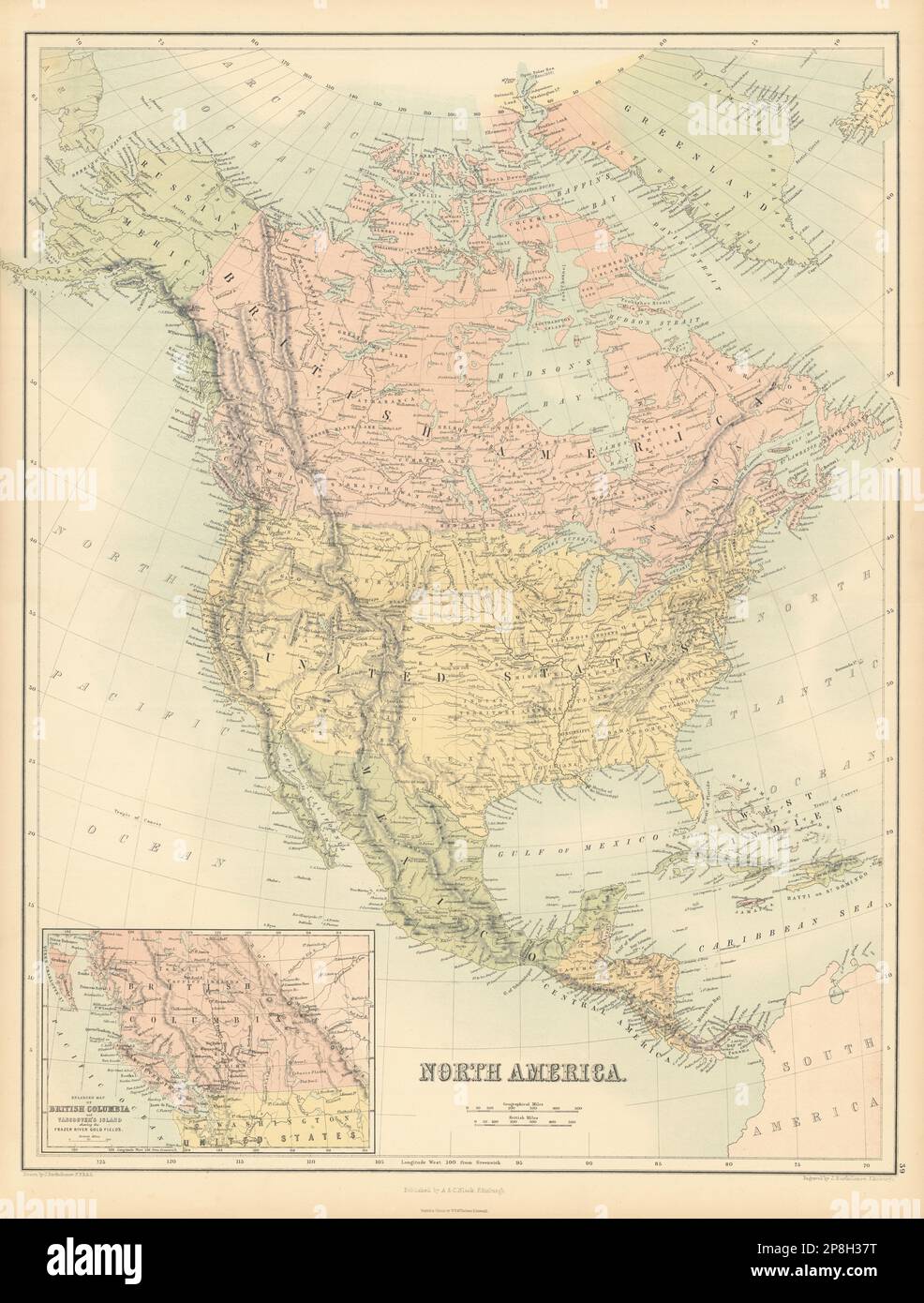 North America. USA. Russian America. British Columbia. BARTHOLOMEW 1862 map Stock Photohttps://www.alamy.com/image-license-details/?v=1https://www.alamy.com/north-america-usa-russian-america-british-columbia-bartholomew-1862-map-image538814412.html
RF2P8H37T–North America. USA. Russian America. British Columbia. BARTHOLOMEW 1862 map
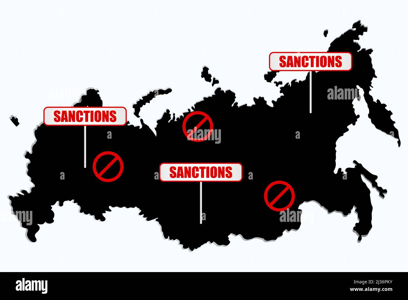 Sanctions against Russian Federation. Russian Map with restriction sign. Embargo and economucal crysis concept. Stock Vectorhttps://www.alamy.com/image-license-details/?v=1https://www.alamy.com/sanctions-against-russian-federation-russian-map-with-restriction-sign-embargo-and-economucal-crysis-concept-image466673423.html
RF2J36PKY–Sanctions against Russian Federation. Russian Map with restriction sign. Embargo and economucal crysis concept.
 20 A map of Kamtschatka engraved from the russian map by Tho Jefferys Stock Photohttps://www.alamy.com/image-license-details/?v=1https://www.alamy.com/20-a-map-of-kamtschatka-engraved-from-the-russian-map-by-tho-jefferys-image187624631.html
RMMW713K–20 A map of Kamtschatka engraved from the russian map by Tho Jefferys
 Russian map Armenia 1903 Stock Photohttps://www.alamy.com/image-license-details/?v=1https://www.alamy.com/stock-photo-russian-map-armenia-1903-137309912.html
RMHYB05C–Russian map Armenia 1903
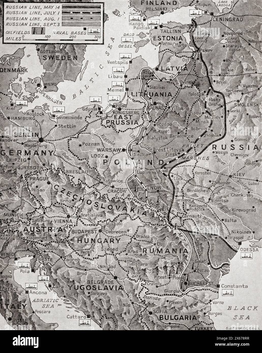 Map showing the advance of the Russian Army in their effort to wipe out the enemy, August 1944. From The War in Pictures, Fifth Year. Stock Photohttps://www.alamy.com/image-license-details/?v=1https://www.alamy.com/map-showing-the-advance-of-the-russian-army-in-their-effort-to-wipe-out-the-enemy-august-1944-from-the-war-in-pictures-fifth-year-image606211419.html
RM2X678RR–Map showing the advance of the Russian Army in their effort to wipe out the enemy, August 1944. From The War in Pictures, Fifth Year.
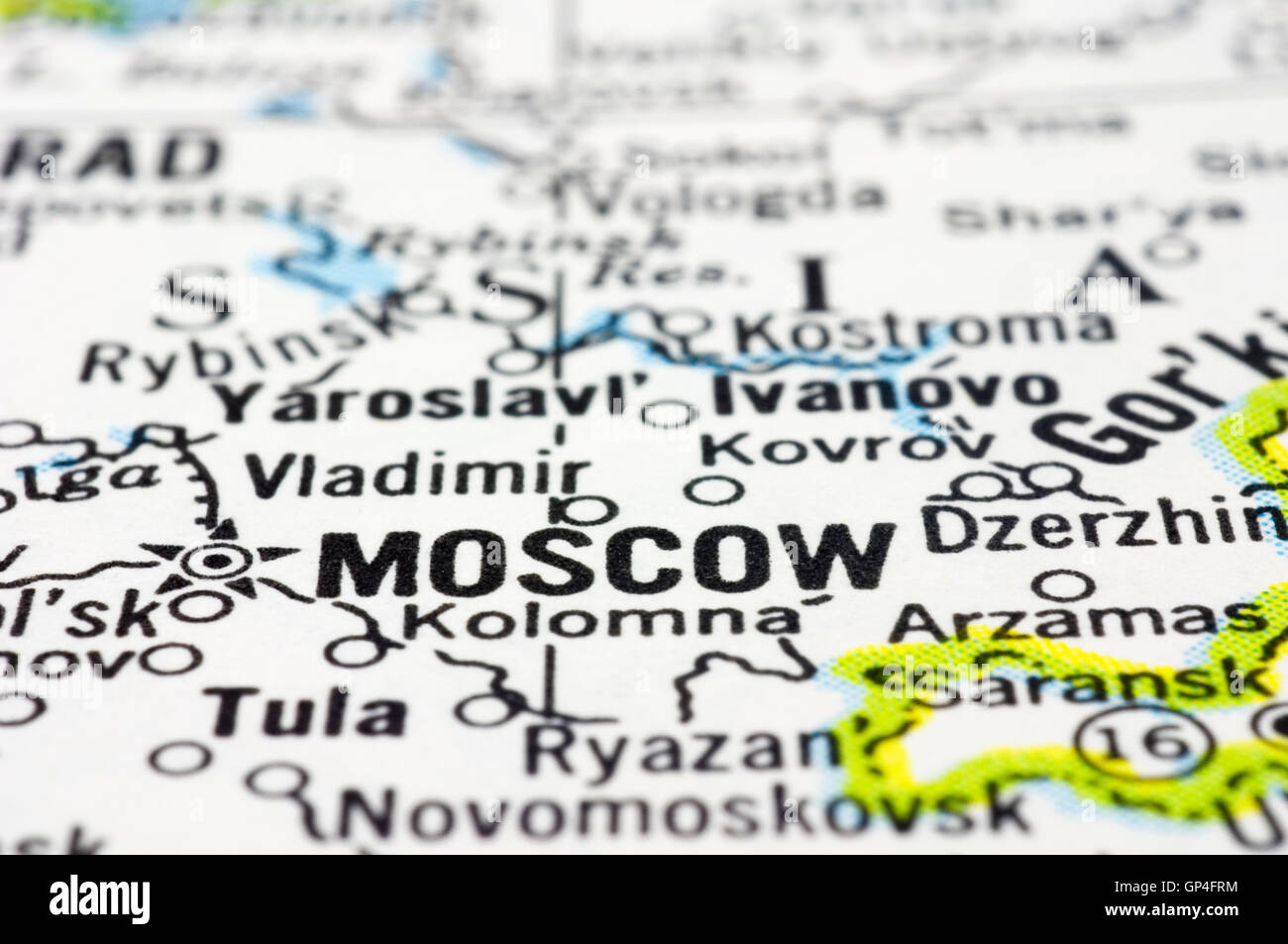 close up of Moscow on map, Russia Stock Photohttps://www.alamy.com/image-license-details/?v=1https://www.alamy.com/stock-photo-close-up-of-moscow-on-map-russia-116884872.html
RFGP4FRM–close up of Moscow on map, Russia
 A map of Kamtschatka engraved from the russian map by Tho Jefferys. Stock Photohttps://www.alamy.com/image-license-details/?v=1https://www.alamy.com/a-map-of-kamtschatka-engraved-from-the-russian-map-by-tho-jefferys-image212454526.html
RMP9J3WJ–A map of Kamtschatka engraved from the russian map by Tho Jefferys.
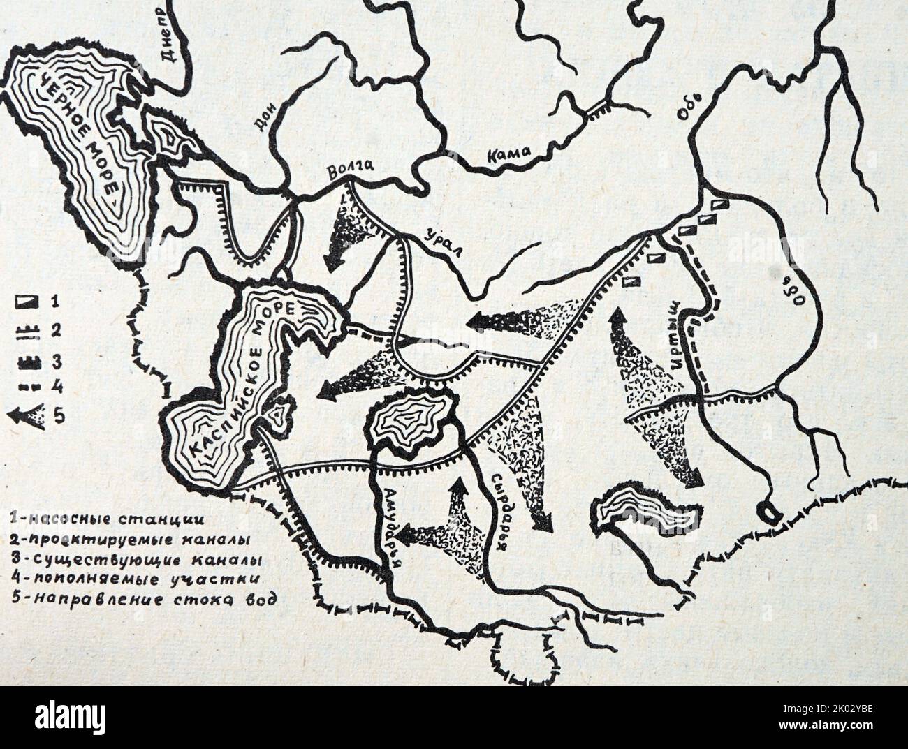 Russian map showing how the rivers of Siberia will come to the aid of the waterless deserts of Central Asia. Stock Photohttps://www.alamy.com/image-license-details/?v=1https://www.alamy.com/russian-map-showing-how-the-rivers-of-siberia-will-come-to-the-aid-of-the-waterless-deserts-of-central-asia-image481955698.html
RM2K02YBE–Russian map showing how the rivers of Siberia will come to the aid of the waterless deserts of Central Asia.
 Old green map of Russian Federation in textured green paper, isolated on white background. Stock Photohttps://www.alamy.com/image-license-details/?v=1https://www.alamy.com/stock-photo-old-green-map-of-russian-federation-in-textured-green-paper-isolated-48611502.html
RMCR2CD2–Old green map of Russian Federation in textured green paper, isolated on white background.
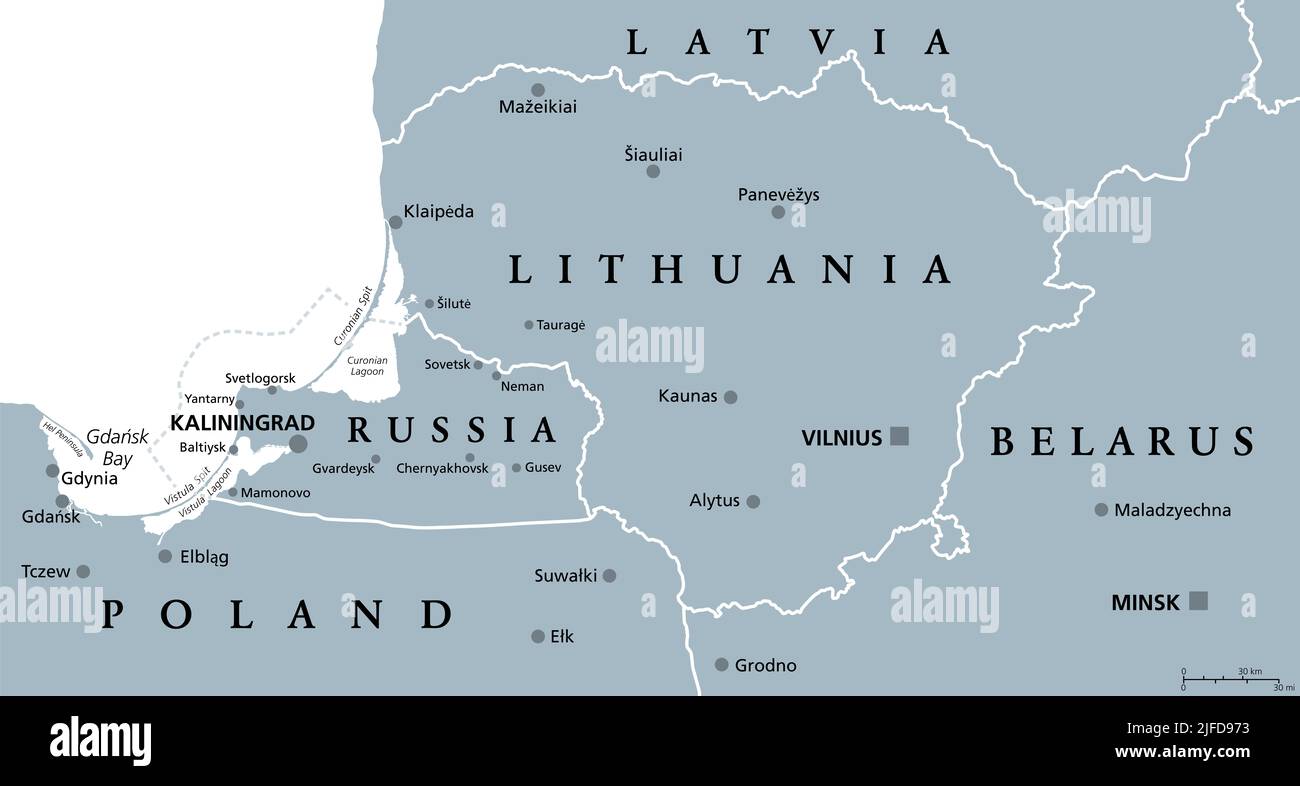 Lithuania and Kaliningrad, gray political map. Republic of Lithuania, European and Baltic country, and the Russian exclave Kaliningrad Oblast. Stock Photohttps://www.alamy.com/image-license-details/?v=1https://www.alamy.com/lithuania-and-kaliningrad-gray-political-map-republic-of-lithuania-european-and-baltic-country-and-the-russian-exclave-kaliningrad-oblast-image474192407.html
RF2JFD973–Lithuania and Kaliningrad, gray political map. Republic of Lithuania, European and Baltic country, and the Russian exclave Kaliningrad Oblast.
 Map of Russia - isolated Stock Photohttps://www.alamy.com/image-license-details/?v=1https://www.alamy.com/stock-photo-map-of-russia-isolated-32213882.html
RFBTBD3P–Map of Russia - isolated
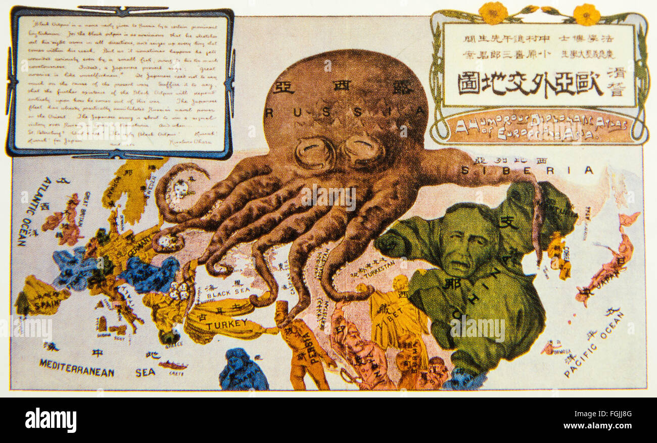 Caricature of Russian invasion. Funny Europe and Asia diplomacy map. Published in Japan, 1904 . Stock Photohttps://www.alamy.com/image-license-details/?v=1https://www.alamy.com/stock-photo-caricature-of-russian-invasion-funny-europe-and-asia-diplomacy-map-96295824.html
RMFGJJ8G–Caricature of Russian invasion. Funny Europe and Asia diplomacy map. Published in Japan, 1904 .
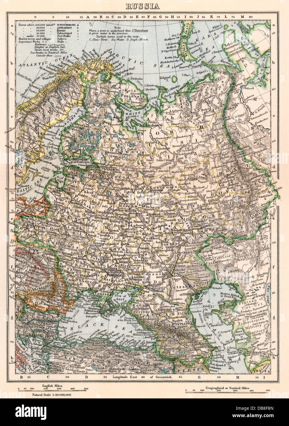 Map of Russia, late 1800s. Color lithograph Stock Photohttps://www.alamy.com/image-license-details/?v=1https://www.alamy.com/stock-photo-map-of-russia-late-1800s-color-lithograph-58579941.html
RMDB8F8N–Map of Russia, late 1800s. Color lithograph
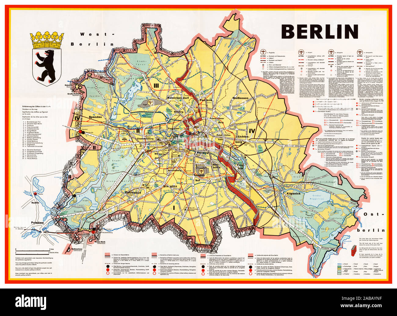 BERLIN WALL Vintage 1960’s Berlin Cold War Propaganda map illustration showing the Berlin Wall as a bricked-up barrier and barbed wire surrounding West Berlin. Airports, government buildings, factories and other sites are shown in the West, but none in the East. Detailed explanations of transportation, borders and border crossing are provided in German, English, French and Spanish - but not in Russian. The map was published by the Press and Information Office of the State of Berlin, in 1963. Germany Stock Photohttps://www.alamy.com/image-license-details/?v=1https://www.alamy.com/berlin-wall-vintage-1960s-berlin-cold-war-propaganda-map-illustration-showing-the-berlin-wall-as-a-bricked-up-barrier-and-barbed-wire-surrounding-west-berlin-airports-government-buildings-factories-and-other-sites-are-shown-in-the-west-but-none-in-the-east-detailed-explanations-of-transportation-borders-and-border-crossing-are-provided-in-german-english-french-and-spanish-but-not-in-russian-the-map-was-published-by-the-press-and-information-office-of-the-state-of-berlin-in-1963-germany-image333999499.html
RM2ABAYNF–BERLIN WALL Vintage 1960’s Berlin Cold War Propaganda map illustration showing the Berlin Wall as a bricked-up barrier and barbed wire surrounding West Berlin. Airports, government buildings, factories and other sites are shown in the West, but none in the East. Detailed explanations of transportation, borders and border crossing are provided in German, English, French and Spanish - but not in Russian. The map was published by the Press and Information Office of the State of Berlin, in 1963. Germany
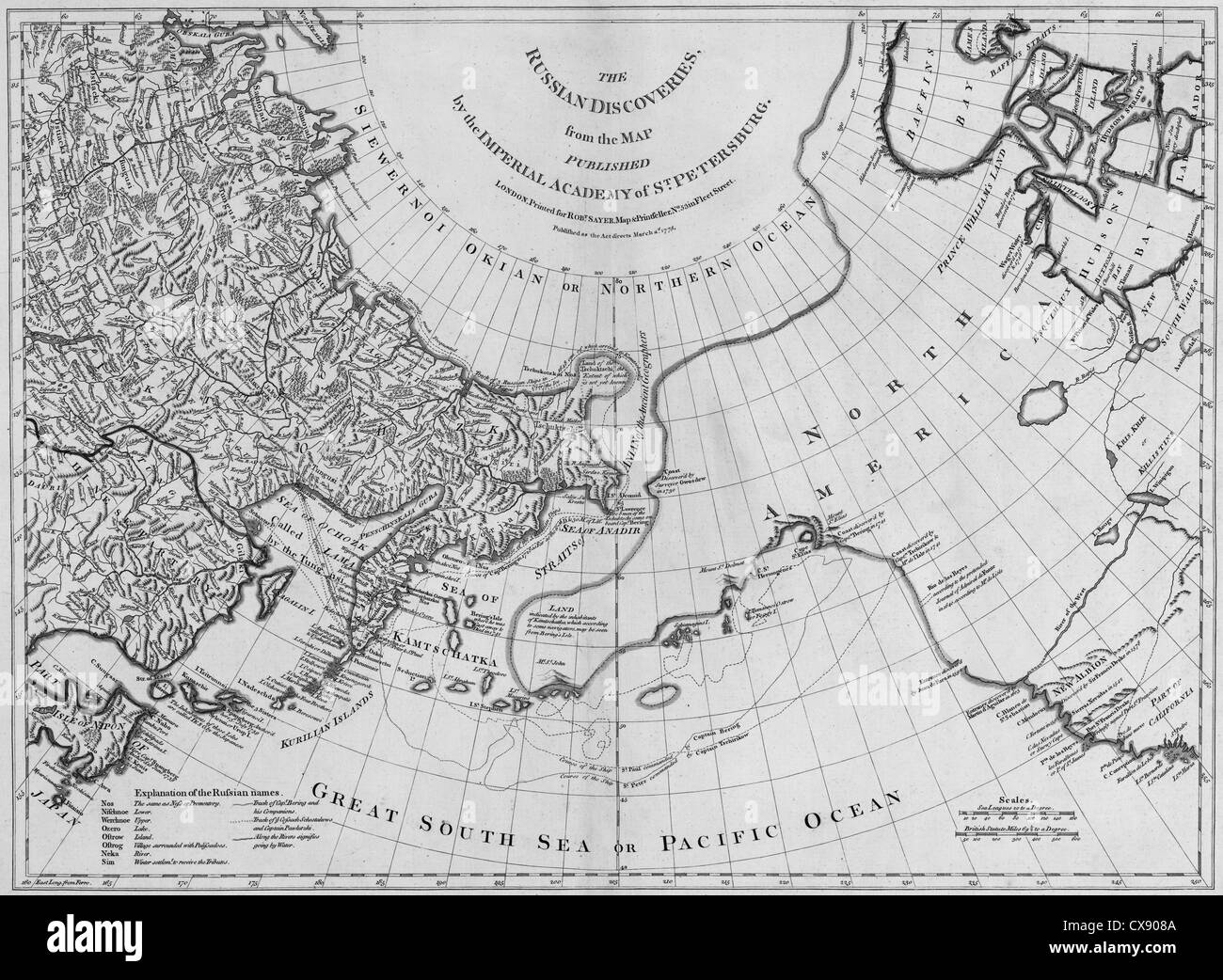 The Russian discoveries from the map published by the Imperial Academy of St. Petersburg, 1775 Stock Photohttps://www.alamy.com/image-license-details/?v=1https://www.alamy.com/stock-photo-the-russian-discoveries-from-the-map-published-by-the-imperial-academy-50599594.html
RMCX908A–The Russian discoveries from the map published by the Imperial Academy of St. Petersburg, 1775
 Map of Russian North Lapland and Kola in 1600 Stock Photohttps://www.alamy.com/image-license-details/?v=1https://www.alamy.com/map-of-russian-north-lapland-and-kola-in-1600-image504915218.html
RM2M9CTEA–Map of Russian North Lapland and Kola in 1600
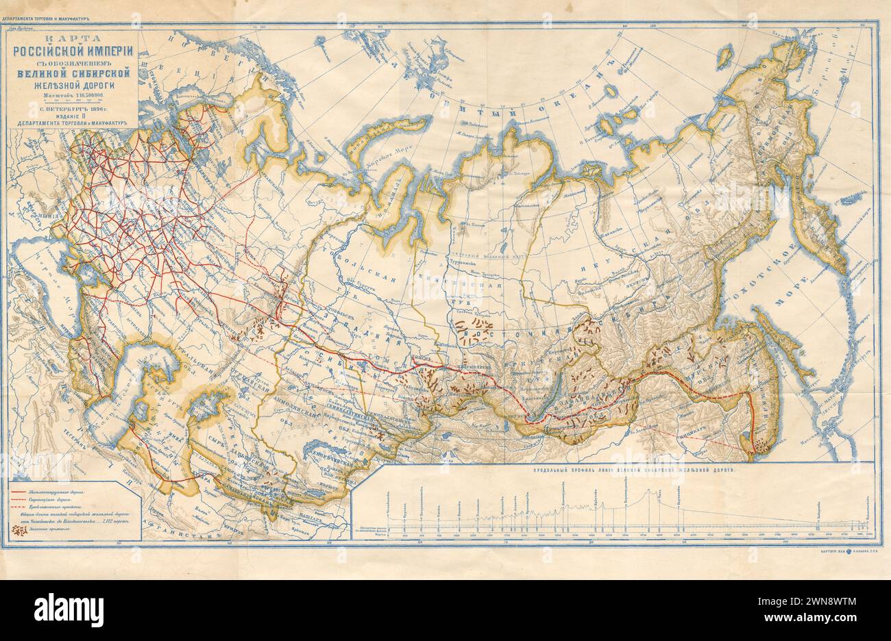 Vintage Russian Map Showing the Trans-Siberian Railroad. 1896 Stock Photohttps://www.alamy.com/image-license-details/?v=1https://www.alamy.com/vintage-russian-map-showing-the-trans-siberian-railroad-1896-image598256196.html
RM2WN8WTM–Vintage Russian Map Showing the Trans-Siberian Railroad. 1896
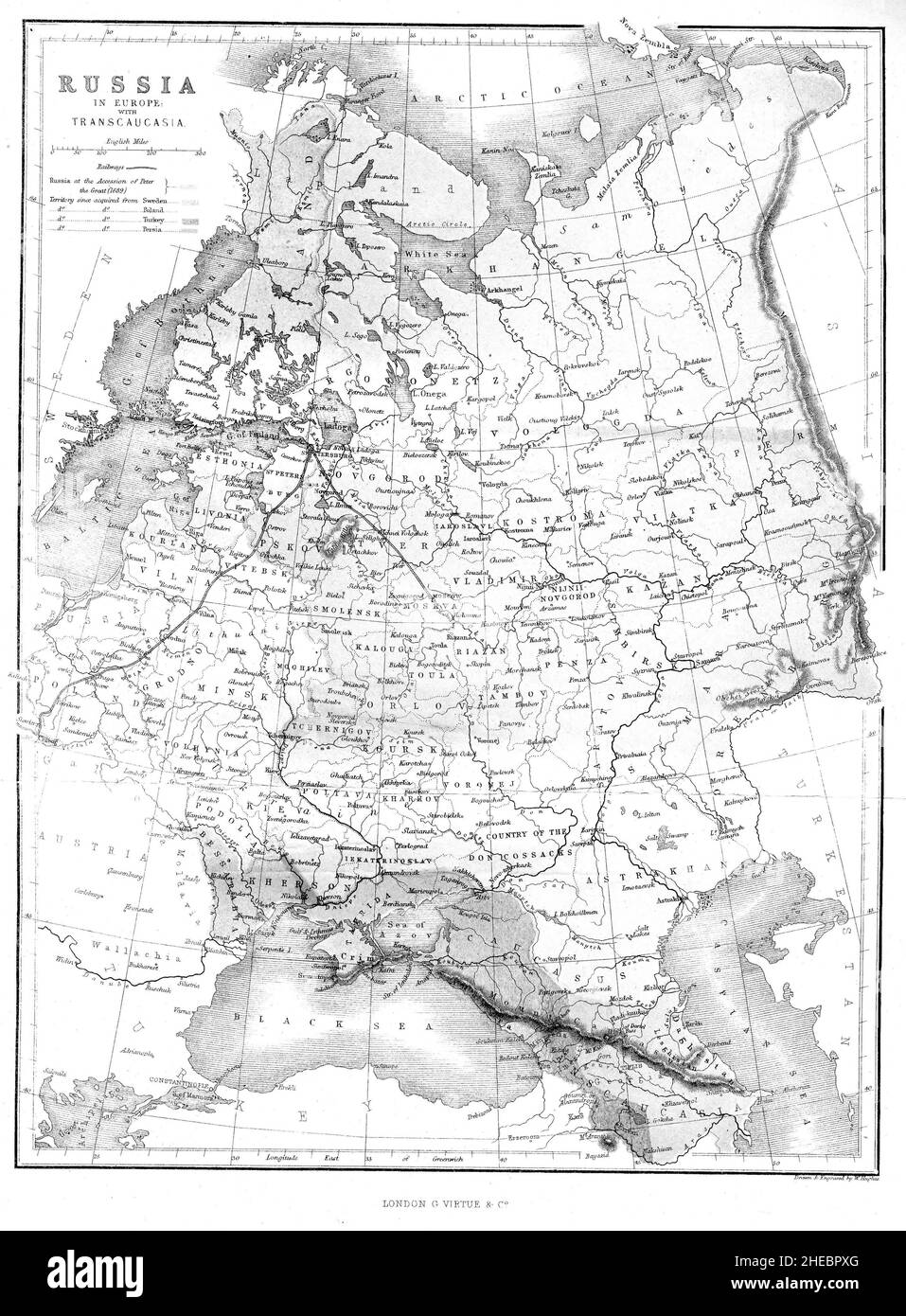 Map of Russia from the book The illustrated history of the war against Russia (Crimean War October 1853 to February 1856) by Edward Henry Nolan, published in 1857 Stock Photohttps://www.alamy.com/image-license-details/?v=1https://www.alamy.com/map-of-russia-from-the-book-the-illustrated-history-of-the-war-against-russia-crimean-war-october-1853-to-february-1856-by-edward-henry-nolan-published-in-1857-image456334216.html
RF2HEBPXG–Map of Russia from the book The illustrated history of the war against Russia (Crimean War October 1853 to February 1856) by Edward Henry Nolan, published in 1857
 Grunge Russia map flag with shadow illustration Stock Photohttps://www.alamy.com/image-license-details/?v=1https://www.alamy.com/stock-photo-grunge-russia-map-flag-with-shadow-illustration-38974840.html
RFC7BCPG–Grunge Russia map flag with shadow illustration
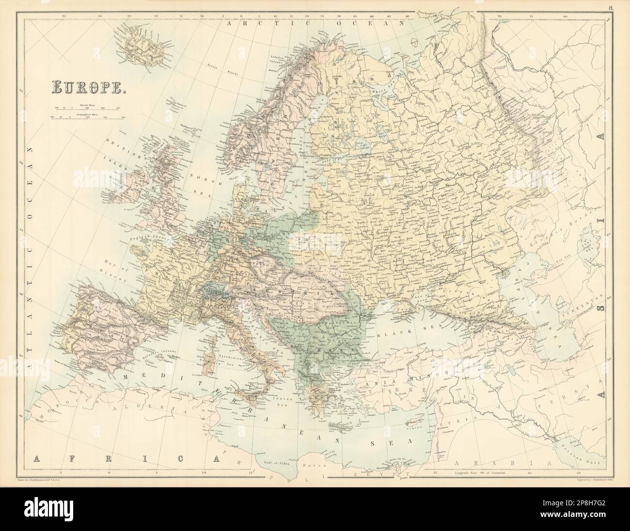 Europe. Austria Prussia Ottoman Russian Empires BARTHOLOMEW 1862 old map Stock Photohttps://www.alamy.com/image-license-details/?v=1https://www.alamy.com/europe-austria-prussia-ottoman-russian-empires-bartholomew-1862-old-map-image538817778.html
RF2P8H7G2–Europe. Austria Prussia Ottoman Russian Empires BARTHOLOMEW 1862 old map
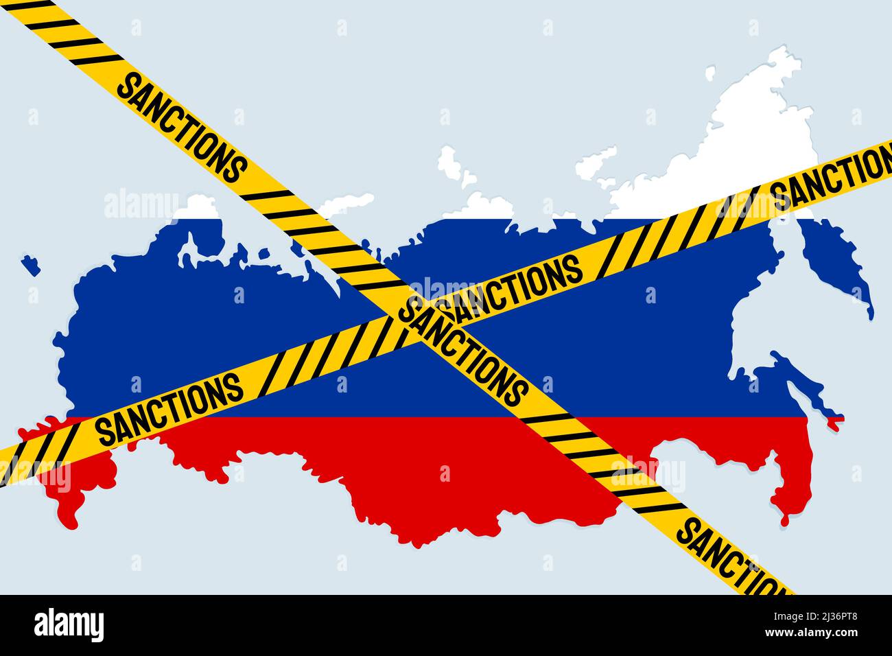 Sanctions against Russian Federation. Russian Map with restriction sign. Embargo and economucal crysis concept. Stock Vectorhttps://www.alamy.com/image-license-details/?v=1https://www.alamy.com/sanctions-against-russian-federation-russian-map-with-restriction-sign-embargo-and-economucal-crysis-concept-image466673544.html
RF2J36PT8–Sanctions against Russian Federation. Russian Map with restriction sign. Embargo and economucal crysis concept.
 20 A map of Kamtschatka engraved from the russian map by Tho Jefferys Stock Photohttps://www.alamy.com/image-license-details/?v=1https://www.alamy.com/20-a-map-of-kamtschatka-engraved-from-the-russian-map-by-tho-jefferys-image188138407.html
RMMX2CCR–20 A map of Kamtschatka engraved from the russian map by Tho Jefferys
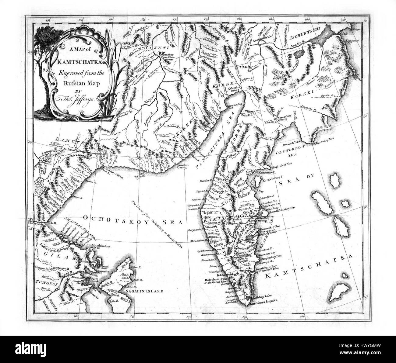 A map of Kamtschatka engraved from the russian map by Tho Jefferys Stock Photohttps://www.alamy.com/image-license-details/?v=1https://www.alamy.com/stock-photo-a-map-of-kamtschatka-engraved-from-the-russian-map-by-tho-jefferys-136444809.html
RMHWYGMW–A map of Kamtschatka engraved from the russian map by Tho Jefferys
 Map showing the speed of the Russian army's drive into the heart of Reich territory, January 1945, during WWII. From The War in Pictures, Sixth Year. Stock Photohttps://www.alamy.com/image-license-details/?v=1https://www.alamy.com/map-showing-the-speed-of-the-russian-armys-drive-into-the-heart-of-reich-territory-january-1945-during-wwii-from-the-war-in-pictures-sixth-year-image605468363.html
RM2X51D23–Map showing the speed of the Russian army's drive into the heart of Reich territory, January 1945, during WWII. From The War in Pictures, Sixth Year.
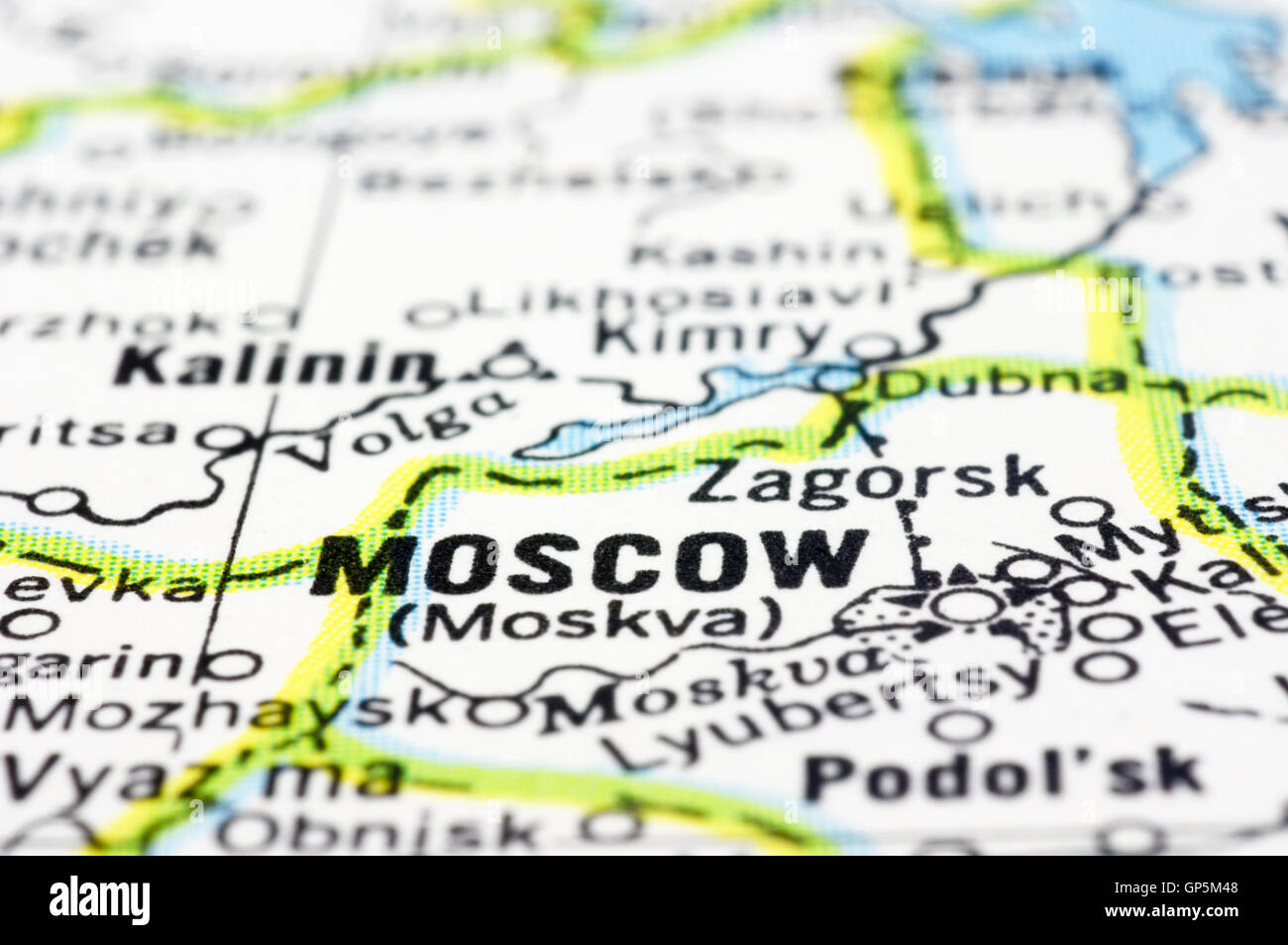 close up of Moscow on map, Russia Stock Photohttps://www.alamy.com/image-license-details/?v=1https://www.alamy.com/stock-photo-close-up-of-moscow-on-map-russia-116910200.html
RFGP5M48–close up of Moscow on map, Russia
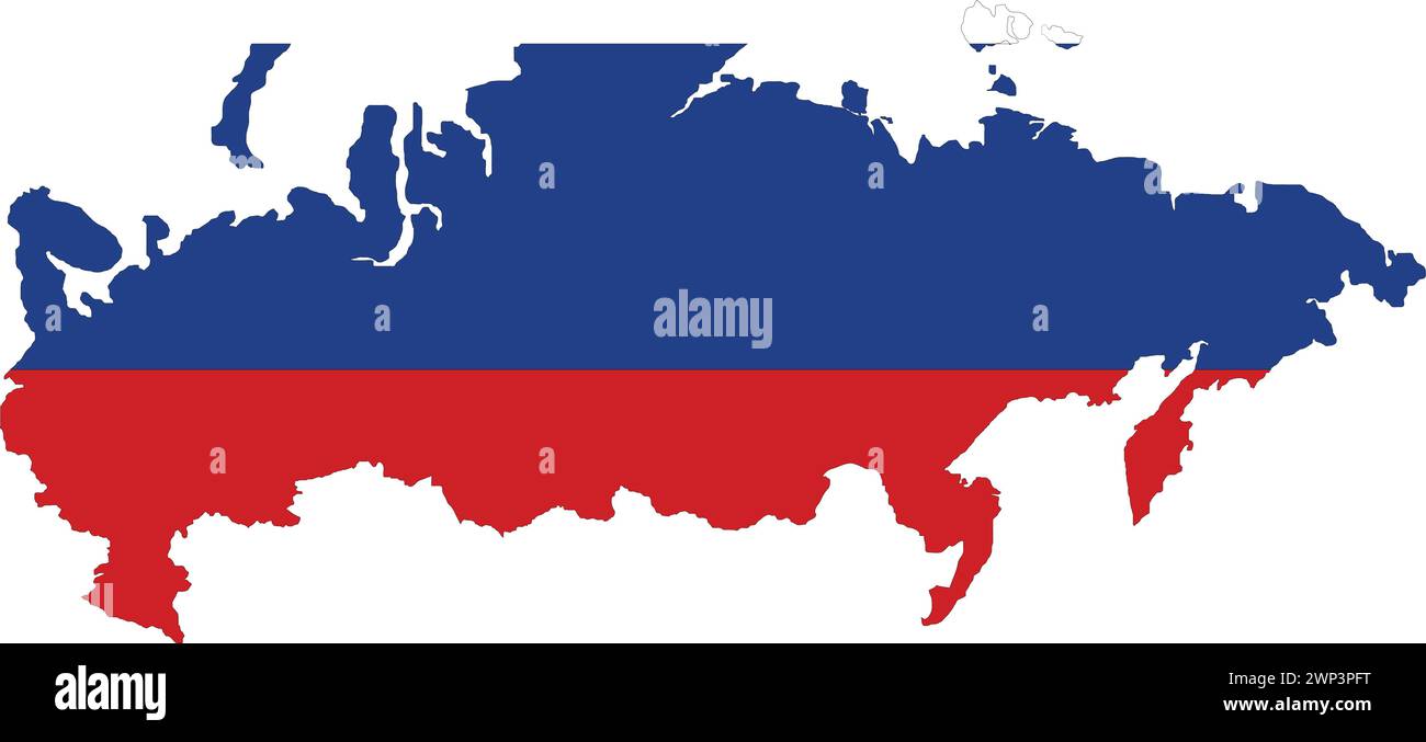 Russia Flag in Russia Map, Russia Map with Flag, Country Map, Russian Flag, Nation Flag Stock Vectorhttps://www.alamy.com/image-license-details/?v=1https://www.alamy.com/russia-flag-in-russia-map-russia-map-with-flag-country-map-russian-flag-nation-flag-image598758492.html
RF2WP3PFT–Russia Flag in Russia Map, Russia Map with Flag, Country Map, Russian Flag, Nation Flag
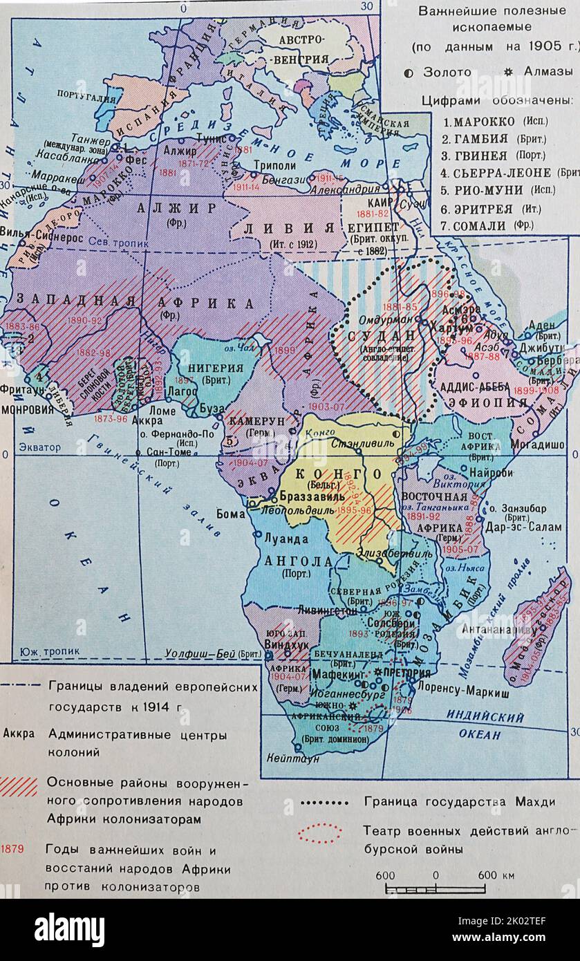 Russian Map 1918, showing the most important mining sources for gold and silver in colonial Africa Stock Photohttps://www.alamy.com/image-license-details/?v=1https://www.alamy.com/russian-map-1918-showing-the-most-important-mining-sources-for-gold-and-silver-in-colonial-africa-image481953431.html
RM2K02TEF–Russian Map 1918, showing the most important mining sources for gold and silver in colonial Africa