Quick filters:
Rwanda tanzania border Stock Photos and Images
![The Kagera River forms the border between Rwanda and Tanzania. [automated translation] Stock Photo The Kagera River forms the border between Rwanda and Tanzania. [automated translation] Stock Photo](https://c8.alamy.com/comp/2X0GKG7/the-kagera-river-forms-the-border-between-rwanda-and-tanzania-automated-translation-2X0GKG7.jpg) The Kagera River forms the border between Rwanda and Tanzania. [automated translation] Stock Photohttps://www.alamy.com/image-license-details/?v=1https://www.alamy.com/the-kagera-river-forms-the-border-between-rwanda-and-tanzania-automated-translation-image602729463.html
The Kagera River forms the border between Rwanda and Tanzania. [automated translation] Stock Photohttps://www.alamy.com/image-license-details/?v=1https://www.alamy.com/the-kagera-river-forms-the-border-between-rwanda-and-tanzania-automated-translation-image602729463.htmlRM2X0GKG7–The Kagera River forms the border between Rwanda and Tanzania. [automated translation]
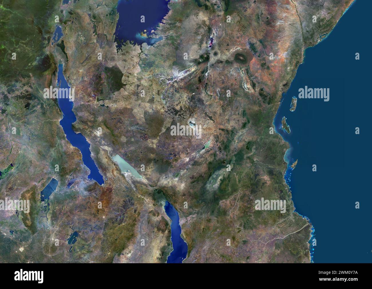 Color satellite image of Tanzania and neighbouring countries. Stock Photohttps://www.alamy.com/image-license-details/?v=1https://www.alamy.com/color-satellite-image-of-tanzania-and-neighbouring-countries-image597467006.html
RM2WM0Y7A–Color satellite image of Tanzania and neighbouring countries.
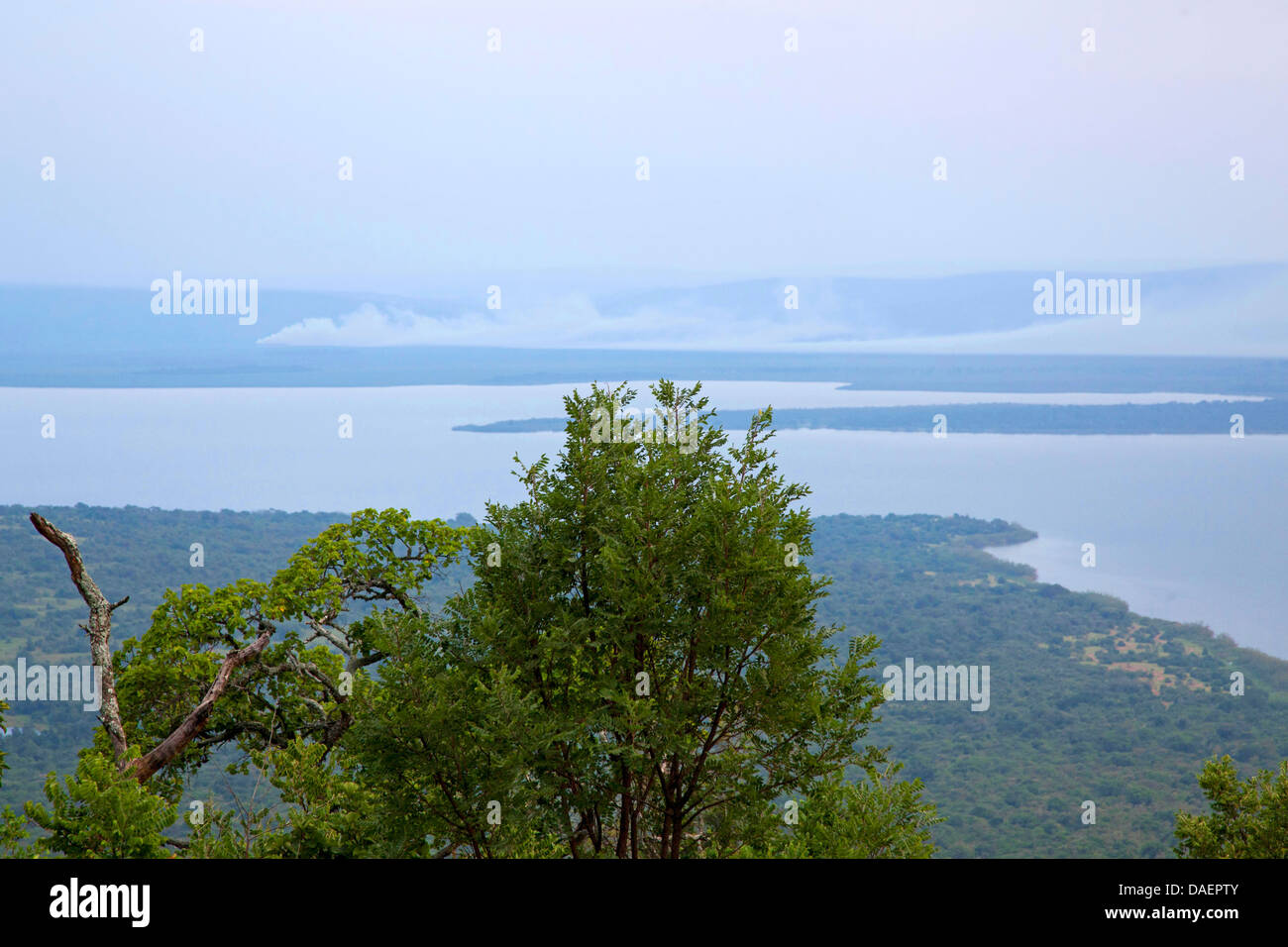 view to Lake Ihema at the border of Tanzania, Rwanda, Eastern Province, Akagera National Park Stock Photohttps://www.alamy.com/image-license-details/?v=1https://www.alamy.com/stock-photo-view-to-lake-ihema-at-the-border-of-tanzania-rwanda-eastern-province-58102939.html
RMDAEPTY–view to Lake Ihema at the border of Tanzania, Rwanda, Eastern Province, Akagera National Park
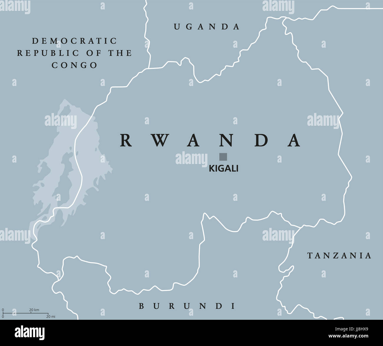 Rwanda political map with capital Kigali. Republic and sovereign state, located in Central and East Africa. Country in the African Great Lakes region. Stock Photohttps://www.alamy.com/image-license-details/?v=1https://www.alamy.com/stock-photo-rwanda-political-map-with-capital-kigali-republic-and-sovereign-state-148936433.html
RFJJ8HX9–Rwanda political map with capital Kigali. Republic and sovereign state, located in Central and East Africa. Country in the African Great Lakes region.
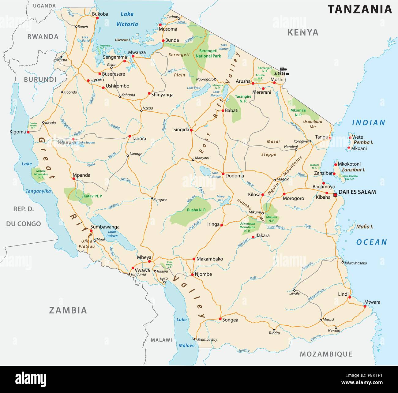 United Republic of Tanzania road vector map Stock Vectorhttps://www.alamy.com/image-license-details/?v=1https://www.alamy.com/united-republic-of-tanzania-road-vector-map-image211860153.html
RFP8K1P1–United Republic of Tanzania road vector map
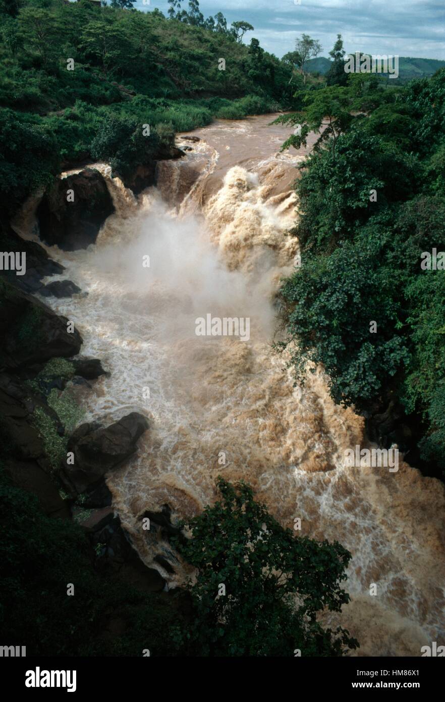 Rusumo Falls on the Kagera river on the border between Rwanda and Tanzania, Rwanda. Stock Photohttps://www.alamy.com/image-license-details/?v=1https://www.alamy.com/stock-photo-rusumo-falls-on-the-kagera-river-on-the-border-between-rwanda-and-132946745.html
RMHM86X1–Rusumo Falls on the Kagera river on the border between Rwanda and Tanzania, Rwanda.
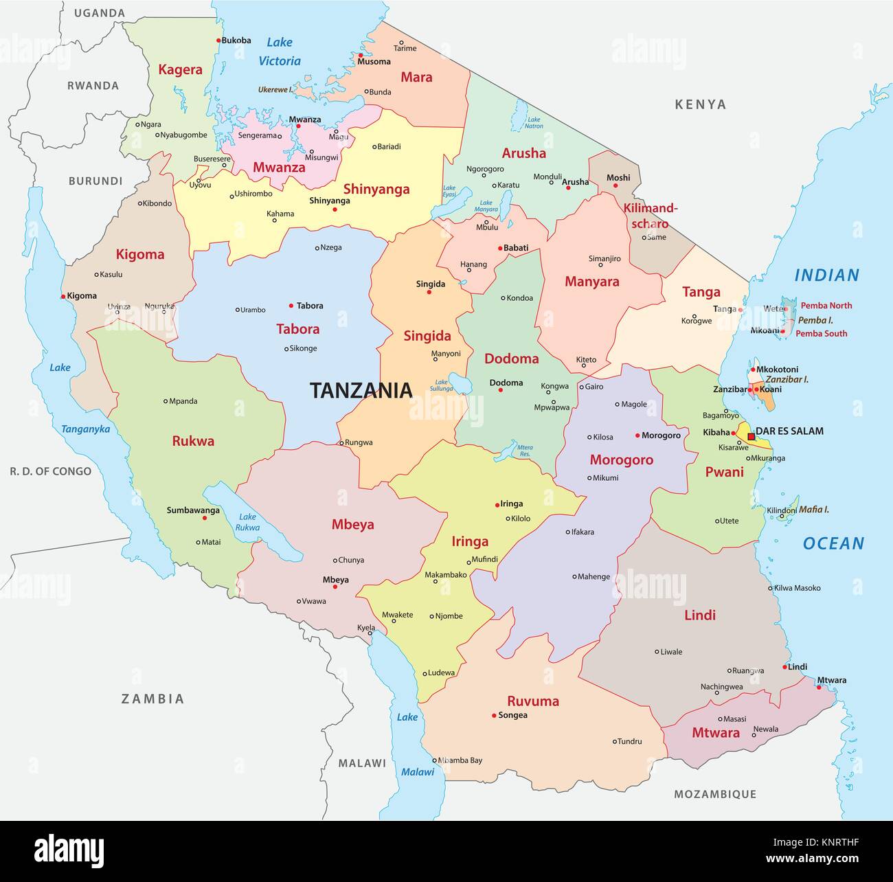 tanzania administrative and political vector map Stock Vectorhttps://www.alamy.com/image-license-details/?v=1https://www.alamy.com/stock-image-tanzania-administrative-and-political-vector-map-168325291.html
RFKNRTHF–tanzania administrative and political vector map
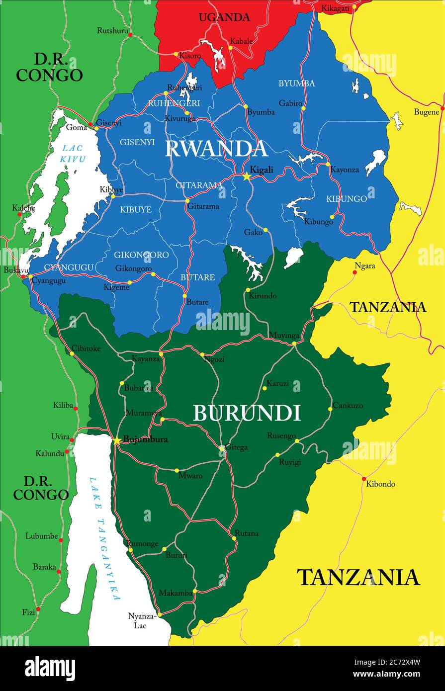 Highly detailed vector map of Rwanda with administrative regions, main cities and roads. Stock Vectorhttps://www.alamy.com/image-license-details/?v=1https://www.alamy.com/highly-detailed-vector-map-of-rwanda-with-administrative-regions-main-cities-and-roads-image365784745.html
RF2C72X4W–Highly detailed vector map of Rwanda with administrative regions, main cities and roads.
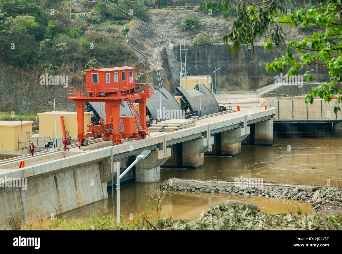 Kigali. 20th Aug, 2022. Water flows through the open spillway gates upstream the waterfalls at the Rusumo border between Rwanda and Tanzania for the regional Rusumo Falls Hydroelectric Project on Aug. 20, 2022. Construction of the regional Rusumo Falls Hydroelectric Project has reached an implementation status of 95 percent before operational, Nile Equatorial Lakes Subsidiary Action Program Coordination Unit (NELSAP-CU) said in a statement on Saturday. Credit: Cyril Ndegeya/Xinhua/Alamy Live News Stock Photohttps://www.alamy.com/image-license-details/?v=1https://www.alamy.com/kigali-20th-aug-2022-water-flows-through-the-open-spillway-gates-upstream-the-waterfalls-at-the-rusumo-border-between-rwanda-and-tanzania-for-the-regional-rusumo-falls-hydroelectric-project-on-aug-20-2022-construction-of-the-regional-rusumo-falls-hydroelectric-project-has-reached-an-implementation-status-of-95-percent-before-operational-nile-equatorial-lakes-subsidiary-action-program-coordination-unit-nelsap-cu-said-in-a-statement-on-saturday-credit-cyril-ndegeyaxinhuaalamy-live-news-image478926164.html
RM2JR4Y5T–Kigali. 20th Aug, 2022. Water flows through the open spillway gates upstream the waterfalls at the Rusumo border between Rwanda and Tanzania for the regional Rusumo Falls Hydroelectric Project on Aug. 20, 2022. Construction of the regional Rusumo Falls Hydroelectric Project has reached an implementation status of 95 percent before operational, Nile Equatorial Lakes Subsidiary Action Program Coordination Unit (NELSAP-CU) said in a statement on Saturday. Credit: Cyril Ndegeya/Xinhua/Alamy Live News
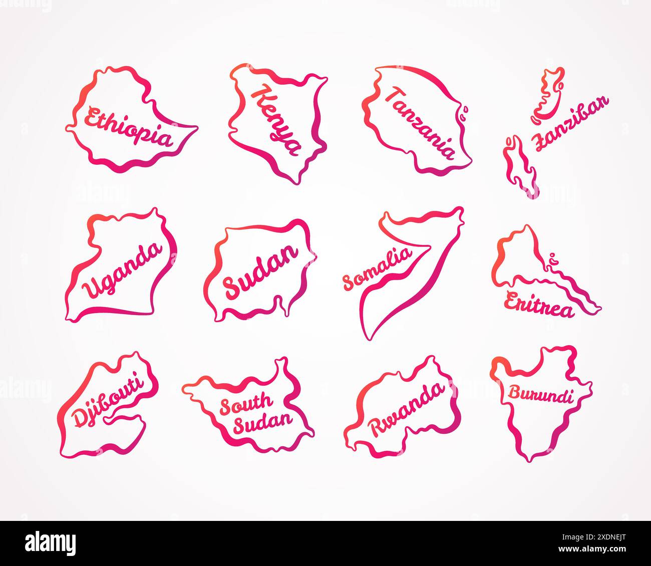 Outline maps of Ethiopia, Kenya, Tanzania, Zanzibar, Uganda, Sudan, Somalia, Eritrea, Djibouti, South Sudan, Rwanda, Burundi with orange-purple gradie Stock Vectorhttps://www.alamy.com/image-license-details/?v=1https://www.alamy.com/outline-maps-of-ethiopia-kenya-tanzania-zanzibar-uganda-sudan-somalia-eritrea-djibouti-south-sudan-rwanda-burundi-with-orange-purple-gradie-image610825904.html
RF2XDNEJT–Outline maps of Ethiopia, Kenya, Tanzania, Zanzibar, Uganda, Sudan, Somalia, Eritrea, Djibouti, South Sudan, Rwanda, Burundi with orange-purple gradie
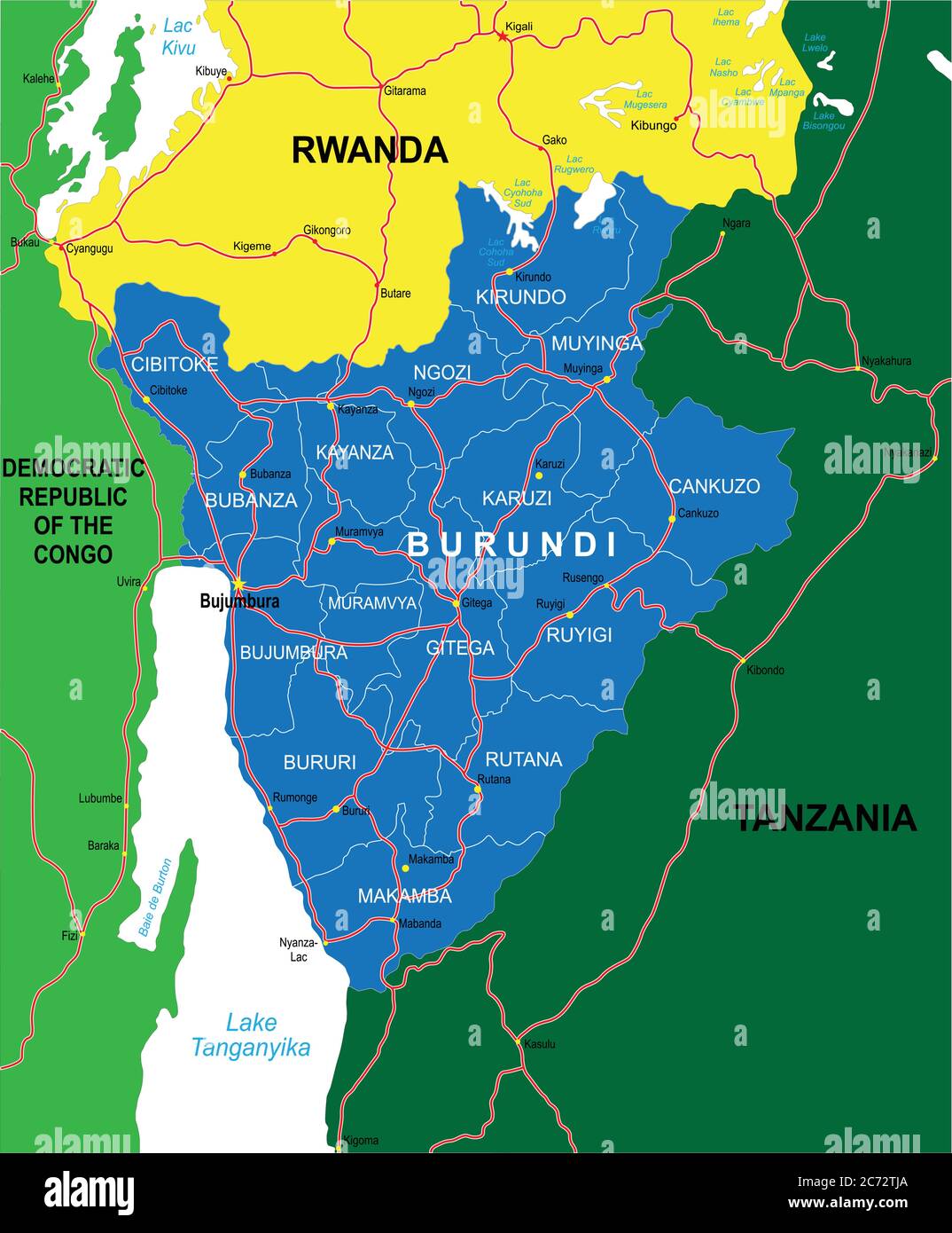 Highly detailed vector map of Burundi with administrative regions,main cities and roads. Stock Vectorhttps://www.alamy.com/image-license-details/?v=1https://www.alamy.com/highly-detailed-vector-map-of-burundi-with-administrative-regionsmain-cities-and-roads-image365783554.html
RF2C72TJA–Highly detailed vector map of Burundi with administrative regions,main cities and roads.
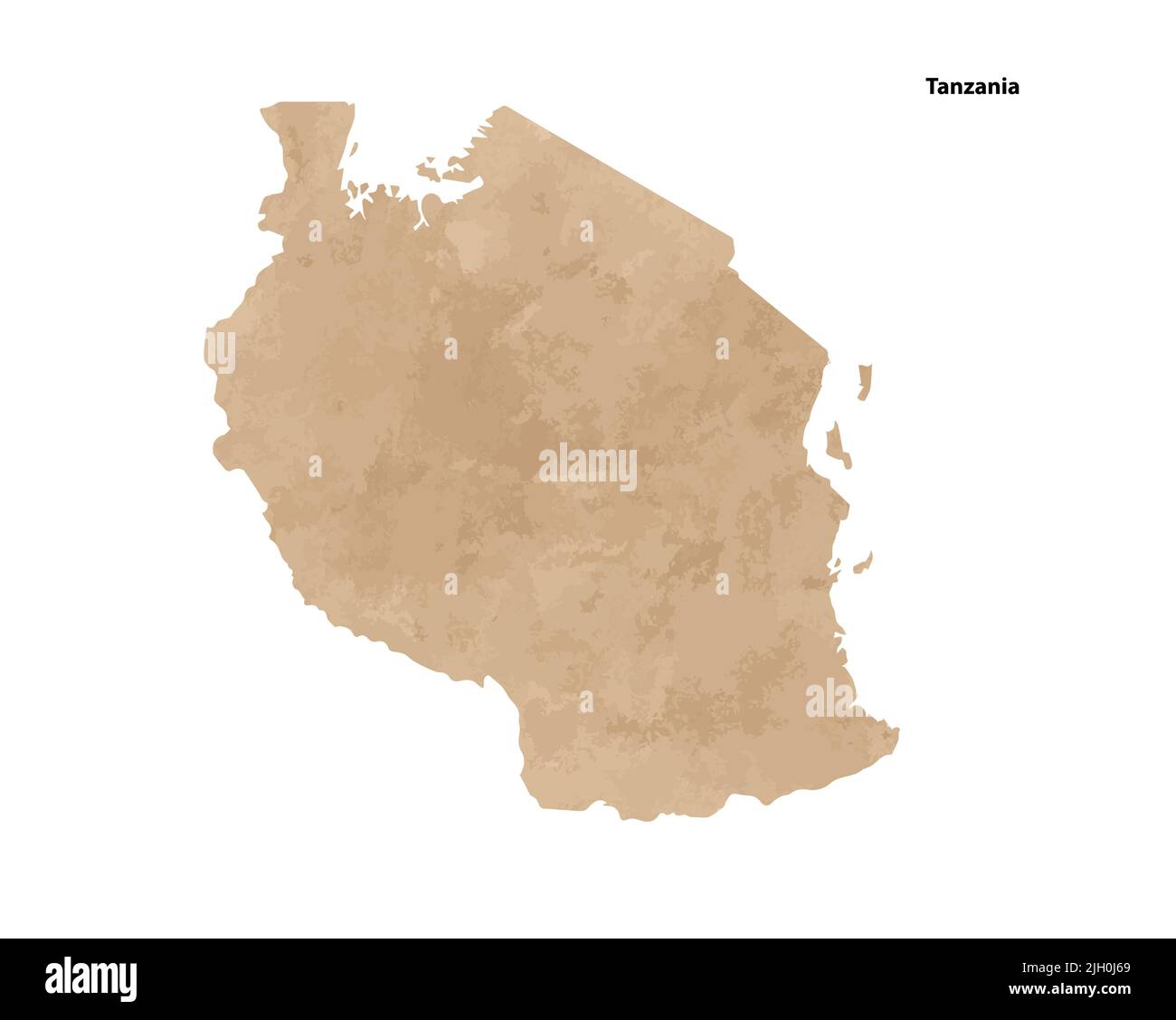 Old vintage paper textured map of Tanzania Country - Vector illustration Stock Vectorhttps://www.alamy.com/image-license-details/?v=1https://www.alamy.com/old-vintage-paper-textured-map-of-tanzania-country-vector-illustration-image475143377.html
RF2JH0J69–Old vintage paper textured map of Tanzania Country - Vector illustration
RFD01X8Y–background with African countries flag icons frame
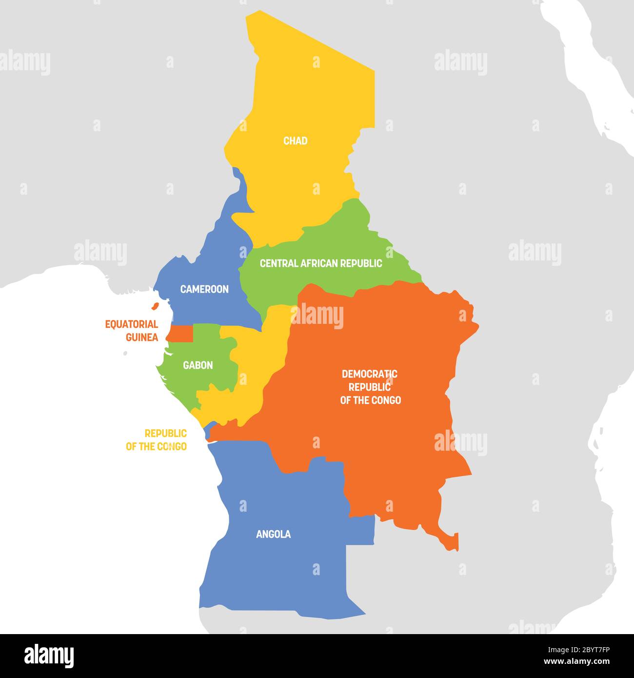 South America Region. Map of countries in southern America. Vector illustration. Stock Vectorhttps://www.alamy.com/image-license-details/?v=1https://www.alamy.com/south-america-region-map-of-countries-in-southern-america-vector-illustration-image361335850.html
RF2BYT7FP–South America Region. Map of countries in southern America. Vector illustration.
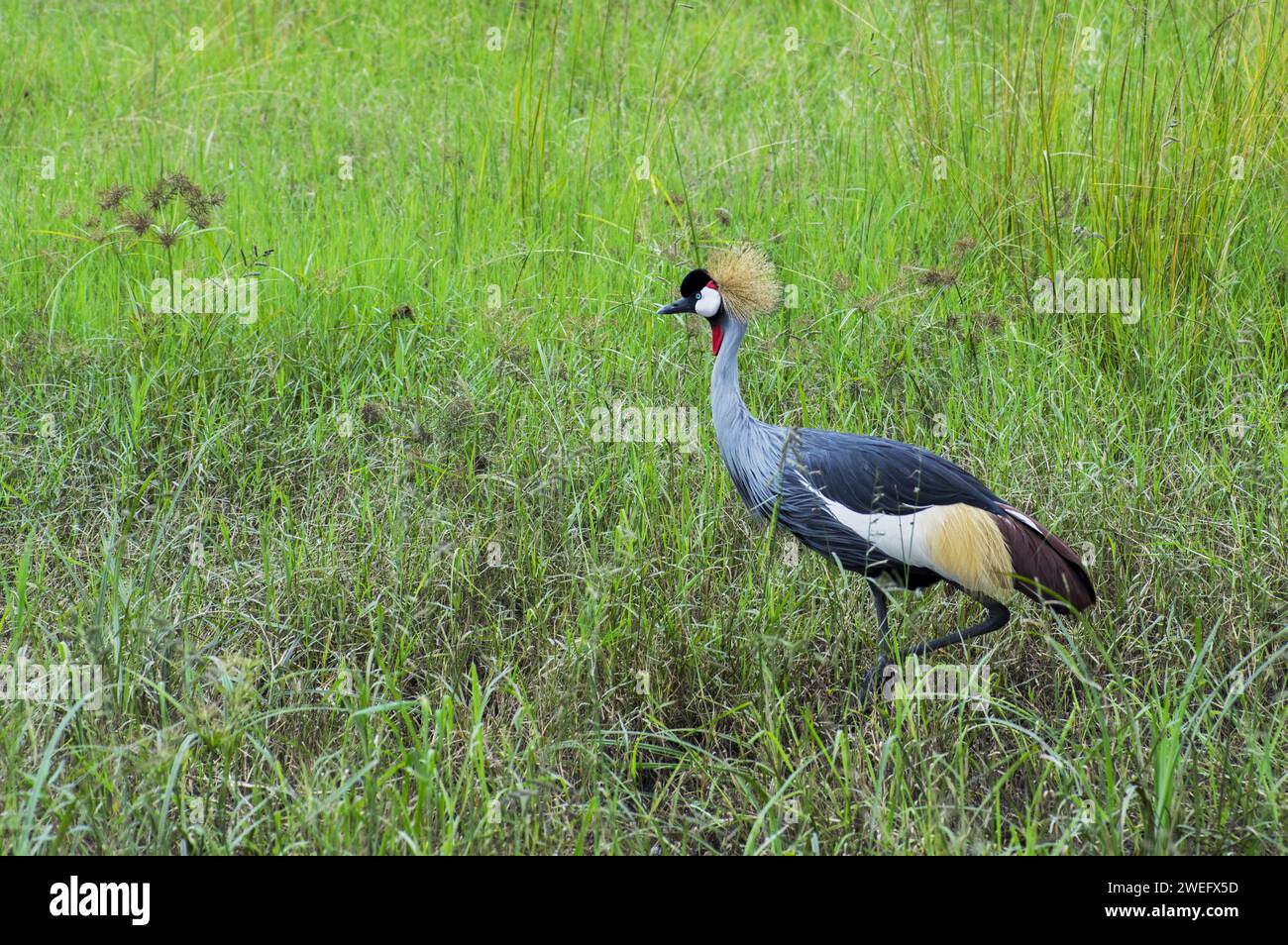 photographed on safari in Akagera National Park in Northeastern Rwanda, Central Africa’s largest protected wetland. Africa Parks Stock Photohttps://www.alamy.com/image-license-details/?v=1https://www.alamy.com/photographed-on-safari-in-akagera-national-park-in-northeastern-rwanda-central-africas-largest-protected-wetland-africa-parks-image594107513.html
RM2WEFX5D–photographed on safari in Akagera National Park in Northeastern Rwanda, Central Africa’s largest protected wetland. Africa Parks
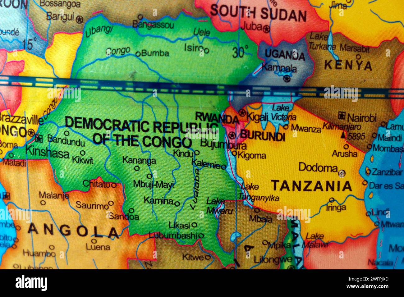 african country republic congo map with rwanda, angola, sudan, tanzania uganda border Stock Photohttps://www.alamy.com/image-license-details/?v=1https://www.alamy.com/african-country-republic-congo-map-with-rwanda-angola-sudan-tanzania-uganda-border-image594870149.html
RF2WFPJXD–african country republic congo map with rwanda, angola, sudan, tanzania uganda border
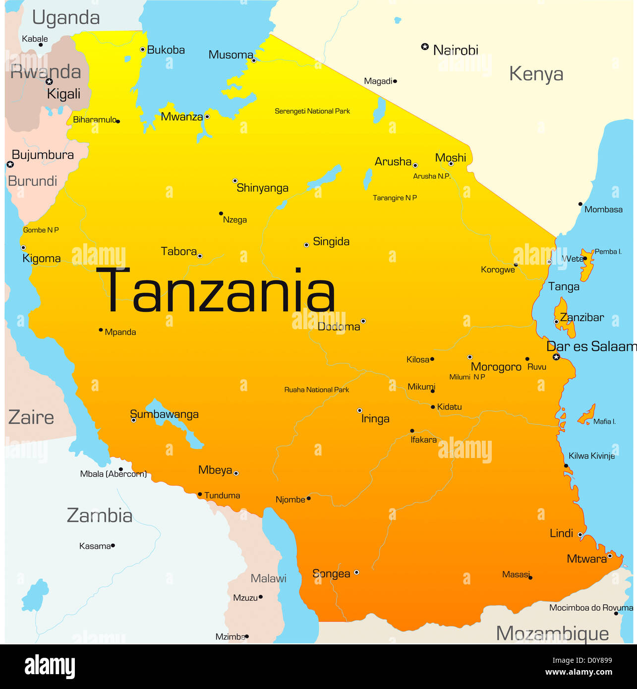 Tanzania Stock Photohttps://www.alamy.com/image-license-details/?v=1https://www.alamy.com/stock-photo-tanzania-52230341.html
RFD0Y899–Tanzania
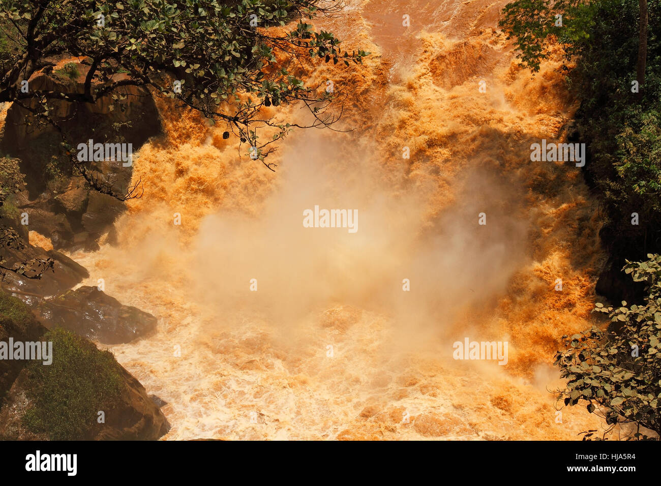 big, large, enormous, extreme, powerful, imposing, immense, relevant, tree, Stock Photohttps://www.alamy.com/image-license-details/?v=1https://www.alamy.com/stock-photo-big-large-enormous-extreme-powerful-imposing-immense-relevant-tree-131760472.html
RFHJA5R4–big, large, enormous, extreme, powerful, imposing, immense, relevant, tree,
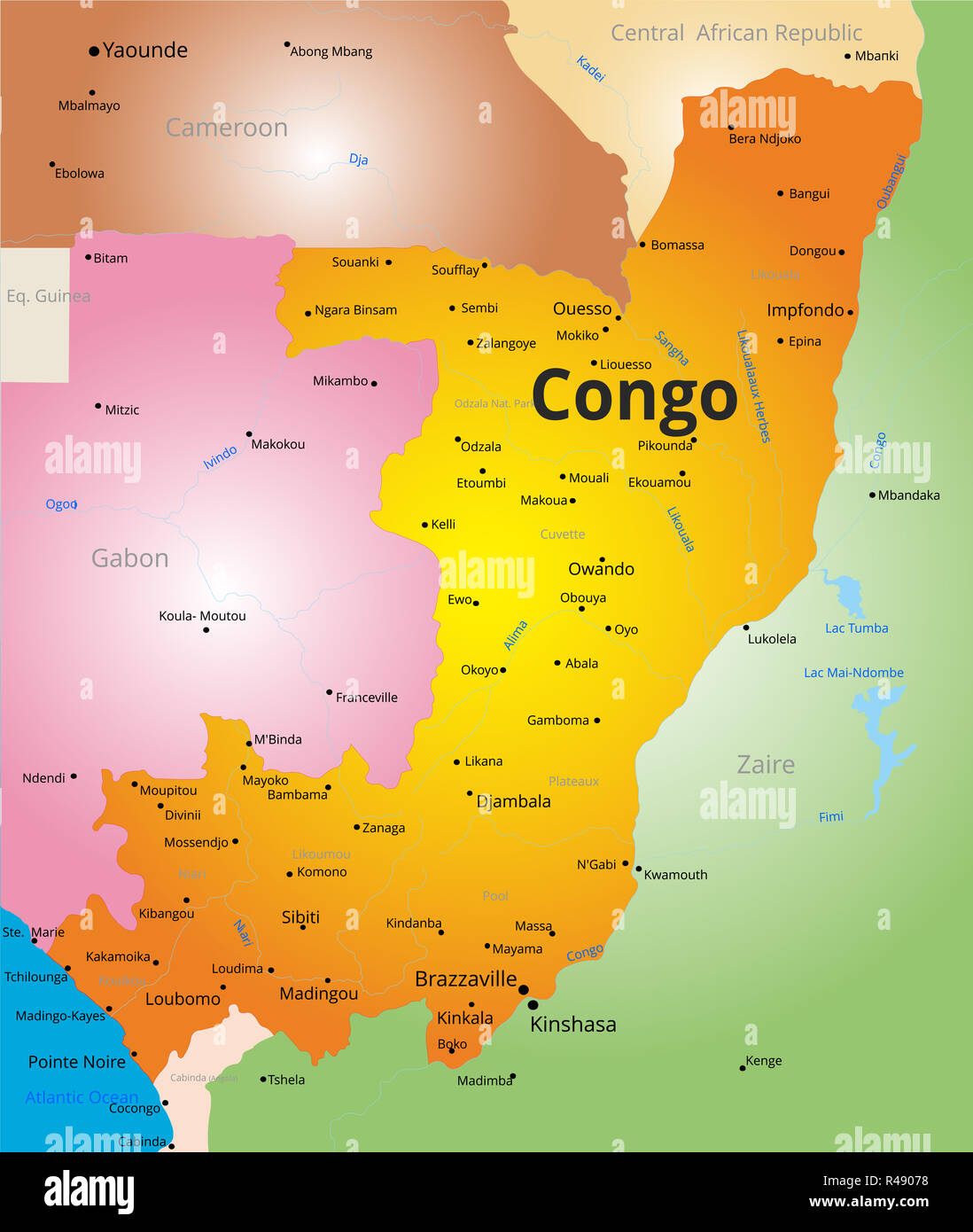 color map of Congo Stock Photohttps://www.alamy.com/image-license-details/?v=1https://www.alamy.com/color-map-of-congo-image226391180.html
RFR49078–color map of Congo
![A waterfall on the Kagera River, which forms the border between Rwanda and Tanzania. [automated translation] Stock Photo A waterfall on the Kagera River, which forms the border between Rwanda and Tanzania. [automated translation] Stock Photo](https://c8.alamy.com/comp/2X0GKE0/a-waterfall-on-the-kagera-river-which-forms-the-border-between-rwanda-and-tanzania-automated-translation-2X0GKE0.jpg) A waterfall on the Kagera River, which forms the border between Rwanda and Tanzania. [automated translation] Stock Photohttps://www.alamy.com/image-license-details/?v=1https://www.alamy.com/a-waterfall-on-the-kagera-river-which-forms-the-border-between-rwanda-and-tanzania-automated-translation-image602729400.html
A waterfall on the Kagera River, which forms the border between Rwanda and Tanzania. [automated translation] Stock Photohttps://www.alamy.com/image-license-details/?v=1https://www.alamy.com/a-waterfall-on-the-kagera-river-which-forms-the-border-between-rwanda-and-tanzania-automated-translation-image602729400.htmlRM2X0GKE0–A waterfall on the Kagera River, which forms the border between Rwanda and Tanzania. [automated translation]
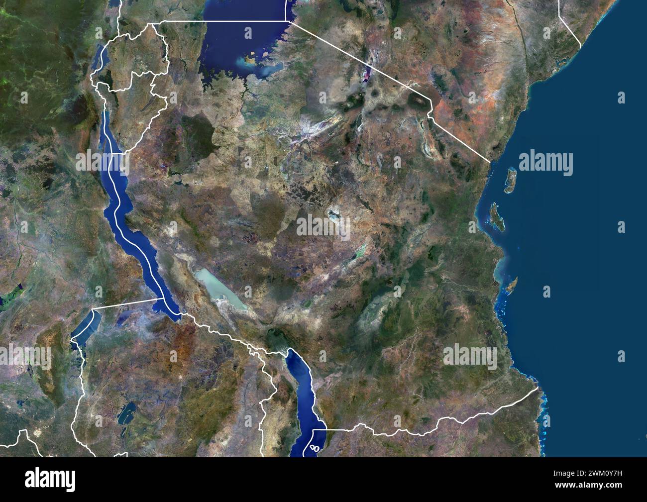 Color satellite image of Tanzania and neighbouring countries, with borders. Stock Photohttps://www.alamy.com/image-license-details/?v=1https://www.alamy.com/color-satellite-image-of-tanzania-and-neighbouring-countries-with-borders-image597467013.html
RM2WM0Y7H–Color satellite image of Tanzania and neighbouring countries, with borders.
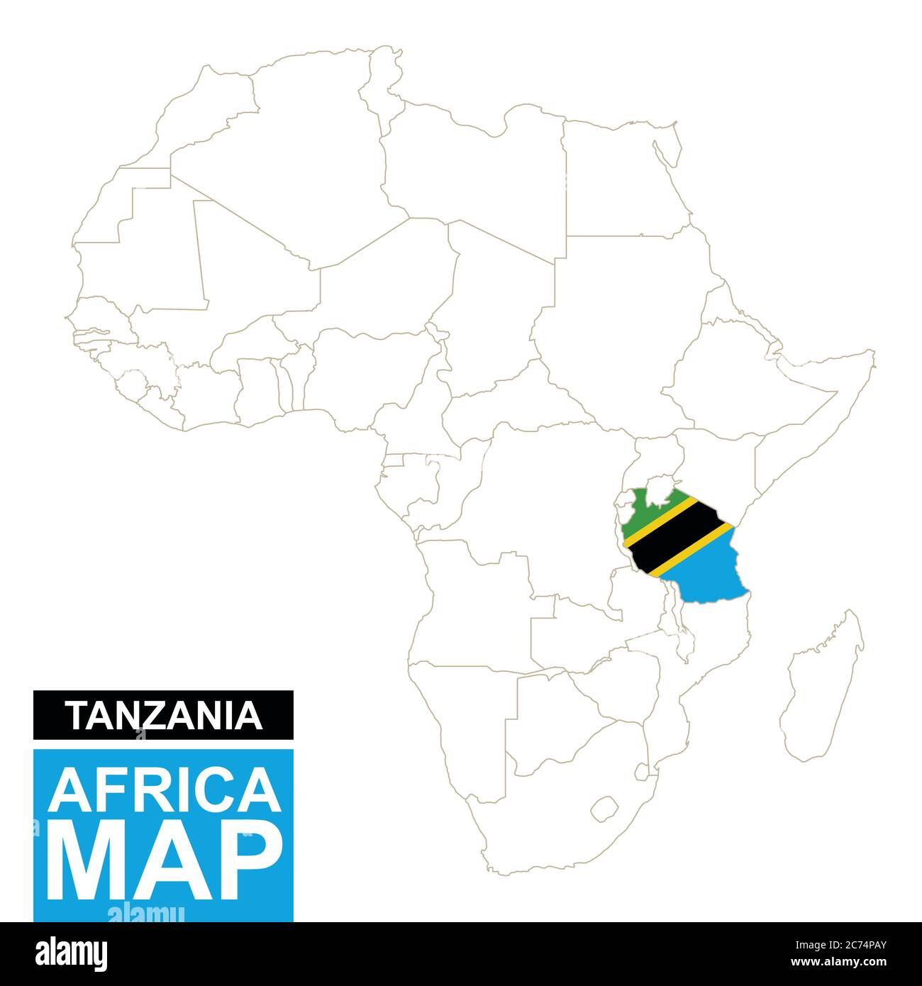 Africa contoured map with highlighted Tanzania. Tanzania map and flag on Africa map. Vector Illustration. Stock Vectorhttps://www.alamy.com/image-license-details/?v=1https://www.alamy.com/africa-contoured-map-with-highlighted-tanzania-tanzania-map-and-flag-on-africa-map-vector-illustration-image365825683.html
RF2C74PAY–Africa contoured map with highlighted Tanzania. Tanzania map and flag on Africa map. Vector Illustration.
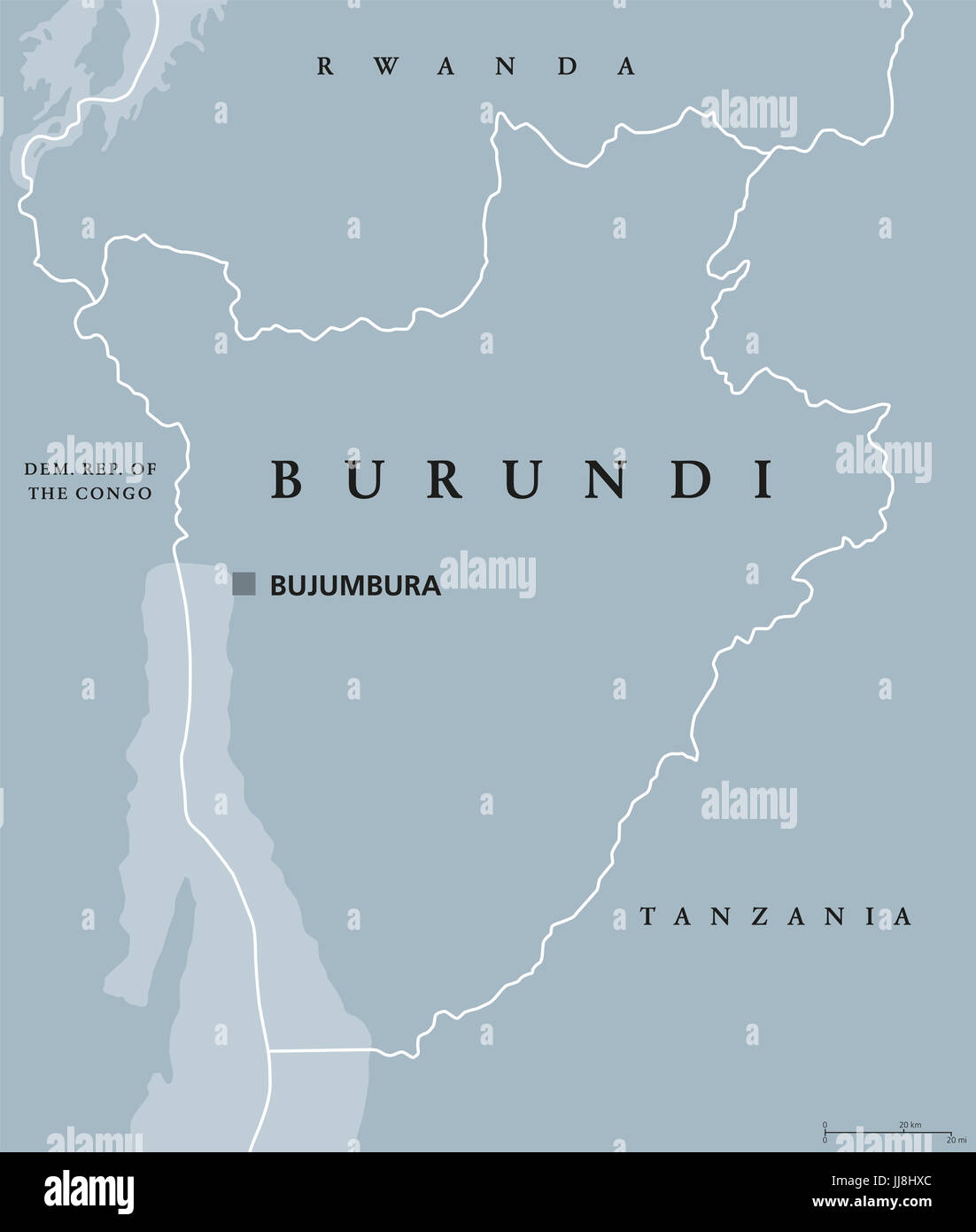 Burundi political map with capital Bujumbura and international borders. Republic and landlocked country in the African Great Lakes region of Africa. Stock Photohttps://www.alamy.com/image-license-details/?v=1https://www.alamy.com/stock-photo-burundi-political-map-with-capital-bujumbura-and-international-borders-148936436.html
RFJJ8HXC–Burundi political map with capital Bujumbura and international borders. Republic and landlocked country in the African Great Lakes region of Africa.
 Tanzania, Relief Map with Border Stock Photohttps://www.alamy.com/image-license-details/?v=1https://www.alamy.com/stock-photo-tanzania-relief-map-with-border-71607764.html
RME4E0C4–Tanzania, Relief Map with Border
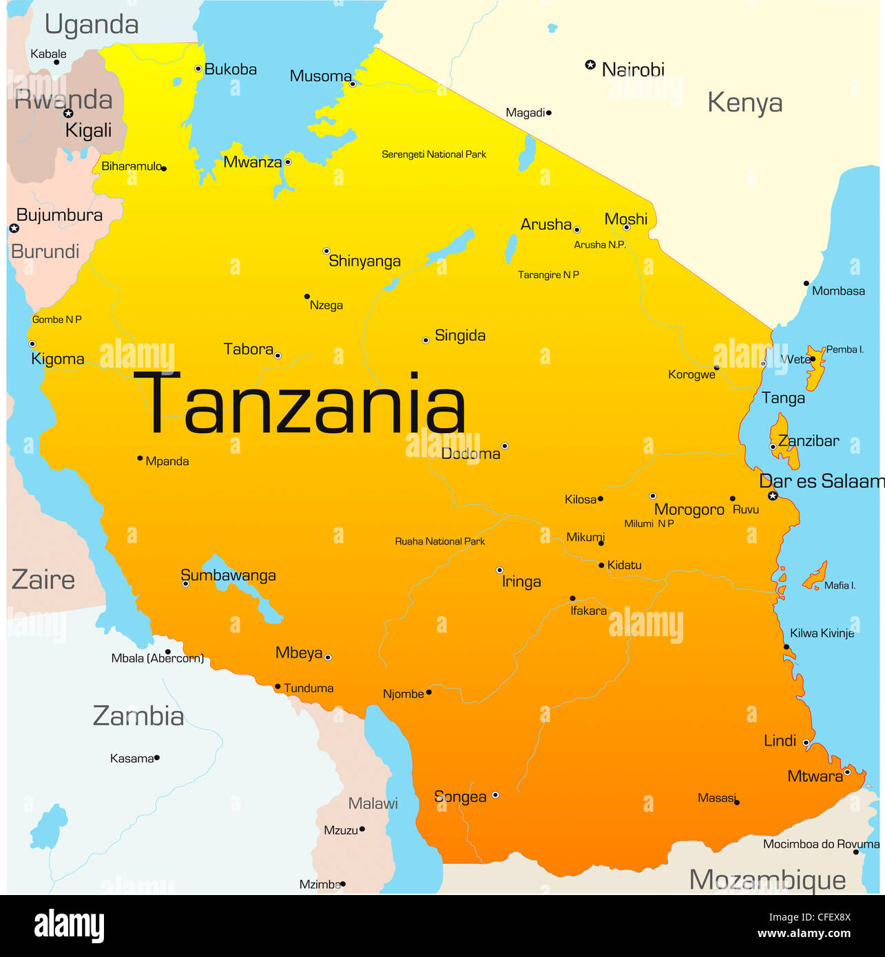 Abstract vector color map of Tanzania country Stock Photohttps://www.alamy.com/image-license-details/?v=1https://www.alamy.com/stock-photo-abstract-vector-color-map-of-tanzania-country-43968538.html
RFCFEX8X–Abstract vector color map of Tanzania country
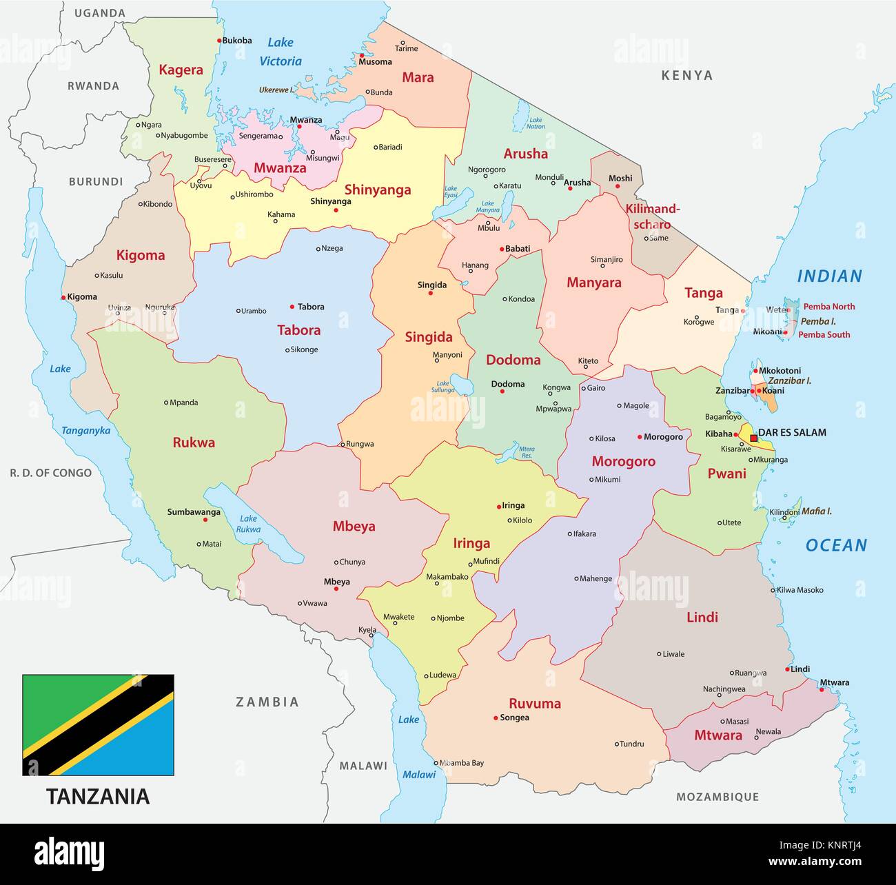 tanzania administrative and political vector map with flag Stock Vectorhttps://www.alamy.com/image-license-details/?v=1https://www.alamy.com/stock-image-tanzania-administrative-and-political-vector-map-with-flag-168325308.html
RFKNRTJ4–tanzania administrative and political vector map with flag
 Lake Victoria (Tanzania, Africa, African Great Lakes) map vector illustration, scribble sketch Nam Lolwe, Nnalubaale, Nyanza or Ukerewe map Stock Vectorhttps://www.alamy.com/image-license-details/?v=1https://www.alamy.com/lake-victoria-tanzania-africa-african-great-lakes-map-vector-illustration-scribble-sketch-nam-lolwe-nnalubaale-nyanza-or-ukerewe-map-image477178214.html
RF2JM99K2–Lake Victoria (Tanzania, Africa, African Great Lakes) map vector illustration, scribble sketch Nam Lolwe, Nnalubaale, Nyanza or Ukerewe map
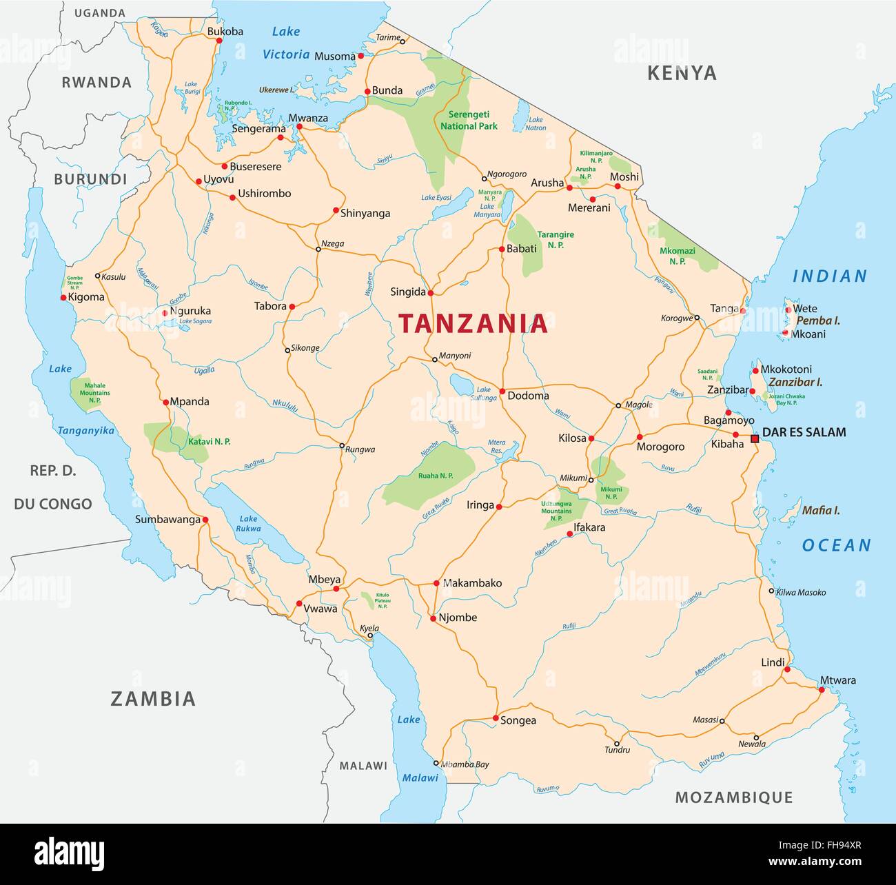 Tanzania road and National Park map Stock Vectorhttps://www.alamy.com/image-license-details/?v=1https://www.alamy.com/stock-photo-tanzania-road-and-national-park-map-96702447.html
RFFH94XR–Tanzania road and National Park map
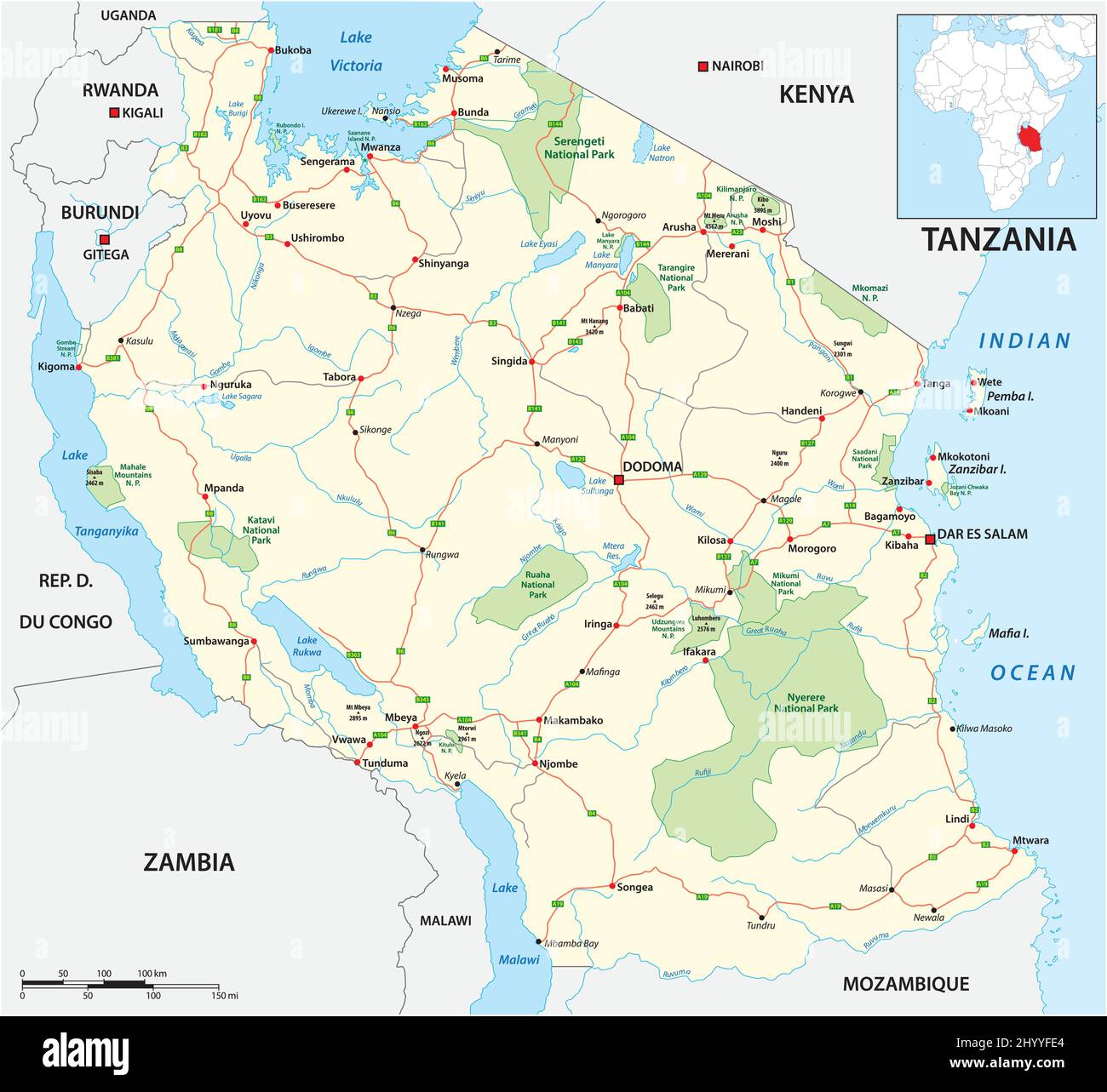 Roads and National Park Vector Map of Tanzania Stock Vectorhttps://www.alamy.com/image-license-details/?v=1https://www.alamy.com/roads-and-national-park-vector-map-of-tanzania-image464670140.html
RF2HYYFE4–Roads and National Park Vector Map of Tanzania
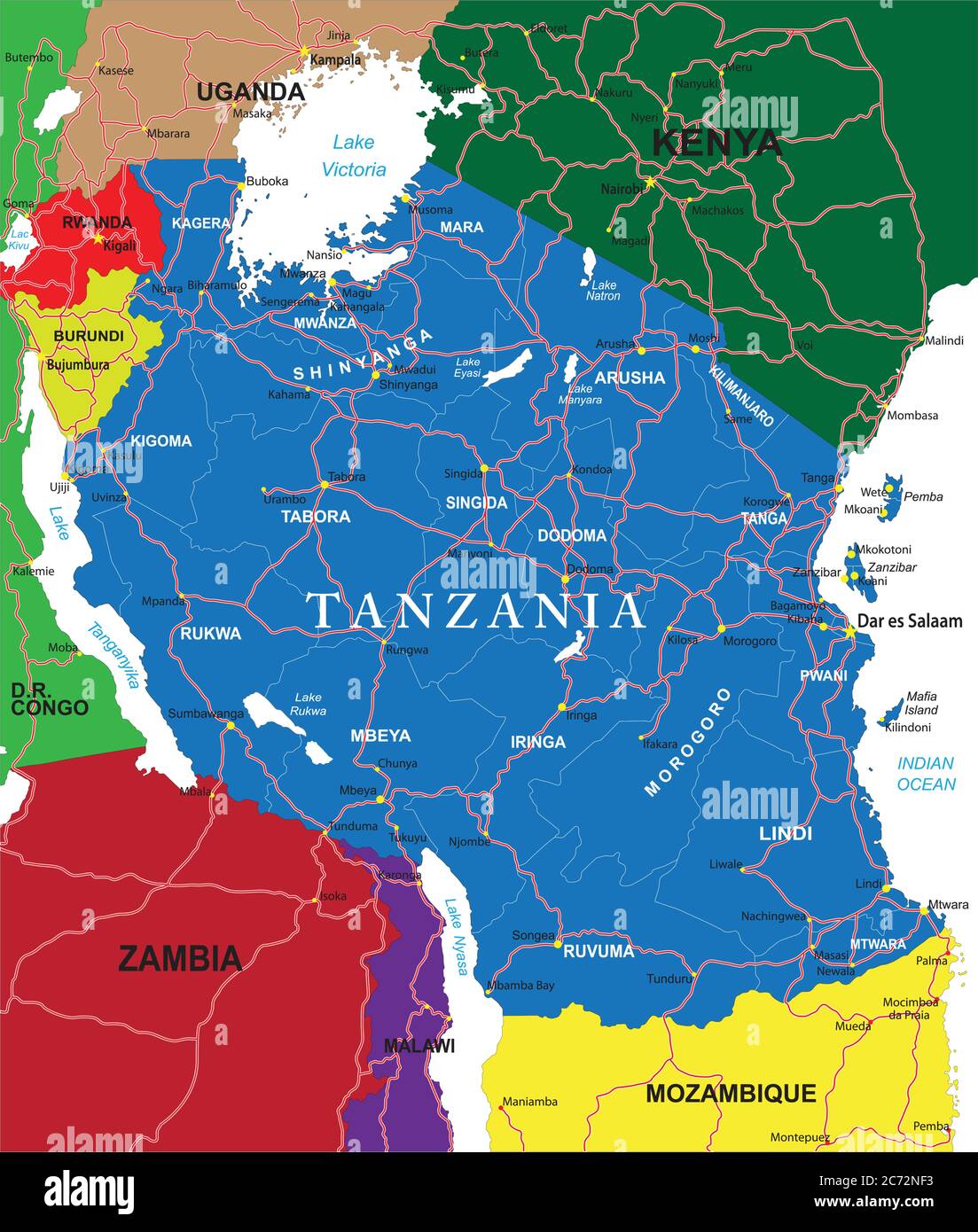 Detailed vector map of Tanzania with country borders, county names, main roads and a highly detailed state silhouette. Stock Vectorhttps://www.alamy.com/image-license-details/?v=1https://www.alamy.com/detailed-vector-map-of-tanzania-with-country-borders-county-names-main-roads-and-a-highly-detailed-state-silhouette-image365781111.html
RF2C72NF3–Detailed vector map of Tanzania with country borders, county names, main roads and a highly detailed state silhouette.
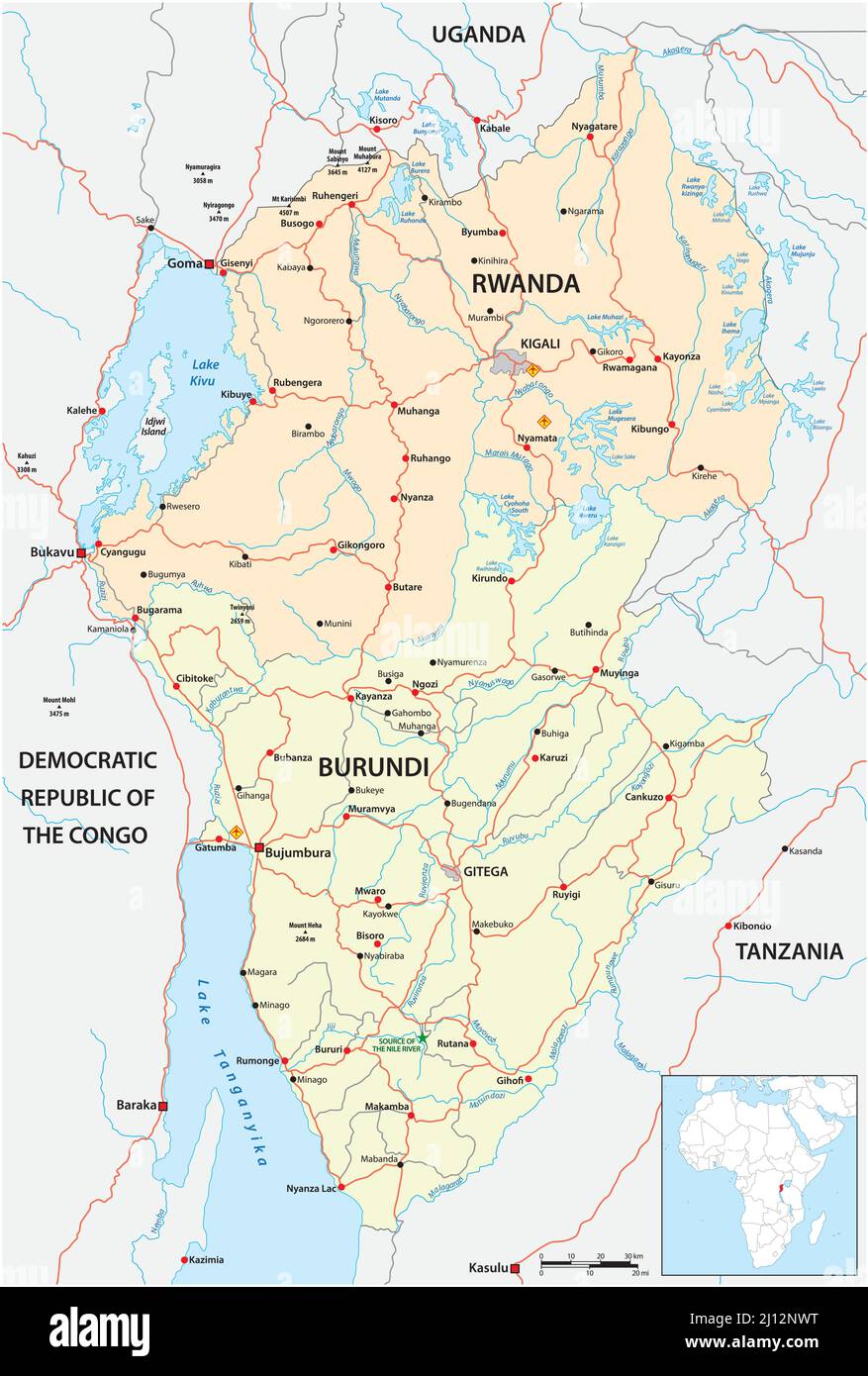 vector road map of east african states rwanda and burundi Stock Vectorhttps://www.alamy.com/image-license-details/?v=1https://www.alamy.com/vector-road-map-of-east-african-states-rwanda-and-burundi-image465355684.html
RF2J12NWT–vector road map of east african states rwanda and burundi
 frame made of African countries flags Stock Photohttps://www.alamy.com/image-license-details/?v=1https://www.alamy.com/stock-photo-frame-made-of-african-countries-flags-51673685.html
RFD01X8N–frame made of African countries flags
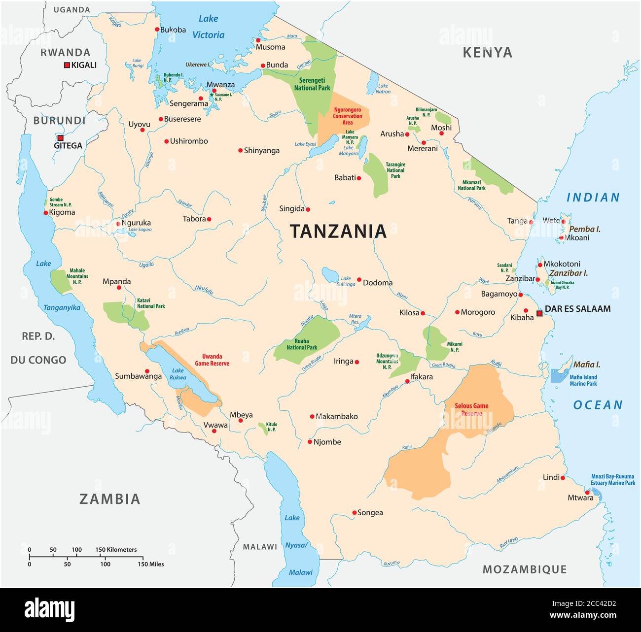 National park vector map of the East African state of Tanzania Stock Vectorhttps://www.alamy.com/image-license-details/?v=1https://www.alamy.com/national-park-vector-map-of-the-east-african-state-of-tanzania-image368883342.html
RF2CC42D2–National park vector map of the East African state of Tanzania
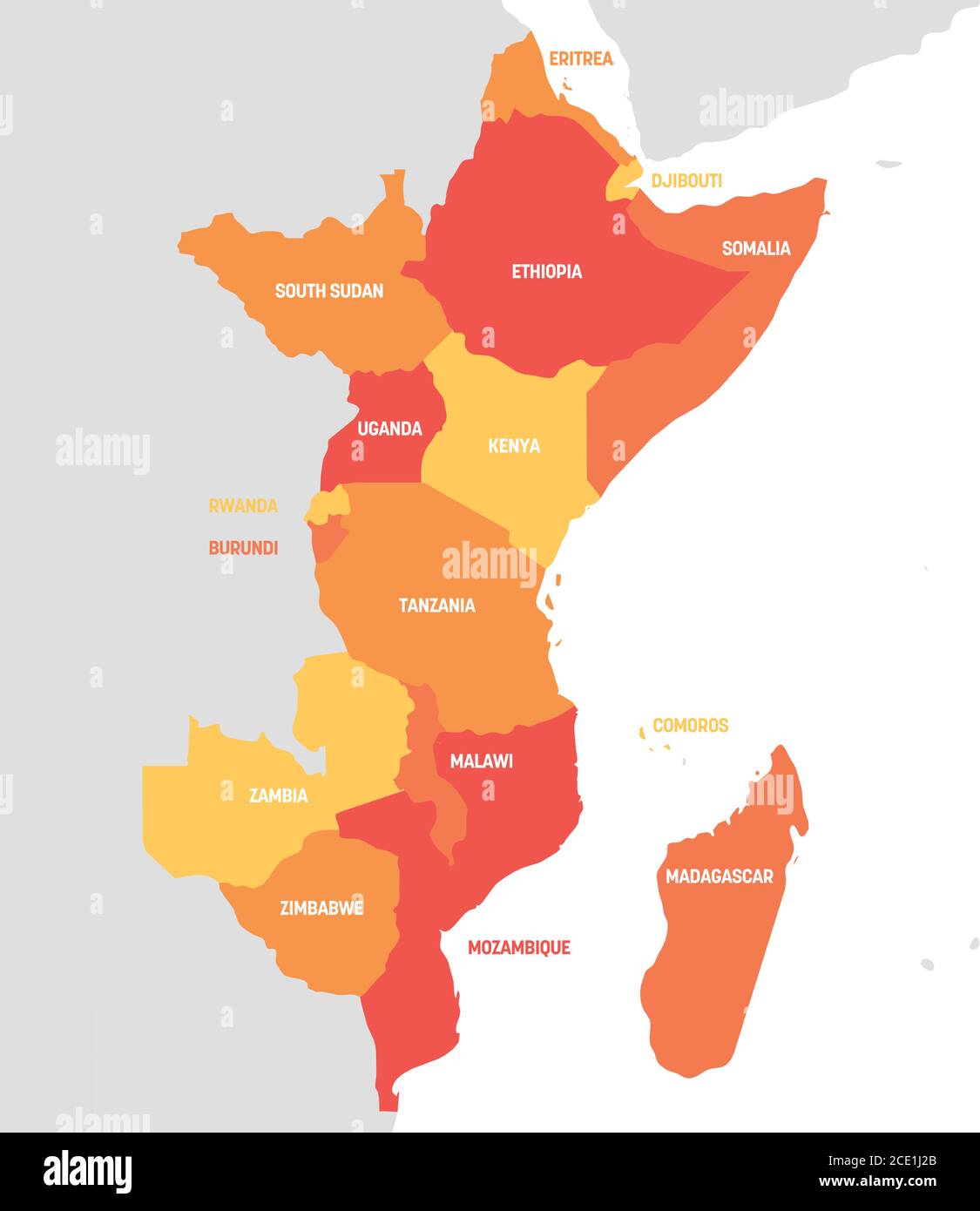 East Africa Region. Map of countries in eastern Africa. Vector illustration. Stock Vectorhttps://www.alamy.com/image-license-details/?v=1https://www.alamy.com/east-africa-region-map-of-countries-in-eastern-africa-vector-illustration-image370059043.html
RF2CE1J2B–East Africa Region. Map of countries in eastern Africa. Vector illustration.
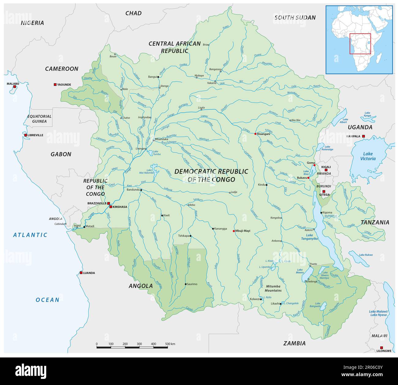 vector map of the congo river basin Stock Photohttps://www.alamy.com/image-license-details/?v=1https://www.alamy.com/vector-map-of-the-congo-river-basin-image550872923.html
RF2R06C0Y–vector map of the congo river basin
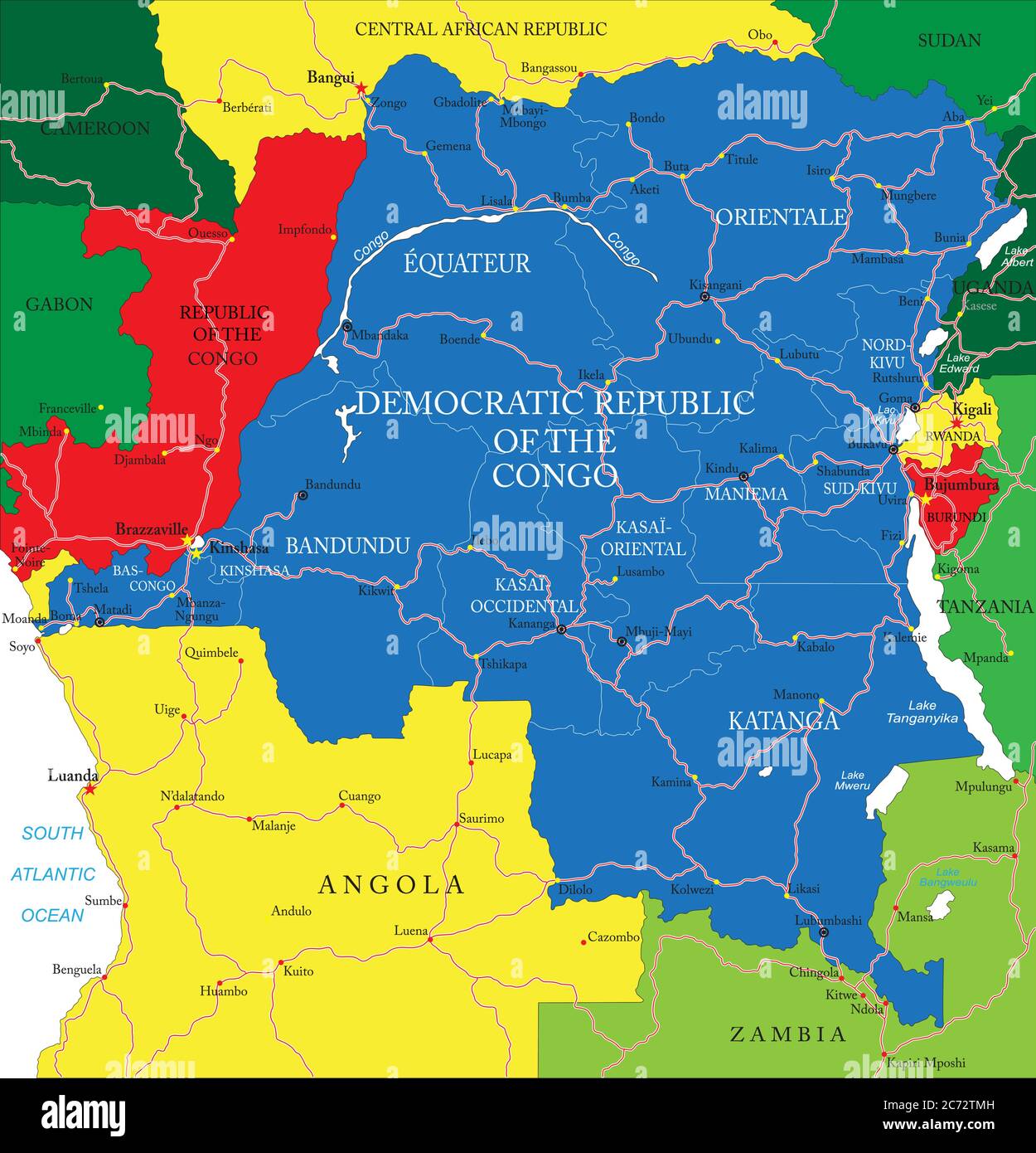 Highly detailed vector map of Democratic Republic of the Congo with administrative regions, main cities and roads. Stock Vectorhttps://www.alamy.com/image-license-details/?v=1https://www.alamy.com/highly-detailed-vector-map-of-democratic-republic-of-the-congo-with-administrative-regions-main-cities-and-roads-image365783617.html
RF2C72TMH–Highly detailed vector map of Democratic Republic of the Congo with administrative regions, main cities and roads.
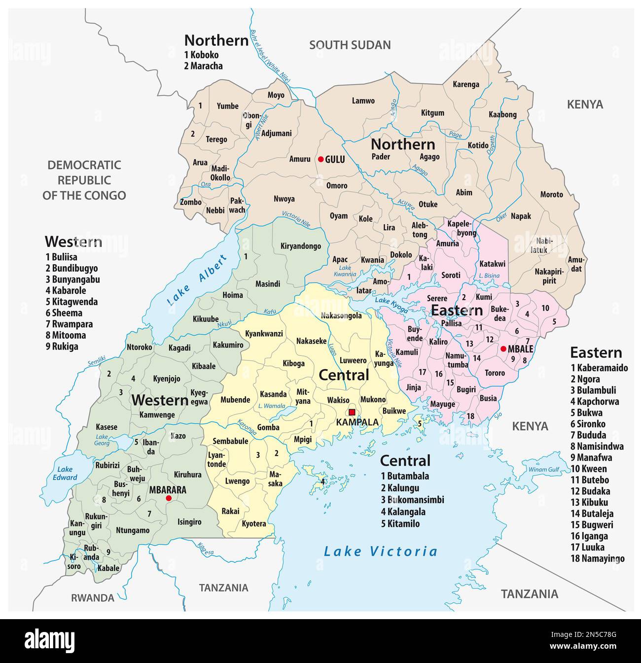 vector administrative and political map of the Republic of Uganda Stock Photohttps://www.alamy.com/image-license-details/?v=1https://www.alamy.com/vector-administrative-and-political-map-of-the-republic-of-uganda-image519653472.html
RF2N5C78G–vector administrative and political map of the Republic of Uganda
![View from the border Rwanda-Tanzania over a river in direction Rwanda. [automated translation] Stock Photo View from the border Rwanda-Tanzania over a river in direction Rwanda. [automated translation] Stock Photo](https://c8.alamy.com/comp/2X0GT56/view-from-the-border-rwanda-tanzania-over-a-river-in-direction-rwanda-automated-translation-2X0GT56.jpg) View from the border Rwanda-Tanzania over a river in direction Rwanda. [automated translation] Stock Photohttps://www.alamy.com/image-license-details/?v=1https://www.alamy.com/view-from-the-border-rwanda-tanzania-over-a-river-in-direction-rwanda-automated-translation-image602733074.html
View from the border Rwanda-Tanzania over a river in direction Rwanda. [automated translation] Stock Photohttps://www.alamy.com/image-license-details/?v=1https://www.alamy.com/view-from-the-border-rwanda-tanzania-over-a-river-in-direction-rwanda-automated-translation-image602733074.htmlRM2X0GT56–View from the border Rwanda-Tanzania over a river in direction Rwanda. [automated translation]
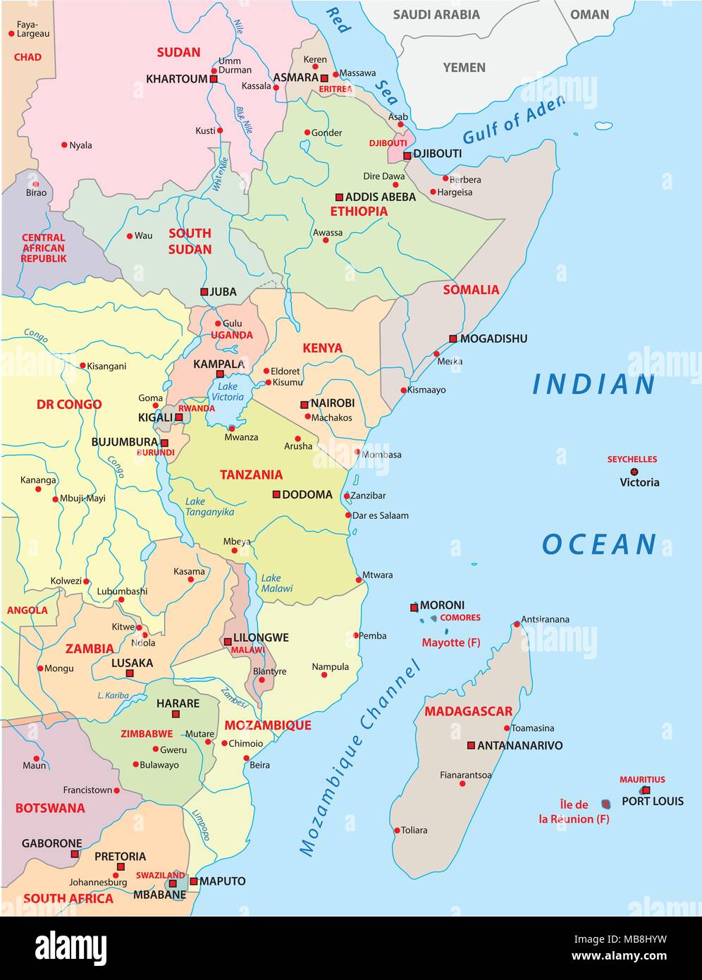 east africa vector map Stock Vectorhttps://www.alamy.com/image-license-details/?v=1https://www.alamy.com/east-africa-vector-map-image179054621.html
RFMB8HYW–east africa vector map
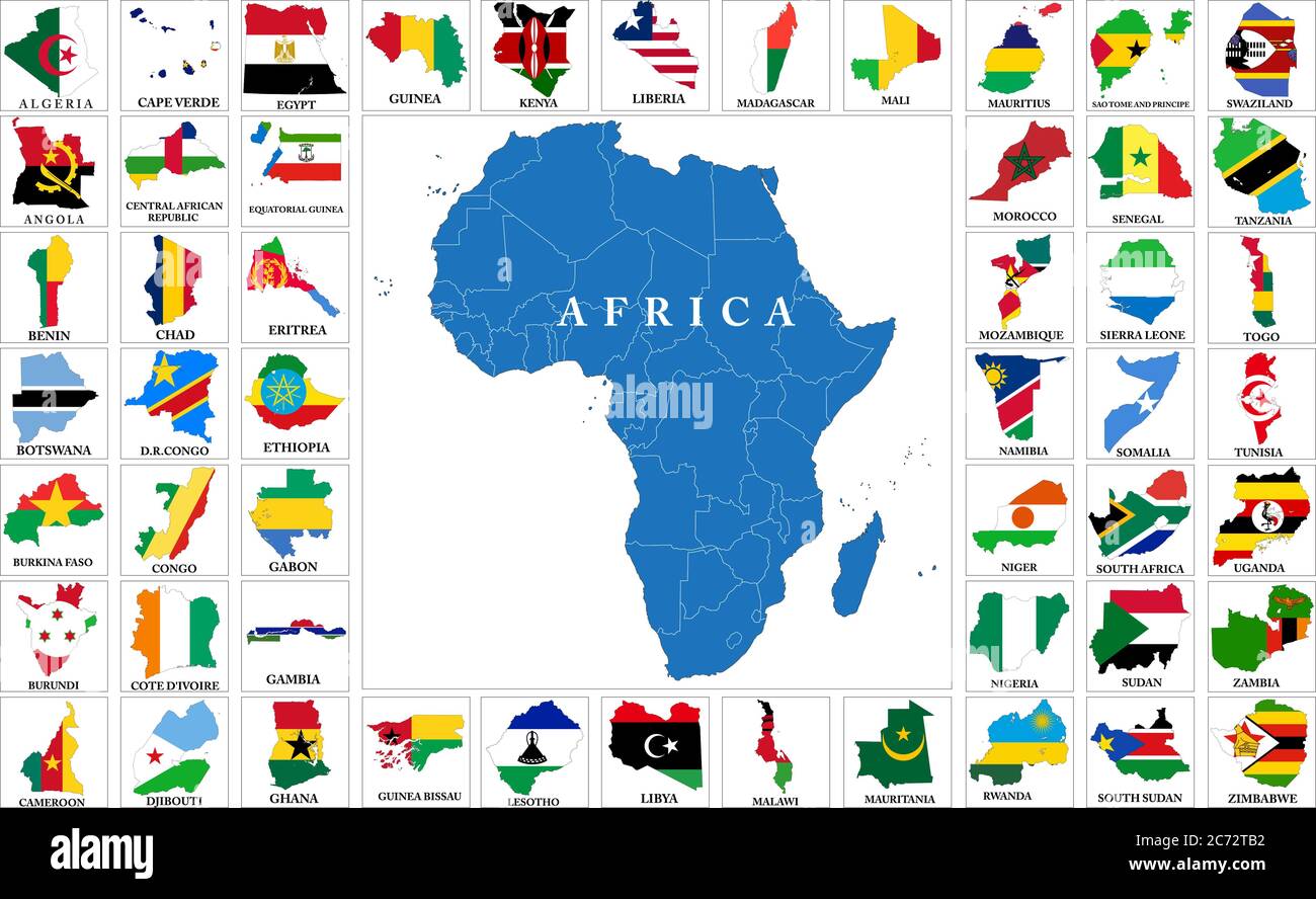 Highly detailed set of vector flag maps of all the Africa countries. Stock Vectorhttps://www.alamy.com/image-license-details/?v=1https://www.alamy.com/highly-detailed-set-of-vector-flag-maps-of-all-the-africa-countries-image365783350.html
RF2C72TB2–Highly detailed set of vector flag maps of all the Africa countries.
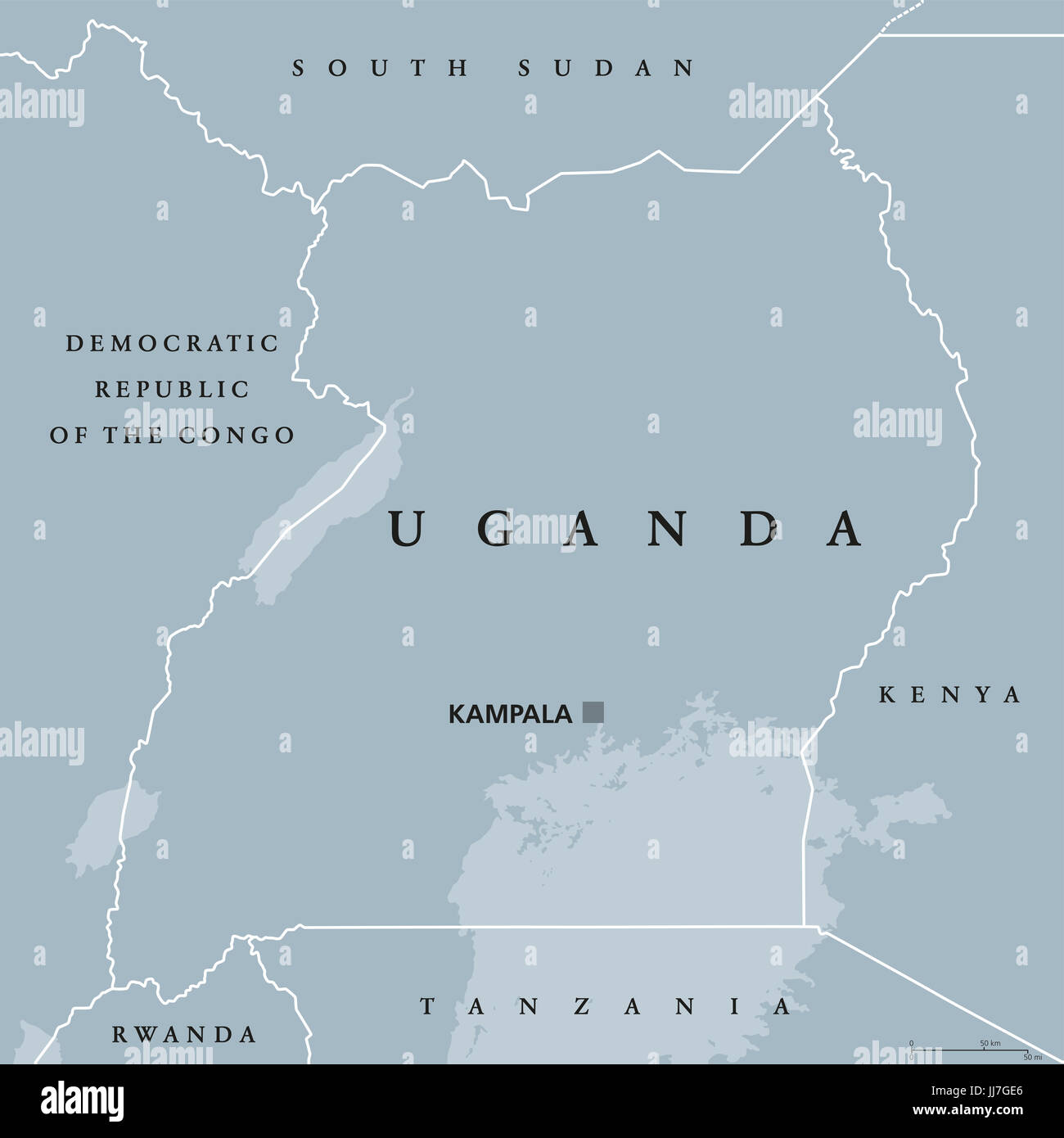 Uganda political map with capital Kampala. Republic in East Africa. Landlocked country in the African Great Lakes region. Stock Photohttps://www.alamy.com/image-license-details/?v=1https://www.alamy.com/stock-photo-uganda-political-map-with-capital-kampala-republic-in-east-africa-148913358.html
RFJJ7GE6–Uganda political map with capital Kampala. Republic in East Africa. Landlocked country in the African Great Lakes region.
 Tanzania, True Colour Satellite Image With Border Stock Photohttps://www.alamy.com/image-license-details/?v=1https://www.alamy.com/stock-photo-tanzania-true-colour-satellite-image-with-border-71607766.html
RME4E0C6–Tanzania, True Colour Satellite Image With Border
 Old vintage paper textured map of Malawi Country - Vector illustration Stock Vectorhttps://www.alamy.com/image-license-details/?v=1https://www.alamy.com/old-vintage-paper-textured-map-of-malawi-country-vector-illustration-image475143679.html
RF2JH0JH3–Old vintage paper textured map of Malawi Country - Vector illustration
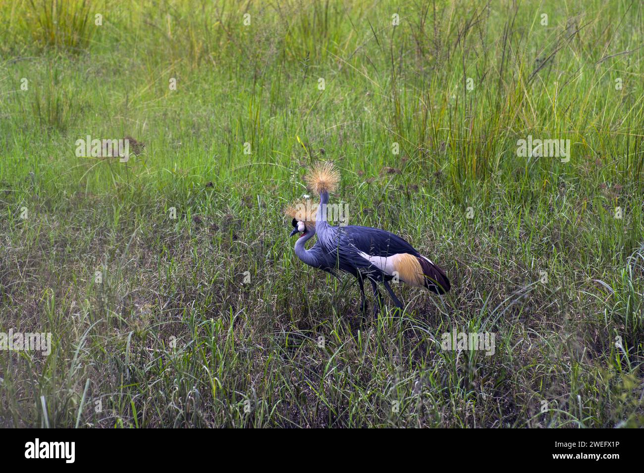 photographed on safari in Akagera National Park in Northeastern Rwanda, Central Africa’s largest protected wetland. Africa Parks Stock Photohttps://www.alamy.com/image-license-details/?v=1https://www.alamy.com/photographed-on-safari-in-akagera-national-park-in-northeastern-rwanda-central-africas-largest-protected-wetland-africa-parks-image594107410.html
RM2WEFX1P–photographed on safari in Akagera National Park in Northeastern Rwanda, Central Africa’s largest protected wetland. Africa Parks
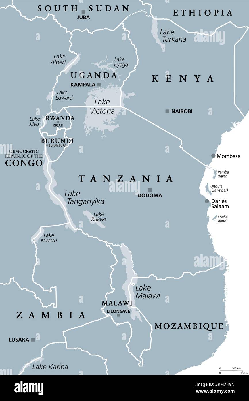 African Great Lakes region, gray political map. Large rift lakes of Africa, and their riparian countries with capitals and borders. Lake Victoria etc. Stock Photohttps://www.alamy.com/image-license-details/?v=1https://www.alamy.com/african-great-lakes-region-gray-political-map-large-rift-lakes-of-africa-and-their-riparian-countries-with-capitals-and-borders-lake-victoria-etc-image563609221.html
RF2RMXH8N–African Great Lakes region, gray political map. Large rift lakes of Africa, and their riparian countries with capitals and borders. Lake Victoria etc.
 vector road map of Burundi with the new capital Gitega Stock Vectorhttps://www.alamy.com/image-license-details/?v=1https://www.alamy.com/vector-road-map-of-burundi-with-the-new-capital-gitega-image368883341.html
RF2CC42D1–vector road map of Burundi with the new capital Gitega
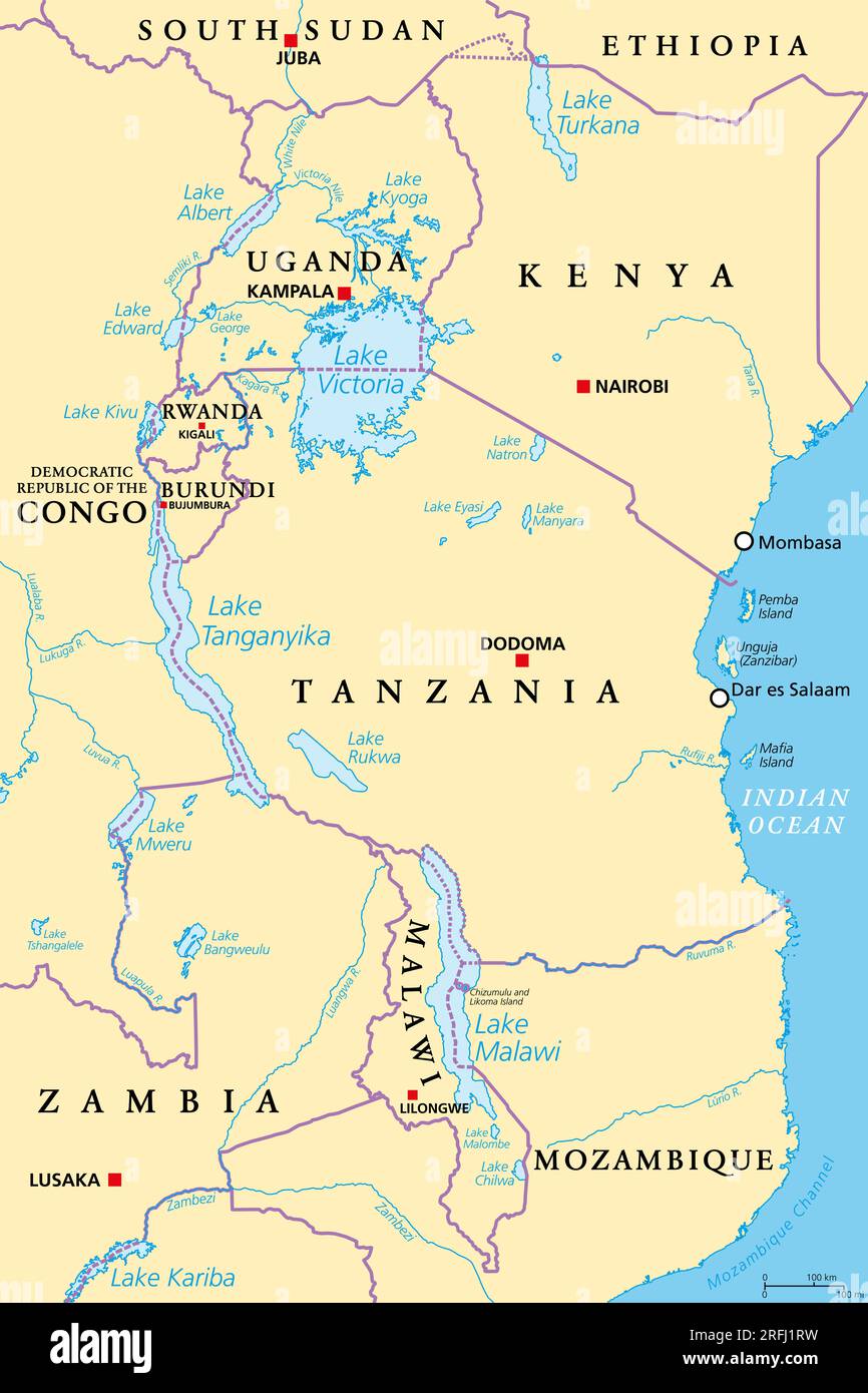 African Great Lakes region, political map. Large rift lakes of Africa, including Lake Victoria, Tanganyika and Lake Malawi. Stock Photohttps://www.alamy.com/image-license-details/?v=1https://www.alamy.com/african-great-lakes-region-political-map-large-rift-lakes-of-africa-including-lake-victoria-tanganyika-and-lake-malawi-image560348205.html
RF2RFJ1RW–African Great Lakes region, political map. Large rift lakes of Africa, including Lake Victoria, Tanganyika and Lake Malawi.
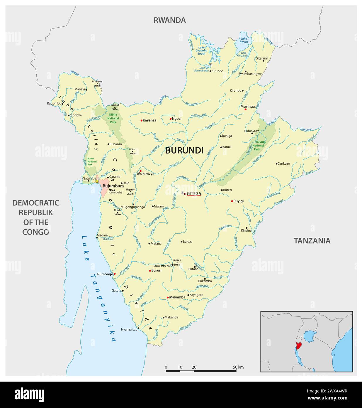 Vector map of the East African state of Burundi Stock Photohttps://www.alamy.com/image-license-details/?v=1https://www.alamy.com/vector-map-of-the-east-african-state-of-burundi-image601356947.html
RF2WXA4WR–Vector map of the East African state of Burundi
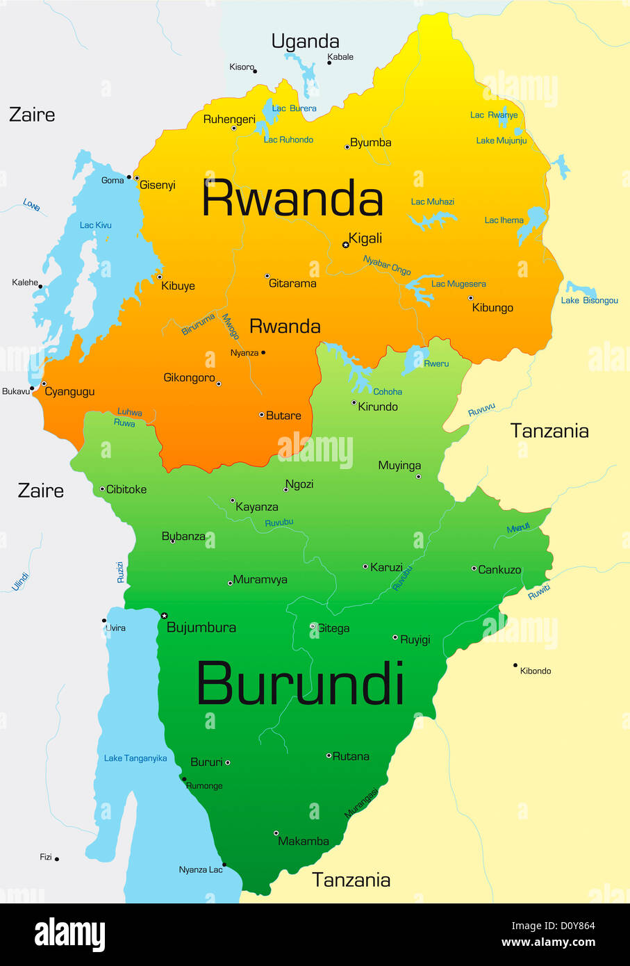 Rwanda and Burundi Stock Photohttps://www.alamy.com/image-license-details/?v=1https://www.alamy.com/stock-photo-rwanda-and-burundi-52230252.html
RFD0Y864–Rwanda and Burundi
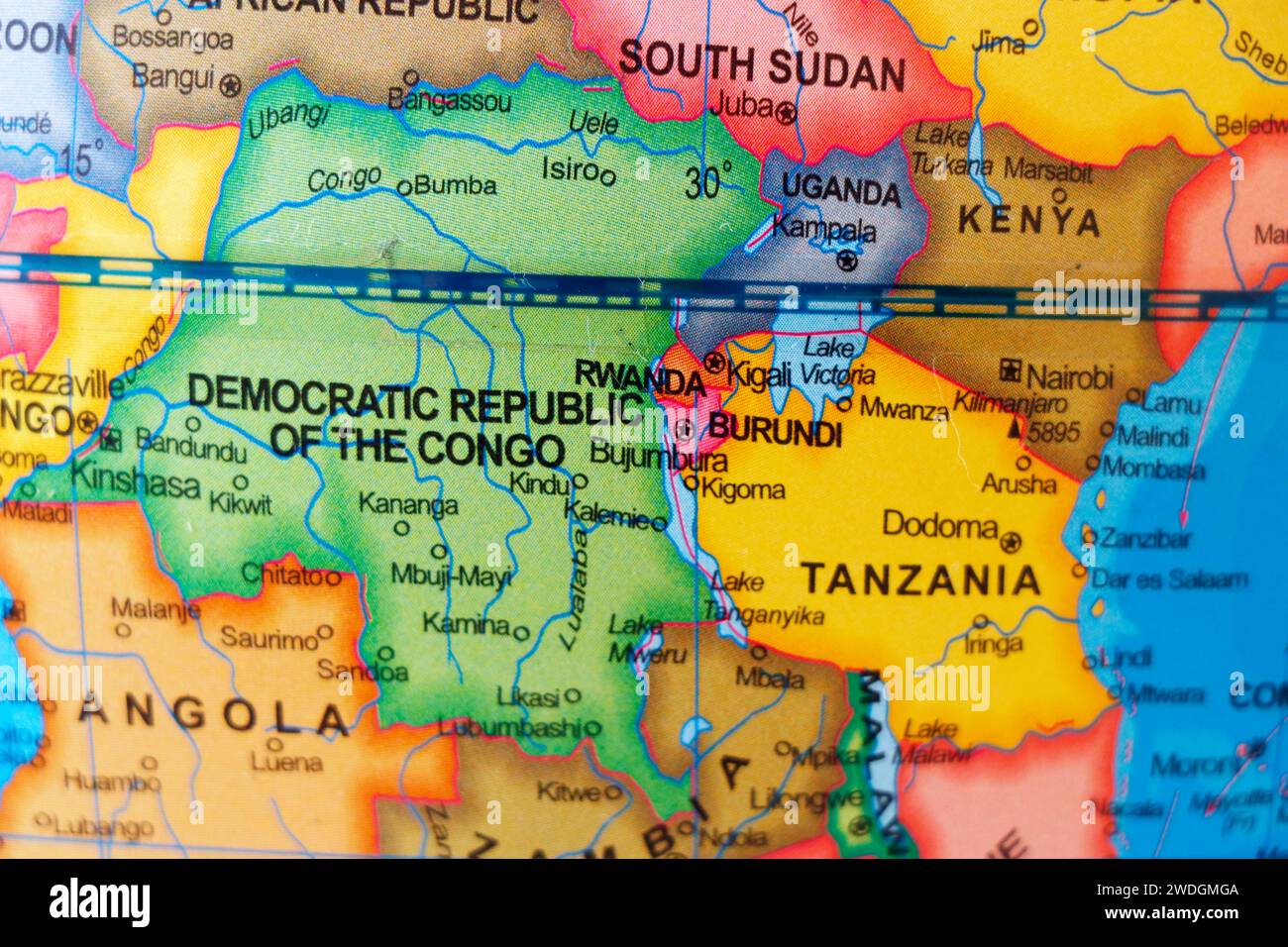 map of african country democratic republic of congo and neighbour nations rwanda, burundi, sudan,uganda, tanzania and angola Stock Photohttps://www.alamy.com/image-license-details/?v=1https://www.alamy.com/map-of-african-country-democratic-republic-of-congo-and-neighbour-nations-rwanda-burundi-sudanuganda-tanzania-and-angola-image593510410.html
RF2WDGMGA–map of african country democratic republic of congo and neighbour nations rwanda, burundi, sudan,uganda, tanzania and angola
 travel, art, political, emblem, traffic, transportation, africa, black, Stock Photohttps://www.alamy.com/image-license-details/?v=1https://www.alamy.com/stock-photo-travel-art-political-emblem-traffic-transportation-africa-black-143031767.html
RFJ8KJDB–travel, art, political, emblem, traffic, transportation, africa, black,
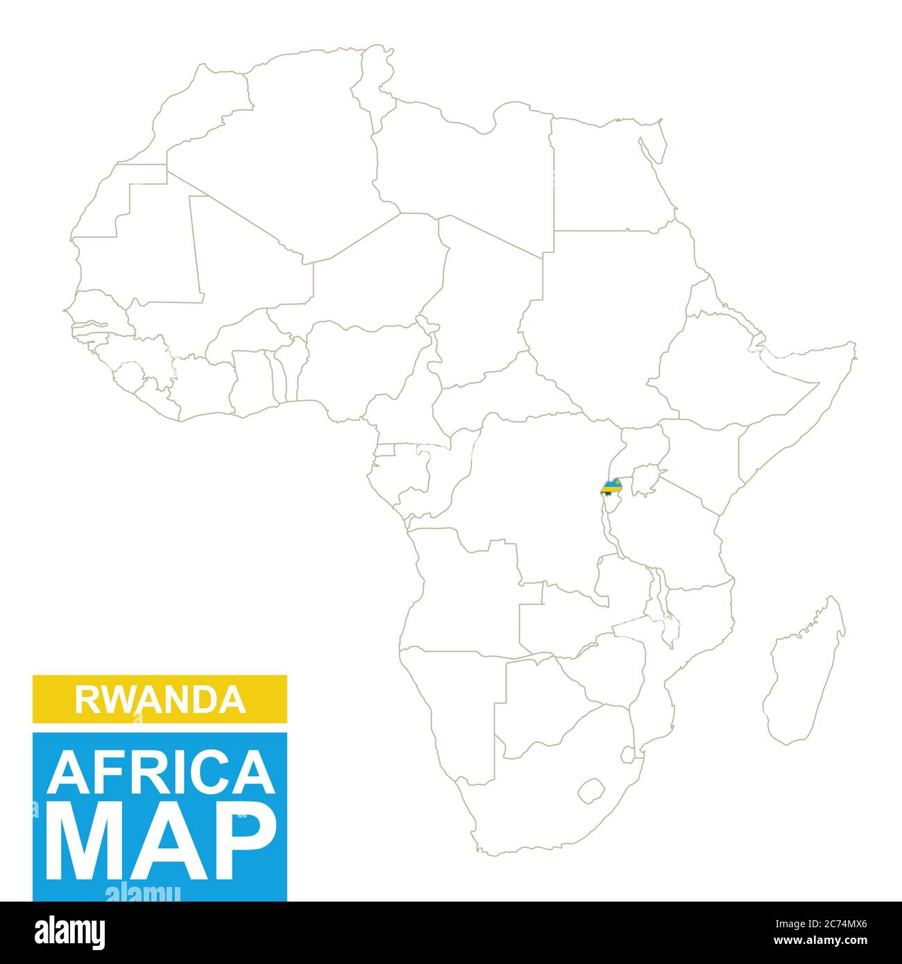 Africa contoured map with highlighted Rwanda. Rwanda map and flag on Africa map. Vector Illustration. Stock Vectorhttps://www.alamy.com/image-license-details/?v=1https://www.alamy.com/africa-contoured-map-with-highlighted-rwanda-rwanda-map-and-flag-on-africa-map-vector-illustration-image365824542.html
RF2C74MX6–Africa contoured map with highlighted Rwanda. Rwanda map and flag on Africa map. Vector Illustration.
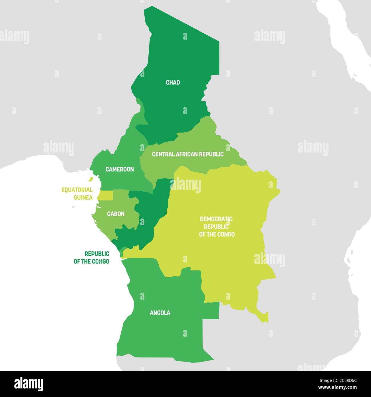 Central Africa Region. Map of countries in central Africa. Vector illustration. Stock Vectorhttps://www.alamy.com/image-license-details/?v=1https://www.alamy.com/central-africa-region-map-of-countries-in-central-africa-vector-illustration-image364676996.html
RF2C58D6C–Central Africa Region. Map of countries in central Africa. Vector illustration.
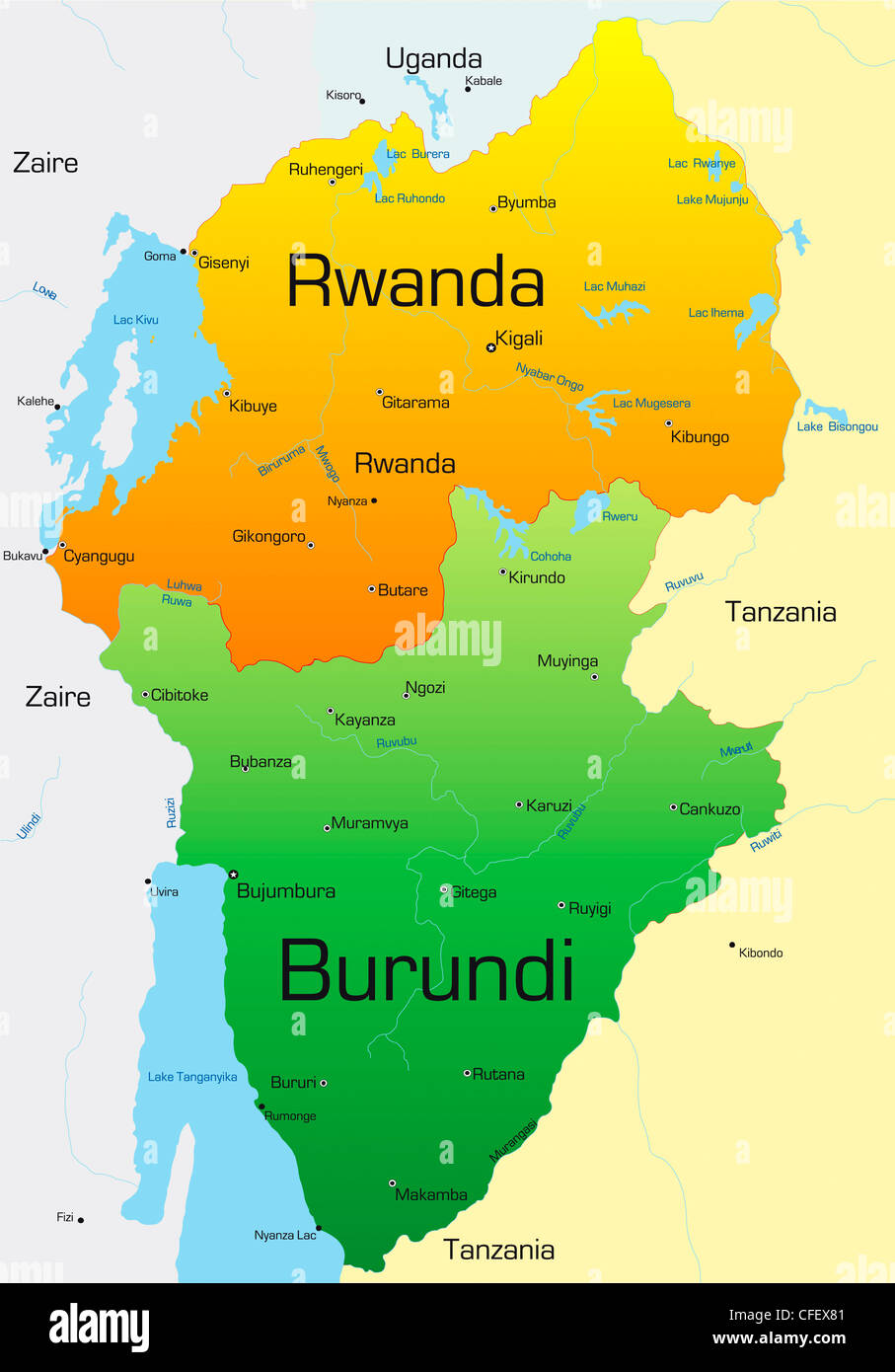 Abstract vector color map of Rwanda and Burundi country Stock Photohttps://www.alamy.com/image-license-details/?v=1https://www.alamy.com/stock-photo-abstract-vector-color-map-of-rwanda-and-burundi-country-43968513.html
RFCFEX81–Abstract vector color map of Rwanda and Burundi country
 Lake Victoria (Tanzania, Africa, African Great Lakes) map vector illustration, scribble sketch Nam Lolwe, Nnalubaale, Nyanza or Ukerewe map Stock Vectorhttps://www.alamy.com/image-license-details/?v=1https://www.alamy.com/lake-victoria-tanzania-africa-african-great-lakes-map-vector-illustration-scribble-sketch-nam-lolwe-nnalubaale-nyanza-or-ukerewe-map-image574640543.html
RF2TAW3TF–Lake Victoria (Tanzania, Africa, African Great Lakes) map vector illustration, scribble sketch Nam Lolwe, Nnalubaale, Nyanza or Ukerewe map
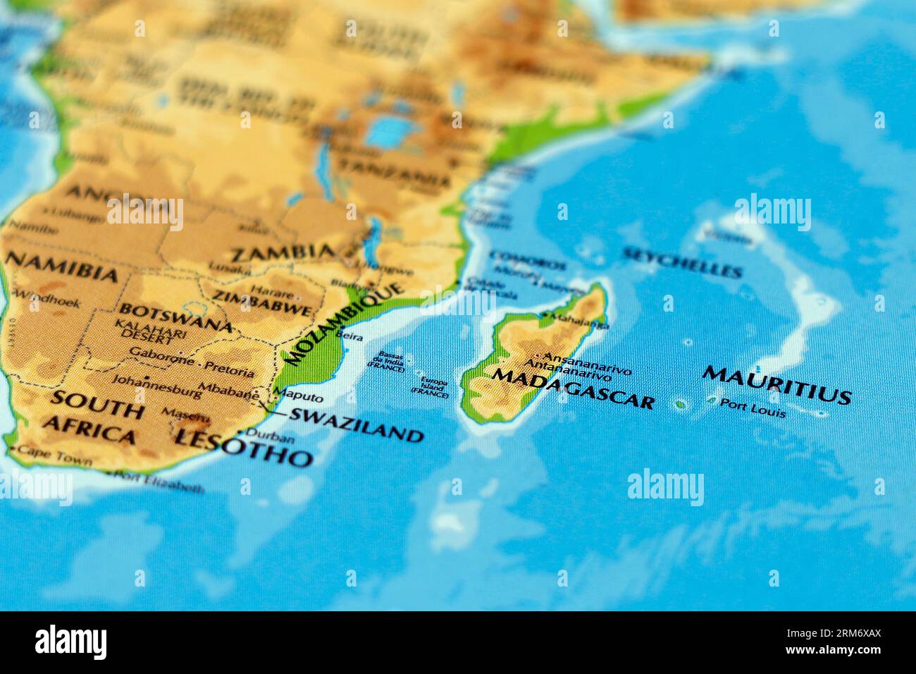 african continent map or atlas with south africa, madagascar, mauritius, mozambique, swaziland,botswana, zimbabwe in focus Stock Photohttps://www.alamy.com/image-license-details/?v=1https://www.alamy.com/african-continent-map-or-atlas-with-south-africa-madagascar-mauritius-mozambique-swazilandbotswana-zimbabwe-in-focus-image563177298.html
RF2RM6XAX–african continent map or atlas with south africa, madagascar, mauritius, mozambique, swaziland,botswana, zimbabwe in focus
![The sun breaks through the rain forest in a forest in Rwanda near the border with Tanzania. [automated translation] Stock Photo The sun breaks through the rain forest in a forest in Rwanda near the border with Tanzania. [automated translation] Stock Photo](https://c8.alamy.com/comp/2X0GN0R/the-sun-breaks-through-the-rain-forest-in-a-forest-in-rwanda-near-the-border-with-tanzania-automated-translation-2X0GN0R.jpg) The sun breaks through the rain forest in a forest in Rwanda near the border with Tanzania. [automated translation] Stock Photohttps://www.alamy.com/image-license-details/?v=1https://www.alamy.com/the-sun-breaks-through-the-rain-forest-in-a-forest-in-rwanda-near-the-border-with-tanzania-automated-translation-image602730599.html
The sun breaks through the rain forest in a forest in Rwanda near the border with Tanzania. [automated translation] Stock Photohttps://www.alamy.com/image-license-details/?v=1https://www.alamy.com/the-sun-breaks-through-the-rain-forest-in-a-forest-in-rwanda-near-the-border-with-tanzania-automated-translation-image602730599.htmlRM2X0GN0R–The sun breaks through the rain forest in a forest in Rwanda near the border with Tanzania. [automated translation]
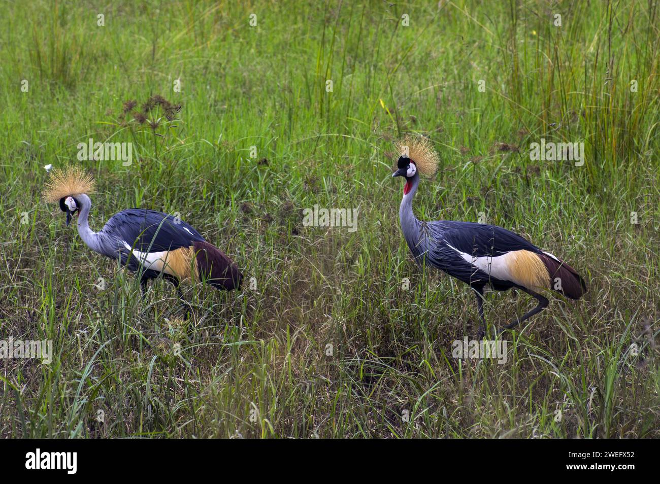 photographed on safari in Akagera National Park in Northeastern Rwanda, Central Africa’s largest protected wetland. Africa Parks Stock Photohttps://www.alamy.com/image-license-details/?v=1https://www.alamy.com/photographed-on-safari-in-akagera-national-park-in-northeastern-rwanda-central-africas-largest-protected-wetland-africa-parks-image594107502.html
RM2WEFX52–photographed on safari in Akagera National Park in Northeastern Rwanda, Central Africa’s largest protected wetland. Africa Parks
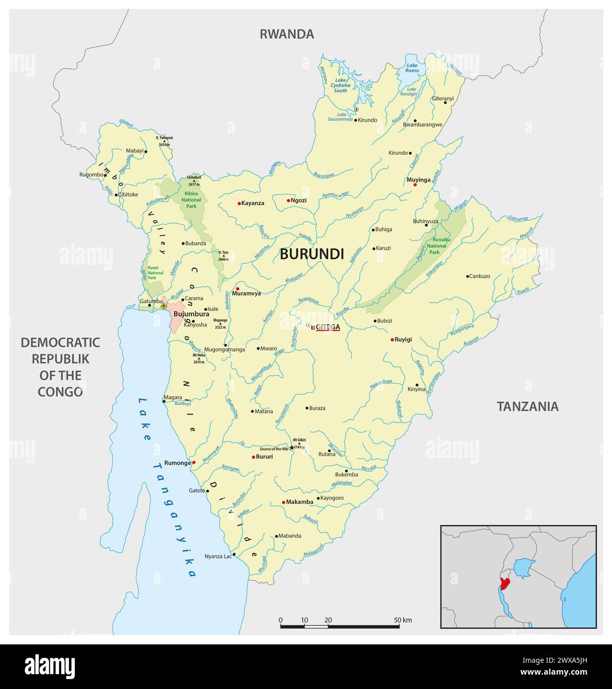 Vector map of the East African state of Burundi Stock Photohttps://www.alamy.com/image-license-details/?v=1https://www.alamy.com/vector-map-of-the-east-african-state-of-burundi-image601357529.html
RF2WXA5JH–Vector map of the East African state of Burundi
 Tanzania Stock Photohttps://www.alamy.com/image-license-details/?v=1https://www.alamy.com/stock-photo-tanzania-52231187.html
RFD0Y9BF–Tanzania
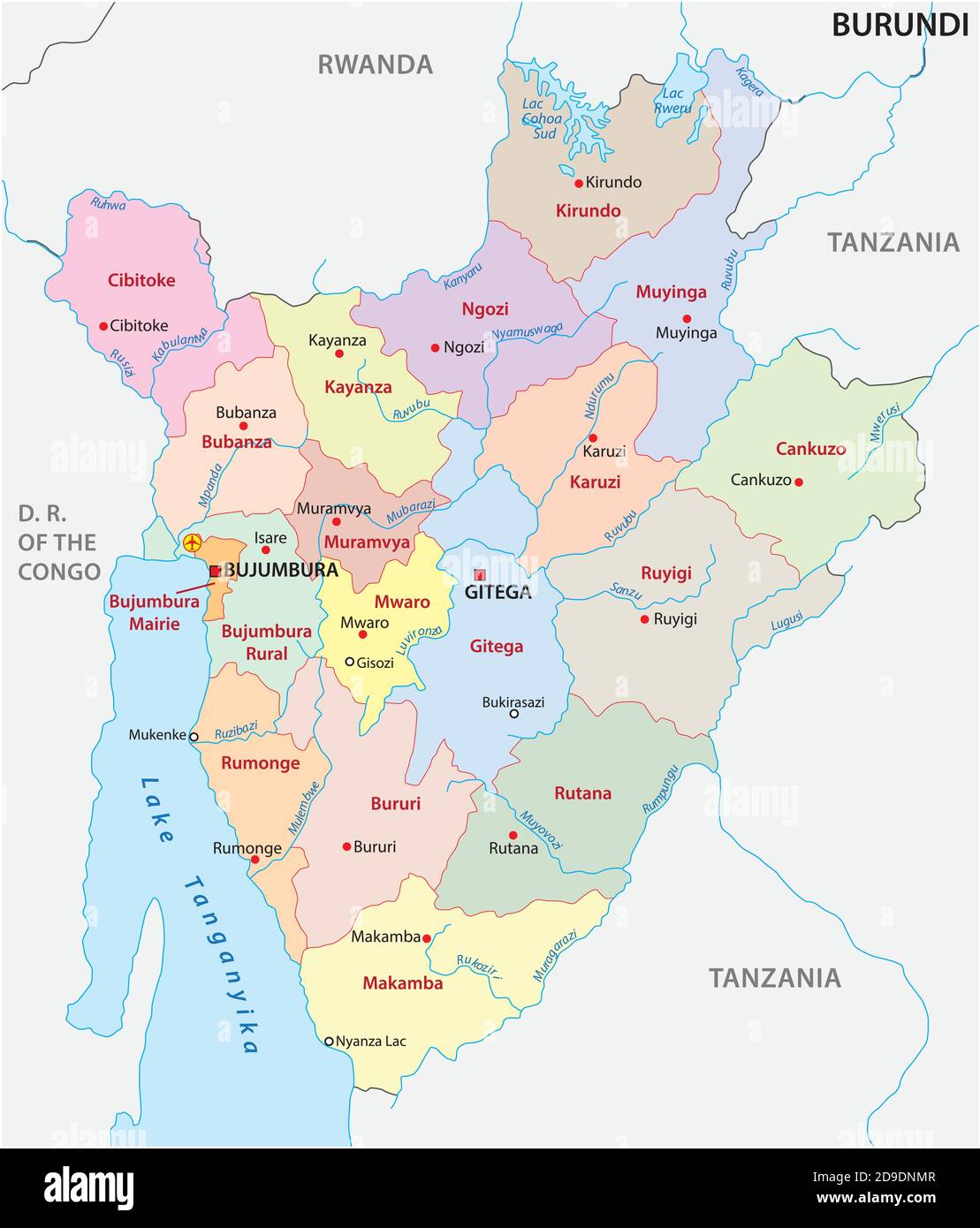 vector map of the new administrative division of the state of Burundi Stock Vectorhttps://www.alamy.com/image-license-details/?v=1https://www.alamy.com/vector-map-of-the-new-administrative-division-of-the-state-of-burundi-image384462423.html
RF2D9DNMR–vector map of the new administrative division of the state of Burundi
 travel, art, political, emblem, traffic, transportation, africa, kenya, black, Stock Photohttps://www.alamy.com/image-license-details/?v=1https://www.alamy.com/stock-photo-travel-art-political-emblem-traffic-transportation-africa-kenya-black-143031782.html
RFJ8KJDX–travel, art, political, emblem, traffic, transportation, africa, kenya, black,
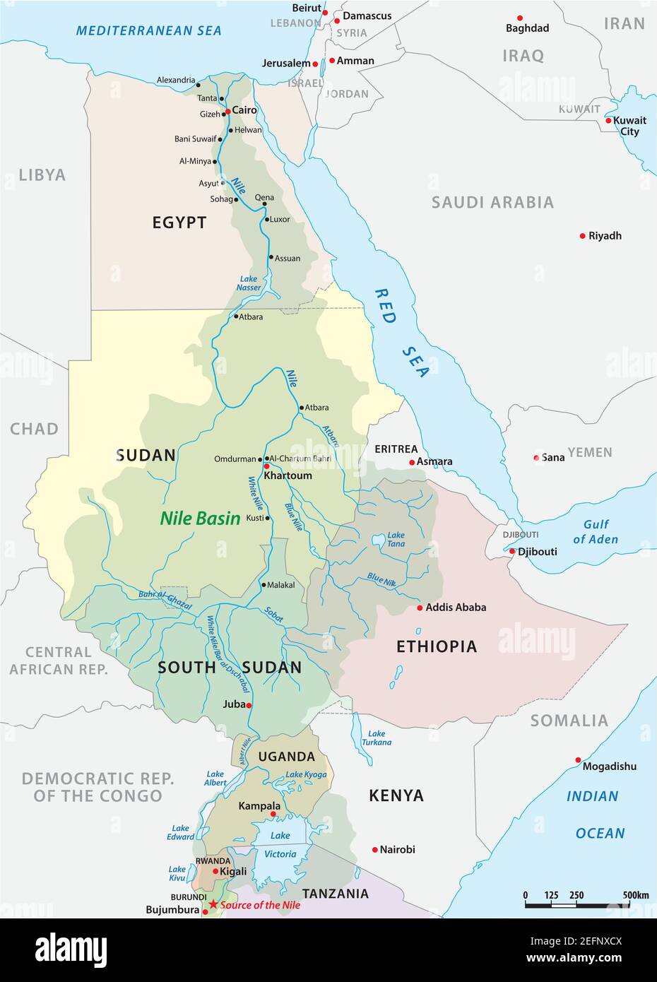 vector map of the nile river basin Stock Vectorhttps://www.alamy.com/image-license-details/?v=1https://www.alamy.com/vector-map-of-the-nile-river-basin-image405540042.html
RF2EFNXCX–vector map of the nile river basin
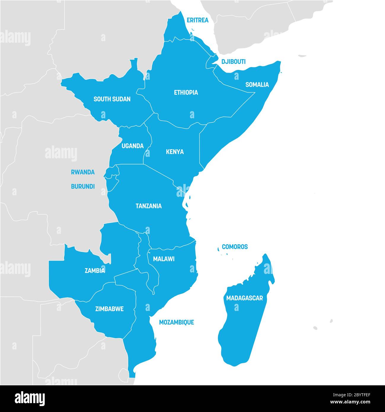 East Africa Region. Map of countries in eastern Africa. Vector illustration. Stock Vectorhttps://www.alamy.com/image-license-details/?v=1https://www.alamy.com/east-africa-region-map-of-countries-in-eastern-africa-vector-illustration-image361342087.html
RF2BYTFEF–East Africa Region. Map of countries in eastern Africa. Vector illustration.
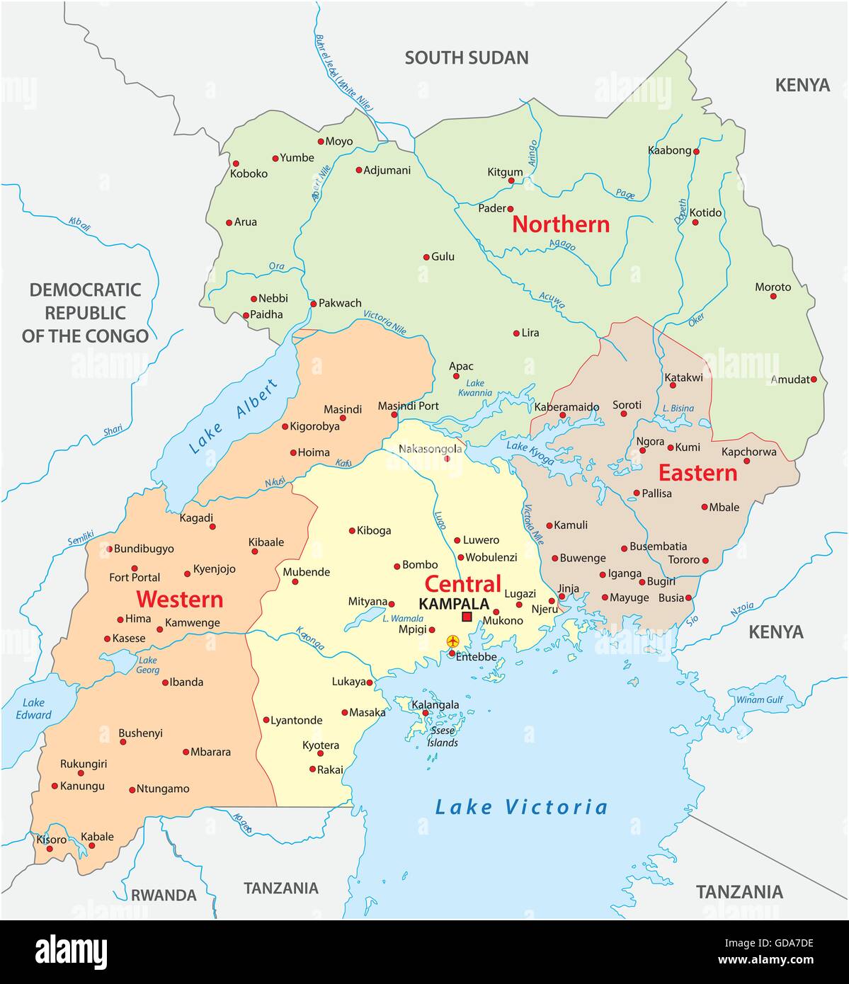 vector administrative and political map of the Republic of Uganda Stock Vectorhttps://www.alamy.com/image-license-details/?v=1https://www.alamy.com/stock-photo-vector-administrative-and-political-map-of-the-republic-of-uganda-111478122.html
RFGDA7DE–vector administrative and political map of the Republic of Uganda
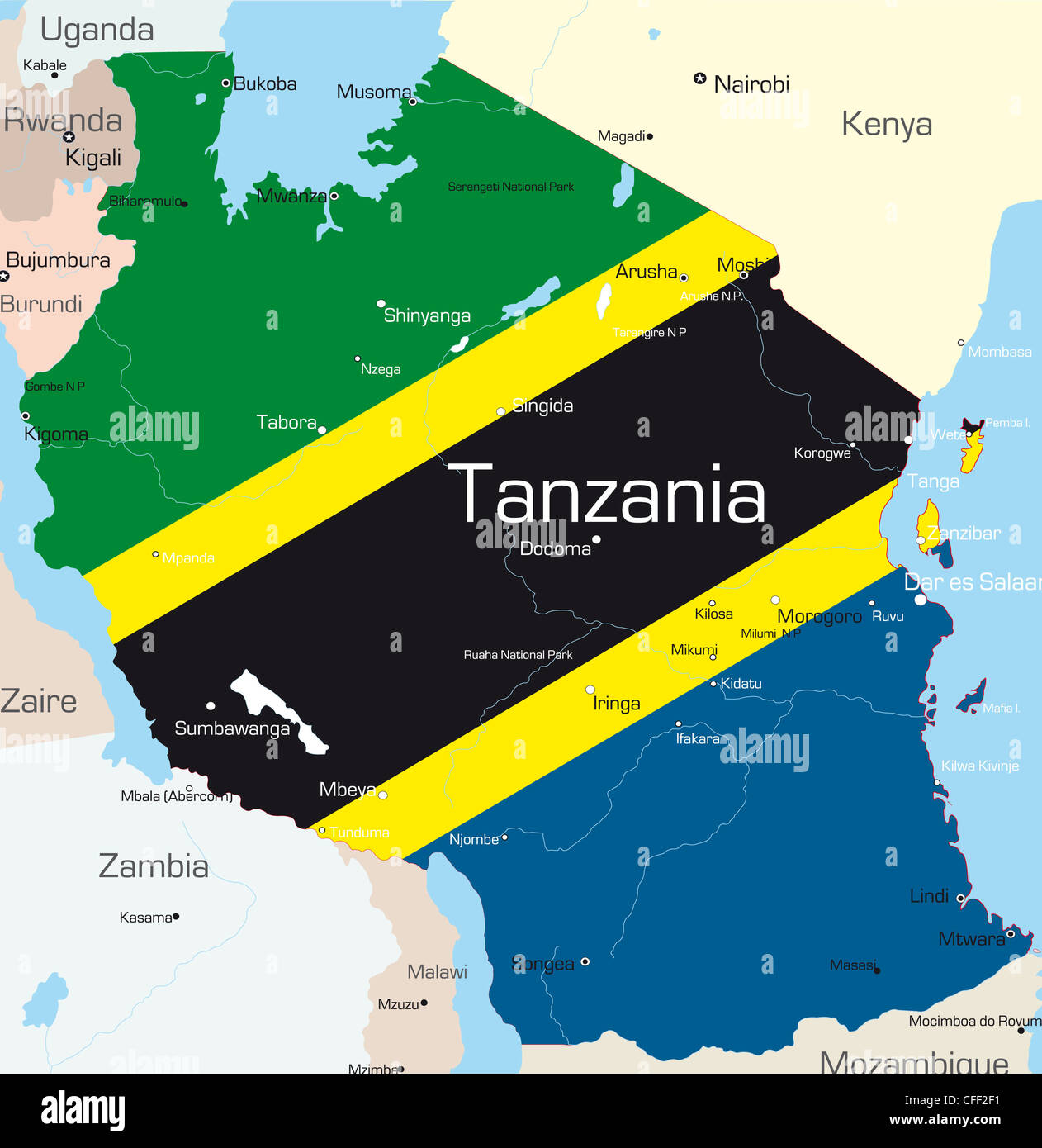 Abstract vector color map of Tanzania country colored by national flag Stock Photohttps://www.alamy.com/image-license-details/?v=1https://www.alamy.com/stock-photo-abstract-vector-color-map-of-tanzania-country-colored-by-national-43971845.html
RFCFF2F1–Abstract vector color map of Tanzania country colored by national flag
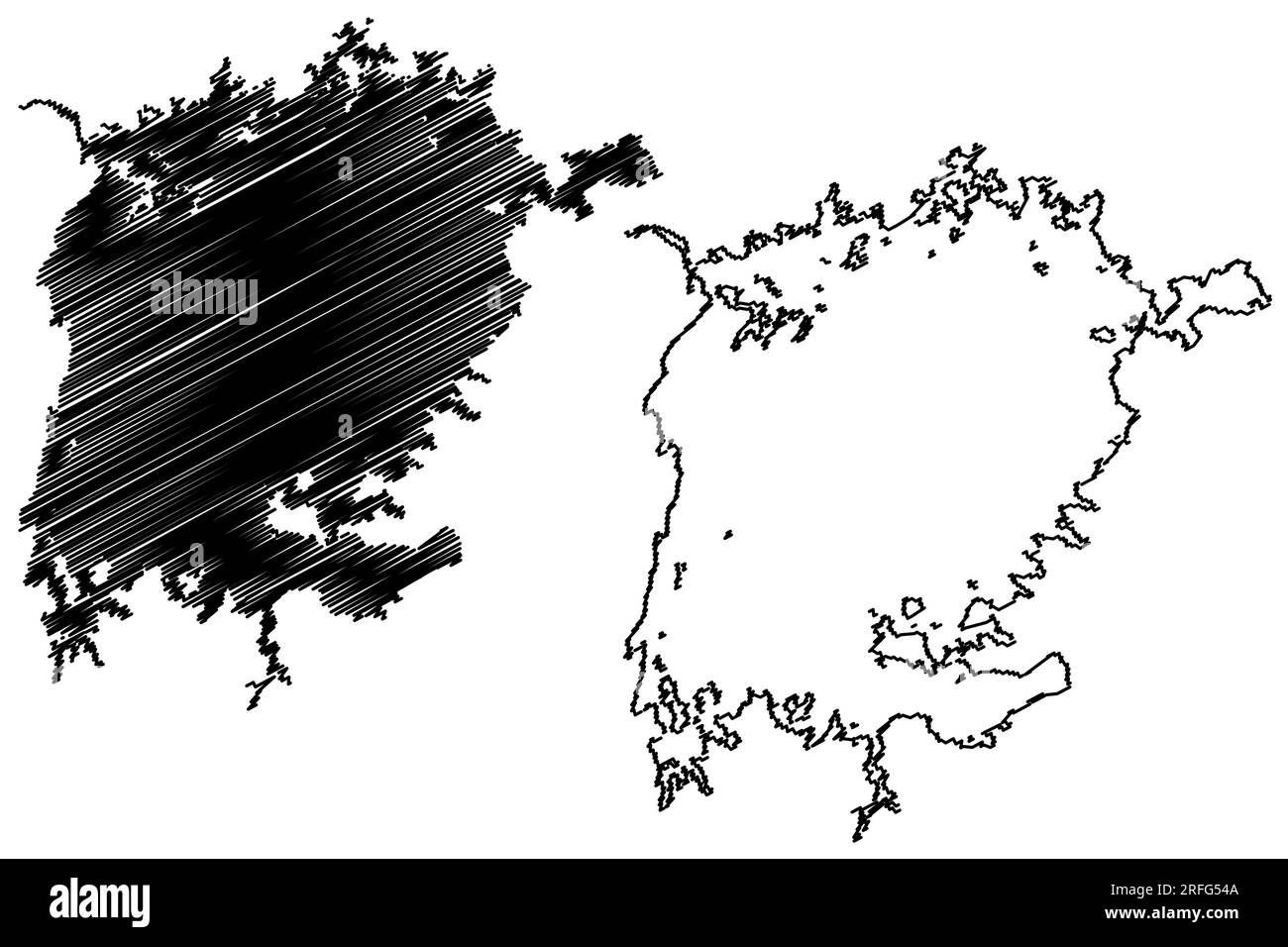 Lake Victoria (Tanzania, Africa, African Great Lakes) map vector illustration, scribble sketch Nam Lolwe, Nnalubaale, Nyanza or Ukerewe map Stock Vectorhttps://www.alamy.com/image-license-details/?v=1https://www.alamy.com/lake-victoria-tanzania-africa-african-great-lakes-map-vector-illustration-scribble-sketch-nam-lolwe-nnalubaale-nyanza-or-ukerewe-map-image560306890.html
RF2RFG54A–Lake Victoria (Tanzania, Africa, African Great Lakes) map vector illustration, scribble sketch Nam Lolwe, Nnalubaale, Nyanza or Ukerewe map
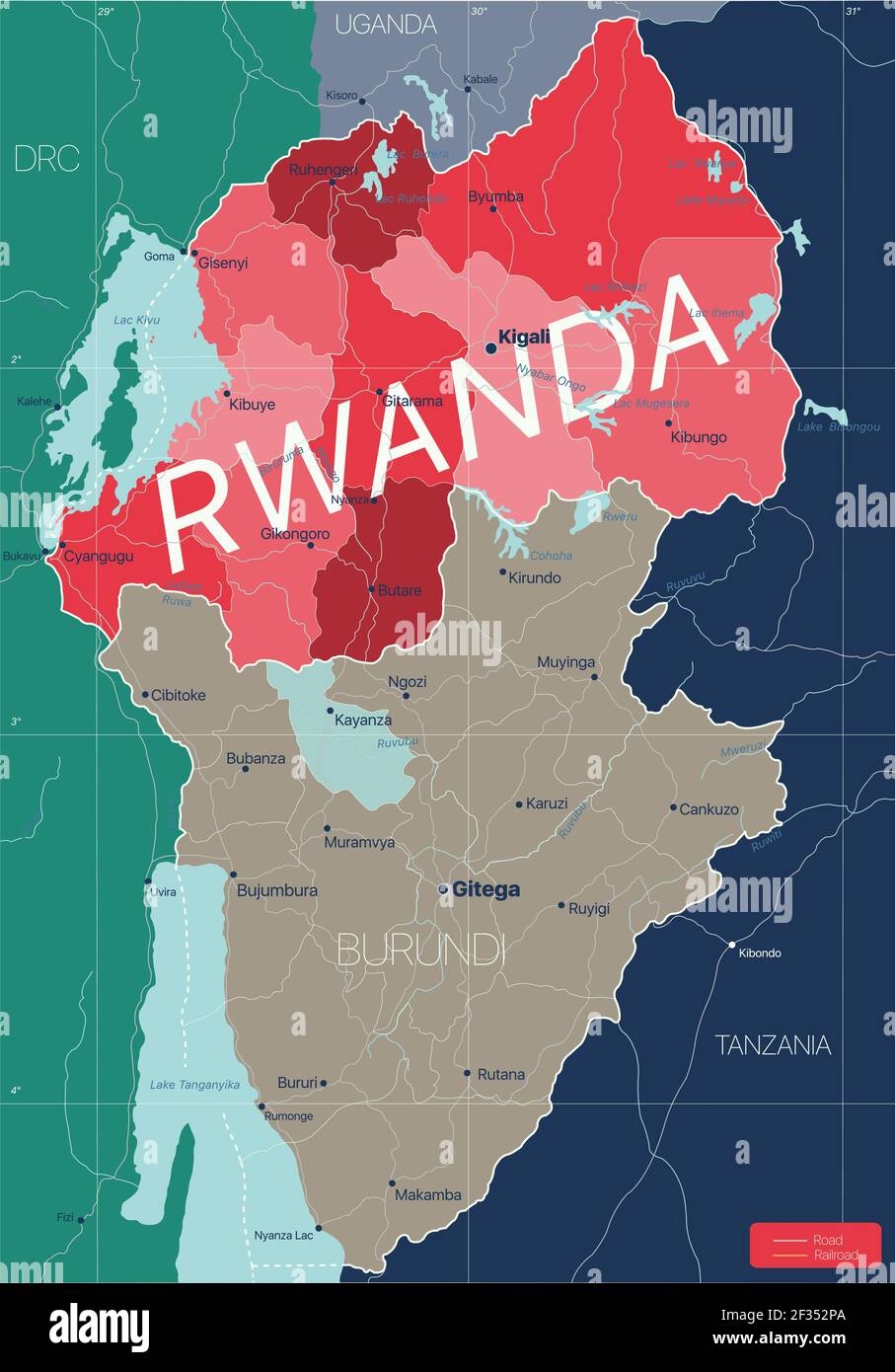 Rwanda country detailed editable map with regions cities and towns, roads and railways, geographic sites. Vector EPS-10 file Stock Vectorhttps://www.alamy.com/image-license-details/?v=1https://www.alamy.com/rwanda-country-detailed-editable-map-with-regions-cities-and-towns-roads-and-railways-geographic-sites-vector-eps-10-file-image415004754.html
RF2F352PA–Rwanda country detailed editable map with regions cities and towns, roads and railways, geographic sites. Vector EPS-10 file
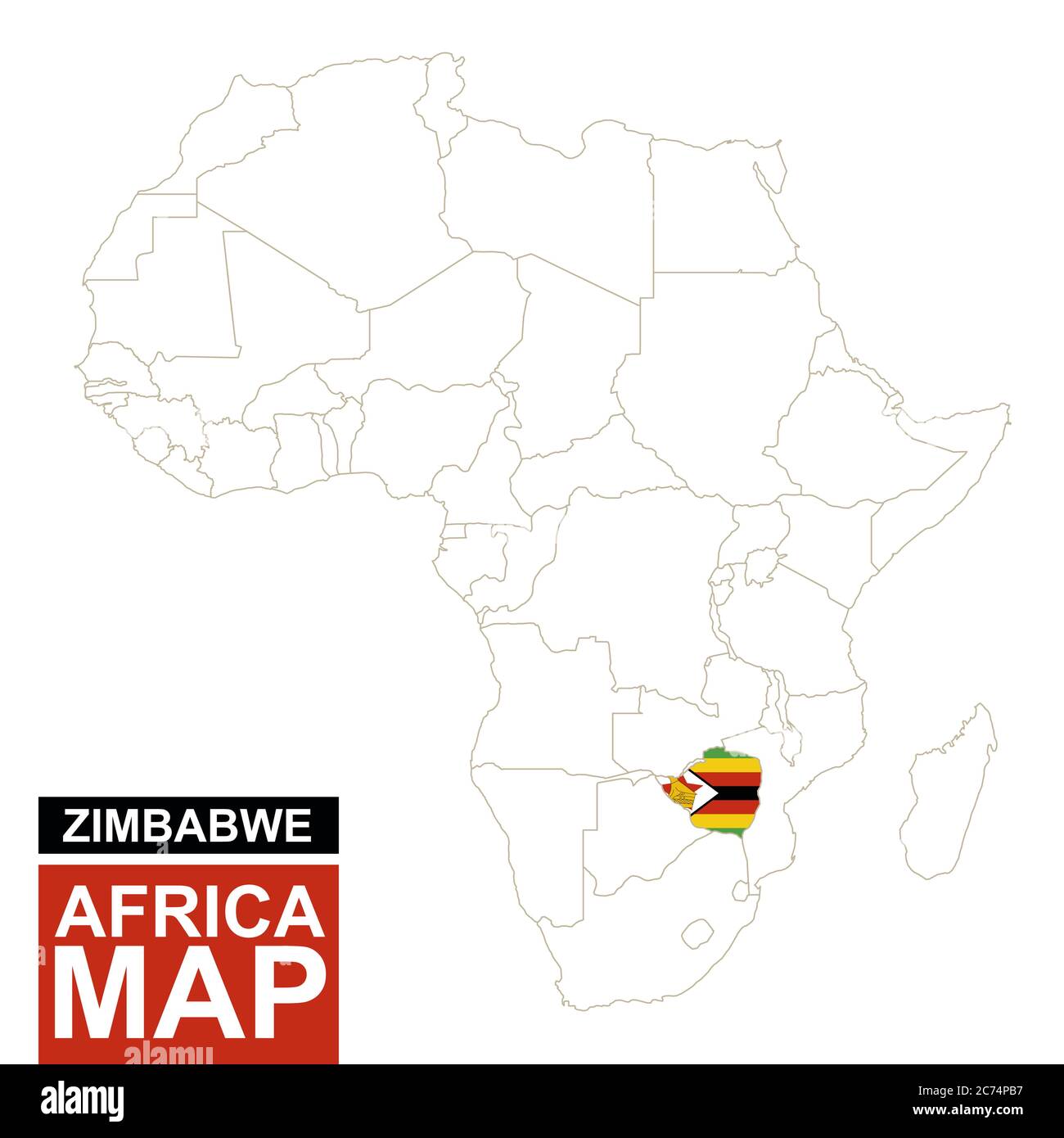 Africa contoured map with highlighted Zimbabwe. Zimbabwe map and flag on Africa map. Vector Illustration. Stock Vectorhttps://www.alamy.com/image-license-details/?v=1https://www.alamy.com/africa-contoured-map-with-highlighted-zimbabwe-zimbabwe-map-and-flag-on-africa-map-vector-illustration-image365825691.html
RF2C74PB7–Africa contoured map with highlighted Zimbabwe. Zimbabwe map and flag on Africa map. Vector Illustration.
 Tanzania country detailed editable map with regions cities and towns, roads and railways, geographic sites. Vector EPS-10 file Stock Vectorhttps://www.alamy.com/image-license-details/?v=1https://www.alamy.com/tanzania-country-detailed-editable-map-with-regions-cities-and-towns-roads-and-railways-geographic-sites-vector-eps-10-file-image415193948.html
RF2F3DM38–Tanzania country detailed editable map with regions cities and towns, roads and railways, geographic sites. Vector EPS-10 file
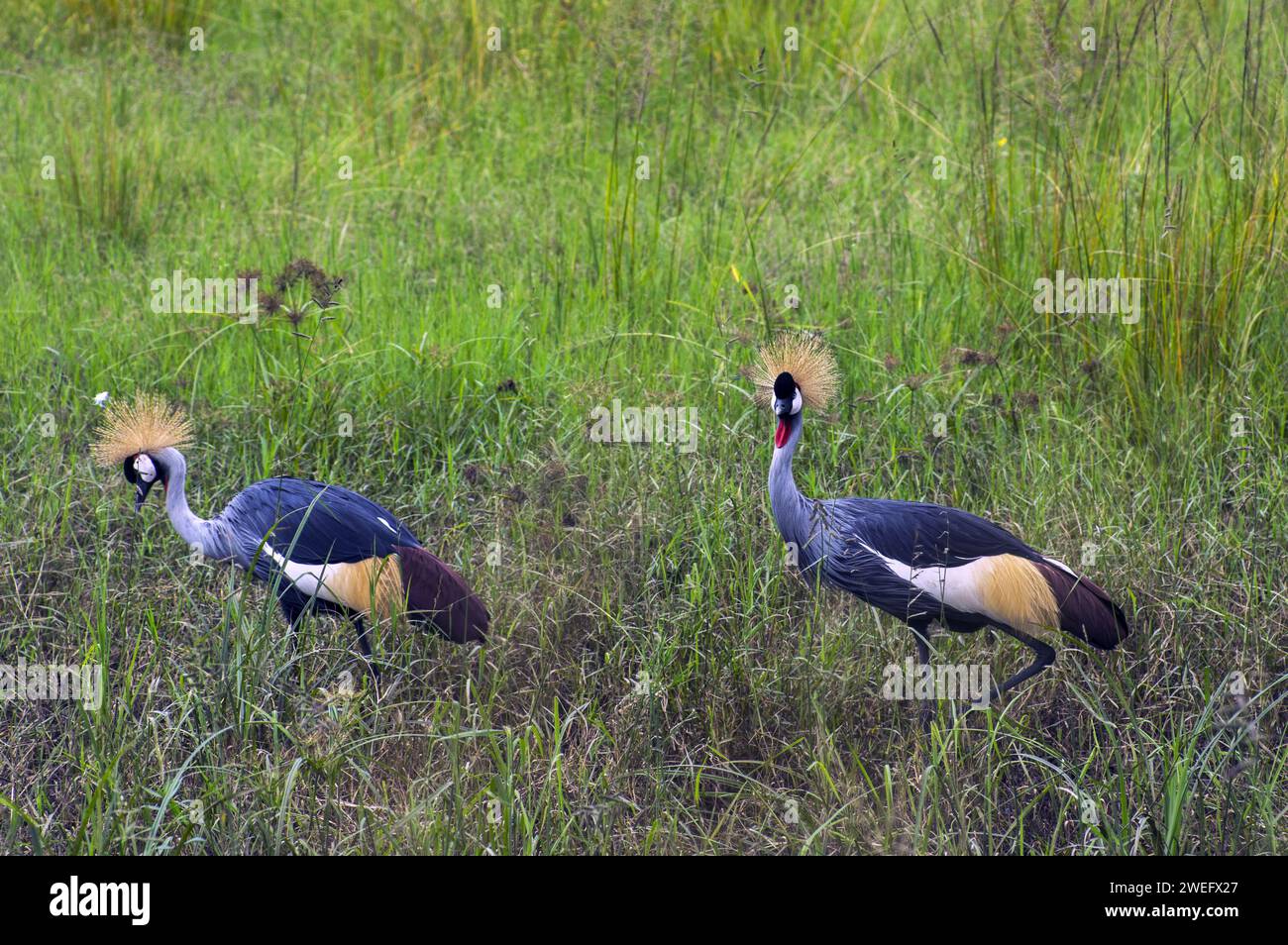 photographed on safari in Akagera National Park in Northeastern Rwanda, Central Africa’s largest protected wetland. Africa Parks Stock Photohttps://www.alamy.com/image-license-details/?v=1https://www.alamy.com/photographed-on-safari-in-akagera-national-park-in-northeastern-rwanda-central-africas-largest-protected-wetland-africa-parks-image594107423.html
RM2WEFX27–photographed on safari in Akagera National Park in Northeastern Rwanda, Central Africa’s largest protected wetland. Africa Parks
 Uganda Stock Photohttps://www.alamy.com/image-license-details/?v=1https://www.alamy.com/stock-photo-uganda-52230506.html
RFD0Y8F6–Uganda
 travel, art, political, emblem, traffic, transportation, africa, kenya, black, Stock Photohttps://www.alamy.com/image-license-details/?v=1https://www.alamy.com/stock-photo-travel-art-political-emblem-traffic-transportation-africa-kenya-black-143032427.html
RFJ8KK8Y–travel, art, political, emblem, traffic, transportation, africa, kenya, black,
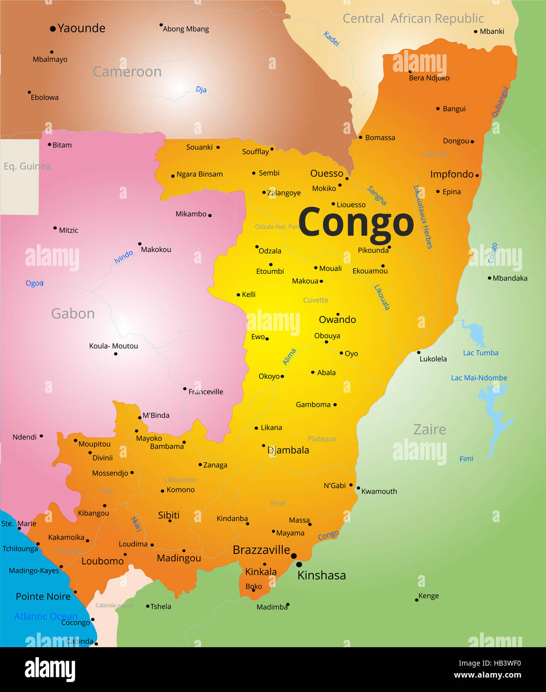 color map of Congo Stock Photohttps://www.alamy.com/image-license-details/?v=1https://www.alamy.com/stock-photo-color-map-of-congo-127319668.html
RMHB3WF0–color map of Congo
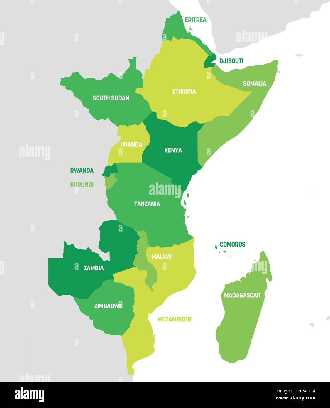 East Africa Region. Map of countries in eastern Africa. Vector illustration. Stock Vectorhttps://www.alamy.com/image-license-details/?v=1https://www.alamy.com/east-africa-region-map-of-countries-in-eastern-africa-vector-illustration-image364677156.html
RF2C58DC4–East Africa Region. Map of countries in eastern Africa. Vector illustration.
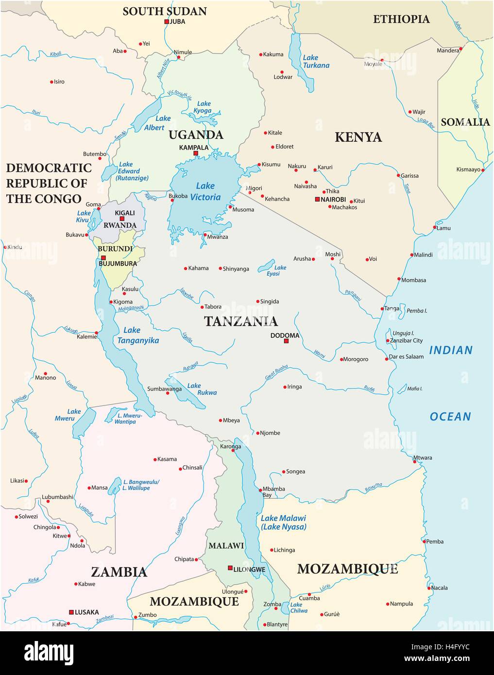 map of the African Great Lakes Stock Vectorhttps://www.alamy.com/image-license-details/?v=1https://www.alamy.com/stock-photo-map-of-the-african-great-lakes-123282416.html
RFH4FYYC–map of the African Great Lakes
 Uganda Stock Photohttps://www.alamy.com/image-license-details/?v=1https://www.alamy.com/stock-photo-uganda-52231276.html
RFD0Y9EM–Uganda
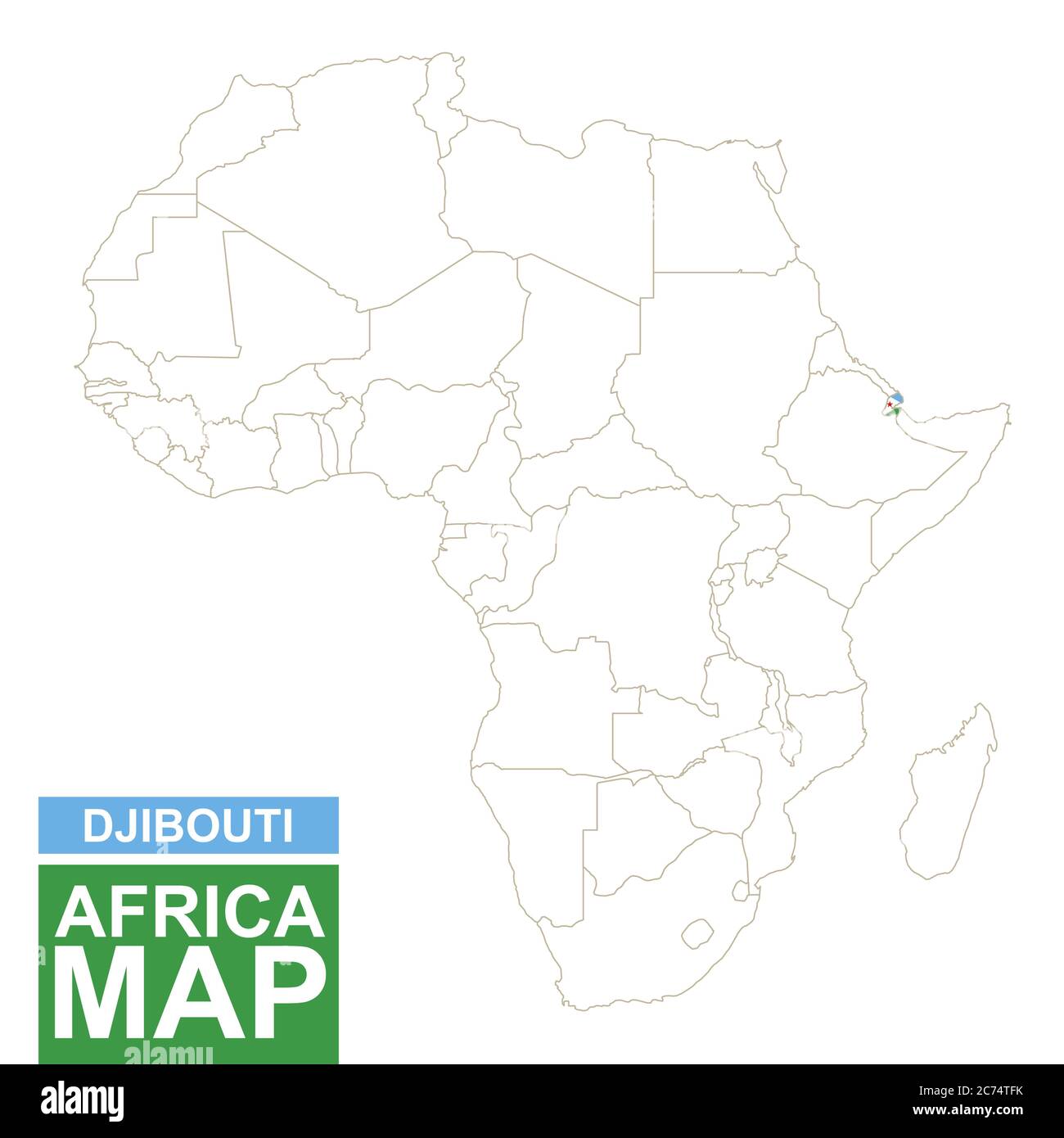 Africa contoured map with highlighted Djibouti. Djibouti map and flag on Africa map. Vector Illustration. Stock Vectorhttps://www.alamy.com/image-license-details/?v=1https://www.alamy.com/africa-contoured-map-with-highlighted-djibouti-djibouti-map-and-flag-on-africa-map-vector-illustration-image365827383.html
RF2C74TFK–Africa contoured map with highlighted Djibouti. Djibouti map and flag on Africa map. Vector Illustration.
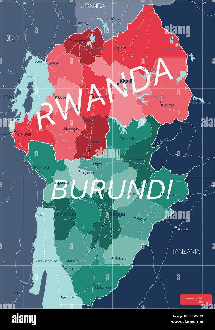 Rwanda and Burundi country detailed editable map with regions cities and towns, roads and railways, geographic sites. Vector EPS-10 file Stock Vectorhttps://www.alamy.com/image-license-details/?v=1https://www.alamy.com/rwanda-and-burundi-country-detailed-editable-map-with-regions-cities-and-towns-roads-and-railways-geographic-sites-vector-eps-10-file-image415188265.html
RF2F3DCT9–Rwanda and Burundi country detailed editable map with regions cities and towns, roads and railways, geographic sites. Vector EPS-10 file
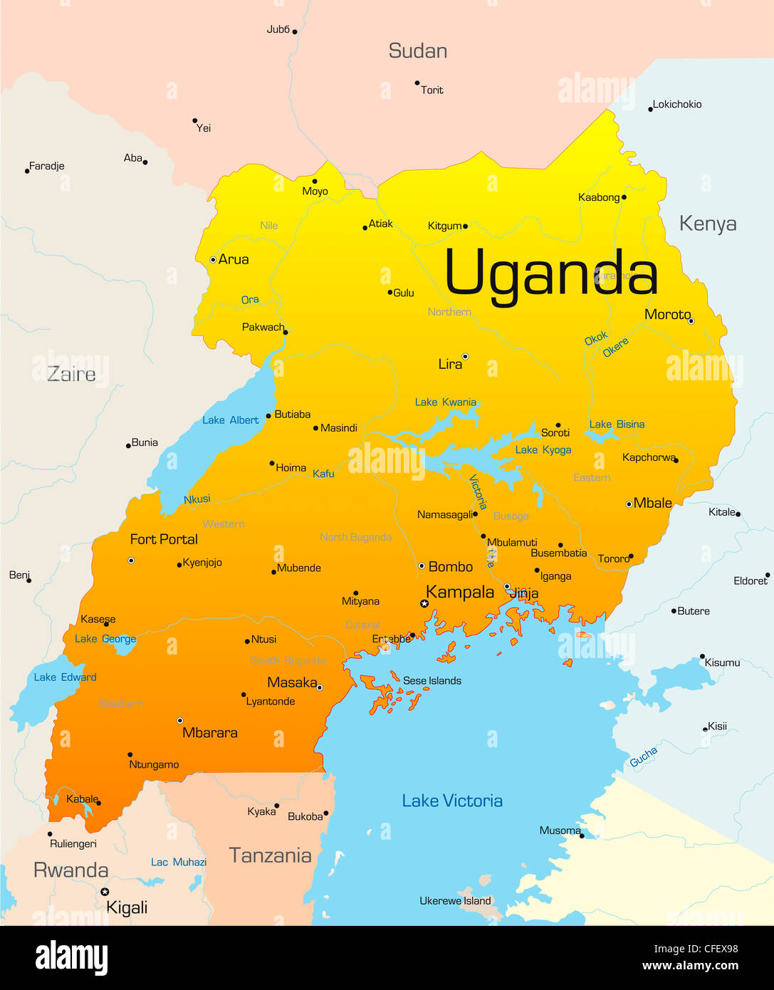 Abstract vector color map of Uganda country Stock Photohttps://www.alamy.com/image-license-details/?v=1https://www.alamy.com/stock-photo-abstract-vector-color-map-of-uganda-country-43968548.html
RFCFEX98–Abstract vector color map of Uganda country
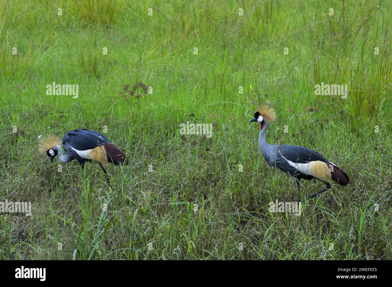 photographed on safari in Akagera National Park in Northeastern Rwanda, Central Africa’s largest protected wetland. Africa Parks Stock Photohttps://www.alamy.com/image-license-details/?v=1https://www.alamy.com/photographed-on-safari-in-akagera-national-park-in-northeastern-rwanda-central-africas-largest-protected-wetland-africa-parks-image594107505.html
RM2WEFX55–photographed on safari in Akagera National Park in Northeastern Rwanda, Central Africa’s largest protected wetland. Africa Parks
 travel, art, political, emblem, traffic, transportation, africa, kenya, black, Stock Photohttps://www.alamy.com/image-license-details/?v=1https://www.alamy.com/stock-photo-travel-art-political-emblem-traffic-transportation-africa-kenya-black-143031792.html
RFJ8KJE8–travel, art, political, emblem, traffic, transportation, africa, kenya, black,
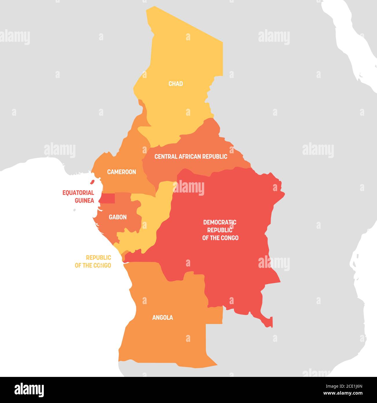 Central Africa Region. Map of countries in central Africa. Vector illustration. Stock Vectorhttps://www.alamy.com/image-license-details/?v=1https://www.alamy.com/central-africa-region-map-of-countries-in-central-africa-vector-illustration-image370059165.html
RF2CE1J6N–Central Africa Region. Map of countries in central Africa. Vector illustration.
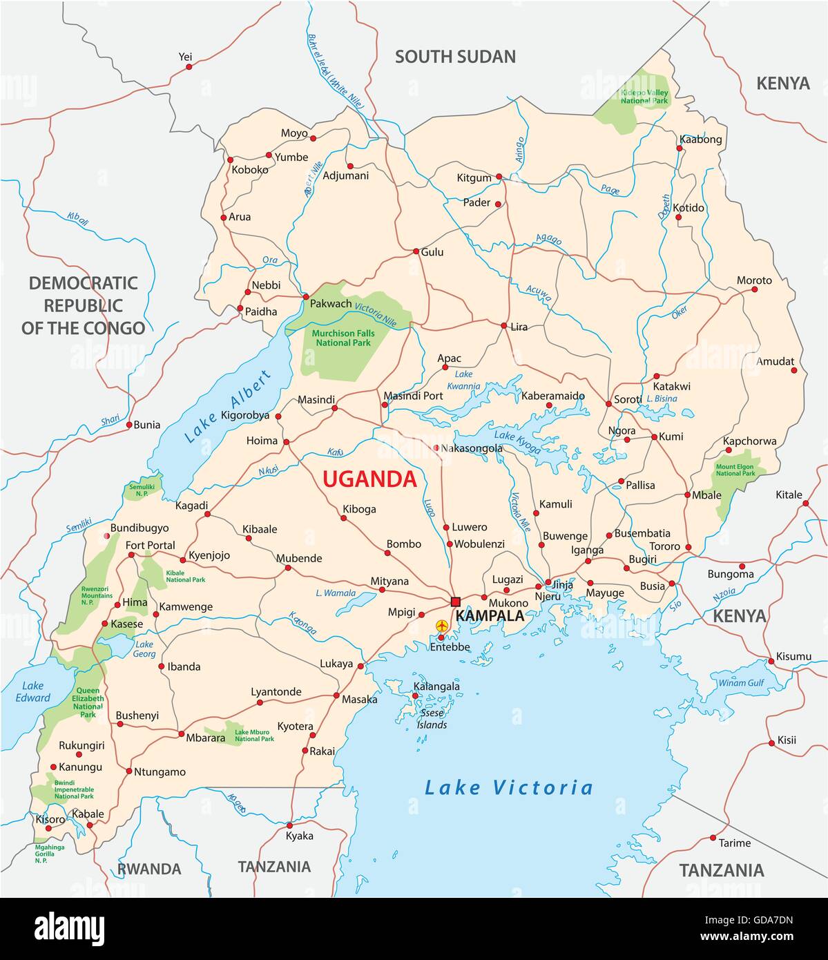 detailed vector street map of republic uganda Stock Vectorhttps://www.alamy.com/image-license-details/?v=1https://www.alamy.com/stock-photo-detailed-vector-street-map-of-republic-uganda-111478129.html
RFGDA7DN–detailed vector street map of republic uganda
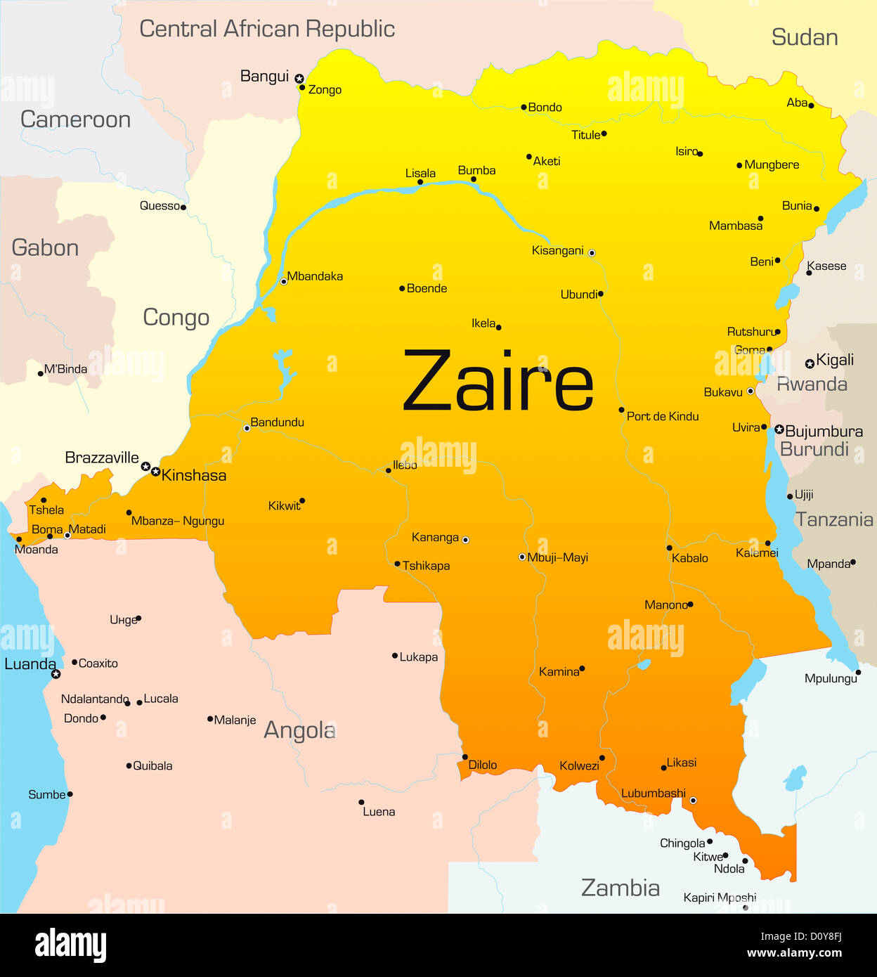 Zaire Stock Photohttps://www.alamy.com/image-license-details/?v=1https://www.alamy.com/stock-photo-zaire-52230518.html
RFD0Y8FJ–Zaire
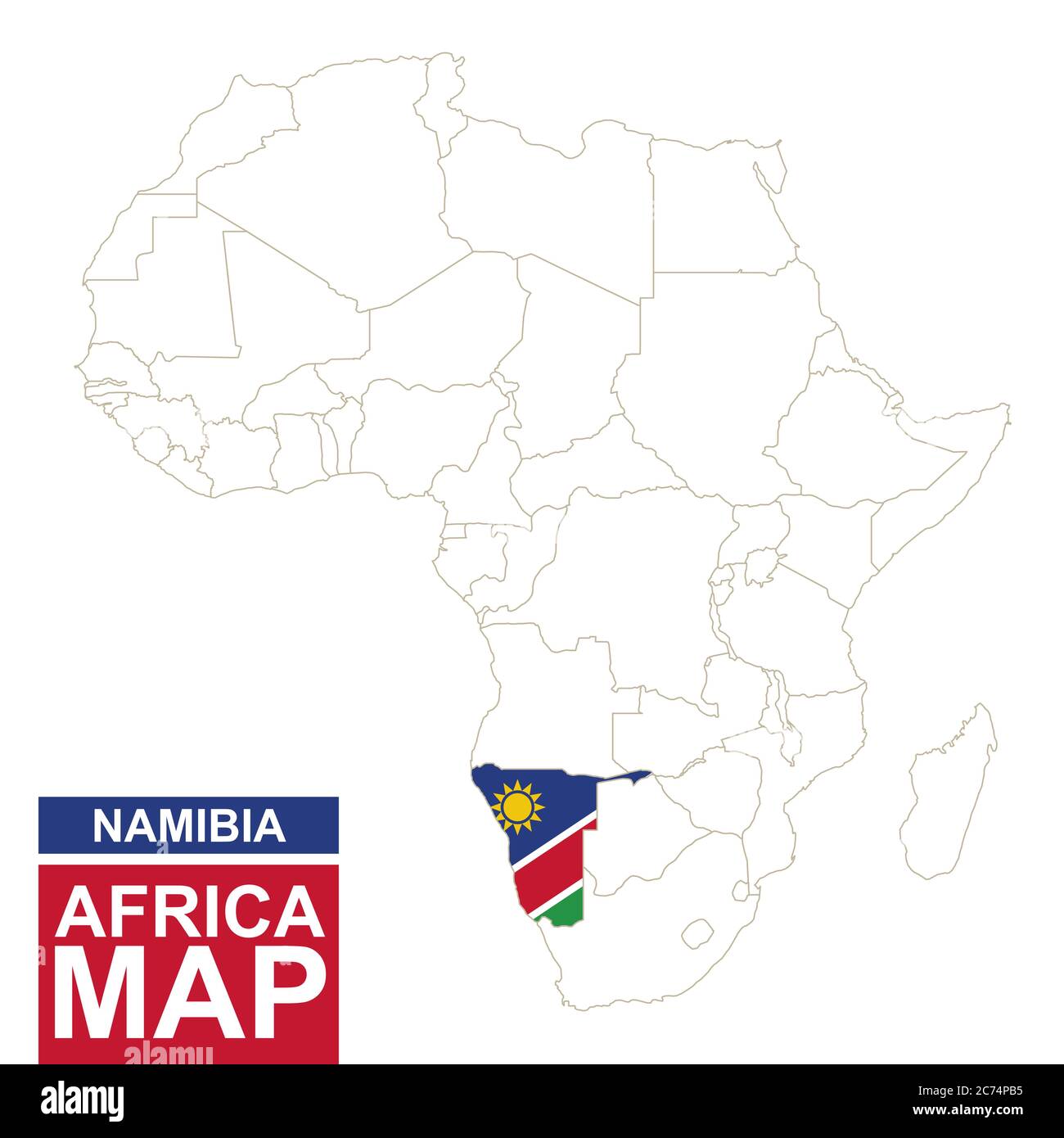 Africa contoured map with highlighted Namibia. Namibia map and flag on Africa map. Vector Illustration. Stock Vectorhttps://www.alamy.com/image-license-details/?v=1https://www.alamy.com/africa-contoured-map-with-highlighted-namibia-namibia-map-and-flag-on-africa-map-vector-illustration-image365825689.html
RF2C74PB5–Africa contoured map with highlighted Namibia. Namibia map and flag on Africa map. Vector Illustration.
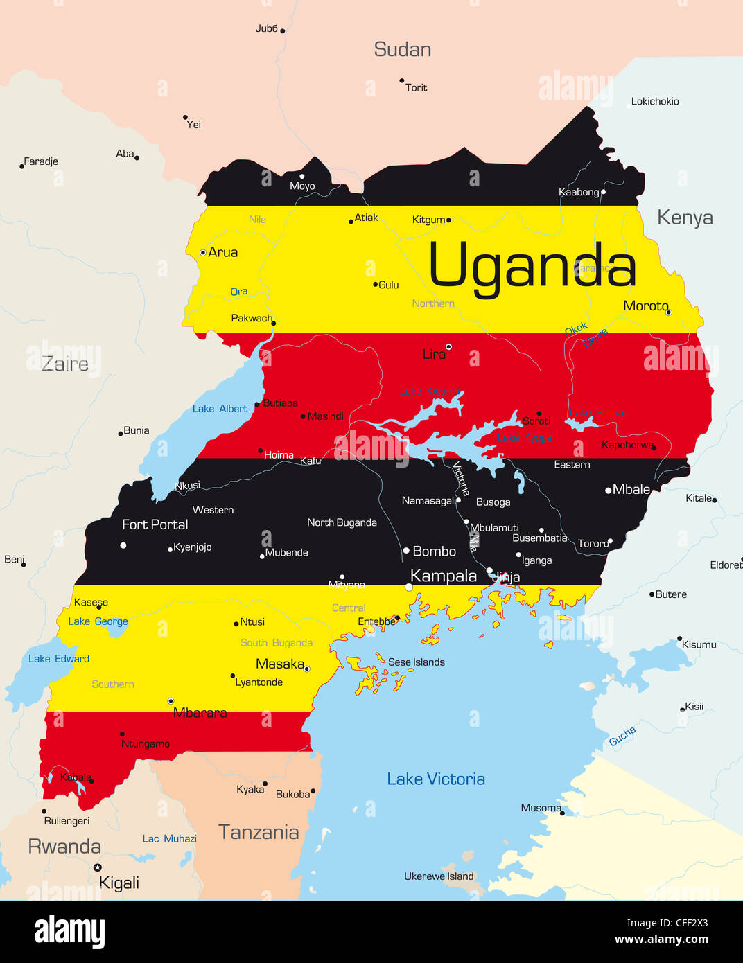 Abstract vector color map of Uganda country colored by national flag Stock Photohttps://www.alamy.com/image-license-details/?v=1https://www.alamy.com/stock-photo-abstract-vector-color-map-of-uganda-country-colored-by-national-flag-43972155.html
RFCFF2X3–Abstract vector color map of Uganda country colored by national flag
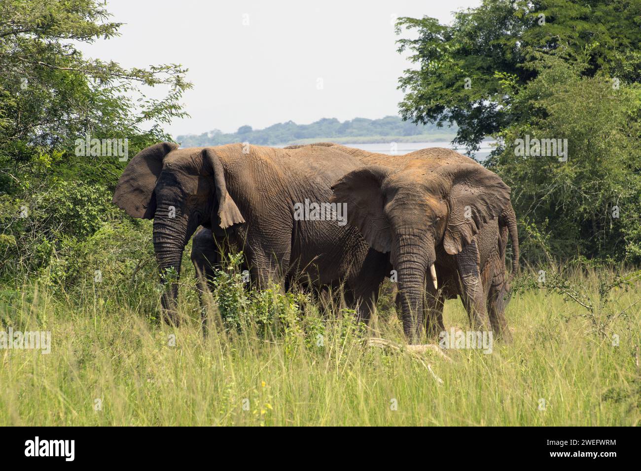 Large elephant with juvenile male elephant photographed on safari in Akagera National Park in Northeastern Rwanda, Central Africa Parks Stock Photohttps://www.alamy.com/image-license-details/?v=1https://www.alamy.com/large-elephant-with-juvenile-male-elephant-photographed-on-safari-in-akagera-national-park-in-northeastern-rwanda-central-africa-parks-image594107240.html
RM2WEFWRM–Large elephant with juvenile male elephant photographed on safari in Akagera National Park in Northeastern Rwanda, Central Africa Parks
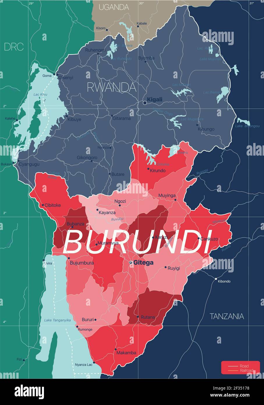 Burundi country detailed editable map with regions cities and towns, roads and railways, geographic sites. Vector EPS-10 file Stock Vectorhttps://www.alamy.com/image-license-details/?v=1https://www.alamy.com/burundi-country-detailed-editable-map-with-regions-cities-and-towns-roads-and-railways-geographic-sites-vector-eps-10-file-image415003548.html
RF2F35178–Burundi country detailed editable map with regions cities and towns, roads and railways, geographic sites. Vector EPS-10 file
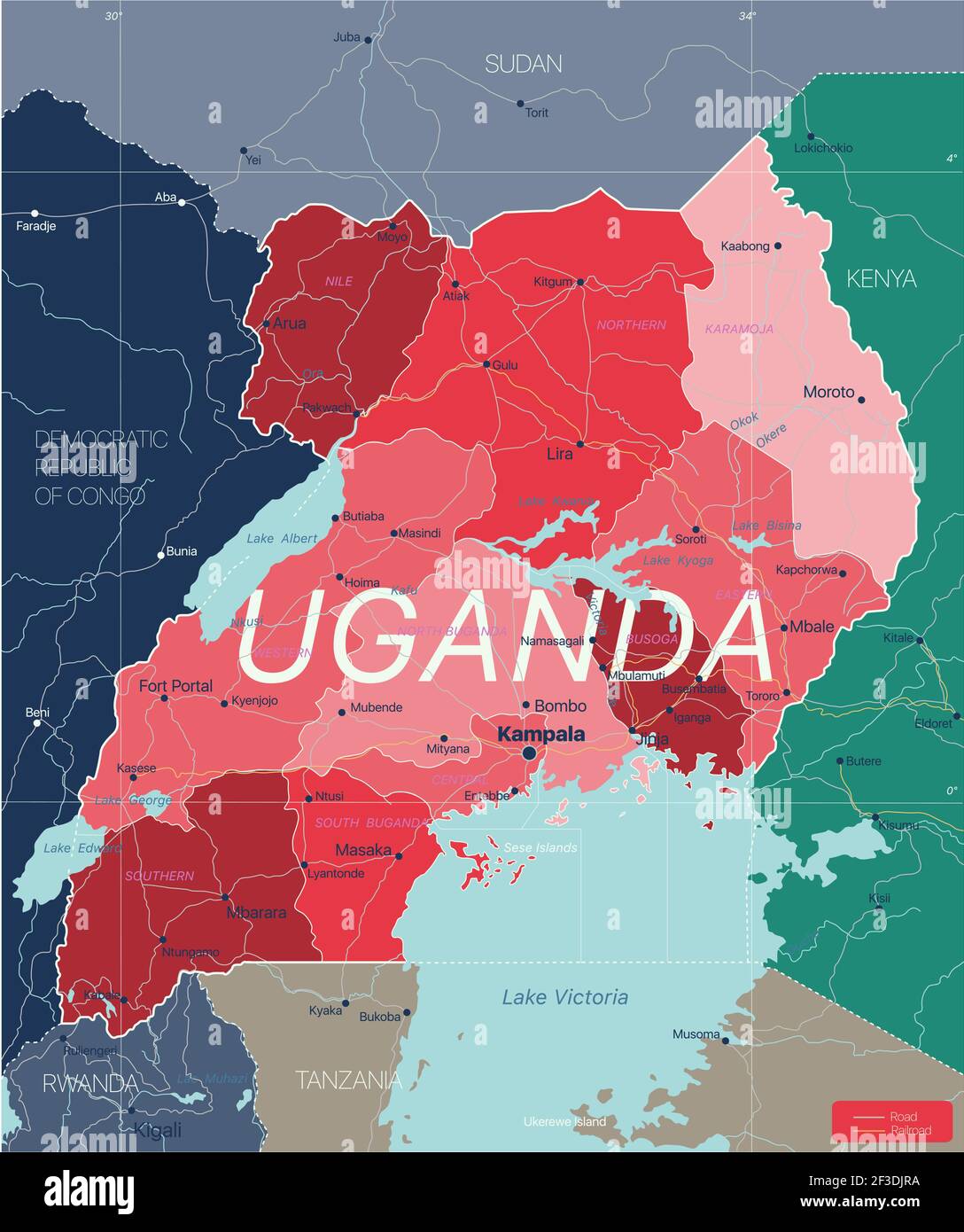 Uganda country detailed editable map with regions cities and towns, roads and railways, geographic sites. Vector EPS-10 file Stock Vectorhttps://www.alamy.com/image-license-details/?v=1https://www.alamy.com/uganda-country-detailed-editable-map-with-regions-cities-and-towns-roads-and-railways-geographic-sites-vector-eps-10-file-image415192942.html
RF2F3DJRA–Uganda country detailed editable map with regions cities and towns, roads and railways, geographic sites. Vector EPS-10 file
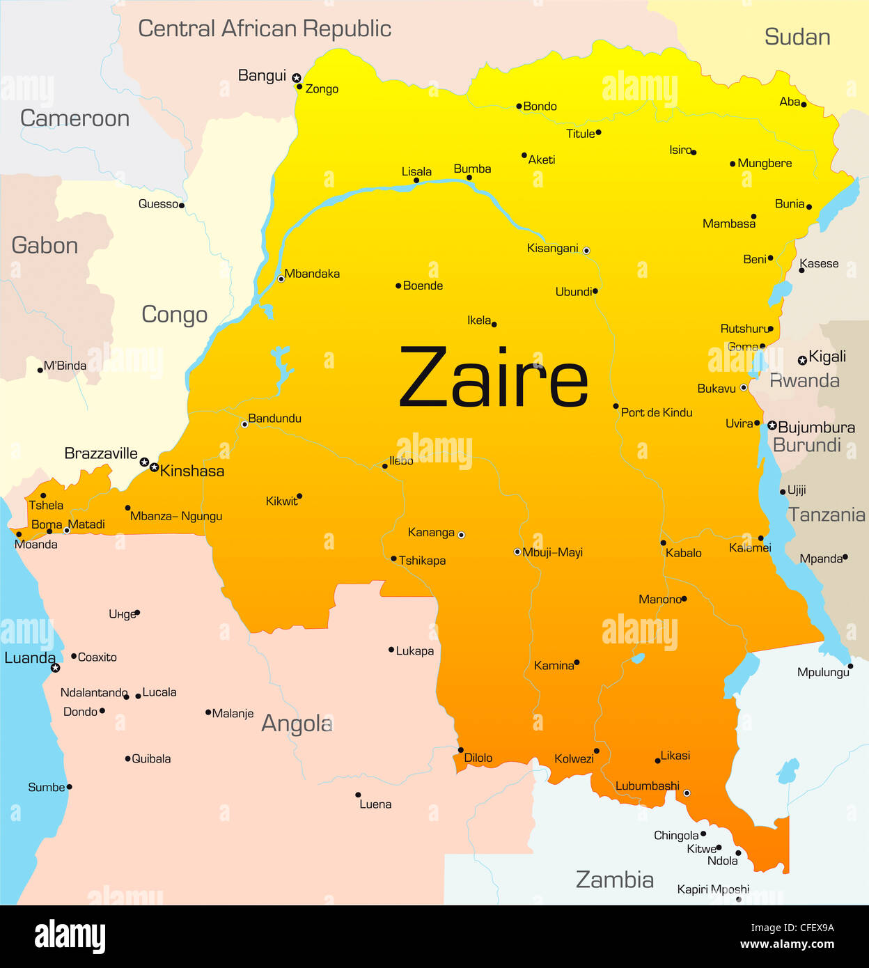 Abstract vector color map of Zaire country Stock Photohttps://www.alamy.com/image-license-details/?v=1https://www.alamy.com/stock-photo-abstract-vector-color-map-of-zaire-country-43968550.html
RFCFEX9A–Abstract vector color map of Zaire country
 travel, art, political, emblem, traffic, transportation, africa, kenya, black, Stock Photohttps://www.alamy.com/image-license-details/?v=1https://www.alamy.com/stock-photo-travel-art-political-emblem-traffic-transportation-africa-kenya-black-143032433.html
RFJ8KK95–travel, art, political, emblem, traffic, transportation, africa, kenya, black,
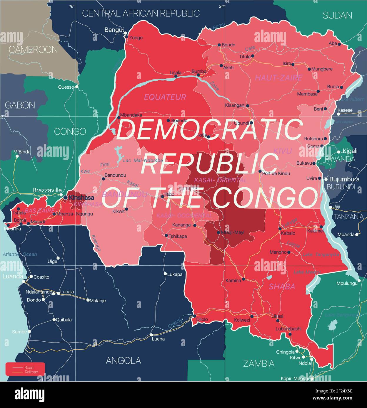 Democratic Republic of Congo country detailed editable map with regions cities and towns, roads and railways, geographic sites. Vector EPS-10 file Stock Vectorhttps://www.alamy.com/image-license-details/?v=1https://www.alamy.com/democratic-republic-of-congo-country-detailed-editable-map-with-regions-cities-and-towns-roads-and-railways-geographic-sites-vector-eps-10-file-image414386490.html
RF2F24X5E–Democratic Republic of Congo country detailed editable map with regions cities and towns, roads and railways, geographic sites. Vector EPS-10 file
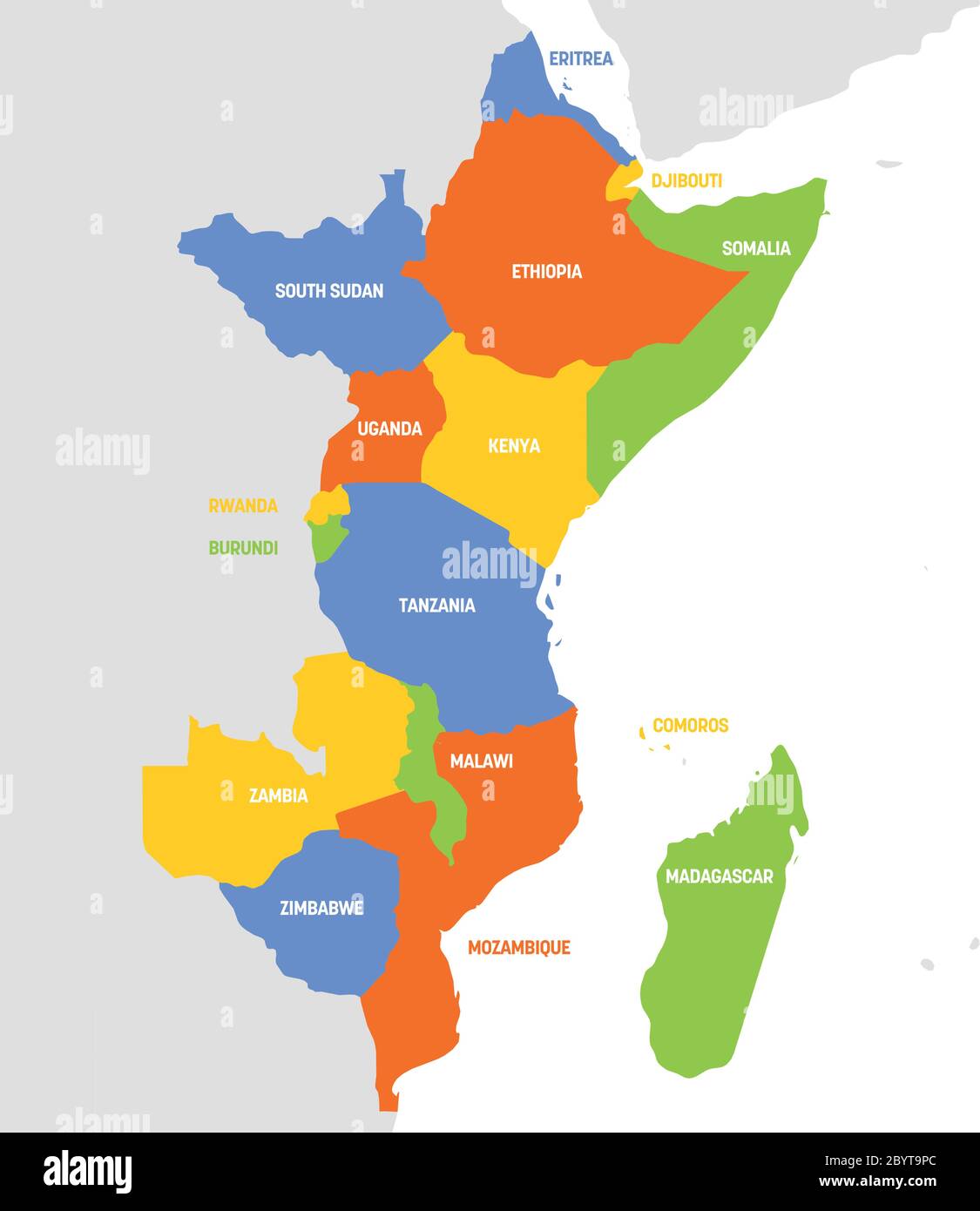 East Africa Region. Map of countries in eastern Africa. Vector illustration. Stock Vectorhttps://www.alamy.com/image-license-details/?v=1https://www.alamy.com/east-africa-region-map-of-countries-in-eastern-africa-vector-illustration-image361337604.html
RF2BYT9PC–East Africa Region. Map of countries in eastern Africa. Vector illustration.
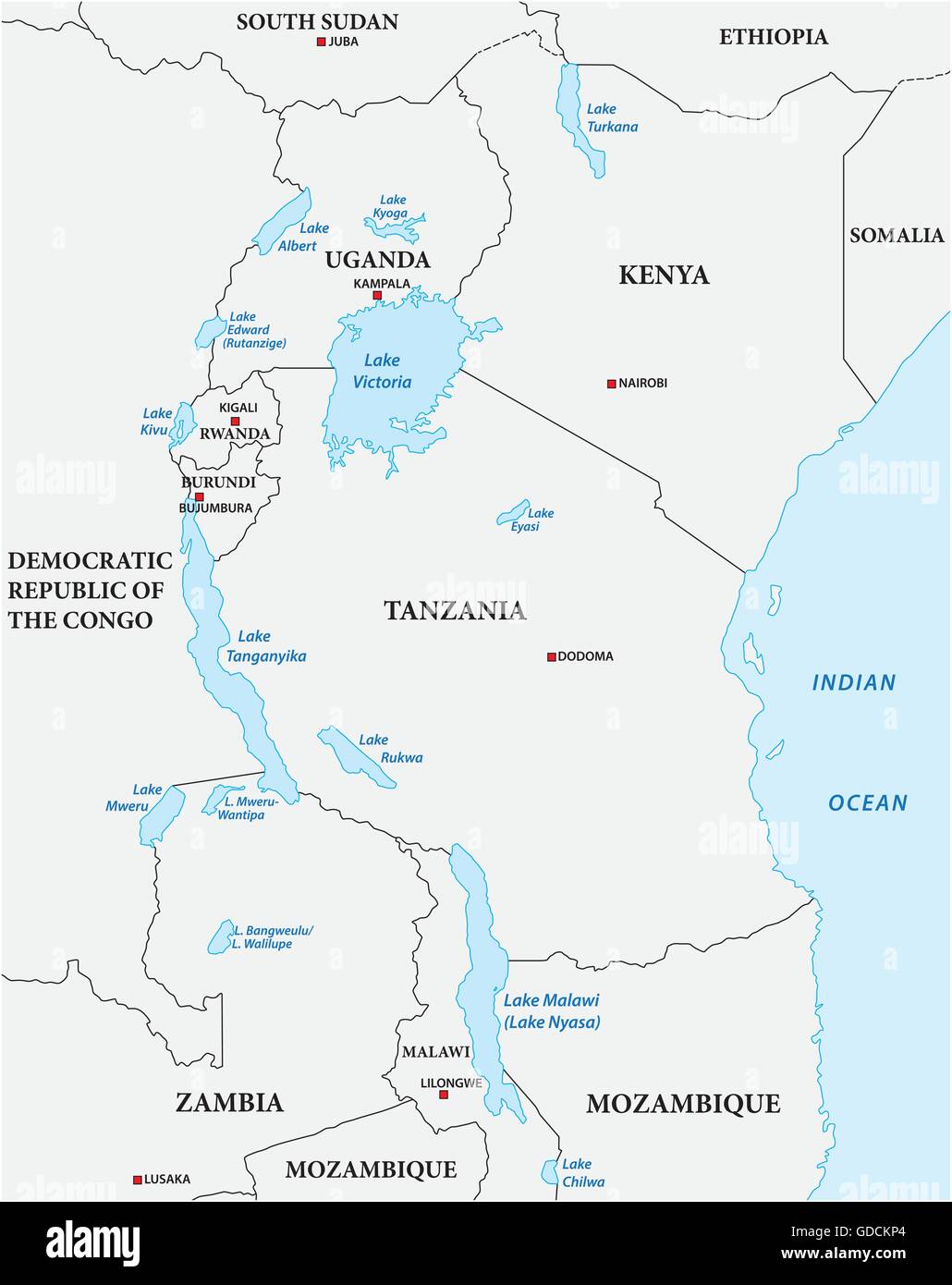 simple vector outline map of the African Great Lakes Stock Vectorhttps://www.alamy.com/image-license-details/?v=1https://www.alamy.com/stock-photo-simple-vector-outline-map-of-the-african-great-lakes-111531676.html
RFGDCKP4–simple vector outline map of the African Great Lakes
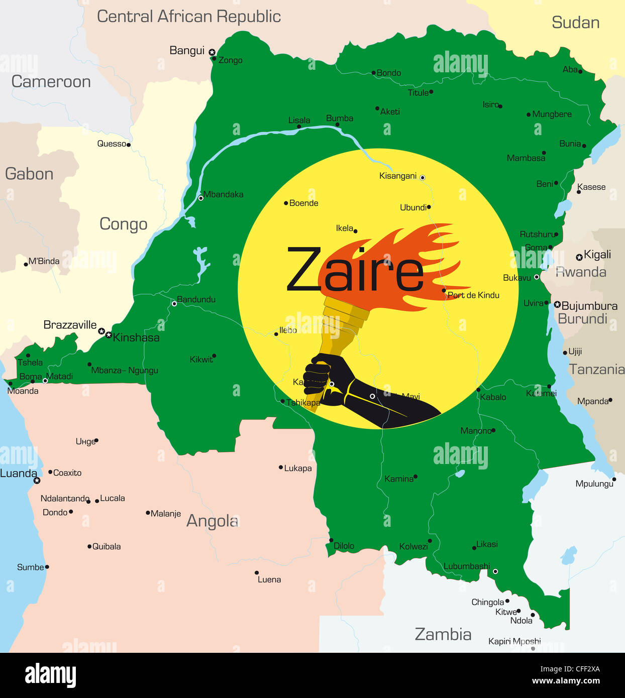 Abstract vector color map of Zaire country colored by national flag Stock Photohttps://www.alamy.com/image-license-details/?v=1https://www.alamy.com/stock-photo-abstract-vector-color-map-of-zaire-country-colored-by-national-flag-43972162.html
RFCFF2XA–Abstract vector color map of Zaire country colored by national flag
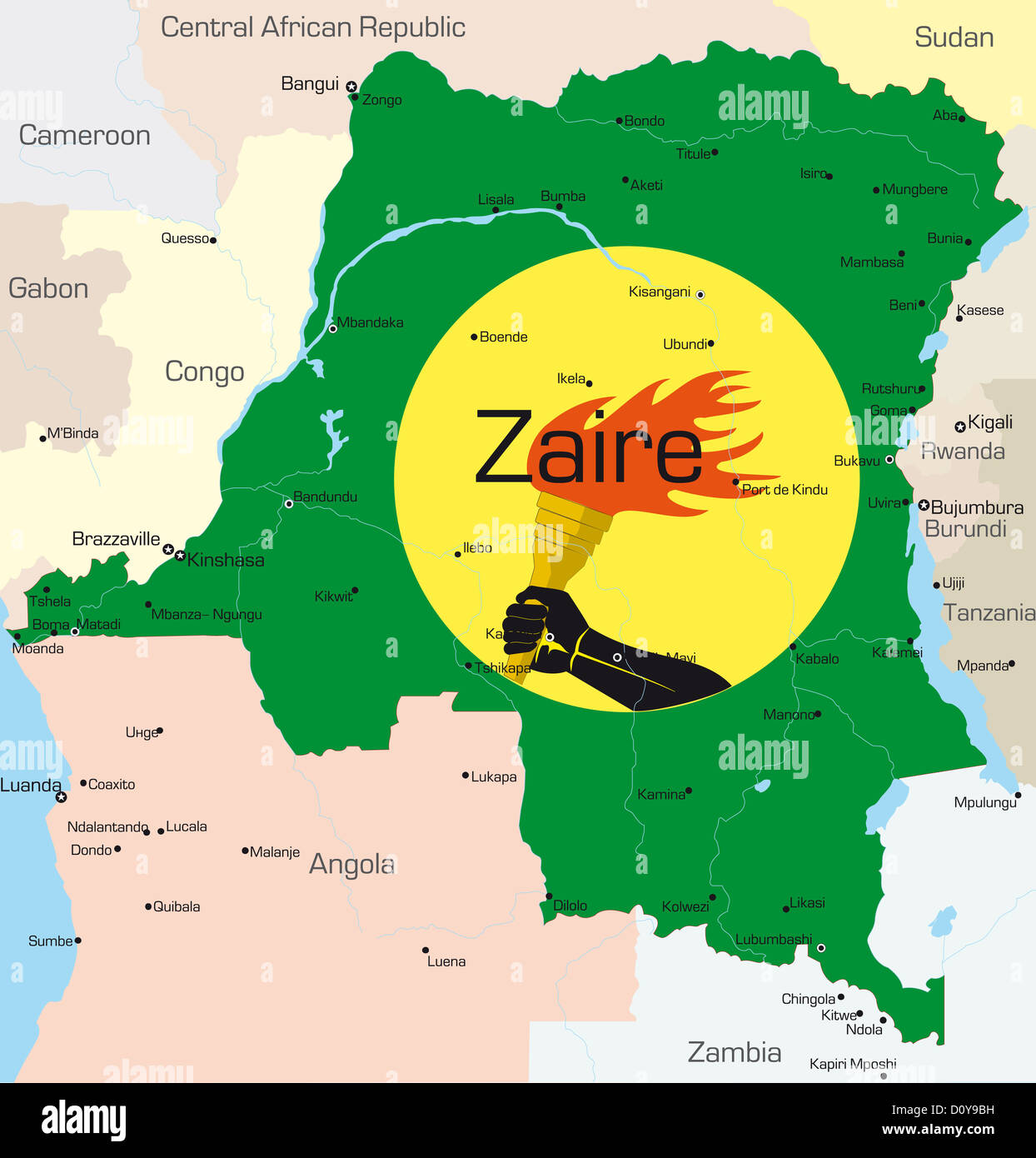 Zaire Stock Photohttps://www.alamy.com/image-license-details/?v=1https://www.alamy.com/stock-photo-zaire-52231189.html
RFD0Y9BH–Zaire
 Africa contoured map with highlighted Mozambique. Mozambique map and flag on Africa map. Vector Illustration. Stock Vectorhttps://www.alamy.com/image-license-details/?v=1https://www.alamy.com/africa-contoured-map-with-highlighted-mozambique-mozambique-map-and-flag-on-africa-map-vector-illustration-image365825785.html
RF2C74PEH–Africa contoured map with highlighted Mozambique. Mozambique map and flag on Africa map. Vector Illustration.
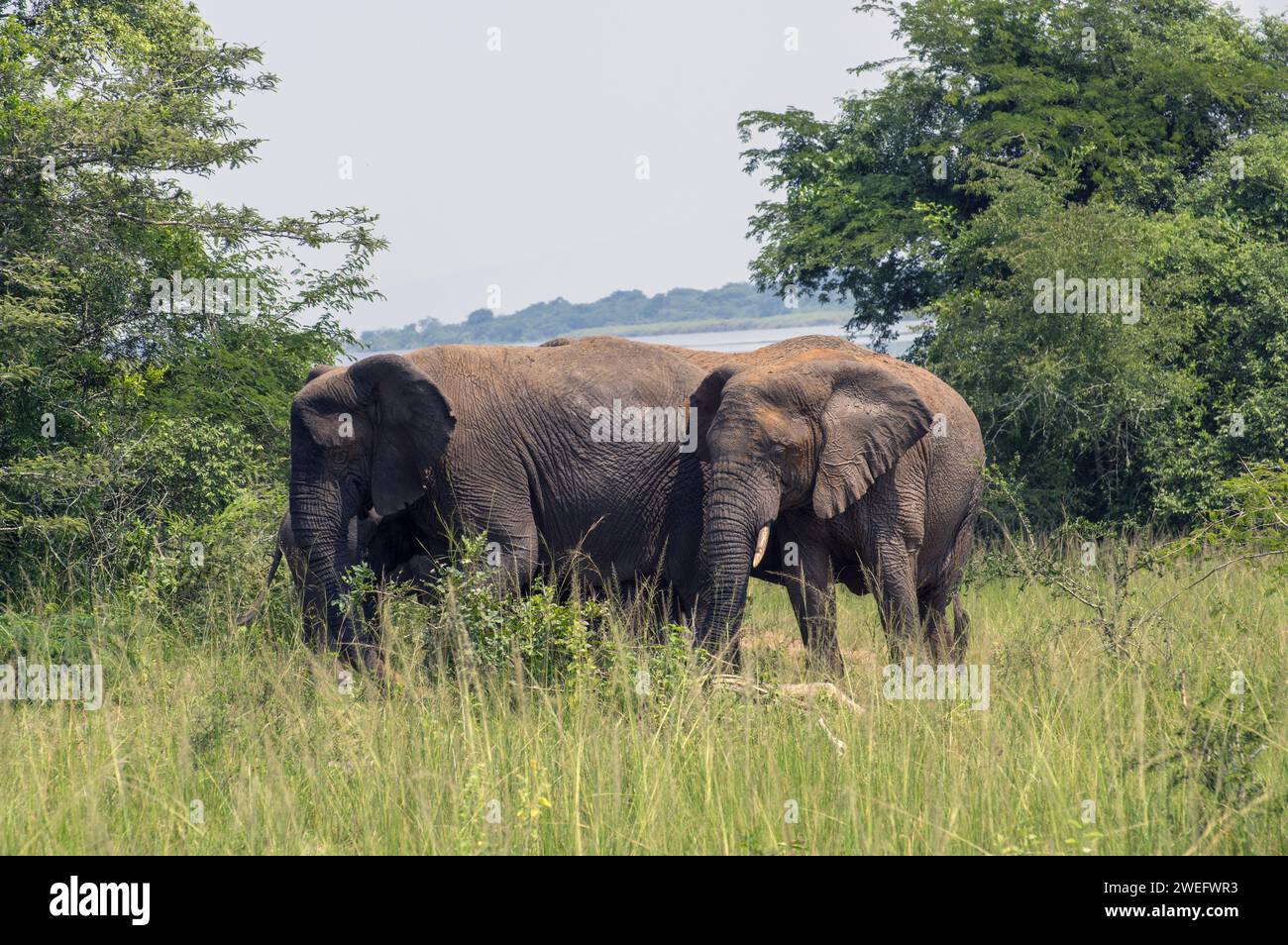 Large elephant with juvenile male elephant photographed on safari in Akagera National Park in Northeastern Rwanda, Central Africa Parks Stock Photohttps://www.alamy.com/image-license-details/?v=1https://www.alamy.com/large-elephant-with-juvenile-male-elephant-photographed-on-safari-in-akagera-national-park-in-northeastern-rwanda-central-africa-parks-image594107223.html
RM2WEFWR3–Large elephant with juvenile male elephant photographed on safari in Akagera National Park in Northeastern Rwanda, Central Africa Parks
 travel, art, political, emblem, traffic, transportation, africa, kenya, black, Stock Photohttps://www.alamy.com/image-license-details/?v=1https://www.alamy.com/stock-photo-travel-art-political-emblem-traffic-transportation-africa-kenya-black-143031791.html
RFJ8KJE7–travel, art, political, emblem, traffic, transportation, africa, kenya, black,