Quick filters:
Sea of azov Stock Photos and Images
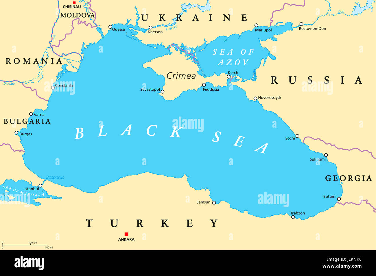 Black Sea and Sea of Azov region political map with capitals, most important cities, borders and rivers. Body of water in Eastern Europe. Stock Photohttps://www.alamy.com/image-license-details/?v=1https://www.alamy.com/stock-photo-black-sea-and-sea-of-azov-region-political-map-with-capitals-most-146722218.html
RFJEKNK6–Black Sea and Sea of Azov region political map with capitals, most important cities, borders and rivers. Body of water in Eastern Europe.
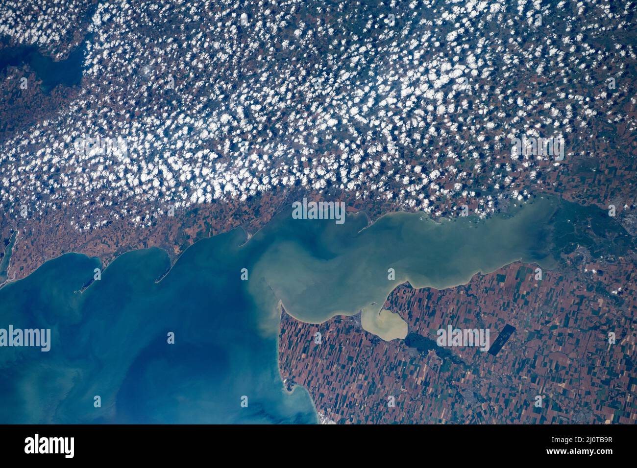 Mariupol, Ukraine, Tahanroz'ka Gulf, Mariupol, Priyut, Sea Of Azov Stock Photohttps://www.alamy.com/image-license-details/?v=1https://www.alamy.com/mariupol-ukraine-tahanrozka-gulf-mariupol-priyut-sea-of-azov-image465215683.html
RM2J0TB9R–Mariupol, Ukraine, Tahanroz'ka Gulf, Mariupol, Priyut, Sea Of Azov
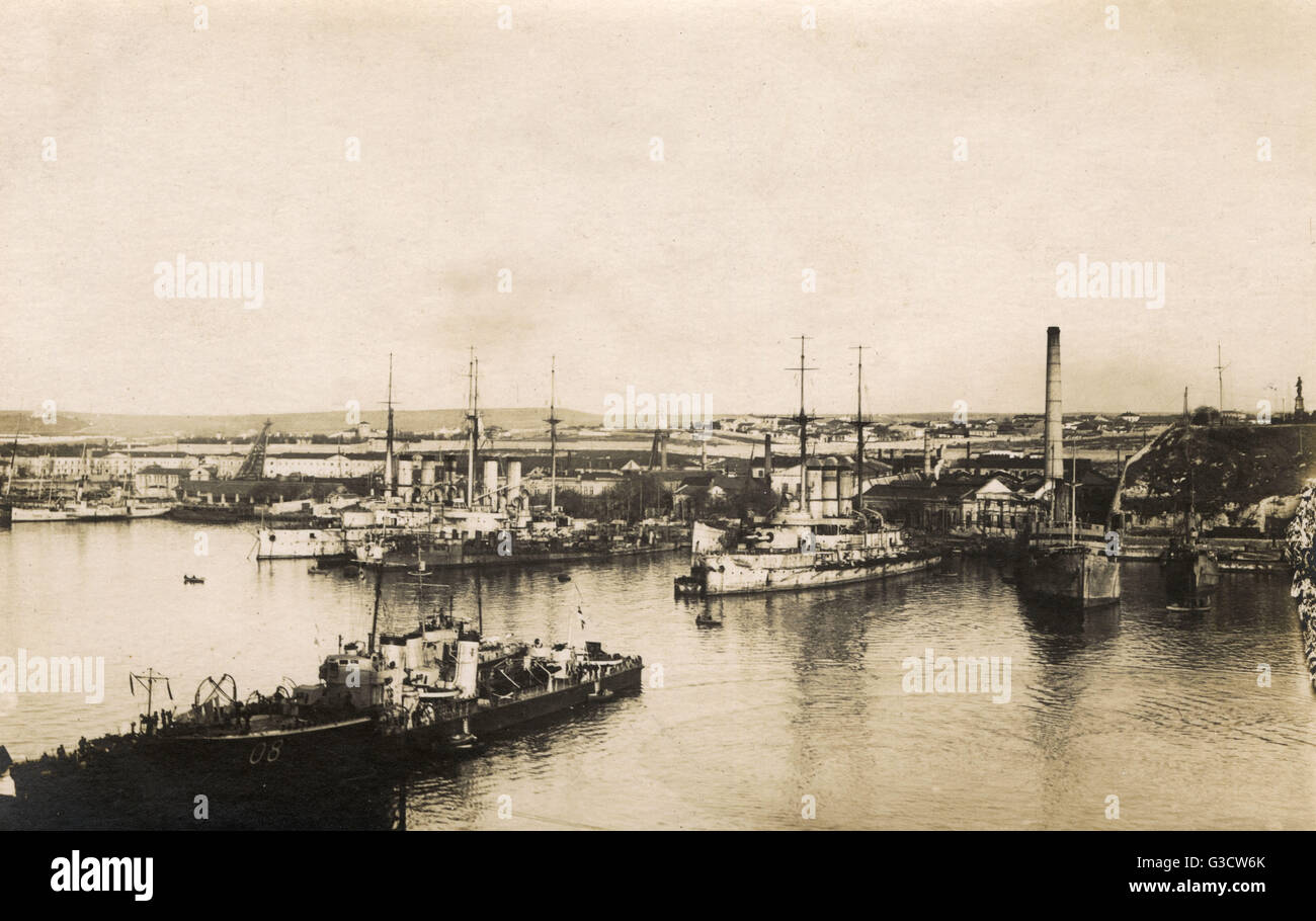 View of a port, Sea of Azov, Russia Stock Photohttps://www.alamy.com/image-license-details/?v=1https://www.alamy.com/stock-photo-view-of-a-port-sea-of-azov-russia-105389387.html
RMG3CW6K–View of a port, Sea of Azov, Russia
 Soviet prisoners of war after the battle of the Sea of Azov, 1941 Stock Photohttps://www.alamy.com/image-license-details/?v=1https://www.alamy.com/stock-photo-soviet-prisoners-of-war-after-the-battle-of-the-sea-of-azov-1941-36997440.html
RMC45AH4–Soviet prisoners of war after the battle of the Sea of Azov, 1941
 A storm over the Black Sea and the Sea of Azov. Stock Photohttps://www.alamy.com/image-license-details/?v=1https://www.alamy.com/stock-photo-a-storm-over-the-black-sea-and-the-sea-of-azov-20627149.html
RFB5FJ3W–A storm over the Black Sea and the Sea of Azov.
 SEASCAPES Lighthouse at the entrance to the sea of Azov 1855. Illustrated Times Stock Photohttps://www.alamy.com/image-license-details/?v=1https://www.alamy.com/stock-photo-seascapes-lighthouse-at-the-entrance-to-the-sea-of-azov-1855-illustrated-95366287.html
RFFF48JR–SEASCAPES Lighthouse at the entrance to the sea of Azov 1855. Illustrated Times
 The town of motorhomes and caravans on the coast of the Sea of Azov at sunrise. Arabat Spit, Ukraine Stock Photohttps://www.alamy.com/image-license-details/?v=1https://www.alamy.com/the-town-of-motorhomes-and-caravans-on-the-coast-of-the-sea-of-azov-at-sunrise-arabat-spit-ukraine-image474459663.html
RF2JFWE3Y–The town of motorhomes and caravans on the coast of the Sea of Azov at sunrise. Arabat Spit, Ukraine
 Map of the Crimea and the Sea of Azov, 1774. Artist: Kinsbergen, Jan Hendrik van (1735-1819) Stock Photohttps://www.alamy.com/image-license-details/?v=1https://www.alamy.com/stock-photo-map-of-the-crimea-and-the-sea-of-azov-1774-artist-kinsbergen-jan-hendrik-135253275.html
RMHT18X3–Map of the Crimea and the Sea of Azov, 1774. Artist: Kinsbergen, Jan Hendrik van (1735-1819)
 the coasts of the city of mariupol bathed by the Sea of Azov Stock Photohttps://www.alamy.com/image-license-details/?v=1https://www.alamy.com/the-coasts-of-the-city-of-mariupol-bathed-by-the-sea-of-azov-image478981894.html
RF2JR7E86–the coasts of the city of mariupol bathed by the Sea of Azov
 Sunrise on the Sea of Azov, sun and waves in the morning. Front view. Stock Photohttps://www.alamy.com/image-license-details/?v=1https://www.alamy.com/sunrise-on-the-sea-of-azov-sun-and-waves-in-the-morning-front-view-image488281418.html
RF2KAB3X2–Sunrise on the Sea of Azov, sun and waves in the morning. Front view.
 Kerch is one of the most ancient cities of Ukraine, and is strategically located along the Strait of Kerch between the Sea of Azov and the Black Sea. 22 August 2008. Satellite image. Stock Photohttps://www.alamy.com/image-license-details/?v=1https://www.alamy.com/kerch-is-one-of-the-most-ancient-cities-of-ukraine-and-is-strategically-located-along-the-strait-of-kerch-between-the-sea-of-azov-and-the-black-sea-22-august-2008-satellite-image-image330679081.html
RM2A5YMF5–Kerch is one of the most ancient cities of Ukraine, and is strategically located along the Strait of Kerch between the Sea of Azov and the Black Sea. 22 August 2008. Satellite image.
 Storm on the sea of Azov. Stock Photohttps://www.alamy.com/image-license-details/?v=1https://www.alamy.com/storm-on-the-sea-of-azov-image215309569.html
RFPE85FD–Storm on the sea of Azov.
 Shore landscape at the Sea of Azov in Ukraine Stock Photohttps://www.alamy.com/image-license-details/?v=1https://www.alamy.com/stock-photo-shore-landscape-at-the-sea-of-azov-in-ukraine-54294643.html
RFD499AB–Shore landscape at the Sea of Azov in Ukraine
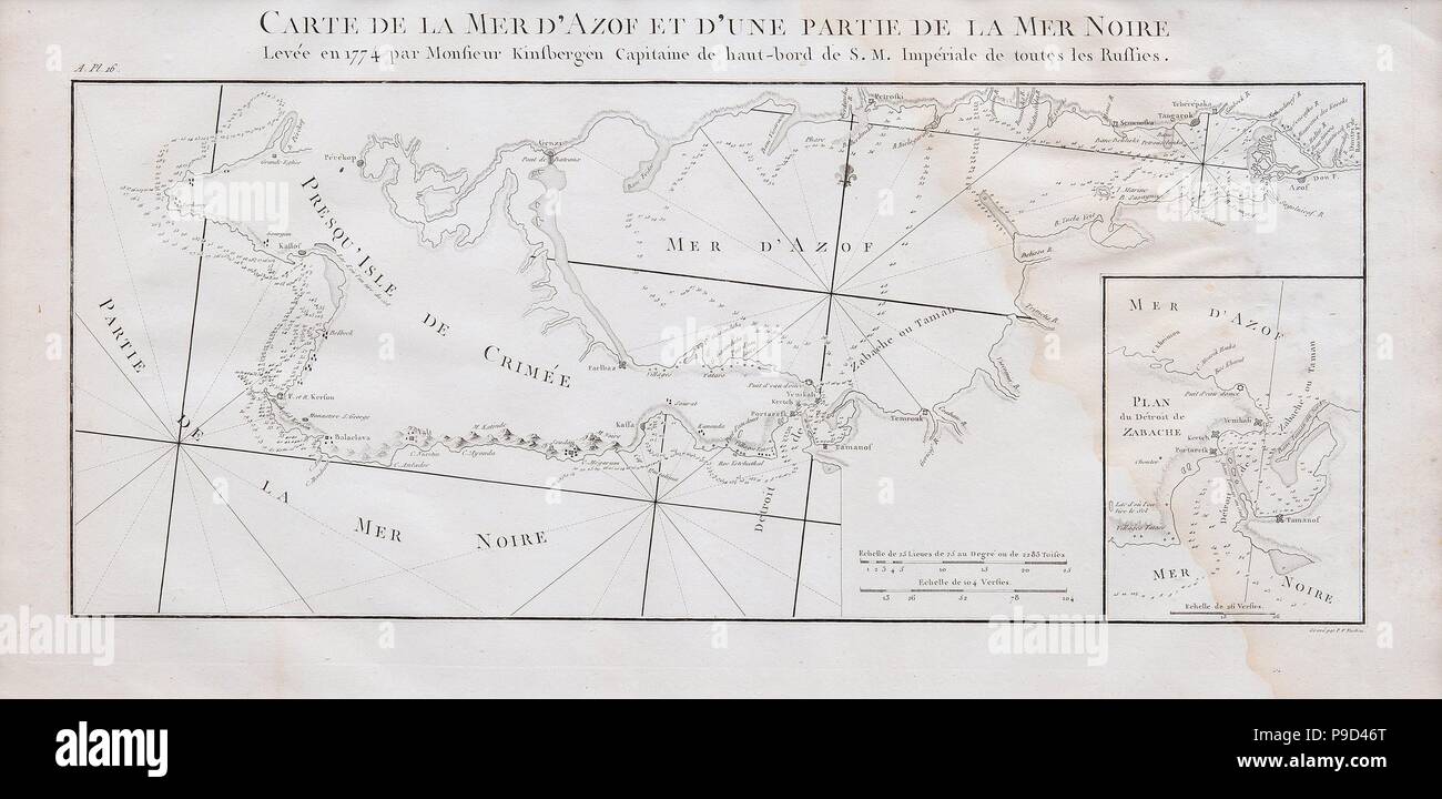 Map of the Crimea and the Sea of Azov. Museum: PRIVATE COLLECTION. Stock Photohttps://www.alamy.com/image-license-details/?v=1https://www.alamy.com/map-of-the-crimea-and-the-sea-of-azov-museum-private-collection-image212345024.html
RMP9D46T–Map of the Crimea and the Sea of Azov. Museum: PRIVATE COLLECTION.
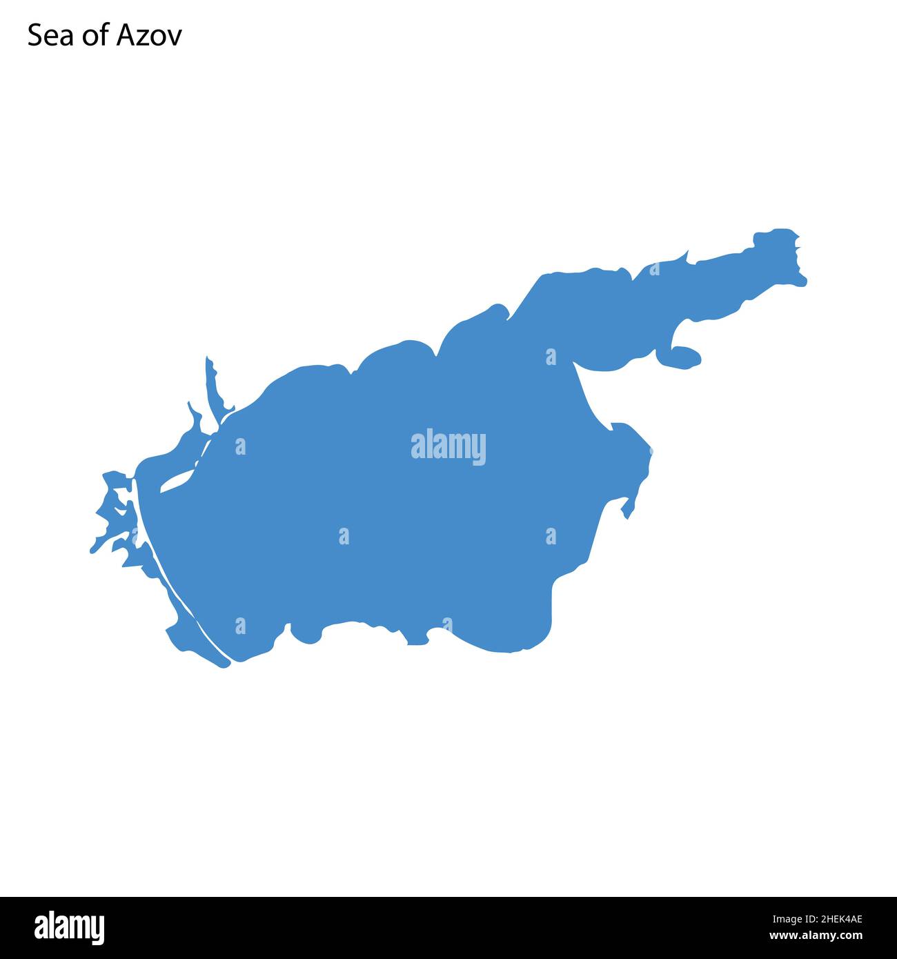 Blue outline map of Sea of Azov, Isolated vector siilhouette sea on white background Stock Vectorhttps://www.alamy.com/image-license-details/?v=1https://www.alamy.com/blue-outline-map-of-sea-of-azov-isolated-vector-siilhouette-sea-on-white-background-image456495270.html
RF2HEK4AE–Blue outline map of Sea of Azov, Isolated vector siilhouette sea on white background
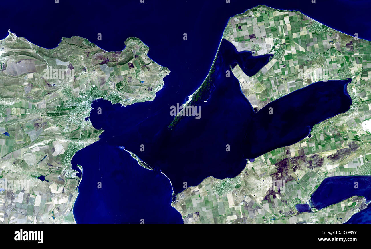 Kerch is one of the most ancient cities of Ukraine, and is strategically located along the Strait of Kerch between the Sea of Azov and the Black Sea. 22 August 2008. Satellite image. Stock Photohttps://www.alamy.com/image-license-details/?v=1https://www.alamy.com/stock-photo-kerch-is-one-of-the-most-ancient-cities-of-ukraine-and-is-strategically-57367911.html
RMD9999Y–Kerch is one of the most ancient cities of Ukraine, and is strategically located along the Strait of Kerch between the Sea of Azov and the Black Sea. 22 August 2008. Satellite image.
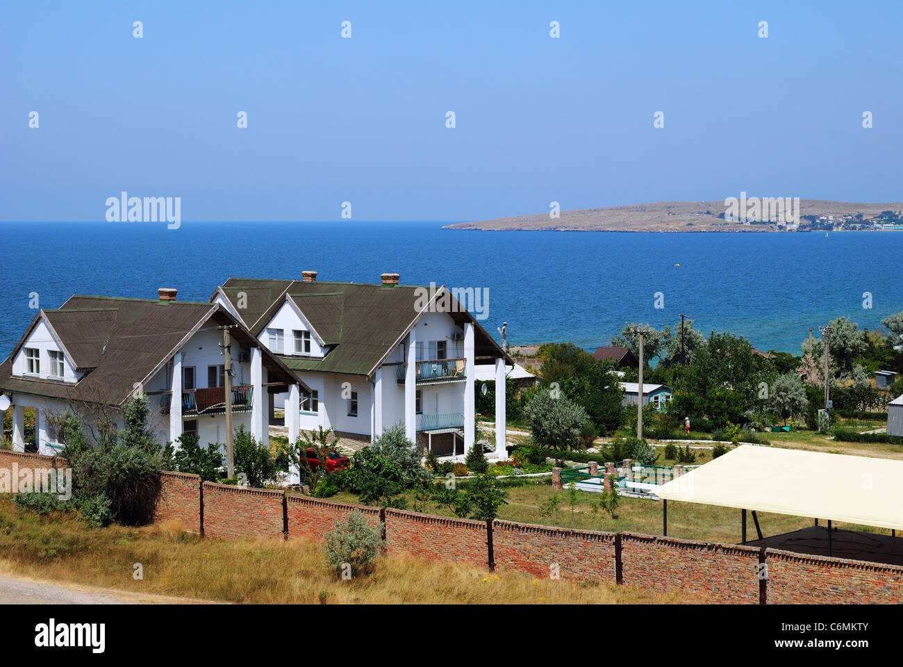 Houses in the bay of Sea of Azov, Crimea, Ukraine Stock Photohttps://www.alamy.com/image-license-details/?v=1https://www.alamy.com/stock-photo-houses-in-the-bay-of-sea-of-azov-crimea-ukraine-38563307.html
RMC6MKTY–Houses in the bay of Sea of Azov, Crimea, Ukraine
 Sea of Azov coastline on Taman Peninsula near resort village Golubickaya, Russia Stock Photohttps://www.alamy.com/image-license-details/?v=1https://www.alamy.com/stock-photo-sea-of-azov-coastline-on-taman-peninsula-near-resort-village-golubickaya-72818066.html
RFE6D456–Sea of Azov coastline on Taman Peninsula near resort village Golubickaya, Russia
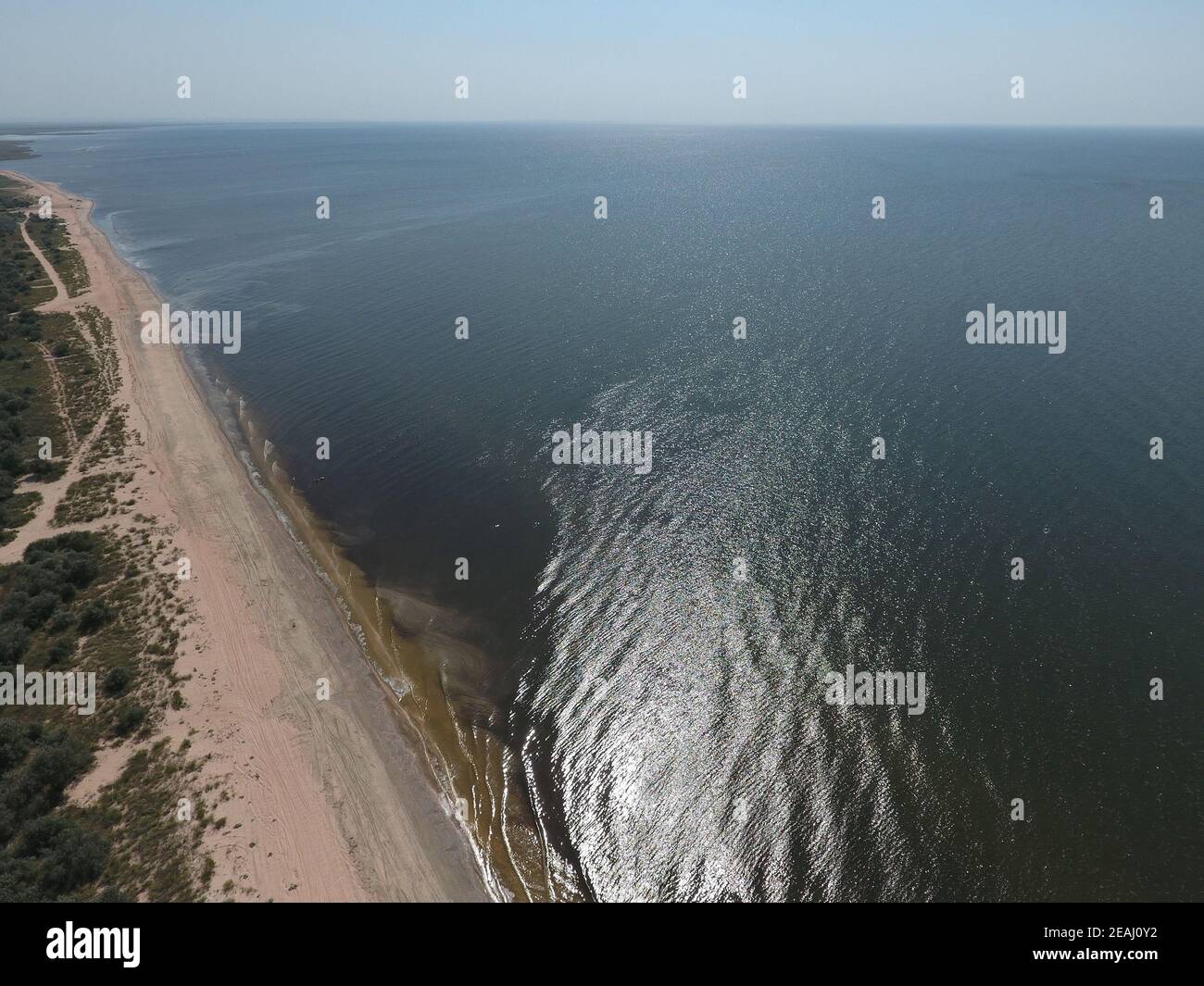 Top view of the Sea of Azov Stock Photohttps://www.alamy.com/image-license-details/?v=1https://www.alamy.com/top-view-of-the-sea-of-azov-image402380918.html
RF2EAJ0Y2–Top view of the Sea of Azov
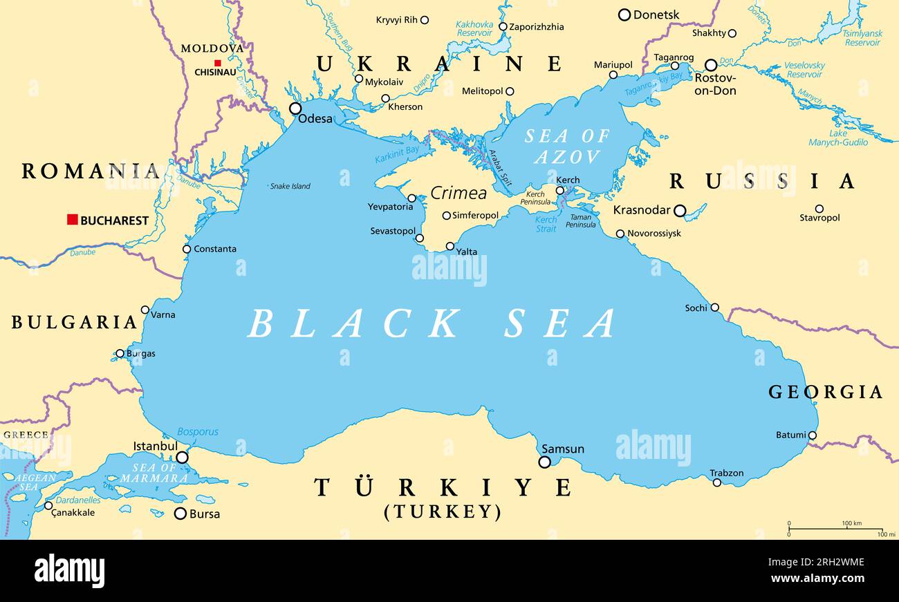 Black Sea region, political map. Located between Europe and Asia, with Crimea, Sea of Azov, Sea of Marmara, Bosporus, Dardanelles and Kerch Strait. Stock Photohttps://www.alamy.com/image-license-details/?v=1https://www.alamy.com/black-sea-region-political-map-located-between-europe-and-asia-with-crimea-sea-of-azov-sea-of-marmara-bosporus-dardanelles-and-kerch-strait-image561245006.html
RF2RH2WME–Black Sea region, political map. Located between Europe and Asia, with Crimea, Sea of Azov, Sea of Marmara, Bosporus, Dardanelles and Kerch Strait.
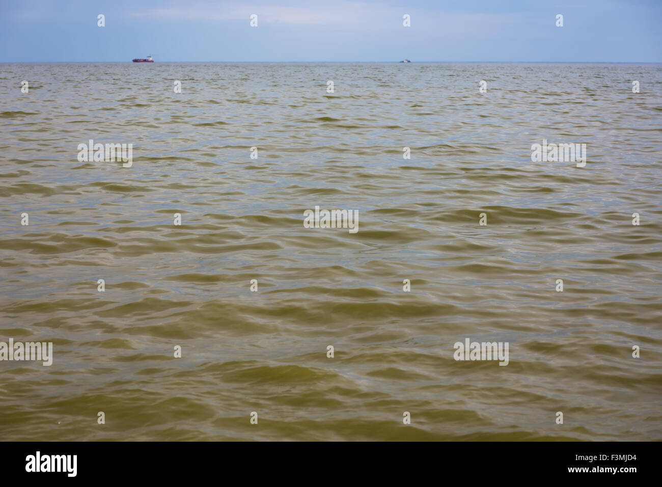 Azov sea in Taganrog, Russia Stock Photohttps://www.alamy.com/image-license-details/?v=1https://www.alamy.com/stock-photo-azov-sea-in-taganrog-russia-88349328.html
RFF3MJD4–Azov sea in Taganrog, Russia
 Dawn over the sea. Sea of Azov. Sunrise. Stock Photohttps://www.alamy.com/image-license-details/?v=1https://www.alamy.com/dawn-over-the-sea-sea-of-azov-sunrise-image369962549.html
RM2CDW705–Dawn over the sea. Sea of Azov. Sunrise.
 Tanks and Waffen SS during combat in a city on the Sea of Azov, 1941 Stock Photohttps://www.alamy.com/image-license-details/?v=1https://www.alamy.com/stock-photo-tanks-and-waffen-ss-during-combat-in-a-city-on-the-sea-of-azov-1941-36995705.html
RMC458B5–Tanks and Waffen SS during combat in a city on the Sea of Azov, 1941
 Map of the Sea of Azov. George Dodd. Pictorial history of the Russian war 1854 5 6 Stock Photohttps://www.alamy.com/image-license-details/?v=1https://www.alamy.com/stock-photo-map-of-the-sea-of-azov-george-dodd-pictorial-history-of-the-russian-140189107.html
RMJ424HR–Map of the Sea of Azov. George Dodd. Pictorial history of the Russian war 1854 5 6
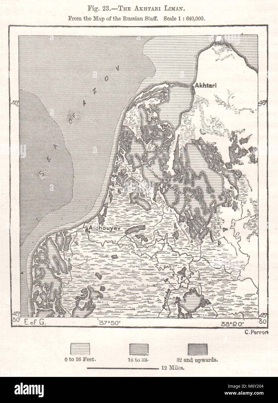 The Akhatari Liman. Sea of Azov. Krasnodar. Russia. Sketch map 1885 old Stock Photohttps://www.alamy.com/image-license-details/?v=1https://www.alamy.com/stock-photo-the-akhatari-liman-sea-of-azov-krasnodar-russia-sketch-map-1885-old-176385892.html
RFM6Y204–The Akhatari Liman. Sea of Azov. Krasnodar. Russia. Sketch map 1885 old
 Picturesque Sunset over the field of sunflowers. Sunflower harvest at sunset near the Sea of Azov in Ukraine. Endless sunflower fields to the horizon. Stock Photohttps://www.alamy.com/image-license-details/?v=1https://www.alamy.com/picturesque-sunset-over-the-field-of-sunflowers-sunflower-harvest-at-sunset-near-the-sea-of-azov-in-ukraine-endless-sunflower-fields-to-the-horizon-image552191488.html
RF2R2ADTG–Picturesque Sunset over the field of sunflowers. Sunflower harvest at sunset near the Sea of Azov in Ukraine. Endless sunflower fields to the horizon.
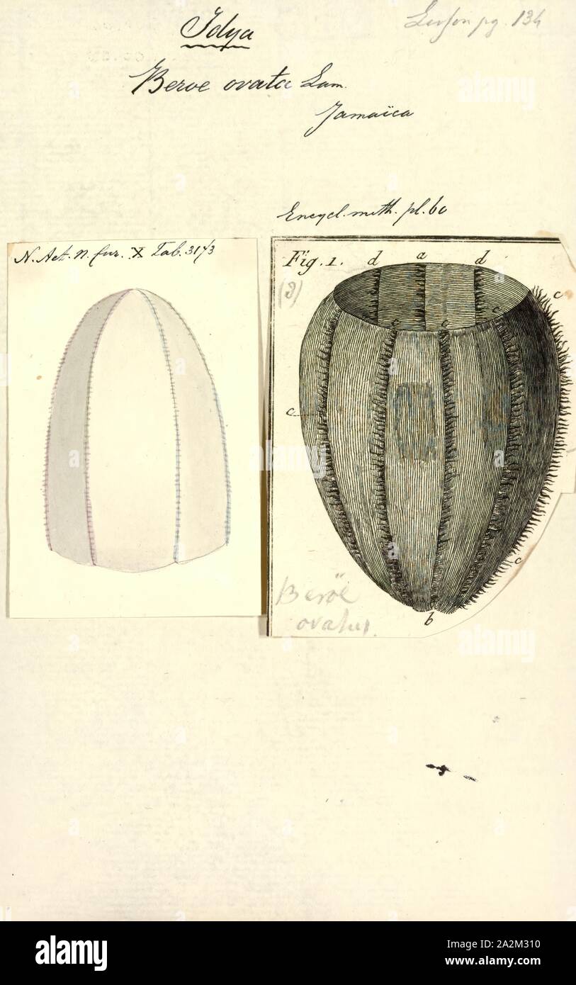 Beroe ovata, Print, Beroe ovata is a comb jelly in the family Beroidae. It is found in the South Atlantic Ocean and the Mediterranean Sea and has been introduced into the Black Sea, the Aegean Sea, the Sea of Azov and the Caspian Sea. It was first described by the French physician and zoologist Jean Guillaume Bruguière in 1789 Stock Photohttps://www.alamy.com/image-license-details/?v=1https://www.alamy.com/beroe-ovata-print-beroe-ovata-is-a-comb-jelly-in-the-family-beroidae-it-is-found-in-the-south-atlantic-ocean-and-the-mediterranean-sea-and-has-been-introduced-into-the-black-sea-the-aegean-sea-the-sea-of-azov-and-the-caspian-sea-it-was-first-described-by-the-french-physician-and-zoologist-jean-guillaume-bruguire-in-1789-image328667724.html
RM2A2M310–Beroe ovata, Print, Beroe ovata is a comb jelly in the family Beroidae. It is found in the South Atlantic Ocean and the Mediterranean Sea and has been introduced into the Black Sea, the Aegean Sea, the Sea of Azov and the Caspian Sea. It was first described by the French physician and zoologist Jean Guillaume Bruguière in 1789
 the coasts of the city of mariupol bathed by the Sea of Azov Stock Photohttps://www.alamy.com/image-license-details/?v=1https://www.alamy.com/the-coasts-of-the-city-of-mariupol-bathed-by-the-sea-of-azov-image478981861.html
RF2JR7E71–the coasts of the city of mariupol bathed by the Sea of Azov
 Sunrise on the Sea of Azov, sun and waves in the morning. Front view. Stock Photohttps://www.alamy.com/image-license-details/?v=1https://www.alamy.com/sunrise-on-the-sea-of-azov-sun-and-waves-in-the-morning-front-view-image488281479.html
RF2KAB407–Sunrise on the Sea of Azov, sun and waves in the morning. Front view.
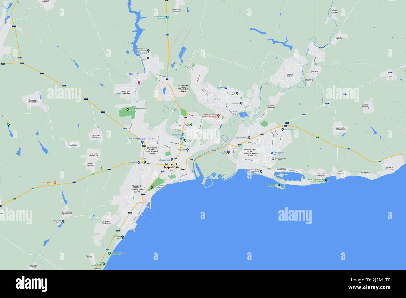 Mariupol on Ukraine map, city at Sea of Azov in Donetsk region (Donbass). Ukraine-Russia crisis, conflict and war. Stock Photohttps://www.alamy.com/image-license-details/?v=1https://www.alamy.com/mariupol-on-ukraine-map-city-at-sea-of-azov-in-donetsk-region-donbass-ukraine-russia-crisis-conflict-and-war-image465735110.html
RF2J1M1TP–Mariupol on Ukraine map, city at Sea of Azov in Donetsk region (Donbass). Ukraine-Russia crisis, conflict and war.
 Storm on the sea of Azov. Stock Photohttps://www.alamy.com/image-license-details/?v=1https://www.alamy.com/storm-on-the-sea-of-azov-image215309566.html
RFPE85FA–Storm on the sea of Azov.
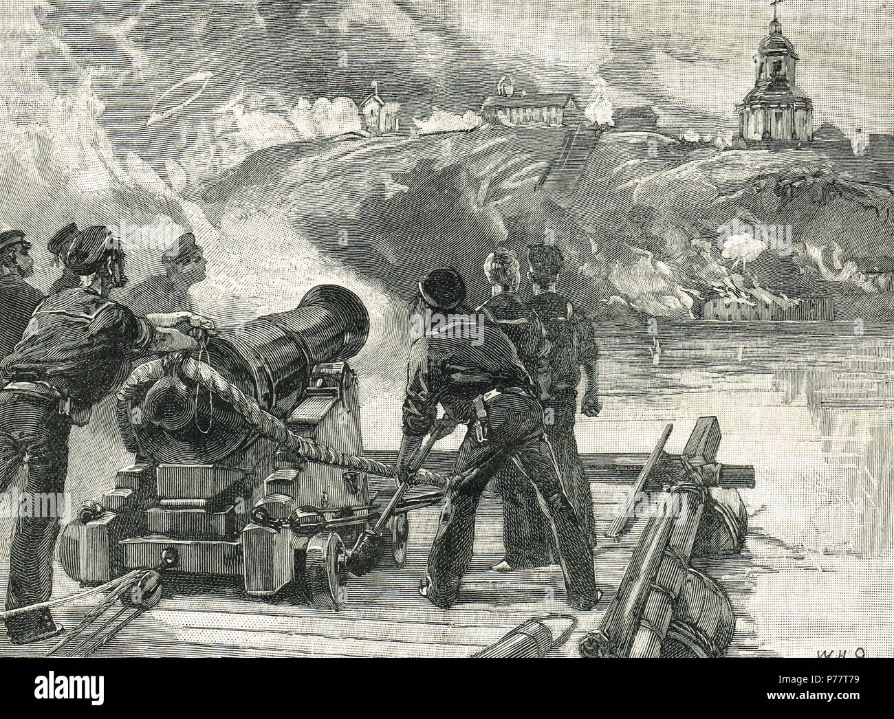 Volunteers of the Flying Squadron, firing the shipping, Siege of Taganrog, 1855 Stock Photohttps://www.alamy.com/image-license-details/?v=1https://www.alamy.com/volunteers-of-the-flying-squadron-firing-the-shipping-siege-of-taganrog-1855-image210999693.html
RMP77T79–Volunteers of the Flying Squadron, firing the shipping, Siege of Taganrog, 1855
 Ukraine. Autonomous Republc of Crimea. Kerch. The Kerch Strait, which connects the Sea of Azov with the Black Sea and the Byzantine Church of St. John the Baptist. 8th century. Stock Photohttps://www.alamy.com/image-license-details/?v=1https://www.alamy.com/ukraine-autonomous-republc-of-crimea-kerch-the-kerch-strait-which-connects-the-sea-of-azov-with-the-black-sea-and-the-byzantine-church-of-st-john-the-baptist-8th-century-image209659403.html
RMP52PKR–Ukraine. Autonomous Republc of Crimea. Kerch. The Kerch Strait, which connects the Sea of Azov with the Black Sea and the Byzantine Church of St. John the Baptist. 8th century.
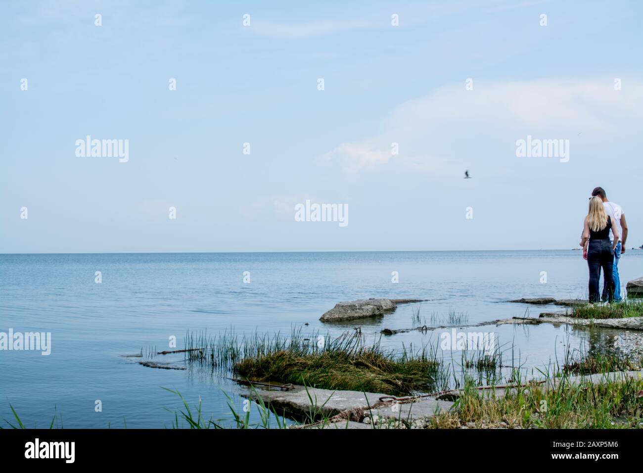 Sea Of Azov Stock Photohttps://www.alamy.com/image-license-details/?v=1https://www.alamy.com/sea-of-azov-image343465478.html
RF2AXP5M6–Sea Of Azov
 . The Bologna edition of Ptolemy's Geography: Eastern Europe to the Sea of Azov English: Map 9 Latina: Tabula 9 . 1477. Bodleian Libraries, Eastern Europe to the Sea of Azov Stock Photohttps://www.alamy.com/image-license-details/?v=1https://www.alamy.com/the-bologna-edition-of-ptolemys-geography-eastern-europe-to-the-sea-of-azov-english-map-9-latina-tabula-9-1477-bodleian-libraries-eastern-europe-to-the-sea-of-azov-image184929039.html
RMMMT6TF–. The Bologna edition of Ptolemy's Geography: Eastern Europe to the Sea of Azov English: Map 9 Latina: Tabula 9 . 1477. Bodleian Libraries, Eastern Europe to the Sea of Azov
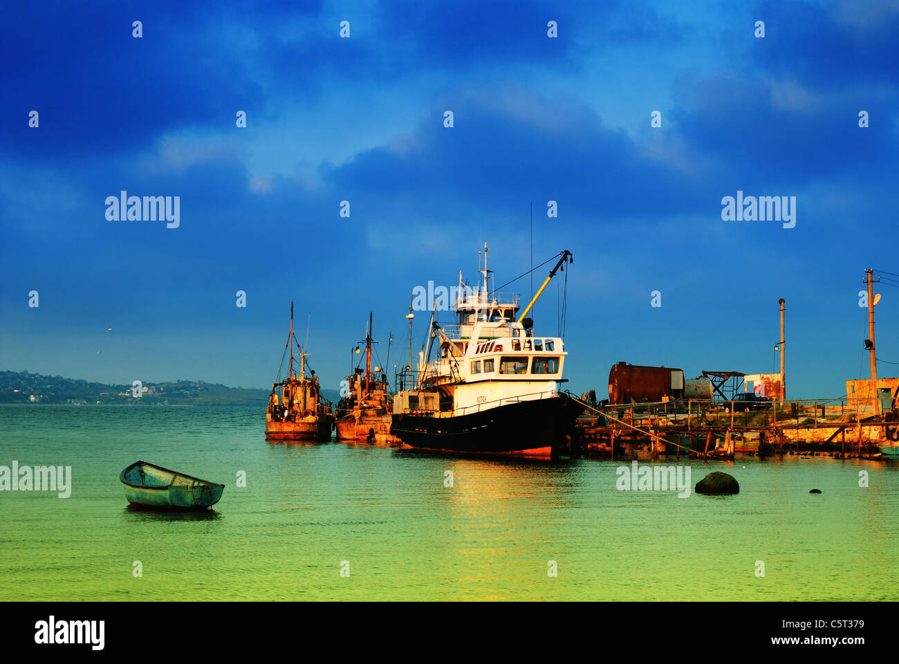 Kazantyp Bay West in early morning light, Sea of Azov, Crimea, Ukraine Stock Photohttps://www.alamy.com/image-license-details/?v=1https://www.alamy.com/stock-photo-kazantyp-bay-west-in-early-morning-light-sea-of-azov-crimea-ukraine-38023421.html
RMC5T379–Kazantyp Bay West in early morning light, Sea of Azov, Crimea, Ukraine
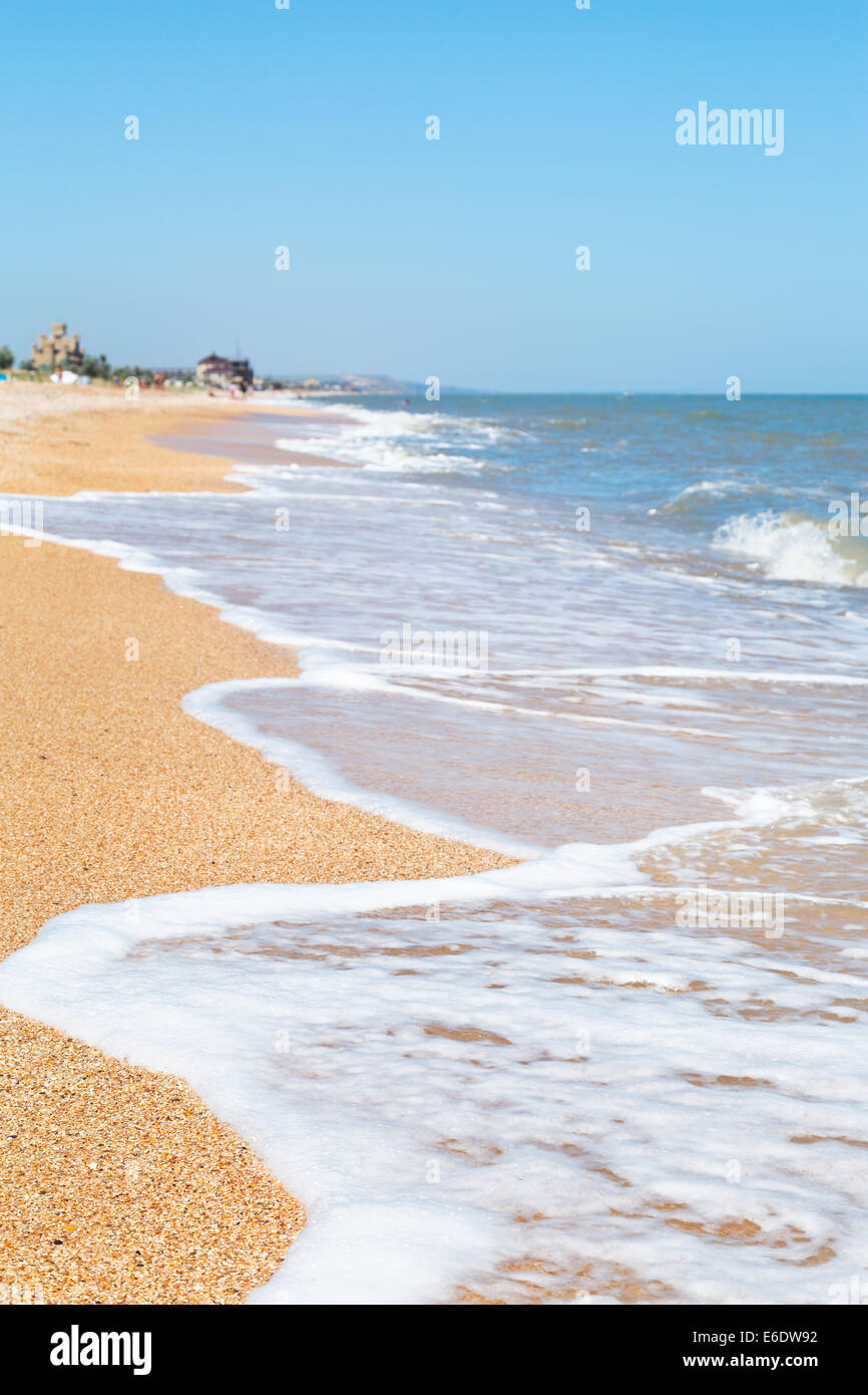 sand and seashells beach of Sea of Azov in resort Golubickaya, Taman Peninsula, Russia Stock Photohttps://www.alamy.com/image-license-details/?v=1https://www.alamy.com/stock-photo-sand-and-seashells-beach-of-sea-of-azov-in-resort-golubickaya-taman-72834638.html
RFE6DW92–sand and seashells beach of Sea of Azov in resort Golubickaya, Taman Peninsula, Russia
 Top view of the Sea of Azov Stock Photohttps://www.alamy.com/image-license-details/?v=1https://www.alamy.com/top-view-of-the-sea-of-azov-image402421777.html
RF2EAKW29–Top view of the Sea of Azov
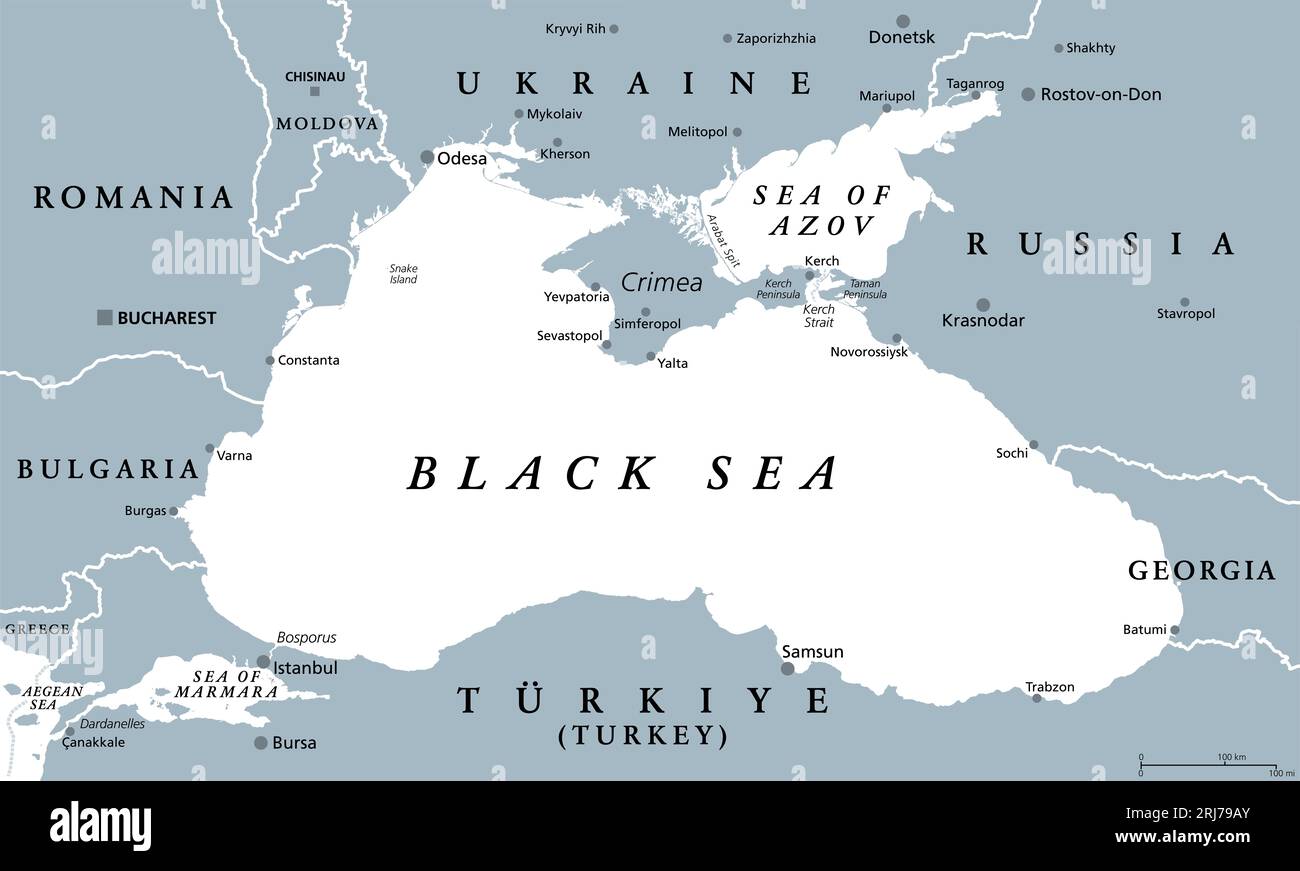 Black Sea region, gray political map. Marginal mediterranean sea of the Atlantic Ocean, between Europe and Asia. With Crimea and the Sea of Azov. Stock Photohttps://www.alamy.com/image-license-details/?v=1https://www.alamy.com/black-sea-region-gray-political-map-marginal-mediterranean-sea-of-the-atlantic-ocean-between-europe-and-asia-with-crimea-and-the-sea-of-azov-image561956611.html
RF2RJ79AY–Black Sea region, gray political map. Marginal mediterranean sea of the Atlantic Ocean, between Europe and Asia. With Crimea and the Sea of Azov.
 Azov sea in Taganrog, Russia Stock Photohttps://www.alamy.com/image-license-details/?v=1https://www.alamy.com/stock-photo-azov-sea-in-taganrog-russia-88963788.html
RFF4MJ64–Azov sea in Taganrog, Russia
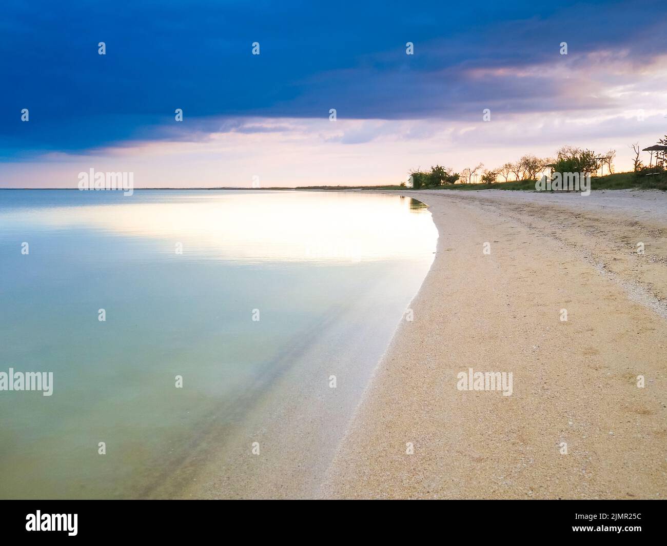 Panoramic view of the sandy shore of the Sea of Azov at sunset. Stock Photohttps://www.alamy.com/image-license-details/?v=1https://www.alamy.com/panoramic-view-of-the-sandy-shore-of-the-sea-of-azov-at-sunset-image477479672.html
RF2JMR25C–Panoramic view of the sandy shore of the Sea of Azov at sunset.
 Antitank defense of the Waffen SS during combat at the Sea of Azov, 1941 Stock Photohttps://www.alamy.com/image-license-details/?v=1https://www.alamy.com/stock-photo-antitank-defense-of-the-waffen-ss-during-combat-at-the-sea-of-azov-36995729.html
RMC458C1–Antitank defense of the Waffen SS during combat at the Sea of Azov, 1941
 Azov sea coast, Russia Stock Photohttps://www.alamy.com/image-license-details/?v=1https://www.alamy.com/azov-sea-coast-russia-image503034338.html
RM2M6B5C2–Azov sea coast, Russia
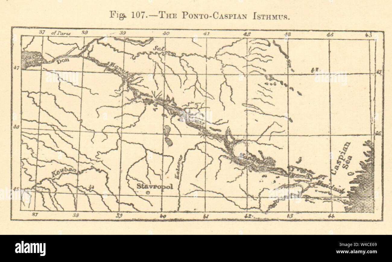 The Ponto-Caspian Isthmus. Russia. Stavropol Sea of Azov. SMALL sketch map 1886 Stock Photohttps://www.alamy.com/image-license-details/?v=1https://www.alamy.com/the-ponto-caspian-isthmus-russia-stavropol-sea-of-azov-small-sketch-map-1886-image260888721.html
RFW4CE69–The Ponto-Caspian Isthmus. Russia. Stavropol Sea of Azov. SMALL sketch map 1886
 Sea of Azov-NASA Stock Photohttps://www.alamy.com/image-license-details/?v=1https://www.alamy.com/stock-image-sea-of-azov-nasa-169389145.html
RMKRG9G9–Sea of Azov-NASA
 Bodleian Libraries, Eastern Europe to the Sea of Azov Stock Photohttps://www.alamy.com/image-license-details/?v=1https://www.alamy.com/stock-photo-bodleian-libraries-eastern-europe-to-the-sea-of-azov-132682214.html
RMHKT5EE–Bodleian Libraries, Eastern Europe to the Sea of Azov
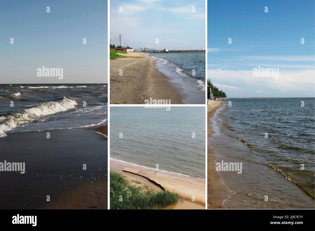 the coasts of the city of mariupol bathed by the Sea of Azov Stock Photohttps://www.alamy.com/image-license-details/?v=1https://www.alamy.com/the-coasts-of-the-city-of-mariupol-bathed-by-the-sea-of-azov-image478981887.html
RF2JR7E7Y–the coasts of the city of mariupol bathed by the Sea of Azov
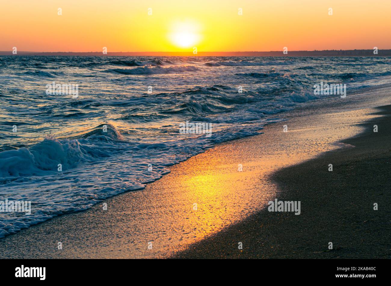 Sunrise on the Sea of Azov, sun and waves in the morning. Front view. Stock Photohttps://www.alamy.com/image-license-details/?v=1https://www.alamy.com/sunrise-on-the-sea-of-azov-sun-and-waves-in-the-morning-front-view-image488281484.html
RF2KAB40C–Sunrise on the Sea of Azov, sun and waves in the morning. Front view.
 View of the Sea of Azov on a hot summer day Stock Photohttps://www.alamy.com/image-license-details/?v=1https://www.alamy.com/view-of-the-sea-of-azov-on-a-hot-summer-day-image232446972.html
RFRE4TDG–View of the Sea of Azov on a hot summer day
 Storm on the sea of Azov. Stock Photohttps://www.alamy.com/image-license-details/?v=1https://www.alamy.com/storm-on-the-sea-of-azov-image215309557.html
RFPE85F1–Storm on the sea of Azov.
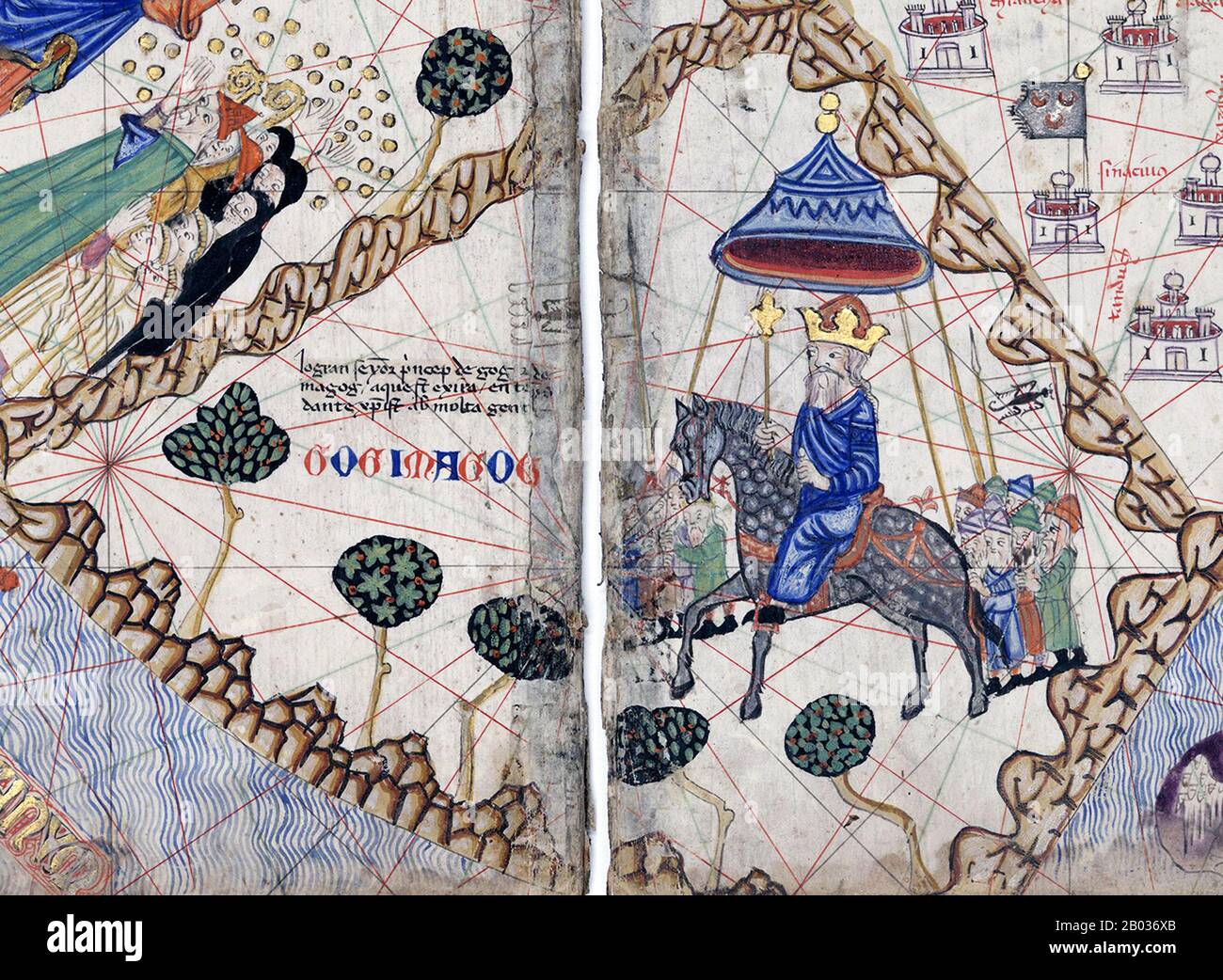 The Catalan Atlas (1375) is the most important Catalan map of the medieval period. It was produced by the Majorcan cartographic school and is attributed to Cresques Abraham, a Jewish book illuminator who was self-described as being a master of the maps of the world as well as compasses. It has been in the royal library of France (now the Bibliotheque nationale de France) since the late 14th century. The 1st century Jewish historian Josephus identified the Gog and Magog people as Scythians, horse-riding barbarians from around the Don and the Sea of Azov. Josephus recounts the tradition that Go Stock Photohttps://www.alamy.com/image-license-details/?v=1https://www.alamy.com/the-catalan-atlas-1375-is-the-most-important-catalan-map-of-the-medieval-period-it-was-produced-by-the-majorcan-cartographic-school-and-is-attributed-to-cresques-abraham-a-jewish-book-illuminator-who-was-self-described-as-being-a-master-of-the-maps-of-the-world-as-well-as-compasses-it-has-been-in-the-royal-library-of-france-now-the-bibliotheque-nationale-de-france-since-the-late-14th-century-the-1st-century-jewish-historian-josephus-identified-the-gog-and-magog-people-as-scythians-horse-riding-barbarians-from-around-the-don-and-the-sea-of-azov-josephus-recounts-the-tradition-that-go-image344278659.html
RM2B036XB–The Catalan Atlas (1375) is the most important Catalan map of the medieval period. It was produced by the Majorcan cartographic school and is attributed to Cresques Abraham, a Jewish book illuminator who was self-described as being a master of the maps of the world as well as compasses. It has been in the royal library of France (now the Bibliotheque nationale de France) since the late 14th century. The 1st century Jewish historian Josephus identified the Gog and Magog people as Scythians, horse-riding barbarians from around the Don and the Sea of Azov. Josephus recounts the tradition that Go
 Ukraine. Autonomous Republc of Crimea. Kerch. The Kerch Strait, which connects the Sea of Azov with the Black Sea and the Byzantine Church of St. John the Baptist. 8th century. Stock Photohttps://www.alamy.com/image-license-details/?v=1https://www.alamy.com/ukraine-autonomous-republc-of-crimea-kerch-the-kerch-strait-which-connects-the-sea-of-azov-with-the-black-sea-and-the-byzantine-church-of-st-john-the-baptist-8th-century-image209659412.html
RMP52PM4–Ukraine. Autonomous Republc of Crimea. Kerch. The Kerch Strait, which connects the Sea of Azov with the Black Sea and the Byzantine Church of St. John the Baptist. 8th century.
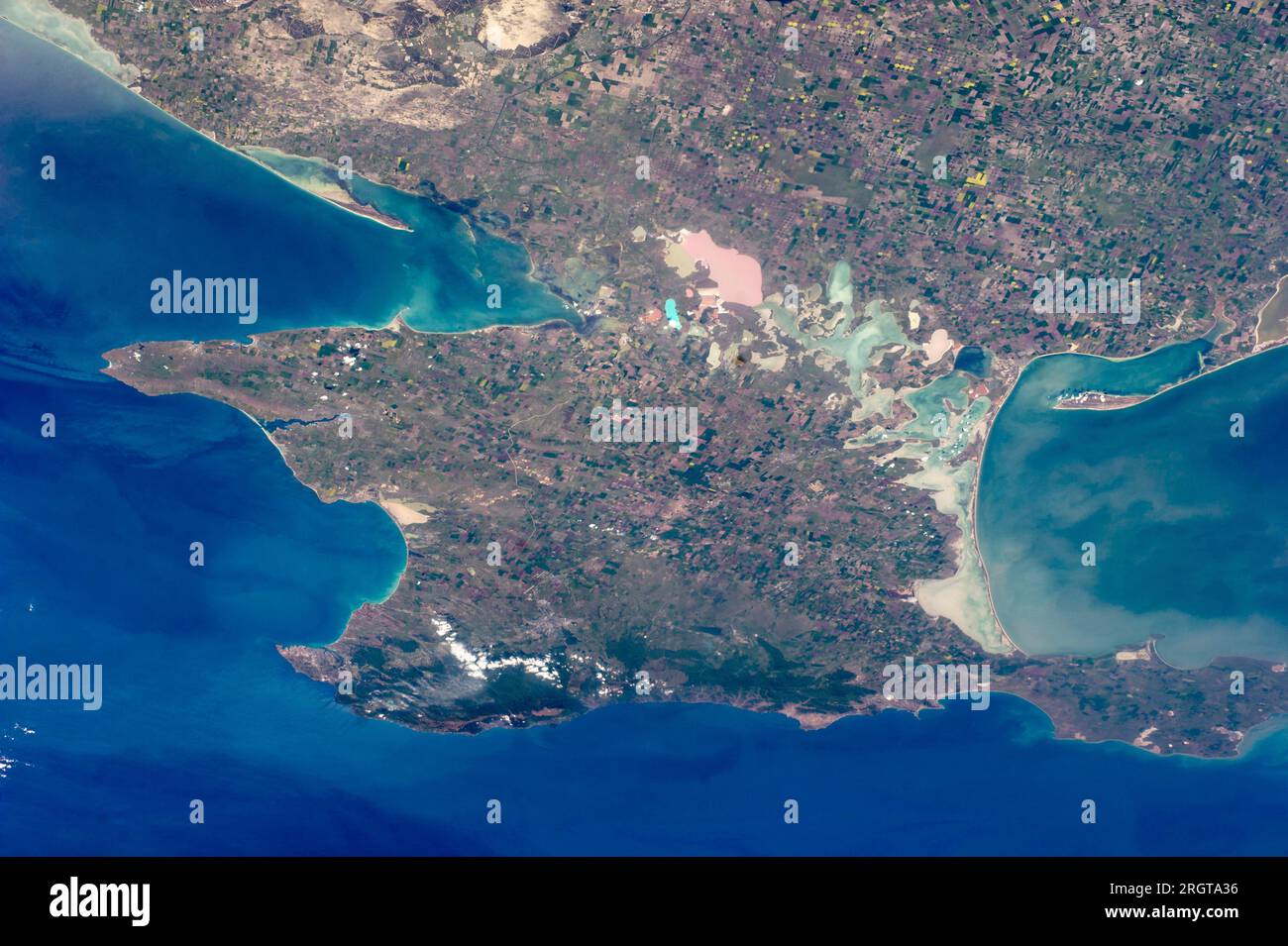 Crimea, Ukraine. 07 May, 2014. A view from onboard the International Space Station of the entire Crimean Peninsula jutting into the Black Sea. A series of shallow lagoons and wetlands known as the Sivash lakes separates the peninsula from the mainland of Ukraine. Credit: NASA/NASA/Alamy Live News Stock Photohttps://www.alamy.com/image-license-details/?v=1https://www.alamy.com/crimea-ukraine-07-may-2014-a-view-from-onboard-the-international-space-station-of-the-entire-crimean-peninsula-jutting-into-the-black-sea-a-series-of-shallow-lagoons-and-wetlands-known-as-the-sivash-lakes-separates-the-peninsula-from-the-mainland-of-ukraine-credit-nasanasaalamy-live-news-image561101050.html
RM2RGTA36–Crimea, Ukraine. 07 May, 2014. A view from onboard the International Space Station of the entire Crimean Peninsula jutting into the Black Sea. A series of shallow lagoons and wetlands known as the Sivash lakes separates the peninsula from the mainland of Ukraine. Credit: NASA/NASA/Alamy Live News
 W.658.372a Piri Reis (Turkish, 1465-1555). 'Leaf from Book on Navigation,' 17th-18th century. ink, paint, and gold on paper. Walters Art Museum (W.658.372A): Acquired by Henry Walters. Piri Reis - Map of the Crimea, the Sea of Azov, and the Mouth of the Dnieper - Walters W658372A - Full Page Stock Photohttps://www.alamy.com/image-license-details/?v=1https://www.alamy.com/w658372a-piri-reis-turkish-1465-1555-leaf-from-book-on-navigation-17th-18th-century-ink-paint-and-gold-on-paper-walters-art-museum-w658372a-acquired-by-henry-walters-piri-reis-map-of-the-crimea-the-sea-of-azov-and-the-mouth-of-the-dnieper-walters-w658372a-full-page-image184871593.html
RMMMNHGW–W.658.372a Piri Reis (Turkish, 1465-1555). 'Leaf from Book on Navigation,' 17th-18th century. ink, paint, and gold on paper. Walters Art Museum (W.658.372A): Acquired by Henry Walters. Piri Reis - Map of the Crimea, the Sea of Azov, and the Mouth of the Dnieper - Walters W658372A - Full Page
 Black Sea and Azov Sea, paper origami style, geographic map, low poly graphic design. Vector illustration. Stock Vectorhttps://www.alamy.com/image-license-details/?v=1https://www.alamy.com/black-sea-and-azov-sea-paper-origami-style-geographic-map-low-poly-graphic-design-vector-illustration-image452437841.html
RF2H82929–Black Sea and Azov Sea, paper origami style, geographic map, low poly graphic design. Vector illustration.
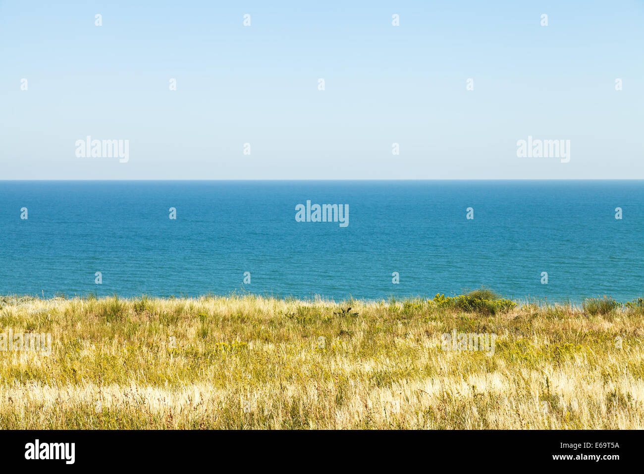 view of Sea of Azov from Taman Peninsula near resort village Golubickaya, Russia Stock Photohttps://www.alamy.com/image-license-details/?v=1https://www.alamy.com/stock-photo-view-of-sea-of-azov-from-taman-peninsula-near-resort-village-golubickaya-72745942.html
RFE69T5A–view of Sea of Azov from Taman Peninsula near resort village Golubickaya, Russia
 Top view of the Sea of Azov Stock Photohttps://www.alamy.com/image-license-details/?v=1https://www.alamy.com/top-view-of-the-sea-of-azov-image402380880.html
RF2EAJ0WM–Top view of the Sea of Azov
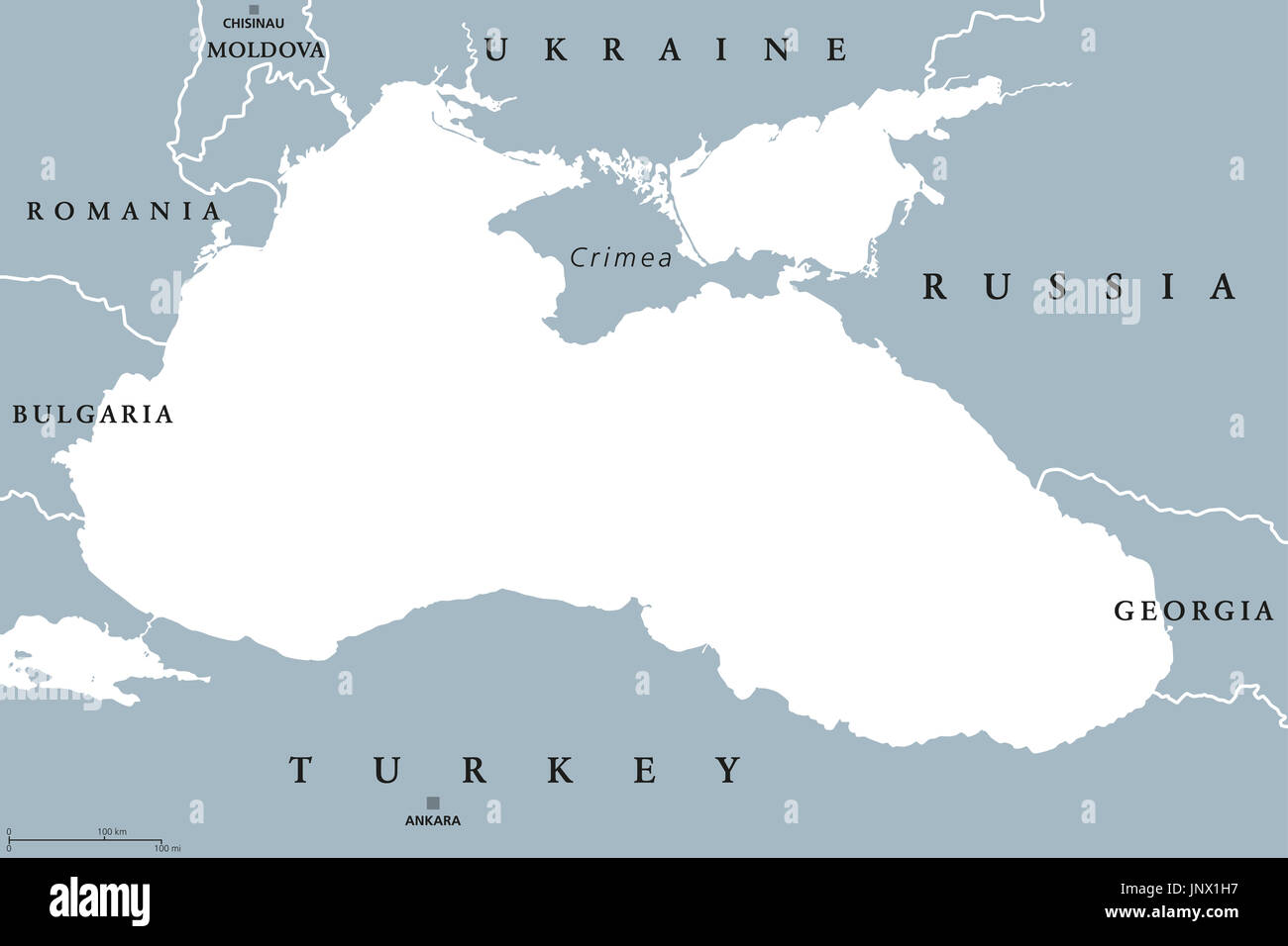 Black Sea and Sea of Azov region political map with capitals and borders. Body of water between Eastern Europe and Western Asia. Illustration. Stock Photohttps://www.alamy.com/image-license-details/?v=1https://www.alamy.com/black-sea-and-sea-of-azov-region-political-map-with-capitals-and-borders-image151162739.html
RFJNX1H7–Black Sea and Sea of Azov region political map with capitals and borders. Body of water between Eastern Europe and Western Asia. Illustration.
 Closeup of the Azov sea in Taganrog, Russia Stock Photohttps://www.alamy.com/image-license-details/?v=1https://www.alamy.com/stock-photo-closeup-of-the-azov-sea-in-taganrog-russia-88349326.html
RFF3MJD2–Closeup of the Azov sea in Taganrog, Russia
 Jellyfish on the shore of the Sea of Azov, on the beach on a summer day Stock Photohttps://www.alamy.com/image-license-details/?v=1https://www.alamy.com/jellyfish-on-the-shore-of-the-sea-of-azov-on-the-beach-on-a-summer-day-image595951167.html
RF2WHFWP7–Jellyfish on the shore of the Sea of Azov, on the beach on a summer day
![A German police boat protects local fishermen in the Sea of Azov. Photo: Deman. [automated translation] Stock Photo A German police boat protects local fishermen in the Sea of Azov. Photo: Deman. [automated translation] Stock Photo](https://c8.alamy.com/comp/2XKAW5H/a-german-police-boat-protects-local-fishermen-in-the-sea-of-azov-photo-deman-automated-translation-2XKAW5H.jpg) A German police boat protects local fishermen in the Sea of Azov. Photo: Deman. [automated translation] Stock Photohttps://www.alamy.com/image-license-details/?v=1https://www.alamy.com/a-german-police-boat-protects-local-fishermen-in-the-sea-of-azov-photo-deman-automated-translation-image614280621.html
A German police boat protects local fishermen in the Sea of Azov. Photo: Deman. [automated translation] Stock Photohttps://www.alamy.com/image-license-details/?v=1https://www.alamy.com/a-german-police-boat-protects-local-fishermen-in-the-sea-of-azov-photo-deman-automated-translation-image614280621.htmlRM2XKAW5H–A German police boat protects local fishermen in the Sea of Azov. Photo: Deman. [automated translation]
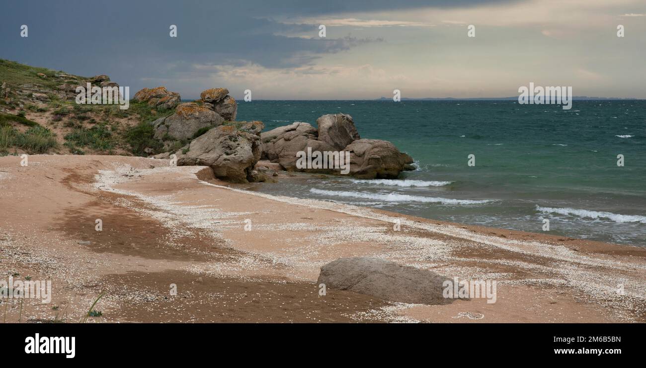 Azov sea coast, Russia Stock Photohttps://www.alamy.com/image-license-details/?v=1https://www.alamy.com/azov-sea-coast-russia-image503034329.html
RM2M6B5BN–Azov sea coast, Russia
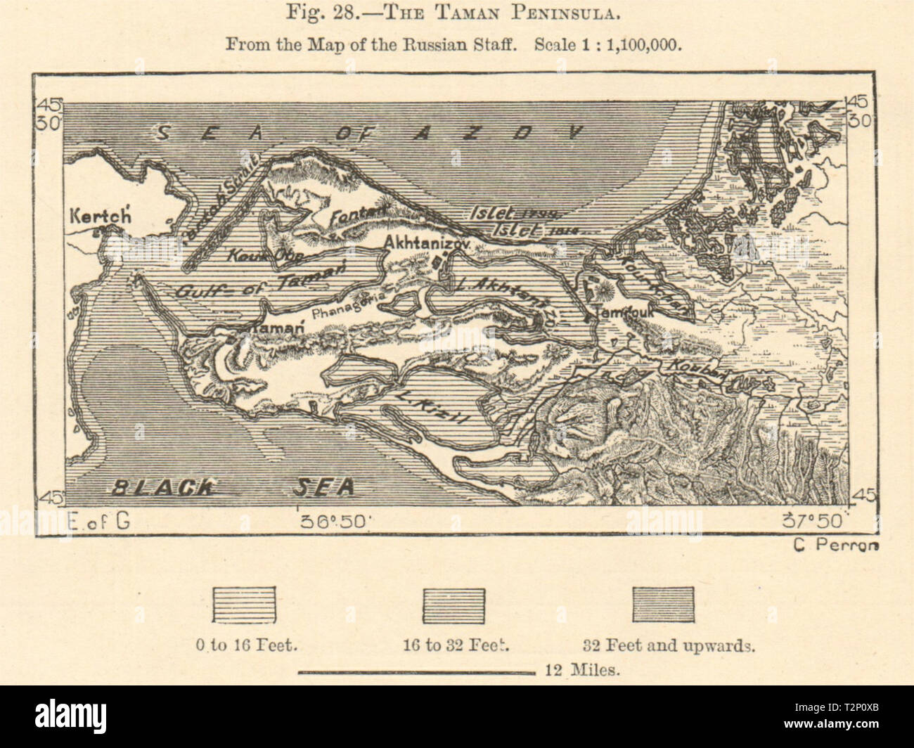 The Taman Peninsula. Sea of Azov. Black Sea. Russia. Sketch map 1885 old Stock Photohttps://www.alamy.com/image-license-details/?v=1https://www.alamy.com/the-taman-peninsula-sea-of-azov-black-sea-russia-sketch-map-1885-old-image242658147.html
RFT2P0XB–The Taman Peninsula. Sea of Azov. Black Sea. Russia. Sketch map 1885 old
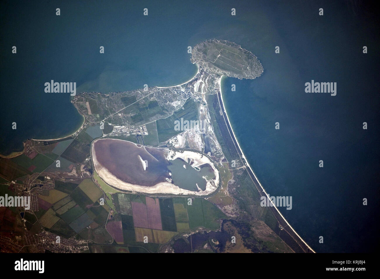 Cape Kazantip, Kerch Peninsula, Southern Sea of Azov, Ukraine Stock Photohttps://www.alamy.com/image-license-details/?v=1https://www.alamy.com/stock-image-cape-kazantip-kerch-peninsula-southern-sea-of-azov-ukraine-169434668.html
RMKRJBJ4–Cape Kazantip, Kerch Peninsula, Southern Sea of Azov, Ukraine
 Piri Reis - Map of the Crimea, the Sea of Azov, and the Mouth of the Dnieper - Walters W658372A - Full Page Stock Photohttps://www.alamy.com/image-license-details/?v=1https://www.alamy.com/stock-photo-piri-reis-map-of-the-crimea-the-sea-of-azov-and-the-mouth-of-the-dnieper-132594022.html
RMHKM50P–Piri Reis - Map of the Crimea, the Sea of Azov, and the Mouth of the Dnieper - Walters W658372A - Full Page
 Map of the Sea of Azov. George Dodd. Pictorial history of the Russian war 1854-5-6. Stock Photohttps://www.alamy.com/image-license-details/?v=1https://www.alamy.com/map-of-the-sea-of-azov-george-dodd-pictorial-history-of-the-russian-war-1854-5-6-image398169999.html
RM2E3P5W3–Map of the Sea of Azov. George Dodd. Pictorial history of the Russian war 1854-5-6.
 Sunrise on the Sea of Azov, sun and waves in the morning. Front view. Stock Photohttps://www.alamy.com/image-license-details/?v=1https://www.alamy.com/sunrise-on-the-sea-of-azov-sun-and-waves-in-the-morning-front-view-image488281471.html
RF2KAB3YY–Sunrise on the Sea of Azov, sun and waves in the morning. Front view.
 Shcholkine, Sea of Azov, Crimea, Ukraine, Eastern Europe Stock Photohttps://www.alamy.com/image-license-details/?v=1https://www.alamy.com/stock-photo-shcholkine-sea-of-azov-crimea-ukraine-eastern-europe-38564035.html
RMC6MMPY–Shcholkine, Sea of Azov, Crimea, Ukraine, Eastern Europe
 Storm on the sea of Azov. Stock Photohttps://www.alamy.com/image-license-details/?v=1https://www.alamy.com/storm-on-the-sea-of-azov-image215309567.html
RFPE85FB–Storm on the sea of Azov.
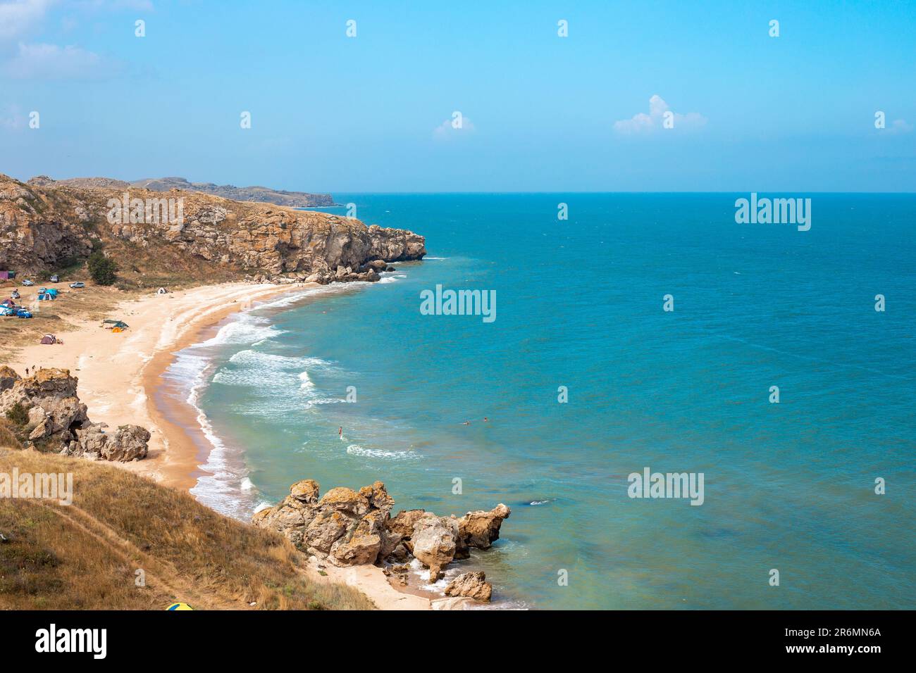 Sea coast with rocky shore and sandy beach. Sea of Azov in Crimea. Stock Photohttps://www.alamy.com/image-license-details/?v=1https://www.alamy.com/sea-coast-with-rocky-shore-and-sandy-beach-sea-of-azov-in-crimea-image554875394.html
RF2R6MN6A–Sea coast with rocky shore and sandy beach. Sea of Azov in Crimea.
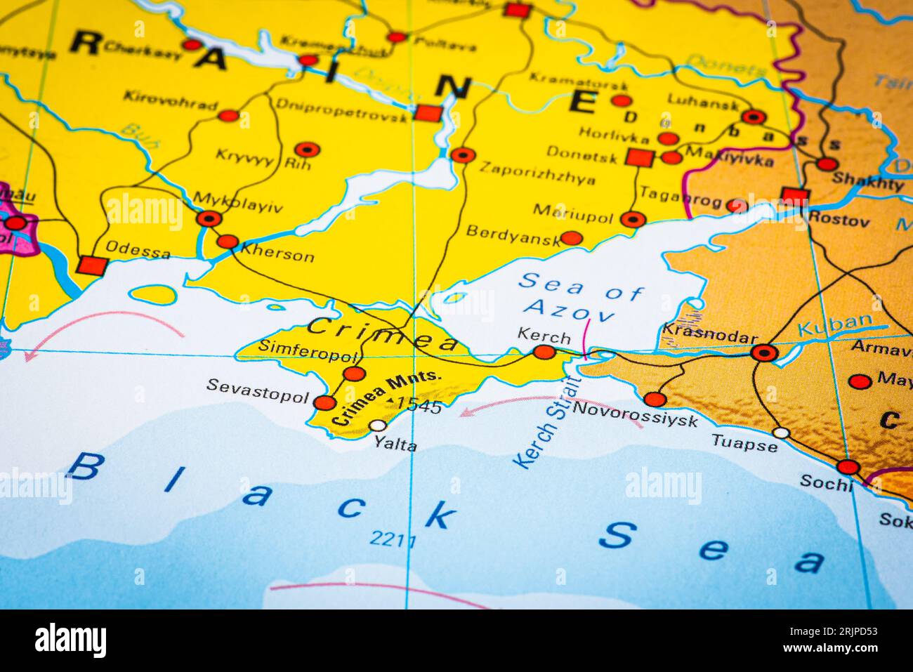 Map or cartography of the Black Sea and Sea of Azov, with Crimea peninsula and Kerch strait Stock Photohttps://www.alamy.com/image-license-details/?v=1https://www.alamy.com/map-or-cartography-of-the-black-sea-and-sea-of-azov-with-crimea-peninsula-and-kerch-strait-image562288863.html
RF2RJPD53–Map or cartography of the Black Sea and Sea of Azov, with Crimea peninsula and Kerch strait
 Crimea, Ukraine. 07 May, 2014. A view from onboard the International Space Station of the entire Crimean Peninsula jutting into the Black Sea. A series of shallow lagoons and wetlands known as the Sivash lakes separates the peninsula from the mainland of Ukraine. Credit: NASA/NASA/Alamy Live News Stock Photohttps://www.alamy.com/image-license-details/?v=1https://www.alamy.com/crimea-ukraine-07-may-2014-a-view-from-onboard-the-international-space-station-of-the-entire-crimean-peninsula-jutting-into-the-black-sea-a-series-of-shallow-lagoons-and-wetlands-known-as-the-sivash-lakes-separates-the-peninsula-from-the-mainland-of-ukraine-credit-nasanasaalamy-live-news-image561101060.html
RM2RGTA3G–Crimea, Ukraine. 07 May, 2014. A view from onboard the International Space Station of the entire Crimean Peninsula jutting into the Black Sea. A series of shallow lagoons and wetlands known as the Sivash lakes separates the peninsula from the mainland of Ukraine. Credit: NASA/NASA/Alamy Live News
 . English: A fine first edition example of Guillaume De L’Isle’s important 1724 map of Persia. Covers from the Crimea and the Sea of Azov south to the Persian Gulf and the Straight of Ormuz and east as far as Kashmir (Cachmir) and Kabul (Caboul). This map includes modern day Iran, Iraq, Afghanistan, Kuwait, Uzbekistan, Turkmenistan, Tajikistan, Georgia, Armenia, and Azerbaijan, with adjacent parts of Russia, Pakistan, Turkey, Ukraine, and Kazakhstan, and Arabia. Cartographically De L’Isle’s mapping of Persia marks a significant advance in European cartographic knowledge of the region. This ma Stock Photohttps://www.alamy.com/image-license-details/?v=1https://www.alamy.com/english-a-fine-first-edition-example-of-guillaume-de-lisles-important-1724-map-of-persia-covers-from-the-crimea-and-the-sea-of-azov-south-to-the-persian-gulf-and-the-straight-of-ormuz-and-east-as-far-as-kashmir-cachmir-and-kabul-caboul-this-map-includes-modern-day-iran-iraq-afghanistan-kuwait-uzbekistan-turkmenistan-tajikistan-georgia-armenia-and-azerbaijan-with-adjacent-parts-of-russia-pakistan-turkey-ukraine-and-kazakhstan-and-arabia-cartographically-de-lisles-mapping-of-persia-marks-a-significant-advance-in-european-cartographic-knowledge-of-the-region-this-ma-image184872334.html
RMMMNJFA–. English: A fine first edition example of Guillaume De L’Isle’s important 1724 map of Persia. Covers from the Crimea and the Sea of Azov south to the Persian Gulf and the Straight of Ormuz and east as far as Kashmir (Cachmir) and Kabul (Caboul). This map includes modern day Iran, Iraq, Afghanistan, Kuwait, Uzbekistan, Turkmenistan, Tajikistan, Georgia, Armenia, and Azerbaijan, with adjacent parts of Russia, Pakistan, Turkey, Ukraine, and Kazakhstan, and Arabia. Cartographically De L’Isle’s mapping of Persia marks a significant advance in European cartographic knowledge of the region. This ma
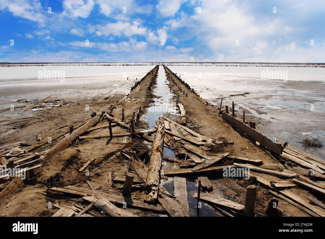 Abandoned salt production on Sivash lake also known as Rotten Sea on the west coast of the Sea of Azov in Ukraine Stock Photohttps://www.alamy.com/image-license-details/?v=1https://www.alamy.com/abandoned-salt-production-on-sivash-lake-also-known-as-rotten-sea-image152822060.html
RFJTHJ2M–Abandoned salt production on Sivash lake also known as Rotten Sea on the west coast of the Sea of Azov in Ukraine
 sand and seashells beach of Sea of Azov in resort village Golubickaya, Taman Peninsula, Russia Stock Photohttps://www.alamy.com/image-license-details/?v=1https://www.alamy.com/stock-photo-sand-and-seashells-beach-of-sea-of-azov-in-resort-village-golubickaya-72818063.html
RFE6D453–sand and seashells beach of Sea of Azov in resort village Golubickaya, Taman Peninsula, Russia
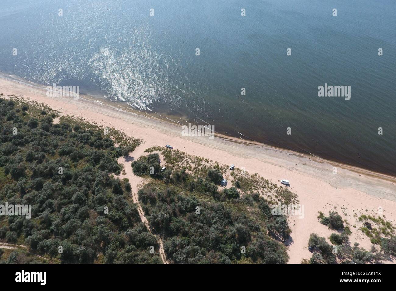 Top view of the Sea of Azov Stock Photohttps://www.alamy.com/image-license-details/?v=1https://www.alamy.com/top-view-of-the-sea-of-azov-image402421710.html
RF2EAKTYX–Top view of the Sea of Azov
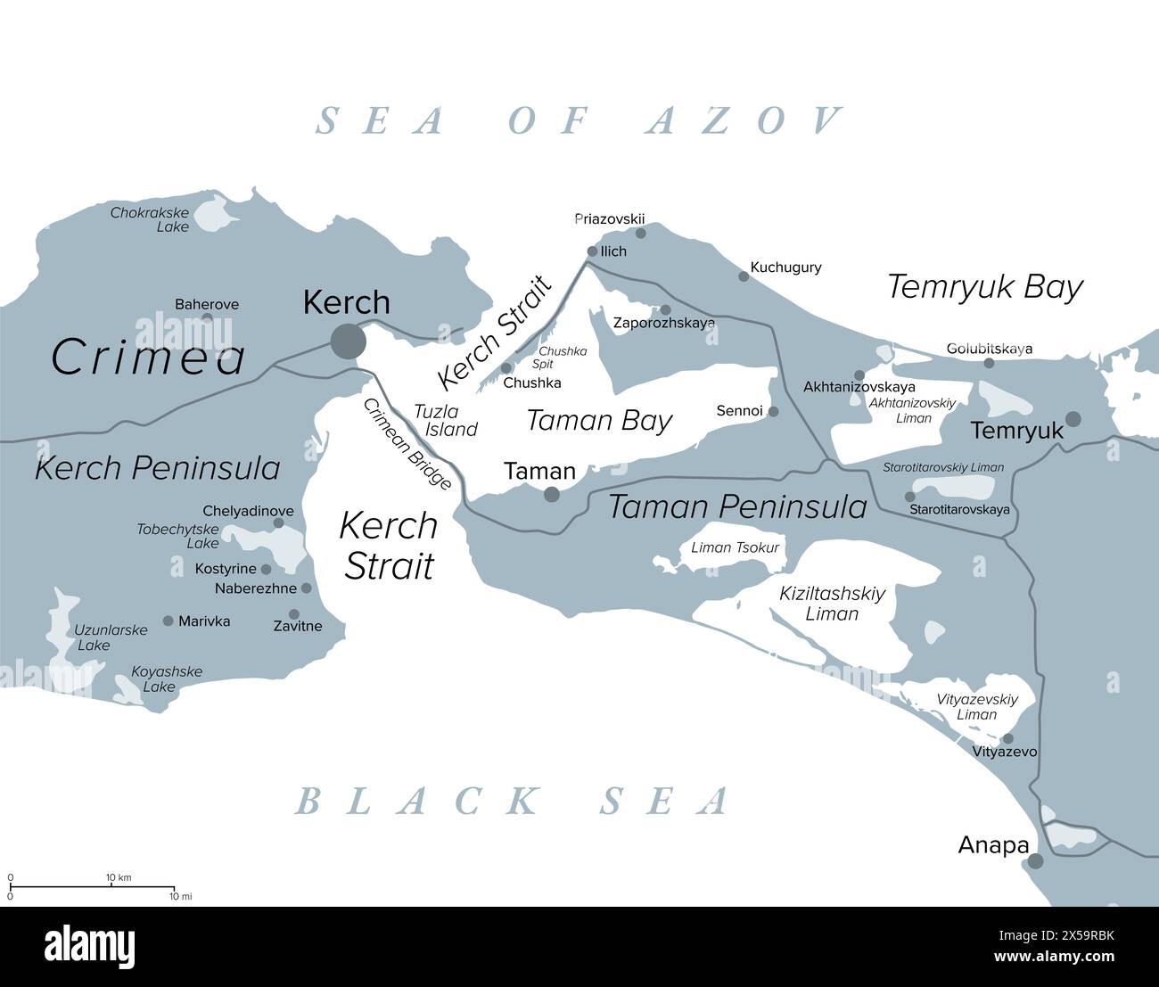 Kerch Strait in Eastern Europe, gray political map. Narrow waterway that connects the Black Sea and Sea of Azov. Stock Photohttps://www.alamy.com/image-license-details/?v=1https://www.alamy.com/kerch-strait-in-eastern-europe-gray-political-map-narrow-waterway-that-connects-the-black-sea-and-sea-of-azov-image605652087.html
RF2X59RBK–Kerch Strait in Eastern Europe, gray political map. Narrow waterway that connects the Black Sea and Sea of Azov.
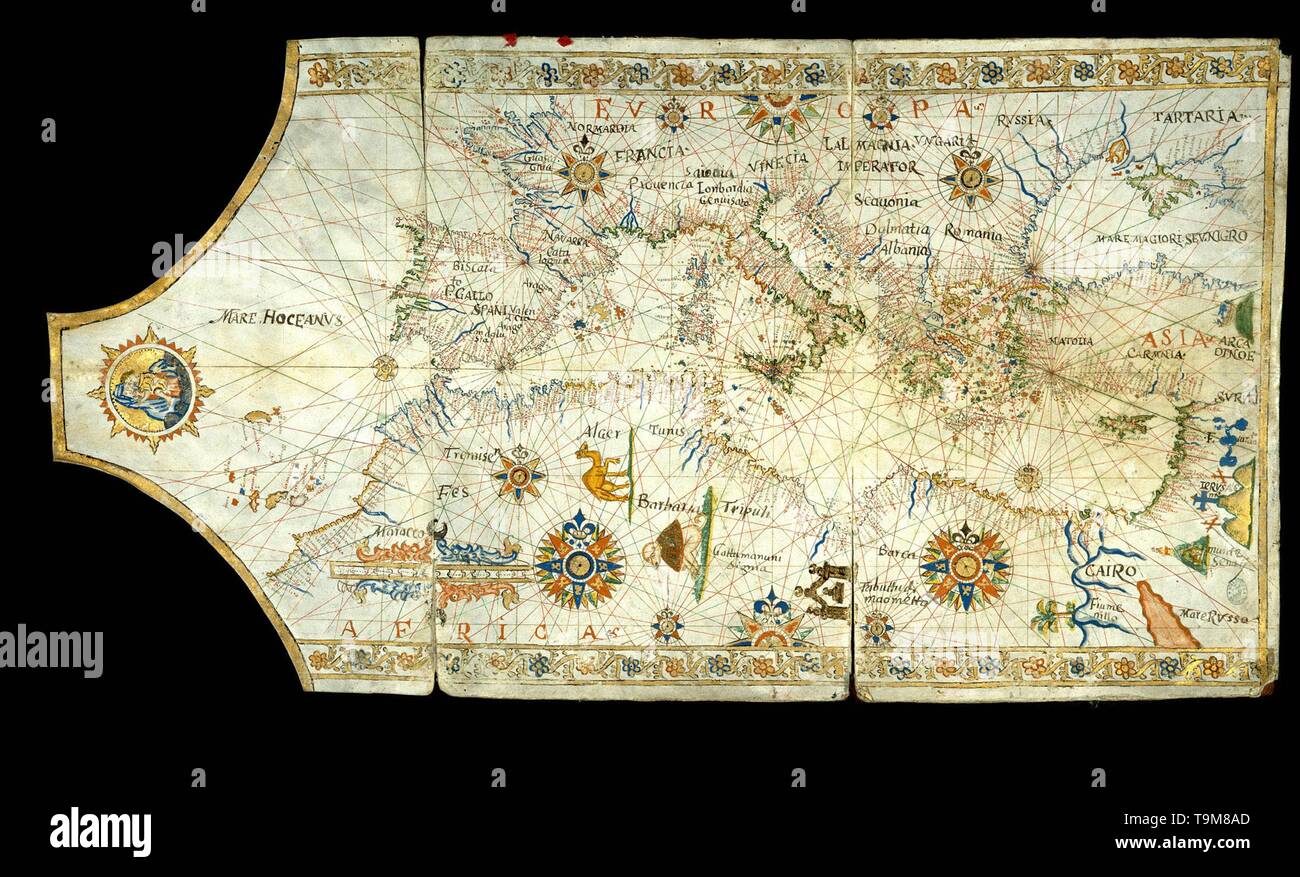 Portolan chart of the Mediterranean Sea, the Black Sea, Sea of Azov and Atlantic coasts of Europe and Africa. Museum: Biblioteca Nacional, Madrid. Author: Anonymous master. Stock Photohttps://www.alamy.com/image-license-details/?v=1https://www.alamy.com/portolan-chart-of-the-mediterranean-sea-the-black-sea-sea-of-azov-and-atlantic-coasts-of-europe-and-africa-museum-biblioteca-nacional-madrid-author-anonymous-master-image246922661.html
RMT9M8AD–Portolan chart of the Mediterranean Sea, the Black Sea, Sea of Azov and Atlantic coasts of Europe and Africa. Museum: Biblioteca Nacional, Madrid. Author: Anonymous master.
 Jellyfish on the shore of the Sea of Azov, on the beach on a summer day Stock Photohttps://www.alamy.com/image-license-details/?v=1https://www.alamy.com/jellyfish-on-the-shore-of-the-sea-of-azov-on-the-beach-on-a-summer-day-image595951158.html
RF2WHFWNX–Jellyfish on the shore of the Sea of Azov, on the beach on a summer day
![Two landing craft (naval ferry barge) in the Kuban bridgehead / Sea of Azov. Photo: v. Versen [automated translation] Stock Photo Two landing craft (naval ferry barge) in the Kuban bridgehead / Sea of Azov. Photo: v. Versen [automated translation] Stock Photo](https://c8.alamy.com/comp/2XKATN6/two-landing-craft-naval-ferry-barge-in-the-kuban-bridgehead-sea-of-azov-photo-v-versen-automated-translation-2XKATN6.jpg) Two landing craft (naval ferry barge) in the Kuban bridgehead / Sea of Azov. Photo: v. Versen [automated translation] Stock Photohttps://www.alamy.com/image-license-details/?v=1https://www.alamy.com/two-landing-craft-naval-ferry-barge-in-the-kuban-bridgehead-sea-of-azov-photo-v-versen-automated-translation-image614280274.html
Two landing craft (naval ferry barge) in the Kuban bridgehead / Sea of Azov. Photo: v. Versen [automated translation] Stock Photohttps://www.alamy.com/image-license-details/?v=1https://www.alamy.com/two-landing-craft-naval-ferry-barge-in-the-kuban-bridgehead-sea-of-azov-photo-v-versen-automated-translation-image614280274.htmlRM2XKATN6–Two landing craft (naval ferry barge) in the Kuban bridgehead / Sea of Azov. Photo: v. Versen [automated translation]
 Azov sea coast, Russia Stock Photohttps://www.alamy.com/image-license-details/?v=1https://www.alamy.com/azov-sea-coast-russia-image503034322.html
RM2M6B5BE–Azov sea coast, Russia
 BLACK SEA. Palus Méotide (Sea of Azov) & Pont Euxin. BARBIÉ DU BOCAGE, 1790 map Stock Photohttps://www.alamy.com/image-license-details/?v=1https://www.alamy.com/stock-photo-black-sea-palus-motide-sea-of-azov-pont-euxin-barbi-du-bocage-1790-111048745.html
RFGCJKPH–BLACK SEA. Palus Méotide (Sea of Azov) & Pont Euxin. BARBIÉ DU BOCAGE, 1790 map
 Maps of the Black Sea and Sea of Azov. George Dodd. Pictorial history of the Russian war 1854 5 6 Stock Photohttps://www.alamy.com/image-license-details/?v=1https://www.alamy.com/stock-photo-maps-of-the-black-sea-and-sea-of-azov-george-dodd-pictorial-history-140188828.html
RMJ4247T–Maps of the Black Sea and Sea of Azov. George Dodd. Pictorial history of the Russian war 1854 5 6
 Bodleian Libraries, Portolan codex Western Black Sea the Sea of Azov, northeast of the Crimea the Sea of Marmara in the southwest the mouths Stock Photohttps://www.alamy.com/image-license-details/?v=1https://www.alamy.com/stock-photo-bodleian-libraries-portolan-codex-western-black-sea-the-sea-of-azov-132728667.html
RMHKX8NF–Bodleian Libraries, Portolan codex Western Black Sea the Sea of Azov, northeast of the Crimea the Sea of Marmara in the southwest the mouths
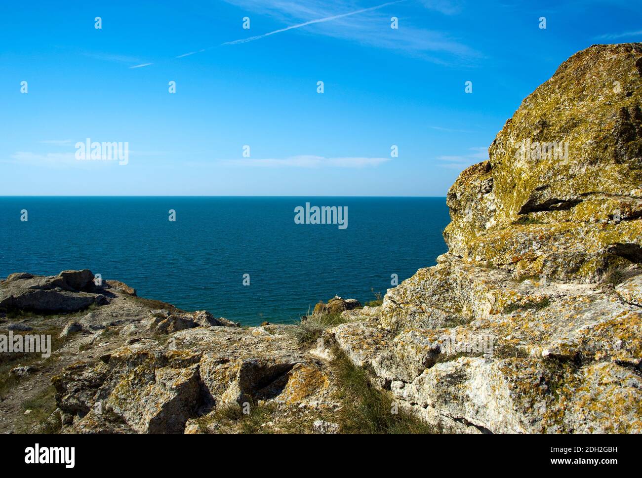 On the rocky shore of the Azov Sea. Stock Photohttps://www.alamy.com/image-license-details/?v=1https://www.alamy.com/on-the-rocky-shore-of-the-azov-sea-image389134021.html
RM2DH2GBH–On the rocky shore of the Azov Sea.
 Sunrise on the Sea of Azov, sun and waves in the morning. Front view. Stock Photohttps://www.alamy.com/image-license-details/?v=1https://www.alamy.com/sunrise-on-the-sea-of-azov-sun-and-waves-in-the-morning-front-view-image488281480.html
RF2KAB408–Sunrise on the Sea of Azov, sun and waves in the morning. Front view.
 Azov sea in Taganrog, Russia Stock Photohttps://www.alamy.com/image-license-details/?v=1https://www.alamy.com/stock-photo-azov-sea-in-taganrog-russia-88349313.html
RFF3MJCH–Azov sea in Taganrog, Russia
 Storm on the sea of Azov. Stock Photohttps://www.alamy.com/image-license-details/?v=1https://www.alamy.com/storm-on-the-sea-of-azov-image215309558.html
RFPE85F2–Storm on the sea of Azov.
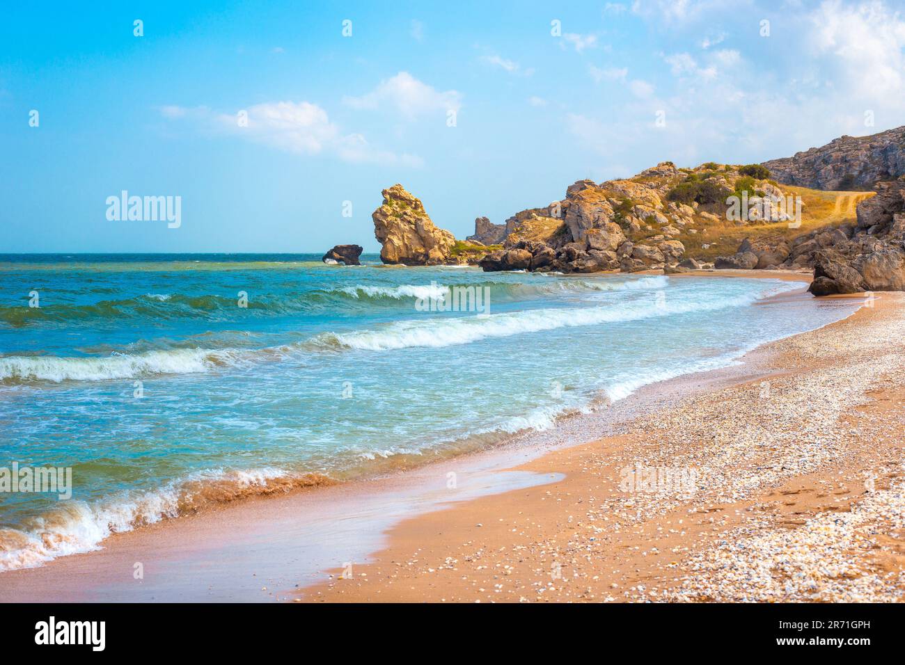 Seascape. Blue sea and rocky shore with yellow sandy beach. Sea of Azov in Crimea. Stock Photohttps://www.alamy.com/image-license-details/?v=1https://www.alamy.com/seascape-blue-sea-and-rocky-shore-with-yellow-sandy-beach-sea-of-azov-in-crimea-image555069497.html
RF2R71GPH–Seascape. Blue sea and rocky shore with yellow sandy beach. Sea of Azov in Crimea.
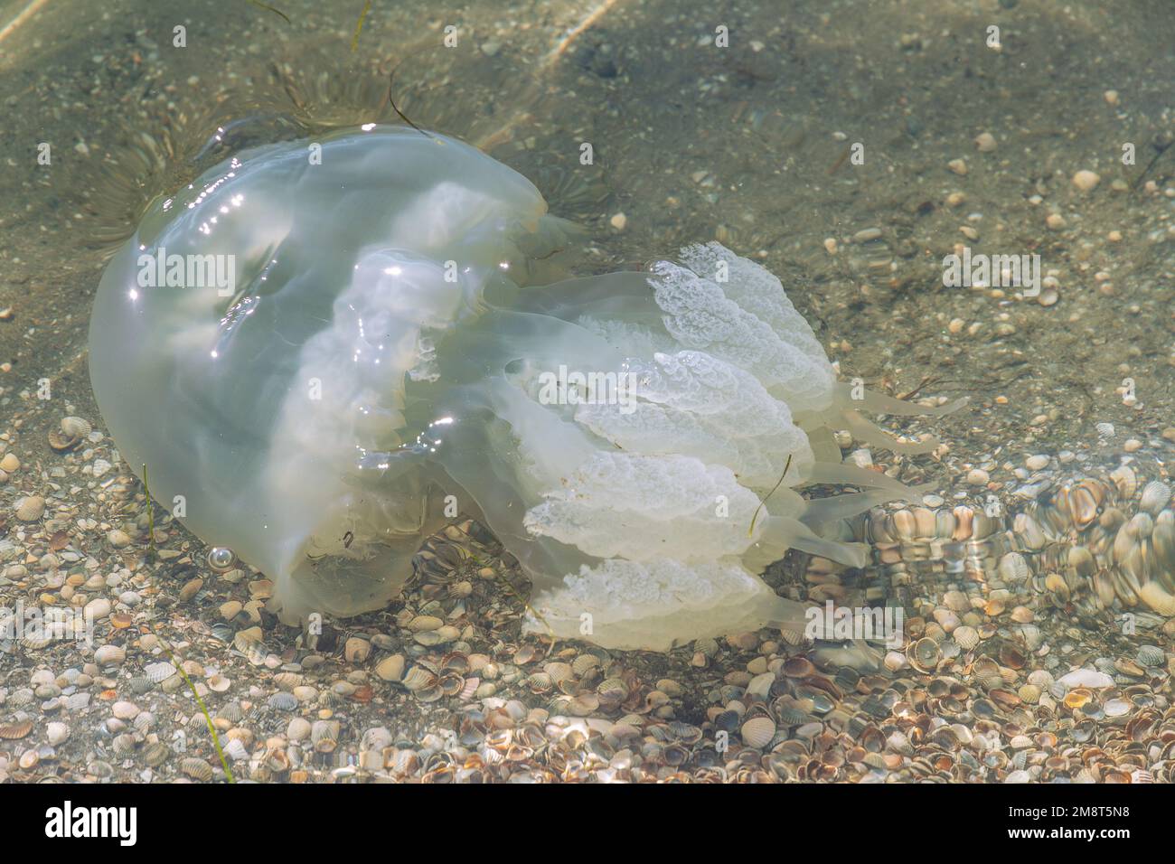 Big white jellyfish medusa in the water near the shore. Azov sea wildlife. Stock Photohttps://www.alamy.com/image-license-details/?v=1https://www.alamy.com/big-white-jellyfish-medusa-in-the-water-near-the-shore-azov-sea-wildlife-image504549284.html
RF2M8T5N8–Big white jellyfish medusa in the water near the shore. Azov sea wildlife.
 Uncleaned territory on the coast of the Arabat Spit in the Azov Sea (South of Ukraine). August 2018. Shot on the phone camera. Editorial Stock Photohttps://www.alamy.com/image-license-details/?v=1https://www.alamy.com/uncleaned-territory-on-the-coast-of-the-arabat-spit-in-the-azov-sea-south-of-ukraine-august-2018-shot-on-the-phone-camera-editorial-image261018519.html
RFW4JBNY–Uncleaned territory on the coast of the Arabat Spit in the Azov Sea (South of Ukraine). August 2018. Shot on the phone camera. Editorial
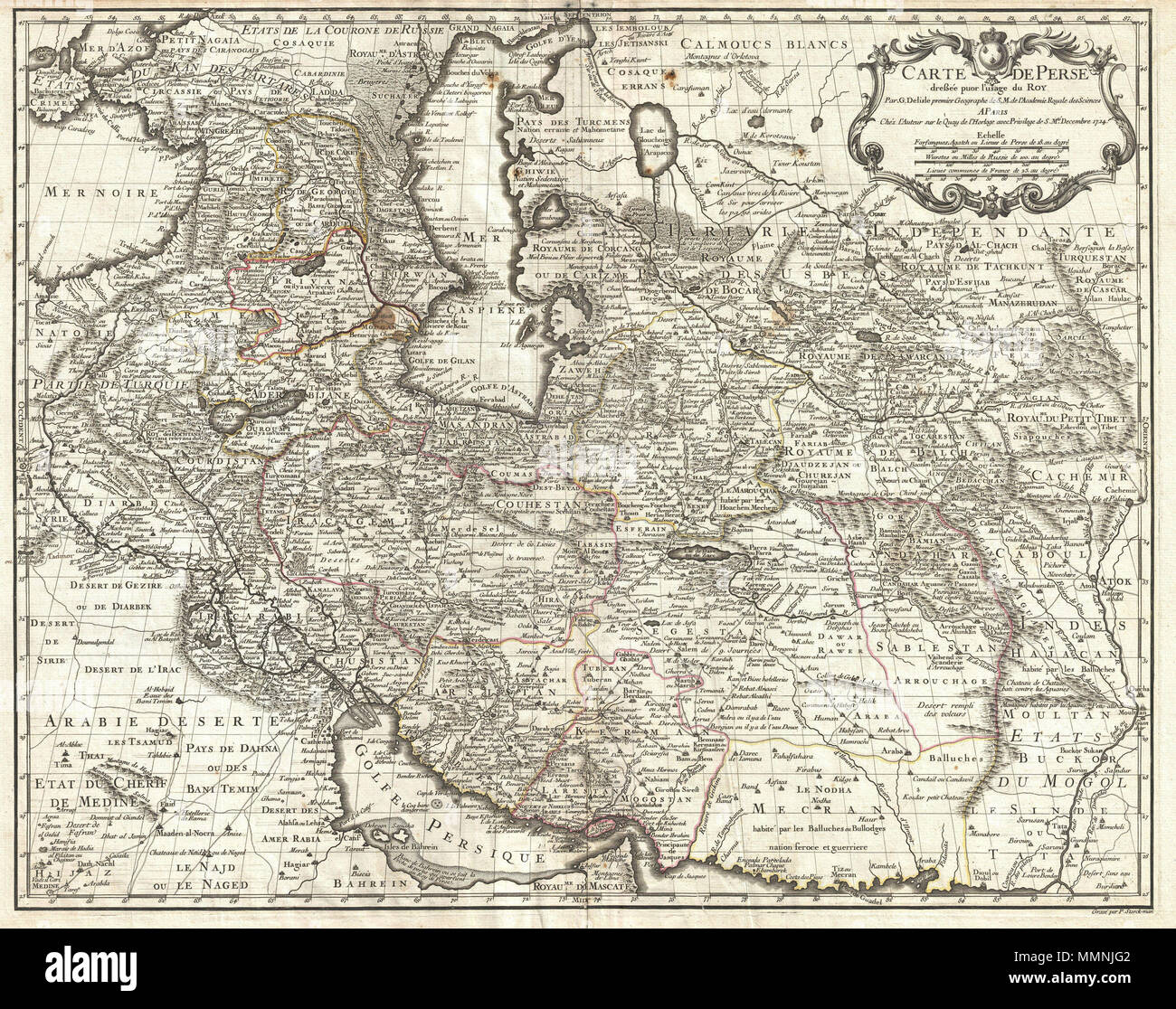 . English: A fine first edition example of Guillaume De L’Isle’s important 1724 map of Persia. Covers from the Crimea and the Sea of Azov south to the Persian Gulf and the Straight of Ormuz and east as far as Kashmir (Cachmir) and Kabul (Caboul). This map includes modern day Iran, Iraq, Afghanistan, Kuwait, Uzbekistan, Turkmenistan, Tajikistan, Georgia, Armenia, and Azerbaijan, with adjacent parts of Russia, Pakistan, Turkey, Ukraine, and Kazakhstan, and Arabia. Cartographically De L’Isle’s mapping of Persia marks a significant advance in European cartographic knowledge of the region. This ma Stock Photohttps://www.alamy.com/image-license-details/?v=1https://www.alamy.com/english-a-fine-first-edition-example-of-guillaume-de-lisles-important-1724-map-of-persia-covers-from-the-crimea-and-the-sea-of-azov-south-to-the-persian-gulf-and-the-straight-of-ormuz-and-east-as-far-as-kashmir-cachmir-and-kabul-caboul-this-map-includes-modern-day-iran-iraq-afghanistan-kuwait-uzbekistan-turkmenistan-tajikistan-georgia-armenia-and-azerbaijan-with-adjacent-parts-of-russia-pakistan-turkey-ukraine-and-kazakhstan-and-arabia-cartographically-de-lisles-mapping-of-persia-marks-a-significant-advance-in-european-cartographic-knowledge-of-the-region-this-ma-image184872354.html
RMMMNJG2–. English: A fine first edition example of Guillaume De L’Isle’s important 1724 map of Persia. Covers from the Crimea and the Sea of Azov south to the Persian Gulf and the Straight of Ormuz and east as far as Kashmir (Cachmir) and Kabul (Caboul). This map includes modern day Iran, Iraq, Afghanistan, Kuwait, Uzbekistan, Turkmenistan, Tajikistan, Georgia, Armenia, and Azerbaijan, with adjacent parts of Russia, Pakistan, Turkey, Ukraine, and Kazakhstan, and Arabia. Cartographically De L’Isle’s mapping of Persia marks a significant advance in European cartographic knowledge of the region. This ma
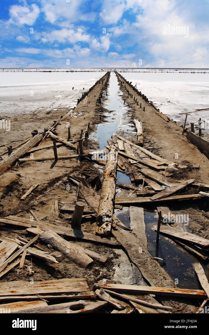 Abandoned salt production on Sivash lake also known as Rotten Sea on the west coast of the Sea of Azov in Ukraine Stock Photohttps://www.alamy.com/image-license-details/?v=1https://www.alamy.com/abandoned-salt-production-on-sivash-lake-also-known-as-rotten-sea-image152822078.html
RFJTHJ3A–Abandoned salt production on Sivash lake also known as Rotten Sea on the west coast of the Sea of Azov in Ukraine
 sand and seashells beach of Sea of Azov in resort settlement Golubickaya, Taman Peninsula, Russia Stock Photohttps://www.alamy.com/image-license-details/?v=1https://www.alamy.com/stock-photo-sand-and-seashells-beach-of-sea-of-azov-in-resort-settlement-golubickaya-72687295.html
RFE675AR–sand and seashells beach of Sea of Azov in resort settlement Golubickaya, Taman Peninsula, Russia
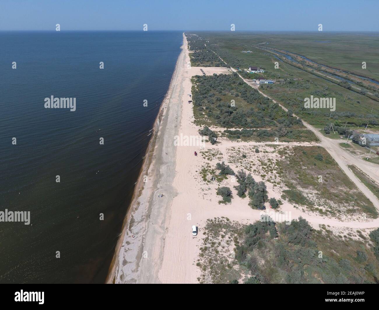 Top view of the Sea of Azov Stock Photohttps://www.alamy.com/image-license-details/?v=1https://www.alamy.com/top-view-of-the-sea-of-azov-image402380882.html
RF2EAJ0WP–Top view of the Sea of Azov
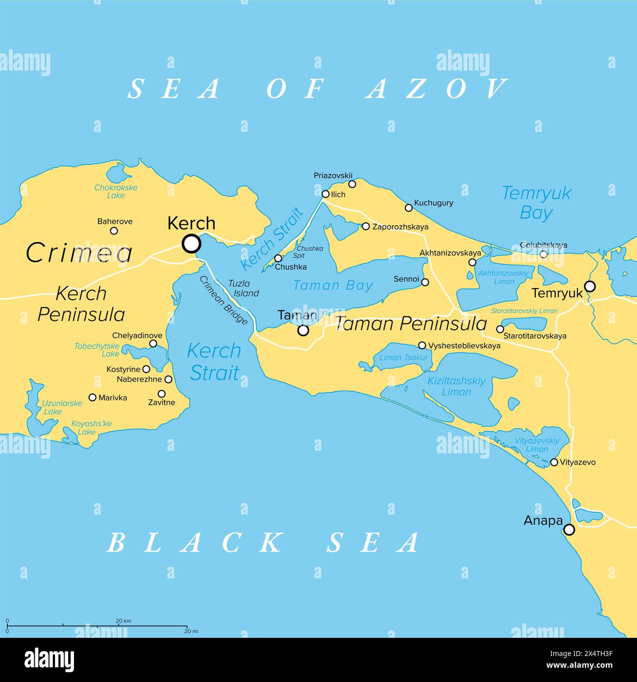 Kerch Strait in Eastern Europe, political map. It connects Black Sea and Sea of Azov, separating the Kerch Peninsula of Crimea from Taman Peninsula. Stock Photohttps://www.alamy.com/image-license-details/?v=1https://www.alamy.com/kerch-strait-in-eastern-europe-political-map-it-connects-black-sea-and-sea-of-azov-separating-the-kerch-peninsula-of-crimea-from-taman-peninsula-image605361779.html
RF2X4TH3F–Kerch Strait in Eastern Europe, political map. It connects Black Sea and Sea of Azov, separating the Kerch Peninsula of Crimea from Taman Peninsula.
 The coast of the Sea of Azov on a summer day Stock Photohttps://www.alamy.com/image-license-details/?v=1https://www.alamy.com/the-coast-of-the-sea-of-azov-on-a-summer-day-image490518643.html
RF2KE11EY–The coast of the Sea of Azov on a summer day
 The grape gardens. Cultivation of wine grapes at the Sea of Azov Stock Photohttps://www.alamy.com/image-license-details/?v=1https://www.alamy.com/the-grape-gardens-cultivation-of-wine-grapes-at-the-sea-of-azov-image369966753.html
RM2CDWCA9–The grape gardens. Cultivation of wine grapes at the Sea of Azov
![German Junkers Ju 87 returning from an enemy flight on the Sea of Azov in the southern section of the Eastern Front during the offensive toward Stalingrad. Photo: Klose [automated translation] Stock Photo German Junkers Ju 87 returning from an enemy flight on the Sea of Azov in the southern section of the Eastern Front during the offensive toward Stalingrad. Photo: Klose [automated translation] Stock Photo](https://c8.alamy.com/comp/2PYX97W/german-junkers-ju-87-returning-from-an-enemy-flight-on-the-sea-of-azov-in-the-southern-section-of-the-eastern-front-during-the-offensive-toward-stalingrad-photo-klose-automated-translation-2PYX97W.jpg) German Junkers Ju 87 returning from an enemy flight on the Sea of Azov in the southern section of the Eastern Front during the offensive toward Stalingrad. Photo: Klose [automated translation] Stock Photohttps://www.alamy.com/image-license-details/?v=1https://www.alamy.com/german-junkers-ju-87-returning-from-an-enemy-flight-on-the-sea-of-azov-in-the-southern-section-of-the-eastern-front-during-the-offensive-toward-stalingrad-photo-klose-automated-translation-image550695149.html
German Junkers Ju 87 returning from an enemy flight on the Sea of Azov in the southern section of the Eastern Front during the offensive toward Stalingrad. Photo: Klose [automated translation] Stock Photohttps://www.alamy.com/image-license-details/?v=1https://www.alamy.com/german-junkers-ju-87-returning-from-an-enemy-flight-on-the-sea-of-azov-in-the-southern-section-of-the-eastern-front-during-the-offensive-toward-stalingrad-photo-klose-automated-translation-image550695149.htmlRM2PYX97W–German Junkers Ju 87 returning from an enemy flight on the Sea of Azov in the southern section of the Eastern Front during the offensive toward Stalingrad. Photo: Klose [automated translation]
