Quick filters:
Smithburg Stock Photos and Images
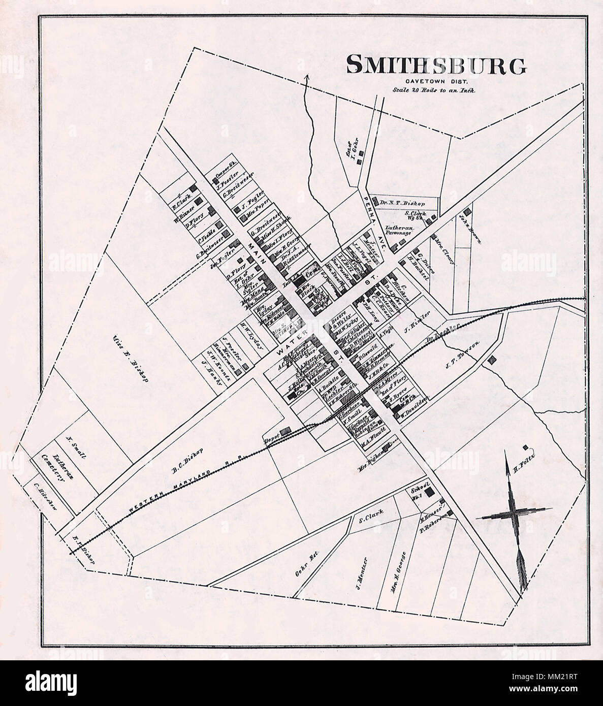
 Map of Smithburg. 1877 Stock Photohttps://www.alamy.com/image-license-details/?v=1https://www.alamy.com/map-of-smithburg-1877-image184442156.html
RMMM21RT–Map of Smithburg. 1877
 Smithburg, Monmouth County, US, United States, New Jersey, N 40 12' 32'', S 74 21' 10'', map, Cartascapes Map published in 2024. Explore Cartascapes, a map revealing Earth's diverse landscapes, cultures, and ecosystems. Journey through time and space, discovering the interconnectedness of our planet's past, present, and future. Stock Photohttps://www.alamy.com/image-license-details/?v=1https://www.alamy.com/smithburg-monmouth-county-us-united-states-new-jersey-n-40-12-32-s-74-21-10-map-cartascapes-map-published-in-2024-explore-cartascapes-a-map-revealing-earths-diverse-landscapes-cultures-and-ecosystems-journey-through-time-and-space-discovering-the-interconnectedness-of-our-planets-past-present-and-future-image621344528.html
RM2Y2TK80–Smithburg, Monmouth County, US, United States, New Jersey, N 40 12' 32'', S 74 21' 10'', map, Cartascapes Map published in 2024. Explore Cartascapes, a map revealing Earth's diverse landscapes, cultures, and ecosystems. Journey through time and space, discovering the interconnectedness of our planet's past, present, and future.
 May 24, 2012 - Baltimore, Maryland, U.S. - Smithburg High School's Chad Greene anchors the win in the 4x200 relay for a state championship at the 1A/2A Maryland State Track and Field Championships at Morgan University in Baltimore, Maryland on May 24, 2012 (Credit Image: © Scott Serio/Eclipse/ZUMAPR Stock Photohttps://www.alamy.com/image-license-details/?v=1https://www.alamy.com/stock-photo-may-24-2012-baltimore-maryland-us-smithburg-high-schools-chad-greene-41239856.html
RMCB2HT0–May 24, 2012 - Baltimore, Maryland, U.S. - Smithburg High School's Chad Greene anchors the win in the 4x200 relay for a state championship at the 1A/2A Maryland State Track and Field Championships at Morgan University in Baltimore, Maryland on May 24, 2012 (Credit Image: © Scott Serio/Eclipse/ZUMAPR
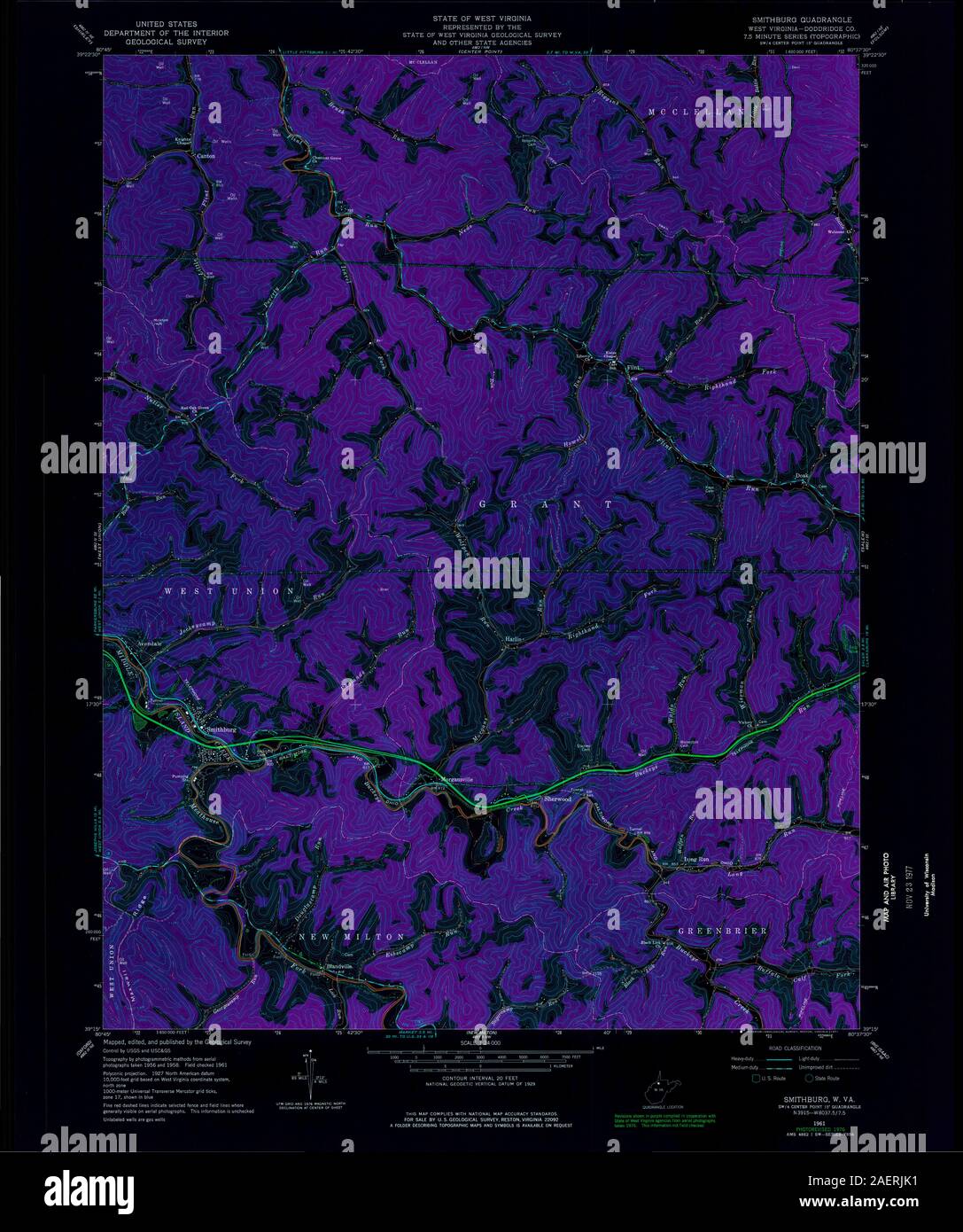
 WV Smithburg 20110125 TM Stock Photohttps://www.alamy.com/image-license-details/?v=1https://www.alamy.com/wv-smithburg-20110125-tm-image336121727.html
RM2AERJKB–WV Smithburg 20110125 TM
 Feb. 20, 2012 - Landover, MD, U.S. - Smithburg High School runner Lance Daignault out kicks Brunswick's Daniel Trettel to win the boys 1600m 1A race during the Maryland State Indoor Track and Field Championships at the Prince George's County Sports Complex in Landover, Maryland on February 20, 2012. Stock Photohttps://www.alamy.com/image-license-details/?v=1https://www.alamy.com/stock-photo-feb-20-2012-landover-md-us-smithburg-high-school-runner-lance-daignault-40499315.html
RMC9TW83–Feb. 20, 2012 - Landover, MD, U.S. - Smithburg High School runner Lance Daignault out kicks Brunswick's Daniel Trettel to win the boys 1600m 1A race during the Maryland State Indoor Track and Field Championships at the Prince George's County Sports Complex in Landover, Maryland on February 20, 2012.
 . Breed Publishing Co.'s directory of the Western Maryland railroad for the year 1892, from Baltimore to Williamsport . Miss Sophia, cashier, h 456 N. Jonathan-^ Summers Walter K. clerk, h 326 N. JonathanQ Sunderland Joseph A. car inspector, h 16 Norway av ^ Sute Miss Lizzie, bookkeeper, h 32 E. Franklinf^ Suter Albert, painter, h 417 W. Church Suter Charles M. undertaker, 42 W. Franklin, h do Snter Samuel A. meat market, 3 Public Square, h 32 EastFranklin. (See adv) Suter Wm. S. h 32 E. Franklin Swain George W. fireman, h 220 High Swallow Dr. John E. dentist, Pub. Sq., h Smithburg pike Swarbr Stock Photohttps://www.alamy.com/image-license-details/?v=1https://www.alamy.com/breed-publishing-cos-directory-of-the-western-maryland-railroad-for-the-year-1892-from-baltimore-to-williamsport-miss-sophia-cashier-h-456-n-jonathan-summers-walter-k-clerk-h-326-n-jonathanq-sunderland-joseph-a-car-inspector-h-16-norway-av-sute-miss-lizzie-bookkeeper-h-32-e-franklinf-suter-albert-painter-h-417-w-church-suter-charles-m-undertaker-42-w-franklin-h-do-snter-samuel-a-meat-market-3-public-square-h-32-eastfranklin-see-adv-suter-wm-s-h-32-e-franklin-swain-george-w-fireman-h-220-high-swallow-dr-john-e-dentist-pub-sq-h-smithburg-pike-swarbr-image371868671.html
RM2CH027Y–. Breed Publishing Co.'s directory of the Western Maryland railroad for the year 1892, from Baltimore to Williamsport . Miss Sophia, cashier, h 456 N. Jonathan-^ Summers Walter K. clerk, h 326 N. JonathanQ Sunderland Joseph A. car inspector, h 16 Norway av ^ Sute Miss Lizzie, bookkeeper, h 32 E. Franklinf^ Suter Albert, painter, h 417 W. Church Suter Charles M. undertaker, 42 W. Franklin, h do Snter Samuel A. meat market, 3 Public Square, h 32 EastFranklin. (See adv) Suter Wm. S. h 32 E. Franklin Swain George W. fireman, h 220 High Swallow Dr. John E. dentist, Pub. Sq., h Smithburg pike Swarbr
 Smithburg, Doddridge County, US, United States, West Virginia, N 39 17' 21'', S 80 44' 3'', map, Cartascapes Map published in 2024. Explore Cartascapes, a map revealing Earth's diverse landscapes, cultures, and ecosystems. Journey through time and space, discovering the interconnectedness of our planet's past, present, and future. Stock Photohttps://www.alamy.com/image-license-details/?v=1https://www.alamy.com/smithburg-doddridge-county-us-united-states-west-virginia-n-39-17-21-s-80-44-3-map-cartascapes-map-published-in-2024-explore-cartascapes-a-map-revealing-earths-diverse-landscapes-cultures-and-ecosystems-journey-through-time-and-space-discovering-the-interconnectedness-of-our-planets-past-present-and-future-image621452178.html
RM2Y31GGJ–Smithburg, Doddridge County, US, United States, West Virginia, N 39 17' 21'', S 80 44' 3'', map, Cartascapes Map published in 2024. Explore Cartascapes, a map revealing Earth's diverse landscapes, cultures, and ecosystems. Journey through time and space, discovering the interconnectedness of our planet's past, present, and future.
 WV Smithburg 20110125 TM Inverted Stock Photohttps://www.alamy.com/image-license-details/?v=1https://www.alamy.com/wv-smithburg-20110125-tm-inverted-image336121687.html
RM2AERJHY–WV Smithburg 20110125 TM Inverted
 Smithburg, Pike County, US, United States, Mississippi, N 31 1' 42'', S 90 17' 25'', map, Cartascapes Map published in 2024. Explore Cartascapes, a map revealing Earth's diverse landscapes, cultures, and ecosystems. Journey through time and space, discovering the interconnectedness of our planet's past, present, and future. Stock Photohttps://www.alamy.com/image-license-details/?v=1https://www.alamy.com/smithburg-pike-county-us-united-states-mississippi-n-31-1-42-s-90-17-25-map-cartascapes-map-published-in-2024-explore-cartascapes-a-map-revealing-earths-diverse-landscapes-cultures-and-ecosystems-journey-through-time-and-space-discovering-the-interconnectedness-of-our-planets-past-present-and-future-image620788754.html
RM2Y1YAAX–Smithburg, Pike County, US, United States, Mississippi, N 31 1' 42'', S 90 17' 25'', map, Cartascapes Map published in 2024. Explore Cartascapes, a map revealing Earth's diverse landscapes, cultures, and ecosystems. Journey through time and space, discovering the interconnectedness of our planet's past, present, and future.
 WV Smithburg 701457 1961 24000 Stock Photohttps://www.alamy.com/image-license-details/?v=1https://www.alamy.com/wv-smithburg-701457-1961-24000-image336121902.html
RM2AERJWJ–WV Smithburg 701457 1961 24000
 Smithburg, West Virginia, map 1961, 1:24000, United States of America by Timeless Maps, data U.S. Geological Survey Stock Photohttps://www.alamy.com/image-license-details/?v=1https://www.alamy.com/smithburg-west-virginia-map-1961-124000-united-states-of-america-by-timeless-maps-data-us-geological-survey-image407039029.html
RM2EJ66C5–Smithburg, West Virginia, map 1961, 1:24000, United States of America by Timeless Maps, data U.S. Geological Survey
 WV Smithburg 701456 1961 24000 Stock Photohttps://www.alamy.com/image-license-details/?v=1https://www.alamy.com/wv-smithburg-701456-1961-24000-image336121690.html
RM2AERJJ2–WV Smithburg 701456 1961 24000
 Smithburg, West Virginia, map 1961, 1:24000, United States of America by Timeless Maps, data U.S. Geological Survey Stock Photohttps://www.alamy.com/image-license-details/?v=1https://www.alamy.com/smithburg-west-virginia-map-1961-124000-united-states-of-america-by-timeless-maps-data-us-geological-survey-image407039021.html
RM2EJ66BW–Smithburg, West Virginia, map 1961, 1:24000, United States of America by Timeless Maps, data U.S. Geological Survey

