Quick filters:
Southeast london map Stock Photos and Images
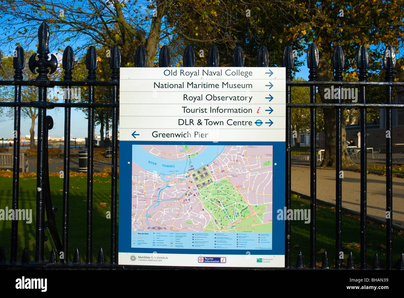 Map and signs Greenwich southeast London England UK Europe Stock Photohttps://www.alamy.com/image-license-details/?v=1https://www.alamy.com/stock-photo-map-and-signs-greenwich-southeast-london-england-uk-europe-27895597.html
RMBHAN39–Map and signs Greenwich southeast London England UK Europe
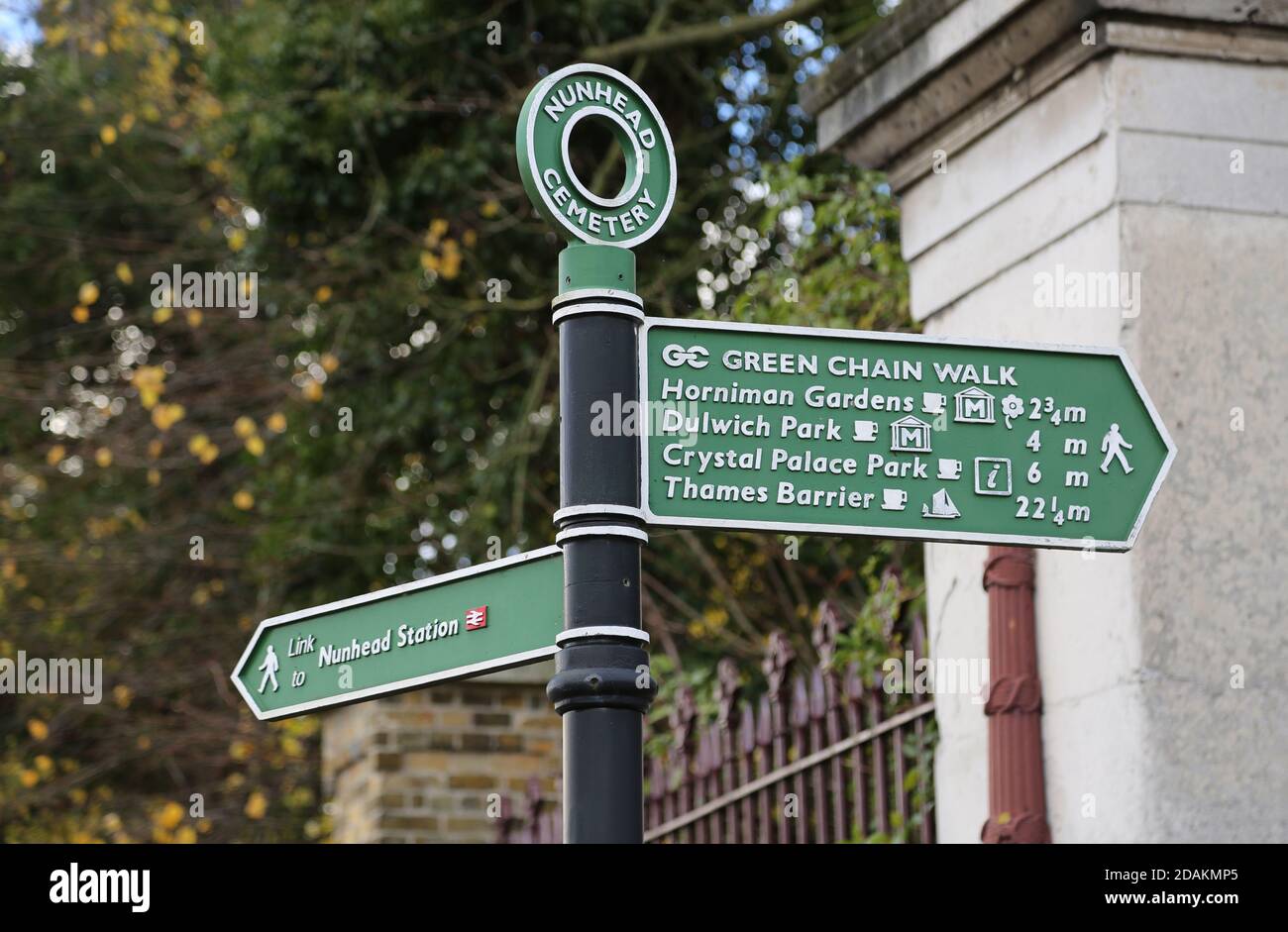 Green Chain Walk sign at Nunhead Cemetery, southeast London, UK. Lists: Horniman Gardens, Dulwich Park, Thames Barrier, Crystal Palace Park, Nunhead. Stock Photohttps://www.alamy.com/image-license-details/?v=1https://www.alamy.com/green-chain-walk-sign-at-nunhead-cemetery-southeast-london-uk-lists-horniman-gardens-dulwich-park-thames-barrier-crystal-palace-park-nunhead-image385208045.html
RM2DAKMP5–Green Chain Walk sign at Nunhead Cemetery, southeast London, UK. Lists: Horniman Gardens, Dulwich Park, Thames Barrier, Crystal Palace Park, Nunhead.
RME9M5WE–LONDON, United Kingdom — The iconic London Underground sign, featuring a red circle with a blue bar, marks the entrance to a Tube station. Known as the 'roundel,' this symbol is a widely recognized emblem of London's public transportation system. The London Underground, commonly referred to as the Tube, is one of the oldest and most extensive subway networks in the world.
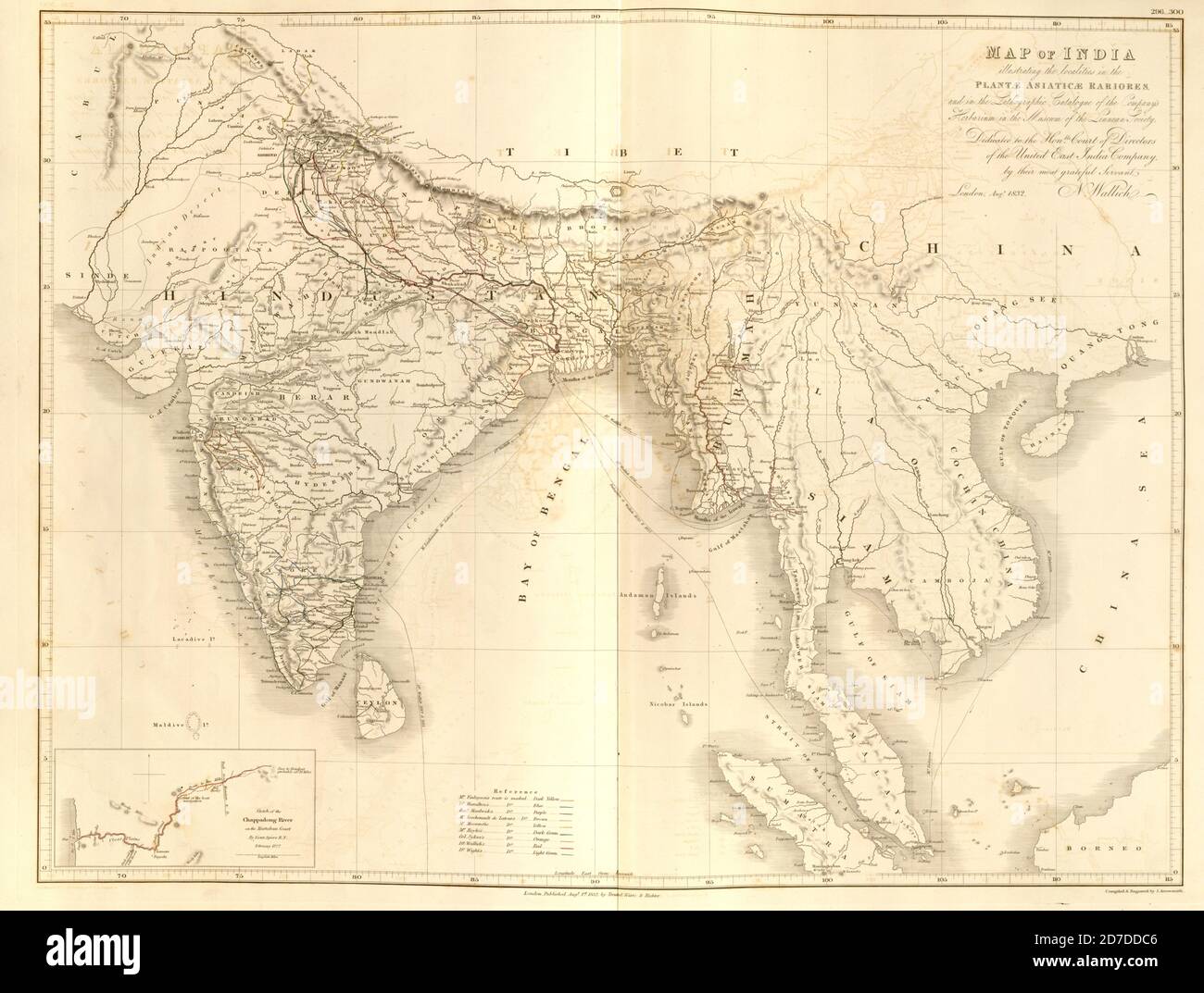 19th century map of India and Indochina From Plantae Asiaticae rariores, or, Descriptions and figures of a select number of unpublished East Indian plants Volume III by Nathaniel Wolff Wallich. Published in London in 1832 Stock Photohttps://www.alamy.com/image-license-details/?v=1https://www.alamy.com/19th-century-map-of-india-and-indochina-from-plantae-asiaticae-rariores-or-descriptions-and-figures-of-a-select-number-of-unpublished-east-indian-plants-volume-iii-by-nathaniel-wolff-wallich-published-in-london-in-1832-image383226598.html
RF2D7DDC6–19th century map of India and Indochina From Plantae Asiaticae rariores, or, Descriptions and figures of a select number of unpublished East Indian plants Volume III by Nathaniel Wolff Wallich. Published in London in 1832
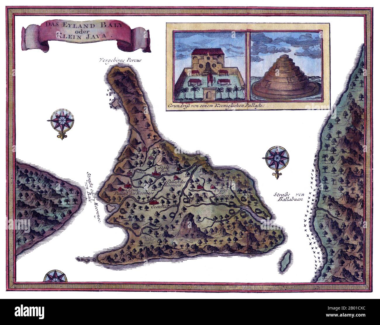 Indonesia: Map of Bali by Jacques-Nicolas Bellin (1703 - 21 March 1772), 1760. Jacques-Nicolas Bellin was a French hydrographer, geographer, and member of the French intellectual group called the philosophes. Bellin was born in Paris. He was hydrographer of France's hydrographic office, member of the Académie de Marine and of the Royal Society of London. Over a 50 year career, he produced a large number of maps of particular interest to the Ministère de la Marine. His maps of Canada and of French territories in North America (New France, Acadia, Louisiana) are particularly valuable. He died Stock Photohttps://www.alamy.com/image-license-details/?v=1https://www.alamy.com/indonesia-map-of-bali-by-jacques-nicolas-bellin-1703-21-march-1772-1760-jacques-nicolas-bellin-was-a-french-hydrographer-geographer-and-member-of-the-french-intellectual-group-called-the-philosophes-bellin-was-born-in-paris-he-was-hydrographer-of-frances-hydrographic-office-member-of-the-acadmie-de-marine-and-of-the-royal-society-of-london-over-a-50-year-career-he-produced-a-large-number-of-maps-of-particular-interest-to-the-ministre-de-la-marine-his-maps-of-canada-and-of-french-territories-in-north-america-new-france-acadia-louisiana-are-particularly-valuable-he-died-image344239460.html
RM2B01CXC–Indonesia: Map of Bali by Jacques-Nicolas Bellin (1703 - 21 March 1772), 1760. Jacques-Nicolas Bellin was a French hydrographer, geographer, and member of the French intellectual group called the philosophes. Bellin was born in Paris. He was hydrographer of France's hydrographic office, member of the Académie de Marine and of the Royal Society of London. Over a 50 year career, he produced a large number of maps of particular interest to the Ministère de la Marine. His maps of Canada and of French territories in North America (New France, Acadia, Louisiana) are particularly valuable. He died
![Ancient map of Rutlandshire [Rutland is a landlocked county in the East Midlands of England, bounded to the west and north by Leicestershire, to the northeast by Lincolnshire and the southeast by Northamptonshire] Copperplate engraving From the Encyclopaedia Londinensis or, Universal dictionary of arts, sciences, and literature; Volume XXII; Edited by Wilkes, John. Published in London in 1827 Stock Photo Ancient map of Rutlandshire [Rutland is a landlocked county in the East Midlands of England, bounded to the west and north by Leicestershire, to the northeast by Lincolnshire and the southeast by Northamptonshire] Copperplate engraving From the Encyclopaedia Londinensis or, Universal dictionary of arts, sciences, and literature; Volume XXII; Edited by Wilkes, John. Published in London in 1827 Stock Photo](https://c8.alamy.com/comp/2E2201Y/ancient-map-of-rutlandshire-rutland-is-a-landlocked-county-in-the-east-midlands-of-england-bounded-to-the-west-and-north-by-leicestershire-to-the-northeast-by-lincolnshire-and-the-southeast-by-northamptonshire-copperplate-engraving-from-the-encyclopaedia-londinensis-or-universal-dictionary-of-arts-sciences-and-literature-volume-xxii-edited-by-wilkes-john-published-in-london-in-1827-2E2201Y.jpg) Ancient map of Rutlandshire [Rutland is a landlocked county in the East Midlands of England, bounded to the west and north by Leicestershire, to the northeast by Lincolnshire and the southeast by Northamptonshire] Copperplate engraving From the Encyclopaedia Londinensis or, Universal dictionary of arts, sciences, and literature; Volume XXII; Edited by Wilkes, John. Published in London in 1827 Stock Photohttps://www.alamy.com/image-license-details/?v=1https://www.alamy.com/ancient-map-of-rutlandshire-rutland-is-a-landlocked-county-in-the-east-midlands-of-england-bounded-to-the-west-and-north-by-leicestershire-to-the-northeast-by-lincolnshire-and-the-southeast-by-northamptonshire-copperplate-engraving-from-the-encyclopaedia-londinensis-or-universal-dictionary-of-arts-sciences-and-literature-volume-xxii-edited-by-wilkes-john-published-in-london-in-1827-image397111735.html
Ancient map of Rutlandshire [Rutland is a landlocked county in the East Midlands of England, bounded to the west and north by Leicestershire, to the northeast by Lincolnshire and the southeast by Northamptonshire] Copperplate engraving From the Encyclopaedia Londinensis or, Universal dictionary of arts, sciences, and literature; Volume XXII; Edited by Wilkes, John. Published in London in 1827 Stock Photohttps://www.alamy.com/image-license-details/?v=1https://www.alamy.com/ancient-map-of-rutlandshire-rutland-is-a-landlocked-county-in-the-east-midlands-of-england-bounded-to-the-west-and-north-by-leicestershire-to-the-northeast-by-lincolnshire-and-the-southeast-by-northamptonshire-copperplate-engraving-from-the-encyclopaedia-londinensis-or-universal-dictionary-of-arts-sciences-and-literature-volume-xxii-edited-by-wilkes-john-published-in-london-in-1827-image397111735.htmlRF2E2201Y–Ancient map of Rutlandshire [Rutland is a landlocked county in the East Midlands of England, bounded to the west and north by Leicestershire, to the northeast by Lincolnshire and the southeast by Northamptonshire] Copperplate engraving From the Encyclopaedia Londinensis or, Universal dictionary of arts, sciences, and literature; Volume XXII; Edited by Wilkes, John. Published in London in 1827
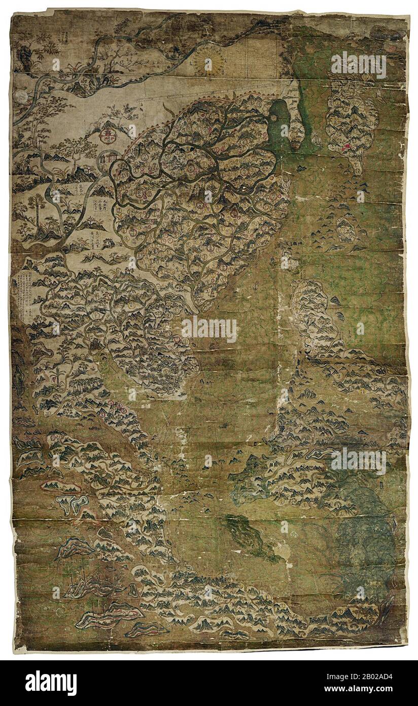 Originally the property of John Selden, the London lawyer and historical and linguistic scholar, the 'Selden Map' was lodged with the Bodleian Library in 1659. Dating from the late Ming period, it shows China, Korea, Japan, the Philippines, Indonesia, Southeast Asia and southern India. Shipping routes with compass bearings from the port of Quanzhou are given for the entire region. A panel of Chinese text on the left of the map near Calicut in the west gives directions of the routes to Aden, Oman, and the Straits of Hormuz. This is the earliest Chinese map to show shipping routes,and also to Stock Photohttps://www.alamy.com/image-license-details/?v=1https://www.alamy.com/originally-the-property-of-john-selden-the-london-lawyer-and-historical-and-linguistic-scholar-the-selden-map-was-lodged-with-the-bodleian-library-in-1659-dating-from-the-late-ming-period-it-shows-china-korea-japan-the-philippines-indonesia-southeast-asia-and-southern-india-shipping-routes-with-compass-bearings-from-the-port-of-quanzhou-are-given-for-the-entire-region-a-panel-of-chinese-text-on-the-left-of-the-map-near-calicut-in-the-west-gives-directions-of-the-routes-to-aden-oman-and-the-straits-of-hormuz-this-is-the-earliest-chinese-map-to-show-shipping-routesand-also-to-image344259472.html
RM2B02AD4–Originally the property of John Selden, the London lawyer and historical and linguistic scholar, the 'Selden Map' was lodged with the Bodleian Library in 1659. Dating from the late Ming period, it shows China, Korea, Japan, the Philippines, Indonesia, Southeast Asia and southern India. Shipping routes with compass bearings from the port of Quanzhou are given for the entire region. A panel of Chinese text on the left of the map near Calicut in the west gives directions of the routes to Aden, Oman, and the Straits of Hormuz. This is the earliest Chinese map to show shipping routes,and also to
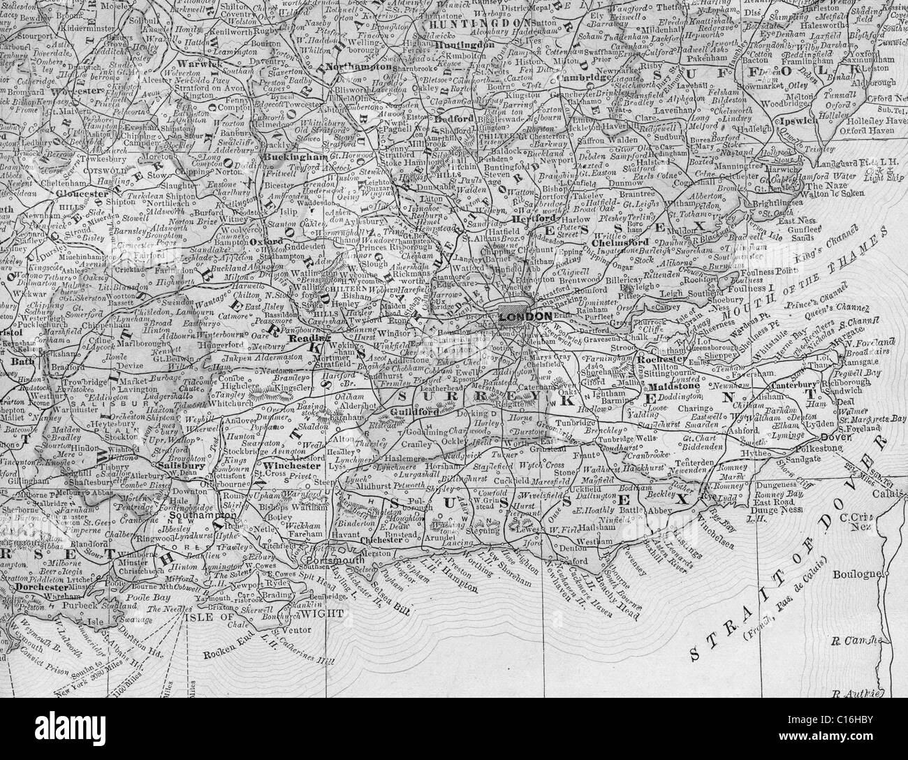 Old map of southeast England from original geography textbook, 1884 Stock Photohttps://www.alamy.com/image-license-details/?v=1https://www.alamy.com/stock-photo-old-map-of-southeast-england-from-original-geography-textbook-1884-35180767.html
RMC16HBY–Old map of southeast England from original geography textbook, 1884
 Platform access from footbridge at Purley Oaks station, Greater London. 2007 Stock Photohttps://www.alamy.com/image-license-details/?v=1https://www.alamy.com/platform-access-from-footbridge-at-purley-oaks-station-greater-london-2007-image210322395.html
RMP650A3–Platform access from footbridge at Purley Oaks station, Greater London. 2007
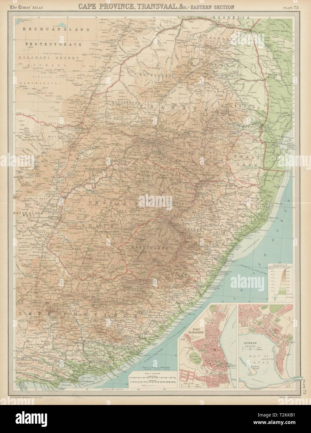 Colonial Southeast Africa. Port Elizabeth Durban. Cape Transvaal. TIMES 1922 map Stock Photohttps://www.alamy.com/image-license-details/?v=1https://www.alamy.com/colonial-southeast-africa-port-elizabeth-durban-cape-transvaal-times-1922-map-image242606757.html
RFT2KKB1–Colonial Southeast Africa. Port Elizabeth Durban. Cape Transvaal. TIMES 1922 map
 The East Indies 28South and Southeast Asia29 the whole map miniature maps mostly from The Universal Traveller by Thomas Salmon London Stock Photohttps://www.alamy.com/image-license-details/?v=1https://www.alamy.com/stock-photo-the-east-indies-28south-and-southeast-asia29-the-whole-map-miniature-147686307.html
RMJG7KAY–The East Indies 28South and Southeast Asia29 the whole map miniature maps mostly from The Universal Traveller by Thomas Salmon London
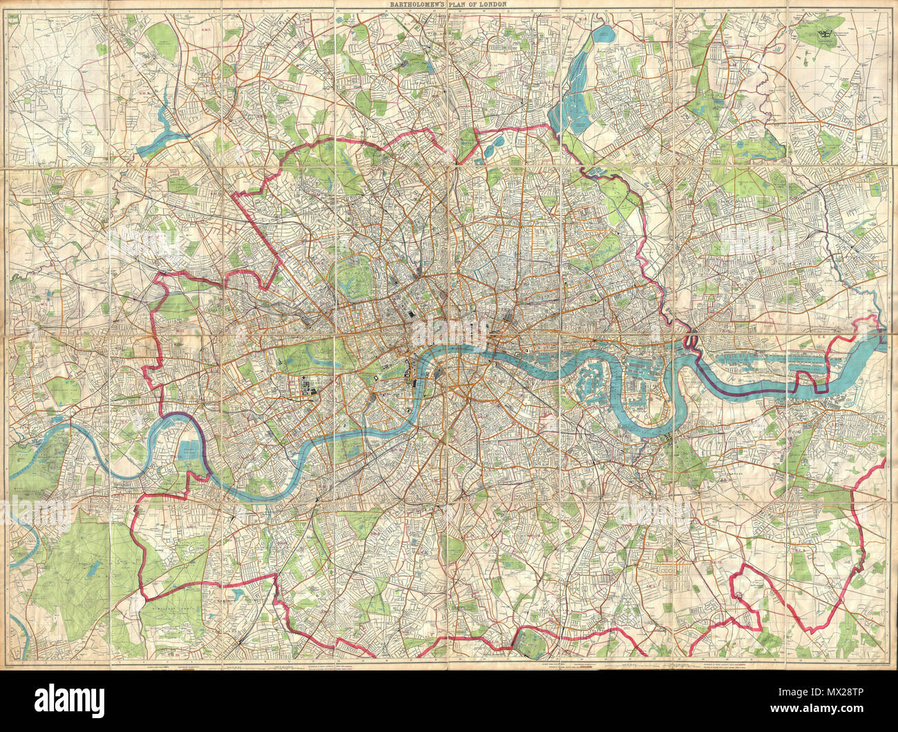 . London Fire Brigade Instructional Map. - Bartholomew's Plan of London. English: An enormously proportioned and extremely unusual map of London, England prepared by John Bartholomew. Covers the entire city of London from Kenton in the northwest, to Richmond Park in the southwest, to Hospital Hill in the northeast and Longlands in the southeast. Offers extraordinary detail freely labeling individual buildings, streets, and waterways throughout London. Prepared as a “London Fire Brigade Instructional Map” with the area of London patrolled by the fire brigades outlined in red. Probably not orig Stock Photohttps://www.alamy.com/image-license-details/?v=1https://www.alamy.com/london-fire-brigade-instructional-map-bartholomews-plan-of-london-english-an-enormously-proportioned-and-extremely-unusual-map-of-london-england-prepared-by-john-bartholomew-covers-the-entire-city-of-london-from-kenton-in-the-northwest-to-richmond-park-in-the-southwest-to-hospital-hill-in-the-northeast-and-longlands-in-the-southeast-offers-extraordinary-detail-freely-labeling-individual-buildings-streets-and-waterways-throughout-london-prepared-as-a-london-fire-brigade-instructional-map-with-the-area-of-london-patrolled-by-the-fire-brigades-outlined-in-red-probably-not-orig-image188135606.html
RMMX28TP–. London Fire Brigade Instructional Map. - Bartholomew's Plan of London. English: An enormously proportioned and extremely unusual map of London, England prepared by John Bartholomew. Covers the entire city of London from Kenton in the northwest, to Richmond Park in the southwest, to Hospital Hill in the northeast and Longlands in the southeast. Offers extraordinary detail freely labeling individual buildings, streets, and waterways throughout London. Prepared as a “London Fire Brigade Instructional Map” with the area of London patrolled by the fire brigades outlined in red. Probably not orig
 The East Indies (South and Southeast Asia) the whole map miniature maps mostly from 'The Universal Traveller' by Thomas Salmon, London Stock Photohttps://www.alamy.com/image-license-details/?v=1https://www.alamy.com/the-east-indies-south-and-southeast-asia-the-whole-map-miniature-maps-mostly-from-the-universal-traveller-by-thomas-salmon-london-image478272041.html
RM2JP34T9–The East Indies (South and Southeast Asia) the whole map miniature maps mostly from 'The Universal Traveller' by Thomas Salmon, London
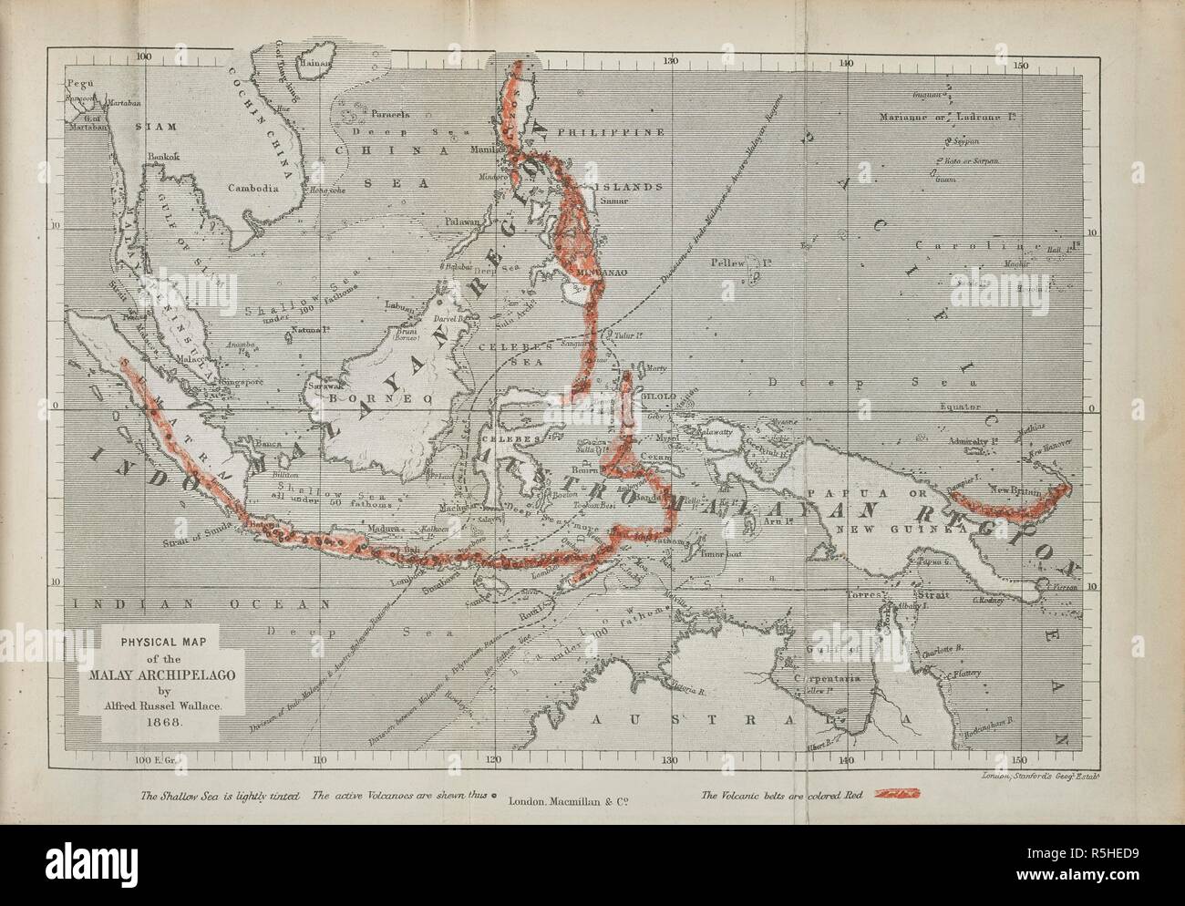 Physical map of the Malay archipelago by Alfred Russel Wallace, 1868. The Malay Archipelago, etc. London : Macmillan & Co., 1890. Source: 2354.a.1 opposite page 8. Stock Photohttps://www.alamy.com/image-license-details/?v=1https://www.alamy.com/physical-map-of-the-malay-archipelago-by-alfred-russel-wallace-1868-the-malay-archipelago-etc-london-macmillan-co-1890-source-2354a1-opposite-page-8-image227192597.html
RMR5HED9–Physical map of the Malay archipelago by Alfred Russel Wallace, 1868. The Malay Archipelago, etc. London : Macmillan & Co., 1890. Source: 2354.a.1 opposite page 8.
![WAAF Plotters Working With Plotting Equipment, 1940. Britain during the Second World War: women monitoring German bombing raids. '"Eighty plus [enemy aircraft], assembling over areas Amiens, Abbeville. A further sixty plus, vicinity of Dieppe. Control advised". First radar reports tend toward the probability of the targets being fighter airfields east and southeast of London. In other words, to Control, it looks the same as it did this morning. But too early to judge. Could be London itself. "All available squadrons at readiness. Let's hear from the Observer Corps as soon as pos Stock Photo WAAF Plotters Working With Plotting Equipment, 1940. Britain during the Second World War: women monitoring German bombing raids. '"Eighty plus [enemy aircraft], assembling over areas Amiens, Abbeville. A further sixty plus, vicinity of Dieppe. Control advised". First radar reports tend toward the probability of the targets being fighter airfields east and southeast of London. In other words, to Control, it looks the same as it did this morning. But too early to judge. Could be London itself. "All available squadrons at readiness. Let's hear from the Observer Corps as soon as pos Stock Photo](https://c8.alamy.com/comp/2XT37H3/waaf-plotters-working-with-plotting-equipment-1940-britain-during-the-second-world-war-women-monitoring-german-bombing-raids-quoteighty-plus-enemy-aircraft-assembling-over-areas-amiens-abbeville-a-further-sixty-plus-vicinity-of-dieppe-control-advisedquot-first-radar-reports-tend-toward-the-probability-of-the-targets-being-fighter-airfields-east-and-southeast-of-london-in-other-words-to-control-it-looks-the-same-as-it-did-this-morning-but-too-early-to-judge-could-be-london-itself-quotall-available-squadrons-at-readiness-lets-hear-from-the-observer-corps-as-soon-as-pos-2XT37H3.jpg) WAAF Plotters Working With Plotting Equipment, 1940. Britain during the Second World War: women monitoring German bombing raids. '"Eighty plus [enemy aircraft], assembling over areas Amiens, Abbeville. A further sixty plus, vicinity of Dieppe. Control advised". First radar reports tend toward the probability of the targets being fighter airfields east and southeast of London. In other words, to Control, it looks the same as it did this morning. But too early to judge. Could be London itself. "All available squadrons at readiness. Let's hear from the Observer Corps as soon as pos Stock Photohttps://www.alamy.com/image-license-details/?v=1https://www.alamy.com/waaf-plotters-working-with-plotting-equipment-1940-britain-during-the-second-world-war-women-monitoring-german-bombing-raids-quoteighty-plus-enemy-aircraft-assembling-over-areas-amiens-abbeville-a-further-sixty-plus-vicinity-of-dieppe-control-advisedquot-first-radar-reports-tend-toward-the-probability-of-the-targets-being-fighter-airfields-east-and-southeast-of-london-in-other-words-to-control-it-looks-the-same-as-it-did-this-morning-but-too-early-to-judge-could-be-london-itself-quotall-available-squadrons-at-readiness-lets-hear-from-the-observer-corps-as-soon-as-pos-image617186447.html
WAAF Plotters Working With Plotting Equipment, 1940. Britain during the Second World War: women monitoring German bombing raids. '"Eighty plus [enemy aircraft], assembling over areas Amiens, Abbeville. A further sixty plus, vicinity of Dieppe. Control advised". First radar reports tend toward the probability of the targets being fighter airfields east and southeast of London. In other words, to Control, it looks the same as it did this morning. But too early to judge. Could be London itself. "All available squadrons at readiness. Let's hear from the Observer Corps as soon as pos Stock Photohttps://www.alamy.com/image-license-details/?v=1https://www.alamy.com/waaf-plotters-working-with-plotting-equipment-1940-britain-during-the-second-world-war-women-monitoring-german-bombing-raids-quoteighty-plus-enemy-aircraft-assembling-over-areas-amiens-abbeville-a-further-sixty-plus-vicinity-of-dieppe-control-advisedquot-first-radar-reports-tend-toward-the-probability-of-the-targets-being-fighter-airfields-east-and-southeast-of-london-in-other-words-to-control-it-looks-the-same-as-it-did-this-morning-but-too-early-to-judge-could-be-london-itself-quotall-available-squadrons-at-readiness-lets-hear-from-the-observer-corps-as-soon-as-pos-image617186447.htmlRM2XT37H3–WAAF Plotters Working With Plotting Equipment, 1940. Britain during the Second World War: women monitoring German bombing raids. '"Eighty plus [enemy aircraft], assembling over areas Amiens, Abbeville. A further sixty plus, vicinity of Dieppe. Control advised". First radar reports tend toward the probability of the targets being fighter airfields east and southeast of London. In other words, to Control, it looks the same as it did this morning. But too early to judge. Could be London itself. "All available squadrons at readiness. Let's hear from the Observer Corps as soon as pos
![Image taken from page 144 of '[The Sea: its stirring story of adventure, peril & heroism.]' Image taken from page 144 of '[The Sea its stirring Stock Photo Image taken from page 144 of '[The Sea: its stirring story of adventure, peril & heroism.]' Image taken from page 144 of '[The Sea its stirring Stock Photo](https://c8.alamy.com/comp/HBN6WX/image-taken-from-page-144-of-the-sea-its-stirring-story-of-adventure-HBN6WX.jpg) Image taken from page 144 of '[The Sea: its stirring story of adventure, peril & heroism.]' Image taken from page 144 of '[The Sea its stirring Stock Photohttps://www.alamy.com/image-license-details/?v=1https://www.alamy.com/stock-photo-image-taken-from-page-144-of-the-sea-its-stirring-story-of-adventure-127700214.html
Image taken from page 144 of '[The Sea: its stirring story of adventure, peril & heroism.]' Image taken from page 144 of '[The Sea its stirring Stock Photohttps://www.alamy.com/image-license-details/?v=1https://www.alamy.com/stock-photo-image-taken-from-page-144-of-the-sea-its-stirring-story-of-adventure-127700214.htmlRMHBN6WX–Image taken from page 144 of '[The Sea: its stirring story of adventure, peril & heroism.]' Image taken from page 144 of '[The Sea its stirring
 19th century map of China Handcolored copperplate engraving From the Encyclopaedia Londinensis or, Universal dictionary of arts, sciences, and literature; Volume IV; Edited by Wilkes, John. Published in London in 1810 Stock Photohttps://www.alamy.com/image-license-details/?v=1https://www.alamy.com/19th-century-map-of-china-handcolored-copperplate-engraving-from-the-encyclopaedia-londinensis-or-universal-dictionary-of-arts-sciences-and-literature-volume-iv-edited-by-wilkes-john-published-in-london-in-1810-image369210445.html
RF2CCJYK9–19th century map of China Handcolored copperplate engraving From the Encyclopaedia Londinensis or, Universal dictionary of arts, sciences, and literature; Volume IV; Edited by Wilkes, John. Published in London in 1810
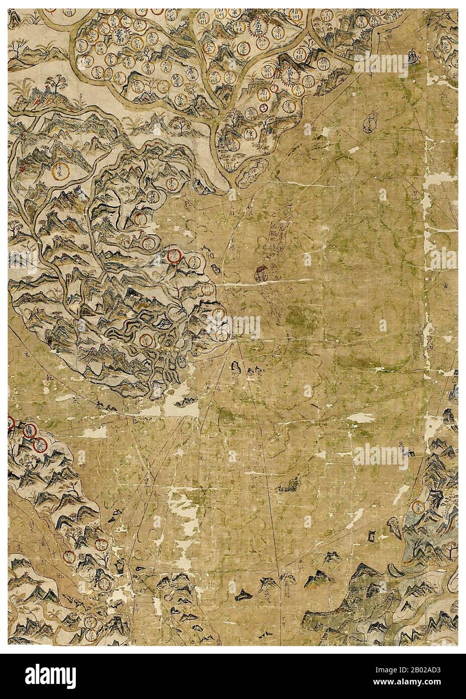 Originally the property of John Selden, the London lawyer and historical and linguistic scholar, the 'Selden Map' was lodged with the Bodleian Library in 1659. Dating from the late Ming period, it shows China, Korea, Japan, the Philippines, Indonesia, Southeast Asia and southern India. Shipping routes with compass bearings from the port of Quanzhou are given for the entire region. A panel of Chinese text on the left of the map near Calicut in the west gives directions of the routes to Aden, Oman, and the Straits of Hormuz. This is the earliest Chinese map to show shipping routes,and also to Stock Photohttps://www.alamy.com/image-license-details/?v=1https://www.alamy.com/originally-the-property-of-john-selden-the-london-lawyer-and-historical-and-linguistic-scholar-the-selden-map-was-lodged-with-the-bodleian-library-in-1659-dating-from-the-late-ming-period-it-shows-china-korea-japan-the-philippines-indonesia-southeast-asia-and-southern-india-shipping-routes-with-compass-bearings-from-the-port-of-quanzhou-are-given-for-the-entire-region-a-panel-of-chinese-text-on-the-left-of-the-map-near-calicut-in-the-west-gives-directions-of-the-routes-to-aden-oman-and-the-straits-of-hormuz-this-is-the-earliest-chinese-map-to-show-shipping-routesand-also-to-image344259471.html
RM2B02AD3–Originally the property of John Selden, the London lawyer and historical and linguistic scholar, the 'Selden Map' was lodged with the Bodleian Library in 1659. Dating from the late Ming period, it shows China, Korea, Japan, the Philippines, Indonesia, Southeast Asia and southern India. Shipping routes with compass bearings from the port of Quanzhou are given for the entire region. A panel of Chinese text on the left of the map near Calicut in the west gives directions of the routes to Aden, Oman, and the Straits of Hormuz. This is the earliest Chinese map to show shipping routes,and also to
 Herman Moll (c. 1654 – September 22, 1732), was a cartographer, engraver, and publisher. Moll produced his earliest maps from studying cartographers such as John Senex and Emanuel Bowen. He probably sold his first maps from a stall in various places in London. From 1688 he had his own shop in Vanley's Court in London's Blackfriars. Between 1691 and 1710 his business was located at the corner of Spring Gardens and Charing Cross, and he finally moved along the River Thames to Beech Street where he remained until his death. Stock Photohttps://www.alamy.com/image-license-details/?v=1https://www.alamy.com/herman-moll-c-1654-september-22-1732-was-a-cartographer-engraver-and-publisher-moll-produced-his-earliest-maps-from-studying-cartographers-such-as-john-senex-and-emanuel-bowen-he-probably-sold-his-first-maps-from-a-stall-in-various-places-in-london-from-1688-he-had-his-own-shop-in-vanleys-court-in-londons-blackfriars-between-1691-and-1710-his-business-was-located-at-the-corner-of-spring-gardens-and-charing-cross-and-he-finally-moved-along-the-river-thames-to-beech-street-where-he-remained-until-his-death-image344255793.html
RM2B025NN–Herman Moll (c. 1654 – September 22, 1732), was a cartographer, engraver, and publisher. Moll produced his earliest maps from studying cartographers such as John Senex and Emanuel Bowen. He probably sold his first maps from a stall in various places in London. From 1688 he had his own shop in Vanley's Court in London's Blackfriars. Between 1691 and 1710 his business was located at the corner of Spring Gardens and Charing Cross, and he finally moved along the River Thames to Beech Street where he remained until his death.
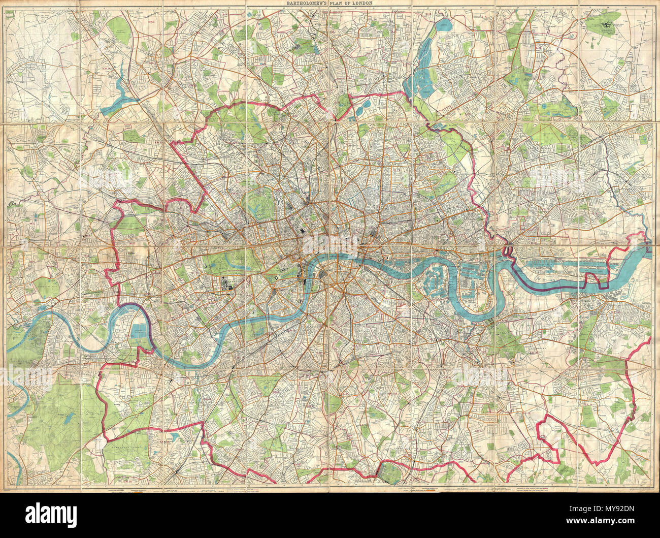 . London Fire Brigade Instructional Map. - Bartholomew's Plan of London. English: An enormously proportioned and extremely unusual map of London, England prepared by John Bartholomew. Covers the entire city of London from Kenton in the northwest, to Richmond Park in the southwest, to Hospital Hill in the northeast and Longlands in the southeast. Offers extraordinary detail freely labeling individual buildings, streets, and waterways throughout London. Prepared as a “London Fire Brigade Instructional Map” with the area of London patrolled by the fire brigades outlined in red. Probably not orig Stock Photohttps://www.alamy.com/image-license-details/?v=1https://www.alamy.com/london-fire-brigade-instructional-map-bartholomews-plan-of-london-english-an-enormously-proportioned-and-extremely-unusual-map-of-london-england-prepared-by-john-bartholomew-covers-the-entire-city-of-london-from-kenton-in-the-northwest-to-richmond-park-in-the-southwest-to-hospital-hill-in-the-northeast-and-longlands-in-the-southeast-offers-extraordinary-detail-freely-labeling-individual-buildings-streets-and-waterways-throughout-london-prepared-as-a-london-fire-brigade-instructional-map-with-the-area-of-london-patrolled-by-the-fire-brigades-outlined-in-red-probably-not-orig-image188898913.html
RMMY92DN–. London Fire Brigade Instructional Map. - Bartholomew's Plan of London. English: An enormously proportioned and extremely unusual map of London, England prepared by John Bartholomew. Covers the entire city of London from Kenton in the northwest, to Richmond Park in the southwest, to Hospital Hill in the northeast and Longlands in the southeast. Offers extraordinary detail freely labeling individual buildings, streets, and waterways throughout London. Prepared as a “London Fire Brigade Instructional Map” with the area of London patrolled by the fire brigades outlined in red. Probably not orig
![A map of Singapore and the surrounding country . Map of Singapore and surrounding country ... Scale, 1 : 253,440, etc. [London] : Intelligence Division, War Office, 1896. Source: Maps 60035.(1.). Language: English. Stock Photo A map of Singapore and the surrounding country . Map of Singapore and surrounding country ... Scale, 1 : 253,440, etc. [London] : Intelligence Division, War Office, 1896. Source: Maps 60035.(1.). Language: English. Stock Photo](https://c8.alamy.com/comp/R58HMW/a-map-of-singapore-and-the-surrounding-country-map-of-singapore-and-surrounding-country-scale-1-253440-etc-london-intelligence-division-war-office-1896-source-maps-600351-language-english-R58HMW.jpg) A map of Singapore and the surrounding country . Map of Singapore and surrounding country ... Scale, 1 : 253,440, etc. [London] : Intelligence Division, War Office, 1896. Source: Maps 60035.(1.). Language: English. Stock Photohttps://www.alamy.com/image-license-details/?v=1https://www.alamy.com/a-map-of-singapore-and-the-surrounding-country-map-of-singapore-and-surrounding-country-scale-1-253440-etc-london-intelligence-division-war-office-1896-source-maps-600351-language-english-image226997593.html
A map of Singapore and the surrounding country . Map of Singapore and surrounding country ... Scale, 1 : 253,440, etc. [London] : Intelligence Division, War Office, 1896. Source: Maps 60035.(1.). Language: English. Stock Photohttps://www.alamy.com/image-license-details/?v=1https://www.alamy.com/a-map-of-singapore-and-the-surrounding-country-map-of-singapore-and-surrounding-country-scale-1-253440-etc-london-intelligence-division-war-office-1896-source-maps-600351-language-english-image226997593.htmlRMR58HMW–A map of Singapore and the surrounding country . Map of Singapore and surrounding country ... Scale, 1 : 253,440, etc. [London] : Intelligence Division, War Office, 1896. Source: Maps 60035.(1.). Language: English.
![WAAF Plotters Working With Plotting Equipment, 1940. Britain during the Second World War: women monitoring German bombing raids. '"Eighty plus [enemy aircraft], assembling over areas Amiens, Abbeville. A further sixty plus, vicinity of Dieppe. Control advised". First radar reports tend toward the probability of the targets being fighter airfields east and southeast of London. In other words, to Control, it looks the same as it did this morning. But too early to judge. Could be London itself. "All available squadrons at readiness. Let's hear from the Observer Corps as soon as pos Stock Photo WAAF Plotters Working With Plotting Equipment, 1940. Britain during the Second World War: women monitoring German bombing raids. '"Eighty plus [enemy aircraft], assembling over areas Amiens, Abbeville. A further sixty plus, vicinity of Dieppe. Control advised". First radar reports tend toward the probability of the targets being fighter airfields east and southeast of London. In other words, to Control, it looks the same as it did this morning. But too early to judge. Could be London itself. "All available squadrons at readiness. Let's hear from the Observer Corps as soon as pos Stock Photo](https://c8.alamy.com/comp/2XT37CB/waaf-plotters-working-with-plotting-equipment-1940-britain-during-the-second-world-war-women-monitoring-german-bombing-raids-quoteighty-plus-enemy-aircraft-assembling-over-areas-amiens-abbeville-a-further-sixty-plus-vicinity-of-dieppe-control-advisedquot-first-radar-reports-tend-toward-the-probability-of-the-targets-being-fighter-airfields-east-and-southeast-of-london-in-other-words-to-control-it-looks-the-same-as-it-did-this-morning-but-too-early-to-judge-could-be-london-itself-quotall-available-squadrons-at-readiness-lets-hear-from-the-observer-corps-as-soon-as-pos-2XT37CB.jpg) WAAF Plotters Working With Plotting Equipment, 1940. Britain during the Second World War: women monitoring German bombing raids. '"Eighty plus [enemy aircraft], assembling over areas Amiens, Abbeville. A further sixty plus, vicinity of Dieppe. Control advised". First radar reports tend toward the probability of the targets being fighter airfields east and southeast of London. In other words, to Control, it looks the same as it did this morning. But too early to judge. Could be London itself. "All available squadrons at readiness. Let's hear from the Observer Corps as soon as pos Stock Photohttps://www.alamy.com/image-license-details/?v=1https://www.alamy.com/waaf-plotters-working-with-plotting-equipment-1940-britain-during-the-second-world-war-women-monitoring-german-bombing-raids-quoteighty-plus-enemy-aircraft-assembling-over-areas-amiens-abbeville-a-further-sixty-plus-vicinity-of-dieppe-control-advisedquot-first-radar-reports-tend-toward-the-probability-of-the-targets-being-fighter-airfields-east-and-southeast-of-london-in-other-words-to-control-it-looks-the-same-as-it-did-this-morning-but-too-early-to-judge-could-be-london-itself-quotall-available-squadrons-at-readiness-lets-hear-from-the-observer-corps-as-soon-as-pos-image617186315.html
WAAF Plotters Working With Plotting Equipment, 1940. Britain during the Second World War: women monitoring German bombing raids. '"Eighty plus [enemy aircraft], assembling over areas Amiens, Abbeville. A further sixty plus, vicinity of Dieppe. Control advised". First radar reports tend toward the probability of the targets being fighter airfields east and southeast of London. In other words, to Control, it looks the same as it did this morning. But too early to judge. Could be London itself. "All available squadrons at readiness. Let's hear from the Observer Corps as soon as pos Stock Photohttps://www.alamy.com/image-license-details/?v=1https://www.alamy.com/waaf-plotters-working-with-plotting-equipment-1940-britain-during-the-second-world-war-women-monitoring-german-bombing-raids-quoteighty-plus-enemy-aircraft-assembling-over-areas-amiens-abbeville-a-further-sixty-plus-vicinity-of-dieppe-control-advisedquot-first-radar-reports-tend-toward-the-probability-of-the-targets-being-fighter-airfields-east-and-southeast-of-london-in-other-words-to-control-it-looks-the-same-as-it-did-this-morning-but-too-early-to-judge-could-be-london-itself-quotall-available-squadrons-at-readiness-lets-hear-from-the-observer-corps-as-soon-as-pos-image617186315.htmlRM2XT37CB–WAAF Plotters Working With Plotting Equipment, 1940. Britain during the Second World War: women monitoring German bombing raids. '"Eighty plus [enemy aircraft], assembling over areas Amiens, Abbeville. A further sixty plus, vicinity of Dieppe. Control advised". First radar reports tend toward the probability of the targets being fighter airfields east and southeast of London. In other words, to Control, it looks the same as it did this morning. But too early to judge. Could be London itself. "All available squadrons at readiness. Let's hear from the Observer Corps as soon as pos
![Image taken from page 215 of 'Illustrated Battles of the Nineteenth Century. [By Archibald Forbes, Major Arthur Griffiths, and others.]' Image taken from page 215 of 'Illustrated Battles of the Stock Photo Image taken from page 215 of 'Illustrated Battles of the Nineteenth Century. [By Archibald Forbes, Major Arthur Griffiths, and others.]' Image taken from page 215 of 'Illustrated Battles of the Stock Photo](https://c8.alamy.com/comp/HC0R65/image-taken-from-page-215-of-illustrated-battles-of-the-nineteenth-HC0R65.jpg) Image taken from page 215 of 'Illustrated Battles of the Nineteenth Century. [By Archibald Forbes, Major Arthur Griffiths, and others.]' Image taken from page 215 of 'Illustrated Battles of the Stock Photohttps://www.alamy.com/image-license-details/?v=1https://www.alamy.com/stock-photo-image-taken-from-page-215-of-illustrated-battles-of-the-nineteenth-127866653.html
Image taken from page 215 of 'Illustrated Battles of the Nineteenth Century. [By Archibald Forbes, Major Arthur Griffiths, and others.]' Image taken from page 215 of 'Illustrated Battles of the Stock Photohttps://www.alamy.com/image-license-details/?v=1https://www.alamy.com/stock-photo-image-taken-from-page-215-of-illustrated-battles-of-the-nineteenth-127866653.htmlRMHC0R65–Image taken from page 215 of 'Illustrated Battles of the Nineteenth Century. [By Archibald Forbes, Major Arthur Griffiths, and others.]' Image taken from page 215 of 'Illustrated Battles of the
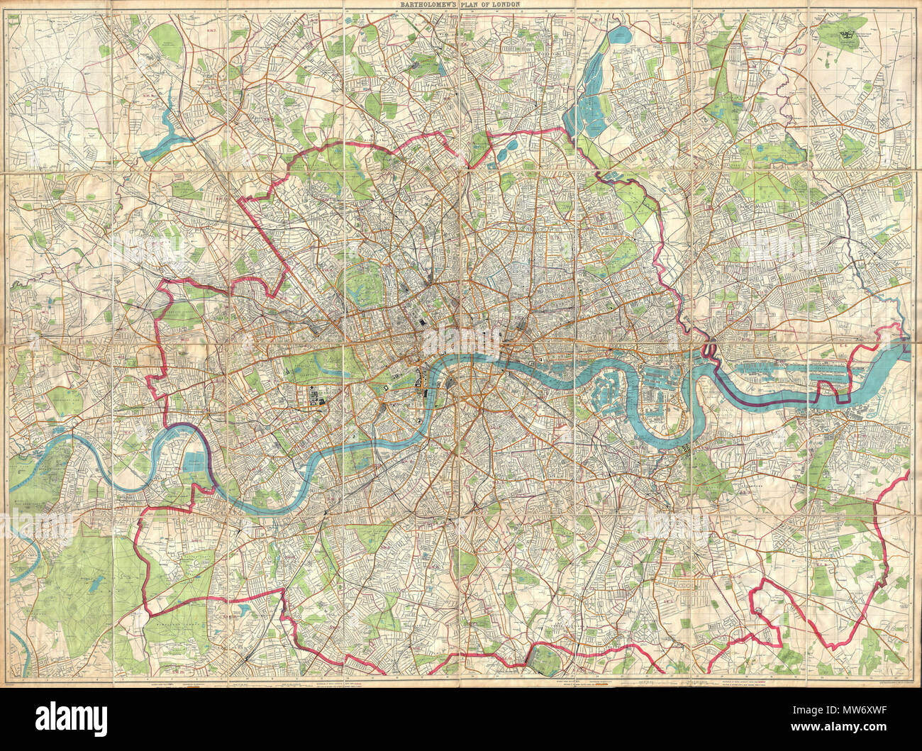 . London Fire Brigade Instructional Map. - Bartholomew's Plan of London. English: An enormously proportioned and extremely unusual map of London, England prepared by John Bartholomew. Covers the entire city of London from Kenton in the northwest, to Richmond Park in the southwest, to Hospital Hill in the northeast and Longlands in the southeast. Offers extraordinary detail freely labeling individual buildings, streets, and waterways throughout London. Prepared as a “London Fire Brigade Instructional Map” with the area of London patrolled by the fire brigades outlined in red. Probably not orig Stock Photohttps://www.alamy.com/image-license-details/?v=1https://www.alamy.com/london-fire-brigade-instructional-map-bartholomews-plan-of-london-english-an-enormously-proportioned-and-extremely-unusual-map-of-london-england-prepared-by-john-bartholomew-covers-the-entire-city-of-london-from-kenton-in-the-northwest-to-richmond-park-in-the-southwest-to-hospital-hill-in-the-northeast-and-longlands-in-the-southeast-offers-extraordinary-detail-freely-labeling-individual-buildings-streets-and-waterways-throughout-london-prepared-as-a-london-fire-brigade-instructional-map-with-the-area-of-london-patrolled-by-the-fire-brigades-outlined-in-red-probably-not-orig-image187622891.html
RMMW6XWF–. London Fire Brigade Instructional Map. - Bartholomew's Plan of London. English: An enormously proportioned and extremely unusual map of London, England prepared by John Bartholomew. Covers the entire city of London from Kenton in the northwest, to Richmond Park in the southwest, to Hospital Hill in the northeast and Longlands in the southeast. Offers extraordinary detail freely labeling individual buildings, streets, and waterways throughout London. Prepared as a “London Fire Brigade Instructional Map” with the area of London patrolled by the fire brigades outlined in red. Probably not orig
![Map of Singapore, 1914. Map of Singapore, GSGS 2241. [London] : [GSGS, War Office], 1914. Great Britain. General Staff. Geographical Section. 1 map : col.; Scale 1:31 680. Source: Maps MOD GSGS 2241. Stock Photo Map of Singapore, 1914. Map of Singapore, GSGS 2241. [London] : [GSGS, War Office], 1914. Great Britain. General Staff. Geographical Section. 1 map : col.; Scale 1:31 680. Source: Maps MOD GSGS 2241. Stock Photo](https://c8.alamy.com/comp/R5CC57/map-of-singapore-1914-map-of-singapore-gsgs-2241-london-gsgs-war-office-1914-great-britain-general-staff-geographical-section-1-map-col-scale-131-680-source-maps-mod-gsgs-2241-R5CC57.jpg) Map of Singapore, 1914. Map of Singapore, GSGS 2241. [London] : [GSGS, War Office], 1914. Great Britain. General Staff. Geographical Section. 1 map : col.; Scale 1:31 680. Source: Maps MOD GSGS 2241. Stock Photohttps://www.alamy.com/image-license-details/?v=1https://www.alamy.com/map-of-singapore-1914-map-of-singapore-gsgs-2241-london-gsgs-war-office-1914-great-britain-general-staff-geographical-section-1-map-col-scale-131-680-source-maps-mod-gsgs-2241-image227081043.html
Map of Singapore, 1914. Map of Singapore, GSGS 2241. [London] : [GSGS, War Office], 1914. Great Britain. General Staff. Geographical Section. 1 map : col.; Scale 1:31 680. Source: Maps MOD GSGS 2241. Stock Photohttps://www.alamy.com/image-license-details/?v=1https://www.alamy.com/map-of-singapore-1914-map-of-singapore-gsgs-2241-london-gsgs-war-office-1914-great-britain-general-staff-geographical-section-1-map-col-scale-131-680-source-maps-mod-gsgs-2241-image227081043.htmlRMR5CC57–Map of Singapore, 1914. Map of Singapore, GSGS 2241. [London] : [GSGS, War Office], 1914. Great Britain. General Staff. Geographical Section. 1 map : col.; Scale 1:31 680. Source: Maps MOD GSGS 2241.
![WAAF Plotters Working With Plotting Equipment, 1940. Britain during the Second World War: women monitoring German bombing raids. '"Eighty plus [enemy aircraft], assembling over areas Amiens, Abbeville. A further sixty plus, vicinity of Dieppe. Control advised". First radar reports tend toward the probability of the targets being fighter airfields east and southeast of London. In other words, to Control, it looks the same as it did this morning. But too early to judge. Could be London itself. "All available squadrons at readiness. Let's hear from the Observer Corps as soon as pos Stock Photo WAAF Plotters Working With Plotting Equipment, 1940. Britain during the Second World War: women monitoring German bombing raids. '"Eighty plus [enemy aircraft], assembling over areas Amiens, Abbeville. A further sixty plus, vicinity of Dieppe. Control advised". First radar reports tend toward the probability of the targets being fighter airfields east and southeast of London. In other words, to Control, it looks the same as it did this morning. But too early to judge. Could be London itself. "All available squadrons at readiness. Let's hear from the Observer Corps as soon as pos Stock Photo](https://c8.alamy.com/comp/2XT3674/waaf-plotters-working-with-plotting-equipment-1940-britain-during-the-second-world-war-women-monitoring-german-bombing-raids-quoteighty-plus-enemy-aircraft-assembling-over-areas-amiens-abbeville-a-further-sixty-plus-vicinity-of-dieppe-control-advisedquot-first-radar-reports-tend-toward-the-probability-of-the-targets-being-fighter-airfields-east-and-southeast-of-london-in-other-words-to-control-it-looks-the-same-as-it-did-this-morning-but-too-early-to-judge-could-be-london-itself-quotall-available-squadrons-at-readiness-lets-hear-from-the-observer-corps-as-soon-as-pos-2XT3674.jpg) WAAF Plotters Working With Plotting Equipment, 1940. Britain during the Second World War: women monitoring German bombing raids. '"Eighty plus [enemy aircraft], assembling over areas Amiens, Abbeville. A further sixty plus, vicinity of Dieppe. Control advised". First radar reports tend toward the probability of the targets being fighter airfields east and southeast of London. In other words, to Control, it looks the same as it did this morning. But too early to judge. Could be London itself. "All available squadrons at readiness. Let's hear from the Observer Corps as soon as pos Stock Photohttps://www.alamy.com/image-license-details/?v=1https://www.alamy.com/waaf-plotters-working-with-plotting-equipment-1940-britain-during-the-second-world-war-women-monitoring-german-bombing-raids-quoteighty-plus-enemy-aircraft-assembling-over-areas-amiens-abbeville-a-further-sixty-plus-vicinity-of-dieppe-control-advisedquot-first-radar-reports-tend-toward-the-probability-of-the-targets-being-fighter-airfields-east-and-southeast-of-london-in-other-words-to-control-it-looks-the-same-as-it-did-this-morning-but-too-early-to-judge-could-be-london-itself-quotall-available-squadrons-at-readiness-lets-hear-from-the-observer-corps-as-soon-as-pos-image617185384.html
WAAF Plotters Working With Plotting Equipment, 1940. Britain during the Second World War: women monitoring German bombing raids. '"Eighty plus [enemy aircraft], assembling over areas Amiens, Abbeville. A further sixty plus, vicinity of Dieppe. Control advised". First radar reports tend toward the probability of the targets being fighter airfields east and southeast of London. In other words, to Control, it looks the same as it did this morning. But too early to judge. Could be London itself. "All available squadrons at readiness. Let's hear from the Observer Corps as soon as pos Stock Photohttps://www.alamy.com/image-license-details/?v=1https://www.alamy.com/waaf-plotters-working-with-plotting-equipment-1940-britain-during-the-second-world-war-women-monitoring-german-bombing-raids-quoteighty-plus-enemy-aircraft-assembling-over-areas-amiens-abbeville-a-further-sixty-plus-vicinity-of-dieppe-control-advisedquot-first-radar-reports-tend-toward-the-probability-of-the-targets-being-fighter-airfields-east-and-southeast-of-london-in-other-words-to-control-it-looks-the-same-as-it-did-this-morning-but-too-early-to-judge-could-be-london-itself-quotall-available-squadrons-at-readiness-lets-hear-from-the-observer-corps-as-soon-as-pos-image617185384.htmlRM2XT3674–WAAF Plotters Working With Plotting Equipment, 1940. Britain during the Second World War: women monitoring German bombing raids. '"Eighty plus [enemy aircraft], assembling over areas Amiens, Abbeville. A further sixty plus, vicinity of Dieppe. Control advised". First radar reports tend toward the probability of the targets being fighter airfields east and southeast of London. In other words, to Control, it looks the same as it did this morning. But too early to judge. Could be London itself. "All available squadrons at readiness. Let's hear from the Observer Corps as soon as pos
 Image taken from page 335 of 'The Records of the Woolwich District' Image taken from page 335 of 'The Records of the Stock Photohttps://www.alamy.com/image-license-details/?v=1https://www.alamy.com/stock-photo-image-taken-from-page-335-of-the-records-of-the-woolwich-district-127790188.html
RMHBW9K8–Image taken from page 335 of 'The Records of the Woolwich District' Image taken from page 335 of 'The Records of the
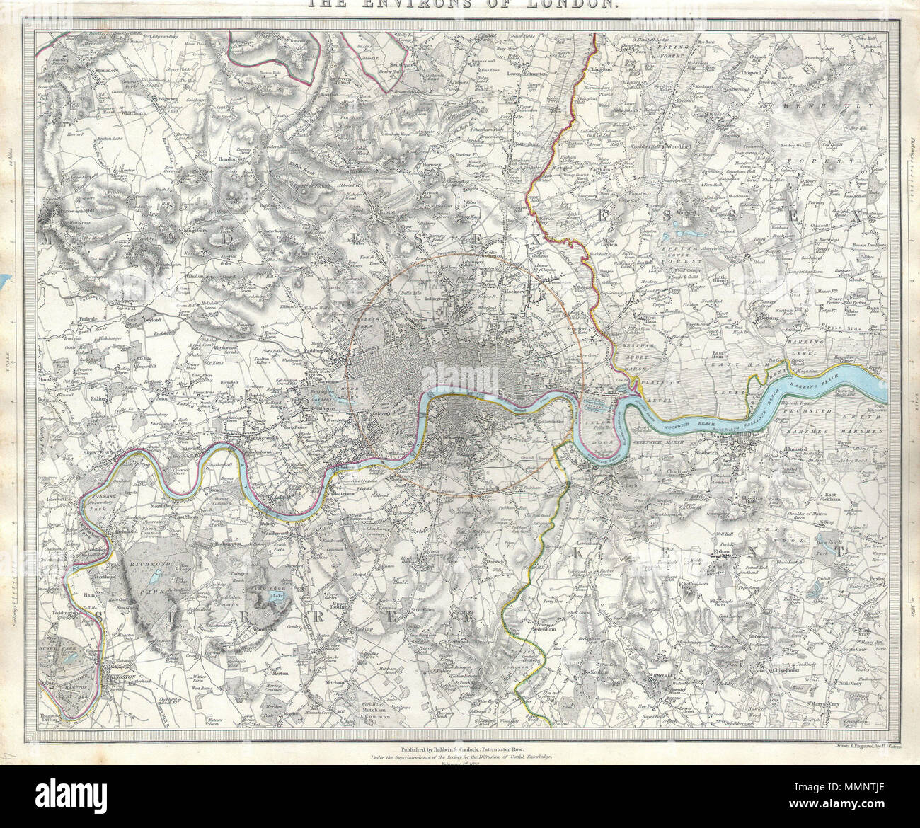 . English: A difficult to find map of the vicinity of London, England. Depicts the London area from Kingston and Hamton Court Park in the southwest to Stanmore in the northwest, Hennault Forest in the northeast and St. Marys Cray and Kevingtown in the southeast. A red circle around central London indicates the “Extent of twopenny post delivery.” Crisp detail notes individual buildings, factories, kilns, butchers, farms, palaces, etc. Printed by Baldwin & Cradock of Paternoster Row, London, for the Society of for the Diffusion of Useful Knowledge on February 1st 1832. The Environs of London.. Stock Photohttps://www.alamy.com/image-license-details/?v=1https://www.alamy.com/english-a-difficult-to-find-map-of-the-vicinity-of-london-england-depicts-the-london-area-from-kingston-and-hamton-court-park-in-the-southwest-to-stanmore-in-the-northwest-hennault-forest-in-the-northeast-and-st-marys-cray-and-kevingtown-in-the-southeast-a-red-circle-around-central-london-indicates-the-extent-of-twopenny-post-delivery-crisp-detail-notes-individual-buildings-factories-kilns-butchers-farms-palaces-etc-printed-by-baldwin-cradock-of-paternoster-row-london-for-the-society-of-for-the-diffusion-of-useful-knowledge-on-february-1st-1832-the-environs-of-london-image184877126.html
RMMMNTJE–. English: A difficult to find map of the vicinity of London, England. Depicts the London area from Kingston and Hamton Court Park in the southwest to Stanmore in the northwest, Hennault Forest in the northeast and St. Marys Cray and Kevingtown in the southeast. A red circle around central London indicates the “Extent of twopenny post delivery.” Crisp detail notes individual buildings, factories, kilns, butchers, farms, palaces, etc. Printed by Baldwin & Cradock of Paternoster Row, London, for the Society of for the Diffusion of Useful Knowledge on February 1st 1832. The Environs of London..
 A map of Sumatra. Map of the Island of Sumatra, constructed chiefly from surveys taken by order of the late Sir T. Stamford Raffles. (Sketch of the Island of Singapore). London : J. Gardner, 1829. Source: Maps 88725.(3.). Language: English. Author: GARDNER, JAMES. Stock Photohttps://www.alamy.com/image-license-details/?v=1https://www.alamy.com/a-map-of-sumatra-map-of-the-island-of-sumatra-constructed-chiefly-from-surveys-taken-by-order-of-the-late-sir-t-stamford-raffles-sketch-of-the-island-of-singapore-london-j-gardner-1829-source-maps-887253-language-english-author-gardner-james-image226859970.html
RMR52A5P–A map of Sumatra. Map of the Island of Sumatra, constructed chiefly from surveys taken by order of the late Sir T. Stamford Raffles. (Sketch of the Island of Singapore). London : J. Gardner, 1829. Source: Maps 88725.(3.). Language: English. Author: GARDNER, JAMES.
 . English: An enormously proportioned and extremely unusual map of London, England prepared by John Bartholomew. Covers the entire city of London from Kenton in the northwest, to Richmond Park in the southwest, to Hospital Hill in the northeast and Longlands in the southeast. Offers extraordinary detail freely labeling individual buildings, streets, and waterways throughout London. Prepared as a “London Fire Brigade Instructional Map” with the area of London patrolled by the fire brigades outlined in red. Probably not originally a fire brigade map, but adopted by the fire brigade commanders f Stock Photohttps://www.alamy.com/image-license-details/?v=1https://www.alamy.com/english-an-enormously-proportioned-and-extremely-unusual-map-of-london-england-prepared-by-john-bartholomew-covers-the-entire-city-of-london-from-kenton-in-the-northwest-to-richmond-park-in-the-southwest-to-hospital-hill-in-the-northeast-and-longlands-in-the-southeast-offers-extraordinary-detail-freely-labeling-individual-buildings-streets-and-waterways-throughout-london-prepared-as-a-london-fire-brigade-instructional-map-with-the-area-of-london-patrolled-by-the-fire-brigades-outlined-in-red-probably-not-originally-a-fire-brigade-map-but-adopted-by-the-fire-brigade-commanders-f-image184878087.html
RMMMNWTR–. English: An enormously proportioned and extremely unusual map of London, England prepared by John Bartholomew. Covers the entire city of London from Kenton in the northwest, to Richmond Park in the southwest, to Hospital Hill in the northeast and Longlands in the southeast. Offers extraordinary detail freely labeling individual buildings, streets, and waterways throughout London. Prepared as a “London Fire Brigade Instructional Map” with the area of London patrolled by the fire brigades outlined in red. Probably not originally a fire brigade map, but adopted by the fire brigade commanders f
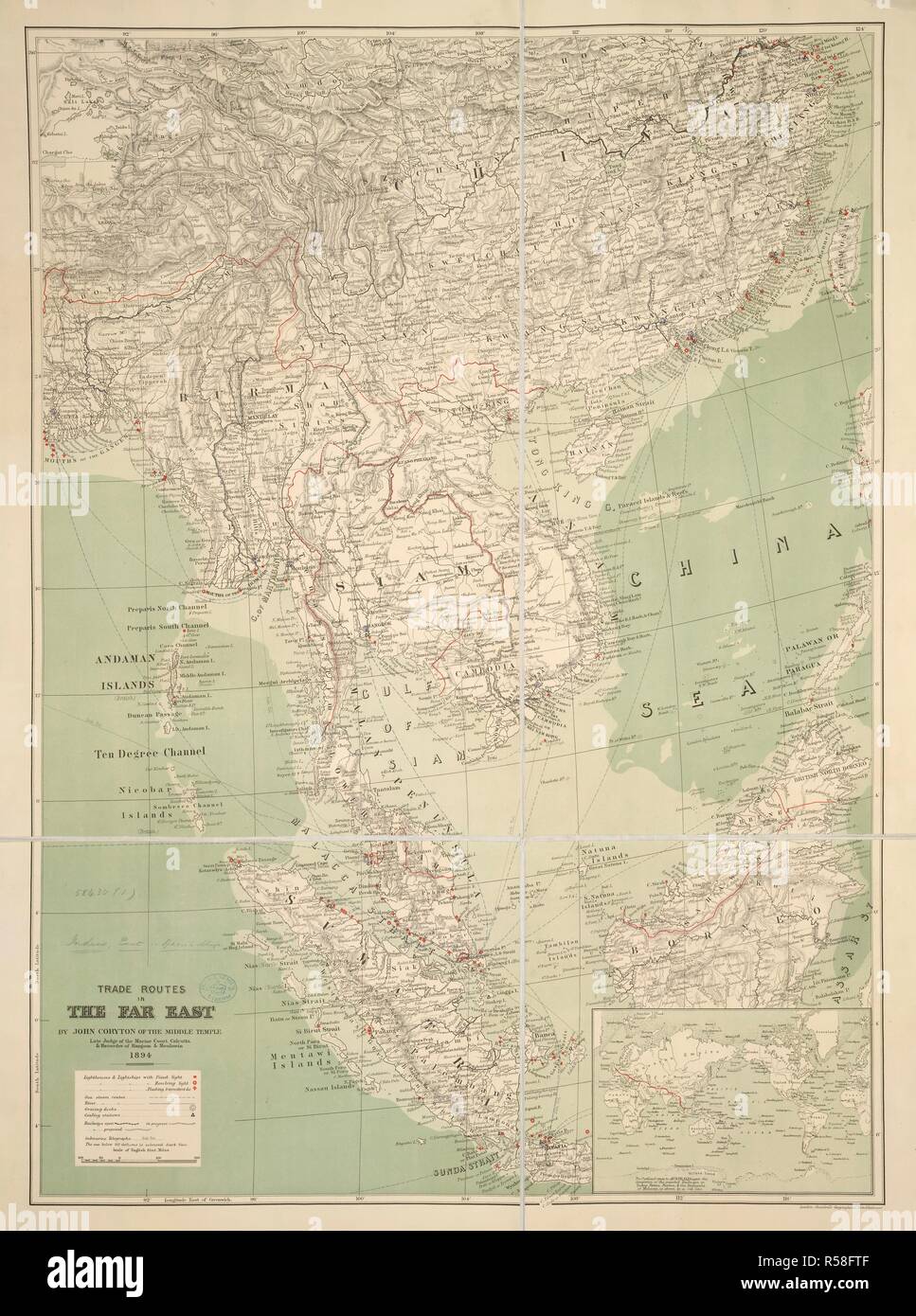 Trade Routes in the Far East. Trade Routes in the Far East. By J. Coryton. [Scal. London : Stanford, 1894. Source: Maps.58430.(1),. Language: English. Stock Photohttps://www.alamy.com/image-license-details/?v=1https://www.alamy.com/trade-routes-in-the-far-east-trade-routes-in-the-far-east-by-j-coryton-scal-london-stanford-1894-source-maps584301-language-english-image226996127.html
RMR58FTF–Trade Routes in the Far East. Trade Routes in the Far East. By J. Coryton. [Scal. London : Stanford, 1894. Source: Maps.58430.(1),. Language: English.
 . The Environs of London. English: A difficult to find map of the vicinity of London, England. Depicts the London area from Kingston and Hamton Court Park in the southwest to Stanmore in the northwest, Hennault Forest in the northeast and St. Marys Cray and Kevingtown in the southeast. A red circle around central London indicates the “Extent of twopenny post delivery.” Crisp detail notes individual buildings, factories, kilns, butchers, farms, palaces, etc. Printed by Baldwin & Cradock of Paternoster Row, London, for the Society of for the Diffusion of Useful Knowledge on February 1st 1832. . Stock Photohttps://www.alamy.com/image-license-details/?v=1https://www.alamy.com/the-environs-of-london-english-a-difficult-to-find-map-of-the-vicinity-of-london-england-depicts-the-london-area-from-kingston-and-hamton-court-park-in-the-southwest-to-stanmore-in-the-northwest-hennault-forest-in-the-northeast-and-st-marys-cray-and-kevingtown-in-the-southeast-a-red-circle-around-central-london-indicates-the-extent-of-twopenny-post-delivery-crisp-detail-notes-individual-buildings-factories-kilns-butchers-farms-palaces-etc-printed-by-baldwin-cradock-of-paternoster-row-london-for-the-society-of-for-the-diffusion-of-useful-knowledge-on-february-1st-1832-image188885925.html
RMMY8DWW–. The Environs of London. English: A difficult to find map of the vicinity of London, England. Depicts the London area from Kingston and Hamton Court Park in the southwest to Stanmore in the northwest, Hennault Forest in the northeast and St. Marys Cray and Kevingtown in the southeast. A red circle around central London indicates the “Extent of twopenny post delivery.” Crisp detail notes individual buildings, factories, kilns, butchers, farms, palaces, etc. Printed by Baldwin & Cradock of Paternoster Row, London, for the Society of for the Diffusion of Useful Knowledge on February 1st 1832. .
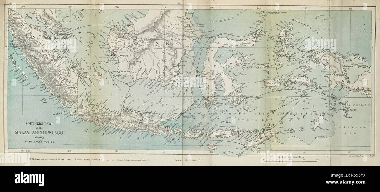 Southern part of the Malay archipelago shewing Mr. Wallace's routes. The Malay Archipelago, etc. London : Macmillan & Co., 1890. Source: 2354.a.1 opp.VIII. Author: WALLACE, ALFRED RUSSEL. Stock Photohttps://www.alamy.com/image-license-details/?v=1https://www.alamy.com/southern-part-of-the-malay-archipelago-shewing-mr-wallaces-routes-the-malay-archipelago-etc-london-macmillan-co-1890-source-2354a1-oppviii-author-wallace-alfred-russel-image226923310.html
RMR556YX–Southern part of the Malay archipelago shewing Mr. Wallace's routes. The Malay Archipelago, etc. London : Macmillan & Co., 1890. Source: 2354.a.1 opp.VIII. Author: WALLACE, ALFRED RUSSEL.
 . The Environs of London. English: A difficult to find map of the vicinity of London, England. Depicts the London area from Kingston and Hamton Court Park in the southwest to Stanmore in the northwest, Hennault Forest in the northeast and St. Marys Cray and Kevingtown in the southeast. A red circle around central London indicates the “Extent of twopenny post delivery.” Crisp detail notes individual buildings, factories, kilns, butchers, farms, palaces, etc. Printed by Baldwin & Cradock of Paternoster Row, London, for the Society of for the Diffusion of Useful Knowledge on February 1st 1832. . Stock Photohttps://www.alamy.com/image-license-details/?v=1https://www.alamy.com/the-environs-of-london-english-a-difficult-to-find-map-of-the-vicinity-of-london-england-depicts-the-london-area-from-kingston-and-hamton-court-park-in-the-southwest-to-stanmore-in-the-northwest-hennault-forest-in-the-northeast-and-st-marys-cray-and-kevingtown-in-the-southeast-a-red-circle-around-central-london-indicates-the-extent-of-twopenny-post-delivery-crisp-detail-notes-individual-buildings-factories-kilns-butchers-farms-palaces-etc-printed-by-baldwin-cradock-of-paternoster-row-london-for-the-society-of-for-the-diffusion-of-useful-knowledge-on-february-1st-1832-image187621389.html
RMMW6TYW–. The Environs of London. English: A difficult to find map of the vicinity of London, England. Depicts the London area from Kingston and Hamton Court Park in the southwest to Stanmore in the northwest, Hennault Forest in the northeast and St. Marys Cray and Kevingtown in the southeast. A red circle around central London indicates the “Extent of twopenny post delivery.” Crisp detail notes individual buildings, factories, kilns, butchers, farms, palaces, etc. Printed by Baldwin & Cradock of Paternoster Row, London, for the Society of for the Diffusion of Useful Knowledge on February 1st 1832. .
 . The Environs of London. English: A difficult to find map of the vicinity of London, England. Depicts the London area from Kingston and Hamton Court Park in the southwest to Stanmore in the northwest, Hennault Forest in the northeast and St. Marys Cray and Kevingtown in the southeast. A red circle around central London indicates the “Extent of twopenny post delivery.” Crisp detail notes individual buildings, factories, kilns, butchers, farms, palaces, etc. Printed by Baldwin & Cradock of Paternoster Row, London, for the Society of for the Diffusion of Useful Knowledge on February 1st 1832. . Stock Photohttps://www.alamy.com/image-license-details/?v=1https://www.alamy.com/the-environs-of-london-english-a-difficult-to-find-map-of-the-vicinity-of-london-england-depicts-the-london-area-from-kingston-and-hamton-court-park-in-the-southwest-to-stanmore-in-the-northwest-hennault-forest-in-the-northeast-and-st-marys-cray-and-kevingtown-in-the-southeast-a-red-circle-around-central-london-indicates-the-extent-of-twopenny-post-delivery-crisp-detail-notes-individual-buildings-factories-kilns-butchers-farms-palaces-etc-printed-by-baldwin-cradock-of-paternoster-row-london-for-the-society-of-for-the-diffusion-of-useful-knowledge-on-february-1st-1832-image188152166.html
RMMX3206–. The Environs of London. English: A difficult to find map of the vicinity of London, England. Depicts the London area from Kingston and Hamton Court Park in the southwest to Stanmore in the northwest, Hennault Forest in the northeast and St. Marys Cray and Kevingtown in the southeast. A red circle around central London indicates the “Extent of twopenny post delivery.” Crisp detail notes individual buildings, factories, kilns, butchers, farms, palaces, etc. Printed by Baldwin & Cradock of Paternoster Row, London, for the Society of for the Diffusion of Useful Knowledge on February 1st 1832. .