Quick filters:
Standard atlas Stock Photos and Images
 1959 Standard Atlas Camper Van coventry Stock Photohttps://www.alamy.com/image-license-details/?v=1https://www.alamy.com/stock-photo-1959-standard-atlas-camper-van-coventry-84636896.html
RMEWKF68–1959 Standard Atlas Camper Van coventry
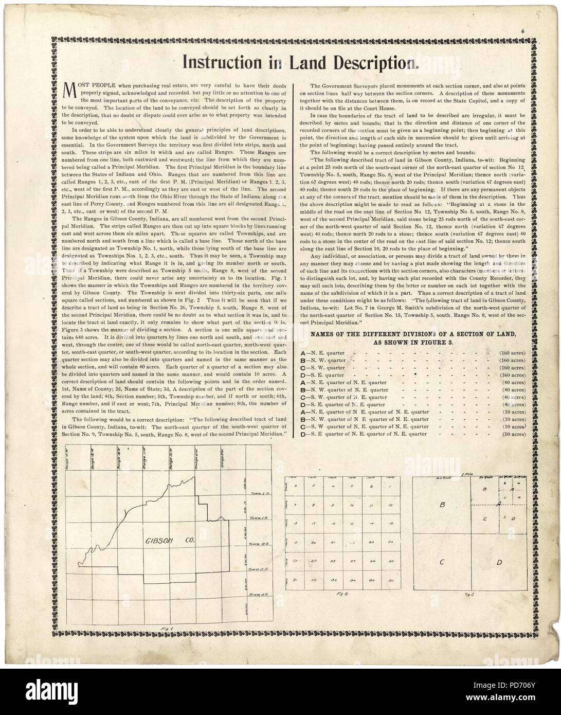 An illustrated standard atlas of Gibson County, Indiana Stock Photohttps://www.alamy.com/image-license-details/?v=1https://www.alamy.com/an-illustrated-standard-atlas-of-gibson-county-indiana-image214668803.html
RMPD706Y–An illustrated standard atlas of Gibson County, Indiana
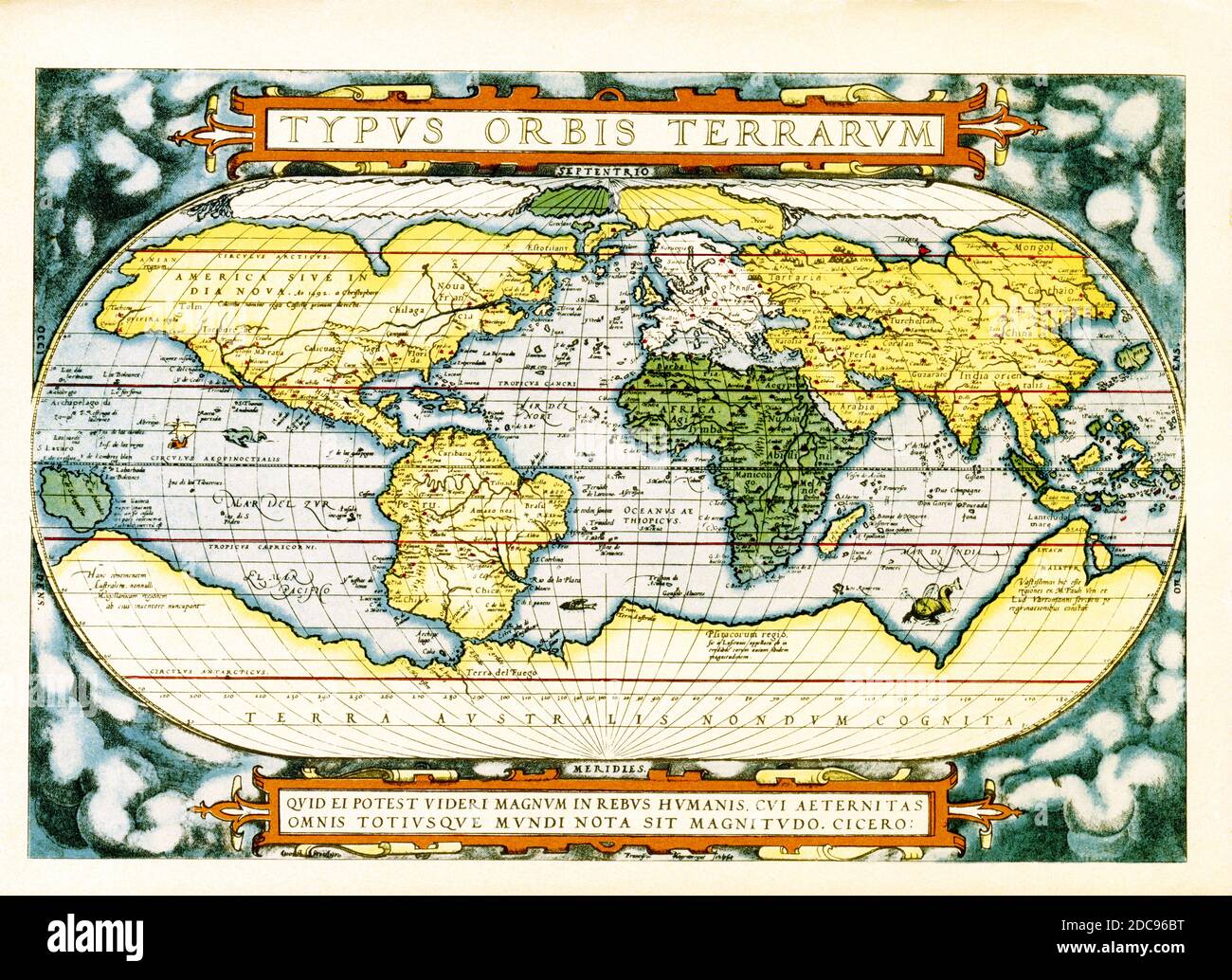 The text at the top of this world map by Abraham Ortelius reads: Typus Orbis Terrarum (Map of the World). The map dates to 1570 and is the first map of the world to appear in a standard atlas and is thus of fundamental importance to the history of cartography. Centered on the Atlantic Ocean, the map covers the entire world from pole to pole. The general presentation of an oval projection derived from earlier maps by Appianus and Bordonius, Cartographically it is derived from the world of Gerard Mercator (1569), Gastaldi (1561) and Gutierrez. The text at the bottom is a quote attributed to the Stock Photohttps://www.alamy.com/image-license-details/?v=1https://www.alamy.com/the-text-at-the-top-of-this-world-map-by-abraham-ortelius-reads-typus-orbis-terrarum-map-of-the-world-the-map-dates-to-1570-and-is-the-first-map-of-the-world-to-appear-in-a-standard-atlas-and-is-thus-of-fundamental-importance-to-the-history-of-cartography-centered-on-the-atlantic-ocean-the-map-covers-the-entire-world-from-pole-to-pole-the-general-presentation-of-an-oval-projection-derived-from-earlier-maps-by-appianus-and-bordonius-cartographically-it-is-derived-from-the-world-of-gerard-mercator-1569-gastaldi-1561-and-gutierrez-the-text-at-the-bottom-is-a-quote-attributed-to-the-image386206572.html
RF2DC96BT–The text at the top of this world map by Abraham Ortelius reads: Typus Orbis Terrarum (Map of the World). The map dates to 1570 and is the first map of the world to appear in a standard atlas and is thus of fundamental importance to the history of cartography. Centered on the Atlantic Ocean, the map covers the entire world from pole to pole. The general presentation of an oval projection derived from earlier maps by Appianus and Bordonius, Cartographically it is derived from the world of Gerard Mercator (1569), Gastaldi (1561) and Gutierrez. The text at the bottom is a quote attributed to the
 1920 Richards standard atlas of the city of Springfield BPL 11059 Stock Photohttps://www.alamy.com/image-license-details/?v=1https://www.alamy.com/1920-richards-standard-atlas-of-the-city-of-springfield-bpl-11059-image259876131.html
RMW2PAJB–1920 Richards standard atlas of the city of Springfield BPL 11059
 Atlas, statue on Red sandstone building on Hope Street, Glasgow, Cortland, James Charles Young (1839–1923) (attributed to) Stock Photohttps://www.alamy.com/image-license-details/?v=1https://www.alamy.com/atlas-statue-on-red-sandstone-building-on-hope-street-glasgow-cortland-james-charles-young-18391923-attributed-to-image503436461.html
RM2M71E9H–Atlas, statue on Red sandstone building on Hope Street, Glasgow, Cortland, James Charles Young (1839–1923) (attributed to)
![Richards standard atlas of the city of Springfield and the town of Longmeadow, Massachusetts [plate 9].... , Massachusetts , Worcester ,county , Long Meadow ,swamp Massachusetts , Hampden ,county , Springfield Stock Photo Richards standard atlas of the city of Springfield and the town of Longmeadow, Massachusetts [plate 9].... , Massachusetts , Worcester ,county , Long Meadow ,swamp Massachusetts , Hampden ,county , Springfield Stock Photo](https://c8.alamy.com/comp/2M5TCGA/richards-standard-atlas-of-the-city-of-springfield-and-the-town-of-longmeadow-massachusetts-plate-9-massachusetts-worcester-county-long-meadow-swamp-massachusetts-hampden-county-springfield-2M5TCGA.jpg) Richards standard atlas of the city of Springfield and the town of Longmeadow, Massachusetts [plate 9].... , Massachusetts , Worcester ,county , Long Meadow ,swamp Massachusetts , Hampden ,county , Springfield Stock Photohttps://www.alamy.com/image-license-details/?v=1https://www.alamy.com/richards-standard-atlas-of-the-city-of-springfield-and-the-town-of-longmeadow-massachusetts-plate-9-massachusetts-worcester-county-long-meadow-swamp-massachusetts-hampden-county-springfield-image502710666.html
Richards standard atlas of the city of Springfield and the town of Longmeadow, Massachusetts [plate 9].... , Massachusetts , Worcester ,county , Long Meadow ,swamp Massachusetts , Hampden ,county , Springfield Stock Photohttps://www.alamy.com/image-license-details/?v=1https://www.alamy.com/richards-standard-atlas-of-the-city-of-springfield-and-the-town-of-longmeadow-massachusetts-plate-9-massachusetts-worcester-county-long-meadow-swamp-massachusetts-hampden-county-springfield-image502710666.htmlRM2M5TCGA–Richards standard atlas of the city of Springfield and the town of Longmeadow, Massachusetts [plate 9].... , Massachusetts , Worcester ,county , Long Meadow ,swamp Massachusetts , Hampden ,county , Springfield
 Standard, Canada, Alberta, N 51 7' 0'', W 112 59' 6'', map, Timeless Map published in 2021. Travelers, explorers and adventurers like Florence Nightingale, David Livingstone, Ernest Shackleton, Lewis and Clark and Sherlock Holmes relied on maps to plan travels to the world's most remote corners, Timeless Maps is mapping most locations on the globe, showing the achievement of great dreams Stock Photohttps://www.alamy.com/image-license-details/?v=1https://www.alamy.com/standard-canada-alberta-n-51-7-0-w-112-59-6-map-timeless-map-published-in-2021-travelers-explorers-and-adventurers-like-florence-nightingale-david-livingstone-ernest-shackleton-lewis-and-clark-and-sherlock-holmes-relied-on-maps-to-plan-travels-to-the-worlds-most-remote-corners-timeless-maps-is-mapping-most-locations-on-the-globe-showing-the-achievement-of-great-dreams-image457885780.html
RM2HGXDYG–Standard, Canada, Alberta, N 51 7' 0'', W 112 59' 6'', map, Timeless Map published in 2021. Travelers, explorers and adventurers like Florence Nightingale, David Livingstone, Ernest Shackleton, Lewis and Clark and Sherlock Holmes relied on maps to plan travels to the world's most remote corners, Timeless Maps is mapping most locations on the globe, showing the achievement of great dreams
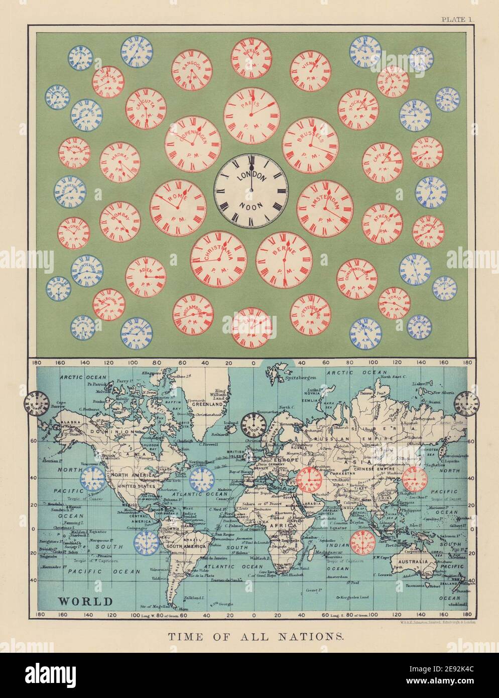 TIME OF ALL NATIONS. predates UTC/standard hourly time zones. JOHNSTON 1901 map Stock Photohttps://www.alamy.com/image-license-details/?v=1https://www.alamy.com/time-of-all-nations-predates-utcstandard-hourly-time-zones-johnston-1901-map-image401429292.html
RF2E92K4C–TIME OF ALL NATIONS. predates UTC/standard hourly time zones. JOHNSTON 1901 map
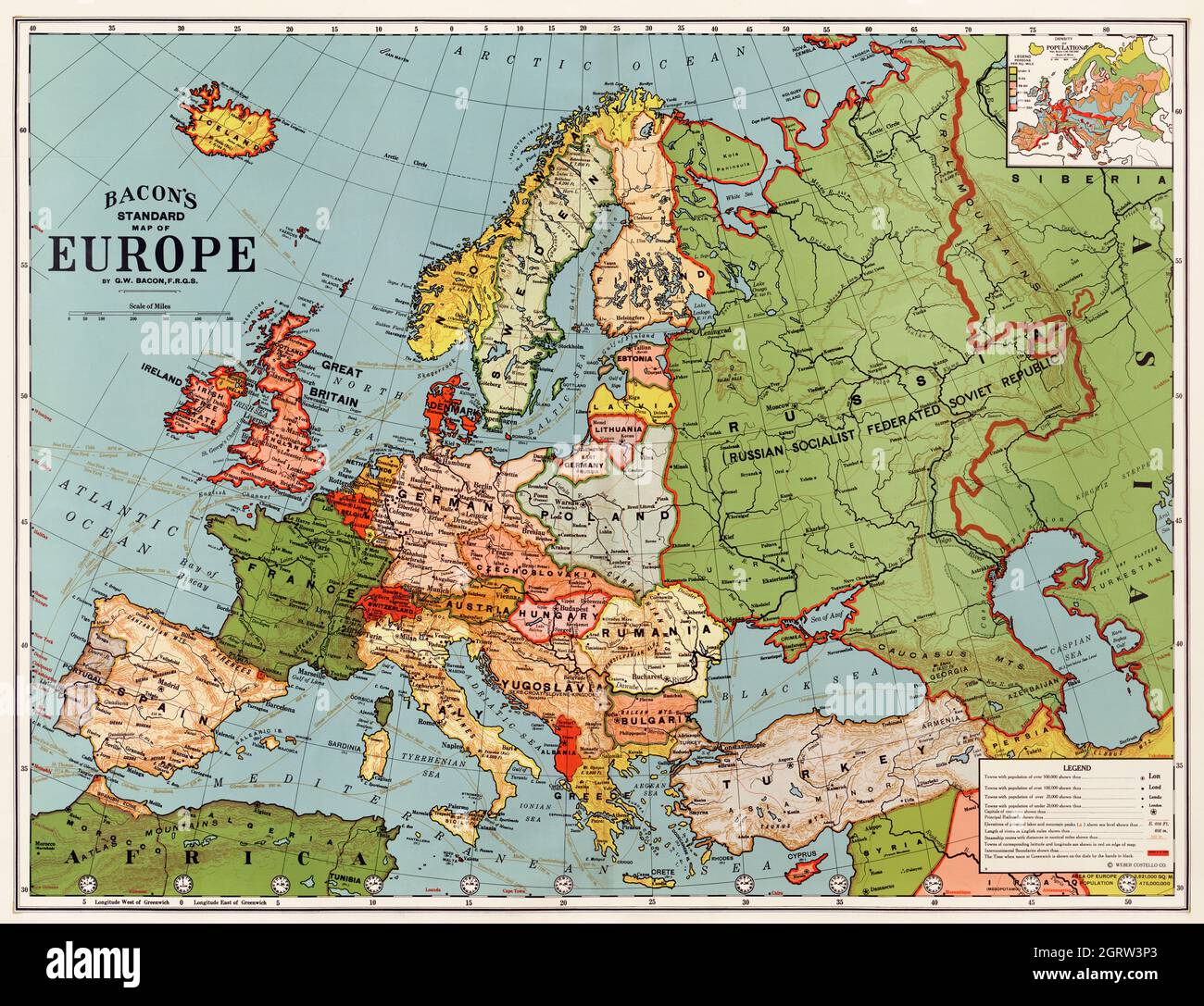 Bacon's standard map of Europe by George Washington Bacon (1830-1922). Stock Photohttps://www.alamy.com/image-license-details/?v=1https://www.alamy.com/bacons-standard-map-of-europe-by-george-washington-bacon-1830-1922-image444948059.html
RM2GRW3P3–Bacon's standard map of Europe by George Washington Bacon (1830-1922).
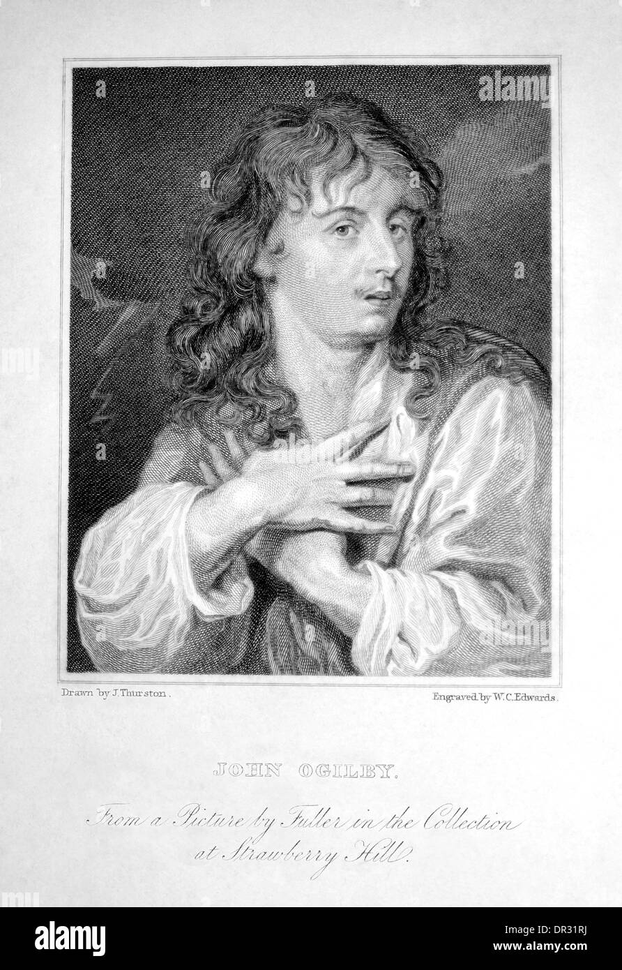 John Ogilby (1600-1676) best known for his Britannia Atlas 1675, a collection of road maps. Copperplate engraving W.C. Edwards Stock Photohttps://www.alamy.com/image-license-details/?v=1https://www.alamy.com/john-ogilby-1600-1676-best-known-for-his-britannia-atlas-1675-a-collection-image65835494.html
RMDR31RJ–John Ogilby (1600-1676) best known for his Britannia Atlas 1675, a collection of road maps. Copperplate engraving W.C. Edwards
 map, atlas, map of the world, political, flag, country, standard, globe, Stock Photohttps://www.alamy.com/image-license-details/?v=1https://www.alamy.com/stock-photo-map-atlas-map-of-the-world-political-flag-country-standard-globe-143158076.html
RFJ8WBGC–map, atlas, map of the world, political, flag, country, standard, globe,
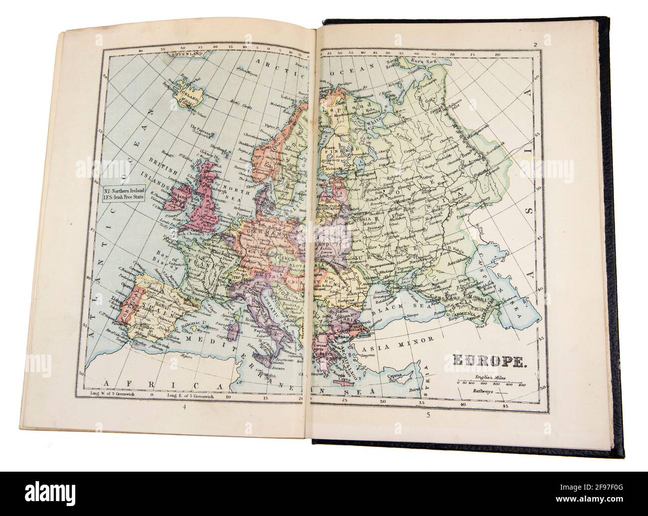 Map of Europe in the The New Standard Encyclopaedia and World Atlas, published by Odhams in 1932 Stock Photohttps://www.alamy.com/image-license-details/?v=1https://www.alamy.com/map-of-europe-in-the-the-new-standard-encyclopaedia-and-world-atlas-published-by-odhams-in-1932-image418746176.html
RM2F97F0G–Map of Europe in the The New Standard Encyclopaedia and World Atlas, published by Odhams in 1932
 London, UK. 15th June, 2024. RAF flypast of a Voyager followed by Atlas C.1. (A400M) over Buckingham Palace at the close of Trooping the Colour parade with the Royal Standard of the UK flying. Credit: Malcolm Park/Alamy Stock Photohttps://www.alamy.com/image-license-details/?v=1https://www.alamy.com/london-uk-15th-june-2024-raf-flypast-of-a-voyager-followed-by-atlas-c1-a400m-over-buckingham-palace-at-the-close-of-trooping-the-colour-parade-with-the-royal-standard-of-the-uk-flying-credit-malcolm-parkalamy-image610149329.html
RM2XCJKKD–London, UK. 15th June, 2024. RAF flypast of a Voyager followed by Atlas C.1. (A400M) over Buckingham Palace at the close of Trooping the Colour parade with the Royal Standard of the UK flying. Credit: Malcolm Park/Alamy
 1925 Town Palace of Lord of the Atlas Morocco T'hami El Glaoui the Pasha of Marrakech Stock Photohttps://www.alamy.com/image-license-details/?v=1https://www.alamy.com/stock-photo-1925-town-palace-of-lord-of-the-atlas-morocco-thami-el-glaoui-the-47252813.html
RMCMTFCD–1925 Town Palace of Lord of the Atlas Morocco T'hami El Glaoui the Pasha of Marrakech
 Moroccan Atlas Blue Boeing 737-400 with registration CN-RND on final for Brussels Airport Stock Photohttps://www.alamy.com/image-license-details/?v=1https://www.alamy.com/moroccan-atlas-blue-boeing-737-400-with-registration-cn-rnd-on-final-for-brussels-airport-image637646542.html
RF2S1B8JP–Moroccan Atlas Blue Boeing 737-400 with registration CN-RND on final for Brussels Airport
 . English: This is Guillaume Blaeu’s 1631 map of the British Isles. Covers all of England, Scotland, Wales, and Ireland with adjacent parts of France and Holland and an inset of the Orkney Islands. Cartographically this map is based upon the plates of Jodocus Hondius, which Blaeu acquired in 1629. The original plate drawn by Hondius in 1617, had decorative border images surrounding the map, but Blaeu was forced to reformat the map, sans images, for issue in his seminal Atlas Major. This map would become Blaeu’s standard representation of the British Isles and was published in most subsequent Stock Photohttps://www.alamy.com/image-license-details/?v=1https://www.alamy.com/english-this-is-guillaume-blaeus-1631-map-of-the-british-isles-covers-all-of-england-scotland-wales-and-ireland-with-adjacent-parts-of-france-and-holland-and-an-inset-of-the-orkney-islands-cartographically-this-map-is-based-upon-the-plates-of-jodocus-hondius-which-blaeu-acquired-in-1629-the-original-plate-drawn-by-hondius-in-1617-had-decorative-border-images-surrounding-the-map-but-blaeu-was-forced-to-reformat-the-map-sans-images-for-issue-in-his-seminal-atlas-major-this-map-would-become-blaeus-standard-representation-of-the-british-isles-and-was-published-in-most-subsequent-image184869035.html
RMMMNE9F–. English: This is Guillaume Blaeu’s 1631 map of the British Isles. Covers all of England, Scotland, Wales, and Ireland with adjacent parts of France and Holland and an inset of the Orkney Islands. Cartographically this map is based upon the plates of Jodocus Hondius, which Blaeu acquired in 1629. The original plate drawn by Hondius in 1617, had decorative border images surrounding the map, but Blaeu was forced to reformat the map, sans images, for issue in his seminal Atlas Major. This map would become Blaeu’s standard representation of the British Isles and was published in most subsequent
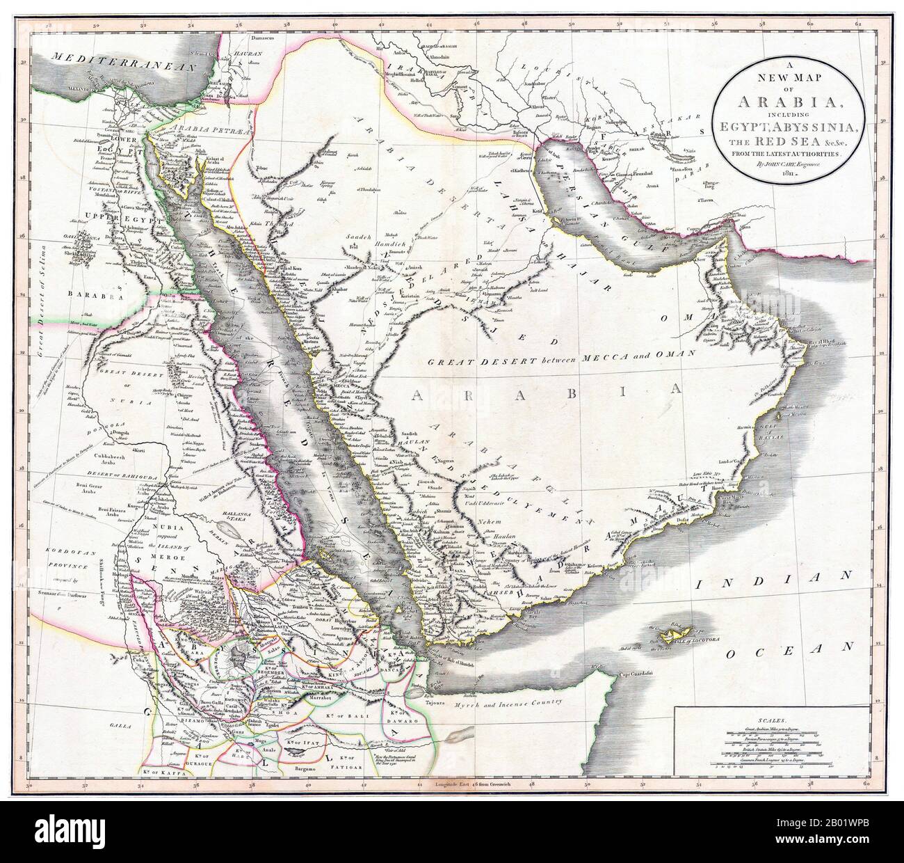 Middle East/East Africa: A New Map of Arabia, Egypt, Abyssinia and the Red Sea. Engraving by John Cary (c. 1754-1835), 1811. John Cary was an English cartographer. Cary served his apprenticeship as an engraver in London, before setting up his own business in the Strand in 1783. He soon gained a reputation for his maps and globes, his atlas, The New and Correct English Atlas published in 1787, becoming a standard reference work in England. In 1794 Cary was commissioned by the Postmaster General to survey England's roads. This resulted in Cary's New Itinerary (1798). Stock Photohttps://www.alamy.com/image-license-details/?v=1https://www.alamy.com/middle-easteast-africa-a-new-map-of-arabia-egypt-abyssinia-and-the-red-sea-engraving-by-john-cary-c-1754-1835-1811-john-cary-was-an-english-cartographer-cary-served-his-apprenticeship-as-an-engraver-in-london-before-setting-up-his-own-business-in-the-strand-in-1783-he-soon-gained-a-reputation-for-his-maps-and-globes-his-atlas-the-new-and-correct-english-atlas-published-in-1787-becoming-a-standard-reference-work-in-england-in-1794-cary-was-commissioned-by-the-postmaster-general-to-survey-englands-roads-this-resulted-in-carys-new-itinerary-1798-image344249539.html
RM2B01WPB–Middle East/East Africa: A New Map of Arabia, Egypt, Abyssinia and the Red Sea. Engraving by John Cary (c. 1754-1835), 1811. John Cary was an English cartographer. Cary served his apprenticeship as an engraver in London, before setting up his own business in the Strand in 1783. He soon gained a reputation for his maps and globes, his atlas, The New and Correct English Atlas published in 1787, becoming a standard reference work in England. In 1794 Cary was commissioned by the Postmaster General to survey England's roads. This resulted in Cary's New Itinerary (1798).
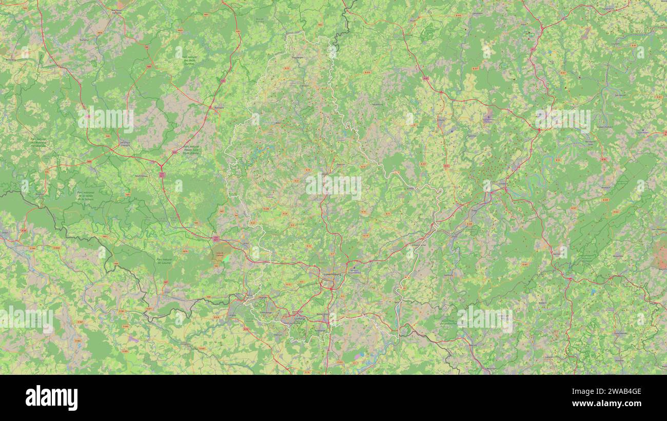 Luxembourg outlined on a topographic, OSM standard style map Stock Photohttps://www.alamy.com/image-license-details/?v=1https://www.alamy.com/luxembourg-outlined-on-a-topographic-osm-standard-style-map-image591544142.html
RF2WAB4GE–Luxembourg outlined on a topographic, OSM standard style map
 Part CERN's Large Hadron Collider Alice experiment, Atlas Stock Photohttps://www.alamy.com/image-license-details/?v=1https://www.alamy.com/stock-photo-part-cerns-large-hadron-collider-alice-experiment-atlas-140356690.html
RFJ49PAX–Part CERN's Large Hadron Collider Alice experiment, Atlas
 1959 Standard Atlas Camper Van coventry Stock Photohttps://www.alamy.com/image-license-details/?v=1https://www.alamy.com/stock-photo-1959-standard-atlas-camper-van-coventry-84636897.html
RMEWKF69–1959 Standard Atlas Camper Van coventry
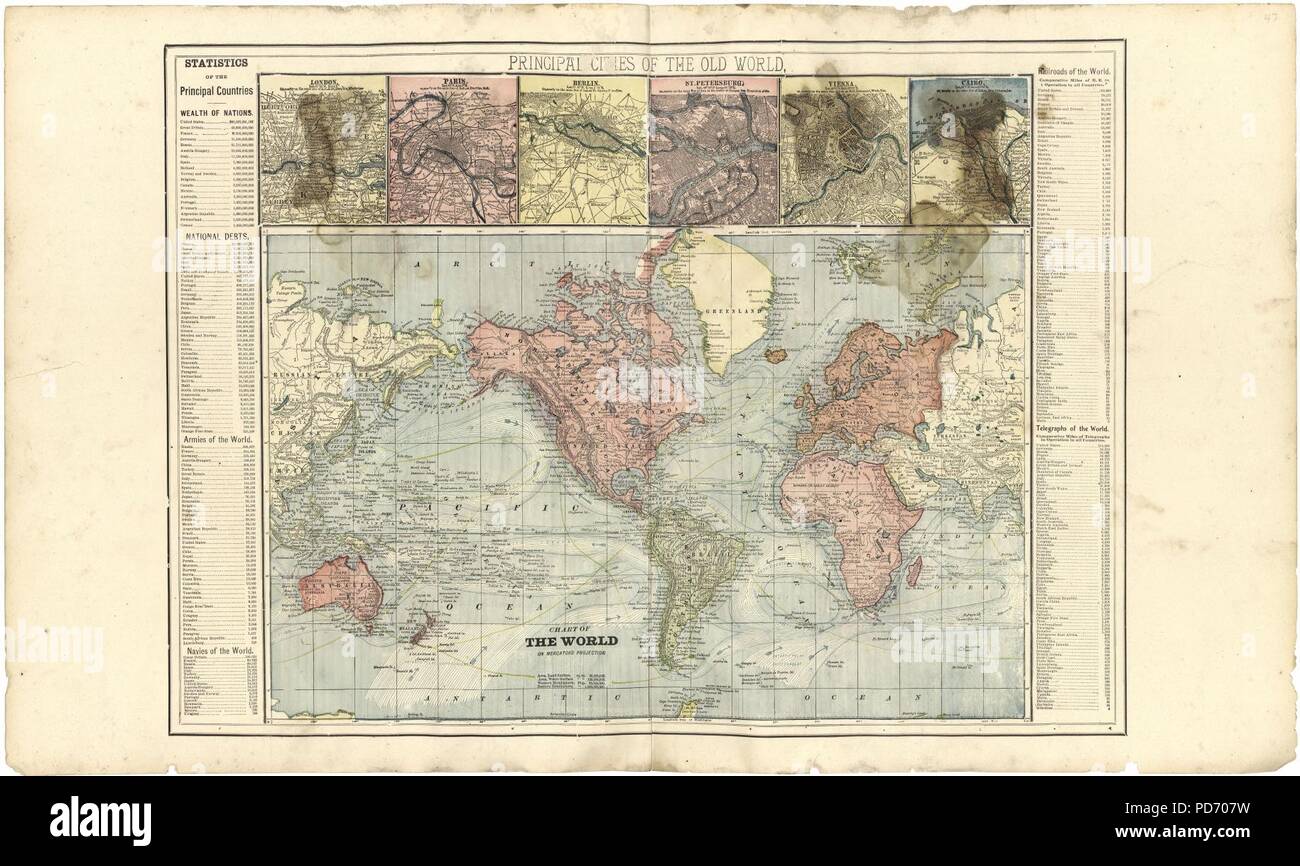 An illustrated standard atlas of Gibson County, Indiana Stock Photohttps://www.alamy.com/image-license-details/?v=1https://www.alamy.com/an-illustrated-standard-atlas-of-gibson-county-indiana-image214668829.html
RMPD707W–An illustrated standard atlas of Gibson County, Indiana
 Spanish Civil War (1936-1939). Standard of the International Brigades. XI International Brigade. 'Bataillon Commune de Paris' (Commune de Paris Battalion). Military unit formed in October 1936, mainly by French, Belgian and Walloon communist volunteers, to fight in support of the Second Republic. Silk satin and taffeta with metal thread embroidery. Army Museum. Toledo, Spain. Stock Photohttps://www.alamy.com/image-license-details/?v=1https://www.alamy.com/spanish-civil-war-1936-1939-standard-of-the-international-brigades-xi-international-brigade-bataillon-commune-de-paris-commune-de-paris-battalion-military-unit-formed-in-october-1936-mainly-by-french-belgian-and-walloon-communist-volunteers-to-fight-in-support-of-the-second-republic-silk-satin-and-taffeta-with-metal-thread-embroidery-army-museum-toledo-spain-image626512166.html
RM2YB82JE–Spanish Civil War (1936-1939). Standard of the International Brigades. XI International Brigade. 'Bataillon Commune de Paris' (Commune de Paris Battalion). Military unit formed in October 1936, mainly by French, Belgian and Walloon communist volunteers, to fight in support of the Second Republic. Silk satin and taffeta with metal thread embroidery. Army Museum. Toledo, Spain.
 A German air force A-400M Atlas aircraft prepares for take-off at Ramstein Air Base, Germany, March 31, 2023. Training objectives for International Interfly Week included establishing standard operating procedures between various aircraft, maximizing defensive capabilities at various points of flying formations, and developing contingencies for completing airdrops in normal and adverse weather conditions. (U.S. Air Force photo by Staff Sgt. Megan M. Beatty) Stock Photohttps://www.alamy.com/image-license-details/?v=1https://www.alamy.com/a-german-air-force-a-400m-atlas-aircraft-prepares-for-take-off-at-ramstein-air-base-germany-march-31-2023-training-objectives-for-international-interfly-week-included-establishing-standard-operating-procedures-between-various-aircraft-maximizing-defensive-capabilities-at-various-points-of-flying-formations-and-developing-contingencies-for-completing-airdrops-in-normal-and-adverse-weather-conditions-us-air-force-photo-by-staff-sgt-megan-m-beatty-image545306404.html
RM2PK4RTM–A German air force A-400M Atlas aircraft prepares for take-off at Ramstein Air Base, Germany, March 31, 2023. Training objectives for International Interfly Week included establishing standard operating procedures between various aircraft, maximizing defensive capabilities at various points of flying formations, and developing contingencies for completing airdrops in normal and adverse weather conditions. (U.S. Air Force photo by Staff Sgt. Megan M. Beatty)
 Standard atlas of Allen County, Indiana : including a plat book of the villages, cities and townships of the county ..patrons directory, reference business directory ... . Stock Photohttps://www.alamy.com/image-license-details/?v=1https://www.alamy.com/standard-atlas-of-allen-county-indiana-including-a-plat-book-of-the-villages-cities-and-townships-of-the-county-patrons-directory-reference-business-directory-image342770071.html
RM2AWJEM7–Standard atlas of Allen County, Indiana : including a plat book of the villages, cities and townships of the county ..patrons directory, reference business directory ... .
![Richards standard atlas of the city of Springfield and the town of Longmeadow, Massachusetts [plate 10].... , Massachusetts , Worcester ,county , Long Meadow ,swamp Massachusetts , Hampden ,county , Springfield Stock Photo Richards standard atlas of the city of Springfield and the town of Longmeadow, Massachusetts [plate 10].... , Massachusetts , Worcester ,county , Long Meadow ,swamp Massachusetts , Hampden ,county , Springfield Stock Photo](https://c8.alamy.com/comp/2M5TEG6/richards-standard-atlas-of-the-city-of-springfield-and-the-town-of-longmeadow-massachusetts-plate-10-massachusetts-worcester-county-long-meadow-swamp-massachusetts-hampden-county-springfield-2M5TEG6.jpg) Richards standard atlas of the city of Springfield and the town of Longmeadow, Massachusetts [plate 10].... , Massachusetts , Worcester ,county , Long Meadow ,swamp Massachusetts , Hampden ,county , Springfield Stock Photohttps://www.alamy.com/image-license-details/?v=1https://www.alamy.com/richards-standard-atlas-of-the-city-of-springfield-and-the-town-of-longmeadow-massachusetts-plate-10-massachusetts-worcester-county-long-meadow-swamp-massachusetts-hampden-county-springfield-image502712230.html
Richards standard atlas of the city of Springfield and the town of Longmeadow, Massachusetts [plate 10].... , Massachusetts , Worcester ,county , Long Meadow ,swamp Massachusetts , Hampden ,county , Springfield Stock Photohttps://www.alamy.com/image-license-details/?v=1https://www.alamy.com/richards-standard-atlas-of-the-city-of-springfield-and-the-town-of-longmeadow-massachusetts-plate-10-massachusetts-worcester-county-long-meadow-swamp-massachusetts-hampden-county-springfield-image502712230.htmlRM2M5TEG6–Richards standard atlas of the city of Springfield and the town of Longmeadow, Massachusetts [plate 10].... , Massachusetts , Worcester ,county , Long Meadow ,swamp Massachusetts , Hampden ,county , Springfield
 Standard Hill, Canada, Saskatchewan, N 53 17' 0'', W 109 8' 5'', map, Timeless Map published in 2021. Travelers, explorers and adventurers like Florence Nightingale, David Livingstone, Ernest Shackleton, Lewis and Clark and Sherlock Holmes relied on maps to plan travels to the world's most remote corners, Timeless Maps is mapping most locations on the globe, showing the achievement of great dreams Stock Photohttps://www.alamy.com/image-license-details/?v=1https://www.alamy.com/standard-hill-canada-saskatchewan-n-53-17-0-w-109-8-5-map-timeless-map-published-in-2021-travelers-explorers-and-adventurers-like-florence-nightingale-david-livingstone-ernest-shackleton-lewis-and-clark-and-sherlock-holmes-relied-on-maps-to-plan-travels-to-the-worlds-most-remote-corners-timeless-maps-is-mapping-most-locations-on-the-globe-showing-the-achievement-of-great-dreams-image457885766.html
RM2HGXDY2–Standard Hill, Canada, Saskatchewan, N 53 17' 0'', W 109 8' 5'', map, Timeless Map published in 2021. Travelers, explorers and adventurers like Florence Nightingale, David Livingstone, Ernest Shackleton, Lewis and Clark and Sherlock Holmes relied on maps to plan travels to the world's most remote corners, Timeless Maps is mapping most locations on the globe, showing the achievement of great dreams
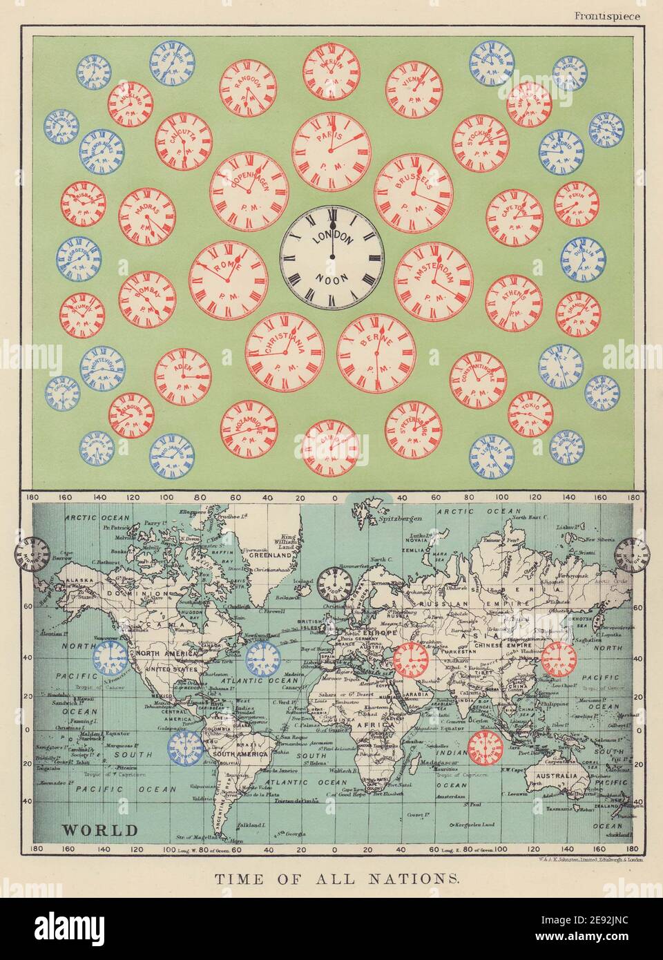 TIME OF ALL NATIONS. predates UTC/standard hourly time zones. JOHNSTON 1910 map Stock Photohttps://www.alamy.com/image-license-details/?v=1https://www.alamy.com/time-of-all-nations-predates-utcstandard-hourly-time-zones-johnston-1910-map-image401428984.html
RF2E92JNC–TIME OF ALL NATIONS. predates UTC/standard hourly time zones. JOHNSTON 1910 map
 Standard atlas of Edwards County, Illinois - including a plat book of the villages, cities and townships of the county. Map of the state, United States and world. Patrons directory, reference business Stock Photohttps://www.alamy.com/image-license-details/?v=1https://www.alamy.com/stock-photo-standard-atlas-of-edwards-county-illinois-including-a-plat-book-of-114575386.html
RMGJBA22–Standard atlas of Edwards County, Illinois - including a plat book of the villages, cities and townships of the county. Map of the state, United States and world. Patrons directory, reference business
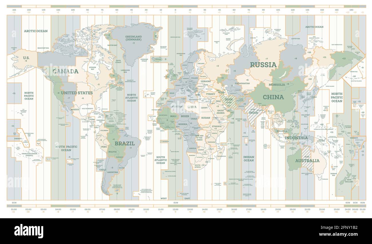 World Time Zones Map. Detailed World Map with Countries Names. Vector Illustration. Stock Vectorhttps://www.alamy.com/image-license-details/?v=1https://www.alamy.com/world-time-zones-map-detailed-world-map-with-countries-names-vector-illustration-image426550406.html
RF2FNY1B2–World Time Zones Map. Detailed World Map with Countries Names. Vector Illustration.
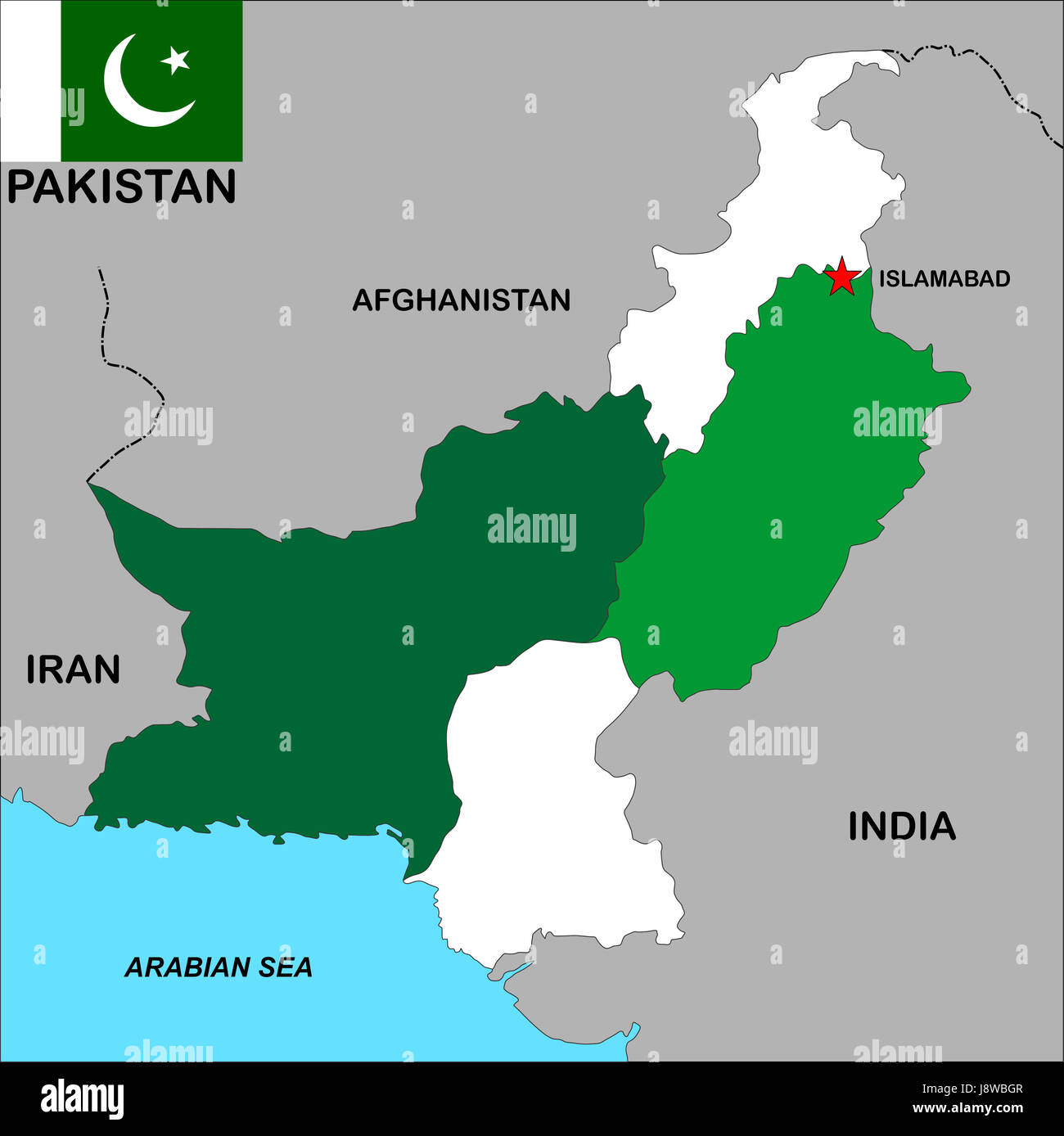 pakistan, map, atlas, map of the world, political, flag, country, standard, Stock Photohttps://www.alamy.com/image-license-details/?v=1https://www.alamy.com/stock-photo-pakistan-map-atlas-map-of-the-world-political-flag-country-standard-143158087.html
RFJ8WBGR–pakistan, map, atlas, map of the world, political, flag, country, standard,
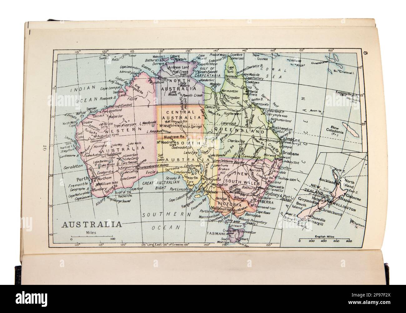 Map of Australia in the The New Standard Encyclopaedia and World Atlas, published by Odhams in 1932 Stock Photohttps://www.alamy.com/image-license-details/?v=1https://www.alamy.com/map-of-australia-in-the-the-new-standard-encyclopaedia-and-world-atlas-published-by-odhams-in-1932-image418746242.html
RM2F97F2X–Map of Australia in the The New Standard Encyclopaedia and World Atlas, published by Odhams in 1932
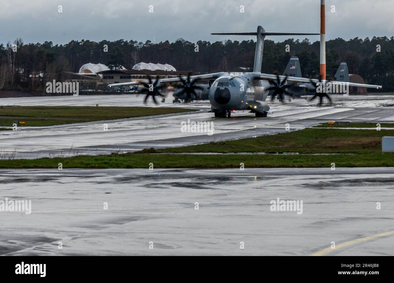 A German air force A-400M Atlas aircraft prepares for take-off at Ramstein Air Base, Germany, March 31, 2023. Training objectives for International Interfly Week included establishing standard operating procedures between various aircraft, maximizing defensive capabilities at various points of flying formations, and developing contingencies for completing airdrops in normal and adverse weather conditions. Stock Photohttps://www.alamy.com/image-license-details/?v=1https://www.alamy.com/a-german-air-force-a-400m-atlas-aircraft-prepares-for-take-off-at-ramstein-air-base-germany-march-31-2023-training-objectives-for-international-interfly-week-included-establishing-standard-operating-procedures-between-various-aircraft-maximizing-defensive-capabilities-at-various-points-of-flying-formations-and-developing-contingencies-for-completing-airdrops-in-normal-and-adverse-weather-conditions-image553336540.html
RM2R46JB8–A German air force A-400M Atlas aircraft prepares for take-off at Ramstein Air Base, Germany, March 31, 2023. Training objectives for International Interfly Week included establishing standard operating procedures between various aircraft, maximizing defensive capabilities at various points of flying formations, and developing contingencies for completing airdrops in normal and adverse weather conditions.
 pleiades seven titan Atlas nymph Pleione daughters god gods angels stars whips robe ancient mystical Stock Photohttps://www.alamy.com/image-license-details/?v=1https://www.alamy.com/stock-photo-pleiades-seven-titan-atlas-nymph-pleione-daughters-god-gods-angels-21742090.html
RMB7AC76–pleiades seven titan Atlas nymph Pleione daughters god gods angels stars whips robe ancient mystical
 Moroccan Atlas Blue Boeing 737-400 with registration CN-RMG on final for Amsterdam Airport Schiphol Stock Photohttps://www.alamy.com/image-license-details/?v=1https://www.alamy.com/moroccan-atlas-blue-boeing-737-400-with-registration-cn-rmg-on-final-for-amsterdam-airport-schiphol-image595132734.html
RF2WG6HTE–Moroccan Atlas Blue Boeing 737-400 with registration CN-RMG on final for Amsterdam Airport Schiphol
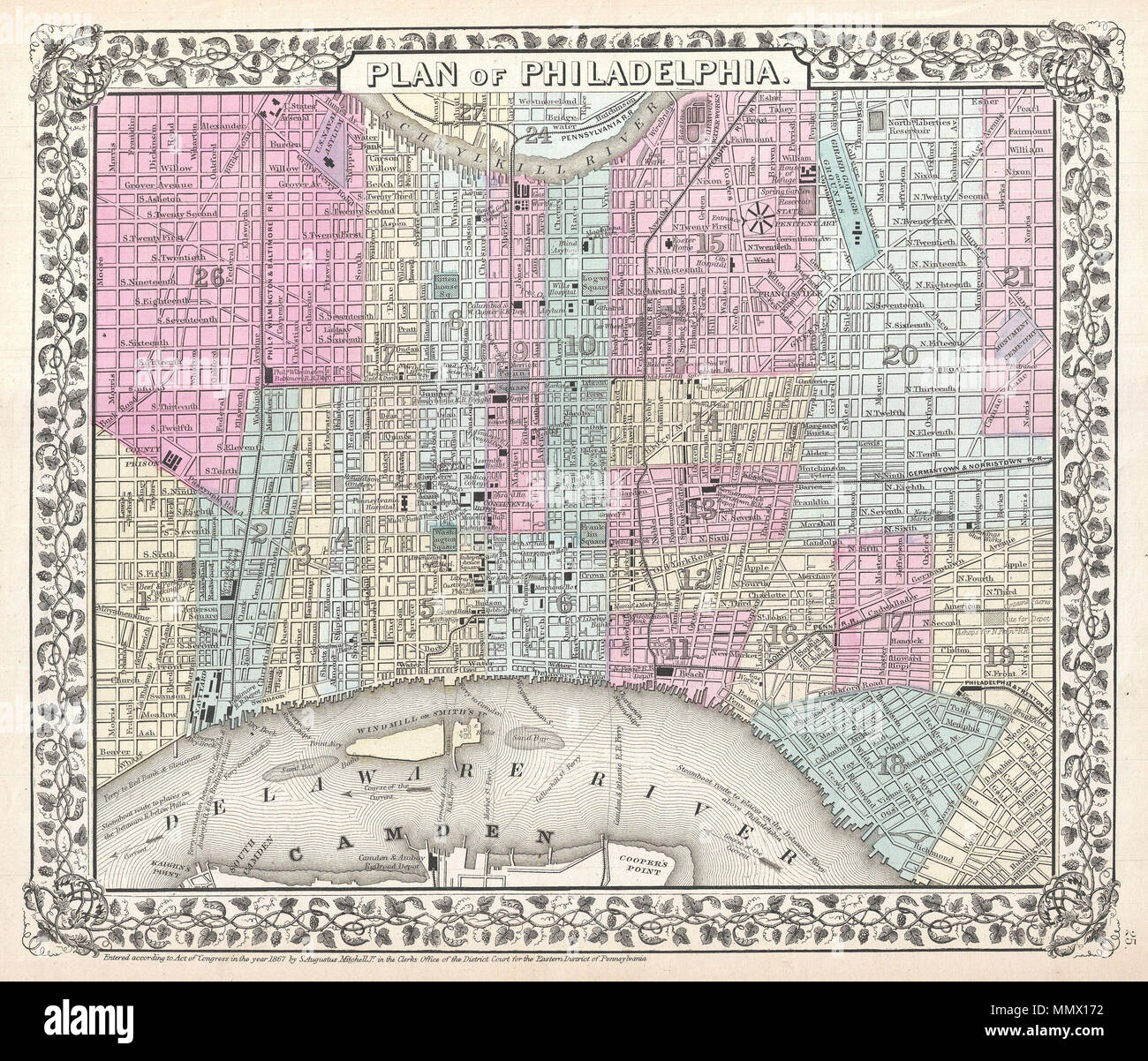 . English: A beautiful example of S. A. Mitchell Jr.’s 1867 map of Philadelphia, Pennsylvania. Covers Philadelphia, focusing on the downtown area between the Schuylkill and Delaware Rivers. This is one of the last iterations of Mitchell’s standard single page map of Philadelphia. Subsequent editions reimagined the Mitchell Philadelphia to account for urban expansion to the west of the Schuylkill. Names important buildings, parks, roads, railways, public work, and military installations. Color coded according to city wards. Surrounded by the attractive vine motif border common to Mitchell atlas Stock Photohttps://www.alamy.com/image-license-details/?v=1https://www.alamy.com/english-a-beautiful-example-of-s-a-mitchell-jrs-1867-map-of-philadelphia-pennsylvania-covers-philadelphia-focusing-on-the-downtown-area-between-the-schuylkill-and-delaware-rivers-this-is-one-of-the-last-iterations-of-mitchells-standard-single-page-map-of-philadelphia-subsequent-editions-reimagined-the-mitchell-philadelphia-to-account-for-urban-expansion-to-the-west-of-the-schuylkill-names-important-buildings-parks-roads-railways-public-work-and-military-installations-color-coded-according-to-city-wards-surrounded-by-the-attractive-vine-motif-border-common-to-mitchell-atlas-image184968534.html
RMMMX172–. English: A beautiful example of S. A. Mitchell Jr.’s 1867 map of Philadelphia, Pennsylvania. Covers Philadelphia, focusing on the downtown area between the Schuylkill and Delaware Rivers. This is one of the last iterations of Mitchell’s standard single page map of Philadelphia. Subsequent editions reimagined the Mitchell Philadelphia to account for urban expansion to the west of the Schuylkill. Names important buildings, parks, roads, railways, public work, and military installations. Color coded according to city wards. Surrounded by the attractive vine motif border common to Mitchell atlas
RFK8NJ62–Belgium flag vector symbol icon design. Belgian flag color illustration isolated on white background.
 Albania outlined on a topographic, OSM standard style map Stock Photohttps://www.alamy.com/image-license-details/?v=1https://www.alamy.com/albania-outlined-on-a-topographic-osm-standard-style-map-image591152634.html
RF2W9N962–Albania outlined on a topographic, OSM standard style map
 Part CERN's Large Hadron Collider Alice experiment, Atlas Stock Photohttps://www.alamy.com/image-license-details/?v=1https://www.alamy.com/stock-photo-part-cerns-large-hadron-collider-alice-experiment-atlas-140356692.html
RFJ49PB0–Part CERN's Large Hadron Collider Alice experiment, Atlas
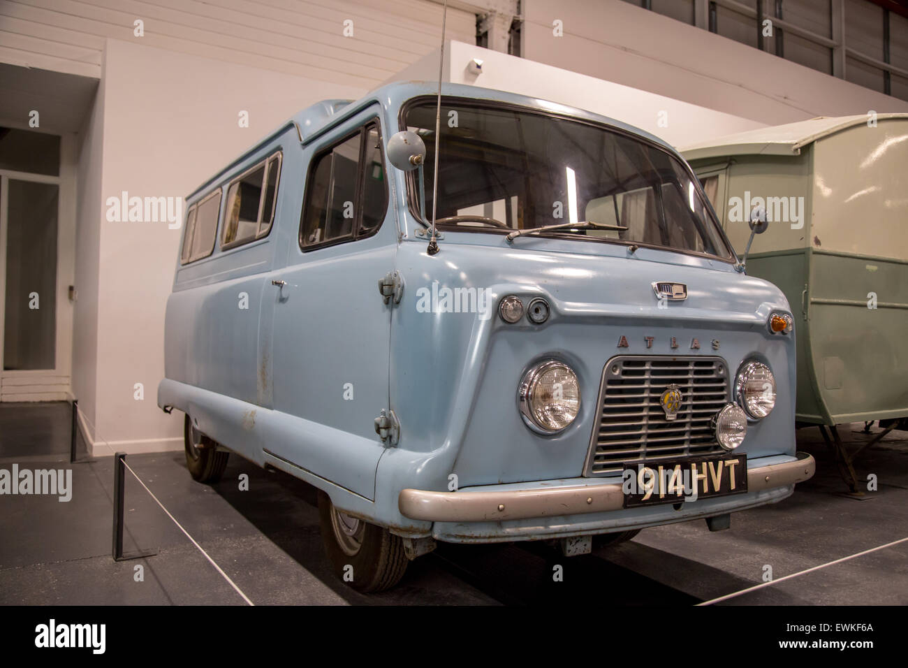 1959 Standard Atlas Camper Van on display at Coventry Transport Museum Stock Photohttps://www.alamy.com/image-license-details/?v=1https://www.alamy.com/stock-photo-1959-standard-atlas-camper-van-on-display-at-coventry-transport-museum-84636898.html
RMEWKF6A–1959 Standard Atlas Camper Van on display at Coventry Transport Museum
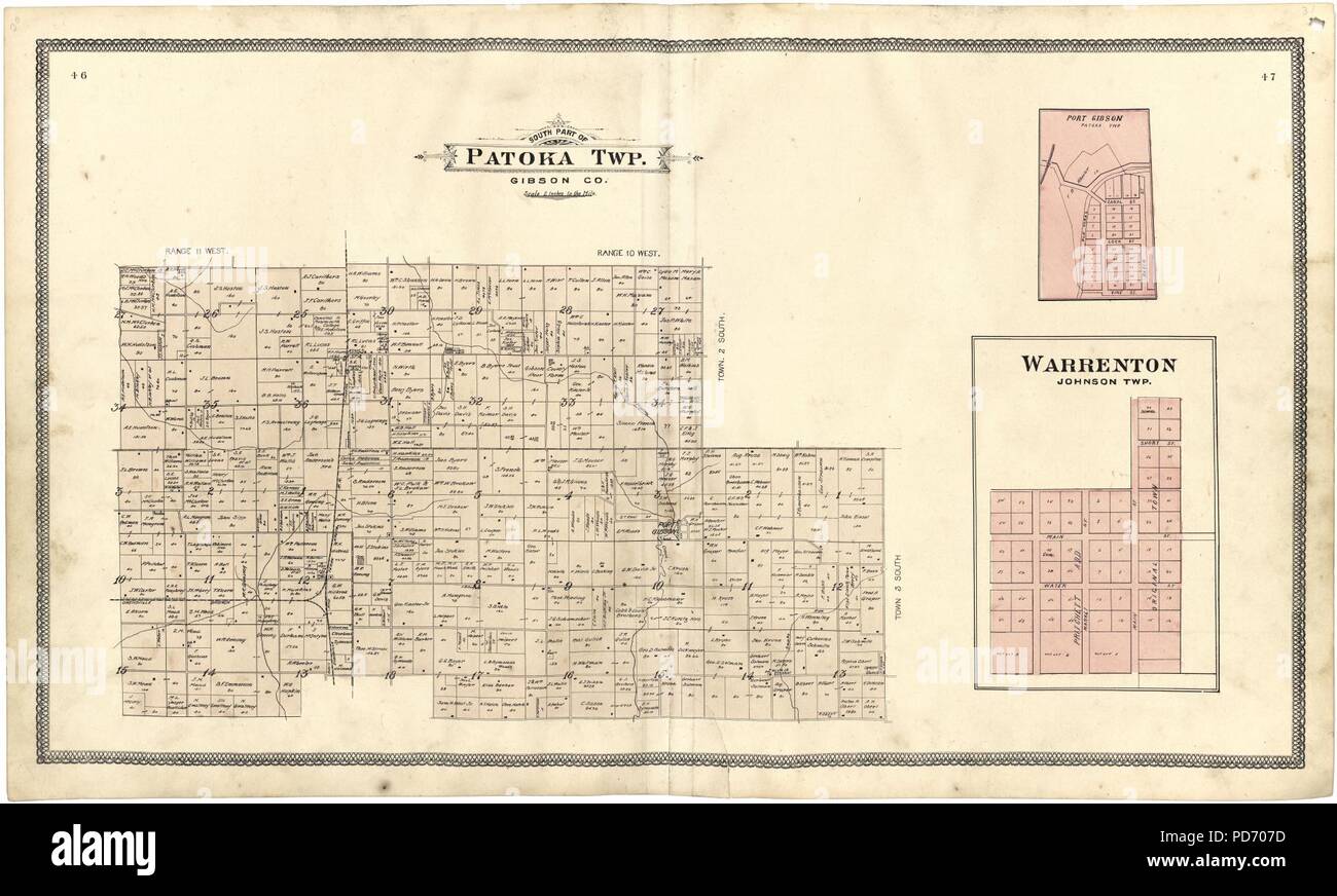 An illustrated standard atlas of Gibson County, Indiana Stock Photohttps://www.alamy.com/image-license-details/?v=1https://www.alamy.com/an-illustrated-standard-atlas-of-gibson-county-indiana-image214668817.html
RMPD707D–An illustrated standard atlas of Gibson County, Indiana
 Embroidered band sampler. Culture: British. Dimensions: L. 34 1/2 x W. 8 1/4 inches (87.6 x 21 cm). Maker: Mary Pots. Date: 1648. Band samplers comprise neatly worked rows of patterns suitable for repeating motifs or figural motifs on the long narrow strip of linen canvas. This is the most common type of extant seventeenth-century sampler, and its standard format was established by about 1630. The foundation was generally cut from one complete width of plain-weave linen, so that the selvages are present at what becomes the top and bottom of the finished work, and the sides are hemmed. Polychr Stock Photohttps://www.alamy.com/image-license-details/?v=1https://www.alamy.com/embroidered-band-sampler-culture-british-dimensions-l-34-12-x-w-8-14-inches-876-x-21-cm-maker-mary-pots-date-1648-band-samplers-comprise-neatly-worked-rows-of-patterns-suitable-for-repeating-motifs-or-figural-motifs-on-the-long-narrow-strip-of-linen-canvas-this-is-the-most-common-type-of-extant-seventeenth-century-sampler-and-its-standard-format-was-established-by-about-1630-the-foundation-was-generally-cut-from-one-complete-width-of-plain-weave-linen-so-that-the-selvages-are-present-at-what-becomes-the-top-and-bottom-of-the-finished-work-and-the-sides-are-hemmed-polychr-image213324419.html
RMPB1ND7–Embroidered band sampler. Culture: British. Dimensions: L. 34 1/2 x W. 8 1/4 inches (87.6 x 21 cm). Maker: Mary Pots. Date: 1648. Band samplers comprise neatly worked rows of patterns suitable for repeating motifs or figural motifs on the long narrow strip of linen canvas. This is the most common type of extant seventeenth-century sampler, and its standard format was established by about 1630. The foundation was generally cut from one complete width of plain-weave linen, so that the selvages are present at what becomes the top and bottom of the finished work, and the sides are hemmed. Polychr
 Uruguay Flag with Frame Vector Illustration Abstract Editable image Stock Vectorhttps://www.alamy.com/image-license-details/?v=1https://www.alamy.com/uruguay-flag-with-frame-vector-illustration-abstract-editable-image-image563613801.html
RF2RMXR49–Uruguay Flag with Frame Vector Illustration Abstract Editable image
 Standard atlas of Allen County, Indiana : including a plat book of the villages, cities and townships of the county ..patrons directory, reference business directory ... . Stock Photohttps://www.alamy.com/image-license-details/?v=1https://www.alamy.com/standard-atlas-of-allen-county-indiana-including-a-plat-book-of-the-villages-cities-and-townships-of-the-county-patrons-directory-reference-business-directory-image342765767.html
RM2AWJ96F–Standard atlas of Allen County, Indiana : including a plat book of the villages, cities and townships of the county ..patrons directory, reference business directory ... .
![Richards standard atlas of the city of Springfield and the town of Longmeadow, Massachusetts [plate 1].... , Massachusetts , Worcester ,county , Long Meadow ,swamp Massachusetts , Hampden ,county , Springfield Stock Photo Richards standard atlas of the city of Springfield and the town of Longmeadow, Massachusetts [plate 1].... , Massachusetts , Worcester ,county , Long Meadow ,swamp Massachusetts , Hampden ,county , Springfield Stock Photo](https://c8.alamy.com/comp/2M5T85G/richards-standard-atlas-of-the-city-of-springfield-and-the-town-of-longmeadow-massachusetts-plate-1-massachusetts-worcester-county-long-meadow-swamp-massachusetts-hampden-county-springfield-2M5T85G.jpg) Richards standard atlas of the city of Springfield and the town of Longmeadow, Massachusetts [plate 1].... , Massachusetts , Worcester ,county , Long Meadow ,swamp Massachusetts , Hampden ,county , Springfield Stock Photohttps://www.alamy.com/image-license-details/?v=1https://www.alamy.com/richards-standard-atlas-of-the-city-of-springfield-and-the-town-of-longmeadow-massachusetts-plate-1-massachusetts-worcester-county-long-meadow-swamp-massachusetts-hampden-county-springfield-image502707228.html
Richards standard atlas of the city of Springfield and the town of Longmeadow, Massachusetts [plate 1].... , Massachusetts , Worcester ,county , Long Meadow ,swamp Massachusetts , Hampden ,county , Springfield Stock Photohttps://www.alamy.com/image-license-details/?v=1https://www.alamy.com/richards-standard-atlas-of-the-city-of-springfield-and-the-town-of-longmeadow-massachusetts-plate-1-massachusetts-worcester-county-long-meadow-swamp-massachusetts-hampden-county-springfield-image502707228.htmlRM2M5T85G–Richards standard atlas of the city of Springfield and the town of Longmeadow, Massachusetts [plate 1].... , Massachusetts , Worcester ,county , Long Meadow ,swamp Massachusetts , Hampden ,county , Springfield
 Village of Standard, Putnam County, US, United States, Illinois, N 41 15' 19'', S 89 10' 54'', map, Cartascapes Map published in 2024. Explore Cartascapes, a map revealing Earth's diverse landscapes, cultures, and ecosystems. Journey through time and space, discovering the interconnectedness of our planet's past, present, and future. Stock Photohttps://www.alamy.com/image-license-details/?v=1https://www.alamy.com/village-of-standard-putnam-county-us-united-states-illinois-n-41-15-19-s-89-10-54-map-cartascapes-map-published-in-2024-explore-cartascapes-a-map-revealing-earths-diverse-landscapes-cultures-and-ecosystems-journey-through-time-and-space-discovering-the-interconnectedness-of-our-planets-past-present-and-future-image633841356.html
RM2YR5Y38–Village of Standard, Putnam County, US, United States, Illinois, N 41 15' 19'', S 89 10' 54'', map, Cartascapes Map published in 2024. Explore Cartascapes, a map revealing Earth's diverse landscapes, cultures, and ecosystems. Journey through time and space, discovering the interconnectedness of our planet's past, present, and future.
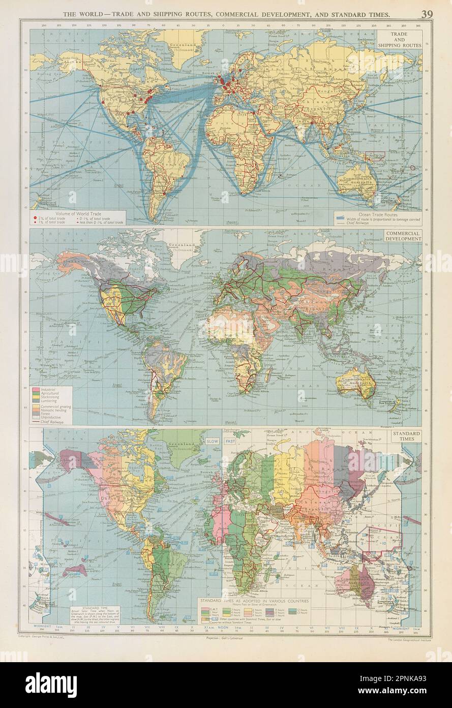 World - Trade & Shipping Routes, Commercial Development. Standard Times 1952 map Stock Photohttps://www.alamy.com/image-license-details/?v=1https://www.alamy.com/world-trade-shipping-routes-commercial-development-standard-times-1952-map-image546854367.html
RF2PNKA93–World - Trade & Shipping Routes, Commercial Development. Standard Times 1952 map
 Standard atlas of Edwards County, Illinois - including a plat book of the villages, cities and townships of the county. Map of the state, United States and world. Patrons directory, reference business Stock Photohttps://www.alamy.com/image-license-details/?v=1https://www.alamy.com/stock-photo-standard-atlas-of-edwards-county-illinois-including-a-plat-book-of-114575247.html
RMGJB9W3–Standard atlas of Edwards County, Illinois - including a plat book of the villages, cities and townships of the county. Map of the state, United States and world. Patrons directory, reference business
 Old vintage paper textured map of Denmark Country - Vector illustration Stock Vectorhttps://www.alamy.com/image-license-details/?v=1https://www.alamy.com/old-vintage-paper-textured-map-of-denmark-country-vector-illustration-image475285838.html
RF2JH73X6–Old vintage paper textured map of Denmark Country - Vector illustration
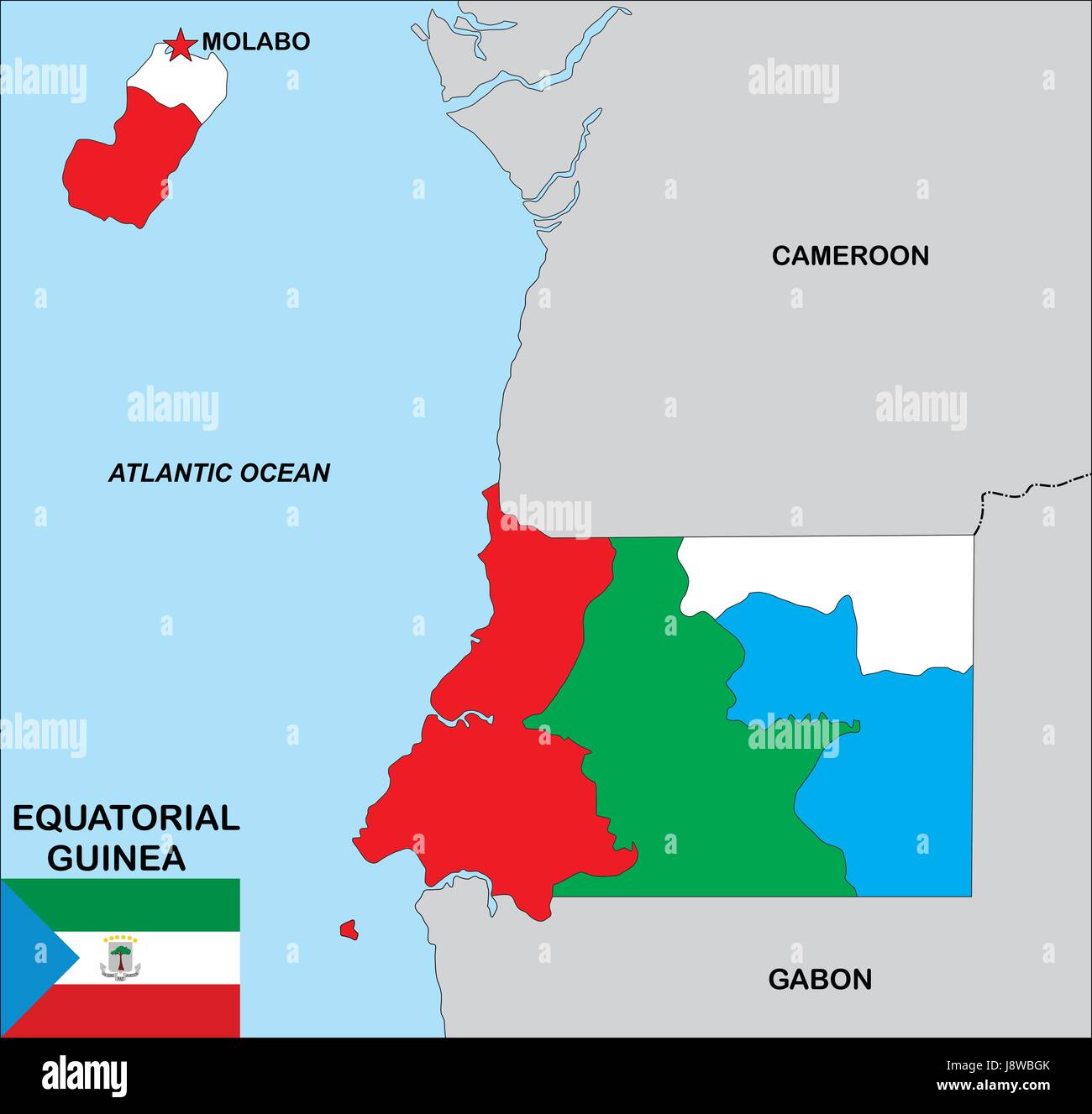 guinea, map, atlas, map of the world, political, flag, country, standard, Stock Photohttps://www.alamy.com/image-license-details/?v=1https://www.alamy.com/stock-photo-guinea-map-atlas-map-of-the-world-political-flag-country-standard-143158083.html
RFJ8WBGK–guinea, map, atlas, map of the world, political, flag, country, standard,
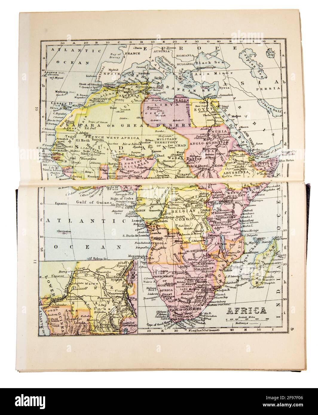 Map of Africa in the The New Standard Encyclopaedia and World Atlas, published by Odhams in 1932 Stock Photohttps://www.alamy.com/image-license-details/?v=1https://www.alamy.com/map-of-africa-in-the-the-new-standard-encyclopaedia-and-world-atlas-published-by-odhams-in-1932-image418746166.html
RM2F97F06–Map of Africa in the The New Standard Encyclopaedia and World Atlas, published by Odhams in 1932
 Official colors and proportions of the flag of Burkina Faso Stock Vectorhttps://www.alamy.com/image-license-details/?v=1https://www.alamy.com/official-colors-and-proportions-of-the-flag-of-burkina-faso-image450784742.html
RF2H5B0F2–Official colors and proportions of the flag of Burkina Faso
 turkish flag Stock Photohttps://www.alamy.com/image-license-details/?v=1https://www.alamy.com/stock-photo-turkish-flag-59475551.html
RFDCN9JR–turkish flag
 Moroccan Atlas Blue Airbus A321-200 with registration CN-RNX on final for Amsterdam Airport Schiphol Stock Photohttps://www.alamy.com/image-license-details/?v=1https://www.alamy.com/moroccan-atlas-blue-airbus-a321-200-with-registration-cn-rnx-on-final-for-amsterdam-airport-schiphol-image595126078.html
RF2WG69AP–Moroccan Atlas Blue Airbus A321-200 with registration CN-RNX on final for Amsterdam Airport Schiphol
 Large stainless steel sculpture to mark the discovery of the Higgs particle in 2012, and the 60th anniversary of CERN Stock Photohttps://www.alamy.com/image-license-details/?v=1https://www.alamy.com/stock-photo-large-stainless-steel-sculpture-to-mark-the-discovery-of-the-higgs-76857955.html
RMED152Y–Large stainless steel sculpture to mark the discovery of the Higgs particle in 2012, and the 60th anniversary of CERN
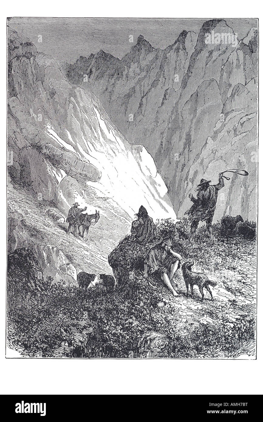 pass over cordillera mountain ranges Spanish spain espagna cordilla cuerda cord. Baetic Atlas Fès basin, Meseta Central Sierra Stock Photohttps://www.alamy.com/image-license-details/?v=1https://www.alamy.com/stock-photo-pass-over-cordillera-mountain-ranges-spanish-spain-espagna-cordilla-15265403.html
RMAMH7BT–pass over cordillera mountain ranges Spanish spain espagna cordilla cuerda cord. Baetic Atlas Fès basin, Meseta Central Sierra
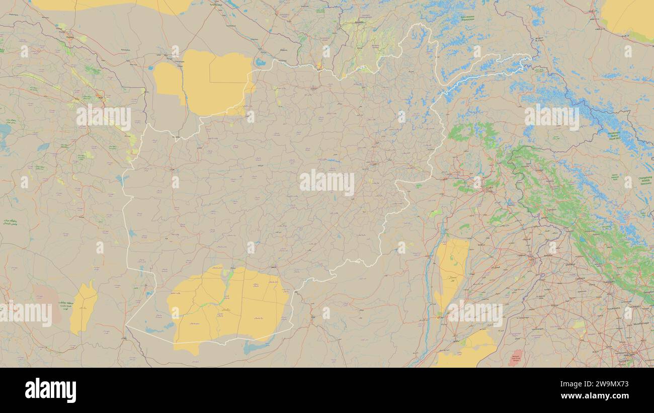 Afghanistan outlined on a topographic, OSM standard style map Stock Photohttps://www.alamy.com/image-license-details/?v=1https://www.alamy.com/afghanistan-outlined-on-a-topographic-osm-standard-style-map-image591144039.html
RF2W9MX73–Afghanistan outlined on a topographic, OSM standard style map
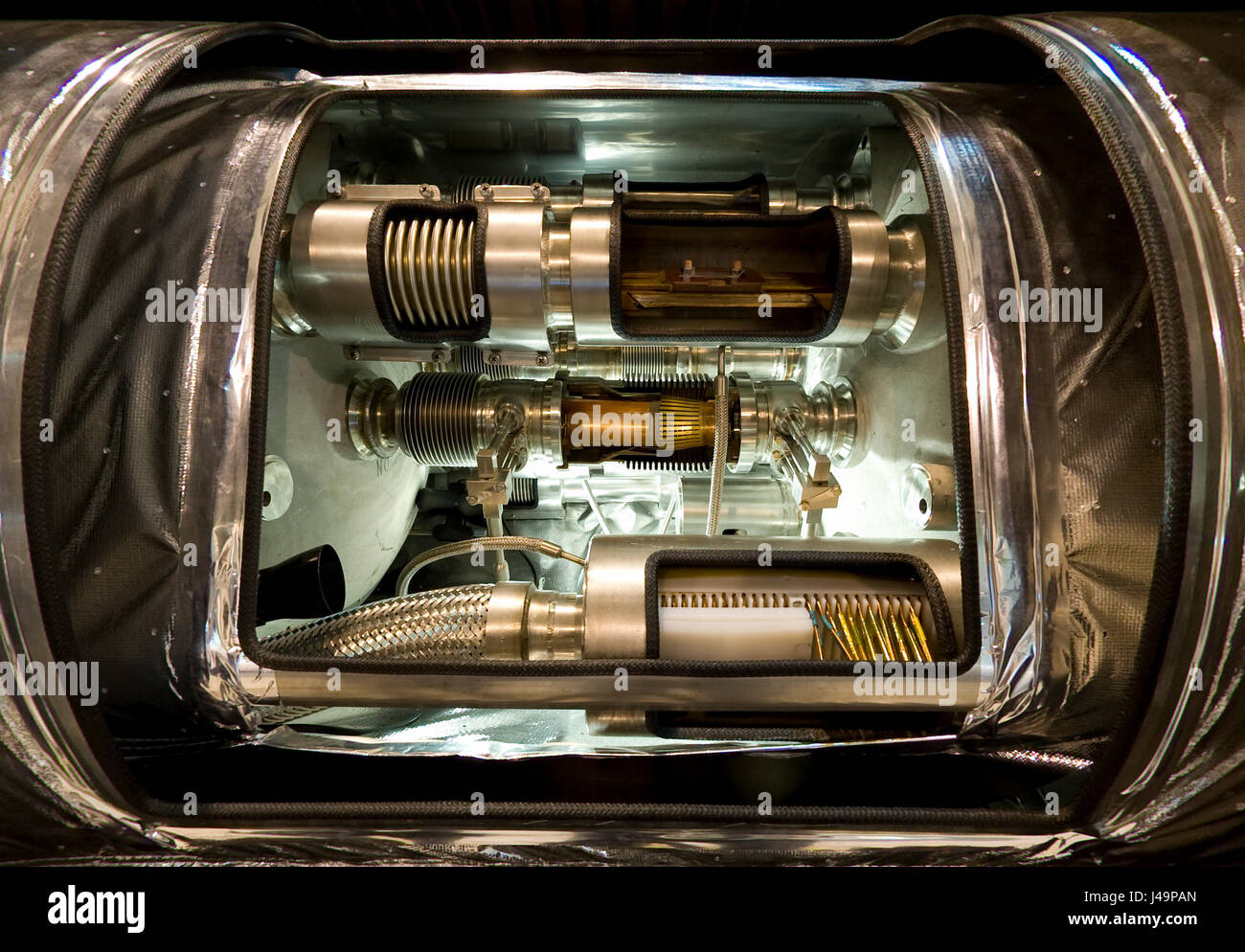 Part CERN's Large Hadron Collider Alice experiment, Atlas Stock Photohttps://www.alamy.com/image-license-details/?v=1https://www.alamy.com/stock-photo-part-cerns-large-hadron-collider-alice-experiment-atlas-140356685.html
RFJ49PAN–Part CERN's Large Hadron Collider Alice experiment, Atlas
 Intentionally Blurred image of complex interior of the ATLAS detector in CERN, Geneva, with colorful components and advanced technology. Stock Photohttps://www.alamy.com/image-license-details/?v=1https://www.alamy.com/intentionally-blurred-image-of-complex-interior-of-the-atlas-detector-in-cern-geneva-with-colorful-components-and-advanced-technology-image646097512.html
RF2SF47Y4–Intentionally Blurred image of complex interior of the ATLAS detector in CERN, Geneva, with colorful components and advanced technology.
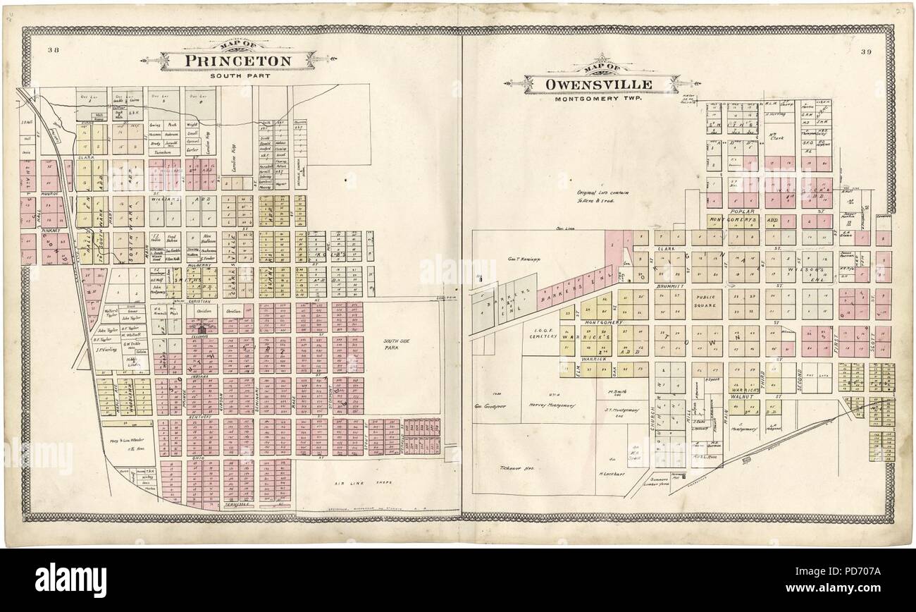 An illustrated standard atlas of Gibson County, Indiana Stock Photohttps://www.alamy.com/image-license-details/?v=1https://www.alamy.com/an-illustrated-standard-atlas-of-gibson-county-indiana-image214668814.html
RMPD707A–An illustrated standard atlas of Gibson County, Indiana
 Sampler. Culture: British. Dimensions: H. 37 1/2 x W. 6 3/8 inches (95.3 x 16.2 cm). Maker: Margret Barber. Date: 1661-63. This band sampler by Margret Barber, probably worked between 1661 and 1663, is divided into rows within three larger sections, each of which showcases a specific technique. The top two-thirds of the sampler includes motifs easily classifiable into standard categories, such as alphabetic characters, geometric designs, and floral motifs, worked in silk and linen on a linen ground using several common stitch techniques. An embroidered alphabet marks the end of the top third Stock Photohttps://www.alamy.com/image-license-details/?v=1https://www.alamy.com/sampler-culture-british-dimensions-h-37-12-x-w-6-38-inches-953-x-162-cm-maker-margret-barber-date-1661-63-this-band-sampler-by-margret-barber-probably-worked-between-1661-and-1663-is-divided-into-rows-within-three-larger-sections-each-of-which-showcases-a-specific-technique-the-top-two-thirds-of-the-sampler-includes-motifs-easily-classifiable-into-standard-categories-such-as-alphabetic-characters-geometric-designs-and-floral-motifs-worked-in-silk-and-linen-on-a-linen-ground-using-several-common-stitch-techniques-an-embroidered-alphabet-marks-the-end-of-the-top-third-image212863075.html
RMPA8N0K–Sampler. Culture: British. Dimensions: H. 37 1/2 x W. 6 3/8 inches (95.3 x 16.2 cm). Maker: Margret Barber. Date: 1661-63. This band sampler by Margret Barber, probably worked between 1661 and 1663, is divided into rows within three larger sections, each of which showcases a specific technique. The top two-thirds of the sampler includes motifs easily classifiable into standard categories, such as alphabetic characters, geometric designs, and floral motifs, worked in silk and linen on a linen ground using several common stitch techniques. An embroidered alphabet marks the end of the top third
 Standard atlas of Allen County, Indiana : including a plat book of the villages, cities and townships of the county ..patrons directory, reference business directory ... . Stock Photohttps://www.alamy.com/image-license-details/?v=1https://www.alamy.com/standard-atlas-of-allen-county-indiana-including-a-plat-book-of-the-villages-cities-and-townships-of-the-county-patrons-directory-reference-business-directory-image342768271.html
RM2AWJCBY–Standard atlas of Allen County, Indiana : including a plat book of the villages, cities and townships of the county ..patrons directory, reference business directory ... .
![Richards standard atlas of the city of Springfield and the town of Longmeadow, Massachusetts [plate 9] , Real property, Massachusetts, Springfield, Maps, Real property, Massachusetts, Longmeadow, Maps, Springfield Mass., Maps, Longmeadow Mass., Maps Norman B. Leventhal Map Center Collection Stock Photo Richards standard atlas of the city of Springfield and the town of Longmeadow, Massachusetts [plate 9] , Real property, Massachusetts, Springfield, Maps, Real property, Massachusetts, Longmeadow, Maps, Springfield Mass., Maps, Longmeadow Mass., Maps Norman B. Leventhal Map Center Collection Stock Photo](https://c8.alamy.com/comp/2M3PHPW/richards-standard-atlas-of-the-city-of-springfield-and-the-town-of-longmeadow-massachusetts-plate-9-real-property-massachusetts-springfield-maps-real-property-massachusetts-longmeadow-maps-springfield-mass-maps-longmeadow-mass-maps-norman-b-leventhal-map-center-collection-2M3PHPW.jpg) Richards standard atlas of the city of Springfield and the town of Longmeadow, Massachusetts [plate 9] , Real property, Massachusetts, Springfield, Maps, Real property, Massachusetts, Longmeadow, Maps, Springfield Mass., Maps, Longmeadow Mass., Maps Norman B. Leventhal Map Center Collection Stock Photohttps://www.alamy.com/image-license-details/?v=1https://www.alamy.com/richards-standard-atlas-of-the-city-of-springfield-and-the-town-of-longmeadow-massachusetts-plate-9-real-property-massachusetts-springfield-maps-real-property-massachusetts-longmeadow-maps-springfield-mass-maps-longmeadow-mass-maps-norman-b-leventhal-map-center-collection-image501441553.html
Richards standard atlas of the city of Springfield and the town of Longmeadow, Massachusetts [plate 9] , Real property, Massachusetts, Springfield, Maps, Real property, Massachusetts, Longmeadow, Maps, Springfield Mass., Maps, Longmeadow Mass., Maps Norman B. Leventhal Map Center Collection Stock Photohttps://www.alamy.com/image-license-details/?v=1https://www.alamy.com/richards-standard-atlas-of-the-city-of-springfield-and-the-town-of-longmeadow-massachusetts-plate-9-real-property-massachusetts-springfield-maps-real-property-massachusetts-longmeadow-maps-springfield-mass-maps-longmeadow-mass-maps-norman-b-leventhal-map-center-collection-image501441553.htmlRM2M3PHPW–Richards standard atlas of the city of Springfield and the town of Longmeadow, Massachusetts [plate 9] , Real property, Massachusetts, Springfield, Maps, Real property, Massachusetts, Longmeadow, Maps, Springfield Mass., Maps, Longmeadow Mass., Maps Norman B. Leventhal Map Center Collection
 Village of Standard City, Macoupin County, US, United States, Illinois, N 39 21' 1'', S 89 47' 0'', map, Cartascapes Map published in 2024. Explore Cartascapes, a map revealing Earth's diverse landscapes, cultures, and ecosystems. Journey through time and space, discovering the interconnectedness of our planet's past, present, and future. Stock Photohttps://www.alamy.com/image-license-details/?v=1https://www.alamy.com/village-of-standard-city-macoupin-county-us-united-states-illinois-n-39-21-1-s-89-47-0-map-cartascapes-map-published-in-2024-explore-cartascapes-a-map-revealing-earths-diverse-landscapes-cultures-and-ecosystems-journey-through-time-and-space-discovering-the-interconnectedness-of-our-planets-past-present-and-future-image633868879.html
RM2YR7667–Village of Standard City, Macoupin County, US, United States, Illinois, N 39 21' 1'', S 89 47' 0'', map, Cartascapes Map published in 2024. Explore Cartascapes, a map revealing Earth's diverse landscapes, cultures, and ecosystems. Journey through time and space, discovering the interconnectedness of our planet's past, present, and future.
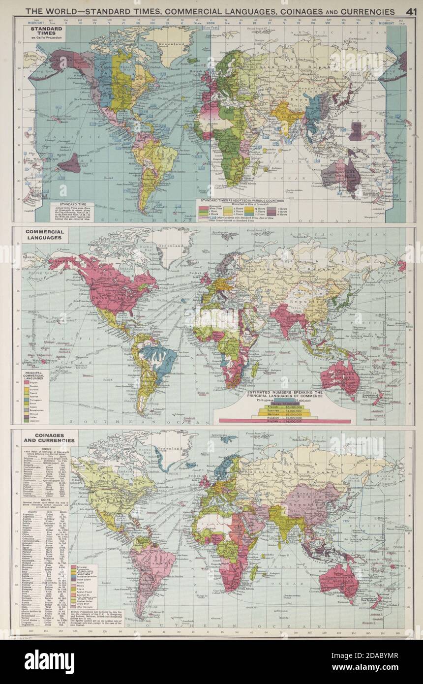 World Standard Times, Commercial languages, coinages & currencies 1927 old map Stock Photohttps://www.alamy.com/image-license-details/?v=1https://www.alamy.com/world-standard-times-commercial-languages-coinages-currencies-1927-old-map-image385037879.html
RF2DABYMR–World Standard Times, Commercial languages, coinages & currencies 1927 old map
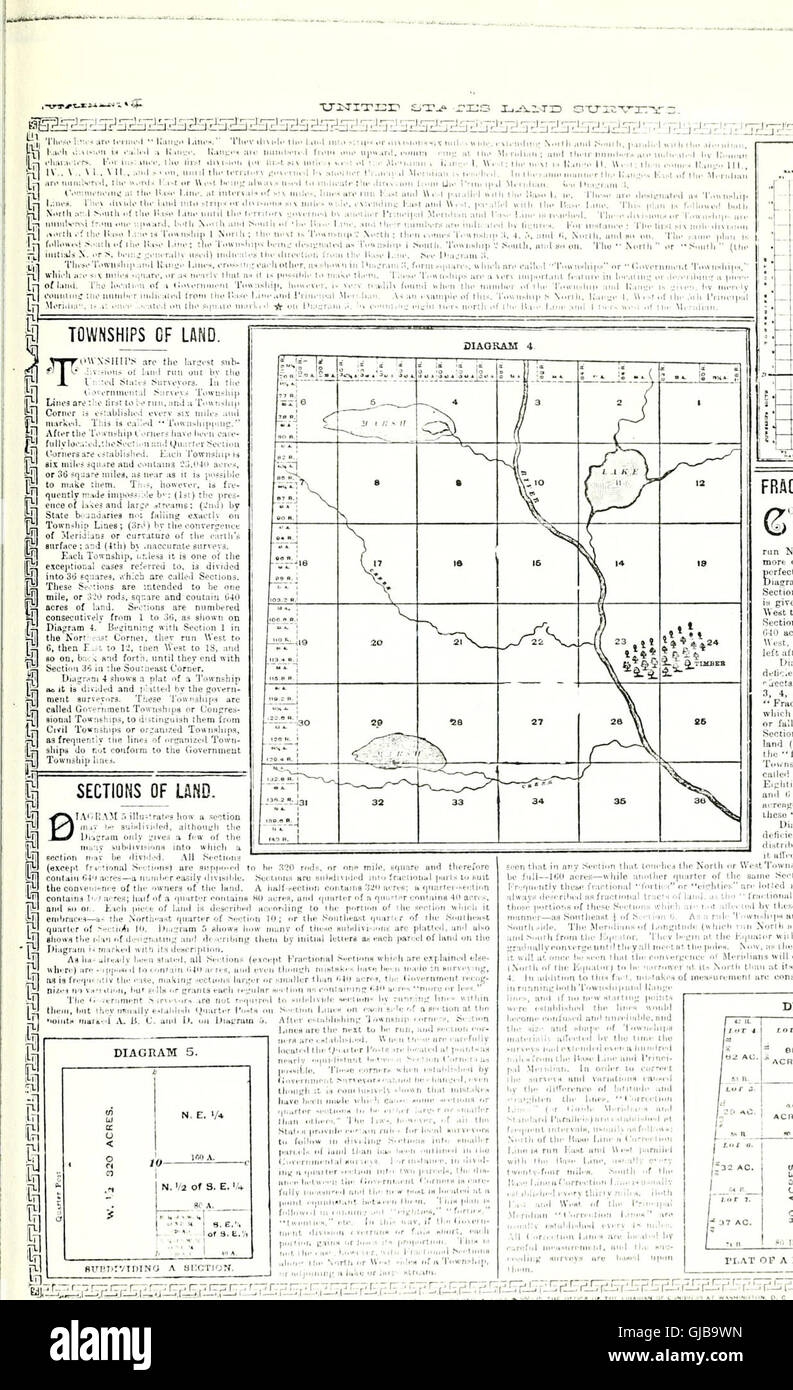 Standard atlas of Edwards County, Illinois - including a plat book of the villages, cities and townships of the county. Map of the state, United States and world. Patrons directory, reference business Stock Photohttps://www.alamy.com/image-license-details/?v=1https://www.alamy.com/stock-photo-standard-atlas-of-edwards-county-illinois-including-a-plat-book-of-114575265.html
RMGJB9WN–Standard atlas of Edwards County, Illinois - including a plat book of the villages, cities and townships of the county. Map of the state, United States and world. Patrons directory, reference business
 map, atlas, map of the world, flag, country, standard, globe, planet, earth, Stock Photohttps://www.alamy.com/image-license-details/?v=1https://www.alamy.com/stock-photo-map-atlas-map-of-the-world-flag-country-standard-globe-planet-earth-143158079.html
RFJ8WBGF–map, atlas, map of the world, flag, country, standard, globe, planet, earth,
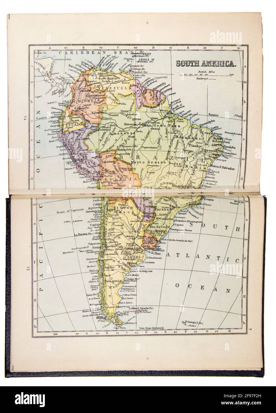 Map of South America in the The New Standard Encyclopaedia and World Atlas, published by Odhams in 1932 Stock Photohttps://www.alamy.com/image-license-details/?v=1https://www.alamy.com/map-of-south-america-in-the-the-new-standard-encyclopaedia-and-world-atlas-published-by-odhams-in-1932-image418746233.html
RM2F97F2H–Map of South America in the The New Standard Encyclopaedia and World Atlas, published by Odhams in 1932
 Official colors and proportions of the flag of Armenia. Stock Vectorhttps://www.alamy.com/image-license-details/?v=1https://www.alamy.com/official-colors-and-proportions-of-the-flag-of-armenia-image450784589.html
RF2H5B09H–Official colors and proportions of the flag of Armenia.
 Large stainless steel sculpture to mark the discovery of the Higgs particle in 2012, and the 60th anniversary of CERN Stock Photohttps://www.alamy.com/image-license-details/?v=1https://www.alamy.com/stock-photo-large-stainless-steel-sculpture-to-mark-the-discovery-of-the-higgs-76858117.html
RMED158N–Large stainless steel sculpture to mark the discovery of the Higgs particle in 2012, and the 60th anniversary of CERN
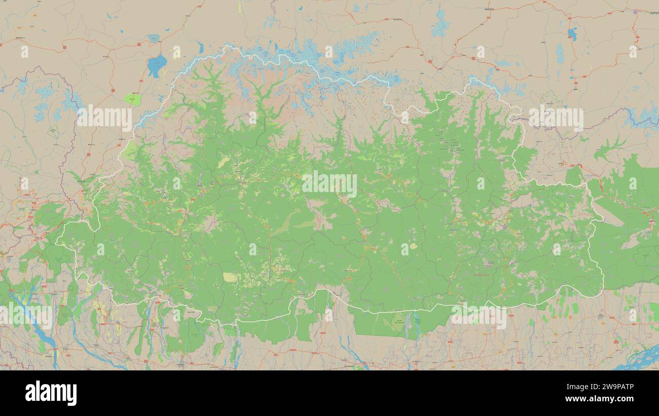 Bhutan outlined on a topographic, OSM standard style map Stock Photohttps://www.alamy.com/image-license-details/?v=1https://www.alamy.com/bhutan-outlined-on-a-topographic-osm-standard-style-map-image591175894.html
RF2W9PATP–Bhutan outlined on a topographic, OSM standard style map
 Part CERN's Large Hadron Collider Alice experiment, Atlas Stock Photohttps://www.alamy.com/image-license-details/?v=1https://www.alamy.com/stock-photo-part-cerns-large-hadron-collider-alice-experiment-atlas-140356683.html
RFJ49PAK–Part CERN's Large Hadron Collider Alice experiment, Atlas
 An illustrated standard atlas of Gibson County, Indiana Stock Photohttps://www.alamy.com/image-license-details/?v=1https://www.alamy.com/an-illustrated-standard-atlas-of-gibson-county-indiana-image214668822.html
RMPD707J–An illustrated standard atlas of Gibson County, Indiana
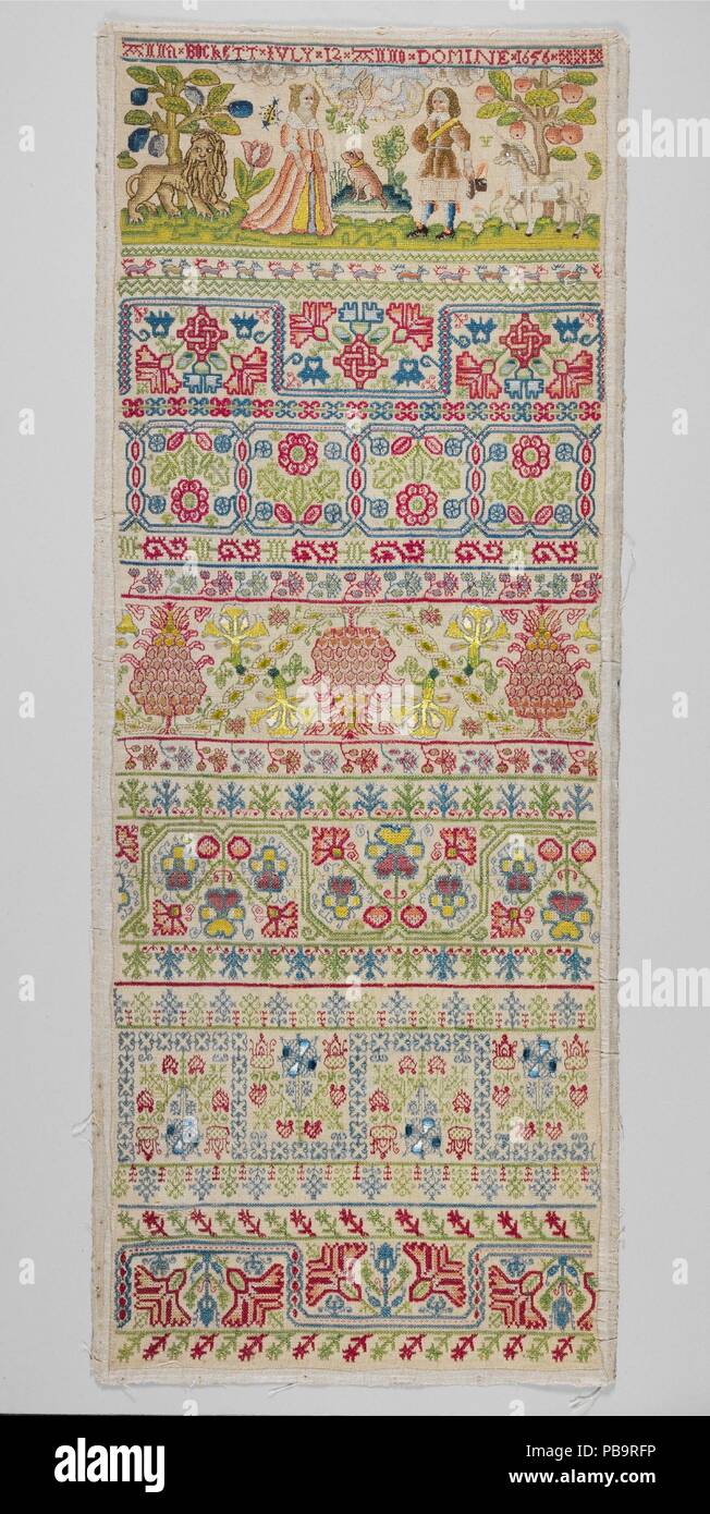 Sampler. Culture: British. Dimensions: H. 27 7/8 x W. 10 3/8 inches (70.8 x 26.4 cm); Framed: H. 30 3/4 x W. 12 1/4; D. 1 1/4 (78.1 x 31.1; 3.2 cm). Maker: Anna Buckett. Date: 1656. Band samplers comprise neatly worked rows of patterns suitable for repeating motifs or figural motifs on the long narrow strip of linen canvas. This is the most common type of extant seventeenth-century sampler, and its standard format was established by about 1630. The foundation was generally cut from one complete width of plain-weave linen, so that the selvages are present at what becomes the top and bottom of Stock Photohttps://www.alamy.com/image-license-details/?v=1https://www.alamy.com/sampler-culture-british-dimensions-h-27-78-x-w-10-38-inches-708-x-264-cm-framed-h-30-34-x-w-12-14-d-1-14-781-x-311-32-cm-maker-anna-buckett-date-1656-band-samplers-comprise-neatly-worked-rows-of-patterns-suitable-for-repeating-motifs-or-figural-motifs-on-the-long-narrow-strip-of-linen-canvas-this-is-the-most-common-type-of-extant-seventeenth-century-sampler-and-its-standard-format-was-established-by-about-1630-the-foundation-was-generally-cut-from-one-complete-width-of-plain-weave-linen-so-that-the-selvages-are-present-at-what-becomes-the-top-and-bottom-of-image213501674.html
RMPB9RFP–Sampler. Culture: British. Dimensions: H. 27 7/8 x W. 10 3/8 inches (70.8 x 26.4 cm); Framed: H. 30 3/4 x W. 12 1/4; D. 1 1/4 (78.1 x 31.1; 3.2 cm). Maker: Anna Buckett. Date: 1656. Band samplers comprise neatly worked rows of patterns suitable for repeating motifs or figural motifs on the long narrow strip of linen canvas. This is the most common type of extant seventeenth-century sampler, and its standard format was established by about 1630. The foundation was generally cut from one complete width of plain-weave linen, so that the selvages are present at what becomes the top and bottom of
 Standard atlas of Allen County, Indiana : including a plat book of the villages, cities and townships of the county ..patrons directory, reference business directory ... . Stock Photohttps://www.alamy.com/image-license-details/?v=1https://www.alamy.com/standard-atlas-of-allen-county-indiana-including-a-plat-book-of-the-villages-cities-and-townships-of-the-county-patrons-directory-reference-business-directory-image342759150.html
RM2AWJ0P6–Standard atlas of Allen County, Indiana : including a plat book of the villages, cities and townships of the county ..patrons directory, reference business directory ... .
![Richards standard atlas of the city of Springfield and the town of Longmeadow, Massachusetts [plate 1] , Real property, Massachusetts, Springfield, Maps, Real property, Massachusetts, Longmeadow, Maps, Springfield Mass., Maps, Longmeadow Mass., Maps Norman B. Leventhal Map Center Collection Stock Photo Richards standard atlas of the city of Springfield and the town of Longmeadow, Massachusetts [plate 1] , Real property, Massachusetts, Springfield, Maps, Real property, Massachusetts, Longmeadow, Maps, Springfield Mass., Maps, Longmeadow Mass., Maps Norman B. Leventhal Map Center Collection Stock Photo](https://c8.alamy.com/comp/2M3PHPN/richards-standard-atlas-of-the-city-of-springfield-and-the-town-of-longmeadow-massachusetts-plate-1-real-property-massachusetts-springfield-maps-real-property-massachusetts-longmeadow-maps-springfield-mass-maps-longmeadow-mass-maps-norman-b-leventhal-map-center-collection-2M3PHPN.jpg) Richards standard atlas of the city of Springfield and the town of Longmeadow, Massachusetts [plate 1] , Real property, Massachusetts, Springfield, Maps, Real property, Massachusetts, Longmeadow, Maps, Springfield Mass., Maps, Longmeadow Mass., Maps Norman B. Leventhal Map Center Collection Stock Photohttps://www.alamy.com/image-license-details/?v=1https://www.alamy.com/richards-standard-atlas-of-the-city-of-springfield-and-the-town-of-longmeadow-massachusetts-plate-1-real-property-massachusetts-springfield-maps-real-property-massachusetts-longmeadow-maps-springfield-mass-maps-longmeadow-mass-maps-norman-b-leventhal-map-center-collection-image501441549.html
Richards standard atlas of the city of Springfield and the town of Longmeadow, Massachusetts [plate 1] , Real property, Massachusetts, Springfield, Maps, Real property, Massachusetts, Longmeadow, Maps, Springfield Mass., Maps, Longmeadow Mass., Maps Norman B. Leventhal Map Center Collection Stock Photohttps://www.alamy.com/image-license-details/?v=1https://www.alamy.com/richards-standard-atlas-of-the-city-of-springfield-and-the-town-of-longmeadow-massachusetts-plate-1-real-property-massachusetts-springfield-maps-real-property-massachusetts-longmeadow-maps-springfield-mass-maps-longmeadow-mass-maps-norman-b-leventhal-map-center-collection-image501441549.htmlRM2M3PHPN–Richards standard atlas of the city of Springfield and the town of Longmeadow, Massachusetts [plate 1] , Real property, Massachusetts, Springfield, Maps, Real property, Massachusetts, Longmeadow, Maps, Springfield Mass., Maps, Longmeadow Mass., Maps Norman B. Leventhal Map Center Collection
 Standard, , HR, Croatia, County of Osijek-Baranja, N 45 32' 42'', N 18 44' 32'', map, Cartascapes Map published in 2024. Explore Cartascapes, a map revealing Earth's diverse landscapes, cultures, and ecosystems. Journey through time and space, discovering the interconnectedness of our planet's past, present, and future. Stock Photohttps://www.alamy.com/image-license-details/?v=1https://www.alamy.com/standard-hr-croatia-county-of-osijek-baranja-n-45-32-42-n-18-44-32-map-cartascapes-map-published-in-2024-explore-cartascapes-a-map-revealing-earths-diverse-landscapes-cultures-and-ecosystems-journey-through-time-and-space-discovering-the-interconnectedness-of-our-planets-past-present-and-future-image642746738.html
RM2S9KJ0J–Standard, , HR, Croatia, County of Osijek-Baranja, N 45 32' 42'', N 18 44' 32'', map, Cartascapes Map published in 2024. Explore Cartascapes, a map revealing Earth's diverse landscapes, cultures, and ecosystems. Journey through time and space, discovering the interconnectedness of our planet's past, present, and future.
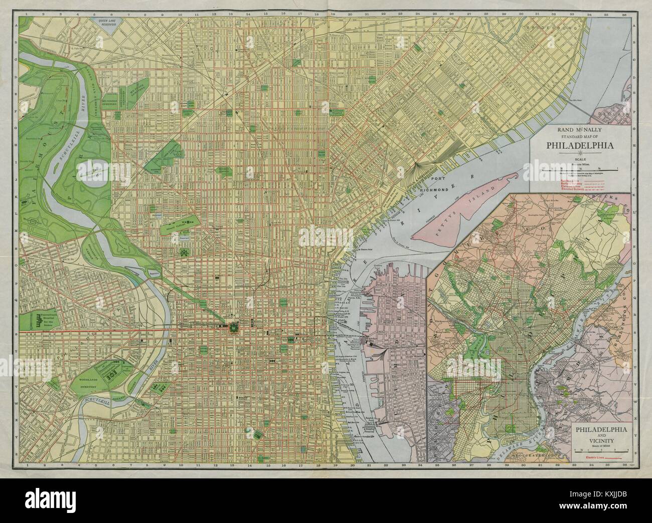 Rand McNally Standard map of Philadelphia. City plan. Pennsylvania c1913 Stock Photohttps://www.alamy.com/image-license-details/?v=1https://www.alamy.com/stock-photo-rand-mcnally-standard-map-of-philadelphia-city-plan-pennsylvania-c1913-171283991.html
RFKXJJDB–Rand McNally Standard map of Philadelphia. City plan. Pennsylvania c1913
 Standard atlas of Edwards County, Illinois - including a plat book of the villages, cities and townships of the county. Map of the state, United States and world. Patrons directory, reference business Stock Photohttps://www.alamy.com/image-license-details/?v=1https://www.alamy.com/stock-photo-standard-atlas-of-edwards-county-illinois-including-a-plat-book-of-114575246.html
RMGJB9W2–Standard atlas of Edwards County, Illinois - including a plat book of the villages, cities and townships of the county. Map of the state, United States and world. Patrons directory, reference business
 map, atlas, map of the world, flag, country, standard, globe, planet, earth, Stock Photohttps://www.alamy.com/image-license-details/?v=1https://www.alamy.com/stock-photo-map-atlas-map-of-the-world-flag-country-standard-globe-planet-earth-143158080.html
RFJ8WBGG–map, atlas, map of the world, flag, country, standard, globe, planet, earth,
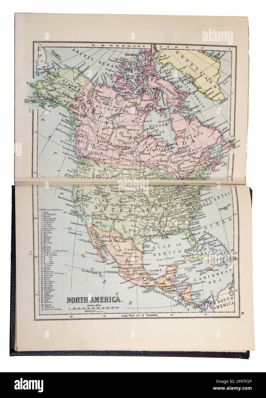 Map of North America in the The New Standard Encyclopaedia and World Atlas, published by Odhams in 1932 Stock Photohttps://www.alamy.com/image-license-details/?v=1https://www.alamy.com/map-of-north-america-in-the-the-new-standard-encyclopaedia-and-world-atlas-published-by-odhams-in-1932-image418746238.html
RM2F97F2P–Map of North America in the The New Standard Encyclopaedia and World Atlas, published by Odhams in 1932
 Official colors and proportions of the flag of Colombia. Stock Vectorhttps://www.alamy.com/image-license-details/?v=1https://www.alamy.com/official-colors-and-proportions-of-the-flag-of-colombia-image450786886.html
RF2H5B37J–Official colors and proportions of the flag of Colombia.
 Large stainless steel sculpture to mark the discovery of the Higgs particle in 2012, and the 60th anniversary of CERN Stock Photohttps://www.alamy.com/image-license-details/?v=1https://www.alamy.com/stock-photo-large-stainless-steel-sculpture-to-mark-the-discovery-of-the-higgs-76857962.html
RMED1536–Large stainless steel sculpture to mark the discovery of the Higgs particle in 2012, and the 60th anniversary of CERN
 Anguilla outlined on a topographic, OSM standard style map Stock Photohttps://www.alamy.com/image-license-details/?v=1https://www.alamy.com/anguilla-outlined-on-a-topographic-osm-standard-style-map-image591156912.html
RF2W9NEJT–Anguilla outlined on a topographic, OSM standard style map
 Part CERN's Large Hadron Collider Alice experiment, Atlas Stock Photohttps://www.alamy.com/image-license-details/?v=1https://www.alamy.com/stock-photo-part-cerns-large-hadron-collider-alice-experiment-atlas-140356682.html
RFJ49PAJ–Part CERN's Large Hadron Collider Alice experiment, Atlas
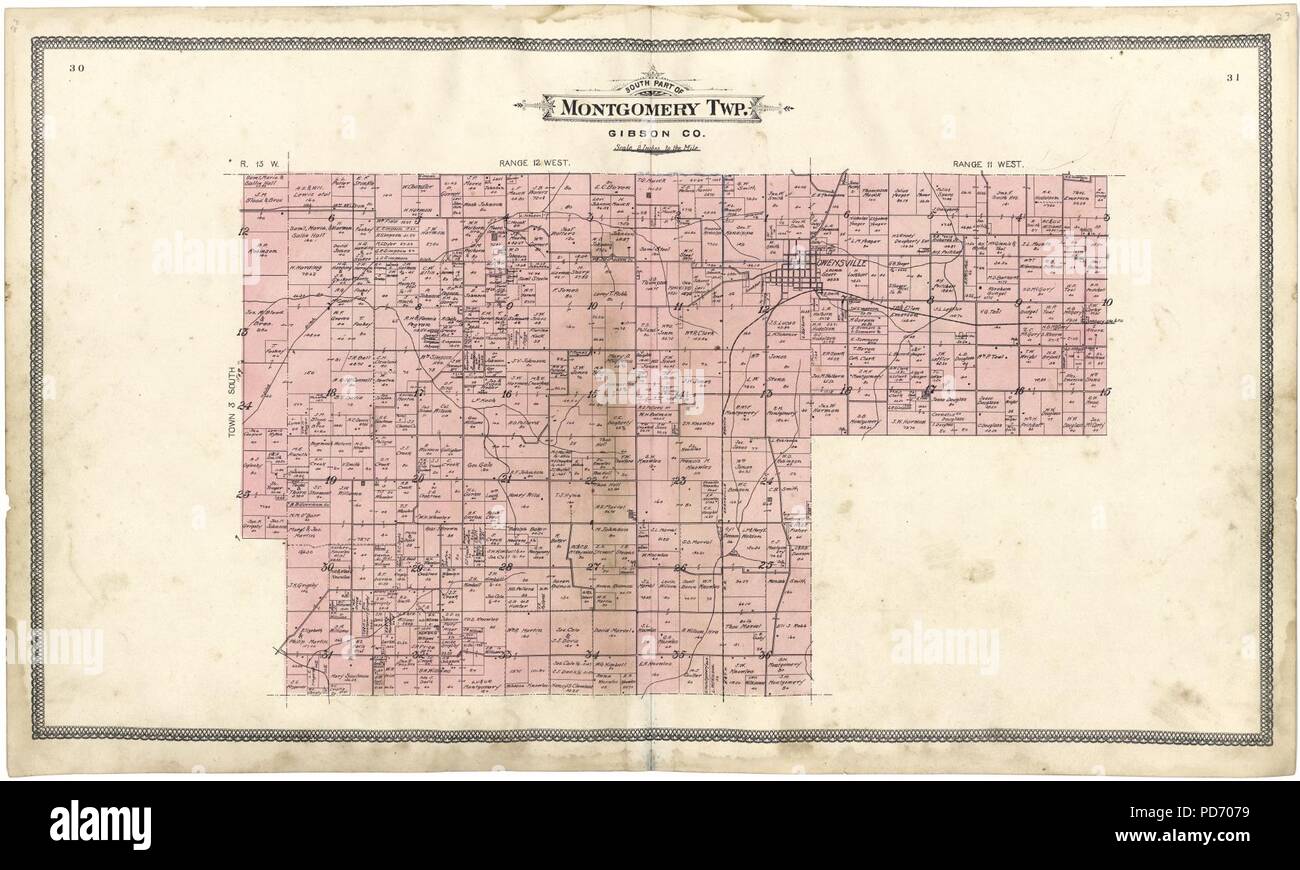 An illustrated standard atlas of Gibson County, Indiana Stock Photohttps://www.alamy.com/image-license-details/?v=1https://www.alamy.com/an-illustrated-standard-atlas-of-gibson-county-indiana-image214668813.html
RMPD7079–An illustrated standard atlas of Gibson County, Indiana
 Standard atlas of Allen County, Indiana : including a plat book of the villages, cities and townships of the county ..patrons directory, reference business directory ... . Stock Photohttps://www.alamy.com/image-license-details/?v=1https://www.alamy.com/standard-atlas-of-allen-county-indiana-including-a-plat-book-of-the-villages-cities-and-townships-of-the-county-patrons-directory-reference-business-directory-image342764259.html
RM2AWJ78K–Standard atlas of Allen County, Indiana : including a plat book of the villages, cities and townships of the county ..patrons directory, reference business directory ... .
![Richards standard atlas of the city of Springfield and the town of Longmeadow, Massachusetts [plate 10] , Real property, Massachusetts, Springfield, Maps, Real property, Massachusetts, Longmeadow, Maps, Springfield Mass., Maps, Longmeadow Mass., Maps Norman B. Leventhal Map Center Collection Stock Photo Richards standard atlas of the city of Springfield and the town of Longmeadow, Massachusetts [plate 10] , Real property, Massachusetts, Springfield, Maps, Real property, Massachusetts, Longmeadow, Maps, Springfield Mass., Maps, Longmeadow Mass., Maps Norman B. Leventhal Map Center Collection Stock Photo](https://c8.alamy.com/comp/2M3PHR4/richards-standard-atlas-of-the-city-of-springfield-and-the-town-of-longmeadow-massachusetts-plate-10-real-property-massachusetts-springfield-maps-real-property-massachusetts-longmeadow-maps-springfield-mass-maps-longmeadow-mass-maps-norman-b-leventhal-map-center-collection-2M3PHR4.jpg) Richards standard atlas of the city of Springfield and the town of Longmeadow, Massachusetts [plate 10] , Real property, Massachusetts, Springfield, Maps, Real property, Massachusetts, Longmeadow, Maps, Springfield Mass., Maps, Longmeadow Mass., Maps Norman B. Leventhal Map Center Collection Stock Photohttps://www.alamy.com/image-license-details/?v=1https://www.alamy.com/richards-standard-atlas-of-the-city-of-springfield-and-the-town-of-longmeadow-massachusetts-plate-10-real-property-massachusetts-springfield-maps-real-property-massachusetts-longmeadow-maps-springfield-mass-maps-longmeadow-mass-maps-norman-b-leventhal-map-center-collection-image501441560.html
Richards standard atlas of the city of Springfield and the town of Longmeadow, Massachusetts [plate 10] , Real property, Massachusetts, Springfield, Maps, Real property, Massachusetts, Longmeadow, Maps, Springfield Mass., Maps, Longmeadow Mass., Maps Norman B. Leventhal Map Center Collection Stock Photohttps://www.alamy.com/image-license-details/?v=1https://www.alamy.com/richards-standard-atlas-of-the-city-of-springfield-and-the-town-of-longmeadow-massachusetts-plate-10-real-property-massachusetts-springfield-maps-real-property-massachusetts-longmeadow-maps-springfield-mass-maps-longmeadow-mass-maps-norman-b-leventhal-map-center-collection-image501441560.htmlRM2M3PHR4–Richards standard atlas of the city of Springfield and the town of Longmeadow, Massachusetts [plate 10] , Real property, Massachusetts, Springfield, Maps, Real property, Massachusetts, Longmeadow, Maps, Springfield Mass., Maps, Longmeadow Mass., Maps Norman B. Leventhal Map Center Collection
 Standard, Walker County, US, United States, Alabama, N 33 44' 9'', S 87 16' 14'', map, Cartascapes Map published in 2024. Explore Cartascapes, a map revealing Earth's diverse landscapes, cultures, and ecosystems. Journey through time and space, discovering the interconnectedness of our planet's past, present, and future. Stock Photohttps://www.alamy.com/image-license-details/?v=1https://www.alamy.com/standard-walker-county-us-united-states-alabama-n-33-44-9-s-87-16-14-map-cartascapes-map-published-in-2024-explore-cartascapes-a-map-revealing-earths-diverse-landscapes-cultures-and-ecosystems-journey-through-time-and-space-discovering-the-interconnectedness-of-our-planets-past-present-and-future-image620795608.html
RM2Y1YK3M–Standard, Walker County, US, United States, Alabama, N 33 44' 9'', S 87 16' 14'', map, Cartascapes Map published in 2024. Explore Cartascapes, a map revealing Earth's diverse landscapes, cultures, and ecosystems. Journey through time and space, discovering the interconnectedness of our planet's past, present, and future.
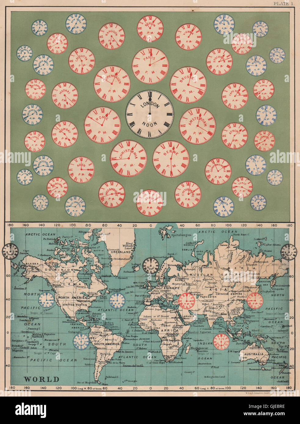 TIME OF ALL NATIONS. predates UTC/standard hourly time zones. JOHNSTON, 1906 map Stock Photohttps://www.alamy.com/image-license-details/?v=1https://www.alamy.com/stock-photo-time-of-all-nations-predates-utcstandard-hourly-time-zones-johnston-114642626.html
RFGJEBRE–TIME OF ALL NATIONS. predates UTC/standard hourly time zones. JOHNSTON, 1906 map
 Standard atlas of Edwards County, Illinois - including a plat book of the villages, cities and townships of the county. Map of the state, United States and world. Patrons directory, reference business Stock Photohttps://www.alamy.com/image-license-details/?v=1https://www.alamy.com/stock-photo-standard-atlas-of-edwards-county-illinois-including-a-plat-book-of-114575235.html
RMGJB9TK–Standard atlas of Edwards County, Illinois - including a plat book of the villages, cities and townships of the county. Map of the state, United States and world. Patrons directory, reference business
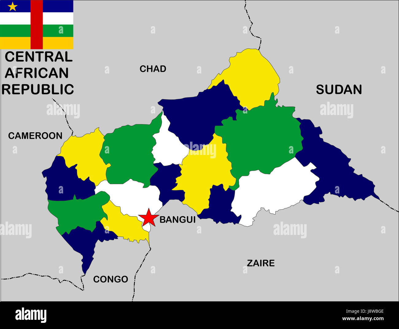 African, central, republic, map, atlas, map of the world, flag, African, Stock Photohttps://www.alamy.com/image-license-details/?v=1https://www.alamy.com/stock-photo-african-central-republic-map-atlas-map-of-the-world-flag-african-143158078.html
RFJ8WBGE–African, central, republic, map, atlas, map of the world, flag, African,
 Map of Britain and Ireland in the The New Standard Encyclopaedia and World Atlas, published by Odhams in 1932 and showing the importance of railways f Stock Photohttps://www.alamy.com/image-license-details/?v=1https://www.alamy.com/map-of-britain-and-ireland-in-the-the-new-standard-encyclopaedia-and-world-atlas-published-by-odhams-in-1932-and-showing-the-importance-of-railways-f-image418746172.html
RM2F97F0C–Map of Britain and Ireland in the The New Standard Encyclopaedia and World Atlas, published by Odhams in 1932 and showing the importance of railways f
 Official colors and proportions of the flag of Benin Stock Vectorhttps://www.alamy.com/image-license-details/?v=1https://www.alamy.com/official-colors-and-proportions-of-the-flag-of-benin-image450786721.html
RF2H5B31N–Official colors and proportions of the flag of Benin
 Large stainless steel sculpture to mark the discovery of the Higgs particle in 2012, and the 60th anniversary of CERN Stock Photohttps://www.alamy.com/image-license-details/?v=1https://www.alamy.com/stock-photo-large-stainless-steel-sculpture-to-mark-the-discovery-of-the-higgs-76858074.html
RMED1576–Large stainless steel sculpture to mark the discovery of the Higgs particle in 2012, and the 60th anniversary of CERN
 Luxembourg highlighted on a topographic, OSM standard style map Stock Photohttps://www.alamy.com/image-license-details/?v=1https://www.alamy.com/luxembourg-highlighted-on-a-topographic-osm-standard-style-map-image591544100.html
RF2WAB4F0–Luxembourg highlighted on a topographic, OSM standard style map
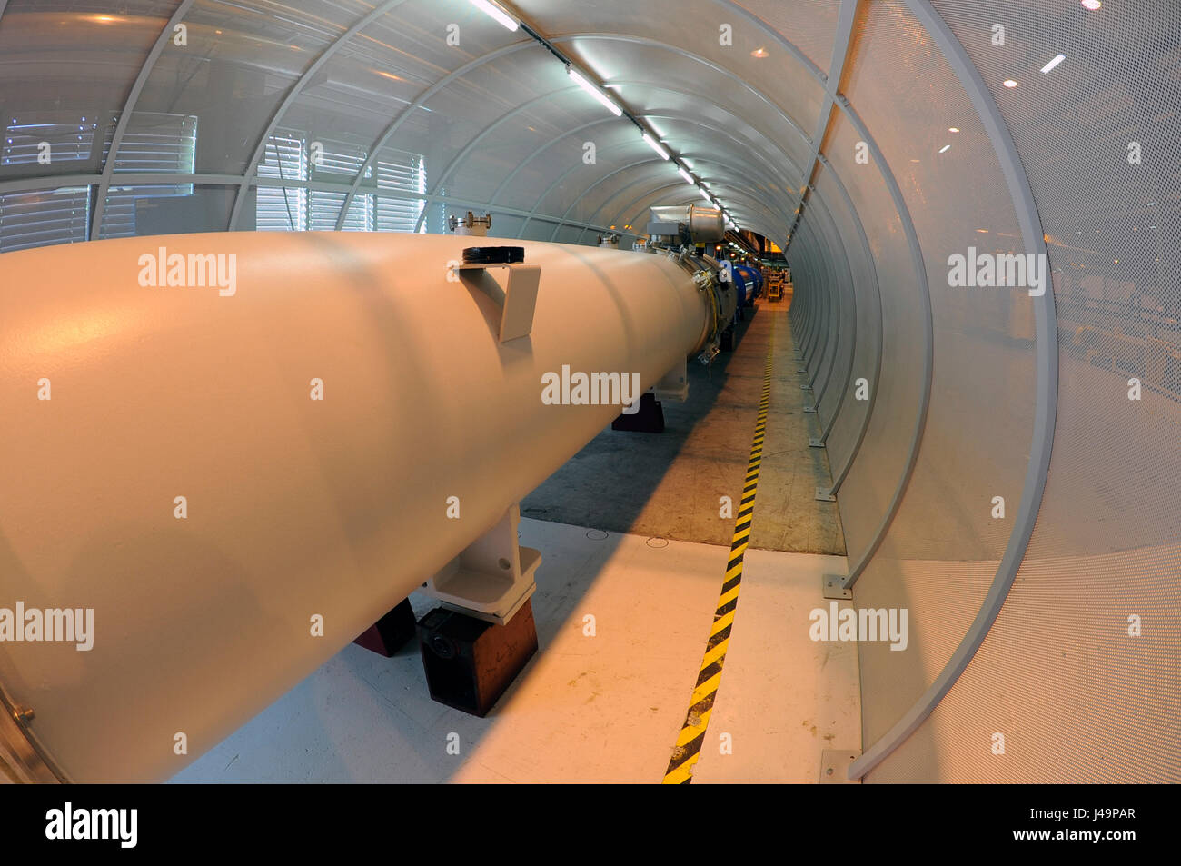 Part CERN's Large Hadron Collider Alice experiment, Atlas Stock Photohttps://www.alamy.com/image-license-details/?v=1https://www.alamy.com/stock-photo-part-cerns-large-hadron-collider-alice-experiment-atlas-140356687.html
RFJ49PAR–Part CERN's Large Hadron Collider Alice experiment, Atlas
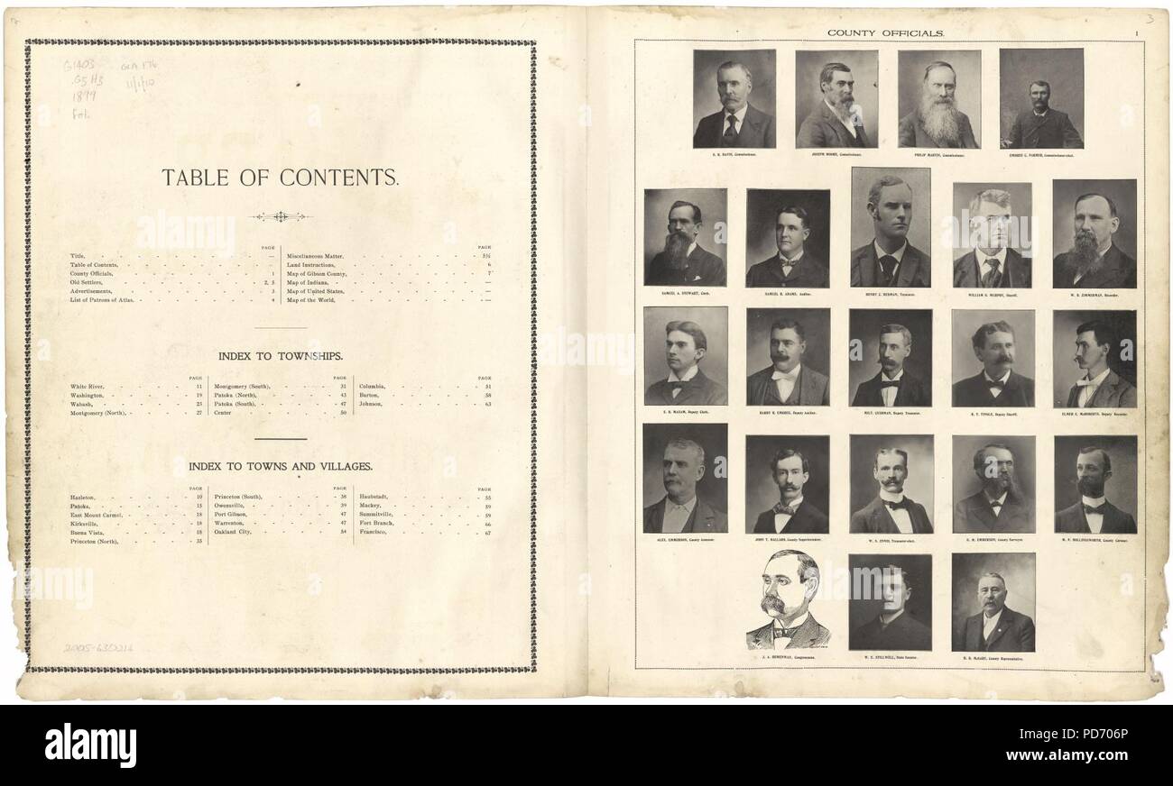 An illustrated standard atlas of Gibson County, Indiana Stock Photohttps://www.alamy.com/image-license-details/?v=1https://www.alamy.com/an-illustrated-standard-atlas-of-gibson-county-indiana-image214668798.html
RMPD706P–An illustrated standard atlas of Gibson County, Indiana
 Standard atlas of Allen County, Indiana : including a plat book of the villages, cities and townships of the county ..patrons directory, reference business directory ... . Stock Photohttps://www.alamy.com/image-license-details/?v=1https://www.alamy.com/standard-atlas-of-allen-county-indiana-including-a-plat-book-of-the-villages-cities-and-townships-of-the-county-patrons-directory-reference-business-directory-image342772763.html
RM2AWJJ4B–Standard atlas of Allen County, Indiana : including a plat book of the villages, cities and townships of the county ..patrons directory, reference business directory ... .
 Launch of an Atlas standard launch vehicle 3. Base: Cape Canaveral Air Force Station State: Florida (FL) Country: United States Of America (USA) Stock Photohttps://www.alamy.com/image-license-details/?v=1https://www.alamy.com/launch-of-an-atlas-standard-launch-vehicle-3-base-cape-canaveral-air-force-station-state-florida-fl-country-united-states-of-america-usa-image503941870.html
RM2M7TEYX–Launch of an Atlas standard launch vehicle 3. Base: Cape Canaveral Air Force Station State: Florida (FL) Country: United States Of America (USA)
 Standard, Sullivan County, US, United States, Indiana, N 39 11' 47'', S 87 23' 21'', map, Cartascapes Map published in 2024. Explore Cartascapes, a map revealing Earth's diverse landscapes, cultures, and ecosystems. Journey through time and space, discovering the interconnectedness of our planet's past, present, and future. Stock Photohttps://www.alamy.com/image-license-details/?v=1https://www.alamy.com/standard-sullivan-county-us-united-states-indiana-n-39-11-47-s-87-23-21-map-cartascapes-map-published-in-2024-explore-cartascapes-a-map-revealing-earths-diverse-landscapes-cultures-and-ecosystems-journey-through-time-and-space-discovering-the-interconnectedness-of-our-planets-past-present-and-future-image620875411.html
RM2Y238WR–Standard, Sullivan County, US, United States, Indiana, N 39 11' 47'', S 87 23' 21'', map, Cartascapes Map published in 2024. Explore Cartascapes, a map revealing Earth's diverse landscapes, cultures, and ecosystems. Journey through time and space, discovering the interconnectedness of our planet's past, present, and future.