Quick filters:
States and territories Stock Photos and Images
 Australia political. States territories. Vegetation rainfall. TIMES 1922 map Stock Photohttps://www.alamy.com/image-license-details/?v=1https://www.alamy.com/australia-political-states-territories-vegetation-rainfall-times-1922-map-image242582089.html
RFT2JFX1–Australia political. States territories. Vegetation rainfall. TIMES 1922 map
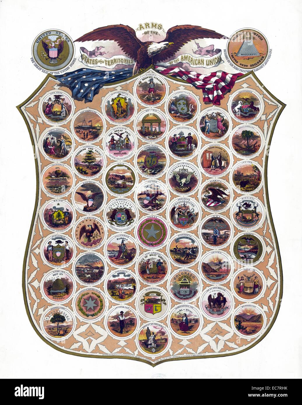 Arms of the states and territories of the American union c1876. composite of the seals of the states and territories of the United States on a large shield; with 'The Great Seal of the United States'; an eagle; and an American flag; as well as an emblem labelled 'Annuit Cœptis Novus Ordo Seclorum' showing a pyramid labelled 'MDCCLXXVI' topped with an eye (as seen on the $1 bill) and 'Designed by Sir John Prestwick Stock Photohttps://www.alamy.com/image-license-details/?v=1https://www.alamy.com/stock-photo-arms-of-the-states-and-territories-of-the-american-union-c1876-composite-76389535.html
RMEC7RHK–Arms of the states and territories of the American union c1876. composite of the seals of the states and territories of the United States on a large shield; with 'The Great Seal of the United States'; an eagle; and an American flag; as well as an emblem labelled 'Annuit Cœptis Novus Ordo Seclorum' showing a pyramid labelled 'MDCCLXXVI' topped with an eye (as seen on the $1 bill) and 'Designed by Sir John Prestwick
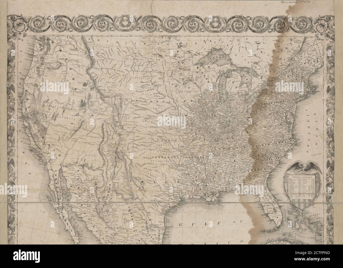 Map of the United States with its territories, cartographic, Maps, 1851 Stock Photohttps://www.alamy.com/image-license-details/?v=1https://www.alamy.com/map-of-the-united-states-with-its-territories-cartographic-maps-1851-image376516601.html
RM2CTFPND–Map of the United States with its territories, cartographic, Maps, 1851
 Art inspired by District of Columbia, from Flags of the States and Territories (N11) for Allen & Ginter Cigarettes Brands, 1888, Commercial color lithograph, Sheet: 2 3/4 x 1 1/2 in. (7 x 3.8 cm), Trade cards from the 'Flags of the States and Territories' series (N11), issued in 1888, Classic works modernized by Artotop with a splash of modernity. Shapes, color and value, eye-catching visual impact on art. Emotions through freedom of artworks in a contemporary way. A timeless message pursuing a wildly creative new direction. Artists turning to the digital medium and creating the Artotop NFT Stock Photohttps://www.alamy.com/image-license-details/?v=1https://www.alamy.com/art-inspired-by-district-of-columbia-from-flags-of-the-states-and-territories-n11-for-allen-ginter-cigarettes-brands-1888-commercial-color-lithograph-sheet-2-34-x-1-12-in-7-x-38-cm-trade-cards-from-the-flags-of-the-states-and-territories-series-n11-issued-in-1888-classic-works-modernized-by-artotop-with-a-splash-of-modernity-shapes-color-and-value-eye-catching-visual-impact-on-art-emotions-through-freedom-of-artworks-in-a-contemporary-way-a-timeless-message-pursuing-a-wildly-creative-new-direction-artists-turning-to-the-digital-medium-and-creating-the-artotop-nft-image463007652.html
RF2HW7PYG–Art inspired by District of Columbia, from Flags of the States and Territories (N11) for Allen & Ginter Cigarettes Brands, 1888, Commercial color lithograph, Sheet: 2 3/4 x 1 1/2 in. (7 x 3.8 cm), Trade cards from the 'Flags of the States and Territories' series (N11), issued in 1888, Classic works modernized by Artotop with a splash of modernity. Shapes, color and value, eye-catching visual impact on art. Emotions through freedom of artworks in a contemporary way. A timeless message pursuing a wildly creative new direction. Artists turning to the digital medium and creating the Artotop NFT
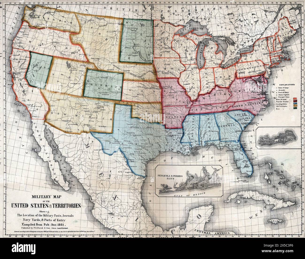 Military map of the United States & territories showing the location of the military posts, arsenals, Navy Yards, & ports of entry, 1861 Stock Photohttps://www.alamy.com/image-license-details/?v=1https://www.alamy.com/military-map-of-the-united-states-territories-showing-the-location-of-the-military-posts-arsenals-navy-yards-ports-of-entry-1861-image605702362.html
RM2X5C3F6–Military map of the United States & territories showing the location of the military posts, arsenals, Navy Yards, & ports of entry, 1861
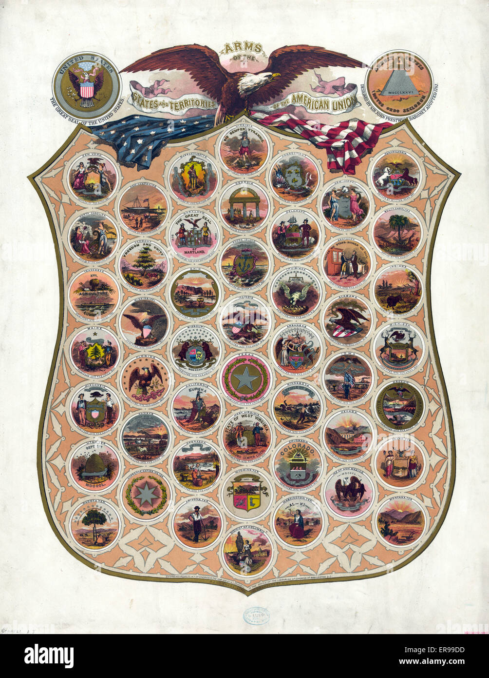 Arms of the states and territories of the American union Stock Photohttps://www.alamy.com/image-license-details/?v=1https://www.alamy.com/stock-photo-arms-of-the-states-and-territories-of-the-american-union-83183561.html
RMER99DD–Arms of the states and territories of the American union
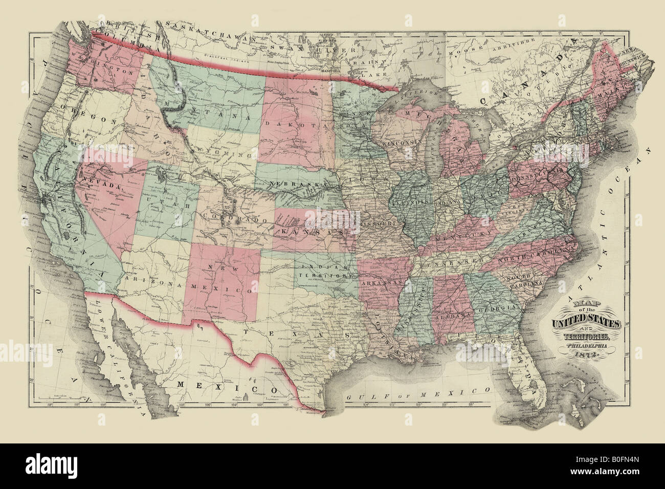 Map of the United States Territories 1872 Stock Photohttps://www.alamy.com/image-license-details/?v=1https://www.alamy.com/stock-photo-map-of-the-united-states-territories-1872-17556245.html
RMB0FN4N–Map of the United States Territories 1872
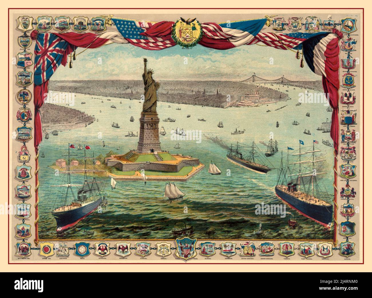 STATUE OF LIBERTY Vintage colour etching of The Statue of Liberty New York USA The gift of France to the American people . The Bartholdi Colossal Statue surrounded by all the seals of American states and territories.The statue was dedicated on October 28, 1886. Historic colour lithograph Stock Photohttps://www.alamy.com/image-license-details/?v=1https://www.alamy.com/statue-of-liberty-vintage-colour-etching-of-the-statue-of-liberty-new-york-usa-the-gift-of-france-to-the-american-people-the-bartholdi-colossal-statue-surrounded-by-all-the-seals-of-american-states-and-territoriesthe-statue-was-dedicated-on-october-28-1886-historic-colour-lithograph-image467660480.html
RM2J4RNM0–STATUE OF LIBERTY Vintage colour etching of The Statue of Liberty New York USA The gift of France to the American people . The Bartholdi Colossal Statue surrounded by all the seals of American states and territories.The statue was dedicated on October 28, 1886. Historic colour lithograph
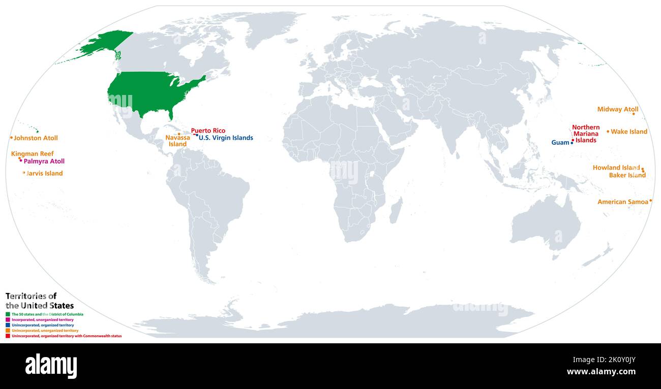 Territories of the United States, political map. Subnational administrative divisions. Stock Photohttps://www.alamy.com/image-license-details/?v=1https://www.alamy.com/territories-of-the-united-states-political-map-subnational-administrative-divisions-image482483539.html
RF2K0Y0JY–Territories of the United States, political map. Subnational administrative divisions.
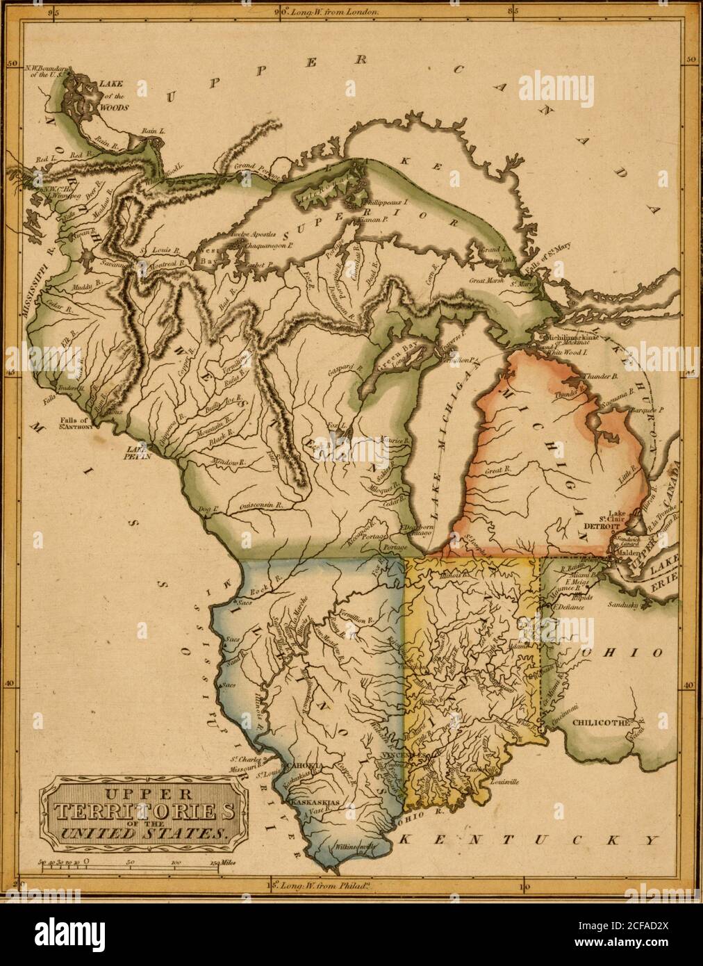 Upper Territories of the United States - 1817 Stock Photohttps://www.alamy.com/image-license-details/?v=1https://www.alamy.com/upper-territories-of-the-united-states-1817-image370867362.html
RM2CFAD2X–Upper Territories of the United States - 1817
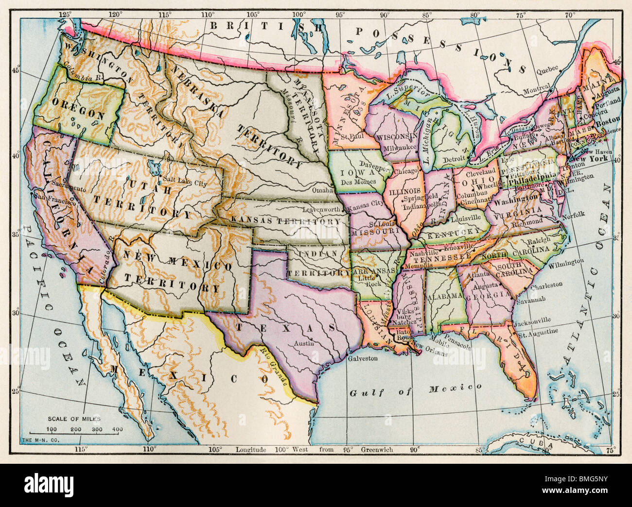 United States and territories at the beginning of the Civil War. Color lithograph Stock Photohttps://www.alamy.com/image-license-details/?v=1https://www.alamy.com/stock-photo-united-states-and-territories-at-the-beginning-of-the-civil-war-color-29859255.html
RMBMG5NY–United States and territories at the beginning of the Civil War. Color lithograph
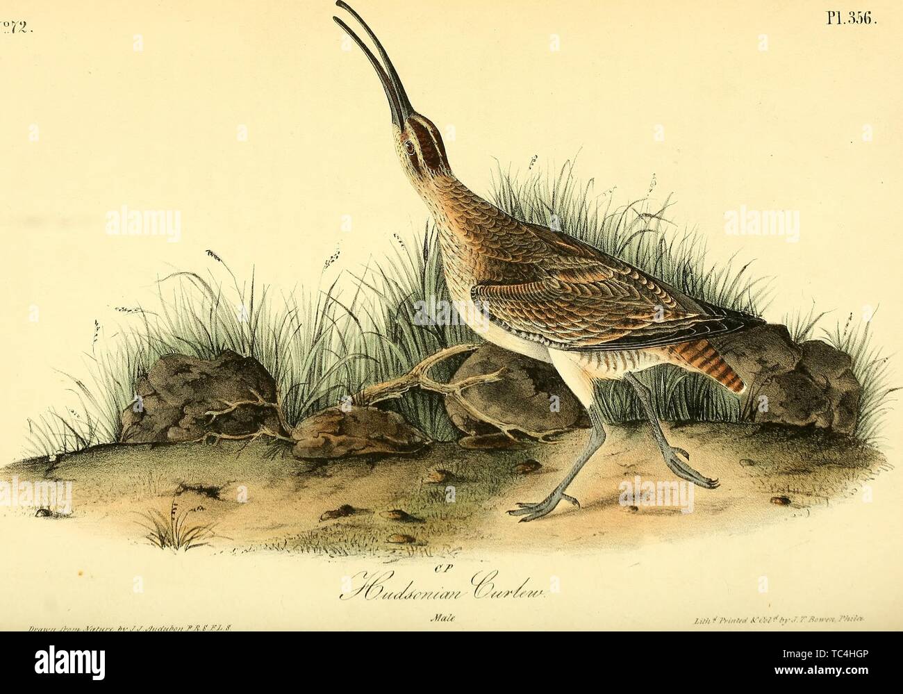 Engraving of the Hudsonian Curlew (Numenius Hudsonicus), from the book 'The birds of America, from drawings made in the United States and their territories' by John James Audubon, 1840. Courtesy Internet Archive. () Stock Photohttps://www.alamy.com/image-license-details/?v=1https://www.alamy.com/engraving-of-the-hudsonian-curlew-numenius-hudsonicus-from-the-book-the-birds-of-america-from-drawings-made-in-the-united-states-and-their-territories-by-john-james-audubon-1840-courtesy-internet-archive-image248422630.html
RMTC4HGP–Engraving of the Hudsonian Curlew (Numenius Hudsonicus), from the book 'The birds of America, from drawings made in the United States and their territories' by John James Audubon, 1840. Courtesy Internet Archive. ()
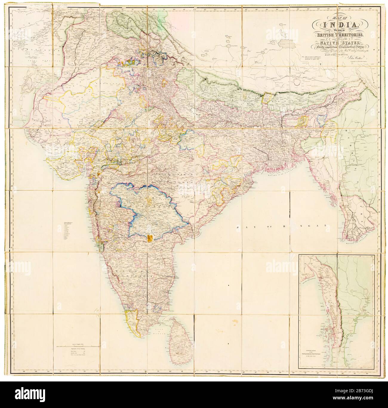 Map of India showing the British Territories and those of the Native States, 19th Century map by John Walker, East India Company, 1856 Stock Photohttps://www.alamy.com/image-license-details/?v=1https://www.alamy.com/map-of-india-showing-the-british-territories-and-those-of-the-native-states-19th-century-map-by-john-walker-east-india-company-1856-image348588734.html
RM2B73GDJ–Map of India showing the British Territories and those of the Native States, 19th Century map by John Walker, East India Company, 1856
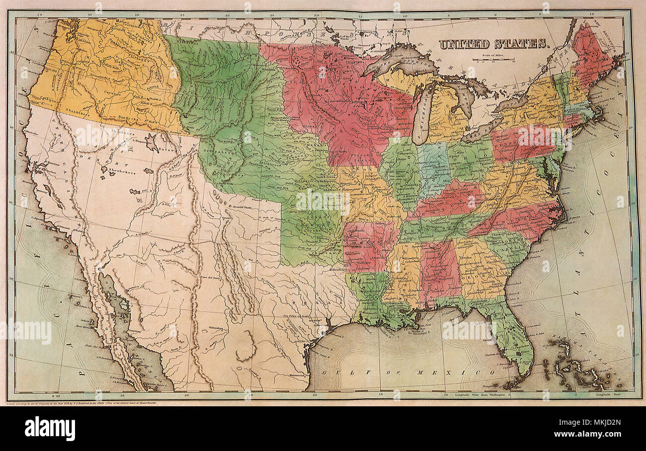 United States 1837 Stock Photohttps://www.alamy.com/image-license-details/?v=1https://www.alamy.com/united-states-1837-image184187549.html
RMMKJD2N–United States 1837
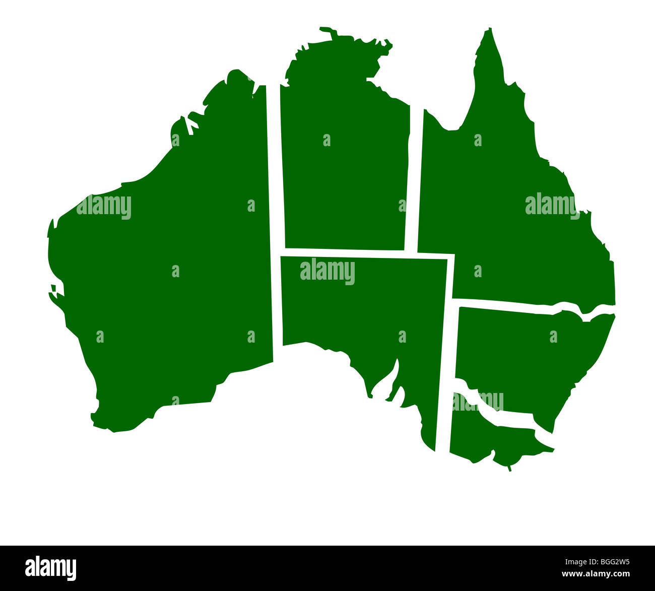 Map of six states of Australia, isolated on white background. Stock Photohttps://www.alamy.com/image-license-details/?v=1https://www.alamy.com/stock-photo-map-of-six-states-of-australia-isolated-on-white-background-27398369.html
RMBGG2W5–Map of six states of Australia, isolated on white background.
 230620-N-NO819-1003 IWAKUNI, Japan (June 20, 2024) Steelworker 3rd Class Xavier Syboune, a Seabee assigned to Naval Mobile Construction Battalion (NMCB) 5, welds a piece of steel onboard Marine Corps Air Station (MCAS) Iwakuni, Japan June 20. NMCB-5 is forward deployed supporting Seabee missions throughout the Indo-Pacific region and United States territories executing expeditionary construction. As the stand-in, crisis response, naval engineering force, NMCB-5 maintains a ready posture to deliver in-theater expeditionary logistics via expeditionary shore infrastructure, forward damage repair, Stock Photohttps://www.alamy.com/image-license-details/?v=1https://www.alamy.com/230620-n-no819-1003-iwakuni-japan-june-20-2024-steelworker-3rd-class-xavier-syboune-a-seabee-assigned-to-naval-mobile-construction-battalion-nmcb-5-welds-a-piece-of-steel-onboard-marine-corps-air-station-mcas-iwakuni-japan-june-20-nmcb-5-is-forward-deployed-supporting-seabee-missions-throughout-the-indo-pacific-region-and-united-states-territories-executing-expeditionary-construction-as-the-stand-in-crisis-response-naval-engineering-force-nmcb-5-maintains-a-ready-posture-to-deliver-in-theater-expeditionary-logistics-via-expeditionary-shore-infrastructure-forward-damage-repair-image611049749.html
RM2XE3M59–230620-N-NO819-1003 IWAKUNI, Japan (June 20, 2024) Steelworker 3rd Class Xavier Syboune, a Seabee assigned to Naval Mobile Construction Battalion (NMCB) 5, welds a piece of steel onboard Marine Corps Air Station (MCAS) Iwakuni, Japan June 20. NMCB-5 is forward deployed supporting Seabee missions throughout the Indo-Pacific region and United States territories executing expeditionary construction. As the stand-in, crisis response, naval engineering force, NMCB-5 maintains a ready posture to deliver in-theater expeditionary logistics via expeditionary shore infrastructure, forward damage repair,
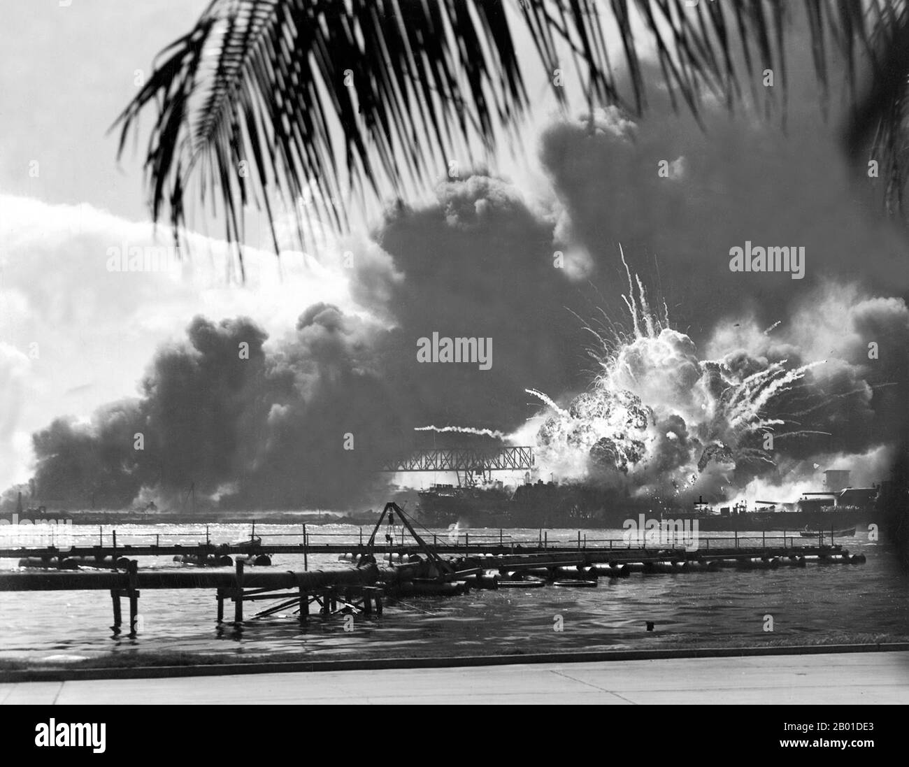 USA/Japan: The USS Shaw exploding during the Japanese attack on Pearl Harbour, December 7, 1941. The attack on Pearl Harbor was a surprise military strike conducted by the Imperial Japanese Navy against the United States naval base at Pearl Harbor, Hawaii, on the morning of December 7, 1941 (December 8 in Japan). The attack was intended as a preventive action in order to keep the U.S. Pacific Fleet from interfering with military actions the Empire of Japan was planning in Southeast Asia against overseas territories of the United Kingdom, the Netherlands, and the United States. Stock Photohttps://www.alamy.com/image-license-details/?v=1https://www.alamy.com/usajapan-the-uss-shaw-exploding-during-the-japanese-attack-on-pearl-harbour-december-7-1941-the-attack-on-pearl-harbor-was-a-surprise-military-strike-conducted-by-the-imperial-japanese-navy-against-the-united-states-naval-base-at-pearl-harbor-hawaii-on-the-morning-of-december-7-1941-december-8-in-japan-the-attack-was-intended-as-a-preventive-action-in-order-to-keep-the-us-pacific-fleet-from-interfering-with-military-actions-the-empire-of-japan-was-planning-in-southeast-asia-against-overseas-territories-of-the-united-kingdom-the-netherlands-and-the-united-states-image344239899.html
RM2B01DE3–USA/Japan: The USS Shaw exploding during the Japanese attack on Pearl Harbour, December 7, 1941. The attack on Pearl Harbor was a surprise military strike conducted by the Imperial Japanese Navy against the United States naval base at Pearl Harbor, Hawaii, on the morning of December 7, 1941 (December 8 in Japan). The attack was intended as a preventive action in order to keep the U.S. Pacific Fleet from interfering with military actions the Empire of Japan was planning in Southeast Asia against overseas territories of the United Kingdom, the Netherlands, and the United States.
 front page of the Graphic Newspaper featuring scenes from the territories of the United States Stock Photohttps://www.alamy.com/image-license-details/?v=1https://www.alamy.com/front-page-of-the-graphic-newspaper-featuring-scenes-from-the-territories-of-the-united-states-image417916188.html
RM2F7WMA4–front page of the Graphic Newspaper featuring scenes from the territories of the United States
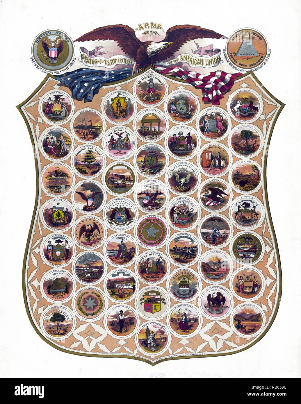 Arms of the states and territories of the American union c1876. composite of the seals of the states and territories of the United States on a large shield; with 'The Great Seal of the United States'; an eagle; and an American flag; as well as an emblem labelled 'Annuit CAiptis Novus Ordo Seclorum' showing a pyramid labelled 'MDCCLXXVI' topped with an eye (as seen on the $1 bill) and 'Designed by Sir John Prestwick Stock Photohttps://www.alamy.com/image-license-details/?v=1https://www.alamy.com/arms-of-the-states-and-territories-of-the-american-union-c1876-composite-of-the-seals-of-the-states-and-territories-of-the-united-states-on-a-large-shield-with-the-great-seal-of-the-united-states-an-eagle-and-an-american-flag-as-well-as-an-emblem-labelled-annuit-caiptis-novus-ordo-seclorum-showing-a-pyramid-labelled-mdcclxxvi-topped-with-an-eye-as-seen-on-the-1-bill-and-designed-by-sir-john-prestwick-image230631898.html
RMRB659E–Arms of the states and territories of the American union c1876. composite of the seals of the states and territories of the United States on a large shield; with 'The Great Seal of the United States'; an eagle; and an American flag; as well as an emblem labelled 'Annuit CAiptis Novus Ordo Seclorum' showing a pyramid labelled 'MDCCLXXVI' topped with an eye (as seen on the $1 bill) and 'Designed by Sir John Prestwick
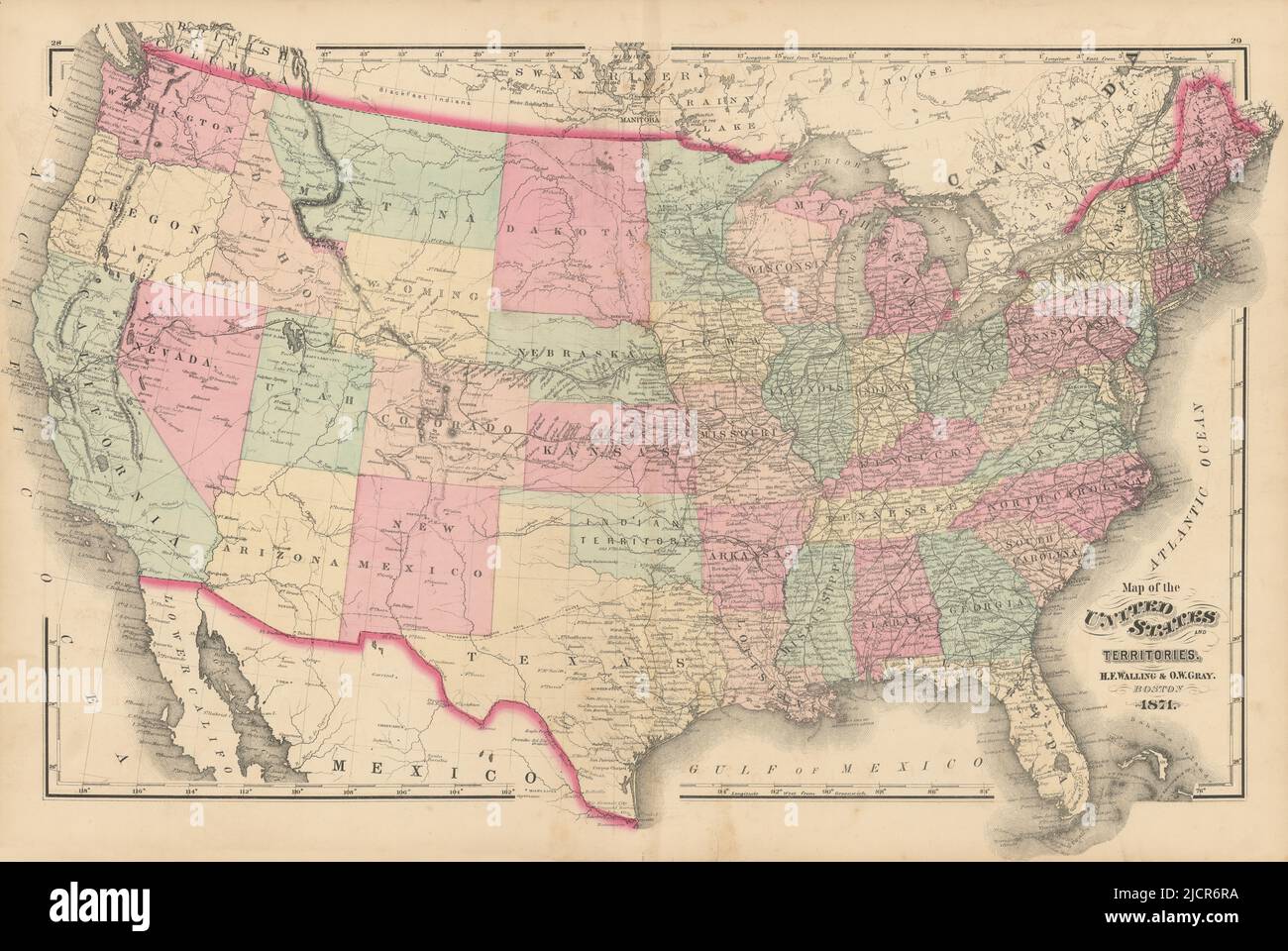 Map of the United States and territories by Walling & Gray 1871 old Stock Photohttps://www.alamy.com/image-license-details/?v=1https://www.alamy.com/map-of-the-united-states-and-territories-by-walling-gray-1871-old-image472566062.html
RF2JCR6RA–Map of the United States and territories by Walling & Gray 1871 old
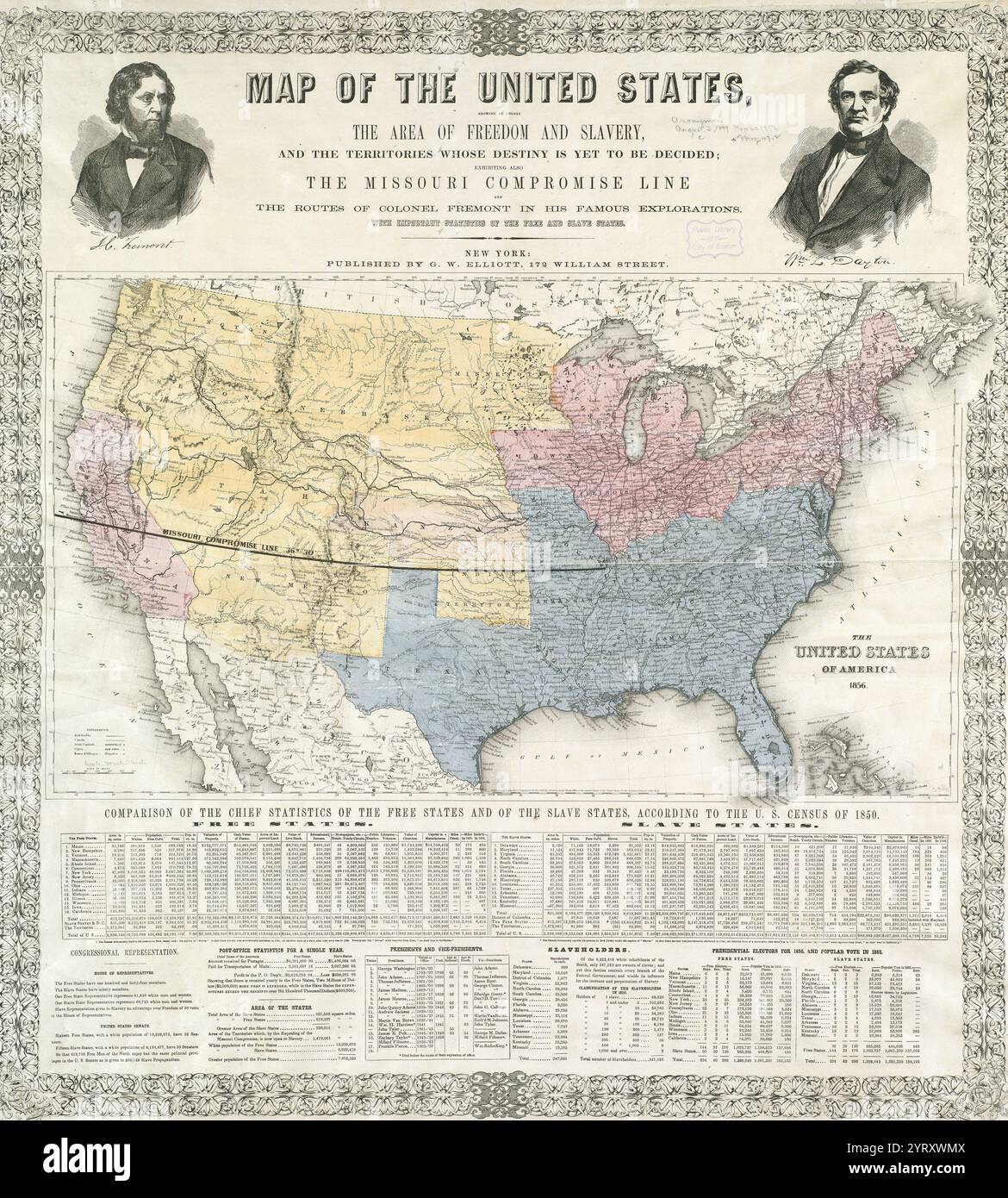 Map of the United States, showing by colours the area of freedom and slavery, and the territories whose destiny is yet to be decided, exhibiting also the Missouri compromise line. The Missouri Compromise (also known as the Compromise of 1820) was federal legislation of the United States that balanced desires of northern states to prevent the expansion of slavery in the country with those of southern states to expand it. It admitted Missouri as a slave state and Maine as a free state and declared a policy of prohibiting slavery in the remaining Louisiana Purchase lands Stock Photohttps://www.alamy.com/image-license-details/?v=1https://www.alamy.com/map-of-the-united-states-showing-by-colours-the-area-of-freedom-and-slavery-and-the-territories-whose-destiny-is-yet-to-be-decided-exhibiting-also-the-missouri-compromise-line-the-missouri-compromise-also-known-as-the-compromise-of-1820-was-federal-legislation-of-the-united-states-that-balanced-desires-of-northern-states-to-prevent-the-expansion-of-slavery-in-the-country-with-those-of-southern-states-to-expand-it-it-admitted-missouri-as-a-slave-state-and-maine-as-a-free-state-and-declared-a-policy-of-prohibiting-slavery-in-the-remaining-louisiana-purchase-lands-image634301274.html
RM2YRXWMX–Map of the United States, showing by colours the area of freedom and slavery, and the territories whose destiny is yet to be decided, exhibiting also the Missouri compromise line. The Missouri Compromise (also known as the Compromise of 1820) was federal legislation of the United States that balanced desires of northern states to prevent the expansion of slavery in the country with those of southern states to expand it. It admitted Missouri as a slave state and Maine as a free state and declared a policy of prohibiting slavery in the remaining Louisiana Purchase lands
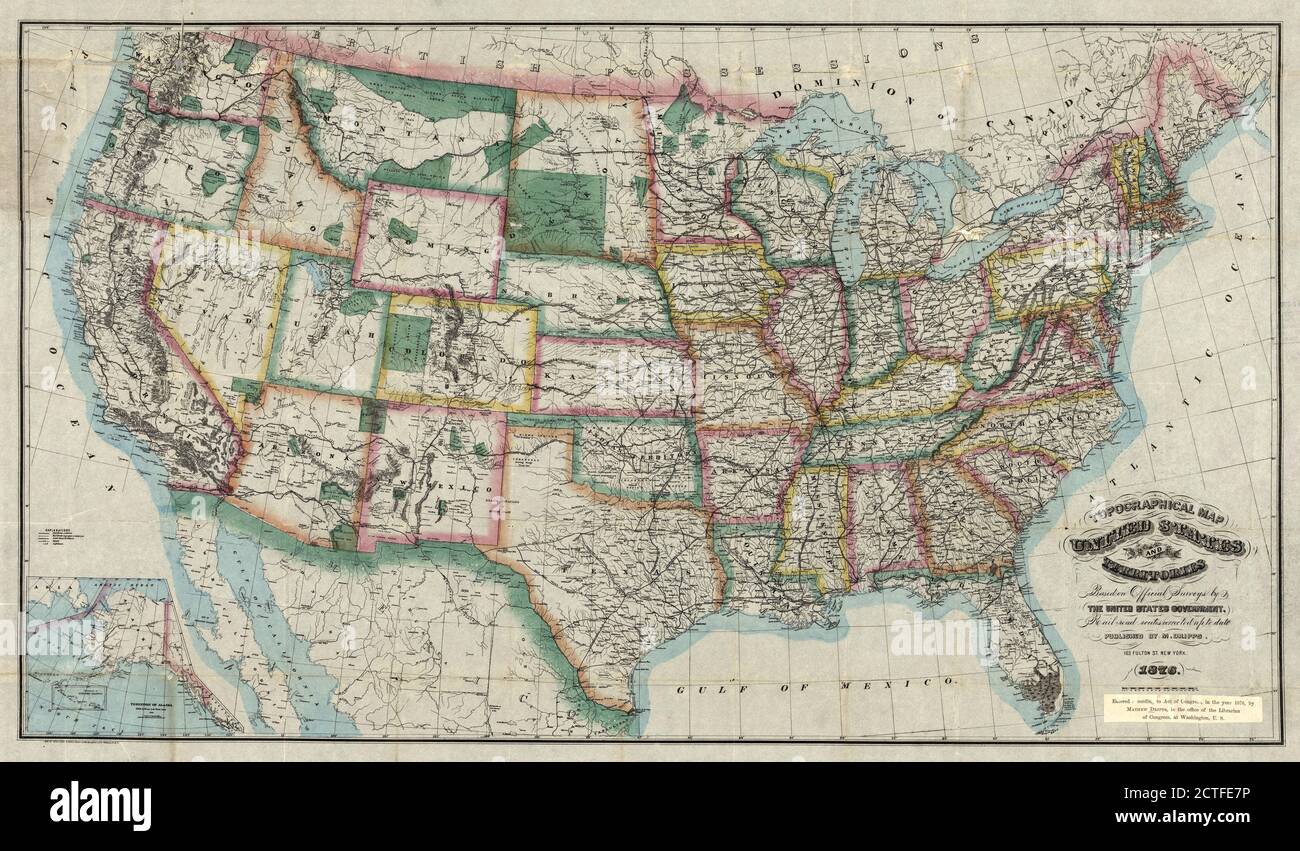 Topographical map, United States and territories, cartographic, Maps, 1876, Dripps, M. (Matthew), Ed. W. Welcke & Bro Stock Photohttps://www.alamy.com/image-license-details/?v=1https://www.alamy.com/topographical-map-united-states-and-territories-cartographic-maps-1876-dripps-m-matthew-ed-w-welcke-bro-image376509946.html
RM2CTFE7P–Topographical map, United States and territories, cartographic, Maps, 1876, Dripps, M. (Matthew), Ed. W. Welcke & Bro
 Art inspired by Washington Territory, from Flags of the States and Territories (N11) for Allen & Ginter Cigarettes Brands, 1888, Commercial color lithograph, Sheet: 2 3/4 x 1 1/2 in. (7 x 3.8 cm), Trade cards from the 'Flags of the States and Territories' series (N11), issued in 1888, Classic works modernized by Artotop with a splash of modernity. Shapes, color and value, eye-catching visual impact on art. Emotions through freedom of artworks in a contemporary way. A timeless message pursuing a wildly creative new direction. Artists turning to the digital medium and creating the Artotop NFT Stock Photohttps://www.alamy.com/image-license-details/?v=1https://www.alamy.com/art-inspired-by-washington-territory-from-flags-of-the-states-and-territories-n11-for-allen-ginter-cigarettes-brands-1888-commercial-color-lithograph-sheet-2-34-x-1-12-in-7-x-38-cm-trade-cards-from-the-flags-of-the-states-and-territories-series-n11-issued-in-1888-classic-works-modernized-by-artotop-with-a-splash-of-modernity-shapes-color-and-value-eye-catching-visual-impact-on-art-emotions-through-freedom-of-artworks-in-a-contemporary-way-a-timeless-message-pursuing-a-wildly-creative-new-direction-artists-turning-to-the-digital-medium-and-creating-the-artotop-nft-image463007623.html
RF2HW7PXF–Art inspired by Washington Territory, from Flags of the States and Territories (N11) for Allen & Ginter Cigarettes Brands, 1888, Commercial color lithograph, Sheet: 2 3/4 x 1 1/2 in. (7 x 3.8 cm), Trade cards from the 'Flags of the States and Territories' series (N11), issued in 1888, Classic works modernized by Artotop with a splash of modernity. Shapes, color and value, eye-catching visual impact on art. Emotions through freedom of artworks in a contemporary way. A timeless message pursuing a wildly creative new direction. Artists turning to the digital medium and creating the Artotop NFT
 The United States of North America, with the British territories. 1793 Stock Photohttps://www.alamy.com/image-license-details/?v=1https://www.alamy.com/the-united-states-of-north-america-with-the-british-territories-1793-image61762598.html
RMDGDER2–The United States of North America, with the British territories. 1793
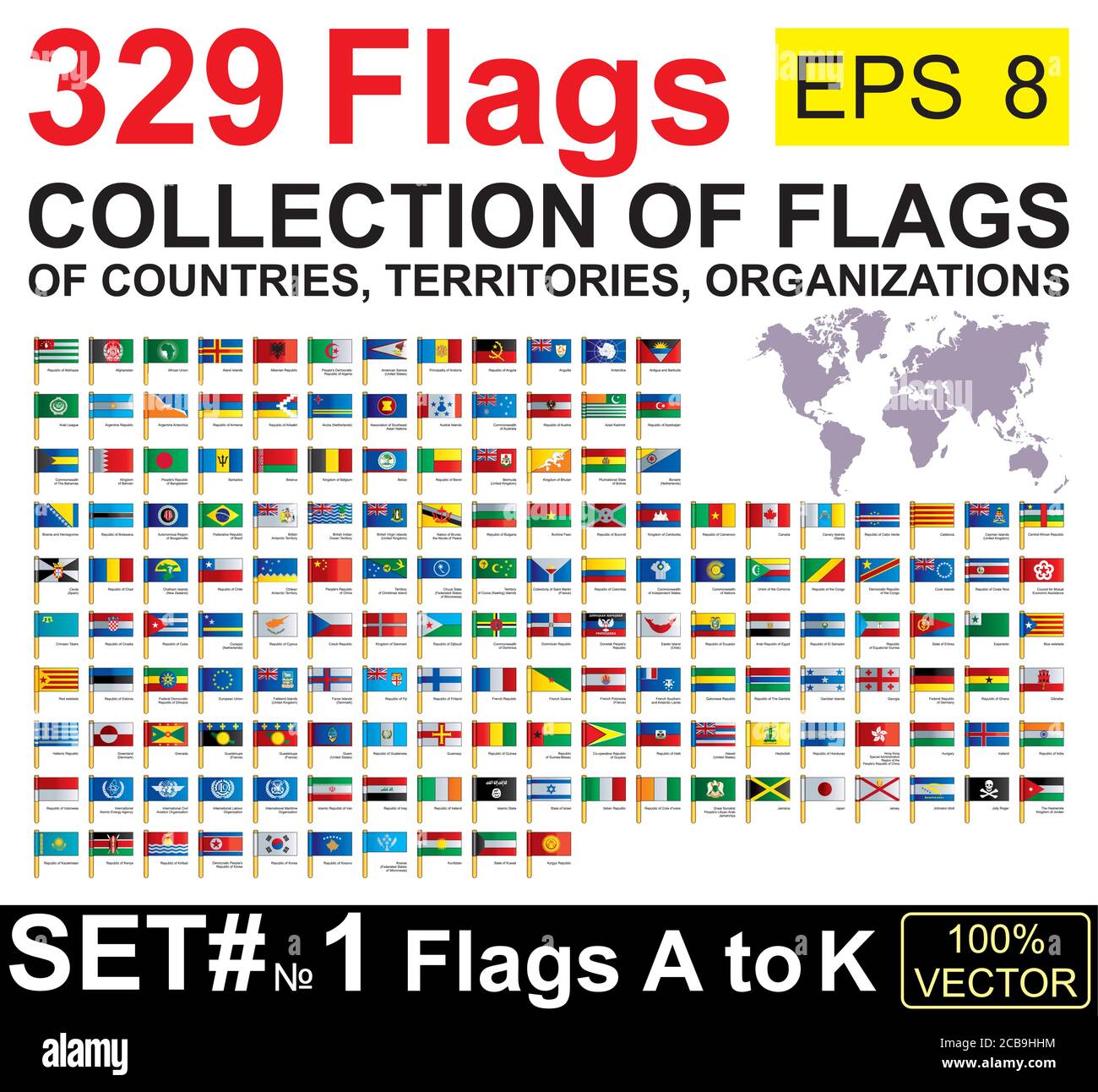 Flags of the world. Collection world Flags of sovereign states, territories and organizations with names. Complete Collection world Flags. Stock Vectorhttps://www.alamy.com/image-license-details/?v=1https://www.alamy.com/flags-of-the-world-collection-world-flags-of-sovereign-states-territories-and-organizations-with-names-complete-collection-world-flags-image368390336.html
RF2CB9HHM–Flags of the world. Collection world Flags of sovereign states, territories and organizations with names. Complete Collection world Flags.
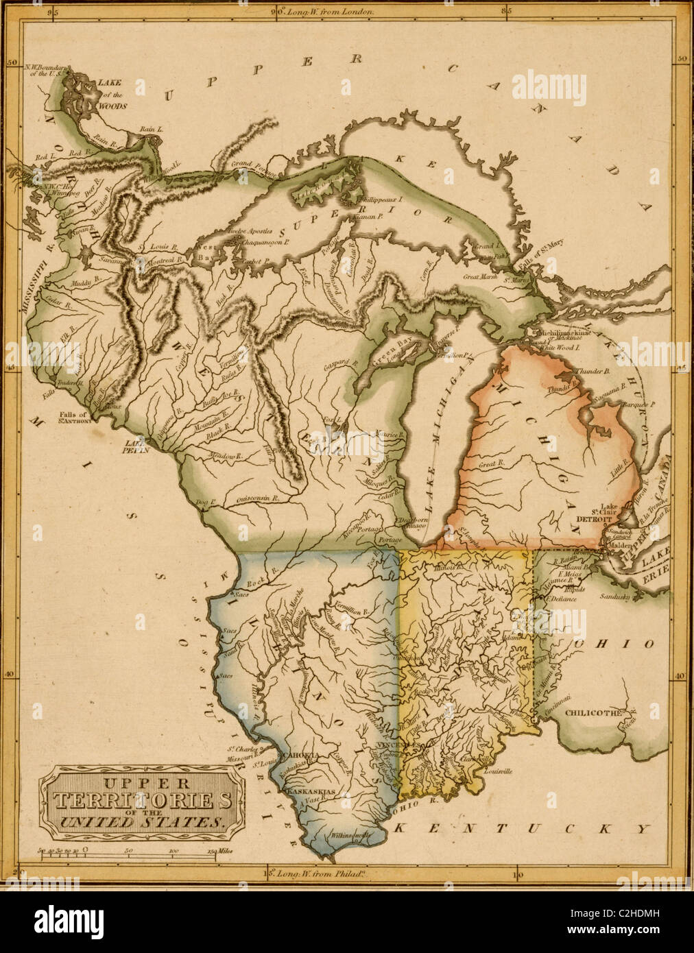 Upper Territories of the United States - 1817 Stock Photohttps://www.alamy.com/image-license-details/?v=1https://www.alamy.com/stock-photo-upper-territories-of-the-united-states-1817-36034001.html
RMC2HDMH–Upper Territories of the United States - 1817
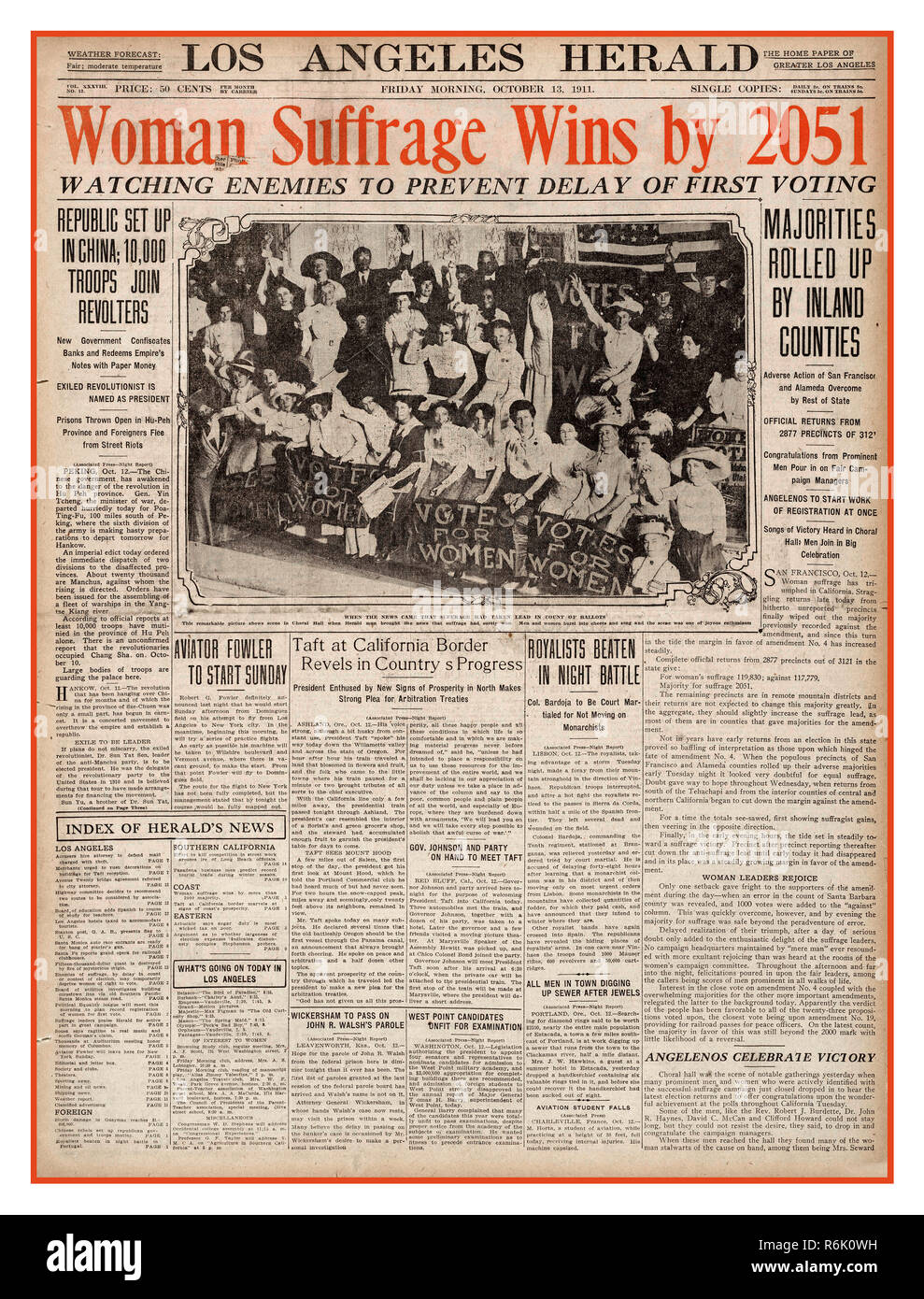 Vintage SUFFRAGE Los Angeles Herald Newspaper Headline. Suffrage USA Western states and territories led the way in granting women the right to vote. The Los Angeles Herald headlined California's vote with a red bannered headline in 1911. WOMAN SUFFRAGE WINS BY 2051 VOTES Stock Photohttps://www.alamy.com/image-license-details/?v=1https://www.alamy.com/vintage-suffrage-los-angeles-herald-newspaper-headline-suffrage-usa-western-states-and-territories-led-the-way-in-granting-women-the-right-to-vote-the-los-angeles-herald-headlined-californias-vote-with-a-red-bannered-headline-in-1911-woman-suffrage-wins-by-2051-votes-image227840525.html
RMR6K0WH–Vintage SUFFRAGE Los Angeles Herald Newspaper Headline. Suffrage USA Western states and territories led the way in granting women the right to vote. The Los Angeles Herald headlined California's vote with a red bannered headline in 1911. WOMAN SUFFRAGE WINS BY 2051 VOTES
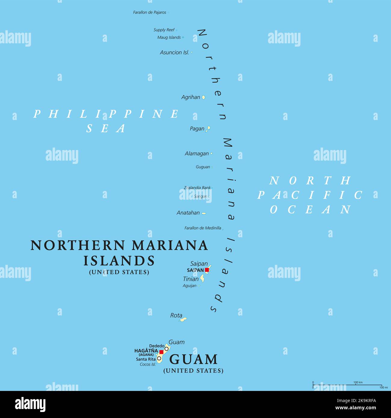 Guam and Northern Mariana Islands, political map. Two separate unincorporated territories of the United States of America in the Micronesia subregion. Stock Photohttps://www.alamy.com/image-license-details/?v=1https://www.alamy.com/guam-and-northern-mariana-islands-political-map-two-separate-unincorporated-territories-of-the-united-states-of-america-in-the-micronesia-subregion-image487857758.html
RF2K9KRFA–Guam and Northern Mariana Islands, political map. Two separate unincorporated territories of the United States of America in the Micronesia subregion.
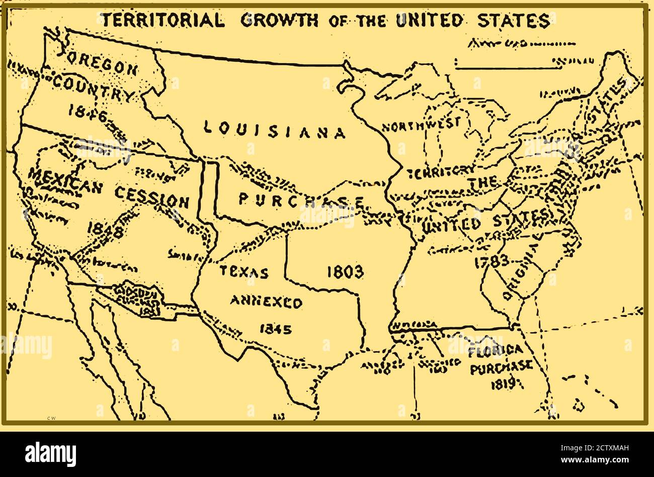 1933 map of the usa showing territorial growth. Stock Photohttps://www.alamy.com/image-license-details/?v=1https://www.alamy.com/1933-map-of-the-usa-showing-territorial-growth-image376756201.html
RM2CTXMAH–1933 map of the usa showing territorial growth.
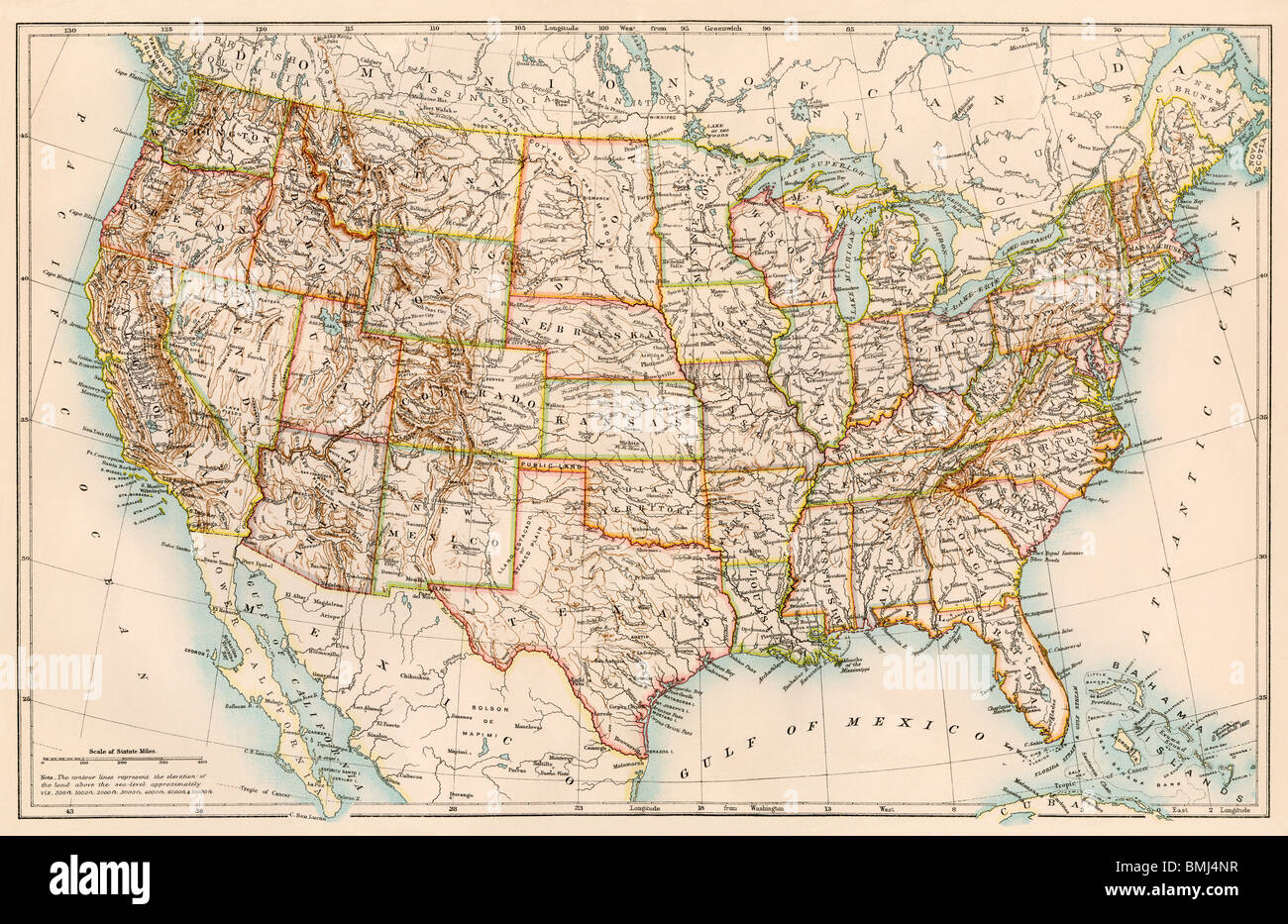 United States map, 1870s. Color lithograph Stock Photohttps://www.alamy.com/image-license-details/?v=1https://www.alamy.com/stock-photo-united-states-map-1870s-color-lithograph-29902371.html
RMBMJ4NR–United States map, 1870s. Color lithograph
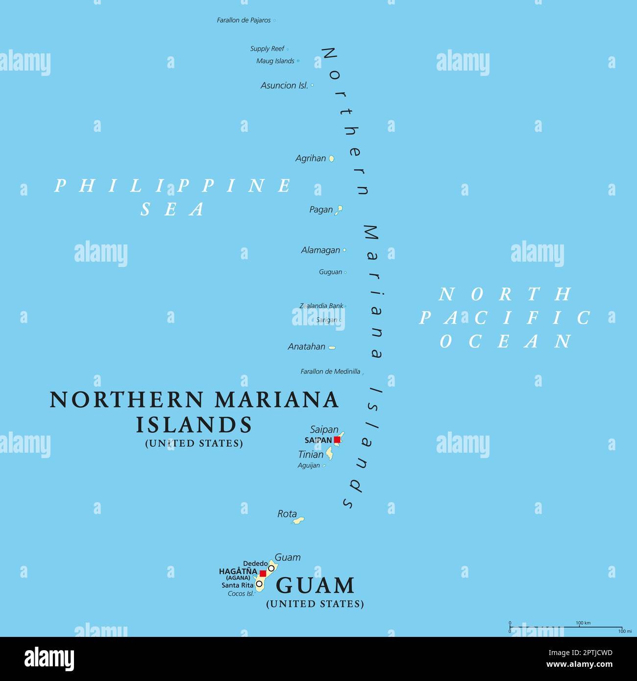 Guam and Northern Mariana Islands, unincorporated US territories, political map Stock Vectorhttps://www.alamy.com/image-license-details/?v=1https://www.alamy.com/guam-and-northern-mariana-islands-unincorporated-us-territories-political-map-image548678409.html
RF2PTJCWD–Guam and Northern Mariana Islands, unincorporated US territories, political map
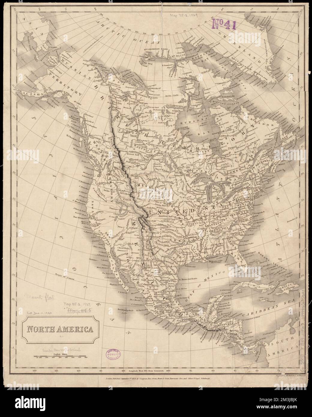 North America , Indians of North America, Maps, North America, Maps, Great Britain, Territories and possessions, Maps, Russia, Territories and possessions, Maps, United States, Territories and possessions, Maps Norman B. Leventhal Map Center Collection Stock Photohttps://www.alamy.com/image-license-details/?v=1https://www.alamy.com/north-america-indians-of-north-america-maps-north-america-maps-great-britain-territories-and-possessions-maps-russia-territories-and-possessions-maps-united-states-territories-and-possessions-maps-norman-b-leventhal-map-center-collection-image501348923.html
RM2M3JBJK–North America , Indians of North America, Maps, North America, Maps, Great Britain, Territories and possessions, Maps, Russia, Territories and possessions, Maps, United States, Territories and possessions, Maps Norman B. Leventhal Map Center Collection
 The official Northern Pacific Railroad guide : for the use of tourists and travelers over the lines of the Northern Pacific Railroad, its branches and allied lines : containing descriptions of states, territories, cities, towns and places along the routes of these allied systems of transportation : and embracing facts relating to the history, resources, population, products and natural features of the great Northwest Stock Photohttps://www.alamy.com/image-license-details/?v=1https://www.alamy.com/stock-photo-the-official-northern-pacific-railroad-guide-for-the-use-of-tourists-176284123.html
RMM6PC5F–The official Northern Pacific Railroad guide : for the use of tourists and travelers over the lines of the Northern Pacific Railroad, its branches and allied lines : containing descriptions of states, territories, cities, towns and places along the routes of these allied systems of transportation : and embracing facts relating to the history, resources, population, products and natural features of the great Northwest
 Okinawa, Japan (Sep. 01, 2022) Marines repel down cliff side during The Jungle Warfare Training Course. NMCB-4 is forward deployed throughout the Indo-Pacific region and United States territories to support and maintain a free and open Indo-Pacific. As the stand in, crisis response, naval engineering force, NMCB-4 maintains a ready posture to deliver in-theater expeditionary logistics via expeditionary shore infrastructure, forward damage repair, and mobile construction. Stock Photohttps://www.alamy.com/image-license-details/?v=1https://www.alamy.com/okinawa-japan-sep-01-2022-marines-repel-down-cliff-side-during-the-jungle-warfare-training-course-nmcb-4-is-forward-deployed-throughout-the-indo-pacific-region-and-united-states-territories-to-support-and-maintain-a-free-and-open-indo-pacific-as-the-stand-in-crisis-response-naval-engineering-force-nmcb-4-maintains-a-ready-posture-to-deliver-in-theater-expeditionary-logistics-via-expeditionary-shore-infrastructure-forward-damage-repair-and-mobile-construction-image510770482.html
RM2MJYGXX–Okinawa, Japan (Sep. 01, 2022) Marines repel down cliff side during The Jungle Warfare Training Course. NMCB-4 is forward deployed throughout the Indo-Pacific region and United States territories to support and maintain a free and open Indo-Pacific. As the stand in, crisis response, naval engineering force, NMCB-4 maintains a ready posture to deliver in-theater expeditionary logistics via expeditionary shore infrastructure, forward damage repair, and mobile construction.
 Okinawa, Japan (Nov. 16, 2022) Marines with Marine Wing Support Squadron 172, 9th Engineer Support Battalion, simulate and repaire a damaged airfield by excavating the grounds on Kadena Air Force Base during excersie Keen Sword 2023. NMCB-4 is forward deployed throughout the Indo-Pacific region and United States territories to support and maintain a free and open Indo-Pacific. As the stand-in, crisis response, naval engineering force, NMCB-4 maintains a ready posture to deliver in-theater expeditionary logistics via expeditionary shore infrastructure, forward damage repair, and mobile construc Stock Photohttps://www.alamy.com/image-license-details/?v=1https://www.alamy.com/okinawa-japan-nov-16-2022-marines-with-marine-wing-support-squadron-172-9th-engineer-support-battalion-simulate-and-repaire-a-damaged-airfield-by-excavating-the-grounds-on-kadena-air-force-base-during-excersie-keen-sword-2023-nmcb-4-is-forward-deployed-throughout-the-indo-pacific-region-and-united-states-territories-to-support-and-maintain-a-free-and-open-indo-pacific-as-the-stand-in-crisis-response-naval-engineering-force-nmcb-4-maintains-a-ready-posture-to-deliver-in-theater-expeditionary-logistics-via-expeditionary-shore-infrastructure-forward-damage-repair-and-mobile-construc-image496084517.html
RM2KR2GT5–Okinawa, Japan (Nov. 16, 2022) Marines with Marine Wing Support Squadron 172, 9th Engineer Support Battalion, simulate and repaire a damaged airfield by excavating the grounds on Kadena Air Force Base during excersie Keen Sword 2023. NMCB-4 is forward deployed throughout the Indo-Pacific region and United States territories to support and maintain a free and open Indo-Pacific. As the stand-in, crisis response, naval engineering force, NMCB-4 maintains a ready posture to deliver in-theater expeditionary logistics via expeditionary shore infrastructure, forward damage repair, and mobile construc
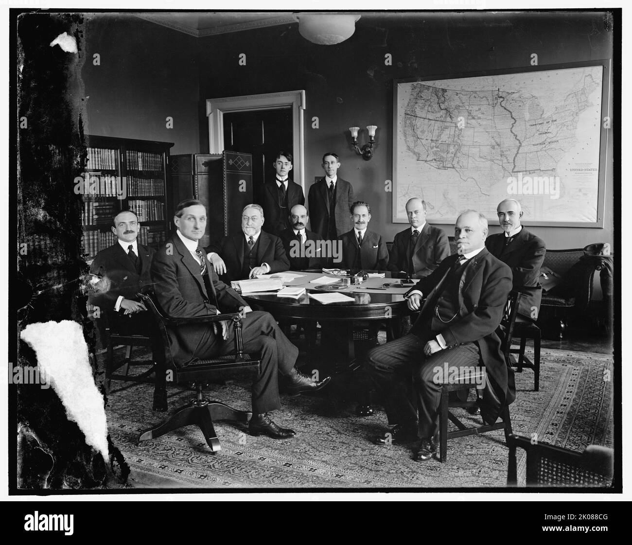 International High Commission, between 1910 and 1920. American lawyer and politician William Gibbs McAdoo Jr. (2nd left) was the husband of Eleanor Wilson McAdoo, (daughter of president Woodrow Wilson). Note map on wall of United States Territories and Insular Possessions, showing 'Original Thirteen States'. Stock Photohttps://www.alamy.com/image-license-details/?v=1https://www.alamy.com/international-high-commission-between-1910-and-1920-american-lawyer-and-politician-william-gibbs-mcadoo-jr-2nd-left-was-the-husband-of-eleanor-wilson-mcadoo-daughter-of-president-woodrow-wilson-note-map-on-wall-of-united-states-territories-and-insular-possessions-showing-original-thirteen-states-image482072544.html
RM2K088CG–International High Commission, between 1910 and 1920. American lawyer and politician William Gibbs McAdoo Jr. (2nd left) was the husband of Eleanor Wilson McAdoo, (daughter of president Woodrow Wilson). Note map on wall of United States Territories and Insular Possessions, showing 'Original Thirteen States'.
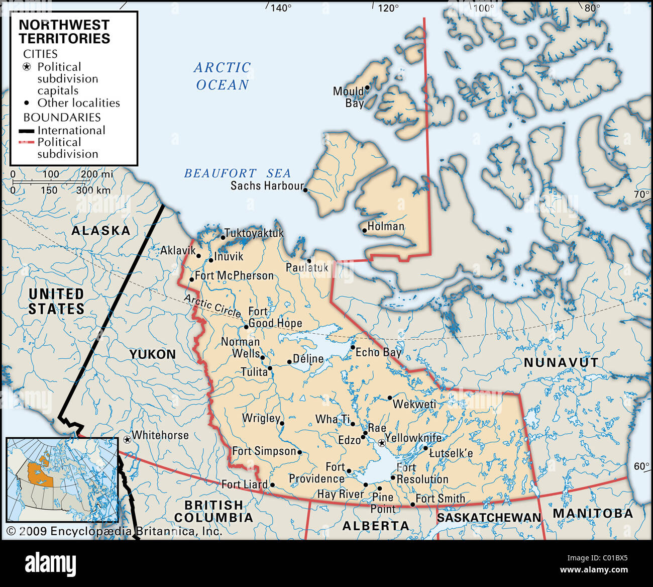 Map of Northwest Territories Stock Photohttps://www.alamy.com/image-license-details/?v=1https://www.alamy.com/stock-photo-map-of-northwest-territories-34452045.html
RMC01BX5–Map of Northwest Territories
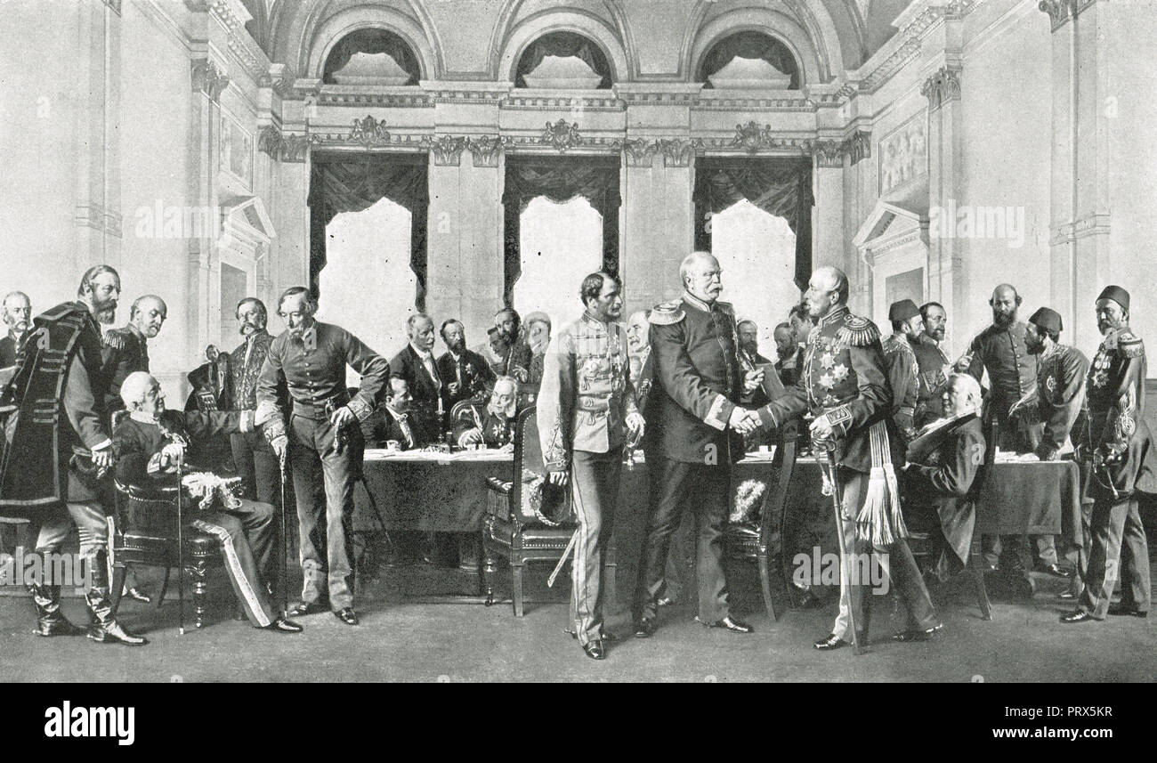 The Congress of Berlin, June 1878 Stock Photohttps://www.alamy.com/image-license-details/?v=1https://www.alamy.com/the-congress-of-berlin-june-1878-image221236731.html
RMPRX5KR–The Congress of Berlin, June 1878
 USA: Constituents of population states & Territories: , 1900 antique map Stock Photohttps://www.alamy.com/image-license-details/?v=1https://www.alamy.com/stock-photo-usa-constituents-of-population-states-territories-1900-antique-map-105657416.html
RFG3W334–USA: Constituents of population states & Territories: , 1900 antique map
 The Great Wall of China a series of fortification systems generally built across the historical northern borders of China to protect and consolidate territories of Chinese states and empires against various nomadic groups of the steppe and their polities. Several walls were being built from as early as the 7th century BC by ancient Chinese states. The most well-known sections of the wall were built by the Ming dynasty (1368?1644). Stock Photohttps://www.alamy.com/image-license-details/?v=1https://www.alamy.com/the-great-wall-of-china-a-series-of-fortification-systems-generally-built-across-the-historical-northern-borders-of-china-to-protect-and-consolidate-territories-of-chinese-states-and-empires-against-various-nomadic-groups-of-the-steppe-and-their-polities-several-walls-were-being-built-from-as-early-as-the-7th-century-bc-by-ancient-chinese-states-the-most-well-known-sections-of-the-wall-were-built-by-the-ming-dynasty-13681644-image634321460.html
RM2YRYRDT–The Great Wall of China a series of fortification systems generally built across the historical northern borders of China to protect and consolidate territories of Chinese states and empires against various nomadic groups of the steppe and their polities. Several walls were being built from as early as the 7th century BC by ancient Chinese states. The most well-known sections of the wall were built by the Ming dynasty (1368?1644).
 Texas, from Flags of the States and Territories (N11) for Allen & Ginter Cigarettes Brands, 1888 Stock Photohttps://www.alamy.com/image-license-details/?v=1https://www.alamy.com/stock-image-texas-from-flags-of-the-states-and-territories-n11-for-allen-ginter-162518123.html
RMKCB9EK–Texas, from Flags of the States and Territories (N11) for Allen & Ginter Cigarettes Brands, 1888
 Art inspired by Washington Territory, from Flags of the States and Territories (N11) for Allen & Ginter Cigarettes Brands, 1888, Commercial color lithograph, Sheet: 2 3/4 x 1 1/2 in. (7 x 3.8 cm), Trade cards from the 'Flags of the States and Territories' series (N11), issued in 1888, Classic works modernized by Artotop with a splash of modernity. Shapes, color and value, eye-catching visual impact on art. Emotions through freedom of artworks in a contemporary way. A timeless message pursuing a wildly creative new direction. Artists turning to the digital medium and creating the Artotop NFT Stock Photohttps://www.alamy.com/image-license-details/?v=1https://www.alamy.com/art-inspired-by-washington-territory-from-flags-of-the-states-and-territories-n11-for-allen-ginter-cigarettes-brands-1888-commercial-color-lithograph-sheet-2-34-x-1-12-in-7-x-38-cm-trade-cards-from-the-flags-of-the-states-and-territories-series-n11-issued-in-1888-classic-works-modernized-by-artotop-with-a-splash-of-modernity-shapes-color-and-value-eye-catching-visual-impact-on-art-emotions-through-freedom-of-artworks-in-a-contemporary-way-a-timeless-message-pursuing-a-wildly-creative-new-direction-artists-turning-to-the-digital-medium-and-creating-the-artotop-nft-image463007620.html
RF2HW7PXC–Art inspired by Washington Territory, from Flags of the States and Territories (N11) for Allen & Ginter Cigarettes Brands, 1888, Commercial color lithograph, Sheet: 2 3/4 x 1 1/2 in. (7 x 3.8 cm), Trade cards from the 'Flags of the States and Territories' series (N11), issued in 1888, Classic works modernized by Artotop with a splash of modernity. Shapes, color and value, eye-catching visual impact on art. Emotions through freedom of artworks in a contemporary way. A timeless message pursuing a wildly creative new direction. Artists turning to the digital medium and creating the Artotop NFT
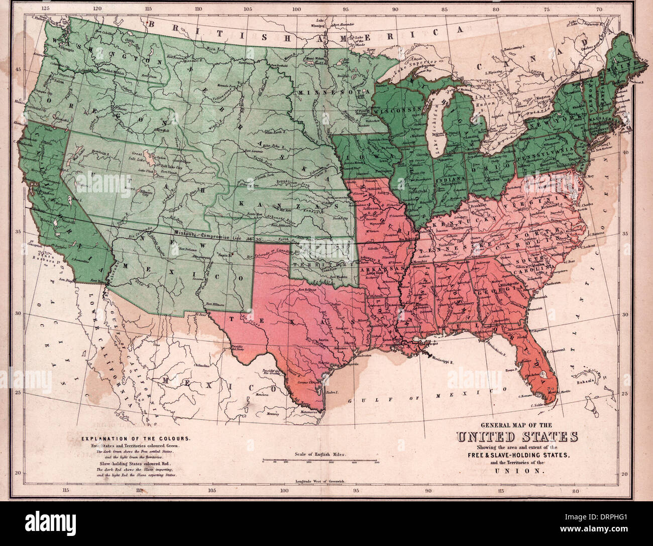 General map of the United States, showing the area and extent of the free & slave-holding states, and the territories of the Union / 1857 Stock Photohttps://www.alamy.com/image-license-details/?v=1https://www.alamy.com/general-map-of-the-united-states-showing-the-area-and-extent-of-the-image66264913.html
RMDRPHG1–General map of the United States, showing the area and extent of the free & slave-holding states, and the territories of the Union / 1857
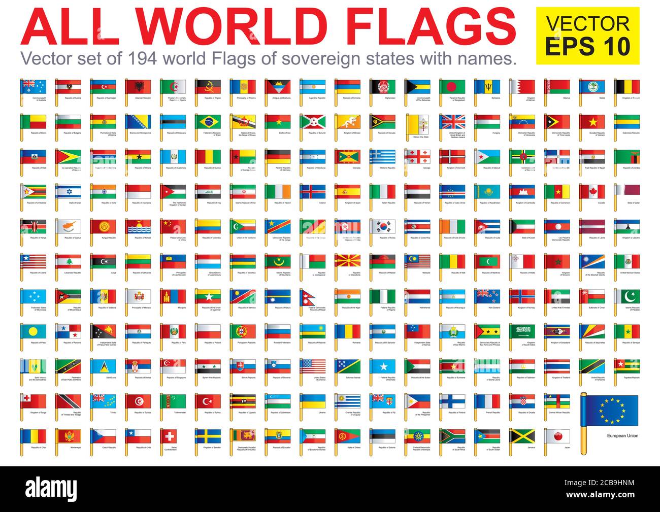 Flags of the world. Collection world Flags of sovereign states, territories and organizations with names. Complete Collection world Flags. Stock Vectorhttps://www.alamy.com/image-license-details/?v=1https://www.alamy.com/flags-of-the-world-collection-world-flags-of-sovereign-states-territories-and-organizations-with-names-complete-collection-world-flags-image368390448.html
RF2CB9HNM–Flags of the world. Collection world Flags of sovereign states, territories and organizations with names. Complete Collection world Flags.
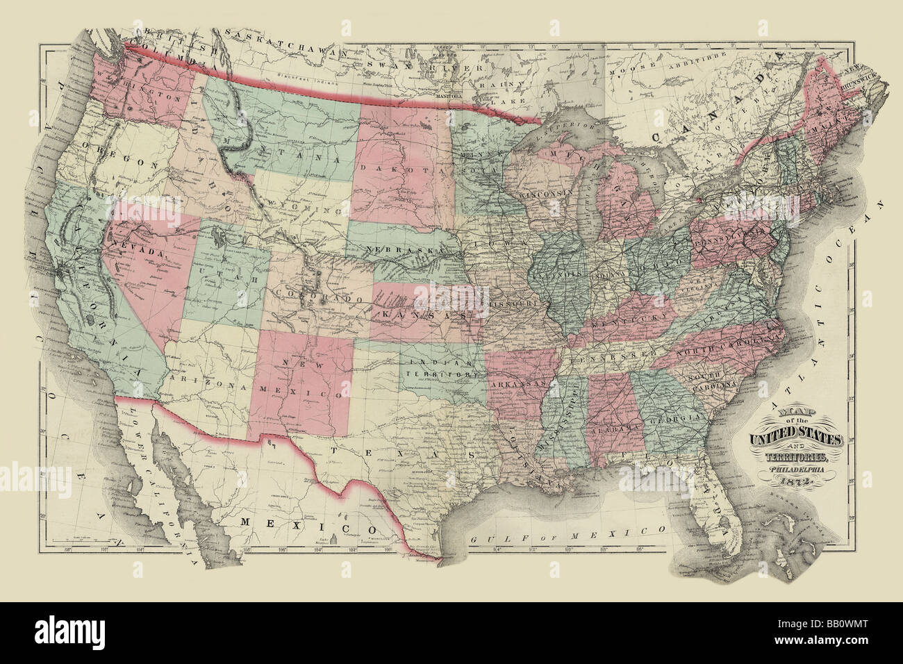 Map of the United States Territories 1872 Stock Photohttps://www.alamy.com/image-license-details/?v=1https://www.alamy.com/stock-photo-map-of-the-united-states-territories-1872-23991768.html
RMBB0WMT–Map of the United States Territories 1872
 November 28, 2022, Washington, District of Columbia, USA: The official White House Christmas Tree, inside the Blue Room, features renderings of the official birds from all states, territories, and the District of Columbia. (Credit Image: © Michael Brochstein/ZUMA Press Wire) Credit: ZUMA Press, Inc./Alamy Live News Stock Photohttps://www.alamy.com/image-license-details/?v=1https://www.alamy.com/november-28-2022-washington-district-of-columbia-usa-the-official-white-house-christmas-tree-inside-the-blue-room-features-renderings-of-the-official-birds-from-all-states-territories-and-the-district-of-columbia-credit-image-michael-brochsteinzuma-press-wire-credit-zuma-press-incalamy-live-news-image496063582.html
RM2KR1J4E–November 28, 2022, Washington, District of Columbia, USA: The official White House Christmas Tree, inside the Blue Room, features renderings of the official birds from all states, territories, and the District of Columbia. (Credit Image: © Michael Brochstein/ZUMA Press Wire) Credit: ZUMA Press, Inc./Alamy Live News
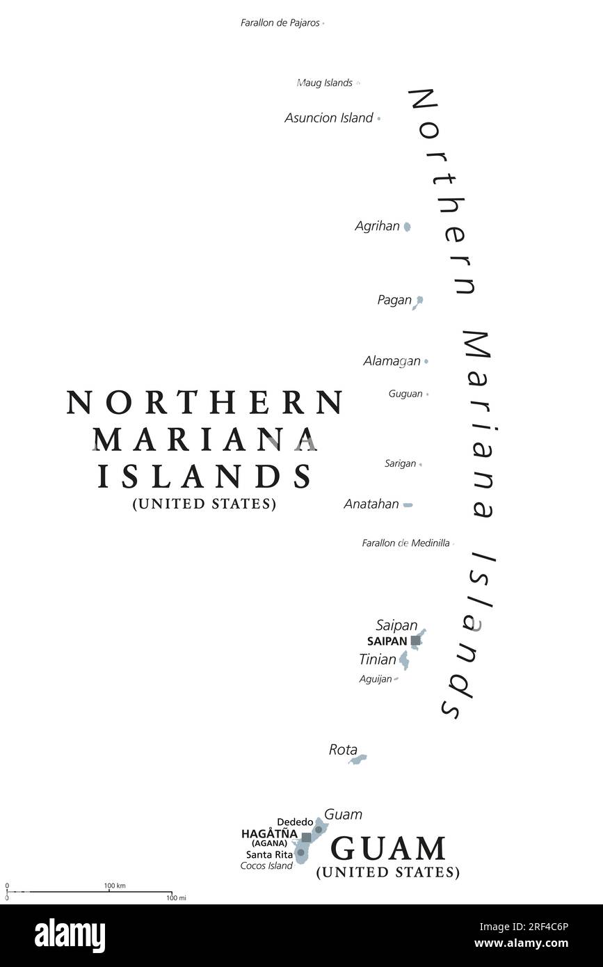 Guam and Northern Mariana Islands, gray political map. Two separate unincorporated territories of the United States in the Micronesia subregion. Stock Photohttps://www.alamy.com/image-license-details/?v=1https://www.alamy.com/guam-and-northern-mariana-islands-gray-political-map-two-separate-unincorporated-territories-of-the-united-states-in-the-micronesia-subregion-image560049022.html
RF2RF4C6P–Guam and Northern Mariana Islands, gray political map. Two separate unincorporated territories of the United States in the Micronesia subregion.
 USA - An original 1890's chart showing the states and territories (including Indian land) in the U S A with statistics for each one including size in square miles, populations in 1880 and 1890 with original states marked with an asterix. Stock Photohttps://www.alamy.com/image-license-details/?v=1https://www.alamy.com/usa-an-original-1890s-chart-showing-the-states-and-territories-including-indian-land-in-the-u-s-a-with-statistics-for-each-one-including-size-in-square-miles-populations-in-1880-and-1890-with-original-states-marked-with-an-asterix-image492866674.html
RM2KHT0D6–USA - An original 1890's chart showing the states and territories (including Indian land) in the U S A with statistics for each one including size in square miles, populations in 1880 and 1890 with original states marked with an asterix.
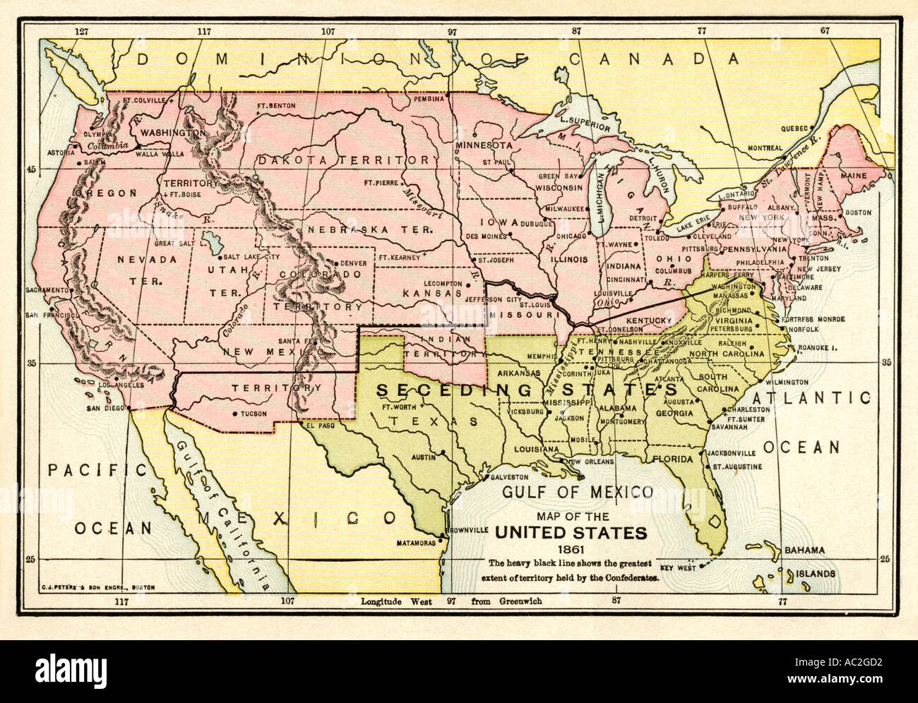 Map of the United States in 1861 at the start of the Civil War. Color lithograph Stock Photohttps://www.alamy.com/image-license-details/?v=1https://www.alamy.com/map-of-the-united-states-in-1861-at-the-start-of-the-civil-war-color-image4249809.html
RMAC2GD2–Map of the United States in 1861 at the start of the Civil War. Color lithograph
 Massachusetts, from Flags of the States and Territories (N11) for Allen & Ginter Cigarettes Brands. Dimensions: Sheet: 2 3/4 x 1 1/2 in. (7 x 3.8 cm). Publisher: Issued by Allen & Ginter (American, Richmond, Virginia). Date: 1888. Trade cards from the 'Flags of the States and Territories' series (N11), issued in 1888 in a set of 47 cards to promote Allen & Ginter brand cigarettes. There are also approximately 100 scroll color variations. The museum's collection contains the full set of 47 cards, as well as 54 scroll color variations and one cutout card. Museum: Metropolitan Museum of Art, New Stock Photohttps://www.alamy.com/image-license-details/?v=1https://www.alamy.com/massachusetts-from-flags-of-the-states-and-territories-n11-for-allen-ginter-cigarettes-brands-dimensions-sheet-2-34-x-1-12-in-7-x-38-cm-publisher-issued-by-allen-ginter-american-richmond-virginia-date-1888-trade-cards-from-the-flags-of-the-states-and-territories-series-n11-issued-in-1888-in-a-set-of-47-cards-to-promote-allen-ginter-brand-cigarettes-there-are-also-approximately-100-scroll-color-variations-the-museums-collection-contains-the-full-set-of-47-cards-as-well-as-54-scroll-color-variations-and-one-cutout-card-museum-metropolitan-museum-of-art-new-image213247505.html
RMPAX7A9–Massachusetts, from Flags of the States and Territories (N11) for Allen & Ginter Cigarettes Brands. Dimensions: Sheet: 2 3/4 x 1 1/2 in. (7 x 3.8 cm). Publisher: Issued by Allen & Ginter (American, Richmond, Virginia). Date: 1888. Trade cards from the 'Flags of the States and Territories' series (N11), issued in 1888 in a set of 47 cards to promote Allen & Ginter brand cigarettes. There are also approximately 100 scroll color variations. The museum's collection contains the full set of 47 cards, as well as 54 scroll color variations and one cutout card. Museum: Metropolitan Museum of Art, New
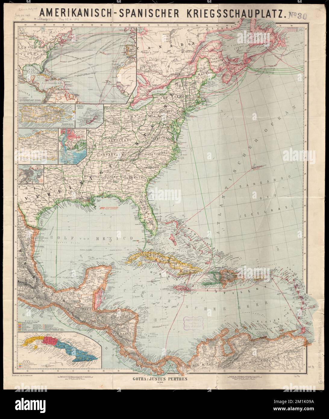 Amerikanisch-Spanischer kriegsschauplatz , Spanish-American War, 1898, Cables, Submarine, North America, Maps, North America, Maps, United States, Territories and possessions, Maps, Spain, Territories and possessions, Maps Norman B. Leventhal Map Center Collection Stock Photohttps://www.alamy.com/image-license-details/?v=1https://www.alamy.com/amerikanisch-spanischer-kriegsschauplatz-spanish-american-war-1898-cables-submarine-north-america-maps-north-america-maps-united-states-territories-and-possessions-maps-spain-territories-and-possessions-maps-norman-b-leventhal-map-center-collection-image500132678.html
RM2M1K09A–Amerikanisch-Spanischer kriegsschauplatz , Spanish-American War, 1898, Cables, Submarine, North America, Maps, North America, Maps, United States, Territories and possessions, Maps, Spain, Territories and possessions, Maps Norman B. Leventhal Map Center Collection
 The official Northern Pacific Railroad guide : for the use of tourists and travelers over the lines of the Northern Pacific Railroad, its branches and allied lines : containing descriptions of states, territories, cities, towns and places along the routes of these allied systems of transportation : and embracing facts relating to the history, resources, population, products and natural features of the great Northwest Stock Photohttps://www.alamy.com/image-license-details/?v=1https://www.alamy.com/stock-photo-the-official-northern-pacific-railroad-guide-for-the-use-of-tourists-176284149.html
RMM6PC6D–The official Northern Pacific Railroad guide : for the use of tourists and travelers over the lines of the Northern Pacific Railroad, its branches and allied lines : containing descriptions of states, territories, cities, towns and places along the routes of these allied systems of transportation : and embracing facts relating to the history, resources, population, products and natural features of the great Northwest
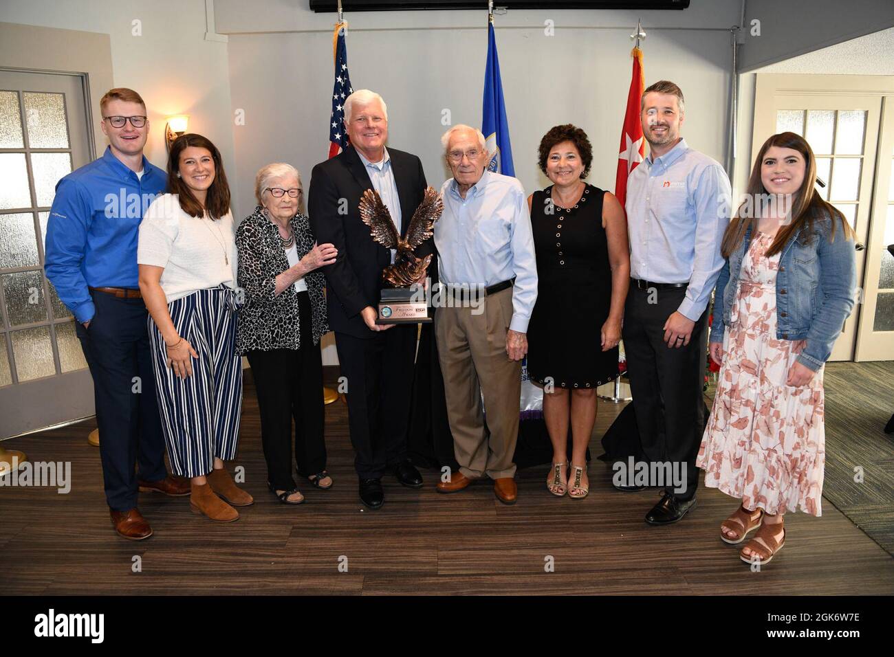 Community members, leaders, members of the Minnesota Committee for Employer Support of the Guard and Reserve (ESGR) and Minnesota National Guard gather August 18, 2021 in Willmar, Minnesota to celebrate Minnesota's Marcus Construction for receiving the Secretary of Defense’s Employer Support Freedom Award for its outstanding support shown as an employer of members of the National Guard. This award was one of only 15 given to employers across the 54 states, territories and the District of Columbia in 2021. “I am proud to salute the outstanding employers who have earned the distinction of bei Stock Photohttps://www.alamy.com/image-license-details/?v=1https://www.alamy.com/community-members-leaders-members-of-the-minnesota-committee-for-employer-support-of-the-guard-and-reserve-esgr-and-minnesota-national-guard-gather-august-18-2021-in-willmar-minnesota-to-celebrate-minnesotas-marcus-construction-for-receiving-the-secretary-of-defenses-employer-support-freedom-award-for-its-outstanding-support-shown-as-an-employer-of-members-of-the-national-guard-this-award-was-one-of-only-15-given-to-employers-across-the-54-states-territories-and-the-district-of-columbia-in-2021-i-am-proud-to-salute-the-outstanding-employers-who-have-earned-the-distinction-of-bei-image442089186.html
RM2GK6W7E–Community members, leaders, members of the Minnesota Committee for Employer Support of the Guard and Reserve (ESGR) and Minnesota National Guard gather August 18, 2021 in Willmar, Minnesota to celebrate Minnesota's Marcus Construction for receiving the Secretary of Defense’s Employer Support Freedom Award for its outstanding support shown as an employer of members of the National Guard. This award was one of only 15 given to employers across the 54 states, territories and the District of Columbia in 2021. “I am proud to salute the outstanding employers who have earned the distinction of bei
 Okinawa, Japan (Nov. 16, 2022) Marines with Marine Wing Support Squadron 172 and 9th Engineer Support Battalion, breaks ground on the joint service Airfield Damage Repair (ADR) exercise on Kadena Air Force Base. NMCB-4 is forward deployed throughout the Indo-Pacific region and United States territories to support and maintain a free and open Indo-Pacific. As the stand-in, crisis response, naval engineering force, NMCB-4 maintains a ready posture to deliver in-theater expeditionary logistics via expeditionary shore infrastructure, forward damage repair, and mobile construction. (U.S. Navy photo Stock Photohttps://www.alamy.com/image-license-details/?v=1https://www.alamy.com/okinawa-japan-nov-16-2022-marines-with-marine-wing-support-squadron-172-and-9th-engineer-support-battalion-breaks-ground-on-the-joint-service-airfield-damage-repair-adr-exercise-on-kadena-air-force-base-nmcb-4-is-forward-deployed-throughout-the-indo-pacific-region-and-united-states-territories-to-support-and-maintain-a-free-and-open-indo-pacific-as-the-stand-in-crisis-response-naval-engineering-force-nmcb-4-maintains-a-ready-posture-to-deliver-in-theater-expeditionary-logistics-via-expeditionary-shore-infrastructure-forward-damage-repair-and-mobile-construction-us-navy-photo-image496084534.html
RM2KR2GTP–Okinawa, Japan (Nov. 16, 2022) Marines with Marine Wing Support Squadron 172 and 9th Engineer Support Battalion, breaks ground on the joint service Airfield Damage Repair (ADR) exercise on Kadena Air Force Base. NMCB-4 is forward deployed throughout the Indo-Pacific region and United States territories to support and maintain a free and open Indo-Pacific. As the stand-in, crisis response, naval engineering force, NMCB-4 maintains a ready posture to deliver in-theater expeditionary logistics via expeditionary shore infrastructure, forward damage repair, and mobile construction. (U.S. Navy photo
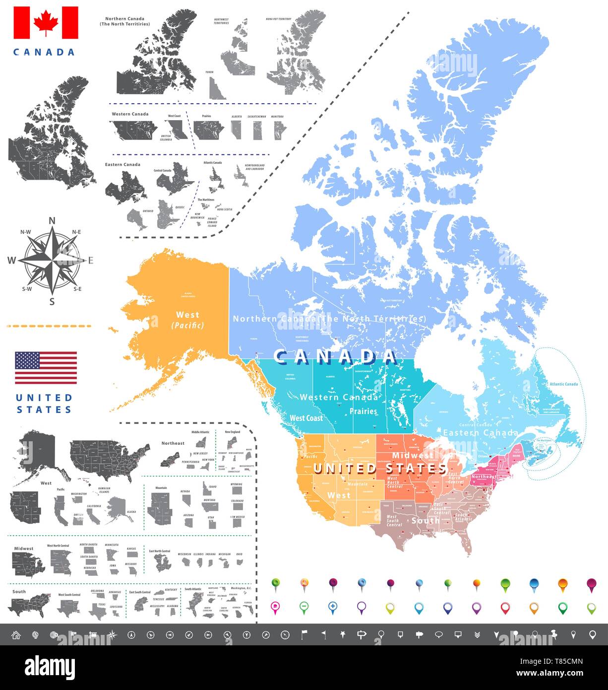 United States census bureau regions ans divisions map; Canadian regions, provinces and territories map. Stock Vectorhttps://www.alamy.com/image-license-details/?v=1https://www.alamy.com/united-states-census-bureau-regions-ans-divisions-map-canadian-regions-provinces-and-territories-map-image245982149.html
RFT85CMN–United States census bureau regions ans divisions map; Canadian regions, provinces and territories map.
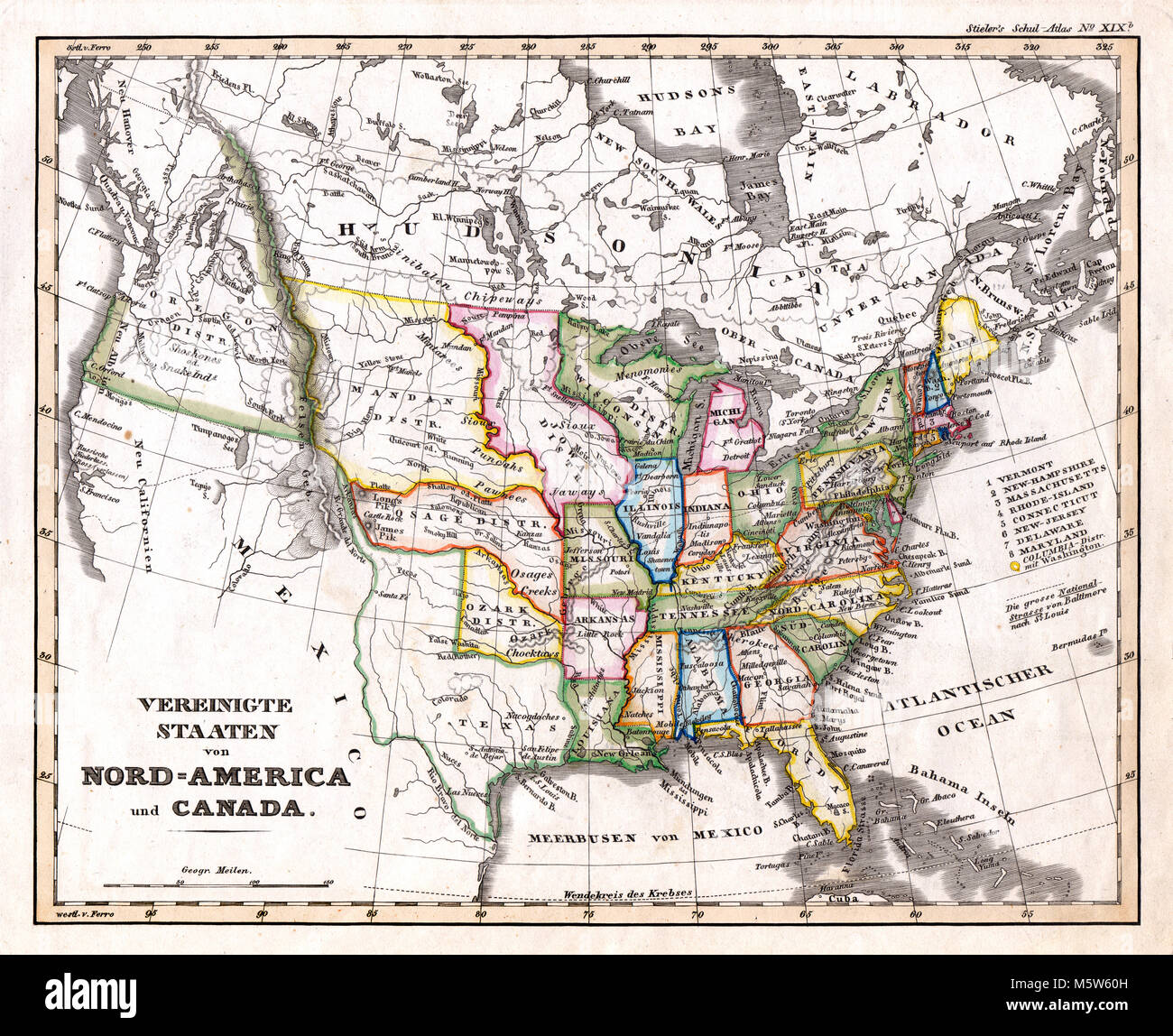 1844 Stieler Map - United States & Western Territories Stock Photohttps://www.alamy.com/image-license-details/?v=1https://www.alamy.com/stock-photo-1844-stieler-map-united-states-western-territories-175730481.html
RFM5W60H–1844 Stieler Map - United States & Western Territories
 Map of Spanish losses in America, showing the disappearance of Spanish rule, and the growth of the United States in the 19th Century Stock Photohttps://www.alamy.com/image-license-details/?v=1https://www.alamy.com/map-of-spanish-losses-in-america-showing-the-disappearance-of-spanish-rule-and-the-growth-of-the-united-states-in-the-19th-century-image216790714.html
RMPGKJNE–Map of Spanish losses in America, showing the disappearance of Spanish rule, and the growth of the United States in the 19th Century
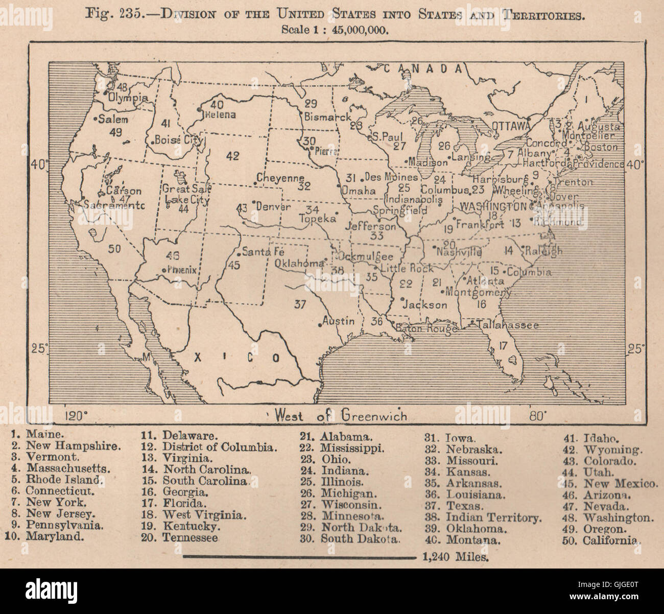 Division of the United States into States and Territories. USA, 1885 old map Stock Photohttps://www.alamy.com/image-license-details/?v=1https://www.alamy.com/stock-photo-division-of-the-united-states-into-states-and-territories-usa-1885-114688248.html
RFGJGE0T–Division of the United States into States and Territories. USA, 1885 old map
 The Great Wall of China a series of fortification systems generally built across the historical northern borders of China to protect and consolidate territories of Chinese states and empires against various nomadic groups of the steppe and their polities. Several walls were being built from as early as the 7th century BC by ancient Chinese states. The most well-known sections of the wall were built by the Ming dynasty (1368?1644). Stock Photohttps://www.alamy.com/image-license-details/?v=1https://www.alamy.com/the-great-wall-of-china-a-series-of-fortification-systems-generally-built-across-the-historical-northern-borders-of-china-to-protect-and-consolidate-territories-of-chinese-states-and-empires-against-various-nomadic-groups-of-the-steppe-and-their-polities-several-walls-were-being-built-from-as-early-as-the-7th-century-bc-by-ancient-chinese-states-the-most-well-known-sections-of-the-wall-were-built-by-the-ming-dynasty-13681644-image634321445.html
RM2YRYRD9–The Great Wall of China a series of fortification systems generally built across the historical northern borders of China to protect and consolidate territories of Chinese states and empires against various nomadic groups of the steppe and their polities. Several walls were being built from as early as the 7th century BC by ancient Chinese states. The most well-known sections of the wall were built by the Ming dynasty (1368?1644).
 Colorado, from Flags of the States and Territories (N11) for Allen & Ginter Cigarettes Brands, 1888 Stock Photohttps://www.alamy.com/image-license-details/?v=1https://www.alamy.com/stock-image-colorado-from-flags-of-the-states-and-territories-n11-for-allen-ginter-162517994.html
RMKCB9A2–Colorado, from Flags of the States and Territories (N11) for Allen & Ginter Cigarettes Brands, 1888
 Art inspired by Washington Territory, from Flags of the States and Territories (N11) for Allen & Ginter Cigarettes Brands, 1888, Commercial color lithograph, Sheet: 2 3/4 x 1 1/2 in. (7 x 3.8 cm), Trade cards from the 'Flags of the States and Territories' series (N11), issued in 1888, Classic works modernized by Artotop with a splash of modernity. Shapes, color and value, eye-catching visual impact on art. Emotions through freedom of artworks in a contemporary way. A timeless message pursuing a wildly creative new direction. Artists turning to the digital medium and creating the Artotop NFT Stock Photohttps://www.alamy.com/image-license-details/?v=1https://www.alamy.com/art-inspired-by-washington-territory-from-flags-of-the-states-and-territories-n11-for-allen-ginter-cigarettes-brands-1888-commercial-color-lithograph-sheet-2-34-x-1-12-in-7-x-38-cm-trade-cards-from-the-flags-of-the-states-and-territories-series-n11-issued-in-1888-classic-works-modernized-by-artotop-with-a-splash-of-modernity-shapes-color-and-value-eye-catching-visual-impact-on-art-emotions-through-freedom-of-artworks-in-a-contemporary-way-a-timeless-message-pursuing-a-wildly-creative-new-direction-artists-turning-to-the-digital-medium-and-creating-the-artotop-nft-image463007619.html
RF2HW7PXB–Art inspired by Washington Territory, from Flags of the States and Territories (N11) for Allen & Ginter Cigarettes Brands, 1888, Commercial color lithograph, Sheet: 2 3/4 x 1 1/2 in. (7 x 3.8 cm), Trade cards from the 'Flags of the States and Territories' series (N11), issued in 1888, Classic works modernized by Artotop with a splash of modernity. Shapes, color and value, eye-catching visual impact on art. Emotions through freedom of artworks in a contemporary way. A timeless message pursuing a wildly creative new direction. Artists turning to the digital medium and creating the Artotop NFT
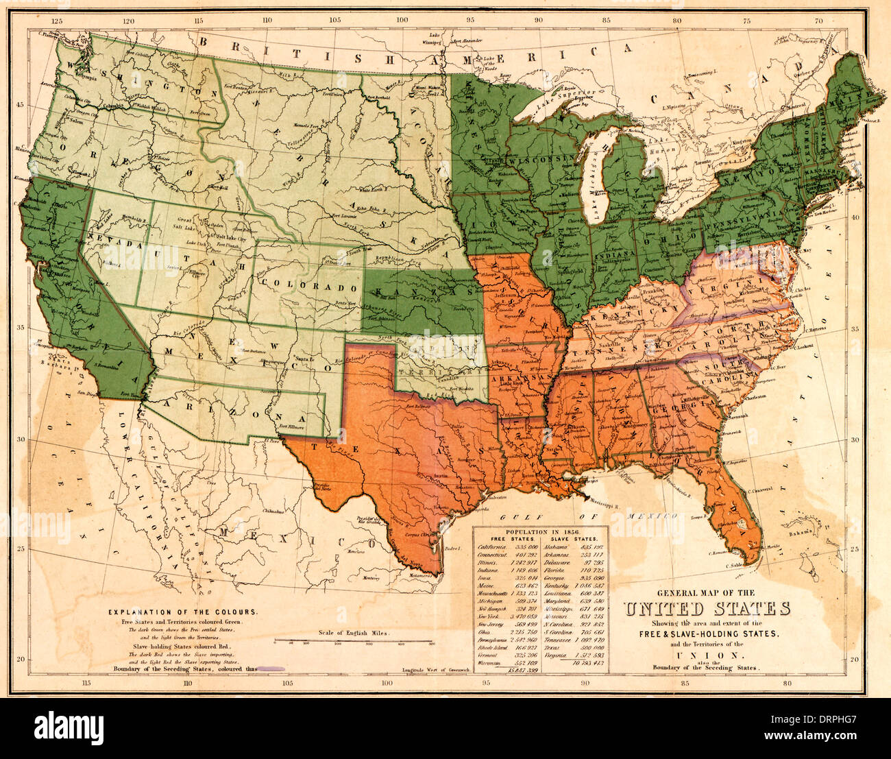 General map of the United States, showing the area and extent of the free & slave-holding states, and the territories of the Union : also the boundary of the seceding states 1861 Stock Photohttps://www.alamy.com/image-license-details/?v=1https://www.alamy.com/general-map-of-the-united-states-showing-the-area-and-extent-of-the-image66264919.html
RMDRPHG7–General map of the United States, showing the area and extent of the free & slave-holding states, and the territories of the Union : also the boundary of the seceding states 1861
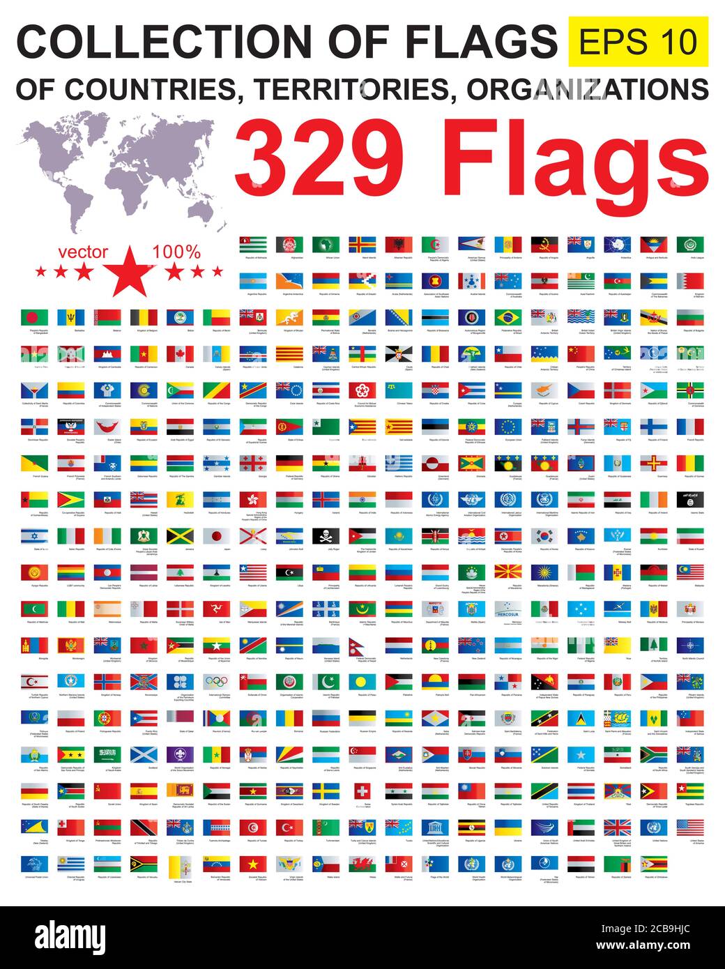 Flags of the world. Collection world Flags of sovereign states, territories and organizations with names. Complete Collection world Flags. Stock Vectorhttps://www.alamy.com/image-license-details/?v=1https://www.alamy.com/flags-of-the-world-collection-world-flags-of-sovereign-states-territories-and-organizations-with-names-complete-collection-world-flags-image368390356.html
RF2CB9HJC–Flags of the world. Collection world Flags of sovereign states, territories and organizations with names. Complete Collection world Flags.
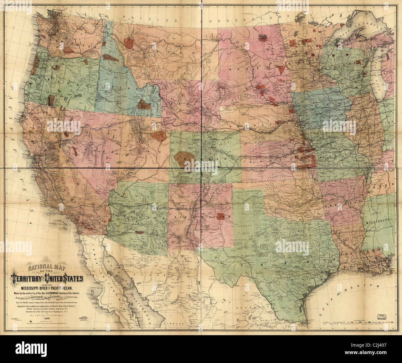 National Map of the Territories of the United States - 1867 Stock Photohttps://www.alamy.com/image-license-details/?v=1https://www.alamy.com/stock-photo-national-map-of-the-territories-of-the-united-states-1867-36048327.html
RMC2J407–National Map of the Territories of the United States - 1867
 November 28, 2022, Washington, District of Columbia, USA: The official White House Christmas Tree, inside the Blue Room, features renderings of the official birds from all states, territories, and the District of Columbia. (Credit Image: © Michael Brochstein/ZUMA Press Wire) Credit: ZUMA Press, Inc./Alamy Live News Stock Photohttps://www.alamy.com/image-license-details/?v=1https://www.alamy.com/november-28-2022-washington-district-of-columbia-usa-the-official-white-house-christmas-tree-inside-the-blue-room-features-renderings-of-the-official-birds-from-all-states-territories-and-the-district-of-columbia-credit-image-michael-brochsteinzuma-press-wire-credit-zuma-press-incalamy-live-news-image496064059.html
RM2KR1JNF–November 28, 2022, Washington, District of Columbia, USA: The official White House Christmas Tree, inside the Blue Room, features renderings of the official birds from all states, territories, and the District of Columbia. (Credit Image: © Michael Brochstein/ZUMA Press Wire) Credit: ZUMA Press, Inc./Alamy Live News
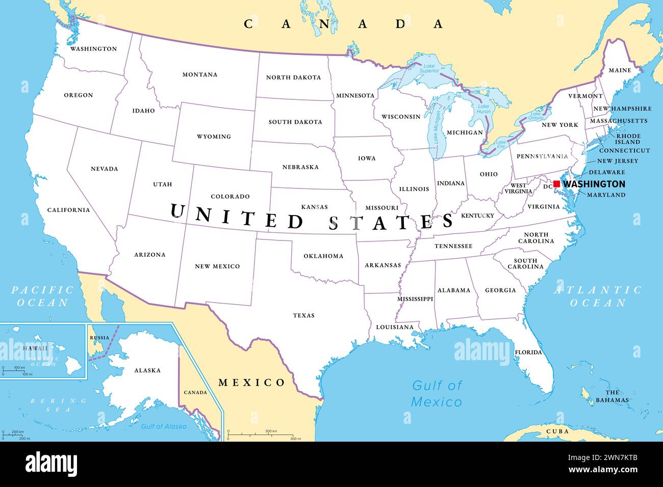 United States of America, political map. Fifty single states with their own geographic territories and borders, bound together in a union. Stock Photohttps://www.alamy.com/image-license-details/?v=1https://www.alamy.com/united-states-of-america-political-map-fifty-single-states-with-their-own-geographic-territories-and-borders-bound-together-in-a-union-image598229531.html
RF2WN7KTB–United States of America, political map. Fifty single states with their own geographic territories and borders, bound together in a union.
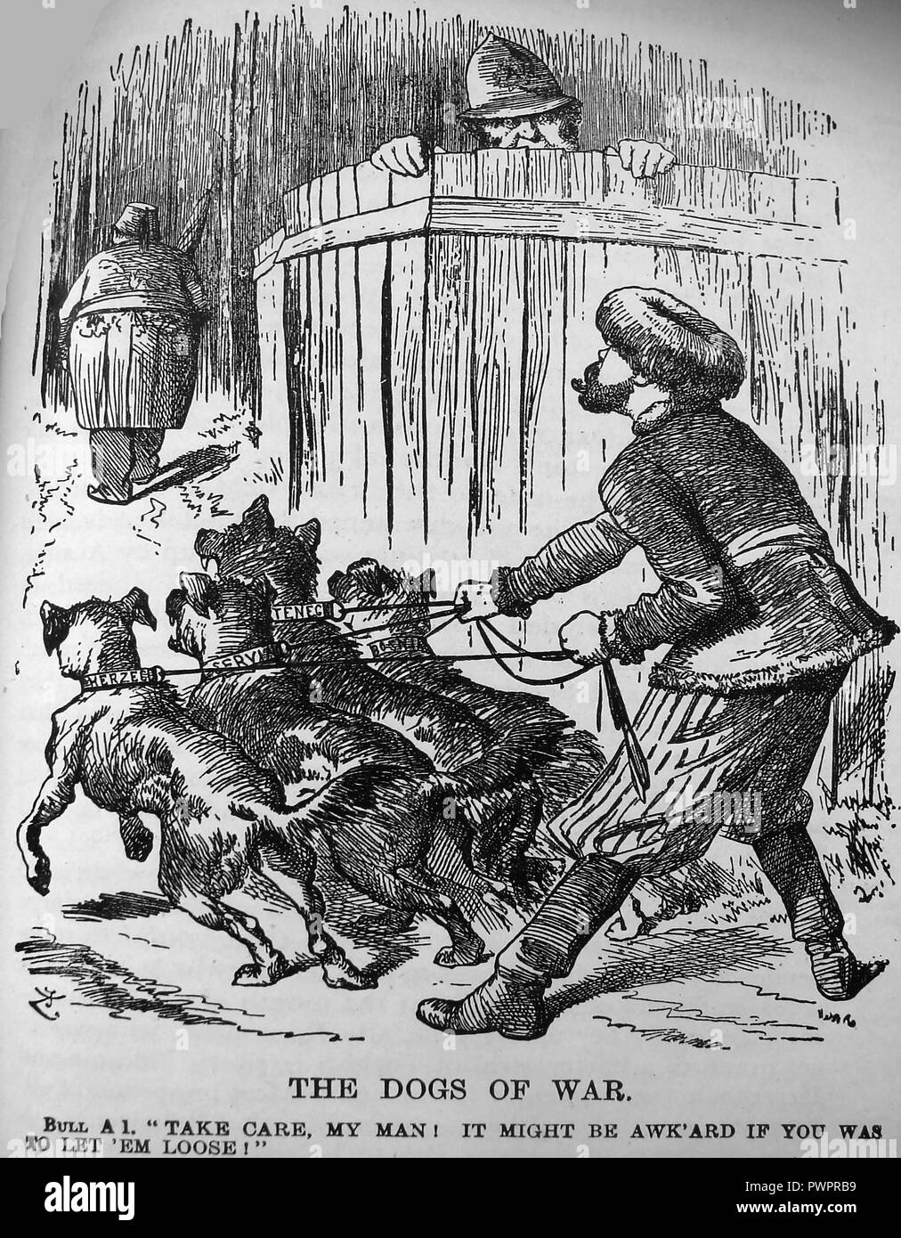 An early political cartoon - Dogs of war -Russia's anxiety to control Balkan States and 'John Bull' on the fence advising of Britain's anxiety to preserve Turkey Stock Photohttps://www.alamy.com/image-license-details/?v=1https://www.alamy.com/an-early-political-cartoon-dogs-of-war-russias-anxiety-to-control-balkan-states-and-john-bull-on-the-fence-advising-of-britains-anxiety-to-preserve-turkey-image222392109.html
RMPWPRB9–An early political cartoon - Dogs of war -Russia's anxiety to control Balkan States and 'John Bull' on the fence advising of Britain's anxiety to preserve Turkey
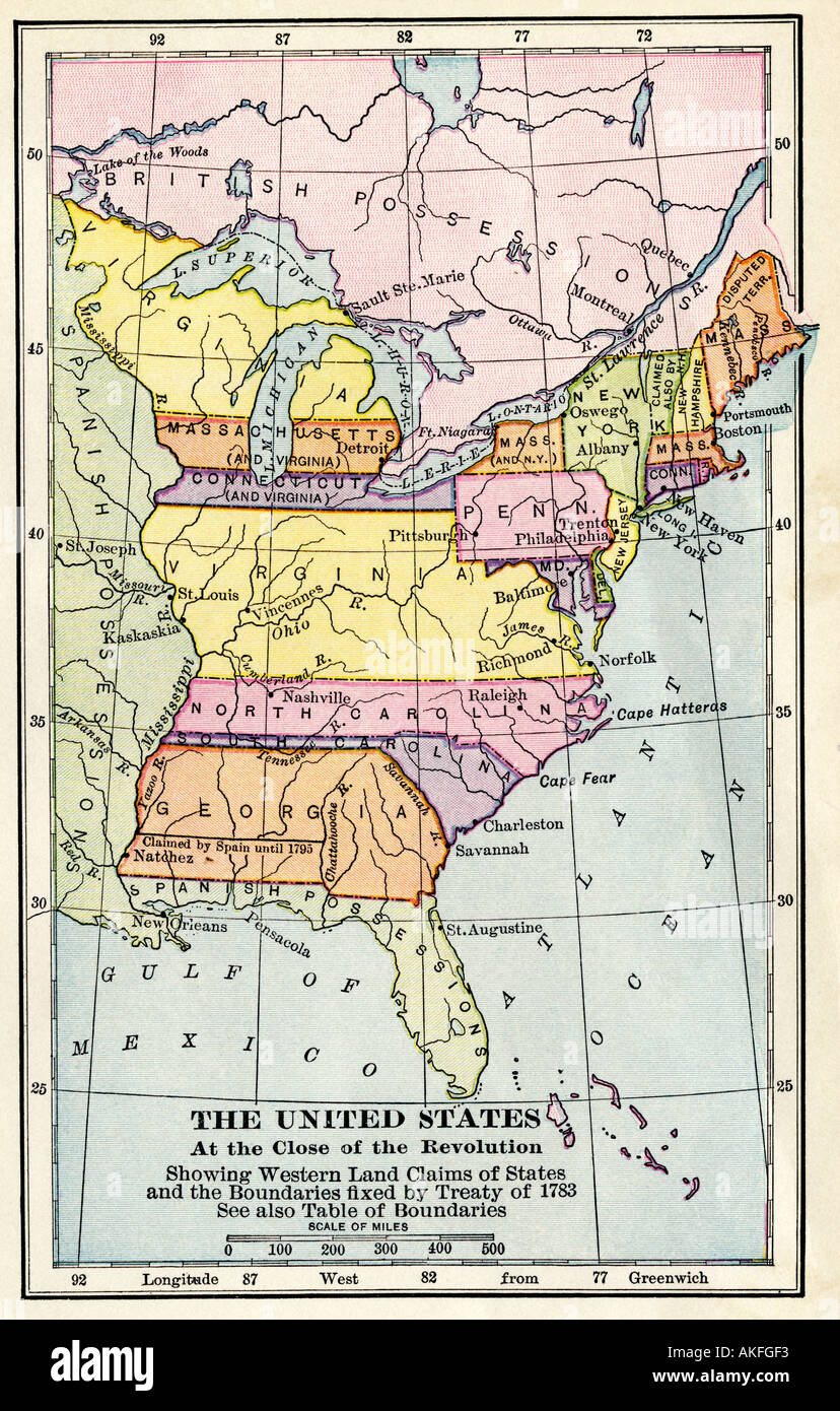 Map of the United States at the close of the American Revolution 1783. Color lithograph Stock Photohttps://www.alamy.com/image-license-details/?v=1https://www.alamy.com/map-of-the-united-states-at-the-close-of-the-american-revolution-1783-image4891890.html
RMAKFGF3–Map of the United States at the close of the American Revolution 1783. Color lithograph
 Pennsylvania, from Flags of the States and Territories (N11) for Allen & Ginter Cigarettes Brands. Dimensions: Sheet: 2 3/4 x 1 1/2 in. (7 x 3.8 cm). Publisher: Issued by Allen & Ginter (American, Richmond, Virginia). Date: 1888. Trade cards from the 'Flags of the States and Territories' series (N11), issued in 1888 in a set of 47 cards to promote Allen & Ginter brand cigarettes. There are also approximately 100 scroll color variations. The museum's collection contains the full set of 47 cards, as well as 54 scroll color variations and one cutout card. Museum: Metropolitan Museum of Art, New Stock Photohttps://www.alamy.com/image-license-details/?v=1https://www.alamy.com/pennsylvania-from-flags-of-the-states-and-territories-n11-for-allen-ginter-cigarettes-brands-dimensions-sheet-2-34-x-1-12-in-7-x-38-cm-publisher-issued-by-allen-ginter-american-richmond-virginia-date-1888-trade-cards-from-the-flags-of-the-states-and-territories-series-n11-issued-in-1888-in-a-set-of-47-cards-to-promote-allen-ginter-brand-cigarettes-there-are-also-approximately-100-scroll-color-variations-the-museums-collection-contains-the-full-set-of-47-cards-as-well-as-54-scroll-color-variations-and-one-cutout-card-museum-metropolitan-museum-of-art-new-image213144564.html
RMPANG1T–Pennsylvania, from Flags of the States and Territories (N11) for Allen & Ginter Cigarettes Brands. Dimensions: Sheet: 2 3/4 x 1 1/2 in. (7 x 3.8 cm). Publisher: Issued by Allen & Ginter (American, Richmond, Virginia). Date: 1888. Trade cards from the 'Flags of the States and Territories' series (N11), issued in 1888 in a set of 47 cards to promote Allen & Ginter brand cigarettes. There are also approximately 100 scroll color variations. The museum's collection contains the full set of 47 cards, as well as 54 scroll color variations and one cutout card. Museum: Metropolitan Museum of Art, New
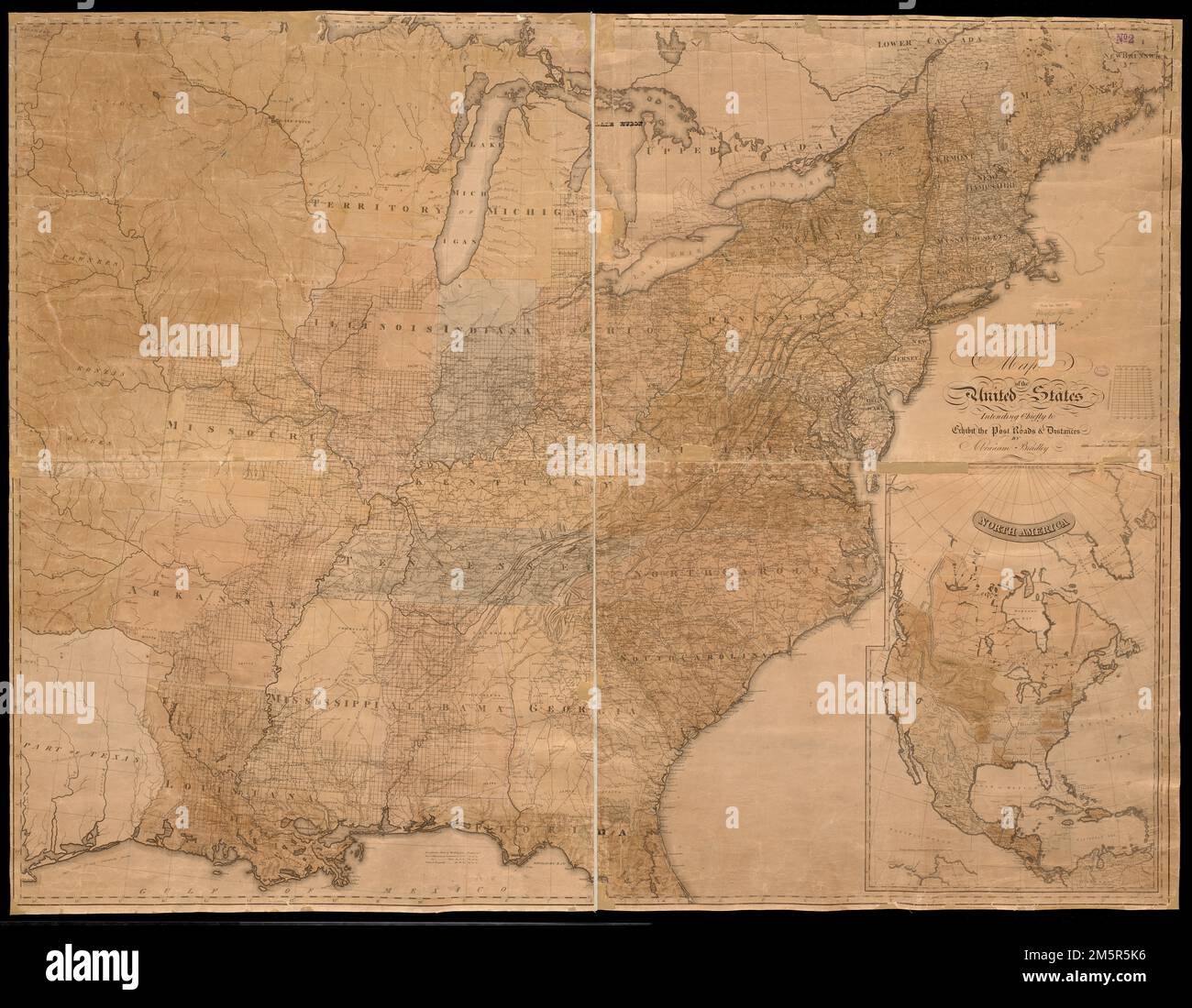 Map of the United States : intending chiefly to exhibit the post roads & distances. Relief shown by hachures. Prime meridian: Washington D.C. Includes inset of North America showing states, territories, and capitals. Map shows the U.S. ca. 1823, showing Copiah Co., Ala (1823) and not Simpson Co., Ala. (1824). Inset shows North America between 1828 and 1836, showing Arkansas (1828) and not Wisconsin Territory (1836).... , North America ,area United States Stock Photohttps://www.alamy.com/image-license-details/?v=1https://www.alamy.com/map-of-the-united-states-intending-chiefly-to-exhibit-the-post-roads-distances-relief-shown-by-hachures-prime-meridian-washington-dc-includes-inset-of-north-america-showing-states-territories-and-capitals-map-shows-the-us-ca-1823-showing-copiah-co-ala-1823-and-not-simpson-co-ala-1824-inset-shows-north-america-between-1828-and-1836-showing-arkansas-1828-and-not-wisconsin-territory-1836-north-america-area-united-states-image502683306.html
RM2M5R5K6–Map of the United States : intending chiefly to exhibit the post roads & distances. Relief shown by hachures. Prime meridian: Washington D.C. Includes inset of North America showing states, territories, and capitals. Map shows the U.S. ca. 1823, showing Copiah Co., Ala (1823) and not Simpson Co., Ala. (1824). Inset shows North America between 1828 and 1836, showing Arkansas (1828) and not Wisconsin Territory (1836).... , North America ,area United States
 The official Northern Pacific Railroad guide : for the use of tourists and travelers over the lines of the Northern Pacific Railroad, its branches and allied lines : containing descriptions of states, territories, cities, towns and places along the routes of these allied systems of transportation : and embracing facts relating to the history, resources, population, products and natural features of the great Northwest Stock Photohttps://www.alamy.com/image-license-details/?v=1https://www.alamy.com/stock-photo-the-official-northern-pacific-railroad-guide-for-the-use-of-tourists-176284343.html
RMM6PCDB–The official Northern Pacific Railroad guide : for the use of tourists and travelers over the lines of the Northern Pacific Railroad, its branches and allied lines : containing descriptions of states, territories, cities, towns and places along the routes of these allied systems of transportation : and embracing facts relating to the history, resources, population, products and natural features of the great Northwest
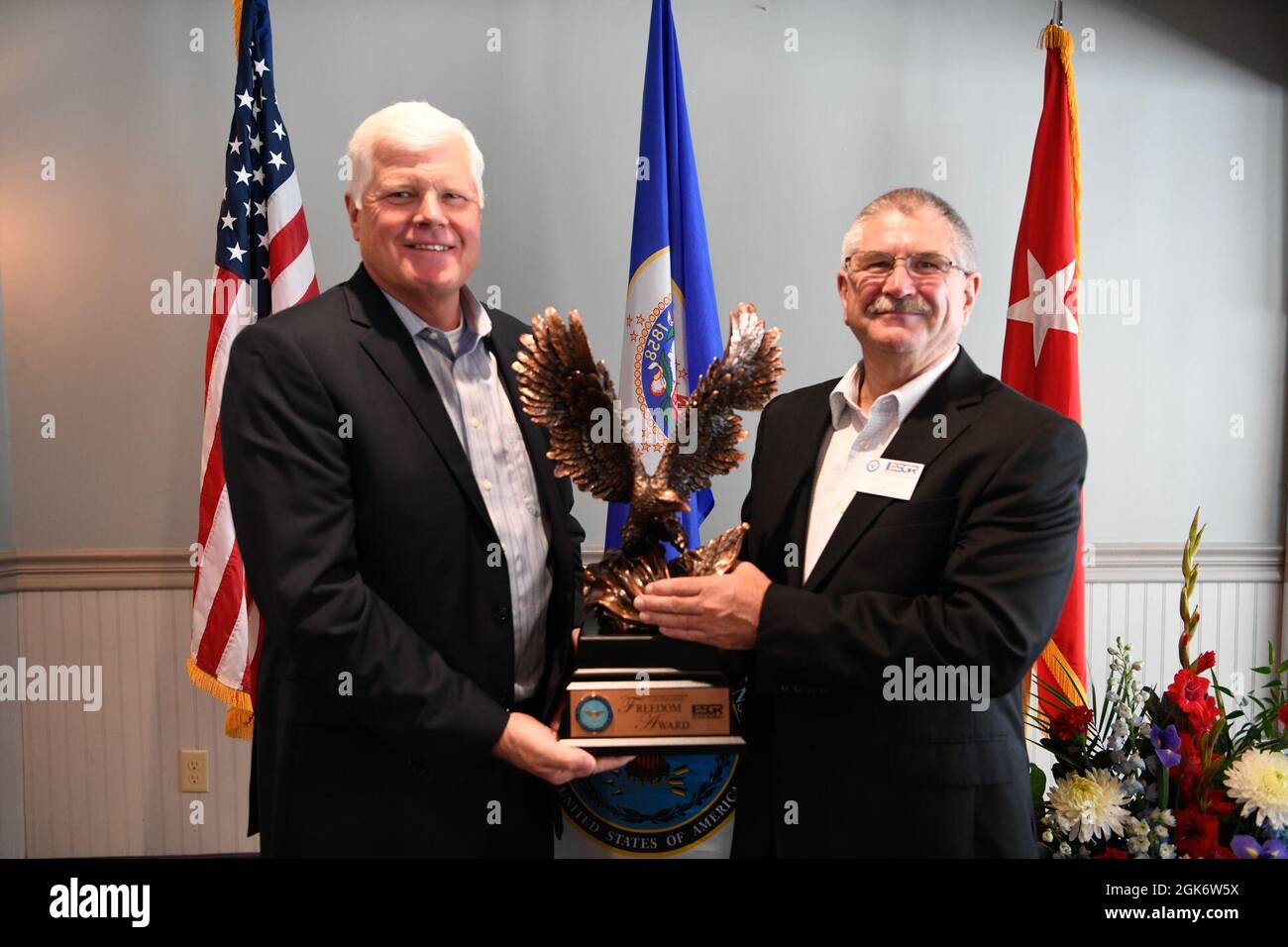 Community members, leaders, members of the Minnesota Committee for Employer Support of the Guard and Reserve (ESGR) and Minnesota National Guard gather August 18, 2021 in Willmar, Minnesota to celebrate Minnesota's Marcus Construction for receiving the Secretary of Defense’s Employer Support Freedom Award for its outstanding support shown as an employer of members of the National Guard. This award was one of only 15 given to employers across the 54 states, territories and the District of Columbia in 2021. “I am proud to salute the outstanding employers who have earned the distinction of bei Stock Photohttps://www.alamy.com/image-license-details/?v=1https://www.alamy.com/community-members-leaders-members-of-the-minnesota-committee-for-employer-support-of-the-guard-and-reserve-esgr-and-minnesota-national-guard-gather-august-18-2021-in-willmar-minnesota-to-celebrate-minnesotas-marcus-construction-for-receiving-the-secretary-of-defenses-employer-support-freedom-award-for-its-outstanding-support-shown-as-an-employer-of-members-of-the-national-guard-this-award-was-one-of-only-15-given-to-employers-across-the-54-states-territories-and-the-district-of-columbia-in-2021-i-am-proud-to-salute-the-outstanding-employers-who-have-earned-the-distinction-of-bei-image442089142.html
RM2GK6W5X–Community members, leaders, members of the Minnesota Committee for Employer Support of the Guard and Reserve (ESGR) and Minnesota National Guard gather August 18, 2021 in Willmar, Minnesota to celebrate Minnesota's Marcus Construction for receiving the Secretary of Defense’s Employer Support Freedom Award for its outstanding support shown as an employer of members of the National Guard. This award was one of only 15 given to employers across the 54 states, territories and the District of Columbia in 2021. “I am proud to salute the outstanding employers who have earned the distinction of bei
 Okinawa, Japan (Nov. 16, 2022) Marines with Marine Wing Support Squadron 172 and 9th Engineer Support Battalion, breaks ground on the joint service Airfield Damage Repair (ADR) exercise on Kadena AIr Force Base. NMCB-4 is forward deployed throughout the Indo-Pacific region and United States territories to support and maintain a free and open Indo-Pacific. As the stand-in, crisis response, naval engineering force, NMCB-4 maintains a ready posture to deliver in-theater expeditionary logistics via expeditionary shore infrastructure, forward damage repair, and mobile construction. (U.S. Navy photo Stock Photohttps://www.alamy.com/image-license-details/?v=1https://www.alamy.com/okinawa-japan-nov-16-2022-marines-with-marine-wing-support-squadron-172-and-9th-engineer-support-battalion-breaks-ground-on-the-joint-service-airfield-damage-repair-adr-exercise-on-kadena-air-force-base-nmcb-4-is-forward-deployed-throughout-the-indo-pacific-region-and-united-states-territories-to-support-and-maintain-a-free-and-open-indo-pacific-as-the-stand-in-crisis-response-naval-engineering-force-nmcb-4-maintains-a-ready-posture-to-deliver-in-theater-expeditionary-logistics-via-expeditionary-shore-infrastructure-forward-damage-repair-and-mobile-construction-us-navy-photo-image496084468.html
RM2KR2GPC–Okinawa, Japan (Nov. 16, 2022) Marines with Marine Wing Support Squadron 172 and 9th Engineer Support Battalion, breaks ground on the joint service Airfield Damage Repair (ADR) exercise on Kadena AIr Force Base. NMCB-4 is forward deployed throughout the Indo-Pacific region and United States territories to support and maintain a free and open Indo-Pacific. As the stand-in, crisis response, naval engineering force, NMCB-4 maintains a ready posture to deliver in-theater expeditionary logistics via expeditionary shore infrastructure, forward damage repair, and mobile construction. (U.S. Navy photo
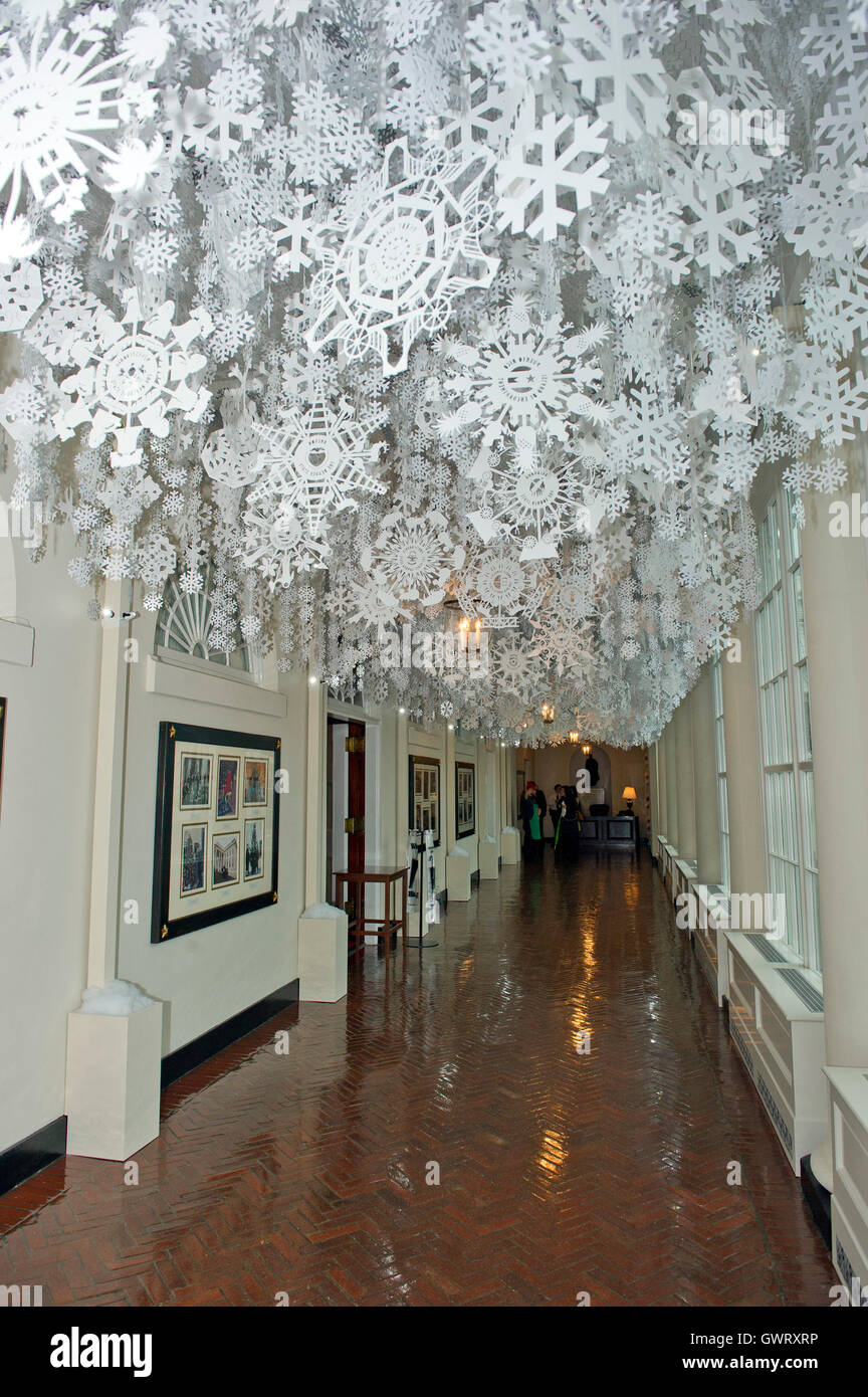 Snowflakes representing each of the 56 states and territories that make-up the United States hang from the ceiling of the East Colonnade as part of the 2015 White House Christmas theme 'A Timeless Tradition' at the White House in Washington, DC on Wednesd Stock Photohttps://www.alamy.com/image-license-details/?v=1https://www.alamy.com/stock-photo-snowflakes-representing-each-of-the-56-states-and-territories-that-119154554.html
RMGWRXRP–Snowflakes representing each of the 56 states and territories that make-up the United States hang from the ceiling of the East Colonnade as part of the 2015 White House Christmas theme 'A Timeless Tradition' at the White House in Washington, DC on Wednesd
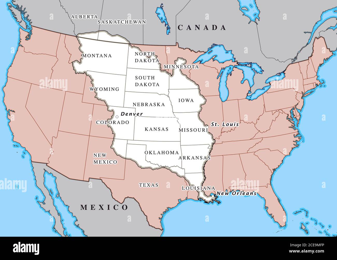 Louisiana Purchase. Map showing the territories (highlighted in white) purchased by the United States from France in April 1803 Stock Photohttps://www.alamy.com/image-license-details/?v=1https://www.alamy.com/louisiana-purchase-map-showing-the-territories-highlighted-in-white-purchased-by-the-united-states-from-france-in-april-1803-image370236602.html
RM2CE9MFP–Louisiana Purchase. Map showing the territories (highlighted in white) purchased by the United States from France in April 1803
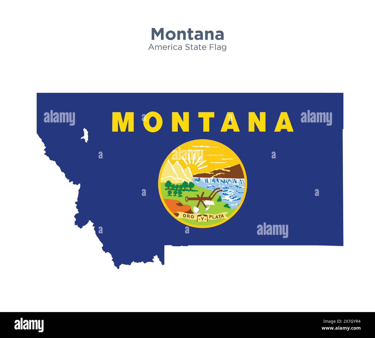 Montana flag and map. Flags of the U.S. states and territories. America states flag and map on white background. Stock Photohttps://www.alamy.com/image-license-details/?v=1https://www.alamy.com/montana-flag-and-map-flags-of-the-us-states-and-territories-america-states-flag-and-map-on-white-background-image607038520.html
RF2X7GYR4–Montana flag and map. Flags of the U.S. states and territories. America states flag and map on white background.
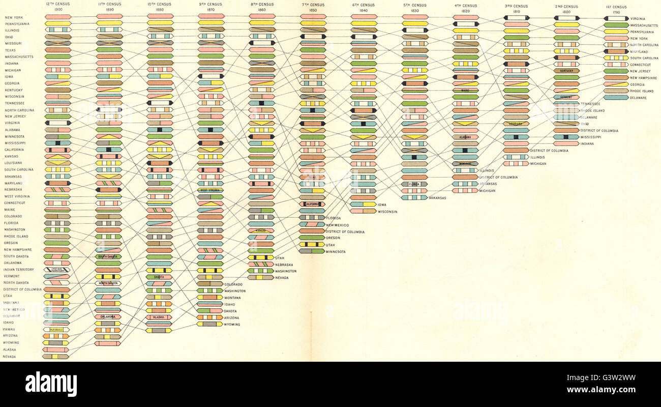 USA: Rank of States & Territories in population at each Census, 1900 old map Stock Photohttps://www.alamy.com/image-license-details/?v=1https://www.alamy.com/stock-photo-usa-rank-of-states-territories-in-population-at-each-census-1900-old-105657269.html
RFG3W2WW–USA: Rank of States & Territories in population at each Census, 1900 old map
 The Great Wall of China a series of fortification systems generally built across the historical northern borders of China to protect and consolidate territories of Chinese states and empires against various nomadic groups of the steppe and their polities. Several walls were being built from as early as the 7th century BC by ancient Chinese states. The most well-known sections of the wall were built by the Ming dynasty (1368?1644). Stock Photohttps://www.alamy.com/image-license-details/?v=1https://www.alamy.com/the-great-wall-of-china-a-series-of-fortification-systems-generally-built-across-the-historical-northern-borders-of-china-to-protect-and-consolidate-territories-of-chinese-states-and-empires-against-various-nomadic-groups-of-the-steppe-and-their-polities-several-walls-were-being-built-from-as-early-as-the-7th-century-bc-by-ancient-chinese-states-the-most-well-known-sections-of-the-wall-were-built-by-the-ming-dynasty-13681644-image634321441.html
RM2YRYRD5–The Great Wall of China a series of fortification systems generally built across the historical northern borders of China to protect and consolidate territories of Chinese states and empires against various nomadic groups of the steppe and their polities. Several walls were being built from as early as the 7th century BC by ancient Chinese states. The most well-known sections of the wall were built by the Ming dynasty (1368?1644).
 Florida, from Flags of the States and Territories (N11) for Allen & Ginter Cigarettes Brands, 1888 Stock Photohttps://www.alamy.com/image-license-details/?v=1https://www.alamy.com/stock-image-florida-from-flags-of-the-states-and-territories-n11-for-allen-ginter-162518014.html
RMKCB9AP–Florida, from Flags of the States and Territories (N11) for Allen & Ginter Cigarettes Brands, 1888
 Art inspired by New York, from Flags of the States and Territories (N11) for Allen & Ginter Cigarettes Brands, 1888, Commercial color lithograph, Sheet: 2 3/4 x 1 1/2 in. (7 x 3.8 cm), Trade cards from the 'Flags of the States and Territories' series (N11), issued in 1888 in a set of, Classic works modernized by Artotop with a splash of modernity. Shapes, color and value, eye-catching visual impact on art. Emotions through freedom of artworks in a contemporary way. A timeless message pursuing a wildly creative new direction. Artists turning to the digital medium and creating the Artotop NFT Stock Photohttps://www.alamy.com/image-license-details/?v=1https://www.alamy.com/art-inspired-by-new-york-from-flags-of-the-states-and-territories-n11-for-allen-ginter-cigarettes-brands-1888-commercial-color-lithograph-sheet-2-34-x-1-12-in-7-x-38-cm-trade-cards-from-the-flags-of-the-states-and-territories-series-n11-issued-in-1888-in-a-set-of-classic-works-modernized-by-artotop-with-a-splash-of-modernity-shapes-color-and-value-eye-catching-visual-impact-on-art-emotions-through-freedom-of-artworks-in-a-contemporary-way-a-timeless-message-pursuing-a-wildly-creative-new-direction-artists-turning-to-the-digital-medium-and-creating-the-artotop-nft-image463007540.html
RF2HW7PRG–Art inspired by New York, from Flags of the States and Territories (N11) for Allen & Ginter Cigarettes Brands, 1888, Commercial color lithograph, Sheet: 2 3/4 x 1 1/2 in. (7 x 3.8 cm), Trade cards from the 'Flags of the States and Territories' series (N11), issued in 1888 in a set of, Classic works modernized by Artotop with a splash of modernity. Shapes, color and value, eye-catching visual impact on art. Emotions through freedom of artworks in a contemporary way. A timeless message pursuing a wildly creative new direction. Artists turning to the digital medium and creating the Artotop NFT
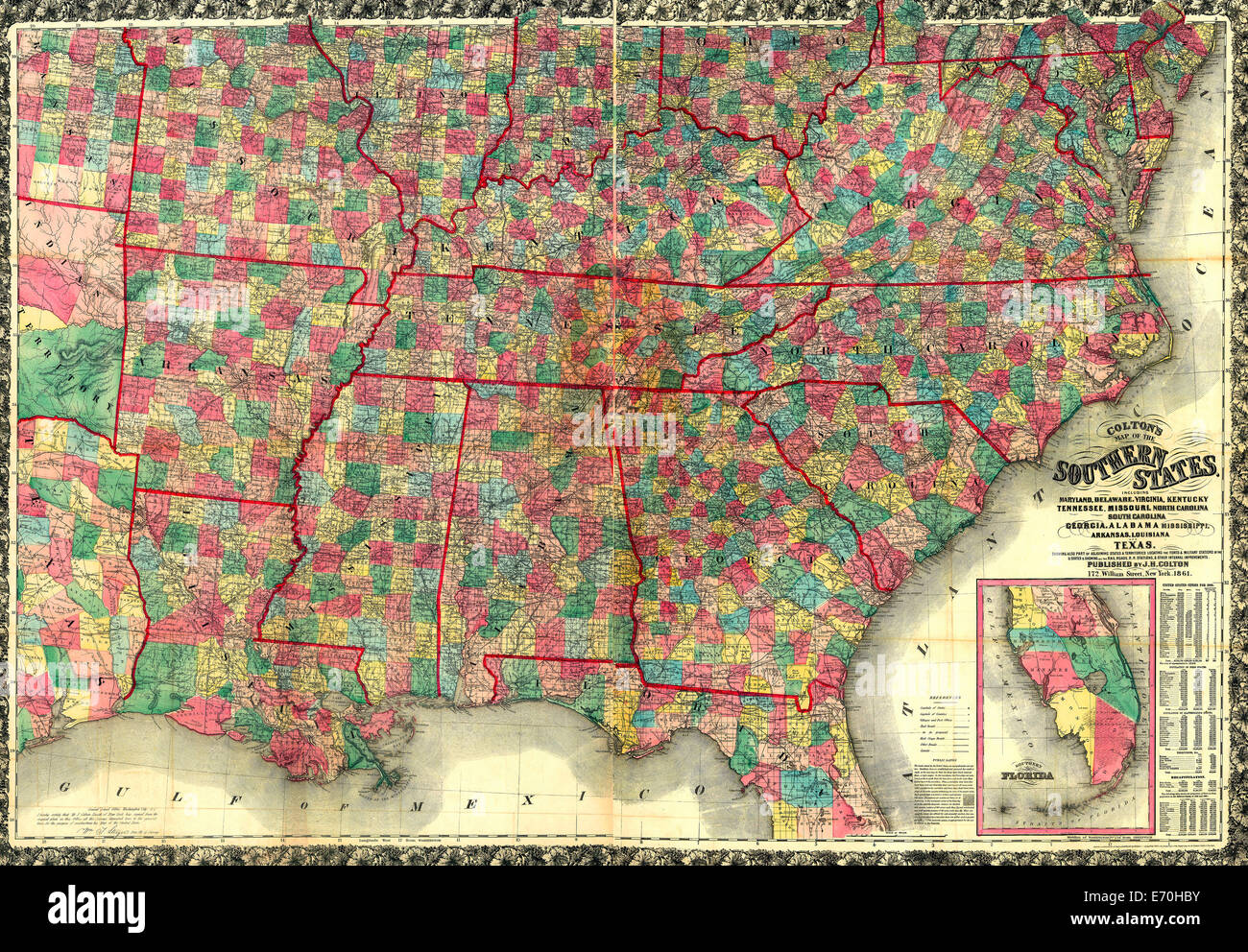 Colton's map of the southern states. Including Maryland, Delaware, Virginia, Kentucky, Tennessee, Missouri, North Carolina, South Carolina, Georgia, Alabama, Mississippi, Arkansas, Louisiana, and Texas. Showing also part of adjoining states & territories locating the forts & military stations of the U. States & showing all the rail roads, r. r. stations, & other internal improvements. 1861 Stock Photohttps://www.alamy.com/image-license-details/?v=1https://www.alamy.com/stock-photo-coltons-map-of-the-southern-states-including-maryland-delaware-virginia-73157727.html
RME70HBY–Colton's map of the southern states. Including Maryland, Delaware, Virginia, Kentucky, Tennessee, Missouri, North Carolina, South Carolina, Georgia, Alabama, Mississippi, Arkansas, Louisiana, and Texas. Showing also part of adjoining states & territories locating the forts & military stations of the U. States & showing all the rail roads, r. r. stations, & other internal improvements. 1861
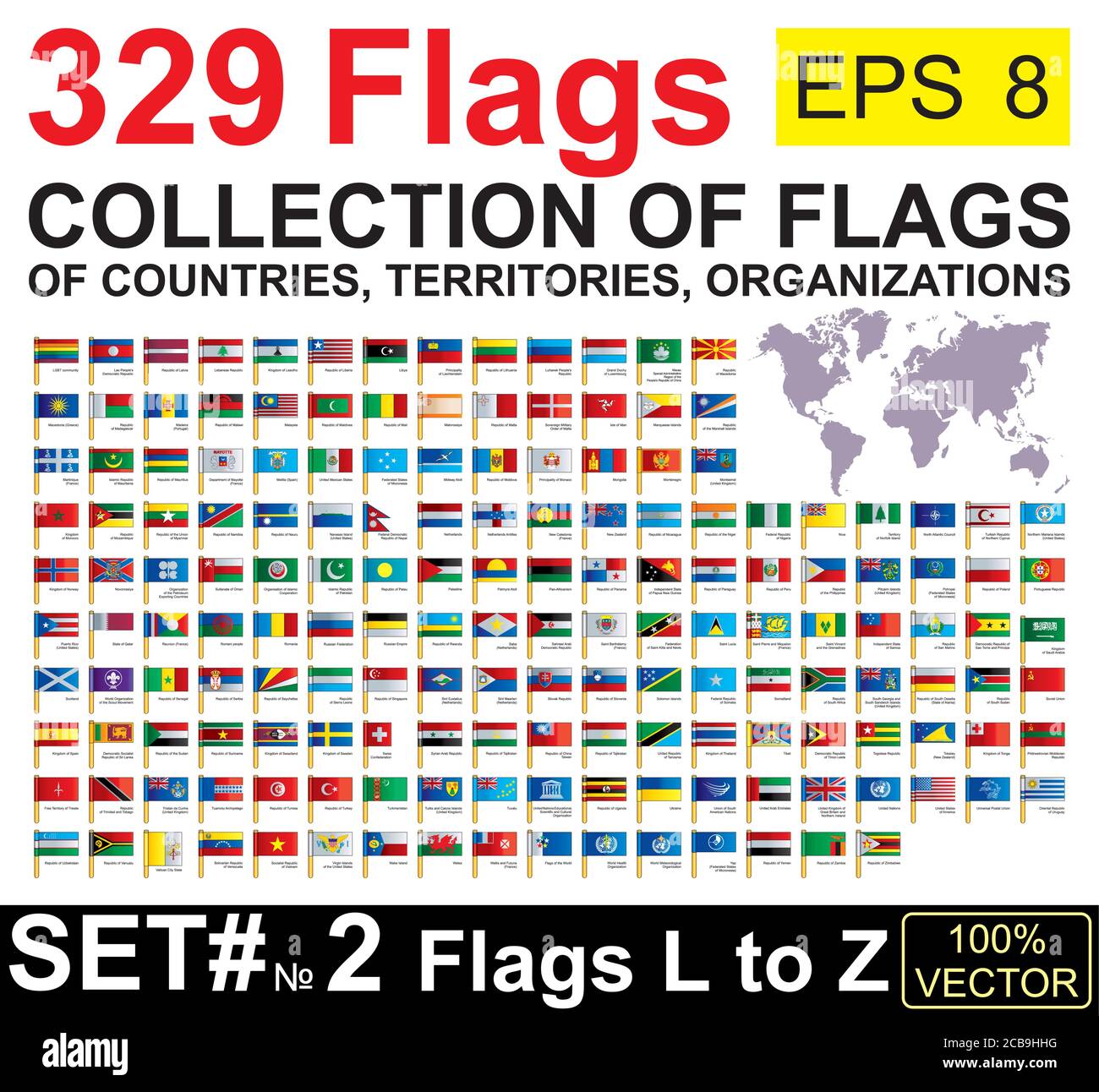 Flags of the world. Collection world Flags of sovereign states, territories and organizations with names. Complete Collection world Flags. Stock Vectorhttps://www.alamy.com/image-license-details/?v=1https://www.alamy.com/flags-of-the-world-collection-world-flags-of-sovereign-states-territories-and-organizations-with-names-complete-collection-world-flags-image368390332.html
RF2CB9HHG–Flags of the world. Collection world Flags of sovereign states, territories and organizations with names. Complete Collection world Flags.
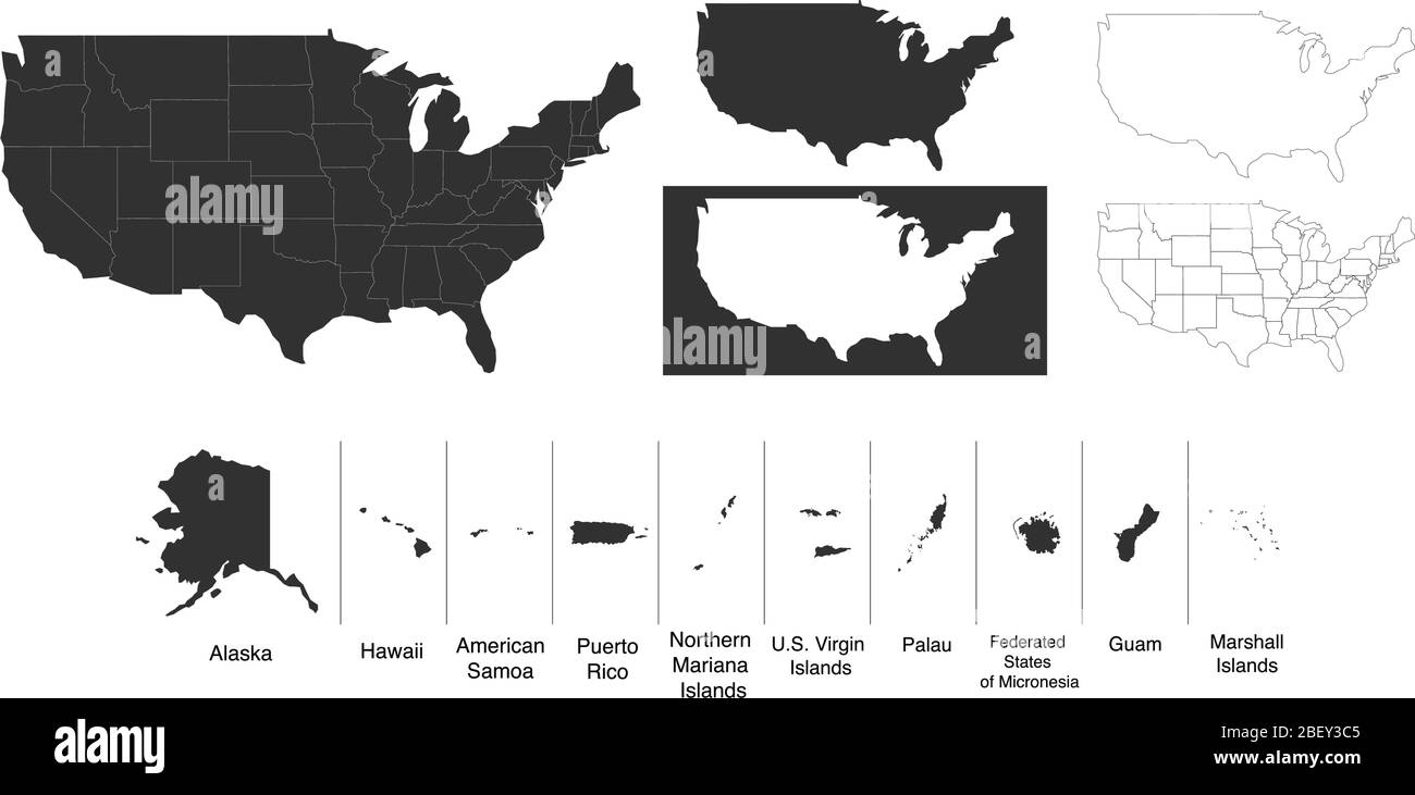 Map of The United States of America USA with territories and Islands. Different map variations for your design. Stock Vector illustration isolated on Stock Vectorhttps://www.alamy.com/image-license-details/?v=1https://www.alamy.com/map-of-the-united-states-of-america-usa-with-territories-and-islands-different-map-variations-for-your-design-stock-vector-illustration-isolated-on-image353407941.html
RF2BEY3C5–Map of The United States of America USA with territories and Islands. Different map variations for your design. Stock Vector illustration isolated on
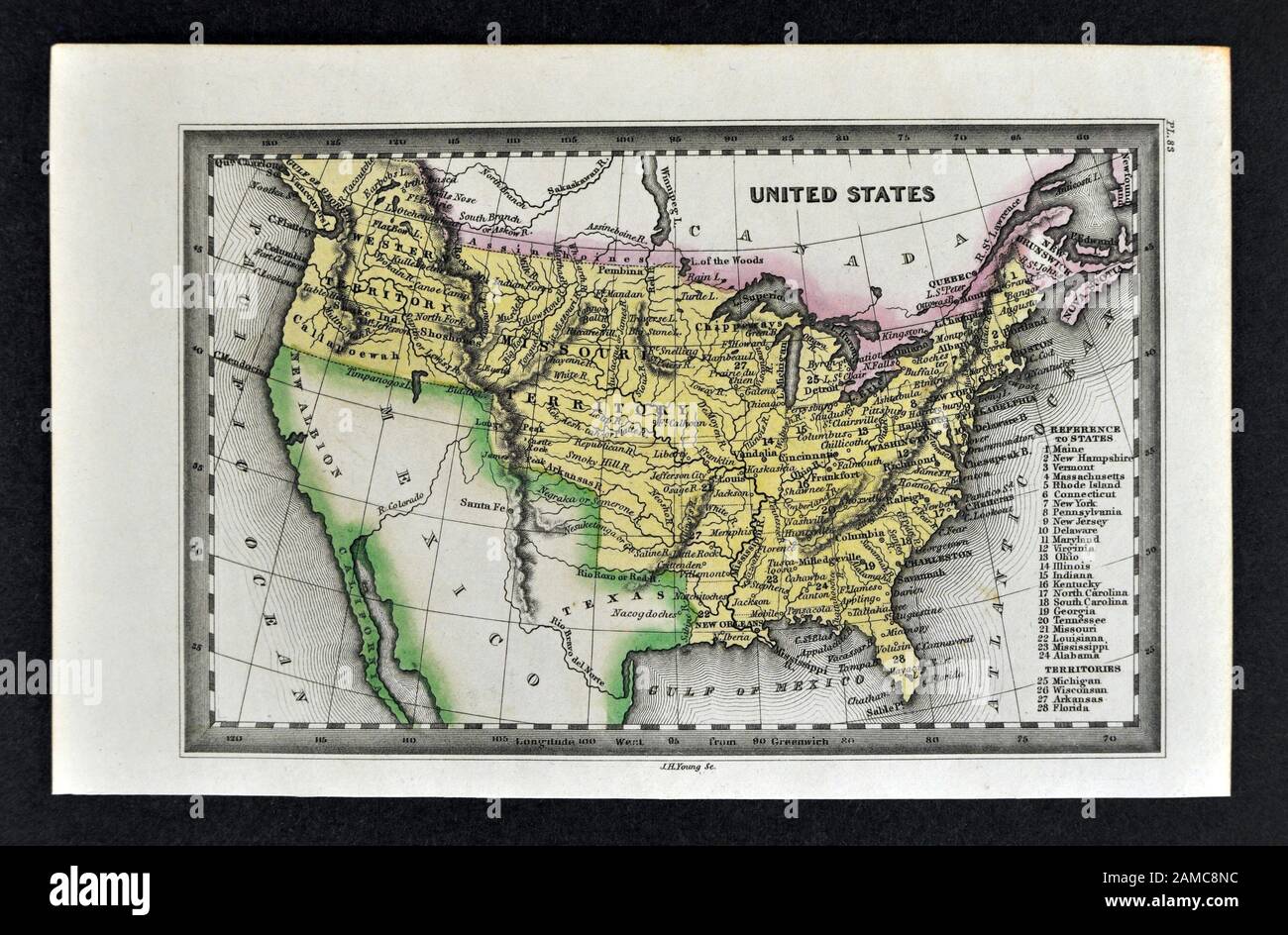 1834 Carey Map United States of America and Western Territories Stock Photohttps://www.alamy.com/image-license-details/?v=1https://www.alamy.com/1834-carey-map-united-states-of-america-and-western-territories-image339560408.html
RF2AMC8NC–1834 Carey Map United States of America and Western Territories
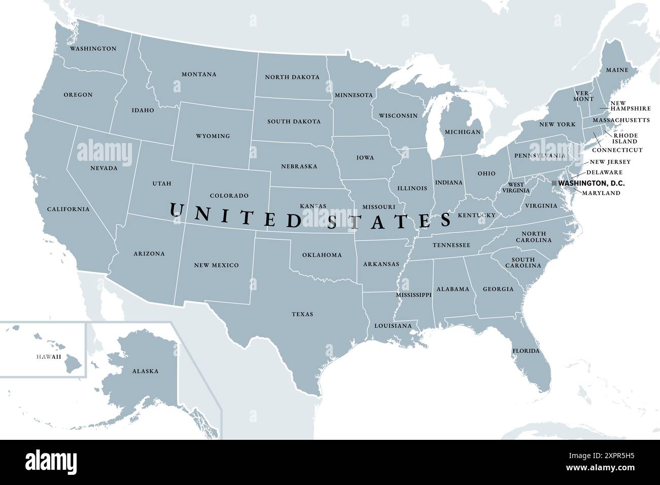 United States of America, gray political map. Fifty single states with their own geographic territories and borders, bound together in a union. Stock Photohttps://www.alamy.com/image-license-details/?v=1https://www.alamy.com/united-states-of-america-gray-political-map-fifty-single-states-with-their-own-geographic-territories-and-borders-bound-together-in-a-union-image616394609.html
RF2XPR5H5–United States of America, gray political map. Fifty single states with their own geographic territories and borders, bound together in a union.
 White-headed or Bald Hagle, (Haliaeetus leucocephalus) from The birds of America : from drawings made in the United States and their territories Volume 1. Plates drawn by John James Audubon and lithographed by John T. Bowen of Philadelphia and Endicott of New York; Published 1840 Stock Photohttps://www.alamy.com/image-license-details/?v=1https://www.alamy.com/white-headed-or-bald-hagle-haliaeetus-leucocephalus-from-the-birds-of-america-from-drawings-made-in-the-united-states-and-their-territories-volume-1-plates-drawn-by-john-james-audubon-and-lithographed-by-john-t-bowen-of-philadelphia-and-endicott-of-new-york-published-1840-image635528600.html
RM2YWXR60–White-headed or Bald Hagle, (Haliaeetus leucocephalus) from The birds of America : from drawings made in the United States and their territories Volume 1. Plates drawn by John James Audubon and lithographed by John T. Bowen of Philadelphia and Endicott of New York; Published 1840
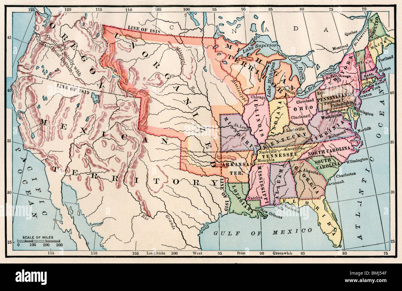 Map of the United States in 1830. Color lithograph Stock Photohttps://www.alamy.com/image-license-details/?v=1https://www.alamy.com/stock-photo-map-of-the-united-states-in-1830-color-lithograph-29902671.html
RMBMJ54F–Map of the United States in 1830. Color lithograph
 Indian Territory, from Flags of the States and Territories (N11) for Allen & Ginter Cigarettes Brands. Dimensions: Sheet: 2 3/4 x 1 1/2 in. (7 x 3.8 cm). Publisher: Issued by Allen & Ginter (American, Richmond, Virginia). Date: 1888. Trade cards from the 'Flags of the States and Territories' series (N11), issued in 1888 in a set of 47 cards to promote Allen & Ginter brand cigarettes. There are also approximately 100 scroll color variations. The museum's collection contains the full set of 47 cards, as well as 54 scroll color variations and one cutout card. Museum: Metropolitan Museum of Art, Stock Photohttps://www.alamy.com/image-license-details/?v=1https://www.alamy.com/indian-territory-from-flags-of-the-states-and-territories-n11-for-allen-ginter-cigarettes-brands-dimensions-sheet-2-34-x-1-12-in-7-x-38-cm-publisher-issued-by-allen-ginter-american-richmond-virginia-date-1888-trade-cards-from-the-flags-of-the-states-and-territories-series-n11-issued-in-1888-in-a-set-of-47-cards-to-promote-allen-ginter-brand-cigarettes-there-are-also-approximately-100-scroll-color-variations-the-museums-collection-contains-the-full-set-of-47-cards-as-well-as-54-scroll-color-variations-and-one-cutout-card-museum-metropolitan-museum-of-art-image213301354.html
RMPB0M1E–Indian Territory, from Flags of the States and Territories (N11) for Allen & Ginter Cigarettes Brands. Dimensions: Sheet: 2 3/4 x 1 1/2 in. (7 x 3.8 cm). Publisher: Issued by Allen & Ginter (American, Richmond, Virginia). Date: 1888. Trade cards from the 'Flags of the States and Territories' series (N11), issued in 1888 in a set of 47 cards to promote Allen & Ginter brand cigarettes. There are also approximately 100 scroll color variations. The museum's collection contains the full set of 47 cards, as well as 54 scroll color variations and one cutout card. Museum: Metropolitan Museum of Art,
 A satellite image showing smoke from wildfires burning across the Yukon and Northwest Territories of Canada, detected by the NASA Landsat 8 Satellite, July 6, 2022, in Earth Orbit. According to the Canadian government, 136 fires were burning in the Yukon and 65 in the Northwest Territories. Stock Photohttps://www.alamy.com/image-license-details/?v=1https://www.alamy.com/a-satellite-image-showing-smoke-from-wildfires-burning-across-the-yukon-and-northwest-territories-of-canada-detected-by-the-nasa-landsat-8-satellite-july-6-2022-in-earth-orbit-according-to-the-canadian-government-136-fires-were-burning-in-the-yukon-and-65-in-the-northwest-territories-image475580471.html
RM2JHMFMR–A satellite image showing smoke from wildfires burning across the Yukon and Northwest Territories of Canada, detected by the NASA Landsat 8 Satellite, July 6, 2022, in Earth Orbit. According to the Canadian government, 136 fires were burning in the Yukon and 65 in the Northwest Territories.
 The official Northern Pacific Railroad guide : for the use of tourists and travelers over the lines of the Northern Pacific Railroad, its branches and allied lines : containing descriptions of states, territories, cities, towns and places along the routes of these allied systems of transportation : and embracing facts relating to the history, resources, population, products and natural features of the great Northwest Stock Photohttps://www.alamy.com/image-license-details/?v=1https://www.alamy.com/stock-photo-the-official-northern-pacific-railroad-guide-for-the-use-of-tourists-176284441.html
RMM6PCGW–The official Northern Pacific Railroad guide : for the use of tourists and travelers over the lines of the Northern Pacific Railroad, its branches and allied lines : containing descriptions of states, territories, cities, towns and places along the routes of these allied systems of transportation : and embracing facts relating to the history, resources, population, products and natural features of the great Northwest
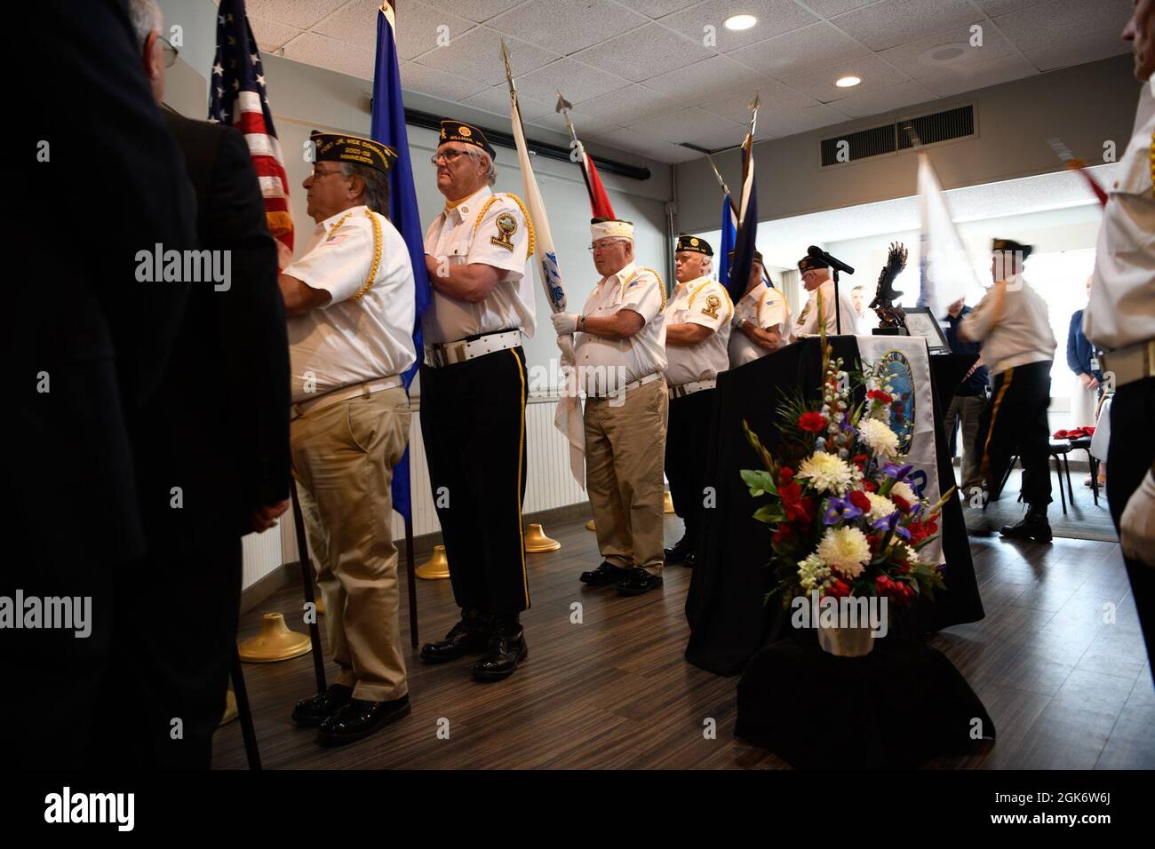 Community members, leaders, members of the Minnesota Committee for Employer Support of the Guard and Reserve (ESGR) and Minnesota National Guard gather August 18, 2021 in Willmar, Minnesota to celebrate Minnesota's Marcus Construction for receiving the Secretary of Defense’s Employer Support Freedom Award for its outstanding support shown as an employer of members of the National Guard. This award was one of only 15 given to employers across the 54 states, territories and the District of Columbia in 2021. “I am proud to salute the outstanding employers who have earned the distinction of bei Stock Photohttps://www.alamy.com/image-license-details/?v=1https://www.alamy.com/community-members-leaders-members-of-the-minnesota-committee-for-employer-support-of-the-guard-and-reserve-esgr-and-minnesota-national-guard-gather-august-18-2021-in-willmar-minnesota-to-celebrate-minnesotas-marcus-construction-for-receiving-the-secretary-of-defenses-employer-support-freedom-award-for-its-outstanding-support-shown-as-an-employer-of-members-of-the-national-guard-this-award-was-one-of-only-15-given-to-employers-across-the-54-states-territories-and-the-district-of-columbia-in-2021-i-am-proud-to-salute-the-outstanding-employers-who-have-earned-the-distinction-of-bei-image442089162.html
RM2GK6W6J–Community members, leaders, members of the Minnesota Committee for Employer Support of the Guard and Reserve (ESGR) and Minnesota National Guard gather August 18, 2021 in Willmar, Minnesota to celebrate Minnesota's Marcus Construction for receiving the Secretary of Defense’s Employer Support Freedom Award for its outstanding support shown as an employer of members of the National Guard. This award was one of only 15 given to employers across the 54 states, territories and the District of Columbia in 2021. “I am proud to salute the outstanding employers who have earned the distinction of bei
 OKINAWA, Japan (Oct. 24, 2024) – A Seabee assigned to Naval Mobile Construction Battalion 5 (NMCB-5) operates a dozer during a bilateral airfield damage repair (ADR) exercise on Kadena Air Base, Okinawa, Japan, Oct. 24, 2024. The purpose of the ADR was to improve interoperability, readiness, and lethality between Japan Self-Defense Forces and U.S. Armed Forces. NMCB-5 is forward deployed throughout the Indo-Pacific region and United States territories to support and maintain a free and open Indo-Pacific. As the stand-in, crisis response, naval engineering force, NMCB-5 maintains a ready postur Stock Photohttps://www.alamy.com/image-license-details/?v=1https://www.alamy.com/okinawa-japan-oct-24-2024-a-seabee-assigned-to-naval-mobile-construction-battalion-5-nmcb-5-operates-a-dozer-during-a-bilateral-airfield-damage-repair-adr-exercise-on-kadena-air-base-okinawa-japan-oct-24-2024-the-purpose-of-the-adr-was-to-improve-interoperability-readiness-and-lethality-between-japan-self-defense-forces-and-us-armed-forces-nmcb-5-is-forward-deployed-throughout-the-indo-pacific-region-and-united-states-territories-to-support-and-maintain-a-free-and-open-indo-pacific-as-the-stand-in-crisis-response-naval-engineering-force-nmcb-5-maintains-a-ready-postur-image629398202.html
RM2YFYFR6–OKINAWA, Japan (Oct. 24, 2024) – A Seabee assigned to Naval Mobile Construction Battalion 5 (NMCB-5) operates a dozer during a bilateral airfield damage repair (ADR) exercise on Kadena Air Base, Okinawa, Japan, Oct. 24, 2024. The purpose of the ADR was to improve interoperability, readiness, and lethality between Japan Self-Defense Forces and U.S. Armed Forces. NMCB-5 is forward deployed throughout the Indo-Pacific region and United States territories to support and maintain a free and open Indo-Pacific. As the stand-in, crisis response, naval engineering force, NMCB-5 maintains a ready postur
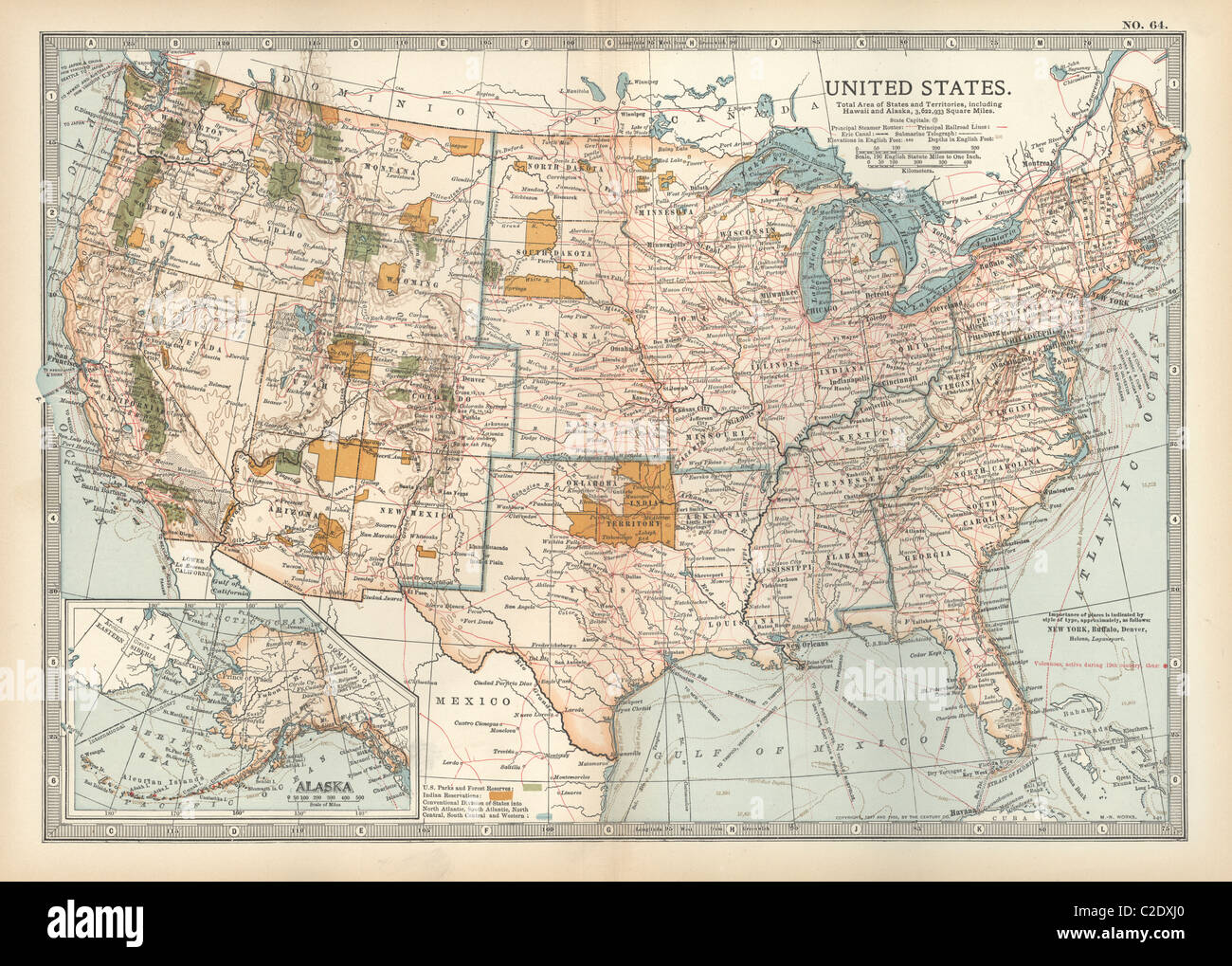 Map of the United States with inset of Alaska Stock Photohttps://www.alamy.com/image-license-details/?v=1https://www.alamy.com/stock-photo-map-of-the-united-states-with-inset-of-alaska-35956312.html
RMC2DXJ0–Map of the United States with inset of Alaska
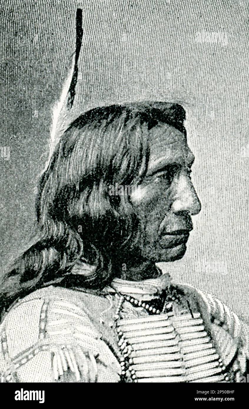 The 1896 caption reads: 'Red Cloud after a photograph by Bell.' Red Cloud was a leader of the Oglala Lakota from 1868 to 1909. He was one of the most capable Native American opponents whom the United States Army faced in the western territories. Stock Photohttps://www.alamy.com/image-license-details/?v=1https://www.alamy.com/the-1896-caption-reads-red-cloud-after-a-photograph-by-bell-red-cloud-was-a-leader-of-the-oglala-lakota-from-1868-to-1909-he-was-one-of-the-most-capable-native-american-opponents-whom-the-united-states-army-faced-in-the-western-territories-image536603803.html
RF2P50BHF–The 1896 caption reads: 'Red Cloud after a photograph by Bell.' Red Cloud was a leader of the Oglala Lakota from 1868 to 1909. He was one of the most capable Native American opponents whom the United States Army faced in the western territories.
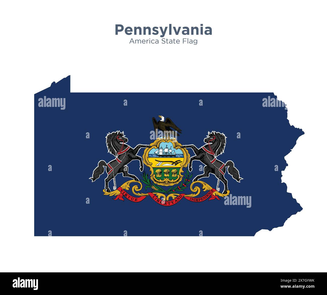 Pennsylvania flag and map. Flags of the U.S. states and territories. America states flag and map on white background. Stock Photohttps://www.alamy.com/image-license-details/?v=1https://www.alamy.com/pennsylvania-flag-and-map-flags-of-the-us-states-and-territories-america-states-flag-and-map-on-white-background-image607038591.html
RF2X7GYWK–Pennsylvania flag and map. Flags of the U.S. states and territories. America states flag and map on white background.
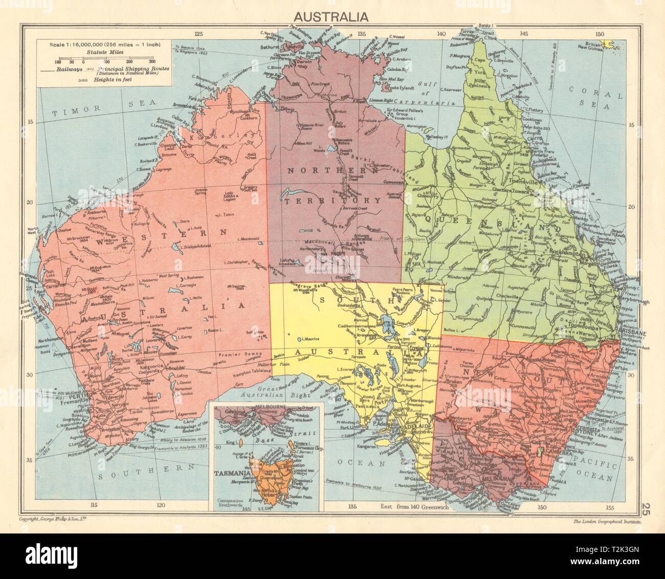 SECOND WORLD WAR Australia states & territories 1942 old vintage map chart Stock Photohttps://www.alamy.com/image-license-details/?v=1https://www.alamy.com/second-world-war-australia-states-territories-1942-old-vintage-map-chart-image242594373.html
RFT2K3GN–SECOND WORLD WAR Australia states & territories 1942 old vintage map chart
 The Great Wall of China a series of fortification systems generally built across the historical northern borders of China to protect and consolidate territories of Chinese states and empires against various nomadic groups of the steppe and their polities. Several walls were being built from as early as the 7th century BC by ancient Chinese states. The most well-known sections of the wall were built by the Ming dynasty (1368?1644). Stock Photohttps://www.alamy.com/image-license-details/?v=1https://www.alamy.com/the-great-wall-of-china-a-series-of-fortification-systems-generally-built-across-the-historical-northern-borders-of-china-to-protect-and-consolidate-territories-of-chinese-states-and-empires-against-various-nomadic-groups-of-the-steppe-and-their-polities-several-walls-were-being-built-from-as-early-as-the-7th-century-bc-by-ancient-chinese-states-the-most-well-known-sections-of-the-wall-were-built-by-the-ming-dynasty-13681644-image634321468.html
RM2YRYRE4–The Great Wall of China a series of fortification systems generally built across the historical northern borders of China to protect and consolidate territories of Chinese states and empires against various nomadic groups of the steppe and their polities. Several walls were being built from as early as the 7th century BC by ancient Chinese states. The most well-known sections of the wall were built by the Ming dynasty (1368?1644).
 Virginia, from Flags of the States and Territories (N11) for Allen & Ginter Cigarettes Brands, 1888 Stock Photohttps://www.alamy.com/image-license-details/?v=1https://www.alamy.com/stock-image-virginia-from-flags-of-the-states-and-territories-n11-for-allen-ginter-162518132.html
RMKCB9F0–Virginia, from Flags of the States and Territories (N11) for Allen & Ginter Cigarettes Brands, 1888
 Art inspired by Dakota, from Flags of the States and Territories (N11) for Allen & Ginter Cigarettes Brands, 1888, Commercial color lithograph, Sheet: 2 3/4 x 1 1/2 in. (7 x 3.8 cm), Trade cards from the 'Flags of the States and Territories' series (N11), issued in 1888 in a set of 47, Classic works modernized by Artotop with a splash of modernity. Shapes, color and value, eye-catching visual impact on art. Emotions through freedom of artworks in a contemporary way. A timeless message pursuing a wildly creative new direction. Artists turning to the digital medium and creating the Artotop NFT Stock Photohttps://www.alamy.com/image-license-details/?v=1https://www.alamy.com/art-inspired-by-dakota-from-flags-of-the-states-and-territories-n11-for-allen-ginter-cigarettes-brands-1888-commercial-color-lithograph-sheet-2-34-x-1-12-in-7-x-38-cm-trade-cards-from-the-flags-of-the-states-and-territories-series-n11-issued-in-1888-in-a-set-of-47-classic-works-modernized-by-artotop-with-a-splash-of-modernity-shapes-color-and-value-eye-catching-visual-impact-on-art-emotions-through-freedom-of-artworks-in-a-contemporary-way-a-timeless-message-pursuing-a-wildly-creative-new-direction-artists-turning-to-the-digital-medium-and-creating-the-artotop-nft-image463007365.html
RF2HW7PH9–Art inspired by Dakota, from Flags of the States and Territories (N11) for Allen & Ginter Cigarettes Brands, 1888, Commercial color lithograph, Sheet: 2 3/4 x 1 1/2 in. (7 x 3.8 cm), Trade cards from the 'Flags of the States and Territories' series (N11), issued in 1888 in a set of 47, Classic works modernized by Artotop with a splash of modernity. Shapes, color and value, eye-catching visual impact on art. Emotions through freedom of artworks in a contemporary way. A timeless message pursuing a wildly creative new direction. Artists turning to the digital medium and creating the Artotop NFT
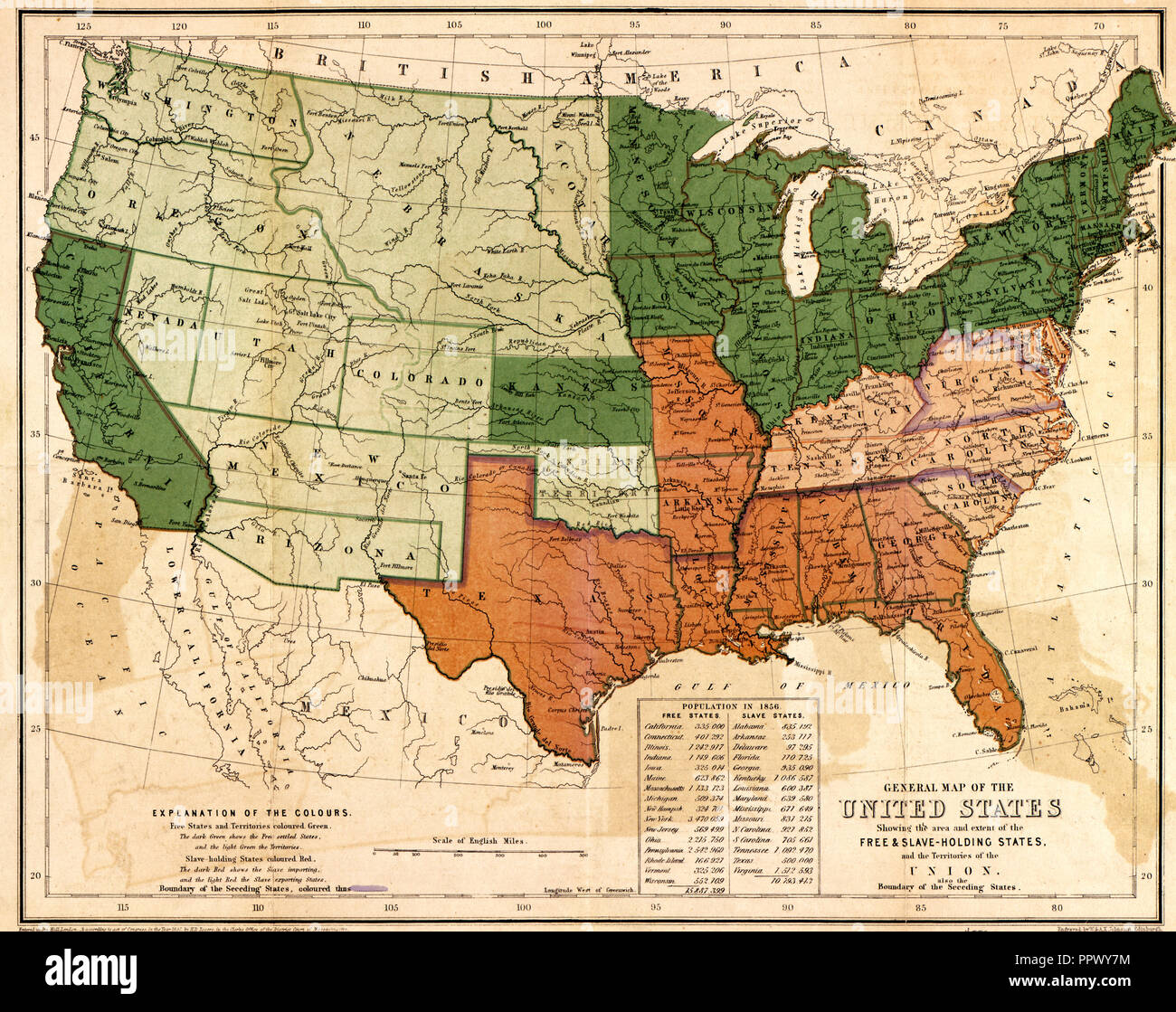 General map of the United States, showing the area and extent of the free & slave-holding states, and the territories of the Union : also the boundary of the seceding states, circa 1861 Stock Photohttps://www.alamy.com/image-license-details/?v=1https://www.alamy.com/general-map-of-the-united-states-showing-the-area-and-extent-of-the-free-slave-holding-states-and-the-territories-of-the-union-also-the-boundary-of-the-seceding-states-circa-1861-image220617032.html
RMPPWY7M–General map of the United States, showing the area and extent of the free & slave-holding states, and the territories of the Union : also the boundary of the seceding states, circa 1861