Stephens county texas Stock Photos and Images
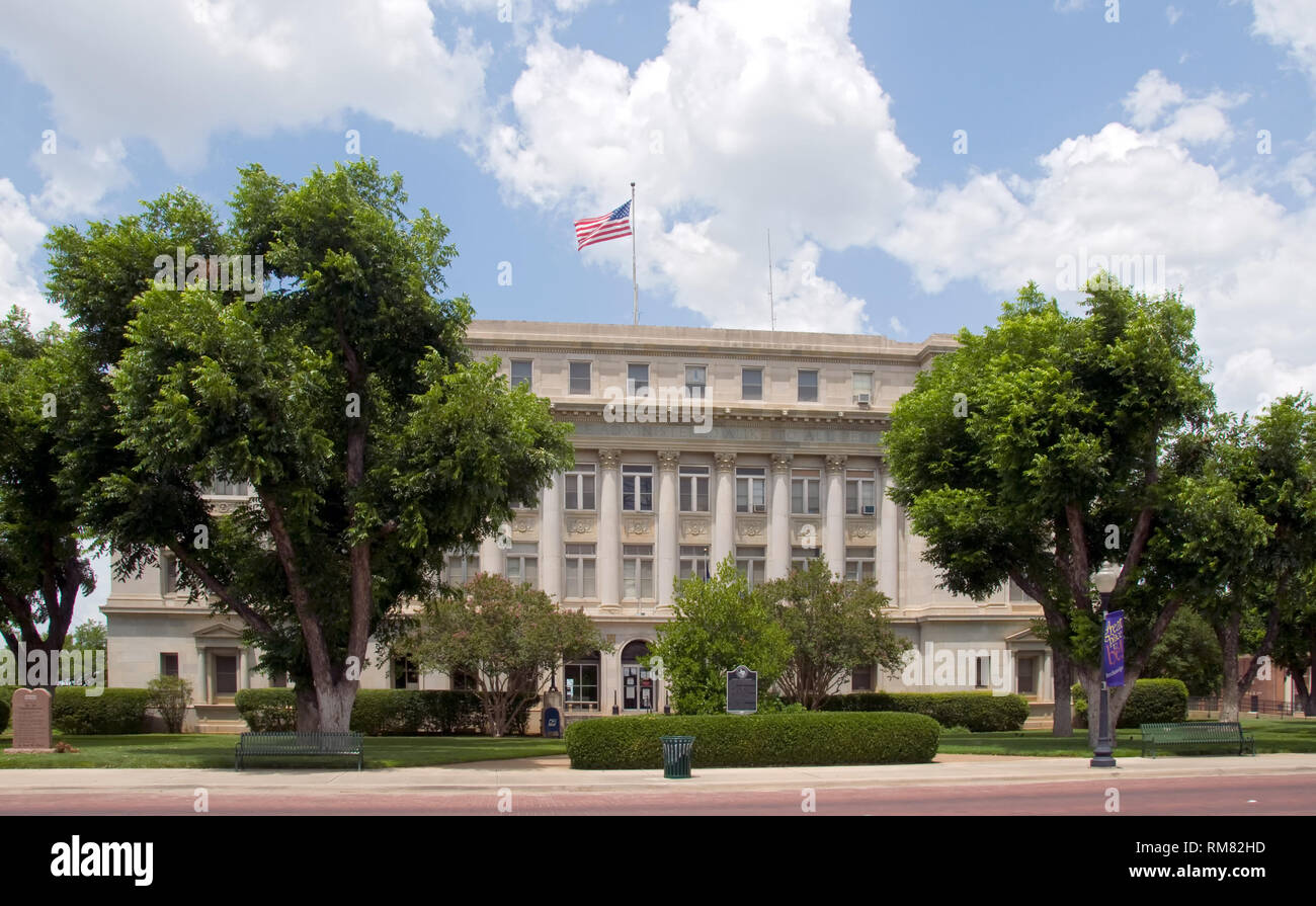 Stephens County Courthouse - Breckenridge, Texas Stock Photohttps://www.alamy.com/image-license-details/?v=1https://www.alamy.com/stephens-county-courthouse-breckenridge-texas-image236205577.html
RFRM82HD–Stephens County Courthouse - Breckenridge, Texas
 Stephens Central Library, which opened in 2011 in San Angelo, the seat of Tom Green County, Texas Stock Photohttps://www.alamy.com/image-license-details/?v=1https://www.alamy.com/stephens-central-library-which-opened-in-2011-in-san-angelo-the-seat-of-tom-green-county-texas-image329346624.html
RM2A3R0YC–Stephens Central Library, which opened in 2011 in San Angelo, the seat of Tom Green County, Texas
 St Stephen's Episcopal Church (1882), Goliad, Texas, USA Stock Photohttps://www.alamy.com/image-license-details/?v=1https://www.alamy.com/stock-photo-st-stephens-episcopal-church-1882-goliad-texas-usa-50675519.html
RMCXCD3Y–St Stephen's Episcopal Church (1882), Goliad, Texas, USA
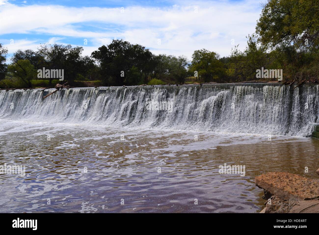 Crystal Falls, in Stephens County Tx Stock Photohttps://www.alamy.com/image-license-details/?v=1https://www.alamy.com/stock-photo-crystal-falls-in-stephens-county-tx-128774236.html
RFHDE4RT–Crystal Falls, in Stephens County Tx
 St. Stephen's Episcopal Church, late Victorian period, originally built in town of Pecos in 1896, moved in 1958 to Fort Stockton, Texas, USA Stock Photohttps://www.alamy.com/image-license-details/?v=1https://www.alamy.com/st-stephens-episcopal-church-late-victorian-period-originally-built-in-town-of-pecos-in-1896-moved-in-1958-to-fort-stockton-texas-usa-image617526002.html
RF2XTJMM2–St. Stephen's Episcopal Church, late Victorian period, originally built in town of Pecos in 1896, moved in 1958 to Fort Stockton, Texas, USA
 Stephens County Courthouse in Breckenridge was built in 1920's to replace the frontier courthouse as oil was discovered - - - residents were proud of the frontier heritage and preserved a doorway of the old courthouse. Now they want to preserve God Stock Photohttps://www.alamy.com/image-license-details/?v=1https://www.alamy.com/stephens-county-courthouse-in-breckenridge-was-built-in-1920s-to-replace-the-frontier-courthouse-as-oil-was-discovered-residents-were-proud-of-the-frontier-heritage-and-preserved-a-doorway-of-the-old-courthouse-now-they-want-to-preserve-god-image229660016.html
RFR9HWKC–Stephens County Courthouse in Breckenridge was built in 1920's to replace the frontier courthouse as oil was discovered - - - residents were proud of the frontier heritage and preserved a doorway of the old courthouse. Now they want to preserve God
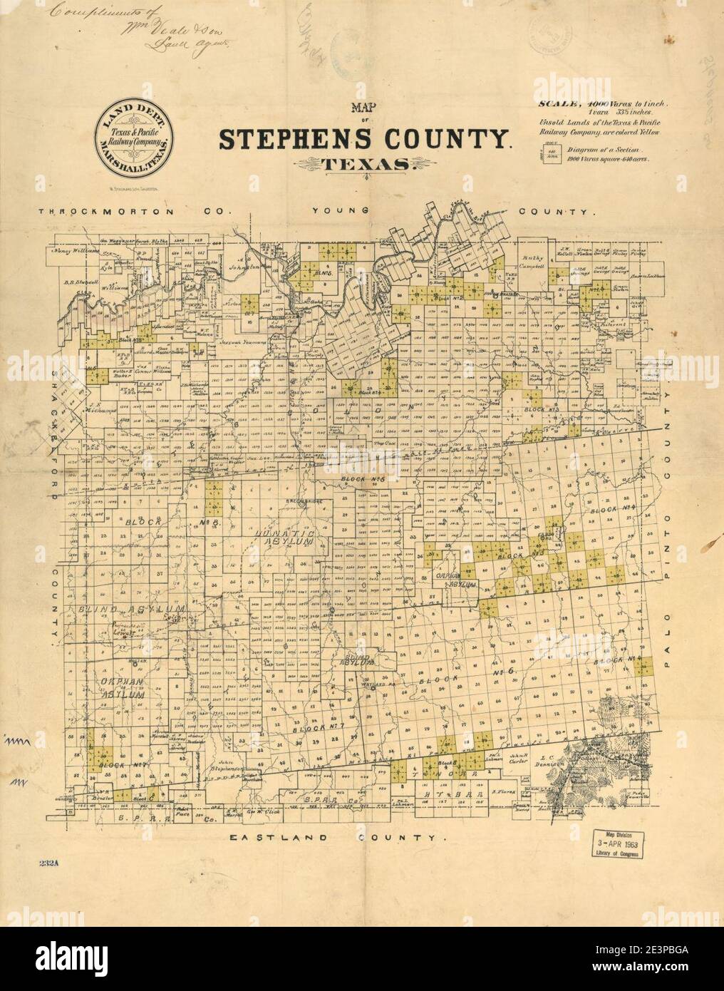 Map of Stephens County, Texas. Stock Photohttps://www.alamy.com/image-license-details/?v=1https://www.alamy.com/map-of-stephens-county-texas-image398174458.html
RM2E3PBGA–Map of Stephens County, Texas.
 Eureka, Stephens County, US, United States, Texas, N 32 34' 56'', S 99 3' 24'', map, Cartascapes Map published in 2024. Explore Cartascapes, a map revealing Earth's diverse landscapes, cultures, and ecosystems. Journey through time and space, discovering the interconnectedness of our planet's past, present, and future. Stock Photohttps://www.alamy.com/image-license-details/?v=1https://www.alamy.com/eureka-stephens-county-us-united-states-texas-n-32-34-56-s-99-3-24-map-cartascapes-map-published-in-2024-explore-cartascapes-a-map-revealing-earths-diverse-landscapes-cultures-and-ecosystems-journey-through-time-and-space-discovering-the-interconnectedness-of-our-planets-past-present-and-future-image621459380.html
RM2Y31WNT–Eureka, Stephens County, US, United States, Texas, N 32 34' 56'', S 99 3' 24'', map, Cartascapes Map published in 2024. Explore Cartascapes, a map revealing Earth's diverse landscapes, cultures, and ecosystems. Journey through time and space, discovering the interconnectedness of our planet's past, present, and future.
 Map of Stephens in Texas Stock Photohttps://www.alamy.com/image-license-details/?v=1https://www.alamy.com/map-of-stephens-in-texas-image363627200.html
RF2C3GJ5M–Map of Stephens in Texas
 Stephens County (Texas) outline map set Stock Vectorhttps://www.alamy.com/image-license-details/?v=1https://www.alamy.com/stephens-county-texas-outline-map-set-image620965252.html
RF2Y27BEC–Stephens County (Texas) outline map set
 Rendering of a green 3d highway sign for Stephens County Stock Photohttps://www.alamy.com/image-license-details/?v=1https://www.alamy.com/rendering-of-a-green-3d-highway-sign-for-stephens-county-image338548362.html
RF2AJP5TX–Rendering of a green 3d highway sign for Stephens County
 A history of Texas and Texans . is alsoJames N.. and Jonathan Wilford is an attorney of someprominence at Amarilla, Texas. He was county judgeof Stephens county for some years, and is now chairmanof the Prohibition Campaign Committee of the county.Another brother, George Elbert, was a railroad con-tractor, and died on February 21, 1900, at Fort Sill,Oklahoma. Robert White Knox, M. D. Both professional suc-cess and influential activity as a citizen have markedthe career of Dr. Knox in Houston and south Texas,where he has been a resident and physician and sur-geon for thirty years. Few physician Stock Photohttps://www.alamy.com/image-license-details/?v=1https://www.alamy.com/a-history-of-texas-and-texans-is-alsojames-n-and-jonathan-wilford-is-an-attorney-of-someprominence-at-amarilla-texas-he-was-county-judgeof-stephens-county-for-some-years-and-is-now-chairmanof-the-prohibition-campaign-committee-of-the-countyanother-brother-george-elbert-was-a-railroad-con-tractor-and-died-on-february-21-1900-at-fort-silloklahoma-robert-white-knox-m-d-both-professional-suc-cess-and-influential-activity-as-a-citizen-have-markedthe-career-of-dr-knox-in-houston-and-south-texaswhere-he-has-been-a-resident-and-physician-and-sur-geon-for-thirty-years-few-physician-image343226056.html
RM2AXB89C–A history of Texas and Texans . is alsoJames N.. and Jonathan Wilford is an attorney of someprominence at Amarilla, Texas. He was county judgeof Stephens county for some years, and is now chairmanof the Prohibition Campaign Committee of the county.Another brother, George Elbert, was a railroad con-tractor, and died on February 21, 1900, at Fort Sill,Oklahoma. Robert White Knox, M. D. Both professional suc-cess and influential activity as a citizen have markedthe career of Dr. Knox in Houston and south Texas,where he has been a resident and physician and sur-geon for thirty years. Few physician
 Map of Stephens in Texas Stock Photohttps://www.alamy.com/image-license-details/?v=1https://www.alamy.com/map-of-stephens-in-texas-image402459146.html
RF2EANGMX–Map of Stephens in Texas
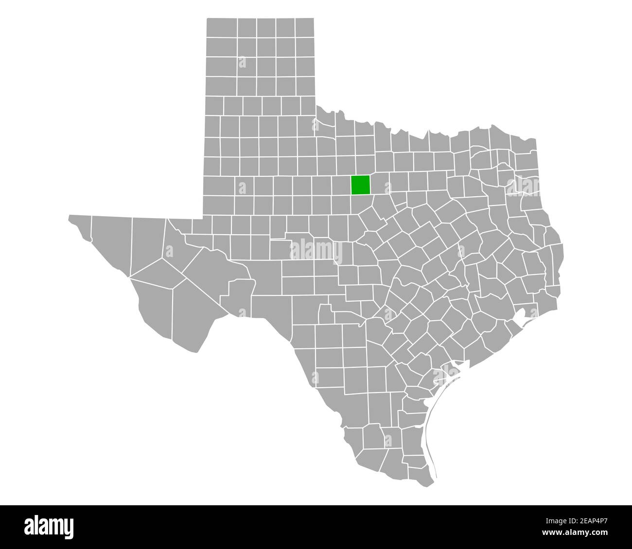 Map of Stephens in Texas Stock Photohttps://www.alamy.com/image-license-details/?v=1https://www.alamy.com/map-of-stephens-in-texas-image402471727.html
RF2EAP4P7–Map of Stephens in Texas
 St. Stephen's Episcopal Church, late Victorian period, yucca, originally built in town of Pecos in 1896, moved in 1958 to Fort Stockton, Texas, USA Stock Photohttps://www.alamy.com/image-license-details/?v=1https://www.alamy.com/st-stephens-episcopal-church-late-victorian-period-yucca-originally-built-in-town-of-pecos-in-1896-moved-in-1958-to-fort-stockton-texas-usa-image617525991.html
RF2XTJMKK–St. Stephen's Episcopal Church, late Victorian period, yucca, originally built in town of Pecos in 1896, moved in 1958 to Fort Stockton, Texas, USA
 Stephens County Courthouse in Breckenridge was built in 1920's to replace the frontier courthouse as oil was discovered - - - residents were proud of the frontier heritage and preserved a doorway of the old courthouse. Now they want to preserve God Stock Photohttps://www.alamy.com/image-license-details/?v=1https://www.alamy.com/stephens-county-courthouse-in-breckenridge-was-built-in-1920s-to-replace-the-frontier-courthouse-as-oil-was-discovered-residents-were-proud-of-the-frontier-heritage-and-preserved-a-doorway-of-the-old-courthouse-now-they-want-to-preserve-god-image229660015.html
RFR9HWKB–Stephens County Courthouse in Breckenridge was built in 1920's to replace the frontier courthouse as oil was discovered - - - residents were proud of the frontier heritage and preserved a doorway of the old courthouse. Now they want to preserve God
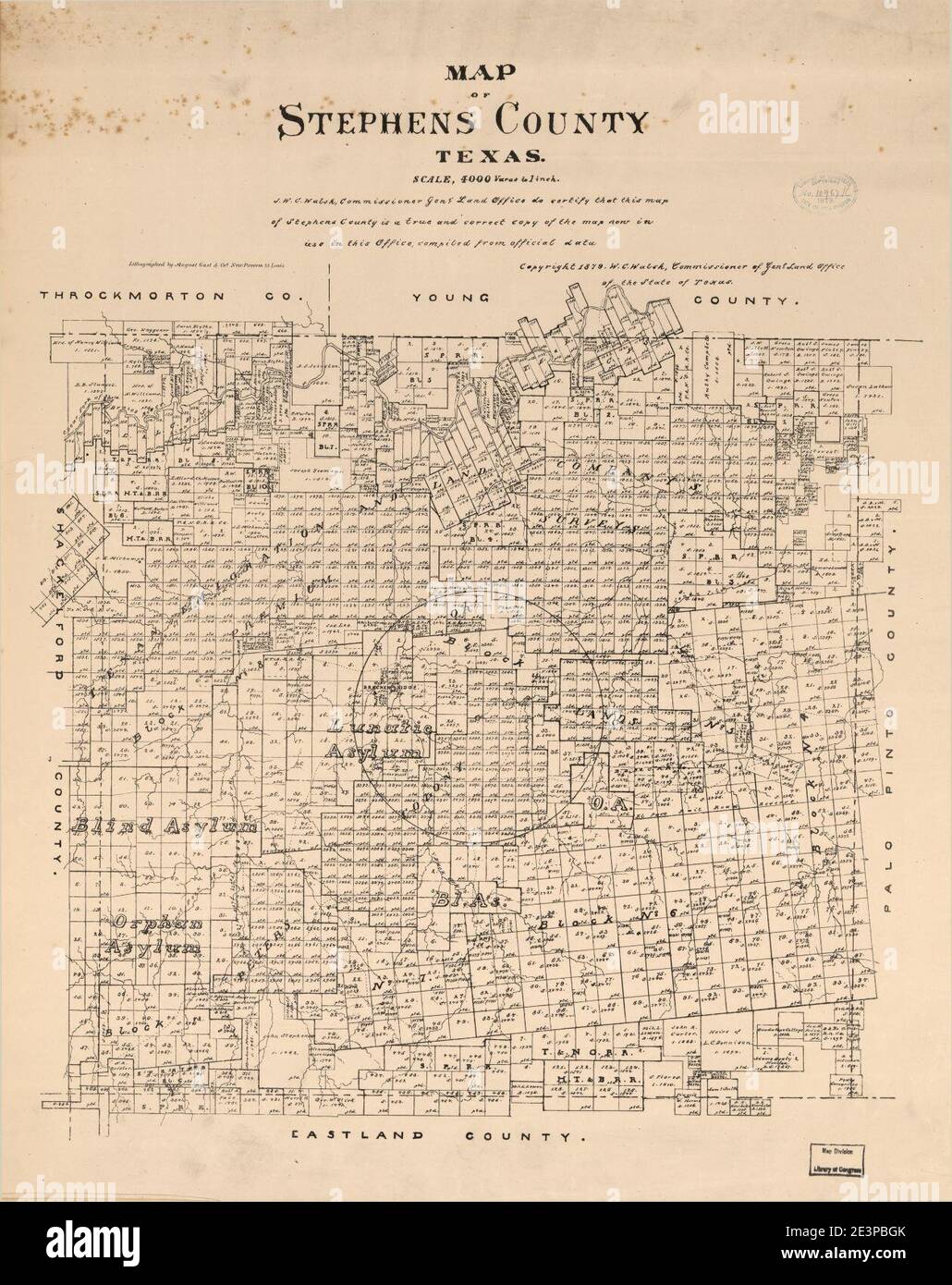 Map of Stephens County, Texas. Stock Photohttps://www.alamy.com/image-license-details/?v=1https://www.alamy.com/map-of-stephens-county-texas-image398174467.html
RM2E3PBGK–Map of Stephens County, Texas.
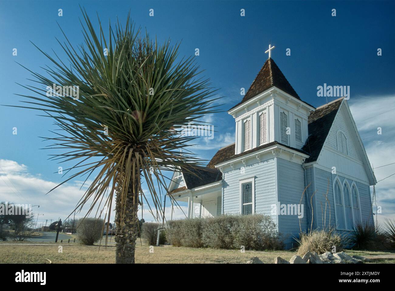 St. Stephen's Episcopal Church, late Victorian period, yucca, near Fort Stockton Historic Site, originally built in town of Pecos in 1896, moved in 19 Stock Photohttps://www.alamy.com/image-license-details/?v=1https://www.alamy.com/st-stephens-episcopal-church-late-victorian-period-yucca-near-fort-stockton-historic-site-originally-built-in-town-of-pecos-in-1896-moved-in-19-image617525831.html
RF2XTJMDY–St. Stephen's Episcopal Church, late Victorian period, yucca, near Fort Stockton Historic Site, originally built in town of Pecos in 1896, moved in 19
 Ivan, Stephens County, US, United States, Texas, N 32 52' 28'', S 98 44' 0'', map, Cartascapes Map published in 2024. Explore Cartascapes, a map revealing Earth's diverse landscapes, cultures, and ecosystems. Journey through time and space, discovering the interconnectedness of our planet's past, present, and future. Stock Photohttps://www.alamy.com/image-license-details/?v=1https://www.alamy.com/ivan-stephens-county-us-united-states-texas-n-32-52-28-s-98-44-0-map-cartascapes-map-published-in-2024-explore-cartascapes-a-map-revealing-earths-diverse-landscapes-cultures-and-ecosystems-journey-through-time-and-space-discovering-the-interconnectedness-of-our-planets-past-present-and-future-image621407676.html
RM2Y2YFR8–Ivan, Stephens County, US, United States, Texas, N 32 52' 28'', S 98 44' 0'', map, Cartascapes Map published in 2024. Explore Cartascapes, a map revealing Earth's diverse landscapes, cultures, and ecosystems. Journey through time and space, discovering the interconnectedness of our planet's past, present, and future.
 Map of Stephens in Texas Stock Photohttps://www.alamy.com/image-license-details/?v=1https://www.alamy.com/map-of-stephens-in-texas-image363874074.html
RF2C3YW2J–Map of Stephens in Texas
 Rendering of a green 3d highway sign for Stephens County Stock Photohttps://www.alamy.com/image-license-details/?v=1https://www.alamy.com/rendering-of-a-green-3d-highway-sign-for-stephens-county-image338548352.html
RF2AJP5TG–Rendering of a green 3d highway sign for Stephens County
 Pictorial review of the city of Paris and Lamar county, Texas .. . ntion of each individual may be found in the businessdirectory of this volume. Also we give herewith a group ofprominent physicians, and one of attorneys of the city. Ot thefirst mentioned, the engraving represents Drs. J. F. Hooks, E. W.Rush, F. M. Fort, J. B. Ryan, B. G. Baldwin, Leo Harrison,W. E Dailey, J. M. Stephens, Jas. R. Jones, VV. T. Thatcher andO. Smith All of these gentlemen have been very successful, andeach has a well-earned reputation for skill in his profession.They are essentially public benefactors, and are t Stock Photohttps://www.alamy.com/image-license-details/?v=1https://www.alamy.com/pictorial-review-of-the-city-of-paris-and-lamar-county-texas-ntion-of-each-individual-may-be-found-in-the-businessdirectory-of-this-volume-also-we-give-herewith-a-group-ofprominent-physicians-and-one-of-attorneys-of-the-city-ot-thefirst-mentioned-the-engraving-represents-drs-j-f-hooks-e-wrush-f-m-fort-j-b-ryan-b-g-baldwin-leo-harrisonw-e-dailey-j-m-stephens-jas-r-jones-vv-t-thatcher-ando-smith-all-of-these-gentlemen-have-been-very-successful-andeach-has-a-well-earned-reputation-for-skill-in-his-professionthey-are-essentially-public-benefactors-and-are-t-image340125724.html
RM2ANA1R8–Pictorial review of the city of Paris and Lamar county, Texas .. . ntion of each individual may be found in the businessdirectory of this volume. Also we give herewith a group ofprominent physicians, and one of attorneys of the city. Ot thefirst mentioned, the engraving represents Drs. J. F. Hooks, E. W.Rush, F. M. Fort, J. B. Ryan, B. G. Baldwin, Leo Harrison,W. E Dailey, J. M. Stephens, Jas. R. Jones, VV. T. Thatcher andO. Smith All of these gentlemen have been very successful, andeach has a well-earned reputation for skill in his profession.They are essentially public benefactors, and are t
 Map of Stephens in Texas Stock Photohttps://www.alamy.com/image-license-details/?v=1https://www.alamy.com/map-of-stephens-in-texas-image443925628.html
RF2GP6FJM–Map of Stephens in Texas
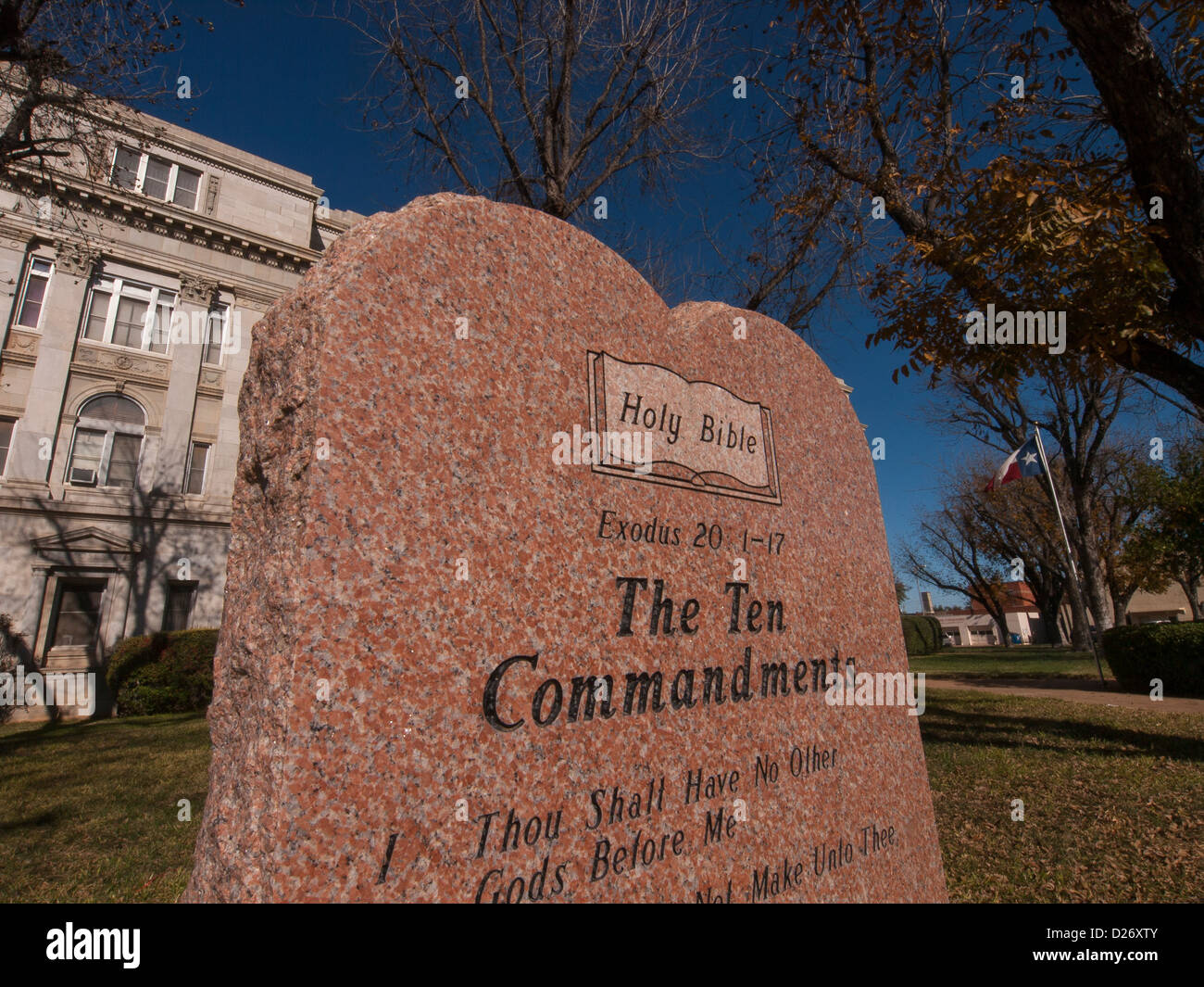 Ten Commandments displayed in front of Texas Courthouse. Stock Photohttps://www.alamy.com/image-license-details/?v=1https://www.alamy.com/stock-photo-ten-commandments-displayed-in-front-of-texas-courthouse-53013211.html
RMD26XTY–Ten Commandments displayed in front of Texas Courthouse.
 Breckenridge, Stephens County, US, United States, Texas, N 32 45' 20'', S 98 54' 8'', map, Cartascapes Map published in 2024. Explore Cartascapes, a map revealing Earth's diverse landscapes, cultures, and ecosystems. Journey through time and space, discovering the interconnectedness of our planet's past, present, and future. Stock Photohttps://www.alamy.com/image-license-details/?v=1https://www.alamy.com/breckenridge-stephens-county-us-united-states-texas-n-32-45-20-s-98-54-8-map-cartascapes-map-published-in-2024-explore-cartascapes-a-map-revealing-earths-diverse-landscapes-cultures-and-ecosystems-journey-through-time-and-space-discovering-the-interconnectedness-of-our-planets-past-present-and-future-image621297992.html
RM2Y2PFX0–Breckenridge, Stephens County, US, United States, Texas, N 32 45' 20'', S 98 54' 8'', map, Cartascapes Map published in 2024. Explore Cartascapes, a map revealing Earth's diverse landscapes, cultures, and ecosystems. Journey through time and space, discovering the interconnectedness of our planet's past, present, and future.
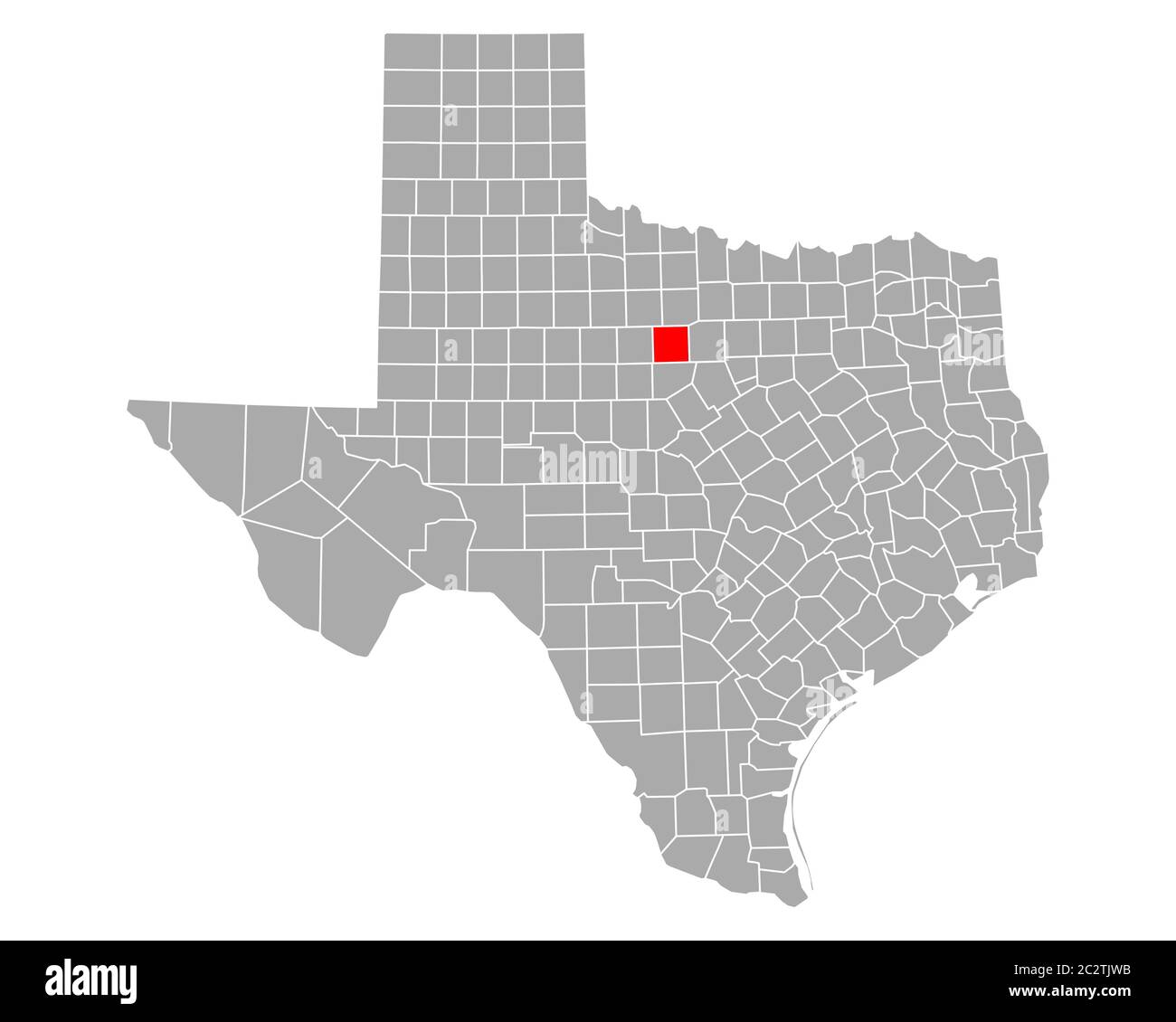 Map of Stephens in Texas Stock Photohttps://www.alamy.com/image-license-details/?v=1https://www.alamy.com/map-of-stephens-in-texas-image363188711.html
RF2C2TJWB–Map of Stephens in Texas
 The history and geography of Texas as told in county names . 244 The History and Geography of Texas CHAPTER XV. THE WAR BETWEEN THE NORTHERN AND SOUTHERNSECTIONS OF THE UNION—1861-1865.. CONFEDERATE MONUMENT, CAPITOL GROUNDS, AUSTIN, TEX. The soldiers and statesmen of the Southern Confederacy whohave been honored by county names are: Camp Lee Stonewall Val Verde Ector Randall Sutton Winkler Gregg Reeves Terry Young Hood Scurry Tom Green Jeff Davis Stephens Upton As Told in County Names 245 CAMP. John La Fayette Camp was born on a farm adjacent to Ely-ton (now a suburb of Birmingham), Ala., in Stock Photohttps://www.alamy.com/image-license-details/?v=1https://www.alamy.com/the-history-and-geography-of-texas-as-told-in-county-names-244-the-history-and-geography-of-texas-chapter-xv-the-war-between-the-northern-and-southernsections-of-the-union1861-1865-confederate-monument-capitol-grounds-austin-tex-the-soldiers-and-statesmen-of-the-southern-confederacy-whohave-been-honored-by-county-names-are-camp-lee-stonewall-val-verde-ector-randall-sutton-winkler-gregg-reeves-terry-young-hood-scurry-tom-green-jeff-davis-stephens-upton-as-told-in-county-names-245-camp-john-la-fayette-camp-was-born-on-a-farm-adjacent-to-ely-ton-now-a-suburb-of-birmingham-ala-in-image340037651.html
RM2AN61DR–The history and geography of Texas as told in county names . 244 The History and Geography of Texas CHAPTER XV. THE WAR BETWEEN THE NORTHERN AND SOUTHERNSECTIONS OF THE UNION—1861-1865.. CONFEDERATE MONUMENT, CAPITOL GROUNDS, AUSTIN, TEX. The soldiers and statesmen of the Southern Confederacy whohave been honored by county names are: Camp Lee Stonewall Val Verde Ector Randall Sutton Winkler Gregg Reeves Terry Young Hood Scurry Tom Green Jeff Davis Stephens Upton As Told in County Names 245 CAMP. John La Fayette Camp was born on a farm adjacent to Ely-ton (now a suburb of Birmingham), Ala., in
 South Hanlon, Stephens County, US, United States, Texas, N 32 43' 39'', S 98 52' 40'', map, Cartascapes Map published in 2024. Explore Cartascapes, a map revealing Earth's diverse landscapes, cultures, and ecosystems. Journey through time and space, discovering the interconnectedness of our planet's past, present, and future. Stock Photohttps://www.alamy.com/image-license-details/?v=1https://www.alamy.com/south-hanlon-stephens-county-us-united-states-texas-n-32-43-39-s-98-52-40-map-cartascapes-map-published-in-2024-explore-cartascapes-a-map-revealing-earths-diverse-landscapes-cultures-and-ecosystems-journey-through-time-and-space-discovering-the-interconnectedness-of-our-planets-past-present-and-future-image621216777.html
RM2Y2JT9D–South Hanlon, Stephens County, US, United States, Texas, N 32 43' 39'', S 98 52' 40'', map, Cartascapes Map published in 2024. Explore Cartascapes, a map revealing Earth's diverse landscapes, cultures, and ecosystems. Journey through time and space, discovering the interconnectedness of our planet's past, present, and future.
![. First[-fourth] annual report of the Geological survey of Texas, 1889[-1892] Edwin T. Dumble, state geologist. k CRYSTAL FALISM * «mi //. r,*. Scotie of «KiZes VICINITY OF CRYSTAL FALLS, STEPHENS COUNTY. 540 GEOLOGY OF NORTHWESTERN TEXAS. On the south side of Hubbards Creek, about one mile from the BerryMeadows mine, there is another outcrop of the same seam of coal. SLOAN SHAFT. One mile north of the Jake Wizeart mine, on the north side of the hillfronting on the Clear Fork of the Brazos River, an opening has been madeon the coal seam that shows the seam to be about the same as at the otherp Stock Photo . First[-fourth] annual report of the Geological survey of Texas, 1889[-1892] Edwin T. Dumble, state geologist. k CRYSTAL FALISM * «mi //. r,*. Scotie of «KiZes VICINITY OF CRYSTAL FALLS, STEPHENS COUNTY. 540 GEOLOGY OF NORTHWESTERN TEXAS. On the south side of Hubbards Creek, about one mile from the BerryMeadows mine, there is another outcrop of the same seam of coal. SLOAN SHAFT. One mile north of the Jake Wizeart mine, on the north side of the hillfronting on the Clear Fork of the Brazos River, an opening has been madeon the coal seam that shows the seam to be about the same as at the otherp Stock Photo](https://c8.alamy.com/comp/2CF6A72/first-fourth-annual-report-of-the-geological-survey-of-texas-1889-1892-edwin-t-dumble-state-geologist-k-crystal-falism-mi-r-scotie-of-kizes-vicinity-of-crystal-falls-stephens-county-540-geology-of-northwestern-texas-on-the-south-side-of-hubbards-creek-about-one-mile-from-the-berrymeadows-mine-there-is-another-outcrop-of-the-same-seam-of-coal-sloan-shaft-one-mile-north-of-the-jake-wizeart-mine-on-the-north-side-of-the-hillfronting-on-the-clear-fork-of-the-brazos-river-an-opening-has-been-madeon-the-coal-seam-that-shows-the-seam-to-be-about-the-same-as-at-the-otherp-2CF6A72.jpg) . First[-fourth] annual report of the Geological survey of Texas, 1889[-1892] Edwin T. Dumble, state geologist. k CRYSTAL FALISM * «mi //. r,*. Scotie of «KiZes VICINITY OF CRYSTAL FALLS, STEPHENS COUNTY. 540 GEOLOGY OF NORTHWESTERN TEXAS. On the south side of Hubbards Creek, about one mile from the BerryMeadows mine, there is another outcrop of the same seam of coal. SLOAN SHAFT. One mile north of the Jake Wizeart mine, on the north side of the hillfronting on the Clear Fork of the Brazos River, an opening has been madeon the coal seam that shows the seam to be about the same as at the otherp Stock Photohttps://www.alamy.com/image-license-details/?v=1https://www.alamy.com/first-fourth-annual-report-of-the-geological-survey-of-texas-1889-1892-edwin-t-dumble-state-geologist-k-crystal-falism-mi-r-scotie-of-kizes-vicinity-of-crystal-falls-stephens-county-540-geology-of-northwestern-texas-on-the-south-side-of-hubbards-creek-about-one-mile-from-the-berrymeadows-mine-there-is-another-outcrop-of-the-same-seam-of-coal-sloan-shaft-one-mile-north-of-the-jake-wizeart-mine-on-the-north-side-of-the-hillfronting-on-the-clear-fork-of-the-brazos-river-an-opening-has-been-madeon-the-coal-seam-that-shows-the-seam-to-be-about-the-same-as-at-the-otherp-image370777318.html
. First[-fourth] annual report of the Geological survey of Texas, 1889[-1892] Edwin T. Dumble, state geologist. k CRYSTAL FALISM * «mi //. r,*. Scotie of «KiZes VICINITY OF CRYSTAL FALLS, STEPHENS COUNTY. 540 GEOLOGY OF NORTHWESTERN TEXAS. On the south side of Hubbards Creek, about one mile from the BerryMeadows mine, there is another outcrop of the same seam of coal. SLOAN SHAFT. One mile north of the Jake Wizeart mine, on the north side of the hillfronting on the Clear Fork of the Brazos River, an opening has been madeon the coal seam that shows the seam to be about the same as at the otherp Stock Photohttps://www.alamy.com/image-license-details/?v=1https://www.alamy.com/first-fourth-annual-report-of-the-geological-survey-of-texas-1889-1892-edwin-t-dumble-state-geologist-k-crystal-falism-mi-r-scotie-of-kizes-vicinity-of-crystal-falls-stephens-county-540-geology-of-northwestern-texas-on-the-south-side-of-hubbards-creek-about-one-mile-from-the-berrymeadows-mine-there-is-another-outcrop-of-the-same-seam-of-coal-sloan-shaft-one-mile-north-of-the-jake-wizeart-mine-on-the-north-side-of-the-hillfronting-on-the-clear-fork-of-the-brazos-river-an-opening-has-been-madeon-the-coal-seam-that-shows-the-seam-to-be-about-the-same-as-at-the-otherp-image370777318.htmlRM2CF6A72–. First[-fourth] annual report of the Geological survey of Texas, 1889[-1892] Edwin T. Dumble, state geologist. k CRYSTAL FALISM * «mi //. r,*. Scotie of «KiZes VICINITY OF CRYSTAL FALLS, STEPHENS COUNTY. 540 GEOLOGY OF NORTHWESTERN TEXAS. On the south side of Hubbards Creek, about one mile from the BerryMeadows mine, there is another outcrop of the same seam of coal. SLOAN SHAFT. One mile north of the Jake Wizeart mine, on the north side of the hillfronting on the Clear Fork of the Brazos River, an opening has been madeon the coal seam that shows the seam to be about the same as at the otherp
 Mankins Mill, Stephens County, US, United States, Texas, N 32 39' 10'', S 99 3' 30'', map, Cartascapes Map published in 2024. Explore Cartascapes, a map revealing Earth's diverse landscapes, cultures, and ecosystems. Journey through time and space, discovering the interconnectedness of our planet's past, present, and future. Stock Photohttps://www.alamy.com/image-license-details/?v=1https://www.alamy.com/mankins-mill-stephens-county-us-united-states-texas-n-32-39-10-s-99-3-30-map-cartascapes-map-published-in-2024-explore-cartascapes-a-map-revealing-earths-diverse-landscapes-cultures-and-ecosystems-journey-through-time-and-space-discovering-the-interconnectedness-of-our-planets-past-present-and-future-image621378408.html
RM2Y2X6E0–Mankins Mill, Stephens County, US, United States, Texas, N 32 39' 10'', S 99 3' 30'', map, Cartascapes Map published in 2024. Explore Cartascapes, a map revealing Earth's diverse landscapes, cultures, and ecosystems. Journey through time and space, discovering the interconnectedness of our planet's past, present, and future.
 . The Wilson bulletin . Vol. XXVI SEPTEMBER, 1914 No. 3 THE WUson BoUetin No. 88CHICAGO, ILL.. WILSON ORNITHOLOGICAL CLUB CONTENTS ^ PAGE Frontispiece The Prothonotary Warbler at Lake Okoboji, Iowa, T. C. Stephens 109 Habits of the Old-Squaw (Harelda Hyemalis) in Jackson Park, Chi-cago, Edwin D. Hull 116 The Kentucky Warbler in Columbiana County, H. W. Weisgerber 123 Spring Migration (1914) at Houston, Texas, George Finlay Simmons 128 The Pine Siskin Breeding in Iowa, W. J. Hayward and T. C. Stephens... 140 Editorial 147 Field Notes: An Experience with a Florida Gallinule; MiniatureEarthquake; Stock Photohttps://www.alamy.com/image-license-details/?v=1https://www.alamy.com/the-wilson-bulletin-vol-xxvi-september-1914-no-3-the-wuson-bouetin-no-88chicago-ill-wilson-ornithological-club-contents-page-frontispiece-the-prothonotary-warbler-at-lake-okoboji-iowa-t-c-stephens-109-habits-of-the-old-squaw-harelda-hyemalis-in-jackson-park-chi-cago-edwin-d-hull-116-the-kentucky-warbler-in-columbiana-county-h-w-weisgerber-123-spring-migration-1914-at-houston-texas-george-finlay-simmons-128-the-pine-siskin-breeding-in-iowa-w-j-hayward-and-t-c-stephens-140-editorial-147-field-notes-an-experience-with-a-florida-gallinule-miniatureearthquake-image374958427.html
RM2CP0R8B–. The Wilson bulletin . Vol. XXVI SEPTEMBER, 1914 No. 3 THE WUson BoUetin No. 88CHICAGO, ILL.. WILSON ORNITHOLOGICAL CLUB CONTENTS ^ PAGE Frontispiece The Prothonotary Warbler at Lake Okoboji, Iowa, T. C. Stephens 109 Habits of the Old-Squaw (Harelda Hyemalis) in Jackson Park, Chi-cago, Edwin D. Hull 116 The Kentucky Warbler in Columbiana County, H. W. Weisgerber 123 Spring Migration (1914) at Houston, Texas, George Finlay Simmons 128 The Pine Siskin Breeding in Iowa, W. J. Hayward and T. C. Stephens... 140 Editorial 147 Field Notes: An Experience with a Florida Gallinule; MiniatureEarthquake;
 Crystal Falls, Stephens County, US, United States, Texas, N 32 53' 44'', S 98 54' 1'', map, Cartascapes Map published in 2024. Explore Cartascapes, a map revealing Earth's diverse landscapes, cultures, and ecosystems. Journey through time and space, discovering the interconnectedness of our planet's past, present, and future. Stock Photohttps://www.alamy.com/image-license-details/?v=1https://www.alamy.com/crystal-falls-stephens-county-us-united-states-texas-n-32-53-44-s-98-54-1-map-cartascapes-map-published-in-2024-explore-cartascapes-a-map-revealing-earths-diverse-landscapes-cultures-and-ecosystems-journey-through-time-and-space-discovering-the-interconnectedness-of-our-planets-past-present-and-future-image621234479.html
RM2Y2KJWK–Crystal Falls, Stephens County, US, United States, Texas, N 32 53' 44'', S 98 54' 1'', map, Cartascapes Map published in 2024. Explore Cartascapes, a map revealing Earth's diverse landscapes, cultures, and ecosystems. Journey through time and space, discovering the interconnectedness of our planet's past, present, and future.
 Breckenridge, Stephens County, US, United States, Texas, N 32 45' 20'', S 98 54' 8'', map, Cartascapes Map published in 2024. Explore Cartascapes, a map revealing Earth's diverse landscapes, cultures, and ecosystems. Journey through time and space, discovering the interconnectedness of our planet's past, present, and future. Stock Photohttps://www.alamy.com/image-license-details/?v=1https://www.alamy.com/breckenridge-stephens-county-us-united-states-texas-n-32-45-20-s-98-54-8-map-cartascapes-map-published-in-2024-explore-cartascapes-a-map-revealing-earths-diverse-landscapes-cultures-and-ecosystems-journey-through-time-and-space-discovering-the-interconnectedness-of-our-planets-past-present-and-future-image620865954.html
RM2Y22TT2–Breckenridge, Stephens County, US, United States, Texas, N 32 45' 20'', S 98 54' 8'', map, Cartascapes Map published in 2024. Explore Cartascapes, a map revealing Earth's diverse landscapes, cultures, and ecosystems. Journey through time and space, discovering the interconnectedness of our planet's past, present, and future.
 Eolian, Stephens County, US, United States, Texas, N 32 40' 0'', S 99 0' 58'', map, Cartascapes Map published in 2024. Explore Cartascapes, a map revealing Earth's diverse landscapes, cultures, and ecosystems. Journey through time and space, discovering the interconnectedness of our planet's past, present, and future. Stock Photohttps://www.alamy.com/image-license-details/?v=1https://www.alamy.com/eolian-stephens-county-us-united-states-texas-n-32-40-0-s-99-0-58-map-cartascapes-map-published-in-2024-explore-cartascapes-a-map-revealing-earths-diverse-landscapes-cultures-and-ecosystems-journey-through-time-and-space-discovering-the-interconnectedness-of-our-planets-past-present-and-future-image620688814.html
RM2Y1PPWJ–Eolian, Stephens County, US, United States, Texas, N 32 40' 0'', S 99 0' 58'', map, Cartascapes Map published in 2024. Explore Cartascapes, a map revealing Earth's diverse landscapes, cultures, and ecosystems. Journey through time and space, discovering the interconnectedness of our planet's past, present, and future.
 Harpersville, Stephens County, US, United States, Texas, N 32 36' 0'', S 98 56' 3'', map, Cartascapes Map published in 2024. Explore Cartascapes, a map revealing Earth's diverse landscapes, cultures, and ecosystems. Journey through time and space, discovering the interconnectedness of our planet's past, present, and future. Stock Photohttps://www.alamy.com/image-license-details/?v=1https://www.alamy.com/harpersville-stephens-county-us-united-states-texas-n-32-36-0-s-98-56-3-map-cartascapes-map-published-in-2024-explore-cartascapes-a-map-revealing-earths-diverse-landscapes-cultures-and-ecosystems-journey-through-time-and-space-discovering-the-interconnectedness-of-our-planets-past-present-and-future-image620888920.html
RM2Y23X48–Harpersville, Stephens County, US, United States, Texas, N 32 36' 0'', S 98 56' 3'', map, Cartascapes Map published in 2024. Explore Cartascapes, a map revealing Earth's diverse landscapes, cultures, and ecosystems. Journey through time and space, discovering the interconnectedness of our planet's past, present, and future.
 Wayland, Stephens County, US, United States, Texas, N 32 36' 34'', S 98 49' 41'', map, Cartascapes Map published in 2024. Explore Cartascapes, a map revealing Earth's diverse landscapes, cultures, and ecosystems. Journey through time and space, discovering the interconnectedness of our planet's past, present, and future. Stock Photohttps://www.alamy.com/image-license-details/?v=1https://www.alamy.com/wayland-stephens-county-us-united-states-texas-n-32-36-34-s-98-49-41-map-cartascapes-map-published-in-2024-explore-cartascapes-a-map-revealing-earths-diverse-landscapes-cultures-and-ecosystems-journey-through-time-and-space-discovering-the-interconnectedness-of-our-planets-past-present-and-future-image620817518.html
RM2Y20K26–Wayland, Stephens County, US, United States, Texas, N 32 36' 34'', S 98 49' 41'', map, Cartascapes Map published in 2024. Explore Cartascapes, a map revealing Earth's diverse landscapes, cultures, and ecosystems. Journey through time and space, discovering the interconnectedness of our planet's past, present, and future.
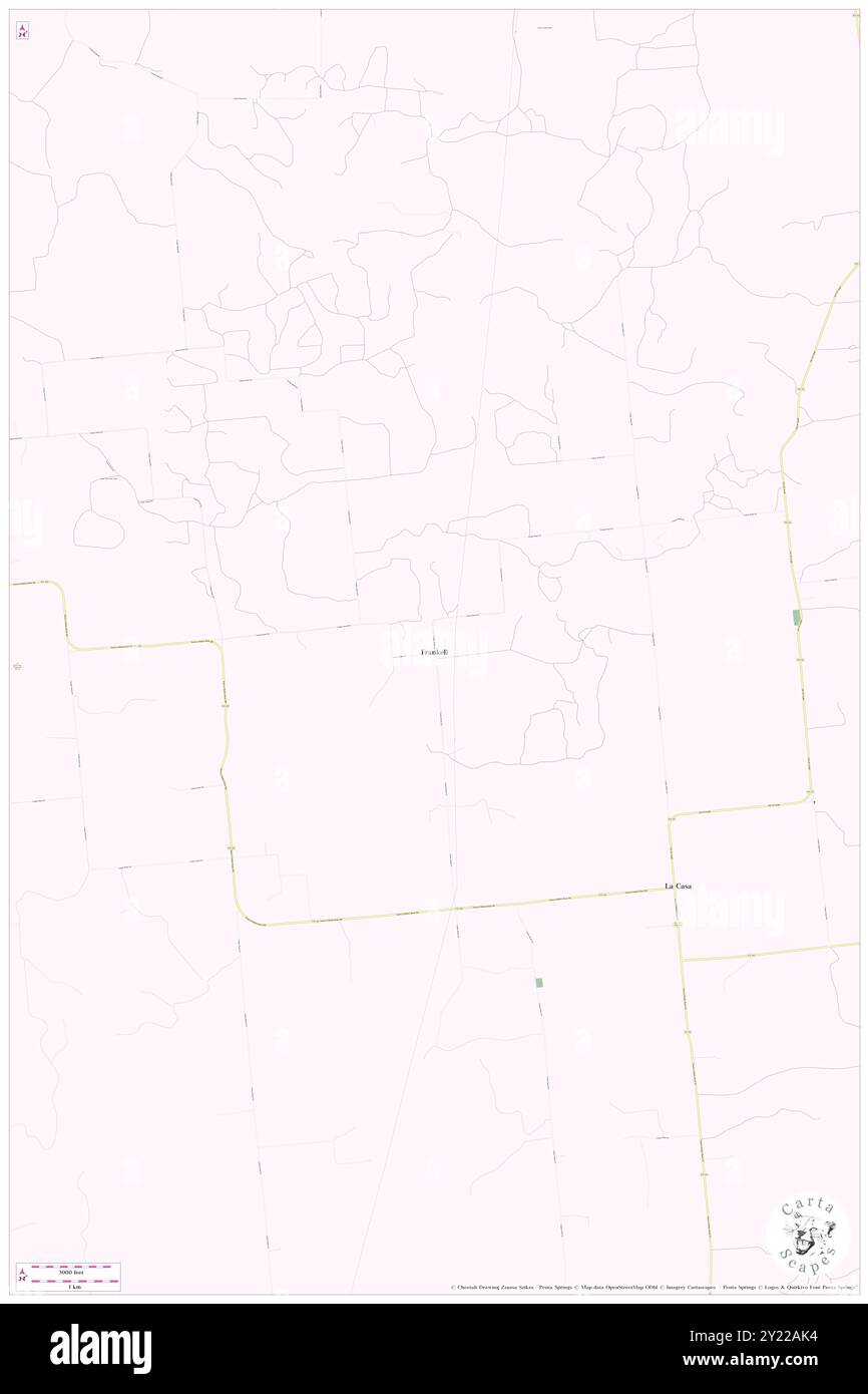 Frankell, Stephens County, US, United States, Texas, N 32 37' 27'', S 98 43' 6'', map, Cartascapes Map published in 2024. Explore Cartascapes, a map revealing Earth's diverse landscapes, cultures, and ecosystems. Journey through time and space, discovering the interconnectedness of our planet's past, present, and future. Stock Photohttps://www.alamy.com/image-license-details/?v=1https://www.alamy.com/frankell-stephens-county-us-united-states-texas-n-32-37-27-s-98-43-6-map-cartascapes-map-published-in-2024-explore-cartascapes-a-map-revealing-earths-diverse-landscapes-cultures-and-ecosystems-journey-through-time-and-space-discovering-the-interconnectedness-of-our-planets-past-present-and-future-image620854840.html
RM2Y22AK4–Frankell, Stephens County, US, United States, Texas, N 32 37' 27'', S 98 43' 6'', map, Cartascapes Map published in 2024. Explore Cartascapes, a map revealing Earth's diverse landscapes, cultures, and ecosystems. Journey through time and space, discovering the interconnectedness of our planet's past, present, and future.
 Necessity, Stephens County, US, United States, Texas, N 32 38' 54'', S 98 46' 30'', map, Cartascapes Map published in 2024. Explore Cartascapes, a map revealing Earth's diverse landscapes, cultures, and ecosystems. Journey through time and space, discovering the interconnectedness of our planet's past, present, and future. Stock Photohttps://www.alamy.com/image-license-details/?v=1https://www.alamy.com/necessity-stephens-county-us-united-states-texas-n-32-38-54-s-98-46-30-map-cartascapes-map-published-in-2024-explore-cartascapes-a-map-revealing-earths-diverse-landscapes-cultures-and-ecosystems-journey-through-time-and-space-discovering-the-interconnectedness-of-our-planets-past-present-and-future-image620715403.html
RM2Y1T0R7–Necessity, Stephens County, US, United States, Texas, N 32 38' 54'', S 98 46' 30'', map, Cartascapes Map published in 2024. Explore Cartascapes, a map revealing Earth's diverse landscapes, cultures, and ecosystems. Journey through time and space, discovering the interconnectedness of our planet's past, present, and future.
 Gunsight, Stephens County, US, United States, Texas, N 32 32' 29'', S 98 52' 16'', map, Cartascapes Map published in 2024. Explore Cartascapes, a map revealing Earth's diverse landscapes, cultures, and ecosystems. Journey through time and space, discovering the interconnectedness of our planet's past, present, and future. Stock Photohttps://www.alamy.com/image-license-details/?v=1https://www.alamy.com/gunsight-stephens-county-us-united-states-texas-n-32-32-29-s-98-52-16-map-cartascapes-map-published-in-2024-explore-cartascapes-a-map-revealing-earths-diverse-landscapes-cultures-and-ecosystems-journey-through-time-and-space-discovering-the-interconnectedness-of-our-planets-past-present-and-future-image620776301.html
RM2Y1XPE5–Gunsight, Stephens County, US, United States, Texas, N 32 32' 29'', S 98 52' 16'', map, Cartascapes Map published in 2024. Explore Cartascapes, a map revealing Earth's diverse landscapes, cultures, and ecosystems. Journey through time and space, discovering the interconnectedness of our planet's past, present, and future.
 Caddo, Stephens County, US, United States, Texas, N 32 43' 5'', S 98 40' 6'', map, Cartascapes Map published in 2024. Explore Cartascapes, a map revealing Earth's diverse landscapes, cultures, and ecosystems. Journey through time and space, discovering the interconnectedness of our planet's past, present, and future. Stock Photohttps://www.alamy.com/image-license-details/?v=1https://www.alamy.com/caddo-stephens-county-us-united-states-texas-n-32-43-5-s-98-40-6-map-cartascapes-map-published-in-2024-explore-cartascapes-a-map-revealing-earths-diverse-landscapes-cultures-and-ecosystems-journey-through-time-and-space-discovering-the-interconnectedness-of-our-planets-past-present-and-future-image620775508.html
RM2Y1XNDT–Caddo, Stephens County, US, United States, Texas, N 32 43' 5'', S 98 40' 6'', map, Cartascapes Map published in 2024. Explore Cartascapes, a map revealing Earth's diverse landscapes, cultures, and ecosystems. Journey through time and space, discovering the interconnectedness of our planet's past, present, and future.
 La Casa, Stephens County, US, United States, Texas, N 32 36' 3'', S 98 41' 22'', map, Cartascapes Map published in 2024. Explore Cartascapes, a map revealing Earth's diverse landscapes, cultures, and ecosystems. Journey through time and space, discovering the interconnectedness of our planet's past, present, and future. Stock Photohttps://www.alamy.com/image-license-details/?v=1https://www.alamy.com/la-casa-stephens-county-us-united-states-texas-n-32-36-3-s-98-41-22-map-cartascapes-map-published-in-2024-explore-cartascapes-a-map-revealing-earths-diverse-landscapes-cultures-and-ecosystems-journey-through-time-and-space-discovering-the-interconnectedness-of-our-planets-past-present-and-future-image620877697.html
RM2Y23BRD–La Casa, Stephens County, US, United States, Texas, N 32 36' 3'', S 98 41' 22'', map, Cartascapes Map published in 2024. Explore Cartascapes, a map revealing Earth's diverse landscapes, cultures, and ecosystems. Journey through time and space, discovering the interconnectedness of our planet's past, present, and future.
 Stephens Crossing, Parker County, US, United States, Texas, N 32 37' 7'', S 97 57' 52'', map, Cartascapes Map published in 2024. Explore Cartascapes, a map revealing Earth's diverse landscapes, cultures, and ecosystems. Journey through time and space, discovering the interconnectedness of our planet's past, present, and future. Stock Photohttps://www.alamy.com/image-license-details/?v=1https://www.alamy.com/stephens-crossing-parker-county-us-united-states-texas-n-32-37-7-s-97-57-52-map-cartascapes-map-published-in-2024-explore-cartascapes-a-map-revealing-earths-diverse-landscapes-cultures-and-ecosystems-journey-through-time-and-space-discovering-the-interconnectedness-of-our-planets-past-present-and-future-image620837464.html
RM2Y21GEG–Stephens Crossing, Parker County, US, United States, Texas, N 32 37' 7'', S 97 57' 52'', map, Cartascapes Map published in 2024. Explore Cartascapes, a map revealing Earth's diverse landscapes, cultures, and ecosystems. Journey through time and space, discovering the interconnectedness of our planet's past, present, and future.