Quick filters:
Straits of magellan map Stock Photos and Images
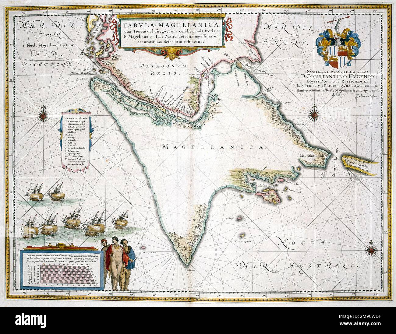 17th century Map of Tierra del Fuego and Magellan Straits Stock Photohttps://www.alamy.com/image-license-details/?v=1https://www.alamy.com/17th-century-map-of-tierra-del-fuego-and-magellan-straits-image504915979.html
RM2M9CWDF–17th century Map of Tierra del Fuego and Magellan Straits
 Woodcut engraving based on Jodocus Hondius' map showing the Straits of Magellan and Terra del Fueogo. Magellan passed through the Straits and round Cape Horn during his voyage of circumnavigation. Jodocus Hondius (1563-1612) a Flemish engraver and cartographer. Dated 16th century Stock Photohttps://www.alamy.com/image-license-details/?v=1https://www.alamy.com/woodcut-engraving-based-on-jodocus-hondius-map-showing-the-straits-of-magellan-and-terra-del-fueogo-magellan-passed-through-the-straits-and-round-cape-horn-during-his-voyage-of-circumnavigation-jodocus-hondius-1563-1612-a-flemish-engraver-and-cartographer-dated-16th-century-image186400599.html
RMMR77T7–Woodcut engraving based on Jodocus Hondius' map showing the Straits of Magellan and Terra del Fueogo. Magellan passed through the Straits and round Cape Horn during his voyage of circumnavigation. Jodocus Hondius (1563-1612) a Flemish engraver and cartographer. Dated 16th century
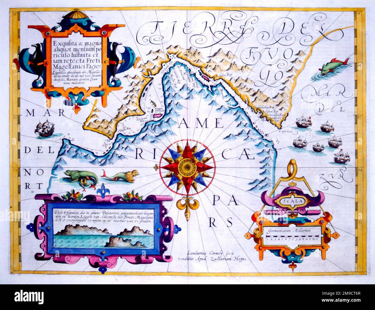 17th century Map of the Magellan Straits, Tierra del Fuego, South America Stock Photohttps://www.alamy.com/image-license-details/?v=1https://www.alamy.com/17th-century-map-of-the-magellan-straits-tierra-del-fuego-south-america-image504915007.html
RM2M9CT6R–17th century Map of the Magellan Straits, Tierra del Fuego, South America
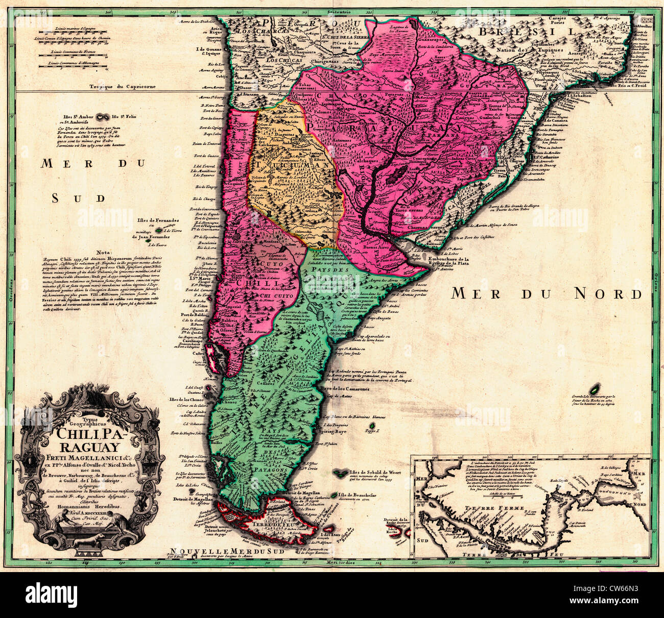 Map of Chile, Paraguay and the Straits of Magellan, circa 1733 Stock Photohttps://www.alamy.com/image-license-details/?v=1https://www.alamy.com/stock-photo-map-of-chile-paraguay-and-the-straits-of-magellan-circa-1733-49924143.html
RMCW66N3–Map of Chile, Paraguay and the Straits of Magellan, circa 1733
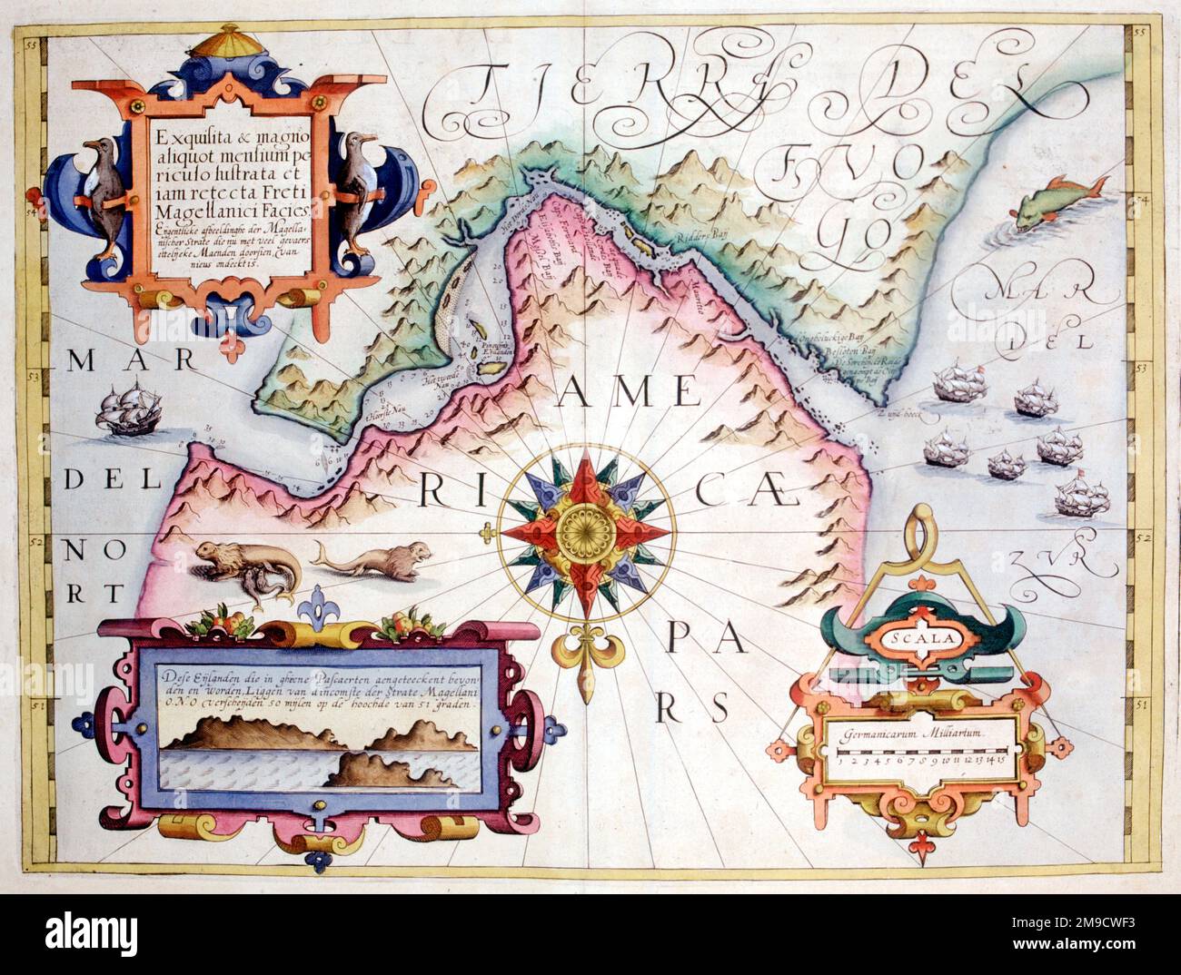 17th century Map of the Magellan Straits, Patagonia and Tierra del Fuego, South America Stock Photohttps://www.alamy.com/image-license-details/?v=1https://www.alamy.com/17th-century-map-of-the-magellan-straits-patagonia-and-tierra-del-fuego-south-america-image504916023.html
RM2M9CWF3–17th century Map of the Magellan Straits, Patagonia and Tierra del Fuego, South America
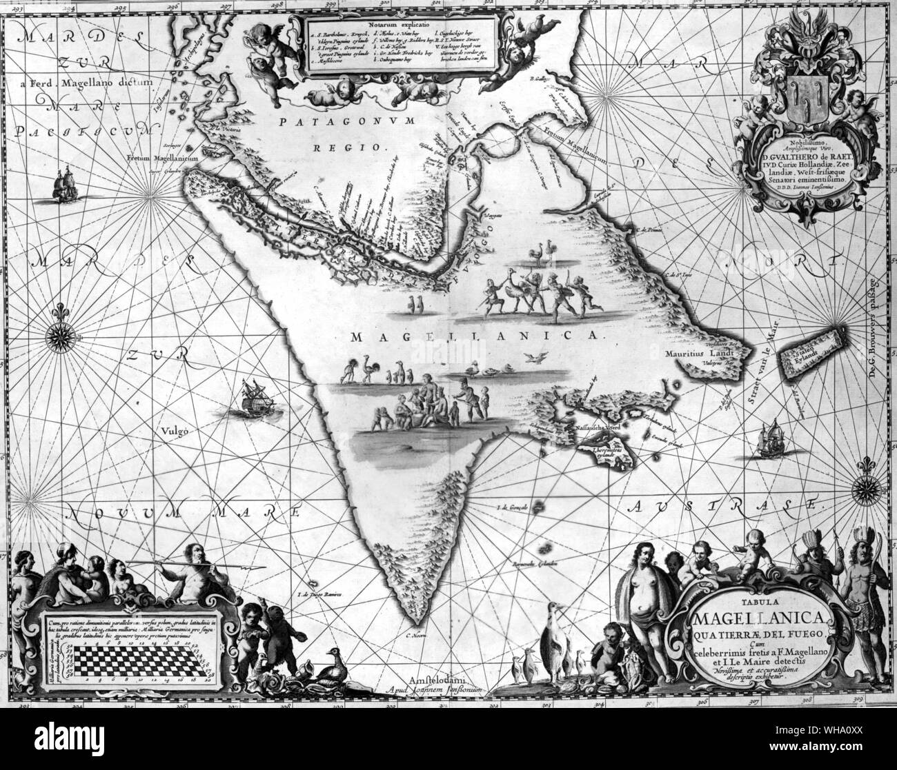 The Magellan Straits, from a sixteenth-century map. In the Tierra del Fuego an idyllic family group sits among rheas, penguins and geese while the warriors go hunting. Stock Photohttps://www.alamy.com/image-license-details/?v=1https://www.alamy.com/the-magellan-straits-from-a-sixteenth-century-map-in-the-tierra-del-fuego-an-idyllic-family-group-sits-among-rheas-penguins-and-geese-while-the-warriors-go-hunting-image268824946.html
RMWHA0XX–The Magellan Straits, from a sixteenth-century map. In the Tierra del Fuego an idyllic family group sits among rheas, penguins and geese while the warriors go hunting.
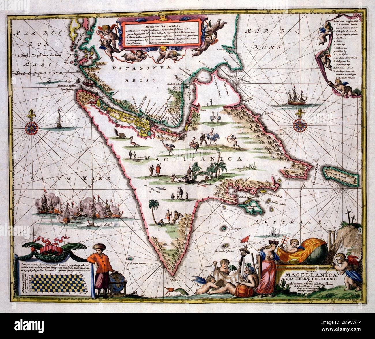 17th century Map of Straits of Magellan and Magellanica (Terra Del Fuego), South America - Tabula Magellanica Qua Tierrae del Fuego Stock Photohttps://www.alamy.com/image-license-details/?v=1https://www.alamy.com/17th-century-map-of-straits-of-magellan-and-magellanica-terra-del-fuego-south-america-tabula-magellanica-qua-tierrae-del-fuego-image504916042.html
RM2M9CWFP–17th century Map of Straits of Magellan and Magellanica (Terra Del Fuego), South America - Tabula Magellanica Qua Tierrae del Fuego
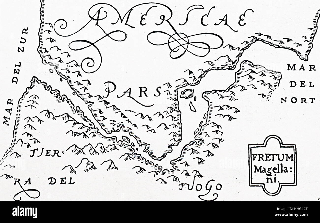 Woodcut based Hondius's Map. Circa 1590, showing the Straits of Magellan and Tierra del Fuego. Stock Photohttps://www.alamy.com/image-license-details/?v=1https://www.alamy.com/stock-photo-woodcut-based-hondiuss-map-circa-1590-showing-the-straits-of-magellan-131276456.html
RMHHG4CT–Woodcut based Hondius's Map. Circa 1590, showing the Straits of Magellan and Tierra del Fuego.
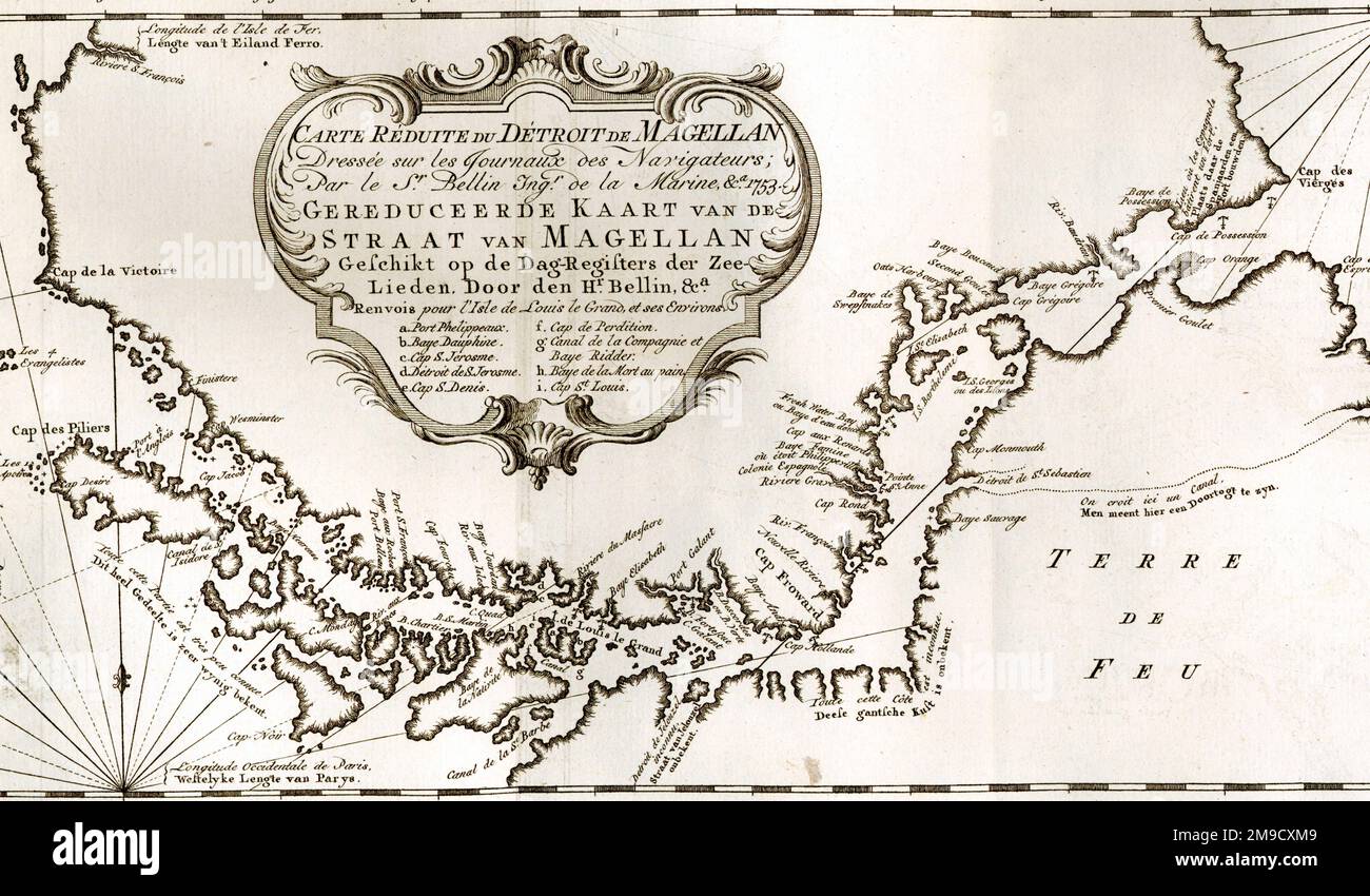 18th century Map of the Strait of Magellan between South America and Tierra del Fuego Stock Photohttps://www.alamy.com/image-license-details/?v=1https://www.alamy.com/18th-century-map-of-the-strait-of-magellan-between-south-america-and-tierra-del-fuego-image504916953.html
RM2M9CXM9–18th century Map of the Strait of Magellan between South America and Tierra del Fuego
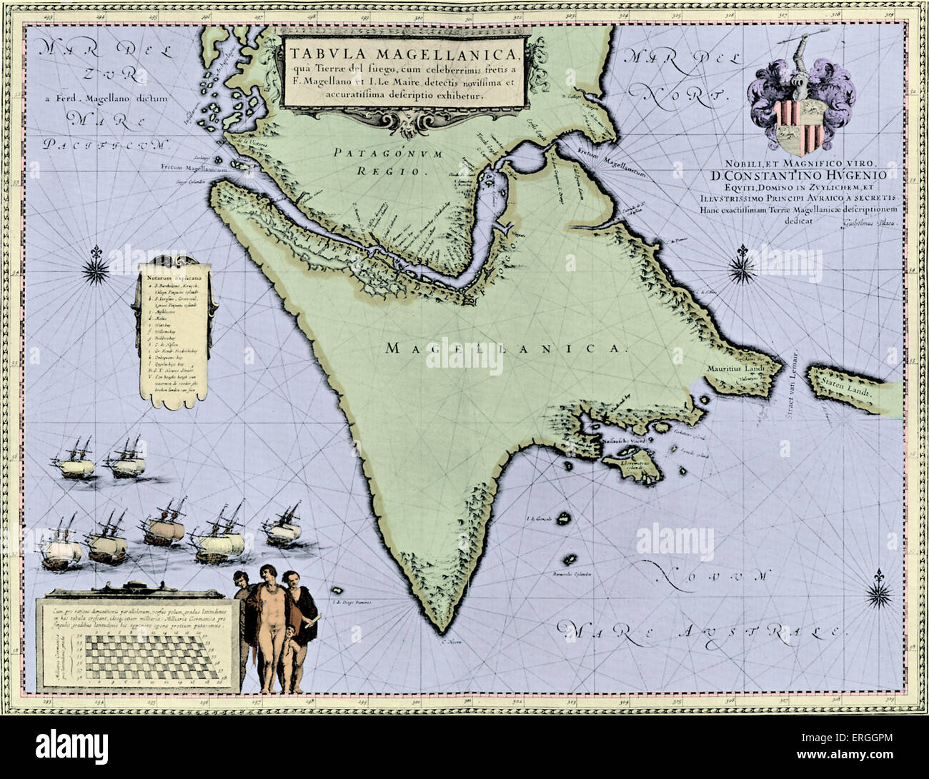 Strait of Magellan and Tierra del Fuego - map published in W.J Blaeu and J. Blaeu 's 'Nieuwe Atlas', 1642-3. (Full title: Stock Photohttps://www.alamy.com/image-license-details/?v=1https://www.alamy.com/stock-photo-strait-of-magellan-and-tierra-del-fuego-map-published-in-wj-blaeu-83342972.html
RMERGGPM–Strait of Magellan and Tierra del Fuego - map published in W.J Blaeu and J. Blaeu 's 'Nieuwe Atlas', 1642-3. (Full title:
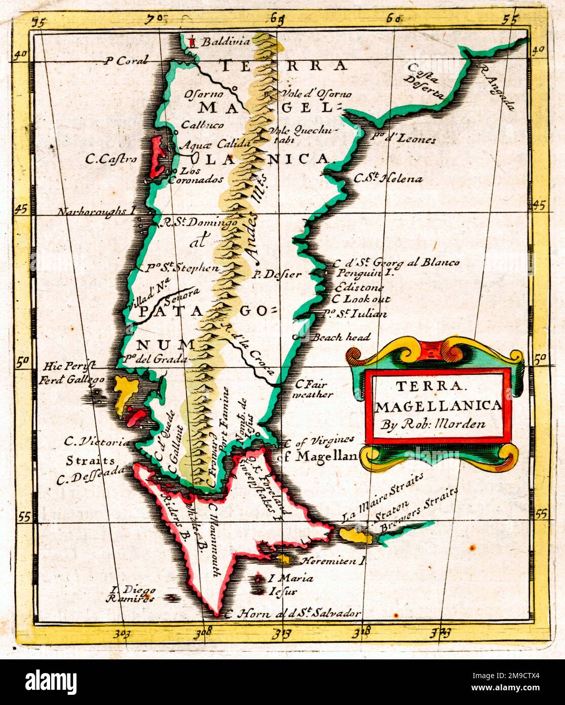 17th century Map of Terra Magellanica, South America, showing the Straits of Magellan, Cape Horn and Patagonia Stock Photohttps://www.alamy.com/image-license-details/?v=1https://www.alamy.com/17th-century-map-of-terra-magellanica-south-america-showing-the-straits-of-magellan-cape-horn-and-patagonia-image504915548.html
RM2M9CTX4–17th century Map of Terra Magellanica, South America, showing the Straits of Magellan, Cape Horn and Patagonia
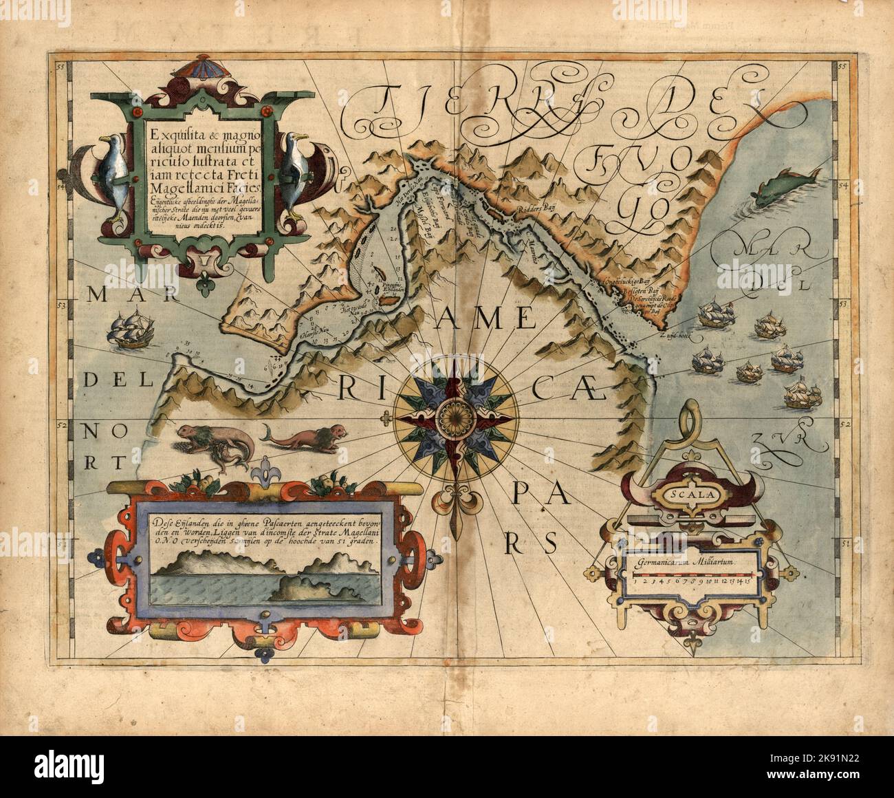 Old illustrated map of the Strait of Magellan in southern Chile by Dutch cartographer Jodocus Hondius ca. 1611 Stock Photohttps://www.alamy.com/image-license-details/?v=1https://www.alamy.com/old-illustrated-map-of-the-strait-of-magellan-in-southern-chile-by-dutch-cartographer-jodocus-hondius-ca-1611-image487460682.html
RM2K91N22–Old illustrated map of the Strait of Magellan in southern Chile by Dutch cartographer Jodocus Hondius ca. 1611
 Famous Voyages - Magellan passing through the straits 1519 Stock Photohttps://www.alamy.com/image-license-details/?v=1https://www.alamy.com/stock-photo-famous-voyages-magellan-passing-through-the-straits-1519-175463153.html
RMM5D115–Famous Voyages - Magellan passing through the straits 1519
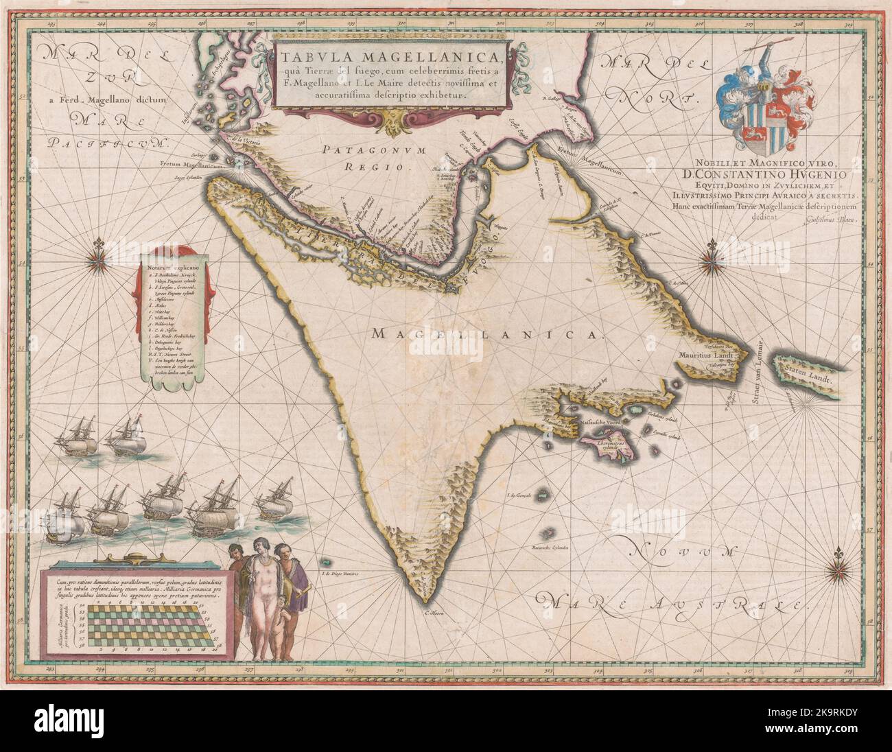 Vintage 18th century map of the Strait of Magellan in southern Chile, South America, by Dutch cartographer Willem Blaeu Stock Photohttps://www.alamy.com/image-license-details/?v=1https://www.alamy.com/vintage-18th-century-map-of-the-strait-of-magellan-in-southern-chile-south-america-by-dutch-cartographer-willem-blaeu-image487942391.html
RM2K9RKDY–Vintage 18th century map of the Strait of Magellan in southern Chile, South America, by Dutch cartographer Willem Blaeu
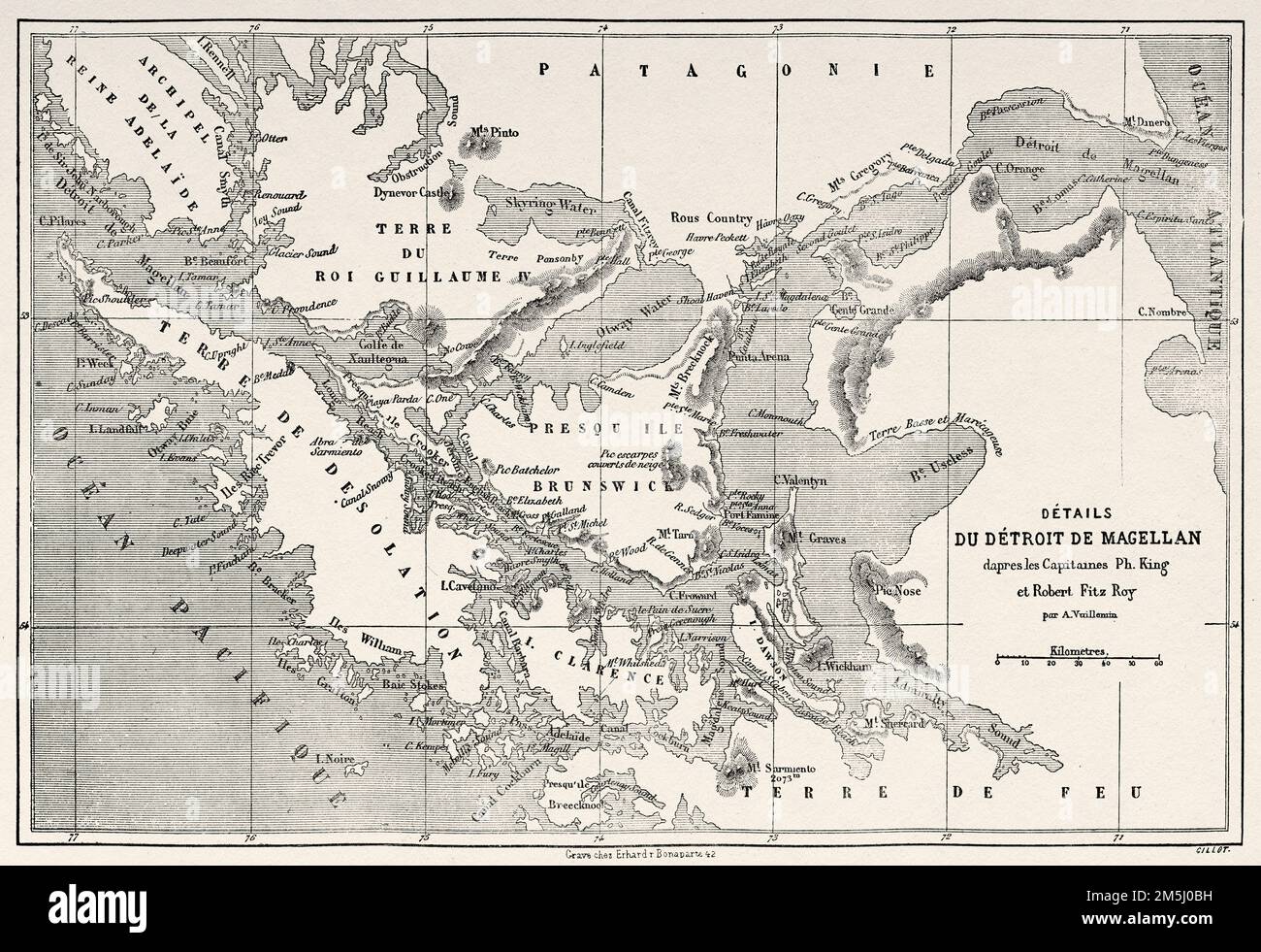 Old Map of the Magellan Strait, Patagonia. Chile, South America. Diary of a Voyage to the Strait of Magellan by V de Rochas 1856-1859. Le Tour du Monde 1861 Stock Photohttps://www.alamy.com/image-license-details/?v=1https://www.alamy.com/old-map-of-the-magellan-strait-patagonia-chile-south-america-diary-of-a-voyage-to-the-strait-of-magellan-by-v-de-rochas-1856-1859-le-tour-du-monde-1861-image502569413.html
RM2M5J0BH–Old Map of the Magellan Strait, Patagonia. Chile, South America. Diary of a Voyage to the Strait of Magellan by V de Rochas 1856-1859. Le Tour du Monde 1861
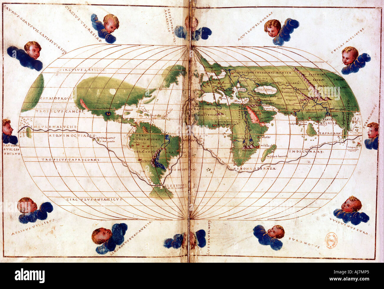 Map of Magellan's round the world voyage, 1519-1521. Artist: Unknown Stock Photohttps://www.alamy.com/image-license-details/?v=1https://www.alamy.com/map-of-magellans-round-the-world-voyage-1519-1521-artist-unknown-image8370788.html
RMAJ7MP5–Map of Magellan's round the world voyage, 1519-1521. Artist: Unknown
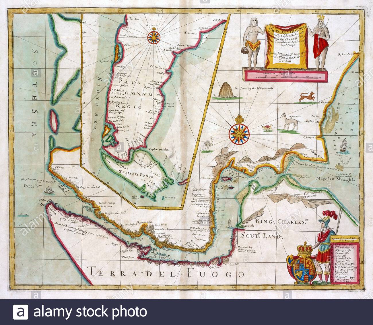 Strait of Magellan, Chile South America, vintage map from 1702 Stock Photohttps://www.alamy.com/image-license-details/?v=1https://www.alamy.com/strait-of-magellan-chile-south-america-vintage-map-from-1702-image397846434.html
RM2E37D56–Strait of Magellan, Chile South America, vintage map from 1702
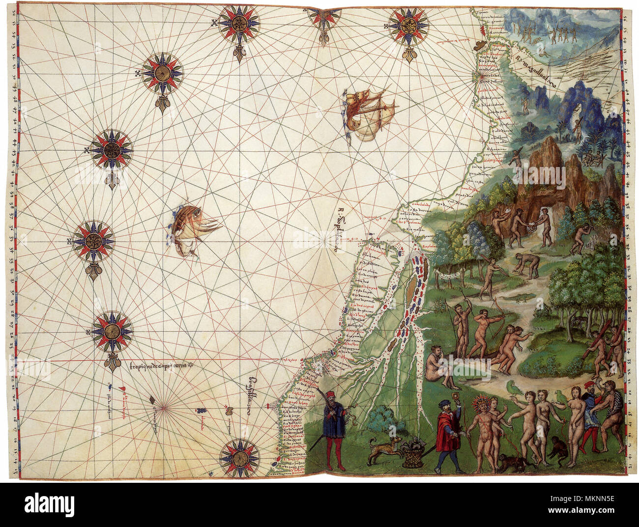 Map of SE South America 1547 Stock Photohttps://www.alamy.com/image-license-details/?v=1https://www.alamy.com/map-of-se-south-america-1547-image184259754.html
RMMKNN5E–Map of SE South America 1547
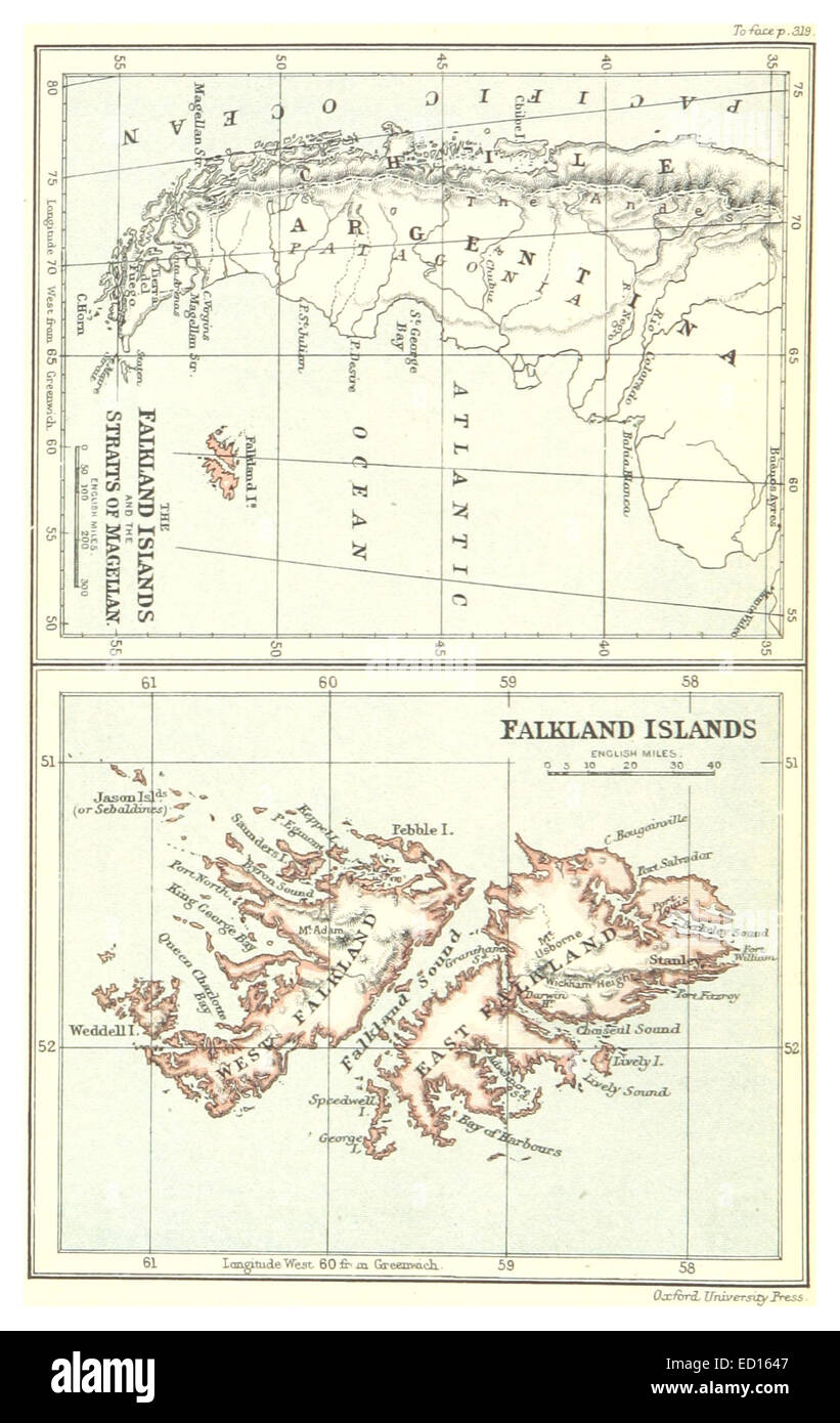 Map of Falkland Islands and the Straits of Magellan (1888) Stock Photohttps://www.alamy.com/image-license-details/?v=1https://www.alamy.com/stock-photo-map-of-falkland-islands-and-the-straits-of-magellan-1888-76858775.html
RMED1647–Map of Falkland Islands and the Straits of Magellan (1888)
 Famous Voyages - Sir Francis Drake and the The 'Golden Hind' 1578 Stock Photohttps://www.alamy.com/image-license-details/?v=1https://www.alamy.com/stock-photo-famous-voyages-sir-francis-drake-and-the-the-golden-hind-1578-175463182.html
RMM5D126–Famous Voyages - Sir Francis Drake and the The 'Golden Hind' 1578
 Map of Falkland Islands and the Straits of Magellan (1888) Stock Photohttps://www.alamy.com/image-license-details/?v=1https://www.alamy.com/map-of-falkland-islands-and-the-straits-of-magellan-1888-image154722682.html
RMJYM6A2–Map of Falkland Islands and the Straits of Magellan (1888)
![THE LAND OF PATAGONIA: &c. THE DRAUGHT OF MAGELLAN STRAITS DRAWEN BY CAPTAIN IOHN NARBROUGH: ANN⁰: 1670: on BOARD HIS MAIESTIS SHIPP SWEEPSTAKS AS I PASED AND REPASED THE STRAITS. Author Narbrough, John 124.84.8 tab.end. Place of publication: [London] Publisher: [John Thornton] Date of publication: [1671-1672.] Item type: 1 map Medium: ink and watercolour on vellum Dimensions: 78 x 184 cm Former owner: George III, King of Great Britain, 1738-1820 Stock Photo THE LAND OF PATAGONIA: &c. THE DRAUGHT OF MAGELLAN STRAITS DRAWEN BY CAPTAIN IOHN NARBROUGH: ANN⁰: 1670: on BOARD HIS MAIESTIS SHIPP SWEEPSTAKS AS I PASED AND REPASED THE STRAITS. Author Narbrough, John 124.84.8 tab.end. Place of publication: [London] Publisher: [John Thornton] Date of publication: [1671-1672.] Item type: 1 map Medium: ink and watercolour on vellum Dimensions: 78 x 184 cm Former owner: George III, King of Great Britain, 1738-1820 Stock Photo](https://c8.alamy.com/comp/2E9GW8J/the-land-of-patagonia-c-the-draught-of-magellan-straits-drawen-by-captain-iohn-narbrough-ann-1670-on-board-his-maiestis-shipp-sweepstaks-as-i-pased-and-repased-the-straits-author-narbrough-john-124848-tabend-place-of-publication-london-publisher-john-thornton-date-of-publication-1671-1672-item-type-1-map-medium-ink-and-watercolour-on-vellum-dimensions-78-x-184-cm-former-owner-george-iii-king-of-great-britain-1738-1820-2E9GW8J.jpg) THE LAND OF PATAGONIA: &c. THE DRAUGHT OF MAGELLAN STRAITS DRAWEN BY CAPTAIN IOHN NARBROUGH: ANN⁰: 1670: on BOARD HIS MAIESTIS SHIPP SWEEPSTAKS AS I PASED AND REPASED THE STRAITS. Author Narbrough, John 124.84.8 tab.end. Place of publication: [London] Publisher: [John Thornton] Date of publication: [1671-1672.] Item type: 1 map Medium: ink and watercolour on vellum Dimensions: 78 x 184 cm Former owner: George III, King of Great Britain, 1738-1820 Stock Photohttps://www.alamy.com/image-license-details/?v=1https://www.alamy.com/the-land-of-patagonia-c-the-draught-of-magellan-straits-drawen-by-captain-iohn-narbrough-ann-1670-on-board-his-maiestis-shipp-sweepstaks-as-i-pased-and-repased-the-straits-author-narbrough-john-124848-tabend-place-of-publication-london-publisher-john-thornton-date-of-publication-1671-1672-item-type-1-map-medium-ink-and-watercolour-on-vellum-dimensions-78-x-184-cm-former-owner-george-iii-king-of-great-britain-1738-1820-image401741442.html
THE LAND OF PATAGONIA: &c. THE DRAUGHT OF MAGELLAN STRAITS DRAWEN BY CAPTAIN IOHN NARBROUGH: ANN‚Å∞: 1670: on BOARD HIS MAIESTIS SHIPP SWEEPSTAKS AS I PASED AND REPASED THE STRAITS. Author Narbrough, John 124.84.8 tab.end. Place of publication: [London] Publisher: [John Thornton] Date of publication: [1671-1672.] Item type: 1 map Medium: ink and watercolour on vellum Dimensions: 78 x 184 cm Former owner: George III, King of Great Britain, 1738-1820 Stock Photohttps://www.alamy.com/image-license-details/?v=1https://www.alamy.com/the-land-of-patagonia-c-the-draught-of-magellan-straits-drawen-by-captain-iohn-narbrough-ann-1670-on-board-his-maiestis-shipp-sweepstaks-as-i-pased-and-repased-the-straits-author-narbrough-john-124848-tabend-place-of-publication-london-publisher-john-thornton-date-of-publication-1671-1672-item-type-1-map-medium-ink-and-watercolour-on-vellum-dimensions-78-x-184-cm-former-owner-george-iii-king-of-great-britain-1738-1820-image401741442.htmlRM2E9GW8J–THE LAND OF PATAGONIA: &c. THE DRAUGHT OF MAGELLAN STRAITS DRAWEN BY CAPTAIN IOHN NARBROUGH: ANN‚Å∞: 1670: on BOARD HIS MAIESTIS SHIPP SWEEPSTAKS AS I PASED AND REPASED THE STRAITS. Author Narbrough, John 124.84.8 tab.end. Place of publication: [London] Publisher: [John Thornton] Date of publication: [1671-1672.] Item type: 1 map Medium: ink and watercolour on vellum Dimensions: 78 x 184 cm Former owner: George III, King of Great Britain, 1738-1820
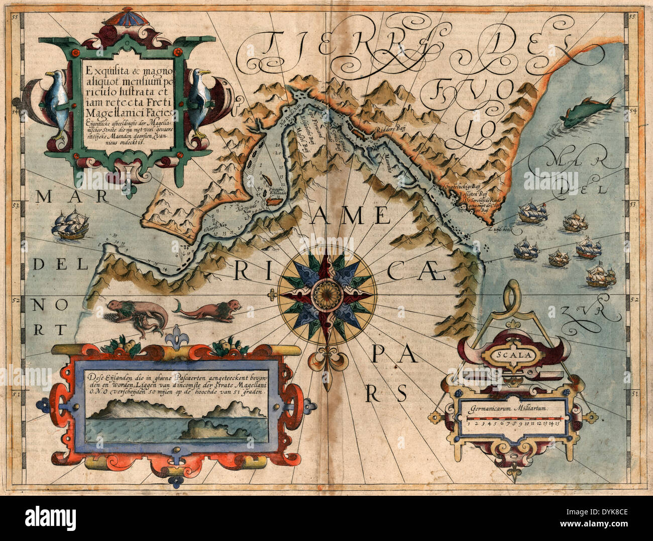 Map of Magellan Straits, circa 1611 Stock Photohttps://www.alamy.com/image-license-details/?v=1https://www.alamy.com/map-of-magellan-straits-circa-1611-image68650526.html
RMDYK8CE–Map of Magellan Straits, circa 1611
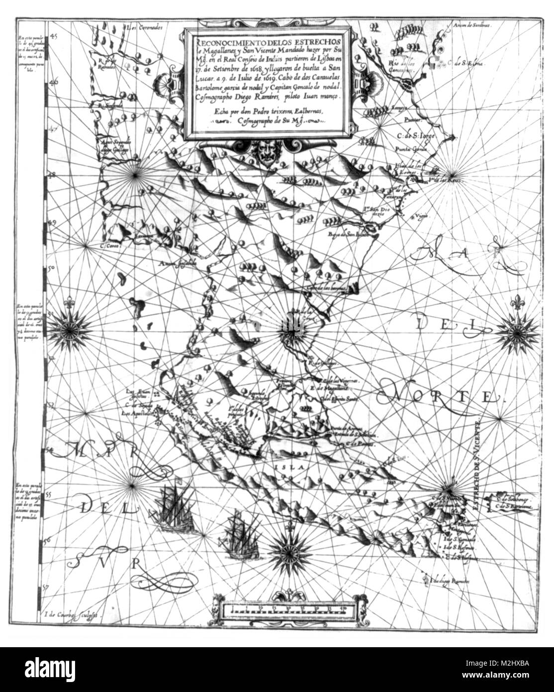 Map of the Strait of Magellan, 1621 Stock Photohttps://www.alamy.com/image-license-details/?v=1https://www.alamy.com/stock-photo-map-of-the-strait-of-magellan-1621-173726878.html
RMM2HXBA–Map of the Strait of Magellan, 1621
 . Deutsch: Erste Karte der Magellanstraße von Antonio Pigafetta. Español: Primer mapa del Estrecho de Magallanes de Antonio Pigafetta. English: First map of Straits of Magellan of Antonio Pigafetta. . circa 1520. Antonio Pigafetta (1480 - 1534) 371 Antonio Pigafetta Magellanstrasse 1520 Stock Photohttps://www.alamy.com/image-license-details/?v=1https://www.alamy.com/deutsch-erste-karte-der-magellanstrae-von-antonio-pigafetta-espaol-primer-mapa-del-estrecho-de-magallanes-de-antonio-pigafetta-english-first-map-of-straits-of-magellan-of-antonio-pigafetta-circa-1520-antonio-pigafetta-1480-1534-371-antonio-pigafetta-magellanstrasse-1520-image189269994.html
RMMYWYPJ–. Deutsch: Erste Karte der Magellanstraße von Antonio Pigafetta. Español: Primer mapa del Estrecho de Magallanes de Antonio Pigafetta. English: First map of Straits of Magellan of Antonio Pigafetta. . circa 1520. Antonio Pigafetta (1480 - 1534) 371 Antonio Pigafetta Magellanstrasse 1520
 Map of Straits of Magellan, showing Patagonian Indians greeting Dutchmen; penguin Stock Photohttps://www.alamy.com/image-license-details/?v=1https://www.alamy.com/map-of-straits-of-magellan-showing-patagonian-indians-greeting-dutchmen-penguin-image398174436.html
RM2E3PBFG–Map of Straits of Magellan, showing Patagonian Indians greeting Dutchmen; penguin
 Map of Straits of Magellan, showing Patagonian Indians greeting Dutchmen; penguin Stock Photohttps://www.alamy.com/image-license-details/?v=1https://www.alamy.com/map-of-straits-of-magellan-showing-patagonian-indians-greeting-dutchmen-penguin-image272283677.html
RMWPYGH1–Map of Straits of Magellan, showing Patagonian Indians greeting Dutchmen; penguin
![Pacific Ocean. Portolano. Italy, circa 1540. [Whole map] Map of the Pacific Ocean showing the Straits of Magellan, and the discoveries of Cortes in Gulf of California. Executed for the Gaudagni family of Florence Image taken from Portolano. Originally published/produced in Italy, circa 1540. . Source: Egerton 2854, ff.3v-4. Language: Italian. Stock Photo Pacific Ocean. Portolano. Italy, circa 1540. [Whole map] Map of the Pacific Ocean showing the Straits of Magellan, and the discoveries of Cortes in Gulf of California. Executed for the Gaudagni family of Florence Image taken from Portolano. Originally published/produced in Italy, circa 1540. . Source: Egerton 2854, ff.3v-4. Language: Italian. Stock Photo](https://c8.alamy.com/comp/RC6070/pacific-ocean-portolano-italy-circa-1540-whole-map-map-of-the-pacific-ocean-showing-the-straits-of-magellan-and-the-discoveries-of-cortes-in-gulf-of-california-executed-for-the-gaudagni-family-of-florence-image-taken-from-portolano-originally-publishedproduced-in-italy-circa-1540-source-egerton-2854-ff3v-4-language-italian-RC6070.jpg) Pacific Ocean. Portolano. Italy, circa 1540. [Whole map] Map of the Pacific Ocean showing the Straits of Magellan, and the discoveries of Cortes in Gulf of California. Executed for the Gaudagni family of Florence Image taken from Portolano. Originally published/produced in Italy, circa 1540. . Source: Egerton 2854, ff.3v-4. Language: Italian. Stock Photohttps://www.alamy.com/image-license-details/?v=1https://www.alamy.com/pacific-ocean-portolano-italy-circa-1540-whole-map-map-of-the-pacific-ocean-showing-the-straits-of-magellan-and-the-discoveries-of-cortes-in-gulf-of-california-executed-for-the-gaudagni-family-of-florence-image-taken-from-portolano-originally-publishedproduced-in-italy-circa-1540-source-egerton-2854-ff3v-4-language-italian-image231242564.html
Pacific Ocean. Portolano. Italy, circa 1540. [Whole map] Map of the Pacific Ocean showing the Straits of Magellan, and the discoveries of Cortes in Gulf of California. Executed for the Gaudagni family of Florence Image taken from Portolano. Originally published/produced in Italy, circa 1540. . Source: Egerton 2854, ff.3v-4. Language: Italian. Stock Photohttps://www.alamy.com/image-license-details/?v=1https://www.alamy.com/pacific-ocean-portolano-italy-circa-1540-whole-map-map-of-the-pacific-ocean-showing-the-straits-of-magellan-and-the-discoveries-of-cortes-in-gulf-of-california-executed-for-the-gaudagni-family-of-florence-image-taken-from-portolano-originally-publishedproduced-in-italy-circa-1540-source-egerton-2854-ff3v-4-language-italian-image231242564.htmlRMRC6070–Pacific Ocean. Portolano. Italy, circa 1540. [Whole map] Map of the Pacific Ocean showing the Straits of Magellan, and the discoveries of Cortes in Gulf of California. Executed for the Gaudagni family of Florence Image taken from Portolano. Originally published/produced in Italy, circa 1540. . Source: Egerton 2854, ff.3v-4. Language: Italian.
 Postage stamp from Hungary depicting Ferdinand Magellan and a map of the Straits of Magellan. Stock Photohttps://www.alamy.com/image-license-details/?v=1https://www.alamy.com/stock-photo-postage-stamp-from-hungary-depicting-ferdinand-magellan-and-a-map-71494313.html
RME48RM9–Postage stamp from Hungary depicting Ferdinand Magellan and a map of the Straits of Magellan.
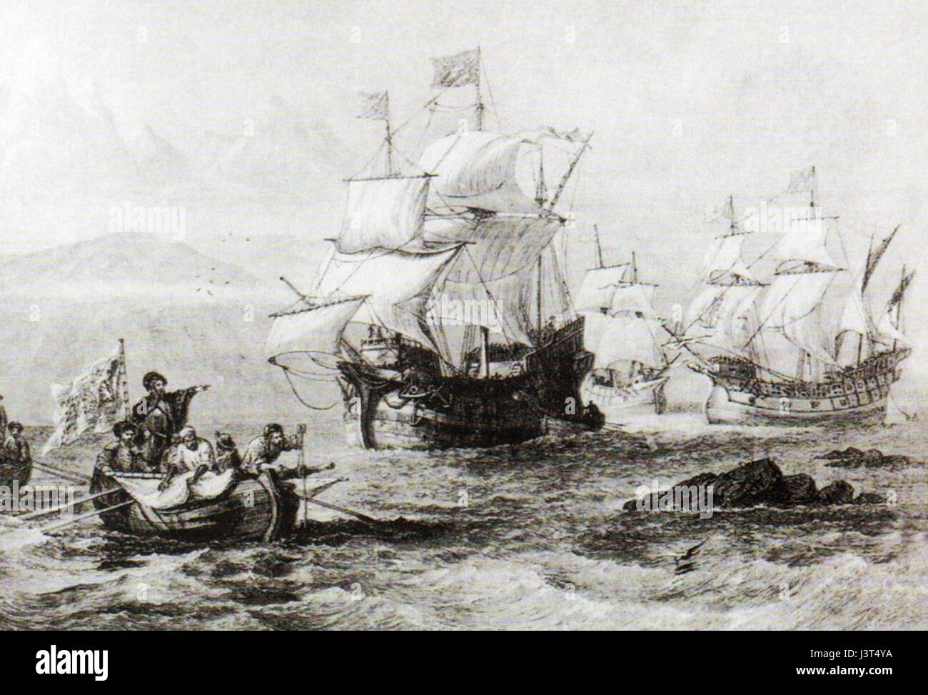 In the Straits of Magellan Stock Photohttps://www.alamy.com/image-license-details/?v=1https://www.alamy.com/stock-photo-in-the-straits-of-magellan-140057662.html
RMJ3T4YA–In the Straits of Magellan
 FILE - An archive picture dated 18 January 2011 shows extrem paddler from Husum Freya Hoffmeister, presenting a map of South America in Husum, Germany. After her record tour around Australia in 2009 the business woman started her tour to surround South America on 12 August 2011. The woman goes from Valparaiso in Chile to Argentina via the Straits of Magellan and after a break to Ve Stock Photohttps://www.alamy.com/image-license-details/?v=1https://www.alamy.com/stock-photo-file-an-archive-picture-dated-18-january-2011-shows-extrem-paddler-58270787.html
RMDAPCYF–FILE - An archive picture dated 18 January 2011 shows extrem paddler from Husum Freya Hoffmeister, presenting a map of South America in Husum, Germany. After her record tour around Australia in 2009 the business woman started her tour to surround South America on 12 August 2011. The woman goes from Valparaiso in Chile to Argentina via the Straits of Magellan and after a break to Ve
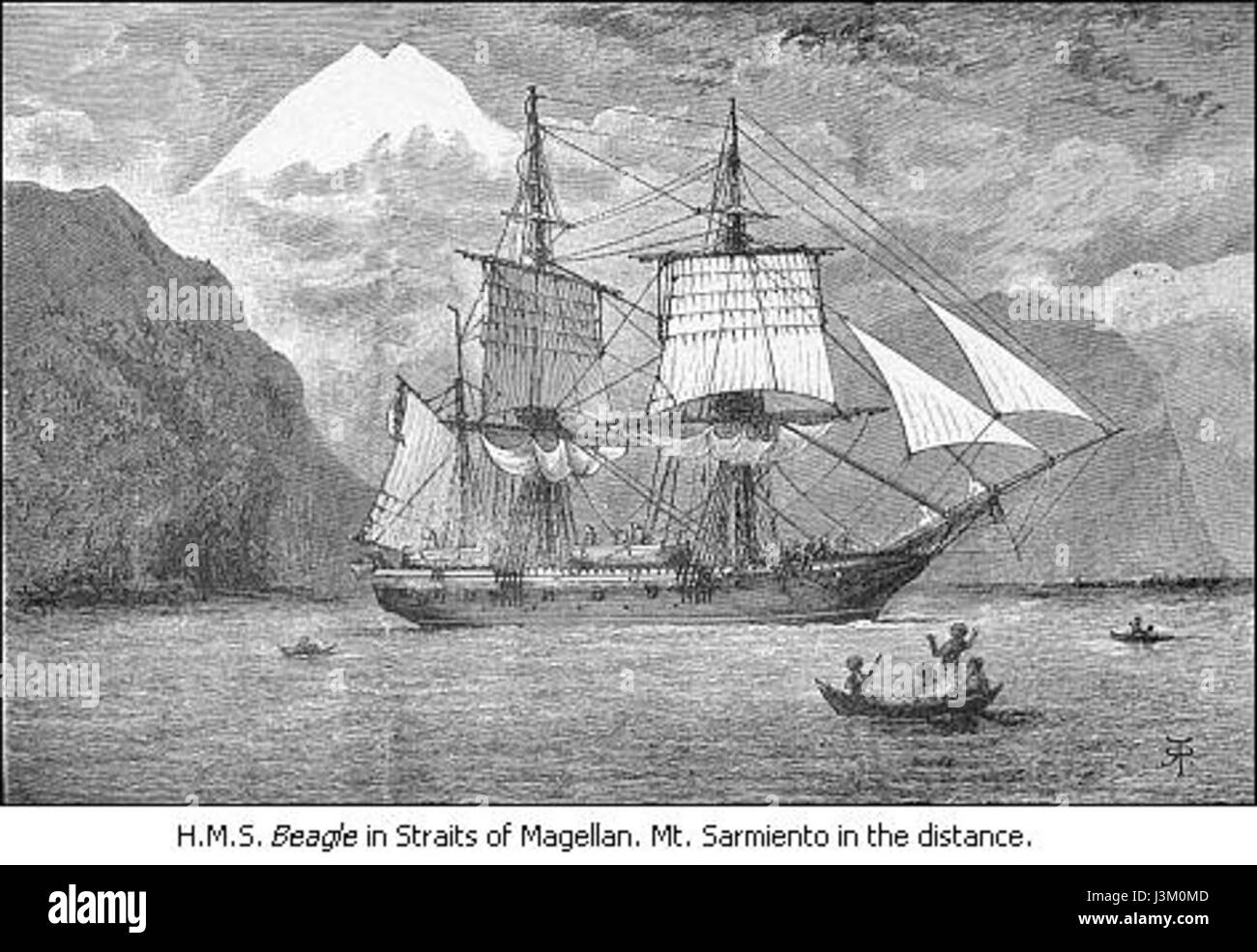 HMS Beagle in Straits of Magellan Stock Photohttps://www.alamy.com/image-license-details/?v=1https://www.alamy.com/stock-photo-hms-beagle-in-straits-of-magellan-139966525.html
RMJ3M0MD–HMS Beagle in Straits of Magellan
 Rare Map of the Straits of Magellan Showing French, English, Spanish, and Dutch Discoveries Stock Photohttps://www.alamy.com/image-license-details/?v=1https://www.alamy.com/rare-map-of-the-straits-of-magellan-showing-french-english-spanish-and-dutch-discoveries-image539967261.html
RM2PADHN1–Rare Map of the Straits of Magellan Showing French, English, Spanish, and Dutch Discoveries
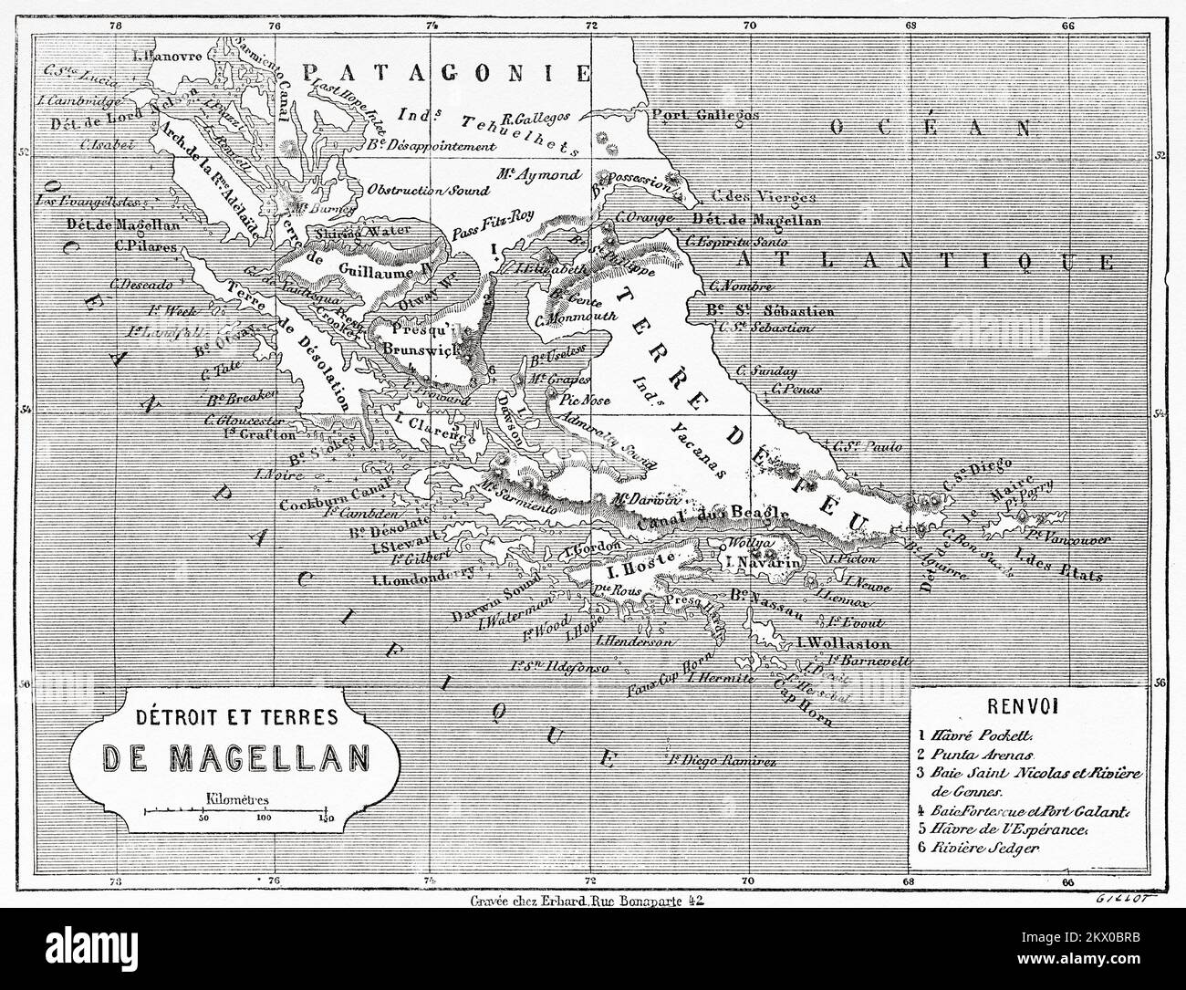 Old Map of the Magellan Strait, Patagonia. Chile, South America. Diary of a Voyage to the Strait of Magellan by V de Rochas 1856-1859. Le Tour du Monde 1861 Stock Photohttps://www.alamy.com/image-license-details/?v=1https://www.alamy.com/old-map-of-the-magellan-strait-patagonia-chile-south-america-diary-of-a-voyage-to-the-strait-of-magellan-by-v-de-rochas-1856-1859-le-tour-du-monde-1861-image497880639.html
RM2KX0BRB–Old Map of the Magellan Strait, Patagonia. Chile, South America. Diary of a Voyage to the Strait of Magellan by V de Rochas 1856-1859. Le Tour du Monde 1861
 Map of SE South America 1547 Stock Photohttps://www.alamy.com/image-license-details/?v=1https://www.alamy.com/map-of-se-south-america-1547-image230693840.html
RMRB909M–Map of SE South America 1547
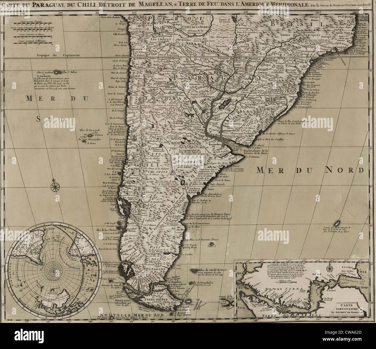 1745 map of northern South American continent, showing colonial place names for Brazil, Paraguay, Peru, Chile that would be Stock Photohttps://www.alamy.com/image-license-details/?v=1https://www.alamy.com/stock-photo-1745-map-of-northern-south-american-continent-showing-colonial-place-50011429.html
RMCWA62D–1745 map of northern South American continent, showing colonial place names for Brazil, Paraguay, Peru, Chile that would be
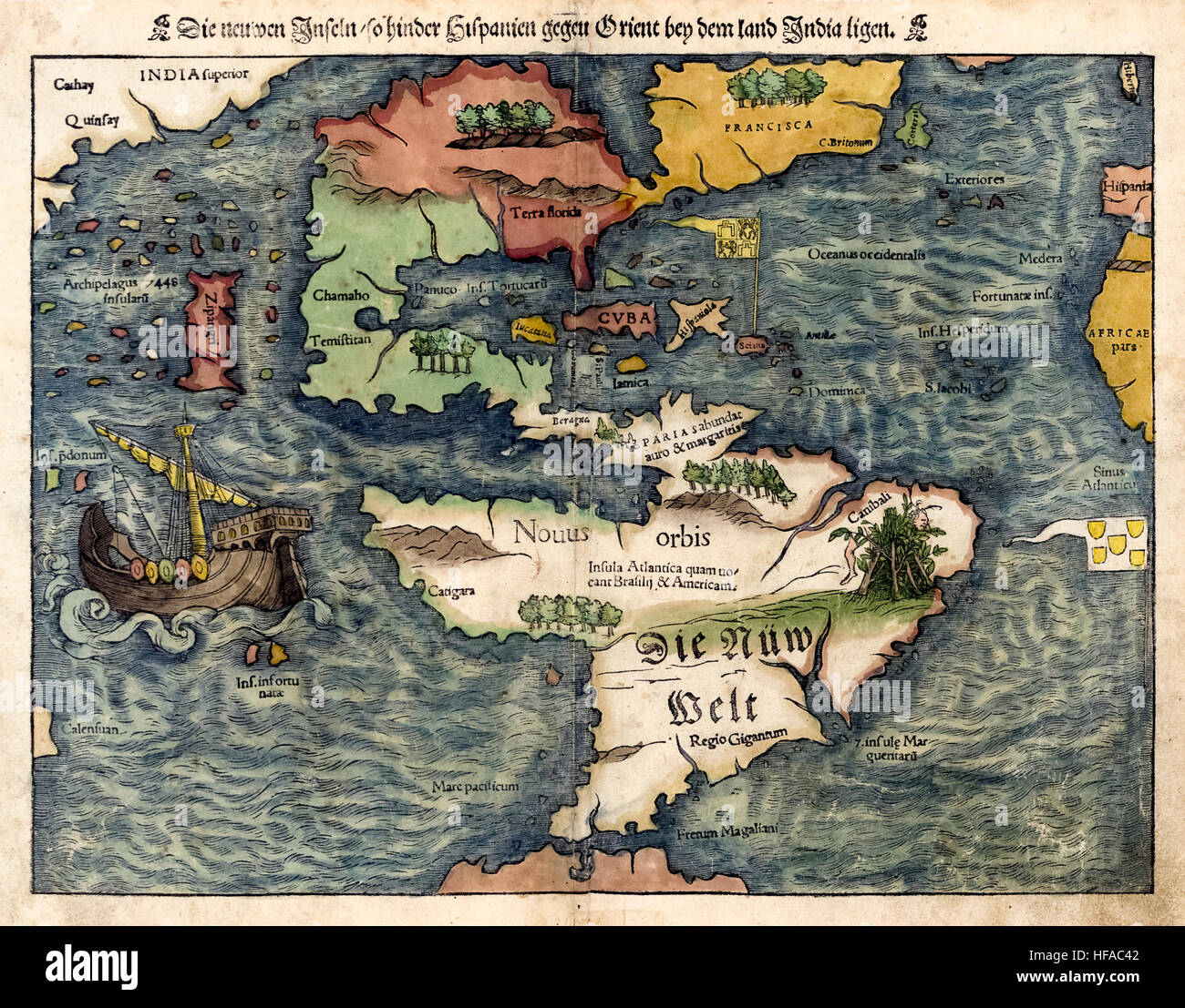 ‘Die neuwen Inseln, so hinder Hispanien gegen Orient bey dem land India ligen.’ Hand coloured map of the New World by German cartography Sebastian Münster (1488-1552). From his edition of Ptolemy's ‘Cosmographia’ the earliest German description of the world featuring the earliest reference to the Pacific Ocean and Japan. Stock Photohttps://www.alamy.com/image-license-details/?v=1https://www.alamy.com/stock-photo-die-neuwen-inseln-so-hinder-hispanien-gegen-orient-bey-dem-land-india-129921458.html
RMHFAC42–‘Die neuwen Inseln, so hinder Hispanien gegen Orient bey dem land India ligen.’ Hand coloured map of the New World by German cartography Sebastian Münster (1488-1552). From his edition of Ptolemy's ‘Cosmographia’ the earliest German description of the world featuring the earliest reference to the Pacific Ocean and Japan.
 Map of Falkland Islands and the Straits of Magellan (1888) Stock Photohttps://www.alamy.com/image-license-details/?v=1https://www.alamy.com/stock-photo-map-of-falkland-islands-and-the-straits-of-magellan-1888-74688734.html
RME9EA6P–Map of Falkland Islands and the Straits of Magellan (1888)
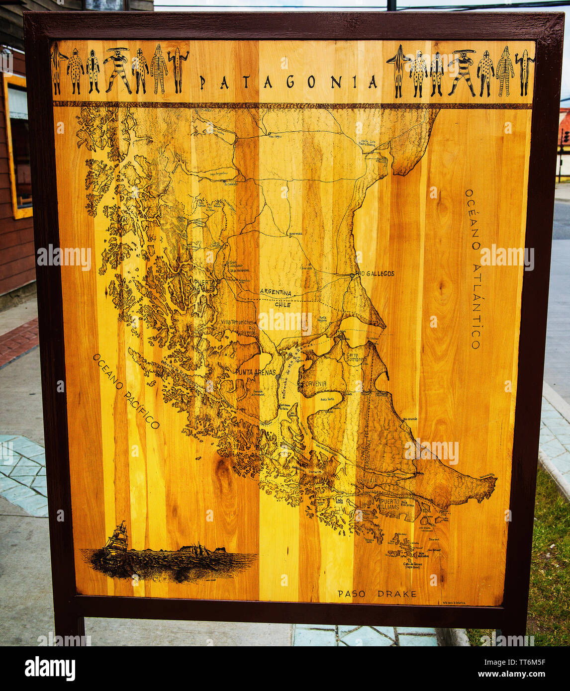 Patagonia Map at the Sea Port of Punta Arenas, Patagonia, Chile, South America Stock Photohttps://www.alamy.com/image-license-details/?v=1https://www.alamy.com/patagonia-map-at-the-sea-port-of-punta-arenas-patagonia-chile-south-america-image255844443.html
RFTT6M5F–Patagonia Map at the Sea Port of Punta Arenas, Patagonia, Chile, South America
 1745 map of northern South American continent, showing colonial place names for Brazil, Paraguay, Peru, Chile that would be nations following independence from Spain and Portugal. Stock Photohttps://www.alamy.com/image-license-details/?v=1https://www.alamy.com/stock-photo-1745-map-of-northern-south-american-continent-showing-colonial-place-32374058.html
RMBTJNCA–1745 map of northern South American continent, showing colonial place names for Brazil, Paraguay, Peru, Chile that would be nations following independence from Spain and Portugal.
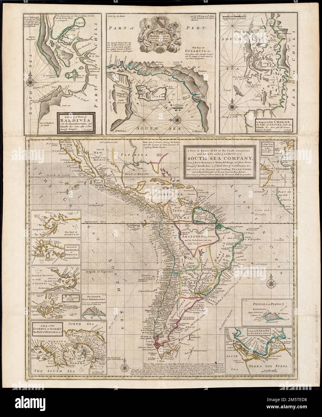 A new & exact map of the coast, countries and islands within ye limits of ye South Sea Company, from ye river Aranoca to Terra del Fuego, and from thence through ye South Sea, to ye north part of California &c. with a view of the general and coasting trade-winds : and perticular draughts of the most important bays, ports &c. according to the newest observations. Relief shown pictorially. Insets: A chart from England to the river Aranoca &c. -- Peypses or Pepys I. -- A map of ye Straits of Magellan &c. -- A map of the isthmus of Darien the bay of Panama &c. -- The island of Juan Ferdinando -- T Stock Photohttps://www.alamy.com/image-license-details/?v=1https://www.alamy.com/a-new-exact-map-of-the-coast-countries-and-islands-within-ye-limits-of-ye-south-sea-company-from-ye-river-aranoca-to-terra-del-fuego-and-from-thence-through-ye-south-sea-to-ye-north-part-of-california-c-with-a-view-of-the-general-and-coasting-trade-winds-and-perticular-draughts-of-the-most-important-bays-ports-c-according-to-the-newest-observations-relief-shown-pictorially-insets-a-chart-from-england-to-the-river-aranoca-c-peypses-or-pepys-i-a-map-of-ye-straits-of-magellan-c-a-map-of-the-isthmus-of-darien-the-bay-of-panama-c-the-island-of-juan-ferdinando-t-image502712148.html
RM2M5TED8–A new & exact map of the coast, countries and islands within ye limits of ye South Sea Company, from ye river Aranoca to Terra del Fuego, and from thence through ye South Sea, to ye north part of California &c. with a view of the general and coasting trade-winds : and perticular draughts of the most important bays, ports &c. according to the newest observations. Relief shown pictorially. Insets: A chart from England to the river Aranoca &c. -- Peypses or Pepys I. -- A map of ye Straits of Magellan &c. -- A map of the isthmus of Darien the bay of Panama &c. -- The island of Juan Ferdinando -- T
 Chica sive Patagonica et Australis Terra (From 'Geographisches Handtbuch'). Museum: PRIVATE COLLECTION. Stock Photohttps://www.alamy.com/image-license-details/?v=1https://www.alamy.com/chica-sive-patagonica-et-australis-terra-from-geographisches-handtbuch-museum-private-collection-image212327365.html
RMP9C9M5–Chica sive Patagonica et Australis Terra (From 'Geographisches Handtbuch'). Museum: PRIVATE COLLECTION.
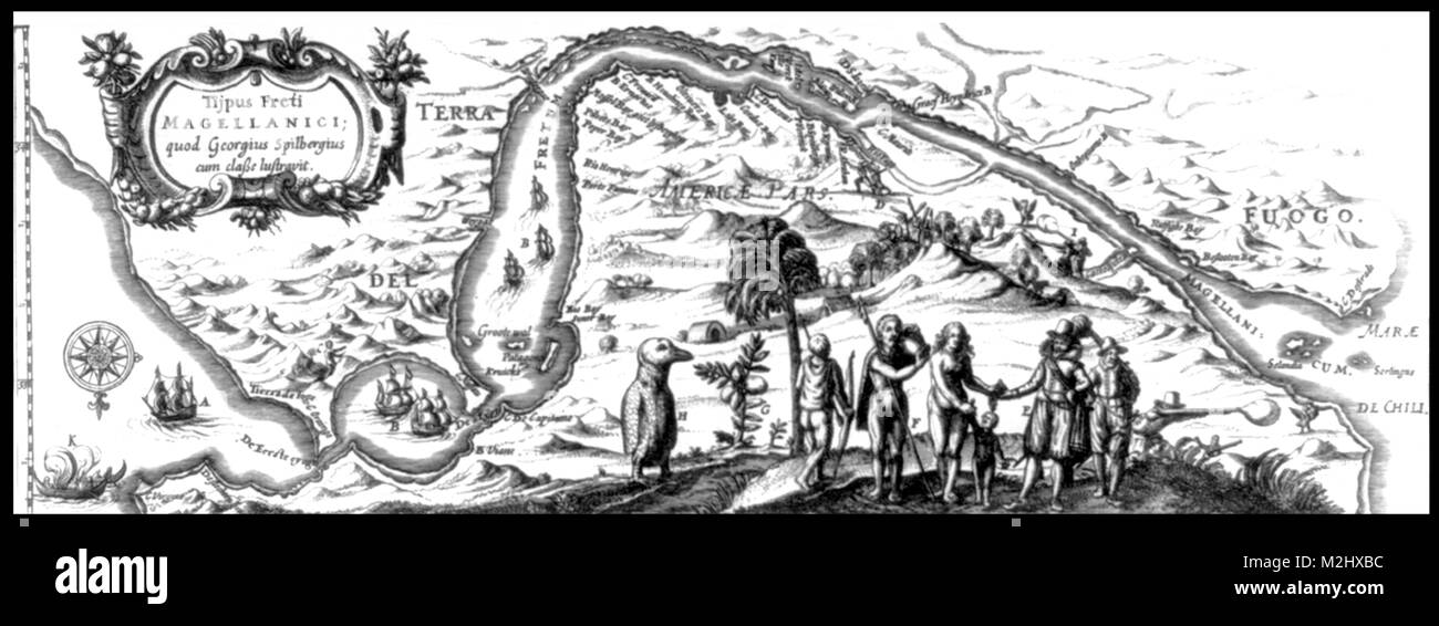 Map of the Strait of Magellan, 1619 Stock Photohttps://www.alamy.com/image-license-details/?v=1https://www.alamy.com/stock-photo-map-of-the-strait-of-magellan-1619-173726880.html
RMM2HXBC–Map of the Strait of Magellan, 1619
 Русский: Карта Магелланова пролива и части Огненной Земли, составленная в 1786 г. Français : Carte du détroit de Magellan et d'une partie de la Terre de Feu, préparée en 1786 English: Map of the Straits of Magellan and Part of the Land of Fire, Prepared in 1786 中文: 麦哲伦海峡和局部火山地图,1786 年绘制 Português: Mapa do Estreito de Magalhães e de parte da Terra do Fogo, Elaborado em 1786 العربية: خريطة مضيق ماجلان وجزء من أرض النار، التي أعدت في 1786 Español: Mapa del Estrecho de Magallanes y parte de Tierra del Fuego, preparado en 1786 . Русский: Данная сводная карта научной экспедиции 1785-86 гг. на иссле Stock Photohttps://www.alamy.com/image-license-details/?v=1https://www.alamy.com/1786-franais-carte-du-dtroit-de-magellan-et-dune-partie-de-la-terre-de-feu-prpare-en-1786-english-map-of-the-straits-of-magellan-and-part-of-the-land-of-fire-prepared-in-1786-1786-portugus-mapa-do-estreito-de-magalhes-e-de-parte-da-terra-do-fogo-elaborado-em-1786-1786-espaol-mapa-del-estrecho-de-magallanes-yparte-de-tierra-del-fuego-preparado-en-1786-1785-86-image185845847.html
RMMPA07K–Русский: Карта Магелланова пролива и части Огненной Земли, составленная в 1786 г. Français : Carte du détroit de Magellan et d'une partie de la Terre de Feu, préparée en 1786 English: Map of the Straits of Magellan and Part of the Land of Fire, Prepared in 1786 中文: 麦哲伦海峡和局部火山地图,1786 年绘制 Português: Mapa do Estreito de Magalhães e de parte da Terra do Fogo, Elaborado em 1786 العربية: خريطة مضيق ماجلان وجزء من أرض النار، التي أعدت في 1786 Español: Mapa del Estrecho de Magallanes y parte de Tierra del Fuego, preparado en 1786 . Русский: Данная сводная карта научной экспедиции 1785-86 гг. на иссле
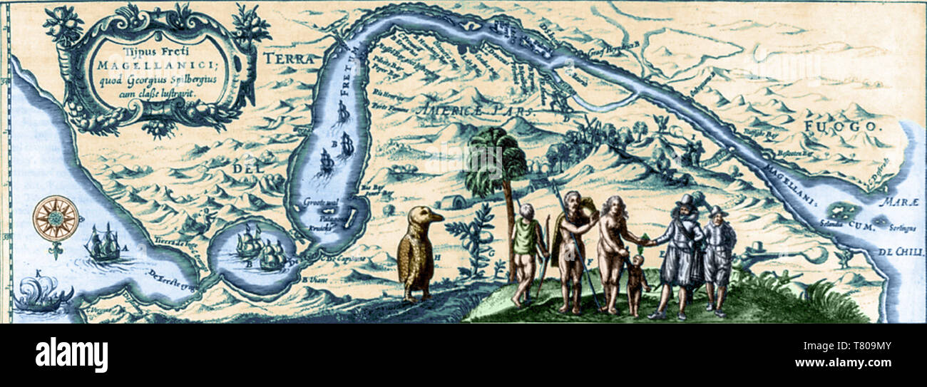 Map of the Strait of Magellan, 1619 Stock Photohttps://www.alamy.com/image-license-details/?v=1https://www.alamy.com/map-of-the-strait-of-magellan-1619-image245870043.html
RMT809MY–Map of the Strait of Magellan, 1619
 Map of the Straits of Magellan and Part of the Land of Fire, Prepared in 1786 Stock Photohttps://www.alamy.com/image-license-details/?v=1https://www.alamy.com/map-of-the-straits-of-magellan-and-part-of-the-land-of-fire-prepared-in-1786-image330819508.html
RM2A663JC–Map of the Straits of Magellan and Part of the Land of Fire, Prepared in 1786
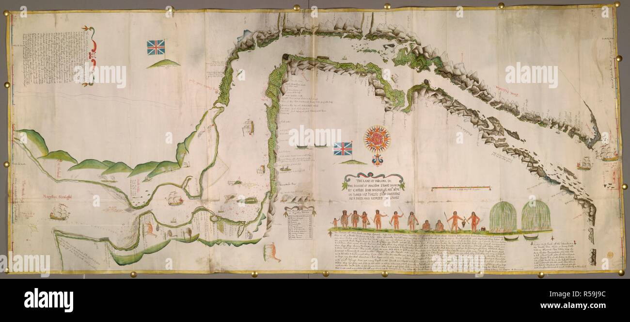 Straits of Magellan. The Land of Patagona, etc. The draught of Magellan. 1670. Pictorial map of the Straits of Magellan. Image taken from The Land of Patagona, etc. The draught of Magellan Straits, drawen by Captain John Narbrough, anno 1670, on board His Majesti's Shipp Sweepstaks, as I pased and repased the Straits; being a large colored chart, drawn on vellum, on a scale of 4 miles to an inch.. Originally published/produced in 1670. Source: Maps K.Top.124.84.8 TAB.END. Stock Photohttps://www.alamy.com/image-license-details/?v=1https://www.alamy.com/straits-of-magellan-the-land-of-patagona-etc-the-draught-of-magellan-1670-pictorial-map-of-the-straits-of-magellan-image-taken-from-the-land-of-patagona-etc-the-draught-of-magellan-straits-drawen-by-captain-john-narbrough-anno-1670-on-board-his-majestis-shipp-sweepstaks-as-i-pased-and-repased-the-straits-being-a-large-colored-chart-drawn-on-vellum-on-a-scale-of-4-miles-to-an-inch-originally-publishedproduced-in-1670-source-maps-ktop124848-tabend-image227020008.html
RMR59J9C–Straits of Magellan. The Land of Patagona, etc. The draught of Magellan. 1670. Pictorial map of the Straits of Magellan. Image taken from The Land of Patagona, etc. The draught of Magellan Straits, drawen by Captain John Narbrough, anno 1670, on board His Majesti's Shipp Sweepstaks, as I pased and repased the Straits; being a large colored chart, drawn on vellum, on a scale of 4 miles to an inch.. Originally published/produced in 1670. Source: Maps K.Top.124.84.8 TAB.END.
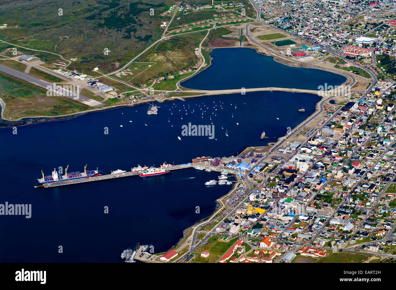 Container ships at wharf and yachts in a sheltered harbor by a city. Stock Photohttps://www.alamy.com/image-license-details/?v=1https://www.alamy.com/stock-photo-container-ships-at-wharf-and-yachts-in-a-sheltered-harbor-by-a-city-75511817.html
RMEART2H–Container ships at wharf and yachts in a sheltered harbor by a city.
 . Illustrated South America; a Chicago publisher's travels and investigations in the republics of South America, with 500 photographs of people and scenes from the Isthmus of Panama to the Straits of Magellan . ii. •rnwj POLITICAL M,. yjncs jyiniivj nCAL MAP OF SOUTH AMERICA. ILLUSTRATED SOUTHAMERICA PANAMA CANAL ZONE Canal Zone area, 448 square miles—United States paid Re-public of Panama $10,000,000 for it—Panama Raihuay, 48miles long, ozvned by United States—Canal jo miles inlength; estimated cost $400,000,000, probable final costover $/00,ooo,ooo—People employed in Canal construc-tion app Stock Photohttps://www.alamy.com/image-license-details/?v=1https://www.alamy.com/illustrated-south-america-a-chicago-publishers-travels-and-investigations-in-the-republics-of-south-america-with-500-photographs-of-people-and-scenes-from-the-isthmus-of-panama-to-the-straits-of-magellan-ii-rnwj-political-m-yjncs-jyiniivj-ncal-map-of-south-america-illustrated-southamerica-panama-canal-zone-canal-zone-area-448-square-milesunited-states-paid-re-public-of-panama-10000000-for-itpanama-raihuay-48miles-long-ozvned-by-united-statescanal-jo-miles-inlength-estimated-cost-400000000-probable-final-costover-00oooooopeople-employed-in-canal-construc-tion-app-image369715406.html
RM2CDDYNJ–. Illustrated South America; a Chicago publisher's travels and investigations in the republics of South America, with 500 photographs of people and scenes from the Isthmus of Panama to the Straits of Magellan . ii. •rnwj POLITICAL M,. yjncs jyiniivj nCAL MAP OF SOUTH AMERICA. ILLUSTRATED SOUTHAMERICA PANAMA CANAL ZONE Canal Zone area, 448 square miles—United States paid Re-public of Panama $10,000,000 for it—Panama Raihuay, 48miles long, ozvned by United States—Canal jo miles inlength; estimated cost $400,000,000, probable final costover $/00,ooo,ooo—People employed in Canal construc-tion app
 Martens, Caryophyllia sp. Elizabeth Island, Straits of Magellan (image 4, page 2r) Stock Photohttps://www.alamy.com/image-license-details/?v=1https://www.alamy.com/stock-photo-martens-caryophyllia-sp-elizabeth-island-straits-of-magellan-image-140202738.html
RMJ42P0J–Martens, Caryophyllia sp. Elizabeth Island, Straits of Magellan (image 4, page 2r)
 Old Map of the Magellan Strait, Patagonia. Chile, South America. Diary of a Voyage to the Strait of Magellan by V de Rochas 1856-1859. Le Tour du Monde 1861 Stock Photohttps://www.alamy.com/image-license-details/?v=1https://www.alamy.com/old-map-of-the-magellan-strait-patagonia-chile-south-america-diary-of-a-voyage-to-the-strait-of-magellan-by-v-de-rochas-1856-1859-le-tour-du-monde-1861-image497881701.html
RM2KX0D59–Old Map of the Magellan Strait, Patagonia. Chile, South America. Diary of a Voyage to the Strait of Magellan by V de Rochas 1856-1859. Le Tour du Monde 1861
 Map of the Straits of Magellan and Part of the Land of Fire, Prepared in 1786 WDL52 Stock Photohttps://www.alamy.com/image-license-details/?v=1https://www.alamy.com/stock-photo-map-of-the-straits-of-magellan-and-part-of-the-land-of-fire-prepared-133431774.html
RMHN29GE–Map of the Straits of Magellan and Part of the Land of Fire, Prepared in 1786 WDL52
 A new & exact map of the coast, countries and islands within ye limits of ye South Sea Company, from ye river Aranoca to Terra del Fuego, and from thence through ye South Sea, to ye north part of California &c. with a view of the general and coasting trade-winds : and perticular draughts of the most important bays, ports &c. according to the newest observations. Relief shown pictorially. Insets: A chart from England to the river Aranoca &c. -- Peypses or Pepys I. -- A map of ye Straits of Magellan &c. -- A map of the isthmus of Darien the bay of Panama &c. -- The island of Juan Ferdinando -- T Stock Photohttps://www.alamy.com/image-license-details/?v=1https://www.alamy.com/a-new-exact-map-of-the-coast-countries-and-islands-within-ye-limits-of-ye-south-sea-company-from-ye-river-aranoca-to-terra-del-fuego-and-from-thence-through-ye-south-sea-to-ye-north-part-of-california-c-with-a-view-of-the-general-and-coasting-trade-winds-and-perticular-draughts-of-the-most-important-bays-ports-c-according-to-the-newest-observations-relief-shown-pictorially-insets-a-chart-from-england-to-the-river-aranoca-c-peypses-or-pepys-i-a-map-of-ye-straits-of-magellan-c-a-map-of-the-isthmus-of-darien-the-bay-of-panama-c-the-island-of-juan-ferdinando-t-image502706391.html
RM2M5T73K–A new & exact map of the coast, countries and islands within ye limits of ye South Sea Company, from ye river Aranoca to Terra del Fuego, and from thence through ye South Sea, to ye north part of California &c. with a view of the general and coasting trade-winds : and perticular draughts of the most important bays, ports &c. according to the newest observations. Relief shown pictorially. Insets: A chart from England to the river Aranoca &c. -- Peypses or Pepys I. -- A map of ye Straits of Magellan &c. -- A map of the isthmus of Darien the bay of Panama &c. -- The island of Juan Ferdinando -- T
 Tractus australior Americæ Meridionalis, a Rio de la Plata per Fretum Magellanicum ad Toraltum (detail). Museum: PRIVATE COLLECTION. Stock Photohttps://www.alamy.com/image-license-details/?v=1https://www.alamy.com/tractus-australior-americ-meridionalis-a-rio-de-la-plata-per-fretum-magellanicum-ad-toraltum-detail-museum-private-collection-image212327368.html
RMP9C9M8–Tractus australior Americæ Meridionalis, a Rio de la Plata per Fretum Magellanicum ad Toraltum (detail). Museum: PRIVATE COLLECTION.
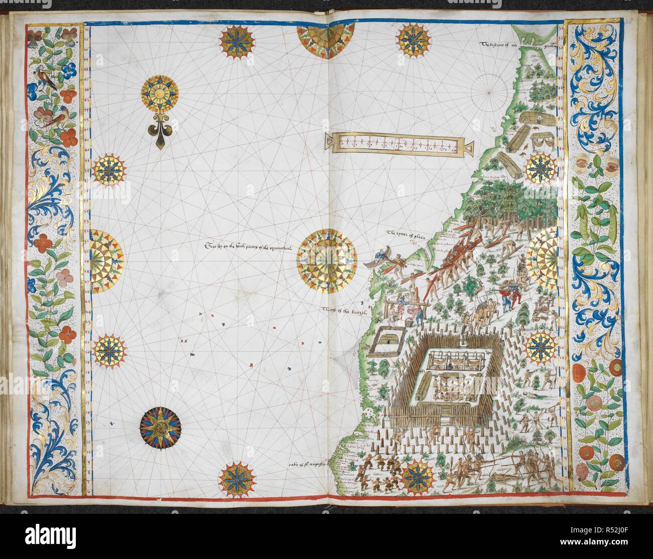 Eastern coast of South America, Brazil with the Straits of Magellan. Jean Rotz, Boke of Idrography (The 'Rotz Atlas'). 1542. Source: Royal 20 E. IX, ff.27v-28. Language: English. Stock Photohttps://www.alamy.com/image-license-details/?v=1https://www.alamy.com/eastern-coast-of-south-america-brazil-with-the-straits-of-magellan-jean-rotz-boke-of-idrography-the-rotz-atlas-1542-source-royal-20-e-ix-ff27v-28-language-english-image226866095.html
RMR52J0F–Eastern coast of South America, Brazil with the Straits of Magellan. Jean Rotz, Boke of Idrography (The 'Rotz Atlas'). 1542. Source: Royal 20 E. IX, ff.27v-28. Language: English.
 Container ships, yachts and tourist ships in a sheltered city harbor. Stock Photohttps://www.alamy.com/image-license-details/?v=1https://www.alamy.com/stock-photo-container-ships-yachts-and-tourist-ships-in-a-sheltered-city-harbor-75511818.html
RMEART2J–Container ships, yachts and tourist ships in a sheltered city harbor.
 . Illustrated South America; a Chicago publisher's travels and investigations in the republics of South America, with 500 photographs of people and scenes from the Isthmus of Panama to the Straits of Magellan . COMiMERCIAl < E u ^ «^^ = :i W-2 - S ? 3 .; < 5 5. i^ X 5 -s K 0 ^ D - % o^ O m ^. RCtM MAP OF SOUTH AMERICA. ARGENTINA Area, i,1^^,840 square miles, or about five and a half times aslarge as France, or nearly one-third the size of the entireUnited States—Extends from the summit of the Andes tothe Atlantic Ocean and from latitude 22 degrees south to56 degrees south—Population (lo Stock Photohttps://www.alamy.com/image-license-details/?v=1https://www.alamy.com/illustrated-south-america-a-chicago-publishers-travels-and-investigations-in-the-republics-of-south-america-with-500-photographs-of-people-and-scenes-from-the-isthmus-of-panama-to-the-straits-of-magellan-comimercial-lt-e-u-=-i-w-2-s-3-lt-5-5-i-x-5-s-k-0-d-o-o-m-rctm-map-of-south-america-argentina-area-i1840-square-miles-or-about-five-and-a-half-times-aslarge-as-france-or-nearly-one-third-the-size-of-the-entireunited-statesextends-from-the-summit-of-the-andes-tothe-atlantic-ocean-and-from-latitude-22-degrees-south-to56-degrees-southpopulation-lo-image369715108.html
RM2CDDYB0–. Illustrated South America; a Chicago publisher's travels and investigations in the republics of South America, with 500 photographs of people and scenes from the Isthmus of Panama to the Straits of Magellan . COMiMERCIAl < E u ^ «^^ = :i W-2 - S ? 3 .; < 5 5. i^ X 5 -s K 0 ^ D - % o^ O m ^. RCtM MAP OF SOUTH AMERICA. ARGENTINA Area, i,1^^,840 square miles, or about five and a half times aslarge as France, or nearly one-third the size of the entireUnited States—Extends from the summit of the Andes tothe Atlantic Ocean and from latitude 22 degrees south to56 degrees south—Population (lo
 Reuterdahl Fleet Passing Through Magellan Straits Stock Photohttps://www.alamy.com/image-license-details/?v=1https://www.alamy.com/stock-image-reuterdahl-fleet-passing-through-magellan-straits-162204350.html
RMKBW18E–Reuterdahl Fleet Passing Through Magellan Straits
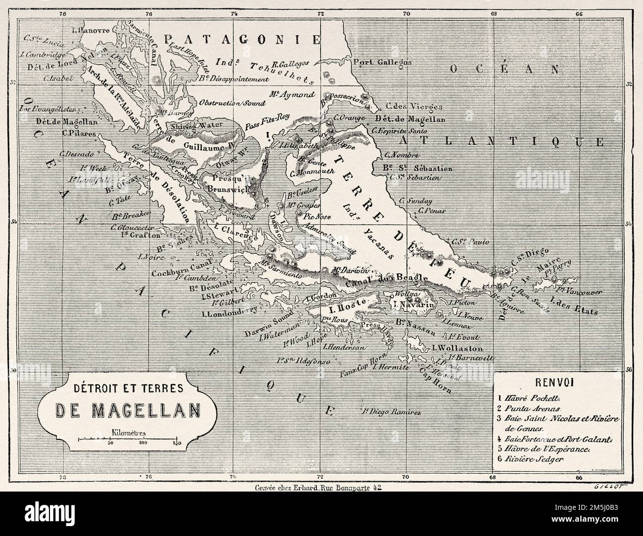 Old Map of the Magellan Strait, Patagonia. Chile, South America. Diary of a Voyage to the Strait of Magellan by V de Rochas 1856-1859. Le Tour du Monde 1861 Stock Photohttps://www.alamy.com/image-license-details/?v=1https://www.alamy.com/old-map-of-the-magellan-strait-patagonia-chile-south-america-diary-of-a-voyage-to-the-strait-of-magellan-by-v-de-rochas-1856-1859-le-tour-du-monde-1861-image502569399.html
RM2M5J0B3–Old Map of the Magellan Strait, Patagonia. Chile, South America. Diary of a Voyage to the Strait of Magellan by V de Rochas 1856-1859. Le Tour du Monde 1861
 MULHALL(1878) p093 STRAITS OF MAGELLAN Stock Photohttps://www.alamy.com/image-license-details/?v=1https://www.alamy.com/stock-photo-mulhall1878-p093-straits-of-magellan-73542190.html
RME7J3PP–MULHALL(1878) p093 STRAITS OF MAGELLAN
 Freti Magellanici ac novi freti vulgo le Maire exactissima delineatio = Afbeelding der Straet Magellanes : so als de selve van Mr. Barent Iansz : potgeieter van Munster door en weder door bevaren en met syn Capiteyn Sebald de Waerd met groot pericul syns levens seer naerstig onderfocht is. Relief shown pictorially. Map of the Straits of Magellan, South America. Bar scales in 'Miliaria Germanica communia' and 'Miliaria Gallica communia.' In Latin on verso, with caption title 'Freti Magellanici et freti le Marii descriptio' and signature 'Fffff.' From Jan Jansson and Henrik Hondius's Atlas novus Stock Photohttps://www.alamy.com/image-license-details/?v=1https://www.alamy.com/freti-magellanici-ac-novi-freti-vulgo-le-maire-exactissima-delineatio-=-afbeelding-der-straet-magellanes-so-als-de-selve-van-mr-barent-iansz-potgeieter-van-munster-door-en-weder-door-bevaren-en-met-syn-capiteyn-sebald-de-waerd-met-groot-pericul-syns-levens-seer-naerstig-onderfocht-is-relief-shown-pictorially-map-of-the-straits-of-magellan-south-america-bar-scales-in-miliaria-germanica-communia-and-miliaria-gallica-communia-in-latin-on-verso-with-caption-title-freti-magellanici-et-freti-le-marii-descriptio-and-signature-fffff-from-jan-jansson-and-henrik-hondiuss-atlas-novus-image502724446.html
RM2M5W24E–Freti Magellanici ac novi freti vulgo le Maire exactissima delineatio = Afbeelding der Straet Magellanes : so als de selve van Mr. Barent Iansz : potgeieter van Munster door en weder door bevaren en met syn Capiteyn Sebald de Waerd met groot pericul syns levens seer naerstig onderfocht is. Relief shown pictorially. Map of the Straits of Magellan, South America. Bar scales in 'Miliaria Germanica communia' and 'Miliaria Gallica communia.' In Latin on verso, with caption title 'Freti Magellanici et freti le Marii descriptio' and signature 'Fffff.' From Jan Jansson and Henrik Hondius's Atlas novus
 Freti Magellanici ac novi freti vulgo Le Maire exactissima delineatio. Museum: PRIVATE COLLECTION. Stock Photohttps://www.alamy.com/image-license-details/?v=1https://www.alamy.com/freti-magellanici-ac-novi-freti-vulgo-le-maire-exactissima-delineatio-museum-private-collection-image212327370.html
RMP9C9MA–Freti Magellanici ac novi freti vulgo Le Maire exactissima delineatio. Museum: PRIVATE COLLECTION.
![Magellan Strait. Theil VI. Sechste Theil, Kurtze, warhafftige Relat. Noribergæ, 1603. The map shows the fortification guarding the Magelllan strait, that was set up by the Spanish after raids by Sir Francis Drake. Image taken from Theil VI. Sechste Theil, Kurtze, warhafftige Relation und Beschreibung der wunderbarsten vier Schiffarten, so jemals verricht worden. Als nemlich: F. Magellani ..., mit S. de Cano. F. Draconis T. Candisch O. von Noort So alle vier umb den gantzen Erdtkreiss gesegelt. Auss unterschiedenen authoribus zusamen getragen, und mit [5] Landt-Charten, [9] Figuren und Erkler Stock Photo Magellan Strait. Theil VI. Sechste Theil, Kurtze, warhafftige Relat. Noribergæ, 1603. The map shows the fortification guarding the Magelllan strait, that was set up by the Spanish after raids by Sir Francis Drake. Image taken from Theil VI. Sechste Theil, Kurtze, warhafftige Relation und Beschreibung der wunderbarsten vier Schiffarten, so jemals verricht worden. Als nemlich: F. Magellani ..., mit S. de Cano. F. Draconis T. Candisch O. von Noort So alle vier umb den gantzen Erdtkreiss gesegelt. Auss unterschiedenen authoribus zusamen getragen, und mit [5] Landt-Charten, [9] Figuren und Erkler Stock Photo](https://c8.alamy.com/comp/R54Y33/magellan-strait-theil-vi-sechste-theil-kurtze-warhafftige-relat-noriberg-1603-the-map-shows-the-fortification-guarding-the-magelllan-strait-that-was-set-up-by-the-spanish-after-raids-by-sir-francis-drake-image-taken-from-theil-vi-sechste-theil-kurtze-warhafftige-relation-und-beschreibung-der-wunderbarsten-vier-schiffarten-so-jemals-verricht-worden-als-nemlich-f-magellani-mit-s-de-cano-f-draconis-t-candisch-o-von-noort-so-alle-vier-umb-den-gantzen-erdtkreiss-gesegelt-auss-unterschiedenen-authoribus-zusamen-getragen-und-mit-5-landt-charten-9-figuren-und-erkler-R54Y33.jpg) Magellan Strait. Theil VI. Sechste Theil, Kurtze, warhafftige Relat. Noribergæ, 1603. The map shows the fortification guarding the Magelllan strait, that was set up by the Spanish after raids by Sir Francis Drake. Image taken from Theil VI. Sechste Theil, Kurtze, warhafftige Relation und Beschreibung der wunderbarsten vier Schiffarten, so jemals verricht worden. Als nemlich: F. Magellani ..., mit S. de Cano. F. Draconis T. Candisch O. von Noort So alle vier umb den gantzen Erdtkreiss gesegelt. Auss unterschiedenen authoribus zusamen getragen, und mit [5] Landt-Charten, [9] Figuren und Erkler Stock Photohttps://www.alamy.com/image-license-details/?v=1https://www.alamy.com/magellan-strait-theil-vi-sechste-theil-kurtze-warhafftige-relat-noriberg-1603-the-map-shows-the-fortification-guarding-the-magelllan-strait-that-was-set-up-by-the-spanish-after-raids-by-sir-francis-drake-image-taken-from-theil-vi-sechste-theil-kurtze-warhafftige-relation-und-beschreibung-der-wunderbarsten-vier-schiffarten-so-jemals-verricht-worden-als-nemlich-f-magellani-mit-s-de-cano-f-draconis-t-candisch-o-von-noort-so-alle-vier-umb-den-gantzen-erdtkreiss-gesegelt-auss-unterschiedenen-authoribus-zusamen-getragen-und-mit-5-landt-charten-9-figuren-und-erkler-image226917127.html
Magellan Strait. Theil VI. Sechste Theil, Kurtze, warhafftige Relat. Noribergæ, 1603. The map shows the fortification guarding the Magelllan strait, that was set up by the Spanish after raids by Sir Francis Drake. Image taken from Theil VI. Sechste Theil, Kurtze, warhafftige Relation und Beschreibung der wunderbarsten vier Schiffarten, so jemals verricht worden. Als nemlich: F. Magellani ..., mit S. de Cano. F. Draconis T. Candisch O. von Noort So alle vier umb den gantzen Erdtkreiss gesegelt. Auss unterschiedenen authoribus zusamen getragen, und mit [5] Landt-Charten, [9] Figuren und Erkler Stock Photohttps://www.alamy.com/image-license-details/?v=1https://www.alamy.com/magellan-strait-theil-vi-sechste-theil-kurtze-warhafftige-relat-noriberg-1603-the-map-shows-the-fortification-guarding-the-magelllan-strait-that-was-set-up-by-the-spanish-after-raids-by-sir-francis-drake-image-taken-from-theil-vi-sechste-theil-kurtze-warhafftige-relation-und-beschreibung-der-wunderbarsten-vier-schiffarten-so-jemals-verricht-worden-als-nemlich-f-magellani-mit-s-de-cano-f-draconis-t-candisch-o-von-noort-so-alle-vier-umb-den-gantzen-erdtkreiss-gesegelt-auss-unterschiedenen-authoribus-zusamen-getragen-und-mit-5-landt-charten-9-figuren-und-erkler-image226917127.htmlRMR54Y33–Magellan Strait. Theil VI. Sechste Theil, Kurtze, warhafftige Relat. Noribergæ, 1603. The map shows the fortification guarding the Magelllan strait, that was set up by the Spanish after raids by Sir Francis Drake. Image taken from Theil VI. Sechste Theil, Kurtze, warhafftige Relation und Beschreibung der wunderbarsten vier Schiffarten, so jemals verricht worden. Als nemlich: F. Magellani ..., mit S. de Cano. F. Draconis T. Candisch O. von Noort So alle vier umb den gantzen Erdtkreiss gesegelt. Auss unterschiedenen authoribus zusamen getragen, und mit [5] Landt-Charten, [9] Figuren und Erkler
 MULHALL(1878) p093 STRAITS OF MAGELLAN Stock Photohttps://www.alamy.com/image-license-details/?v=1https://www.alamy.com/mulhall1878-p093-straits-of-magellan-image154608375.html
RMJYF0FK–MULHALL(1878) p093 STRAITS OF MAGELLAN
 MULHALL(1878) p093 STRAITS OF MAGELLAN Stock Photohttps://www.alamy.com/image-license-details/?v=1https://www.alamy.com/stock-photo-mulhall1878-p093-straits-of-magellan-74692515.html
RME9EF1R–MULHALL(1878) p093 STRAITS OF MAGELLAN
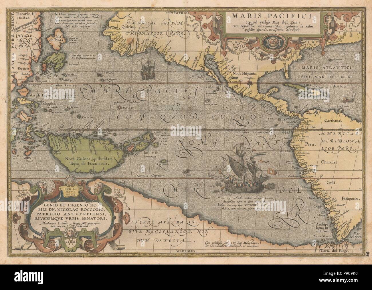 Maris Pacifici (From Theatrum orbis terrarum). Museum: PRIVATE COLLECTION. Stock Photohttps://www.alamy.com/image-license-details/?v=1https://www.alamy.com/maris-pacifici-from-theatrum-orbis-terrarum-museum-private-collection-image212327332.html
RMP9C9K0–Maris Pacifici (From Theatrum orbis terrarum). Museum: PRIVATE COLLECTION.
 Chart of the eastern coast of South America from 6Å‚ south to the Straits of Magellan. Jean Rotz, Boke of Idrography (The 'Rotz Atlas'). c 1535-1542. Source: Royal MS 20 E IX f.27v. Language: French & English. Stock Photohttps://www.alamy.com/image-license-details/?v=1https://www.alamy.com/chart-of-the-eastern-coast-of-south-america-from-6-south-to-the-straits-of-magellan-jean-rotz-boke-of-idrography-the-rotz-atlas-c-1535-1542-source-royal-ms-20-e-ix-f27v-language-french-english-image227038184.html
RMR5ADEG–Chart of the eastern coast of South America from 6Å‚ south to the Straits of Magellan. Jean Rotz, Boke of Idrography (The 'Rotz Atlas'). c 1535-1542. Source: Royal MS 20 E IX f.27v. Language: French & English.
 47045 Haplochiton zebra, Straits of Magellan Stock Photohttps://www.alamy.com/image-license-details/?v=1https://www.alamy.com/stock-photo-47045-haplochiton-zebra-straits-of-magellan-115033771.html
RMGK46MY–47045 Haplochiton zebra, Straits of Magellan
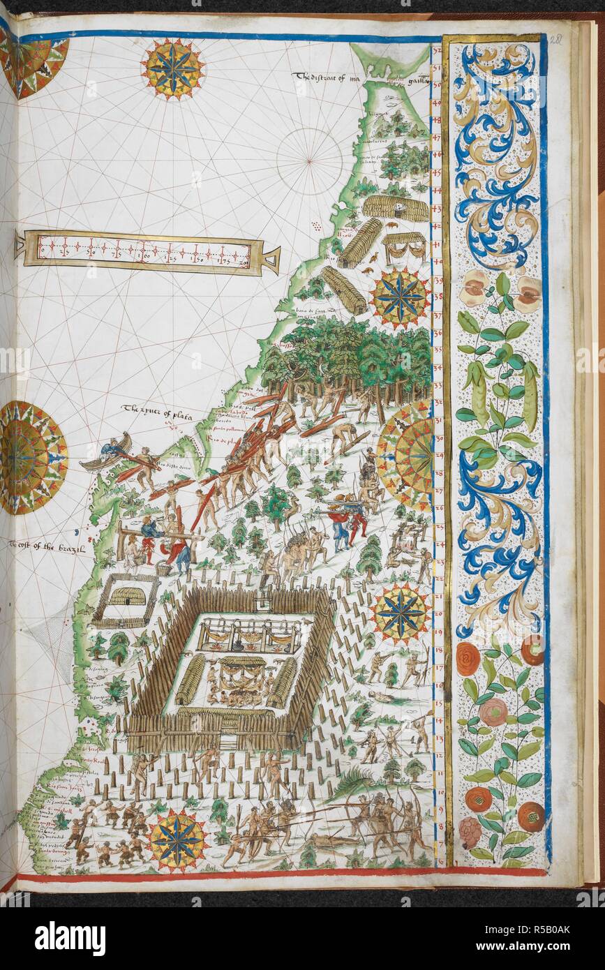 Chart of the eastern coast of South America from 6Å‚ south to the Straits of Magellan. A native enclosure and various activities. Jean Rotz, Boke of Idrography (The 'Rotz Atlas'). c 1535-1542. Source: Royal MS 20 E IX f.28. Language: French & English. Stock Photohttps://www.alamy.com/image-license-details/?v=1https://www.alamy.com/chart-of-the-eastern-coast-of-south-america-from-6-south-to-the-straits-of-magellan-a-native-enclosure-and-various-activities-jean-rotz-boke-of-idrography-the-rotz-atlas-c-1535-1542-source-royal-ms-20-e-ix-f28-language-french-english-image227049835.html
RMR5B0AK–Chart of the eastern coast of South America from 6Å‚ south to the Straits of Magellan. A native enclosure and various activities. Jean Rotz, Boke of Idrography (The 'Rotz Atlas'). c 1535-1542. Source: Royal MS 20 E IX f.28. Language: French & English.
 36495 Gray's Harbour, Straits of Magellan Stock Photohttps://www.alamy.com/image-license-details/?v=1https://www.alamy.com/stock-photo-36495-grays-harbour-straits-of-magellan-115084079.html
RMGK6EWK–36495 Gray's Harbour, Straits of Magellan
 The Straits of Magellan, taken on board the 'Dolphin,' 1767; drawn by Richard Pickersgill. CHARTS and maps made during voyages of discovery in the South Pacific Ocean by Samuel Wallis, commander of the 'Dolphin,' in 1767; Lieut. James Cook, commander of the 'Endeavour,' in 1769 and 1770; and Matthew Flinders, second lieut., and George Bass, surgeon, of the 'Resistance,' in 1798, 1799. 1767. Source: Add. 21593 A. Stock Photohttps://www.alamy.com/image-license-details/?v=1https://www.alamy.com/the-straits-of-magellan-taken-on-board-the-dolphin-1767-drawn-by-richard-pickersgill-charts-and-maps-made-during-voyages-of-discovery-in-the-south-pacific-ocean-by-samuel-wallis-commander-of-the-dolphin-in-1767-lieut-james-cook-commander-of-the-endeavour-in-1769-and-1770-and-matthew-flinders-second-lieut-and-george-bass-surgeon-of-the-resistance-in-1798-1799-1767-source-add-21593-a-image227136078.html
RMR5EXAP–The Straits of Magellan, taken on board the 'Dolphin,' 1767; drawn by Richard Pickersgill. CHARTS and maps made during voyages of discovery in the South Pacific Ocean by Samuel Wallis, commander of the 'Dolphin,' in 1767; Lieut. James Cook, commander of the 'Endeavour,' in 1769 and 1770; and Matthew Flinders, second lieut., and George Bass, surgeon, of the 'Resistance,' in 1798, 1799. 1767. Source: Add. 21593 A.
 47287 Bad Weather, Magellan Straits Stock Photohttps://www.alamy.com/image-license-details/?v=1https://www.alamy.com/stock-photo-47287-bad-weather-magellan-straits-115034060.html
RMGK4738–47287 Bad Weather, Magellan Straits
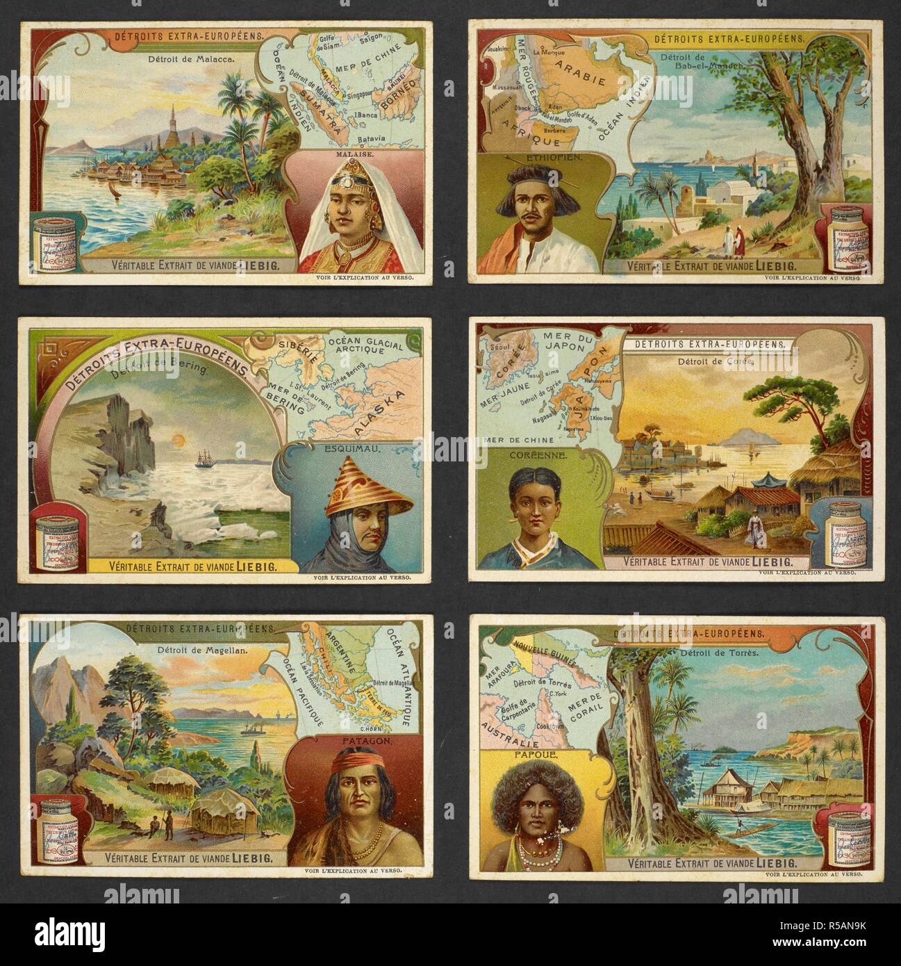 Six trading trades depicting: DeÌtroit de Malacca - DeÌtroit de Bab-el-Mandeb - DeÌtroit de Bering - DeÌtroit de CoeÌe - DeÌtroit de Magellan - DeÌtroit de TorreÌ€s. Contents: On verso: geographical descriptions and recipes. Physical Description: 6 trade cards : col ; 7 x 11 cm.; Scales differ. . DeÌtroits extra-EuropeÌens. 19th century. Six trade cards, probably produced in late nineteenth century, to advertise Liebig meat extract. They show maps and views of straits throughout the world, and illustrations of local people. Physical Description: 6 trade cards : col ; 7 x 11 cm. Stock Photohttps://www.alamy.com/image-license-details/?v=1https://www.alamy.com/six-trading-trades-depicting-detroit-de-malacca-detroit-de-bab-el-mandeb-detroit-de-bering-detroit-de-coee-detroit-de-magellan-detroit-de-torres-contents-on-verso-geographical-descriptions-and-recipes-physical-description-6-trade-cards-col-7-x-11-cm-scales-differ-detroits-extra-europeens-19th-century-six-trade-cards-probably-produced-in-late-nineteenth-century-to-advertise-liebig-meat-extract-they-show-maps-and-views-of-straits-throughout-the-world-and-illustrations-of-local-people-physical-description-6-trade-cards-col-7-x-11-cm-image227044319.html
RMR5AN9K–Six trading trades depicting: DeÌtroit de Malacca - DeÌtroit de Bab-el-Mandeb - DeÌtroit de Bering - DeÌtroit de CoeÌe - DeÌtroit de Magellan - DeÌtroit de TorreÌ€s. Contents: On verso: geographical descriptions and recipes. Physical Description: 6 trade cards : col ; 7 x 11 cm.; Scales differ. . DeÌtroits extra-EuropeÌens. 19th century. Six trade cards, probably produced in late nineteenth century, to advertise Liebig meat extract. They show maps and views of straits throughout the world, and illustrations of local people. Physical Description: 6 trade cards : col ; 7 x 11 cm.
 36529 Gray's Harbour, Straits of Magellan Stock Photohttps://www.alamy.com/image-license-details/?v=1https://www.alamy.com/stock-photo-36529-grays-harbour-straits-of-magellan-115084123.html
RMGK6EY7–36529 Gray's Harbour, Straits of Magellan
![World Map. Portolan Atlas. Italy [Venice]; 1536. [Whole map] Map of the world showing the route of Magellan's circumnavigation and route from Polosi to Seville [1519-1522] Image taken from Portolan Atlas. Originally published/produced in Italy [Venice]; 1536. . Source: Add. 19927, ff.12v-13. Language: Latin. Stock Photo World Map. Portolan Atlas. Italy [Venice]; 1536. [Whole map] Map of the world showing the route of Magellan's circumnavigation and route from Polosi to Seville [1519-1522] Image taken from Portolan Atlas. Originally published/produced in Italy [Venice]; 1536. . Source: Add. 19927, ff.12v-13. Language: Latin. Stock Photo](https://c8.alamy.com/comp/R58MEC/world-map-portolan-atlas-italy-venice-1536-whole-map-map-of-the-world-showing-the-route-of-magellans-circumnavigation-and-route-from-polosi-to-seville-1519-1522-image-taken-from-portolan-atlas-originally-publishedproduced-in-italy-venice-1536-source-add-19927-ff12v-13-language-latin-R58MEC.jpg) World Map. Portolan Atlas. Italy [Venice]; 1536. [Whole map] Map of the world showing the route of Magellan's circumnavigation and route from Polosi to Seville [1519-1522] Image taken from Portolan Atlas. Originally published/produced in Italy [Venice]; 1536. . Source: Add. 19927, ff.12v-13. Language: Latin. Stock Photohttps://www.alamy.com/image-license-details/?v=1https://www.alamy.com/world-map-portolan-atlas-italy-venice-1536-whole-map-map-of-the-world-showing-the-route-of-magellans-circumnavigation-and-route-from-polosi-to-seville-1519-1522-image-taken-from-portolan-atlas-originally-publishedproduced-in-italy-venice-1536-source-add-19927-ff12v-13-language-latin-image226999764.html
World Map. Portolan Atlas. Italy [Venice]; 1536. [Whole map] Map of the world showing the route of Magellan's circumnavigation and route from Polosi to Seville [1519-1522] Image taken from Portolan Atlas. Originally published/produced in Italy [Venice]; 1536. . Source: Add. 19927, ff.12v-13. Language: Latin. Stock Photohttps://www.alamy.com/image-license-details/?v=1https://www.alamy.com/world-map-portolan-atlas-italy-venice-1536-whole-map-map-of-the-world-showing-the-route-of-magellans-circumnavigation-and-route-from-polosi-to-seville-1519-1522-image-taken-from-portolan-atlas-originally-publishedproduced-in-italy-venice-1536-source-add-19927-ff12v-13-language-latin-image226999764.htmlRMR58MEC–World Map. Portolan Atlas. Italy [Venice]; 1536. [Whole map] Map of the world showing the route of Magellan's circumnavigation and route from Polosi to Seville [1519-1522] Image taken from Portolan Atlas. Originally published/produced in Italy [Venice]; 1536. . Source: Add. 19927, ff.12v-13. Language: Latin.
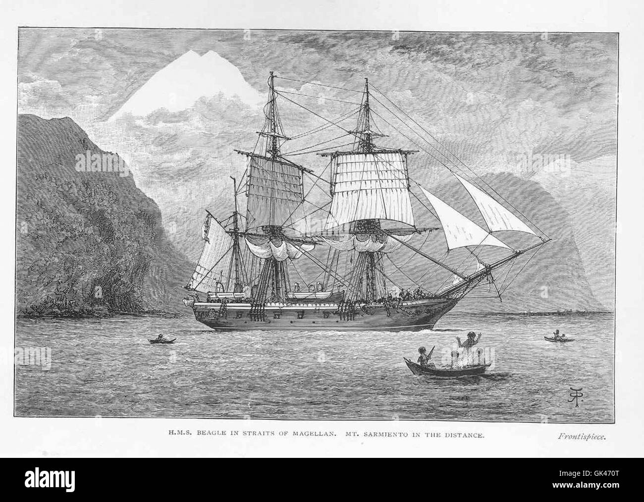 47233 HMS Beagle in Straits of Magellan Mt Sarmiento in the Distance Stock Photohttps://www.alamy.com/image-license-details/?v=1https://www.alamy.com/stock-photo-47233-hms-beagle-in-straits-of-magellan-mt-sarmiento-in-the-distance-115033992.html
RMGK470T–47233 HMS Beagle in Straits of Magellan Mt Sarmiento in the Distance
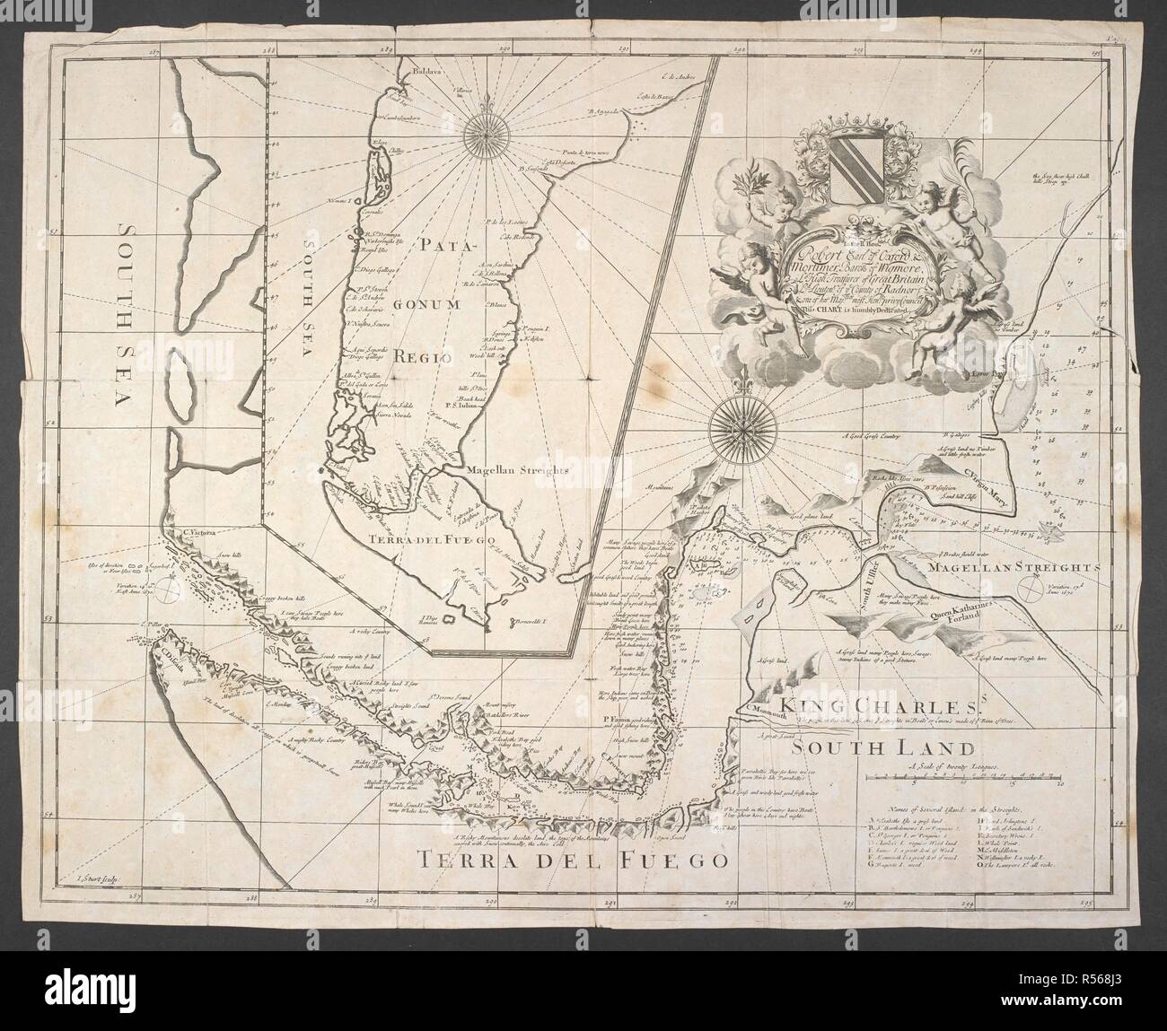 A printed chart of the Strait of Magellan with an inset of Patagonia and Terra del Fuego . To the R. Hon.ble Robert Earl of Oxford & Mortimer Baron of Wigmore, Ld High Treasurer of Great Britain Ld Lieutenant of ye County of Radnor & one of her Maj:ties most Hon.ble Privy Council this chart is humbly dedicated. 1711. Source: Add. 88980 E. Language: English. Stock Photohttps://www.alamy.com/image-license-details/?v=1https://www.alamy.com/a-printed-chart-of-the-strait-of-magellan-with-an-inset-of-patagonia-and-terra-del-fuego-to-the-r-honble-robert-earl-of-oxford-mortimer-baron-of-wigmore-ld-high-treasurer-of-great-britain-ld-lieutenant-of-ye-county-of-radnor-one-of-her-majties-most-honble-privy-council-this-chart-is-humbly-dedicated-1711-source-add-88980-e-language-english-image226946555.html
RMR568J3–A printed chart of the Strait of Magellan with an inset of Patagonia and Terra del Fuego . To the R. Hon.ble Robert Earl of Oxford & Mortimer Baron of Wigmore, Ld High Treasurer of Great Britain Ld Lieutenant of ye County of Radnor & one of her Maj:ties most Hon.ble Privy Council this chart is humbly dedicated. 1711. Source: Add. 88980 E. Language: English.