Quick filters:
Survey of india maps Stock Photos and Images
 Name sign in the entrance of the Geological Survey of India in the New Market Area of Taltala, Kolkata (Calcutta), capital of West Bengal, India Stock Photohttps://www.alamy.com/image-license-details/?v=1https://www.alamy.com/name-sign-in-the-entrance-of-the-geological-survey-of-india-in-the-new-market-area-of-taltala-kolkata-calcutta-capital-of-west-bengal-india-image547055724.html
RM2PP0F4C–Name sign in the entrance of the Geological Survey of India in the New Market Area of Taltala, Kolkata (Calcutta), capital of West Bengal, India
 Town and Cantonments of Jacobabad. A general survey of India carried out 1858-59. A Survey of India. India. A general survey of the cantonments and settlements in India during the later part of the 19th century. Source: Maps I.S. Stock Photohttps://www.alamy.com/image-license-details/?v=1https://www.alamy.com/town-and-cantonments-of-jacobabad-a-general-survey-of-india-carried-out-1858-59-a-survey-of-india-india-a-general-survey-of-the-cantonments-and-settlements-in-india-during-the-later-part-of-the-19th-century-source-maps-is-image226793868.html
RMR4Y9W0–Town and Cantonments of Jacobabad. A general survey of India carried out 1858-59. A Survey of India. India. A general survey of the cantonments and settlements in India during the later part of the 19th century. Source: Maps I.S.
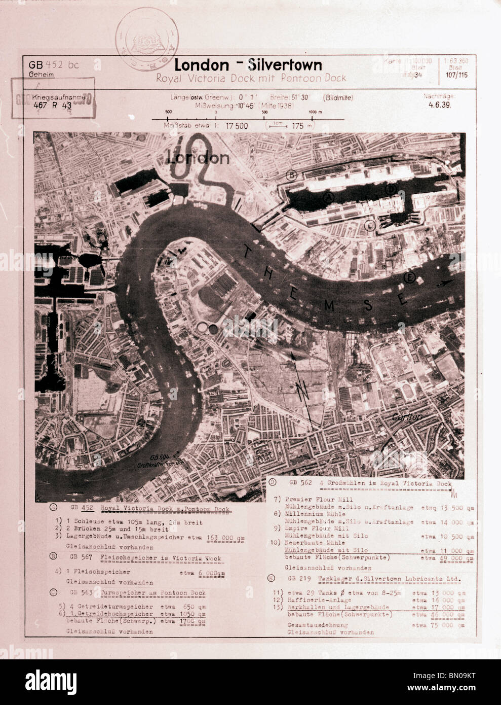 London - Silvertown 4th June 1939 Blitz Royal Victoria, Royal Albert, West India & Millwall Docks, Silvertown Lubricants Ltd Stock Photohttps://www.alamy.com/image-license-details/?v=1https://www.alamy.com/stock-photo-london-silvertown-4th-june-1939-blitz-royal-victoria-royal-albert-30125756.html
RMBN09KT–London - Silvertown 4th June 1939 Blitz Royal Victoria, Royal Albert, West India & Millwall Docks, Silvertown Lubricants Ltd
 Tobago from actual surveys and observations. Relief shown by hachures; depth shown by soundings. Shows administrative boundaries and cultural features. Includes descriptive text and inset maps 'Man of War Bay' and 'A survey of Great & Little Courland Bays, by David Ross.' 'Printed for Robt. Sayer, Map and Printseller, no. 53 in Fleet Street, as the Act directs 20 Feby. 1775.' Prime meridian: Ferro. Appears in the author's West-India atlas. London: Robert Sayer and John Bennet, 1783. Cataloging, conservation, and digitization made possible in part by The National Endowment for the Humanities: E Stock Photohttps://www.alamy.com/image-license-details/?v=1https://www.alamy.com/tobago-from-actual-surveys-and-observations-relief-shown-by-hachures-depth-shown-by-soundings-shows-administrative-boundaries-and-cultural-features-includes-descriptive-text-and-inset-maps-man-of-war-bay-and-a-survey-of-great-little-courland-bays-by-david-ross-printed-for-robt-sayer-map-and-printseller-no-53-in-fleet-street-as-the-act-directs-20-feby-1775-prime-meridian-ferro-appears-in-the-authors-west-india-atlas-london-robert-sayer-and-john-bennet-1783-cataloging-conservation-and-digitization-made-possible-in-part-by-the-national-endowment-for-the-humanities-e-image502718999.html
RM2M5TR5Y–Tobago from actual surveys and observations. Relief shown by hachures; depth shown by soundings. Shows administrative boundaries and cultural features. Includes descriptive text and inset maps 'Man of War Bay' and 'A survey of Great & Little Courland Bays, by David Ross.' 'Printed for Robt. Sayer, Map and Printseller, no. 53 in Fleet Street, as the Act directs 20 Feby. 1775.' Prime meridian: Ferro. Appears in the author's West-India atlas. London: Robert Sayer and John Bennet, 1783. Cataloging, conservation, and digitization made possible in part by The National Endowment for the Humanities: E
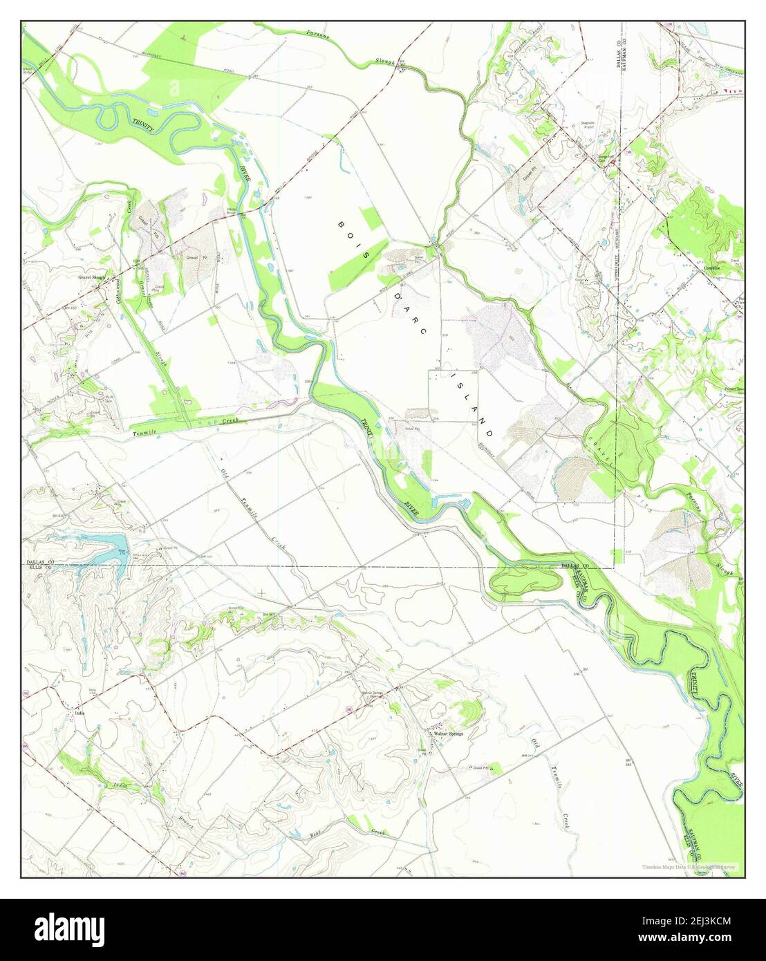 India, Texas, map 1959, 1:24000, United States of America by Timeless Maps, data U.S. Geological Survey Stock Photohttps://www.alamy.com/image-license-details/?v=1https://www.alamy.com/india-texas-map-1959-124000-united-states-of-america-by-timeless-maps-data-us-geological-survey-image406983380.html
RM2EJ3KCM–India, Texas, map 1959, 1:24000, United States of America by Timeless Maps, data U.S. Geological Survey
 Maps and survey . are overprinted in heavyblack. This is far better than suppressing the topographicaldetail, as is too often done in railway maps. The representation of railways running underground throughtowns involves difficulties which have not been successfullyovercome. In a country such as India, where there are several differentgauges in use, it is most important to distinguish between them.And it is even more important in mountainous countries, asSwitzerland, to distinguish between railways of the ordinarykind, rack railways, and funiculars. Scale. The question of scale is of prime imp Stock Photohttps://www.alamy.com/image-license-details/?v=1https://www.alamy.com/maps-and-survey-are-overprinted-in-heavyblack-this-is-far-better-than-suppressing-the-topographicaldetail-as-is-too-often-done-in-railway-maps-the-representation-of-railways-running-underground-throughtowns-involves-difficulties-which-have-not-been-successfullyovercome-in-a-country-such-as-india-where-there-are-several-differentgauges-in-use-it-is-most-important-to-distinguish-between-themand-it-is-even-more-important-in-mountainous-countries-asswitzerland-to-distinguish-between-railways-of-the-ordinarykind-rack-railways-and-funiculars-scale-the-question-of-scale-is-of-prime-imp-image343132677.html
RM2AX716D–Maps and survey . are overprinted in heavyblack. This is far better than suppressing the topographicaldetail, as is too often done in railway maps. The representation of railways running underground throughtowns involves difficulties which have not been successfullyovercome. In a country such as India, where there are several differentgauges in use, it is most important to distinguish between them.And it is even more important in mountainous countries, asSwitzerland, to distinguish between railways of the ordinarykind, rack railways, and funiculars. Scale. The question of scale is of prime imp
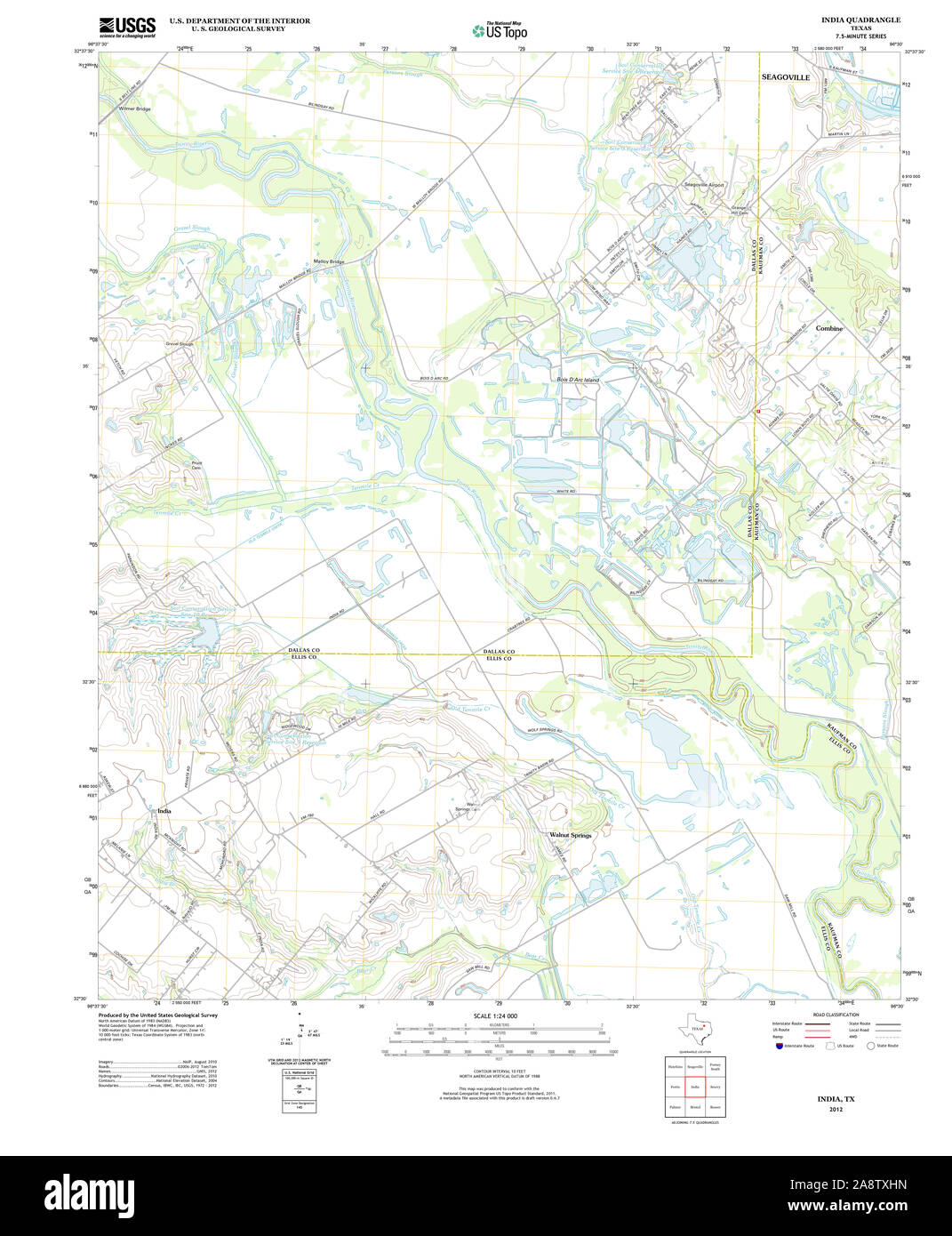 USGS TOPO Map Texas TX India 20121106 TM Restoration Stock Photohttps://www.alamy.com/image-license-details/?v=1https://www.alamy.com/usgs-topo-map-texas-tx-india-20121106-tm-restoration-image332461969.html
RM2A8TXHN–USGS TOPO Map Texas TX India 20121106 TM Restoration
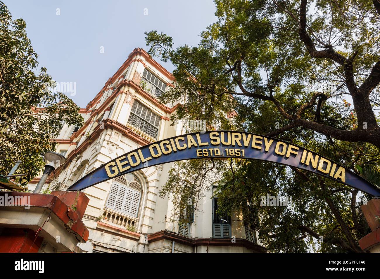 Name sign in the entrance of the Geological Survey of India in the New Market Area of Taltala, Kolkata (Calcutta), capital of West Bengal, India Stock Photohttps://www.alamy.com/image-license-details/?v=1https://www.alamy.com/name-sign-in-the-entrance-of-the-geological-survey-of-india-in-the-new-market-area-of-taltala-kolkata-calcutta-capital-of-west-bengal-india-image547055720.html
RM2PP0F48–Name sign in the entrance of the Geological Survey of India in the New Market Area of Taltala, Kolkata (Calcutta), capital of West Bengal, India
![Map of Bombay. Bombay Guide Map, including part of Salsette. Scale, 1 : 25,000. Reprint of 1933 edition. [Calcutta] : Survey of India Offices H.L.O., 1945. 764 x 1019 mm.; Scale 1: 25 000. Source: Maps 52540.(11). Stock Photo Map of Bombay. Bombay Guide Map, including part of Salsette. Scale, 1 : 25,000. Reprint of 1933 edition. [Calcutta] : Survey of India Offices H.L.O., 1945. 764 x 1019 mm.; Scale 1: 25 000. Source: Maps 52540.(11). Stock Photo](https://c8.alamy.com/comp/R5DHNY/map-of-bombay-bombay-guide-map-including-part-of-salsette-scale-1-25000-reprint-of-1933-edition-calcutta-survey-of-india-offices-hlo-1945-764-x-1019-mm-scale-1-25-000-source-maps-5254011-R5DHNY.jpg) Map of Bombay. Bombay Guide Map, including part of Salsette. Scale, 1 : 25,000. Reprint of 1933 edition. [Calcutta] : Survey of India Offices H.L.O., 1945. 764 x 1019 mm.; Scale 1: 25 000. Source: Maps 52540.(11). Stock Photohttps://www.alamy.com/image-license-details/?v=1https://www.alamy.com/map-of-bombay-bombay-guide-map-including-part-of-salsette-scale-1-25000-reprint-of-1933-edition-calcutta-survey-of-india-offices-hlo-1945-764-x-1019-mm-scale-1-25-000-source-maps-5254011-image227107383.html
Map of Bombay. Bombay Guide Map, including part of Salsette. Scale, 1 : 25,000. Reprint of 1933 edition. [Calcutta] : Survey of India Offices H.L.O., 1945. 764 x 1019 mm.; Scale 1: 25 000. Source: Maps 52540.(11). Stock Photohttps://www.alamy.com/image-license-details/?v=1https://www.alamy.com/map-of-bombay-bombay-guide-map-including-part-of-salsette-scale-1-25000-reprint-of-1933-edition-calcutta-survey-of-india-offices-hlo-1945-764-x-1019-mm-scale-1-25-000-source-maps-5254011-image227107383.htmlRMR5DHNY–Map of Bombay. Bombay Guide Map, including part of Salsette. Scale, 1 : 25,000. Reprint of 1933 edition. [Calcutta] : Survey of India Offices H.L.O., 1945. 764 x 1019 mm.; Scale 1: 25 000. Source: Maps 52540.(11).
 London - Silvertown 4th June 1939 Luftwaffe Royal Victoria, Royal Albert, West India & Millwall Docks, Silvertown Lubricants Ltd Stock Photohttps://www.alamy.com/image-license-details/?v=1https://www.alamy.com/stock-photo-london-silvertown-4th-june-1939-luftwaffe-royal-victoria-royal-albert-30125764.html
RMBN09M4–London - Silvertown 4th June 1939 Luftwaffe Royal Victoria, Royal Albert, West India & Millwall Docks, Silvertown Lubricants Ltd
 India, Texas, map 1959, 1:24000, United States of America by Timeless Maps, data U.S. Geological Survey Stock Photohttps://www.alamy.com/image-license-details/?v=1https://www.alamy.com/india-texas-map-1959-124000-united-states-of-america-by-timeless-maps-data-us-geological-survey-image406983381.html
RM2EJ3KCN–India, Texas, map 1959, 1:24000, United States of America by Timeless Maps, data U.S. Geological Survey
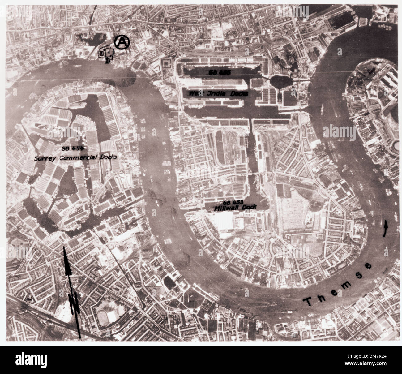 London - Stepney 1940 Surrey Commercial Dock, East India Dock & Millwall Dock Stock Photohttps://www.alamy.com/image-license-details/?v=1https://www.alamy.com/stock-photo-london-stepney-1940-surrey-commercial-dock-east-india-dock-millwall-30111148.html
RMBMYK24–London - Stepney 1940 Surrey Commercial Dock, East India Dock & Millwall Dock
 Journal of Asiatic Society of Bengal . JOURNAL OF THE ASIATIC SOCIETY. No. III.—1853. Report on the Geological Structure and Mineral Wealth of^ the SgltMange in the Runjaub ; with Maps, Sections, Sfc.—By Andee%Fleming, M. D., Edin. Assistant Surgeon, AjL Regt. RunjaubCavalry. In charge of the Geological Survey of the Salt Rangein the Runjaub. Season 1851-52. (Communicated by the Govt, of India.) Peeliminaey Eemaeks. In compliance with the instructions received at Maree on theIndus, on the 14th February 1851, from the Most Noble the Go-vernor General, I have endeavoured to make such an examinat Stock Photohttps://www.alamy.com/image-license-details/?v=1https://www.alamy.com/journal-of-asiatic-society-of-bengal-journal-of-the-asiatic-society-no-iii1853-report-on-the-geological-structure-and-mineral-wealth-of-the-sgltmange-in-the-runjaub-with-maps-sections-sfcby-andeefleming-m-d-edin-assistant-surgeon-ajl-regt-runjaubcavalry-in-charge-of-the-geological-survey-of-the-salt-rangein-the-runjaub-season-1851-52-communicated-by-the-govt-of-india-peeliminaey-eemaeks-in-compliance-with-the-instructions-received-at-maree-on-theindus-on-the-14th-february-1851-from-the-most-noble-the-go-vernor-general-i-have-endeavoured-to-make-such-an-examinat-image340063625.html
RM2AN76HD–Journal of Asiatic Society of Bengal . JOURNAL OF THE ASIATIC SOCIETY. No. III.—1853. Report on the Geological Structure and Mineral Wealth of^ the SgltMange in the Runjaub ; with Maps, Sections, Sfc.—By Andee%Fleming, M. D., Edin. Assistant Surgeon, AjL Regt. RunjaubCavalry. In charge of the Geological Survey of the Salt Rangein the Runjaub. Season 1851-52. (Communicated by the Govt, of India.) Peeliminaey Eemaeks. In compliance with the instructions received at Maree on theIndus, on the 14th February 1851, from the Most Noble the Go-vernor General, I have endeavoured to make such an examinat
 London - Isle of Dogs 1940 Royal Victoria, Royal Albert, West India & Millwall Docks Stock Photohttps://www.alamy.com/image-license-details/?v=1https://www.alamy.com/stock-photo-london-isle-of-dogs-1940-royal-victoria-royal-albert-west-india-millwall-30131052.html
RMBN0GD0–London - Isle of Dogs 1940 Royal Victoria, Royal Albert, West India & Millwall Docks
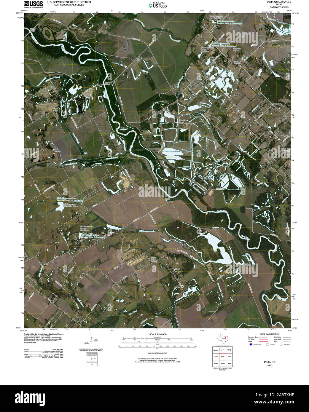 USGS TOPO Map Texas TX India 20100428 TM Restoration Stock Photohttps://www.alamy.com/image-license-details/?v=1https://www.alamy.com/usgs-topo-map-texas-tx-india-20100428-tm-restoration-image332461962.html
RM2A8TXHE–USGS TOPO Map Texas TX India 20100428 TM Restoration
 Name sign in the entrance of the Geological Survey of India in the New Market Area of Taltala, Kolkata (Calcutta), capital of West Bengal, India Stock Photohttps://www.alamy.com/image-license-details/?v=1https://www.alamy.com/name-sign-in-the-entrance-of-the-geological-survey-of-india-in-the-new-market-area-of-taltala-kolkata-calcutta-capital-of-west-bengal-india-image547055735.html
RM2PP0F4R–Name sign in the entrance of the Geological Survey of India in the New Market Area of Taltala, Kolkata (Calcutta), capital of West Bengal, India
![An index chart. Index Chart to the Great Trigonometrical Survey of. Calcutta : Surveyor General's Office, 1870[-1895]. Index Chart to the Great Trigonometrical Survey of India. Sh. 595 x 570 mm. Image taken from Index Chart to the Great Trigonometrical Survey of India, showing net work of Triangulation Completed to 1st May, 1870 (--1st October, 1895). Scale, 96 miles = 1 inch. Originally published/produced in Calcutta : Surveyor General's Office, 1870[-1895]. . Source: Maps.144.e.24,. Language: English. Stock Photo An index chart. Index Chart to the Great Trigonometrical Survey of. Calcutta : Surveyor General's Office, 1870[-1895]. Index Chart to the Great Trigonometrical Survey of India. Sh. 595 x 570 mm. Image taken from Index Chart to the Great Trigonometrical Survey of India, showing net work of Triangulation Completed to 1st May, 1870 (--1st October, 1895). Scale, 96 miles = 1 inch. Originally published/produced in Calcutta : Surveyor General's Office, 1870[-1895]. . Source: Maps.144.e.24,. Language: English. Stock Photo](https://c8.alamy.com/comp/R52AXF/an-index-chart-index-chart-to-the-great-trigonometrical-survey-of-calcutta-surveyor-generals-office-1870-1895-index-chart-to-the-great-trigonometrical-survey-of-india-sh-595-x-570-mm-image-taken-from-index-chart-to-the-great-trigonometrical-survey-of-india-showing-net-work-of-triangulation-completed-to-1st-may-1870-1st-october-1895-scale-96-miles-=-1-inch-originally-publishedproduced-in-calcutta-surveyor-generals-office-1870-1895-source-maps144e24-language-english-R52AXF.jpg) An index chart. Index Chart to the Great Trigonometrical Survey of. Calcutta : Surveyor General's Office, 1870[-1895]. Index Chart to the Great Trigonometrical Survey of India. Sh. 595 x 570 mm. Image taken from Index Chart to the Great Trigonometrical Survey of India, showing net work of Triangulation Completed to 1st May, 1870 (--1st October, 1895). Scale, 96 miles = 1 inch. Originally published/produced in Calcutta : Surveyor General's Office, 1870[-1895]. . Source: Maps.144.e.24,. Language: English. Stock Photohttps://www.alamy.com/image-license-details/?v=1https://www.alamy.com/an-index-chart-index-chart-to-the-great-trigonometrical-survey-of-calcutta-surveyor-generals-office-1870-1895-index-chart-to-the-great-trigonometrical-survey-of-india-sh-595-x-570-mm-image-taken-from-index-chart-to-the-great-trigonometrical-survey-of-india-showing-net-work-of-triangulation-completed-to-1st-may-1870-1st-october-1895-scale-96-miles-=-1-inch-originally-publishedproduced-in-calcutta-surveyor-generals-office-1870-1895-source-maps144e24-language-english-image226860551.html
An index chart. Index Chart to the Great Trigonometrical Survey of. Calcutta : Surveyor General's Office, 1870[-1895]. Index Chart to the Great Trigonometrical Survey of India. Sh. 595 x 570 mm. Image taken from Index Chart to the Great Trigonometrical Survey of India, showing net work of Triangulation Completed to 1st May, 1870 (--1st October, 1895). Scale, 96 miles = 1 inch. Originally published/produced in Calcutta : Surveyor General's Office, 1870[-1895]. . Source: Maps.144.e.24,. Language: English. Stock Photohttps://www.alamy.com/image-license-details/?v=1https://www.alamy.com/an-index-chart-index-chart-to-the-great-trigonometrical-survey-of-calcutta-surveyor-generals-office-1870-1895-index-chart-to-the-great-trigonometrical-survey-of-india-sh-595-x-570-mm-image-taken-from-index-chart-to-the-great-trigonometrical-survey-of-india-showing-net-work-of-triangulation-completed-to-1st-may-1870-1st-october-1895-scale-96-miles-=-1-inch-originally-publishedproduced-in-calcutta-surveyor-generals-office-1870-1895-source-maps144e24-language-english-image226860551.htmlRMR52AXF–An index chart. Index Chart to the Great Trigonometrical Survey of. Calcutta : Surveyor General's Office, 1870[-1895]. Index Chart to the Great Trigonometrical Survey of India. Sh. 595 x 570 mm. Image taken from Index Chart to the Great Trigonometrical Survey of India, showing net work of Triangulation Completed to 1st May, 1870 (--1st October, 1895). Scale, 96 miles = 1 inch. Originally published/produced in Calcutta : Surveyor General's Office, 1870[-1895]. . Source: Maps.144.e.24,. Language: English.
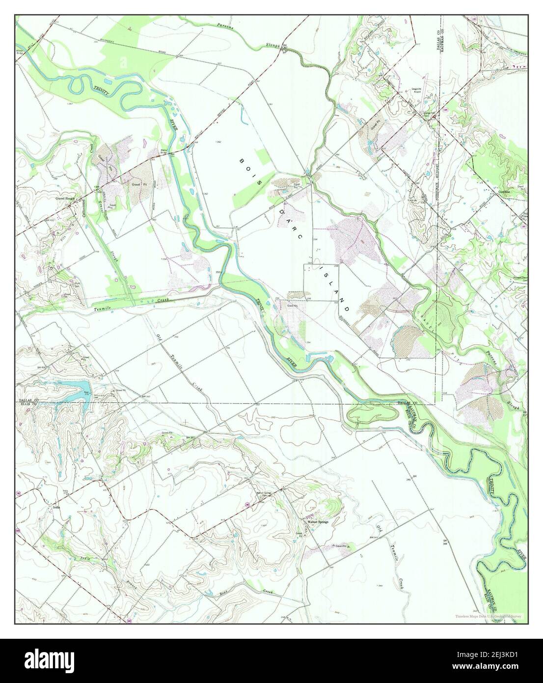 India, Texas, map 1959, 1:24000, United States of America by Timeless Maps, data U.S. Geological Survey Stock Photohttps://www.alamy.com/image-license-details/?v=1https://www.alamy.com/india-texas-map-1959-124000-united-states-of-america-by-timeless-maps-data-us-geological-survey-image406983389.html
RM2EJ3KD1–India, Texas, map 1959, 1:24000, United States of America by Timeless Maps, data U.S. Geological Survey
 Maps and survey . I. Half-second Pendulums. 2. Clock and Flash Box. Gravity S^ivvey.. urvey of India. 3. Latitude with Zenith Telescope. GEODETIC SURVEY 177 compensation is more than complete, so that there is a defect ofdensity underlying these regions. A few figures will serve to show the nature of these results. All observations are referred to Kew as the base station. The value ofg, the acceleration due to gravity, is taken to be 981 •200 centimetres at Kew.The Indian pendulums were swung at Kew, and the mean time of vibrationwas o5o67ooi seconds. The same pendulums swung at Dehra Dun gave Stock Photohttps://www.alamy.com/image-license-details/?v=1https://www.alamy.com/maps-and-survey-i-half-second-pendulums-2-clock-and-flash-box-gravity-sivvey-urvey-of-india-3-latitude-with-zenith-telescope-geodetic-survey-177-compensation-is-more-than-complete-so-that-there-is-a-defect-ofdensity-underlying-these-regions-a-few-figures-will-serve-to-show-the-nature-of-these-results-all-observations-are-referred-to-kew-as-the-base-station-the-value-ofg-the-acceleration-due-to-gravity-is-taken-to-be-981-200-centimetres-at-kewthe-indian-pendulums-were-swung-at-kew-and-the-mean-time-of-vibrationwas-o5o67ooi-seconds-the-same-pendulums-swung-at-dehra-dun-gave-image343096647.html
RM2AX5B7K–Maps and survey . I. Half-second Pendulums. 2. Clock and Flash Box. Gravity S^ivvey.. urvey of India. 3. Latitude with Zenith Telescope. GEODETIC SURVEY 177 compensation is more than complete, so that there is a defect ofdensity underlying these regions. A few figures will serve to show the nature of these results. All observations are referred to Kew as the base station. The value ofg, the acceleration due to gravity, is taken to be 981 •200 centimetres at Kew.The Indian pendulums were swung at Kew, and the mean time of vibrationwas o5o67ooi seconds. The same pendulums swung at Dehra Dun gave
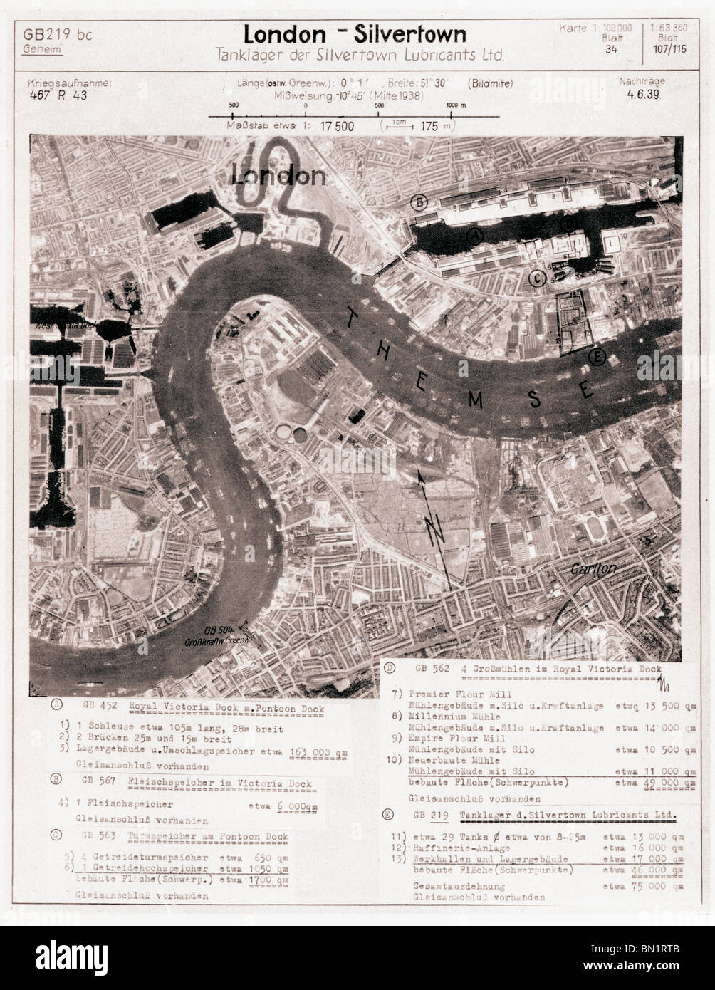 London - Silvertown 4th June 1939 Royal Victoria, Royal Albert, West India & Millwall Docks, Silvertown Lubricants Ltd Stock Photohttps://www.alamy.com/image-license-details/?v=1https://www.alamy.com/stock-photo-london-silvertown-4th-june-1939-royal-victoria-royal-albert-west-india-30158811.html
RMBN1RTB–London - Silvertown 4th June 1939 Royal Victoria, Royal Albert, West India & Millwall Docks, Silvertown Lubricants Ltd
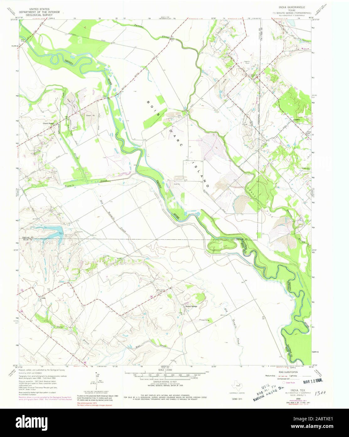 USGS TOPO Map Texas TX India 110959 1959 24000 Restoration Stock Photohttps://www.alamy.com/image-license-details/?v=1https://www.alamy.com/usgs-topo-map-texas-tx-india-110959-1959-24000-restoration-image332461865.html
RM2A8TXE1–USGS TOPO Map Texas TX India 110959 1959 24000 Restoration
 Name sign in the entrance of the Geological Survey of India in the New Market Area of Taltala, Kolkata (Calcutta), capital of West Bengal, India Stock Photohttps://www.alamy.com/image-license-details/?v=1https://www.alamy.com/name-sign-in-the-entrance-of-the-geological-survey-of-india-in-the-new-market-area-of-taltala-kolkata-calcutta-capital-of-west-bengal-india-image547055713.html
RM2PP0F41–Name sign in the entrance of the Geological Survey of India in the New Market Area of Taltala, Kolkata (Calcutta), capital of West Bengal, India
 A map of Mount Everest and its environs. Mount Everest and Environs. Scale, 1 inch to 2 miles, etc. Dehra Dun : Survey of India, 1930. Source: Maps 46848.(5.). Language: English. Stock Photohttps://www.alamy.com/image-license-details/?v=1https://www.alamy.com/a-map-of-mount-everest-and-its-environs-mount-everest-and-environs-scale-1-inch-to-2-miles-etc-dehra-dun-survey-of-india-1930-source-maps-468485-language-english-image226992119.html
RMR58ANB–A map of Mount Everest and its environs. Mount Everest and Environs. Scale, 1 inch to 2 miles, etc. Dehra Dun : Survey of India, 1930. Source: Maps 46848.(5.). Language: English.
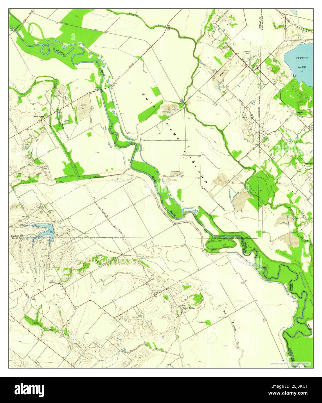 India, Texas, map 1959, 1:24000, United States of America by Timeless Maps, data U.S. Geological Survey Stock Photohttps://www.alamy.com/image-license-details/?v=1https://www.alamy.com/india-texas-map-1959-124000-united-states-of-america-by-timeless-maps-data-us-geological-survey-image406983384.html
RM2EJ3KCT–India, Texas, map 1959, 1:24000, United States of America by Timeless Maps, data U.S. Geological Survey
 . Memoirs of the Geological Survey of India. station the Nila Roh turns to the north-west at ario-ht angle, and passing off through the low Bhattani ridge unites with thetrans-frontier border hills of the Bannu and Dera Ismail Khan districts.The northern ranges in the Kalabagh region j!have elevations up to3,900 and 4,700 feet above the sea, according toGovernment maps; the cliffs of Dangot risesheer 2,070 feet from the Indus, and there are many other lofty preci-pices among the Lakargarh and Shingarh mountains, as well as along thesouthern escarpment of the Chichali range. The highest summit Stock Photohttps://www.alamy.com/image-license-details/?v=1https://www.alamy.com/memoirs-of-the-geological-survey-of-india-station-the-nila-roh-turns-to-the-north-west-at-ario-ht-angle-and-passing-off-through-the-low-bhattani-ridge-unites-with-thetrans-frontier-border-hills-of-the-bannu-and-dera-ismail-khan-districtsthe-northern-ranges-in-the-kalabagh-region-j!have-elevations-up-to3900-and-4700-feet-above-the-sea-according-togovernment-maps-the-cliffs-of-dangot-risesheer-2070-feet-from-the-indus-and-there-are-many-other-lofty-preci-pices-among-the-lakargarh-and-shingarh-mountains-as-well-as-along-thesouthern-escarpment-of-the-chichali-range-the-highest-summit-image337004358.html
RM2AG7TDX–. Memoirs of the Geological Survey of India. station the Nila Roh turns to the north-west at ario-ht angle, and passing off through the low Bhattani ridge unites with thetrans-frontier border hills of the Bannu and Dera Ismail Khan districts.The northern ranges in the Kalabagh region j!have elevations up to3,900 and 4,700 feet above the sea, according toGovernment maps; the cliffs of Dangot risesheer 2,070 feet from the Indus, and there are many other lofty preci-pices among the Lakargarh and Shingarh mountains, as well as along thesouthern escarpment of the Chichali range. The highest summit
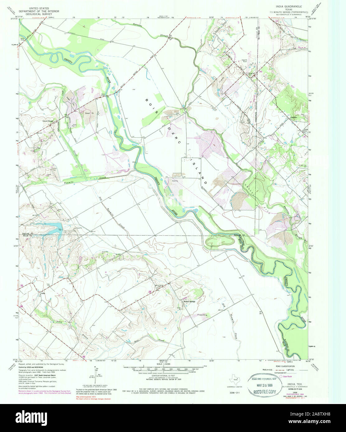 USGS TOPO Map Texas TX India 117890 1959 24000 Restoration Stock Photohttps://www.alamy.com/image-license-details/?v=1https://www.alamy.com/usgs-topo-map-texas-tx-india-117890-1959-24000-restoration-image332461956.html
RM2A8TXH8–USGS TOPO Map Texas TX India 117890 1959 24000 Restoration
![Map of Baku dated 1918. Baku, MOD Misc 306. [S.l.] : Survey Party MEF, 1918. India. Army. Royal Engineers. Indian Field Survey Company, 1st. Scale 1:21 000. Source: Maps MOD Misc 306. Stock Photo Map of Baku dated 1918. Baku, MOD Misc 306. [S.l.] : Survey Party MEF, 1918. India. Army. Royal Engineers. Indian Field Survey Company, 1st. Scale 1:21 000. Source: Maps MOD Misc 306. Stock Photo](https://c8.alamy.com/comp/R56KFJ/map-of-baku-dated-1918-baku-mod-misc-306-sl-survey-party-mef-1918-india-army-royal-engineers-indian-field-survey-company-1st-scale-121-000-source-maps-mod-misc-306-R56KFJ.jpg) Map of Baku dated 1918. Baku, MOD Misc 306. [S.l.] : Survey Party MEF, 1918. India. Army. Royal Engineers. Indian Field Survey Company, 1st. Scale 1:21 000. Source: Maps MOD Misc 306. Stock Photohttps://www.alamy.com/image-license-details/?v=1https://www.alamy.com/map-of-baku-dated-1918-baku-mod-misc-306-sl-survey-party-mef-1918-india-army-royal-engineers-indian-field-survey-company-1st-scale-121-000-source-maps-mod-misc-306-image226955110.html
Map of Baku dated 1918. Baku, MOD Misc 306. [S.l.] : Survey Party MEF, 1918. India. Army. Royal Engineers. Indian Field Survey Company, 1st. Scale 1:21 000. Source: Maps MOD Misc 306. Stock Photohttps://www.alamy.com/image-license-details/?v=1https://www.alamy.com/map-of-baku-dated-1918-baku-mod-misc-306-sl-survey-party-mef-1918-india-army-royal-engineers-indian-field-survey-company-1st-scale-121-000-source-maps-mod-misc-306-image226955110.htmlRMR56KFJ–Map of Baku dated 1918. Baku, MOD Misc 306. [S.l.] : Survey Party MEF, 1918. India. Army. Royal Engineers. Indian Field Survey Company, 1st. Scale 1:21 000. Source: Maps MOD Misc 306.
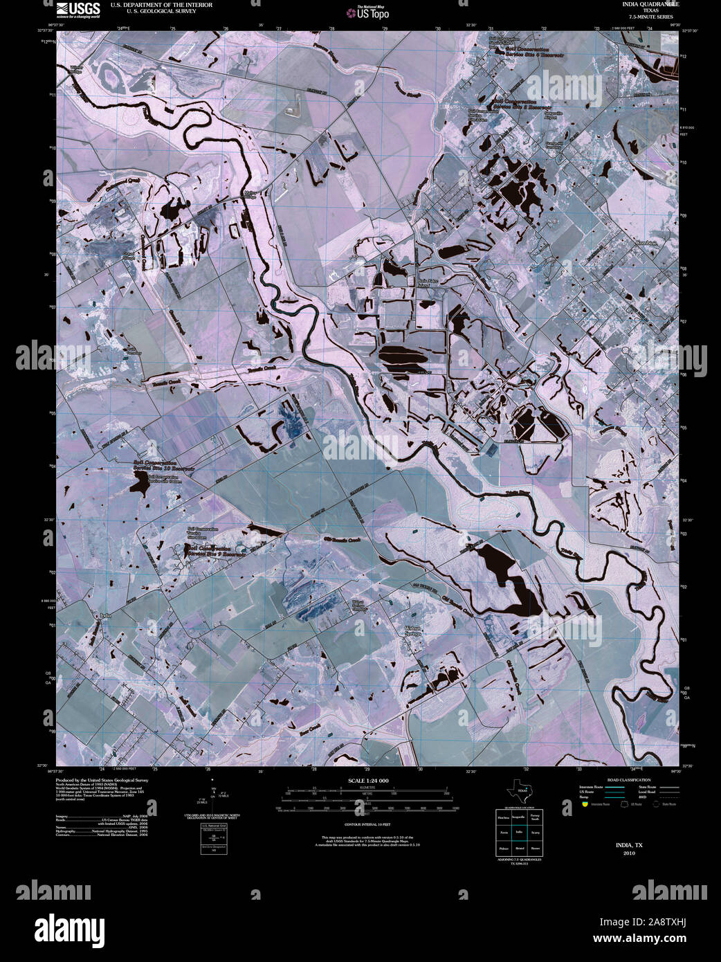 USGS TOPO Map Texas TX India 20100428 TM Inverted Restoration Stock Photohttps://www.alamy.com/image-license-details/?v=1https://www.alamy.com/usgs-topo-map-texas-tx-india-20100428-tm-inverted-restoration-image332461966.html
RM2A8TXHJ–USGS TOPO Map Texas TX India 20100428 TM Inverted Restoration
![Map of Baku, dated 1918. Baku, MOD Misc 306. [S.l.] : Survey Party MEF, 1918. India. Army. Royal Engineers. Indian Field Survey Company, 1st. Scale 1:21 000. Source: Maps MOD Misc 306 Sheet 1. Stock Photo Map of Baku, dated 1918. Baku, MOD Misc 306. [S.l.] : Survey Party MEF, 1918. India. Army. Royal Engineers. Indian Field Survey Company, 1st. Scale 1:21 000. Source: Maps MOD Misc 306 Sheet 1. Stock Photo](https://c8.alamy.com/comp/R5J7GB/map-of-baku-dated-1918-baku-mod-misc-306-sl-survey-party-mef-1918-india-army-royal-engineers-indian-field-survey-company-1st-scale-121-000-source-maps-mod-misc-306-sheet-1-R5J7GB.jpg) Map of Baku, dated 1918. Baku, MOD Misc 306. [S.l.] : Survey Party MEF, 1918. India. Army. Royal Engineers. Indian Field Survey Company, 1st. Scale 1:21 000. Source: Maps MOD Misc 306 Sheet 1. Stock Photohttps://www.alamy.com/image-license-details/?v=1https://www.alamy.com/map-of-baku-dated-1918-baku-mod-misc-306-sl-survey-party-mef-1918-india-army-royal-engineers-indian-field-survey-company-1st-scale-121-000-source-maps-mod-misc-306-sheet-1-image227209147.html
Map of Baku, dated 1918. Baku, MOD Misc 306. [S.l.] : Survey Party MEF, 1918. India. Army. Royal Engineers. Indian Field Survey Company, 1st. Scale 1:21 000. Source: Maps MOD Misc 306 Sheet 1. Stock Photohttps://www.alamy.com/image-license-details/?v=1https://www.alamy.com/map-of-baku-dated-1918-baku-mod-misc-306-sl-survey-party-mef-1918-india-army-royal-engineers-indian-field-survey-company-1st-scale-121-000-source-maps-mod-misc-306-sheet-1-image227209147.htmlRMR5J7GB–Map of Baku, dated 1918. Baku, MOD Misc 306. [S.l.] : Survey Party MEF, 1918. India. Army. Royal Engineers. Indian Field Survey Company, 1st. Scale 1:21 000. Source: Maps MOD Misc 306 Sheet 1.
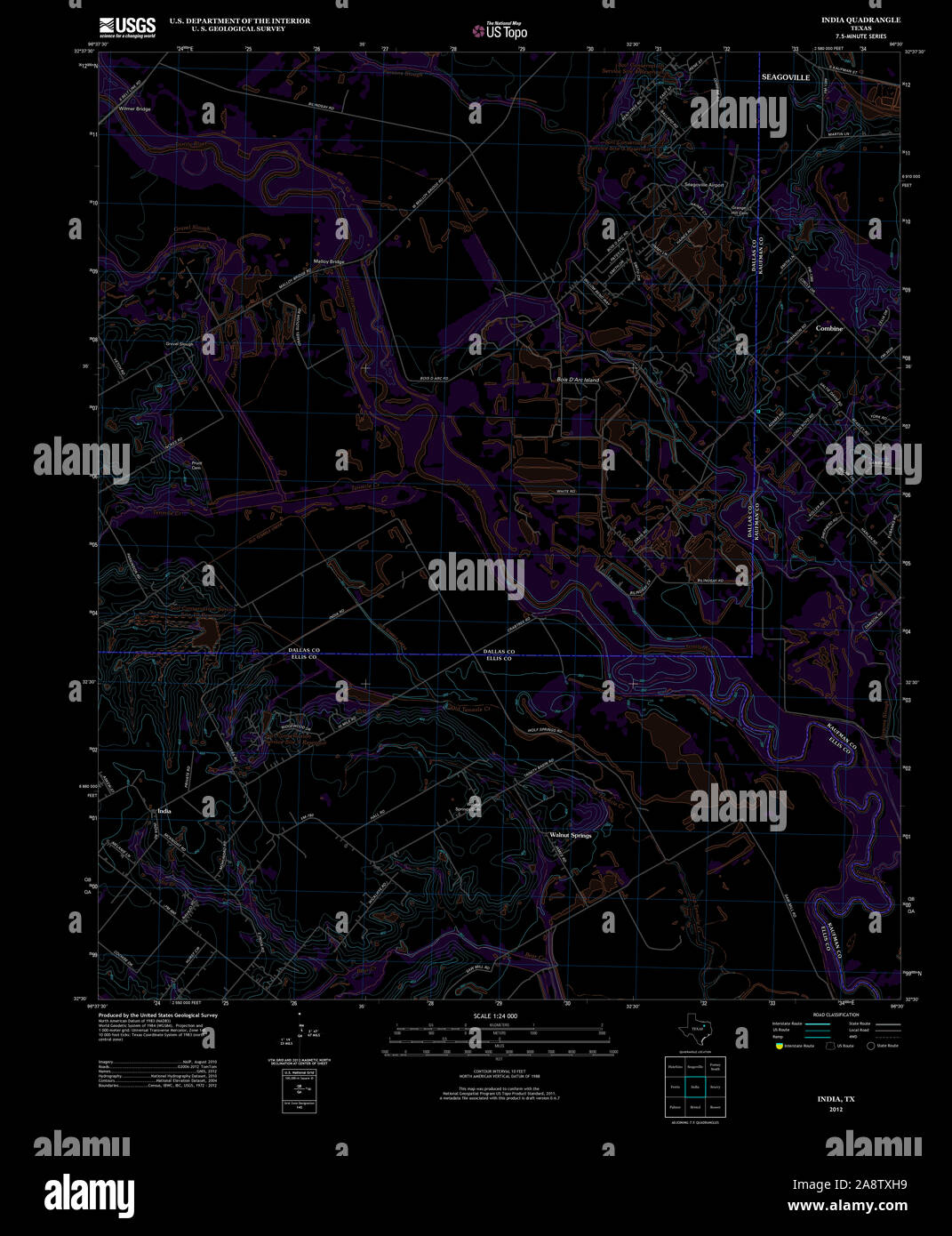 USGS TOPO Map Texas TX India 20121106 TM Inverted Restoration Stock Photohttps://www.alamy.com/image-license-details/?v=1https://www.alamy.com/usgs-topo-map-texas-tx-india-20121106-tm-inverted-restoration-image332461957.html
RM2A8TXH9–USGS TOPO Map Texas TX India 20121106 TM Inverted Restoration
![Map of Baku, dated 1918. Baku, MOD Misc 306. [S.l.] : Survey Party MEF, 1918. India. Army. Royal Engineers. Indian Field Survey Company, 1st. Scale 1:21 000. Source: Maps MOD Misc 306 sheet 3. Stock Photo Map of Baku, dated 1918. Baku, MOD Misc 306. [S.l.] : Survey Party MEF, 1918. India. Army. Royal Engineers. Indian Field Survey Company, 1st. Scale 1:21 000. Source: Maps MOD Misc 306 sheet 3. Stock Photo](https://c8.alamy.com/comp/R58619/map-of-baku-dated-1918-baku-mod-misc-306-sl-survey-party-mef-1918-india-army-royal-engineers-indian-field-survey-company-1st-scale-121-000-source-maps-mod-misc-306-sheet-3-R58619.jpg) Map of Baku, dated 1918. Baku, MOD Misc 306. [S.l.] : Survey Party MEF, 1918. India. Army. Royal Engineers. Indian Field Survey Company, 1st. Scale 1:21 000. Source: Maps MOD Misc 306 sheet 3. Stock Photohttps://www.alamy.com/image-license-details/?v=1https://www.alamy.com/map-of-baku-dated-1918-baku-mod-misc-306-sl-survey-party-mef-1918-india-army-royal-engineers-indian-field-survey-company-1st-scale-121-000-source-maps-mod-misc-306-sheet-3-image226988421.html
Map of Baku, dated 1918. Baku, MOD Misc 306. [S.l.] : Survey Party MEF, 1918. India. Army. Royal Engineers. Indian Field Survey Company, 1st. Scale 1:21 000. Source: Maps MOD Misc 306 sheet 3. Stock Photohttps://www.alamy.com/image-license-details/?v=1https://www.alamy.com/map-of-baku-dated-1918-baku-mod-misc-306-sl-survey-party-mef-1918-india-army-royal-engineers-indian-field-survey-company-1st-scale-121-000-source-maps-mod-misc-306-sheet-3-image226988421.htmlRMR58619–Map of Baku, dated 1918. Baku, MOD Misc 306. [S.l.] : Survey Party MEF, 1918. India. Army. Royal Engineers. Indian Field Survey Company, 1st. Scale 1:21 000. Source: Maps MOD Misc 306 sheet 3.
 USGS TOPO Map Texas TX India 110960 1959 24000 Restoration Stock Photohttps://www.alamy.com/image-license-details/?v=1https://www.alamy.com/usgs-topo-map-texas-tx-india-110960-1959-24000-restoration-image332461881.html
RM2A8TXEH–USGS TOPO Map Texas TX India 110960 1959 24000 Restoration
![Map of Baku, dated 1918. Baku, MOD Misc 306. [S.l.] : Survey Party MEF, 1918. India. Army. Royal Engineers. Indian Field Survey Company, 1st. Scale 1:21 000. Source: Maps MOD Misc 306 sheet 5. Stock Photo Map of Baku, dated 1918. Baku, MOD Misc 306. [S.l.] : Survey Party MEF, 1918. India. Army. Royal Engineers. Indian Field Survey Company, 1st. Scale 1:21 000. Source: Maps MOD Misc 306 sheet 5. Stock Photo](https://c8.alamy.com/comp/R5HEJ0/map-of-baku-dated-1918-baku-mod-misc-306-sl-survey-party-mef-1918-india-army-royal-engineers-indian-field-survey-company-1st-scale-121-000-source-maps-mod-misc-306-sheet-5-R5HEJ0.jpg) Map of Baku, dated 1918. Baku, MOD Misc 306. [S.l.] : Survey Party MEF, 1918. India. Army. Royal Engineers. Indian Field Survey Company, 1st. Scale 1:21 000. Source: Maps MOD Misc 306 sheet 5. Stock Photohttps://www.alamy.com/image-license-details/?v=1https://www.alamy.com/map-of-baku-dated-1918-baku-mod-misc-306-sl-survey-party-mef-1918-india-army-royal-engineers-indian-field-survey-company-1st-scale-121-000-source-maps-mod-misc-306-sheet-5-image227192728.html
Map of Baku, dated 1918. Baku, MOD Misc 306. [S.l.] : Survey Party MEF, 1918. India. Army. Royal Engineers. Indian Field Survey Company, 1st. Scale 1:21 000. Source: Maps MOD Misc 306 sheet 5. Stock Photohttps://www.alamy.com/image-license-details/?v=1https://www.alamy.com/map-of-baku-dated-1918-baku-mod-misc-306-sl-survey-party-mef-1918-india-army-royal-engineers-indian-field-survey-company-1st-scale-121-000-source-maps-mod-misc-306-sheet-5-image227192728.htmlRMR5HEJ0–Map of Baku, dated 1918. Baku, MOD Misc 306. [S.l.] : Survey Party MEF, 1918. India. Army. Royal Engineers. Indian Field Survey Company, 1st. Scale 1:21 000. Source: Maps MOD Misc 306 sheet 5.
 USGS TOPO Map Texas TX India 110958 1959 24000 Restoration Stock Photohttps://www.alamy.com/image-license-details/?v=1https://www.alamy.com/usgs-topo-map-texas-tx-india-110958-1959-24000-restoration-image332461917.html
RM2A8TXFW–USGS TOPO Map Texas TX India 110958 1959 24000 Restoration
 'Map to illustrate report of intelligence officer, Siam Boundary Commission Northern Party'. Map to illustrate report of ... Siam Boundary Commission, Northern Party. Scale, 8 miles = 1 inch. Calcutta : Survey of India Offices, 1893. Source: Maps 60122.(1.). Language: English. Stock Photohttps://www.alamy.com/image-license-details/?v=1https://www.alamy.com/map-to-illustrate-report-of-intelligence-officer-siam-boundary-commission-northern-party-map-to-illustrate-report-of-siam-boundary-commission-northern-party-scale-8-miles-=-1-inch-calcutta-survey-of-india-offices-1893-source-maps-601221-language-english-image226822809.html
RMR50JPH–'Map to illustrate report of intelligence officer, Siam Boundary Commission Northern Party'. Map to illustrate report of ... Siam Boundary Commission, Northern Party. Scale, 8 miles = 1 inch. Calcutta : Survey of India Offices, 1893. Source: Maps 60122.(1.). Language: English.
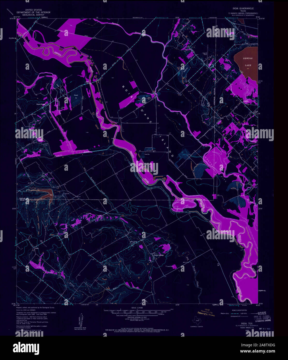 USGS TOPO Map Texas TX India 110958 1959 24000 Inverted Restoration Stock Photohttps://www.alamy.com/image-license-details/?v=1https://www.alamy.com/usgs-topo-map-texas-tx-india-110958-1959-24000-inverted-restoration-image332461852.html
RM2A8TXDG–USGS TOPO Map Texas TX India 110958 1959 24000 Inverted Restoration
![Map of Baku, dated 1918. Baku, MOD Misc 306. [S.l.] : Survey Party MEF, 1918. India. Army. Royal Engineers. Indian Field Survey Company, 1st. Scale 1:21 000. Source: Maps MOD Misc 306 sheet 2. Stock Photo Map of Baku, dated 1918. Baku, MOD Misc 306. [S.l.] : Survey Party MEF, 1918. India. Army. Royal Engineers. Indian Field Survey Company, 1st. Scale 1:21 000. Source: Maps MOD Misc 306 sheet 2. Stock Photo](https://c8.alamy.com/comp/R5AMFJ/map-of-baku-dated-1918-baku-mod-misc-306-sl-survey-party-mef-1918-india-army-royal-engineers-indian-field-survey-company-1st-scale-121-000-source-maps-mod-misc-306-sheet-2-R5AMFJ.jpg) Map of Baku, dated 1918. Baku, MOD Misc 306. [S.l.] : Survey Party MEF, 1918. India. Army. Royal Engineers. Indian Field Survey Company, 1st. Scale 1:21 000. Source: Maps MOD Misc 306 sheet 2. Stock Photohttps://www.alamy.com/image-license-details/?v=1https://www.alamy.com/map-of-baku-dated-1918-baku-mod-misc-306-sl-survey-party-mef-1918-india-army-royal-engineers-indian-field-survey-company-1st-scale-121-000-source-maps-mod-misc-306-sheet-2-image227043702.html
Map of Baku, dated 1918. Baku, MOD Misc 306. [S.l.] : Survey Party MEF, 1918. India. Army. Royal Engineers. Indian Field Survey Company, 1st. Scale 1:21 000. Source: Maps MOD Misc 306 sheet 2. Stock Photohttps://www.alamy.com/image-license-details/?v=1https://www.alamy.com/map-of-baku-dated-1918-baku-mod-misc-306-sl-survey-party-mef-1918-india-army-royal-engineers-indian-field-survey-company-1st-scale-121-000-source-maps-mod-misc-306-sheet-2-image227043702.htmlRMR5AMFJ–Map of Baku, dated 1918. Baku, MOD Misc 306. [S.l.] : Survey Party MEF, 1918. India. Army. Royal Engineers. Indian Field Survey Company, 1st. Scale 1:21 000. Source: Maps MOD Misc 306 sheet 2.
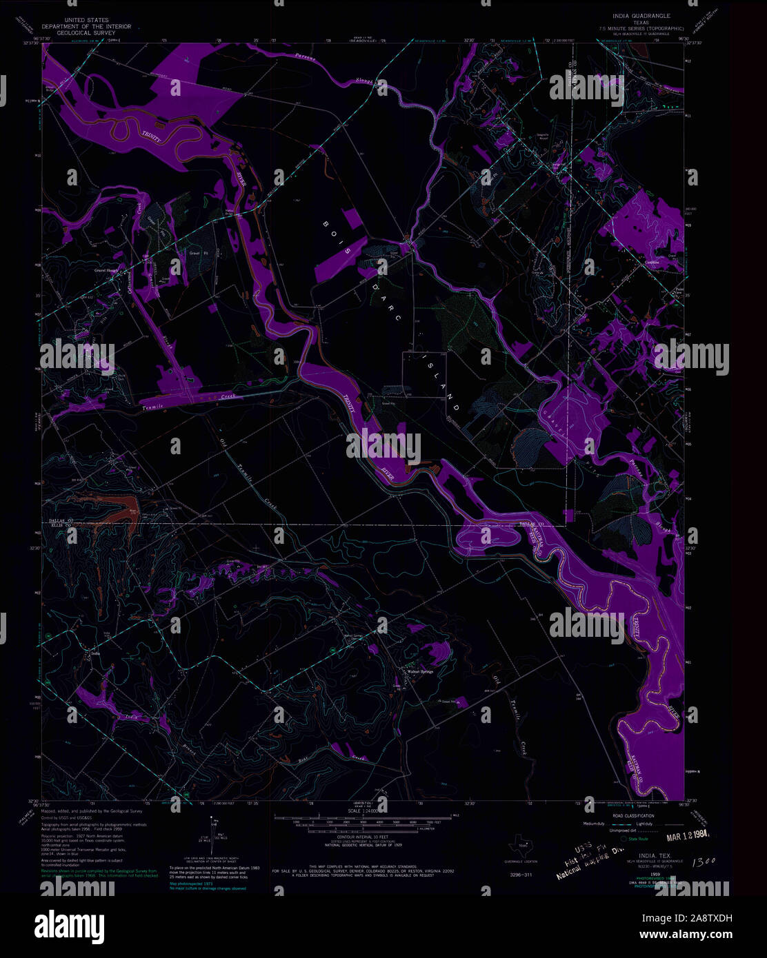 USGS TOPO Map Texas TX India 110959 1959 24000 Inverted Restoration Stock Photohttps://www.alamy.com/image-license-details/?v=1https://www.alamy.com/usgs-topo-map-texas-tx-india-110959-1959-24000-inverted-restoration-image332461853.html
RM2A8TXDH–USGS TOPO Map Texas TX India 110959 1959 24000 Inverted Restoration
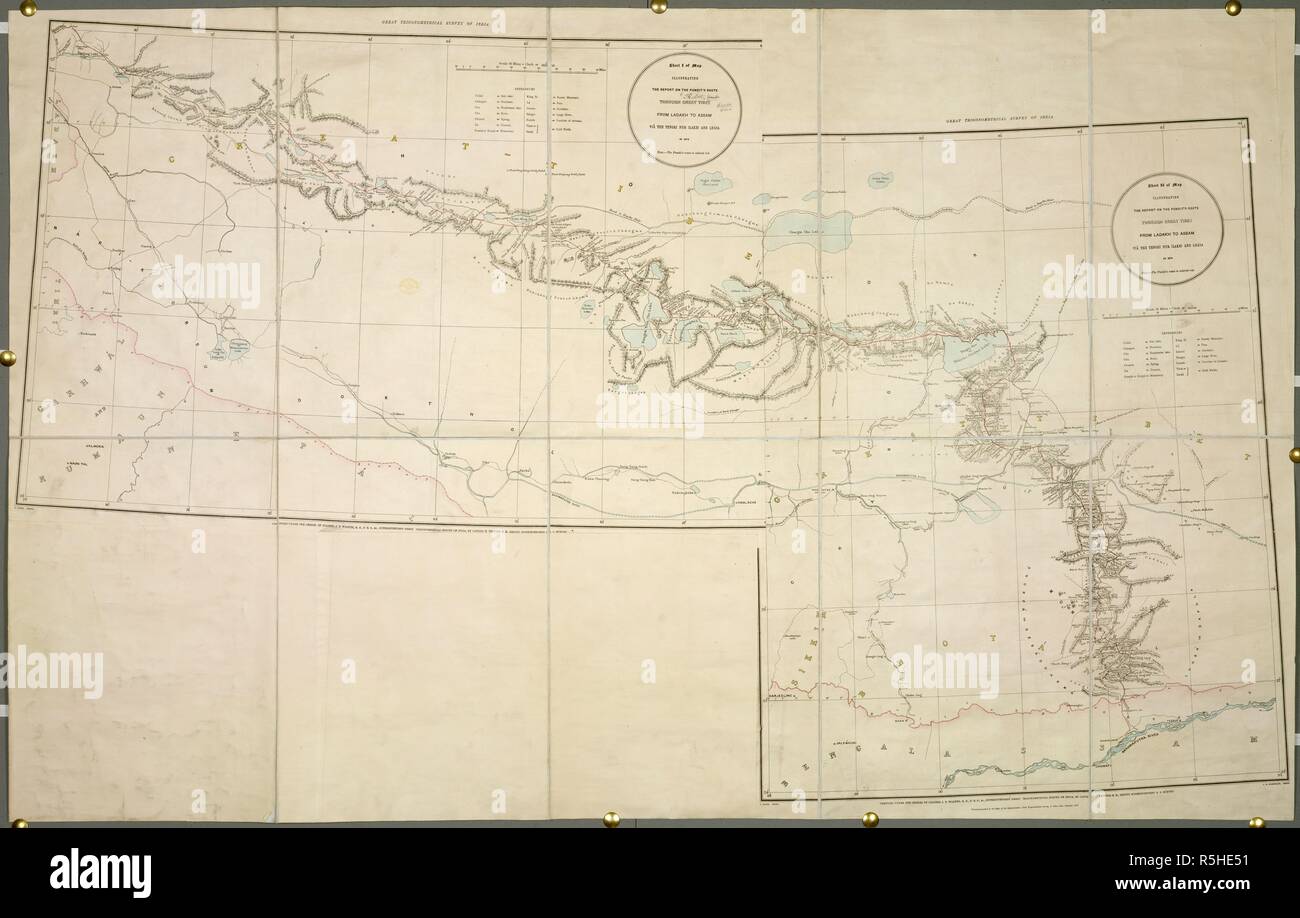 The Pundit's Route. Map illustrating the Report on the Pundit's Route. Dehra Dún, 1875. Map illustrating the Report on the Pundit's Route through Great Thibet from Ladakh to Assam in 1874. Image taken from Map illustrating the Report on the Pundit's Route through Great Thibet from Ladakh to Assam in 1874. (Great Trigonometrical Survey of India.) Scale, 16 miles = 1 inch. Originally published/produced in Dehra Dún, 1875. . Source: Maps.60750.(2),. Language: English. Stock Photohttps://www.alamy.com/image-license-details/?v=1https://www.alamy.com/the-pundits-route-map-illustrating-the-report-on-the-pundits-route-dehra-dn-1875-map-illustrating-the-report-on-the-pundits-route-through-great-thibet-from-ladakh-to-assam-in-1874-image-taken-from-map-illustrating-the-report-on-the-pundits-route-through-great-thibet-from-ladakh-to-assam-in-1874-great-trigonometrical-survey-of-india-scale-16-miles-=-1-inch-originally-publishedproduced-in-dehra-dn-1875-source-maps607502-language-english-image227192365.html
RMR5HE51–The Pundit's Route. Map illustrating the Report on the Pundit's Route. Dehra Dún, 1875. Map illustrating the Report on the Pundit's Route through Great Thibet from Ladakh to Assam in 1874. Image taken from Map illustrating the Report on the Pundit's Route through Great Thibet from Ladakh to Assam in 1874. (Great Trigonometrical Survey of India.) Scale, 16 miles = 1 inch. Originally published/produced in Dehra Dún, 1875. . Source: Maps.60750.(2),. Language: English.
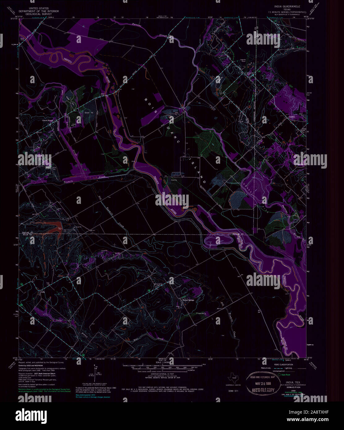 USGS TOPO Map Texas TX India 117890 1959 24000 Inverted Restoration Stock Photohttps://www.alamy.com/image-license-details/?v=1https://www.alamy.com/usgs-topo-map-texas-tx-india-117890-1959-24000-inverted-restoration-image332461963.html
RM2A8TXHF–USGS TOPO Map Texas TX India 117890 1959 24000 Inverted Restoration
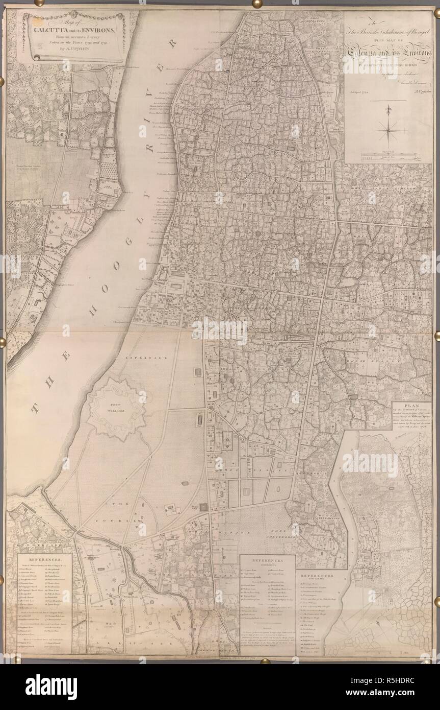 A map of Calcutta and its environs . Map of Calcutta and its Environs from a Survey taken in the years 1792 and '93. 1794?. Source: Maps K.Top.115.43.2.TAB. Language: English. Stock Photohttps://www.alamy.com/image-license-details/?v=1https://www.alamy.com/a-map-of-calcutta-and-its-environs-map-of-calcutta-and-its-environs-from-a-survey-taken-in-the-years-1792-and-93-1794-source-maps-ktop115432tab-language-english-image227192096.html
RMR5HDRC–A map of Calcutta and its environs . Map of Calcutta and its Environs from a Survey taken in the years 1792 and '93. 1794?. Source: Maps K.Top.115.43.2.TAB. Language: English.
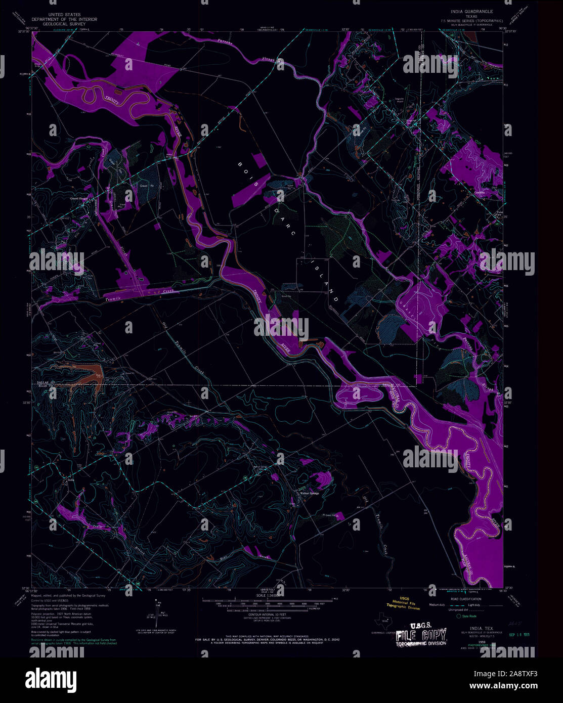 USGS TOPO Map Texas TX India 110960 1959 24000 Inverted Restoration Stock Photohttps://www.alamy.com/image-license-details/?v=1https://www.alamy.com/usgs-topo-map-texas-tx-india-110960-1959-24000-inverted-restoration-image332461895.html
RM2A8TXF3–USGS TOPO Map Texas TX India 110960 1959 24000 Inverted Restoration
 A survey of the country on the banks of the Hughly River, from the town of Calcutta of Ooloobareah, and which includes the fortress of Fort William and works at Budge Budge. A 'survey of the country on the banks of the Hughly River, from the town of Calcutta of Ooloobareah, and which includes the fortress of Fort William and works at Budge Budge, also representing the soundings of the river at low water in spring tides, surveyed by order of Government 'twixt the years 1780 and 1784;'... ca. 1780-1784. Source: Maps K.Top.115.37. Language: English. Stock Photohttps://www.alamy.com/image-license-details/?v=1https://www.alamy.com/a-survey-of-the-country-on-the-banks-of-the-hughly-river-from-the-town-of-calcutta-of-ooloobareah-and-which-includes-the-fortress-of-fort-william-and-works-at-budge-budge-a-survey-of-the-country-on-the-banks-of-the-hughly-river-from-the-town-of-calcutta-of-ooloobareah-and-which-includes-the-fortress-of-fort-william-and-works-at-budge-budge-also-representing-the-soundings-of-the-river-at-low-water-in-spring-tides-surveyed-by-order-of-government-twixt-the-years-1780-and-1784-ca-1780-1784-source-maps-ktop11537-language-english-image227120832.html
RMR5E6X8–A survey of the country on the banks of the Hughly River, from the town of Calcutta of Ooloobareah, and which includes the fortress of Fort William and works at Budge Budge. A 'survey of the country on the banks of the Hughly River, from the town of Calcutta of Ooloobareah, and which includes the fortress of Fort William and works at Budge Budge, also representing the soundings of the river at low water in spring tides, surveyed by order of Government 'twixt the years 1780 and 1784;'... ca. 1780-1784. Source: Maps K.Top.115.37. Language: English.
 A survey of the country on the banks of the Hughly, from Manicolly Point to Chitpore. A 'survey of the country on the banks of the Hughly, from Manicolly Point to Chitpore, including the Post at Manicolly, Fort William, and the town of Calcutta, and shewing the situation of the different villages, nullahs, bunds, tanks or broken ground, likewise representing the sands and soundings of the river at low water in spring tides, from the month of January till the month of May in the years 1782 and 1783;'. 1785. Source: Maps K.Top.115.39. Language: English. Stock Photohttps://www.alamy.com/image-license-details/?v=1https://www.alamy.com/a-survey-of-the-country-on-the-banks-of-the-hughly-from-manicolly-point-to-chitpore-a-survey-of-the-country-on-the-banks-of-the-hughly-from-manicolly-point-to-chitpore-including-the-post-at-manicolly-fort-william-and-the-town-of-calcutta-and-shewing-the-situation-of-the-different-villages-nullahs-bunds-tanks-or-broken-ground-likewise-representing-the-sands-and-soundings-of-the-river-at-low-water-in-spring-tides-from-the-month-of-january-till-the-month-of-may-in-the-years-1782-and-1783-1785-source-maps-ktop11539-language-english-image227039060.html
RMR5AEHT–A survey of the country on the banks of the Hughly, from Manicolly Point to Chitpore. A 'survey of the country on the banks of the Hughly, from Manicolly Point to Chitpore, including the Post at Manicolly, Fort William, and the town of Calcutta, and shewing the situation of the different villages, nullahs, bunds, tanks or broken ground, likewise representing the sands and soundings of the river at low water in spring tides, from the month of January till the month of May in the years 1782 and 1783;'. 1785. Source: Maps K.Top.115.39. Language: English.
 A survey of the country on the eastern bank of the Hughly, from Calcutta to the Fortifications at Budgebudge, including Fort William and the Post at Manicolly Point. A 'survey of the country on the eastern bank of the Hughly, from Calcutta to the Fortifications at Budgebudge, including Fort William and the Post at Manicolly Point, and shewing the extent and situation of the different courses, embankments, tanks, or broken ground, likewise representing the sands and soundings of the river at low water in spring tides, from January to May, from the year 1780 till 1784;'. 1780-1784. Source: Maps Stock Photohttps://www.alamy.com/image-license-details/?v=1https://www.alamy.com/a-survey-of-the-country-on-the-eastern-bank-of-the-hughly-from-calcutta-to-the-fortifications-at-budgebudge-including-fort-william-and-the-post-at-manicolly-point-a-survey-of-the-country-on-the-eastern-bank-of-the-hughly-from-calcutta-to-the-fortifications-at-budgebudge-including-fort-william-and-the-post-at-manicolly-point-and-shewing-the-extent-and-situation-of-the-different-courses-embankments-tanks-or-broken-ground-likewise-representing-the-sands-and-soundings-of-the-river-at-low-water-in-spring-tides-from-january-to-may-from-the-year-1780-till-1784-1780-1784-source-maps-image227077264.html
RMR5C7A8–A survey of the country on the eastern bank of the Hughly, from Calcutta to the Fortifications at Budgebudge, including Fort William and the Post at Manicolly Point. A 'survey of the country on the eastern bank of the Hughly, from Calcutta to the Fortifications at Budgebudge, including Fort William and the Post at Manicolly Point, and shewing the extent and situation of the different courses, embankments, tanks, or broken ground, likewise representing the sands and soundings of the river at low water in spring tides, from January to May, from the year 1780 till 1784;'. 1780-1784. Source: Maps
![Bala Hissar. Plan and Survey of the Bala Hissar or Fort of Cabu. Calcutta : Surveyor General's Office, 1878. Plan and Survey of the Bala Hissar or Fort of Cabul. Image taken from Plan and Survey of the Bala Hissar or Fort of Cabul, shewing the present state and nature of its Defences, and pointing out repairs and improvements recommended for its better security. Lithographed from a copy 1839. Scale of feet, 500[= 100 mm]. Originally published/produced in Calcutta : Surveyor General's Office, 1878. . Source: Maps.52000.(9),. Language: English. Stock Photo Bala Hissar. Plan and Survey of the Bala Hissar or Fort of Cabu. Calcutta : Surveyor General's Office, 1878. Plan and Survey of the Bala Hissar or Fort of Cabul. Image taken from Plan and Survey of the Bala Hissar or Fort of Cabul, shewing the present state and nature of its Defences, and pointing out repairs and improvements recommended for its better security. Lithographed from a copy 1839. Scale of feet, 500[= 100 mm]. Originally published/produced in Calcutta : Surveyor General's Office, 1878. . Source: Maps.52000.(9),. Language: English. Stock Photo](https://c8.alamy.com/comp/R5EKF7/bala-hissar-plan-and-survey-of-the-bala-hissar-or-fort-of-cabu-calcutta-surveyor-generals-office-1878-plan-and-survey-of-the-bala-hissar-or-fort-of-cabul-image-taken-from-plan-and-survey-of-the-bala-hissar-or-fort-of-cabul-shewing-the-present-state-and-nature-of-its-defences-and-pointing-out-repairs-and-improvements-recommended-for-its-better-security-lithographed-from-a-copy-1839-scale-of-feet-500-=-100-mm-originally-publishedproduced-in-calcutta-surveyor-generals-office-1878-source-maps520009-language-english-R5EKF7.jpg) Bala Hissar. Plan and Survey of the Bala Hissar or Fort of Cabu. Calcutta : Surveyor General's Office, 1878. Plan and Survey of the Bala Hissar or Fort of Cabul. Image taken from Plan and Survey of the Bala Hissar or Fort of Cabul, shewing the present state and nature of its Defences, and pointing out repairs and improvements recommended for its better security. Lithographed from a copy 1839. Scale of feet, 500[= 100 mm]. Originally published/produced in Calcutta : Surveyor General's Office, 1878. . Source: Maps.52000.(9),. Language: English. Stock Photohttps://www.alamy.com/image-license-details/?v=1https://www.alamy.com/bala-hissar-plan-and-survey-of-the-bala-hissar-or-fort-of-cabu-calcutta-surveyor-generals-office-1878-plan-and-survey-of-the-bala-hissar-or-fort-of-cabul-image-taken-from-plan-and-survey-of-the-bala-hissar-or-fort-of-cabul-shewing-the-present-state-and-nature-of-its-defences-and-pointing-out-repairs-and-improvements-recommended-for-its-better-security-lithographed-from-a-copy-1839-scale-of-feet-500-=-100-mm-originally-publishedproduced-in-calcutta-surveyor-generals-office-1878-source-maps520009-language-english-image227130715.html
Bala Hissar. Plan and Survey of the Bala Hissar or Fort of Cabu. Calcutta : Surveyor General's Office, 1878. Plan and Survey of the Bala Hissar or Fort of Cabul. Image taken from Plan and Survey of the Bala Hissar or Fort of Cabul, shewing the present state and nature of its Defences, and pointing out repairs and improvements recommended for its better security. Lithographed from a copy 1839. Scale of feet, 500[= 100 mm]. Originally published/produced in Calcutta : Surveyor General's Office, 1878. . Source: Maps.52000.(9),. Language: English. Stock Photohttps://www.alamy.com/image-license-details/?v=1https://www.alamy.com/bala-hissar-plan-and-survey-of-the-bala-hissar-or-fort-of-cabu-calcutta-surveyor-generals-office-1878-plan-and-survey-of-the-bala-hissar-or-fort-of-cabul-image-taken-from-plan-and-survey-of-the-bala-hissar-or-fort-of-cabul-shewing-the-present-state-and-nature-of-its-defences-and-pointing-out-repairs-and-improvements-recommended-for-its-better-security-lithographed-from-a-copy-1839-scale-of-feet-500-=-100-mm-originally-publishedproduced-in-calcutta-surveyor-generals-office-1878-source-maps520009-language-english-image227130715.htmlRMR5EKF7–Bala Hissar. Plan and Survey of the Bala Hissar or Fort of Cabu. Calcutta : Surveyor General's Office, 1878. Plan and Survey of the Bala Hissar or Fort of Cabul. Image taken from Plan and Survey of the Bala Hissar or Fort of Cabul, shewing the present state and nature of its Defences, and pointing out repairs and improvements recommended for its better security. Lithographed from a copy 1839. Scale of feet, 500[= 100 mm]. Originally published/produced in Calcutta : Surveyor General's Office, 1878. . Source: Maps.52000.(9),. Language: English.