Quick filters:
Usa map 1776 Stock Photos and Images
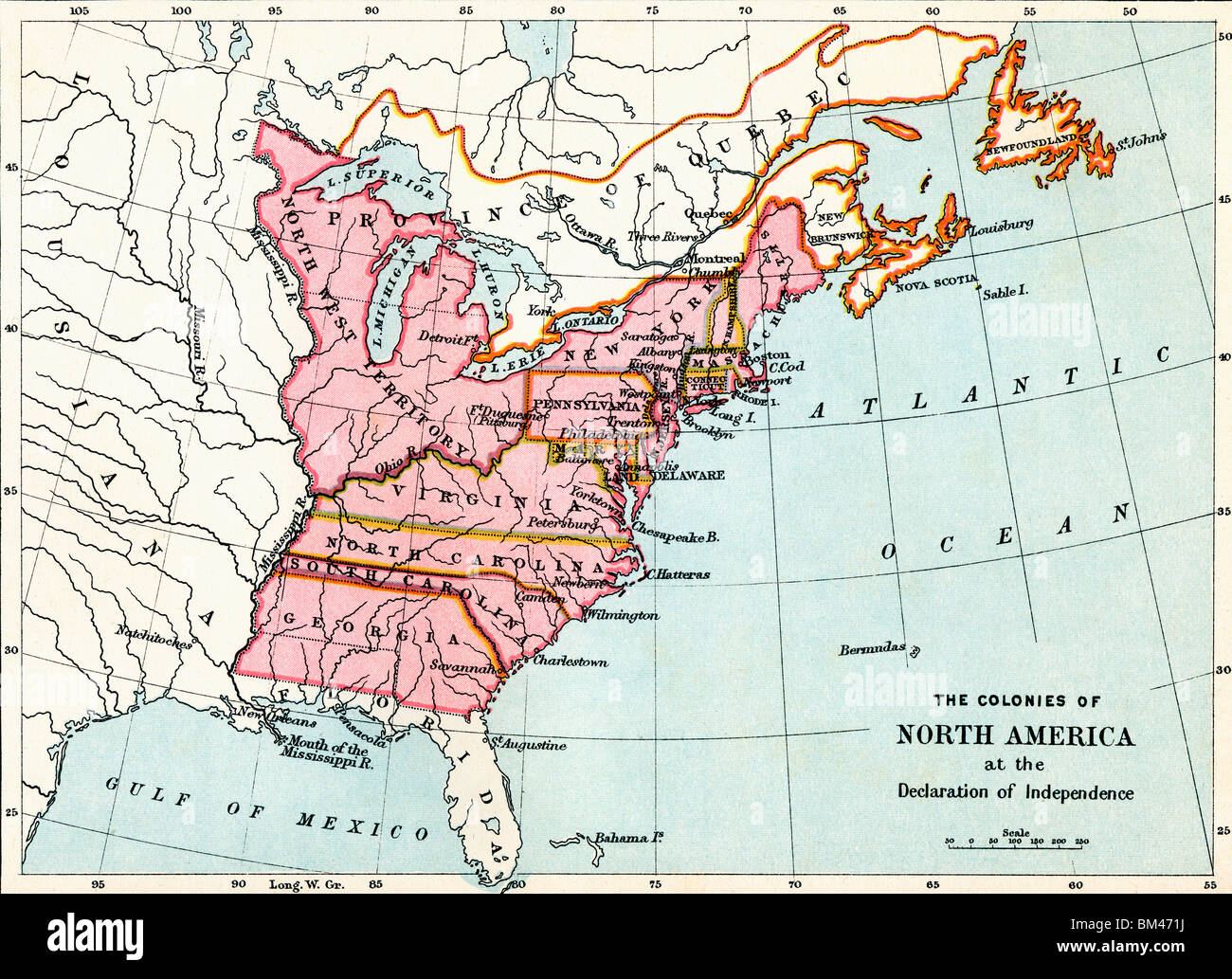 Map of the colonies of North America at the Declaration of Independence, 1776. Stock Photohttps://www.alamy.com/image-license-details/?v=1https://www.alamy.com/stock-photo-map-of-the-colonies-of-north-america-at-the-declaration-of-independence-29596830.html
RMBM471J–Map of the colonies of North America at the Declaration of Independence, 1776.
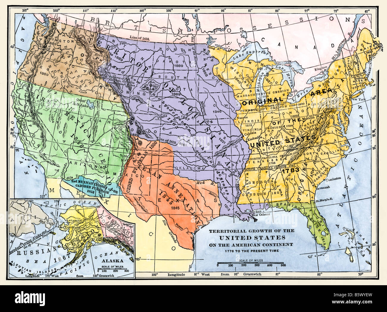 Map showing territorial growth of the continental US 1776 to 1899. Hand-colored woodcut Stock Photohttps://www.alamy.com/image-license-details/?v=1https://www.alamy.com/stock-photo-map-showing-territorial-growth-of-the-continental-us-1776-to-1899-20854033.html
RMB5WYEW–Map showing territorial growth of the continental US 1776 to 1899. Hand-colored woodcut
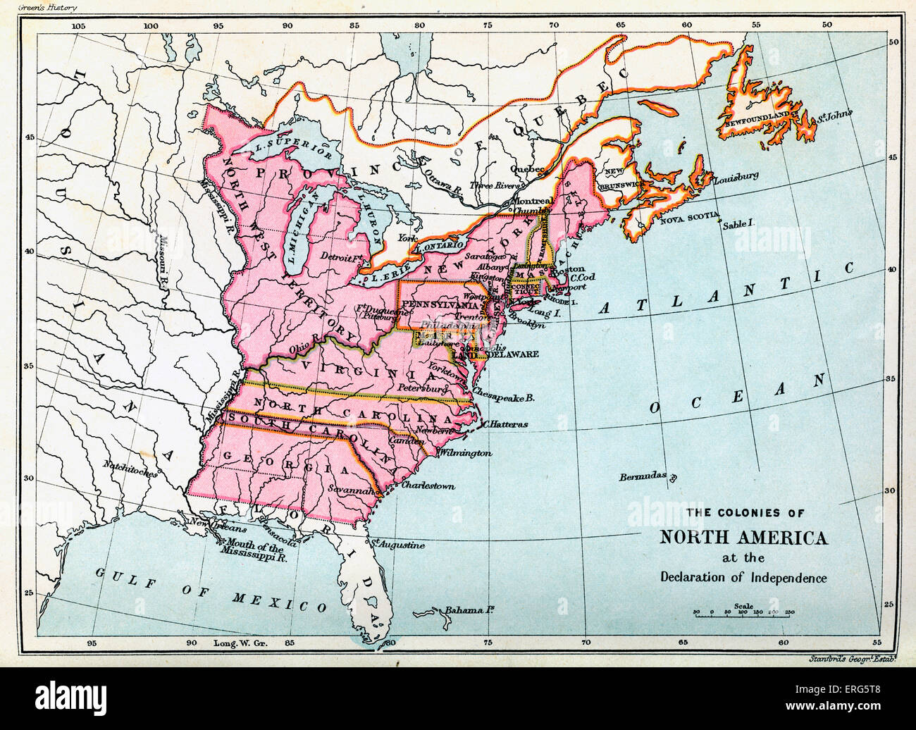 Colonies of North America in 1776, at the United States Declaration of Independence. Statement adopted by the Continental Stock Photohttps://www.alamy.com/image-license-details/?v=1https://www.alamy.com/stock-photo-colonies-of-north-america-in-1776-at-the-united-states-declaration-83334392.html
RMERG5T8–Colonies of North America in 1776, at the United States Declaration of Independence. Statement adopted by the Continental
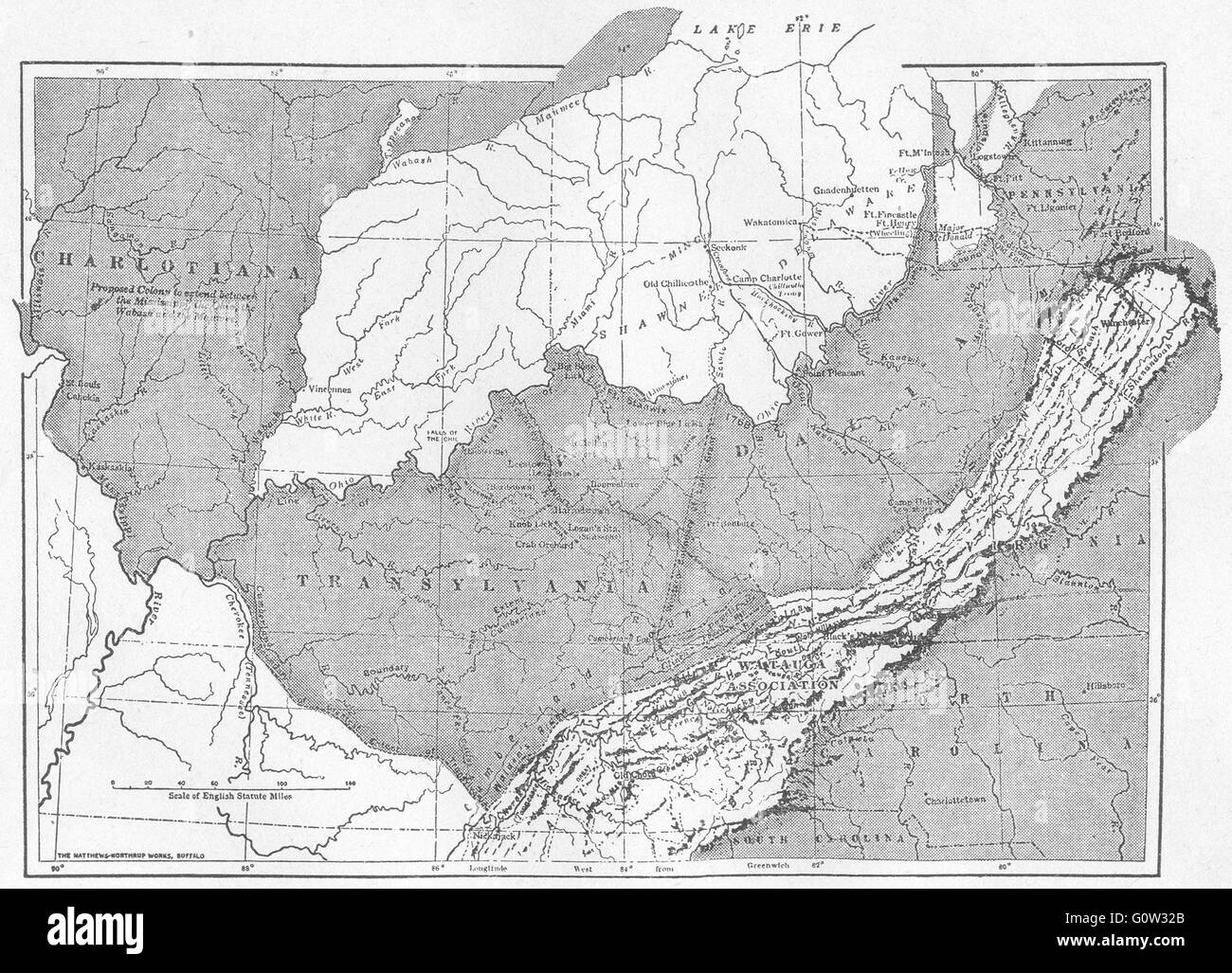 USA: The West 1763-1776, sketch map, 1942 Stock Photohttps://www.alamy.com/image-license-details/?v=1https://www.alamy.com/stock-photo-usa-the-west-1763-1776-sketch-map-1942-103813427.html
RFG0W32B–USA: The West 1763-1776, sketch map, 1942
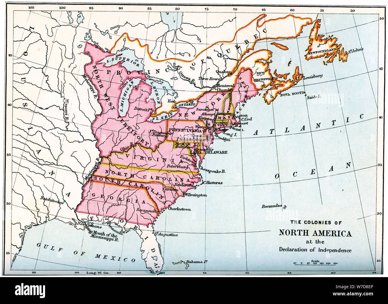 The colonies of North America at the declaration of independence, 1776 (1894). Artist: Unknown Stock Photohttps://www.alamy.com/image-license-details/?v=1https://www.alamy.com/the-colonies-of-north-america-at-the-declaration-of-independence-1776-1894-artist-unknown-image262750174.html
RMW7D8EP–The colonies of North America at the declaration of independence, 1776 (1894). Artist: Unknown
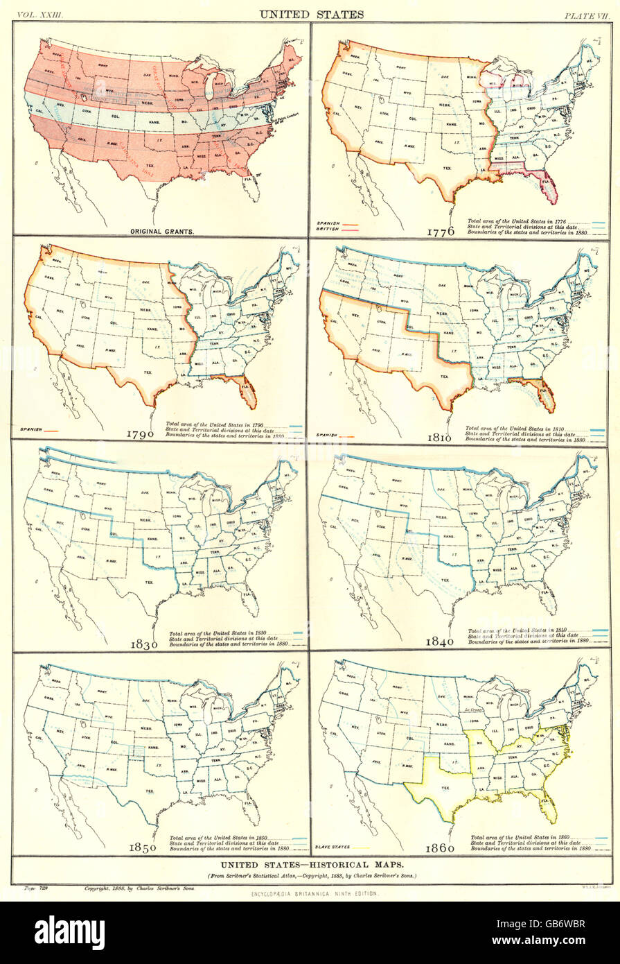 USA HISTORICAL:Original grants. In 1776 1790 1810 1830 1840 1850 1860, 1898 map Stock Photohttps://www.alamy.com/image-license-details/?v=1https://www.alamy.com/stock-photo-usa-historicaloriginal-grants-in-1776-1790-1810-1830-1840-1850-1860-110175067.html
RFGB6WBR–USA HISTORICAL:Original grants. In 1776 1790 1810 1830 1840 1850 1860, 1898 map
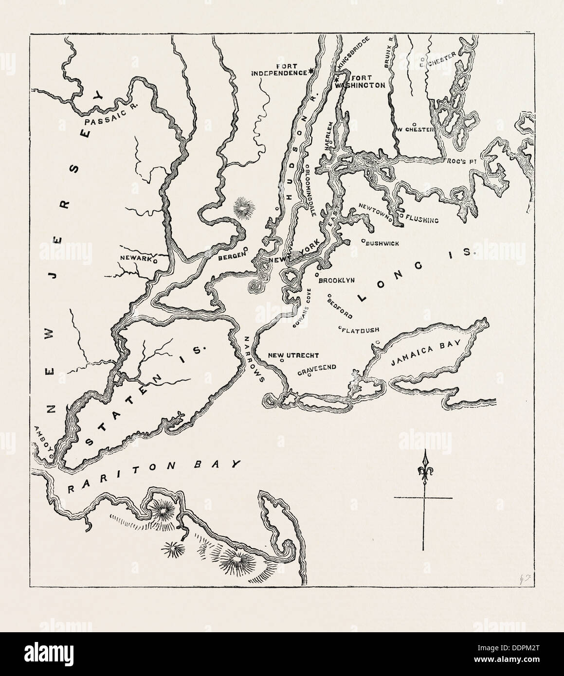 MAP OF NEW YORK AND VICINITY, 1776, UNITED STATES OF AMERICA, US, USA, 1870s engraving Stock Photohttps://www.alamy.com/image-license-details/?v=1https://www.alamy.com/map-of-new-york-and-vicinity-1776-united-states-of-america-us-usa-image60120336.html
RMDDPM2T–MAP OF NEW YORK AND VICINITY, 1776, UNITED STATES OF AMERICA, US, USA, 1870s engraving
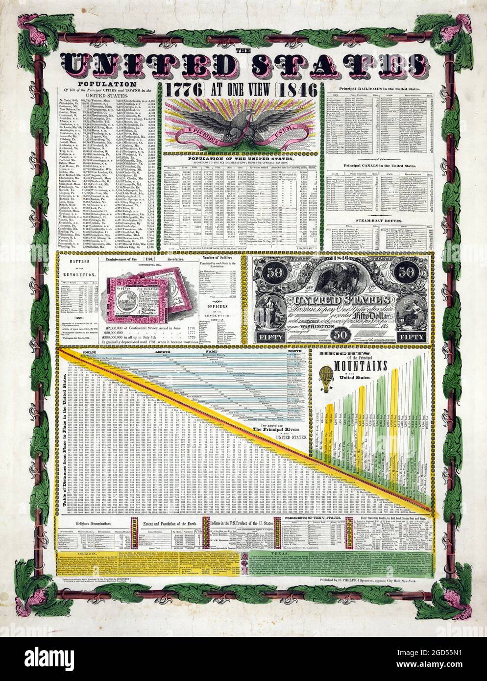 Map: Humphrey Phelps. The United States 1776 | At One View | 1846. (New York: Humphrey Phelps, 1845). Information about USA. Population etc. Stock Photohttps://www.alamy.com/image-license-details/?v=1https://www.alamy.com/map-humphrey-phelps-the-united-states-1776-at-one-view-1846-new-york-humphrey-phelps-1845-information-about-usa-population-etc-image438363997.html
RM2GD55N1–Map: Humphrey Phelps. The United States 1776 | At One View | 1846. (New York: Humphrey Phelps, 1845). Information about USA. Population etc.
 A topographical map of the north part of New York Island, showing the Plan of Fort Washington, now Fort Knyphausen by Claude Joseph Sauthier. November 16th, 1776. Four attacks are depicted as follows: A) first attack under General Knyphausen, B) second At Stock Photohttps://www.alamy.com/image-license-details/?v=1https://www.alamy.com/stock-photo-a-topographical-map-of-the-north-part-of-new-york-island-showing-the-103999105.html
RMG15FWN–A topographical map of the north part of New York Island, showing the Plan of Fort Washington, now Fort Knyphausen by Claude Joseph Sauthier. November 16th, 1776. Four attacks are depicted as follows: A) first attack under General Knyphausen, B) second At
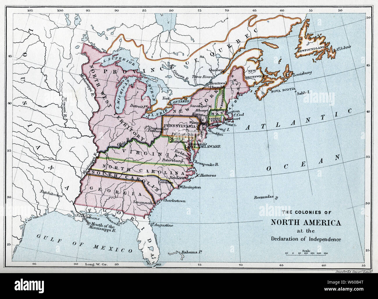 The Colonies of North America at the Declaration of Independence. The United States Declaration of Independence is the pronouncement adopted by the Second Continental Congress meeting at the Pennsylvania State House, Philadelphia, Pennsylvania, July 4th, 1776. Stock Photohttps://www.alamy.com/image-license-details/?v=1https://www.alamy.com/the-colonies-of-north-america-at-the-declaration-of-independence-the-united-states-declaration-of-independence-is-the-pronouncement-adopted-by-the-second-continental-congress-meeting-at-the-pennsylvania-state-house-philadelphia-pennsylvania-july-4th-1776-image261852216.html
RMW60B4T–The Colonies of North America at the Declaration of Independence. The United States Declaration of Independence is the pronouncement adopted by the Second Continental Congress meeting at the Pennsylvania State House, Philadelphia, Pennsylvania, July 4th, 1776.
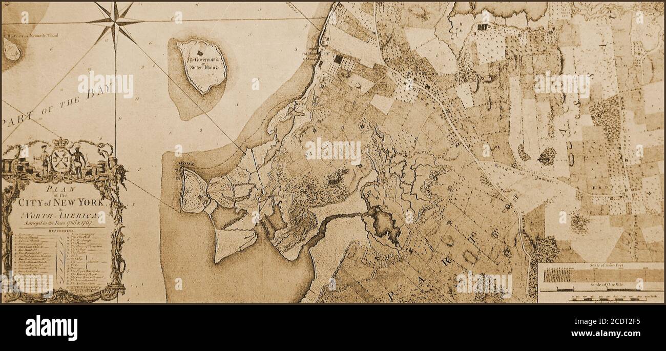 An old map of New York City , USA in 1767. Prominent is Governors Island which originally had the native Lenape inhabitants name of Paggank meaning nut island. The name was translated into the Dutch Noten Eylandt, then Anglicized into Nutten Island .It became a military island between 1776 and 1996, particularly in the the American Revolutionary War, when Continental Army troops raised defensive works on the island. It has also served as a United States Coast Guard installation/ Stock Photohttps://www.alamy.com/image-license-details/?v=1https://www.alamy.com/an-old-map-of-new-york-city-usa-in-1767-prominent-is-governors-island-which-originally-had-the-native-lenape-inhabitants-name-of-paggank-meaning-nut-island-the-name-was-translated-into-the-dutch-noten-eylandt-then-anglicized-into-nutten-island-it-became-a-military-island-between-1776-and-1996-particularly-in-the-the-american-revolutionary-war-when-continental-army-troops-raised-defensive-works-on-the-island-it-has-also-served-as-a-united-states-coast-guard-installation-image369937097.html
RM2CDT2F5–An old map of New York City , USA in 1767. Prominent is Governors Island which originally had the native Lenape inhabitants name of Paggank meaning nut island. The name was translated into the Dutch Noten Eylandt, then Anglicized into Nutten Island .It became a military island between 1776 and 1996, particularly in the the American Revolutionary War, when Continental Army troops raised defensive works on the island. It has also served as a United States Coast Guard installation/
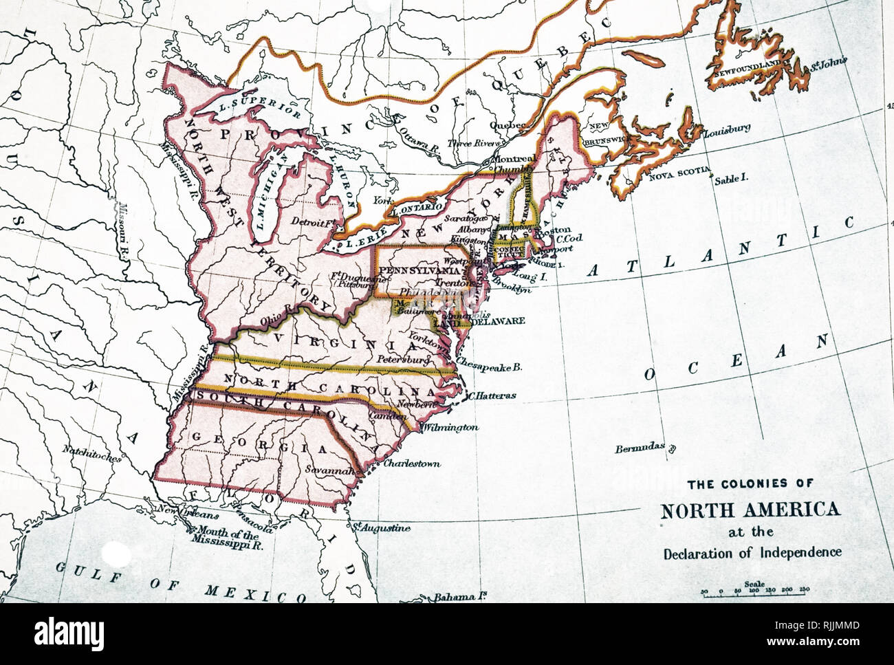 A map of the United States on the eve of Independence, 3rd July 1776. Dated 18th century Stock Photohttps://www.alamy.com/image-license-details/?v=1https://www.alamy.com/a-map-of-the-united-states-on-the-eve-of-independence-3rd-july-1776-dated-18th-century-image235209981.html
RMRJJMMD–A map of the United States on the eve of Independence, 3rd July 1776. Dated 18th century
 America flag watercolor painting design . Country map shape . Independence day concept ( 4 July 1776 ) . Vector . Stock Vectorhttps://www.alamy.com/image-license-details/?v=1https://www.alamy.com/america-flag-watercolor-painting-design-country-map-shape-independence-day-concept-4-july-1776-vector-image244203543.html
RFT58C33–America flag watercolor painting design . Country map shape . Independence day concept ( 4 July 1776 ) . Vector .
 USA map shape with America flag watercolor painting design. Independence day, 4 July 1776 and sports team concept. Vector background Stock Vectorhttps://www.alamy.com/image-license-details/?v=1https://www.alamy.com/usa-map-shape-with-america-flag-watercolor-painting-design-independence-day-4-july-1776-and-sports-team-concept-vector-background-image555856279.html
RF2R89C9Y–USA map shape with America flag watercolor painting design. Independence day, 4 July 1776 and sports team concept. Vector background
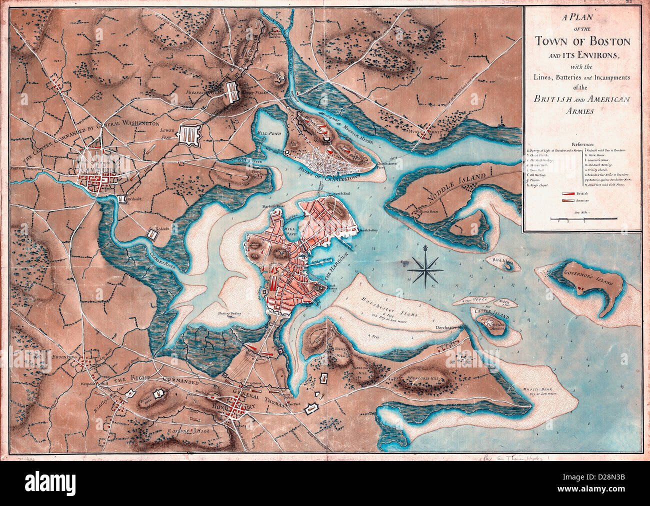 A plan of the town of Boston and its environs, with the lines, batteries, and incampments of the British and American armies. 1776 USA Revolutionary War Stock Photohttps://www.alamy.com/image-license-details/?v=1https://www.alamy.com/stock-photo-a-plan-of-the-town-of-boston-and-its-environs-with-the-lines-batteries-53052591.html
RMD28N3B–A plan of the town of Boston and its environs, with the lines, batteries, and incampments of the British and American armies. 1776 USA Revolutionary War
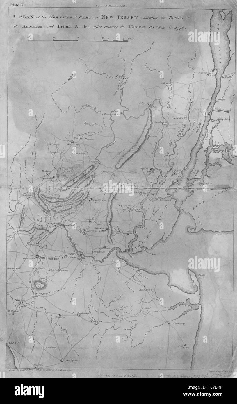 Engraved map of the northern part of New Jersey, showing the positions of the American and British armies after crossing the North River in 1776, 1807. From the New York Public Library. () Stock Photohttps://www.alamy.com/image-license-details/?v=1https://www.alamy.com/engraved-map-of-the-northern-part-of-new-jersey-showing-the-positions-of-the-american-and-british-armies-after-crossing-the-north-river-in-1776-1807-from-the-new-york-public-library-image245235082.html
RMT6YBRP–Engraved map of the northern part of New Jersey, showing the positions of the American and British armies after crossing the North River in 1776, 1807. From the New York Public Library. ()
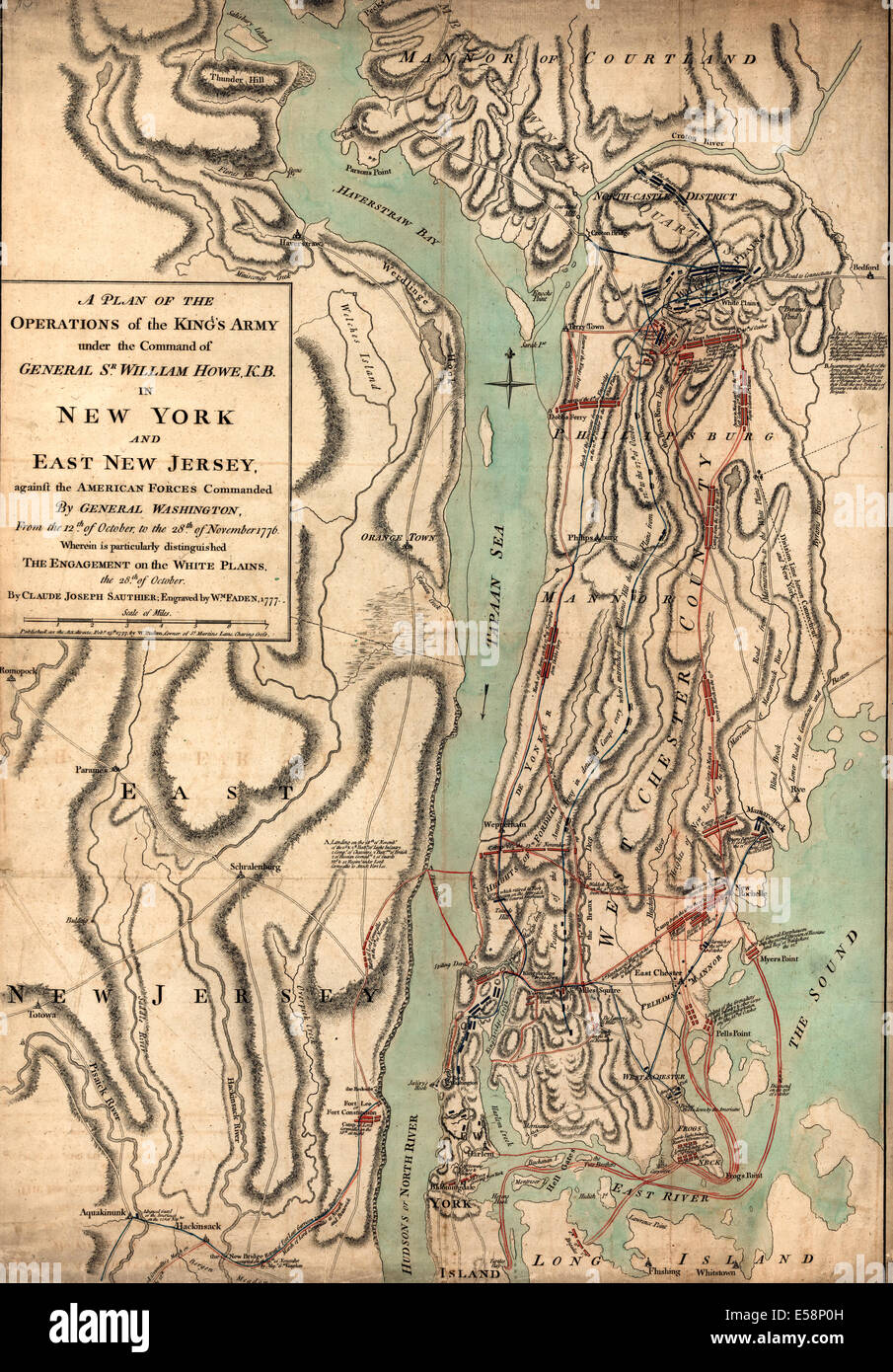 A plan of the operations of the King's army under the command of General Sr. William Howe, K.B. in New York and east New Jersey, USA Revolutionary War Stock Photohttps://www.alamy.com/image-license-details/?v=1https://www.alamy.com/stock-photo-a-plan-of-the-operations-of-the-kings-army-under-the-command-of-general-72107633.html
RME58P0H–A plan of the operations of the King's army under the command of General Sr. William Howe, K.B. in New York and east New Jersey, USA Revolutionary War
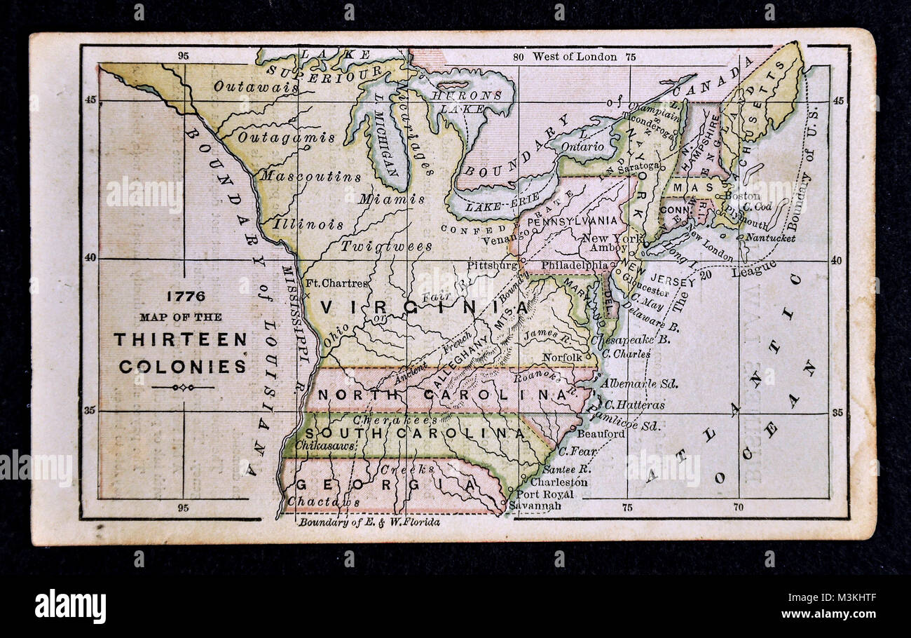 1882 Bradstreet Atlas Map - United States Thirteen Colonies 1776 Stock Photohttps://www.alamy.com/image-license-details/?v=1https://www.alamy.com/stock-photo-1882-bradstreet-atlas-map-united-states-thirteen-colonies-1776-174378751.html
RFM3KHTF–1882 Bradstreet Atlas Map - United States Thirteen Colonies 1776
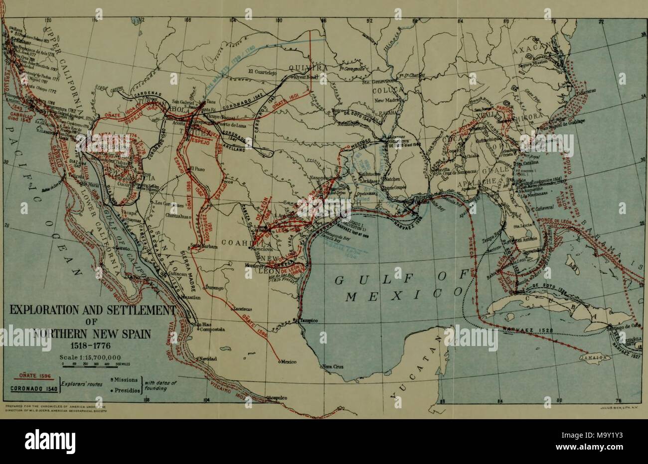 Color illustration depicting a map of the central and southern portions of the USA, and Cuba, the Bahamas, and Mexico, with lines indicating physical features such as rivers and some named regions, captioned 'Exploration and Settlement of Northern New Spain 1518-1776, ' from the volume 'The Chronicles of America Series, ' edited by Allen Johnson, 1918. () Stock Photohttps://www.alamy.com/image-license-details/?v=1https://www.alamy.com/color-illustration-depicting-a-map-of-the-central-and-southern-portions-of-the-usa-and-cuba-the-bahamas-and-mexico-with-lines-indicating-physical-features-such-as-rivers-and-some-named-regions-captioned-exploration-and-settlement-of-northern-new-spain-1518-1776-from-the-volume-the-chronicles-of-america-series-edited-by-allen-johnson-1918-image178229831.html
RMM9Y1Y3–Color illustration depicting a map of the central and southern portions of the USA, and Cuba, the Bahamas, and Mexico, with lines indicating physical features such as rivers and some named regions, captioned 'Exploration and Settlement of Northern New Spain 1518-1776, ' from the volume 'The Chronicles of America Series, ' edited by Allen Johnson, 1918. ()
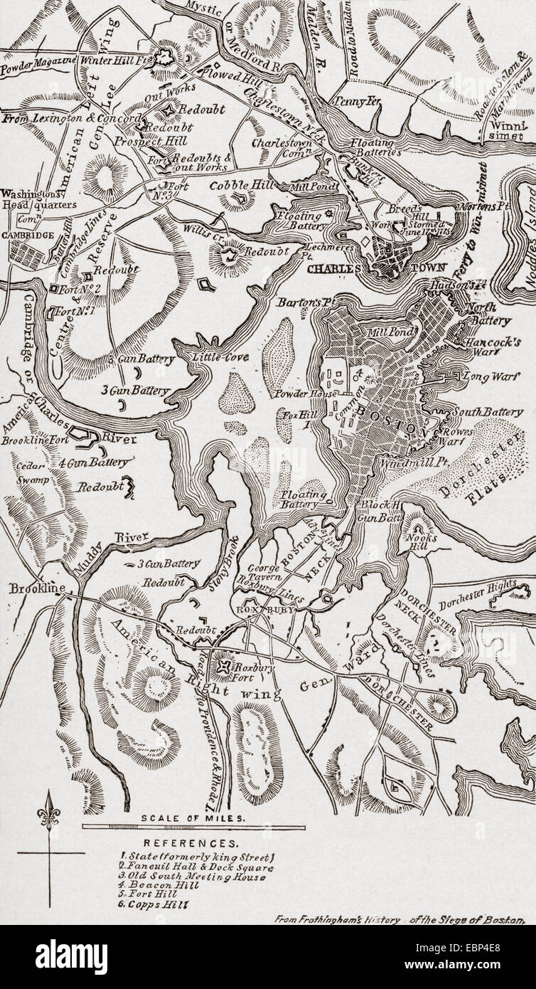 Map of Boston and its environs in 1775-1776. Stock Photohttps://www.alamy.com/image-license-details/?v=1https://www.alamy.com/stock-photo-map-of-boston-and-its-environs-in-1775-1776-76089168.html
RMEBP4E8–Map of Boston and its environs in 1775-1776.
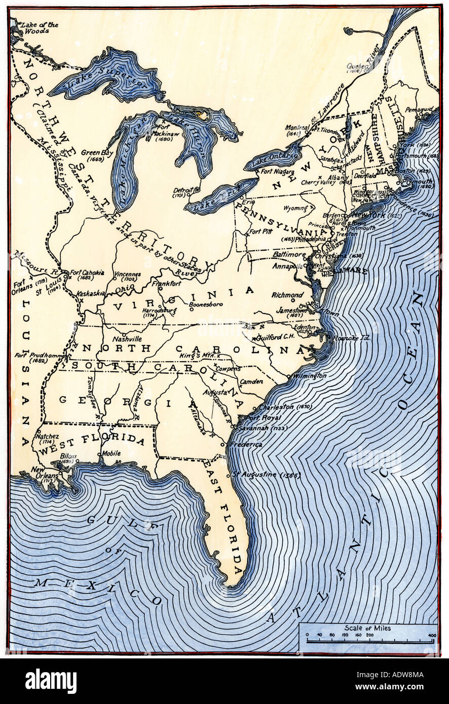 Map showing the thirteen colonies which joined together as the original thirteen states in 1776. Hand-colored woodcut Stock Photohttps://www.alamy.com/image-license-details/?v=1https://www.alamy.com/map-showing-the-thirteen-colonies-which-joined-together-as-the-original-image7712585.html
RMADW8MA–Map showing the thirteen colonies which joined together as the original thirteen states in 1776. Hand-colored woodcut
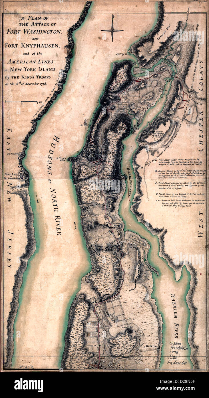 A plan of the attack of Fort Washington, now Fort Knyphausen, and of the American lines on New-York Island by the King's troops, on the 16th of November 1776. USA Revolutionary War Stock Photohttps://www.alamy.com/image-license-details/?v=1https://www.alamy.com/stock-photo-a-plan-of-the-attack-of-fort-washington-now-fort-knyphausen-and-of-53052651.html
RMD28N5F–A plan of the attack of Fort Washington, now Fort Knyphausen, and of the American lines on New-York Island by the King's troops, on the 16th of November 1776. USA Revolutionary War
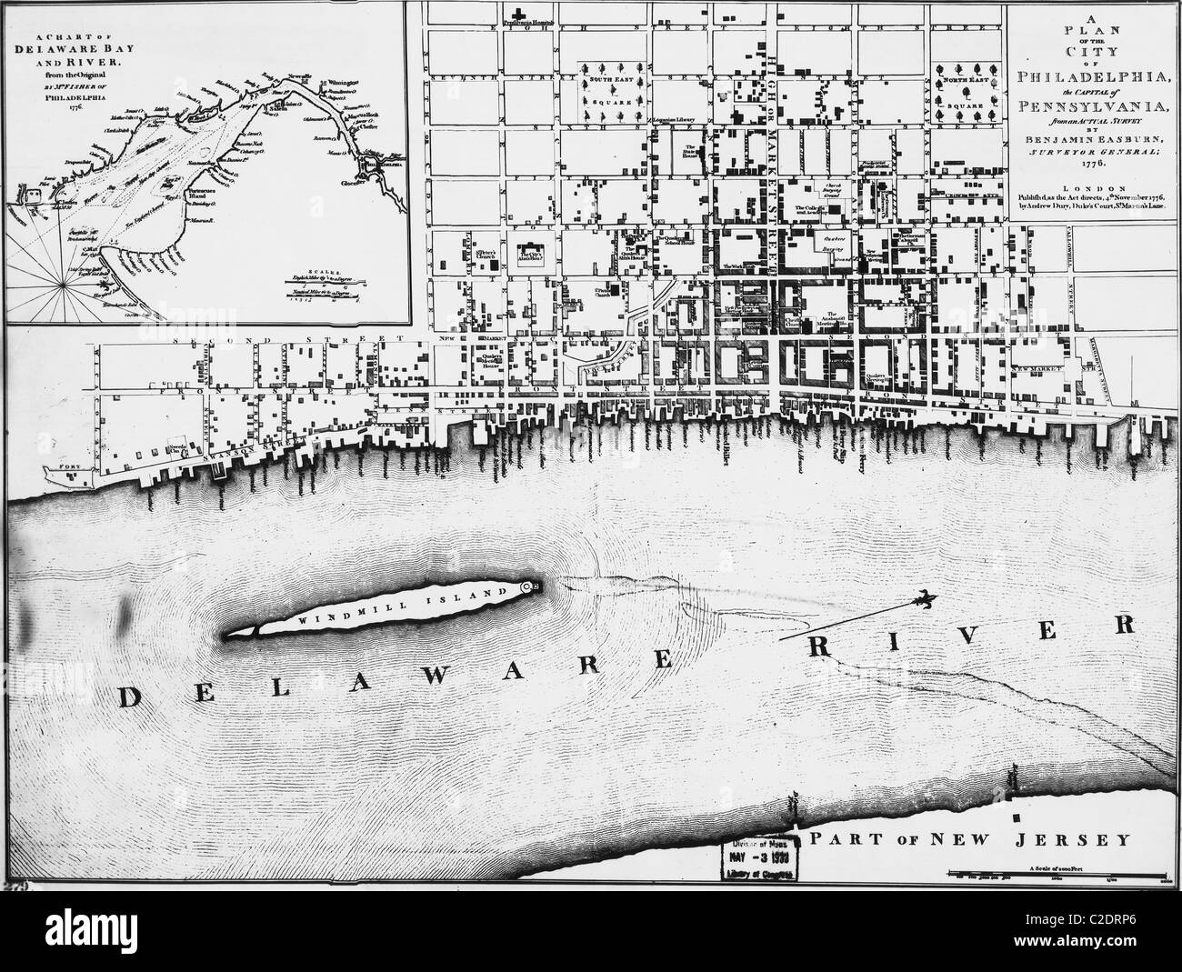 City map of Philadelphia Stock Photohttps://www.alamy.com/image-license-details/?v=1https://www.alamy.com/stock-photo-city-map-of-philadelphia-35954078.html
RMC2DRP6–City map of Philadelphia
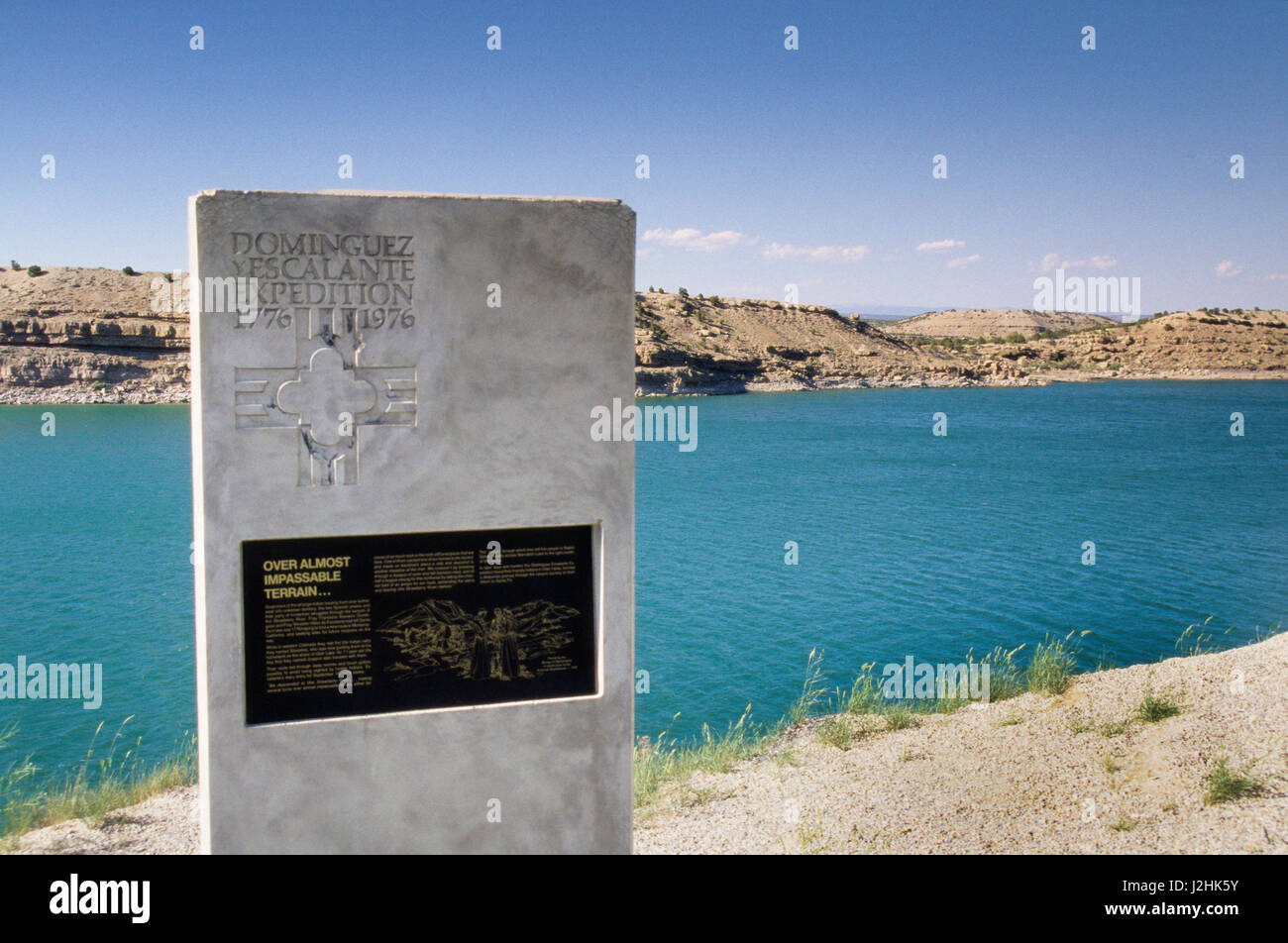 In 1776 the Dominguez y Escalante Expedition traveled over impassable terrain through the Uinta Basin, homelands to the Ute Indians. Stock Photohttps://www.alamy.com/image-license-details/?v=1https://www.alamy.com/stock-photo-in-1776-the-dominguez-y-escalante-expedition-traveled-over-impassable-139300503.html
RMJ2HK5Y–In 1776 the Dominguez y Escalante Expedition traveled over impassable terrain through the Uinta Basin, homelands to the Ute Indians.
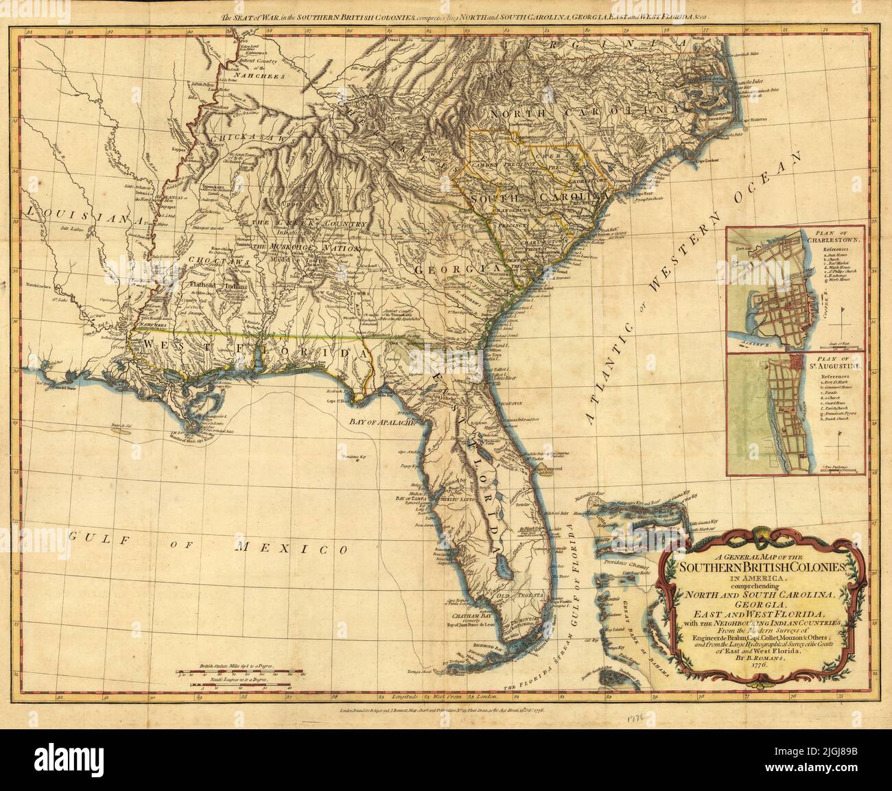 Map of the Southern British Colonies including North and South Carolina, Georgia, East and West Florida, 1776, by Bernard Romans Stock Photohttps://www.alamy.com/image-license-details/?v=1https://www.alamy.com/map-of-the-southern-british-colonies-including-north-and-south-carolina-georgia-east-and-west-florida-1776-by-bernard-romans-image474916103.html
RF2JGJ89B–Map of the Southern British Colonies including North and South Carolina, Georgia, East and West Florida, 1776, by Bernard Romans
 1776 Wiennerisches Diarium o Deklaracji Niepodległości USA Stock Photohttps://www.alamy.com/image-license-details/?v=1https://www.alamy.com/stock-photo-1776-wiennerisches-diarium-o-deklaracji-niepodlegoci-usa-147382464.html
RMJFNRRC–1776 Wiennerisches Diarium o Deklaracji Niepodległości USA
 Made in USA monogram vector. Vintage America logo design. Retro United States seal. US label illustration. Hipster t-shirt graphic on grunge background. Stock Vectorhttps://www.alamy.com/image-license-details/?v=1https://www.alamy.com/stock-photo-made-in-usa-monogram-vector-vintage-america-logo-design-retro-united-117778851.html
RFGRH83F–Made in USA monogram vector. Vintage America logo design. Retro United States seal. US label illustration. Hipster t-shirt graphic on grunge background.
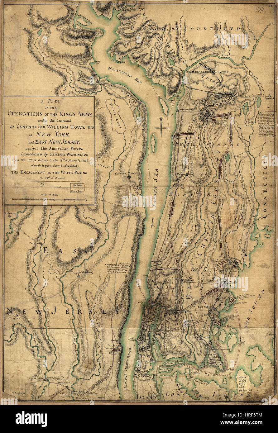 British Army White Plains Battle Plans, 1776 Stock Photohttps://www.alamy.com/image-license-details/?v=1https://www.alamy.com/stock-photo-british-army-white-plains-battle-plans-1776-135097220.html
RMHRP5TM–British Army White Plains Battle Plans, 1776
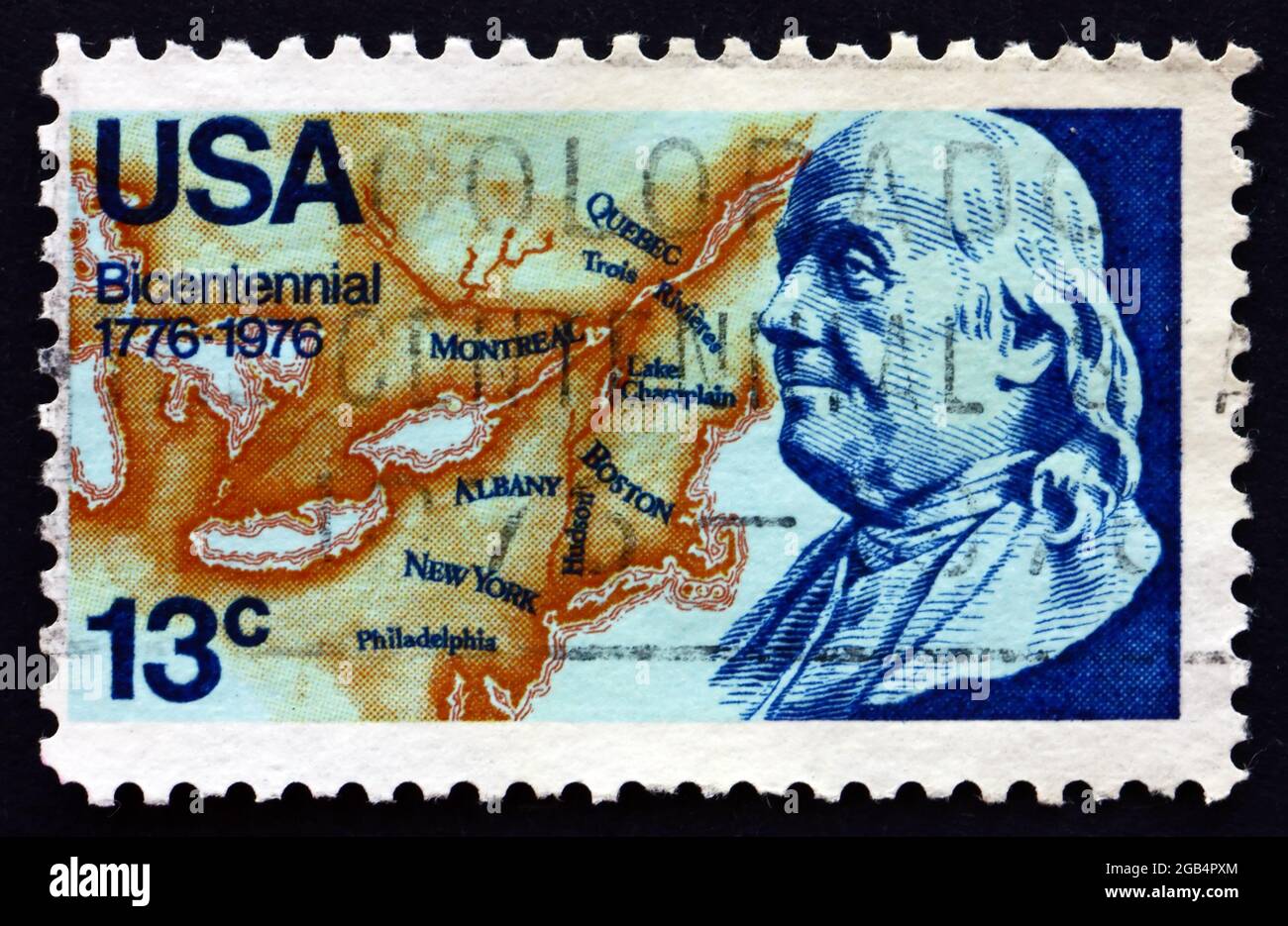 UNITED STATES OF AMERICA - CIRCA 1976: a stamp printed in the USA shows Franklin and Map of North America, 1776, American Bicentennial, circa 1976 Stock Photohttps://www.alamy.com/image-license-details/?v=1https://www.alamy.com/united-states-of-america-circa-1976-a-stamp-printed-in-the-usa-shows-franklin-and-map-of-north-america-1776-american-bicentennial-circa-1976-image437126220.html
RF2GB4PXM–UNITED STATES OF AMERICA - CIRCA 1976: a stamp printed in the USA shows Franklin and Map of North America, 1776, American Bicentennial, circa 1976
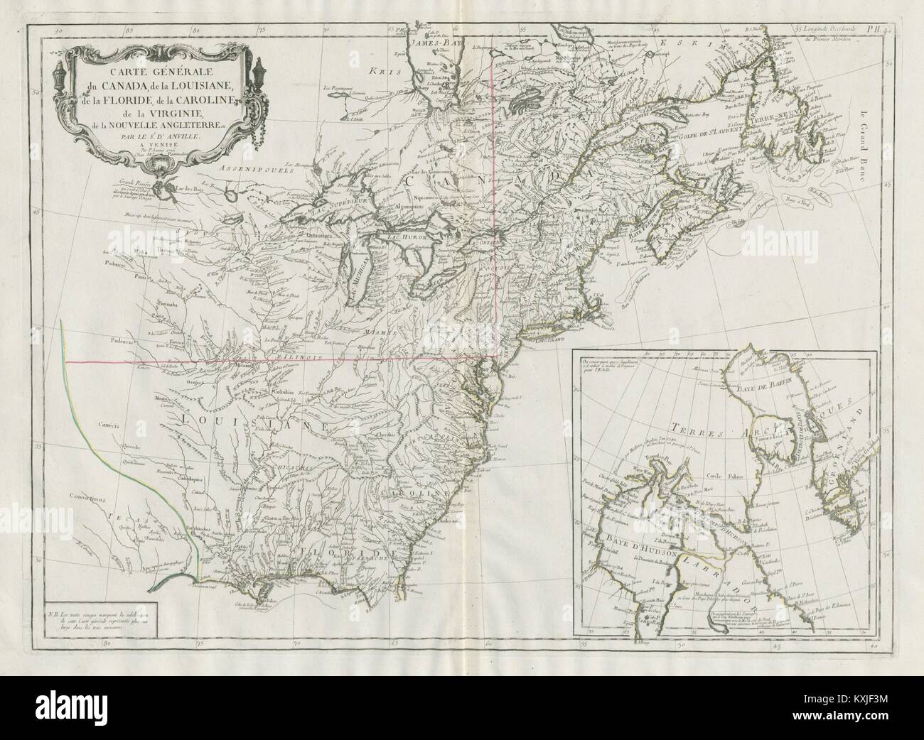 'Carte Générale du Canada, de la Louisiane…' SANTINI / D'ANVILLE 1784 old map Stock Photohttps://www.alamy.com/image-license-details/?v=1https://www.alamy.com/stock-photo-carte-gnrale-du-canada-de-la-louisiane-santini-danville-1784-old-map-171281368.html
RFKXJF3M–'Carte Générale du Canada, de la Louisiane…' SANTINI / D'ANVILLE 1784 old map
 United states of America, USA map and flag illustration design Stock Photohttps://www.alamy.com/image-license-details/?v=1https://www.alamy.com/united-states-of-america-usa-map-and-flag-illustration-design-image66182969.html
RFDRJW1D–United states of America, USA map and flag illustration design
 Symbols United States framed in different forms of the flag background Stock Vectorhttps://www.alamy.com/image-license-details/?v=1https://www.alamy.com/symbols-united-states-framed-in-different-forms-of-the-flag-background-image259854769.html
RFW2NBBD–Symbols United States framed in different forms of the flag background
 Map of the United States of america with the words about independence day, 4th of July . Vector . Stock Vectorhttps://www.alamy.com/image-license-details/?v=1https://www.alamy.com/map-of-the-united-states-of-america-with-the-words-about-independence-day-4th-of-july-vector-image615272014.html
RF2XN01ME–Map of the United States of america with the words about independence day, 4th of July . Vector .
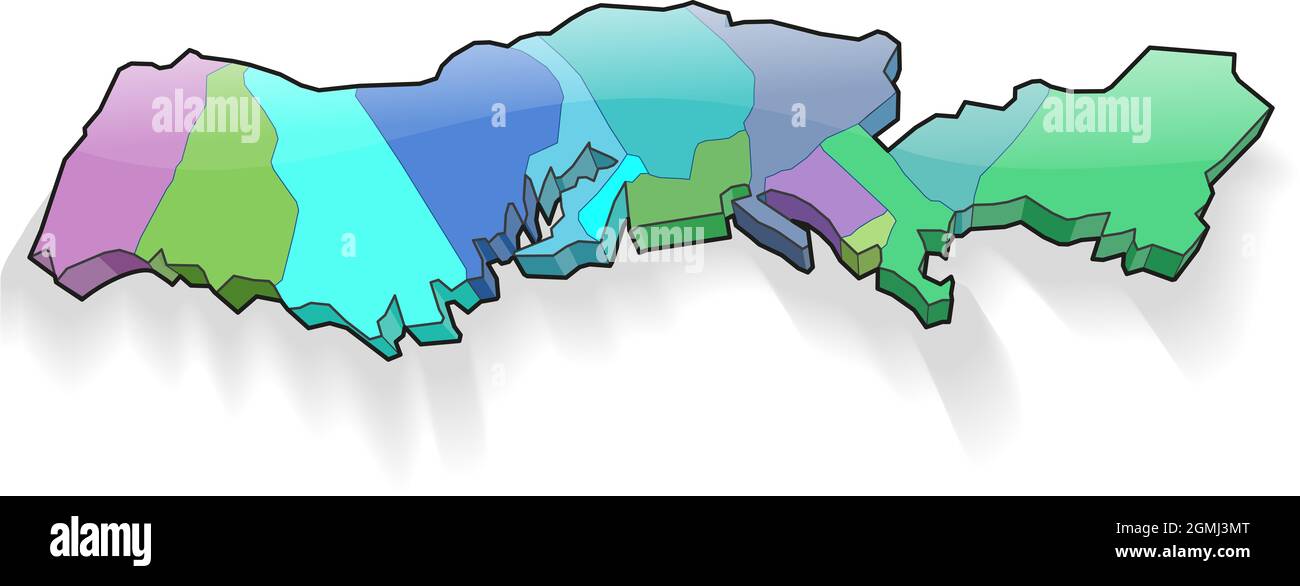 The 13 thirteen colonies of the usa 3d map Stock Photohttps://www.alamy.com/image-license-details/?v=1https://www.alamy.com/the-13-thirteen-colonies-of-the-usa-3d-map-image442950392.html
RF2GMJ3MT–The 13 thirteen colonies of the usa 3d map
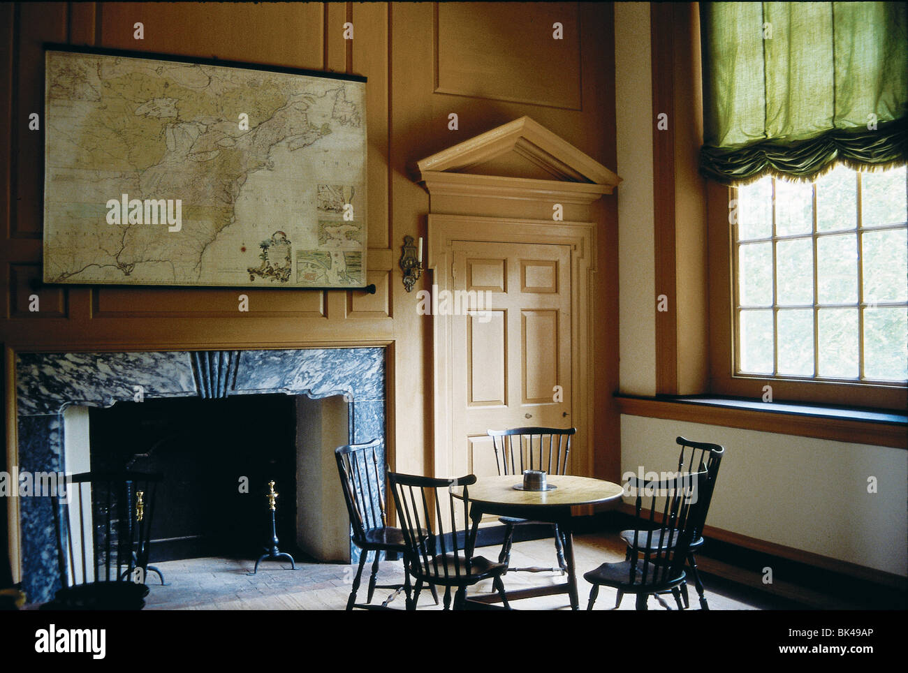 Independence Hall Committee Room, Philadelphia, Pennsylvania Stock Photohttps://www.alamy.com/image-license-details/?v=1https://www.alamy.com/stock-photo-independence-hall-committee-room-philadelphia-pennsylvania-28983998.html
RMBK49AP–Independence Hall Committee Room, Philadelphia, Pennsylvania
 The 13 thirteen colonies of the usa 3d map Stock Photohttps://www.alamy.com/image-license-details/?v=1https://www.alamy.com/the-13-thirteen-colonies-of-the-usa-3d-map-image442950387.html
RF2GMJ3MK–The 13 thirteen colonies of the usa 3d map
RF2JF69BK–VIEW OF BRITISH AND HESSIAN ATTACK ON FORT WASHINGTON, NOV. 16, 1776; DRAWN BY CAPT. THOS. DAVIES. From the book The iconography of Manhattan Island, 1498-1909 compiled from original sources and illustrated by photo-intaglio reproductions of important maps, plans, views, and documents in public and private collections - Volume 6
 The 13 thirteen colonies of the usa vector 3d map vector Stock Vectorhttps://www.alamy.com/image-license-details/?v=1https://www.alamy.com/the-13-thirteen-colonies-of-the-usa-vector-3d-map-vector-image442950396.html
RF2GMJ3N0–The 13 thirteen colonies of the usa vector 3d map vector
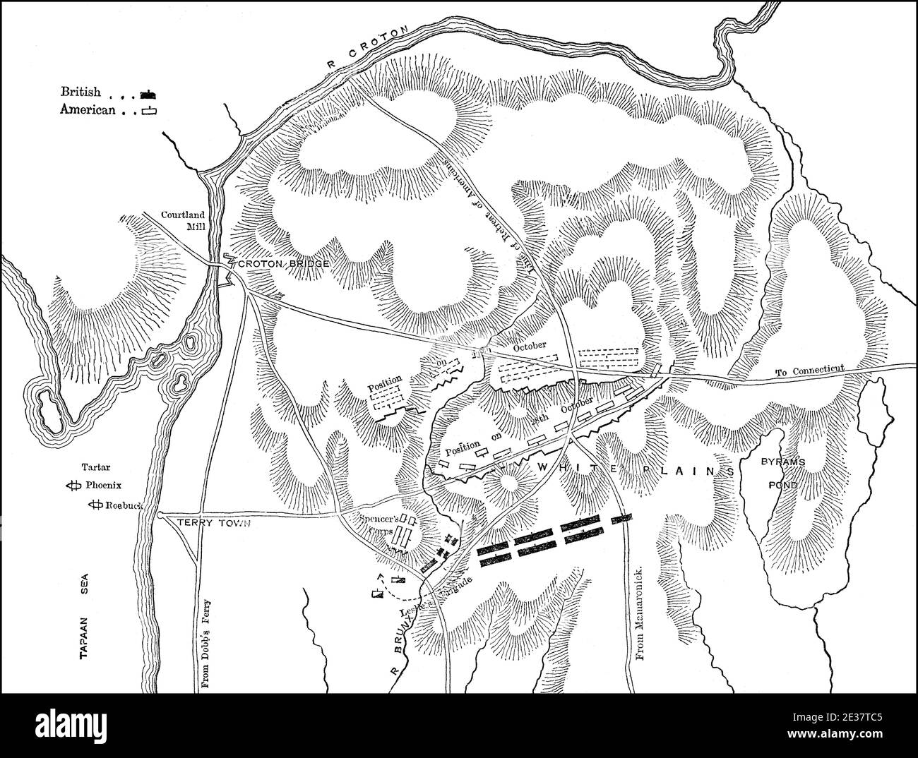 Plan of the Battle of White Plains, New York and New Jersey campaign on October 28, 1776, American Revolutionary War Stock Photohttps://www.alamy.com/image-license-details/?v=1https://www.alamy.com/plan-of-the-battle-of-white-plains-new-york-and-new-jersey-campaign-on-october-28-1776-american-revolutionary-war-image397855253.html
RM2E37TC5–Plan of the Battle of White Plains, New York and New Jersey campaign on October 28, 1776, American Revolutionary War
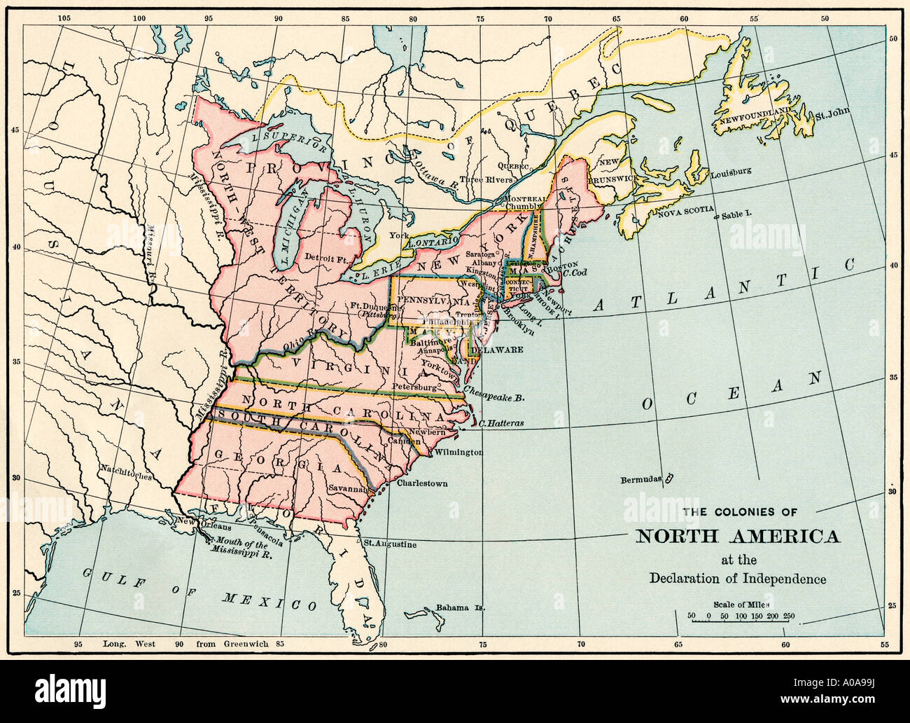 British North American colonies in 1776. Color lithograph Stock Photohttps://www.alamy.com/image-license-details/?v=1https://www.alamy.com/british-north-american-colonies-in-1776-color-lithograph-image9931709.html
RMA0A99J–British North American colonies in 1776. Color lithograph
 4th of july Independence day banner with kids Stock Vectorhttps://www.alamy.com/image-license-details/?v=1https://www.alamy.com/stock-image-4th-of-july-independence-day-banner-with-kids-160951993.html
RFK9RYWD–4th of july Independence day banner with kids
 Image taken from page 663 of '1776 American Enterprise. 1876. Burley's United States Centennial Gazetteer and Guide 1876 ... C. H. Kidder, editor, etc' Image taken from page 663 of '1776 American Enterprise 1876 Stock Photohttps://www.alamy.com/image-license-details/?v=1https://www.alamy.com/stock-photo-image-taken-from-page-663-of-1776-american-enterprise-1876-burleys-130177440.html
RMHFP2J8–Image taken from page 663 of '1776 American Enterprise. 1876. Burley's United States Centennial Gazetteer and Guide 1876 ... C. H. Kidder, editor, etc' Image taken from page 663 of '1776 American Enterprise 1876
 Happy independence day card United States of America, 4 th of July Stock Vectorhttps://www.alamy.com/image-license-details/?v=1https://www.alamy.com/stock-image-happy-independence-day-card-united-states-of-america-4-th-of-july-160951890.html
RFK9RYNP–Happy independence day card United States of America, 4 th of July
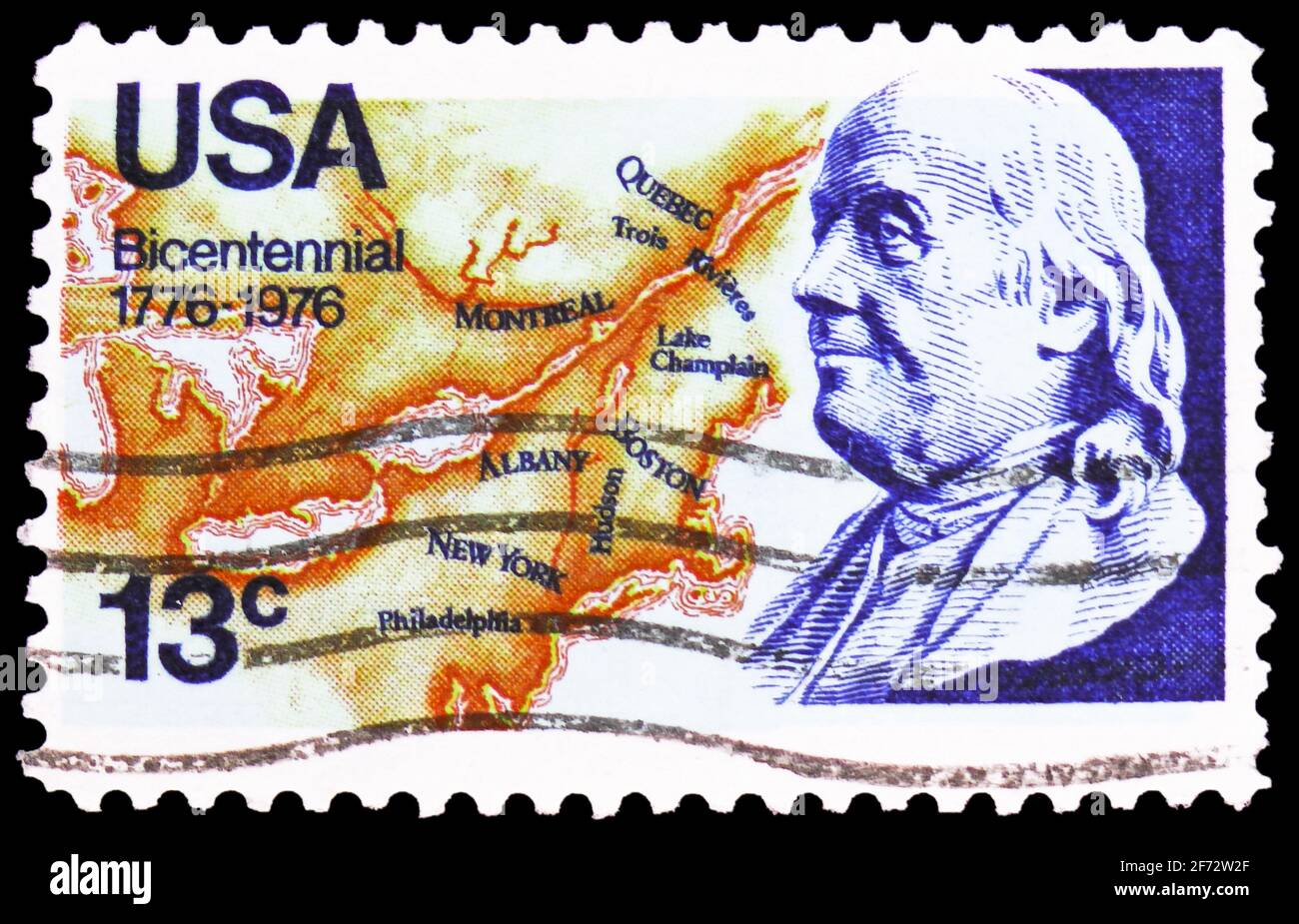 MOSCOW, RUSSIA - JANUARY 12, 2021: Postage stamp printed in United States shows Franklin and Map of North America, 1776, American Bicentennial Issues: Stock Photohttps://www.alamy.com/image-license-details/?v=1https://www.alamy.com/moscow-russia-january-12-2021-postage-stamp-printed-in-united-states-shows-franklin-and-map-of-north-america-1776-american-bicentennial-issues-image417414999.html
RF2F72W2F–MOSCOW, RUSSIA - JANUARY 12, 2021: Postage stamp printed in United States shows Franklin and Map of North America, 1776, American Bicentennial Issues:
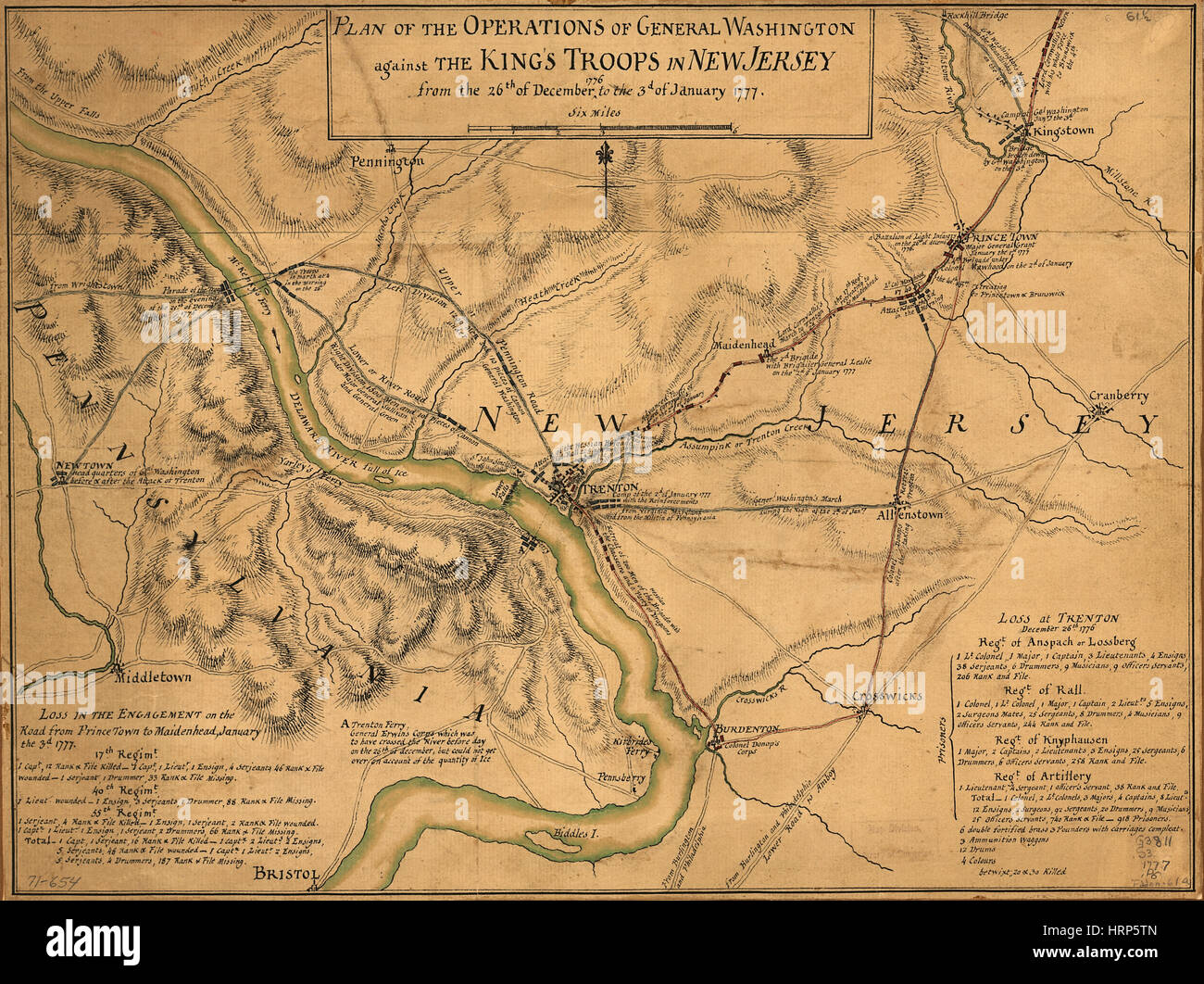 Washington's New Jersey Battle Plans, 1776-77 Stock Photohttps://www.alamy.com/image-license-details/?v=1https://www.alamy.com/stock-photo-washingtons-new-jersey-battle-plans-1776-77-135097221.html
RMHRP5TN–Washington's New Jersey Battle Plans, 1776-77
 Symbols United States framed in different forms of the flag background Stock Vectorhttps://www.alamy.com/image-license-details/?v=1https://www.alamy.com/symbols-united-states-framed-in-different-forms-of-the-flag-background-image259854236.html
RFW2NAMC–Symbols United States framed in different forms of the flag background
 Map of the United States of america with the words about independence day, 4th of July . Vector . Stock Vectorhttps://www.alamy.com/image-license-details/?v=1https://www.alamy.com/map-of-the-united-states-of-america-with-the-words-about-independence-day-4th-of-july-vector-image615272003.html
RF2XN01M3–Map of the United States of america with the words about independence day, 4th of July . Vector .
RF2JF69H5–VIEW OF THE NARROWS BETWEEN LONG ISLAND & STATEN ISLAND WT OUR FLEET AT ANCHOR & LORD HOWE COMING IN;’DRAWN BY ARCHIBALD ROBERTSON, July 12th 1776 From the book The iconography of Manhattan Island, 1498-1909 compiled from original sources and illustrated by photo-intaglio reproductions of important maps, plans, views, and documents in public and private collections - Volume 6
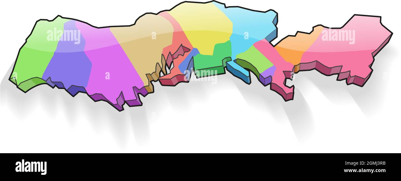 The 13 thirteen colonies of the usa vector 3d map vector Stock Vectorhttps://www.alamy.com/image-license-details/?v=1https://www.alamy.com/the-13-thirteen-colonies-of-the-usa-vector-3d-map-vector-image442950463.html
RF2GMJ3RB–The 13 thirteen colonies of the usa vector 3d map vector
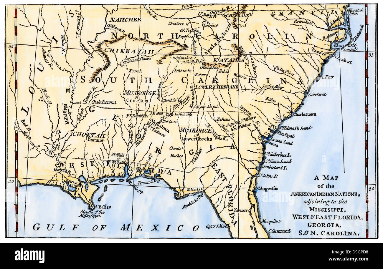 Map of southeastern Native American Nations about 1776. Hand-colored woodcut Stock Photohttps://www.alamy.com/image-license-details/?v=1https://www.alamy.com/stock-photo-map-of-southeastern-native-american-nations-about-1776-hand-colored-57531860.html
RMD9GPD8–Map of southeastern Native American Nations about 1776. Hand-colored woodcut
 Symbols United States framed in different forms of the flag background Stock Vectorhttps://www.alamy.com/image-license-details/?v=1https://www.alamy.com/symbols-united-states-framed-in-different-forms-of-the-flag-background-image259854584.html
RFW2NB4T–Symbols United States framed in different forms of the flag background
 Map of the United States of america with the words about independence day, 4th of July . Vector . Stock Vectorhttps://www.alamy.com/image-license-details/?v=1https://www.alamy.com/map-of-the-united-states-of-america-with-the-words-about-independence-day-4th-of-july-vector-image615272011.html
RF2XN01MB–Map of the United States of america with the words about independence day, 4th of July . Vector .
RF2JF69HN–VIEW OF PART OF THE REBEL WORKS ROUND WALTON’S HOUSE; DRAWN BY ARCHIBALD ROBERTSON, OCT. 8, 1776 [top] VIEW OF THE NORTH RIVER FROM THE BEACH NEAR LISPENARD’S BREWHOUSE; DRAWN BY ARCHIBALD ROBERTSON, DEC. I0, 1781 From the book The iconography of Manhattan Island, 1498-1909 compiled from original sources and illustrated by photo-intaglio reproductions of important maps, plans, views, and documents in public and private collections - Volume 6
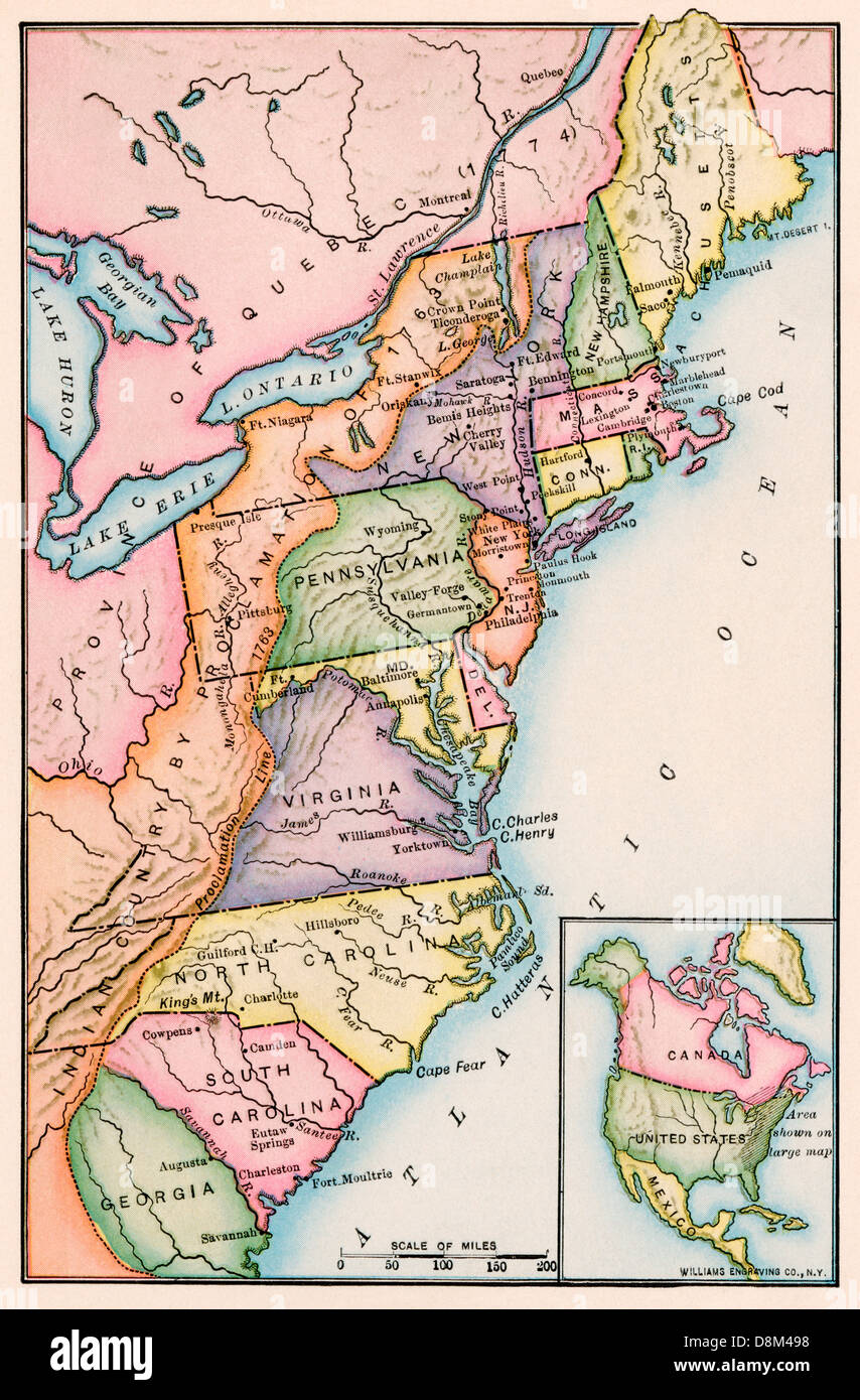 American colonies at the outbreak of the Revolution. Printed color lithograph Stock Photohttps://www.alamy.com/image-license-details/?v=1https://www.alamy.com/stock-photo-american-colonies-at-the-outbreak-of-the-revolution-printed-color-56990788.html
RMD8M498–American colonies at the outbreak of the Revolution. Printed color lithograph
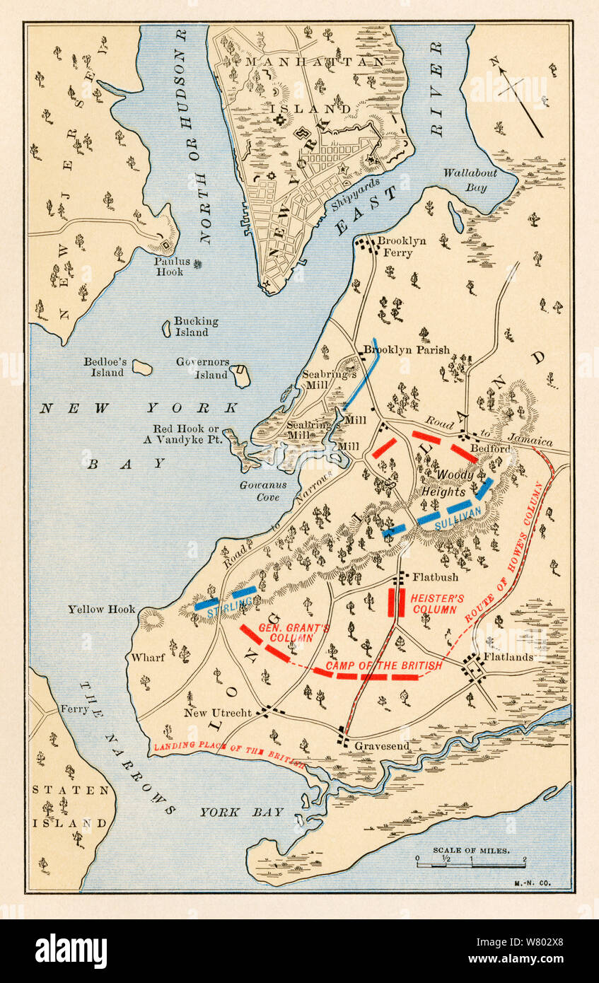 Battle of Long Island battlefield map, Revolutionary War. Color lithograph Stock Photohttps://www.alamy.com/image-license-details/?v=1https://www.alamy.com/battle-of-long-island-battlefield-map-revolutionary-war-color-lithograph-image263075072.html
RMW802X8–Battle of Long Island battlefield map, Revolutionary War. Color lithograph
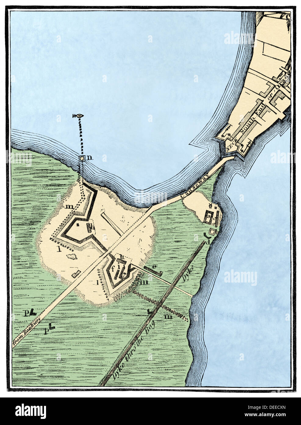 British fortifications on Boston Neck, 1775-1776. Hand-colored woodcut Stock Photohttps://www.alamy.com/image-license-details/?v=1https://www.alamy.com/british-fortifications-on-boston-neck-1775-1776-hand-colored-woodcut-image60553773.html
RMDEECXN–British fortifications on Boston Neck, 1775-1776. Hand-colored woodcut
 Symbols United States framed in different forms of the flag background Stock Vectorhttps://www.alamy.com/image-license-details/?v=1https://www.alamy.com/symbols-united-states-framed-in-different-forms-of-the-flag-background-image259853545.html
RFW2N9RN–Symbols United States framed in different forms of the flag background
 Map of the United States of america with the words about independence day, 4th of July . Vector . Stock Vectorhttps://www.alamy.com/image-license-details/?v=1https://www.alamy.com/map-of-the-united-states-of-america-with-the-words-about-independence-day-4th-of-july-vector-image615271937.html
RF2XN01HN–Map of the United States of america with the words about independence day, 4th of July . Vector .
RF2JF69XE–WASHINGTON’S PROCLAMATION OF AUG. 17, 1776, ON THE EXPECTED BOMBARDMENT OF NEW YORK CITY. [Left] PROCLAMATION OF THE “KING'S COMMISSIONERS FOR RE- STORING PEACE’ PROMISING PARDON; DATED NOV. 30, 1776 [Right] from the book The iconography of Manhattan Island, 1498-1909 compiled from original sources and illustrated by photo-intaglio reproductions of important maps, plans, views, and documents in public and private collections - Volume 5 by Stokes, I. N. Phelps (Isaac Newton Phelps), 1867-1944
RF2JF69XJ–KIP’s BAY, SHOWING THE BRITISH TROOPS CROSSING THE RIVER ON SEPT. 15, 1776; DRAWN BY ARCHIBALD ROBERT- SON ON AUG. 17, 1778, PROBABLY FROM A SKETCH MADE ON THE EARLIER DATE. from the book The iconography of Manhattan Island, 1498-1909 compiled from original sources and illustrated by photo-intaglio reproductions of important maps, plans, views, and documents in public and private collections - Volume 5 by Stokes, I. N. Phelps (Isaac Newton Phelps), 1867-1944