Quick filters:
World map 1527 Stock Photos and Images
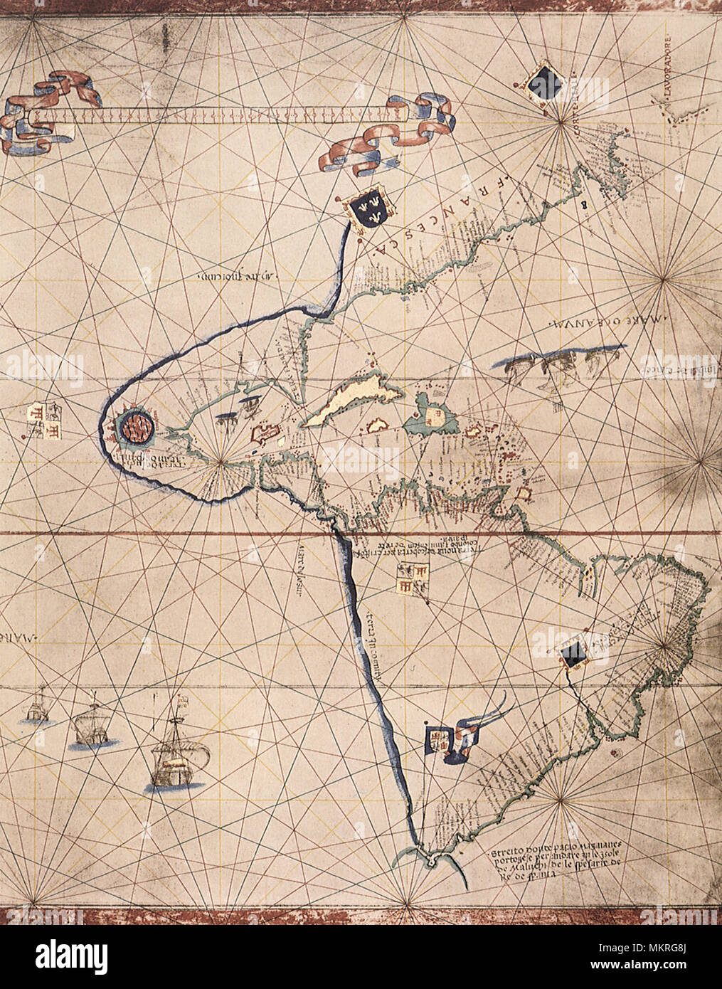 Partial Map of the World 1527 Stock Photohttps://www.alamy.com/image-license-details/?v=1https://www.alamy.com/partial-map-of-the-world-1527-image184299826.html
RMMKRG8J–Partial Map of the World 1527
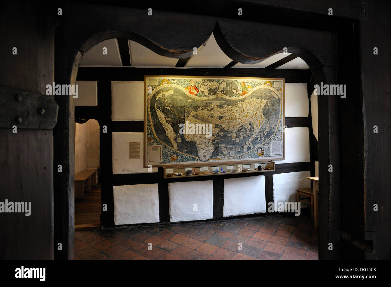 World map of 1527, with various minerals for the manufacture of paints below, Albrecht Duerer House, historic center, Nuremberg Stock Photohttps://www.alamy.com/image-license-details/?v=1https://www.alamy.com/world-map-of-1527-with-various-minerals-for-the-manufacture-of-paints-image61996712.html
RMDGT5C8–World map of 1527, with various minerals for the manufacture of paints below, Albrecht Duerer House, historic center, Nuremberg
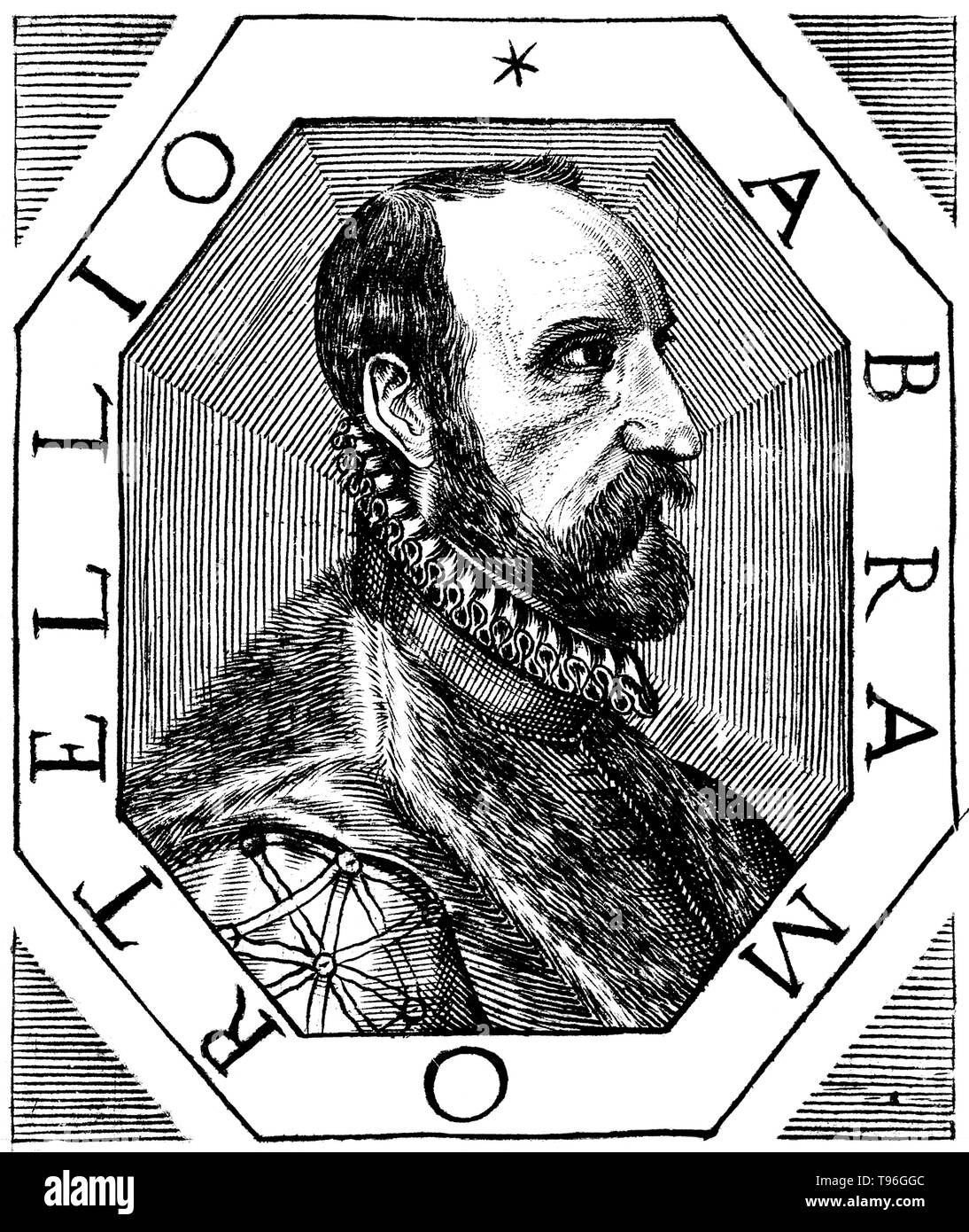 Abraham Ortelius (April 14, 1527 - June 28, 1598) was a Flemish cartographer and geographer. Beginning as a map-engraver, he entered the Antwerp Guild of Saint Luke as an illuminator of maps. He met Gerardus Mercator in 1554, who influenced his decision to become a scientific geographer. In 1564 he published his first map, Typus Orbis Terrarum, an eight-leaved wall map of the world. In 1578 he laid the basis of a critical treatment of ancient geography by his Synonymia geographica. Stock Photohttps://www.alamy.com/image-license-details/?v=1https://www.alamy.com/abraham-ortelius-april-14-1527-june-28-1598-was-a-flemish-cartographer-and-geographer-beginning-as-a-map-engraver-he-entered-the-antwerp-guild-of-saint-luke-as-an-illuminator-of-maps-he-met-gerardus-mercator-in-1554-who-influenced-his-decision-to-become-a-scientific-geographer-in-1564-he-published-his-first-map-typus-orbis-terrarum-an-eight-leaved-wall-map-of-the-world-in-1578-he-laid-the-basis-of-a-critical-treatment-of-ancient-geography-by-his-synonymia-geographica-image246621772.html
RMT96GGC–Abraham Ortelius (April 14, 1527 - June 28, 1598) was a Flemish cartographer and geographer. Beginning as a map-engraver, he entered the Antwerp Guild of Saint Luke as an illuminator of maps. He met Gerardus Mercator in 1554, who influenced his decision to become a scientific geographer. In 1564 he published his first map, Typus Orbis Terrarum, an eight-leaved wall map of the world. In 1578 he laid the basis of a critical treatment of ancient geography by his Synonymia geographica.
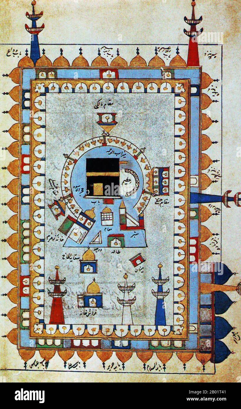 Saudi Arabia/Iran/Persia: A map or diagram showing the Ka'ba or Kaaba at the heart of the Masjid al-Haram in Mecca. From 'Futuh al-Haramayn' (Triumph of the Holy Places) by Muhyi al-Din Abd al-Rahman al-Lari al-Ansari, c. 1527. The Kaaba or Qaaba (the Cube) is a cuboid-shaped building in Mecca, Saudi Arabia, and is the most sacred site in Islam. The Qur'an states that the Ka'ba was constructed by Abraham (Ibrahim in Arabic), and his son Ishmael (Ismail in Arabic), after the latter had settled in Arabia. The building has a mosque built around it, the Masjid al-Haram. Stock Photohttps://www.alamy.com/image-license-details/?v=1https://www.alamy.com/saudi-arabiairanpersia-a-map-or-diagram-showing-the-kaba-or-kaaba-at-the-heart-of-the-masjid-al-haram-in-mecca-from-futuh-al-haramayn-triumph-of-the-holy-places-by-muhyi-al-din-abd-al-rahman-al-lari-al-ansari-c-1527-the-kaaba-or-qaaba-the-cube-is-a-cuboid-shaped-building-in-mecca-saudi-arabia-and-is-the-most-sacred-site-in-islam-the-quran-states-that-the-kaba-was-constructed-by-abraham-ibrahim-in-arabic-and-his-son-ishmael-ismail-in-arabic-after-the-latter-had-settled-in-arabia-the-building-has-a-mosque-built-around-it-the-masjid-al-haram-image344248241.html
RM2B01T41–Saudi Arabia/Iran/Persia: A map or diagram showing the Ka'ba or Kaaba at the heart of the Masjid al-Haram in Mecca. From 'Futuh al-Haramayn' (Triumph of the Holy Places) by Muhyi al-Din Abd al-Rahman al-Lari al-Ansari, c. 1527. The Kaaba or Qaaba (the Cube) is a cuboid-shaped building in Mecca, Saudi Arabia, and is the most sacred site in Islam. The Qur'an states that the Ka'ba was constructed by Abraham (Ibrahim in Arabic), and his son Ishmael (Ismail in Arabic), after the latter had settled in Arabia. The building has a mosque built around it, the Masjid al-Haram.
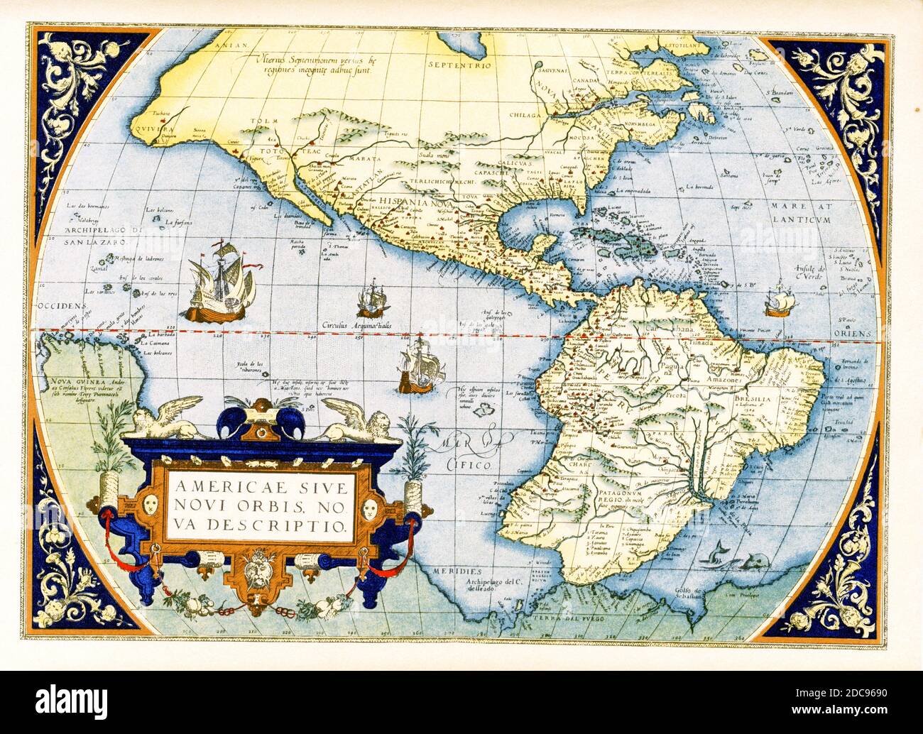 Abraham Ortelius’s map of the Americas — Americae sive Novi Orbis, Nova Descriptio. Originally published in 1570, the first plate of this map was based off of Gerard Mercator’s multi-sheet map of the world from 1569. Engraved by Frans Hogenberg, this became one of the most famous influential maps of the New World and the basis for a great deal of future cartography of the Americas. Abraham Ortelius (1527-1598) was a Dutch cartographer, geographer, and cosmographer, conventionally recognized as the creator of the first modern atlas, the Theatrum Orbis Terrarum. Stock Photohttps://www.alamy.com/image-license-details/?v=1https://www.alamy.com/abraham-orteliuss-map-of-the-americas-americae-sive-novi-orbis-nova-descriptio-originally-published-in-1570-the-first-plate-of-this-map-was-based-off-of-gerard-mercators-multi-sheet-map-of-the-world-from-1569-engraved-by-frans-hogenberg-this-became-one-of-the-most-famous-influential-maps-of-the-new-world-and-the-basis-for-a-great-deal-of-future-cartography-of-the-americas-abraham-ortelius-1527-1598-was-a-dutch-cartographer-geographer-and-cosmographer-conventionally-recognized-as-the-creator-of-the-first-modern-atlas-the-theatrum-orbis-terrarum-image386206492.html
RF2DC9690–Abraham Ortelius’s map of the Americas — Americae sive Novi Orbis, Nova Descriptio. Originally published in 1570, the first plate of this map was based off of Gerard Mercator’s multi-sheet map of the world from 1569. Engraved by Frans Hogenberg, this became one of the most famous influential maps of the New World and the basis for a great deal of future cartography of the Americas. Abraham Ortelius (1527-1598) was a Dutch cartographer, geographer, and cosmographer, conventionally recognized as the creator of the first modern atlas, the Theatrum Orbis Terrarum.
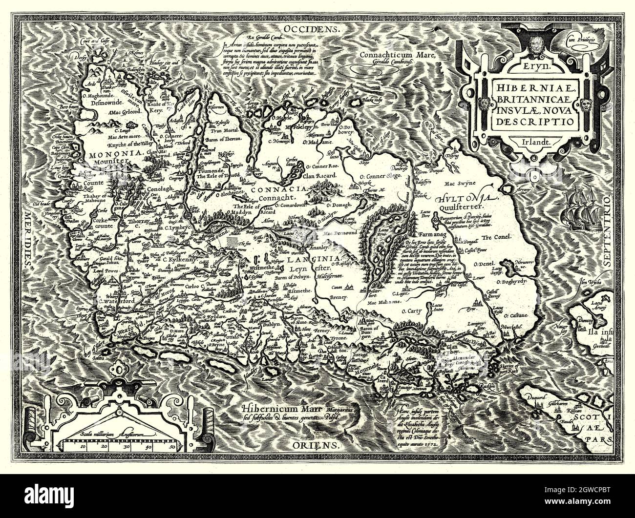 'Hiberniae, Britannicae Insvlae nova descripto.' Translation: a new description of Ireland and the British Island, is in Latin and is lying with its northern coast to the west. The map, was created in 1598 by Abraham Ortelius (1527-1598), a Dutch cartographer, geographer, and cosmographer, conventionally recognized as the creator of the first modern atlas, the Theatrum Orbis Terrarum (Theatre of the World). Stock Photohttps://www.alamy.com/image-license-details/?v=1https://www.alamy.com/hiberniae-britannicae-insvlae-nova-descripto-translation-a-new-description-of-ireland-and-the-british-island-is-in-latin-and-is-lying-with-its-northern-coast-to-the-west-the-map-was-created-in-1598-by-abraham-ortelius-1527-1598-a-dutch-cartographer-geographer-and-cosmographer-conventionally-recognized-as-the-creator-of-the-first-modern-atlas-the-theatrum-orbis-terrarum-theatre-of-the-world-image445906604.html
RM2GWCPBT–'Hiberniae, Britannicae Insvlae nova descripto.' Translation: a new description of Ireland and the British Island, is in Latin and is lying with its northern coast to the west. The map, was created in 1598 by Abraham Ortelius (1527-1598), a Dutch cartographer, geographer, and cosmographer, conventionally recognized as the creator of the first modern atlas, the Theatrum Orbis Terrarum (Theatre of the World).
 Map of Japan by Luís Teixeira. circa 1590. Published on 'Theatre of the Orb of the World' by Abraham Ortelius (1527 - 1598 ) . First edition was published on 1570, Private Collection. Stock Photohttps://www.alamy.com/image-license-details/?v=1https://www.alamy.com/map-of-japan-by-lus-teixeira-circa-1590-published-on-theatre-of-the-orb-of-the-world-by-abraham-ortelius-1527-1598-first-edition-was-published-on-1570-private-collection-image367058945.html
RM2C94YC1–Map of Japan by Luís Teixeira. circa 1590. Published on 'Theatre of the Orb of the World' by Abraham Ortelius (1527 - 1598 ) . First edition was published on 1570, Private Collection.
![Spanish map of America where Cabeza de Vaca wandered. Alvar Nunez Cabeza de Vaca (c. 1488/1490/1492 - c. 1557/1558/1559[1]/1560) was a Spanish explorer of the New World, and one of four survivors of the 1527 Narvaez expedition Stock Photo Spanish map of America where Cabeza de Vaca wandered. Alvar Nunez Cabeza de Vaca (c. 1488/1490/1492 - c. 1557/1558/1559[1]/1560) was a Spanish explorer of the New World, and one of four survivors of the 1527 Narvaez expedition Stock Photo](https://c8.alamy.com/comp/2K08AD8/spanish-map-of-america-where-cabeza-de-vaca-wandered-alvar-nunez-cabeza-de-vaca-c-148814901492-c-155715581559-1-1560-was-a-spanish-explorer-of-the-new-world-and-one-of-four-survivors-of-the-1527-narvaez-expedition-2K08AD8.jpg) Spanish map of America where Cabeza de Vaca wandered. Alvar Nunez Cabeza de Vaca (c. 1488/1490/1492 - c. 1557/1558/1559[1]/1560) was a Spanish explorer of the New World, and one of four survivors of the 1527 Narvaez expedition Stock Photohttps://www.alamy.com/image-license-details/?v=1https://www.alamy.com/spanish-map-of-america-where-cabeza-de-vaca-wandered-alvar-nunez-cabeza-de-vaca-c-148814901492-c-155715581559-1-1560-was-a-spanish-explorer-of-the-new-world-and-one-of-four-survivors-of-the-1527-narvaez-expedition-image482074132.html
Spanish map of America where Cabeza de Vaca wandered. Alvar Nunez Cabeza de Vaca (c. 1488/1490/1492 - c. 1557/1558/1559[1]/1560) was a Spanish explorer of the New World, and one of four survivors of the 1527 Narvaez expedition Stock Photohttps://www.alamy.com/image-license-details/?v=1https://www.alamy.com/spanish-map-of-america-where-cabeza-de-vaca-wandered-alvar-nunez-cabeza-de-vaca-c-148814901492-c-155715581559-1-1560-was-a-spanish-explorer-of-the-new-world-and-one-of-four-survivors-of-the-1527-narvaez-expedition-image482074132.htmlRM2K08AD8–Spanish map of America where Cabeza de Vaca wandered. Alvar Nunez Cabeza de Vaca (c. 1488/1490/1492 - c. 1557/1558/1559[1]/1560) was a Spanish explorer of the New World, and one of four survivors of the 1527 Narvaez expedition
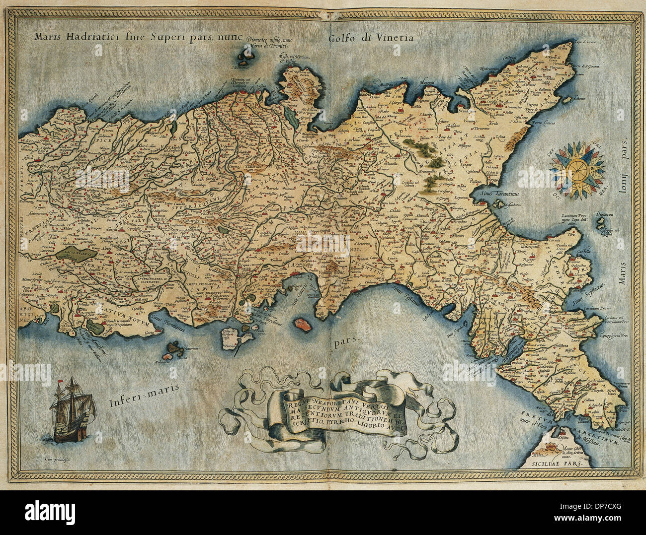 Map of the Kingdom of Naples. Theatrum Orbis Terrarum by Abraham Ortelius (1527-1598). First Edition. Antwerp, 1574. Stock Photohttps://www.alamy.com/image-license-details/?v=1https://www.alamy.com/map-of-the-kingdom-of-naples-theatrum-orbis-terrarum-by-abraham-ortelius-image65317352.html
RMDP7CXG–Map of the Kingdom of Naples. Theatrum Orbis Terrarum by Abraham Ortelius (1527-1598). First Edition. Antwerp, 1574.
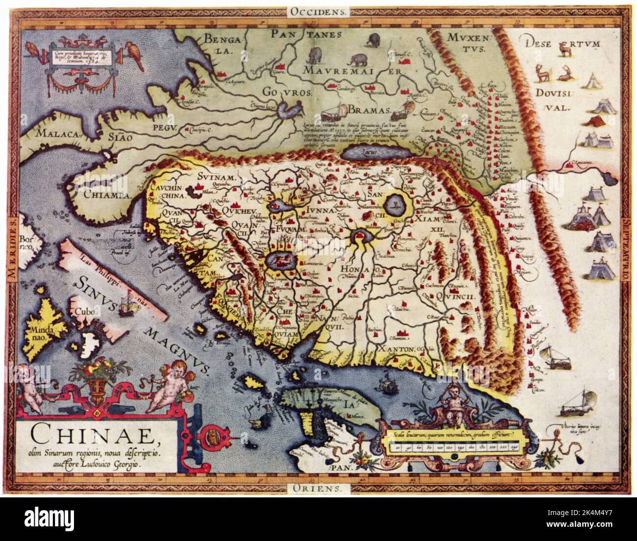 Map of China, 1584. By Luiz Jorge de Barbuda (c1564-c1613). From Theatrum Orbis Terrarum, Published by Abraham Ortelius (1527-1598), 1584. Stock Photohttps://www.alamy.com/image-license-details/?v=1https://www.alamy.com/map-of-china-1584-by-luiz-jorge-de-barbudac1564-c1613-from-theatrum-orbis-terrarum-published-by-abraham-ortelius-1527-1598-1584-image484791867.html
RM2K4M4Y7–Map of China, 1584. By Luiz Jorge de Barbuda (c1564-c1613). From Theatrum Orbis Terrarum, Published by Abraham Ortelius (1527-1598), 1584.
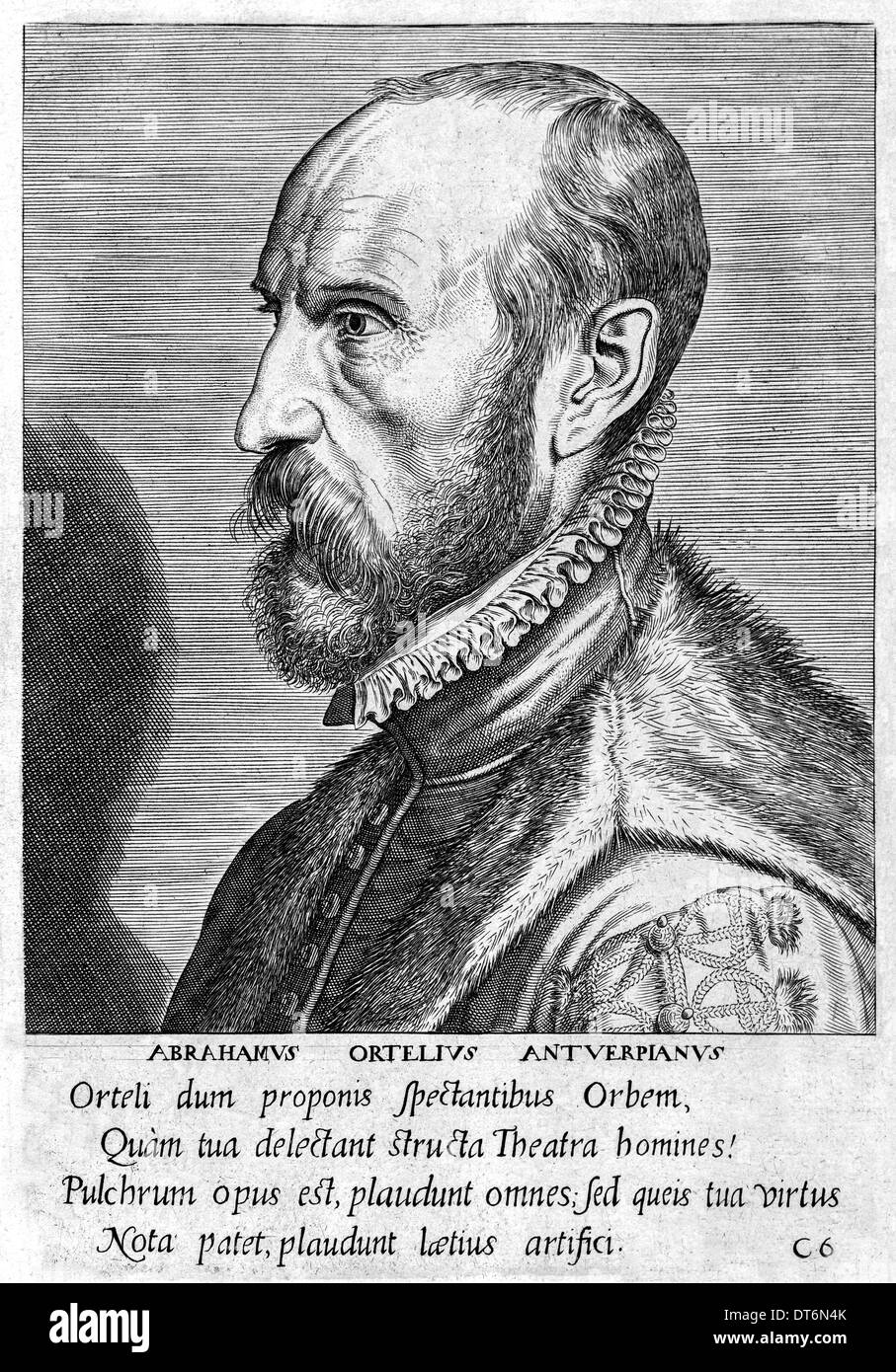 Abraham Ortelius (1527-1598) Flemish cartographer creator of first modern atlas, Theatrum Orbis Terrarum (Theatre of the World). Stock Photohttps://www.alamy.com/image-license-details/?v=1https://www.alamy.com/abraham-ortelius-1527-1598-flemish-cartographer-creator-of-first-modern-image66531155.html
RMDT6N4K–Abraham Ortelius (1527-1598) Flemish cartographer creator of first modern atlas, Theatrum Orbis Terrarum (Theatre of the World).
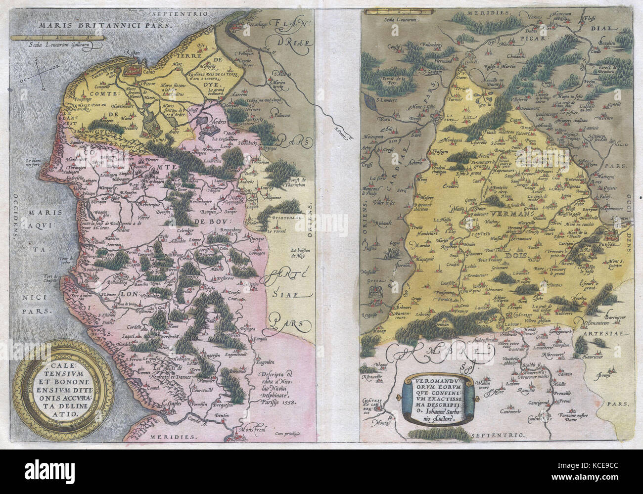 1579, Ortelius Map of Calais and Vermandois, France and Vicinity, Abraham Ortelius, also Orthellius, 1527 – 1598, Flemish Stock Photohttps://www.alamy.com/image-license-details/?v=1https://www.alamy.com/stock-image-1579-ortelius-map-of-calais-and-vermandois-france-and-vicinity-abraham-162583916.html
RMKCE9CC–1579, Ortelius Map of Calais and Vermandois, France and Vicinity, Abraham Ortelius, also Orthellius, 1527 – 1598, Flemish
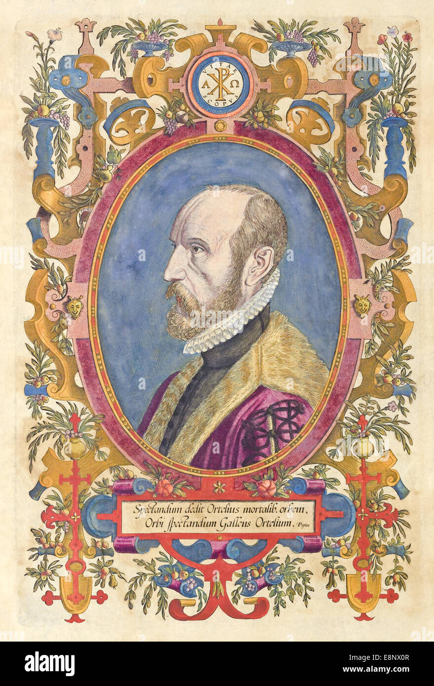 Abraham Ortelius (1527-1598) Flemish cartographer creator of first modern atlas, Theatrum Orbis Terrarum (Theatre of the World). Stock Photohttps://www.alamy.com/image-license-details/?v=1https://www.alamy.com/stock-photo-abraham-ortelius-1527-1598-flemish-cartographer-creator-of-first-modern-74240119.html
RME8NX0R–Abraham Ortelius (1527-1598) Flemish cartographer creator of first modern atlas, Theatrum Orbis Terrarum (Theatre of the World).
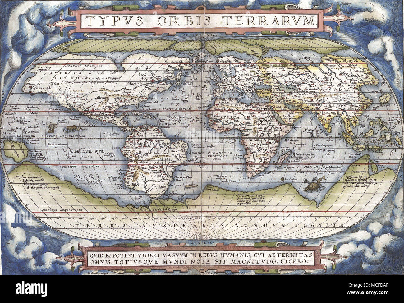 ABRAHAM ORTELIUS (1527-1598) Flemish cartographer. His 1570 Typus Orbis Terrarum Stock Photohttps://www.alamy.com/image-license-details/?v=1https://www.alamy.com/abraham-ortelius-1527-1598-flemish-cartographer-his-1570-typus-orbis-terrarum-image179819326.html
RMMCFDAP–ABRAHAM ORTELIUS (1527-1598) Flemish cartographer. His 1570 Typus Orbis Terrarum
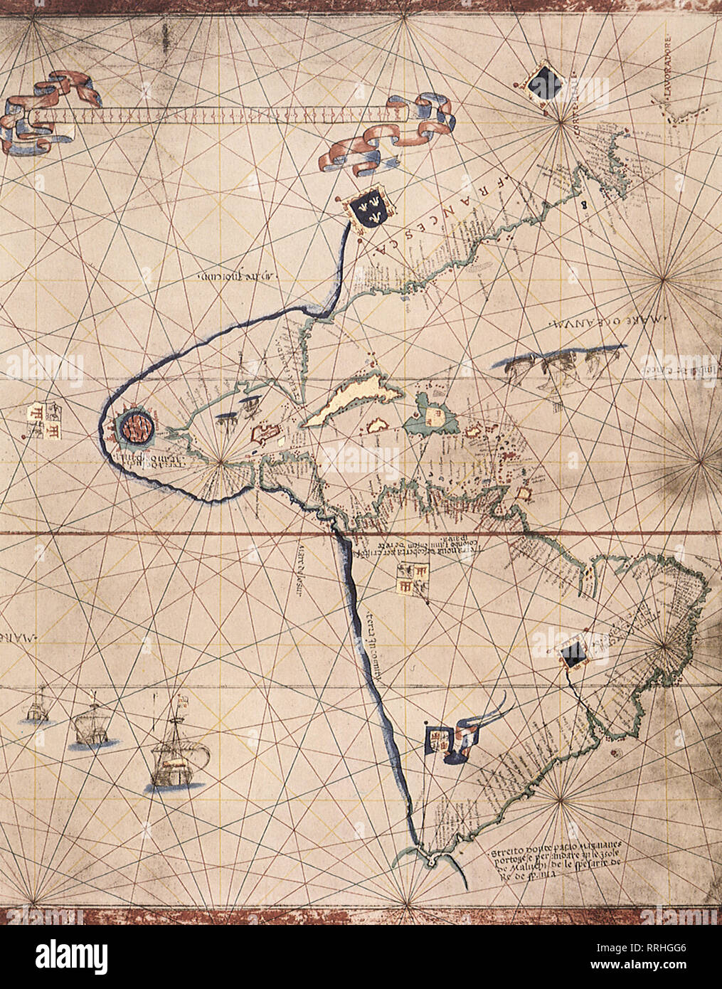 Partial Map of the World 1527. Stock Photohttps://www.alamy.com/image-license-details/?v=1https://www.alamy.com/partial-map-of-the-world-1527-image238258054.html
RMRRHGG6–Partial Map of the World 1527.
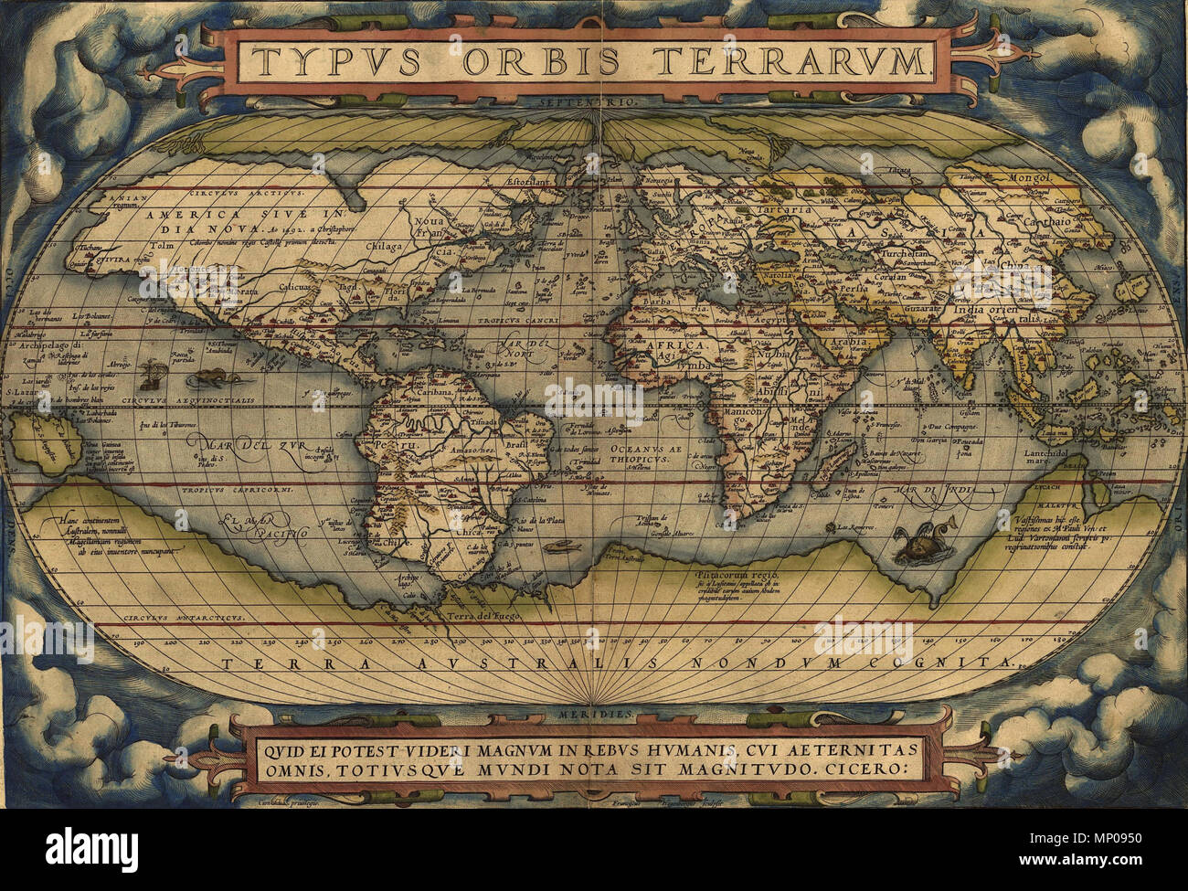 . English: Ortelius World Map Typvs Orbis Terrarvm, 1570. 1570. Abraham Ortelius (1527–1598) Alternative names Ortels, Oertel, Orthellius, Wortels Description Belgian-Flemish cartographer and historian Date of birth/death 14 April 1527 28 June 1598 Location of birth/death Antwerp Antwerp Work location Antwerp Authority control : Q232916 VIAF: 32104723 ISNI: 0000 0001 0856 4124 ULAN: 500011462 LCCN: n50002381 NLA: 35401660 WorldCat 947 OrteliusWorldMap1570 Stock Photohttps://www.alamy.com/image-license-details/?v=1https://www.alamy.com/english-ortelius-world-map-typvs-orbis-terrarvm-1570-1570-abraham-ortelius-15271598-alternative-names-ortels-oertel-orthellius-wortels-description-belgian-flemish-cartographer-and-historian-date-of-birthdeath-14-april-1527-28-june-1598-location-of-birthdeath-antwerp-antwerp-work-location-antwerp-authority-control-q232916-viaf32104723-isni0000-0001-0856-4124-ulan500011462-lccnn50002381-nla35401660-worldcat-947-orteliusworldmap1570-image185633308.html
RMMP0950–. English: Ortelius World Map Typvs Orbis Terrarvm, 1570. 1570. Abraham Ortelius (1527–1598) Alternative names Ortels, Oertel, Orthellius, Wortels Description Belgian-Flemish cartographer and historian Date of birth/death 14 April 1527 28 June 1598 Location of birth/death Antwerp Antwerp Work location Antwerp Authority control : Q232916 VIAF: 32104723 ISNI: 0000 0001 0856 4124 ULAN: 500011462 LCCN: n50002381 NLA: 35401660 WorldCat 947 OrteliusWorldMap1570
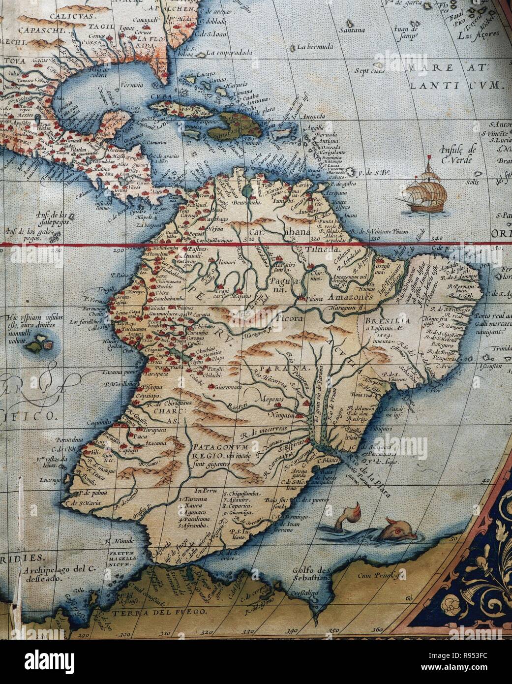 Map of Central and South America. Theatrum Orbis Terrarum by Abraham Ortelius (1527-1598). First Edition. Antwerp, 1574. Stock Photohttps://www.alamy.com/image-license-details/?v=1https://www.alamy.com/map-of-central-and-south-america-theatrum-orbis-terrarum-by-abraham-ortelius-1527-1598-first-edition-antwerp-1574-image229379232.html
RMR953FC–Map of Central and South America. Theatrum Orbis Terrarum by Abraham Ortelius (1527-1598). First Edition. Antwerp, 1574.
 N/A. World map; title: Typus Orbis Terrarum; size: 340 x 494 mm . 1572. Abraham Ortelius (1527–1598) Alternative names Ortels, Oertel, Orthellius, Wortels Description Belgian-Flemish cartographer and historian Date of birth/death 14 April 1527 28 June 1598 Location of birth/death Antwerp Antwerp Work location Antwerp Authority control : Q232916 VIAF:32104723 ISNI:0000 0001 0856 4124 ULAN:500011462 LCCN:n50002381 NLA:35401660 WorldCat 17 1572 Typus Orbis Terrarum Ortelius Stock Photohttps://www.alamy.com/image-license-details/?v=1https://www.alamy.com/na-world-map-title-typus-orbis-terrarum-size-340-x-494-mm-1572-abraham-ortelius-15271598-alternative-names-ortels-oertel-orthellius-wortels-description-belgian-flemish-cartographer-and-historian-date-of-birthdeath-14-april-1527-28-june-1598-location-of-birthdeath-antwerp-antwerp-work-location-antwerp-authority-control-q232916-viaf32104723-isni0000-0001-0856-4124-ulan500011462-lccnn50002381-nla35401660-worldcat-17-1572-typus-orbis-terrarum-ortelius-image210107298.html
RMP5R602–N/A. World map; title: Typus Orbis Terrarum; size: 340 x 494 mm . 1572. Abraham Ortelius (1527–1598) Alternative names Ortels, Oertel, Orthellius, Wortels Description Belgian-Flemish cartographer and historian Date of birth/death 14 April 1527 28 June 1598 Location of birth/death Antwerp Antwerp Work location Antwerp Authority control : Q232916 VIAF:32104723 ISNI:0000 0001 0856 4124 ULAN:500011462 LCCN:n50002381 NLA:35401660 WorldCat 17 1572 Typus Orbis Terrarum Ortelius
RF2J62EW0–WORLD-MAP OF VESCONTE DI MAGGIOLO, Genoa 1527 from The iconography of Manhattan Island, 1498-1909 compiled from original sources and illustrated by photo-intaglio reproductions of important maps, plans, views, and documents in public and private collections - Volume 2 by Stokes, I. N. Phelps (Isaac Newton Phelps), 1867-1944 Publisher New York : Robert H. Dodd 1915. Including Cartography: an essay on the development of knowledge regarding the geography of the east coast of North America; Manhattan Island and its environs on early maps and charts / by F.C. Wieder and I.N. Phelps Stokes. The Man
 N/A. World map; title:Typus Orbis Terrarum; size: 340 x 494 mm . 1570. Abraham Ortelius (1527–1598) Alternative names Ortels, Oertel, Orthellius, Wortels Description Belgian-Flemish cartographer and historian Date of birth/death 14 April 1527 28 June 1598 Location of birth/death Antwerp Antwerp Work location Antwerp Authority control : Q232916 VIAF:32104723 ISNI:0000 0001 0856 4124 ULAN:500011462 LCCN:n50002381 NLA:35401660 WorldCat 17 1570 Typus Ortelius mr Stock Photohttps://www.alamy.com/image-license-details/?v=1https://www.alamy.com/na-world-map-titletypus-orbis-terrarum-size-340-x-494-mm-1570-abraham-ortelius-15271598-alternative-names-ortels-oertel-orthellius-wortels-description-belgian-flemish-cartographer-and-historian-date-of-birthdeath-14-april-1527-28-june-1598-location-of-birthdeath-antwerp-antwerp-work-location-antwerp-authority-control-q232916-viaf32104723-isni0000-0001-0856-4124-ulan500011462-lccnn50002381-nla35401660-worldcat-17-1570-typus-ortelius-mr-image209987802.html
RMP5HNGA–N/A. World map; title:Typus Orbis Terrarum; size: 340 x 494 mm . 1570. Abraham Ortelius (1527–1598) Alternative names Ortels, Oertel, Orthellius, Wortels Description Belgian-Flemish cartographer and historian Date of birth/death 14 April 1527 28 June 1598 Location of birth/death Antwerp Antwerp Work location Antwerp Authority control : Q232916 VIAF:32104723 ISNI:0000 0001 0856 4124 ULAN:500011462 LCCN:n50002381 NLA:35401660 WorldCat 17 1570 Typus Ortelius mr
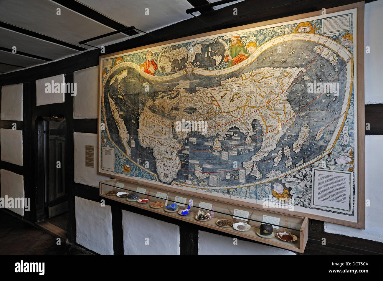 World map of 1527, with various minerals for the manufacture of paints below, Albrecht Duerer House, Nuremberg, Middle Franconia Stock Photohttps://www.alamy.com/image-license-details/?v=1https://www.alamy.com/world-map-of-1527-with-various-minerals-for-the-manufacture-of-paints-image61996714.html
RMDGT5CA–World map of 1527, with various minerals for the manufacture of paints below, Albrecht Duerer House, Nuremberg, Middle Franconia
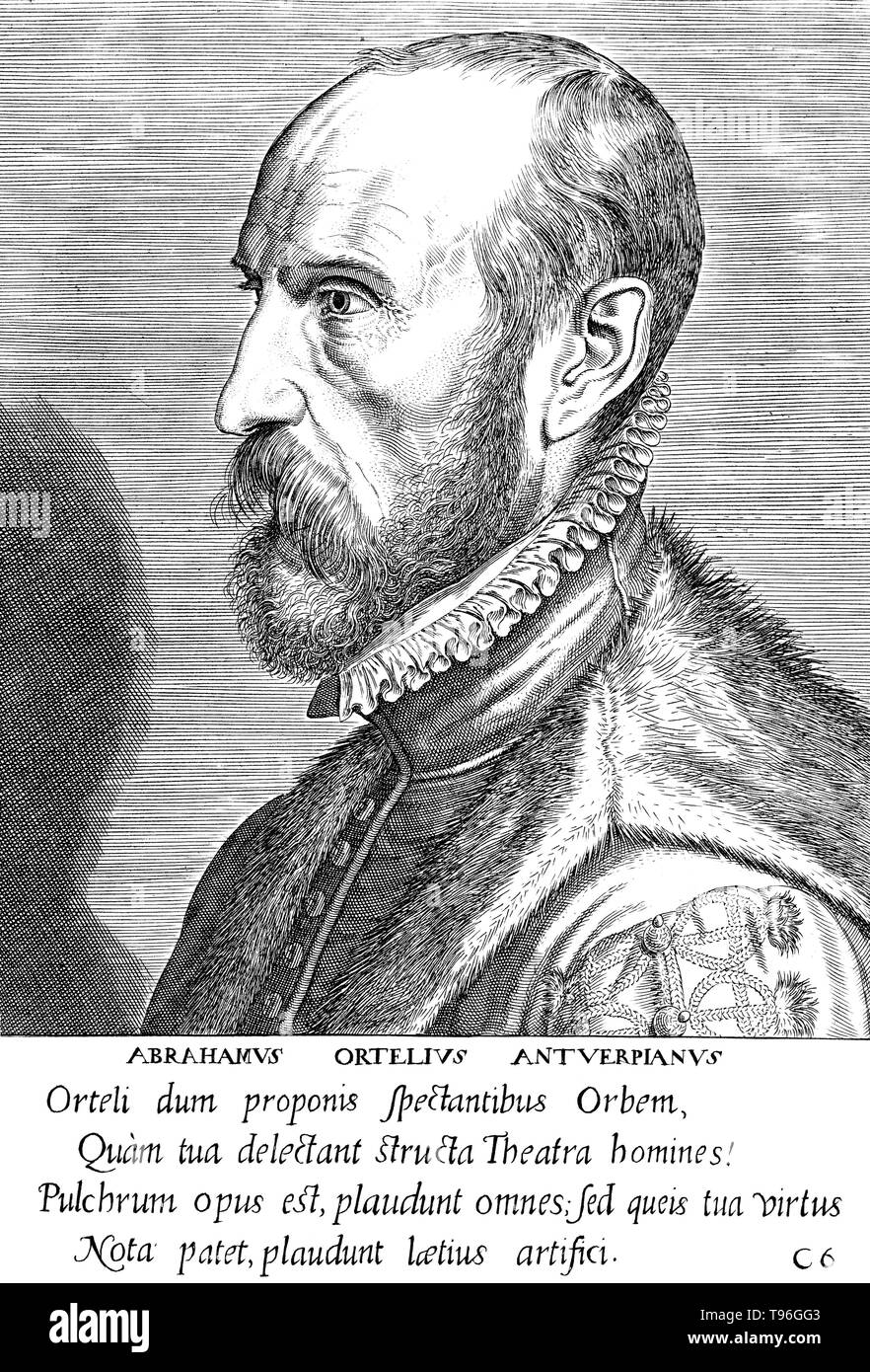 Abraham Ortelius (April 14, 1527 - June 28, 1598) was a Flemish cartographer and geographer. Beginning as a map-engraver, he entered the Antwerp Guild of Saint Luke as an illuminator of maps. He met Gerardus Mercator in 1554, who influenced his decision to become a scientific geographer. In 1564 he published his first map, Typus Orbis Terrarum, an eight-leaved wall map of the world. In 1578 he laid the basis of a critical treatment of ancient geography by his Synonymia geographica. Stock Photohttps://www.alamy.com/image-license-details/?v=1https://www.alamy.com/abraham-ortelius-april-14-1527-june-28-1598-was-a-flemish-cartographer-and-geographer-beginning-as-a-map-engraver-he-entered-the-antwerp-guild-of-saint-luke-as-an-illuminator-of-maps-he-met-gerardus-mercator-in-1554-who-influenced-his-decision-to-become-a-scientific-geographer-in-1564-he-published-his-first-map-typus-orbis-terrarum-an-eight-leaved-wall-map-of-the-world-in-1578-he-laid-the-basis-of-a-critical-treatment-of-ancient-geography-by-his-synonymia-geographica-image246621763.html
RMT96GG3–Abraham Ortelius (April 14, 1527 - June 28, 1598) was a Flemish cartographer and geographer. Beginning as a map-engraver, he entered the Antwerp Guild of Saint Luke as an illuminator of maps. He met Gerardus Mercator in 1554, who influenced his decision to become a scientific geographer. In 1564 he published his first map, Typus Orbis Terrarum, an eight-leaved wall map of the world. In 1578 he laid the basis of a critical treatment of ancient geography by his Synonymia geographica.
 Abraham Ortelius (1527-1598) was a Brabantian cartographer and geographer, conventially known as the creator of the first modern atlas, the 'Theatrum Orbis Terrarum' (Theatre of the World). He was one of the most notable figures in the Dutch school of cartography during their golden age (roughly 1570s-1670s), his publishing of his atlas in 1570 being seen as its official beginning. Stock Photohttps://www.alamy.com/image-license-details/?v=1https://www.alamy.com/abraham-ortelius-1527-1598-was-a-brabantian-cartographer-and-geographer-conventially-known-as-the-creator-of-the-first-modern-atlas-the-theatrum-orbis-terrarum-theatre-of-the-world-he-was-one-of-the-most-notable-figures-in-the-dutch-school-of-cartography-during-their-golden-age-roughly-1570s-1670s-his-publishing-of-his-atlas-in-1570-being-seen-as-its-official-beginning-image344281382.html
RM2B03ABJ–Abraham Ortelius (1527-1598) was a Brabantian cartographer and geographer, conventially known as the creator of the first modern atlas, the 'Theatrum Orbis Terrarum' (Theatre of the World). He was one of the most notable figures in the Dutch school of cartography during their golden age (roughly 1570s-1670s), his publishing of his atlas in 1570 being seen as its official beginning.
![Vesconte de Maiollo conposuy hanc cartan in Janua anno dñy. 1587. die xx. Decenbris. Facsimile reproduction of Maggiolo's 1527 manuscript map of the world. The original manuscript map, held by the Biblioteca Ambrosiana in Milan, was destroyed by aerial bombing in 1944. Includes illustrations of ships, animals, flags, cities, people and tents. Date in inscription originally read 1527 but was altered to 1587. Reproduction of original: [1527] 1 manuscript map on 2 sheets : on vellum, hand colored ; 60 x 170 cm in Biblioteca Ambrosiana, Milan, Italy... Vesconte de Maiollo conposuy hanc cartan in Stock Photo Vesconte de Maiollo conposuy hanc cartan in Janua anno dñy. 1587. die xx. Decenbris. Facsimile reproduction of Maggiolo's 1527 manuscript map of the world. The original manuscript map, held by the Biblioteca Ambrosiana in Milan, was destroyed by aerial bombing in 1944. Includes illustrations of ships, animals, flags, cities, people and tents. Date in inscription originally read 1527 but was altered to 1587. Reproduction of original: [1527] 1 manuscript map on 2 sheets : on vellum, hand colored ; 60 x 170 cm in Biblioteca Ambrosiana, Milan, Italy... Vesconte de Maiollo conposuy hanc cartan in Stock Photo](https://c8.alamy.com/comp/2M5X02F/vesconte-de-maiollo-conposuy-hanc-cartan-in-janua-anno-dny-1587-die-xx-decenbris-facsimile-reproduction-of-maggiolos-1527-manuscript-map-of-the-world-the-original-manuscript-map-held-by-the-biblioteca-ambrosiana-in-milan-was-destroyed-by-aerial-bombing-in-1944-includes-illustrations-of-ships-animals-flags-cities-people-and-tents-date-in-inscription-originally-read-1527-but-was-altered-to-1587-reproduction-of-original-1527-1-manuscript-map-on-2-sheets-on-vellum-hand-colored-60-x-170-cm-in-biblioteca-ambrosiana-milan-italy-vesconte-de-maiollo-conposuy-hanc-cartan-in-2M5X02F.jpg) Vesconte de Maiollo conposuy hanc cartan in Janua anno dñy. 1587. die xx. Decenbris. Facsimile reproduction of Maggiolo's 1527 manuscript map of the world. The original manuscript map, held by the Biblioteca Ambrosiana in Milan, was destroyed by aerial bombing in 1944. Includes illustrations of ships, animals, flags, cities, people and tents. Date in inscription originally read 1527 but was altered to 1587. Reproduction of original: [1527] 1 manuscript map on 2 sheets : on vellum, hand colored ; 60 x 170 cm in Biblioteca Ambrosiana, Milan, Italy... Vesconte de Maiollo conposuy hanc cartan in Stock Photohttps://www.alamy.com/image-license-details/?v=1https://www.alamy.com/vesconte-de-maiollo-conposuy-hanc-cartan-in-janua-anno-dny-1587-die-xx-decenbris-facsimile-reproduction-of-maggiolos-1527-manuscript-map-of-the-world-the-original-manuscript-map-held-by-the-biblioteca-ambrosiana-in-milan-was-destroyed-by-aerial-bombing-in-1944-includes-illustrations-of-ships-animals-flags-cities-people-and-tents-date-in-inscription-originally-read-1527-but-was-altered-to-1587-reproduction-of-original-1527-1-manuscript-map-on-2-sheets-on-vellum-hand-colored-60-x-170-cm-in-biblioteca-ambrosiana-milan-italy-vesconte-de-maiollo-conposuy-hanc-cartan-in-image502744775.html
Vesconte de Maiollo conposuy hanc cartan in Janua anno dñy. 1587. die xx. Decenbris. Facsimile reproduction of Maggiolo's 1527 manuscript map of the world. The original manuscript map, held by the Biblioteca Ambrosiana in Milan, was destroyed by aerial bombing in 1944. Includes illustrations of ships, animals, flags, cities, people and tents. Date in inscription originally read 1527 but was altered to 1587. Reproduction of original: [1527] 1 manuscript map on 2 sheets : on vellum, hand colored ; 60 x 170 cm in Biblioteca Ambrosiana, Milan, Italy... Vesconte de Maiollo conposuy hanc cartan in Stock Photohttps://www.alamy.com/image-license-details/?v=1https://www.alamy.com/vesconte-de-maiollo-conposuy-hanc-cartan-in-janua-anno-dny-1587-die-xx-decenbris-facsimile-reproduction-of-maggiolos-1527-manuscript-map-of-the-world-the-original-manuscript-map-held-by-the-biblioteca-ambrosiana-in-milan-was-destroyed-by-aerial-bombing-in-1944-includes-illustrations-of-ships-animals-flags-cities-people-and-tents-date-in-inscription-originally-read-1527-but-was-altered-to-1587-reproduction-of-original-1527-1-manuscript-map-on-2-sheets-on-vellum-hand-colored-60-x-170-cm-in-biblioteca-ambrosiana-milan-italy-vesconte-de-maiollo-conposuy-hanc-cartan-in-image502744775.htmlRM2M5X02F–Vesconte de Maiollo conposuy hanc cartan in Janua anno dñy. 1587. die xx. Decenbris. Facsimile reproduction of Maggiolo's 1527 manuscript map of the world. The original manuscript map, held by the Biblioteca Ambrosiana in Milan, was destroyed by aerial bombing in 1944. Includes illustrations of ships, animals, flags, cities, people and tents. Date in inscription originally read 1527 but was altered to 1587. Reproduction of original: [1527] 1 manuscript map on 2 sheets : on vellum, hand colored ; 60 x 170 cm in Biblioteca Ambrosiana, Milan, Italy... Vesconte de Maiollo conposuy hanc cartan in
![Orontius Finaeus, 1531, reprinted 1889. Top: 'Terra Australis' on the left. Europe, Russia, the North Pole, China and northern Africa on the right. Bottom: parts of recently-invaded north and south America; Europe, Africa and Asia. 'This is the forme of a Mappe sent 1527 from Sivill [Seville] in Spayne by maister Robert Thorne marchaunt, to Doctor Ley Embassadour for king Henry the 8. to Charles the Emperour, And although the same in this present time may seeme rude, yet I have set it out, because his booke could not well be understood without the same. The imperfection of which Mappe may be e Stock Photo Orontius Finaeus, 1531, reprinted 1889. Top: 'Terra Australis' on the left. Europe, Russia, the North Pole, China and northern Africa on the right. Bottom: parts of recently-invaded north and south America; Europe, Africa and Asia. 'This is the forme of a Mappe sent 1527 from Sivill [Seville] in Spayne by maister Robert Thorne marchaunt, to Doctor Ley Embassadour for king Henry the 8. to Charles the Emperour, And although the same in this present time may seeme rude, yet I have set it out, because his booke could not well be understood without the same. The imperfection of which Mappe may be e Stock Photo](https://c8.alamy.com/comp/2MBBFK1/orontius-finaeus-1531-reprinted-1889-top-terra-australis-on-the-left-europe-russia-the-north-pole-china-and-northern-africa-on-the-right-bottom-parts-of-recently-invaded-north-and-south-america-europe-africa-and-asia-this-is-the-forme-of-a-mappe-sent-1527-from-sivill-seville-in-spayne-by-maister-robert-thorne-marchaunt-to-doctor-ley-embassadour-for-king-henry-the-8-to-charles-the-emperour-and-although-the-same-in-this-present-time-may-seeme-rude-yet-i-have-set-it-out-because-his-booke-could-not-well-be-understood-without-the-same-the-imperfection-of-which-mappe-may-be-e-2MBBFK1.jpg) Orontius Finaeus, 1531, reprinted 1889. Top: 'Terra Australis' on the left. Europe, Russia, the North Pole, China and northern Africa on the right. Bottom: parts of recently-invaded north and south America; Europe, Africa and Asia. 'This is the forme of a Mappe sent 1527 from Sivill [Seville] in Spayne by maister Robert Thorne marchaunt, to Doctor Ley Embassadour for king Henry the 8. to Charles the Emperour, And although the same in this present time may seeme rude, yet I have set it out, because his booke could not well be understood without the same. The imperfection of which Mappe may be e Stock Photohttps://www.alamy.com/image-license-details/?v=1https://www.alamy.com/orontius-finaeus-1531-reprinted-1889-top-terra-australis-on-the-left-europe-russia-the-north-pole-china-and-northern-africa-on-the-right-bottom-parts-of-recently-invaded-north-and-south-america-europe-africa-and-asia-this-is-the-forme-of-a-mappe-sent-1527-from-sivill-seville-in-spayne-by-maister-robert-thorne-marchaunt-to-doctor-ley-embassadour-for-king-henry-the-8-to-charles-the-emperour-and-although-the-same-in-this-present-time-may-seeme-rude-yet-i-have-set-it-out-because-his-booke-could-not-well-be-understood-without-the-same-the-imperfection-of-which-mappe-may-be-e-image506115653.html
Orontius Finaeus, 1531, reprinted 1889. Top: 'Terra Australis' on the left. Europe, Russia, the North Pole, China and northern Africa on the right. Bottom: parts of recently-invaded north and south America; Europe, Africa and Asia. 'This is the forme of a Mappe sent 1527 from Sivill [Seville] in Spayne by maister Robert Thorne marchaunt, to Doctor Ley Embassadour for king Henry the 8. to Charles the Emperour, And although the same in this present time may seeme rude, yet I have set it out, because his booke could not well be understood without the same. The imperfection of which Mappe may be e Stock Photohttps://www.alamy.com/image-license-details/?v=1https://www.alamy.com/orontius-finaeus-1531-reprinted-1889-top-terra-australis-on-the-left-europe-russia-the-north-pole-china-and-northern-africa-on-the-right-bottom-parts-of-recently-invaded-north-and-south-america-europe-africa-and-asia-this-is-the-forme-of-a-mappe-sent-1527-from-sivill-seville-in-spayne-by-maister-robert-thorne-marchaunt-to-doctor-ley-embassadour-for-king-henry-the-8-to-charles-the-emperour-and-although-the-same-in-this-present-time-may-seeme-rude-yet-i-have-set-it-out-because-his-booke-could-not-well-be-understood-without-the-same-the-imperfection-of-which-mappe-may-be-e-image506115653.htmlRM2MBBFK1–Orontius Finaeus, 1531, reprinted 1889. Top: 'Terra Australis' on the left. Europe, Russia, the North Pole, China and northern Africa on the right. Bottom: parts of recently-invaded north and south America; Europe, Africa and Asia. 'This is the forme of a Mappe sent 1527 from Sivill [Seville] in Spayne by maister Robert Thorne marchaunt, to Doctor Ley Embassadour for king Henry the 8. to Charles the Emperour, And although the same in this present time may seeme rude, yet I have set it out, because his booke could not well be understood without the same. The imperfection of which Mappe may be e
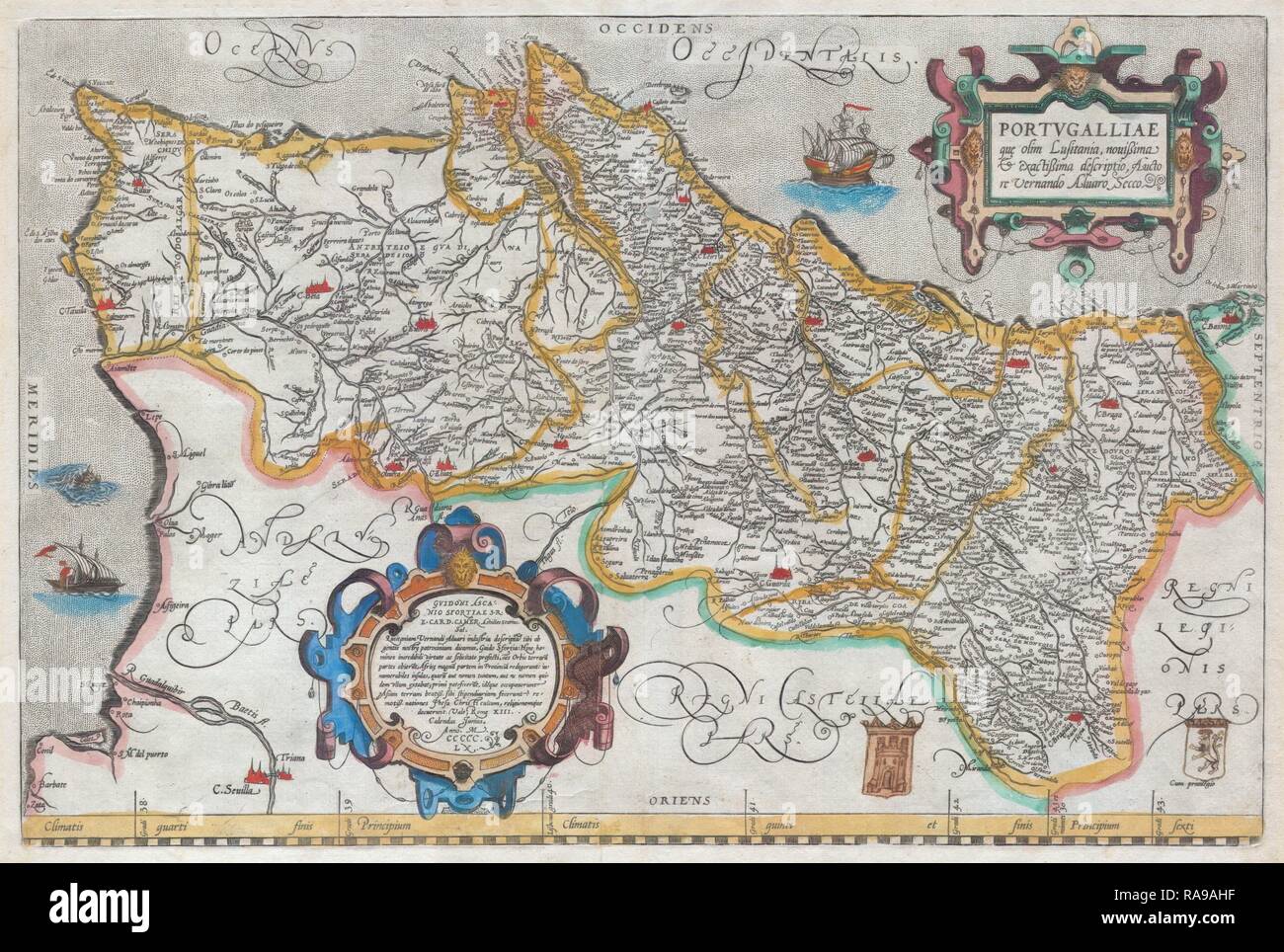 1579, Ortelius Map of Portugal, Porvgalliae, Abraham Ortelius, also Orthellius, 1527 – 1598, Flemish, Netherlandish reimagined Stock Photohttps://www.alamy.com/image-license-details/?v=1https://www.alamy.com/1579-ortelius-map-of-portugal-porvgalliae-abraham-ortelius-also-orthellius-1527-1598-flemish-netherlandish-reimagined-image230087243.html
RFRA9AHF–1579, Ortelius Map of Portugal, Porvgalliae, Abraham Ortelius, also Orthellius, 1527 – 1598, Flemish, Netherlandish reimagined
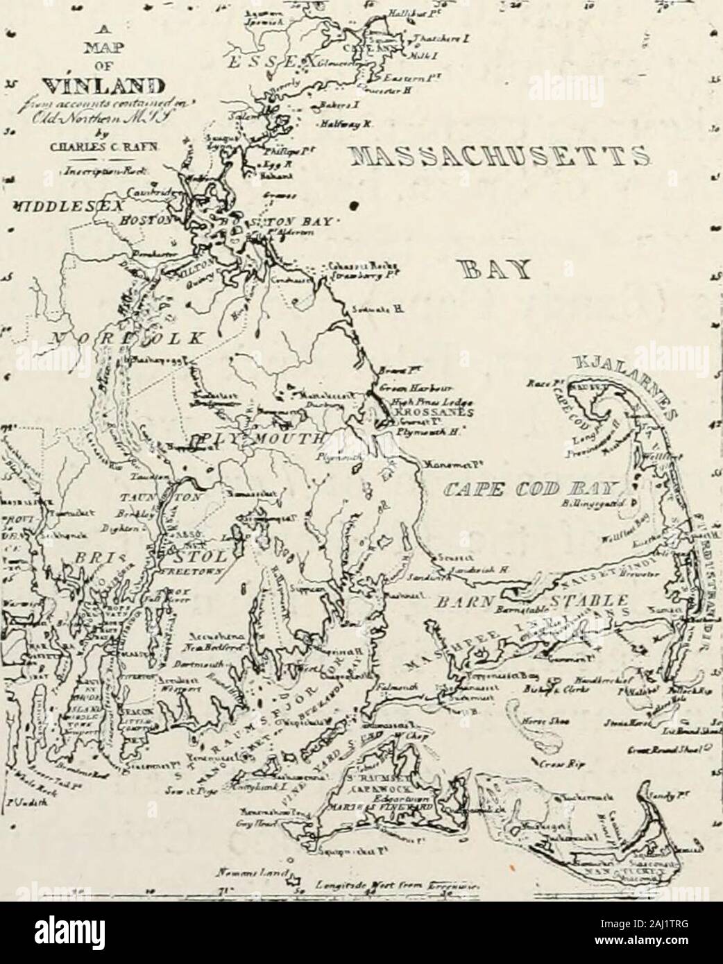 History of the Pilgrims and Puritans, their ancestry and descendants; basis of Americanization . Ptolemy. Honestas he was, he robbedeven his enemies, theSpaniards, of no glory,by inscribing on his newstyled map on Merca-tors Projection thatSpanish name, Cabo deArenas (Sandy Cape),appropriately given byRibero in 1527. Fewmen have done more forthe science of navigationand geography thanMercator. In 1570, SigurdStephanus, an Icelander,made a chart and calledCape Cod Vineland, including territory east and west,following in the wake of Trycher, who discovered thatprimal grape-arbor in the New World Stock Photohttps://www.alamy.com/image-license-details/?v=1https://www.alamy.com/history-of-the-pilgrims-and-puritans-their-ancestry-and-descendants-basis-of-americanization-ptolemy-honestas-he-was-he-robbedeven-his-enemies-thespaniards-of-no-gloryby-inscribing-on-his-newstyled-map-on-merca-tors-projection-thatspanish-name-cabo-dearenas-sandy-capeappropriately-given-byribero-in-1527-fewmen-have-done-more-forthe-science-of-navigationand-geography-thanmercator-in-1570-sigurdstephanus-an-icelandermade-a-chart-and-calledcape-cod-vineland-including-territory-east-and-westfollowing-in-the-wake-of-trycher-who-discovered-thatprimal-grape-arbor-in-the-new-world-image338102228.html
RM2AJ1TRG–History of the Pilgrims and Puritans, their ancestry and descendants; basis of Americanization . Ptolemy. Honestas he was, he robbedeven his enemies, theSpaniards, of no glory,by inscribing on his newstyled map on Merca-tors Projection thatSpanish name, Cabo deArenas (Sandy Cape),appropriately given byRibero in 1527. Fewmen have done more forthe science of navigationand geography thanMercator. In 1570, SigurdStephanus, an Icelander,made a chart and calledCape Cod Vineland, including territory east and west,following in the wake of Trycher, who discovered thatprimal grape-arbor in the New World
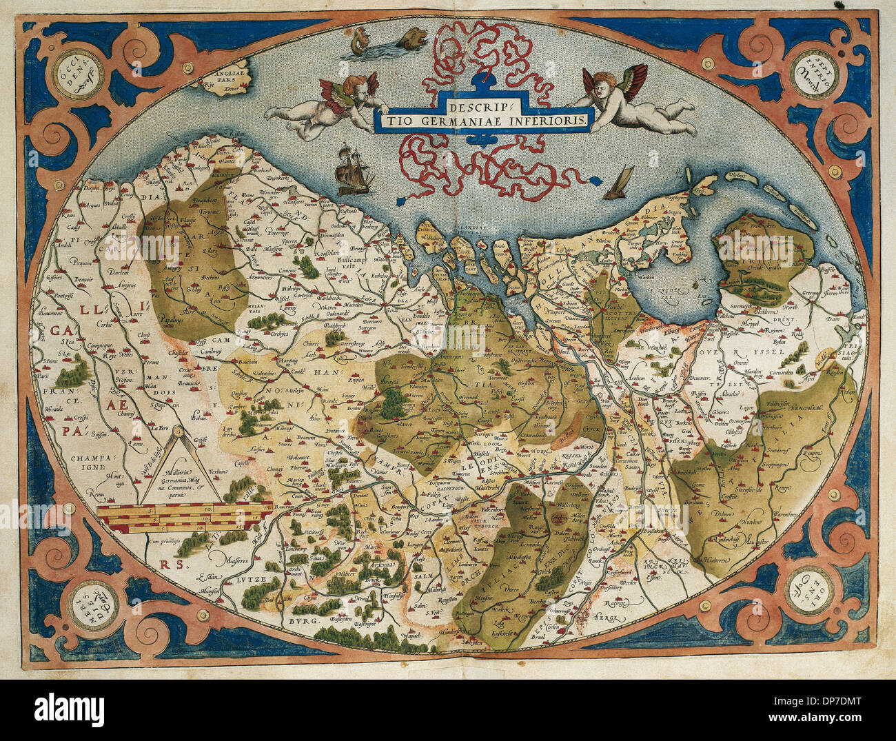 Map of Germany and current Netherlands. Theatrum Orbis Terrarum by Abraham Ortelius (1527-1598). First Edition. Antwerp, 1574. Stock Photohttps://www.alamy.com/image-license-details/?v=1https://www.alamy.com/map-of-germany-and-current-netherlands-theatrum-orbis-terrarum-by-image65317976.html
RMDP7DMT–Map of Germany and current Netherlands. Theatrum Orbis Terrarum by Abraham Ortelius (1527-1598). First Edition. Antwerp, 1574.
 1579, Ortelius Map of Portugal, Porvgalliae, Abraham Ortelius, also Orthellius, 1527 – 1598, Flemish, Netherlandish cartographer Stock Photohttps://www.alamy.com/image-license-details/?v=1https://www.alamy.com/stock-image-1579-ortelius-map-of-portugal-porvgalliae-abraham-ortelius-also-orthellius-162583917.html
RMKCE9CD–1579, Ortelius Map of Portugal, Porvgalliae, Abraham Ortelius, also Orthellius, 1527 – 1598, Flemish, Netherlandish cartographer
 'Abraham Ortelius (Abraham Ortels) (April 14, 1527 ? June 28, 1598) was a Flemish cartographer and geographer, generally recognized as the creator of the first modern atlas, the Theatrum Orbis Terrarum (Theatre of the World). He is also believed to be the first person to imagine that the continents were joined together before drifting to their present positions. In 1564 he completed a 'mappemonde', eight-leaved map of the world, which afterwards appeared in reduced form in the Theatrum. The only extant copy of this great map is in the library of the University of Basel. On May 20, 1570, Gilles Stock Photohttps://www.alamy.com/image-license-details/?v=1https://www.alamy.com/abraham-ortelius-abraham-ortels-april-14-1527-june-28-1598-was-a-flemish-cartographer-and-geographer-generally-recognized-as-the-creator-of-the-first-modern-atlas-the-theatrum-orbis-terrarum-theatre-of-the-world-he-is-also-believed-to-be-the-first-person-to-imagine-that-the-continents-were-joined-together-before-drifting-to-their-present-positions-in-1564-he-completed-a-mappemonde-eight-leaved-map-of-the-world-which-afterwards-appeared-in-reduced-form-in-the-theatrum-the-only-extant-copy-of-this-great-map-is-in-the-library-of-the-university-of-basel-on-may-20-1570-gilles-image385492641.html
RM2DB4KP9–'Abraham Ortelius (Abraham Ortels) (April 14, 1527 ? June 28, 1598) was a Flemish cartographer and geographer, generally recognized as the creator of the first modern atlas, the Theatrum Orbis Terrarum (Theatre of the World). He is also believed to be the first person to imagine that the continents were joined together before drifting to their present positions. In 1564 he completed a 'mappemonde', eight-leaved map of the world, which afterwards appeared in reduced form in the Theatrum. The only extant copy of this great map is in the library of the University of Basel. On May 20, 1570, Gilles
 Map of the Kingdom of Naples. Theatrum Orbis Terrarum by Abraham Ortelius (1527-1598). First Edition. Antwerp, 1574. Library of Catalonia. Barcelona. Spain. Stock Photohttps://www.alamy.com/image-license-details/?v=1https://www.alamy.com/map-of-the-kingdom-of-naples-theatrum-orbis-terrarum-by-abraham-ortelius-1527-1598-first-edition-antwerp-1574-library-of-catalonia-barcelona-spain-image220196270.html
RMPP6PGE–Map of the Kingdom of Naples. Theatrum Orbis Terrarum by Abraham Ortelius (1527-1598). First Edition. Antwerp, 1574. Library of Catalonia. Barcelona. Spain.
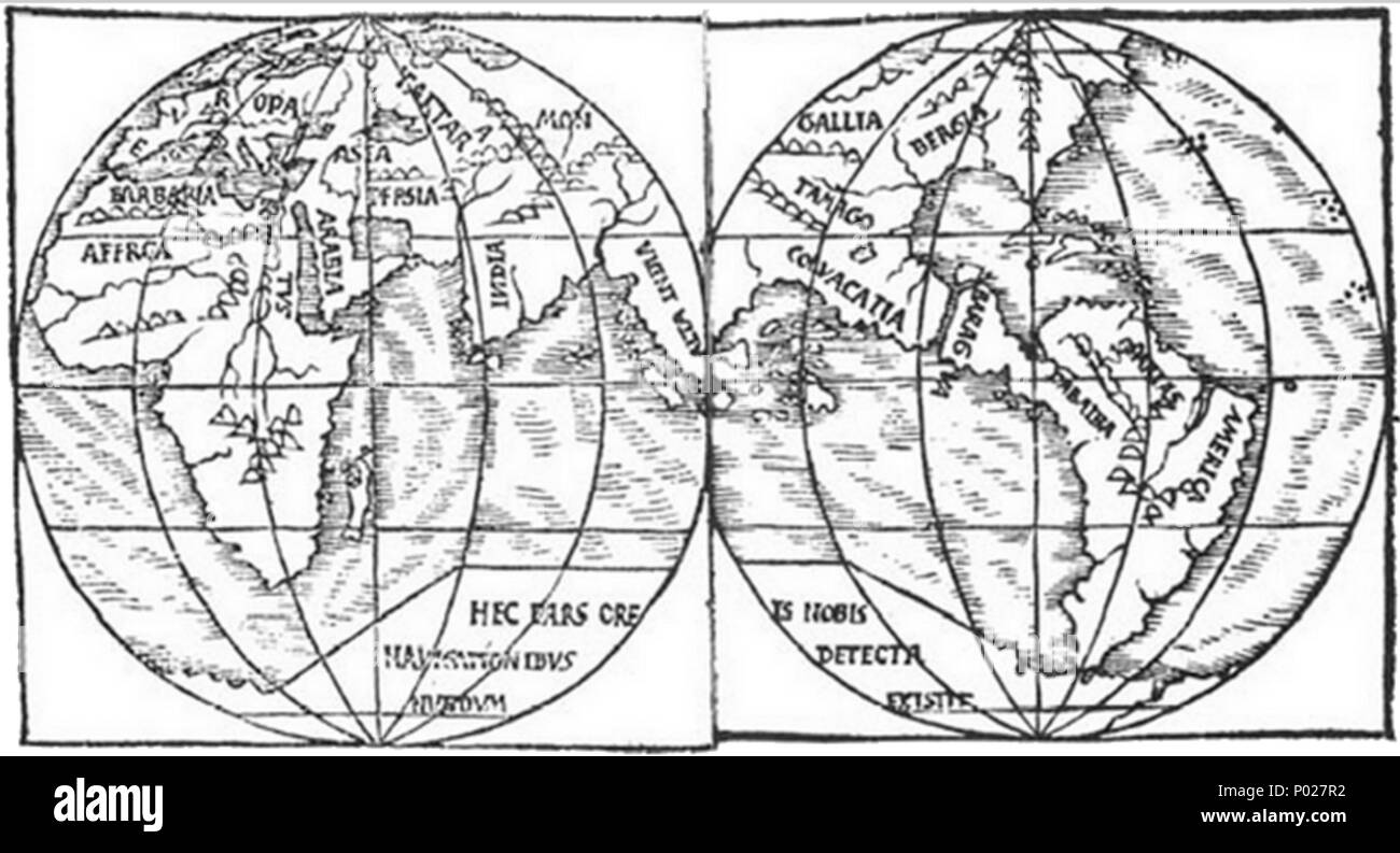 . English: A map of the world (c.1527) by Monachus showing two halves of the globe that he had constructed. For full descriptions of the globe see w:Franciscus Monachus. Placenames: evropa (Europe), tartara (Russia), mongalla (Mongolia), asia (Turkey), arabia, persia, india, alia india ('Other India'; Malaysia), bergia (Siberia/the American South), tamago (China/Texas), colvacatia? (Dragon's Head peninsula/), baragva (Dragon's Head peninsula/Central America); dabaiba (Dragon's Head peninsula/Colombia); artas? (Dragon's Head peninsula/Venezuela); america (Dragon's Head peninsula/Brazil); barbar Stock Photohttps://www.alamy.com/image-license-details/?v=1https://www.alamy.com/english-a-map-of-the-world-c1527-by-monachus-showing-two-halves-of-the-globe-that-he-had-constructed-for-full-descriptions-of-the-globe-see-wfranciscus-monachus-placenames-evropa-europe-tartara-russia-mongalla-mongolia-asia-turkey-arabia-persia-india-alia-india-other-india-malaysia-bergia-siberiathe-american-south-tamago-chinatexas-colvacatia-dragons-head-peninsula-baragva-dragons-head-peninsulacentral-america-dabaiba-dragons-head-peninsulacolombia-artas-dragons-head-peninsulavenezuela-america-dragons-head-peninsulabrazil-barbar-image206574454.html
RMP027R2–. English: A map of the world (c.1527) by Monachus showing two halves of the globe that he had constructed. For full descriptions of the globe see w:Franciscus Monachus. Placenames: evropa (Europe), tartara (Russia), mongalla (Mongolia), asia (Turkey), arabia, persia, india, alia india ('Other India'; Malaysia), bergia (Siberia/the American South), tamago (China/Texas), colvacatia? (Dragon's Head peninsula/), baragva (Dragon's Head peninsula/Central America); dabaiba (Dragon's Head peninsula/Colombia); artas? (Dragon's Head peninsula/Venezuela); america (Dragon's Head peninsula/Brazil); barbar
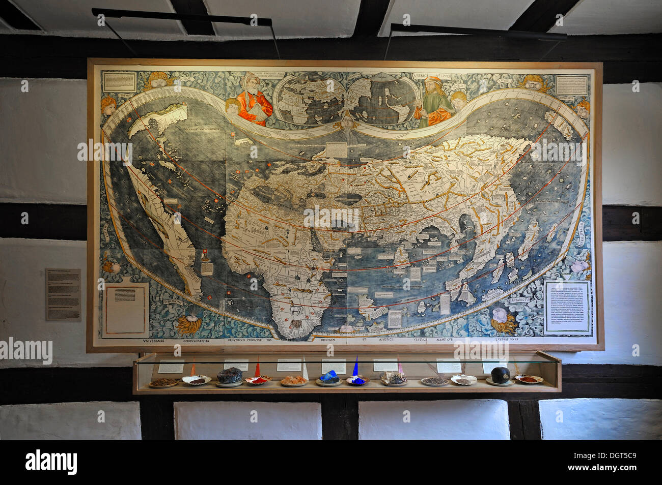 World map of 1527, with various minerals for the manufacture of paints below, Albrecht Duerer House, historic center, Nuremberg Stock Photohttps://www.alamy.com/image-license-details/?v=1https://www.alamy.com/world-map-of-1527-with-various-minerals-for-the-manufacture-of-paints-image61996713.html
RMDGT5C9–World map of 1527, with various minerals for the manufacture of paints below, Albrecht Duerer House, historic center, Nuremberg
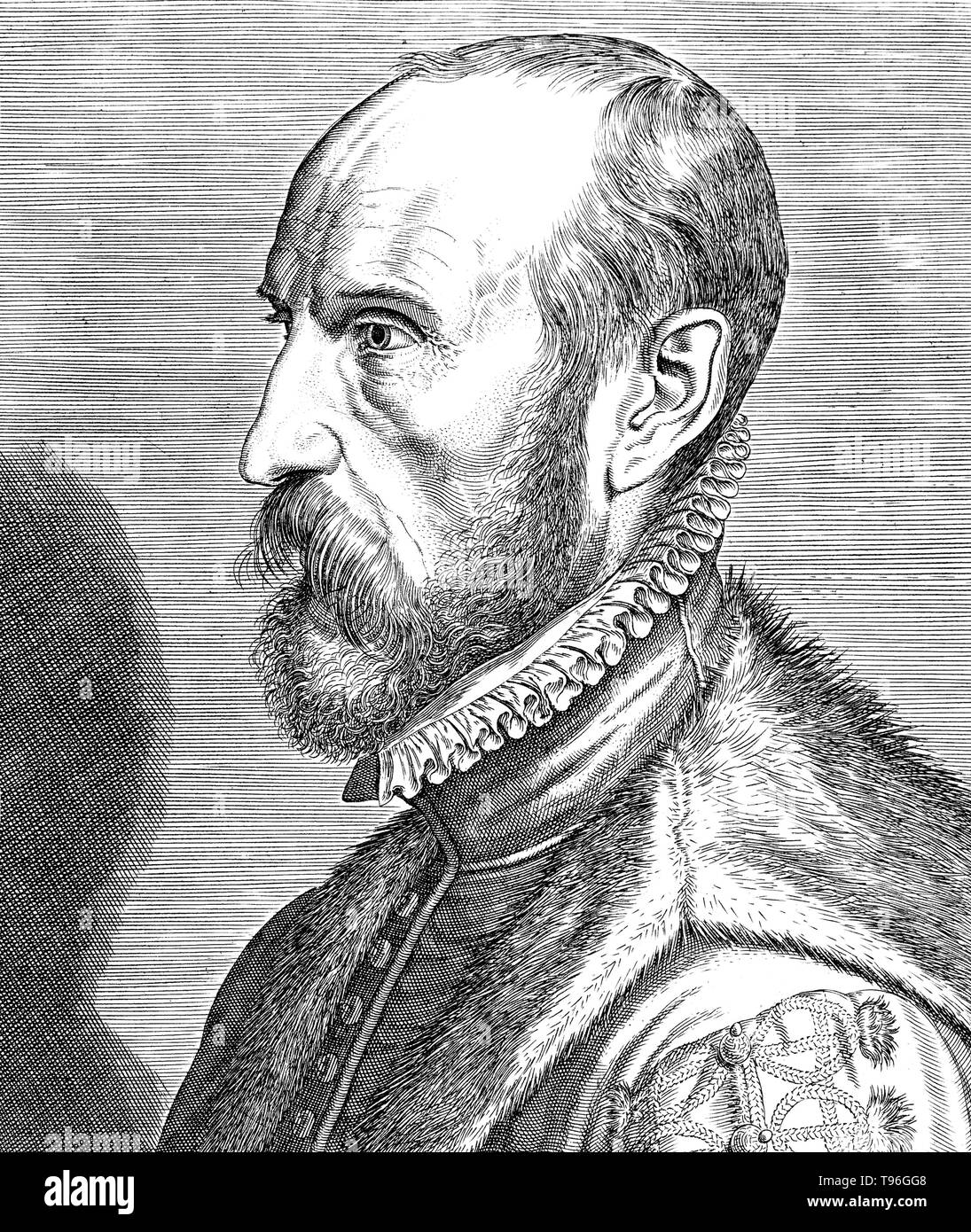 Abraham Ortelius (April 14, 1527 - June 28, 1598) was a Flemish cartographer and geographer. Beginning as a map-engraver, he entered the Antwerp Guild of Saint Luke as an illuminator of maps. He met Gerardus Mercator in 1554, who influenced his decision to become a scientific geographer. In 1564 he published his first map, Typus Orbis Terrarum, an eight-leaved wall map of the world. In 1578 he laid the basis of a critical treatment of ancient geography by his Synonymia geographica. Stock Photohttps://www.alamy.com/image-license-details/?v=1https://www.alamy.com/abraham-ortelius-april-14-1527-june-28-1598-was-a-flemish-cartographer-and-geographer-beginning-as-a-map-engraver-he-entered-the-antwerp-guild-of-saint-luke-as-an-illuminator-of-maps-he-met-gerardus-mercator-in-1554-who-influenced-his-decision-to-become-a-scientific-geographer-in-1564-he-published-his-first-map-typus-orbis-terrarum-an-eight-leaved-wall-map-of-the-world-in-1578-he-laid-the-basis-of-a-critical-treatment-of-ancient-geography-by-his-synonymia-geographica-image246621768.html
RMT96GG8–Abraham Ortelius (April 14, 1527 - June 28, 1598) was a Flemish cartographer and geographer. Beginning as a map-engraver, he entered the Antwerp Guild of Saint Luke as an illuminator of maps. He met Gerardus Mercator in 1554, who influenced his decision to become a scientific geographer. In 1564 he published his first map, Typus Orbis Terrarum, an eight-leaved wall map of the world. In 1578 he laid the basis of a critical treatment of ancient geography by his Synonymia geographica.
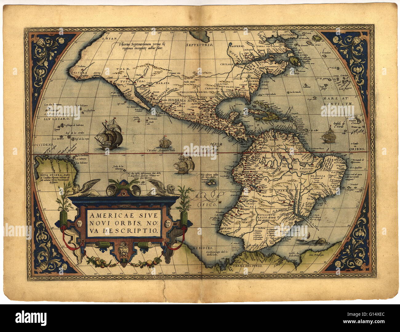 Map of the New World, in the 1570 edition of the Ortelius Atlas (Theatrum Orbis Terrarum). Abraham Ortelius (1527-1598) was a Flemish mapmaker who is considered to have produced the first true atlas (collection of uniform maps in one book). Ortelius worke Stock Photohttps://www.alamy.com/image-license-details/?v=1https://www.alamy.com/stock-photo-map-of-the-new-world-in-the-1570-edition-of-the-ortelius-atlas-theatrum-103985460.html
RMG14XEC–Map of the New World, in the 1570 edition of the Ortelius Atlas (Theatrum Orbis Terrarum). Abraham Ortelius (1527-1598) was a Flemish mapmaker who is considered to have produced the first true atlas (collection of uniform maps in one book). Ortelius worke
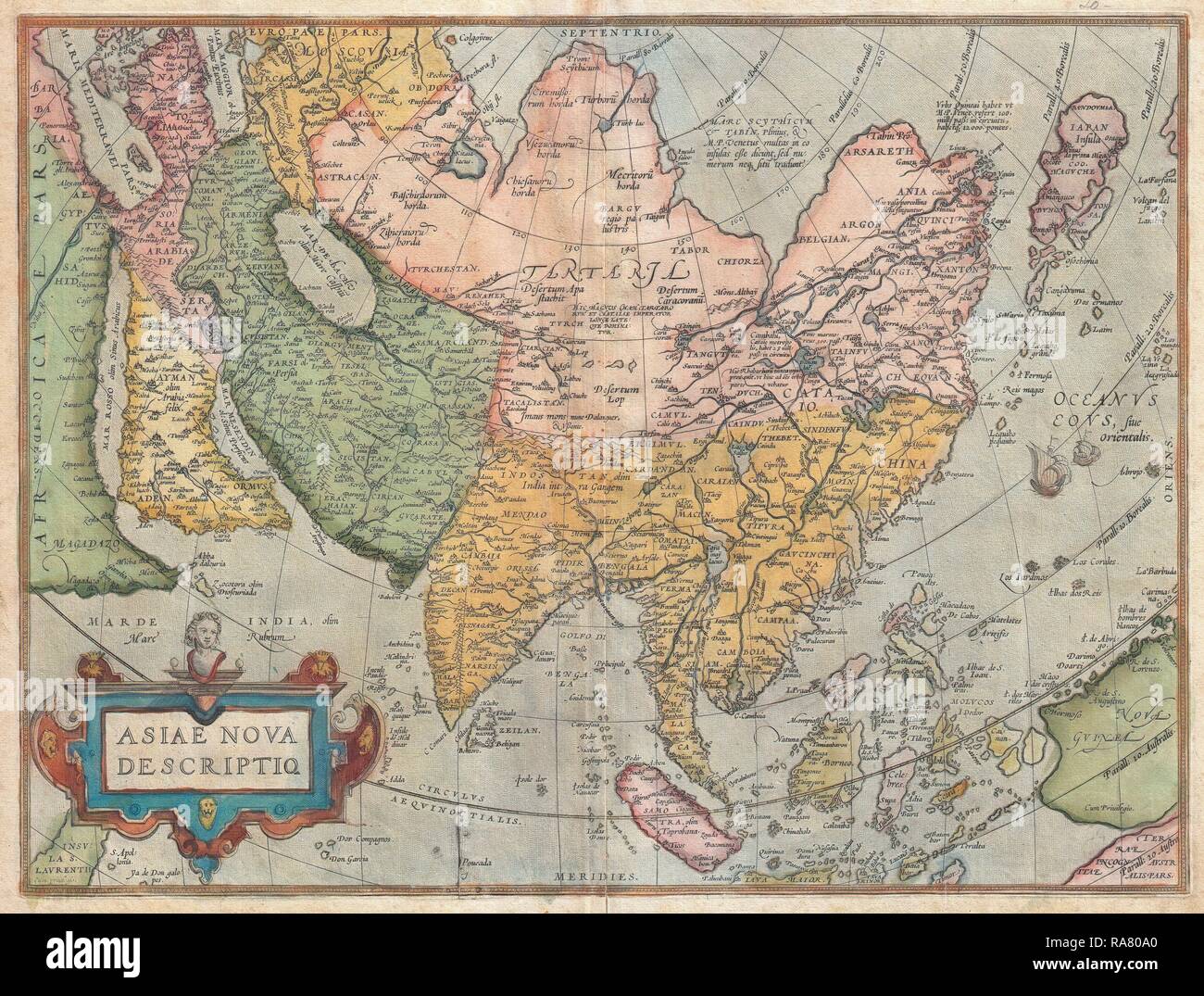 1570, Ortelius Map of Asia, first edition, Abraham Ortelius, also Orthellius, 1527 – 1598, Flemish, Netherlandish reimagined Stock Photohttps://www.alamy.com/image-license-details/?v=1https://www.alamy.com/1570-ortelius-map-of-asia-first-edition-abraham-ortelius-also-orthellius-1527-1598-flemish-netherlandish-reimagined-image230057240.html
RFRA80A0–1570, Ortelius Map of Asia, first edition, Abraham Ortelius, also Orthellius, 1527 – 1598, Flemish, Netherlandish reimagined
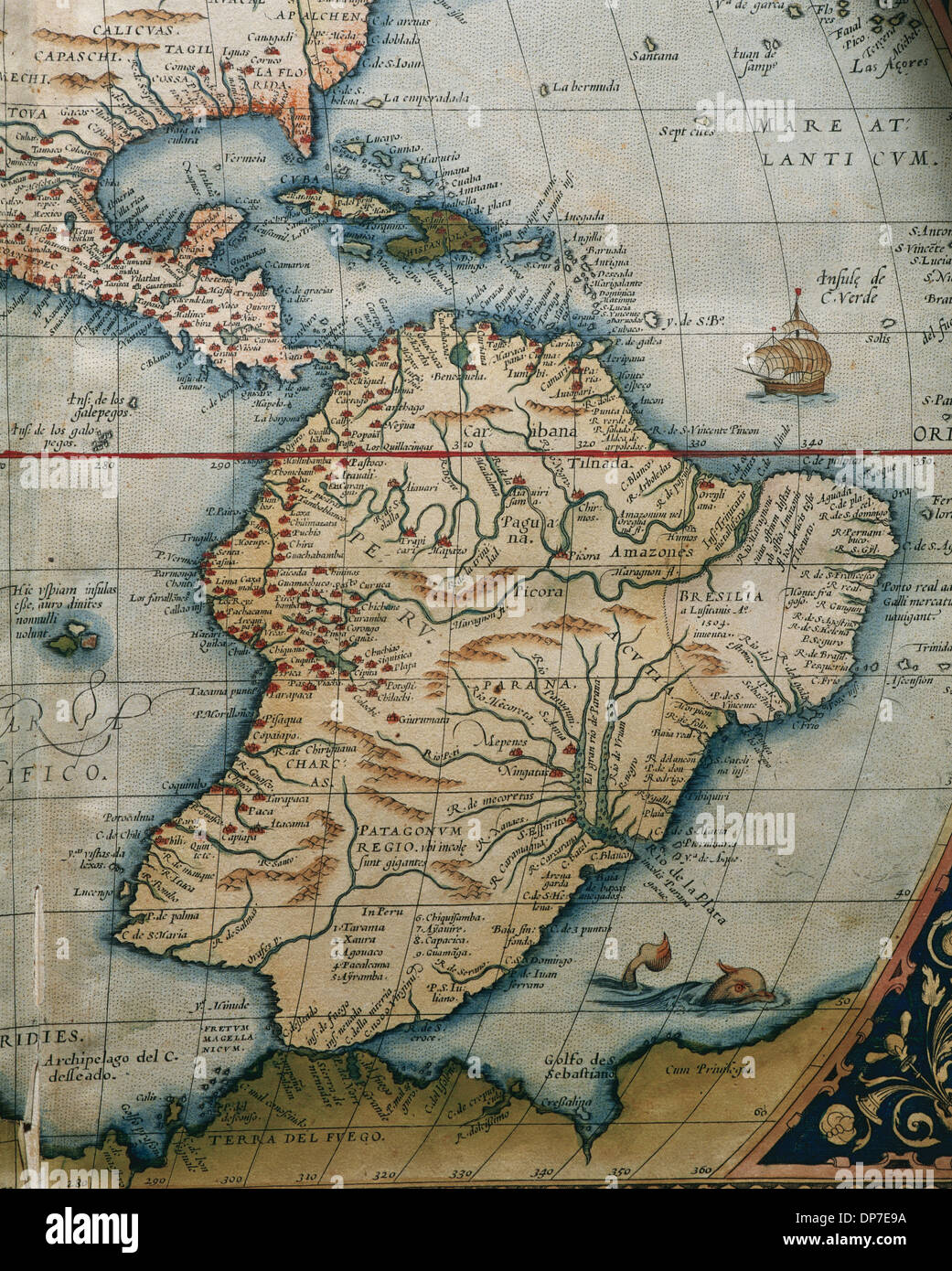 Map of Central and South America. Theatrum Orbis Terrarum by Abraham Ortelius (1527-1598). First Edition. Antwerp, 1574. Stock Photohttps://www.alamy.com/image-license-details/?v=1https://www.alamy.com/map-of-central-and-south-america-theatrum-orbis-terrarum-by-abraham-image65318438.html
RMDP7E9A–Map of Central and South America. Theatrum Orbis Terrarum by Abraham Ortelius (1527-1598). First Edition. Antwerp, 1574.
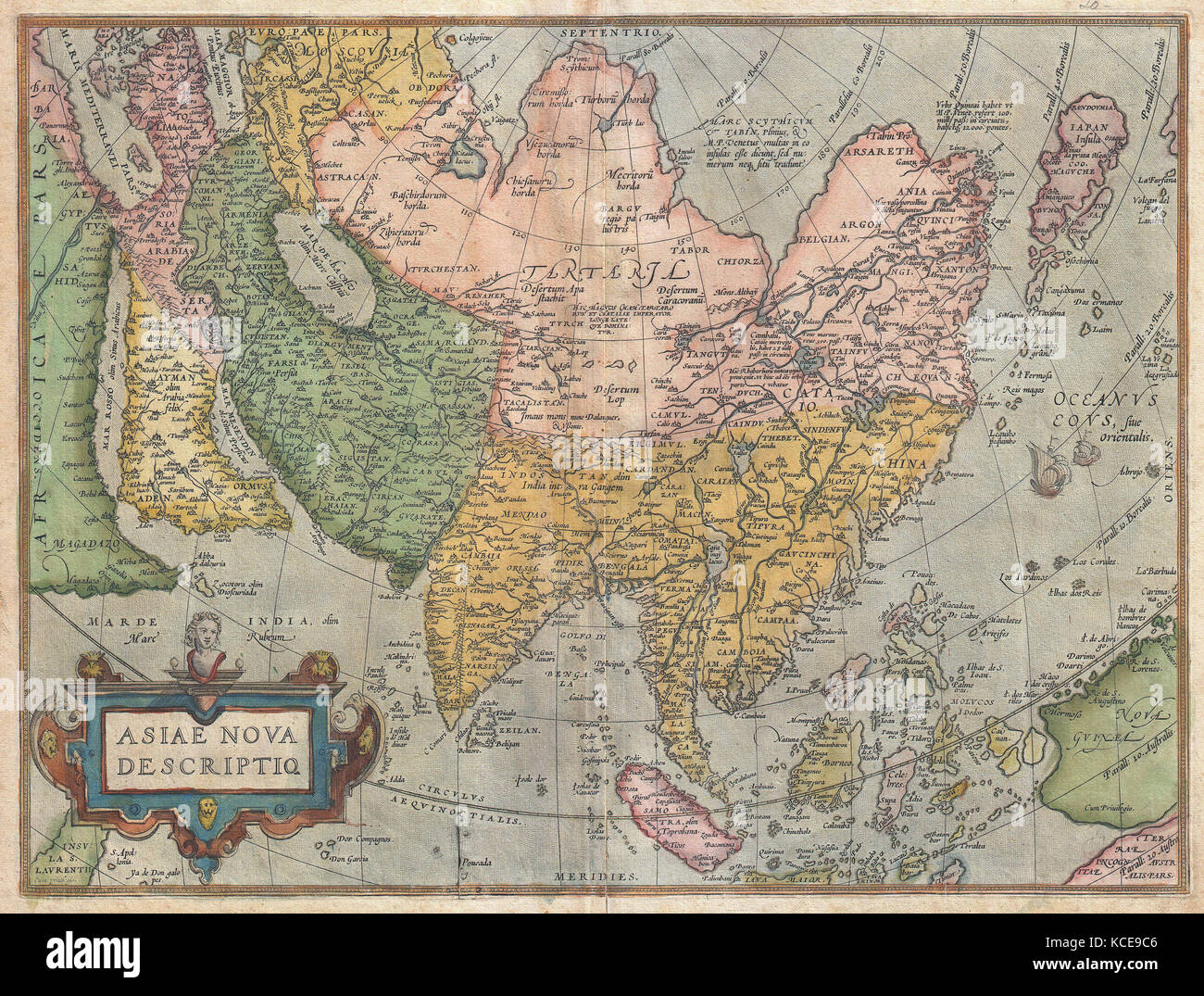 1570, Ortelius Map of Asia, first edition, Abraham Ortelius, also Orthellius, 1527 – 1598, Flemish, Netherlandish cartographer Stock Photohttps://www.alamy.com/image-license-details/?v=1https://www.alamy.com/stock-image-1570-ortelius-map-of-asia-first-edition-abraham-ortelius-also-orthellius-162583910.html
RMKCE9C6–1570, Ortelius Map of Asia, first edition, Abraham Ortelius, also Orthellius, 1527 – 1598, Flemish, Netherlandish cartographer
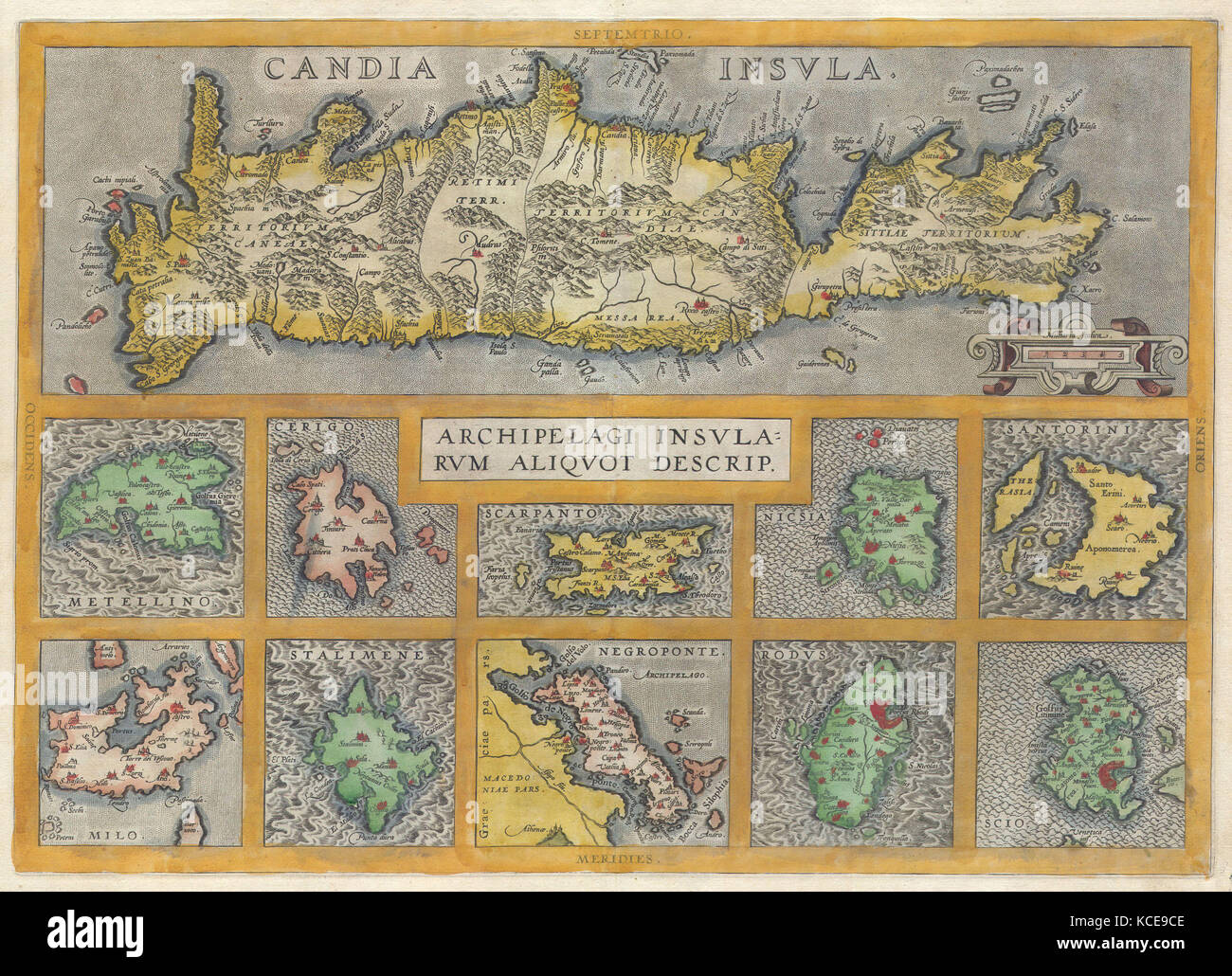 1584, Ortelius Map of Crete, Candia and 10 Greek Islands, Abraham Ortelius, also Orthellius, 1527 – 1598, Flemish, Netherlandish Stock Photohttps://www.alamy.com/image-license-details/?v=1https://www.alamy.com/stock-image-1584-ortelius-map-of-crete-candia-and-10-greek-islands-abraham-ortelius-162583918.html
RMKCE9CE–1584, Ortelius Map of Crete, Candia and 10 Greek Islands, Abraham Ortelius, also Orthellius, 1527 – 1598, Flemish, Netherlandish
 'Abraham Ortelius (Abraham Ortelius) (April 14, 1527 ? June 28, 1598) was a Flemish cartographer and geographer, generally recognized as the creator of the first modern atlas, the Theatrum Orbis Terrarum (Theatre of the World). He is also believed to be the first person to imagine that the continents were joined together before drifting to their present positions. In 1564 he completed a 'mappemonde', eight-leaved map of the world, which afterwards appeared in reduced form in the Theatrum. The only extant copy of this great map is in the library of the University of Basel. On May 20, 1570, Gill Stock Photohttps://www.alamy.com/image-license-details/?v=1https://www.alamy.com/abraham-ortelius-abraham-ortelius-april-14-1527-june-28-1598-was-a-flemish-cartographer-and-geographer-generally-recognized-as-the-creator-of-the-first-modern-atlas-the-theatrum-orbis-terrarum-theatre-of-the-world-he-is-also-believed-to-be-the-first-person-to-imagine-that-the-continents-were-joined-together-before-drifting-to-their-present-positions-in-1564-he-completed-a-mappemonde-eight-leaved-map-of-the-world-which-afterwards-appeared-in-reduced-form-in-the-theatrum-the-only-extant-copy-of-this-great-map-is-in-the-library-of-the-university-of-basel-on-may-20-1570-gill-image385492184.html
RM2DB4K60–'Abraham Ortelius (Abraham Ortelius) (April 14, 1527 ? June 28, 1598) was a Flemish cartographer and geographer, generally recognized as the creator of the first modern atlas, the Theatrum Orbis Terrarum (Theatre of the World). He is also believed to be the first person to imagine that the continents were joined together before drifting to their present positions. In 1564 he completed a 'mappemonde', eight-leaved map of the world, which afterwards appeared in reduced form in the Theatrum. The only extant copy of this great map is in the library of the University of Basel. On May 20, 1570, Gill
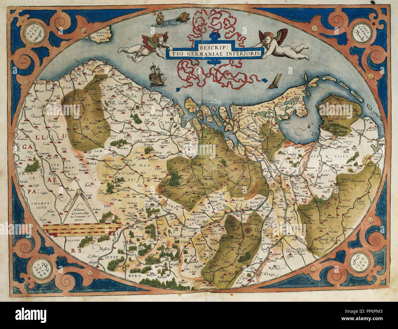 Map of Germany and current Netherlands. Theatrum Orbis Terrarum by Abraham Ortelius (1527-1598). First Edition. Antwerp, 1574. Library of Catalonia. Barcelona. Spain. Stock Photohttps://www.alamy.com/image-license-details/?v=1https://www.alamy.com/map-of-germany-and-current-netherlands-theatrum-orbis-terrarum-by-abraham-ortelius-1527-1598-first-edition-antwerp-1574-library-of-catalonia-barcelona-spain-image220196371.html
RMPP6PM3–Map of Germany and current Netherlands. Theatrum Orbis Terrarum by Abraham Ortelius (1527-1598). First Edition. Antwerp, 1574. Library of Catalonia. Barcelona. Spain.
 View of Salzburg and surroundings. Theatrum Orbis Terrarum by Abraham Ortelius (1527-1598). First Edition. Antwerp, 1574. Stock Photohttps://www.alamy.com/image-license-details/?v=1https://www.alamy.com/stock-photo-view-of-salzburg-and-surroundings-theatrum-orbis-terrarum-by-abraham-71268317.html
RME3XFD1–View of Salzburg and surroundings. Theatrum Orbis Terrarum by Abraham Ortelius (1527-1598). First Edition. Antwerp, 1574.
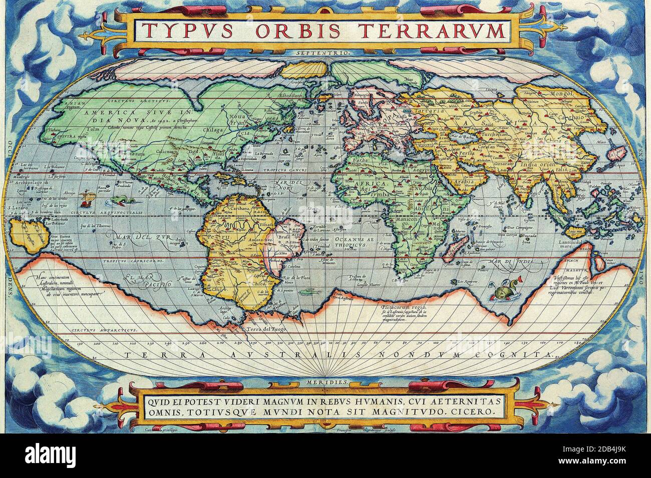 'Abraham Ortelius (Abraham Ortelius) (April 14, 1527 ? June 28, 1598) was a Flemish cartographer and geographer, generally recognized as the creator of the first modern atlas, the Theatrum Orbis Terrarum (Theatre of the World). He is also believed to be the first person to imagine that the continents were joined together before drifting to their present positions. In 1564 he completed a 'mappemonde', eight-leaved map of the world, which afterwards appeared in reduced form in the Theatrum. The only extant copy of this great map is in the library of the University of Basel. On May 20, 1570, Gill Stock Photohttps://www.alamy.com/image-license-details/?v=1https://www.alamy.com/abraham-ortelius-abraham-ortelius-april-14-1527-june-28-1598-was-a-flemish-cartographer-and-geographer-generally-recognized-as-the-creator-of-the-first-modern-atlas-the-theatrum-orbis-terrarum-theatre-of-the-world-he-is-also-believed-to-be-the-first-person-to-imagine-that-the-continents-were-joined-together-before-drifting-to-their-present-positions-in-1564-he-completed-a-mappemonde-eight-leaved-map-of-the-world-which-afterwards-appeared-in-reduced-form-in-the-theatrum-the-only-extant-copy-of-this-great-map-is-in-the-library-of-the-university-of-basel-on-may-20-1570-gill-image385491503.html
RM2DB4J9K–'Abraham Ortelius (Abraham Ortelius) (April 14, 1527 ? June 28, 1598) was a Flemish cartographer and geographer, generally recognized as the creator of the first modern atlas, the Theatrum Orbis Terrarum (Theatre of the World). He is also believed to be the first person to imagine that the continents were joined together before drifting to their present positions. In 1564 he completed a 'mappemonde', eight-leaved map of the world, which afterwards appeared in reduced form in the Theatrum. The only extant copy of this great map is in the library of the University of Basel. On May 20, 1570, Gill
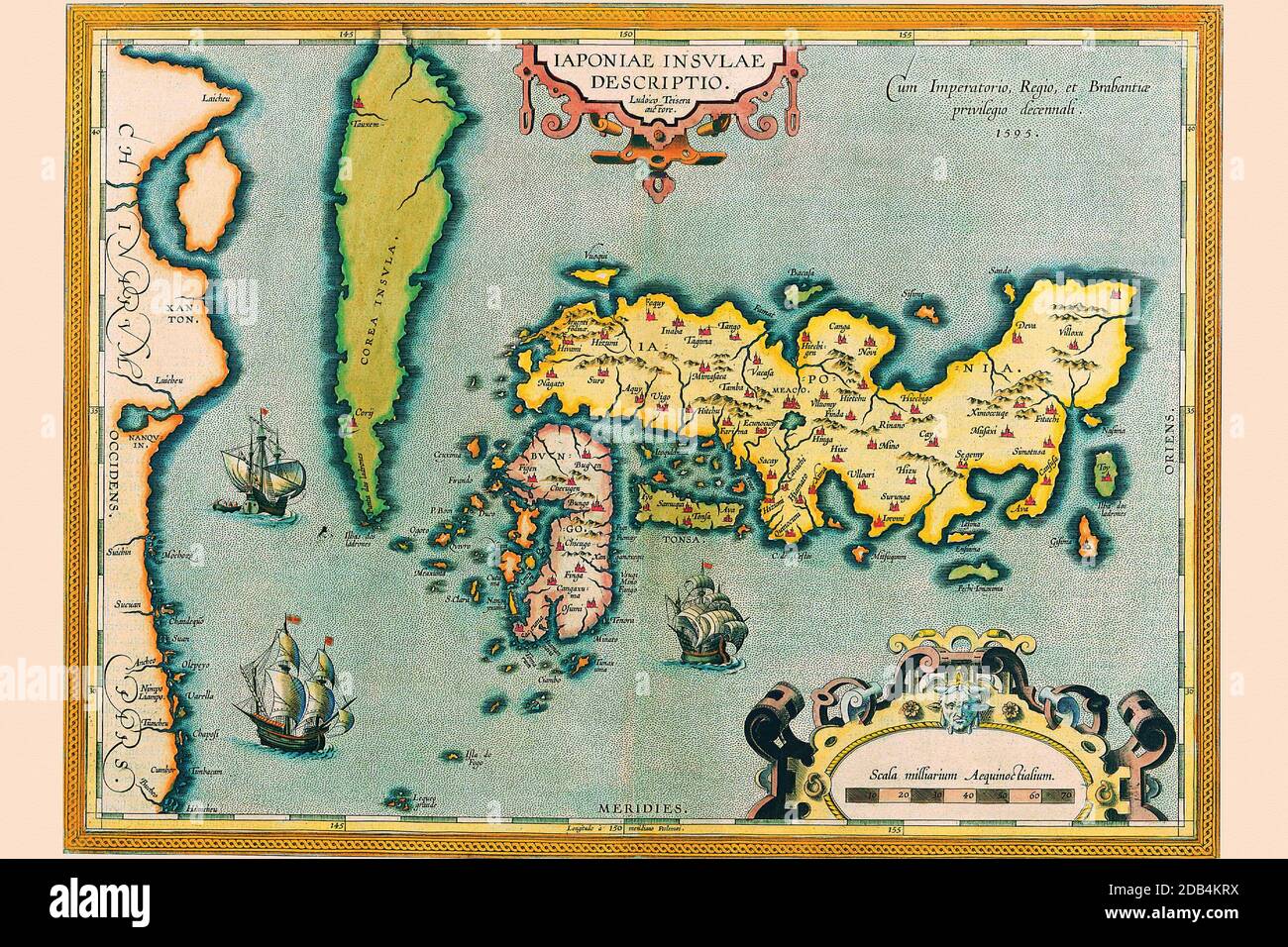 'Abraham Ortelius (Abraham Ortels) (April 14, 1527 ? June 28, 1598) was a Flemish cartographer and geographer, generally recognized as the creator of the first modern atlas, the Theatrum Orbis Terrarum (Theatre of the World). He is also believed to be the first person to imagine that the continents were joined together before drifting to their present positions. In 1564 he completed a 'mappemonde', eight-leaved map of the world, which afterwards appeared in reduced form in the Theatrum. The only extant copy of this great map is in the library of the University of Basel. On May 20, 1570, Gilles Stock Photohttps://www.alamy.com/image-license-details/?v=1https://www.alamy.com/abraham-ortelius-abraham-ortels-april-14-1527-june-28-1598-was-a-flemish-cartographer-and-geographer-generally-recognized-as-the-creator-of-the-first-modern-atlas-the-theatrum-orbis-terrarum-theatre-of-the-world-he-is-also-believed-to-be-the-first-person-to-imagine-that-the-continents-were-joined-together-before-drifting-to-their-present-positions-in-1564-he-completed-a-mappemonde-eight-leaved-map-of-the-world-which-afterwards-appeared-in-reduced-form-in-the-theatrum-the-only-extant-copy-of-this-great-map-is-in-the-library-of-the-university-of-basel-on-may-20-1570-gilles-image385492686.html
RM2DB4KRX–'Abraham Ortelius (Abraham Ortels) (April 14, 1527 ? June 28, 1598) was a Flemish cartographer and geographer, generally recognized as the creator of the first modern atlas, the Theatrum Orbis Terrarum (Theatre of the World). He is also believed to be the first person to imagine that the continents were joined together before drifting to their present positions. In 1564 he completed a 'mappemonde', eight-leaved map of the world, which afterwards appeared in reduced form in the Theatrum. The only extant copy of this great map is in the library of the University of Basel. On May 20, 1570, Gilles
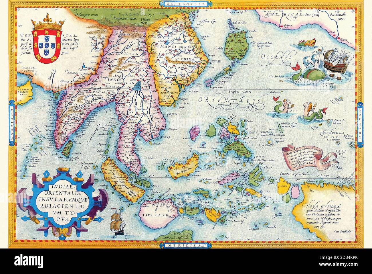 'Abraham Ortelius (Abraham Ortels) (April 14, 1527 ? June 28, 1598) was a Flemish cartographer and geographer, generally recognized as the creator of the first modern atlas, the Theatrum Orbis Terrarum (Theatre of the World). He is also believed to be the first person to imagine that the continents were joined together before drifting to their present positions. In 1564 he completed a 'mappemonde', eight-leaved map of the world, which afterwards appeared in reduced form in the Theatrum. The only extant copy of this great map is in the library of the University of Basel. On May 20, 1570, Gilles Stock Photohttps://www.alamy.com/image-license-details/?v=1https://www.alamy.com/abraham-ortelius-abraham-ortels-april-14-1527-june-28-1598-was-a-flemish-cartographer-and-geographer-generally-recognized-as-the-creator-of-the-first-modern-atlas-the-theatrum-orbis-terrarum-theatre-of-the-world-he-is-also-believed-to-be-the-first-person-to-imagine-that-the-continents-were-joined-together-before-drifting-to-their-present-positions-in-1564-he-completed-a-mappemonde-eight-leaved-map-of-the-world-which-afterwards-appeared-in-reduced-form-in-the-theatrum-the-only-extant-copy-of-this-great-map-is-in-the-library-of-the-university-of-basel-on-may-20-1570-gilles-image385492651.html
RM2DB4KPK–'Abraham Ortelius (Abraham Ortels) (April 14, 1527 ? June 28, 1598) was a Flemish cartographer and geographer, generally recognized as the creator of the first modern atlas, the Theatrum Orbis Terrarum (Theatre of the World). He is also believed to be the first person to imagine that the continents were joined together before drifting to their present positions. In 1564 he completed a 'mappemonde', eight-leaved map of the world, which afterwards appeared in reduced form in the Theatrum. The only extant copy of this great map is in the library of the University of Basel. On May 20, 1570, Gilles