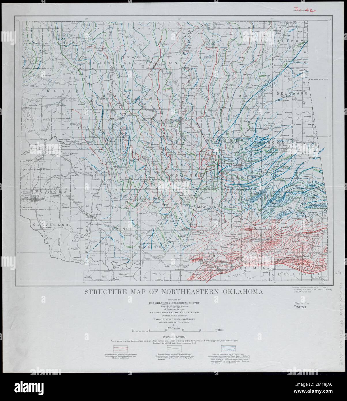
Structure map of northeastern Oklahoma , Oklahoma, Maps, Geology, Structural, Oklahoma, Maps Norman B. Leventhal Map Center Collection
RMID:Image ID:2M18JAC
Image details
Contributor:
piemags/DCM / Alamy Stock PhotoImage ID:
2M18JACFile size:
104.4 MB (4.8 MB Compressed download)Releases:
Model - no | Property - noDo I need a release?Dimensions:
5815 x 6275 px | 49.2 x 53.1 cm | 19.4 x 20.9 inches | 300dpiMore information:
This image is a public domain image, which means either that copyright has expired in the image or the copyright holder has waived their copyright. Alamy charges you a fee for access to the high resolution copy of the image.
This image could have imperfections as it’s either historical or reportage.