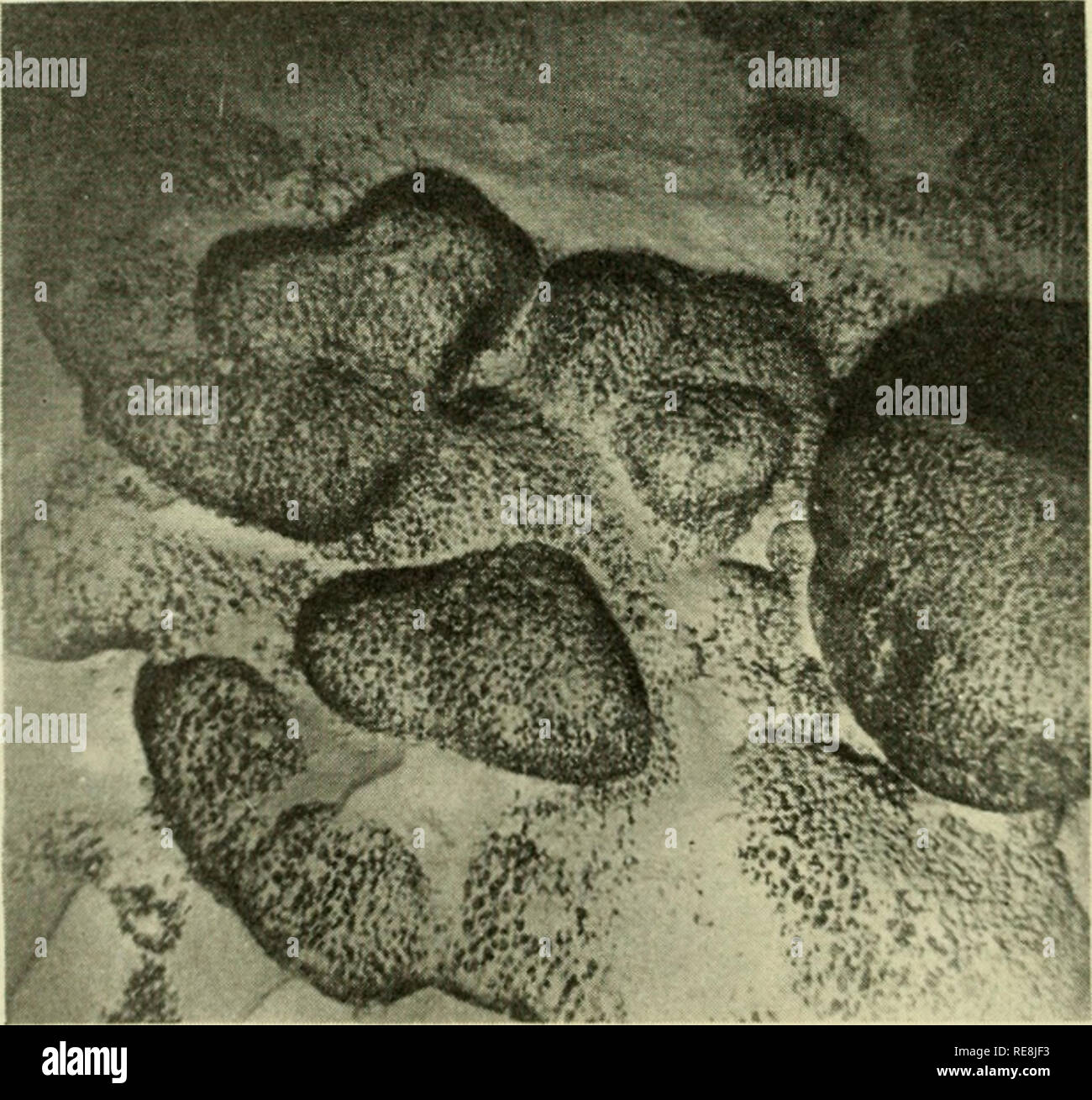
. The Earth beneath the sea : History. Ocean bottom; Marine geophysics. Fig. 6. 43° 31..5'X, 12° 3fi'W. Depth 5200 m. Head of Biscay-Iberia inlerplain channel. (Photo by N.I.O.) Semi-consolidated sedimentary rocks exposed on the cliffs of an eroded channel cut into the Biscay abyssal plain by turbidity currents. These may represent the degree of lithification of abyssal-plain sediments buried some 100 m deep.. Fig. 7. 11°51'N, 164° 55'E. Depth 1730 m. Sylvania Tablemount near Bikini. Area of picture 1^ by U m. (U.S. Navy Electronics Laboratory photo by C. J. Shipek.) Manganese-encrusted volcan
Image details
Contributor:
The Book Worm / Alamy Stock PhotoImage ID:
RE8JF3File size:
7.1 MB (470.6 KB Compressed download)Releases:
Model - no | Property - noDo I need a release?Dimensions:
1632 x 1531 px | 27.6 x 25.9 cm | 10.9 x 10.2 inches | 150dpiMore information:
This image is a public domain image, which means either that copyright has expired in the image or the copyright holder has waived their copyright. Alamy charges you a fee for access to the high resolution copy of the image.
This image could have imperfections as it’s either historical or reportage.
. The Earth beneath the sea : History. Ocean bottom; Marine geophysics. Fig. 6. 43° 31..5'X, 12° 3fi'W. Depth 5200 m. Head of Biscay-Iberia inlerplain channel. (Photo by N.I.O.) Semi-consolidated sedimentary rocks exposed on the cliffs of an eroded channel cut into the Biscay abyssal plain by turbidity currents. These may represent the degree of lithification of abyssal-plain sediments buried some 100 m deep.. Fig. 7. 11°51'N, 164° 55'E. Depth 1730 m. Sylvania Tablemount near Bikini. Area of picture 1^ by U m. (U.S. Navy Electronics Laboratory photo by C. J. Shipek.) Manganese-encrusted volcanic boulders and rippled Globi(/eriita ooze. Similar boulders were dredged near by, showing these rocks to be olivine-basalt boulders coated by a thick crust of manganese.. Please note that these images are extracted from scanned page images that may have been digitally enhanced for readability - coloration and appearance of these illustrations may not perfectly resemble the original work.. Hill, M. N. (Maurice Neville), 1919-. New York : Interscience Pub.