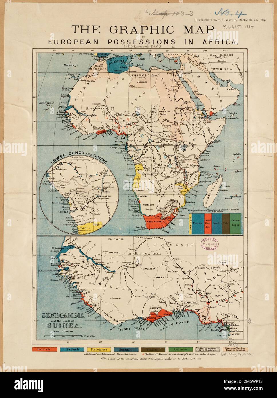
The graphic map of European possessions in Africa. Includes inset map "Lower Congo and Ogowe" and ancillary map "Senegambia and the coast of Guinea." "Supplement to the Graphic, December 10, 1884.".. European possessions in Africa. European possessions in Africa, Africa Africa
RMID:Image ID:2M5WP13
Image details
Contributor:
LM/BT / Alamy Stock PhotoImage ID:
2M5WP13File size:
58.2 MB (3 MB Compressed download)Releases:
Model - no | Property - noDo I need a release?Dimensions:
3894 x 5226 px | 33 x 44.2 cm | 13 x 17.4 inches | 300dpiMore information:
This image is a public domain image, which means either that copyright has expired in the image or the copyright holder has waived their copyright. Alamy charges you a fee for access to the high resolution copy of the image.
This image could have imperfections as it’s either historical or reportage.