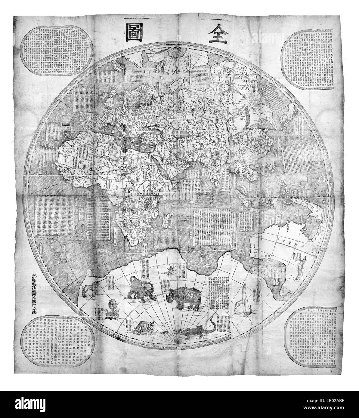
This map showing the two hemispheres of the world was made for the 2nd Qing Emperor, Kangxi (1662-1722) by the Jesuit Ferdinand Verbiest (1623-88), in 1674. Verbiest was one of a few Jesuits who were employed at the Chinese court during the period. Printed from woodblocks using Mercator's projection, the map was part of a larger geographical work called Kunyu tushuo (Illustrated Discussion of the Geography of the World) and called: Kunyu wanguo quantu (A Map of the Myriad Countries of the World). It was one of a series of maps produced by the Jesuits at the Court in Beijing, beginning with M
Image details
Contributor:
CPA Media Pte Ltd / Alamy Stock PhotoImage ID:
2B02ABFFile size:
49.9 MB (3.2 MB Compressed download)Releases:
Model - no | Property - noDo I need a release?Dimensions:
4000 x 4358 px | 33.9 x 36.9 cm | 13.3 x 14.5 inches | 300dpiDate taken:
12 September 2013Photographer:
Pictures From HistoryMore information:
This image could have imperfections as it’s either historical or reportage.
This map showing the two hemispheres of the world was made for the 2nd Qing Emperor, Kangxi (1662-1722) by the Jesuit Ferdinand Verbiest (1623-88), in 1674. Verbiest was one of a few Jesuits who were employed at the Chinese court during the period. Printed from woodblocks using Mercator's projection, the map was part of a larger geographical work called Kunyu tushuo (Illustrated Discussion of the Geography of the World) and called: Kunyu wanguo quantu (A Map of the Myriad Countries of the World). It was one of a series of maps produced by the Jesuits at the Court in Beijing, beginning with Matteo Ricci's two maps of 1584 and 1602.