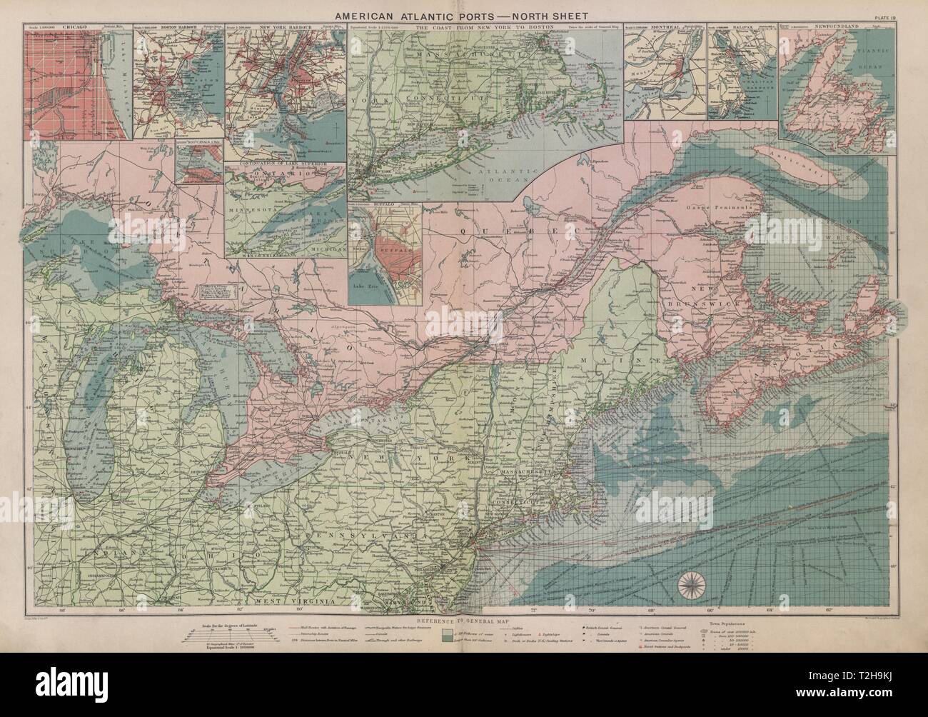
US Canada Atlantic & Great Lakes ports sea chart. Lighthouses &c LARGE 1916 map
Image details
Contributor:
Antiqua Print Gallery / Alamy Stock PhotoImage ID:
T2H9KJFile size:
137 MB (7.8 MB Compressed download)Releases:
Model - no | Property - noDo I need a release?Dimensions:
8251 x 5802 px | 69.9 x 49.1 cm | 27.5 x 19.3 inches | 300dpiDate taken:
1916Location:
USAMore information:
This image could have imperfections as it’s either historical or reportage.
American Atlantic Ports - North Sheet; Inset Chicaco; Boston Harbour; “Soo” Canals; New York Horbour; Ontario; The Coast from New York to Boston; Buffalo; Montreal; Halifax; Newfoundland. Artist/engraver/cartographer: George Philip & Son Ltd. Provenance: "Philips' Mercantile Marine Atlas"; Edited By George Philip, Published by George Philip & Son, Ltd., London : 6th Edition. Type: Antique colour maritime map chart; Scale 1:5, 000, 000; Scale 1:100, 000; Scale 1:500, 000; Scale 1:500, 000; Scale 1:100, 000; Scale 1:2, 500, 000; Scale 1:200, 000; Scale 1:500, 000; Scale 1:500, 000; Scale 1:10, 000, 000.