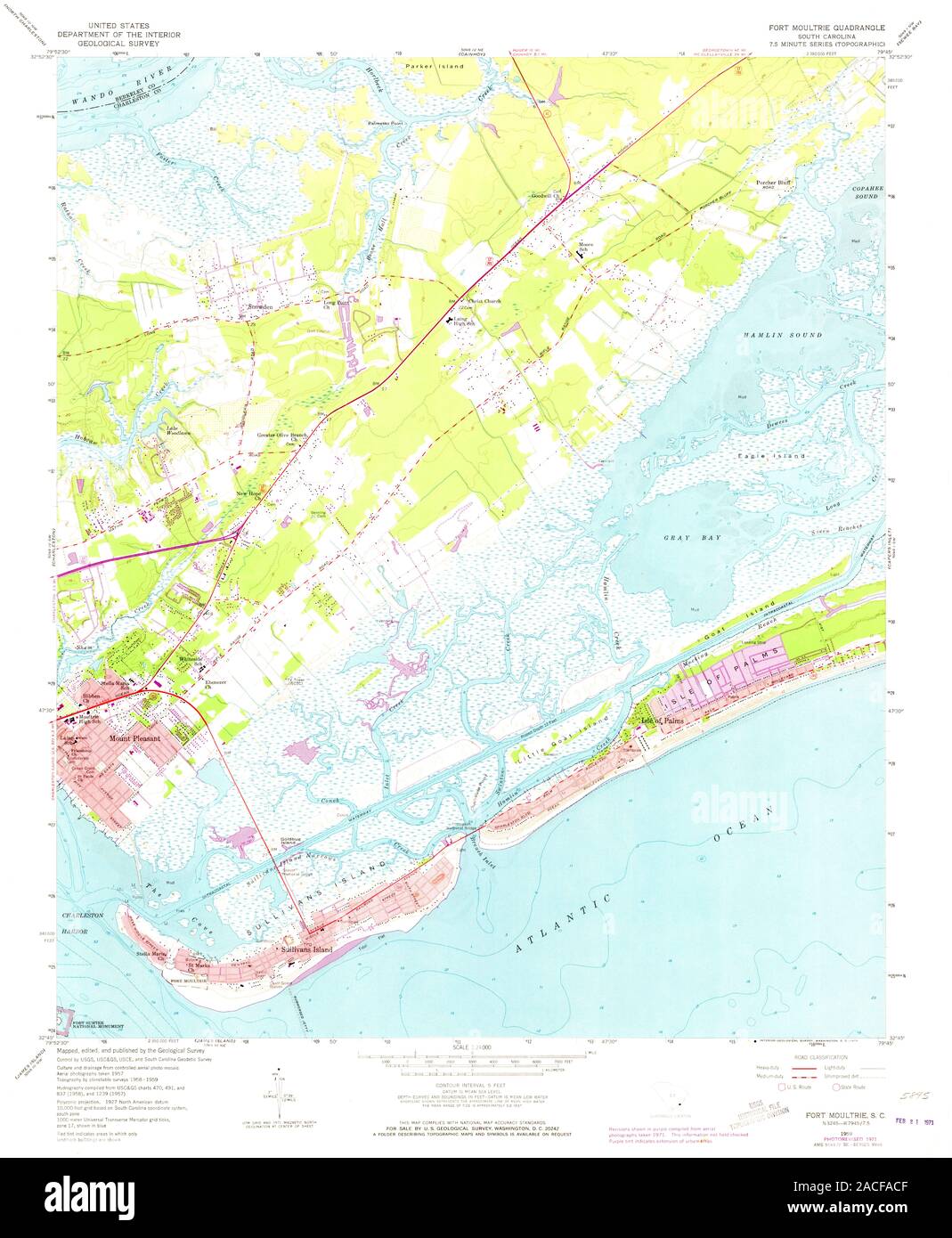
USGS TOPO Map South Carolina SC Fort Moultrie 261012 1959 24000 Restoration
RMID:Image ID:2ACFACF
Image details
Contributor:
Wetdryvac / Alamy Stock PhotoImage ID:
2ACFACFFile size:
152.7 MB (6.6 MB Compressed download)Releases:
Model - no | Property - noDo I need a release?Dimensions:
6626 x 8053 px | 56.1 x 68.2 cm | 22.1 x 26.8 inches | 300dpiMore information:
This image could have imperfections as it’s either historical or reportage.