···
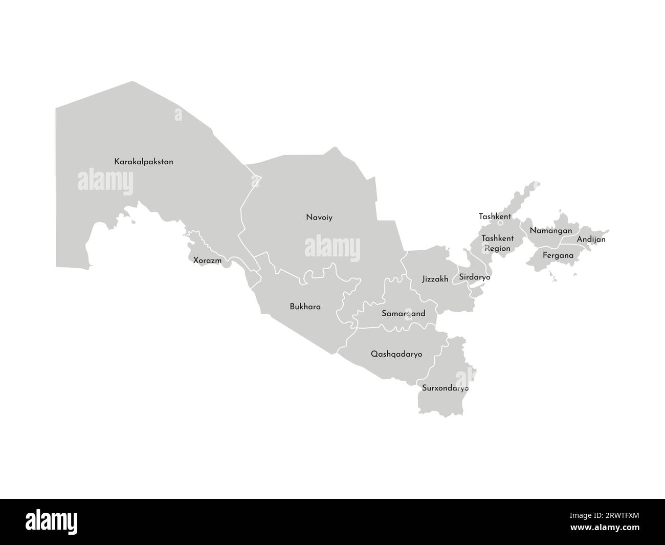
Vector isolated illustration of simplified administrative map of Uzbekistan. Borders and names of the provinces (regions). Grey silhouettes. White out Image details More information:
Vector isolated illustration of simplified administrative map of Uzbekistan. Borders and names of the provinces (regions). Grey silhouettes. White outline
Search stock photos by tags
Similar stock vectors Vector isolated illustration. Simplified administrative map of Venezuela. Blue shapes, white background and outlines. Names of Venezuelan cities and s Stock Vector https://www.alamy.com/image-license-details/?v=1 https://www.alamy.com/vector-isolated-illustration-simplified-administrative-map-of-venezuela-blue-shapes-white-background-and-outlines-names-of-venezuelan-cities-and-s-image566637718.html RF 2RWTG5A – Vector isolated illustration. Simplified administrative map of Venezuela. Blue shapes, white background and outlines. Names of Venezuelan cities and s Vector, isolated illustration of simplified administrative map of Canada. Boundaries of provinces (regions) Stock Vector https://www.alamy.com/image-license-details/?v=1 https://www.alamy.com/vector-isolated-illustration-of-simplified-administrative-map-of-canada-boundaries-of-provinces-regions-image476890704.html RF 2JKT6XT – Vector, isolated illustration of simplified administrative map of Canada. Boundaries of provinces (regions) land dispute line icon, outline symbol, vector illustration, concept sign Stock Vector https://www.alamy.com/image-license-details/?v=1 https://www.alamy.com/land-dispute-line-icon-outline-symbol-vector-illustration-concept-sign-image478446190.html RF 2JPB2YX – land dispute line icon, outline symbol, vector illustration, concept sign Kazakhstan map vector, isolated on white background. Black map template, flat earth. Simplified Stock Vector https://www.alamy.com/image-license-details/?v=1 https://www.alamy.com/kazakhstan-map-vector-isolated-on-white-background-black-map-template-flat-earth-simplified-image418941465.html RF 2F9GC35 – Kazakhstan map vector, isolated on white background. Black map template, flat earth. Simplified Simplified maps of Poland. Black and white outlines. Stock Vector https://www.alamy.com/image-license-details/?v=1 https://www.alamy.com/simplified-maps-of-poland-black-and-white-outlines-image217664276.html RF PJ3D04 – Simplified maps of Poland. Black and white outlines. Mexico map icon vector illustration logo design. Stock Vector https://www.alamy.com/image-license-details/?v=1 https://www.alamy.com/mexico-map-icon-vector-illustration-logo-design-image515375202.html RF 2MXDA96 – Mexico map icon vector illustration logo design. Germany provinces map with boundaries vector illustration. Light gray color. Stock Vector https://www.alamy.com/image-license-details/?v=1 https://www.alamy.com/germany-provinces-map-with-boundaries-vector-illustration-light-gray-color-image332566142.html RF 2A91KE6 – Germany provinces map with boundaries vector illustration. Light gray color. Simplified map of Hong Kong outline, with slightly bent flag under it. Stock Vector https://www.alamy.com/image-license-details/?v=1 https://www.alamy.com/simplified-map-of-hong-kong-outline-with-slightly-bent-flag-under-it-image239085405.html RF RTY7TD – Simplified map of Hong Kong outline, with slightly bent flag under it. Map of the country of Armenia. Detailed vector map of Armenia by region. Map of Armenia with flag. Stock Vector https://www.alamy.com/image-license-details/?v=1 https://www.alamy.com/map-of-the-country-of-armenia-detailed-vector-map-of-armenia-by-region-map-of-armenia-with-flag-image603194661.html RF 2X19TXD – Map of the country of Armenia. Detailed vector map of Armenia by region. Map of Armenia with flag. Map of Czech Republic divided into administrative regions. Vector illustration. Stock Vector https://www.alamy.com/image-license-details/?v=1 https://www.alamy.com/map-of-czech-republic-divided-into-administrative-regions-vector-illustration-image361340331.html RF 2BYTD7R – Map of Czech Republic divided into administrative regions. Vector illustration. Israel, gaza, west bank map, vector illustration. Stock Vector https://www.alamy.com/image-license-details/?v=1 https://www.alamy.com/israel-gaza-west-bank-map-vector-illustration-image572281499.html RF 2T71JTY – Israel, gaza, west bank map, vector illustration. 3d isometric map of Scandinavia region, isolated with shadow vector illustration Stock Vector https://www.alamy.com/image-license-details/?v=1 https://www.alamy.com/3d-isometric-map-of-scandinavia-region-isolated-with-shadow-vector-illustration-image449728289.html RF 2H3JW0H – 3d isometric map of Scandinavia region, isolated with shadow vector illustration Realistic vector map of Portugal with flag. The location of the country on the map of the world and Europe. A silhouette with detailed borders of the Stock Vector https://www.alamy.com/image-license-details/?v=1 https://www.alamy.com/realistic-vector-map-of-portugal-with-flag-the-location-of-the-country-on-the-map-of-the-world-and-europe-a-silhouette-with-detailed-borders-of-the-image432073586.html RF 2G2XJ7E – Realistic vector map of Portugal with flag. The location of the country on the map of the world and Europe. A silhouette with detailed borders of the 