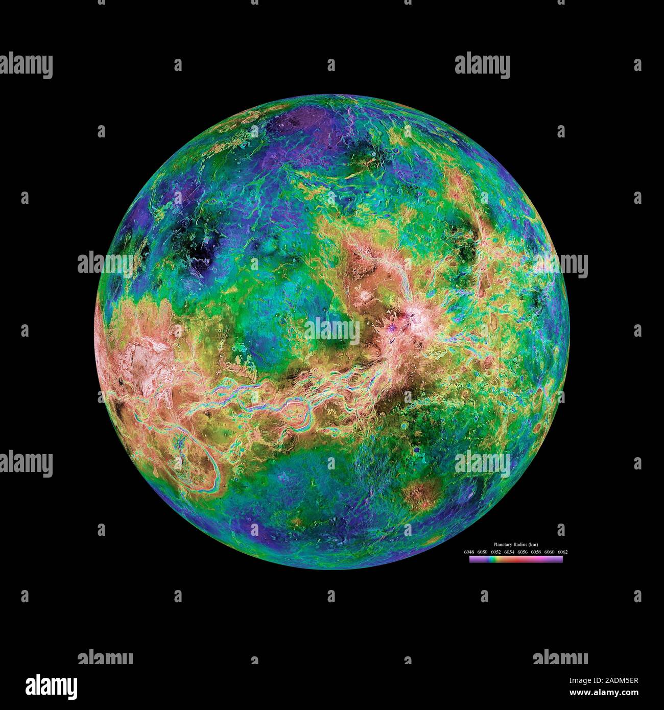
Venus radar map, centred at 180 degrees east longitude. The map is colour-coded for altitude, going from low altitude (purple) through blue, green, ye
RMID:Image ID:2ADM5ER
Image details
Contributor:
Science Photo Library / Alamy Stock PhotoImage ID:
2ADM5ERFile size:
79.8 MB (4.4 MB Compressed download)Releases:
Model - no | Property - noDo I need a release?Dimensions:
5280 x 5280 px | 44.7 x 44.7 cm | 17.6 x 17.6 inches | 300dpiDate taken:
29 August 2008Photographer:
NASA/JPL/USGS/SCIENCE PHOTO LIBRARYMore information:
Venus radar map, centred at 180 degrees east longitude. The map is colour-coded for altitude, going from low altitude (purple) through blue, green, yellow and orange to high altitude (red). The scale is at lower right. Most of this map was created using radar data gathered by the Magellan spacecraft from 1990 to 1994. Gaps in the coverage were filled in using data from earlier missions and Earth-based radar telescopes. This map is part of a set of six radar maps of Venus: see images R334/184 to R344/189.