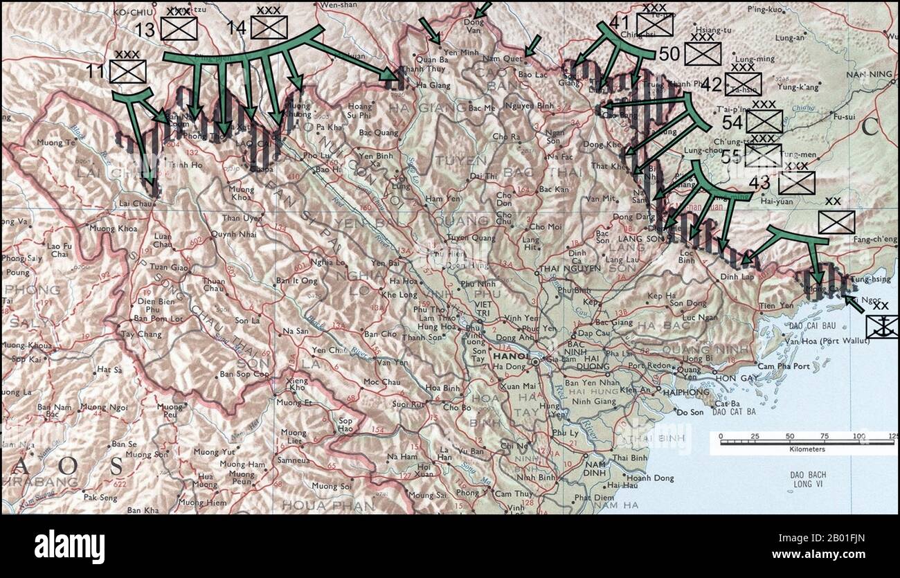
Vietnam: Map showing Chinese invasion routes of Vietnam, Third Indochina War, 1979. The Sino-Vietnamese War (Vietnamese: Chiến tranh biên giới Việt-Trung), also known as the Third Indochina War, known in the PRC as 对越自卫反击战 (Counterattack against Vietnam in Self-Defense) and in Vietnam as Chiến tranh chống bành trướng Trung Hoa (War against Chinese expansionism), was a brief but bloody border war fought in 1979 between the People's Republic of China (PRC) and the Socialist Republic of Vietnam. The PRC launched the offensive in response to Vietnam's 1978 invasion and occupation of Cambodia.

RMID:Image ID:2B01FJN
Image details
Contributor:
CPA Media Pte Ltd / Alamy Stock PhotoImage ID:
2B01FJNFile size:
50.1 MB (2.2 MB Compressed download)Releases:
Model - no | Property - noDo I need a release?Dimensions:
5524 x 3168 px | 46.8 x 26.8 cm | 18.4 x 10.6 inches | 300dpiDate taken:
21 October 2011Photographer:
Pictures From HistoryMore information:
This image could have imperfections as it’s either historical or reportage.