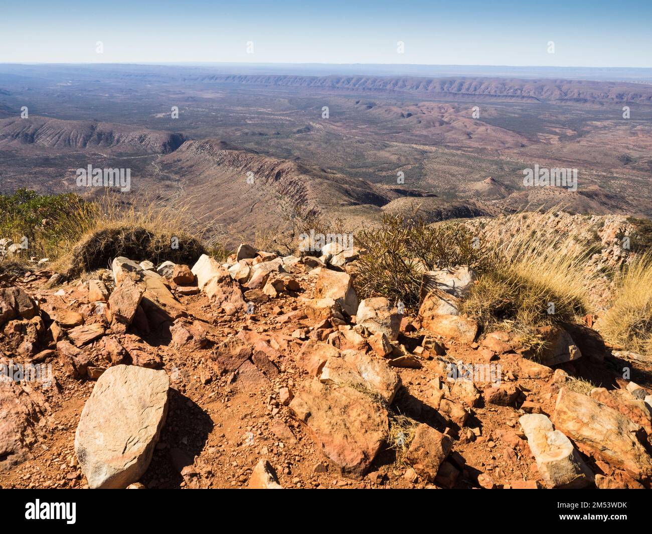
View southeast from the South Summit (1339m) of Mt Sonder with the Heavitree Range in the background, West Macdonnell (Tjoritja) National Park.
RFID:Image ID:2M53WDK
Image details
Contributor:
steve waters / Alamy Stock PhotoImage ID:
2M53WDKFile size:
43.5 MB (2.8 MB Compressed download)Releases:
Model - no | Property - noDo I need a release?Dimensions:
4504 x 3378 px | 38.1 x 28.6 cm | 15 x 11.3 inches | 300dpiDate taken:
1 November 2019Location:
Mt Sonder, West Macdonnell (Tjoritja) National Park, Northern Territory, AustraliaMore information:
The 223km Larapinta long-distance walking trail through The West Macdonnell (Tjoritja) National Park follows the Heavitree and Chewing Ranges west from Alice Springs to Mt Sonder. The area contains the highest peaks in the Northern Territory. Mt Sonder, the 4th-highest, is known as Rutjupma / Rwetyepme by the local Aranda (Western Arrernte) people.