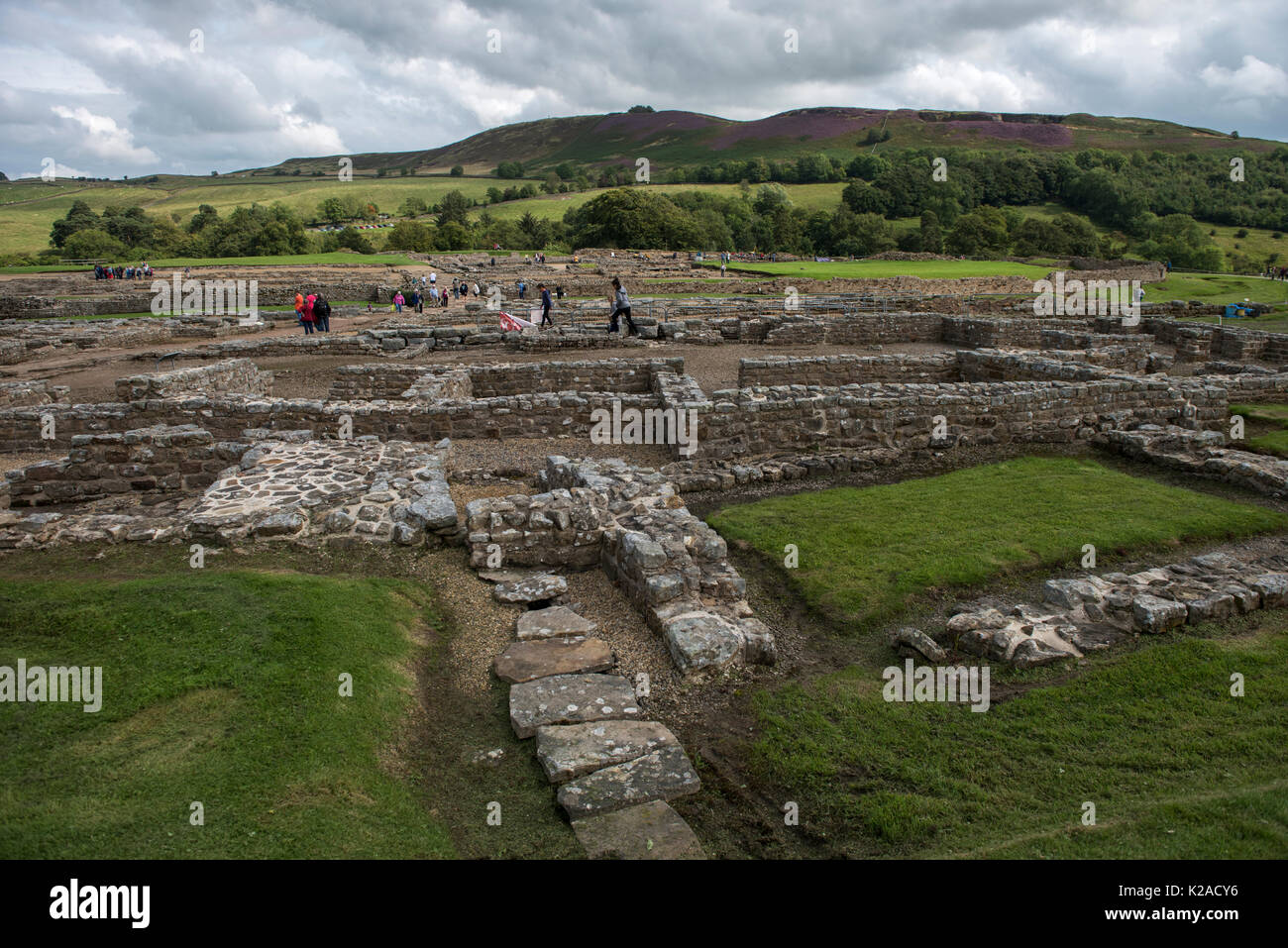
Vindolanda on Hadrian's Wall, Northumberland, England. August 2017 Vindolanda Roman Fort saw it's first Roman settlement between AD 74 and AD 85. Ther
Image details
Contributor:
BRIAN HARRIS / Alamy Stock PhotoImage ID:
K2ACY6File size:
103.4 MB (6.2 MB Compressed download)Releases:
Model - no | Property - noDo I need a release?Dimensions:
7360 x 4912 px | 62.3 x 41.6 cm | 24.5 x 16.4 inches | 300dpiDate taken:
1 August 2017Location:
Vindolanda, Hexham, United KingdomMore information:
Vindolanda on Hadrian's Wall, Northumberland, England. August 2017 Vindolanda Roman Fort saw it's first Roman settlement between AD 74 and AD 85. There were nine forts built here over the following 300-400 years. The excavation of the site started in the 1970's and will go on for another 150 years. Wikipaedia: Vindolanda was a Roman auxiliary fort (castrum) just south of Hadrian's Wall, which it predates, in northern England. Located near the modern village of Bardon Mill, it guarded the Stanegate, the Roman road from the River Tyne to the Solway Firth. It is noted for the Vindolanda tablets, among the most important finds of military and private correspondence (written on wooden tablets) found anywhere in the Roman Empire. Wikipaedia: Hadrian's Wall (Latin: Vallum Aelium), also called the Roman Wall, Picts' Wall, or Vallum Hadriani in Latin, was a defensive fortification in the Roman province of Britannia, begun in AD 122 in the reign of the emperor Hadrian. It ran from the banks of the River Tyne near the North Sea to the Solway Firth on the Irish Sea, and was the northern limit of the Roman Empire, immediately north of which were the lands of the northern Ancient Britons, including the Picts. It had a stone base and a stone wall. There were milecastles with two turrets in between. There was a fort about every five Roman miles. From north to south, the wall comprised a ditch, wall, military way and vallum, another ditch with adjoining mounds. It is thought the milecastles were staffed with static garrisons, whereas the forts had fighting garrisons of infantry and cavalry. In addition to the wall's defensive military role, its gates may have been customs posts. A significant portion of the wall still stands and can be followed on foot along the adjoining Hadrian's Wall Path. The largest Roman artefact anywhere, it runs a total of 73 miles in northern England.[2] Regarded as a British cultural icon, Hadrian's Wall is one of Britain's major ancient tourist attract