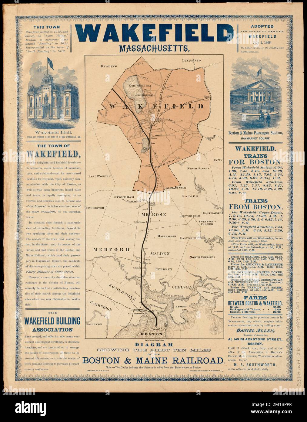
Wakefield, Massachusetts : diagram showing the first ten miles of the Boston & Maine Railroad , Boston and Maine Railroad, Maps, Railroads, Massachusetts, Boston, Maps, Railroads, Massachusetts, Wakefield, Maps, Wakefield Mass., Maps, Boston Mass., Maps Norman B. Leventhal Map Center Collection
RMID:Image ID:2M1BPPR
Image details
Contributor:
piemags/DCM / Alamy Stock PhotoImage ID:
2M1BPPRFile size:
108.2 MB (5.2 MB Compressed download)Releases:
Model - no | Property - noDo I need a release?Dimensions:
5430 x 6966 px | 46 x 59 cm | 18.1 x 23.2 inches | 300dpiMore information:
This image is a public domain image, which means either that copyright has expired in the image or the copyright holder has waived their copyright. Alamy charges you a fee for access to the high resolution copy of the image.
This image could have imperfections as it’s either historical or reportage.