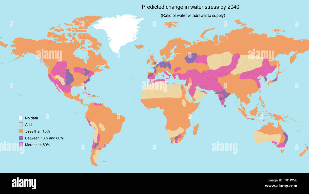
Water Stress by 2040, Map

RMID:Image ID:T81RWE
Image details
Contributor:
Science History Images / Alamy Stock PhotoImage ID:
T81RWEFile size:
62.9 MB (2.1 MB Compressed download)Releases:
Model - no | Property - noDo I need a release?Dimensions:
6264 x 3508 px | 53 x 29.7 cm | 20.9 x 11.7 inches | 300dpiDate taken:
14 August 2002Photographer:
Science History ImagesMore information:
This image could have imperfections as it’s either historical or reportage.
A map showing the predicted change in water stress (the ratio of water withdrawal to supply) by 2040. The areas of greatest stress are roughly indicated in bright purple. They include the western USA and Central America, southern Europe, the Middle East and parts of Asia, Northern Africa, South Africa, and parts of Australia and South America. Data adapted from the World Resources Institute.