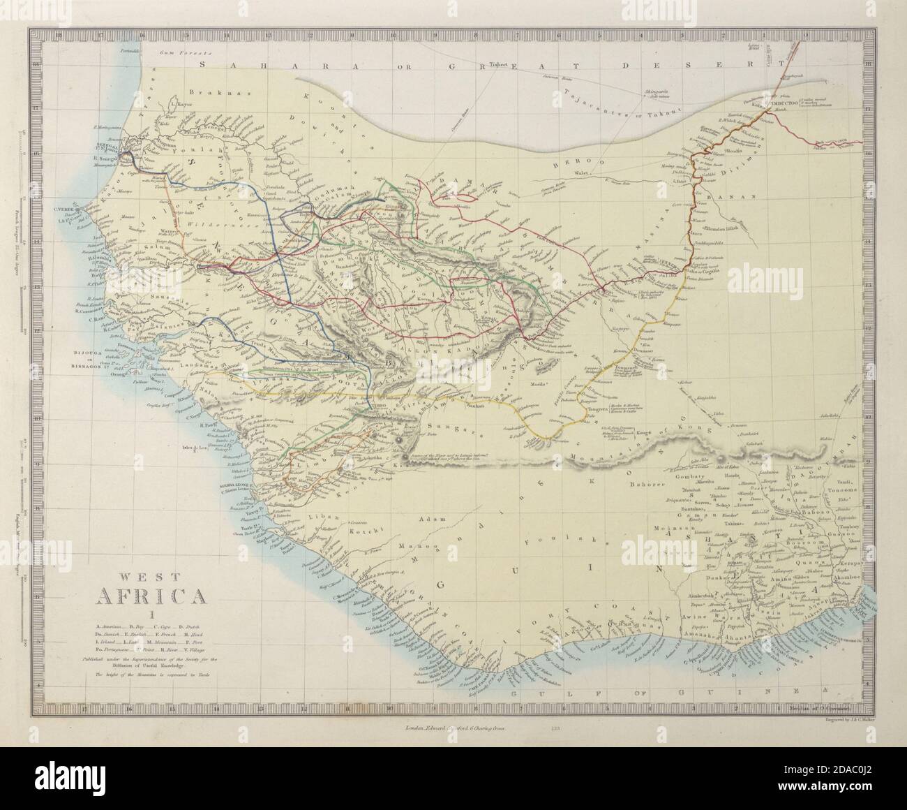
WEST AFRICA Explorers' routes Senegal Ashanti. Mountains of Kong. SDUK 1857 map
Image details
Contributor:
Antiqua Print Gallery / Alamy Stock PhotoImage ID:
2DAC0J2File size:
45 MB (1.7 MB Compressed download)Releases:
Model - no | Property - noDo I need a release?Dimensions:
4371 x 3599 px | 37 x 30.5 cm | 14.6 x 12 inches | 300dpiDate taken:
1857Location:
AfricaMore information:
This image could have imperfections as it’s either historical or reportage.
WEST AFRICA, I [Senegal River to Cape St Paul]. Artist/engraver/cartographer: Engraved by J & C Walker. Provenance: "The Family Atlas under the superintendence of the Society for the Diffusion of Useful Knowledge", published by Edward Stanford, London. Type: Antique steel engraved map with original hand colouring. The map shows the routes followed by the explorers Caillie, Laing, O'Byrne, Winterbottom, Campbell, Mollien, Beaufort, Dochard, Park & Gray. Marked on this map are the Mountains of Kong, a non-existent mountain range charted on English maps of Africa from 1798 through the late 1880s. An early map resulting from exploration of the area and showing this west to east mountain range in 1798 was produced by English cartographer James Rennell. The mountains were thought to begin in West Africa near the highland source of the Niger River near Tembakounda in Guinea, then continue east to the also fictitious Central African Mountains of the Moon, thought to be where the White Nile rose. Cartographers stopped including the mountains on maps after French explorer Louis Gustave Binger established that the mountains were fictitious in his 1887-1889 expedition to chart the Niger River from its mouth in the Gulf of Guinea and through Côte d'Ivoire.