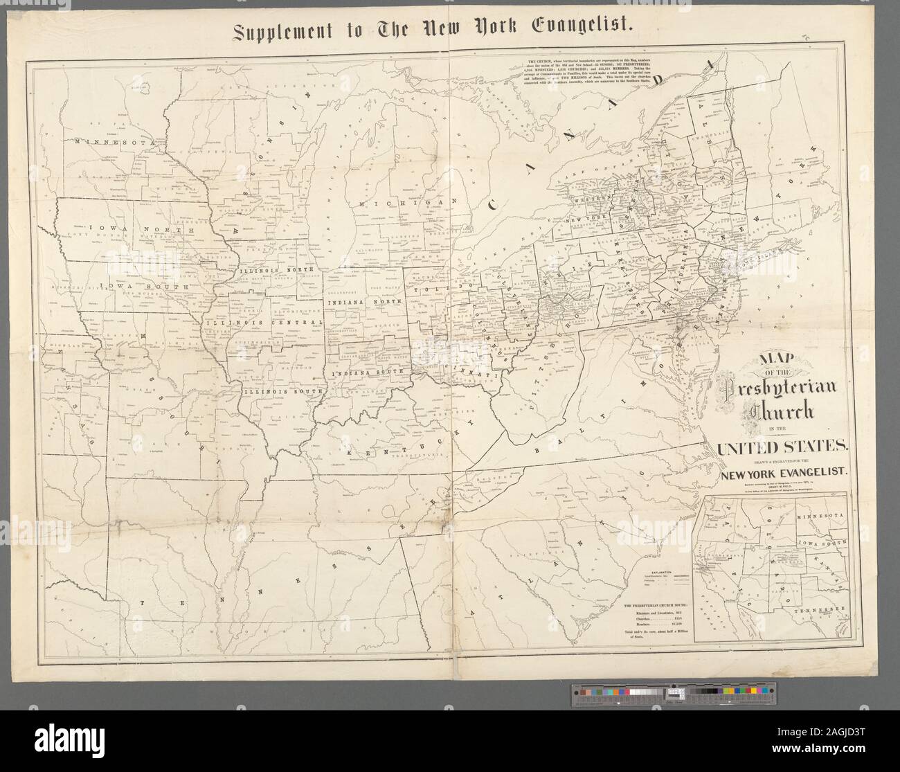
Western territory shown in inset map. Includes note and statistics. Mapping the Nation (NEH grant, 2015-2018); Map of the Presbyterian Church in the United States
RMID:Image ID:2AGJD3T
Image details
Contributor:
Bravo Images / Alamy Stock PhotoImage ID:
2AGJD3TFile size:
57.2 MB (2.4 MB Compressed download)Releases:
Model - no | Property - noDo I need a release?Dimensions:
5035 x 3972 px | 42.6 x 33.6 cm | 16.8 x 13.2 inches | 300dpiDate taken:
23 February 2016More information:
This image is a public domain image, which means either that copyright has expired in the image or the copyright holder has waived their copyright. Alamy charges you a fee for access to the high resolution copy of the image.
This image could have imperfections as it’s either historical or reportage.