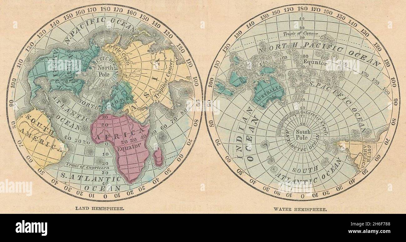
World. Land & Water Hemispheres. JOHNSON 1865 old antique map plan chart
RFID:Image ID:2H6F788
Image details
Contributor:
Antiqua Print Gallery / Alamy Stock PhotoImage ID:
2H6F788File size:
5.4 MB (620.4 KB Compressed download)Releases:
Model - no | Property - noDo I need a release?Dimensions:
1891 x 995 px | 32 x 16.8 cm | 12.6 x 6.6 inches | 150dpiDate taken:
1865Location:
WorldMore information:
This image could have imperfections as it’s either historical or reportage.
Land Hemisphere - Water Hemisphere. Artist/engraver/cartographer: Alvin Jewett Johnson. Provenance: "Johnson's New Illustrated Family Atlas", Johnson and Ward, 113 Fulton Street, New York [Johnson's New Illustrated Family Atlas]. Type: Large, decorative hand coloured 19th century atlas map.