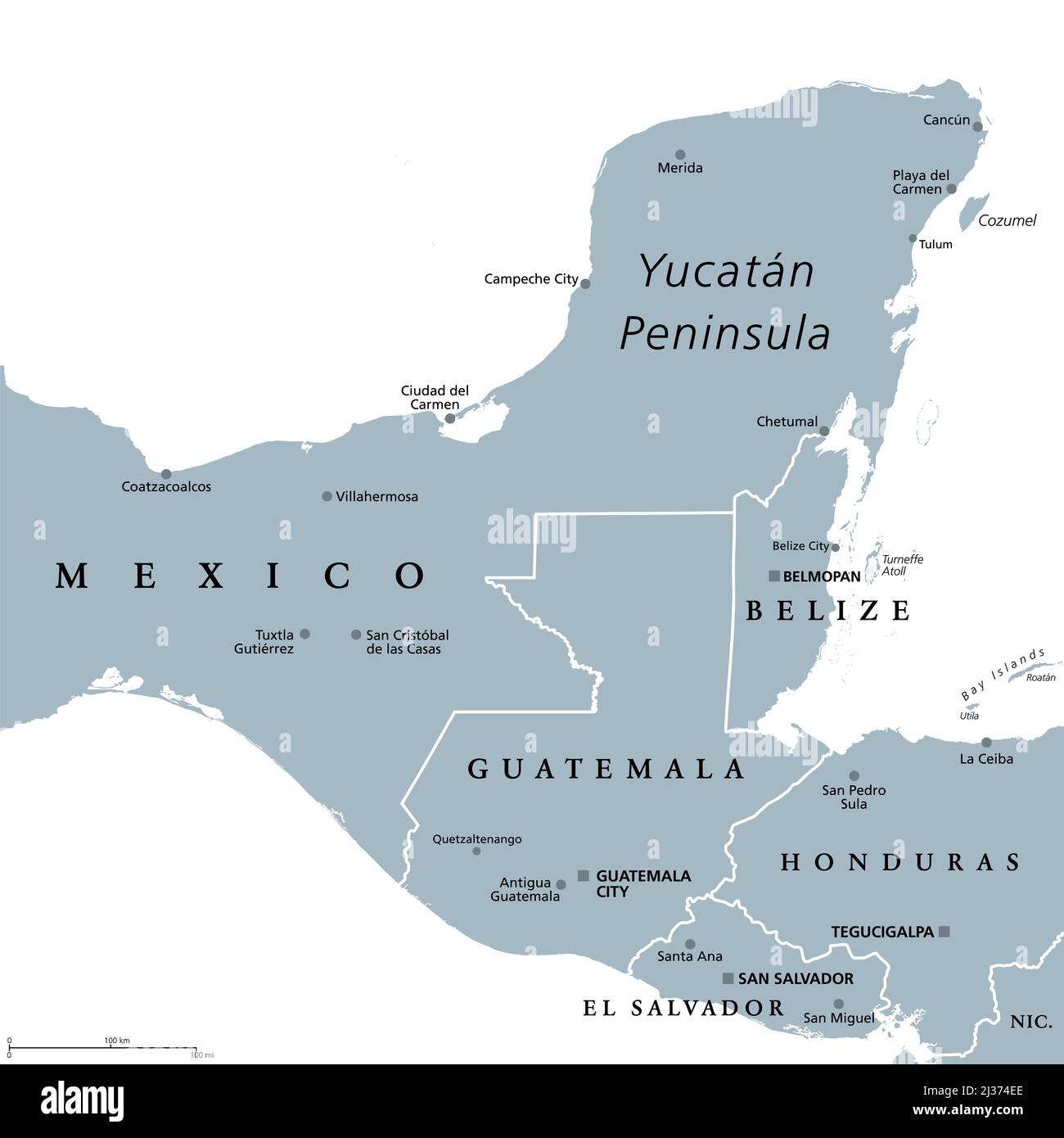
Yucatan Peninsula, gray political map. Peninsula in southeastern Mexico and adjectants portions of Belize and Guatemala.
RFID:Image ID:2J374EE
Image details
Contributor:
Peter Hermes Furian / Alamy Stock PhotoImage ID:
2J374EEFile size:
103 MB (718.9 KB Compressed download)Releases:
Model - no | Property - noDo I need a release?Dimensions:
6000 x 6000 px | 50.8 x 50.8 cm | 20 x 20 inches | 300dpiDate taken:
6 April 2022Location:
YucatanMore information:
Yucatan Peninsula, gray political map. Peninsula in southeastern Mexico and adjectants portions of Belize and Guatemala, separating the Gulf of Mexico and Caribbean Sea. With El Salvador and Honduras.