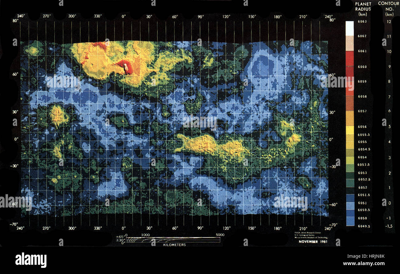
Venus, Topographic Map, Mercator Projection
Image details
Contributor:
Science History Images / Alamy Stock PhotoImage ID:
HRJN8KFile size:
40.6 MB (3.1 MB Compressed download)Releases:
Model - no | Property - noDo I need a release?Dimensions:
4800 x 2957 px | 40.6 x 25 cm | 16 x 9.9 inches | 300dpiPhotographer:
Photo ResearchersMore information:
This image could have imperfections as it’s either historical or reportage.
Topographic Map of Venus from Pioneer Venus (Mercator Projection). The Pioneer Venus project was part of the Pioneer program consisting of two spacecraft, the Pioneer Venus Orbiter and the Pioneer Venus Multiprobe, launched to Venus in 1978. The Pioneer Venus Orbiter entered orbit around Venus on December 4, 1978, and performed observations to characterize the atmosphere and surface of Venus. It continued to transmit data until October 1992. The Pioneer Venus Multiprobe deployed four small probes into the Venusian atmosphere on December 9, 1978. All four probes transmitted data throughout their descent to the surface. One probe survived landing and transmitted data from the surface for over an hour. The Mercator projection is a cylindrical map projection.