Quick filters:
16th century map trade Stock Photos and Images
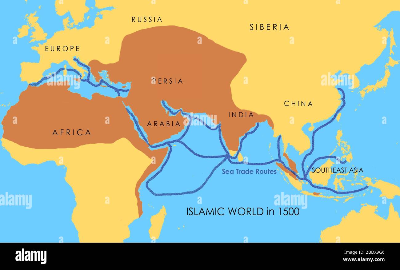 A map showing a network of medieval sea trade routes. The areas in darker yellow indicate the extent of the Islamic world in 1500. Stock Photohttps://www.alamy.com/image-license-details/?v=1https://www.alamy.com/a-map-showing-a-network-of-medieval-sea-trade-routes-the-areas-in-darker-yellow-indicate-the-extent-of-the-islamic-world-in-1500-image352776150.html
RM2BDX9G6–A map showing a network of medieval sea trade routes. The areas in darker yellow indicate the extent of the Islamic world in 1500.
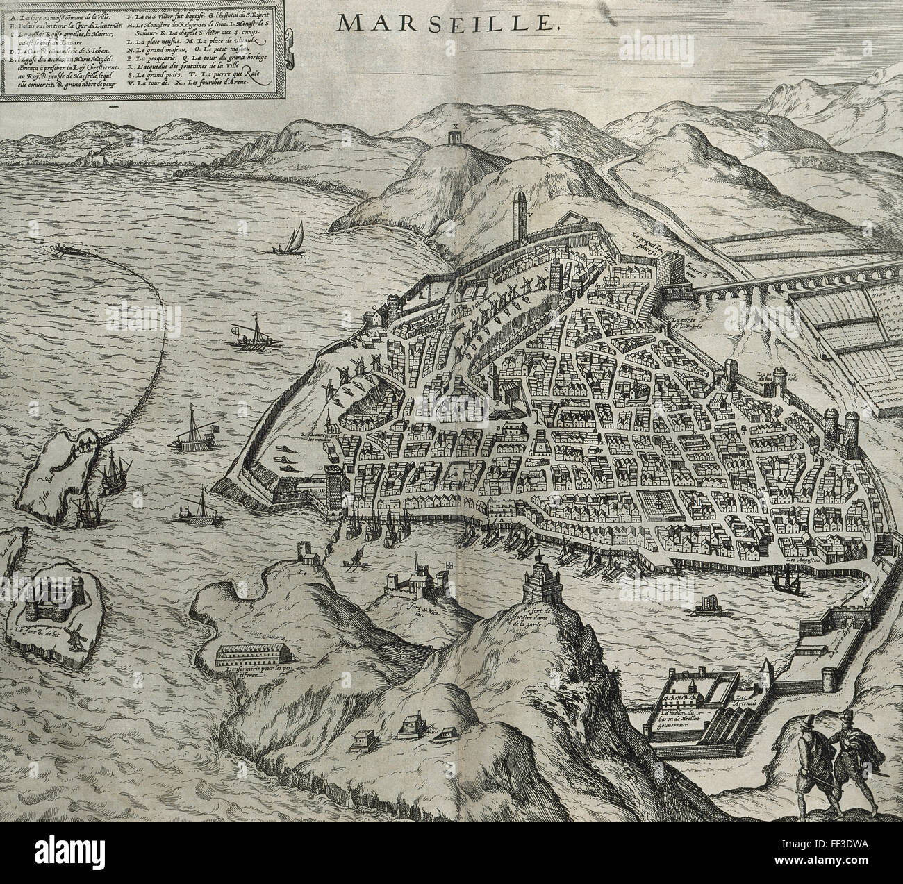 France. Marseille in 16th century. Map. Engraving in 'Theatre des principalles villes de tout le monde' by Georges Brun de Cologne, 1573. Stock Photohttps://www.alamy.com/image-license-details/?v=1https://www.alamy.com/stock-photo-france-marseille-in-16th-century-map-engraving-in-theatre-des-principalles-95348438.html
RMFF3DWA–France. Marseille in 16th century. Map. Engraving in 'Theatre des principalles villes de tout le monde' by Georges Brun de Cologne, 1573.
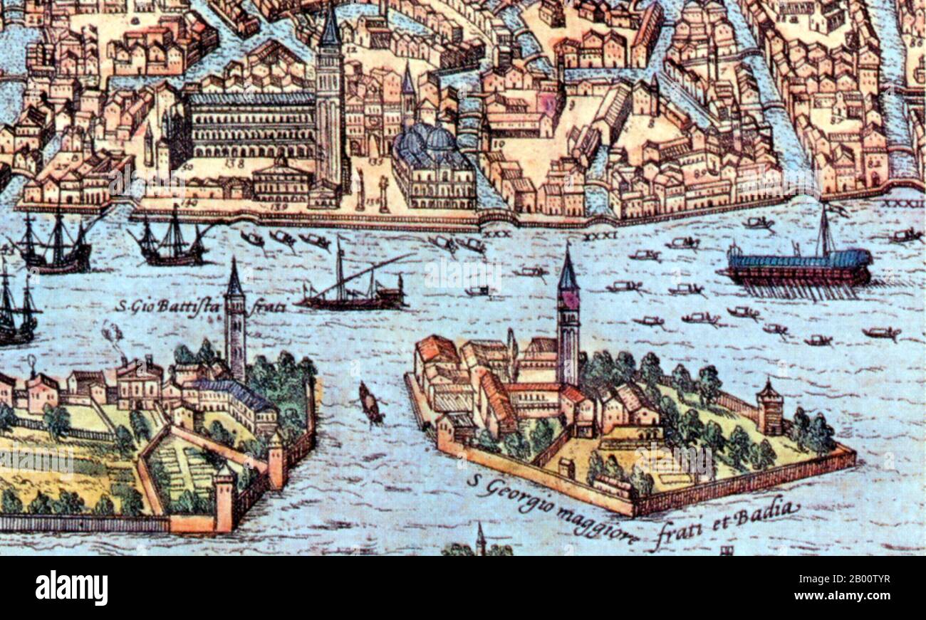 Italy: Detail from an illustration of Venice showing lateen- (triangular-) and square--rigged ships. Illustration by Frans Hogenberg (1535-1590), 16th century. For centuries Venice was Europe’s prime trading partner with the Middle East and the Byzantine Empire in particular. Venetian naval and commercial power was unrivalled in Europe until it lost a series of wars to the Ottoman armies in the 15th century. The city lost some 50,000 people to the Black Death in 1575-77, but remained a major manufacturing center and port well into the 18th century. Stock Photohttps://www.alamy.com/image-license-details/?v=1https://www.alamy.com/italy-detail-from-an-illustration-of-venice-showing-lateen-triangular-and-square-rigged-ships-illustration-by-frans-hogenberg-1535-1590-16th-century-for-centuries-venice-was-europes-prime-trading-partner-with-the-middle-east-and-the-byzantine-empire-in-particular-venetian-naval-and-commercial-power-was-unrivalled-in-europe-until-it-lost-a-series-of-wars-to-the-ottoman-armies-in-the-15th-century-the-city-lost-some-50000-people-to-the-black-death-in-1575-77-but-remained-a-major-manufacturing-center-and-port-well-into-the-18th-century-image344226955.html
RM2B00TYR–Italy: Detail from an illustration of Venice showing lateen- (triangular-) and square--rigged ships. Illustration by Frans Hogenberg (1535-1590), 16th century. For centuries Venice was Europe’s prime trading partner with the Middle East and the Byzantine Empire in particular. Venetian naval and commercial power was unrivalled in Europe until it lost a series of wars to the Ottoman armies in the 15th century. The city lost some 50,000 people to the Black Death in 1575-77, but remained a major manufacturing center and port well into the 18th century.
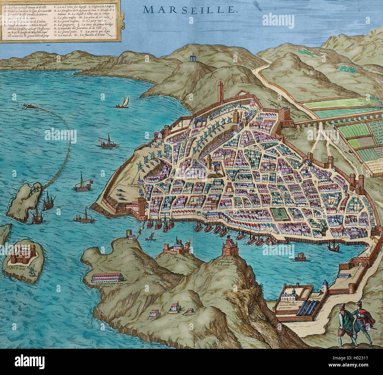 France. Marseille in 16th century. Map. Engraving in 'Theatre des principalles villes de tout le monde' by Georges Brun de Cologne, 1573. Colored. Stock Photohttps://www.alamy.com/image-license-details/?v=1https://www.alamy.com/stock-photo-france-marseille-in-16th-century-map-engraving-in-theatre-des-principalles-120518861.html
RMH02311–France. Marseille in 16th century. Map. Engraving in 'Theatre des principalles villes de tout le monde' by Georges Brun de Cologne, 1573. Colored.
 Map: The Coast of France and Holland, and the British Isles, Greek, Parchment, mid-16th century, Sheet: 7 7/8 x 12 in., 20 x 30.5 cm, Age of exploration, cartography, geography, historic map, navigation, seafaring, trade, voyage Stock Photohttps://www.alamy.com/image-license-details/?v=1https://www.alamy.com/map-the-coast-of-france-and-holland-and-the-british-isles-greek-parchment-mid-16th-century-sheet-7-78-x-12-in-20-x-305-cm-age-of-exploration-cartography-geography-historic-map-navigation-seafaring-trade-voyage-image454274023.html
RM2HB1Y47–Map: The Coast of France and Holland, and the British Isles, Greek, Parchment, mid-16th century, Sheet: 7 7/8 x 12 in., 20 x 30.5 cm, Age of exploration, cartography, geography, historic map, navigation, seafaring, trade, voyage
 Inspired by Map: The Coast of France and Holland, and the British Isles, Greek, Parchment, mid-16th century, Sheet: 7 7/8 x 12 in., 20 x 30.5 cm, Age of exploration, cartography, geography, historic map, navigation, seafaring, trade, voyage, Reimagined by Artotop. Classic art reinvented with a modern twist. Design of warm cheerful glowing of brightness and light ray radiance. Photography inspired by surrealism and futurism, embracing dynamic energy of modern technology, movement, speed and revolutionize culture Stock Photohttps://www.alamy.com/image-license-details/?v=1https://www.alamy.com/inspired-by-map-the-coast-of-france-and-holland-and-the-british-isles-greek-parchment-mid-16th-century-sheet-7-78-x-12-in-20-x-305-cm-age-of-exploration-cartography-geography-historic-map-navigation-seafaring-trade-voyage-reimagined-by-artotop-classic-art-reinvented-with-a-modern-twist-design-of-warm-cheerful-glowing-of-brightness-and-light-ray-radiance-photography-inspired-by-surrealism-and-futurism-embracing-dynamic-energy-of-modern-technology-movement-speed-and-revolutionize-culture-image459253038.html
RF2HK4NX6–Inspired by Map: The Coast of France and Holland, and the British Isles, Greek, Parchment, mid-16th century, Sheet: 7 7/8 x 12 in., 20 x 30.5 cm, Age of exploration, cartography, geography, historic map, navigation, seafaring, trade, voyage, Reimagined by Artotop. Classic art reinvented with a modern twist. Design of warm cheerful glowing of brightness and light ray radiance. Photography inspired by surrealism and futurism, embracing dynamic energy of modern technology, movement, speed and revolutionize culture
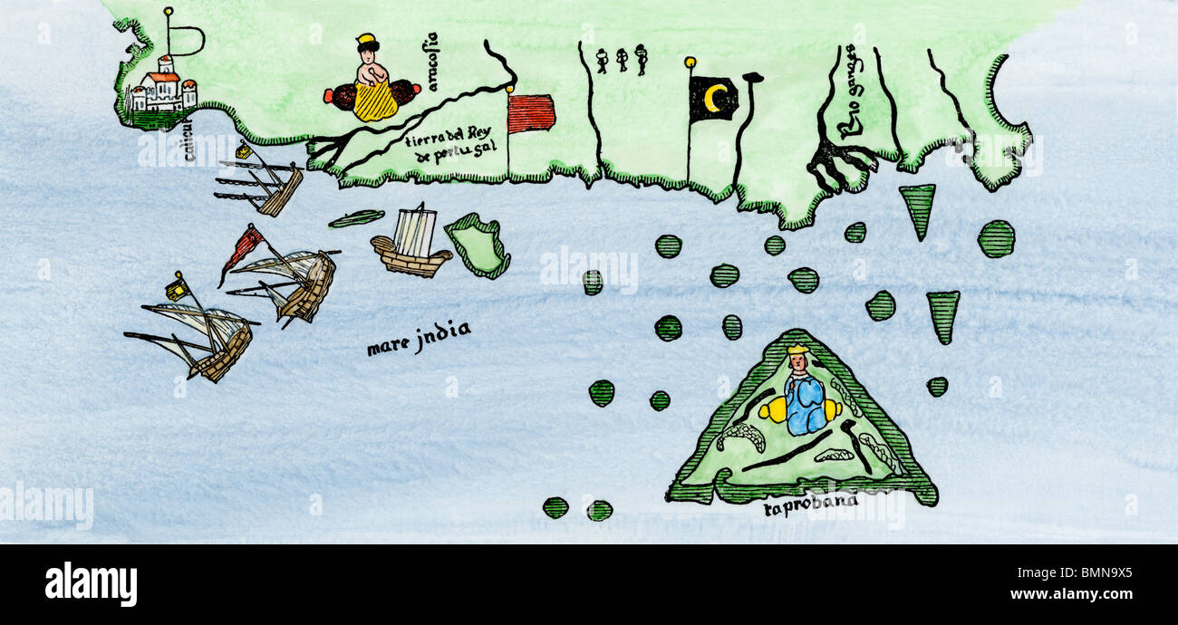 Calcutta and the southern coast of India, from Juan de la Cosa's map, 1500. Hand-colored woodcut Stock Photohttps://www.alamy.com/image-license-details/?v=1https://www.alamy.com/stock-photo-calcutta-and-the-southern-coast-of-india-from-juan-de-la-cosas-map-29972269.html
RMBMN9X5–Calcutta and the southern coast of India, from Juan de la Cosa's map, 1500. Hand-colored woodcut
 'Cantino's Map'. Anonymous early 16th-century world map by a Portuguese cartographer commissioned by Alberto Cantino, agent of the Italian Duke of Ferrara in Italy. It depicts how the Portuguese succeeded in reaching India using a direct sea route. Copy of the original parchment in the Biblioteca Estense in Modena (Italy). Detail. Maritime Museum. Lisbon, Portugal. Stock Photohttps://www.alamy.com/image-license-details/?v=1https://www.alamy.com/cantinos-map-anonymous-early-16th-century-world-map-by-a-portuguese-cartographer-commissioned-by-alberto-cantino-agent-of-the-italian-duke-of-ferrara-in-italy-it-depicts-how-the-portuguese-succeeded-in-reaching-india-using-a-direct-sea-route-copy-of-the-original-parchment-in-the-biblioteca-estense-in-modena-italy-detail-maritime-museum-lisbon-portugal-image545645861.html
RM2PKM8T5–'Cantino's Map'. Anonymous early 16th-century world map by a Portuguese cartographer commissioned by Alberto Cantino, agent of the Italian Duke of Ferrara in Italy. It depicts how the Portuguese succeeded in reaching India using a direct sea route. Copy of the original parchment in the Biblioteca Estense in Modena (Italy). Detail. Maritime Museum. Lisbon, Portugal.
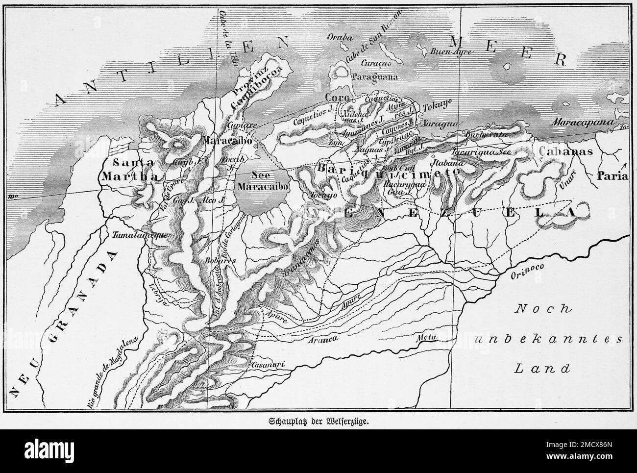 Map, Welser, 16th century, patrician family, German, triangular trade, wealth, voyages, overseas province, colony, Caribbean, terra incognita, Lake Stock Photohttps://www.alamy.com/image-license-details/?v=1https://www.alamy.com/map-welser-16th-century-patrician-family-german-triangular-trade-wealth-voyages-overseas-province-colony-caribbean-terra-incognita-lake-image507053757.html
RM2MCX86N–Map, Welser, 16th century, patrician family, German, triangular trade, wealth, voyages, overseas province, colony, Caribbean, terra incognita, Lake
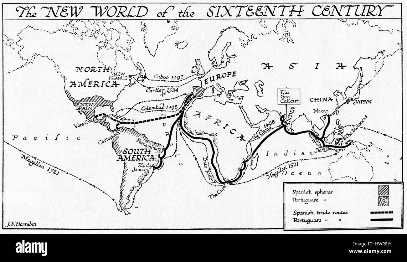 The new world of the 16th century, map showing Spanish and Portuguese colonies and trade routes Stock Photohttps://www.alamy.com/image-license-details/?v=1https://www.alamy.com/stock-photo-the-new-world-of-the-16th-century-map-showing-spanish-and-portuguese-136355379.html
RMHWREJY–The new world of the 16th century, map showing Spanish and Portuguese colonies and trade routes
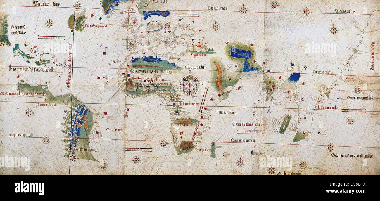 World map of 1502 showing the continent of Africa in the centre. Named after Alberto Cantino, Italian diplomatic agent in Lisbon, who obtained it for the Duke of Ferrara. The rivalry between Spain and Portugal over trade and conquest was regulated by the Reaty of Tordesillas 1494. The blue line on left shows the Papal demarcation of territory, Spain to the West, Portugal to the East. Stock Photohttps://www.alamy.com/image-license-details/?v=1https://www.alamy.com/stock-photo-world-map-of-1502-showing-the-continent-of-africa-in-the-centre-named-57347302.html
RMD98B1X–World map of 1502 showing the continent of Africa in the centre. Named after Alberto Cantino, Italian diplomatic agent in Lisbon, who obtained it for the Duke of Ferrara. The rivalry between Spain and Portugal over trade and conquest was regulated by the Reaty of Tordesillas 1494. The blue line on left shows the Papal demarcation of territory, Spain to the West, Portugal to the East.
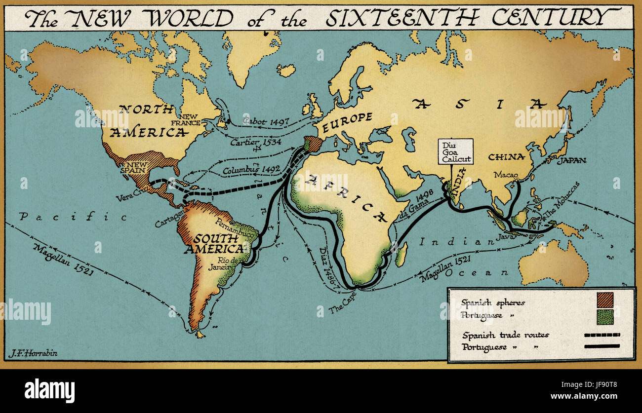 The new world of the 16th century, map showing Spanish and Portuguese colonies and trade routes Stock Photohttps://www.alamy.com/image-license-details/?v=1https://www.alamy.com/stock-photo-the-new-world-of-the-16th-century-map-showing-spanish-and-portuguese-147101032.html
RMJF90T8–The new world of the 16th century, map showing Spanish and Portuguese colonies and trade routes
 France. Marseille in 16th century. Map. Engraving in 'Theatre des principalles villes de tout le monde' by Georges Brun de Cologne, 1573. Stock Photohttps://www.alamy.com/image-license-details/?v=1https://www.alamy.com/france-marseille-in-16th-century-map-engraving-in-theatre-des-principalles-villes-de-tout-le-monde-by-georges-brun-de-cologne-1573-image220202254.html
RMPP7266–France. Marseille in 16th century. Map. Engraving in 'Theatre des principalles villes de tout le monde' by Georges Brun de Cologne, 1573.
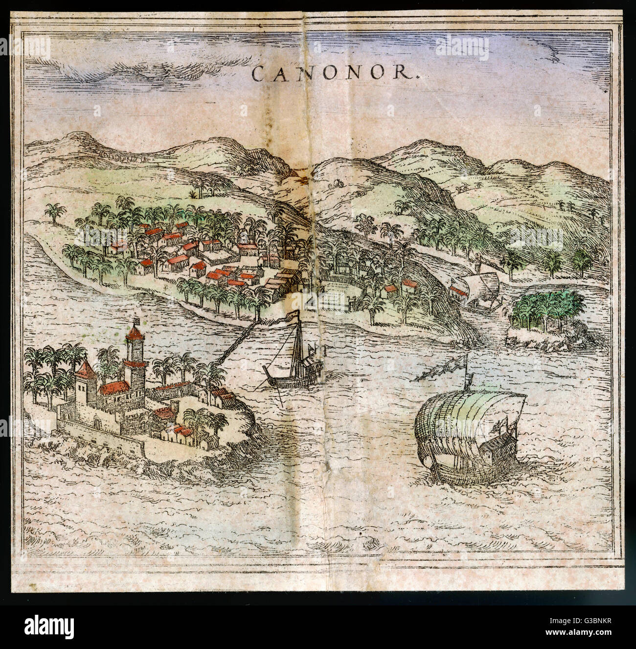 TRADE / CANONOR 1572 Stock Photohttps://www.alamy.com/image-license-details/?v=1https://www.alamy.com/stock-photo-trade-canonor-1572-105364667.html
RMG3BNKR–TRADE / CANONOR 1572
 German book trade in the 16th century Stock Photohttps://www.alamy.com/image-license-details/?v=1https://www.alamy.com/stock-photo-german-book-trade-in-the-16th-century-139988540.html
RMJ3N0PM–German book trade in the 16th century
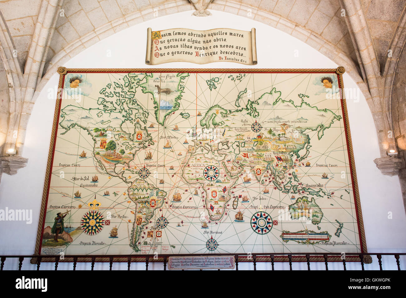 LISBON, Portugal — The Age of Discoveries Map at the Museu de Marinha (Maritime Museum) illustrates Portuguese maritime explorations during the 15th and 16th centuries. Using the Mercator projection, the map details the routes of Portuguese explorers across the Atlantic, Indian, and Pacific oceans. Displayed in the historic Jerónimos Monastery wing of the museum, it demonstrates Portugal's pioneering role in global maritime exploration. Stock Photohttps://www.alamy.com/image-license-details/?v=1https://www.alamy.com/stock-photo-lisbon-portugal-the-age-of-discoveries-map-at-the-museu-de-marinha-115502651.html
RMGKWGPK–LISBON, Portugal — The Age of Discoveries Map at the Museu de Marinha (Maritime Museum) illustrates Portuguese maritime explorations during the 15th and 16th centuries. Using the Mercator projection, the map details the routes of Portuguese explorers across the Atlantic, Indian, and Pacific oceans. Displayed in the historic Jerónimos Monastery wing of the museum, it demonstrates Portugal's pioneering role in global maritime exploration.
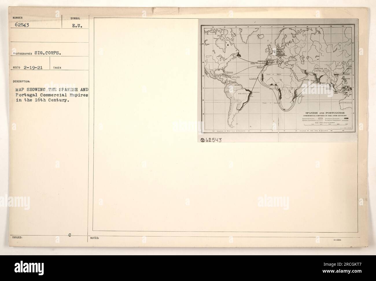 Close-up of a map displaying the Spanish and Portuguese Commercial Empires during the 16th Century. The map is marked with intricate detail and shows the extensive territories controlled by the two empires at that time. This photograph was taken by the Signal Corps and received on February 19, 1921. Stock Photohttps://www.alamy.com/image-license-details/?v=1https://www.alamy.com/close-up-of-a-map-displaying-the-spanish-and-portuguese-commercial-empires-during-the-16th-century-the-map-is-marked-with-intricate-detail-and-shows-the-extensive-territories-controlled-by-the-two-empires-at-that-time-this-photograph-was-taken-by-the-signal-corps-and-received-on-february-19-1921-image558474455.html
RM2RCGKT7–Close-up of a map displaying the Spanish and Portuguese Commercial Empires during the 16th Century. The map is marked with intricate detail and shows the extensive territories controlled by the two empires at that time. This photograph was taken by the Signal Corps and received on February 19, 1921.
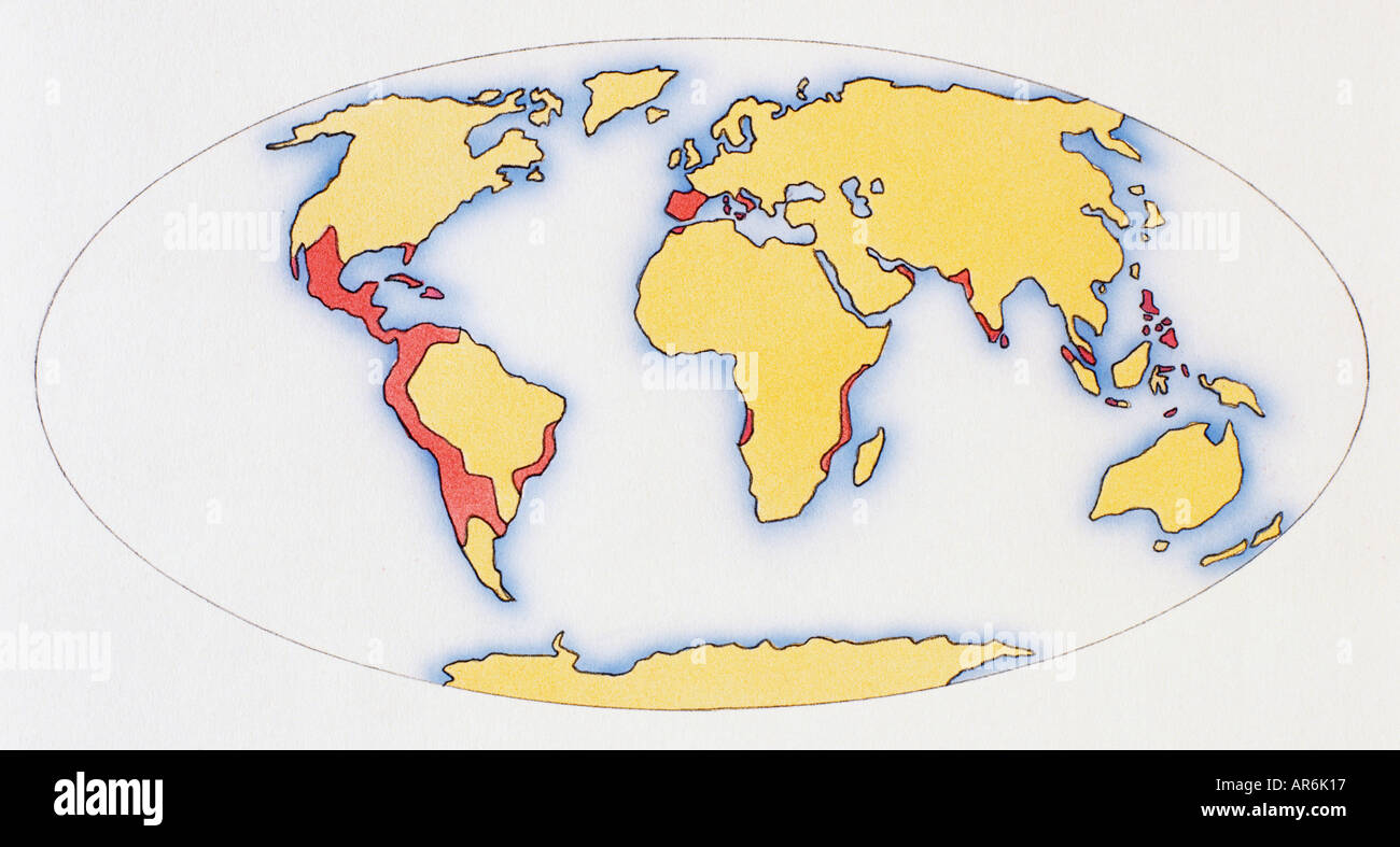 World map, red areas highlighting extent of Spanish and Portuguese Empires in 1588, Stock Photohttps://www.alamy.com/image-license-details/?v=1https://www.alamy.com/world-map-red-areas-highlighting-extent-of-spanish-and-portuguese-image5208854.html
RMAR6K17–World map, red areas highlighting extent of Spanish and Portuguese Empires in 1588,
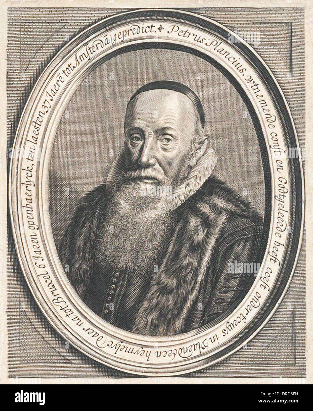 Petrus Plancius (1552-1622) Dutch astronomer, cartographer and mathematician. Founder and mapmaker for Dutch East India Company. Stock Photohttps://www.alamy.com/image-license-details/?v=1https://www.alamy.com/petrus-plancius-1552-1622-dutch-astronomer-cartographer-and-mathematician-image66058713.html
RMDRD6FN–Petrus Plancius (1552-1622) Dutch astronomer, cartographer and mathematician. Founder and mapmaker for Dutch East India Company.
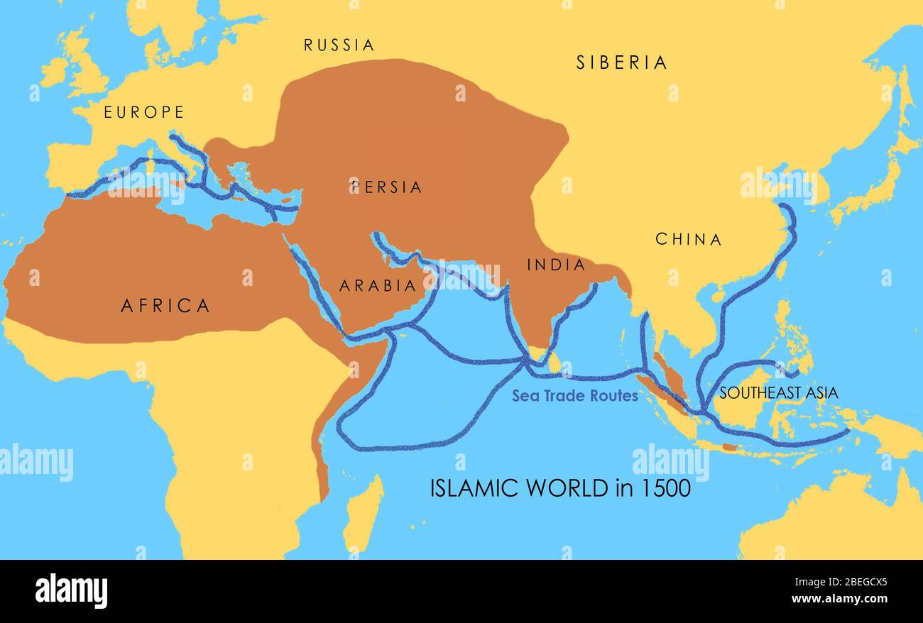 A map showing a network of medieval sea trade routes. The areas in darker yellow indicate the extent of the Islamic world in 1500. Stock Photohttps://www.alamy.com/image-license-details/?v=1https://www.alamy.com/a-map-showing-a-network-of-medieval-sea-trade-routes-the-areas-in-darker-yellow-indicate-the-extent-of-the-islamic-world-in-1500-image353173917.html
RM2BEGCX5–A map showing a network of medieval sea trade routes. The areas in darker yellow indicate the extent of the Islamic world in 1500.
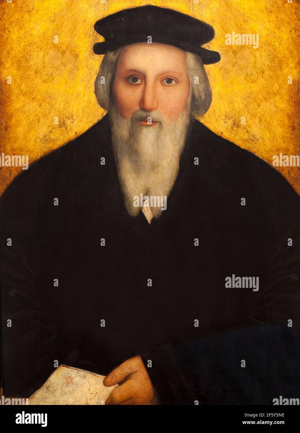 Sebastian Cabot or Sebastiano Caboto. Italian explorer of the Rio de la Plata. Bust portrait painted from Julio Garcia Condoy engraving Stock Photohttps://www.alamy.com/image-license-details/?v=1https://www.alamy.com/sebastian-cabot-or-sebastiano-caboto-italian-explorer-of-the-rio-de-la-plata-bust-portrait-painted-from-julio-garcia-condoy-engraving-image416719338.html
RF2F5Y5NE–Sebastian Cabot or Sebastiano Caboto. Italian explorer of the Rio de la Plata. Bust portrait painted from Julio Garcia Condoy engraving
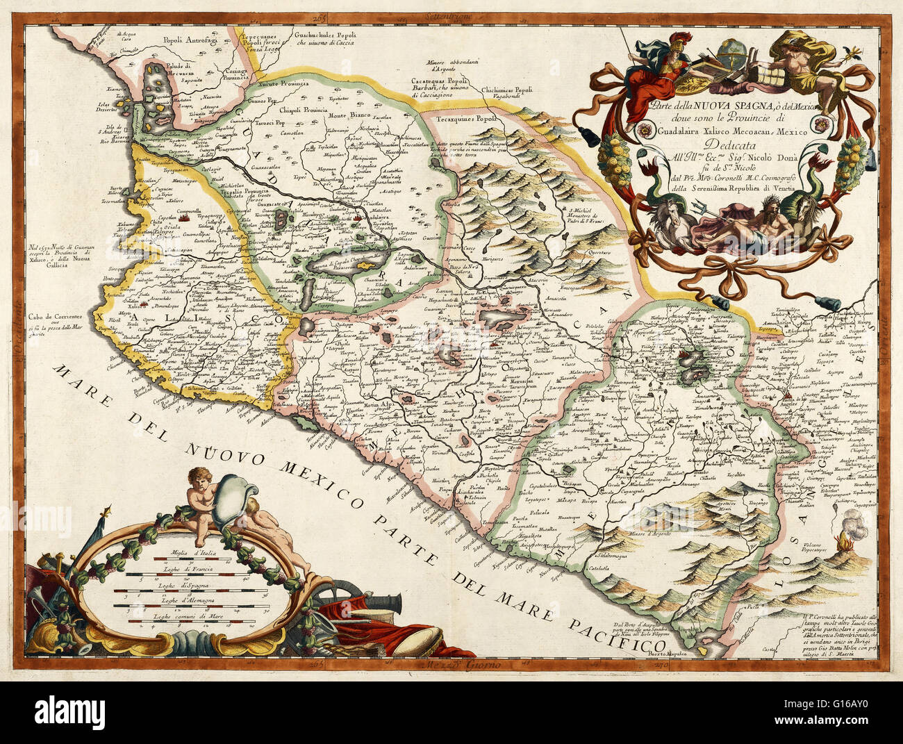 A 16th century map of New Spain or Mexico by Diego Gutiérrez, who was appointed cartographer of the Casa de la Contratacion (House of Trade) in 1554. Casa de la Contratacion was a government agency of the Spanish Empire that existed from the 16th to the 1 Stock Photohttps://www.alamy.com/image-license-details/?v=1https://www.alamy.com/stock-photo-a-16th-century-map-of-new-spain-or-mexico-by-diego-gutirrez-who-was-104017172.html
RMG16AY0–A 16th century map of New Spain or Mexico by Diego Gutiérrez, who was appointed cartographer of the Casa de la Contratacion (House of Trade) in 1554. Casa de la Contratacion was a government agency of the Spanish Empire that existed from the 16th to the 1
 Italy: An early 16th-century illustration of Venice by Ottoman admiral and cartographer Piri Reis (1470-1554), published in his navigational ‘Kitab-i-Bahriye’ (Book of Sea Lore). For centuries Venice was Europe’s prime trading partner with the Middle East and the Byzantine Empire in particular. Venetian naval and commercial power was unrivalled in Europe until it lost a series of wars to the Ottoman armies in the 15th century. The city lost some 50,000 people to the Black Death in 1575-77, but remained a major manufacturing center and port well into the 18th century. Stock Photohttps://www.alamy.com/image-license-details/?v=1https://www.alamy.com/italy-an-early-16th-century-illustration-of-venice-by-ottoman-admiral-and-cartographer-piri-reis-1470-1554-published-in-his-navigational-kitab-i-bahriye-book-of-sea-lore-for-centuries-venice-was-europes-prime-trading-partner-with-the-middle-east-and-the-byzantine-empire-in-particular-venetian-naval-and-commercial-power-was-unrivalled-in-europe-until-it-lost-a-series-of-wars-to-the-ottoman-armies-in-the-15th-century-the-city-lost-some-50000-people-to-the-black-death-in-1575-77-but-remained-a-major-manufacturing-center-and-port-well-into-the-18th-century-image344226976.html
RM2B00W0G–Italy: An early 16th-century illustration of Venice by Ottoman admiral and cartographer Piri Reis (1470-1554), published in his navigational ‘Kitab-i-Bahriye’ (Book of Sea Lore). For centuries Venice was Europe’s prime trading partner with the Middle East and the Byzantine Empire in particular. Venetian naval and commercial power was unrivalled in Europe until it lost a series of wars to the Ottoman armies in the 15th century. The city lost some 50,000 people to the Black Death in 1575-77, but remained a major manufacturing center and port well into the 18th century.
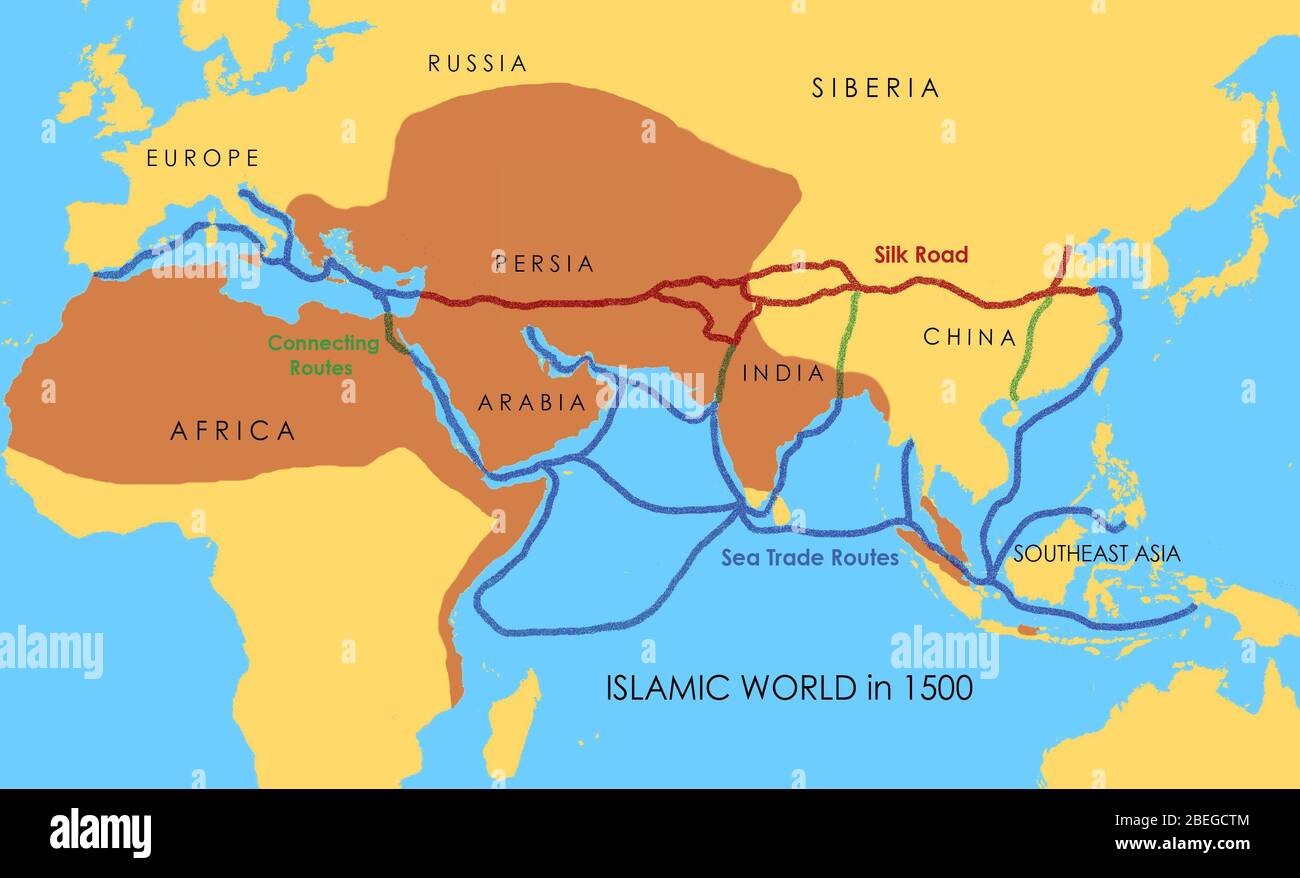 A map showing a network of medieval trade routes, including the Silk Road (connecting East and West between the 2nd century BCE and the 18th century) and various sea trade routes. The areas in darker yellow indicate the extent of the Islamic world in 1500. Stock Photohttps://www.alamy.com/image-license-details/?v=1https://www.alamy.com/a-map-showing-a-network-of-medieval-trade-routes-including-the-silk-road-connecting-east-and-west-between-the-2nd-century-bce-and-the-18th-century-and-various-sea-trade-routes-the-areas-in-darker-yellow-indicate-the-extent-of-the-islamic-world-in-1500-image353173876.html
RM2BEGCTM–A map showing a network of medieval trade routes, including the Silk Road (connecting East and West between the 2nd century BCE and the 18th century) and various sea trade routes. The areas in darker yellow indicate the extent of the Islamic world in 1500.
 Art inspired by Map: The Coast of France and Holland, and the British Isles, Greek, Parchment, mid-16th century, Sheet: 7 7/8 x 12 in., 20 x 30.5 cm, Age of exploration, cartography, geography, historic map, navigation, seafaring, trade, voyage, Classic works modernized by Artotop with a splash of modernity. Shapes, color and value, eye-catching visual impact on art. Emotions through freedom of artworks in a contemporary way. A timeless message pursuing a wildly creative new direction. Artists turning to the digital medium and creating the Artotop NFT Stock Photohttps://www.alamy.com/image-license-details/?v=1https://www.alamy.com/art-inspired-by-map-the-coast-of-france-and-holland-and-the-british-isles-greek-parchment-mid-16th-century-sheet-7-78-x-12-in-20-x-305-cm-age-of-exploration-cartography-geography-historic-map-navigation-seafaring-trade-voyage-classic-works-modernized-by-artotop-with-a-splash-of-modernity-shapes-color-and-value-eye-catching-visual-impact-on-art-emotions-through-freedom-of-artworks-in-a-contemporary-way-a-timeless-message-pursuing-a-wildly-creative-new-direction-artists-turning-to-the-digital-medium-and-creating-the-artotop-nft-image459568072.html
RF2HKK3NC–Art inspired by Map: The Coast of France and Holland, and the British Isles, Greek, Parchment, mid-16th century, Sheet: 7 7/8 x 12 in., 20 x 30.5 cm, Age of exploration, cartography, geography, historic map, navigation, seafaring, trade, voyage, Classic works modernized by Artotop with a splash of modernity. Shapes, color and value, eye-catching visual impact on art. Emotions through freedom of artworks in a contemporary way. A timeless message pursuing a wildly creative new direction. Artists turning to the digital medium and creating the Artotop NFT
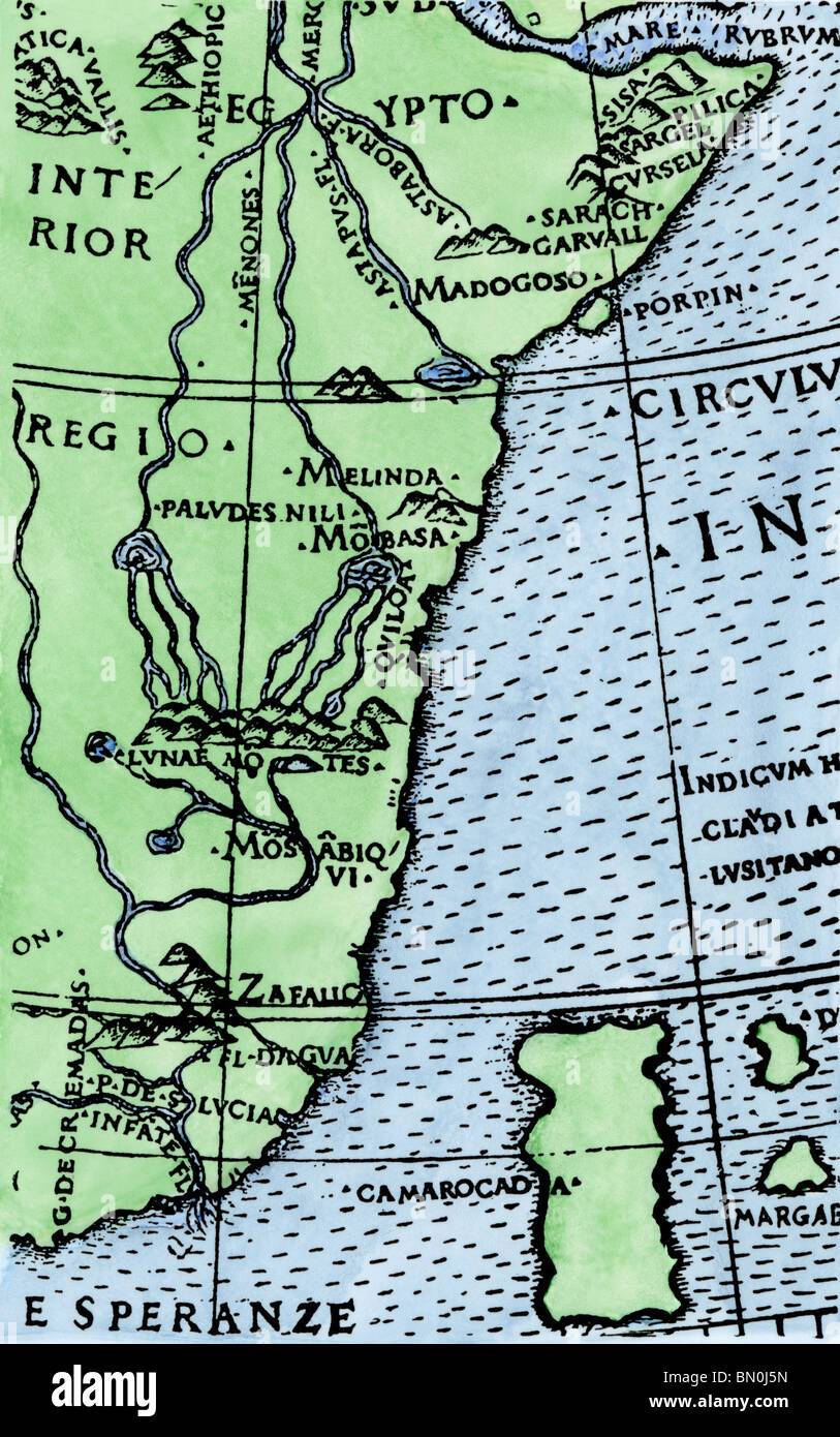 Africa's southern point first shown at the correct latitude, from Ruysch's map 1508. Hand-colored woodcut Stock Photohttps://www.alamy.com/image-license-details/?v=1https://www.alamy.com/stock-photo-africas-southern-point-first-shown-at-the-correct-latitude-from-ruyschs-30132417.html
RMBN0J5N–Africa's southern point first shown at the correct latitude, from Ruysch's map 1508. Hand-colored woodcut
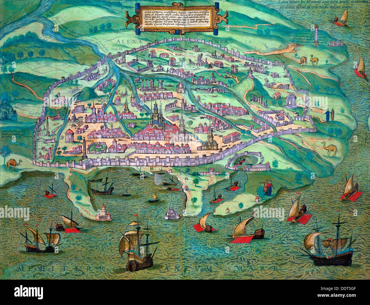 Map of Alexandria, Egypt, c1572. Artist: Joris Hoefnagel Stock Photohttps://www.alamy.com/image-license-details/?v=1https://www.alamy.com/map-of-alexandria-egypt-c1572-artist-joris-hoefnagel-image60152863.html
RMDDT5GF–Map of Alexandria, Egypt, c1572. Artist: Joris Hoefnagel
 Portuguese arrive in Africa from 'Indiae Orientalis' 1599 by Theodor de Bry. See description for further information. Stock Photohttps://www.alamy.com/image-license-details/?v=1https://www.alamy.com/stock-photo-portuguese-arrive-in-africa-from-indiae-orientalis-1599-by-theodor-73178754.html
RME71G6X–Portuguese arrive in Africa from 'Indiae Orientalis' 1599 by Theodor de Bry. See description for further information.
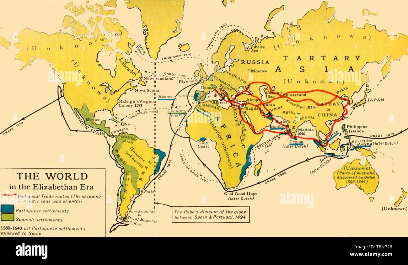 'The World in the Elizabethan Era', 1926. Creators: Unknown, Emery Walker Ltd. Stock Photohttps://www.alamy.com/image-license-details/?v=1https://www.alamy.com/the-world-in-the-elizabethan-era-1926-creators-unknown-emery-walker-ltd-image246328944.html
RMT8N728–'The World in the Elizabethan Era', 1926. Creators: Unknown, Emery Walker Ltd.
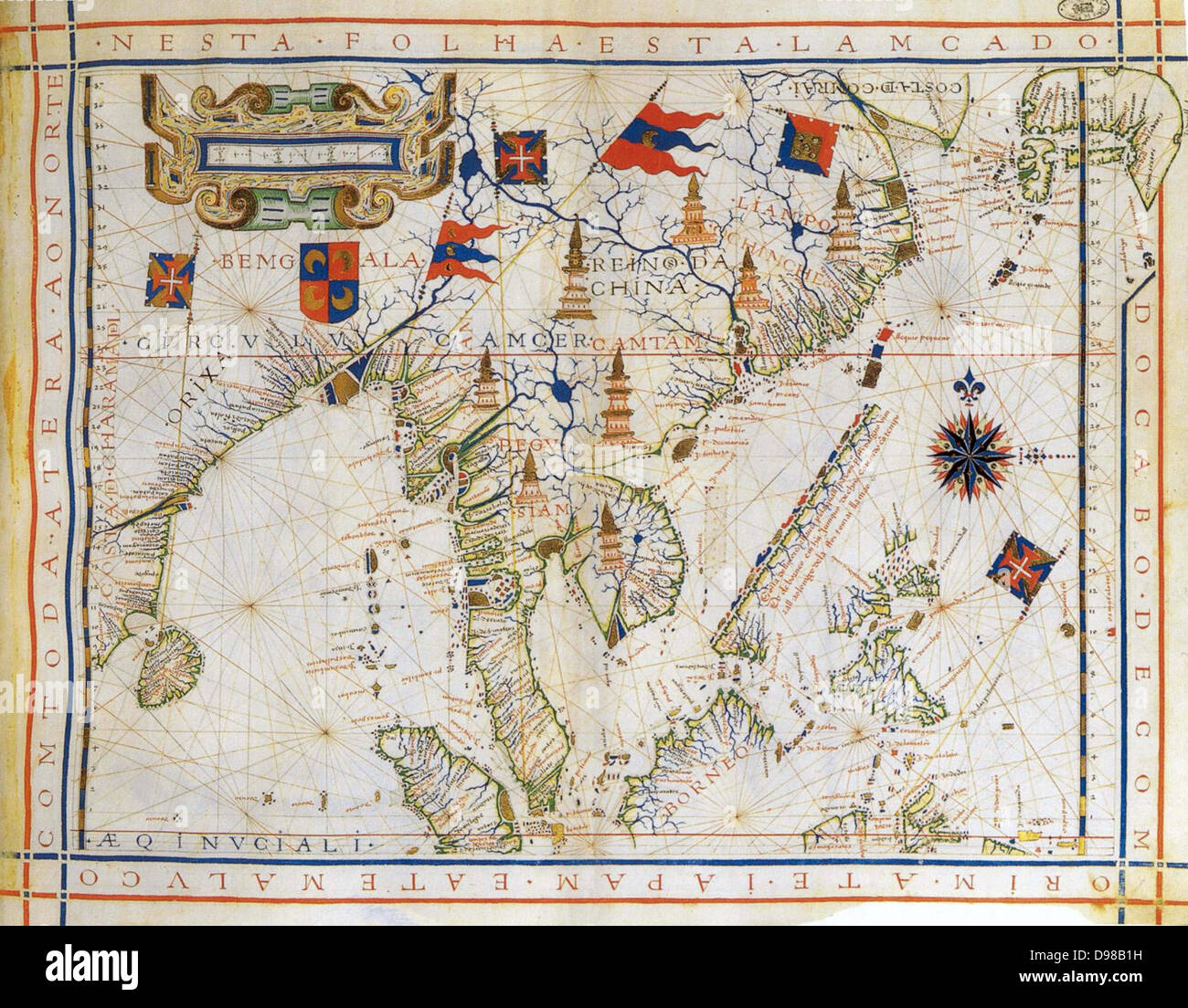 Plane-chart, pre-Mercator map of 1571 by the Portugese cartographer Fernao Vaz Dourado (c1520-c1580). Map of East India, Bay of Bengal, South East China, Thailandnd, Borneo, and Japan. The Tropic of Cancer is named. Stock Photohttps://www.alamy.com/image-license-details/?v=1https://www.alamy.com/stock-photo-plane-chart-pre-mercator-map-of-1571-by-the-portugese-cartographer-57347293.html
RMD98B1H–Plane-chart, pre-Mercator map of 1571 by the Portugese cartographer Fernao Vaz Dourado (c1520-c1580). Map of East India, Bay of Bengal, South East China, Thailandnd, Borneo, and Japan. The Tropic of Cancer is named.
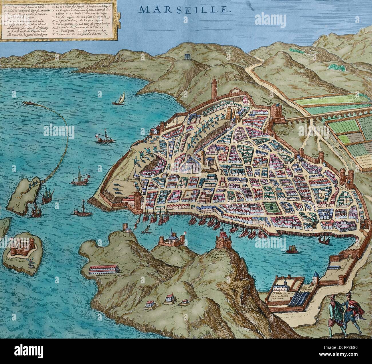 France. Marseille in 16th century. Map. Engraving in 'Theatre des principalles villes de tout le monde' by Georges Brun de Cologne, 1573. Colored. Stock Photohttps://www.alamy.com/image-license-details/?v=1https://www.alamy.com/france-marseille-in-16th-century-map-engraving-in-theatre-des-principalles-villes-de-tout-le-monde-by-georges-brun-de-cologne-1573-colored-image220233664.html
RMPP8E80–France. Marseille in 16th century. Map. Engraving in 'Theatre des principalles villes de tout le monde' by Georges Brun de Cologne, 1573. Colored.
 Henry Bourchier Stock Photohttps://www.alamy.com/image-license-details/?v=1https://www.alamy.com/stock-photo-henry-bourchier-142955481.html
RMJ8G54W–Henry Bourchier
![Indonesia: A map of Bantam on the west coast of Java in 1596, the year the first Dutch fleet arrived with a view to establishing a foothold on the spice trade. Etching, c. 1597-1598. Following successful expeditions to the East Indies [Indonesia], the Dutch set up a factory and a fortress in Bantam, which was later moved to the new capital in Jakarta. The Dutch East India Company, or VOC, was set up in 1602 to exploit the East Indies and, in particular, the Moluccas or Spice Islands, which were the world's major provider of nutmeg, mace, cloves and pepper. Stock Photo Indonesia: A map of Bantam on the west coast of Java in 1596, the year the first Dutch fleet arrived with a view to establishing a foothold on the spice trade. Etching, c. 1597-1598. Following successful expeditions to the East Indies [Indonesia], the Dutch set up a factory and a fortress in Bantam, which was later moved to the new capital in Jakarta. The Dutch East India Company, or VOC, was set up in 1602 to exploit the East Indies and, in particular, the Moluccas or Spice Islands, which were the world's major provider of nutmeg, mace, cloves and pepper. Stock Photo](https://c8.alamy.com/comp/2B014Y3/indonesia-a-map-of-bantam-on-the-west-coast-of-java-in-1596-the-year-the-first-dutch-fleet-arrived-with-a-view-to-establishing-a-foothold-on-the-spice-trade-etching-c-1597-1598-following-successful-expeditions-to-the-east-indies-indonesia-the-dutch-set-up-a-factory-and-a-fortress-in-bantam-which-was-later-moved-to-the-new-capital-in-jakarta-the-dutch-east-india-company-or-voc-was-set-up-in-1602-to-exploit-the-east-indies-and-in-particular-the-moluccas-or-spice-islands-which-were-the-worlds-major-provider-of-nutmeg-mace-cloves-and-pepper-2B014Y3.jpg) Indonesia: A map of Bantam on the west coast of Java in 1596, the year the first Dutch fleet arrived with a view to establishing a foothold on the spice trade. Etching, c. 1597-1598. Following successful expeditions to the East Indies [Indonesia], the Dutch set up a factory and a fortress in Bantam, which was later moved to the new capital in Jakarta. The Dutch East India Company, or VOC, was set up in 1602 to exploit the East Indies and, in particular, the Moluccas or Spice Islands, which were the world's major provider of nutmeg, mace, cloves and pepper. Stock Photohttps://www.alamy.com/image-license-details/?v=1https://www.alamy.com/indonesia-a-map-of-bantam-on-the-west-coast-of-java-in-1596-the-year-the-first-dutch-fleet-arrived-with-a-view-to-establishing-a-foothold-on-the-spice-trade-etching-c-1597-1598-following-successful-expeditions-to-the-east-indies-indonesia-the-dutch-set-up-a-factory-and-a-fortress-in-bantam-which-was-later-moved-to-the-new-capital-in-jakarta-the-dutch-east-india-company-or-voc-was-set-up-in-1602-to-exploit-the-east-indies-and-in-particular-the-moluccas-or-spice-islands-which-were-the-worlds-major-provider-of-nutmeg-mace-cloves-and-pepper-image344233207.html
Indonesia: A map of Bantam on the west coast of Java in 1596, the year the first Dutch fleet arrived with a view to establishing a foothold on the spice trade. Etching, c. 1597-1598. Following successful expeditions to the East Indies [Indonesia], the Dutch set up a factory and a fortress in Bantam, which was later moved to the new capital in Jakarta. The Dutch East India Company, or VOC, was set up in 1602 to exploit the East Indies and, in particular, the Moluccas or Spice Islands, which were the world's major provider of nutmeg, mace, cloves and pepper. Stock Photohttps://www.alamy.com/image-license-details/?v=1https://www.alamy.com/indonesia-a-map-of-bantam-on-the-west-coast-of-java-in-1596-the-year-the-first-dutch-fleet-arrived-with-a-view-to-establishing-a-foothold-on-the-spice-trade-etching-c-1597-1598-following-successful-expeditions-to-the-east-indies-indonesia-the-dutch-set-up-a-factory-and-a-fortress-in-bantam-which-was-later-moved-to-the-new-capital-in-jakarta-the-dutch-east-india-company-or-voc-was-set-up-in-1602-to-exploit-the-east-indies-and-in-particular-the-moluccas-or-spice-islands-which-were-the-worlds-major-provider-of-nutmeg-mace-cloves-and-pepper-image344233207.htmlRM2B014Y3–Indonesia: A map of Bantam on the west coast of Java in 1596, the year the first Dutch fleet arrived with a view to establishing a foothold on the spice trade. Etching, c. 1597-1598. Following successful expeditions to the East Indies [Indonesia], the Dutch set up a factory and a fortress in Bantam, which was later moved to the new capital in Jakarta. The Dutch East India Company, or VOC, was set up in 1602 to exploit the East Indies and, in particular, the Moluccas or Spice Islands, which were the world's major provider of nutmeg, mace, cloves and pepper.
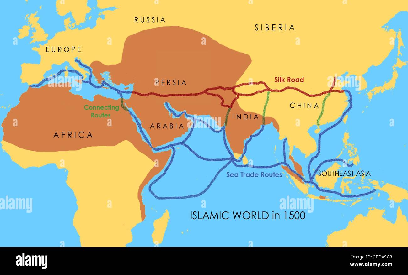 A map showing a network of medieval trade routes, including the Silk Road (connecting East and West between the 2nd century BCE and the 18th century) and various sea trade routes. The areas in darker yellow indicate the extent of the Islamic world in 1500. Stock Photohttps://www.alamy.com/image-license-details/?v=1https://www.alamy.com/a-map-showing-a-network-of-medieval-trade-routes-including-the-silk-road-connecting-east-and-west-between-the-2nd-century-bce-and-the-18th-century-and-various-sea-trade-routes-the-areas-in-darker-yellow-indicate-the-extent-of-the-islamic-world-in-1500-image352776147.html
RM2BDX9G3–A map showing a network of medieval trade routes, including the Silk Road (connecting East and West between the 2nd century BCE and the 18th century) and various sea trade routes. The areas in darker yellow indicate the extent of the Islamic world in 1500.
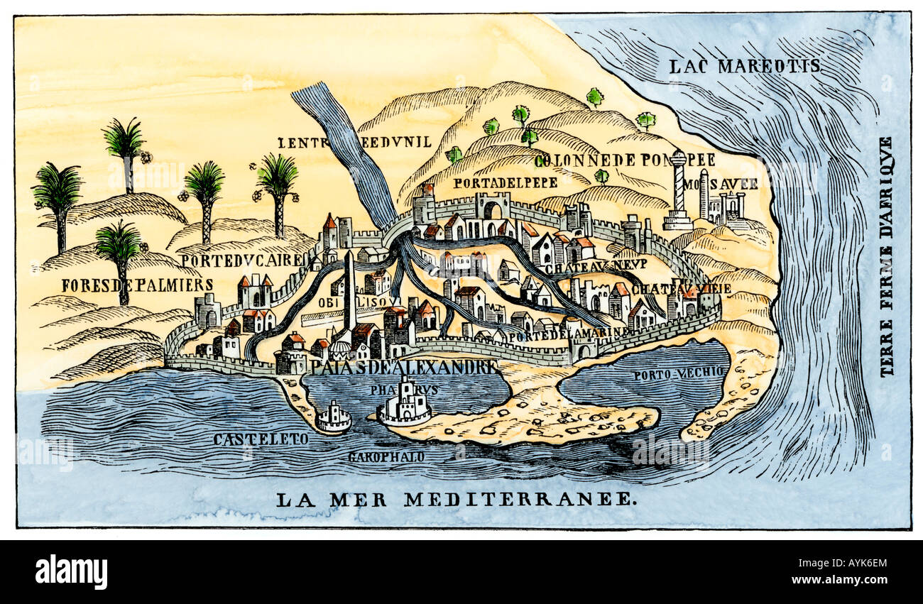 Map of Alexandria showing the lighthouse Pharos at the harbor entrance in the 1500s. Hand-colored woodcut Stock Photohttps://www.alamy.com/image-license-details/?v=1https://www.alamy.com/stock-photo-map-of-alexandria-showing-the-lighthouse-pharos-at-the-harbor-entrance-17127883.html
RMAYK6EM–Map of Alexandria showing the lighthouse Pharos at the harbor entrance in the 1500s. Hand-colored woodcut
 Map of the World: Tradewinds, 1511, reprinted 1889. Published by Bernardi Sylvani, Venice. Stock Photohttps://www.alamy.com/image-license-details/?v=1https://www.alamy.com/map-of-the-world-tradewinds-1511-reprinted-1889-published-by-bernardi-sylvani-venice-image491534628.html
RM2KFK9C4–Map of the World: Tradewinds, 1511, reprinted 1889. Published by Bernardi Sylvani, Venice.
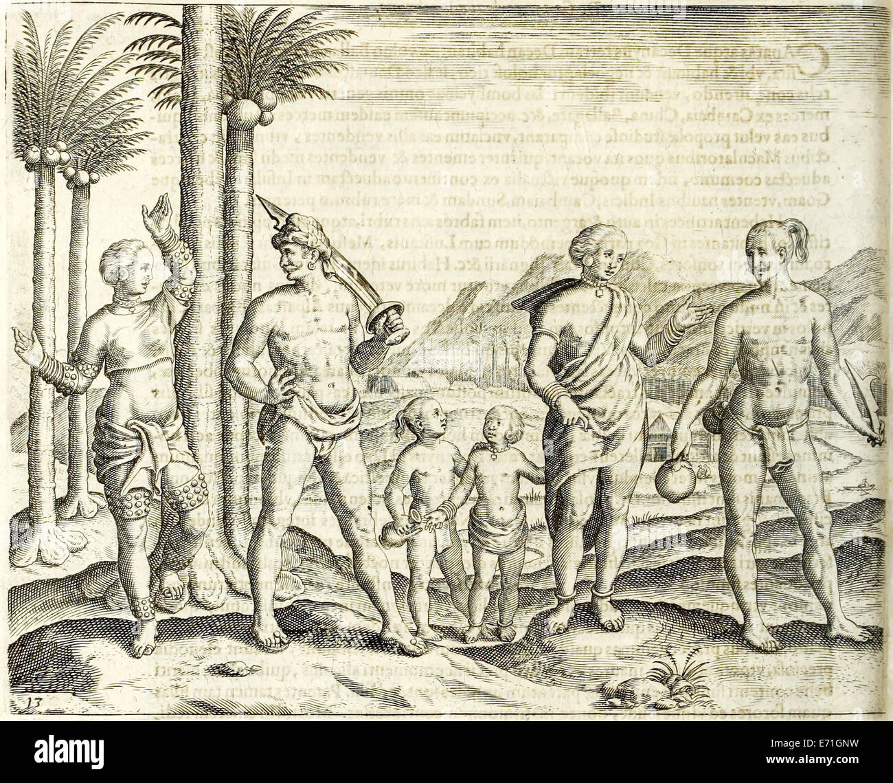 Illustration from 'Indiae Orientalis' 1599 by Theodor de Bry. See description for further information. Stock Photohttps://www.alamy.com/image-license-details/?v=1https://www.alamy.com/stock-photo-illustration-from-indiae-orientalis-1599-by-theodor-de-bry-see-description-73179173.html
RME71GNW–Illustration from 'Indiae Orientalis' 1599 by Theodor de Bry. See description for further information.
 A 17th-century map by the Dutch cartographer Jan Janssonius showing the Barbary Coast, here 'Barbaria'. The Barbary Coast (also Barbary, Berbery, or Berber Coast) was the name given to the coastal regions of central and western North Africa or more specifically the Maghreb and the Ottoman borderlands consisting of the regencies in Algiers, Tunis, and Tripoli, as well as the Sultanate of Morocco from the 16th to 19th centuries. Stock Photohttps://www.alamy.com/image-license-details/?v=1https://www.alamy.com/a-17th-century-map-by-the-dutch-cartographer-jan-janssonius-showing-the-barbary-coast-here-barbaria-the-barbary-coast-also-barbary-berbery-or-berber-coast-was-the-name-given-to-the-coastal-regions-of-central-and-western-north-africa-or-more-specifically-the-maghreb-and-the-ottoman-borderlands-consisting-of-the-regencies-in-algiers-tunis-and-tripoli-as-well-as-the-sultanate-of-morocco-from-the-16th-to-19th-centuries-image634319283.html
RM2YRYMM3–A 17th-century map by the Dutch cartographer Jan Janssonius showing the Barbary Coast, here 'Barbaria'. The Barbary Coast (also Barbary, Berbery, or Berber Coast) was the name given to the coastal regions of central and western North Africa or more specifically the Maghreb and the Ottoman borderlands consisting of the regencies in Algiers, Tunis, and Tripoli, as well as the Sultanate of Morocco from the 16th to 19th centuries.
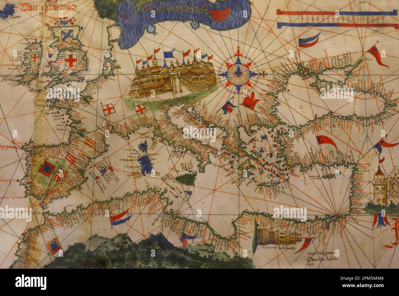 'Cantino's Map'. Anonymous early 16th-century world map by a Portuguese cartographer commissioned by Alberto Cantino, agent of the Italian Duke of Ferrara in Italy. It depicts how the Portuguese succeeded in reaching India using a direct sea route. Copy of the original parchment in the Biblioteca Estense in Modena (Italy). Detail. Maritime Museum. Lisbon, Portugal. Stock Photohttps://www.alamy.com/image-license-details/?v=1https://www.alamy.com/cantinos-map-anonymous-early-16th-century-world-map-by-a-portuguese-cartographer-commissioned-by-alberto-cantino-agent-of-the-italian-duke-of-ferrara-in-italy-it-depicts-how-the-portuguese-succeeded-in-reaching-india-using-a-direct-sea-route-copy-of-the-original-parchment-in-the-biblioteca-estense-in-modena-italy-detail-maritime-museum-lisbon-portugal-image545940536.html
RM2PM5MM8–'Cantino's Map'. Anonymous early 16th-century world map by a Portuguese cartographer commissioned by Alberto Cantino, agent of the Italian Duke of Ferrara in Italy. It depicts how the Portuguese succeeded in reaching India using a direct sea route. Copy of the original parchment in the Biblioteca Estense in Modena (Italy). Detail. Maritime Museum. Lisbon, Portugal.
 Katherine Willoughby Suffolk Stock Photohttps://www.alamy.com/image-license-details/?v=1https://www.alamy.com/stock-photo-katherine-willoughby-suffolk-140055670.html
RMJ3T2C6–Katherine Willoughby Suffolk
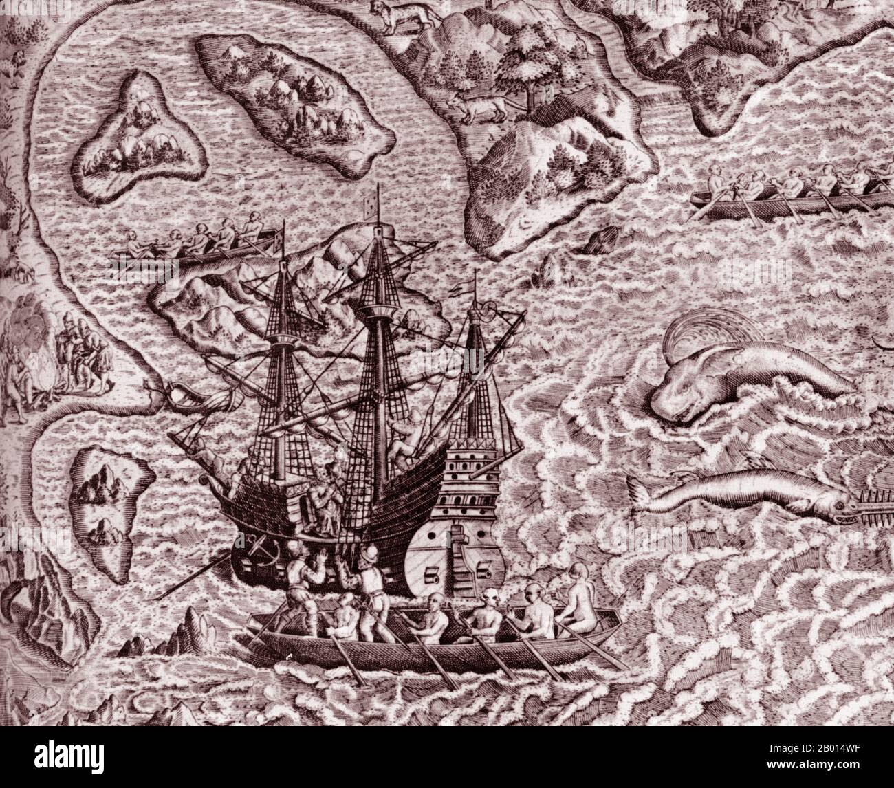 Brazil/Portugal: The arrival of Cabral's fleet in Porto Seguro on the coast of Brazil in April 1500. Engraving by Theodor de Bry (1528 - 27 March 1598), 16th century. Following Portuguese navigator Vasco da Gama's success in discovering a sea route around Africa to India in 1498, King Manuel I commissioned Pedro Alvares Cabral to lead a second voyage of 13 ships and 1,500 men to India. Although he intended to stay close to the west coast of Africa, Cabral sailed far off course and accidentally chanced upon the coast of South America. Stock Photohttps://www.alamy.com/image-license-details/?v=1https://www.alamy.com/brazilportugal-the-arrival-of-cabrals-fleet-in-porto-seguro-on-the-coast-of-brazil-in-april-1500-engraving-by-theodor-de-bry-1528-27-march-1598-16th-century-following-portuguese-navigator-vasco-da-gamas-success-in-discovering-a-sea-route-around-africa-to-india-in-1498-king-manuel-i-commissioned-pedro-alvares-cabral-to-lead-a-second-voyage-of-13-ships-and-1500-men-to-india-although-he-intended-to-stay-close-to-the-west-coast-of-africa-cabral-sailed-far-off-course-and-accidentally-chanced-upon-the-coast-of-south-america-image344233163.html
RM2B014WF–Brazil/Portugal: The arrival of Cabral's fleet in Porto Seguro on the coast of Brazil in April 1500. Engraving by Theodor de Bry (1528 - 27 March 1598), 16th century. Following Portuguese navigator Vasco da Gama's success in discovering a sea route around Africa to India in 1498, King Manuel I commissioned Pedro Alvares Cabral to lead a second voyage of 13 ships and 1,500 men to India. Although he intended to stay close to the west coast of Africa, Cabral sailed far off course and accidentally chanced upon the coast of South America.
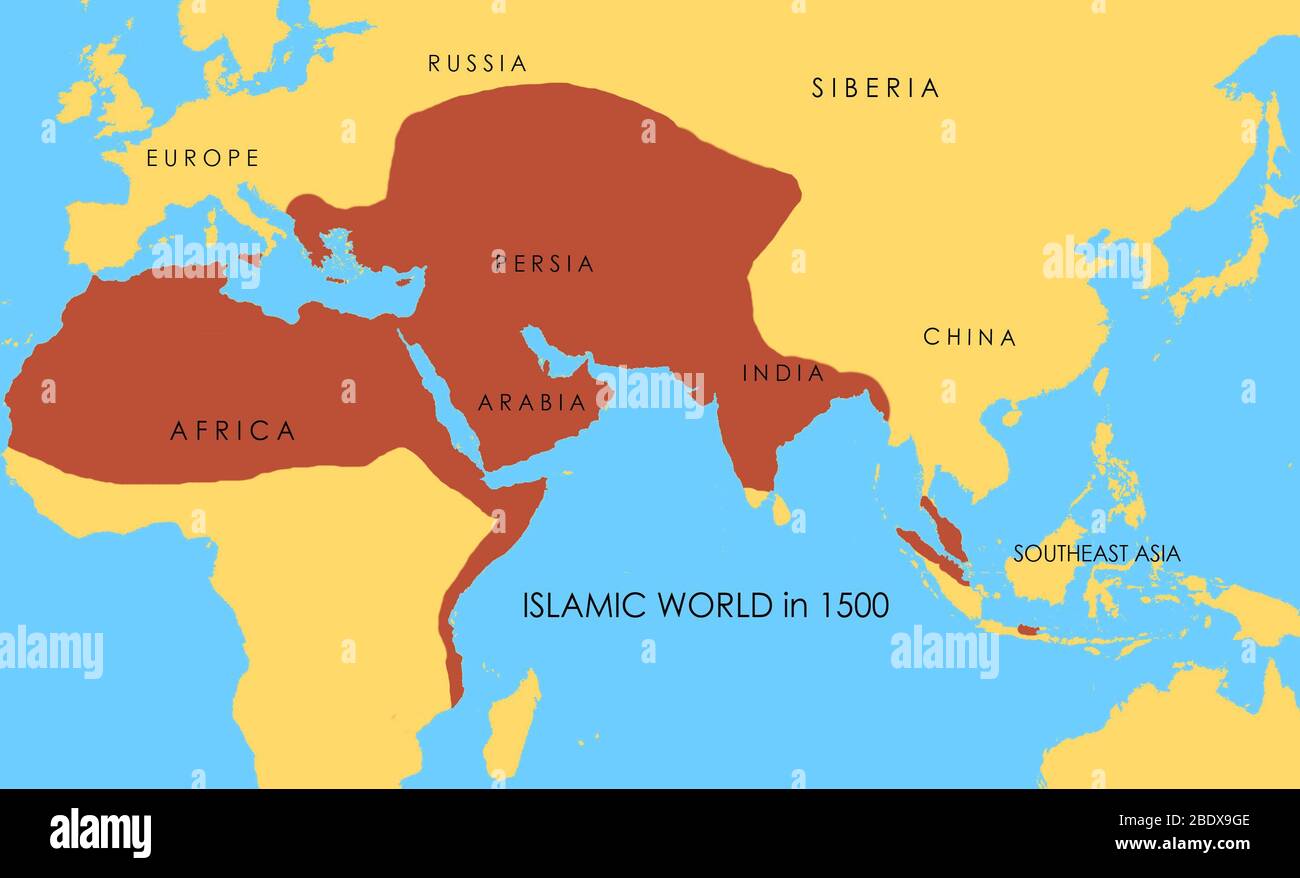 A map showing the extent of the Islamic world in 1500. Stock Photohttps://www.alamy.com/image-license-details/?v=1https://www.alamy.com/a-map-showing-the-extent-of-the-islamic-world-in-1500-image352776158.html
RM2BDX9GE–A map showing the extent of the Islamic world in 1500.
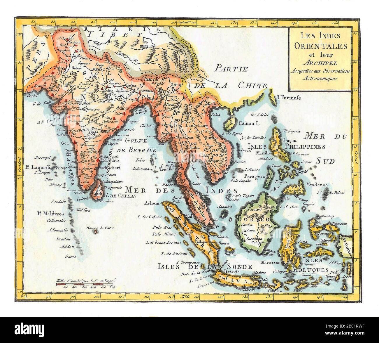 Asia/Indian Ocean: 'East Indies'. Hand-coloured map by Joseph de La Porte (19 January 1714 - 19 December 1779) from his 'Atlas Moderne Portatif', 1799. East Indies is a term used by Europeans from the 16th century onwards to identify what is now known as the Indian subcontinent or South Asia, Southeastern Asia, and the islands of Oceania, including the Malay Archipelago and the Philippines. The term has traditionally excluded China, Japan, and other countries to the north of India and the Himalayas. The names 'India' and 'the Indies', derived from the Indus River in modern-day Pakistan. Stock Photohttps://www.alamy.com/image-license-details/?v=1https://www.alamy.com/asiaindian-ocean-east-indies-hand-coloured-map-by-joseph-de-la-porte-19-january-1714-19-december-1779-from-his-atlas-moderne-portatif-1799-east-indies-is-a-term-used-by-europeans-from-the-16th-century-onwards-to-identify-what-is-now-known-as-the-indian-subcontinent-or-south-asia-southeastern-asia-and-the-islands-of-oceania-including-the-malay-archipelago-and-the-philippines-the-term-has-traditionally-excluded-china-japan-and-other-countries-to-the-north-of-india-and-the-himalayas-the-names-india-and-the-indies-derived-from-the-indus-river-in-modern-day-pakistan-image344248059.html
RM2B01RWF–Asia/Indian Ocean: 'East Indies'. Hand-coloured map by Joseph de La Porte (19 January 1714 - 19 December 1779) from his 'Atlas Moderne Portatif', 1799. East Indies is a term used by Europeans from the 16th century onwards to identify what is now known as the Indian subcontinent or South Asia, Southeastern Asia, and the islands of Oceania, including the Malay Archipelago and the Philippines. The term has traditionally excluded China, Japan, and other countries to the north of India and the Himalayas. The names 'India' and 'the Indies', derived from the Indus River in modern-day Pakistan.
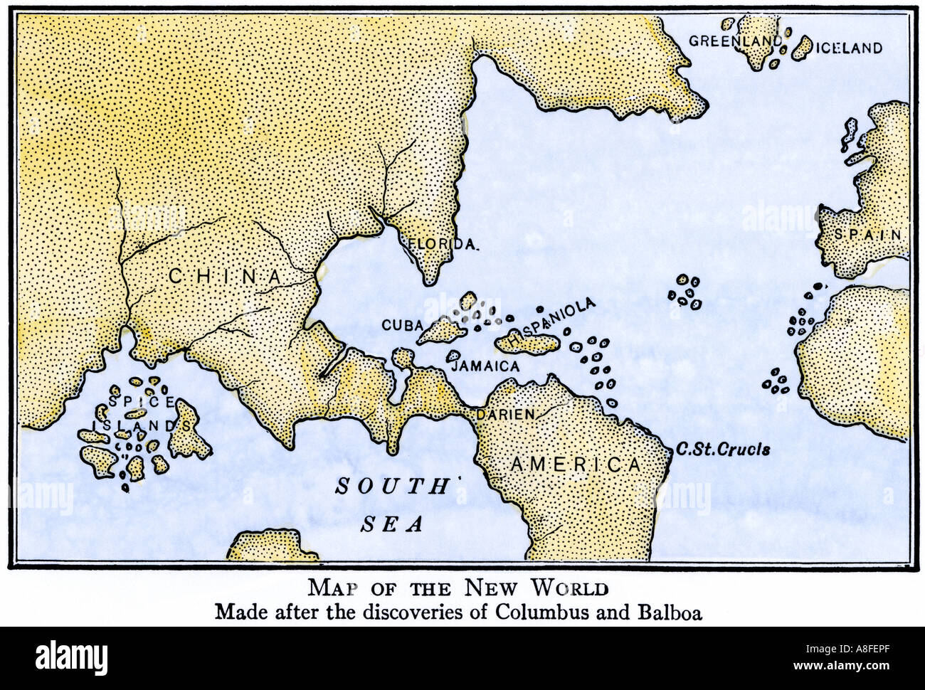 New World map showing South America attached to Asia as assumed after the discoveries of Columbus and Balboa. Hand-colored woodcut Stock Photohttps://www.alamy.com/image-license-details/?v=1https://www.alamy.com/new-world-map-showing-south-america-attached-to-asia-as-assumed-after-image6907374.html
RMA8FEPF–New World map showing South America attached to Asia as assumed after the discoveries of Columbus and Balboa. Hand-colored woodcut
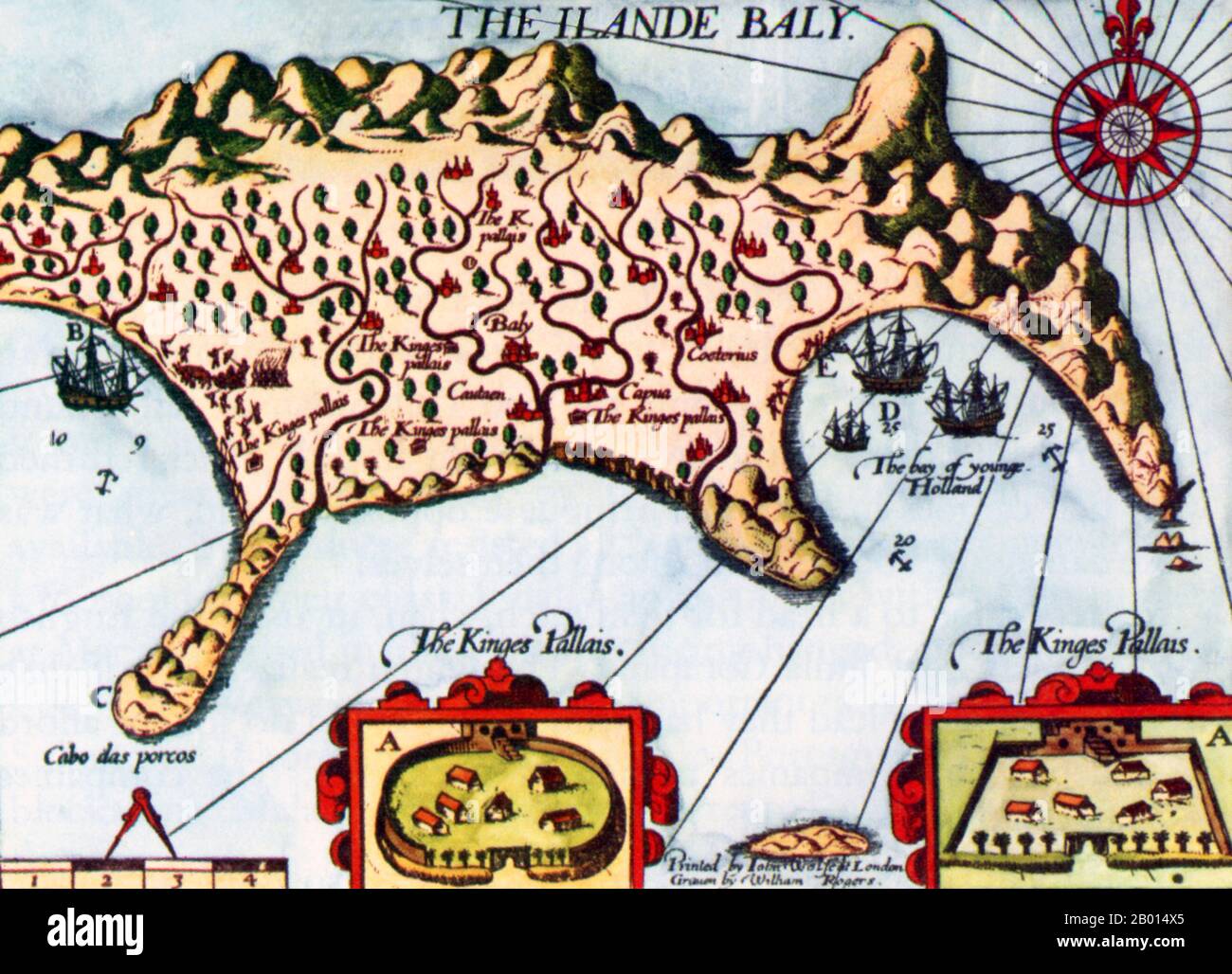 Netherlands/Indonesia: The island of Bali - an English copy of Dutch explorer Cornelis de Houtman’s map of 1596-1597. The boxes ‘A’ indicate the king’s palaces; B is where de Houtman met the king; C is what de Houtman calls the ‘Cape of Pigs’; D is where the Dutch fleet anchored; E where they went ashore. Cornelis de Houtman (2 April 1565 - 1 September 1599) was a Dutch explorer who discovered a new sea route from Europe to Indonesia which helped start the Dutch spice trade. At the time, the Portuguese Empire held a monopoly on the spice trade, and the voyage was a Dutch symbolic victory. Stock Photohttps://www.alamy.com/image-license-details/?v=1https://www.alamy.com/netherlandsindonesia-the-island-of-bali-an-english-copy-of-dutch-explorer-cornelis-de-houtmans-map-of-1596-1597-the-boxes-a-indicate-the-kings-palaces-b-is-where-de-houtman-met-the-king-c-is-what-de-houtman-calls-the-cape-of-pigs-d-is-where-the-dutch-fleet-anchored-e-where-they-went-ashore-cornelis-de-houtman-2-april-1565-1-september-1599-was-a-dutch-explorer-who-discovered-a-new-sea-route-from-europe-to-indonesia-which-helped-start-the-dutch-spice-trade-at-the-time-the-portuguese-empire-held-a-monopoly-on-the-spice-trade-and-the-voyage-was-a-dutch-symbolic-victory-image344233181.html
RM2B014X5–Netherlands/Indonesia: The island of Bali - an English copy of Dutch explorer Cornelis de Houtman’s map of 1596-1597. The boxes ‘A’ indicate the king’s palaces; B is where de Houtman met the king; C is what de Houtman calls the ‘Cape of Pigs’; D is where the Dutch fleet anchored; E where they went ashore. Cornelis de Houtman (2 April 1565 - 1 September 1599) was a Dutch explorer who discovered a new sea route from Europe to Indonesia which helped start the Dutch spice trade. At the time, the Portuguese Empire held a monopoly on the spice trade, and the voyage was a Dutch symbolic victory.
 Portuguese arrive in Ethiopia from 'Indiae Orientalis' 1599 by Theodor de Bry. See description for further information. Stock Photohttps://www.alamy.com/image-license-details/?v=1https://www.alamy.com/stock-photo-portuguese-arrive-in-ethiopia-from-indiae-orientalis-1599-by-theodor-73178752.html
RME71G6T–Portuguese arrive in Ethiopia from 'Indiae Orientalis' 1599 by Theodor de Bry. See description for further information.
![View of Venice [lower right block], 1500. Stock Photo View of Venice [lower right block], 1500. Stock Photo](https://c8.alamy.com/comp/2G4GF1E/view-of-venice-lower-right-block-1500-2G4GF1E.jpg) View of Venice [lower right block], 1500. Stock Photohttps://www.alamy.com/image-license-details/?v=1https://www.alamy.com/view-of-venice-lower-right-block-1500-image433080858.html
View of Venice [lower right block], 1500. Stock Photohttps://www.alamy.com/image-license-details/?v=1https://www.alamy.com/view-of-venice-lower-right-block-1500-image433080858.htmlRM2G4GF1E–View of Venice [lower right block], 1500.
 A 17th-century map by the Dutch cartographer Jan Janssonius showing the Barbary Coast, here 'Barbaria'. The Barbary Coast (also Barbary, Berbery, or Berber Coast) was the name given to the coastal regions of central and western North Africa or more specifically the Maghreb and the Ottoman borderlands consisting of the regencies in Algiers, Tunis, and Tripoli, as well as the Sultanate of Morocco from the 16th to 19th centuries. Stock Photohttps://www.alamy.com/image-license-details/?v=1https://www.alamy.com/a-17th-century-map-by-the-dutch-cartographer-jan-janssonius-showing-the-barbary-coast-here-barbaria-the-barbary-coast-also-barbary-berbery-or-berber-coast-was-the-name-given-to-the-coastal-regions-of-central-and-western-north-africa-or-more-specifically-the-maghreb-and-the-ottoman-borderlands-consisting-of-the-regencies-in-algiers-tunis-and-tripoli-as-well-as-the-sultanate-of-morocco-from-the-16th-to-19th-centuries-image634159183.html
RM2YRMCE7–A 17th-century map by the Dutch cartographer Jan Janssonius showing the Barbary Coast, here 'Barbaria'. The Barbary Coast (also Barbary, Berbery, or Berber Coast) was the name given to the coastal regions of central and western North Africa or more specifically the Maghreb and the Ottoman borderlands consisting of the regencies in Algiers, Tunis, and Tripoli, as well as the Sultanate of Morocco from the 16th to 19th centuries.
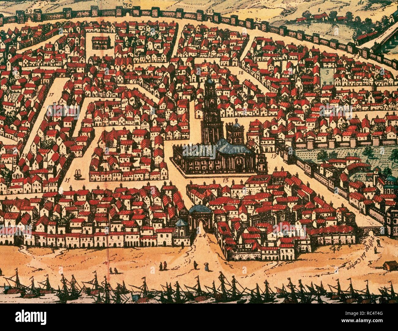 Spain. City of Seville. 16th century. Atlas 'Civitates Orbis Terrarum'. Drawing by Joris Hoefnagel (1542-1600). Stock Photohttps://www.alamy.com/image-license-details/?v=1https://www.alamy.com/spain-city-of-seville-16th-century-atlas-civitates-orbis-terrarum-drawing-by-joris-hoefnagel-1542-1600-image231217408.html
RMRC4T4G–Spain. City of Seville. 16th century. Atlas 'Civitates Orbis Terrarum'. Drawing by Joris Hoefnagel (1542-1600).
 Stephen Gardiner Stock Photohttps://www.alamy.com/image-license-details/?v=1https://www.alamy.com/stock-photo-stephen-gardiner-140521068.html
RMJ4H81G–Stephen Gardiner
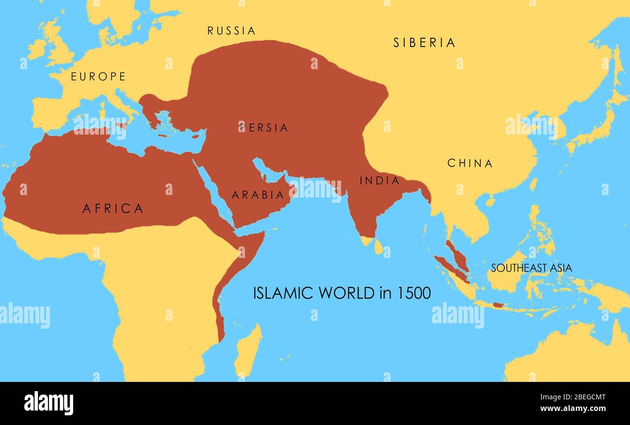 A map showing the extent of the Islamic world in 1500. Stock Photohttps://www.alamy.com/image-license-details/?v=1https://www.alamy.com/a-map-showing-the-extent-of-the-islamic-world-in-1500-image353173768.html
RM2BEGCMT–A map showing the extent of the Islamic world in 1500.
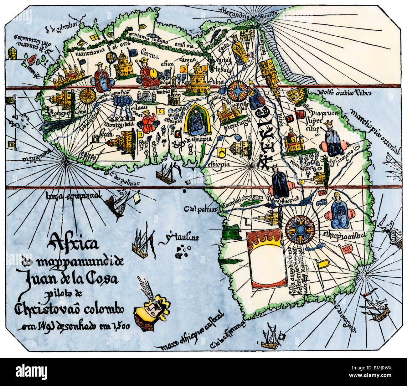 Africa as known after Vasco da Gama's discoveries, from map of Juan de la Cosa, 1500. Hand-colored woodcut Stock Photohttps://www.alamy.com/image-license-details/?v=1https://www.alamy.com/stock-photo-africa-as-known-after-vasco-da-gamas-discoveries-from-map-of-juan-29917382.html
RMBMJRWX–Africa as known after Vasco da Gama's discoveries, from map of Juan de la Cosa, 1500. Hand-colored woodcut
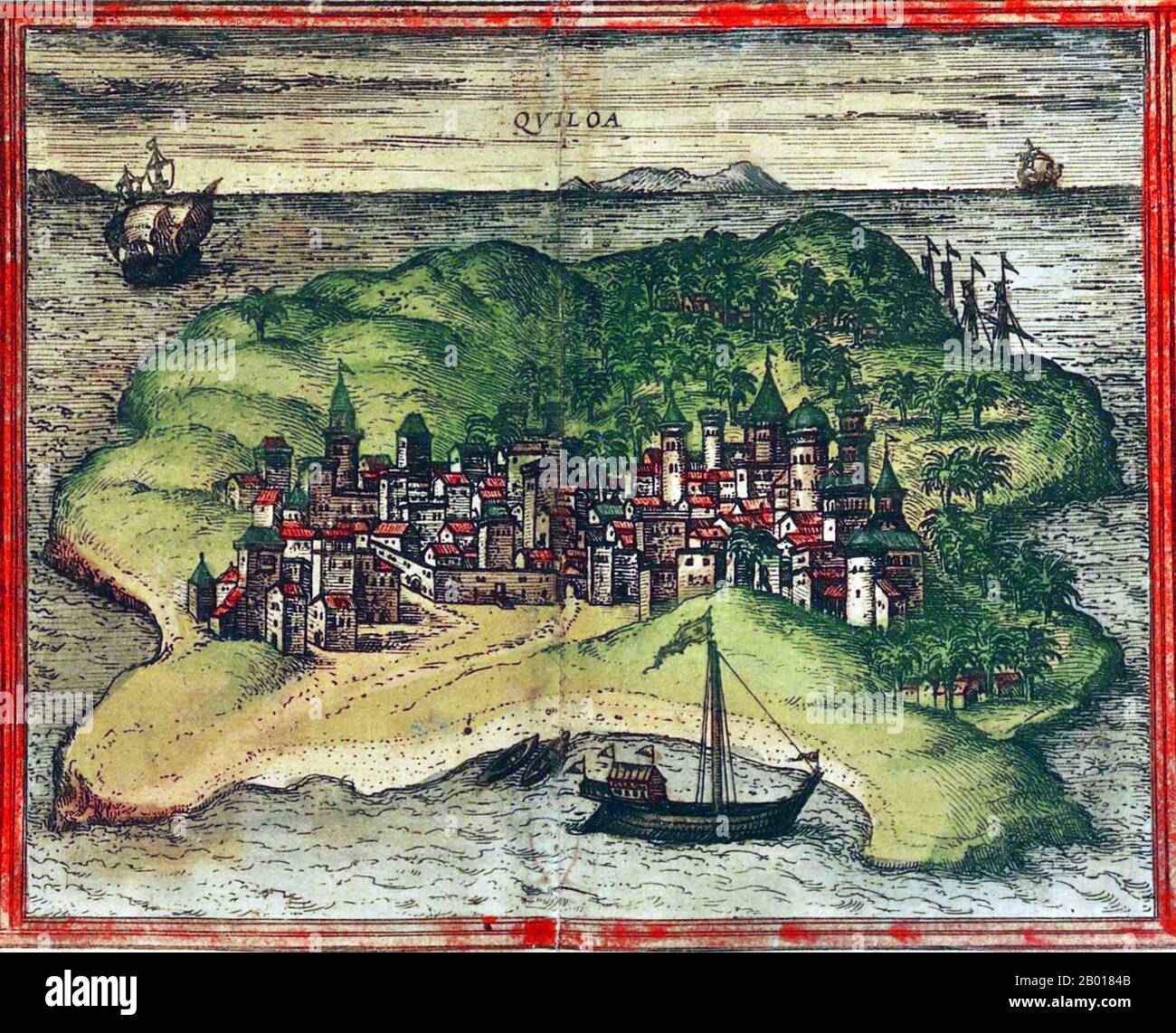 Tanzania: The Swahili city of Quiloa (Kilwa), on the Tanzanian coast. From 'Civitates Orbis Terrarum' by Georg Braun (1541 - 10 March 1622) and Frans Hogenberg (1535-1590), 1572. In the 11th century, the island of Kilwa Kisiwani was sold to a Persian trader Ali bin Al-Hasan, who founded the city and the Kilwa Sultanate. Over the next few centuries, Kilwa grew to be a major city and trading centre along that coast, and also inland as far as Zimbabwe. Trade was mainly in gold and iron from Zimbabwe, ivory from Tanzania, and textiles, jewelry, porcelain, and spices from Asia. Stock Photohttps://www.alamy.com/image-license-details/?v=1https://www.alamy.com/tanzania-the-swahili-city-of-quiloa-kilwa-on-the-tanzanian-coast-from-civitates-orbis-terrarum-by-georg-braun-1541-10-march-1622-and-frans-hogenberg-1535-1590-1572-in-the-11th-century-the-island-of-kilwa-kisiwani-was-sold-to-a-persian-trader-ali-bin-al-hasan-who-founded-the-city-and-the-kilwa-sultanate-over-the-next-few-centuries-kilwa-grew-to-be-a-major-city-and-trading-centre-along-that-coast-and-also-inland-as-far-as-zimbabwe-trade-was-mainly-in-gold-and-iron-from-zimbabwe-ivory-from-tanzania-and-textiles-jewelry-porcelain-and-spices-from-asia-image344235707.html
RM2B0184B–Tanzania: The Swahili city of Quiloa (Kilwa), on the Tanzanian coast. From 'Civitates Orbis Terrarum' by Georg Braun (1541 - 10 March 1622) and Frans Hogenberg (1535-1590), 1572. In the 11th century, the island of Kilwa Kisiwani was sold to a Persian trader Ali bin Al-Hasan, who founded the city and the Kilwa Sultanate. Over the next few centuries, Kilwa grew to be a major city and trading centre along that coast, and also inland as far as Zimbabwe. Trade was mainly in gold and iron from Zimbabwe, ivory from Tanzania, and textiles, jewelry, porcelain, and spices from Asia.
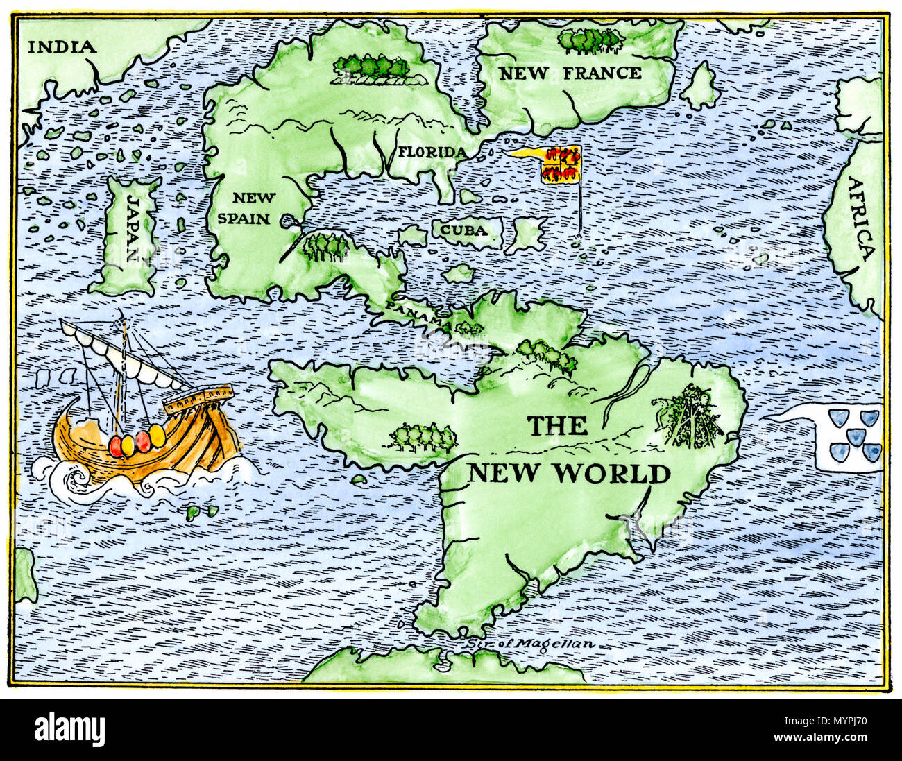 New World geography according to a mapmaker of 1540. Hand-colored woodcut Stock Photohttps://www.alamy.com/image-license-details/?v=1https://www.alamy.com/new-world-geography-according-to-a-mapmaker-of-1540-hand-colored-woodcut-image189196644.html
RMMYPJ70–New World geography according to a mapmaker of 1540. Hand-colored woodcut
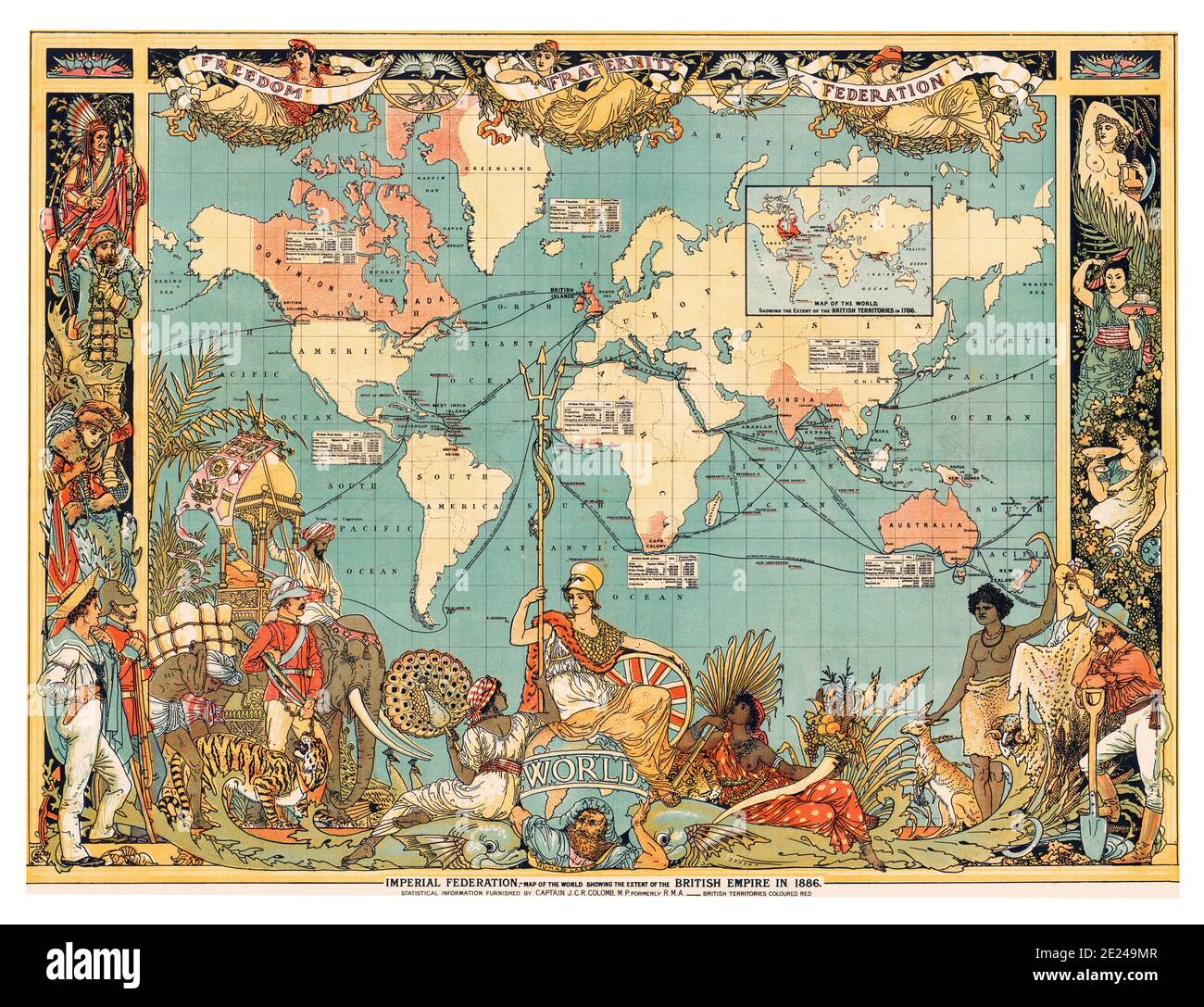 United Kingdom: Map of the World showing the British Empire highlighted in red, London, 1886. The British Empire comprised the dominions, colonies, protectorates, mandates and other territories ruled or administered by the United Kingdom. It originated with the overseas colonies and trading posts established by England in the late 16th and early 17th centuries. At its height, it was the largest empire in history and, for over a century, was the foremost global power. Stock Photohttps://www.alamy.com/image-license-details/?v=1https://www.alamy.com/united-kingdom-map-of-the-world-showing-the-british-empire-highlighted-in-red-london-1886-the-british-empire-comprised-the-dominions-colonies-protectorates-mandates-and-other-territories-ruled-or-administered-by-the-united-kingdom-it-originated-with-the-overseas-colonies-and-trading-posts-established-by-england-in-the-late-16th-and-early-17th-centuries-at-its-height-it-was-the-largest-empire-in-history-and-for-over-a-century-was-the-foremost-global-power-image397163223.html
RM2E249MR–United Kingdom: Map of the World showing the British Empire highlighted in red, London, 1886. The British Empire comprised the dominions, colonies, protectorates, mandates and other territories ruled or administered by the United Kingdom. It originated with the overseas colonies and trading posts established by England in the late 16th and early 17th centuries. At its height, it was the largest empire in history and, for over a century, was the foremost global power.
 Map of the city of Algiers, 1575, by Georg Braun (1540 or 1541-1622) and Franz Hogenberg (circa 1535-90). Published in Cologne, Germany. Algiers was a thriving city under a series of Berber dynasties from the tenth to the 16th centuries. It came under Spanish influence from the early 1300s onward. In 1516 the Greco-Turkish pirate Kheireddin Barbarossa (1478--1546) established himself at Algiers, put an end to Spanish influence, and in 1529 accepted Ottoman sovereignty. Stock Photohttps://www.alamy.com/image-license-details/?v=1https://www.alamy.com/map-of-the-city-of-algiers-1575-by-georg-braun-1540-or-1541-1622-and-franz-hogenberg-circa-1535-90-published-in-cologne-germany-algiers-was-a-thriving-city-under-a-series-of-berber-dynasties-from-the-tenth-to-the-16th-centuries-it-came-under-spanish-influence-from-the-early-1300s-onward-in-1516-the-greco-turkish-pirate-kheireddin-barbarossa-1478-1546-established-himself-at-algiers-put-an-end-to-spanish-influence-and-in-1529-accepted-ottoman-sovereignty-image634160460.html
RM2YRME3T–Map of the city of Algiers, 1575, by Georg Braun (1540 or 1541-1622) and Franz Hogenberg (circa 1535-90). Published in Cologne, Germany. Algiers was a thriving city under a series of Berber dynasties from the tenth to the 16th centuries. It came under Spanish influence from the early 1300s onward. In 1516 the Greco-Turkish pirate Kheireddin Barbarossa (1478--1546) established himself at Algiers, put an end to Spanish influence, and in 1529 accepted Ottoman sovereignty.
 Spain/Portugal/Asia: A 1522 map of Asia showing an ‘antemeridian’ to demarcate the Portuguese sphere of influence (west of the red line) from the Spanish. Supervised by Spanish-born Pope Alexander VI, the Treaty of Tordesillas in 1494 divided the world in half—into Spanish and Portuguese territories. However, following Portugal’s discovery of the Spice Islands of the Moluccas in 1512, Spain contested the line of demarcation. The issue was never fully settled, but the Treaty of Zaragoza in 1529 attempted to resolve the matter. Stock Photohttps://www.alamy.com/image-license-details/?v=1https://www.alamy.com/spainportugalasia-a-1522-map-of-asia-showing-an-antemeridian-to-demarcate-the-portuguese-sphere-of-influence-west-of-the-red-line-from-the-spanish-supervised-by-spanish-born-pope-alexander-vi-the-treaty-of-tordesillas-in-1494-divided-the-world-in-halfinto-spanish-and-portuguese-territories-however-following-portugals-discovery-of-the-spice-islands-of-the-moluccas-in-1512-spain-contested-the-line-of-demarcation-the-issue-was-never-fully-settled-but-the-treaty-of-zaragoza-in-1529-attempted-to-resolve-the-matter-image344233173.html
RM2B014WW–Spain/Portugal/Asia: A 1522 map of Asia showing an ‘antemeridian’ to demarcate the Portuguese sphere of influence (west of the red line) from the Spanish. Supervised by Spanish-born Pope Alexander VI, the Treaty of Tordesillas in 1494 divided the world in half—into Spanish and Portuguese territories. However, following Portugal’s discovery of the Spice Islands of the Moluccas in 1512, Spain contested the line of demarcation. The issue was never fully settled, but the Treaty of Zaragoza in 1529 attempted to resolve the matter.
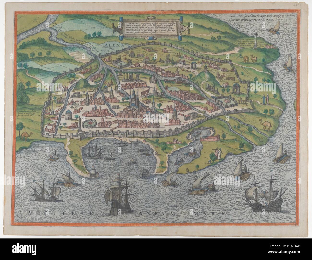 Map of Alexandria. Artist: Frans Hogenberg (Netherlandish, 1540-1590); Georg Braun (German, 1541-1622). Dimensions: Sheet: 15 3/8 in. × 20 in. (39.1 × 50.8 cm). Date: 1575. Museum: Metropolitan Museum of Art, New York, USA. Stock Photohttps://www.alamy.com/image-license-details/?v=1https://www.alamy.com/map-of-alexandria-artist-frans-hogenberg-netherlandish-1540-1590-georg-braun-german-1541-1622-dimensions-sheet-15-38-in-20-in-391-508-cm-date-1575-museum-metropolitan-museum-of-art-new-york-usa-image221750782.html
RMPTNHAP–Map of Alexandria. Artist: Frans Hogenberg (Netherlandish, 1540-1590); Georg Braun (German, 1541-1622). Dimensions: Sheet: 15 3/8 in. × 20 in. (39.1 × 50.8 cm). Date: 1575. Museum: Metropolitan Museum of Art, New York, USA.
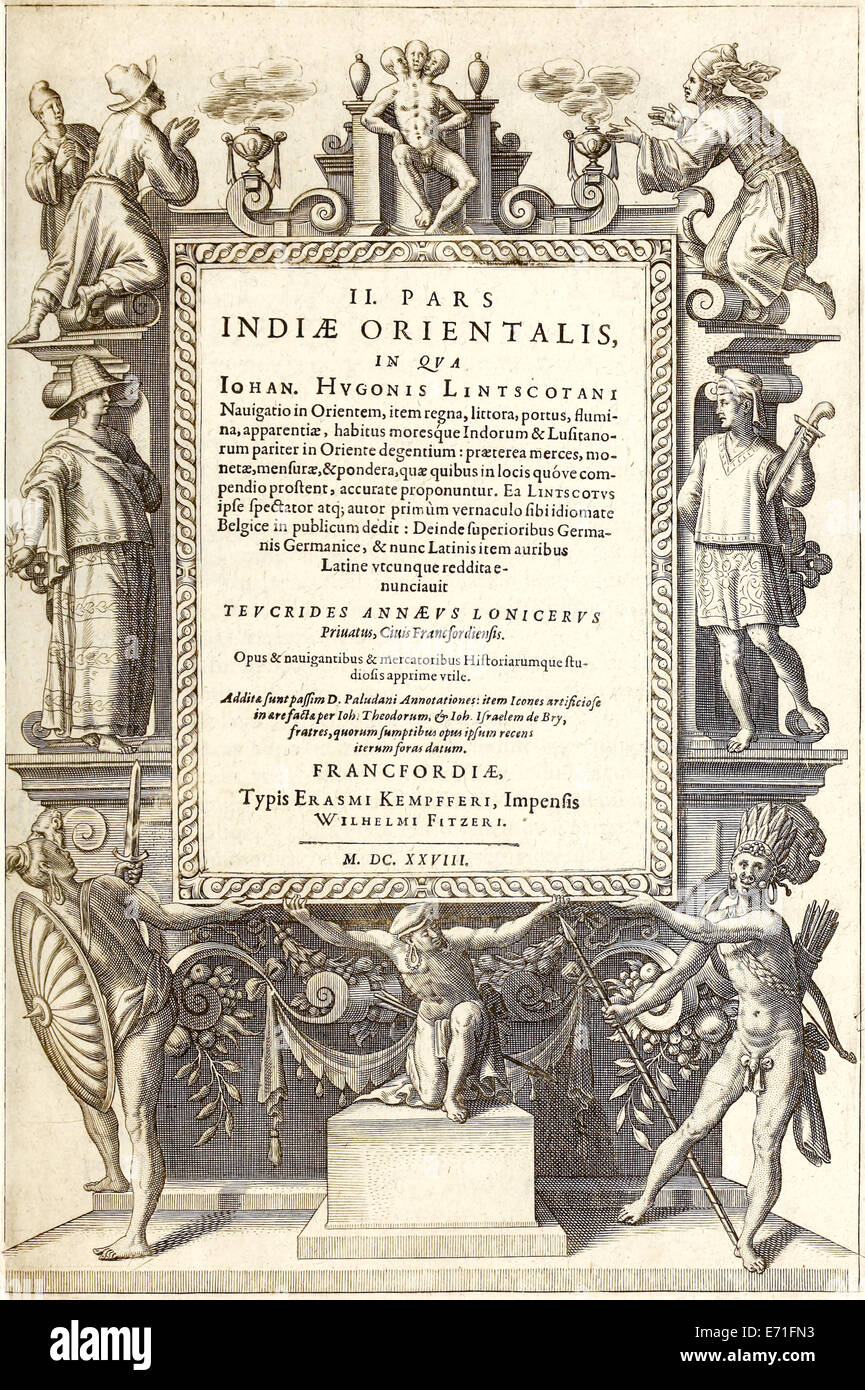 Frontispiece from 'Indiae Orientalis' 1599 (1628 2nd Latin Edition) by Theodor de Bry. See description for further information. Stock Photohttps://www.alamy.com/image-license-details/?v=1https://www.alamy.com/stock-photo-frontispiece-from-indiae-orientalis-1599-1628-2nd-latin-edition-by-73178367.html
RME71FN3–Frontispiece from 'Indiae Orientalis' 1599 (1628 2nd Latin Edition) by Theodor de Bry. See description for further information.
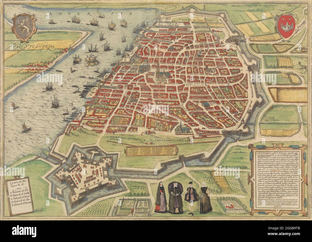 View of Antwerp, 1572-94. From Braun and Hogenberg's Civitates Orbis Terrarum. Stock Photohttps://www.alamy.com/image-license-details/?v=1https://www.alamy.com/view-of-antwerp-1572-94-from-braun-and-hogenbergs-civitates-orbis-terrarum-image440342907.html
RM2GGB9TB–View of Antwerp, 1572-94. From Braun and Hogenberg's Civitates Orbis Terrarum.
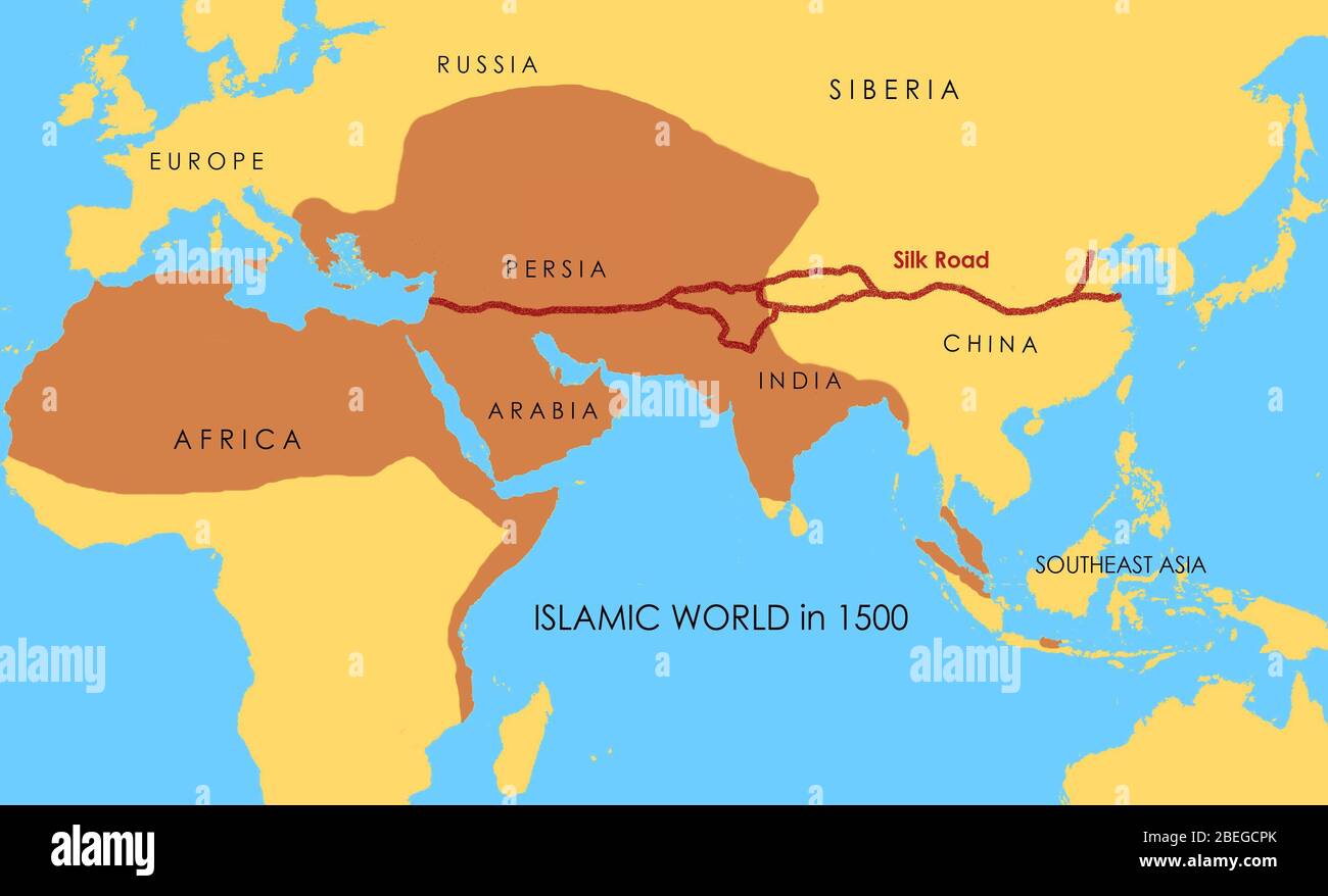 A map showing the route of the Silk Road, which connected East and West between the 2nd century BCE and the 18th century. The areas in darker yellow indicate the extent of the Islamic world in 1500. Stock Photohttps://www.alamy.com/image-license-details/?v=1https://www.alamy.com/a-map-showing-the-route-of-the-silk-road-which-connected-east-and-west-between-the-2nd-century-bce-and-the-18th-century-the-areas-in-darker-yellow-indicate-the-extent-of-the-islamic-world-in-1500-image353173819.html
RM2BEGCPK–A map showing the route of the Silk Road, which connected East and West between the 2nd century BCE and the 18th century. The areas in darker yellow indicate the extent of the Islamic world in 1500.
 Map of the city of Algiers, 1575, by Georg Braun (1540 or 1541-1622) and Franz Hogenberg (circa 1535-90). Published in Cologne, Germany. Algiers was a thriving city under a series of Berber dynasties from the tenth to the 16th centuries. It came under Spanish influence from the early 1300s onward. In 1516 the Greco-Turkish pirate Kheireddin Barbarossa (1478--1546) established himself at Algiers, put an end to Spanish influence, and in 1529 accepted Ottoman sovereignty. Stock Photohttps://www.alamy.com/image-license-details/?v=1https://www.alamy.com/map-of-the-city-of-algiers-1575-by-georg-braun-1540-or-1541-1622-and-franz-hogenberg-circa-1535-90-published-in-cologne-germany-algiers-was-a-thriving-city-under-a-series-of-berber-dynasties-from-the-tenth-to-the-16th-centuries-it-came-under-spanish-influence-from-the-early-1300s-onward-in-1516-the-greco-turkish-pirate-kheireddin-barbarossa-1478-1546-established-himself-at-algiers-put-an-end-to-spanish-influence-and-in-1529-accepted-ottoman-sovereignty-image634319934.html
RM2YRYNFA–Map of the city of Algiers, 1575, by Georg Braun (1540 or 1541-1622) and Franz Hogenberg (circa 1535-90). Published in Cologne, Germany. Algiers was a thriving city under a series of Berber dynasties from the tenth to the 16th centuries. It came under Spanish influence from the early 1300s onward. In 1516 the Greco-Turkish pirate Kheireddin Barbarossa (1478--1546) established himself at Algiers, put an end to Spanish influence, and in 1529 accepted Ottoman sovereignty.
 East Africa: A map of the east coast of Africa, charted after Vasco da Gama’s 1497-1498 voyage to India, by Diogo Homem (1521-1576), c. 1558. Vasco da Gama (1460/1469 – 24 December 1524) was a Portuguese explorer, one of the most successful in the Age of Discovery, and the commander of the first ships to sail directly from Europe to India. Under the reign of King Manuel I, Portugal discovered Brazil in 1500. Meanwhile, da Gama set sail from Lisbon on July 8, 1497, with a fleet of four ships and 170 men. He sailed around the Cape of Good Hope, before finally landing in India on May 20, 1498. Stock Photohttps://www.alamy.com/image-license-details/?v=1https://www.alamy.com/east-africa-a-map-of-the-east-coast-of-africa-charted-after-vasco-da-gamas-1497-1498-voyage-to-india-by-diogo-homem-1521-1576-c-1558-vasco-da-gama-14601469-24-december-1524-was-a-portuguese-explorer-one-of-the-most-successful-in-the-age-of-discovery-and-the-commander-of-the-first-ships-to-sail-directly-from-europe-to-india-under-the-reign-of-king-manuel-i-portugal-discovered-brazil-in-1500-meanwhile-da-gama-set-sail-from-lisbon-on-july-8-1497-with-a-fleet-of-four-ships-and-170-men-he-sailed-around-the-cape-of-good-hope-before-finally-landing-in-india-on-may-20-1498-image344233156.html
RM2B014W8–East Africa: A map of the east coast of Africa, charted after Vasco da Gama’s 1497-1498 voyage to India, by Diogo Homem (1521-1576), c. 1558. Vasco da Gama (1460/1469 – 24 December 1524) was a Portuguese explorer, one of the most successful in the Age of Discovery, and the commander of the first ships to sail directly from Europe to India. Under the reign of King Manuel I, Portugal discovered Brazil in 1500. Meanwhile, da Gama set sail from Lisbon on July 8, 1497, with a fleet of four ships and 170 men. He sailed around the Cape of Good Hope, before finally landing in India on May 20, 1498.
 Portuguese maritime discoveries and explorations. 15th-16th centuries. Large planisphere, made by the workshops of the Museu de Marinha, similar to the old charts and maps of the 15th and 16th centuries, showing the new lands, plants, animals and populations contacted by the Portuguese navigators. It is located at the end of the entrance hall. Maritime Museum. Lisbon, Portugal. Author: Portugal. Workshops of the Museu de Marinha. Lisbon. Stock Photohttps://www.alamy.com/image-license-details/?v=1https://www.alamy.com/portuguese-maritime-discoveries-and-explorations-15th-16th-centuries-large-planisphere-made-by-the-workshops-of-the-museu-de-marinha-similar-to-the-old-charts-and-maps-of-the-15th-and-16th-centuries-showing-the-new-lands-plants-animals-and-populations-contacted-by-the-portuguese-navigators-it-is-located-at-the-end-of-the-entrance-hall-maritime-museum-lisbon-portugal-author-portugal-workshops-of-the-museu-de-marinha-lisbon-image545729116.html
RM2PKT31G–Portuguese maritime discoveries and explorations. 15th-16th centuries. Large planisphere, made by the workshops of the Museu de Marinha, similar to the old charts and maps of the 15th and 16th centuries, showing the new lands, plants, animals and populations contacted by the Portuguese navigators. It is located at the end of the entrance hall. Maritime Museum. Lisbon, Portugal. Author: Portugal. Workshops of the Museu de Marinha. Lisbon.
 Zhaoqing was known to the Qin and Han as Gaoyao. It was renamed Duanzhou from its role as the seat of Duan Prefecture under the Sui. The present name, meaning 'Beginning Auspiciousness', was bestowed on the area by Emperor Huizong of the Song in 1118. When the Portuguese arrived in the 16th century, Zhaoqing was still an important center, serving as the seat of the Viceroy of Liangguang (Guangdong and Guangxi). Matteo Ricci's On the Christian Expedition among the Sinae tells of the early visits of Macanese-based Europeans to Zhaoqing. Ricci also drew the first modern Chinese map of the world Stock Photohttps://www.alamy.com/image-license-details/?v=1https://www.alamy.com/zhaoqing-was-known-to-the-qin-and-han-as-gaoyao-it-was-renamed-duanzhou-from-its-role-as-the-seat-of-duan-prefecture-under-the-sui-the-present-name-meaning-beginning-auspiciousness-was-bestowed-on-the-area-by-emperor-huizong-of-the-song-in-1118-when-the-portuguese-arrived-in-the-16th-century-zhaoqing-was-still-an-important-center-serving-as-the-seat-of-the-viceroy-of-liangguang-guangdong-and-guangxi-matteo-riccis-on-the-christian-expedition-among-the-sinae-tells-of-the-early-visits-of-macanese-based-europeans-to-zhaoqing-ricci-also-drew-the-first-modern-chinese-map-of-the-world-image344279928.html
RM2B038FM–Zhaoqing was known to the Qin and Han as Gaoyao. It was renamed Duanzhou from its role as the seat of Duan Prefecture under the Sui. The present name, meaning 'Beginning Auspiciousness', was bestowed on the area by Emperor Huizong of the Song in 1118. When the Portuguese arrived in the 16th century, Zhaoqing was still an important center, serving as the seat of the Viceroy of Liangguang (Guangdong and Guangxi). Matteo Ricci's On the Christian Expedition among the Sinae tells of the early visits of Macanese-based Europeans to Zhaoqing. Ricci also drew the first modern Chinese map of the world
 Scene in China, from 'Indiae Orientalis' 1599 by Theodor de Bry. See description for further information. Stock Photohttps://www.alamy.com/image-license-details/?v=1https://www.alamy.com/stock-photo-scene-in-china-from-indiae-orientalis-1599-by-theodor-de-bry-see-description-73178762.html
RME71G76–Scene in China, from 'Indiae Orientalis' 1599 by Theodor de Bry. See description for further information.
![Following successful expeditions to the East Indies [Indonesia], the Dutch set up a factory and a fortress in Bantam, which was later moved to the new capital in Jakarta. The Dutch East India Company, or VOC, was set up in 1602 to exploit the East Indies and, in particular, the Moluccas or Spice Islands, which were the world's major provider of nutmeg, mace, cloves and pepper. Until that point, the spice trade had been dominated by the Portuguese. Between 1602 and 1796, the VOC sent almost a million Europeans to work in the Asia trade on 4,785 ships, and netted more than 2.5 million tons of Stock Photo Following successful expeditions to the East Indies [Indonesia], the Dutch set up a factory and a fortress in Bantam, which was later moved to the new capital in Jakarta. The Dutch East India Company, or VOC, was set up in 1602 to exploit the East Indies and, in particular, the Moluccas or Spice Islands, which were the world's major provider of nutmeg, mace, cloves and pepper. Until that point, the spice trade had been dominated by the Portuguese. Between 1602 and 1796, the VOC sent almost a million Europeans to work in the Asia trade on 4,785 ships, and netted more than 2.5 million tons of Stock Photo](https://c8.alamy.com/comp/2B036DR/following-successful-expeditions-to-the-east-indies-indonesia-the-dutch-set-up-a-factory-and-a-fortress-in-bantam-which-was-later-moved-to-the-new-capital-in-jakarta-the-dutch-east-india-company-or-voc-was-set-up-in-1602-to-exploit-the-east-indies-and-in-particular-the-moluccas-or-spice-islands-which-were-the-worlds-major-provider-of-nutmeg-mace-cloves-and-pepper-until-that-point-the-spice-trade-had-been-dominated-by-the-portuguese-between-1602-and-1796-the-voc-sent-almost-a-million-europeans-to-work-in-the-asia-trade-on-4785-ships-and-netted-more-than-25-million-tons-of-2B036DR.jpg) Following successful expeditions to the East Indies [Indonesia], the Dutch set up a factory and a fortress in Bantam, which was later moved to the new capital in Jakarta. The Dutch East India Company, or VOC, was set up in 1602 to exploit the East Indies and, in particular, the Moluccas or Spice Islands, which were the world's major provider of nutmeg, mace, cloves and pepper. Until that point, the spice trade had been dominated by the Portuguese. Between 1602 and 1796, the VOC sent almost a million Europeans to work in the Asia trade on 4,785 ships, and netted more than 2.5 million tons of Stock Photohttps://www.alamy.com/image-license-details/?v=1https://www.alamy.com/following-successful-expeditions-to-the-east-indies-indonesia-the-dutch-set-up-a-factory-and-a-fortress-in-bantam-which-was-later-moved-to-the-new-capital-in-jakarta-the-dutch-east-india-company-or-voc-was-set-up-in-1602-to-exploit-the-east-indies-and-in-particular-the-moluccas-or-spice-islands-which-were-the-worlds-major-provider-of-nutmeg-mace-cloves-and-pepper-until-that-point-the-spice-trade-had-been-dominated-by-the-portuguese-between-1602-and-1796-the-voc-sent-almost-a-million-europeans-to-work-in-the-asia-trade-on-4785-ships-and-netted-more-than-25-million-tons-of-image344278307.html
Following successful expeditions to the East Indies [Indonesia], the Dutch set up a factory and a fortress in Bantam, which was later moved to the new capital in Jakarta. The Dutch East India Company, or VOC, was set up in 1602 to exploit the East Indies and, in particular, the Moluccas or Spice Islands, which were the world's major provider of nutmeg, mace, cloves and pepper. Until that point, the spice trade had been dominated by the Portuguese. Between 1602 and 1796, the VOC sent almost a million Europeans to work in the Asia trade on 4,785 ships, and netted more than 2.5 million tons of Stock Photohttps://www.alamy.com/image-license-details/?v=1https://www.alamy.com/following-successful-expeditions-to-the-east-indies-indonesia-the-dutch-set-up-a-factory-and-a-fortress-in-bantam-which-was-later-moved-to-the-new-capital-in-jakarta-the-dutch-east-india-company-or-voc-was-set-up-in-1602-to-exploit-the-east-indies-and-in-particular-the-moluccas-or-spice-islands-which-were-the-worlds-major-provider-of-nutmeg-mace-cloves-and-pepper-until-that-point-the-spice-trade-had-been-dominated-by-the-portuguese-between-1602-and-1796-the-voc-sent-almost-a-million-europeans-to-work-in-the-asia-trade-on-4785-ships-and-netted-more-than-25-million-tons-of-image344278307.htmlRM2B036DR–Following successful expeditions to the East Indies [Indonesia], the Dutch set up a factory and a fortress in Bantam, which was later moved to the new capital in Jakarta. The Dutch East India Company, or VOC, was set up in 1602 to exploit the East Indies and, in particular, the Moluccas or Spice Islands, which were the world's major provider of nutmeg, mace, cloves and pepper. Until that point, the spice trade had been dominated by the Portuguese. Between 1602 and 1796, the VOC sent almost a million Europeans to work in the Asia trade on 4,785 ships, and netted more than 2.5 million tons of
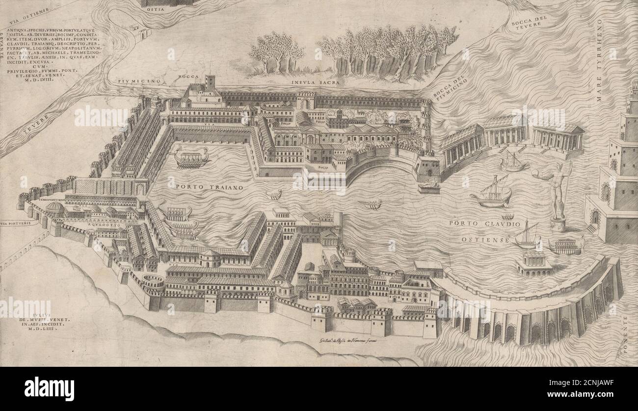 Speculum Romanae Magnificentiae: Birdseye View of the Port of Rome, 1554. Stock Photohttps://www.alamy.com/image-license-details/?v=1https://www.alamy.com/speculum-romanae-magnificentiae-birdseye-view-of-the-port-of-rome-1554-image374729195.html
RM2CNJAWF–Speculum Romanae Magnificentiae: Birdseye View of the Port of Rome, 1554.
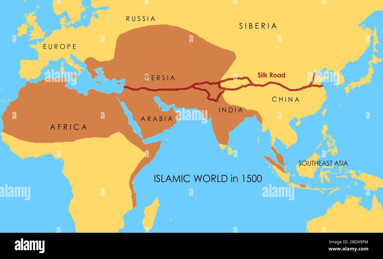 A map showing the route of the Silk Road, which connected East and West between the 2nd century BCE and the 18th century. The areas in darker yellow indicate the extent of the Islamic world in 1500. Stock Photohttps://www.alamy.com/image-license-details/?v=1https://www.alamy.com/a-map-showing-the-route-of-the-silk-road-which-connected-east-and-west-between-the-2nd-century-bce-and-the-18th-century-the-areas-in-darker-yellow-indicate-the-extent-of-the-islamic-world-in-1500-image352776136.html
RM2BDX9FM–A map showing the route of the Silk Road, which connected East and West between the 2nd century BCE and the 18th century. The areas in darker yellow indicate the extent of the Islamic world in 1500.
 AMERICA DEL SUR. CHILE. SIGLO XVIII. 'PLANO DEL PUERTO DE BALDIVIA'. VALDIVIA, situada en la costa del Chile y bañada por el rio Valdivia, según un dibujo del año 1713. La Ciudad fue fundada por Jeronimo de Alderate y Pedro de Valdivia en el año 1552. Grabado francés impreso en París en el año 1716. Stock Photohttps://www.alamy.com/image-license-details/?v=1https://www.alamy.com/america-del-sur-chile-siglo-xviii-plano-del-puerto-de-baldivia-valdivia-situada-en-la-costa-del-chile-y-baada-por-el-rio-valdivia-segn-un-dibujo-del-ao-1713-la-ciudad-fue-fundada-por-jeronimo-de-alderate-y-pedro-de-valdivia-en-el-ao-1552-grabado-francs-impreso-en-pars-en-el-ao-1716-image220172921.html
RMPP5MPH–AMERICA DEL SUR. CHILE. SIGLO XVIII. 'PLANO DEL PUERTO DE BALDIVIA'. VALDIVIA, situada en la costa del Chile y bañada por el rio Valdivia, según un dibujo del año 1713. La Ciudad fue fundada por Jeronimo de Alderate y Pedro de Valdivia en el año 1552. Grabado francés impreso en París en el año 1716.
 Funeral rituals in Ballagate near Goa from 'Indiae Orientalis' 1599 by Theodor de Bry. See description for further information. Stock Photohttps://www.alamy.com/image-license-details/?v=1https://www.alamy.com/stock-photo-funeral-rituals-in-ballagate-near-goa-from-indiae-orientalis-1599-73178769.html
RME71G7D–Funeral rituals in Ballagate near Goa from 'Indiae Orientalis' 1599 by Theodor de Bry. See description for further information.
![View of Venice [lower center block], 1500. Stock Photo View of Venice [lower center block], 1500. Stock Photo](https://c8.alamy.com/comp/2G4GF17/view-of-venice-lower-center-block-1500-2G4GF17.jpg) View of Venice [lower center block], 1500. Stock Photohttps://www.alamy.com/image-license-details/?v=1https://www.alamy.com/view-of-venice-lower-center-block-1500-image433080851.html
View of Venice [lower center block], 1500. Stock Photohttps://www.alamy.com/image-license-details/?v=1https://www.alamy.com/view-of-venice-lower-center-block-1500-image433080851.htmlRM2G4GF17–View of Venice [lower center block], 1500.
 PORTULANO DEL MEDITERRANEO. Carta de navegación realizada por Bartolomeu OLIVES en el año 1538. Legado Espona. Obra original. Museu Marítim de Barcelona. Cataluña. Stock Photohttps://www.alamy.com/image-license-details/?v=1https://www.alamy.com/portulano-del-mediterraneo-carta-de-navegacin-realizada-por-bartolomeu-olives-en-el-ao-1538-legado-espona-obra-original-museu-martim-de-barcelona-catalua-image231216044.html
RMRC4PBT–PORTULANO DEL MEDITERRANEO. Carta de navegación realizada por Bartolomeu OLIVES en el año 1538. Legado Espona. Obra original. Museu Marítim de Barcelona. Cataluña.
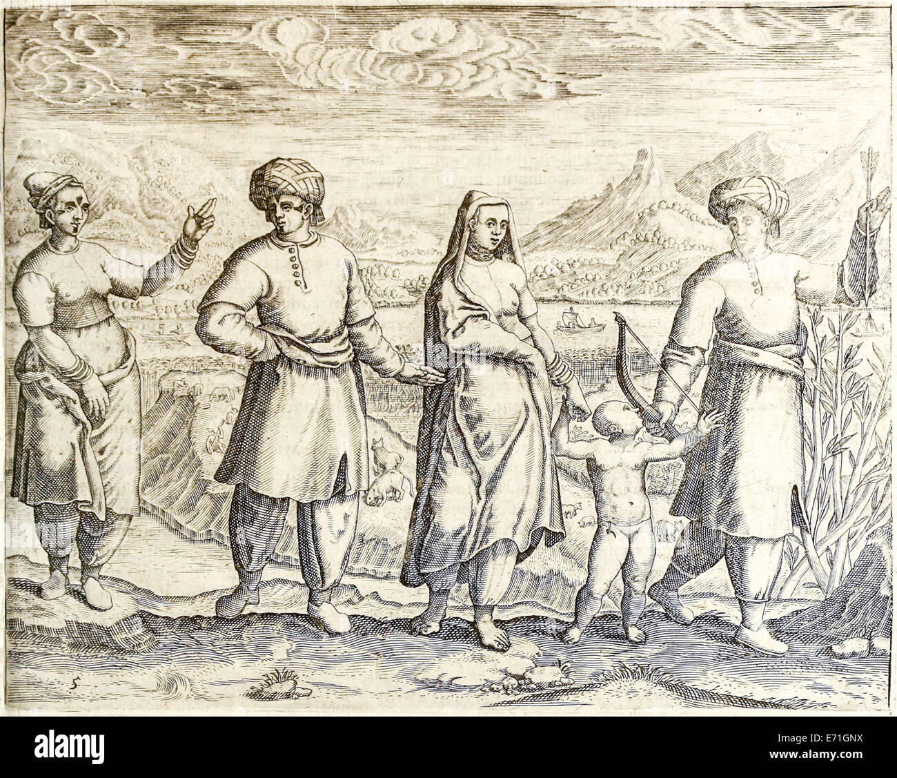 Arab and Ethiopian inhabitants of Goa from 'Indiae Orientalis' 1599 by Theodor de Bry. See description for further information. Stock Photohttps://www.alamy.com/image-license-details/?v=1https://www.alamy.com/stock-photo-arab-and-ethiopian-inhabitants-of-goa-from-indiae-orientalis-1599-73179174.html
RME71GNX–Arab and Ethiopian inhabitants of Goa from 'Indiae Orientalis' 1599 by Theodor de Bry. See description for further information.
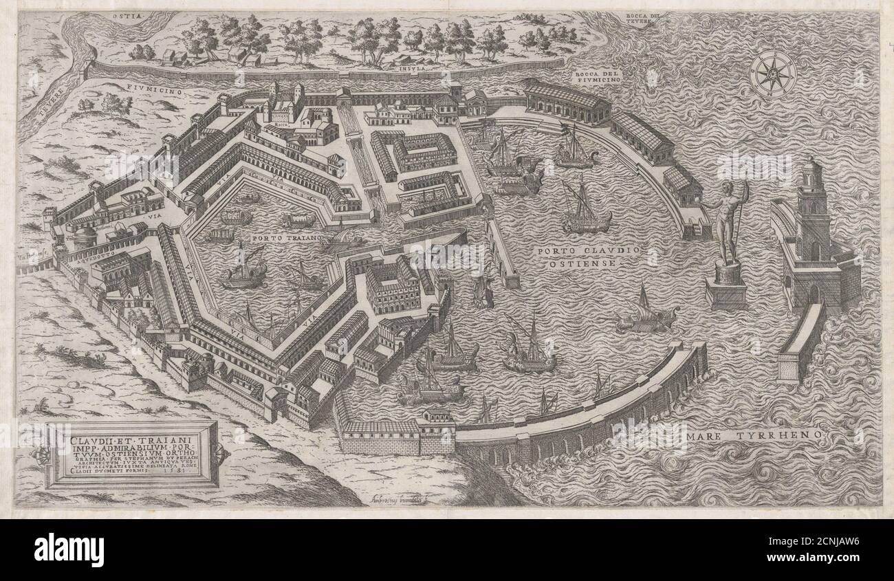 Speculum Romanae Magnificentiae: Port of Rome, 1581. Stock Photohttps://www.alamy.com/image-license-details/?v=1https://www.alamy.com/speculum-romanae-magnificentiae-port-of-rome-1581-image374729186.html
RM2CNJAW6–Speculum Romanae Magnificentiae: Port of Rome, 1581.
 MAPA DE ARABIA - SIGLO XVI. Author: HOMEN, DIEGO. Location: NATIONAL LIBRARY. France. Stock Photohttps://www.alamy.com/image-license-details/?v=1https://www.alamy.com/mapa-de-arabia-siglo-xvi-author-homen-diego-location-national-library-france-image219876713.html
RMPNM6YN–MAPA DE ARABIA - SIGLO XVI. Author: HOMEN, DIEGO. Location: NATIONAL LIBRARY. France.
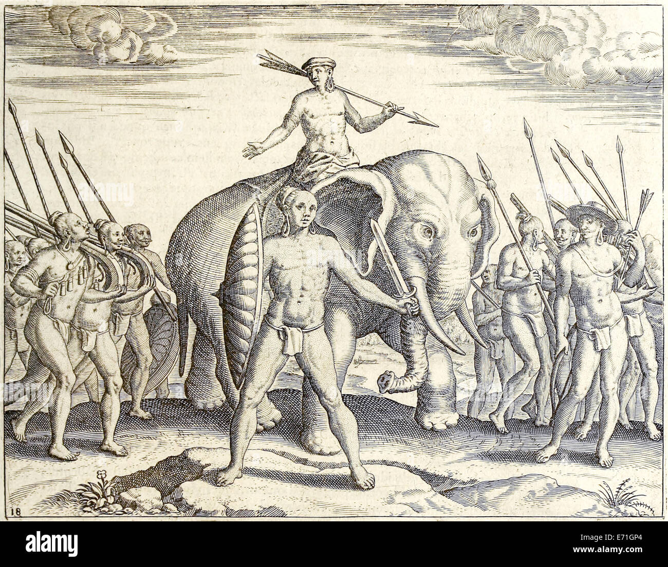 Ethiopia battle elephant, Illustration from 'Indiae Orientalis' 1599 by Theodor de Bry. See description for further information. Stock Photohttps://www.alamy.com/image-license-details/?v=1https://www.alamy.com/stock-photo-ethiopia-battle-elephant-illustration-from-indiae-orientalis-1599-73179180.html
RME71GP4–Ethiopia battle elephant, Illustration from 'Indiae Orientalis' 1599 by Theodor de Bry. See description for further information.
 CIVITATES ORBIS TERRARUM - CONIL Y JEREZ DE LA FRONTERA - GRABADO - SIGLO XVI. Author: BRAUN GEORG 1541-1622 / HOGENBERG FRANS. Location: BIBLIOTECA NACIONAL-COLECCION. MADRID. SPAIN. Stock Photohttps://www.alamy.com/image-license-details/?v=1https://www.alamy.com/civitates-orbis-terrarum-conil-y-jerez-de-la-frontera-grabado-siglo-xvi-author-braun-georg-1541-1622-hogenberg-frans-location-biblioteca-nacional-coleccion-madrid-spain-image219833136.html
RMPNJ7BC–CIVITATES ORBIS TERRARUM - CONIL Y JEREZ DE LA FRONTERA - GRABADO - SIGLO XVI. Author: BRAUN GEORG 1541-1622 / HOGENBERG FRANS. Location: BIBLIOTECA NACIONAL-COLECCION. MADRID. SPAIN.
 Farm scene near Goa from 'Indiae Orientalis' 1599 by Theodor de Bry. See description for further information. Stock Photohttps://www.alamy.com/image-license-details/?v=1https://www.alamy.com/stock-photo-farm-scene-near-goa-from-indiae-orientalis-1599-by-theodor-de-bry-73179177.html
RME71GP1–Farm scene near Goa from 'Indiae Orientalis' 1599 by Theodor de Bry. See description for further information.
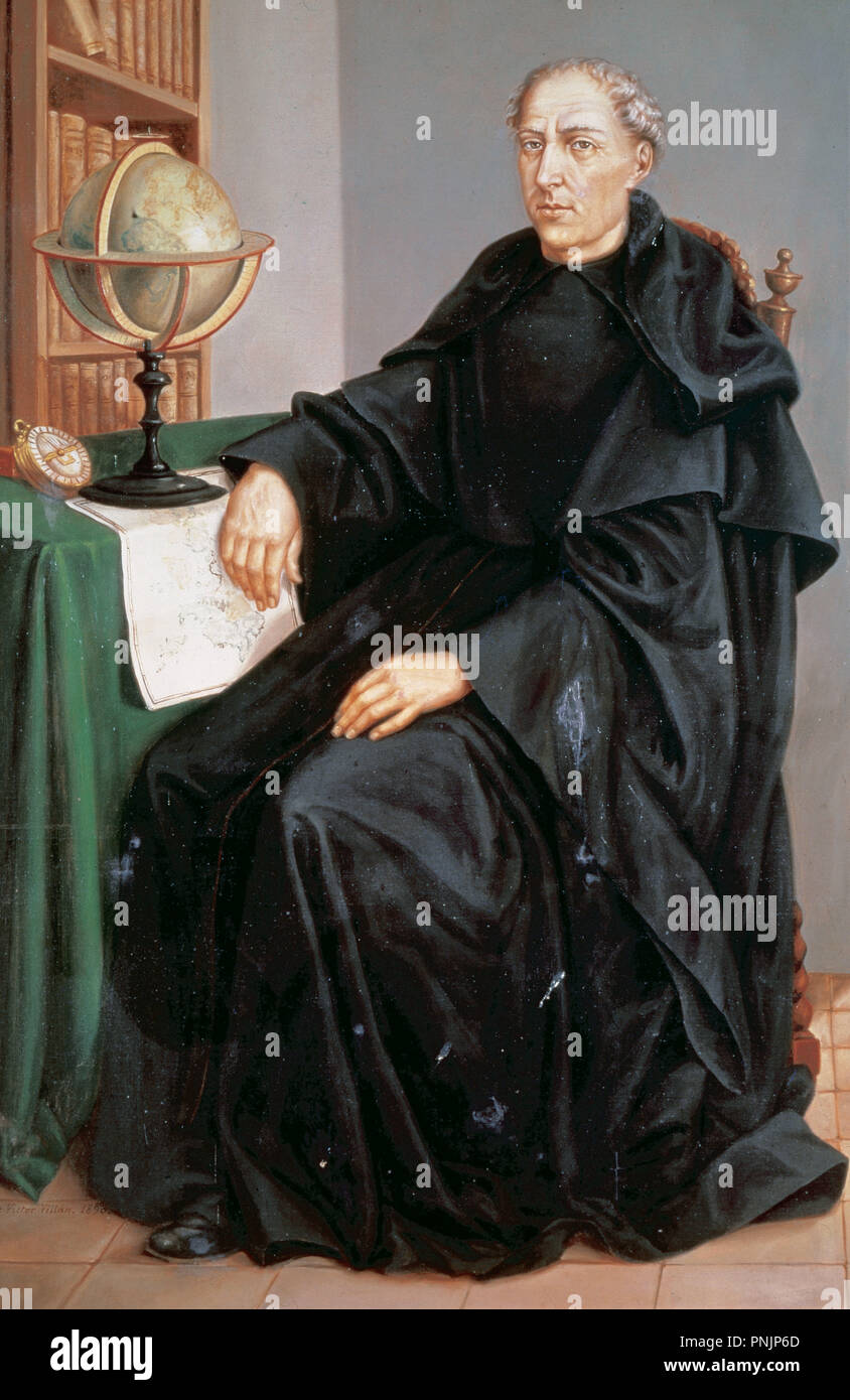 Andres de Urdaneta (1508-1568). Was a circumnavigator, explorer and Augustinian friar. Anonymous portrait. Monasterio de San Lorenzo de El Escorial. Spain. Stock Photohttps://www.alamy.com/image-license-details/?v=1https://www.alamy.com/andres-de-urdaneta-1508-1568-was-a-circumnavigator-explorer-and-augustinian-friar-anonymous-portrait-monasterio-de-san-lorenzo-de-el-escorial-spain-image219844757.html
RMPNJP6D–Andres de Urdaneta (1508-1568). Was a circumnavigator, explorer and Augustinian friar. Anonymous portrait. Monasterio de San Lorenzo de El Escorial. Spain.
 Native battle scene from 'Indiae Orientalis' 1599 by Theodor de Bry. See description for further gruesome information. Stock Photohttps://www.alamy.com/image-license-details/?v=1https://www.alamy.com/stock-photo-native-battle-scene-from-indiae-orientalis-1599-by-theodor-de-bry-73178372.html
RME71FN8–Native battle scene from 'Indiae Orientalis' 1599 by Theodor de Bry. See description for further gruesome information.
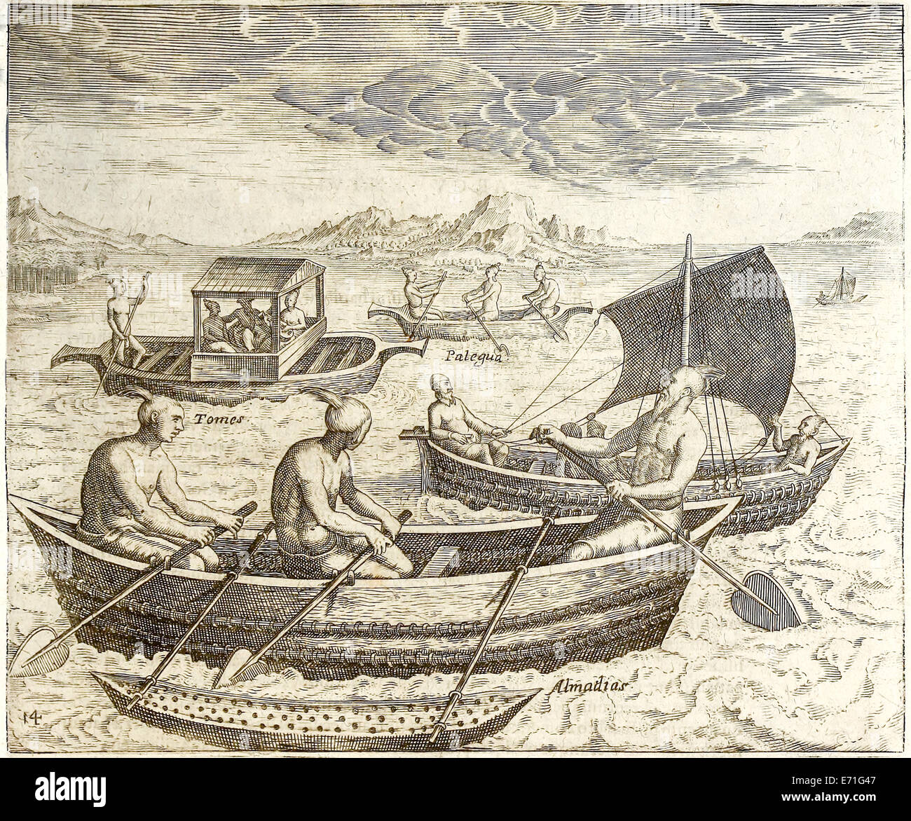 Boats from Goa and Cochin from 'Indiae Orientalis' 1599 by Theodor de Bry. See description for further information. Stock Photohttps://www.alamy.com/image-license-details/?v=1https://www.alamy.com/stock-photo-boats-from-goa-and-cochin-from-indiae-orientalis-1599-by-theodor-de-73178679.html
RME71G47–Boats from Goa and Cochin from 'Indiae Orientalis' 1599 by Theodor de Bry. See description for further information.
 Illustration of Chinese ship from 'Indiae Orientalis' 1599 by Theodor de Bry. See description for further information. Stock Photohttps://www.alamy.com/image-license-details/?v=1https://www.alamy.com/stock-photo-illustration-of-chinese-ship-from-indiae-orientalis-1599-by-theodor-73178758.html
RME71G72–Illustration of Chinese ship from 'Indiae Orientalis' 1599 by Theodor de Bry. See description for further information.
 Portuguese, illustration from 'Indiae Orientalis' 1599 by Theodor de Bry. See description for further information. Stock Photohttps://www.alamy.com/image-license-details/?v=1https://www.alamy.com/stock-photo-portuguese-illustration-from-indiae-orientalis-1599-by-theodor-de-73178767.html
RME71G7B–Portuguese, illustration from 'Indiae Orientalis' 1599 by Theodor de Bry. See description for further information.
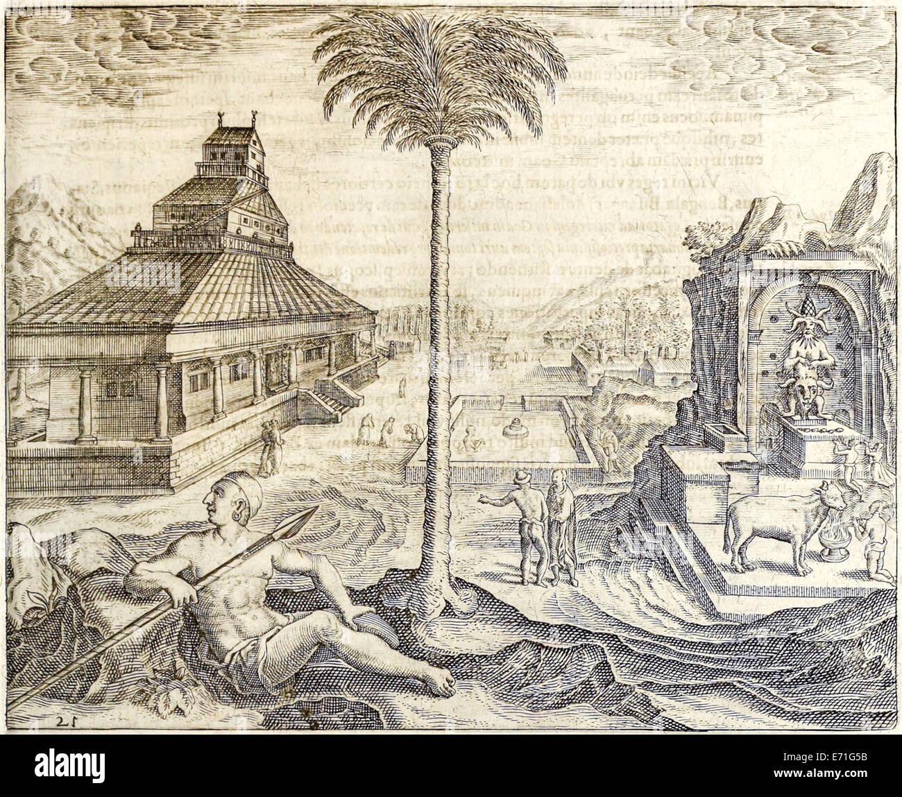 Illustration from 'Indiae Orientalis' 1599 by Theodor de Bry. See description for further information. Stock Photohttps://www.alamy.com/image-license-details/?v=1https://www.alamy.com/stock-photo-illustration-from-indiae-orientalis-1599-by-theodor-de-bry-see-description-73178711.html
RME71G5B–Illustration from 'Indiae Orientalis' 1599 by Theodor de Bry. See description for further information.
 Feast in China, illustration from 'Indiae Orientalis' 1599 by Theodor de Bry. See description for further information. Stock Photohttps://www.alamy.com/image-license-details/?v=1https://www.alamy.com/stock-photo-feast-in-china-illustration-from-indiae-orientalis-1599-by-theodor-73178761.html
RME71G75–Feast in China, illustration from 'Indiae Orientalis' 1599 by Theodor de Bry. See description for further information.
 Coins, illustration from 'Indiae Orientalis' 1599 by Theodor de Bry. See description for further information. Stock Photohttps://www.alamy.com/image-license-details/?v=1https://www.alamy.com/stock-photo-coins-illustration-from-indiae-orientalis-1599-by-theodor-de-bry-see-73178370.html
RME71FN6–Coins, illustration from 'Indiae Orientalis' 1599 by Theodor de Bry. See description for further information.
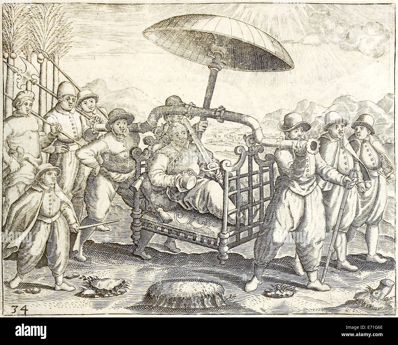 Portuguese hammock litter from 'Indiae Orientalis' 1599 by Theodor de Bry. See description for further information. Stock Photohttps://www.alamy.com/image-license-details/?v=1https://www.alamy.com/stock-photo-portuguese-hammock-litter-from-indiae-orientalis-1599-by-theodor-de-73178742.html
RME71G6E–Portuguese hammock litter from 'Indiae Orientalis' 1599 by Theodor de Bry. See description for further information.
 Jan Huyghen van Linschoten portrait from 'Indiae Orientalis' 1599 by Theodor de Bry. See description for further information. Stock Photohttps://www.alamy.com/image-license-details/?v=1https://www.alamy.com/stock-photo-jan-huyghen-van-linschoten-portrait-from-indiae-orientalis-1599-by-73178750.html
RME71G6P–Jan Huyghen van Linschoten portrait from 'Indiae Orientalis' 1599 by Theodor de Bry. See description for further information.
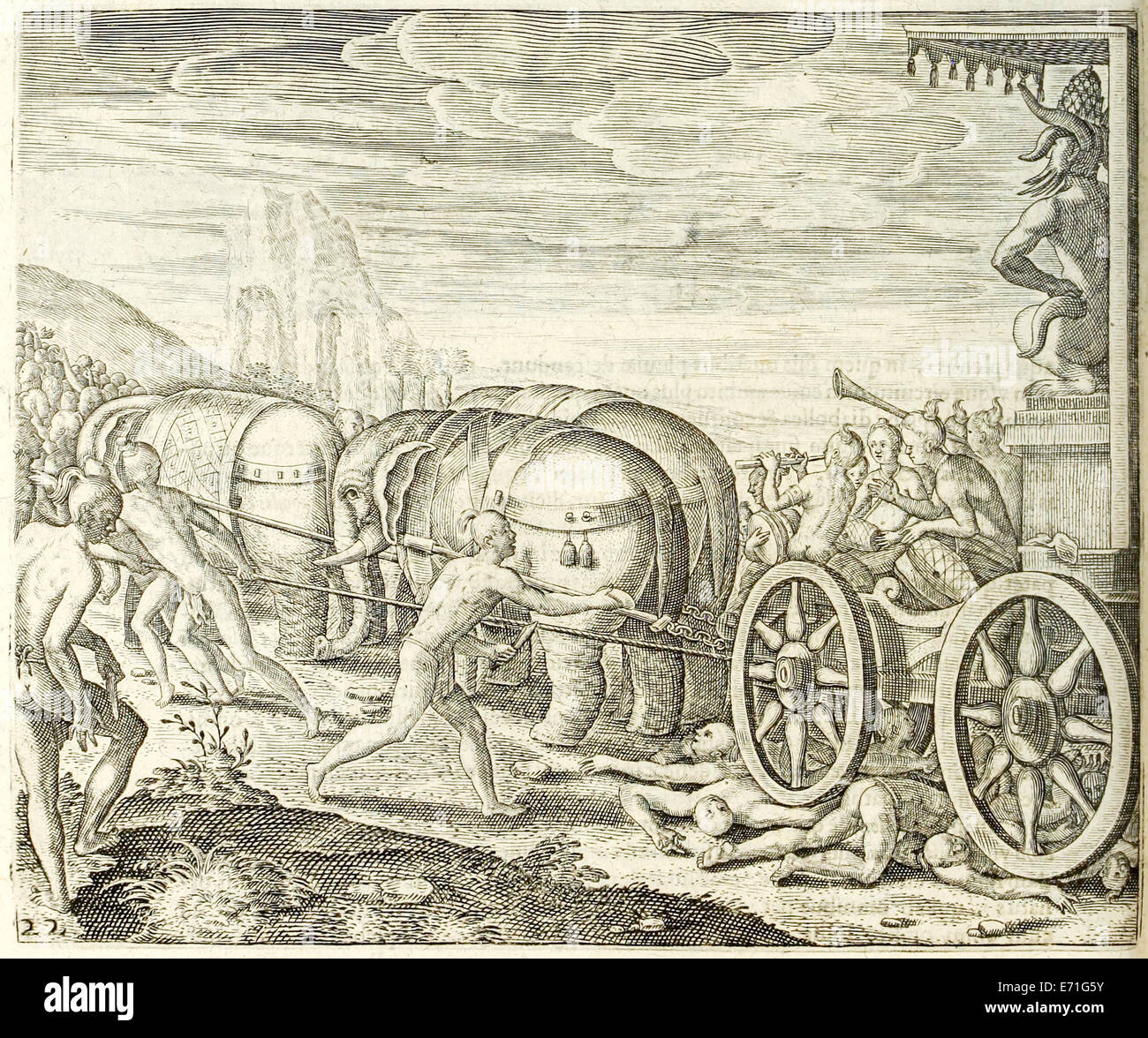 Religious customs in Narsinga, India from 'Indiae Orientalis' 1599 by Theodor de Bry. See description for further information. Stock Photohttps://www.alamy.com/image-license-details/?v=1https://www.alamy.com/stock-photo-religious-customs-in-narsinga-india-from-indiae-orientalis-1599-by-73178727.html
RME71G5Y–Religious customs in Narsinga, India from 'Indiae Orientalis' 1599 by Theodor de Bry. See description for further information.
 Punishment in China. Illustration from 'Indiae Orientalis' 1599 by Theodor de Bry. See description for further information. Stock Photohttps://www.alamy.com/image-license-details/?v=1https://www.alamy.com/stock-photo-punishment-in-china-illustration-from-indiae-orientalis-1599-by-theodor-73178741.html
RME71G6D–Punishment in China. Illustration from 'Indiae Orientalis' 1599 by Theodor de Bry. See description for further information.
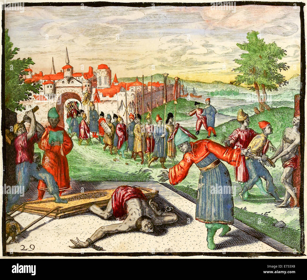 Punishment in China, breaking ankles and feet with a sledge hammer between boards and fingers in vice. Illustration from 'Indiae Orientalis' 1598 by Theodor de Bry (1528-1598). See description for further information. Stock Photohttps://www.alamy.com/image-license-details/?v=1https://www.alamy.com/stock-photo-punishment-in-china-breaking-ankles-and-feet-with-a-sledge-hammer-73213008.html
RME733X8–Punishment in China, breaking ankles and feet with a sledge hammer between boards and fingers in vice. Illustration from 'Indiae Orientalis' 1598 by Theodor de Bry (1528-1598). See description for further information.
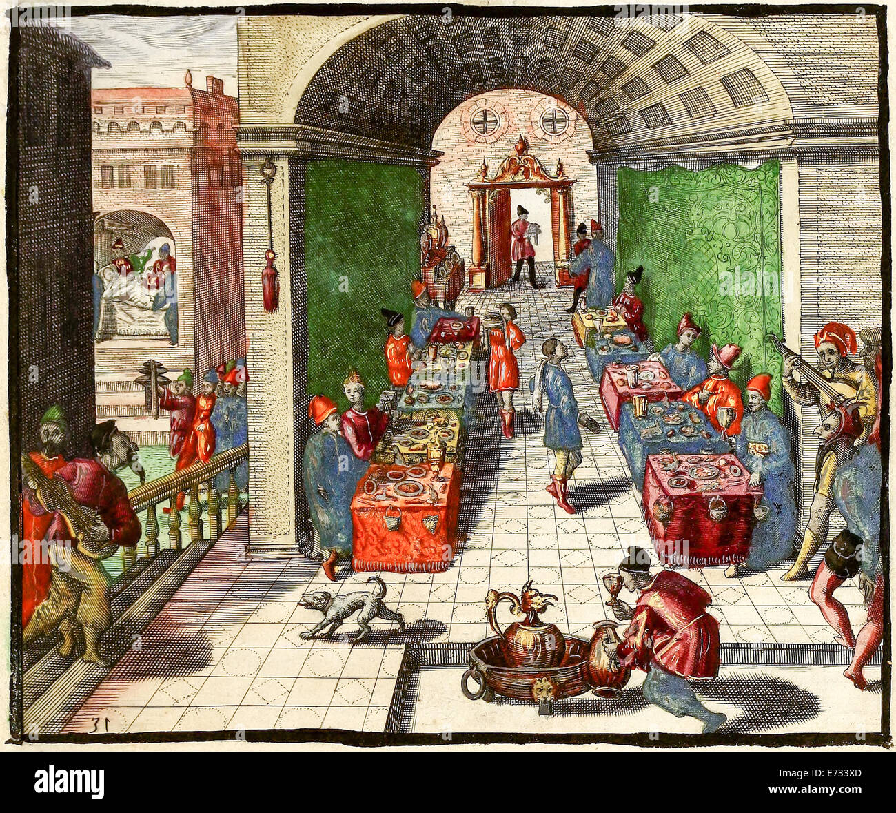 Feast in China, illustration from 'Indiae Orientalis' 1598 by Theodor de Bry. See description for further information. Stock Photohttps://www.alamy.com/image-license-details/?v=1https://www.alamy.com/stock-photo-feast-in-china-illustration-from-indiae-orientalis-1598-by-theodor-73213013.html
RME733XD–Feast in China, illustration from 'Indiae Orientalis' 1598 by Theodor de Bry. See description for further information.
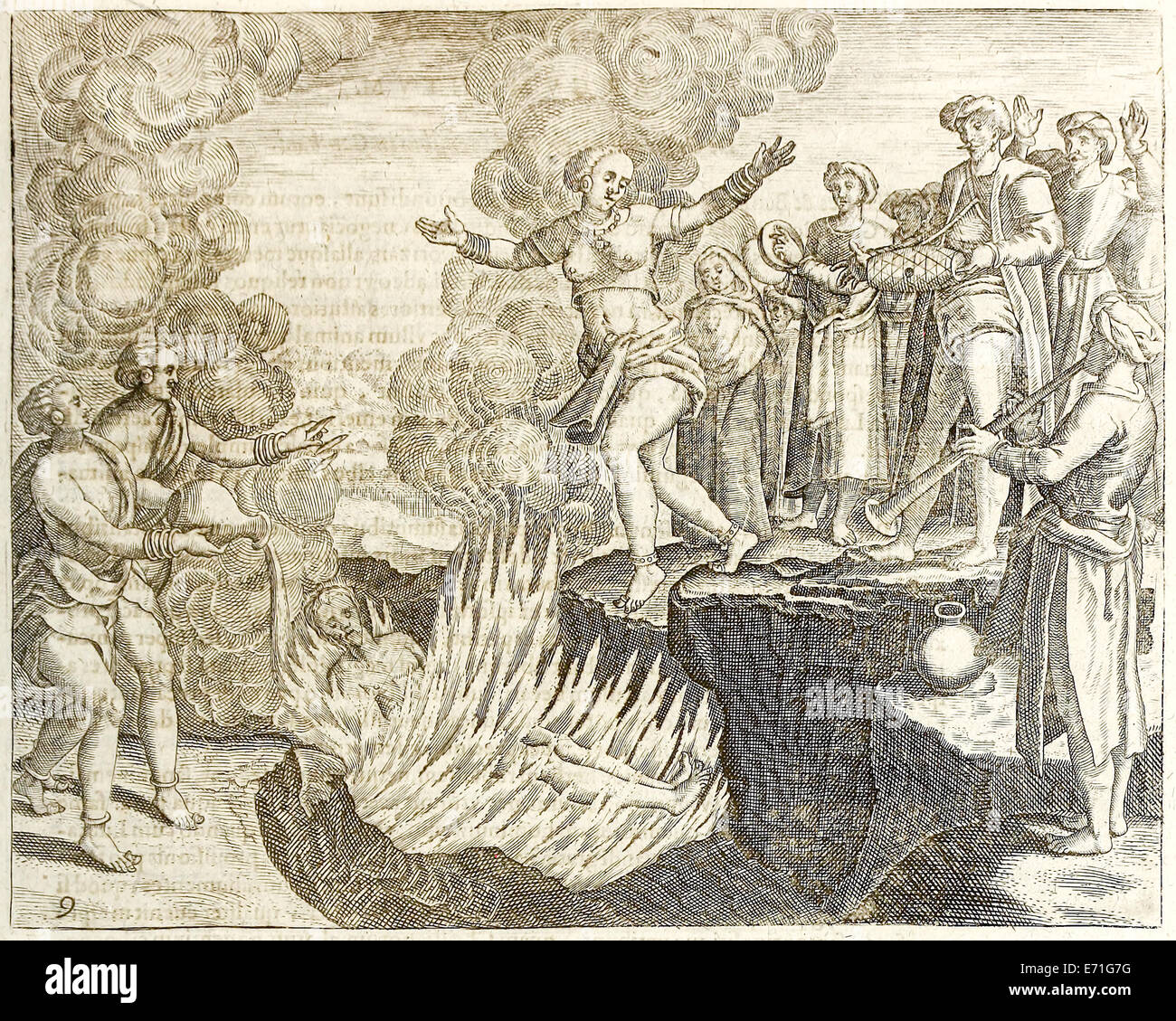 Sati in India, illustration from 'Indiae Orientalis' 1599 by Theodor de Bry. See description for further information. Stock Photohttps://www.alamy.com/image-license-details/?v=1https://www.alamy.com/stock-photo-sati-in-india-illustration-from-indiae-orientalis-1599-by-theodor-73178772.html
RME71G7G–Sati in India, illustration from 'Indiae Orientalis' 1599 by Theodor de Bry. See description for further information.
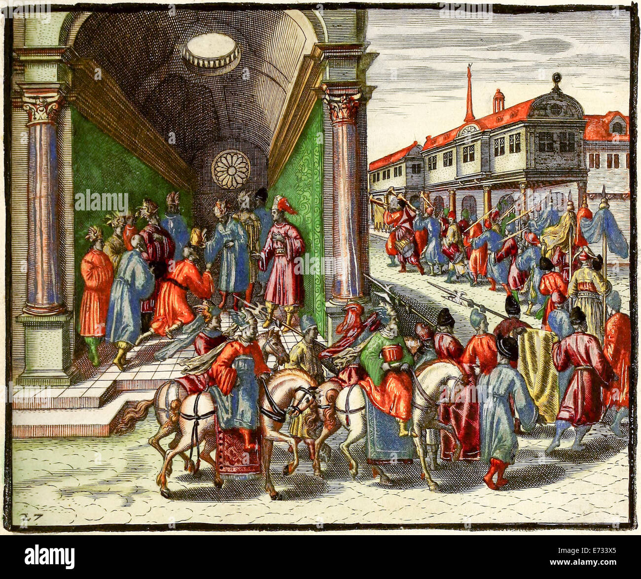 Nomination of Regent in China, illustration from 'Indiae Orientalis' 1598 by Theodor de Bry. See description for further info Stock Photohttps://www.alamy.com/image-license-details/?v=1https://www.alamy.com/stock-photo-nomination-of-regent-in-china-illustration-from-indiae-orientalis-73213005.html
RME733X5–Nomination of Regent in China, illustration from 'Indiae Orientalis' 1598 by Theodor de Bry. See description for further info
 Funeral in China, illustration from 'Indiae Orientalis' 1598 by Theodor de Bry. See description for further information. Stock Photohttps://www.alamy.com/image-license-details/?v=1https://www.alamy.com/stock-photo-funeral-in-china-illustration-from-indiae-orientalis-1598-by-theodor-73212042.html
RME732KP–Funeral in China, illustration from 'Indiae Orientalis' 1598 by Theodor de Bry. See description for further information.
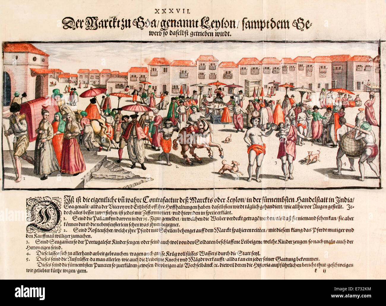 Market Square, Goa India, illustration from 'Indiae Orientalis' 1598 by Theodor de Bry. See description for further information. Stock Photohttps://www.alamy.com/image-license-details/?v=1https://www.alamy.com/stock-photo-market-square-goa-india-illustration-from-indiae-orientalis-1598-by-73212040.html
RME732KM–Market Square, Goa India, illustration from 'Indiae Orientalis' 1598 by Theodor de Bry. See description for further information.
 Jan Huyghen van Linschoten portrait from 'Indiae Orientalis' 1598 by Theodor de Bry. See description for further information. Stock Photohttps://www.alamy.com/image-license-details/?v=1https://www.alamy.com/stock-photo-jan-huyghen-van-linschoten-portrait-from-indiae-orientalis-1598-by-73212031.html
RME732KB–Jan Huyghen van Linschoten portrait from 'Indiae Orientalis' 1598 by Theodor de Bry. See description for further information.
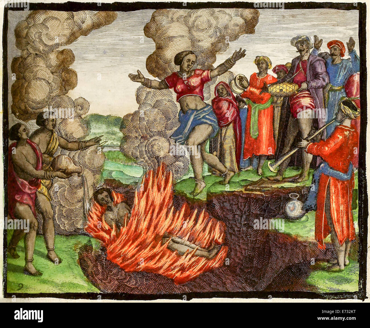 Sati in India, illustration from 'Indiae Orientalis' 1598 by Theodor de Bry. See description for further information. Stock Photohttps://www.alamy.com/image-license-details/?v=1https://www.alamy.com/stock-photo-sati-in-india-illustration-from-indiae-orientalis-1598-by-theodor-73212044.html
RME732KT–Sati in India, illustration from 'Indiae Orientalis' 1598 by Theodor de Bry. See description for further information.
 Portuguese hammock litter from 'Indiae Orientalis' 1598 by Theodor de Bry. See description for further information. Stock Photohttps://www.alamy.com/image-license-details/?v=1https://www.alamy.com/stock-photo-portuguese-hammock-litter-from-indiae-orientalis-1598-by-theodor-de-73212039.html
RME732KK–Portuguese hammock litter from 'Indiae Orientalis' 1598 by Theodor de Bry. See description for further information.