1780 map north america Stock Photos and Images
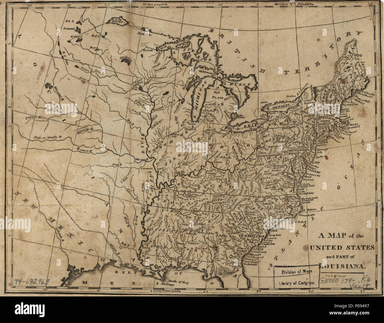 . English: Scale ca. 1:9,500,000. 'Meridian of Philadelphia.' Relief shown pictorially. LC Maps of North America, 1750-1789, 738 Available also through the Library of Congress Web site as a raster image. Vault AACR2: 651 . A map of the United States and part of Louisiana.. 1780. Kneass, William 129 A map of the United States and part of Louisiana. LOC 74692963 Stock Photohttps://www.alamy.com/image-license-details/?v=1https://www.alamy.com/english-scale-ca-19500000-meridian-of-philadelphia-relief-shown-pictorially-lc-maps-of-north-america-1750-1789-738-available-also-through-the-library-of-congress-web-site-as-a-raster-image-vault-aacr2-651-a-map-of-the-united-states-and-part-of-louisiana-1780-kneass-william-129-a-map-of-the-united-states-and-part-of-louisiana-loc-74692963-image206725379.html
RMP09497–. English: Scale ca. 1:9,500,000. 'Meridian of Philadelphia.' Relief shown pictorially. LC Maps of North America, 1750-1789, 738 Available also through the Library of Congress Web site as a raster image. Vault AACR2: 651 . A map of the United States and part of Louisiana.. 1780. Kneass, William 129 A map of the United States and part of Louisiana. LOC 74692963
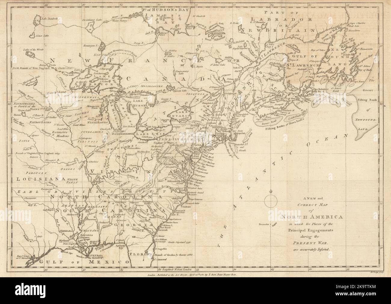 A New & Correct Map of North America in which the places… JOHN LODGE 1780 Stock Photohttps://www.alamy.com/image-license-details/?v=1https://www.alamy.com/a-new-correct-map-of-north-america-in-which-the-places-john-lodge-1780-image487968424.html
RF2K9TTKM–A New & Correct Map of North America in which the places… JOHN LODGE 1780
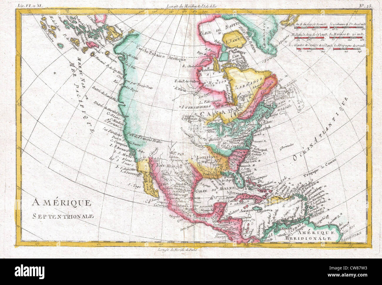 1780 Raynal and Bonne Map of North America Stock Photohttps://www.alamy.com/image-license-details/?v=1https://www.alamy.com/stock-photo-1780-raynal-and-bonne-map-of-north-america-49968943.html
RMCW87W3–1780 Raynal and Bonne Map of North America
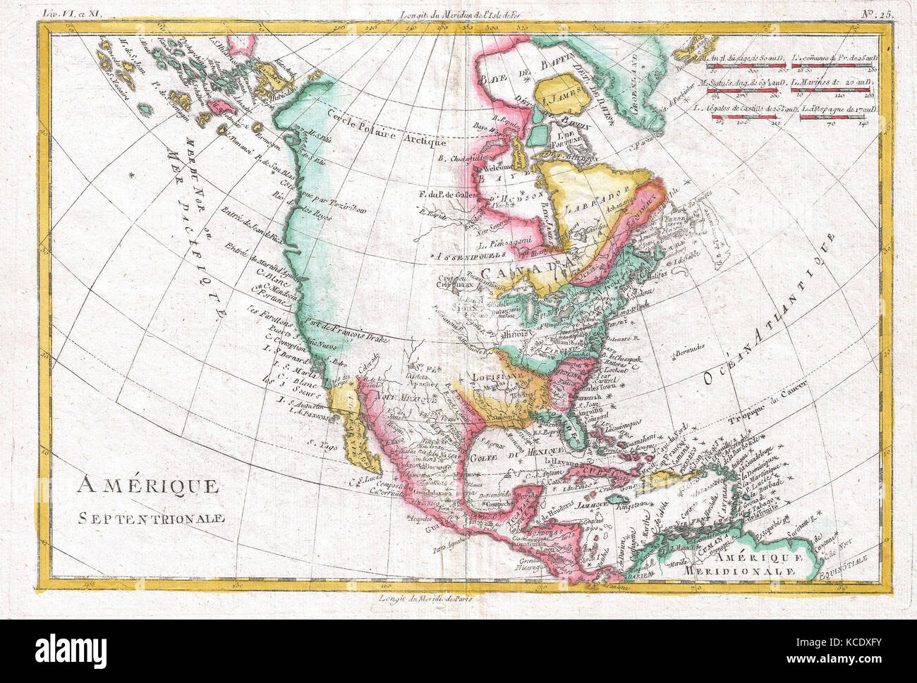 1780, Raynal and Bonne Map of North America, Rigobert Bonne 1727 – 1794 Stock Photohttps://www.alamy.com/image-license-details/?v=1https://www.alamy.com/stock-image-1780-raynal-and-bonne-map-of-north-america-rigobert-bonne-1727-1794-162575391.html
RMKCDXFY–1780, Raynal and Bonne Map of North America, Rigobert Bonne 1727 – 1794
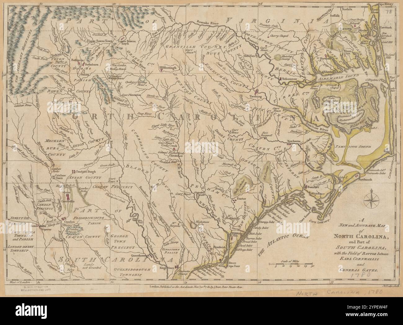 A new and accurate map of North Carolina and part of South Carolina : with the field of battle between Earl Cornwallis and General Gates 1780 by Lodge, John, -1796 Stock Photohttps://www.alamy.com/image-license-details/?v=1https://www.alamy.com/a-new-and-accurate-map-of-north-carolina-and-part-of-south-carolina-with-the-field-of-battle-between-earl-cornwallis-and-general-gates-1780-by-lodge-john-1796-image633422735.html
RM2YPEW4F–A new and accurate map of North Carolina and part of South Carolina : with the field of battle between Earl Cornwallis and General Gates 1780 by Lodge, John, -1796
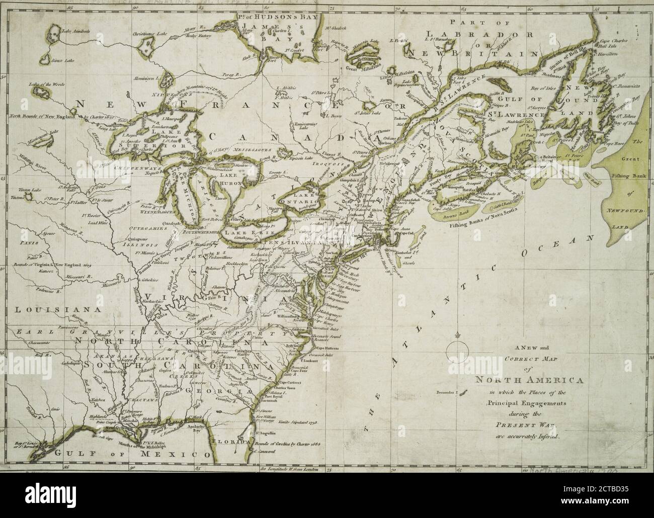 A new and correct map of North America : in which the places of the principal engagements during the present war are accurately inserted, cartographic, Maps, 1780-04-26, Lodge, John, -1796 Stock Photohttps://www.alamy.com/image-license-details/?v=1https://www.alamy.com/a-new-and-correct-map-of-north-america-in-which-the-places-of-the-principal-engagements-during-the-present-war-are-accurately-inserted-cartographic-maps-1780-04-26-lodge-john-1796-image376421225.html
RM2CTBD35–A new and correct map of North America : in which the places of the principal engagements during the present war are accurately inserted, cartographic, Maps, 1780-04-26, Lodge, John, -1796
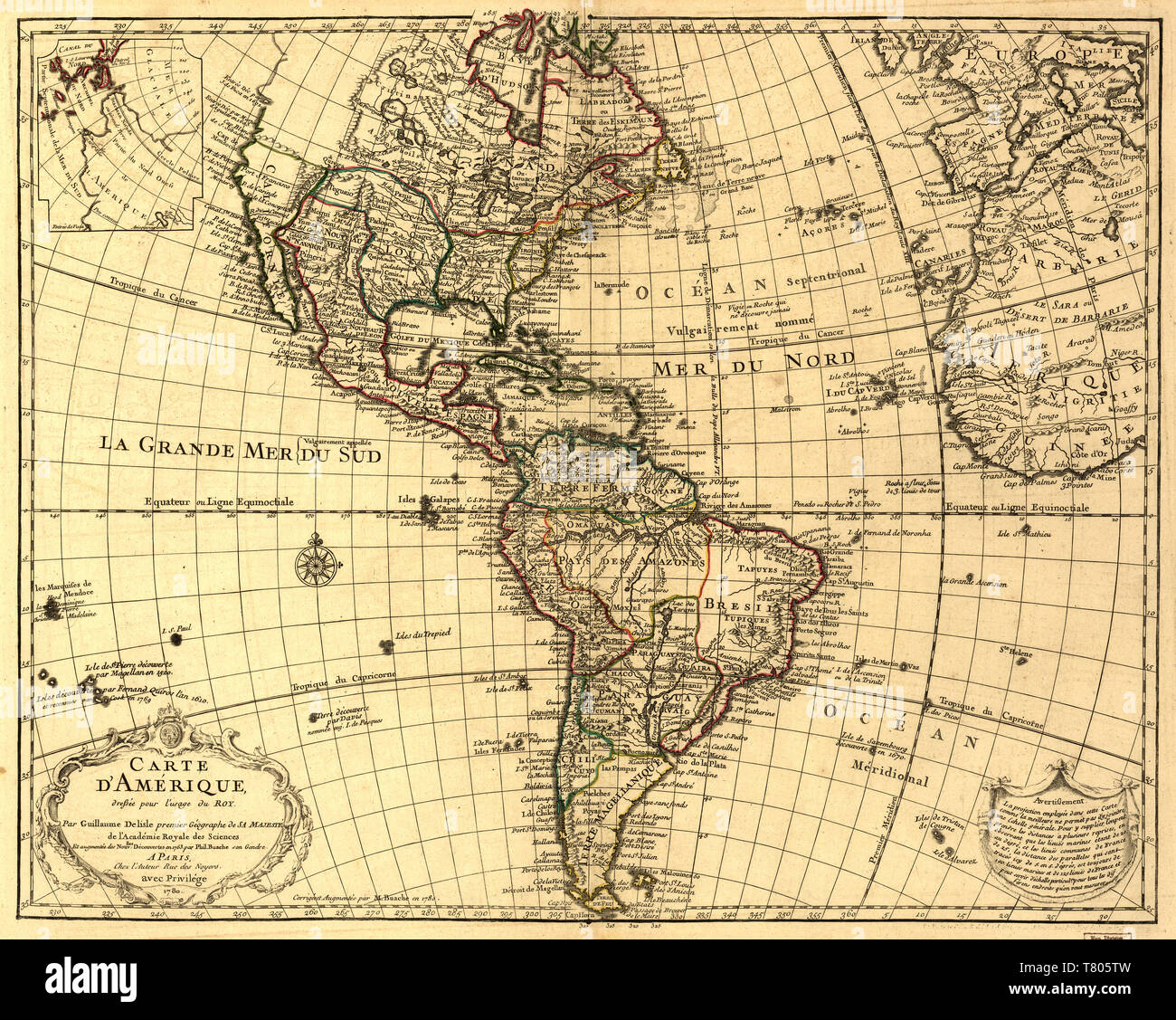 Guillaume Delisle, The Americas Map, 1780 Stock Photohttps://www.alamy.com/image-license-details/?v=1https://www.alamy.com/guillaume-delisle-the-americas-map-1780-image245867017.html
RMT805TW–Guillaume Delisle, The Americas Map, 1780
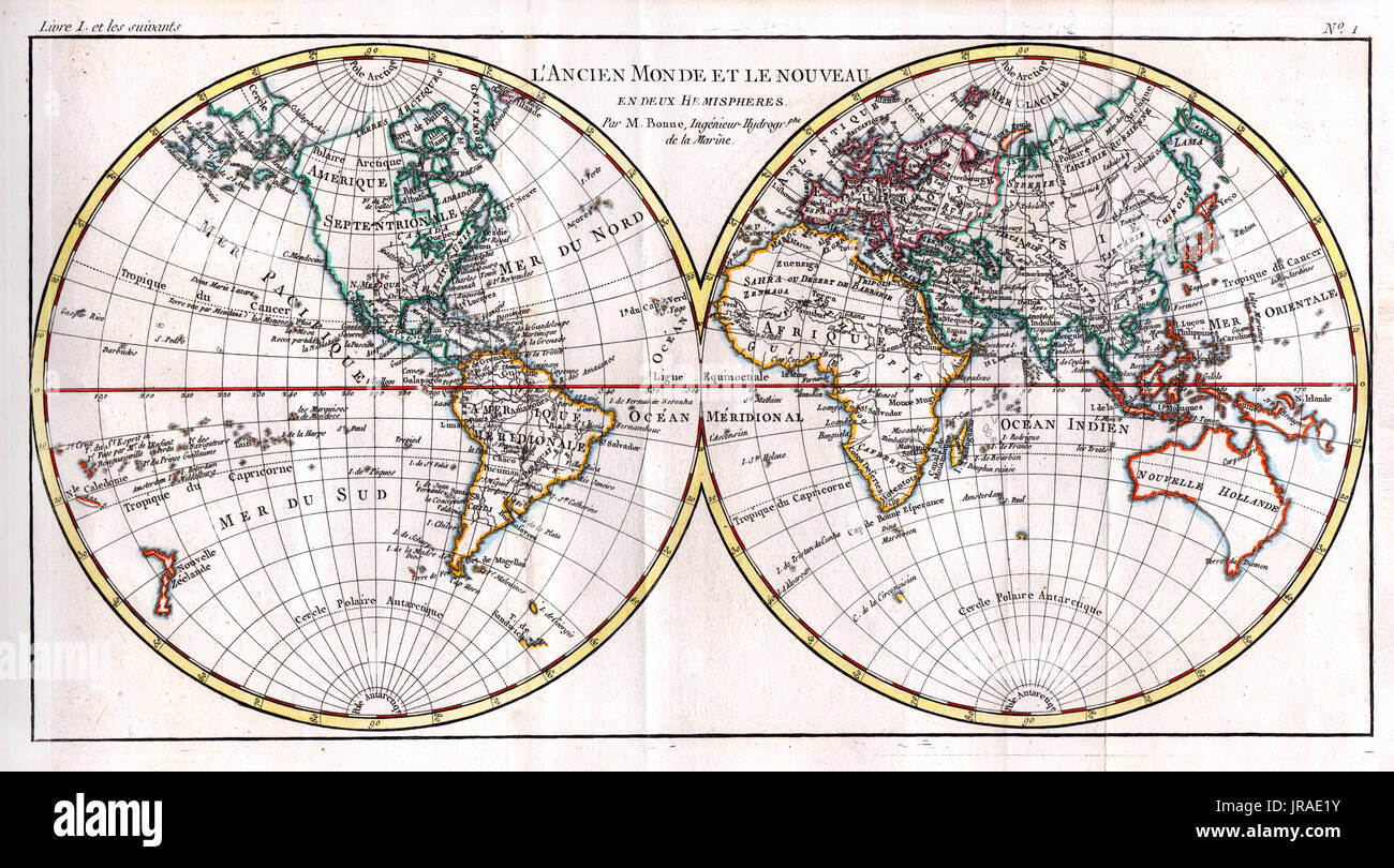 1780 Bonne Antique Map of World in Hemispheres showing the continents of North America, South America, Asia, Europe, Africa and Australia. Stock Photohttps://www.alamy.com/image-license-details/?v=1https://www.alamy.com/1780-bonne-antique-map-of-world-in-hemispheres-showing-the-continents-image152050583.html
RFJRAE1Y–1780 Bonne Antique Map of World in Hemispheres showing the continents of North America, South America, Asia, Europe, Africa and Australia.
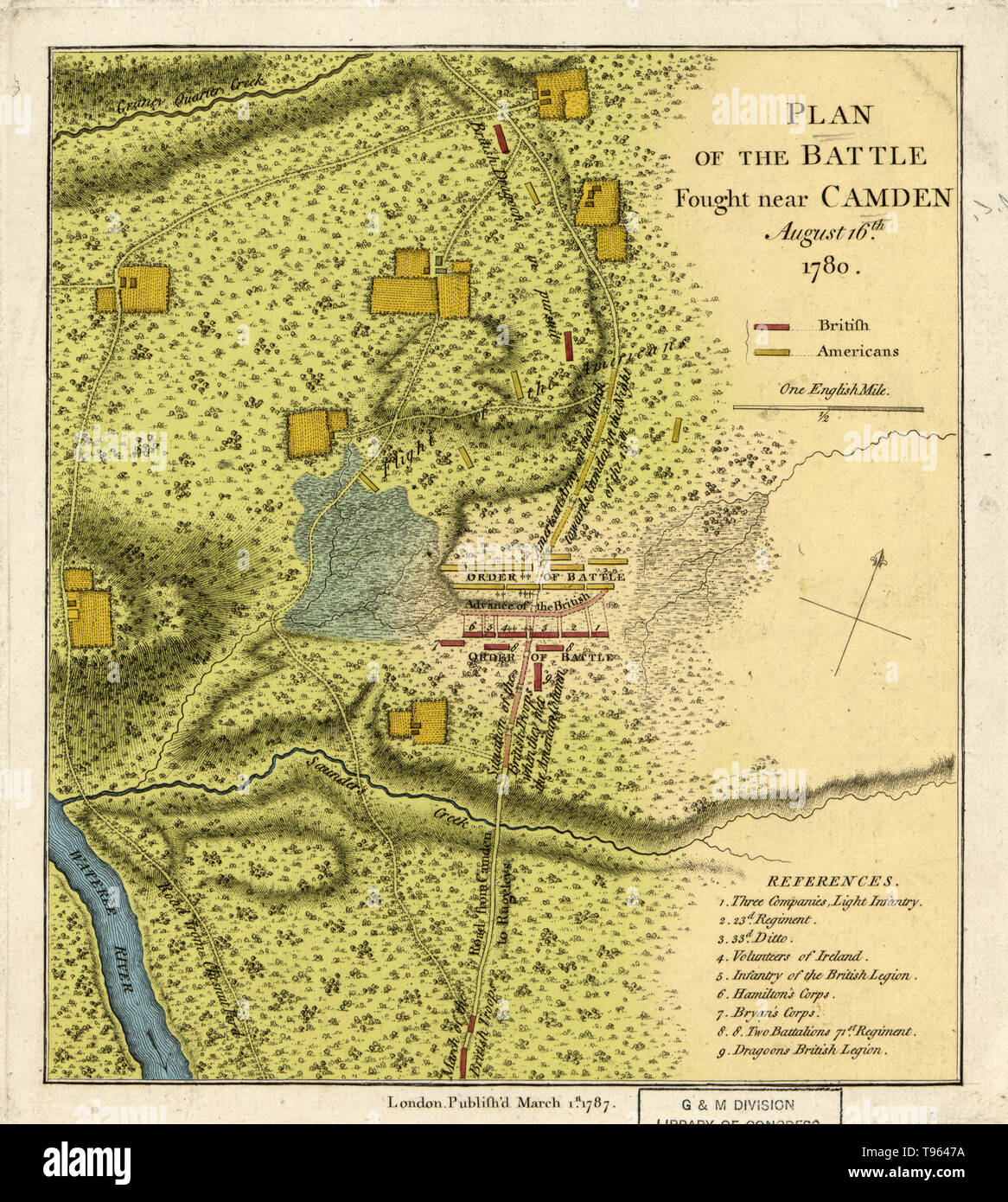 The Battle of Camden was a major victory for the British in the Southern theater of the American Revolutionary War. On August 16, 1780, British forces under Lieutenant General Charles, Lord Cornwallis routed the American forces of Major General Horatio Gates about 10 km (five miles) north of Camden, South Carolina, strengthening the British hold on the Carolinas following the capture of Charleston. Stock Photohttps://www.alamy.com/image-license-details/?v=1https://www.alamy.com/the-battle-of-camden-was-a-major-victory-for-the-british-in-the-southern-theater-of-the-american-revolutionary-war-on-august-16-1780-british-forces-under-lieutenant-general-charles-lord-cornwallis-routed-the-american-forces-of-major-general-horatio-gates-about-10-km-five-miles-north-of-camden-south-carolina-strengthening-the-british-hold-on-the-carolinas-following-the-capture-of-charleston-image246612110.html
RMT9647A–The Battle of Camden was a major victory for the British in the Southern theater of the American Revolutionary War. On August 16, 1780, British forces under Lieutenant General Charles, Lord Cornwallis routed the American forces of Major General Horatio Gates about 10 km (five miles) north of Camden, South Carolina, strengthening the British hold on the Carolinas following the capture of Charleston.
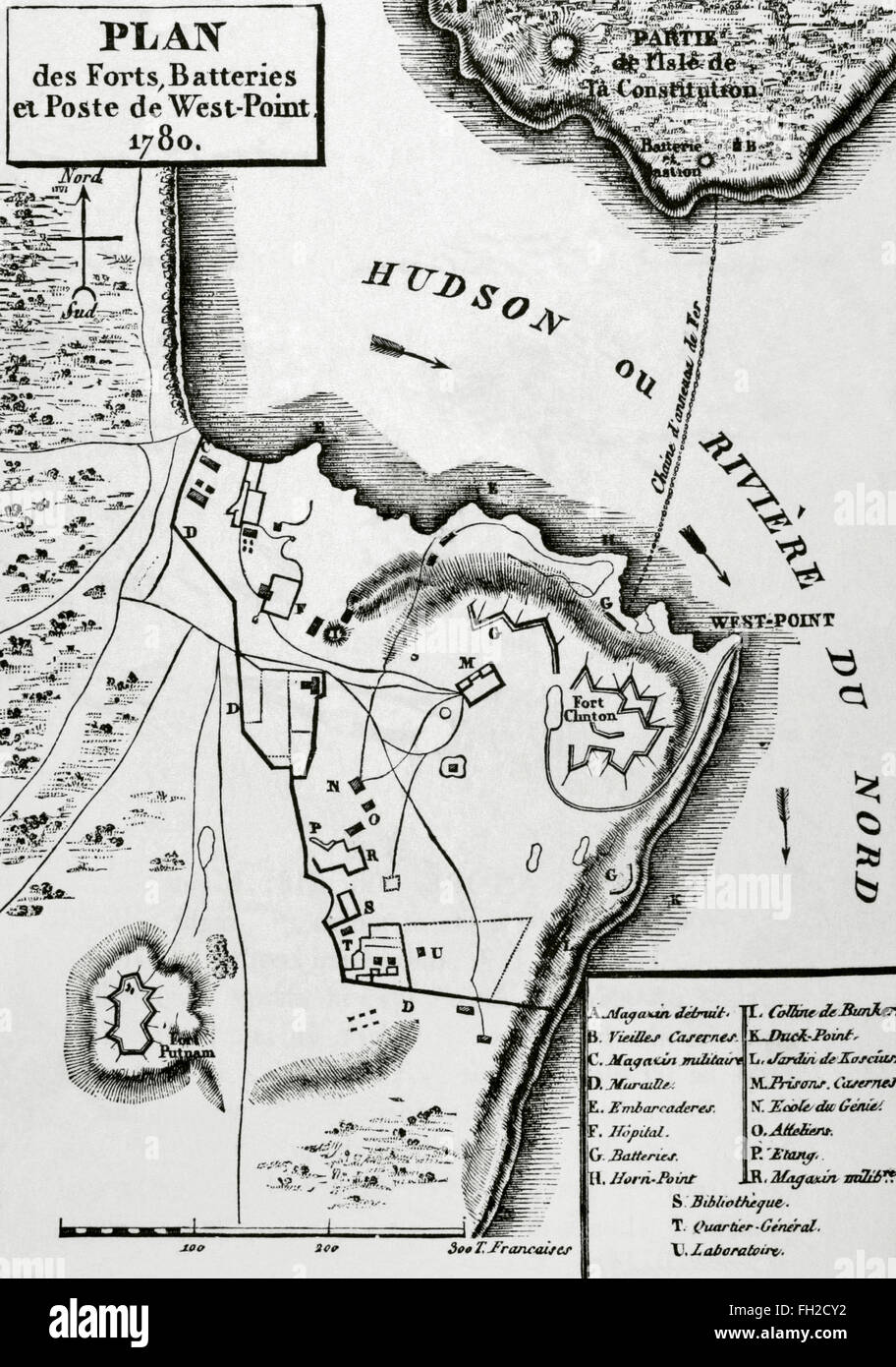 American Revolutionary War (1775-1783). Map of the defense network at West Point, including the Great Chain, Constitution Island, Fort Clinton, and Fort Putnam, 1780. Engraving. Stock Photohttps://www.alamy.com/image-license-details/?v=1https://www.alamy.com/stock-photo-american-revolutionary-war-1775-1783-map-of-the-defense-network-at-96555062.html
RMFH2CY2–American Revolutionary War (1775-1783). Map of the defense network at West Point, including the Great Chain, Constitution Island, Fort Clinton, and Fort Putnam, 1780. Engraving.
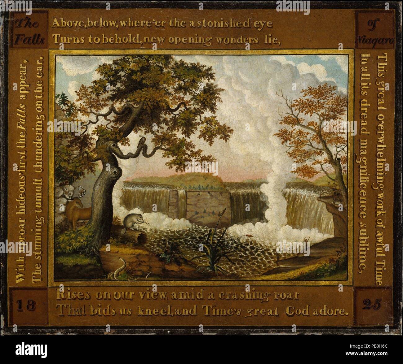 The Falls of Niagara. Artist: Edward Hicks (American, Langhorne, Pennsylvania 1780-1849 Newton, Pennsylvania). Dimensions: 31 1/2 x 38 in. (80 x 96.5 cm). Date: ca. 1825. Hicks visited Niagara Falls in 1819, but he based this composition on a vignette of the falls from a map of North America published by Henry S. Tanner in 1822. As seen from the Canadian side, the falls are replete with the moose, beaver, rattlesnake and eagle, all traditional emblems of North America. The long poem inscribed around the picture is an excerpt from Alexander Wilson's 'The Foresters' that originally appeared Stock Photohttps://www.alamy.com/image-license-details/?v=1https://www.alamy.com/the-falls-of-niagara-artist-edward-hicks-american-langhorne-pennsylvania-1780-1849-newton-pennsylvania-dimensions-31-12-x-38-in-80-x-965-cm-date-ca-1825-hicks-visited-niagara-falls-in-1819-but-he-based-this-composition-on-a-vignette-of-the-falls-from-a-map-of-north-america-published-by-henry-s-tanner-in-1822-as-seen-from-the-canadian-side-the-falls-are-replete-with-the-moose-beaver-rattlesnake-and-eagle-all-traditional-emblems-of-north-america-the-long-poem-inscribed-around-the-picture-is-an-excerpt-from-alexander-wilsons-the-foresters-that-originally-appeared-image213299140.html
RMPB0H6C–The Falls of Niagara. Artist: Edward Hicks (American, Langhorne, Pennsylvania 1780-1849 Newton, Pennsylvania). Dimensions: 31 1/2 x 38 in. (80 x 96.5 cm). Date: ca. 1825. Hicks visited Niagara Falls in 1819, but he based this composition on a vignette of the falls from a map of North America published by Henry S. Tanner in 1822. As seen from the Canadian side, the falls are replete with the moose, beaver, rattlesnake and eagle, all traditional emblems of North America. The long poem inscribed around the picture is an excerpt from Alexander Wilson's 'The Foresters' that originally appeared
 1780 Raynal and Bonne Map of North America - Geographicus - Amerique-bonne-1780. Stock Photohttps://www.alamy.com/image-license-details/?v=1https://www.alamy.com/1780-raynal-and-bonne-map-of-north-america-geographicus-amerique-bonne-1780-image209622525.html
RMP513JN–1780 Raynal and Bonne Map of North America - Geographicus - Amerique-bonne-1780.
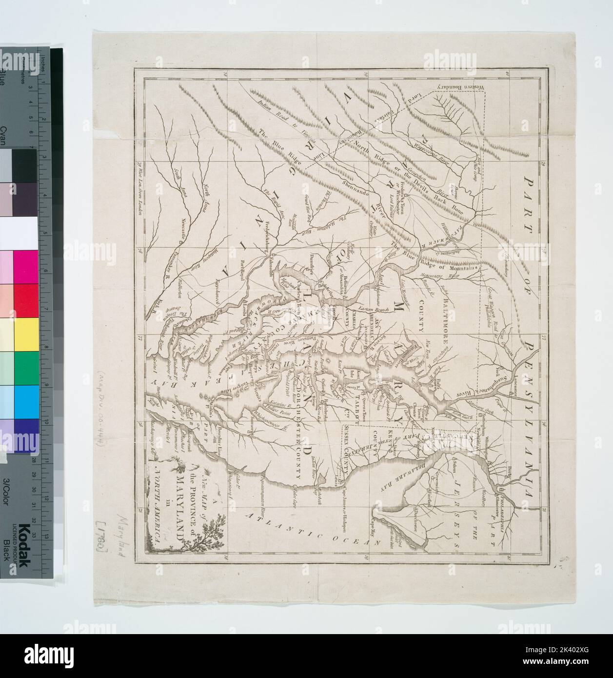 A new map of the province of Maryland in North America Cartographic. Maps. 1780. Lionel Pincus and Princess Firyal Map Division. Maryland, Delaware Stock Photohttps://www.alamy.com/image-license-details/?v=1https://www.alamy.com/a-new-map-of-the-province-of-maryland-in-north-america-cartographic-maps-1780-lionel-pincus-and-princess-firyal-map-division-maryland-delaware-image484351240.html
RM2K402XG–A new map of the province of Maryland in North America Cartographic. Maps. 1780. Lionel Pincus and Princess Firyal Map Division. Maryland, Delaware
 1780, Raynal and Bonne Map of North America, Rigobert Bonne 1727 – 1794, one of the most important cartographers of reimagined Stock Photohttps://www.alamy.com/image-license-details/?v=1https://www.alamy.com/1780-raynal-and-bonne-map-of-north-america-rigobert-bonne-1727-1794-one-of-the-most-important-cartographers-of-reimagined-image230062794.html
RFRA87CA–1780, Raynal and Bonne Map of North America, Rigobert Bonne 1727 – 1794, one of the most important cartographers of reimagined
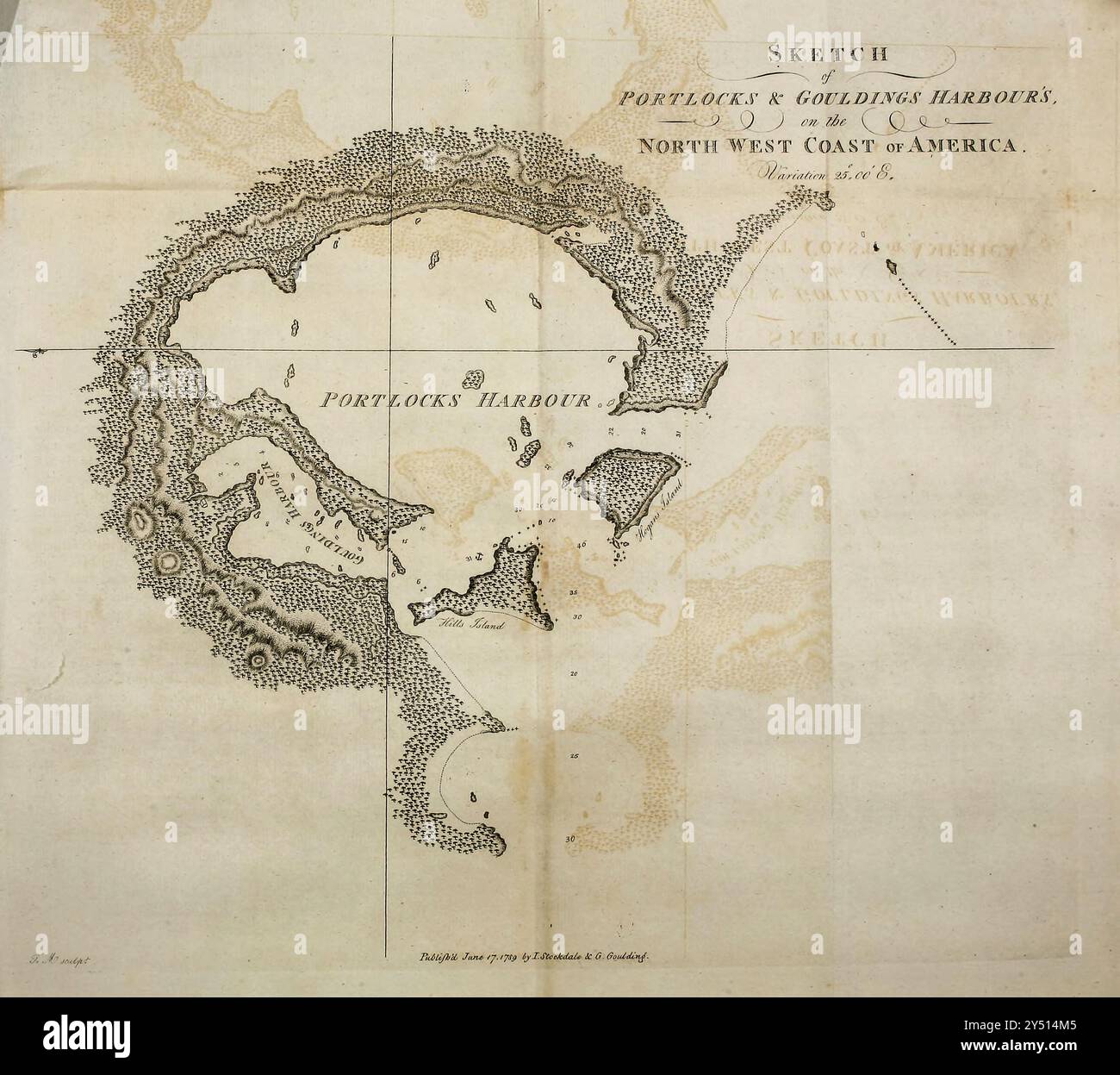 Map of Portlocks and Gouldings Harbour from A Voyage Around the World by Captain George Dixon, and Captain Nathaniel Portlock (c. 1748 – 12 September 1817) was a British ship's captain, maritime fur trader, and author. He entered the Royal Navy in 1772 as an able seaman, serving in HMS St Albans. In 1776 he joined HMS Discovery as master's mate and served on the third Pacific voyage of James Cook. During the expedition, in August 1779, he was transferred to HMS Resolution. He passed his lieutenant's examination on 7 September 1780, then served on HMS Firebrand in the Channel fleet. In Septembe Stock Photohttps://www.alamy.com/image-license-details/?v=1https://www.alamy.com/map-of-portlocks-and-gouldings-harbour-from-a-voyage-around-the-world-by-captain-george-dixon-and-captain-nathaniel-portlock-c-1748-12-september-1817-was-a-british-ships-captain-maritime-fur-trader-and-author-he-entered-the-royal-navy-in-1772-as-an-able-seaman-serving-in-hms-st-albans-in-1776-he-joined-hms-discovery-as-masters-mate-and-served-on-the-third-pacific-voyage-of-james-cook-during-the-expedition-in-august-1779-he-was-transferred-to-hms-resolution-he-passed-his-lieutenants-examination-on-7-september-1780-then-served-on-hms-firebrand-in-the-channel-fleet-in-septembe-image622672181.html
RM2Y514M5–Map of Portlocks and Gouldings Harbour from A Voyage Around the World by Captain George Dixon, and Captain Nathaniel Portlock (c. 1748 – 12 September 1817) was a British ship's captain, maritime fur trader, and author. He entered the Royal Navy in 1772 as an able seaman, serving in HMS St Albans. In 1776 he joined HMS Discovery as master's mate and served on the third Pacific voyage of James Cook. During the expedition, in August 1779, he was transferred to HMS Resolution. He passed his lieutenant's examination on 7 September 1780, then served on HMS Firebrand in the Channel fleet. In Septembe
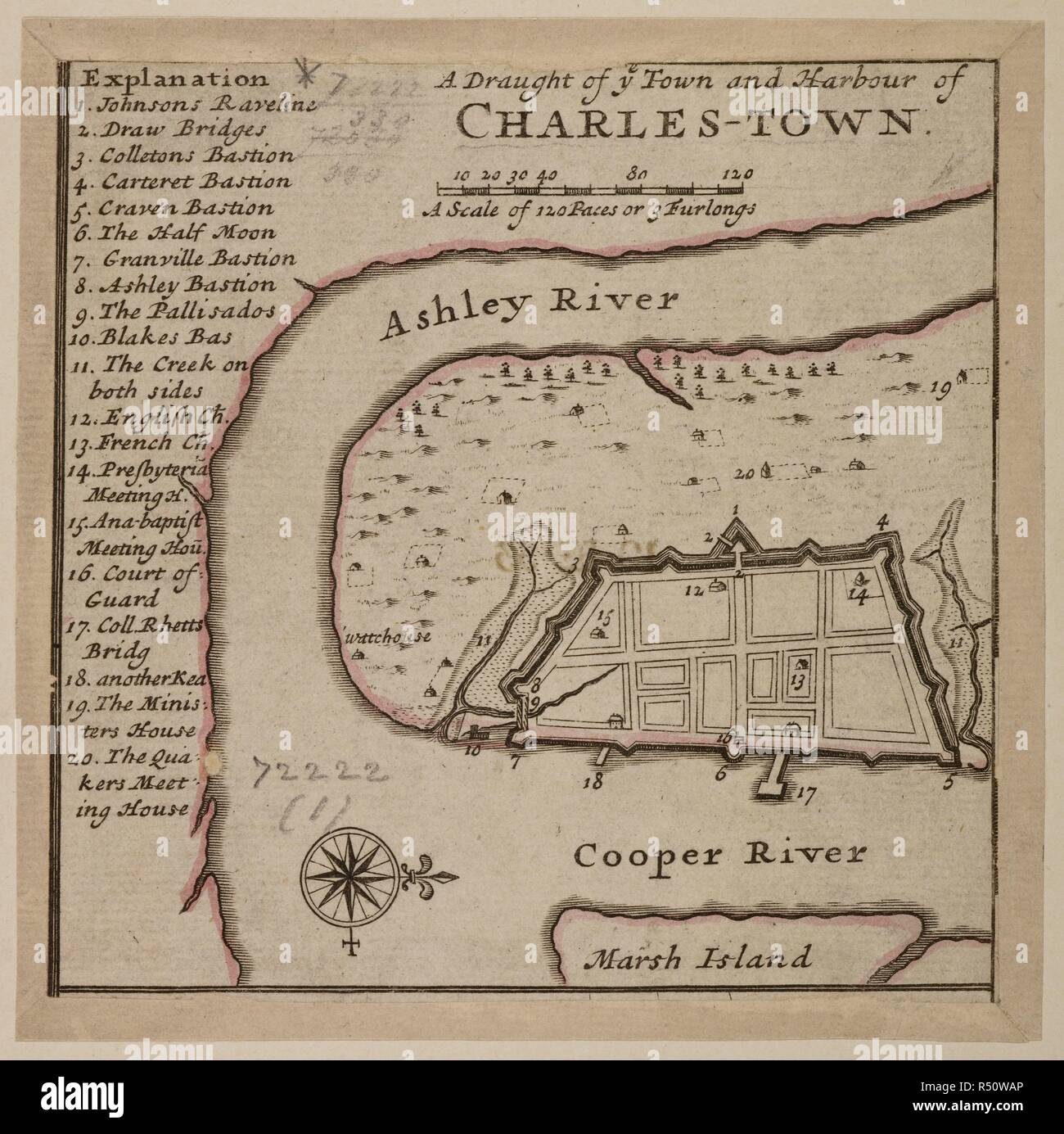 Map of Charles-Town, a fortified settlement on the Ashley River settled by Quakers in South Carolina. 1780. . Charles Town ... With a Chart of the Bars & Harbour. Charleston South Carolina USA. Source: Maps*72222. Author: Cowley, R. Stock Photohttps://www.alamy.com/image-license-details/?v=1https://www.alamy.com/map-of-charles-town-a-fortified-settlement-on-the-ashley-river-settled-by-quakers-in-south-carolina-1780-charles-town-with-a-chart-of-the-bars-harbour-charleston-south-carolina-usa-source-maps72222-author-cowley-r-image226827966.html
RMR50WAP–Map of Charles-Town, a fortified settlement on the Ashley River settled by Quakers in South Carolina. 1780. . Charles Town ... With a Chart of the Bars & Harbour. Charleston South Carolina USA. Source: Maps*72222. Author: Cowley, R.
 American Revolutionary War Era Maps 1750-1786 887 Sketch of the harbour of North Edisto 2d March 1780 Rebuild and Repair Stock Photohttps://www.alamy.com/image-license-details/?v=1https://www.alamy.com/american-revolutionary-war-era-maps-1750-1786-887-sketch-of-the-harbour-of-north-edisto-2d-march-1780-rebuild-and-repair-image261968510.html
RMW65KE6–American Revolutionary War Era Maps 1750-1786 887 Sketch of the harbour of North Edisto 2d March 1780 Rebuild and Repair
 . English: A fine example of Rigobert Bonne and Guilleme Raynal’s 1780 map of North America. Covers the entire continent from the high arctic to Central America, the Caribbean, and the Spanish Main. Offers an early perspective on the region including the identification of Louisiana, Virginia, Florida, and New England. The representation of the western coast of the continent is exceptionally primitive and corresponds to the pre-Cook conception of the territory. San Francisco Bay is nowhere in evidence unless it is interpreted as the “Port of Francois Drake”, where Drake sheltered and repaired Stock Photohttps://www.alamy.com/image-license-details/?v=1https://www.alamy.com/english-a-fine-example-of-rigobert-bonne-and-guilleme-raynals-1780-map-of-north-america-covers-the-entire-continent-from-the-high-arctic-to-central-america-the-caribbean-and-the-spanish-main-offers-an-early-perspective-on-the-region-including-the-identification-of-louisiana-virginia-florida-and-new-england-the-representation-of-the-western-coast-of-the-continent-is-exceptionally-primitive-and-corresponds-to-the-pre-cook-conception-of-the-territory-san-francisco-bay-is-nowhere-in-evidence-unless-it-is-interpreted-as-the-port-of-francois-drake-where-drake-sheltered-and-repaired-image184884196.html
RMMMP5K0–. English: A fine example of Rigobert Bonne and Guilleme Raynal’s 1780 map of North America. Covers the entire continent from the high arctic to Central America, the Caribbean, and the Spanish Main. Offers an early perspective on the region including the identification of Louisiana, Virginia, Florida, and New England. The representation of the western coast of the continent is exceptionally primitive and corresponds to the pre-Cook conception of the territory. San Francisco Bay is nowhere in evidence unless it is interpreted as the “Port of Francois Drake”, where Drake sheltered and repaired
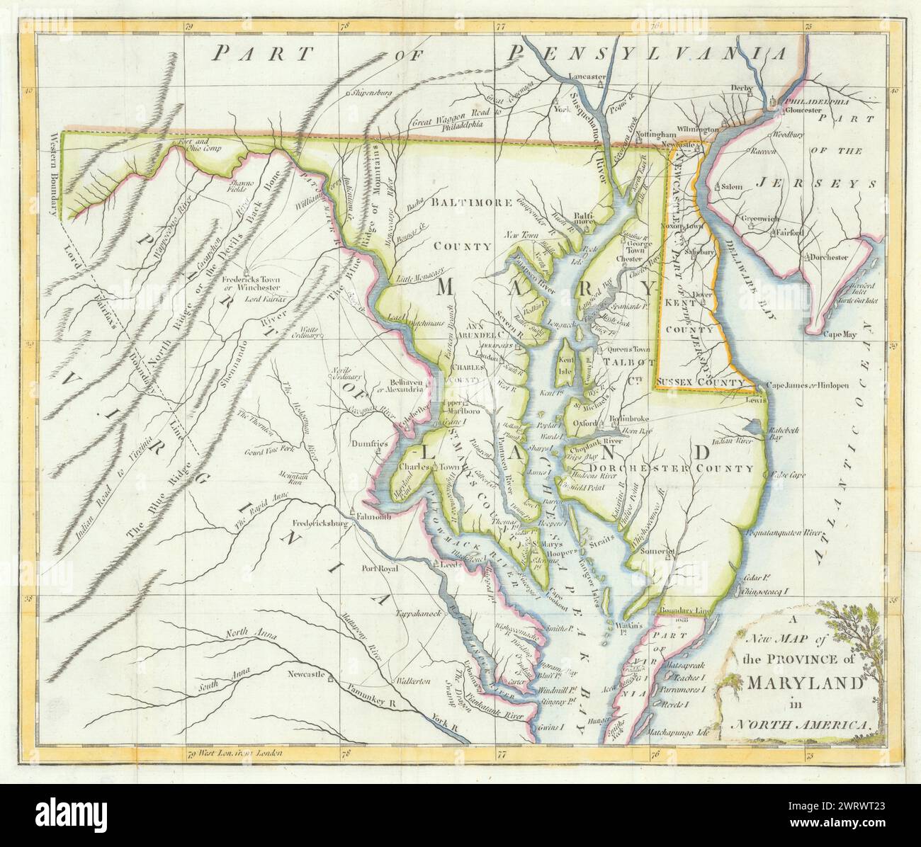 A New Map of the Province of Maryland in North America… Universal Magazine 1780 Stock Photohttps://www.alamy.com/image-license-details/?v=1https://www.alamy.com/a-new-map-of-the-province-of-maryland-in-north-america-universal-magazine-1780-image599857275.html
RF2WRWT23–A New Map of the Province of Maryland in North America… Universal Magazine 1780
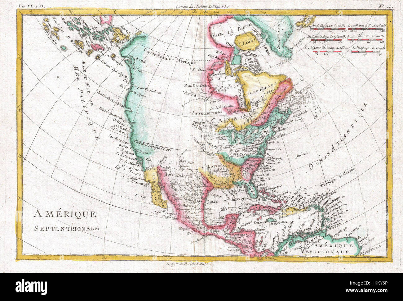 1780 Raynal and Bonne Map of North America - Geographicus - Amerique-bonne-1780 Stock Photohttps://www.alamy.com/image-license-details/?v=1https://www.alamy.com/stock-photo-1780-raynal-and-bonne-map-of-north-america-geographicus-amerique-bonne-132589486.html
RMHKKY6P–1780 Raynal and Bonne Map of North America - Geographicus - Amerique-bonne-1780
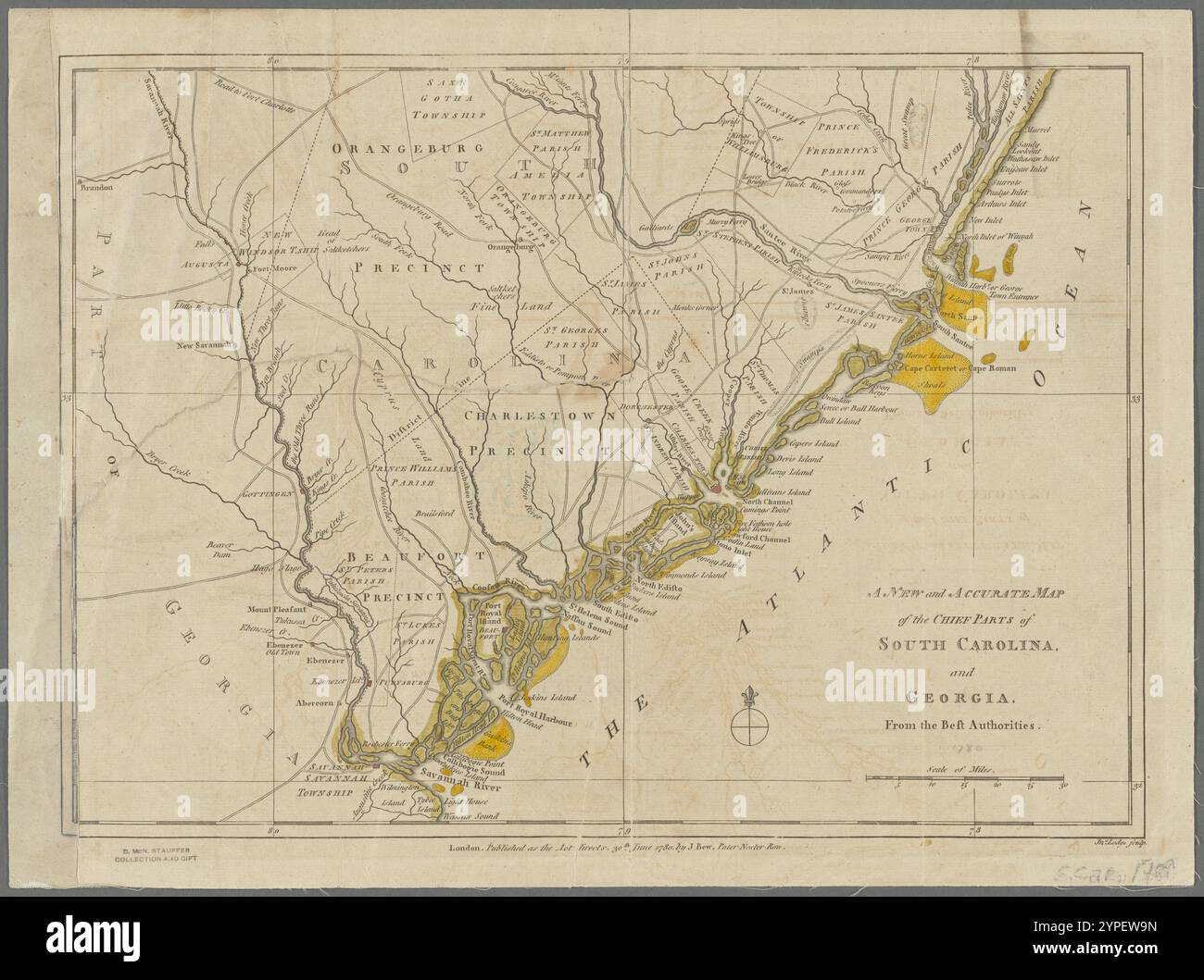 A new and accurate map of the chief parts of South Carolina and Georgia, from the best authorities 1780 by Lodge, John, -1796 Stock Photohttps://www.alamy.com/image-license-details/?v=1https://www.alamy.com/a-new-and-accurate-map-of-the-chief-parts-of-south-carolina-and-georgia-from-the-best-authorities-1780-by-lodge-john-1796-image633422881.html
RM2YPEW9N–A new and accurate map of the chief parts of South Carolina and Georgia, from the best authorities 1780 by Lodge, John, -1796
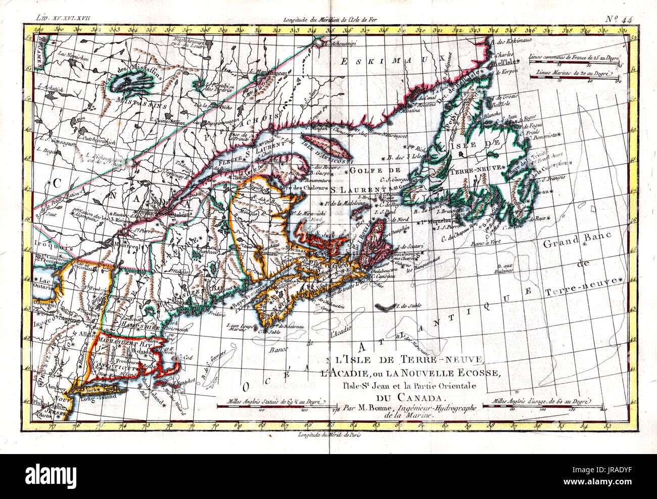 1780 Bonne Antique Map of the United States North East and Nova Scotia Canada, including Newfoundland, New England, Maine, Massachusetts and other states Stock Photohttps://www.alamy.com/image-license-details/?v=1https://www.alamy.com/1780-bonne-antique-map-of-the-united-states-north-east-and-nova-scotia-image152050515.html
RFJRADYF–1780 Bonne Antique Map of the United States North East and Nova Scotia Canada, including Newfoundland, New England, Maine, Massachusetts and other states
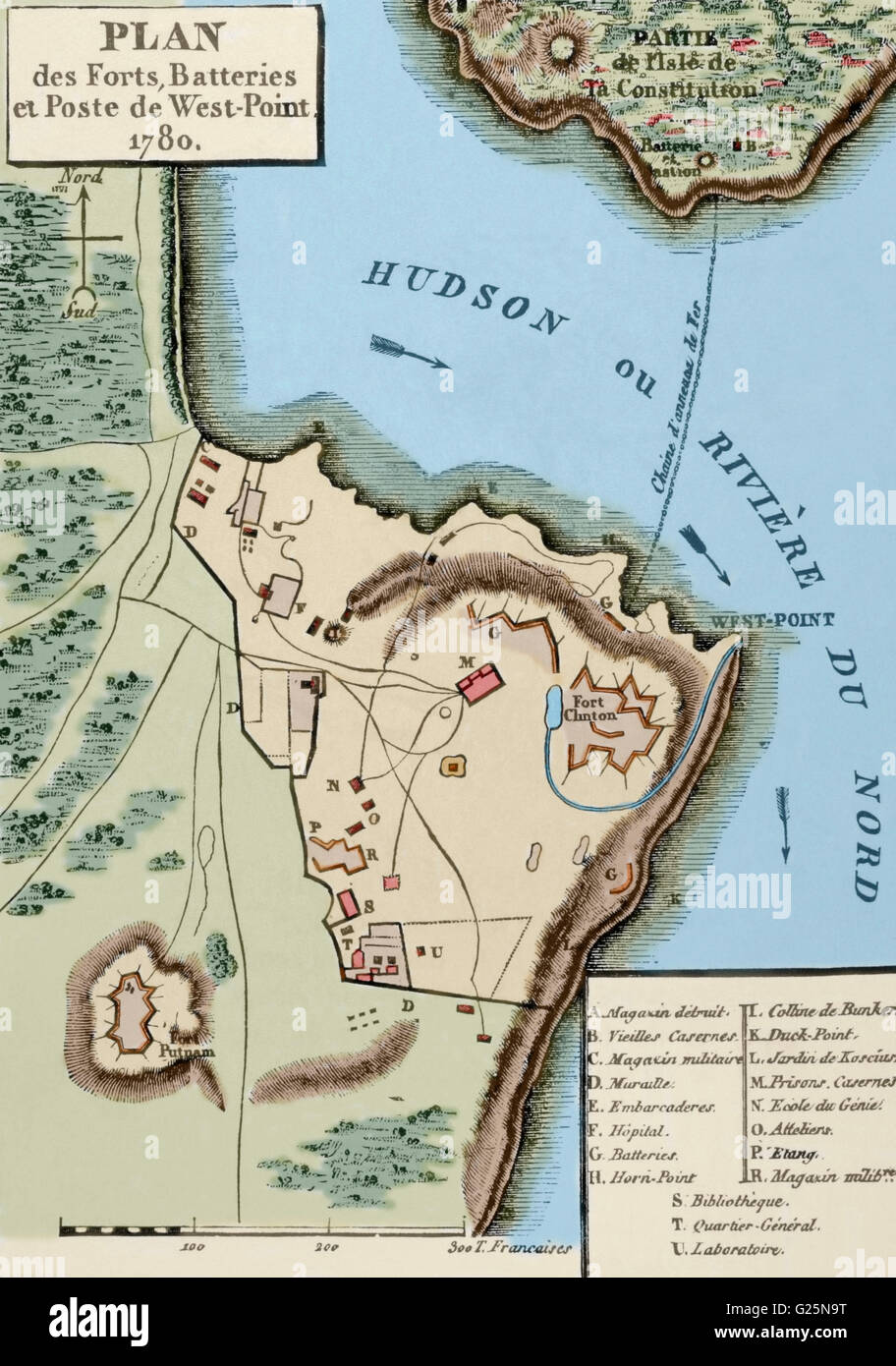 American Revolutionary War (1775-1783). Map of the defense network at West Point, including the Great Chain, Constitution Island, Fort Clinton, and Fort Putnam, 1780. Engraving. Colored. Stock Photohttps://www.alamy.com/image-license-details/?v=1https://www.alamy.com/stock-photo-american-revolutionary-war-1775-1783-map-of-the-defense-network-at-104618020.html
RMG25N9T–American Revolutionary War (1775-1783). Map of the defense network at West Point, including the Great Chain, Constitution Island, Fort Clinton, and Fort Putnam, 1780. Engraving. Colored.
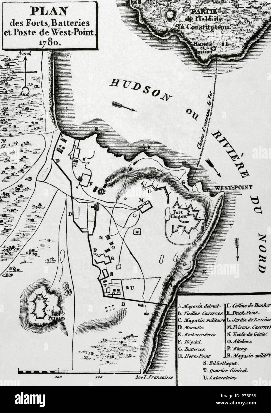 American Revolutionary War (1775-1783). Map of the defense network at West Point, including the Great Chain, Constitution Island, Fort Clinton, and Fort Putnam, 1780. Engraving. Stock Photohttps://www.alamy.com/image-license-details/?v=1https://www.alamy.com/american-revolutionary-war-1775-1783-map-of-the-defense-network-at-west-point-including-the-great-chain-constitution-island-fort-clinton-and-fort-putnam-1780-engraving-image211085820.html
RMP7BP38–American Revolutionary War (1775-1783). Map of the defense network at West Point, including the Great Chain, Constitution Island, Fort Clinton, and Fort Putnam, 1780. Engraving.
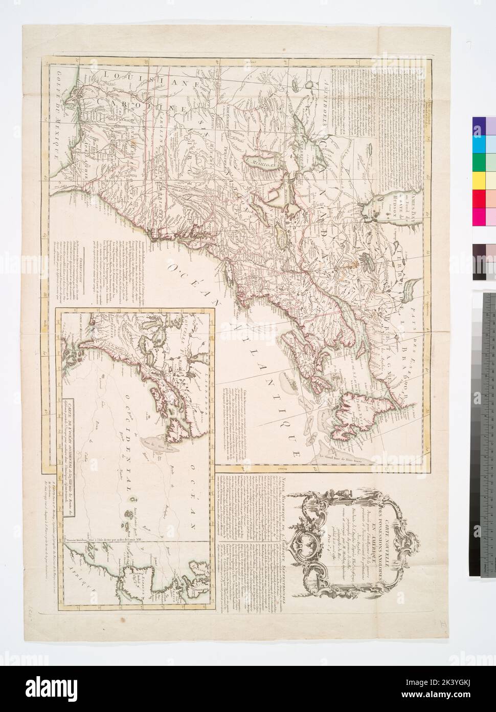 Carte nouvelle des posséssions angloises en Amérique Moithey, Maurille Antoine, 1732-1805. Cartographic. Maps. 1780-04-15. Lionel Pincus and Princess Firyal Map Division. North America Stock Photohttps://www.alamy.com/image-license-details/?v=1https://www.alamy.com/carte-nouvelle-des-possssions-angloises-en-amrique-moithey-maurille-antoine-1732-1805-cartographic-maps-1780-04-15-lionel-pincus-and-princess-firyal-map-division-north-america-image484340070.html
RM2K3YGKJ–Carte nouvelle des posséssions angloises en Amérique Moithey, Maurille Antoine, 1732-1805. Cartographic. Maps. 1780-04-15. Lionel Pincus and Princess Firyal Map Division. North America
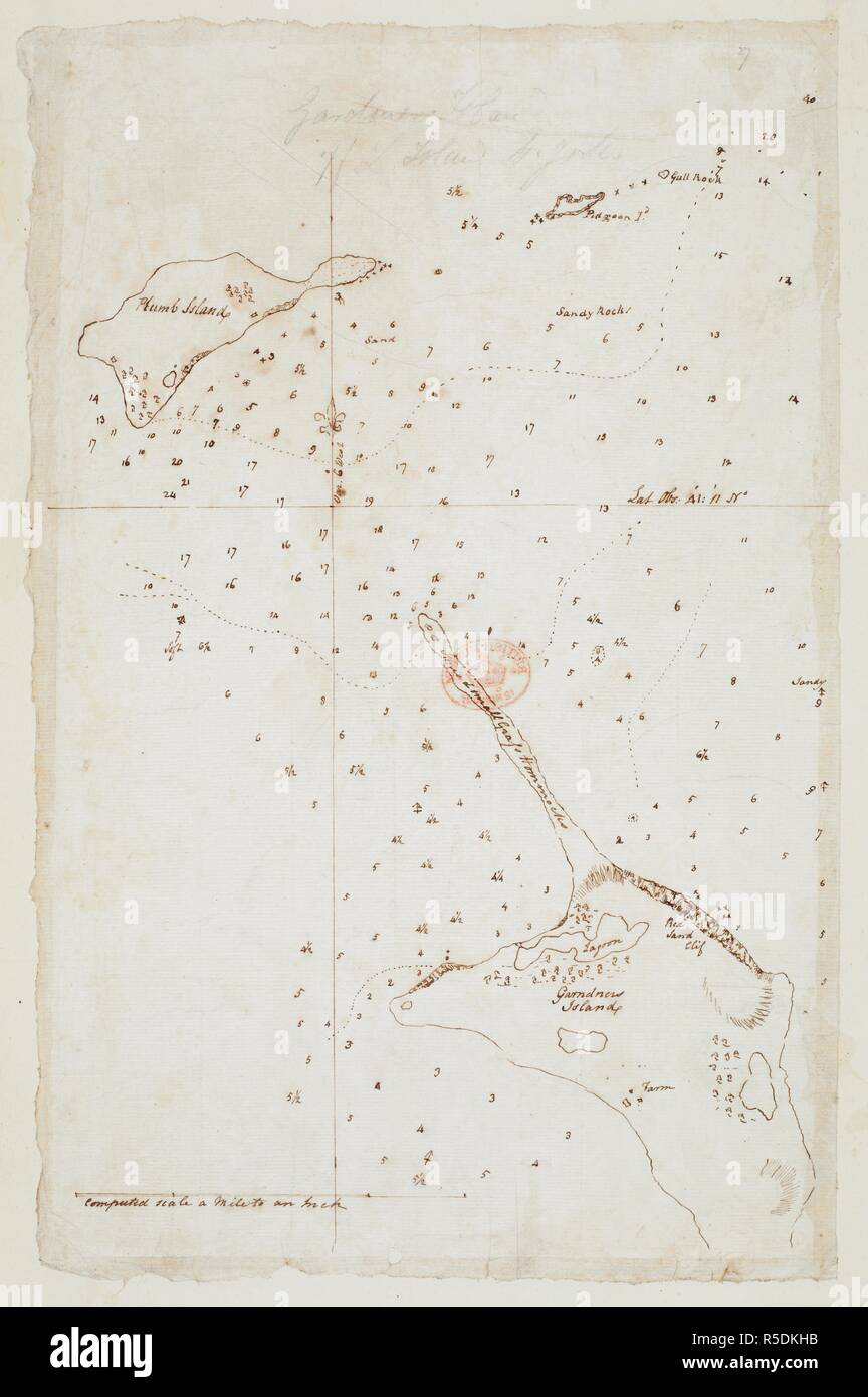 Chart of Gardiners island and Plum island situated off the coast of America. SIXTY-SEVEN Charts and maps illustrating the voyages and surveys of Capt. James Cook, R.N., and other discoverers; circ. 1760- 1780. c 1760-1780. Source: Add. 31360, no.27. Stock Photohttps://www.alamy.com/image-license-details/?v=1https://www.alamy.com/chart-of-gardiners-island-and-plum-island-situated-off-the-coast-of-america-sixty-seven-charts-and-maps-illustrating-the-voyages-and-surveys-of-capt-james-cook-rn-and-other-discoverers-circ-1760-1780-c-1760-1780-source-add-31360-no27-image227108823.html
RMR5DKHB–Chart of Gardiners island and Plum island situated off the coast of America. SIXTY-SEVEN Charts and maps illustrating the voyages and surveys of Capt. James Cook, R.N., and other discoverers; circ. 1760- 1780. c 1760-1780. Source: Add. 31360, no.27.
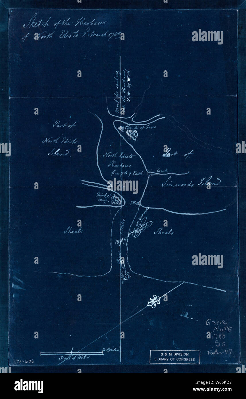 American Revolutionary War Era Maps 1750-1786 889 Sketch of the harbour of North Edisto 2d March 1780 Inverted Rebuild and Repair Stock Photohttps://www.alamy.com/image-license-details/?v=1https://www.alamy.com/american-revolutionary-war-era-maps-1750-1786-889-sketch-of-the-harbour-of-north-edisto-2d-march-1780-inverted-rebuild-and-repair-image261968484.html
RMW65KD8–American Revolutionary War Era Maps 1750-1786 889 Sketch of the harbour of North Edisto 2d March 1780 Inverted Rebuild and Repair
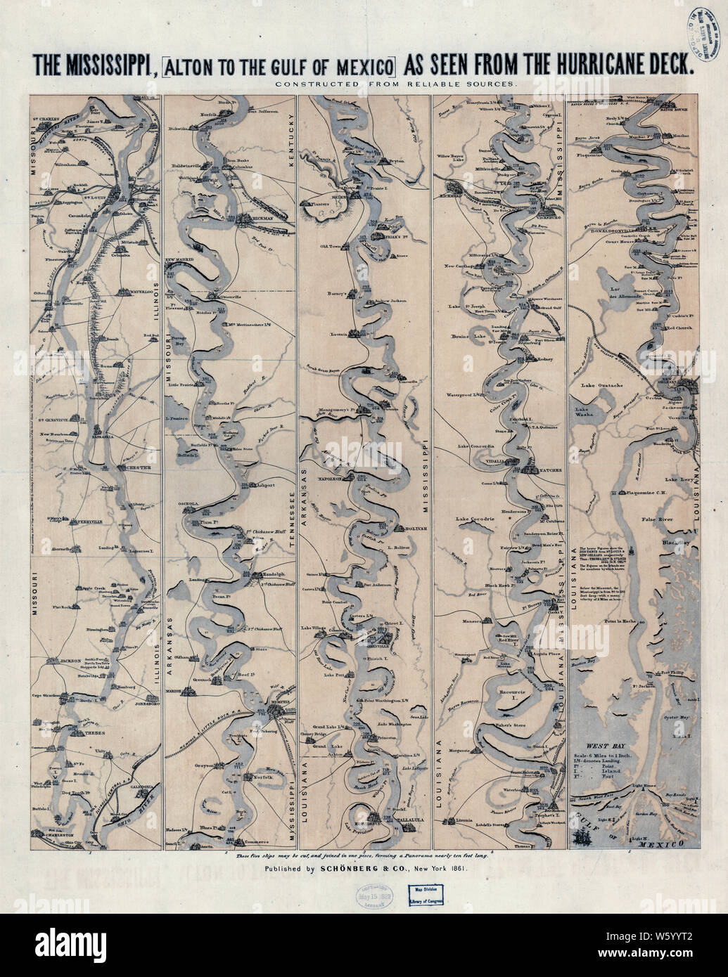 Civil War Maps 1780 The Mississippi Rebuild and Repair Stock Photohttps://www.alamy.com/image-license-details/?v=1https://www.alamy.com/civil-war-maps-1780-the-mississippi-rebuild-and-repair-image261843346.html
RMW5YYT2–Civil War Maps 1780 The Mississippi Rebuild and Repair
 . English: A fine example of Rigobert Bonne and G. Raynal’s 1780 map of the world on a hemispherical projection. Offers a number of interesting details corresponding to the knowledge of the world at the time. Western North America exhibits a pre-Cook configuration with a curious archipelago that can be understood as a proto-understanding of the Aleutian Islands. On the opposite side of the world Tasmania is joined to the mainland of Australia. Neither Antarctica (which had yet to be discovered) nor the mythical Terre Australis appear in the southern latitudes - a significant advancement in th Stock Photohttps://www.alamy.com/image-license-details/?v=1https://www.alamy.com/english-a-fine-example-of-rigobert-bonne-and-g-raynals-1780-map-of-the-world-on-a-hemispherical-projection-offers-a-number-of-interesting-details-corresponding-to-the-knowledge-of-the-world-at-the-time-western-north-america-exhibits-a-pre-cook-configuration-with-a-curious-archipelago-that-can-be-understood-as-a-proto-understanding-of-the-aleutian-islands-on-the-opposite-side-of-the-world-tasmania-is-joined-to-the-mainland-of-australia-neither-antarctica-which-had-yet-to-be-discovered-nor-the-mythical-terre-australis-appear-in-the-southern-latitudes-a-significant-advancement-in-th-image184884437.html
RMMMP5YH–. English: A fine example of Rigobert Bonne and G. Raynal’s 1780 map of the world on a hemispherical projection. Offers a number of interesting details corresponding to the knowledge of the world at the time. Western North America exhibits a pre-Cook configuration with a curious archipelago that can be understood as a proto-understanding of the Aleutian Islands. On the opposite side of the world Tasmania is joined to the mainland of Australia. Neither Antarctica (which had yet to be discovered) nor the mythical Terre Australis appear in the southern latitudes - a significant advancement in th
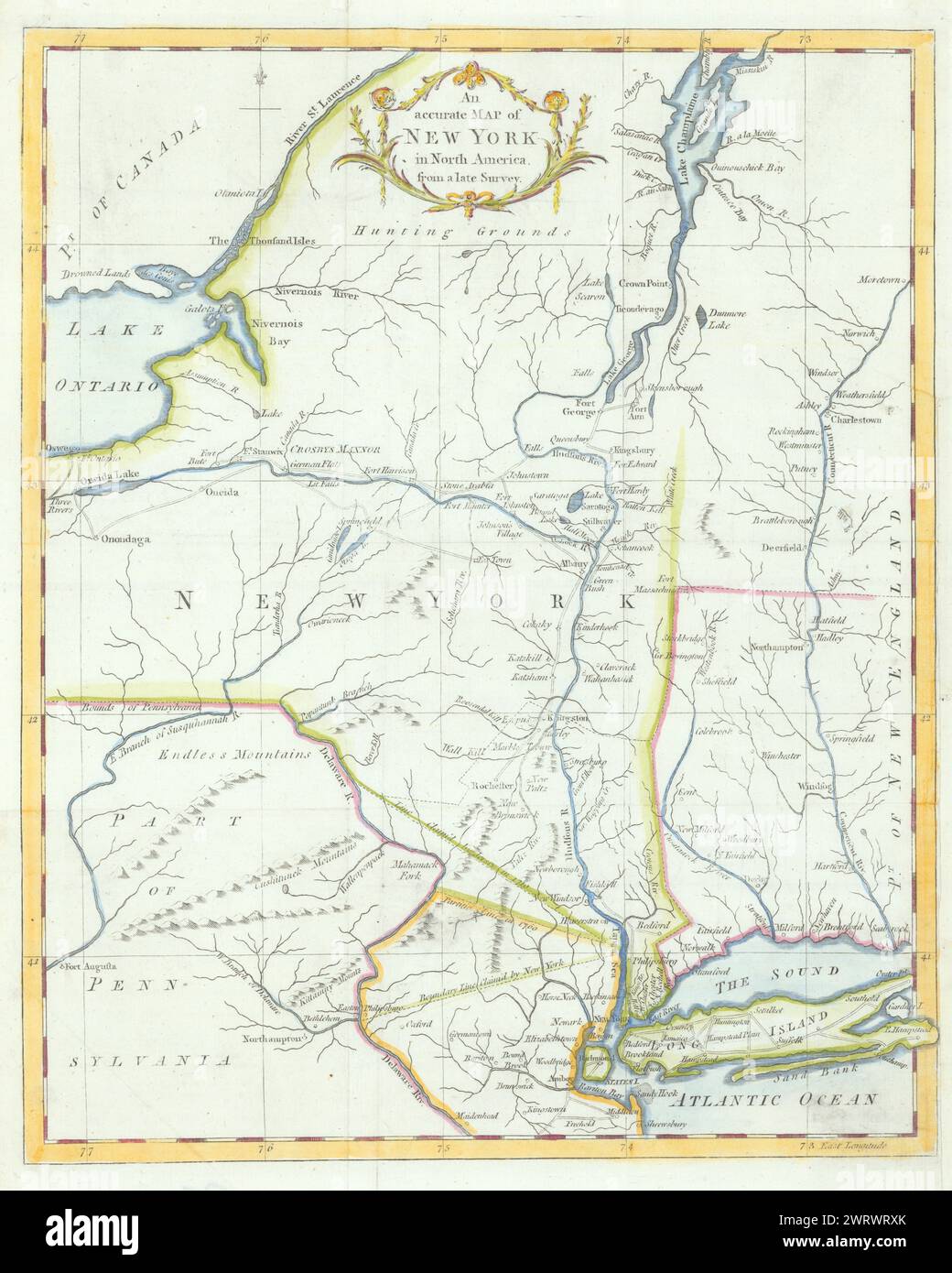 An accurate Map of New York, in North America… Universal Magazine 1780 old Stock Photohttps://www.alamy.com/image-license-details/?v=1https://www.alamy.com/an-accurate-map-of-new-york-in-north-america-universal-magazine-1780-old-image599857179.html
RF2WRWRXK–An accurate Map of New York, in North America… Universal Magazine 1780 old
 A map of such parts of Georgia and South Carolina as tend to illustrate the progress and operations of the British Army &c. 1780 by Kitchin, Thomas, 1718-1784 Stock Photohttps://www.alamy.com/image-license-details/?v=1https://www.alamy.com/a-map-of-such-parts-of-georgia-and-south-carolina-as-tend-to-illustrate-the-progress-and-operations-of-the-british-army-c-1780-by-kitchin-thomas-1718-1784-image633422663.html
RM2YPEW1Y–A map of such parts of Georgia and South Carolina as tend to illustrate the progress and operations of the British Army &c. 1780 by Kitchin, Thomas, 1718-1784
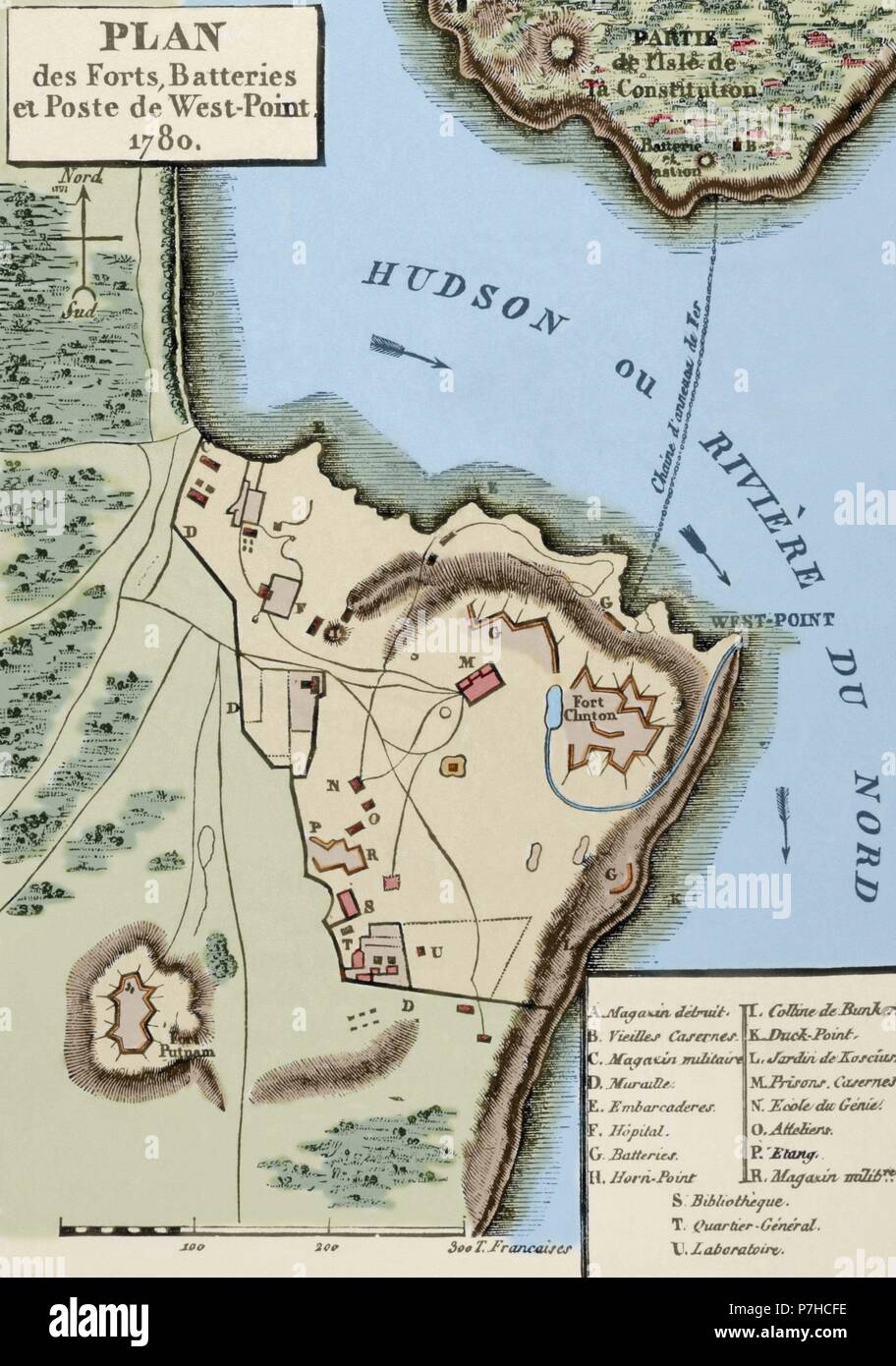 American Revolutionary War (1775-1783). Map of the defense network at West Point, including the Great Chain, Constitution Island, Fort Clinton, and Fort Putnam, 1780. Engraving. Colored. Stock Photohttps://www.alamy.com/image-license-details/?v=1https://www.alamy.com/american-revolutionary-war-1775-1783-map-of-the-defense-network-at-west-point-including-the-great-chain-constitution-island-fort-clinton-and-fort-putnam-1780-engraving-colored-image211210034.html
RMP7HCFE–American Revolutionary War (1775-1783). Map of the defense network at West Point, including the Great Chain, Constitution Island, Fort Clinton, and Fort Putnam, 1780. Engraving. Colored.
 A New map of the province of Maryland in North America. Relief shown pictorially. Also covers Delaware and parts of other adjacent states. From the Universal magazine (February 1780), v. 66.... , Maryland Delaware Stock Photohttps://www.alamy.com/image-license-details/?v=1https://www.alamy.com/a-new-map-of-the-province-of-maryland-in-north-america-relief-shown-pictorially-also-covers-delaware-and-parts-of-other-adjacent-states-from-the-universal-magazine-february-1780-v-66-maryland-delaware-image502712087.html
RM2M5TEB3–A New map of the province of Maryland in North America. Relief shown pictorially. Also covers Delaware and parts of other adjacent states. From the Universal magazine (February 1780), v. 66.... , Maryland Delaware
 Coloured plan of Cornwallis Island with ink detail of the town of Halifax with lettered explanation including North & South suburbs, fathoms marked. . SIXTY-SEVEN Charts and maps illustrating the voyages and surveys of Capt. James Cook, R.N., and other discoverers; circ. 1760- 1780. 1758-62. Source: Add. 31360, no.9. Stock Photohttps://www.alamy.com/image-license-details/?v=1https://www.alamy.com/coloured-plan-of-cornwallis-island-with-ink-detail-of-the-town-of-halifax-with-lettered-explanation-including-north-south-suburbs-fathoms-marked-sixty-seven-charts-and-maps-illustrating-the-voyages-and-surveys-of-capt-james-cook-rn-and-other-discoverers-circ-1760-1780-1758-62-source-add-31360-no9-image226914070.html
RMR54R5X–Coloured plan of Cornwallis Island with ink detail of the town of Halifax with lettered explanation including North & South suburbs, fathoms marked. . SIXTY-SEVEN Charts and maps illustrating the voyages and surveys of Capt. James Cook, R.N., and other discoverers; circ. 1760- 1780. 1758-62. Source: Add. 31360, no.9.
 Civil War Maps 1780 The Mississippi Inverted Rebuild and Repair Stock Photohttps://www.alamy.com/image-license-details/?v=1https://www.alamy.com/civil-war-maps-1780-the-mississippi-inverted-rebuild-and-repair-image261843364.html
RMW5YYTM–Civil War Maps 1780 The Mississippi Inverted Rebuild and Repair
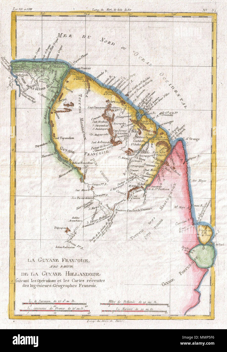 . English: A fine example of Rigobert Bonne and Guilleme Raynal’s 1780 map of northeastern South America, depicting Guyana (Guyane). Covers parts of British Guyana, Dutch Surinam in the north, French Guyana (Guyane), modern day Mayapa, a Brazilian state, and Cap de Nord in the south. Most of the data for this map is drawn from records compiled under the Dutch West India Company, which traded throughout the region. While inland information is minimal, trading settlements and missions along both the Maroni River and the Tammouri are noted. Names numerous American Indian tribes and villages thro Stock Photohttps://www.alamy.com/image-license-details/?v=1https://www.alamy.com/english-a-fine-example-of-rigobert-bonne-and-guilleme-raynals-1780-map-of-northeastern-south-america-depicting-guyana-guyane-covers-parts-of-british-guyana-dutch-surinam-in-the-north-french-guyana-guyane-modern-day-mayapa-a-brazilian-state-and-cap-de-nord-in-the-south-most-of-the-data-for-this-map-is-drawn-from-records-compiled-under-the-dutch-west-india-company-which-traded-throughout-the-region-while-inland-information-is-minimal-trading-settlements-and-missions-along-both-the-maroni-river-and-the-tammouri-are-noted-names-numerous-american-indian-tribes-and-villages-thro-image184884090.html
RMMMP5F6–. English: A fine example of Rigobert Bonne and Guilleme Raynal’s 1780 map of northeastern South America, depicting Guyana (Guyane). Covers parts of British Guyana, Dutch Surinam in the north, French Guyana (Guyane), modern day Mayapa, a Brazilian state, and Cap de Nord in the south. Most of the data for this map is drawn from records compiled under the Dutch West India Company, which traded throughout the region. While inland information is minimal, trading settlements and missions along both the Maroni River and the Tammouri are noted. Names numerous American Indian tribes and villages thro
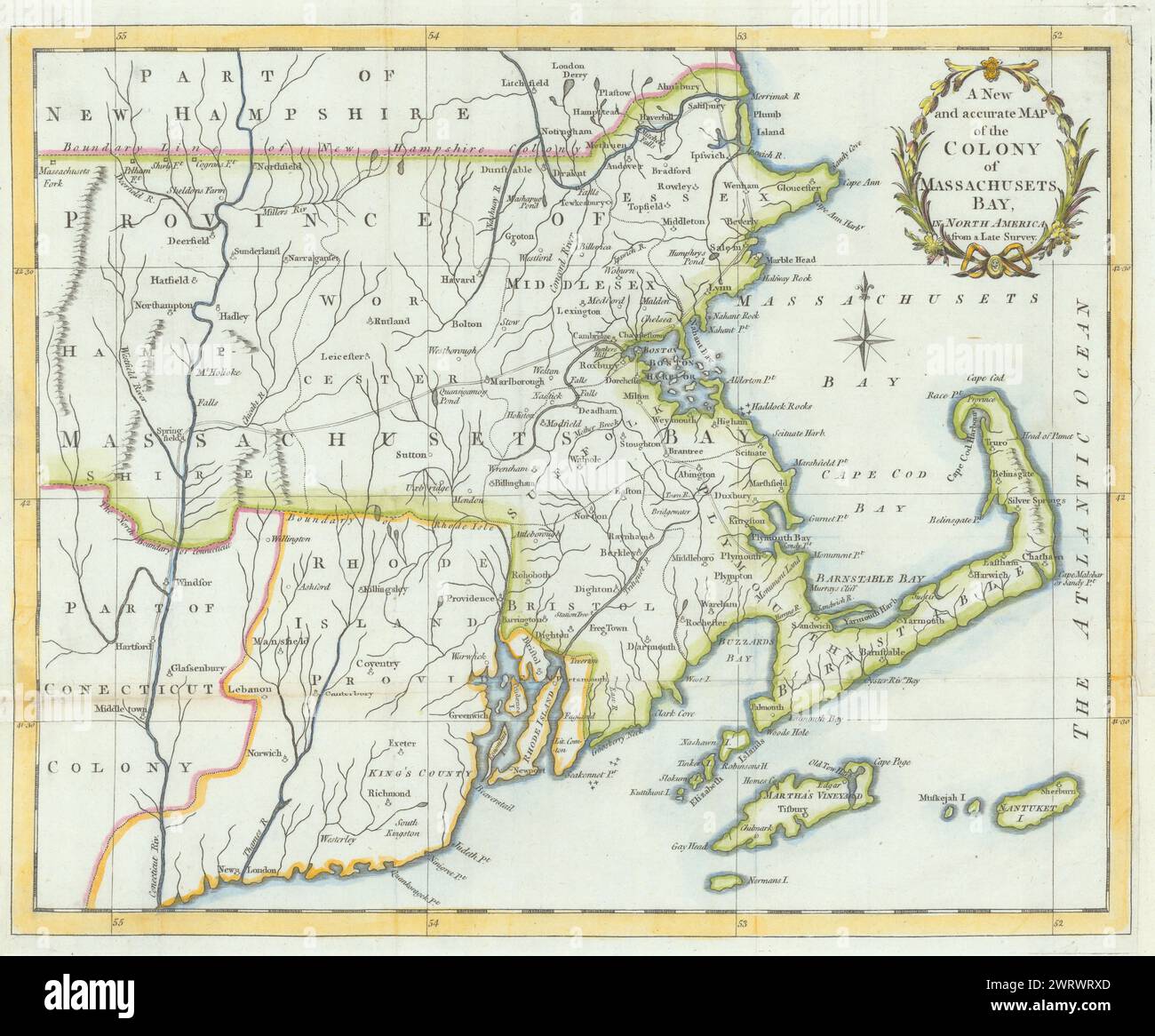 A New & accurate Map of the Colony of Massachusets Bay… Universal Magazine 1780 Stock Photohttps://www.alamy.com/image-license-details/?v=1https://www.alamy.com/a-new-accurate-map-of-the-colony-of-massachusets-bay-universal-magazine-1780-image599857173.html
RF2WRWRXD–A New & accurate Map of the Colony of Massachusets Bay… Universal Magazine 1780
![An accurate map of Rhode Island, part of Connecticut and Massachusets [sic] : showing Admiral Arbuthnot's station in blocking up Admiral Ternay 1780 by Lodge, John, -1796 Stock Photo An accurate map of Rhode Island, part of Connecticut and Massachusets [sic] : showing Admiral Arbuthnot's station in blocking up Admiral Ternay 1780 by Lodge, John, -1796 Stock Photo](https://c8.alamy.com/comp/2YPERPB/an-accurate-map-of-rhode-island-part-of-connecticut-and-massachusets-sic-showing-admiral-arbuthnots-station-in-blocking-up-admiral-ternay-1780-by-lodge-john-1796-2YPERPB.jpg) An accurate map of Rhode Island, part of Connecticut and Massachusets [sic] : showing Admiral Arbuthnot's station in blocking up Admiral Ternay 1780 by Lodge, John, -1796 Stock Photohttps://www.alamy.com/image-license-details/?v=1https://www.alamy.com/an-accurate-map-of-rhode-island-part-of-connecticut-and-massachusets-sic-showing-admiral-arbuthnots-station-in-blocking-up-admiral-ternay-1780-by-lodge-john-1796-image633421667.html
An accurate map of Rhode Island, part of Connecticut and Massachusets [sic] : showing Admiral Arbuthnot's station in blocking up Admiral Ternay 1780 by Lodge, John, -1796 Stock Photohttps://www.alamy.com/image-license-details/?v=1https://www.alamy.com/an-accurate-map-of-rhode-island-part-of-connecticut-and-massachusets-sic-showing-admiral-arbuthnots-station-in-blocking-up-admiral-ternay-1780-by-lodge-john-1796-image633421667.htmlRM2YPERPB–An accurate map of Rhode Island, part of Connecticut and Massachusets [sic] : showing Admiral Arbuthnot's station in blocking up Admiral Ternay 1780 by Lodge, John, -1796
 Map of Cooks River, America, Anonymous, 1780 - 1800 print Map of Cooks River. The route of the expedition in 1778 of James Cook is indicated. Around a degree distribution. paper etching maps, atlases North and Central America Stock Photohttps://www.alamy.com/image-license-details/?v=1https://www.alamy.com/map-of-cooks-river-america-anonymous-1780-1800-print-map-of-cooks-river-the-route-of-the-expedition-in-1778-of-james-cook-is-indicated-around-a-degree-distribution-paper-etching-maps-atlases-north-and-central-america-image594306303.html
RM2WETYN3–Map of Cooks River, America, Anonymous, 1780 - 1800 print Map of Cooks River. The route of the expedition in 1778 of James Cook is indicated. Around a degree distribution. paper etching maps, atlases North and Central America
 Plan of the road of Coudres. Shows the island of Coudres. SIXTY-SEVEN Charts and maps illustrating the voyages and surveys of Capt. James Cook, R.N., and other discoverers; circ. 1760- 1780. c 1760-1780. Source: Add. 31360, no.25. Stock Photohttps://www.alamy.com/image-license-details/?v=1https://www.alamy.com/plan-of-the-road-of-coudres-shows-the-island-of-coudres-sixty-seven-charts-and-maps-illustrating-the-voyages-and-surveys-of-capt-james-cook-rn-and-other-discoverers-circ-1760-1780-c-1760-1780-source-add-31360-no25-image227192691.html
RMR5HEGK–Plan of the road of Coudres. Shows the island of Coudres. SIXTY-SEVEN Charts and maps illustrating the voyages and surveys of Capt. James Cook, R.N., and other discoverers; circ. 1760- 1780. c 1760-1780. Source: Add. 31360, no.25.
![. English: Relief shown pictorially. Shows towns, roads, forts, rivers, streams, and waterfalls as far west as 'Chambers Town.' Includes adjacent part of New Jersey. From The London magazine: or, Gentleman's monthly intelligencer (April, 1780), vol. 64. 'West longitude from London.' Accompanied by text: Historical and geographical description of the Province of Pennsylvania in North America. [8] p. ; 21 cm. Available also through the Library of Congress Web site as a raster image. . A new and accurate map of the Province of Pennsylvania, in North America : from the best authorities.. 1780. Un Stock Photo . English: Relief shown pictorially. Shows towns, roads, forts, rivers, streams, and waterfalls as far west as 'Chambers Town.' Includes adjacent part of New Jersey. From The London magazine: or, Gentleman's monthly intelligencer (April, 1780), vol. 64. 'West longitude from London.' Accompanied by text: Historical and geographical description of the Province of Pennsylvania in North America. [8] p. ; 21 cm. Available also through the Library of Congress Web site as a raster image. . A new and accurate map of the Province of Pennsylvania, in North America : from the best authorities.. 1780. Un Stock Photo](https://c8.alamy.com/comp/P09P3B/english-relief-shown-pictorially-shows-towns-roads-forts-rivers-streams-and-waterfalls-as-far-west-as-chambers-town-includes-adjacent-part-of-new-jersey-from-the-london-magazine-or-gentlemans-monthly-intelligencer-april-1780-vol-64-west-longitude-from-london-accompanied-by-text-historical-and-geographical-description-of-the-province-of-pennsylvania-in-north-america-8-p-21-cm-available-also-through-the-library-of-congress-web-site-as-a-raster-image-a-new-and-accurate-map-of-the-province-of-pennsylvania-in-north-america-from-the-best-authorities-1780-un-P09P3B.jpg) . English: Relief shown pictorially. Shows towns, roads, forts, rivers, streams, and waterfalls as far west as 'Chambers Town.' Includes adjacent part of New Jersey. From The London magazine: or, Gentleman's monthly intelligencer (April, 1780), vol. 64. 'West longitude from London.' Accompanied by text: Historical and geographical description of the Province of Pennsylvania in North America. [8] p. ; 21 cm. Available also through the Library of Congress Web site as a raster image. . A new and accurate map of the Province of Pennsylvania, in North America : from the best authorities.. 1780. Un Stock Photohttps://www.alamy.com/image-license-details/?v=1https://www.alamy.com/english-relief-shown-pictorially-shows-towns-roads-forts-rivers-streams-and-waterfalls-as-far-west-as-chambers-town-includes-adjacent-part-of-new-jersey-from-the-london-magazine-or-gentlemans-monthly-intelligencer-april-1780-vol-64-west-longitude-from-london-accompanied-by-text-historical-and-geographical-description-of-the-province-of-pennsylvania-in-north-america-8-p-21-cm-available-also-through-the-library-of-congress-web-site-as-a-raster-image-a-new-and-accurate-map-of-the-province-of-pennsylvania-in-north-america-from-the-best-authorities-1780-un-image206739327.html
. English: Relief shown pictorially. Shows towns, roads, forts, rivers, streams, and waterfalls as far west as 'Chambers Town.' Includes adjacent part of New Jersey. From The London magazine: or, Gentleman's monthly intelligencer (April, 1780), vol. 64. 'West longitude from London.' Accompanied by text: Historical and geographical description of the Province of Pennsylvania in North America. [8] p. ; 21 cm. Available also through the Library of Congress Web site as a raster image. . A new and accurate map of the Province of Pennsylvania, in North America : from the best authorities.. 1780. Un Stock Photohttps://www.alamy.com/image-license-details/?v=1https://www.alamy.com/english-relief-shown-pictorially-shows-towns-roads-forts-rivers-streams-and-waterfalls-as-far-west-as-chambers-town-includes-adjacent-part-of-new-jersey-from-the-london-magazine-or-gentlemans-monthly-intelligencer-april-1780-vol-64-west-longitude-from-london-accompanied-by-text-historical-and-geographical-description-of-the-province-of-pennsylvania-in-north-america-8-p-21-cm-available-also-through-the-library-of-congress-web-site-as-a-raster-image-a-new-and-accurate-map-of-the-province-of-pennsylvania-in-north-america-from-the-best-authorities-1780-un-image206739327.htmlRMP09P3B–. English: Relief shown pictorially. Shows towns, roads, forts, rivers, streams, and waterfalls as far west as 'Chambers Town.' Includes adjacent part of New Jersey. From The London magazine: or, Gentleman's monthly intelligencer (April, 1780), vol. 64. 'West longitude from London.' Accompanied by text: Historical and geographical description of the Province of Pennsylvania in North America. [8] p. ; 21 cm. Available also through the Library of Congress Web site as a raster image. . A new and accurate map of the Province of Pennsylvania, in North America : from the best authorities.. 1780. Un
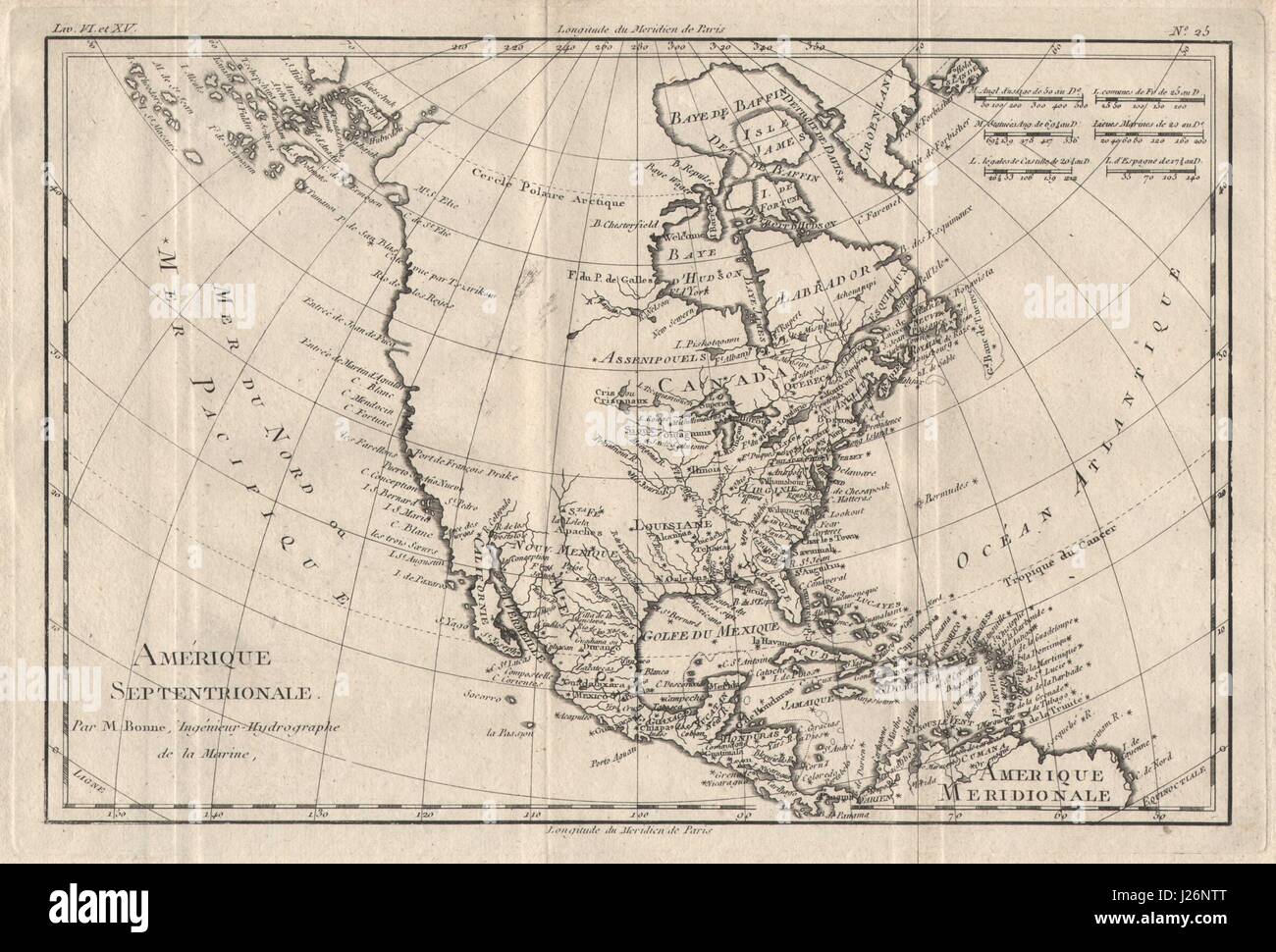 'Amérique Septentrionale'. North America. Misshapen Baja/Alaska. BONNE 1780 map Stock Photohttps://www.alamy.com/image-license-details/?v=1https://www.alamy.com/stock-photo-amrique-septentrionale-north-america-misshapen-bajaalaska-bonne-1780-139061128.html
RFJ26NTT–'Amérique Septentrionale'. North America. Misshapen Baja/Alaska. BONNE 1780 map
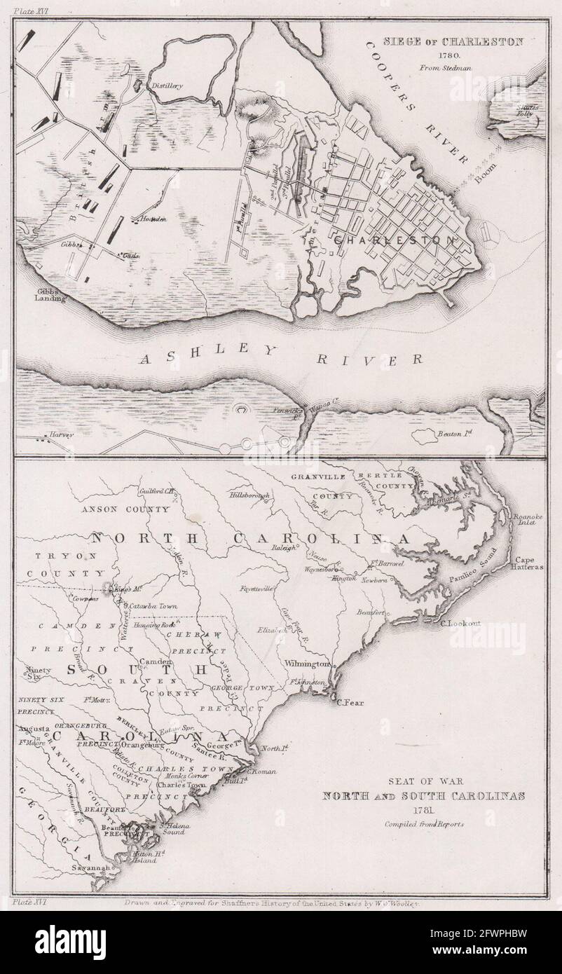 Siege of Charleston 1780. Revolutionary War. North South Carolina 1781 1863 map Stock Photohttps://www.alamy.com/image-license-details/?v=1https://www.alamy.com/siege-of-charleston-1780-revolutionary-war-north-south-carolina-1781-1863-map-image428911837.html
RF2FWPHBW–Siege of Charleston 1780. Revolutionary War. North South Carolina 1781 1863 map
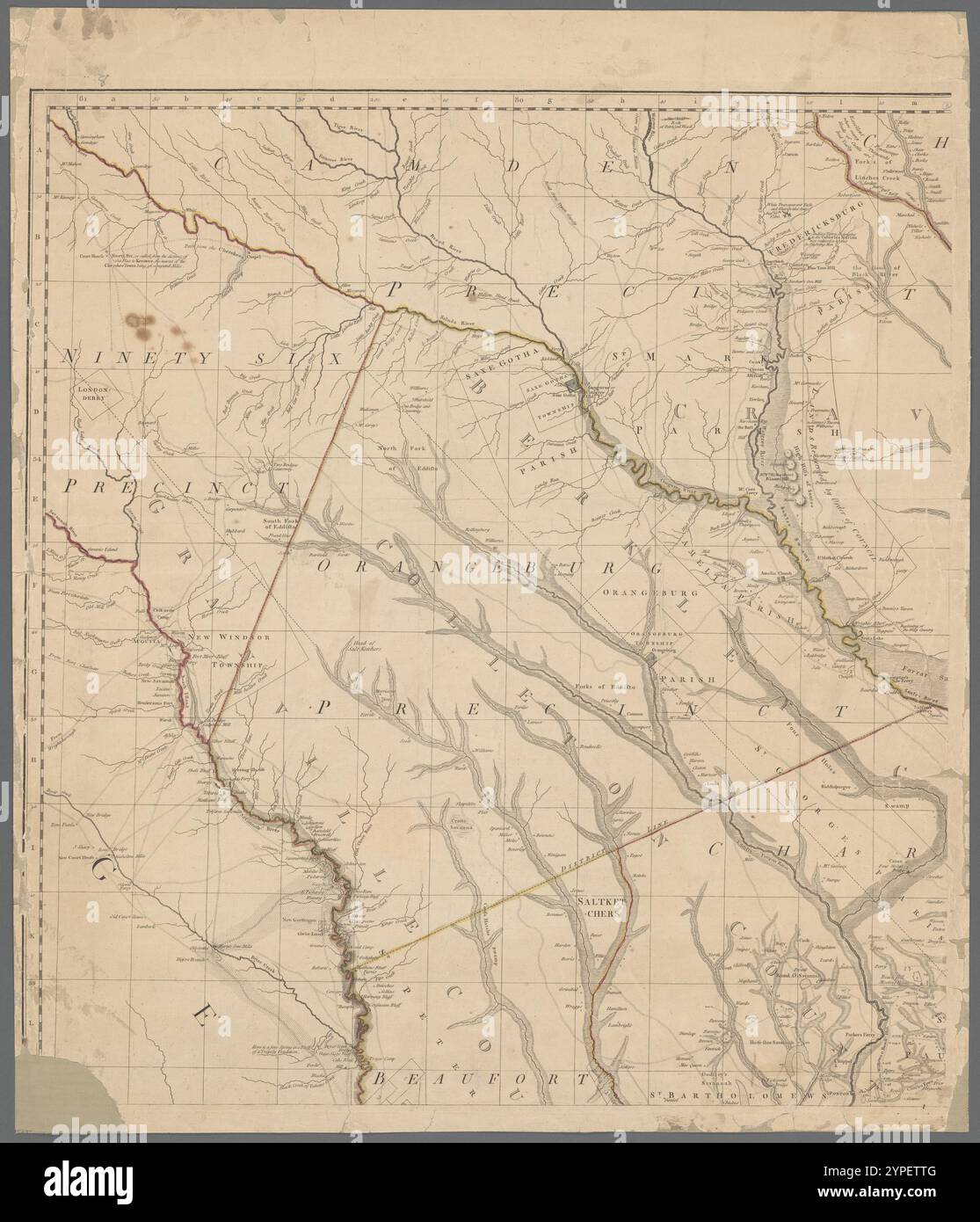 A map of South Carolina and a part of Georgia, containing the whole sea-coast : all the islands, inlets, rivers, creeks, parishes, townships, boroughs, roads, and bridges : as also several plantations, with their proper boundary lines, their names, and the names of their proprietors 1780-06-01 Stock Photohttps://www.alamy.com/image-license-details/?v=1https://www.alamy.com/a-map-of-south-carolina-and-a-part-of-georgia-containing-the-whole-sea-coast-all-the-islands-inlets-rivers-creeks-parishes-townships-boroughs-roads-and-bridges-as-also-several-plantations-with-their-proper-boundary-lines-their-names-and-the-names-of-their-proprietors-1780-06-01-image633422512.html
RM2YPETTG–A map of South Carolina and a part of Georgia, containing the whole sea-coast : all the islands, inlets, rivers, creeks, parishes, townships, boroughs, roads, and bridges : as also several plantations, with their proper boundary lines, their names, and the names of their proprietors 1780-06-01
![Partie Occidentale du Canada [&] les Cinq Grand Lacs… Great Lakes BONNE 1780 map Stock Photo Partie Occidentale du Canada [&] les Cinq Grand Lacs… Great Lakes BONNE 1780 map Stock Photo](https://c8.alamy.com/comp/J26PAE/partie-occidentale-du-canada-les-cinq-grand-lacs-great-lakes-bonne-J26PAE.jpg) Partie Occidentale du Canada [&] les Cinq Grand Lacs… Great Lakes BONNE 1780 map Stock Photohttps://www.alamy.com/image-license-details/?v=1https://www.alamy.com/stock-photo-partie-occidentale-du-canada-les-cinq-grand-lacs-great-lakes-bonne-139061510.html
Partie Occidentale du Canada [&] les Cinq Grand Lacs… Great Lakes BONNE 1780 map Stock Photohttps://www.alamy.com/image-license-details/?v=1https://www.alamy.com/stock-photo-partie-occidentale-du-canada-les-cinq-grand-lacs-great-lakes-bonne-139061510.htmlRFJ26PAE–Partie Occidentale du Canada [&] les Cinq Grand Lacs… Great Lakes BONNE 1780 map
 An Accurate map of New York in North America, from a late survey. Cartographic. Maps. 1780. Lionel Pincus and Princess Firyal Map Division. New York (N.Y.), New York (State) , Maps , Early works to 1800 Stock Photohttps://www.alamy.com/image-license-details/?v=1https://www.alamy.com/an-accurate-map-of-new-york-in-north-america-from-a-late-survey-cartographic-maps-1780-lionel-pincus-and-princess-firyal-map-division-new-york-ny-new-york-state-maps-early-works-to-1800-image484375070.html
RM2K4159J–An Accurate map of New York in North America, from a late survey. Cartographic. Maps. 1780. Lionel Pincus and Princess Firyal Map Division. New York (N.Y.), New York (State) , Maps , Early works to 1800
 Chart of the Islands of St Pierre and Miquelon, just off the coast of Newfoundland. SIXTY-SEVEN Charts and maps illustrating the voyages and surveys of Capt. James Cook, R.N., and other discoverers; circ. 1760- 1780. 1763. Source: Add. 31360, no.21. Stock Photohttps://www.alamy.com/image-license-details/?v=1https://www.alamy.com/chart-of-the-islands-of-st-pierre-and-miquelon-just-off-the-coast-of-newfoundland-sixty-seven-charts-and-maps-illustrating-the-voyages-and-surveys-of-capt-james-cook-rn-and-other-discoverers-circ-1760-1780-1763-source-add-31360-no21-image227124833.html
RMR5EC15–Chart of the Islands of St Pierre and Miquelon, just off the coast of Newfoundland. SIXTY-SEVEN Charts and maps illustrating the voyages and surveys of Capt. James Cook, R.N., and other discoverers; circ. 1760- 1780. 1763. Source: Add. 31360, no.21.
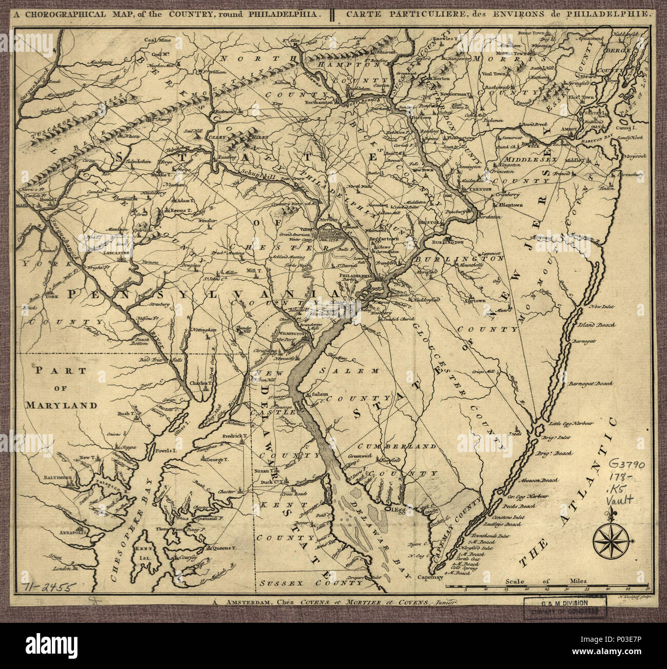 . English: Scale ca. 1:800,000. Relief shown pictorially. Shows 'Genl. Howe's track' from Elk River to Philadelphia, 'Genl. Washington's track,' and 'Grand American Winter Camp, Jan. 1778' at Valley Forge. LC Maps of North America, 1750-1789, 1052 Available also through the Library of Congress Web site as a raster image. Vault AACR2: 651/1; 651/2; 710 . A chorographical map, of the country, round Philadelphia. Carte particuliere, des environs de Philadelphie.. 1780. Klockhoff, H.; Cóvens Et Mortier Et Cóvens, Junior 36 A chorographical map, of the country, round Philadelphia. Carte particulie Stock Photohttps://www.alamy.com/image-license-details/?v=1https://www.alamy.com/english-scale-ca-1800000-relief-shown-pictorially-shows-genl-howes-track-from-elk-river-to-philadelphia-genl-washingtons-track-and-grand-american-winter-camp-jan-1778-at-valley-forge-lc-maps-of-north-america-1750-1789-1052-available-also-through-the-library-of-congress-web-site-as-a-raster-image-vault-aacr2-6511-6512-710-a-chorographical-map-of-the-country-round-philadelphia-carte-particuliere-des-environs-de-philadelphie-1780-klockhoff-h-cvens-et-mortier-et-cvens-junior-36-a-chorographical-map-of-the-country-round-philadelphia-carte-particulie-image206601466.html
RMP03E7P–. English: Scale ca. 1:800,000. Relief shown pictorially. Shows 'Genl. Howe's track' from Elk River to Philadelphia, 'Genl. Washington's track,' and 'Grand American Winter Camp, Jan. 1778' at Valley Forge. LC Maps of North America, 1750-1789, 1052 Available also through the Library of Congress Web site as a raster image. Vault AACR2: 651/1; 651/2; 710 . A chorographical map, of the country, round Philadelphia. Carte particuliere, des environs de Philadelphie.. 1780. Klockhoff, H.; Cóvens Et Mortier Et Cóvens, Junior 36 A chorographical map, of the country, round Philadelphia. Carte particulie
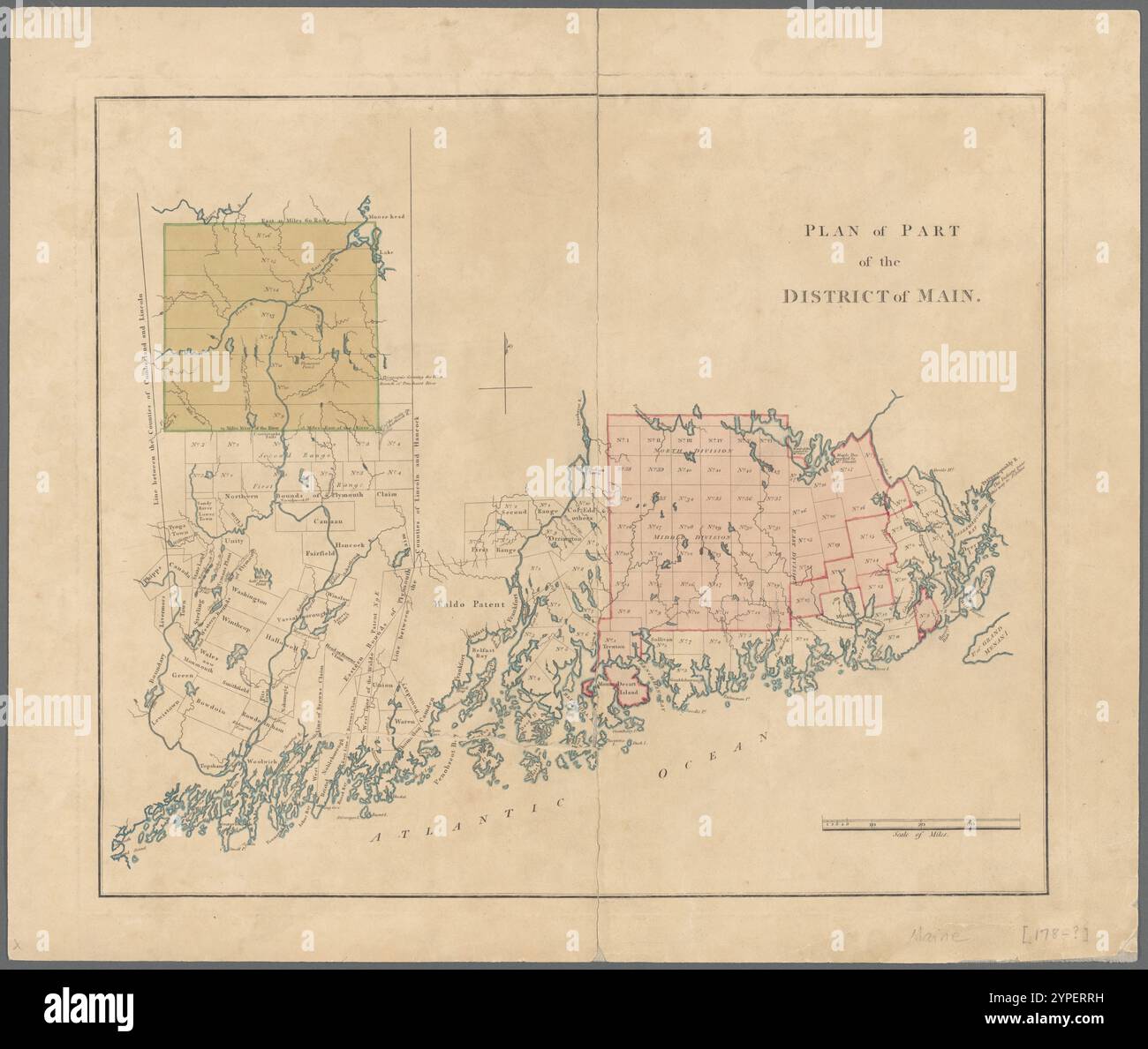 Plan of part of the district of Maine 1780 - 1789 Stock Photohttps://www.alamy.com/image-license-details/?v=1https://www.alamy.com/plan-of-part-of-the-district-of-maine-1780-1789-image633421701.html
RM2YPERRH–Plan of part of the district of Maine 1780 - 1789
 A new and accurate map of the province of Pennsylvania in North America, from the best authorities. Relief shown pictorially. From: Universal magazine of knowledge and pleasure, v. 66, Apr. London : J. Hinton, 1780. Prime meridian: London.... , Pennsylvania Stock Photohttps://www.alamy.com/image-license-details/?v=1https://www.alamy.com/a-new-and-accurate-map-of-the-province-of-pennsylvania-in-north-america-from-the-best-authorities-relief-shown-pictorially-from-universal-magazine-of-knowledge-and-pleasure-v-66-apr-london-j-hinton-1780-prime-meridian-london-pennsylvania-image502743653.html
RM2M5WXJD–A new and accurate map of the province of Pennsylvania in North America, from the best authorities. Relief shown pictorially. From: Universal magazine of knowledge and pleasure, v. 66, Apr. London : J. Hinton, 1780. Prime meridian: London.... , Pennsylvania
 Chart of a coastline, with the words in the margin, 'geo. Vancouver'. SIXTY-SEVEN Charts and maps illustrating the voyages and surveys of Capt. James Cook, R.N., and other discoverers; circ. 1760- 1780. c 1760-1780. Source: Add. 31360, no.42. Stock Photohttps://www.alamy.com/image-license-details/?v=1https://www.alamy.com/chart-of-a-coastline-with-the-words-in-the-margin-geo-vancouver-sixty-seven-charts-and-maps-illustrating-the-voyages-and-surveys-of-capt-james-cook-rn-and-other-discoverers-circ-1760-1780-c-1760-1780-source-add-31360-no42-image226866210.html
RMR52J4J–Chart of a coastline, with the words in the margin, 'geo. Vancouver'. SIXTY-SEVEN Charts and maps illustrating the voyages and surveys of Capt. James Cook, R.N., and other discoverers; circ. 1760- 1780. c 1760-1780. Source: Add. 31360, no.42.
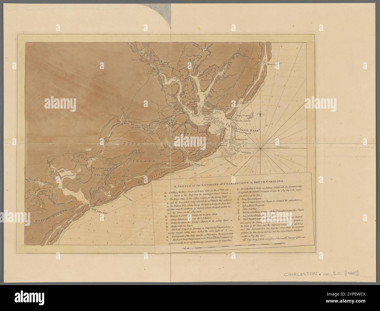 A sketch of the environs of Charlestown in South Carolina 1780 Stock Photohttps://www.alamy.com/image-license-details/?v=1https://www.alamy.com/a-sketch-of-the-environs-of-charlestown-in-south-carolina-1780-image633422970.html
RM2YPEWCX–A sketch of the environs of Charlestown in South Carolina 1780
 An Accurate Map of New York in North America. Original caption: An accurate map of New York in North America - Universal Magazine of Knowledge and Pleasure, London, England. P. 57. Vol. 67 July-Dec. 1780. State: New York. Stock Photohttps://www.alamy.com/image-license-details/?v=1https://www.alamy.com/an-accurate-map-of-new-york-in-north-america-original-caption-an-accurate-map-of-new-york-in-north-america-universal-magazine-of-knowledge-and-pleasure-london-england-p-57-vol-67-july-dec-1780-state-new-york-image501756089.html
RM2M48Y09–An Accurate Map of New York in North America. Original caption: An accurate map of New York in North America - Universal Magazine of Knowledge and Pleasure, London, England. P. 57. Vol. 67 July-Dec. 1780. State: New York.
 A plan of the road of Miquelong in the island of Miquelong by James Cook. A scale of one mile. Sixty-Seven Charts and maps illustrating the voyages and surveys of Capt. James Cook, R.N., and other discoverers. circa 1760-1780. Source: Add. 31360, No.15. Stock Photohttps://www.alamy.com/image-license-details/?v=1https://www.alamy.com/a-plan-of-the-road-of-miquelong-in-the-island-of-miquelong-by-james-cook-a-scale-of-one-mile-sixty-seven-charts-and-maps-illustrating-the-voyages-and-surveys-of-capt-james-cook-rn-and-other-discoverers-circa-1760-1780-source-add-31360-no15-image226967972.html
RMR577Y0–A plan of the road of Miquelong in the island of Miquelong by James Cook. A scale of one mile. Sixty-Seven Charts and maps illustrating the voyages and surveys of Capt. James Cook, R.N., and other discoverers. circa 1760-1780. Source: Add. 31360, No.15.
 A sketch of the environs of Charlestown in South Carolina 1780 Stock Photohttps://www.alamy.com/image-license-details/?v=1https://www.alamy.com/a-sketch-of-the-environs-of-charlestown-in-south-carolina-1780-image633422968.html
RM2YPEWCT–A sketch of the environs of Charlestown in South Carolina 1780
 Map of the port of Samganoodha, Anonymous, 1780 - 1800 print Map of the port of Samganoodha on the island of Unalaska. The route of the Expedition of James Cook in 1778 is indicated on the map. Under a bowl. paper etching maps, atlases Alaska. North America Stock Photohttps://www.alamy.com/image-license-details/?v=1https://www.alamy.com/map-of-the-port-of-samganoodha-anonymous-1780-1800-print-map-of-the-port-of-samganoodha-on-the-island-of-unalaska-the-route-of-the-expedition-of-james-cook-in-1778-is-indicated-on-the-map-under-a-bowl-paper-etching-maps-atlases-alaska-north-america-image594134972.html
RM2WEH564–Map of the port of Samganoodha, Anonymous, 1780 - 1800 print Map of the port of Samganoodha on the island of Unalaska. The route of the Expedition of James Cook in 1778 is indicated on the map. Under a bowl. paper etching maps, atlases Alaska. North America
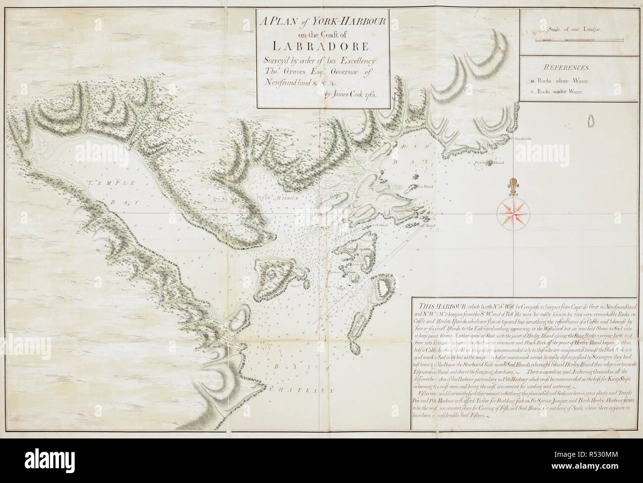 A plan of York harbour (also known as Chateaux Bay) on the coast of Labradore. Commissioned by Thomas Graves, Governor of Newfoundland from 1761 to 1764 , and completed by James Cook in 1763. Sixty-Seven Charts and maps illustrating the voyages and surveys of Capt. James Cook, R.N., and other discoverers. circa 1760-1780. Source: Add. 31360, No.24. Stock Photohttps://www.alamy.com/image-license-details/?v=1https://www.alamy.com/a-plan-of-york-harbour-also-known-as-chateaux-bay-on-the-coast-of-labradore-commissioned-by-thomas-graves-governor-of-newfoundland-from-1761-to-1764-and-completed-by-james-cook-in-1763-sixty-seven-charts-and-maps-illustrating-the-voyages-and-surveys-of-capt-james-cook-rn-and-other-discoverers-circa-1760-1780-source-add-31360-no24-image226874500.html
RMR530MM–A plan of York harbour (also known as Chateaux Bay) on the coast of Labradore. Commissioned by Thomas Graves, Governor of Newfoundland from 1761 to 1764 , and completed by James Cook in 1763. Sixty-Seven Charts and maps illustrating the voyages and surveys of Capt. James Cook, R.N., and other discoverers. circa 1760-1780. Source: Add. 31360, No.24.
 A sketch of the operations before Charlestown, the capital of South Carolina 1780 Stock Photohttps://www.alamy.com/image-license-details/?v=1https://www.alamy.com/a-sketch-of-the-operations-before-charlestown-the-capital-of-south-carolina-1780-image633422971.html
RM2YPEWCY–A sketch of the operations before Charlestown, the capital of South Carolina 1780
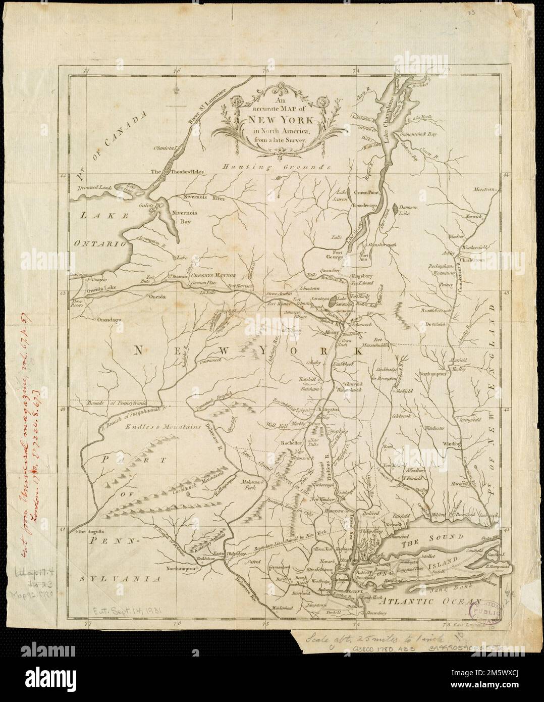 An Accurate map of New York in North America, from a late survey. Shows boundary lines claimed by New York and New Jersey. Relief shown pictorially. From: Universal magazine of knowledge and pleasure, v. 67, p. 57, Aug. London : J. Hinton, 1780.... , New York Stock Photohttps://www.alamy.com/image-license-details/?v=1https://www.alamy.com/an-accurate-map-of-new-york-in-north-america-from-a-late-survey-shows-boundary-lines-claimed-by-new-york-and-new-jersey-relief-shown-pictorially-from-universal-magazine-of-knowledge-and-pleasure-v-67-p-57-aug-london-j-hinton-1780-new-york-image502743490.html
RM2M5WXCJ–An Accurate map of New York in North America, from a late survey. Shows boundary lines claimed by New York and New Jersey. Relief shown pictorially. From: Universal magazine of knowledge and pleasure, v. 67, p. 57, Aug. London : J. Hinton, 1780.... , New York
 Quebec Harbour River St. Lawrence to “ A scale of Three Thousand Yards†Shows Island of Orleans, N & S Channels of Orleans and full soundings. . SIXTY-SEVEN Charts and maps illustrating the voyages and surveys of Capt. James Cook, R.N., and other discoverers; circ. 1760- 1780. c 1760. Source: Add. 31360, no.26. Stock Photohttps://www.alamy.com/image-license-details/?v=1https://www.alamy.com/quebec-harbour-river-st-lawrence-to-a-scale-of-three-thousand-yards-shows-island-of-orleans-n-s-channels-of-orleans-and-full-soundings-sixty-seven-charts-and-maps-illustrating-the-voyages-and-surveys-of-capt-james-cook-rn-and-other-discoverers-circ-1760-1780-c-1760-source-add-31360-no26-image226995921.html
RMR58FH5–Quebec Harbour River St. Lawrence to “ A scale of Three Thousand Yards†Shows Island of Orleans, N & S Channels of Orleans and full soundings. . SIXTY-SEVEN Charts and maps illustrating the voyages and surveys of Capt. James Cook, R.N., and other discoverers; circ. 1760- 1780. c 1760. Source: Add. 31360, no.26.
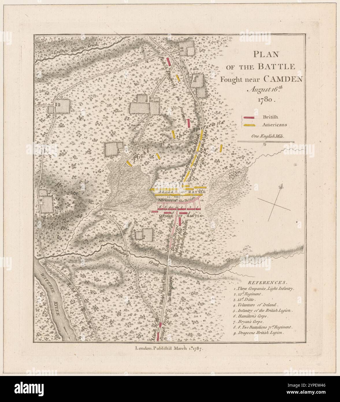 Plan of the battle fought near Camden August 16th, 1780 1787 Stock Photohttps://www.alamy.com/image-license-details/?v=1https://www.alamy.com/plan-of-the-battle-fought-near-camden-august-16th-1780-1787-image633422726.html
RM2YPEW46–Plan of the battle fought near Camden August 16th, 1780 1787
 The coast of Nova Scotia, New England, New-York, Jersey, the Gulph and River of St. Lawrence, the islands of Newfoundland, Cape Breton, St. John, Antecosty, Sable, &c., and soundings thereof ... Cartographic. Maps. 1780-11-01. Lionel Pincus and Princess Firyal Map Division. Atlantic Coast (North America), Nautical charts , Atlantic Coast (North America), Atlantic Coast (North America) , Maps , Early works to 1800 Stock Photohttps://www.alamy.com/image-license-details/?v=1https://www.alamy.com/the-coast-of-nova-scotia-new-england-new-york-jersey-the-gulph-and-river-of-st-lawrence-the-islands-of-newfoundland-cape-breton-st-john-antecosty-sable-c-and-soundings-thereof-cartographic-maps-1780-11-01-lionel-pincus-and-princess-firyal-map-division-atlantic-coast-north-america-nautical-charts-atlantic-coast-north-america-atlantic-coast-north-america-maps-early-works-to-1800-image484329853.html
RM2K3Y3JN–The coast of Nova Scotia, New England, New-York, Jersey, the Gulph and River of St. Lawrence, the islands of Newfoundland, Cape Breton, St. John, Antecosty, Sable, &c., and soundings thereof ... Cartographic. Maps. 1780-11-01. Lionel Pincus and Princess Firyal Map Division. Atlantic Coast (North America), Nautical charts , Atlantic Coast (North America), Atlantic Coast (North America) , Maps , Early works to 1800
 A plan of the harbour of ST Peters off S. Coast Newfoundland Low water soundings. References to: A. Stagins for splitting & salting fish B. Warfes C. Beach for drying fish(Symbol): rock above water(symbol): rock under water Shows Isle Dogs; Boar Island & Pigeon Island . SIXTY-SEVEN Charts and maps illustrating the voyages and surveys of Capt. James Cook, R.N., and other discoverers; circ. 1760- 1780. 1765. Source: Add. 31360, no.20. Stock Photohttps://www.alamy.com/image-license-details/?v=1https://www.alamy.com/a-plan-of-the-harbour-of-st-peters-off-s-coast-newfoundland-low-water-soundings-references-to-a-stagins-for-splitting-salting-fish-b-warfes-c-beach-for-drying-fishsymbol-rock-above-watersymbol-rock-under-water-shows-isle-dogs-boar-island-pigeon-island-sixty-seven-charts-and-maps-illustrating-the-voyages-and-surveys-of-capt-james-cook-rn-and-other-discoverers-circ-1760-1780-1765-source-add-31360-no20-image227174935.html
RMR5GKXF–A plan of the harbour of ST Peters off S. Coast Newfoundland Low water soundings. References to: A. Stagins for splitting & salting fish B. Warfes C. Beach for drying fish(Symbol): rock above water(symbol): rock under water Shows Isle Dogs; Boar Island & Pigeon Island . SIXTY-SEVEN Charts and maps illustrating the voyages and surveys of Capt. James Cook, R.N., and other discoverers; circ. 1760- 1780. 1765. Source: Add. 31360, no.20.
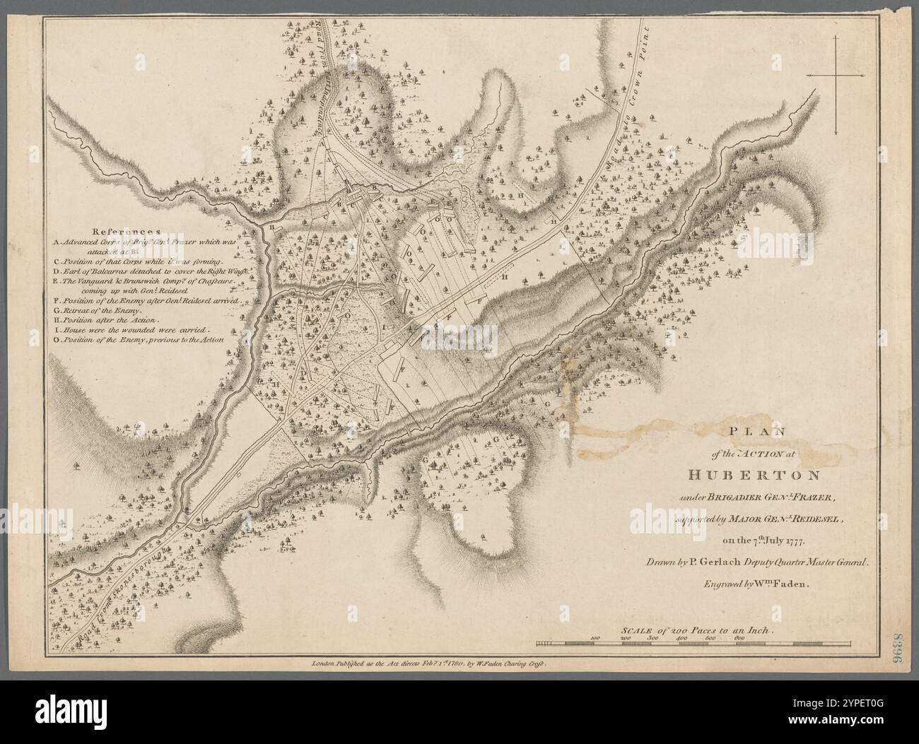 Plan of the action of Huberton under Brigadier Genl. Frazer, supported by Major Genl. Reidesel on the 7th July 1777 1780 Stock Photohttps://www.alamy.com/image-license-details/?v=1https://www.alamy.com/plan-of-the-action-of-huberton-under-brigadier-genl-frazer-supported-by-major-genl-reidesel-on-the-7th-july-1777-1780-image633421840.html
RM2YPET0G–Plan of the action of Huberton under Brigadier Genl. Frazer, supported by Major Genl. Reidesel on the 7th July 1777 1780
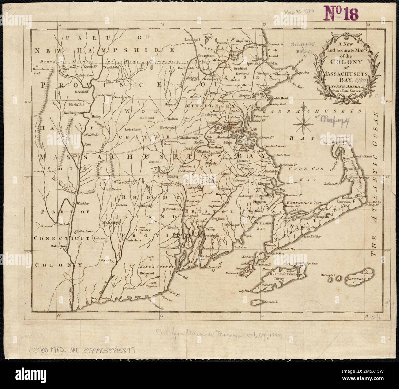 A new and accurate map of the colony of Massachusets Bay, in North America, from a late survey. Covers eastern Massachusetts, Rhode Island, eastern Connecticut, and small portions of New Hampshire and Vermont. Relief shown pictorially. From Universal magazine of knowledge and pleasure, vol. 66, Dec. 1780, opposite p. 281. Prime meridian: Ferro... New and accurate map of the colony of Massachusetts Bay. New and accurate map of the colony of Massachusetts Bay, Massachusetts Rhode Island Connecticut Stock Photohttps://www.alamy.com/image-license-details/?v=1https://www.alamy.com/a-new-and-accurate-map-of-the-colony-of-massachusets-bay-in-north-america-from-a-late-survey-covers-eastern-massachusetts-rhode-island-eastern-connecticut-and-small-portions-of-new-hampshire-and-vermont-relief-shown-pictorially-from-universal-magazine-of-knowledge-and-pleasure-vol-66-dec-1780-opposite-p-281-prime-meridian-ferro-new-and-accurate-map-of-the-colony-of-massachusetts-bay-new-and-accurate-map-of-the-colony-of-massachusetts-bay-massachusetts-rhode-island-connecticut-image502745653.html
RM2M5X15W–A new and accurate map of the colony of Massachusets Bay, in North America, from a late survey. Covers eastern Massachusetts, Rhode Island, eastern Connecticut, and small portions of New Hampshire and Vermont. Relief shown pictorially. From Universal magazine of knowledge and pleasure, vol. 66, Dec. 1780, opposite p. 281. Prime meridian: Ferro... New and accurate map of the colony of Massachusetts Bay. New and accurate map of the colony of Massachusetts Bay, Massachusetts Rhode Island Connecticut
 A sketch of the environs of Charlestown in South Carolina 1780-06-01 by Sproule, Geo. F. (George F.), 1741-1817 Stock Photohttps://www.alamy.com/image-license-details/?v=1https://www.alamy.com/a-sketch-of-the-environs-of-charlestown-in-south-carolina-1780-06-01-by-sproule-geo-f-george-f-1741-1817-image633422967.html
RM2YPEWCR–A sketch of the environs of Charlestown in South Carolina 1780-06-01 by Sproule, Geo. F. (George F.), 1741-1817
 Carte réduite des côtes orientales de l'Amérique septentrionale : contenant celles des provinces de New-York et de la Nouvelle Angleterre, celles de l'Acadie ou Nouvelle Ecosse, de l'Île Royale de l'Île St. Jean, avec l'intérieur du pays dressée au Dépôt général des cartes, plans et journaux de la marine Carte réduite des côtes orientales de l'Amérique septentrionale Cartographic. Maps. 1780. Lionel Pincus and Princess Firyal Map Division. Northeastern States, Coasts , Maritime Provinces, Coasts , Northeastern States, Maritime Provinces, Nautical charts , Atlantic Coast (North America), Nautic Stock Photohttps://www.alamy.com/image-license-details/?v=1https://www.alamy.com/carte-rduite-des-ctes-orientales-de-lamrique-septentrionale-contenant-celles-des-provinces-de-new-york-et-de-la-nouvelle-angleterre-celles-de-lacadie-ou-nouvelle-ecosse-de-lle-royale-de-lle-st-jean-avec-lintrieur-du-pays-dresse-au-dpt-gnral-des-cartes-plans-et-journaux-de-la-marine-carte-rduite-des-ctes-orientales-de-lamrique-septentrionale-cartographic-maps-1780-lionel-pincus-and-princess-firyal-map-division-northeastern-states-coasts-maritime-provinces-coasts-northeastern-states-maritime-provinces-nautical-charts-atlantic-coast-north-america-nautic-image484374275.html
RM2K41497–Carte réduite des côtes orientales de l'Amérique septentrionale : contenant celles des provinces de New-York et de la Nouvelle Angleterre, celles de l'Acadie ou Nouvelle Ecosse, de l'Île Royale de l'Île St. Jean, avec l'intérieur du pays dressée au Dépôt général des cartes, plans et journaux de la marine Carte réduite des côtes orientales de l'Amérique septentrionale Cartographic. Maps. 1780. Lionel Pincus and Princess Firyal Map Division. Northeastern States, Coasts , Maritime Provinces, Coasts , Northeastern States, Maritime Provinces, Nautical charts , Atlantic Coast (North America), Nautic
 Plan of the action at Huberton : under Brigadier Genl. Frazer, supported by Major Genl. Reidesel, on the 7th July 1777 1780 by Gerlach, P., Deputy Quarter Master General Stock Photohttps://www.alamy.com/image-license-details/?v=1https://www.alamy.com/plan-of-the-action-at-huberton-under-brigadier-genl-frazer-supported-by-major-genl-reidesel-on-the-7th-july-1777-1780-by-gerlach-p-deputy-quarter-master-general-image633422670.html
RM2YPEW26–Plan of the action at Huberton : under Brigadier Genl. Frazer, supported by Major Genl. Reidesel, on the 7th July 1777 1780 by Gerlach, P., Deputy Quarter Master General
 Position of the detachment under Lieut. Coll. Baum, at Walmscock near Bennington : shewing the attacks of the enemy on the 16th August 1777 1780 by Durnford, Elias, 1739-1794 Stock Photohttps://www.alamy.com/image-license-details/?v=1https://www.alamy.com/position-of-the-detachment-under-lieut-coll-baum-at-walmscock-near-bennington-shewing-the-attacks-of-the-enemy-on-the-16th-august-1777-1780-by-durnford-elias-1739-1794-image633422666.html
RM2YPEW22–Position of the detachment under Lieut. Coll. Baum, at Walmscock near Bennington : shewing the attacks of the enemy on the 16th August 1777 1780 by Durnford, Elias, 1739-1794
 Carte réduite des côtes et de l'interieur de la presqu'île de la Floride : avec la détroit de cette presqu'île et le canal de Bahama 1780 by France. Dépôt des cartes et plans de la marine Stock Photohttps://www.alamy.com/image-license-details/?v=1https://www.alamy.com/carte-rduite-des-ctes-et-de-linterieur-de-la-presqule-de-la-floride-avec-la-dtroit-de-cette-presqule-et-le-canal-de-bahama-1780-by-france-dpt-des-cartes-et-plans-de-la-marine-image633422674.html
RM2YPEW2A–Carte réduite des côtes et de l'interieur de la presqu'île de la Floride : avec la détroit de cette presqu'île et le canal de Bahama 1780 by France. Dépôt des cartes et plans de la marine
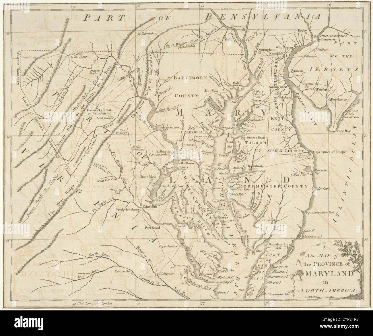 A New map of the province of Maryland in North America. 1780 Stock Photohttps://www.alamy.com/image-license-details/?v=1https://www.alamy.com/a-new-map-of-the-province-of-maryland-in-north-america-1780-image633159019.html
RM2YP2TP3–A New map of the province of Maryland in North America. 1780
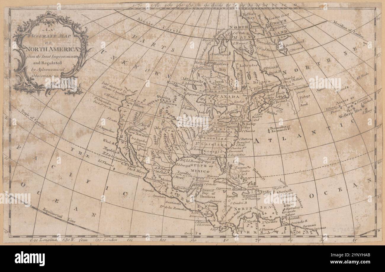 An accurate map of North America from the latest improvements, and regulated by astronomical observations. 1760 - 1780 by Rollos, G. Stock Photohttps://www.alamy.com/image-license-details/?v=1https://www.alamy.com/an-accurate-map-of-north-america-from-the-latest-improvements-and-regulated-by-astronomical-observations-1760-1780-by-rollos-g-image633087347.html
RM2YNYHAB–An accurate map of North America from the latest improvements, and regulated by astronomical observations. 1760 - 1780 by Rollos, G.
![A new and accurate map of the colony of Massachusets [i.e. Massachusetts] Bay, in North America, from a late survey 1780 Stock Photo A new and accurate map of the colony of Massachusets [i.e. Massachusetts] Bay, in North America, from a late survey 1780 Stock Photo](https://c8.alamy.com/comp/2YP5NY6/a-new-and-accurate-map-of-the-colony-of-massachusets-ie-massachusetts-bay-in-north-america-from-a-late-survey-1780-2YP5NY6.jpg) A new and accurate map of the colony of Massachusets [i.e. Massachusetts] Bay, in North America, from a late survey 1780 Stock Photohttps://www.alamy.com/image-license-details/?v=1https://www.alamy.com/a-new-and-accurate-map-of-the-colony-of-massachusets-ie-massachusetts-bay-in-north-america-from-a-late-survey-1780-image633222666.html
A new and accurate map of the colony of Massachusets [i.e. Massachusetts] Bay, in North America, from a late survey 1780 Stock Photohttps://www.alamy.com/image-license-details/?v=1https://www.alamy.com/a-new-and-accurate-map-of-the-colony-of-massachusets-ie-massachusetts-bay-in-north-america-from-a-late-survey-1780-image633222666.htmlRM2YP5NY6–A new and accurate map of the colony of Massachusets [i.e. Massachusetts] Bay, in North America, from a late survey 1780
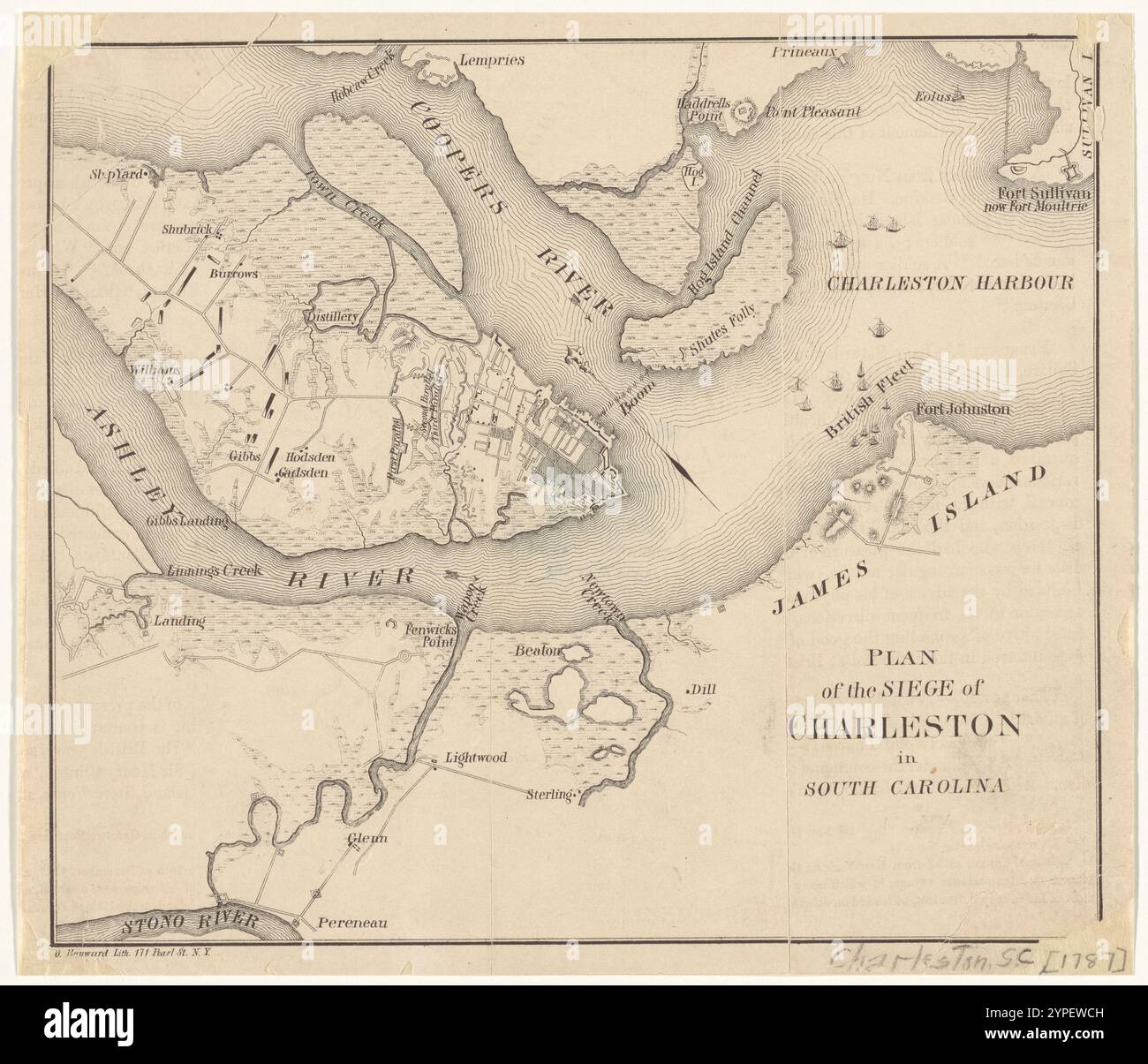 Plan of the siege of Charleston in South Carolina 1860 Stock Photohttps://www.alamy.com/image-license-details/?v=1https://www.alamy.com/plan-of-the-siege-of-charleston-in-south-carolina-1860-image633422961.html
RM2YPEWCH–Plan of the siege of Charleston in South Carolina 1860
 Plan of the siege of Charlestown in South Carolina 1787-03-01 by Faden, William, 1749-1836 Stock Photohttps://www.alamy.com/image-license-details/?v=1https://www.alamy.com/plan-of-the-siege-of-charlestown-in-south-carolina-1787-03-01-by-faden-william-1749-1836-image633422956.html
RM2YPEWCC–Plan of the siege of Charlestown in South Carolina 1787-03-01 by Faden, William, 1749-1836
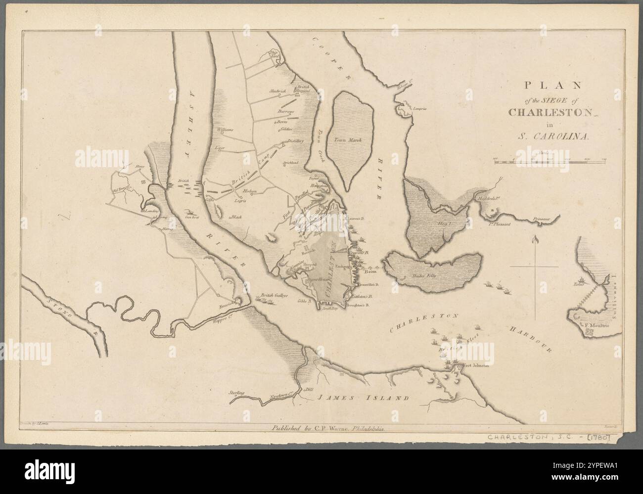 Plan of the siege of Charleston in S. Carolina 1807 by Tanner, Henry Schenck, 1786-1858 Stock Photohttps://www.alamy.com/image-license-details/?v=1https://www.alamy.com/plan-of-the-siege-of-charleston-in-s-carolina-1807-by-tanner-henry-schenck-1786-1858-image633422889.html
RM2YPEWA1–Plan of the siege of Charleston in S. Carolina 1807 by Tanner, Henry Schenck, 1786-1858
 A map of a portion of the Indian country lying east and west of the Mississippi River to the forty sixth degree of north latitude from personal observation made in the autumn of 1835 and recent authentic documents 1836 by Featherstonhaugh, George William, 1780-1866 Stock Photohttps://www.alamy.com/image-license-details/?v=1https://www.alamy.com/a-map-of-a-portion-of-the-indian-country-lying-east-and-west-of-the-mississippi-river-to-the-forty-sixth-degree-of-north-latitude-from-personal-observation-made-in-the-autumn-of-1835-and-recent-authentic-documents-1836-by-featherstonhaugh-george-william-1780-1866-image633123212.html
RM2YP1738–A map of a portion of the Indian country lying east and west of the Mississippi River to the forty sixth degree of north latitude from personal observation made in the autumn of 1835 and recent authentic documents 1836 by Featherstonhaugh, George William, 1780-1866
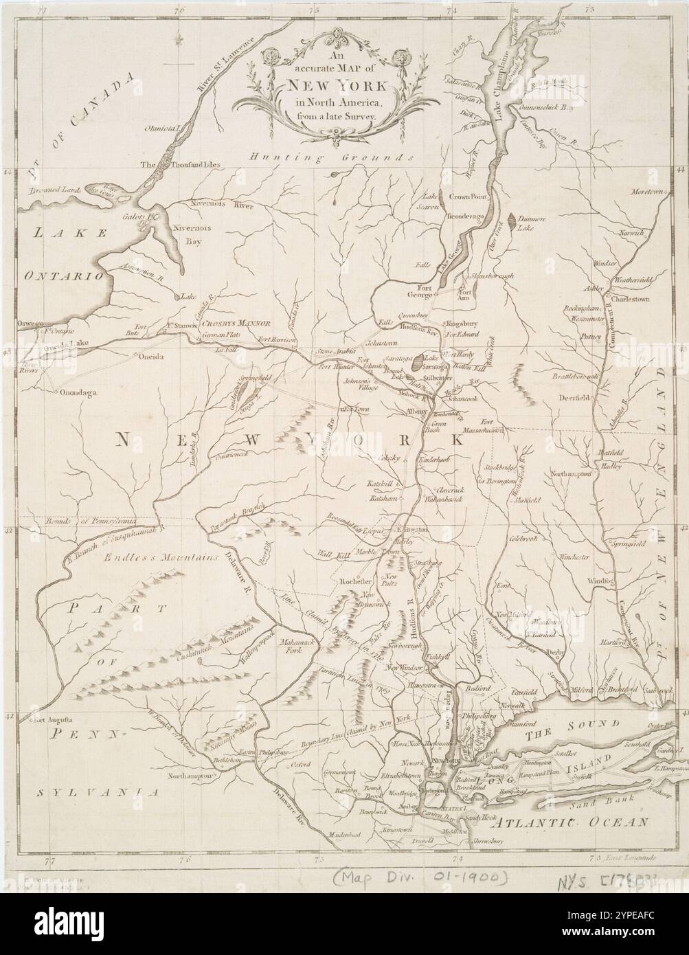 An Accurate map of New York in North America, from a late survey. 1780 Stock Photohttps://www.alamy.com/image-license-details/?v=1https://www.alamy.com/an-accurate-map-of-new-york-in-north-america-from-a-late-survey-1780-image633411280.html
RM2YPEAFC–An Accurate map of New York in North America, from a late survey. 1780
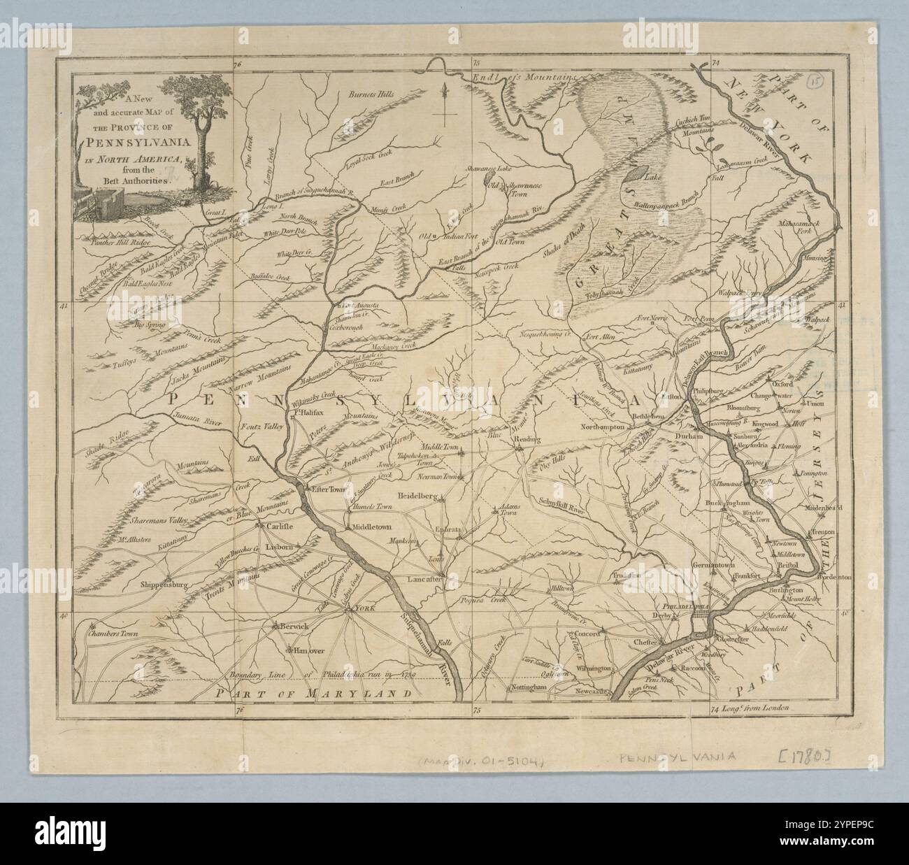 A New and accurate map of the province of Pennsylvania in North America, from the best authorities. 1780 Stock Photohttps://www.alamy.com/image-license-details/?v=1https://www.alamy.com/a-new-and-accurate-map-of-the-province-of-pennsylvania-in-north-america-from-the-best-authorities-1780-image633420520.html
RM2YPEP9C–A New and accurate map of the province of Pennsylvania in North America, from the best authorities. 1780
 A new and correct map of North America : in which the places of the principal engagements during the present war are accurately inserted 1780-04-26 by Lodge, John, -1796 Stock Photohttps://www.alamy.com/image-license-details/?v=1https://www.alamy.com/a-new-and-correct-map-of-north-america-in-which-the-places-of-the-principal-engagements-during-the-present-war-are-accurately-inserted-1780-04-26-by-lodge-john-1796-image633088255.html
RM2YNYJER–A new and correct map of North America : in which the places of the principal engagements during the present war are accurately inserted 1780-04-26 by Lodge, John, -1796
 A new and correct map of North America : in which the places of the principal engagements during the present war are accurately inserted 1780-04-26 by Lodge, John, -1796 Stock Photohttps://www.alamy.com/image-license-details/?v=1https://www.alamy.com/a-new-and-correct-map-of-north-america-in-which-the-places-of-the-principal-engagements-during-the-present-war-are-accurately-inserted-1780-04-26-by-lodge-john-1796-image633088748.html
RM2YNYK4C–A new and correct map of North America : in which the places of the principal engagements during the present war are accurately inserted 1780-04-26 by Lodge, John, -1796
 A new and accurate map of Connecticut and Rhode Island: from the best authorities 1780 Stock Photohttps://www.alamy.com/image-license-details/?v=1https://www.alamy.com/a-new-and-accurate-map-of-connecticut-and-rhode-island-from-the-best-authorities-1780-image633221405.html
RM2YP5MA5–A new and accurate map of Connecticut and Rhode Island: from the best authorities 1780
 Chart of the N.W. coast of America, and N.E. coast of Asia : explored by Capt. Cook and Capt. Clerke, in the years 1778 & 1779 1780 - 1789 by Clerke, Charles, 1741-1779 Stock Photohttps://www.alamy.com/image-license-details/?v=1https://www.alamy.com/chart-of-the-nw-coast-of-america-and-ne-coast-of-asia-explored-by-capt-cook-and-capt-clerke-in-the-years-1778-1779-1780-1789-by-clerke-charles-1741-1779-image633124164.html
RM2YP1898–Chart of the N.W. coast of America, and N.E. coast of Asia : explored by Capt. Cook and Capt. Clerke, in the years 1778 & 1779 1780 - 1789 by Clerke, Charles, 1741-1779
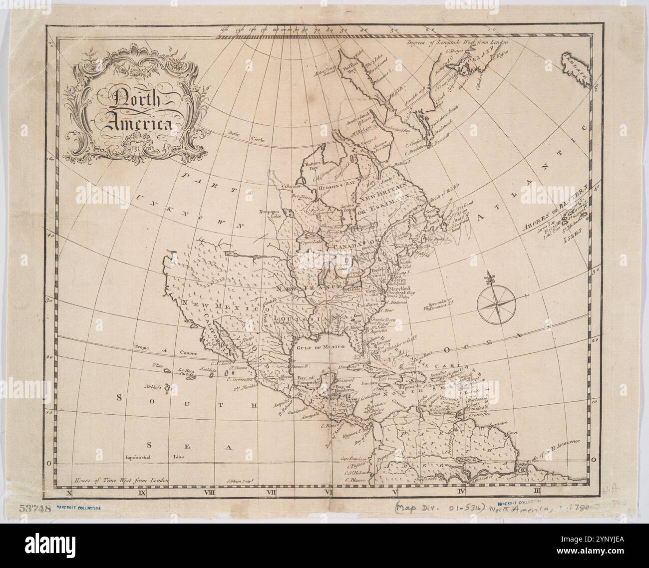 North America 1780 by Gibson, J. (John) Stock Photohttps://www.alamy.com/image-license-details/?v=1https://www.alamy.com/north-america-1780-by-gibson-j-john-image633088242.html
RM2YNYJEA–North America 1780 by Gibson, J. (John)
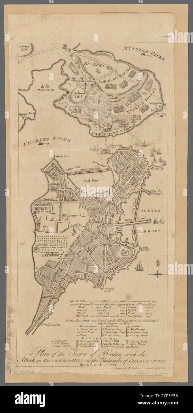 Plan of the town of Boston with the attack on Bunkers-Hill in the peninsula of Charlestown the 17th of June 1775 1780 Stock Photohttps://www.alamy.com/image-license-details/?v=1https://www.alamy.com/plan-of-the-town-of-boston-with-the-attack-on-bunkers-hill-in-the-peninsula-of-charlestown-the-17th-of-june-1775-1780-image633226758.html
RM2YP5Y5A–Plan of the town of Boston with the attack on Bunkers-Hill in the peninsula of Charlestown the 17th of June 1775 1780
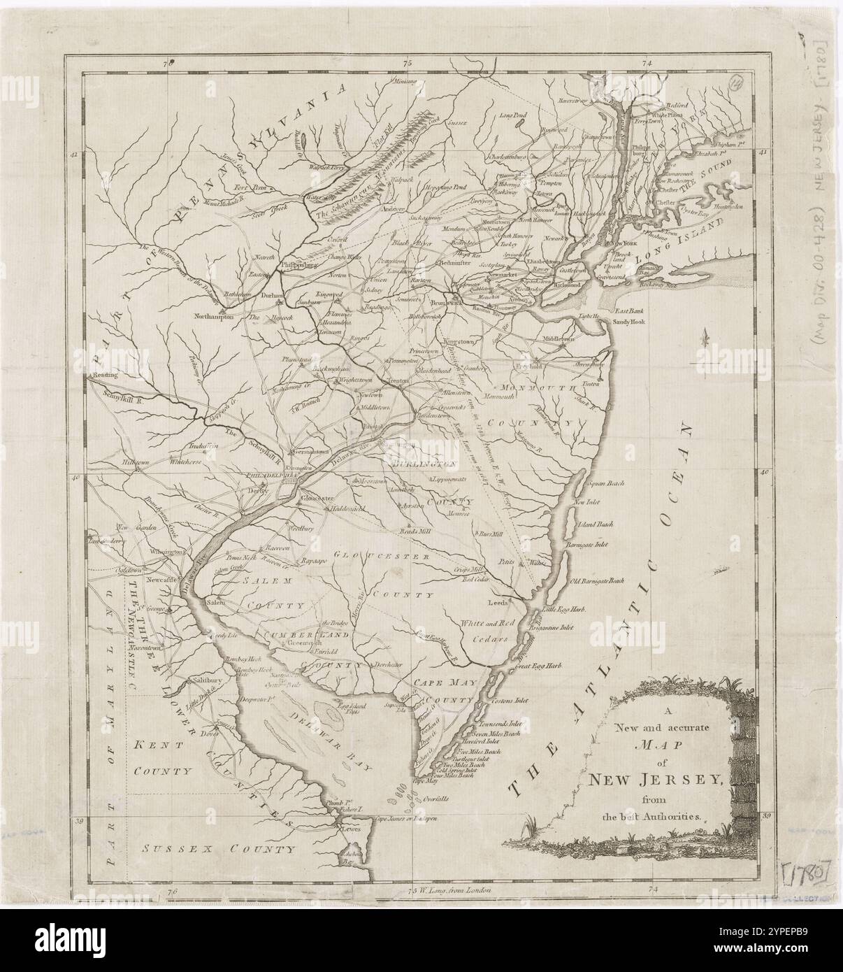 A New and accurate map of New Jersey : from the best authorities. 1780 Stock Photohttps://www.alamy.com/image-license-details/?v=1https://www.alamy.com/a-new-and-accurate-map-of-new-jersey-from-the-best-authorities-1780-image633420573.html
RM2YPEPB9–A New and accurate map of New Jersey : from the best authorities. 1780
 A New and accurate map of New Jersey : from the best authorities. 1780 Stock Photohttps://www.alamy.com/image-license-details/?v=1https://www.alamy.com/a-new-and-accurate-map-of-new-jersey-from-the-best-authorities-1780-image633420385.html
RM2YPEP4H–A New and accurate map of New Jersey : from the best authorities. 1780
 A New and accurate map of Virginia : and part of Maryland and Pennsylvania 1780-12-31 by Lodge, John, -1796 Stock Photohttps://www.alamy.com/image-license-details/?v=1https://www.alamy.com/a-new-and-accurate-map-of-virginia-and-part-of-maryland-and-pennsylvania-1780-12-31-by-lodge-john-1796-image633420516.html
RM2YPEP98–A New and accurate map of Virginia : and part of Maryland and Pennsylvania 1780-12-31 by Lodge, John, -1796
 A chorographical map of the country round Philadelphia = Carte particuliere des environs de Philadelphie 1780 - 1789 by Klockhoff, H. Stock Photohttps://www.alamy.com/image-license-details/?v=1https://www.alamy.com/a-chorographical-map-of-the-country-round-philadelphia-=-carte-particuliere-des-environs-de-philadelphie-1780-1789-by-klockhoff-h-image633420452.html
RM2YPEP70–A chorographical map of the country round Philadelphia = Carte particuliere des environs de Philadelphie 1780 - 1789 by Klockhoff, H.
 A map of the country in which the army under Lt. General Burgoyne acted in the campaign of 1777 : shewing the marches of the army & the places of the principal actions 1780-02-01 by Medcalfe, Mr. Stock Photohttps://www.alamy.com/image-license-details/?v=1https://www.alamy.com/a-map-of-the-country-in-which-the-army-under-lt-general-burgoyne-acted-in-the-campaign-of-1777-shewing-the-marches-of-the-army-the-places-of-the-principal-actions-1780-02-01-by-medcalfe-mr-image633715562.html
RM2YR06JJ–A map of the country in which the army under Lt. General Burgoyne acted in the campaign of 1777 : shewing the marches of the army & the places of the principal actions 1780-02-01 by Medcalfe, Mr.
 Carte des possessions Russes 1825 by Brué, Adrien Hubert, 1786-1832 Stock Photohttps://www.alamy.com/image-license-details/?v=1https://www.alamy.com/carte-des-possessions-russes-1825-by-bru-adrien-hubert-1786-1832-image633123870.html
RM2YP17XP–Carte des possessions Russes 1825 by Brué, Adrien Hubert, 1786-1832
 Connecticut and parts adjacent 1780 by Klockhoff, H. (Hendrik) Stock Photohttps://www.alamy.com/image-license-details/?v=1https://www.alamy.com/connecticut-and-parts-adjacent-1780-by-klockhoff-h-hendrik-image633421404.html
RM2YPERD0–Connecticut and parts adjacent 1780 by Klockhoff, H. (Hendrik)
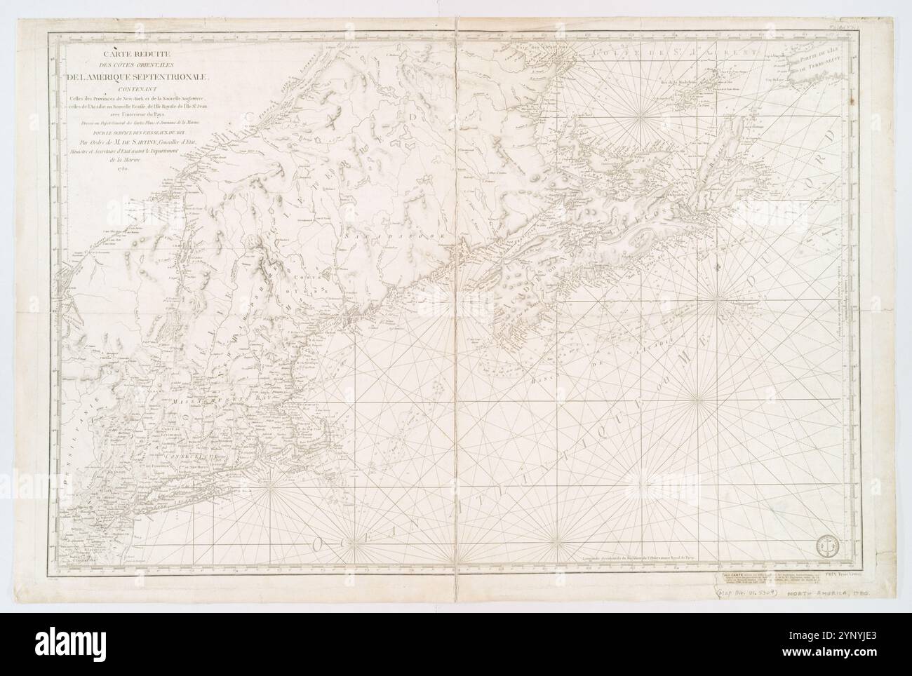 Carte réduite des côtes orientales de l'Amérique septentrionale : contenant celles des provinces de New-York et de la Nouvelle Angleterre, celles de l'Acadie ou Nouvelle Ecosse de l'Ãle Royale de l'Ãle St. Jean avec l'intérieur du pays 1780 by Petit, Sculp. Stock Photohttps://www.alamy.com/image-license-details/?v=1https://www.alamy.com/carte-rduite-des-ctes-orientales-de-lamrique-septentrionale-contenant-celles-des-provinces-de-new-york-et-de-la-nouvelle-angleterre-celles-de-lacadie-ou-nouvelle-ecosse-de-lle-royale-de-lle-st-jean-avec-lintrieur-du-pays-1780-by-petit-sculp-image633088235.html
RM2YNYJE3–Carte réduite des côtes orientales de l'Amérique septentrionale : contenant celles des provinces de New-York et de la Nouvelle Angleterre, celles de l'Acadie ou Nouvelle Ecosse de l'Ãle Royale de l'Ãle St. Jean avec l'intérieur du pays 1780 by Petit, Sculp.
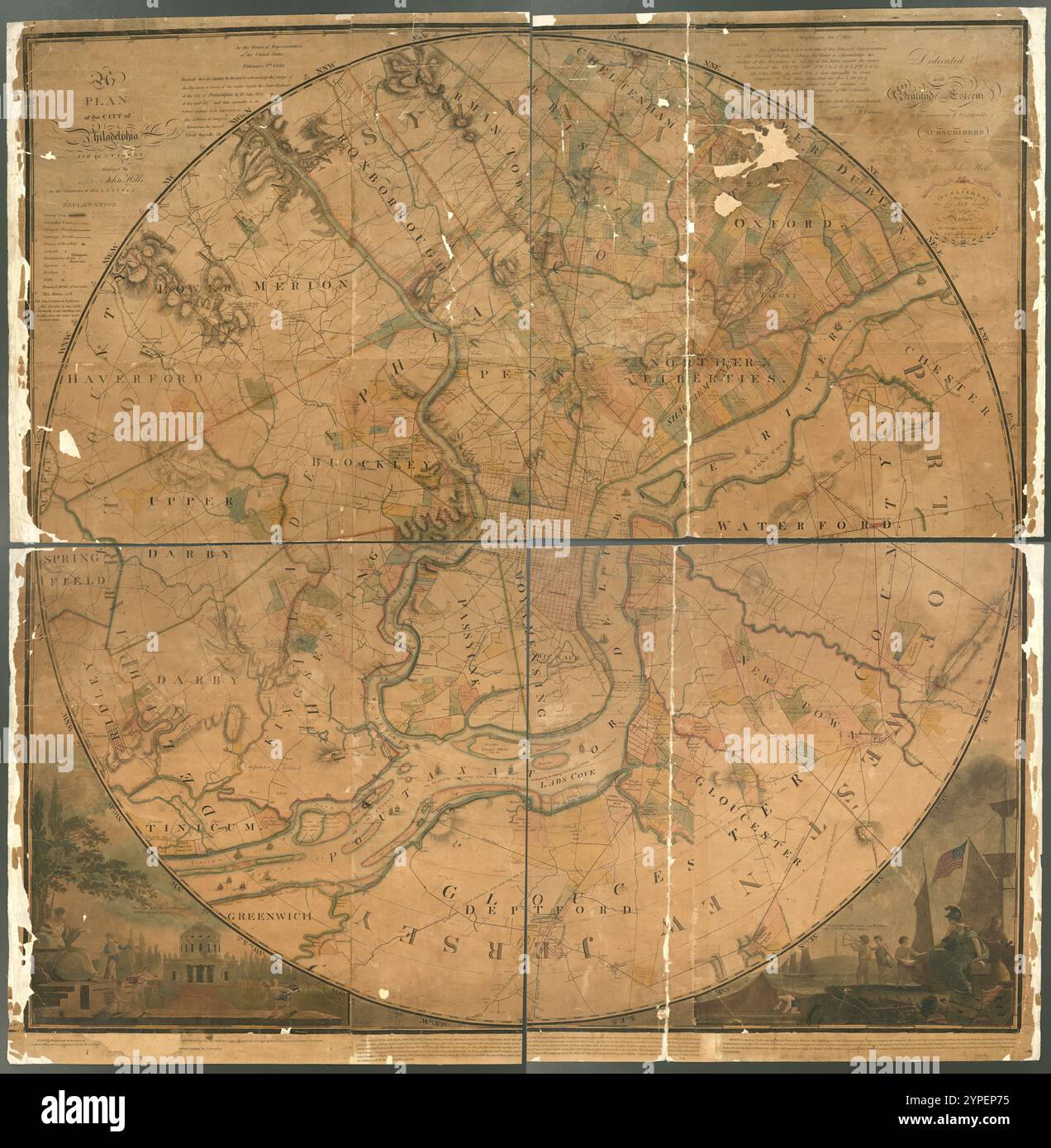 A plan of the city of Philadelphia and environs 1809 by Kneass, William, 1780-1840 Stock Photohttps://www.alamy.com/image-license-details/?v=1https://www.alamy.com/a-plan-of-the-city-of-philadelphia-and-environs-1809-by-kneass-william-1780-1840-image633420457.html
RM2YPEP75–A plan of the city of Philadelphia and environs 1809 by Kneass, William, 1780-1840