Quick filters:
18th century london map Stock Photos and Images
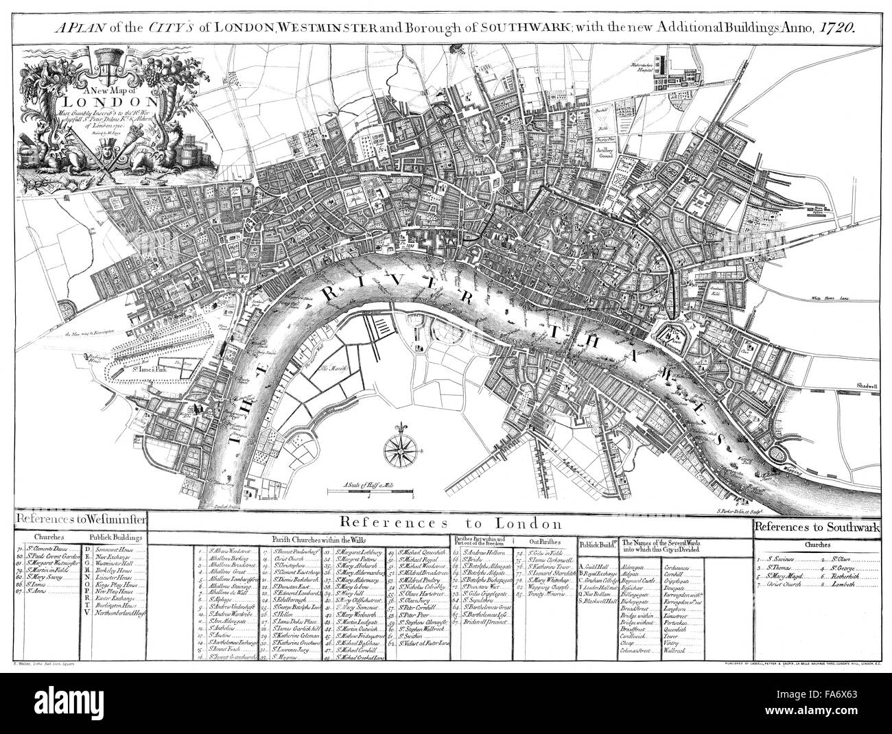 City map of London, England, 1720, Stadtplan von London, 1720 Stock Photohttps://www.alamy.com/image-license-details/?v=1https://www.alamy.com/stock-photo-city-map-of-london-england-1720-stadtplan-von-london-1720-92350667.html
RMFA6X63–City map of London, England, 1720, Stadtplan von London, 1720
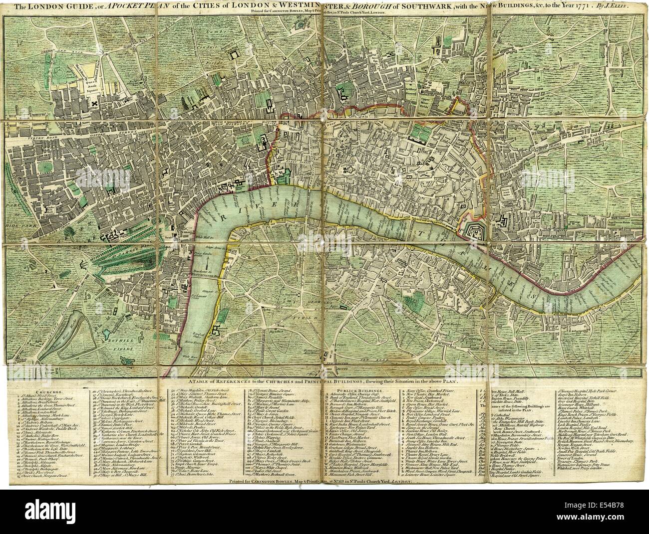 Pocket plan, map of the Cities of London, Westminster & Borough of Southwark, with new buildings, 1771, by J. Ellis Stock Photohttps://www.alamy.com/image-license-details/?v=1https://www.alamy.com/stock-photo-pocket-plan-map-of-the-cities-of-london-westminster-borough-of-southwark-72011388.html
RME54B78–Pocket plan, map of the Cities of London, Westminster & Borough of Southwark, with new buildings, 1771, by J. Ellis
 Vintage map of London and area from 17th/18th century. Map is beautifully hand illustrated and engraved showing London at the time. Stock Photohttps://www.alamy.com/image-license-details/?v=1https://www.alamy.com/vintage-map-of-london-and-area-from-17th18th-century-map-is-beautifully-hand-illustrated-and-engraved-showing-london-at-the-time-image468180681.html
RF2J5KD6H–Vintage map of London and area from 17th/18th century. Map is beautifully hand illustrated and engraved showing London at the time.
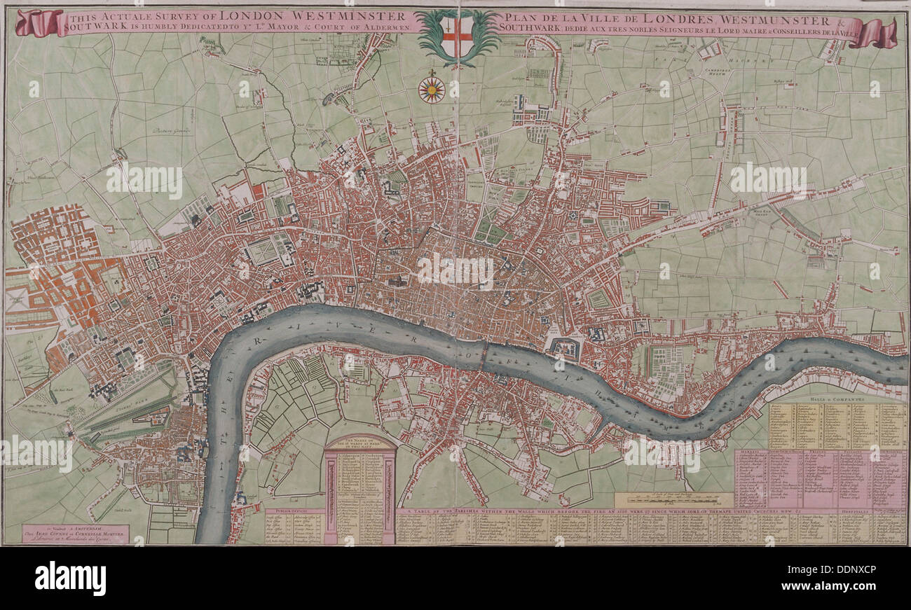 Map of London, 1725. Artist: Anon Stock Photohttps://www.alamy.com/image-license-details/?v=1https://www.alamy.com/map-of-london-1725-artist-anon-image60103366.html
RMDDNXCP–Map of London, 1725. Artist: Anon
 18th century Map of London and River Thames Stock Photohttps://www.alamy.com/image-license-details/?v=1https://www.alamy.com/18th-century-map-of-london-and-river-thames-image504916005.html
RM2M9CWED–18th century Map of London and River Thames
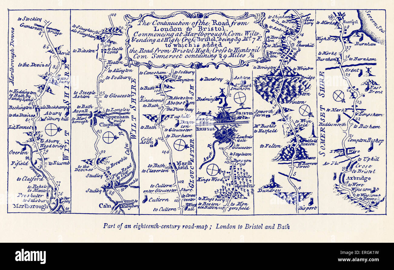 Road map: London to Bristol and Bath, 18th century Stock Photohttps://www.alamy.com/image-license-details/?v=1https://www.alamy.com/stock-photo-road-map-london-to-bristol-and-bath-18th-century-83344741.html
RMERGK1W–Road map: London to Bristol and Bath, 18th century
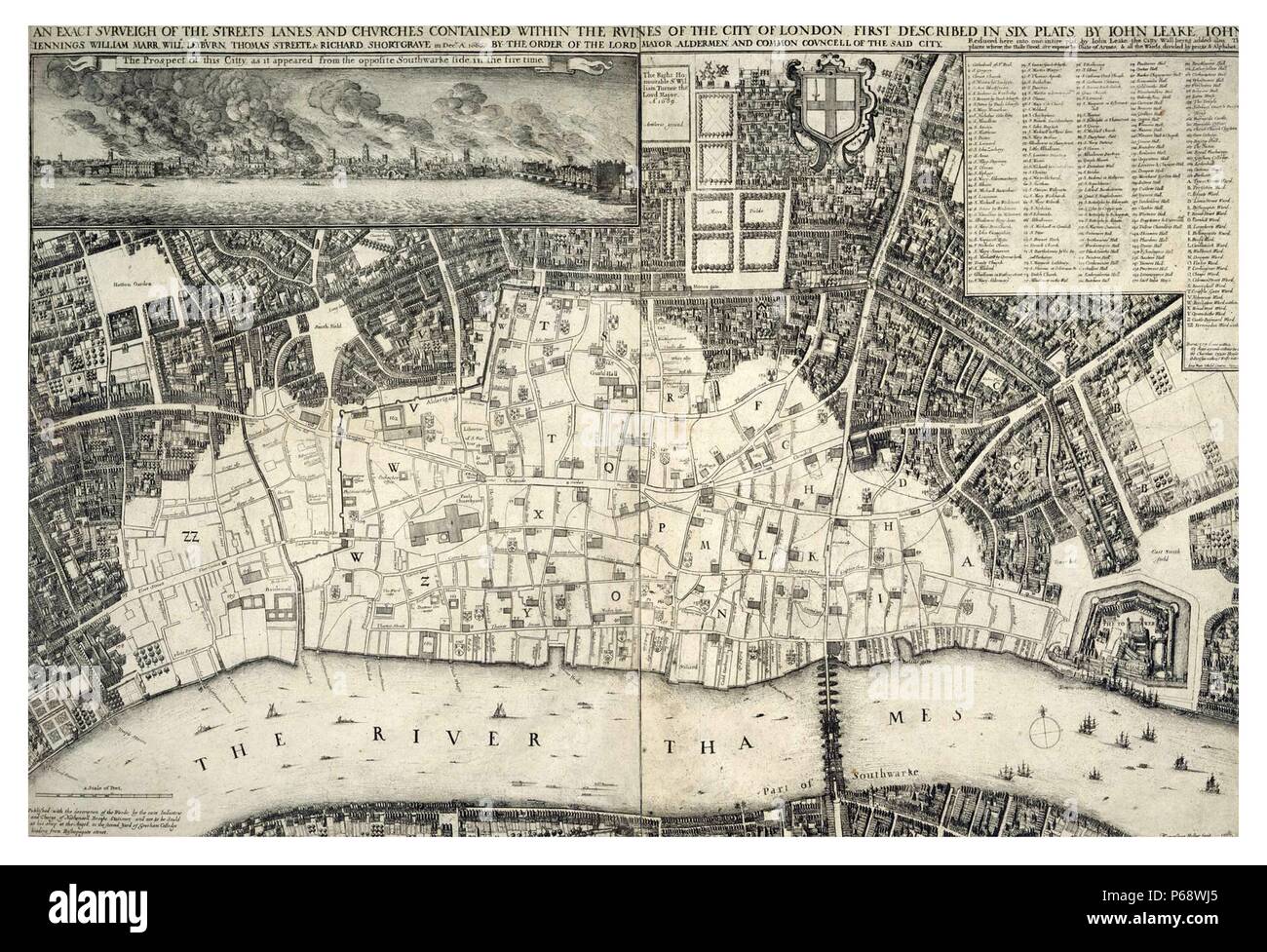 map, of central London; England dated 1677; shows the re-built areas of the city after the 'Great Fire of London' Stock Photohttps://www.alamy.com/image-license-details/?v=1https://www.alamy.com/map-of-central-london-england-dated-1677-shows-the-re-built-areas-of-the-city-after-the-great-fire-of-london-image210408077.html
RMP68WJ5–map, of central London; England dated 1677; shows the re-built areas of the city after the 'Great Fire of London'
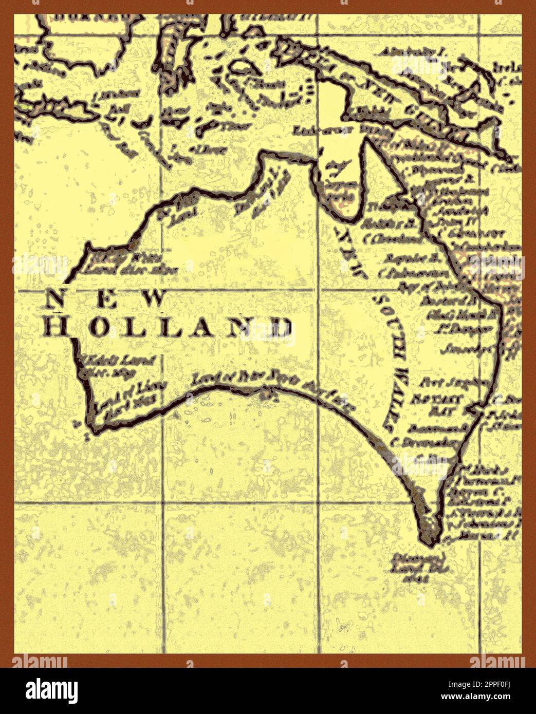 MAP - New Holland (Australia) 1787 as charted by Captain James Cook. The long held belief that Captain Cook’s son James, died without issue has in 2024 been disputed in a new book. “The Untold Story of Captain James Cook R N”. (Pen & Sword books – ISBN 978-1399056960 ). Verifiable history changing evidence is based on the discovery of a newly discovered 18th century government document discovered in the British National Archives. Stock Photohttps://www.alamy.com/image-license-details/?v=1https://www.alamy.com/map-new-holland-australia-1787-as-charted-by-captain-james-cook-the-long-held-belief-that-captain-cooks-son-james-died-without-issue-has-in-2024-been-disputed-in-a-new-book-the-untold-story-of-captain-james-cook-r-n-pen-sword-books-isbn-978-1399056960-verifiable-history-changing-evidence-is-based-on-the-discovery-of-a-newly-discovered-18th-century-government-document-discovered-in-the-british-national-archives-image547373558.html
RM2PPF0FJ–MAP - New Holland (Australia) 1787 as charted by Captain James Cook. The long held belief that Captain Cook’s son James, died without issue has in 2024 been disputed in a new book. “The Untold Story of Captain James Cook R N”. (Pen & Sword books – ISBN 978-1399056960 ). Verifiable history changing evidence is based on the discovery of a newly discovered 18th century government document discovered in the British National Archives.
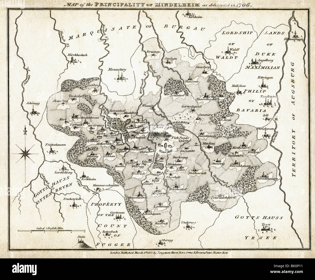 cartography, historical maps, map of the Principality of Mindelheim, 1706, published in London, 1818, Germany, Holy Roman Empire, Bavaria, Swabia, Kirchheim, 18th century, historic, historical, Hungerbach, Wertach, Schwetek, Kamlach, Mindel, rivers, towns, monasteries, monastery, German principalities, Stock Photohttps://www.alamy.com/image-license-details/?v=1https://www.alamy.com/stock-photo-cartography-historical-maps-map-of-the-principality-of-mindelheim-28906109.html
RMBK0P11–cartography, historical maps, map of the Principality of Mindelheim, 1706, published in London, 1818, Germany, Holy Roman Empire, Bavaria, Swabia, Kirchheim, 18th century, historic, historical, Hungerbach, Wertach, Schwetek, Kamlach, Mindel, rivers, towns, monasteries, monastery, German principalities,
![Map of the region Naples, Map of the Naples region, with Mount Vesuvius and the Gulf of Castel a Mare, 18th century, Plate VI, after 168, 1773, William Hamilton: Observations on Mount Vesuvius, Mount Etna, and other volcanos: in a series of letters, addressed to the Royal Society from [...] W. Hamilton [...]: to which are added, explanatory notes by the author, hitherto unpublished. London: printed for T. Cadell, 1773 Stock Photo Map of the region Naples, Map of the Naples region, with Mount Vesuvius and the Gulf of Castel a Mare, 18th century, Plate VI, after 168, 1773, William Hamilton: Observations on Mount Vesuvius, Mount Etna, and other volcanos: in a series of letters, addressed to the Royal Society from [...] W. Hamilton [...]: to which are added, explanatory notes by the author, hitherto unpublished. London: printed for T. Cadell, 1773 Stock Photo](https://c8.alamy.com/comp/2A2RWKP/map-of-the-region-naples-map-of-the-naples-region-with-mount-vesuvius-and-the-gulf-of-castel-a-mare-18th-century-plate-vi-after-168-1773-william-hamilton-observations-on-mount-vesuvius-mount-etna-and-other-volcanos-in-a-series-of-letters-addressed-to-the-royal-society-from-w-hamilton-to-which-are-added-explanatory-notes-by-the-author-hitherto-unpublished-london-printed-for-t-cadell-1773-2A2RWKP.jpg) Map of the region Naples, Map of the Naples region, with Mount Vesuvius and the Gulf of Castel a Mare, 18th century, Plate VI, after 168, 1773, William Hamilton: Observations on Mount Vesuvius, Mount Etna, and other volcanos: in a series of letters, addressed to the Royal Society from [...] W. Hamilton [...]: to which are added, explanatory notes by the author, hitherto unpublished. London: printed for T. Cadell, 1773 Stock Photohttps://www.alamy.com/image-license-details/?v=1https://www.alamy.com/map-of-the-region-naples-map-of-the-naples-region-with-mount-vesuvius-and-the-gulf-of-castel-a-mare-18th-century-plate-vi-after-168-1773-william-hamilton-observations-on-mount-vesuvius-mount-etna-and-other-volcanos-in-a-series-of-letters-addressed-to-the-royal-society-from-w-hamilton-to-which-are-added-explanatory-notes-by-the-author-hitherto-unpublished-london-printed-for-t-cadell-1773-image328751354.html
Map of the region Naples, Map of the Naples region, with Mount Vesuvius and the Gulf of Castel a Mare, 18th century, Plate VI, after 168, 1773, William Hamilton: Observations on Mount Vesuvius, Mount Etna, and other volcanos: in a series of letters, addressed to the Royal Society from [...] W. Hamilton [...]: to which are added, explanatory notes by the author, hitherto unpublished. London: printed for T. Cadell, 1773 Stock Photohttps://www.alamy.com/image-license-details/?v=1https://www.alamy.com/map-of-the-region-naples-map-of-the-naples-region-with-mount-vesuvius-and-the-gulf-of-castel-a-mare-18th-century-plate-vi-after-168-1773-william-hamilton-observations-on-mount-vesuvius-mount-etna-and-other-volcanos-in-a-series-of-letters-addressed-to-the-royal-society-from-w-hamilton-to-which-are-added-explanatory-notes-by-the-author-hitherto-unpublished-london-printed-for-t-cadell-1773-image328751354.htmlRM2A2RWKP–Map of the region Naples, Map of the Naples region, with Mount Vesuvius and the Gulf of Castel a Mare, 18th century, Plate VI, after 168, 1773, William Hamilton: Observations on Mount Vesuvius, Mount Etna, and other volcanos: in a series of letters, addressed to the Royal Society from [...] W. Hamilton [...]: to which are added, explanatory notes by the author, hitherto unpublished. London: printed for T. Cadell, 1773
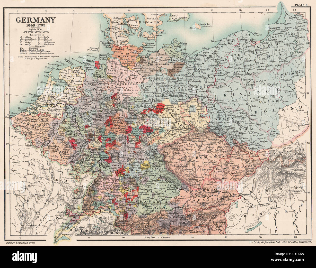 GERMANY 1648-1795: 17th and 18th century Germany, 1902 antique map Stock Photohttps://www.alamy.com/image-license-details/?v=1https://www.alamy.com/stock-photo-germany-1648-1795-17th-and-18th-century-germany-1902-antique-map-94079392.html
RFFD1K68–GERMANY 1648-1795: 17th and 18th century Germany, 1902 antique map
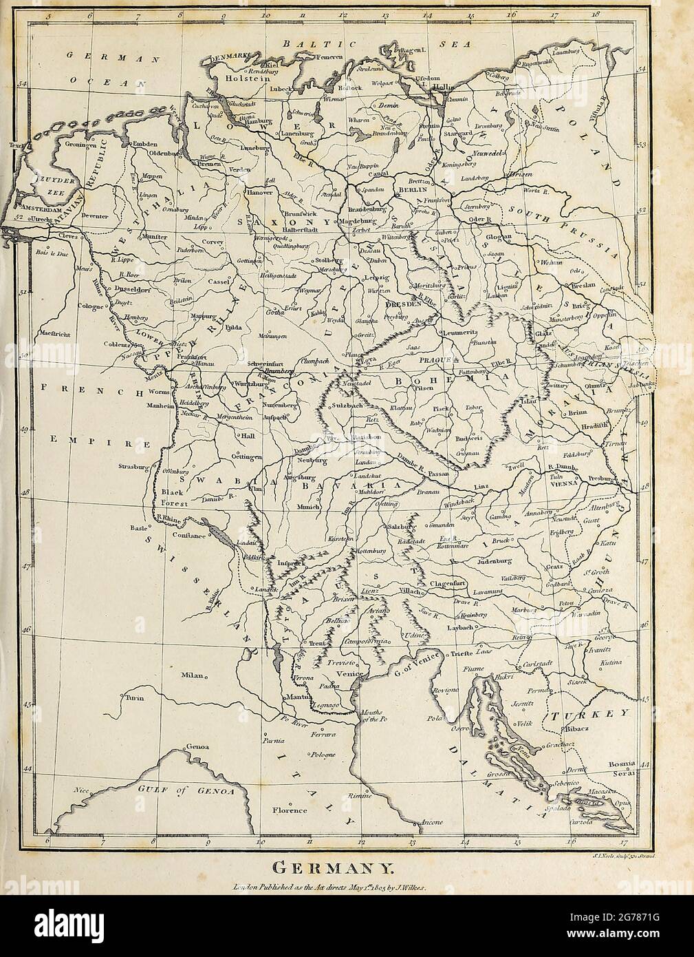 18th Century map of Germany Copperplate engraving From the Encyclopaedia Londinensis or, Universal dictionary of arts, sciences, and literature; Volume VIII; Edited by Wilkes, John. Published in London in 1810. Stock Photohttps://www.alamy.com/image-license-details/?v=1https://www.alamy.com/18th-century-map-of-germany-copperplate-engraving-from-the-encyclopaedia-londinensis-or-universal-dictionary-of-arts-sciences-and-literature-volume-viii-edited-by-wilkes-john-published-in-london-in-1810-image434742940.html
RM2G7871G–18th Century map of Germany Copperplate engraving From the Encyclopaedia Londinensis or, Universal dictionary of arts, sciences, and literature; Volume VIII; Edited by Wilkes, John. Published in London in 1810.
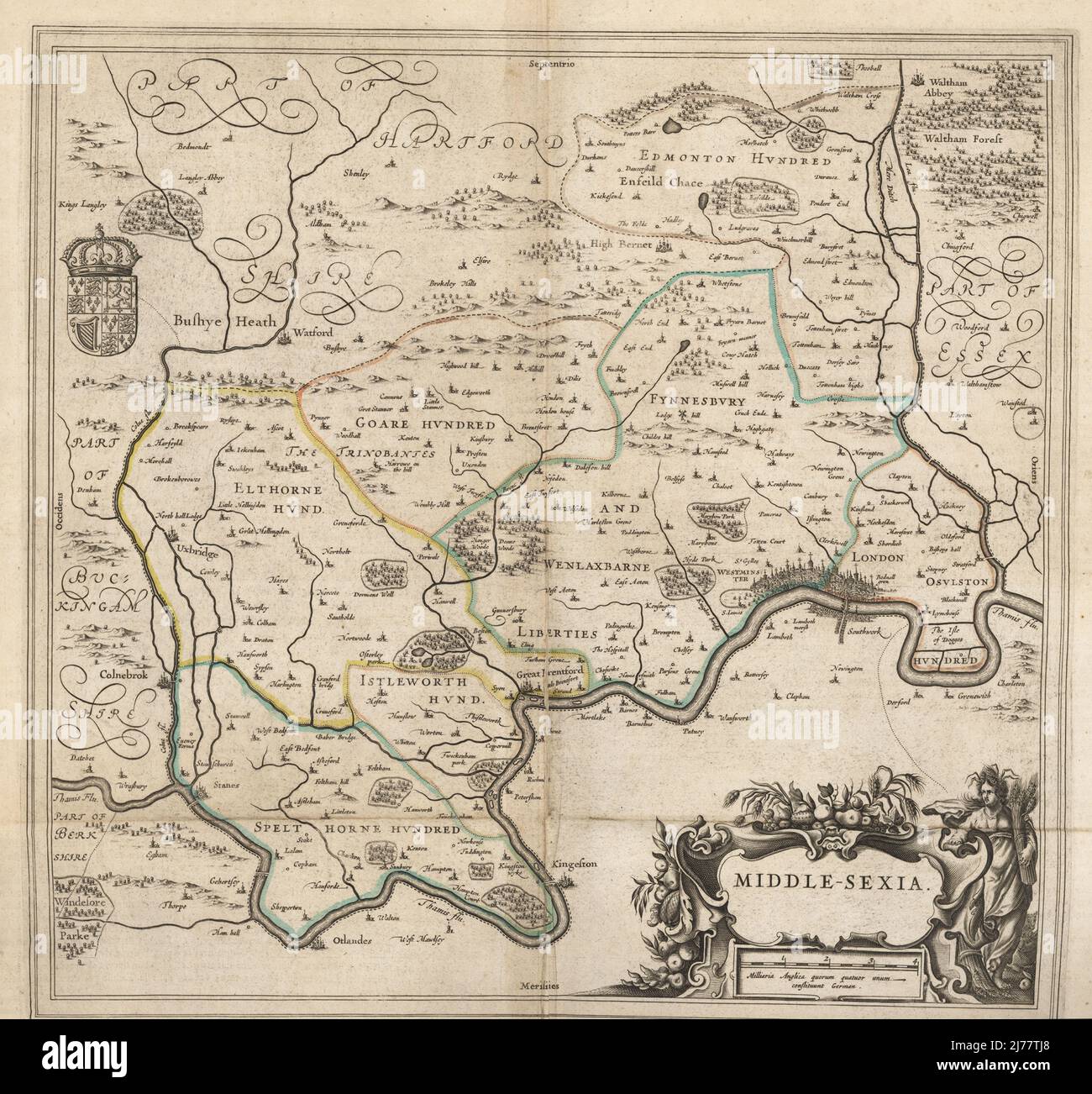 Map of the city of London and county of Middlesex, circa 1600. London shown as clutch of churches, surrounded by parishes Kensington, Chelsey, St. Gylles, Lambeth, Southwork, Hampton Court, on the River Thames, Hyde Park and Marybon Park. With title Middle-Sexia in cartouche and coat of arms. Handcoloured copperplate engraving by Johannes Blaeu from Geographiae Volumen Quintum quo Angliae, county atlas of England and Wales, Amsterdam, 1662. Stock Photohttps://www.alamy.com/image-license-details/?v=1https://www.alamy.com/map-of-the-city-of-london-and-county-of-middlesex-circa-1600-london-shown-as-clutch-of-churches-surrounded-by-parishes-kensington-chelsey-st-gylles-lambeth-southwork-hampton-court-on-the-river-thames-hyde-park-and-marybon-park-with-title-middle-sexia-in-cartouche-and-coat-of-arms-handcoloured-copperplate-engraving-by-johannes-blaeu-from-geographiae-volumen-quintum-quo-angliae-county-atlas-of-england-and-wales-amsterdam-1662-image469155520.html
RM2J77TJ8–Map of the city of London and county of Middlesex, circa 1600. London shown as clutch of churches, surrounded by parishes Kensington, Chelsey, St. Gylles, Lambeth, Southwork, Hampton Court, on the River Thames, Hyde Park and Marybon Park. With title Middle-Sexia in cartouche and coat of arms. Handcoloured copperplate engraving by Johannes Blaeu from Geographiae Volumen Quintum quo Angliae, county atlas of England and Wales, Amsterdam, 1662.
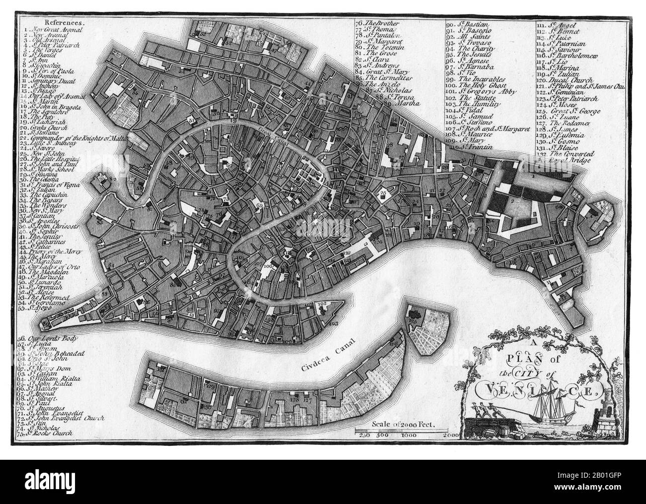 Italy/Venice: A map of Venice published by J. Stockdale, London, 1800. For centuries Venice was Europe’s prime trading partner with the Middle East and the Byzantine Empire in particular. Venetian naval and commercial power was unrivalled in Europe until it lost a series of wars to the Ottoman armies in the 15th century. The city lost some 50,000 people to the Black Death in 1575-1577, but remained a major manufacturing centre and port well into the 18th century. Stock Photohttps://www.alamy.com/image-license-details/?v=1https://www.alamy.com/italyvenice-a-map-of-venice-published-by-j-stockdale-london-1800-for-centuries-venice-was-europes-prime-trading-partner-with-the-middle-east-and-the-byzantine-empire-in-particular-venetian-naval-and-commercial-power-was-unrivalled-in-europe-until-it-lost-a-series-of-wars-to-the-ottoman-armies-in-the-15th-century-the-city-lost-some-50000-people-to-the-black-death-in-1575-1577-but-remained-a-major-manufacturing-centre-and-port-well-into-the-18th-century-image344242298.html
RM2B01GFP–Italy/Venice: A map of Venice published by J. Stockdale, London, 1800. For centuries Venice was Europe’s prime trading partner with the Middle East and the Byzantine Empire in particular. Venetian naval and commercial power was unrivalled in Europe until it lost a series of wars to the Ottoman armies in the 15th century. The city lost some 50,000 people to the Black Death in 1575-1577, but remained a major manufacturing centre and port well into the 18th century.
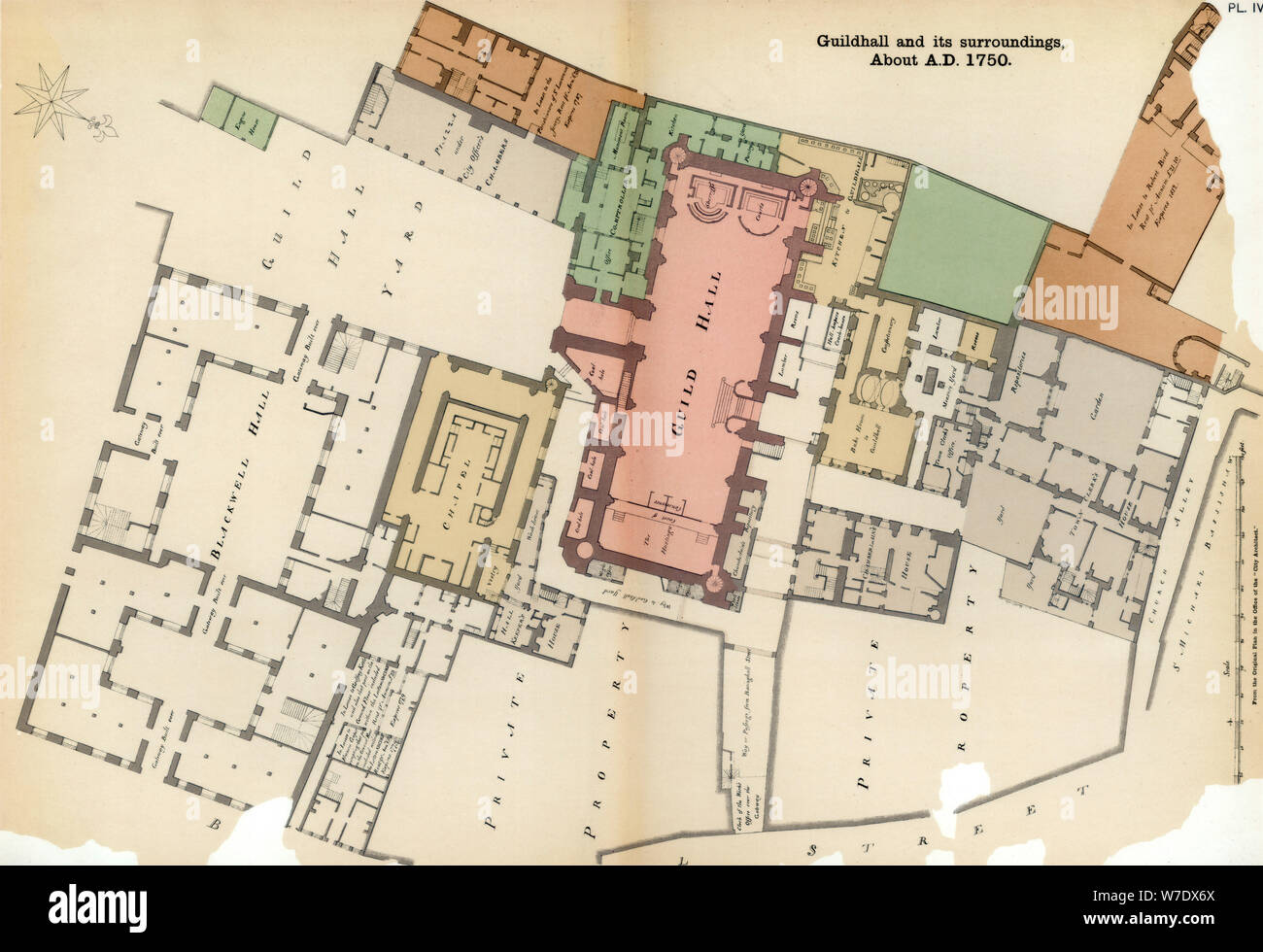 Plan of Guildhall and its surroundings, City of London, c1750 (1886). Artist: Unknown Stock Photohttps://www.alamy.com/image-license-details/?v=1https://www.alamy.com/plan-of-guildhall-and-its-surroundings-city-of-london-c1750-1886-artist-unknown-image262764066.html
RMW7DX6X–Plan of Guildhall and its surroundings, City of London, c1750 (1886). Artist: Unknown
 Vintage Map, A new and accurate survey of the parishes of St. Andrew's Holbourn, without the Freedom St. George Queen Square, St. James Clerkenwell, St. Luke Old Street, St. Mary Islington, and the Charterhouse Liberty. Cole, Benjamin, 1756 Stock Photohttps://www.alamy.com/image-license-details/?v=1https://www.alamy.com/vintage-map-a-new-and-accurate-survey-of-the-parishes-of-st-andrews-holbourn-without-the-freedom-st-george-queen-square-st-james-clerkenwell-st-luke-old-street-st-mary-islington-and-the-charterhouse-liberty-cole-benjamin-1756-image611576950.html
RM2XEYMHX–Vintage Map, A new and accurate survey of the parishes of St. Andrew's Holbourn, without the Freedom St. George Queen Square, St. James Clerkenwell, St. Luke Old Street, St. Mary Islington, and the Charterhouse Liberty. Cole, Benjamin, 1756
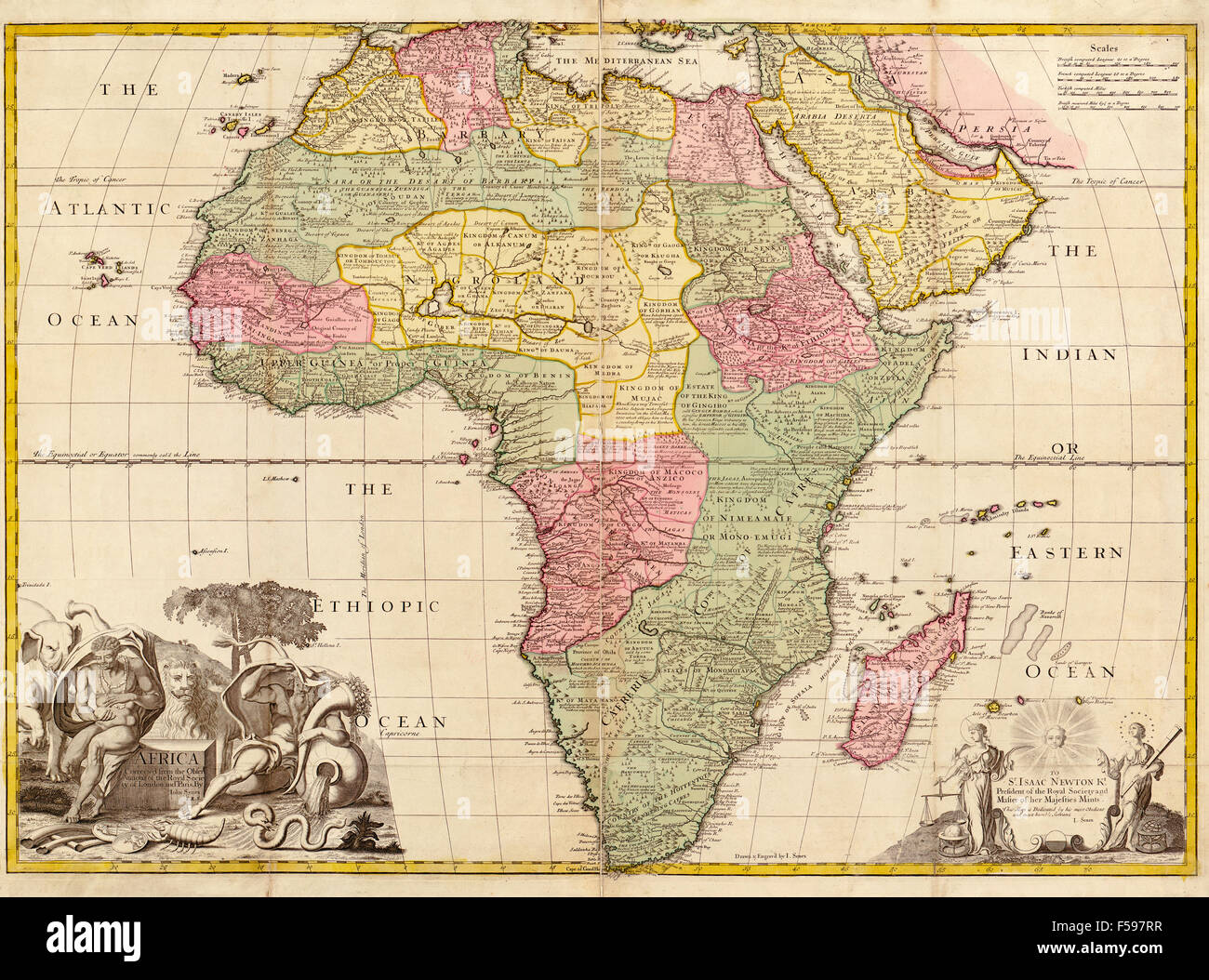 Africa circa 1725 from Modern Geography. Drawn and engraved by John Senex. The map shows boundaries of kingdoms and tribal areas on the continent as they were assumed to be in the early 18th century. Information was based on 'observations by the Royal Society of London and Paris.' Stock Photohttps://www.alamy.com/image-license-details/?v=1https://www.alamy.com/stock-photo-africa-circa-1725-from-modern-geography-drawn-and-engraved-by-john-89328843.html
RMF597RR–Africa circa 1725 from Modern Geography. Drawn and engraved by John Senex. The map shows boundaries of kingdoms and tribal areas on the continent as they were assumed to be in the early 18th century. Information was based on 'observations by the Royal Society of London and Paris.'
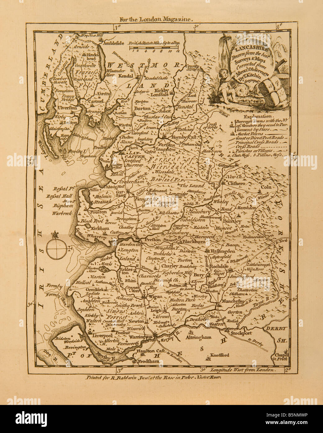 And old 18th century engraving of the county of Lancashire in England created in 1761 for the London Magazine. Stock Photohttps://www.alamy.com/image-license-details/?v=1https://www.alamy.com/stock-photo-and-old-18th-century-engraving-of-the-county-of-lancashire-in-england-20761042.html
RMB5NMWP–And old 18th century engraving of the county of Lancashire in England created in 1761 for the London Magazine.
 The American Revolution. A sketch of New London & Groton with the attacks made on Forts Trumbull & Griswold by the British Stock Photohttps://www.alamy.com/image-license-details/?v=1https://www.alamy.com/stock-photo-the-american-revolution-a-sketch-of-new-london-groton-with-the-attacks-50035208.html
RMCWB8BM–The American Revolution. A sketch of New London & Groton with the attacks made on Forts Trumbull & Griswold by the British
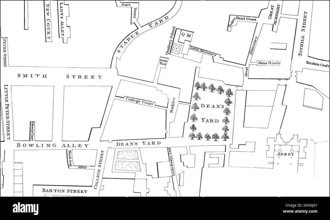 Map of Westminster, London, England, 1748 Stock Photohttps://www.alamy.com/image-license-details/?v=1https://www.alamy.com/map-of-westminster-london-england-1748-image492309859.html
RM2KGXJ6Y–Map of Westminster, London, England, 1748
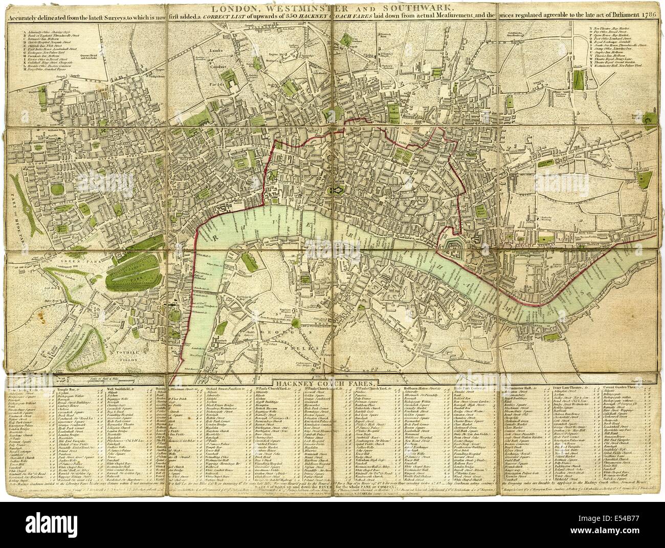 Pocket plan, stranger's guide to London and Westminster, 1786, showing Hackney and river boat fares to principle destinations Stock Photohttps://www.alamy.com/image-license-details/?v=1https://www.alamy.com/stock-photo-pocket-plan-strangers-guide-to-london-and-westminster-1786-showing-72011387.html
RME54B77–Pocket plan, stranger's guide to London and Westminster, 1786, showing Hackney and river boat fares to principle destinations
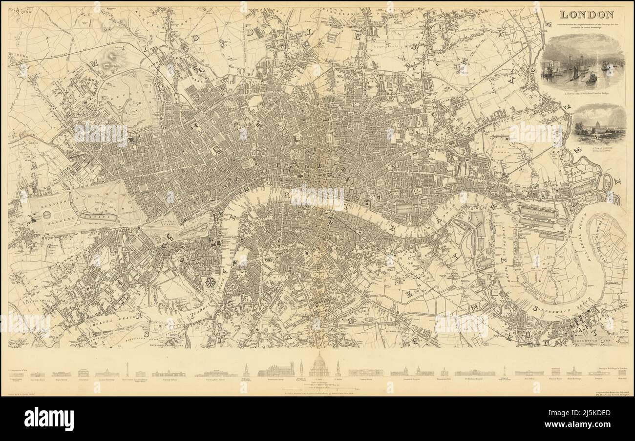 Vintage map of London and area from 17th/18th century. Map is beautifully hand illustrated and engraved showing London at the time. Stock Photohttps://www.alamy.com/image-license-details/?v=1https://www.alamy.com/vintage-map-of-london-and-area-from-17th18th-century-map-is-beautifully-hand-illustrated-and-engraved-showing-london-at-the-time-image468180901.html
RF2J5KDED–Vintage map of London and area from 17th/18th century. Map is beautifully hand illustrated and engraved showing London at the time.
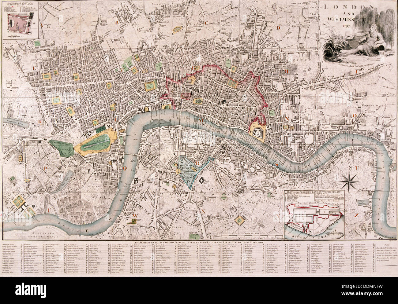 Map of London, 1797. Artist: Edward Mogg Stock Photohttps://www.alamy.com/image-license-details/?v=1https://www.alamy.com/map-of-london-1797-artist-edward-mogg-image60077581.html
RMDDMNFW–Map of London, 1797. Artist: Edward Mogg
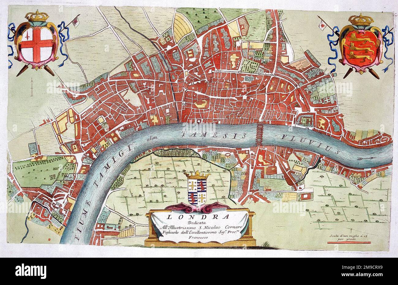 18th century Map of London and the River Thames Stock Photohttps://www.alamy.com/image-license-details/?v=1https://www.alamy.com/18th-century-map-of-london-and-the-river-thames-image504914769.html
RM2M9CRX9–18th century Map of London and the River Thames
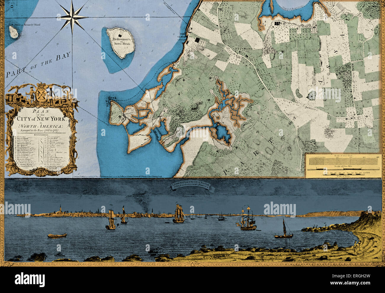 Map of the City of New York with a South West View of the City From Governor 's Island - from an engraving published in London Stock Photohttps://www.alamy.com/image-license-details/?v=1https://www.alamy.com/stock-photo-map-of-the-city-of-new-york-with-a-south-west-view-of-the-city-from-83343201.html
RMERGH2W–Map of the City of New York with a South West View of the City From Governor 's Island - from an engraving published in London
 Portrait of Richard Milles (c1735-1820) c1760. Pompeo Girolamo Batoni (1708-1787) Italian painter. London, National Gallery Stock Photohttps://www.alamy.com/image-license-details/?v=1https://www.alamy.com/portrait-of-richard-milles-c1735-1820-c1760-pompeo-girolamo-batoni-1708-1787-italian-painter-london-national-gallery-image483537114.html
RM2K2K0EJ–Portrait of Richard Milles (c1735-1820) c1760. Pompeo Girolamo Batoni (1708-1787) Italian painter. London, National Gallery
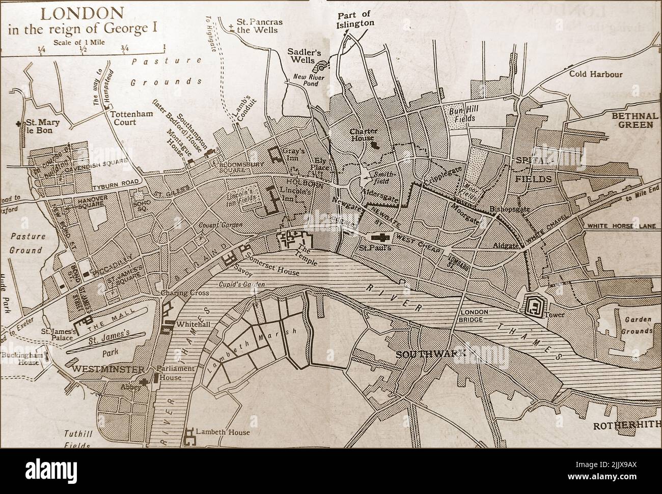 An old map of London at the time of King George I, (circa 1700s) Stock Photohttps://www.alamy.com/image-license-details/?v=1https://www.alamy.com/an-old-map-of-london-at-the-time-of-king-george-i-circa-1700s-image476321858.html
RM2JJX9AX–An old map of London at the time of King George I, (circa 1700s)
 cartography, map of the area south-west of Bruges at the time of the War of the Spanish Succession 1701 - 1714, printed in London, 1818, Siege of Ostend 1706, Affair of Wynendale 1708, Belgium, Netherlands, France, 18th century, historic, historical, Rousselaer, Dixmund, Dunkirk, Cassel, Nieuport, Ypres, Poperinge, Damme, Courtrai, Menin, Bergues, Furnes, Dunkerque, Stock Photohttps://www.alamy.com/image-license-details/?v=1https://www.alamy.com/stock-photo-cartography-map-of-the-area-south-west-of-bruges-at-the-time-of-the-28904692.html
RMBK0M6C–cartography, map of the area south-west of Bruges at the time of the War of the Spanish Succession 1701 - 1714, printed in London, 1818, Siege of Ostend 1706, Affair of Wynendale 1708, Belgium, Netherlands, France, 18th century, historic, historical, Rousselaer, Dixmund, Dunkirk, Cassel, Nieuport, Ypres, Poperinge, Damme, Courtrai, Menin, Bergues, Furnes, Dunkerque,
 A Plan of Hyde-Park with the City and the Liberties of Westminster, Map of Westminster and Hyde Park from the 18th century, Pt., I, after p. 132, 1766, John Gwynn: London and Westminster improved, illustrated by plans: to which is prefixed, a discourse on publick magnificence with observations on the state of arts and artists in this kingdom, wherein the study of the polite arts is recommended as necessary to a liberal education: concluded by some proposals relative to places not laid down in the plans. London: printed for the author ..., 1766 Stock Photohttps://www.alamy.com/image-license-details/?v=1https://www.alamy.com/a-plan-of-hyde-park-with-the-city-and-the-liberties-of-westminster-map-of-westminster-and-hyde-park-from-the-18th-century-pt-i-after-p-132-1766-john-gwynn-london-and-westminster-improved-illustrated-by-plans-to-which-is-prefixed-a-discourse-on-publick-magnificence-with-observations-on-the-state-of-arts-and-artists-in-this-kingdom-wherein-the-study-of-the-polite-arts-is-recommended-as-necessary-to-a-liberal-education-concluded-by-some-proposals-relative-to-places-not-laid-down-in-the-plans-london-printed-for-the-author-1766-image328744158.html
RM2A2RGEP–A Plan of Hyde-Park with the City and the Liberties of Westminster, Map of Westminster and Hyde Park from the 18th century, Pt., I, after p. 132, 1766, John Gwynn: London and Westminster improved, illustrated by plans: to which is prefixed, a discourse on publick magnificence with observations on the state of arts and artists in this kingdom, wherein the study of the polite arts is recommended as necessary to a liberal education: concluded by some proposals relative to places not laid down in the plans. London: printed for the author ..., 1766
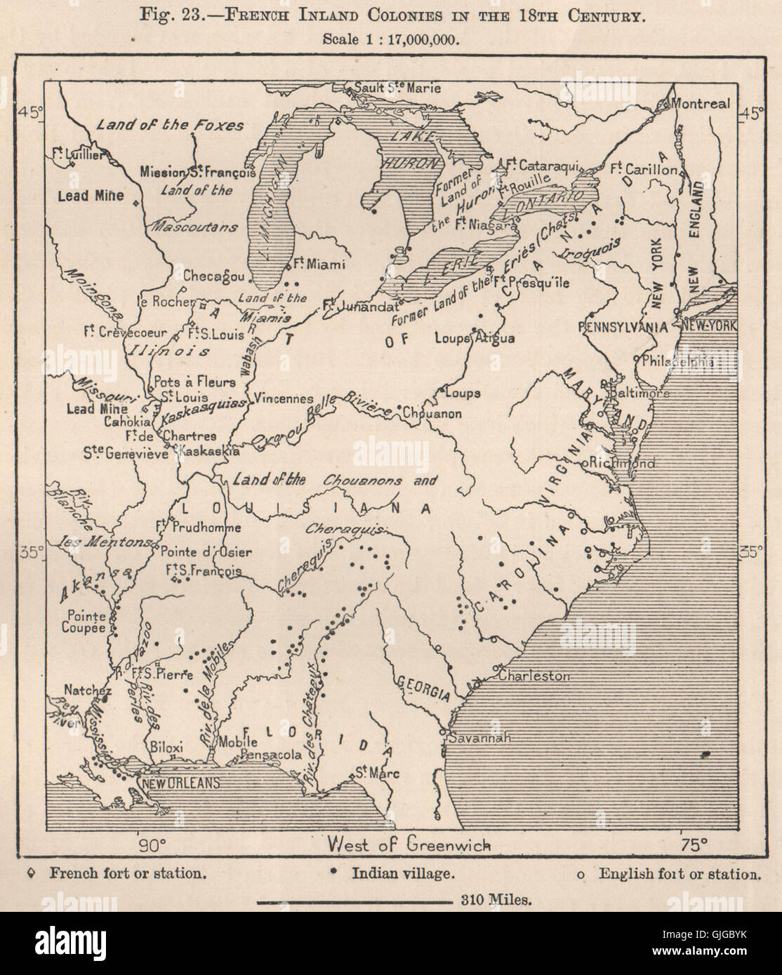 French Inland Colonies in the 18th Century. USA, 1885 antique map Stock Photohttps://www.alamy.com/image-license-details/?v=1https://www.alamy.com/stock-photo-french-inland-colonies-in-the-18th-century-usa-1885-antique-map-114686647.html
RFGJGBYK–French Inland Colonies in the 18th Century. USA, 1885 antique map
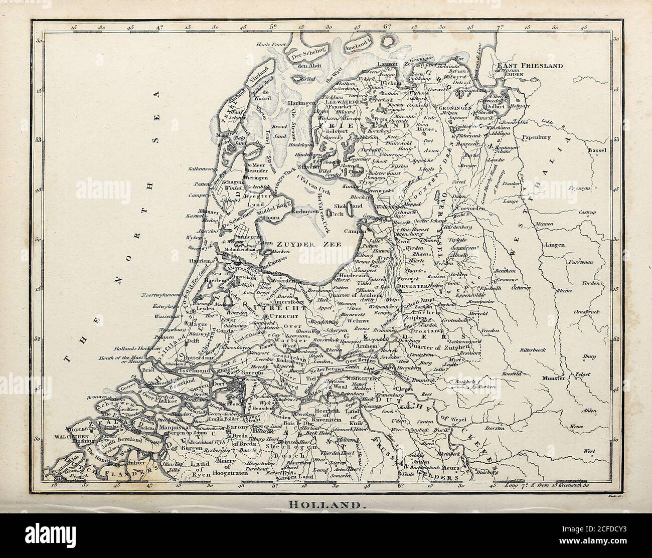 18th Century ancient map of Holland, Copperplate engraving From the Encyclopaedia Londinensis or, Universal dictionary of arts, sciences, and literature; Volume X; Edited by Wilkes, John. Published in London in 1811 Stock Photohttps://www.alamy.com/image-license-details/?v=1https://www.alamy.com/18th-century-ancient-map-of-holland-copperplate-engraving-from-the-encyclopaedia-londinensis-or-universal-dictionary-of-arts-sciences-and-literature-volume-x-edited-by-wilkes-john-published-in-london-in-1811-image370933111.html
RF2CFDCY3–18th Century ancient map of Holland, Copperplate engraving From the Encyclopaedia Londinensis or, Universal dictionary of arts, sciences, and literature; Volume X; Edited by Wilkes, John. Published in London in 1811
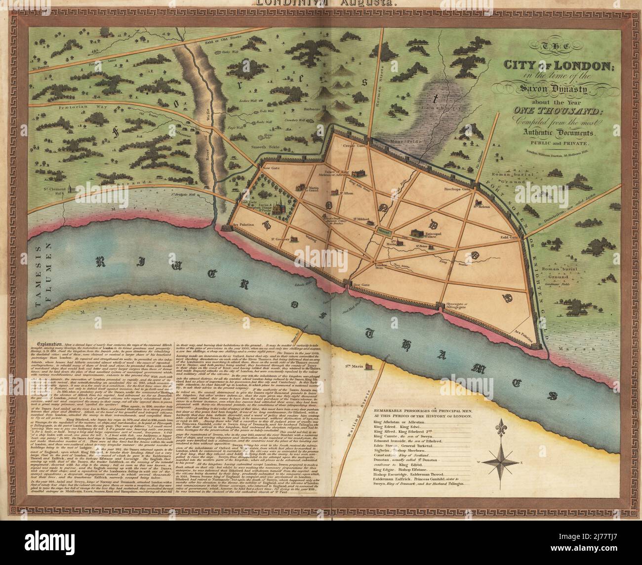 Map of London in the Anglo-Saxon era, circa 1000 AD. Walled town with Palace of King Athelstan, churches, gates (Creple, New, Lud, Doe, Bischops, Eald, Billingsgate), surrounded by fields, wells, and Roman burial grounds on the River Thames. City of London in the time of the Saxon Dynasty about the year 1000. Compiled from the most authentic documents, public and private. Handcoloured copperplate engraving published by William Darton, 58 Holborn Hill, London. circa 1810. Stock Photohttps://www.alamy.com/image-license-details/?v=1https://www.alamy.com/map-of-london-in-the-anglo-saxon-era-circa-1000-ad-walled-town-with-palace-of-king-athelstan-churches-gates-creple-new-lud-doe-bischops-eald-billingsgate-surrounded-by-fields-wells-and-roman-burial-grounds-on-the-river-thames-city-of-london-in-the-time-of-the-saxon-dynasty-about-the-year-1000-compiled-from-the-most-authentic-documents-public-and-private-handcoloured-copperplate-engraving-published-by-william-darton-58-holborn-hill-london-circa-1810-image469155519.html
RM2J77TJ7–Map of London in the Anglo-Saxon era, circa 1000 AD. Walled town with Palace of King Athelstan, churches, gates (Creple, New, Lud, Doe, Bischops, Eald, Billingsgate), surrounded by fields, wells, and Roman burial grounds on the River Thames. City of London in the time of the Saxon Dynasty about the year 1000. Compiled from the most authentic documents, public and private. Handcoloured copperplate engraving published by William Darton, 58 Holborn Hill, London. circa 1810.
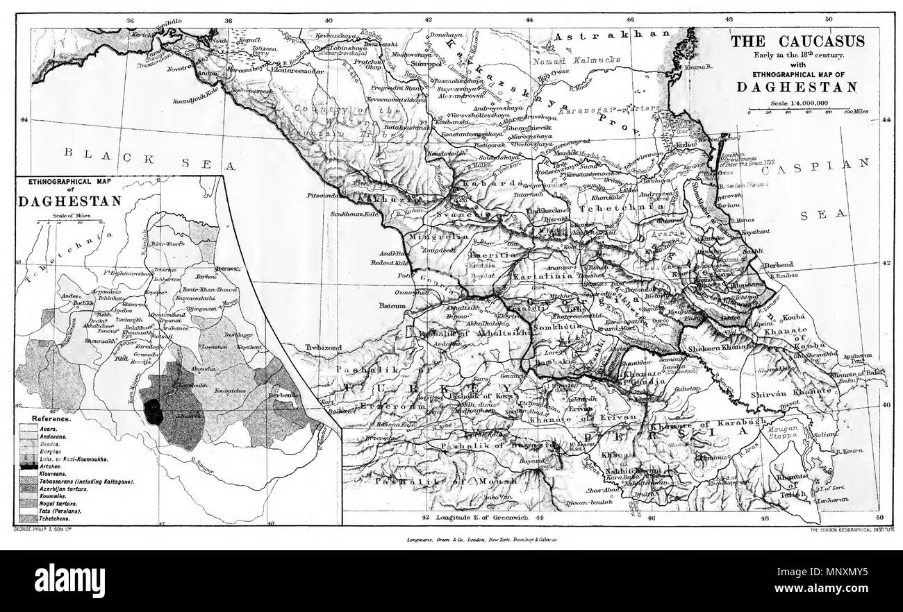 . English: The Caucasus. Early in the 18th (but judging from the map 19th) Century. With Etnographical map of Daghestan. Scale 1: 4 000 000 Türkçe: Kafkasya. 18. (fakat haritaya bakılırsa, gerçekte 19.) yüzyılın başlangıcı. Dağıstan'ın etnografik haritasıyla birlikte. Ölçek 1: 4 000 000 Русский: Кавказ. Начало 18-го (если судить по карте, в действительности 19-го) века. С этнографической картой Дагестана. Масштаб 1: 4 000 000 . 1908. English: The London Geographical Institute Türkçe: Londra Coğrafya Enstitüsü Русский: Лондонский Географический Институт 1170 The Caucasus. Early in the 18th Cent Stock Photohttps://www.alamy.com/image-license-details/?v=1https://www.alamy.com/english-the-caucasus-early-in-the-18th-but-judging-from-the-map-19th-century-with-etnographical-map-of-daghestan-scale-1-4-000-000-trke-kafkasya-18-fakat-haritaya-baklrsa-gerekte-19-yzyln-balangc-dastann-etnografik-haritasyla-birlikte-lek-1-4-000-000-18-19-1-4-000-000-1908-english-the-london-geographical-institute-trke-londra-corafya-enstits-1170-the-caucasus-early-in-the-18th-cent-image185598649.html
RMMNXMY5–. English: The Caucasus. Early in the 18th (but judging from the map 19th) Century. With Etnographical map of Daghestan. Scale 1: 4 000 000 Türkçe: Kafkasya. 18. (fakat haritaya bakılırsa, gerçekte 19.) yüzyılın başlangıcı. Dağıstan'ın etnografik haritasıyla birlikte. Ölçek 1: 4 000 000 Русский: Кавказ. Начало 18-го (если судить по карте, в действительности 19-го) века. С этнографической картой Дагестана. Масштаб 1: 4 000 000 . 1908. English: The London Geographical Institute Türkçe: Londra Coğrafya Enstitüsü Русский: Лондонский Географический Институт 1170 The Caucasus. Early in the 18th Cent
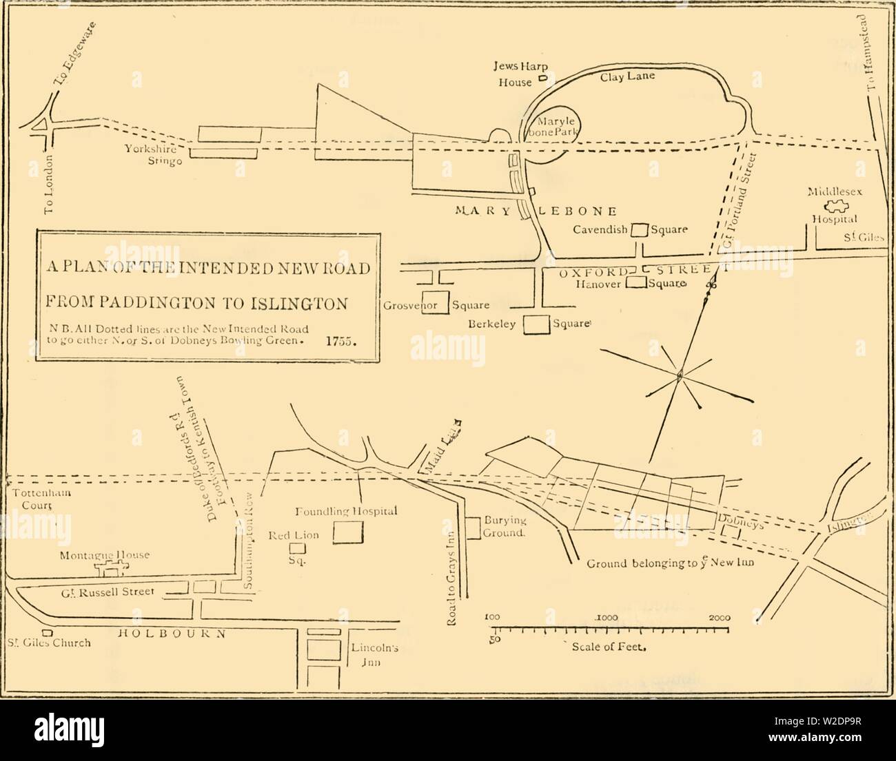 'Ground Plan of New Road from Islington to Edgware Road, 1755', (c1876). Creator: Unknown. Stock Photohttps://www.alamy.com/image-license-details/?v=1https://www.alamy.com/ground-plan-of-new-road-from-islington-to-edgware-road-1755-c1876-creator-unknown-image259687731.html
RMW2DP9R–'Ground Plan of New Road from Islington to Edgware Road, 1755', (c1876). Creator: Unknown.
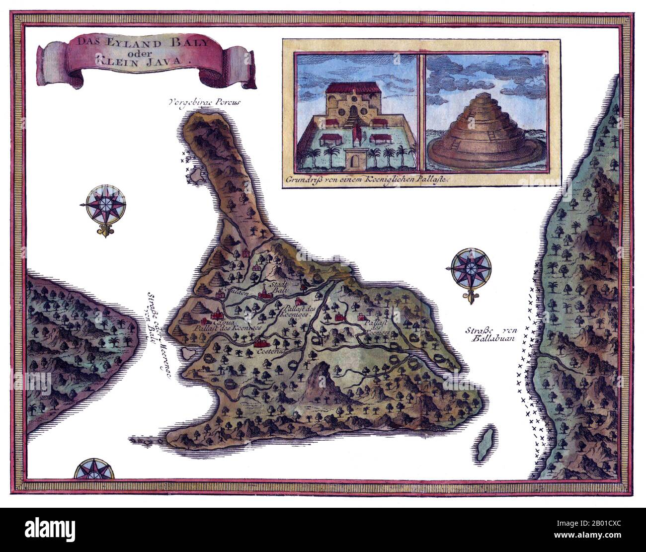 Indonesia: Map of Bali by Jacques-Nicolas Bellin (1703 - 21 March 1772), 1760. Jacques-Nicolas Bellin was a French hydrographer, geographer, and member of the French intellectual group called the philosophes. Bellin was born in Paris. He was hydrographer of France's hydrographic office, member of the Académie de Marine and of the Royal Society of London. Over a 50 year career, he produced a large number of maps of particular interest to the Ministère de la Marine. His maps of Canada and of French territories in North America (New France, Acadia, Louisiana) are particularly valuable. He died Stock Photohttps://www.alamy.com/image-license-details/?v=1https://www.alamy.com/indonesia-map-of-bali-by-jacques-nicolas-bellin-1703-21-march-1772-1760-jacques-nicolas-bellin-was-a-french-hydrographer-geographer-and-member-of-the-french-intellectual-group-called-the-philosophes-bellin-was-born-in-paris-he-was-hydrographer-of-frances-hydrographic-office-member-of-the-acadmie-de-marine-and-of-the-royal-society-of-london-over-a-50-year-career-he-produced-a-large-number-of-maps-of-particular-interest-to-the-ministre-de-la-marine-his-maps-of-canada-and-of-french-territories-in-north-america-new-france-acadia-louisiana-are-particularly-valuable-he-died-image344239460.html
RM2B01CXC–Indonesia: Map of Bali by Jacques-Nicolas Bellin (1703 - 21 March 1772), 1760. Jacques-Nicolas Bellin was a French hydrographer, geographer, and member of the French intellectual group called the philosophes. Bellin was born in Paris. He was hydrographer of France's hydrographic office, member of the Académie de Marine and of the Royal Society of London. Over a 50 year career, he produced a large number of maps of particular interest to the Ministère de la Marine. His maps of Canada and of French territories in North America (New France, Acadia, Louisiana) are particularly valuable. He died
 Tate Britain, London, UK. 1 November 2021. Hogarth & Europe (3 Nov 21-20 Mar 22). This major exhibition presents William Hogarth (1697-1764), one of Britain’s most famous painters, in a new light. Hogarth & Europe shows his work alongside artists from across the continent, comparing how Hogarth depicted London with other artists depictions of European cities such as Amsterdam, Venice and Paris. Image: Map of Hogarth’s London. Credit: Malcolm Park/Alamy Live News. Stock Photohttps://www.alamy.com/image-license-details/?v=1https://www.alamy.com/tate-britain-london-uk-1-november-2021-hogarth-europe-3-nov-21-20-mar-22-thismajor-exhibitionpresents-william-hogarth-1697-1764-one-of-britains-most-famous-painters-in-a-new-light-hogarth-europe-shows-his-work-alongside-artists-from-across-the-continent-comparing-how-hogarth-depicted-london-with-other-artists-depictions-of-european-cities-such-as-amsterdam-venice-and-paris-image-map-of-hogarths-london-credit-malcolm-parkalamy-live-news-image450118311.html
RM2H48JDY–Tate Britain, London, UK. 1 November 2021. Hogarth & Europe (3 Nov 21-20 Mar 22). This major exhibition presents William Hogarth (1697-1764), one of Britain’s most famous painters, in a new light. Hogarth & Europe shows his work alongside artists from across the continent, comparing how Hogarth depicted London with other artists depictions of European cities such as Amsterdam, Venice and Paris. Image: Map of Hogarth’s London. Credit: Malcolm Park/Alamy Live News.
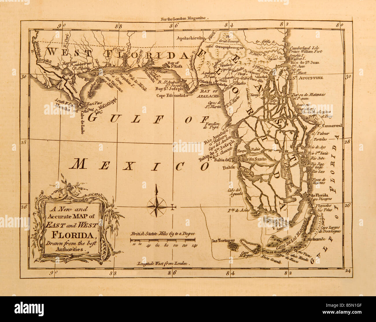 An old map of the state of Florida in America made in 1764 for the London Magazine Stock Photohttps://www.alamy.com/image-license-details/?v=1https://www.alamy.com/stock-photo-an-old-map-of-the-state-of-florida-in-america-made-in-1764-for-the-20745887.html
RMB5N1GF–An old map of the state of Florida in America made in 1764 for the London Magazine
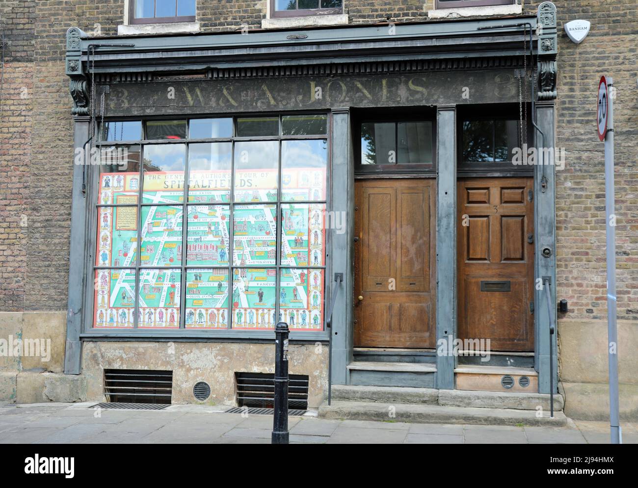 The Gentle Authors Tour of Spitalfields map in the window of 8 Fournier Street in the East End of London Stock Photohttps://www.alamy.com/image-license-details/?v=1https://www.alamy.com/the-gentle-authors-tour-of-spitalfields-map-in-the-window-of-8-fournier-street-in-the-east-end-of-london-image470313562.html
RM2J94HMX–The Gentle Authors Tour of Spitalfields map in the window of 8 Fournier Street in the East End of London
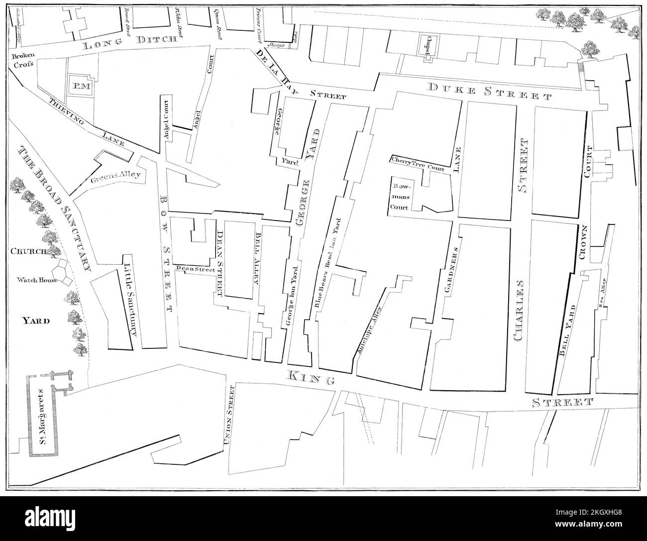 Map of Westminster, London, England, 1740 Stock Photohttps://www.alamy.com/image-license-details/?v=1https://www.alamy.com/map-of-westminster-london-england-1740-image492309336.html
RM2KGXHG8–Map of Westminster, London, England, 1740
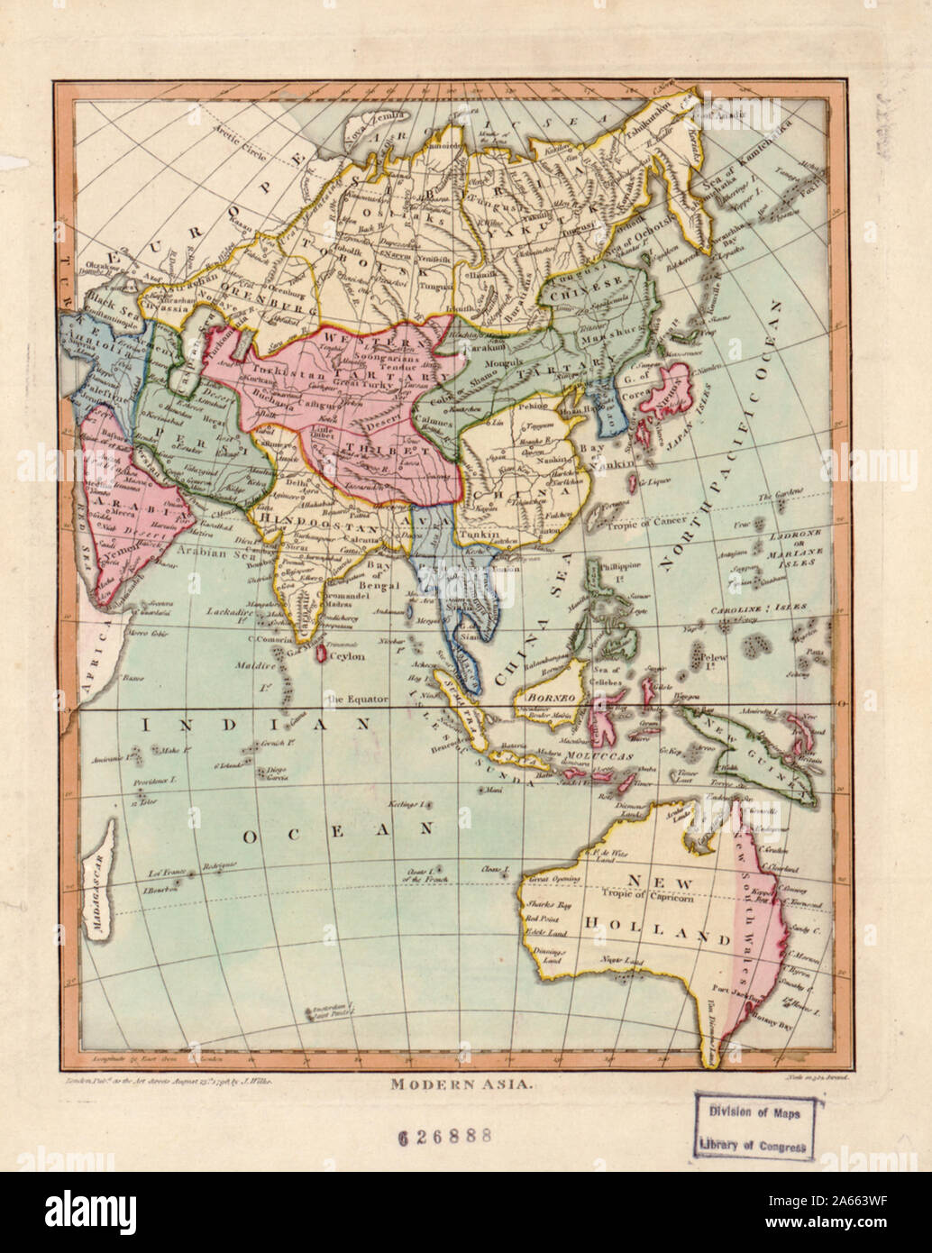 John Wilkes was a London publisher best known for his Encyclopaedia Londinensis; or, universal dictionary of arts, sciences, and literature (1801-28). Wilkes frequently worked with Samuel John Neele, the engraver of this hand-colored map of “modern Asia.” The map reflects late 18th-century European geographic conceptions and terminology. India is referred to as “Hindoostan,” while much of the interior is shown as comprised of “Western Tartary” and “Chinese Tartary.” “Tartary” was a designation applied by Europeans to those parts of Asia inhabited by nomadic Turkic and Mongol peoples. This map Stock Photohttps://www.alamy.com/image-license-details/?v=1https://www.alamy.com/john-wilkes-was-a-london-publisher-best-known-for-his-encyclopaedia-londinensis-or-universal-dictionary-of-arts-sciences-and-literature-1801-28-wilkes-frequently-worked-with-samuel-john-neele-the-engraver-of-this-hand-colored-map-of-modern-asia-the-map-reflects-late-18th-century-european-geographic-conceptions-and-terminology-india-is-referred-to-as-hindoostan-while-much-of-the-interior-is-shown-as-comprised-of-western-tartary-and-chinese-tartary-tartary-was-a-designation-applied-by-europeans-to-those-parts-of-asia-inhabited-by-nomadic-turkic-and-mongol-peoples-this-map-image330819707.html
RM2A663WF–John Wilkes was a London publisher best known for his Encyclopaedia Londinensis; or, universal dictionary of arts, sciences, and literature (1801-28). Wilkes frequently worked with Samuel John Neele, the engraver of this hand-colored map of “modern Asia.” The map reflects late 18th-century European geographic conceptions and terminology. India is referred to as “Hindoostan,” while much of the interior is shown as comprised of “Western Tartary” and “Chinese Tartary.” “Tartary” was a designation applied by Europeans to those parts of Asia inhabited by nomadic Turkic and Mongol peoples. This map
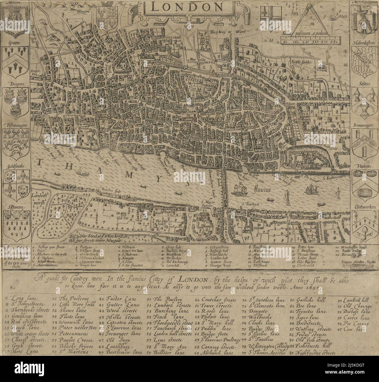 Vintage map of London and area from 17th/18th century. Map is beautifully hand illustrated and engraved showing London at the time. Stock Photohttps://www.alamy.com/image-license-details/?v=1https://www.alamy.com/vintage-map-of-london-and-area-from-17th18th-century-map-is-beautifully-hand-illustrated-and-engraved-showing-london-at-the-time-image468180968.html
RF2J5KDGT–Vintage map of London and area from 17th/18th century. Map is beautifully hand illustrated and engraved showing London at the time.
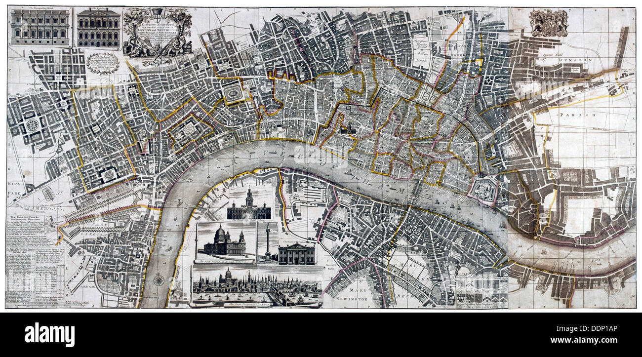 Map of the City of London, City of Westminster, River Thames, Lambeth and Southwark, 1736. Artist: Anon Stock Photohttps://www.alamy.com/image-license-details/?v=1https://www.alamy.com/map-of-the-city-of-london-city-of-westminster-river-thames-lambeth-image60105662.html
RMDDP1AP–Map of the City of London, City of Westminster, River Thames, Lambeth and Southwark, 1736. Artist: Anon
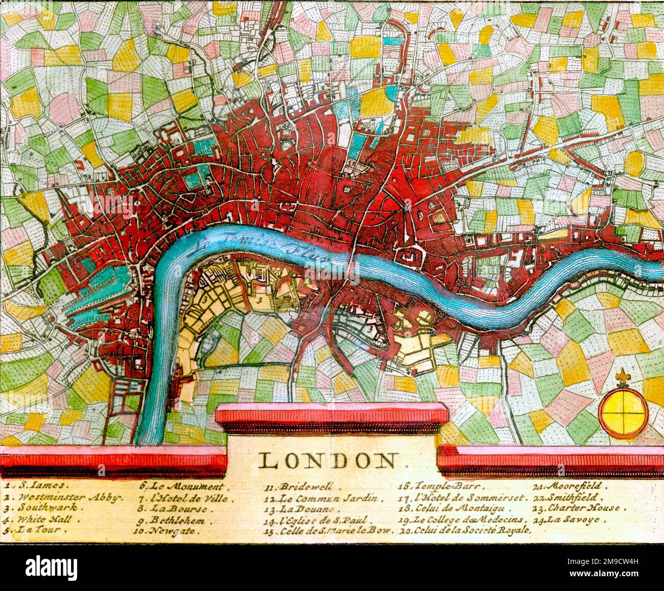 18th century Map of London and River Thames, England Stock Photohttps://www.alamy.com/image-license-details/?v=1https://www.alamy.com/18th-century-map-of-london-and-river-thames-england-image504915729.html
RM2M9CW4H–18th century Map of London and River Thames, England
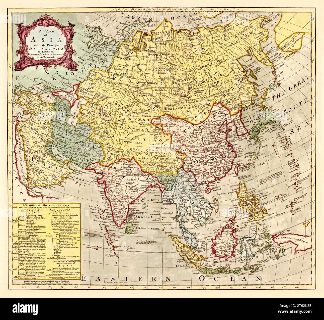 Old map of Asia. By Palairet, publ. In London, 18th century Stock Photohttps://www.alamy.com/image-license-details/?v=1https://www.alamy.com/old-map-of-asia-by-palairet-publ-in-london-18th-century-image571689115.html
RF2T62K8B–Old map of Asia. By Palairet, publ. In London, 18th century
 Marshalsea prison, London, 18th century Stock Photohttps://www.alamy.com/image-license-details/?v=1https://www.alamy.com/stock-photo-marshalsea-prison-london-18th-century-142956691.html
RMJ8G6M3–Marshalsea prison, London, 18th century
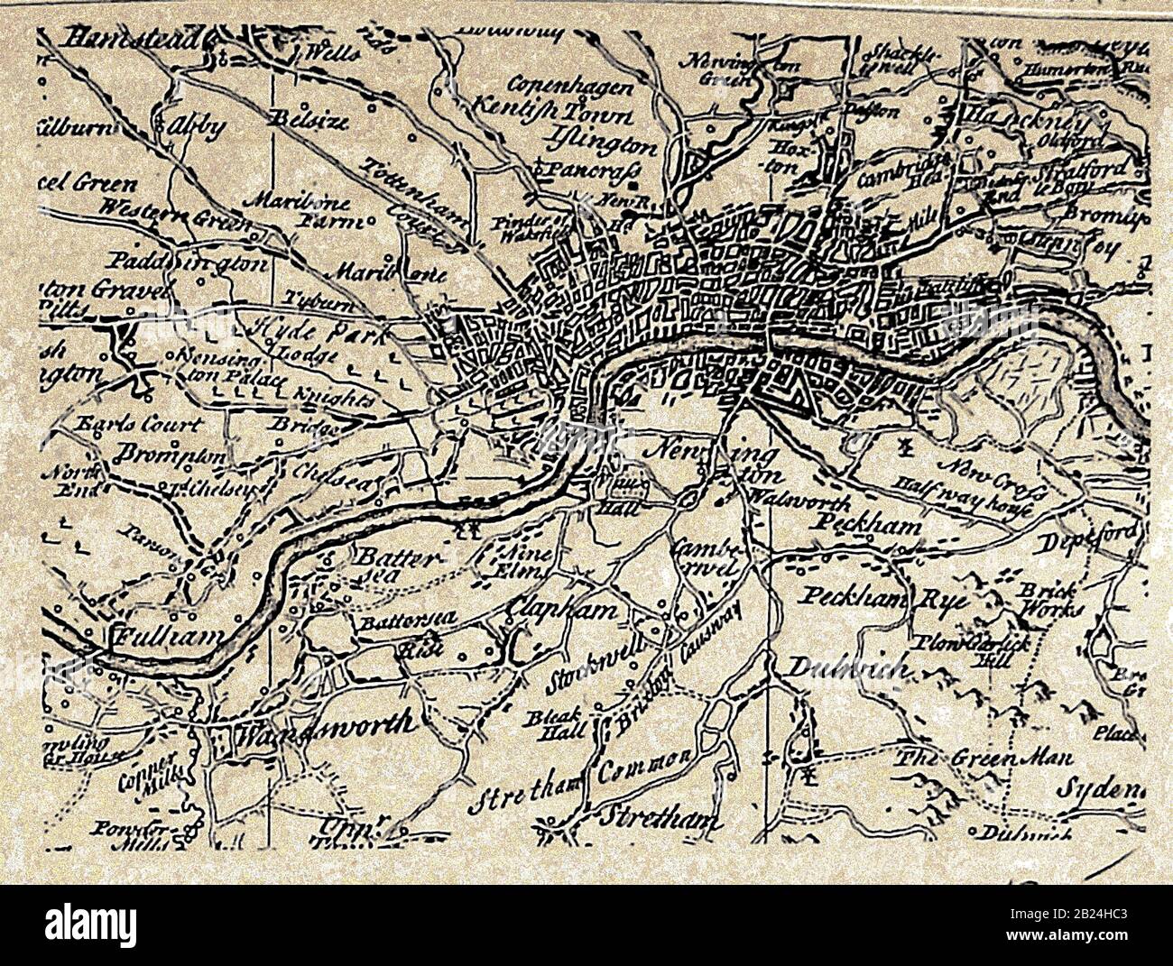 A map of the city of London (UK) , villages, inns, surrounds etc in the 1700's, with spellings at that time Stock Photohttps://www.alamy.com/image-license-details/?v=1https://www.alamy.com/a-map-of-the-city-of-london-uk-villages-inns-surrounds-etc-in-the-1700s-with-spellings-at-that-time-image345538147.html
RM2B24HC3–A map of the city of London (UK) , villages, inns, surrounds etc in the 1700's, with spellings at that time
 cartography, map of the area around Ghent and Brussels, at the time of the War of the Spanish Succession 1701 - 1714, published in London, 1818, Belgium, Netherlands, 18th century, maps, historic, historical, 1707, 1708, Oudenaarde, Oudenarde, Tournay, Valenciennes, Charleroi, Louvain, Antwerp, Courtrai, Ath, Mons, Maubeuge, Conde, Leuse, Malines, Mecheln, Sambre, Scheldt, Scheld, Damme, Ardenburg, The Sluys, Sluis, Stock Photohttps://www.alamy.com/image-license-details/?v=1https://www.alamy.com/stock-photo-cartography-map-of-the-area-around-ghent-and-brussels-at-the-time-28906173.html
RMBK0P39–cartography, map of the area around Ghent and Brussels, at the time of the War of the Spanish Succession 1701 - 1714, published in London, 1818, Belgium, Netherlands, 18th century, maps, historic, historical, 1707, 1708, Oudenaarde, Oudenarde, Tournay, Valenciennes, Charleroi, Louvain, Antwerp, Courtrai, Ath, Mons, Maubeuge, Conde, Leuse, Malines, Mecheln, Sambre, Scheldt, Scheld, Damme, Ardenburg, The Sluys, Sluis,
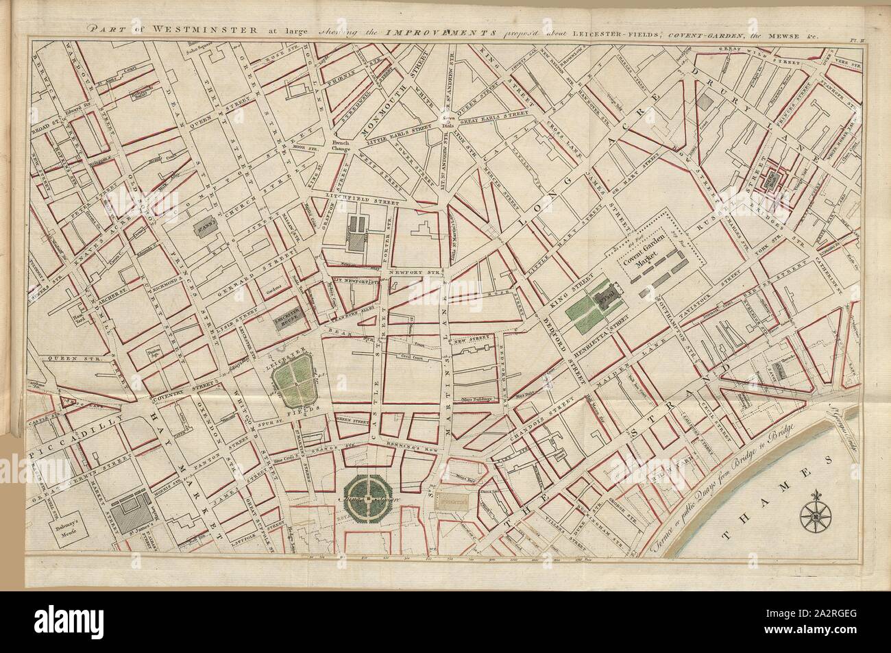 Part of Westminster at large shewing the Improvements propos'd about Leicester - Fields, Covent - Garden, the Mewse & c., 18th century map of Westminster, Pt., II, after p. 132, 1766, John Gwynn: London and Westminster improved, illustrated by plans: to which is prefixed, a discourse on publick magnificence with observations on the state of arts and artists in this kingdom, wherein the study of the polite arts is recommended as necessary to a liberal education: concluded by some proposals relative to places not laid down in the plans. London: printed for the author ..., 1766 Stock Photohttps://www.alamy.com/image-license-details/?v=1https://www.alamy.com/part-of-westminster-at-large-shewing-the-improvements-proposd-about-leicester-fields-covent-garden-the-mewse-c-18th-century-map-of-westminster-pt-ii-after-p-132-1766-john-gwynn-london-and-westminster-improved-illustrated-by-plans-to-which-is-prefixed-a-discourse-on-publick-magnificence-with-observations-on-the-state-of-arts-and-artists-in-this-kingdom-wherein-the-study-of-the-polite-arts-is-recommended-as-necessary-to-a-liberal-education-concluded-by-some-proposals-relative-to-places-not-laid-down-in-the-plans-london-printed-for-the-author-1766-image328744152.html
RM2A2RGEG–Part of Westminster at large shewing the Improvements propos'd about Leicester - Fields, Covent - Garden, the Mewse & c., 18th century map of Westminster, Pt., II, after p. 132, 1766, John Gwynn: London and Westminster improved, illustrated by plans: to which is prefixed, a discourse on publick magnificence with observations on the state of arts and artists in this kingdom, wherein the study of the polite arts is recommended as necessary to a liberal education: concluded by some proposals relative to places not laid down in the plans. London: printed for the author ..., 1766
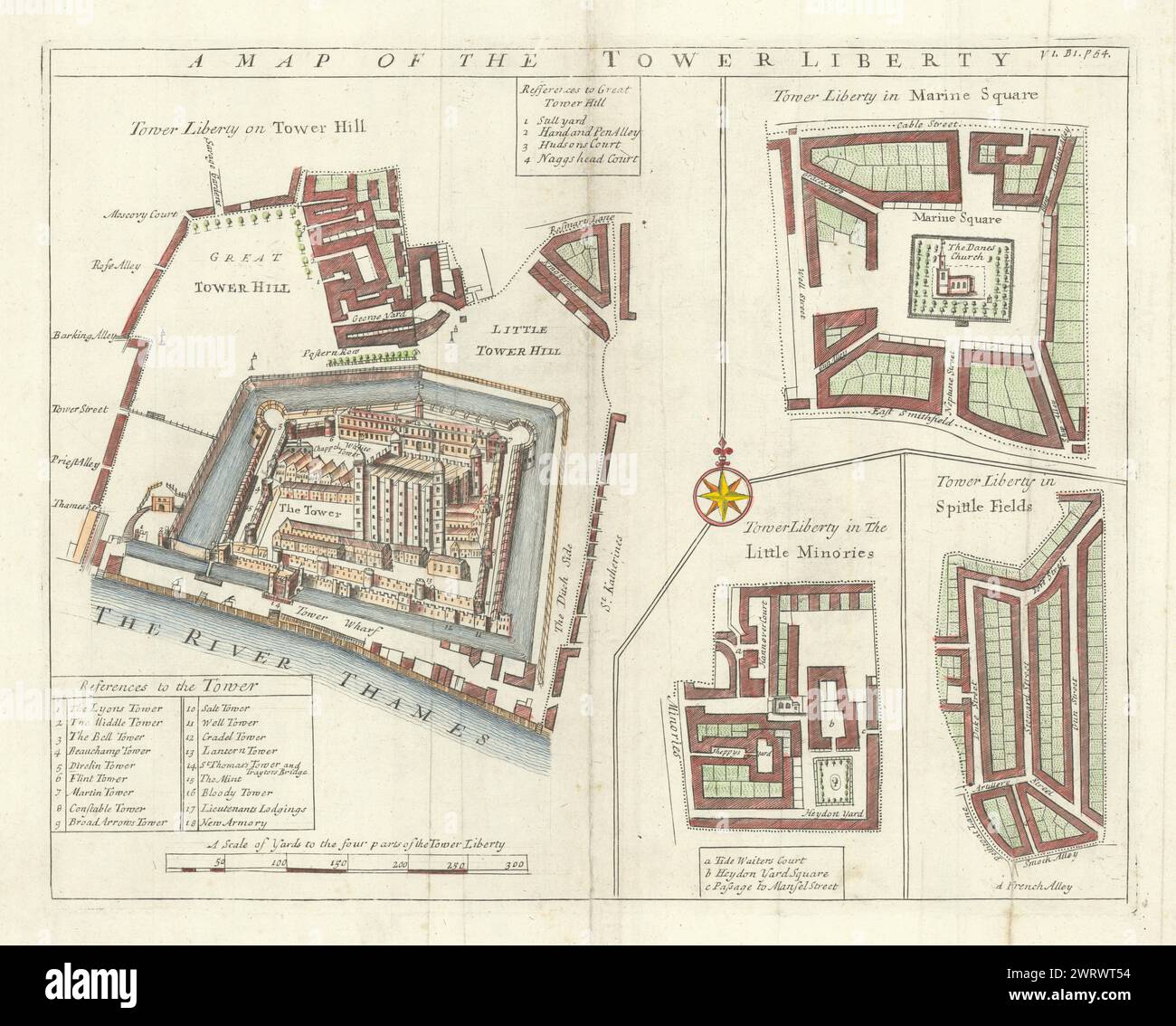 'Map of the the Tower Liberty'. Tower of London/Tower Hill. STOW/STRYPE 1720 Stock Photohttps://www.alamy.com/image-license-details/?v=1https://www.alamy.com/map-of-the-the-tower-liberty-tower-of-londontower-hill-stowstrype-1720-image599857360.html
RF2WRWT54–'Map of the the Tower Liberty'. Tower of London/Tower Hill. STOW/STRYPE 1720
![18th Century ancient map of Hindoostan [Hindustan] or Modern India and the Indian subcontinent. Copperplate engraving From the Encyclopaedia Londinensis or, Universal dictionary of arts, sciences, and literature; Volume X; Edited by Wilkes, John. Published in London in 1811 Stock Photo 18th Century ancient map of Hindoostan [Hindustan] or Modern India and the Indian subcontinent. Copperplate engraving From the Encyclopaedia Londinensis or, Universal dictionary of arts, sciences, and literature; Volume X; Edited by Wilkes, John. Published in London in 1811 Stock Photo](https://c8.alamy.com/comp/2CFDBPG/18th-century-ancient-map-of-hindoostan-hindustan-or-modern-india-and-the-indian-subcontinent-copperplate-engraving-from-the-encyclopaedia-londinensis-or-universal-dictionary-of-arts-sciences-and-literature-volume-x-edited-by-wilkes-john-published-in-london-in-1811-2CFDBPG.jpg) 18th Century ancient map of Hindoostan [Hindustan] or Modern India and the Indian subcontinent. Copperplate engraving From the Encyclopaedia Londinensis or, Universal dictionary of arts, sciences, and literature; Volume X; Edited by Wilkes, John. Published in London in 1811 Stock Photohttps://www.alamy.com/image-license-details/?v=1https://www.alamy.com/18th-century-ancient-map-of-hindoostan-hindustan-or-modern-india-and-the-indian-subcontinent-copperplate-engraving-from-the-encyclopaedia-londinensis-or-universal-dictionary-of-arts-sciences-and-literature-volume-x-edited-by-wilkes-john-published-in-london-in-1811-image370932200.html
18th Century ancient map of Hindoostan [Hindustan] or Modern India and the Indian subcontinent. Copperplate engraving From the Encyclopaedia Londinensis or, Universal dictionary of arts, sciences, and literature; Volume X; Edited by Wilkes, John. Published in London in 1811 Stock Photohttps://www.alamy.com/image-license-details/?v=1https://www.alamy.com/18th-century-ancient-map-of-hindoostan-hindustan-or-modern-india-and-the-indian-subcontinent-copperplate-engraving-from-the-encyclopaedia-londinensis-or-universal-dictionary-of-arts-sciences-and-literature-volume-x-edited-by-wilkes-john-published-in-london-in-1811-image370932200.htmlRF2CFDBPG–18th Century ancient map of Hindoostan [Hindustan] or Modern India and the Indian subcontinent. Copperplate engraving From the Encyclopaedia Londinensis or, Universal dictionary of arts, sciences, and literature; Volume X; Edited by Wilkes, John. Published in London in 1811
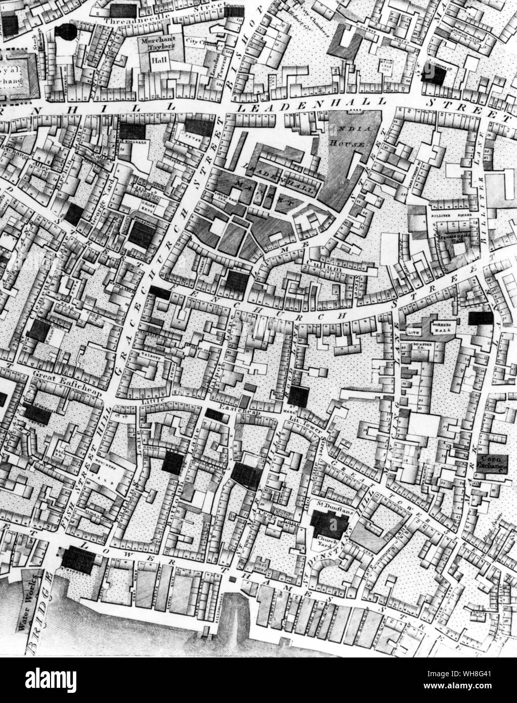 Horwoods plan of London 1792, showing Harp Lane and Mincing Lane. Stock Photohttps://www.alamy.com/image-license-details/?v=1https://www.alamy.com/horwoods-plan-of-london-1792-showing-harp-lane-and-mincing-lane-image268792945.html
RMWH8G41–Horwoods plan of London 1792, showing Harp Lane and Mincing Lane.
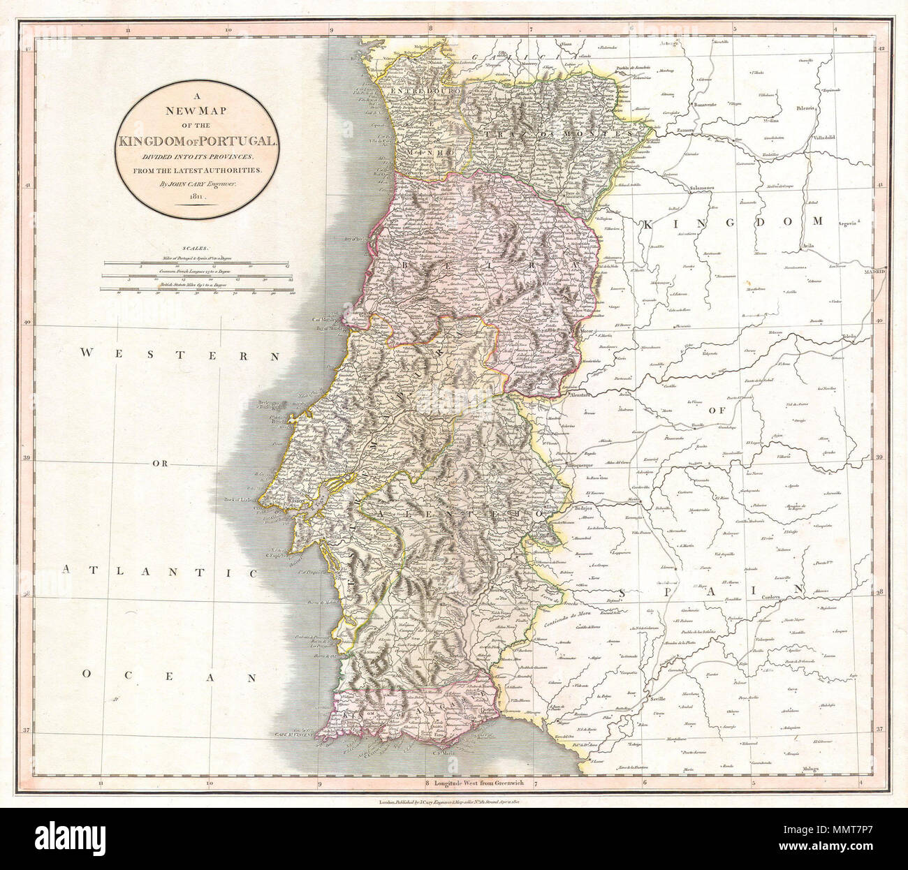 . English: This is a stunning 1811 map of Portugal by the important late 18th / early 19th century Edinburgh cartographer John Cary. Fully depicts the country and its various regions. The popular resort province of Algarve, is listed as its own Kingdom. Dated, London, April 21, 1811. A New Map of the Kingdom of Portugal. Divided into its Provinces. From the Latest Authorities.. 1811. 1811 Cary Map of the Kingdom of Portugal - Geographicus - Portugal-cary-1811 Stock Photohttps://www.alamy.com/image-license-details/?v=1https://www.alamy.com/english-this-is-a-stunning-1811-map-of-portugal-by-the-important-late-18th-early-19th-century-edinburgh-cartographer-john-cary-fully-depicts-the-country-and-its-various-regions-the-popular-resort-province-of-algarve-is-listed-as-its-own-kingdom-dated-london-april-21-1811-a-new-map-of-the-kingdom-of-portugal-divided-into-its-provinces-from-the-latest-authorities-1811-1811-cary-map-of-the-kingdom-of-portugal-geographicus-portugal-cary-1811-image184929759.html
RMMMT7P7–. English: This is a stunning 1811 map of Portugal by the important late 18th / early 19th century Edinburgh cartographer John Cary. Fully depicts the country and its various regions. The popular resort province of Algarve, is listed as its own Kingdom. Dated, London, April 21, 1811. A New Map of the Kingdom of Portugal. Divided into its Provinces. From the Latest Authorities.. 1811. 1811 Cary Map of the Kingdom of Portugal - Geographicus - Portugal-cary-1811
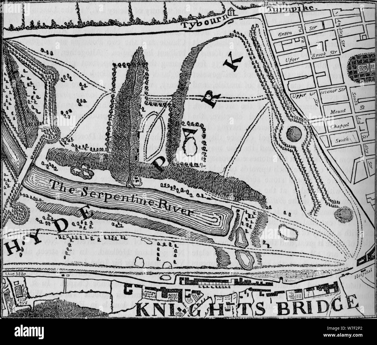 Map of Hyde Park, London, 1748 (1878). Artist: John Pine. Stock Photohttps://www.alamy.com/image-license-details/?v=1https://www.alamy.com/map-of-hyde-park-london-1748-1878-artist-john-pine-image262789578.html
RMW7F2P2–Map of Hyde Park, London, 1748 (1878). Artist: John Pine.
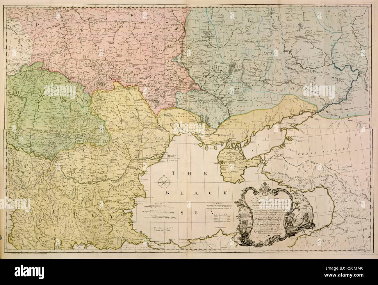 An 18th century map of Eastern Europe. To His Excellency the Count of Czernichew... this. London, 1770. Source: Maps.Roll.507,. Language: English. Author: Dury, Andrew. Stock Photohttps://www.alamy.com/image-license-details/?v=1https://www.alamy.com/an-18th-century-map-of-eastern-europe-to-his-excellency-the-count-of-czernichew-this-london-1770-source-mapsroll507-language-english-author-dury-andrew-image226956022.html
RMR56MM6–An 18th century map of Eastern Europe. To His Excellency the Count of Czernichew... this. London, 1770. Source: Maps.Roll.507,. Language: English. Author: Dury, Andrew.
 Tate Britain, London, UK. 1 November 2021. Hogarth & Europe (3 Nov 21-20 Mar 22). This major exhibition presents William Hogarth (1697-1764), one of Britain’s most famous painters, in a new light. Hogarth & Europe shows his work alongside artists from across the continent, comparing how Hogarth depicted London with other artists depictions of European cities such as Amsterdam, Venice and Paris. Image: Map of Hogarth’s London. Credit: Malcolm Park/Alamy Live News. Stock Photohttps://www.alamy.com/image-license-details/?v=1https://www.alamy.com/tate-britain-london-uk-1-november-2021-hogarth-europe-3-nov-21-20-mar-22-thismajor-exhibitionpresents-william-hogarth-1697-1764-one-of-britains-most-famous-painters-in-a-new-light-hogarth-europe-shows-his-work-alongside-artists-from-across-the-continent-comparing-how-hogarth-depicted-london-with-other-artists-depictions-of-european-cities-such-as-amsterdam-venice-and-paris-image-map-of-hogarths-london-credit-malcolm-parkalamy-live-news-image450118301.html
RM2H48JDH–Tate Britain, London, UK. 1 November 2021. Hogarth & Europe (3 Nov 21-20 Mar 22). This major exhibition presents William Hogarth (1697-1764), one of Britain’s most famous painters, in a new light. Hogarth & Europe shows his work alongside artists from across the continent, comparing how Hogarth depicted London with other artists depictions of European cities such as Amsterdam, Venice and Paris. Image: Map of Hogarth’s London. Credit: Malcolm Park/Alamy Live News.
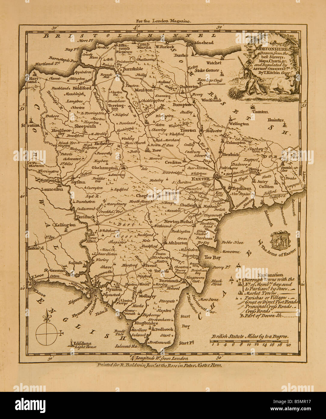 An old map of Devon County known then as Devonshire It was engraved in 1761 for the London Magazine Stock Photohttps://www.alamy.com/image-license-details/?v=1https://www.alamy.com/stock-photo-an-old-map-of-devon-county-known-then-as-devonshire-it-was-engraved-20740755.html
RMB5MR17–An old map of Devon County known then as Devonshire It was engraved in 1761 for the London Magazine
 A walker & his dog pause to check the map on Pont Scethin, Ardudwy, Snowdonia, Wales, an C18th bridge used by drovers and the London to Harlech coach. Stock Photohttps://www.alamy.com/image-license-details/?v=1https://www.alamy.com/a-walker-his-dog-pause-to-check-the-map-on-pont-scethin-ardudwy-snowdonia-image61740872.html
RMDGCF34–A walker & his dog pause to check the map on Pont Scethin, Ardudwy, Snowdonia, Wales, an C18th bridge used by drovers and the London to Harlech coach.
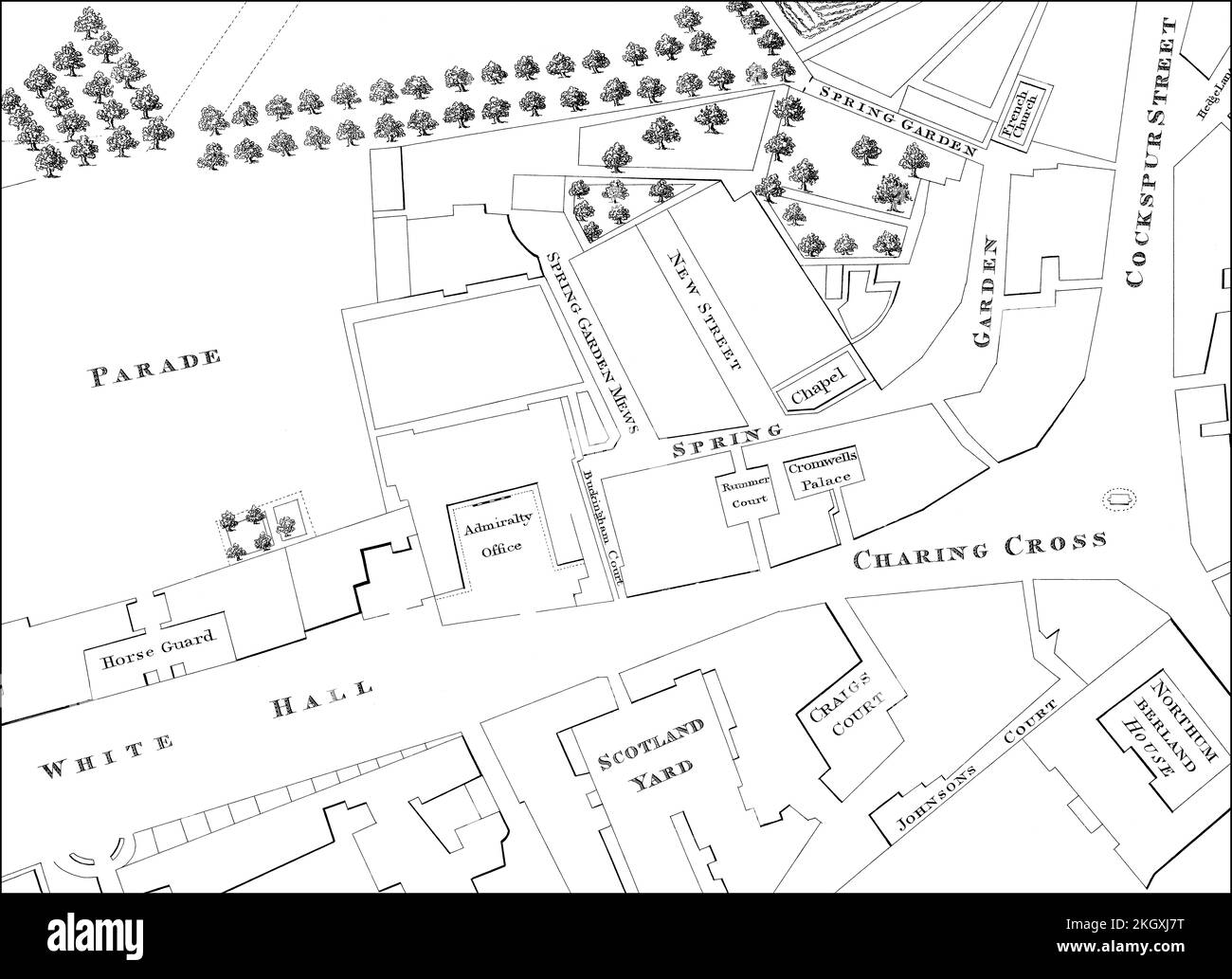 Map of Westminster, London, England, 1740 Stock Photohttps://www.alamy.com/image-license-details/?v=1https://www.alamy.com/map-of-westminster-london-england-1740-image492309884.html
RM2KGXJ7T–Map of Westminster, London, England, 1740
 front left: Neal Davies (Ariodates), Katarina Karneus (Xerxes) in XERXES at English National Opera (ENO), London Coliseum, London WC2 19/11/2005 music: George Frideric Handel text: Nicolo Minato conductor: Harry Bicket design: David Fielding lighting: Paul Pyant translator & director: Nicholas Hytner Stock Photohttps://www.alamy.com/image-license-details/?v=1https://www.alamy.com/front-left-neal-davies-ariodates-katarina-karneus-xerxes-in-xerxes-at-english-national-opera-eno-london-coliseum-london-wc2-19112005-music-george-frideric-handel-text-nicolo-minato-conductor-harry-bicket-design-david-fielding-lighting-paul-pyant-translator-director-nicholas-hytner-image616282966.html
RM2XPJ35X–front left: Neal Davies (Ariodates), Katarina Karneus (Xerxes) in XERXES at English National Opera (ENO), London Coliseum, London WC2 19/11/2005 music: George Frideric Handel text: Nicolo Minato conductor: Harry Bicket design: David Fielding lighting: Paul Pyant translator & director: Nicholas Hytner
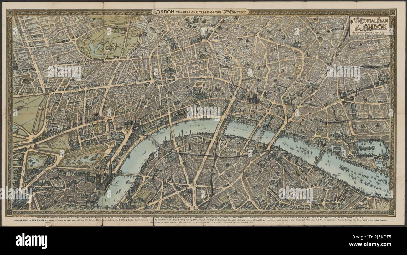 Vintage map of London and area from 17th/18th century. Map is beautifully hand illustrated and engraved showing London at the time. Stock Photohttps://www.alamy.com/image-license-details/?v=1https://www.alamy.com/vintage-map-of-london-and-area-from-17th18th-century-map-is-beautifully-hand-illustrated-and-engraved-showing-london-at-the-time-image468180921.html
RF2J5KDF5–Vintage map of London and area from 17th/18th century. Map is beautifully hand illustrated and engraved showing London at the time.
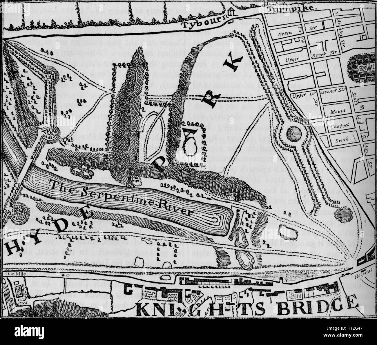 Map of Hyde Park, London, 1748 (1878). Artist: John Pine. Stock Photohttps://www.alamy.com/image-license-details/?v=1https://www.alamy.com/stock-photo-map-of-hyde-park-london-1748-1878-artist-john-pine-135280887.html
RMHT2G47–Map of Hyde Park, London, 1748 (1878). Artist: John Pine.
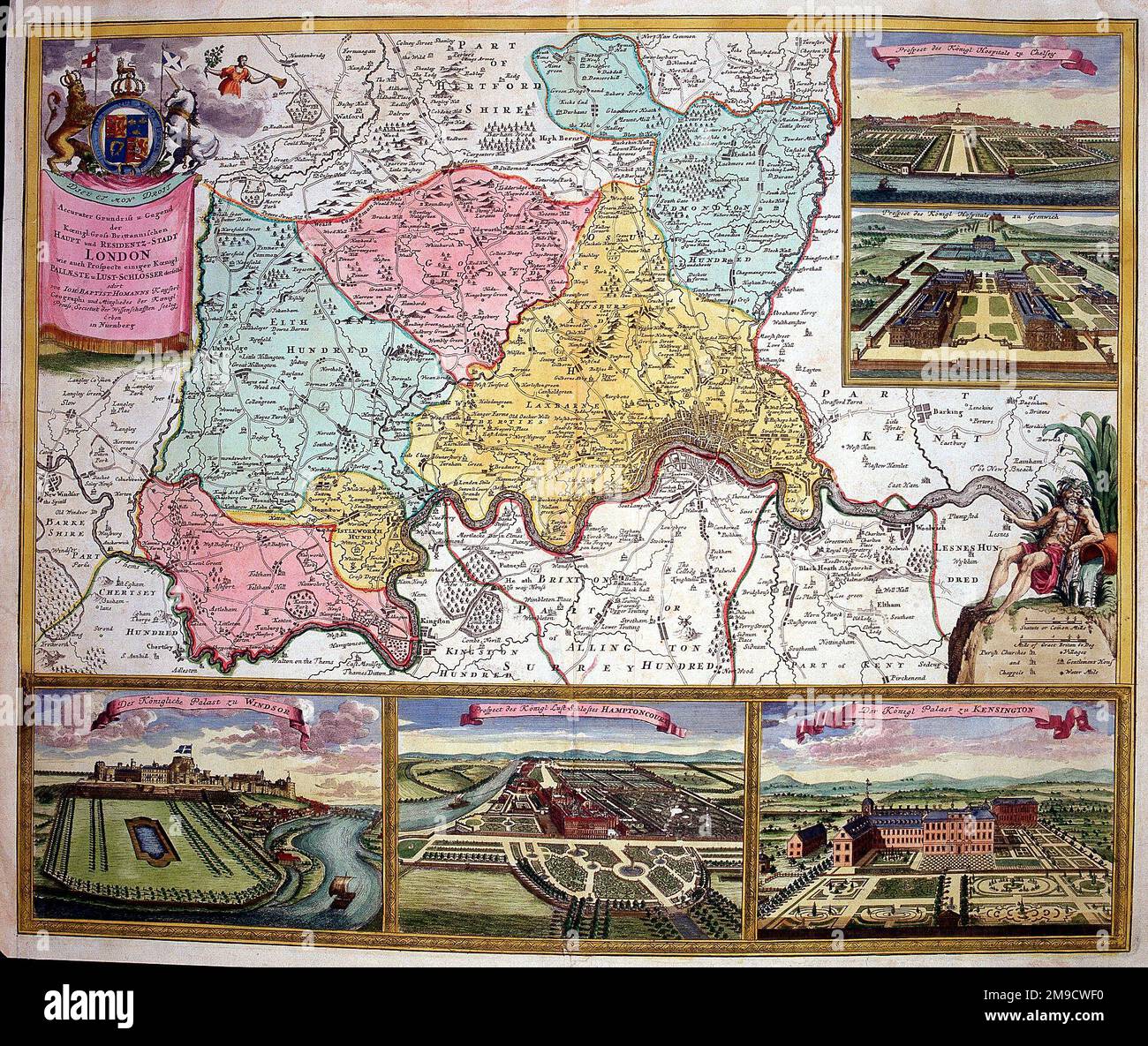 18th century city Map of London, England with inset views of Hampton Court, Windsor Castle, St. James Palace, King's Hospital at Greenwich and Chelsea Stock Photohttps://www.alamy.com/image-license-details/?v=1https://www.alamy.com/18th-century-city-map-of-london-england-with-inset-views-of-hampton-court-windsor-castle-st-james-palace-kings-hospital-at-greenwich-and-chelsea-image504916020.html
RM2M9CWF0–18th century city Map of London, England with inset views of Hampton Court, Windsor Castle, St. James Palace, King's Hospital at Greenwich and Chelsea
 Map of Stockholm (Aubry de La Mottraye's 'Travels throughout Europe, Asia and into Part of Africa...,' London, 1724, vol. II, pl. 32). Artist: William Hogarth (British, London 1697-1764 London). Author: Illustrates Aubry de La Mottraye (French, 1674-1743). Dimensions: sheet: 9 15/16 x 6 11/16 in. (25.2 x 17 cm). Date: 1723-24. Museum: Metropolitan Museum of Art, New York, USA. Stock Photohttps://www.alamy.com/image-license-details/?v=1https://www.alamy.com/map-of-stockholm-aubry-de-la-mottrayes-travels-throughout-europe-asia-and-into-part-of-africa-london-1724-vol-ii-pl-32-artist-william-hogarth-british-london-1697-1764-london-author-illustrates-aubry-de-la-mottraye-french-1674-1743-dimensions-sheet-9-1516-x-6-1116-in-252-x-17-cm-date-1723-24-museum-metropolitan-museum-of-art-new-york-usa-image213246427.html
RMPAX5YR–Map of Stockholm (Aubry de La Mottraye's 'Travels throughout Europe, Asia and into Part of Africa...,' London, 1724, vol. II, pl. 32). Artist: William Hogarth (British, London 1697-1764 London). Author: Illustrates Aubry de La Mottraye (French, 1674-1743). Dimensions: sheet: 9 15/16 x 6 11/16 in. (25.2 x 17 cm). Date: 1723-24. Museum: Metropolitan Museum of Art, New York, USA.
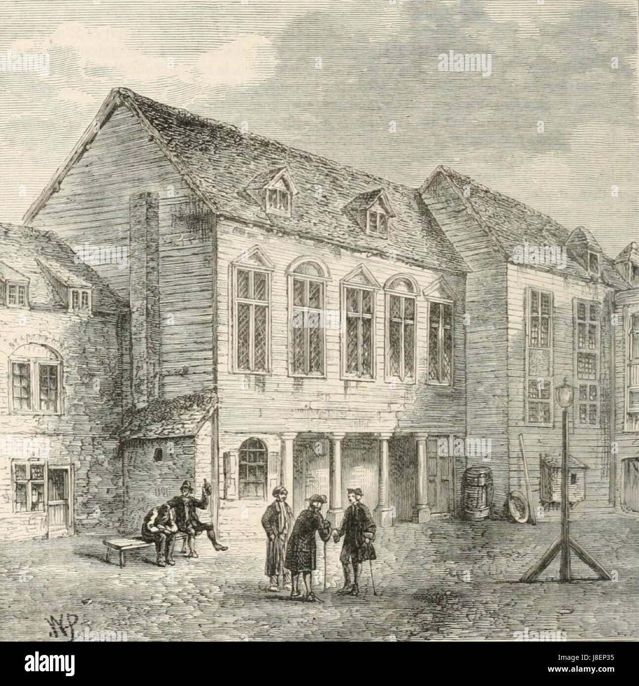 Marshalsea prison, London, 18th century (2) Stock Photohttps://www.alamy.com/image-license-details/?v=1https://www.alamy.com/stock-photo-marshalsea-prison-london-18th-century-2-142924857.html
RMJ8EP35–Marshalsea prison, London, 18th century (2)
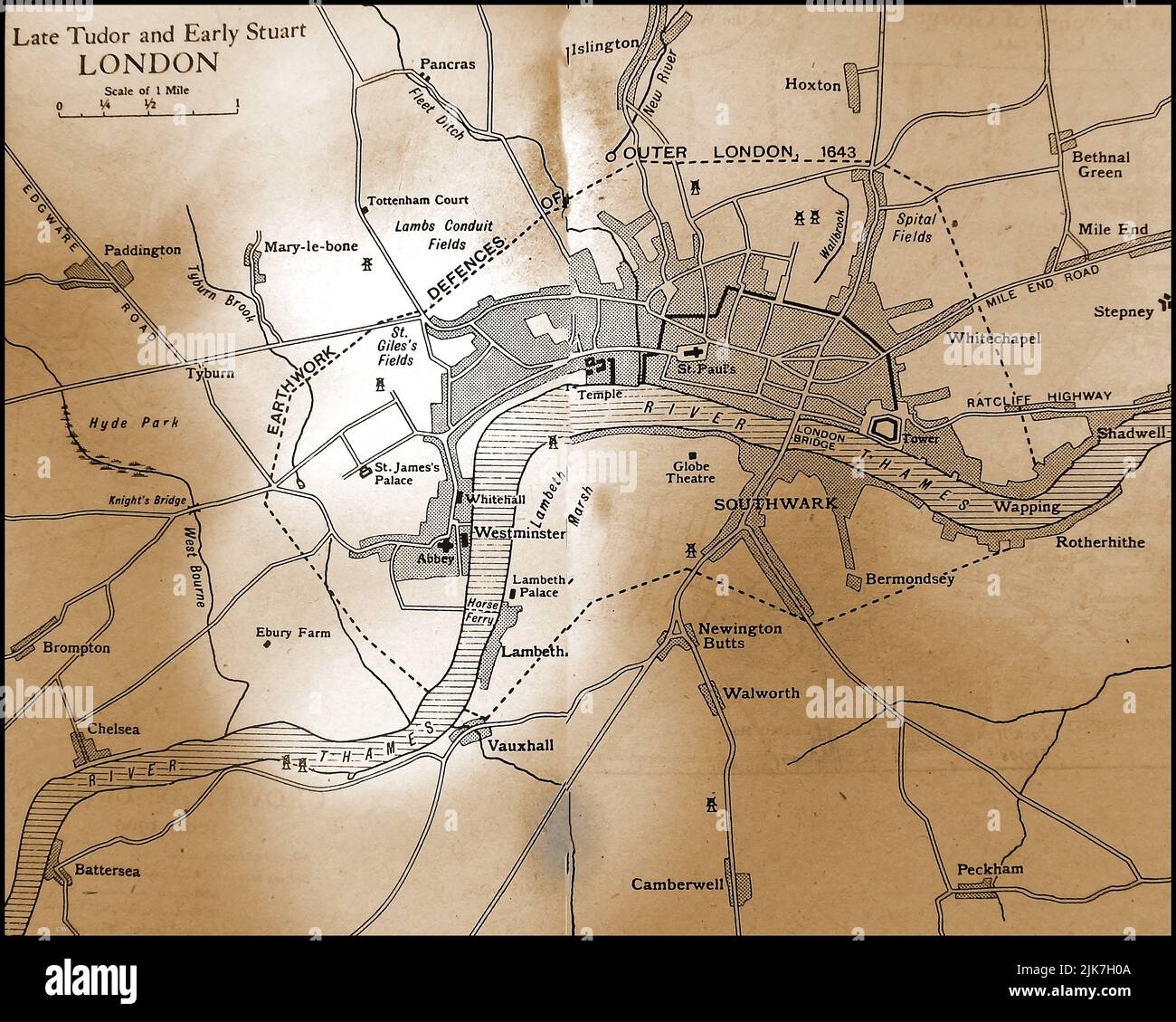 An old map showing the City of London in late Tudor & early Stuart time 1500s - early 1700s Stock Photohttps://www.alamy.com/image-license-details/?v=1https://www.alamy.com/an-old-map-showing-the-city-of-london-in-late-tudor-early-stuart-time-1500s-early-1700s-image476525402.html
RM2JK7H0A–An old map showing the City of London in late Tudor & early Stuart time 1500s - early 1700s
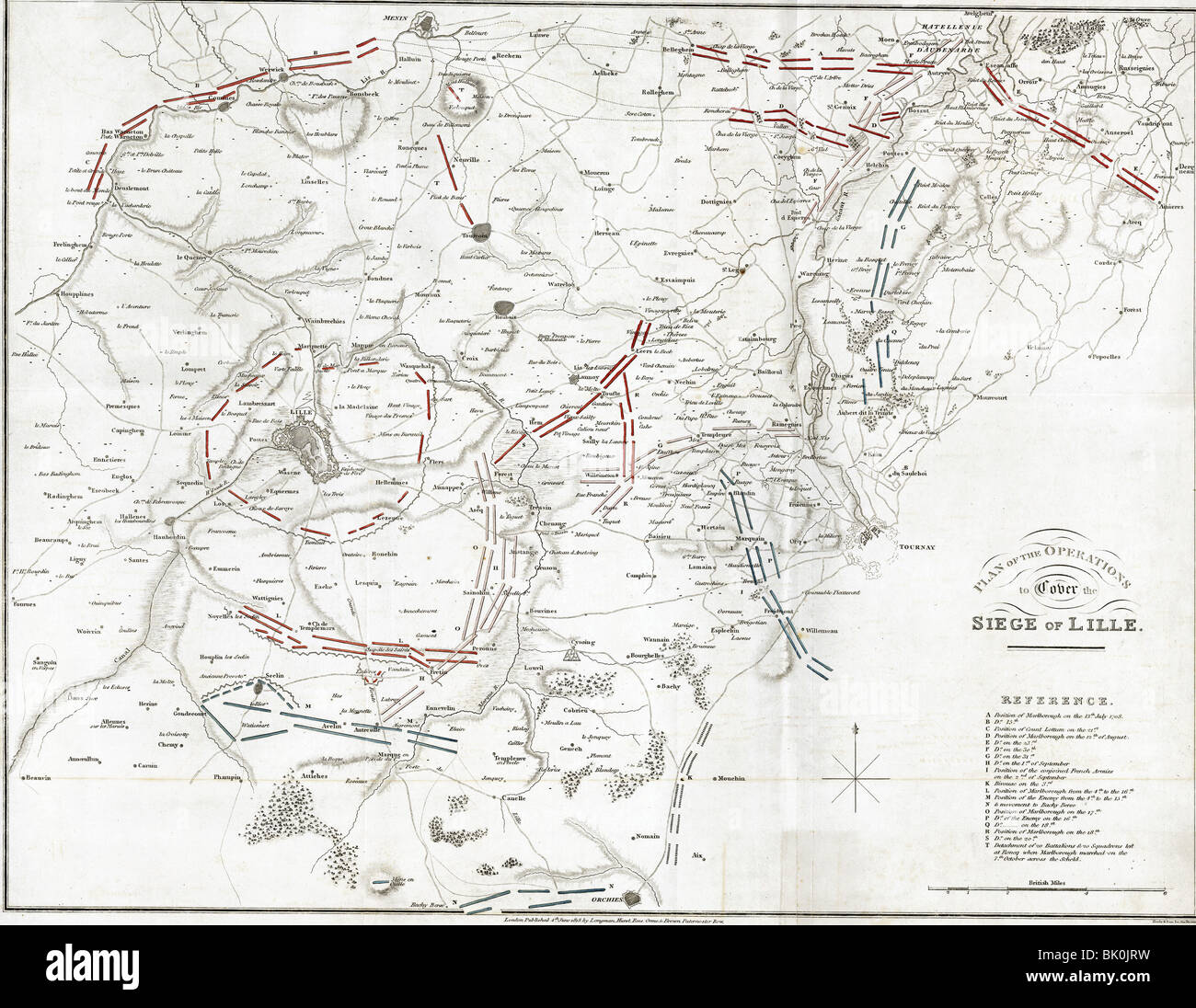 events, War of the Spanish Succession 1701 - 1714, Plan of the Operations to Cover the Siege of Lille (summer and autumn 1708), printed in London, 1818, 18th century, map, maps, historic, historical, plans, fortress, troops, English, Allied, French, France, John Churchill, 1st Duke of Marlborough, Stock Photohttps://www.alamy.com/image-license-details/?v=1https://www.alamy.com/stock-photo-events-war-of-the-spanish-succession-1701-1714-plan-of-the-operations-28903613.html
RMBK0JRW–events, War of the Spanish Succession 1701 - 1714, Plan of the Operations to Cover the Siege of Lille (summer and autumn 1708), printed in London, 1818, 18th century, map, maps, historic, historical, plans, fortress, troops, English, Allied, French, France, John Churchill, 1st Duke of Marlborough,
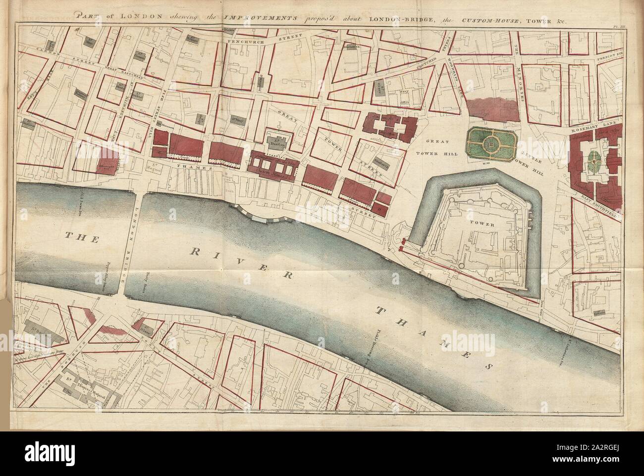 Part of London shewing the Improvements propos'd about London - Bridge, the Custom - House, Tower & c., Map of part of London from the 18th century, Pt., IIII, after p. 132, 1766, John Gwynn: London and Westminster improved, illustrated by plans: to which is prefixed, a discourse on publick magnificence with observations on the state of arts and artists in this kingdom, wherein the study of the polite arts is recommended as necessary to a liberal education: concluded by some proposals relative to places not laid down in the plans. London: printed for the author ..., 1766 Stock Photohttps://www.alamy.com/image-license-details/?v=1https://www.alamy.com/part-of-london-shewing-the-improvements-proposd-about-london-bridge-the-custom-house-tower-c-map-of-part-of-london-from-the-18th-century-pt-iiii-after-p-132-1766-john-gwynn-london-and-westminster-improved-illustrated-by-plans-to-which-is-prefixed-a-discourse-on-publick-magnificence-with-observations-on-the-state-of-arts-and-artists-in-this-kingdom-wherein-the-study-of-the-polite-arts-is-recommended-as-necessary-to-a-liberal-education-concluded-by-some-proposals-relative-to-places-not-laid-down-in-the-plans-london-printed-for-the-author-1766-image328744154.html
RM2A2RGEJ–Part of London shewing the Improvements propos'd about London - Bridge, the Custom - House, Tower & c., Map of part of London from the 18th century, Pt., IIII, after p. 132, 1766, John Gwynn: London and Westminster improved, illustrated by plans: to which is prefixed, a discourse on publick magnificence with observations on the state of arts and artists in this kingdom, wherein the study of the polite arts is recommended as necessary to a liberal education: concluded by some proposals relative to places not laid down in the plans. London: printed for the author ..., 1766
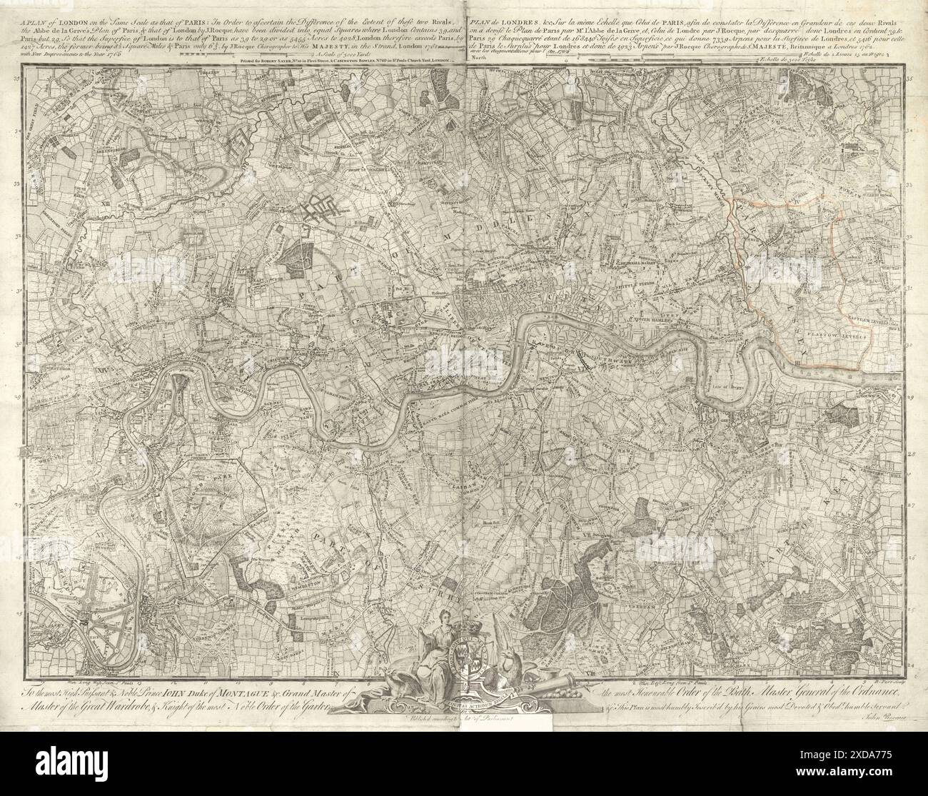 'A Plan of London on the same scale as that of Paris..' by John Rocque 1769 map Stock Photohttps://www.alamy.com/image-license-details/?v=1https://www.alamy.com/a-plan-of-london-on-the-same-scale-as-that-of-paris-by-john-rocque-1769-map-image610578617.html
RF2XDA775–'A Plan of London on the same scale as that of Paris..' by John Rocque 1769 map
![18th Century Map of Gloucestershire [Glocestershire] a county in South West England. The county comprises part of the Cotswold Hills, part of the flat fertile valley of the River Severn, and the entire Forest of Dean. Copperplate engraving From the Encyclopaedia Londinensis or, Universal dictionary of arts, sciences, and literature; Volume VIII; Edited by Wilkes, John. Published in London in 1810. Stock Photo 18th Century Map of Gloucestershire [Glocestershire] a county in South West England. The county comprises part of the Cotswold Hills, part of the flat fertile valley of the River Severn, and the entire Forest of Dean. Copperplate engraving From the Encyclopaedia Londinensis or, Universal dictionary of arts, sciences, and literature; Volume VIII; Edited by Wilkes, John. Published in London in 1810. Stock Photo](https://c8.alamy.com/comp/2G7881N/18th-century-map-of-gloucestershire-glocestershire-a-county-in-south-west-england-the-county-comprises-part-of-the-cotswold-hills-part-of-the-flat-fertile-valley-of-the-river-severn-and-the-entire-forest-of-dean-copperplate-engraving-from-the-encyclopaedia-londinensis-or-universal-dictionary-of-arts-sciences-and-literature-volume-viii-edited-by-wilkes-john-published-in-london-in-1810-2G7881N.jpg) 18th Century Map of Gloucestershire [Glocestershire] a county in South West England. The county comprises part of the Cotswold Hills, part of the flat fertile valley of the River Severn, and the entire Forest of Dean. Copperplate engraving From the Encyclopaedia Londinensis or, Universal dictionary of arts, sciences, and literature; Volume VIII; Edited by Wilkes, John. Published in London in 1810. Stock Photohttps://www.alamy.com/image-license-details/?v=1https://www.alamy.com/18th-century-map-of-gloucestershire-glocestershire-a-county-in-south-west-england-the-county-comprises-part-of-the-cotswold-hills-part-of-the-flat-fertile-valley-of-the-river-severn-and-the-entire-forest-of-dean-copperplate-engraving-from-the-encyclopaedia-londinensis-or-universal-dictionary-of-arts-sciences-and-literature-volume-viii-edited-by-wilkes-john-published-in-london-in-1810-image434743729.html
18th Century Map of Gloucestershire [Glocestershire] a county in South West England. The county comprises part of the Cotswold Hills, part of the flat fertile valley of the River Severn, and the entire Forest of Dean. Copperplate engraving From the Encyclopaedia Londinensis or, Universal dictionary of arts, sciences, and literature; Volume VIII; Edited by Wilkes, John. Published in London in 1810. Stock Photohttps://www.alamy.com/image-license-details/?v=1https://www.alamy.com/18th-century-map-of-gloucestershire-glocestershire-a-county-in-south-west-england-the-county-comprises-part-of-the-cotswold-hills-part-of-the-flat-fertile-valley-of-the-river-severn-and-the-entire-forest-of-dean-copperplate-engraving-from-the-encyclopaedia-londinensis-or-universal-dictionary-of-arts-sciences-and-literature-volume-viii-edited-by-wilkes-john-published-in-london-in-1810-image434743729.htmlRM2G7881N–18th Century Map of Gloucestershire [Glocestershire] a county in South West England. The county comprises part of the Cotswold Hills, part of the flat fertile valley of the River Severn, and the entire Forest of Dean. Copperplate engraving From the Encyclopaedia Londinensis or, Universal dictionary of arts, sciences, and literature; Volume VIII; Edited by Wilkes, John. Published in London in 1810.
 Antique map of the Journeyings of the Children of Israel from Egypt to the Land of Canaan 1776 Edition of The National Illustrated Family Bible The Stock Photohttps://www.alamy.com/image-license-details/?v=1https://www.alamy.com/antique-map-of-the-journeyings-of-the-children-of-israel-from-egypt-to-the-land-of-canaan-1776-edition-of-the-national-illustrated-family-bible-the-image627608863.html
RM2YD21E7–Antique map of the Journeyings of the Children of Israel from Egypt to the Land of Canaan 1776 Edition of The National Illustrated Family Bible The
 . English: A view of the Malabar Coast port of Dabul by Jacques Nicolas Bellin, 1736 Source: ebay, Jan. 2004 'VUE DE DABUL en 1736, by Jacques-Nicolas Bellin (1703-1772), Royal Hydrographer, engineer of the French Navy and member of the Royal Society, London. This map was part of Prévost's Histoire générale des voyages and has folds as issued. Original 18th century copperplate engraving, modern handcoloring.' . 1736. Jacques Nicolas Bellin Dabulview Stock Photohttps://www.alamy.com/image-license-details/?v=1https://www.alamy.com/english-a-view-of-the-malabar-coast-port-of-dabul-by-jacques-nicolas-bellin-1736-source-ebay-jan-2004-vue-de-dabul-en-1736-by-jacques-nicolas-bellin-1703-1772-royal-hydrographer-engineer-of-the-french-navy-and-member-of-the-royal-society-london-this-map-was-part-of-prvosts-histoire-gnrale-des-voyages-and-has-folds-as-issued-original-18th-century-copperplate-engraving-modern-handcoloring-1736-jacques-nicolas-bellin-dabulview-image184965712.html
RMMMWWJ8–. English: A view of the Malabar Coast port of Dabul by Jacques Nicolas Bellin, 1736 Source: ebay, Jan. 2004 'VUE DE DABUL en 1736, by Jacques-Nicolas Bellin (1703-1772), Royal Hydrographer, engineer of the French Navy and member of the Royal Society, London. This map was part of Prévost's Histoire générale des voyages and has folds as issued. Original 18th century copperplate engraving, modern handcoloring.' . 1736. Jacques Nicolas Bellin Dabulview
 'Dr. Stukeley's Plan of the Camp at St. Pancras', c1750, (c1876). Creator: Unknown. Stock Photohttps://www.alamy.com/image-license-details/?v=1https://www.alamy.com/dr-stukeleys-plan-of-the-camp-at-st-pancras-c1750-c1876-creator-unknown-image259687756.html
RMW2DPAM–'Dr. Stukeley's Plan of the Camp at St. Pancras', c1750, (c1876). Creator: Unknown.
 18th century map of the county of Northamptonshire. . The County of Northamptonshire, as surveyed and planned by the late T. Eyre, revised by the late T. Jefferys, and engraved by W. Faden. London, 1779. Source: Maps*4420.(3). Stock Photohttps://www.alamy.com/image-license-details/?v=1https://www.alamy.com/18th-century-map-of-the-county-of-northamptonshire-the-county-of-northamptonshire-as-surveyed-and-planned-by-the-late-t-eyre-revised-by-the-late-t-jefferys-and-engraved-by-w-faden-london-1779-source-maps44203-image227135089.html
RMR5EW3D–18th century map of the county of Northamptonshire. . The County of Northamptonshire, as surveyed and planned by the late T. Eyre, revised by the late T. Jefferys, and engraved by W. Faden. London, 1779. Source: Maps*4420.(3).
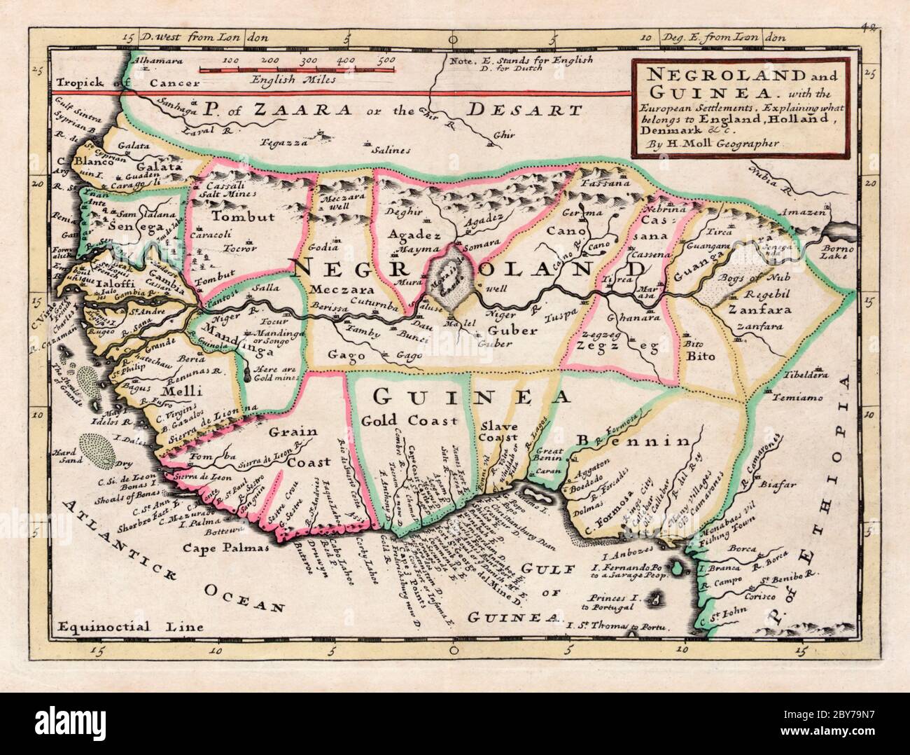 Negroland and Guinea, with the European settlements, explaining what belongs to England, Holland, Denmark etc. By H. Moll, Geographer. From an atlas printed and sold by T. Bowles, London circa 1735. The map covers some of the main slaving areas of equatorial Africa. Stock Photohttps://www.alamy.com/image-license-details/?v=1https://www.alamy.com/negroland-and-guinea-with-the-european-settlements-explaining-what-belongs-to-england-holland-denmark-etc-by-h-moll-geographer-from-an-atlas-printed-and-sold-by-t-bowles-london-circa-1735-the-map-covers-some-of-the-main-slaving-areas-of-equatorial-africa-image360964387.html
RM2BY79N7–Negroland and Guinea, with the European settlements, explaining what belongs to England, Holland, Denmark etc. By H. Moll, Geographer. From an atlas printed and sold by T. Bowles, London circa 1735. The map covers some of the main slaving areas of equatorial Africa.
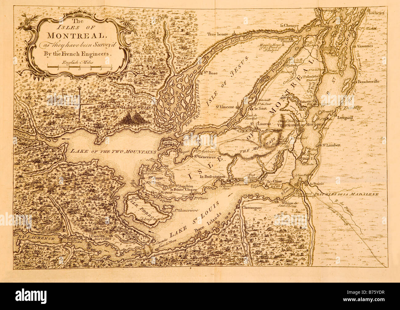 A map printed in London England circa 1761 showing Montreal and the surrounding areas in Canada. Stock Photohttps://www.alamy.com/image-license-details/?v=1https://www.alamy.com/stock-photo-a-map-printed-in-london-england-circa-1761-showing-montreal-and-the-21644275.html
RMB75YDR–A map printed in London England circa 1761 showing Montreal and the surrounding areas in Canada.
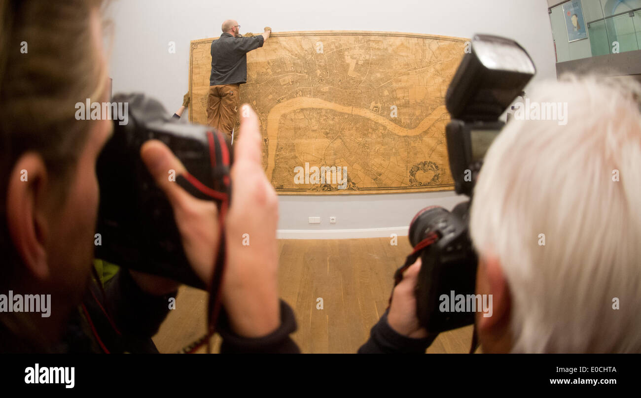 A photojournalist takes a picture of a map of London from the 18th century at the German Museum of Caricature and Drawings Wilhelm Busch in Hanover, Germany, 09 May 2014. The rare, seven-meter map is going on display in the exhibition 'Koengichles Theater. Britische Karikaturen aus der Zeit der Personalunion und der Gegenwart' (Royal Theater. British caricatures from the time of personal union to present day). Photo: JULIAN STRATENSCHULTE/dpa Stock Photohttps://www.alamy.com/image-license-details/?v=1https://www.alamy.com/a-photojournalist-takes-a-picture-of-a-map-of-london-from-the-18th-image69118906.html
RME0CHTA–A photojournalist takes a picture of a map of London from the 18th century at the German Museum of Caricature and Drawings Wilhelm Busch in Hanover, Germany, 09 May 2014. The rare, seven-meter map is going on display in the exhibition 'Koengichles Theater. Britische Karikaturen aus der Zeit der Personalunion und der Gegenwart' (Royal Theater. British caricatures from the time of personal union to present day). Photo: JULIAN STRATENSCHULTE/dpa
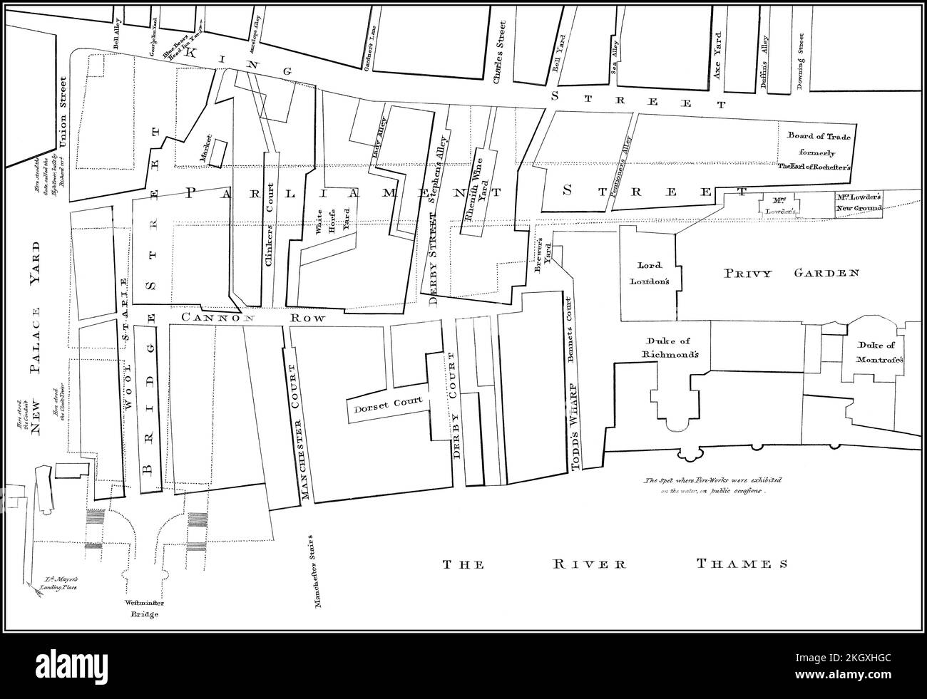 Map of Westminster, London, England, 1740 Stock Photohttps://www.alamy.com/image-license-details/?v=1https://www.alamy.com/map-of-westminster-london-england-1740-image492309340.html
RM2KGXHGC–Map of Westminster, London, England, 1740
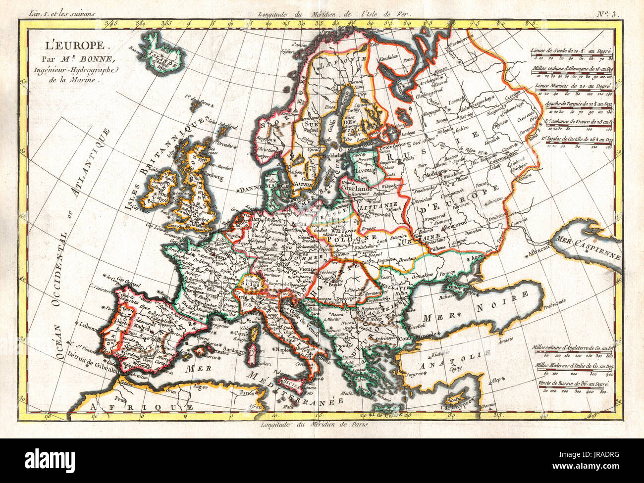 1780 Bonne Antique Map of the continent of Europe and Great Britain Stock Photohttps://www.alamy.com/image-license-details/?v=1https://www.alamy.com/1780-bonne-antique-map-of-the-continent-of-europe-and-great-britain-image152050404.html
RFJRADRG–1780 Bonne Antique Map of the continent of Europe and Great Britain
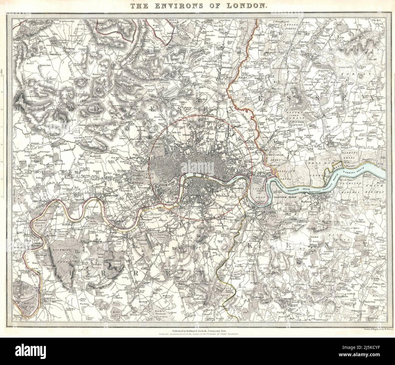 Vintage map of London and area from 17th/18th century. Map is beautifully hand illustrated and engraved showing London at the time. Stock Photohttps://www.alamy.com/image-license-details/?v=1https://www.alamy.com/vintage-map-of-london-and-area-from-17th18th-century-map-is-beautifully-hand-illustrated-and-engraved-showing-london-at-the-time-image468180483.html
RF2J5KCYF–Vintage map of London and area from 17th/18th century. Map is beautifully hand illustrated and engraved showing London at the time.
 Map of Rathbone Place and its neighbourhood, Westminster, London, 1746 (1878). Artist: Unknown. Stock Photohttps://www.alamy.com/image-license-details/?v=1https://www.alamy.com/stock-photo-map-of-rathbone-place-and-its-neighbourhood-westminster-london-1746-135280894.html
RMHT2G4E–Map of Rathbone Place and its neighbourhood, Westminster, London, 1746 (1878). Artist: Unknown.
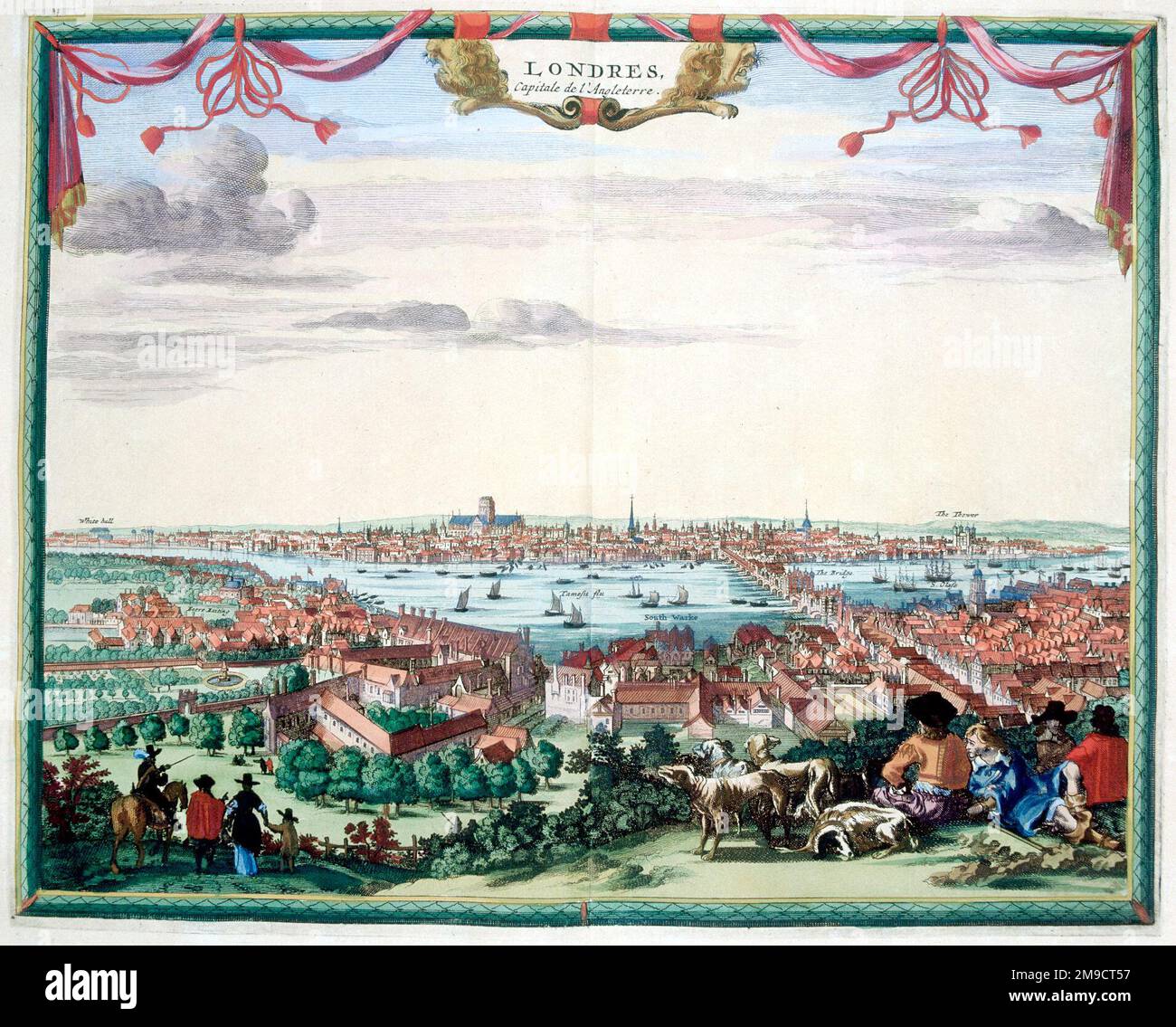 17th / 18th century view of London Stock Photohttps://www.alamy.com/image-license-details/?v=1https://www.alamy.com/17th-18th-century-view-of-london-image504914963.html
RM2M9CT57–17th / 18th century view of London
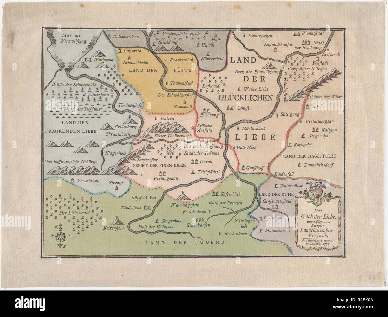 Valentine: Map of the Kingdom of Lover (Das Reich der Liebe). Artist: Breitkopf & Härtel (German). Dimensions: Sheet: 9 1/16 × 11 7/16 in. (23 × 29 cm). Date: 1777. This is a very rare trial proof of cartography printed from type composition by the famous German eighteenth century printer, Breitkopf, in Leipzig, Germany. Dated 1777, this is a Valentine, created as a Map of Matrimony, and labeled 'The Kingdom of Love'. The various 'lands' are depicted with several titles, from The Land of Lust, and the Land of Fixed Ideas, to The Land of Youth, and the Land of Happy. This would have been a ver Stock Photohttps://www.alamy.com/image-license-details/?v=1https://www.alamy.com/valentine-map-of-the-kingdom-of-lover-das-reich-der-liebe-artist-breitkopf-hrtel-german-dimensions-sheet-9-116-11-716-in-23-29-cm-date-1777-this-is-a-very-rare-trial-proof-of-cartography-printed-from-type-composition-by-the-famous-german-eighteenth-century-printer-breitkopf-in-leipzig-germany-dated-1777-this-is-a-valentine-created-as-a-map-of-matrimony-and-labeled-the-kingdom-of-love-the-various-lands-are-depicted-with-several-titles-from-the-land-of-lust-and-the-land-of-fixed-ideas-to-the-land-of-youth-and-the-land-of-happy-this-would-have-been-a-ver-image226449786.html
RMR4BK0A–Valentine: Map of the Kingdom of Lover (Das Reich der Liebe). Artist: Breitkopf & Härtel (German). Dimensions: Sheet: 9 1/16 × 11 7/16 in. (23 × 29 cm). Date: 1777. This is a very rare trial proof of cartography printed from type composition by the famous German eighteenth century printer, Breitkopf, in Leipzig, Germany. Dated 1777, this is a Valentine, created as a Map of Matrimony, and labeled 'The Kingdom of Love'. The various 'lands' are depicted with several titles, from The Land of Lust, and the Land of Fixed Ideas, to The Land of Youth, and the Land of Happy. This would have been a ver
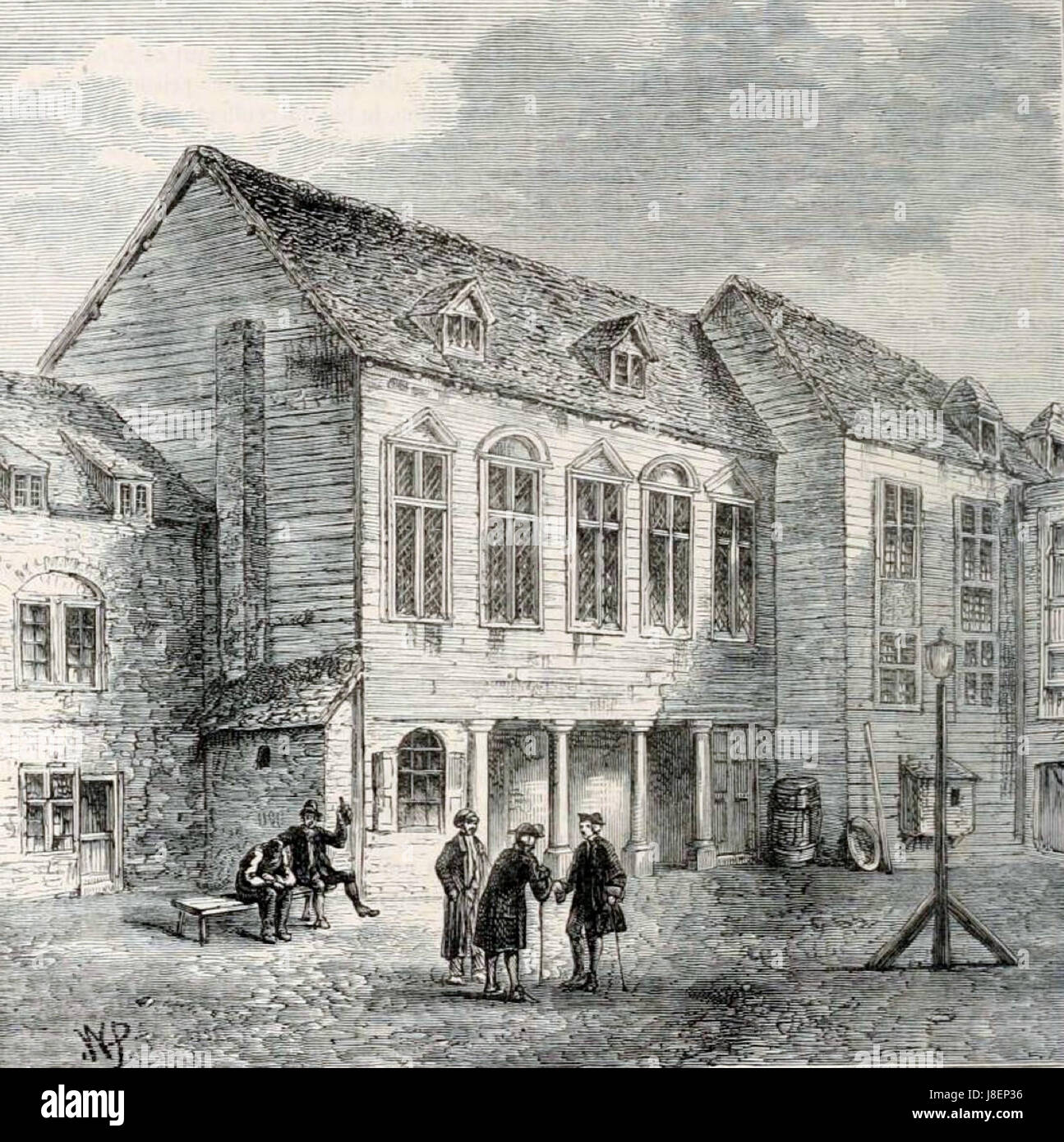 Marshalsea prison, London, 18th century (3) Stock Photohttps://www.alamy.com/image-license-details/?v=1https://www.alamy.com/stock-photo-marshalsea-prison-london-18th-century-3-142924858.html
RMJ8EP36–Marshalsea prison, London, 18th century (3)
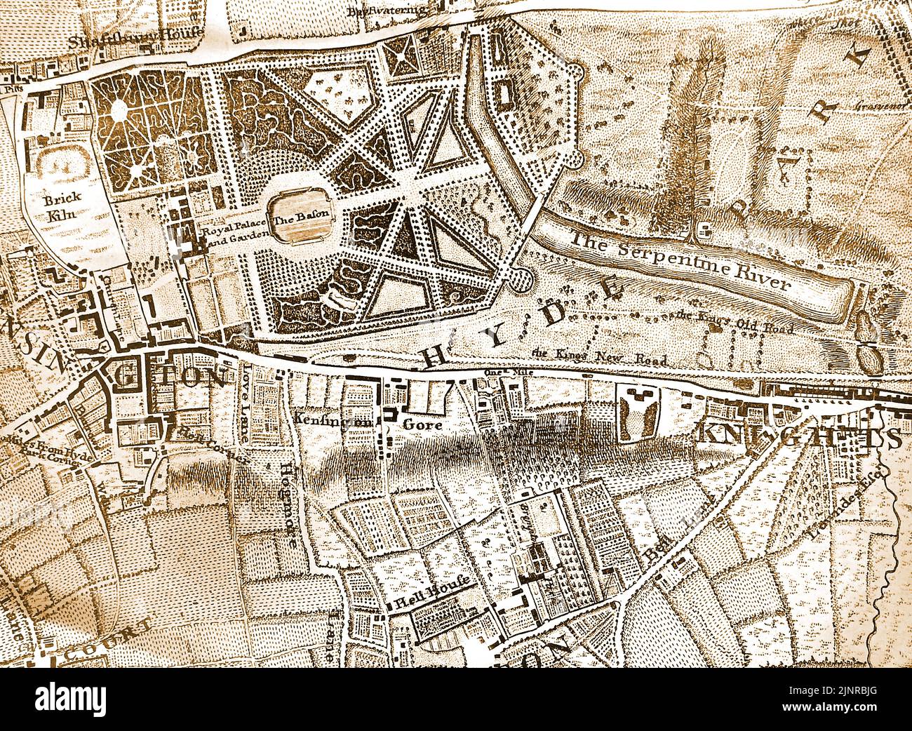 A 1746 map of part of London, England centred on the Hyde Park area Stock Photohttps://www.alamy.com/image-license-details/?v=1https://www.alamy.com/a-1746-map-of-part-of-london-england-centred-on-the-hyde-park-area-image478101752.html
RM2JNRBJG–A 1746 map of part of London, England centred on the Hyde Park area
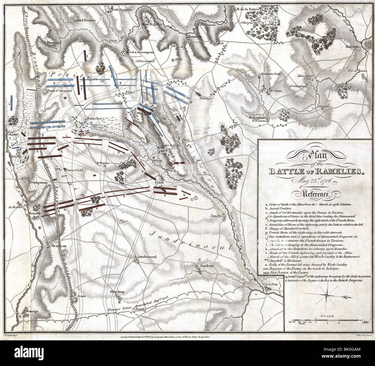 events, War of the Spanish Succession 1701 - 1714, Plan of the Battle of Ramelies, May 23rd 1706, printed in London, 1818, English and Dutch troops under John Churchill, 1st Duke of Marlborough Henry, Count of Nassau, Lord of Overkirk against French and Bavarians under Francois de Neufville, duc de Villeroy and Maximilian II Emanuel of Bavaria,Belgium, 18th century, map, maps, plans, Villeroi, historic, historical, Ramillies, Stock Photohttps://www.alamy.com/image-license-details/?v=1https://www.alamy.com/stock-photo-events-war-of-the-spanish-succession-1701-1714-plan-of-the-battle-28901676.html
RMBK0GAM–events, War of the Spanish Succession 1701 - 1714, Plan of the Battle of Ramelies, May 23rd 1706, printed in London, 1818, English and Dutch troops under John Churchill, 1st Duke of Marlborough Henry, Count of Nassau, Lord of Overkirk against French and Bavarians under Francois de Neufville, duc de Villeroy and Maximilian II Emanuel of Bavaria,Belgium, 18th century, map, maps, plans, Villeroi, historic, historical, Ramillies,
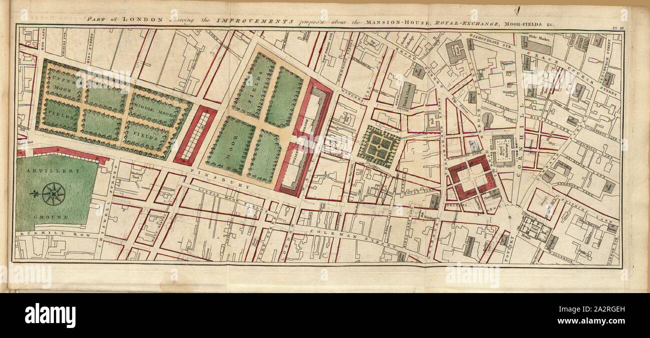 Part of London shewing the Improvements propos'd about the Mansion - House, Royal - Exchange, Moor-Fields & c., Map of part of London from the 18th century, pt., III, after p. 132, unekannt, 1766, John Gwynn: London and Westminster improved, illustrated by plans: to which is prefixed, a discourse on publick magnificence with observations on the state of arts and artists in this kingdom, wherein the study of the polite arts is recommended as necessary to a liberal education: concluded by some proposals relative to places not laid down in the plans. London: printed for the author ..., 1766 Stock Photohttps://www.alamy.com/image-license-details/?v=1https://www.alamy.com/part-of-london-shewing-the-improvements-proposd-about-the-mansion-house-royal-exchange-moor-fields-c-map-of-part-of-london-from-the-18th-century-pt-iii-after-p-132-unekannt-1766-john-gwynn-london-and-westminster-improved-illustrated-by-plans-to-which-is-prefixed-a-discourse-on-publick-magnificence-with-observations-on-the-state-of-arts-and-artists-in-this-kingdom-wherein-the-study-of-the-polite-arts-is-recommended-as-necessary-to-a-liberal-education-concluded-by-some-proposals-relative-to-places-not-laid-down-in-the-plans-london-printed-for-the-author-1766-image328744153.html
RM2A2RGEH–Part of London shewing the Improvements propos'd about the Mansion - House, Royal - Exchange, Moor-Fields & c., Map of part of London from the 18th century, pt., III, after p. 132, unekannt, 1766, John Gwynn: London and Westminster improved, illustrated by plans: to which is prefixed, a discourse on publick magnificence with observations on the state of arts and artists in this kingdom, wherein the study of the polite arts is recommended as necessary to a liberal education: concluded by some proposals relative to places not laid down in the plans. London: printed for the author ..., 1766
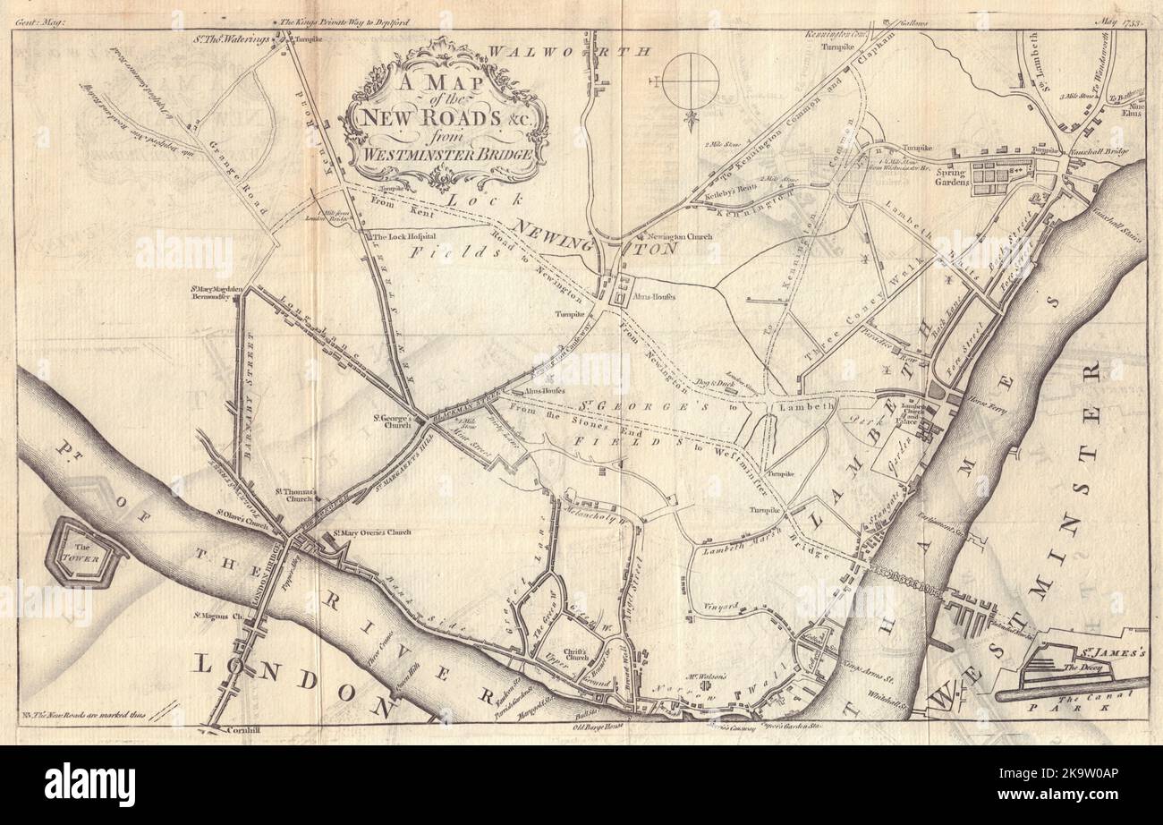 A Map of the New Roads &c from Westminster Bridge. London. GENTS MAG 1753 Stock Photohttps://www.alamy.com/image-license-details/?v=1https://www.alamy.com/a-map-of-the-new-roads-c-from-westminster-bridge-london-gents-mag-1753-image487971310.html
RF2K9W0AP–A Map of the New Roads &c from Westminster Bridge. London. GENTS MAG 1753
 early 19th century map of Ireland Copperplate engraving From the Encyclopaedia Londinensis or, Universal dictionary of arts, sciences, and literature; Volume XI; Edited by Wilkes, John. Published in London in 1812 Stock Photohttps://www.alamy.com/image-license-details/?v=1https://www.alamy.com/early-19th-century-map-of-ireland-copperplate-engraving-from-the-encyclopaedia-londinensis-or-universal-dictionary-of-arts-sciences-and-literature-volume-xi-edited-by-wilkes-john-published-in-london-in-1812-image376261199.html
RF2CT44YY–early 19th century map of Ireland Copperplate engraving From the Encyclopaedia Londinensis or, Universal dictionary of arts, sciences, and literature; Volume XI; Edited by Wilkes, John. Published in London in 1812
 Antique map of The World As peopled by the Descendants of Noah in 1776 Edition of The National Illustrated Family Bible The Holy Bible With Commentari Stock Photohttps://www.alamy.com/image-license-details/?v=1https://www.alamy.com/antique-map-of-the-world-as-peopled-by-the-descendants-of-noah-in-1776-edition-of-the-national-illustrated-family-bible-the-holy-bible-with-commentari-image627608916.html
RM2YD21G4–Antique map of The World As peopled by the Descendants of Noah in 1776 Edition of The National Illustrated Family Bible The Holy Bible With Commentari
 Africa, with all its States, Kingdoms, republics, Regions, Islands, & cca. Improved and Inlarged form D’Anville’s Map to which has been added A particular Chart of the Gold Coast wherein are Distinguished all the European Forts, and Factories by S. Boulton. English: This is most likely the most important map of Africa produced in the 18th century. Printed at the height of the slave trade in 1787 by the Robert Sayer firm of London, England. Largely based upon the earlier D’Anville map, this map has been enlarged and expanded by Samuel Boulton. Depicts the continent in full with insets of the G Stock Photohttps://www.alamy.com/image-license-details/?v=1https://www.alamy.com/africa-with-all-its-states-kingdoms-republics-regions-islands-cca-improved-and-inlarged-form-danvilles-map-to-which-has-been-added-a-particular-chart-of-the-gold-coast-wherein-are-distinguished-all-the-european-forts-and-factories-by-s-boulton-english-this-is-most-likely-the-most-important-map-of-africa-produced-in-the-18th-century-printed-at-the-height-of-the-slave-trade-in-1787-by-the-robert-sayer-firm-of-london-england-largely-based-upon-the-earlier-danville-map-this-map-has-been-enlarged-and-expanded-by-samuel-boulton-depicts-the-continent-in-full-with-insets-of-the-g-image210014860.html
RMP5K02M–Africa, with all its States, Kingdoms, republics, Regions, Islands, & cca. Improved and Inlarged form D’Anville’s Map to which has been added A particular Chart of the Gold Coast wherein are Distinguished all the European Forts, and Factories by S. Boulton. English: This is most likely the most important map of Africa produced in the 18th century. Printed at the height of the slave trade in 1787 by the Robert Sayer firm of London, England. Largely based upon the earlier D’Anville map, this map has been enlarged and expanded by Samuel Boulton. Depicts the continent in full with insets of the G
!['Poland and the Partitions of 1772, 1793 & 1795', (c1920). Map showing how territory in Europe was divided between the empires of Russia, Prussia and Austria in the 18th century. From "The Great World War - A History" Volume IV, edited by Frank A Mumby. [The Gresham Publishing Company Ltd, London, c1920] Stock Photo 'Poland and the Partitions of 1772, 1793 & 1795', (c1920). Map showing how territory in Europe was divided between the empires of Russia, Prussia and Austria in the 18th century. From "The Great World War - A History" Volume IV, edited by Frank A Mumby. [The Gresham Publishing Company Ltd, London, c1920] Stock Photo](https://c8.alamy.com/comp/W6P8N0/poland-and-the-partitions-of-1772-1793-amp-1795-c1920-map-showing-how-territory-in-europe-was-divided-between-the-empires-of-russia-prussia-and-austria-in-the-18th-century-from-quotthe-great-world-war-a-historyquot-volume-iv-edited-by-frank-a-mumby-the-gresham-publishing-company-ltd-london-c1920-W6P8N0.jpg) 'Poland and the Partitions of 1772, 1793 & 1795', (c1920). Map showing how territory in Europe was divided between the empires of Russia, Prussia and Austria in the 18th century. From "The Great World War - A History" Volume IV, edited by Frank A Mumby. [The Gresham Publishing Company Ltd, London, c1920] Stock Photohttps://www.alamy.com/image-license-details/?v=1https://www.alamy.com/poland-and-the-partitions-of-1772-1793-amp-1795-c1920-map-showing-how-territory-in-europe-was-divided-between-the-empires-of-russia-prussia-and-austria-in-the-18th-century-from-quotthe-great-world-war-a-historyquot-volume-iv-edited-by-frank-a-mumby-the-gresham-publishing-company-ltd-london-c1920-image262333260.html
'Poland and the Partitions of 1772, 1793 & 1795', (c1920). Map showing how territory in Europe was divided between the empires of Russia, Prussia and Austria in the 18th century. From "The Great World War - A History" Volume IV, edited by Frank A Mumby. [The Gresham Publishing Company Ltd, London, c1920] Stock Photohttps://www.alamy.com/image-license-details/?v=1https://www.alamy.com/poland-and-the-partitions-of-1772-1793-amp-1795-c1920-map-showing-how-territory-in-europe-was-divided-between-the-empires-of-russia-prussia-and-austria-in-the-18th-century-from-quotthe-great-world-war-a-historyquot-volume-iv-edited-by-frank-a-mumby-the-gresham-publishing-company-ltd-london-c1920-image262333260.htmlRMW6P8N0–'Poland and the Partitions of 1772, 1793 & 1795', (c1920). Map showing how territory in Europe was divided between the empires of Russia, Prussia and Austria in the 18th century. From "The Great World War - A History" Volume IV, edited by Frank A Mumby. [The Gresham Publishing Company Ltd, London, c1920]
![An 18th century map of Persia. A New Map of Persia ... British miles, 200[ = 75 mm]. London : R. Sayer, 1790. 570 x 510 mm.; British miles, 200[ = 75 mm]. Source: Maps*50970.(28). Stock Photo An 18th century map of Persia. A New Map of Persia ... British miles, 200[ = 75 mm]. London : R. Sayer, 1790. 570 x 510 mm.; British miles, 200[ = 75 mm]. Source: Maps*50970.(28). Stock Photo](https://c8.alamy.com/comp/R55G4W/an-18th-century-map-of-persia-a-new-map-of-persia-british-miles-200-=-75-mm-london-r-sayer-1790-570-x-510-mm-british-miles-200-=-75-mm-source-maps5097028-R55G4W.jpg) An 18th century map of Persia. A New Map of Persia ... British miles, 200[ = 75 mm]. London : R. Sayer, 1790. 570 x 510 mm.; British miles, 200[ = 75 mm]. Source: Maps*50970.(28). Stock Photohttps://www.alamy.com/image-license-details/?v=1https://www.alamy.com/an-18th-century-map-of-persia-a-new-map-of-persia-british-miles-200-=-75-mm-london-r-sayer-1790-570-x-510-mm-british-miles-200-=-75-mm-source-maps5097028-image226930505.html
An 18th century map of Persia. A New Map of Persia ... British miles, 200[ = 75 mm]. London : R. Sayer, 1790. 570 x 510 mm.; British miles, 200[ = 75 mm]. Source: Maps*50970.(28). Stock Photohttps://www.alamy.com/image-license-details/?v=1https://www.alamy.com/an-18th-century-map-of-persia-a-new-map-of-persia-british-miles-200-=-75-mm-london-r-sayer-1790-570-x-510-mm-british-miles-200-=-75-mm-source-maps5097028-image226930505.htmlRMR55G4W–An 18th century map of Persia. A New Map of Persia ... British miles, 200[ = 75 mm]. London : R. Sayer, 1790. 570 x 510 mm.; British miles, 200[ = 75 mm]. Source: Maps*50970.(28).
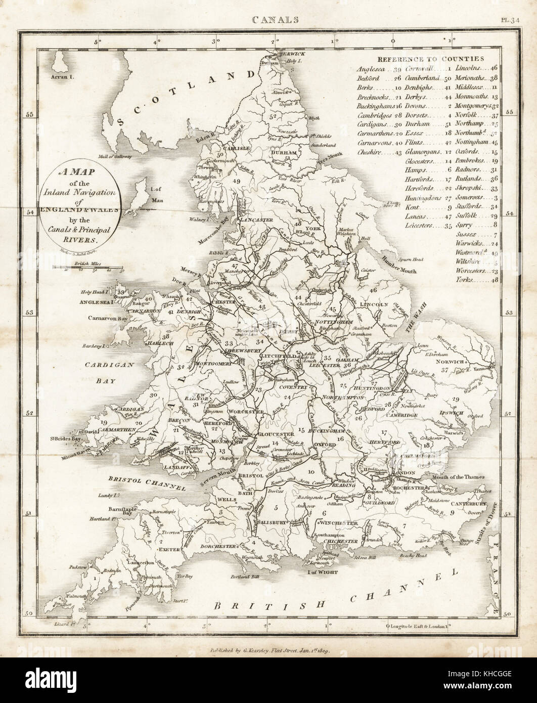 Map of the inland navigation of England and Wales by the canals and principal rivers, 1809. Copperplate engraving by Mutlow from John Mason Good's Pantologia, a New Encyclopedia, G. Kearsley, London, 1813. Stock Photohttps://www.alamy.com/image-license-details/?v=1https://www.alamy.com/stock-image-map-of-the-inland-navigation-of-england-and-wales-by-the-canals-and-165618894.html
RMKHCGGE–Map of the inland navigation of England and Wales by the canals and principal rivers, 1809. Copperplate engraving by Mutlow from John Mason Good's Pantologia, a New Encyclopedia, G. Kearsley, London, 1813.
 Commanders engaged at sea. Artist: Thomas Rowlandson (1756-1827) an English artist and caricaturist of the Georgian Era. A social observer, he was a prolific artist and print maker. Credit: Thomas Rowlandson/Alamy Stock Photohttps://www.alamy.com/image-license-details/?v=1https://www.alamy.com/commanders-engaged-at-sea-artist-thomas-rowlandson-1756-1827-an-english-artist-and-caricaturist-of-the-georgian-era-a-social-observer-he-was-a-prolific-artist-and-print-maker-credit-thomas-rowlandsonalamy-image457117445.html
RM2HFKDY1–Commanders engaged at sea. Artist: Thomas Rowlandson (1756-1827) an English artist and caricaturist of the Georgian Era. A social observer, he was a prolific artist and print maker. Credit: Thomas Rowlandson/Alamy
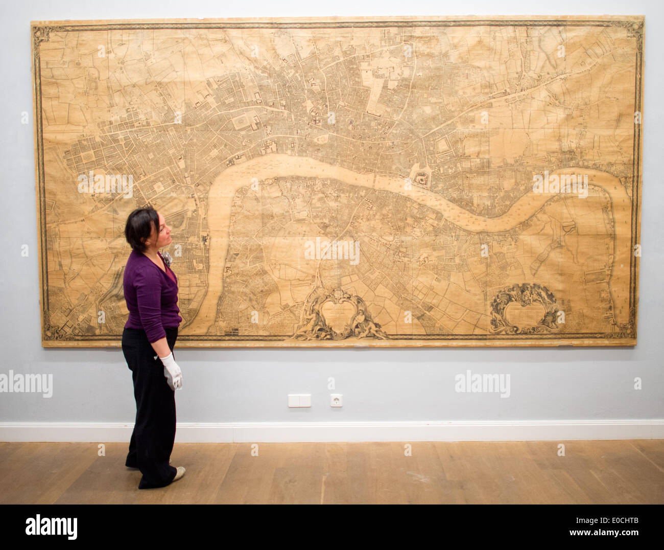 Museum employees hang a map of London from the 18th century at the German Museum of Caricature and Drawings Wilhelm Busch in Hanover, Germany, 09 May 2014. The rare, seven-meter map is going on display in the exhibition 'Koengichles Theater. Britische Karikaturen aus der Zeit der Personalunion und der Gegenwart' (Royal Theater. British caricatures from the time of personal union to present day). Photo: JULIAN STRATENSCHULTE/dpa Stock Photohttps://www.alamy.com/image-license-details/?v=1https://www.alamy.com/museum-employees-hang-a-map-of-london-from-the-18th-century-at-the-image69118907.html
RME0CHTB–Museum employees hang a map of London from the 18th century at the German Museum of Caricature and Drawings Wilhelm Busch in Hanover, Germany, 09 May 2014. The rare, seven-meter map is going on display in the exhibition 'Koengichles Theater. Britische Karikaturen aus der Zeit der Personalunion und der Gegenwart' (Royal Theater. British caricatures from the time of personal union to present day). Photo: JULIAN STRATENSCHULTE/dpa
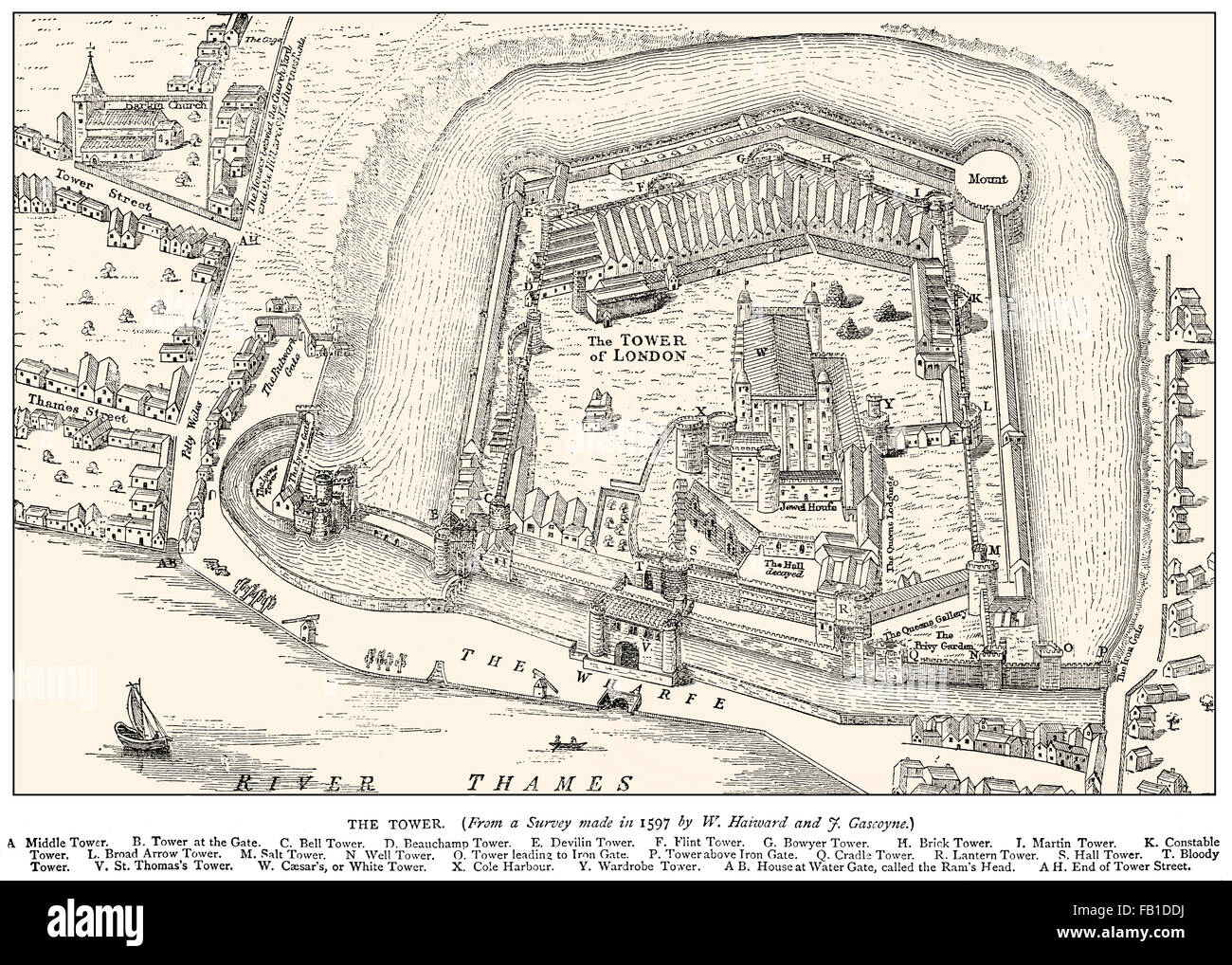 Tower of London, Her Majesty's Royal Palace and Fortress, historic castle on the north bank of the River Thames, 1597 Stock Photohttps://www.alamy.com/image-license-details/?v=1https://www.alamy.com/stock-photo-tower-of-london-her-majestys-royal-palace-and-fortress-historic-castle-92845582.html
RMFB1DDJ–Tower of London, Her Majesty's Royal Palace and Fortress, historic castle on the north bank of the River Thames, 1597
![To the Right Honourable William, Lord Cowper, Lord High Chancellor of Great Britain, this map of Asia : according to ye newest and most exact observations is most humbly dedicated. Map of the Middle East and Asia including the East Indies. It features characteristic misconceptions of early 18th century cartography such as New Guinea as a peninsula of the southern continent and Iapon or Niphon [i.e. Japan] having a huge northern island called Land of Iesso [presumably the islands of Hokkaido and Sakhalin]. Prime meridians: Ferro and London. Relief shown pictorially. Dedicated to Lord Cowper, Hi Stock Photo To the Right Honourable William, Lord Cowper, Lord High Chancellor of Great Britain, this map of Asia : according to ye newest and most exact observations is most humbly dedicated. Map of the Middle East and Asia including the East Indies. It features characteristic misconceptions of early 18th century cartography such as New Guinea as a peninsula of the southern continent and Iapon or Niphon [i.e. Japan] having a huge northern island called Land of Iesso [presumably the islands of Hokkaido and Sakhalin]. Prime meridians: Ferro and London. Relief shown pictorially. Dedicated to Lord Cowper, Hi Stock Photo](https://c8.alamy.com/comp/2M5RR6X/to-the-right-honourable-william-lord-cowper-lord-high-chancellor-of-great-britain-this-map-of-asia-according-to-ye-newest-and-most-exact-observations-is-most-humbly-dedicated-map-of-the-middle-east-and-asia-including-the-east-indies-it-features-characteristic-misconceptions-of-early-18th-century-cartography-such-as-new-guinea-as-a-peninsula-of-the-southern-continent-and-iapon-or-niphon-ie-japan-having-a-huge-northern-island-called-land-of-iesso-presumably-the-islands-of-hokkaido-and-sakhalin-prime-meridians-ferro-and-london-relief-shown-pictorially-dedicated-to-lord-cowper-hi-2M5RR6X.jpg) To the Right Honourable William, Lord Cowper, Lord High Chancellor of Great Britain, this map of Asia : according to ye newest and most exact observations is most humbly dedicated. Map of the Middle East and Asia including the East Indies. It features characteristic misconceptions of early 18th century cartography such as New Guinea as a peninsula of the southern continent and Iapon or Niphon [i.e. Japan] having a huge northern island called Land of Iesso [presumably the islands of Hokkaido and Sakhalin]. Prime meridians: Ferro and London. Relief shown pictorially. Dedicated to Lord Cowper, Hi Stock Photohttps://www.alamy.com/image-license-details/?v=1https://www.alamy.com/to-the-right-honourable-william-lord-cowper-lord-high-chancellor-of-great-britain-this-map-of-asia-according-to-ye-newest-and-most-exact-observations-is-most-humbly-dedicated-map-of-the-middle-east-and-asia-including-the-east-indies-it-features-characteristic-misconceptions-of-early-18th-century-cartography-such-as-new-guinea-as-a-peninsula-of-the-southern-continent-and-iapon-or-niphon-ie-japan-having-a-huge-northern-island-called-land-of-iesso-presumably-the-islands-of-hokkaido-and-sakhalin-prime-meridians-ferro-and-london-relief-shown-pictorially-dedicated-to-lord-cowper-hi-image502697074.html
To the Right Honourable William, Lord Cowper, Lord High Chancellor of Great Britain, this map of Asia : according to ye newest and most exact observations is most humbly dedicated. Map of the Middle East and Asia including the East Indies. It features characteristic misconceptions of early 18th century cartography such as New Guinea as a peninsula of the southern continent and Iapon or Niphon [i.e. Japan] having a huge northern island called Land of Iesso [presumably the islands of Hokkaido and Sakhalin]. Prime meridians: Ferro and London. Relief shown pictorially. Dedicated to Lord Cowper, Hi Stock Photohttps://www.alamy.com/image-license-details/?v=1https://www.alamy.com/to-the-right-honourable-william-lord-cowper-lord-high-chancellor-of-great-britain-this-map-of-asia-according-to-ye-newest-and-most-exact-observations-is-most-humbly-dedicated-map-of-the-middle-east-and-asia-including-the-east-indies-it-features-characteristic-misconceptions-of-early-18th-century-cartography-such-as-new-guinea-as-a-peninsula-of-the-southern-continent-and-iapon-or-niphon-ie-japan-having-a-huge-northern-island-called-land-of-iesso-presumably-the-islands-of-hokkaido-and-sakhalin-prime-meridians-ferro-and-london-relief-shown-pictorially-dedicated-to-lord-cowper-hi-image502697074.htmlRM2M5RR6X–To the Right Honourable William, Lord Cowper, Lord High Chancellor of Great Britain, this map of Asia : according to ye newest and most exact observations is most humbly dedicated. Map of the Middle East and Asia including the East Indies. It features characteristic misconceptions of early 18th century cartography such as New Guinea as a peninsula of the southern continent and Iapon or Niphon [i.e. Japan] having a huge northern island called Land of Iesso [presumably the islands of Hokkaido and Sakhalin]. Prime meridians: Ferro and London. Relief shown pictorially. Dedicated to Lord Cowper, Hi
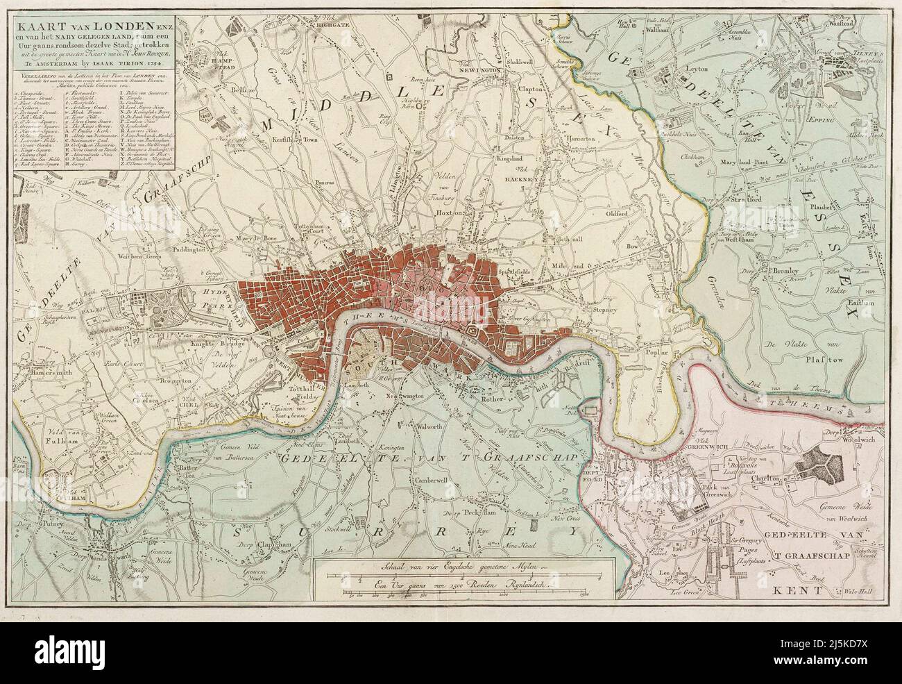 Vintage map of London and area from 17th/18th century. Map is beautifully hand illustrated and engraved showing London at the time. Stock Photohttps://www.alamy.com/image-license-details/?v=1https://www.alamy.com/vintage-map-of-london-and-area-from-17th18th-century-map-is-beautifully-hand-illustrated-and-engraved-showing-london-at-the-time-image468180718.html
RF2J5KD7X–Vintage map of London and area from 17th/18th century. Map is beautifully hand illustrated and engraved showing London at the time.
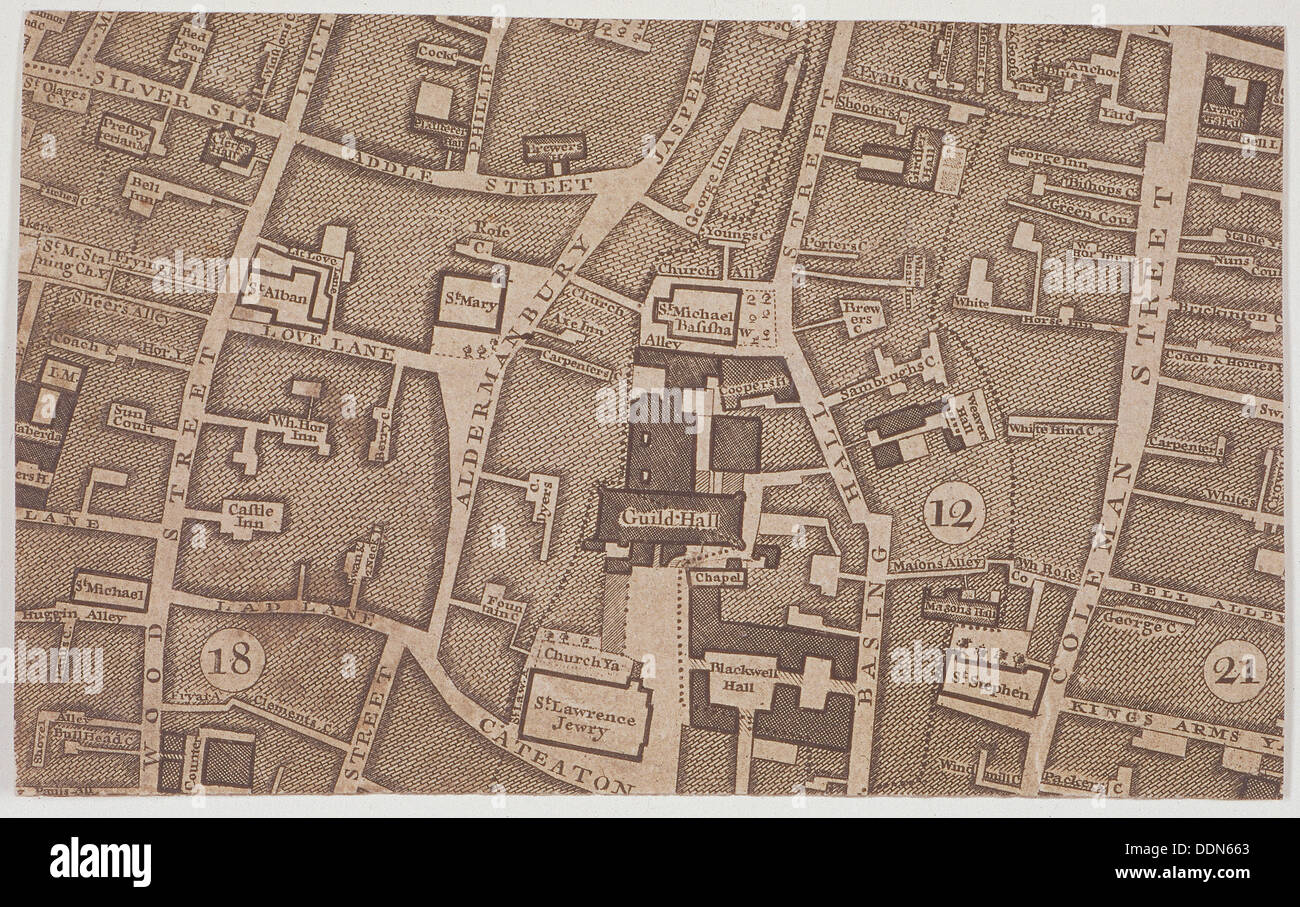 Plan of Guildhall and the neighbourhood around Guildhall, London, 1747. Artist: John Rocque Stock Photohttps://www.alamy.com/image-license-details/?v=1https://www.alamy.com/plan-of-guildhall-and-the-neighbourhood-around-guildhall-london-1747-image60087499.html
RMDDN663–Plan of Guildhall and the neighbourhood around Guildhall, London, 1747. Artist: John Rocque
