Quick filters:
2004 map Stock Photos and Images
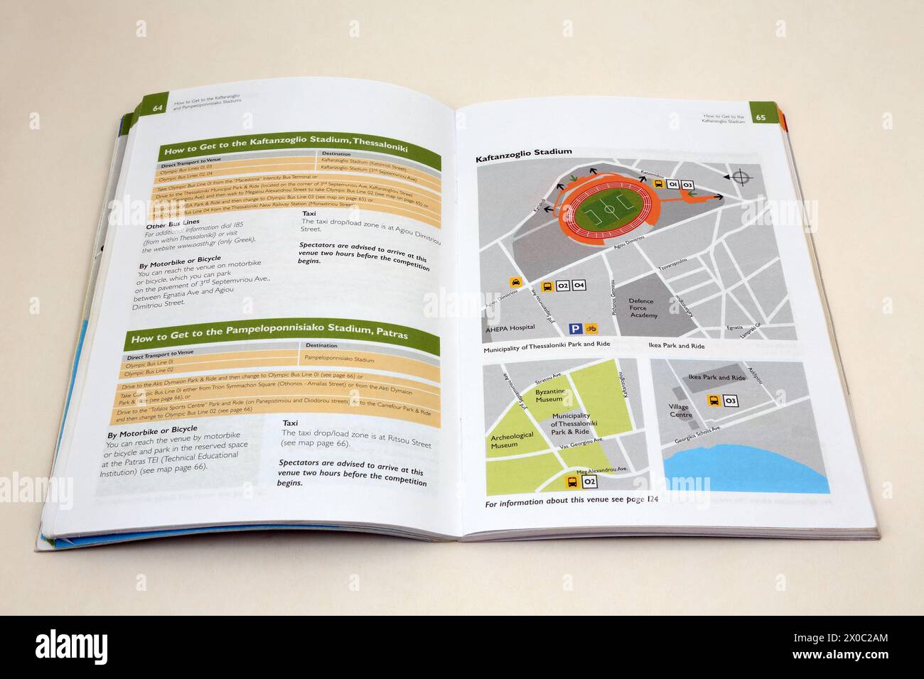 Stadion Official Spectators guide to Summer Olympics Athens 2004 Map of Stadium Stock Photohttps://www.alamy.com/image-license-details/?v=1https://www.alamy.com/stadion-official-spectators-guide-to-summer-olympics-athens-2004-map-of-stadium-image602628172.html
RM2X0C2AM–Stadion Official Spectators guide to Summer Olympics Athens 2004 Map of Stadium
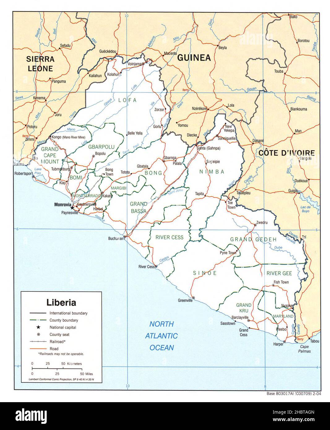 2004 Map of Liberia ca. 2004 Stock Photohttps://www.alamy.com/image-license-details/?v=1https://www.alamy.com/2004-map-of-liberia-ca-2004-image454765941.html
RM2HBTAGN–2004 Map of Liberia ca. 2004
 Tsunami Map, Sumatra Earthquake, 2004 Stock Photohttps://www.alamy.com/image-license-details/?v=1https://www.alamy.com/stock-photo-tsunami-map-sumatra-earthquake-2004-135019969.html
RMHRJK9N–Tsunami Map, Sumatra Earthquake, 2004
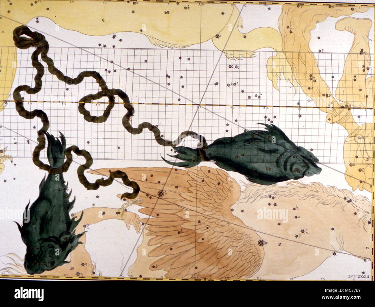 Star map of Aquaries from C18th constellation book. 2004 Charles Walker / Stock Photohttps://www.alamy.com/image-license-details/?v=1https://www.alamy.com/star-map-of-aquaries-from-c18th-constellation-book-2004-charles-walker-image179661075.html
RMMC87EY–Star map of Aquaries from C18th constellation book. 2004 Charles Walker /
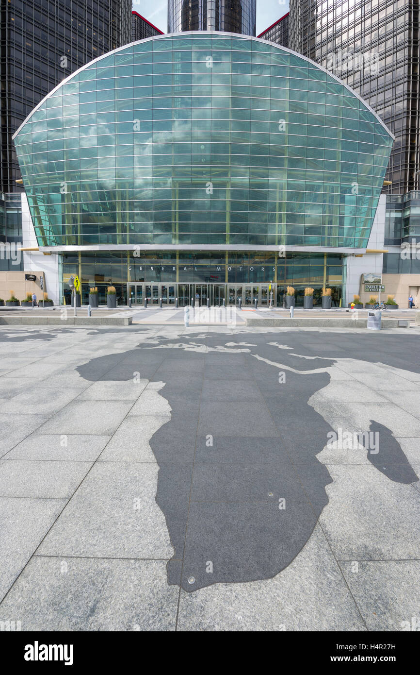 TIP OF AFRICA MAP OUTLINE (©SKIDMORE OWINGS & MERRIL 2004) GM RIVERWALK DOWNTOWN DETROIT MICHIGAN USA Stock Photohttps://www.alamy.com/image-license-details/?v=1https://www.alamy.com/stock-photo-tip-of-africa-map-outline-skidmore-owings-merril-2004-gm-riverwalk-123437877.html
RMH4R27H–TIP OF AFRICA MAP OUTLINE (©SKIDMORE OWINGS & MERRIL 2004) GM RIVERWALK DOWNTOWN DETROIT MICHIGAN USA
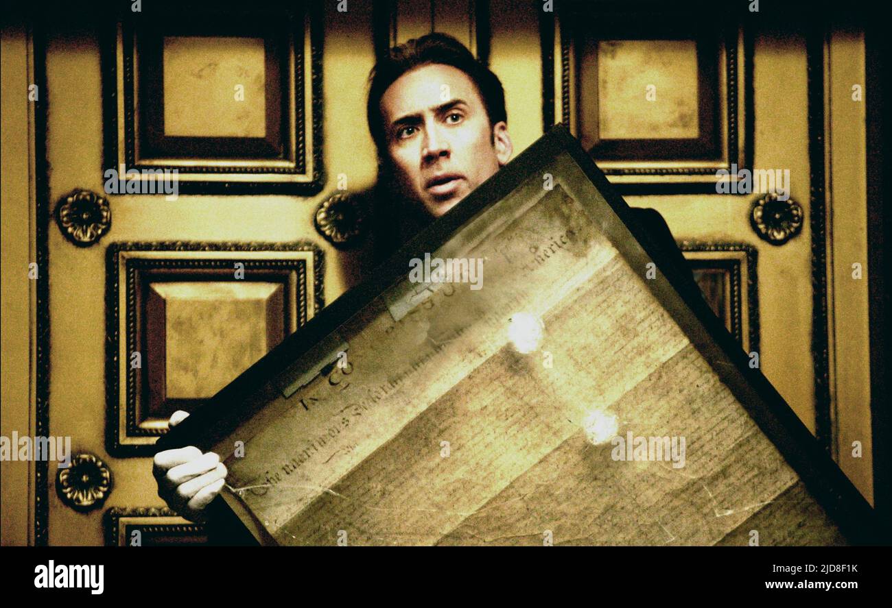 NICOLAS CAGE, NATIONAL TREASURE, 2004, Stock Photohttps://www.alamy.com/image-license-details/?v=1https://www.alamy.com/nicolas-cage-national-treasure-2004-image472857887.html
RM2JD8F1K–NICOLAS CAGE, NATIONAL TREASURE, 2004,
 Members of the Stop Bush campaign examine a map of Co Clare after a meeting with Senior Garda from Ennis at the Killeshin Hotel in Portlaoise, Co Laoise, to discuss restrictions before planned demonstrations against US Presdient, George W. Bush's visit to Dromoland Castle, Co Clare, where he arrives on Friday, 25 June, 2004 and leaves the next day. Stock Photohttps://www.alamy.com/image-license-details/?v=1https://www.alamy.com/stock-photo-members-of-the-stop-bush-campaign-examine-a-map-of-co-clare-after-107620483.html
RMG72F0K–Members of the Stop Bush campaign examine a map of Co Clare after a meeting with Senior Garda from Ennis at the Killeshin Hotel in Portlaoise, Co Laoise, to discuss restrictions before planned demonstrations against US Presdient, George W. Bush's visit to Dromoland Castle, Co Clare, where he arrives on Friday, 25 June, 2004 and leaves the next day.
 LOOKING FOR KITTY, 2004, ©Think Film/courtesy Everett Collection Stock Photohttps://www.alamy.com/image-license-details/?v=1https://www.alamy.com/stock-photo-looking-for-kitty-2004-think-filmcourtesy-everett-collection-72367842.html
RME5MHWP–LOOKING FOR KITTY, 2004, ©Think Film/courtesy Everett Collection
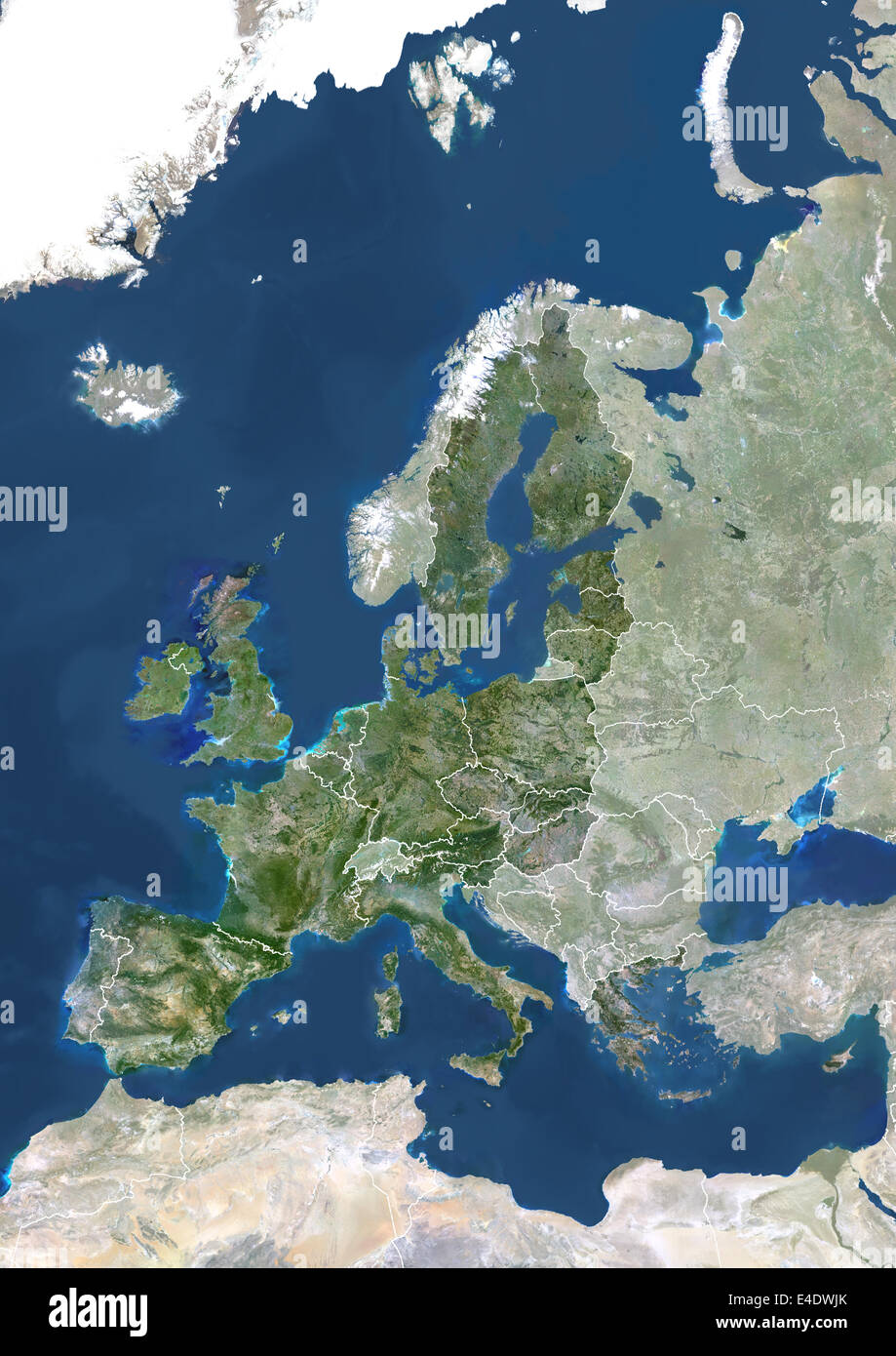 Member States Of The European Union In 2004, True Colour Satellite Image With Mask And Borders. True colour satellite image of t Stock Photohttps://www.alamy.com/image-license-details/?v=1https://www.alamy.com/stock-photo-member-states-of-the-european-union-in-2004-true-colour-satellite-71605595.html
RME4DWJK–Member States Of The European Union In 2004, True Colour Satellite Image With Mask And Borders. True colour satellite image of t
 National Treasure (2004) directed by Jon Turteltaub and starring Nicolas Cage, Diane Kruger and Justin Bartha. A historian races to find the legendary Templar Treasure before a team of mercenaries. Stock Photohttps://www.alamy.com/image-license-details/?v=1https://www.alamy.com/national-treasure-2004-directed-by-jon-turteltaub-and-starring-nicolas-cage-diane-kruger-and-justin-bartha-a-historian-races-to-find-the-legendary-templar-treasure-before-a-team-of-mercenaries-image405371337.html
RM2EFE77N–National Treasure (2004) directed by Jon Turteltaub and starring Nicolas Cage, Diane Kruger and Justin Bartha. A historian races to find the legendary Templar Treasure before a team of mercenaries.
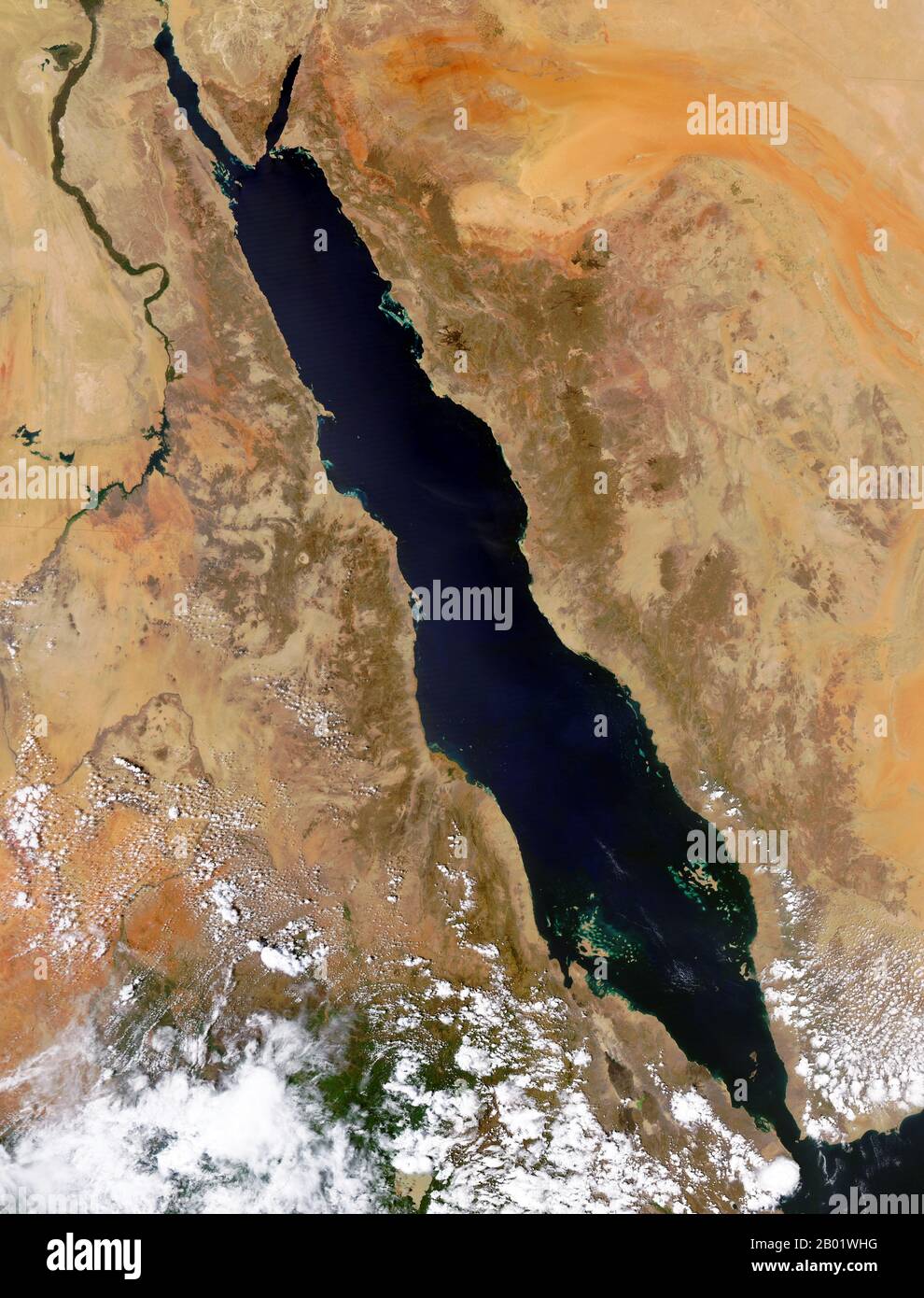 Arabian Peninsula/Middle East: NASA orbital image of the Red Sea area, September 29, 2004. Satellite image of the Red Sea area including (clockwise from top) part or all of the territories of Israel, Jordan, Saudi Arabia, Yemen, Djibouti, Eritrea, Ethiopia, South Sudan, Sudan and Egypt. Stock Photohttps://www.alamy.com/image-license-details/?v=1https://www.alamy.com/arabian-peninsulamiddle-east-nasa-orbital-image-of-the-red-sea-area-september-29-2004-satellite-image-of-the-red-sea-area-including-clockwise-from-top-part-or-all-of-the-territories-of-israel-jordan-saudi-arabia-yemen-djibouti-eritrea-ethiopia-south-sudan-sudan-and-egypt-image344249404.html
RM2B01WHG–Arabian Peninsula/Middle East: NASA orbital image of the Red Sea area, September 29, 2004. Satellite image of the Red Sea area including (clockwise from top) part or all of the territories of Israel, Jordan, Saudi Arabia, Yemen, Djibouti, Eritrea, Ethiopia, South Sudan, Sudan and Egypt.
 Tropical Storm Charley 2004. Currently approaching Jamaica. Stock Photohttps://www.alamy.com/image-license-details/?v=1https://www.alamy.com/tropical-storm-charley-2004-currently-approaching-jamaica-image68559070.html
RMDYF3P6–Tropical Storm Charley 2004. Currently approaching Jamaica.
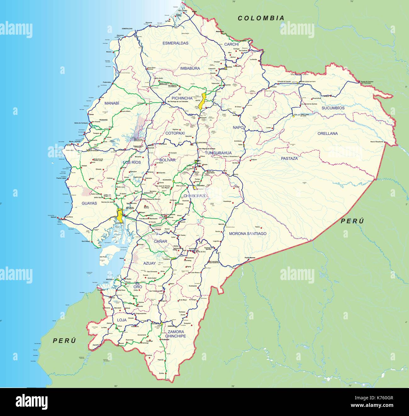 Road and hydro graphical map of Ecuador with the main roads, provincial boundaries, provincial capitals and main cities names - Year 2004 - Vector Stock Vectorhttps://www.alamy.com/image-license-details/?v=1https://www.alamy.com/road-and-hydro-graphical-map-of-ecuador-with-the-main-roads-provincial-image159328087.html
RFK760GR–Road and hydro graphical map of Ecuador with the main roads, provincial boundaries, provincial capitals and main cities names - Year 2004 - Vector
 Cow Parade Prague 2004 this cow is called Lost Navigator by Miroslav Novak. it features a map of Prague streets. Stock Photohttps://www.alamy.com/image-license-details/?v=1https://www.alamy.com/cow-parade-prague-2004-this-cow-is-called-lost-navigator-by-miroslav-image4950886.html
RMAM6K67–Cow Parade Prague 2004 this cow is called Lost Navigator by Miroslav Novak. it features a map of Prague streets.
 PARIS FRANCE TOURIST MAP 2004 Stock Photohttps://www.alamy.com/image-license-details/?v=1https://www.alamy.com/paris-france-tourist-map-2004-image1285252.html
RMAK9C85–PARIS FRANCE TOURIST MAP 2004
 Portugal Lisbon Modified Metro Map for Euro Cup Footbal Championship 2004 Stock Photohttps://www.alamy.com/image-license-details/?v=1https://www.alamy.com/portugal-lisbon-modified-metro-map-for-euro-cup-footbal-championship-image1979119.html
RMA2Y2F0–Portugal Lisbon Modified Metro Map for Euro Cup Footbal Championship 2004
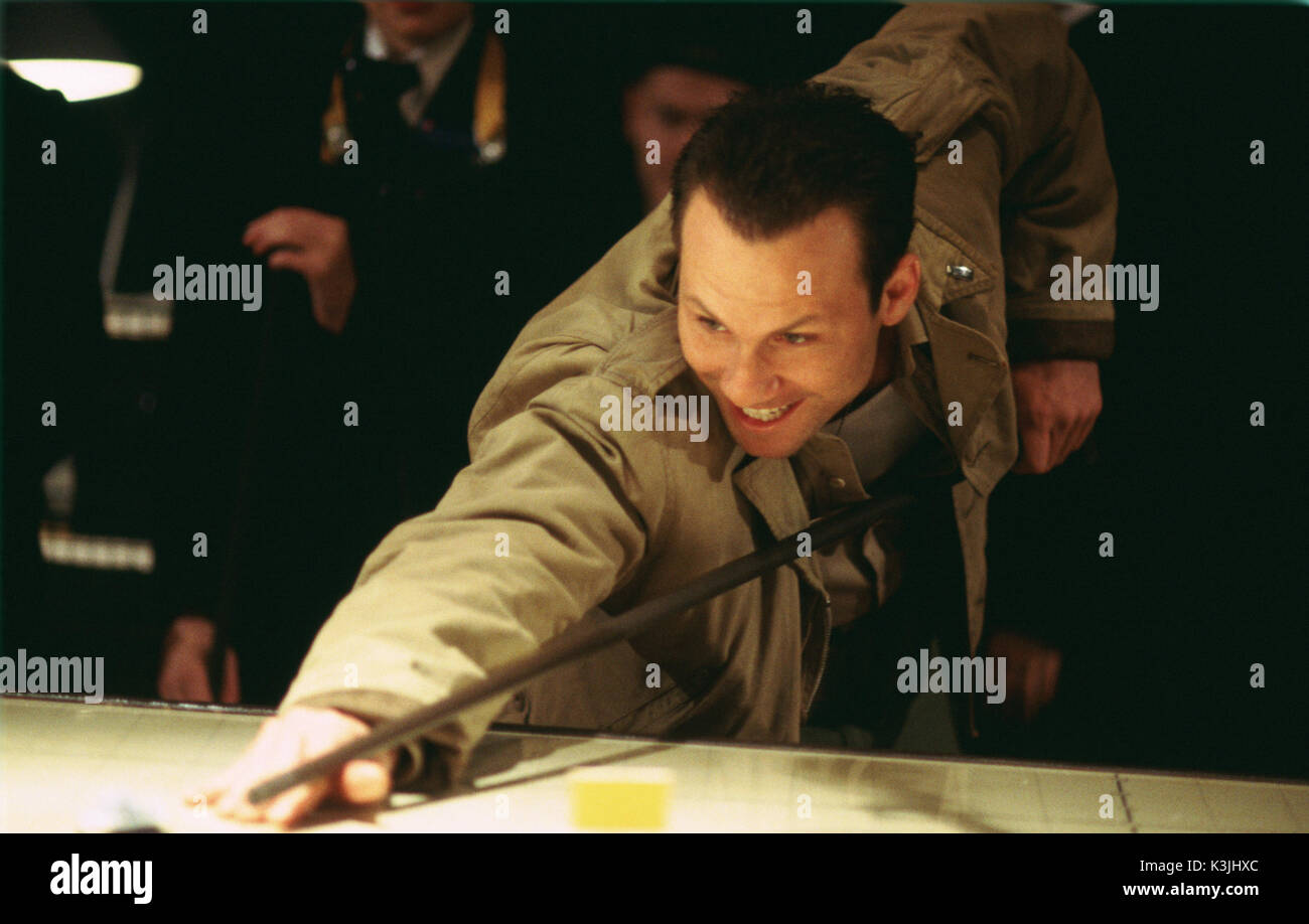 CHURCHILL: THE HOLLYWOOD YEARS Christian Slater as Churchill playing pool on the war strategy map CHURCHILL: THE HOLLYWOOD YEARS Date: 2004 Stock Photohttps://www.alamy.com/image-license-details/?v=1https://www.alamy.com/churchill-the-hollywood-years-christian-slater-as-churchill-playing-image157146484.html
RMK3JHXC–CHURCHILL: THE HOLLYWOOD YEARS Christian Slater as Churchill playing pool on the war strategy map CHURCHILL: THE HOLLYWOOD YEARS Date: 2004
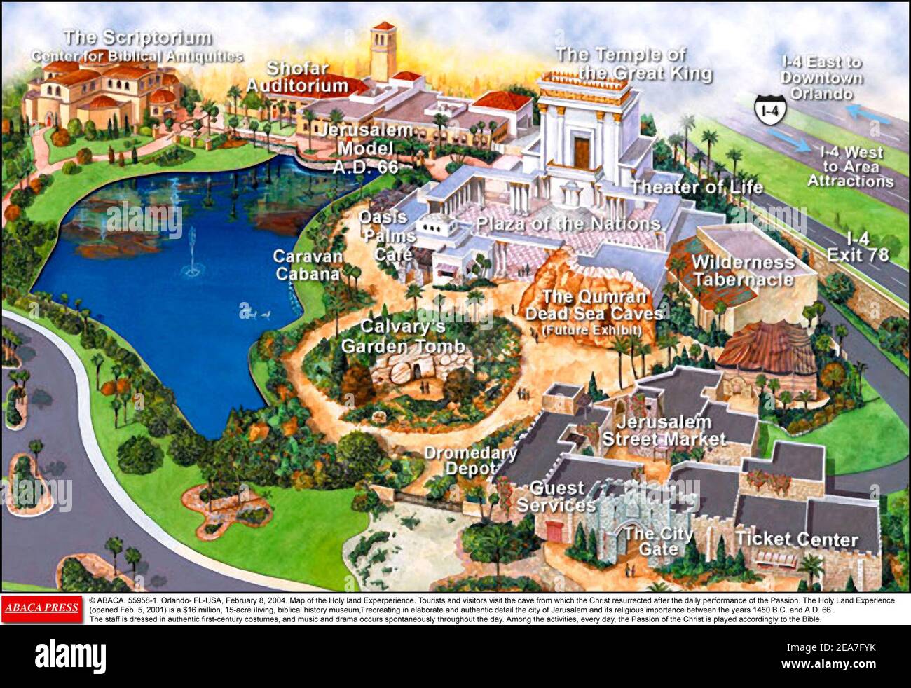 © ABACA. 55958-1. Orlando- FL-USA, February 8, 2004. Map of the Holy land Experience. Tourists and visitors visit the cave from which the Christ resurrected after the daily performance of the Passion. The Holy Land Experience (opened Feb. 5, 2001) is a $16 million, 15-acre living, biblical history museum, recreating in elaborate and authentic detail the city of Jerusalem and its religious importance between the years 1450 B.C. and A.D. 66 (through the Old and New Testaments, from Genesis through Revelation). The staff is dressed in authentic first-century costumes, and music and drama occurs s Stock Photohttps://www.alamy.com/image-license-details/?v=1https://www.alamy.com/abaca-55958-1-orlando-fl-usa-february-8-2004-map-of-the-holy-land-experience-tourists-and-visitors-visit-the-cave-from-which-the-christ-resurrected-after-the-daily-performance-of-the-passion-the-holy-land-experience-opened-feb-5-2001-is-a-16-million-15-acre-living-biblical-history-museum-recreating-in-elaborate-and-authentic-detail-the-city-of-jerusalem-and-its-religious-importance-between-the-years-1450-bc-and-ad-66-through-the-old-and-new-testaments-from-genesis-through-revelation-the-staff-is-dressed-in-authentic-first-century-costumes-and-music-and-drama-occurs-s-image402151223.html
RF2EA7FYK–© ABACA. 55958-1. Orlando- FL-USA, February 8, 2004. Map of the Holy land Experience. Tourists and visitors visit the cave from which the Christ resurrected after the daily performance of the Passion. The Holy Land Experience (opened Feb. 5, 2001) is a $16 million, 15-acre living, biblical history museum, recreating in elaborate and authentic detail the city of Jerusalem and its religious importance between the years 1450 B.C. and A.D. 66 (through the Old and New Testaments, from Genesis through Revelation). The staff is dressed in authentic first-century costumes, and music and drama occurs s
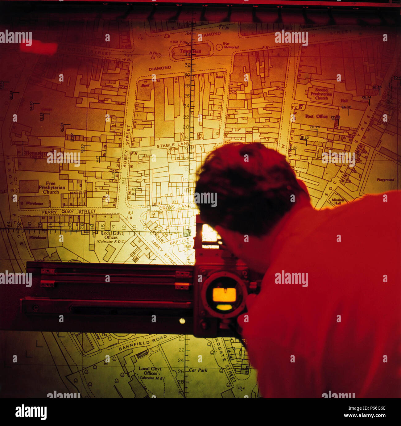
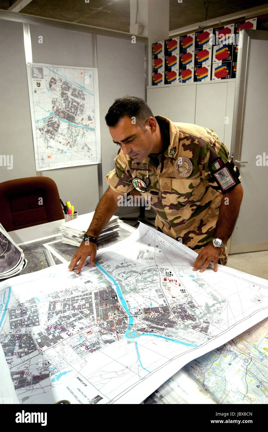 Nassiriya (Iraq), Italian Military Contingent, Tallin Airport, 6th ROA (Military Air Force), cartography department (October 2004) Stock Photohttps://www.alamy.com/image-license-details/?v=1https://www.alamy.com/stock-photo-nassiriya-iraq-italian-military-contingent-tallin-airport-6th-roa-145021541.html
RMJBX8CN–Nassiriya (Iraq), Italian Military Contingent, Tallin Airport, 6th ROA (Military Air Force), cartography department (October 2004)
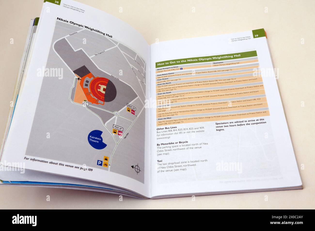 Stadion Official Spectators guide to Summer Olympics Athens 2004 Map of Weightlifting Hall Stock Photohttps://www.alamy.com/image-license-details/?v=1https://www.alamy.com/stadion-official-spectators-guide-to-summer-olympics-athens-2004-map-of-weightlifting-hall-image602628179.html
RM2X0C2AY–Stadion Official Spectators guide to Summer Olympics Athens 2004 Map of Weightlifting Hall
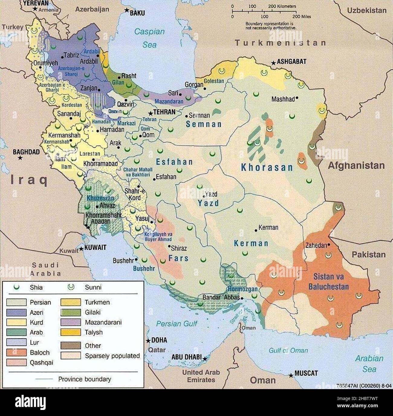 2004 Map of Iran ethnoreligious distribution ca. 27 December 2009 Stock Photohttps://www.alamy.com/image-license-details/?v=1https://www.alamy.com/2004-map-of-iran-ethnoreligious-distribution-ca-27-december-2009-image454763844.html
RM2HBT7WT–2004 Map of Iran ethnoreligious distribution ca. 27 December 2009
 El Ni̱o, Pacific Ocean Temperature, 2004 Stock Photohttps://www.alamy.com/image-license-details/?v=1https://www.alamy.com/stock-photo-el-nio-pacific-ocean-temperature-2004-135022093.html
RMHRJP1H–El Ni̱o, Pacific Ocean Temperature, 2004
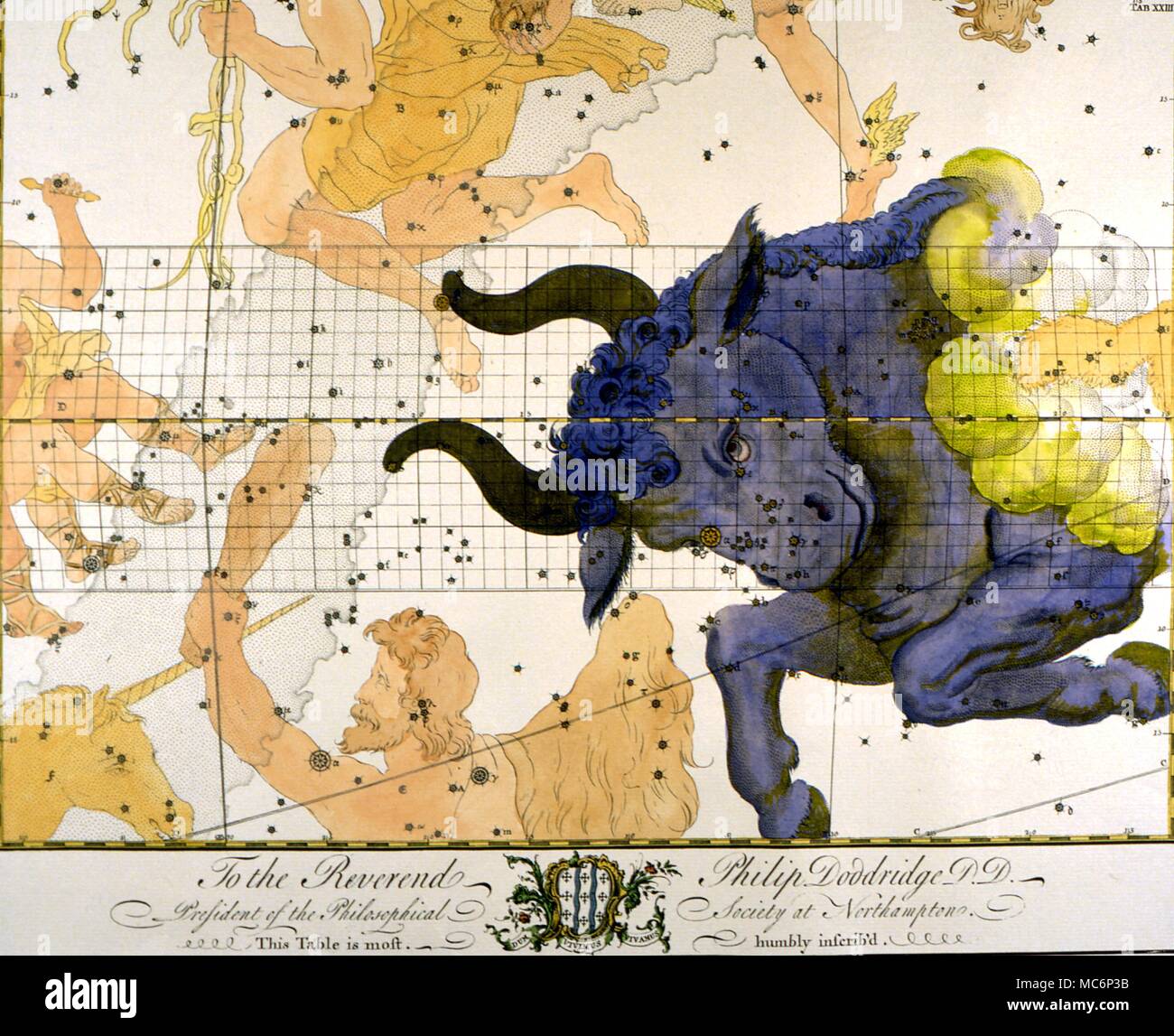 Star map of Taurus, from an eighteenth century constellation book, the plates having been printed by subscription. 2004 Charles Walker / Stock Photohttps://www.alamy.com/image-license-details/?v=1https://www.alamy.com/star-map-of-taurus-from-an-eighteenth-century-constellation-book-the-plates-having-been-printed-by-subscription-2004-charles-walker-image179628607.html
RMMC6P3B–Star map of Taurus, from an eighteenth century constellation book, the plates having been printed by subscription. 2004 Charles Walker /
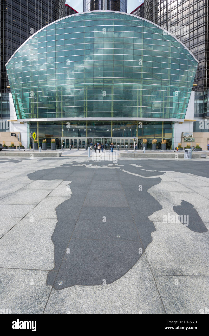 TIP OF AFRICA MAP OUTLINE (©SKIDMORE OWINGS & MERRIL 2004) GM RIVERWALK DOWNTOWN DETROIT MICHIGAN USA Stock Photohttps://www.alamy.com/image-license-details/?v=1https://www.alamy.com/stock-photo-tip-of-africa-map-outline-skidmore-owings-merril-2004-gm-riverwalk-123437873.html
RMH4R27D–TIP OF AFRICA MAP OUTLINE (©SKIDMORE OWINGS & MERRIL 2004) GM RIVERWALK DOWNTOWN DETROIT MICHIGAN USA
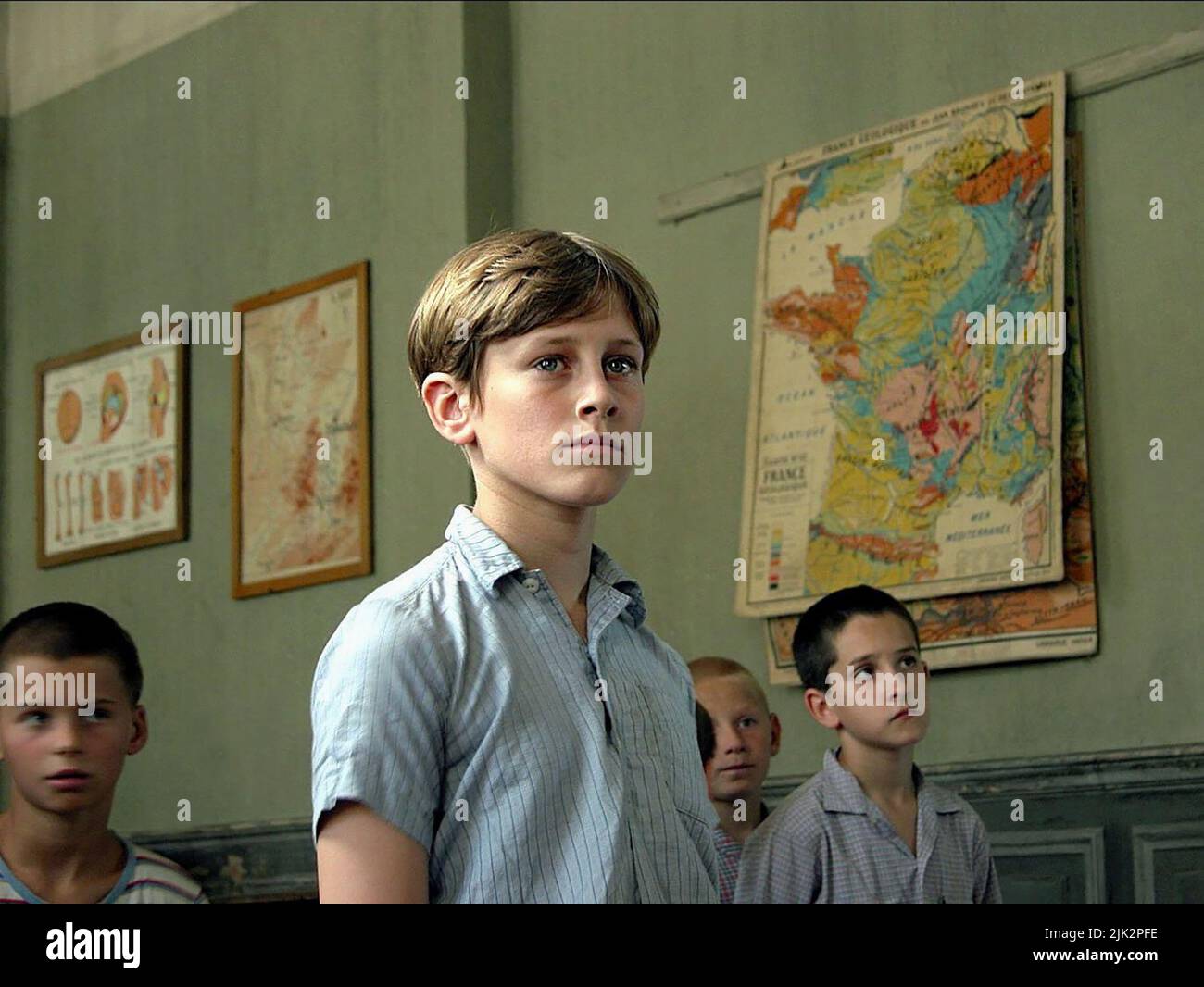 JEAN-BAPTISTE MAUNIER, LES CHORISTES, 2004, Stock Photohttps://www.alamy.com/image-license-details/?v=1https://www.alamy.com/jean-baptiste-maunier-les-choristes-2004-image476419986.html
RM2JK2PFE–JEAN-BAPTISTE MAUNIER, LES CHORISTES, 2004,
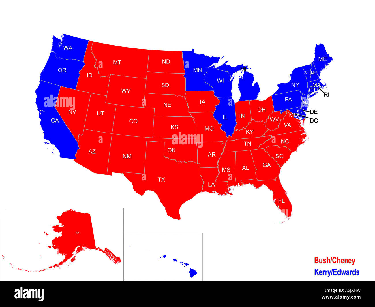 United States Presidential Election Results Map For 2004 Stock Photohttps://www.alamy.com/image-license-details/?v=1https://www.alamy.com/stock-photo-united-states-presidential-election-results-map-for-2004-11329956.html
RMA5JXNW–United States Presidential Election Results Map For 2004
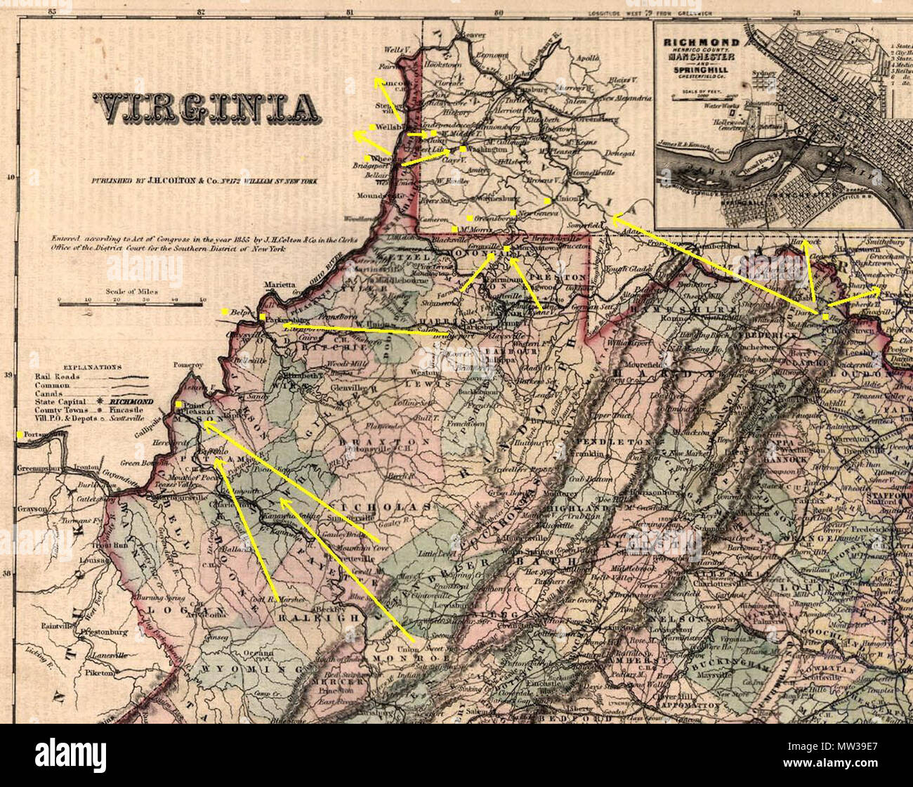 . English: Routes for escaping slaves through western (West) Virginia on the Underground Railroad, information derived from William J. Switala 'Underground Railroad in Delaware, Marylonad, and West Virginia', Stackpole Books, 2004, pages 108, 116-125. 1855. Own work on PD map 654 WVUndergroundRR Stock Photohttps://www.alamy.com/image-license-details/?v=1https://www.alamy.com/english-routes-for-escaping-slaves-through-western-west-virginia-on-the-underground-railroad-information-derived-from-william-j-switala-underground-railroad-in-delaware-marylonad-and-west-virginia-stackpole-books-2004-pages-108-116-125-1855-own-work-on-pd-map-654-wvundergroundrr-image187543391.html
RMMW39E7–. English: Routes for escaping slaves through western (West) Virginia on the Underground Railroad, information derived from William J. Switala 'Underground Railroad in Delaware, Marylonad, and West Virginia', Stackpole Books, 2004, pages 108, 116-125. 1855. Own work on PD map 654 WVUndergroundRR
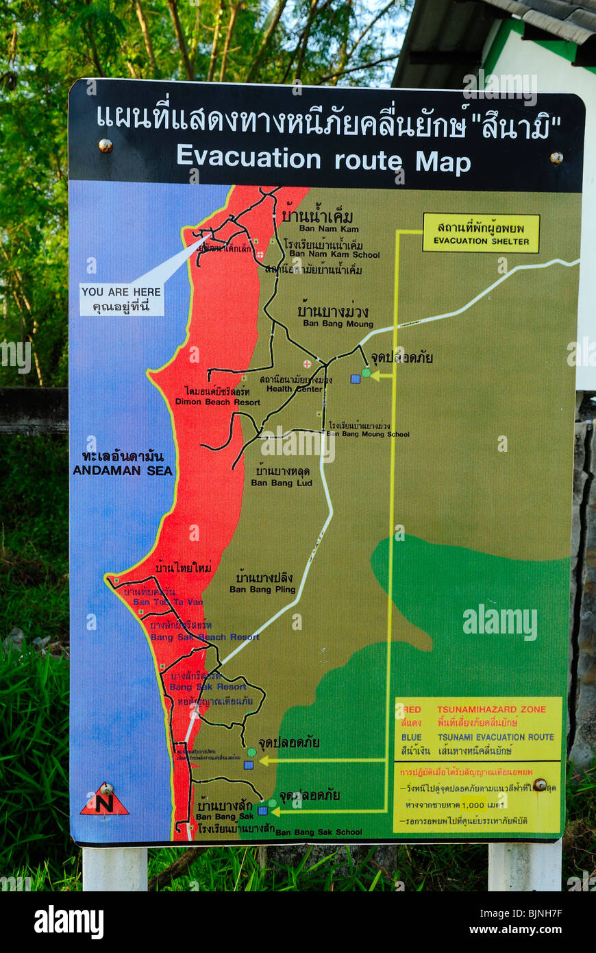 Evacuation route map in Ban Nam Khem village, Thailand Stock Photohttps://www.alamy.com/image-license-details/?v=1https://www.alamy.com/stock-photo-evacuation-route-map-in-ban-nam-khem-village-thailand-28748707.html
RFBJNH7F–Evacuation route map in Ban Nam Khem village, Thailand
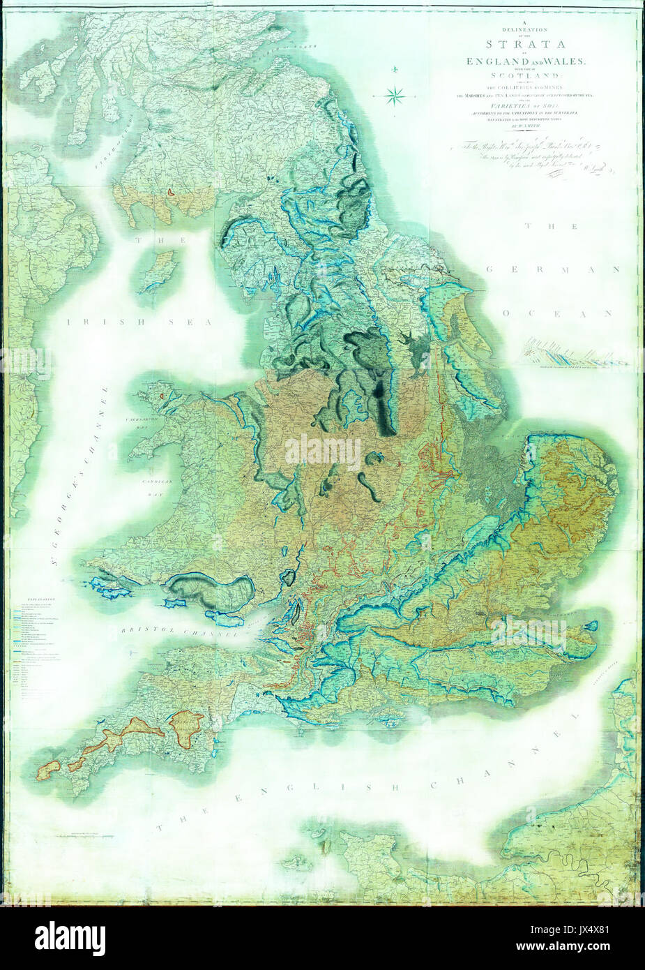 'Strata of England and Wales' The William Smith Geological Map Adjusted for clarity YORYM 2004 25 Stock Photohttps://www.alamy.com/image-license-details/?v=1https://www.alamy.com/strata-of-england-and-wales-the-william-smith-geological-map-adjusted-image153772417.html
RMJX4X81–'Strata of England and Wales' The William Smith Geological Map Adjusted for clarity YORYM 2004 25
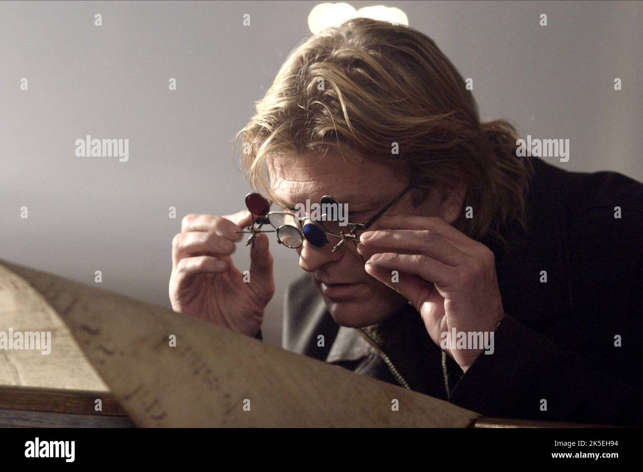 SEAN BEAN, NATIONAL TREASURE, 2004 Stock Photohttps://www.alamy.com/image-license-details/?v=1https://www.alamy.com/sean-bean-national-treasure-2004-image485284496.html
RM2K5EH94–SEAN BEAN, NATIONAL TREASURE, 2004
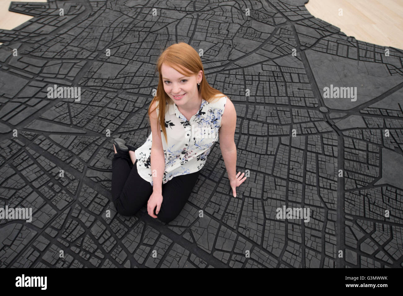 The Tate Modern, London UK. 14th June 2016. The world’s most popular gallery presents the new Switch House to the press, designed by architects Herzog & de Meuron, opening to the public on 17th June 2016 and increasing the overall space by 60%. Galleries within the existing Boiler House are also rehung for the official opening. A member of gallery staff sits on Beirut Caoutchouc by Marwan Rechmaoui, a floor based rubber map of the City of Beirut. Credit: Malcolm Park/Alamy Live News. Stock Photohttps://www.alamy.com/image-license-details/?v=1https://www.alamy.com/stock-photo-the-tate-modern-london-uk-14th-june-2016-the-worlds-most-popular-gallery-105565535.html
RMG3MWWK–The Tate Modern, London UK. 14th June 2016. The world’s most popular gallery presents the new Switch House to the press, designed by architects Herzog & de Meuron, opening to the public on 17th June 2016 and increasing the overall space by 60%. Galleries within the existing Boiler House are also rehung for the official opening. A member of gallery staff sits on Beirut Caoutchouc by Marwan Rechmaoui, a floor based rubber map of the City of Beirut. Credit: Malcolm Park/Alamy Live News.
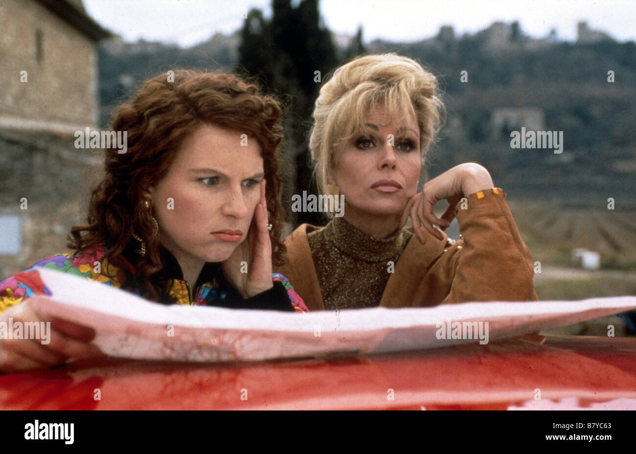 Absolutely Fabulous TV-Series 1992-2004 UK Director: Tristram Shapeero Bob Spiers Joanna Lumley , Jennifer Saunders Stock Photohttps://www.alamy.com/image-license-details/?v=1https://www.alamy.com/stock-photo-absolutely-fabulous-tv-series-1992-2004-uk-director-tristram-shapeero-22115243.html
RMB7YC63–Absolutely Fabulous TV-Series 1992-2004 UK Director: Tristram Shapeero Bob Spiers Joanna Lumley , Jennifer Saunders
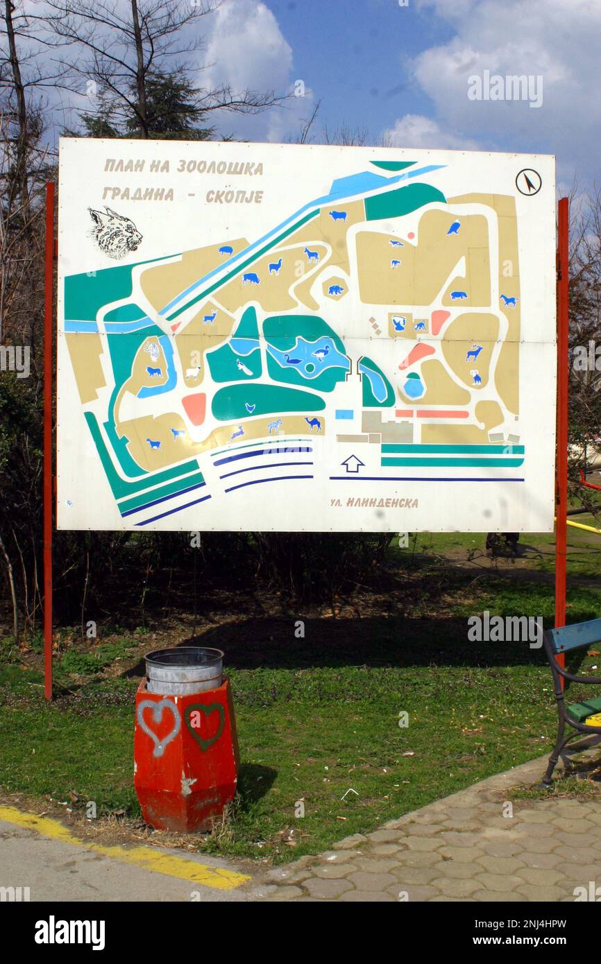 Skopje Zoo photographed March 2004. These photographs led to a number of press articles criticising the conditions at the Zoo. Over the years the zoo received much criticism for the living conditions of its animals. In 2008 the City allocated 42 million denar in funds to improve the zoo, and the zoo started working with the European Association of Zoos and Aquaria (EAZA) to bring the zoo up to modern standards. By 2010 new enclosures had been built, 85% of the older exhibits at the zoo had been renovated, the zoo became an EAZA membership candidate. Picture garyroberts/worldwidefeatures.com Stock Photohttps://www.alamy.com/image-license-details/?v=1https://www.alamy.com/skopje-zoo-photographed-march-2004-these-photographs-led-to-a-number-of-press-articles-criticising-the-conditions-at-the-zoo-over-the-years-the-zoo-received-much-criticism-for-the-living-conditions-of-its-animals-in-2008-the-city-allocated-42-million-denar-in-funds-to-improve-the-zoo-and-the-zoo-started-working-with-the-european-association-of-zoos-and-aquaria-eaza-to-bring-the-zoo-up-to-modern-standards-by-2010-new-enclosures-had-been-built-85-of-the-older-exhibits-at-the-zoo-had-been-renovated-the-zoo-became-an-eaza-membership-candidate-picture-garyrobertsworldwidefeaturescom-image527476625.html
RM2NJ4HPW–Skopje Zoo photographed March 2004. These photographs led to a number of press articles criticising the conditions at the Zoo. Over the years the zoo received much criticism for the living conditions of its animals. In 2008 the City allocated 42 million denar in funds to improve the zoo, and the zoo started working with the European Association of Zoos and Aquaria (EAZA) to bring the zoo up to modern standards. By 2010 new enclosures had been built, 85% of the older exhibits at the zoo had been renovated, the zoo became an EAZA membership candidate. Picture garyroberts/worldwidefeatures.com
 'Strata of England and Wales' The William Smith Geological Map - High Resolution YORYM 2004 25. Stock Photohttps://www.alamy.com/image-license-details/?v=1https://www.alamy.com/strata-of-england-and-wales-the-william-smith-geological-map-high-resolution-yorym-2004-25-image207514067.html
RMP1H28K–'Strata of England and Wales' The William Smith Geological Map - High Resolution YORYM 2004 25.
 ENGLAND CAMBRIDGE TOURIST FROM JAPAN 2004 Stock Photohttps://www.alamy.com/image-license-details/?v=1https://www.alamy.com/england-cambridge-tourist-from-japan-2004-image1878936.html
RMA0XB99–ENGLAND CAMBRIDGE TOURIST FROM JAPAN 2004
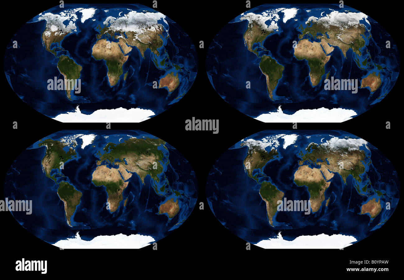 Worldwide seasonal changes in land ice coverage in 2004 Stock Photohttps://www.alamy.com/image-license-details/?v=1https://www.alamy.com/stock-photo-worldwide-seasonal-changes-in-land-ice-coverage-in-2004-17820625.html
RMB0YPAW–Worldwide seasonal changes in land ice coverage in 2004
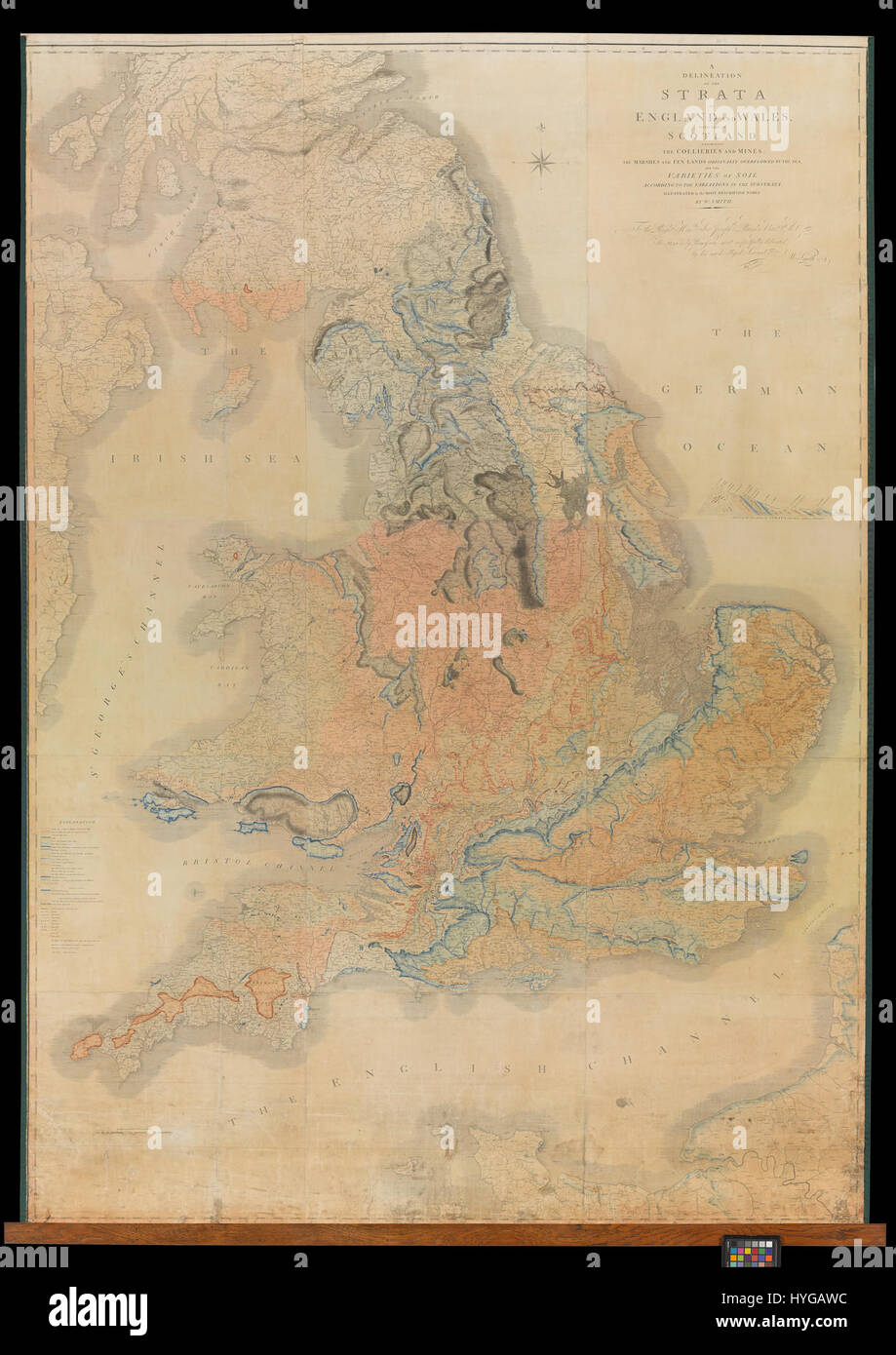 'Strata of England and Wales' The William Smith Geological Map High Resolution YORYM 2004 25 Stock Photohttps://www.alamy.com/image-license-details/?v=1https://www.alamy.com/stock-photo-strata-of-england-and-wales-the-william-smith-geological-map-high-137428072.html
RMHYGAWC–'Strata of England and Wales' The William Smith Geological Map High Resolution YORYM 2004 25
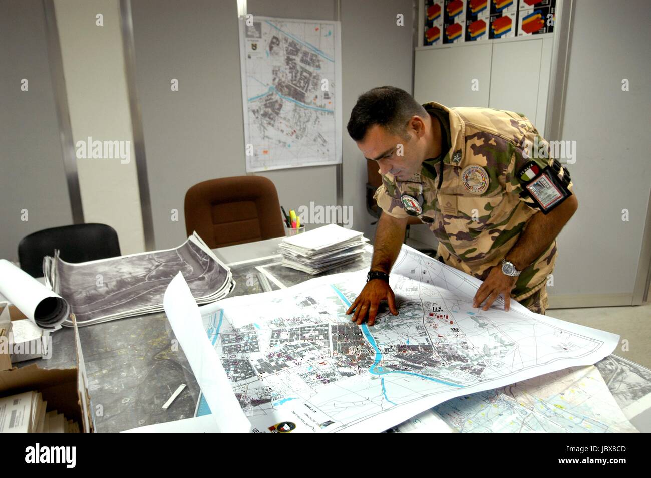 Nassiriya (Iraq), Italian Military Contingent, Tallin Airport, 6th ROA (Military Air Force), cartography department (October 2004) Stock Photohttps://www.alamy.com/image-license-details/?v=1https://www.alamy.com/stock-photo-nassiriya-iraq-italian-military-contingent-tallin-airport-6th-roa-145021533.html
RMJBX8CD–Nassiriya (Iraq), Italian Military Contingent, Tallin Airport, 6th ROA (Military Air Force), cartography department (October 2004)
 Greenbelt Park Site Map, Project Years 2004-2012 Stock Photohttps://www.alamy.com/image-license-details/?v=1https://www.alamy.com/greenbelt-park-site-map-project-years-2004-2012-image261971677.html
RMW65RF9–Greenbelt Park Site Map, Project Years 2004-2012
 Map of Jordan ca. 2004 Stock Photohttps://www.alamy.com/image-license-details/?v=1https://www.alamy.com/map-of-jordan-ca-2004-image454754145.html
RM2HBRRFD–Map of Jordan ca. 2004
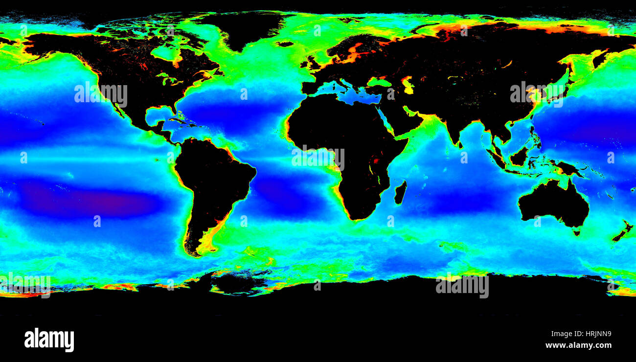 Global Chlorophyll Concentrations 2002-2004 Stock Photohttps://www.alamy.com/image-license-details/?v=1https://www.alamy.com/stock-photo-global-chlorophyll-concentrations-2002-2004-135021861.html
RMHRJNN9–Global Chlorophyll Concentrations 2002-2004
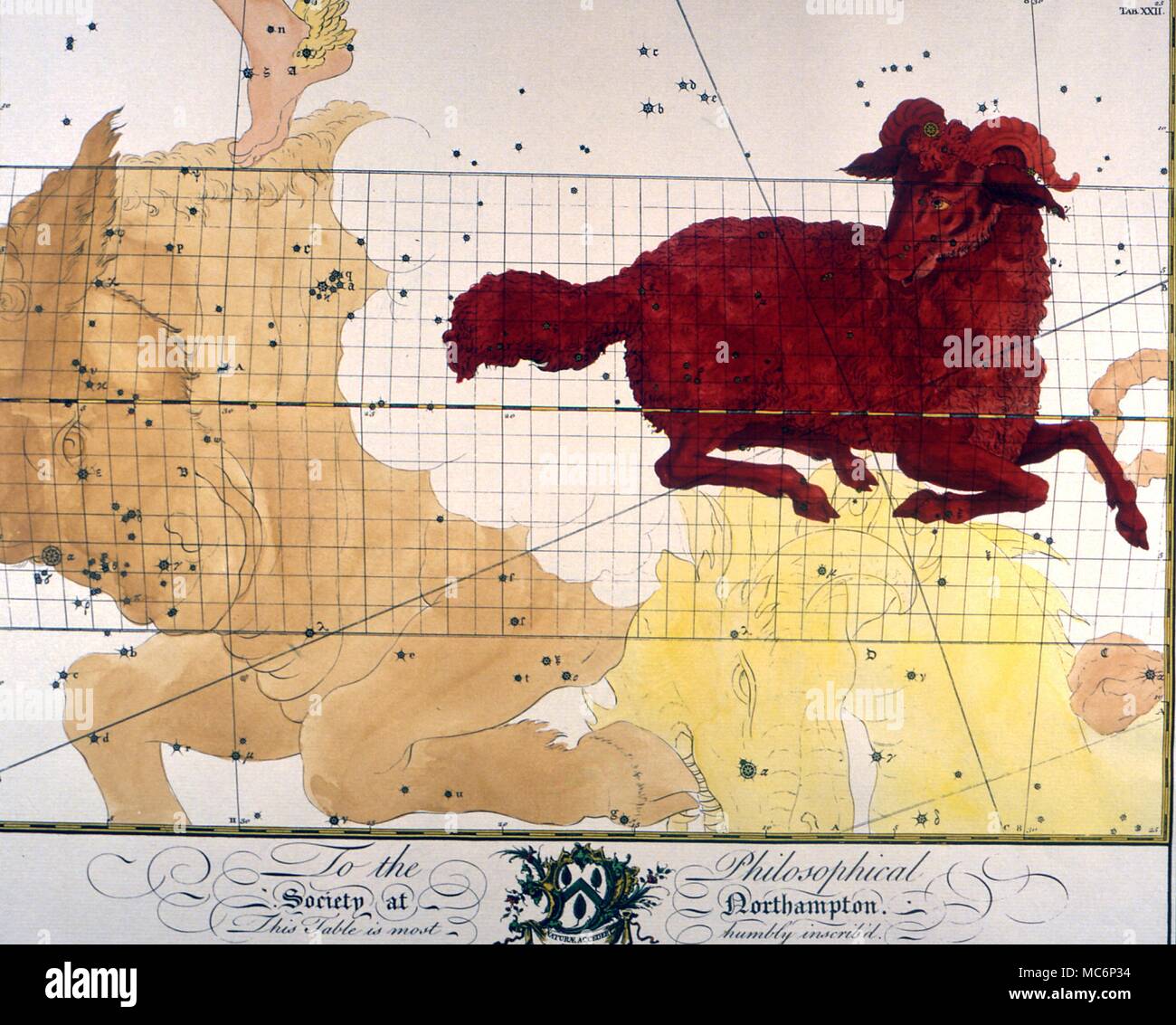 Aries- Star map of Aries from an eighteenth century constellation book, the plates having been printed by subscription. 2004 Charles Walker / Stock Photohttps://www.alamy.com/image-license-details/?v=1https://www.alamy.com/aries-star-map-of-aries-from-an-eighteenth-century-constellation-book-the-plates-having-been-printed-by-subscription-2004-charles-walker-image179628600.html
RMMC6P34–Aries- Star map of Aries from an eighteenth century constellation book, the plates having been printed by subscription. 2004 Charles Walker /
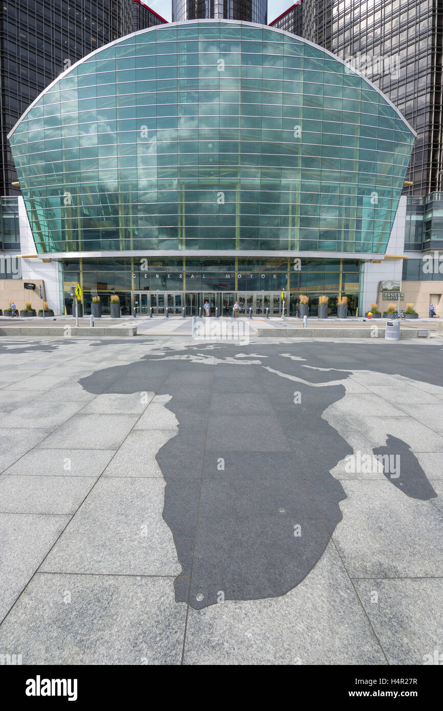 TIP OF AFRICA MAP OUTLINE (©SKIDMORE OWINGS & MERRIL 2004) GM RIVERWALK DOWNTOWN DETROIT MICHIGAN USA Stock Photohttps://www.alamy.com/image-license-details/?v=1https://www.alamy.com/stock-photo-tip-of-africa-map-outline-skidmore-owings-merril-2004-gm-riverwalk-123437883.html
RMH4R27R–TIP OF AFRICA MAP OUTLINE (©SKIDMORE OWINGS & MERRIL 2004) GM RIVERWALK DOWNTOWN DETROIT MICHIGAN USA
 KRUGER,CAGE,BARTHA, NATIONAL TREASURE, 2004 Stock Photohttps://www.alamy.com/image-license-details/?v=1https://www.alamy.com/krugercagebartha-national-treasure-2004-image473164904.html
RM2JDPEJG–KRUGER,CAGE,BARTHA, NATIONAL TREASURE, 2004
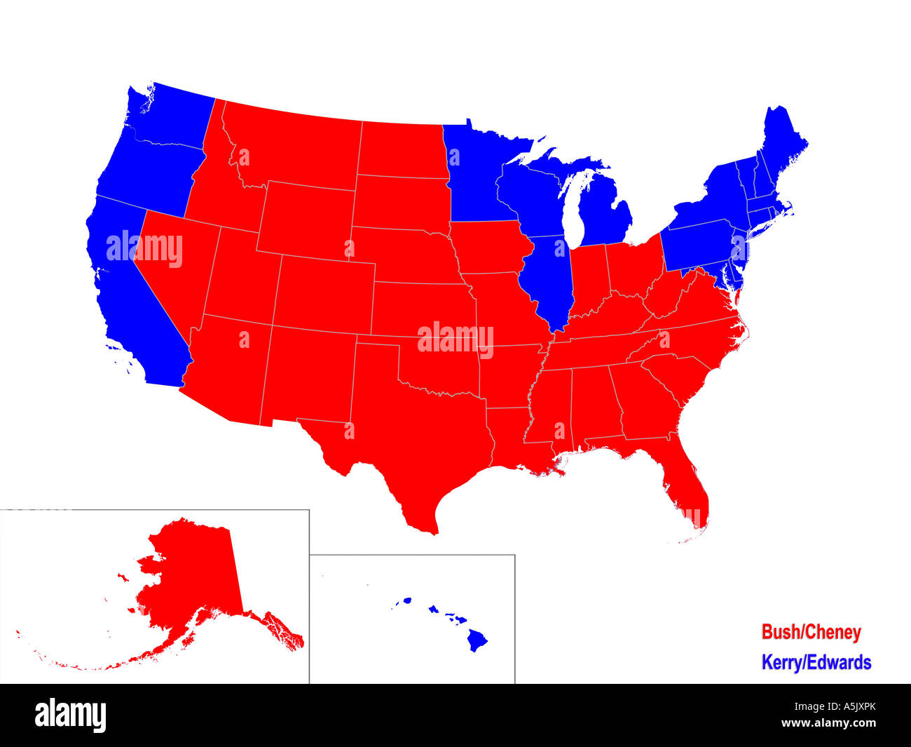 United States Presidential Election Results Map For 2004 Stock Photohttps://www.alamy.com/image-license-details/?v=1https://www.alamy.com/stock-photo-united-states-presidential-election-results-map-for-2004-11329962.html
RMA5JXPK–United States Presidential Election Results Map For 2004
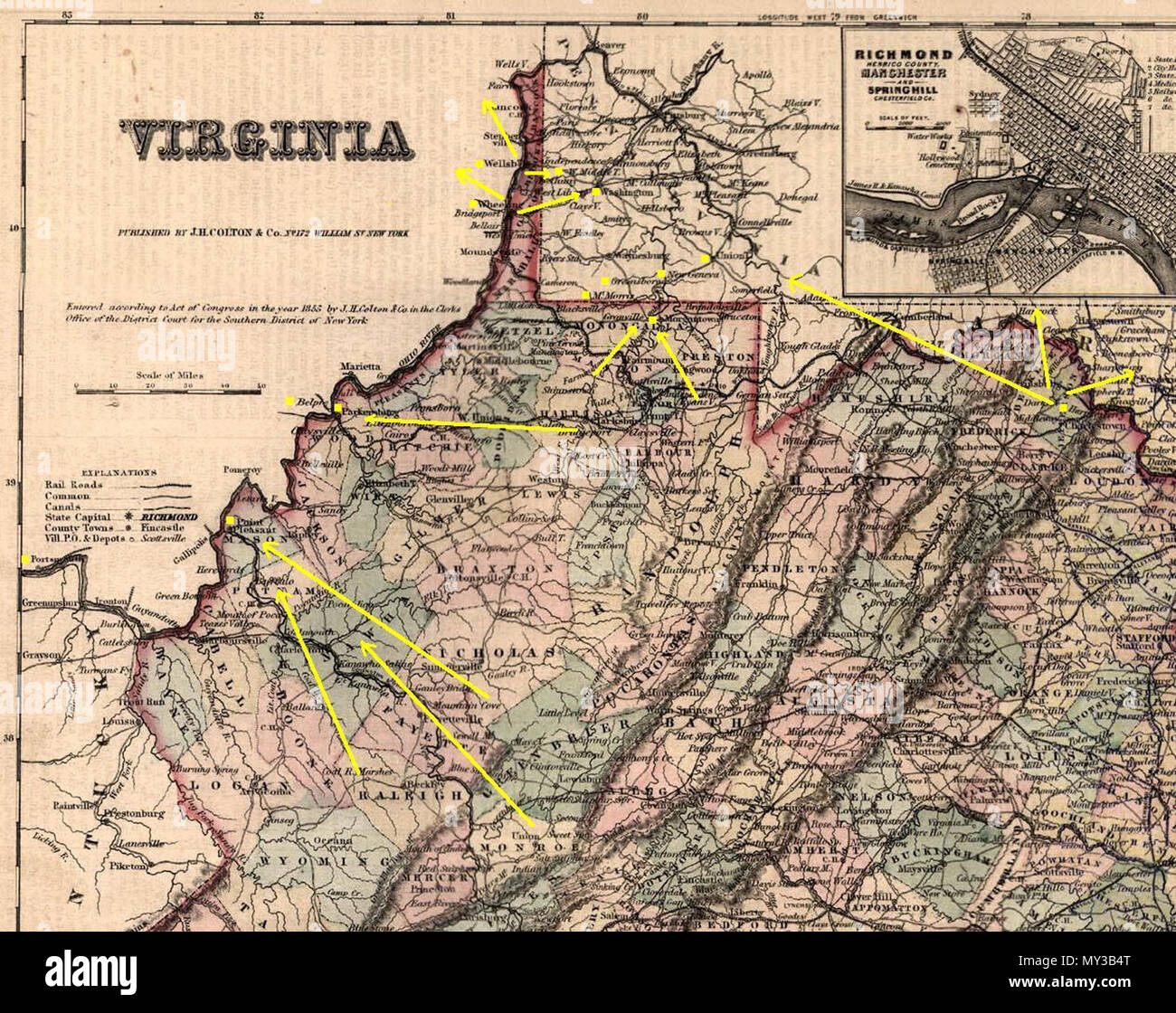 . English: Routes for escaping slaves through western (West) Virginia on the Underground Railroad, information derived from William J. Switala 'Underground Railroad in Delaware, Marylonad, and West Virginia', Stackpole Books, 2004, pages 108, 116-125. 1855. Own work on PD map 569 WVUndergroundRR Stock Photohttps://www.alamy.com/image-license-details/?v=1https://www.alamy.com/english-routes-for-escaping-slaves-through-western-west-virginia-on-the-underground-railroad-information-derived-from-william-j-switala-underground-railroad-in-delaware-marylonad-and-west-virginia-stackpole-books-2004-pages-108-116-125-1855-own-work-on-pd-map-569-wvundergroundrr-image188774008.html
RMMY3B4T–. English: Routes for escaping slaves through western (West) Virginia on the Underground Railroad, information derived from William J. Switala 'Underground Railroad in Delaware, Marylonad, and West Virginia', Stackpole Books, 2004, pages 108, 116-125. 1855. Own work on PD map 569 WVUndergroundRR
 The Fuhrer studies a map of territory wrested from the Czechs Herr Hitler substitutes self preservation for self determination as an excuse for occupying the Czech provinces, the fuhrer consulting a map of Czechoslovakia with General Blaskowitz in Prague March 1939 ©2004 Topfoto Stock Photohttps://www.alamy.com/image-license-details/?v=1https://www.alamy.com/the-fuhrer-studies-a-map-of-territory-wrested-from-the-czechs-herr-hitler-substitutes-self-preservation-for-self-determination-as-an-excuse-for-occupying-the-czech-provinces-the-fuhrer-consulting-a-map-of-czechoslovakia-with-general-blaskowitz-in-prague-march-1939-2004-topfoto-image623740361.html
RM2Y6NR5D–The Fuhrer studies a map of territory wrested from the Czechs Herr Hitler substitutes self preservation for self determination as an excuse for occupying the Czech provinces, the fuhrer consulting a map of Czechoslovakia with General Blaskowitz in Prague March 1939 ©2004 Topfoto
 2004 election map (30254980584) Stock Photohttps://www.alamy.com/image-license-details/?v=1https://www.alamy.com/stock-image-2004-election-map-30254980584-165727815.html
RMKHHFEF–2004 election map (30254980584)
 NATIONAL TREASURE, NICOLAS CAGE, 2004 Stock Photohttps://www.alamy.com/image-license-details/?v=1https://www.alamy.com/national-treasure-nicolas-cage-2004-image488727833.html
RM2KB3D9D–NATIONAL TREASURE, NICOLAS CAGE, 2004
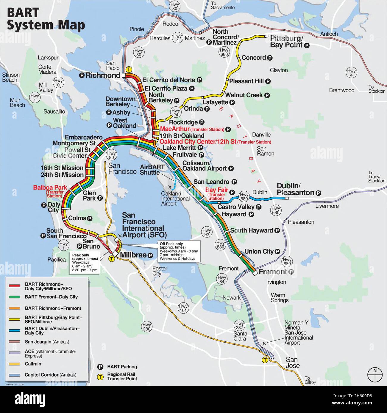 BART system map accurate to the south-of-Daly-City changes of February 9, 2004 Stock Photohttps://www.alamy.com/image-license-details/?v=1https://www.alamy.com/bart-system-map-accurate-to-the-south-of-daly-city-changes-of-february-9-2004-image451157876.html
RM2H600D8–BART system map accurate to the south-of-Daly-City changes of February 9, 2004
 Former M15 spy David Shayler and his girlfriend Annie Machont arrive for the Stop the War Coalition's annual conference held at the Camden Centre in central London, Saturday February 28, 2004, where he was due to later speak. The Coalition established itself on the political and campaigning map last year and remains determined to prevent future wars and to hold the government to account for their actions. PA Photo : Johnny Green. Stock Photohttps://www.alamy.com/image-license-details/?v=1https://www.alamy.com/stock-photo-former-m15-spy-david-shayler-and-his-girlfriend-annie-machont-arrive-107479830.html
RMG6T3HA–Former M15 spy David Shayler and his girlfriend Annie Machont arrive for the Stop the War Coalition's annual conference held at the Camden Centre in central London, Saturday February 28, 2004, where he was due to later speak. The Coalition established itself on the political and campaigning map last year and remains determined to prevent future wars and to hold the government to account for their actions. PA Photo : Johnny Green.
 (dpa) - German pop singer Herbert Groenemeyer (L) and Bono of British pop group U2 stand in front of map of Africa and an enlarged photograph of an African childe in Berlin, 21 April 2004. Both musicians campaigned for a stronger engagement of rich countries in the struggle against the deadly disease AIDS. Stock Photohttps://www.alamy.com/image-license-details/?v=1https://www.alamy.com/stock-photo-dpa-german-pop-singer-herbert-groenemeyer-l-and-bono-of-british-pop-53877313.html
RMD3J91N–(dpa) - German pop singer Herbert Groenemeyer (L) and Bono of British pop group U2 stand in front of map of Africa and an enlarged photograph of an African childe in Berlin, 21 April 2004. Both musicians campaigned for a stronger engagement of rich countries in the struggle against the deadly disease AIDS.
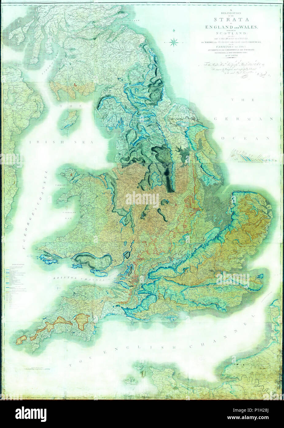 'Strata of England and Wales' The William Smith Geological Map - Adjusted for clarity YORYM 2004 25. Stock Photohttps://www.alamy.com/image-license-details/?v=1https://www.alamy.com/strata-of-england-and-wales-the-william-smith-geological-map-adjusted-for-clarity-yorym-2004-25-image207514066.html
RMP1H28J–'Strata of England and Wales' The William Smith Geological Map - Adjusted for clarity YORYM 2004 25.
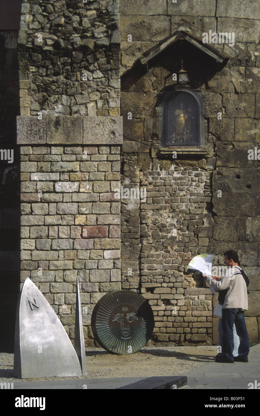 Tourist couple pause to check their map before the N & O letters of the Barcino iron art sculpture, Placa Nova, Barcelona, Spain Stock Photohttps://www.alamy.com/image-license-details/?v=1https://www.alamy.com/stock-photo-tourist-couple-pause-to-check-their-map-before-the-n-o-letters-of-17288125.html
RMB03F51–Tourist couple pause to check their map before the N & O letters of the Barcino iron art sculpture, Placa Nova, Barcelona, Spain
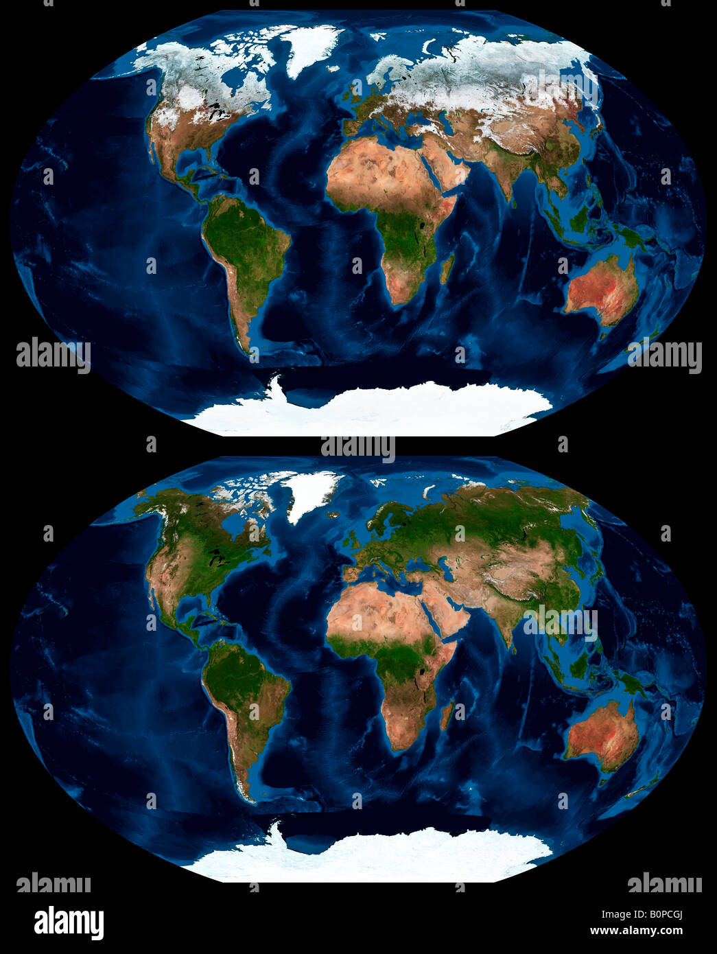 Worldwide seasonal changes in land ice coverage between January and July 2004 Stock Photohttps://www.alamy.com/image-license-details/?v=1https://www.alamy.com/stock-photo-worldwide-seasonal-changes-in-land-ice-coverage-between-january-and-17703186.html
RMB0PCGJ–Worldwide seasonal changes in land ice coverage between January and July 2004
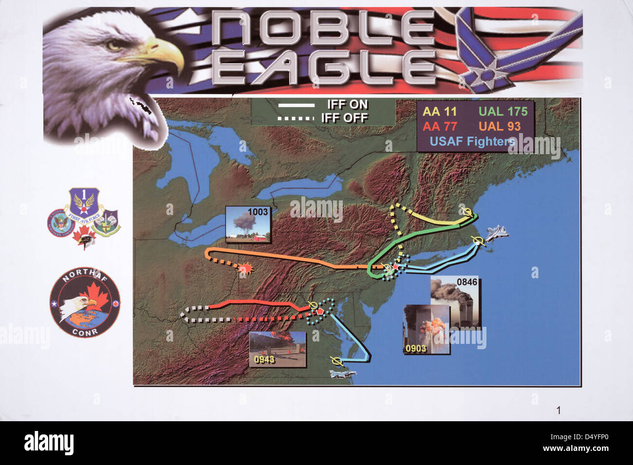 Map of Four Flights and Timeline of Events on September 11, 2001, ca. 2004 (page 1 of 5) Stock Photohttps://www.alamy.com/image-license-details/?v=1https://www.alamy.com/stock-photo-map-of-four-flights-and-timeline-of-events-on-september-11-2001-ca-54694808.html
RMD4YFP0–Map of Four Flights and Timeline of Events on September 11, 2001, ca. 2004 (page 1 of 5)
 Nassiriya (Iraq), Italian Military Contingent, Tallin Airport, 6th ROA (Military Air Force), cartography department (October 2004) Stock Photohttps://www.alamy.com/image-license-details/?v=1https://www.alamy.com/stock-photo-nassiriya-iraq-italian-military-contingent-tallin-airport-6th-roa-145021529.html
RMJBX8C9–Nassiriya (Iraq), Italian Military Contingent, Tallin Airport, 6th ROA (Military Air Force), cartography department (October 2004)
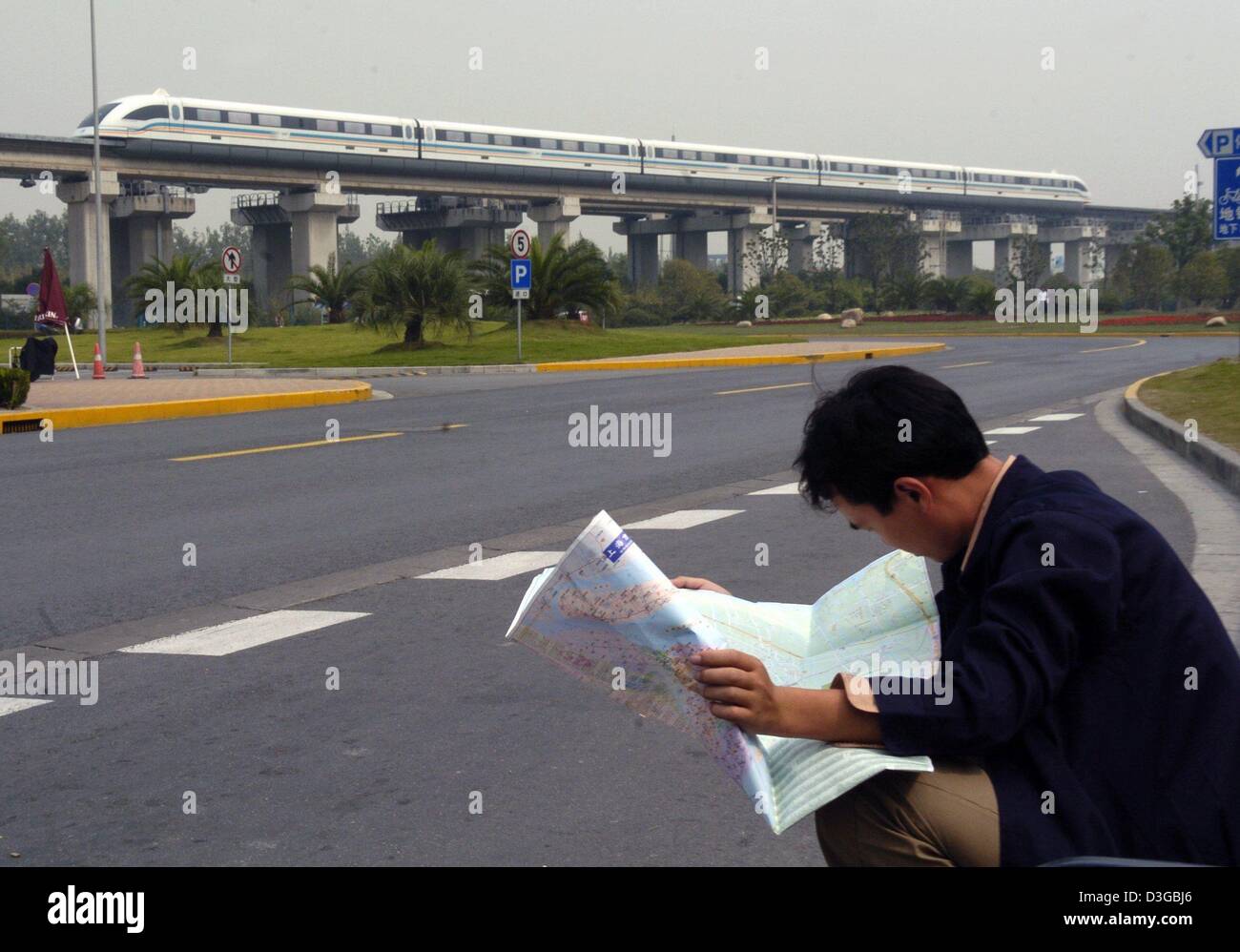 (dpa) - A Transrapid highspeed train races past a tourist who looks through a map in Shanghai, China, 11 October 2004. The up to 430 km/h fast train has been running in 20 minute intervals between the Shanghai fair grounds and the International Airport in Pudong since early 2004. The trip takes about 8 minutes. Stock Photohttps://www.alamy.com/image-license-details/?v=1https://www.alamy.com/stock-photo-dpa-a-transrapid-highspeed-train-races-past-a-tourist-who-looks-through-53835438.html
RMD3GBJ6–(dpa) - A Transrapid highspeed train races past a tourist who looks through a map in Shanghai, China, 11 October 2004. The up to 430 km/h fast train has been running in 20 minute intervals between the Shanghai fair grounds and the International Airport in Pudong since early 2004. The trip takes about 8 minutes.
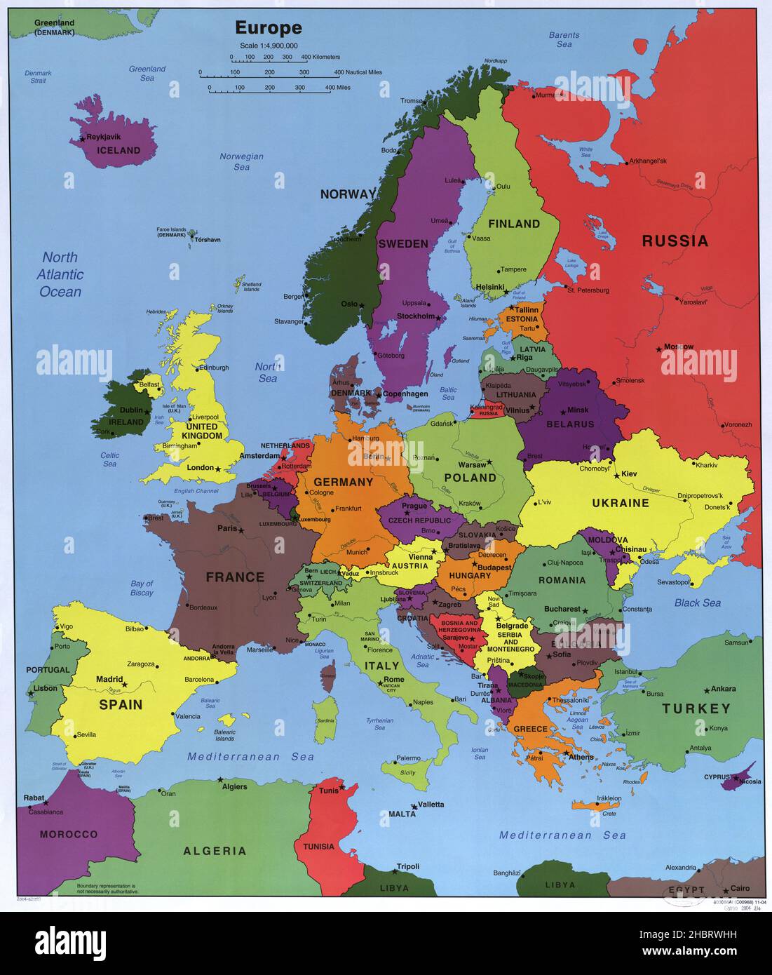 Map of Europe ca. 2004 Stock Photohttps://www.alamy.com/image-license-details/?v=1https://www.alamy.com/map-of-europe-ca-2004-image454755773.html
RM2HBRWHH–Map of Europe ca. 2004
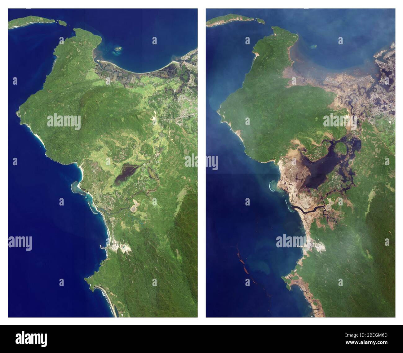 Aceh, Indonesia, Before and After 2004 Tsunami Stock Photohttps://www.alamy.com/image-license-details/?v=1https://www.alamy.com/aceh-indonesia-before-and-after-2004-tsunami-image353179637.html
RM2BEGM6D–Aceh, Indonesia, Before and After 2004 Tsunami
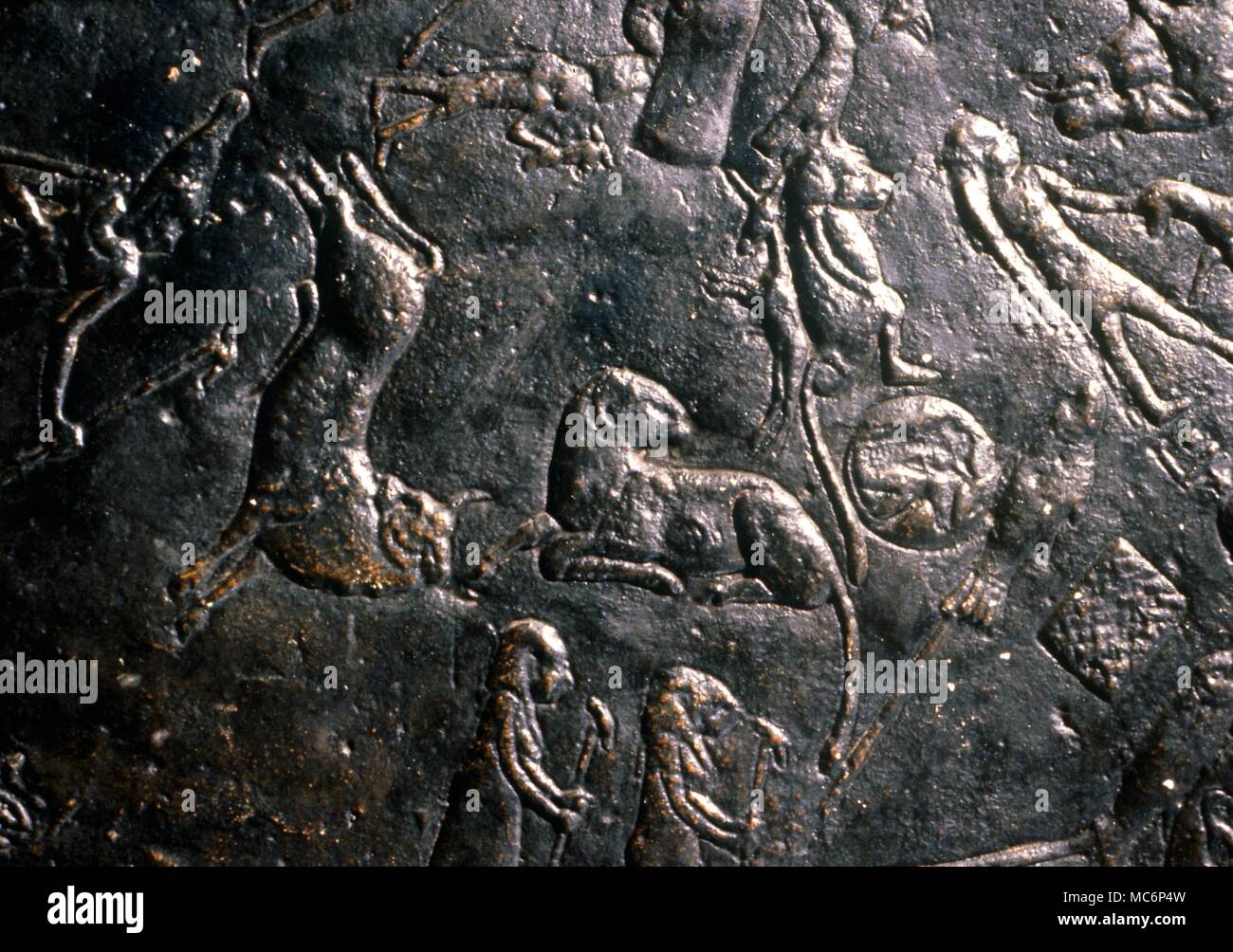 Constellation image of zodiacal Aries and Taurus, the bull, on the ceiling constellation map in the upper chamber on the roof of the Hathor Temple, Denderah. 2004 Charles Walker / Stock Photohttps://www.alamy.com/image-license-details/?v=1https://www.alamy.com/constellation-image-of-zodiacal-aries-and-taurus-the-bull-on-the-ceiling-constellation-map-in-the-upper-chamber-on-the-roof-of-the-hathor-temple-denderah-2004-charles-walker-image179628649.html
RMMC6P4W–Constellation image of zodiacal Aries and Taurus, the bull, on the ceiling constellation map in the upper chamber on the roof of the Hathor Temple, Denderah. 2004 Charles Walker /
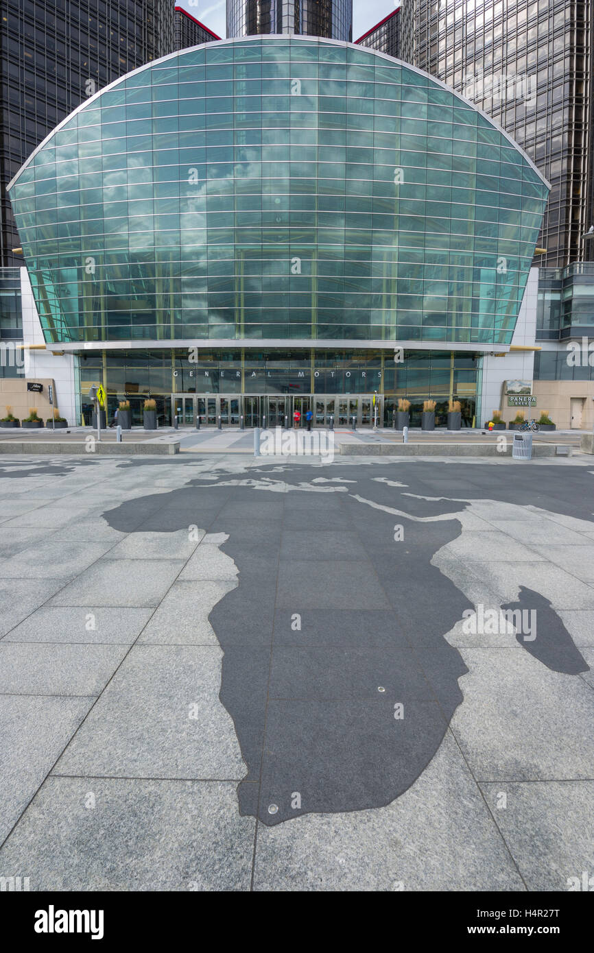 TIP OF AFRICA MAP OUTLINE (©SKIDMORE OWINGS & MERRIL 2004) GM RIVERWALK DOWNTOWN DETROIT MICHIGAN USA Stock Photohttps://www.alamy.com/image-license-details/?v=1https://www.alamy.com/stock-photo-tip-of-africa-map-outline-skidmore-owings-merril-2004-gm-riverwalk-123437884.html
RMH4R27T–TIP OF AFRICA MAP OUTLINE (©SKIDMORE OWINGS & MERRIL 2004) GM RIVERWALK DOWNTOWN DETROIT MICHIGAN USA
 BOBO,WALKEN,LUCAS, AROUND THE BEND, 2004, Stock Photohttps://www.alamy.com/image-license-details/?v=1https://www.alamy.com/bobowalkenlucas-around-the-bend-2004-image472856780.html
RM2JD8DJ4–BOBO,WALKEN,LUCAS, AROUND THE BEND, 2004,
 This small cemetery stands on the site of a German redoubt which was called Fortin 17. Fighting around this area began in 1915. The German defence line had a sharp bend in it which reduced the distance between the opposing sides to some 50 yards. Drawn on a map the line looked like a Roman nose - hence (Caesars). The cemetery is in the middle of a field. It was begun in July 1917 and used until November 1918. There are 68 burials. Stock Photohttps://www.alamy.com/image-license-details/?v=1https://www.alamy.com/this-small-cemetery-stands-on-the-site-of-a-german-redoubt-which-was-called-fortin-17-fighting-around-this-area-began-in-1915-the-german-defence-line-had-a-sharp-bend-in-it-which-reduced-the-distance-between-the-opposing-sides-to-some-50-yards-drawn-on-a-map-the-line-looked-like-a-roman-nose-hence-caesars-the-cemetery-is-in-the-middle-of-a-field-it-was-begun-in-july-1917-and-used-until-november-1918-there-are-68-burials-image560779215.html
RM2RG9KH3–This small cemetery stands on the site of a German redoubt which was called Fortin 17. Fighting around this area began in 1915. The German defence line had a sharp bend in it which reduced the distance between the opposing sides to some 50 yards. Drawn on a map the line looked like a Roman nose - hence (Caesars). The cemetery is in the middle of a field. It was begun in July 1917 and used until November 1918. There are 68 burials.
 . English: Overland trade routes through the Deccan, a French map, 1666 Source: ebay, Mar. 2004 'Pierre Du Val was a nephew and pupil of the greatest of all French cartographers, Nicolas Sanson, and went on to become the Royal Geographer. He published many atlases in all sizes including the two volume 'Geographie Universelle', and 'Le Monde Chrestien'. This map comes from a 1666 edition of his atlas 'La Geographie Ancienne'. The map measures 9' by 6', has later outline hand colouring, and is in very good condition.' . 1666. French map 950 Overland trade routes through the Deccan Stock Photohttps://www.alamy.com/image-license-details/?v=1https://www.alamy.com/english-overland-trade-routes-through-the-deccan-a-french-map-1666-source-ebay-mar-2004-pierre-du-val-was-a-nephew-and-pupil-of-the-greatest-of-all-french-cartographers-nicolas-sanson-and-went-on-to-become-the-royal-geographer-he-published-many-atlases-in-all-sizes-including-the-two-volume-geographie-universelle-and-le-monde-chrestien-this-map-comes-from-a-1666-edition-of-his-atlas-la-geographie-ancienne-the-map-measures-9-by-6-has-later-outline-hand-colouring-and-is-in-very-good-condition-1666-french-map-950-overland-trade-routes-through-the-deccan-image185694093.html
RMMP32KW–. English: Overland trade routes through the Deccan, a French map, 1666 Source: ebay, Mar. 2004 'Pierre Du Val was a nephew and pupil of the greatest of all French cartographers, Nicolas Sanson, and went on to become the Royal Geographer. He published many atlases in all sizes including the two volume 'Geographie Universelle', and 'Le Monde Chrestien'. This map comes from a 1666 edition of his atlas 'La Geographie Ancienne'. The map measures 9' by 6', has later outline hand colouring, and is in very good condition.' . 1666. French map 950 Overland trade routes through the Deccan
 The eyes and ears of the RAF, girls of the Royal Observer Corps at work plotting aircraft movements on a big map table which represents the area covered from their operational centre. The long range board behind thm shows the movement of aircraft in adjoining regions. ©2004 Topfoto Stock Photohttps://www.alamy.com/image-license-details/?v=1https://www.alamy.com/the-eyes-and-ears-of-the-raf-girls-of-the-royal-observer-corps-at-work-plotting-aircraft-movements-on-a-big-map-table-which-represents-the-area-covered-from-their-operational-centre-the-long-range-board-behind-thm-shows-the-movement-of-aircraft-in-adjoining-regions-2004-topfoto-image623319063.html
RM2Y62HR3–The eyes and ears of the RAF, girls of the Royal Observer Corps at work plotting aircraft movements on a big map table which represents the area covered from their operational centre. The long range board behind thm shows the movement of aircraft in adjoining regions. ©2004 Topfoto
 'Strata of England and Wales' The William Smith Geological Map High Resolution YORYM 2004 25 Stock Photohttps://www.alamy.com/image-license-details/?v=1https://www.alamy.com/stock-photo-strata-of-england-and-wales-the-william-smith-geological-map-high-143453558.html
RMJ9ATDA–'Strata of England and Wales' The William Smith Geological Map High Resolution YORYM 2004 25
 KRUGER,CAGE,BARTHA, NATIONAL TREASURE, 2004 Stock Photohttps://www.alamy.com/image-license-details/?v=1https://www.alamy.com/krugercagebartha-national-treasure-2004-image485284527.html
RM2K5EHA7–KRUGER,CAGE,BARTHA, NATIONAL TREASURE, 2004
 St Louis Sep10 2004 Stock Photohttps://www.alamy.com/image-license-details/?v=1https://www.alamy.com/st-louis-sep10-2004-image499419340.html
RF2M0EED0–St Louis Sep10 2004
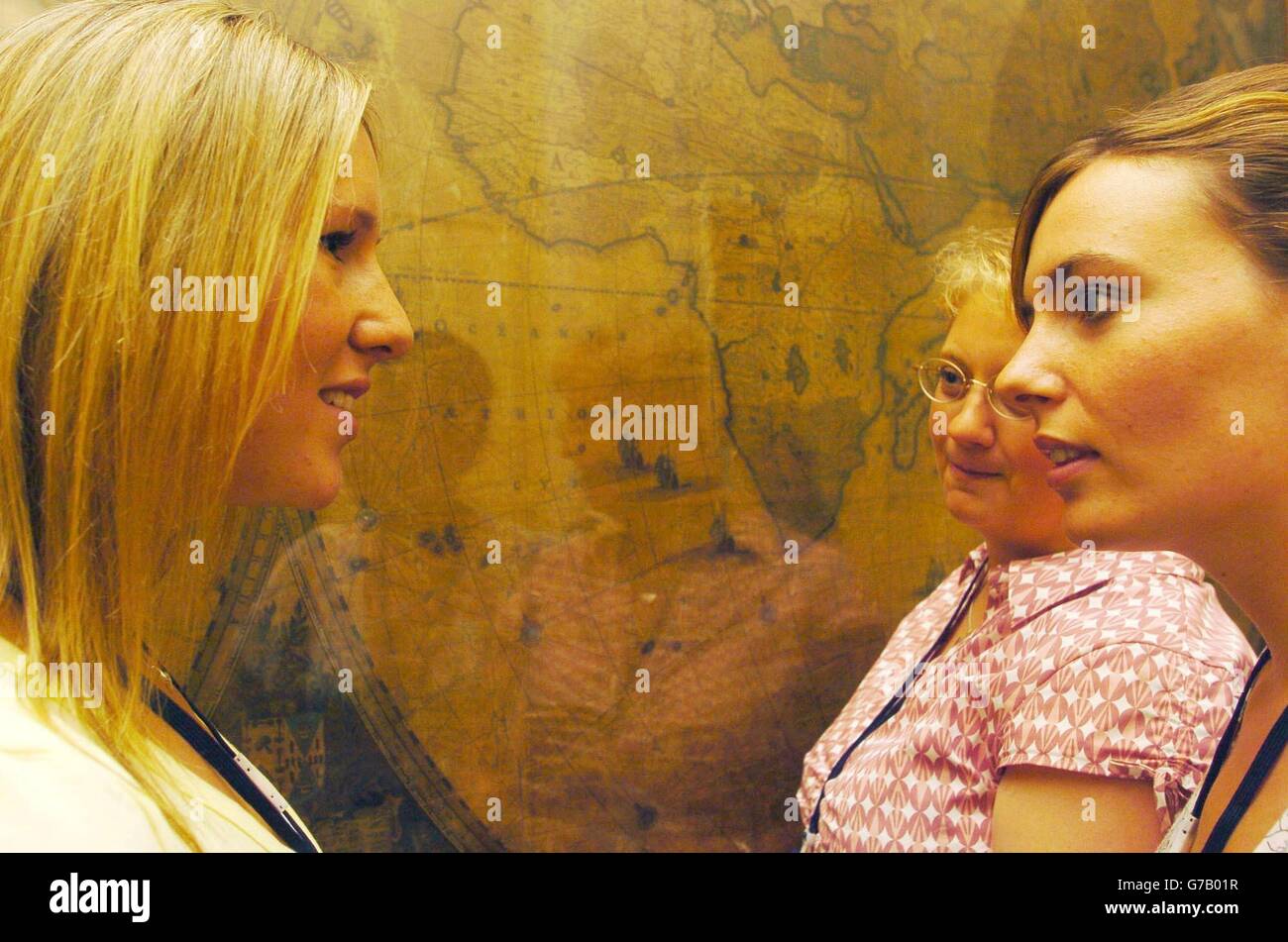 Sally Kettle (right), 27, from Northampton, talks to Claire Mills (left), 22, from Dunstable and Ali Boreham, 34, from Ingworth in Norfolk, in front of a world map inside the Royal Geographical Society in London, Wednesday August 18, 2004, as they discuss the challenges awaiting them of a rowing race across the Atlantic Ocean. The three women will be joined by Diane Parks, 44, as they begin training for next year's Atlantic Rowing Race between the Canary Islands and Barbados, with a total mileage of 2,900 nautical miles. Stock Photohttps://www.alamy.com/image-license-details/?v=1https://www.alamy.com/stock-photo-sally-kettle-right-27-from-northampton-talks-to-claire-mills-left-107806323.html
RMG7B01R–Sally Kettle (right), 27, from Northampton, talks to Claire Mills (left), 22, from Dunstable and Ali Boreham, 34, from Ingworth in Norfolk, in front of a world map inside the Royal Geographical Society in London, Wednesday August 18, 2004, as they discuss the challenges awaiting them of a rowing race across the Atlantic Ocean. The three women will be joined by Diane Parks, 44, as they begin training for next year's Atlantic Rowing Race between the Canary Islands and Barbados, with a total mileage of 2,900 nautical miles.
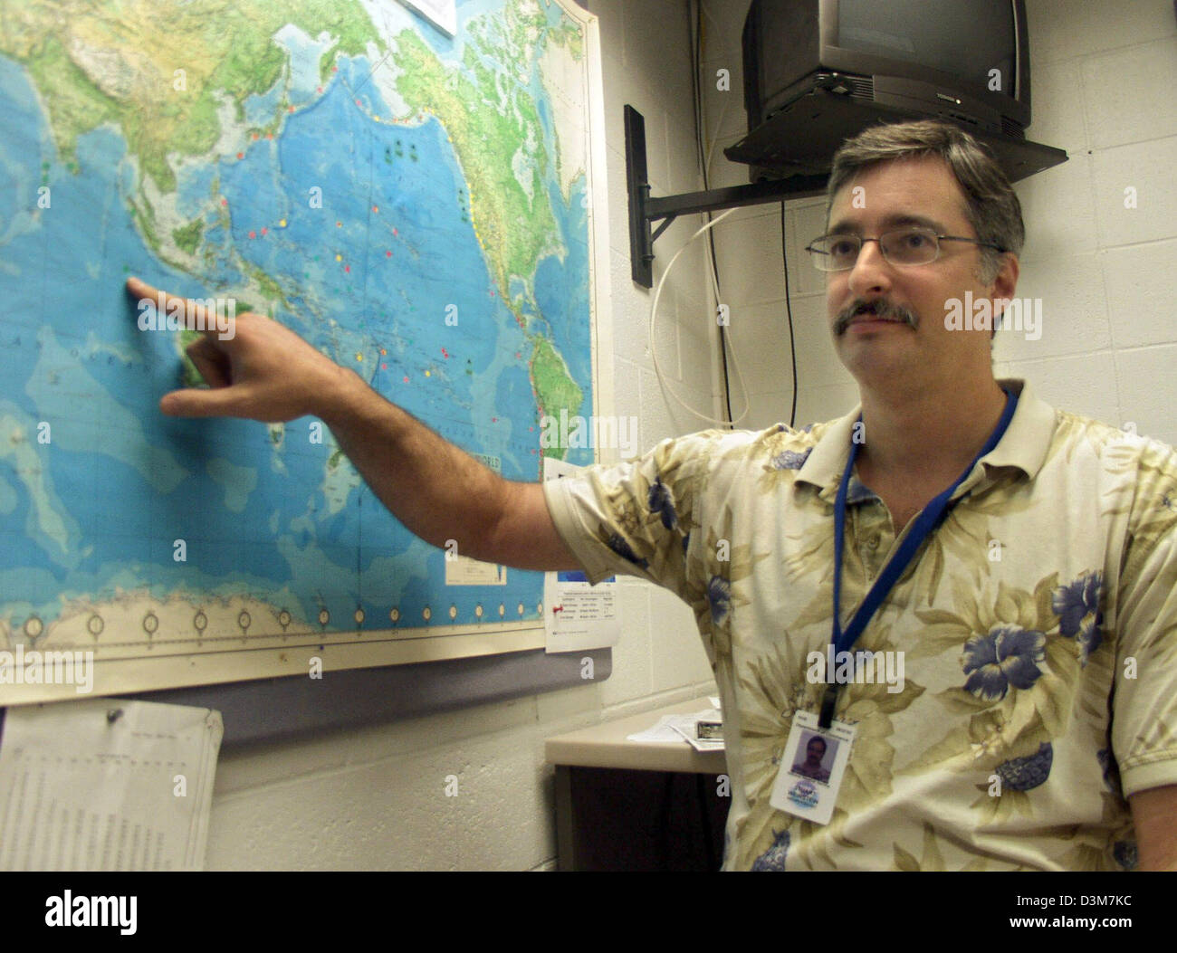 (dpa) - Geophysicist Stuart Weinstein shows on a map the epicentre of the century quake in front of Sumatra at the Tsunami Warning Center in Hawaii, USA, 13 December 2005. Weinstein was on duty on 25 December 2004 and was the first one to record the massiv earthquake in South Asia, which caused the devastating tsunami (25 December local time Hawaii, 26 December in South Asia). 14 m Stock Photohttps://www.alamy.com/image-license-details/?v=1https://www.alamy.com/stock-photo-dpa-geophysicist-stuart-weinstein-shows-on-a-map-the-epicentre-of-53920144.html
RMD3M7KC–(dpa) - Geophysicist Stuart Weinstein shows on a map the epicentre of the century quake in front of Sumatra at the Tsunami Warning Center in Hawaii, USA, 13 December 2005. Weinstein was on duty on 25 December 2004 and was the first one to record the massiv earthquake in South Asia, which caused the devastating tsunami (25 December local time Hawaii, 26 December in South Asia). 14 m
 Paris map of Blondel and Bullet – Pinon and Le Boudec 2004 p51. Stock Photohttps://www.alamy.com/image-license-details/?v=1https://www.alamy.com/paris-map-of-blondel-and-bullet-pinon-and-le-boudec-2004-p51-image406738749.html
RM2EHMFBW–Paris map of Blondel and Bullet – Pinon and Le Boudec 2004 p51.
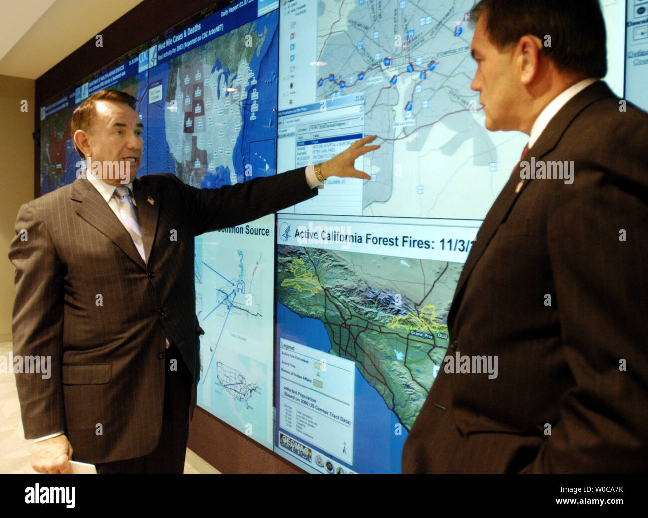 Secretary of Health and Human Services Tommy Thompson Secretary of Homeland Security Tom Ridge a television map system that can bring up maps all over the country, during a news conference on January 29, 2004 in Washington. Ridge and Thompson announced a new program to share information between the Department of Health and Human Services and Homeland Security to help fight biological weapons and support the fight of contagious diseases. (UPI Photo/Michael Kleinfeld) Stock Photohttps://www.alamy.com/image-license-details/?v=1https://www.alamy.com/secretary-of-health-and-human-services-tommy-thompson-secretary-of-homeland-security-tom-ridge-a-television-map-system-that-can-bring-up-maps-all-over-the-country-during-a-news-conference-on-january-29-2004-in-washington-ridge-and-thompson-announced-a-new-program-to-share-information-between-the-department-of-health-and-human-services-and-homeland-security-to-help-fight-biological-weapons-and-support-the-fight-of-contagious-diseases-upi-photomichael-kleinfeld-image258426999.html
RMW0CA7K–Secretary of Health and Human Services Tommy Thompson Secretary of Homeland Security Tom Ridge a television map system that can bring up maps all over the country, during a news conference on January 29, 2004 in Washington. Ridge and Thompson announced a new program to share information between the Department of Health and Human Services and Homeland Security to help fight biological weapons and support the fight of contagious diseases. (UPI Photo/Michael Kleinfeld)
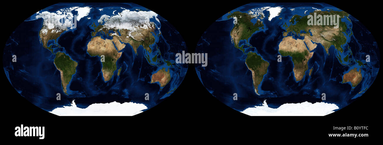 Worldwide seasonal changes in land ice coverage between January and July 2004 Stock Photohttps://www.alamy.com/image-license-details/?v=1https://www.alamy.com/stock-photo-worldwide-seasonal-changes-in-land-ice-coverage-between-january-and-17822320.html
RMB0YTFC–Worldwide seasonal changes in land ice coverage between January and July 2004
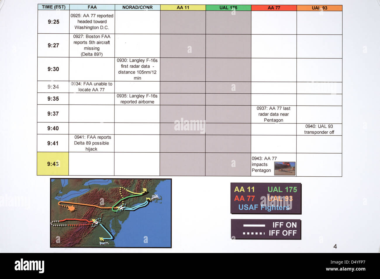 Map of Four Flights and Timeline of Events on September 11, 2001, ca. 2004 (page 4 of 5) Stock Photohttps://www.alamy.com/image-license-details/?v=1https://www.alamy.com/stock-photo-map-of-four-flights-and-timeline-of-events-on-september-11-2001-ca-54694815.html
RMD4YFP7–Map of Four Flights and Timeline of Events on September 11, 2001, ca. 2004 (page 4 of 5)
 Nassiriya (Iraq), Italian Military Contingent, Tallin Airport, 6th ROA (Military Air Force), cartography department (October 2004) Stock Photohttps://www.alamy.com/image-license-details/?v=1https://www.alamy.com/stock-photo-nassiriya-iraq-italian-military-contingent-tallin-airport-6th-roa-145021531.html
RMJBX8CB–Nassiriya (Iraq), Italian Military Contingent, Tallin Airport, 6th ROA (Military Air Force), cartography department (October 2004)
 (dpa) - Forestry expert Manuel Goetze holds a pair of binoculars in his hands as he examines a map of the local forest on the watchtower near Muellrose, Germany, 06 August 2004. The hazard level of forest fires was raised to level three due to the dry and warm weather in recent days. Level three allows authorities to prohibit access to the forest if necessary. Stock Photohttps://www.alamy.com/image-license-details/?v=1https://www.alamy.com/stock-photo-dpa-forestry-expert-manuel-goetze-holds-a-pair-of-binoculars-in-his-53840626.html
RMD3GJ7E–(dpa) - Forestry expert Manuel Goetze holds a pair of binoculars in his hands as he examines a map of the local forest on the watchtower near Muellrose, Germany, 06 August 2004. The hazard level of forest fires was raised to level three due to the dry and warm weather in recent days. Level three allows authorities to prohibit access to the forest if necessary.
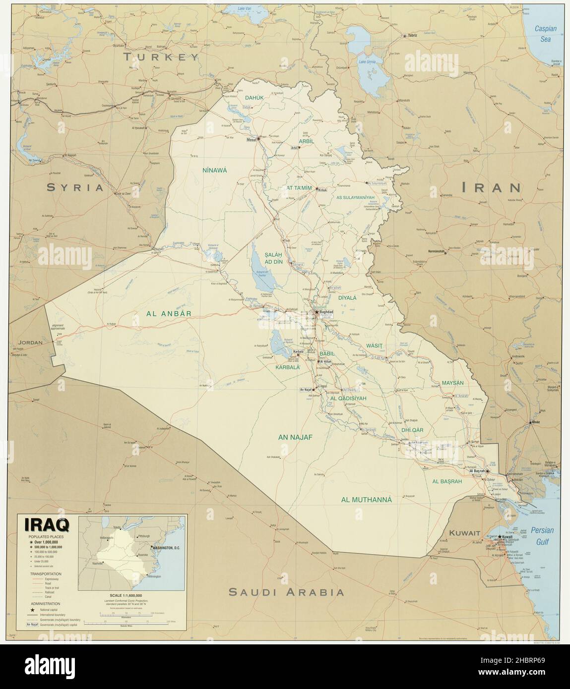 Map of Iraq ca. 2004 Stock Photohttps://www.alamy.com/image-license-details/?v=1https://www.alamy.com/map-of-iraq-ca-2004-image454753105.html
RM2HBRP69–Map of Iraq ca. 2004
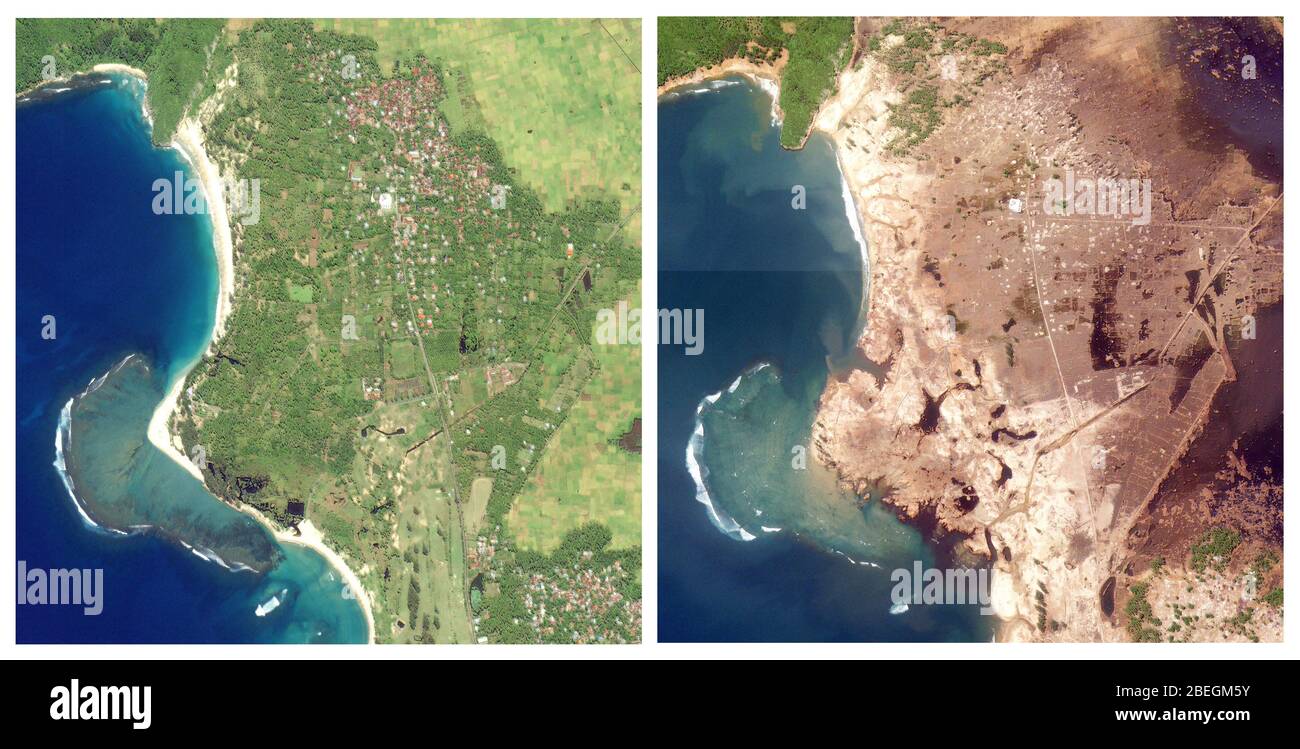 Aceh, Indonesia, Before and After 2004 Tsunami Stock Photohttps://www.alamy.com/image-license-details/?v=1https://www.alamy.com/aceh-indonesia-before-and-after-2004-tsunami-image353179623.html
RM2BEGM5Y–Aceh, Indonesia, Before and After 2004 Tsunami
 Three People and a Map. Three People Studying a paper map while entering Pere La Chaise Cementery in Paris, France, 2004. Paris Pere la Chaise Ile de France France Copyright: xGuidoxKoppesxPhotox Stock Photohttps://www.alamy.com/image-license-details/?v=1https://www.alamy.com/three-people-and-a-map-three-people-studying-a-paper-map-while-entering-pere-la-chaise-cementery-in-paris-france-2004-paris-pere-la-chaise-ile-de-france-france-copyright-xguidoxkoppesxphotox-image635500383.html
RM2YWWF67–Three People and a Map. Three People Studying a paper map while entering Pere La Chaise Cementery in Paris, France, 2004. Paris Pere la Chaise Ile de France France Copyright: xGuidoxKoppesxPhotox
 A map of the United States is pinned with locations from which fans travelved for the 2012 Plan-It-X Fest in Bloomington, Ind. The Plan-It-X Fest which was from June 22-24 was a fundraiser for several charities and drew dozens of bands and hundreds of punk rock fans from across the United States and the world. Plan-It-X Records (also known as PIX) is an independent record label in the United States. The festival first took place in 2004 to celebrate the 10-year anniversary on the label. Bands performing at the festival may or may not be on the label. Stock Photohttps://www.alamy.com/image-license-details/?v=1https://www.alamy.com/stock-photo-a-map-of-the-united-states-is-pinned-with-locations-from-which-fans-88423876.html
RMF3T1FG–A map of the United States is pinned with locations from which fans travelved for the 2012 Plan-It-X Fest in Bloomington, Ind. The Plan-It-X Fest which was from June 22-24 was a fundraiser for several charities and drew dozens of bands and hundreds of punk rock fans from across the United States and the world. Plan-It-X Records (also known as PIX) is an independent record label in the United States. The festival first took place in 2004 to celebrate the 10-year anniversary on the label. Bands performing at the festival may or may not be on the label.
 Greenbelt Park Site Map, Project Years 2004-2012 Stock Photohttps://www.alamy.com/image-license-details/?v=1https://www.alamy.com/greenbelt-park-site-map-project-years-2004-2012-image257658290.html
RMTY59NP–Greenbelt Park Site Map, Project Years 2004-2012
 Angela Keane holds Morgan, 1, as Braeden ,3, watches as his mother points to places where they lived on a map were the kids marked where the lived during the celebration for military kids since April is the Month of the Military Child on Wednesday April 28, 2004 in Alameda, Calif. Over 200 hundred Stock Photohttps://www.alamy.com/image-license-details/?v=1https://www.alamy.com/stock-photo-angela-keane-holds-morgan-1-as-braeden-3-watches-as-his-mother-points-40814602.html
RMCAB7CA–Angela Keane holds Morgan, 1, as Braeden ,3, watches as his mother points to places where they lived on a map were the kids marked where the lived during the celebration for military kids since April is the Month of the Military Child on Wednesday April 28, 2004 in Alameda, Calif. Over 200 hundred
 N/A. English: Detailed map of Dejima (Deshima) island at Nagasaki, where the Dutch East India had its factory. There were no defensive works and only a modest outer wall was allowed. From Henri Chatelain's Atlas historique, Paris (c. 1705-1739). 1) Landing staircase for merchandise; 2) House for Japanese visitors; 3) House of the governor (the factory's chief factor); 4) Liquor warehouse (the steam coming out of the roof may indicate a distillery); 5) Trading center. 5 January 2004, 06:36:05. Henry Chatelain, Atlas historique, 1705 to 1739. 432 Dejima Chatelain Stock Photohttps://www.alamy.com/image-license-details/?v=1https://www.alamy.com/na-english-detailed-map-of-dejima-deshima-island-at-nagasaki-where-the-dutch-east-india-had-its-factory-there-were-no-defensive-works-and-only-a-modest-outer-wall-was-allowed-from-henri-chatelains-atlas-historique-paris-c-1705-1739-1-landing-staircase-for-merchandise-2-house-for-japanese-visitors-3-house-of-the-governor-the-factorys-chief-factor-4-liquor-warehouse-the-steam-coming-out-of-the-roof-may-indicate-a-distillery-5-trading-center-5-january-2004-063605-henry-chatelain-atlas-historique-1705-to-1739-432-dejima-chatelain-image209892128.html
RMP5DBFC–N/A. English: Detailed map of Dejima (Deshima) island at Nagasaki, where the Dutch East India had its factory. There were no defensive works and only a modest outer wall was allowed. From Henri Chatelain's Atlas historique, Paris (c. 1705-1739). 1) Landing staircase for merchandise; 2) House for Japanese visitors; 3) House of the governor (the factory's chief factor); 4) Liquor warehouse (the steam coming out of the roof may indicate a distillery); 5) Trading center. 5 January 2004, 06:36:05. Henry Chatelain, Atlas historique, 1705 to 1739. 432 Dejima Chatelain
 The Kings tour of the battle areas in France, Belgium and Holland. Field Marshal Montgomery explaining troops dispositions and battle movements to the King who is seated in the map lorry at the Field Marshals HQ. October 1944 Montgomery, Bernard Law (Monty; Viscount Montgomery of Alamein) British general; won victory at El Alamein in World War II 1942; helped plan Normandy invasion 1887-1976 ©2004 Topfoto Stock Photohttps://www.alamy.com/image-license-details/?v=1https://www.alamy.com/the-kings-tour-of-the-battle-areas-in-france-belgium-and-holland-field-marshal-montgomery-explaining-troops-dispositions-and-battle-movements-to-the-king-who-is-seated-in-the-map-lorry-at-the-field-marshals-hq-october-1944-montgomery-bernard-law-monty-viscount-montgomery-of-alamein-british-general-won-victory-at-el-alamein-in-world-war-ii-1942-helped-plan-normandy-invasion-1887-1976-2004-topfoto-image623737799.html
RM2Y6NKWY–The Kings tour of the battle areas in France, Belgium and Holland. Field Marshal Montgomery explaining troops dispositions and battle movements to the King who is seated in the map lorry at the Field Marshals HQ. October 1944 Montgomery, Bernard Law (Monty; Viscount Montgomery of Alamein) British general; won victory at El Alamein in World War II 1942; helped plan Normandy invasion 1887-1976 ©2004 Topfoto
 Genoa, Liguria, Italy. 16th Oct, 2004. A female tourist looks at a map in front of the most beautiful church in Genoa, the Church of Jesus and of Saints Ambrose and Andrea (Chiesa del Gesù dei Santi Ambrogio e Andrea), a Baroque gem. Dating from 1597, it was rebuilt by the Jesuits at the turn of the 16th and 17th century. Genoa is a favorite destination for tourists and travelers. Credit: Arnold Drapkin/ZUMA Wire/Alamy Live News Stock Photohttps://www.alamy.com/image-license-details/?v=1https://www.alamy.com/genoa-liguria-italy-16th-oct-2004-a-female-tourist-looks-at-a-map-in-front-of-the-most-beautiful-church-in-genoa-the-church-of-jesus-and-of-saints-ambrose-and-andrea-chiesa-del-ges-dei-santi-ambrogio-e-andrea-a-baroque-gem-dating-from-1597-it-was-rebuilt-by-the-jesuits-at-the-turn-of-the-16th-and-17th-century-genoa-is-a-favorite-destination-for-tourists-and-travelers-credit-arnold-drapkinzuma-wirealamy-live-news-image216714303.html
RMPGG58F–Genoa, Liguria, Italy. 16th Oct, 2004. A female tourist looks at a map in front of the most beautiful church in Genoa, the Church of Jesus and of Saints Ambrose and Andrea (Chiesa del Gesù dei Santi Ambrogio e Andrea), a Baroque gem. Dating from 1597, it was rebuilt by the Jesuits at the turn of the 16th and 17th century. Genoa is a favorite destination for tourists and travelers. Credit: Arnold Drapkin/ZUMA Wire/Alamy Live News
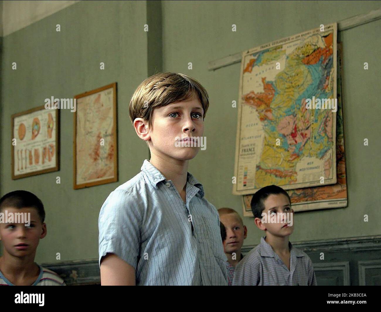 LES CHORISTES, JEAN-BAPTISTE MAUNIER, 2004 Stock Photohttps://www.alamy.com/image-license-details/?v=1https://www.alamy.com/les-choristes-jean-baptiste-maunier-2004-image488727186.html
RM2KB3CEA–LES CHORISTES, JEAN-BAPTISTE MAUNIER, 2004
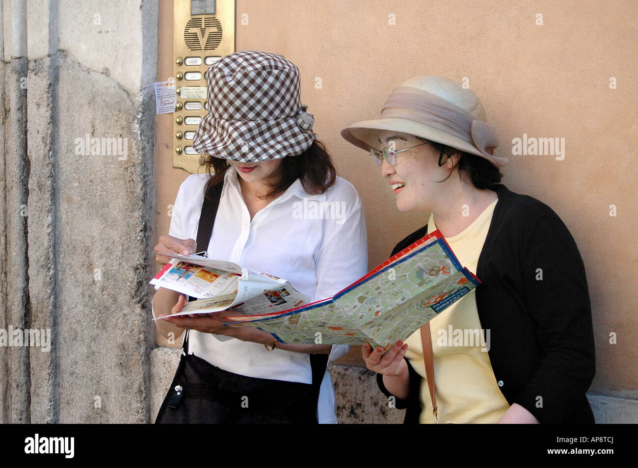 Two japanese female tourists reading their map in the streets of Rome, Italy 2004 Stock Photohttps://www.alamy.com/image-license-details/?v=1https://www.alamy.com/stock-photo-two-japanese-female-tourists-reading-their-map-in-the-streets-of-rome-15713297.html
RMAP8TCJ–Two japanese female tourists reading their map in the streets of Rome, Italy 2004
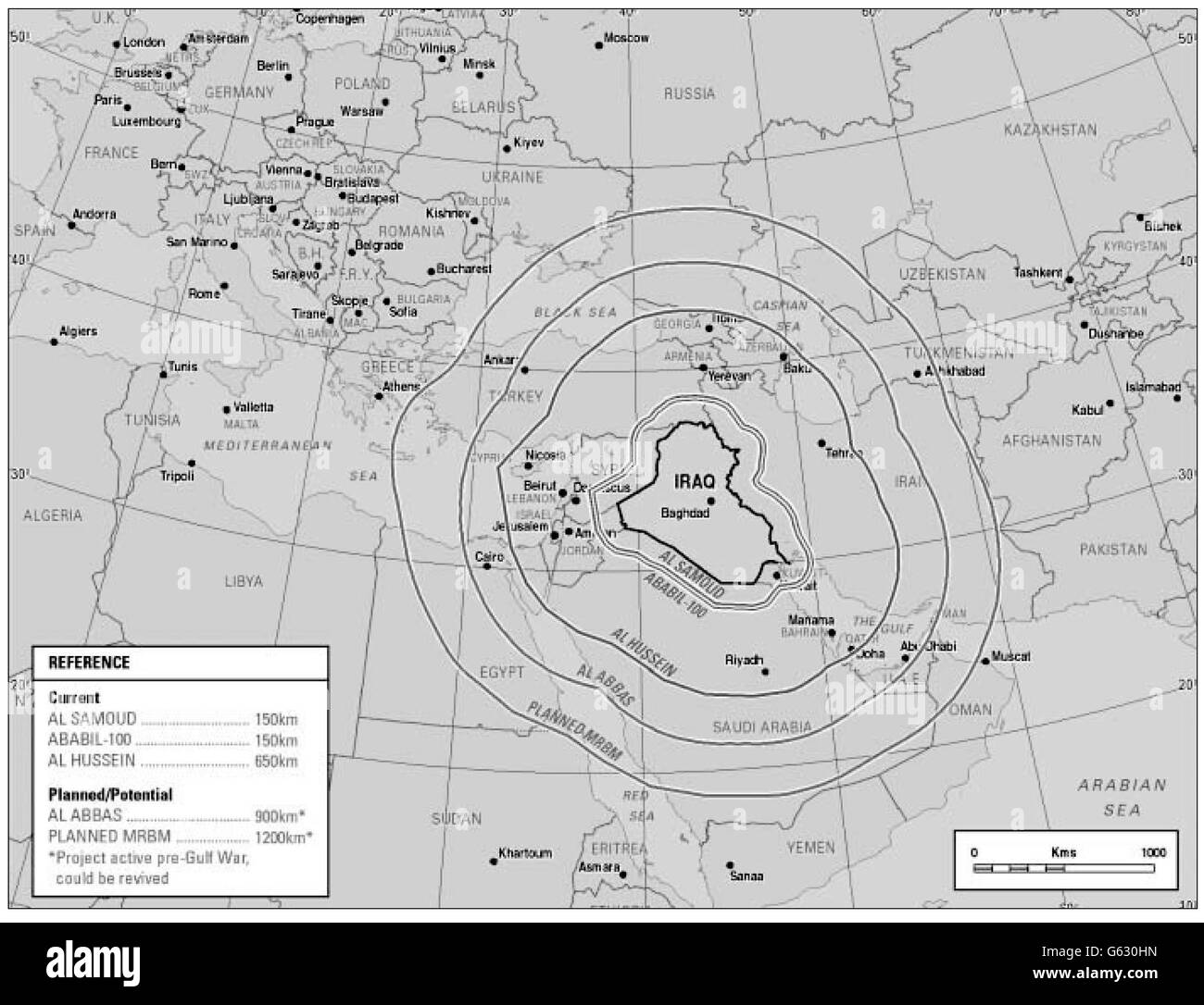 Picture from the British Government dossier of evidence against Iraqi President Saddam Hussein showing the range of the country's current and planned / potential ballistic missiles. * The document states that Iraq has constructed a new engine test stand for the development of missiles capable of reaching the UK Sovereign Base Areas in Cyprus and NATO members(Greece and Turkey),as well as all Iraq s Gulf neighbours and Israel. 14/07/2004 Lord Butler's inquiry into intelligence failings in the run-up to war in Iraq is being published later Wednesday July 14, 2004. Stock Photohttps://www.alamy.com/image-license-details/?v=1https://www.alamy.com/stock-photo-picture-from-the-british-government-dossier-of-evidence-against-iraqi-107016497.html
RMG630HN–Picture from the British Government dossier of evidence against Iraqi President Saddam Hussein showing the range of the country's current and planned / potential ballistic missiles. * The document states that Iraq has constructed a new engine test stand for the development of missiles capable of reaching the UK Sovereign Base Areas in Cyprus and NATO members(Greece and Turkey),as well as all Iraq s Gulf neighbours and Israel. 14/07/2004 Lord Butler's inquiry into intelligence failings in the run-up to war in Iraq is being published later Wednesday July 14, 2004.
 (dpa) - German Chancellor Gerhard Schroeder gestures to Palestinean Premier Ahmed Qurei as they attend a press conference in Berlin, 17 February 2004. Schroeder called on the different parties involved in the Middle East conflict to comply with the obligations of the international peace plan, the Road Map to Peace, which envisages the formation of an independent Palestinean state. Stock Photohttps://www.alamy.com/image-license-details/?v=1https://www.alamy.com/stock-photo-dpa-german-chancellor-gerhard-schroeder-gestures-to-palestinean-premier-53872281.html
RMD3J2J1–(dpa) - German Chancellor Gerhard Schroeder gestures to Palestinean Premier Ahmed Qurei as they attend a press conference in Berlin, 17 February 2004. Schroeder called on the different parties involved in the Middle East conflict to comply with the obligations of the international peace plan, the Road Map to Peace, which envisages the formation of an independent Palestinean state.
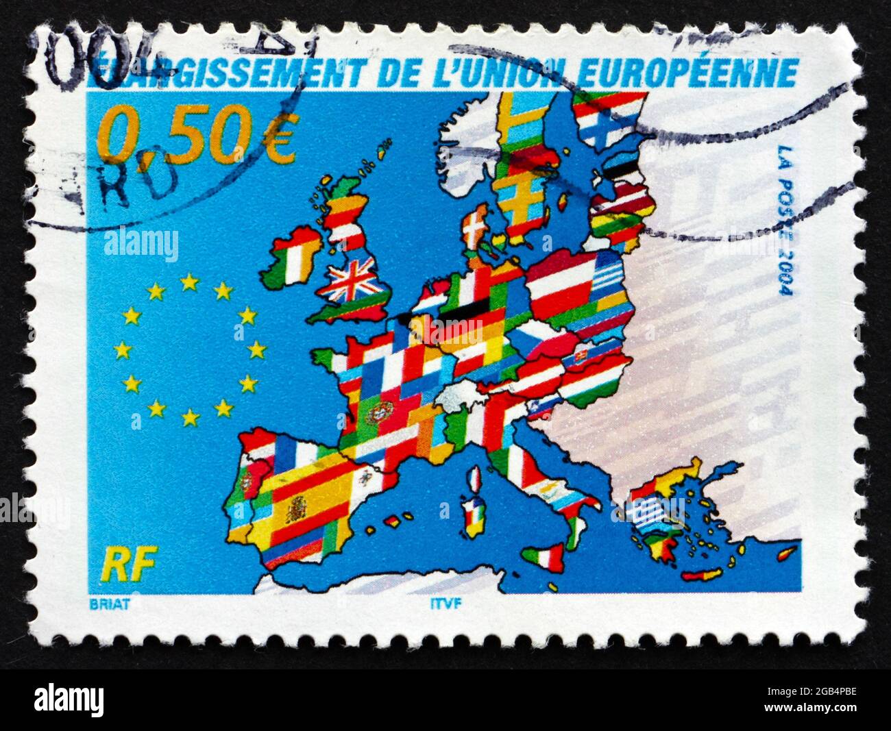 FRANCE - CIRCA 2004: a stamp printed in the France shows Map of Europe, Expansion of the European Union, circa 2004 Stock Photohttps://www.alamy.com/image-license-details/?v=1https://www.alamy.com/france-circa-2004-a-stamp-printed-in-the-france-shows-map-of-europe-expansion-of-the-european-union-circa-2004-image437125794.html
RF2GB4PBE–FRANCE - CIRCA 2004: a stamp printed in the France shows Map of Europe, Expansion of the European Union, circa 2004
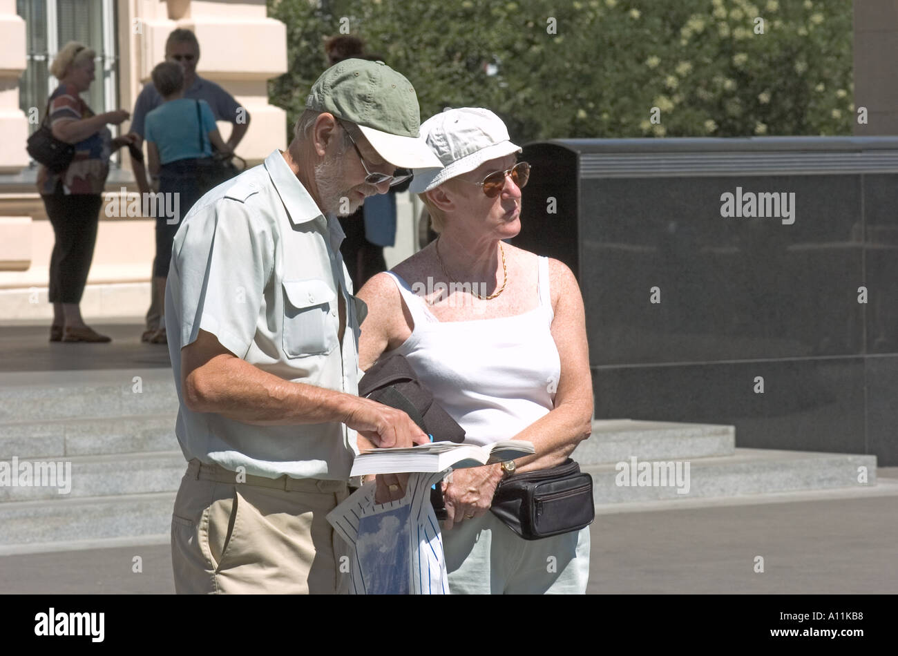 August 21st 2004 Vienna Austria Tourists consult a map in Vienna Austria Photo Copyright Barry Cronin www chromepix com Stock Photohttps://www.alamy.com/image-license-details/?v=1https://www.alamy.com/august-21st-2004-vienna-austria-tourists-consult-a-map-in-vienna-austria-image3301303.html
RMA11KB8–August 21st 2004 Vienna Austria Tourists consult a map in Vienna Austria Photo Copyright Barry Cronin www chromepix com
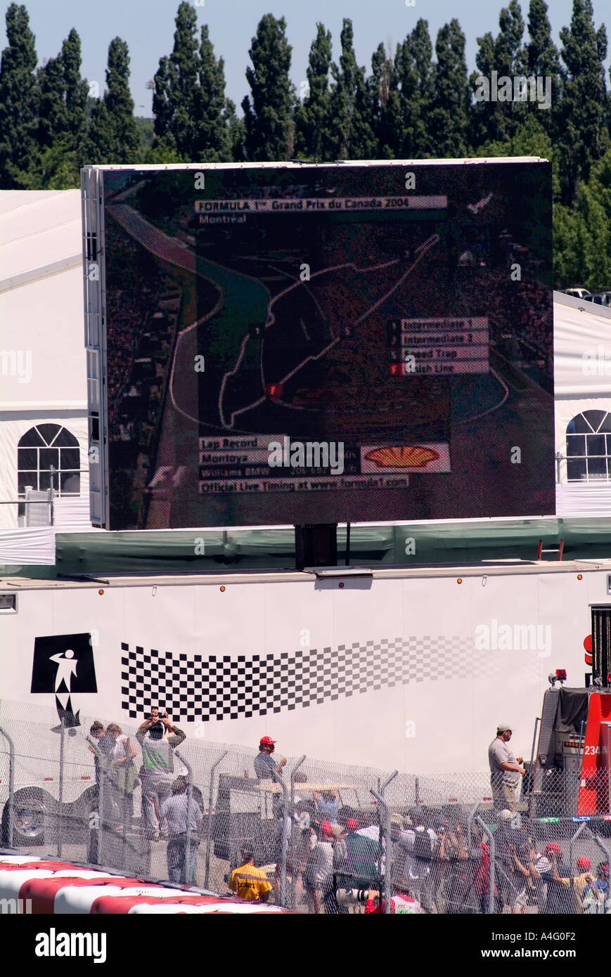 Formula 1 spectator billboard showing map of race near pit row Gilles Villeneuve Gran Prix Race Track Montral Canada June 2004 Stock Photohttps://www.alamy.com/image-license-details/?v=1https://www.alamy.com/formula-1-spectator-billboard-showing-map-of-race-near-pit-row-gilles-image2031857.html
RMA4G0F2–Formula 1 spectator billboard showing map of race near pit row Gilles Villeneuve Gran Prix Race Track Montral Canada June 2004
 Map of Four Flights and Timeline of Events on September 11, 2001, ca. 2004 (page 5 of 5) Stock Photohttps://www.alamy.com/image-license-details/?v=1https://www.alamy.com/stock-photo-map-of-four-flights-and-timeline-of-events-on-september-11-2001-ca-54694651.html
RMD4YFGB–Map of Four Flights and Timeline of Events on September 11, 2001, ca. 2004 (page 5 of 5)
 2004 1962 Stock Photohttps://www.alamy.com/image-license-details/?v=1https://www.alamy.com/stock-photo-2004-1962-142508991.html
RMJ7RRJR–2004 1962
 (dpa) - German Defence Minister Peter Struck (2nd from R) listens as soldiers of the German Bundeswehr explain a map of the area around Feisabad, Afghanistan, 26 September 2004. Struck on that day visited the German rebuilding team of the Bundeswehr in northern Kundus and Feisabad, Afghanistan, as well as troops in Termes (Uzbekistan). Germany's parliament extended the mandate of G Stock Photohttps://www.alamy.com/image-license-details/?v=1https://www.alamy.com/stock-photo-dpa-german-defence-minister-peter-struck-2nd-from-r-listens-as-soldiers-53834048.html
RMD3G9TG–(dpa) - German Defence Minister Peter Struck (2nd from R) listens as soldiers of the German Bundeswehr explain a map of the area around Feisabad, Afghanistan, 26 September 2004. Struck on that day visited the German rebuilding team of the Bundeswehr in northern Kundus and Feisabad, Afghanistan, as well as troops in Termes (Uzbekistan). Germany's parliament extended the mandate of G
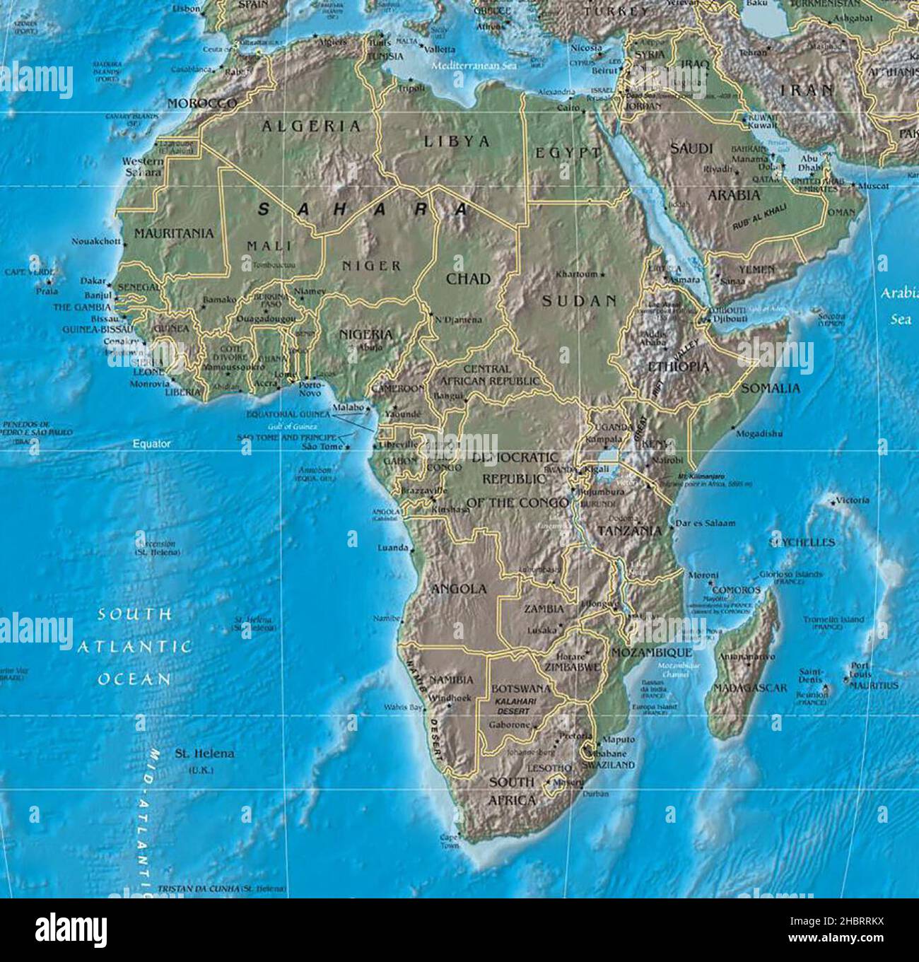 Map of Africa ca. 2004 Stock Photohttps://www.alamy.com/image-license-details/?v=1https://www.alamy.com/map-of-africa-ca-2004-image454754270.html
RM2HBRRKX–Map of Africa ca. 2004
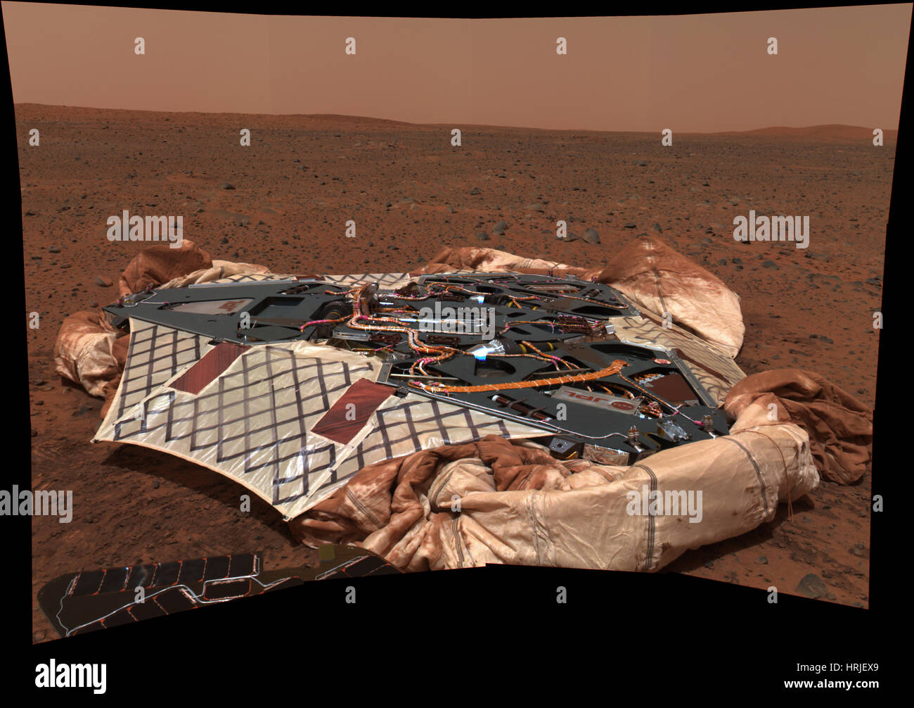 Spirit Rover's Lander On Mars Stock Photohttps://www.alamy.com/image-license-details/?v=1https://www.alamy.com/stock-photo-spirit-rovers-lander-on-mars-135016513.html
RMHRJEX9–Spirit Rover's Lander On Mars
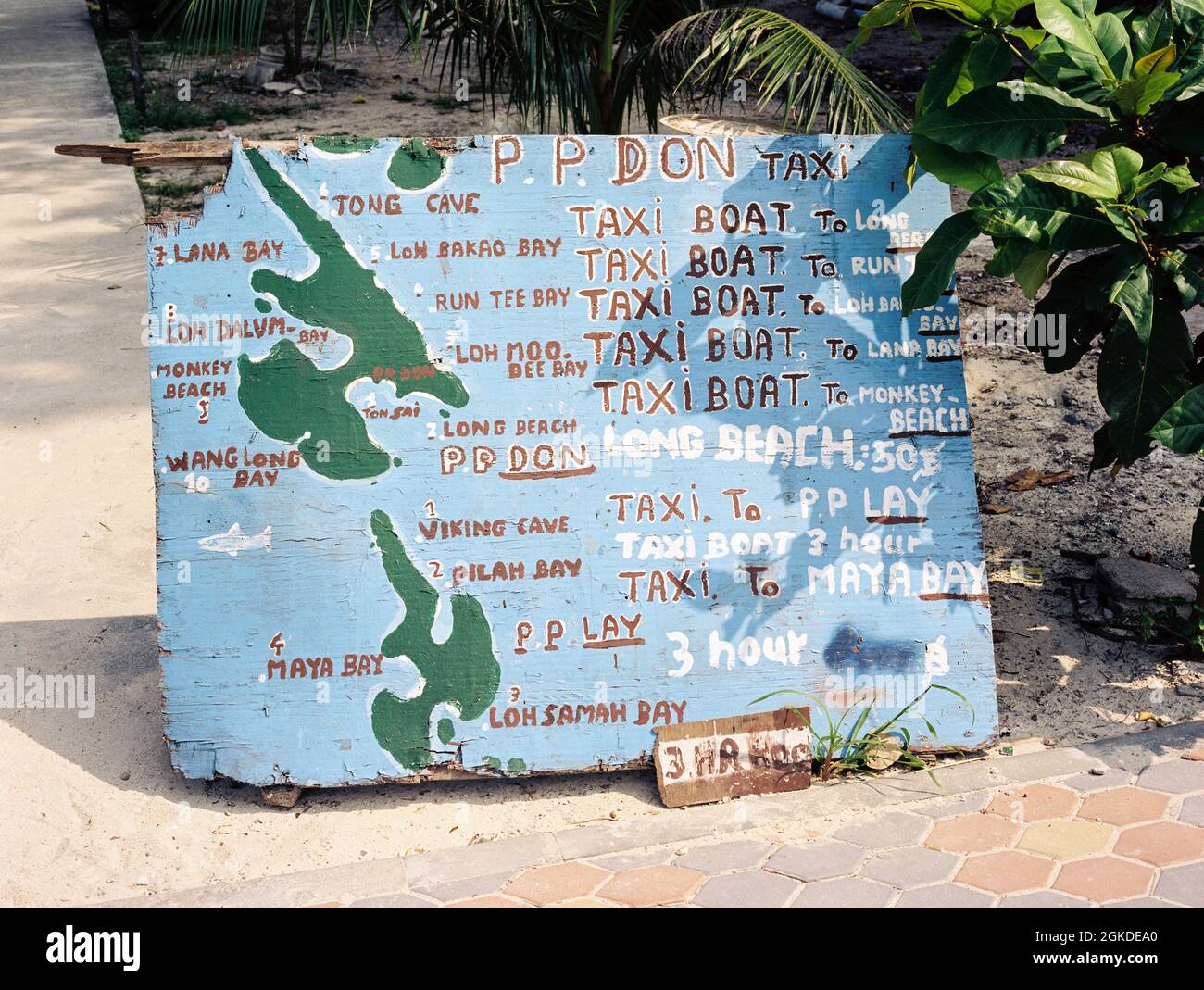 Phi phi island water taxi fares sign , Phi Phi island Krabi, Thailand. Stock Photohttps://www.alamy.com/image-license-details/?v=1https://www.alamy.com/phi-phi-island-water-taxi-fares-sign-phi-phi-island-krabi-thailand-image442234296.html
RM2GKDEA0–Phi phi island water taxi fares sign , Phi Phi island Krabi, Thailand.
