Quick filters:
2012 map Stock Photos and Images
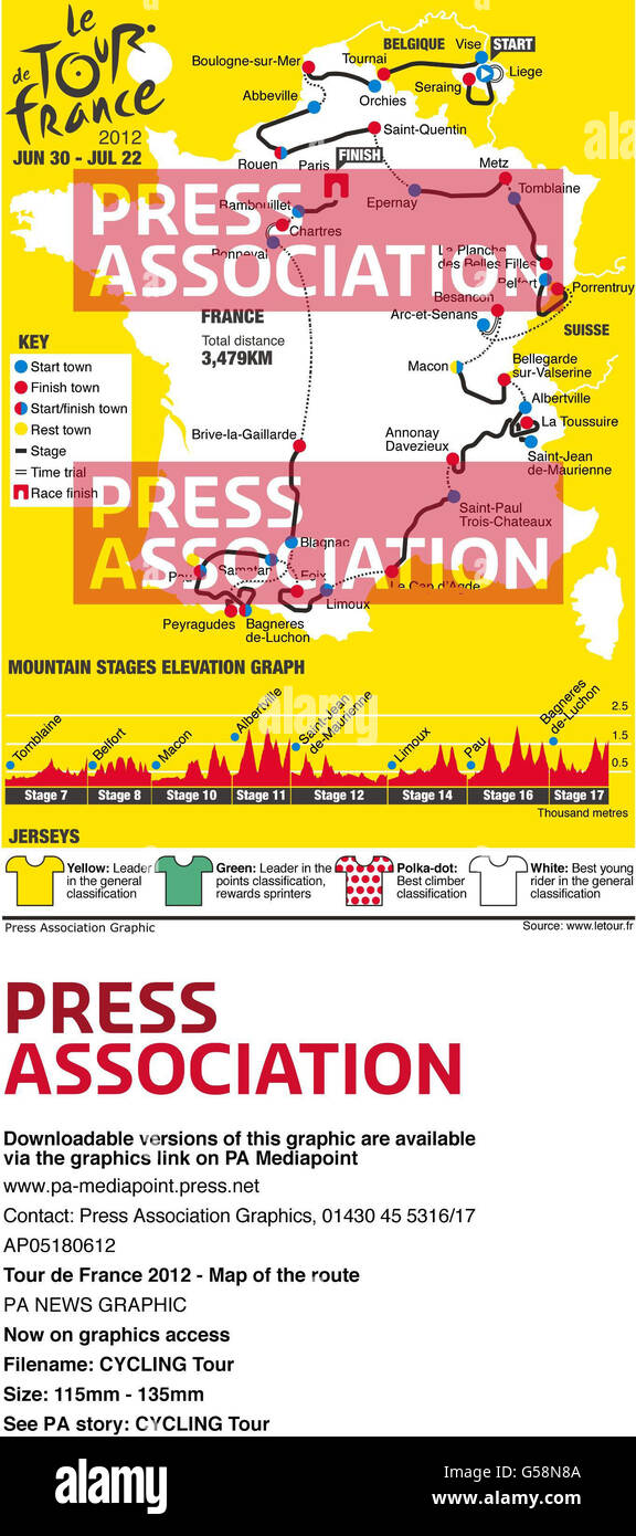 Cycling Tour. Tour de France 2012 - Map of the route Stock Photohttps://www.alamy.com/image-license-details/?v=1https://www.alamy.com/stock-photo-cycling-tour-tour-de-france-2012-map-of-the-route-106527802.html
RMG58N8A–Cycling Tour. Tour de France 2012 - Map of the route
 Feb. 25, 2012 - Map of the Athos Republic. (Arrow indicates the monastery of Esphigmenou) ne Pictures USA Stock Photohttps://www.alamy.com/image-license-details/?v=1https://www.alamy.com/feb-25-2012-map-of-the-athos-republic-arrow-indicates-the-monastery-image69521778.html
RME12YMJ–Feb. 25, 2012 - Map of the Athos Republic. (Arrow indicates the monastery of Esphigmenou) ne Pictures USA
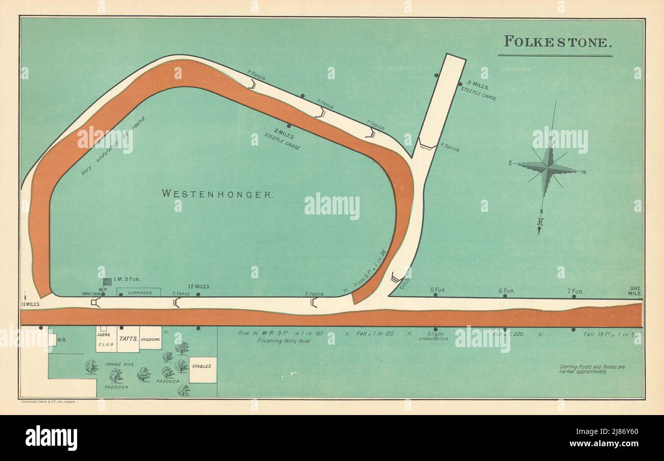 Folkestone racecourse, Kent. Westenhanger. Closed 2012. BAYLES 1903 old map Stock Photohttps://www.alamy.com/image-license-details/?v=1https://www.alamy.com/folkestone-racecourse-kent-westenhanger-closed-2012-bayles-1903-old-map-image469750232.html
RF2J86Y60–Folkestone racecourse, Kent. Westenhanger. Closed 2012. BAYLES 1903 old map
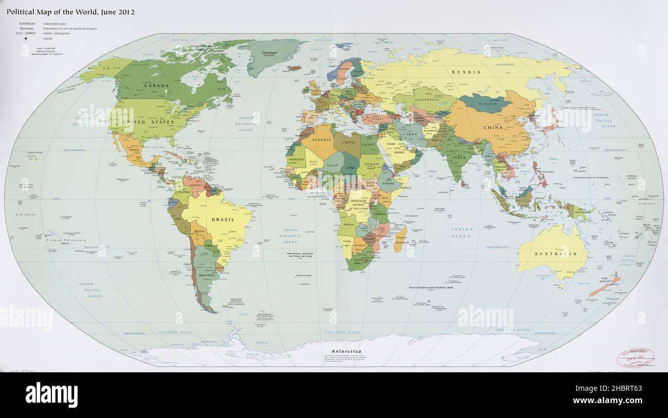 2012 Map of the world Stock Photohttps://www.alamy.com/image-license-details/?v=1https://www.alamy.com/2012-map-of-the-world-image454754667.html
RM2HBRT63–2012 Map of the world
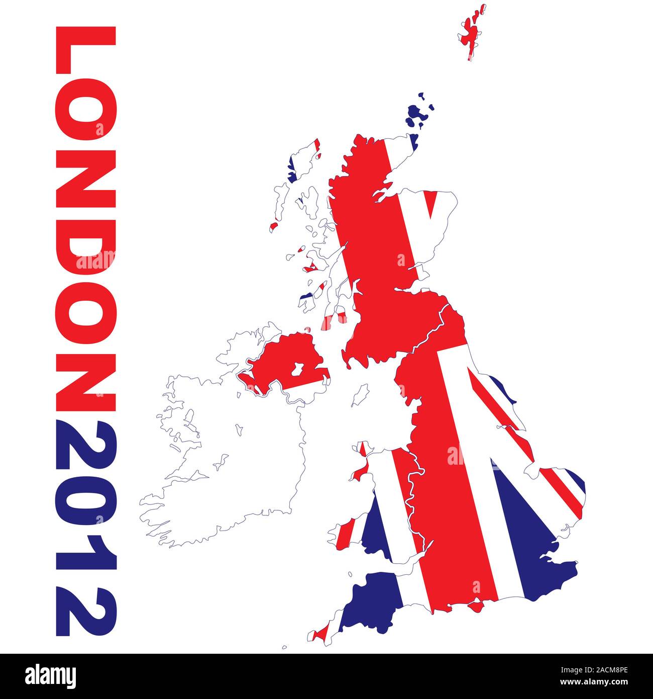 London 2012 map Stock Photohttps://www.alamy.com/image-license-details/?v=1https://www.alamy.com/london-2012-map-image334818806.html
RM2ACM8PE–London 2012 map
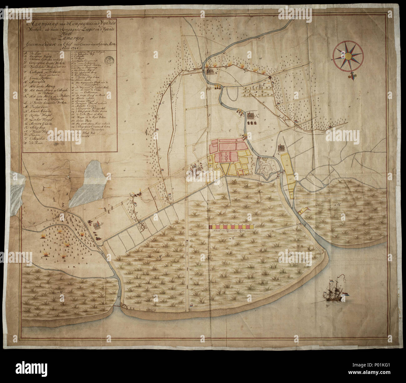 . English: Semarang, 1741 . 3 June 2012 (map date: 1741). Unknown 21 Semarang, 1741 Stock Photohttps://www.alamy.com/image-license-details/?v=1https://www.alamy.com/english-semarang-1741-3-june-2012-map-date-1741-unknown-21-semarang-1741-image206561713.html
RMP01KG1–. English: Semarang, 1741 . 3 June 2012 (map date: 1741). Unknown 21 Semarang, 1741
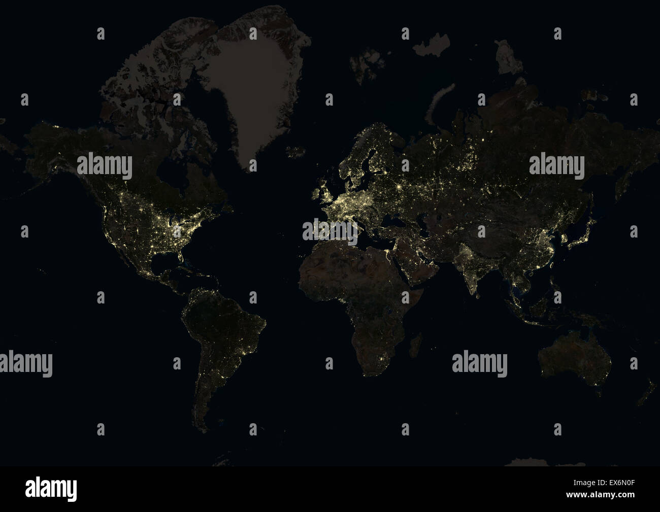 World at night in 2012, showing a world map in Mercator projection. This satellite image shows urban and industrial lights. Stock Photohttps://www.alamy.com/image-license-details/?v=1https://www.alamy.com/stock-photo-world-at-night-in-2012-showing-a-world-map-in-mercator-projection-84970719.html
RMEX6N0F–World at night in 2012, showing a world map in Mercator projection. This satellite image shows urban and industrial lights.
 Thailand: Provincial map of Thailand showing the approximate frontiers of the former Lan Na Kingdom (1292-1774) and the Kingdom of Chiang Mai (1781-1939) The Lan Na Kingdom effectively came into existence as an independent entity under King Mangrai the Great (r. 1259-1317), but the capital was not established at Chiang Mai ('New City') by Mangrai until 1892-1896. The Mangrai Dynasty ruled over an independent Lan Na Kingdom until 1558, when Chiang Mai was captured by Burma's King Bayinnaung (r. 1551-1581). Chiang Mai remained a Burmese tributary state until the Lan Na Revolt (1771-1774). Stock Photohttps://www.alamy.com/image-license-details/?v=1https://www.alamy.com/thailand-provincial-map-of-thailand-showing-the-approximate-frontiers-of-the-former-lan-na-kingdom-1292-1774-and-the-kingdom-of-chiang-mai-1781-1939-the-lan-na-kingdom-effectively-came-into-existence-as-an-independent-entity-under-king-mangrai-the-great-r-1259-1317-but-the-capital-was-not-established-at-chiang-mai-new-city-by-mangrai-until-1892-1896-the-mangrai-dynasty-ruled-over-an-independent-lan-na-kingdom-until-1558-when-chiang-mai-was-captured-by-burmas-king-bayinnaung-r-1551-1581-chiang-mai-remained-a-burmese-tributary-state-until-the-lan-na-revolt-1771-1774-image344249129.html
RM2B01W7N–Thailand: Provincial map of Thailand showing the approximate frontiers of the former Lan Na Kingdom (1292-1774) and the Kingdom of Chiang Mai (1781-1939) The Lan Na Kingdom effectively came into existence as an independent entity under King Mangrai the Great (r. 1259-1317), but the capital was not established at Chiang Mai ('New City') by Mangrai until 1892-1896. The Mangrai Dynasty ruled over an independent Lan Na Kingdom until 1558, when Chiang Mai was captured by Burma's King Bayinnaung (r. 1551-1581). Chiang Mai remained a Burmese tributary state until the Lan Na Revolt (1771-1774).
 Spectators consult a detailed map of the Olympic Park during the London 2012 Olympics. This land was transformed to become a 2.5 Sq Km sporting complex, once industrial businesses and now the venue of eight venues including the main arena, Aquatics Centre and Velodrome plus the athletes' Olympic Village. After the Olympics, the park is to be known as Queen Elizabeth Olympic Park. Stock Photohttps://www.alamy.com/image-license-details/?v=1https://www.alamy.com/stock-photo-spectators-consult-a-detailed-map-of-the-olympic-park-during-the-london-49733758.html
RMCTWFWJ–Spectators consult a detailed map of the Olympic Park during the London 2012 Olympics. This land was transformed to become a 2.5 Sq Km sporting complex, once industrial businesses and now the venue of eight venues including the main arena, Aquatics Centre and Velodrome plus the athletes' Olympic Village. After the Olympics, the park is to be known as Queen Elizabeth Olympic Park.
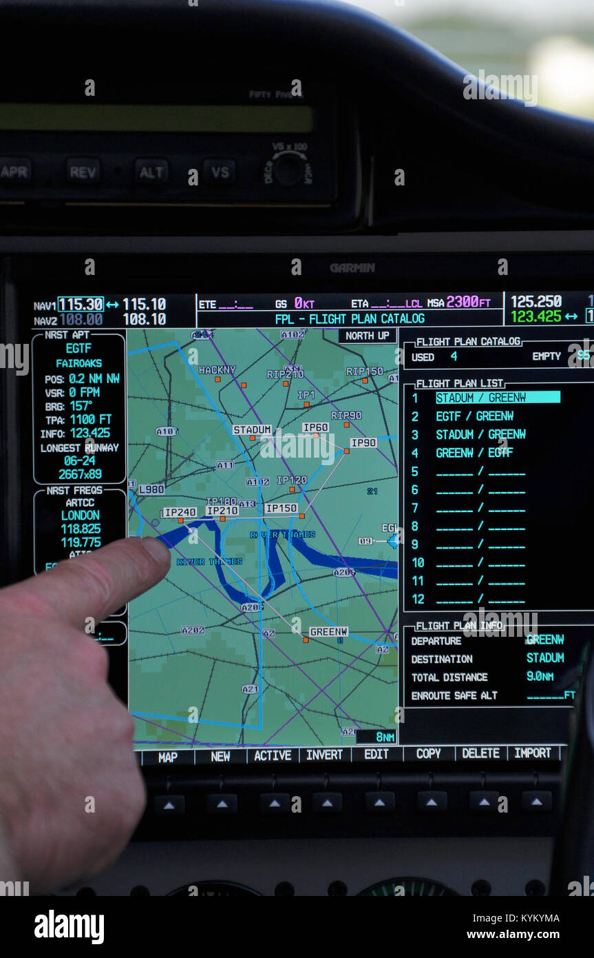 Flight plan used for Paralympics opening ceremony London 2012 in Tecnam P2006T plane fitted with LED lights and pyrotechnics for a light show. Garmin Stock Photohttps://www.alamy.com/image-license-details/?v=1https://www.alamy.com/stock-photo-flight-plan-used-for-paralympics-opening-ceremony-london-2012-in-tecnam-171927850.html
RMKYKYMA–Flight plan used for Paralympics opening ceremony London 2012 in Tecnam P2006T plane fitted with LED lights and pyrotechnics for a light show. Garmin
 world map 2012 Stock Photohttps://www.alamy.com/image-license-details/?v=1https://www.alamy.com/stock-photo-world-map-2012-142950975.html
RFJ8FYBY–world map 2012
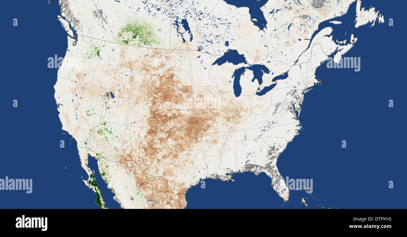 Drought map of the continental USA for 2012 Stock Photohttps://www.alamy.com/image-license-details/?v=1https://www.alamy.com/drought-map-of-the-continental-usa-for-2012-image66886948.html
RMDTPXYG–Drought map of the continental USA for 2012
 London 2012 Olympic Games - looking at a map of the site Stock Photohttps://www.alamy.com/image-license-details/?v=1https://www.alamy.com/stock-photo-london-2012-olympic-games-looking-at-a-map-of-the-site-49711161.html
RMCTTF2H–London 2012 Olympic Games - looking at a map of the site
 Musket Ball Cluster, Mass Map Stock Photohttps://www.alamy.com/image-license-details/?v=1https://www.alamy.com/stock-photo-musket-ball-cluster-mass-map-135014271.html
RMHRJC27–Musket Ball Cluster, Mass Map
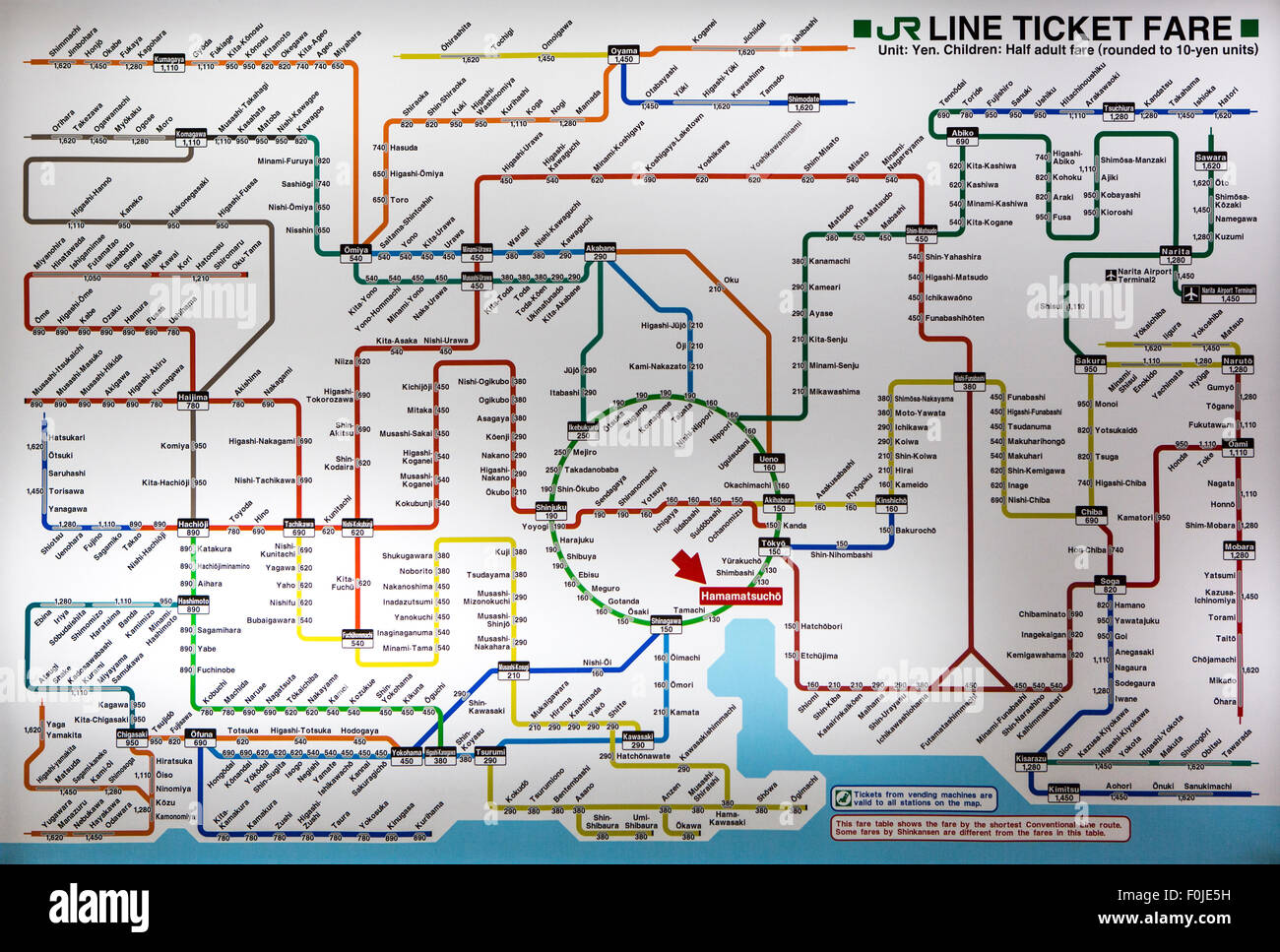 latest version of the Tokyo metro map. Japan 2012. Stock Photohttps://www.alamy.com/image-license-details/?v=1https://www.alamy.com/stock-photo-latest-version-of-the-tokyo-metro-map-japan-2012-86458109.html
RFF0JE5H–latest version of the Tokyo metro map. Japan 2012.
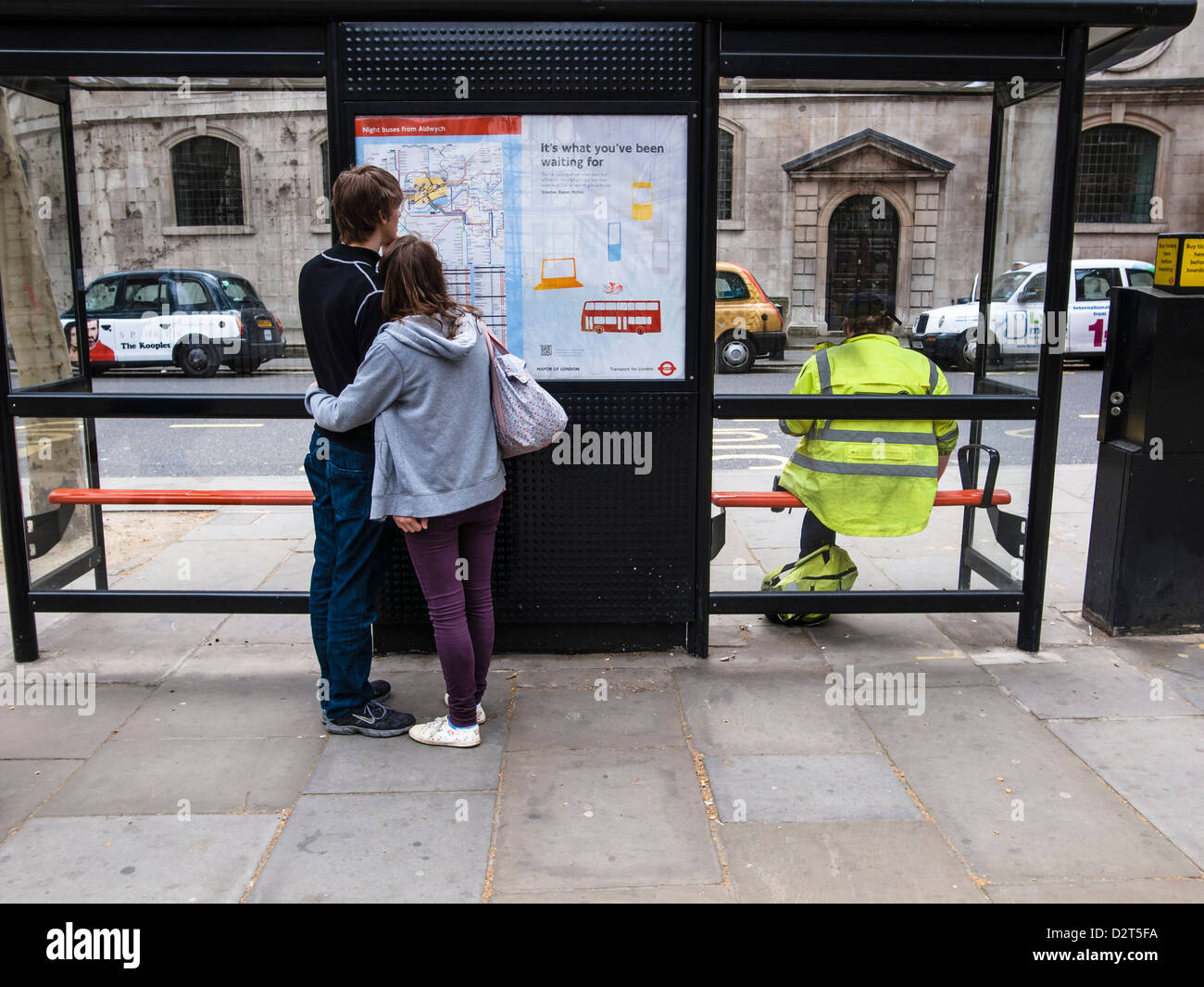 boy and girl reading a map on bus stop Stock Photohttps://www.alamy.com/image-license-details/?v=1https://www.alamy.com/stock-photo-boy-and-girl-reading-a-map-on-bus-stop-53391614.html
RMD2T5FA–boy and girl reading a map on bus stop
 A young boy looks at the map of the site at the National Eisteddfod of Wales 2012 Stock Photohttps://www.alamy.com/image-license-details/?v=1https://www.alamy.com/stock-photo-a-young-boy-looks-at-the-map-of-the-site-at-the-national-eisteddfod-50646758.html
RMCXB4CP–A young boy looks at the map of the site at the National Eisteddfod of Wales 2012
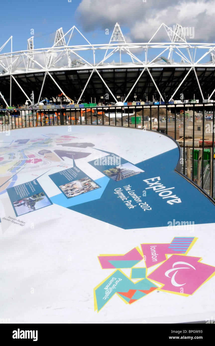 UK LONDON 2012 OLYMPIC STADIUM. MAP OF SPORT FACILITIES Stock Photohttps://www.alamy.com/image-license-details/?v=1https://www.alamy.com/stock-photo-uk-london-2012-olympic-stadium-map-of-sport-facilities-31103887.html
RMBPGW93–UK LONDON 2012 OLYMPIC STADIUM. MAP OF SPORT FACILITIES
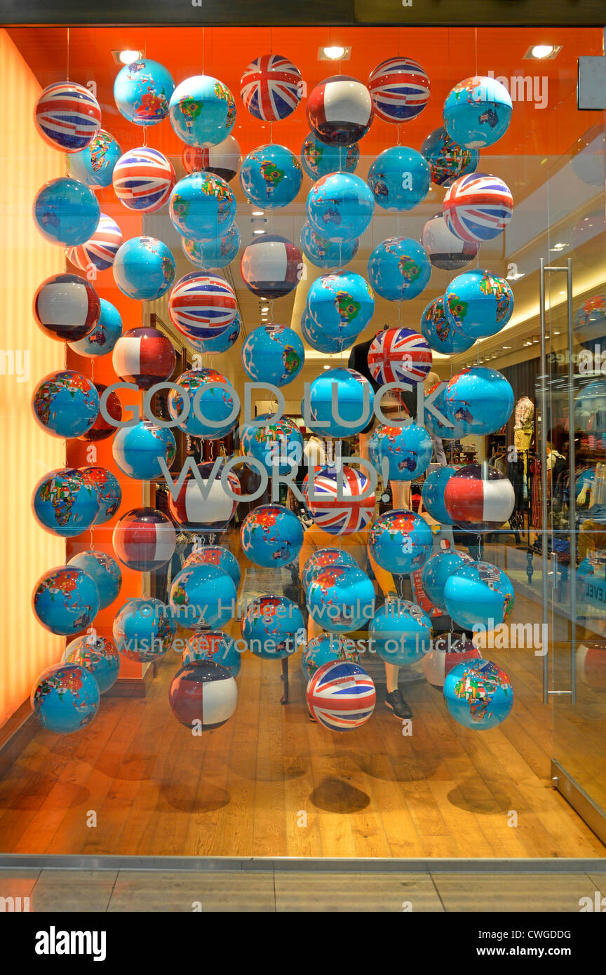 Globe map & flag spheres in shop window during London 2012 Olympics including Union flag versions Westfield shopping centre Stratford City London UK Stock Photohttps://www.alamy.com/image-license-details/?v=1https://www.alamy.com/stock-photo-globe-map-flag-spheres-in-shop-window-during-london-2012-olympics-50148940.html
RMCWGDDG–Globe map & flag spheres in shop window during London 2012 Olympics including Union flag versions Westfield shopping centre Stratford City London UK
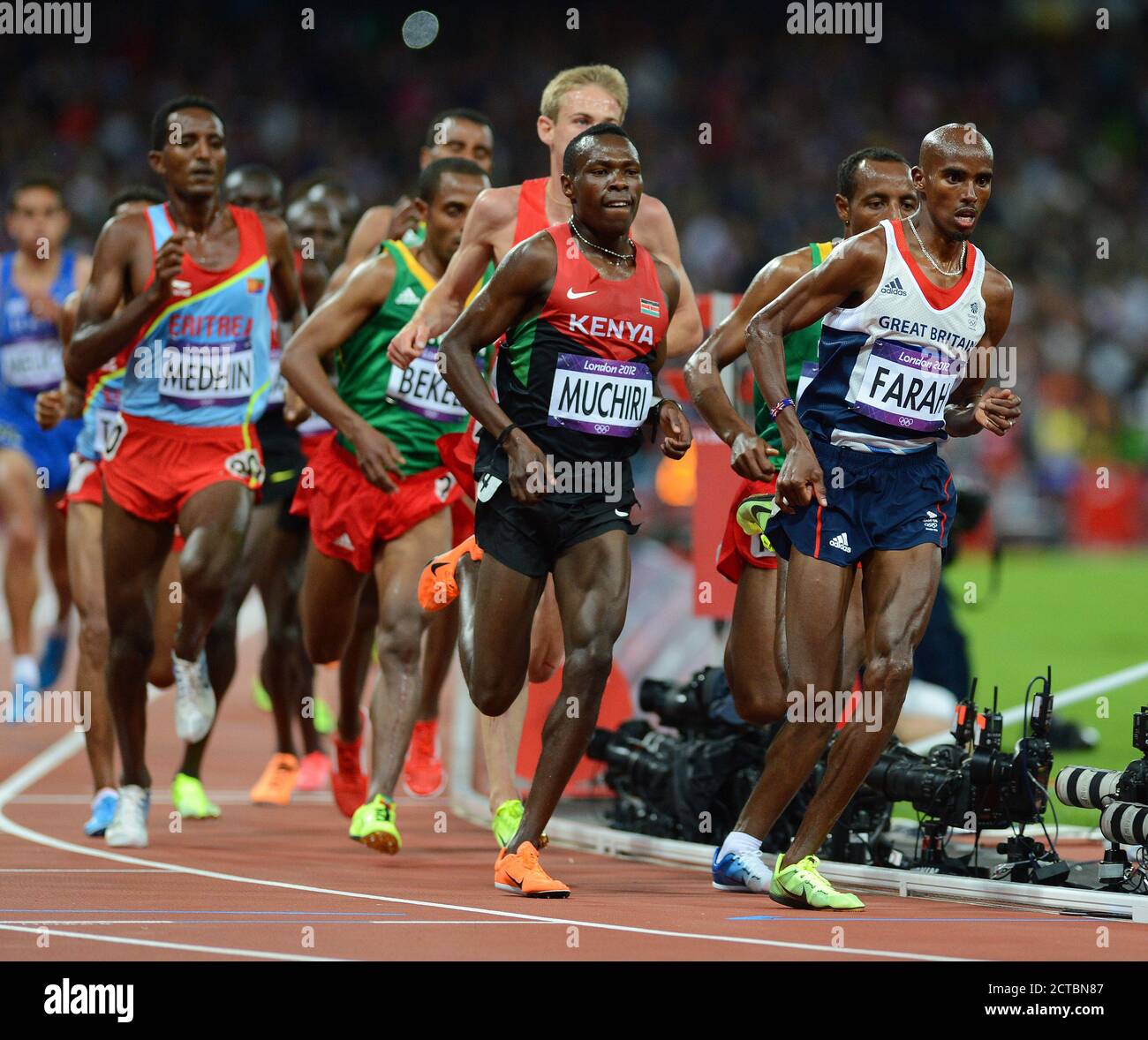 MO FARAH LEADS THE FINAL MAP MENS 10,000 METRES LONDON 2012 OLYMPICS Copyright Picture : Mark Pain 07774 842005 PHOTO CREDIT : © MARK PAIN / ALA Stock Photohttps://www.alamy.com/image-license-details/?v=1https://www.alamy.com/mo-farah-leads-the-final-map-mens-10000-metres-london-2012-olympics-copyright-picture-mark-pain-07774-842005-photo-credit-mark-pain-ala-image376427639.html
RF2CTBN87–MO FARAH LEADS THE FINAL MAP MENS 10,000 METRES LONDON 2012 OLYMPICS Copyright Picture : Mark Pain 07774 842005 PHOTO CREDIT : © MARK PAIN / ALA
 Mar. 27, 2012 - Walls of crime; Crime Section of the map room where general crimes are noted Stock Photohttps://www.alamy.com/image-license-details/?v=1https://www.alamy.com/mar-27-2012-walls-of-crime-crime-section-of-the-map-room-where-general-image69544183.html
RME1408R–Mar. 27, 2012 - Walls of crime; Crime Section of the map room where general crimes are noted
 Election 2012 with USA Flag in Map Silhouette Illustration Stock Photohttps://www.alamy.com/image-license-details/?v=1https://www.alamy.com/stock-photo-election-2012-with-usa-flag-in-map-silhouette-illustration-50285891.html
RFCWPM4K–Election 2012 with USA Flag in Map Silhouette Illustration
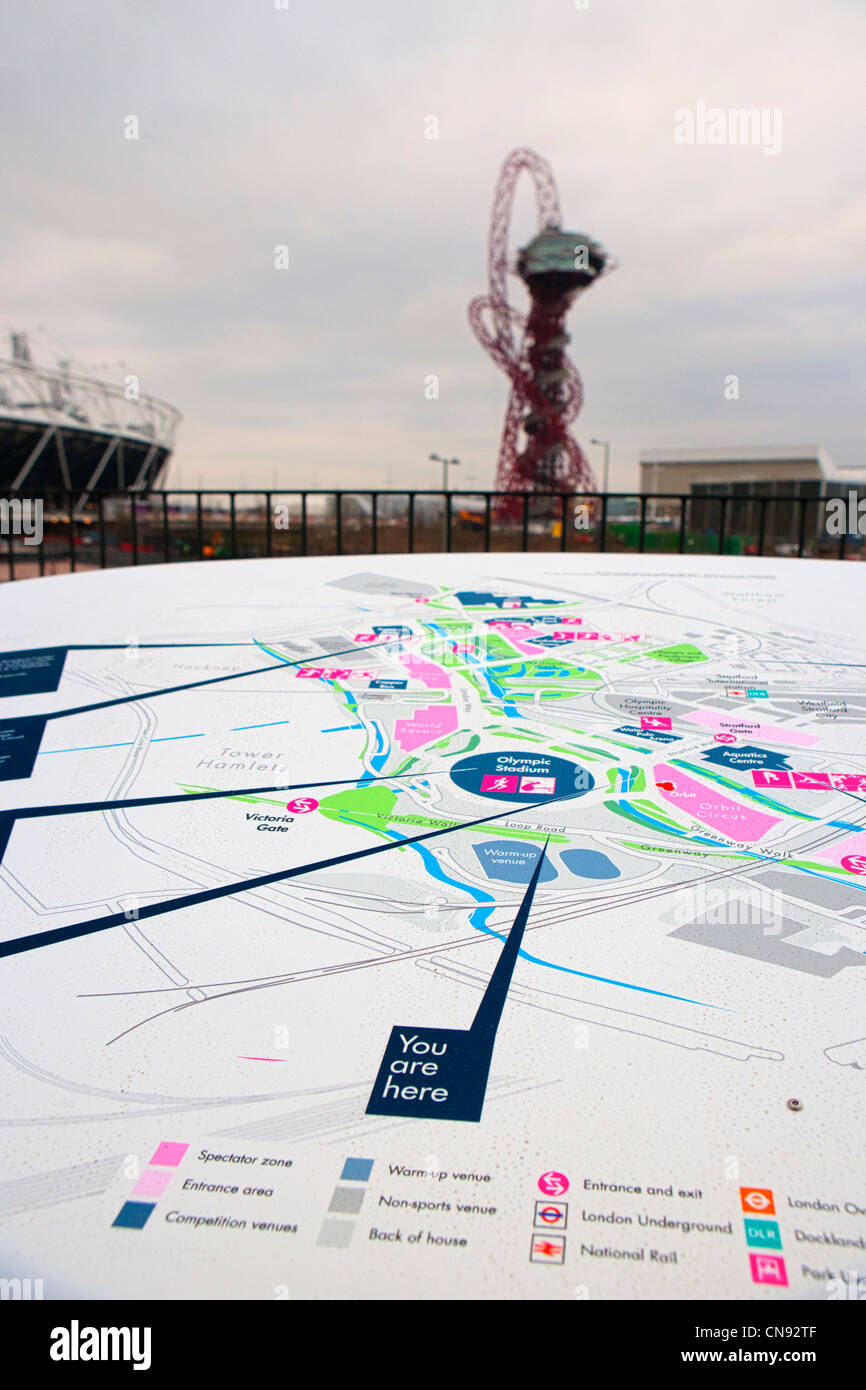 2012 Olympic site under construction Stock Photohttps://www.alamy.com/image-license-details/?v=1https://www.alamy.com/stock-photo-2012-olympic-site-under-construction-47528335.html
RMCN92TF–2012 Olympic site under construction
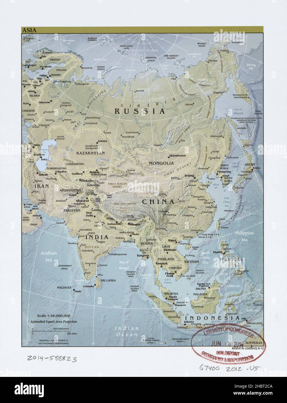 Map of Asia ca. 2012 Stock Photohttps://www.alamy.com/image-license-details/?v=1https://www.alamy.com/map-of-asia-ca-2012-image454759546.html
RM2HBT2CA–Map of Asia ca. 2012
 The Olympic Stadium with the Olympic Park map. Olympic Park at night Stock Photohttps://www.alamy.com/image-license-details/?v=1https://www.alamy.com/stock-photo-the-olympic-stadium-with-the-olympic-park-map-olympic-park-at-night-50813268.html
RMCXJMRG–The Olympic Stadium with the Olympic Park map. Olympic Park at night
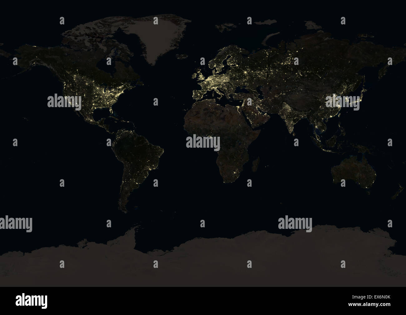 World at night in 2012, showing a world map in Miller projection. This satellite image shows urban and industrial lights. Stock Photohttps://www.alamy.com/image-license-details/?v=1https://www.alamy.com/stock-photo-world-at-night-in-2012-showing-a-world-map-in-miller-projection-this-84970723.html
RMEX6N0K–World at night in 2012, showing a world map in Miller projection. This satellite image shows urban and industrial lights.
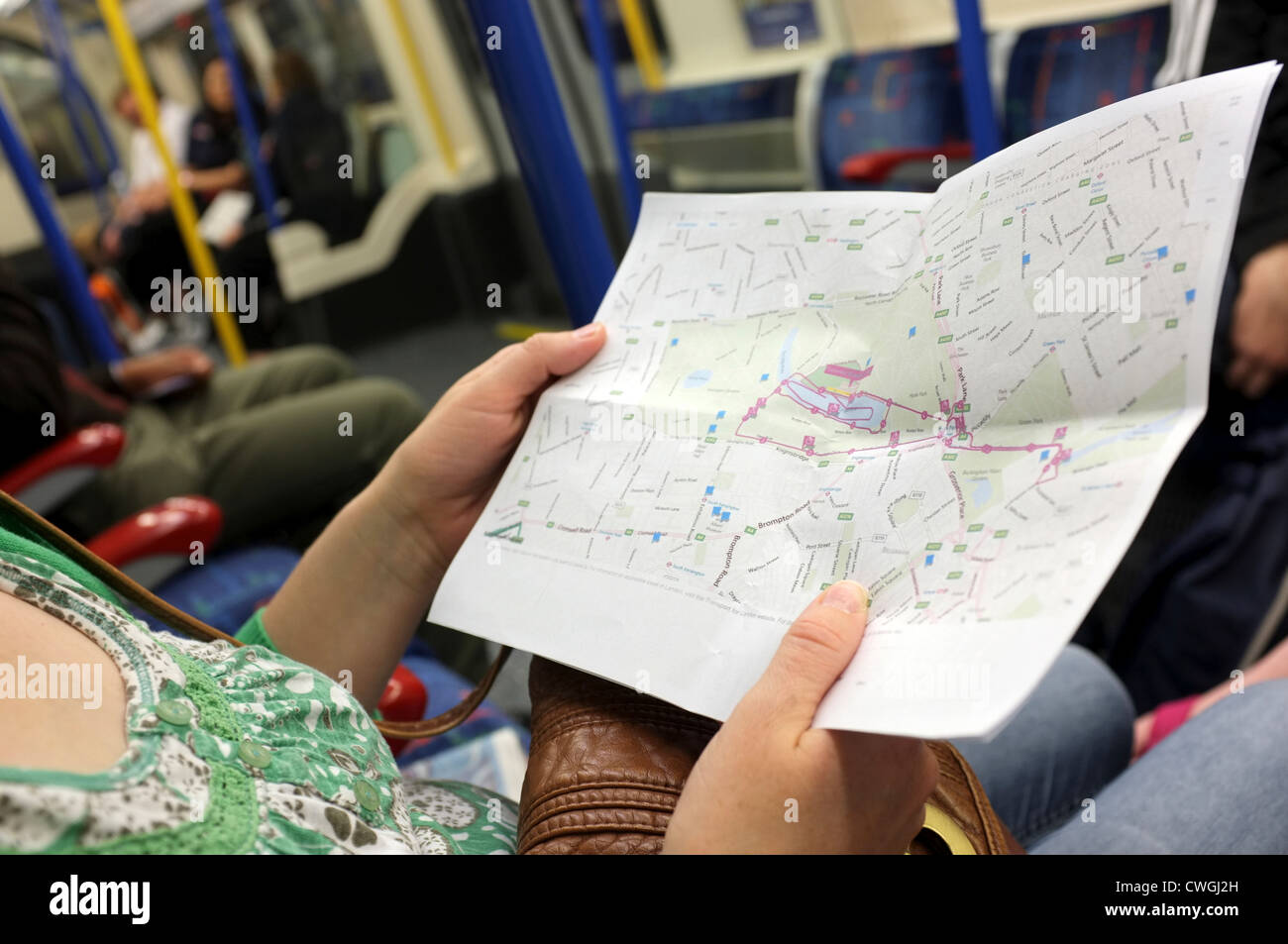 woman looking at map of Olympic triathlon course London 2012 Stock Photohttps://www.alamy.com/image-license-details/?v=1https://www.alamy.com/stock-photo-woman-looking-at-map-of-olympic-triathlon-course-london-2012-50152553.html
RMCWGJ2H–woman looking at map of Olympic triathlon course London 2012
 Spectators consult a detailed map of the Olympic Park during the London 2012 Olympics. This land was transformed to become a 2.5 Sq Km sporting complex, once industrial businesses and now the venue of eight venues including the main arena, Aquatics Centre and Velodrome plus the athletes' Olympic Village. After the Olympics, the park is to be known as Queen Elizabeth Olympic Park. Stock Photohttps://www.alamy.com/image-license-details/?v=1https://www.alamy.com/stock-photo-spectators-consult-a-detailed-map-of-the-olympic-park-during-the-london-49733799.html
RMCTWFY3–Spectators consult a detailed map of the Olympic Park during the London 2012 Olympics. This land was transformed to become a 2.5 Sq Km sporting complex, once industrial businesses and now the venue of eight venues including the main arena, Aquatics Centre and Velodrome plus the athletes' Olympic Village. After the Olympics, the park is to be known as Queen Elizabeth Olympic Park.
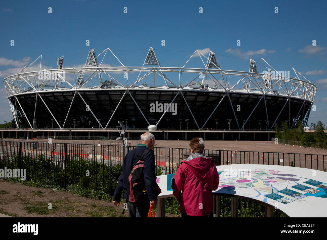 02.05.2011 Preview images for the London 2012 Olympic games. Tourists study a large map of the Olympic Village, with the main St Stock Photohttps://www.alamy.com/image-license-details/?v=1https://www.alamy.com/stock-photo-02052011-preview-images-for-the-london-2012-olympic-games-tourists-41408151.html
RMCBA8EF–02.05.2011 Preview images for the London 2012 Olympic games. Tourists study a large map of the Olympic Village, with the main St
 world map 2012 Stock Photohttps://www.alamy.com/image-license-details/?v=1https://www.alamy.com/stock-photo-world-map-2012-143260616.html
RFJ922AG–world map 2012
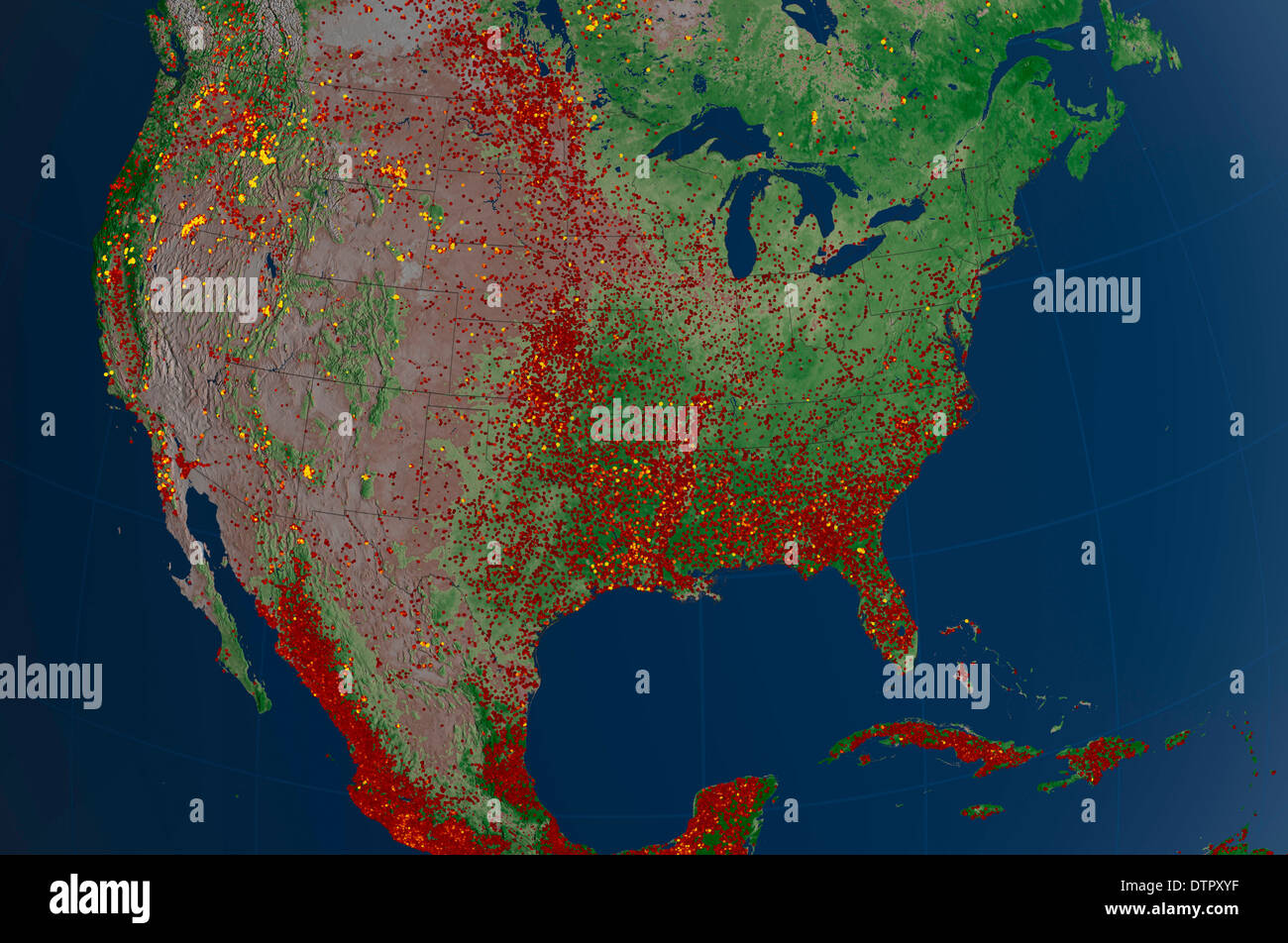 Map of the continental USA showing the fires of 2012 Stock Photohttps://www.alamy.com/image-license-details/?v=1https://www.alamy.com/map-of-the-continental-usa-showing-the-fires-of-2012-image66886947.html
RMDTPXYF–Map of the continental USA showing the fires of 2012
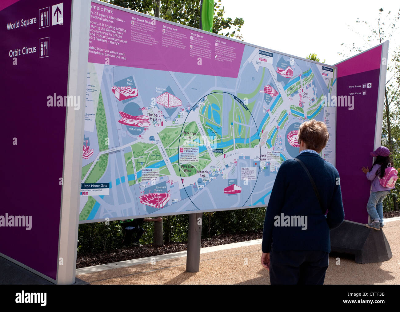 London 2012 Olympic Games - looking at a map of the site Stock Photohttps://www.alamy.com/image-license-details/?v=1https://www.alamy.com/stock-photo-london-2012-olympic-games-looking-at-a-map-of-the-site-49711183.html
RMCTTF3B–London 2012 Olympic Games - looking at a map of the site
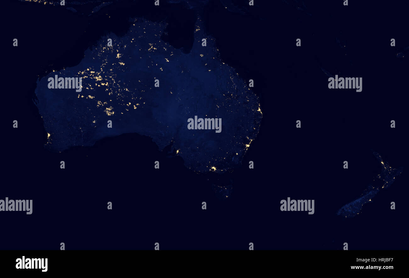 Australia at Night, 2012 Stock Photohttps://www.alamy.com/image-license-details/?v=1https://www.alamy.com/stock-photo-australia-at-night-2012-135013851.html
RMHRJBF7–Australia at Night, 2012
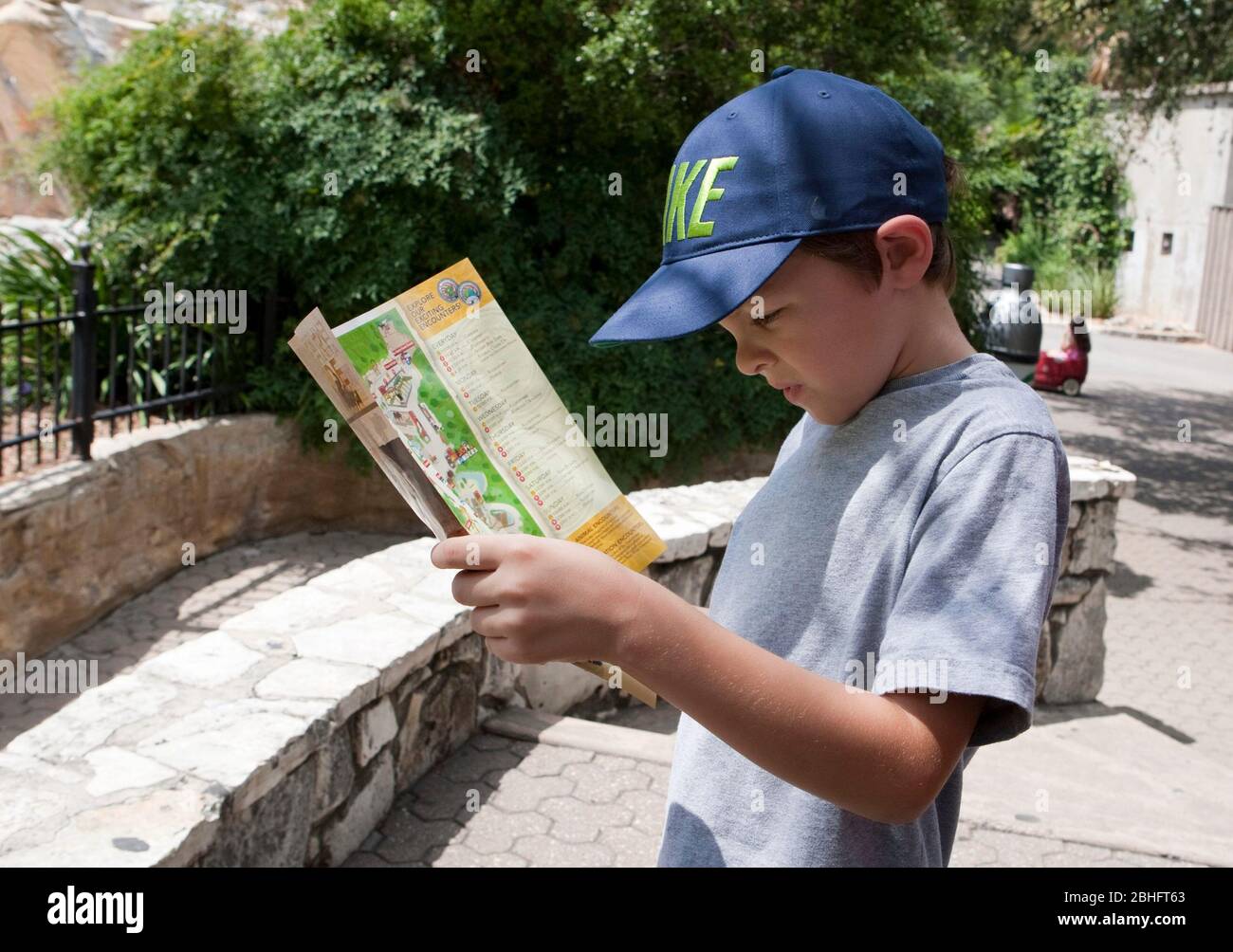 San Antonio Texas USA, January 12 2012: 7-year-old Hispanic boy reads information brochure and map at the San Antonio Zoo. Model Released © Marjorie Kamys Cotera/Daemmrich Photography Stock Photohttps://www.alamy.com/image-license-details/?v=1https://www.alamy.com/san-antonio-texas-usa-january-12-2012-7-year-old-hispanic-boy-reads-information-brochure-and-map-at-the-san-antonio-zoo-model-released-marjorie-kamys-coteradaemmrich-photography-image355004779.html
RM2BHFT63–San Antonio Texas USA, January 12 2012: 7-year-old Hispanic boy reads information brochure and map at the San Antonio Zoo. Model Released © Marjorie Kamys Cotera/Daemmrich Photography
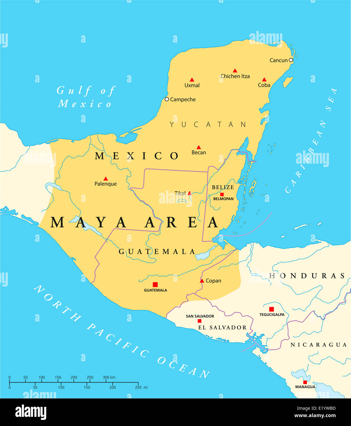 Maya High Culture Area Map - Political map with capitals, national borders, most important ancient cities, rivers and lakes. Stock Photohttps://www.alamy.com/image-license-details/?v=1https://www.alamy.com/stock-photo-maya-high-culture-area-map-political-map-with-capitals-national-borders-70068753.html
RFE1YWBD–Maya High Culture Area Map - Political map with capitals, national borders, most important ancient cities, rivers and lakes.
 A rear view of a woman looking a a map of the site of the National Eisteddfod of Wales 2012 Stock Photohttps://www.alamy.com/image-license-details/?v=1https://www.alamy.com/stock-photo-a-rear-view-of-a-woman-looking-a-a-map-of-the-site-of-the-national-50646127.html
RMCXB3J7–A rear view of a woman looking a a map of the site of the National Eisteddfod of Wales 2012
 soccer Euro 2012 Venues. Venue guide, with map, stadium pictures and fixtures Stock Photohttps://www.alamy.com/image-license-details/?v=1https://www.alamy.com/stock-photo-soccer-euro-2012-venues-venue-guide-with-map-stadium-pictures-and-106498651.html
RMG57C37–soccer Euro 2012 Venues. Venue guide, with map, stadium pictures and fixtures
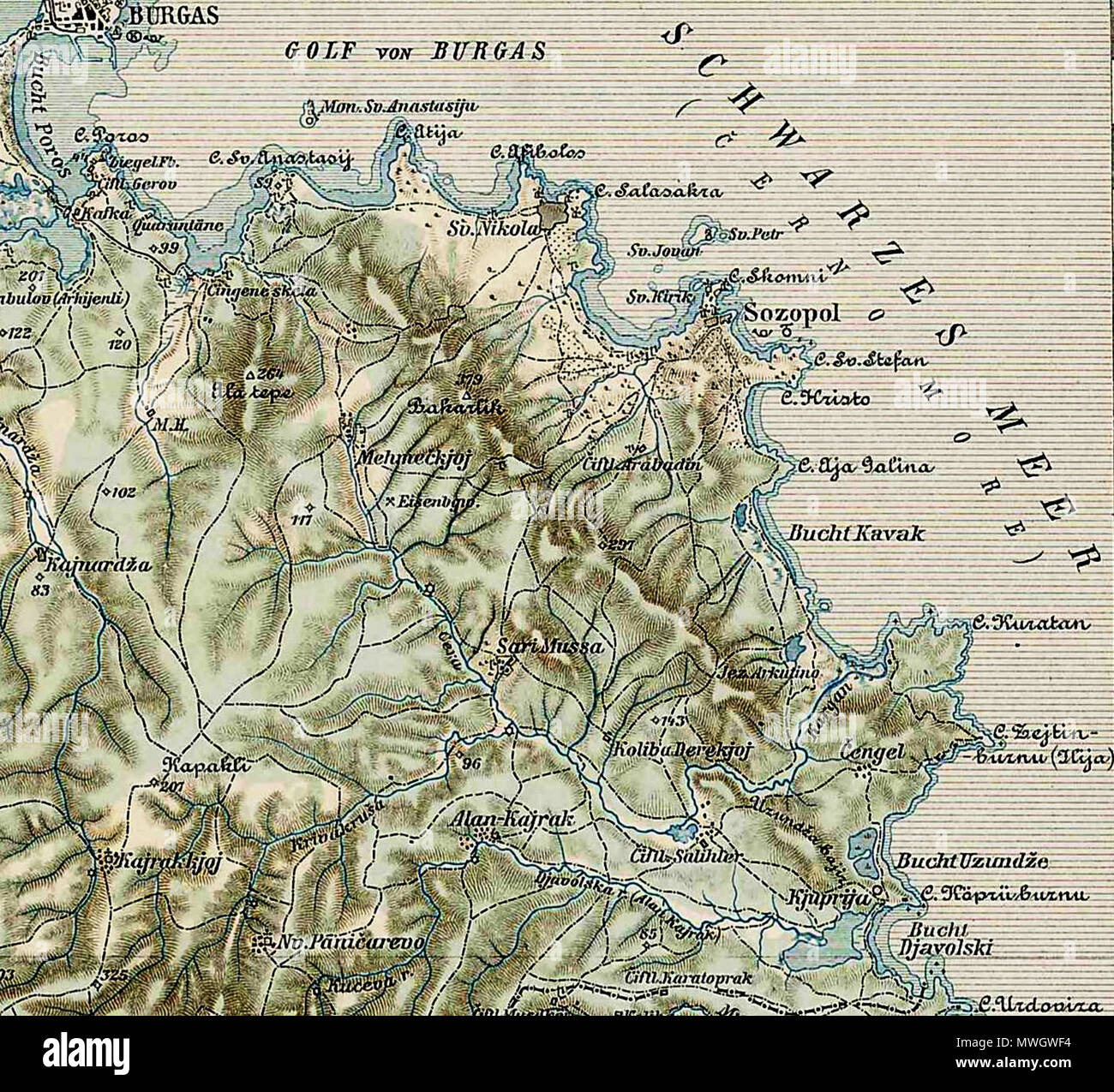 . Deutsch: Sozopol und sein Umland (1903) . 14 July 2012, 15:58 (UTC). Map 45-42 erkesia.jpg: Unknown derivative work: Vammpi 392 Map 45-42 Sozopol1 Stock Photohttps://www.alamy.com/image-license-details/?v=1https://www.alamy.com/deutsch-sozopol-und-sein-umland-1903-14-july-2012-1558-utc-map-45-42-erkesiajpg-unknown-derivative-work-vammpi-392-map-45-42-sozopol1-image187841336.html
RMMWGWF4–. Deutsch: Sozopol und sein Umland (1903) . 14 July 2012, 15:58 (UTC). Map 45-42 erkesia.jpg: Unknown derivative work: Vammpi 392 Map 45-42 Sozopol1
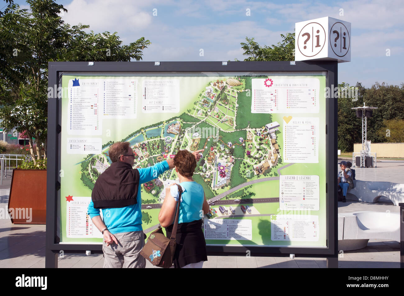 Giant map of the Floriade 2012 garden festival Venlo, Netherlands. Stock Photohttps://www.alamy.com/image-license-details/?v=1https://www.alamy.com/stock-photo-giant-map-of-the-floriade-2012-garden-festival-venlo-netherlands-57001223.html
RMD8MHHY–Giant map of the Floriade 2012 garden festival Venlo, Netherlands.
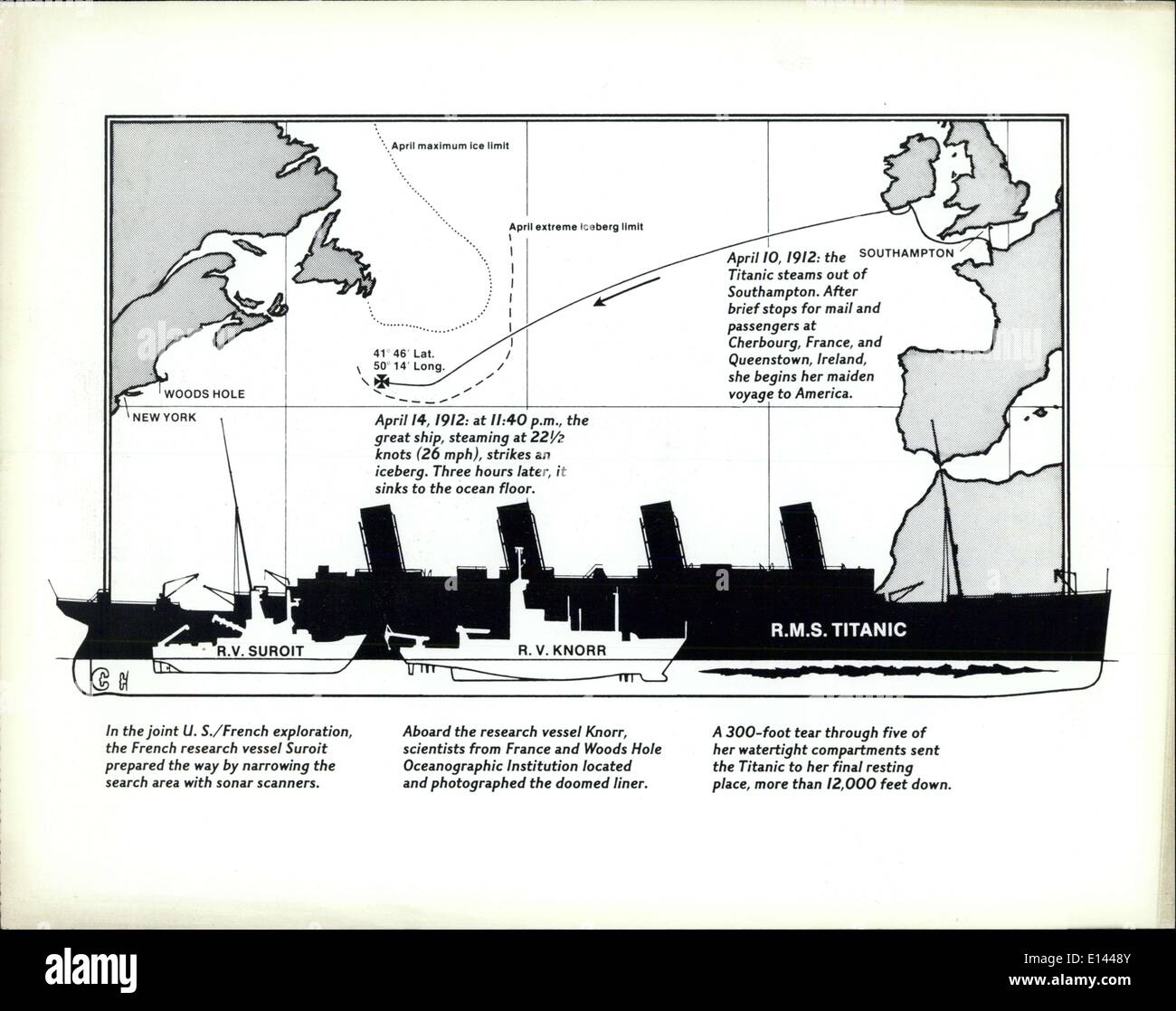 Apr. 04, 2012 - Titanic Diagram map WA-20790-2...Released in Washington,D.C. ,..Sept 11 1985 Stock Photohttps://www.alamy.com/image-license-details/?v=1https://www.alamy.com/apr-04-2012-titanic-diagram-map-wa-20790-2released-in-washingtondc-image69547323.html
RME1448Y–Apr. 04, 2012 - Titanic Diagram map WA-20790-2...Released in Washington,D.C. ,..Sept 11 1985
 Election 2012 with USA Flag in Map Silhouette Illustration Stock Photohttps://www.alamy.com/image-license-details/?v=1https://www.alamy.com/stock-photo-election-2012-with-usa-flag-in-map-silhouette-illustration-50459905.html
RFCX2J3D–Election 2012 with USA Flag in Map Silhouette Illustration
 A U.S. Air Force member looks over a map before his simulation flight during the Emerald Warrior exercise at Hurlburt Field, Fla. Stock Photohttps://www.alamy.com/image-license-details/?v=1https://www.alamy.com/stock-photo-a-us-air-force-member-looks-over-a-map-before-his-simulation-flight-95642875.html
RMFFGWCY–A U.S. Air Force member looks over a map before his simulation flight during the Emerald Warrior exercise at Hurlburt Field, Fla.
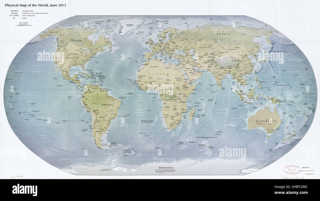 Physical map of the world ca. 2012 Stock Photohttps://www.alamy.com/image-license-details/?v=1https://www.alamy.com/physical-map-of-the-world-ca-2012-image454759912.html
RM2HBT2WC–Physical map of the world ca. 2012
 Destroyed buildings in Marysville, Indiana after the March 2012 Tornado which nearly wiped the town off the map. Stock Photohttps://www.alamy.com/image-license-details/?v=1https://www.alamy.com/stock-photo-destroyed-buildings-in-marysville-indiana-after-the-march-2012-tornado-44056154.html
RMCFJX22–Destroyed buildings in Marysville, Indiana after the March 2012 Tornado which nearly wiped the town off the map.
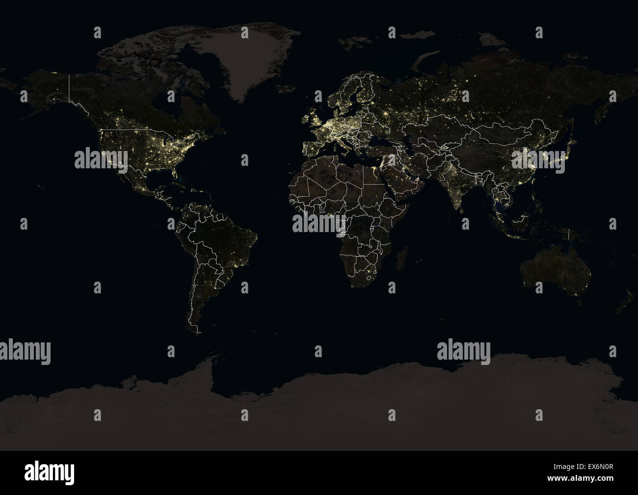 World at night in 2012, showing a world map in Miller projection. This satellite image with country borders shows urban and Stock Photohttps://www.alamy.com/image-license-details/?v=1https://www.alamy.com/stock-photo-world-at-night-in-2012-showing-a-world-map-in-miller-projection-this-84970727.html
RMEX6N0R–World at night in 2012, showing a world map in Miller projection. This satellite image with country borders shows urban and
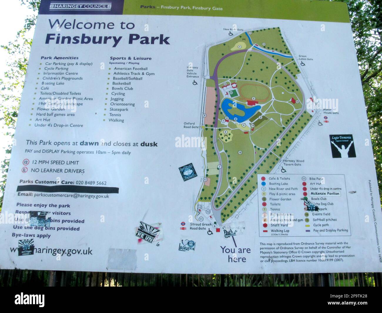 Finsbury Park map, North London, London Borough of Haringey, London, UK as of 2012 Stock Photohttps://www.alamy.com/image-license-details/?v=1https://www.alamy.com/finsbury-park-map-north-london-london-borough-of-haringey-london-uk-as-of-2012-image419122544.html
RM2F9TK28–Finsbury Park map, North London, London Borough of Haringey, London, UK as of 2012
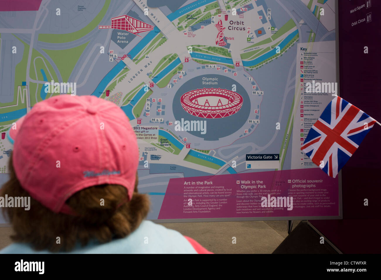 Spectators consult a detailed map of the Olympic Park during the London 2012 Olympics. This land was transformed to become a 2.5 Sq Km sporting complex, once industrial businesses and now the venue of eight venues including the main arena, Aquatics Centre and Velodrome plus the athletes' Olympic Village. After the Olympics, the park is to be known as Queen Elizabeth Olympic Park. Stock Photohttps://www.alamy.com/image-license-details/?v=1https://www.alamy.com/stock-photo-spectators-consult-a-detailed-map-of-the-olympic-park-during-the-london-49733791.html
RMCTWFXR–Spectators consult a detailed map of the Olympic Park during the London 2012 Olympics. This land was transformed to become a 2.5 Sq Km sporting complex, once industrial businesses and now the venue of eight venues including the main arena, Aquatics Centre and Velodrome plus the athletes' Olympic Village. After the Olympics, the park is to be known as Queen Elizabeth Olympic Park.
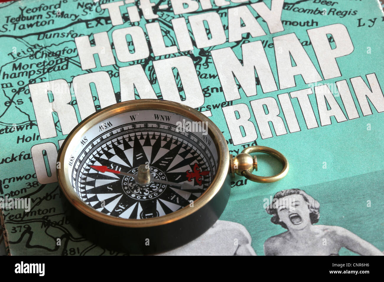 UK holidays with road map and compass Stock Photohttps://www.alamy.com/image-license-details/?v=1https://www.alamy.com/stock-photo-uk-holidays-with-road-map-and-compass-47838594.html
RMCNR6H6–UK holidays with road map and compass
 world map 2012 Stock Photohttps://www.alamy.com/image-license-details/?v=1https://www.alamy.com/stock-photo-world-map-2012-143003585.html
RFJ8JAEW–world map 2012
 Inflatable earth globe map International Tourism Show 2012 Paris Stock Photohttps://www.alamy.com/image-license-details/?v=1https://www.alamy.com/stock-photo-inflatable-earth-globe-map-international-tourism-show-2012-paris-47191676.html
RMCMNND0–Inflatable earth globe map International Tourism Show 2012 Paris
 woman looking at the map of the London 2012 Olympic Park and stadium on sign Stock Photohttps://www.alamy.com/image-license-details/?v=1https://www.alamy.com/stock-photo-woman-looking-at-the-map-of-the-london-2012-olympic-park-and-stadium-49600375.html
RMCTKDNY–woman looking at the map of the London 2012 Olympic Park and stadium on sign
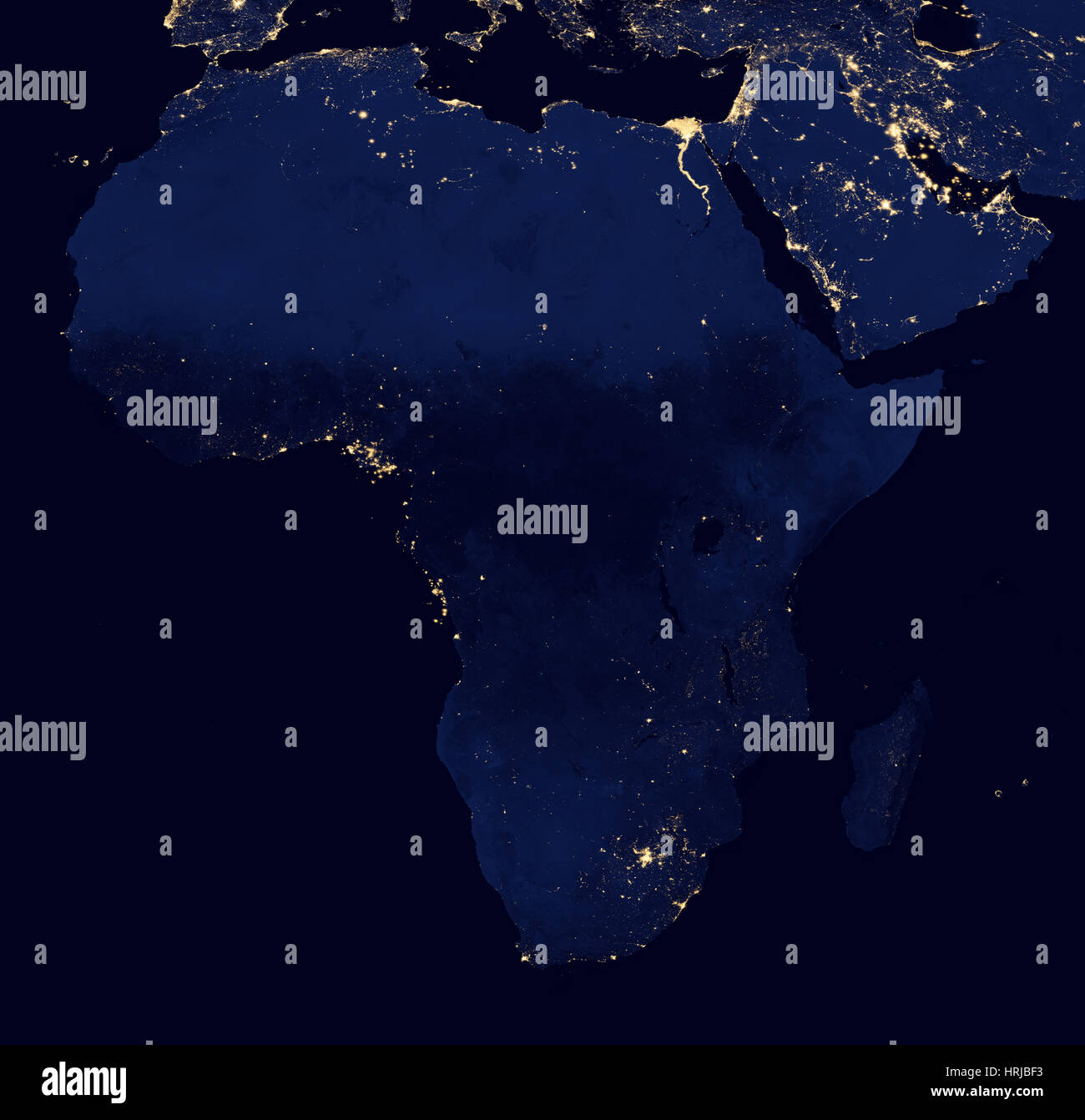 Africa at Night, 2012 Stock Photohttps://www.alamy.com/image-license-details/?v=1https://www.alamy.com/stock-photo-africa-at-night-2012-135013847.html
RMHRJBF3–Africa at Night, 2012
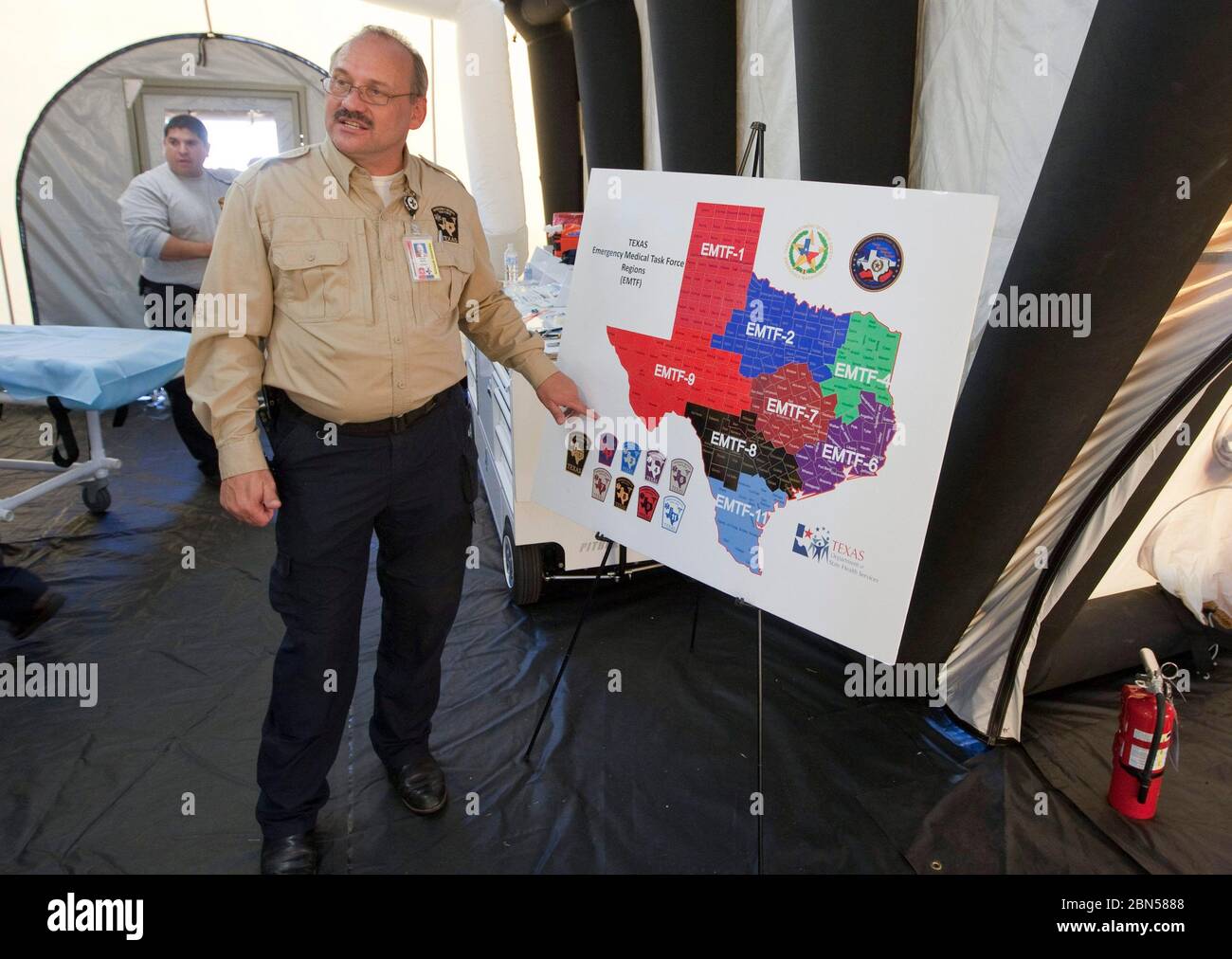 Austin Texas USA, June 1 2012: Member Texas's emergency management office shows a map of the state's emergency districts at a press conference at a mobile medical facility during a hurricane preparedness drill. ©Bob Daemmrich Stock Photohttps://www.alamy.com/image-license-details/?v=1https://www.alamy.com/austin-texas-usa-june-1-2012-member-texass-emergency-management-office-shows-a-map-of-the-states-emergency-districts-at-a-press-conference-at-a-mobile-medical-facility-during-a-hurricane-preparedness-drill-bob-daemmrich-image357231400.html
RM2BN5888–Austin Texas USA, June 1 2012: Member Texas's emergency management office shows a map of the state's emergency districts at a press conference at a mobile medical facility during a hurricane preparedness drill. ©Bob Daemmrich
 Balkan road map 2012 on red background Stock Photohttps://www.alamy.com/image-license-details/?v=1https://www.alamy.com/stock-photo-balkan-road-map-2012-on-red-background-86697574.html
RFF11BHX–Balkan road map 2012 on red background
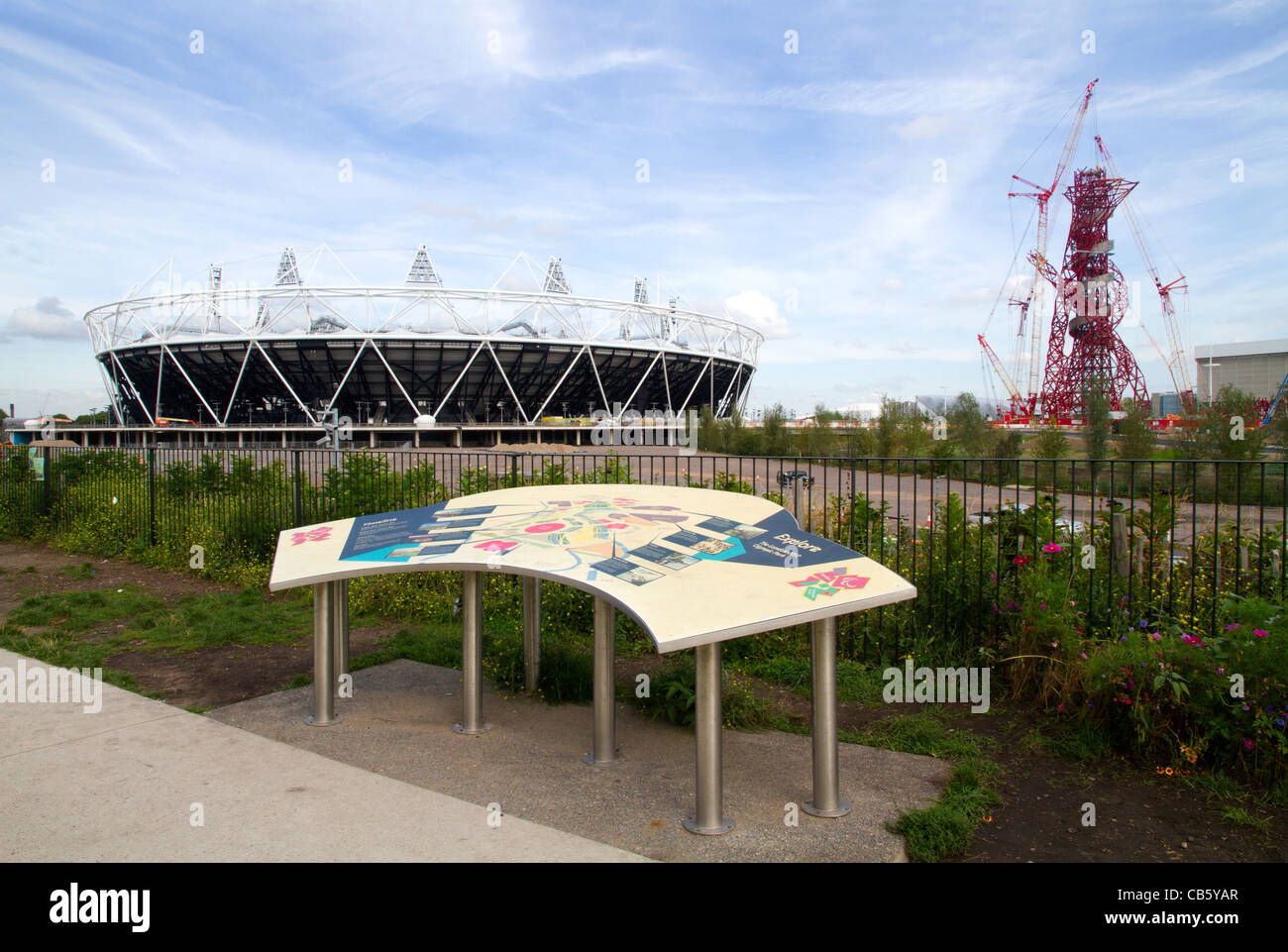 The London 2012 Olympic stadium, the ArcelorMittal Orbit observation tower and site map in the Olympic Park in Stratford, London Stock Photohttps://www.alamy.com/image-license-details/?v=1https://www.alamy.com/stock-photo-the-london-2012-olympic-stadium-the-arcelormittal-orbit-observation-41313183.html
RMCB5YAR–The London 2012 Olympic stadium, the ArcelorMittal Orbit observation tower and site map in the Olympic Park in Stratford, London
 soccer Euro 2012 Venues. Venue guide, with map, stadium pictures and fixtures Stock Photohttps://www.alamy.com/image-license-details/?v=1https://www.alamy.com/stock-photo-soccer-euro-2012-venues-venue-guide-with-map-stadium-pictures-and-106469619.html
RMG5632B–soccer Euro 2012 Venues. Venue guide, with map, stadium pictures and fixtures
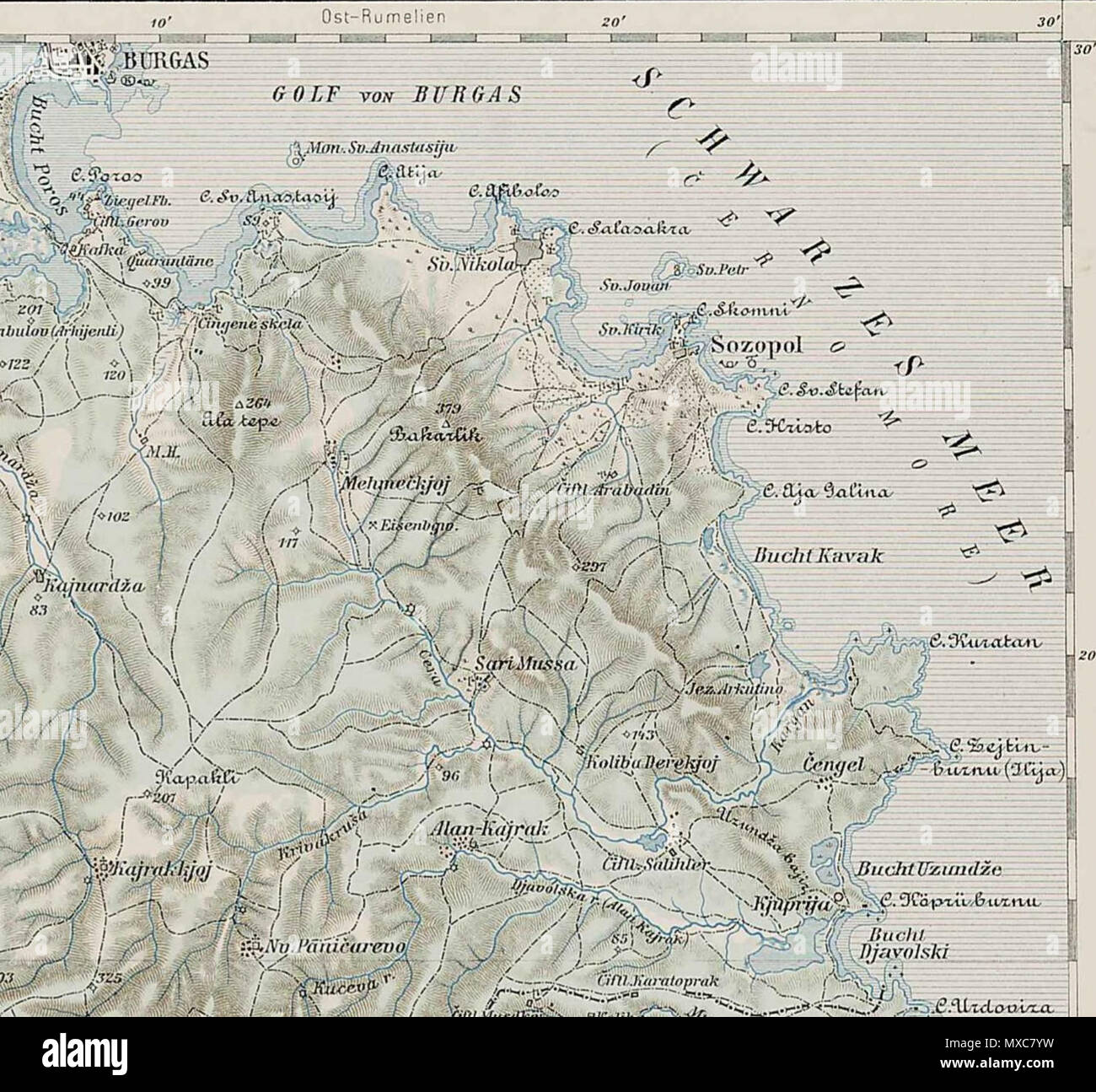 . Deutsch: Sozopol und sein Umland (1903) . 14 July 2012, 15:58 (UTC). Map 45-42 erkesia.jpg: Unknown derivative work: Vammpi 392 Map 45-42 Sozopol Stock Photohttps://www.alamy.com/image-license-details/?v=1https://www.alamy.com/deutsch-sozopol-und-sein-umland-1903-14-july-2012-1558-utc-map-45-42-erkesiajpg-unknown-derivative-work-vammpi-392-map-45-42-sozopol-image188354429.html
RMMXC7YW–. Deutsch: Sozopol und sein Umland (1903) . 14 July 2012, 15:58 (UTC). Map 45-42 erkesia.jpg: Unknown derivative work: Vammpi 392 Map 45-42 Sozopol
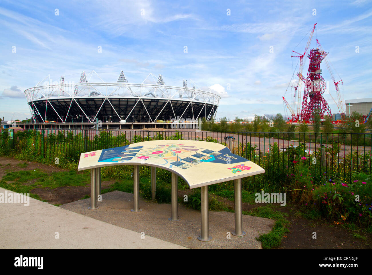 The London 2012 Olympic stadium, the ArcelorMittal Orbit observation tower and site map in the Olympic Park in Stratford in the Stock Photohttps://www.alamy.com/image-license-details/?v=1https://www.alamy.com/stock-photo-the-london-2012-olympic-stadium-the-arcelormittal-orbit-observation-49031879.html
RMCRNGJF–The London 2012 Olympic stadium, the ArcelorMittal Orbit observation tower and site map in the Olympic Park in Stratford in the
 Mar. 22, 2012 - This map of Windsor Castle printed on tiles is to be found on the right hand wall of the narrow alley way which Stock Photohttps://www.alamy.com/image-license-details/?v=1https://www.alamy.com/mar-22-2012-this-map-of-windsor-castle-printed-on-tiles-is-to-be-found-image69540195.html
RME13R6B–Mar. 22, 2012 - This map of Windsor Castle printed on tiles is to be found on the right hand wall of the narrow alley way which
 Vote Presidential Election 2012 with USA Flag in Map Silhouette Retro Illustration Stock Photohttps://www.alamy.com/image-license-details/?v=1https://www.alamy.com/stock-photo-vote-presidential-election-2012-with-usa-flag-in-map-silhouette-retro-50459939.html
RFCX2J4K–Vote Presidential Election 2012 with USA Flag in Map Silhouette Retro Illustration
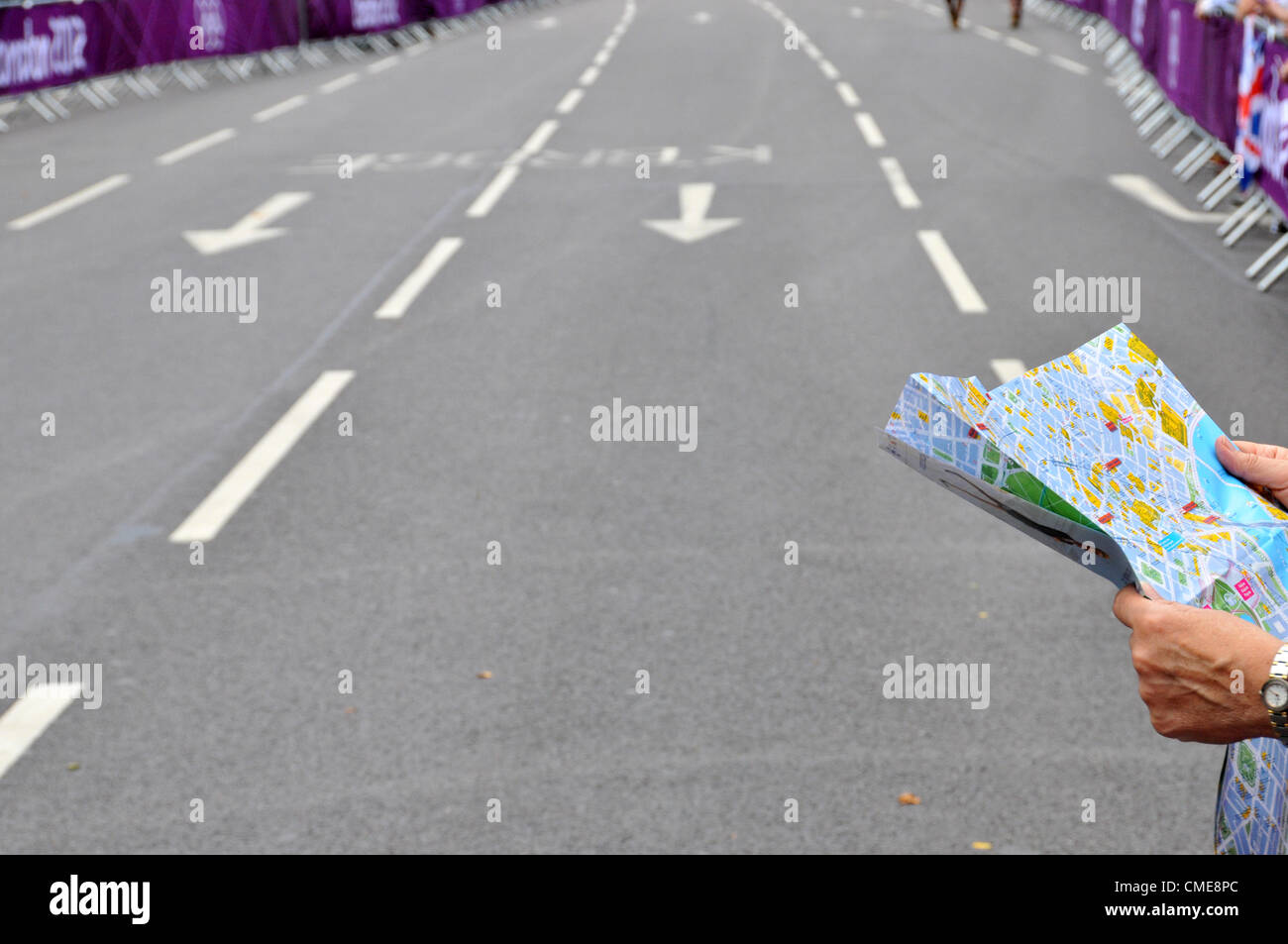 Hyde Park Corner, London, UK. 29th July 2012 'Where are we now?'. The crowd wait for the women's Cycling Road race at Hyde Park Corner. Stock Photohttps://www.alamy.com/image-license-details/?v=1https://www.alamy.com/stock-photo-hyde-park-corner-london-uk-29th-july-2012-where-are-we-now-the-crowd-47028084.html
RMCME8PC–Hyde Park Corner, London, UK. 29th July 2012 'Where are we now?'. The crowd wait for the women's Cycling Road race at Hyde Park Corner.
 Map of administrative divisions of Yemen, 2012 Stock Photohttps://www.alamy.com/image-license-details/?v=1https://www.alamy.com/map-of-administrative-divisions-of-yemen-2012-image454766150.html
RM2HBTAT6–Map of administrative divisions of Yemen, 2012
 Destroyed buildings in Marysville, Indiana after the March 2012 Tornado which nearly wiped the town off the map. Stock Photohttps://www.alamy.com/image-license-details/?v=1https://www.alamy.com/stock-photo-destroyed-buildings-in-marysville-indiana-after-the-march-2012-tornado-44056094.html
RMCFJWYX–Destroyed buildings in Marysville, Indiana after the March 2012 Tornado which nearly wiped the town off the map.
 World at night in 2012, showing a world map in Mercator projection. This satellite image with country borders shows urban and Stock Photohttps://www.alamy.com/image-license-details/?v=1https://www.alamy.com/stock-photo-world-at-night-in-2012-showing-a-world-map-in-mercator-projection-84970721.html
RMEX6N0H–World at night in 2012, showing a world map in Mercator projection. This satellite image with country borders shows urban and
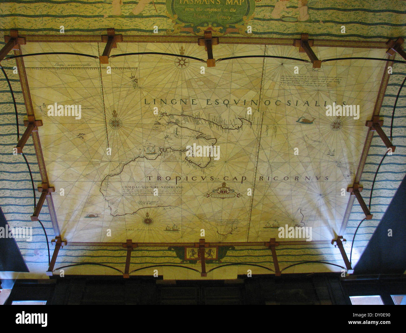 Tasman Map, entrance to Mitchell Library, 2012 / photographed by State Library Library of New South Wales Stock Photohttps://www.alamy.com/image-license-details/?v=1https://www.alamy.com/tasman-map-entrance-to-mitchell-library-2012-photographed-by-state-image68238044.html
RMDY0E90–Tasman Map, entrance to Mitchell Library, 2012 / photographed by State Library Library of New South Wales
 Spectators consult a detailed map of the Olympic Park during the London 2012 Olympics. This land was transformed to become a 2.5 Sq Km sporting complex, once industrial businesses and now the venue of eight venues including the main arena, Aquatics Centre and Velodrome plus the athletes' Olympic Village. After the Olympics, the park is to be known as Queen Elizabeth Olympic Park. Stock Photohttps://www.alamy.com/image-license-details/?v=1https://www.alamy.com/stock-photo-spectators-consult-a-detailed-map-of-the-olympic-park-during-the-london-49733926.html
RMCTWG3J–Spectators consult a detailed map of the Olympic Park during the London 2012 Olympics. This land was transformed to become a 2.5 Sq Km sporting complex, once industrial businesses and now the venue of eight venues including the main arena, Aquatics Centre and Velodrome plus the athletes' Olympic Village. After the Olympics, the park is to be known as Queen Elizabeth Olympic Park.
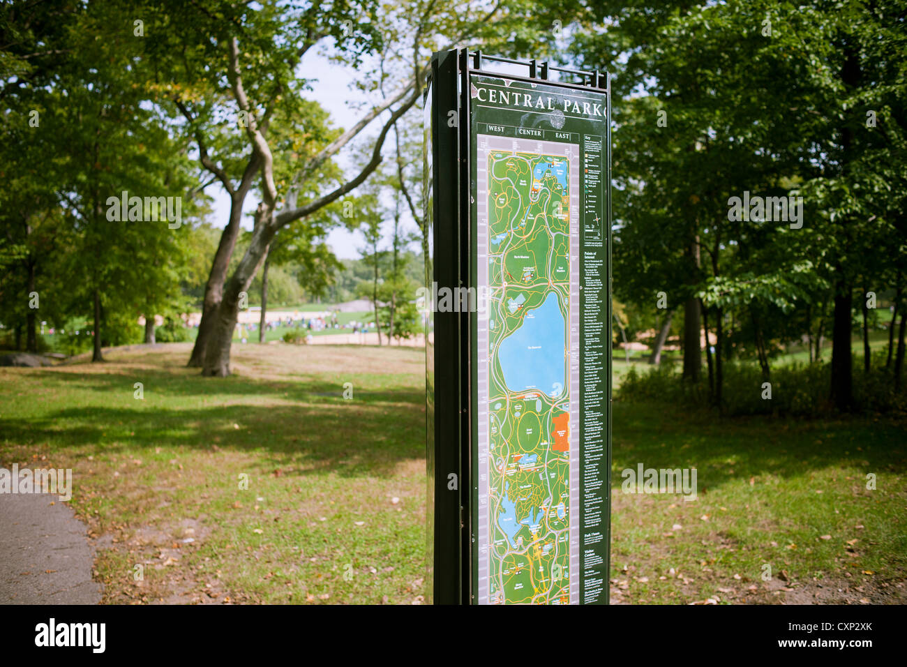 A map and wayfinding sign is seen in Central Park in New York on Saturday, October 6, 2012. (© Richard B. Levine) Stock Photohttps://www.alamy.com/image-license-details/?v=1https://www.alamy.com/stock-photo-a-map-and-wayfinding-sign-is-seen-in-central-park-in-new-york-on-saturday-50887051.html
RMCXP2XK–A map and wayfinding sign is seen in Central Park in New York on Saturday, October 6, 2012. (© Richard B. Levine)
 world map 2012 Stock Photohttps://www.alamy.com/image-license-details/?v=1https://www.alamy.com/stock-photo-world-map-2012-143204750.html
RFJ8YF3A–world map 2012
 BERLIN - JUNE 17: Person looking at the Ubahn map while waiting for the train in Alexanderplatz station on June 17, 2012 in Berl Stock Photohttps://www.alamy.com/image-license-details/?v=1https://www.alamy.com/stock-photo-berlin-june-17-person-looking-at-the-ubahn-map-while-waiting-for-the-124542872.html
RMH6HBKM–BERLIN - JUNE 17: Person looking at the Ubahn map while waiting for the train in Alexanderplatz station on June 17, 2012 in Berl
 City Model 2012 of the artist Egbert Broerken, City Hall, Nördlingen, Swabia, Bavaria, Germany Stock Photohttps://www.alamy.com/image-license-details/?v=1https://www.alamy.com/stock-photo-city-model-2012-of-the-artist-egbert-broerken-city-hall-nrdlingen-129432559.html
RMHEG4FB–City Model 2012 of the artist Egbert Broerken, City Hall, Nördlingen, Swabia, Bavaria, Germany
 Abell 550, Galaxy Cluster, Luminosity Map Stock Photohttps://www.alamy.com/image-license-details/?v=1https://www.alamy.com/stock-photo-abell-550-galaxy-cluster-luminosity-map-135014293.html
RMHRJC31–Abell 550, Galaxy Cluster, Luminosity Map
 Santorini Island, Greece - July 19, 2012: Tourist woman with shoulder with hat with map of Santorini island. Every year, millions of visitors choose t Stock Photohttps://www.alamy.com/image-license-details/?v=1https://www.alamy.com/stock-image-santorini-island-greece-july-19-2012-tourist-woman-with-shoulder-with-164233459.html
RFKF5DCK–Santorini Island, Greece - July 19, 2012: Tourist woman with shoulder with hat with map of Santorini island. Every year, millions of visitors choose t
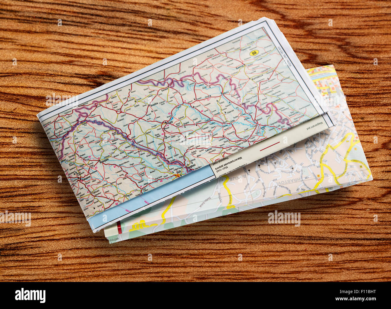 Balkan road map 2012 on wooden background Stock Photohttps://www.alamy.com/image-license-details/?v=1https://www.alamy.com/stock-photo-balkan-road-map-2012-on-wooden-background-86697572.html
RFF11BHT–Balkan road map 2012 on wooden background
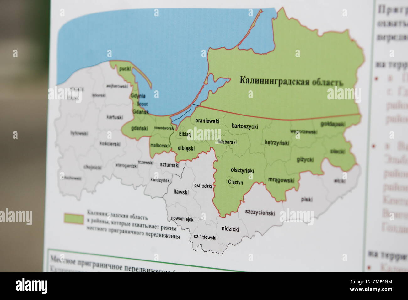 Grzechotki, Poland Friday 27th, July 2012 Small cross border traffic map. Poles and Russians can move across the border with the Russian enclave of Kaliningrad (Kaliningrad oblast) , on Poland's north east border, as of Friday. The visa-free travel is the result of a bilateral agreement on so-called “small cross border traffic” signed between Poland and Russia in December last year. Stock Photohttps://www.alamy.com/image-license-details/?v=1https://www.alamy.com/stock-photo-grzechotki-poland-friday-27th-july-2012-small-cross-border-traffic-47021792.html
RMCME0NM–Grzechotki, Poland Friday 27th, July 2012 Small cross border traffic map. Poles and Russians can move across the border with the Russian enclave of Kaliningrad (Kaliningrad oblast) , on Poland's north east border, as of Friday. The visa-free travel is the result of a bilateral agreement on so-called “small cross border traffic” signed between Poland and Russia in December last year.
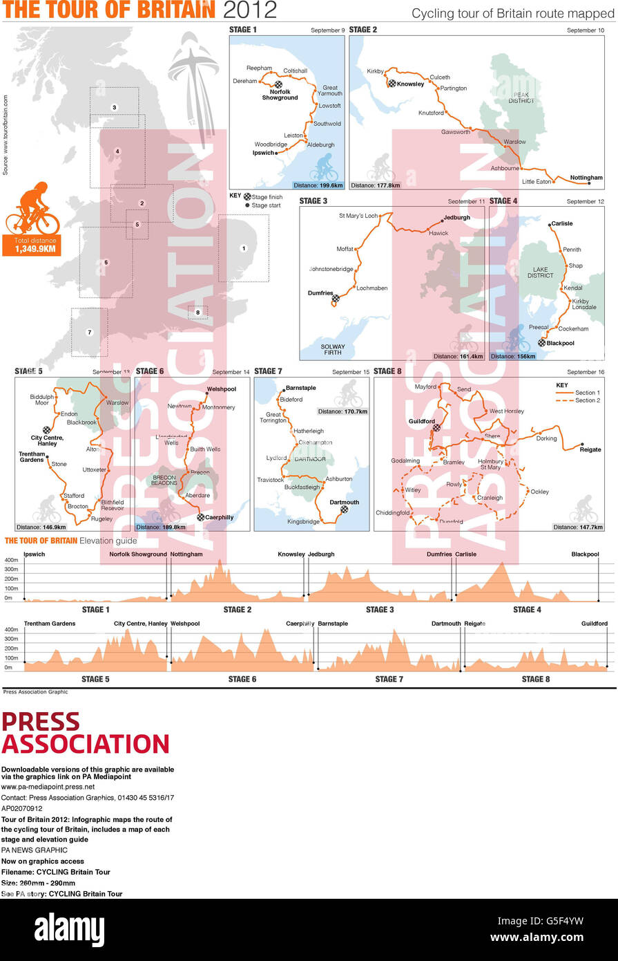 Tour of Britain 2012: Infographic maps the route of the cycling tour of Britain, includes a map of each stage and elevation guide Stock Photohttps://www.alamy.com/image-license-details/?v=1https://www.alamy.com/stock-photo-tour-of-britain-2012-infographic-maps-the-route-of-the-cycling-tour-106668685.html
RMG5F4YW–Tour of Britain 2012: Infographic maps the route of the cycling tour of Britain, includes a map of each stage and elevation guide
 . Deutsch: Sozopol und sein Umland (1903) . 14 July 2012, 15:58 (UTC). Map 45-42 erkesia.jpg: Unknown derivative work: Vammpi 392 Map 45-42 Sozopol1 Stock Photohttps://www.alamy.com/image-license-details/?v=1https://www.alamy.com/deutsch-sozopol-und-sein-umland-1903-14-july-2012-1558-utc-map-45-42-erkesiajpg-unknown-derivative-work-vammpi-392-map-45-42-sozopol1-image188354431.html
RMMXC7YY–. Deutsch: Sozopol und sein Umland (1903) . 14 July 2012, 15:58 (UTC). Map 45-42 erkesia.jpg: Unknown derivative work: Vammpi 392 Map 45-42 Sozopol1
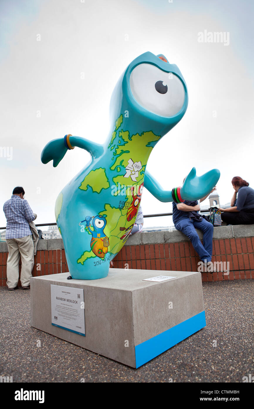 Statue of London 2012 mascot Wenlock, located on the southbank London, UK Stock Photohttps://www.alamy.com/image-license-details/?v=1https://www.alamy.com/stock-photo-statue-of-london-2012-mascot-wenlock-located-on-the-southbank-london-49627525.html
RMCTMMBH–Statue of London 2012 mascot Wenlock, located on the southbank London, UK
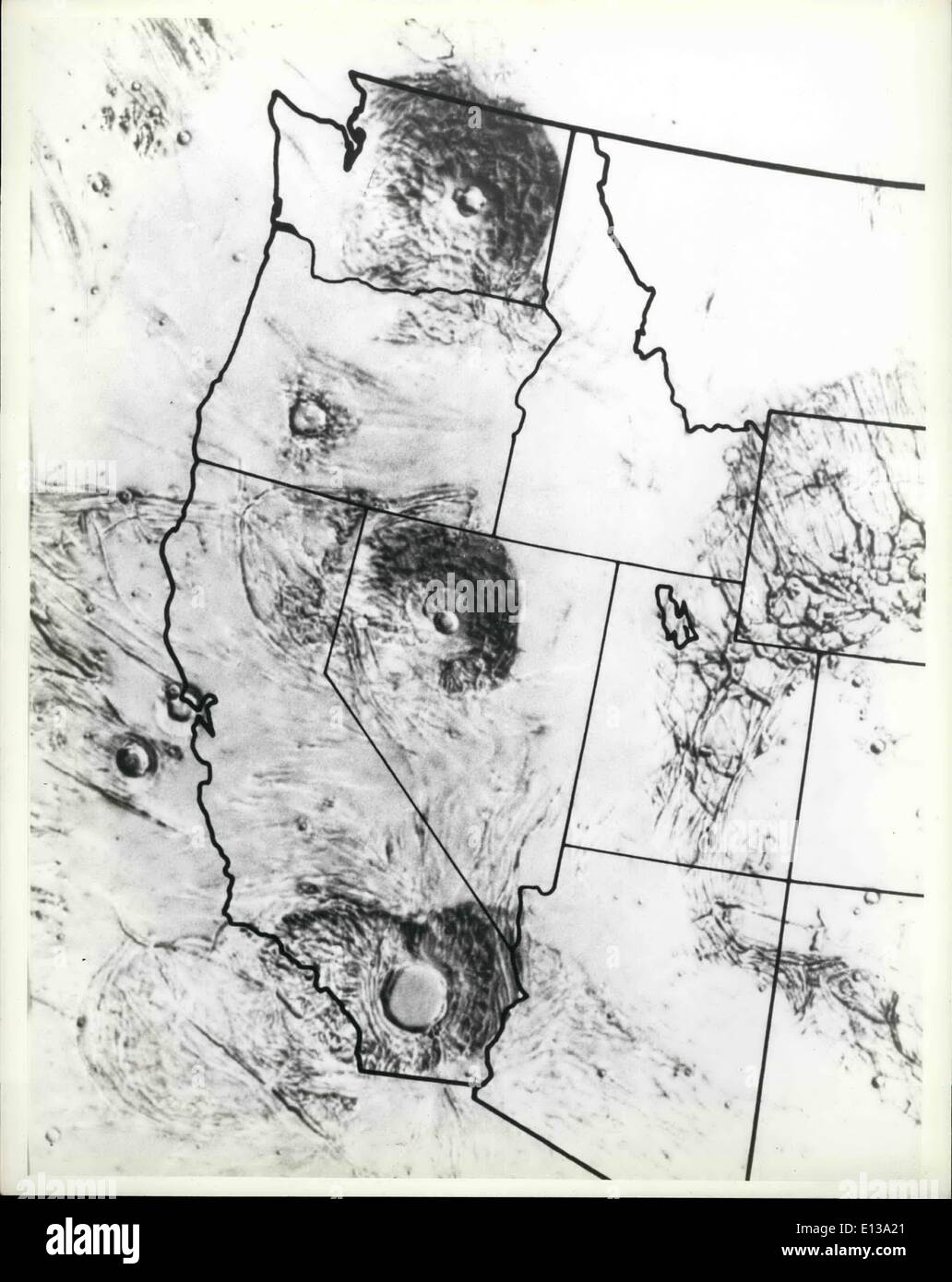 Feb. 29, 2012 - The Tharsis Ridge The immense volcanoes in this airbrush map make up the Tharsis Ridge, an elevated area on the Stock Photohttps://www.alamy.com/image-license-details/?v=1https://www.alamy.com/feb-29-2012-the-tharsis-ridge-the-immense-volcanoes-in-this-airbrush-image69529881.html
RME13A21–Feb. 29, 2012 - The Tharsis Ridge The immense volcanoes in this airbrush map make up the Tharsis Ridge, an elevated area on the
 Vote Presidential Election 2012 with USA Flag in Map Silhouette Illustration Stock Photohttps://www.alamy.com/image-license-details/?v=1https://www.alamy.com/stock-photo-vote-presidential-election-2012-with-usa-flag-in-map-silhouette-illustration-50459935.html
RFCX2J4F–Vote Presidential Election 2012 with USA Flag in Map Silhouette Illustration
 New Year. Text 2012 and earth. 3d Stock Photohttps://www.alamy.com/image-license-details/?v=1https://www.alamy.com/stock-photo-new-year-text-2012-and-earth-3d-52468072.html
RFD1A3FM–New Year. Text 2012 and earth. 3d
 Map of administrative divisions of Bhutan, 2012 Stock Photohttps://www.alamy.com/image-license-details/?v=1https://www.alamy.com/map-of-administrative-divisions-of-bhutan-2012-image454755617.html
RM2HBRWC1–Map of administrative divisions of Bhutan, 2012
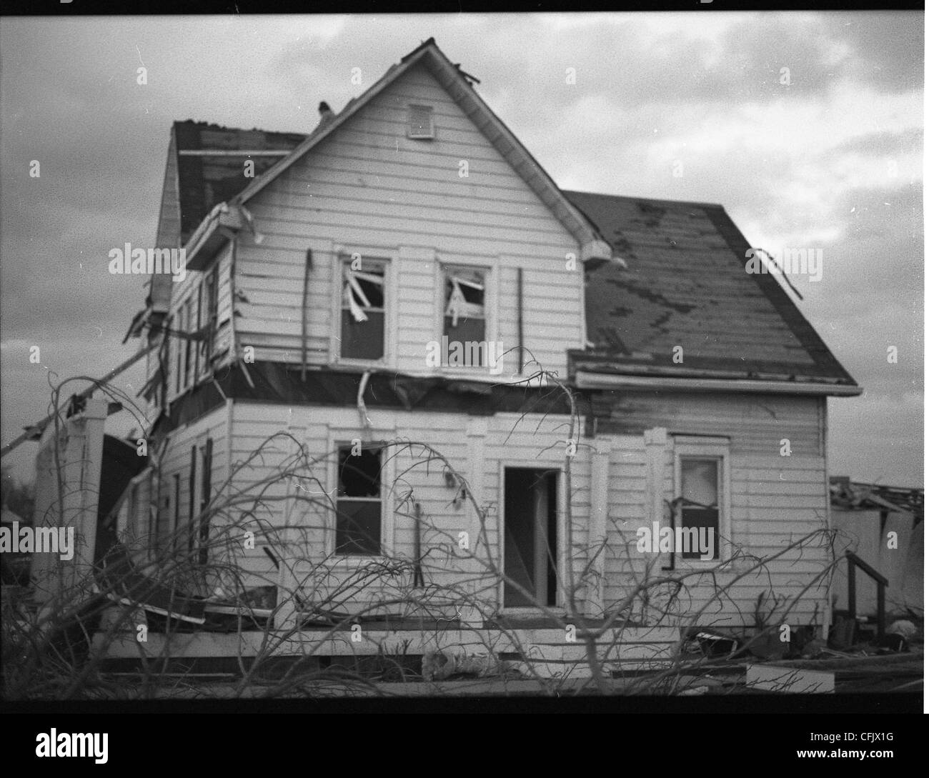 Destroyed buildings in Marysville, Indiana after the March 2012 Tornado which nearly wiped the town off the map. Stock Photohttps://www.alamy.com/image-license-details/?v=1https://www.alamy.com/stock-photo-destroyed-buildings-in-marysville-indiana-after-the-march-2012-tornado-44056140.html
RMCFJX1G–Destroyed buildings in Marysville, Indiana after the March 2012 Tornado which nearly wiped the town off the map.
 Venice Biennale 2012, Common Ground, Venice, Italy. Architect: Various, 2012. Stock Photohttps://www.alamy.com/image-license-details/?v=1https://www.alamy.com/stock-photo-venice-biennale-2012-common-ground-venice-italy-architect-various-50815805.html
RMCXJT25–Venice Biennale 2012, Common Ground, Venice, Italy. Architect: Various, 2012.
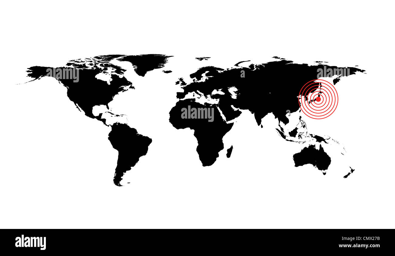 World map illustration, Japan earthquake 2012 Stock Photohttps://www.alamy.com/image-license-details/?v=1https://www.alamy.com/stock-photo-world-map-illustration-japan-earthquake-2012-47286383.html
RFCMX27B–World map illustration, Japan earthquake 2012
 Spectators consult a detailed map of the Olympic Park during the London 2012 Olympics. This land was transformed to become a 2.5 Sq Km sporting complex, once industrial businesses and now the venue of eight venues including the main arena, Aquatics Centre and Velodrome plus the athletes' Olympic Village. After the Olympics, the park is to be known as Queen Elizabeth Olympic Park. Stock Photohttps://www.alamy.com/image-license-details/?v=1https://www.alamy.com/stock-photo-spectators-consult-a-detailed-map-of-the-olympic-park-during-the-london-49733636.html
RMCTWFN8–Spectators consult a detailed map of the Olympic Park during the London 2012 Olympics. This land was transformed to become a 2.5 Sq Km sporting complex, once industrial businesses and now the venue of eight venues including the main arena, Aquatics Centre and Velodrome plus the athletes' Olympic Village. After the Olympics, the park is to be known as Queen Elizabeth Olympic Park.
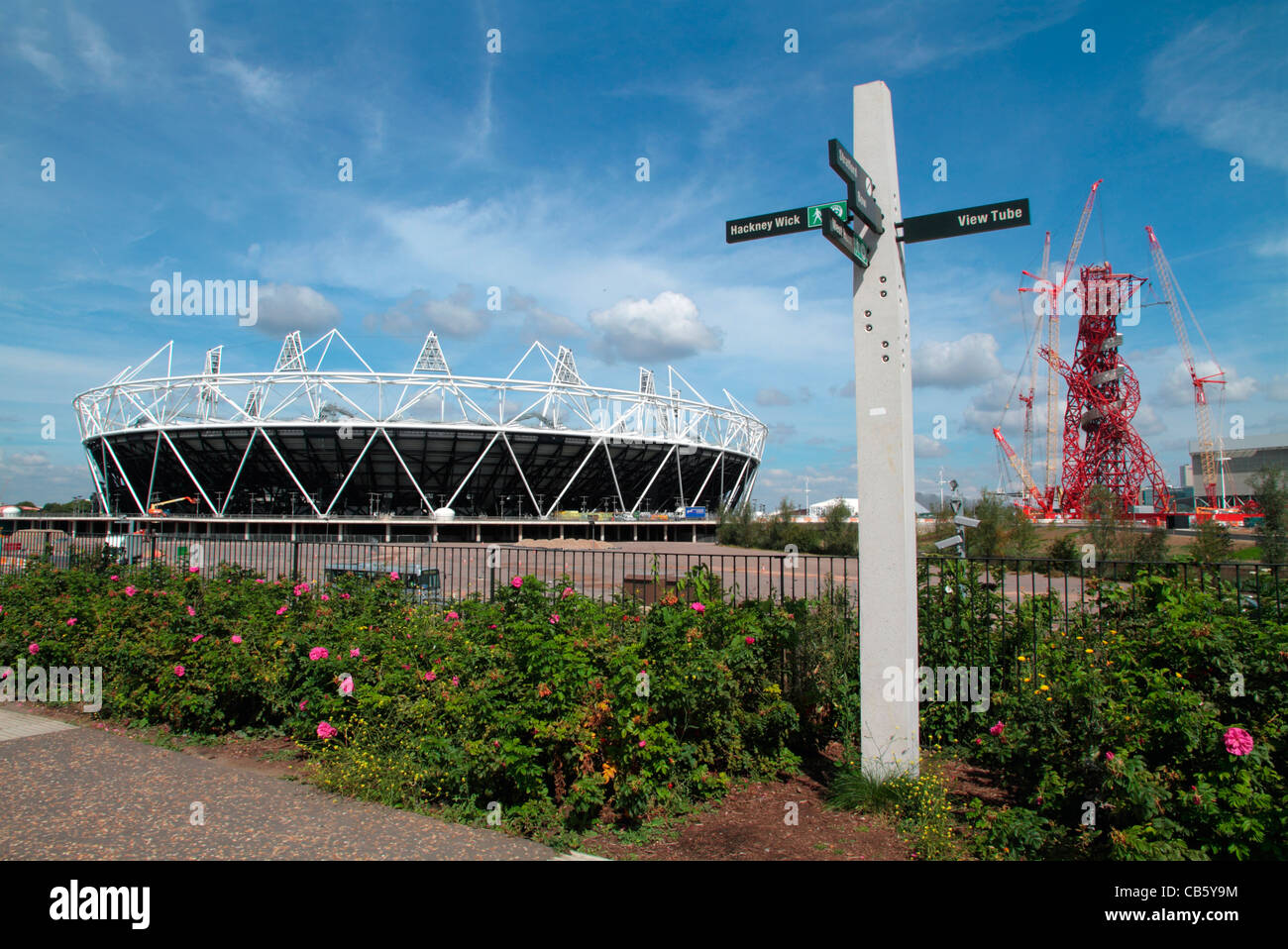 The London 2012 Olympic stadium, the ArcelorMittal Orbit observation tower and site map in the Olympic Park in Stratford, London Stock Photohttps://www.alamy.com/image-license-details/?v=1https://www.alamy.com/stock-photo-the-london-2012-olympic-stadium-the-arcelormittal-orbit-observation-41313152.html
RMCB5Y9M–The London 2012 Olympic stadium, the ArcelorMittal Orbit observation tower and site map in the Olympic Park in Stratford, London
 map of the usa 2012 Stock Photohttps://www.alamy.com/image-license-details/?v=1https://www.alamy.com/stock-photo-map-of-the-usa-2012-143018135.html
RFJ8K12F–map of the usa 2012
 NEW-YORK - NOV 17: Two people looking at the map placed in a subway station in New-York, USA on November 17, 2012. Stock Photohttps://www.alamy.com/image-license-details/?v=1https://www.alamy.com/stock-photo-new-york-nov-17-two-people-looking-at-the-map-placed-in-a-subway-station-124544768.html
RMH6HE3C–NEW-YORK - NOV 17: Two people looking at the map placed in a subway station in New-York, USA on November 17, 2012.
 London, 10/08/2012, Woman looking at the world Lego map 2012 exposed in the Southbank Centre Summer Art Festival Stock Photohttps://www.alamy.com/image-license-details/?v=1https://www.alamy.com/stock-photo-london-10082012-woman-looking-at-the-world-lego-map-2012-exposed-in-49823002.html
RMCW1HMX–London, 10/08/2012, Woman looking at the world Lego map 2012 exposed in the Southbank Centre Summer Art Festival
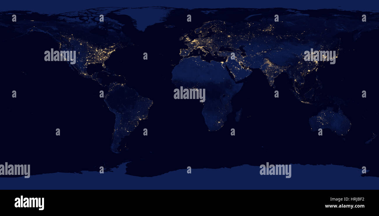 Earth at Night, 2012 Stock Photohttps://www.alamy.com/image-license-details/?v=1https://www.alamy.com/stock-photo-earth-at-night-2012-135013846.html
RMHRJBF2–Earth at Night, 2012
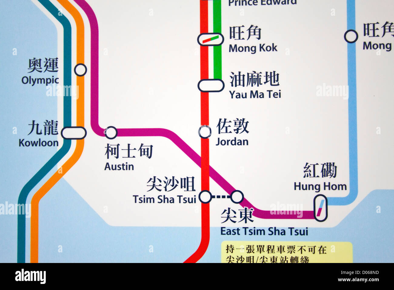 HONG KONG - JAN 17, Hong Kong MTR route map in a MTR station in Hong Kong on 17 January, 2012. Stock Photohttps://www.alamy.com/image-license-details/?v=1https://www.alamy.com/stock-photo-hong-kong-jan-17-hong-kong-mtr-route-map-in-a-mtr-station-in-hong-51769689.html
RFD068ND–HONG KONG - JAN 17, Hong Kong MTR route map in a MTR station in Hong Kong on 17 January, 2012.
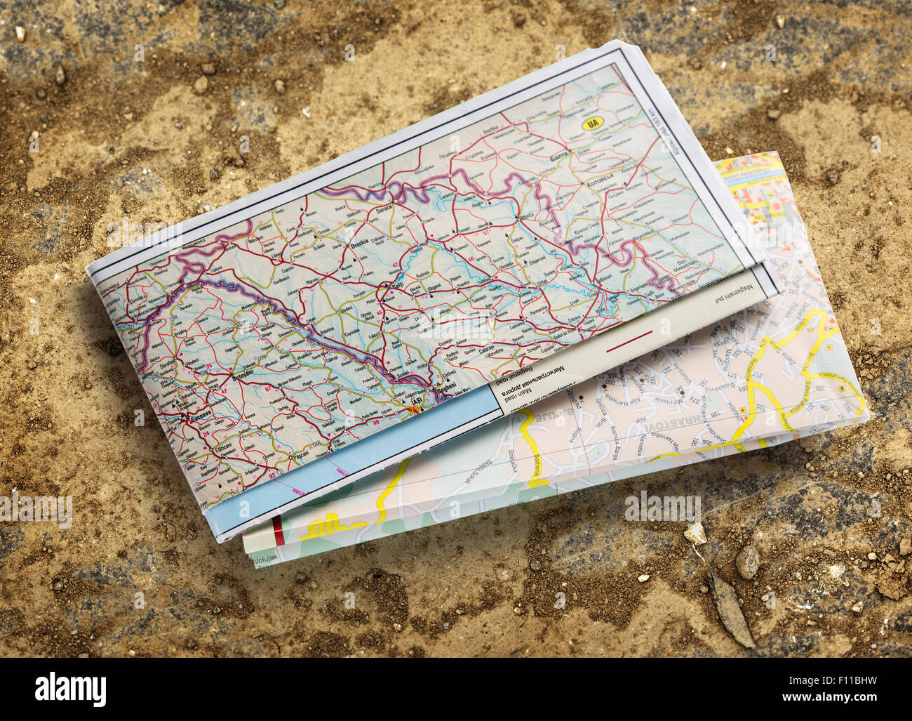 Balkan road map 2012 on soil background Stock Photohttps://www.alamy.com/image-license-details/?v=1https://www.alamy.com/stock-photo-balkan-road-map-2012-on-soil-background-86697573.html
RFF11BHW–Balkan road map 2012 on soil background
 UK, County Durham, Greta Bridge, the Morritt Arms Hotel, Dickens Bistro, 2012 Dickens mural and Teesdale map by Stuart Short Stock Photohttps://www.alamy.com/image-license-details/?v=1https://www.alamy.com/stock-photo-uk-county-durham-greta-bridge-the-morritt-arms-hotel-dickens-bistro-74772807.html
RME9J5DB–UK, County Durham, Greta Bridge, the Morritt Arms Hotel, Dickens Bistro, 2012 Dickens mural and Teesdale map by Stuart Short
 Laura Blakeman, a member of the GB Canoeing team holds an artist's impression of the White Water Canoe Centre in Broxbourne, Hertfordshire, where work started today on building the site for the 2012 London Olympic Canoe Slalom venue. Stock Photohttps://www.alamy.com/image-license-details/?v=1https://www.alamy.com/stock-photo-laura-blakeman-a-member-of-the-gb-canoeing-team-holds-an-artists-impression-110596963.html
RMGBX3FF–Laura Blakeman, a member of the GB Canoeing team holds an artist's impression of the White Water Canoe Centre in Broxbourne, Hertfordshire, where work started today on building the site for the 2012 London Olympic Canoe Slalom venue.
 . Deutsch: Sozopol und sein Umland (1903) . 14 July 2012, 15:58 (UTC). Map 45-42 erkesia.jpg: Unknown derivative work: Vammpi 392 Map 45-42 Sozopol Stock Photohttps://www.alamy.com/image-license-details/?v=1https://www.alamy.com/deutsch-sozopol-und-sein-umland-1903-14-july-2012-1558-utc-map-45-42-erkesiajpg-unknown-derivative-work-vammpi-392-map-45-42-sozopol-image187841325.html
RMMWGWEN–. Deutsch: Sozopol und sein Umland (1903) . 14 July 2012, 15:58 (UTC). Map 45-42 erkesia.jpg: Unknown derivative work: Vammpi 392 Map 45-42 Sozopol
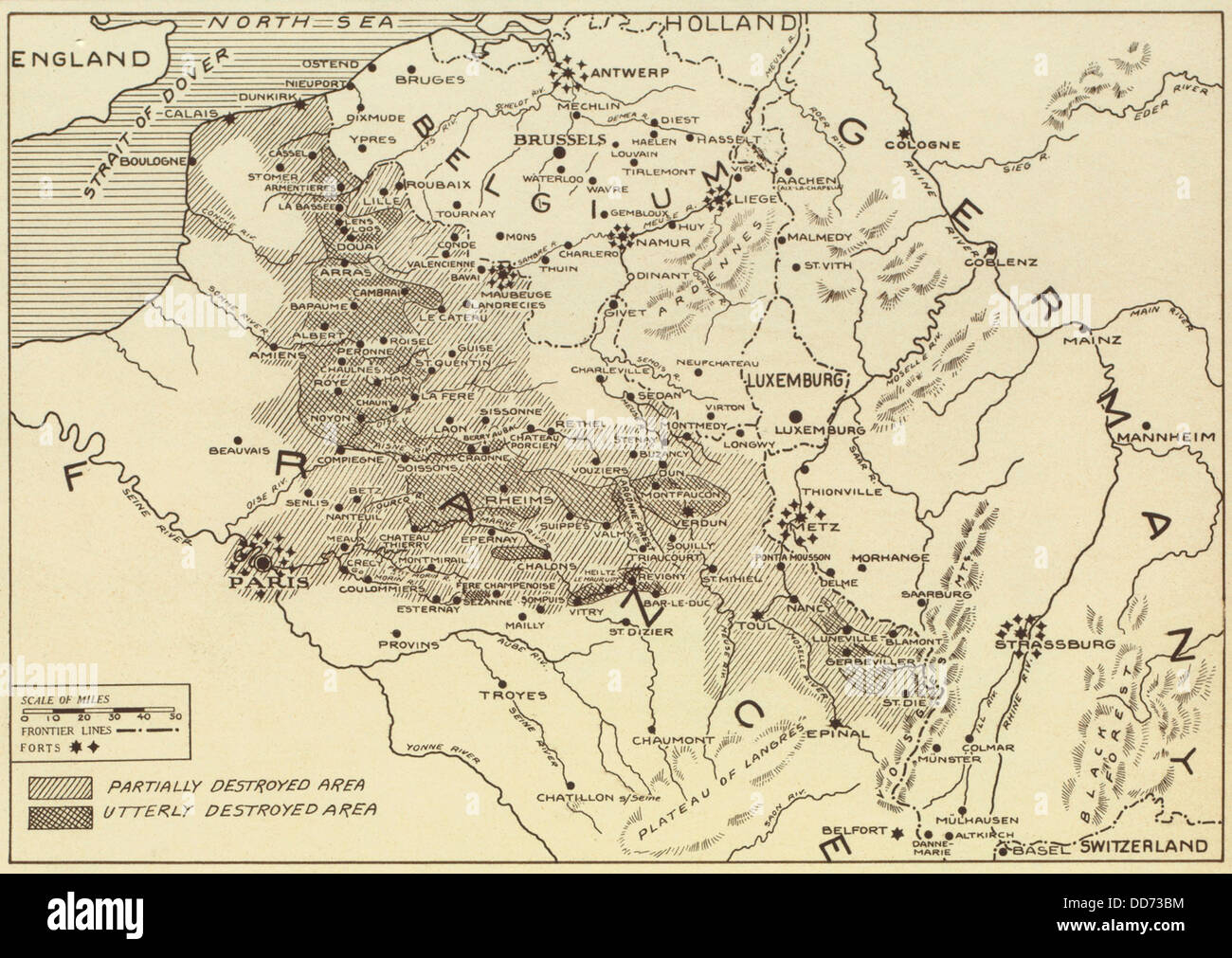 Post World War 1 map of the ruined regions of France in 1919. (BSLOC 2012 4 15) Stock Photohttps://www.alamy.com/image-license-details/?v=1https://www.alamy.com/stock-photo-post-world-war-1-map-of-the-ruined-regions-of-france-in-1919-bsloc-59777976.html
RMDD73BM–Post World War 1 map of the ruined regions of France in 1919. (BSLOC 2012 4 15)
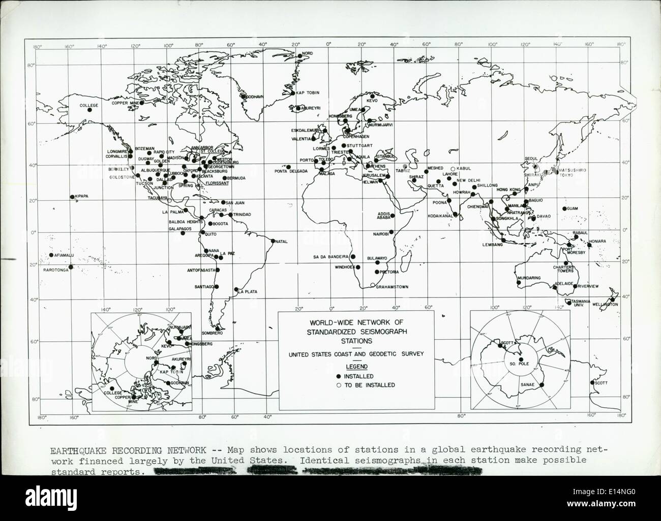 Apr. 18, 2012 - Earthquake Recording Network - Map shows locations of stations in a global earthquake recording network financed largely by the United States. Identical seismographs in each station make possible standard reports. Stock Photohttps://www.alamy.com/image-license-details/?v=1https://www.alamy.com/apr-18-2012-earthquake-recording-network-map-shows-locations-of-stations-image69560848.html
RME14NG0–Apr. 18, 2012 - Earthquake Recording Network - Map shows locations of stations in a global earthquake recording network financed largely by the United States. Identical seismographs in each station make possible standard reports.
 2012 Happy New Year World Globe on Blurred Background Illustration Stock Photohttps://www.alamy.com/image-license-details/?v=1https://www.alamy.com/stock-photo-2012-happy-new-year-world-globe-on-blurred-background-illustration-40253864.html
RFC9DM60–2012 Happy New Year World Globe on Blurred Background Illustration
 Halkidiki, Greece. November 18, 2012. Map of the area Skouries on Mount Kakkavos.Peaceful protest against the construction of the gold mines in northern Greece's Halkidiki peninsula in position Skouries. Dozens of residents of the nearby villages of Ierissos and Ouranoupoli, as well as protesters who arrived by coaches and cars from Thessaloniki, approached the forest in Skouries, where Hellenic Gold, a subsidiary of Canadian firm Eldorado Gold, has begun mining activity that locals are appealing against. The residents of the village Megali Panagia have been divided into two sides, those who r Stock Photohttps://www.alamy.com/image-license-details/?v=1https://www.alamy.com/stock-photo-halkidiki-greece-november-18-2012-map-of-the-area-skouries-on-mount-51761174.html
RMD05WWA–Halkidiki, Greece. November 18, 2012. Map of the area Skouries on Mount Kakkavos.Peaceful protest against the construction of the gold mines in northern Greece's Halkidiki peninsula in position Skouries. Dozens of residents of the nearby villages of Ierissos and Ouranoupoli, as well as protesters who arrived by coaches and cars from Thessaloniki, approached the forest in Skouries, where Hellenic Gold, a subsidiary of Canadian firm Eldorado Gold, has begun mining activity that locals are appealing against. The residents of the village Megali Panagia have been divided into two sides, those who r
