Quick filters:
Evans map Stock Photos and Images
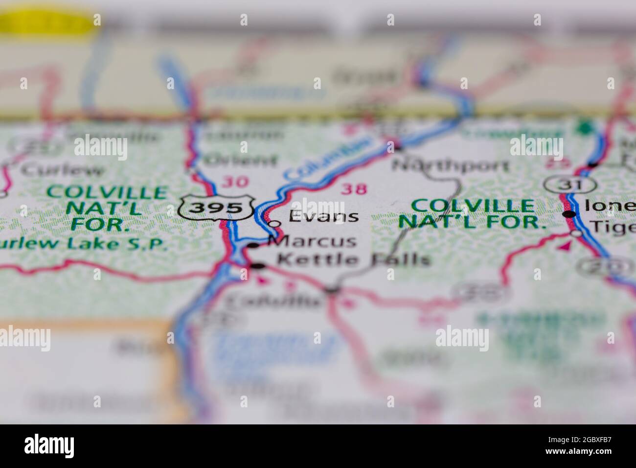 Evans Washington State USA shown on a road map or Geography map Stock Photohttps://www.alamy.com/image-license-details/?v=1https://www.alamy.com/evans-washington-state-usa-shown-on-a-road-map-or-geography-map-image437603243.html
RM2GBXFB7–Evans Washington State USA shown on a road map or Geography map
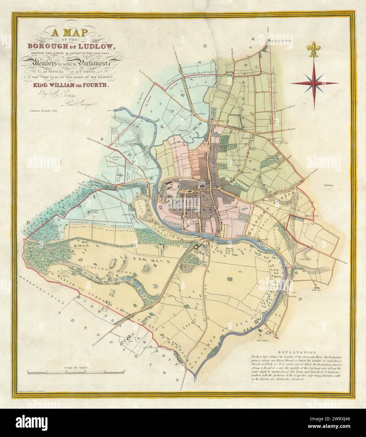 A Map of the Borough of Ludlow by C. Evans. Reform Act 1832 old antique Stock Photohttps://www.alamy.com/image-license-details/?v=1https://www.alamy.com/a-map-of-the-borough-of-ludlow-by-c-evans-reform-act-1832-old-antique-image599874582.html
RF2WRXJ46–A Map of the Borough of Ludlow by C. Evans. Reform Act 1832 old antique
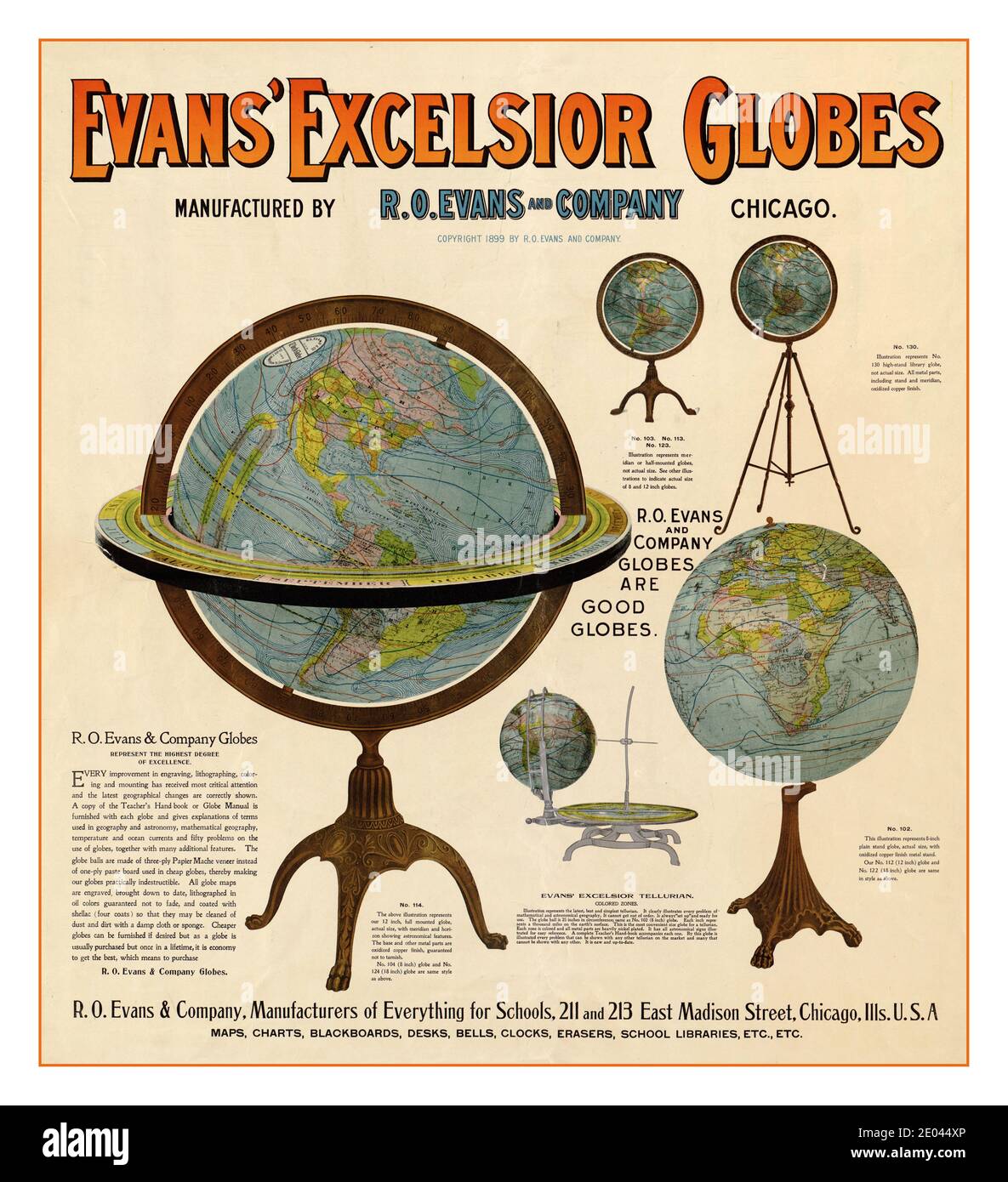 Vintage Advertising poster for Globes 1890’s Chicago : R. O. Evans, 1899. Globes Posters Evans' Excelsior globes : manufactured by R. O. Evans and Company. Advertisement poster for globes which has representions of 5 globes mapping circumnavigation world map Stock Photohttps://www.alamy.com/image-license-details/?v=1https://www.alamy.com/vintage-advertising-poster-for-globes-1890s-chicago-r-o-evans-1899-globes-posters-evans-excelsior-globes-manufactured-by-r-o-evans-and-company-advertisement-poster-for-globes-which-has-representions-of-5-globes-mapping-circumnavigation-world-map-image395930158.html
RM2E044XP–Vintage Advertising poster for Globes 1890’s Chicago : R. O. Evans, 1899. Globes Posters Evans' Excelsior globes : manufactured by R. O. Evans and Company. Advertisement poster for globes which has representions of 5 globes mapping circumnavigation world map
 Evans Bay, , AU, Australia, Queensland, S 10 41' 58'', N 142 33' 4'', map, Cartascapes Map published in 2024. Explore Cartascapes, a map revealing Earth's diverse landscapes, cultures, and ecosystems. Journey through time and space, discovering the interconnectedness of our planet's past, present, and future. Stock Photohttps://www.alamy.com/image-license-details/?v=1https://www.alamy.com/evans-bay-au-australia-queensland-s-10-41-58-n-142-33-4-map-cartascapes-map-published-in-2024-explore-cartascapes-a-map-revealing-earths-diverse-landscapes-cultures-and-ecosystems-journey-through-time-and-space-discovering-the-interconnectedness-of-our-planets-past-present-and-future-image625763180.html
RM2YA1Y90–Evans Bay, , AU, Australia, Queensland, S 10 41' 58'', N 142 33' 4'', map, Cartascapes Map published in 2024. Explore Cartascapes, a map revealing Earth's diverse landscapes, cultures, and ecosystems. Journey through time and space, discovering the interconnectedness of our planet's past, present, and future.
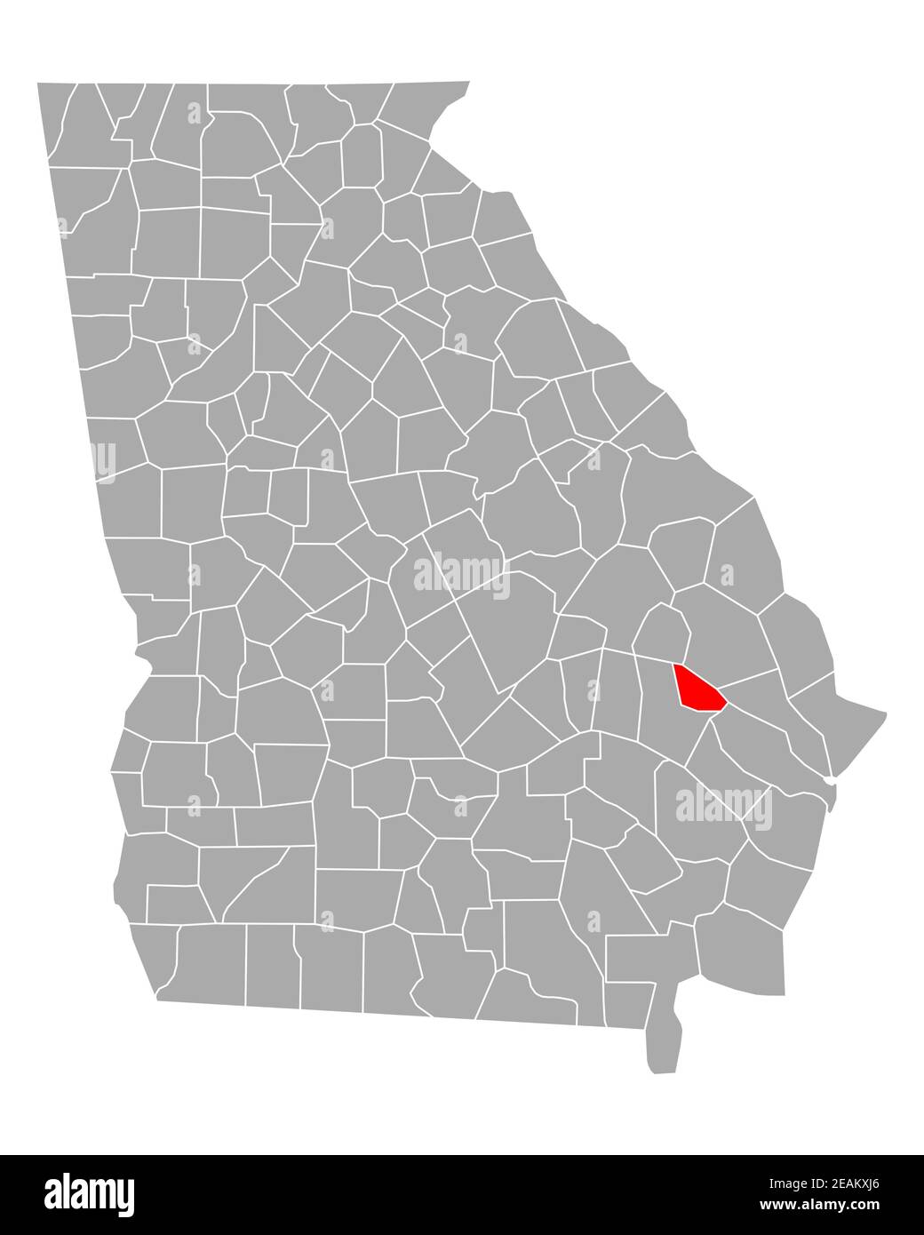 Map of Evans in Georgia Stock Photohttps://www.alamy.com/image-license-details/?v=1https://www.alamy.com/map-of-evans-in-georgia-image402423006.html
RF2EAKXJ6–Map of Evans in Georgia
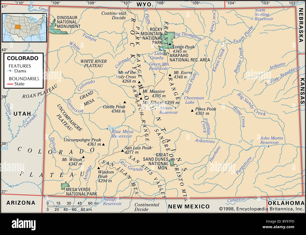 Physical map of Colorado Stock Photohttps://www.alamy.com/image-license-details/?v=1https://www.alamy.com/stock-photo-physical-map-of-colorado-34009569.html
RMBY97FD–Physical map of Colorado
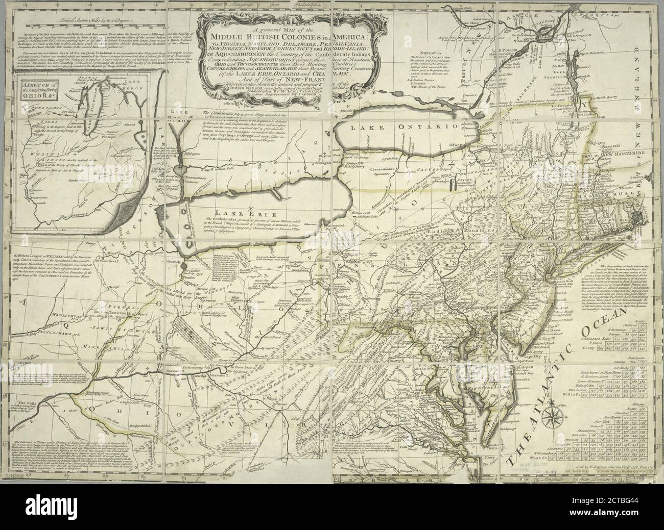 A general map of the middle British colonies in America : viz. Virginia, Maryland, Delaware, Pensilvania, New-Jersey, New-York, Connecticut and Rhode-Island : of Aquanishuonigy the country of the confederate Indians comprehending Aquanishuonigy proper, their places of residence, Ohio and Thuchsochruntie their deer hunting countries, Couchsachrage and Skaniadarade their beaver hunting countries, of the Lakes Erie, Ontario and Champlain, and of part of New-France : wherein is also shewn the antient and present seats of the Indian nations, cartographic, Maps, 1758, Evans, Lewis, 1700?-1756 Stock Photohttps://www.alamy.com/image-license-details/?v=1https://www.alamy.com/a-general-map-of-the-middle-british-colonies-in-america-viz-virginia-maryland-delaware-pensilvania-new-jersey-new-york-connecticut-and-rhode-island-of-aquanishuonigy-the-country-of-the-confederate-indians-comprehending-aquanishuonigy-proper-their-places-of-residence-ohio-and-thuchsochruntie-their-deer-hunting-countries-couchsachrage-and-skaniadarade-their-beaver-hunting-countries-of-the-lakes-erie-ontario-and-champlain-and-of-part-of-new-france-wherein-is-also-shewn-the-antient-and-present-seats-of-the-indian-nations-cartographic-maps-1758-evans-lewis-1700-1756-image376423604.html
RM2CTBG44–A general map of the middle British colonies in America : viz. Virginia, Maryland, Delaware, Pensilvania, New-Jersey, New-York, Connecticut and Rhode-Island : of Aquanishuonigy the country of the confederate Indians comprehending Aquanishuonigy proper, their places of residence, Ohio and Thuchsochruntie their deer hunting countries, Couchsachrage and Skaniadarade their beaver hunting countries, of the Lakes Erie, Ontario and Champlain, and of part of New-France : wherein is also shewn the antient and present seats of the Indian nations, cartographic, Maps, 1758, Evans, Lewis, 1700?-1756
 'Winter Work (Left to right - Debenham, Cherry-Garrard, Bowers, Evans, Taylor)', c1911, (1913). Artist: Herbert Ponting. Stock Photohttps://www.alamy.com/image-license-details/?v=1https://www.alamy.com/winter-work-left-to-right-debenham-cherry-garrard-bowers-evans-taylor-c1911-1913-artist-herbert-ponting-image217097105.html
RMPH5HG1–'Winter Work (Left to right - Debenham, Cherry-Garrard, Bowers, Evans, Taylor)', c1911, (1913). Artist: Herbert Ponting.
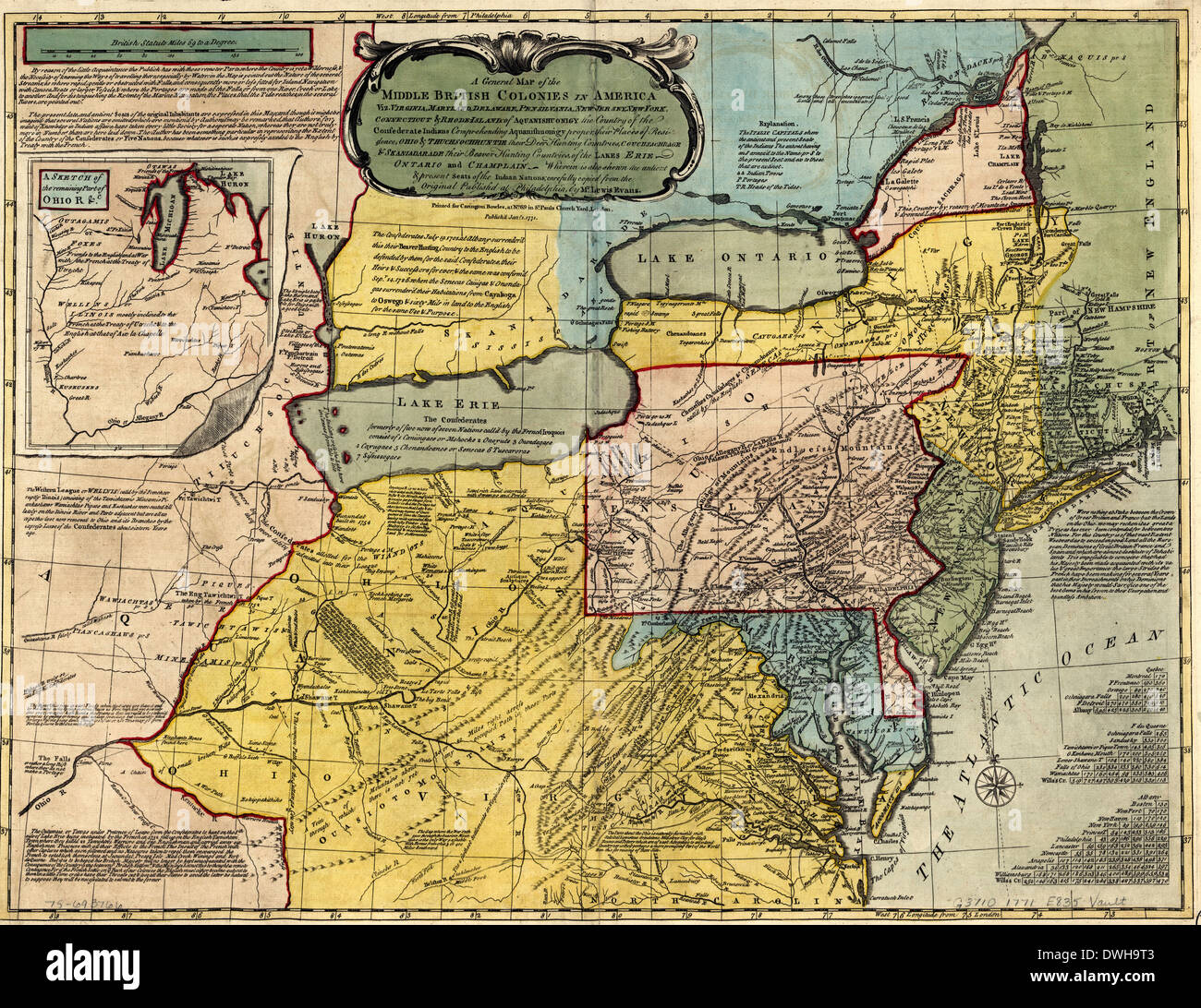 A general map of the middle British colonies in America, 1771 Stock Photohttps://www.alamy.com/image-license-details/?v=1https://www.alamy.com/a-general-map-of-the-middle-british-colonies-in-america-1771-image67378419.html
RMDWH9T3–A general map of the middle British colonies in America, 1771
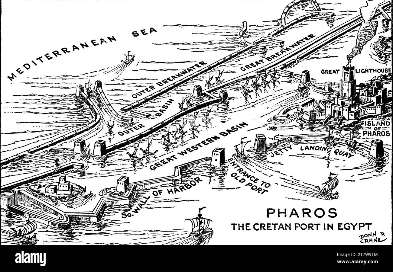 A reconstruction of Alexandria Port, Egypt. By Donn Philip Crane (1878-1944). After Sir Arthur Evans (1851-1941). A plan of the port including the Pharos of Alexandria. Stock Photohttps://www.alamy.com/image-license-details/?v=1https://www.alamy.com/a-reconstruction-of-alexandria-port-egypt-by-donn-philip-crane-1878-1944-after-sir-arthur-evans-1851-1941-a-plan-of-the-port-including-the-pharos-of-alexandria-image572801284.html
RM2T7W9TM–A reconstruction of Alexandria Port, Egypt. By Donn Philip Crane (1878-1944). After Sir Arthur Evans (1851-1941). A plan of the port including the Pharos of Alexandria.
![Map [of the republic] of Texas compiled from the latest and best authorities 1837 by Evans, William Gardner Stock Photo Map [of the republic] of Texas compiled from the latest and best authorities 1837 by Evans, William Gardner Stock Photo](https://c8.alamy.com/comp/2YPEYTW/map-of-the-republic-of-texas-compiled-from-the-latest-and-best-authorities-1837-by-evans-william-gardner-2YPEYTW.jpg) Map [of the republic] of Texas compiled from the latest and best authorities 1837 by Evans, William Gardner Stock Photohttps://www.alamy.com/image-license-details/?v=1https://www.alamy.com/map-of-the-republic-of-texas-compiled-from-the-latest-and-best-authorities-1837-by-evans-william-gardner-image633424873.html
Map [of the republic] of Texas compiled from the latest and best authorities 1837 by Evans, William Gardner Stock Photohttps://www.alamy.com/image-license-details/?v=1https://www.alamy.com/map-of-the-republic-of-texas-compiled-from-the-latest-and-best-authorities-1837-by-evans-william-gardner-image633424873.htmlRM2YPEYTW–Map [of the republic] of Texas compiled from the latest and best authorities 1837 by Evans, William Gardner
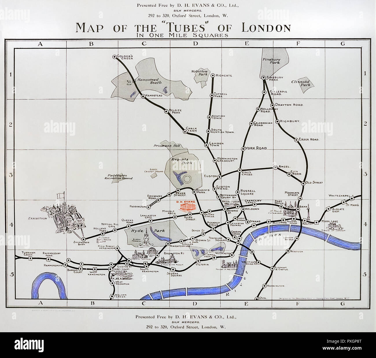 'Map of the Tubes of London' 1907. Stock Photohttps://www.alamy.com/image-license-details/?v=1https://www.alamy.com/map-of-the-tubes-of-london-1907-image222874200.html
RMPXGP8T–'Map of the Tubes of London' 1907.
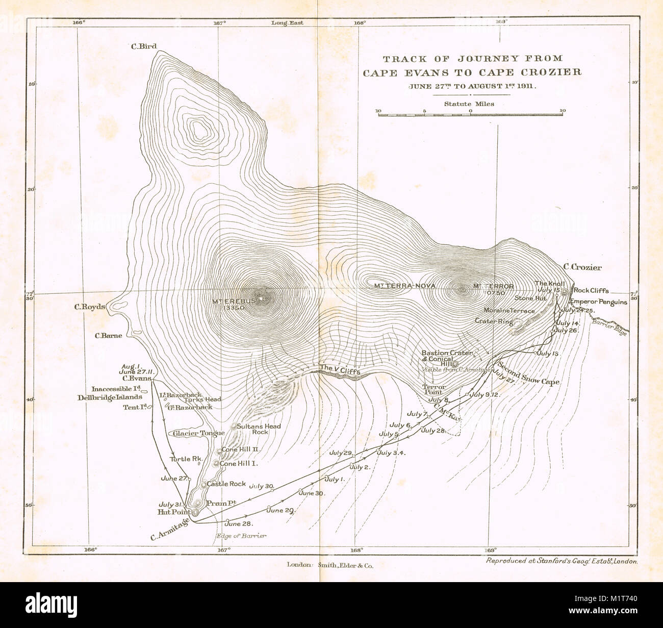 Track of journey from Cape Evans to Cape Crozier, Austral Winter 1911, Scott's final expedition Stock Photohttps://www.alamy.com/image-license-details/?v=1https://www.alamy.com/stock-photo-track-of-journey-from-cape-evans-to-cape-crozier-austral-winter-1911-173250784.html
RMM1T740–Track of journey from Cape Evans to Cape Crozier, Austral Winter 1911, Scott's final expedition
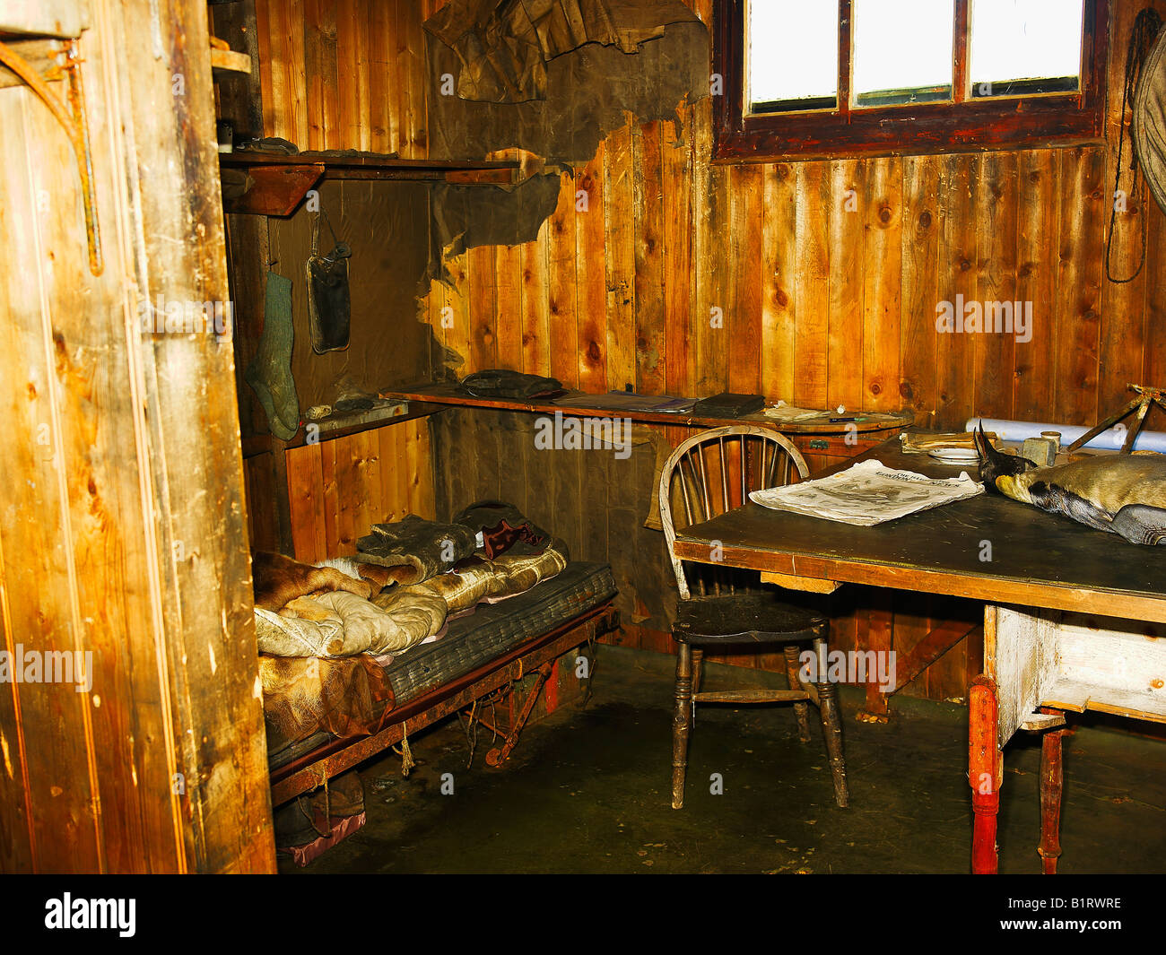 Scott's Hut, interior view, bed with Scott's map table, at Cape Evans on Ross Island, Antarctica Stock Photohttps://www.alamy.com/image-license-details/?v=1https://www.alamy.com/stock-photo-scotts-hut-interior-view-bed-with-scotts-map-table-at-cape-evans-on-18350178.html
RMB1RWRE–Scott's Hut, interior view, bed with Scott's map table, at Cape Evans on Ross Island, Antarctica
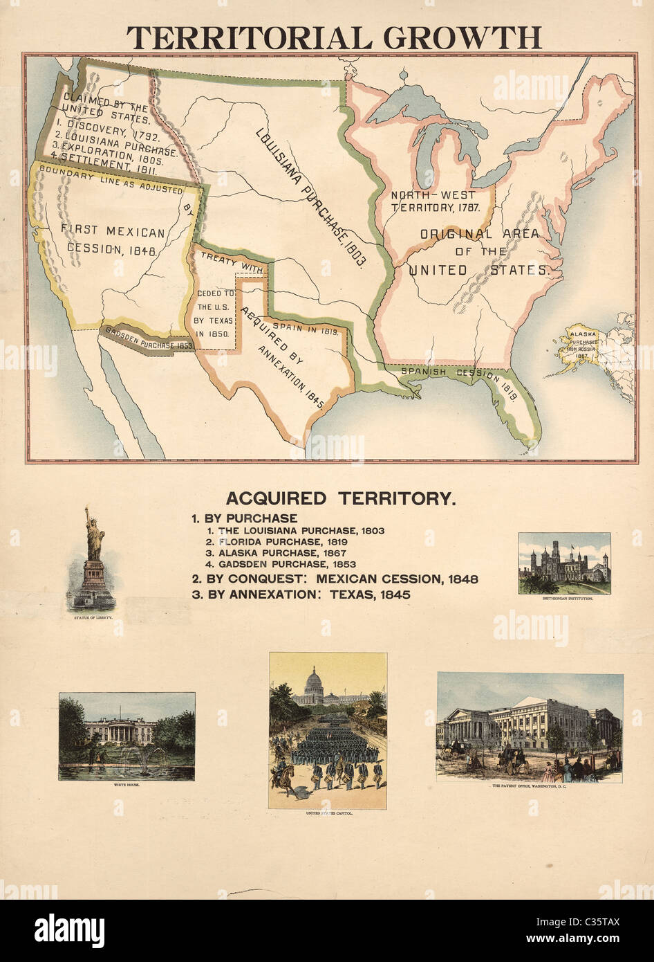 Map of Acquired Territory for the United States. Territorial Growth from 1492 to the present time. Stock Photohttps://www.alamy.com/image-license-details/?v=1https://www.alamy.com/stock-photo-map-of-acquired-territory-for-the-united-states-territorial-growth-36393586.html
RMC35TAX–Map of Acquired Territory for the United States. Territorial Growth from 1492 to the present time.
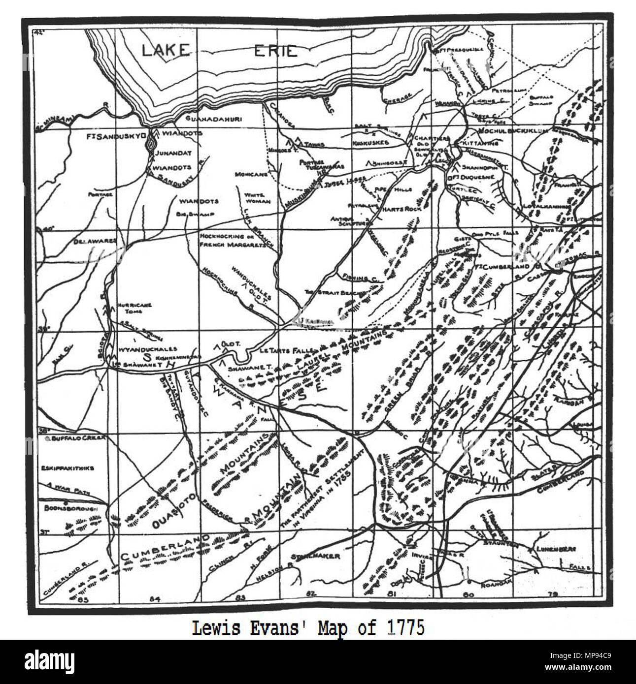 . English: Map of the Allegheny Plateau and Mountains . 1755. Lewis Evans 808 Lewis' 1755 Map, Library of Congress Stock Photohttps://www.alamy.com/image-license-details/?v=1https://www.alamy.com/english-map-of-the-allegheny-plateau-and-mountains-1755-lewis-evans-808-lewis-1755-map-library-of-congress-image185827161.html
RMMP94C9–. English: Map of the Allegheny Plateau and Mountains . 1755. Lewis Evans 808 Lewis' 1755 Map, Library of Congress
![A New & accurate PLAN of the CITIES of LONDON & WESTMINSTER & BOROUGH of SOUTHWARK Map information: Title: A New , accurate PLAN of the CITIES of LONDON , WESTMINSTER , BOROUGH of SOUTHWARK 20.44. Place of publication: [London] Publisher: Publish'd Jan.y 1 1796 by I. Evans, N⁰ 41 Long Lane West Smithfield, Date of publication: [January 1 1796] Item type: 1 map Medium: hand-coloured copperplate engraving printed on two sheets Dimensions: 55.5 x 105.5 cm Former owner: George III, King of Great Britain, 1738-1820 Stock Photo A New & accurate PLAN of the CITIES of LONDON & WESTMINSTER & BOROUGH of SOUTHWARK Map information: Title: A New , accurate PLAN of the CITIES of LONDON , WESTMINSTER , BOROUGH of SOUTHWARK 20.44. Place of publication: [London] Publisher: Publish'd Jan.y 1 1796 by I. Evans, N⁰ 41 Long Lane West Smithfield, Date of publication: [January 1 1796] Item type: 1 map Medium: hand-coloured copperplate engraving printed on two sheets Dimensions: 55.5 x 105.5 cm Former owner: George III, King of Great Britain, 1738-1820 Stock Photo](https://c8.alamy.com/comp/2E9HF00/a-new-accurate-plan-of-the-cities-of-london-westminster-borough-of-southwark-map-information-title-a-new-accurate-plan-of-the-cities-of-london-westminster-borough-of-southwark-2044-place-of-publication-london-publisher-publishd-jany-1-1796-by-i-evans-n-41-long-lane-west-smithfield-date-of-publication-january-1-1796-item-type-1-map-medium-hand-coloured-copperplate-engraving-printed-on-two-sheets-dimensions-555-x-1055-cm-former-owner-george-iii-king-of-great-britain-1738-1820-2E9HF00.jpg) A New & accurate PLAN of the CITIES of LONDON & WESTMINSTER & BOROUGH of SOUTHWARK Map information: Title: A New , accurate PLAN of the CITIES of LONDON , WESTMINSTER , BOROUGH of SOUTHWARK 20.44. Place of publication: [London] Publisher: Publish'd Jan.y 1 1796 by I. Evans, N⁰ 41 Long Lane West Smithfield, Date of publication: [January 1 1796] Item type: 1 map Medium: hand-coloured copperplate engraving printed on two sheets Dimensions: 55.5 x 105.5 cm Former owner: George III, King of Great Britain, 1738-1820 Stock Photohttps://www.alamy.com/image-license-details/?v=1https://www.alamy.com/a-new-accurate-plan-of-the-cities-of-london-westminster-borough-of-southwark-map-information-title-a-new-accurate-plan-of-the-cities-of-london-westminster-borough-of-southwark-2044-place-of-publication-london-publisher-publishd-jany-1-1796-by-i-evans-n-41-long-lane-west-smithfield-date-of-publication-january-1-1796-item-type-1-map-medium-hand-coloured-copperplate-engraving-printed-on-two-sheets-dimensions-555-x-1055-cm-former-owner-george-iii-king-of-great-britain-1738-1820-image401755312.html
A New & accurate PLAN of the CITIES of LONDON & WESTMINSTER & BOROUGH of SOUTHWARK Map information: Title: A New , accurate PLAN of the CITIES of LONDON , WESTMINSTER , BOROUGH of SOUTHWARK 20.44. Place of publication: [London] Publisher: Publish'd Jan.y 1 1796 by I. Evans, N‚Å∞ 41 Long Lane West Smithfield, Date of publication: [January 1 1796] Item type: 1 map Medium: hand-coloured copperplate engraving printed on two sheets Dimensions: 55.5 x 105.5 cm Former owner: George III, King of Great Britain, 1738-1820 Stock Photohttps://www.alamy.com/image-license-details/?v=1https://www.alamy.com/a-new-accurate-plan-of-the-cities-of-london-westminster-borough-of-southwark-map-information-title-a-new-accurate-plan-of-the-cities-of-london-westminster-borough-of-southwark-2044-place-of-publication-london-publisher-publishd-jany-1-1796-by-i-evans-n-41-long-lane-west-smithfield-date-of-publication-january-1-1796-item-type-1-map-medium-hand-coloured-copperplate-engraving-printed-on-two-sheets-dimensions-555-x-1055-cm-former-owner-george-iii-king-of-great-britain-1738-1820-image401755312.htmlRM2E9HF00–A New & accurate PLAN of the CITIES of LONDON & WESTMINSTER & BOROUGH of SOUTHWARK Map information: Title: A New , accurate PLAN of the CITIES of LONDON , WESTMINSTER , BOROUGH of SOUTHWARK 20.44. Place of publication: [London] Publisher: Publish'd Jan.y 1 1796 by I. Evans, N‚Å∞ 41 Long Lane West Smithfield, Date of publication: [January 1 1796] Item type: 1 map Medium: hand-coloured copperplate engraving printed on two sheets Dimensions: 55.5 x 105.5 cm Former owner: George III, King of Great Britain, 1738-1820
![A pictorial map of the world illustrating different cultures, animals and peoples. The Crystal Palace Game. Voyage round the World; an entertaining excursion in search of knowledge, whereby geography is made easy. London, [1855?]. Source: Maps.28.bb.7. Language: English. Author: HENRY SMITH EVANS. Stock Photo A pictorial map of the world illustrating different cultures, animals and peoples. The Crystal Palace Game. Voyage round the World; an entertaining excursion in search of knowledge, whereby geography is made easy. London, [1855?]. Source: Maps.28.bb.7. Language: English. Author: HENRY SMITH EVANS. Stock Photo](https://c8.alamy.com/comp/R58J00/a-pictorial-map-of-the-world-illustrating-different-cultures-animals-and-peoples-the-crystal-palace-game-voyage-round-the-world-an-entertaining-excursion-in-search-of-knowledge-whereby-geography-is-made-easy-london-1855-source-maps28bb7-language-english-author-henry-smith-evans-R58J00.jpg) A pictorial map of the world illustrating different cultures, animals and peoples. The Crystal Palace Game. Voyage round the World; an entertaining excursion in search of knowledge, whereby geography is made easy. London, [1855?]. Source: Maps.28.bb.7. Language: English. Author: HENRY SMITH EVANS. Stock Photohttps://www.alamy.com/image-license-details/?v=1https://www.alamy.com/a-pictorial-map-of-the-world-illustrating-different-cultures-animals-and-peoples-the-crystal-palace-game-voyage-round-the-world-an-entertaining-excursion-in-search-of-knowledge-whereby-geography-is-made-easy-london-1855-source-maps28bb7-language-english-author-henry-smith-evans-image226997792.html
A pictorial map of the world illustrating different cultures, animals and peoples. The Crystal Palace Game. Voyage round the World; an entertaining excursion in search of knowledge, whereby geography is made easy. London, [1855?]. Source: Maps.28.bb.7. Language: English. Author: HENRY SMITH EVANS. Stock Photohttps://www.alamy.com/image-license-details/?v=1https://www.alamy.com/a-pictorial-map-of-the-world-illustrating-different-cultures-animals-and-peoples-the-crystal-palace-game-voyage-round-the-world-an-entertaining-excursion-in-search-of-knowledge-whereby-geography-is-made-easy-london-1855-source-maps28bb7-language-english-author-henry-smith-evans-image226997792.htmlRMR58J00–A pictorial map of the world illustrating different cultures, animals and peoples. The Crystal Palace Game. Voyage round the World; an entertaining excursion in search of knowledge, whereby geography is made easy. London, [1855?]. Source: Maps.28.bb.7. Language: English. Author: HENRY SMITH EVANS.
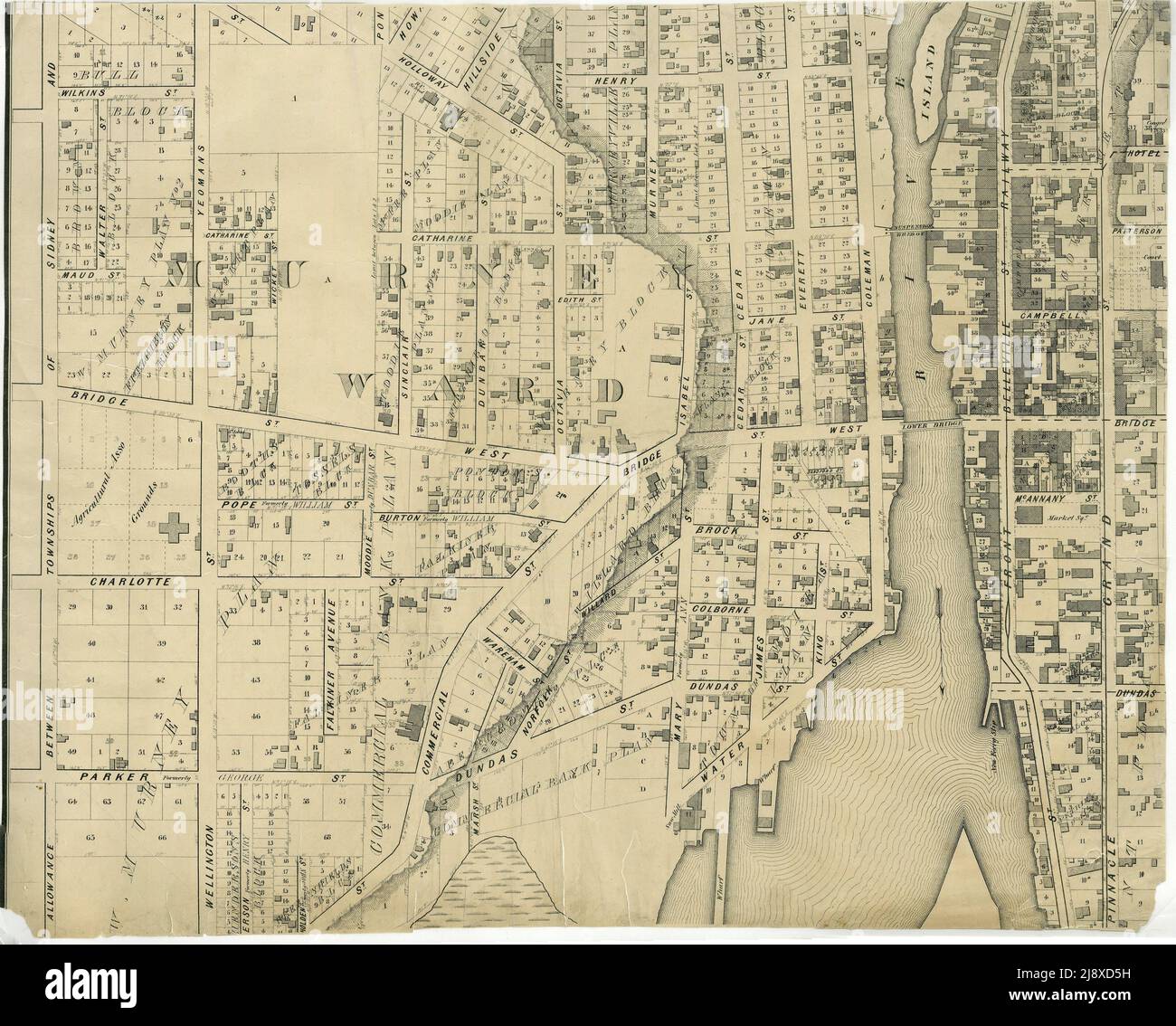 Part of the 1877 Map of the City of Belleville, Township of Thurlow, County of Hastings, Ontario, by Evans & Bolger, surveyors. ca. 1877 Stock Photohttps://www.alamy.com/image-license-details/?v=1https://www.alamy.com/part-of-the-1877-map-of-the-city-of-belleville-township-of-thurlow-county-of-hastings-ontario-by-evans-bolger-surveyors-ca-1877-image470178285.html
RM2J8XD5H–Part of the 1877 Map of the City of Belleville, Township of Thurlow, County of Hastings, Ontario, by Evans & Bolger, surveyors. ca. 1877
 Second battle field at Bull Run. Stock Photohttps://www.alamy.com/image-license-details/?v=1https://www.alamy.com/stock-image-second-battle-field-at-bull-run-168941497.html
RMKPRXGW–Second battle field at Bull Run.
 FRANCE: Evans Scundee , 1811 antique map Stock Photohttps://www.alamy.com/image-license-details/?v=1https://www.alamy.com/stock-photo-france-evans-scundee-1811-antique-map-100150437.html
RFFPX6W9–FRANCE: Evans Scundee , 1811 antique map
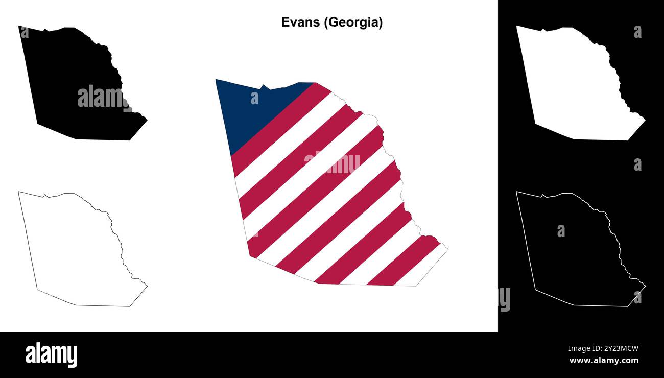 Evans County (Georgia) outline map set Stock Vectorhttps://www.alamy.com/image-license-details/?v=1https://www.alamy.com/evans-county-georgia-outline-map-set-image620884457.html
RF2Y23MCW–Evans County (Georgia) outline map set
 Evans Gully, , AU, Australia, Queensland, S 28 18' 3'', N 152 47' 55'', map, Cartascapes Map published in 2024. Explore Cartascapes, a map revealing Earth's diverse landscapes, cultures, and ecosystems. Journey through time and space, discovering the interconnectedness of our planet's past, present, and future. Stock Photohttps://www.alamy.com/image-license-details/?v=1https://www.alamy.com/evans-gully-au-australia-queensland-s-28-18-3-n-152-47-55-map-cartascapes-map-published-in-2024-explore-cartascapes-a-map-revealing-earths-diverse-landscapes-cultures-and-ecosystems-journey-through-time-and-space-discovering-the-interconnectedness-of-our-planets-past-present-and-future-image625834970.html
RM2YA56TX–Evans Gully, , AU, Australia, Queensland, S 28 18' 3'', N 152 47' 55'', map, Cartascapes Map published in 2024. Explore Cartascapes, a map revealing Earth's diverse landscapes, cultures, and ecosystems. Journey through time and space, discovering the interconnectedness of our planet's past, present, and future.
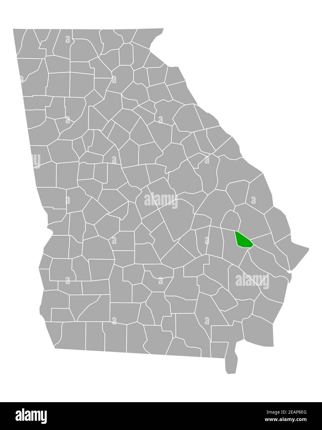 Map of Evans in Georgia Stock Photohttps://www.alamy.com/image-license-details/?v=1https://www.alamy.com/map-of-evans-in-georgia-image402474648.html
RF2EAP8EG–Map of Evans in Georgia
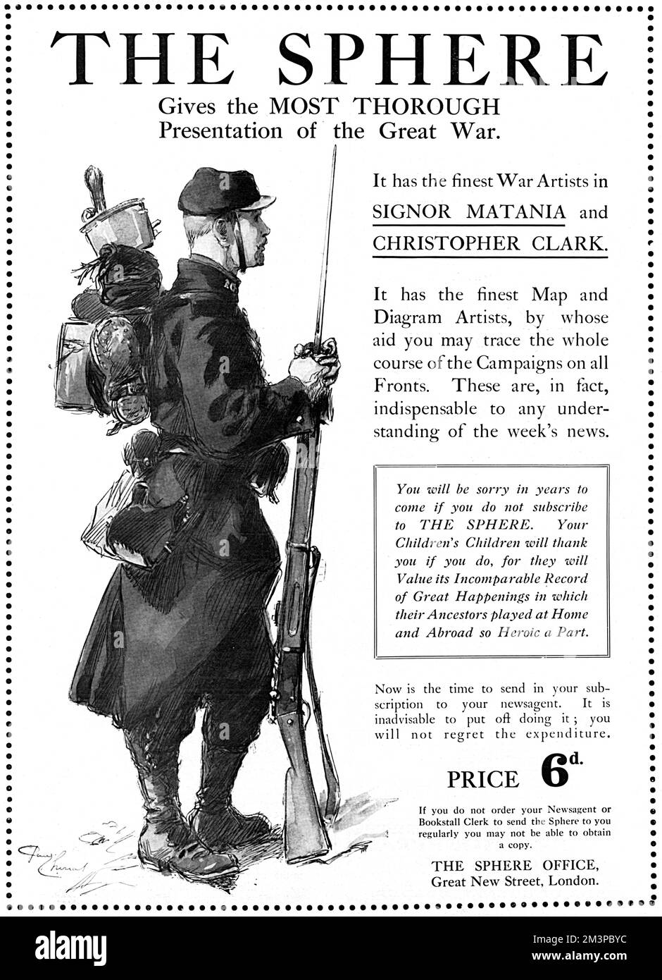 Advertisement IN The Sphere magazine FOR The Sphere magazine, declaring it had the finest war artists in Signor (Fortunino) Matania and Christopher Clark, as well as the finest map and diagram artists, by whose aid you may trace the whole course of the war. The copy goes on to warn readers, "You will be sorry in years to come if you do not subscribe to The Sphere. Your children's children will thank you if you do, for they will value its incomparable record of great happenings in which their ancestors played at home and abroad so heroic a part." Considering we at Mary Evans are as Stock Photohttps://www.alamy.com/image-license-details/?v=1https://www.alamy.com/advertisement-in-the-sphere-magazine-for-the-sphere-magazine-declaring-it-had-the-finest-war-artists-in-signor-fortunino-matania-and-christopher-clark-as-well-as-the-finest-map-and-diagram-artists-by-whose-aid-you-may-trace-the-whole-course-of-the-war-the-copy-goes-on-to-warn-readers-quotyou-will-be-sorry-in-years-to-come-if-you-do-not-subscribe-to-the-sphere-your-childrens-children-will-thank-you-if-you-do-for-they-will-value-its-incomparable-record-of-great-happenings-in-which-their-ancestors-played-at-home-and-abroad-so-heroic-a-partquot-considering-we-at-mary-evans-are-as-image501436976.html
RM2M3PBYC–Advertisement IN The Sphere magazine FOR The Sphere magazine, declaring it had the finest war artists in Signor (Fortunino) Matania and Christopher Clark, as well as the finest map and diagram artists, by whose aid you may trace the whole course of the war. The copy goes on to warn readers, "You will be sorry in years to come if you do not subscribe to The Sphere. Your children's children will thank you if you do, for they will value its incomparable record of great happenings in which their ancestors played at home and abroad so heroic a part." Considering we at Mary Evans are as
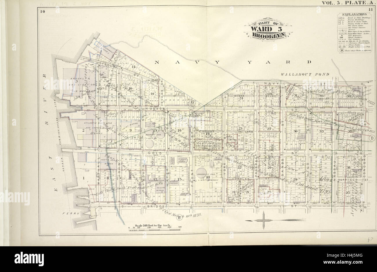 Vol. 5. Plate, A. Map bound by U.S. Navy Yard, Concord St., Bridge St., East River; Including Little St., Navy St. Stock Photohttps://www.alamy.com/image-license-details/?v=1https://www.alamy.com/stock-photo-vol-5-plate-a-map-bound-by-us-navy-yard-concord-st-bridge-st-east-123330832.html
RMH4J5MG–Vol. 5. Plate, A. Map bound by U.S. Navy Yard, Concord St., Bridge St., East River; Including Little St., Navy St.
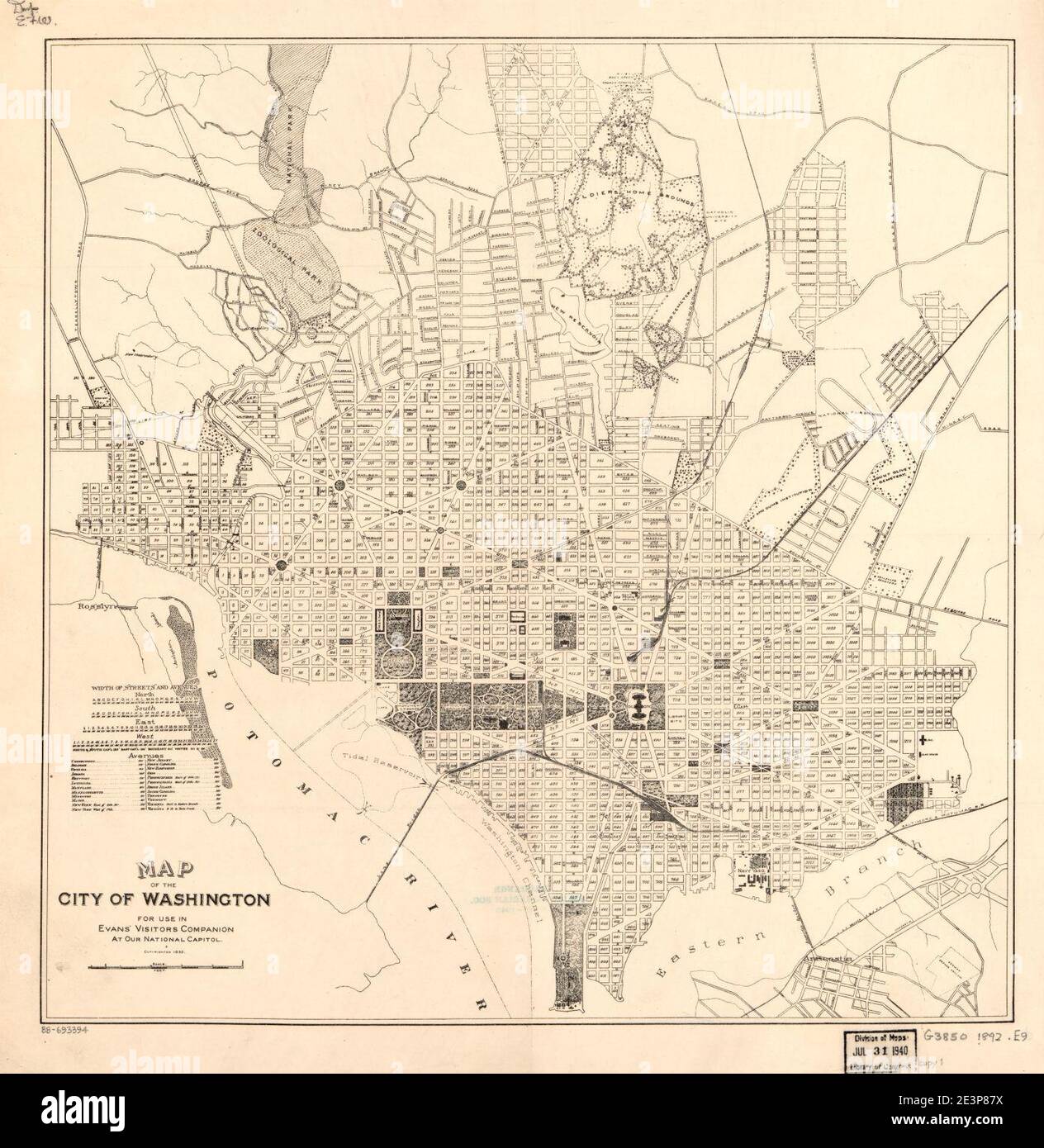 Map of the city of Washington - for use in Evans' visitors companion at our National Capitol. Stock Photohttps://www.alamy.com/image-license-details/?v=1https://www.alamy.com/map-of-the-city-of-washington-for-use-in-evans-visitors-companion-at-our-national-capitol-image398171870.html
RM2E3P87X–Map of the city of Washington - for use in Evans' visitors companion at our National Capitol.
 LUKE EVANS in ANNA (2019). Credit: TF1 FILMS PRODUCTIONS / Album Stock Photohttps://www.alamy.com/image-license-details/?v=1https://www.alamy.com/luke-evans-in-anna-2019-credit-tf1-films-productions-album-image259566425.html
RMW287HD–LUKE EVANS in ANNA (2019). Credit: TF1 FILMS PRODUCTIONS / Album
 EVANS (1811) Stock Photohttps://www.alamy.com/image-license-details/?v=1https://www.alamy.com/stock-photo-evans-1811-73537126.html
RME7HW9X–EVANS (1811)
 Map of Tonawanda Swamp in the counties of Genesee & Orleans 1830 - 1839 by Mix, David Ellicott Evans Stock Photohttps://www.alamy.com/image-license-details/?v=1https://www.alamy.com/map-of-tonawanda-swamp-in-the-counties-of-genesee-orleans-1830-1839-by-mix-david-ellicott-evans-image633227900.html
RM2YP60J4–Map of Tonawanda Swamp in the counties of Genesee & Orleans 1830 - 1839 by Mix, David Ellicott Evans
 Evans County, Georgia (U.S. county, United States of America,USA, U.S., US) map vector illustration, scribble sketch Evans map Stock Vectorhttps://www.alamy.com/image-license-details/?v=1https://www.alamy.com/evans-county-georgia-us-county-united-states-of-americausa-us-us-map-vector-illustration-scribble-sketch-evans-map-image354805031.html
RF2BH6NC7–Evans County, Georgia (U.S. county, United States of America,USA, U.S., US) map vector illustration, scribble sketch Evans map
 Edgar Evans Stock Photohttps://www.alamy.com/image-license-details/?v=1https://www.alamy.com/stock-photo-edgar-evans-139814907.html
RMJ3D39F–Edgar Evans
 UMEÅ 20240214Elfyn Evans (GBR) with map reader Scott Martin (GBR), Toyota Gazoo Racing WRT, Toyota GR Yaris Rally1 Hybrid, RC1 Rally1 during Thursday's Shake Down Håkmark Rally Sweden 2024 in Umeå Photo: Peo Möller/LocalEyes/TT code 11549 Credit: TT News Agency/Alamy Live News Stock Photohttps://www.alamy.com/image-license-details/?v=1https://www.alamy.com/ume-20240214elfyn-evans-gbr-with-map-reader-scott-martin-gbr-toyota-gazoo-racing-wrt-toyota-gr-yaris-rally1-hybrid-rc1-rally1-during-thursdays-shake-down-hkmark-rally-sweden-2024-in-ume-photo-peo-mllerlocaleyestt-code-11549-credit-tt-news-agencyalamy-live-news-image596556773.html
RM2WJFE71–UMEÅ 20240214Elfyn Evans (GBR) with map reader Scott Martin (GBR), Toyota Gazoo Racing WRT, Toyota GR Yaris Rally1 Hybrid, RC1 Rally1 during Thursday's Shake Down Håkmark Rally Sweden 2024 in Umeå Photo: Peo Möller/LocalEyes/TT code 11549 Credit: TT News Agency/Alamy Live News
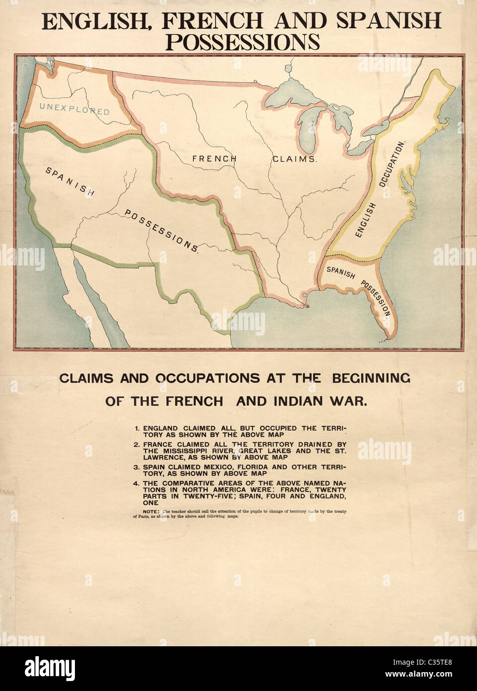 English, French and Spanish Possessions Claims and Occupations in US around 1754 Stock Photohttps://www.alamy.com/image-license-details/?v=1https://www.alamy.com/stock-photo-english-french-and-spanish-possessions-claims-and-occupations-in-us-36393680.html
RMC35TE8–English, French and Spanish Possessions Claims and Occupations in US around 1754
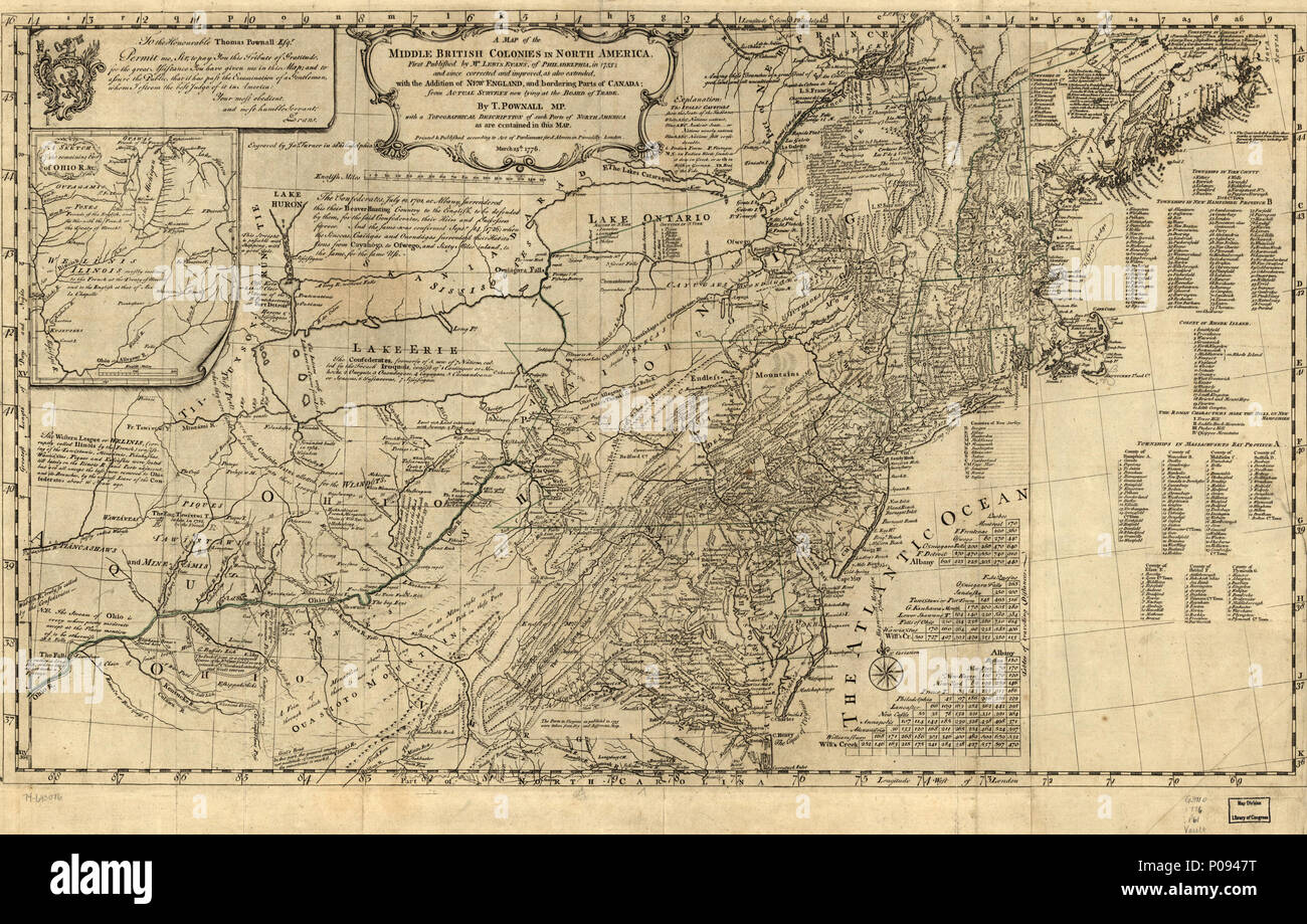 129 A map of the middle British colonies in North America. First published by Lewis Evans, of Philadelphia, in 1755; and since corrected and improved, as also extended, with the addition of New England, LOC 74693076 Stock Photohttps://www.alamy.com/image-license-details/?v=1https://www.alamy.com/129-a-map-of-the-middle-british-colonies-in-north-america-first-published-by-lewis-evans-of-philadelphia-in-1755-and-since-corrected-and-improved-as-also-extended-with-the-addition-of-new-england-loc-74693076-image206725340.html
RMP0947T–129 A map of the middle British colonies in North America. First published by Lewis Evans, of Philadelphia, in 1755; and since corrected and improved, as also extended, with the addition of New England, LOC 74693076
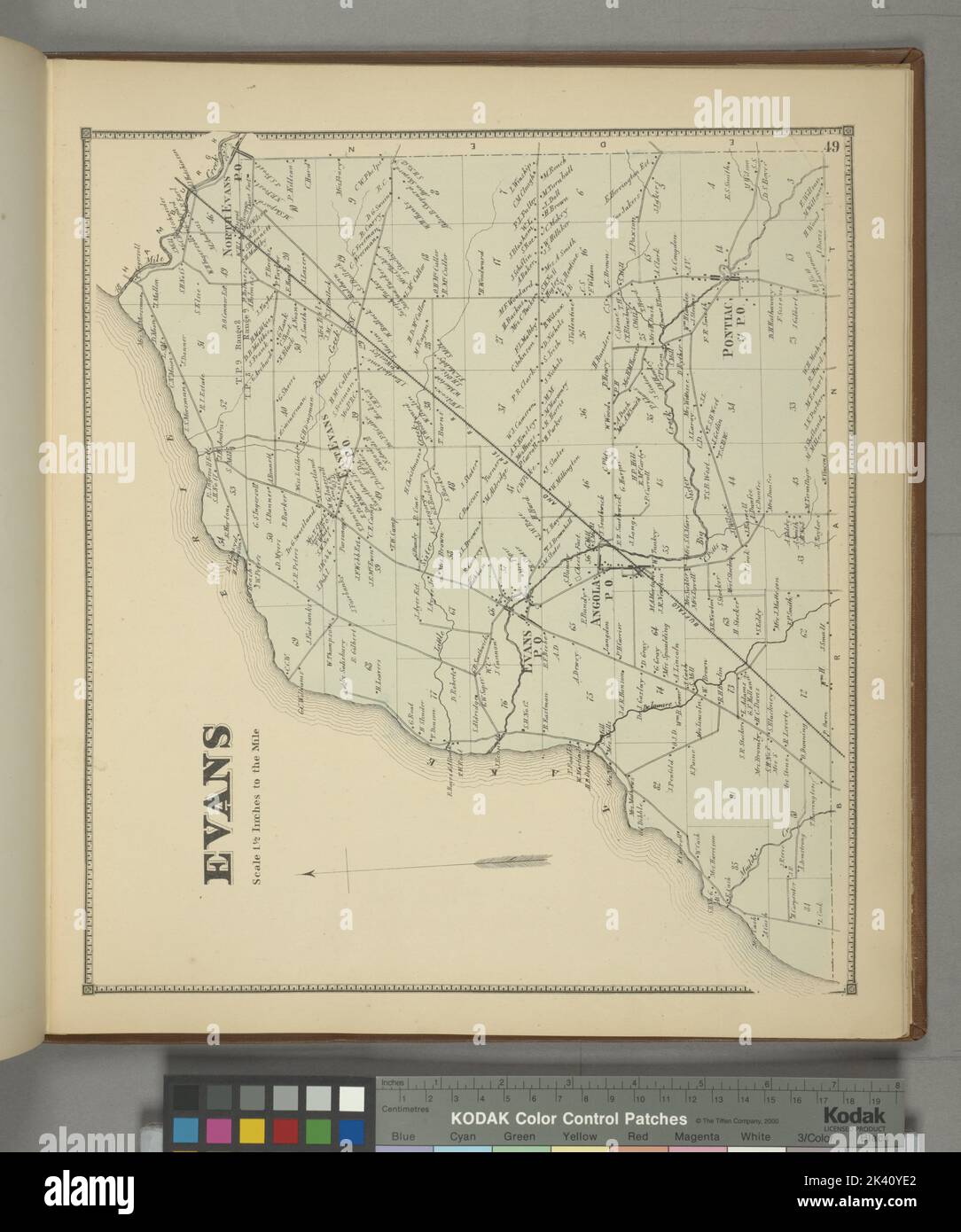 Evans Township Cartographic. Atlases, Maps. 1866. Lionel Pincus and Princess Firyal Map Division. Erie County (N.Y.) Stock Photohttps://www.alamy.com/image-license-details/?v=1https://www.alamy.com/evans-township-cartographic-atlases-maps-1866-lionel-pincus-and-princess-firyal-map-division-erie-county-ny-image484370490.html
RM2K40YE2–Evans Township Cartographic. Atlases, Maps. 1866. Lionel Pincus and Princess Firyal Map Division. Erie County (N.Y.)
 A map of the cities of London and Westminster. An exact delineation of the Cities of London and Westminster and the Suburbs thereof, together wth ye Burrough of Southwark and All ye Through-fares, Highwaies, Streetes, Lanes & Common Allies wth in ye same. Composed by a scale and ichnographically described by Richard Newcourt W. Faithorne Sculpsit, 1658. Engraved from the original by G. Jarman. London : A.E. Evans & Sons, 1857. Source: Maps.3480.(149). Language: English. Stock Photohttps://www.alamy.com/image-license-details/?v=1https://www.alamy.com/a-map-of-the-cities-of-london-and-westminster-an-exact-delineation-of-the-cities-of-london-and-westminster-and-the-suburbs-thereof-together-wth-ye-burrough-of-southwark-and-all-ye-through-fares-highwaies-streetes-lanes-common-allies-wth-in-ye-same-composed-by-a-scale-and-ichnographically-described-by-richard-newcourt-w-faithorne-sculpsit-1658-engraved-from-the-original-by-g-jarman-london-ae-evans-sons-1857-source-maps3480149-language-english-image231623196.html
RMRCR9N0–A map of the cities of London and Westminster. An exact delineation of the Cities of London and Westminster and the Suburbs thereof, together wth ye Burrough of Southwark and All ye Through-fares, Highwaies, Streetes, Lanes & Common Allies wth in ye same. Composed by a scale and ichnographically described by Richard Newcourt W. Faithorne Sculpsit, 1658. Engraved from the original by G. Jarman. London : A.E. Evans & Sons, 1857. Source: Maps.3480.(149). Language: English.
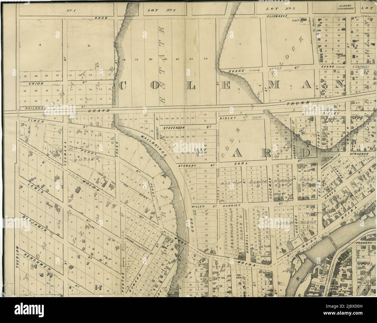 Part of the 1877 Map of the City of Belleville, Township of Thurlow, County of Hastings, Ontario, by Evans & Bolger, surveyors. ca. 1877 Stock Photohttps://www.alamy.com/image-license-details/?v=1https://www.alamy.com/part-of-the-1877-map-of-the-city-of-belleville-township-of-thurlow-county-of-hastings-ontario-by-evans-bolger-surveyors-ca-1877-image470178145.html
RM2J8XD0H–Part of the 1877 Map of the City of Belleville, Township of Thurlow, County of Hastings, Ontario, by Evans & Bolger, surveyors. ca. 1877
 U.S. President George W. Bush examines a map of shelters and kitchens in Louisiana during a visit to the American Red Cross Command Center in Washington, D.C., September 4, 2005. At right are Red Cross President and CEO Marty Evans (red shirt) and Executive Vice President, Chapter and International Operations, Alan McCurry. (UPI Photo/Martin H. Simon) Stock Photohttps://www.alamy.com/image-license-details/?v=1https://www.alamy.com/us-president-george-w-bush-examines-a-map-of-shelters-and-kitchens-in-louisiana-during-a-visit-to-the-american-red-cross-command-center-in-washington-dc-september-4-2005-at-right-are-red-cross-president-and-ceo-marty-evans-red-shirt-and-executive-vice-president-chapter-and-international-operations-alan-mccurry-upi-photomartin-h-simon-image258600414.html
RMW0M7D2–U.S. President George W. Bush examines a map of shelters and kitchens in Louisiana during a visit to the American Red Cross Command Center in Washington, D.C., September 4, 2005. At right are Red Cross President and CEO Marty Evans (red shirt) and Executive Vice President, Chapter and International Operations, Alan McCurry. (UPI Photo/Martin H. Simon)
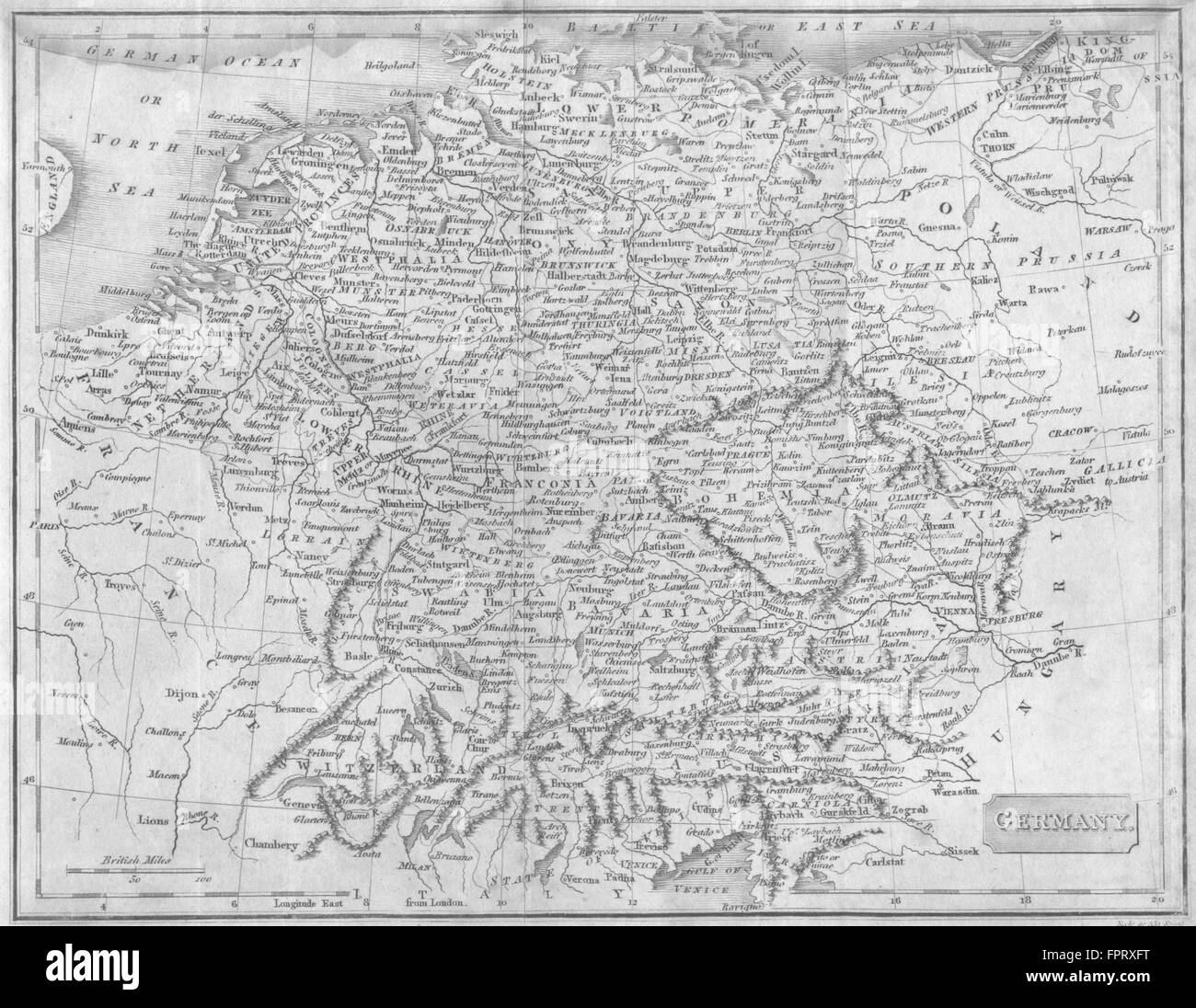 GERMANY: Evans Cundee , 1811 antique map Stock Photohttps://www.alamy.com/image-license-details/?v=1https://www.alamy.com/stock-photo-germany-evans-cundee-1811-antique-map-100099996.html
RFFPRXFT–GERMANY: Evans Cundee , 1811 antique map
 History of Spain. First Carlist War (1833-1840). Plan of the Battle of Oriamendi (15 and 16 March 1837). The Carlist troops, under the command of the Infante Sebastian (1811-1875), defeated the Liberal army, which had been joined by the British Auxiliary Legion. Engraving. 'Historia de la guerra civil y de los partidos liberal y carlista' (History of the Civil War and the Liberal and Carlist parties), by Antonio Pirala. Volume IV. Madrid, 1869. Stock Photohttps://www.alamy.com/image-license-details/?v=1https://www.alamy.com/history-of-spain-first-carlist-war-1833-1840-plan-of-the-battle-of-oriamendi-15-and-16-march-1837-the-carlist-troops-under-the-command-of-the-infante-sebastian-1811-1875-defeated-the-liberal-army-which-had-been-joined-by-the-british-auxiliary-legion-engraving-historia-de-la-guerra-civil-y-de-los-partidos-liberal-y-carlista-history-of-the-civil-war-and-the-liberal-and-carlist-parties-by-antonio-pirala-volume-iv-madrid-1869-image610502134.html
RM2XD6NKJ–History of Spain. First Carlist War (1833-1840). Plan of the Battle of Oriamendi (15 and 16 March 1837). The Carlist troops, under the command of the Infante Sebastian (1811-1875), defeated the Liberal army, which had been joined by the British Auxiliary Legion. Engraving. 'Historia de la guerra civil y de los partidos liberal y carlista' (History of the Civil War and the Liberal and Carlist parties), by Antonio Pirala. Volume IV. Madrid, 1869.
 Evans Creek, , AU, Australia, Victoria, S 36 55' 59'', N 146 24' 0'', map, Cartascapes Map published in 2024. Explore Cartascapes, a map revealing Earth's diverse landscapes, cultures, and ecosystems. Journey through time and space, discovering the interconnectedness of our planet's past, present, and future. Stock Photohttps://www.alamy.com/image-license-details/?v=1https://www.alamy.com/evans-creek-au-australia-victoria-s-36-55-59-n-146-24-0-map-cartascapes-map-published-in-2024-explore-cartascapes-a-map-revealing-earths-diverse-landscapes-cultures-and-ecosystems-journey-through-time-and-space-discovering-the-interconnectedness-of-our-planets-past-present-and-future-image625434033.html
RM2Y9EYDN–Evans Creek, , AU, Australia, Victoria, S 36 55' 59'', N 146 24' 0'', map, Cartascapes Map published in 2024. Explore Cartascapes, a map revealing Earth's diverse landscapes, cultures, and ecosystems. Journey through time and space, discovering the interconnectedness of our planet's past, present, and future.
 Map of Evans in Georgia Stock Photohttps://www.alamy.com/image-license-details/?v=1https://www.alamy.com/map-of-evans-in-georgia-image443868379.html
RF2GP3XJ3–Map of Evans in Georgia
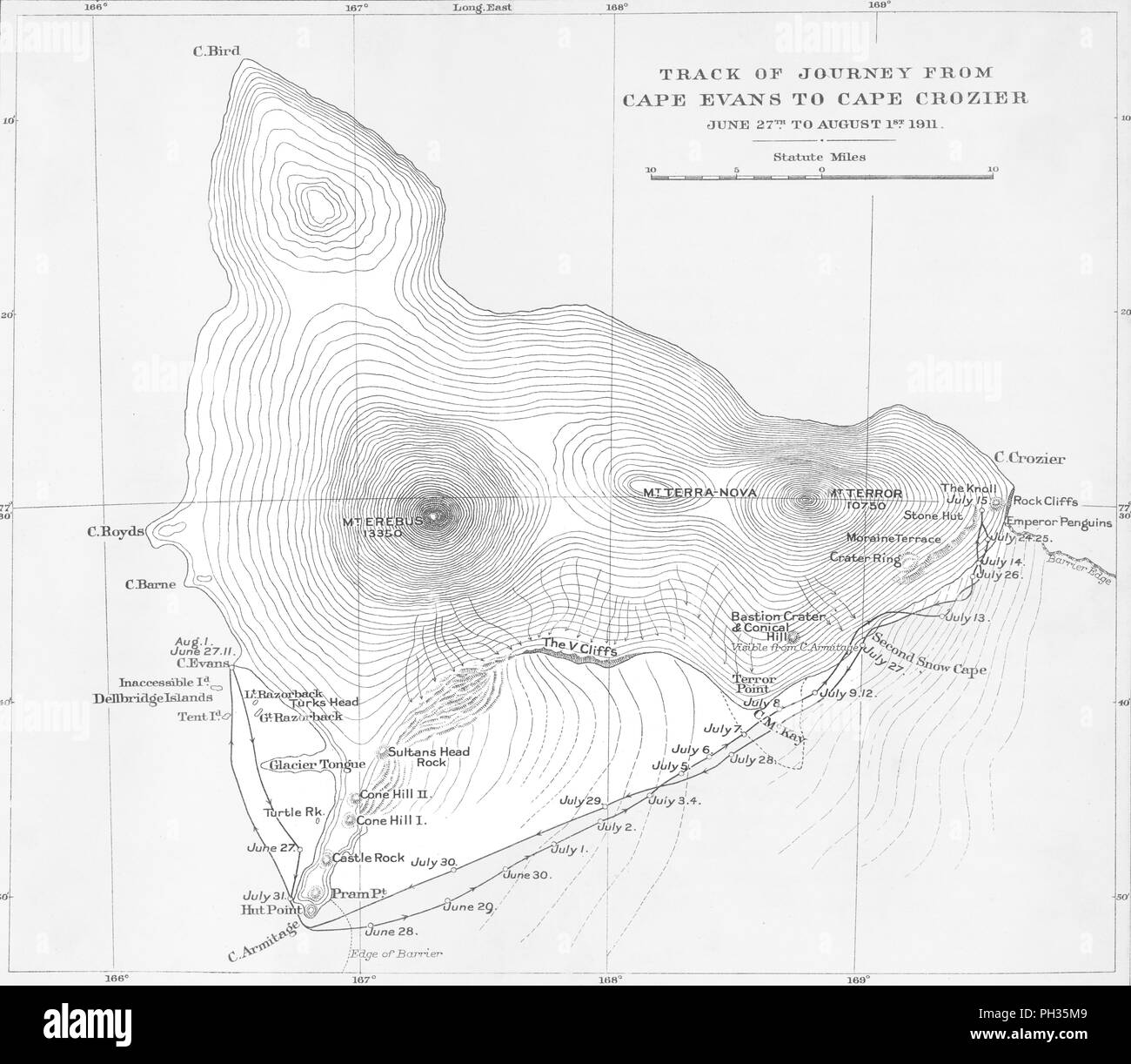 'Track of Journey from Cape Evans to Cape Crozier - June 27th to August 1st 1911', (1913). Artist: Unknown. Stock Photohttps://www.alamy.com/image-license-details/?v=1https://www.alamy.com/track-of-journey-from-cape-evans-to-cape-crozier-june-27th-to-august-1st-1911-1913-artist-unknown-image217043913.html
RMPH35M9–'Track of Journey from Cape Evans to Cape Crozier - June 27th to August 1st 1911', (1913). Artist: Unknown.
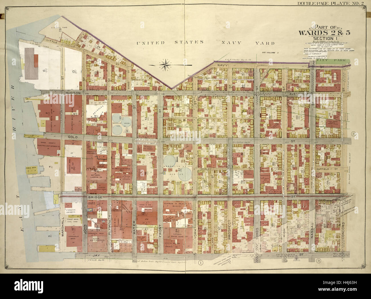 Brooklyn, Vol. 1, Double Page Plate No. 2; Part of Wards 2 & 5, Section 1; Map bounded by Little St., Evans St., Hudson Ave. Stock Photohttps://www.alamy.com/image-license-details/?v=1https://www.alamy.com/stock-photo-brooklyn-vol-1-double-page-plate-no-2-part-of-wards-2-5-section-1-123331141.html
RMH4J63H–Brooklyn, Vol. 1, Double Page Plate No. 2; Part of Wards 2 & 5, Section 1; Map bounded by Little St., Evans St., Hudson Ave.
 A map of the middle British colonies in North America. First published by Lewis Evans, of Philadelphia, in 1755; and since corrected and improved, as also extended, with the addition of New England, Stock Photohttps://www.alamy.com/image-license-details/?v=1https://www.alamy.com/a-map-of-the-middle-british-colonies-in-north-america-first-published-by-lewis-evans-of-philadelphia-in-1755-and-since-corrected-and-improved-as-also-extended-with-the-addition-of-new-england-image212523780.html
RMP9N870–A map of the middle British colonies in North America. First published by Lewis Evans, of Philadelphia, in 1755; and since corrected and improved, as also extended, with the addition of New England,
 June 3, 2024, Bonn, Germany, Germany: EVANS NJEWA, Chair of the Least Developed Countries (LDC) speaks to the press on the first day of the United Nations Climate Change Conference 2024 in Bonn. Nations come together to address continuing problems and new issues arising within the global map of Climate change, addressing each nation and region on their perspective and unique problems to collective issues. Climate finance is new on the agenda, in which numbers of grants are dwindling while loan borrowing is increasing debt for some nations at risk. (Credit Image: © Bianca Otero/ZUMA Press Wire) Stock Photohttps://www.alamy.com/image-license-details/?v=1https://www.alamy.com/june-3-2024-bonn-germany-germany-evans-njewa-chair-of-the-least-developed-countries-ldc-speaks-to-the-press-on-the-first-day-of-the-united-nations-climate-change-conference-2024-in-bonn-nations-come-together-to-address-continuing-problems-and-new-issues-arising-within-the-global-map-of-climate-change-addressing-each-nation-and-region-on-their-perspective-and-unique-problems-to-collective-issues-climate-finance-is-new-on-the-agenda-in-which-numbers-of-grants-are-dwindling-while-loan-borrowing-is-increasing-debt-for-some-nations-at-risk-credit-image-bianca-oterozuma-press-wire-image608463677.html
RM2X9WWHH–June 3, 2024, Bonn, Germany, Germany: EVANS NJEWA, Chair of the Least Developed Countries (LDC) speaks to the press on the first day of the United Nations Climate Change Conference 2024 in Bonn. Nations come together to address continuing problems and new issues arising within the global map of Climate change, addressing each nation and region on their perspective and unique problems to collective issues. Climate finance is new on the agenda, in which numbers of grants are dwindling while loan borrowing is increasing debt for some nations at risk. (Credit Image: © Bianca Otero/ZUMA Press Wire)
 EVANS (1811) Vol2 Stock Photohttps://www.alamy.com/image-license-details/?v=1https://www.alamy.com/stock-photo-evans-1811-vol2-73537129.html
RME7HWA1–EVANS (1811) Vol2
![Queens V. 3, Plate No. 70 [Map bounded by Dewey Pl., Traffic, Evans Pl., Metropolitan Ave., Sigsbee Pl., Shaler, Woodbine] 1884 - 1936 Stock Photo Queens V. 3, Plate No. 70 [Map bounded by Dewey Pl., Traffic, Evans Pl., Metropolitan Ave., Sigsbee Pl., Shaler, Woodbine] 1884 - 1936 Stock Photo](https://c8.alamy.com/comp/2YP95AY/queens-v-3-plate-no-70-map-bounded-by-dewey-pl-traffic-evans-pl-metropolitan-ave-sigsbee-pl-shaler-woodbine-1884-1936-2YP95AY.jpg) Queens V. 3, Plate No. 70 [Map bounded by Dewey Pl., Traffic, Evans Pl., Metropolitan Ave., Sigsbee Pl., Shaler, Woodbine] 1884 - 1936 Stock Photohttps://www.alamy.com/image-license-details/?v=1https://www.alamy.com/queens-v-3-plate-no-70-map-bounded-by-dewey-pl-traffic-evans-pl-metropolitan-ave-sigsbee-pl-shaler-woodbine-1884-1936-image633297475.html
Queens V. 3, Plate No. 70 [Map bounded by Dewey Pl., Traffic, Evans Pl., Metropolitan Ave., Sigsbee Pl., Shaler, Woodbine] 1884 - 1936 Stock Photohttps://www.alamy.com/image-license-details/?v=1https://www.alamy.com/queens-v-3-plate-no-70-map-bounded-by-dewey-pl-traffic-evans-pl-metropolitan-ave-sigsbee-pl-shaler-woodbine-1884-1936-image633297475.htmlRM2YP95AY–Queens V. 3, Plate No. 70 [Map bounded by Dewey Pl., Traffic, Evans Pl., Metropolitan Ave., Sigsbee Pl., Shaler, Woodbine] 1884 - 1936
 Evans County, Georgia (U.S. county, United States of America,USA, U.S., US) map vector illustration, scribble sketch Evans map Stock Vectorhttps://www.alamy.com/image-license-details/?v=1https://www.alamy.com/evans-county-georgia-us-county-united-states-of-americausa-us-us-map-vector-illustration-scribble-sketch-evans-map-image357758738.html
RF2BP18WP–Evans County, Georgia (U.S. county, United States of America,USA, U.S., US) map vector illustration, scribble sketch Evans map
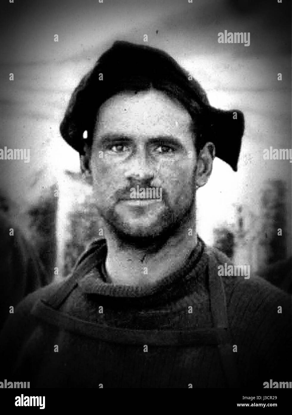 Edward Evans Stock Photohttps://www.alamy.com/image-license-details/?v=1https://www.alamy.com/stock-photo-edward-evans-139808433.html
RMJ3CR29–Edward Evans
 UMEÅ 20240214Elfyn Evans (GBR) with map reader Scott Martin (GBR), Toyota Gazoo Racing WRT, Toyota GR Yaris Rally1 Hybrid, RC1 Rally1 during Thursday's Shake Down Håkmark Rally Sweden 2024 in Umeå Photo: Peo Möller/LocalEyes/TT code 11549 Credit: TT News Agency/Alamy Live News Stock Photohttps://www.alamy.com/image-license-details/?v=1https://www.alamy.com/ume-20240214elfyn-evans-gbr-with-map-reader-scott-martin-gbr-toyota-gazoo-racing-wrt-toyota-gr-yaris-rally1-hybrid-rc1-rally1-during-thursdays-shake-down-hkmark-rally-sweden-2024-in-ume-photo-peo-mllerlocaleyestt-code-11549-credit-tt-news-agencyalamy-live-news-image596558590.html
RM2WJFGFX–UMEÅ 20240214Elfyn Evans (GBR) with map reader Scott Martin (GBR), Toyota Gazoo Racing WRT, Toyota GR Yaris Rally1 Hybrid, RC1 Rally1 during Thursday's Shake Down Håkmark Rally Sweden 2024 in Umeå Photo: Peo Möller/LocalEyes/TT code 11549 Credit: TT News Agency/Alamy Live News
 Map of Evans in Georgia Stock Photohttps://www.alamy.com/image-license-details/?v=1https://www.alamy.com/map-of-evans-in-georgia-image364660622.html
RF2C57M9J–Map of Evans in Georgia
 . The Constellations (July, August, September). English: This rare hand colored map of the stars was engraved W. G. Evans of New York for Burritt’s 1856 edition of the Atlas to Illustrate the Geography of the Heavens. It represents the Northern night sky in the months of July, August and September. Constellations are drawn in detail and include depictions of the Zodiacal figures the stars are said to represent. Included on this chart are Scorpio (the Scorpion), Sagittarius (the Archer), Capricorn (the Goat), Serpentarins (the Serpent Bearer) and Taurus (the Bull). Chart is quartered by lines Stock Photohttps://www.alamy.com/image-license-details/?v=1https://www.alamy.com/the-constellations-july-august-september-english-this-rare-hand-colored-map-of-the-stars-was-engraved-w-g-evans-of-new-york-for-burritts-1856-edition-of-the-atlas-to-illustrate-the-geography-of-the-heavens-it-represents-the-northern-night-sky-in-the-months-of-july-august-and-september-constellations-are-drawn-in-detail-and-include-depictions-of-the-zodiacal-figures-the-stars-are-said-to-represent-included-on-this-chart-are-scorpio-the-scorpion-sagittarius-the-archer-capricorn-the-goat-serpentarins-the-serpent-bearer-and-taurus-the-bull-chart-is-quartered-by-lines-image188134265.html
RMMX274W–. The Constellations (July, August, September). English: This rare hand colored map of the stars was engraved W. G. Evans of New York for Burritt’s 1856 edition of the Atlas to Illustrate the Geography of the Heavens. It represents the Northern night sky in the months of July, August and September. Constellations are drawn in detail and include depictions of the Zodiacal figures the stars are said to represent. Included on this chart are Scorpio (the Scorpion), Sagittarius (the Archer), Capricorn (the Goat), Serpentarins (the Serpent Bearer) and Taurus (the Bull). Chart is quartered by lines
 Plan of land in Roxbury belonging to the heirs of Alfred Evans , Real property, Massachusetts, Boston, Maps, Roxbury Boston, Mass., Maps, Roxbury Boston, Mass. Norman B. Leventhal Map Center Collection Stock Photohttps://www.alamy.com/image-license-details/?v=1https://www.alamy.com/plan-of-land-in-roxbury-belonging-to-the-heirs-of-alfred-evans-real-property-massachusetts-boston-maps-roxbury-boston-mass-maps-roxbury-boston-mass-norman-b-leventhal-map-center-collection-image501394108.html
RM2M3MD8C–Plan of land in Roxbury belonging to the heirs of Alfred Evans , Real property, Massachusetts, Boston, Maps, Roxbury Boston, Mass., Maps, Roxbury Boston, Mass. Norman B. Leventhal Map Center Collection
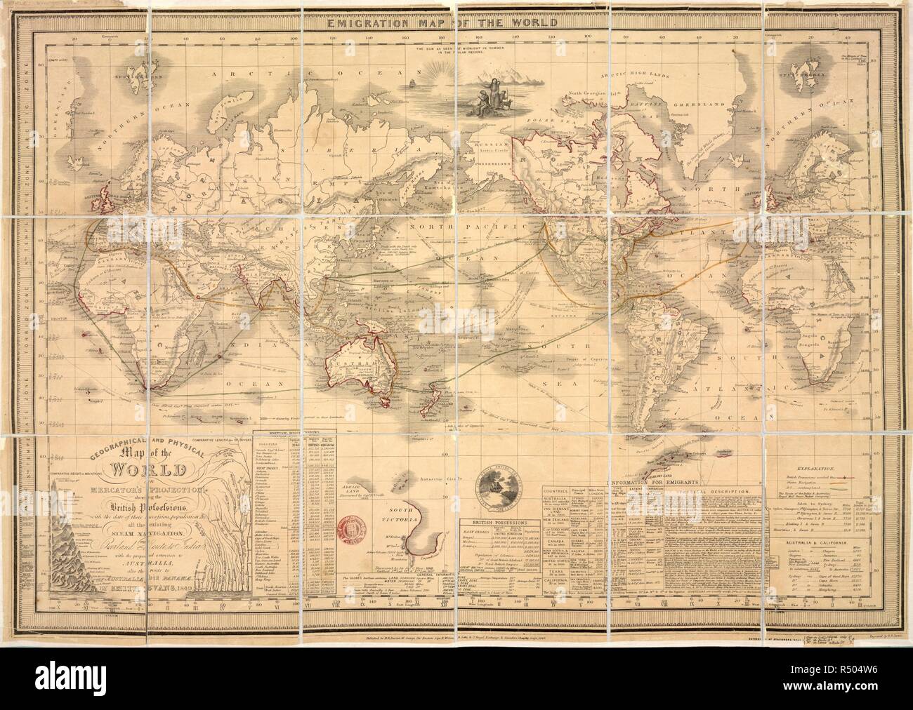 Emigration Map of the World. Emigration Map of the World. Geographical and phys. London : B.R. Davies, 1849. Source: Maps.60.a.12,. Language: English. Stock Photohttps://www.alamy.com/image-license-details/?v=1https://www.alamy.com/emigration-map-of-the-world-emigration-map-of-the-world-geographical-and-phys-london-br-davies-1849-source-maps60a12-language-english-image226811906.html
RMR504W6–Emigration Map of the World. Emigration Map of the World. Geographical and phys. London : B.R. Davies, 1849. Source: Maps.60.a.12,. Language: English.
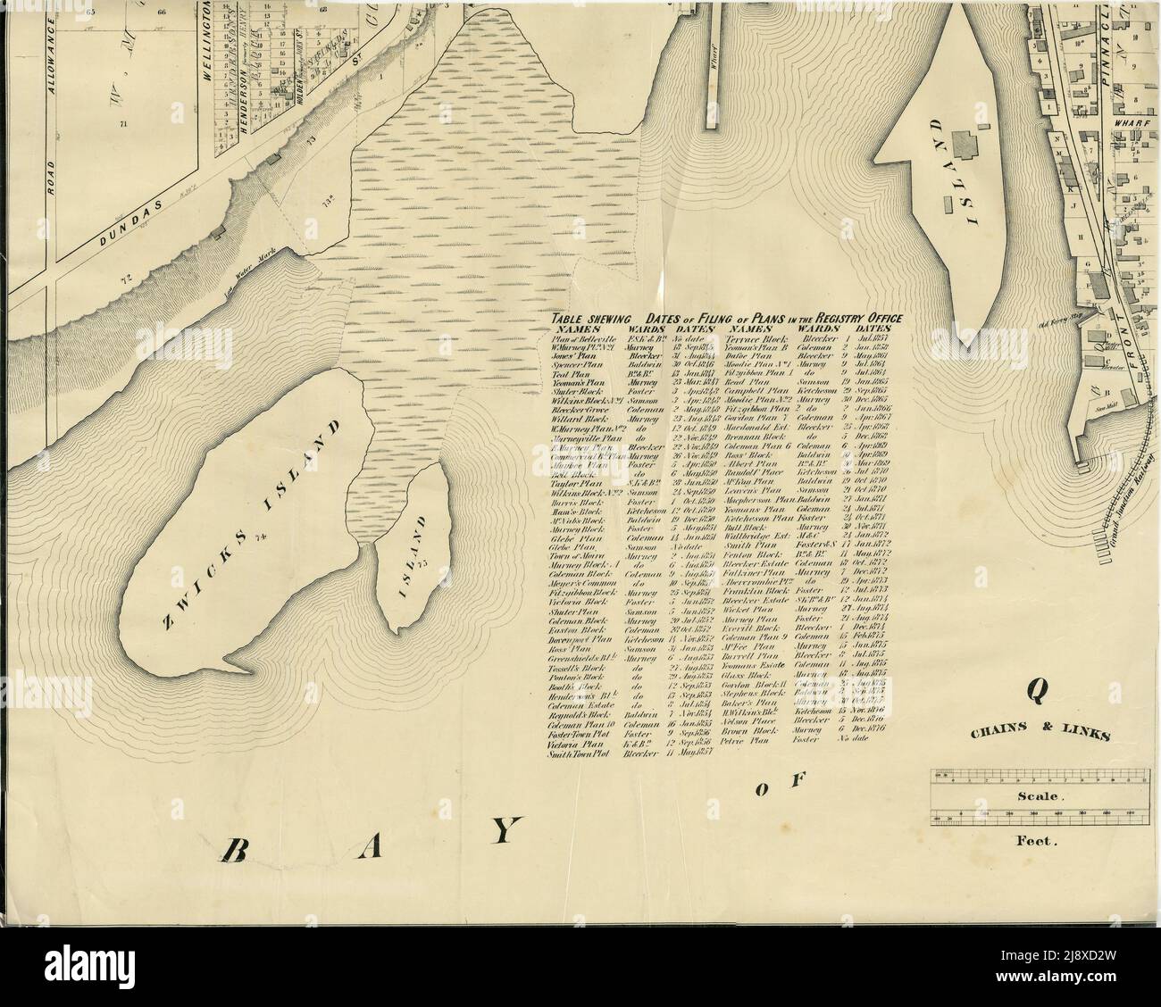 Part of the 1877 Map of the City of Belleville, Township of Thurlow, County of Hastings, Ontario, by Evans & Bolger, surveyors ca. 1877 Stock Photohttps://www.alamy.com/image-license-details/?v=1https://www.alamy.com/part-of-the-1877-map-of-the-city-of-belleville-township-of-thurlow-county-of-hastings-ontario-by-evans-bolger-surveyors-ca-1877-image470178209.html
RM2J8XD2W–Part of the 1877 Map of the City of Belleville, Township of Thurlow, County of Hastings, Ontario, by Evans & Bolger, surveyors ca. 1877
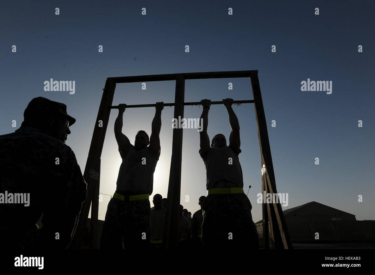 Command Sgt. Maj. Michael Evans, sergeant major of 1st Battalion, 18th Infantry Regiment, 2nd Advise and Assist Brigade, 1st Infantry Division, United States Division-Center, counts out the repititions as Soldiers from the battalion do pull-ups as part of a unit competition at Camp Taji, Iraq, May 27, 2011 for the opportunity to attend Ranger School. The competition included a 12-mile ruck march as well as testing on weapons tasks, map reading and other tactical skills and was designed to give the prospective Ranger candidates a small taste of the physical and mental requirements of Ranger Sch Stock Photohttps://www.alamy.com/image-license-details/?v=1https://www.alamy.com/stock-photo-command-sgt-maj-michael-evans-sergeant-major-of-1st-battalion-18th-129502999.html
RMHEKAB3–Command Sgt. Maj. Michael Evans, sergeant major of 1st Battalion, 18th Infantry Regiment, 2nd Advise and Assist Brigade, 1st Infantry Division, United States Division-Center, counts out the repititions as Soldiers from the battalion do pull-ups as part of a unit competition at Camp Taji, Iraq, May 27, 2011 for the opportunity to attend Ranger School. The competition included a 12-mile ruck march as well as testing on weapons tasks, map reading and other tactical skills and was designed to give the prospective Ranger candidates a small taste of the physical and mental requirements of Ranger Sch
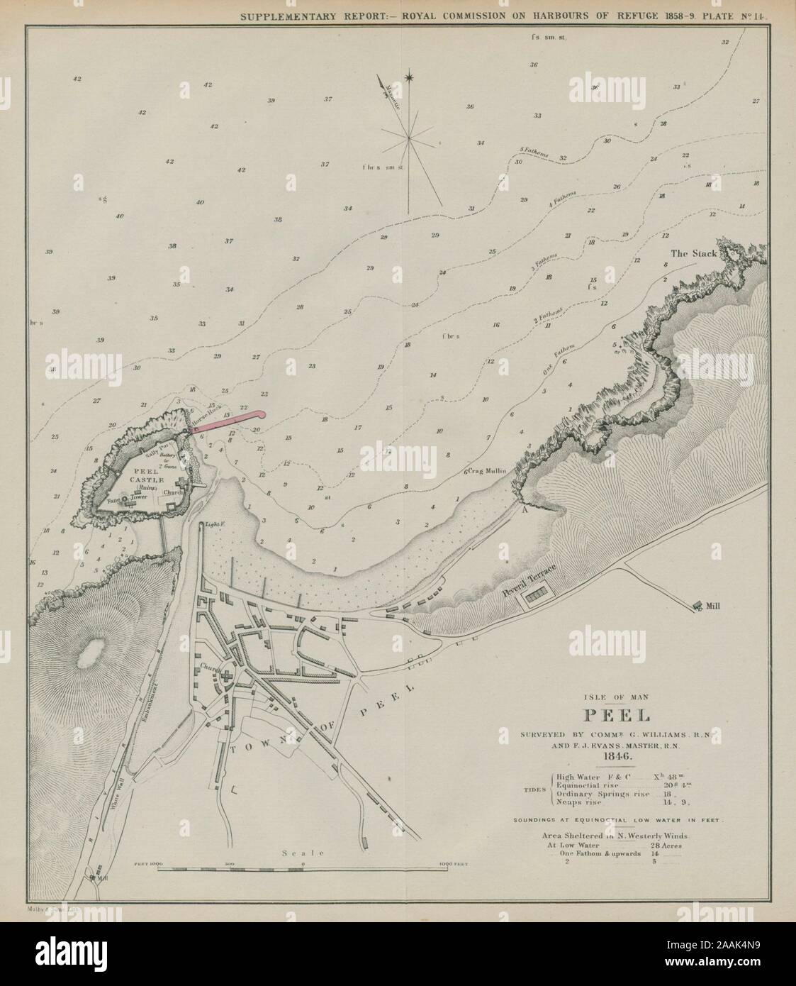 Peel bay surveyed by Williams & Evans. Proposed breakwater. Isle of Man 1859 map Stock Photohttps://www.alamy.com/image-license-details/?v=1https://www.alamy.com/peel-bay-surveyed-by-williams-evans-proposed-breakwater-isle-of-man-1859-map-image333564373.html
RF2AAK4N9–Peel bay surveyed by Williams & Evans. Proposed breakwater. Isle of Man 1859 map
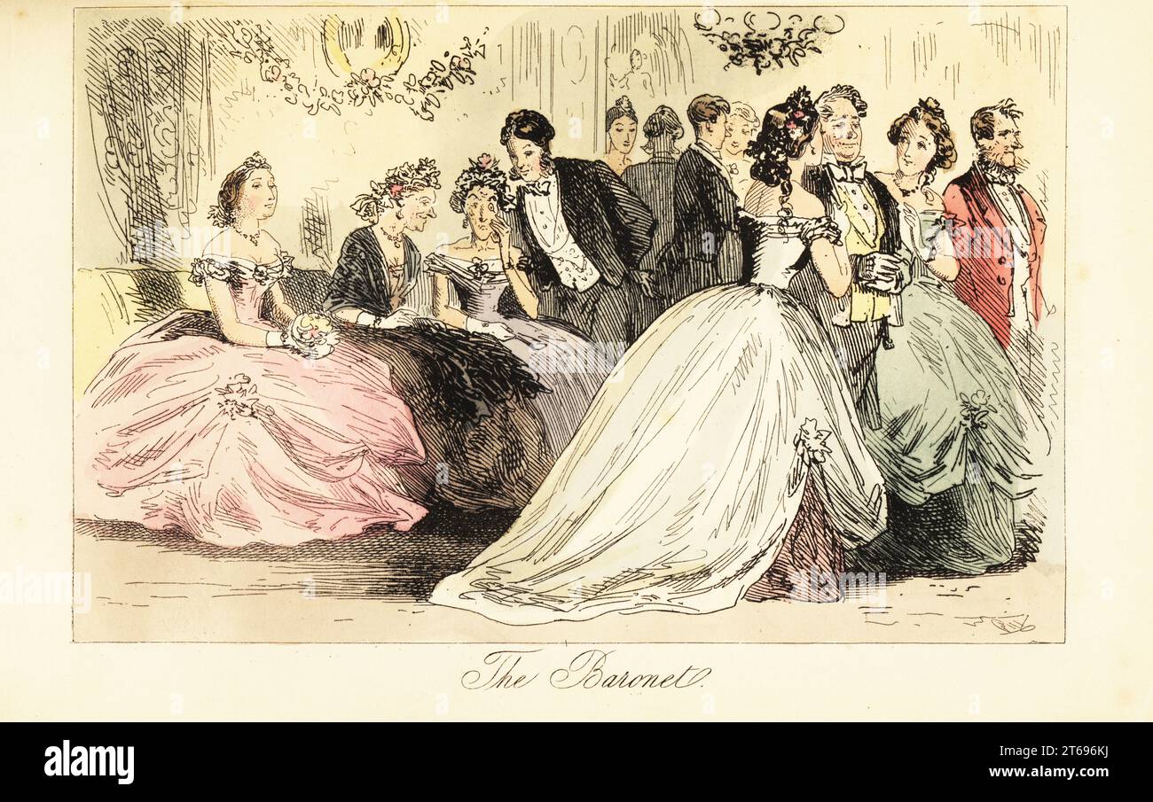 Arrival of aristocracy at a dance ball in a grand house, 19th century. Sir Roger Ferguson is accompanied by Lady de Tabby and Mrs Freezer in crinolines. A gentlemen whispers to two old ladies on a couch. The Baronet. Handcoloured steel engraving after an illustration by Hablot Knight Browne (Phiz) from Robert Smith Surtees Mr. Facey Romfords Hounds, Bradbury, Evans and Co., London, 1865. Stock Photohttps://www.alamy.com/image-license-details/?v=1https://www.alamy.com/arrival-of-aristocracy-at-a-dance-ball-in-a-grand-house-19th-century-sir-roger-ferguson-is-accompanied-by-lady-de-tabby-and-mrs-freezer-in-crinolines-a-gentlemen-whispers-to-two-old-ladies-on-a-couch-the-baronet-handcoloured-steel-engraving-after-an-illustration-by-hablot-knight-browne-phiz-from-robert-smith-surtees-mr-facey-romfords-hounds-bradbury-evans-and-co-london-1865-image571832902.html
RM2T696KJ–Arrival of aristocracy at a dance ball in a grand house, 19th century. Sir Roger Ferguson is accompanied by Lady de Tabby and Mrs Freezer in crinolines. A gentlemen whispers to two old ladies on a couch. The Baronet. Handcoloured steel engraving after an illustration by Hablot Knight Browne (Phiz) from Robert Smith Surtees Mr. Facey Romfords Hounds, Bradbury, Evans and Co., London, 1865.
 Evans Bore, , AU, Australia, South Australia, S 30 39' 35'', N 138 49' 13'', map, Cartascapes Map published in 2024. Explore Cartascapes, a map revealing Earth's diverse landscapes, cultures, and ecosystems. Journey through time and space, discovering the interconnectedness of our planet's past, present, and future. Stock Photohttps://www.alamy.com/image-license-details/?v=1https://www.alamy.com/evans-bore-au-australia-south-australia-s-30-39-35-n-138-49-13-map-cartascapes-map-published-in-2024-explore-cartascapes-a-map-revealing-earths-diverse-landscapes-cultures-and-ecosystems-journey-through-time-and-space-discovering-the-interconnectedness-of-our-planets-past-present-and-future-image625823169.html
RM2YA4KRD–Evans Bore, , AU, Australia, South Australia, S 30 39' 35'', N 138 49' 13'', map, Cartascapes Map published in 2024. Explore Cartascapes, a map revealing Earth's diverse landscapes, cultures, and ecosystems. Journey through time and space, discovering the interconnectedness of our planet's past, present, and future.
 Robert Louis Stevenson relics, Lady Stair's House, Edinburgh, Scotland. Artist: Tony Evans Stock Photohttps://www.alamy.com/image-license-details/?v=1https://www.alamy.com/robert-louis-stevenson-relics-lady-stairs-house-edinburgh-scotland-image60290331.html
RMDE2CX3–Robert Louis Stevenson relics, Lady Stair's House, Edinburgh, Scotland. Artist: Tony Evans
 PLAN OF LANDAU. - Image taken from 'The Popular History Of England: An Illustrated History Of Society And Government From The Earliest Period To Our OwnTimes By Charles KNIGHT - London. Bradbury and Evans. 1856-1862 Stock Photohttps://www.alamy.com/image-license-details/?v=1https://www.alamy.com/plan-of-landau-image-taken-from-the-popular-history-of-england-an-illustrated-history-of-society-and-government-from-the-earliest-period-to-our-owntimes-by-charles-knight-london-bradbury-and-evans-1856-1862-image593302722.html
RM2WD77JX–PLAN OF LANDAU. - Image taken from 'The Popular History Of England: An Illustrated History Of Society And Government From The Earliest Period To Our OwnTimes By Charles KNIGHT - London. Bradbury and Evans. 1856-1862
 Windy Wellington city sign on the side of a hill in Miramar, overlooking Evans Bay, near to the airport. New Zealand, North Island. Stock Photohttps://www.alamy.com/image-license-details/?v=1https://www.alamy.com/windy-wellington-city-sign-on-the-side-of-a-hill-in-miramar-overlooking-evans-bay-near-to-the-airport-new-zealand-north-island-image417922684.html
RF2F7X0J4–Windy Wellington city sign on the side of a hill in Miramar, overlooking Evans Bay, near to the airport. New Zealand, North Island.
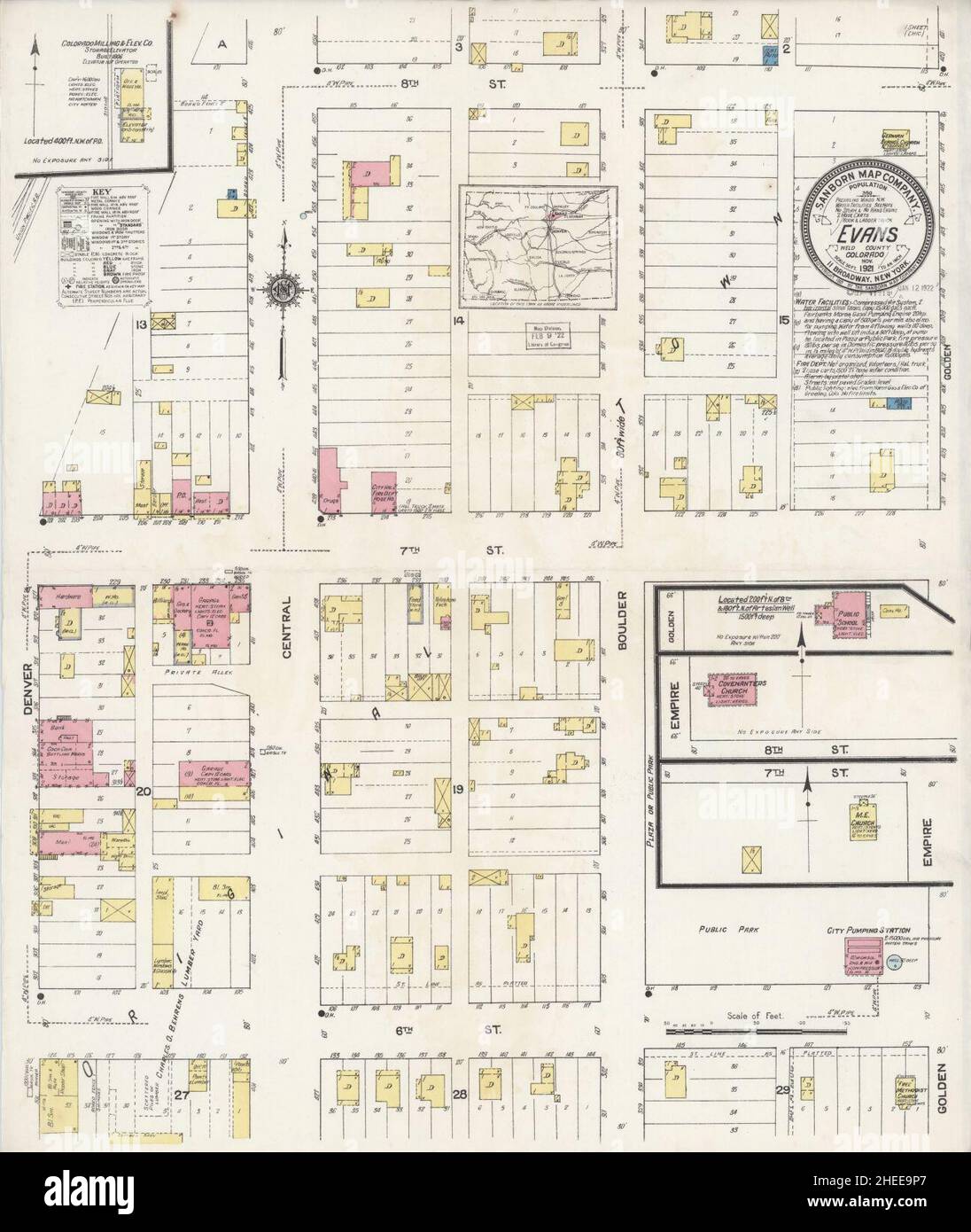 Sanborn Fire Insurance Map from Evans, Weld County, Colorado. Stock Photohttps://www.alamy.com/image-license-details/?v=1https://www.alamy.com/sanborn-fire-insurance-map-from-evans-weld-county-colorado-image456389759.html
RM2HEE9P7–Sanborn Fire Insurance Map from Evans, Weld County, Colorado.
 June 3, 2024, Bonn, Germany, Germany: EVANS NJEWA, Chair of the Least Developed Countries (LDC) speaks to the press on the first day of the United Nations Climate Change Conference 2024 in Bonn. Nations come together to address continuing problems and new issues arising within the global map of Climate change, addressing each nation and region on their perspective and unique problems to collective issues. Climate finance is new on the agenda, in which numbers of grants are dwindling while loan borrowing is increasing debt for some nations at risk. (Credit Image: © Bianca Otero/ZUMA Press Wire) Stock Photohttps://www.alamy.com/image-license-details/?v=1https://www.alamy.com/june-3-2024-bonn-germany-germany-evans-njewa-chair-of-the-least-developed-countries-ldc-speaks-to-the-press-on-the-first-day-of-the-united-nations-climate-change-conference-2024-in-bonn-nations-come-together-to-address-continuing-problems-and-new-issues-arising-within-the-global-map-of-climate-change-addressing-each-nation-and-region-on-their-perspective-and-unique-problems-to-collective-issues-climate-finance-is-new-on-the-agenda-in-which-numbers-of-grants-are-dwindling-while-loan-borrowing-is-increasing-debt-for-some-nations-at-risk-credit-image-bianca-oterozuma-press-wire-image608463691.html
RM2X9WWJ3–June 3, 2024, Bonn, Germany, Germany: EVANS NJEWA, Chair of the Least Developed Countries (LDC) speaks to the press on the first day of the United Nations Climate Change Conference 2024 in Bonn. Nations come together to address continuing problems and new issues arising within the global map of Climate change, addressing each nation and region on their perspective and unique problems to collective issues. Climate finance is new on the agenda, in which numbers of grants are dwindling while loan borrowing is increasing debt for some nations at risk. (Credit Image: © Bianca Otero/ZUMA Press Wire)
 EVANS (1811) Vol1 Stock Photohttps://www.alamy.com/image-license-details/?v=1https://www.alamy.com/stock-photo-evans-1811-vol1-73537128.html
RME7HWA0–EVANS (1811) Vol1
 A general map of the middle British colonies in America: viz. Virginia, Maryland, Delaware, Pensilvania, New-Jersey, New-York, Connecticut and Rhode-Island : of Aquanishuonigy the country of the confederate Indians comprehending Aquanishuonigy proper, their places of residence, Ohio and Thuchsochruntie their deer hunting countries, Couchsachrage and Skaniadarade their beaver hunting countries, of the Lakes Erie, Ontario and Champlain, and of part of New-France : wherein is also shewn the antient and present seats of the Indian nations 1758 by Evans, Lewis, 1700?-1756 Stock Photohttps://www.alamy.com/image-license-details/?v=1https://www.alamy.com/a-general-map-of-the-middle-british-colonies-in-america-viz-virginia-maryland-delaware-pensilvania-new-jersey-new-york-connecticut-and-rhode-island-of-aquanishuonigy-the-country-of-the-confederate-indians-comprehending-aquanishuonigy-proper-their-places-of-residence-ohio-and-thuchsochruntie-their-deer-hunting-countries-couchsachrage-and-skaniadarade-their-beaver-hunting-countries-of-the-lakes-erie-ontario-and-champlain-and-of-part-of-new-france-wherein-is-also-shewn-the-antient-and-present-seats-of-the-indian-nations-1758-by-evans-lewis-1700-1756-image633122956.html
RM2YP16P4–A general map of the middle British colonies in America: viz. Virginia, Maryland, Delaware, Pensilvania, New-Jersey, New-York, Connecticut and Rhode-Island : of Aquanishuonigy the country of the confederate Indians comprehending Aquanishuonigy proper, their places of residence, Ohio and Thuchsochruntie their deer hunting countries, Couchsachrage and Skaniadarade their beaver hunting countries, of the Lakes Erie, Ontario and Champlain, and of part of New-France : wherein is also shewn the antient and present seats of the Indian nations 1758 by Evans, Lewis, 1700?-1756
 Evans County, Georgia (U.S. county, United States of America,USA, U.S., US) map vector illustration, scribble sketch Evans map Stock Vectorhttps://www.alamy.com/image-license-details/?v=1https://www.alamy.com/evans-county-georgia-us-county-united-states-of-americausa-us-us-map-vector-illustration-scribble-sketch-evans-map-image365432245.html
RF2C6ETFH–Evans County, Georgia (U.S. county, United States of America,USA, U.S., US) map vector illustration, scribble sketch Evans map
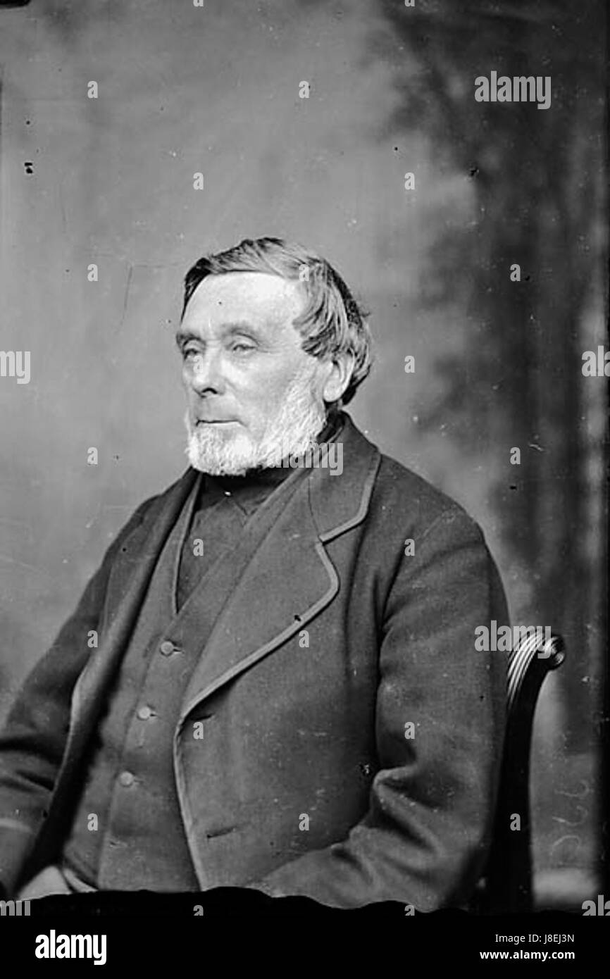 Evans NLW3362410 Stock Photohttps://www.alamy.com/image-license-details/?v=1https://www.alamy.com/stock-photo-evans-nlw3362410-142921737.html
RMJ8EJ3N–Evans NLW3362410
 UMEÅ 20240214Elfyn Evans (GBR) with map reader Scott Martin (GBR), Toyota Gazoo Racing WRT, Toyota GR Yaris Rally1 Hybrid, RC1 Rally1 during Thursday's Shake Down Håkmark Rally Sweden 2024 in Umeå Photo: Peo Möller/LocalEyes/TT code 11549 Credit: TT News Agency/Alamy Live News Stock Photohttps://www.alamy.com/image-license-details/?v=1https://www.alamy.com/ume-20240214elfyn-evans-gbr-with-map-reader-scott-martin-gbr-toyota-gazoo-racing-wrt-toyota-gr-yaris-rally1-hybrid-rc1-rally1-during-thursdays-shake-down-hkmark-rally-sweden-2024-in-ume-photo-peo-mllerlocaleyestt-code-11549-credit-tt-news-agencyalamy-live-news-image596559460.html
RM2WJFHK0–UMEÅ 20240214Elfyn Evans (GBR) with map reader Scott Martin (GBR), Toyota Gazoo Racing WRT, Toyota GR Yaris Rally1 Hybrid, RC1 Rally1 during Thursday's Shake Down Håkmark Rally Sweden 2024 in Umeå Photo: Peo Möller/LocalEyes/TT code 11549 Credit: TT News Agency/Alamy Live News
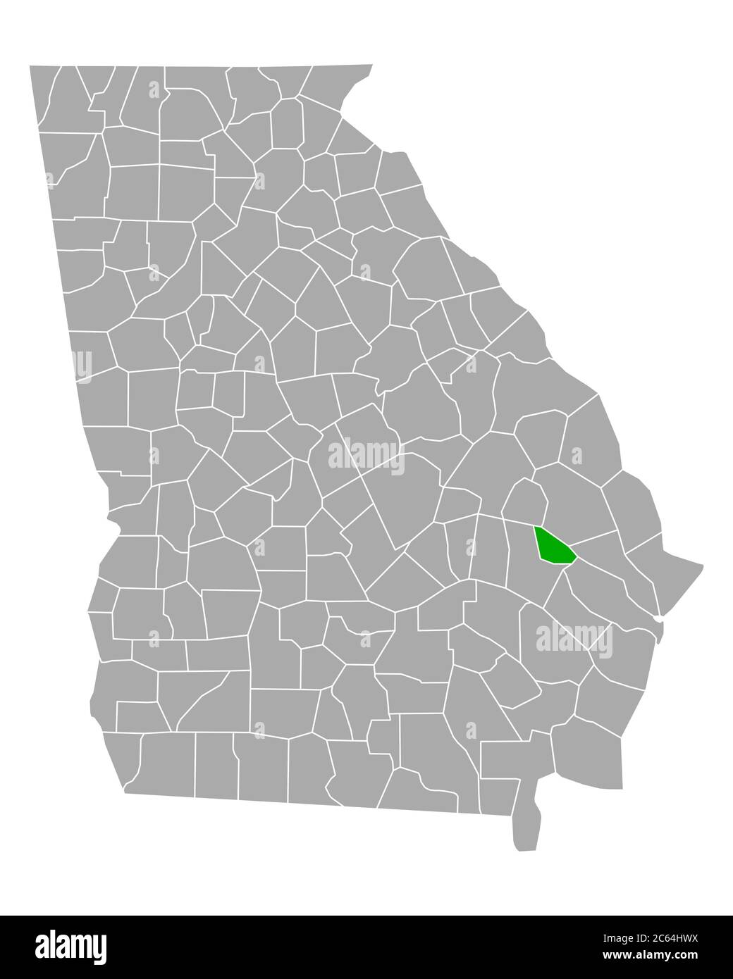 Map of Evans in Georgia Stock Photohttps://www.alamy.com/image-license-details/?v=1https://www.alamy.com/map-of-evans-in-georgia-image365207526.html
RF2C64HWX–Map of Evans in Georgia
 . English: This rare hand colored map of the stars was engraved W. G. Evans of New York for Burritt’s 1856 edition of the Atlas to Illustrate the Geography of the Heavens. It represents the Northern night sky in the months of July, August and September. Constellations are drawn in detail and include depictions of the Zodiacal figures the stars are said to represent. Included on this chart are Scorpio (the Scorpion), Sagittarius (the Archer), Capricorn (the Goat), Serpentarins (the Serpent Bearer) and Taurus (the Bull). Chart is quartered by lines indicating the Solstitial and Equinoctial Colu Stock Photohttps://www.alamy.com/image-license-details/?v=1https://www.alamy.com/english-this-rare-hand-colored-map-of-the-stars-was-engraved-w-g-evans-of-new-york-for-burritts-1856-edition-of-the-atlas-to-illustrate-the-geography-of-the-heavens-it-represents-the-northern-night-sky-in-the-months-of-july-august-and-september-constellations-are-drawn-in-detail-and-include-depictions-of-the-zodiacal-figures-the-stars-are-said-to-represent-included-on-this-chart-are-scorpio-the-scorpion-sagittarius-the-archer-capricorn-the-goat-serpentarins-the-serpent-bearer-and-taurus-the-bull-chart-is-quartered-by-lines-indicating-the-solstitial-and-equinoctial-colu-image184877533.html
RMMMNW51–. English: This rare hand colored map of the stars was engraved W. G. Evans of New York for Burritt’s 1856 edition of the Atlas to Illustrate the Geography of the Heavens. It represents the Northern night sky in the months of July, August and September. Constellations are drawn in detail and include depictions of the Zodiacal figures the stars are said to represent. Included on this chart are Scorpio (the Scorpion), Sagittarius (the Archer), Capricorn (the Goat), Serpentarins (the Serpent Bearer) and Taurus (the Bull). Chart is quartered by lines indicating the Solstitial and Equinoctial Colu
 Evans Center Village; North Evans Village; Evans Township Cartographic. Atlases, Maps. 1880. Lionel Pincus and Princess Firyal Map Division. Erie County (N.Y.), Real property , New York (State) , Erie County Stock Photohttps://www.alamy.com/image-license-details/?v=1https://www.alamy.com/evans-center-village-north-evans-village-evans-township-cartographic-atlases-maps-1880-lionel-pincus-and-princess-firyal-map-division-erie-county-ny-real-property-new-york-state-erie-county-image484348977.html
RM2K4001N–Evans Center Village; North Evans Village; Evans Township Cartographic. Atlases, Maps. 1880. Lionel Pincus and Princess Firyal Map Division. Erie County (N.Y.), Real property , New York (State) , Erie County
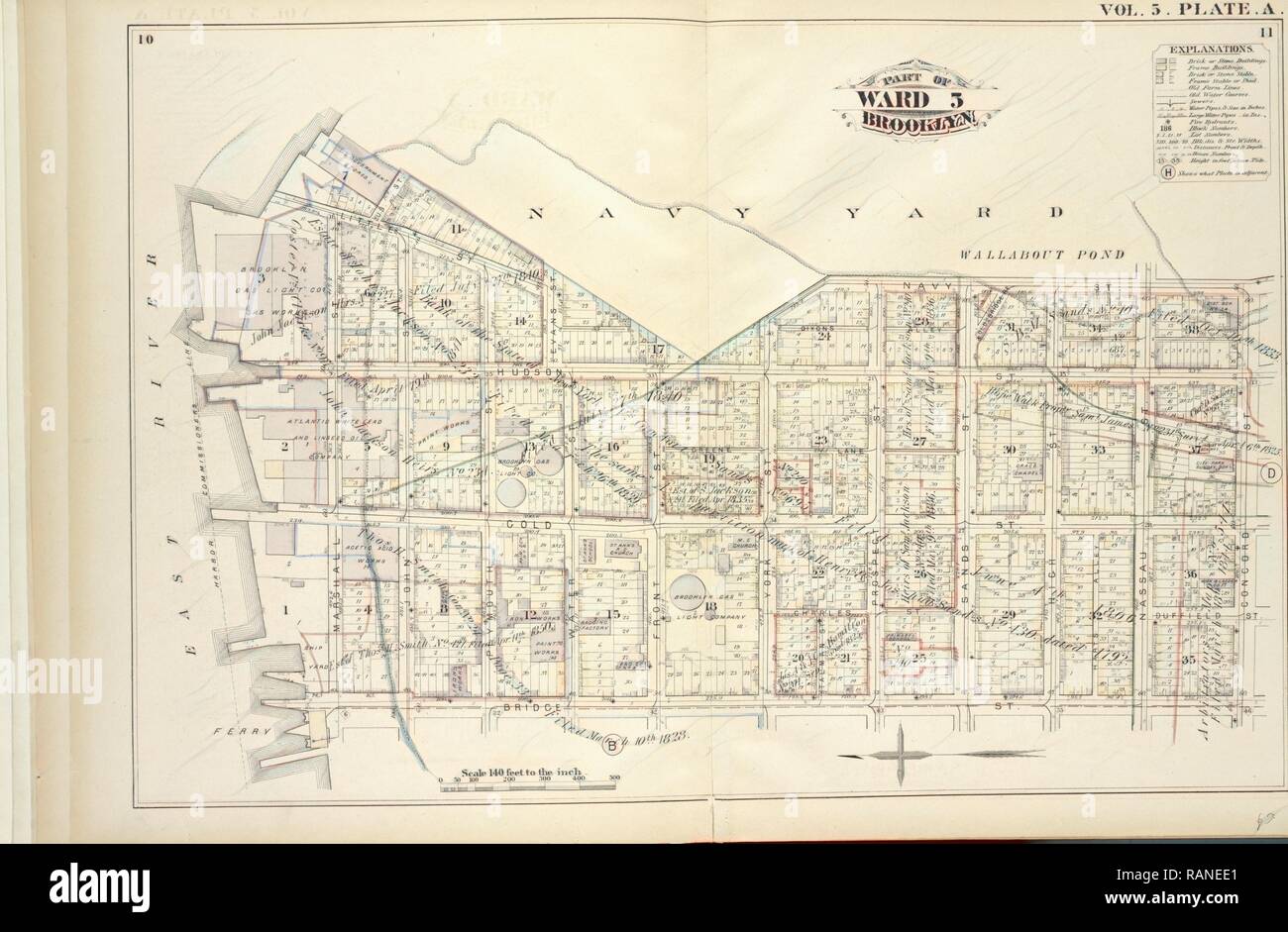 Vol. 5. Plate, A. Map bound by U.S. Navy Yard, Concord St., Bridge St., East River, Including Little St., Navy St reimagined Stock Photohttps://www.alamy.com/image-license-details/?v=1https://www.alamy.com/vol-5-plate-a-map-bound-by-us-navy-yard-concord-st-bridge-st-east-river-including-little-st-navy-st-reimagined-image230353705.html
RFRANEE1–Vol. 5. Plate, A. Map bound by U.S. Navy Yard, Concord St., Bridge St., East River, Including Little St., Navy St reimagined
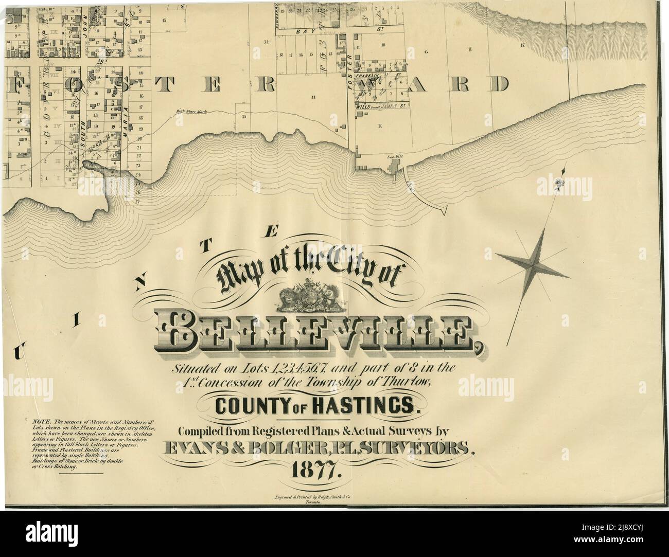 Part of the 1877 Map of the City of Belleville, Township of Thurlow, County of Hastings, Ontario, by Evans & Bolger, surveyors ca. 1877 Stock Photohttps://www.alamy.com/image-license-details/?v=1https://www.alamy.com/part-of-the-1877-map-of-the-city-of-belleville-township-of-thurlow-county-of-hastings-ontario-by-evans-bolger-surveyors-ca-1877-image470178118.html
RM2J8XCYJ–Part of the 1877 Map of the City of Belleville, Township of Thurlow, County of Hastings, Ontario, by Evans & Bolger, surveyors ca. 1877
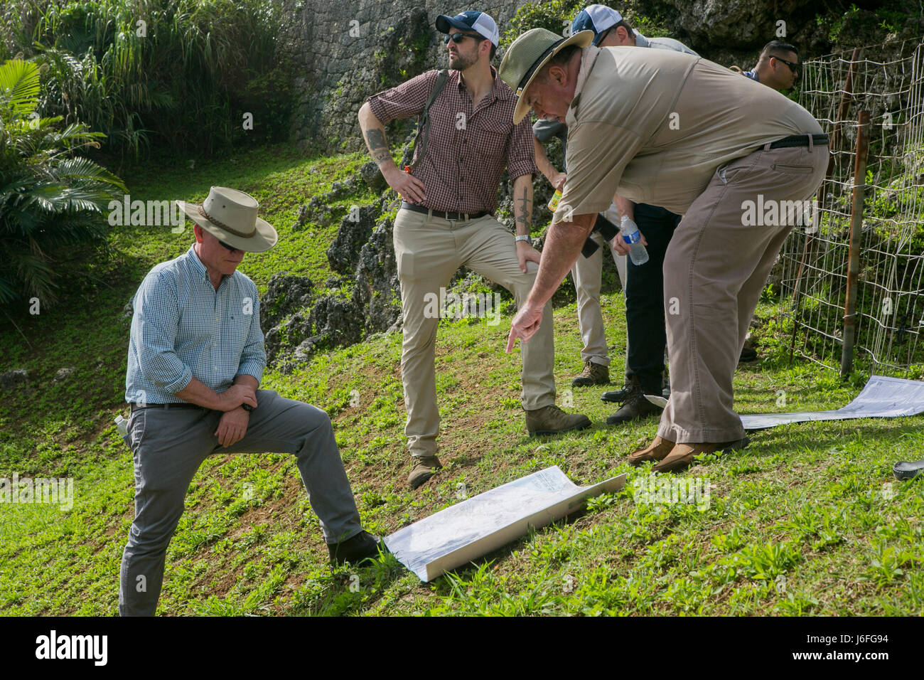 U.S. Marine Corps Lt. Gen. Lawrence D. Nicholson, III Marine Expeditionary Force (MEF) commanding general, left, and David Leipold, a civilian contractor with the Information Management Office at III MEF, right, study a map during a Battle of Okinawa Tour on Okinawa, Japan, May 15, 2017. The battle tour was conducted to build a greater understanding of Marine Corps history on Okinawa through facilitated discussion and a guided tour, while building camaraderie and espirit de corps among the III MEF staff. (U.S. Marine Corps photo by MCIPAC Combat Camera Lance Cpl. Sean M. Evans) Stock Photohttps://www.alamy.com/image-license-details/?v=1https://www.alamy.com/stock-photo-us-marine-corps-lt-gen-lawrence-d-nicholson-iii-marine-expeditionary-141712960.html
RMJ6FG94–U.S. Marine Corps Lt. Gen. Lawrence D. Nicholson, III Marine Expeditionary Force (MEF) commanding general, left, and David Leipold, a civilian contractor with the Information Management Office at III MEF, right, study a map during a Battle of Okinawa Tour on Okinawa, Japan, May 15, 2017. The battle tour was conducted to build a greater understanding of Marine Corps history on Okinawa through facilitated discussion and a guided tour, while building camaraderie and espirit de corps among the III MEF staff. (U.S. Marine Corps photo by MCIPAC Combat Camera Lance Cpl. Sean M. Evans)
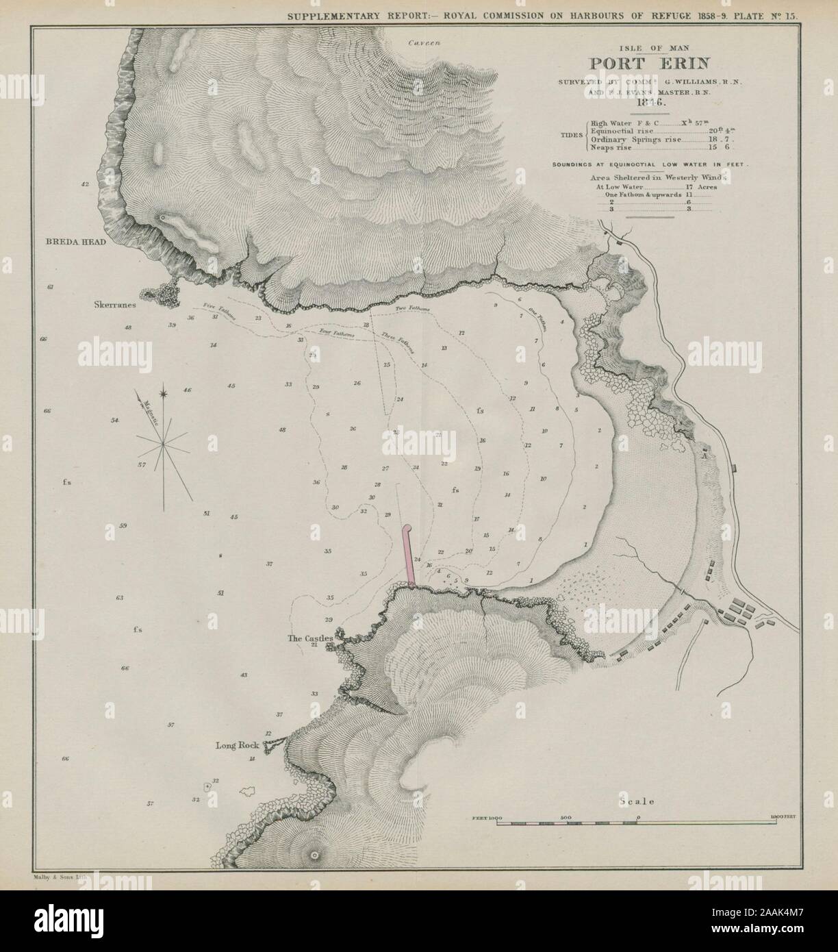 Port Erin bay. Williams/Evans survey. Proposed breakwater. Isle of Man 1859 map Stock Photohttps://www.alamy.com/image-license-details/?v=1https://www.alamy.com/port-erin-bay-williamsevans-survey-proposed-breakwater-isle-of-man-1859-map-image333564343.html
RF2AAK4M7–Port Erin bay. Williams/Evans survey. Proposed breakwater. Isle of Man 1859 map
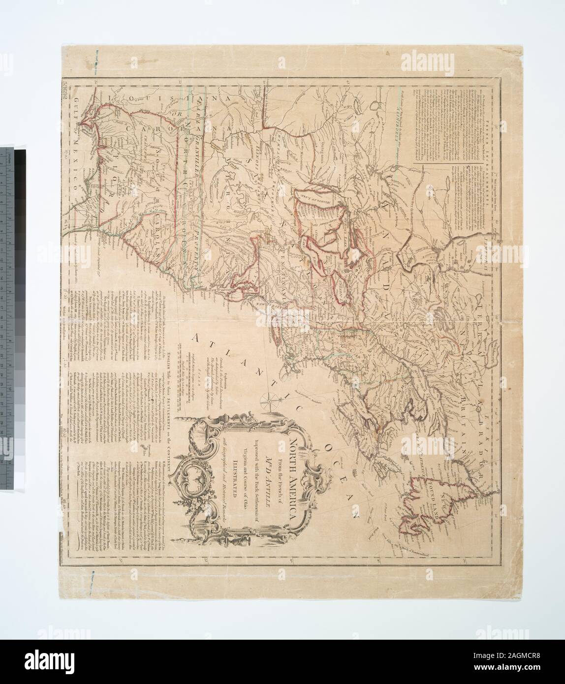 At end of table of contents of v. 1 is printed the direction Place the map to face the title of vol. I; the three maps described in the Introduction to v. 2, p. 20-21 (originals composed and lately printed in the several countries) are wanting in this copy and in all N.Y.P.L. copies of different editions of the Summary; the map of the dominions of New-Englnd, and that of New-York, the Jersies and Pensylvania, published 1749, by Mr. Evans in Pensylvania, are found separately in the map collection of the Library of Congress. The second volume ends at p. 416 (end of section XVI, Virginia); in a r Stock Photohttps://www.alamy.com/image-license-details/?v=1https://www.alamy.com/at-end-of-table-of-contents-of-v-1-is-printed-the-direction-place-the-map-to-face-the-title-of-vol-i-the-three-maps-described-in-the-introduction-to-v-2-p-20-21-originals-composed-and-lately-printed-in-the-several-countries-are-wanting-in-this-copy-and-in-all-nypl-copies-of-different-editions-of-the-summary-the-map-of-the-dominions-of-new-englnd-and-that-of-new-york-the-jersies-and-pensylvania-published-1749-by-mr-evans-in-pensylvania-are-found-separately-in-the-map-collection-of-the-library-of-congress-the-second-volume-ends-at-p-416-end-of-section-xvi-virginia-in-a-r-image337280588.html
RM2AGMCR8–At end of table of contents of v. 1 is printed the direction Place the map to face the title of vol. I; the three maps described in the Introduction to v. 2, p. 20-21 (originals composed and lately printed in the several countries) are wanting in this copy and in all N.Y.P.L. copies of different editions of the Summary; the map of the dominions of New-Englnd, and that of New-York, the Jersies and Pensylvania, published 1749, by Mr. Evans in Pensylvania, are found separately in the map collection of the Library of Congress. The second volume ends at p. 416 (end of section XVI, Virginia); in a r
 Evans, Kingston, AU, Australia, South Australia, S 36 33' 27'', N 140 20' 37'', map, Cartascapes Map published in 2024. Explore Cartascapes, a map revealing Earth's diverse landscapes, cultures, and ecosystems. Journey through time and space, discovering the interconnectedness of our planet's past, present, and future. Stock Photohttps://www.alamy.com/image-license-details/?v=1https://www.alamy.com/evans-kingston-au-australia-south-australia-s-36-33-27-n-140-20-37-map-cartascapes-map-published-in-2024-explore-cartascapes-a-map-revealing-earths-diverse-landscapes-cultures-and-ecosystems-journey-through-time-and-space-discovering-the-interconnectedness-of-our-planets-past-present-and-future-image625569022.html
RM2Y9N3JP–Evans, Kingston, AU, Australia, South Australia, S 36 33' 27'', N 140 20' 37'', map, Cartascapes Map published in 2024. Explore Cartascapes, a map revealing Earth's diverse landscapes, cultures, and ecosystems. Journey through time and space, discovering the interconnectedness of our planet's past, present, and future.
 The Head Quarters of the 1910 - 13 Scott Polar Expedition Stock Photohttps://www.alamy.com/image-license-details/?v=1https://www.alamy.com/the-head-quarters-of-the-1910-13-scott-polar-expedition-image501419141.html
RM2M3NH6D–The Head Quarters of the 1910 - 13 Scott Polar Expedition
 CRESSY AND THE VICINITY - Image taken from 'The Popular History Of England: An Illustrated History Of Society And Government From The Earliest Period To Our OwnTimes By Charles KNIGHT - London. Bradbury and Evans. 1856-1862 Stock Photohttps://www.alamy.com/image-license-details/?v=1https://www.alamy.com/cressy-and-the-vicinity-image-taken-from-the-popular-history-of-england-an-illustrated-history-of-society-and-government-from-the-earliest-period-to-our-owntimes-by-charles-knight-london-bradbury-and-evans-1856-1862-image593304723.html
RM2WD7A6B–CRESSY AND THE VICINITY - Image taken from 'The Popular History Of England: An Illustrated History Of Society And Government From The Earliest Period To Our OwnTimes By Charles KNIGHT - London. Bradbury and Evans. 1856-1862
 History of Spain. First Carlist War (1833-1840). Plan of the Battle of Oriamendi (15 and 16 March 1837). The Carlist troops, under the command of the Infante Sebastian (1811-1875), defeated the Liberal army, which had been joined by the British Auxiliary Legion. Engraving. 'Historia de la guerra civil y de los partidos liberal y carlista' (History of the Civil War and the Liberal and Carlist parties), by Antonio Pirala. Volume IV. Madrid, 1869. Stock Photohttps://www.alamy.com/image-license-details/?v=1https://www.alamy.com/history-of-spain-first-carlist-war-1833-1840-plan-of-the-battle-of-oriamendi-15-and-16-march-1837-the-carlist-troops-under-the-command-of-the-infante-sebastian-1811-1875-defeated-the-liberal-army-which-had-been-joined-by-the-british-auxiliary-legion-engraving-historia-de-la-guerra-civil-y-de-los-partidos-liberal-y-carlista-history-of-the-civil-war-and-the-liberal-and-carlist-parties-by-antonio-pirala-volume-iv-madrid-1869-image610168526.html
RM2XCKG52–History of Spain. First Carlist War (1833-1840). Plan of the Battle of Oriamendi (15 and 16 March 1837). The Carlist troops, under the command of the Infante Sebastian (1811-1875), defeated the Liberal army, which had been joined by the British Auxiliary Legion. Engraving. 'Historia de la guerra civil y de los partidos liberal y carlista' (History of the Civil War and the Liberal and Carlist parties), by Antonio Pirala. Volume IV. Madrid, 1869.
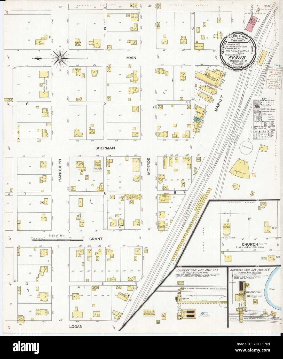 Sanborn Fire Insurance Map from Evans, Mahaska County, Iowa. Stock Photohttps://www.alamy.com/image-license-details/?v=1https://www.alamy.com/sanborn-fire-insurance-map-from-evans-mahaska-county-iowa-image456389745.html
RM2HEE9NN–Sanborn Fire Insurance Map from Evans, Mahaska County, Iowa.
 June 3, 2024, Bonn, Germany, Germany: EVANS NJEWA, Chair of the Least Developed Countries (LDC) listens during a press conference on the first day of the United Nations Climate Change Conference 2024 in Bonn. Nations come together to address continuing problems and new issues arising within the global map of Climate change, addressing each nation and region on their perspective and unique problems to collective issues. Climate finance is new on the agenda, in which numbers of grants are dwindling while loan borrowing is increasing debt for some nations at risk. (Credit Image: © Bianca Otero/ZU Stock Photohttps://www.alamy.com/image-license-details/?v=1https://www.alamy.com/june-3-2024-bonn-germany-germany-evans-njewa-chair-of-the-least-developed-countries-ldc-listens-during-a-press-conference-on-the-first-day-of-the-united-nations-climate-change-conference-2024-in-bonn-nations-come-together-to-address-continuing-problems-and-new-issues-arising-within-the-global-map-of-climate-change-addressing-each-nation-and-region-on-their-perspective-and-unique-problems-to-collective-issues-climate-finance-is-new-on-the-agenda-in-which-numbers-of-grants-are-dwindling-while-loan-borrowing-is-increasing-debt-for-some-nations-at-risk-credit-image-bianca-oterozu-image608465250.html
RM2X9WYHP–June 3, 2024, Bonn, Germany, Germany: EVANS NJEWA, Chair of the Least Developed Countries (LDC) listens during a press conference on the first day of the United Nations Climate Change Conference 2024 in Bonn. Nations come together to address continuing problems and new issues arising within the global map of Climate change, addressing each nation and region on their perspective and unique problems to collective issues. Climate finance is new on the agenda, in which numbers of grants are dwindling while loan borrowing is increasing debt for some nations at risk. (Credit Image: © Bianca Otero/ZU
 EVANS (1811) Stock Photohttps://www.alamy.com/image-license-details/?v=1https://www.alamy.com/stock-photo-evans-1811-74471456.html
RME94D2T–EVANS (1811)
 A general map of the middle British colonies in America: viz. Virginia, Maryland, Delaware, Pensilvania, New-Jersey, New-York, Connecticut and Rhode-Island : of Aquanishuonigy the country of the confederate Indians comprehending Aquanishuonigy proper, their places of residence, Ohio and Thuchsochruntie their deer hunting countries, Couchsachrage and Skaniadarade their beaver hunting countries, of the Lakes Erie, Ontario and Champlain, and of part of New-France : wherein is also shewn the antient and present seats of the Indian nations 1758 by Evans, Lewis, 1700?-1756 Stock Photohttps://www.alamy.com/image-license-details/?v=1https://www.alamy.com/a-general-map-of-the-middle-british-colonies-in-america-viz-virginia-maryland-delaware-pensilvania-new-jersey-new-york-connecticut-and-rhode-island-of-aquanishuonigy-the-country-of-the-confederate-indians-comprehending-aquanishuonigy-proper-their-places-of-residence-ohio-and-thuchsochruntie-their-deer-hunting-countries-couchsachrage-and-skaniadarade-their-beaver-hunting-countries-of-the-lakes-erie-ontario-and-champlain-and-of-part-of-new-france-wherein-is-also-shewn-the-antient-and-present-seats-of-the-indian-nations-1758-by-evans-lewis-1700-1756-image633122991.html
RM2YP16RB–A general map of the middle British colonies in America: viz. Virginia, Maryland, Delaware, Pensilvania, New-Jersey, New-York, Connecticut and Rhode-Island : of Aquanishuonigy the country of the confederate Indians comprehending Aquanishuonigy proper, their places of residence, Ohio and Thuchsochruntie their deer hunting countries, Couchsachrage and Skaniadarade their beaver hunting countries, of the Lakes Erie, Ontario and Champlain, and of part of New-France : wherein is also shewn the antient and present seats of the Indian nations 1758 by Evans, Lewis, 1700?-1756
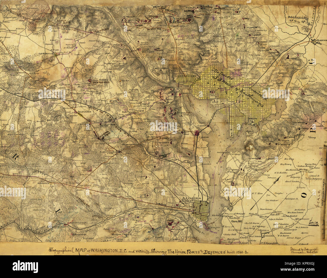 Second battle field at Bull Run. Stock Photohttps://www.alamy.com/image-license-details/?v=1https://www.alamy.com/stock-image-second-battle-field-at-bull-run-168941490.html
RMKPRXGJ–Second battle field at Bull Run.
 Walter Evans Stock Photohttps://www.alamy.com/image-license-details/?v=1https://www.alamy.com/stock-photo-walter-evans-140673890.html
RMJ4T6YE–Walter Evans
 UMEÅ 20240214Elfyn Evans (GBR) with map reader Scott Martin (GBR), Toyota Gazoo Racing WRT, Toyota GR Yaris Rally1 Hybrid, RC1 Rally1 during Thursday's Shake Down Håkmark Rally Sweden 2024 in Umeå Photo: Peo Möller/LocalEyes/TT code 11549 Credit: TT News Agency/Alamy Live News Stock Photohttps://www.alamy.com/image-license-details/?v=1https://www.alamy.com/ume-20240214elfyn-evans-gbr-with-map-reader-scott-martin-gbr-toyota-gazoo-racing-wrt-toyota-gr-yaris-rally1-hybrid-rc1-rally1-during-thursdays-shake-down-hkmark-rally-sweden-2024-in-ume-photo-peo-mllerlocaleyestt-code-11549-credit-tt-news-agencyalamy-live-news-image596557147.html
RM2WJFEMB–UMEÅ 20240214Elfyn Evans (GBR) with map reader Scott Martin (GBR), Toyota Gazoo Racing WRT, Toyota GR Yaris Rally1 Hybrid, RC1 Rally1 during Thursday's Shake Down Håkmark Rally Sweden 2024 in Umeå Photo: Peo Möller/LocalEyes/TT code 11549 Credit: TT News Agency/Alamy Live News
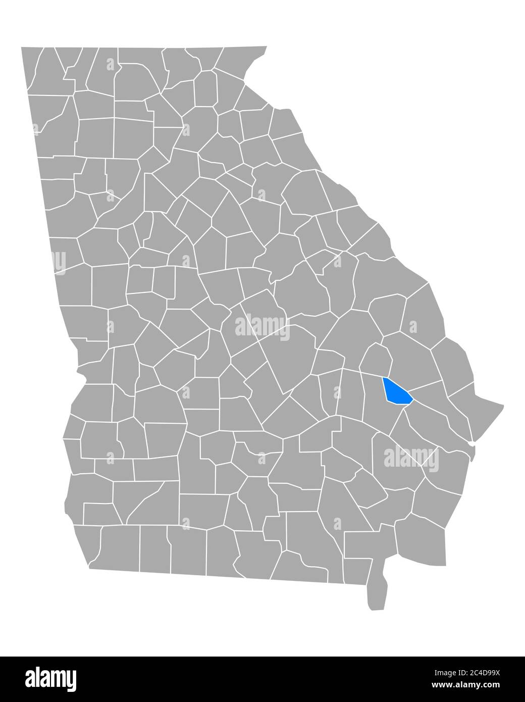 Map of Evans in Georgia Stock Photohttps://www.alamy.com/image-license-details/?v=1https://www.alamy.com/map-of-evans-in-georgia-image364169062.html
RF2C4D99X–Map of Evans in Georgia
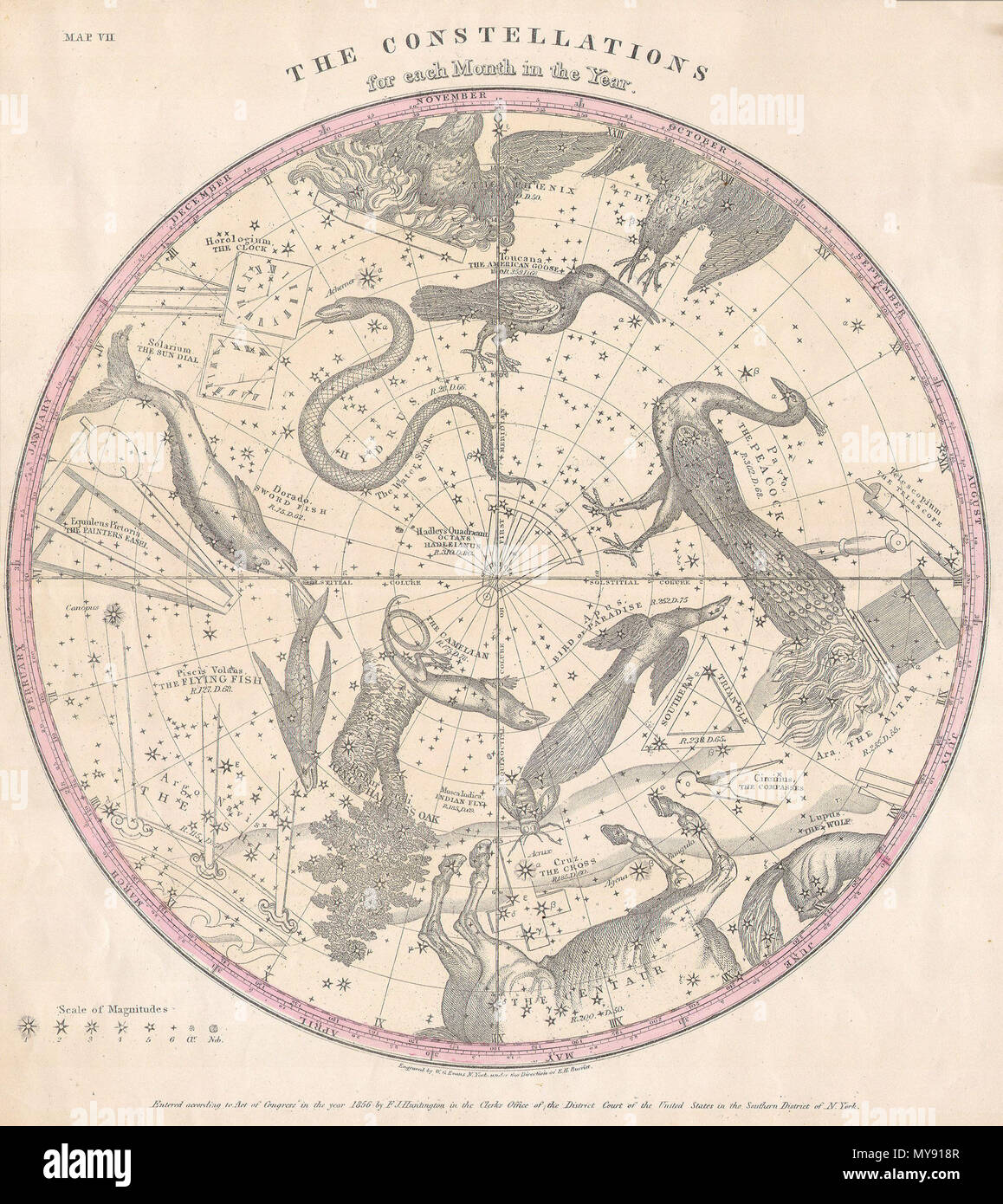 . The Constellations for Each Month in the Year. English: This rare hand colored map of the stars of the southern hemisphere was engraved W. G. Evans of New York for Burritt’s 1856 edition of the Atlas to Illustrate the Geography of the Heavens. It represents the night sky and constellations of the Southern Hemisphere. Constellations are drawn in detail and include depictions of the Zodiacal figures the stars are said to represent. Included on this chart are Hydra (the Snake), Dorado (the Sword Fish), Pavo (the Peacock) and the Centaur. Chart is quartered by lines indicating the Solstitial an Stock Photohttps://www.alamy.com/image-license-details/?v=1https://www.alamy.com/the-constellations-for-each-month-in-the-year-english-this-rare-hand-colored-map-of-the-stars-of-the-southern-hemisphere-was-engraved-w-g-evans-of-new-york-for-burritts-1856-edition-of-the-atlas-to-illustrate-the-geography-of-the-heavens-it-represents-the-night-sky-and-constellations-of-the-southern-hemisphere-constellations-are-drawn-in-detail-and-include-depictions-of-the-zodiacal-figures-the-stars-are-said-to-represent-included-on-this-chart-are-hydra-the-snake-dorado-the-sword-fish-pavo-the-peacock-and-the-centaur-chart-is-quartered-by-lines-indicating-the-solstitial-an-image188897991.html
RMMY918R–. The Constellations for Each Month in the Year. English: This rare hand colored map of the stars of the southern hemisphere was engraved W. G. Evans of New York for Burritt’s 1856 edition of the Atlas to Illustrate the Geography of the Heavens. It represents the night sky and constellations of the Southern Hemisphere. Constellations are drawn in detail and include depictions of the Zodiacal figures the stars are said to represent. Included on this chart are Hydra (the Snake), Dorado (the Sword Fish), Pavo (the Peacock) and the Centaur. Chart is quartered by lines indicating the Solstitial an
 Cartographic, Maps. 1913. Lionel Pincus and Princess Firyal Map Division. Bronx (New York, N.Y.), New York (N.Y.) Plate 41 Map bounded by Long Island Sound, East River, Calhoun Ave., Evans Ave. Stock Photohttps://www.alamy.com/image-license-details/?v=1https://www.alamy.com/cartographic-maps-1913-lionel-pincus-and-princess-firyal-map-division-bronx-new-york-ny-new-york-ny-plate-41-map-bounded-by-long-island-sound-east-river-calhoun-ave-evans-ave-image483563755.html
RM2K2M6E3–Cartographic, Maps. 1913. Lionel Pincus and Princess Firyal Map Division. Bronx (New York, N.Y.), New York (N.Y.) Plate 41 Map bounded by Long Island Sound, East River, Calhoun Ave., Evans Ave.
 Vol. 5. Plate, A. Map bound by U.S. Navy Yard, Concord St., Bridge St., East River, Including Little St., Navy St reimagined Stock Photohttps://www.alamy.com/image-license-details/?v=1https://www.alamy.com/vol-5-plate-a-map-bound-by-us-navy-yard-concord-st-bridge-st-east-river-including-little-st-navy-st-reimagined-image230183016.html
RFRADMP0–Vol. 5. Plate, A. Map bound by U.S. Navy Yard, Concord St., Bridge St., East River, Including Little St., Navy St reimagined
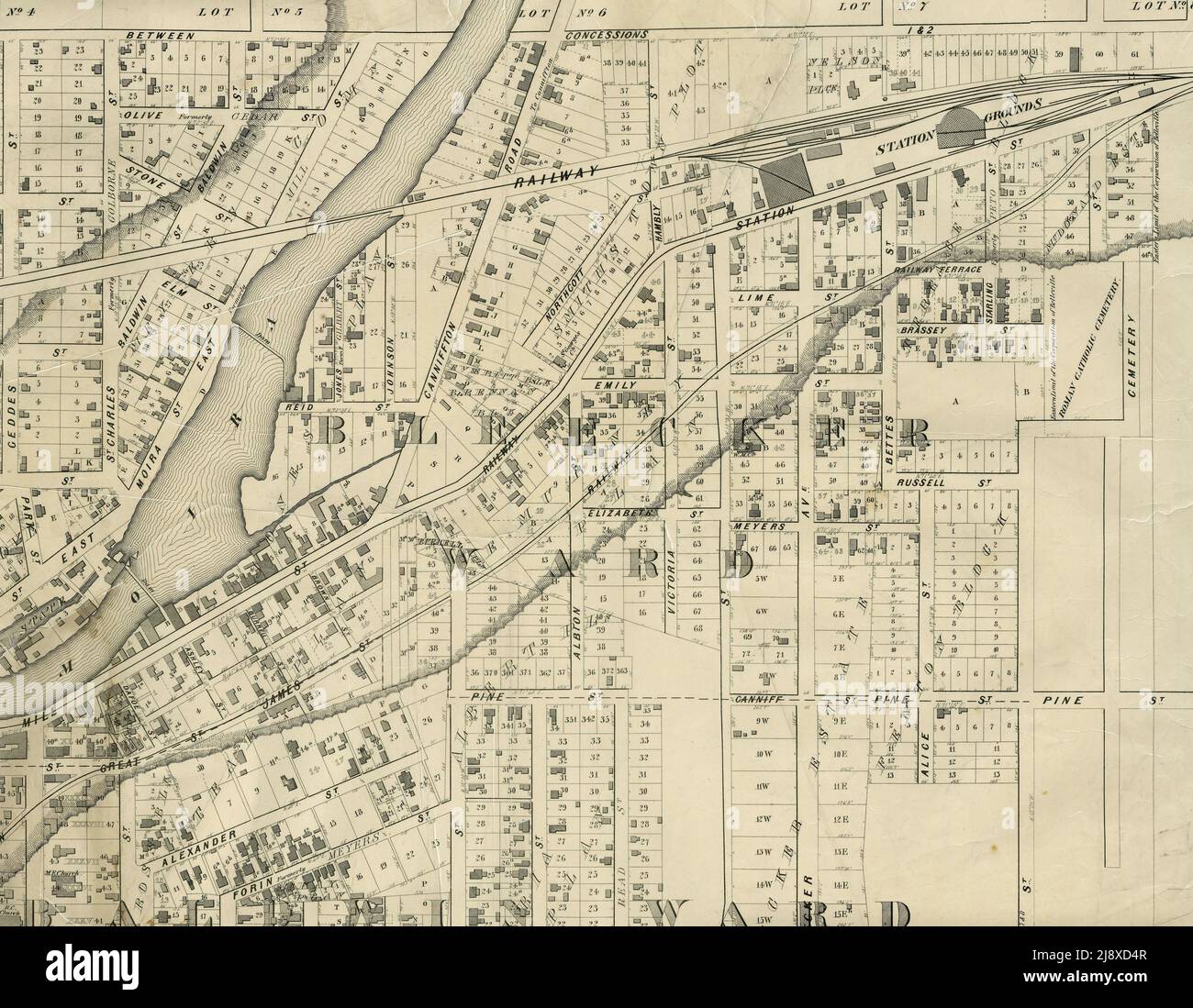 Part of the 1877 Map of the City of Belleville, Township of Thurlow, County of Hastings, Ontario, by Evans & Bolger, surveyors ca. 1877 Stock Photohttps://www.alamy.com/image-license-details/?v=1https://www.alamy.com/part-of-the-1877-map-of-the-city-of-belleville-township-of-thurlow-county-of-hastings-ontario-by-evans-bolger-surveyors-ca-1877-image470178263.html
RM2J8XD4R–Part of the 1877 Map of the City of Belleville, Township of Thurlow, County of Hastings, Ontario, by Evans & Bolger, surveyors ca. 1877
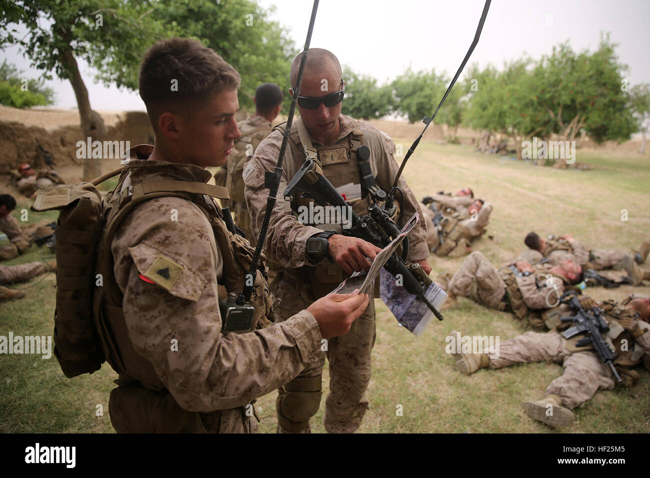 Corporal Dale Sherrill Jr., left, squad leader, Bravo Company, 1st Battalion, 7th Marine Regiment, and 2nd Lt. Zachary Geelan, a platoon commander with the company, review a map before conducting a patrol during a mission in Helmand province, Afghanistan, May 15, 2014. The company operated in Larr Village for two days to establish a presence and to disrupt enemy fighters. Throughout the mission the infantrymen conducted several patrols within the village and discovered hazardous materials which could be used to create improvised explosive devices. 1-7 continues to disrupt Taliban insurgents in Stock Photohttps://www.alamy.com/image-license-details/?v=1https://www.alamy.com/stock-photo-corporal-dale-sherrill-jr-left-squad-leader-bravo-company-1st-battalion-129740805.html
RMHF25M5–Corporal Dale Sherrill Jr., left, squad leader, Bravo Company, 1st Battalion, 7th Marine Regiment, and 2nd Lt. Zachary Geelan, a platoon commander with the company, review a map before conducting a patrol during a mission in Helmand province, Afghanistan, May 15, 2014. The company operated in Larr Village for two days to establish a presence and to disrupt enemy fighters. Throughout the mission the infantrymen conducted several patrols within the village and discovered hazardous materials which could be used to create improvised explosive devices. 1-7 continues to disrupt Taliban insurgents in
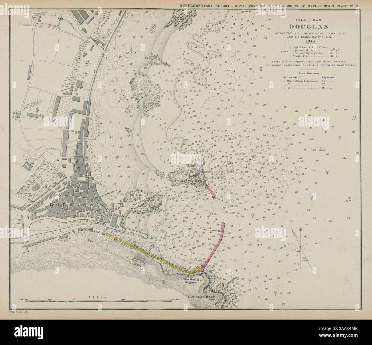 Douglas Bay. Williams & Evans survey. Proposed breakwater. Isle of Man 1859 map Stock Photohttps://www.alamy.com/image-license-details/?v=1https://www.alamy.com/douglas-bay-williams-evans-survey-proposed-breakwater-isle-of-man-1859-map-image333564355.html
RF2AAK4MK–Douglas Bay. Williams & Evans survey. Proposed breakwater. Isle of Man 1859 map
 Guide to Charleston, SC.; with brief history of the city and a map thereof . Can find Sectional Book Casesand Desks, Fountain Pens, Cor-respondence Paper, and anythingworth while in the Stationeryline at No* 5 Broad Street,Walker, Evans & Cogswell Co* Page 130 ThompsonTransfer Company AUTOMOBILESFOR HIRE WHITE CHAUFFEURS - 8-CYLINDER CADILLACS Stock Photohttps://www.alamy.com/image-license-details/?v=1https://www.alamy.com/guide-to-charleston-sc-with-brief-history-of-the-city-and-a-map-thereof-can-find-sectional-book-casesand-desks-fountain-pens-cor-respondence-paper-and-anythingworth-while-in-the-stationeryline-at-no-5-broad-streetwalker-evans-cogswell-co-page-130-thompsontransfer-company-automobilesfor-hire-white-chauffeurs-8-cylinder-cadillacs-image342771296.html
RM2AWJG80–Guide to Charleston, SC.; with brief history of the city and a map thereof . Can find Sectional Book Casesand Desks, Fountain Pens, Cor-respondence Paper, and anythingworth while in the Stationeryline at No* 5 Broad Street,Walker, Evans & Cogswell Co* Page 130 ThompsonTransfer Company AUTOMOBILESFOR HIRE WHITE CHAUFFEURS - 8-CYLINDER CADILLACS
 Evans Outstation, , AU, Australia, South Australia, S 30 39' 30'', N 138 49' 21'', map, Cartascapes Map published in 2024. Explore Cartascapes, a map revealing Earth's diverse landscapes, cultures, and ecosystems. Journey through time and space, discovering the interconnectedness of our planet's past, present, and future. Stock Photohttps://www.alamy.com/image-license-details/?v=1https://www.alamy.com/evans-outstation-au-australia-south-australia-s-30-39-30-n-138-49-21-map-cartascapes-map-published-in-2024-explore-cartascapes-a-map-revealing-earths-diverse-landscapes-cultures-and-ecosystems-journey-through-time-and-space-discovering-the-interconnectedness-of-our-planets-past-present-and-future-image625579626.html
RM2Y9NH5E–Evans Outstation, , AU, Australia, South Australia, S 30 39' 30'', N 138 49' 21'', map, Cartascapes Map published in 2024. Explore Cartascapes, a map revealing Earth's diverse landscapes, cultures, and ecosystems. Journey through time and space, discovering the interconnectedness of our planet's past, present, and future.
