Quick filters:
India war map Stock Photos and Images
 Four bullets on the geographical map of India. Conceptual image for war, conflict, violence. Stock Photohttps://www.alamy.com/image-license-details/?v=1https://www.alamy.com/stock-photo-four-bullets-on-the-geographical-map-of-india-conceptual-image-for-84281315.html
RFEW39JY–Four bullets on the geographical map of India. Conceptual image for war, conflict, violence.
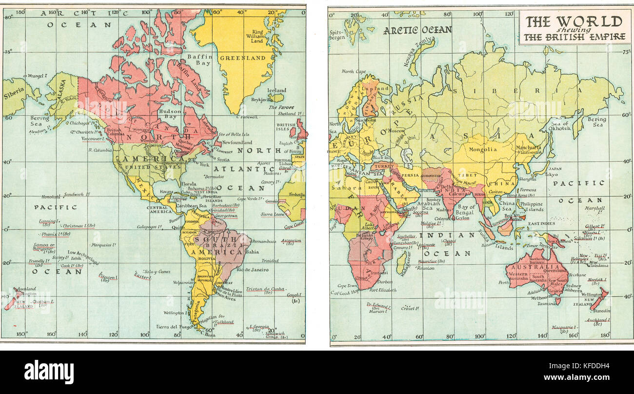 Pre World War 2 Map of the British Empire in 1935 Stock Photohttps://www.alamy.com/image-license-details/?v=1https://www.alamy.com/stock-image-pre-world-war-2-map-of-the-british-empire-in-1935-164409200.html
RMKFDDH4–Pre World War 2 Map of the British Empire in 1935
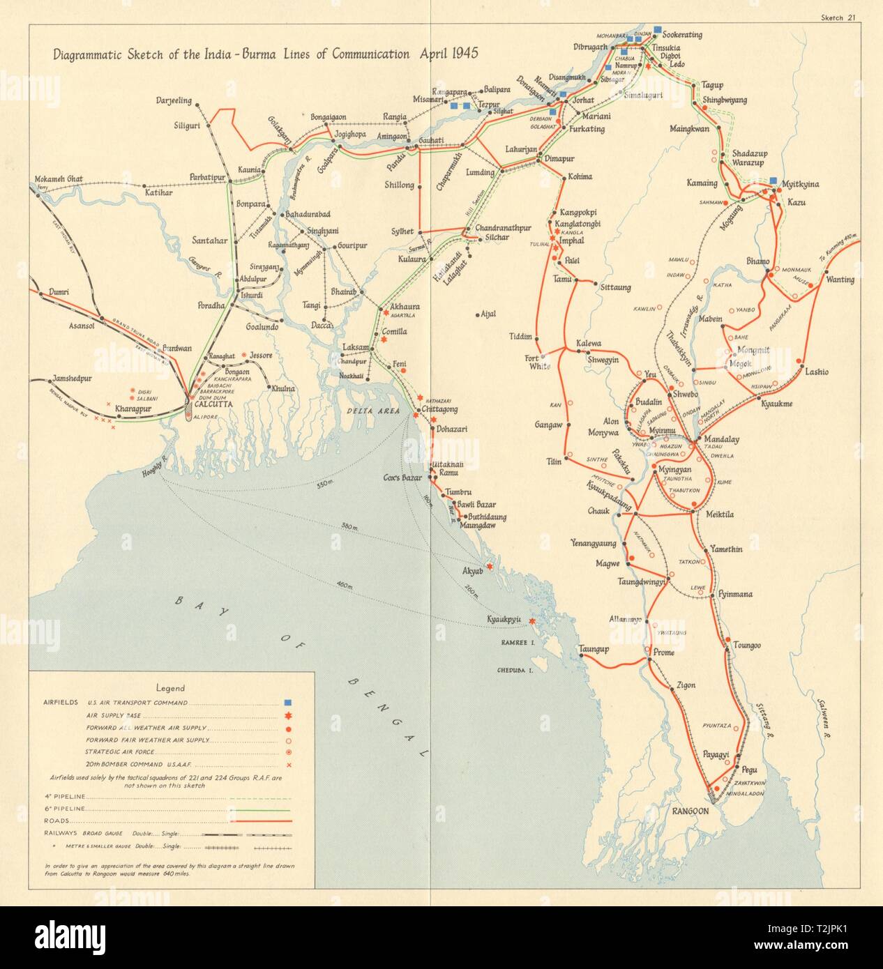 Burma Campaign World War 2. April 1945. NE India-Burma supply lines 1965 map Stock Photohttps://www.alamy.com/image-license-details/?v=1https://www.alamy.com/burma-campaign-world-war-2-april-1945-ne-india-burma-supply-lines-1965-map-image242587381.html
RFT2JPK1–Burma Campaign World War 2. April 1945. NE India-Burma supply lines 1965 map
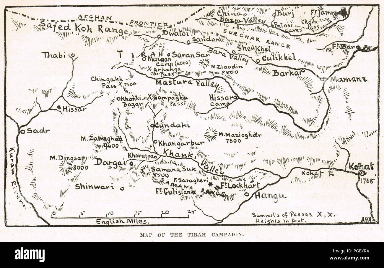 Map of the Tirah Campaign, also known as the Tirah Expedition, an Indian frontier war in 1897–1898 Stock Photohttps://www.alamy.com/image-license-details/?v=1https://www.alamy.com/map-of-the-tirah-campaign-also-known-as-the-tirah-expedition-an-indian-frontier-war-in-18971898-image216622206.html
RMPGBYRA–Map of the Tirah Campaign, also known as the Tirah Expedition, an Indian frontier war in 1897–1898
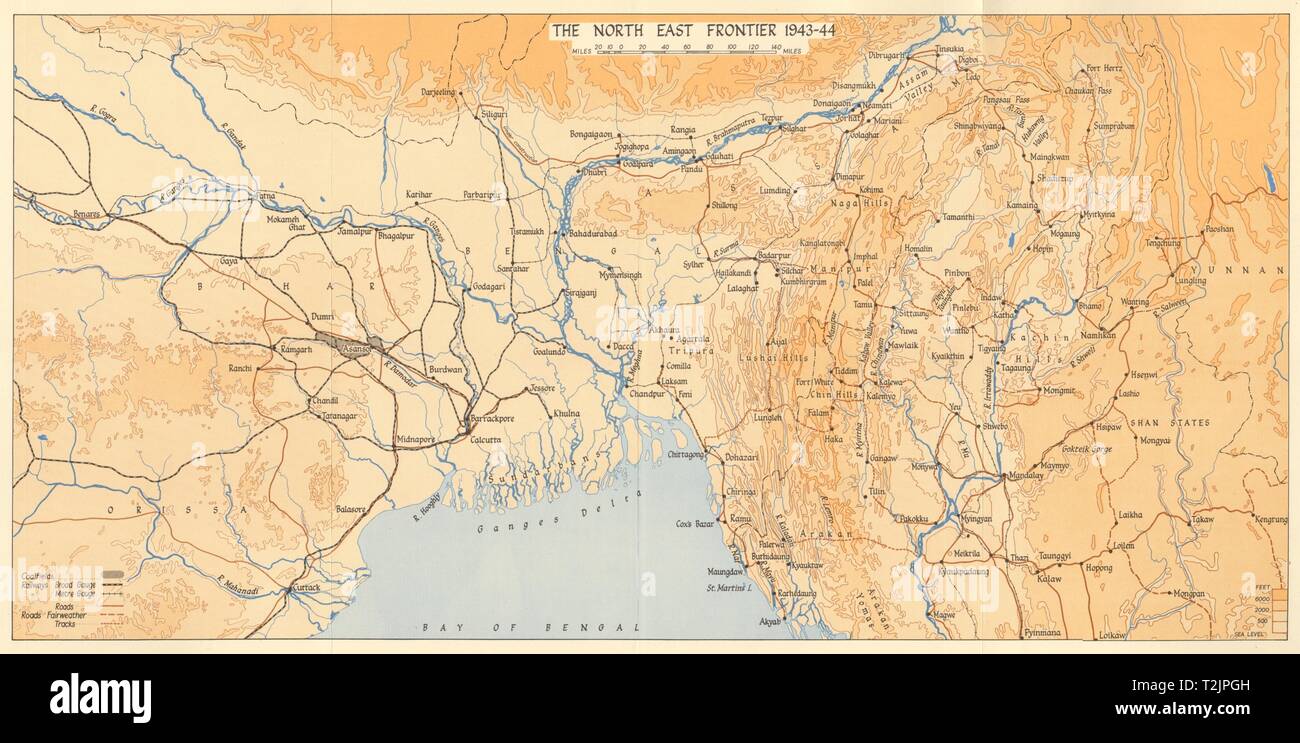 World War 2. Burma Campaign. India North East Frontier 1943-44 1961 old map Stock Photohttps://www.alamy.com/image-license-details/?v=1https://www.alamy.com/world-war-2-burma-campaign-india-north-east-frontier-1943-44-1961-old-map-image242587313.html
RFT2JPGH–World War 2. Burma Campaign. India North East Frontier 1943-44 1961 old map
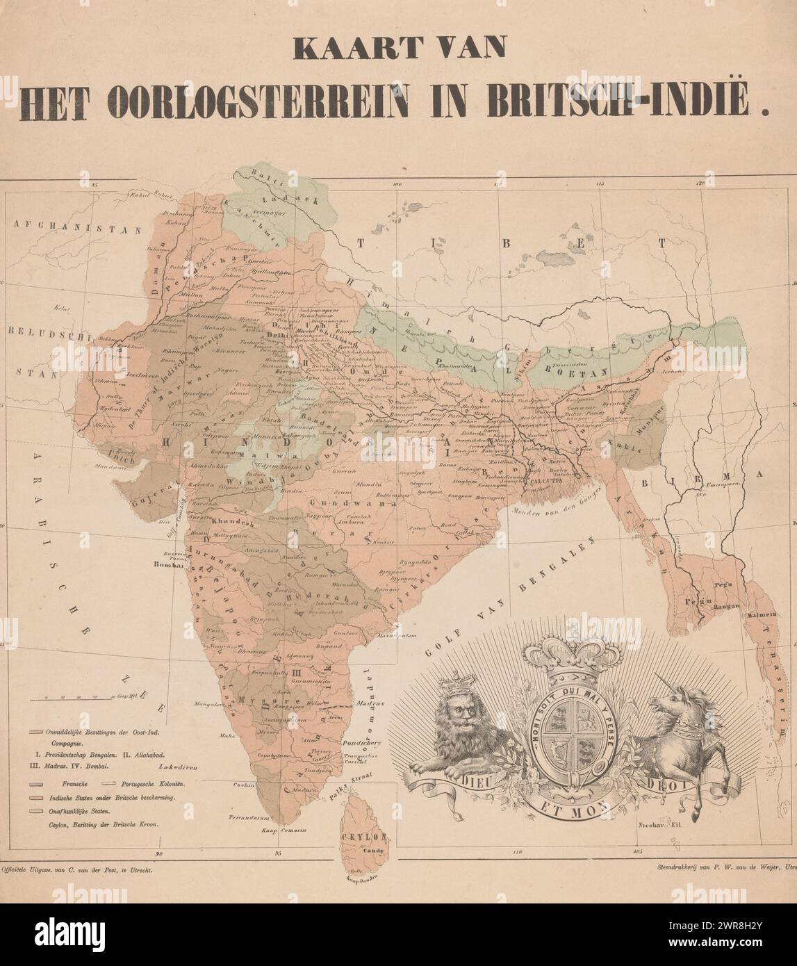 Map of European colonial possessions in India, Map of the war zone in British India (title on object), The coat of arms of the United Kingdom at the bottom of the image., print maker: anonymous, printer: Pieter Wilhelmus van de Weijer, publisher: C. van der Post (II), Utrecht, 1830 - 1879, paper, height 478 mm × width 442 mm, print Stock Photohttps://www.alamy.com/image-license-details/?v=1https://www.alamy.com/map-of-european-colonial-possessions-in-india-map-of-the-war-zone-in-british-india-title-on-object-the-coat-of-arms-of-the-united-kingdom-at-the-bottom-of-the-image-print-maker-anonymous-printer-pieter-wilhelmus-van-de-weijer-publisher-c-van-der-post-ii-utrecht-1830-1879-paper-height-478-mm-width-442-mm-print-image599478627.html
RM2WR8H2Y–Map of European colonial possessions in India, Map of the war zone in British India (title on object), The coat of arms of the United Kingdom at the bottom of the image., print maker: anonymous, printer: Pieter Wilhelmus van de Weijer, publisher: C. van der Post (II), Utrecht, 1830 - 1879, paper, height 478 mm × width 442 mm, print
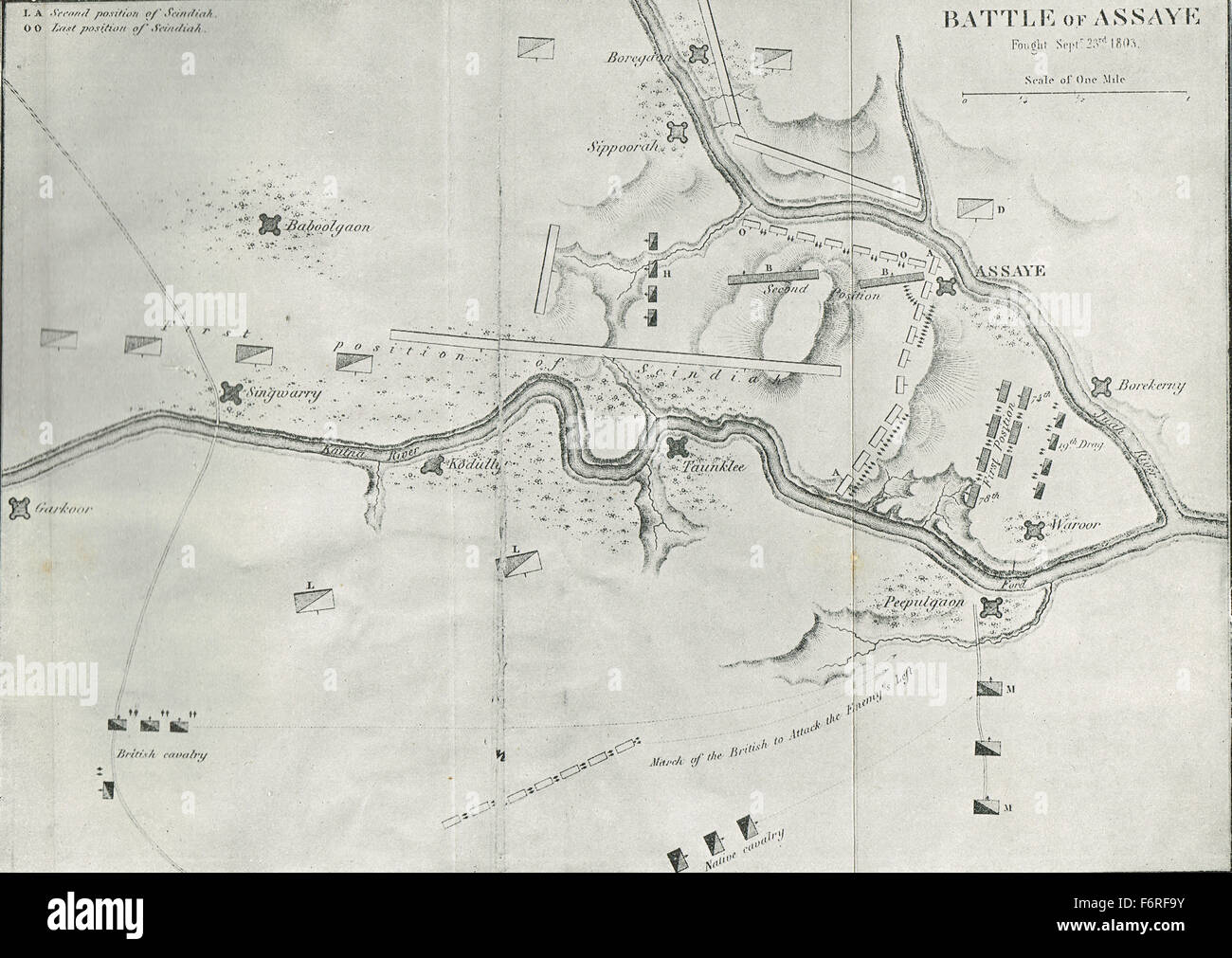 Sketch map Battle of Assaye India 1803 Stock Photohttps://www.alamy.com/image-license-details/?v=1https://www.alamy.com/stock-photo-sketch-map-battle-of-assaye-india-1803-90256711.html
RMF6RF9Y–Sketch map Battle of Assaye India 1803
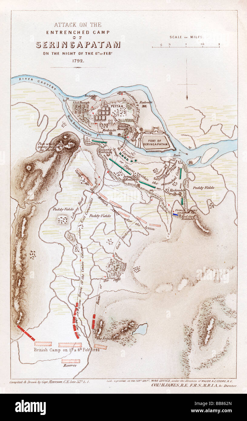 Battle of Seringapatan 1792 map of the siege that ended the Third Mysore War of the British against Tipu Sultan Stock Photohttps://www.alamy.com/image-license-details/?v=1https://www.alamy.com/stock-photo-battle-of-seringapatan-1792-map-of-the-siege-that-ended-the-third-24151981.html
RMBB862N–Battle of Seringapatan 1792 map of the siege that ended the Third Mysore War of the British against Tipu Sultan
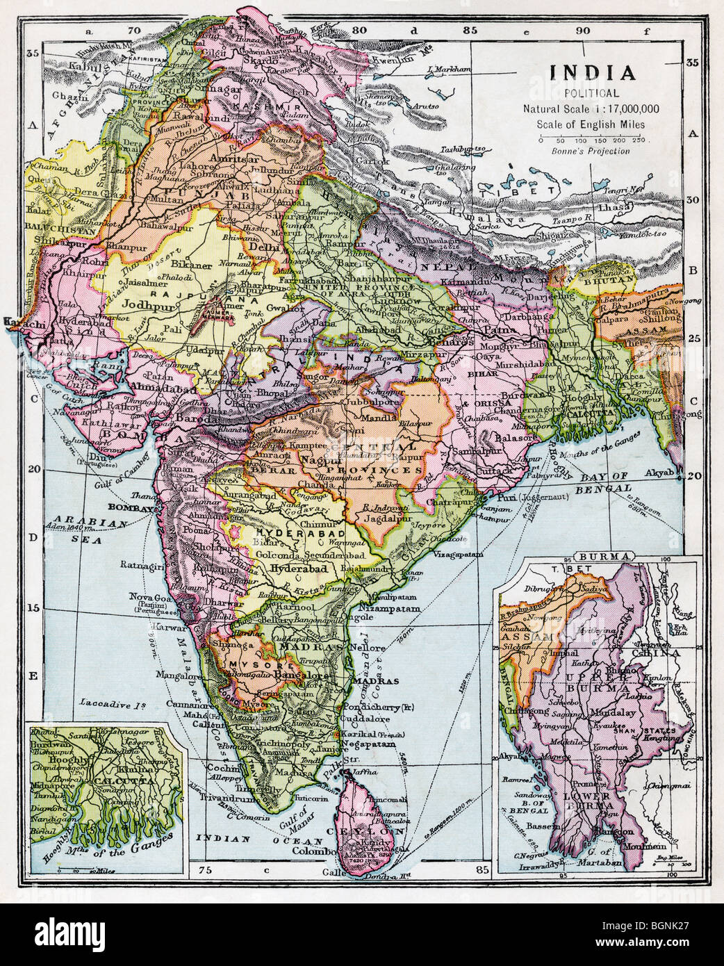 India circa 1930. Before partition. Stock Photohttps://www.alamy.com/image-license-details/?v=1https://www.alamy.com/stock-photo-india-circa-1930-before-partition-27520815.html
RMBGNK27–India circa 1930. Before partition.
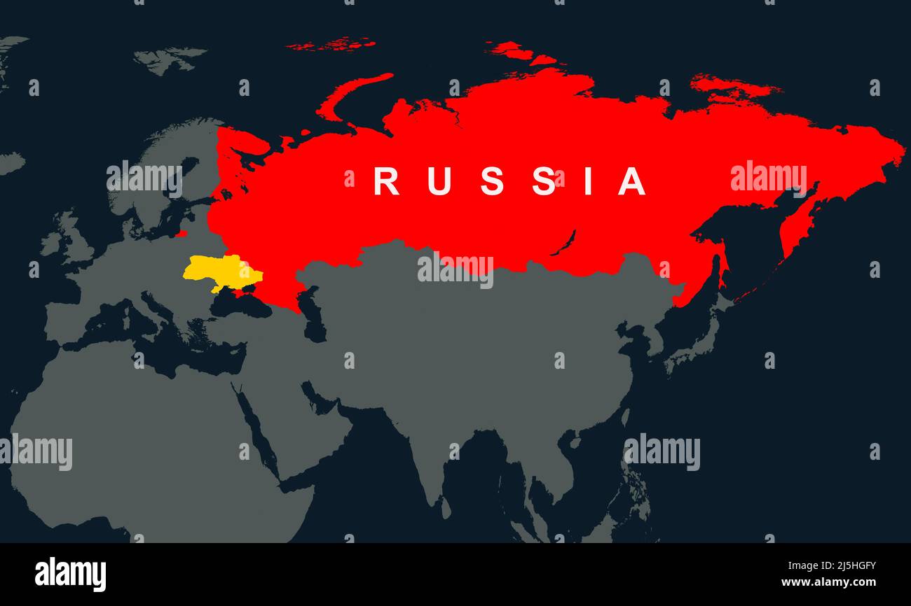 Russia, Ukraine and Europe on World map, territory of Russia in Eurasia on dark outline map. Concept of Russian-Ukrainian war, geographic and politica Stock Photohttps://www.alamy.com/image-license-details/?v=1https://www.alamy.com/russia-ukraine-and-europe-on-world-map-territory-of-russia-in-eurasia-on-dark-outline-map-concept-of-russian-ukrainian-war-geographic-and-politica-image468139391.html
RF2J5HGFY–Russia, Ukraine and Europe on World map, territory of Russia in Eurasia on dark outline map. Concept of Russian-Ukrainian war, geographic and politica
 A World War II map showing Iran and neighbouring countries - Eine Karte aus dem Zweiten Weltkrieg, die den Iran und seine Nachbarländer zeigt - Карта Второй мировой войны, на которой изображены Иран и соседние страны. - Stock Photohttps://www.alamy.com/image-license-details/?v=1https://www.alamy.com/a-world-war-ii-map-showing-iran-and-neighbouring-countries-eine-karte-aus-dem-zweiten-weltkrieg-die-den-iran-und-seine-nachbarlnder-zeigt-image623884961.html
RM2Y70BHN–A World War II map showing Iran and neighbouring countries - Eine Karte aus dem Zweiten Weltkrieg, die den Iran und seine Nachbarländer zeigt - Карта Второй мировой войны, на которой изображены Иран и соседние страны. -
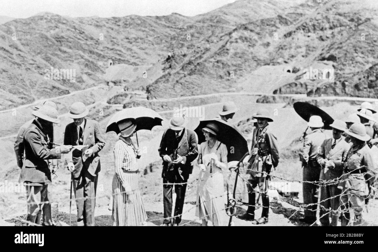 The viceroy of India, Lord Wellington, studying a map in front of the Khyber Pass. The hinterland of the border crossing in the northwest of India could never really be pacified by the English. Here applied the authority of the respective tribal leaders. Today the pass separates Pakistan from Afghanistan. Stock Photohttps://www.alamy.com/image-license-details/?v=1https://www.alamy.com/the-viceroy-of-india-lord-wellington-studying-a-map-in-front-of-the-khyber-pass-the-hinterland-of-the-border-crossing-in-the-northwest-of-india-could-never-really-be-pacified-by-the-english-here-applied-the-authority-of-the-respective-tribal-leaders-today-the-pass-separates-pakistan-from-afghanistan-image345684751.html
RM2B2B8BY–The viceroy of India, Lord Wellington, studying a map in front of the Khyber Pass. The hinterland of the border crossing in the northwest of India could never really be pacified by the English. Here applied the authority of the respective tribal leaders. Today the pass separates Pakistan from Afghanistan.
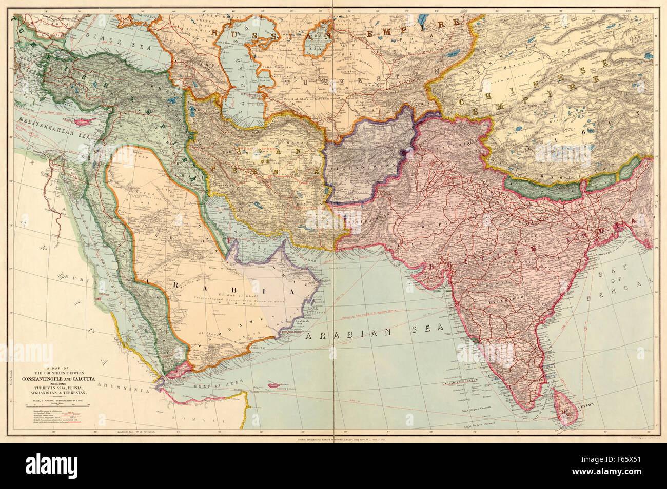 The Countries Between Constantinople and Calcutta including Turkey in Asia, Persia, Afghanistan and Turkestan. Middle East and Indian subcontinent. Pre World War One map. Dated 1912. Stock Photohttps://www.alamy.com/image-license-details/?v=1https://www.alamy.com/stock-photo-the-countries-between-constantinople-and-calcutta-including-turkey-89870061.html
RMF65X51–The Countries Between Constantinople and Calcutta including Turkey in Asia, Persia, Afghanistan and Turkestan. Middle East and Indian subcontinent. Pre World War One map. Dated 1912.
 Malaysia: 'British Territory of Malacca', from 'An Atlas of the Southern Part of India'. Map of Mount Ophir, Melaka (Malacca), British Straits Settlements, 1854. The Straits Settlements were a group of British territories located in Southeast Asia. Originally established in 1826 as part of the territories controlled by the British East India Company, the Straits Settlements came under direct British control as a crown colony on 1 April 1867. The colony was dissolved in 1946 as part of the British reorganisation of its South-East Asian dependencies following the end of the Second World War. Stock Photohttps://www.alamy.com/image-license-details/?v=1https://www.alamy.com/malaysia-british-territory-of-malacca-from-an-atlas-of-the-southern-part-of-india-map-of-mount-ophir-melaka-malacca-british-straits-settlements-1854-the-straits-settlements-were-a-group-of-british-territories-located-in-southeast-asia-originally-established-in-1826-as-part-of-the-territories-controlled-by-the-british-east-india-company-the-straits-settlements-came-under-direct-british-control-as-a-crown-colony-on-1-april-1867-the-colony-was-dissolved-in-1946-as-part-of-the-british-reorganisation-of-its-south-east-asian-dependencies-following-the-end-of-the-second-world-war-image344250287.html
RM2B01XN3–Malaysia: 'British Territory of Malacca', from 'An Atlas of the Southern Part of India'. Map of Mount Ophir, Melaka (Malacca), British Straits Settlements, 1854. The Straits Settlements were a group of British territories located in Southeast Asia. Originally established in 1826 as part of the territories controlled by the British East India Company, the Straits Settlements came under direct British control as a crown colony on 1 April 1867. The colony was dissolved in 1946 as part of the British reorganisation of its South-East Asian dependencies following the end of the Second World War.
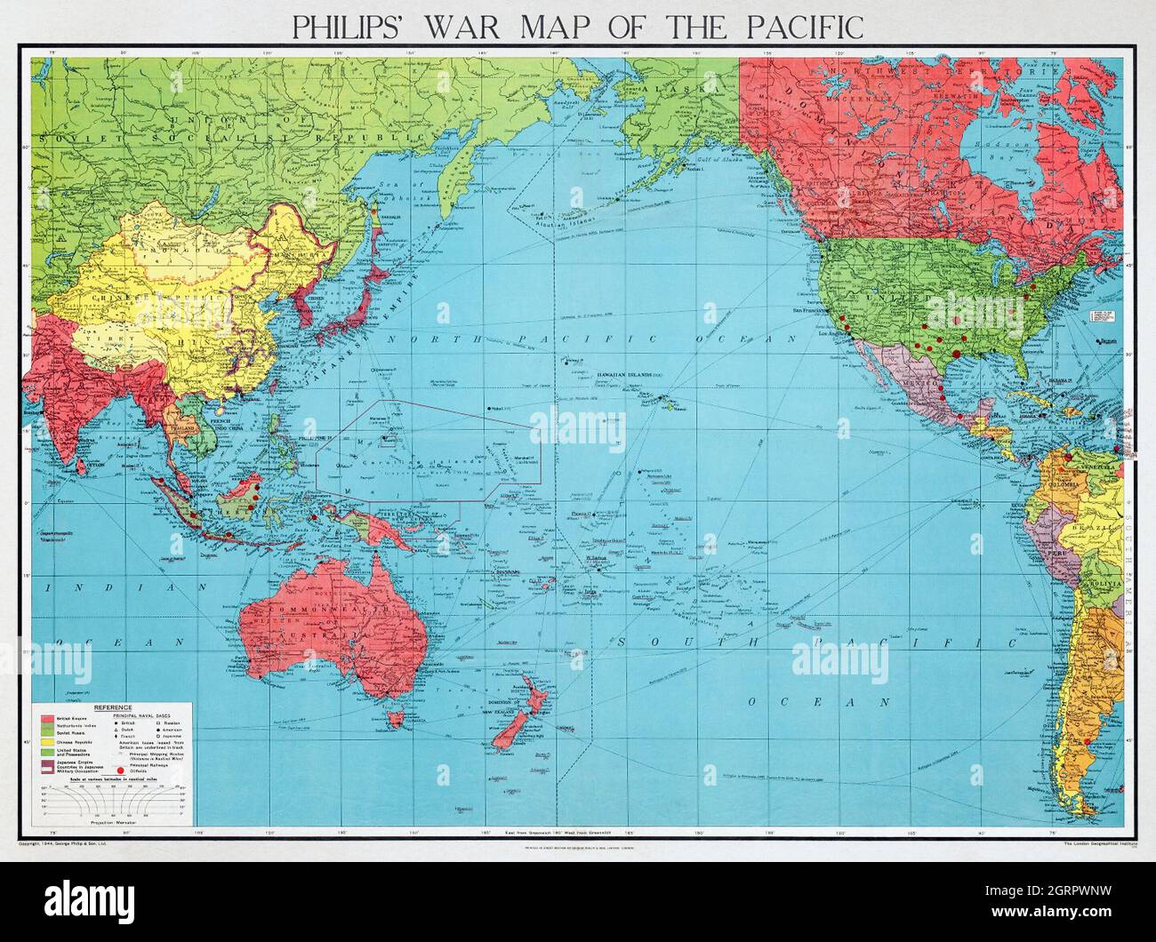 Philips' war map of the Pacific (1945) by George Philip and Son Limited. Stock Photohttps://www.alamy.com/image-license-details/?v=1https://www.alamy.com/philips-war-map-of-the-pacific-1945-by-george-philip-and-son-limited-image444899445.html
RM2GRPWNW–Philips' war map of the Pacific (1945) by George Philip and Son Limited.
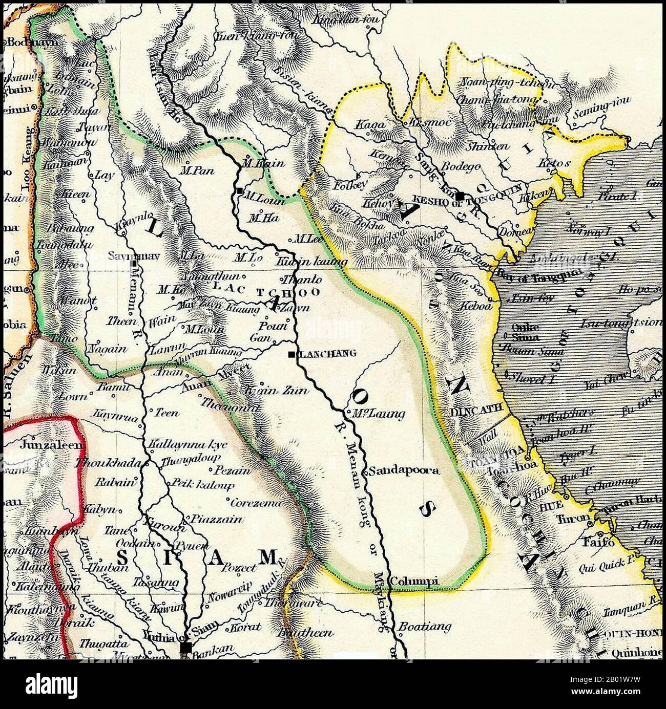 Thailand/Laos: Detail of a map of Siam, Laos and Tonkin, c. 1825. 'Laos' includes both the Lan Na Kingdom, with its capital at 'Saymamay' (Chiang Mai), and Laos, with its capital at 'Lanchang' (Vientiane). Detail of a British map dating from the early 19th century. Burma's Tenasserim Province (pink) is marked as being British and was seized by Britain after the First Anglo-Burmese War (1824-1826). The geography is very imperfect, the first British surveying teams into 'Laos Land' not being dispatched until the missions of McLeod and Richardson (1836-1837). Stock Photohttps://www.alamy.com/image-license-details/?v=1https://www.alamy.com/thailandlaos-detail-of-a-map-of-siam-laos-and-tonkin-c-1825-laos-includes-both-the-lan-na-kingdom-with-its-capital-at-saymamay-chiang-mai-and-laos-with-its-capital-at-lanchang-vientiane-detail-of-a-british-map-dating-from-the-early-19th-century-burmas-tenasserim-province-pink-is-marked-as-being-british-and-was-seized-by-britain-after-the-first-anglo-burmese-war-1824-1826-the-geography-is-very-imperfect-the-first-british-surveying-teams-into-laos-land-not-being-dispatched-until-the-missions-of-mcleod-and-richardson-1836-1837-image344249133.html
RM2B01W7W–Thailand/Laos: Detail of a map of Siam, Laos and Tonkin, c. 1825. 'Laos' includes both the Lan Na Kingdom, with its capital at 'Saymamay' (Chiang Mai), and Laos, with its capital at 'Lanchang' (Vientiane). Detail of a British map dating from the early 19th century. Burma's Tenasserim Province (pink) is marked as being British and was seized by Britain after the First Anglo-Burmese War (1824-1826). The geography is very imperfect, the first British surveying teams into 'Laos Land' not being dispatched until the missions of McLeod and Richardson (1836-1837).
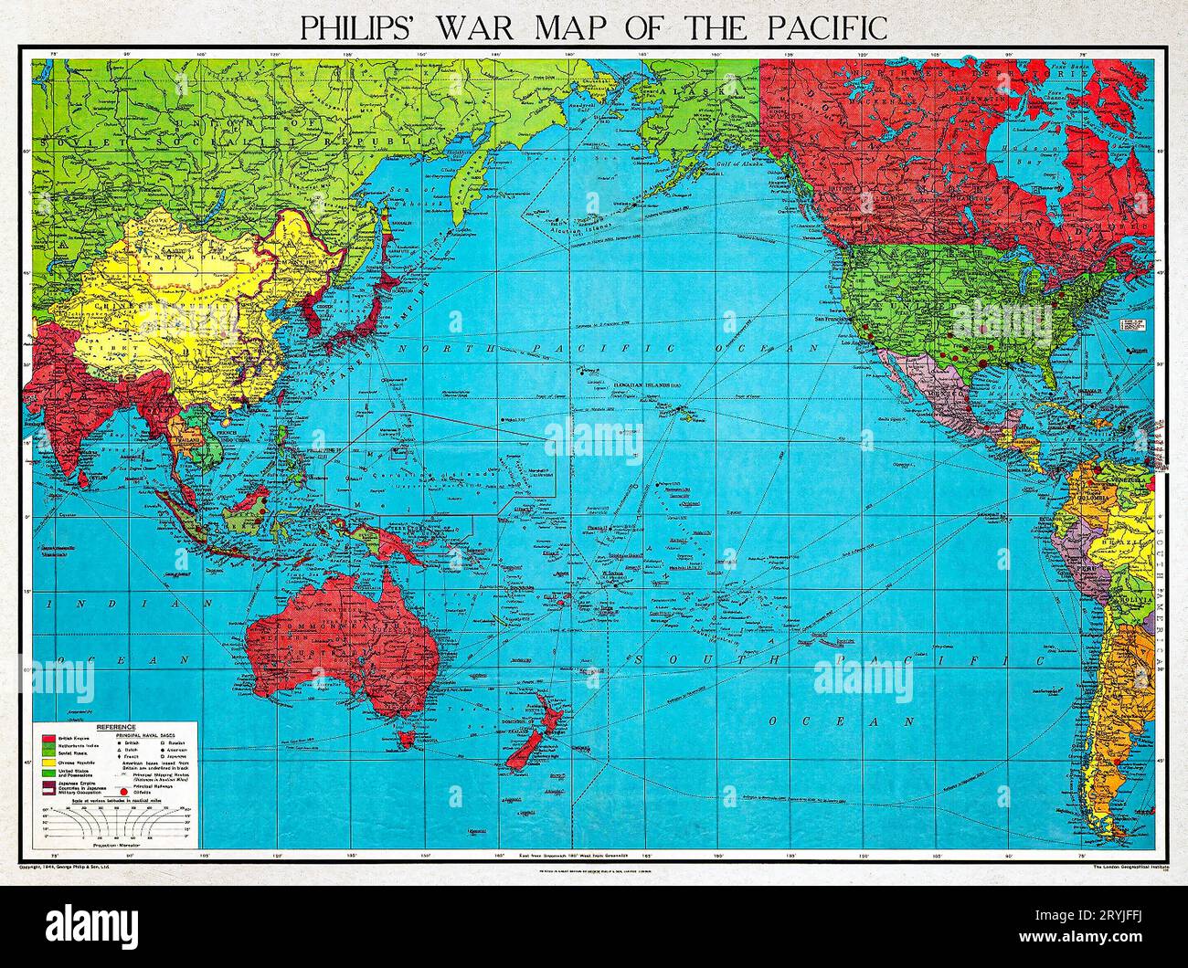 Philips' war map of the Pacific (1945) by George Philip and Son Limited. Stock Photohttps://www.alamy.com/image-license-details/?v=1https://www.alamy.com/philips-war-map-of-the-pacific-1945-by-george-philip-and-son-limited-image567734822.html
RM2RYJFFJ–Philips' war map of the Pacific (1945) by George Philip and Son Limited.
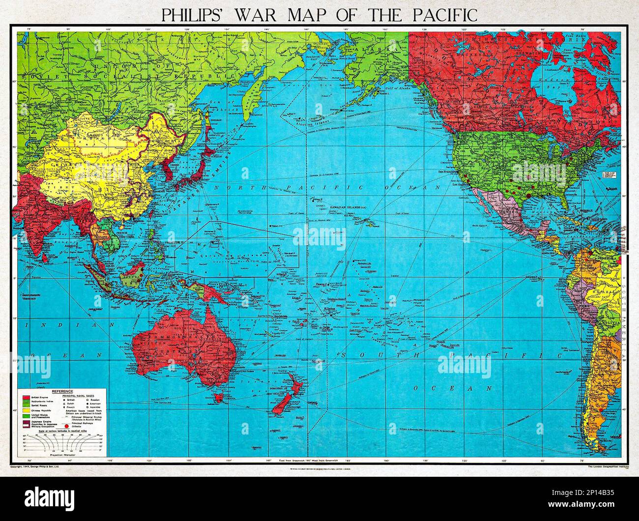 Philips' war map of the Pacific (1945) by George Philip and Son Limited. Original from The Beinecke Rare Book & Manuscript Library. Digitally enhanced Stock Photohttps://www.alamy.com/image-license-details/?v=1https://www.alamy.com/philips-war-map-of-the-pacific-1945-by-george-philip-and-son-limited-original-from-the-beinecke-rare-book-manuscript-library-digitally-enhanced-image534232585.html
RF2P14B35–Philips' war map of the Pacific (1945) by George Philip and Son Limited. Original from The Beinecke Rare Book & Manuscript Library. Digitally enhanced
 a finger of Woman point the city Calcutta, India, Asia on a world map, to choice a destination Stock Photohttps://www.alamy.com/image-license-details/?v=1https://www.alamy.com/stock-photo-a-finger-of-woman-point-the-city-calcutta-india-asia-on-a-world-map-52911532.html
RMD2295G–a finger of Woman point the city Calcutta, India, Asia on a world map, to choice a destination
 Four bullets on the geographical map of India. Conceptual image for war, conflict, violence. Stock Photohttps://www.alamy.com/image-license-details/?v=1https://www.alamy.com/stock-photo-four-bullets-on-the-geographical-map-of-india-conceptual-image-for-84281323.html
RFEW39K7–Four bullets on the geographical map of India. Conceptual image for war, conflict, violence.
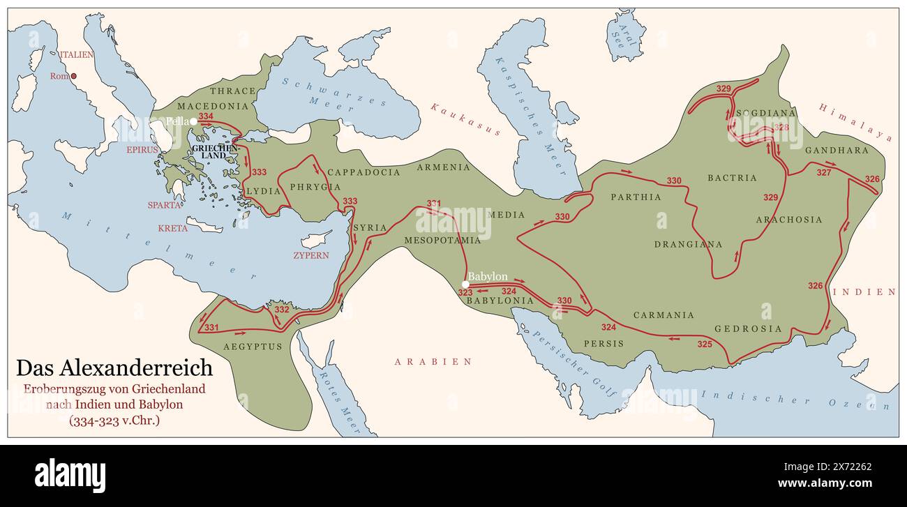 The Empire of Alexander the Great on his conquest course from Greece to India to Babylon 334 to 323 BC. German labeled history map. Stock Photohttps://www.alamy.com/image-license-details/?v=1https://www.alamy.com/the-empire-of-alexander-the-great-on-his-conquest-course-from-greece-to-india-to-babylon-334-to-323-bc-german-labeled-history-map-image606711114.html
RF2X72262–The Empire of Alexander the Great on his conquest course from Greece to India to Babylon 334 to 323 BC. German labeled history map.
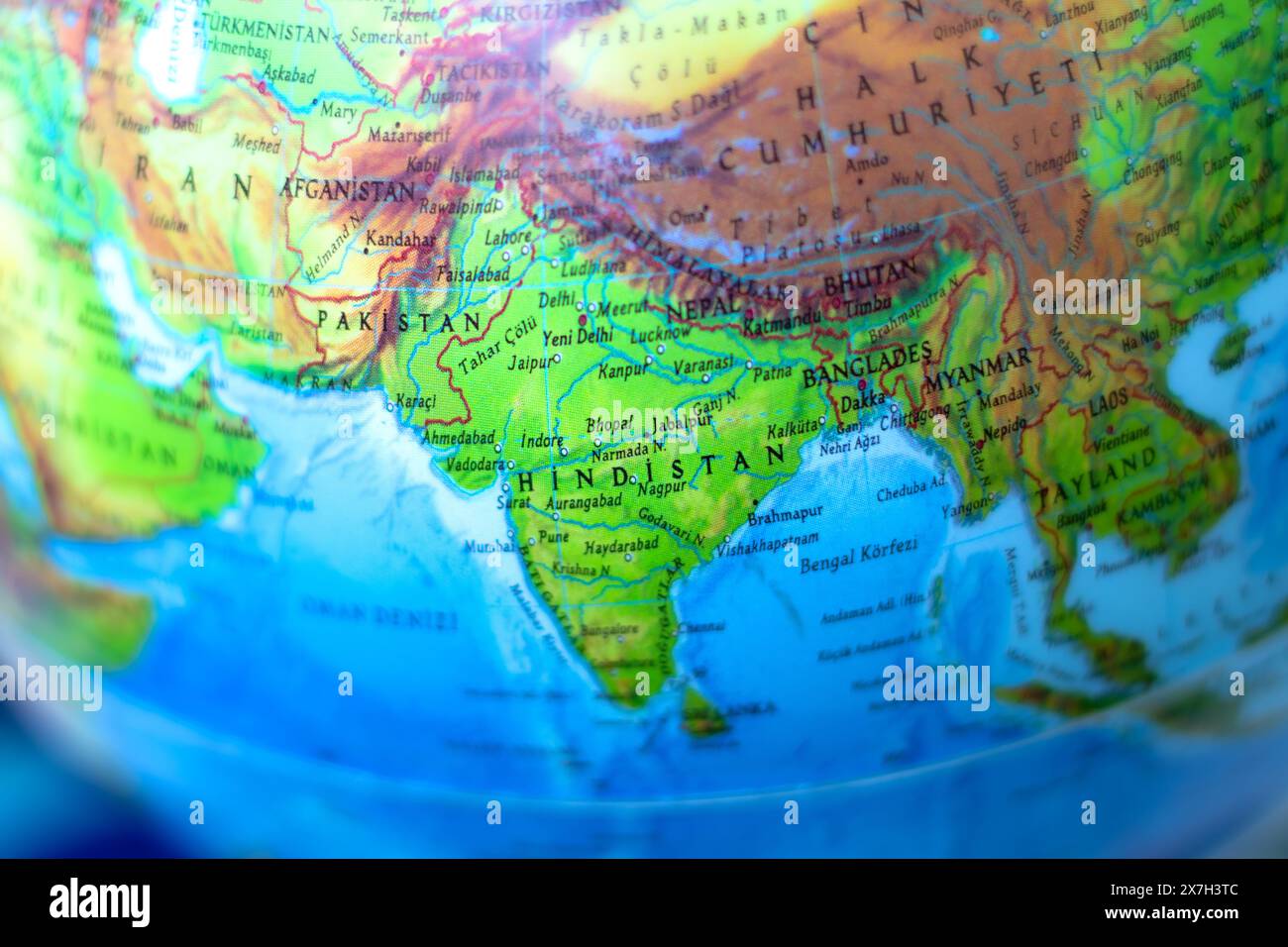 Part of the world map. Map focused on india and pakistan. Country borders. Top view. Horizontal photo. No people, nobody. Stock Photohttps://www.alamy.com/image-license-details/?v=1https://www.alamy.com/part-of-the-world-map-map-focused-on-india-and-pakistan-country-borders-top-view-horizontal-photo-no-people-nobody-image607041692.html
RF2X7H3TC–Part of the world map. Map focused on india and pakistan. Country borders. Top view. Horizontal photo. No people, nobody.
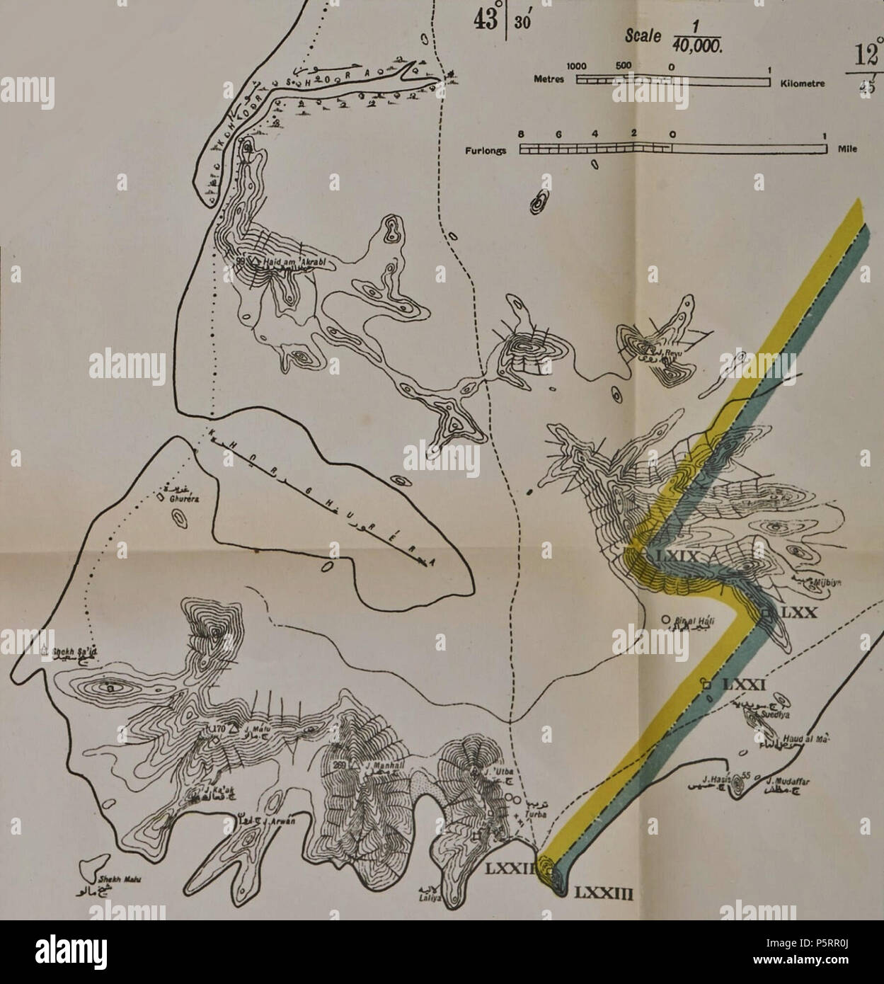 N/A. English: Map showing the Anglo-Turkish demarcation line of the Cape Bab el-Mandeb area in Yemen, also know as Sheikh Said and now generally known as Ras Menheli. This separate map was part of a larger map issued as an annex to the Anglo-Turkish Convention of 3 June 1914. This larger map of the southwestern tip of the Arabian Peninsula showed the demarcation line agreed upon between 1902 and 1904 by the Anglo-Turkish Boundary Commission which had been tasked to demarcate the respective Ottoman and British spheres of influence in South Arabia. 1914. British War Office/Survey of India 268 Ca Stock Photohttps://www.alamy.com/image-license-details/?v=1https://www.alamy.com/na-english-map-showing-the-anglo-turkish-demarcation-line-of-the-cape-bab-el-mandeb-area-in-yemen-also-know-as-sheikh-said-and-now-generally-known-as-ras-menheli-this-separate-map-was-part-of-a-larger-map-issued-as-an-annex-to-the-anglo-turkish-convention-of-3-june-1914-this-larger-map-of-the-southwestern-tip-of-the-arabian-peninsula-showed-the-demarcation-line-agreed-upon-between-1902-and-1904-by-the-anglo-turkish-boundary-commission-which-had-been-tasked-to-demarcate-the-respective-ottoman-and-british-spheres-of-influence-in-south-arabia-1914-british-war-officesurvey-of-india-268-ca-image210120642.html
RMP5RR0J–N/A. English: Map showing the Anglo-Turkish demarcation line of the Cape Bab el-Mandeb area in Yemen, also know as Sheikh Said and now generally known as Ras Menheli. This separate map was part of a larger map issued as an annex to the Anglo-Turkish Convention of 3 June 1914. This larger map of the southwestern tip of the Arabian Peninsula showed the demarcation line agreed upon between 1902 and 1904 by the Anglo-Turkish Boundary Commission which had been tasked to demarcate the respective Ottoman and British spheres of influence in South Arabia. 1914. British War Office/Survey of India 268 Ca
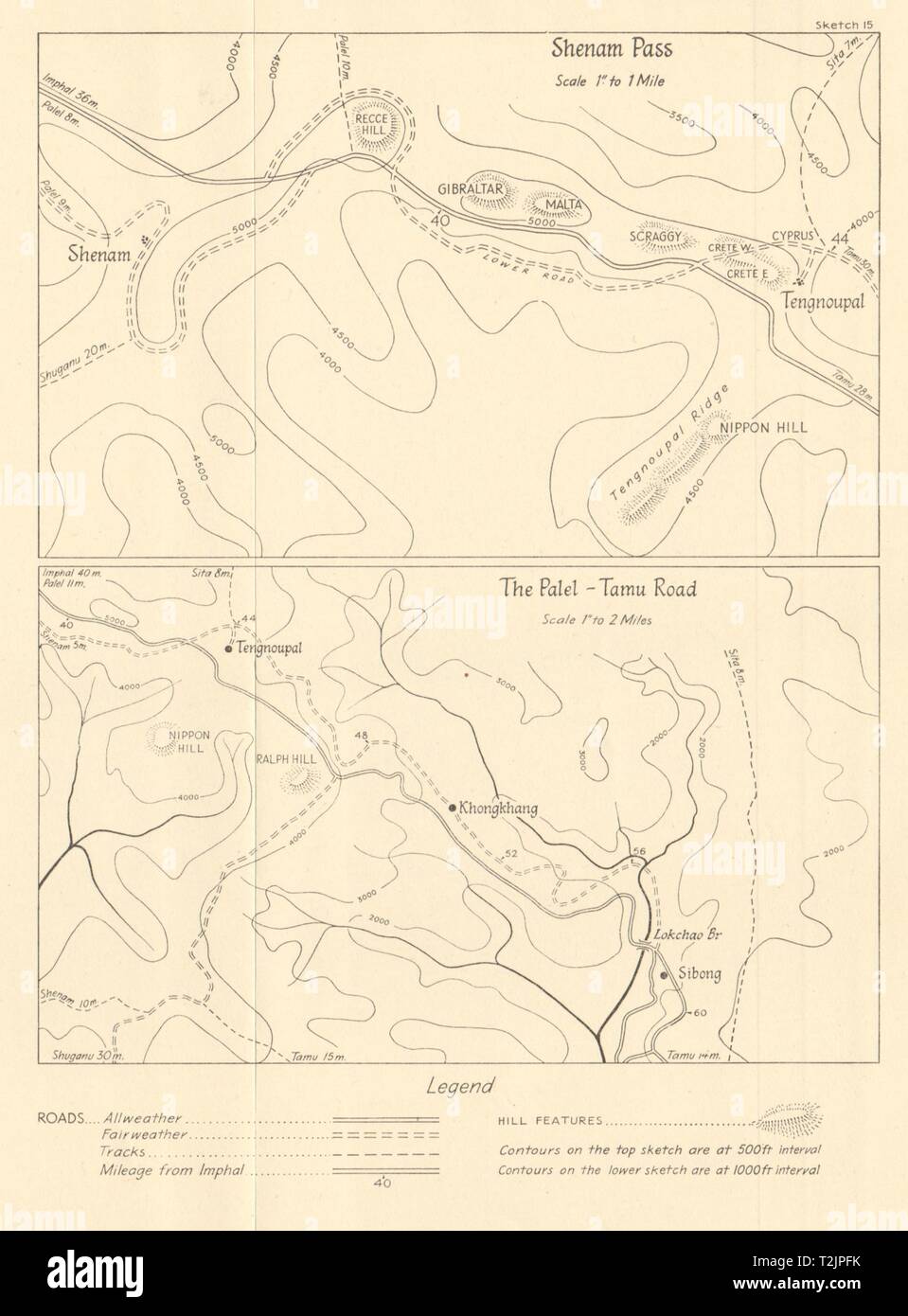 Burma Campaign World War 2. Manipur India. Shenam Pass. Palel-Tamu Road 1961 map Stock Photohttps://www.alamy.com/image-license-details/?v=1https://www.alamy.com/burma-campaign-world-war-2-manipur-india-shenam-pass-palel-tamu-road-1961-map-image242587287.html
RFT2JPFK–Burma Campaign World War 2. Manipur India. Shenam Pass. Palel-Tamu Road 1961 map
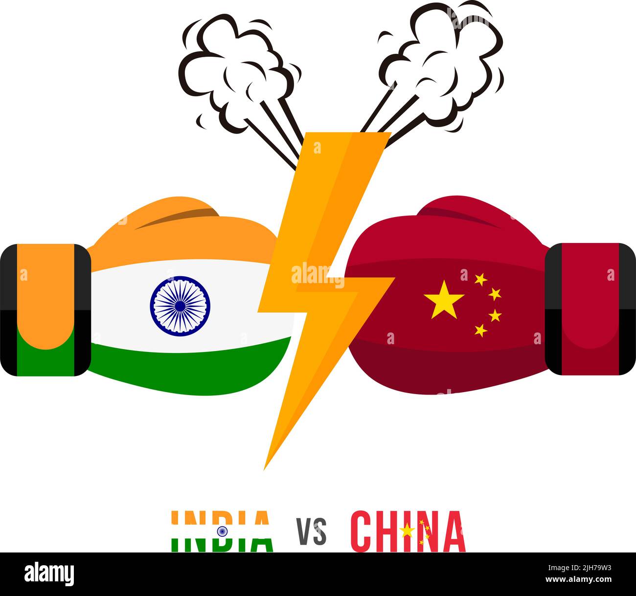 India vs China. Concept of trade war, fight or war on border between India and china. Vector illustration. Stock Vectorhttps://www.alamy.com/image-license-details/?v=1https://www.alamy.com/india-vs-china-concept-of-trade-war-fight-or-war-on-border-between-india-and-china-vector-illustration-image475290511.html
RF2JH79W3–India vs China. Concept of trade war, fight or war on border between India and china. Vector illustration.
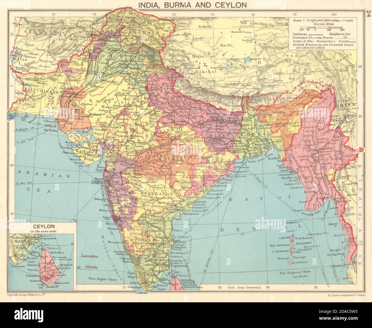 SECOND WORLD WAR. Indian, Burma & Ceylon 1943 old vintage map plan chart Stock Photohttps://www.alamy.com/image-license-details/?v=1https://www.alamy.com/second-world-war-indian-burma-ceylon-1943-old-vintage-map-plan-chart-image385038785.html
RF2DAC0W5–SECOND WORLD WAR. Indian, Burma & Ceylon 1943 old vintage map plan chart
 Yuan on the map of SouthEast Asia and Indonesia. Concept for chinese and asian economy, tourism, investment and trading Stock Photohttps://www.alamy.com/image-license-details/?v=1https://www.alamy.com/yuan-on-the-map-of-southeast-asia-and-indonesia-concept-for-chinese-and-asian-economy-tourism-investment-and-trading-image244712782.html
RFT63HJ6–Yuan on the map of SouthEast Asia and Indonesia. Concept for chinese and asian economy, tourism, investment and trading
 INDIA: Plan of the Battle of Assaye, c1880 antique map Stock Photohttps://www.alamy.com/image-license-details/?v=1https://www.alamy.com/stock-photo-india-plan-of-the-battle-of-assaye-c1880-antique-map-103844086.html
RFG0XE5A–INDIA: Plan of the Battle of Assaye, c1880 antique map
 Yuan on the map of South-East Asia and China. Concept for chinese and asian economy, tourism, investment and trading Stock Photohttps://www.alamy.com/image-license-details/?v=1https://www.alamy.com/yuan-on-the-map-of-south-east-asia-and-china-concept-for-chinese-and-asian-economy-tourism-investment-and-trading-image461499918.html
RF2HPR3RX–Yuan on the map of South-East Asia and China. Concept for chinese and asian economy, tourism, investment and trading
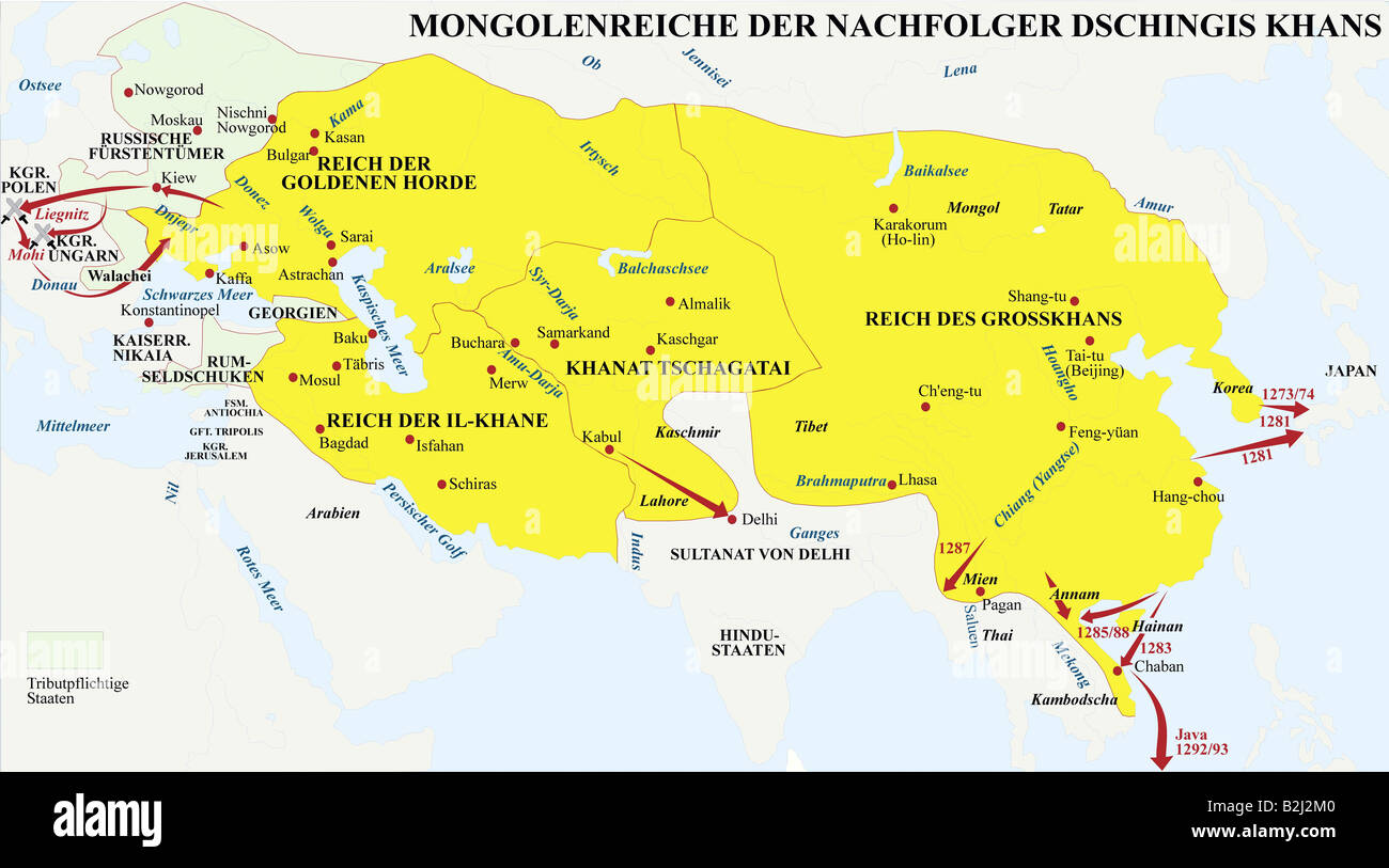 carthography, historical maps, middle ages, Mongolian Empire of successor of Genghis Khan, middle of 13th century, Asia, China, map, history, historic, war, battles, battle, Tatars, Karakitai, Hsi Hsia, Sung, Chwarezm, Mongolia, India, Sultan of Delhi, Russia, Seljuq of Rum, Persia, campaign, medieval, Stock Photohttps://www.alamy.com/image-license-details/?v=1https://www.alamy.com/stock-photo-carthography-historical-maps-middle-ages-mongolian-empire-of-successor-18836944.html
RMB2J2M0–carthography, historical maps, middle ages, Mongolian Empire of successor of Genghis Khan, middle of 13th century, Asia, China, map, history, historic, war, battles, battle, Tatars, Karakitai, Hsi Hsia, Sung, Chwarezm, Mongolia, India, Sultan of Delhi, Russia, Seljuq of Rum, Persia, campaign, medieval,
 Globe Afghanistan and Pakistan and India Stock Photohttps://www.alamy.com/image-license-details/?v=1https://www.alamy.com/stock-photo-globe-afghanistan-and-pakistan-and-india-21251635.html
RFB6G2JY–Globe Afghanistan and Pakistan and India
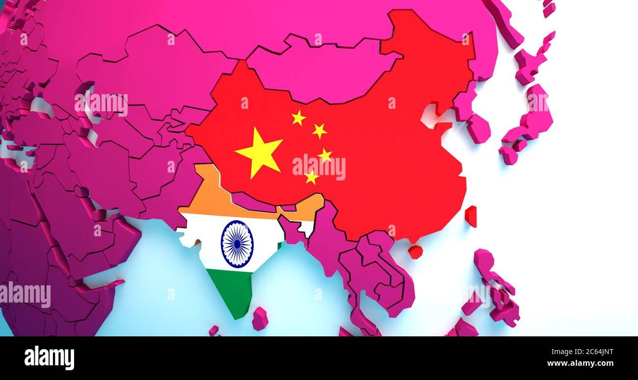 Confrontation between the India and China. China and India national flags appear together on the map. Concept of the foreign policy conflict Stock Photohttps://www.alamy.com/image-license-details/?v=1https://www.alamy.com/confrontation-between-the-india-and-china-china-and-india-national-flags-appear-together-on-the-map-concept-of-the-foreign-policy-conflict-image365208196.html
RF2C64JNT–Confrontation between the India and China. China and India national flags appear together on the map. Concept of the foreign policy conflict
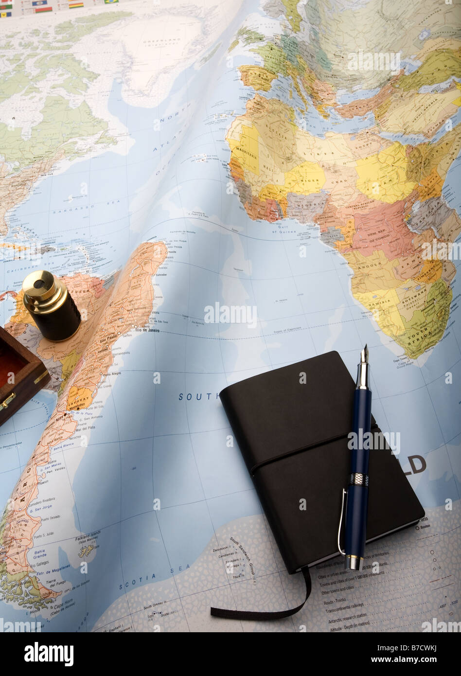 Map of the world showing the southern Atlantic with mini telescope and notebook Stock Photohttps://www.alamy.com/image-license-details/?v=1https://www.alamy.com/stock-photo-map-of-the-world-showing-the-southern-atlantic-with-mini-telescope-21796534.html
RFB7CWKJ–Map of the world showing the southern Atlantic with mini telescope and notebook
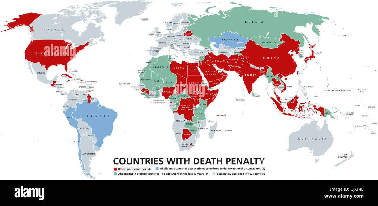 Death penalty countries world map. Retentionist states with capital punishment in red color. Stock Photohttps://www.alamy.com/image-license-details/?v=1https://www.alamy.com/stock-photo-death-penalty-countries-world-map-retentionist-states-with-capital-114908654.html
RFGJXF4E–Death penalty countries world map. Retentionist states with capital punishment in red color.
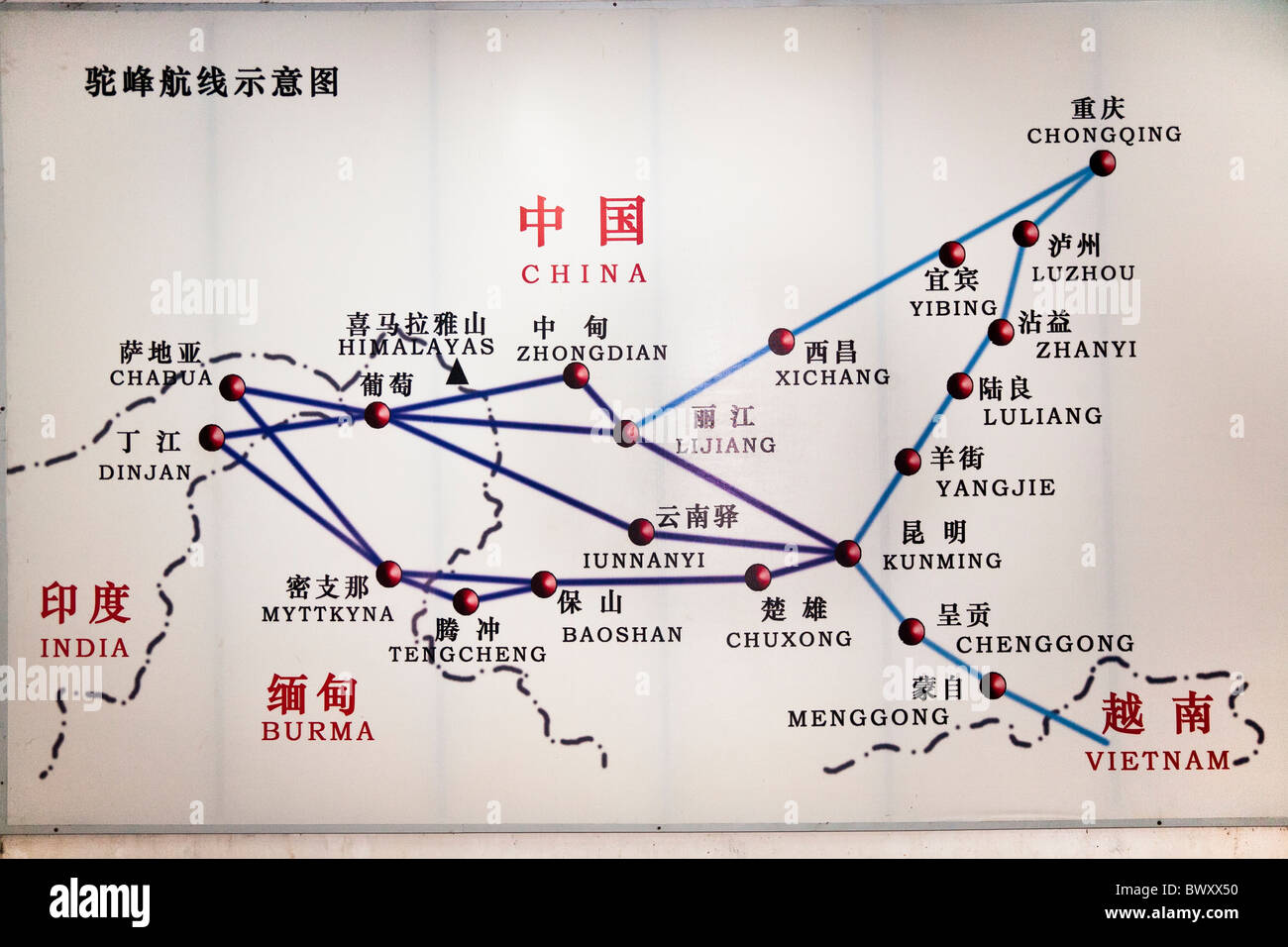 Map exhibit, Transportation Museum of China, Burma, India Theater in World War II, Yunnanyi, Yunnan Province, China Stock Photohttps://www.alamy.com/image-license-details/?v=1https://www.alamy.com/stock-photo-map-exhibit-transportation-museum-of-china-burma-india-theater-in-33168044.html
RMBWXX50–Map exhibit, Transportation Museum of China, Burma, India Theater in World War II, Yunnanyi, Yunnan Province, China
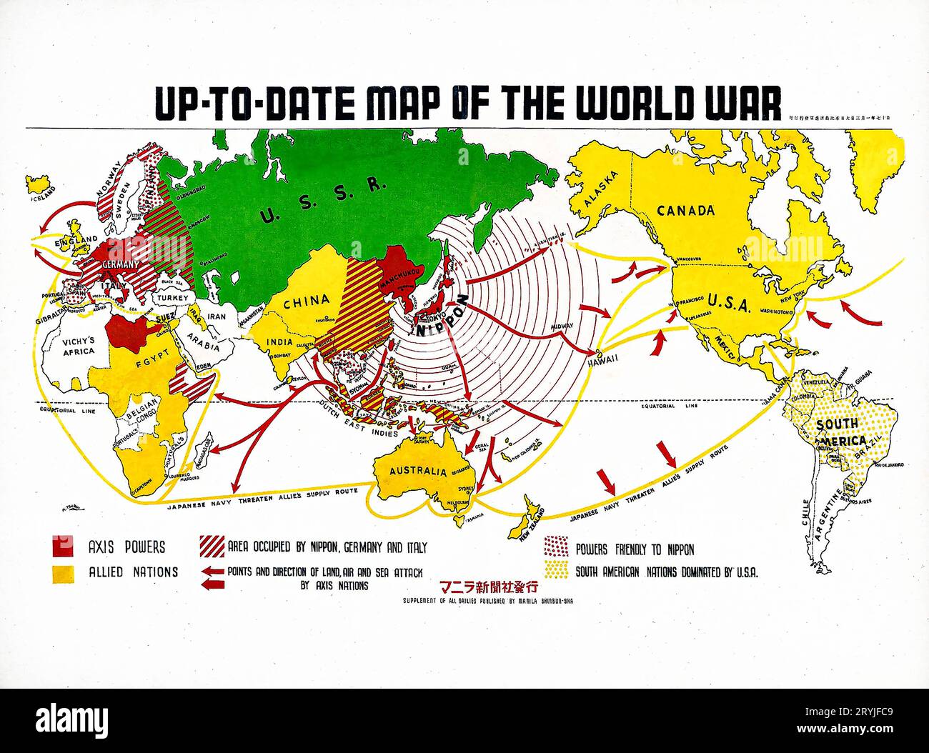 Up-to-date map of the world war (1942) by Manila Shinbun-sha. Stock Photohttps://www.alamy.com/image-license-details/?v=1https://www.alamy.com/up-to-date-map-of-the-world-war-1942-by-manila-shinbun-sha-image567734729.html
RM2RYJFC9–Up-to-date map of the world war (1942) by Manila Shinbun-sha.
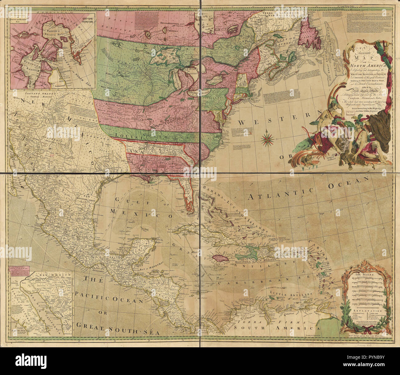 Vintage Maps / Antique Maps - An accurate map of North America. Describing and distinguishing the British, Spanish and French dominions on this great continent; exhibiting the present seat of war, and the French encroachments. Also all the West India Islands belonging to, and possessed by the several European princes and states. The whole laid down according to the latest and most authentick improvements Stock Photohttps://www.alamy.com/image-license-details/?v=1https://www.alamy.com/vintage-maps-antique-maps-an-accurate-map-of-north-america-describing-and-distinguishing-the-british-spanish-and-french-dominions-on-this-great-continent-exhibiting-the-present-seat-of-war-and-the-french-encroachments-also-all-the-west-india-islands-belonging-to-and-possessed-by-the-several-european-princes-and-states-the-whole-laid-down-according-to-the-latest-and-most-authentick-improvements-image223590023.html
RMPYNB9Y–Vintage Maps / Antique Maps - An accurate map of North America. Describing and distinguishing the British, Spanish and French dominions on this great continent; exhibiting the present seat of war, and the French encroachments. Also all the West India Islands belonging to, and possessed by the several European princes and states. The whole laid down according to the latest and most authentick improvements
 Indian military force, army or war concept. 3D rendering isolated on white background Stock Photohttps://www.alamy.com/image-license-details/?v=1https://www.alamy.com/indian-military-force-army-or-war-concept-3d-rendering-isolated-on-white-background-image244396692.html
RFT5H6D8–Indian military force, army or war concept. 3D rendering isolated on white background
 Four bullets on the geographical map of India. Conceptual image for war, conflict, violence. Stock Photohttps://www.alamy.com/image-license-details/?v=1https://www.alamy.com/stock-photo-four-bullets-on-the-geographical-map-of-india-conceptual-image-for-84281319.html
RFEW39K3–Four bullets on the geographical map of India. Conceptual image for war, conflict, violence.
 High detailed flag of India. National India flag. Asia. 3D illustration. Stock Photohttps://www.alamy.com/image-license-details/?v=1https://www.alamy.com/high-detailed-flag-of-india-national-india-flag-asia-3d-illustration-image591797844.html
RF2WAPM58–High detailed flag of India. National India flag. Asia. 3D illustration.
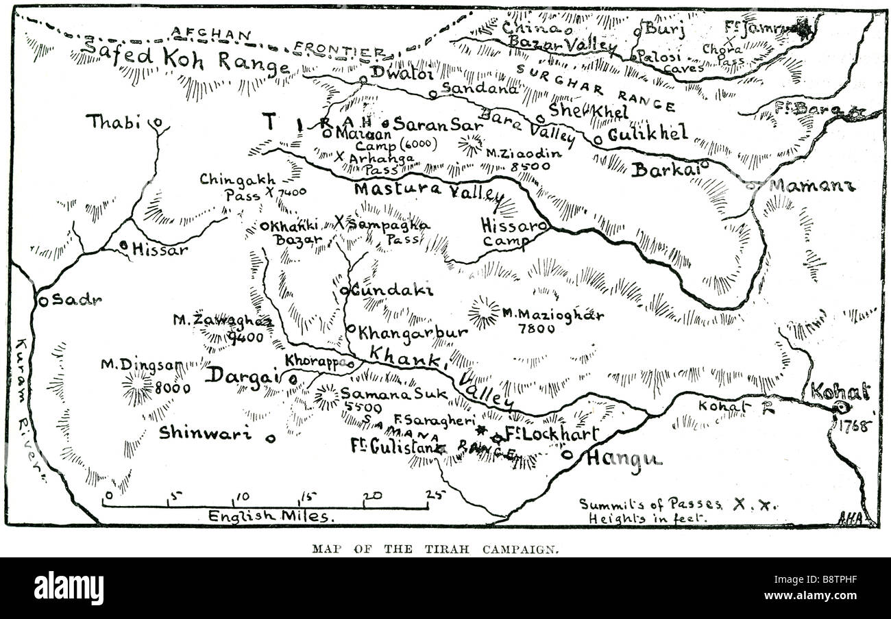 map of the tirah campaign The Tirah Campaign was an Indian frontier war in 1897-98. (The campaign is often referred to in contem Stock Photohttps://www.alamy.com/image-license-details/?v=1https://www.alamy.com/stock-photo-map-of-the-tirah-campaign-the-tirah-campaign-was-an-indian-frontier-22672203.html
RMB8TPHF–map of the tirah campaign The Tirah Campaign was an Indian frontier war in 1897-98. (The campaign is often referred to in contem
 . English: This map, created immediately after the Third Anglo-Mysore War (1789-92), shows the division of and territorial loss by the Kingdom of Mysore through the 1792 Treaty of Seringapatam. A 'third edition' was created in 1800 showing the territorial changes after the Fourth Anglo-Mysore War (1798–1799). Description from Geographicus: One of the largest and most impressive maps of India to appear in the 18th century. Depicts the subcontinent from Bombay ( Mumbai ) and Aurungabad, south including the northern half of Sri Lanka ( Ceylon ). Printed in 1793 in London by William Faden, “Royal Stock Photohttps://www.alamy.com/image-license-details/?v=1https://www.alamy.com/english-this-map-created-immediately-after-the-third-anglo-mysore-war-1789-92-shows-the-division-of-and-territorial-loss-by-the-kingdom-of-mysore-through-the-1792-treaty-of-seringapatam-a-third-edition-was-created-in-1800-showing-the-territorial-changes-after-the-fourth-anglo-mysore-war-17981799-description-from-geographicus-one-of-the-largest-and-most-impressive-maps-of-india-to-appear-in-the-18th-century-depicts-the-subcontinent-from-bombay-mumbai-and-aurungabad-south-including-the-northern-half-of-sri-lanka-ceylon-printed-in-1793-in-london-by-william-faden-royal-image184897012.html
RMMMPP0M–. English: This map, created immediately after the Third Anglo-Mysore War (1789-92), shows the division of and territorial loss by the Kingdom of Mysore through the 1792 Treaty of Seringapatam. A 'third edition' was created in 1800 showing the territorial changes after the Fourth Anglo-Mysore War (1798–1799). Description from Geographicus: One of the largest and most impressive maps of India to appear in the 18th century. Depicts the subcontinent from Bombay ( Mumbai ) and Aurungabad, south including the northern half of Sri Lanka ( Ceylon ). Printed in 1793 in London by William Faden, “Royal
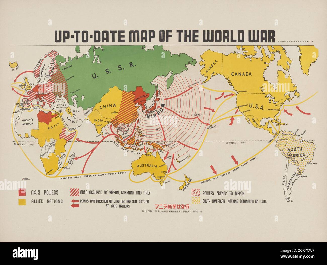 Up-to-date map of the world war (1942) by Manila Shinbun-sha. Stock Photohttps://www.alamy.com/image-license-details/?v=1https://www.alamy.com/up-to-date-map-of-the-world-war-1942-by-manila-shinbun-sha-image444999107.html
RM2GRYCW7–Up-to-date map of the world war (1942) by Manila Shinbun-sha.
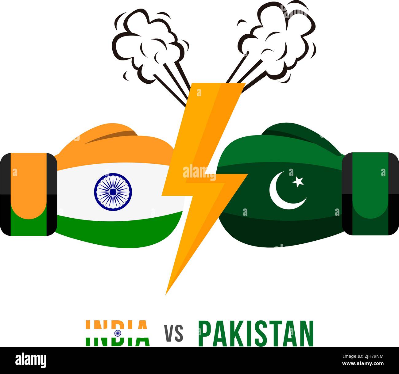 India vs Pakistan. Concept of trade war, fight or war on border between india and pakistan. Vector illustration. Stock Vectorhttps://www.alamy.com/image-license-details/?v=1https://www.alamy.com/india-vs-pakistan-concept-of-trade-war-fight-or-war-on-border-between-india-and-pakistan-vector-illustration-image475290416.html
RF2JH79NM–India vs Pakistan. Concept of trade war, fight or war on border between india and pakistan. Vector illustration.
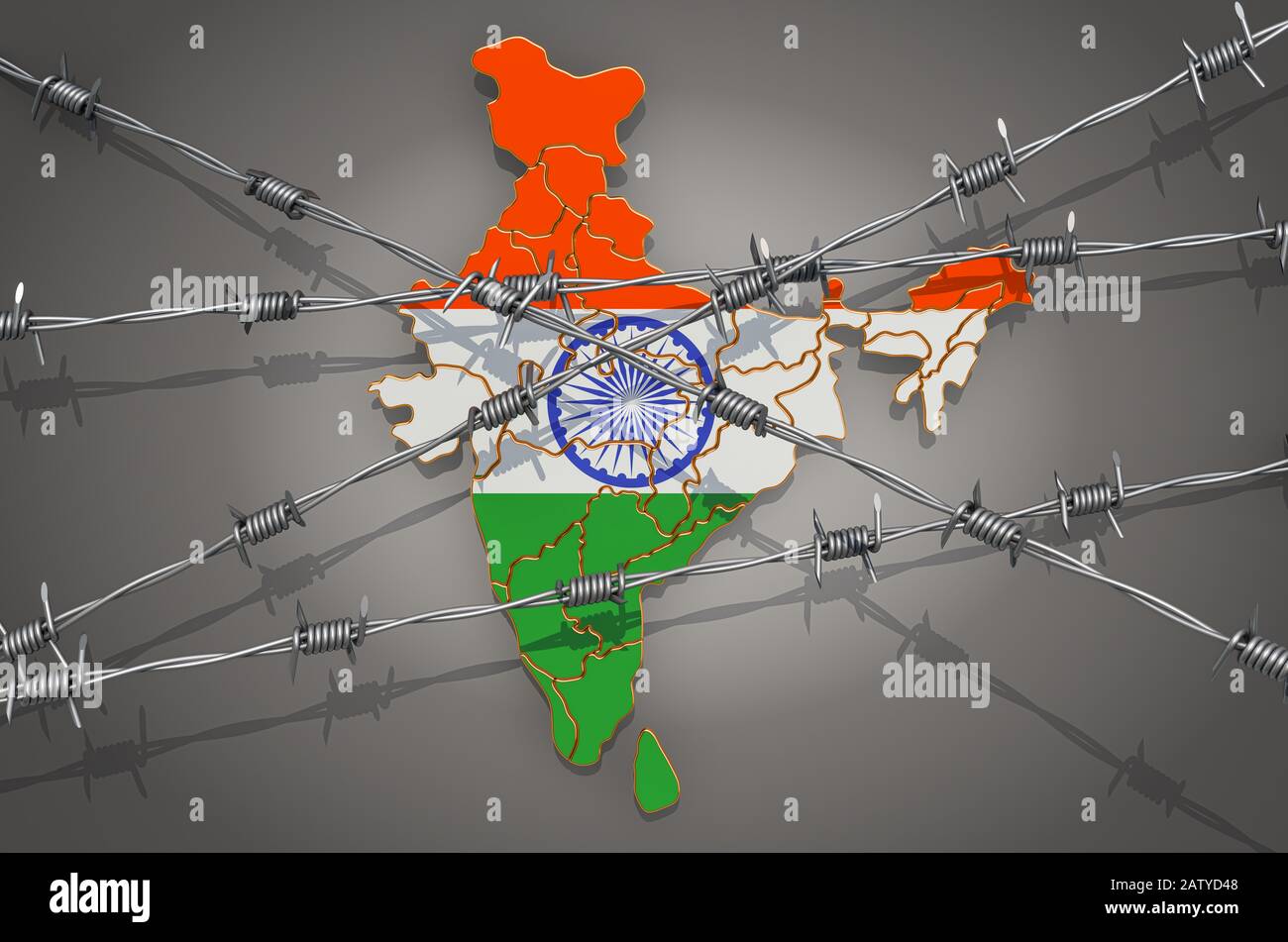 Map of India with barbed wire, 3D rendering on grey background Stock Photohttps://www.alamy.com/image-license-details/?v=1https://www.alamy.com/map-of-india-with-barbed-wire-3d-rendering-on-grey-background-image342351752.html
RF2ATYD48–Map of India with barbed wire, 3D rendering on grey background
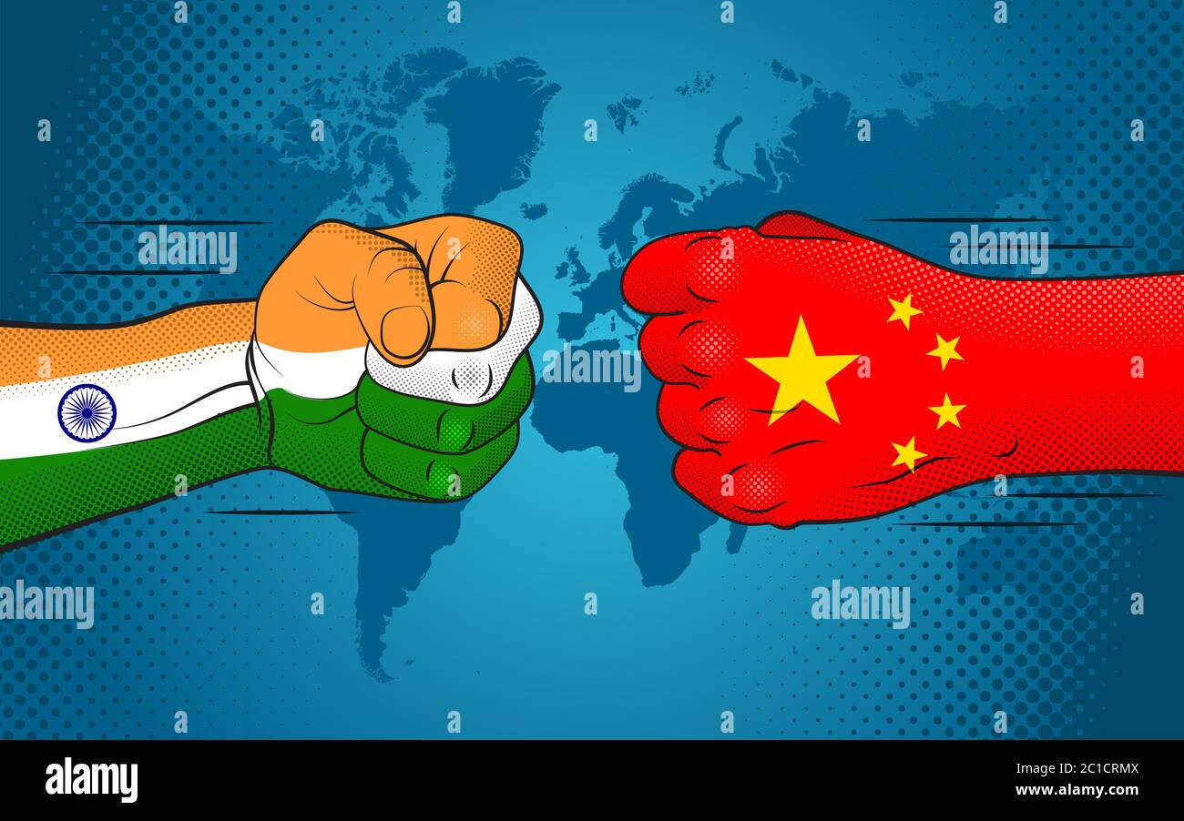 Conflict between India and China. India-China relations. India versus China. Stock Photohttps://www.alamy.com/image-license-details/?v=1https://www.alamy.com/conflict-between-india-and-china-india-china-relations-india-versus-china-image362314426.html
RF2C1CRMX–Conflict between India and China. India-China relations. India versus China.
 INDIA: Plan of the Battle of Laswaree, c1880 antique map Stock Photohttps://www.alamy.com/image-license-details/?v=1https://www.alamy.com/stock-photo-india-plan-of-the-battle-of-laswaree-c1880-antique-map-103844094.html
RFG0XE5J–INDIA: Plan of the Battle of Laswaree, c1880 antique map
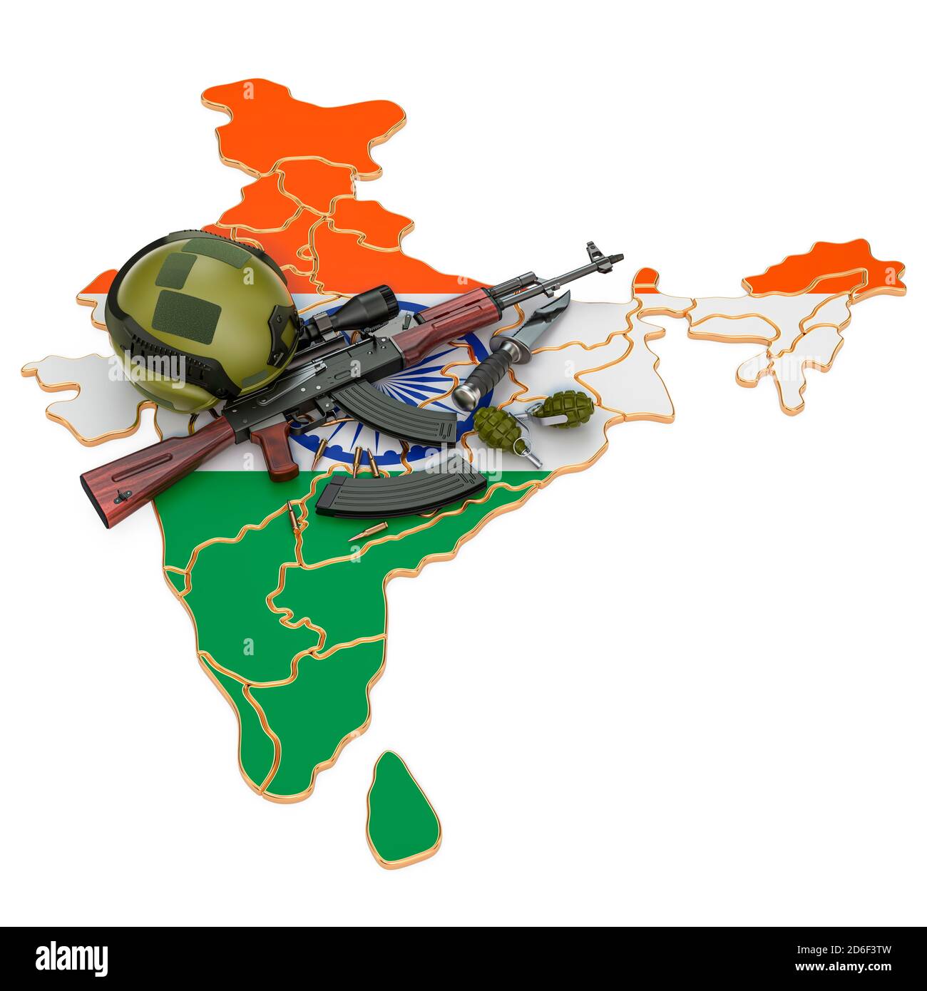 Military force, army or war conflict in India concept. 3D rendering isolated on white background Stock Photohttps://www.alamy.com/image-license-details/?v=1https://www.alamy.com/military-force-army-or-war-conflict-in-india-concept-3d-rendering-isolated-on-white-background-image382648361.html
RF2D6F3TW–Military force, army or war conflict in India concept. 3D rendering isolated on white background
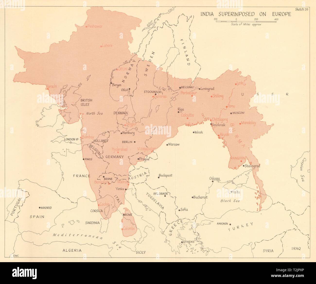 India superimposed on Europe 1961 old vintage map plan chart Stock Photohttps://www.alamy.com/image-license-details/?v=1https://www.alamy.com/india-superimposed-on-europe-1961-old-vintage-map-plan-chart-image242587598.html
RFT2JPXP–India superimposed on Europe 1961 old vintage map plan chart
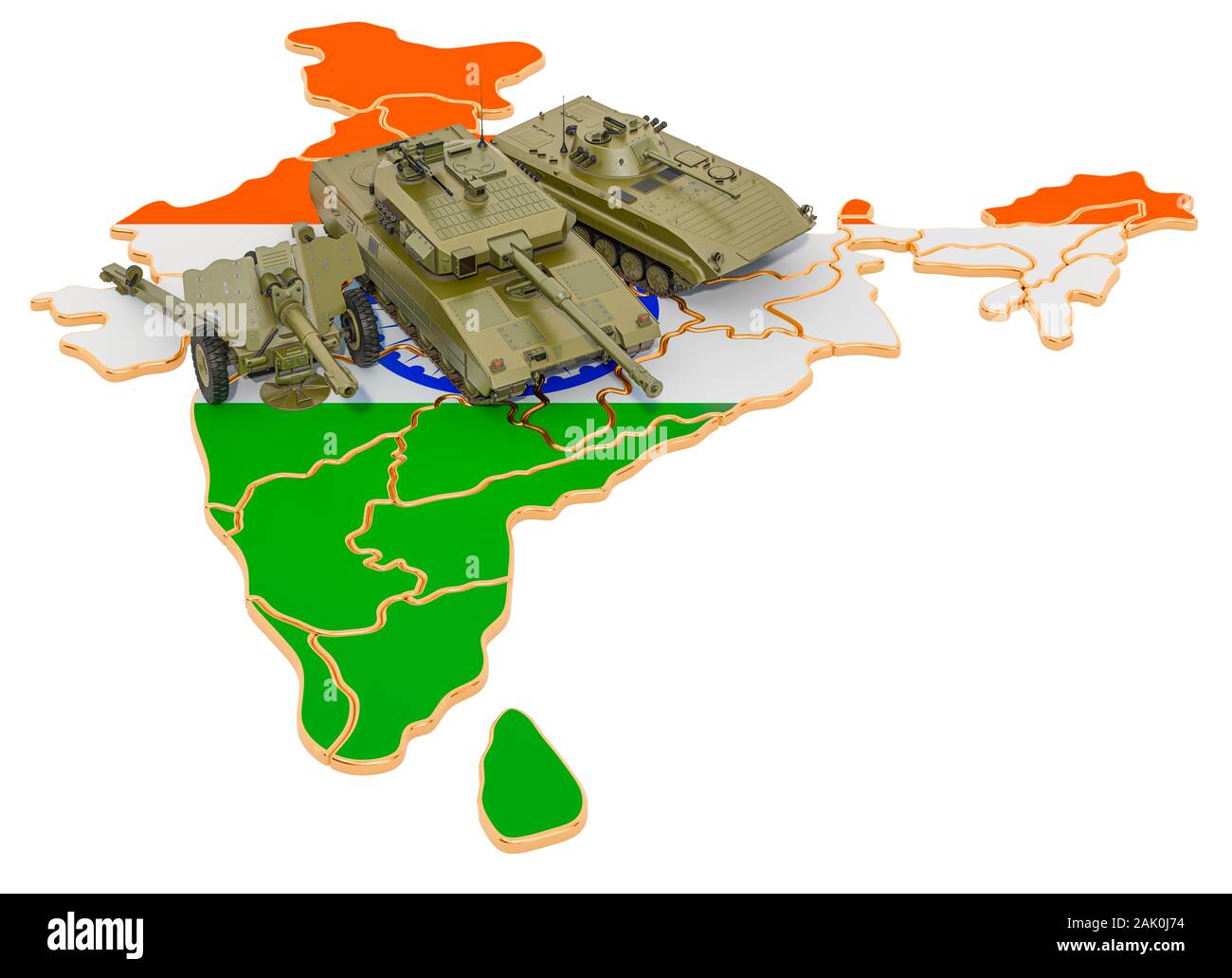 Combat vehicles on Indian map. Military defence of India concept, 3D rendering isolated on white background Stock Photohttps://www.alamy.com/image-license-details/?v=1https://www.alamy.com/combat-vehicles-on-indian-map-military-defence-of-india-concept-3d-rendering-isolated-on-white-background-image338689768.html
RF2AK0J74–Combat vehicles on Indian map. Military defence of India concept, 3D rendering isolated on white background
 UK Great Britain and India flags. The United Kingdom VS Indian flags, isolated on grey world map background. Vector illustration. Stock Vectorhttps://www.alamy.com/image-license-details/?v=1https://www.alamy.com/uk-great-britain-and-india-flags-the-united-kingdom-vs-indian-flags-isolated-on-grey-world-map-background-vector-illustration-image485210900.html
RF2K5B7CM–UK Great Britain and India flags. The United Kingdom VS Indian flags, isolated on grey world map background. Vector illustration.
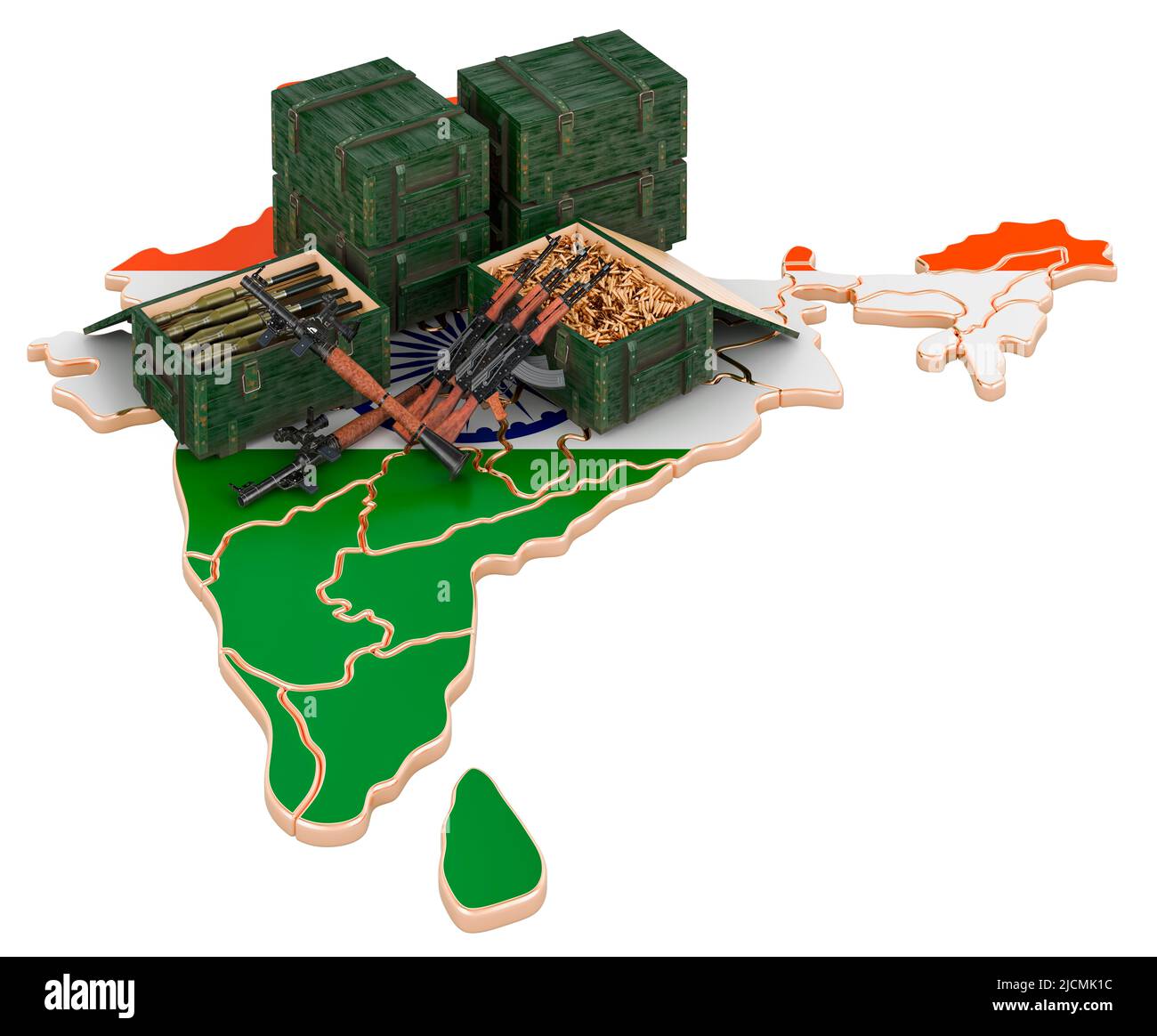 Indian map with weapons. Military supplies in India, concept. 3D rendering isolated on white background Stock Photohttps://www.alamy.com/image-license-details/?v=1https://www.alamy.com/indian-map-with-weapons-military-supplies-in-india-concept-3d-rendering-isolated-on-white-background-image472509784.html
RF2JCMK1C–Indian map with weapons. Military supplies in India, concept. 3D rendering isolated on white background
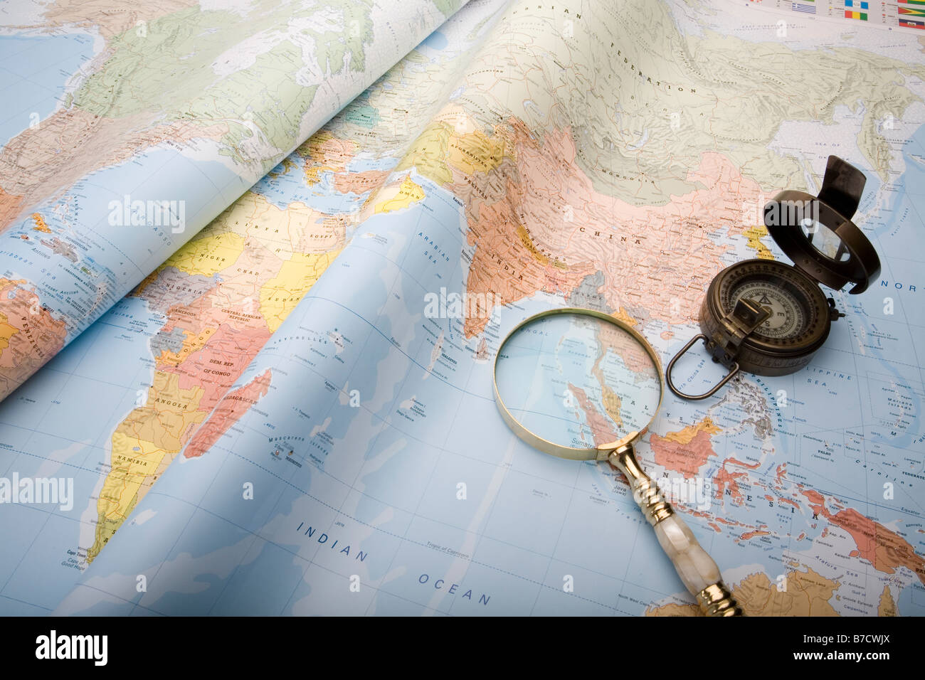 A world map with old world war ll compass and magnifying glass Stock Photohttps://www.alamy.com/image-license-details/?v=1https://www.alamy.com/stock-photo-a-world-map-with-old-world-war-ll-compass-and-magnifying-glass-21796514.html
RFB7CWJX–A world map with old world war ll compass and magnifying glass
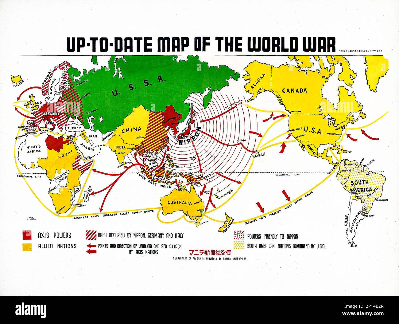 Up-to-date map of the world war (1942) by Manila Shinbun-sha. Original from The Beinecke Rare Book & Manuscript Library. Stock Photohttps://www.alamy.com/image-license-details/?v=1https://www.alamy.com/up-to-date-map-of-the-world-war-1942-by-manila-shinbun-sha-original-from-the-beinecke-rare-book-manuscript-library-image534232575.html
RF2P14B2R–Up-to-date map of the world war (1942) by Manila Shinbun-sha. Original from The Beinecke Rare Book & Manuscript Library.
 a finger of Woman point the city Mumbai, India, Asia on a world map, to choice a destination Stock Photohttps://www.alamy.com/image-license-details/?v=1https://www.alamy.com/stock-photo-a-finger-of-woman-point-the-city-mumbai-india-asia-on-a-world-map-52911581.html
RMD22979–a finger of Woman point the city Mumbai, India, Asia on a world map, to choice a destination
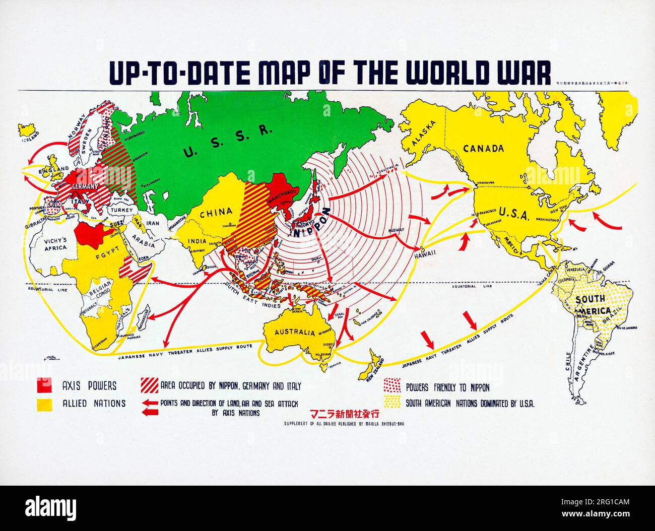 Up-to-date map of the world war by Manila Shinbun-sha. Original from The Beinecke Rare Book Manuscript Library. Stock Photohttps://www.alamy.com/image-license-details/?v=1https://www.alamy.com/up-to-date-map-of-the-world-war-by-manila-shinbun-sha-original-from-the-beinecke-rare-book-manuscript-library-image560597932.html
RF2RG1CAM–Up-to-date map of the world war by Manila Shinbun-sha. Original from The Beinecke Rare Book Manuscript Library.
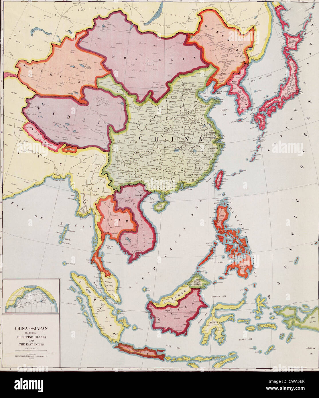 1932 map of east Asia, showing nations that would become targets of Japanese expansion and invasion in the Sino-Japanese War Stock Photohttps://www.alamy.com/image-license-details/?v=1https://www.alamy.com/stock-photo-1932-map-of-east-asia-showing-nations-that-would-become-targets-of-50010987.html
RMCWA5EK–1932 map of east Asia, showing nations that would become targets of Japanese expansion and invasion in the Sino-Japanese War
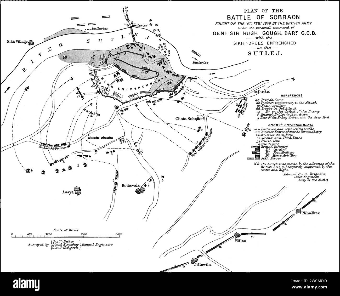 Plan of the Battle of Sobraon, First Anglo-Sikh War, 10 February 1846 Stock Photohttps://www.alamy.com/image-license-details/?v=1https://www.alamy.com/plan-of-the-battle-of-sobraon-first-anglo-sikh-war-10-february-1846-image592766705.html
RM2WCARYD–Plan of the Battle of Sobraon, First Anglo-Sikh War, 10 February 1846
 High detailed flag of India. National India flag. Asia. 3D illustration. Stock Vectorhttps://www.alamy.com/image-license-details/?v=1https://www.alamy.com/high-detailed-flag-of-india-national-india-flag-asia-3d-illustration-image591798281.html
RF2WAPMMW–High detailed flag of India. National India flag. Asia. 3D illustration.
 Lance Corporal James W. Gunter, a squad leader with the Second Squad, Second Platoon, is seen checking a map while on patrol. This photograph was taken on October 30, 1969, 8 miles South of DaNang, by LCpl. John Gentry. Gunter was part of India Company, Third Battalion, First Marine Regiment, under the 1st Marine Division during the Vietnam War. Stock Photohttps://www.alamy.com/image-license-details/?v=1https://www.alamy.com/lance-corporal-james-w-gunter-a-squad-leader-with-the-second-squad-second-platoon-is-seen-checking-a-map-while-on-patrol-this-photograph-was-taken-on-october-30-1969-8-miles-south-of-danang-by-lcpl-john-gentry-gunter-was-part-of-india-company-third-battalion-first-marine-regiment-under-the-1st-marine-division-during-the-vietnam-war-image574171385.html
RM2TA3NCW–Lance Corporal James W. Gunter, a squad leader with the Second Squad, Second Platoon, is seen checking a map while on patrol. This photograph was taken on October 30, 1969, 8 miles South of DaNang, by LCpl. John Gentry. Gunter was part of India Company, Third Battalion, First Marine Regiment, under the 1st Marine Division during the Vietnam War.
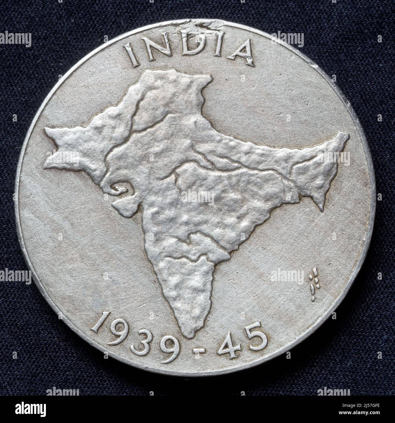 India: India Service Medal 1939 - 1945 (reverse), awarded to Indian Forces for at least 3 years of non-operational service in India between September 1938 and September 1945. This side shows a relief map of India. Stock Photohttps://www.alamy.com/image-license-details/?v=1https://www.alamy.com/india-india-service-medal-1939-1945-reverse-awarded-to-indian-forces-for-at-least-3-years-of-non-operational-service-in-india-between-september-1938-and-september-1945-this-side-shows-a-relief-map-of-india-image467919858.html
RM2J57GFE–India: India Service Medal 1939 - 1945 (reverse), awarded to Indian Forces for at least 3 years of non-operational service in India between September 1938 and September 1945. This side shows a relief map of India.
 Fighting fists with China and India flags and a concrete wall with the map of asia Stock Photohttps://www.alamy.com/image-license-details/?v=1https://www.alamy.com/fighting-fists-with-china-and-india-flags-and-a-concrete-wall-with-the-map-of-asia-image571305161.html
RF2T5D5FN–Fighting fists with China and India flags and a concrete wall with the map of asia
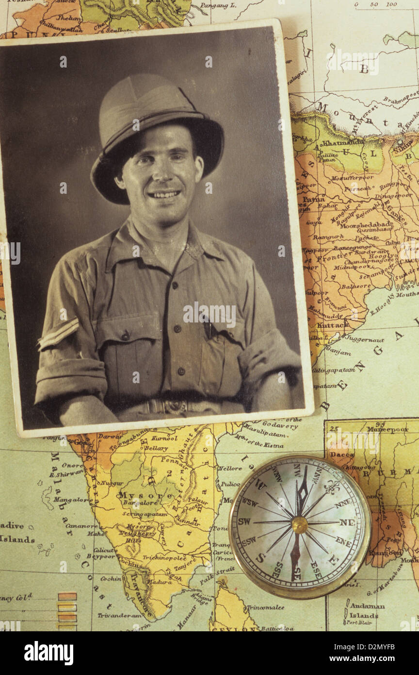 Black and white photograph of man in tropical military uniform placed with compass on map of India Stock Photohttps://www.alamy.com/image-license-details/?v=1https://www.alamy.com/stock-photo-black-and-white-photograph-of-man-in-tropical-military-uniform-placed-53321055.html
RMD2MYFB–Black and white photograph of man in tropical military uniform placed with compass on map of India
RF2RH0MHM–INDIA Map and raised fists. National day or Independence day design for INDIA celebration. Modern retro design with abstract icons. Vector
 Poster showing map of India, Buddha, Gandhi, and the Taj Mahal. Stock Photohttps://www.alamy.com/image-license-details/?v=1https://www.alamy.com/poster-showing-map-of-india-buddha-gandhi-and-the-taj-mahal-image217257679.html
RMPHCXAR–Poster showing map of India, Buddha, Gandhi, and the Taj Mahal.
 INDIA national day banner with map, flag colors theme background and geometric abstract retro modern colorfull design with raised hands or fists. Stock Vectorhttps://www.alamy.com/image-license-details/?v=1https://www.alamy.com/india-national-day-banner-with-map-flag-colors-theme-background-and-geometric-abstract-retro-modern-colorfull-design-with-raised-hands-or-fists-image565556878.html
RF2RT39FX–INDIA national day banner with map, flag colors theme background and geometric abstract retro modern colorfull design with raised hands or fists.
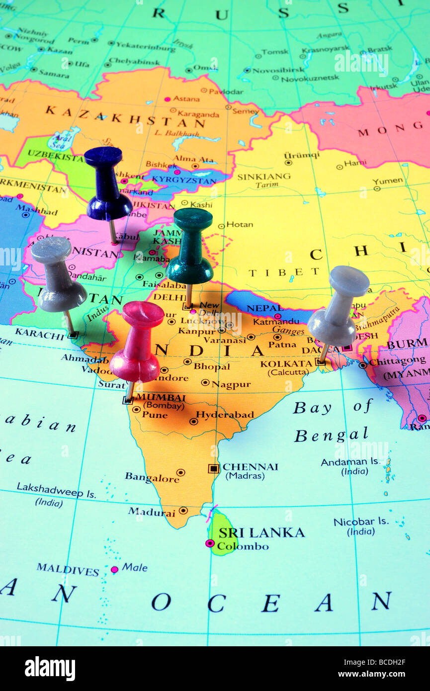 map pins in Southern Asia Map Stock Photohttps://www.alamy.com/image-license-details/?v=1https://www.alamy.com/stock-photo-map-pins-in-southern-asia-map-24885015.html
RFBCDH2F–map pins in Southern Asia Map
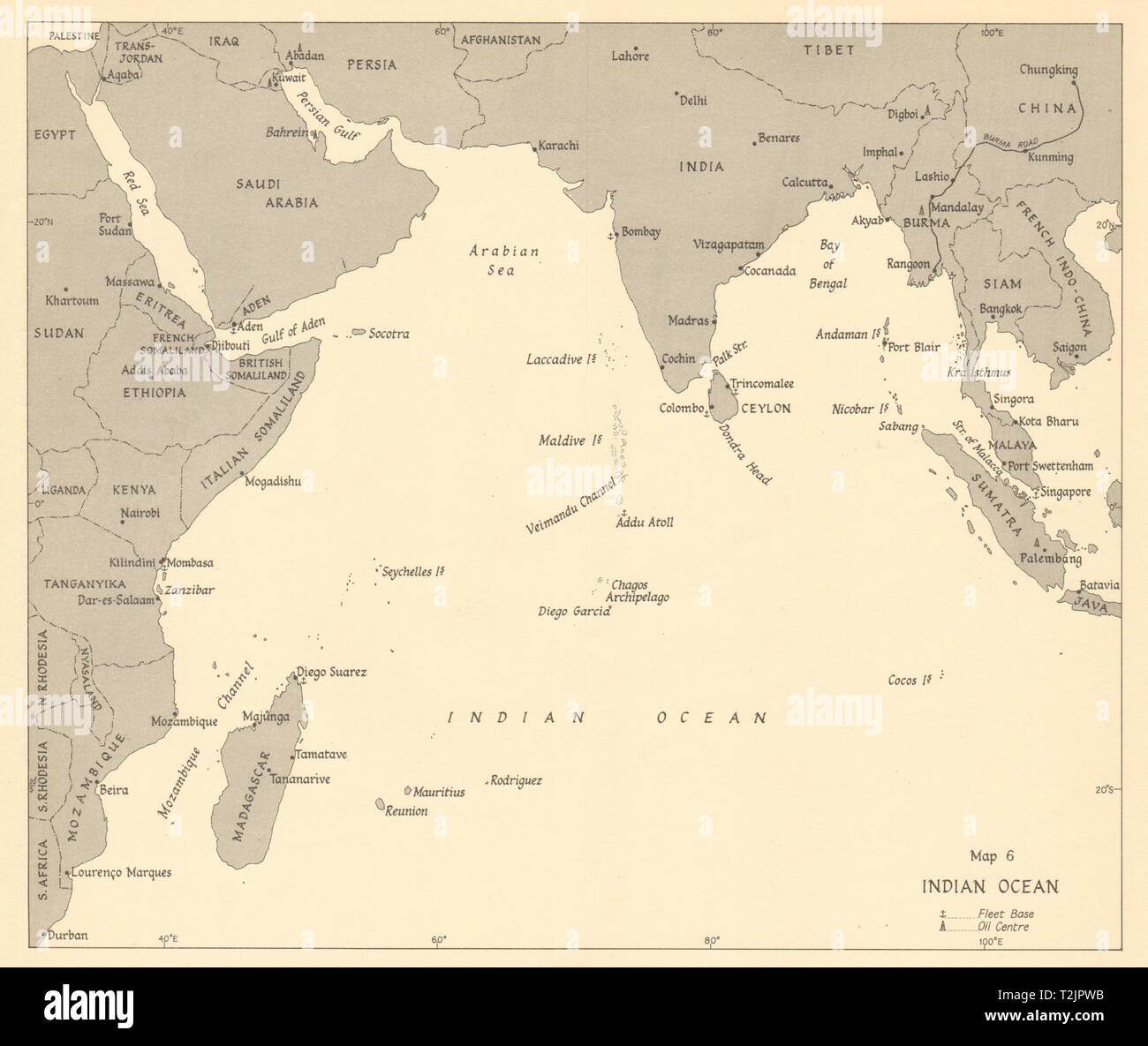 Indian Ocean 1942. World War 2 1961 old vintage map plan chart Stock Photohttps://www.alamy.com/image-license-details/?v=1https://www.alamy.com/indian-ocean-1942-world-war-2-1961-old-vintage-map-plan-chart-image242587559.html
RFT2JPWB–Indian Ocean 1942. World War 2 1961 old vintage map plan chart
 Field Marshal Montgomery Talks With India Interim Government Vice President Nehru a news photo, World War II Stock Photohttps://www.alamy.com/image-license-details/?v=1https://www.alamy.com/stock-photo-field-marshal-montgomery-talks-with-india-interim-government-vice-139861184.html
RMJ3F6A8–Field Marshal Montgomery Talks With India Interim Government Vice President Nehru a news photo, World War II
 Map of Bantam War (approximately made in 17th Century) Stock Photohttps://www.alamy.com/image-license-details/?v=1https://www.alamy.com/map-of-bantam-war-approximately-made-in-17th-century-image599765192.html
RM2WRNJHC–Map of Bantam War (approximately made in 17th Century)
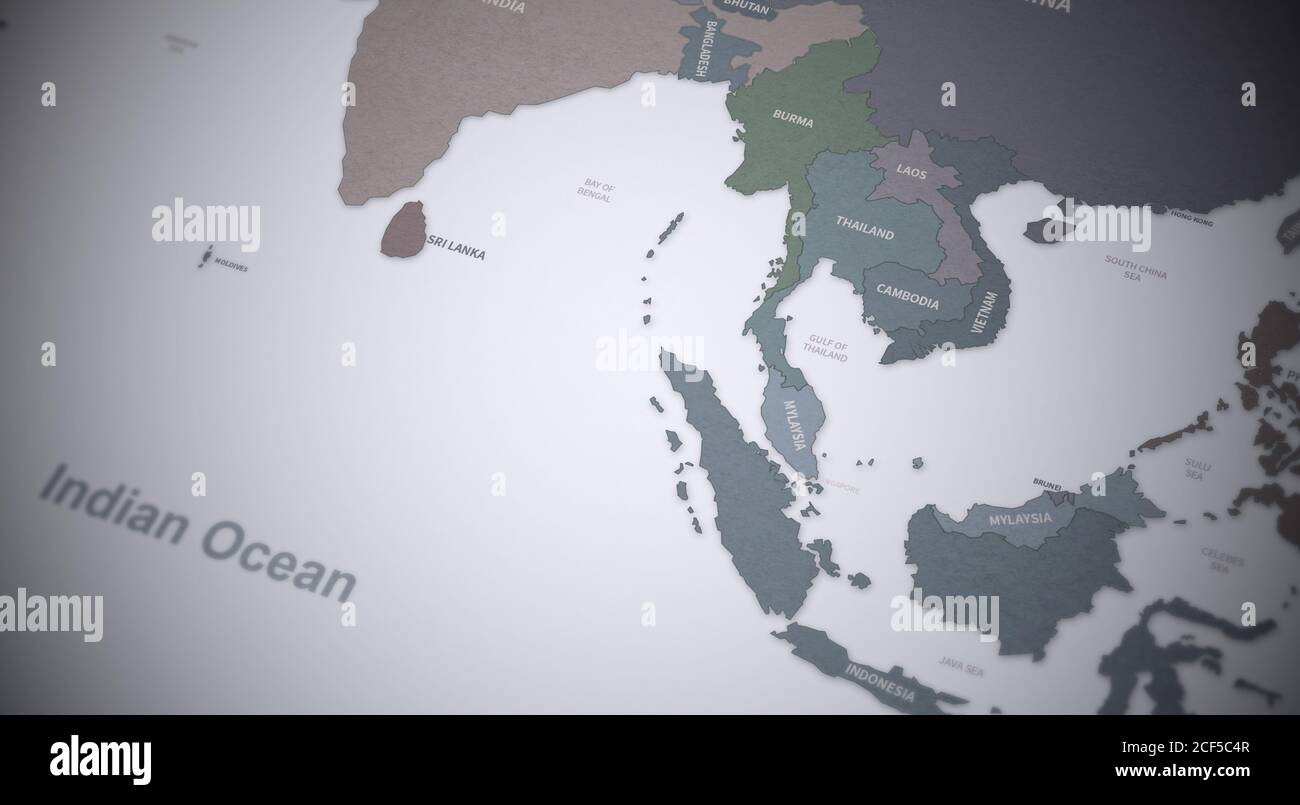 South Asia Countries Map. Continental Vintage Map 3d Rendering. Stock Photohttps://www.alamy.com/image-license-details/?v=1https://www.alamy.com/south-asia-countries-map-continental-vintage-map-3d-rendering-image370756871.html
RF2CF5C4R–South Asia Countries Map. Continental Vintage Map 3d Rendering.
 Yuan on the map of South-East Asia and China. Concept for chinese economy, tourism, investment and trading Stock Photohttps://www.alamy.com/image-license-details/?v=1https://www.alamy.com/yuan-on-the-map-of-south-east-asia-and-china-concept-for-chinese-economy-tourism-investment-and-trading-image244712768.html
RFT63HHM–Yuan on the map of South-East Asia and China. Concept for chinese economy, tourism, investment and trading
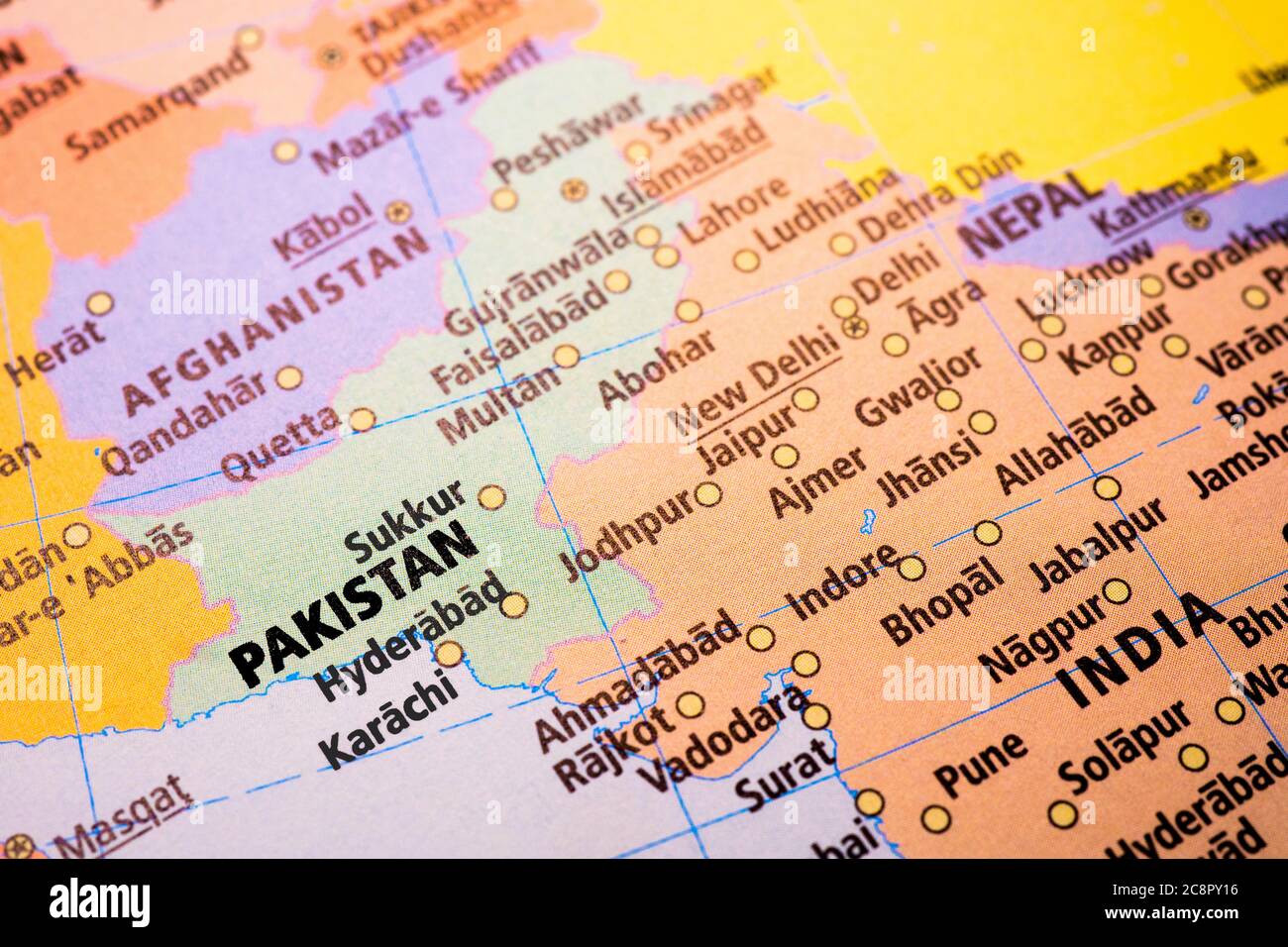 Map photography of Pakistan, India, Afghanistan, Nepal. Stock Photohttps://www.alamy.com/image-license-details/?v=1https://www.alamy.com/map-photography-of-pakistan-india-afghanistan-nepal-image366839122.html
RF2C8PY16–Map photography of Pakistan, India, Afghanistan, Nepal.
 a finger of Woman point the city New Delhi, India, Asia on a world map, to choice a destination Stock Photohttps://www.alamy.com/image-license-details/?v=1https://www.alamy.com/stock-photo-a-finger-of-woman-point-the-city-new-delhi-india-asia-on-a-world-map-52911539.html
RMD2295R–a finger of Woman point the city New Delhi, India, Asia on a world map, to choice a destination
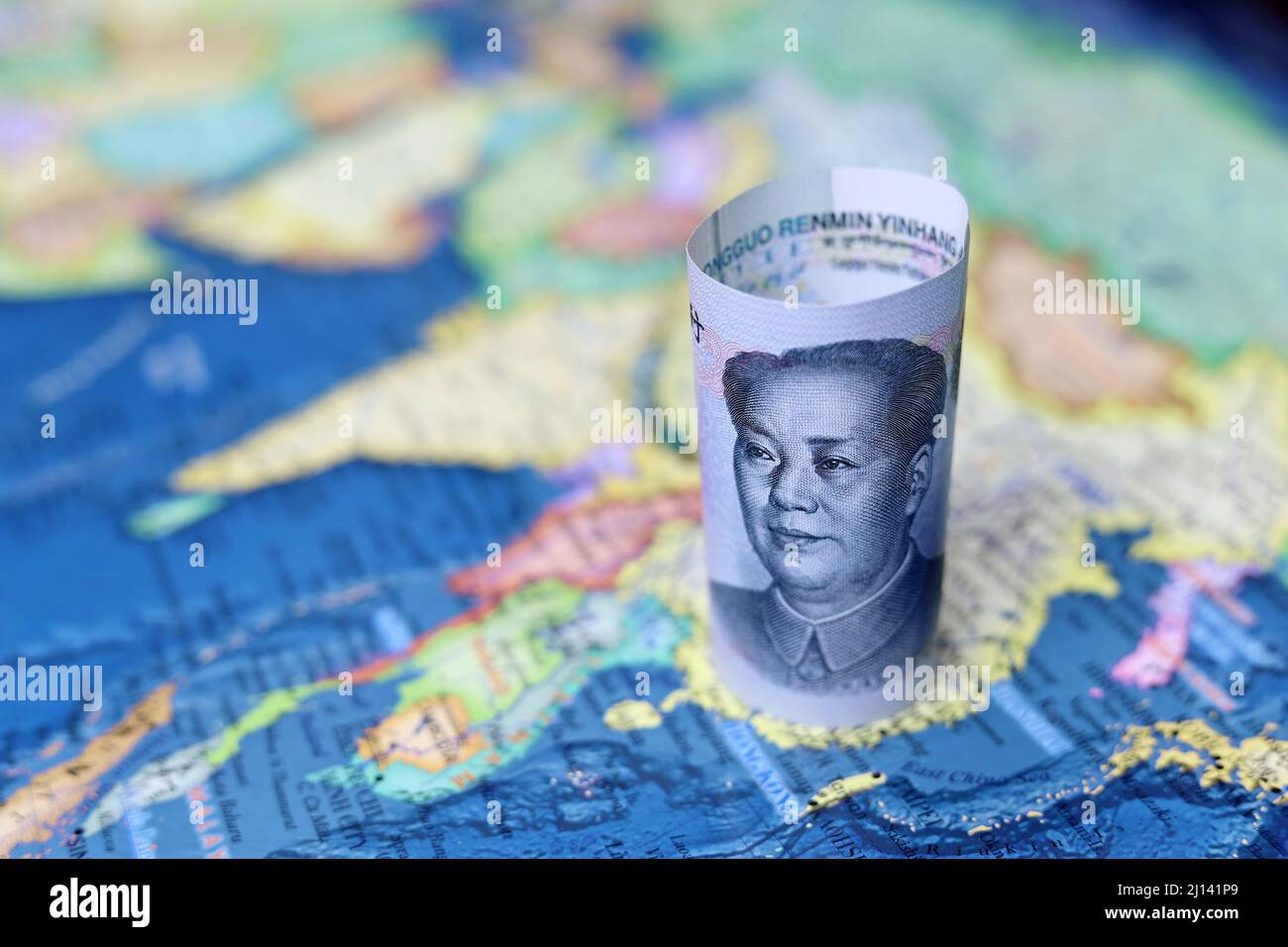 Chinese yuan currency on the map of China. Concept of chinese and asian economy, political conflict over Taiwan Stock Photohttps://www.alamy.com/image-license-details/?v=1https://www.alamy.com/chinese-yuan-currency-on-the-map-of-china-concept-of-chinese-and-asian-economy-political-conflict-over-taiwan-image465383809.html
RF2J141P9–Chinese yuan currency on the map of China. Concept of chinese and asian economy, political conflict over Taiwan
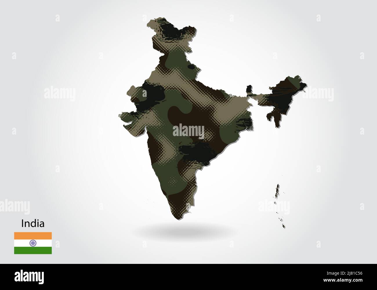 india map with camouflage pattern, Forest - green texture in map. Military concept for army, soldier and war. coat of arms, flag. Stock Vectorhttps://www.alamy.com/image-license-details/?v=1https://www.alamy.com/india-map-with-camouflage-pattern-forest-green-texture-in-map-military-concept-for-army-soldier-and-war-coat-of-arms-flag-image469628690.html
RF2J81C56–india map with camouflage pattern, Forest - green texture in map. Military concept for army, soldier and war. coat of arms, flag.
 Wrecked Zeppelin brought down by our aviators near the coast of Essex (1916) - India Office Official Record of the Great War (1921) - BL Photo 21-108 Stock Photohttps://www.alamy.com/image-license-details/?v=1https://www.alamy.com/stock-photo-wrecked-zeppelin-brought-down-by-our-aviators-near-the-coast-of-essex-73520715.html
RME7H4BR–Wrecked Zeppelin brought down by our aviators near the coast of Essex (1916) - India Office Official Record of the Great War (1921) - BL Photo 21-108
 High detailed flag of India. National India flag. Asia. 3D illustration. Stock Vectorhttps://www.alamy.com/image-license-details/?v=1https://www.alamy.com/high-detailed-flag-of-india-national-india-flag-asia-3d-illustration-image591798227.html
RF2WAPMJY–High detailed flag of India. National India flag. Asia. 3D illustration.
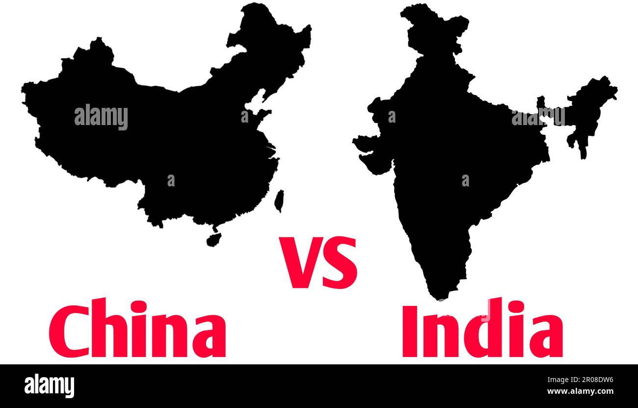 A India VS China Border Disputes War Concept Illustration, Fight Trade Breaking News Timeline Paper, Country Maps Silhouette Style Stock Photohttps://www.alamy.com/image-license-details/?v=1https://www.alamy.com/a-india-vs-china-border-disputes-war-concept-illustration-fight-trade-breaking-news-timeline-paper-country-maps-silhouette-style-image550918290.html
RF2R08DW6–A India VS China Border Disputes War Concept Illustration, Fight Trade Breaking News Timeline Paper, Country Maps Silhouette Style
 Battle of Laswari, November 1, 1803 near Laswari village, Alwar, Second Anglo-Maratha War, From British Battles on Land and Sea by James Grant Stock Photohttps://www.alamy.com/image-license-details/?v=1https://www.alamy.com/battle-of-laswari-november-1-1803-near-laswari-village-alwar-second-anglo-maratha-war-from-british-battles-on-land-and-sea-by-james-grant-image398902251.html
RM2E4YFTY–Battle of Laswari, November 1, 1803 near Laswari village, Alwar, Second Anglo-Maratha War, From British Battles on Land and Sea by James Grant
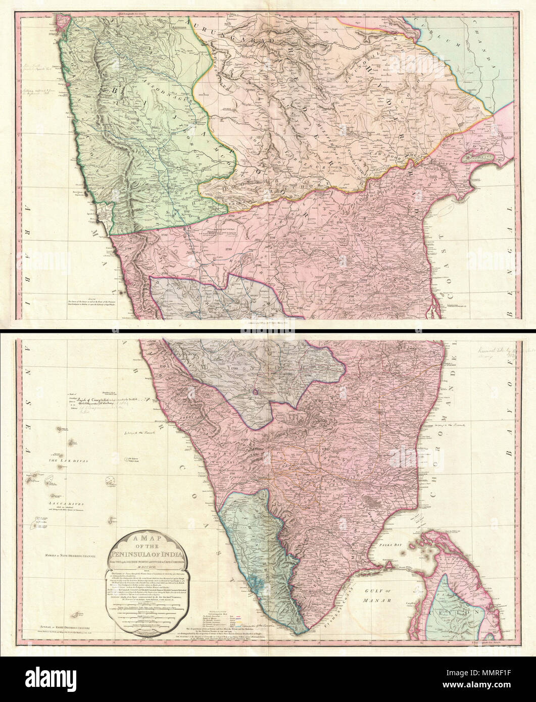 . English: This map (noted as 'Third Edition'), created immediately after the Fourth Anglo-Mysore War (1798–1799), is based on the 1793 Faden map (without any version note), created immediately after the Third Anglo-Mysore War (1789-92) and the subsequent division of and territorial loss by the Kingdom of Mysore through the 1792 Treaty of Seringapatam. The only difference from the older map is in political territory, showing vast expansion of the territory of the British East India Company (over that gained by the 1792 Treaty of Seringapatam), and the now much smaller Princely State of Mysore Stock Photohttps://www.alamy.com/image-license-details/?v=1https://www.alamy.com/english-this-map-noted-as-third-edition-created-immediately-after-the-fourth-anglo-mysore-war-17981799-is-based-on-the-1793-faden-map-without-any-version-note-created-immediately-after-the-third-anglo-mysore-war-1789-92-and-the-subsequent-division-of-and-territorial-loss-by-the-kingdom-of-mysore-through-the-1792-treaty-of-seringapatam-the-only-difference-from-the-older-map-is-in-political-territory-showing-vast-expansion-of-the-territory-of-the-british-east-india-company-over-that-gained-by-the-1792-treaty-of-seringapatam-and-the-now-much-smaller-princely-state-of-mysore-image184913499.html
RMMMRF1F–. English: This map (noted as 'Third Edition'), created immediately after the Fourth Anglo-Mysore War (1798–1799), is based on the 1793 Faden map (without any version note), created immediately after the Third Anglo-Mysore War (1789-92) and the subsequent division of and territorial loss by the Kingdom of Mysore through the 1792 Treaty of Seringapatam. The only difference from the older map is in political territory, showing vast expansion of the territory of the British East India Company (over that gained by the 1792 Treaty of Seringapatam), and the now much smaller Princely State of Mysore
 illustration of elements of Indian Airforce Day Background Stock Vectorhttps://www.alamy.com/image-license-details/?v=1https://www.alamy.com/stock-image-illustration-of-elements-of-indian-airforce-day-background-162357436.html
RFKC40FT–illustration of elements of Indian Airforce Day Background
RF2HP92AP–Location Icon for India
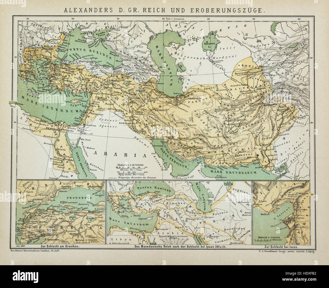 Antique map of Alexander's the Great Empire Stock Photohttps://www.alamy.com/image-license-details/?v=1https://www.alamy.com/stock-photo-antique-map-of-alexanders-the-great-empire-129045926.html
RFHDXFB2–Antique map of Alexander's the Great Empire
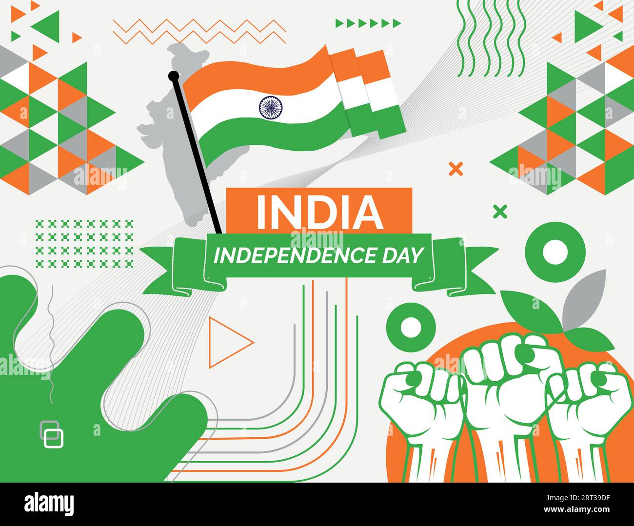 INDIA national day banner with map, flag colors theme background and geometric abstract retro modern colorfull design with raised hands or fists. Stock Vectorhttps://www.alamy.com/image-license-details/?v=1https://www.alamy.com/india-national-day-banner-with-map-flag-colors-theme-background-and-geometric-abstract-retro-modern-colorfull-design-with-raised-hands-or-fists-image565556811.html
RF2RT39DF–INDIA national day banner with map, flag colors theme background and geometric abstract retro modern colorfull design with raised hands or fists.
 Currency war Stock Photohttps://www.alamy.com/image-license-details/?v=1https://www.alamy.com/stock-photo-currency-war-33031510.html
RFBWMM0P–Currency war
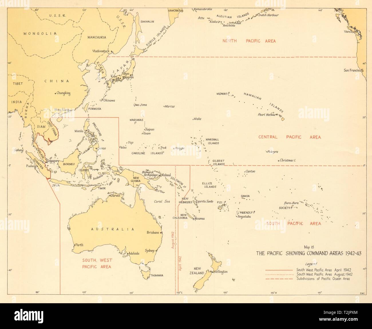 The Pacific showing Command Areas 1942-43. World War 2 1961 old vintage map Stock Photohttps://www.alamy.com/image-license-details/?v=1https://www.alamy.com/the-pacific-showing-command-areas-1942-43-world-war-2-1961-old-vintage-map-image242587596.html
RFT2JPXM–The Pacific showing Command Areas 1942-43. World War 2 1961 old vintage map
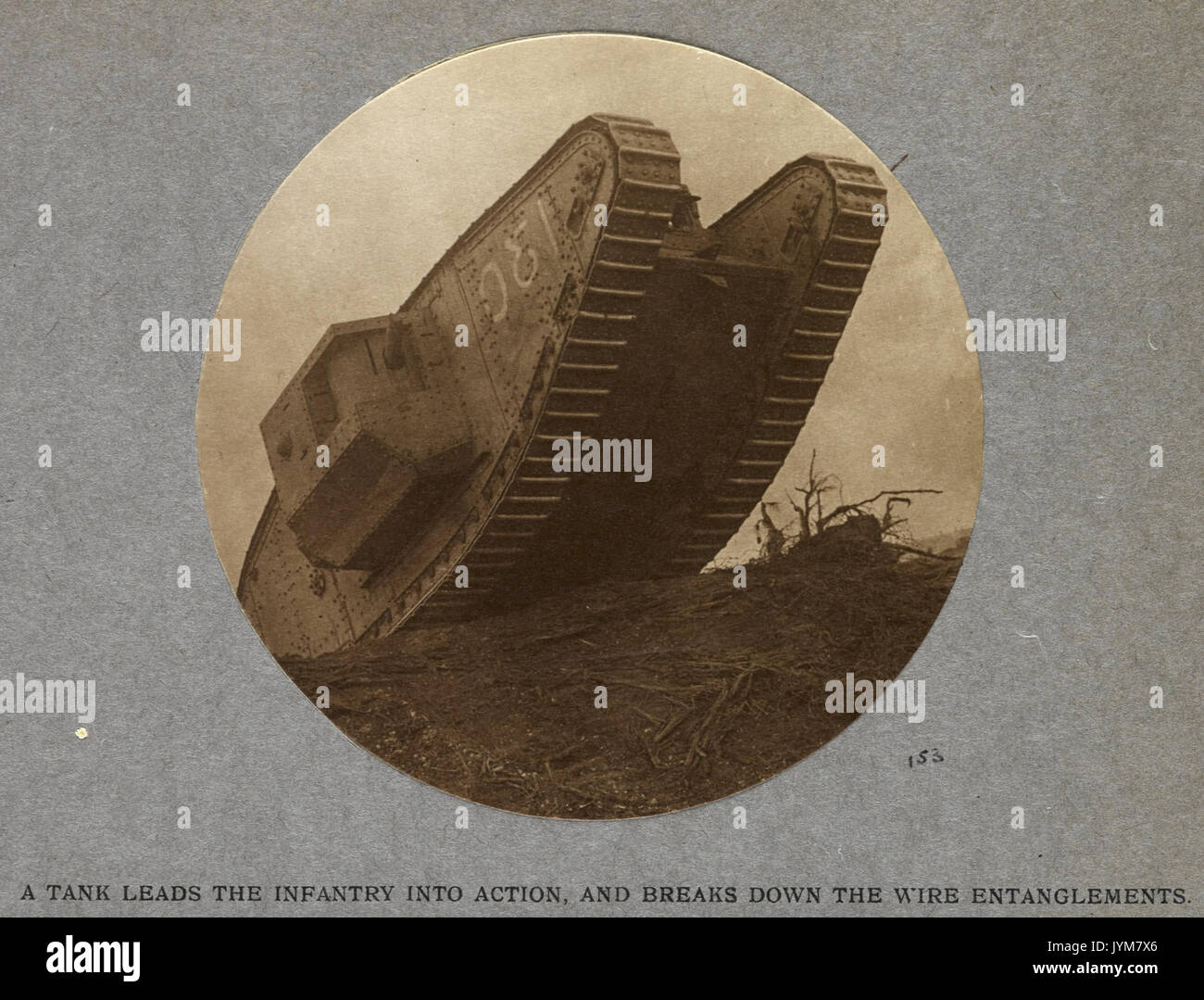 A tank leads the infantry into action and breaks down the wire entanglements (1917) India Office Official Record of the Great War (1921) BL Photo 21 153 Stock Photohttps://www.alamy.com/image-license-details/?v=1https://www.alamy.com/a-tank-leads-the-infantry-into-action-and-breaks-down-the-wire-entanglements-image154723918.html
RMJYM7X6–A tank leads the infantry into action and breaks down the wire entanglements (1917) India Office Official Record of the Great War (1921) BL Photo 21 153
 Currency war Stock Vectorhttps://www.alamy.com/image-license-details/?v=1https://www.alamy.com/currency-war-image64457828.html
RFDMT8H8–Currency war
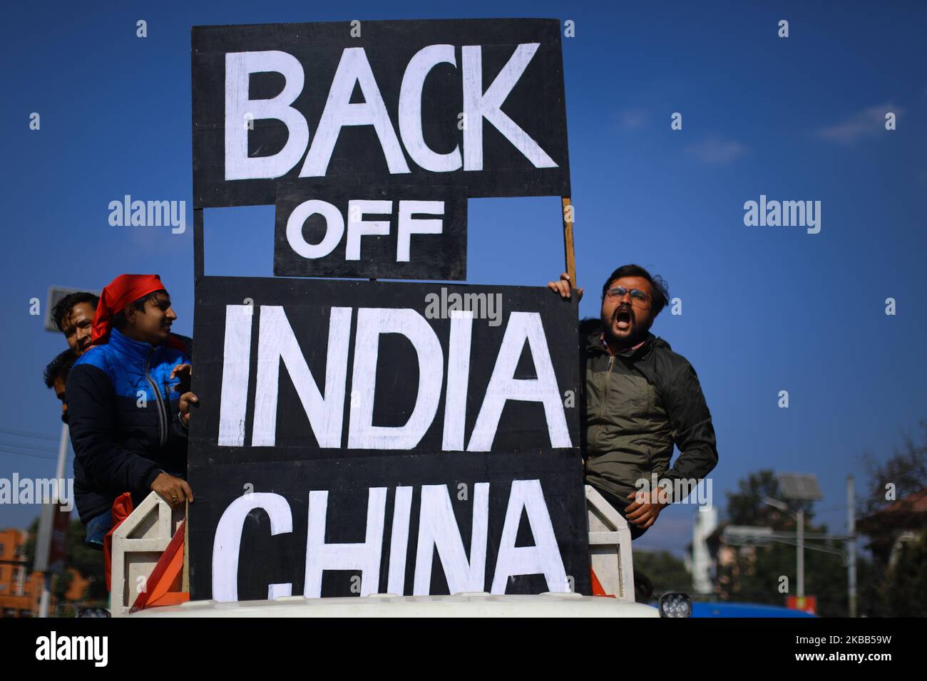 Nepal Student Union protest against border encroachment against both India and china at Maitighar Mandala on November 17,2019. They gathered at Maitighar Mandala holding play cards ‘Back off India, China” and chanted slogans against the encroachment. (Photo by Saroj Baizu/NurPhoto) Stock Photohttps://www.alamy.com/image-license-details/?v=1https://www.alamy.com/nepal-student-union-protest-against-border-encroachment-against-both-india-and-china-at-maitighar-mandala-on-november-172019-they-gathered-at-maitighar-mandala-holding-play-cards-back-off-india-china-and-chanted-slogans-against-the-encroachment-photo-by-saroj-baizunurphoto-image488897189.html
RM2KBB59W–Nepal Student Union protest against border encroachment against both India and china at Maitighar Mandala on November 17,2019. They gathered at Maitighar Mandala holding play cards ‘Back off India, China” and chanted slogans against the encroachment. (Photo by Saroj Baizu/NurPhoto)
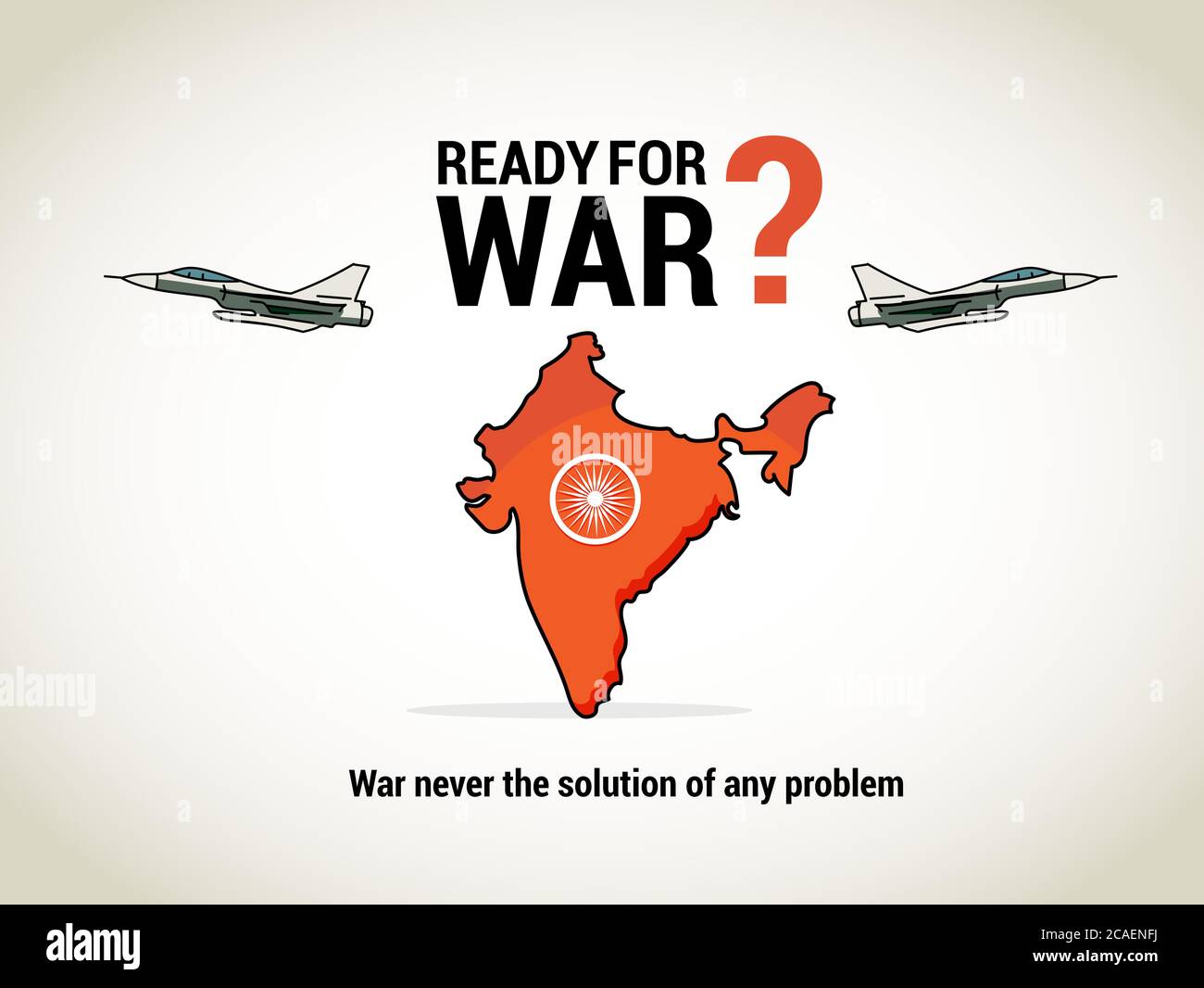 India Map on white background. Ready for war..War never be the solution of any country. Suitable for war awareness campaigns and adverts Stock Vectorhttps://www.alamy.com/image-license-details/?v=1https://www.alamy.com/india-map-on-white-background-ready-for-warwar-never-be-the-solution-of-any-country-suitable-for-war-awareness-campaigns-and-adverts-image367888518.html
RF2CAENFJ–India Map on white background. Ready for war..War never be the solution of any country. Suitable for war awareness campaigns and adverts
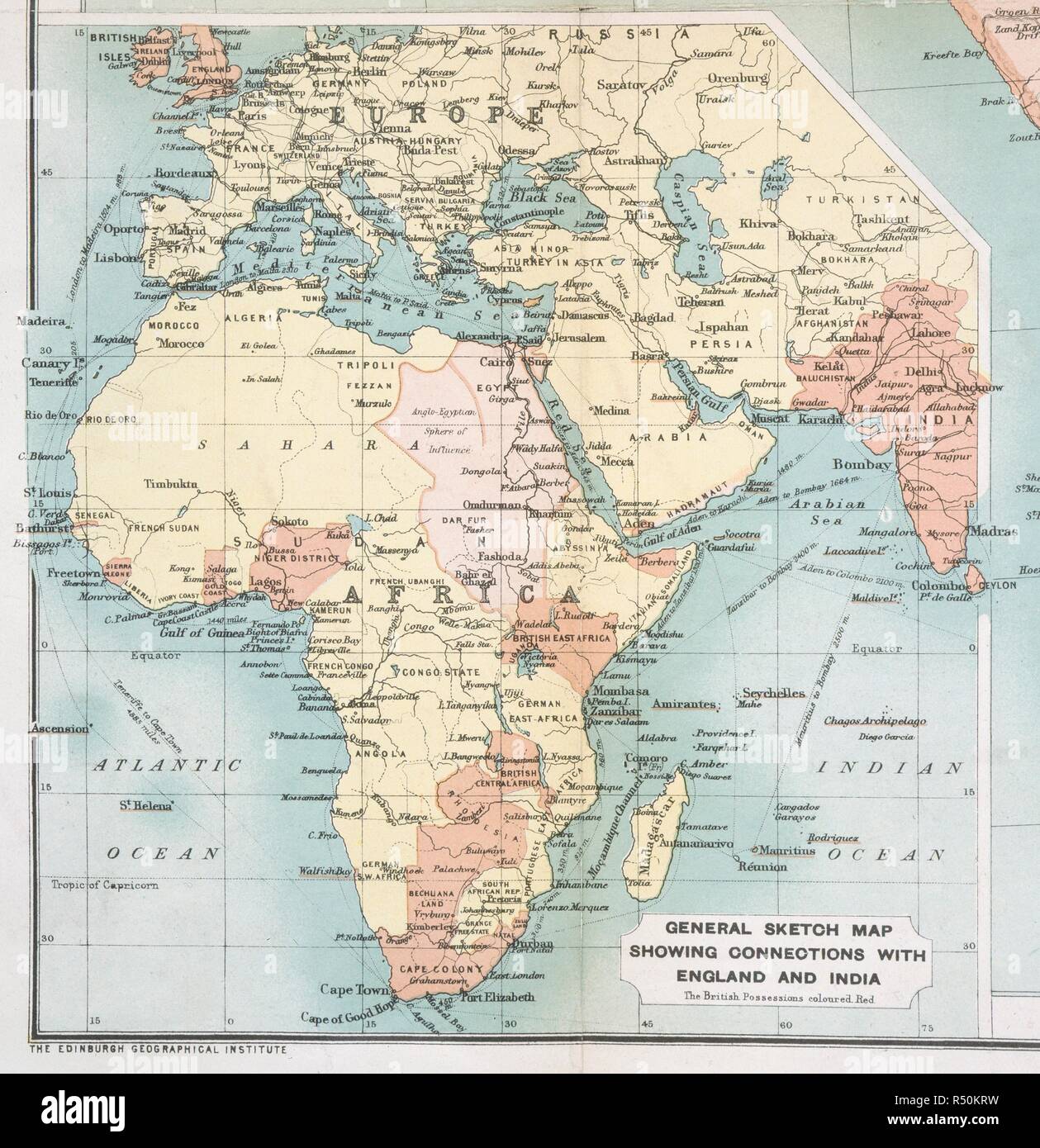 Map of British possessions. Bartholomew's special (war) map of South Africa. Edinburgh, 1899. General sketch map showing connections with England and India. Image taken from Bartholomew's special (war) map of South Africa. Originally published/produced in Edinburgh, 1899. . Source: Maps.20.a.37,. Stock Photohttps://www.alamy.com/image-license-details/?v=1https://www.alamy.com/map-of-british-possessions-bartholomews-special-war-map-of-south-africa-edinburgh-1899-general-sketch-map-showing-connections-with-england-and-india-image-taken-from-bartholomews-special-war-map-of-south-africa-originally-publishedproduced-in-edinburgh-1899-source-maps20a37-image226823629.html
RMR50KRW–Map of British possessions. Bartholomew's special (war) map of South Africa. Edinburgh, 1899. General sketch map showing connections with England and India. Image taken from Bartholomew's special (war) map of South Africa. Originally published/produced in Edinburgh, 1899. . Source: Maps.20.a.37,.
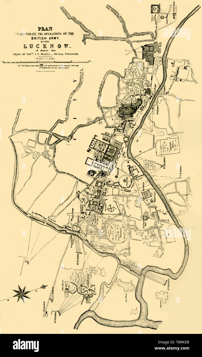 'Plan to Illustrate the Operations of the British Army before Lucknow in March 1858', (1901). Creator: Julius George Medley. Stock Photohttps://www.alamy.com/image-license-details/?v=1https://www.alamy.com/plan-to-illustrate-the-operations-of-the-british-army-before-lucknow-in-march-1858-1901-creator-julius-george-medley-image246382595.html
RMT8RKEB–'Plan to Illustrate the Operations of the British Army before Lucknow in March 1858', (1901). Creator: Julius George Medley.
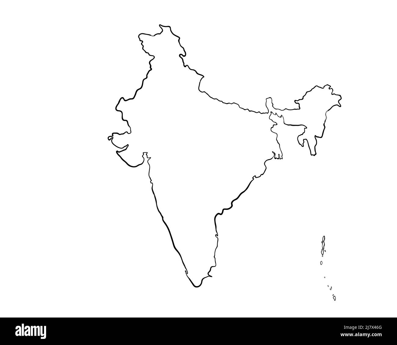 India - Hand-Drawn Map lllustration Stock Photohttps://www.alamy.com/image-license-details/?v=1https://www.alamy.com/india-hand-drawn-map-lllustration-image469556600.html
RF2J7X46G–India - Hand-Drawn Map lllustration
 Indian map with forbidden sign, 3D rendering isolated on white background Stock Photohttps://www.alamy.com/image-license-details/?v=1https://www.alamy.com/indian-map-with-forbidden-sign-3d-rendering-isolated-on-white-background-image483840863.html
RF2K34RXR–Indian map with forbidden sign, 3D rendering isolated on white background
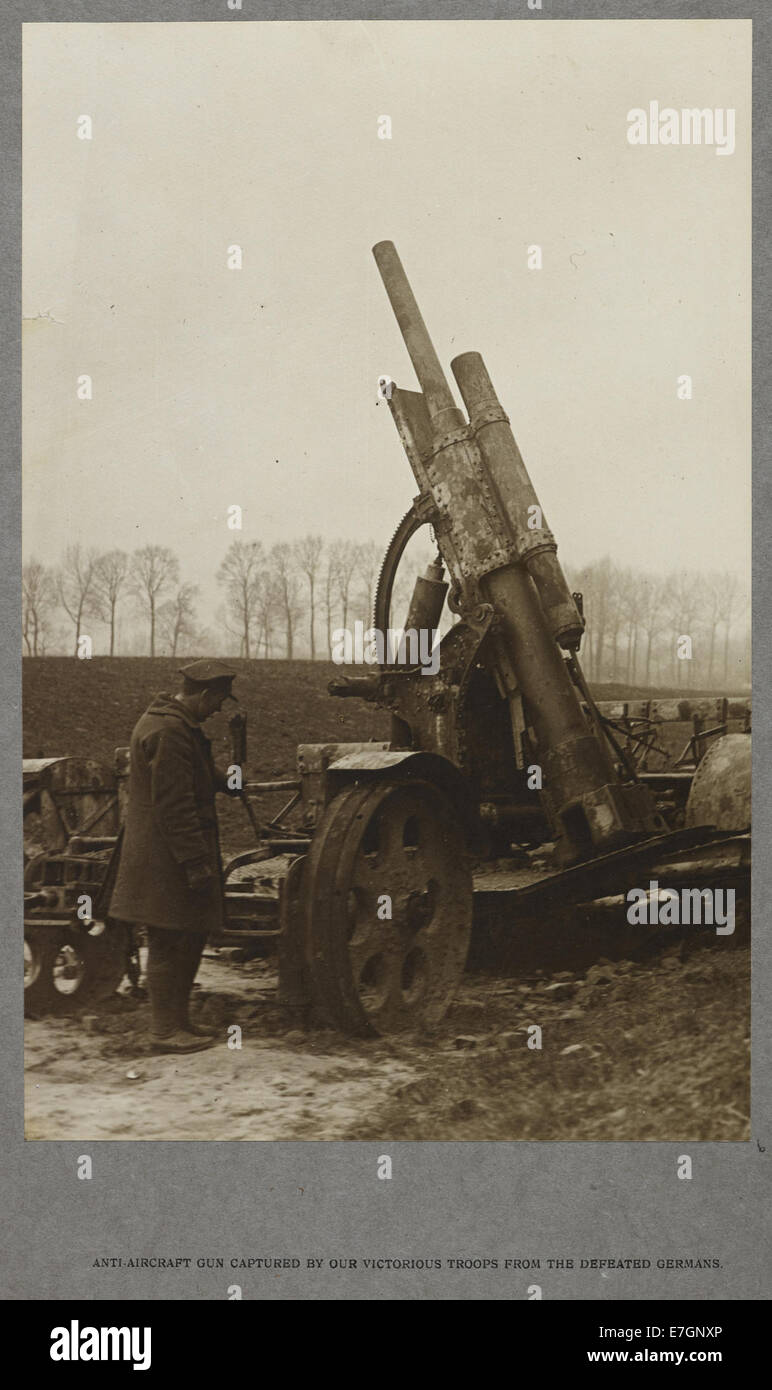 Anti-aircraft gun captured by our victorious troops from the defeated Germans (1915) - India Office Official Record of the Great War (1921) - BL Photo 21-6 Stock Photohttps://www.alamy.com/image-license-details/?v=1https://www.alamy.com/stock-photo-anti-aircraft-gun-captured-by-our-victorious-troops-from-the-defeated-73512510.html
RME7GNXP–Anti-aircraft gun captured by our victorious troops from the defeated Germans (1915) - India Office Official Record of the Great War (1921) - BL Photo 21-6
 An indian landscape I found when working with the Seva Mandir charity, a few hours out of Udaipur. The view captures the stunning wildlife of India. Stock Photohttps://www.alamy.com/image-license-details/?v=1https://www.alamy.com/stock-photo-an-indian-landscape-i-found-when-working-with-the-seva-mandir-charity-172628053.html
RFM0RTRH–An indian landscape I found when working with the Seva Mandir charity, a few hours out of Udaipur. The view captures the stunning wildlife of India.
RF2R08DNY–A India VS China Border Disputes War Concept Illustration, Fight Trade Breaking News Timeline Paper, Country Maps With Hand First Icon
 Moscow, Russia. 09th July, 2024. Russian President Vladimir Putin, point to a map of Russia to Indian Prime Minister Narendra Modi, right, during a visit the Atom pavilion dedicated to the history and latest achievements of the nuclear industry, at the VDNKh Exhibition Center, July 9, 2024 in Moscow Oblast, Russia. Credit: Gavriil Grigorov/Kremlin Pool/Alamy Live News Stock Photohttps://www.alamy.com/image-license-details/?v=1https://www.alamy.com/moscow-russia-09th-july-2024-russian-president-vladimir-putin-point-to-a-map-of-russia-to-indian-prime-minister-narendra-modi-right-during-a-visit-the-atom-pavilion-dedicated-to-the-history-and-latest-achievements-of-the-nuclear-industry-at-the-vdnkh-exhibition-center-july-9-2024-in-moscow-oblast-russia-credit-gavriil-grigorovkremlin-poolalamy-live-news-image612594111.html
RM2XGJ213–Moscow, Russia. 09th July, 2024. Russian President Vladimir Putin, point to a map of Russia to Indian Prime Minister Narendra Modi, right, during a visit the Atom pavilion dedicated to the history and latest achievements of the nuclear industry, at the VDNKh Exhibition Center, July 9, 2024 in Moscow Oblast, Russia. Credit: Gavriil Grigorov/Kremlin Pool/Alamy Live News
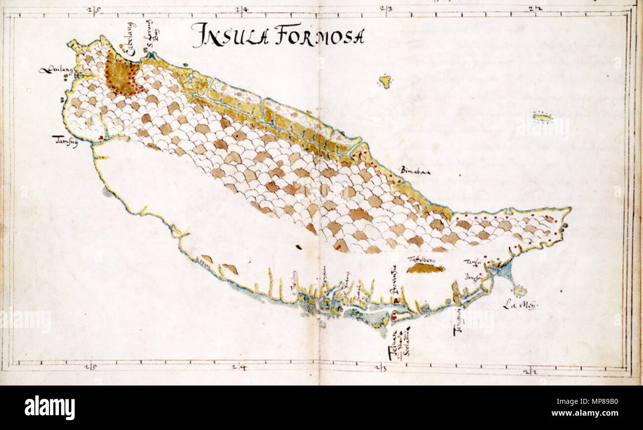 . Deutsch: Eine Karte von Formosa, gezeichnet von Caspar Schmalkalden nachdem er seinen Dienst bei der Niederländischen Ostindien-Kompanie quittiert hatte. Bemerkenswert ist die detaillierte Darstellung der Ostküste der Insel, die bis dahin durch die europäischen Kolonisatoren vernachlässigt worden war. Die Karte reflektiert das damalige Wissen, das durch mehrere Expeditionen der Ostindien-Kompanie an die Ostküste in den 1640er Jahren gewonnen worden war. English: This unofficial map, made by Caspar Schmalkalden, after he left the service of the Dutch East India Company is unusual in the detai Stock Photohttps://www.alamy.com/image-license-details/?v=1https://www.alamy.com/deutsch-eine-karte-von-formosa-gezeichnet-von-caspar-schmalkalden-nachdem-er-seinen-dienst-bei-der-niederlndischen-ostindien-kompanie-quittiert-hatte-bemerkenswert-ist-die-detaillierte-darstellung-der-ostkste-der-insel-die-bis-dahin-durch-die-europischen-kolonisatoren-vernachlssigt-worden-war-die-karte-reflektiert-das-damalige-wissen-das-durch-mehrere-expeditionen-der-ostindien-kompanie-an-die-ostkste-in-den-1640er-jahren-gewonnen-worden-war-english-this-unofficial-map-made-by-caspar-schmalkalden-after-he-left-the-service-of-the-dutch-east-india-company-is-unusual-in-the-detai-image185809092.html
RMMP89B0–. Deutsch: Eine Karte von Formosa, gezeichnet von Caspar Schmalkalden nachdem er seinen Dienst bei der Niederländischen Ostindien-Kompanie quittiert hatte. Bemerkenswert ist die detaillierte Darstellung der Ostküste der Insel, die bis dahin durch die europäischen Kolonisatoren vernachlässigt worden war. Die Karte reflektiert das damalige Wissen, das durch mehrere Expeditionen der Ostindien-Kompanie an die Ostküste in den 1640er Jahren gewonnen worden war. English: This unofficial map, made by Caspar Schmalkalden, after he left the service of the Dutch East India Company is unusual in the detai