Quick filters:
Map of ancient greece Stock Photos and Images
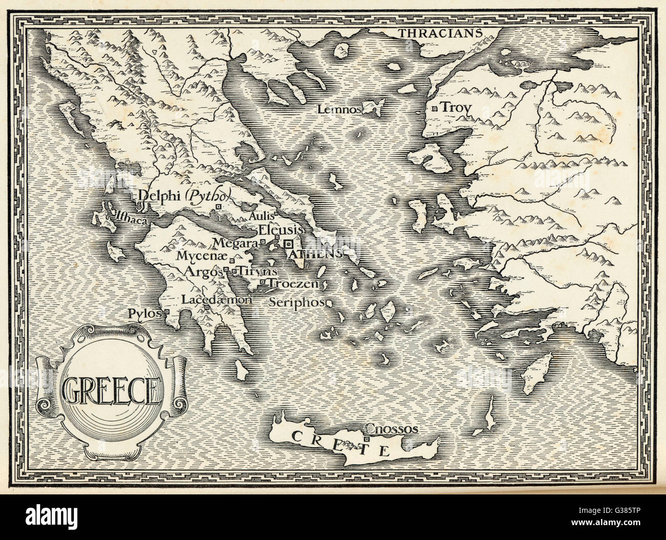 Map of ancient Greece. Stock Photohttps://www.alamy.com/image-license-details/?v=1https://www.alamy.com/stock-photo-map-of-ancient-greece-105286406.html
RMG385TP–Map of ancient Greece.
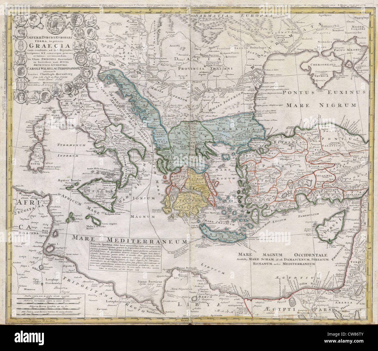 1741 Homann Heirs Map of Ancient Greece ^ the Eastern Mediterranean Stock Photohttps://www.alamy.com/image-license-details/?v=1https://www.alamy.com/stock-photo-1741-homann-heirs-map-of-ancient-greece-the-eastern-mediterranean-49968155.html
RMCW86TY–1741 Homann Heirs Map of Ancient Greece ^ the Eastern Mediterranean
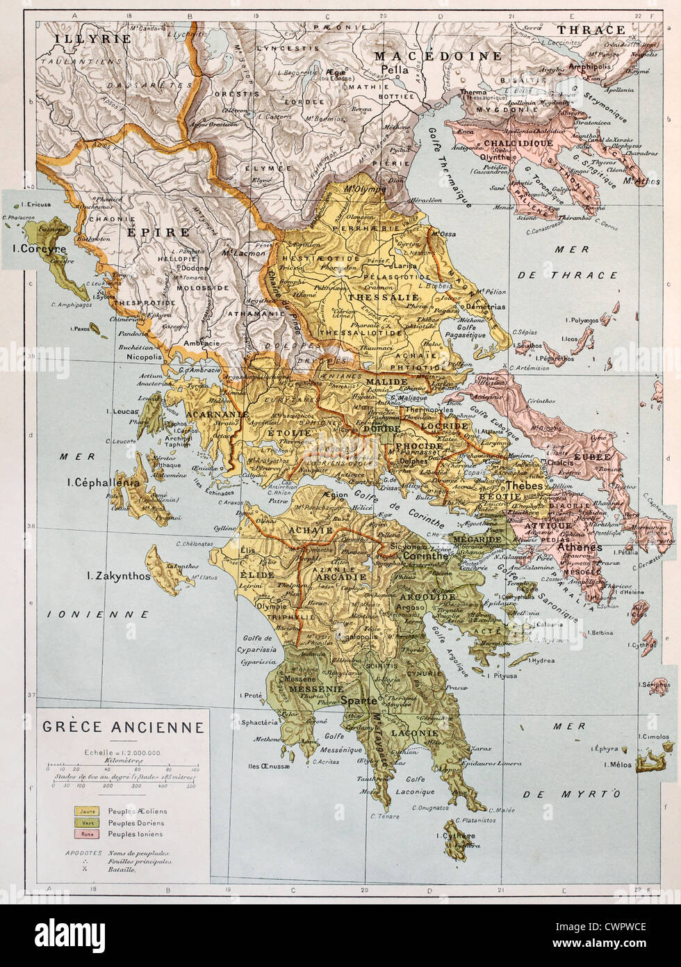 Old map of Ancient Greece Stock Photohttps://www.alamy.com/image-license-details/?v=1https://www.alamy.com/stock-photo-old-map-of-ancient-greece-50290030.html
RFCWPWCE–Old map of Ancient Greece
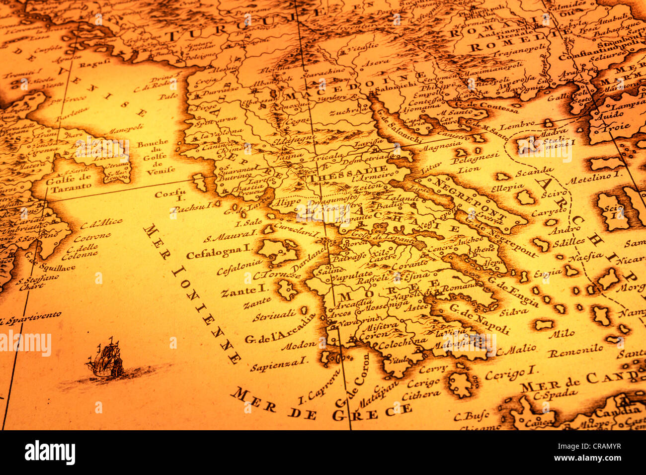 Ancient map of Greece, Macedonia and Southern Italy. Map is from 1680 and is out of copyright. Stock Photohttps://www.alamy.com/image-license-details/?v=1https://www.alamy.com/stock-photo-ancient-map-of-greece-macedonia-and-southern-italy-map-is-from-1680-48793803.html
RFCRAMYR–Ancient map of Greece, Macedonia and Southern Italy. Map is from 1680 and is out of copyright.
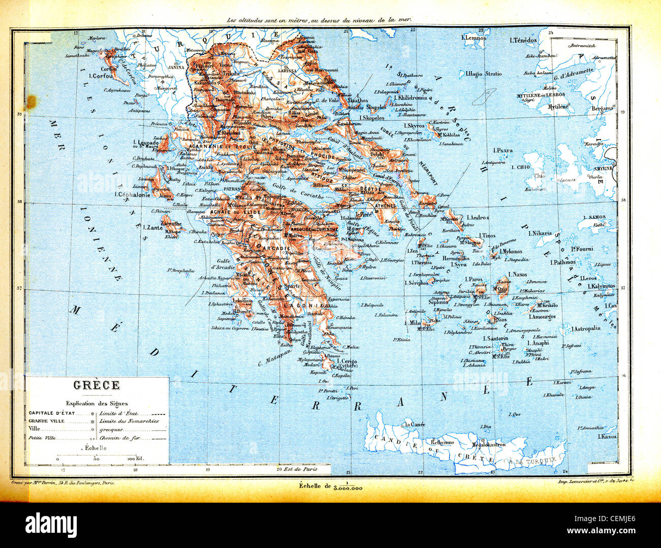 The map of Greece with explanation of signs on map. Stock Photohttps://www.alamy.com/image-license-details/?v=1https://www.alamy.com/stock-photo-the-map-of-greece-with-explanation-of-signs-on-map-43479470.html
RFCEMJE6–The map of Greece with explanation of signs on map.
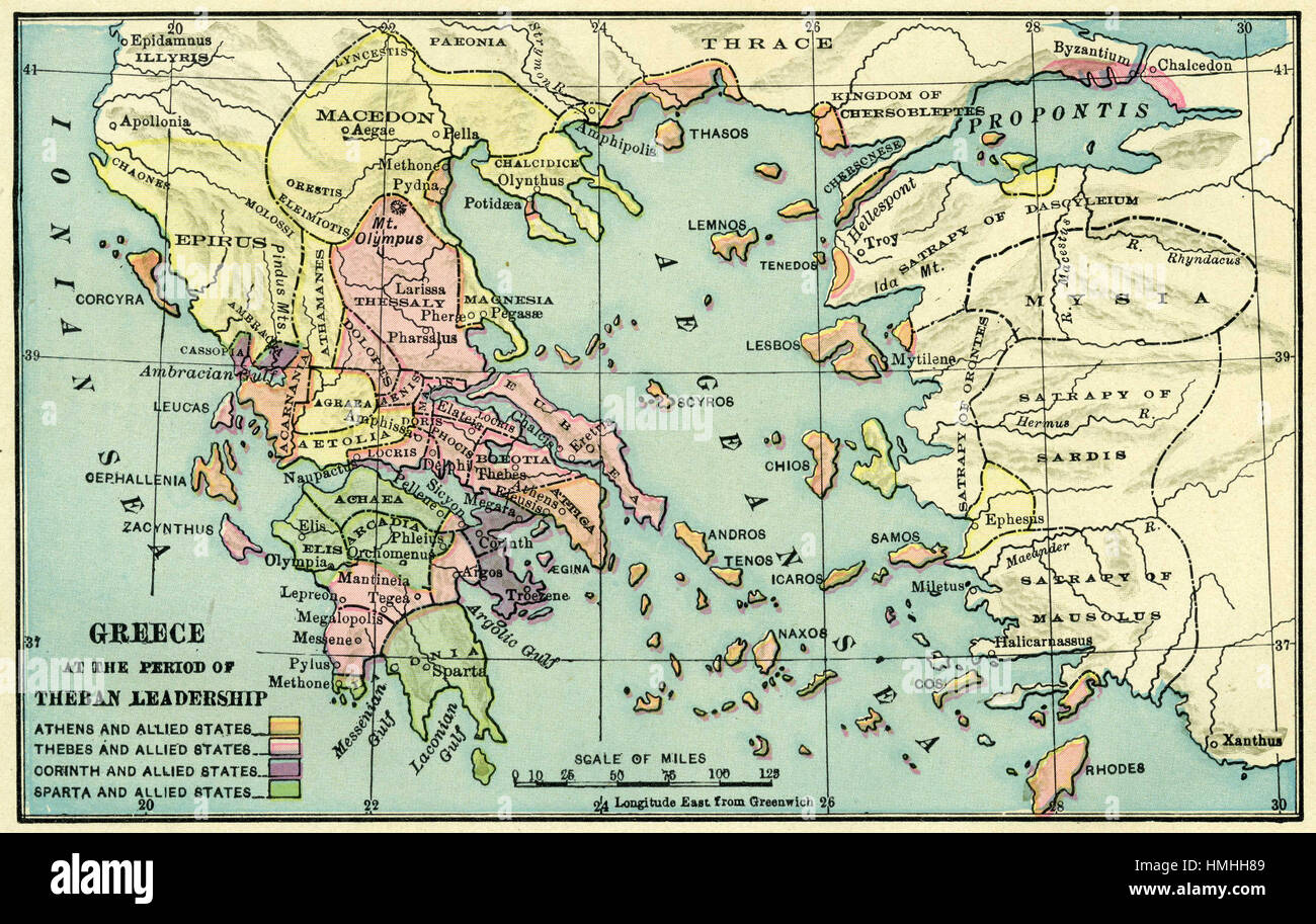 map of europe Stock Photohttps://www.alamy.com/image-license-details/?v=1https://www.alamy.com/stock-photo-map-of-europe-133152441.html
RFHMHH89–map of europe
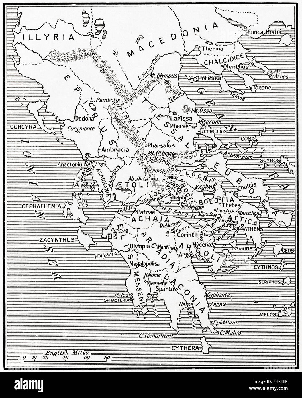 Map of Ancient Greece, 500 - 300 BC. Stock Photohttps://www.alamy.com/image-license-details/?v=1https://www.alamy.com/stock-photo-map-of-ancient-greece-500-300-bc-97083135.html
RMFHXEER–Map of Ancient Greece, 500 - 300 BC.
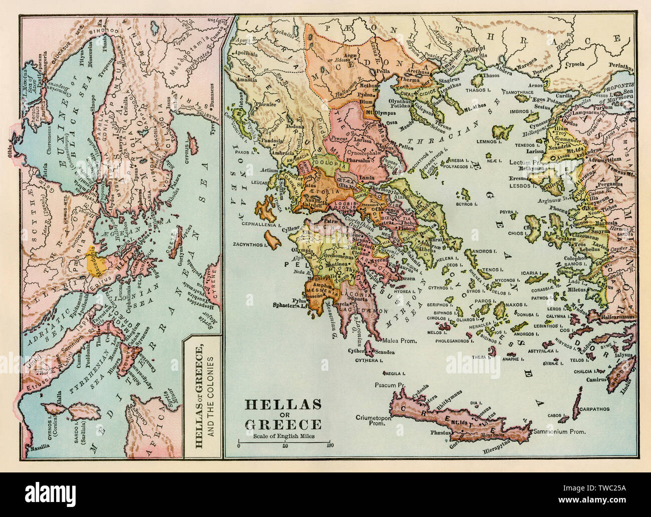 Map of ancient Greece and the Greek empire. Color lithograph Stock Photohttps://www.alamy.com/image-license-details/?v=1https://www.alamy.com/map-of-ancient-greece-and-the-greek-empire-color-lithograph-image256576694.html
RMTWC25A–Map of ancient Greece and the Greek empire. Color lithograph
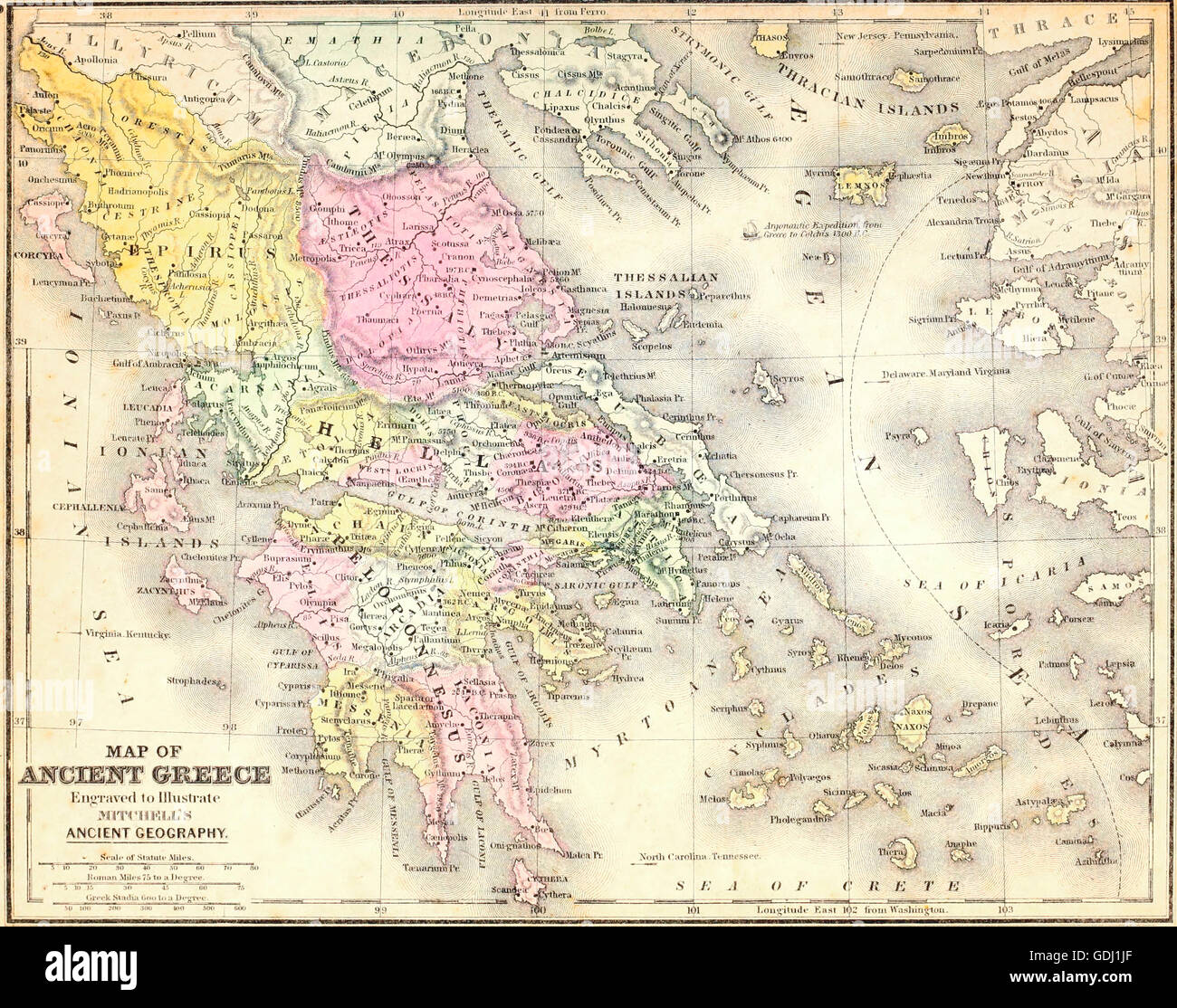 Map of Ancient Greece Stock Photohttps://www.alamy.com/image-license-details/?v=1https://www.alamy.com/stock-photo-map-of-ancient-greece-111649175.html
RMGDJ1JF–Map of Ancient Greece
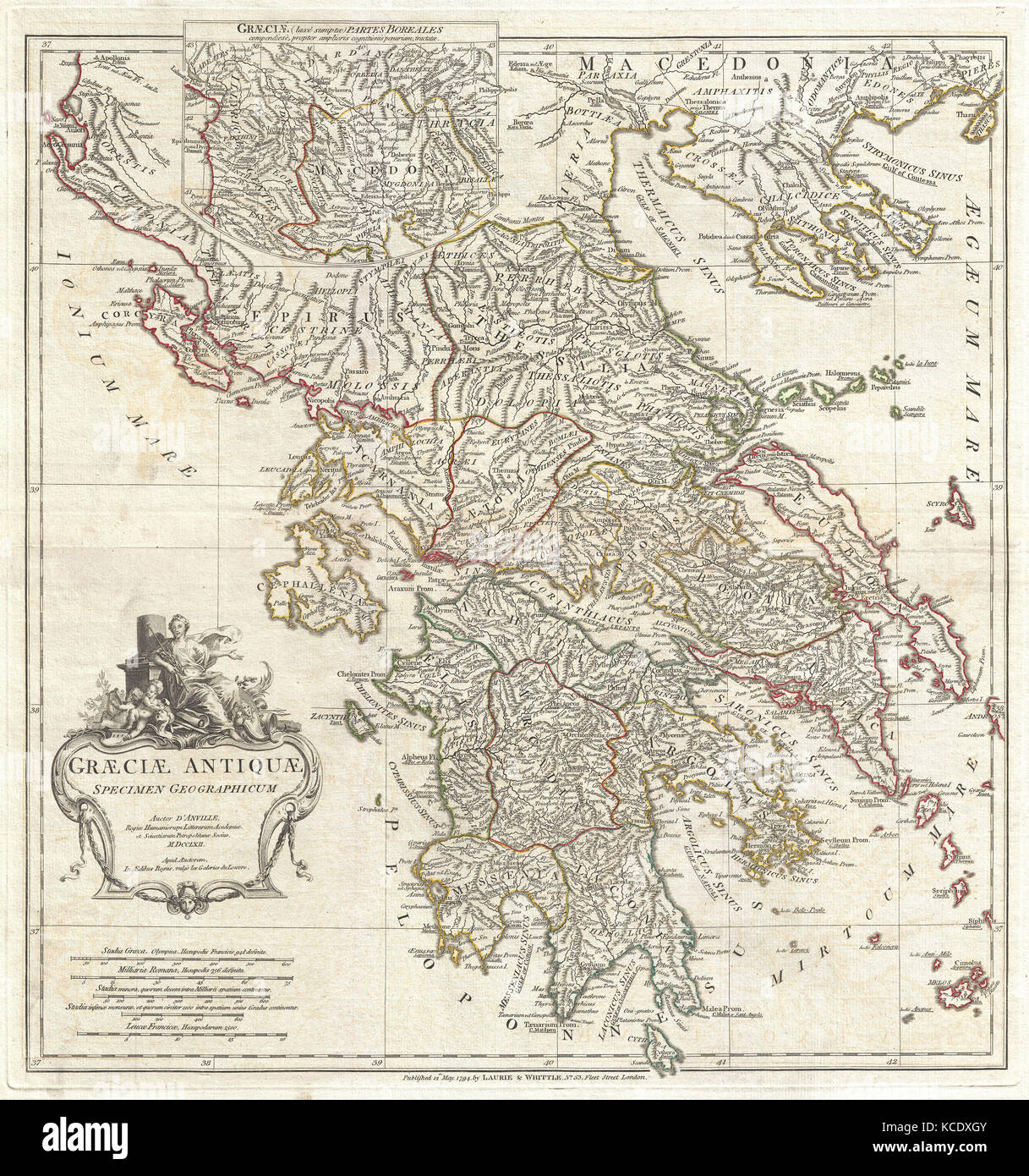 1794, Anville Map of Ancient Greece Stock Photohttps://www.alamy.com/image-license-details/?v=1https://www.alamy.com/stock-image-1794-anville-map-of-ancient-greece-162575419.html
RMKCDXGY–1794, Anville Map of Ancient Greece
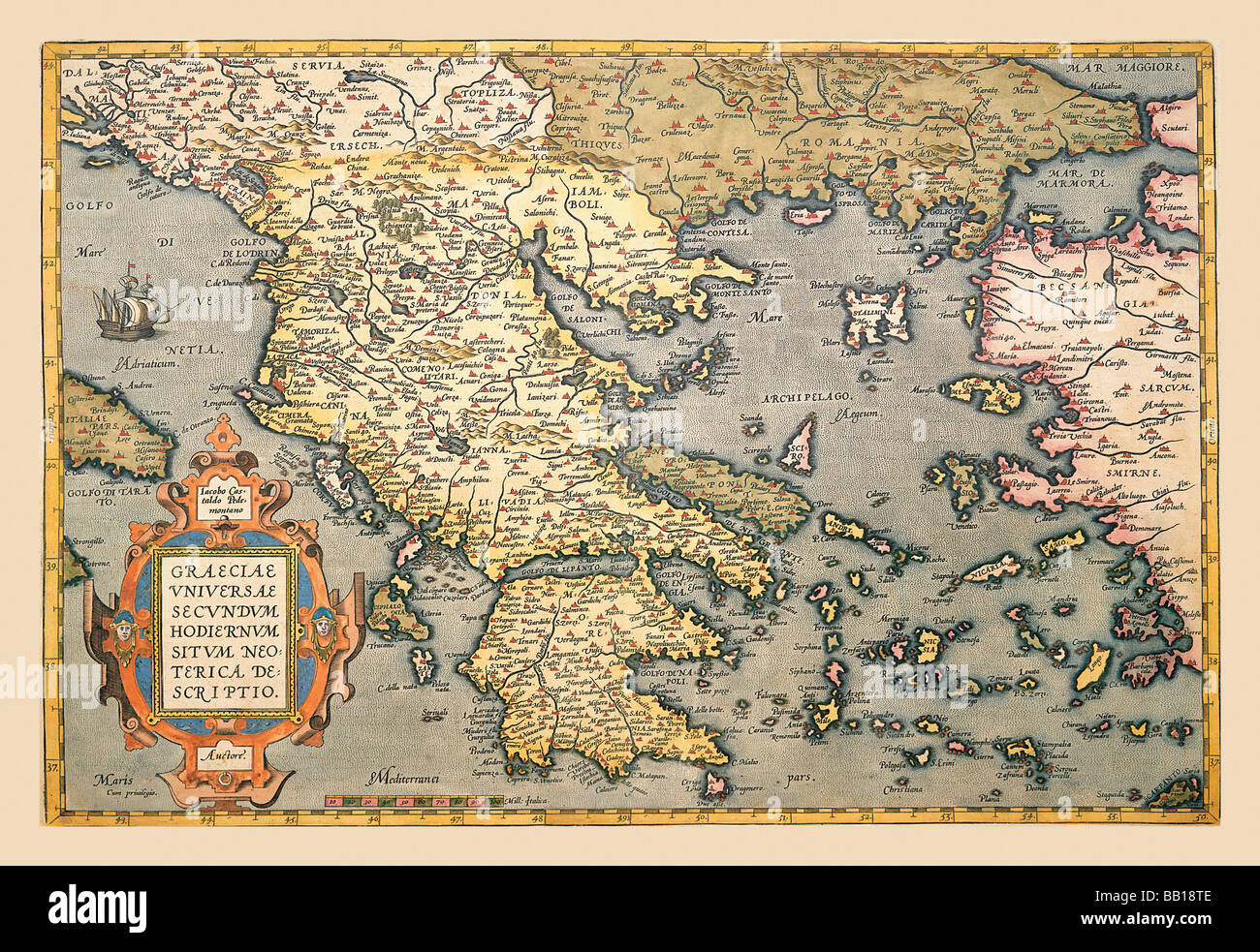 Map of Greece Stock Photohttps://www.alamy.com/image-license-details/?v=1https://www.alamy.com/stock-photo-map-of-greece-24000494.html
RMBB18TE–Map of Greece
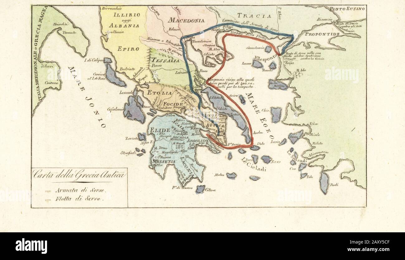 Map of Ancient Greece. Routes of King of Persia Xerxes I’s army (blue) and navy (red) during its failed invasion of Greece 480BC. Carta della Grecia Antica. Handcoloured copperplate engraving from Giulio Ferrario’s Costumes Ancient and Modern of the Peoples of the World, Il Costume Antico e Moderno, Florence, 1842. Stock Photohttps://www.alamy.com/image-license-details/?v=1https://www.alamy.com/map-of-ancient-greece-routes-of-king-of-persia-xerxes-is-army-blue-and-navy-red-during-its-failed-invasion-of-greece-480bc-carta-della-grecia-antica-handcoloured-copperplate-engraving-from-giulio-ferrarios-costumes-ancient-and-modern-of-the-peoples-of-the-world-il-costume-antico-e-moderno-florence-1842-image343575023.html
RM2AXY5CF–Map of Ancient Greece. Routes of King of Persia Xerxes I’s army (blue) and navy (red) during its failed invasion of Greece 480BC. Carta della Grecia Antica. Handcoloured copperplate engraving from Giulio Ferrario’s Costumes Ancient and Modern of the Peoples of the World, Il Costume Antico e Moderno, Florence, 1842.
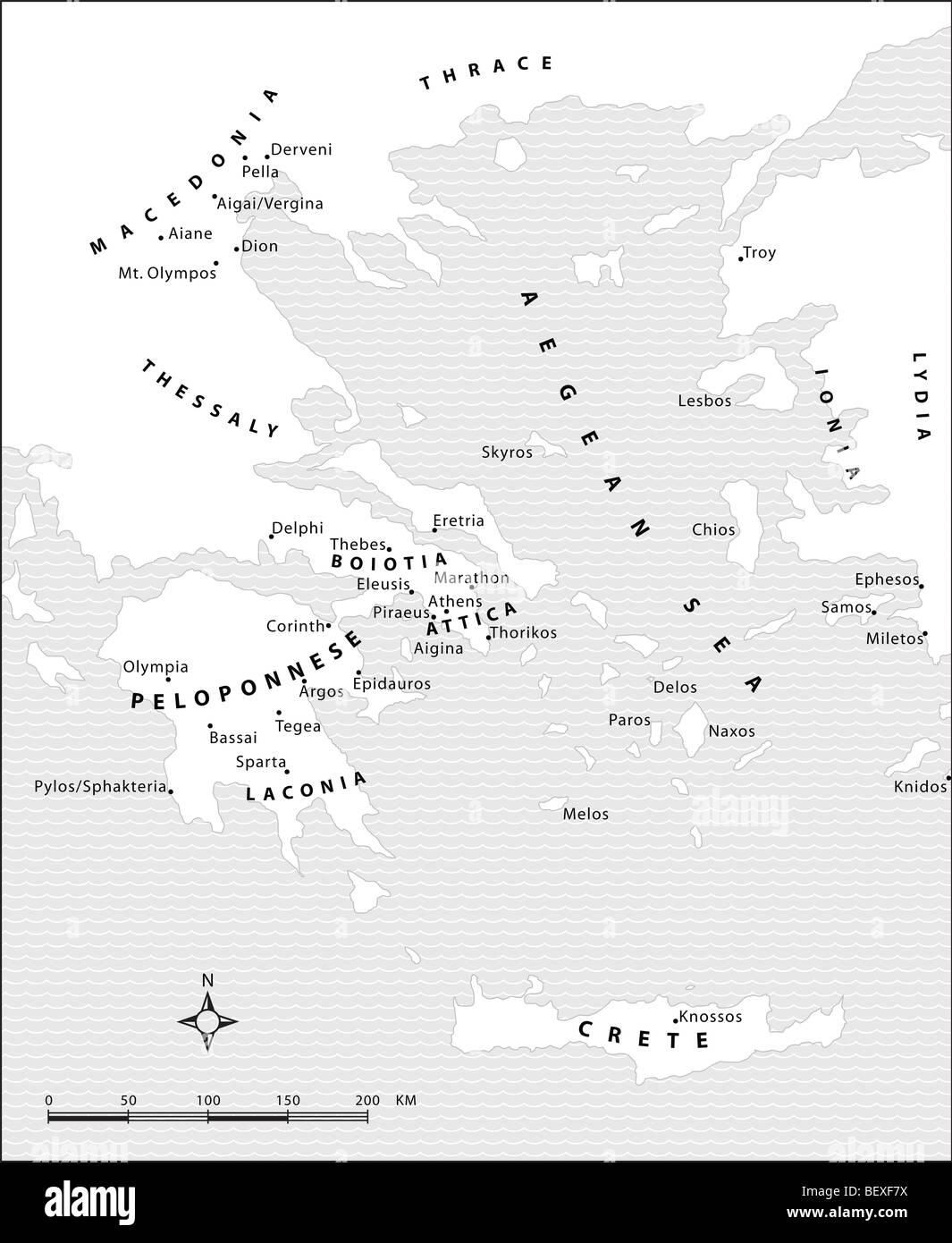 Map of Ancient Greece. Drawing by Erin Babnik. Stock Photohttps://www.alamy.com/image-license-details/?v=1https://www.alamy.com/stock-photo-map-of-ancient-greece-drawing-by-erin-babnik-26398286.html
RMBEXF7X–Map of Ancient Greece. Drawing by Erin Babnik.
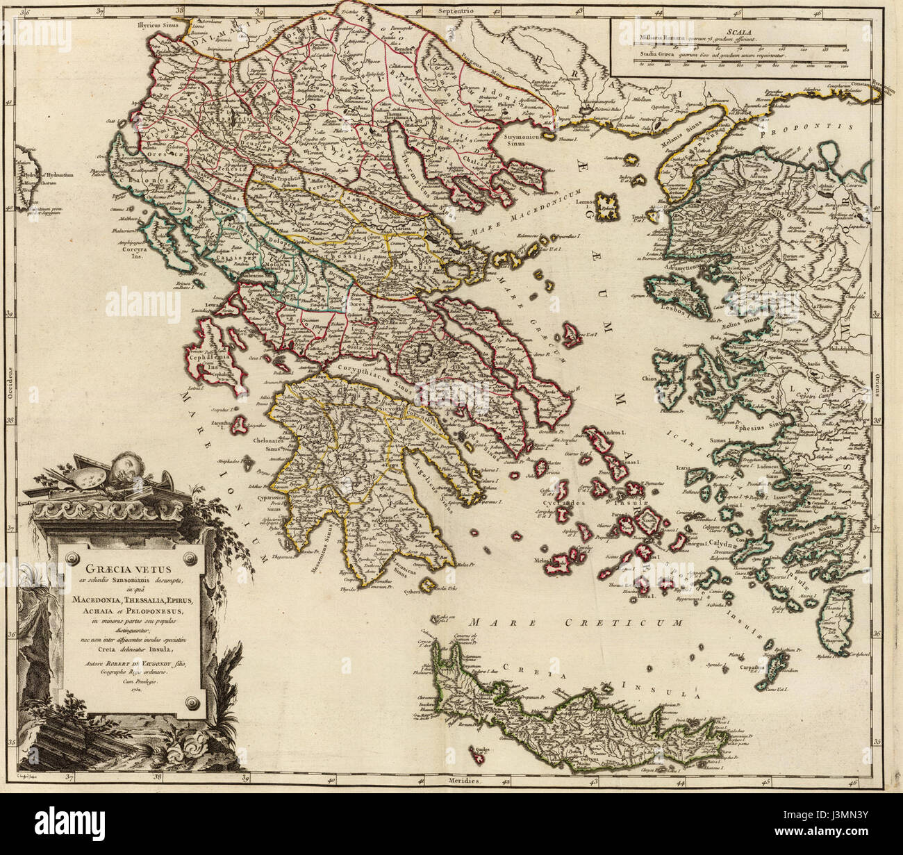 Graecia Vetus Map of Ancient Greece Stock Photohttps://www.alamy.com/image-license-details/?v=1https://www.alamy.com/stock-photo-graecia-vetus-map-of-ancient-greece-139982527.html
RMJ3MN3Y–Graecia Vetus Map of Ancient Greece
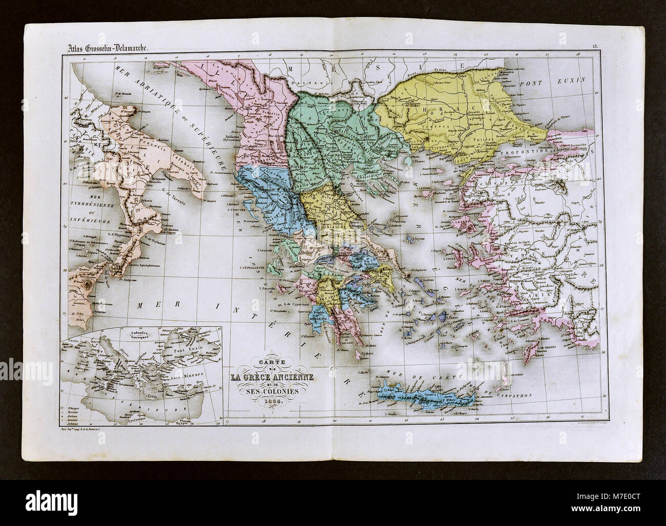 1858 Delamarche Map of Ancient Greece and its Colonies in Italy and Turkey Stock Photohttps://www.alamy.com/image-license-details/?v=1https://www.alamy.com/stock-photo-1858-delamarche-map-of-ancient-greece-and-its-colonies-in-italy-and-176713960.html
RFM7E0CT–1858 Delamarche Map of Ancient Greece and its Colonies in Italy and Turkey
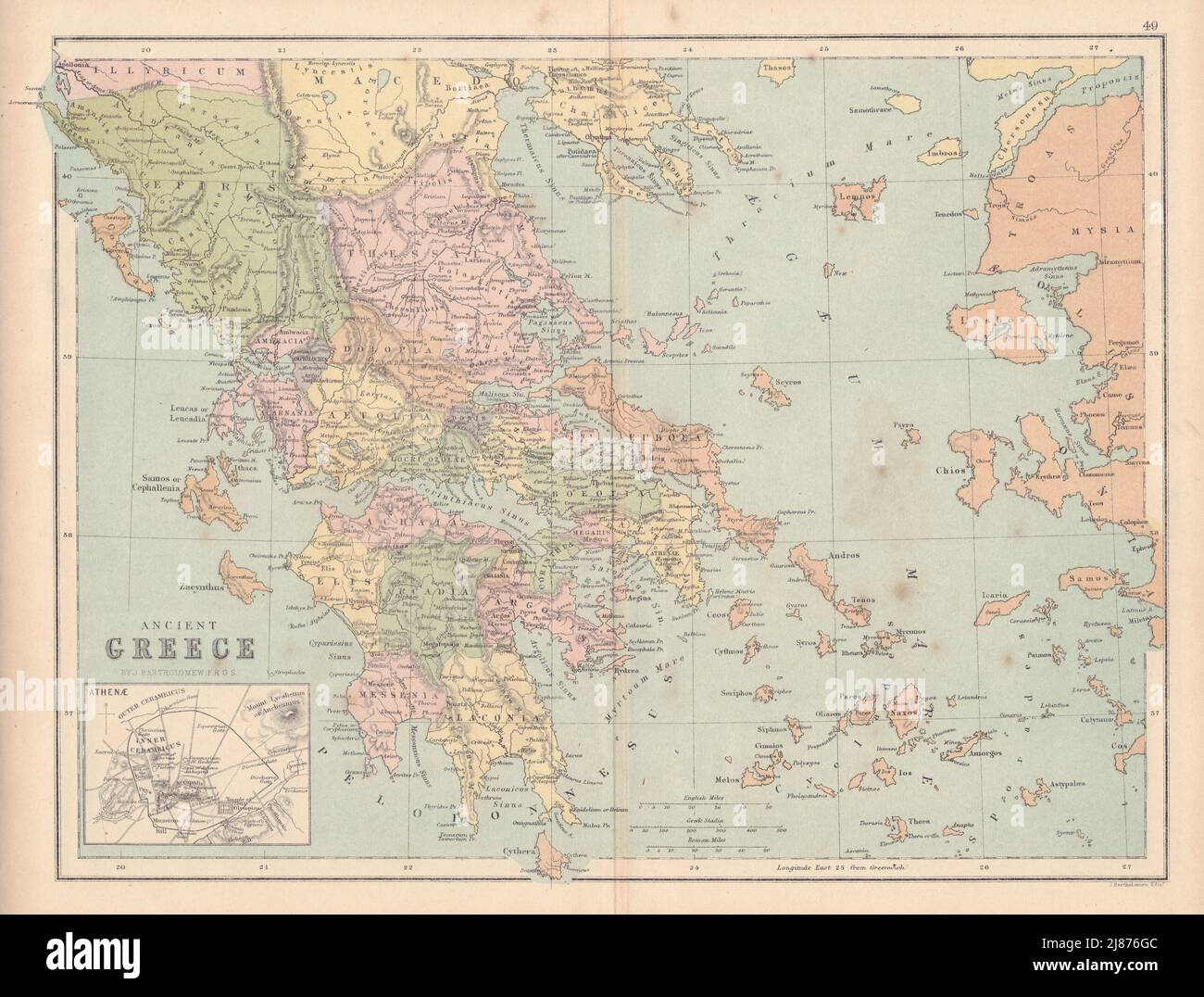 ANCIENT GREECE showing provinces etc. Aegean Ionian islands. COLLINS 1873 map Stock Photohttps://www.alamy.com/image-license-details/?v=1https://www.alamy.com/ancient-greece-showing-provinces-etc-aegean-ionian-islands-collins-1873-map-image469756012.html
RF2J876GC–ANCIENT GREECE showing provinces etc. Aegean Ionian islands. COLLINS 1873 map
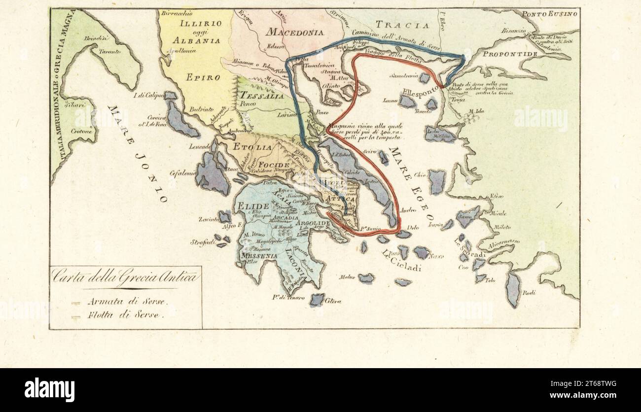 Map of Ancient Greece. Routes of King of Persia Xerxes Is army (blue) and navy (red) during its failed invasion of Greece 480BC. Carta della Grecia Antica. Handcoloured copperplate engraving from Giulio Ferrarios Costumes Ancient and Modern of the Peoples of the World, Il Costume Antico e Moderno, Florence, 1842. Stock Photohttps://www.alamy.com/image-license-details/?v=1https://www.alamy.com/map-of-ancient-greece-routes-of-king-of-persia-xerxes-is-army-blue-and-navy-red-during-its-failed-invasion-of-greece-480bc-carta-della-grecia-antica-handcoloured-copperplate-engraving-from-giulio-ferrarios-costumes-ancient-and-modern-of-the-peoples-of-the-world-il-costume-antico-e-moderno-florence-1842-image571825228.html
RM2T68TWG–Map of Ancient Greece. Routes of King of Persia Xerxes Is army (blue) and navy (red) during its failed invasion of Greece 480BC. Carta della Grecia Antica. Handcoloured copperplate engraving from Giulio Ferrarios Costumes Ancient and Modern of the Peoples of the World, Il Costume Antico e Moderno, Florence, 1842.
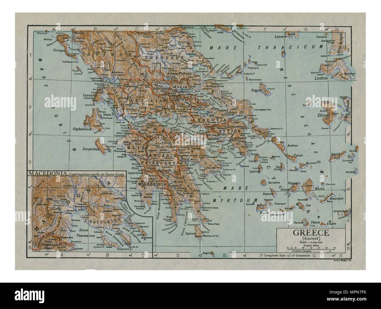 Map of Ancient Greece, c1910s. Creator: Emery Walker Ltd. Stock Photohttps://www.alamy.com/image-license-details/?v=1https://www.alamy.com/map-of-ancient-greece-c1910s-creator-emery-walker-ltd-image186093031.html
RMMPN7FK–Map of Ancient Greece, c1910s. Creator: Emery Walker Ltd.
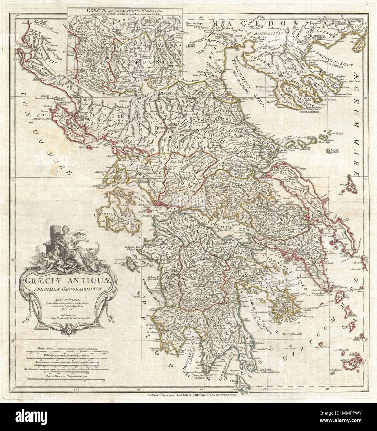 . English: A large and dramatic J. B. B. D'Anville map of Ancient Greece. Covers from Macedonia to the Peloponnesus, inclusive of Euboea and the Ionian Isles. Details mountains, rivers, cities, roadways, and lakes with political divisions highlighted in outline color. Decorative title cartouche in the lower left quadrant depicts an ancient Greek woman lounging against a Tuscan column while two cherubic children create art. Includes five distance scales, bottom left, referencing various measurement systems common in antiquity. Text in Latin and English. Drawn by J. B. B. D'Anville in 1762 and Stock Photohttps://www.alamy.com/image-license-details/?v=1https://www.alamy.com/english-a-large-and-dramatic-j-b-b-danville-map-of-ancient-greece-covers-from-macedonia-to-the-peloponnesus-inclusive-of-euboea-and-the-ionian-isles-details-mountains-rivers-cities-roadways-and-lakes-with-political-divisions-highlighted-in-outline-color-decorative-title-cartouche-in-the-lower-left-quadrant-depicts-an-ancient-greek-woman-lounging-against-a-tuscan-column-while-two-cherubic-children-create-art-includes-five-distance-scales-bottom-left-referencing-various-measurement-systems-common-in-antiquity-text-in-latin-and-english-drawn-by-j-b-b-danville-in-1762-and-image184897719.html
RMMMPPWY–. English: A large and dramatic J. B. B. D'Anville map of Ancient Greece. Covers from Macedonia to the Peloponnesus, inclusive of Euboea and the Ionian Isles. Details mountains, rivers, cities, roadways, and lakes with political divisions highlighted in outline color. Decorative title cartouche in the lower left quadrant depicts an ancient Greek woman lounging against a Tuscan column while two cherubic children create art. Includes five distance scales, bottom left, referencing various measurement systems common in antiquity. Text in Latin and English. Drawn by J. B. B. D'Anville in 1762 and
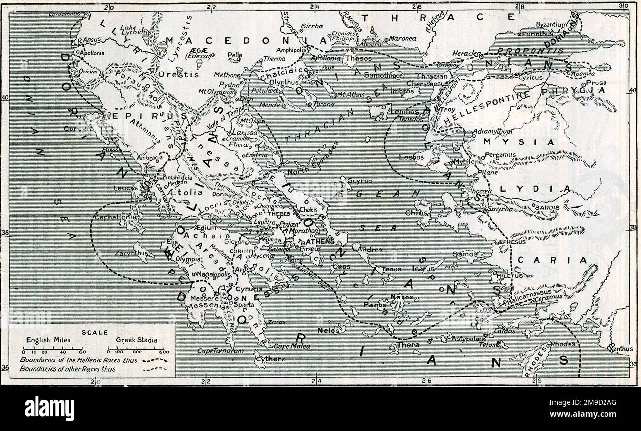 Map Of Ancient Greece - 3 Races Battles Stock Photohttps://www.alamy.com/image-license-details/?v=1https://www.alamy.com/map-of-ancient-greece-3-races-battles-image504919816.html
RM2M9D2AG–Map Of Ancient Greece - 3 Races Battles
 1794 Anville Map of Ancient Greece Stock Photohttps://www.alamy.com/image-license-details/?v=1https://www.alamy.com/stock-photo-1794-anville-map-of-ancient-greece-50536252.html
RMCX63E4–1794 Anville Map of Ancient Greece
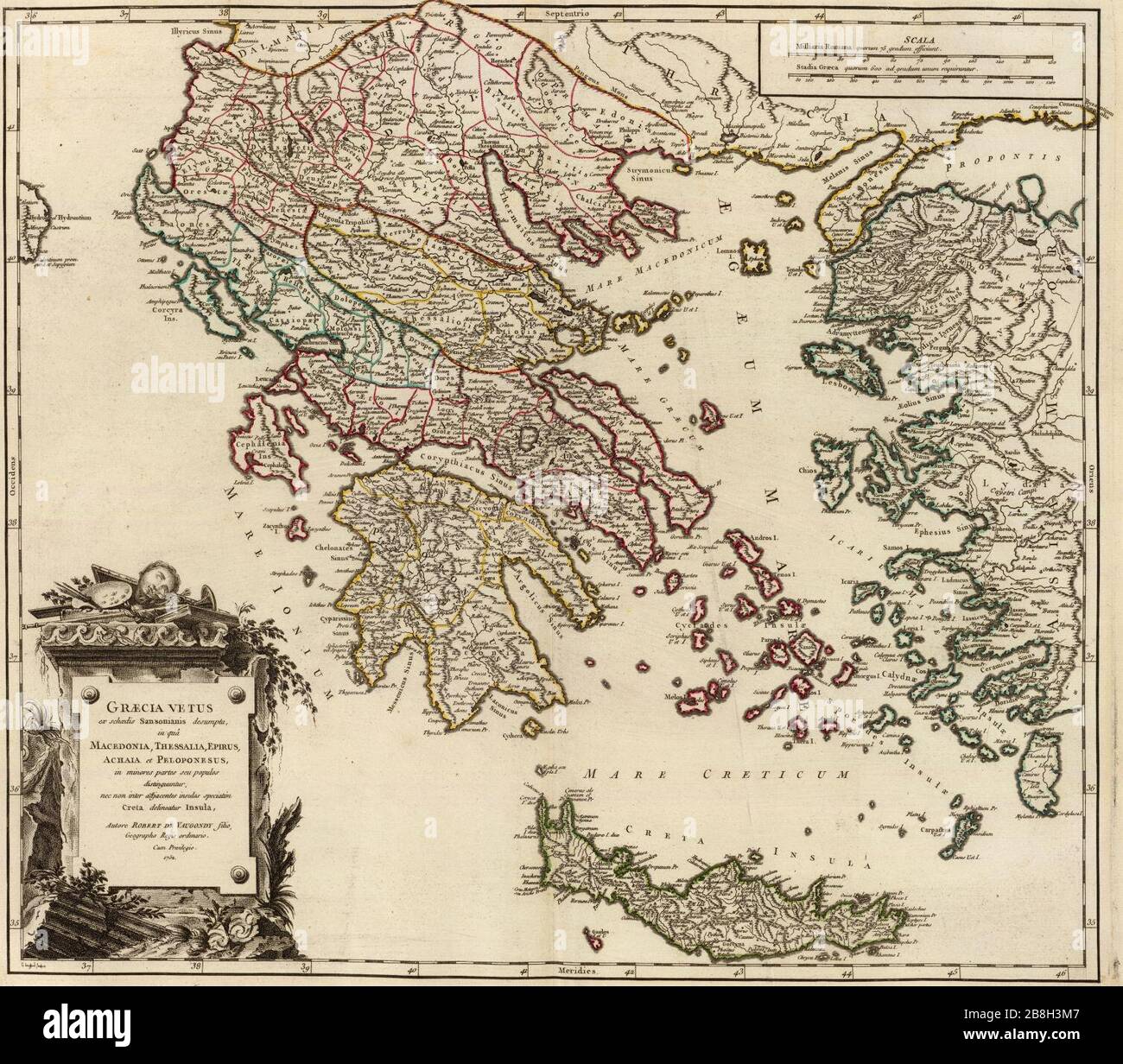 Graecia Vetus Map of Ancient Greece. Stock Photohttps://www.alamy.com/image-license-details/?v=1https://www.alamy.com/graecia-vetus-map-of-ancient-greece-image349500711.html
RM2B8H3M7–Graecia Vetus Map of Ancient Greece.
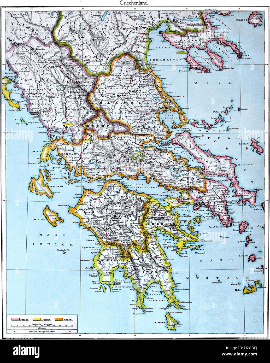 Colored Map of Ancient Greece after Putzger Atlas from 1888, combination of North and South, language Latin and some German Stock Photohttps://www.alamy.com/image-license-details/?v=1https://www.alamy.com/stock-photo-colored-map-of-ancient-greece-after-putzger-atlas-from-1888-combination-122063750.html
RFH2GDFJ–Colored Map of Ancient Greece after Putzger Atlas from 1888, combination of North and South, language Latin and some German
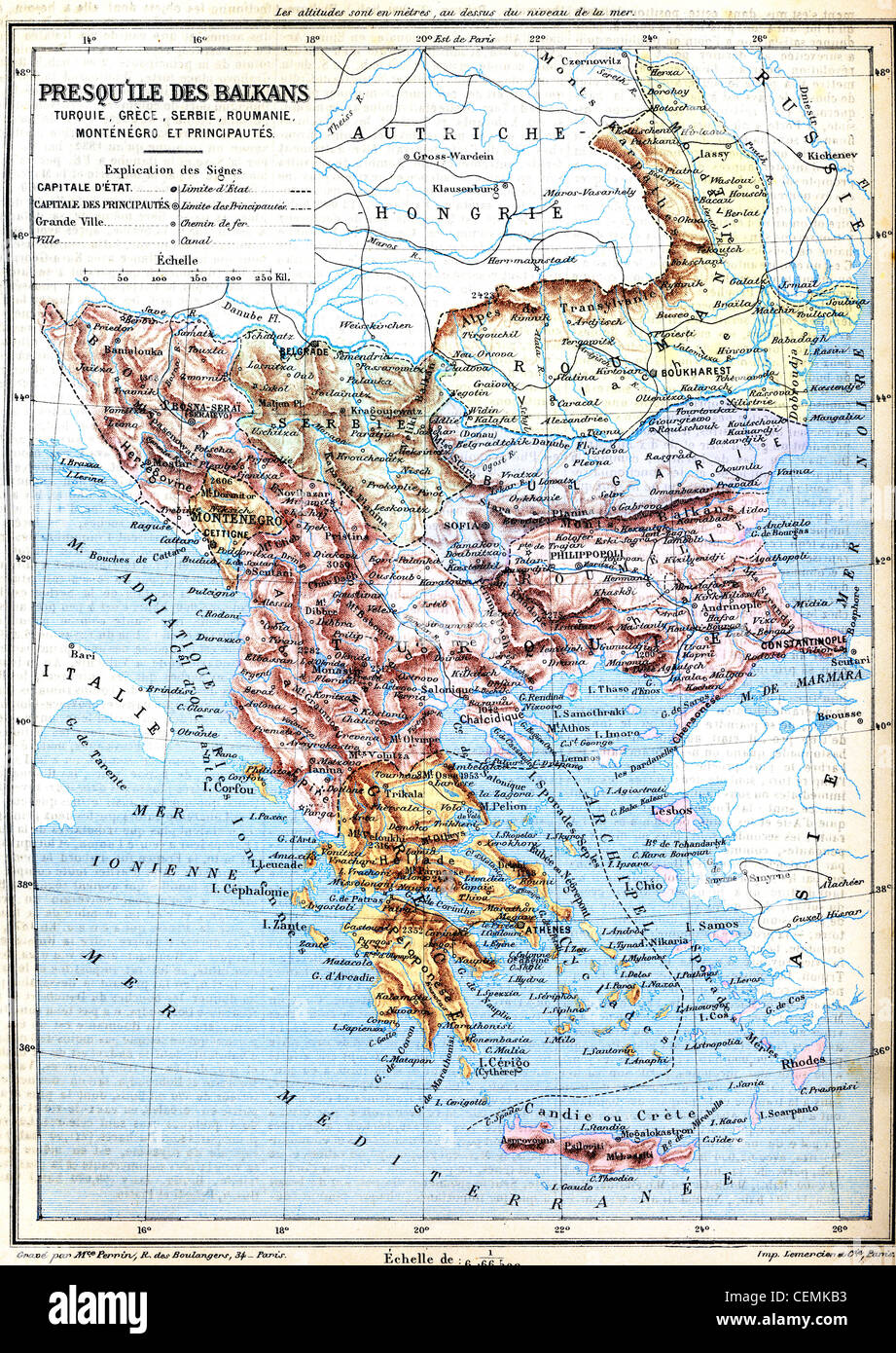 The map of Balkan Peninsula (Turkey, Greece, Serbia, Romania and Montenegro) with signs and their explanation. Stock Photohttps://www.alamy.com/image-license-details/?v=1https://www.alamy.com/stock-photo-the-map-of-balkan-peninsula-turkey-greece-serbia-romania-and-montenegro-43480167.html
RFCEMKB3–The map of Balkan Peninsula (Turkey, Greece, Serbia, Romania and Montenegro) with signs and their explanation.
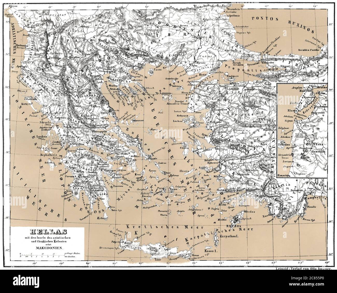 Historical map of ancient Greece with Asian and Thracian Colonies Stock Photohttps://www.alamy.com/image-license-details/?v=1https://www.alamy.com/historical-map-of-ancient-greece-with-asian-and-thracian-colonies-image366449272.html
RM2C855P0–Historical map of ancient Greece with Asian and Thracian Colonies
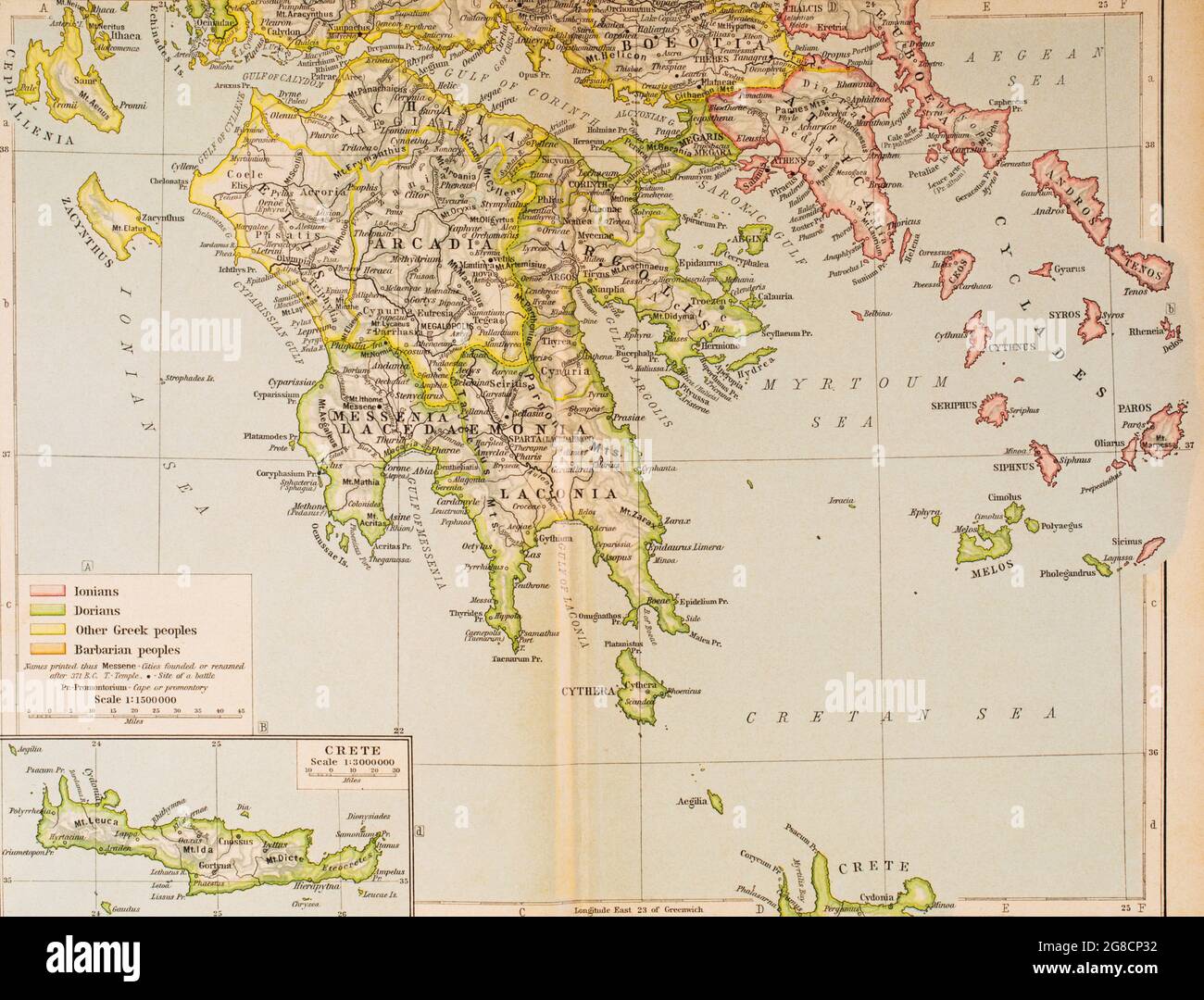 Map of Ancient Greece, southern part. From Historical Atlas, published 1923. Stock Photohttps://www.alamy.com/image-license-details/?v=1https://www.alamy.com/map-of-ancient-greece-southern-part-from-historical-atlas-published-1923-image435457206.html
RM2G8CP32–Map of Ancient Greece, southern part. From Historical Atlas, published 1923.
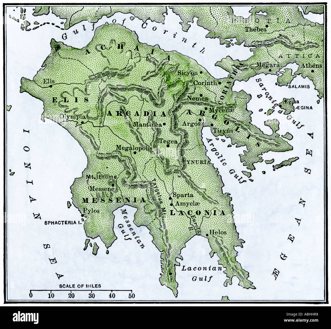 Map of the Peloponnesus ancient Greece. Hand-colored woodcut Stock Photohttps://www.alamy.com/image-license-details/?v=1https://www.alamy.com/map-of-the-peloponnesus-ancient-greece-hand-colored-woodcut-image7370295.html
RMABHHR8–Map of the Peloponnesus ancient Greece. Hand-colored woodcut
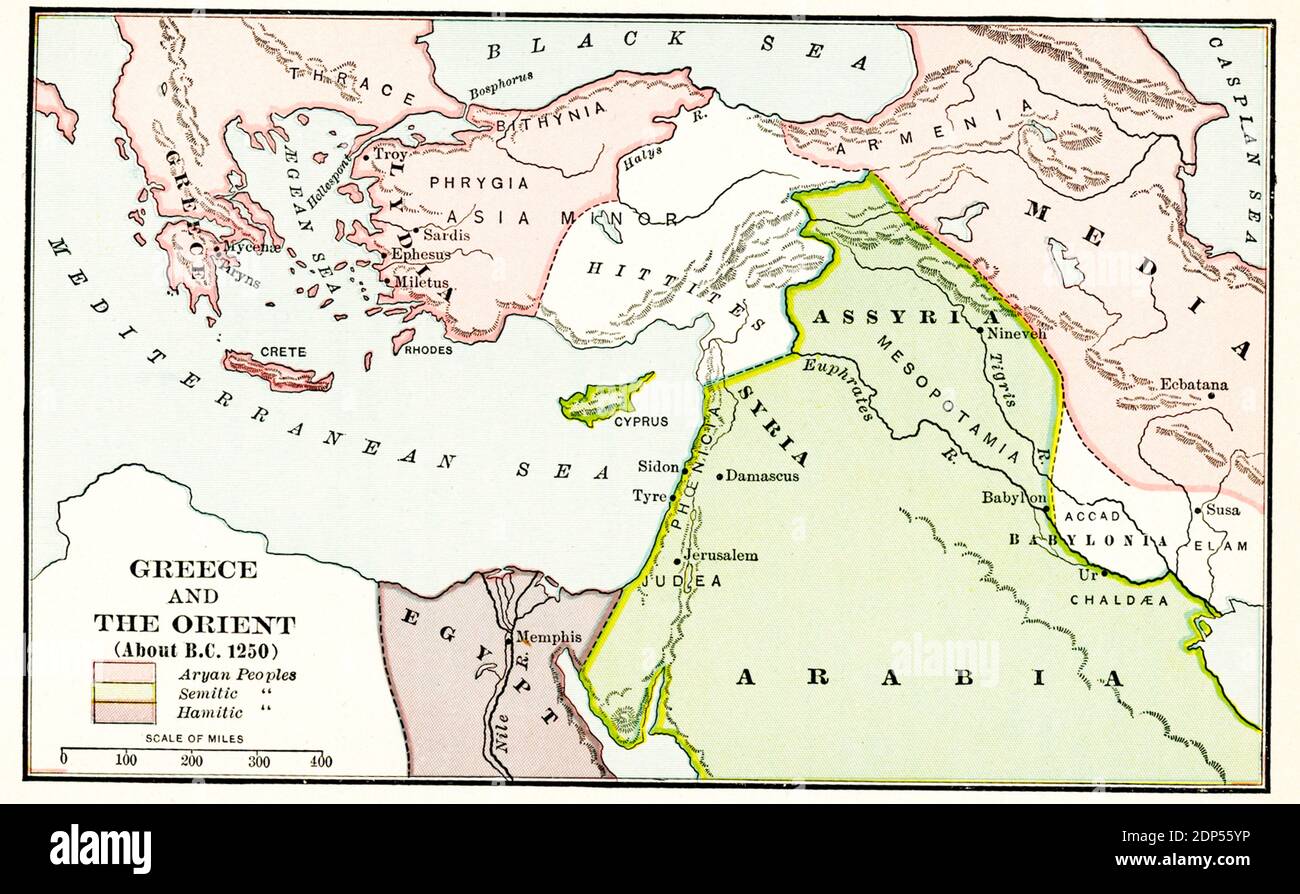 Greece and the Orient about B.C. 1250. The legend for this early 1900s map reads: Pink-Aryan peoples; green- Semitic peoples; Purple - Hamitic peoples Stock Photohttps://www.alamy.com/image-license-details/?v=1https://www.alamy.com/greece-and-the-orient-about-bc-1250-the-legend-for-this-early-1900s-map-reads-pink-aryan-peoples-green-semitic-peoples-purple-hamitic-peoples-image392264986.html
RF2DP55YP–Greece and the Orient about B.C. 1250. The legend for this early 1900s map reads: Pink-Aryan peoples; green- Semitic peoples; Purple - Hamitic peoples
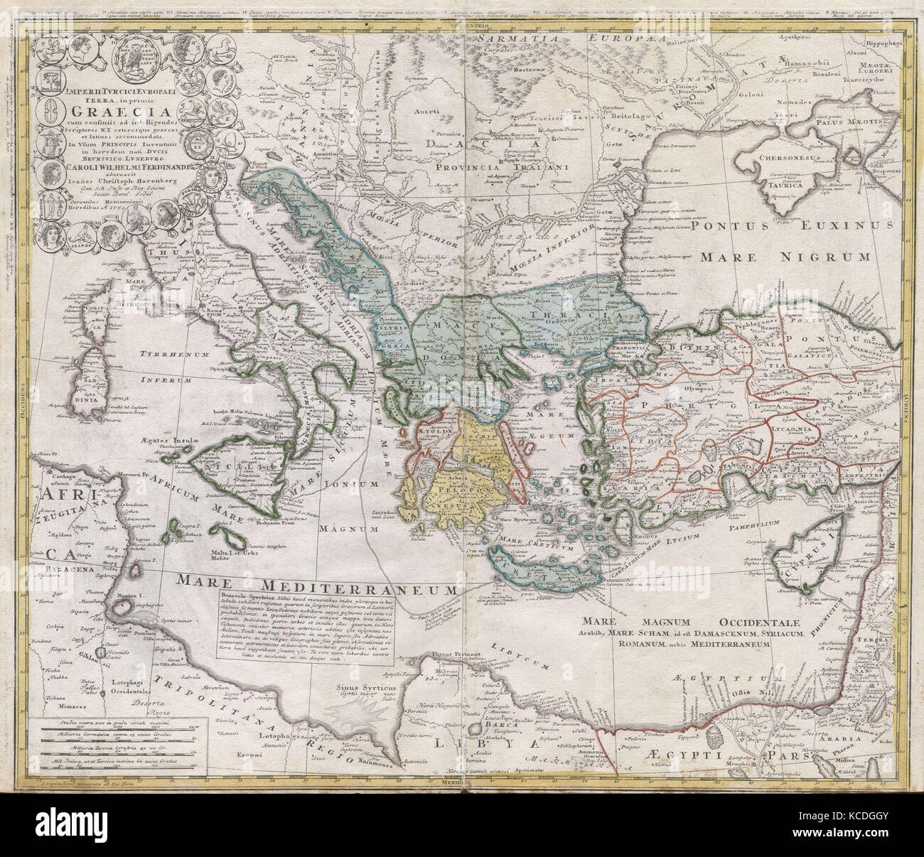 1741, Homann Heirs Map of Ancient Greece and the Eastern Mediterranean Stock Photohttps://www.alamy.com/image-license-details/?v=1https://www.alamy.com/stock-image-1741-homann-heirs-map-of-ancient-greece-and-the-eastern-mediterranean-162567579.html
RMKCDGGY–1741, Homann Heirs Map of Ancient Greece and the Eastern Mediterranean
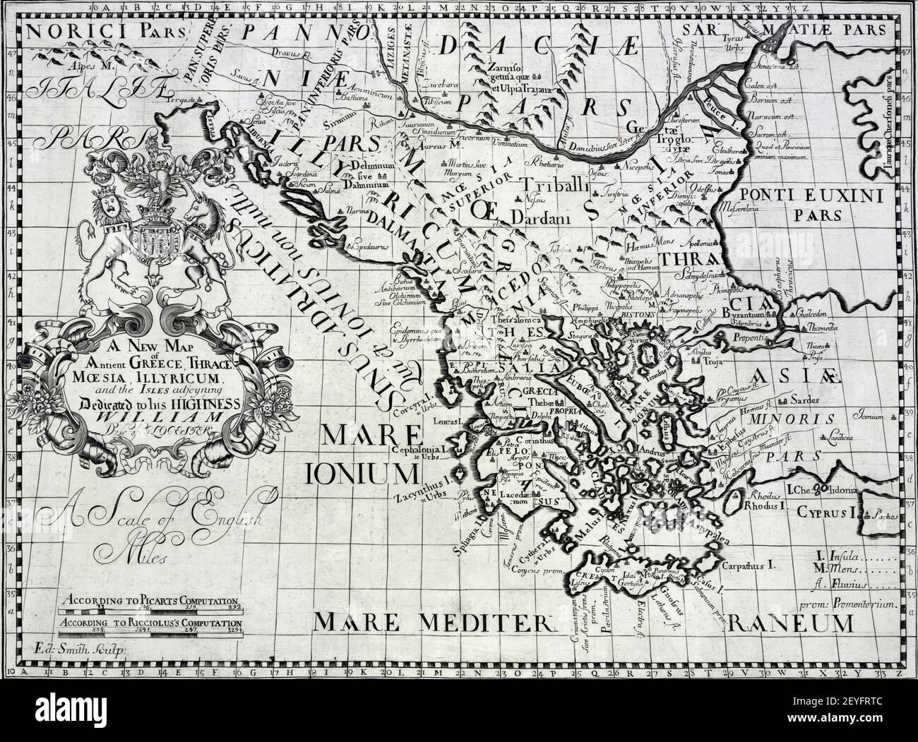 An illustration of the ancient map of Ancient Greece and Thrac Stock Photohttps://www.alamy.com/image-license-details/?v=1https://www.alamy.com/an-illustration-of-the-ancient-map-of-ancient-greece-and-thrac-image412782172.html
RF2EYFRTC–An illustration of the ancient map of Ancient Greece and Thrac
 History by Polybius. Volume III. French edition translated from Greek by Dom Vincent Thuillier. Comments of Military Science enriched with critical and historical notes by M. De Folard. Paris, chez Pierre Gandouin, Julien-Michel Gandouin, Pierre-Francois Giffart and Nicolas-Pierre Armand, 1728. Map of Greece. Engraving. Stock Photohttps://www.alamy.com/image-license-details/?v=1https://www.alamy.com/history-by-polybius-volume-iii-french-edition-translated-from-greek-by-dom-vincent-thuillier-comments-of-military-science-enriched-with-critical-and-historical-notes-by-m-de-folard-paris-chez-pierre-gandouin-julien-michel-gandouin-pierre-francois-giffart-and-nicolas-pierre-armand-1728-map-of-greece-engraving-image244783490.html
RMT66RRE–History by Polybius. Volume III. French edition translated from Greek by Dom Vincent Thuillier. Comments of Military Science enriched with critical and historical notes by M. De Folard. Paris, chez Pierre Gandouin, Julien-Michel Gandouin, Pierre-Francois Giffart and Nicolas-Pierre Armand, 1728. Map of Greece. Engraving.
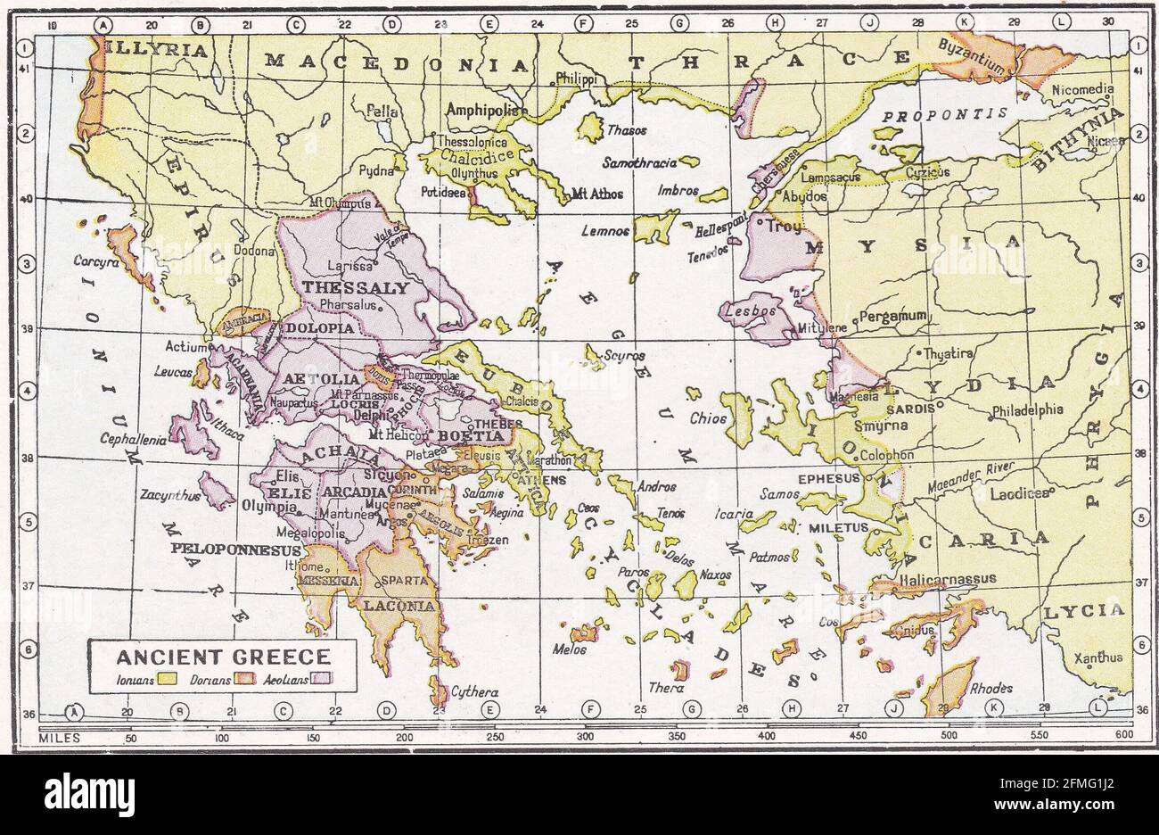 Vintage map of Ancient Greece. Stock Photohttps://www.alamy.com/image-license-details/?v=1https://www.alamy.com/vintage-map-of-ancient-greece-image425694474.html
RF2FMG1J2–Vintage map of Ancient Greece.
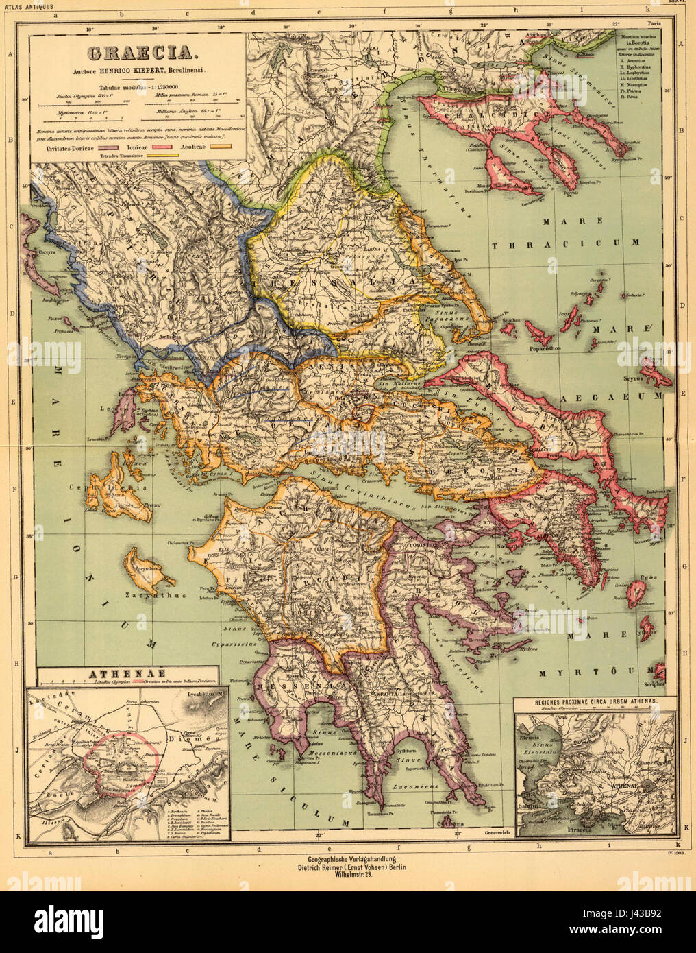 Map of Ancient Greece (as drawn in 1903) Stock Photohttps://www.alamy.com/image-license-details/?v=1https://www.alamy.com/stock-photo-map-of-ancient-greece-as-drawn-in-1903-140216302.html
RMJ43B92–Map of Ancient Greece (as drawn in 1903)
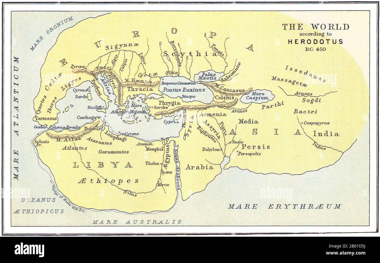 Greece/Turkey: Map of the World according to Herodotus (c. 484 - c. 425 BCE), c. 450 BCE. Herodotus (Greek: Hēródotos) was an ancient Greek historian who was born in Halicarnassus, Caria (modern day Bodrum, Turkey) and lived in the 5th century BCE. He has been called the 'Father of History' since he was the first historian known to collect his materials systematically, test their accuracy to a certain extent and arrange them in a well-constructed and vivid narrative. The Histories - his masterpiece and only known work - is an investigation of the origins of the Greco-Persian Wars. Stock Photohttps://www.alamy.com/image-license-details/?v=1https://www.alamy.com/greeceturkey-map-of-the-world-according-to-herodotus-c-484-c-425-bce-c-450-bce-herodotus-greek-hrdotos-was-an-ancient-greek-historian-who-was-born-in-halicarnassus-caria-modern-day-bodrum-turkey-and-lived-in-the-5th-century-bce-he-has-been-called-the-father-of-history-since-he-was-the-first-historian-known-to-collect-his-materials-systematically-test-their-accuracy-to-a-certain-extent-and-arrange-them-in-a-well-constructed-and-vivid-narrative-the-histories-his-masterpiece-and-only-known-work-is-an-investigation-of-the-origins-of-the-greco-persian-wars-image344239662.html
RM2B01D5J–Greece/Turkey: Map of the World according to Herodotus (c. 484 - c. 425 BCE), c. 450 BCE. Herodotus (Greek: Hēródotos) was an ancient Greek historian who was born in Halicarnassus, Caria (modern day Bodrum, Turkey) and lived in the 5th century BCE. He has been called the 'Father of History' since he was the first historian known to collect his materials systematically, test their accuracy to a certain extent and arrange them in a well-constructed and vivid narrative. The Histories - his masterpiece and only known work - is an investigation of the origins of the Greco-Persian Wars.
 'Graeciae Antiquae'. Ancient Greece. D'ANVILLE 1815 old antique map plan chart Stock Photohttps://www.alamy.com/image-license-details/?v=1https://www.alamy.com/graeciae-antiquae-ancient-greece-danville-1815-old-antique-map-plan-chart-image610578240.html
RF2XDA6NM–'Graeciae Antiquae'. Ancient Greece. D'ANVILLE 1815 old antique map plan chart
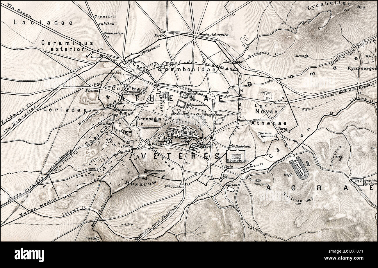
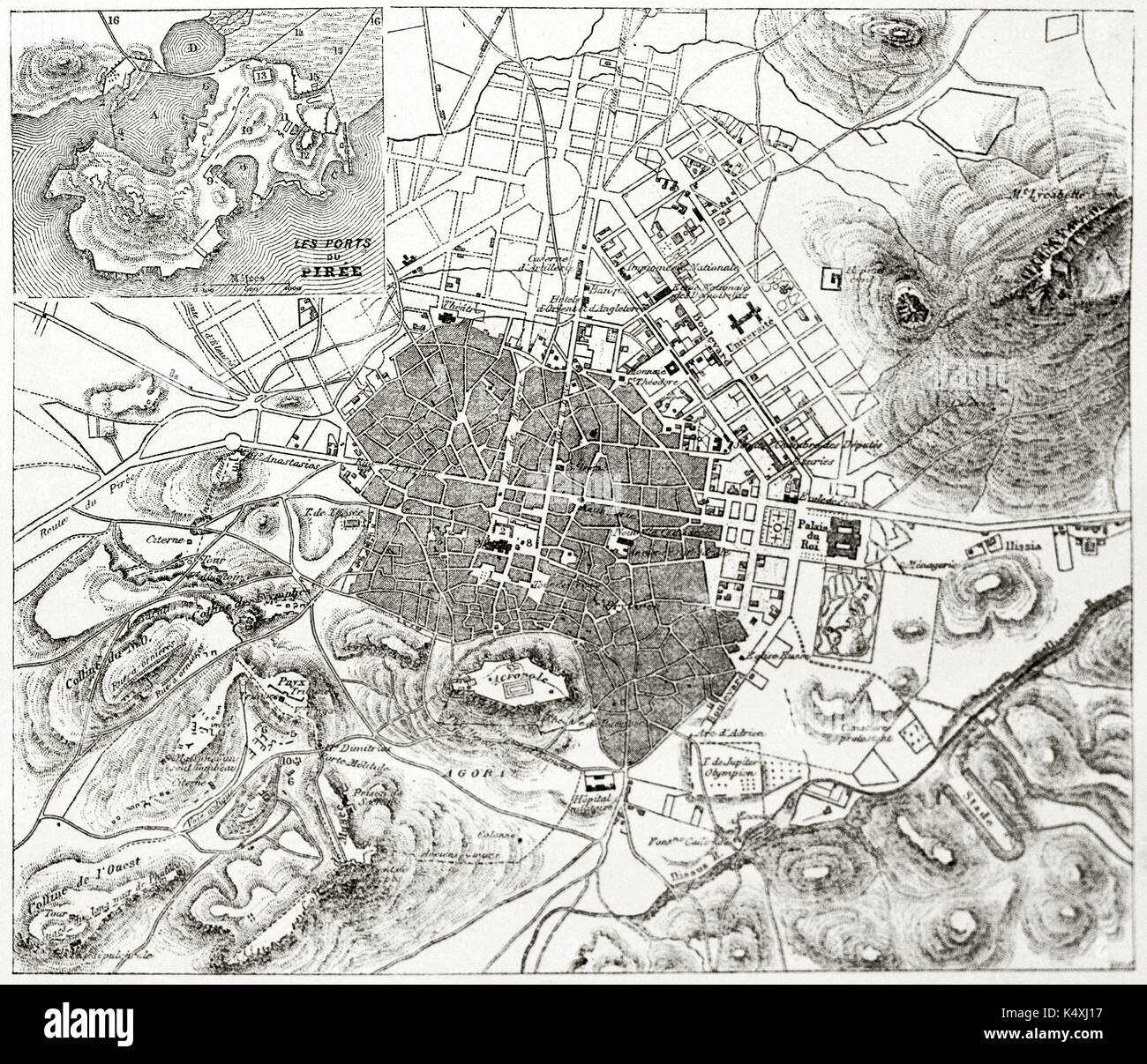 Ancient sepia tone topographic map of Athens with Piraeus insert map, Greece. By unidentified author published on Le Tour du Monde Paris 1862 Stock Photohttps://www.alamy.com/image-license-details/?v=1https://www.alamy.com/ancient-sepia-tone-topographic-map-of-athens-with-piraeus-insert-map-image157936835.html
RFK4XJ17–Ancient sepia tone topographic map of Athens with Piraeus insert map, Greece. By unidentified author published on Le Tour du Monde Paris 1862
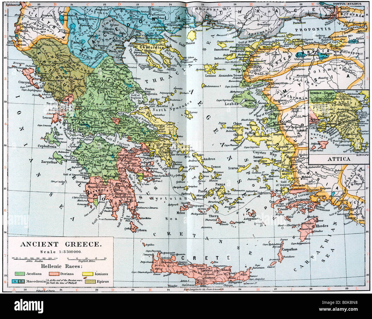 Map of Ancient Greece, 1902. Artist: Unknown Stock Photohttps://www.alamy.com/image-license-details/?v=1https://www.alamy.com/stock-photo-map-of-ancient-greece-1902-artist-unknown-17636676.html
RMB0KBN8–Map of Ancient Greece, 1902. Artist: Unknown
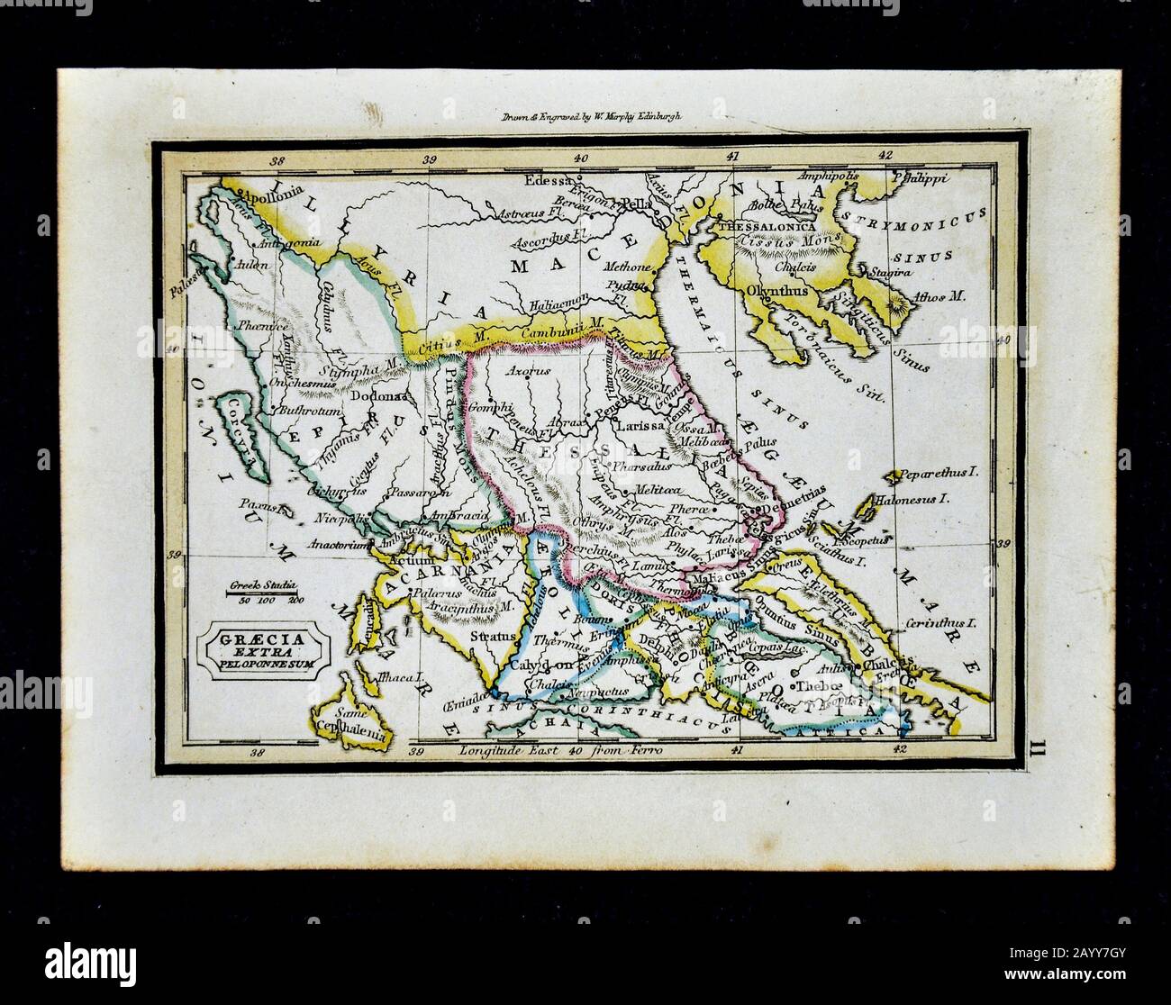 1832 Murphy Map Greacia Extra Peloponnesum Ancient Greece Delphi Thessaly Macedonia Stock Photohttps://www.alamy.com/image-license-details/?v=1https://www.alamy.com/1832-murphy-map-greacia-extra-peloponnesum-ancient-greece-delphi-thessaly-macedonia-image344191371.html
RM2AYY7GY–1832 Murphy Map Greacia Extra Peloponnesum Ancient Greece Delphi Thessaly Macedonia
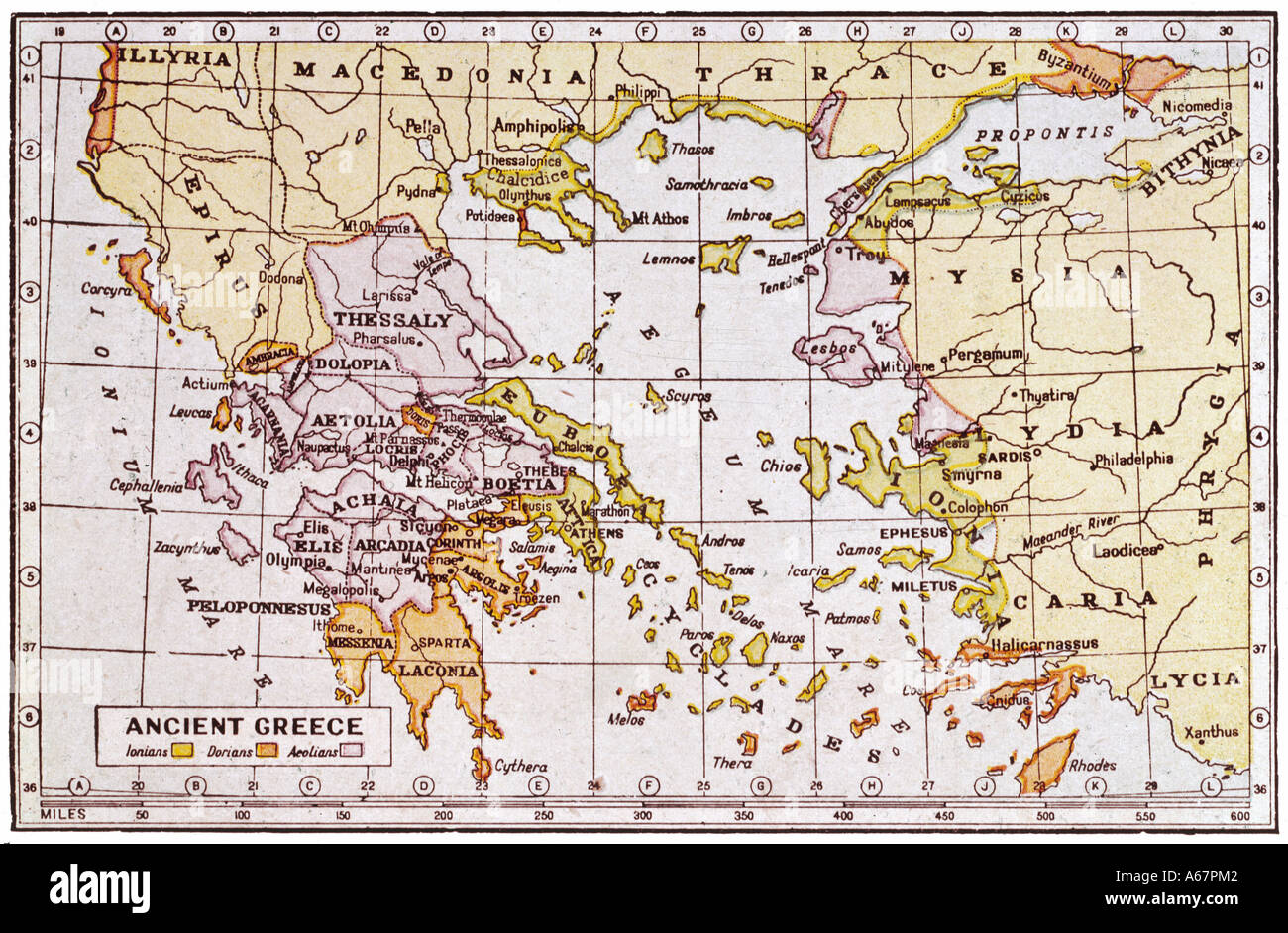 Map Of Ancient Greece Stock Photohttps://www.alamy.com/image-license-details/?v=1https://www.alamy.com/map-of-ancient-greece-image6564801.html
RMA67PM2–Map Of Ancient Greece
 1741 Homann Heirs Map of Ancient Greece ^ the Eastern Mediterranean - Geographicus - Graecia-homannheirs-1741 Stock Photohttps://www.alamy.com/image-license-details/?v=1https://www.alamy.com/stock-photo-1741-homann-heirs-map-of-ancient-greece-the-eastern-mediterranean-133519676.html
RMHN69KT–1741 Homann Heirs Map of Ancient Greece ^ the Eastern Mediterranean - Geographicus - Graecia-homannheirs-1741
 Graecia Antiqua Map of Ancient Greece 1809. Stock Photohttps://www.alamy.com/image-license-details/?v=1https://www.alamy.com/graecia-antiqua-map-of-ancient-greece-1809-image349500690.html
RM2B8H3KE–Graecia Antiqua Map of Ancient Greece 1809.
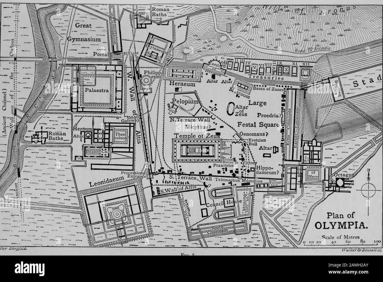 Map and plan of the Greek city of Olympia, home of the ancient Olympic Games, Greece, showing gymnasium and Temple of Zeus, 1910. Courtesy Internet Archive. () Stock Photohttps://www.alamy.com/image-license-details/?v=1https://www.alamy.com/map-and-plan-of-the-greek-city-of-olympia-home-of-the-ancient-olympic-games-greece-showing-gymnasium-and-temple-of-zeus-1910-courtesy-internet-archive-image339665171.html
RM2AMH2AY–Map and plan of the Greek city of Olympia, home of the ancient Olympic Games, Greece, showing gymnasium and Temple of Zeus, 1910. Courtesy Internet Archive. ()
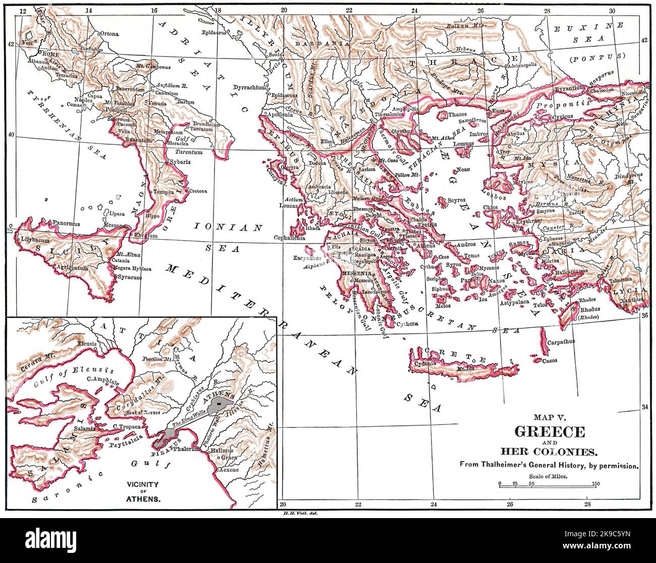 Map V, Greece and her Colonies, Illustration, Ridpath's History of the World, Volume I, by John Clark Ridpath, LL. D., Merrill & Baker Publishers, New York, 1894 Stock Photohttps://www.alamy.com/image-license-details/?v=1https://www.alamy.com/map-v-greece-and-her-colonies-illustration-ridpaths-history-of-the-world-volume-i-by-john-clark-ridpath-ll-d-merrill-baker-publishers-new-york-1894-image487690329.html
RM2K9C5YN–Map V, Greece and her Colonies, Illustration, Ridpath's History of the World, Volume I, by John Clark Ridpath, LL. D., Merrill & Baker Publishers, New York, 1894
 Historical map of ancient Greece Stock Photohttps://www.alamy.com/image-license-details/?v=1https://www.alamy.com/stock-photo-historical-map-of-ancient-greece-143680868.html
RMJ9N6BG–Historical map of ancient Greece
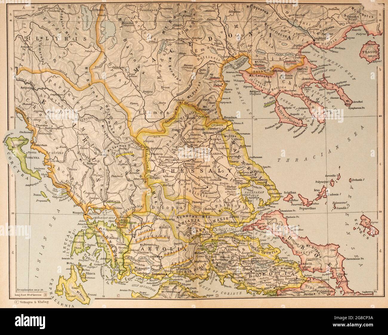 Map of Ancient Greece, northern part. From Historical Atlas, published 1923. Stock Photohttps://www.alamy.com/image-license-details/?v=1https://www.alamy.com/map-of-ancient-greece-northern-part-from-historical-atlas-published-1923-image435457214.html
RM2G8CP3A–Map of Ancient Greece, northern part. From Historical Atlas, published 1923.
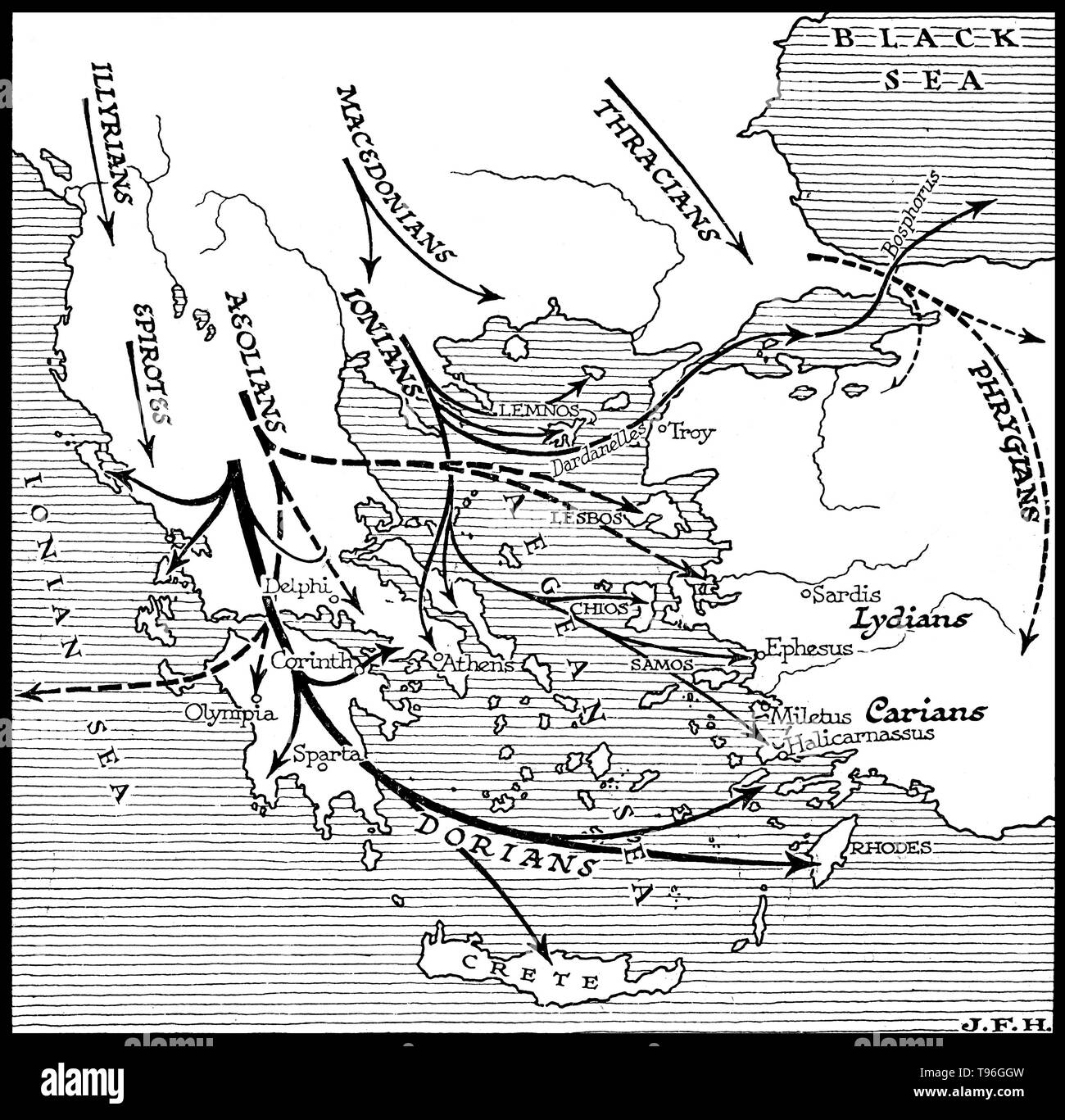 Ancient Greece 1100-800 BC.The Greek Dark Age, also called Greek Dark Ages, Homeric Age or Geometric period (so called after the characteristic Geometric art of the time), is the period of Greek history from the end of the Mycenaean palatial civilization around 1100 BC to the first signs of the Greek city states, in the 9th century BC. Illustrated by J. F. Horrabin. Stock Photohttps://www.alamy.com/image-license-details/?v=1https://www.alamy.com/ancient-greece-1100-800-bcthe-greek-dark-age-also-called-greek-dark-ages-homeric-age-or-geometric-period-so-called-after-the-characteristic-geometric-art-of-the-time-is-the-period-of-greek-history-from-the-end-of-the-mycenaean-palatial-civilization-around-1100-bc-to-the-first-signs-of-the-greek-city-states-in-the-9th-century-bc-illustrated-by-j-f-horrabin-image246621785.html
RMT96GGW–Ancient Greece 1100-800 BC.The Greek Dark Age, also called Greek Dark Ages, Homeric Age or Geometric period (so called after the characteristic Geometric art of the time), is the period of Greek history from the end of the Mycenaean palatial civilization around 1100 BC to the first signs of the Greek city states, in the 9th century BC. Illustrated by J. F. Horrabin.
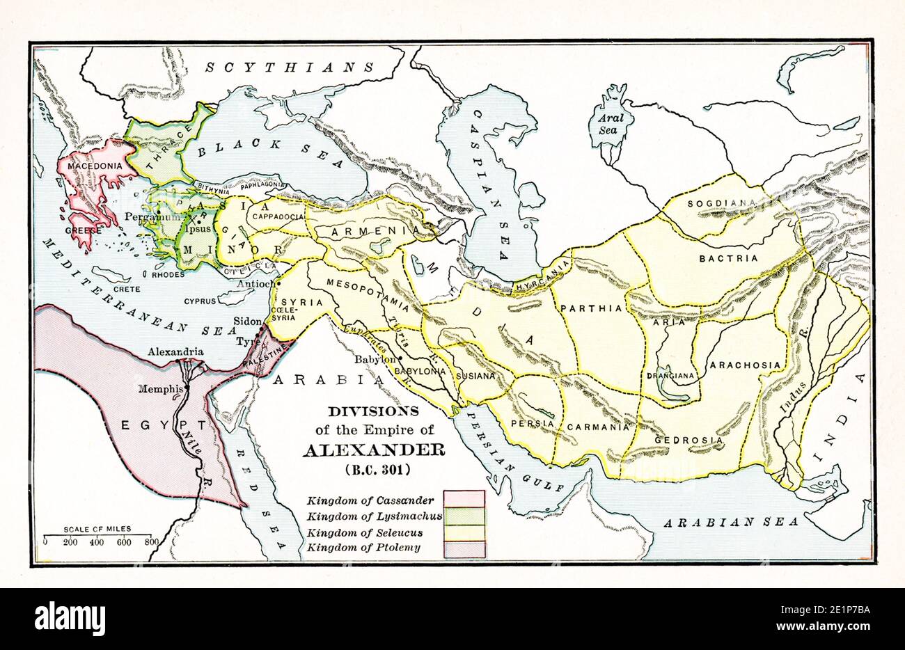 Map of the Divisions of the Empire of Alexander in BC 301. The legend reads: Pink: Kingdom of Cassander; Green: Kingdom of Lysimachus; Yellow: Kingdom of Seleucus; Purple: Kingdom of Ptolemy. Alexander the Great fell ill in Babylon on his return to Greece and Macedonia. The year was 323 B.C. This map shows the divisions of Alexander’s empire among the diadochoi (successors) at the time of his death. Stock Photohttps://www.alamy.com/image-license-details/?v=1https://www.alamy.com/map-of-the-divisions-of-the-empire-of-alexander-in-bc-301-the-legend-reads-pink-kingdom-of-cassander-green-kingdom-of-lysimachus-yellow-kingdom-of-seleucus-purple-kingdom-of-ptolemy-alexander-the-great-fell-ill-in-babylon-on-his-return-to-greece-and-macedonia-the-year-was-323-bc-this-map-shows-the-divisions-of-alexanders-empire-among-the-diadochoi-successors-at-the-time-of-his-death-image396941870.html
RF2E1P7BA–Map of the Divisions of the Empire of Alexander in BC 301. The legend reads: Pink: Kingdom of Cassander; Green: Kingdom of Lysimachus; Yellow: Kingdom of Seleucus; Purple: Kingdom of Ptolemy. Alexander the Great fell ill in Babylon on his return to Greece and Macedonia. The year was 323 B.C. This map shows the divisions of Alexander’s empire among the diadochoi (successors) at the time of his death.
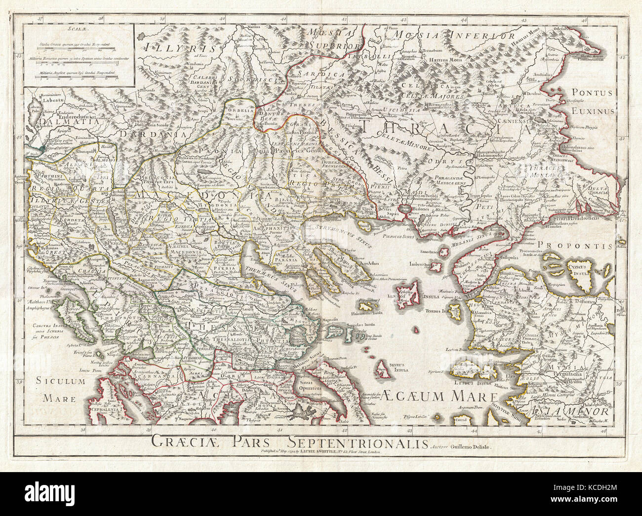 1794, Delisle Map of Northern Ancient Greece, Balkans, Macedonia Stock Photohttps://www.alamy.com/image-license-details/?v=1https://www.alamy.com/stock-image-1794-delisle-map-of-northern-ancient-greece-balkans-macedonia-162567964.html
RMKCDH2M–1794, Delisle Map of Northern Ancient Greece, Balkans, Macedonia
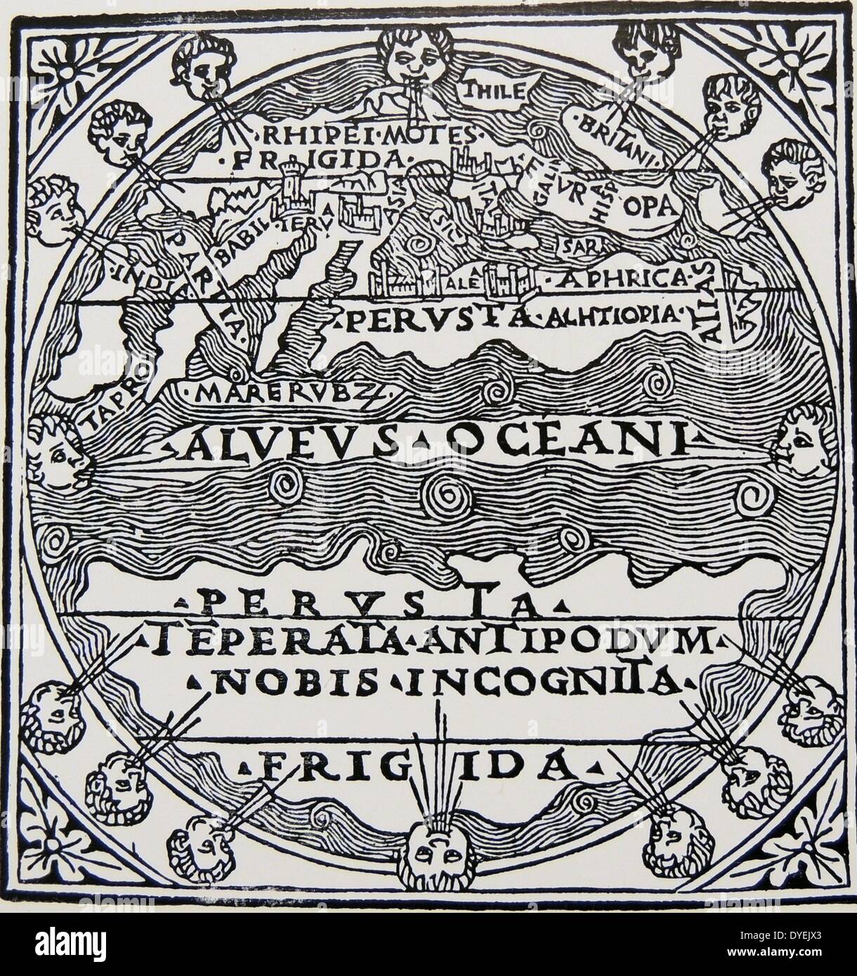 Map of the extent of the known world in Greek times. From a Sixteenth century woodcut. Stock Photohttps://www.alamy.com/image-license-details/?v=1https://www.alamy.com/map-of-the-extent-of-the-known-world-in-greek-times-from-a-sixteenth-image68548987.html
RMDYEJX3–Map of the extent of the known world in Greek times. From a Sixteenth century woodcut.
 Map of Greek island of Corfu. Ionian Sea. Italian map. 1537. Stock Photohttps://www.alamy.com/image-license-details/?v=1https://www.alamy.com/stock-photo-map-of-greek-island-of-corfu-ionian-sea-italian-map-1537-82415488.html
RMEP29P8–Map of Greek island of Corfu. Ionian Sea. Italian map. 1537.
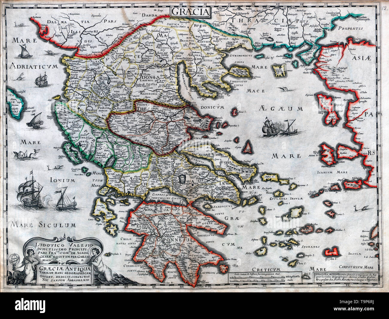 Map of Graeciae Antique - Sanson Atlas, circa 1700 Stock Photohttps://www.alamy.com/image-license-details/?v=1https://www.alamy.com/map-of-graeciae-antique-sanson-atlas-circa-1700-image246965366.html
RMT9P6RJ–Map of Graeciae Antique - Sanson Atlas, circa 1700
 Graecia Antiqua Map of Ancient Greece 1809 Stock Photohttps://www.alamy.com/image-license-details/?v=1https://www.alamy.com/stock-photo-graecia-antiqua-map-of-ancient-greece-1809-139957182.html
RMJ3KGPP–Graecia Antiqua Map of Ancient Greece 1809
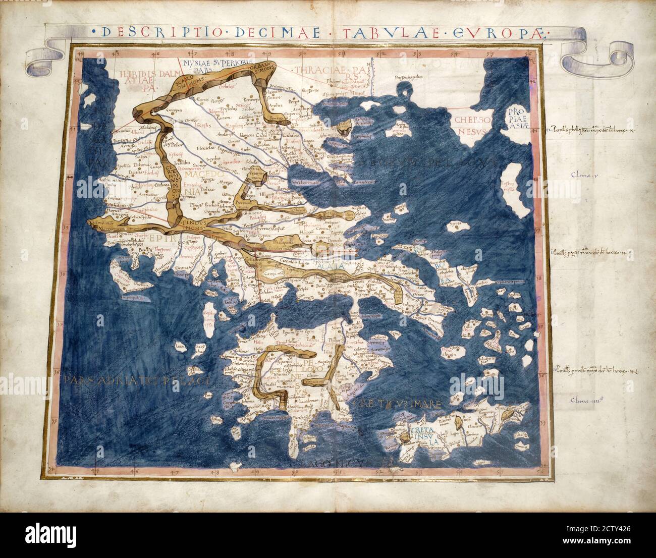 Greece old map from rare medieval book Geography by Claudius Ptolemy published in 1480. Detail of vintage Ancient World map close-up. Concept of antiq Stock Photohttps://www.alamy.com/image-license-details/?v=1https://www.alamy.com/greece-old-map-from-rare-medieval-book-geography-by-claudius-ptolemy-published-in-1480-detail-of-vintage-ancient-world-map-close-up-concept-of-antiq-image376765374.html
RF2CTY426–Greece old map from rare medieval book Geography by Claudius Ptolemy published in 1480. Detail of vintage Ancient World map close-up. Concept of antiq
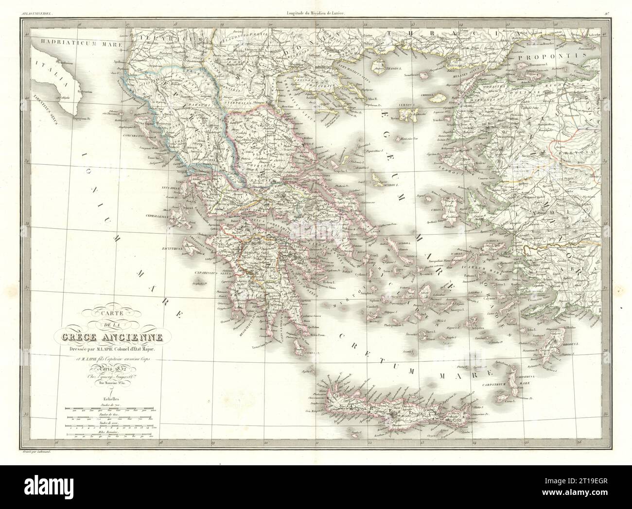 Carte de la Grèce ancienne. Ancient Greece. LAPIE 1832 old antique map chart Stock Photohttps://www.alamy.com/image-license-details/?v=1https://www.alamy.com/carte-de-la-grce-ancienne-ancient-greece-lapie-1832-old-antique-map-chart-image568765815.html
RF2T19EGR–Carte de la Grèce ancienne. Ancient Greece. LAPIE 1832 old antique map chart
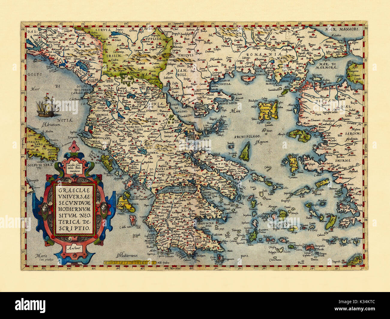 Old map of Greece. Excellent state of preservation realized in ancient style. All the graphic composition is inside a frame. By Ortelius, Theatrum Orbis Terrarum, Antwerp, 1570 Stock Photohttps://www.alamy.com/image-license-details/?v=1https://www.alamy.com/old-map-of-greece-excellent-state-of-preservation-realized-in-ancient-image156840668.html
RFK34KTC–Old map of Greece. Excellent state of preservation realized in ancient style. All the graphic composition is inside a frame. By Ortelius, Theatrum Orbis Terrarum, Antwerp, 1570
 Ancient Corinth, Corinthia, Greece, Peloponnese, N 37 54' 34'', E 22 53' 0'', map, Timeless Map published in 2021. Travelers, explorers and adventurers like Florence Nightingale, David Livingstone, Ernest Shackleton, Lewis and Clark and Sherlock Holmes relied on maps to plan travels to the world's most remote corners, Timeless Maps is mapping most locations on the globe, showing the achievement of great dreams Stock Photohttps://www.alamy.com/image-license-details/?v=1https://www.alamy.com/ancient-corinth-corinthia-greece-peloponnese-n-37-54-34-e-22-53-0-map-timeless-map-published-in-2021-travelers-explorers-and-adventurers-like-florence-nightingale-david-livingstone-ernest-shackleton-lewis-and-clark-and-sherlock-holmes-relied-on-maps-to-plan-travels-to-the-worlds-most-remote-corners-timeless-maps-is-mapping-most-locations-on-the-globe-showing-the-achievement-of-great-dreams-image457955307.html
RM2HH1JJK–Ancient Corinth, Corinthia, Greece, Peloponnese, N 37 54' 34'', E 22 53' 0'', map, Timeless Map published in 2021. Travelers, explorers and adventurers like Florence Nightingale, David Livingstone, Ernest Shackleton, Lewis and Clark and Sherlock Holmes relied on maps to plan travels to the world's most remote corners, Timeless Maps is mapping most locations on the globe, showing the achievement of great dreams
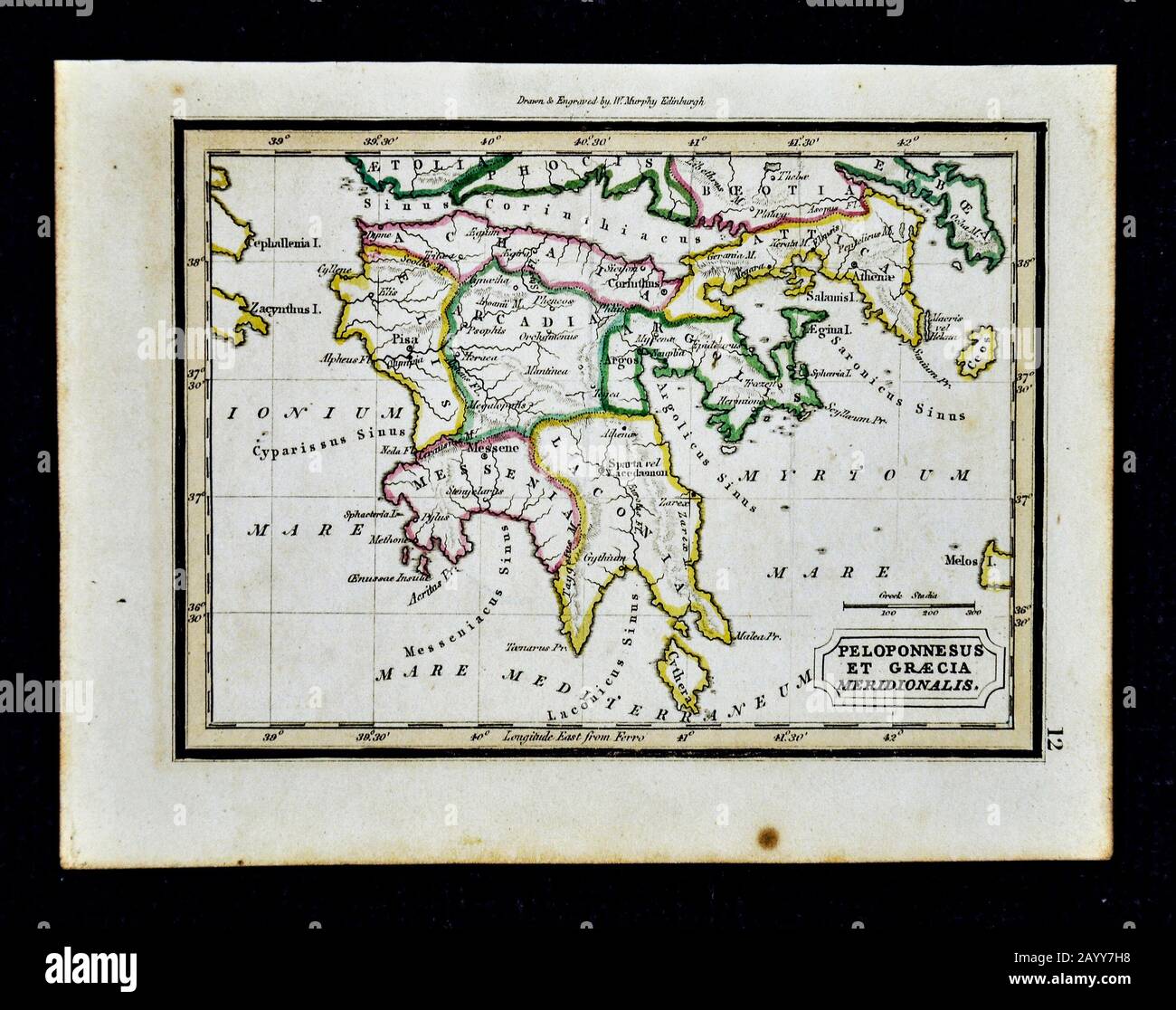 1832 Murphy Map Ancient Greece - Peloponnesus et Graecia Meridionalis - Athens Sparta Corinth Cythera Stock Photohttps://www.alamy.com/image-license-details/?v=1https://www.alamy.com/1832-murphy-map-ancient-greece-peloponnesus-et-graecia-meridionalis-athens-sparta-corinth-cythera-image344191380.html
RM2AYY7H8–1832 Murphy Map Ancient Greece - Peloponnesus et Graecia Meridionalis - Athens Sparta Corinth Cythera
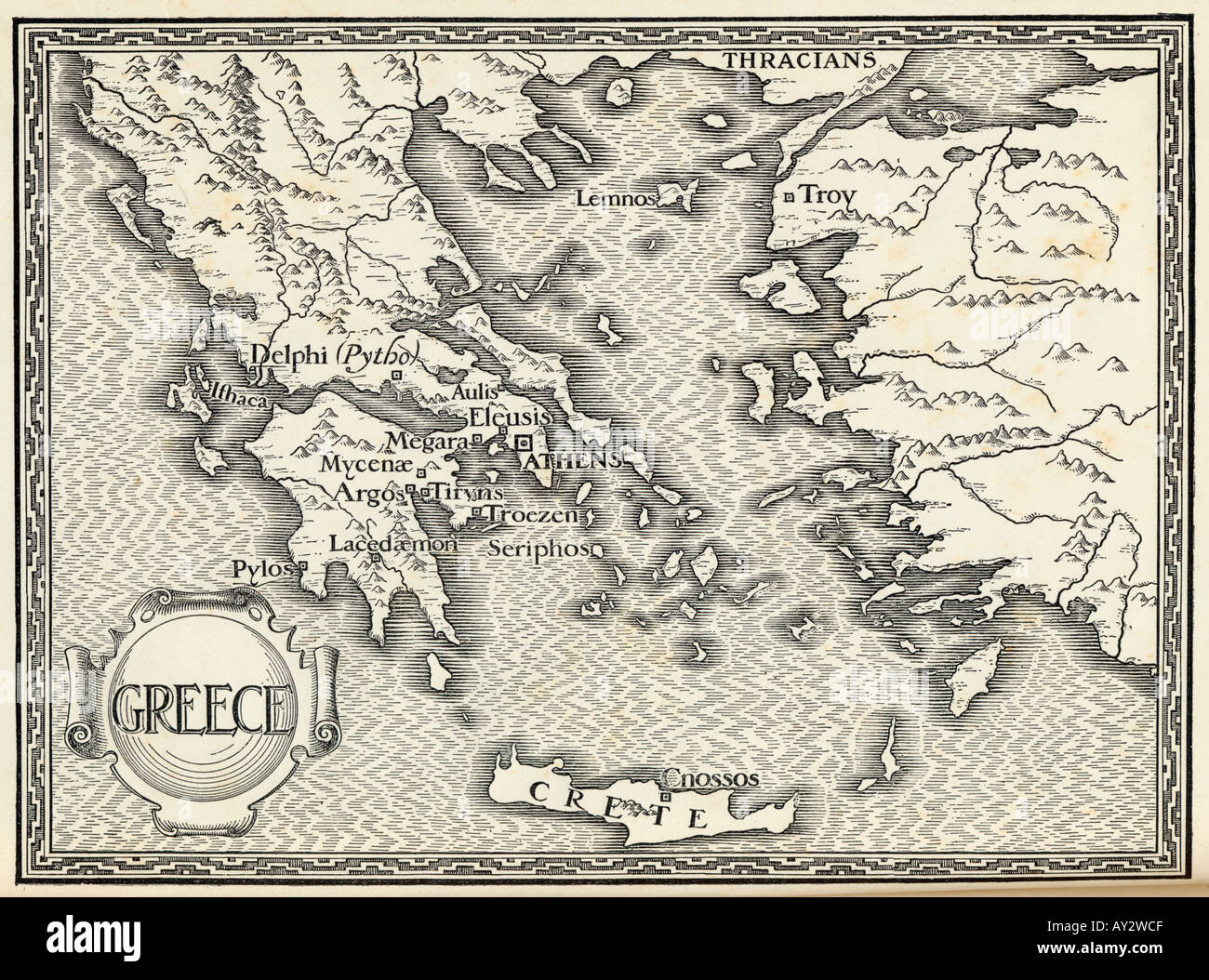 Map Europe Greece Ford Stock Photohttps://www.alamy.com/image-license-details/?v=1https://www.alamy.com/map-europe-greece-ford-image5542350.html
RMAY2WCF–Map Europe Greece Ford
 1794 Anville Map of Ancient Greece - Geographicus - GreeceAncient-anville-1794 Stock Photohttps://www.alamy.com/image-license-details/?v=1https://www.alamy.com/stock-photo-1794-anville-map-of-ancient-greece-geographicus-greeceancient-anville-132600350.html
RMHKMD2P–1794 Anville Map of Ancient Greece - Geographicus - GreeceAncient-anville-1794
 Graecia Antiqua Map of Ancient Greece made in 1814. Stock Photohttps://www.alamy.com/image-license-details/?v=1https://www.alamy.com/graecia-antiqua-map-of-ancient-greece-made-in-1814-image349500675.html
RM2B8H3JY–Graecia Antiqua Map of Ancient Greece made in 1814.
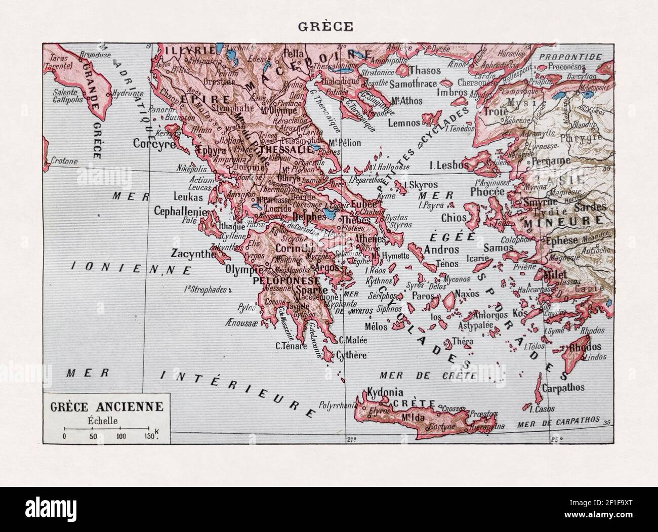 Old map of the Ancient Greece printed in the french dictionary 'Dictionnaire complet illustré' by the editor Larousse in 1889. Stock Photohttps://www.alamy.com/image-license-details/?v=1https://www.alamy.com/old-map-of-the-ancient-greece-printed-in-the-french-dictionary-dictionnaire-complet-illustr-by-the-editor-larousse-in-1889-image414000576.html
RF2F1F9XT–Old map of the Ancient Greece printed in the french dictionary 'Dictionnaire complet illustré' by the editor Larousse in 1889.
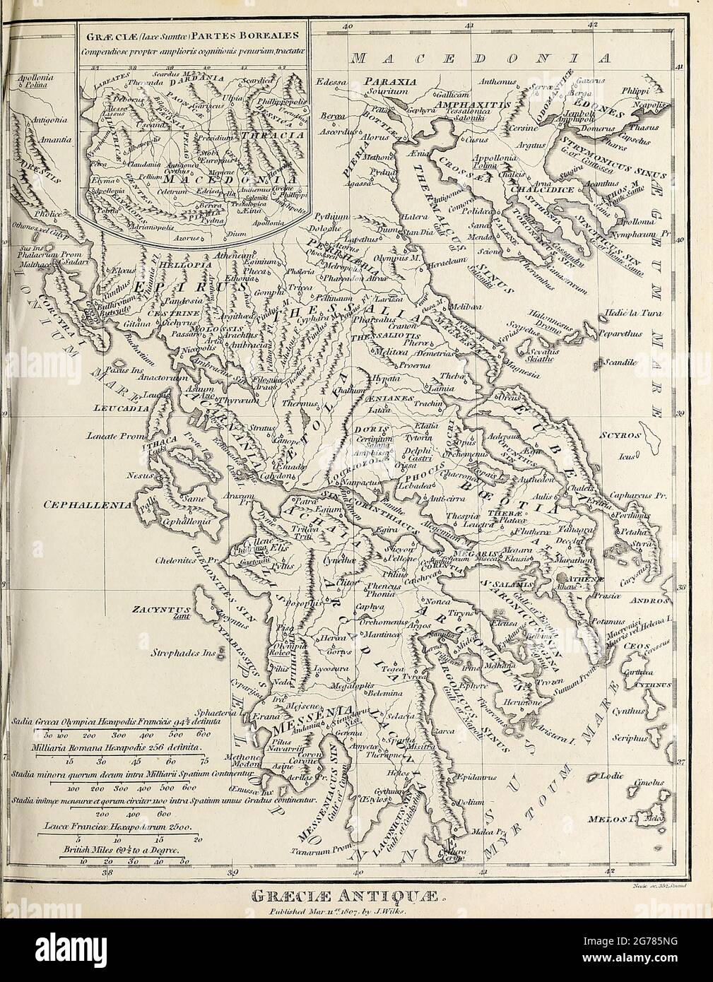 Graeciae Antiquae Ancient, Historical map of Greece Copperplate engraving From the Encyclopaedia Londinensis or, Universal dictionary of arts, sciences, and literature; Volume VIII; Edited by Wilkes, John. Published in London in 1810. Stock Photohttps://www.alamy.com/image-license-details/?v=1https://www.alamy.com/graeciae-antiquae-ancient-historical-map-of-greece-copperplate-engraving-from-the-encyclopaedia-londinensis-or-universal-dictionary-of-arts-sciences-and-literature-volume-viii-edited-by-wilkes-john-published-in-london-in-1810-image434741932.html
RM2G785NG–Graeciae Antiquae Ancient, Historical map of Greece Copperplate engraving From the Encyclopaedia Londinensis or, Universal dictionary of arts, sciences, and literature; Volume VIII; Edited by Wilkes, John. Published in London in 1810.
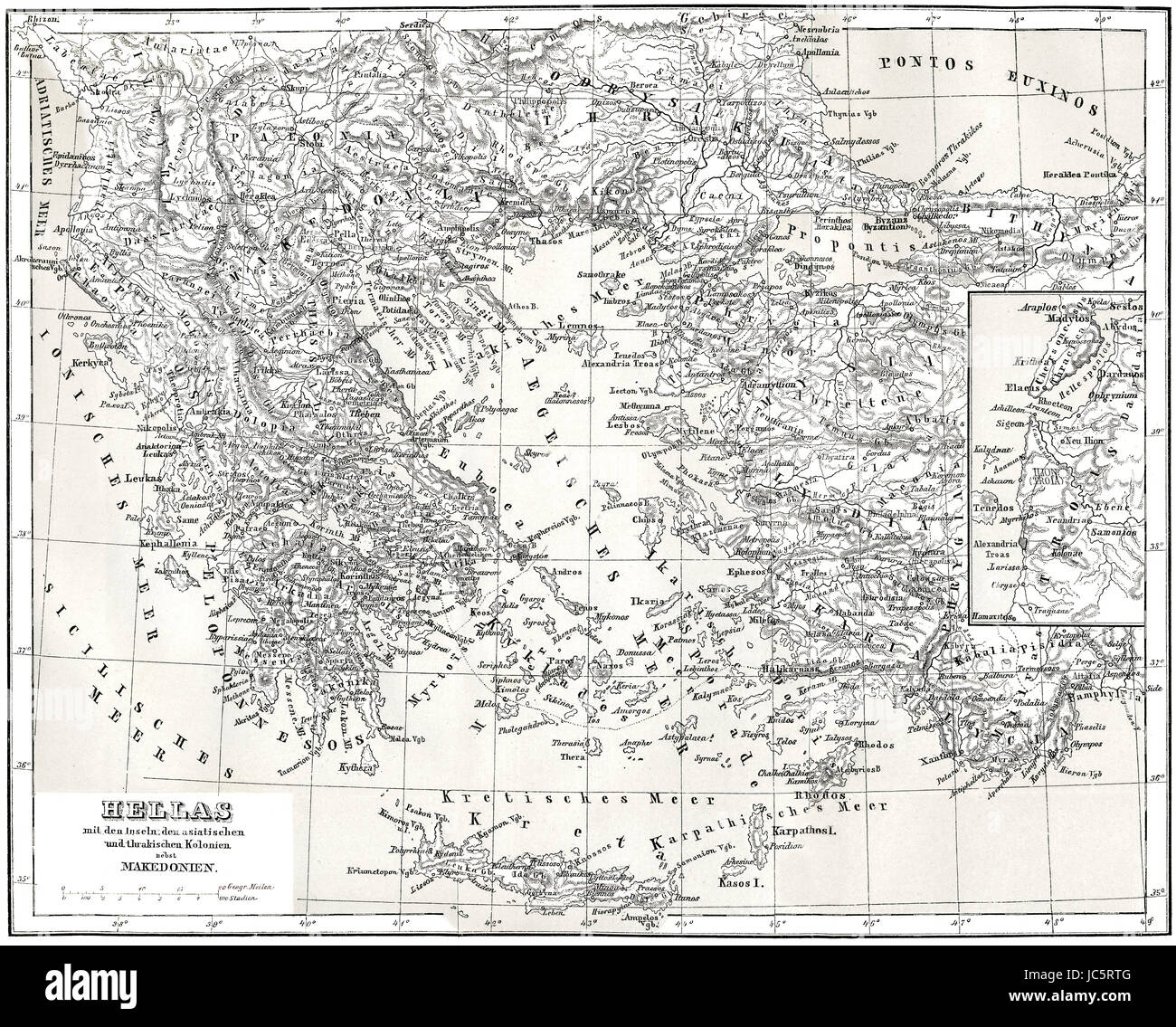 Historical map of ancient Greece with Asian and Thracian Colonies Stock Photohttps://www.alamy.com/image-license-details/?v=1https://www.alamy.com/stock-photo-historical-map-of-ancient-greece-with-asian-and-thracian-colonies-145187296.html
RMJC5RTG–Historical map of ancient Greece with Asian and Thracian Colonies
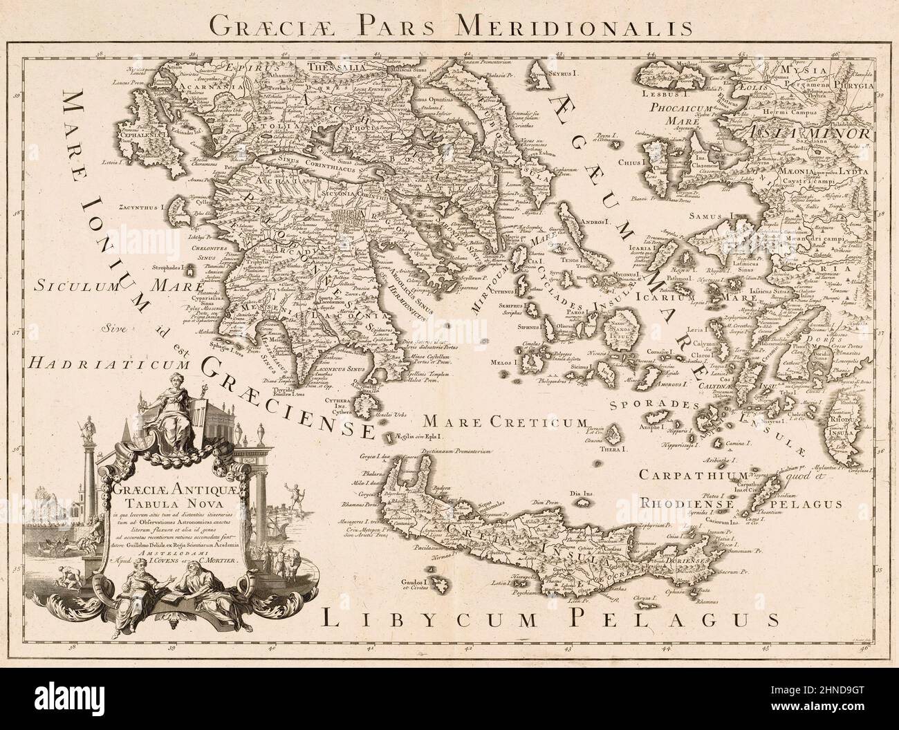 Graeciae pars meridionalis. Graeciae antiquae tabula nova. Southern Greece. A New Map of Ancient Greece. Parts of Asian Turkey are also shown. After a map by French cartographer Guillaume Delisle, also spelled Guillaume de l'Isle, 1675 - 1726. Stock Photohttps://www.alamy.com/image-license-details/?v=1https://www.alamy.com/graeciae-pars-meridionalis-graeciae-antiquae-tabula-nova-southern-greece-a-new-map-of-ancient-greece-parts-of-asian-turkey-are-also-shown-after-a-map-by-french-cartographer-guillaume-delisle-also-spelled-guillaume-de-lisle-1675-1726-image460670248.html
RM2HND9GT–Graeciae pars meridionalis. Graeciae antiquae tabula nova. Southern Greece. A New Map of Ancient Greece. Parts of Asian Turkey are also shown. After a map by French cartographer Guillaume Delisle, also spelled Guillaume de l'Isle, 1675 - 1726.
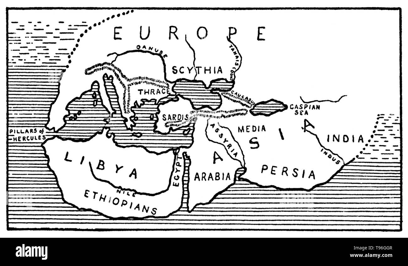 Herodotus (484-425 BC) was an ancient Greek historian, often called the father of history. His history of the invasion of Greece by the Persian Empire was the first attempt at narrative history and was the beginning of all Western history writing. Stock Photohttps://www.alamy.com/image-license-details/?v=1https://www.alamy.com/herodotus-484-425-bc-was-an-ancient-greek-historian-often-called-the-father-of-history-his-history-of-the-invasion-of-greece-by-the-persian-empire-was-the-first-attempt-at-narrative-history-and-was-the-beginning-of-all-western-history-writing-image246621783.html
RMT96GGR–Herodotus (484-425 BC) was an ancient Greek historian, often called the father of history. His history of the invasion of Greece by the Persian Empire was the first attempt at narrative history and was the beginning of all Western history writing.
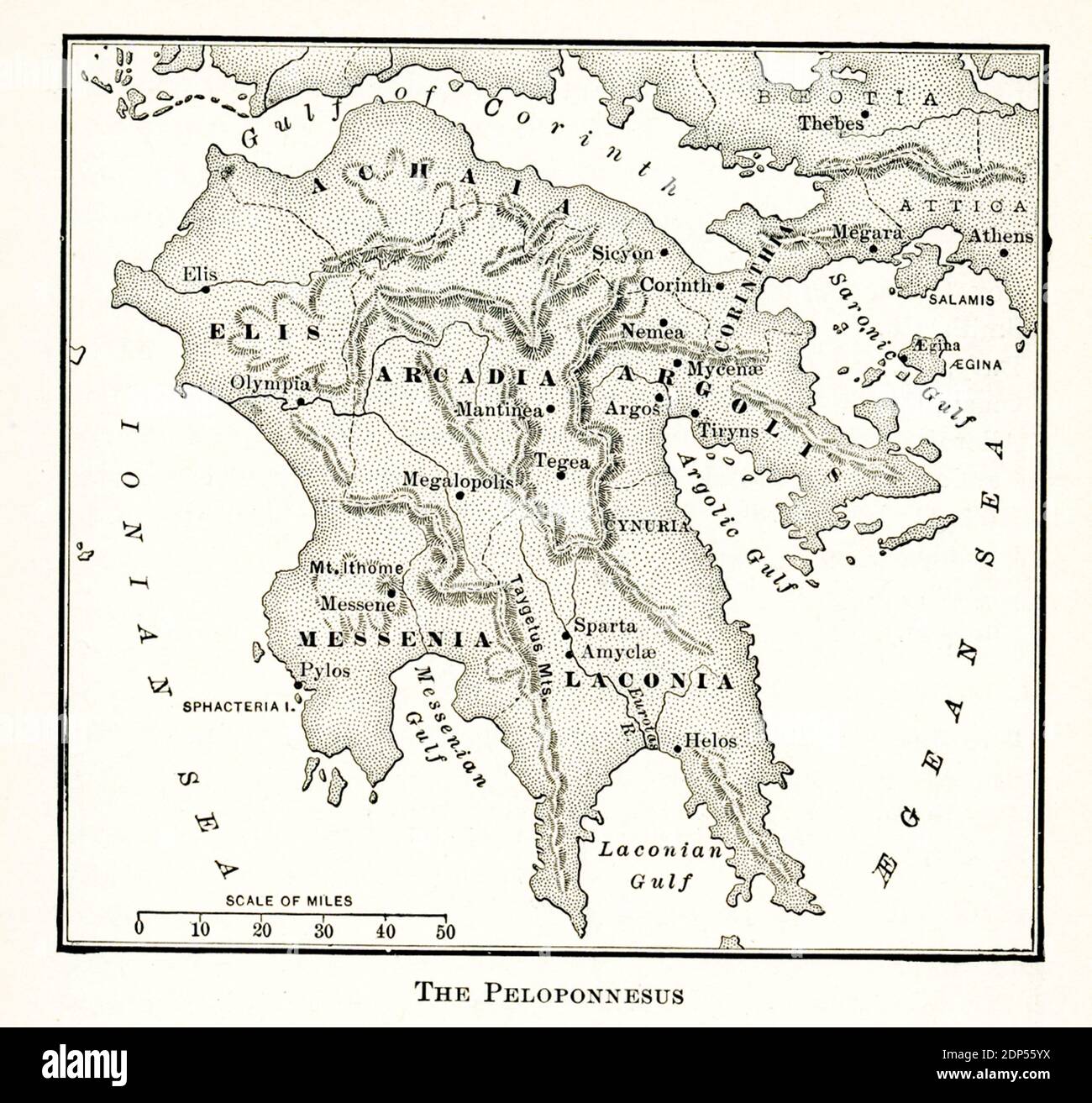 This map of the Peloponnesus dates to the early 1900s. Stock Photohttps://www.alamy.com/image-license-details/?v=1https://www.alamy.com/this-map-of-the-peloponnesus-dates-to-the-early-1900s-image392264990.html
RF2DP55YX–This map of the Peloponnesus dates to the early 1900s.
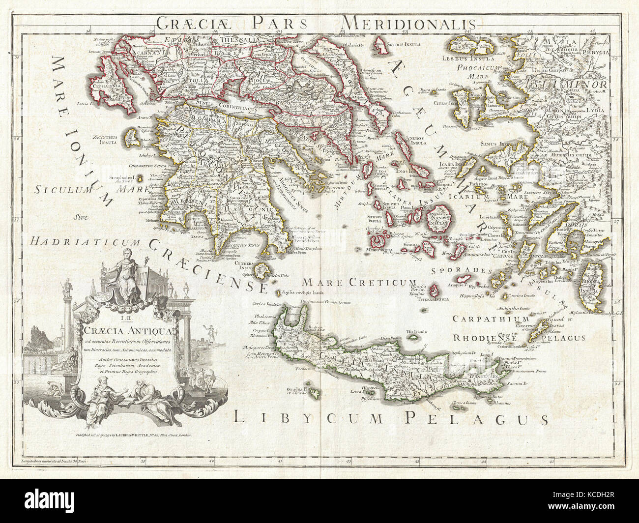 1794, Delisle Map of Southern Ancient Greece, Greeks Isles, and Crete Stock Photohttps://www.alamy.com/image-license-details/?v=1https://www.alamy.com/stock-image-1794-delisle-map-of-southern-ancient-greece-greeks-isles-and-crete-162567967.html
RMKCDH2R–1794, Delisle Map of Southern Ancient Greece, Greeks Isles, and Crete
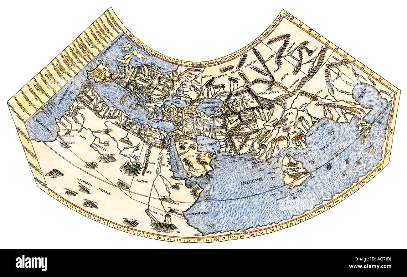 Ptolemy map of the world, a concept of the flat earth. Hand-colored woodcut Stock Photohttps://www.alamy.com/image-license-details/?v=1https://www.alamy.com/stock-photo-ptolemy-map-of-the-world-a-concept-of-the-flat-earth-hand-colored-14121341.html
RMAG7JDJ–Ptolemy map of the world, a concept of the flat earth. Hand-colored woodcut
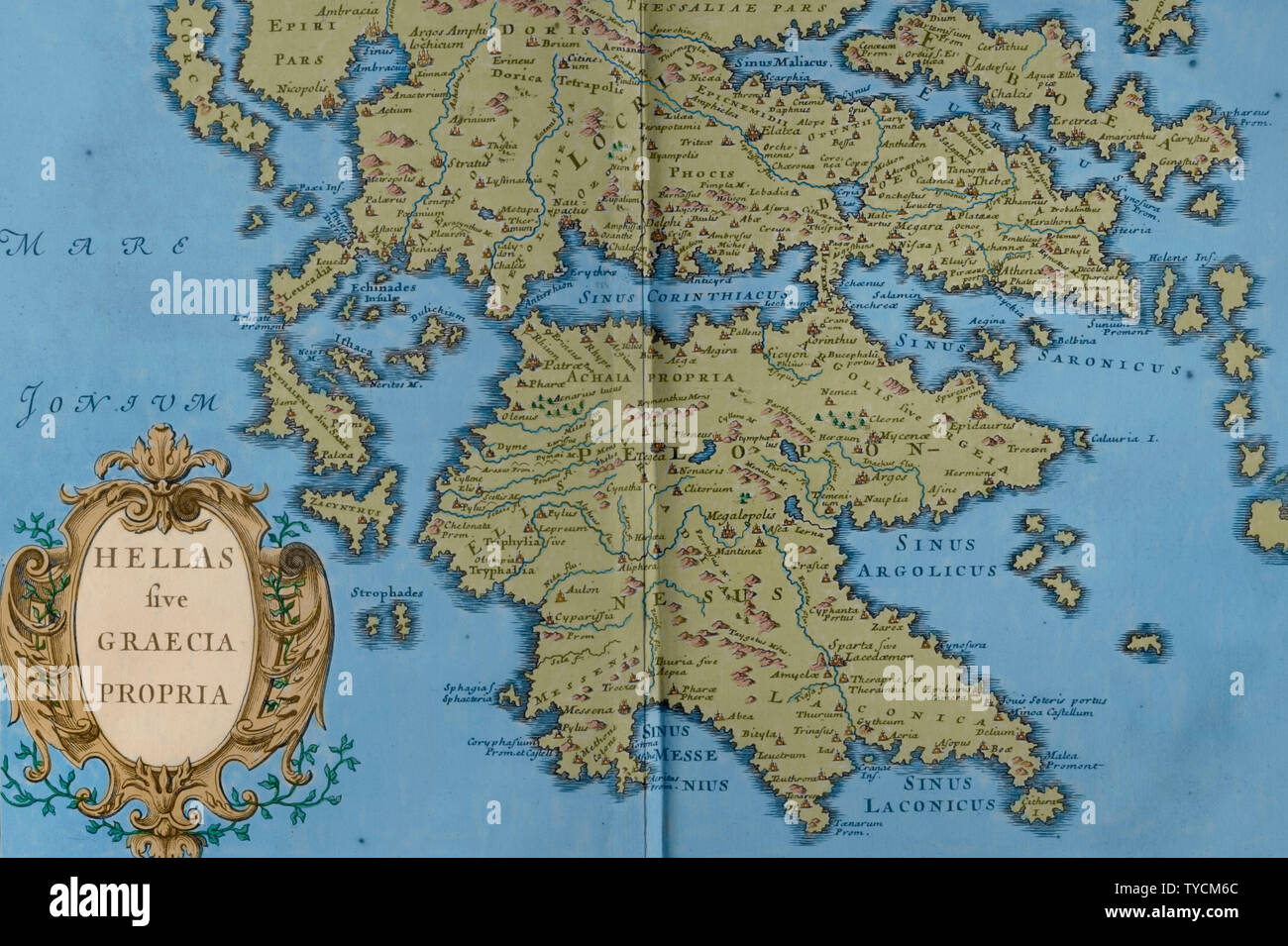 History by Polybius. Volume III. French edition translated from Greek by Dom Vincent Thuillier. Comments of Military Science enriched with critical and historical notes by M. De Folard. Paris, chez Pierre Gandouin, Julien-Michel Gandouin, Pierre-Francois Giffart and Nicolas-Pierre Armand, 1728. Map of Greece. Engraving. Later colouration. Stock Photohttps://www.alamy.com/image-license-details/?v=1https://www.alamy.com/history-by-polybius-volume-iii-french-edition-translated-from-greek-by-dom-vincent-thuillier-comments-of-military-science-enriched-with-critical-and-historical-notes-by-m-de-folard-paris-chez-pierre-gandouin-julien-michel-gandouin-pierre-francois-giffart-and-nicolas-pierre-armand-1728-map-of-greece-engraving-later-colouration-image257820148.html
RMTYCM6C–History by Polybius. Volume III. French edition translated from Greek by Dom Vincent Thuillier. Comments of Military Science enriched with critical and historical notes by M. De Folard. Paris, chez Pierre Gandouin, Julien-Michel Gandouin, Pierre-Francois Giffart and Nicolas-Pierre Armand, 1728. Map of Greece. Engraving. Later colouration.
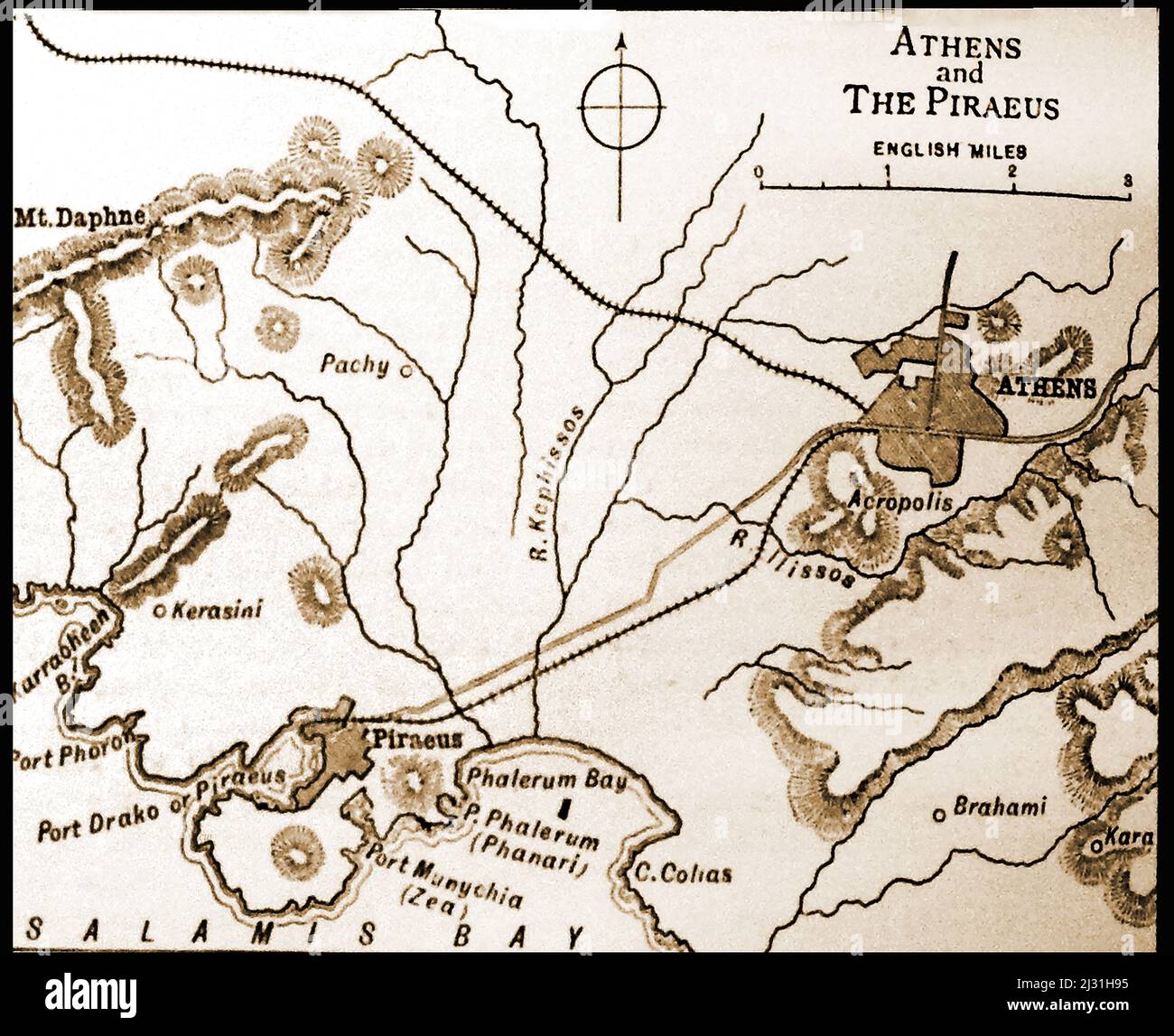 A British 19th century map of Athens and Piraeus, Greece, with distances in English miles Stock Photohttps://www.alamy.com/image-license-details/?v=1https://www.alamy.com/a-british-19th-century-map-of-athens-and-piraeus-greece-with-distances-in-english-miles-image466559441.html
RM2J31H95–A British 19th century map of Athens and Piraeus, Greece, with distances in English miles
 Graecia Antiqua Map of Ancient Greece made in 1814 Stock Photohttps://www.alamy.com/image-license-details/?v=1https://www.alamy.com/stock-photo-graecia-antiqua-map-of-ancient-greece-made-in-1814-139982536.html
RMJ3MN48–Graecia Antiqua Map of Ancient Greece made in 1814
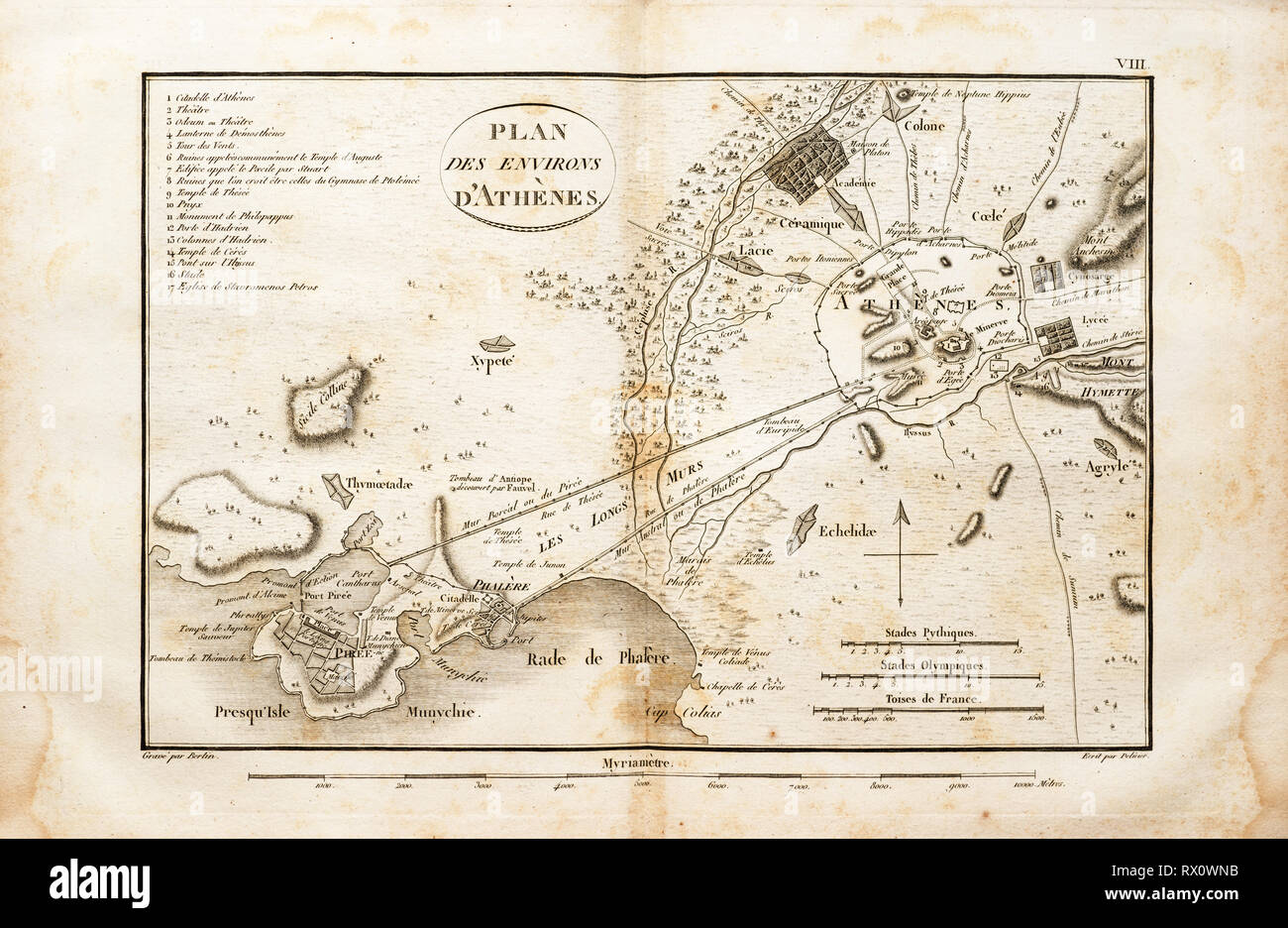 old map of the area around Athens Greece from an 1802 book in French Stock Photohttps://www.alamy.com/image-license-details/?v=1https://www.alamy.com/old-map-of-the-area-around-athens-greece-from-an-1802-book-in-french-image239736039.html
RFRX0WNB–old map of the area around Athens Greece from an 1802 book in French
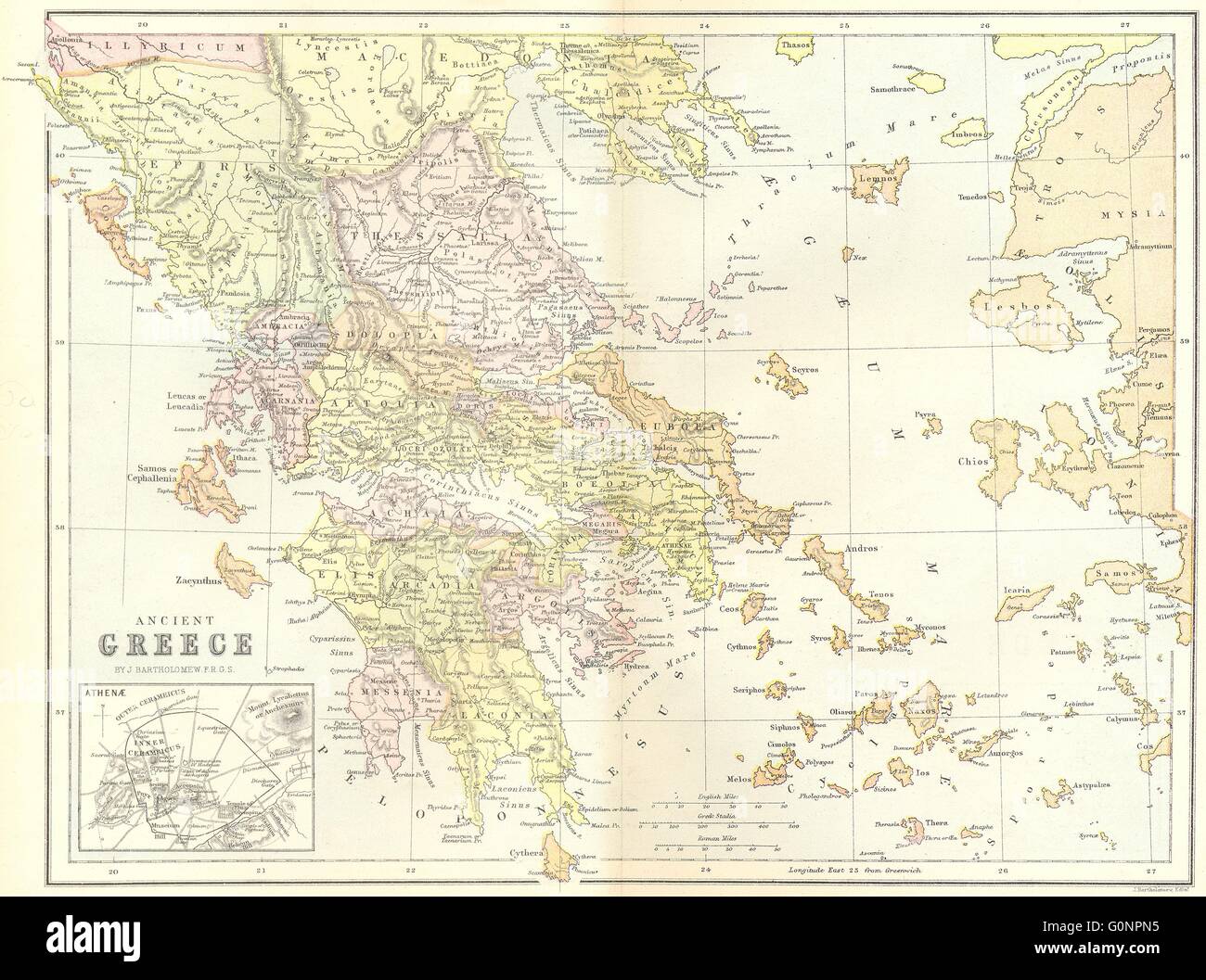 GREECE: Ancient, 1870 antique map Stock Photohttps://www.alamy.com/image-license-details/?v=1https://www.alamy.com/stock-photo-greece-ancient-1870-antique-map-103741041.html
RFG0NPN5–GREECE: Ancient, 1870 antique map
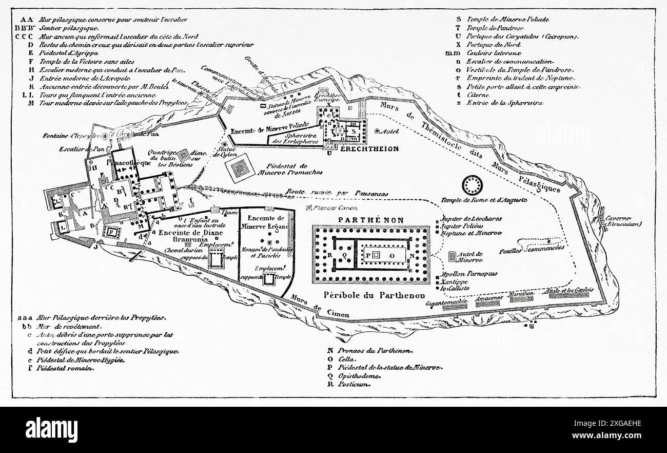 Old Map of the Acropolis, Athens. Greece, from a Winter in Athens, 1857-1858 by Antonin Proust (1832-1905) Le Tour du Monde 1862 Stock Photohttps://www.alamy.com/image-license-details/?v=1https://www.alamy.com/old-map-of-the-acropolis-athens-greece-from-a-winter-in-athens-1857-1858-by-antonin-proust-1832-1905-le-tour-du-monde-1862-image612428362.html
RM2XGAEHE–Old Map of the Acropolis, Athens. Greece, from a Winter in Athens, 1857-1858 by Antonin Proust (1832-1905) Le Tour du Monde 1862
 A new map of ancient Greece Thrace, Moesia, Ilyricum and the isles adjoyning. Greece, Thrace, Illyricum, &c. Cartographic. Maps, Atlases. 1700. Lionel Pincus and Princess Firyal Map Division. Atlases, British, Geography, Ancient, Maps in education , England, Maps Stock Photohttps://www.alamy.com/image-license-details/?v=1https://www.alamy.com/a-new-map-of-ancient-greece-thrace-moesia-ilyricum-and-the-isles-adjoyning-greece-thrace-illyricum-c-cartographic-maps-atlases-1700-lionel-pincus-and-princess-firyal-map-division-atlases-british-geography-ancient-maps-in-education-england-maps-image484373650.html
RM2K413EX–A new map of ancient Greece Thrace, Moesia, Ilyricum and the isles adjoyning. Greece, Thrace, Illyricum, &c. Cartographic. Maps, Atlases. 1700. Lionel Pincus and Princess Firyal Map Division. Atlases, British, Geography, Ancient, Maps in education , England, Maps
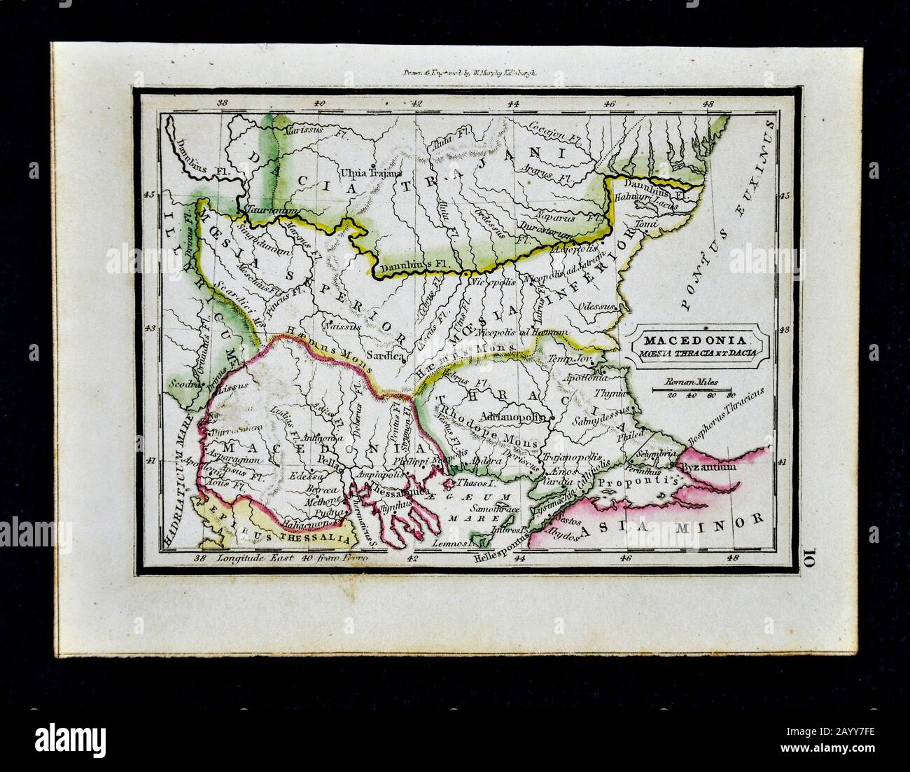 1832 Murphy Map Ancient Macedonia Moesia Thracia et Dacia Greece Turkey Byzantium Balkans Stock Photohttps://www.alamy.com/image-license-details/?v=1https://www.alamy.com/1832-murphy-map-ancient-macedonia-moesia-thracia-et-dacia-greece-turkey-byzantium-balkans-image344191330.html
RM2AYY7FE–1832 Murphy Map Ancient Macedonia Moesia Thracia et Dacia Greece Turkey Byzantium Balkans
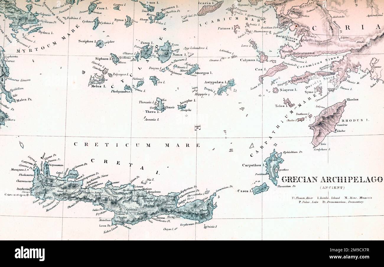 Islands of the Ancient Greece Archipeligo Stock Photohttps://www.alamy.com/image-license-details/?v=1https://www.alamy.com/islands-of-the-ancient-greece-archipeligo-image504916603.html
RM2M9CX7R–Islands of the Ancient Greece Archipeligo
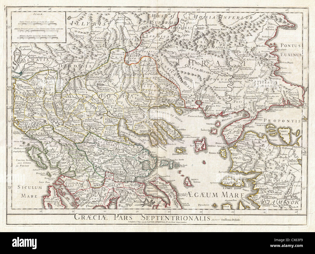 1794 Delisle Map of Northern Ancient Greece, Balkans, Macedonia Stock Photohttps://www.alamy.com/image-license-details/?v=1https://www.alamy.com/stock-photo-1794-delisle-map-of-northern-ancient-greece-balkans-macedonia-50536285.html
RMCX63F9–1794 Delisle Map of Northern Ancient Greece, Balkans, Macedonia
 Map of Ancient Greece. Stock Photohttps://www.alamy.com/image-license-details/?v=1https://www.alamy.com/map-of-ancient-greece-image398201084.html
RM2E3RHF8–Map of Ancient Greece.
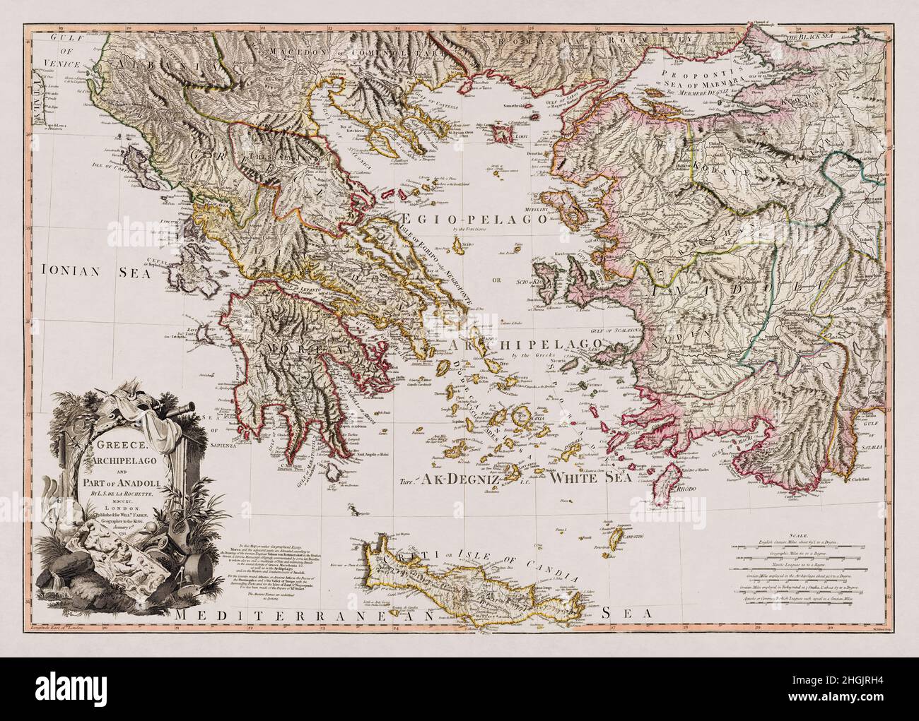 Map of Greece, it's archipelago and part of Anadoli drawn by Louis Stanislas d'Arcy Delarochette in 1791. Stock Photohttps://www.alamy.com/image-license-details/?v=1https://www.alamy.com/map-of-greece-its-archipelago-and-part-of-anadoli-drawn-by-louis-stanislas-darcy-delarochette-in-1791-image457717712.html
RF2HGJRH4–Map of Greece, it's archipelago and part of Anadoli drawn by Louis Stanislas d'Arcy Delarochette in 1791.
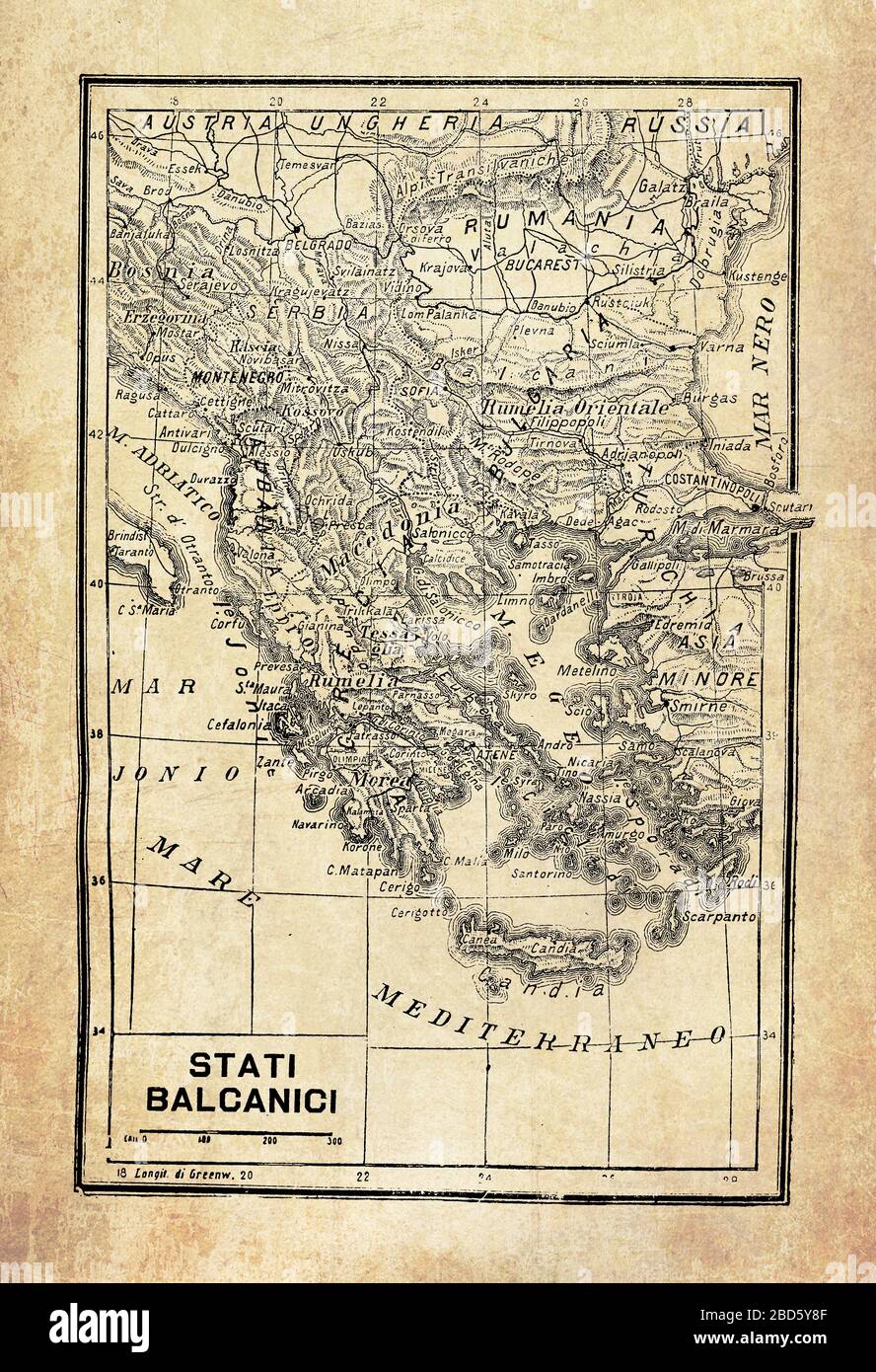 Ancient map of Balkan Peninsula in Southeast Europe and the seas and islands surrounding it with geographical Italian names and descriptions Stock Photohttps://www.alamy.com/image-license-details/?v=1https://www.alamy.com/ancient-map-of-balkan-peninsula-in-southeast-europe-and-the-seas-and-islands-surrounding-it-with-geographical-italian-names-and-descriptions-image352329055.html
RF2BD5Y8F–Ancient map of Balkan Peninsula in Southeast Europe and the seas and islands surrounding it with geographical Italian names and descriptions
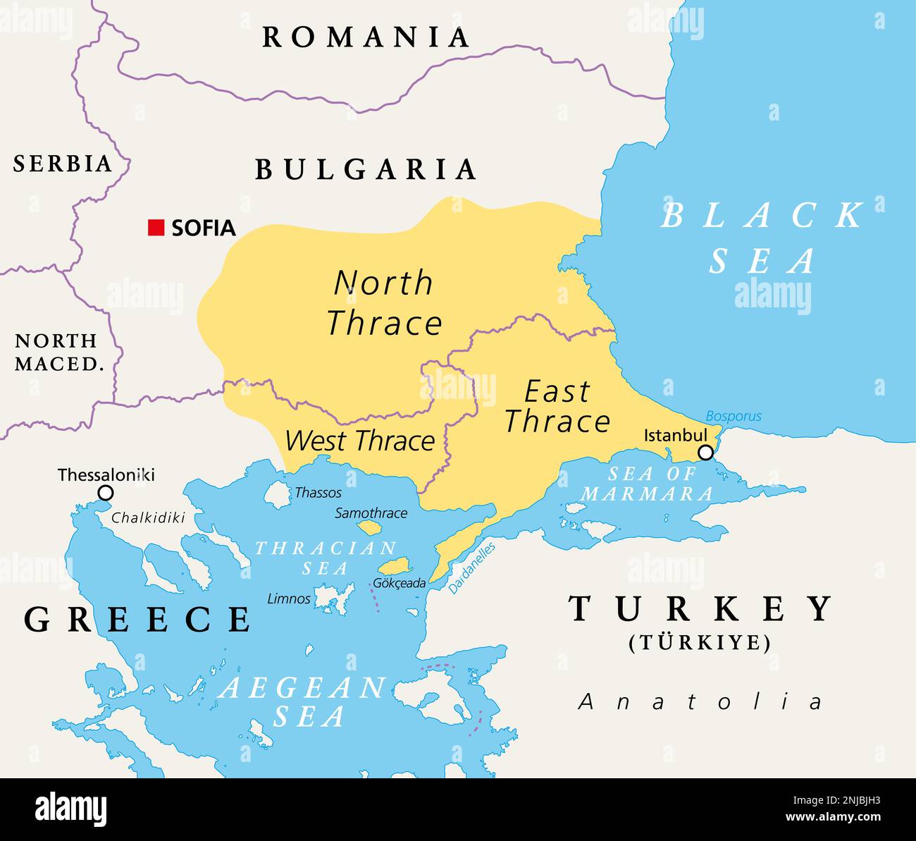 Thrace, geographical and historical region in Southeast Europe, political map. Modern boundaries of Thrace, split among Bulgaria, Greece and Turkey. Stock Photohttps://www.alamy.com/image-license-details/?v=1https://www.alamy.com/thrace-geographical-and-historical-region-in-southeast-europe-political-map-modern-boundaries-of-thrace-split-among-bulgaria-greece-and-turkey-image527630911.html
RF2NJBJH3–Thrace, geographical and historical region in Southeast Europe, political map. Modern boundaries of Thrace, split among Bulgaria, Greece and Turkey.
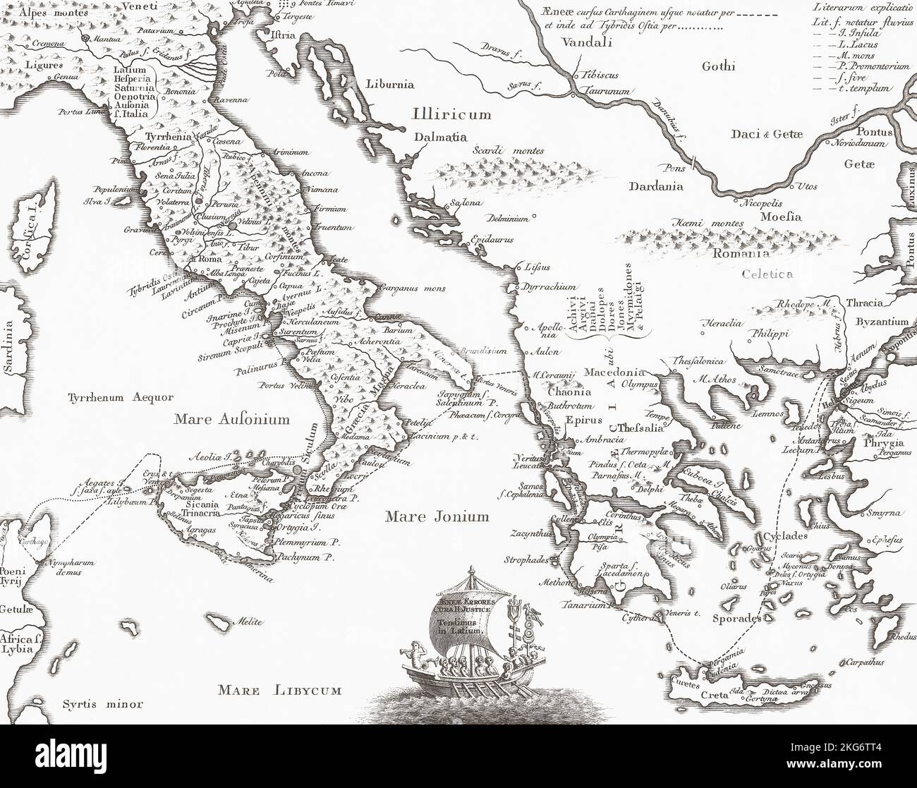 18th century map of Italy and Greece showing major sites of ancient history. Stock Photohttps://www.alamy.com/image-license-details/?v=1https://www.alamy.com/18th-century-map-of-italy-and-greece-showing-major-sites-of-ancient-history-image491876004.html
RM2KG6TT4–18th century map of Italy and Greece showing major sites of ancient history.
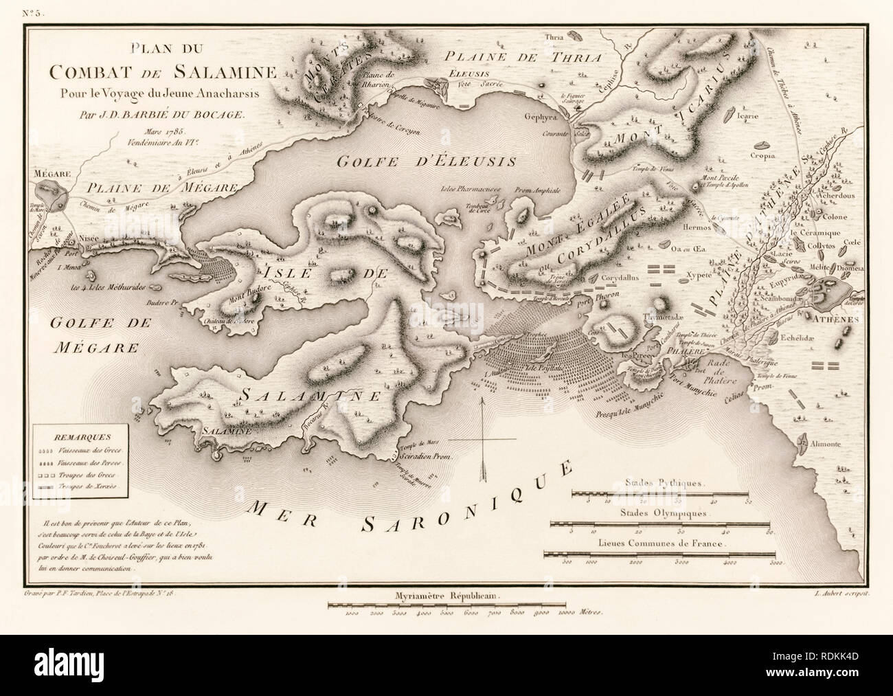 ‘Plan du Combat de Salamine Pour le Voyage du Jeune Anacharsis’ Plan of the Battle of Salamis 480 BC by Jean Denis Barbie du Bocage (1760-1825) from ‘Voyage du jeune Anacharsis en Grèce’ (Travels of Anacharsis the younger in Greece) by Jean Jacques Barthélemy (1716-1795). Stock Photohttps://www.alamy.com/image-license-details/?v=1https://www.alamy.com/plan-du-combat-de-salamine-pour-le-voyage-du-jeune-anacharsis-plan-of-the-battle-of-salamis-480-bc-by-jean-denis-barbie-du-bocage-1760-1825-from-voyage-du-jeune-anacharsis-en-grce-travels-of-anacharsis-the-younger-in-greece-by-jean-jacques-barthlemy-1716-1795-image232157421.html
RMRDKK4D–‘Plan du Combat de Salamine Pour le Voyage du Jeune Anacharsis’ Plan of the Battle of Salamis 480 BC by Jean Denis Barbie du Bocage (1760-1825) from ‘Voyage du jeune Anacharsis en Grèce’ (Travels of Anacharsis the younger in Greece) by Jean Jacques Barthélemy (1716-1795).
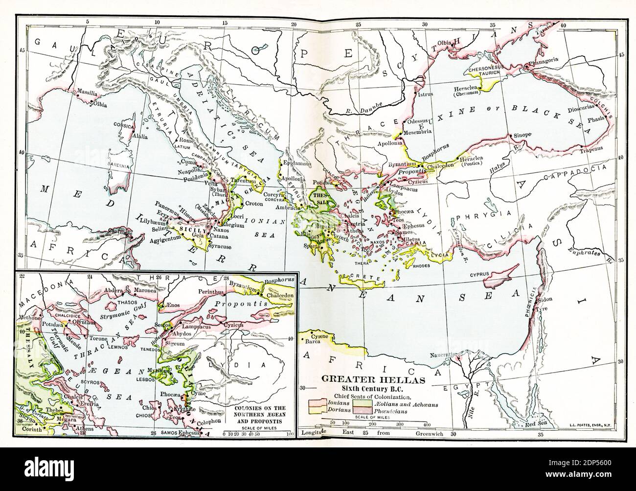 Greater Hellas Sixth Century B.C. The legend on this early 1900s map reads: Chief Seats of Colonization. Pink: Ionians; Green-Aeolians and Achaeans; Yellow-Dorians; Purple-Phoenicians. Inset map: Colonies of the Northern Aegean and Propontis Stock Photohttps://www.alamy.com/image-license-details/?v=1https://www.alamy.com/greater-hellas-sixth-century-bc-the-legend-on-this-early-1900s-map-reads-chief-seats-of-colonization-pink-ionians-green-aeolians-and-achaeans-yellow-dorians-purple-phoenicians-inset-map-colonies-of-the-northern-aegean-and-propontis-image392264992.html
RF2DP5600–Greater Hellas Sixth Century B.C. The legend on this early 1900s map reads: Chief Seats of Colonization. Pink: Ionians; Green-Aeolians and Achaeans; Yellow-Dorians; Purple-Phoenicians. Inset map: Colonies of the Northern Aegean and Propontis
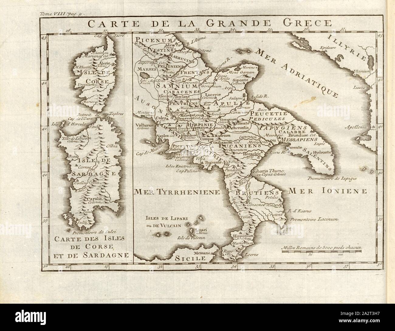 Map of Great Greece, Map of the Magna Graecia region in ancient Italy, Fig. 5, according to p. 6, Histoire universelle depuis le commencement du monde jusqu'à présent, traduite de l'anglois. T. 8. Amsterdam; Leipzig: chez Arkstée et Merkus, MDCCLXX [1770 Stock Photohttps://www.alamy.com/image-license-details/?v=1https://www.alamy.com/map-of-great-greece-map-of-the-magna-graecia-region-in-ancient-italy-fig-5-according-to-p-6-histoire-universelle-depuis-le-commencement-du-monde-jusqu-prsent-traduite-de-langlois-t-8-amsterdam-leipzig-chez-arkste-et-merkus-mdcclxx-1770-image328755987.html
RM2A2T3H7–Map of Great Greece, Map of the Magna Graecia region in ancient Italy, Fig. 5, according to p. 6, Histoire universelle depuis le commencement du monde jusqu'à présent, traduite de l'anglois. T. 8. Amsterdam; Leipzig: chez Arkstée et Merkus, MDCCLXX [1770
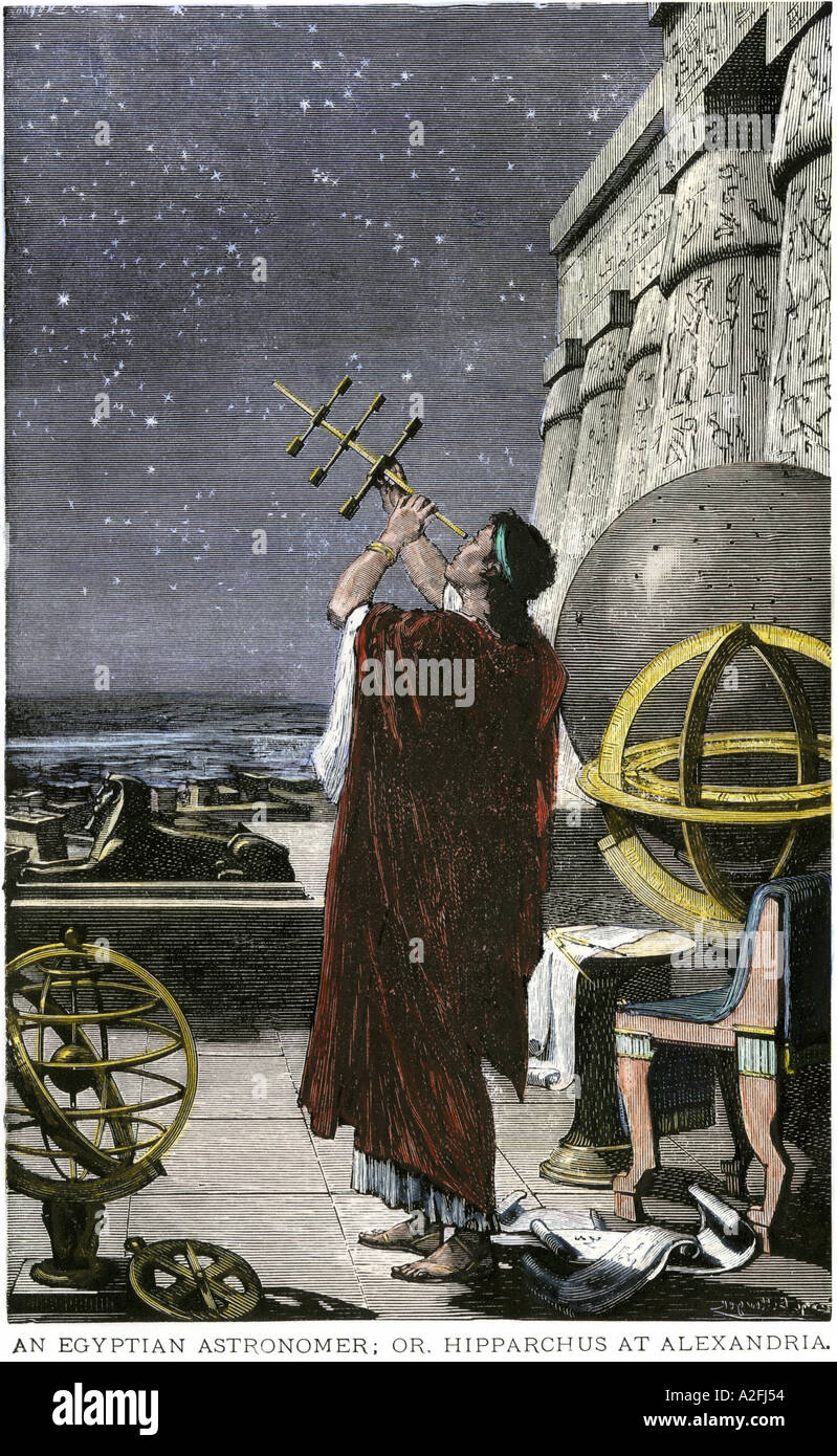 Greek astronomer Hipparchus mapping the stars over Alexandria in ancient Egypt. Hand-colored woodcut Stock Photohttps://www.alamy.com/image-license-details/?v=1https://www.alamy.com/greek-astronomer-hipparchus-mapping-the-stars-over-alexandria-in-ancient-image3429971.html
RMA2FJ54–Greek astronomer Hipparchus mapping the stars over Alexandria in ancient Egypt. Hand-colored woodcut
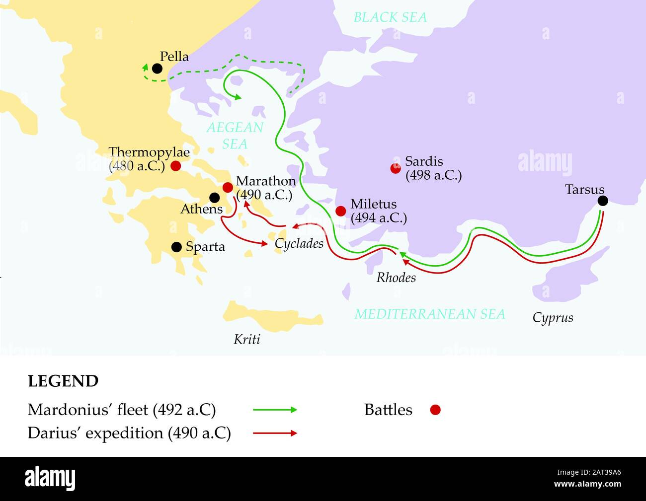 Ancient greece map showing persian invasion of greece. Stock Photohttps://www.alamy.com/image-license-details/?v=1https://www.alamy.com/ancient-greece-map-showing-persian-invasion-of-greece-image341821934.html
RF2AT39A6–Ancient greece map showing persian invasion of greece.
 18th-century Dutch map of Sicily written in Greek Stock Photohttps://www.alamy.com/image-license-details/?v=1https://www.alamy.com/18th-century-dutch-map-of-sicily-written-in-greek-image7575796.html
RMACYRY5–18th-century Dutch map of Sicily written in Greek
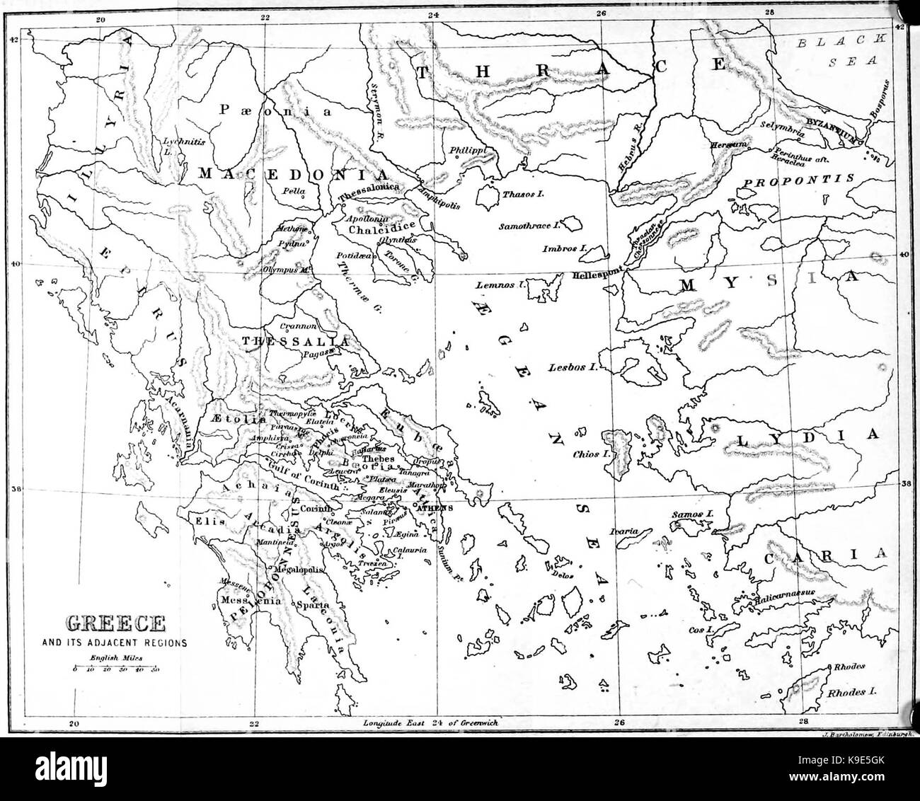 Map of Ancient Greece Stock Photohttps://www.alamy.com/image-license-details/?v=1https://www.alamy.com/stock-image-map-of-ancient-greece-160736931.html
RMK9E5GK–Map of Ancient Greece
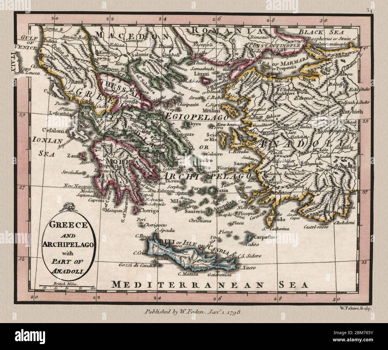 'Greece and Archipelago.' Detailed map shows Greece in 1804. The map shows mainland Greece, the archipelago in the Aegean Sea, and Anadoli, which is modern-day Turkey. This is a beautifully detailed historic map reproduction. Original from a British atlas published by famed cartographer William Faden. Stock Photohttps://www.alamy.com/image-license-details/?v=1https://www.alamy.com/greece-and-archipelago-detailed-map-shows-greece-in-1804-the-map-shows-mainland-greece-the-archipelago-in-the-aegean-sea-and-anadoli-which-is-modern-day-turkey-this-is-a-beautifully-detailed-historic-map-reproduction-original-from-a-british-atlas-published-by-famed-cartographer-william-faden-image356659015.html
RM2BM765Y–'Greece and Archipelago.' Detailed map shows Greece in 1804. The map shows mainland Greece, the archipelago in the Aegean Sea, and Anadoli, which is modern-day Turkey. This is a beautifully detailed historic map reproduction. Original from a British atlas published by famed cartographer William Faden.
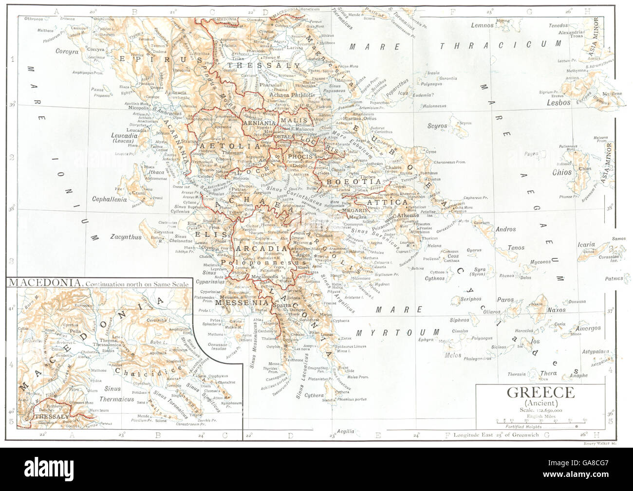 GREECE: Greece(Ancient); Inset map of Macedonia, 1910 Stock Photohttps://www.alamy.com/image-license-details/?v=1https://www.alamy.com/stock-photo-greece-greeceancient-inset-map-of-macedonia-1910-109594247.html
RFGA8CG7–GREECE: Greece(Ancient); Inset map of Macedonia, 1910
 Old Map of Athens city and the Piraeus port, Greece. A Winter in Athens, 1857-1858 by Antonin Proust (1832-1905) Le Tour du Monde 1862 Stock Photohttps://www.alamy.com/image-license-details/?v=1https://www.alamy.com/old-map-of-athens-city-and-the-piraeus-port-greece-a-winter-in-athens-1857-1858-by-antonin-proust-1832-1905-le-tour-du-monde-1862-image612428343.html
RM2XGAEGR–Old Map of Athens city and the Piraeus port, Greece. A Winter in Athens, 1857-1858 by Antonin Proust (1832-1905) Le Tour du Monde 1862
 Greek symbols on the Greece map Stock Vectorhttps://www.alamy.com/image-license-details/?v=1https://www.alamy.com/greek-symbols-on-the-greece-map-image64447013.html
RFDMRPR1–Greek symbols on the Greece map
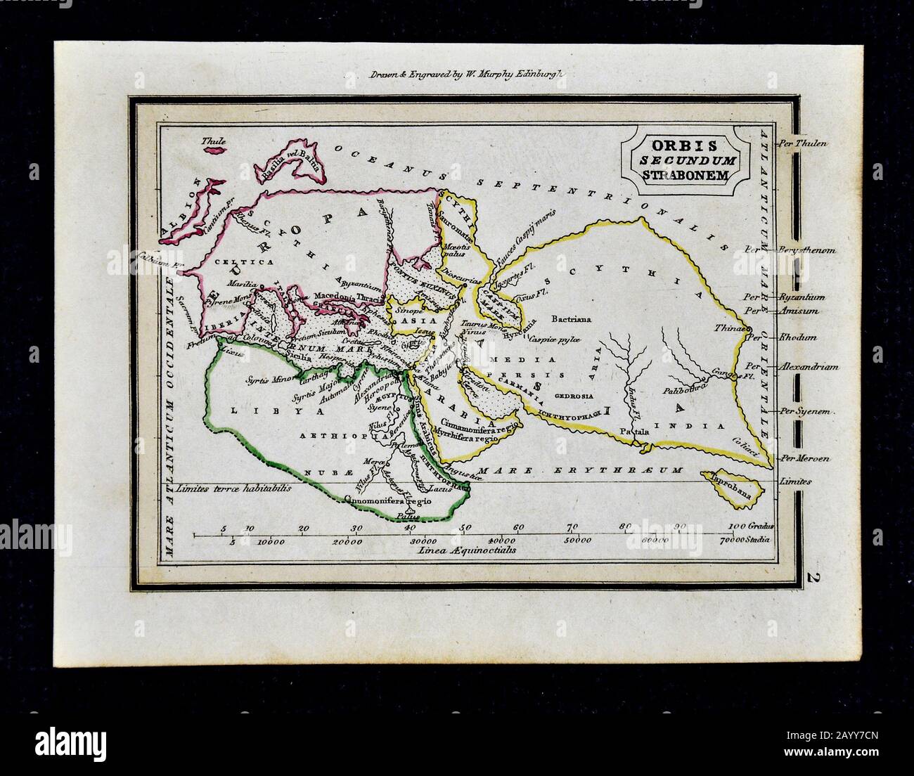 1832 Murphy Map Ancient Stock Photohttps://www.alamy.com/image-license-details/?v=1https://www.alamy.com/1832-murphy-map-ancient-image344191253.html
RM2AYY7CN–1832 Murphy Map Ancient
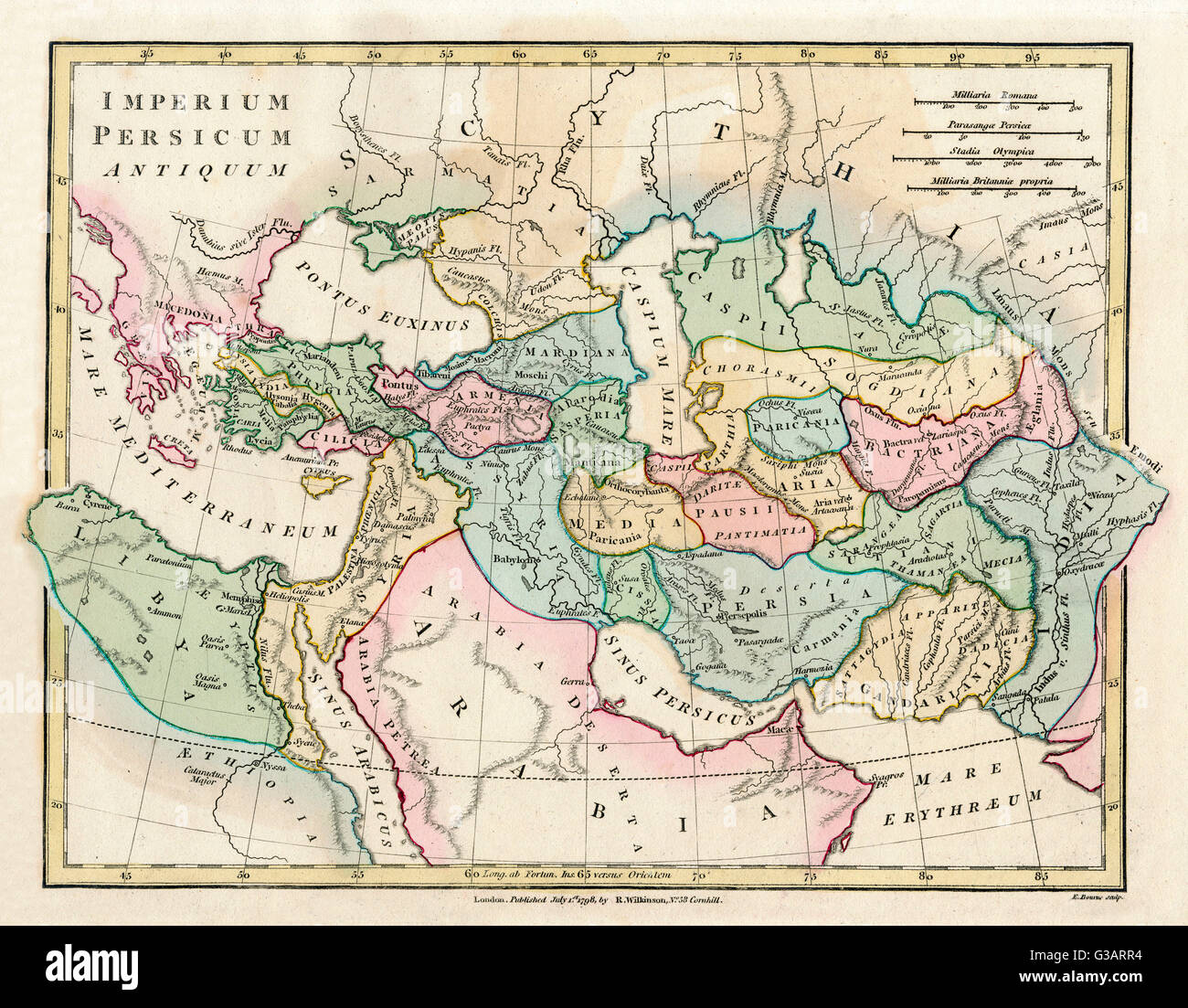 Map of the Ancient Persian Empire, encompassing Greece to the north west, Arabia to the south east, Egypt and Libya to the south west and deep in the Caucasus in the north east. Date: 1798 Stock Photohttps://www.alamy.com/image-license-details/?v=1https://www.alamy.com/stock-photo-map-of-the-ancient-persian-empire-encompassing-greece-to-the-north-105344376.html
RMG3ARR4–Map of the Ancient Persian Empire, encompassing Greece to the north west, Arabia to the south east, Egypt and Libya to the south west and deep in the Caucasus in the north east. Date: 1798
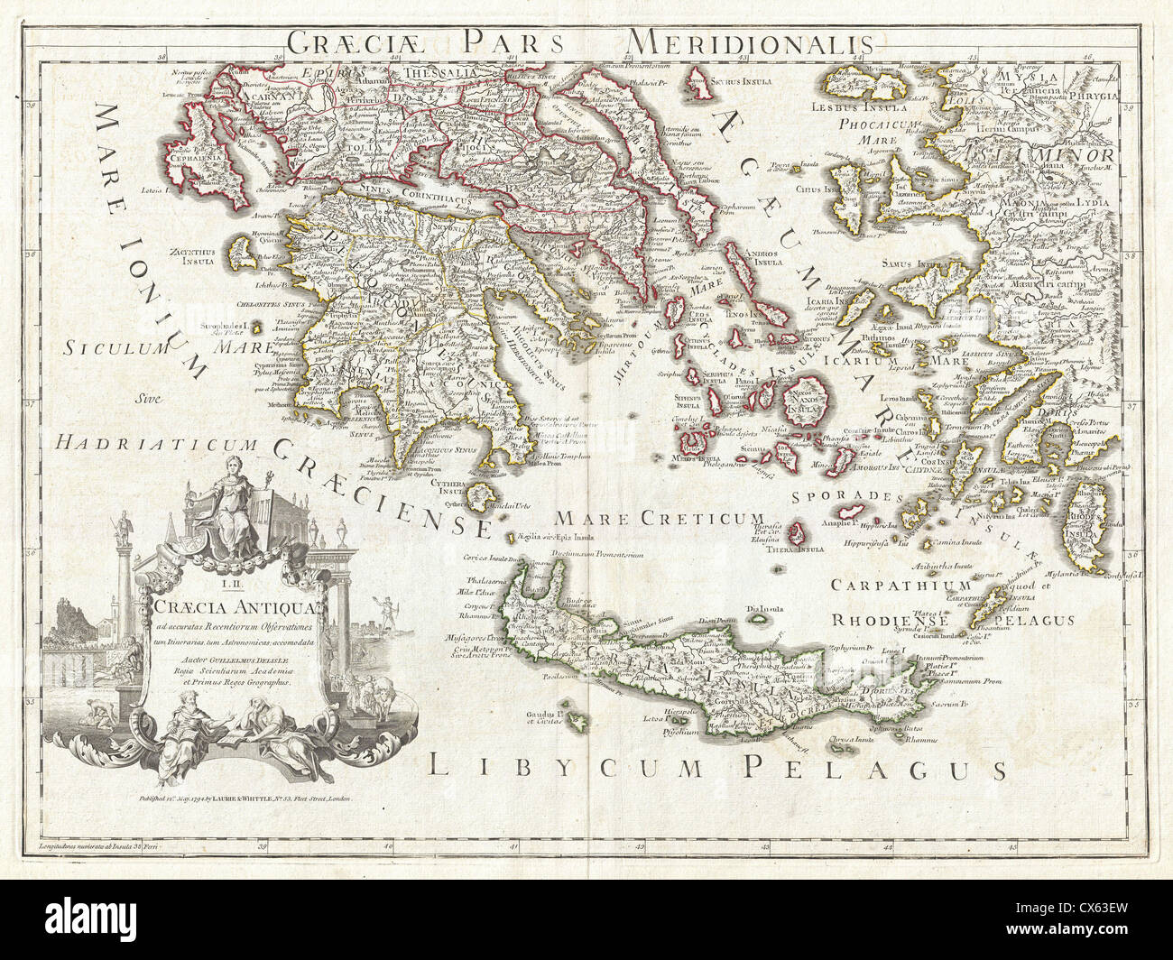 1794 Delisle Map of Southern Ancient Greece, Greeks Isles, and Crete Stock Photohttps://www.alamy.com/image-license-details/?v=1https://www.alamy.com/stock-photo-1794-delisle-map-of-southern-ancient-greece-greeks-isles-and-crete-50536273.html
RMCX63EW–1794 Delisle Map of Southern Ancient Greece, Greeks Isles, and Crete
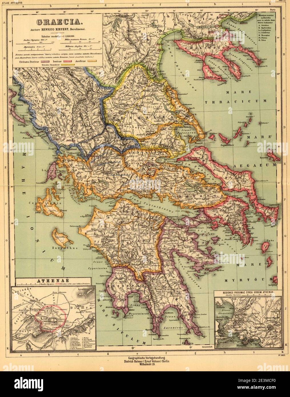 Map of Ancient Greece (as drawn in 1903). Stock Photohttps://www.alamy.com/image-license-details/?v=1https://www.alamy.com/map-of-ancient-greece-as-drawn-in-1903-image398131300.html
RM2E3MCF0–Map of Ancient Greece (as drawn in 1903).
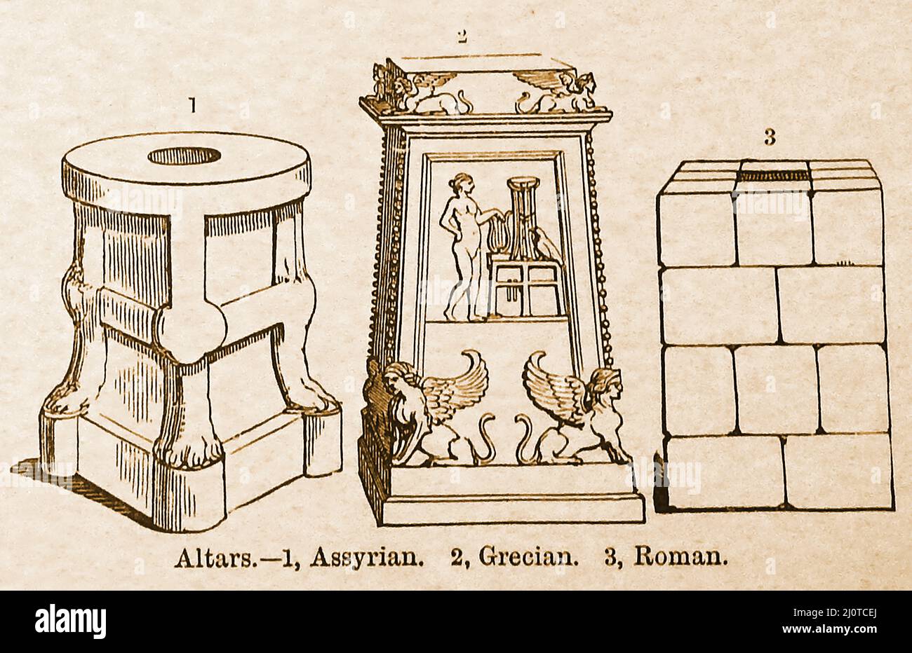 A 19th century comparison between the styles of 3 ancient altars., Assyrian, Grecian and Roman Stock Photohttps://www.alamy.com/image-license-details/?v=1https://www.alamy.com/a-19th-century-comparison-between-the-styles-of-3-ancient-altars-assyrian-grecian-and-roman-image465216602.html
RM2J0TCEJ–A 19th century comparison between the styles of 3 ancient altars., Assyrian, Grecian and Roman
