Quick filters:
Map of north borneo Stock Photos and Images
 8 cent postage stamp issued in 1954 from North Borneo with an image of Queen Elizabeth II and a map of North Borneo, Brunei and Sarawak. Stock Photohttps://www.alamy.com/image-license-details/?v=1https://www.alamy.com/8-cent-postage-stamp-issued-in-1954-from-north-borneo-with-an-image-of-queen-elizabeth-ii-and-a-map-of-north-borneo-brunei-and-sarawak-image610403612.html
RM2XD2810–8 cent postage stamp issued in 1954 from North Borneo with an image of Queen Elizabeth II and a map of North Borneo, Brunei and Sarawak.
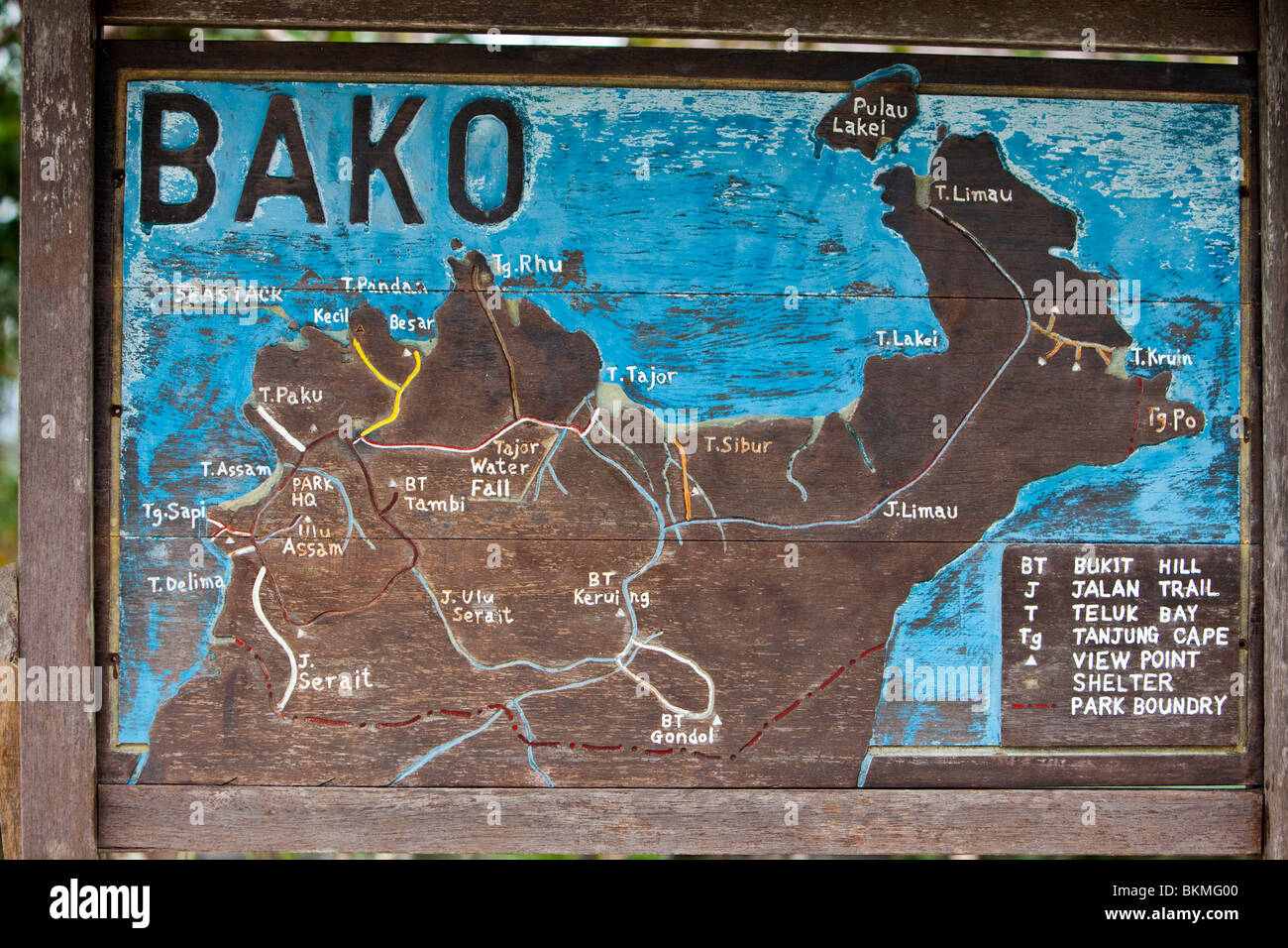 Map of Bako National Park. Established in 1957, Bako is the oldest national park in Sarawak. Kuching, Sarawak, Borneo, Malaysia. Stock Photohttps://www.alamy.com/image-license-details/?v=1https://www.alamy.com/stock-photo-map-of-bako-national-park-established-in-1957-bako-is-the-oldest-national-29340416.html
RMBKMG00–Map of Bako National Park. Established in 1957, Bako is the oldest national park in Sarawak. Kuching, Sarawak, Borneo, Malaysia.
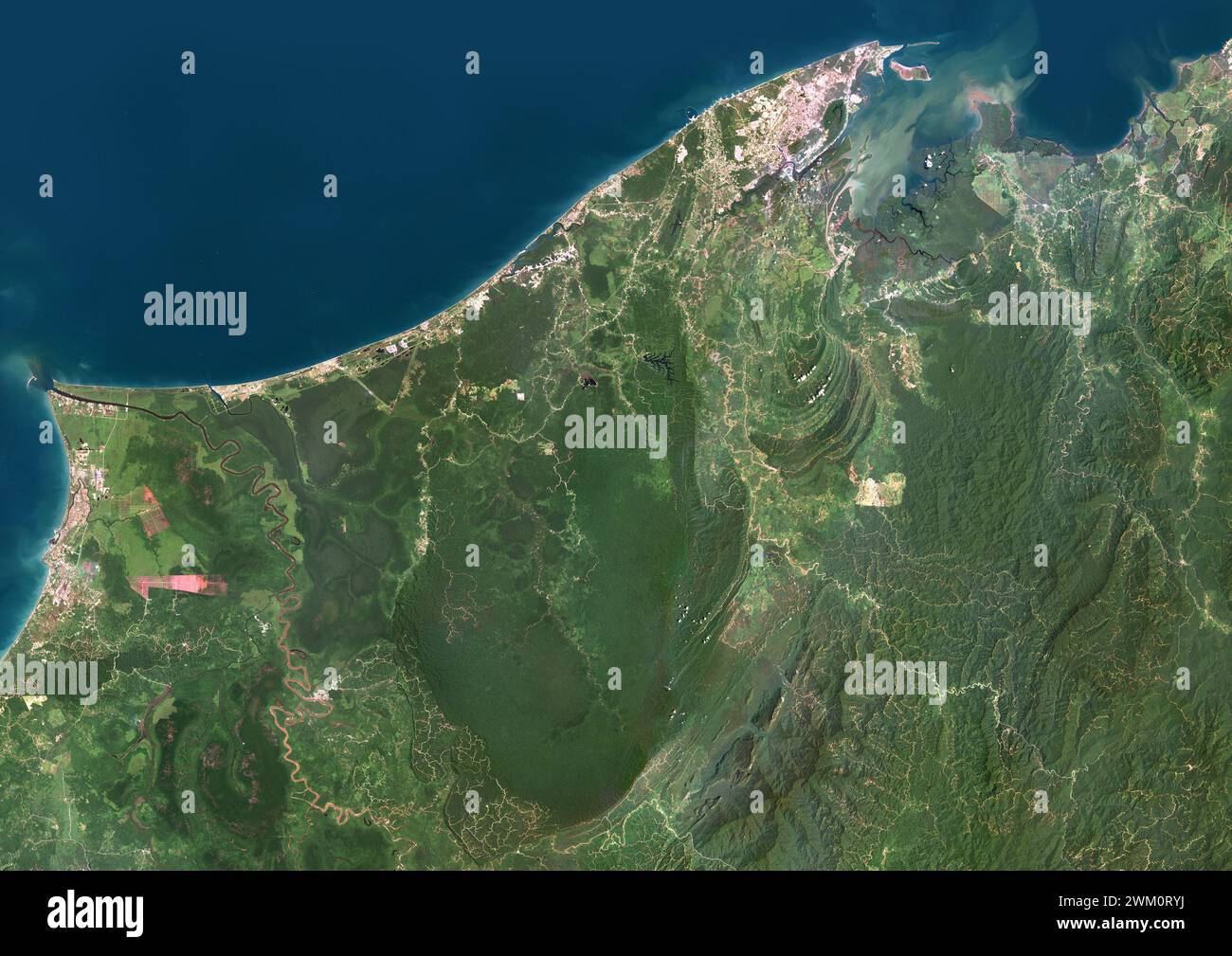 Color satellite image of Brunei. The country is located on the north coast of the island of Borneo in Southeast Asia. Stock Photohttps://www.alamy.com/image-license-details/?v=1https://www.alamy.com/color-satellite-image-of-brunei-the-country-is-located-on-the-north-coast-of-the-island-of-borneo-in-southeast-asia-image597464438.html
RM2WM0RYJ–Color satellite image of Brunei. The country is located on the north coast of the island of Borneo in Southeast Asia.
 A world map with old world war ll compass and magnifying glass Stock Photohttps://www.alamy.com/image-license-details/?v=1https://www.alamy.com/stock-photo-a-world-map-with-old-world-war-ll-compass-and-magnifying-glass-21796514.html
RFB7CWJX–A world map with old world war ll compass and magnifying glass
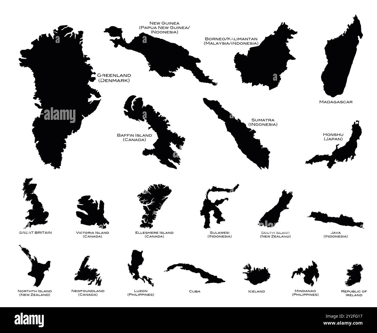 Black silhouette maps of the twenty largest islands in the world Stock Photohttps://www.alamy.com/image-license-details/?v=1https://www.alamy.com/black-silhouette-maps-of-the-twenty-largest-islands-in-the-world-image621144419.html
RF2Y2FG17–Black silhouette maps of the twenty largest islands in the world
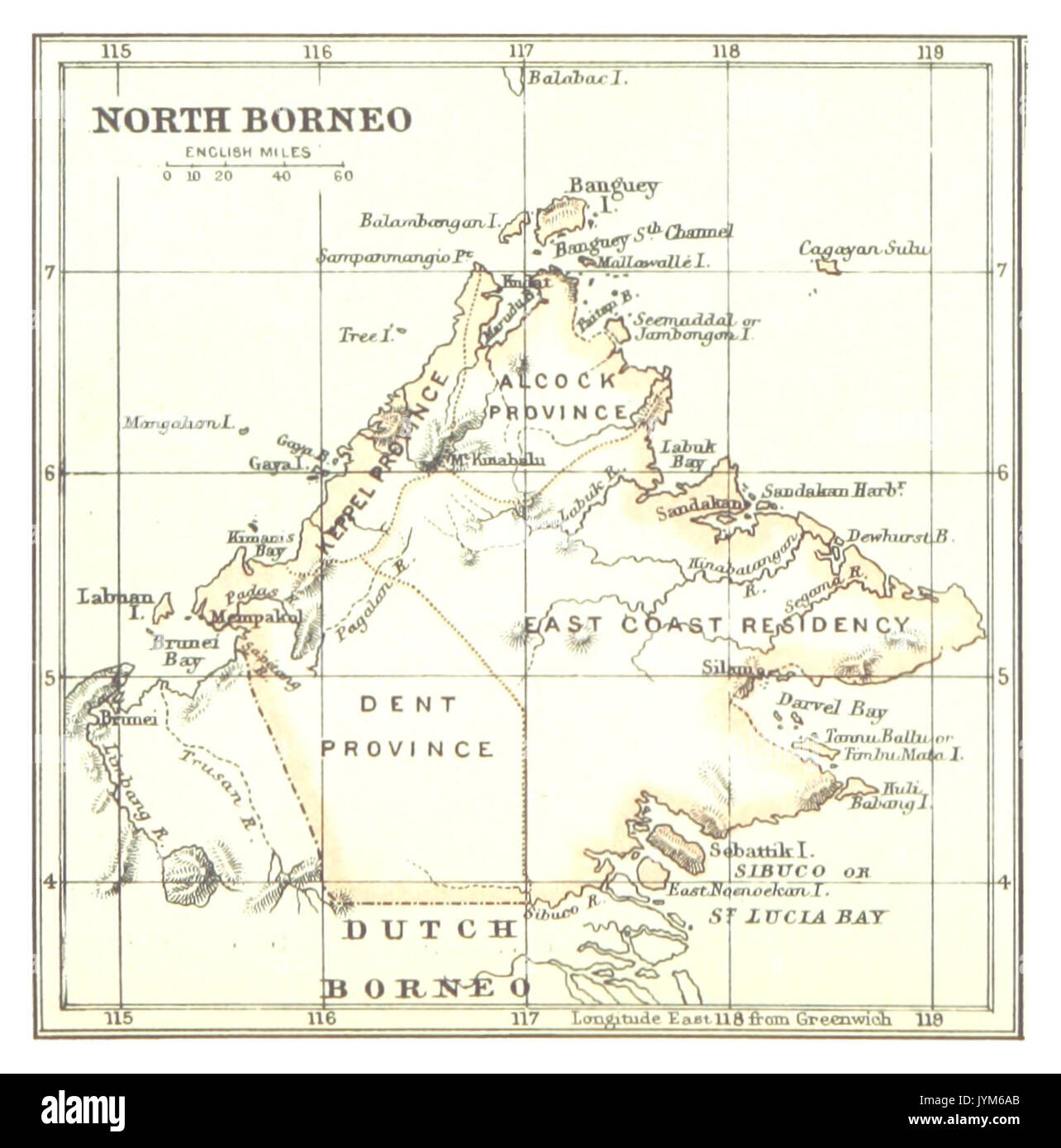 Map of North Borneo (1888) Stock Photohttps://www.alamy.com/image-license-details/?v=1https://www.alamy.com/map-of-north-borneo-1888-image154722691.html
RMJYM6AB–Map of North Borneo (1888)
 Ruffled Flag of Brunei Blowing in Wind Stock Photohttps://www.alamy.com/image-license-details/?v=1https://www.alamy.com/ruffled-flag-of-brunei-blowing-in-wind-image257236822.html
RFTXE45A–Ruffled Flag of Brunei Blowing in Wind
 Map of North Borneo Stock Photohttps://www.alamy.com/image-license-details/?v=1https://www.alamy.com/map-of-north-borneo-image398182371.html
RM2E3PNJY–Map of North Borneo
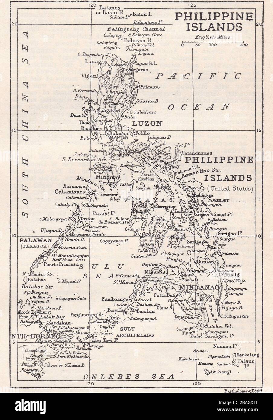 Vintage map of the Philippine Islands 1900s. Stock Photohttps://www.alamy.com/image-license-details/?v=1https://www.alamy.com/vintage-map-of-the-philippine-islands-1900s-image350726232.html
RF2BAGXTT–Vintage map of the Philippine Islands 1900s.
 BHUTAN - CIRCA 1971: a stamp printed in Bhutan shows Boy Scout Reading Map, 60th Anniversary of the Boy Scouts, circa 1971 Stock Photohttps://www.alamy.com/image-license-details/?v=1https://www.alamy.com/bhutan-circa-1971-a-stamp-printed-in-bhutan-shows-boy-scout-reading-map-60th-anniversary-of-the-boy-scouts-circa-1971-image460376355.html
RF2HMYXMK–BHUTAN - CIRCA 1971: a stamp printed in Bhutan shows Boy Scout Reading Map, 60th Anniversary of the Boy Scouts, circa 1971
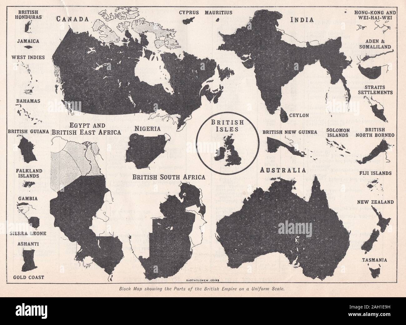 Vintage block map of showing the parts of the British Empire on a Uniform Scale Stock Photohttps://www.alamy.com/image-license-details/?v=1https://www.alamy.com/vintage-block-map-of-showing-the-parts-of-the-british-empire-on-a-uniform-scale-image337479341.html
RF2AH1E9H–Vintage block map of showing the parts of the British Empire on a Uniform Scale
 Advertising leaflet for Martin Bro's Borneo Cigars circa 1905 Stock Photohttps://www.alamy.com/image-license-details/?v=1https://www.alamy.com/advertising-leaflet-for-martin-bros-borneo-cigars-circa-1905-image364294546.html
RM2C4K1BE–Advertising leaflet for Martin Bro's Borneo Cigars circa 1905
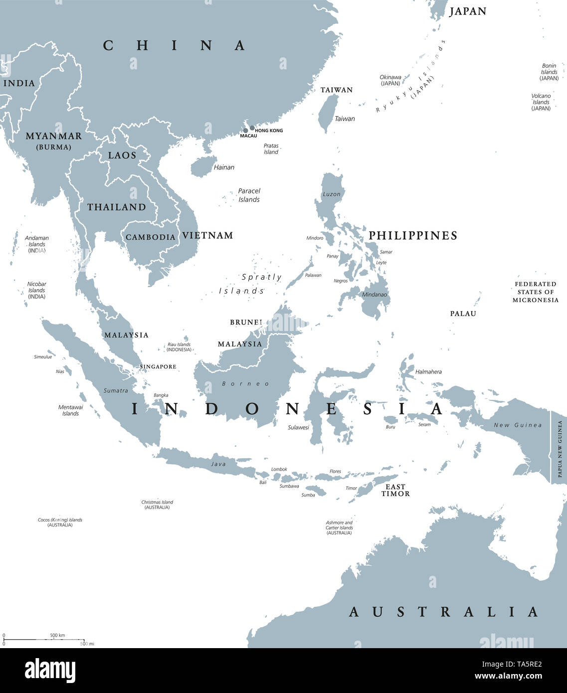 Southeast Asia, political map with borders. Subregion of Asia with countries south of China, east of India, west of New Guinea, north of Australia. Stock Photohttps://www.alamy.com/image-license-details/?v=1https://www.alamy.com/southeast-asia-political-map-with-borders-subregion-of-asia-with-countries-south-of-china-east-of-india-west-of-new-guinea-north-of-australia-image247219898.html
RFTA5RE2–Southeast Asia, political map with borders. Subregion of Asia with countries south of China, east of India, west of New Guinea, north of Australia.
 the natives of Raj Stock Photohttps://www.alamy.com/image-license-details/?v=1https://www.alamy.com/the-natives-of-raj-image352694053.html
RM2BDPGT5–the natives of Raj
 . English: An extremely appealing large format c. 1820 map of Asia rendered in two panels. Truly one of the most beautiful large format maps of Asia to appear in an early 19th century atlas. Drawn by Daniel Lizars this map covers from the Mediterranean to the Sea of Kamchatka (top panel) and from the Red Sea to Japan (bottom panel). The map further extends north as far as the Arctic and south as far as Ceylon and Borneo. Stylistically this map follows the conventions established by Thomson, Pinkerton, and Cary at the turn of the 18th century, especially with regard to coloration, border desig Stock Photohttps://www.alamy.com/image-license-details/?v=1https://www.alamy.com/english-an-extremely-appealing-large-format-c-1820-map-of-asia-rendered-in-two-panels-truly-one-of-the-most-beautiful-large-format-maps-of-asia-to-appear-in-an-early-19th-century-atlas-drawn-by-daniel-lizars-this-map-covers-from-the-mediterranean-to-the-sea-of-kamchatka-top-panel-and-from-the-red-sea-to-japan-bottom-panel-the-map-further-extends-north-as-far-as-the-arctic-and-south-as-far-as-ceylon-and-borneo-stylistically-this-map-follows-the-conventions-established-by-thomson-pinkerton-and-cary-at-the-turn-of-the-18th-century-especially-with-regard-to-coloration-border-desig-image184934620.html
RMMMTDYT–. English: An extremely appealing large format c. 1820 map of Asia rendered in two panels. Truly one of the most beautiful large format maps of Asia to appear in an early 19th century atlas. Drawn by Daniel Lizars this map covers from the Mediterranean to the Sea of Kamchatka (top panel) and from the Red Sea to Japan (bottom panel). The map further extends north as far as the Arctic and south as far as Ceylon and Borneo. Stylistically this map follows the conventions established by Thomson, Pinkerton, and Cary at the turn of the 18th century, especially with regard to coloration, border desig
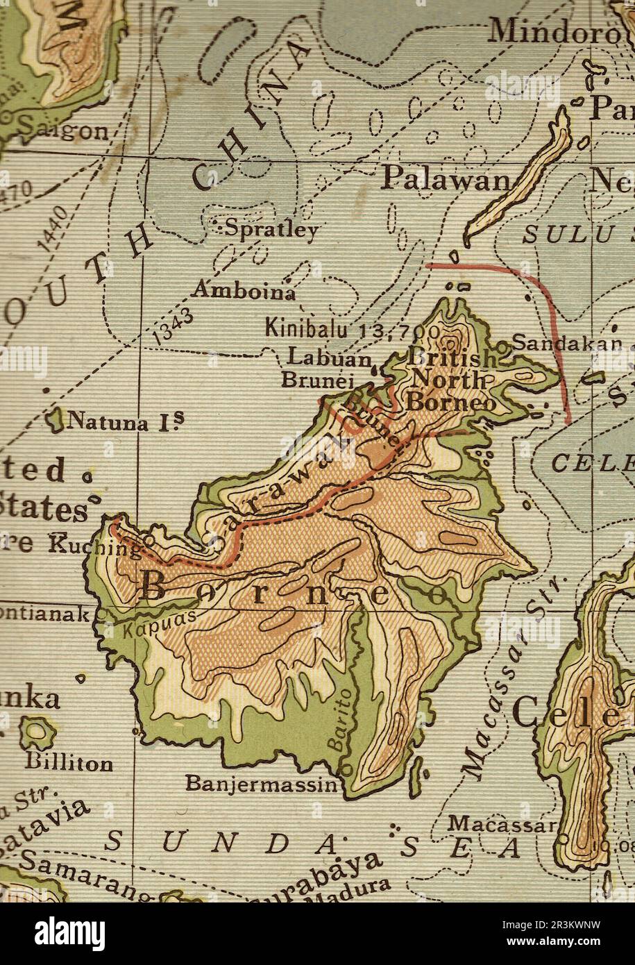 Vintage geographical map of Borneo in sepia. Stock Photohttps://www.alamy.com/image-license-details/?v=1https://www.alamy.com/vintage-geographical-map-of-borneo-in-sepia-image553013045.html
RF2R3KWNW–Vintage geographical map of Borneo in sepia.
 Description: Map showing forest exploitation in North Borneo. Location: Borneo asia, malaysia, borneo, sabah, asiathroughalens Stock Photohttps://www.alamy.com/image-license-details/?v=1https://www.alamy.com/description-map-showing-forest-exploitation-in-north-borneo-location-borneo-asia-malaysia-borneo-sabah-asiathroughalens-image600818032.html
RM2WWDHET–Description: Map showing forest exploitation in North Borneo. Location: Borneo asia, malaysia, borneo, sabah, asiathroughalens
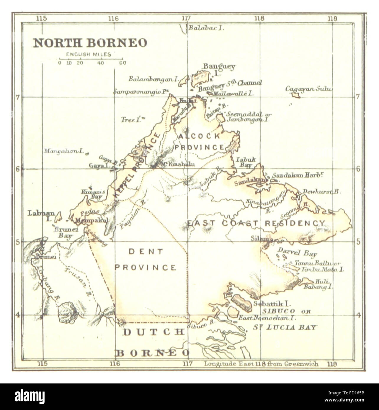 Map of North Borneo (1888) Stock Photohttps://www.alamy.com/image-license-details/?v=1https://www.alamy.com/stock-photo-map-of-north-borneo-1888-76858807.html
RMED165B–Map of North Borneo (1888)
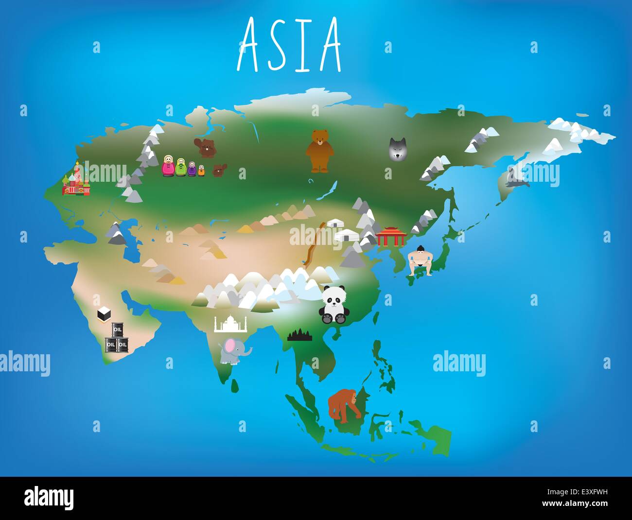 Cute illustrated map of asia with space to add country names in your own language if needed. Stock Vectorhttps://www.alamy.com/image-license-details/?v=1https://www.alamy.com/stock-photo-cute-illustrated-map-of-asia-with-space-to-add-country-names-in-your-71268669.html
RFE3XFWH–Cute illustrated map of asia with space to add country names in your own language if needed.
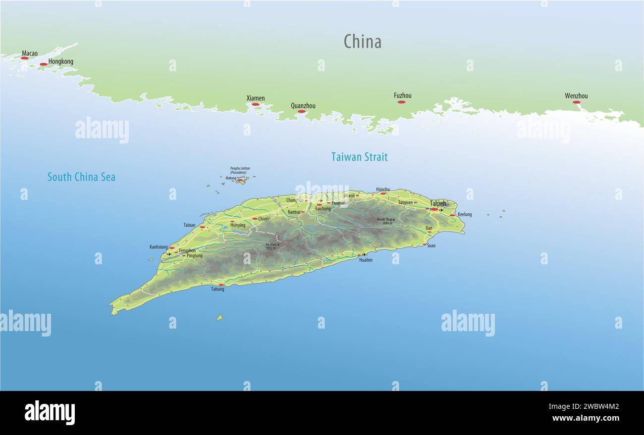 Taiwan Stock Vectorhttps://www.alamy.com/image-license-details/?v=1https://www.alamy.com/taiwan-image592466226.html
RF2WBW4M2–Taiwan
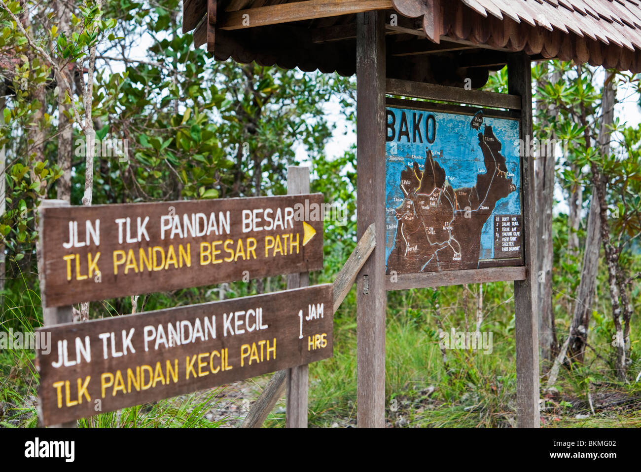 Map of Bako National Park. Established in 1957, Bako is the oldest national park in Sarawak. Kuching, Sarawak, Borneo, Malaysia. Stock Photohttps://www.alamy.com/image-license-details/?v=1https://www.alamy.com/stock-photo-map-of-bako-national-park-established-in-1957-bako-is-the-oldest-national-29340418.html
RMBKMG02–Map of Bako National Park. Established in 1957, Bako is the oldest national park in Sarawak. Kuching, Sarawak, Borneo, Malaysia.
 Color satellite image of Brunei, with mask. The country is located on the north coast of the island of Borneo in Southeast Asia. Stock Photohttps://www.alamy.com/image-license-details/?v=1https://www.alamy.com/color-satellite-image-of-brunei-with-mask-the-country-is-located-on-the-north-coast-of-the-island-of-borneo-in-southeast-asia-image597464447.html
RM2WM0RYY–Color satellite image of Brunei, with mask. The country is located on the north coast of the island of Borneo in Southeast Asia.
 Map of the world showing the southern Atlantic with mini telescope and notebook Stock Photohttps://www.alamy.com/image-license-details/?v=1https://www.alamy.com/stock-photo-map-of-the-world-showing-the-southern-atlantic-with-mini-telescope-21796534.html
RFB7CWKJ–Map of the world showing the southern Atlantic with mini telescope and notebook
 A decorative late 17th century Dutch map of the East Indies and Australia, incorporating the discoveries of Abel Tasman's two voyages (1642-44). The map appeared first in Carel Allard's Atlas Maior in 1697. This second map is from his son Hugo's imprint of circa 1702-1705. The map extends across the whole of the Indian Ocean, from the Cape of Good Hope to the East Indies, Japan and Australia. A decorative catouche at the bottom of the map illustrates Asian merchants, traders, elephants, camels and a native African ostrich hunt. Includes details of the early seventeeth century discoveries in th Stock Photohttps://www.alamy.com/image-license-details/?v=1https://www.alamy.com/a-decorative-late-17th-century-dutch-map-of-the-east-indies-and-australia-incorporating-the-discoveries-of-abel-tasmans-two-voyages-1642-44-the-map-appeared-first-in-carel-allards-atlas-maior-in-1697-this-second-map-is-from-his-son-hugos-imprint-of-circa-1702-1705-the-map-extends-across-the-whole-of-the-indian-ocean-from-the-cape-of-good-hope-to-the-east-indies-japan-and-australia-a-decorative-catouche-at-the-bottom-of-the-map-illustrates-asian-merchants-traders-elephants-camels-and-a-native-african-ostrich-hunt-includes-details-of-the-early-seventeeth-century-discoveries-in-th-image610830366.html
RM2XDNMA6–A decorative late 17th century Dutch map of the East Indies and Australia, incorporating the discoveries of Abel Tasman's two voyages (1642-44). The map appeared first in Carel Allard's Atlas Maior in 1697. This second map is from his son Hugo's imprint of circa 1702-1705. The map extends across the whole of the Indian Ocean, from the Cape of Good Hope to the East Indies, Japan and Australia. A decorative catouche at the bottom of the map illustrates Asian merchants, traders, elephants, camels and a native African ostrich hunt. Includes details of the early seventeeth century discoveries in th
 Map of North Borneo, HongKong and Labuan (1888) Stock Photohttps://www.alamy.com/image-license-details/?v=1https://www.alamy.com/map-of-north-borneo-hongkong-and-labuan-1888-image154723765.html
RMJYM7MN–Map of North Borneo, HongKong and Labuan (1888)
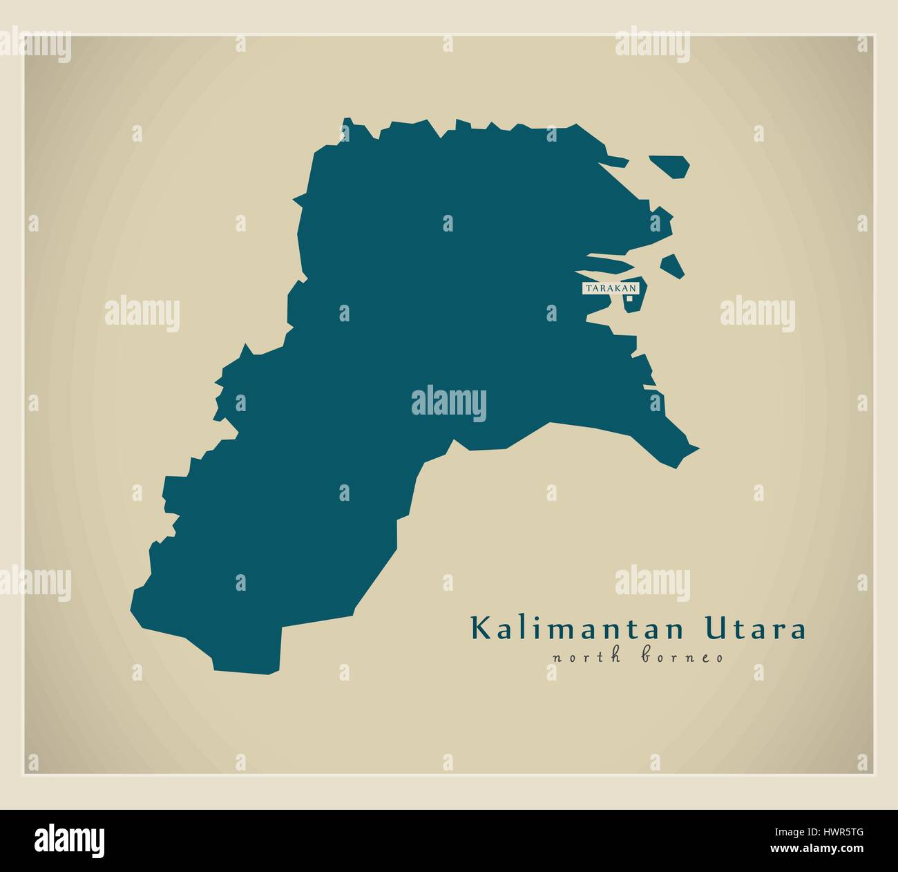 Modern Map - Kalimantan Utara ID Stock Vectorhttps://www.alamy.com/image-license-details/?v=1https://www.alamy.com/stock-photo-modern-map-kalimantan-utara-id-136348480.html
RFHWR5TG–Modern Map - Kalimantan Utara ID
 A map of British North Borneo. Stock Photohttps://www.alamy.com/image-license-details/?v=1https://www.alamy.com/a-map-of-british-north-borneo-image212443730.html
RMP9HJ42–A map of British North Borneo.
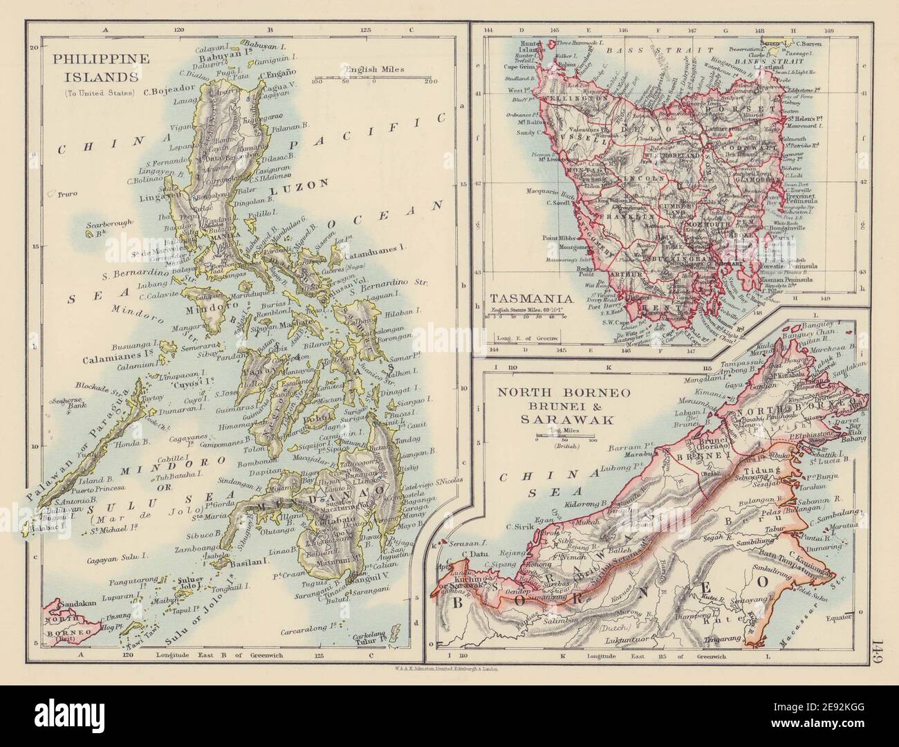 EAST ASIA. American Philippines. Tasmania North Borneo Brunei Sarawak 1901 map Stock Photohttps://www.alamy.com/image-license-details/?v=1https://www.alamy.com/east-asia-american-philippines-tasmania-north-borneo-brunei-sarawak-1901-map-image401429632.html
RF2E92KGG–EAST ASIA. American Philippines. Tasmania North Borneo Brunei Sarawak 1901 map
 Brunei map, folded paper with Brunei map. Vector illustration. Stock Vectorhttps://www.alamy.com/image-license-details/?v=1https://www.alamy.com/brunei-map-folded-paper-with-brunei-map-vector-illustration-image594015589.html
RF2WEBMXD–Brunei map, folded paper with Brunei map. Vector illustration.
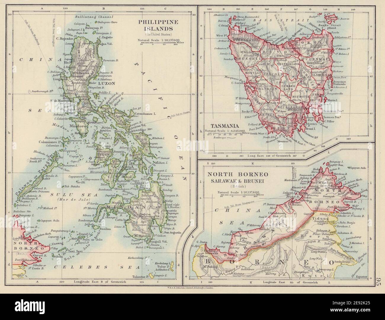 EAST ASIA. Philippines Tasmania North Borneo Brunei Sarawak. JOHNSTON 1910 map Stock Photohttps://www.alamy.com/image-license-details/?v=1https://www.alamy.com/east-asia-philippines-tasmania-north-borneo-brunei-sarawak-johnston-1910-map-image401429229.html
RF2E92K25–EAST ASIA. Philippines Tasmania North Borneo Brunei Sarawak. JOHNSTON 1910 map
 Borneo, Mill en Sint Hubert, Netherlands, North Brabant, N 51 40' 39'', E 5 46' 30'', map, Timeless Map published in 2021. Travelers, explorers and adventurers like Florence Nightingale, David Livingstone, Ernest Shackleton, Lewis and Clark and Sherlock Holmes relied on maps to plan travels to the world's most remote corners, Timeless Maps is mapping most locations on the globe, showing the achievement of great dreams Stock Photohttps://www.alamy.com/image-license-details/?v=1https://www.alamy.com/borneo-mill-en-sint-hubert-netherlands-north-brabant-n-51-40-39-e-5-46-30-map-timeless-map-published-in-2021-travelers-explorers-and-adventurers-like-florence-nightingale-david-livingstone-ernest-shackleton-lewis-and-clark-and-sherlock-holmes-relied-on-maps-to-plan-travels-to-the-worlds-most-remote-corners-timeless-maps-is-mapping-most-locations-on-the-globe-showing-the-achievement-of-great-dreams-image445813315.html
RM2GW8FC3–Borneo, Mill en Sint Hubert, Netherlands, North Brabant, N 51 40' 39'', E 5 46' 30'', map, Timeless Map published in 2021. Travelers, explorers and adventurers like Florence Nightingale, David Livingstone, Ernest Shackleton, Lewis and Clark and Sherlock Holmes relied on maps to plan travels to the world's most remote corners, Timeless Maps is mapping most locations on the globe, showing the achievement of great dreams
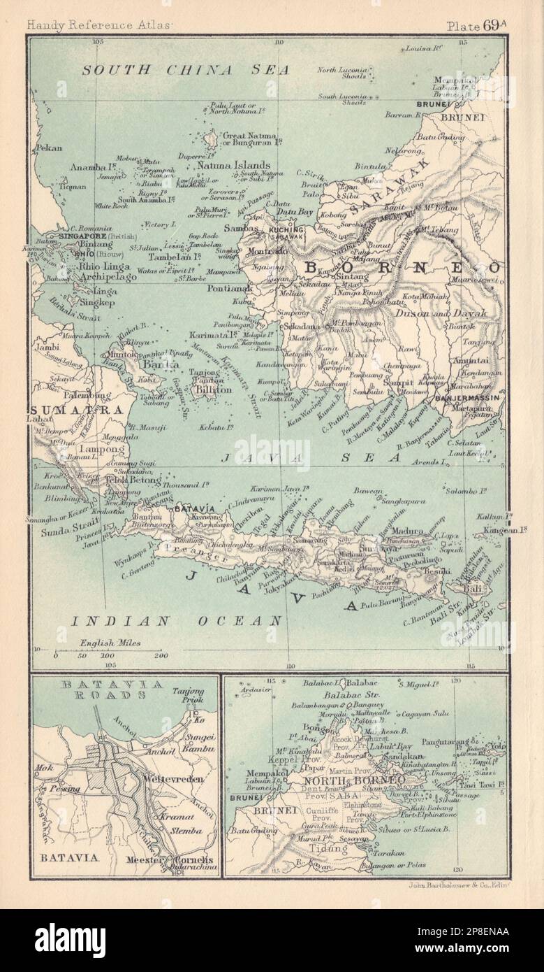 Batavia/Jakarta sketch plan. North Borneo Java Sea Singapore. Indonesia 1898 map Stock Photohttps://www.alamy.com/image-license-details/?v=1https://www.alamy.com/bataviajakarta-sketch-plan-north-borneo-java-sea-singapore-indonesia-1898-map-image538762738.html
RF2P8ENAA–Batavia/Jakarta sketch plan. North Borneo Java Sea Singapore. Indonesia 1898 map
 North Kalimantan (Subdivisions of Indonesia, Provinces of Indonesia) map vector illustration, scribble sketch North Kalimantan map Stock Vectorhttps://www.alamy.com/image-license-details/?v=1https://www.alamy.com/north-kalimantan-subdivisions-of-indonesia-provinces-of-indonesia-map-vector-illustration-scribble-sketch-north-kalimantan-map-image228792184.html
RFR86ANC–North Kalimantan (Subdivisions of Indonesia, Provinces of Indonesia) map vector illustration, scribble sketch North Kalimantan map
 . Nederlands: Titel catalogus Leupe (NA): Kaart van de Indische Noord) van Sumatra tot Japan om de Noord, de Phillippynen, Mindanao, Borneo, Celebes enz.. Bijzonderheden: het perkament is zeer donker geworden. English: Title in the Leupe catalogue (NA): Kaart van de Indische Noord) van Sumatra tot Japan om de Noord, de Phillippynen, Mindanao, Borneo, Celebes enz.. Particulars: the parchment has darkened considerably. Nederlands: Kaart van Zuid Japan tot Noord Sumatra English: Map of South Japan to North Sumatra . 1717. Nederlands: Anoniem / Anonymous (landmeter / kaartenmaker) English: Anoni Stock Photohttps://www.alamy.com/image-license-details/?v=1https://www.alamy.com/nederlands-titel-catalogus-leupe-na-kaart-van-de-indische-noord-van-sumatra-tot-japan-om-de-noord-de-phillippynen-mindanao-borneo-celebes-enz-bijzonderheden-het-perkament-is-zeer-donker-geworden-english-title-in-the-leupe-catalogue-na-kaart-van-de-indische-noord-van-sumatra-tot-japan-om-de-noord-de-phillippynen-mindanao-borneo-celebes-enz-particulars-the-parchment-has-darkened-considerably-nederlands-kaart-van-zuid-japan-tot-noord-sumatra-english-map-of-south-japan-to-north-sumatra-1717-nederlands-anoniem-anonymous-landmeter-kaartenmaker-english-anoni-image184888936.html
RMMMPBM8–. Nederlands: Titel catalogus Leupe (NA): Kaart van de Indische Noord) van Sumatra tot Japan om de Noord, de Phillippynen, Mindanao, Borneo, Celebes enz.. Bijzonderheden: het perkament is zeer donker geworden. English: Title in the Leupe catalogue (NA): Kaart van de Indische Noord) van Sumatra tot Japan om de Noord, de Phillippynen, Mindanao, Borneo, Celebes enz.. Particulars: the parchment has darkened considerably. Nederlands: Kaart van Zuid Japan tot Noord Sumatra English: Map of South Japan to North Sumatra . 1717. Nederlands: Anoniem / Anonymous (landmeter / kaartenmaker) English: Anoni
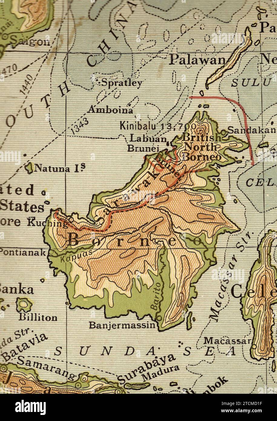 Vintage geographical map in sepia showing Borneo. Stock Photohttps://www.alamy.com/image-license-details/?v=1https://www.alamy.com/vintage-geographical-map-in-sepia-showing-borneo-image575767291.html
RF2TCMD1F–Vintage geographical map in sepia showing Borneo.
 Easter Island Description: Map and sketches of Easter Island from J Gilbert's log of the voyage of HMS Resolution through the Pacific from 1772-5. Date: c.1773 chile, easter, polynesia, sketch, map, north, journey, borneo, resolution, gilbert, georgian, exploration, moai, easterisland, navigation, admiralty, captainjamescook, rapanui, isladepascua, 1773, hmsresolution, jgilberts Stock Photohttps://www.alamy.com/image-license-details/?v=1https://www.alamy.com/easter-island-description-map-and-sketches-of-easter-island-from-j-gilberts-log-of-the-voyage-of-hms-resolution-through-the-pacific-from-1772-5-date-c1773-chile-easter-polynesia-sketch-map-north-journey-borneo-resolution-gilbert-georgian-exploration-moai-easterisland-navigation-admiralty-captainjamescook-rapanui-isladepascua-1773-hmsresolution-jgilberts-image600834295.html
RM2WWEA7K–Easter Island Description: Map and sketches of Easter Island from J Gilbert's log of the voyage of HMS Resolution through the Pacific from 1772-5. Date: c.1773 chile, easter, polynesia, sketch, map, north, journey, borneo, resolution, gilbert, georgian, exploration, moai, easterisland, navigation, admiralty, captainjamescook, rapanui, isladepascua, 1773, hmsresolution, jgilberts
 Map of North Borneo (1888) Stock Photohttps://www.alamy.com/image-license-details/?v=1https://www.alamy.com/stock-photo-map-of-north-borneo-1888-74688770.html
RME9EA82–Map of North Borneo (1888)
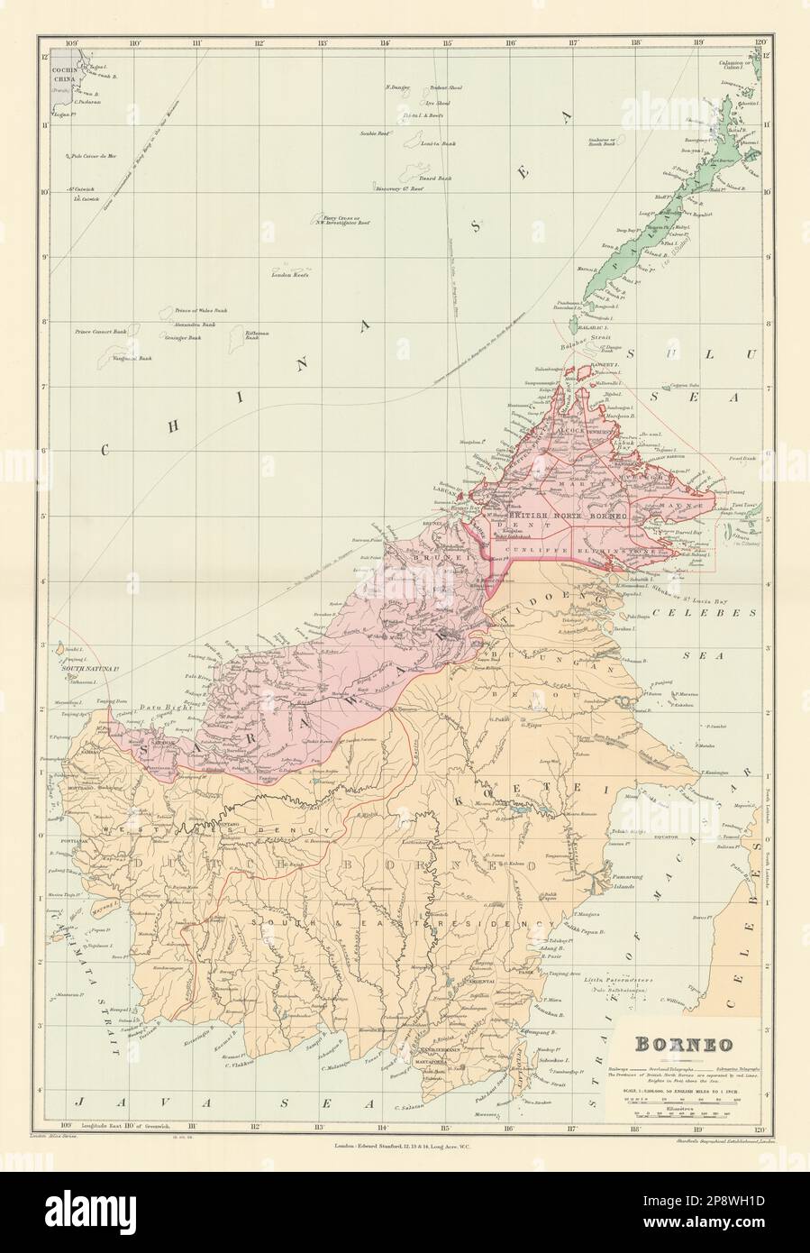 Dutch & British North Borneo Sarawak Kalimantan Palawan. STANFORD 1904 old map Stock Photohttps://www.alamy.com/image-license-details/?v=1https://www.alamy.com/dutch-british-north-borneo-sarawak-kalimantan-palawan-stanford-1904-old-map-image539000825.html
RF2P8WH1D–Dutch & British North Borneo Sarawak Kalimantan Palawan. STANFORD 1904 old map
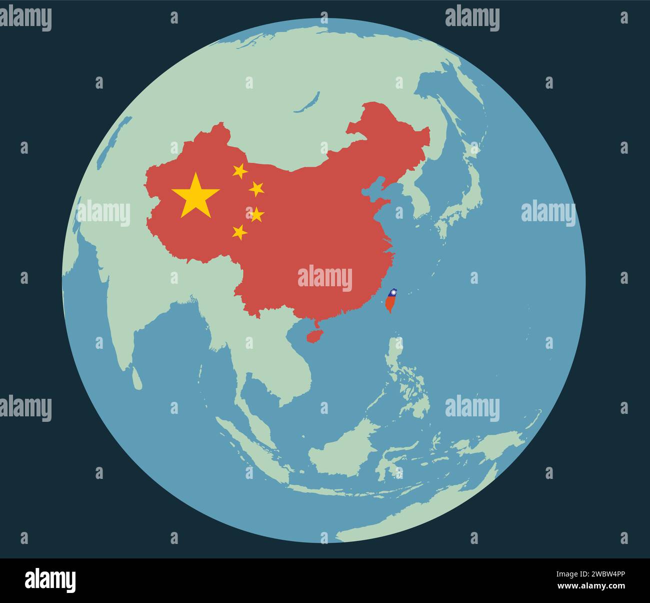 Taiwan Stock Vectorhttps://www.alamy.com/image-license-details/?v=1https://www.alamy.com/taiwan-image592466302.html
RF2WBW4PP–Taiwan
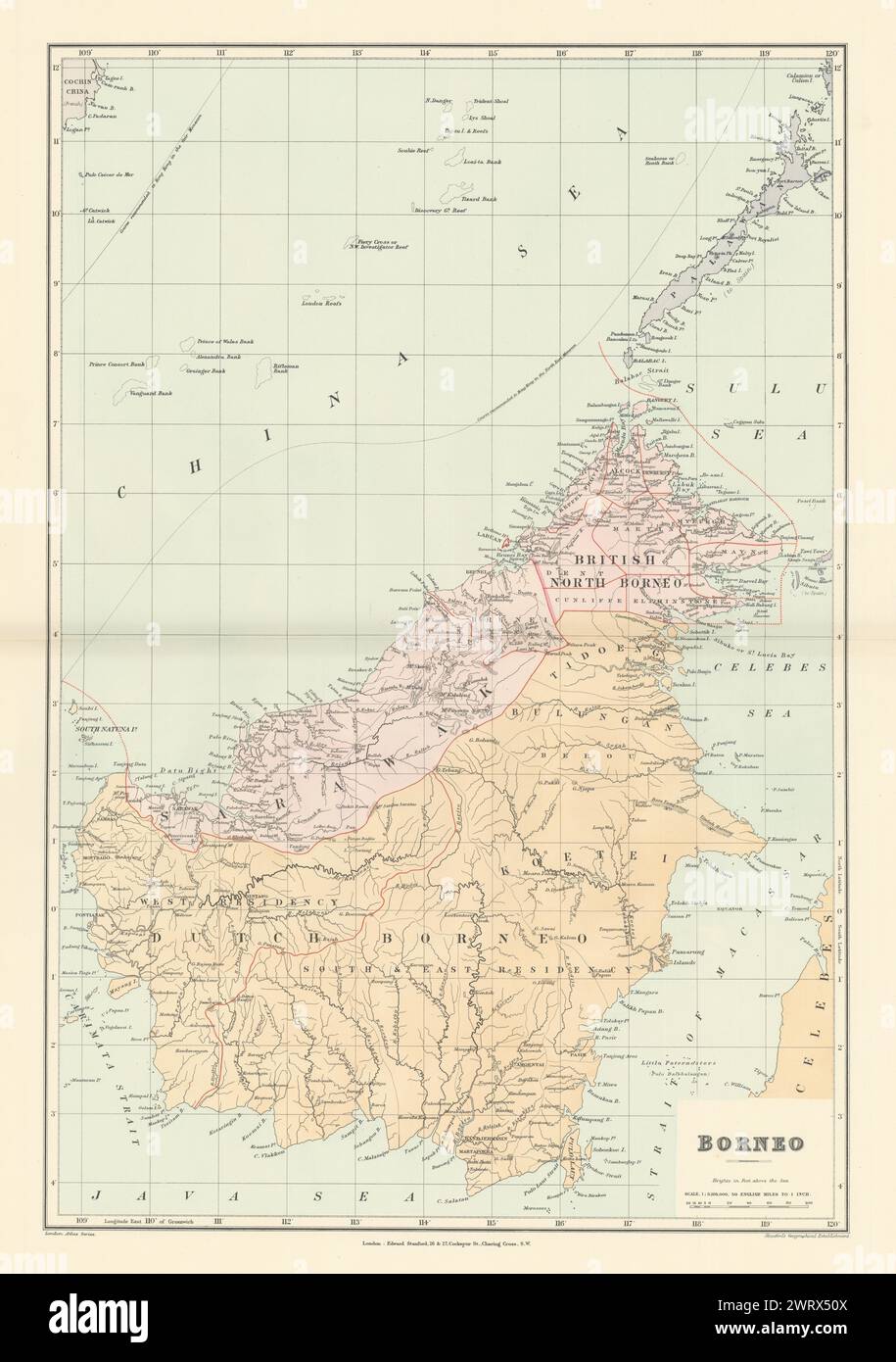 Dutch & British North Borneo Sarawak Kalimantan Palawan. STANFORD 1896 old map Stock Photohttps://www.alamy.com/image-license-details/?v=1https://www.alamy.com/dutch-british-north-borneo-sarawak-kalimantan-palawan-stanford-1896-old-map-image599864298.html
RF2WRX50X–Dutch & British North Borneo Sarawak Kalimantan Palawan. STANFORD 1896 old map
 Color satellite image of Brunei, with borders. The country is located on the north coast of the island of Borneo in Southeast Asia. Stock Photohttps://www.alamy.com/image-license-details/?v=1https://www.alamy.com/color-satellite-image-of-brunei-with-borders-the-country-is-located-on-the-north-coast-of-the-island-of-borneo-in-southeast-asia-image597464436.html
RM2WM0RYG–Color satellite image of Brunei, with borders. The country is located on the north coast of the island of Borneo in Southeast Asia.
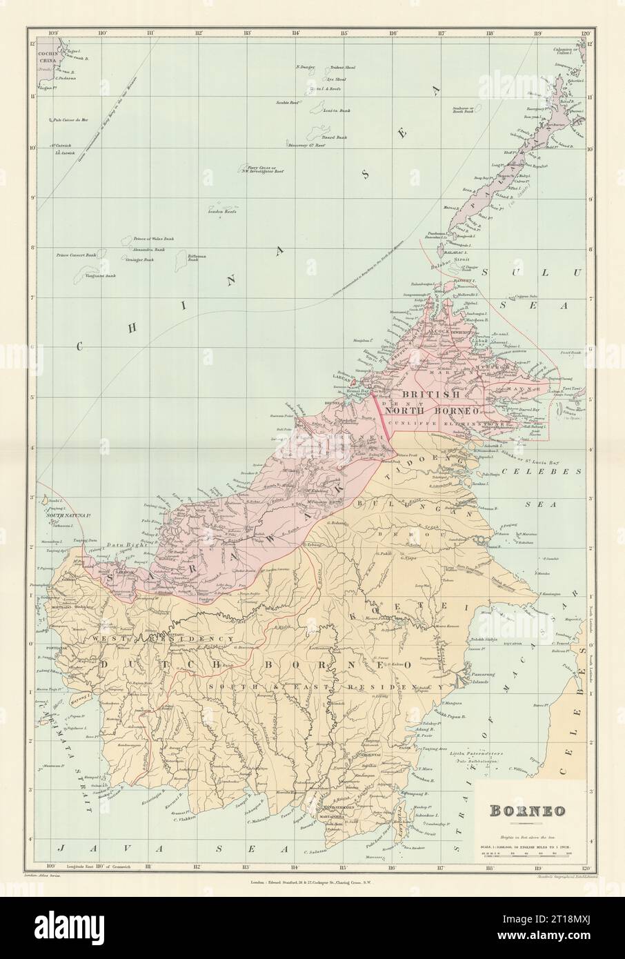 Dutch & British North Borneo Sarawak Kalimantan Palawan. STANFORD 1894 old map Stock Photohttps://www.alamy.com/image-license-details/?v=1https://www.alamy.com/dutch-british-north-borneo-sarawak-kalimantan-palawan-stanford-1894-old-map-image568748842.html
RF2T18MXJ–Dutch & British North Borneo Sarawak Kalimantan Palawan. STANFORD 1894 old map
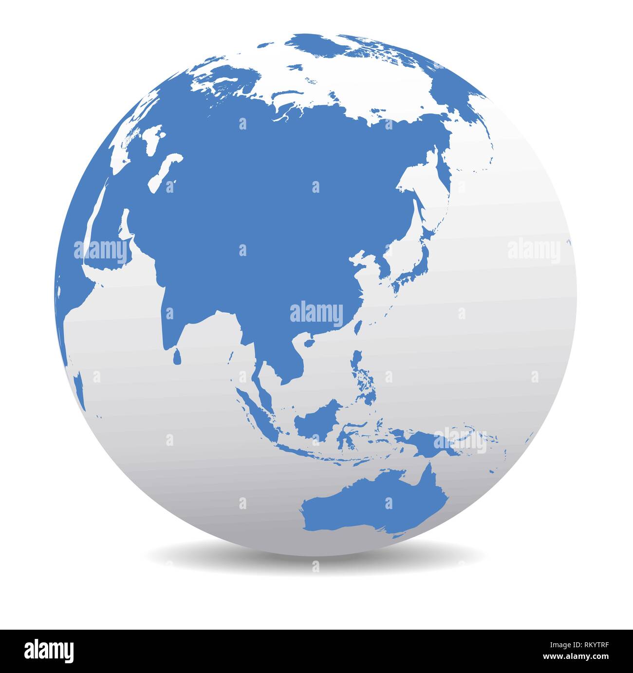 China, Japan, Malaysia, Thailand, Indonesia, Global World Stock Vectorhttps://www.alamy.com/image-license-details/?v=1https://www.alamy.com/china-japan-malaysia-thailand-indonesia-global-world-image236025427.html
RFRKYTRF–China, Japan, Malaysia, Thailand, Indonesia, Global World
 A map of British North Borneo Stock Photohttps://www.alamy.com/image-license-details/?v=1https://www.alamy.com/stock-photo-a-map-of-british-north-borneo-139434593.html
RMJ2RP6W–A map of British North Borneo
 EAST ASIA. Philippines Tasmania North Borneo Brunei Sarawak. JOHNSTON, 1895 map Stock Photohttps://www.alamy.com/image-license-details/?v=1https://www.alamy.com/stock-photo-east-asia-philippines-tasmania-north-borneo-brunei-sarawak-johnston-115449567.html
RFGKR52R–EAST ASIA. Philippines Tasmania North Borneo Brunei Sarawak. JOHNSTON, 1895 map
 A map of British North Borneo (II). Stock Photohttps://www.alamy.com/image-license-details/?v=1https://www.alamy.com/a-map-of-british-north-borneo-ii-image212443700.html
RMP9HJ30–A map of British North Borneo (II).
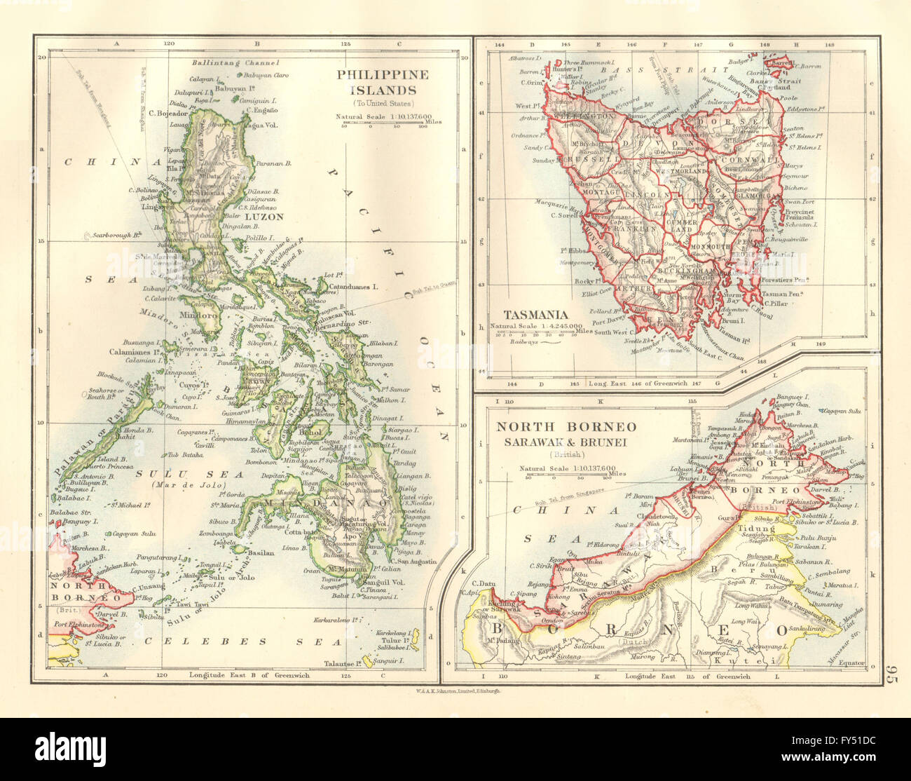 EAST ASIA. Philippines Tasmania North Borneo Brunei Sarawak. JOHNSTON, 1920 map Stock Photohttps://www.alamy.com/image-license-details/?v=1https://www.alamy.com/stock-photo-east-asia-philippines-tasmania-north-borneo-brunei-sarawak-johnston-102758472.html
RFFY51DC–EAST ASIA. Philippines Tasmania North Borneo Brunei Sarawak. JOHNSTON, 1920 map
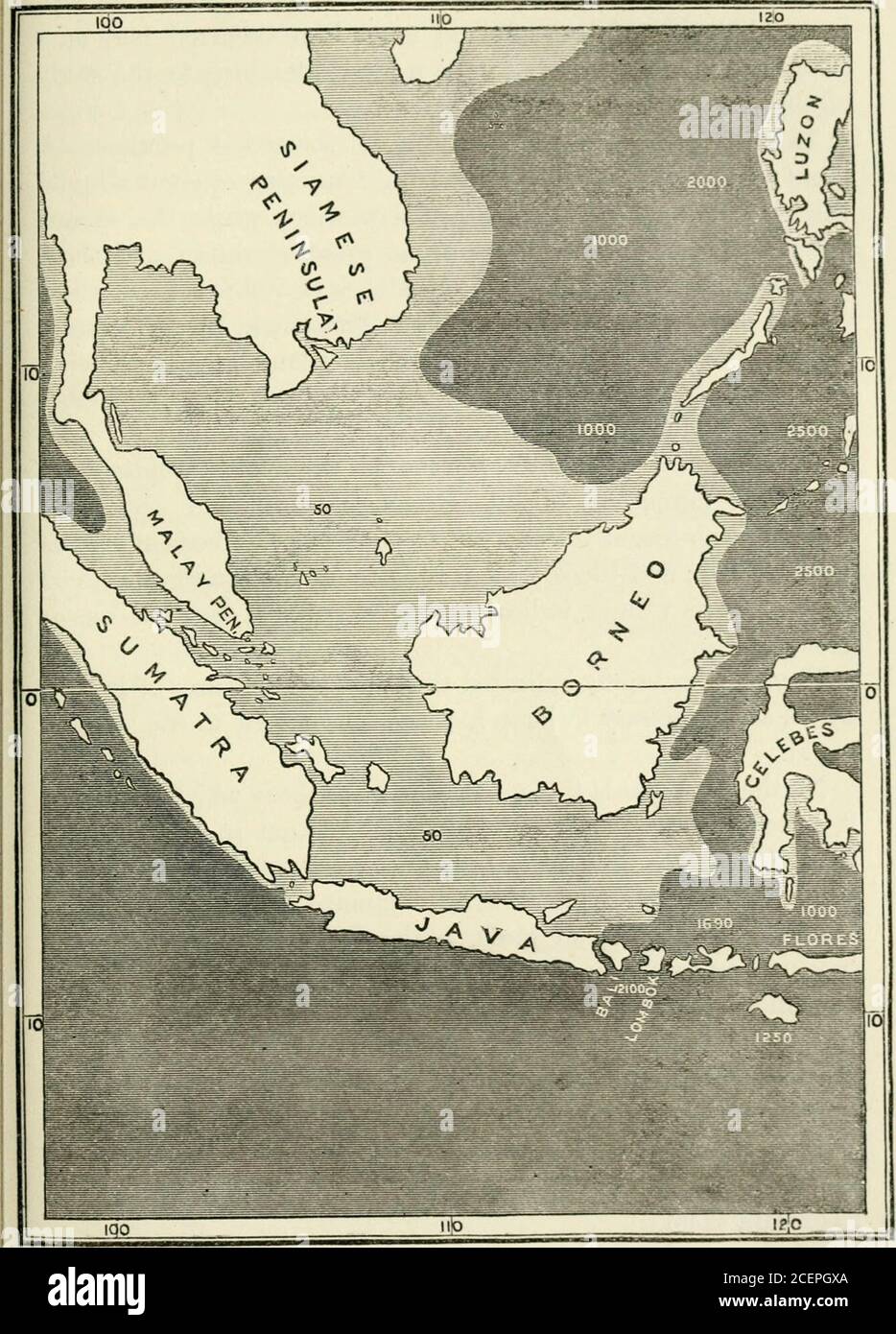 . Island life; or, the phenomena and causes of insular faunas and floras, including a revision and attempted solution of the problem of geological climates. iderableamount of speciality; and, in its relations to the surroundingislands and the Asiatic continent, offers us some problems ofgreat interest and considerable difficulty. The accompanying map shows that Borneo is situated on theeastern side of a submarine bank of enormous extent, beingabout 1,200 miles from north to south, and 1,500 from east towest, and embracing Java, Sumatra, and the Malay Peninsula.This vast area is all included wi Stock Photohttps://www.alamy.com/image-license-details/?v=1https://www.alamy.com/island-life-or-the-phenomena-and-causes-of-insular-faunas-and-floras-including-a-revision-and-attempted-solution-of-the-problem-of-geological-climates-iderableamount-of-speciality-and-in-its-relations-to-the-surroundingislands-and-the-asiatic-continent-offers-us-some-problems-ofgreat-interest-and-considerable-difficulty-the-accompanying-map-shows-that-borneo-is-situated-on-theeastern-side-of-a-submarine-bank-of-enormous-extent-beingabout-1200-miles-from-north-to-south-and-1500-from-east-towest-and-embracing-java-sumatra-and-the-malay-peninsulathis-vast-area-is-all-included-wi-image370519138.html
RM2CEPGXA–. Island life; or, the phenomena and causes of insular faunas and floras, including a revision and attempted solution of the problem of geological climates. iderableamount of speciality; and, in its relations to the surroundingislands and the Asiatic continent, offers us some problems ofgreat interest and considerable difficulty. The accompanying map shows that Borneo is situated on theeastern side of a submarine bank of enormous extent, beingabout 1,200 miles from north to south, and 1,500 from east towest, and embracing Java, Sumatra, and the Malay Peninsula.This vast area is all included wi
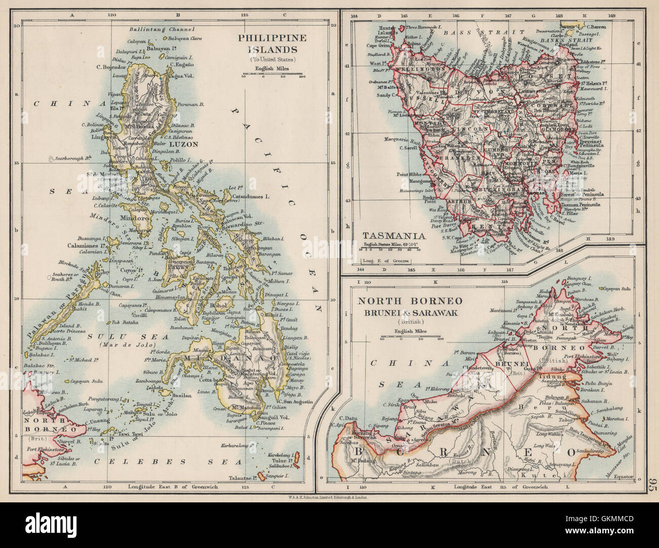 EAST ASIA. Philippines Tasmania North Borneo Brunei Sarawak. JOHNSTON, 1903 map Stock Photohttps://www.alamy.com/image-license-details/?v=1https://www.alamy.com/stock-photo-east-asia-philippines-tasmania-north-borneo-brunei-sarawak-johnston-115395741.html
RFGKMMCD–EAST ASIA. Philippines Tasmania North Borneo Brunei Sarawak. JOHNSTON, 1903 map
 Map of Jakarta vector illustration symbol design Stock Vectorhttps://www.alamy.com/image-license-details/?v=1https://www.alamy.com/map-of-jakarta-vector-illustration-symbol-design-image617739101.html
RF2XW0CEN–Map of Jakarta vector illustration symbol design
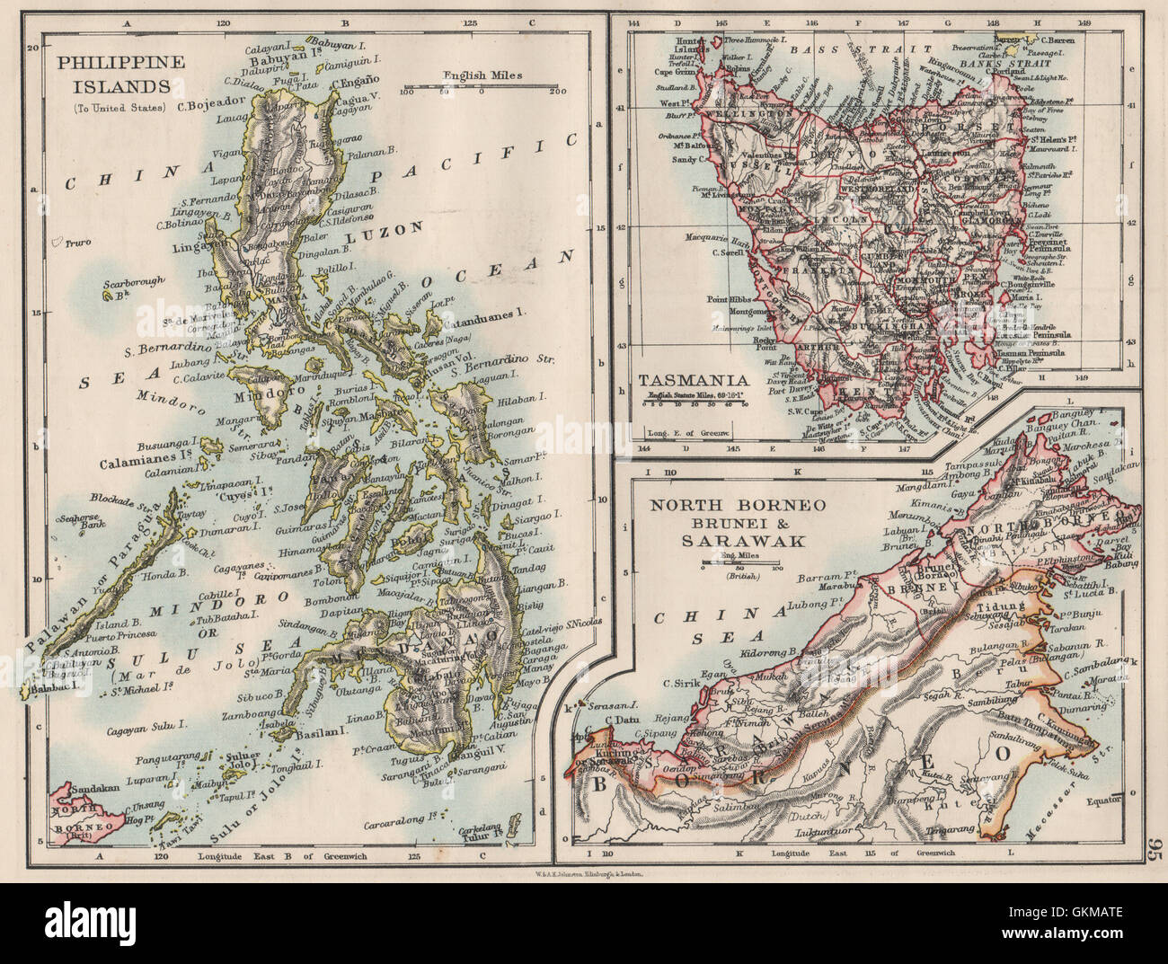 EAST ASIA. Philippines Tasmania North Borneo Brunei Sarawak. JOHNSTON, 1900 map Stock Photohttps://www.alamy.com/image-license-details/?v=1https://www.alamy.com/stock-photo-east-asia-philippines-tasmania-north-borneo-brunei-sarawak-johnston-115388238.html
RFGKMATE–EAST ASIA. Philippines Tasmania North Borneo Brunei Sarawak. JOHNSTON, 1900 map
 North Kalimantan (Subdivisions of Indonesia, Provinces of Indonesia) map vector illustration, scribble sketch North Kalimantan map Stock Vectorhttps://www.alamy.com/image-license-details/?v=1https://www.alamy.com/north-kalimantan-subdivisions-of-indonesia-provinces-of-indonesia-map-vector-illustration-scribble-sketch-north-kalimantan-map-image225877784.html
RFR3DHBM–North Kalimantan (Subdivisions of Indonesia, Provinces of Indonesia) map vector illustration, scribble sketch North Kalimantan map
 EAST ASIA. Philippines Tasmania North Borneo Brunei Sarawak. JOHNSTON, 1897 map Stock Photohttps://www.alamy.com/image-license-details/?v=1https://www.alamy.com/stock-photo-east-asia-philippines-tasmania-north-borneo-brunei-sarawak-johnston-110842416.html
RFGC98HM–EAST ASIA. Philippines Tasmania North Borneo Brunei Sarawak. JOHNSTON, 1897 map
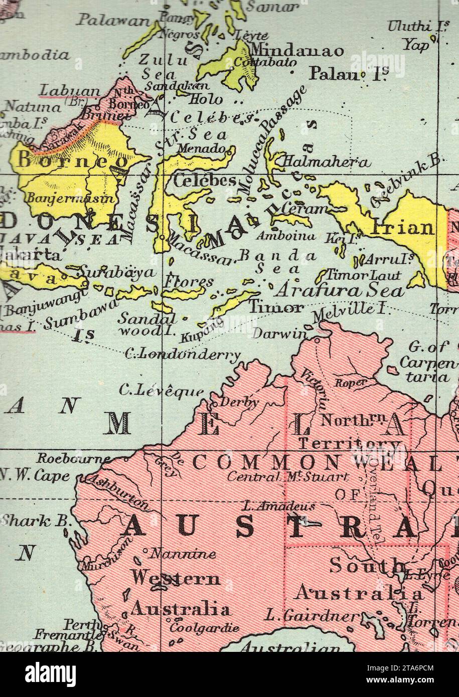 A vintage/antique political map of Borneo and Australia in sepia. Stock Photohttps://www.alamy.com/image-license-details/?v=1https://www.alamy.com/a-vintageantique-political-map-of-borneo-and-australia-in-sepia-image574238020.html
RF2TA6PCM–A vintage/antique political map of Borneo and Australia in sepia.
 Kaart Van Borneo, Covens & Mortier, 1707 - 1741 print Map of Borneo, the north on the right, two wind roses. In the sea at the bottom left and top right a ship, the land with some mountain marks and trees. Around the inscription Bathing figures, around the scale at the bottom right in German and French miles, putti with cartographic instruments. Amsterdam paper engraving maps of separate countries or regions Borneo Stock Photohttps://www.alamy.com/image-license-details/?v=1https://www.alamy.com/kaart-van-borneo-covens-mortier-1707-1741-print-map-of-borneo-the-north-on-the-right-two-wind-roses-in-the-sea-at-the-bottom-left-and-top-right-a-ship-the-land-with-some-mountain-marks-and-trees-around-the-inscription-bathing-figures-around-the-scale-at-the-bottom-right-in-german-and-french-miles-putti-with-cartographic-instruments-amsterdam-paper-engraving-maps-of-separate-countries-or-regions-borneo-image590744125.html
RM2W92M4D–Kaart Van Borneo, Covens & Mortier, 1707 - 1741 print Map of Borneo, the north on the right, two wind roses. In the sea at the bottom left and top right a ship, the land with some mountain marks and trees. Around the inscription Bathing figures, around the scale at the bottom right in German and French miles, putti with cartographic instruments. Amsterdam paper engraving maps of separate countries or regions Borneo
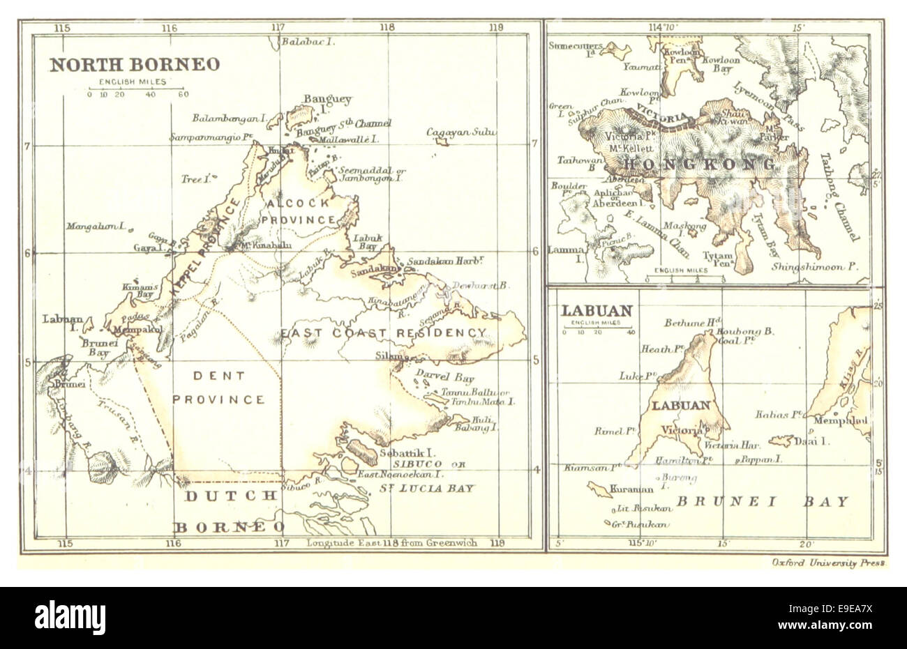 Map of North Borneo, HongKong and Labuan (1888) Stock Photohttps://www.alamy.com/image-license-details/?v=1https://www.alamy.com/stock-photo-map-of-north-borneo-hongkong-and-labuan-1888-74688766.html
RME9EA7X–Map of North Borneo, HongKong and Labuan (1888)
 EAST ASIA Philippines Tasmania North Borneo Brunei Sarawak JOHNSTON 1892 map Stock Photohttps://www.alamy.com/image-license-details/?v=1https://www.alamy.com/east-asia-philippines-tasmania-north-borneo-brunei-sarawak-johnston-1892-map-image242553108.html
RFT2H6Y0–EAST ASIA Philippines Tasmania North Borneo Brunei Sarawak JOHNSTON 1892 map
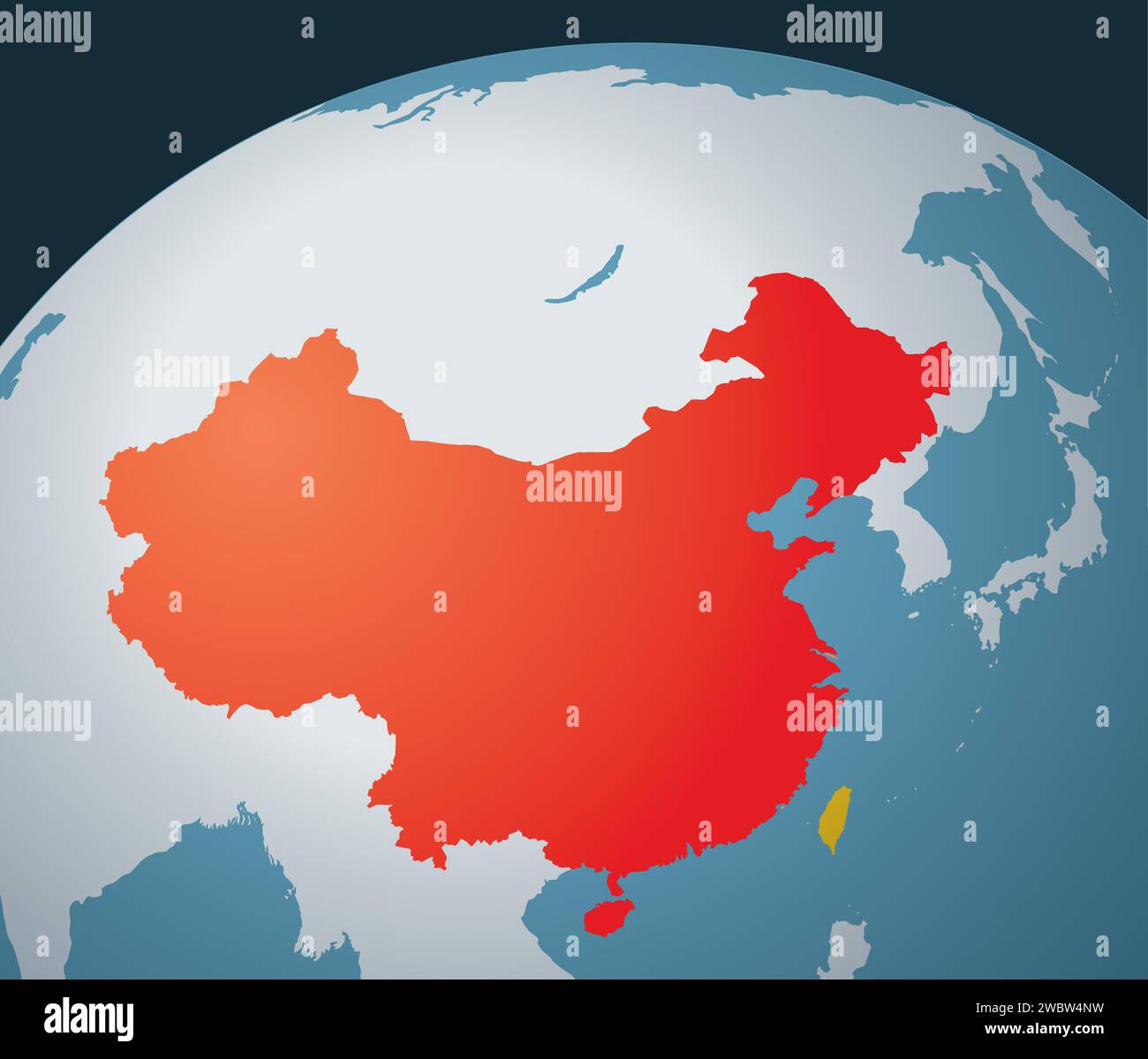 Taiwan vs. China Stock Vectorhttps://www.alamy.com/image-license-details/?v=1https://www.alamy.com/taiwan-vs-china-image592466277.html
RF2WBW4NW–Taiwan vs. China
 EAST ASIA. Philippines Tasmania North Borneo Brunei Sarawak. JOHNSTON, 1906 map Stock Photohttps://www.alamy.com/image-license-details/?v=1https://www.alamy.com/stock-photo-east-asia-philippines-tasmania-north-borneo-brunei-sarawak-johnston-102758141.html
RFFY511H–EAST ASIA. Philippines Tasmania North Borneo Brunei Sarawak. JOHNSTON, 1906 map
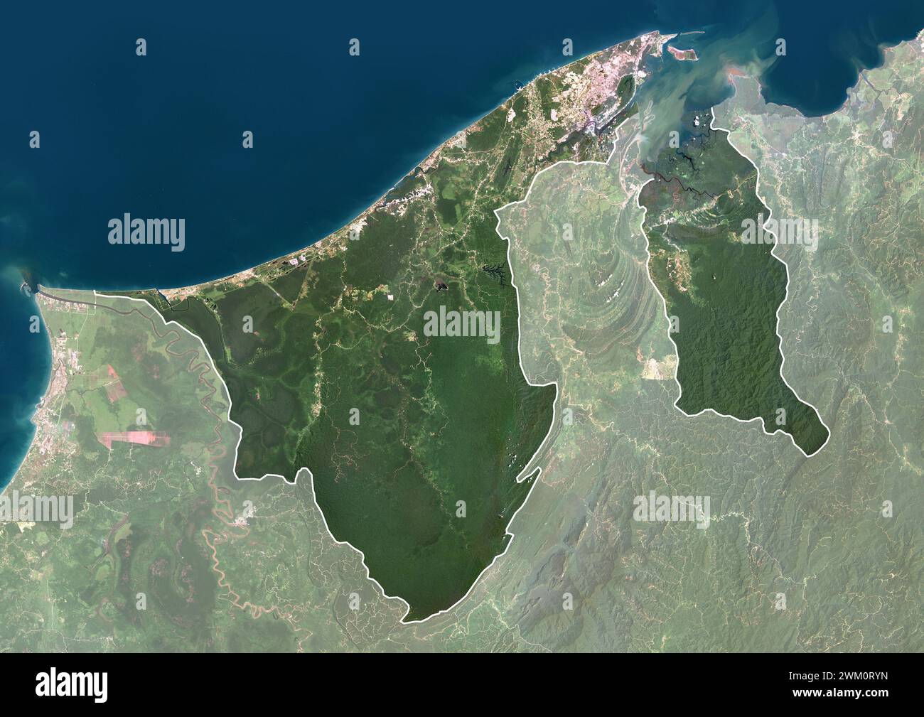 Color satellite image of Brunei with borders and mask. The country is located on the north coast of the island of Borneo in Southeast Asia. Stock Photohttps://www.alamy.com/image-license-details/?v=1https://www.alamy.com/color-satellite-image-of-brunei-with-borders-and-mask-the-country-is-located-on-the-north-coast-of-the-island-of-borneo-in-southeast-asia-image597464441.html
RM2WM0RYN–Color satellite image of Brunei with borders and mask. The country is located on the north coast of the island of Borneo in Southeast Asia.
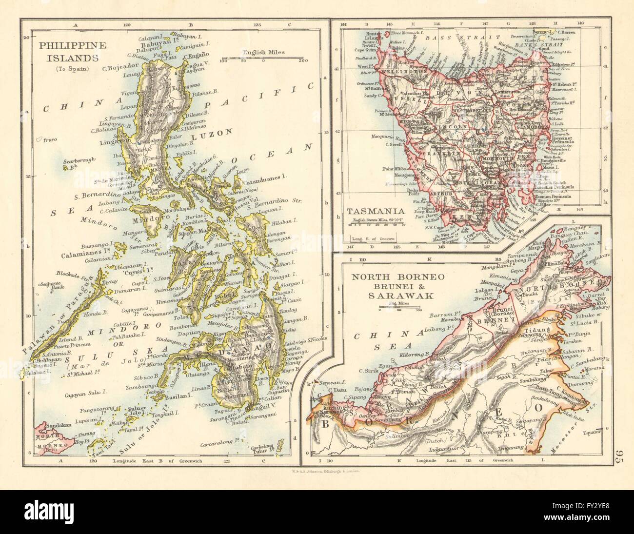 EAST ASIA. Philippines Tasmania North Borneo Brunei Sarawak. JOHNSTON, 1899 map Stock Photohttps://www.alamy.com/image-license-details/?v=1https://www.alamy.com/stock-photo-east-asia-philippines-tasmania-north-borneo-brunei-sarawak-johnston-102713024.html
RFFY2YE8–EAST ASIA. Philippines Tasmania North Borneo Brunei Sarawak. JOHNSTON, 1899 map
 Satellite view of Borneo. The island is divided among three countries: Malaysia and Brunei in the north, and Indonesia to the south. This image was compiled from data acquired by Landsat satellites. Stock Photohttps://www.alamy.com/image-license-details/?v=1https://www.alamy.com/stock-photo-satellite-view-of-borneo-the-island-is-divided-among-three-countries-112372830.html
RMGER0KA–Satellite view of Borneo. The island is divided among three countries: Malaysia and Brunei in the north, and Indonesia to the south. This image was compiled from data acquired by Landsat satellites.
 A map of British North Borneo (II) Stock Photohttps://www.alamy.com/image-license-details/?v=1https://www.alamy.com/stock-photo-a-map-of-british-north-borneo-ii-139434594.html
RMJ2RP6X–A map of British North Borneo (II)
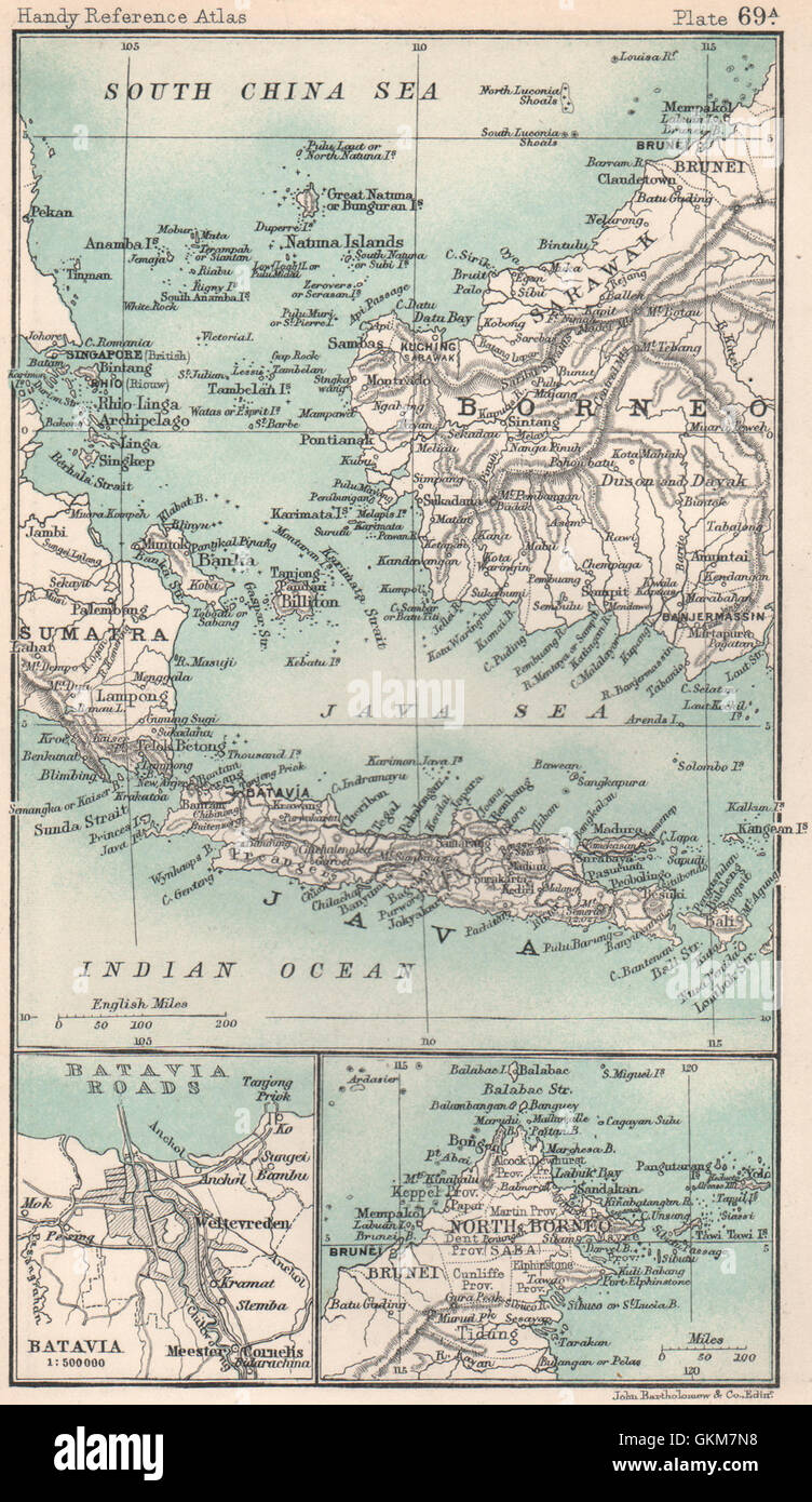 Batavia/Jakarta sketch plan. North Borneo Java Sea Singapore. Indonesia 1904 map Stock Photohttps://www.alamy.com/image-license-details/?v=1https://www.alamy.com/stock-photo-bataviajakarta-sketch-plan-north-borneo-java-sea-singapore-indonesia-115385796.html
RFGKM7N8–Batavia/Jakarta sketch plan. North Borneo Java Sea Singapore. Indonesia 1904 map
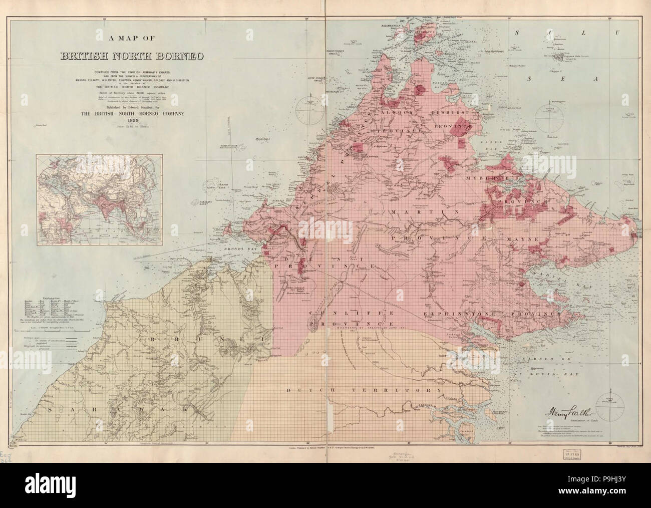 A map of British North Borneo (III). Stock Photohttps://www.alamy.com/image-license-details/?v=1https://www.alamy.com/a-map-of-british-north-borneo-iii-image212443727.html
RMP9HJ3Y–A map of British North Borneo (III).
 ASIA shows Sultanate of Sulu in North Borneo, Mindanao & Palawan. SDUK 1874 map Stock Photohttps://www.alamy.com/image-license-details/?v=1https://www.alamy.com/asia-shows-sultanate-of-sulu-in-north-borneo-mindanao-palawan-sduk-1874-map-image248876708.html
RFTCW8NT–ASIA shows Sultanate of Sulu in North Borneo, Mindanao & Palawan. SDUK 1874 map
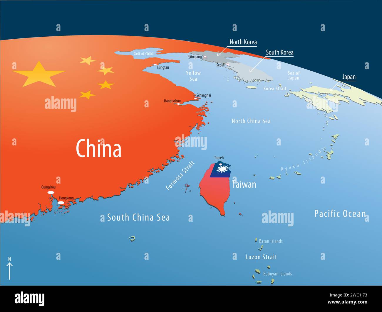 Big China, small Taiwan Stock Vectorhttps://www.alamy.com/image-license-details/?v=1https://www.alamy.com/big-china-small-taiwan-image592564647.html
RF2WC1J73–Big China, small Taiwan
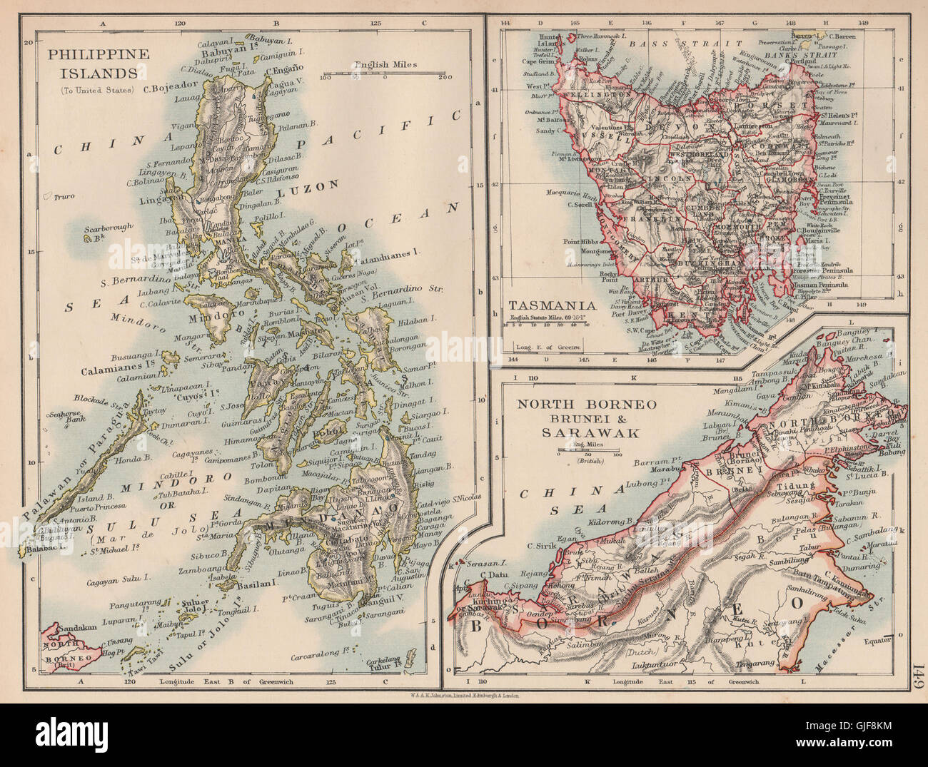 EAST ASIA.US American Philippines.Tasmania North Borneo Brunei Sarawak, 1906 map Stock Photohttps://www.alamy.com/image-license-details/?v=1https://www.alamy.com/stock-photo-east-asiaus-american-philippinestasmania-north-borneo-brunei-sarawak-114662120.html
RFGJF8KM–EAST ASIA.US American Philippines.Tasmania North Borneo Brunei Sarawak, 1906 map
 Map of Jakarta vector illustration symbol design Stock Vectorhttps://www.alamy.com/image-license-details/?v=1https://www.alamy.com/map-of-jakarta-vector-illustration-symbol-design-image617738476.html
RF2XW0BMC–Map of Jakarta vector illustration symbol design
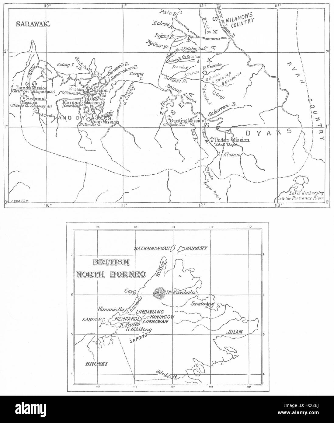 BORNEO ANGLICAN CHURCH MISSIONS: Sarawak Sabah Protestant. Malaysia, 1897 map Stock Photohttps://www.alamy.com/image-license-details/?v=1https://www.alamy.com/stock-photo-borneo-anglican-church-missions-sarawak-sabah-protestant-malaysia-102610246.html
RFFXX8BJ–BORNEO ANGLICAN CHURCH MISSIONS: Sarawak Sabah Protestant. Malaysia, 1897 map
 North Kalimantan (Subdivisions of Indonesia, Provinces of Indonesia) map vector illustration, scribble sketch North Kalimantan map Stock Vectorhttps://www.alamy.com/image-license-details/?v=1https://www.alamy.com/north-kalimantan-subdivisions-of-indonesia-provinces-of-indonesia-map-vector-illustration-scribble-sketch-north-kalimantan-map-image224047195.html
RFR0E6DF–North Kalimantan (Subdivisions of Indonesia, Provinces of Indonesia) map vector illustration, scribble sketch North Kalimantan map
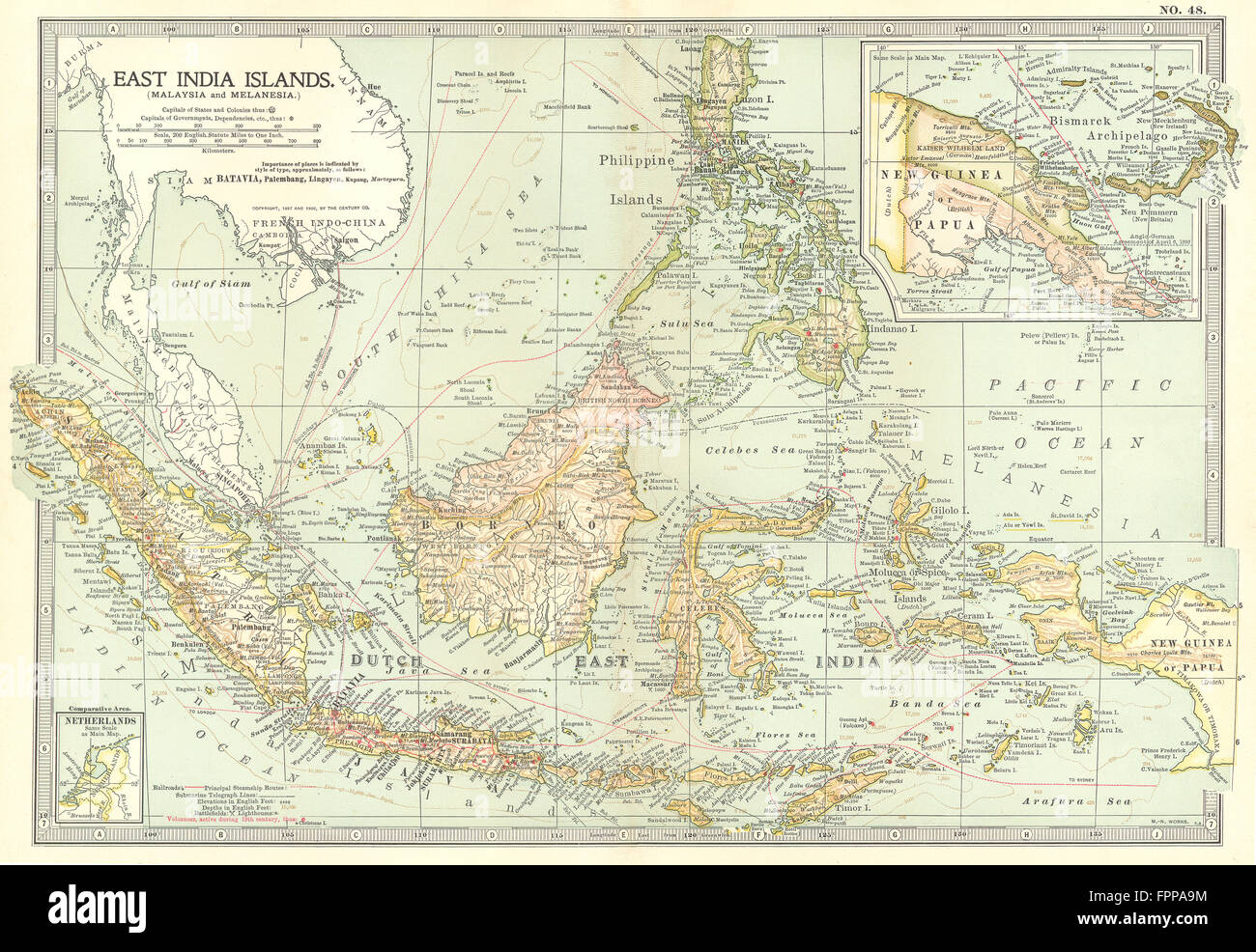 INDONESIA: Borneo Sulawesi Sumatra; New Guinea Sarawak Philippines, 1903 map Stock Photohttps://www.alamy.com/image-license-details/?v=1https://www.alamy.com/stock-photo-indonesia-borneo-sulawesi-sumatra-new-guinea-sarawak-philippines-1903-100065328.html
RFFPPA9M–INDONESIA: Borneo Sulawesi Sumatra; New Guinea Sarawak Philippines, 1903 map
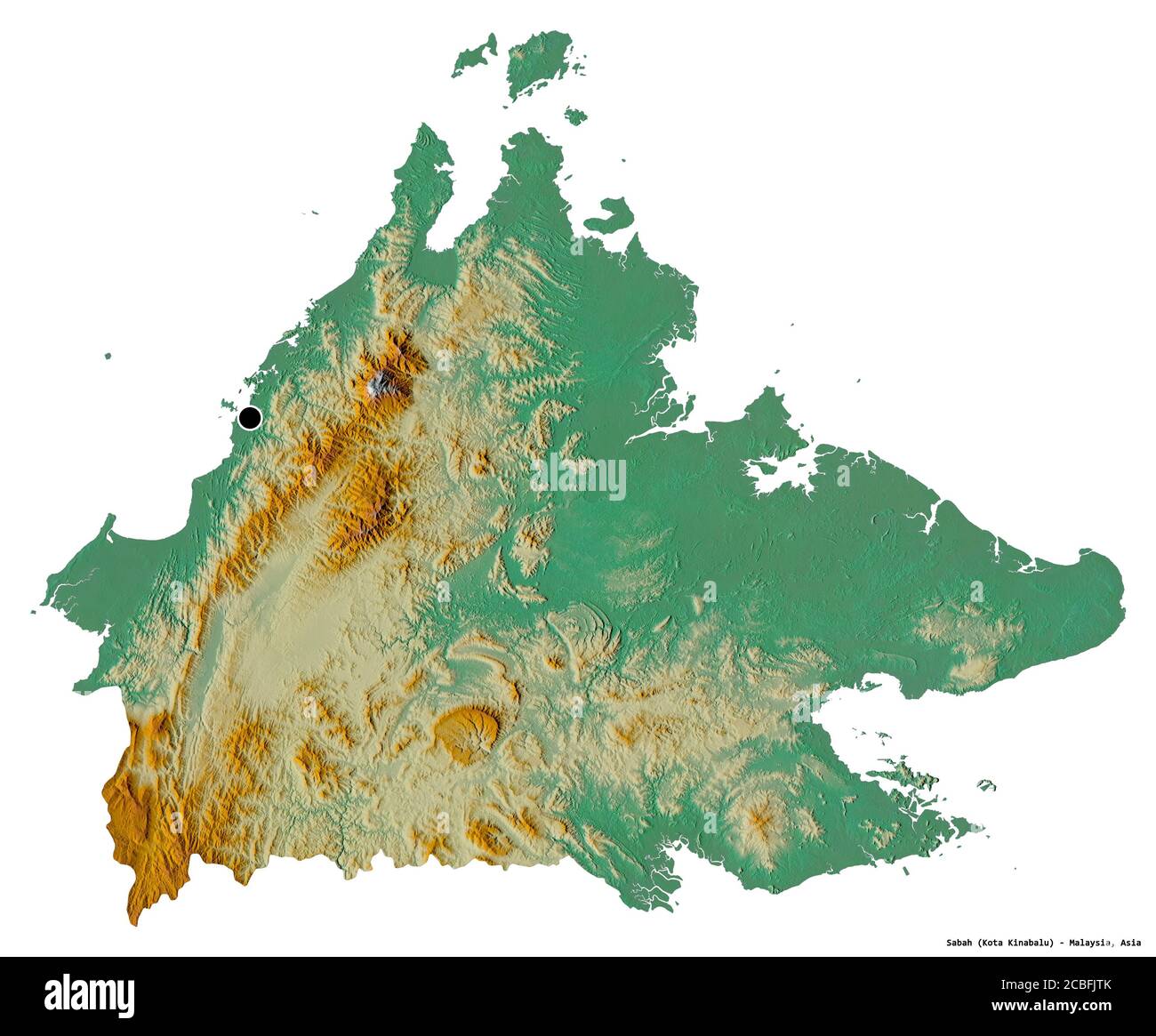 Shape of Sabah, state of Malaysia, with its capital isolated on white background. Topographic relief map. 3D rendering Stock Photohttps://www.alamy.com/image-license-details/?v=1https://www.alamy.com/shape-of-sabah-state-of-malaysia-with-its-capital-isolated-on-white-background-topographic-relief-map-3d-rendering-image368523027.html
RF2CBFJTK–Shape of Sabah, state of Malaysia, with its capital isolated on white background. Topographic relief map. 3D rendering
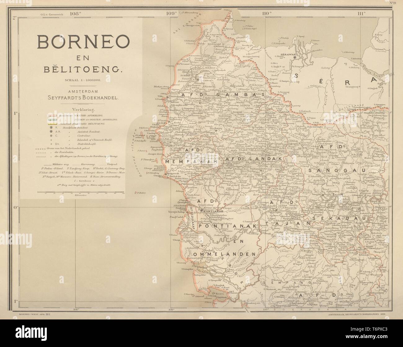 DUTCH EAST INDIES Borneo West Kalimantan Indonesia DORNSEIFFEN 1902 old map Stock Photohttps://www.alamy.com/image-license-details/?v=1https://www.alamy.com/dutch-east-indies-borneo-west-kalimantan-indonesia-dornseiffen-1902-old-map-image245136755.html
RFT6PXC3–DUTCH EAST INDIES Borneo West Kalimantan Indonesia DORNSEIFFEN 1902 old map
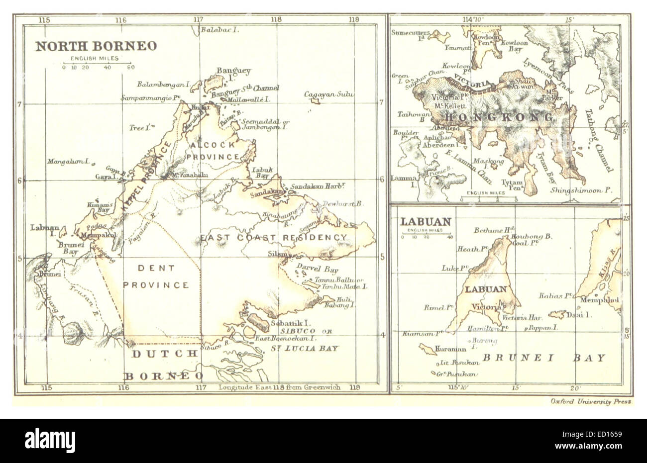 Map of North Borneo, HongKong and Labuan (1888) Stock Photohttps://www.alamy.com/image-license-details/?v=1https://www.alamy.com/stock-photo-map-of-north-borneo-hongkong-and-labuan-1888-76858805.html
RMED1659–Map of North Borneo, HongKong and Labuan (1888)
 . Bulletin of the British Museum (Natural History) Entomology. * Ptychandra lorqum T P. leucogyne + P. schadenbergi m P. mindorana a P. talboti u P. negrosensis xlanac / x MI.Aroiot 1 Mnnlolbon ^Polillo Is, BoloonT C-»* Quezon Cit> Mor,»eres^«'n'llfl!A.poele Pulonglugo--/* xTCT„s„. Fig. 15. Map of Philippines, Borneo and North Moluccas showing distribution records for Ptychandra species.. Please note that these images are extracted from scanned page images that may have been digitally enhanced for readability - coloration and appearance of these illustrations may not perfectly resemble Stock Photohttps://www.alamy.com/image-license-details/?v=1https://www.alamy.com/bulletin-of-the-british-museum-natural-history-entomology-ptychandra-lorqum-t-p-leucogyne-p-schadenbergi-m-p-mindorana-a-p-talboti-u-p-negrosensis-xlanac-x-miaroiot-1-mnnlolbon-polillo-is-boloont-c-quezon-citgt-moreresnllfl!apoele-pulonglugo-xtcts-fig-15-map-of-philippines-borneo-and-north-moluccas-showing-distribution-records-for-ptychandra-species-please-note-that-these-images-are-extracted-from-scanned-page-images-that-may-have-been-digitally-enhanced-for-readability-coloration-and-appearance-of-these-illustrations-may-not-perfectly-resemble-image233959164.html
RMRGHN8C–. Bulletin of the British Museum (Natural History) Entomology. * Ptychandra lorqum T P. leucogyne + P. schadenbergi m P. mindorana a P. talboti u P. negrosensis xlanac / x MI.Aroiot 1 Mnnlolbon ^Polillo Is, BoloonT C-»* Quezon Cit> Mor,»eres^«'n'llfl!A.poele Pulonglugo--/* xTCT„s„. Fig. 15. Map of Philippines, Borneo and North Moluccas showing distribution records for Ptychandra species.. Please note that these images are extracted from scanned page images that may have been digitally enhanced for readability - coloration and appearance of these illustrations may not perfectly resemble
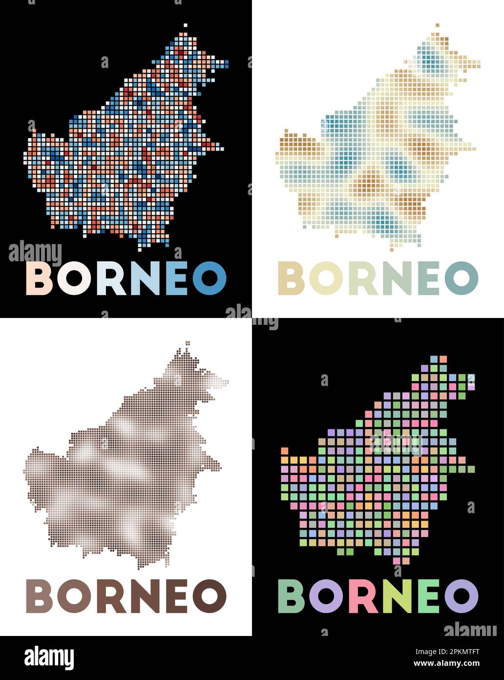 Borneo map. Collection of map of Borneo in dotted style. Borders of the island filled with rectangles for your design. Vector illustration. Stock Vectorhttps://www.alamy.com/image-license-details/?v=1https://www.alamy.com/borneo-map-collection-of-map-of-borneo-in-dotted-style-borders-of-the-island-filled-with-rectangles-for-your-design-vector-illustration-image545658172.html
RF2PKMTFT–Borneo map. Collection of map of Borneo in dotted style. Borders of the island filled with rectangles for your design. Vector illustration.
 Cute illustrated map of asia with space to add country names in your own language if needed. Stock Photohttps://www.alamy.com/image-license-details/?v=1https://www.alamy.com/cute-illustrated-map-of-asia-with-space-to-add-country-names-in-your-image69811651.html
RME1G5D7–Cute illustrated map of asia with space to add country names in your own language if needed.
 North Kalimantan (Subdivisions of Indonesia, Provinces of Indonesia) map is designed cannabis leaf green and black, North Kalimantan map made of marij Stock Vectorhttps://www.alamy.com/image-license-details/?v=1https://www.alamy.com/north-kalimantan-subdivisions-of-indonesia-provinces-of-indonesia-map-is-designed-cannabis-leaf-green-and-black-north-kalimantan-map-made-of-marij-image262889853.html
RFW7KJK9–North Kalimantan (Subdivisions of Indonesia, Provinces of Indonesia) map is designed cannabis leaf green and black, North Kalimantan map made of marij
 Satellite view of Borneo (with country boundaries). The island is divided among three countries: Malaysia and Brunei in the north, and Indonesia to the south. This image was compiled from data acquired by Landsat satellites. Stock Photohttps://www.alamy.com/image-license-details/?v=1https://www.alamy.com/stock-photo-satellite-view-of-borneo-with-country-boundaries-the-island-is-divided-112372835.html
RMGER0KF–Satellite view of Borneo (with country boundaries). The island is divided among three countries: Malaysia and Brunei in the north, and Indonesia to the south. This image was compiled from data acquired by Landsat satellites.
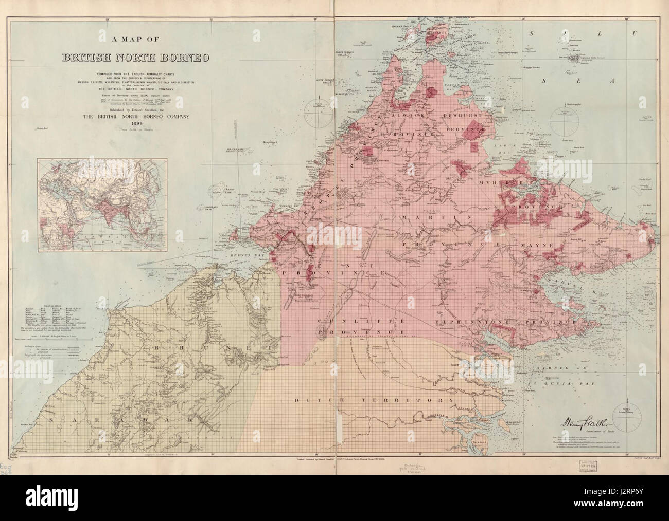 A map of British North Borneo (III) Stock Photohttps://www.alamy.com/image-license-details/?v=1https://www.alamy.com/stock-photo-a-map-of-british-north-borneo-iii-139434595.html
RMJ2RP6Y–A map of British North Borneo (III)
 A map of British North Borneo. Stock Photohttps://www.alamy.com/image-license-details/?v=1https://www.alamy.com/a-map-of-british-north-borneo-image592947345.html
RM2WCK2AW–A map of British North Borneo.
 Map of Jakarta vector illustration symbol design Stock Vectorhttps://www.alamy.com/image-license-details/?v=1https://www.alamy.com/map-of-jakarta-vector-illustration-symbol-design-image617738781.html
RF2XW0C39–Map of Jakarta vector illustration symbol design
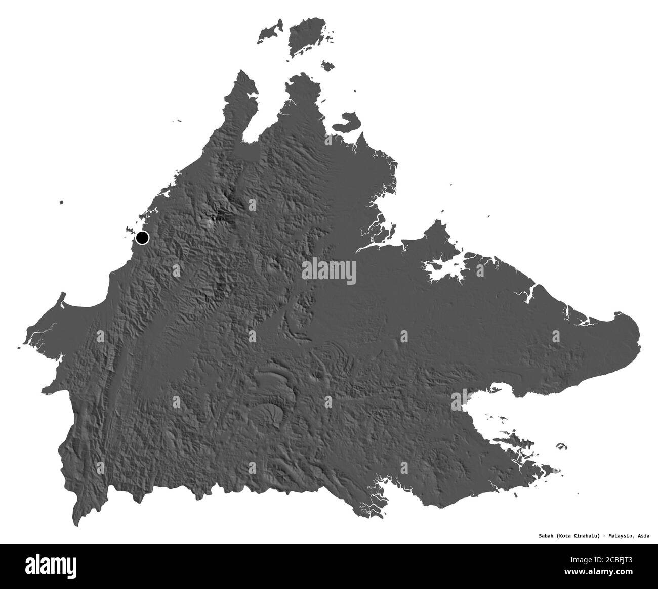 Shape of Sabah, state of Malaysia, with its capital isolated on white background. Bilevel elevation map. 3D rendering Stock Photohttps://www.alamy.com/image-license-details/?v=1https://www.alamy.com/shape-of-sabah-state-of-malaysia-with-its-capital-isolated-on-white-background-bilevel-elevation-map-3d-rendering-image368523011.html
RF2CBFJT3–Shape of Sabah, state of Malaysia, with its capital isolated on white background. Bilevel elevation map. 3D rendering
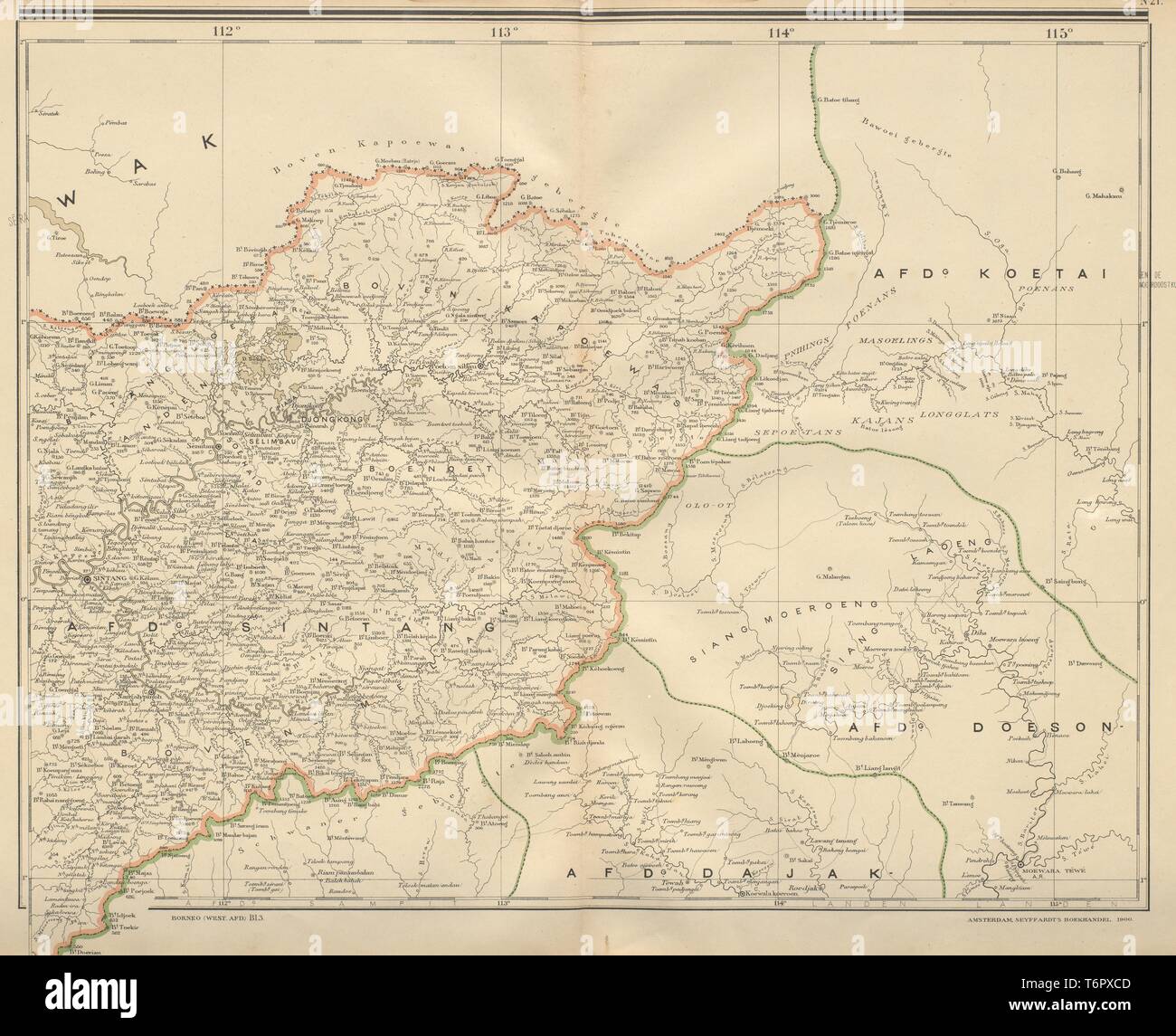 DUTCH EAST INDIES Central Borneo West Kalimantan Indonesia DORNSEIFFEN 1902 map Stock Photohttps://www.alamy.com/image-license-details/?v=1https://www.alamy.com/dutch-east-indies-central-borneo-west-kalimantan-indonesia-dornseiffen-1902-map-image245136765.html
RFT6PXCD–DUTCH EAST INDIES Central Borneo West Kalimantan Indonesia DORNSEIFFEN 1902 map
 Image taken from page 290 of 'North Borneo. Explorations and adventures on the Equator ... With biographical sketch and notes by Joseph Hatton, and preface by Sir W. Medhurst ... Illustrated. Second edition' Image taken from page 290 of 'North Borneo Explorations and Stock Photohttps://www.alamy.com/image-license-details/?v=1https://www.alamy.com/stock-photo-image-taken-from-page-290-of-north-borneo-explorations-and-adventures-85967590.html
RMEYT4F2–Image taken from page 290 of 'North Borneo. Explorations and adventures on the Equator ... With biographical sketch and notes by Joseph Hatton, and preface by Sir W. Medhurst ... Illustrated. Second edition' Image taken from page 290 of 'North Borneo Explorations and
 Bond Street Jesselton British North Borneo in 1914 Stock Photohttps://www.alamy.com/image-license-details/?v=1https://www.alamy.com/stock-photo-bond-street-jesselton-british-north-borneo-in-1914-140475456.html
RMJ4F5TG–Bond Street Jesselton British North Borneo in 1914
 A map of British North Borneo Stock Photohttps://www.alamy.com/image-license-details/?v=1https://www.alamy.com/a-map-of-british-north-borneo-image592947301.html
RM2WCK299–A map of British North Borneo
 Map of Jakarta vector illustration symbol design Stock Vectorhttps://www.alamy.com/image-license-details/?v=1https://www.alamy.com/map-of-jakarta-vector-illustration-symbol-design-image617738033.html
RF2XW0B4H–Map of Jakarta vector illustration symbol design
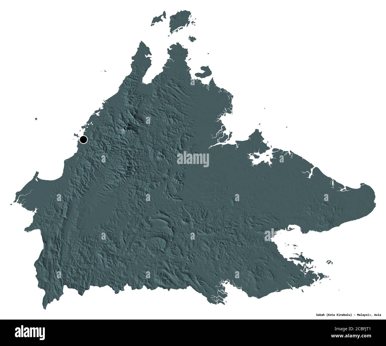 Shape of Sabah, state of Malaysia, with its capital isolated on white background. Colored elevation map. 3D rendering Stock Photohttps://www.alamy.com/image-license-details/?v=1https://www.alamy.com/shape-of-sabah-state-of-malaysia-with-its-capital-isolated-on-white-background-colored-elevation-map-3d-rendering-image368523009.html
RF2CBFJT1–Shape of Sabah, state of Malaysia, with its capital isolated on white background. Colored elevation map. 3D rendering
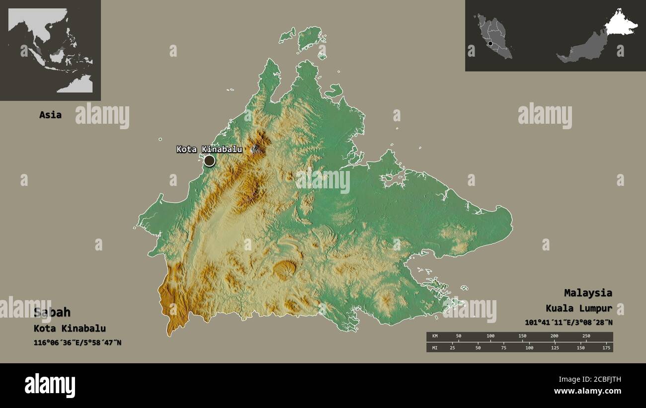 Shape of Sabah, state of Malaysia, and its capital. Distance scale, previews and labels. Topographic relief map. 3D rendering Stock Photohttps://www.alamy.com/image-license-details/?v=1https://www.alamy.com/shape-of-sabah-state-of-malaysia-and-its-capital-distance-scale-previews-and-labels-topographic-relief-map-3d-rendering-image368523025.html
RF2CBFJTH–Shape of Sabah, state of Malaysia, and its capital. Distance scale, previews and labels. Topographic relief map. 3D rendering
 Image taken from page 348 of 'North Borneo. Explorations and adventures on the Equator ... With biographical sketch and notes by Joseph Hatton, and preface by Sir W. Medhurst ... Illustrated. Second edition' Image taken from page 348 of 'North Borneo Explorations and Stock Photohttps://www.alamy.com/image-license-details/?v=1https://www.alamy.com/stock-photo-image-taken-from-page-348-of-north-borneo-explorations-and-adventures-85969489.html
RMEYT6XW–Image taken from page 348 of 'North Borneo. Explorations and adventures on the Equator ... With biographical sketch and notes by Joseph Hatton, and preface by Sir W. Medhurst ... Illustrated. Second edition' Image taken from page 348 of 'North Borneo Explorations and
 Gaya Street Jesselton British North Borneo in 1930 Stock Photohttps://www.alamy.com/image-license-details/?v=1https://www.alamy.com/stock-photo-gaya-street-jesselton-british-north-borneo-in-1930-140475468.html
RMJ4F5W0–Gaya Street Jesselton British North Borneo in 1930
 A map of British North Borneo (II). Stock Photohttps://www.alamy.com/image-license-details/?v=1https://www.alamy.com/a-map-of-british-north-borneo-ii-image592947330.html
RM2WCK2AA–A map of British North Borneo (II).
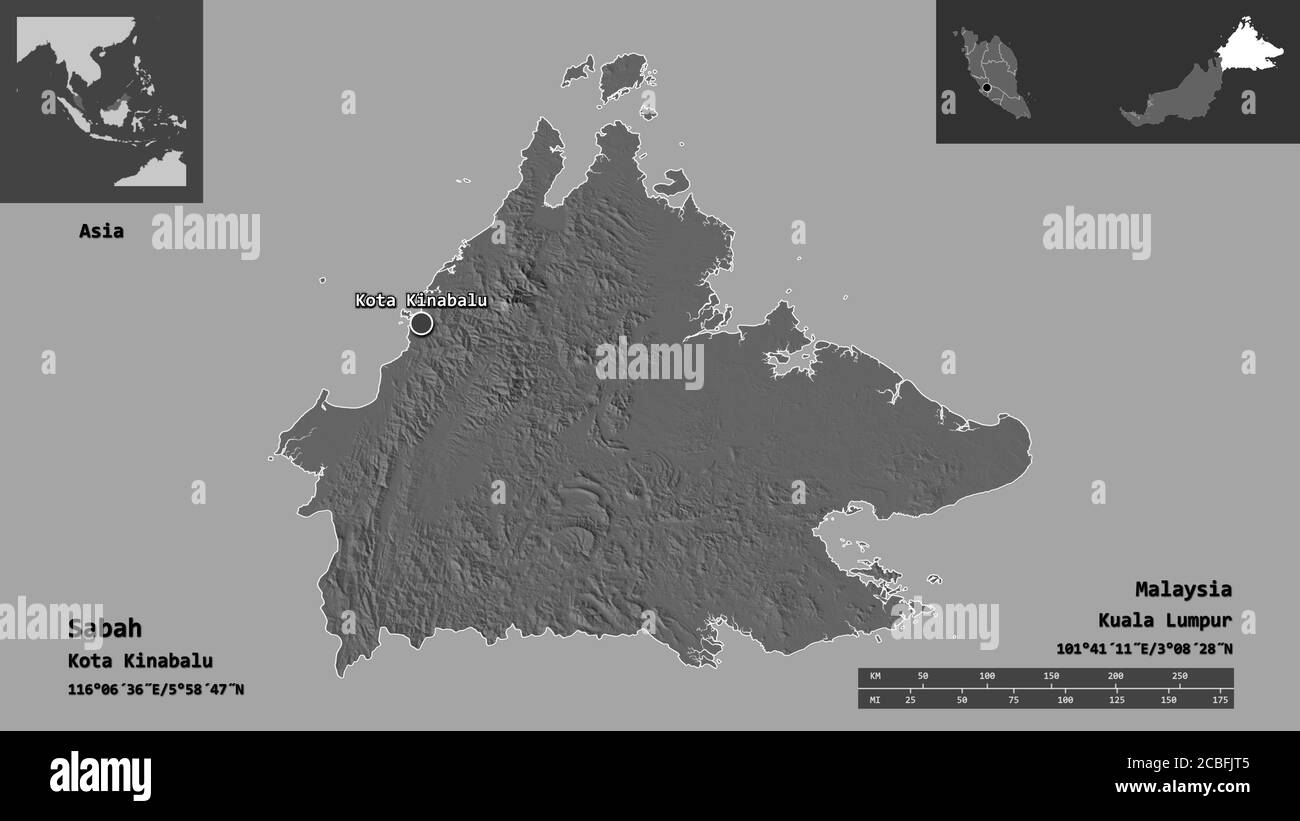 Shape of Sabah, state of Malaysia, and its capital. Distance scale, previews and labels. Bilevel elevation map. 3D rendering Stock Photohttps://www.alamy.com/image-license-details/?v=1https://www.alamy.com/shape-of-sabah-state-of-malaysia-and-its-capital-distance-scale-previews-and-labels-bilevel-elevation-map-3d-rendering-image368523013.html
RF2CBFJT5–Shape of Sabah, state of Malaysia, and its capital. Distance scale, previews and labels. Bilevel elevation map. 3D rendering
 Image taken from page 149 of 'North Borneo. Explorations and adventures on the Equator ... With biographical sketch and notes by Joseph Hatton, and preface by Sir W. Medhurst ... Illustrated. Second edition' Image taken from page 149 of 'North Borneo Explorations and Stock Photohttps://www.alamy.com/image-license-details/?v=1https://www.alamy.com/stock-photo-image-taken-from-page-149-of-north-borneo-explorations-and-adventures-85961242.html
RMEYRTCA–Image taken from page 149 of 'North Borneo. Explorations and adventures on the Equator ... With biographical sketch and notes by Joseph Hatton, and preface by Sir W. Medhurst ... Illustrated. Second edition' Image taken from page 149 of 'North Borneo Explorations and
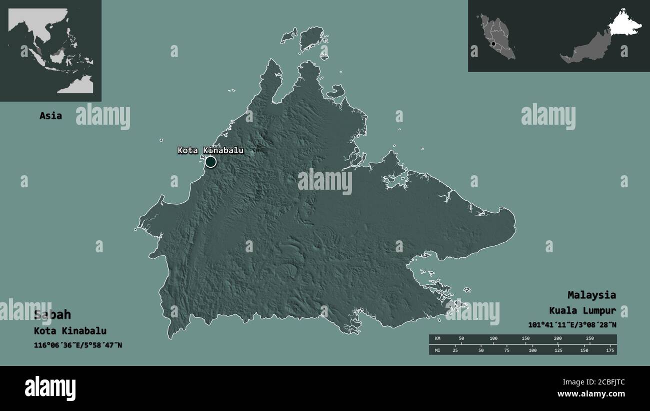 Shape of Sabah, state of Malaysia, and its capital. Distance scale, previews and labels. Colored elevation map. 3D rendering Stock Photohttps://www.alamy.com/image-license-details/?v=1https://www.alamy.com/shape-of-sabah-state-of-malaysia-and-its-capital-distance-scale-previews-and-labels-colored-elevation-map-3d-rendering-image368523020.html
RF2CBFJTC–Shape of Sabah, state of Malaysia, and its capital. Distance scale, previews and labels. Colored elevation map. 3D rendering
 Image taken from page 157 of 'North Borneo. Explorations and adventures on the Equator ... With biographical sketch and notes by Joseph Hatton, and preface by Sir W. Medhurst ... Illustrated. Second edition' Image taken from page 157 of 'North Borneo Explorations and Stock Photohttps://www.alamy.com/image-license-details/?v=1https://www.alamy.com/stock-photo-image-taken-from-page-157-of-north-borneo-explorations-and-adventures-85961695.html
RMEYRW0F–Image taken from page 157 of 'North Borneo. Explorations and adventures on the Equator ... With biographical sketch and notes by Joseph Hatton, and preface by Sir W. Medhurst ... Illustrated. Second edition' Image taken from page 157 of 'North Borneo Explorations and
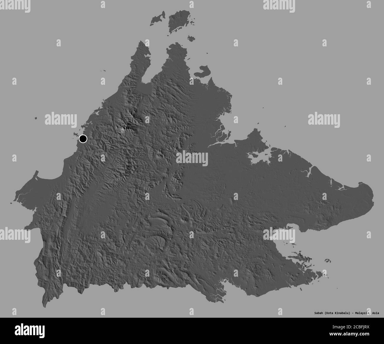 Shape of Sabah, state of Malaysia, with its capital isolated on a solid color background. Bilevel elevation map. 3D rendering Stock Photohttps://www.alamy.com/image-license-details/?v=1https://www.alamy.com/shape-of-sabah-state-of-malaysia-with-its-capital-isolated-on-a-solid-color-background-bilevel-elevation-map-3d-rendering-image368523006.html
RF2CBFJRX–Shape of Sabah, state of Malaysia, with its capital isolated on a solid color background. Bilevel elevation map. 3D rendering
 North Borneo. Explorations and adventures on the Equator ... With biographical sketch and notes by Joseph Hatton, and preface by Sir W. Medhurst ... Illustrated. Second edition Image taken from page 331 of 'North Borneo Explorations and Stock Photohttps://www.alamy.com/image-license-details/?v=1https://www.alamy.com/stock-photo-north-borneo-explorations-and-adventures-on-the-equator-with-biographical-86535186.html
RMF0P0EA–North Borneo. Explorations and adventures on the Equator ... With biographical sketch and notes by Joseph Hatton, and preface by Sir W. Medhurst ... Illustrated. Second edition Image taken from page 331 of 'North Borneo Explorations and