Quick filters:
Map of roman roads Stock Photos and Images
 ANCIENT ROMAN FRANCE GAUL. Gallia Transalpina. Roman roads names. SDUK 1846 map Stock Photohttps://www.alamy.com/image-license-details/?v=1https://www.alamy.com/ancient-roman-france-gaul-gallia-transalpina-roman-roads-names-sduk-1846-map-image242572253.html
RFT2J3AN–ANCIENT ROMAN FRANCE GAUL. Gallia Transalpina. Roman roads names. SDUK 1846 map
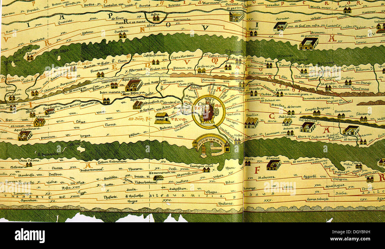 5766. Tabula Peutengeriana, an illustrated road map showing the roads in the Roman Empire, dating from the 4-5th. C. Pic. Shows roads around Rome with the harbor of Ostia. Stock Photohttps://www.alamy.com/image-license-details/?v=1https://www.alamy.com/5766-tabula-peutengeriana-an-illustrated-road-map-showing-the-roads-image62067533.html
RMDGYBNH–5766. Tabula Peutengeriana, an illustrated road map showing the roads in the Roman Empire, dating from the 4-5th. C. Pic. Shows roads around Rome with the harbor of Ostia.
 This map of europe shows the principal ancient Roman roads throughout the area. The network of public Roman roads covered around 76,000 miles, and it greatly assisted the free movement of armies, people, and goods across the empire. Stock Photohttps://www.alamy.com/image-license-details/?v=1https://www.alamy.com/this-map-of-europe-shows-the-principal-ancient-roman-roads-throughout-the-area-the-network-of-publicromanroads-covered-around-76000-miles-and-it-greatly-assisted-the-free-movement-of-armies-people-and-goods-across-the-empire-image445443882.html
RF2GTKM62–This map of europe shows the principal ancient Roman roads throughout the area. The network of public Roman roads covered around 76,000 miles, and it greatly assisted the free movement of armies, people, and goods across the empire.
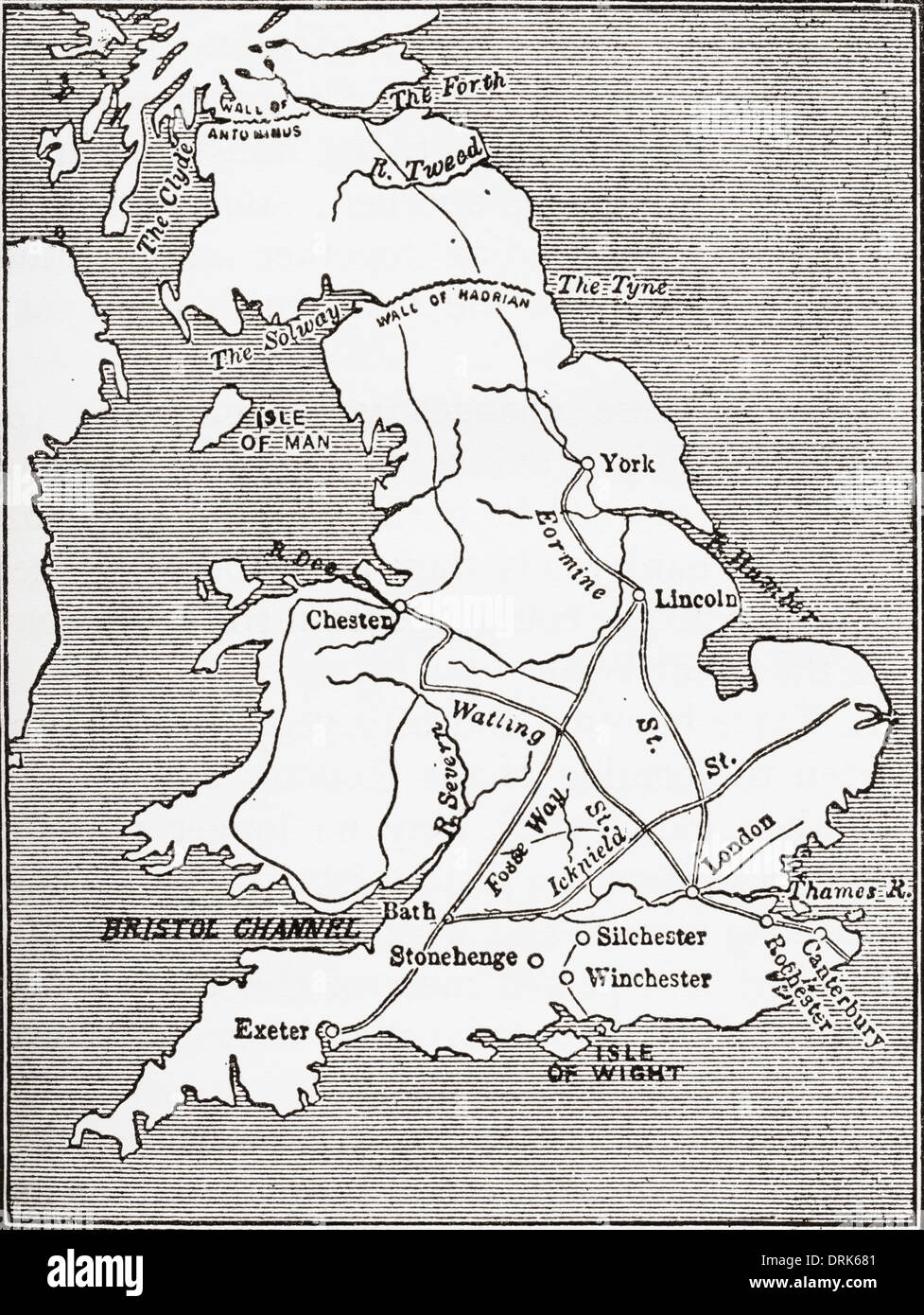 Map showing the Roman roads in Britain. Stock Photohttps://www.alamy.com/image-license-details/?v=1https://www.alamy.com/map-showing-the-roman-roads-in-britain-image66190209.html
RMDRK681–Map showing the Roman roads in Britain.
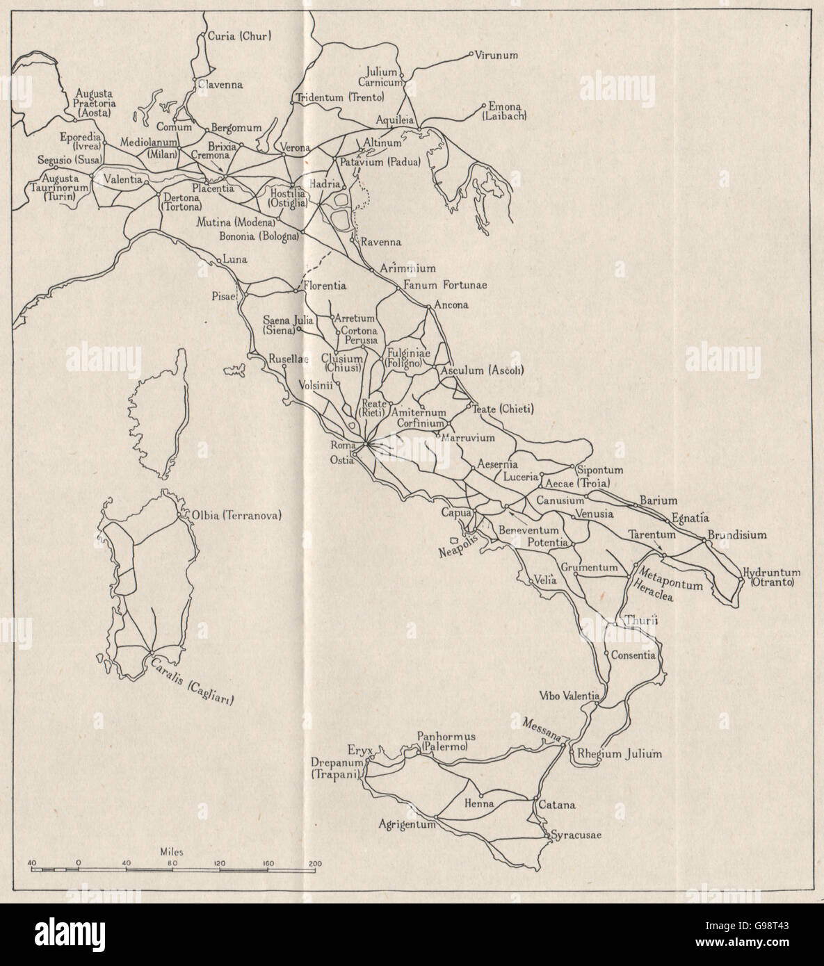 ITALY: Roman roads. WW2 ROYAL NAVY INTELLIGENCE MAP, 1945 Stock Photohttps://www.alamy.com/image-license-details/?v=1https://www.alamy.com/stock-photo-italy-roman-roads-ww2-royal-navy-intelligence-map-1945-108988659.html
RFG98T43–ITALY: Roman roads. WW2 ROYAL NAVY INTELLIGENCE MAP, 1945
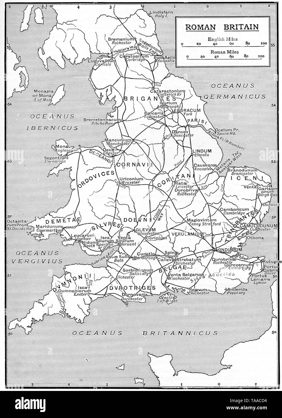 A map showing the infrastructure of Roman Britain, 1925. Stock Photohttps://www.alamy.com/image-license-details/?v=1https://www.alamy.com/a-map-showing-the-infrastructure-of-roman-britain-1925-image247321008.html
RMTAACD4–A map showing the infrastructure of Roman Britain, 1925.
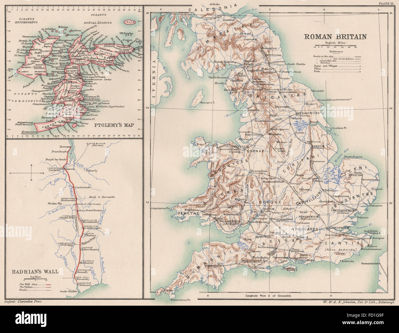 ROMAN BRITAIN: Roads towns forts villas. Ptolemy's map. Hadrian's Wall, 1902 Stock Photohttps://www.alamy.com/image-license-details/?v=1https://www.alamy.com/stock-photo-roman-britain-roads-towns-forts-villas-ptolemys-map-hadrians-wall-94077131.html
RFFD1G9F–ROMAN BRITAIN: Roads towns forts villas. Ptolemy's map. Hadrian's Wall, 1902
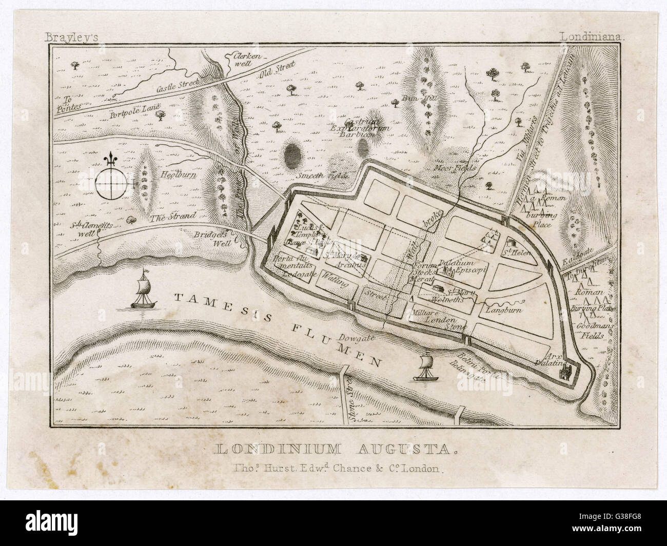 Map showing Roman London (Londinium) with its grid of straight roads Stock Photohttps://www.alamy.com/image-license-details/?v=1https://www.alamy.com/stock-photo-map-showing-roman-london-londinium-with-its-grid-of-straight-roads-105294008.html
RMG38FG8–Map showing Roman London (Londinium) with its grid of straight roads
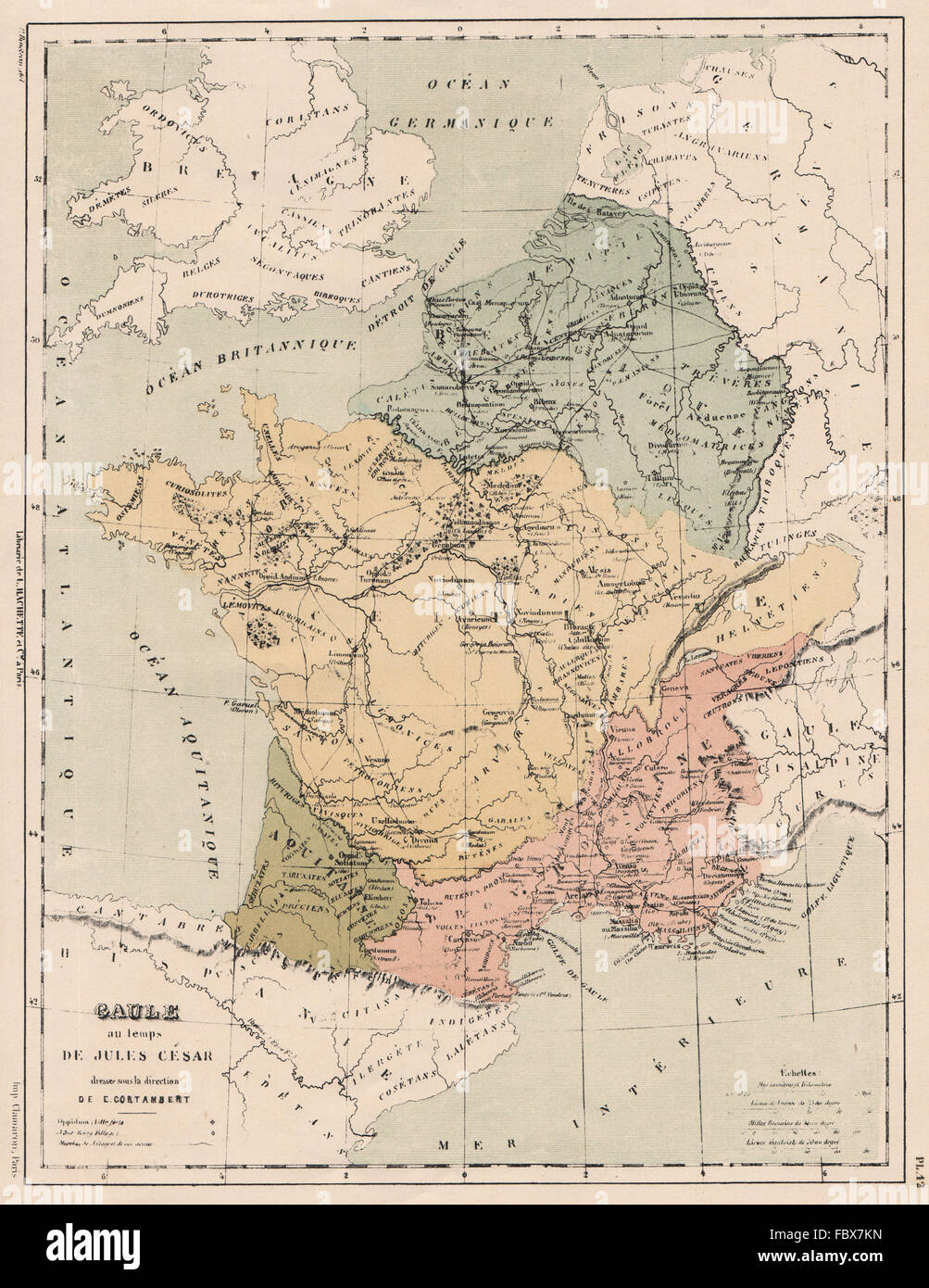 GAULE in the time of Julius Caesar. Gaule. Roman roads.Tribes Provinces 1880 map Stock Photohttps://www.alamy.com/image-license-details/?v=1https://www.alamy.com/stock-photo-gaule-in-the-time-of-julius-caesar-gaule-roman-roadstribes-provinces-93389849.html
RFFBX7KN–GAULE in the time of Julius Caesar. Gaule. Roman roads.Tribes Provinces 1880 map
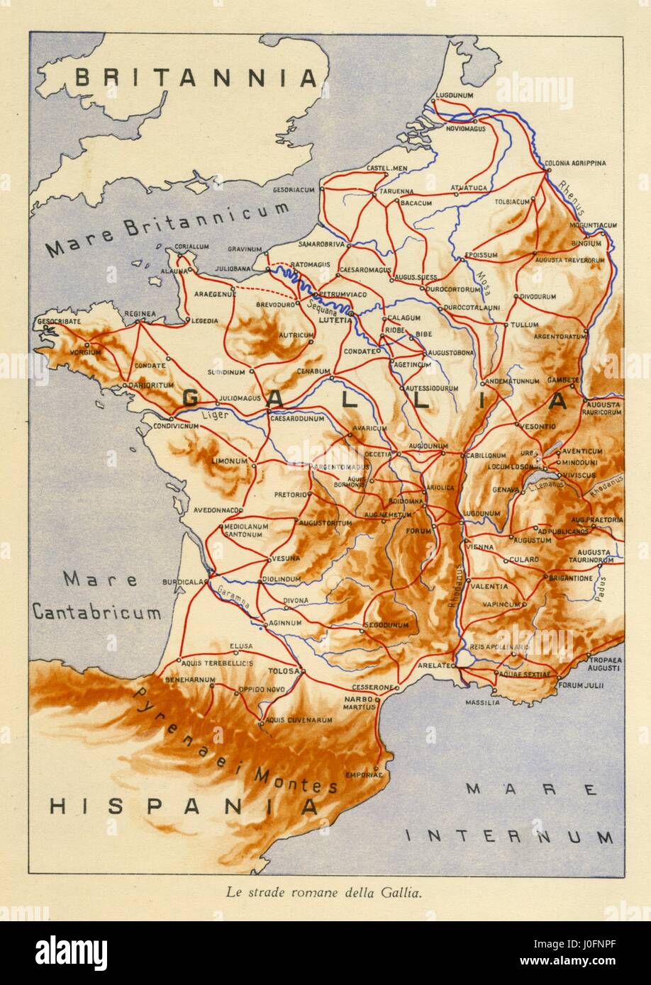 Map showing the Roman roads of Gaul Stock Photohttps://www.alamy.com/image-license-details/?v=1https://www.alamy.com/stock-photo-map-showing-the-roman-roads-of-gaul-138029319.html
RMJ0FNPF–Map showing the Roman roads of Gaul
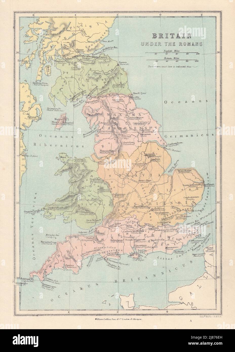 ROMAN BRITAIN showing provinces roads Latin town names. COLLINS 1873 old map Stock Photohttps://www.alamy.com/image-license-details/?v=1https://www.alamy.com/roman-britain-showing-provinces-roads-latin-town-names-collins-1873-old-map-image469755961.html
RF2J876EH–ROMAN BRITAIN showing provinces roads Latin town names. COLLINS 1873 old map
 The 1907 ca[tion reads: 'Section of Constantinople from the 4th century after Christ - from the Peutinger Map after Konrad Miller.' Tabula Peutingeriana, also referred to as Peutinger's Tabula or Peutinger Table, is an illustrated itinerarium showing the layout of the cursus publicus, the road network of the Roman Empire. The map is a parchment copy dating from around 1200 of a Late Antique original. Konrad Millar (1844-1933) was a German art historian, archaeologist and historian of cartography. Stock Photohttps://www.alamy.com/image-license-details/?v=1https://www.alamy.com/the-1907-ca-tion-reads-section-of-constantinople-from-the-4th-century-after-christ-from-the-peutinger-map-after-konrad-miller-tabula-peutingeriana-also-referred-to-as-peutingers-tabula-or-peutinger-table-is-an-illustrated-itinerarium-showing-the-layout-of-the-cursus-publicus-the-road-network-of-the-roman-empire-the-map-is-a-parchment-copy-dating-from-around-1200-of-a-late-antique-original-konrad-millar-1844-1933-was-a-german-art-historian-archaeologist-and-historian-of-cartography-image572140714.html
RF2T6R78X–The 1907 ca[tion reads: 'Section of Constantinople from the 4th century after Christ - from the Peutinger Map after Konrad Miller.' Tabula Peutingeriana, also referred to as Peutinger's Tabula or Peutinger Table, is an illustrated itinerarium showing the layout of the cursus publicus, the road network of the Roman Empire. The map is a parchment copy dating from around 1200 of a Late Antique original. Konrad Millar (1844-1933) was a German art historian, archaeologist and historian of cartography.
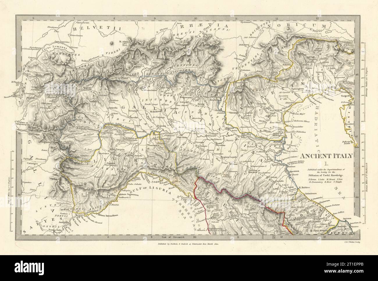 ANCIENT ROMAN ITALY NORTH.Liguria Venetia Gallia Cisalpina.Roads.SDUK 1844 map Stock Photohttps://www.alamy.com/image-license-details/?v=1https://www.alamy.com/ancient-roman-italy-northliguria-venetia-gallia-cisalpinaroadssduk-1844-map-image568882003.html
RF2T1EPPB–ANCIENT ROMAN ITALY NORTH.Liguria Venetia Gallia Cisalpina.Roads.SDUK 1844 map
 Map of the Roman roads in Lower Germany (title on object), Roman Antiquities in Maastricht (series title), In addition to rivers and roads, the map also shows remains of buildings and old burial mounds. In the middle the legend with an explanation of the symbols. At the bottom is a portion of the Tabula Peutingeriana, a Roman map from the third to fourth centuries. Numbered top right: Pl. 1., print maker: Tiemen Hooiberg, (possibly), after design by: Conradus Leemans, printer: T. Hooiberg, Leiden, 1843, paper, height 445 mm × width 285 mm Stock Photohttps://www.alamy.com/image-license-details/?v=1https://www.alamy.com/map-of-the-roman-roads-in-lower-germany-title-on-object-roman-antiquities-in-maastricht-series-title-in-addition-to-rivers-and-roads-the-map-also-shows-remains-of-buildings-and-old-burial-mounds-in-the-middle-the-legend-with-an-explanation-of-the-symbols-at-the-bottom-is-a-portion-of-the-tabula-peutingeriana-a-roman-map-from-the-third-to-fourth-centuries-numbered-top-right-pl-1-print-maker-tiemen-hooiberg-possibly-after-design-by-conradus-leemans-printer-t-hooiberg-leiden-1843-paper-height-445-mm-width-285-mm-image599457043.html
RM2WR7HG3–Map of the Roman roads in Lower Germany (title on object), Roman Antiquities in Maastricht (series title), In addition to rivers and roads, the map also shows remains of buildings and old burial mounds. In the middle the legend with an explanation of the symbols. At the bottom is a portion of the Tabula Peutingeriana, a Roman map from the third to fourth centuries. Numbered top right: Pl. 1., print maker: Tiemen Hooiberg, (possibly), after design by: Conradus Leemans, printer: T. Hooiberg, Leiden, 1843, paper, height 445 mm × width 285 mm
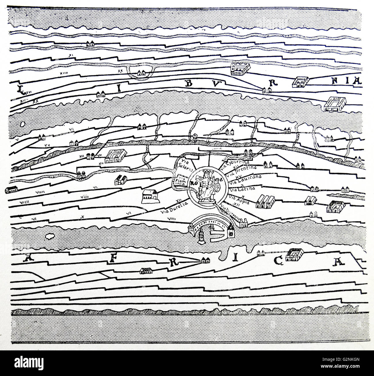 A portion of an old Roman map of the world, showing the roads through the empire, rivers, mountains and the surrounding seas. Stock Photohttps://www.alamy.com/image-license-details/?v=1https://www.alamy.com/stock-photo-a-portion-of-an-old-roman-map-of-the-world-showing-the-roads-through-104967877.html
RMG2NKGN–A portion of an old Roman map of the world, showing the roads through the empire, rivers, mountains and the surrounding seas.
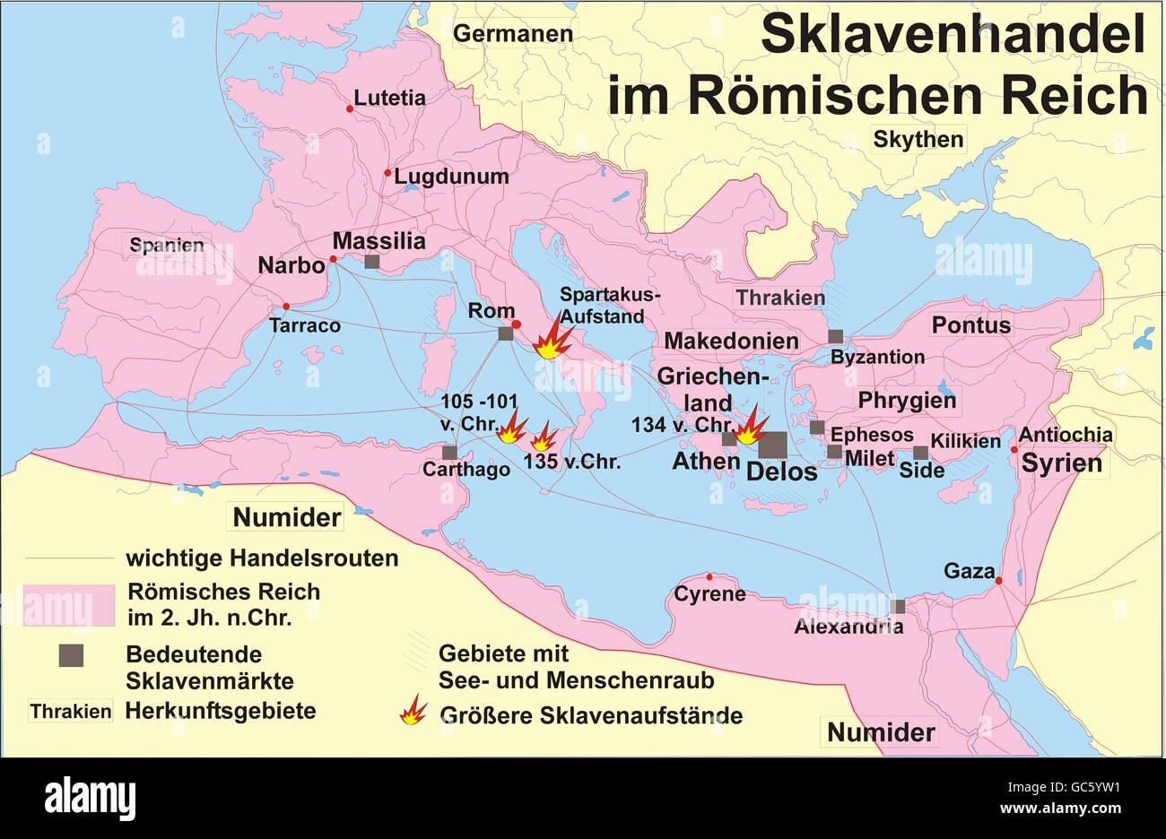 cartography, historical maps, Ancient World, Roman Empire, slave trade, slavery, uprising, Sicily 135 BC, 105 - 135 BC, Spartacus 73 - 71 BC, routes, markets, Rome, Delos, Massilia, Alexandria, Carthago, Byzantion, Milet, Ephesos, Numidia, Numidian, Thracian, Teutons, Scythians, Syrians, 2nd century AD, Mediterranean, Black Sea, roads, map, historic, historical, ancient world, Additional-Rights-Clearences-Not Available Stock Photohttps://www.alamy.com/image-license-details/?v=1https://www.alamy.com/stock-photo-cartography-historical-maps-ancient-world-roman-empire-slave-trade-110769709.html
RMGC5YW1–cartography, historical maps, Ancient World, Roman Empire, slave trade, slavery, uprising, Sicily 135 BC, 105 - 135 BC, Spartacus 73 - 71 BC, routes, markets, Rome, Delos, Massilia, Alexandria, Carthago, Byzantion, Milet, Ephesos, Numidia, Numidian, Thracian, Teutons, Scythians, Syrians, 2nd century AD, Mediterranean, Black Sea, roads, map, historic, historical, ancient world, Additional-Rights-Clearences-Not Available
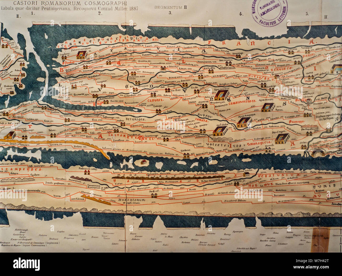 Tabula Peutingeriana / Peutinger Map / Peutinger's Tabula / Peutinger Table, illustrated itinerarium / ancient Roman road map Stock Photohttps://www.alamy.com/image-license-details/?v=1https://www.alamy.com/tabula-peutingeriana-peutinger-map-peutingers-tabula-peutinger-table-illustrated-itinerarium-ancient-roman-road-map-image262834512.html
RMW7H42T–Tabula Peutingeriana / Peutinger Map / Peutinger's Tabula / Peutinger Table, illustrated itinerarium / ancient Roman road map
 Map of the Netherlands in Roman times, The Netherlands during Roman rule (title on object), Map of the Netherlands in Roman times. With various stakes with division cards and a map of Brittenburg. With the most important Roman roads and the border between Germania and Belgian Gaul. Numbered top right: No. I., print, print maker: Pieter Willem Marinus Trap, (mentioned on object), after drawing by: Willem Jacob Hofdijk, (mentioned on object), Willem Jacob Hofdijk, (mentioned on object), print maker: Leiden, publisher: Amsterdam, 1855 - 1857, paper, height, 640 mm × width, 505 mm Stock Photohttps://www.alamy.com/image-license-details/?v=1https://www.alamy.com/map-of-the-netherlands-in-roman-times-the-netherlands-during-roman-rule-title-on-object-map-of-the-netherlands-in-roman-times-with-various-stakes-with-division-cards-and-a-map-of-brittenburg-with-the-most-important-roman-roads-and-the-border-between-germania-and-belgian-gaul-numbered-top-right-no-i-print-print-maker-pieter-willem-marinus-trap-mentioned-on-object-after-drawing-by-willem-jacob-hofdijk-mentioned-on-object-willem-jacob-hofdijk-mentioned-on-object-print-maker-leiden-publisher-amsterdam-1855-1857-paper-height-640-mm-width-505-mm-image606624211.html
RM2X6X3AB–Map of the Netherlands in Roman times, The Netherlands during Roman rule (title on object), Map of the Netherlands in Roman times. With various stakes with division cards and a map of Brittenburg. With the most important Roman roads and the border between Germania and Belgian Gaul. Numbered top right: No. I., print, print maker: Pieter Willem Marinus Trap, (mentioned on object), after drawing by: Willem Jacob Hofdijk, (mentioned on object), Willem Jacob Hofdijk, (mentioned on object), print maker: Leiden, publisher: Amsterdam, 1855 - 1857, paper, height, 640 mm × width, 505 mm
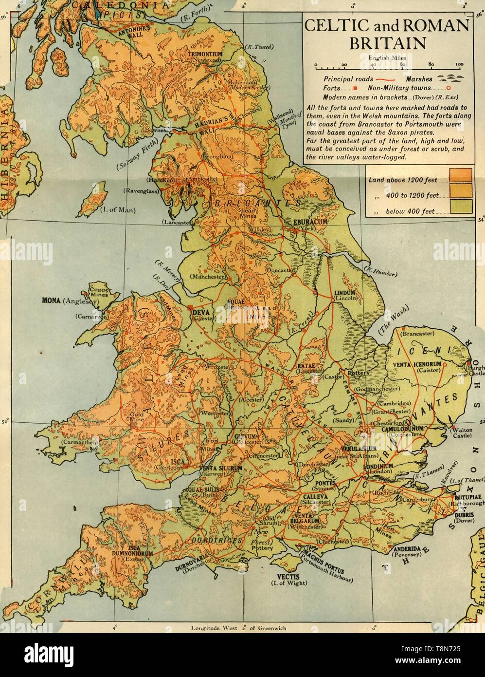 'Celtic and Roman Britain', 1926. Creator: Emery Walker Ltd. Stock Photohttps://www.alamy.com/image-license-details/?v=1https://www.alamy.com/celtic-and-roman-britain-1926-creator-emery-walker-ltd-image246328941.html
RMT8N725–'Celtic and Roman Britain', 1926. Creator: Emery Walker Ltd.
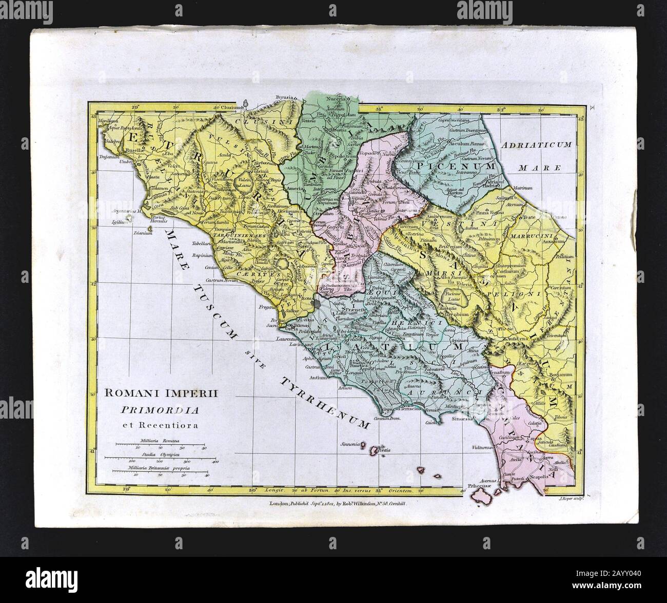 1808 Wilkinson Map Roman Italy Rome Romani Imperii Primordia Etruria Latium Umbria Campania Stock Photohttps://www.alamy.com/image-license-details/?v=1https://www.alamy.com/1808-wilkinson-map-roman-italy-rome-romani-imperii-primordia-etruria-latium-umbria-campania-image344185520.html
RM2AYY040–1808 Wilkinson Map Roman Italy Rome Romani Imperii Primordia Etruria Latium Umbria Campania
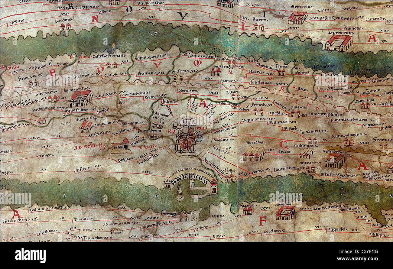 5766. Tabula Peutengeriana, an illustrated road map showing the roads in the Roman Empire, dating from the 4-5th. C. Pic. Shows roads around Rome with the harbor of Ostia. Stock Photohttps://www.alamy.com/image-license-details/?v=1https://www.alamy.com/5766-tabula-peutengeriana-an-illustrated-road-map-showing-the-roads-image62067532.html
RMDGYBNG–5766. Tabula Peutengeriana, an illustrated road map showing the roads in the Roman Empire, dating from the 4-5th. C. Pic. Shows roads around Rome with the harbor of Ostia.
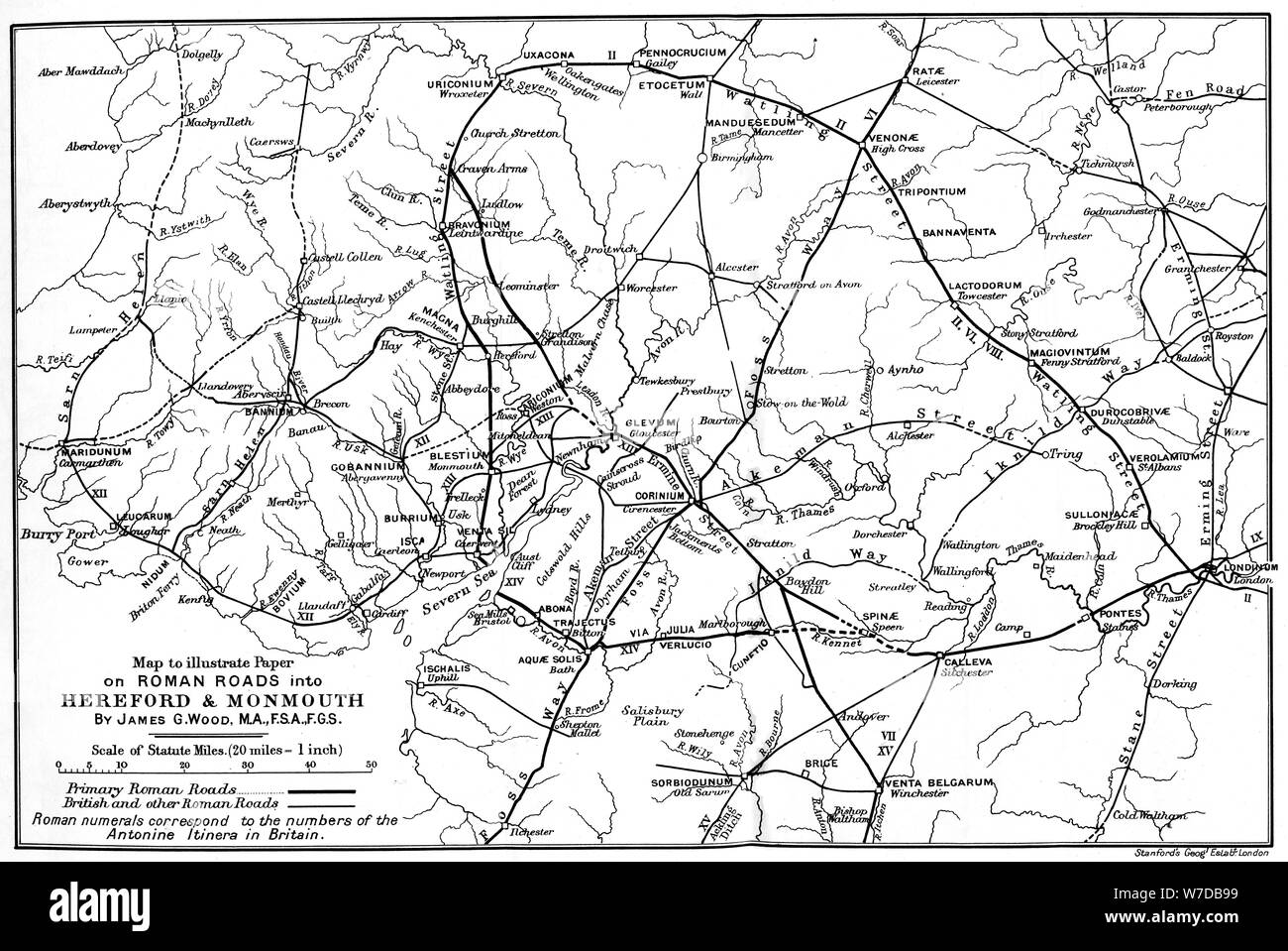 Roman roads into Hereford and Monmouth.Artist: James G Wood Stock Photohttps://www.alamy.com/image-license-details/?v=1https://www.alamy.com/roman-roads-into-hereford-and-monmouthartist-james-g-wood-image262752373.html
RMW7DB99–Roman roads into Hereford and Monmouth.Artist: James G Wood
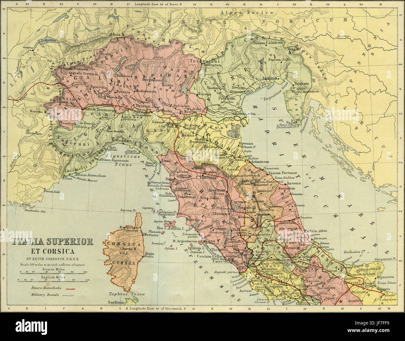 Map of Italia Superior and Corsica - Roman northern Italy and Corsica, showing military roads and the route of Hannibal 's journey crossing the Alps ( 3rd century B.C. ). Drawn by Keith Johnston F.R.S.E. Published in The Unrivalled Classical Atlas by W. and A.K. Johnston in 1877. Stock Photohttps://www.alamy.com/image-license-details/?v=1https://www.alamy.com/stock-photo-map-of-italia-superior-and-corsica-roman-northern-italy-and-corsica-147068637.html
RMJF7FF9–Map of Italia Superior and Corsica - Roman northern Italy and Corsica, showing military roads and the route of Hannibal 's journey crossing the Alps ( 3rd century B.C. ). Drawn by Keith Johnston F.R.S.E. Published in The Unrivalled Classical Atlas by W. and A.K. Johnston in 1877.
![To the Society of ANTIQUARIES in LONDON, this Plate of the ROMAN Roads in the County of YORK &c. is particuarly inscribed by their Brother, and very humble Servant, FRANCIS DRAKE. Author Drake, Francis 44.20.2. Place of publication: [York?] Publisher: [F. Drake?] Date of publication: [1722] Item type: 1 map Medium: copperplate engraving Dimensions: 46.0 x 46.8 cm Former owner: George III, King of Great Britain, 1738-1820 Stock Photo To the Society of ANTIQUARIES in LONDON, this Plate of the ROMAN Roads in the County of YORK &c. is particuarly inscribed by their Brother, and very humble Servant, FRANCIS DRAKE. Author Drake, Francis 44.20.2. Place of publication: [York?] Publisher: [F. Drake?] Date of publication: [1722] Item type: 1 map Medium: copperplate engraving Dimensions: 46.0 x 46.8 cm Former owner: George III, King of Great Britain, 1738-1820 Stock Photo](https://c8.alamy.com/comp/2E9ENB7/to-the-society-of-antiquaries-in-london-this-plate-of-the-roman-roads-in-the-county-of-york-c-is-particuarly-inscribed-by-their-brother-and-very-humble-servant-francis-drake-author-drake-francis-44202-place-of-publication-york-publisher-f-drake-date-of-publication-1722-item-type-1-map-medium-copperplate-engraving-dimensions-460-x-468-cm-former-owner-george-iii-king-of-great-britain-1738-1820-2E9ENB7.jpg) To the Society of ANTIQUARIES in LONDON, this Plate of the ROMAN Roads in the County of YORK &c. is particuarly inscribed by their Brother, and very humble Servant, FRANCIS DRAKE. Author Drake, Francis 44.20.2. Place of publication: [York?] Publisher: [F. Drake?] Date of publication: [1722] Item type: 1 map Medium: copperplate engraving Dimensions: 46.0 x 46.8 cm Former owner: George III, King of Great Britain, 1738-1820 Stock Photohttps://www.alamy.com/image-license-details/?v=1https://www.alamy.com/to-the-society-of-antiquaries-in-london-this-plate-of-the-roman-roads-in-the-county-of-york-c-is-particuarly-inscribed-by-their-brother-and-very-humble-servant-francis-drake-author-drake-francis-44202-place-of-publication-york-publisher-f-drake-date-of-publication-1722-item-type-1-map-medium-copperplate-engraving-dimensions-460-x-468-cm-former-owner-george-iii-king-of-great-britain-1738-1820-image401694475.html
To the Society of ANTIQUARIES in LONDON, this Plate of the ROMAN Roads in the County of YORK &c. is particuarly inscribed by their Brother, and very humble Servant, FRANCIS DRAKE. Author Drake, Francis 44.20.2. Place of publication: [York?] Publisher: [F. Drake?] Date of publication: [1722] Item type: 1 map Medium: copperplate engraving Dimensions: 46.0 x 46.8 cm Former owner: George III, King of Great Britain, 1738-1820 Stock Photohttps://www.alamy.com/image-license-details/?v=1https://www.alamy.com/to-the-society-of-antiquaries-in-london-this-plate-of-the-roman-roads-in-the-county-of-york-c-is-particuarly-inscribed-by-their-brother-and-very-humble-servant-francis-drake-author-drake-francis-44202-place-of-publication-york-publisher-f-drake-date-of-publication-1722-item-type-1-map-medium-copperplate-engraving-dimensions-460-x-468-cm-former-owner-george-iii-king-of-great-britain-1738-1820-image401694475.htmlRM2E9ENB7–To the Society of ANTIQUARIES in LONDON, this Plate of the ROMAN Roads in the County of YORK &c. is particuarly inscribed by their Brother, and very humble Servant, FRANCIS DRAKE. Author Drake, Francis 44.20.2. Place of publication: [York?] Publisher: [F. Drake?] Date of publication: [1722] Item type: 1 map Medium: copperplate engraving Dimensions: 46.0 x 46.8 cm Former owner: George III, King of Great Britain, 1738-1820
 Roman Roads of Britain - Matthew Paris, Book of Additions (c.1250), f. 187v Stock Photohttps://www.alamy.com/image-license-details/?v=1https://www.alamy.com/stock-photo-roman-roads-of-britain-matthew-paris-book-of-additions-c1250-f-187v-73519922.html
RME7H3BE–Roman Roads of Britain - Matthew Paris, Book of Additions (c.1250), f. 187v
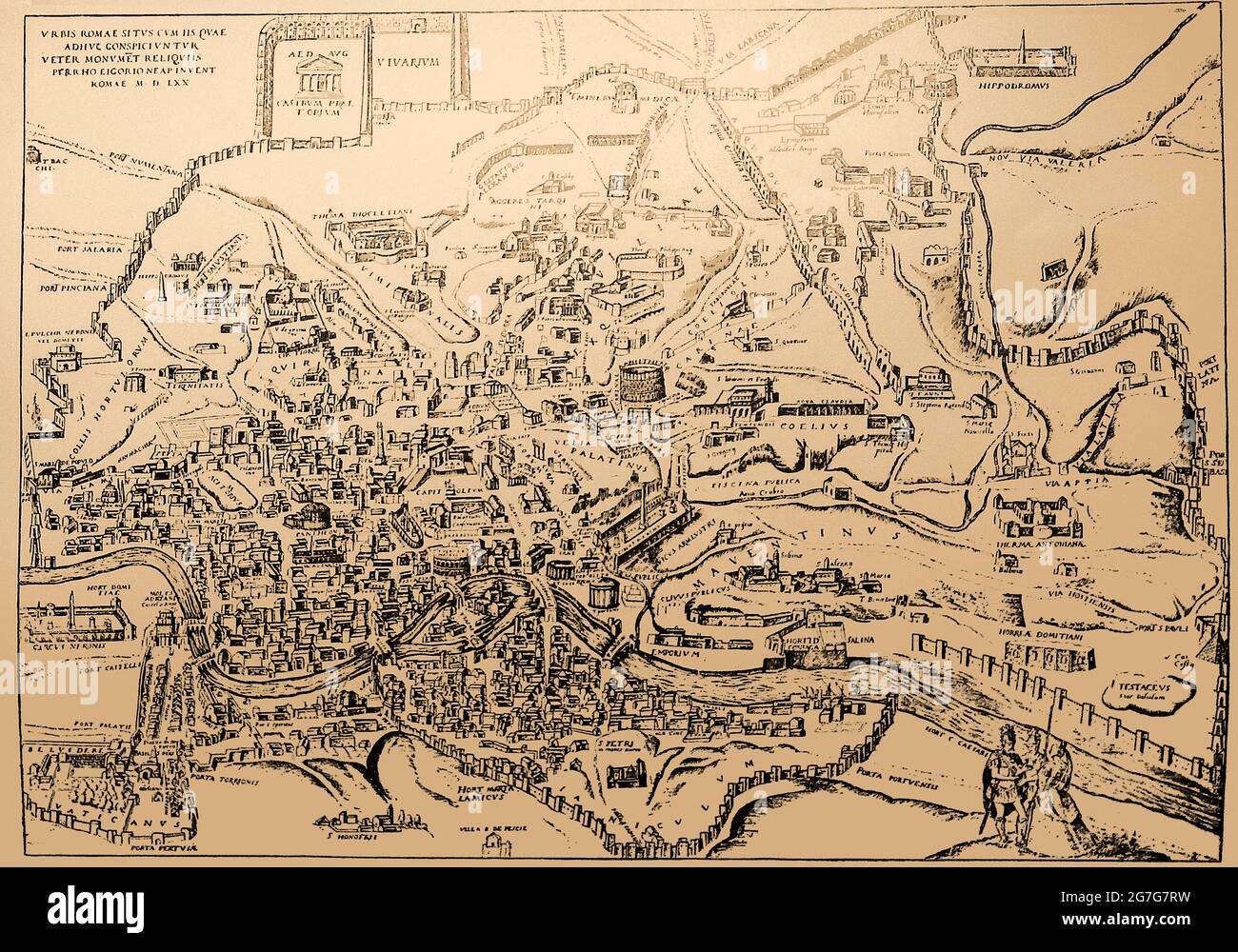 A 16th century map of the city of Rome, Italy, showing the major landmarks , buildings and names in Latin, in 1570 Stock Photohttps://www.alamy.com/image-license-details/?v=1https://www.alamy.com/a-16th-century-map-of-the-city-of-rome-italy-showing-the-major-landmarks-buildings-and-names-in-latin-in-1570-image434919181.html
RM2G7G7RW–A 16th century map of the city of Rome, Italy, showing the major landmarks , buildings and names in Latin, in 1570
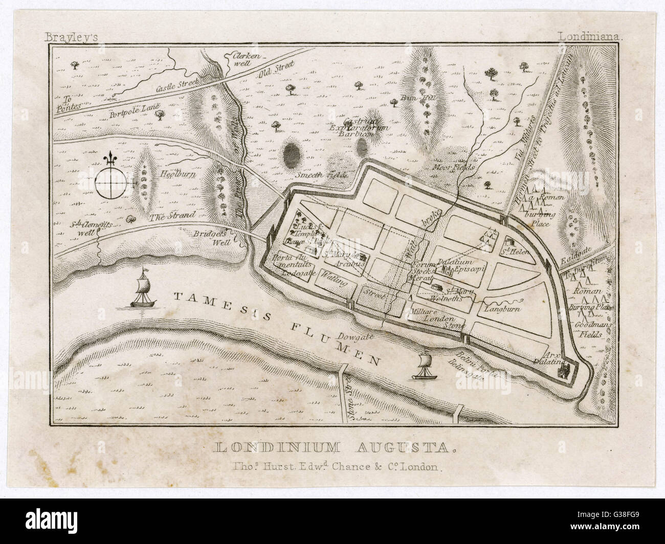 Map showing Roman London (Londinium) with its grid of straight roads Stock Photohttps://www.alamy.com/image-license-details/?v=1https://www.alamy.com/stock-photo-map-showing-roman-london-londinium-with-its-grid-of-straight-roads-105294009.html
RMG38FG9–Map showing Roman London (Londinium) with its grid of straight roads
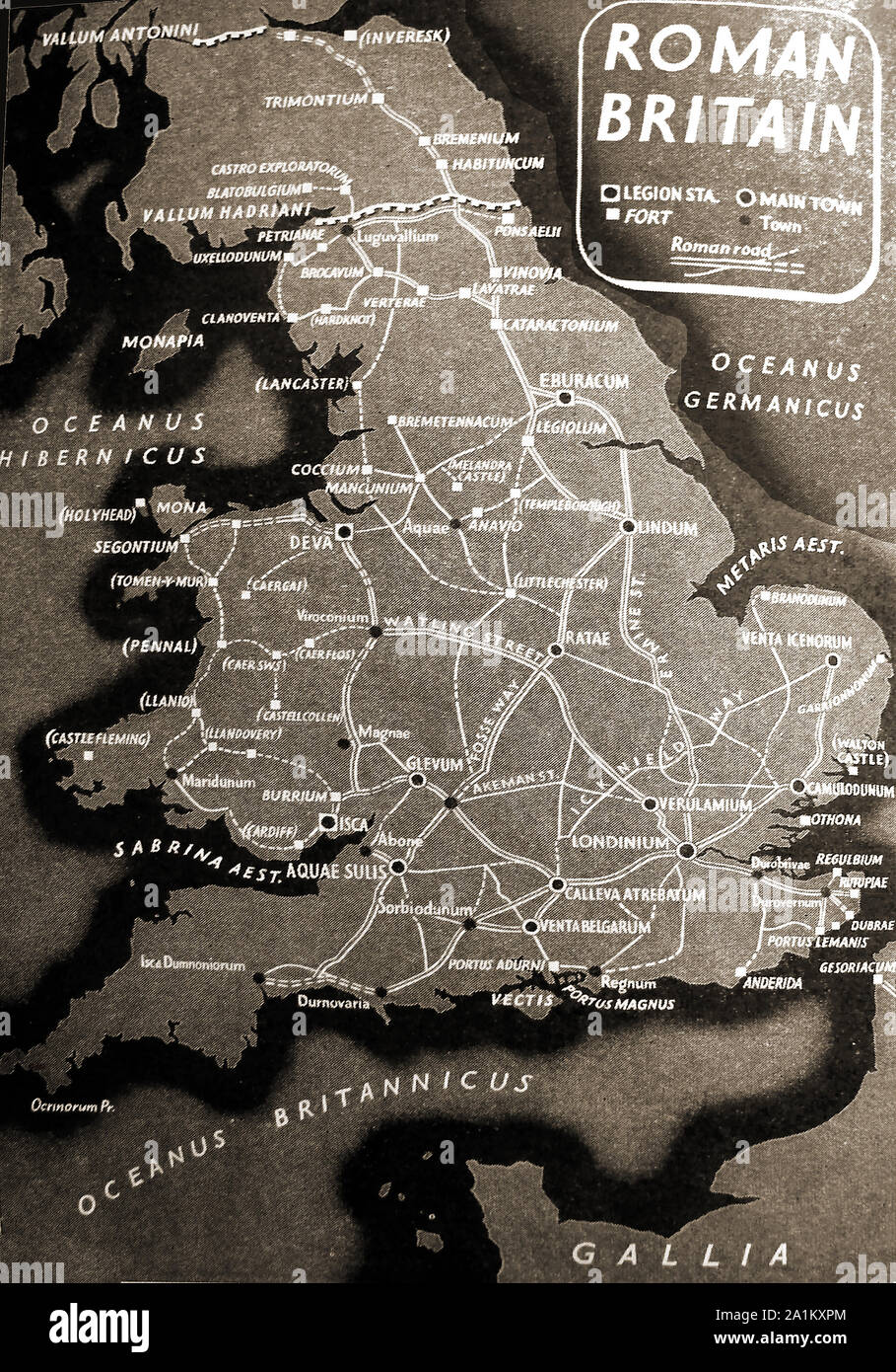 An old (circa 1940's) school poster showing Roman Britain with place names and listing main towns, small towns, forts and legion stations Stock Photohttps://www.alamy.com/image-license-details/?v=1https://www.alamy.com/an-old-circa-1940s-school-poster-showing-roman-britain-with-place-names-and-listing-main-towns-small-towns-forts-and-legion-stations-image328049756.html
RM2A1KXPM–An old (circa 1940's) school poster showing Roman Britain with place names and listing main towns, small towns, forts and legion stations
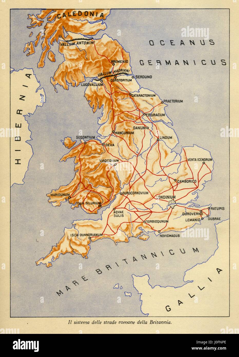 Map showing the system of Roman roads in Britannia Stock Photohttps://www.alamy.com/image-license-details/?v=1https://www.alamy.com/stock-photo-map-showing-the-system-of-roman-roads-in-britannia-138029318.html
RMJ0FNPE–Map showing the system of Roman roads in Britannia
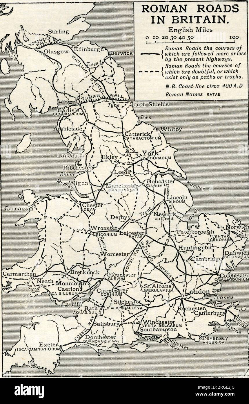 Roman Roads Stock Photohttps://www.alamy.com/image-license-details/?v=1https://www.alamy.com/roman-roads-image560875688.html
RM2RGE2JG–Roman Roads
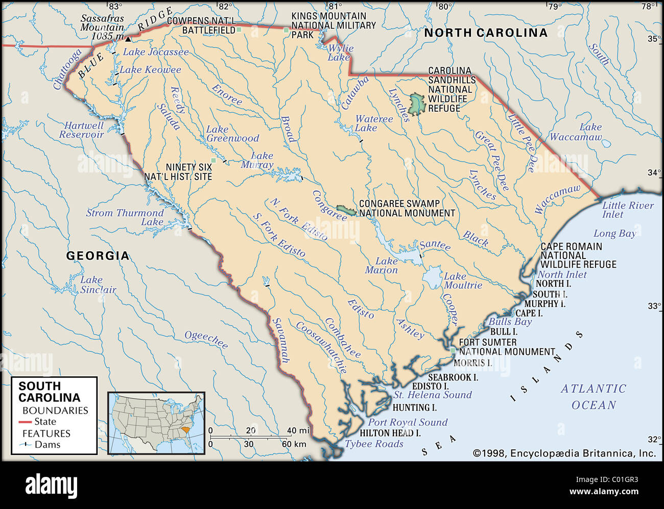 Physical map of South Carolina Stock Photohttps://www.alamy.com/image-license-details/?v=1https://www.alamy.com/stock-photo-physical-map-of-south-carolina-34455879.html
RMC01GR3–Physical map of South Carolina
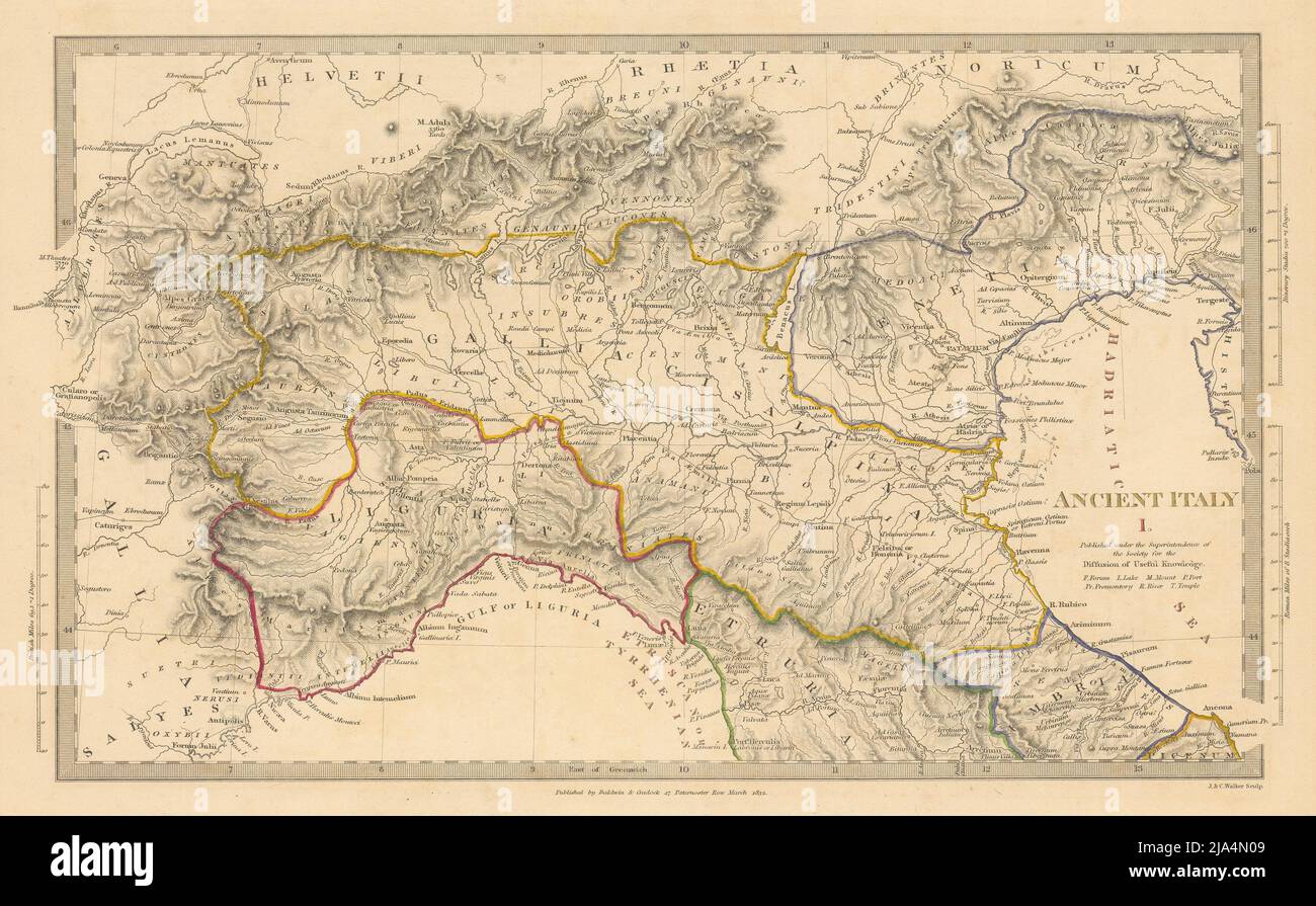 ANCIENT ROMAN ITALY NORTH.Liguria Venetia Gallia Cisalpina.Roads.SDUK 1844 map Stock Photohttps://www.alamy.com/image-license-details/?v=1https://www.alamy.com/ancient-roman-italy-northliguria-venetia-gallia-cisalpinaroadssduk-1844-map-image470930777.html
RF2JA4N09–ANCIENT ROMAN ITALY NORTH.Liguria Venetia Gallia Cisalpina.Roads.SDUK 1844 map
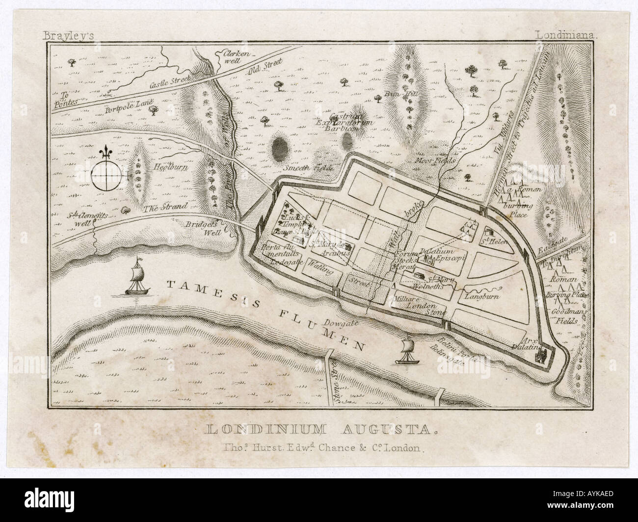 London Map Roman Period Stock Photohttps://www.alamy.com/image-license-details/?v=1https://www.alamy.com/london-map-roman-period-image3177196.html
RMAYKAED–London Map Roman Period
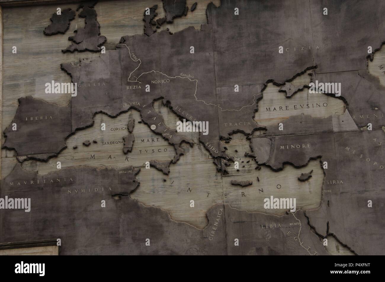 Relief map showing the Roman Expansion in the 8th century B.C. The founding of Rome. Imperial Forum. Rome. Italy. Stock Photohttps://www.alamy.com/image-license-details/?v=1https://www.alamy.com/relief-map-showing-the-roman-expansion-in-the-8th-century-bc-the-founding-of-rome-imperial-forum-rome-italy-image209566164.html
RMP4XFNT–Relief map showing the Roman Expansion in the 8th century B.C. The founding of Rome. Imperial Forum. Rome. Italy.
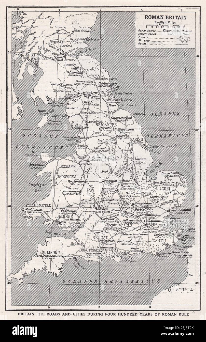 Roman Britain - Map of roads and cities during four hundred years of Roman Rule. Stock Photohttps://www.alamy.com/image-license-details/?v=1https://www.alamy.com/roman-britain-map-of-roads-and-cities-during-four-hundred-years-of-roman-rule-image406987215.html
RF2EJ3T9K–Roman Britain - Map of roads and cities during four hundred years of Roman Rule.
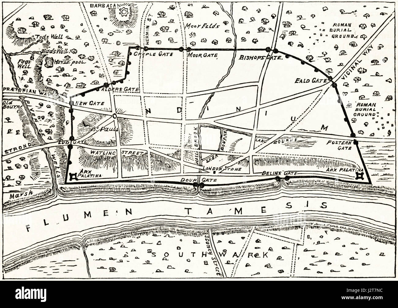 Map of Roman London showing the ancient walls. Victorian engraving circa 1880. Stock Photohttps://www.alamy.com/image-license-details/?v=1https://www.alamy.com/stock-photo-map-of-roman-london-showing-the-ancient-walls-victorian-engraving-139445192.html
RMJ2T7NC–Map of Roman London showing the ancient walls. Victorian engraving circa 1880.
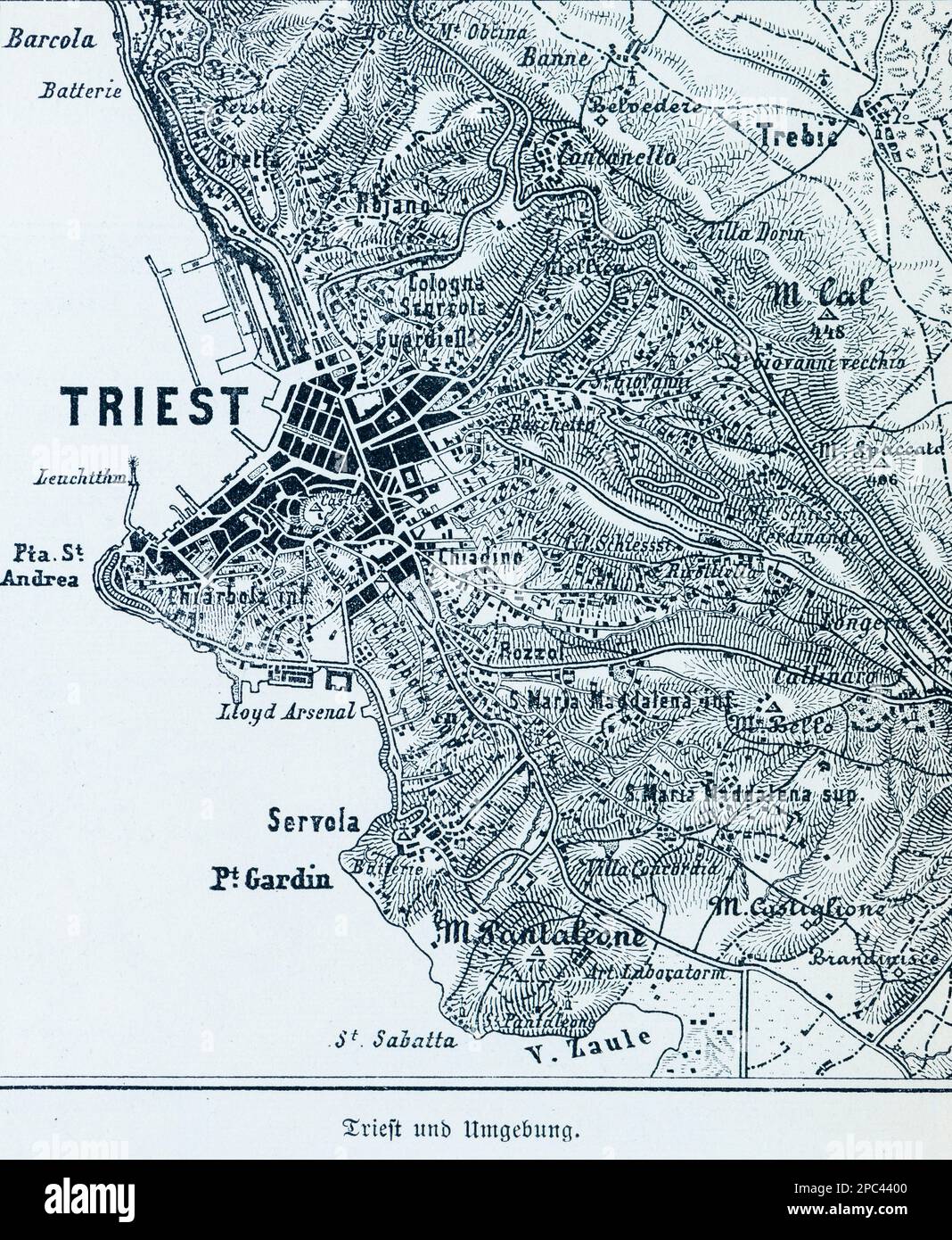 City map of Trieste and its surroundings, Trieste, Mediterranean Sea, Southern Italy, Southern Europe Stock Photohttps://www.alamy.com/image-license-details/?v=1https://www.alamy.com/city-map-of-trieste-and-its-surroundings-trieste-mediterranean-sea-southern-italy-southern-europe-image540988224.html
RM2PC4400–City map of Trieste and its surroundings, Trieste, Mediterranean Sea, Southern Italy, Southern Europe
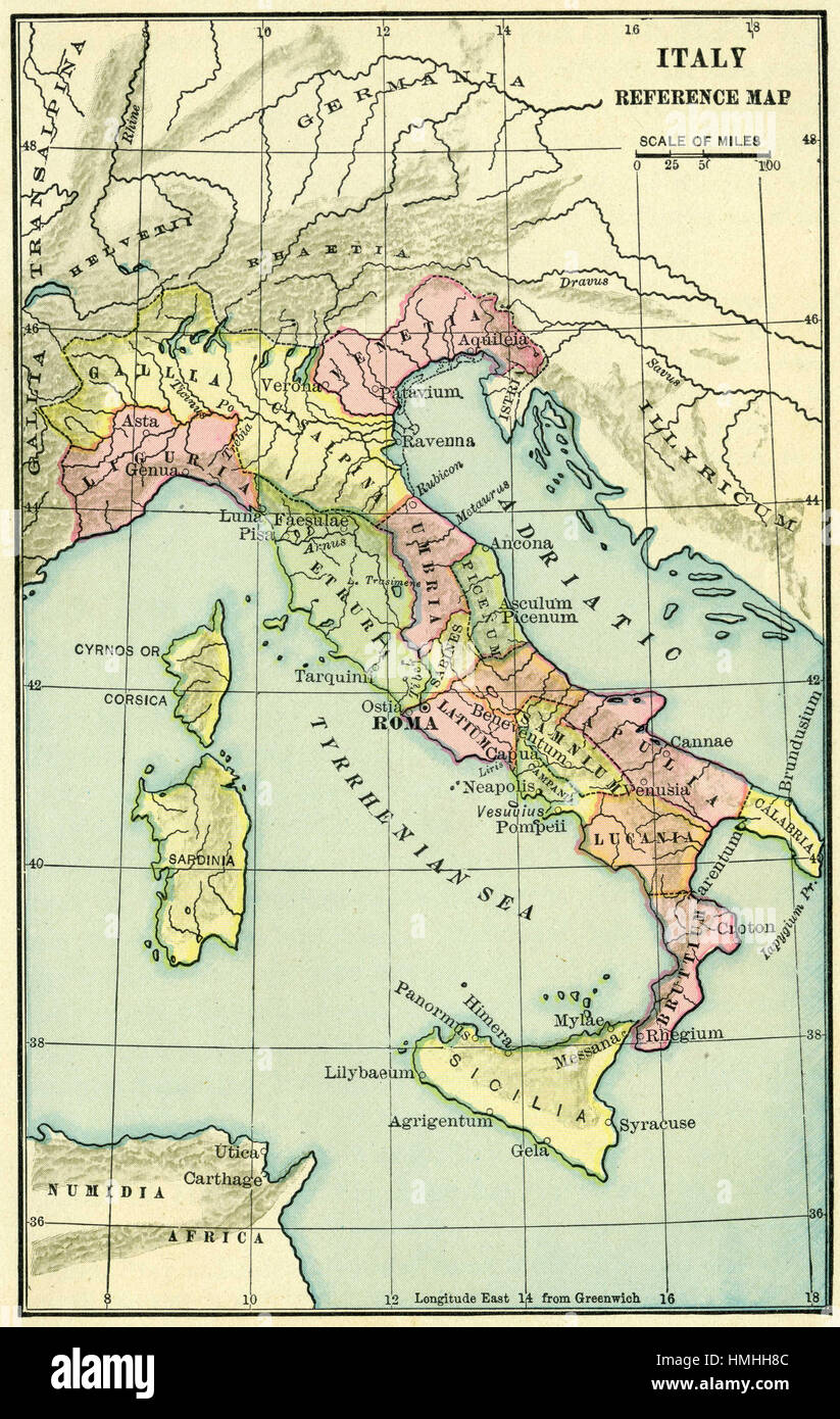 map of europe Stock Photohttps://www.alamy.com/image-license-details/?v=1https://www.alamy.com/stock-photo-map-of-europe-133152444.html
RFHMHH8C–map of europe
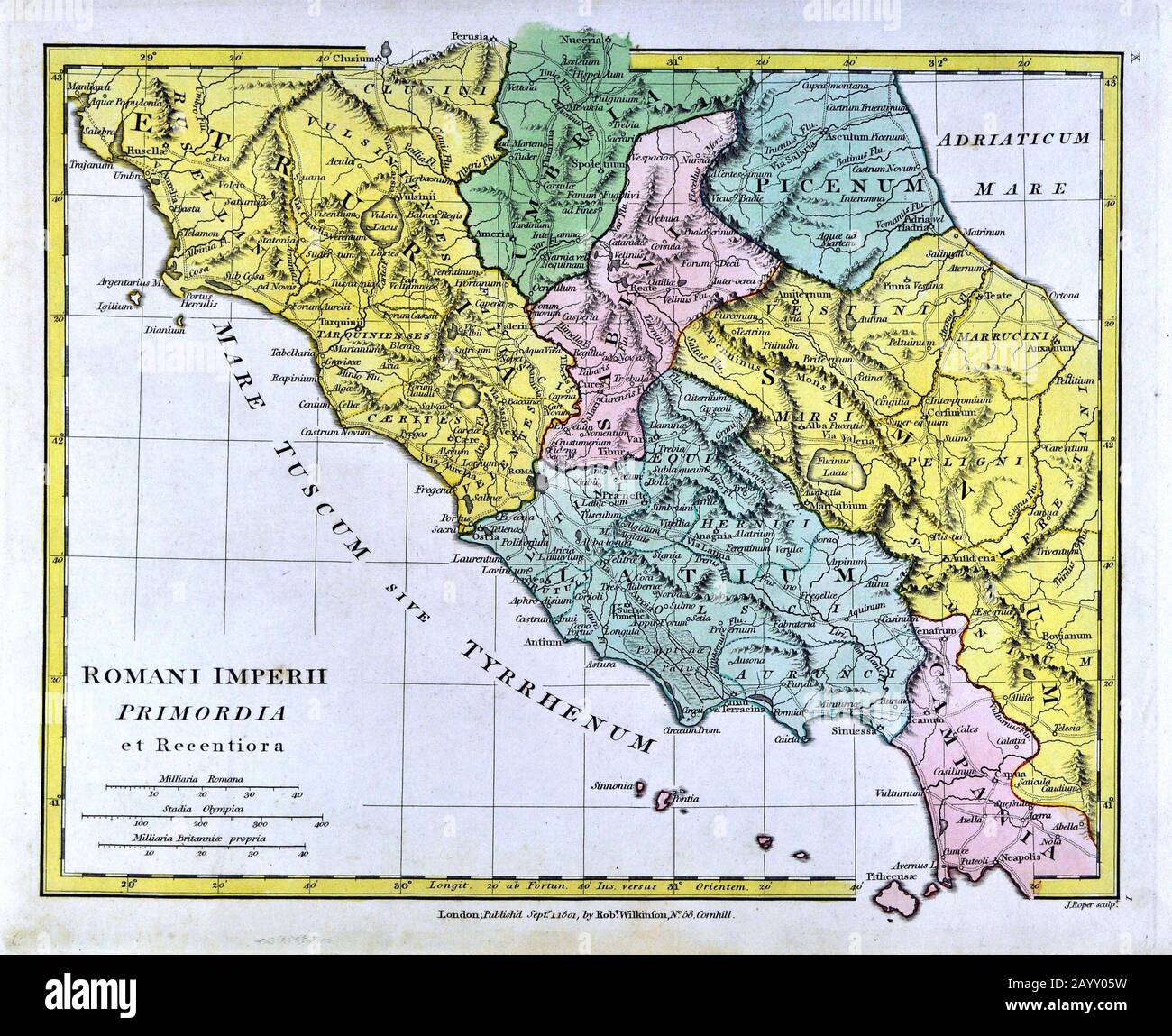 1808 Wilkinson Map Roman Italy Rome Romani Imperii Primordia Etruria Latium Umbria Campania Stock Photohttps://www.alamy.com/image-license-details/?v=1https://www.alamy.com/1808-wilkinson-map-roman-italy-rome-romani-imperii-primordia-etruria-latium-umbria-campania-image344185573.html
RM2AYY05W–1808 Wilkinson Map Roman Italy Rome Romani Imperii Primordia Etruria Latium Umbria Campania
 The Kazan Pass (with the modern and Roman roads) Pardoe Julia 1839 Stock Photohttps://www.alamy.com/image-license-details/?v=1https://www.alamy.com/stock-photo-the-kazan-pass-with-the-modern-and-roman-roads-pardoe-julia-1839-140717571.html
RMJ4X6KF–The Kazan Pass (with the modern and Roman roads) Pardoe Julia 1839
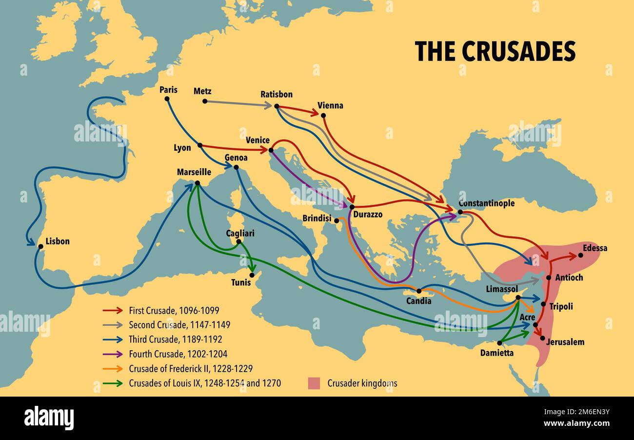 Map of the Crusades main routes and roads Stock Photohttps://www.alamy.com/image-license-details/?v=1https://www.alamy.com/map-of-the-crusades-main-routes-and-roads-image503112511.html
RF2M6EN3Y–Map of the Crusades main routes and roads
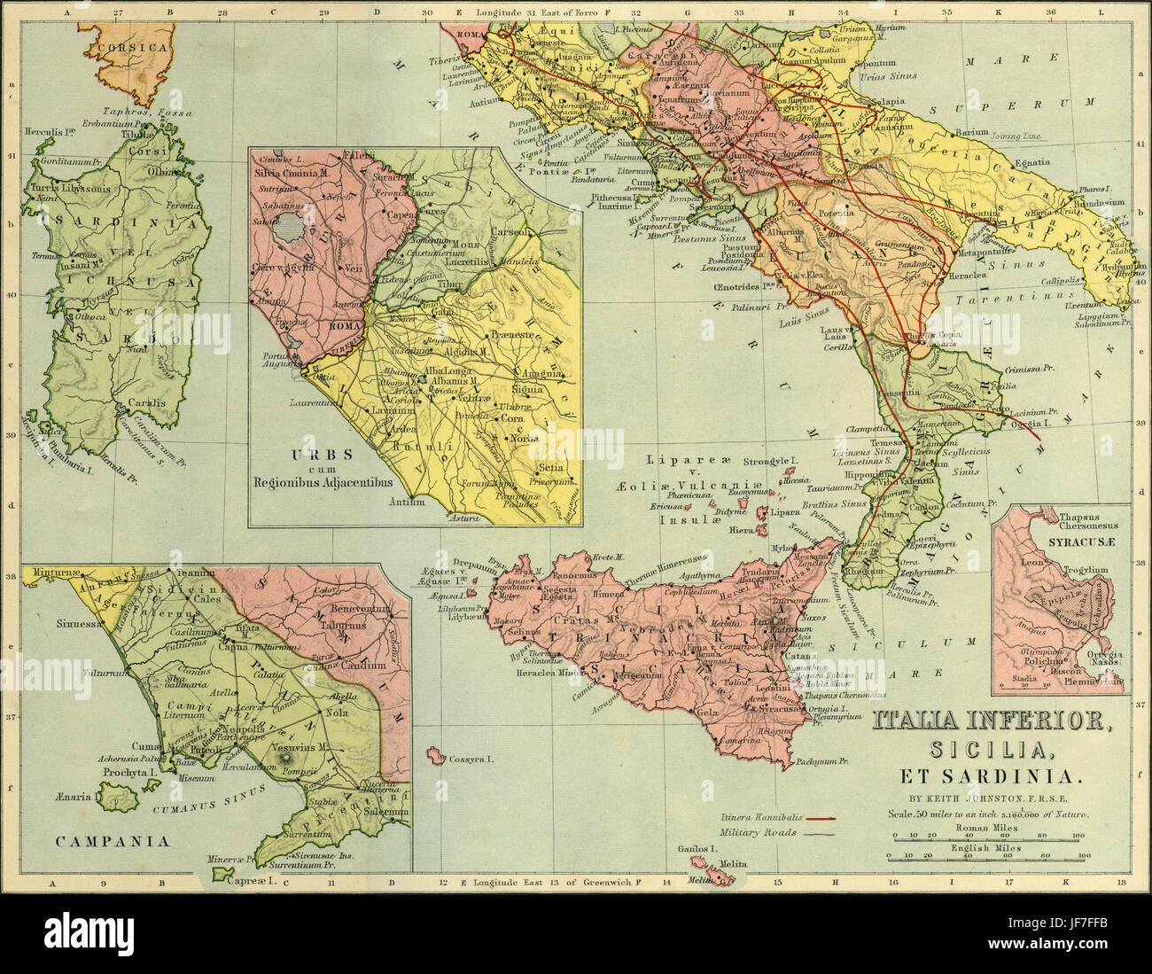 Map of Italia Inferior, Sicilia, Sardinia - southern Italy. Showing magnified views of Campania, Urbs and Syracuse, as well as military roads and the route of Hannibal 's journey crossing the Alps ( 3rd century B.C. ). Drawn by Keith Johnston F.R.S.E. Published in The Unrivalled Classical Atlas by W. and A.K. Johnston in 1877. Stock Photohttps://www.alamy.com/image-license-details/?v=1https://www.alamy.com/stock-photo-map-of-italia-inferior-sicilia-sardinia-southern-italy-showing-magnified-147068639.html
RMJF7FFB–Map of Italia Inferior, Sicilia, Sardinia - southern Italy. Showing magnified views of Campania, Urbs and Syracuse, as well as military roads and the route of Hannibal 's journey crossing the Alps ( 3rd century B.C. ). Drawn by Keith Johnston F.R.S.E. Published in The Unrivalled Classical Atlas by W. and A.K. Johnston in 1877.
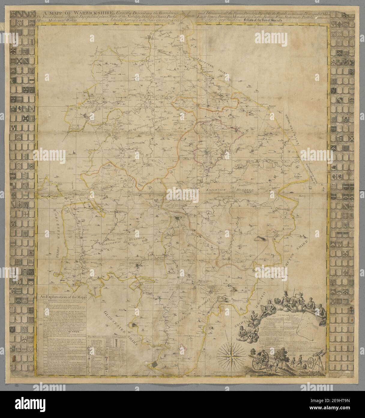 A map of Warwick shire, exactly describing the boundaries, and divisions, all the rivers, brooks & rivulets, the roads in measur'd & computed miles, the parish churches, chapels, depopulated places, seats of the no Map information: Title: A map of Warwick-shire, exactly describing the boundaries, and divisions, all the rivers, brooks , rivulets, the roads in measur'd , computed miles, the parish churches, chapels, depopulated places, seats of the nobility , gentry, chaces, parks, kings houses, baronies, monasteries, castles, Roman ways, stations ,c., battels, garrisons, mines, medicinal-water Stock Photohttps://www.alamy.com/image-license-details/?v=1https://www.alamy.com/a-map-of-warwick-shire-exactly-describing-the-boundaries-and-divisions-all-the-rivers-brooks-rivulets-the-roads-in-measurd-computed-miles-the-parish-churches-chapels-depopulated-places-seats-of-the-no-map-information-title-a-map-of-warwick-shire-exactly-describing-the-boundaries-and-divisions-all-the-rivers-brooks-rivulets-the-roads-in-measurd-computed-miles-the-parish-churches-chapels-depopulated-places-seats-of-the-nobility-gentry-chaces-parks-kings-houses-baronies-monasteries-castles-roman-ways-stations-c-battels-garrisons-mines-medicinal-water-image401762641.html
RM2E9HT9N–A map of Warwick shire, exactly describing the boundaries, and divisions, all the rivers, brooks & rivulets, the roads in measur'd & computed miles, the parish churches, chapels, depopulated places, seats of the no Map information: Title: A map of Warwick-shire, exactly describing the boundaries, and divisions, all the rivers, brooks , rivulets, the roads in measur'd , computed miles, the parish churches, chapels, depopulated places, seats of the nobility , gentry, chaces, parks, kings houses, baronies, monasteries, castles, Roman ways, stations ,c., battels, garrisons, mines, medicinal-water
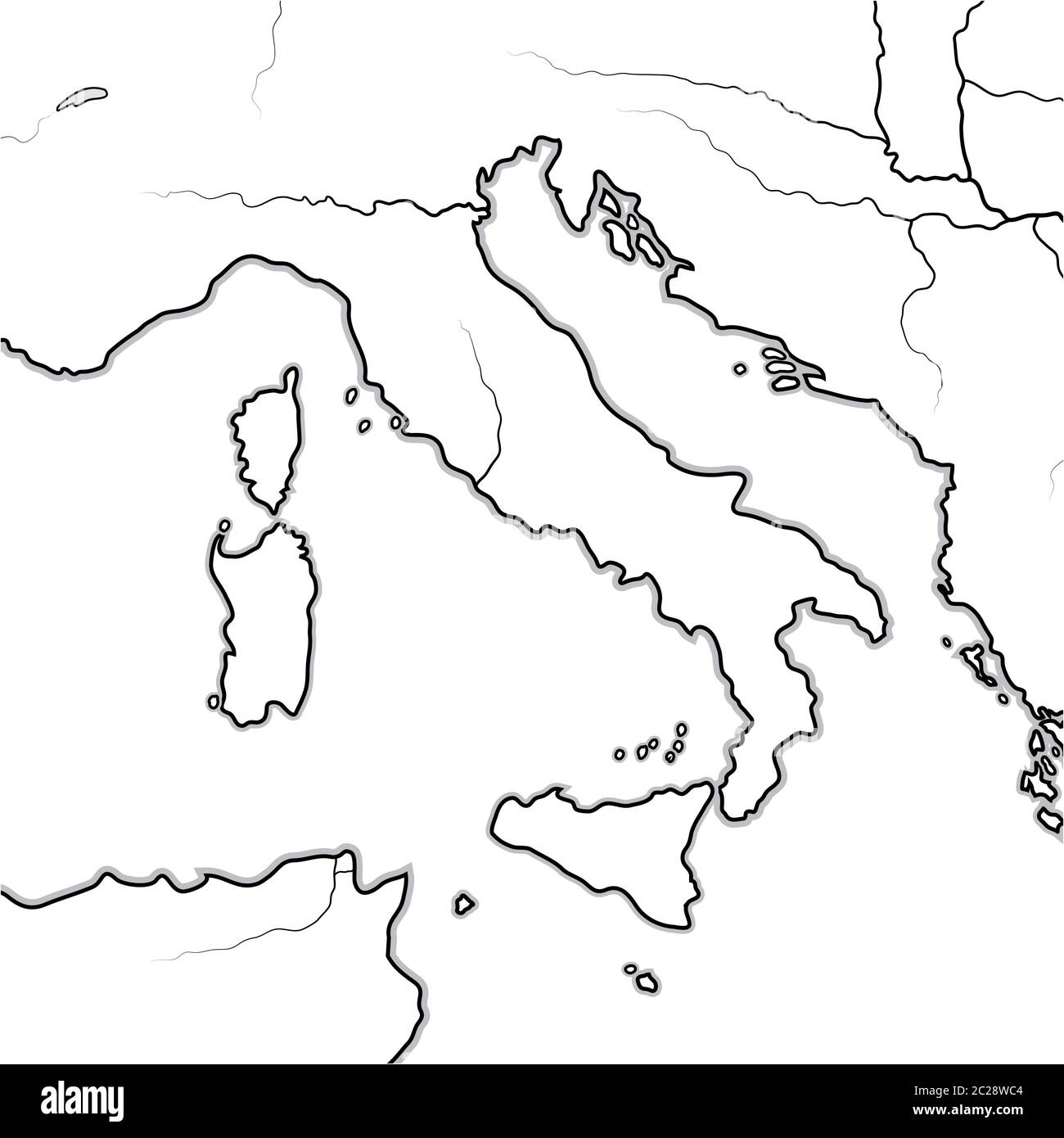 Map of The ITALIAN Lands: Italy, Tuscany, Lombardy, Sicily, The Apennines, Italian Peninsula. Geographic chart. Stock Photohttps://www.alamy.com/image-license-details/?v=1https://www.alamy.com/map-of-the-italian-lands-italy-tuscany-lombardy-sicily-the-apennines-italian-peninsula-geographic-chart-image362842596.html
RM2C28WC4–Map of The ITALIAN Lands: Italy, Tuscany, Lombardy, Sicily, The Apennines, Italian Peninsula. Geographic chart.
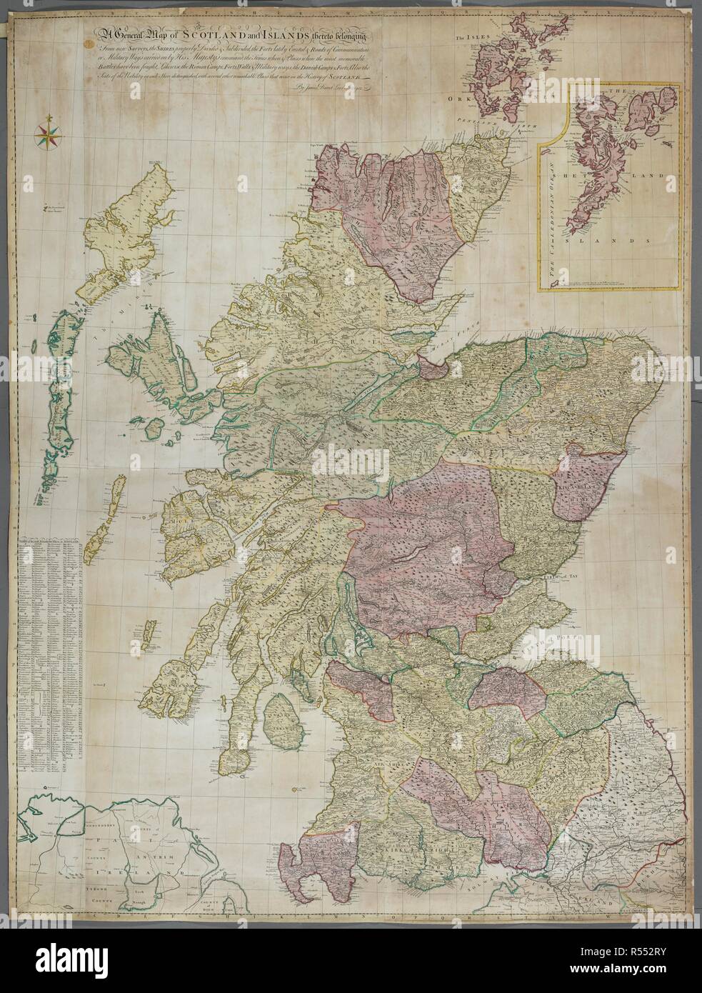 A map of Scotland and the islands. A General Map of SCOTLAND and ISLANDS thereto belonging From new Surveys, : the SHIRES properly Divided & Subdivided, the FORTS lately Erected & Roads of Communication or Military Ways carried on by His Majesty's command, the Times when & places where the most memorable Battles have been fought, Likewise the Roman Camps, Forts, Walls & Military ways, the Danish Camples 7 Forts, Also the Seats of the Nobility in each Shire distinguished, with several other remarkable Places that occur in the History of SCOTLAND. London : Publish'd according to Act of Parliamen Stock Photohttps://www.alamy.com/image-license-details/?v=1https://www.alamy.com/a-map-of-scotland-and-the-islands-a-general-map-of-scotland-and-islands-thereto-belonging-from-new-surveys-the-shires-properly-divided-subdivided-the-forts-lately-erected-roads-of-communication-or-military-ways-carried-on-by-his-majestys-command-the-times-when-places-where-the-most-memorable-battles-have-been-fought-likewise-the-roman-camps-forts-walls-military-ways-the-danish-camples-7-forts-also-the-seats-of-the-nobility-in-each-shire-distinguished-with-several-other-remarkable-places-that-occur-in-the-history-of-scotland-london-publishd-according-to-act-of-parliamen-image226920063.html
RMR552RY–A map of Scotland and the islands. A General Map of SCOTLAND and ISLANDS thereto belonging From new Surveys, : the SHIRES properly Divided & Subdivided, the FORTS lately Erected & Roads of Communication or Military Ways carried on by His Majesty's command, the Times when & places where the most memorable Battles have been fought, Likewise the Roman Camps, Forts, Walls & Military ways, the Danish Camples 7 Forts, Also the Seats of the Nobility in each Shire distinguished, with several other remarkable Places that occur in the History of SCOTLAND. London : Publish'd according to Act of Parliamen
 Luxemburg and her neighbours, a record of the political fortunes of the present Grand Duchy from the eve of the French Revolution to the great war, with a preliminary sketch of events from 963 to 1780 . ., . ..r ^ p-14. TABULA GEOGRAPHICA A R P A1.KXANDRO WILTHELM E SOCIETATE lESU. MAP SHOWING ROMAN ROADS ACROSS LUXEMBURG. From Bertholefs Hisloire du Duche de Luxembourg A Neutralized Land in 1914 13 It was not surprising that the Swede found thatno one was wiUing to betray his thoughts, as hehimself was richly provided with letters recom-mending him to German officials and signed byhigh author Stock Photohttps://www.alamy.com/image-license-details/?v=1https://www.alamy.com/luxemburg-and-her-neighbours-a-record-of-the-political-fortunes-of-the-present-grand-duchy-from-the-eve-of-the-french-revolution-to-the-great-war-with-a-preliminary-sketch-of-events-from-963-to-1780-r-p-14-tabula-geographica-a-r-p-a1kxandro-wilthelm-e-societate-lesu-map-showing-roman-roads-across-luxemburg-from-bertholefs-hisloire-du-duche-de-luxembourg-a-neutralized-land-in-1914-13-it-was-not-surprising-that-the-swede-found-thatno-one-was-wiuing-to-betray-his-thoughts-as-hehimself-was-richly-provided-with-letters-recom-mending-him-to-german-officials-and-signed-byhigh-author-image339141759.html
RM2AKN6NK–Luxemburg and her neighbours, a record of the political fortunes of the present Grand Duchy from the eve of the French Revolution to the great war, with a preliminary sketch of events from 963 to 1780 . ., . ..r ^ p-14. TABULA GEOGRAPHICA A R P A1.KXANDRO WILTHELM E SOCIETATE lESU. MAP SHOWING ROMAN ROADS ACROSS LUXEMBURG. From Bertholefs Hisloire du Duche de Luxembourg A Neutralized Land in 1914 13 It was not surprising that the Swede found thatno one was wiUing to betray his thoughts, as hehimself was richly provided with letters recom-mending him to German officials and signed byhigh author
 Kaart van twee Romeinse militaire wegen in Nederland Carte de deux voies militaire des Romains (titel op object) Map of the Roman military roads in the river in Nederland. Manufacturer : print maker: unknown date: 1732 - 1734 Physical characteristics: Colored etching and engra material: paper Technique: etching / engra (printing process) / hand-color dimensions: h 296 mm × W 442 mmToelichtingIllustratie for: Gerard of loons ancient Dutch histori, Pieter de Hondt, the Hague 1734, two delen. Subject: road, path Roman period Netherlands Where: Netherlands Stock Photohttps://www.alamy.com/image-license-details/?v=1https://www.alamy.com/kaart-van-twee-romeinse-militaire-wegen-in-nederland-carte-de-deux-voies-militaire-des-romains-titel-op-object-map-of-the-roman-military-roads-in-the-river-in-nederland-manufacturer-print-maker-unknown-date-1732-1734-physical-characteristics-colored-etching-and-engra-material-paper-technique-etching-engra-printing-process-hand-color-dimensions-h-296-mm-w-442-mmtoelichtingillustratie-for-gerard-of-loons-ancient-dutch-histori-pieter-de-hondt-the-hague-1734-two-delen-subject-road-path-roman-period-netherlands-where-netherlands-image348487387.html
RM2B6XY63–Kaart van twee Romeinse militaire wegen in Nederland Carte de deux voies militaire des Romains (titel op object) Map of the Roman military roads in the river in Nederland. Manufacturer : print maker: unknown date: 1732 - 1734 Physical characteristics: Colored etching and engra material: paper Technique: etching / engra (printing process) / hand-color dimensions: h 296 mm × W 442 mmToelichtingIllustratie for: Gerard of loons ancient Dutch histori, Pieter de Hondt, the Hague 1734, two delen. Subject: road, path Roman period Netherlands Where: Netherlands
 La Tavola Peutingeriana or Peutinger Table is a copy of the XII-XIII century of an ancient Roman map showing the military roads of the Roman Empire, A Stock Photohttps://www.alamy.com/image-license-details/?v=1https://www.alamy.com/la-tavola-peutingeriana-or-peutinger-table-is-a-copy-of-the-xii-xiii-century-of-an-ancient-roman-map-showing-the-military-roads-of-the-roman-empire-a-image448355637.html
RM2H1CA59–La Tavola Peutingeriana or Peutinger Table is a copy of the XII-XIII century of an ancient Roman map showing the military roads of the Roman Empire, A
 Illustration of the road map of the Roman Emperors in Serbia (Moesia) in Viminacium (Viminatium), Kostolac, Branichevo District, Serbia. Stock Photohttps://www.alamy.com/image-license-details/?v=1https://www.alamy.com/illustration-of-the-road-map-of-the-roman-emperors-in-serbia-moesia-in-viminacium-viminatium-kostolac-branichevo-district-serbia-image328285727.html
RM2A22KP7–Illustration of the road map of the Roman Emperors in Serbia (Moesia) in Viminacium (Viminatium), Kostolac, Branichevo District, Serbia.
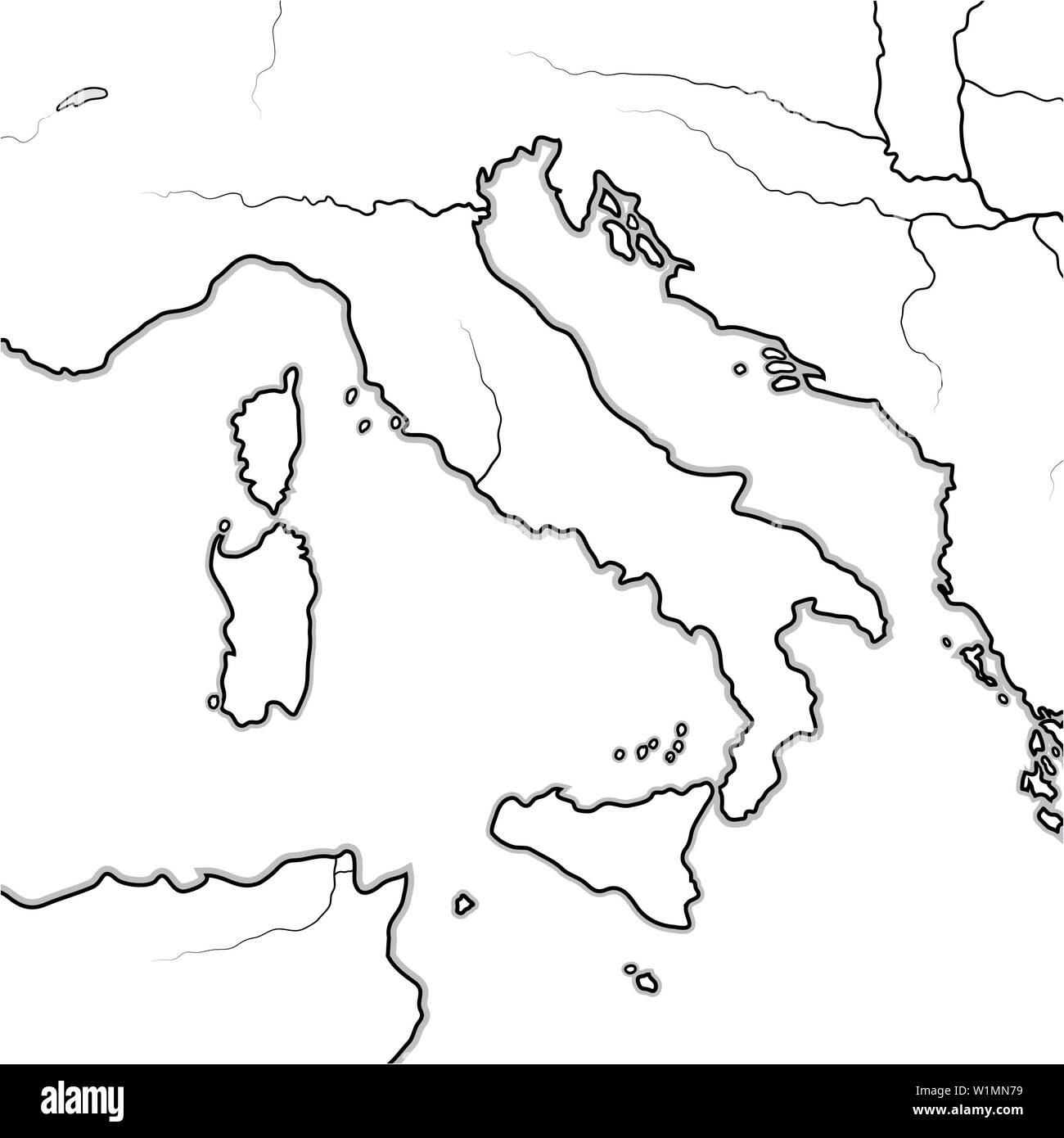 Map of The ITALIAN Lands: Italy, Tuscany, Lombardy, Sicily, Liguria, Umbria, Campania, Neapolitania, The Apennines, Italian Peninsula. Stock Photohttps://www.alamy.com/image-license-details/?v=1https://www.alamy.com/map-of-the-italian-lands-italy-tuscany-lombardy-sicily-liguria-umbria-campania-neapolitania-the-apennines-italian-peninsula-image259225885.html
RFW1MN79–Map of The ITALIAN Lands: Italy, Tuscany, Lombardy, Sicily, Liguria, Umbria, Campania, Neapolitania, The Apennines, Italian Peninsula.
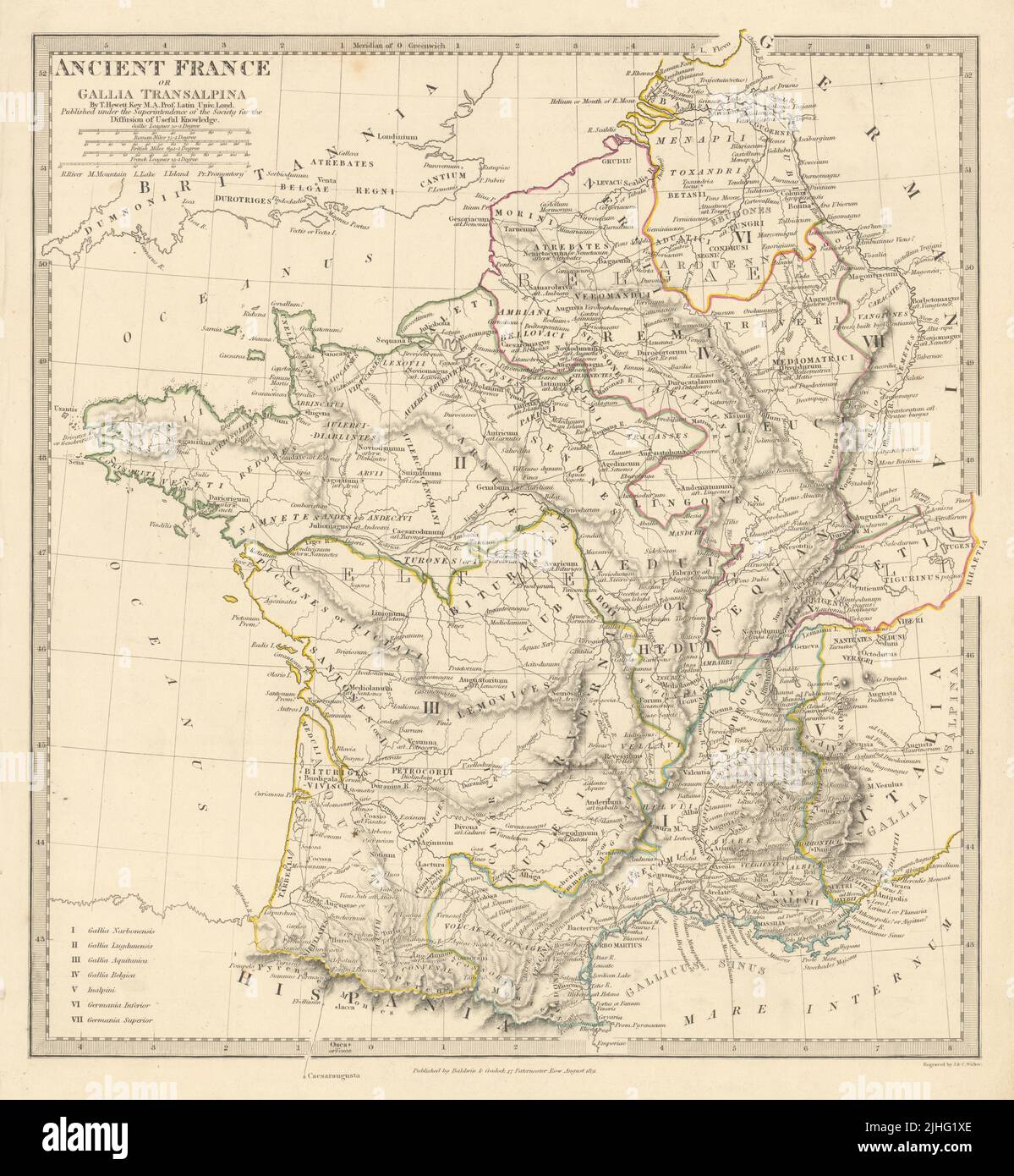 ANCIENT ROMAN FRANCE GAUL. Gallia Transalpina. Roman names roads.SDUK 1844 map Stock Photohttps://www.alamy.com/image-license-details/?v=1https://www.alamy.com/ancient-roman-france-gaul-gallia-transalpina-roman-names-roadssduk-1844-map-image475481846.html
RF2JHG1XE–ANCIENT ROMAN FRANCE GAUL. Gallia Transalpina. Roman names roads.SDUK 1844 map
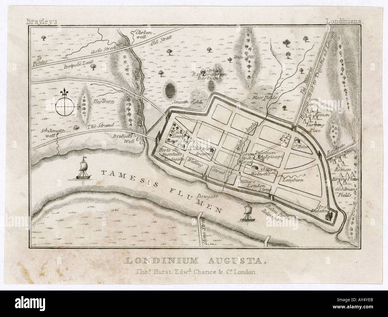 London Map Roman Period Stock Photohttps://www.alamy.com/image-license-details/?v=1https://www.alamy.com/london-map-roman-period-image5549034.html
RMAY4YEB–London Map Roman Period
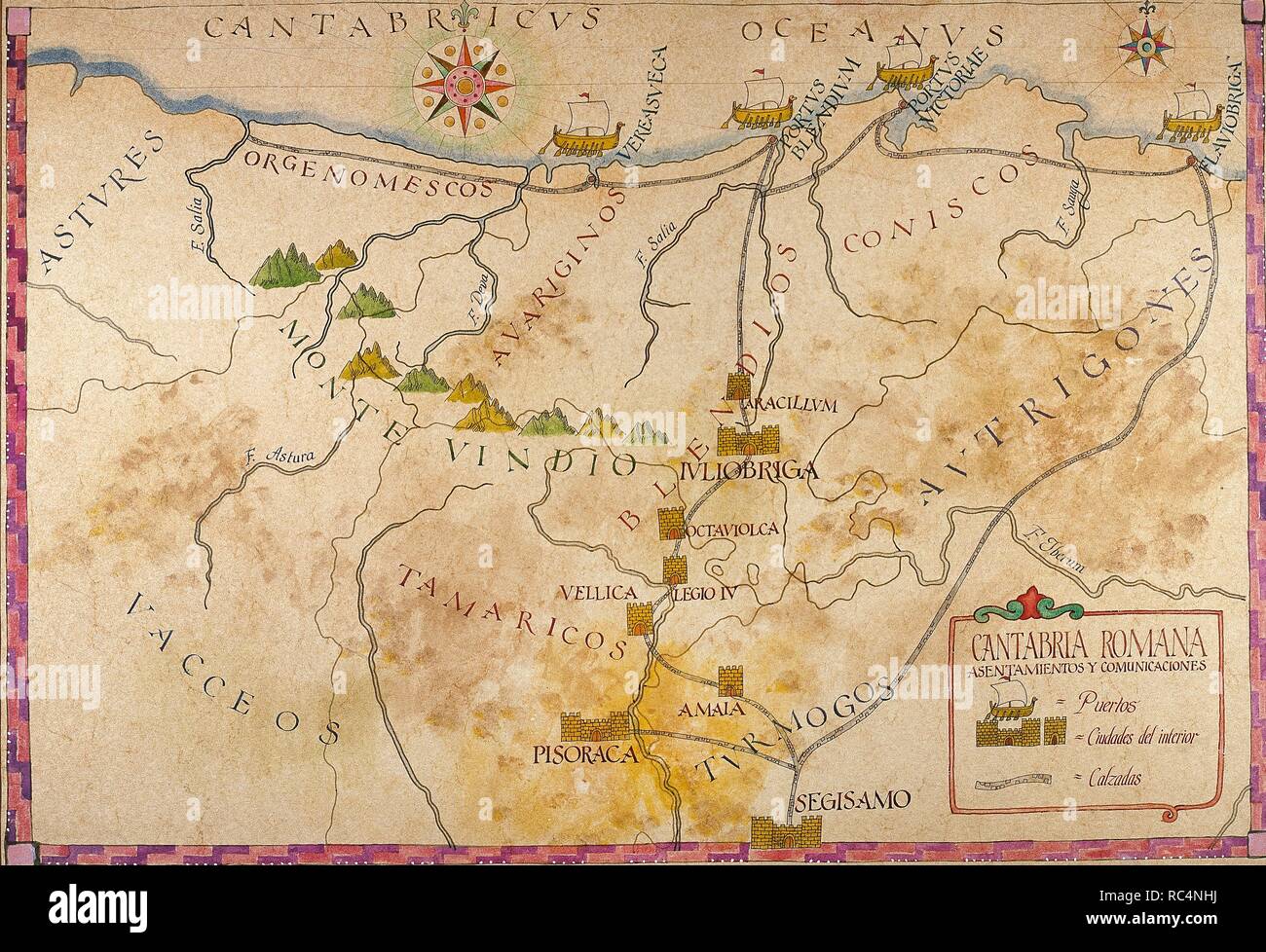 History of the Roman Empire. Romanisation of the Iberian Peninsula. Map of Cantabria. Roman Times. Stock Photohttps://www.alamy.com/image-license-details/?v=1https://www.alamy.com/history-of-the-roman-empire-romanisation-of-the-iberian-peninsula-map-of-cantabria-roman-times-image231215422.html
RMRC4NHJ–History of the Roman Empire. Romanisation of the Iberian Peninsula. Map of Cantabria. Roman Times.
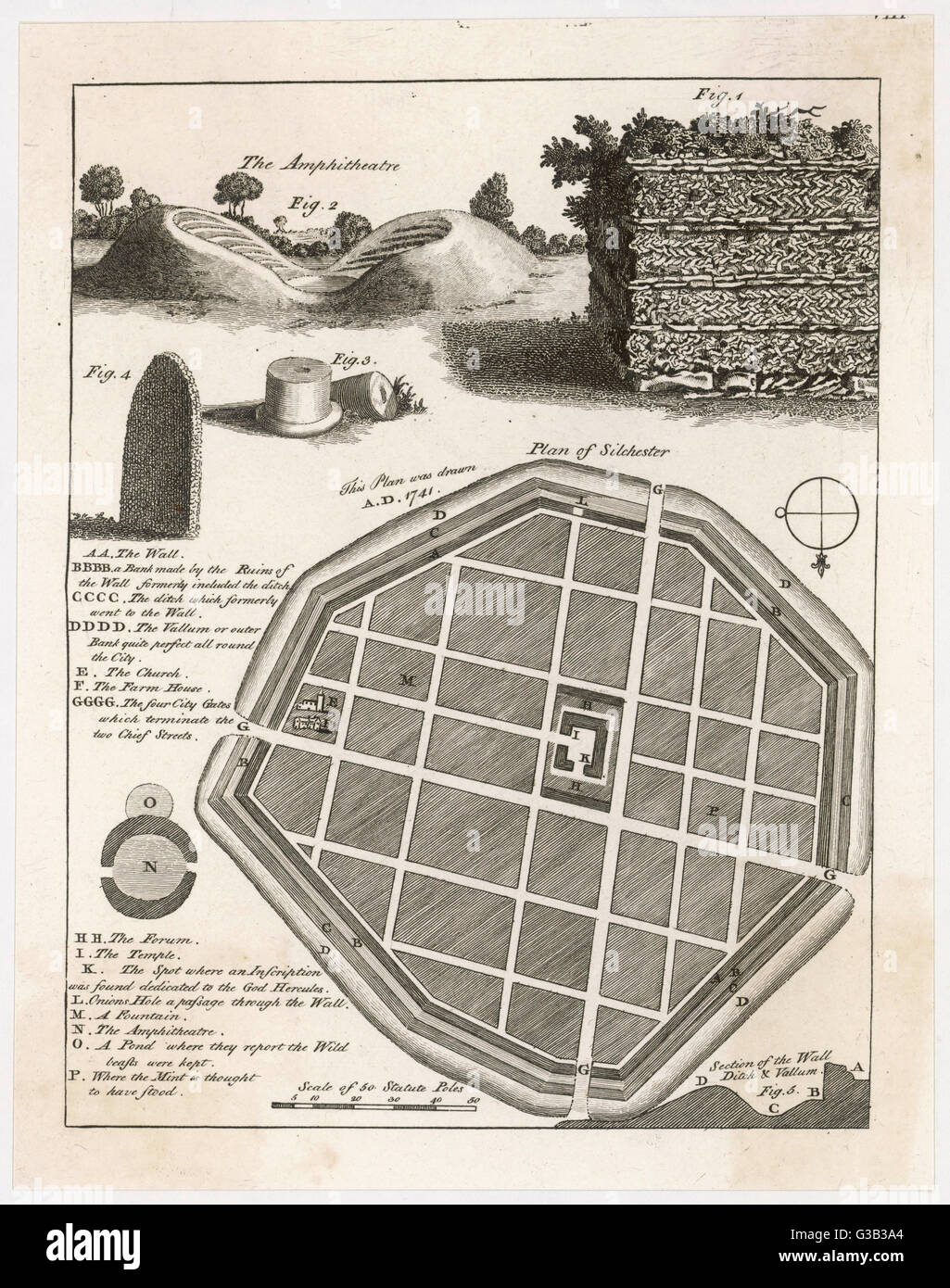 A plan and details from the well-preserved Roman town of Silchester (Calleva Atrebatum). The entire circuit of the town wall, and bowl of the amphitheatre have survived Date: 1777 Stock Photohttps://www.alamy.com/image-license-details/?v=1https://www.alamy.com/stock-photo-a-plan-and-details-from-the-well-preserved-roman-town-of-silchester-105350284.html
RMG3B3A4–A plan and details from the well-preserved Roman town of Silchester (Calleva Atrebatum). The entire circuit of the town wall, and bowl of the amphitheatre have survived Date: 1777
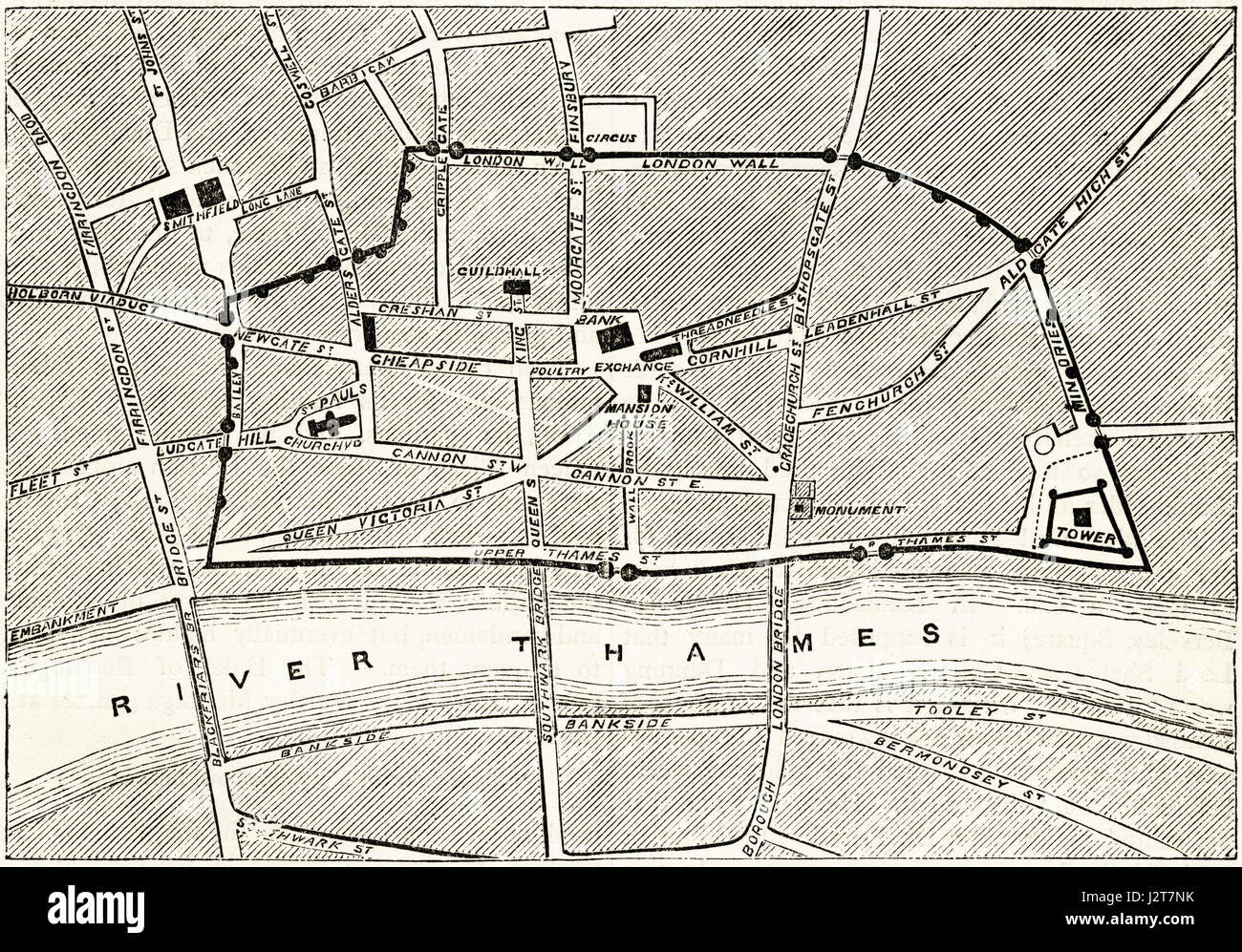 Map of Victorian London showing the ancient walls. Victorian engraving circa 1880. Stock Photohttps://www.alamy.com/image-license-details/?v=1https://www.alamy.com/stock-photo-map-of-victorian-london-showing-the-ancient-walls-victorian-engraving-139445199.html
RMJ2T7NK–Map of Victorian London showing the ancient walls. Victorian engraving circa 1880.
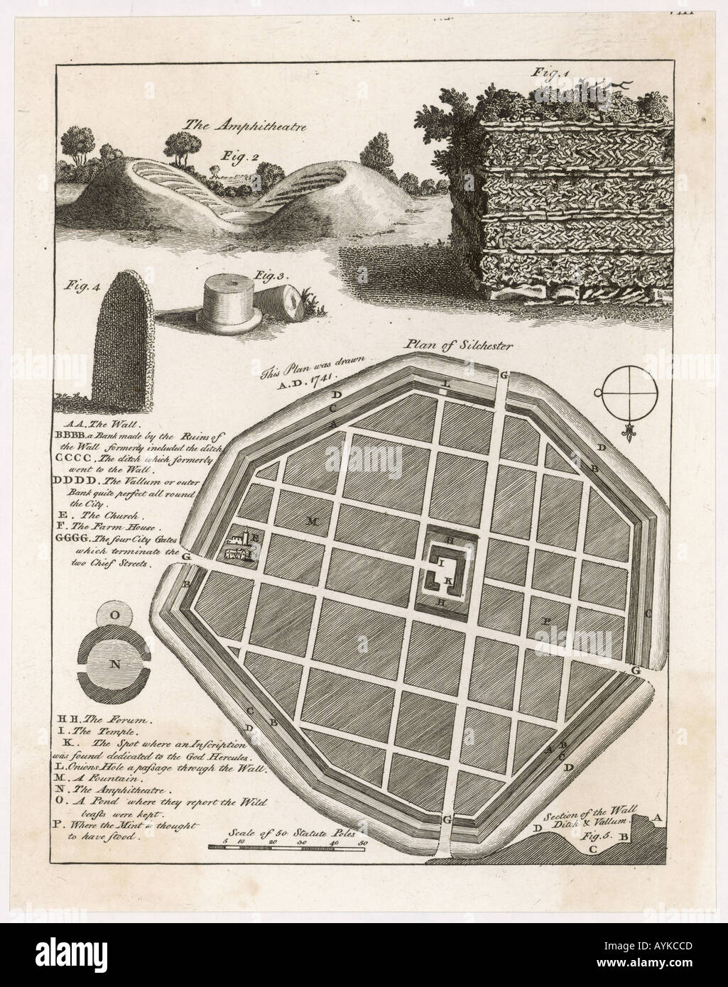 Plan Of Silchester 1777 Stock Photohttps://www.alamy.com/image-license-details/?v=1https://www.alamy.com/plan-of-silchester-1777-image3177676.html
RMAYKCCD–Plan Of Silchester 1777
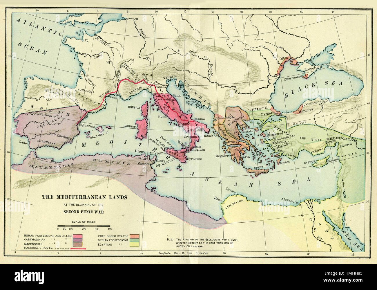 map of europe Stock Photohttps://www.alamy.com/image-license-details/?v=1https://www.alamy.com/stock-photo-map-of-europe-133152437.html
RFHMHH85–map of europe
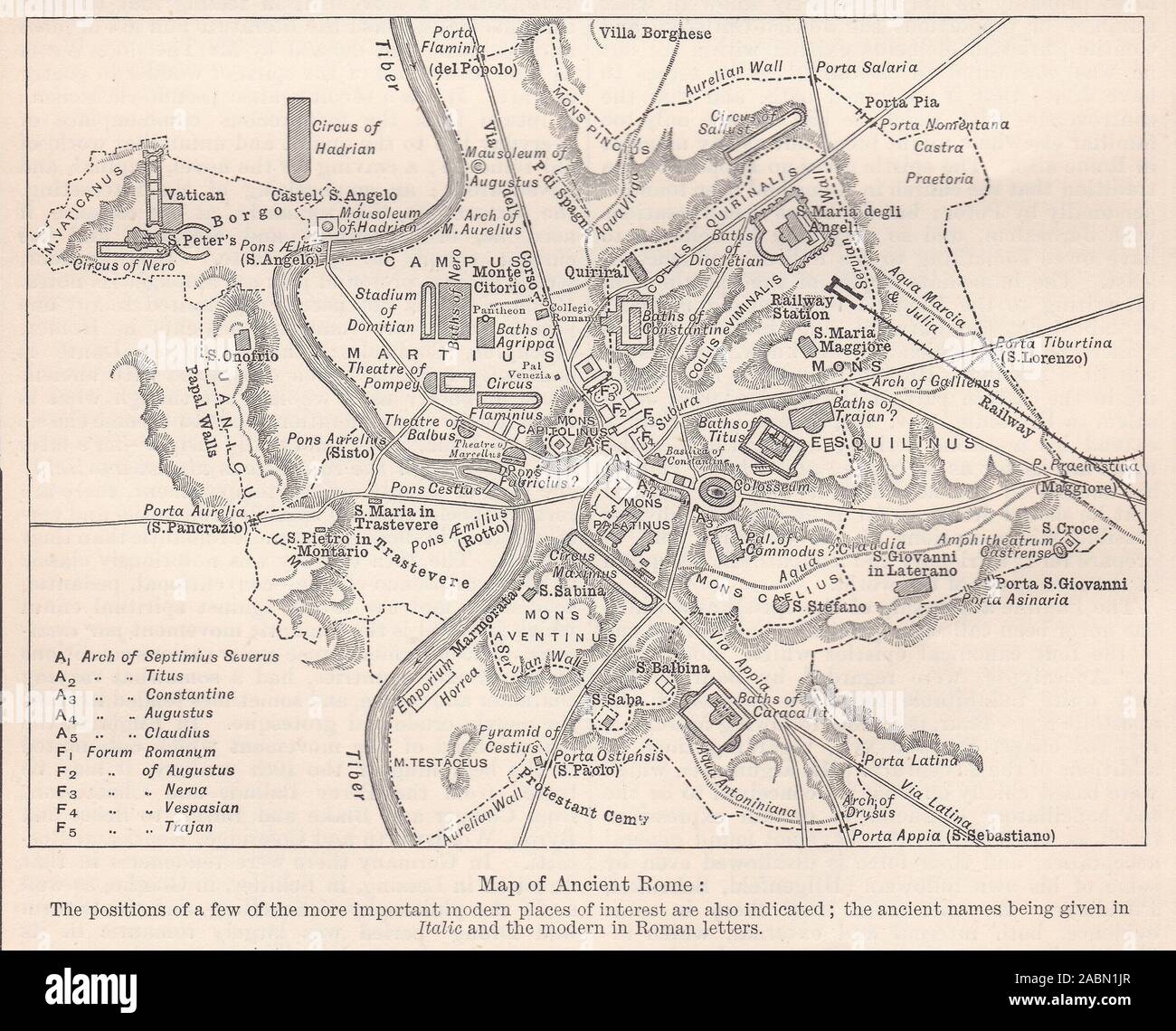 1800s Illustration of a Map of Ancient Rome. Stock Photohttps://www.alamy.com/image-license-details/?v=1https://www.alamy.com/1800s-illustration-of-a-map-of-ancient-rome-image334220511.html
RF2ABN1JR–1800s Illustration of a Map of Ancient Rome.
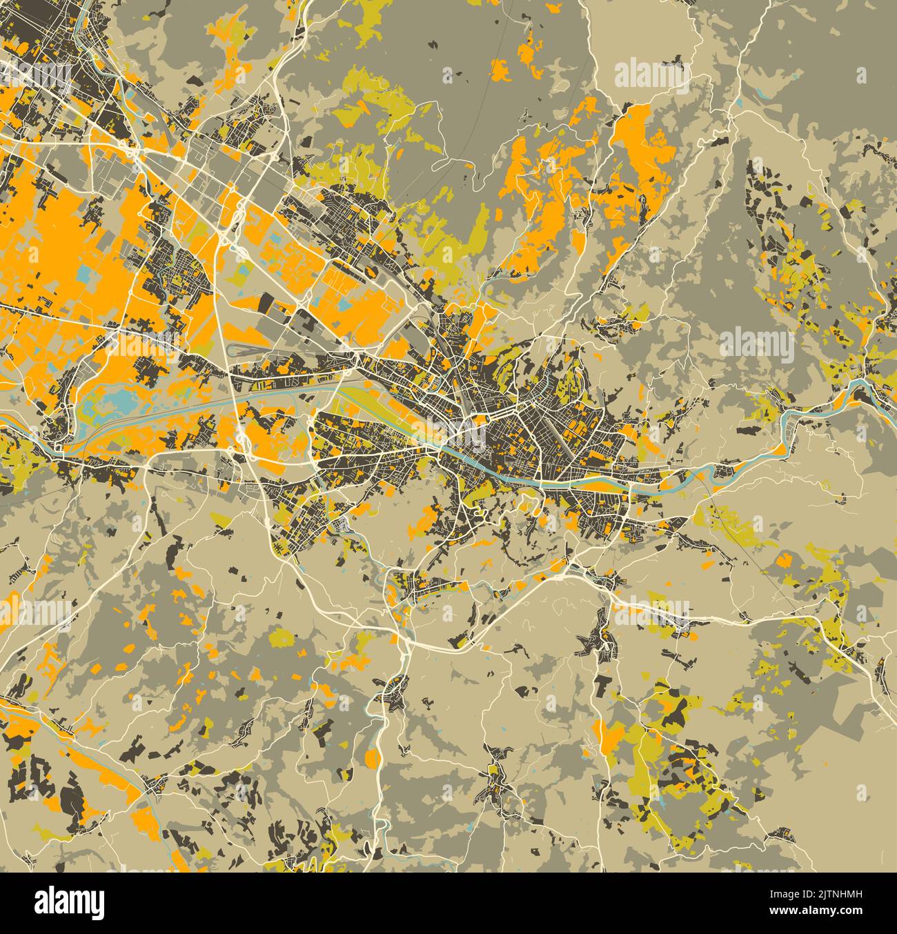 City map of Florence, Italy Stock Vectorhttps://www.alamy.com/image-license-details/?v=1https://www.alamy.com/city-map-of-florence-italy-image479906577.html
RF2JTNHMH–City map of Florence, Italy
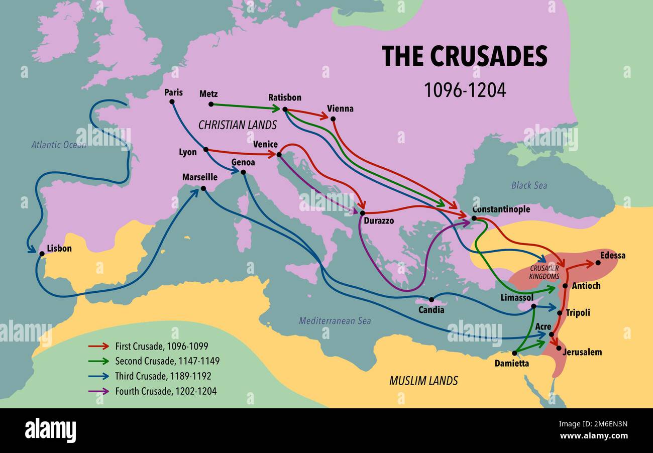 Map of the Crusades main routes and roads Stock Photohttps://www.alamy.com/image-license-details/?v=1https://www.alamy.com/map-of-the-crusades-main-routes-and-roads-image503112505.html
RF2M6EN3N–Map of the Crusades main routes and roads
 Merida city on the map, Extremadura, Badajoz, Spain. Selective focus over word Stock Photohttps://www.alamy.com/image-license-details/?v=1https://www.alamy.com/merida-city-on-the-map-extremadura-badajoz-spain-selective-focus-over-word-image599658699.html
RF2WRGPP3–Merida city on the map, Extremadura, Badajoz, Spain. Selective focus over word
 Map of two Roman military roads in the Netherlands, 1732 - 1734 print Map of Roman military roads in the river area in the Netherlands. paper etching / engraving road, path Netherlands Stock Photohttps://www.alamy.com/image-license-details/?v=1https://www.alamy.com/map-of-two-roman-military-roads-in-the-netherlands-1732-1734-print-map-of-roman-military-roads-in-the-river-area-in-the-netherlands-paper-etching-engraving-road-path-netherlands-image595193277.html
RM2WG9B2N–Map of two Roman military roads in the Netherlands, 1732 - 1734 print Map of Roman military roads in the river area in the Netherlands. paper etching / engraving road, path Netherlands
 Roman Column Building on the Bund of Shanghai Stock Photohttps://www.alamy.com/image-license-details/?v=1https://www.alamy.com/roman-column-building-on-the-bund-of-shanghai-image248871760.html
RFTCW2D4–Roman Column Building on the Bund of Shanghai
![The Holy Roman Empire. Gelegenheit Teutscher Lannd unnd aller anstös Das. Bamberg : Georg Erlinger, 1524. A woodcut map, showing the Holy Roman Empire and parts of the adjacent countries. Image taken from Gelegenheit Teutscher Lannd unnd aller anstös Das man mit hilff eins Compas gewislich von einem ortt zu dem andern ziehen mag. [A woodcut map, showing the Holy Roman Empire and parts of the adjacent countries with the principal roads. With a marginal index, an illustration of a compass-dial and scales in four of the different miles then in use in the Empire and neighbouring countries.] Teu Stock Photo The Holy Roman Empire. Gelegenheit Teutscher Lannd unnd aller anstös Das. Bamberg : Georg Erlinger, 1524. A woodcut map, showing the Holy Roman Empire and parts of the adjacent countries. Image taken from Gelegenheit Teutscher Lannd unnd aller anstös Das man mit hilff eins Compas gewislich von einem ortt zu dem andern ziehen mag. [A woodcut map, showing the Holy Roman Empire and parts of the adjacent countries with the principal roads. With a marginal index, an illustration of a compass-dial and scales in four of the different miles then in use in the Empire and neighbouring countries.] Teu Stock Photo](https://c8.alamy.com/comp/R4X7XX/the-holy-roman-empire-gelegenheit-teutscher-lannd-unnd-aller-ansts-das-bamberg-georg-erlinger-1524-a-woodcut-map-showing-the-holy-roman-empire-and-parts-of-the-adjacent-countries-image-taken-from-gelegenheit-teutscher-lannd-unnd-aller-ansts-das-man-mit-hilff-eins-compas-gewislich-von-einem-ortt-zu-dem-andern-ziehen-mag-a-woodcut-map-showing-the-holy-roman-empire-and-parts-of-the-adjacent-countries-with-the-principal-roads-with-a-marginal-index-an-illustration-of-a-compass-dial-and-scales-in-four-of-the-different-miles-then-in-use-in-the-empire-and-neighbouring-countries-teu-R4X7XX.jpg) The Holy Roman Empire. Gelegenheit Teutscher Lannd unnd aller anstös Das. Bamberg : Georg Erlinger, 1524. A woodcut map, showing the Holy Roman Empire and parts of the adjacent countries. Image taken from Gelegenheit Teutscher Lannd unnd aller anstös Das man mit hilff eins Compas gewislich von einem ortt zu dem andern ziehen mag. [A woodcut map, showing the Holy Roman Empire and parts of the adjacent countries with the principal roads. With a marginal index, an illustration of a compass-dial and scales in four of the different miles then in use in the Empire and neighbouring countries.] Teu Stock Photohttps://www.alamy.com/image-license-details/?v=1https://www.alamy.com/the-holy-roman-empire-gelegenheit-teutscher-lannd-unnd-aller-ansts-das-bamberg-georg-erlinger-1524-a-woodcut-map-showing-the-holy-roman-empire-and-parts-of-the-adjacent-countries-image-taken-from-gelegenheit-teutscher-lannd-unnd-aller-ansts-das-man-mit-hilff-eins-compas-gewislich-von-einem-ortt-zu-dem-andern-ziehen-mag-a-woodcut-map-showing-the-holy-roman-empire-and-parts-of-the-adjacent-countries-with-the-principal-roads-with-a-marginal-index-an-illustration-of-a-compass-dial-and-scales-in-four-of-the-different-miles-then-in-use-in-the-empire-and-neighbouring-countries-teu-image226770402.html
The Holy Roman Empire. Gelegenheit Teutscher Lannd unnd aller anstös Das. Bamberg : Georg Erlinger, 1524. A woodcut map, showing the Holy Roman Empire and parts of the adjacent countries. Image taken from Gelegenheit Teutscher Lannd unnd aller anstös Das man mit hilff eins Compas gewislich von einem ortt zu dem andern ziehen mag. [A woodcut map, showing the Holy Roman Empire and parts of the adjacent countries with the principal roads. With a marginal index, an illustration of a compass-dial and scales in four of the different miles then in use in the Empire and neighbouring countries.] Teu Stock Photohttps://www.alamy.com/image-license-details/?v=1https://www.alamy.com/the-holy-roman-empire-gelegenheit-teutscher-lannd-unnd-aller-ansts-das-bamberg-georg-erlinger-1524-a-woodcut-map-showing-the-holy-roman-empire-and-parts-of-the-adjacent-countries-image-taken-from-gelegenheit-teutscher-lannd-unnd-aller-ansts-das-man-mit-hilff-eins-compas-gewislich-von-einem-ortt-zu-dem-andern-ziehen-mag-a-woodcut-map-showing-the-holy-roman-empire-and-parts-of-the-adjacent-countries-with-the-principal-roads-with-a-marginal-index-an-illustration-of-a-compass-dial-and-scales-in-four-of-the-different-miles-then-in-use-in-the-empire-and-neighbouring-countries-teu-image226770402.htmlRMR4X7XX–The Holy Roman Empire. Gelegenheit Teutscher Lannd unnd aller anstös Das. Bamberg : Georg Erlinger, 1524. A woodcut map, showing the Holy Roman Empire and parts of the adjacent countries. Image taken from Gelegenheit Teutscher Lannd unnd aller anstös Das man mit hilff eins Compas gewislich von einem ortt zu dem andern ziehen mag. [A woodcut map, showing the Holy Roman Empire and parts of the adjacent countries with the principal roads. With a marginal index, an illustration of a compass-dial and scales in four of the different miles then in use in the Empire and neighbouring countries.] Teu
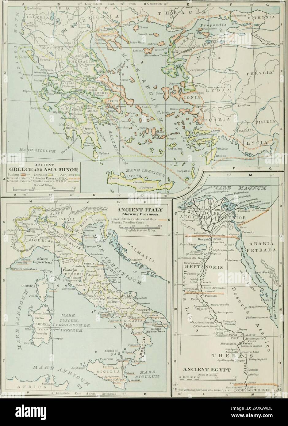 The century dictionary and cyclopedia, a work of universal reference in all departments of knowledge with a new atlas of the world . Ectioljolho/ o* I Silnah-,? 1 V, iTleLl of Eoiiiiiy 7 / REFERENCE MAP OF PALESTINE, SHOMTiG THE POLITXCAL DmSfONSAT THE TIME OF CHKIST. Jidea, Samaria and Galflee: — Free Territory: — ProviocB of Syria, ^. Limit of Territory b(^!owSea Level; -*—*—?«?- Dlbllcttl Name* In upriffbi type, CAPS or Upper i Lower CMo.Roman. Irrrk mJ TalmuOic Namea — Undrmrorctl.UdJcTii ?famcB of tlio moat Important pliuva luid fcatuteaIn Italic* — CAPS or Upper Jr Lower Cafe. Roads th Stock Photohttps://www.alamy.com/image-license-details/?v=1https://www.alamy.com/the-century-dictionary-and-cyclopedia-a-work-of-universal-reference-in-all-departments-of-knowledge-with-a-new-atlas-of-the-world-ectioljolho-o-i-silnah-1-v-itlell-of-eoiiiiiy-7-reference-map-of-palestine-shomtig-the-politxcal-dmsfonsat-the-time-of-chkist-jidea-samaria-and-galflee-free-territory-proviocb-of-syria-limit-of-territory-b!owsea-level-dlbllcttl-name-in-upriffbi-type-caps-or-upper-i-lower-cmoroman-irrrk-mj-talmuoic-namea-undrmrorctludjctii-famcb-of-tlio-moat-important-pliuva-luid-fcatuteain-italic-caps-or-upper-jr-lower-cafe-roads-th-image343349258.html
RM2AXGWDE–The century dictionary and cyclopedia, a work of universal reference in all departments of knowledge with a new atlas of the world . Ectioljolho/ o* I Silnah-,? 1 V, iTleLl of Eoiiiiiy 7 / REFERENCE MAP OF PALESTINE, SHOMTiG THE POLITXCAL DmSfONSAT THE TIME OF CHKIST. Jidea, Samaria and Galflee: — Free Territory: — ProviocB of Syria, ^. Limit of Territory b(^!owSea Level; -*—*—?«?- Dlbllcttl Name* In upriffbi type, CAPS or Upper i Lower CMo.Roman. Irrrk mJ TalmuOic Namea — Undrmrorctl.UdJcTii ?famcB of tlio moat Important pliuva luid fcatuteaIn Italic* — CAPS or Upper Jr Lower Cafe. Roads th
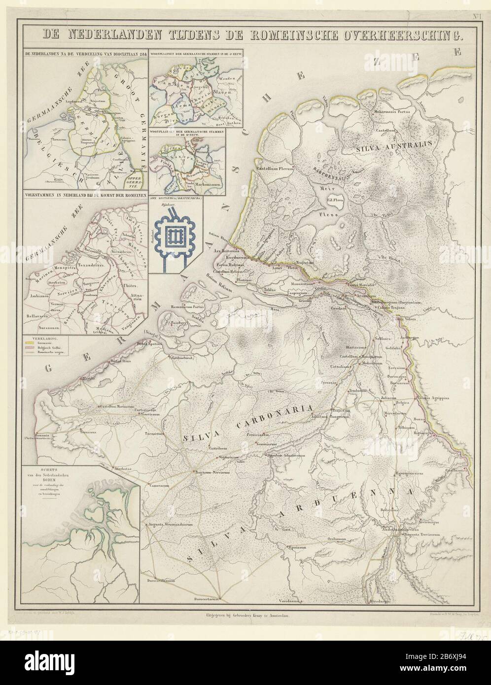 Kaart van de Nederlanden in de Romeinse tijd De Nederlanden tijdens de Romeinsche overheersching (titel op object) the Netherlands Card in Roman time. With different bets with some tickets and a map of Brittenburg. The main Roman roads and the border between Germania and Belgian Gaul. Numbered upper right: No. I. Manufacturer : printmaker Pieter Willem Marinus Trap (listed property) to drawing: Willem Jacob Hofdijk (listed building) compiler: Willem Jacob Hofdijk (listed building) publisher: Gebroeders Kraay (listed property) Place manufacture: printmaker : Leiden Publisher: Amsterdam Date: 18 Stock Photohttps://www.alamy.com/image-license-details/?v=1https://www.alamy.com/kaart-van-de-nederlanden-in-de-romeinse-tijd-de-nederlanden-tijdens-de-romeinsche-overheersching-titel-op-object-the-netherlands-card-in-roman-time-with-different-bets-with-some-tickets-and-a-map-of-brittenburg-the-main-roman-roads-and-the-border-between-germania-and-belgian-gaul-numbered-upper-right-no-i-manufacturer-printmaker-pieter-willem-marinus-trap-listed-property-to-drawing-willem-jacob-hofdijk-listed-building-compiler-willem-jacob-hofdijk-listed-building-publisher-gebroeders-kraay-listed-property-place-manufacture-printmaker-leiden-publisher-amsterdam-date-18-image348480416.html
RM2B6XJ94–Kaart van de Nederlanden in de Romeinse tijd De Nederlanden tijdens de Romeinsche overheersching (titel op object) the Netherlands Card in Roman time. With different bets with some tickets and a map of Brittenburg. The main Roman roads and the border between Germania and Belgian Gaul. Numbered upper right: No. I. Manufacturer : printmaker Pieter Willem Marinus Trap (listed property) to drawing: Willem Jacob Hofdijk (listed building) compiler: Willem Jacob Hofdijk (listed building) publisher: Gebroeders Kraay (listed property) Place manufacture: printmaker : Leiden Publisher: Amsterdam Date: 18
 Itinerarium Antonini Augusti frontpage. Reproduction at Blacos Visitors Centre, Soria, Spain Stock Photohttps://www.alamy.com/image-license-details/?v=1https://www.alamy.com/itinerarium-antonini-augusti-frontpage-reproduction-at-blacos-visitors-centre-soria-spain-image615037198.html
RF2XMHA66–Itinerarium Antonini Augusti frontpage. Reproduction at Blacos Visitors Centre, Soria, Spain
 aerial photograph of a suburban housing estate on the edge of Bath, Somerset Stock Photohttps://www.alamy.com/image-license-details/?v=1https://www.alamy.com/aerial-photograph-of-a-suburban-housing-estate-on-the-edge-of-bath-somerset-image558332078.html
RM2RCA67A–aerial photograph of a suburban housing estate on the edge of Bath, Somerset
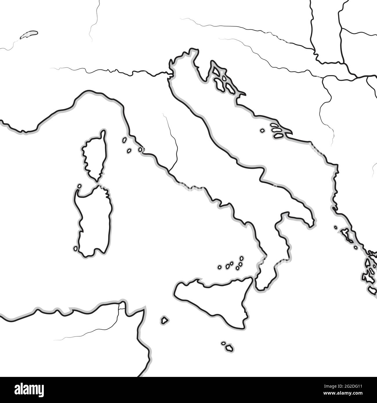 Map of The ITALIAN Lands: Italy, Tuscany, Lombardy, Sicily, The Apennines, Italian Peninsula. Geographic chart. Stock Vectorhttps://www.alamy.com/image-license-details/?v=1https://www.alamy.com/map-of-the-italian-lands-italy-tuscany-lombardy-sicily-the-apennines-italian-peninsula-geographic-chart-image431786461.html
RF2G2DG11–Map of The ITALIAN Lands: Italy, Tuscany, Lombardy, Sicily, The Apennines, Italian Peninsula. Geographic chart.
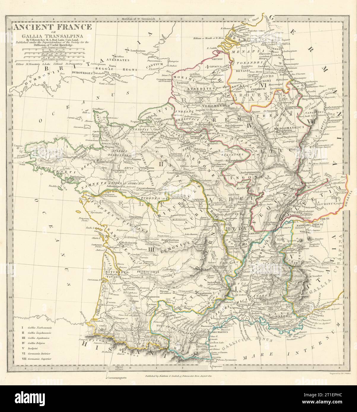 ANCIENT ROMAN FRANCE GAUL. Gallia Transalpina. Roman names roads.SDUK 1844 map Stock Photohttps://www.alamy.com/image-license-details/?v=1https://www.alamy.com/ancient-roman-france-gaul-gallia-transalpina-roman-names-roadssduk-1844-map-image568881864.html
RF2T1EPHC–ANCIENT ROMAN FRANCE GAUL. Gallia Transalpina. Roman names roads.SDUK 1844 map
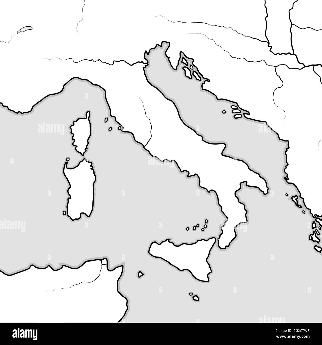 Map of The ITALIAN Lands: Italy, Tuscany, Lombardy, Sicily, The Apennines, Italian Peninsula. Geographic chart. Stock Photohttps://www.alamy.com/image-license-details/?v=1https://www.alamy.com/map-of-the-italian-lands-italy-tuscany-lombardy-sicily-the-apennines-italian-peninsula-geographic-chart-image431771463.html
RF2G2CTWB–Map of The ITALIAN Lands: Italy, Tuscany, Lombardy, Sicily, The Apennines, Italian Peninsula. Geographic chart.
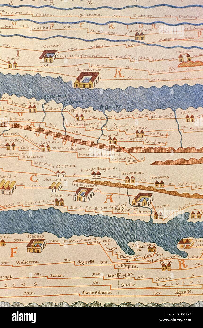 Tabula Peutingeriana or Peutinger Table. An illustrated itinerarium (ancient Roman road map) showing the layout of the road network of the Roman Empire. Painted on parchment, it is a medieval copy (13th century) of an original map of the 4th century. Detail of Italy. National Library of Vienna. Austria. Stock Photohttps://www.alamy.com/image-license-details/?v=1https://www.alamy.com/tabula-peutingeriana-or-peutinger-table-an-illustrated-itinerarium-ancient-roman-road-map-showing-the-layout-of-the-road-network-of-the-roman-empire-painted-on-parchment-it-is-a-medieval-copy-13th-century-of-an-original-map-of-the-4th-century-detail-of-italy-national-library-of-vienna-austria-image220445071.html
RMPPJ3X7–Tabula Peutingeriana or Peutinger Table. An illustrated itinerarium (ancient Roman road map) showing the layout of the road network of the Roman Empire. Painted on parchment, it is a medieval copy (13th century) of an original map of the 4th century. Detail of Italy. National Library of Vienna. Austria.
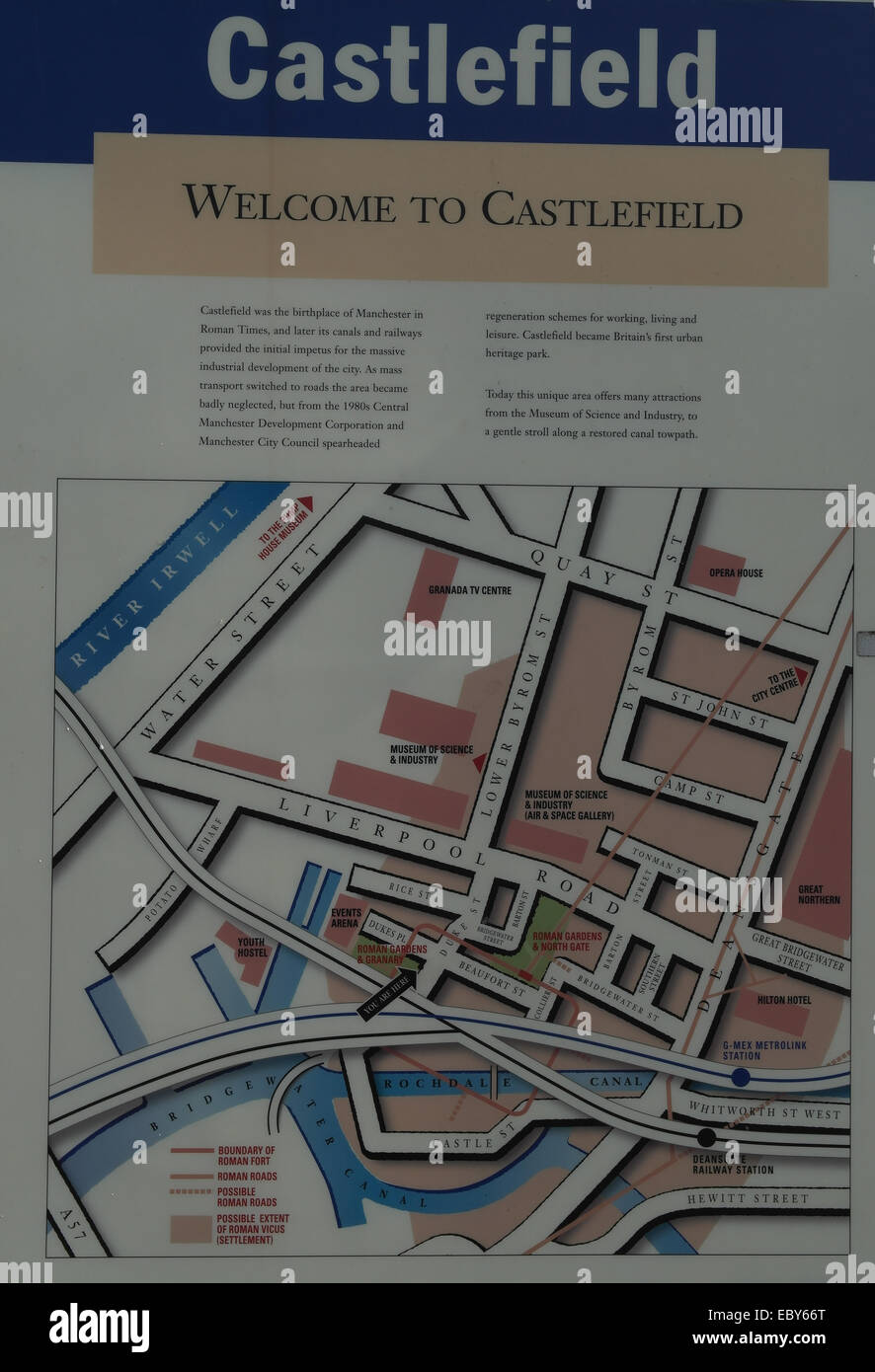 'Welcome to Castlefield' information board history and map, Roman Gardens and Granary, Duke Street, Castlefield, Manchester, UK Stock Photohttps://www.alamy.com/image-license-details/?v=1https://www.alamy.com/stock-photo-welcome-to-castlefield-information-board-history-and-map-roman-gardens-76200288.html
RMEBY66T–'Welcome to Castlefield' information board history and map, Roman Gardens and Granary, Duke Street, Castlefield, Manchester, UK
 Plan of the city of Rome 31 bc - ad 330, The Metropolitan Museum of Art (The Met), Upper Manhattan, New York City, New York State, USA. Stock Photohttps://www.alamy.com/image-license-details/?v=1https://www.alamy.com/stock-photo-plan-of-the-city-of-rome-31-bc-ad-330-the-metropolitan-museum-of-art-172445806.html
RMM0FGAP–Plan of the city of Rome 31 bc - ad 330, The Metropolitan Museum of Art (The Met), Upper Manhattan, New York City, New York State, USA.
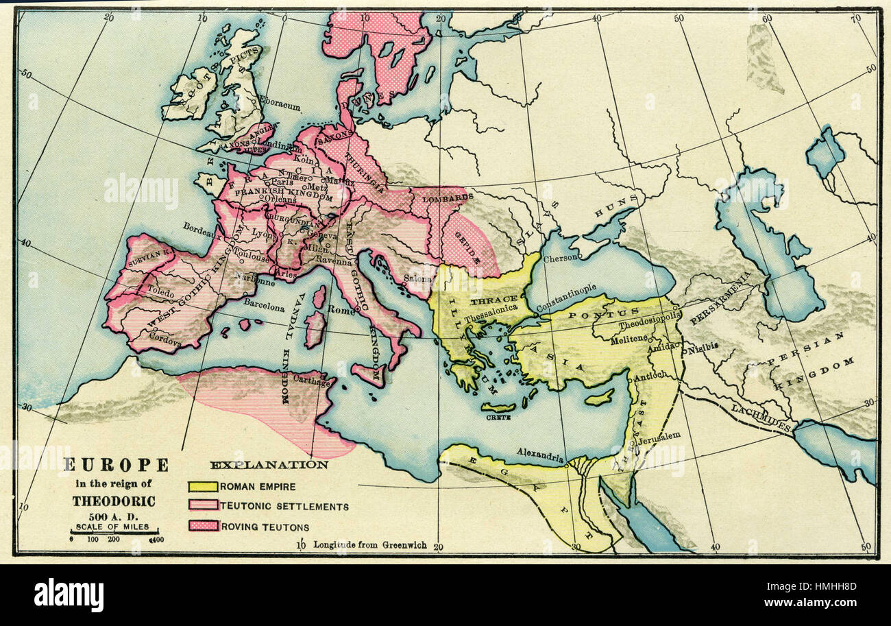 map of europe Stock Photohttps://www.alamy.com/image-license-details/?v=1https://www.alamy.com/stock-photo-map-of-europe-133152445.html
RFHMHH8D–map of europe
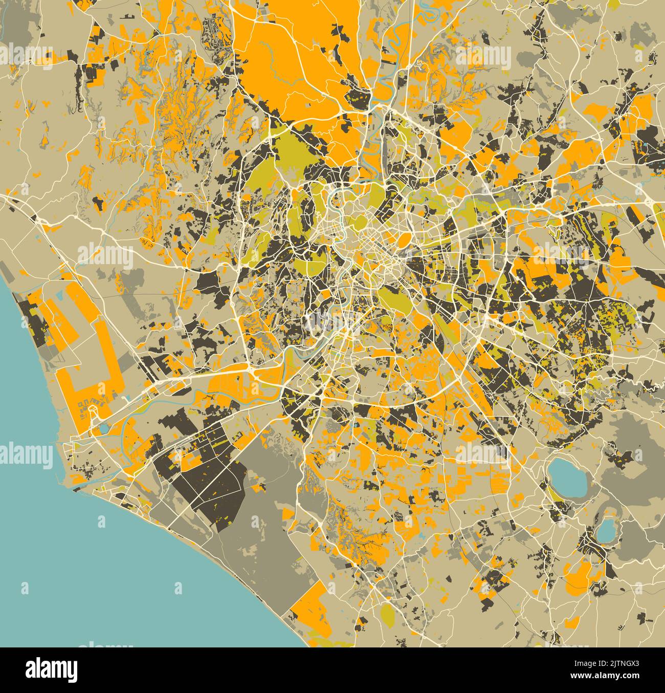 City map of Rome, Italy Stock Vectorhttps://www.alamy.com/image-license-details/?v=1https://www.alamy.com/city-map-of-rome-italy-image479905947.html
RF2JTNGX3–City map of Rome, Italy
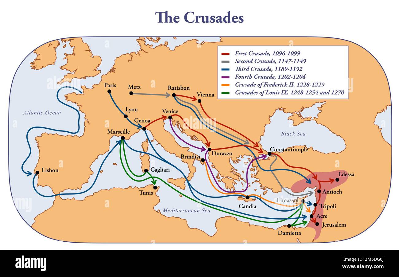 Map of the Crusades main routes and roads Stock Photohttps://www.alamy.com/image-license-details/?v=1https://www.alamy.com/map-of-the-crusades-main-routes-and-roads-image502471890.html
RF2M5DG0J–Map of the Crusades main routes and roads
 Map of the Netherlands in Roman times, 1855 - 1857 print Map of the Netherlands in Roman times. With different bets with partial tickets and a map of Brittenburg. With the most important Roman roads and the border between Germania and Belgian Gaul. Numbered at the top right: No. I. print maker: Leidenpublisher: Amsterdam paper maps of separate countries or regions Low Countries. Germany. Brittenburg Stock Photohttps://www.alamy.com/image-license-details/?v=1https://www.alamy.com/map-of-the-netherlands-in-roman-times-1855-1857-print-map-of-the-netherlands-in-roman-times-with-different-bets-with-partial-tickets-and-a-map-of-brittenburg-with-the-most-important-roman-roads-and-the-border-between-germania-and-belgian-gaul-numbered-at-the-top-right-no-i-print-maker-leidenpublisher-amsterdam-paper-maps-of-separate-countries-or-regions-low-countries-germany-brittenburg-image595234373.html
RM2WGB7ED–Map of the Netherlands in Roman times, 1855 - 1857 print Map of the Netherlands in Roman times. With different bets with partial tickets and a map of Brittenburg. With the most important Roman roads and the border between Germania and Belgian Gaul. Numbered at the top right: No. I. print maker: Leidenpublisher: Amsterdam paper maps of separate countries or regions Low Countries. Germany. Brittenburg
 Mappa Britanniae Septentrionalis Faciei Romanae. A view of the Roman Roads and antiquities of Northern Britain. . Mappa Britanniae Septentrionalis Faciei Romanae. England 1774. Mappa Britanniae Septentrionalis Faciei Romanae, secundum fidem Monumentorum per veterum depicta, ex Ricardo Corinense emendata, et in recentioribus geometricis atque astronomicis observationibus accommodata a G. Roy. Source: Maps K.Top.48.25.11.Tab Roll 23 (det). Language: Latin. Stock Photohttps://www.alamy.com/image-license-details/?v=1https://www.alamy.com/mappa-britanniae-septentrionalis-faciei-romanae-a-view-of-the-roman-roads-and-antiquities-of-northern-britain-mappa-britanniae-septentrionalis-faciei-romanae-england-1774-mappa-britanniae-septentrionalis-faciei-romanae-secundum-fidem-monumentorum-per-veterum-depicta-ex-ricardo-corinense-emendata-et-in-recentioribus-geometricis-atque-astronomicis-observationibus-accommodata-a-g-roy-source-maps-ktop482511tab-roll-23-det-language-latin-image226789628.html
RMR4Y4DG–Mappa Britanniae Septentrionalis Faciei Romanae. A view of the Roman Roads and antiquities of Northern Britain. . Mappa Britanniae Septentrionalis Faciei Romanae. England 1774. Mappa Britanniae Septentrionalis Faciei Romanae, secundum fidem Monumentorum per veterum depicta, ex Ricardo Corinense emendata, et in recentioribus geometricis atque astronomicis observationibus accommodata a G. Roy. Source: Maps K.Top.48.25.11.Tab Roll 23 (det). Language: Latin.
 Transactions of the Bristol and Gloucestershire Archaeological Society . bliothecaGlovistrensis and Fosbrookes History oj Gloucester, sets forth the city as itappeared before the destruction of its suburbs in August, 1643. We seein this map the city wall extending from the Severn eastwards to what isnow the junction of Brunswick and Parliament Roads; from thence itturns southwards and runs as far as St. Aldate Street; from thence it runswestwards to the boundary of the Cathedral precincts. The Roman wallfollowed the same line. On the west it ran up Barbican Road, andcrossing Westgate Street ne Stock Photohttps://www.alamy.com/image-license-details/?v=1https://www.alamy.com/transactions-of-the-bristol-and-gloucestershire-archaeological-society-bliothecaglovistrensis-and-fosbrookes-history-oj-gloucester-sets-forth-the-city-as-itappeared-before-the-destruction-of-its-suburbs-in-august-1643-we-seein-this-map-the-city-wall-extending-from-the-severn-eastwards-to-what-isnow-the-junction-of-brunswick-and-parliament-roads-from-thence-itturns-southwards-and-runs-as-far-as-st-aldate-street-from-thence-it-runswestwards-to-the-boundary-of-the-cathedral-precincts-the-roman-wallfollowed-the-same-line-on-the-west-it-ran-up-barbican-road-andcrossing-westgate-street-ne-image342785061.html
RM2AWK5RH–Transactions of the Bristol and Gloucestershire Archaeological Society . bliothecaGlovistrensis and Fosbrookes History oj Gloucester, sets forth the city as itappeared before the destruction of its suburbs in August, 1643. We seein this map the city wall extending from the Severn eastwards to what isnow the junction of Brunswick and Parliament Roads; from thence itturns southwards and runs as far as St. Aldate Street; from thence it runswestwards to the boundary of the Cathedral precincts. The Roman wallfollowed the same line. On the west it ran up Barbican Road, andcrossing Westgate Street ne
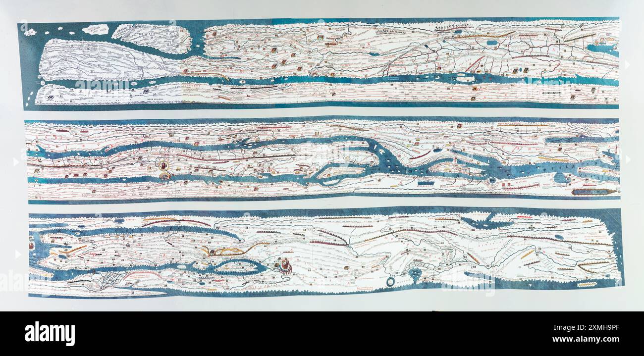 Itinerarium Antonini Augusti maps. Reproduction at Blacos Visitors Centre, Soria, Spain Stock Photohttps://www.alamy.com/image-license-details/?v=1https://www.alamy.com/itinerarium-antonini-augusti-maps-reproduction-at-blacos-visitors-centre-soria-spain-image615036871.html
RF2XMH9PF–Itinerarium Antonini Augusti maps. Reproduction at Blacos Visitors Centre, Soria, Spain
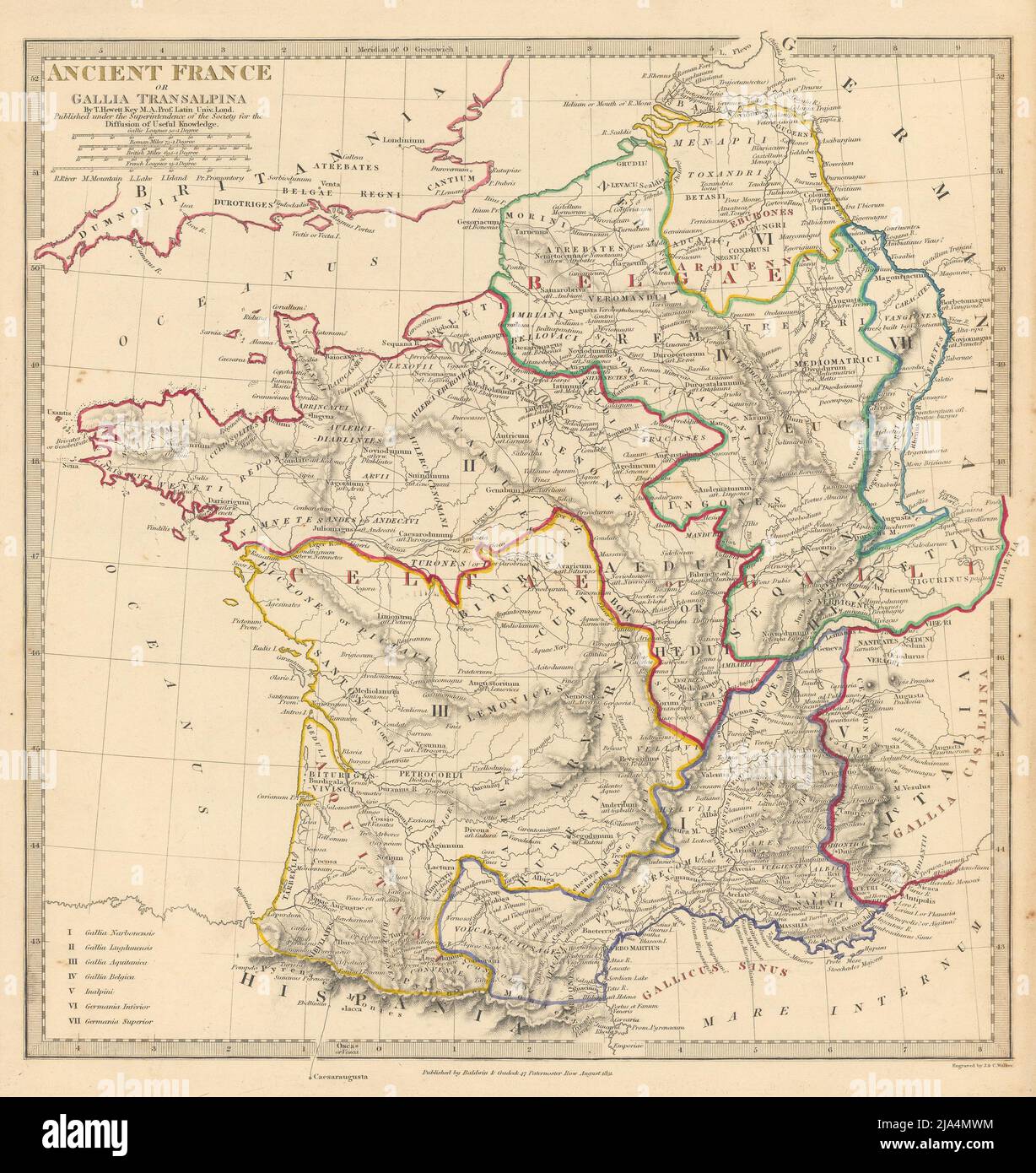 ANCIENT ROMAN FRANCE GAUL. Gallia Transalpina. Roman names roads.SDUK 1844 map Stock Photohttps://www.alamy.com/image-license-details/?v=1https://www.alamy.com/ancient-roman-france-gaul-gallia-transalpina-roman-names-roadssduk-1844-map-image470930704.html
RF2JA4MWM–ANCIENT ROMAN FRANCE GAUL. Gallia Transalpina. Roman names roads.SDUK 1844 map
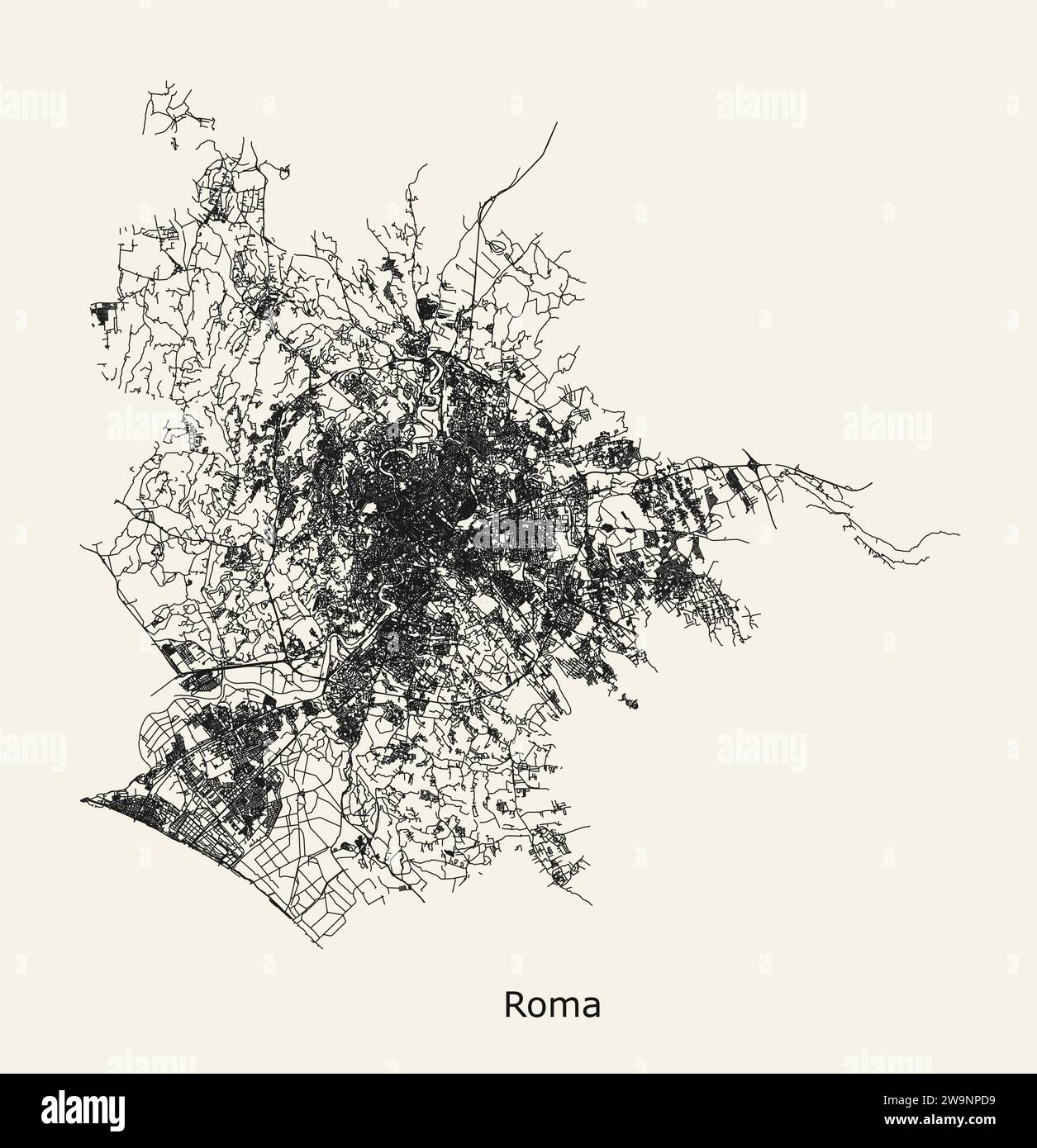 City road map of Rome, Italy Stock Vectorhttps://www.alamy.com/image-license-details/?v=1https://www.alamy.com/city-road-map-of-rome-italy-image591163029.html
RF2W9NPD9–City road map of Rome, Italy
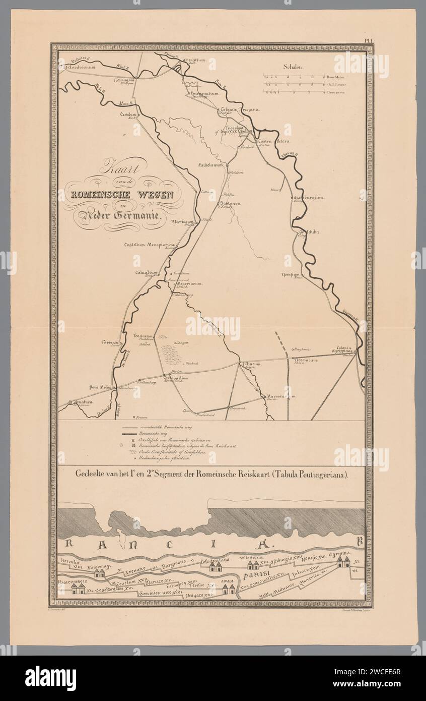 Map of the Roman roads in Lower Germanie, Tiemen Hooberg (Possible), T. Hooberg, After Conradus Leemans, 1843 print In addition to rivers and roads, remains of buildings and old burial mounds are also shown on the map. In the middle the legend with an explanation of the symbols. At the bottom of a part of the Tabula Peutingeriana, a Roman map from the third to fourth century. Numbered at the top right: pl. 1. Leiden paper maps, atlases. river. Rome (one of the four world empires). Roman script; scripts based on the Roman alphabet Stock Photohttps://www.alamy.com/image-license-details/?v=1https://www.alamy.com/map-of-the-roman-roads-in-lower-germanie-tiemen-hooberg-possible-t-hooberg-after-conradus-leemans-1843-print-in-addition-to-rivers-and-roads-remains-of-buildings-and-old-burial-mounds-are-also-shown-on-the-map-in-the-middle-the-legend-with-an-explanation-of-the-symbols-at-the-bottom-of-a-part-of-the-tabula-peutingeriana-a-roman-map-from-the-third-to-fourth-century-numbered-at-the-top-right-pl-1-leiden-paper-maps-atlases-river-rome-one-of-the-four-world-empires-roman-script-scripts-based-on-the-roman-alphabet-image592868831.html
RM2WCFE6R–Map of the Roman roads in Lower Germanie, Tiemen Hooberg (Possible), T. Hooberg, After Conradus Leemans, 1843 print In addition to rivers and roads, remains of buildings and old burial mounds are also shown on the map. In the middle the legend with an explanation of the symbols. At the bottom of a part of the Tabula Peutingeriana, a Roman map from the third to fourth century. Numbered at the top right: pl. 1. Leiden paper maps, atlases. river. Rome (one of the four world empires). Roman script; scripts based on the Roman alphabet
 Mappa Britanniae Septentrionalis Faciei Romanae. A view of the Roman Roads and antiquities of Northern Britain. . Mappa Britanniae Septentrionalis Faciei Romanae, secundum fidem Monumentorum per veterum depicta, ex Ricardo Corinense emendata, et in recentioribus geometricis atque astronomicis observationibus accommodata a G. Roy. England 1774. Mappa Britanniae Septentrionalis Faciei Romanae, secundum fidem Monumentorum per veterum depicta, ex Ricardo Corinense emendata, et in recentioribus geometricis atque astronomicis observationibus accommodata a G. Roy. Source: Maps K.Top.48.25.11.Tab Roll Stock Photohttps://www.alamy.com/image-license-details/?v=1https://www.alamy.com/mappa-britanniae-septentrionalis-faciei-romanae-a-view-of-the-roman-roads-and-antiquities-of-northern-britain-mappa-britanniae-septentrionalis-faciei-romanae-secundum-fidem-monumentorum-per-veterum-depicta-ex-ricardo-corinense-emendata-et-in-recentioribus-geometricis-atque-astronomicis-observationibus-accommodata-a-g-roy-england-1774-mappa-britanniae-septentrionalis-faciei-romanae-secundum-fidem-monumentorum-per-veterum-depicta-ex-ricardo-corinense-emendata-et-in-recentioribus-geometricis-atque-astronomicis-observationibus-accommodata-a-g-roy-source-maps-ktop482511tab-roll-image226771521.html
RMR4X9AW–Mappa Britanniae Septentrionalis Faciei Romanae. A view of the Roman Roads and antiquities of Northern Britain. . Mappa Britanniae Septentrionalis Faciei Romanae, secundum fidem Monumentorum per veterum depicta, ex Ricardo Corinense emendata, et in recentioribus geometricis atque astronomicis observationibus accommodata a G. Roy. England 1774. Mappa Britanniae Septentrionalis Faciei Romanae, secundum fidem Monumentorum per veterum depicta, ex Ricardo Corinense emendata, et in recentioribus geometricis atque astronomicis observationibus accommodata a G. Roy. Source: Maps K.Top.48.25.11.Tab Roll
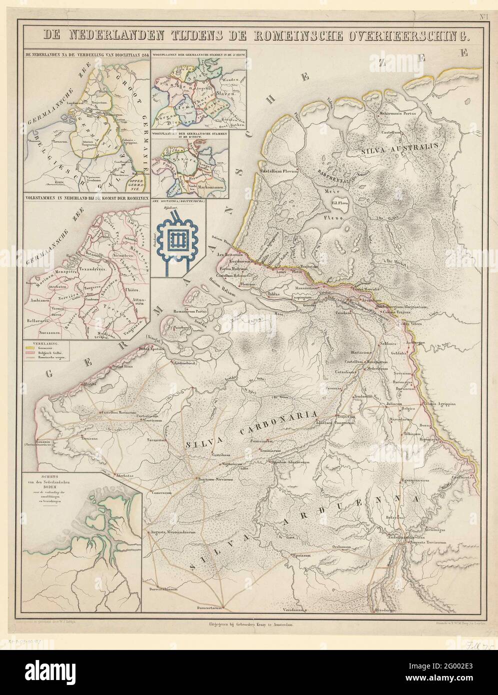 Map of the Netherlands in Roman times; The Netherlands during the Roman overlood. Map of the Netherlands in Roman times. With various bets with sub-cards and a map of Brittenburg. With the most important Roman roads and the border between Germany and Belgian Gaul. Numbered at the top right: No. I. Stock Photohttps://www.alamy.com/image-license-details/?v=1https://www.alamy.com/map-of-the-netherlands-in-roman-times-the-netherlands-during-the-roman-overlood-map-of-the-netherlands-in-roman-times-with-various-bets-with-sub-cards-and-a-map-of-brittenburg-with-the-most-important-roman-roads-and-the-border-between-germany-and-belgian-gaul-numbered-at-the-top-right-no-i-image430261163.html
RM2G002E3–Map of the Netherlands in Roman times; The Netherlands during the Roman overlood. Map of the Netherlands in Roman times. With various bets with sub-cards and a map of Brittenburg. With the most important Roman roads and the border between Germany and Belgian Gaul. Numbered at the top right: No. I.
 . An English history with illustrations and maps/ by E.S. Symes ; adapted for use in Canadian elementary schools by George M. Wrong. to theRomans that Britain was an island. If we look at a map of Roman Britain we find it coveredwith lines running from one town to another,almost as straight as if they had been drawnwith a ruler. These lines Iepresent the famous military roads,which the Romans, the greatest road-makers in the world,made to help in the task of conquering Britain. A part oftheir plan of conquest was to form in different commandingpositions camps in which they might station bodies Stock Photohttps://www.alamy.com/image-license-details/?v=1https://www.alamy.com/an-english-history-with-illustrations-and-maps-by-es-symes-adapted-for-use-in-canadian-elementary-schools-by-george-m-wrong-to-theromans-that-britain-was-an-island-if-we-look-at-a-map-of-roman-britain-we-find-it-coveredwith-lines-running-from-one-town-to-anotheralmost-as-straight-as-if-they-had-been-drawnwith-a-ruler-these-lines-iepresent-the-famous-military-roadswhich-the-romans-the-greatest-road-makers-in-the-worldmade-to-help-in-the-task-of-conquering-britain-a-part-oftheir-plan-of-conquest-was-to-form-in-different-commandingpositions-camps-in-which-they-might-station-bodies-image370531647.html
RM2CER4W3–. An English history with illustrations and maps/ by E.S. Symes ; adapted for use in Canadian elementary schools by George M. Wrong. to theRomans that Britain was an island. If we look at a map of Roman Britain we find it coveredwith lines running from one town to another,almost as straight as if they had been drawnwith a ruler. These lines Iepresent the famous military roads,which the Romans, the greatest road-makers in the world,made to help in the task of conquering Britain. A part oftheir plan of conquest was to form in different commandingpositions camps in which they might station bodies
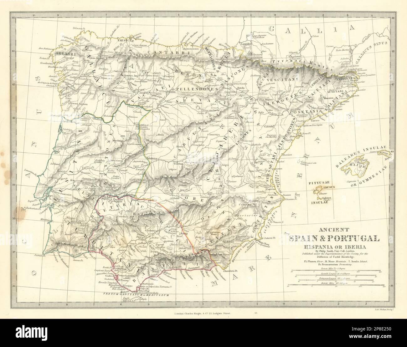 HISPANIA IBERIA. Ancient Spain & Portugal. Roman names & roads. SDUK 1844 map Stock Photohttps://www.alamy.com/image-license-details/?v=1https://www.alamy.com/hispania-iberia-ancient-spain-portugal-roman-names-roads-sduk-1844-map-image538747692.html
RF2P8E250–HISPANIA IBERIA. Ancient Spain & Portugal. Roman names & roads. SDUK 1844 map
![Roman military roads. Liber Additamentorum. England [St Albans]; circa 1250-1254. Source: Cotton Nero D. I, f.187v. Language: Latin. Author: PARIS, MATTHEW. Stock Photo Roman military roads. Liber Additamentorum. England [St Albans]; circa 1250-1254. Source: Cotton Nero D. I, f.187v. Language: Latin. Author: PARIS, MATTHEW. Stock Photo](https://c8.alamy.com/comp/R505A0/roman-military-roads-liber-additamentorum-england-st-albans-circa-1250-1254-source-cotton-nero-d-i-f187v-language-latin-author-paris-matthew-R505A0.jpg) Roman military roads. Liber Additamentorum. England [St Albans]; circa 1250-1254. Source: Cotton Nero D. I, f.187v. Language: Latin. Author: PARIS, MATTHEW. Stock Photohttps://www.alamy.com/image-license-details/?v=1https://www.alamy.com/roman-military-roads-liber-additamentorum-england-st-albans-circa-1250-1254-source-cotton-nero-d-i-f187v-language-latin-author-paris-matthew-image226812264.html
Roman military roads. Liber Additamentorum. England [St Albans]; circa 1250-1254. Source: Cotton Nero D. I, f.187v. Language: Latin. Author: PARIS, MATTHEW. Stock Photohttps://www.alamy.com/image-license-details/?v=1https://www.alamy.com/roman-military-roads-liber-additamentorum-england-st-albans-circa-1250-1254-source-cotton-nero-d-i-f187v-language-latin-author-paris-matthew-image226812264.htmlRMR505A0–Roman military roads. Liber Additamentorum. England [St Albans]; circa 1250-1254. Source: Cotton Nero D. I, f.187v. Language: Latin. Author: PARIS, MATTHEW.
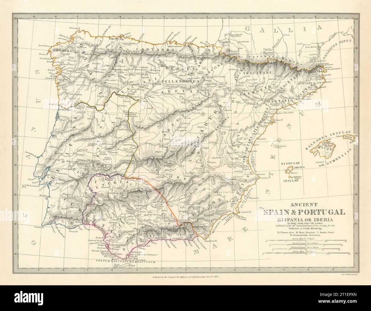 HISPANIA IBERIA. Ancient Spain & Portugal. Roman names & roads. SDUK 1844 map Stock Photohttps://www.alamy.com/image-license-details/?v=1https://www.alamy.com/hispania-iberia-ancient-spain-portugal-roman-names-roads-sduk-1844-map-image568882125.html
RF2T1EPXN–HISPANIA IBERIA. Ancient Spain & Portugal. Roman names & roads. SDUK 1844 map
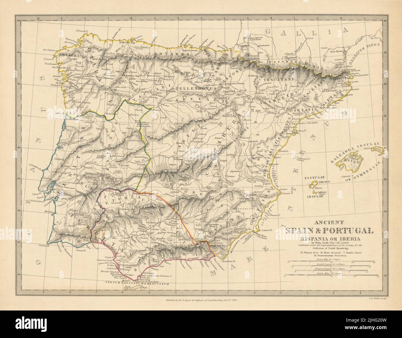 HISPANIA IBERIA. Ancient Spain & Portugal. Roman names & roads. SDUK 1848 map Stock Photohttps://www.alamy.com/image-license-details/?v=1https://www.alamy.com/hispania-iberia-ancient-spain-portugal-roman-names-roads-sduk-1848-map-image475481913.html
RF2JHG20W–HISPANIA IBERIA. Ancient Spain & Portugal. Roman names & roads. SDUK 1848 map
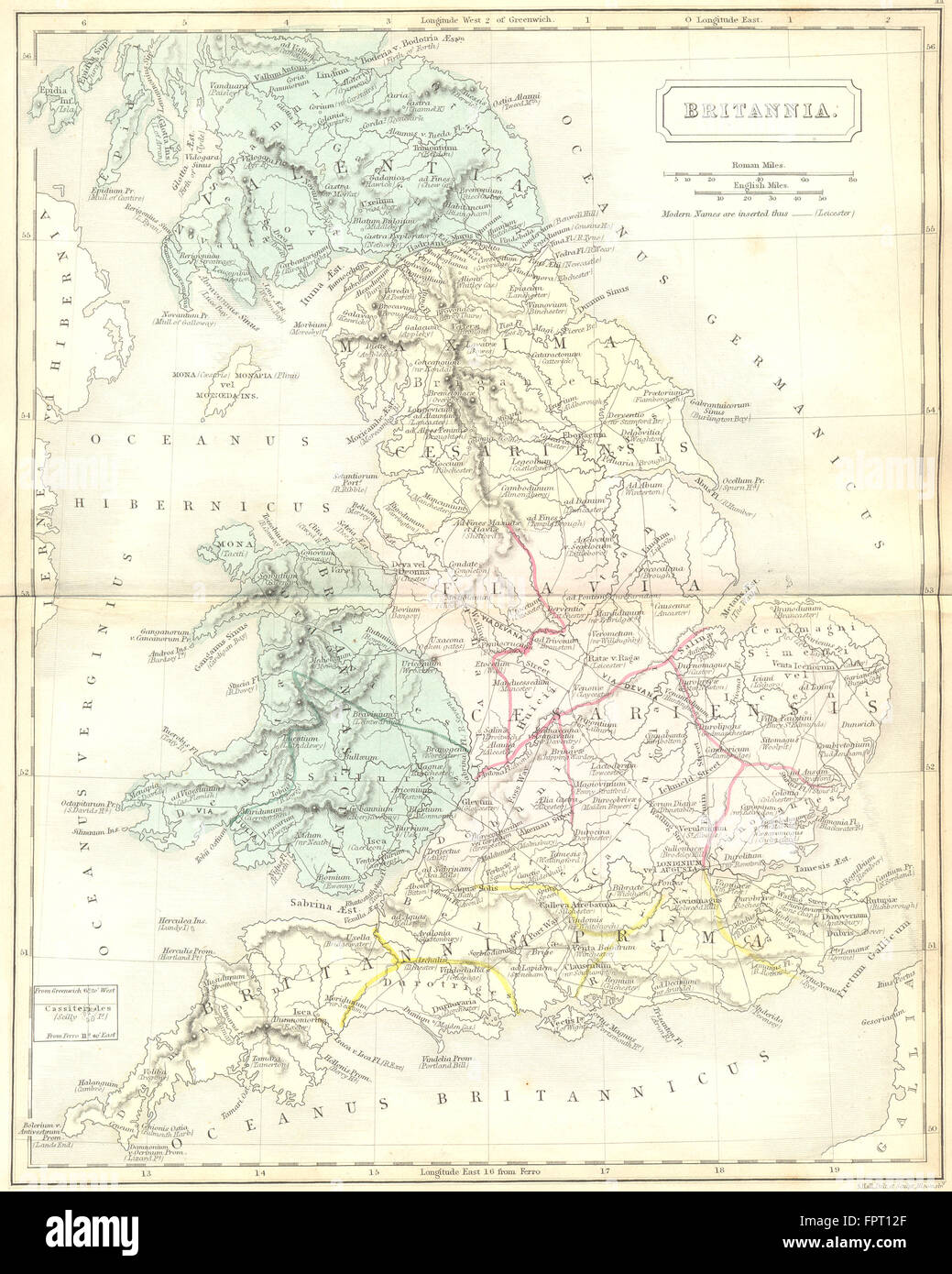 BRITANNIA: Roman Britain; roads town Butler, 1861 antique map Stock Photohttps://www.alamy.com/image-license-details/?v=1https://www.alamy.com/stock-photo-britannia-roman-britain-roads-town-butler-1861-antique-map-100101975.html
RFFPT12F–BRITANNIA: Roman Britain; roads town Butler, 1861 antique map
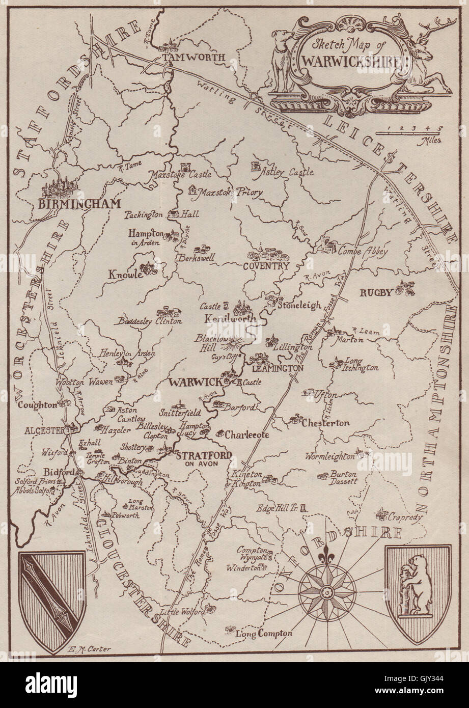 WARWICKSHIRE. Roman roads. Fosse Way. Watling Street. Icknield Street, 1906 map Stock Photohttps://www.alamy.com/image-license-details/?v=1https://www.alamy.com/stock-photo-warwickshire-roman-roads-fosse-way-watling-street-icknield-street-114921188.html
RFGJY344–WARWICKSHIRE. Roman roads. Fosse Way. Watling Street. Icknield Street, 1906 map
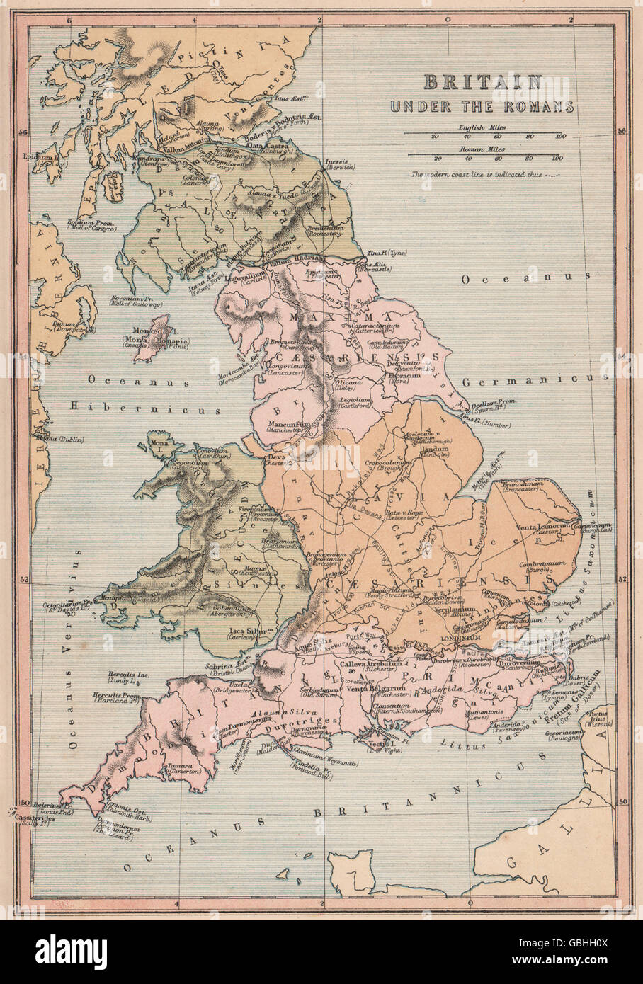 ROMAN BRITAIN: Showing provinces roads Latin town names. COLLINS, 1880 old map Stock Photohttps://www.alamy.com/image-license-details/?v=1https://www.alamy.com/stock-photo-roman-britain-showing-provinces-roads-latin-town-names-collins-1880-110409962.html
RFGBHH0X–ROMAN BRITAIN: Showing provinces roads Latin town names. COLLINS, 1880 old map
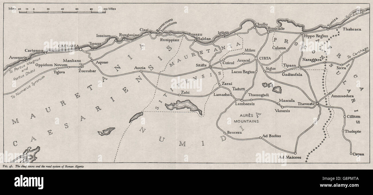 ROMAN ALGERIA: Chief towns & roads. WW2 ROYAL NAVY INTELLIGENCE MAP, 1943 Stock Photohttps://www.alamy.com/image-license-details/?v=1https://www.alamy.com/stock-photo-roman-algeria-chief-towns-roads-ww2-royal-navy-intelligence-map-1943-108678762.html
RFG8PMTA–ROMAN ALGERIA: Chief towns & roads. WW2 ROYAL NAVY INTELLIGENCE MAP, 1943
 GREAT BRITAIN & IRELAND. British Isles. Roman Roads. ARROWSMITH 1828 old map Stock Photohttps://www.alamy.com/image-license-details/?v=1https://www.alamy.com/great-britain-ireland-british-isles-roman-roads-arrowsmith-1828-old-map-image335425827.html
RF2ADKY1R–GREAT BRITAIN & IRELAND. British Isles. Roman Roads. ARROWSMITH 1828 old map
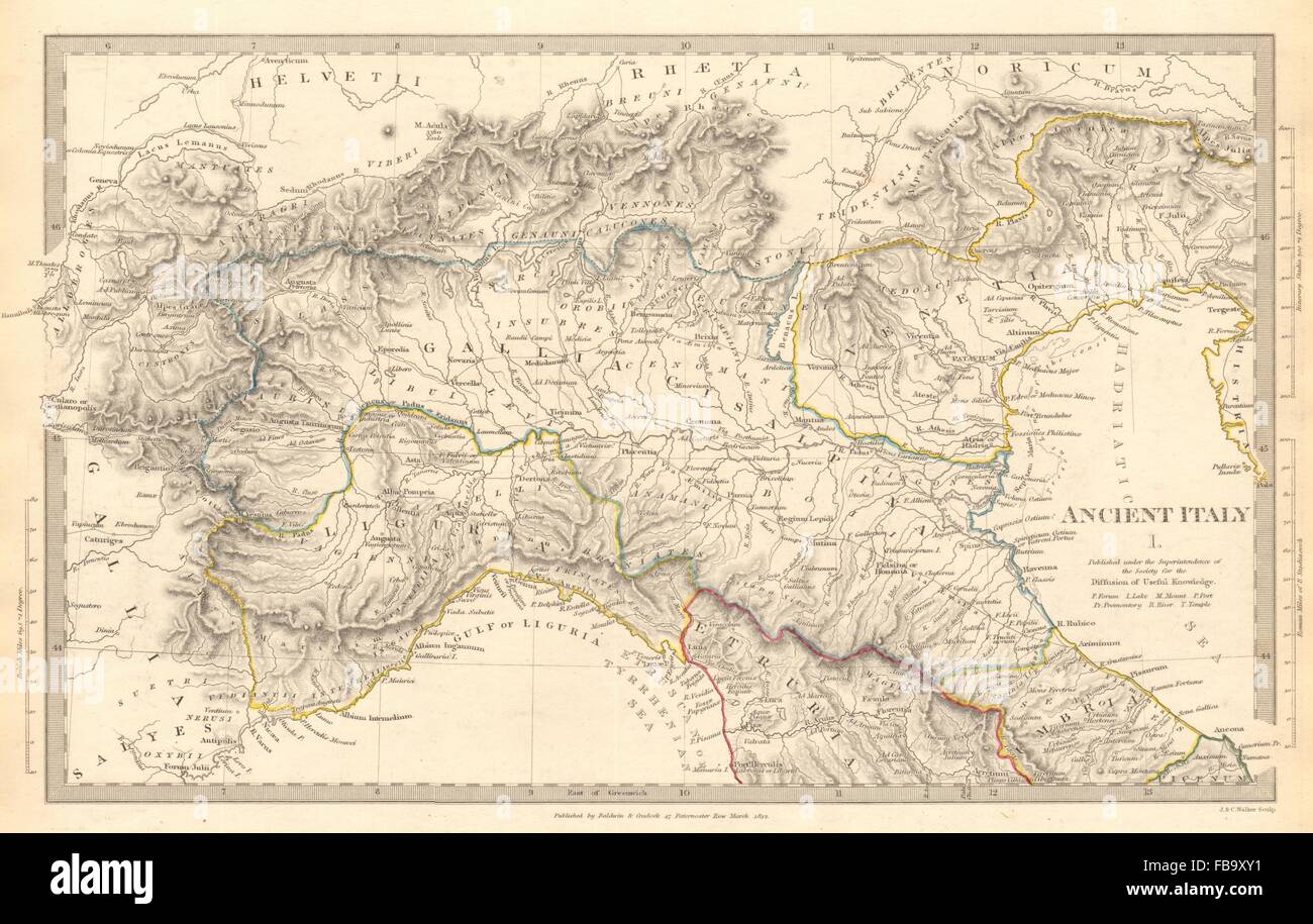 ANCIENT ROMAN ITALY NORTH.Liguria Venetia Gallia Cisalpina.Roads.SDUK, 1844 map Stock Photohttps://www.alamy.com/image-license-details/?v=1https://www.alamy.com/stock-photo-ancient-roman-italy-northliguria-venetia-gallia-cisalpinaroadssduk-93031765.html
RFFB9XY1–ANCIENT ROMAN ITALY NORTH.Liguria Venetia Gallia Cisalpina.Roads.SDUK, 1844 map
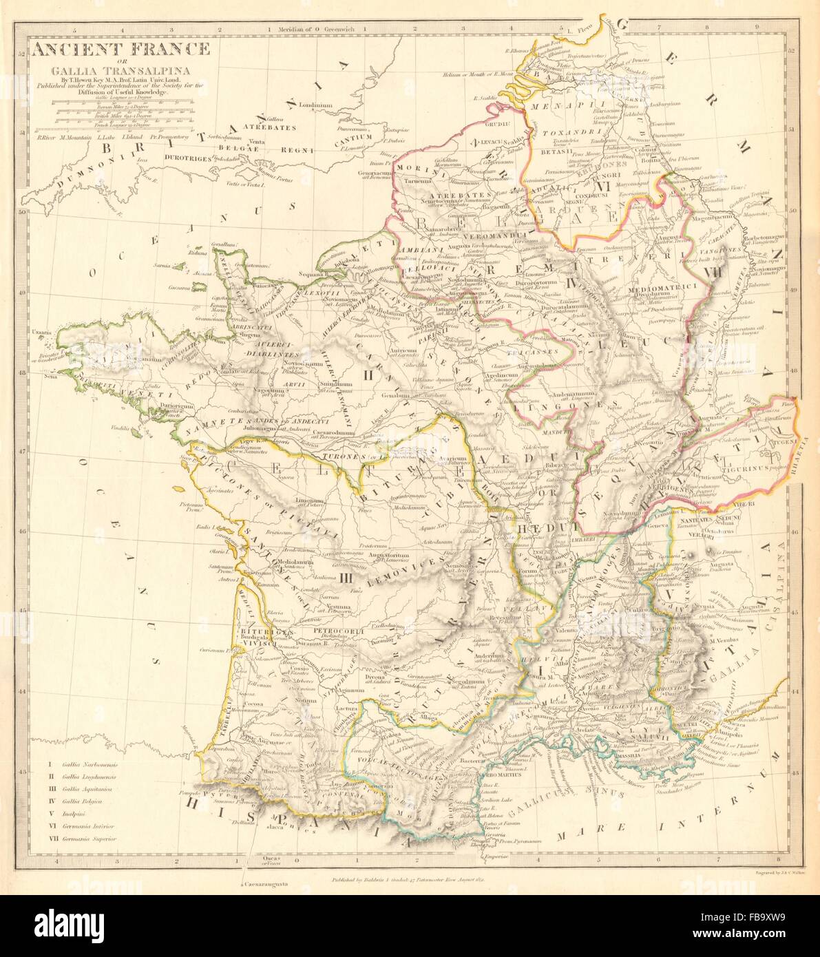 ANCIENT ROMAN FRANCE GAUL. Gallia Transalpina. Roman names roads.SDUK, 1844 map Stock Photohttps://www.alamy.com/image-license-details/?v=1https://www.alamy.com/stock-photo-ancient-roman-france-gaul-gallia-transalpina-roman-names-roadssduk-93031717.html
RFFB9XW9–ANCIENT ROMAN FRANCE GAUL. Gallia Transalpina. Roman names roads.SDUK, 1844 map
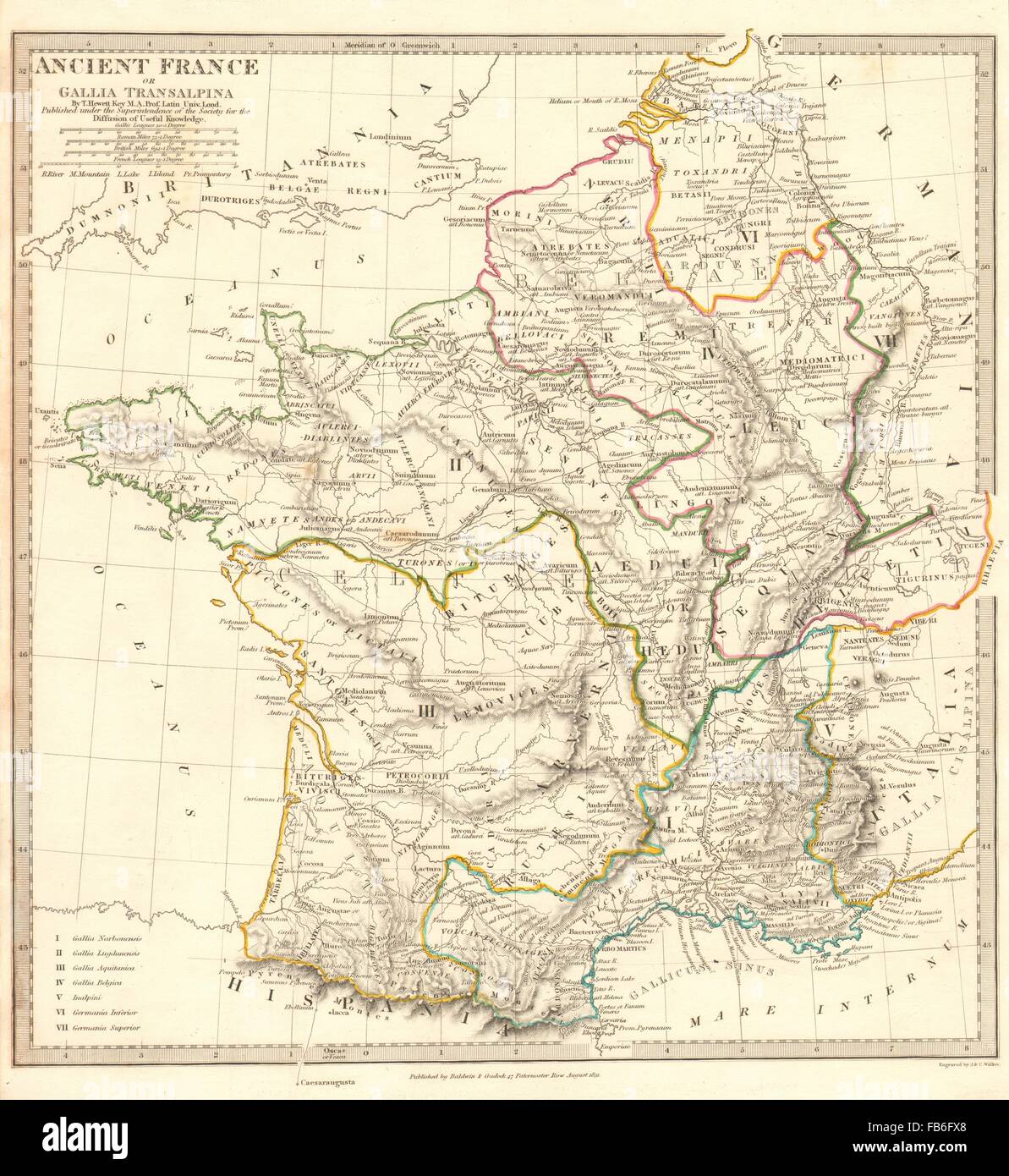 ANCIENT ROMAN FRANCE GAUL: Gallia Transalpina. Roman names roads.SDUK, 1848 map Stock Photohttps://www.alamy.com/image-license-details/?v=1https://www.alamy.com/stock-photo-ancient-roman-france-gaul-gallia-transalpina-roman-names-roadssduk-92957264.html
RFFB6FX8–ANCIENT ROMAN FRANCE GAUL: Gallia Transalpina. Roman names roads.SDUK, 1848 map
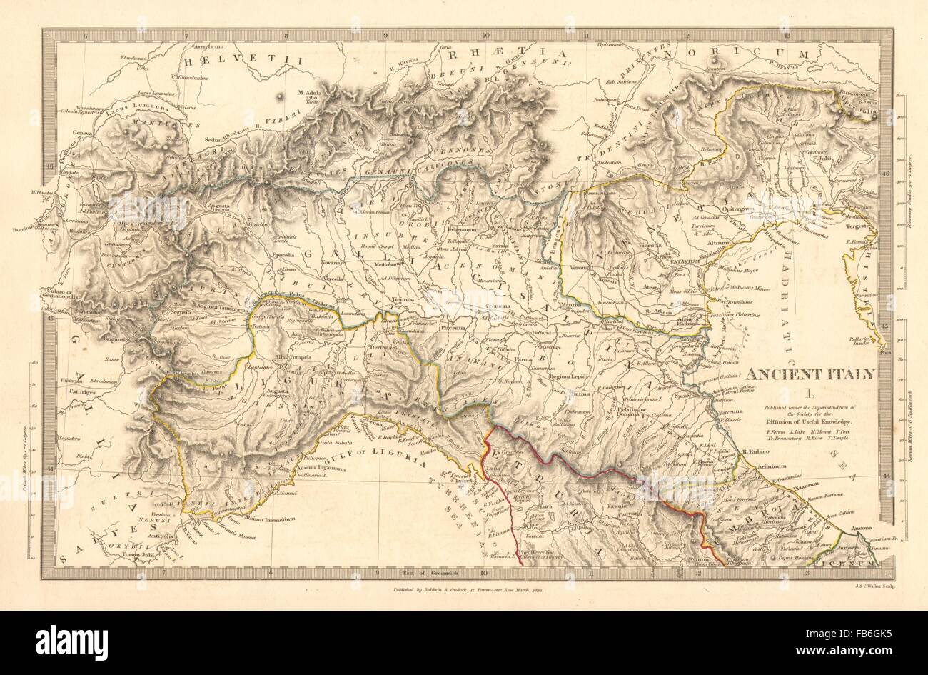 ANCIENT ROMAN ITALY NORTH:Liguria Venetia Gallia Cisalpina.Roads.SDUK, 1848 map Stock Photohttps://www.alamy.com/image-license-details/?v=1https://www.alamy.com/stock-photo-ancient-roman-italy-northliguria-venetia-gallia-cisalpinaroadssduk-92957849.html
RFFB6GK5–ANCIENT ROMAN ITALY NORTH:Liguria Venetia Gallia Cisalpina.Roads.SDUK, 1848 map