Quick filters:
Map of sheerness Stock Photos and Images
 Sheerness and surrounding areas shown on a road map or Geography map Stock Photohttps://www.alamy.com/image-license-details/?v=1https://www.alamy.com/sheerness-and-surrounding-areas-shown-on-a-road-map-or-geography-map-image406531642.html
RM2EHB376–Sheerness and surrounding areas shown on a road map or Geography map
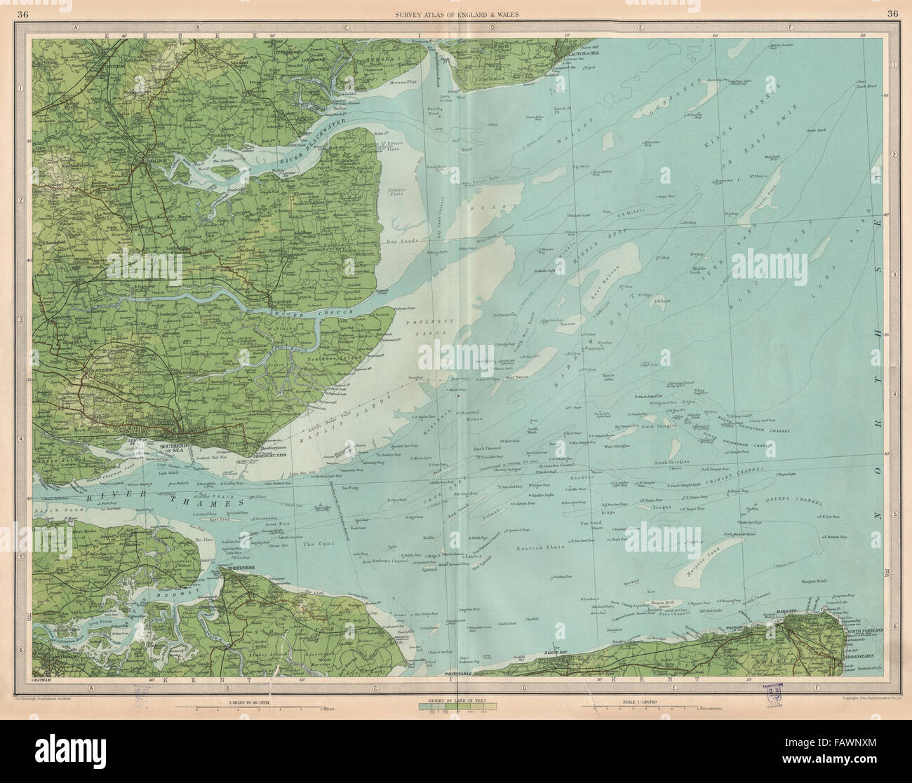 THAMES ESTUARY: Medway Southend-on-Sea Sheerness Margate Clacton.LARGE, 1939 map Stock Photohttps://www.alamy.com/image-license-details/?v=1https://www.alamy.com/stock-photo-thames-estuary-medway-southend-on-sea-sheerness-margate-clactonlarge-92764412.html
RFFAWNXM–THAMES ESTUARY: Medway Southend-on-Sea Sheerness Margate Clacton.LARGE, 1939 map
 Sheerness, Kent, United Kingdom, England, N 51 26' 25'', E 0 45' 45'', map, Timeless Map published in 2021. Travelers, explorers and adventurers like Florence Nightingale, David Livingstone, Ernest Shackleton, Lewis and Clark and Sherlock Holmes relied on maps to plan travels to the world's most remote corners, Timeless Maps is mapping most locations on the globe, showing the achievement of great dreams Stock Photohttps://www.alamy.com/image-license-details/?v=1https://www.alamy.com/sheerness-kent-united-kingdom-england-n-51-26-25-e-0-45-45-map-timeless-map-published-in-2021-travelers-explorers-and-adventurers-like-florence-nightingale-david-livingstone-ernest-shackleton-lewis-and-clark-and-sherlock-holmes-relied-on-maps-to-plan-travels-to-the-worlds-most-remote-corners-timeless-maps-is-mapping-most-locations-on-the-globe-showing-the-achievement-of-great-dreams-image439386800.html
RM2GERP9M–Sheerness, Kent, United Kingdom, England, N 51 26' 25'', E 0 45' 45'', map, Timeless Map published in 2021. Travelers, explorers and adventurers like Florence Nightingale, David Livingstone, Ernest Shackleton, Lewis and Clark and Sherlock Holmes relied on maps to plan travels to the world's most remote corners, Timeless Maps is mapping most locations on the globe, showing the achievement of great dreams
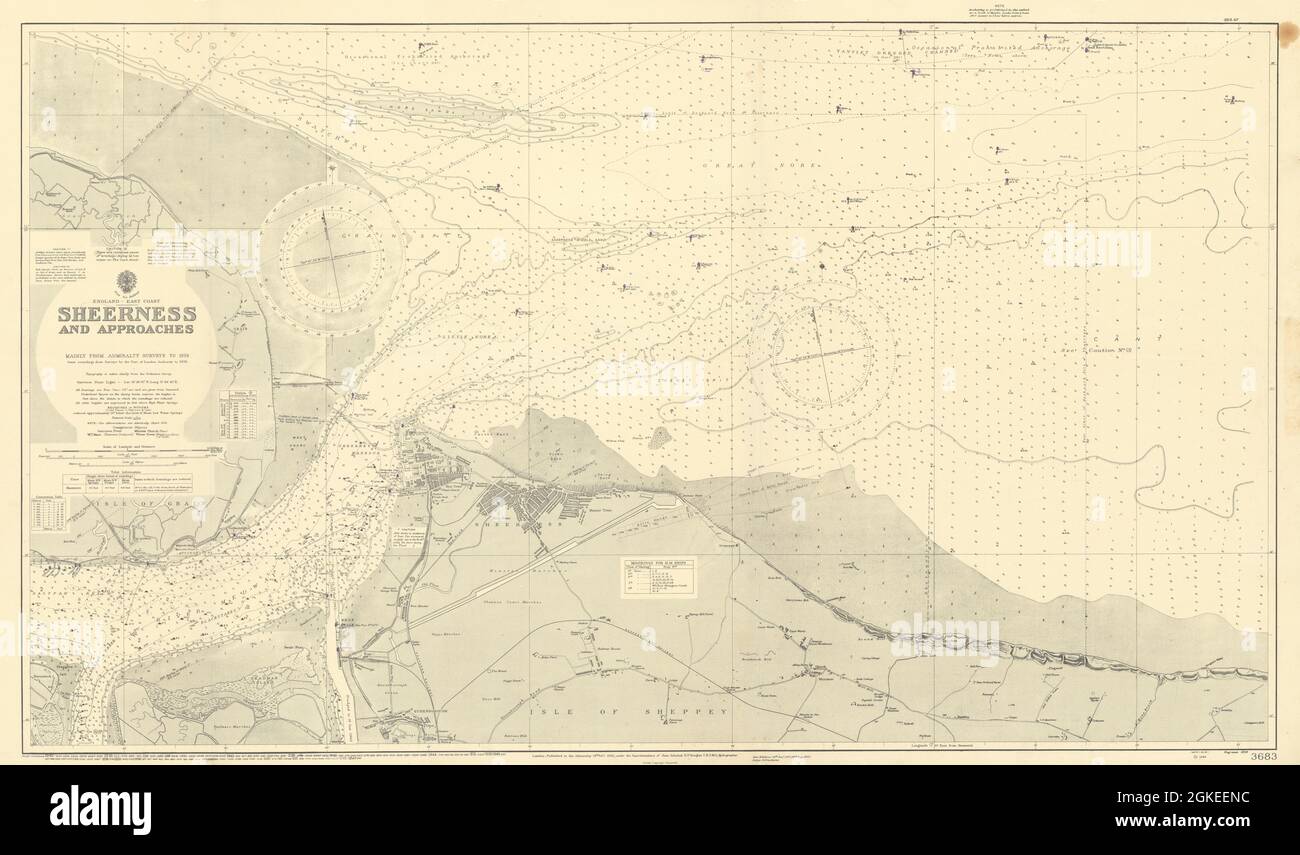 Sheerness & approaches. Medway Kent. ADMIRALTY sea chart 1930 (1948) old map Stock Photohttps://www.alamy.com/image-license-details/?v=1https://www.alamy.com/sheerness-approaches-medway-kent-admiralty-sea-chart-1930-1948-old-map-image442256568.html
RF2GKEENC–Sheerness & approaches. Medway Kent. ADMIRALTY sea chart 1930 (1948) old map
 Map of the estuary of the Thames showing the Journey to Chatham, 1667, Map of the estuary of the Thames showing the Journey to Chatham by the ships of the Dutch fleet under Admiral De Ruyter, 20-23 June 1667. On the left, the battle around Sheerness, above the Dutch ships on the River Medway. Bottom right a lion on a pedestal with the legend A-V., print, print maker: Michiel Comans (II), (mentioned on object), publisher: Justus Danckerts, (mentioned on object), print maker: Northern Netherlands, publisher: Amsterdam, 1667, paper, etching, height, 416 mm × width, 509 mm Stock Photohttps://www.alamy.com/image-license-details/?v=1https://www.alamy.com/map-of-the-estuary-of-the-thames-showing-the-journey-to-chatham-1667-map-of-the-estuary-of-the-thames-showing-the-journey-to-chatham-by-the-ships-of-the-dutch-fleet-under-admiral-de-ruyter-20-23-june-1667-on-the-left-the-battle-around-sheerness-above-the-dutch-ships-on-the-river-medway-bottom-right-a-lion-on-a-pedestal-with-the-legend-a-v-print-print-maker-michiel-comans-ii-mentioned-on-object-publisher-justus-danckerts-mentioned-on-object-print-maker-northern-netherlands-publisher-amsterdam-1667-paper-etching-height-416-mm-width-509-mm-image606628374.html
RM2X6X8K2–Map of the estuary of the Thames showing the Journey to Chatham, 1667, Map of the estuary of the Thames showing the Journey to Chatham by the ships of the Dutch fleet under Admiral De Ruyter, 20-23 June 1667. On the left, the battle around Sheerness, above the Dutch ships on the River Medway. Bottom right a lion on a pedestal with the legend A-V., print, print maker: Michiel Comans (II), (mentioned on object), publisher: Justus Danckerts, (mentioned on object), print maker: Northern Netherlands, publisher: Amsterdam, 1667, paper, etching, height, 416 mm × width, 509 mm
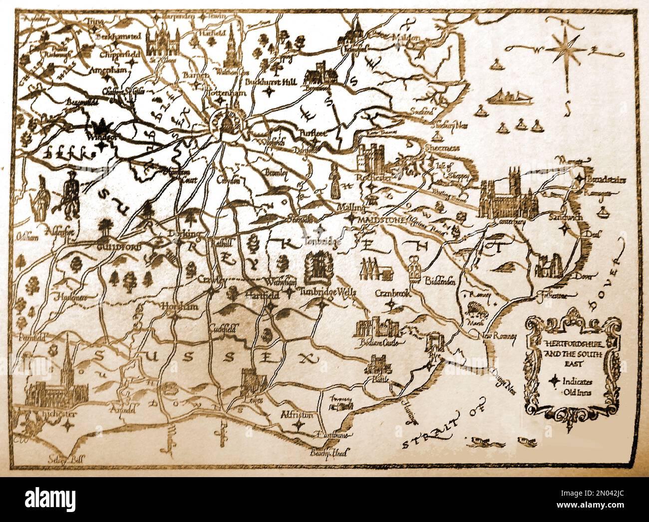 A 1946 map of part of southern England showing inns and places of interest. Stock Photohttps://www.alamy.com/image-license-details/?v=1https://www.alamy.com/a-1946-map-of-part-of-southern-england-showing-inns-and-places-of-interest-image516400932.html
RM2N042JC–A 1946 map of part of southern England showing inns and places of interest.
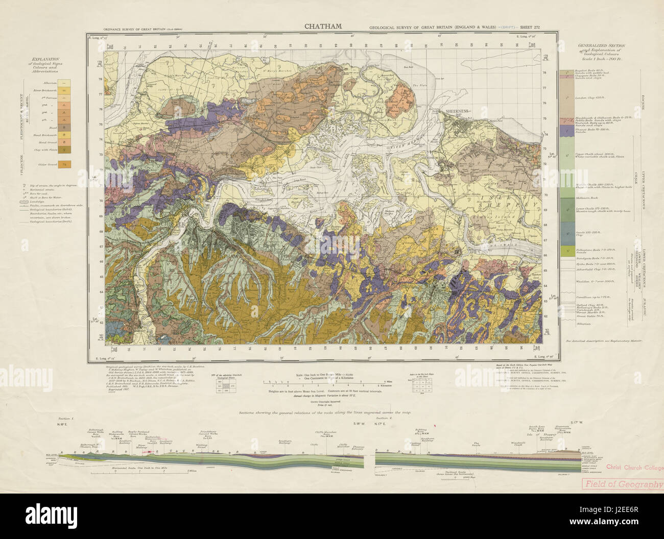 Chatham geological survey sheet 272 Medway Rochester Sheerness Sheppey 1957 map Stock Photohttps://www.alamy.com/image-license-details/?v=1https://www.alamy.com/stock-photo-chatham-geological-survey-sheet-272-medway-rochester-sheerness-sheppey-139230751.html
RFJ2EE6R–Chatham geological survey sheet 272 Medway Rochester Sheerness Sheppey 1957 map
 PLAN of the Present State of SHEERNESS Map information: Title: PLAN of the Present State of SHEERNESS ; 17.17. Date of publication: 1780. Item type: 1 map Medium: pen and ink Dimensions: 45.8 x 59.7 cm Former owner: George III, King of Great Britain, 1738-1820 Stock Photohttps://www.alamy.com/image-license-details/?v=1https://www.alamy.com/plan-of-the-present-state-of-sheerness-map-information-title-plan-of-the-present-state-of-sheerness-1717-date-of-publication-1780-item-type-1-map-medium-pen-and-ink-dimensions-458-x-597-cm-former-owner-george-iii-king-of-great-britain-1738-1820-image401749431.html
RM2E9H7DY–PLAN of the Present State of SHEERNESS Map information: Title: PLAN of the Present State of SHEERNESS ; 17.17. Date of publication: 1780. Item type: 1 map Medium: pen and ink Dimensions: 45.8 x 59.7 cm Former owner: George III, King of Great Britain, 1738-1820
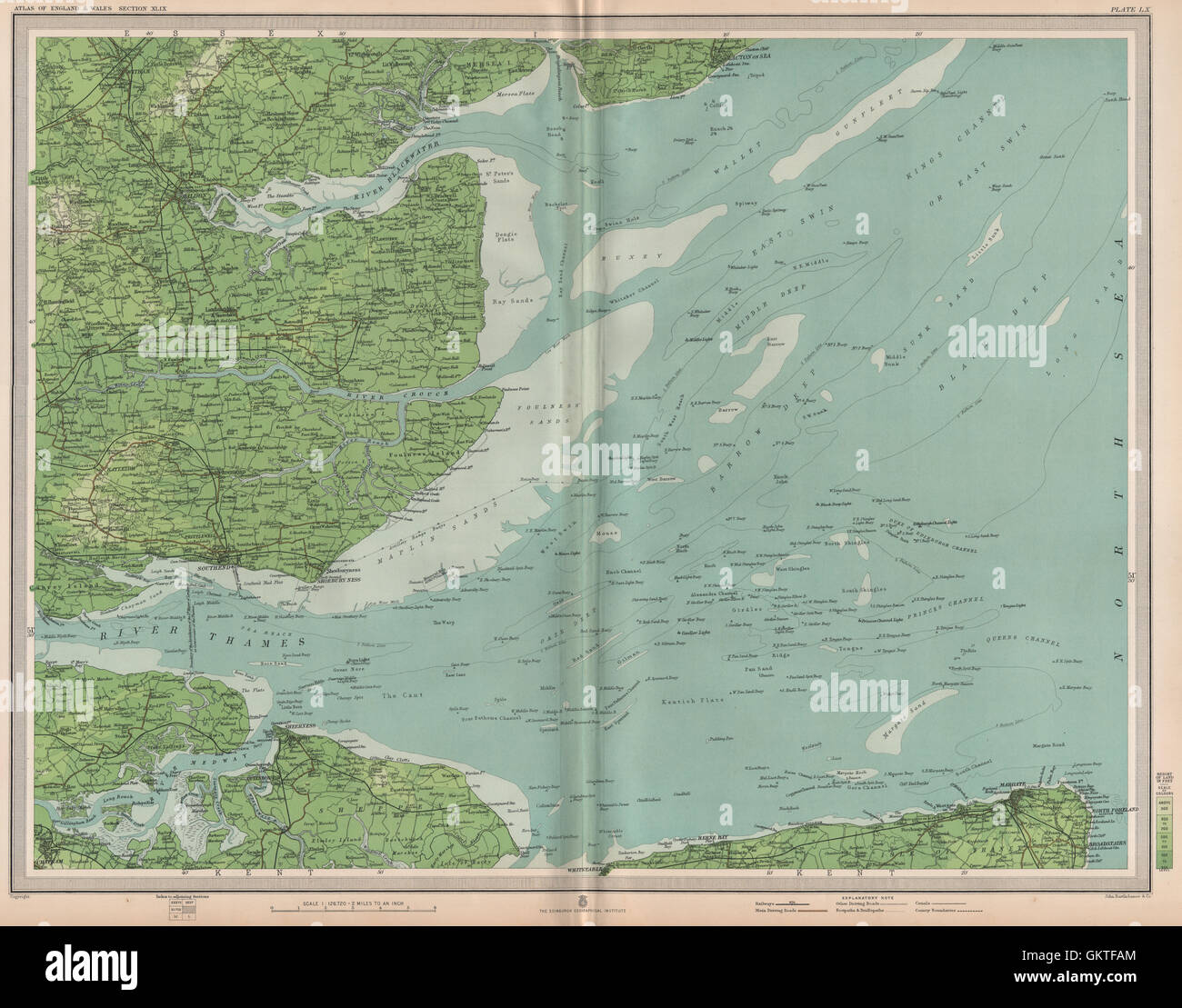 THAMES ESTUARY Buoys Lightships Medway Southend Sheerness Margate LARGE 1903 map Stock Photohttps://www.alamy.com/image-license-details/?v=1https://www.alamy.com/stock-photo-thames-estuary-buoys-lightships-medway-southend-sheerness-margate-115479580.html
RFGKTFAM–THAMES ESTUARY Buoys Lightships Medway Southend Sheerness Margate LARGE 1903 map
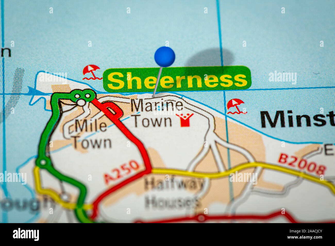 Blue Map Pin on Paper Map Showing Sheerness Stock Photohttps://www.alamy.com/image-license-details/?v=1https://www.alamy.com/blue-map-pin-on-paper-map-showing-sheerness-image333421451.html
RM2AACJCY–Blue Map Pin on Paper Map Showing Sheerness
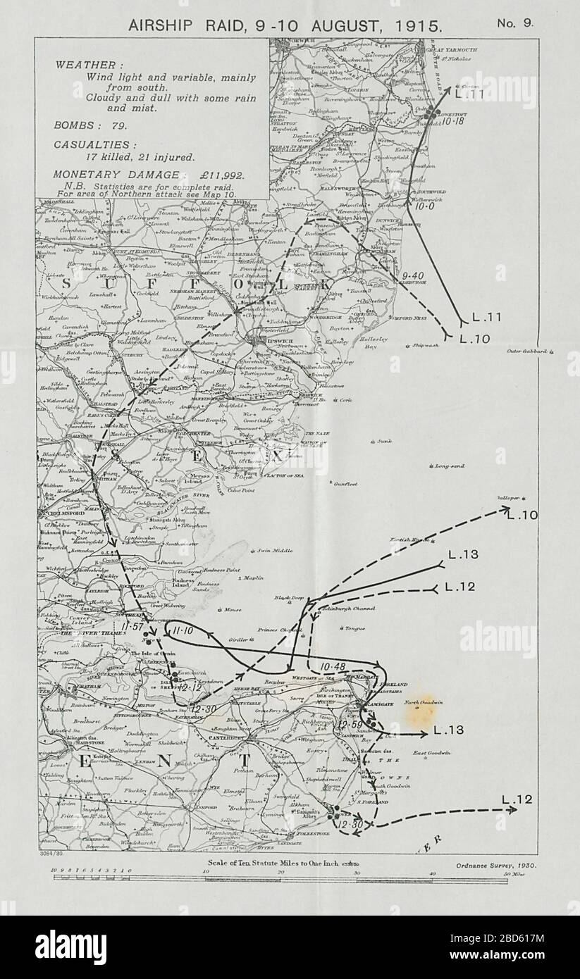 First World War German Airship raid August 1915 Lowestoft Dover Ramsgate Sheerness 1930 map Stock Photohttps://www.alamy.com/image-license-details/?v=1https://www.alamy.com/first-world-war-german-airship-raid-august-1915-lowestoft-dover-ramsgate-sheerness-1930-map-image352330600.html
RF2BD617M–First World War German Airship raid August 1915 Lowestoft Dover Ramsgate Sheerness 1930 map
 Sheerness, Kent, UK. 24th Jan, 2024. The Maritime and Coastguard Agency (MCA) have put out a half a million pounds tender for surveying the wreck of the SS Richard Montgomery in the Thames, which sank 1.5 miles off Sheerness, Kent with 1400 tons of explosives onboard back in August 1944. The three masts are expected to be cut off this year to reduce strain on the deteriorating vessel. Pic: the exclusion zone around the wreck seen on the Open Street Map website. Credit: James Bell/Alamy Live News Stock Photohttps://www.alamy.com/image-license-details/?v=1https://www.alamy.com/sheerness-kent-uk-24th-jan-2024-the-maritime-and-coastguard-agency-mca-have-put-out-a-half-a-million-pounds-tender-for-surveying-the-wreck-of-the-ss-richard-montgomery-in-the-thames-which-sank-15-miles-off-sheerness-kent-with-1400-tons-of-explosives-onboard-back-in-august-1944-the-three-masts-are-expected-to-be-cut-off-this-year-to-reduce-strain-on-the-deteriorating-vessel-pic-the-exclusion-zone-around-the-wreck-seen-on-the-open-street-map-website-credit-james-bellalamy-live-news-image593993450.html
RM2WEAMKP–Sheerness, Kent, UK. 24th Jan, 2024. The Maritime and Coastguard Agency (MCA) have put out a half a million pounds tender for surveying the wreck of the SS Richard Montgomery in the Thames, which sank 1.5 miles off Sheerness, Kent with 1400 tons of explosives onboard back in August 1944. The three masts are expected to be cut off this year to reduce strain on the deteriorating vessel. Pic: the exclusion zone around the wreck seen on the Open Street Map website. Credit: James Bell/Alamy Live News
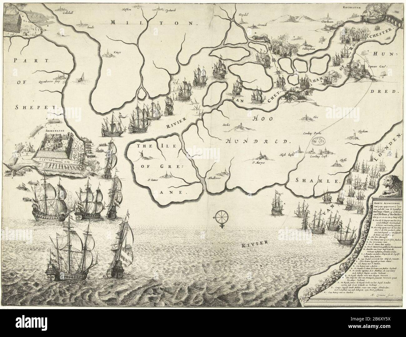 Kaart van monding van de Theems met de Tocht naar Chatham, 1667 Map of Thames estuary Where: on the Journey to Chatham by the ships of the States fleet under Admiral de Ruyter indicated, 20-23 June 1667. Left the battle around Sheerness, over the Dutch ships on the river Medway. Right a lion on a pedestal on which the legend AV. Manufacturer : printmaker: Michiel Comans (II) (listed building) Dated: 1667 Physical features: etching and engra material: paper Technique: engra (printing process) / etch dimensions: sheet: H 418 mm × b mm Subject 553: maps or separate countries or regions battle (+ Stock Photohttps://www.alamy.com/image-license-details/?v=1https://www.alamy.com/kaart-van-monding-van-de-theems-met-de-tocht-naar-chatham-1667-map-of-thames-estuary-where-on-the-journey-to-chatham-by-the-ships-of-the-states-fleet-under-admiral-de-ruyter-indicated-20-23-june-1667-left-the-battle-around-sheerness-over-the-dutch-ships-on-the-river-medway-right-a-lion-on-a-pedestal-on-which-the-legend-av-manufacturer-printmaker-michiel-comans-ii-listed-building-dated-1667-physical-features-etching-and-engra-material-paper-technique-engra-printing-process-etch-dimensions-sheet-h-418-mm-b-mm-subject-553-maps-or-separate-countries-or-regions-battle-image348487382.html
RM2B6XY5X–Kaart van monding van de Theems met de Tocht naar Chatham, 1667 Map of Thames estuary Where: on the Journey to Chatham by the ships of the States fleet under Admiral de Ruyter indicated, 20-23 June 1667. Left the battle around Sheerness, over the Dutch ships on the river Medway. Right a lion on a pedestal on which the legend AV. Manufacturer : printmaker: Michiel Comans (II) (listed building) Dated: 1667 Physical features: etching and engra material: paper Technique: engra (printing process) / etch dimensions: sheet: H 418 mm × b mm Subject 553: maps or separate countries or regions battle (+
 Dutch raid against Chatham and Sheerness IMG 7038 Stock Photohttps://www.alamy.com/image-license-details/?v=1https://www.alamy.com/stock-photo-dutch-raid-against-chatham-and-sheerness-img-7038-142850809.html
RMJ8BBJH–Dutch raid against Chatham and Sheerness IMG 7038
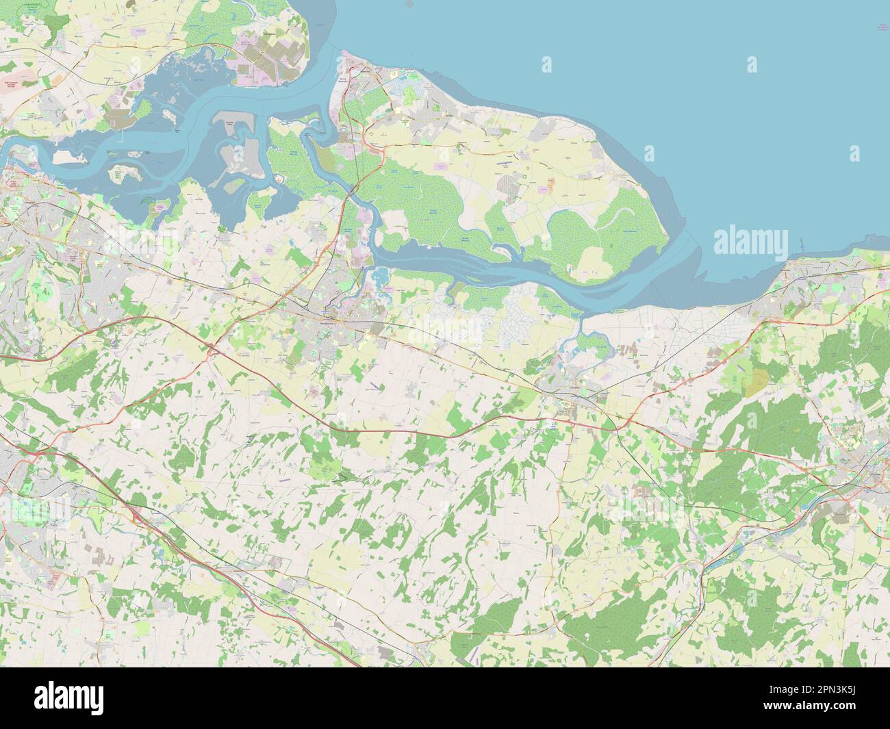 Swale, non metropolitan district of England - Great Britain. Open Street Map Stock Photohttps://www.alamy.com/image-license-details/?v=1https://www.alamy.com/swale-non-metropolitan-district-of-england-great-britain-open-street-map-image546510094.html
RF2PN3K5J–Swale, non metropolitan district of England - Great Britain. Open Street Map
 William Turner Wachschiff beim Great Nore Sheerness 1050 Stock Photohttps://www.alamy.com/image-license-details/?v=1https://www.alamy.com/stock-image-william-turner-wachschiff-beim-great-nore-sheerness-1050-162244584.html
RMKBXTHC–William Turner Wachschiff beim Great Nore Sheerness 1050
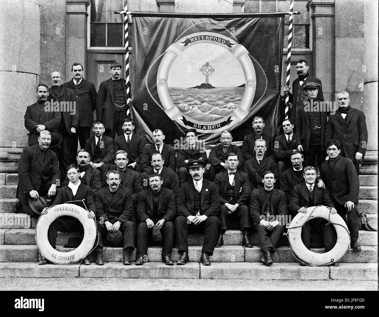 National Seamens and Firemans Union, Waterford 32507954936 o Stock Photohttps://www.alamy.com/image-license-details/?v=1https://www.alamy.com/stock-photo-national-seamens-and-firemans-union-waterford-32507954936-o-147097664.html
RMJF8TG0–National Seamens and Firemans Union, Waterford 32507954936 o
![Image taken from page 7 of '[Guide to Sheerness-on-Sea and the Isle of Sheppey. [By A. W. M.] Third edition.]' Image taken from page 7 of '[Guide to Sheerness-on-Sea and Stock Photo Image taken from page 7 of '[Guide to Sheerness-on-Sea and the Isle of Sheppey. [By A. W. M.] Third edition.]' Image taken from page 7 of '[Guide to Sheerness-on-Sea and Stock Photo](https://c8.alamy.com/comp/HFP5JF/image-taken-from-page-7-of-guide-to-sheerness-on-sea-and-the-isle-HFP5JF.jpg) Image taken from page 7 of '[Guide to Sheerness-on-Sea and the Isle of Sheppey. [By A. W. M.] Third edition.]' Image taken from page 7 of '[Guide to Sheerness-on-Sea and Stock Photohttps://www.alamy.com/image-license-details/?v=1https://www.alamy.com/stock-photo-image-taken-from-page-7-of-guide-to-sheerness-on-sea-and-the-isle-130179799.html
Image taken from page 7 of '[Guide to Sheerness-on-Sea and the Isle of Sheppey. [By A. W. M.] Third edition.]' Image taken from page 7 of '[Guide to Sheerness-on-Sea and Stock Photohttps://www.alamy.com/image-license-details/?v=1https://www.alamy.com/stock-photo-image-taken-from-page-7-of-guide-to-sheerness-on-sea-and-the-isle-130179799.htmlRMHFP5JF–Image taken from page 7 of '[Guide to Sheerness-on-Sea and the Isle of Sheppey. [By A. W. M.] Third edition.]' Image taken from page 7 of '[Guide to Sheerness-on-Sea and
 Sheerness-on-Sea Railway Station, Kent, GB, United Kingdom, England, N 51 26' 26'', N 0 45' 29'', map, Cartascapes Map published in 2024. Explore Cartascapes, a map revealing Earth's diverse landscapes, cultures, and ecosystems. Journey through time and space, discovering the interconnectedness of our planet's past, present, and future. Stock Photohttps://www.alamy.com/image-license-details/?v=1https://www.alamy.com/sheerness-on-sea-railway-station-kent-gb-united-kingdom-england-n-51-26-26-n-0-45-29-map-cartascapes-map-published-in-2024-explore-cartascapes-a-map-revealing-earths-diverse-landscapes-cultures-and-ecosystems-journey-through-time-and-space-discovering-the-interconnectedness-of-our-planets-past-present-and-future-image604216368.html
RM2X30C40–Sheerness-on-Sea Railway Station, Kent, GB, United Kingdom, England, N 51 26' 26'', N 0 45' 29'', map, Cartascapes Map published in 2024. Explore Cartascapes, a map revealing Earth's diverse landscapes, cultures, and ecosystems. Journey through time and space, discovering the interconnectedness of our planet's past, present, and future.
 Map of the mouth of the Thames with the Journey to Chatham, 1667, True Depiction, of what was carried out by part of the National War Fleet, on the River Chattam or Rochester, the 19th, 20th, 21st, 22 and 23 June, 1667 (title on object), Map of the Thames estuary showing the Journey to Chatham by the ships of the Dutch fleet under Admiral De Ruyter, 20-23 June 1667. On the left the battle around Sheerness, above the Dutch ships on the River Medway. Bottom right a lion on a pedestal with the legend A-V. A text sheet accompanies the plate., print, print maker: Michiel Comans (II), (mentioned on Stock Photohttps://www.alamy.com/image-license-details/?v=1https://www.alamy.com/map-of-the-mouth-of-the-thames-with-the-journey-to-chatham-1667-true-depiction-of-what-was-carried-out-by-part-of-the-national-war-fleet-on-the-river-chattam-or-rochester-the-19th-20th-21st-22-and-23-june-1667-title-on-object-map-of-the-thames-estuary-showing-the-journey-to-chatham-by-the-ships-of-the-dutch-fleet-under-admiral-de-ruyter-20-23-june-1667-on-the-left-the-battle-around-sheerness-above-the-dutch-ships-on-the-river-medway-bottom-right-a-lion-on-a-pedestal-with-the-legend-a-v-a-text-sheet-accompanies-the-plate-print-print-maker-michiel-comans-ii-mentioned-on-image606628366.html
RM2X6X8JP–Map of the mouth of the Thames with the Journey to Chatham, 1667, True Depiction, of what was carried out by part of the National War Fleet, on the River Chattam or Rochester, the 19th, 20th, 21st, 22 and 23 June, 1667 (title on object), Map of the Thames estuary showing the Journey to Chatham by the ships of the Dutch fleet under Admiral De Ruyter, 20-23 June 1667. On the left the battle around Sheerness, above the Dutch ships on the River Medway. Bottom right a lion on a pedestal with the legend A-V. A text sheet accompanies the plate., print, print maker: Michiel Comans (II), (mentioned on
![Elevation of the wharf at Sheerness . Map information: Title: [Elevation of the wharf at Sheerness]. 17.19.f. Date of publication: 1740 c. Item type: 1 drawing Medium: pen and ink with coloured wash Dimensions: 25.2 x 49.0 cm Former owner: George III, King of Great Britain, 1738-1820 Stock Photo Elevation of the wharf at Sheerness . Map information: Title: [Elevation of the wharf at Sheerness]. 17.19.f. Date of publication: 1740 c. Item type: 1 drawing Medium: pen and ink with coloured wash Dimensions: 25.2 x 49.0 cm Former owner: George III, King of Great Britain, 1738-1820 Stock Photo](https://c8.alamy.com/comp/2E9H7E7/elevation-of-the-wharf-at-sheerness-map-information-title-elevation-of-the-wharf-at-sheerness-1719f-date-of-publication-1740-c-item-type-1-drawing-medium-pen-and-ink-with-coloured-wash-dimensions-252-x-490-cm-former-owner-george-iii-king-of-great-britain-1738-1820-2E9H7E7.jpg) Elevation of the wharf at Sheerness . Map information: Title: [Elevation of the wharf at Sheerness]. 17.19.f. Date of publication: 1740 c. Item type: 1 drawing Medium: pen and ink with coloured wash Dimensions: 25.2 x 49.0 cm Former owner: George III, King of Great Britain, 1738-1820 Stock Photohttps://www.alamy.com/image-license-details/?v=1https://www.alamy.com/elevation-of-the-wharf-at-sheerness-map-information-title-elevation-of-the-wharf-at-sheerness-1719f-date-of-publication-1740-c-item-type-1-drawing-medium-pen-and-ink-with-coloured-wash-dimensions-252-x-490-cm-former-owner-george-iii-king-of-great-britain-1738-1820-image401749439.html
Elevation of the wharf at Sheerness . Map information: Title: [Elevation of the wharf at Sheerness]. 17.19.f. Date of publication: 1740 c. Item type: 1 drawing Medium: pen and ink with coloured wash Dimensions: 25.2 x 49.0 cm Former owner: George III, King of Great Britain, 1738-1820 Stock Photohttps://www.alamy.com/image-license-details/?v=1https://www.alamy.com/elevation-of-the-wharf-at-sheerness-map-information-title-elevation-of-the-wharf-at-sheerness-1719f-date-of-publication-1740-c-item-type-1-drawing-medium-pen-and-ink-with-coloured-wash-dimensions-252-x-490-cm-former-owner-george-iii-king-of-great-britain-1738-1820-image401749439.htmlRM2E9H7E7–Elevation of the wharf at Sheerness . Map information: Title: [Elevation of the wharf at Sheerness]. 17.19.f. Date of publication: 1740 c. Item type: 1 drawing Medium: pen and ink with coloured wash Dimensions: 25.2 x 49.0 cm Former owner: George III, King of Great Britain, 1738-1820
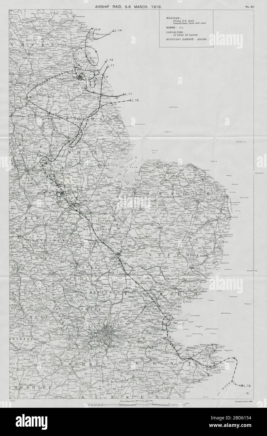 First World War German Airship raid 5-6 March 1916 Sheerness Hull Beverley 1930 old map Stock Photohttps://www.alamy.com/image-license-details/?v=1https://www.alamy.com/first-world-war-german-airship-raid-5-6-march-1916-sheerness-hull-beverley-1930-old-map-image352330528.html
RF2BD6154–First World War German Airship raid 5-6 March 1916 Sheerness Hull Beverley 1930 old map
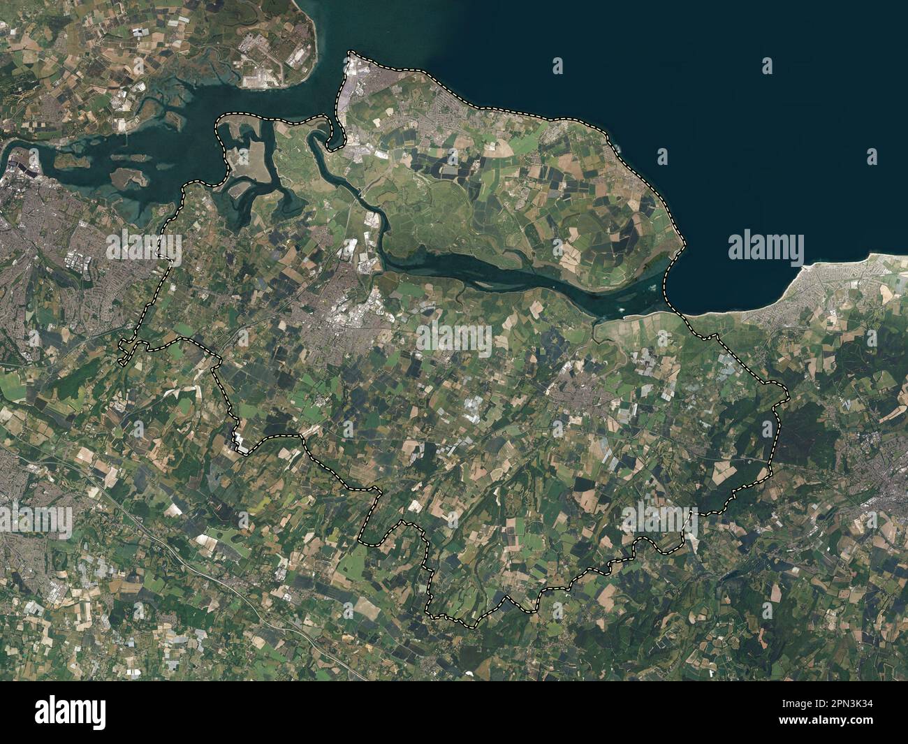 Swale, non metropolitan district of England - Great Britain. High resolution satellite map Stock Photohttps://www.alamy.com/image-license-details/?v=1https://www.alamy.com/swale-non-metropolitan-district-of-england-great-britain-high-resolution-satellite-map-image546510024.html
RF2PN3K34–Swale, non metropolitan district of England - Great Britain. High resolution satellite map
 Joseph Mallord William Turner - Sheerness as seen from the Nore - Stock Photohttps://www.alamy.com/image-license-details/?v=1https://www.alamy.com/stock-photo-joseph-mallord-william-turner-sheerness-as-seen-from-the-nore-148397094.html
RMJHC206–Joseph Mallord William Turner - Sheerness as seen from the Nore -
 Sheerness, Kent, GB, United Kingdom, England, N 51 26' 14'', N 0 44' 34'', map, Cartascapes Map published in 2024. Explore Cartascapes, a map revealing Earth's diverse landscapes, cultures, and ecosystems. Journey through time and space, discovering the interconnectedness of our planet's past, present, and future. Stock Photohttps://www.alamy.com/image-license-details/?v=1https://www.alamy.com/sheerness-kent-gb-united-kingdom-england-n-51-26-14-n-0-44-34-map-cartascapes-map-published-in-2024-explore-cartascapes-a-map-revealing-earths-diverse-landscapes-cultures-and-ecosystems-journey-through-time-and-space-discovering-the-interconnectedness-of-our-planets-past-present-and-future-image604081565.html
RM2X2P85H–Sheerness, Kent, GB, United Kingdom, England, N 51 26' 14'', N 0 44' 34'', map, Cartascapes Map published in 2024. Explore Cartascapes, a map revealing Earth's diverse landscapes, cultures, and ecosystems. Journey through time and space, discovering the interconnectedness of our planet's past, present, and future.
 The Dutch Raid on the Medway, 1667, Sheet with two scenes about the Journey to Chatham on June 20-23, 1667 by the Dutch fleet under Admiral De Ruyter. On the left is a map of the English east coast and the Thames and Medway estuaries. On the right the Dutch fleet on the Thames and the fighting around the Isle of Sheppey and the towns of Sheerness and Chatham. On the sheet below the scene a description in 3 columns., print, print maker: anonymous, publisher: Marcus Willemsz. Doornick, (mentioned on object), print maker: Northern Netherlands, publisher: Amsterdam, 1667, paper, etching Stock Photohttps://www.alamy.com/image-license-details/?v=1https://www.alamy.com/the-dutch-raid-on-the-medway-1667-sheet-with-two-scenes-about-the-journey-to-chatham-on-june-20-23-1667-by-the-dutch-fleet-under-admiral-de-ruyter-on-the-left-is-a-map-of-the-english-east-coast-and-the-thames-and-medway-estuaries-on-the-right-the-dutch-fleet-on-the-thames-and-the-fighting-around-the-isle-of-sheppey-and-the-towns-of-sheerness-and-chatham-on-the-sheet-below-the-scene-a-description-in-3-columns-print-print-maker-anonymous-publisher-marcus-willemsz-doornick-mentioned-on-object-print-maker-northern-netherlands-publisher-amsterdam-1667-paper-etching-image606628358.html
RM2X6X8JE–The Dutch Raid on the Medway, 1667, Sheet with two scenes about the Journey to Chatham on June 20-23, 1667 by the Dutch fleet under Admiral De Ruyter. On the left is a map of the English east coast and the Thames and Medway estuaries. On the right the Dutch fleet on the Thames and the fighting around the Isle of Sheppey and the towns of Sheerness and Chatham. On the sheet below the scene a description in 3 columns., print, print maker: anonymous, publisher: Marcus Willemsz. Doornick, (mentioned on object), print maker: Northern Netherlands, publisher: Amsterdam, 1667, paper, etching
 A PLAN of SHEERNESS. 1732. Map information: Title: A PLAN of SHEERNESS. 1732. 17.15.1. Date of publication: 1732 c. Item type: 1 map Medium: pen and ink Dimensions: 52.1 X 72.5 cm Former owner: George III, King of Great Britain, 1738-1820 Stock Photohttps://www.alamy.com/image-license-details/?v=1https://www.alamy.com/a-plan-of-sheerness-1732-map-information-title-a-plan-of-sheerness-1732-17151-date-of-publication-1732-c-item-type-1-map-medium-pen-and-ink-dimensions-521-x-725-cm-former-owner-george-iii-king-of-great-britain-1738-1820-image401749422.html
RM2E9H7DJ–A PLAN of SHEERNESS. 1732. Map information: Title: A PLAN of SHEERNESS. 1732. 17.15.1. Date of publication: 1732 c. Item type: 1 map Medium: pen and ink Dimensions: 52.1 X 72.5 cm Former owner: George III, King of Great Britain, 1738-1820
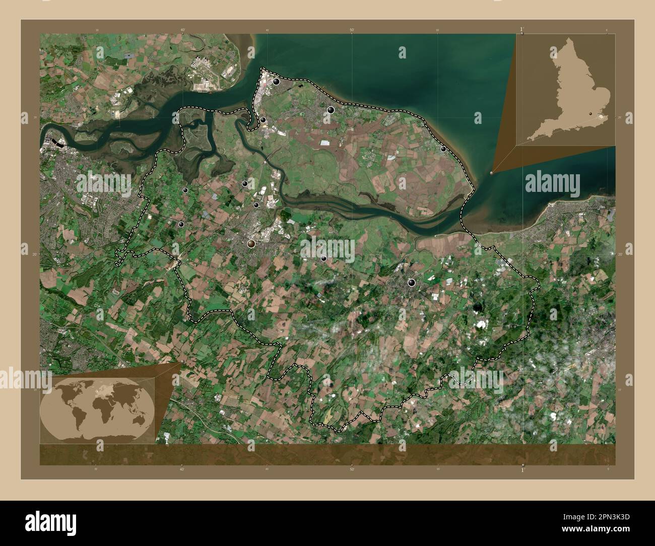
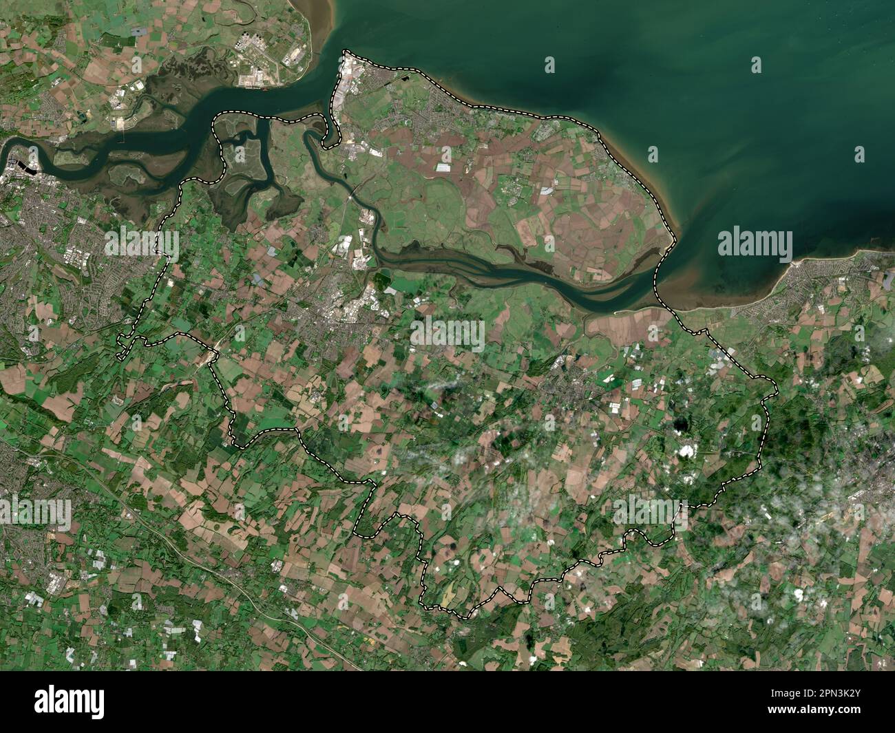 Swale, non metropolitan district of England - Great Britain. Low resolution satellite map Stock Photohttps://www.alamy.com/image-license-details/?v=1https://www.alamy.com/swale-non-metropolitan-district-of-england-great-britain-low-resolution-satellite-map-image546510019.html
RF2PN3K2Y–Swale, non metropolitan district of England - Great Britain. Low resolution satellite map
 Isaac Sailmaker - Ships in the Thames Estuary near Sheerness - Stock Photohttps://www.alamy.com/image-license-details/?v=1https://www.alamy.com/stock-photo-isaac-sailmaker-ships-in-the-thames-estuary-near-sheerness-148393263.html
RMJHBW3B–Isaac Sailmaker - Ships in the Thames Estuary near Sheerness -
 Sheerness, Kent, GB, United Kingdom, England, N 51 26' 25'', N 0 45' 45'', map, Cartascapes Map published in 2024. Explore Cartascapes, a map revealing Earth's diverse landscapes, cultures, and ecosystems. Journey through time and space, discovering the interconnectedness of our planet's past, present, and future. Stock Photohttps://www.alamy.com/image-license-details/?v=1https://www.alamy.com/sheerness-kent-gb-united-kingdom-england-n-51-26-25-n-0-45-45-map-cartascapes-map-published-in-2024-explore-cartascapes-a-map-revealing-earths-diverse-landscapes-cultures-and-ecosystems-journey-through-time-and-space-discovering-the-interconnectedness-of-our-planets-past-present-and-future-image604151052.html
RM2X2WCR8–Sheerness, Kent, GB, United Kingdom, England, N 51 26' 25'', N 0 45' 45'', map, Cartascapes Map published in 2024. Explore Cartascapes, a map revealing Earth's diverse landscapes, cultures, and ecosystems. Journey through time and space, discovering the interconnectedness of our planet's past, present, and future.
 The Dutch Raid on the Medway, 1667, Sheet with two scenes about the Journey to Chatham on June 20-23, 1667 by the Dutch fleet under Admiral De Ruyter. On the left is a map of the English east coast and the Thames estuary. On the right the Dutch ships on the Thames and Medway and the fighting near the Isle of Sheppey and the towns of Sheerness and Chatham. On the sheet below the scene a description in 3 columns., print, print maker: anonymous, publisher: Marcus Willemsz. Doornick, (mentioned on object), print maker: Northern Netherlands, publisher: Amsterdam, 1667, paper, etching, engraving Stock Photohttps://www.alamy.com/image-license-details/?v=1https://www.alamy.com/the-dutch-raid-on-the-medway-1667-sheet-with-two-scenes-about-the-journey-to-chatham-on-june-20-23-1667-by-the-dutch-fleet-under-admiral-de-ruyter-on-the-left-is-a-map-of-the-english-east-coast-and-the-thames-estuary-on-the-right-the-dutch-ships-on-the-thames-and-medway-and-the-fighting-near-the-isle-of-sheppey-and-the-towns-of-sheerness-and-chatham-on-the-sheet-below-the-scene-a-description-in-3-columns-print-print-maker-anonymous-publisher-marcus-willemsz-doornick-mentioned-on-object-print-maker-northern-netherlands-publisher-amsterdam-1667-paper-etching-engraving-image606628363.html
RM2X6X8JK–The Dutch Raid on the Medway, 1667, Sheet with two scenes about the Journey to Chatham on June 20-23, 1667 by the Dutch fleet under Admiral De Ruyter. On the left is a map of the English east coast and the Thames estuary. On the right the Dutch ships on the Thames and Medway and the fighting near the Isle of Sheppey and the towns of Sheerness and Chatham. On the sheet below the scene a description in 3 columns., print, print maker: anonymous, publisher: Marcus Willemsz. Doornick, (mentioned on object), print maker: Northern Netherlands, publisher: Amsterdam, 1667, paper, etching, engraving
![Plan and elevation of the wharf at Sheerness . Map information: Title: [Plan and elevation of the wharf at Sheerness]. 17.19.g. Date of publication: 1740 c. Item type: 1 drawing Medium: pen and ink with coloured wash Dimensions: 25.3 x 49.7 cm Former owner: George III, King of Great Britain, 1738-1820 Stock Photo Plan and elevation of the wharf at Sheerness . Map information: Title: [Plan and elevation of the wharf at Sheerness]. 17.19.g. Date of publication: 1740 c. Item type: 1 drawing Medium: pen and ink with coloured wash Dimensions: 25.3 x 49.7 cm Former owner: George III, King of Great Britain, 1738-1820 Stock Photo](https://c8.alamy.com/comp/2E9H7ET/plan-and-elevation-of-the-wharf-at-sheerness-map-information-title-plan-and-elevation-of-the-wharf-at-sheerness-1719g-date-of-publication-1740-c-item-type-1-drawing-medium-pen-and-ink-with-coloured-wash-dimensions-253-x-497-cm-former-owner-george-iii-king-of-great-britain-1738-1820-2E9H7ET.jpg) Plan and elevation of the wharf at Sheerness . Map information: Title: [Plan and elevation of the wharf at Sheerness]. 17.19.g. Date of publication: 1740 c. Item type: 1 drawing Medium: pen and ink with coloured wash Dimensions: 25.3 x 49.7 cm Former owner: George III, King of Great Britain, 1738-1820 Stock Photohttps://www.alamy.com/image-license-details/?v=1https://www.alamy.com/plan-and-elevation-of-the-wharf-at-sheerness-map-information-title-plan-and-elevation-of-the-wharf-at-sheerness-1719g-date-of-publication-1740-c-item-type-1-drawing-medium-pen-and-ink-with-coloured-wash-dimensions-253-x-497-cm-former-owner-george-iii-king-of-great-britain-1738-1820-image401749456.html
Plan and elevation of the wharf at Sheerness . Map information: Title: [Plan and elevation of the wharf at Sheerness]. 17.19.g. Date of publication: 1740 c. Item type: 1 drawing Medium: pen and ink with coloured wash Dimensions: 25.3 x 49.7 cm Former owner: George III, King of Great Britain, 1738-1820 Stock Photohttps://www.alamy.com/image-license-details/?v=1https://www.alamy.com/plan-and-elevation-of-the-wharf-at-sheerness-map-information-title-plan-and-elevation-of-the-wharf-at-sheerness-1719g-date-of-publication-1740-c-item-type-1-drawing-medium-pen-and-ink-with-coloured-wash-dimensions-253-x-497-cm-former-owner-george-iii-king-of-great-britain-1738-1820-image401749456.htmlRM2E9H7ET–Plan and elevation of the wharf at Sheerness . Map information: Title: [Plan and elevation of the wharf at Sheerness]. 17.19.g. Date of publication: 1740 c. Item type: 1 drawing Medium: pen and ink with coloured wash Dimensions: 25.3 x 49.7 cm Former owner: George III, King of Great Britain, 1738-1820
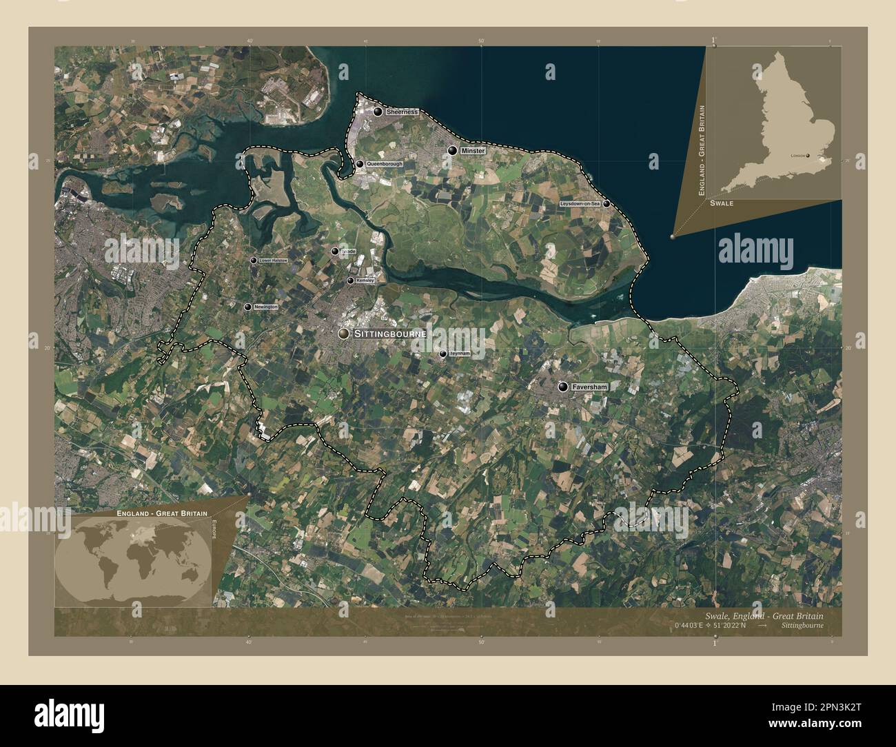 Swale, non metropolitan district of England - Great Britain. High resolution satellite map. Locations and names of major cities of the region. Corner Stock Photohttps://www.alamy.com/image-license-details/?v=1https://www.alamy.com/swale-non-metropolitan-district-of-england-great-britain-high-resolution-satellite-map-locations-and-names-of-major-cities-of-the-region-corner-image546510016.html
RF2PN3K2T–Swale, non metropolitan district of England - Great Britain. High resolution satellite map. Locations and names of major cities of the region. Corner
 Sheerness, Kent, GB, United Kingdom, England, N 51 26' 25'', N 0 45' 45'', map, Cartascapes Map published in 2024. Explore Cartascapes, a map revealing Earth's diverse landscapes, cultures, and ecosystems. Journey through time and space, discovering the interconnectedness of our planet's past, present, and future. Stock Photohttps://www.alamy.com/image-license-details/?v=1https://www.alamy.com/sheerness-kent-gb-united-kingdom-england-n-51-26-25-n-0-45-45-map-cartascapes-map-published-in-2024-explore-cartascapes-a-map-revealing-earths-diverse-landscapes-cultures-and-ecosystems-journey-through-time-and-space-discovering-the-interconnectedness-of-our-planets-past-present-and-future-image604151075.html
RM2X2WCT3–Sheerness, Kent, GB, United Kingdom, England, N 51 26' 25'', N 0 45' 45'', map, Cartascapes Map published in 2024. Explore Cartascapes, a map revealing Earth's diverse landscapes, cultures, and ecosystems. Journey through time and space, discovering the interconnectedness of our planet's past, present, and future.
 A PLAN of SHEERNESS at the Mouth of the RIVER MEDWAY 1725. Map information: Title: A PLAN of SHEERNESS at the Mouth of the RIVER MEDWAY 1725. 17.14. Date of publication: 1725. Item type: 1 map Medium: pen and ink Dimensions: 50.6 x 71.5 cm Former owner: George III, King of Great Britain, 1738-1820 Stock Photohttps://www.alamy.com/image-license-details/?v=1https://www.alamy.com/a-plan-of-sheerness-at-the-mouth-of-the-river-medway-1725-map-information-title-a-plan-of-sheerness-at-the-mouth-of-the-river-medway-1725-1714-date-of-publication-1725-item-type-1-map-medium-pen-and-ink-dimensions-506-x-715-cm-former-owner-george-iii-king-of-great-britain-1738-1820-image401749425.html
RM2E9H7DN–A PLAN of SHEERNESS at the Mouth of the RIVER MEDWAY 1725. Map information: Title: A PLAN of SHEERNESS at the Mouth of the RIVER MEDWAY 1725. 17.14. Date of publication: 1725. Item type: 1 map Medium: pen and ink Dimensions: 50.6 x 71.5 cm Former owner: George III, King of Great Britain, 1738-1820
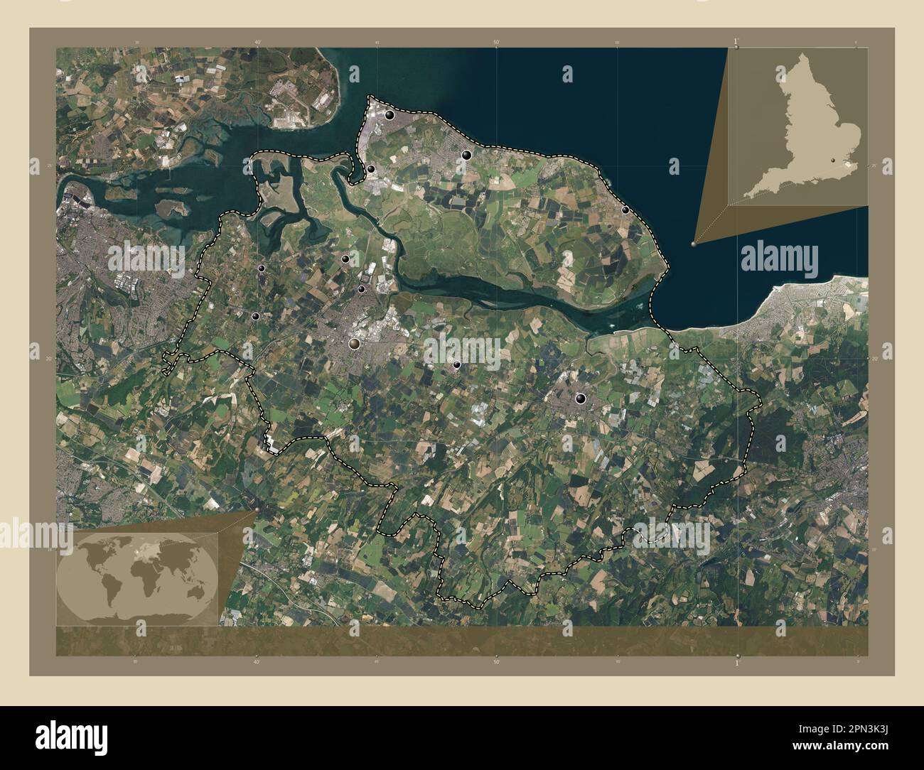 Swale, non metropolitan district of England - Great Britain. High resolution satellite map. Locations of major cities of the region. Corner auxiliary Stock Photohttps://www.alamy.com/image-license-details/?v=1https://www.alamy.com/swale-non-metropolitan-district-of-england-great-britain-high-resolution-satellite-map-locations-of-major-cities-of-the-region-corner-auxiliary-image546510038.html
RF2PN3K3J–Swale, non metropolitan district of England - Great Britain. High resolution satellite map. Locations of major cities of the region. Corner auxiliary
 Sheerness Harbour, Kent, GB, United Kingdom, England, N 51 26' 34'', N 0 44' 30'', map, Cartascapes Map published in 2024. Explore Cartascapes, a map revealing Earth's diverse landscapes, cultures, and ecosystems. Journey through time and space, discovering the interconnectedness of our planet's past, present, and future. Stock Photohttps://www.alamy.com/image-license-details/?v=1https://www.alamy.com/sheerness-harbour-kent-gb-united-kingdom-england-n-51-26-34-n-0-44-30-map-cartascapes-map-published-in-2024-explore-cartascapes-a-map-revealing-earths-diverse-landscapes-cultures-and-ecosystems-journey-through-time-and-space-discovering-the-interconnectedness-of-our-planets-past-present-and-future-image604151048.html
RM2X2WCR4–Sheerness Harbour, Kent, GB, United Kingdom, England, N 51 26' 34'', N 0 44' 30'', map, Cartascapes Map published in 2024. Explore Cartascapes, a map revealing Earth's diverse landscapes, cultures, and ecosystems. Journey through time and space, discovering the interconnectedness of our planet's past, present, and future.
 PROPOSED DESIGN for Wharfing and Repairing the Breach at SHEERNESS. Map information: Title: PROPOSED DESIGN for Wharfing and Repairing the Breach at SHEERNESS. 17.19.d. Date of publication: 1740 c. Item type: 1 map Medium: pen and ink Dimensions: 41.3 x 33.1 cm Former owner: George III, King of Great Britain, 1738-1820 Stock Photohttps://www.alamy.com/image-license-details/?v=1https://www.alamy.com/proposed-design-for-wharfing-and-repairing-the-breach-at-sheerness-map-information-title-proposed-design-for-wharfing-and-repairing-the-breach-at-sheerness-1719d-date-of-publication-1740-c-item-type-1-map-medium-pen-and-ink-dimensions-413-x-331-cm-former-owner-george-iii-king-of-great-britain-1738-1820-image401749417.html
RM2E9H7DD–PROPOSED DESIGN for Wharfing and Repairing the Breach at SHEERNESS. Map information: Title: PROPOSED DESIGN for Wharfing and Repairing the Breach at SHEERNESS. 17.19.d. Date of publication: 1740 c. Item type: 1 map Medium: pen and ink Dimensions: 41.3 x 33.1 cm Former owner: George III, King of Great Britain, 1738-1820
 Swale, non metropolitan district of England - Great Britain. Low resolution satellite map. Locations and names of major cities of the region. Corner a Stock Photohttps://www.alamy.com/image-license-details/?v=1https://www.alamy.com/swale-non-metropolitan-district-of-england-great-britain-low-resolution-satellite-map-locations-and-names-of-major-cities-of-the-region-corner-a-image546510117.html
RF2PN3K6D–Swale, non metropolitan district of England - Great Britain. Low resolution satellite map. Locations and names of major cities of the region. Corner a
 Sheerness Channel, Kent, GB, United Kingdom, England, N 51 27' 39'', N 0 46' 32'', map, Cartascapes Map published in 2024. Explore Cartascapes, a map revealing Earth's diverse landscapes, cultures, and ecosystems. Journey through time and space, discovering the interconnectedness of our planet's past, present, and future. Stock Photohttps://www.alamy.com/image-license-details/?v=1https://www.alamy.com/sheerness-channel-kent-gb-united-kingdom-england-n-51-27-39-n-0-46-32-map-cartascapes-map-published-in-2024-explore-cartascapes-a-map-revealing-earths-diverse-landscapes-cultures-and-ecosystems-journey-through-time-and-space-discovering-the-interconnectedness-of-our-planets-past-present-and-future-image604075011.html
RM2X2NYRF–Sheerness Channel, Kent, GB, United Kingdom, England, N 51 27' 39'', N 0 46' 32'', map, Cartascapes Map published in 2024. Explore Cartascapes, a map revealing Earth's diverse landscapes, cultures, and ecosystems. Journey through time and space, discovering the interconnectedness of our planet's past, present, and future.
 PROPOSED DESIGN for Wharfing and Repairing the Breach at SHEERNESS. Map information: Title: PROPOSED DESIGN for Wharfing and Repairing the Breach at SHEERNESS. 17.19.d. Date of publication: 1740 c. Item type: 1 map Medium: pen and ink Dimensions: 41.3 x 33.1 cm Former owner: George III, King of Great Britain, 1738-1820 Stock Photohttps://www.alamy.com/image-license-details/?v=1https://www.alamy.com/proposed-design-for-wharfing-and-repairing-the-breach-at-sheerness-map-information-title-proposed-design-for-wharfing-and-repairing-the-breach-at-sheerness-1719d-date-of-publication-1740-c-item-type-1-map-medium-pen-and-ink-dimensions-413-x-331-cm-former-owner-george-iii-king-of-great-britain-1738-1820-image401749442.html
RM2E9H7EA–PROPOSED DESIGN for Wharfing and Repairing the Breach at SHEERNESS. Map information: Title: PROPOSED DESIGN for Wharfing and Repairing the Breach at SHEERNESS. 17.19.d. Date of publication: 1740 c. Item type: 1 map Medium: pen and ink Dimensions: 41.3 x 33.1 cm Former owner: George III, King of Great Britain, 1738-1820
 Swale, non metropolitan district of England - Great Britain. Low resolution satellite map. Locations of major cities of the region. Corner auxiliary l Stock Photohttps://www.alamy.com/image-license-details/?v=1https://www.alamy.com/swale-non-metropolitan-district-of-england-great-britain-low-resolution-satellite-map-locations-of-major-cities-of-the-region-corner-auxiliary-l-image546510033.html
RF2PN3K3D–Swale, non metropolitan district of England - Great Britain. Low resolution satellite map. Locations of major cities of the region. Corner auxiliary l
 Sheerness Middle Sand, Kent, GB, United Kingdom, England, N 51 27' 55'', N 0 45' 41'', map, Cartascapes Map published in 2024. Explore Cartascapes, a map revealing Earth's diverse landscapes, cultures, and ecosystems. Journey through time and space, discovering the interconnectedness of our planet's past, present, and future. Stock Photohttps://www.alamy.com/image-license-details/?v=1https://www.alamy.com/sheerness-middle-sand-kent-gb-united-kingdom-england-n-51-27-55-n-0-45-41-map-cartascapes-map-published-in-2024-explore-cartascapes-a-map-revealing-earths-diverse-landscapes-cultures-and-ecosystems-journey-through-time-and-space-discovering-the-interconnectedness-of-our-planets-past-present-and-future-image604074326.html
RM2X2NXY2–Sheerness Middle Sand, Kent, GB, United Kingdom, England, N 51 27' 55'', N 0 45' 41'', map, Cartascapes Map published in 2024. Explore Cartascapes, a map revealing Earth's diverse landscapes, cultures, and ecosystems. Journey through time and space, discovering the interconnectedness of our planet's past, present, and future.
 PLAN of the MAGAZINE, one Bastion, and Buildings Adjacent, at SHEERNESS. Map information: Title: PLAN of the MAGAZINE, one Bastion, and Buildings Adjacent, at SHEERNESS. ; 17.19.c. Date of publication: 1740-1750. Item type: 1 map Medium: pen and ink with coloured wash Dimensions: 17.2 x 30.9 cm Former owner: George III, King of Great Britain, 1738-1820 Stock Photohttps://www.alamy.com/image-license-details/?v=1https://www.alamy.com/plan-of-the-magazine-one-bastion-and-buildings-adjacent-at-sheerness-map-information-title-plan-of-the-magazine-one-bastion-and-buildings-adjacent-at-sheerness-1719c-date-of-publication-1740-1750-item-type-1-map-medium-pen-and-ink-with-coloured-wash-dimensions-172-x-309-cm-former-owner-george-iii-king-of-great-britain-1738-1820-image401749430.html
RM2E9H7DX–PLAN of the MAGAZINE, one Bastion, and Buildings Adjacent, at SHEERNESS. Map information: Title: PLAN of the MAGAZINE, one Bastion, and Buildings Adjacent, at SHEERNESS. ; 17.19.c. Date of publication: 1740-1750. Item type: 1 map Medium: pen and ink with coloured wash Dimensions: 17.2 x 30.9 cm Former owner: George III, King of Great Britain, 1738-1820
 Swale, non metropolitan district of England - Great Britain. Open Street Map. Locations of major cities of the region. Corner auxiliary location maps Stock Photohttps://www.alamy.com/image-license-details/?v=1https://www.alamy.com/swale-non-metropolitan-district-of-england-great-britain-open-street-map-locations-of-major-cities-of-the-region-corner-auxiliary-location-maps-image546510101.html
RF2PN3K5W–Swale, non metropolitan district of England - Great Britain. Open Street Map. Locations of major cities of the region. Corner auxiliary location maps
 Sheerness Light Buoy, Kent, GB, United Kingdom, England, N 51 26' 57'', N 0 45' 11'', map, Cartascapes Map published in 2024. Explore Cartascapes, a map revealing Earth's diverse landscapes, cultures, and ecosystems. Journey through time and space, discovering the interconnectedness of our planet's past, present, and future. Stock Photohttps://www.alamy.com/image-license-details/?v=1https://www.alamy.com/sheerness-light-buoy-kent-gb-united-kingdom-england-n-51-26-57-n-0-45-11-map-cartascapes-map-published-in-2024-explore-cartascapes-a-map-revealing-earths-diverse-landscapes-cultures-and-ecosystems-journey-through-time-and-space-discovering-the-interconnectedness-of-our-planets-past-present-and-future-image604080957.html
RM2X2P7BW–Sheerness Light Buoy, Kent, GB, United Kingdom, England, N 51 26' 57'', N 0 45' 11'', map, Cartascapes Map published in 2024. Explore Cartascapes, a map revealing Earth's diverse landscapes, cultures, and ecosystems. Journey through time and space, discovering the interconnectedness of our planet's past, present, and future.
![A plan of Sheerness. Map information: Title: A plan of Sheerness. 17.13.11.tab Place of publication: [England] Publisher: [producer not identified] Date of publication: [ca. 1700-1730] Item type: 1 map Medium: hand coloured pen and ink drawing Dimensions: 69 x 94 cm Former owner: George III, King of Great Britain, 1738-1820 Stock Photo A plan of Sheerness. Map information: Title: A plan of Sheerness. 17.13.11.tab Place of publication: [England] Publisher: [producer not identified] Date of publication: [ca. 1700-1730] Item type: 1 map Medium: hand coloured pen and ink drawing Dimensions: 69 x 94 cm Former owner: George III, King of Great Britain, 1738-1820 Stock Photo](https://c8.alamy.com/comp/2E9H735/a-plan-of-sheerness-map-information-title-a-plan-of-sheerness-171311tab-place-of-publication-england-publisher-producer-not-identified-date-of-publication-ca-1700-1730-item-type-1-map-medium-hand-coloured-pen-and-ink-drawing-dimensions-69-x-94-cm-former-owner-george-iii-king-of-great-britain-1738-1820-2E9H735.jpg) A plan of Sheerness. Map information: Title: A plan of Sheerness. 17.13.11.tab Place of publication: [England] Publisher: [producer not identified] Date of publication: [ca. 1700-1730] Item type: 1 map Medium: hand coloured pen and ink drawing Dimensions: 69 x 94 cm Former owner: George III, King of Great Britain, 1738-1820 Stock Photohttps://www.alamy.com/image-license-details/?v=1https://www.alamy.com/a-plan-of-sheerness-map-information-title-a-plan-of-sheerness-171311tab-place-of-publication-england-publisher-producer-not-identified-date-of-publication-ca-1700-1730-item-type-1-map-medium-hand-coloured-pen-and-ink-drawing-dimensions-69-x-94-cm-former-owner-george-iii-king-of-great-britain-1738-1820-image401749129.html
A plan of Sheerness. Map information: Title: A plan of Sheerness. 17.13.11.tab Place of publication: [England] Publisher: [producer not identified] Date of publication: [ca. 1700-1730] Item type: 1 map Medium: hand coloured pen and ink drawing Dimensions: 69 x 94 cm Former owner: George III, King of Great Britain, 1738-1820 Stock Photohttps://www.alamy.com/image-license-details/?v=1https://www.alamy.com/a-plan-of-sheerness-map-information-title-a-plan-of-sheerness-171311tab-place-of-publication-england-publisher-producer-not-identified-date-of-publication-ca-1700-1730-item-type-1-map-medium-hand-coloured-pen-and-ink-drawing-dimensions-69-x-94-cm-former-owner-george-iii-king-of-great-britain-1738-1820-image401749129.htmlRM2E9H735–A plan of Sheerness. Map information: Title: A plan of Sheerness. 17.13.11.tab Place of publication: [England] Publisher: [producer not identified] Date of publication: [ca. 1700-1730] Item type: 1 map Medium: hand coloured pen and ink drawing Dimensions: 69 x 94 cm Former owner: George III, King of Great Britain, 1738-1820
 Swale, non metropolitan district of England - Great Britain. Open Street Map. Locations and names of major cities of the region. Corner auxiliary loca Stock Photohttps://www.alamy.com/image-license-details/?v=1https://www.alamy.com/swale-non-metropolitan-district-of-england-great-britain-open-street-map-locations-and-names-of-major-cities-of-the-region-corner-auxiliary-loca-image546510071.html
RF2PN3K4R–Swale, non metropolitan district of England - Great Britain. Open Street Map. Locations and names of major cities of the region. Corner auxiliary loca
![A Geometrical Plan & West Elevation Of His Majesty's Dock Yards and Garrison, at Sheerness, with the Ordnance, Wharfe &c. Author Milton, Thomas 17.18. Place of publication: [London] Publisher: According to Act of Parliam.t June the 18.th, Date of publication: 1753. Item type: 1 map Medium: copperplate engraving Dimensions: 49.8 x 67.2 cm Former owner: George III, King of Great Britain, 1738-1820 Stock Photo A Geometrical Plan & West Elevation Of His Majesty's Dock Yards and Garrison, at Sheerness, with the Ordnance, Wharfe &c. Author Milton, Thomas 17.18. Place of publication: [London] Publisher: According to Act of Parliam.t June the 18.th, Date of publication: 1753. Item type: 1 map Medium: copperplate engraving Dimensions: 49.8 x 67.2 cm Former owner: George III, King of Great Britain, 1738-1820 Stock Photo](https://c8.alamy.com/comp/2E9H7D9/a-geometrical-plan-west-elevation-of-his-majestys-dock-yards-and-garrison-at-sheerness-with-the-ordnance-wharfe-c-author-milton-thomas-1718-place-of-publication-london-publisher-according-to-act-of-parliamt-june-the-18th-date-of-publication-1753-item-type-1-map-medium-copperplate-engraving-dimensions-498-x-672-cm-former-owner-george-iii-king-of-great-britain-1738-1820-2E9H7D9.jpg) A Geometrical Plan & West Elevation Of His Majesty's Dock Yards and Garrison, at Sheerness, with the Ordnance, Wharfe &c. Author Milton, Thomas 17.18. Place of publication: [London] Publisher: According to Act of Parliam.t June the 18.th, Date of publication: 1753. Item type: 1 map Medium: copperplate engraving Dimensions: 49.8 x 67.2 cm Former owner: George III, King of Great Britain, 1738-1820 Stock Photohttps://www.alamy.com/image-license-details/?v=1https://www.alamy.com/a-geometrical-plan-west-elevation-of-his-majestys-dock-yards-and-garrison-at-sheerness-with-the-ordnance-wharfe-c-author-milton-thomas-1718-place-of-publication-london-publisher-according-to-act-of-parliamt-june-the-18th-date-of-publication-1753-item-type-1-map-medium-copperplate-engraving-dimensions-498-x-672-cm-former-owner-george-iii-king-of-great-britain-1738-1820-image401749413.html
A Geometrical Plan & West Elevation Of His Majesty's Dock Yards and Garrison, at Sheerness, with the Ordnance, Wharfe &c. Author Milton, Thomas 17.18. Place of publication: [London] Publisher: According to Act of Parliam.t June the 18.th, Date of publication: 1753. Item type: 1 map Medium: copperplate engraving Dimensions: 49.8 x 67.2 cm Former owner: George III, King of Great Britain, 1738-1820 Stock Photohttps://www.alamy.com/image-license-details/?v=1https://www.alamy.com/a-geometrical-plan-west-elevation-of-his-majestys-dock-yards-and-garrison-at-sheerness-with-the-ordnance-wharfe-c-author-milton-thomas-1718-place-of-publication-london-publisher-according-to-act-of-parliamt-june-the-18th-date-of-publication-1753-item-type-1-map-medium-copperplate-engraving-dimensions-498-x-672-cm-former-owner-george-iii-king-of-great-britain-1738-1820-image401749413.htmlRM2E9H7D9–A Geometrical Plan & West Elevation Of His Majesty's Dock Yards and Garrison, at Sheerness, with the Ordnance, Wharfe &c. Author Milton, Thomas 17.18. Place of publication: [London] Publisher: According to Act of Parliam.t June the 18.th, Date of publication: 1753. Item type: 1 map Medium: copperplate engraving Dimensions: 49.8 x 67.2 cm Former owner: George III, King of Great Britain, 1738-1820
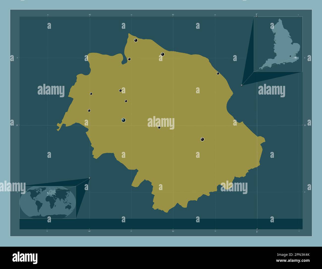 Swale, non metropolitan district of England - Great Britain. Solid color shape. Locations of major cities of the region. Corner auxiliary location map Stock Photohttps://www.alamy.com/image-license-details/?v=1https://www.alamy.com/swale-non-metropolitan-district-of-england-great-britain-solid-color-shape-locations-of-major-cities-of-the-region-corner-auxiliary-location-map-image546510067.html
RF2PN3K4K–Swale, non metropolitan district of England - Great Britain. Solid color shape. Locations of major cities of the region. Corner auxiliary location map
![Sheerness and part of the adjacent marshes with the works proposed for the better defence of the town and dockyard, marked in yellow Author Page, Thomas Hyde 17.16.a. Place of publication: [England] Publisher: Thos. Hyde Page Eng.r, Date of publication: 12 June 1778. Item type: 1 map on 2 sheets Medium: hand-coloured Dimensions: 99 x 112 cm Former owner: George III, King of Great Britain, 1738-1820 Stock Photo Sheerness and part of the adjacent marshes with the works proposed for the better defence of the town and dockyard, marked in yellow Author Page, Thomas Hyde 17.16.a. Place of publication: [England] Publisher: Thos. Hyde Page Eng.r, Date of publication: 12 June 1778. Item type: 1 map on 2 sheets Medium: hand-coloured Dimensions: 99 x 112 cm Former owner: George III, King of Great Britain, 1738-1820 Stock Photo](https://c8.alamy.com/comp/2E9H7DP/sheerness-and-part-of-the-adjacent-marshes-with-the-works-proposed-for-the-better-defence-of-the-town-and-dockyard-marked-in-yellow-author-page-thomas-hyde-1716a-place-of-publication-england-publisher-thos-hyde-page-engr-date-of-publication-12-june-1778-item-type-1-map-on-2-sheets-medium-hand-coloured-dimensions-99-x-112-cm-former-owner-george-iii-king-of-great-britain-1738-1820-2E9H7DP.jpg) Sheerness and part of the adjacent marshes with the works proposed for the better defence of the town and dockyard, marked in yellow Author Page, Thomas Hyde 17.16.a. Place of publication: [England] Publisher: Thos. Hyde Page Eng.r, Date of publication: 12 June 1778. Item type: 1 map on 2 sheets Medium: hand-coloured Dimensions: 99 x 112 cm Former owner: George III, King of Great Britain, 1738-1820 Stock Photohttps://www.alamy.com/image-license-details/?v=1https://www.alamy.com/sheerness-and-part-of-the-adjacent-marshes-with-the-works-proposed-for-the-better-defence-of-the-town-and-dockyard-marked-in-yellow-author-page-thomas-hyde-1716a-place-of-publication-england-publisher-thos-hyde-page-engr-date-of-publication-12-june-1778-item-type-1-map-on-2-sheets-medium-hand-coloured-dimensions-99-x-112-cm-former-owner-george-iii-king-of-great-britain-1738-1820-image401749426.html
Sheerness and part of the adjacent marshes with the works proposed for the better defence of the town and dockyard, marked in yellow Author Page, Thomas Hyde 17.16.a. Place of publication: [England] Publisher: Thos. Hyde Page Eng.r, Date of publication: 12 June 1778. Item type: 1 map on 2 sheets Medium: hand-coloured Dimensions: 99 x 112 cm Former owner: George III, King of Great Britain, 1738-1820 Stock Photohttps://www.alamy.com/image-license-details/?v=1https://www.alamy.com/sheerness-and-part-of-the-adjacent-marshes-with-the-works-proposed-for-the-better-defence-of-the-town-and-dockyard-marked-in-yellow-author-page-thomas-hyde-1716a-place-of-publication-england-publisher-thos-hyde-page-engr-date-of-publication-12-june-1778-item-type-1-map-on-2-sheets-medium-hand-coloured-dimensions-99-x-112-cm-former-owner-george-iii-king-of-great-britain-1738-1820-image401749426.htmlRM2E9H7DP–Sheerness and part of the adjacent marshes with the works proposed for the better defence of the town and dockyard, marked in yellow Author Page, Thomas Hyde 17.16.a. Place of publication: [England] Publisher: Thos. Hyde Page Eng.r, Date of publication: 12 June 1778. Item type: 1 map on 2 sheets Medium: hand-coloured Dimensions: 99 x 112 cm Former owner: George III, King of Great Britain, 1738-1820
 Swale, non metropolitan district of England - Great Britain. Solid color shape. Locations and names of major cities of the region. Corner auxiliary lo Stock Photohttps://www.alamy.com/image-license-details/?v=1https://www.alamy.com/swale-non-metropolitan-district-of-england-great-britain-solid-color-shape-locations-and-names-of-major-cities-of-the-region-corner-auxiliary-lo-image546510095.html
RF2PN3K5K–Swale, non metropolitan district of England - Great Britain. Solid color shape. Locations and names of major cities of the region. Corner auxiliary lo
 A colored plan of Sheerness, with various profils, by Geo. Demler, engineer drawn on a scale of 40 feet to an inch. Map information: Title: A colored plan of Sheerness, with various profils, by Geo. Demler, engineer; drawn on a scale of 40 feet to an inch. 124 Supp.fol.65. Date of publication: ca. 1765-1780. Item type: Ms. 1 f. 5 1/2 in. x 1 f. 2 in. Former owner: George III, King of Great Britain, 1738-1820 Stock Photohttps://www.alamy.com/image-license-details/?v=1https://www.alamy.com/a-colored-plan-of-sheerness-with-various-profils-by-geo-demler-engineer-drawn-on-a-scale-of-40-feet-to-an-inch-map-information-title-a-colored-plan-of-sheerness-with-various-profils-by-geo-demler-engineer-drawn-on-a-scale-of-40-feet-to-an-inch-124-suppfol65-date-of-publication-ca-1765-1780-item-type-ms-1-f-5-12-in-x-1-f-2-in-former-owner-george-iii-king-of-great-britain-1738-1820-image401740434.html
RM2E9GT0J–A colored plan of Sheerness, with various profils, by Geo. Demler, engineer drawn on a scale of 40 feet to an inch. Map information: Title: A colored plan of Sheerness, with various profils, by Geo. Demler, engineer; drawn on a scale of 40 feet to an inch. 124 Supp.fol.65. Date of publication: ca. 1765-1780. Item type: Ms. 1 f. 5 1/2 in. x 1 f. 2 in. Former owner: George III, King of Great Britain, 1738-1820
 Swale, non metropolitan district of England - Great Britain. Solid color shape Stock Photohttps://www.alamy.com/image-license-details/?v=1https://www.alamy.com/swale-non-metropolitan-district-of-england-great-britain-solid-color-shape-image546510100.html
RF2PN3K5T–Swale, non metropolitan district of England - Great Britain. Solid color shape
 Text sheet at the map of the Mouth of the Thames with the trip to Chatham, 1667, 1667 text sheet Text sheet at the map of the Mouth of the Thames on which the trip to Chatham is indicated by the ships of the State fleet under Admiraal de Ruyter, 20-23 June 1667. Text in 5 columns. print maker: Northern Netherlandspublisher: Amsterdam paper letterpress printing Raid on the Medway Theems. Sheerness. Medway. Chatham. Rochester Stock Photohttps://www.alamy.com/image-license-details/?v=1https://www.alamy.com/text-sheet-at-the-map-of-the-mouth-of-the-thames-with-the-trip-to-chatham-1667-1667-text-sheet-text-sheet-at-the-map-of-the-mouth-of-the-thames-on-which-the-trip-to-chatham-is-indicated-by-the-ships-of-the-state-fleet-under-admiraal-de-ruyter-20-23-june-1667-text-in-5-columns-print-maker-northern-netherlandspublisher-amsterdam-paper-letterpress-printing-raid-on-the-medway-theems-sheerness-medway-chatham-rochester-image595178414.html
RM2WG8M3X–Text sheet at the map of the Mouth of the Thames with the trip to Chatham, 1667, 1667 text sheet Text sheet at the map of the Mouth of the Thames on which the trip to Chatham is indicated by the ships of the State fleet under Admiraal de Ruyter, 20-23 June 1667. Text in 5 columns. print maker: Northern Netherlandspublisher: Amsterdam paper letterpress printing Raid on the Medway Theems. Sheerness. Medway. Chatham. Rochester
 Map of mouth of the Thames with the trip to Chatham, 1667, Michiel Comans (II), 1667 print Map of the mouth of the Thames on which the trip to Chatham is indicated by the ships of the State Fleet under Admiraal de Ruyter, 20-23 June 1667. On the left the battle around Sheerness, above the Dutch ships on the Medway River. At the bottom right a lion on a pedestal on which the legend A-V. paper engraving / etching maps of separate countries or regions. battle (+ naval force). Raid on the Medway Theems. Sheerness. Medway. Chatham. Rochester Stock Photohttps://www.alamy.com/image-license-details/?v=1https://www.alamy.com/map-of-mouth-of-the-thames-with-the-trip-to-chatham-1667-michiel-comans-ii-1667-print-map-of-the-mouth-of-the-thames-on-which-the-trip-to-chatham-is-indicated-by-the-ships-of-the-state-fleet-under-admiraal-de-ruyter-20-23-june-1667-on-the-left-the-battle-around-sheerness-above-the-dutch-ships-on-the-medway-river-at-the-bottom-right-a-lion-on-a-pedestal-on-which-the-legend-a-v-paper-engraving-etching-maps-of-separate-countries-or-regions-battle-naval-force-raid-on-the-medway-theems-sheerness-medway-chatham-rochester-image594053139.html
RM2WEDCRF–Map of mouth of the Thames with the trip to Chatham, 1667, Michiel Comans (II), 1667 print Map of the mouth of the Thames on which the trip to Chatham is indicated by the ships of the State Fleet under Admiraal de Ruyter, 20-23 June 1667. On the left the battle around Sheerness, above the Dutch ships on the Medway River. At the bottom right a lion on a pedestal on which the legend A-V. paper engraving / etching maps of separate countries or regions. battle (+ naval force). Raid on the Medway Theems. Sheerness. Medway. Chatham. Rochester
 Map of the Mouth of the Thames with the trip to Chatham, 1667, 1667 print Map of the mouth of the Thames on which the journey to Chatham is indicated by the ships of the State Fleet under Admiraal de Ruyter, 20-23 June 1667. On the left the battle around Sheerness, above the Dutch ships on the Medway river. At the bottom right a lion on a pedestal on which the legend A-V. print maker: Northern Netherlandspublisher: Amsterdam paper etching maps of separate countries or regions. battle (+ naval force). Raid on the Medway Theems. Sheerness. Medway. Chatham. Rochester Stock Photohttps://www.alamy.com/image-license-details/?v=1https://www.alamy.com/map-of-the-mouth-of-the-thames-with-the-trip-to-chatham-1667-1667-print-map-of-the-mouth-of-the-thames-on-which-the-journey-to-chatham-is-indicated-by-the-ships-of-the-state-fleet-under-admiraal-de-ruyter-20-23-june-1667-on-the-left-the-battle-around-sheerness-above-the-dutch-ships-on-the-medway-river-at-the-bottom-right-a-lion-on-a-pedestal-on-which-the-legend-a-v-print-maker-northern-netherlandspublisher-amsterdam-paper-etching-maps-of-separate-countries-or-regions-battle-naval-force-raid-on-the-medway-theems-sheerness-medway-chatham-rochester-image595228386.html
RM2WGAYTJ–Map of the Mouth of the Thames with the trip to Chatham, 1667, 1667 print Map of the mouth of the Thames on which the journey to Chatham is indicated by the ships of the State Fleet under Admiraal de Ruyter, 20-23 June 1667. On the left the battle around Sheerness, above the Dutch ships on the Medway river. At the bottom right a lion on a pedestal on which the legend A-V. print maker: Northern Netherlandspublisher: Amsterdam paper etching maps of separate countries or regions. battle (+ naval force). Raid on the Medway Theems. Sheerness. Medway. Chatham. Rochester
 The Dutch Raid on the Medway, 1667, 1667 print Leaf with two performances about the trip to Chatham on 20-23 June 1667 by the State fleet under Admiraal de Ruyter. On the left a map of the English east coast and the mouth of the Thames. On the right the Dutch ships on the Thames and Medway and the fighting on the island of Sheppey and the places Sheerness and Chatham. On the leaf under the performance a description in 3 columns. print maker: Northern Netherlandspublisher: Amsterdam paper etching / engraving / letterpress printing maps of separate countries or regions. battle (+ naval force). R Stock Photohttps://www.alamy.com/image-license-details/?v=1https://www.alamy.com/the-dutch-raid-on-the-medway-1667-1667-print-leaf-with-two-performances-about-the-trip-to-chatham-on-20-23-june-1667-by-the-state-fleet-under-admiraal-de-ruyter-on-the-left-a-map-of-the-english-east-coast-and-the-mouth-of-the-thames-on-the-right-the-dutch-ships-on-the-thames-and-medway-and-the-fighting-on-the-island-of-sheppey-and-the-places-sheerness-and-chatham-on-the-leaf-under-the-performance-a-description-in-3-columns-print-maker-northern-netherlandspublisher-amsterdam-paper-etching-engraving-letterpress-printing-maps-of-separate-countries-or-regions-battle-naval-force-r-image595209413.html
RM2WGA3K1–The Dutch Raid on the Medway, 1667, 1667 print Leaf with two performances about the trip to Chatham on 20-23 June 1667 by the State fleet under Admiraal de Ruyter. On the left a map of the English east coast and the mouth of the Thames. On the right the Dutch ships on the Thames and Medway and the fighting on the island of Sheppey and the places Sheerness and Chatham. On the leaf under the performance a description in 3 columns. print maker: Northern Netherlandspublisher: Amsterdam paper etching / engraving / letterpress printing maps of separate countries or regions. battle (+ naval force). R
 The Dutch Raid on the Medway, 1667, 1667 print Leaf with two performances about the trip to Chatham on 20-23 June 1667 by the State fleet under Admiraal de Ruyter. On the left a map of the English east coast and the mouth of the Thames and the Medway. On the right the State fleet on the Thames and the fighting around the island of Sheppey and the places Sheerness and Chatham. On the leaf under the performance a description in 3 columns. print maker: Northern Netherlandspublisher: Amsterdam paper etching / engraving / letterpress printing maps of separate countries or regions. battle (+ naval f Stock Photohttps://www.alamy.com/image-license-details/?v=1https://www.alamy.com/the-dutch-raid-on-the-medway-1667-1667-print-leaf-with-two-performances-about-the-trip-to-chatham-on-20-23-june-1667-by-the-state-fleet-under-admiraal-de-ruyter-on-the-left-a-map-of-the-english-east-coast-and-the-mouth-of-the-thames-and-the-medway-on-the-right-the-state-fleet-on-the-thames-and-the-fighting-around-the-island-of-sheppey-and-the-places-sheerness-and-chatham-on-the-leaf-under-the-performance-a-description-in-3-columns-print-maker-northern-netherlandspublisher-amsterdam-paper-etching-engraving-letterpress-printing-maps-of-separate-countries-or-regions-battle-naval-f-image595205101.html
RM2WG9X51–The Dutch Raid on the Medway, 1667, 1667 print Leaf with two performances about the trip to Chatham on 20-23 June 1667 by the State fleet under Admiraal de Ruyter. On the left a map of the English east coast and the mouth of the Thames and the Medway. On the right the State fleet on the Thames and the fighting around the island of Sheppey and the places Sheerness and Chatham. On the leaf under the performance a description in 3 columns. print maker: Northern Netherlandspublisher: Amsterdam paper etching / engraving / letterpress printing maps of separate countries or regions. battle (+ naval f
 Map of the Mouth of the Thames with the trip to Chatham, 1667, 1667 print Map of the mouth of the Thames on which the journey to Chatham is indicated by the ships of the State Fleet under Admiraal de Ruyter, 20-23 June 1667. On the left the battle around Sheerness, above the Dutch ships on the Medway river. At the bottom right a lion on a pedestal on which the legend A-V. A text sheet belongs to the plate. print maker: Northern Netherlandspublisher: Amsterdam paper etching maps of separate countries or regions. battle (+ naval force). Raid on the Medway Theems. Sheerness. Medway. Chatham. Roch Stock Photohttps://www.alamy.com/image-license-details/?v=1https://www.alamy.com/map-of-the-mouth-of-the-thames-with-the-trip-to-chatham-1667-1667-print-map-of-the-mouth-of-the-thames-on-which-the-journey-to-chatham-is-indicated-by-the-ships-of-the-state-fleet-under-admiraal-de-ruyter-20-23-june-1667-on-the-left-the-battle-around-sheerness-above-the-dutch-ships-on-the-medway-river-at-the-bottom-right-a-lion-on-a-pedestal-on-which-the-legend-a-v-a-text-sheet-belongs-to-the-plate-print-maker-northern-netherlandspublisher-amsterdam-paper-etching-maps-of-separate-countries-or-regions-battle-naval-force-raid-on-the-medway-theems-sheerness-medway-chatham-roch-image595225633.html
RM2WGATA9–Map of the Mouth of the Thames with the trip to Chatham, 1667, 1667 print Map of the mouth of the Thames on which the journey to Chatham is indicated by the ships of the State Fleet under Admiraal de Ruyter, 20-23 June 1667. On the left the battle around Sheerness, above the Dutch ships on the Medway river. At the bottom right a lion on a pedestal on which the legend A-V. A text sheet belongs to the plate. print maker: Northern Netherlandspublisher: Amsterdam paper etching maps of separate countries or regions. battle (+ naval force). Raid on the Medway Theems. Sheerness. Medway. Chatham. Roch
![Sketch for the wharf at Sheerness . Visual Material information: Title: [Sketch for the wharf at Sheerness]. 17.19.e.4 Date of publication: 1740 c. Item type: 1 drawing Medium: pen and ink Dimensions: 18.4 x 30.0 cm Former owner: George III, King of Great Britain, 1738-1820 Stock Photo Sketch for the wharf at Sheerness . Visual Material information: Title: [Sketch for the wharf at Sheerness]. 17.19.e.4 Date of publication: 1740 c. Item type: 1 drawing Medium: pen and ink Dimensions: 18.4 x 30.0 cm Former owner: George III, King of Great Britain, 1738-1820 Stock Photo](https://c8.alamy.com/comp/2E9H7D7/sketch-for-the-wharf-at-sheerness-visual-material-information-title-sketch-for-the-wharf-at-sheerness-1719e4-date-of-publication-1740-c-item-type-1-drawing-medium-pen-and-ink-dimensions-184-x-300-cm-former-owner-george-iii-king-of-great-britain-1738-1820-2E9H7D7.jpg) Sketch for the wharf at Sheerness . Visual Material information: Title: [Sketch for the wharf at Sheerness]. 17.19.e.4 Date of publication: 1740 c. Item type: 1 drawing Medium: pen and ink Dimensions: 18.4 x 30.0 cm Former owner: George III, King of Great Britain, 1738-1820 Stock Photohttps://www.alamy.com/image-license-details/?v=1https://www.alamy.com/sketch-for-the-wharf-at-sheerness-visual-material-information-title-sketch-for-the-wharf-at-sheerness-1719e4-date-of-publication-1740-c-item-type-1-drawing-medium-pen-and-ink-dimensions-184-x-300-cm-former-owner-george-iii-king-of-great-britain-1738-1820-image401749411.html
Sketch for the wharf at Sheerness . Visual Material information: Title: [Sketch for the wharf at Sheerness]. 17.19.e.4 Date of publication: 1740 c. Item type: 1 drawing Medium: pen and ink Dimensions: 18.4 x 30.0 cm Former owner: George III, King of Great Britain, 1738-1820 Stock Photohttps://www.alamy.com/image-license-details/?v=1https://www.alamy.com/sketch-for-the-wharf-at-sheerness-visual-material-information-title-sketch-for-the-wharf-at-sheerness-1719e4-date-of-publication-1740-c-item-type-1-drawing-medium-pen-and-ink-dimensions-184-x-300-cm-former-owner-george-iii-king-of-great-britain-1738-1820-image401749411.htmlRM2E9H7D7–Sketch for the wharf at Sheerness . Visual Material information: Title: [Sketch for the wharf at Sheerness]. 17.19.e.4 Date of publication: 1740 c. Item type: 1 drawing Medium: pen and ink Dimensions: 18.4 x 30.0 cm Former owner: George III, King of Great Britain, 1738-1820
![Sketch for the wharf at Sheerness . Visual Material information: Title: [Sketch for the wharf at Sheerness]. 17.19.e.3 Date of publication: 1740 c. Item type: 1 drawing Medium: pen and ink Dimensions: 17.3 x 29.3 cm Former owner: George III, King of Great Britain, 1738-1820 Stock Photo Sketch for the wharf at Sheerness . Visual Material information: Title: [Sketch for the wharf at Sheerness]. 17.19.e.3 Date of publication: 1740 c. Item type: 1 drawing Medium: pen and ink Dimensions: 17.3 x 29.3 cm Former owner: George III, King of Great Britain, 1738-1820 Stock Photo](https://c8.alamy.com/comp/2E9H7DR/sketch-for-the-wharf-at-sheerness-visual-material-information-title-sketch-for-the-wharf-at-sheerness-1719e3-date-of-publication-1740-c-item-type-1-drawing-medium-pen-and-ink-dimensions-173-x-293-cm-former-owner-george-iii-king-of-great-britain-1738-1820-2E9H7DR.jpg) Sketch for the wharf at Sheerness . Visual Material information: Title: [Sketch for the wharf at Sheerness]. 17.19.e.3 Date of publication: 1740 c. Item type: 1 drawing Medium: pen and ink Dimensions: 17.3 x 29.3 cm Former owner: George III, King of Great Britain, 1738-1820 Stock Photohttps://www.alamy.com/image-license-details/?v=1https://www.alamy.com/sketch-for-the-wharf-at-sheerness-visual-material-information-title-sketch-for-the-wharf-at-sheerness-1719e3-date-of-publication-1740-c-item-type-1-drawing-medium-pen-and-ink-dimensions-173-x-293-cm-former-owner-george-iii-king-of-great-britain-1738-1820-image401749427.html
Sketch for the wharf at Sheerness . Visual Material information: Title: [Sketch for the wharf at Sheerness]. 17.19.e.3 Date of publication: 1740 c. Item type: 1 drawing Medium: pen and ink Dimensions: 17.3 x 29.3 cm Former owner: George III, King of Great Britain, 1738-1820 Stock Photohttps://www.alamy.com/image-license-details/?v=1https://www.alamy.com/sketch-for-the-wharf-at-sheerness-visual-material-information-title-sketch-for-the-wharf-at-sheerness-1719e3-date-of-publication-1740-c-item-type-1-drawing-medium-pen-and-ink-dimensions-173-x-293-cm-former-owner-george-iii-king-of-great-britain-1738-1820-image401749427.htmlRM2E9H7DR–Sketch for the wharf at Sheerness . Visual Material information: Title: [Sketch for the wharf at Sheerness]. 17.19.e.3 Date of publication: 1740 c. Item type: 1 drawing Medium: pen and ink Dimensions: 17.3 x 29.3 cm Former owner: George III, King of Great Britain, 1738-1820
![Sketch for the wharf at Sheerness . Visual Material information: Title: [Sketch for the wharf at Sheerness]. 17.19.e.2 Date of publication: 1740 c. Item type: 1 drawing Medium: pen and ink Dimensions: 18.5 x 30.0 cm Former owner: George III, King of Great Britain, 1738-1820 Stock Photo Sketch for the wharf at Sheerness . Visual Material information: Title: [Sketch for the wharf at Sheerness]. 17.19.e.2 Date of publication: 1740 c. Item type: 1 drawing Medium: pen and ink Dimensions: 18.5 x 30.0 cm Former owner: George III, King of Great Britain, 1738-1820 Stock Photo](https://c8.alamy.com/comp/2E9H7D8/sketch-for-the-wharf-at-sheerness-visual-material-information-title-sketch-for-the-wharf-at-sheerness-1719e2-date-of-publication-1740-c-item-type-1-drawing-medium-pen-and-ink-dimensions-185-x-300-cm-former-owner-george-iii-king-of-great-britain-1738-1820-2E9H7D8.jpg) Sketch for the wharf at Sheerness . Visual Material information: Title: [Sketch for the wharf at Sheerness]. 17.19.e.2 Date of publication: 1740 c. Item type: 1 drawing Medium: pen and ink Dimensions: 18.5 x 30.0 cm Former owner: George III, King of Great Britain, 1738-1820 Stock Photohttps://www.alamy.com/image-license-details/?v=1https://www.alamy.com/sketch-for-the-wharf-at-sheerness-visual-material-information-title-sketch-for-the-wharf-at-sheerness-1719e2-date-of-publication-1740-c-item-type-1-drawing-medium-pen-and-ink-dimensions-185-x-300-cm-former-owner-george-iii-king-of-great-britain-1738-1820-image401749412.html
Sketch for the wharf at Sheerness . Visual Material information: Title: [Sketch for the wharf at Sheerness]. 17.19.e.2 Date of publication: 1740 c. Item type: 1 drawing Medium: pen and ink Dimensions: 18.5 x 30.0 cm Former owner: George III, King of Great Britain, 1738-1820 Stock Photohttps://www.alamy.com/image-license-details/?v=1https://www.alamy.com/sketch-for-the-wharf-at-sheerness-visual-material-information-title-sketch-for-the-wharf-at-sheerness-1719e2-date-of-publication-1740-c-item-type-1-drawing-medium-pen-and-ink-dimensions-185-x-300-cm-former-owner-george-iii-king-of-great-britain-1738-1820-image401749412.htmlRM2E9H7D8–Sketch for the wharf at Sheerness . Visual Material information: Title: [Sketch for the wharf at Sheerness]. 17.19.e.2 Date of publication: 1740 c. Item type: 1 drawing Medium: pen and ink Dimensions: 18.5 x 30.0 cm Former owner: George III, King of Great Britain, 1738-1820
![SHEERNESS Author Kip, Johannes 17.19.a. Place of publication: [London] Publisher: Printed , Sold by Dicey , Co. in Aldemary Church Yard London., Date of publication: [1710-1721 c.] Item type: 1 print Medium: etching Dimensions: platemark 35.0 x 42.5 cm Former owner: George III, King of Great Britain, 1738-1820 Stock Photo SHEERNESS Author Kip, Johannes 17.19.a. Place of publication: [London] Publisher: Printed , Sold by Dicey , Co. in Aldemary Church Yard London., Date of publication: [1710-1721 c.] Item type: 1 print Medium: etching Dimensions: platemark 35.0 x 42.5 cm Former owner: George III, King of Great Britain, 1738-1820 Stock Photo](https://c8.alamy.com/comp/2E9H7DG/sheerness-author-kip-johannes-1719a-place-of-publication-london-publisher-printed-sold-by-dicey-co-in-aldemary-church-yard-london-date-of-publication-1710-1721-c-item-type-1-print-medium-etching-dimensions-platemark-350-x-425-cm-former-owner-george-iii-king-of-great-britain-1738-1820-2E9H7DG.jpg) SHEERNESS Author Kip, Johannes 17.19.a. Place of publication: [London] Publisher: Printed , Sold by Dicey , Co. in Aldemary Church Yard London., Date of publication: [1710-1721 c.] Item type: 1 print Medium: etching Dimensions: platemark 35.0 x 42.5 cm Former owner: George III, King of Great Britain, 1738-1820 Stock Photohttps://www.alamy.com/image-license-details/?v=1https://www.alamy.com/sheerness-author-kip-johannes-1719a-place-of-publication-london-publisher-printed-sold-by-dicey-co-in-aldemary-church-yard-london-date-of-publication-1710-1721-c-item-type-1-print-medium-etching-dimensions-platemark-350-x-425-cm-former-owner-george-iii-king-of-great-britain-1738-1820-image401749420.html
SHEERNESS Author Kip, Johannes 17.19.a. Place of publication: [London] Publisher: Printed , Sold by Dicey , Co. in Aldemary Church Yard London., Date of publication: [1710-1721 c.] Item type: 1 print Medium: etching Dimensions: platemark 35.0 x 42.5 cm Former owner: George III, King of Great Britain, 1738-1820 Stock Photohttps://www.alamy.com/image-license-details/?v=1https://www.alamy.com/sheerness-author-kip-johannes-1719a-place-of-publication-london-publisher-printed-sold-by-dicey-co-in-aldemary-church-yard-london-date-of-publication-1710-1721-c-item-type-1-print-medium-etching-dimensions-platemark-350-x-425-cm-former-owner-george-iii-king-of-great-britain-1738-1820-image401749420.htmlRM2E9H7DG–SHEERNESS Author Kip, Johannes 17.19.a. Place of publication: [London] Publisher: Printed , Sold by Dicey , Co. in Aldemary Church Yard London., Date of publication: [1710-1721 c.] Item type: 1 print Medium: etching Dimensions: platemark 35.0 x 42.5 cm Former owner: George III, King of Great Britain, 1738-1820
 Estimate for Compleating the two Cespools. in the Ravelin of Sheerness. 1740. Visual Material information: Title: Estimate for Compleating the two Cespools. in the Ravelin of Sheerness. 1740. 17.19.i. Date of publication: 1740. Item type: 1 drawing Medium: pen and ink with coloured wash Dimensions: 34.1 x 21.3 cm Former owner: George III, King of Great Britain, 1738-1820 Stock Photohttps://www.alamy.com/image-license-details/?v=1https://www.alamy.com/estimate-for-compleating-the-two-cespools-in-the-ravelin-of-sheerness-1740-visual-material-information-title-estimate-for-compleating-the-two-cespools-in-the-ravelin-of-sheerness-1740-1719i-date-of-publication-1740-item-type-1-drawing-medium-pen-and-ink-with-coloured-wash-dimensions-341-x-213-cm-former-owner-george-iii-king-of-great-britain-1738-1820-image401749436.html
RM2E9H7E4–Estimate for Compleating the two Cespools. in the Ravelin of Sheerness. 1740. Visual Material information: Title: Estimate for Compleating the two Cespools. in the Ravelin of Sheerness. 1740. 17.19.i. Date of publication: 1740. Item type: 1 drawing Medium: pen and ink with coloured wash Dimensions: 34.1 x 21.3 cm Former owner: George III, King of Great Britain, 1738-1820
 SECTIONS of the Works proposed at SHEERNESS for the defence of HIS MAJESTY'S DOCK YARD 1783. Visual Material information: Title: SECTIONS of the Works proposed at SHEERNESS for the defence of HIS MAJESTY'S DOCK-YARD 1783. 17.19.h. Date of publication: 1783 c. Item type: 1 drawing Medium: pen and ink Dimensions: 34.2 x 51.5 cm Former owner: George III, King of Great Britain, 1738-1820 Stock Photohttps://www.alamy.com/image-license-details/?v=1https://www.alamy.com/sections-of-the-works-proposed-at-sheerness-for-the-defence-of-his-majestys-dock-yard-1783-visual-material-information-title-sections-of-the-works-proposed-at-sheerness-for-the-defence-of-his-majestys-dock-yard-1783-1719h-date-of-publication-1783-c-item-type-1-drawing-medium-pen-and-ink-dimensions-342-x-515-cm-former-owner-george-iii-king-of-great-britain-1738-1820-image401749450.html
RM2E9H7EJ–SECTIONS of the Works proposed at SHEERNESS for the defence of HIS MAJESTY'S DOCK YARD 1783. Visual Material information: Title: SECTIONS of the Works proposed at SHEERNESS for the defence of HIS MAJESTY'S DOCK-YARD 1783. 17.19.h. Date of publication: 1783 c. Item type: 1 drawing Medium: pen and ink Dimensions: 34.2 x 51.5 cm Former owner: George III, King of Great Britain, 1738-1820
 PLAN and UPRIGHT of a GUARD HOUSE, projected for SHEERNESS. 1717/8. Visual Material information: Title: PLAN and UPRIGHT of a GUARD HOUSE, projected for SHEERNESS. 1717/8. 17.19.l. Date of publication: 1717-1718. Item type: 1 drawing Medium: pen and ink with grey wash Dimensions: 51.0 x 35.8 cm Former owner: George III, King of Great Britain, 1738-1820 Stock Photohttps://www.alamy.com/image-license-details/?v=1https://www.alamy.com/plan-and-upright-of-a-guard-house-projected-for-sheerness-17178-visual-material-information-title-plan-and-upright-of-a-guard-house-projected-for-sheerness-17178-1719l-date-of-publication-1717-1718-item-type-1-drawing-medium-pen-and-ink-with-grey-wash-dimensions-510-x-358-cm-former-owner-george-iii-king-of-great-britain-1738-1820-image401749419.html
RM2E9H7DF–PLAN and UPRIGHT of a GUARD HOUSE, projected for SHEERNESS. 1717/8. Visual Material information: Title: PLAN and UPRIGHT of a GUARD HOUSE, projected for SHEERNESS. 1717/8. 17.19.l. Date of publication: 1717-1718. Item type: 1 drawing Medium: pen and ink with grey wash Dimensions: 51.0 x 35.8 cm Former owner: George III, King of Great Britain, 1738-1820
![THE NORTH WEST PROSPECT OF SHEERNESS, IN THE COUNTY OF KENT. Author Buck, Nathaniel 17.19.b. Place of publication: [London] Publisher: Publish'd according to Act of Parliament March 26.th 1739. Garden Co. No. 1 Middle Temple London, Date of publication: [1739.] Item type: 1 print Medium: etching Dimensions: sheet 30.9 x 80.5 cm [trimmed within platemark] Former owner: George III, King of Great Britain, 1738-1820 Stock Photo THE NORTH WEST PROSPECT OF SHEERNESS, IN THE COUNTY OF KENT. Author Buck, Nathaniel 17.19.b. Place of publication: [London] Publisher: Publish'd according to Act of Parliament March 26.th 1739. Garden Co. No. 1 Middle Temple London, Date of publication: [1739.] Item type: 1 print Medium: etching Dimensions: sheet 30.9 x 80.5 cm [trimmed within platemark] Former owner: George III, King of Great Britain, 1738-1820 Stock Photo](https://c8.alamy.com/comp/2E9H7EE/the-north-west-prospect-of-sheerness-in-the-county-of-kent-author-buck-nathaniel-1719b-place-of-publication-london-publisher-publishd-according-to-act-of-parliament-march-26th-1739-garden-co-no-1-middle-temple-london-date-of-publication-1739-item-type-1-print-medium-etching-dimensions-sheet-309-x-805-cm-trimmed-within-platemark-former-owner-george-iii-king-of-great-britain-1738-1820-2E9H7EE.jpg) THE NORTH WEST PROSPECT OF SHEERNESS, IN THE COUNTY OF KENT. Author Buck, Nathaniel 17.19.b. Place of publication: [London] Publisher: Publish'd according to Act of Parliament March 26.th 1739. Garden Co. No. 1 Middle Temple London, Date of publication: [1739.] Item type: 1 print Medium: etching Dimensions: sheet 30.9 x 80.5 cm [trimmed within platemark] Former owner: George III, King of Great Britain, 1738-1820 Stock Photohttps://www.alamy.com/image-license-details/?v=1https://www.alamy.com/the-north-west-prospect-of-sheerness-in-the-county-of-kent-author-buck-nathaniel-1719b-place-of-publication-london-publisher-publishd-according-to-act-of-parliament-march-26th-1739-garden-co-no-1-middle-temple-london-date-of-publication-1739-item-type-1-print-medium-etching-dimensions-sheet-309-x-805-cm-trimmed-within-platemark-former-owner-george-iii-king-of-great-britain-1738-1820-image401749446.html
THE NORTH WEST PROSPECT OF SHEERNESS, IN THE COUNTY OF KENT. Author Buck, Nathaniel 17.19.b. Place of publication: [London] Publisher: Publish'd according to Act of Parliament March 26.th 1739. Garden Co. No. 1 Middle Temple London, Date of publication: [1739.] Item type: 1 print Medium: etching Dimensions: sheet 30.9 x 80.5 cm [trimmed within platemark] Former owner: George III, King of Great Britain, 1738-1820 Stock Photohttps://www.alamy.com/image-license-details/?v=1https://www.alamy.com/the-north-west-prospect-of-sheerness-in-the-county-of-kent-author-buck-nathaniel-1719b-place-of-publication-london-publisher-publishd-according-to-act-of-parliament-march-26th-1739-garden-co-no-1-middle-temple-london-date-of-publication-1739-item-type-1-print-medium-etching-dimensions-sheet-309-x-805-cm-trimmed-within-platemark-former-owner-george-iii-king-of-great-britain-1738-1820-image401749446.htmlRM2E9H7EE–THE NORTH WEST PROSPECT OF SHEERNESS, IN THE COUNTY OF KENT. Author Buck, Nathaniel 17.19.b. Place of publication: [London] Publisher: Publish'd according to Act of Parliament March 26.th 1739. Garden Co. No. 1 Middle Temple London, Date of publication: [1739.] Item type: 1 print Medium: etching Dimensions: sheet 30.9 x 80.5 cm [trimmed within platemark] Former owner: George III, King of Great Britain, 1738-1820
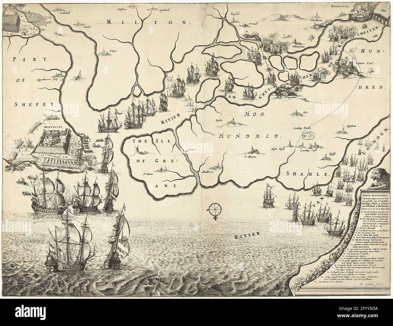 Map of mouth of the Thames with the trip to Chatham, 1667. Map of mouth of the Thames on which the trip to Chatham is indicated by the ships of the state fleet under Admiraal de Ruyter, 20-23 June 1667. Left the battle around Sheerness , above the Dutch ships on the Medway River. At the bottom right a lion on a pedestal on which the legend A-V. Stock Photohttps://www.alamy.com/image-license-details/?v=1https://www.alamy.com/map-of-mouth-of-the-thames-with-the-trip-to-chatham-1667-map-of-mouth-of-the-thames-on-which-the-trip-to-chatham-is-indicated-by-the-ships-of-the-state-fleet-under-admiraal-de-ruyter-20-23-june-1667-left-the-battle-around-sheerness-above-the-dutch-ships-on-the-medway-river-at-the-bottom-right-a-lion-on-a-pedestal-on-which-the-legend-a-v-image430243894.html
RM2FYY8DA–Map of mouth of the Thames with the trip to Chatham, 1667. Map of mouth of the Thames on which the trip to Chatham is indicated by the ships of the state fleet under Admiraal de Ruyter, 20-23 June 1667. Left the battle around Sheerness , above the Dutch ships on the Medway River. At the bottom right a lion on a pedestal on which the legend A-V.
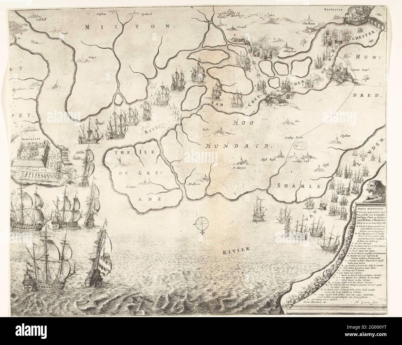 Map of mouth of the Thames with the trip to Chatham, 1667. Map of the mouth of the Thames on which the trip to Chatham has been indicated by the ships of the state fleet under Admiraal de Ruyter, 20-23 June 1667. On the left the struggle around Sheerness, above the Dutch ships on the Medway river. At the bottom right a lion on a pedestal on which the legend A-V. Stock Photohttps://www.alamy.com/image-license-details/?v=1https://www.alamy.com/map-of-mouth-of-the-thames-with-the-trip-to-chatham-1667-map-of-the-mouth-of-the-thames-on-which-the-trip-to-chatham-has-been-indicated-by-the-ships-of-the-state-fleet-under-admiraal-de-ruyter-20-23-june-1667-on-the-left-the-struggle-around-sheerness-above-the-dutch-ships-on-the-medway-river-at-the-bottom-right-a-lion-on-a-pedestal-on-which-the-legend-a-v-image430259980.html
RM2G000YT–Map of mouth of the Thames with the trip to Chatham, 1667. Map of the mouth of the Thames on which the trip to Chatham has been indicated by the ships of the state fleet under Admiraal de Ruyter, 20-23 June 1667. On the left the struggle around Sheerness, above the Dutch ships on the Medway river. At the bottom right a lion on a pedestal on which the legend A-V.
 The Dutch RAID on the Medway, 1667. Sheet with two performances over the trip to Chatham on June 20-23 1667 by the state fleet under Admiraal de Ruyter. On the left a map of the English east coast and the mouth of the Thames. On the right the Dutch ships on the Thames and Medway and the fighting at the island of Sheppey and the places Sheerness and Chatham. On the blade under the show a description in 3 columns. Stock Photohttps://www.alamy.com/image-license-details/?v=1https://www.alamy.com/the-dutch-raid-on-the-medway-1667-sheet-with-two-performances-over-the-trip-to-chatham-on-june-20-23-1667-by-the-state-fleet-under-admiraal-de-ruyter-on-the-left-a-map-of-the-english-east-coast-and-the-mouth-of-the-thames-on-the-right-the-dutch-ships-on-the-thames-and-medway-and-the-fighting-at-the-island-of-sheppey-and-the-places-sheerness-and-chatham-on-the-blade-under-the-show-a-description-in-3-columns-image430262754.html
RM2G004EX–The Dutch RAID on the Medway, 1667. Sheet with two performances over the trip to Chatham on June 20-23 1667 by the state fleet under Admiraal de Ruyter. On the left a map of the English east coast and the mouth of the Thames. On the right the Dutch ships on the Thames and Medway and the fighting at the island of Sheppey and the places Sheerness and Chatham. On the blade under the show a description in 3 columns.
 The Dutch RAID on the Medway, 1667. Sheet with two performances over the trip to Chatham on June 20-23 1667 by the state fleet under Admiraal de Ruyter. On the left a map of the English east coast and the mouth of the Thames and the Medway. On the right the state fleet on the Thames and the fighting around the island of Sheppey and the places Sheerness and Chatham. On the blade under the show a description in 3 columns. Stock Photohttps://www.alamy.com/image-license-details/?v=1https://www.alamy.com/the-dutch-raid-on-the-medway-1667-sheet-with-two-performances-over-the-trip-to-chatham-on-june-20-23-1667-by-the-state-fleet-under-admiraal-de-ruyter-on-the-left-a-map-of-the-english-east-coast-and-the-mouth-of-the-thames-and-the-medway-on-the-right-the-state-fleet-on-the-thames-and-the-fighting-around-the-island-of-sheppey-and-the-places-sheerness-and-chatham-on-the-blade-under-the-show-a-description-in-3-columns-image430266580.html
RM2G009BG–The Dutch RAID on the Medway, 1667. Sheet with two performances over the trip to Chatham on June 20-23 1667 by the state fleet under Admiraal de Ruyter. On the left a map of the English east coast and the mouth of the Thames and the Medway. On the right the state fleet on the Thames and the fighting around the island of Sheppey and the places Sheerness and Chatham. On the blade under the show a description in 3 columns.
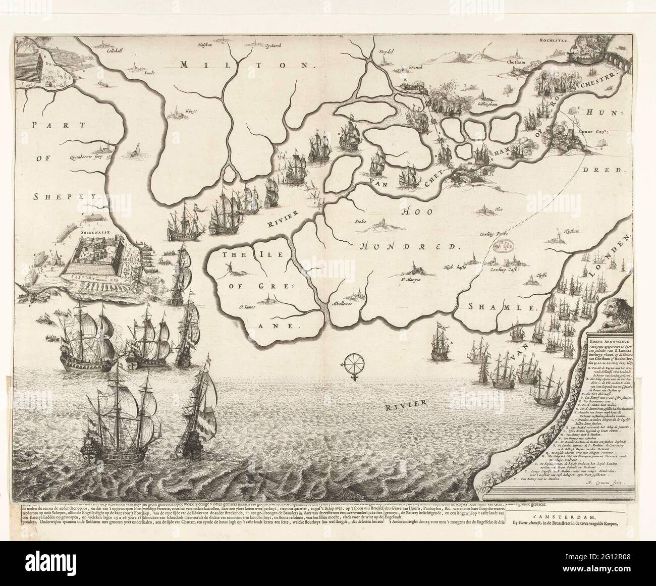 Map of mouth of the Thames with the trip to Chatham, 1667; Warely Af-imagining, from 't Gene Uytvoert is by a part of' t Landtors Warshs fleet, on the Riviere of Chattam or Rochester, the 19, 20, 21, 22 and 23 June, 1667. Map of the mouth of the Thames on which the trip to Chatham is indicated by the ships of the state fleet under Admiraal de Ruyter, 20-23 June 1667. On the left the struggle around Sheerness, above the Dutch ships on the Medway river. At the bottom right a lion on a pedestal on which the legend A-V. A text sheet is one of the record. Stock Photohttps://www.alamy.com/image-license-details/?v=1https://www.alamy.com/map-of-mouth-of-the-thames-with-the-trip-to-chatham-1667-warely-af-imagining-from-t-gene-uytvoert-is-by-a-part-of-t-landtors-warshs-fleet-on-the-riviere-of-chattam-or-rochester-the-19-20-21-22-and-23-june-1667-map-of-the-mouth-of-the-thames-on-which-the-trip-to-chatham-is-indicated-by-the-ships-of-the-state-fleet-under-admiraal-de-ruyter-20-23-june-1667-on-the-left-the-struggle-around-sheerness-above-the-dutch-ships-on-the-medway-river-at-the-bottom-right-a-lion-on-a-pedestal-on-which-the-legend-a-v-a-text-sheet-is-one-of-the-record-image430935800.html
RM2G12R08–Map of mouth of the Thames with the trip to Chatham, 1667; Warely Af-imagining, from 't Gene Uytvoert is by a part of' t Landtors Warshs fleet, on the Riviere of Chattam or Rochester, the 19, 20, 21, 22 and 23 June, 1667. Map of the mouth of the Thames on which the trip to Chatham is indicated by the ships of the state fleet under Admiraal de Ruyter, 20-23 June 1667. On the left the struggle around Sheerness, above the Dutch ships on the Medway river. At the bottom right a lion on a pedestal on which the legend A-V. A text sheet is one of the record.