Quick filters:
Military map Stock Photos and Images
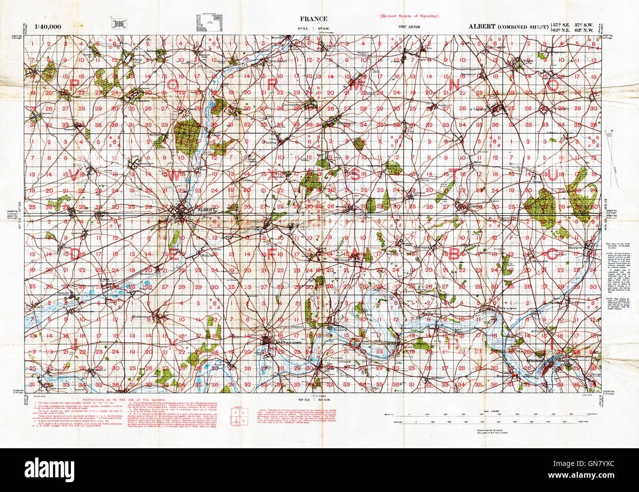 Somme Battlefield Map, 1916 1:40,000 military map of the British sector around Albert, with squares 57d SE, 57c SW, 62d NE, 62c NW Stock Photohttps://www.alamy.com/image-license-details/?v=1https://www.alamy.com/stock-photo-somme-battlefield-map-1916-140000-military-map-of-the-british-sector-116345556.html
RMGN7YXC–Somme Battlefield Map, 1916 1:40,000 military map of the British sector around Albert, with squares 57d SE, 57c SW, 62d NE, 62c NW
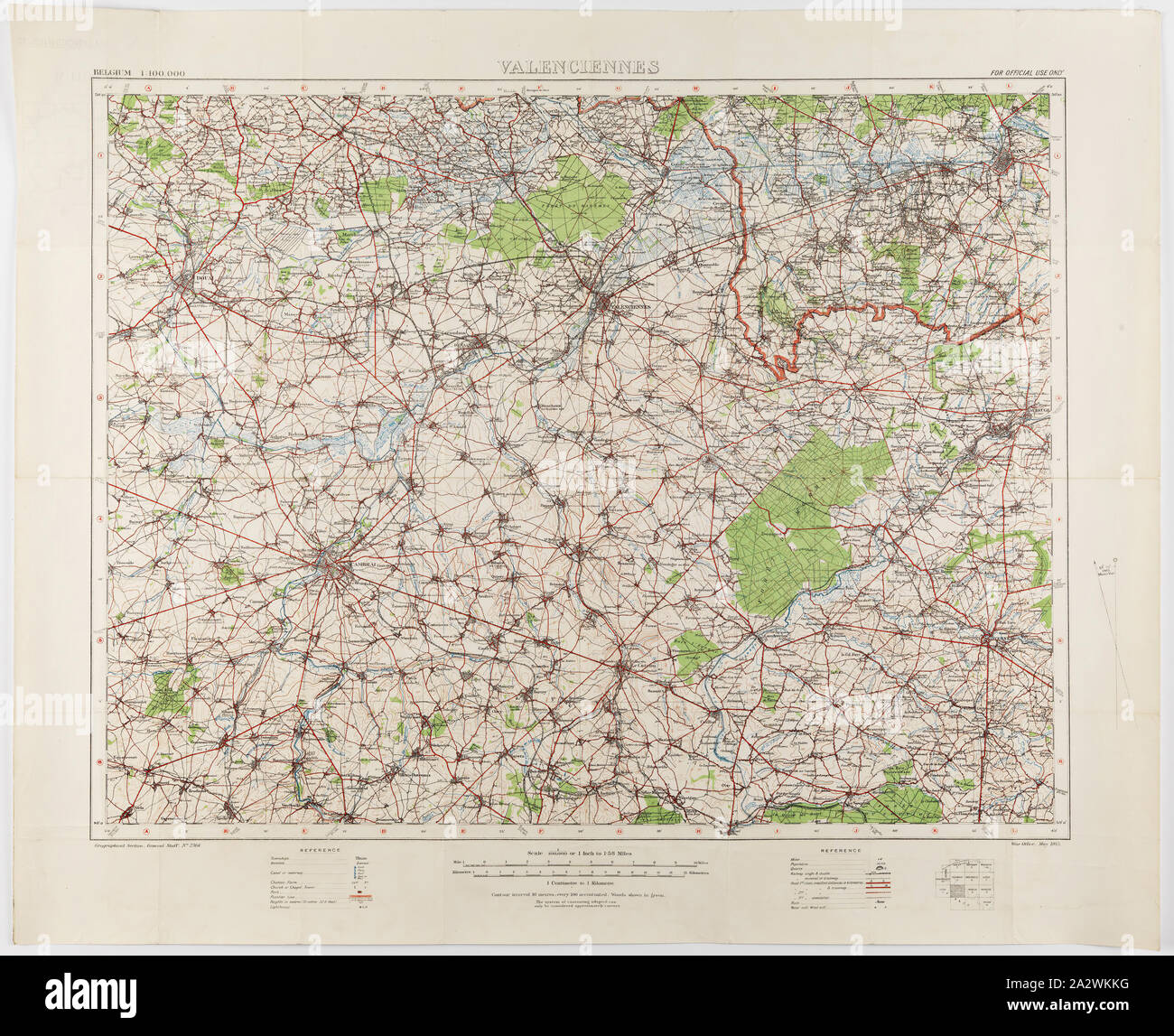 Map - Military, Belgium, Valenciennes 12, Scale 1:100,000, World War I, 1914-1918, Military map of Belgium, Valenciennes 12 region, scale 1:100,000. The map would have been used during World War I. Maps of this scale lacked the detail needed for trench warfare, instead providing an overview of regions for the use of senior commanders. Part of the collection of World War I memorabilia donated by Sergeant John Lord (#6252). John Lord was 19 years old when he enlisted with Stock Photohttps://www.alamy.com/image-license-details/?v=1https://www.alamy.com/map-military-belgium-valenciennes-12-scale-1100000-world-war-i-1914-1918-military-map-of-belgium-valenciennes-12-region-scale-1100000-the-map-would-have-been-used-during-world-war-i-maps-of-this-scale-lacked-the-detail-needed-for-trench-warfare-instead-providing-an-overview-of-regions-for-the-use-of-senior-commanders-part-of-the-collection-of-world-war-i-memorabilia-donated-by-sergeant-john-lord-6252-john-lord-was-19-years-old-when-he-enlisted-with-image328790548.html
RM2A2WKKG–Map - Military, Belgium, Valenciennes 12, Scale 1:100,000, World War I, 1914-1918, Military map of Belgium, Valenciennes 12 region, scale 1:100,000. The map would have been used during World War I. Maps of this scale lacked the detail needed for trench warfare, instead providing an overview of regions for the use of senior commanders. Part of the collection of World War I memorabilia donated by Sergeant John Lord (#6252). John Lord was 19 years old when he enlisted with
 1044 Military map showing the marches of the United States forces under command of Maj. Genl. W.T. Sherman, U.S.A. during the years 1863, 1864, 1865 (10208605453) Stock Photohttps://www.alamy.com/image-license-details/?v=1https://www.alamy.com/1044-military-map-showing-the-marches-of-the-united-states-forces-under-command-of-maj-genl-wt-sherman-usa-during-the-years-1863-1864-1865-10208605453-image213485446.html
RMPB92T6–1044 Military map showing the marches of the United States forces under command of Maj. Genl. W.T. Sherman, U.S.A. during the years 1863, 1864, 1865 (10208605453)
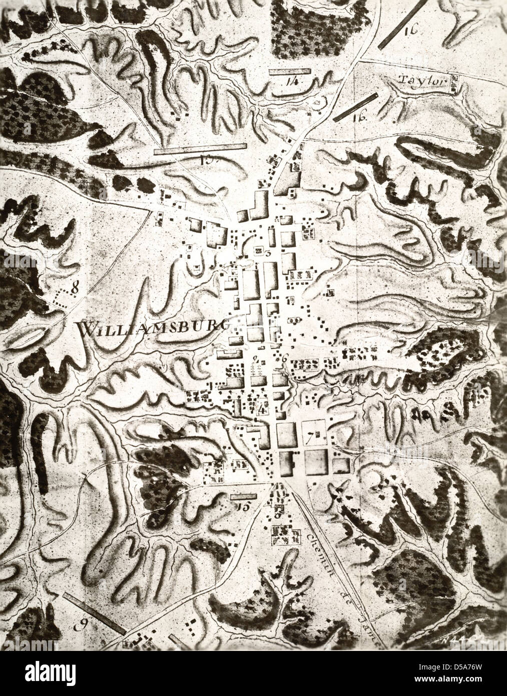 Rochambeau Military Map of Williamsburg, Virginia Stock Photohttps://www.alamy.com/image-license-details/?v=1https://www.alamy.com/stock-photo-rochambeau-military-map-of-williamsburg-virginia-54929585.html
RMD5A76W–Rochambeau Military Map of Williamsburg, Virginia
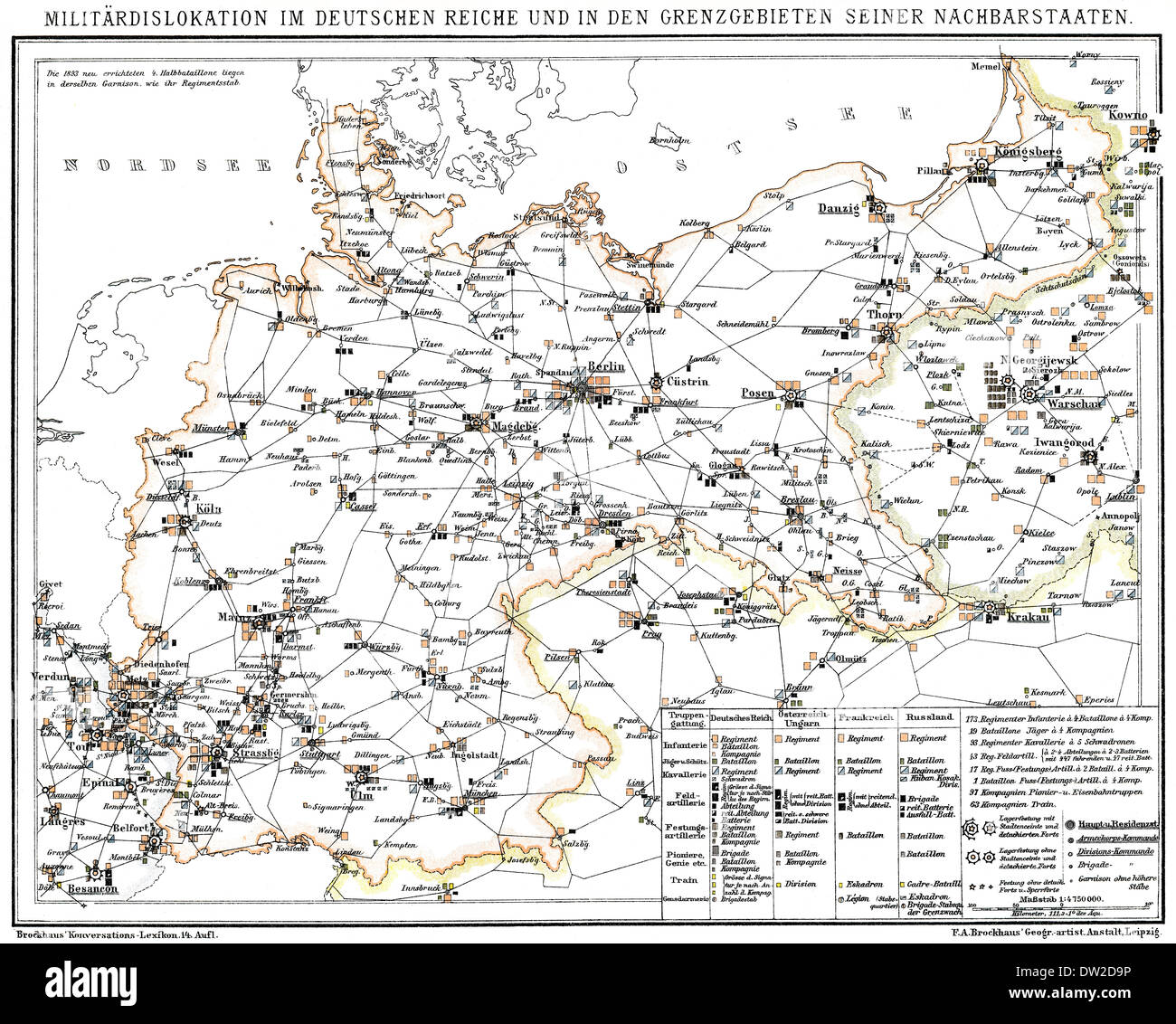 Historical military map of Germany, 1894 Stock Photohttps://www.alamy.com/image-license-details/?v=1https://www.alamy.com/historical-military-map-of-germany-1894-image67051874.html
RMDW2D9P–Historical military map of Germany, 1894
 Mawangdui Military Map Stock Photohttps://www.alamy.com/image-license-details/?v=1https://www.alamy.com/stock-photo-mawangdui-military-map-140189985.html
RMJ425N5–Mawangdui Military Map
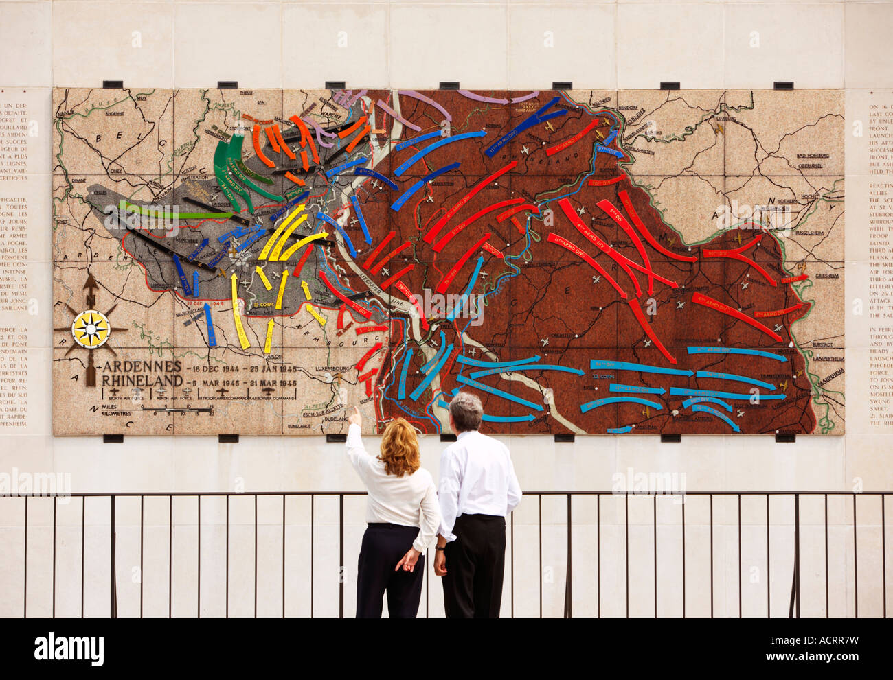 American Military Cemetery, Hamm, Luxembourg City, Europe - couple viewing the World War 2 battle map Stock Photohttps://www.alamy.com/image-license-details/?v=1https://www.alamy.com/stock-photo-american-military-cemetery-hamm-luxembourg-city-europe-couple-viewing-13219788.html
RMACRR7W–American Military Cemetery, Hamm, Luxembourg City, Europe - couple viewing the World War 2 battle map
 Military map reading skills demonstrated by US Army soldiers during the Soldier of the Year competition at Fort Huachuca Stock Photohttps://www.alamy.com/image-license-details/?v=1https://www.alamy.com/stock-photo-military-map-reading-skills-demonstrated-by-us-army-soldiers-during-50054263.html
RMCWC4M7–Military map reading skills demonstrated by US Army soldiers during the Soldier of the Year competition at Fort Huachuca
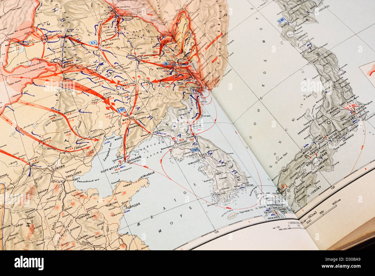 Military map of World War II on the Far East, 9 August - 2 September 1945 Stock Photohttps://www.alamy.com/image-license-details/?v=1https://www.alamy.com/stock-photo-military-map-of-world-war-ii-on-the-far-east-9-august-2-september-53483985.html
RFD30BA9–Military map of World War II on the Far East, 9 August - 2 September 1945
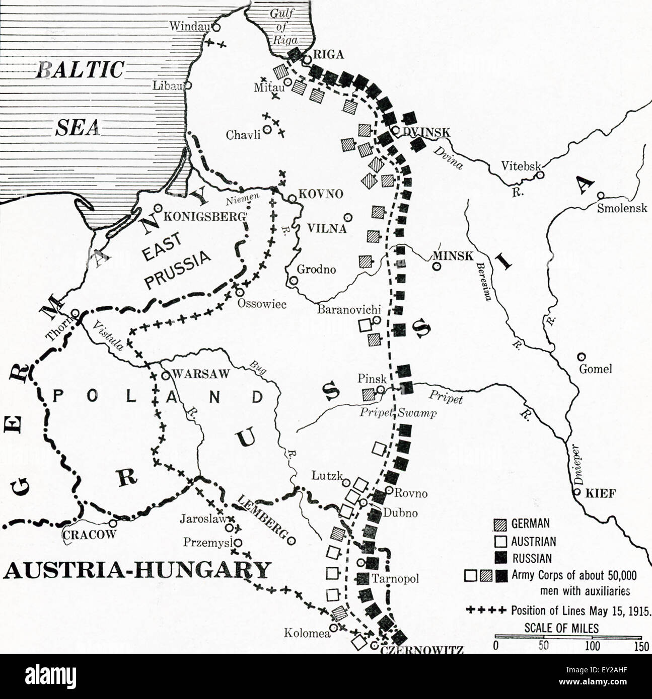 This map shows the eastern front in the early summer of 1916. The time period is World War I. The military lines shown as German, Austrian, and Russian. Stock Photohttps://www.alamy.com/image-license-details/?v=1https://www.alamy.com/stock-photo-this-map-shows-the-eastern-front-in-the-early-summer-of-1916-the-time-85489419.html
RFEY2AHF–This map shows the eastern front in the early summer of 1916. The time period is World War I. The military lines shown as German, Austrian, and Russian.
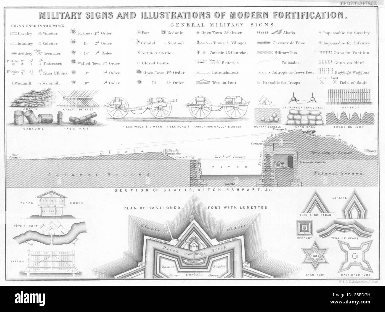 MILITARIA: Military Signs and Illustrations of Modern Fortification, 1848 Stock Photohttps://www.alamy.com/image-license-details/?v=1https://www.alamy.com/stock-photo-militaria-military-signs-and-illustrations-of-modern-fortification-106653473.html
RFG5EDGH–MILITARIA: Military Signs and Illustrations of Modern Fortification, 1848
 Map of Battle of Sokolov, postage stamp, Czechoslovakia, 1968 Stock Photohttps://www.alamy.com/image-license-details/?v=1https://www.alamy.com/stock-photo-map-of-battle-of-sokolov-postage-stamp-czechoslovakia-1968-53624933.html
RMD36R45–Map of Battle of Sokolov, postage stamp, Czechoslovakia, 1968
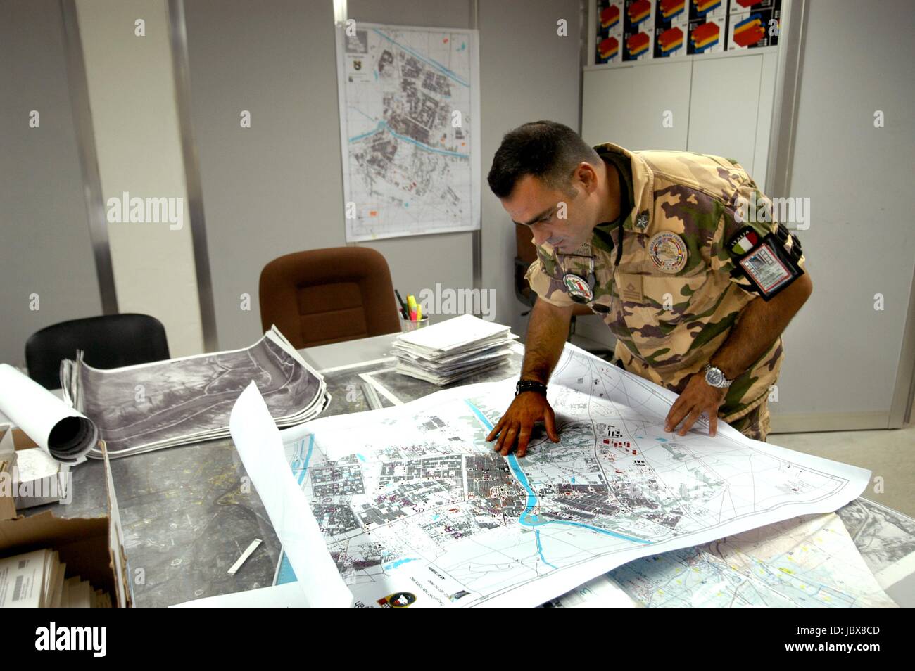 Nassiriya (Iraq), Italian Military Contingent, Tallin Airport, 6th ROA (Military Air Force), cartography department (October 2004) Stock Photohttps://www.alamy.com/image-license-details/?v=1https://www.alamy.com/stock-photo-nassiriya-iraq-italian-military-contingent-tallin-airport-6th-roa-145021533.html
RMJBX8CD–Nassiriya (Iraq), Italian Military Contingent, Tallin Airport, 6th ROA (Military Air Force), cartography department (October 2004)
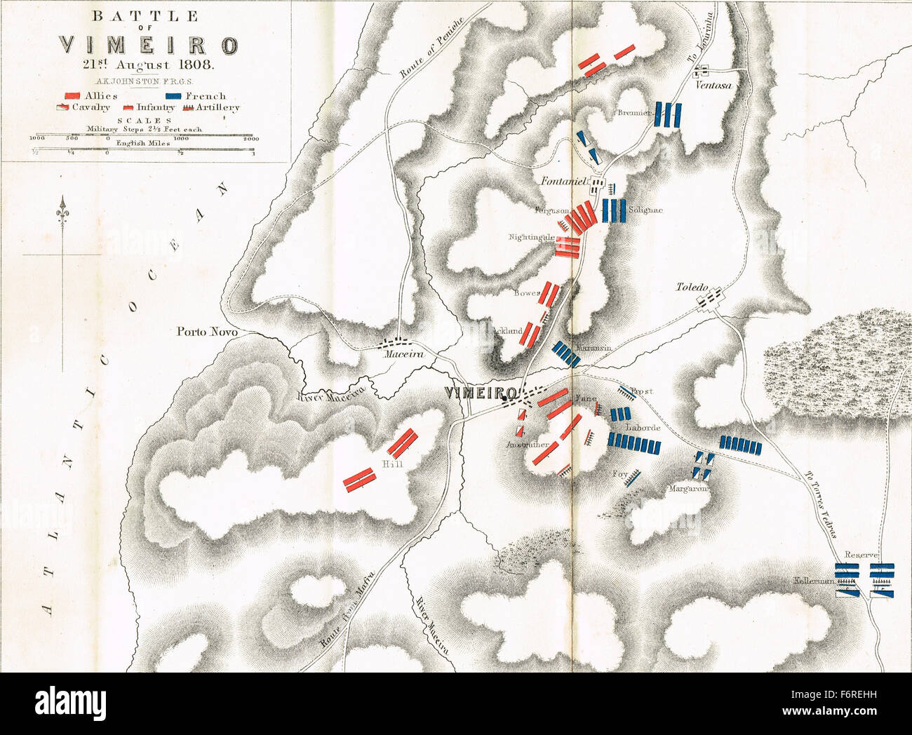 Map of the Battle of Vimeiro in 1808 Stock Photohttps://www.alamy.com/image-license-details/?v=1https://www.alamy.com/stock-photo-map-of-the-battle-of-vimeiro-in-1808-90256141.html
RMF6REHH–Map of the Battle of Vimeiro in 1808
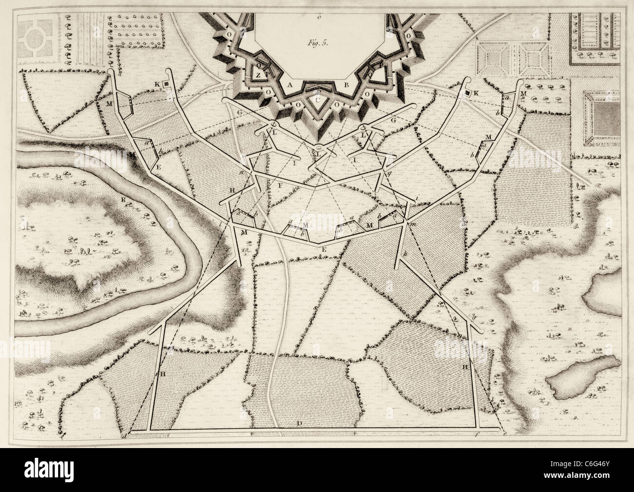 Plan of fortification under siege showing fortification under attack and earthworks permitting besieging army to approach object Stock Photohttps://www.alamy.com/image-license-details/?v=1https://www.alamy.com/stock-photo-plan-of-fortification-under-siege-showing-fortification-under-attack-38463235.html
RMC6G46Y–Plan of fortification under siege showing fortification under attack and earthworks permitting besieging army to approach object
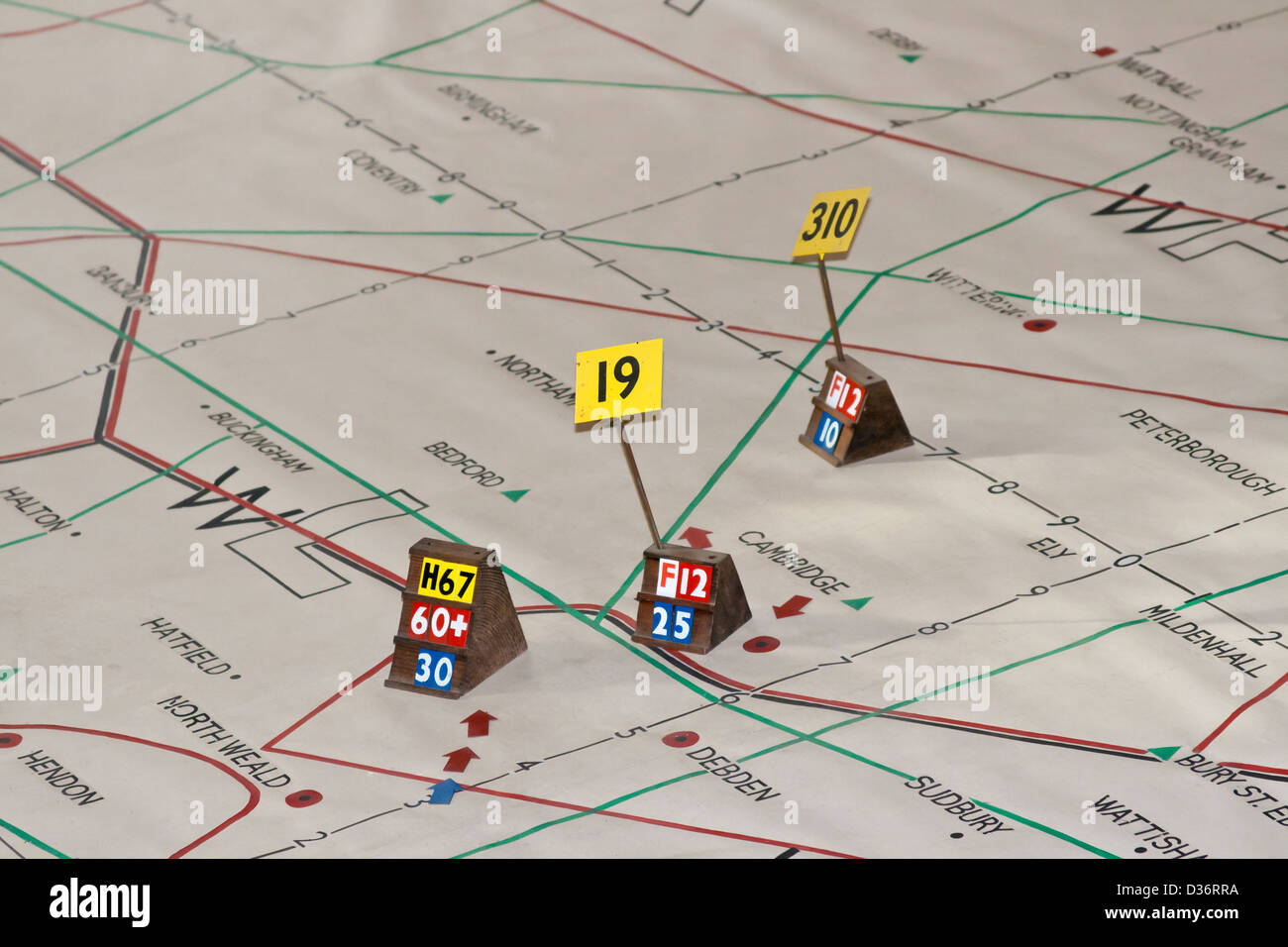 WW2 Plotting map Stock Photohttps://www.alamy.com/image-license-details/?v=1https://www.alamy.com/stock-photo-ww2-plotting-map-53625470.html
RMD36RRA–WW2 Plotting map
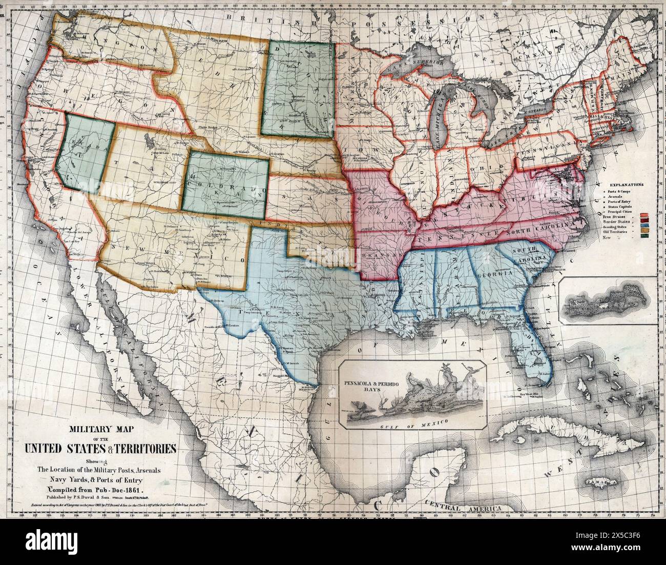 Military map of the United States & territories showing the location of the military posts, arsenals, Navy Yards, & ports of entry, 1861 Stock Photohttps://www.alamy.com/image-license-details/?v=1https://www.alamy.com/military-map-of-the-united-states-territories-showing-the-location-of-the-military-posts-arsenals-navy-yards-ports-of-entry-1861-image605702362.html
RM2X5C3F6–Military map of the United States & territories showing the location of the military posts, arsenals, Navy Yards, & ports of entry, 1861
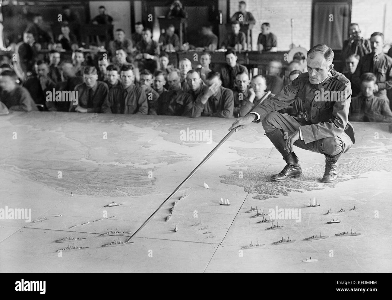 U.S. Military Training during World War I, Harris & Ewing, 1917 Stock Photohttps://www.alamy.com/image-license-details/?v=1https://www.alamy.com/stock-image-us-military-training-during-world-war-i-harris-ewing-1917-163800048.html
RMKEDMHM–U.S. Military Training during World War I, Harris & Ewing, 1917
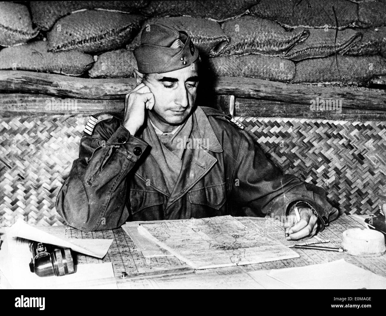 General De Castries in his headquarters reading a map Stock Photohttps://www.alamy.com/image-license-details/?v=1https://www.alamy.com/general-de-castries-in-his-headquarters-reading-a-map-image69288814.html
RME0MAGE–General De Castries in his headquarters reading a map
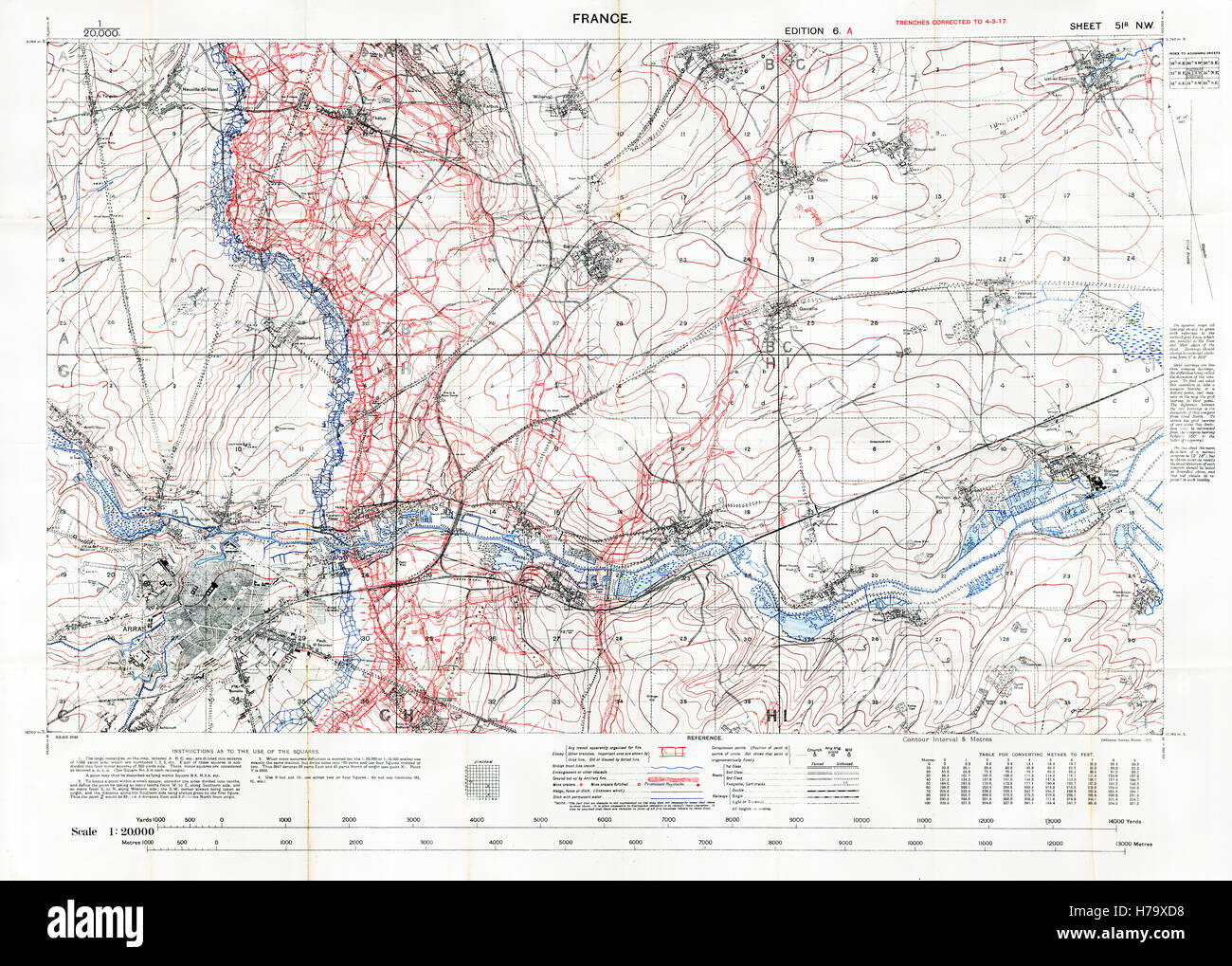 Arras Sector Battlefield Map, 1917 Edition 6A 1:20,000 military map of the British sector in Northern France, with square 51B NW, trenches correct at March 1917 Stock Photohttps://www.alamy.com/image-license-details/?v=1https://www.alamy.com/stock-photo-arras-sector-battlefield-map-1917-edition-6a-120000-military-map-of-124993492.html
RMH79XD8–Arras Sector Battlefield Map, 1917 Edition 6A 1:20,000 military map of the British sector in Northern France, with square 51B NW, trenches correct at March 1917
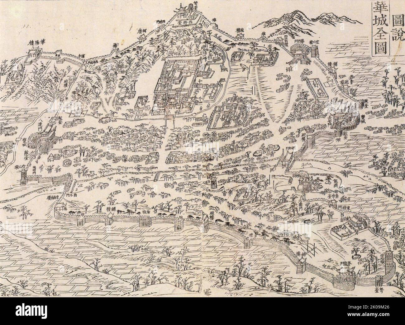 Joseon Era Korean military map of the Hwaseong Fortress, from the Hwaseong Uigwe. Here, the structures are described using their original (Hanja) names. 1795, Hwaseong Fortress or Suwon Hwaseong is a fortification surrounding the centre of Suwon, the provincial capital of Gyeonggi-do, in South Korea. It was built from 1794 to 1796 by King Jeongjo of the Joseon dynasty. Stock Photohttps://www.alamy.com/image-license-details/?v=1https://www.alamy.com/joseon-era-korean-military-map-of-the-hwaseong-fortress-from-the-hwaseong-uigwe-here-the-structures-are-described-using-their-original-hanja-names-1795-hwaseong-fortress-or-suwon-hwaseong-is-a-fortification-surrounding-the-centre-of-suwon-the-provincial-capital-of-gyeonggi-do-in-south-korea-it-was-built-from-1794-to-1796-by-king-jeongjo-of-the-joseon-dynasty-image482103614.html
RM2K09M26–Joseon Era Korean military map of the Hwaseong Fortress, from the Hwaseong Uigwe. Here, the structures are described using their original (Hanja) names. 1795, Hwaseong Fortress or Suwon Hwaseong is a fortification surrounding the centre of Suwon, the provincial capital of Gyeonggi-do, in South Korea. It was built from 1794 to 1796 by King Jeongjo of the Joseon dynasty.
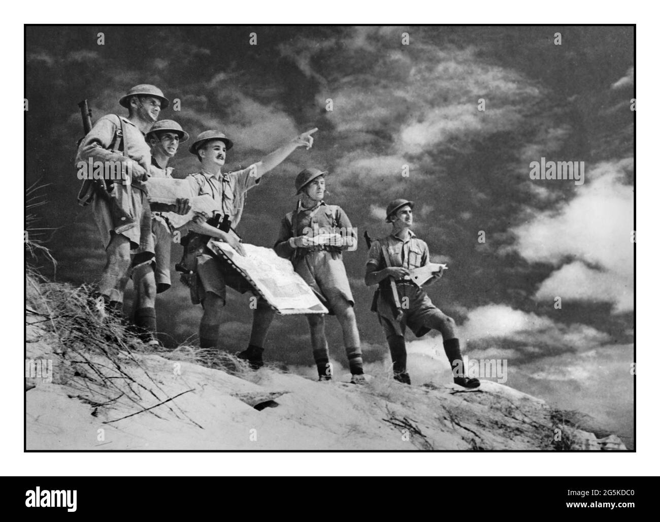 WW2 British Army soldiers mapping out the Western Desert: a British military map-reading class under-going instruction in the Western Desert before the opening of the British second offensive on November 18th 1941 Photograph shows soldiers in lightweight uniform in the desert studying maps and terrain World War, 1939-1945--Egypt--Western Desert - Map reading--Egypt--Western Desert--1940-1950 - Soldiers--British--Egypt--Western Desert--1940-1950 - Military education--Egypt--Western Desert--1940-1950 Stock Photohttps://www.alamy.com/image-license-details/?v=1https://www.alamy.com/ww2-british-army-soldiers-mapping-out-the-western-desert-a-british-military-map-reading-class-under-going-instruction-in-the-western-desert-before-the-opening-of-the-british-second-offensive-on-november-18th-1941-photograph-shows-soldiers-in-lightweight-uniform-in-the-desert-studying-maps-and-terrain-world-war-1939-1945-egypt-western-desert-map-reading-egypt-western-desert-1940-1950-soldiers-british-egypt-western-desert-1940-1950-military-education-egypt-western-desert-1940-1950-image433760096.html
RM2G5KDC0–WW2 British Army soldiers mapping out the Western Desert: a British military map-reading class under-going instruction in the Western Desert before the opening of the British second offensive on November 18th 1941 Photograph shows soldiers in lightweight uniform in the desert studying maps and terrain World War, 1939-1945--Egypt--Western Desert - Map reading--Egypt--Western Desert--1940-1950 - Soldiers--British--Egypt--Western Desert--1940-1950 - Military education--Egypt--Western Desert--1940-1950
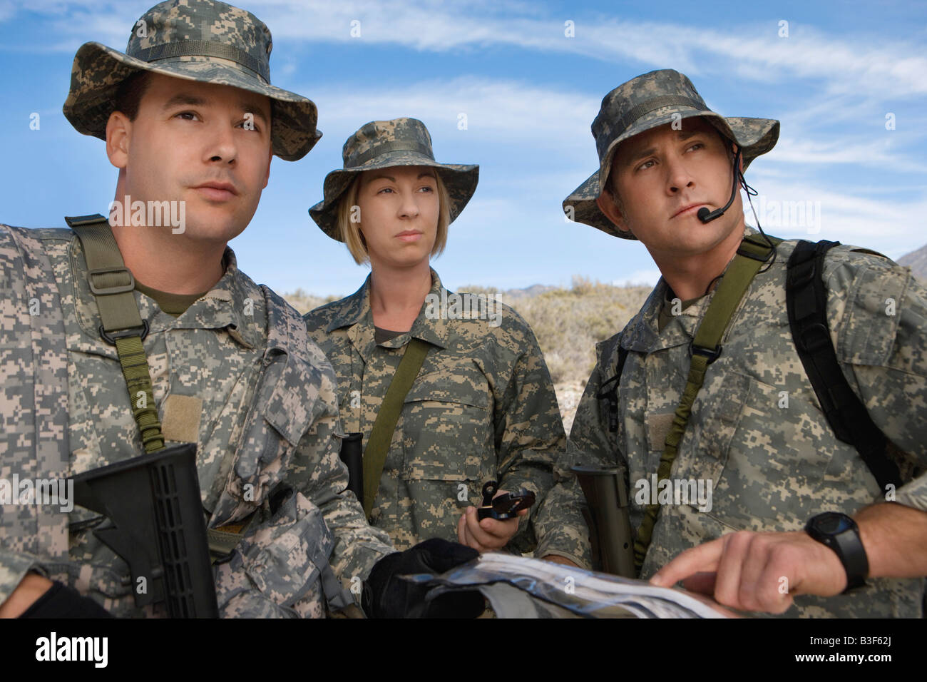 Soldiers in field looking at map Stock Photohttps://www.alamy.com/image-license-details/?v=1https://www.alamy.com/stock-photo-soldiers-in-field-looking-at-map-19388394.html
RFB3F62J–Soldiers in field looking at map
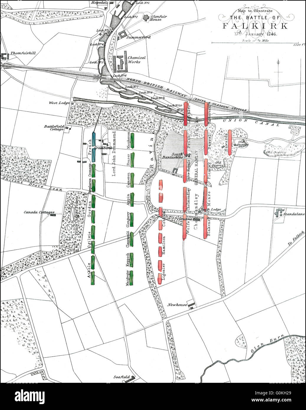 The Battle of Falkirk, on 22 July 1298, one of the major battles in the First War of Scottish Independence Stock Photohttps://www.alamy.com/image-license-details/?v=1https://www.alamy.com/stock-photo-the-battle-of-falkirk-on-22-july-1298-one-of-the-major-battles-in-103692689.html
RMG0KH29–The Battle of Falkirk, on 22 July 1298, one of the major battles in the First War of Scottish Independence
 1862 Johnson Military Map of the United States ( Civil War ) Stock Photohttps://www.alamy.com/image-license-details/?v=1https://www.alamy.com/stock-photo-1862-johnson-military-map-of-the-united-states-civil-war-50538979.html
RMCX66YF–1862 Johnson Military Map of the United States ( Civil War )
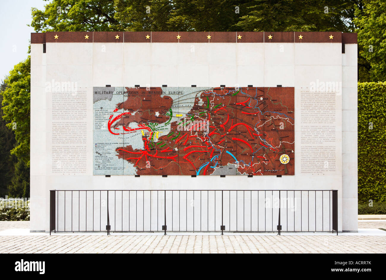 Battle maps at the American Military Cemetery Hamm Luxembourg City Luxembourg Europe Stock Photohttps://www.alamy.com/image-license-details/?v=1https://www.alamy.com/stock-photo-battle-maps-at-the-american-military-cemetery-hamm-luxembourg-city-13219782.html
RMACRR7K–Battle maps at the American Military Cemetery Hamm Luxembourg City Luxembourg Europe
 U.S. Army Pfc. Jessica Estrada and Sgt. Eric Taylor, both assigned to Headquarters and Headquarters Company (HHC) Network Enterprise Technology Command (NETCOM), plot their points during the land navigation training exercise for the NETCOM Best Warrior Competition at Fort Huachuca, Az., May 11, 2017. The land navigation training is designed to test the soldiers' abilities in teamwork and leadership as well as determining the grid coordinates on a military map. Stock Photohttps://www.alamy.com/image-license-details/?v=1https://www.alamy.com/us-army-pfc-jessica-estrada-and-sgt-eric-taylor-both-assigned-to-headquarters-and-headquarters-company-hhc-network-enterprise-technology-command-netcom-plot-their-points-during-the-land-navigation-training-exercise-for-the-netcom-best-warrior-competition-at-fort-huachuca-az-may-11-2017-the-land-navigation-training-is-designed-to-test-the-soldiers-abilities-in-teamwork-and-leadership-as-well-as-determining-the-grid-coordinates-on-a-military-map-image210883828.html
RMP72GD8–U.S. Army Pfc. Jessica Estrada and Sgt. Eric Taylor, both assigned to Headquarters and Headquarters Company (HHC) Network Enterprise Technology Command (NETCOM), plot their points during the land navigation training exercise for the NETCOM Best Warrior Competition at Fort Huachuca, Az., May 11, 2017. The land navigation training is designed to test the soldiers' abilities in teamwork and leadership as well as determining the grid coordinates on a military map.
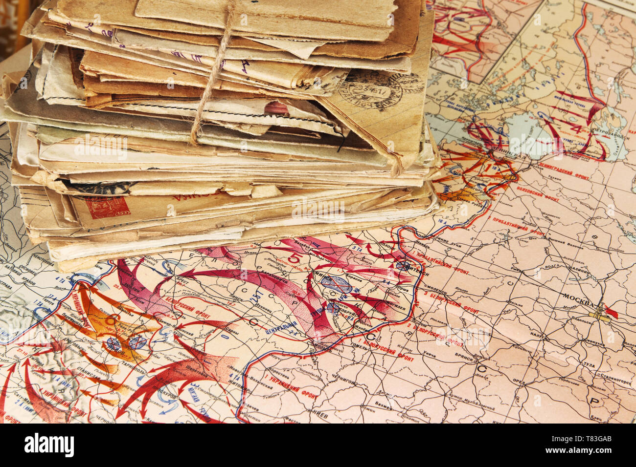 Pile of the paper letters of the wartime lying on the military map of the World War II, 1944 Stock Photohttps://www.alamy.com/image-license-details/?v=1https://www.alamy.com/pile-of-the-paper-letters-of-the-wartime-lying-on-the-military-map-of-the-world-war-ii-1944-image245941091.html
RFT83GAB–Pile of the paper letters of the wartime lying on the military map of the World War II, 1944
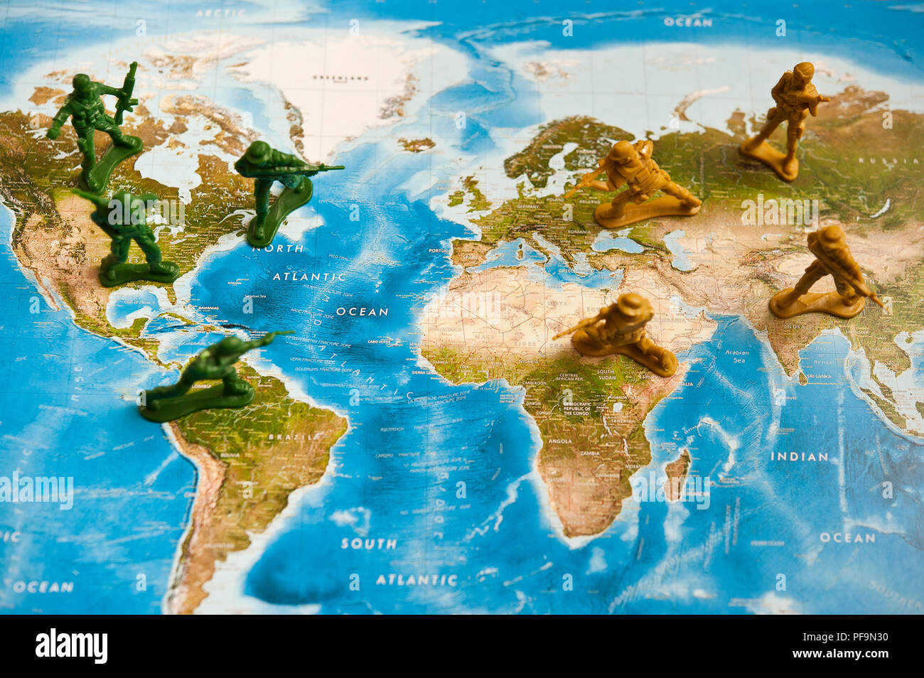 toy plastic soldiers armies facing each other on a world map Stock Photohttps://www.alamy.com/image-license-details/?v=1https://www.alamy.com/toy-plastic-soldiers-armies-facing-each-other-on-a-world-map-image215958372.html
RMPF9N30–toy plastic soldiers armies facing each other on a world map
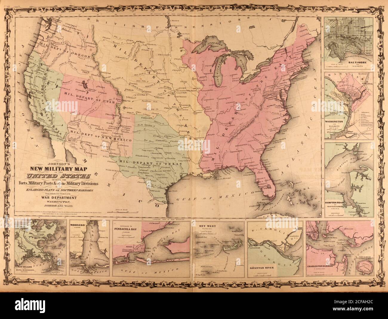
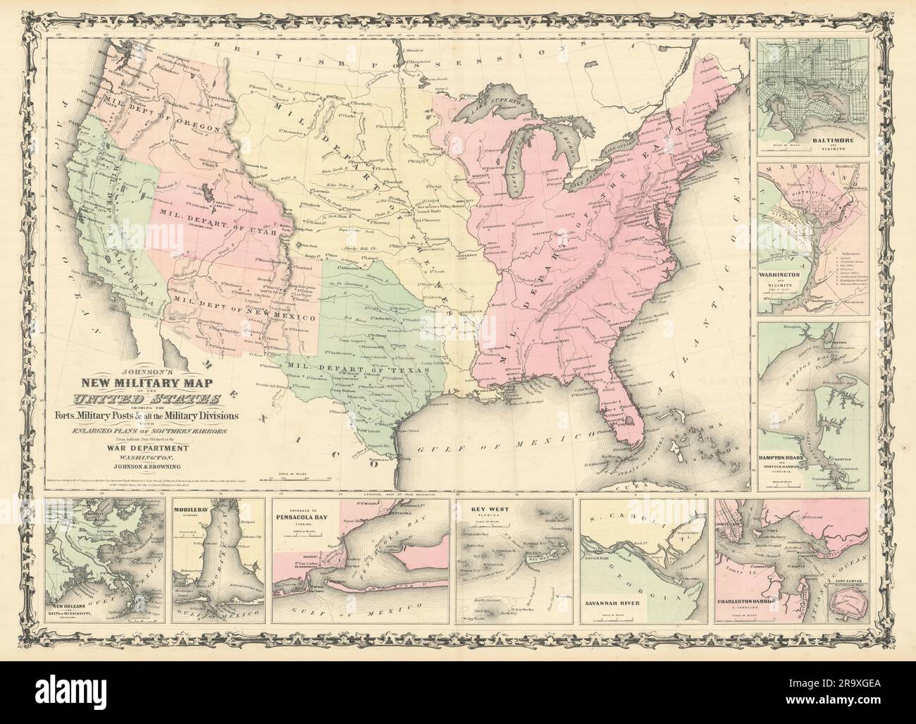 Johnson's New Military Map of the United States. Forts Posts divisions 1861 Stock Photohttps://www.alamy.com/image-license-details/?v=1https://www.alamy.com/johnsons-new-military-map-of-the-united-states-forts-posts-divisions-1861-image556847378.html
RF2R9XGEA–Johnson's New Military Map of the United States. Forts Posts divisions 1861
 Map of General Harmar's defeat by the Miami and Shawnee at Fort Wayne, Indiana, 1791. Hand-colored woodcut Stock Photohttps://www.alamy.com/image-license-details/?v=1https://www.alamy.com/stock-photo-map-of-general-harmars-defeat-by-the-miami-and-shawnee-at-fort-wayne-29601883.html
RMBM4DE3–Map of General Harmar's defeat by the Miami and Shawnee at Fort Wayne, Indiana, 1791. Hand-colored woodcut
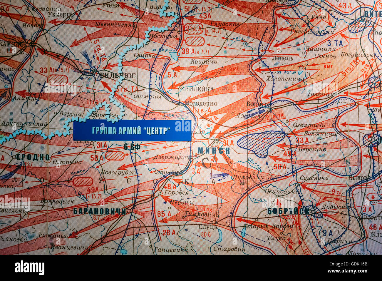 The exhibit at the Belarusian Museum Of The Great Patriotic War - Map of the Soviet offensive in the Wehrmacht troops in the lib Stock Photohttps://www.alamy.com/image-license-details/?v=1https://www.alamy.com/stock-photo-the-exhibit-at-the-belarusian-museum-of-the-great-patriotic-war-map-111683331.html
RMGDKH6B–The exhibit at the Belarusian Museum Of The Great Patriotic War - Map of the Soviet offensive in the Wehrmacht troops in the lib
 British Army of the Rhine, Brigade and battle Group Trainer, installation for simulated management of battlefield (1986) Stock Photohttps://www.alamy.com/image-license-details/?v=1https://www.alamy.com/stock-photo-british-army-of-the-rhine-brigade-and-battle-group-trainer-installation-73397108.html
RME7BEN8–British Army of the Rhine, Brigade and battle Group Trainer, installation for simulated management of battlefield (1986)
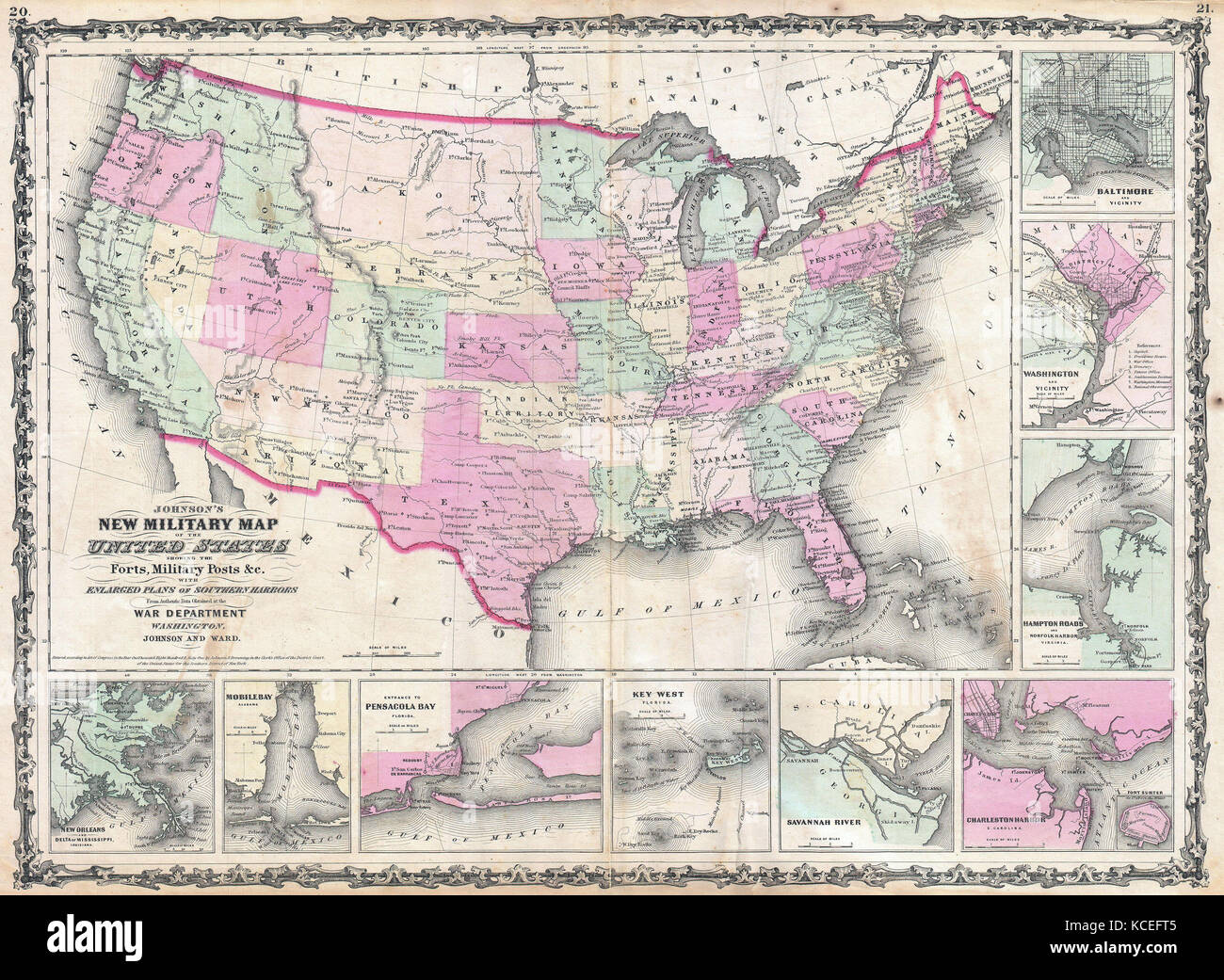 1862, Johnson Military Map of the United States, Civil War Stock Photohttps://www.alamy.com/image-license-details/?v=1https://www.alamy.com/stock-image-1862-johnson-military-map-of-the-united-states-civil-war-162588949.html
RMKCEFT5–1862, Johnson Military Map of the United States, Civil War
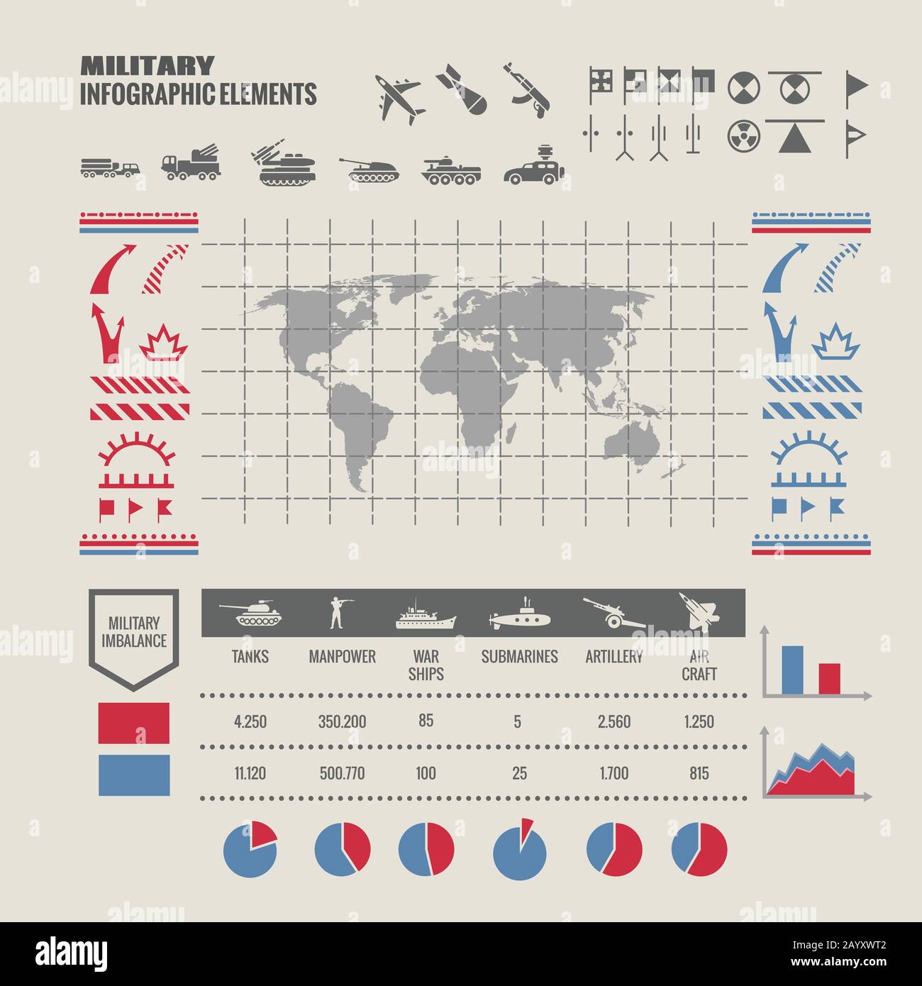 Military strategy map. Strategy military map for war, map to game with warship tank and soldier. Vector illustration infographic Stock Vectorhttps://www.alamy.com/image-license-details/?v=1https://www.alamy.com/military-strategy-map-strategy-military-map-for-war-map-to-game-with-warship-tank-and-soldier-vector-illustration-infographic-image344183730.html
RF2AYXWT2–Military strategy map. Strategy military map for war, map to game with warship tank and soldier. Vector illustration infographic
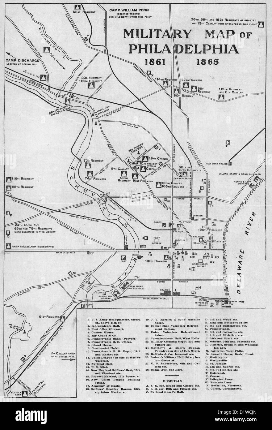 Military Map of Philadelphia, Pennsylvania, 1861-1865, USA Civil War Stock Photohttps://www.alamy.com/image-license-details/?v=1https://www.alamy.com/stock-photo-military-map-of-philadelphia-pennsylvania-1861-1865-usa-civil-war-52804493.html
RMD1WCJN–Military Map of Philadelphia, Pennsylvania, 1861-1865, USA Civil War
 A BRITISH ARMY FEMALE RECRUIT CHECKS A MAP WHILE BEING BRIEFED BY A COLOUR SERGEANT BEFORE A TRAINING STALK DURING A SNIPER COUR Stock Photohttps://www.alamy.com/image-license-details/?v=1https://www.alamy.com/stock-photo-a-british-army-female-recruit-checks-a-map-while-being-briefed-by-16848601.html
RMAXHF8X–A BRITISH ARMY FEMALE RECRUIT CHECKS A MAP WHILE BEING BRIEFED BY A COLOUR SERGEANT BEFORE A TRAINING STALK DURING A SNIPER COUR
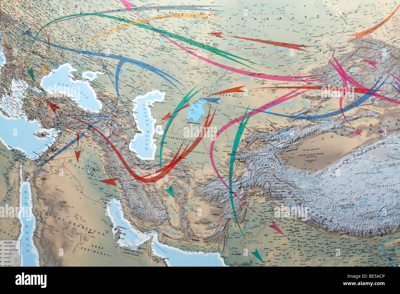 Turkish map of the migrations in the Near East, Military Museum, Askeri Mues, Osmanbey, Istanbul, Turkey Stock Photohttps://www.alamy.com/image-license-details/?v=1https://www.alamy.com/stock-photo-turkish-map-of-the-migrations-in-the-near-east-military-museum-askeri-25933510.html
RMBE5ACP–Turkish map of the migrations in the Near East, Military Museum, Askeri Mues, Osmanbey, Istanbul, Turkey
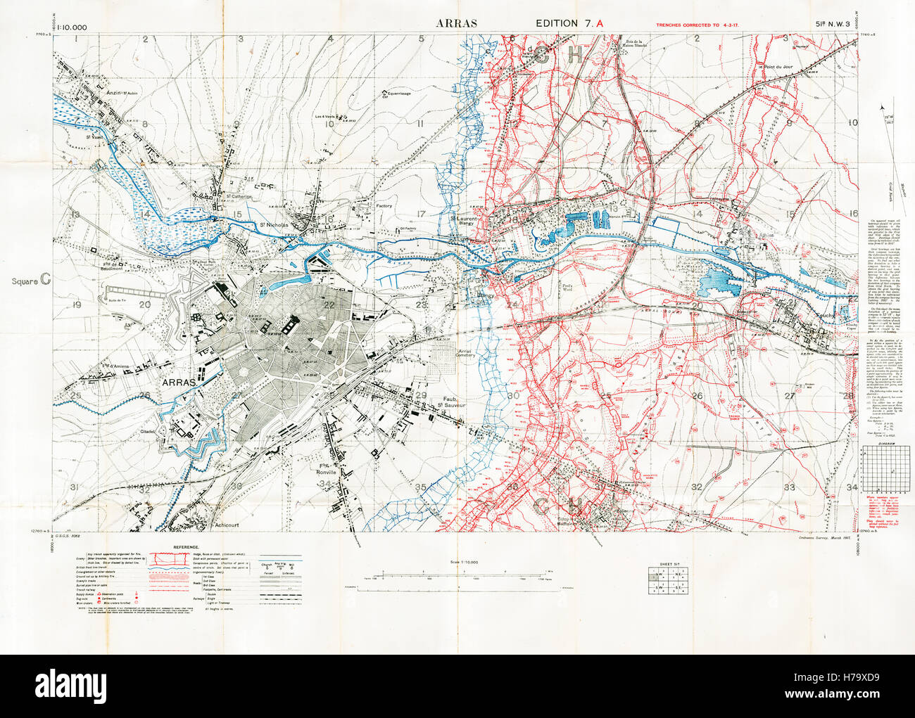 Arras Sector Battlefield Map, 1917 Edition 7A 1:10,000 military map of the British sector in Northern France, with square 51B NW3, trenches correct at March 1917 Stock Photohttps://www.alamy.com/image-license-details/?v=1https://www.alamy.com/stock-photo-arras-sector-battlefield-map-1917-edition-7a-110000-military-map-of-124993493.html
RMH79XD9–Arras Sector Battlefield Map, 1917 Edition 7A 1:10,000 military map of the British sector in Northern France, with square 51B NW3, trenches correct at March 1917
 Military Map of the Theater of War - Mappa militar do Theatro da Guerra. 1914 by Belfort, W. Stock Photohttps://www.alamy.com/image-license-details/?v=1https://www.alamy.com/military-map-of-the-theater-of-war-mappa-militar-do-theatro-da-guerra-1914-by-belfort-w-image463611580.html
RM2HX798C–Military Map of the Theater of War - Mappa militar do Theatro da Guerra. 1914 by Belfort, W.
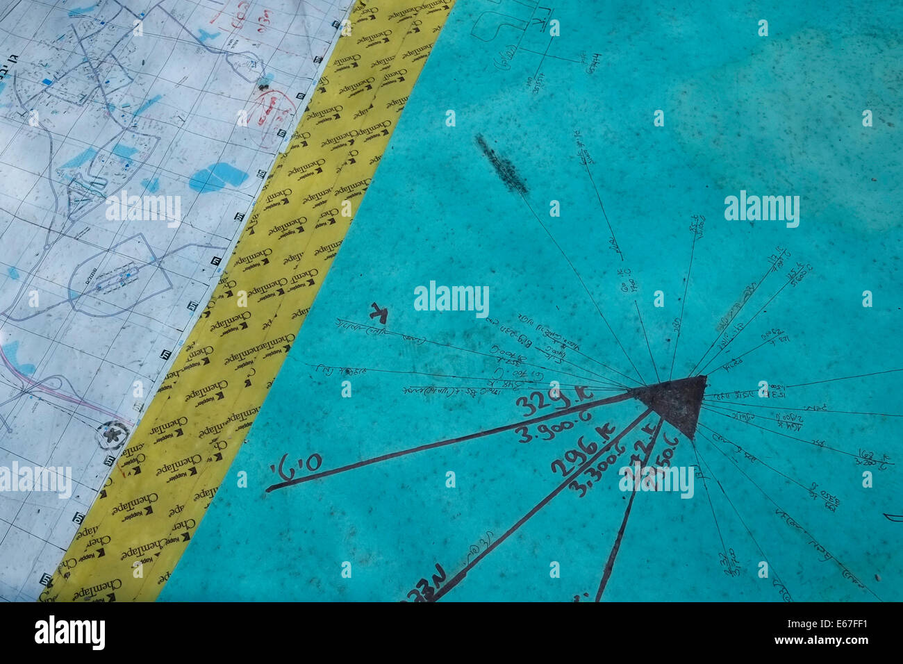 A military vector chart with map at the Israeli military observation post near the city of Ashdod Israel Stock Photohttps://www.alamy.com/image-license-details/?v=1https://www.alamy.com/stock-photo-a-military-vector-chart-with-map-at-the-israeli-military-observation-72695253.html
RME67FF1–A military vector chart with map at the Israeli military observation post near the city of Ashdod Israel
 Map inside the American Cemetery near Cambridge High ISO Stock Photohttps://www.alamy.com/image-license-details/?v=1https://www.alamy.com/map-inside-the-american-cemetery-near-cambridge-high-iso-image8646576.html
RMAM30Y1–Map inside the American Cemetery near Cambridge High ISO
 A military map of The Battle of Naseby, 1645. The Battle of Naseby was a decisive engagement of the First English Civil War, fought on 14th June 1645, between the Royalist army of King Charles I and the Parliamentarian New Model Army under the commanded of Sir Thomas Fairfax and Oliver Cromwell. It was fought near the village of Naseby in Northamptonshire. Stock Photohttps://www.alamy.com/image-license-details/?v=1https://www.alamy.com/a-military-map-of-the-battle-of-naseby-1645-the-battle-of-naseby-was-a-decisive-engagement-of-the-first-english-civil-war-fought-on-14th-june-1645-between-the-royalist-army-of-king-charles-i-and-the-parliamentarian-new-model-army-under-the-commanded-of-sir-thomas-fairfax-and-oliver-cromwell-it-was-fought-near-the-village-of-naseby-in-northamptonshire-image261852668.html
RMW60BN0–A military map of The Battle of Naseby, 1645. The Battle of Naseby was a decisive engagement of the First English Civil War, fought on 14th June 1645, between the Royalist army of King Charles I and the Parliamentarian New Model Army under the commanded of Sir Thomas Fairfax and Oliver Cromwell. It was fought near the village of Naseby in Northamptonshire.
 1878 Meiji 11 Ino Tadataka Japanese Military Map of Japan Stock Photohttps://www.alamy.com/image-license-details/?v=1https://www.alamy.com/stock-photo-1878-meiji-11-ino-tadataka-japanese-military-map-of-japan-50538136.html
RMCX65WC–1878 Meiji 11 Ino Tadataka Japanese Military Map of Japan
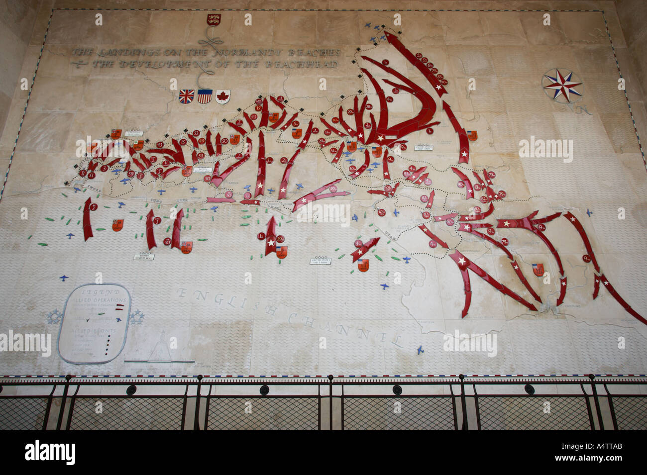 Battle map at american military memorial cemetery Normandy France Stock Photohttps://www.alamy.com/image-license-details/?v=1https://www.alamy.com/battle-map-at-american-military-memorial-cemetery-normandy-france-image3631274.html
RMA4TTAB–Battle map at american military memorial cemetery Normandy France
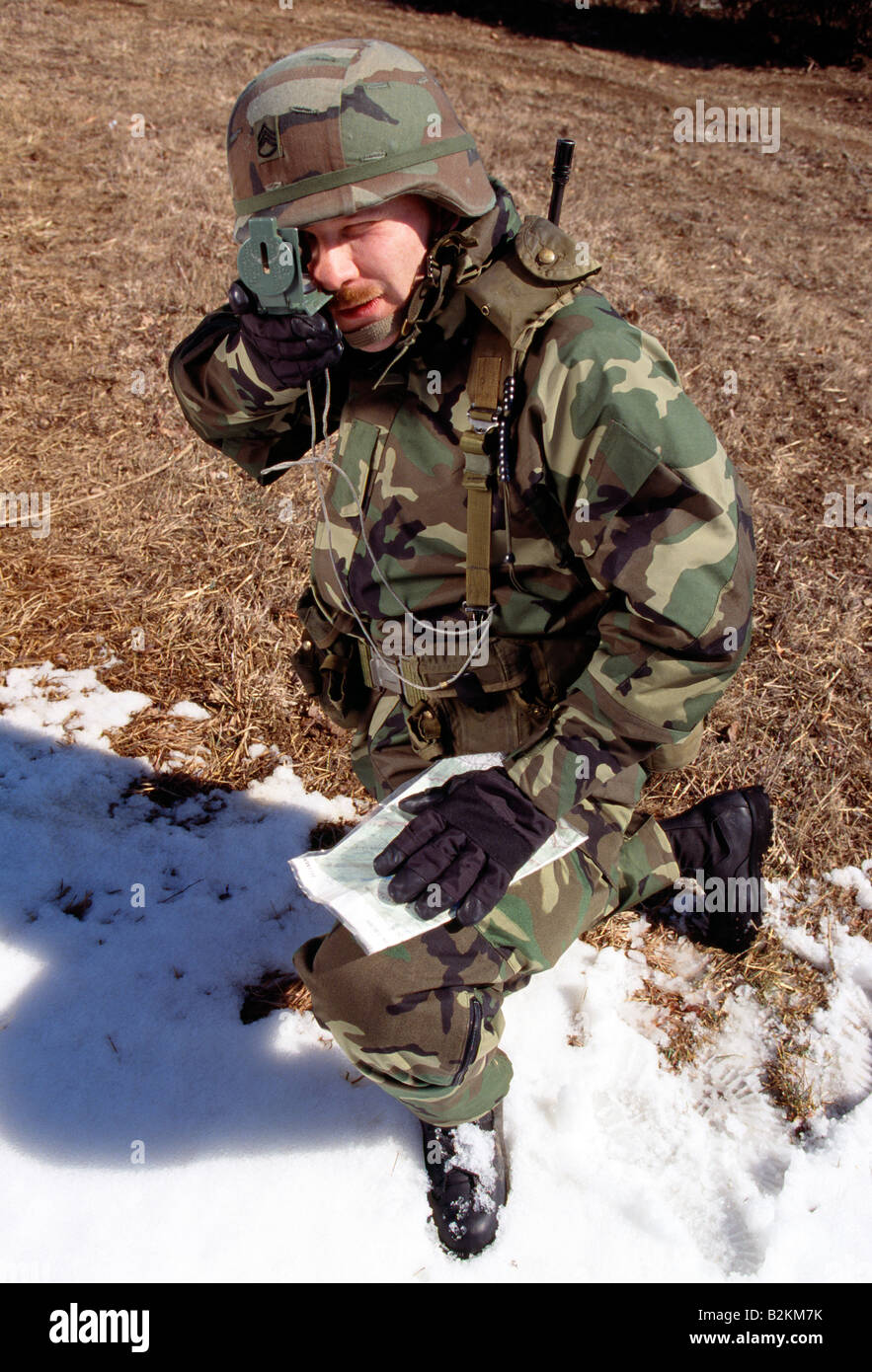 US Army soldier on maneuvers in the field Stock Photohttps://www.alamy.com/image-license-details/?v=1https://www.alamy.com/stock-photo-us-army-soldier-on-maneuvers-in-the-field-18872663.html
RMB2KM7K–US Army soldier on maneuvers in the field
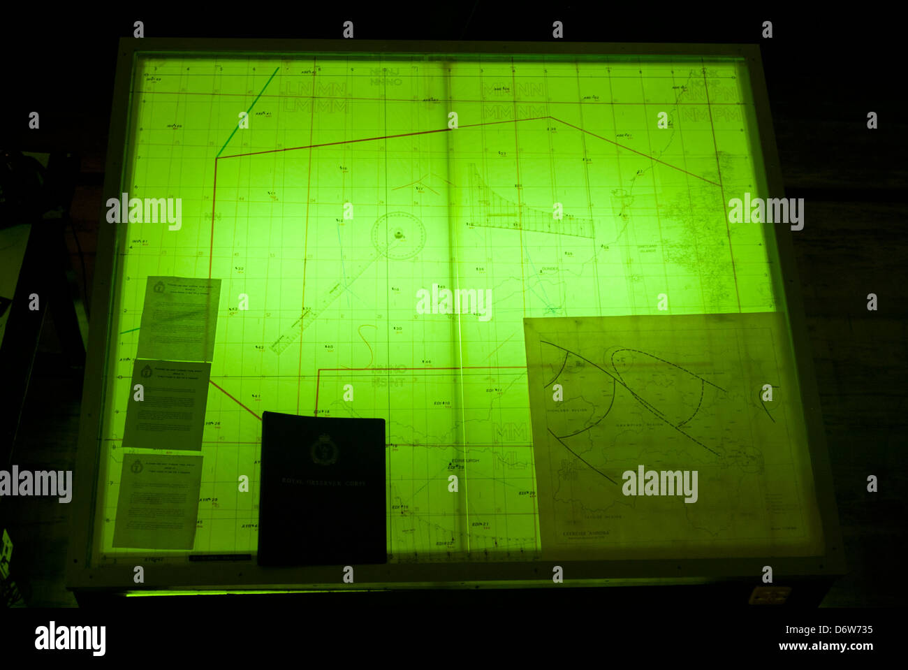 military map Stock Photohttps://www.alamy.com/image-license-details/?v=1https://www.alamy.com/stock-photo-military-map-55873417.html
RMD6W735–military map
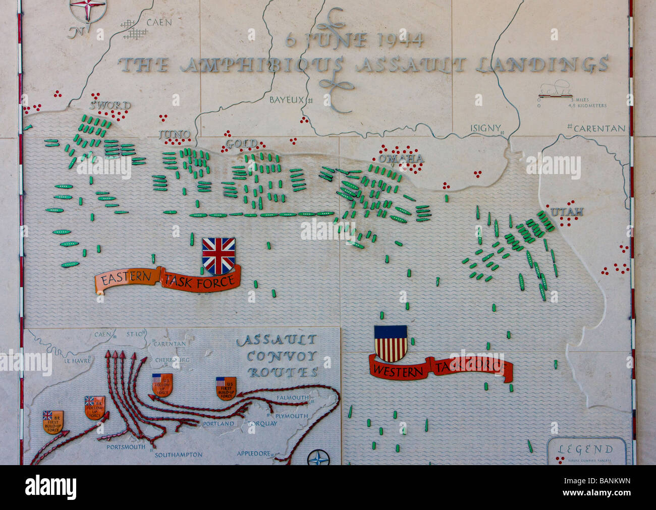 invasion map American Military Cemetery Omaha Beach Colleville sur Mer Normandy France Stock Photohttps://www.alamy.com/image-license-details/?v=1https://www.alamy.com/stock-photo-invasion-map-american-military-cemetery-omaha-beach-colleville-sur-23833537.html
RMBANKWN–invasion map American Military Cemetery Omaha Beach Colleville sur Mer Normandy France
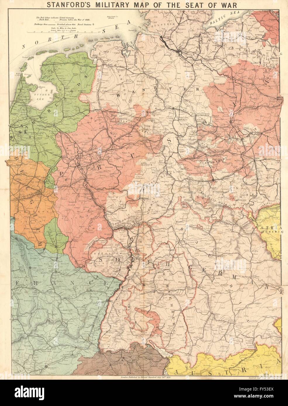 'Stanford's military map of the seat of war'. Franco-Prussian War. Germany 1870 Stock Photohttps://www.alamy.com/image-license-details/?v=1https://www.alamy.com/stock-photo-stanfords-military-map-of-the-seat-of-war-franco-prussian-war-germany-102760082.html
RFFY53EX–'Stanford's military map of the seat of war'. Franco-Prussian War. Germany 1870
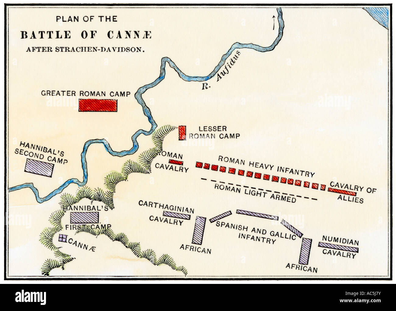 Map of the Battle of Cannae in which Hannibal defeated the Romans during the Second Punic War 216 BC. Hand-colored woodcut Stock Photohttps://www.alamy.com/image-license-details/?v=1https://www.alamy.com/stock-photo-map-of-the-battle-of-cannae-in-which-hannibal-defeated-the-romans-13048766.html
RMAC5J7Y–Map of the Battle of Cannae in which Hannibal defeated the Romans during the Second Punic War 216 BC. Hand-colored woodcut
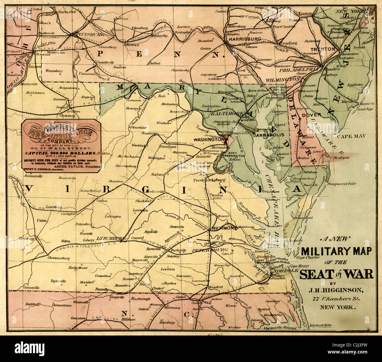 Military Map - 1861 Stock Photohttps://www.alamy.com/image-license-details/?v=1https://www.alamy.com/stock-photo-military-map-1861-36047981.html
RMC2J3FW–Military Map - 1861
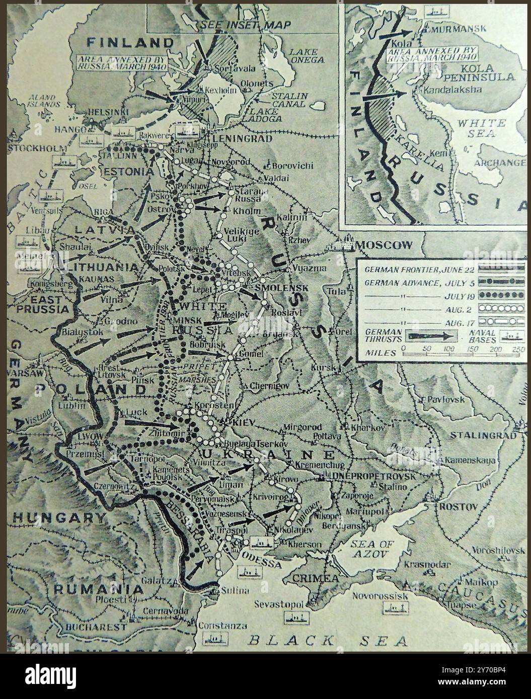 WWII - A map of the Eastern front in 1941 - Seconde Guerre mondiale - Une carte du front de l'Est en 1941 - Zweiter Weltkrieg - Eine Karte der Ostfront im Jahr 1941 -Вторая мировая война - Карта Восточного фронта в 1941 году - Вторая мировая война - Карта Восточного фронта в 1941 году - Вторая мировая война - Карта Восточного фронта в 1941 году - Stock Photohttps://www.alamy.com/image-license-details/?v=1https://www.alamy.com/wwii-a-map-of-the-eastern-front-in-1941-seconde-guerre-mondiale-une-carte-du-front-de-lest-en-1941-zweiter-weltkrieg-eine-karte-der-ostfront-im-jahr-1941-1941-1941-1941-image623885084.html
RM2Y70BP4–WWII - A map of the Eastern front in 1941 - Seconde Guerre mondiale - Une carte du front de l'Est en 1941 - Zweiter Weltkrieg - Eine Karte der Ostfront im Jahr 1941 -Вторая мировая война - Карта Восточного фронта в 1941 году - Вторая мировая война - Карта Восточного фронта в 1941 году - Вторая мировая война - Карта Восточного фронта в 1941 году -
 A new military map of the seat of war, cartographic, Maps, 1861, Higginson, J. H. (Publisher Stock Photohttps://www.alamy.com/image-license-details/?v=1https://www.alamy.com/a-new-military-map-of-the-seat-of-war-cartographic-maps-1861-higginson-j-h-publisher-image376427597.html
RM2CTBN6N–A new military map of the seat of war, cartographic, Maps, 1861, Higginson, J. H. (Publisher
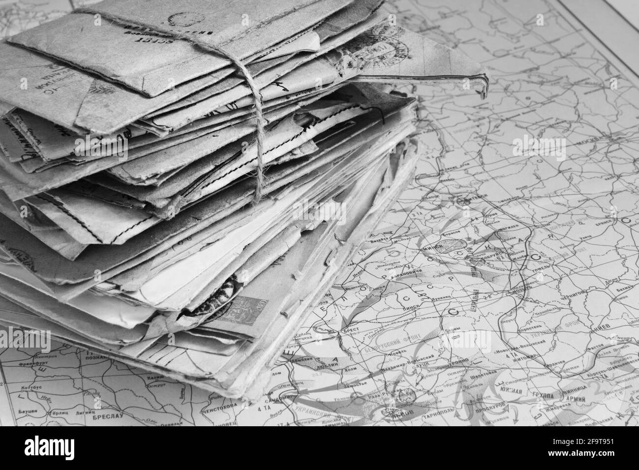 Sheaf of the paper letters on the military map of the World War II in Europe, 1944, black and white Stock Photohttps://www.alamy.com/image-license-details/?v=1https://www.alamy.com/sheaf-of-the-paper-letters-on-the-military-map-of-the-world-war-ii-in-europe-1944-black-and-white-image419114781.html
RF2F9T951–Sheaf of the paper letters on the military map of the World War II in Europe, 1944, black and white
 Bacon's military map of the United States showing the forts & fortifications. 1862 Stock Photohttps://www.alamy.com/image-license-details/?v=1https://www.alamy.com/bacons-military-map-of-the-united-states-showing-the-forts-fortifications-image65074687.html
RMDNTBBY–Bacon's military map of the United States showing the forts & fortifications. 1862
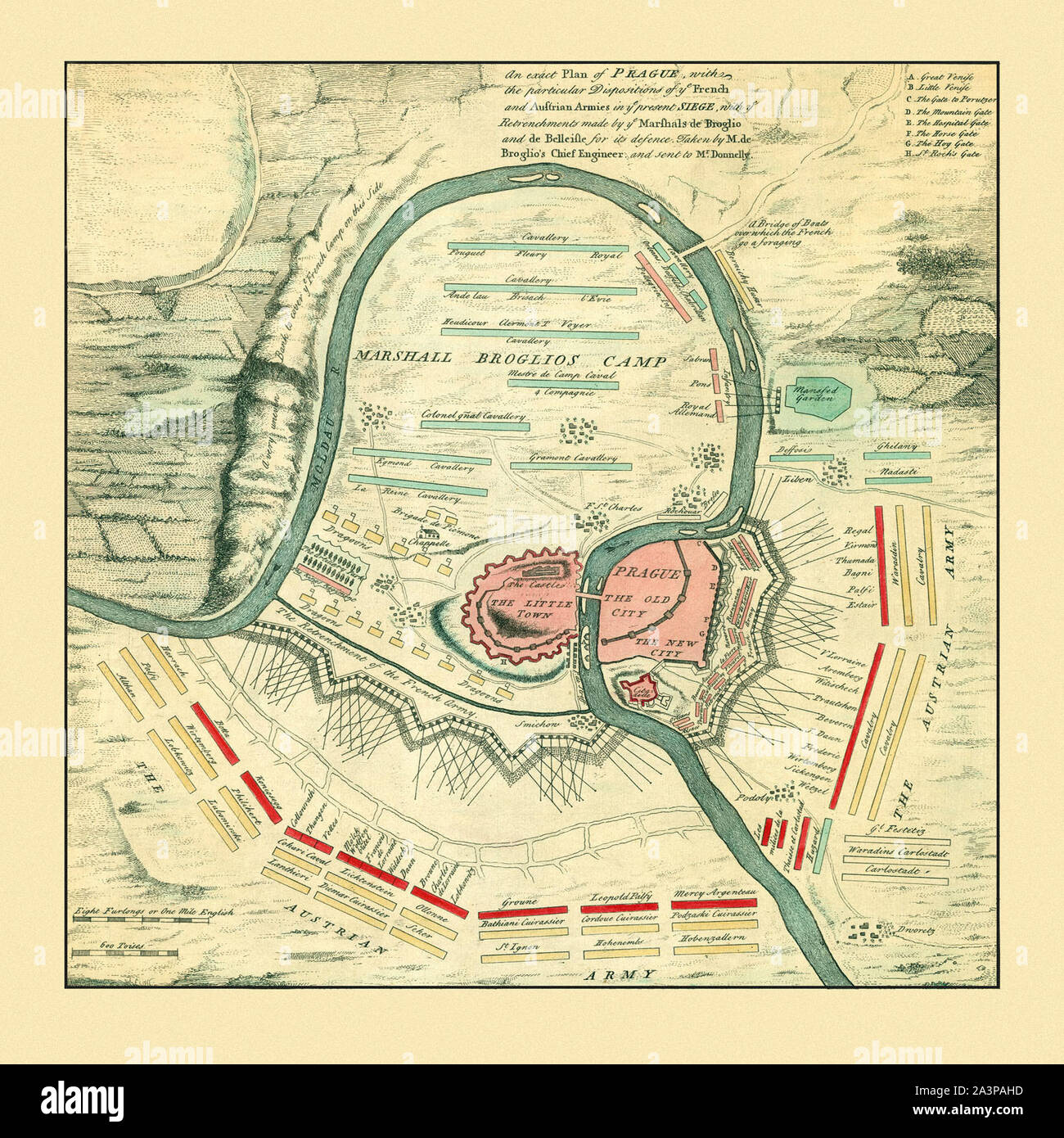 Map Of Prague 1742 Stock Photohttps://www.alamy.com/image-license-details/?v=1https://www.alamy.com/map-of-prague-1742-image329332233.html
RF2A3PAHD–Map Of Prague 1742
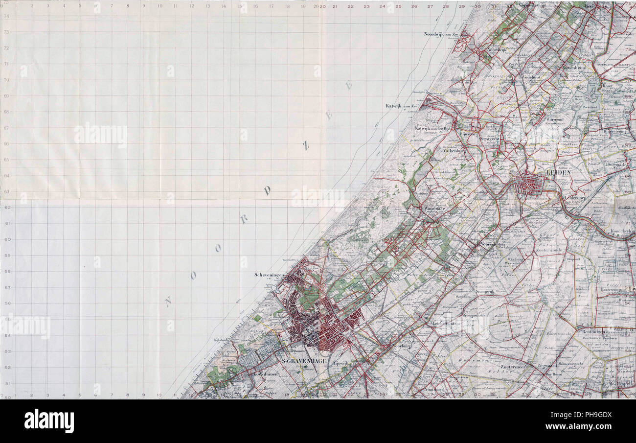 ca. 1914 - Military map of the Hague region, numbered I / m IV. This map was used by the Dutch army during the German invasion in 1940. Stock Photohttps://www.alamy.com/image-license-details/?v=1https://www.alamy.com/ca-1914-military-map-of-the-hague-region-numbered-i-m-iv-this-map-was-used-by-the-dutch-army-during-the-german-invasion-in-1940-image217184070.html
RMPH9GDX–ca. 1914 - Military map of the Hague region, numbered I / m IV. This map was used by the Dutch army during the German invasion in 1940.
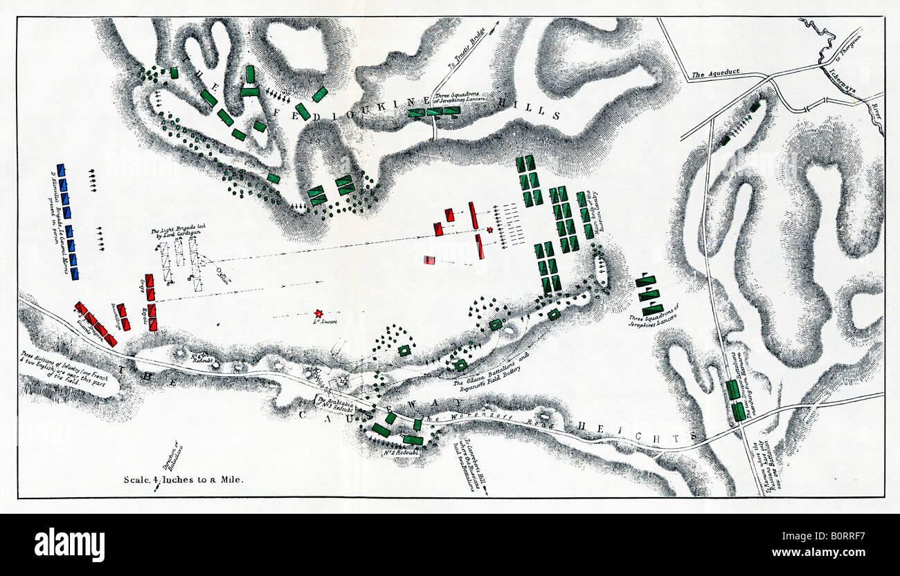 The Charge of the Light Brigade 1854 map of the action at the Balaclava in the Crimea 673 cavalrymen to the fore Stock Photohttps://www.alamy.com/image-license-details/?v=1https://www.alamy.com/stock-photo-the-charge-of-the-light-brigade-1854-map-of-the-action-at-the-balaclava-17733723.html
RMB0RRF7–The Charge of the Light Brigade 1854 map of the action at the Balaclava in the Crimea 673 cavalrymen to the fore
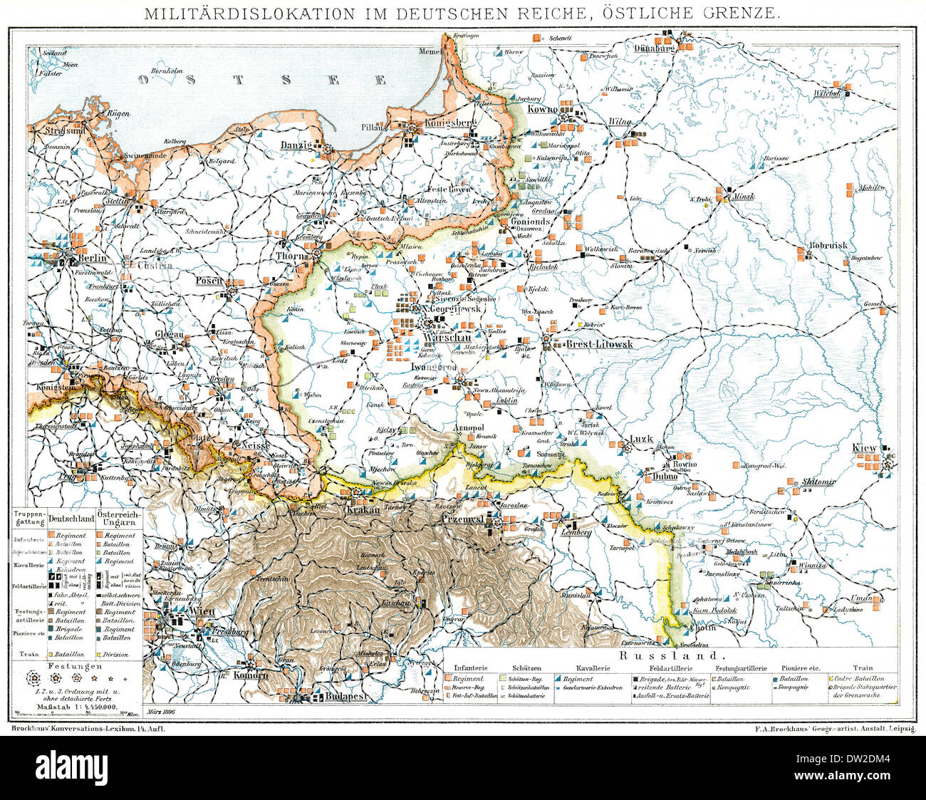 Historical military map of Germany, 1894 Stock Photohttps://www.alamy.com/image-license-details/?v=1https://www.alamy.com/historical-military-map-of-germany-1894-image67052164.html
RMDW2DM4–Historical military map of Germany, 1894
 Blank military map on desk surrounded by army equipment Stock Photohttps://www.alamy.com/image-license-details/?v=1https://www.alamy.com/blank-military-map-on-desk-surrounded-by-army-equipment-image466509567.html
RF2J2Y9KY–Blank military map on desk surrounded by army equipment
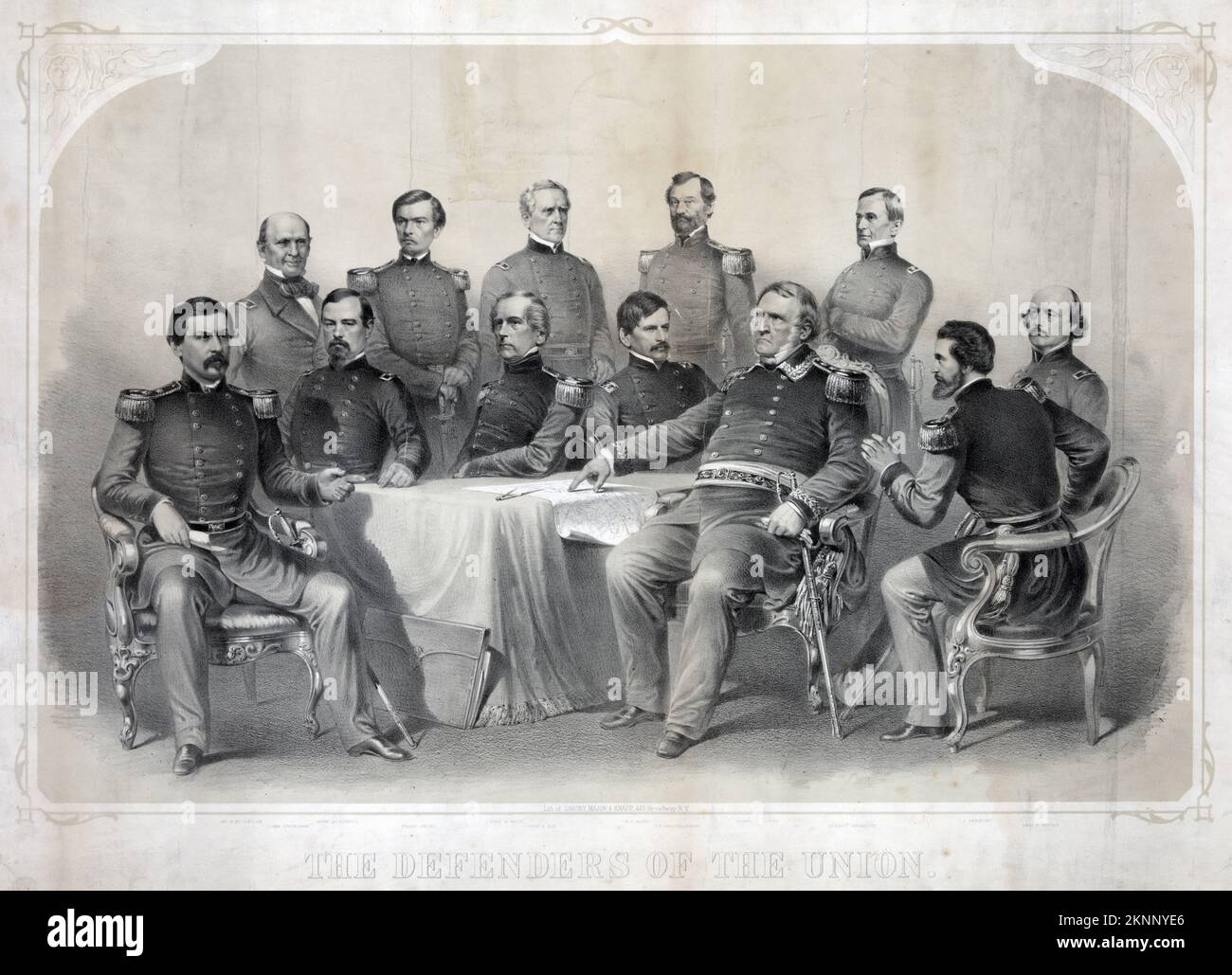 The defenders of the Union, Union officers around table with military map of Virginia: Major General George Brinton McClellan, Rear Admiral Silas Horton Stringham, Major General Irvin McDowell, Major General Franz Sigel, Major General John Ellis Wool, Major General John Adams Dix, Major General Nathaniel Prentice (or Prentiss) Banks, Major General Samuel Peter Heintzelman, Lieutenant General Winfield Scott, Major General Robert Anderson, Major General John Charles Frémont, and Major General Benjamin Franklin Butler. Stock Photohttps://www.alamy.com/image-license-details/?v=1https://www.alamy.com/the-defenders-of-the-union-union-officers-around-table-with-military-map-of-virginia-major-general-george-brinton-mcclellan-rear-admiral-silas-horton-stringham-major-general-irvin-mcdowell-major-general-franz-sigel-major-general-john-ellis-wool-major-general-john-adams-dix-major-general-nathaniel-prentice-or-prentiss-banks-major-general-samuel-peter-heintzelman-lieutenant-general-winfield-scott-major-general-robert-anderson-major-general-john-charles-frmont-and-major-general-benjamin-franklin-butler-image495280638.html
RM2KNNYE6–The defenders of the Union, Union officers around table with military map of Virginia: Major General George Brinton McClellan, Rear Admiral Silas Horton Stringham, Major General Irvin McDowell, Major General Franz Sigel, Major General John Ellis Wool, Major General John Adams Dix, Major General Nathaniel Prentice (or Prentiss) Banks, Major General Samuel Peter Heintzelman, Lieutenant General Winfield Scott, Major General Robert Anderson, Major General John Charles Frémont, and Major General Benjamin Franklin Butler.
 Bacon's military map of the United States shewing the forts & fortifications. Stock Photohttps://www.alamy.com/image-license-details/?v=1https://www.alamy.com/bacons-military-map-of-the-united-states-shewing-the-forts-fortifications-image217679617.html
RMPJ44G1–Bacon's military map of the United States shewing the forts & fortifications.
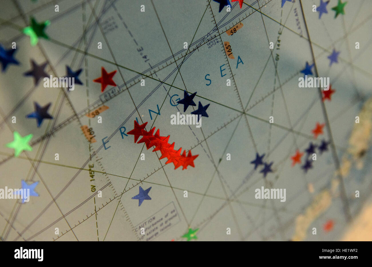 Stars on a map show the intercepts made by crews from the Combat Alert Cell at Joint Base Elmendorf-Richardson, Alaska. Personnel live at the CAC for days at a time while on duty. The maintainers and pilots at the CAC are responsible for launching F-22 Raptors to intercept unidentified or unauthorized aircraft flying near or within U.S. airspace. /Master Sgt. Brian Ferguson Stock Photohttps://www.alamy.com/image-license-details/?v=1https://www.alamy.com/stock-photo-stars-on-a-map-show-the-intercepts-made-by-crews-from-the-combat-alert-129119734.html
RMHE1WF2–Stars on a map show the intercepts made by crews from the Combat Alert Cell at Joint Base Elmendorf-Richardson, Alaska. Personnel live at the CAC for days at a time while on duty. The maintainers and pilots at the CAC are responsible for launching F-22 Raptors to intercept unidentified or unauthorized aircraft flying near or within U.S. airspace. /Master Sgt. Brian Ferguson
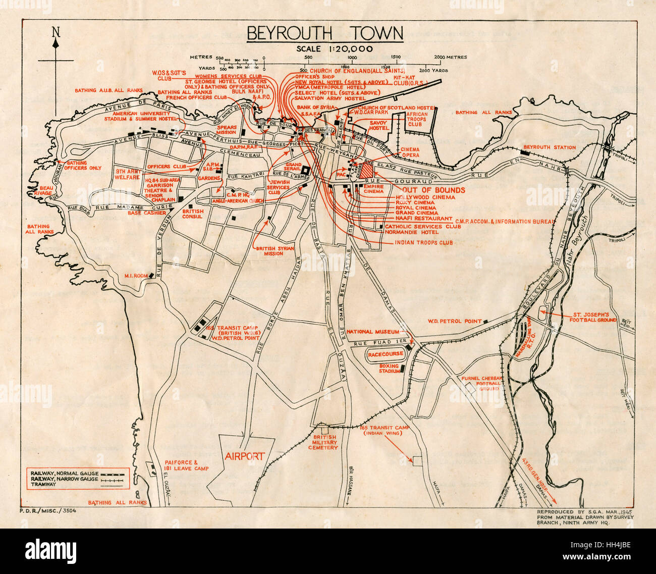 WW2 - Map of Beirut, Lebanon - with Military locations Stock Photohttps://www.alamy.com/image-license-details/?v=1https://www.alamy.com/stock-photo-ww2-map-of-beirut-lebanon-with-military-locations-131023970.html
RMHH4JBE–WW2 - Map of Beirut, Lebanon - with Military locations
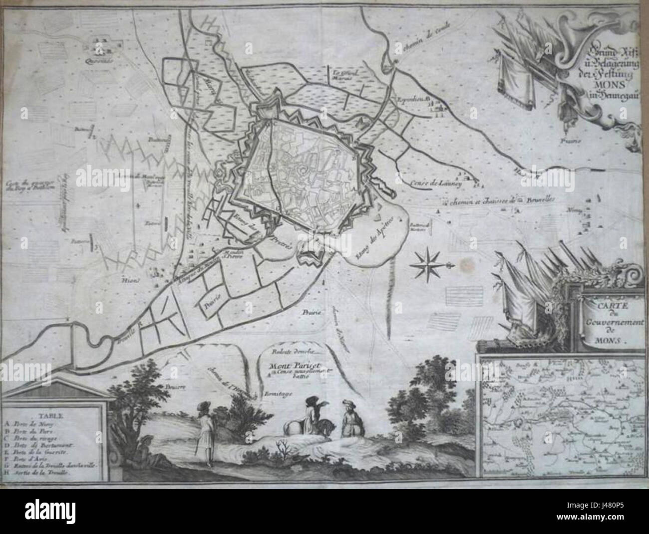 Military map of Mons, 1702 Stock Photohttps://www.alamy.com/image-license-details/?v=1https://www.alamy.com/stock-photo-military-map-of-mons-1702-140317805.html
RMJ480P5–Military map of Mons, 1702
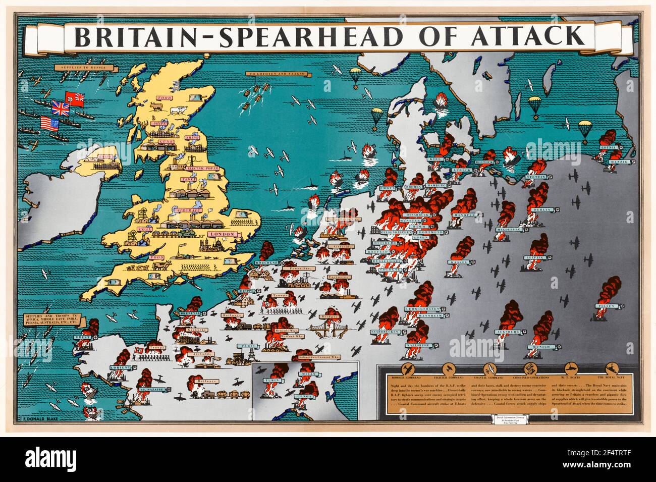 British, WW2, Britain: Spearhead of Attack, Poster Map showing how wartime manufacture helped military action liberate occupied Europe, 1942-1945 Stock Photohttps://www.alamy.com/image-license-details/?v=1https://www.alamy.com/british-ww2-britain-spearhead-of-attack-poster-map-showing-how-wartime-manufacture-helped-military-action-liberate-occupied-europe-1942-1945-image416053023.html
RM2F4TRTF–British, WW2, Britain: Spearhead of Attack, Poster Map showing how wartime manufacture helped military action liberate occupied Europe, 1942-1945
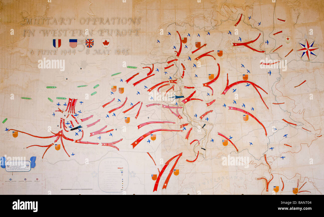 invasion map American Military Cemetery Omaha Beach Colleville sur Mer Normandy France Stock Photohttps://www.alamy.com/image-license-details/?v=1https://www.alamy.com/stock-photo-invasion-map-american-military-cemetery-omaha-beach-colleville-sur-23836740.html
RMBANT04–invasion map American Military Cemetery Omaha Beach Colleville sur Mer Normandy France
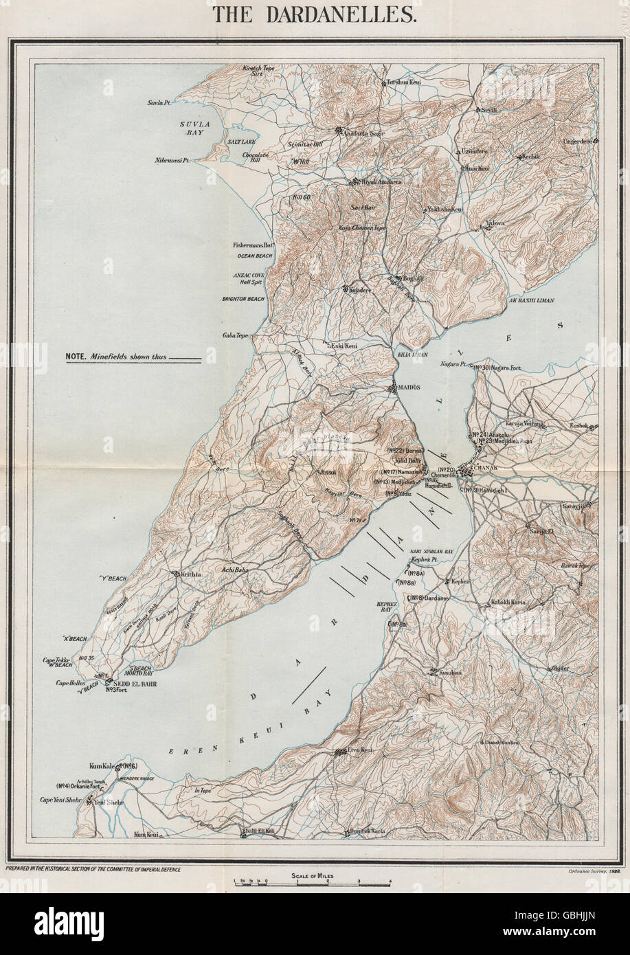 FIRST WORLD WAR: The Dardanelles. Minefields. Military map, 1928 Stock Photohttps://www.alamy.com/image-license-details/?v=1https://www.alamy.com/stock-photo-first-world-war-the-dardanelles-minefields-military-map-1928-110411245.html
RFGBHJJN–FIRST WORLD WAR: The Dardanelles. Minefields. Military map, 1928
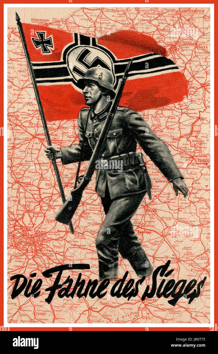 FRANCE OCCUPATION NAZI GERMANY Vintage Nazi Germany WW2 'The flag of victory' Nazi Propaganda Poster. Showing a German Wehrmacht soldier marching across a map of occupied France with the German Nazi Swastika Military Flag World War II Second World War Stock Photohttps://www.alamy.com/image-license-details/?v=1https://www.alamy.com/france-occupation-nazi-germany-vintage-nazi-germany-ww2-the-flag-of-image151970761.html
RMJR6T75–FRANCE OCCUPATION NAZI GERMANY Vintage Nazi Germany WW2 'The flag of victory' Nazi Propaganda Poster. Showing a German Wehrmacht soldier marching across a map of occupied France with the German Nazi Swastika Military Flag World War II Second World War
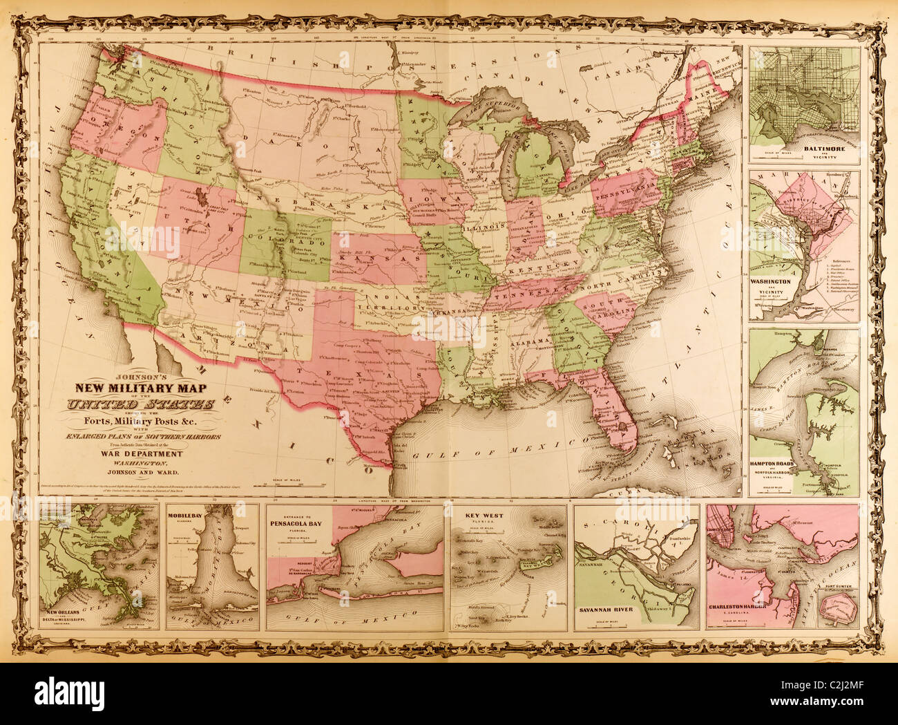 Military Map of the United states - 1863 Stock Photohttps://www.alamy.com/image-license-details/?v=1https://www.alamy.com/stock-photo-military-map-of-the-united-states-1863-36047327.html
RMC2J2MF–Military Map of the United states - 1863
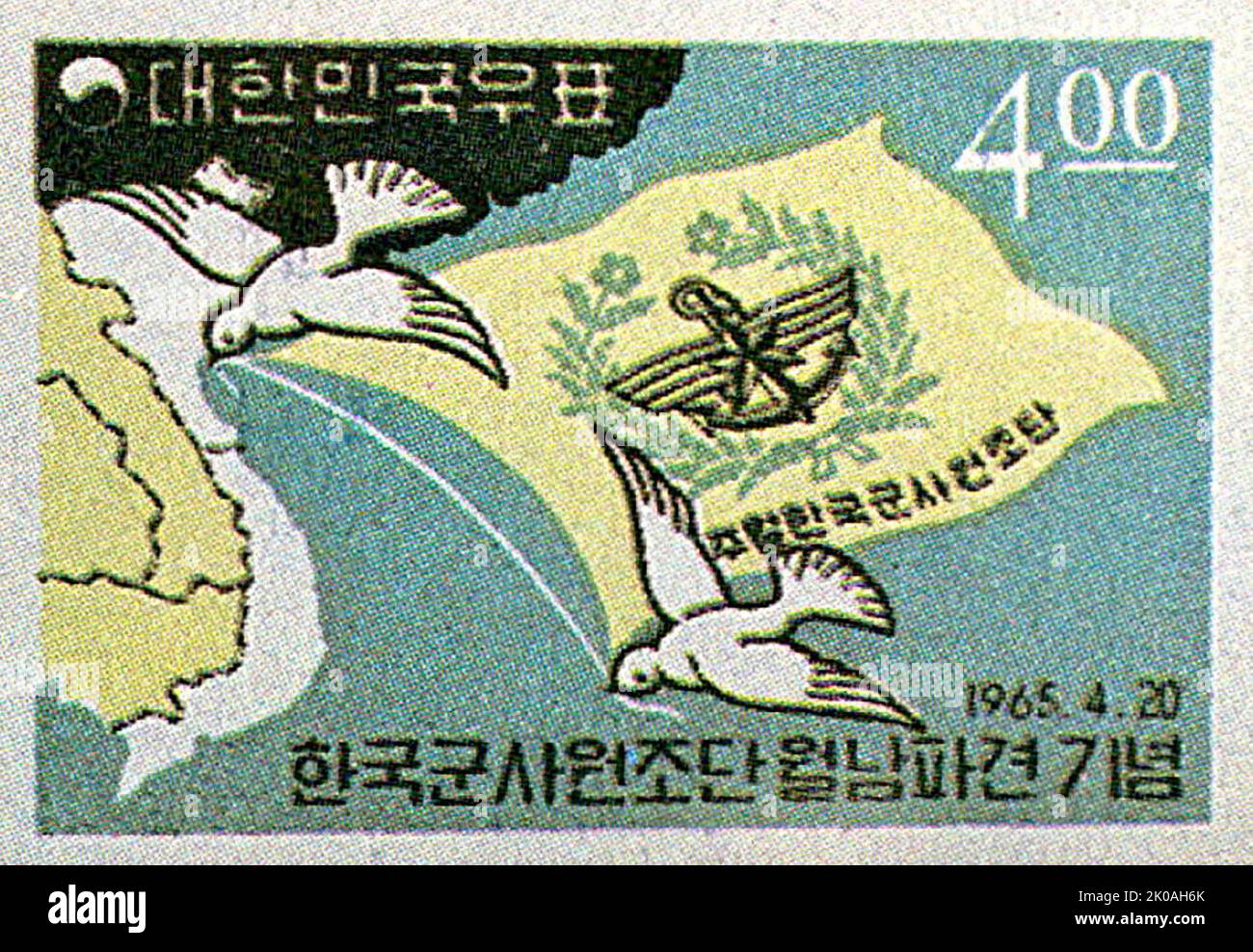 South Korean Stamp depicting a map of Vietnam and flag of Korean Military Assistance Group, in Vietnam during the Vietnam War Stock Photohttps://www.alamy.com/image-license-details/?v=1https://www.alamy.com/south-korean-stamp-depicting-a-map-of-vietnam-and-flag-of-korean-military-assistance-group-in-vietnam-during-the-vietnam-war-image482123339.html
RM2K0AH6K–South Korean Stamp depicting a map of Vietnam and flag of Korean Military Assistance Group, in Vietnam during the Vietnam War
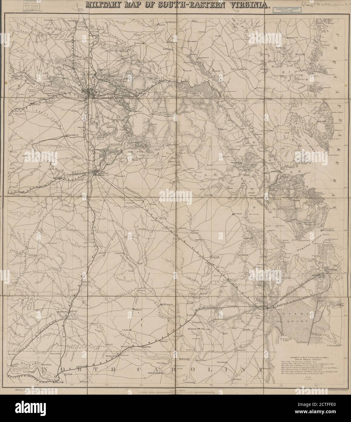 Military map of south-eastern Virginia , cartographic, Maps, 1861, Lindenkohl, H. (Henry), Krebs, Charles G Stock Photohttps://www.alamy.com/image-license-details/?v=1https://www.alamy.com/military-map-of-south-eastern-virginia-cartographic-maps-1861-lindenkohl-h-henry-krebs-charles-g-image376510904.html
RM2CTFFE0–Military map of south-eastern Virginia , cartographic, Maps, 1861, Lindenkohl, H. (Henry), Krebs, Charles G
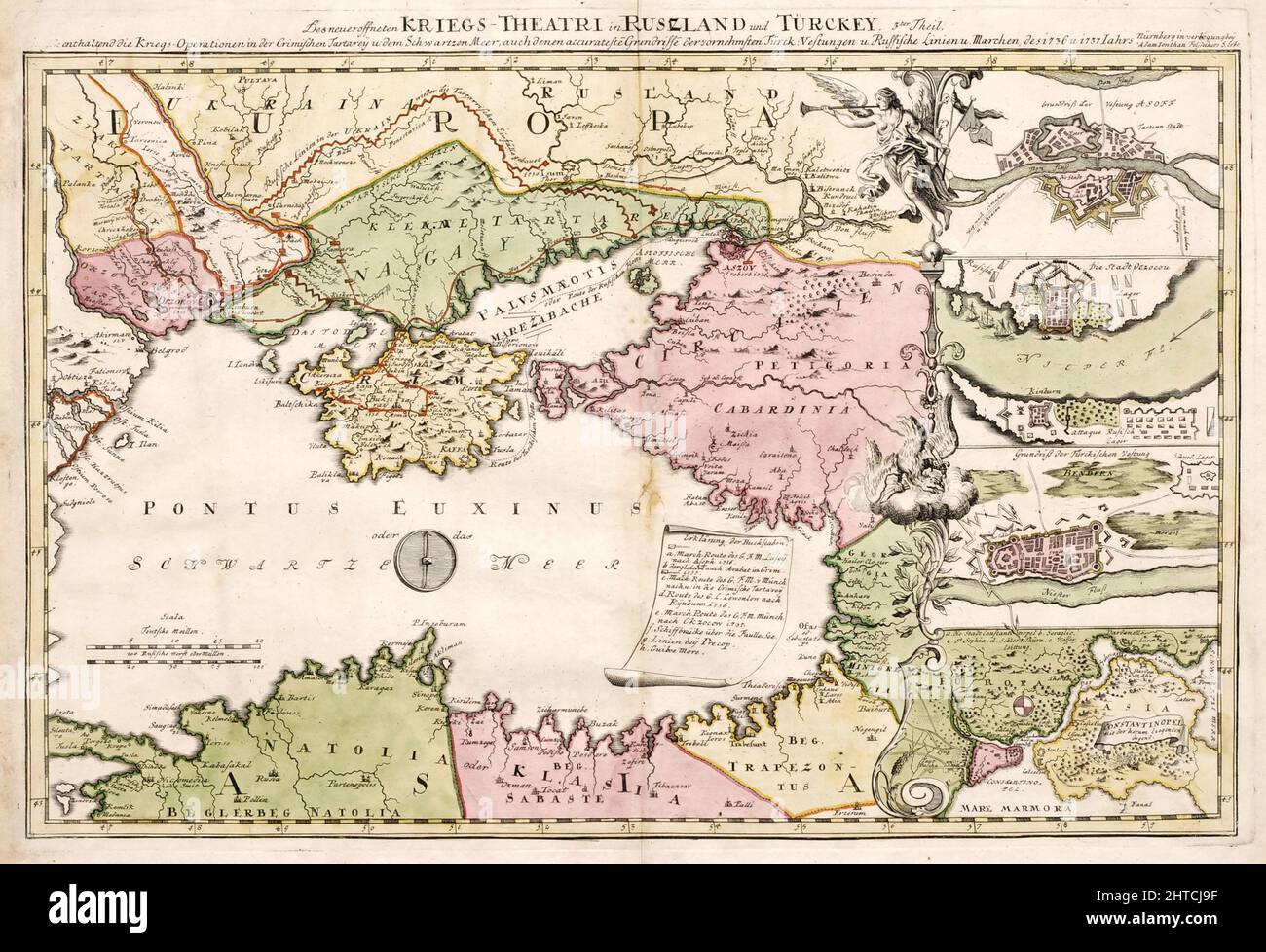 A military map depicting Russo-Turkish War of 1735-1739, 1737. Private Collection. Stock Photohttps://www.alamy.com/image-license-details/?v=1https://www.alamy.com/a-military-map-depicting-russo-turkish-war-of-1735-1739-1737-private-collection-image462499115.html
RM2HTCJ9F–A military map depicting Russo-Turkish War of 1735-1739, 1737. Private Collection.
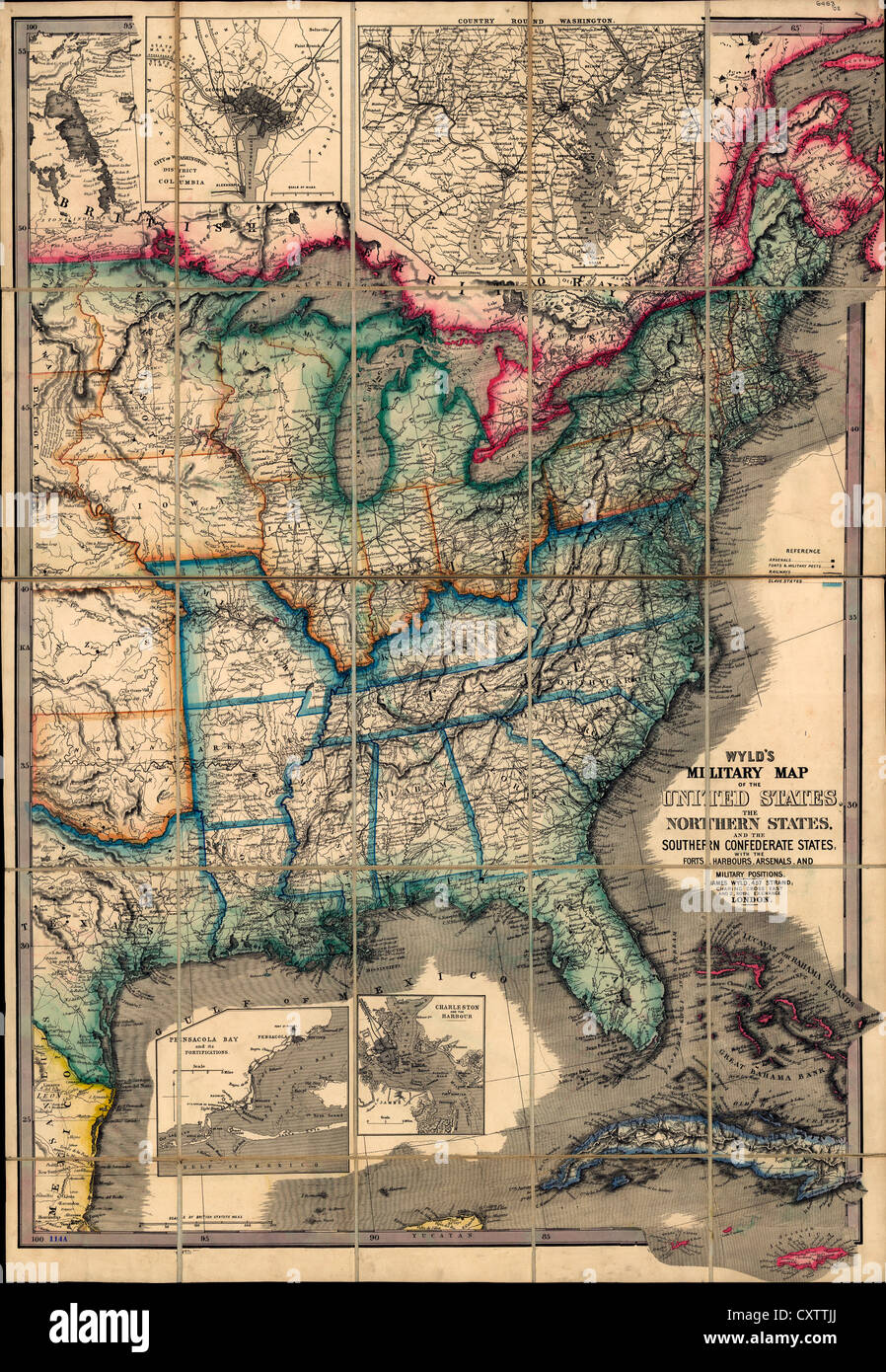 Wyld's military map of the United States, with the forts, harbors, arsenals, and military positions. 1861 USA Civil War Stock Photohttps://www.alamy.com/image-license-details/?v=1https://www.alamy.com/stock-photo-wylds-military-map-of-the-united-states-with-the-forts-harbors-arsenals-50947978.html
RMCXTTJJ–Wyld's military map of the United States, with the forts, harbors, arsenals, and military positions. 1861 USA Civil War
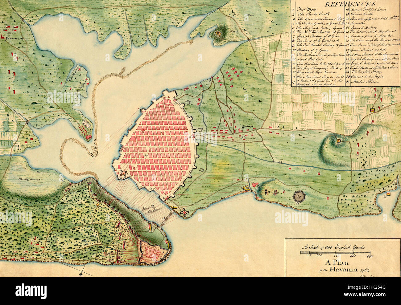 Map of Havana 1762 Stock Photohttps://www.alamy.com/image-license-details/?v=1https://www.alamy.com/stock-photo-map-of-havana-1762-132198992.html
RFHK254G–Map of Havana 1762
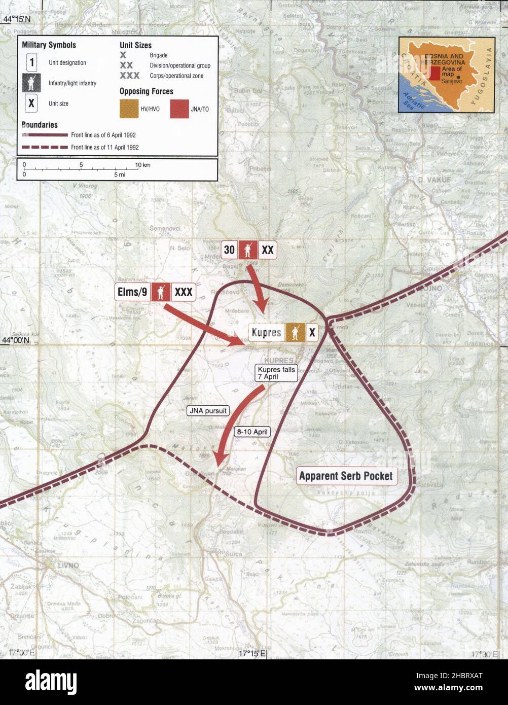 1992 Military Map of Kupres Bosnia Stock Photohttps://www.alamy.com/image-license-details/?v=1https://www.alamy.com/1992-military-map-of-kupres-bosnia-image454756368.html
RM2HBRXAT–1992 Military Map of Kupres Bosnia
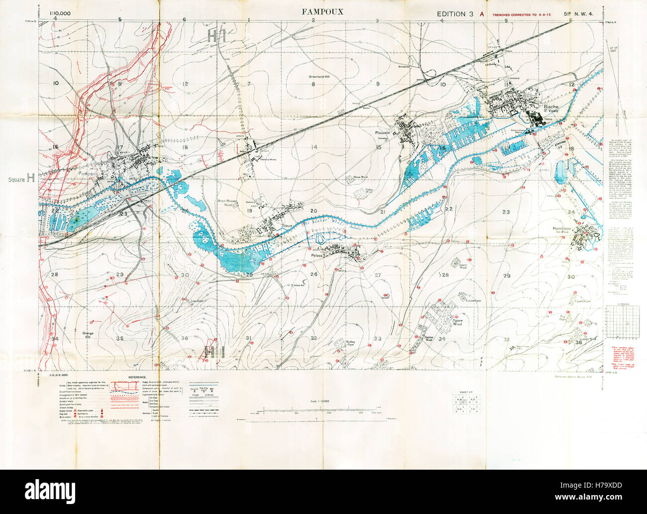 Fampoux Battlefield Map, 1917 Edition 3A 1:10,000 military map of the British sector Est of Arras in Northern France, with square 51B NW3, trenches correct at March 1917 Stock Photohttps://www.alamy.com/image-license-details/?v=1https://www.alamy.com/stock-photo-fampoux-battlefield-map-1917-edition-3a-110000-military-map-of-the-124993497.html
RMH79XDD–Fampoux Battlefield Map, 1917 Edition 3A 1:10,000 military map of the British sector Est of Arras in Northern France, with square 51B NW3, trenches correct at March 1917
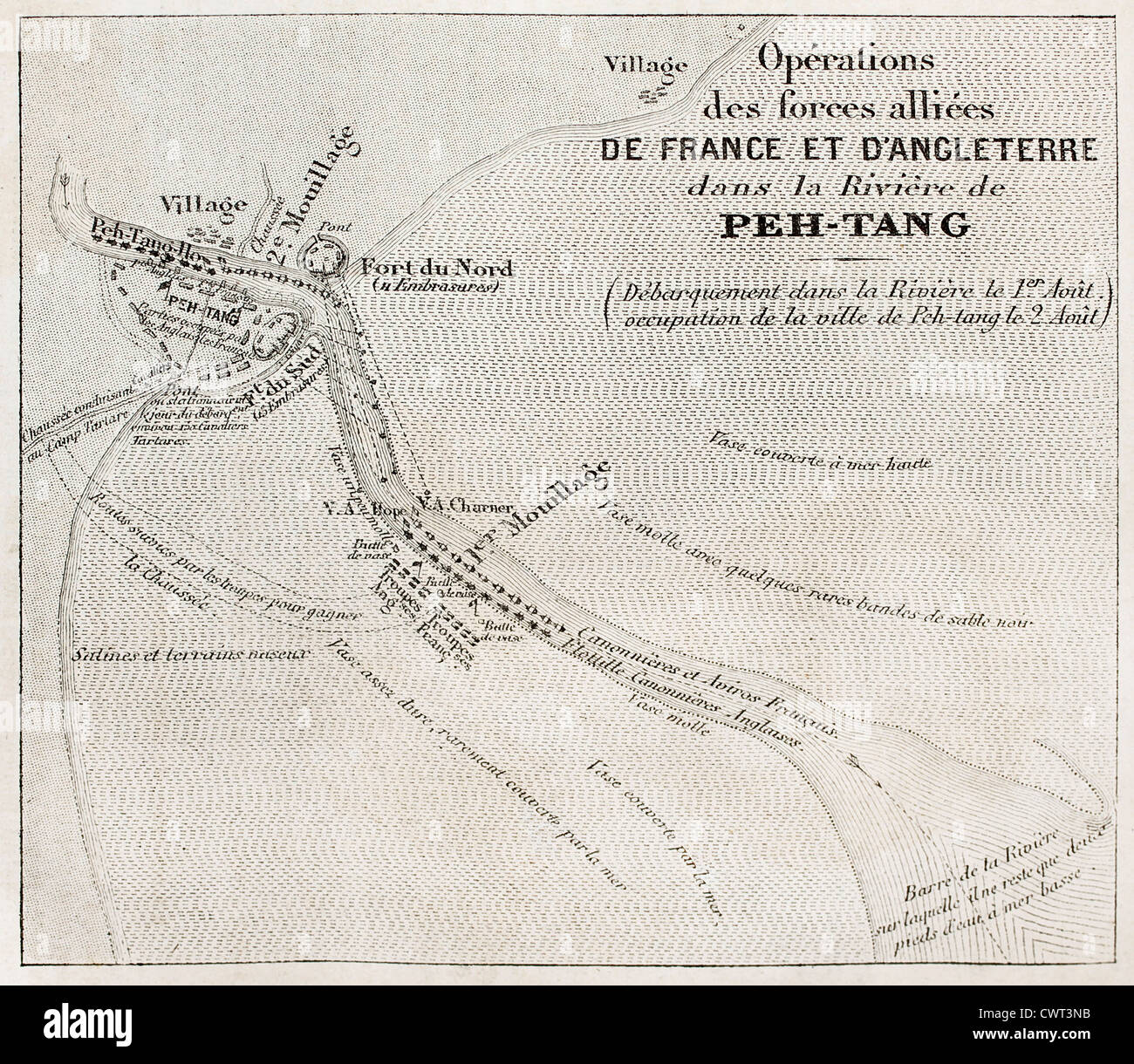 Old military map of French-British allied forces settlement in Beitang, China. Stock Photohttps://www.alamy.com/image-license-details/?v=1https://www.alamy.com/stock-photo-old-military-map-of-french-british-allied-forces-settlement-in-beitang-50316935.html
RFCWT3NB–Old military map of French-British allied forces settlement in Beitang, China.
 Hands over Map. Close up of a hand with pencil over a military map Stock Photohttps://www.alamy.com/image-license-details/?v=1https://www.alamy.com/hands-over-map-close-up-of-a-hand-with-pencil-over-a-military-map-image339553574.html
RF2AMC01A–Hands over Map. Close up of a hand with pencil over a military map
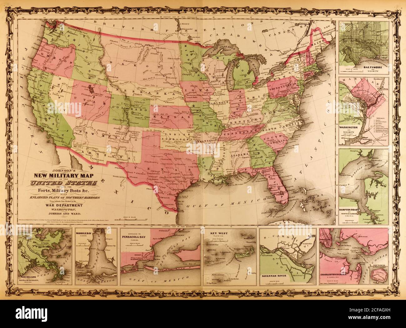 Military Map of the United states - 1863 Stock Photohttps://www.alamy.com/image-license-details/?v=1https://www.alamy.com/military-map-of-the-united-states-1863-image370870377.html
RM2CFAGXH–Military Map of the United states - 1863
 World War One patriotic postcard Stock Photohttps://www.alamy.com/image-license-details/?v=1https://www.alamy.com/stock-photo-world-war-one-patriotic-postcard-57059252.html
RMD8R7JC–World War One patriotic postcard
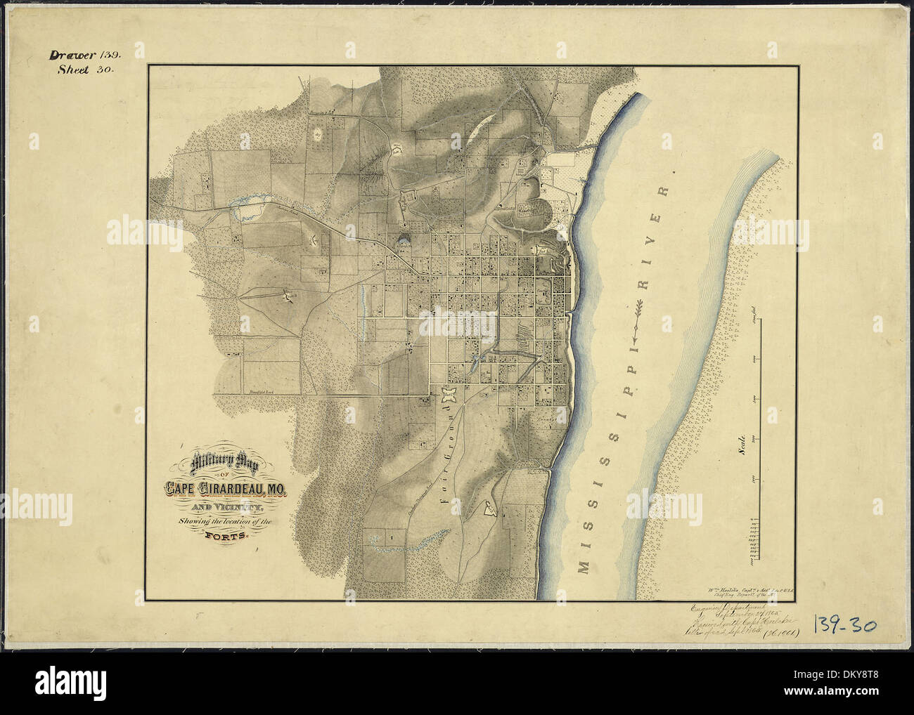 Military Map of Cape Girardeau, Mo., and Vicinity, Showing the location of the Forts. Wm. Hoelcke, Captn. & Addl.... 305778 Stock Photohttps://www.alamy.com/image-license-details/?v=1https://www.alamy.com/military-map-of-cape-girardeau-mo-and-vicinity-showing-the-location-image63909224.html
RMDKY8T8–Military Map of Cape Girardeau, Mo., and Vicinity, Showing the location of the Forts. Wm. Hoelcke, Captn. & Addl.... 305778
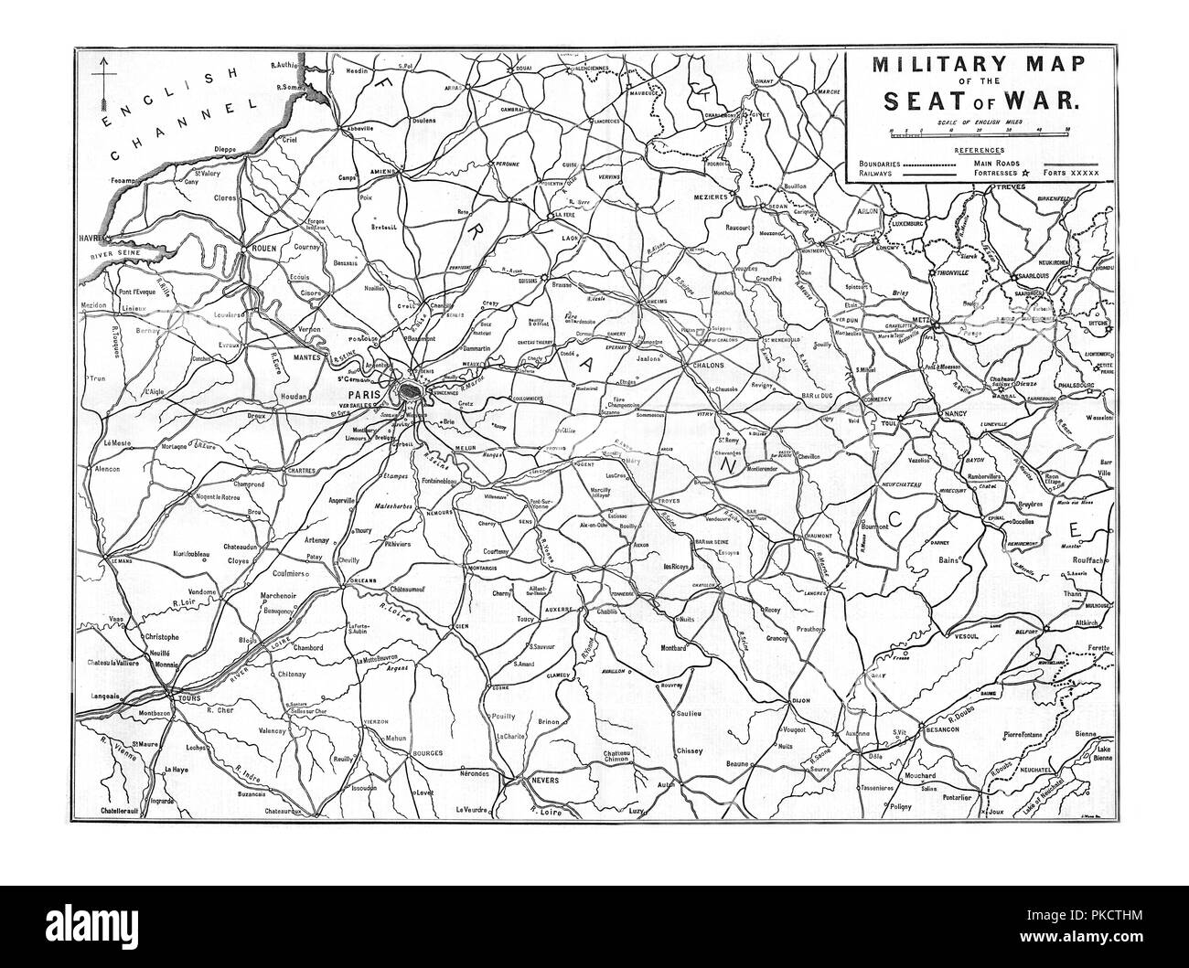 'Military Map of the Seat of War', 1870. Artist: Unknown. Stock Photohttps://www.alamy.com/image-license-details/?v=1https://www.alamy.com/military-map-of-the-seat-of-war-1870-artist-unknown-image218485616.html
RMPKCTHM–'Military Map of the Seat of War', 1870. Artist: Unknown.
 Military map of Bruges 1680 1685 Stock Photohttps://www.alamy.com/image-license-details/?v=1https://www.alamy.com/stock-photo-military-map-of-bruges-1680-1685-140284359.html
RMJ46E3K–Military map of Bruges 1680 1685
 Seven Years War (1756-1763). Third Silesian War. Battle of Leuthen (5th December 1757). The Prussian army of Frederick the Great defeated the outnumbered Austrian army led by Prince Charles Alexander of Lorraine. Published in 1765 by the cartographer Jean de Beaurain (1696-1771) as an illustration of his Great Map of Germany, with the events that took place during the Seven Years War. Etching and engraving. French edition, 1765. Military Historical Library of Barcelona (Biblioteca Histórico Militar de Barcelona). Catalonia. Spain. Stock Photohttps://www.alamy.com/image-license-details/?v=1https://www.alamy.com/seven-years-war-1756-1763-third-silesian-war-battle-of-leuthen-5th-december-1757-the-prussian-army-of-frederick-the-great-defeated-the-outnumbered-austrian-army-led-by-prince-charles-alexander-of-lorraine-published-in-1765-by-the-cartographer-jean-de-beaurain-1696-1771-as-an-illustration-of-his-great-map-of-germany-with-the-events-that-took-place-during-the-seven-years-war-etching-and-engraving-french-edition-1765-military-historical-library-of-barcelona-biblioteca-histrico-militar-de-barcelona-catalonia-spain-image499679957.html
RM2M0XATN–Seven Years War (1756-1763). Third Silesian War. Battle of Leuthen (5th December 1757). The Prussian army of Frederick the Great defeated the outnumbered Austrian army led by Prince Charles Alexander of Lorraine. Published in 1765 by the cartographer Jean de Beaurain (1696-1771) as an illustration of his Great Map of Germany, with the events that took place during the Seven Years War. Etching and engraving. French edition, 1765. Military Historical Library of Barcelona (Biblioteca Histórico Militar de Barcelona). Catalonia. Spain.
 second world war maps of pendennis head in falmouth, cornwall, uk Stock Photohttps://www.alamy.com/image-license-details/?v=1https://www.alamy.com/second-world-war-maps-of-pendennis-head-in-falmouth-cornwall-uk-image65054391.html
RMDNRDF3–second world war maps of pendennis head in falmouth, cornwall, uk
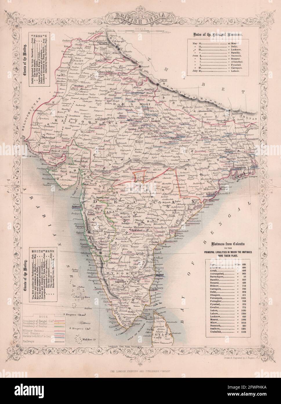 BRITISH INDIA. shows proposed Railways & military bases. RAPKIN/TALLIS c1855 map Stock Photohttps://www.alamy.com/image-license-details/?v=1https://www.alamy.com/british-india-shows-proposed-railways-military-bases-rapkintallis-c1855-map-image428912046.html
RF2FWPHKA–BRITISH INDIA. shows proposed Railways & military bases. RAPKIN/TALLIS c1855 map
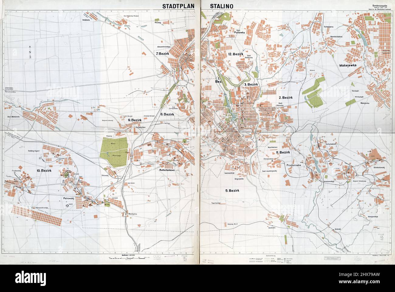 Stadtplan Stalino (Donetsk) - Military map. Created in Germany by Heer, 1943. Stock Photohttps://www.alamy.com/image-license-details/?v=1https://www.alamy.com/stadtplan-stalino-donetsk-military-map-created-in-germany-by-heer-1943-image463611649.html
RM2HX79AW–Stadtplan Stalino (Donetsk) - Military map. Created in Germany by Heer, 1943.
 Military Map of the United States - 1862 Stock Photohttps://www.alamy.com/image-license-details/?v=1https://www.alamy.com/stock-photo-military-map-of-the-united-states-1862-36047480.html
RMC2J2X0–Military Map of the United States - 1862
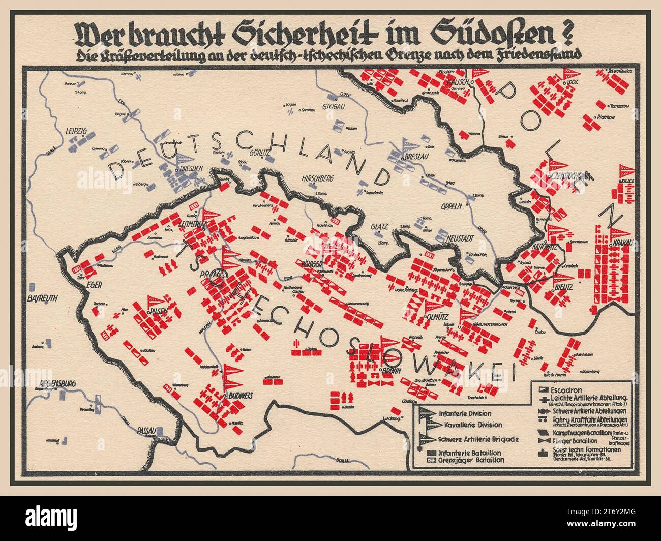 1930s Nazi Third Reich propaganda poster titled 'WHO NEEDS SECURITY IN THE SOUTHEAST, illustrating a map of Germany with borders of Czechoslovakia and Poland showing apparent significan build up of men and military armaments. Stock Photohttps://www.alamy.com/image-license-details/?v=1https://www.alamy.com/1930s-nazi-third-reich-propaganda-poster-titled-who-needs-security-in-the-southeast-illustrating-a-map-of-germany-with-borders-of-czechoslovakia-and-poland-showing-apparent-significan-build-up-of-men-and-military-armaments-image572224928.html
RM2T6Y2MG–1930s Nazi Third Reich propaganda poster titled 'WHO NEEDS SECURITY IN THE SOUTHEAST, illustrating a map of Germany with borders of Czechoslovakia and Poland showing apparent significan build up of men and military armaments.
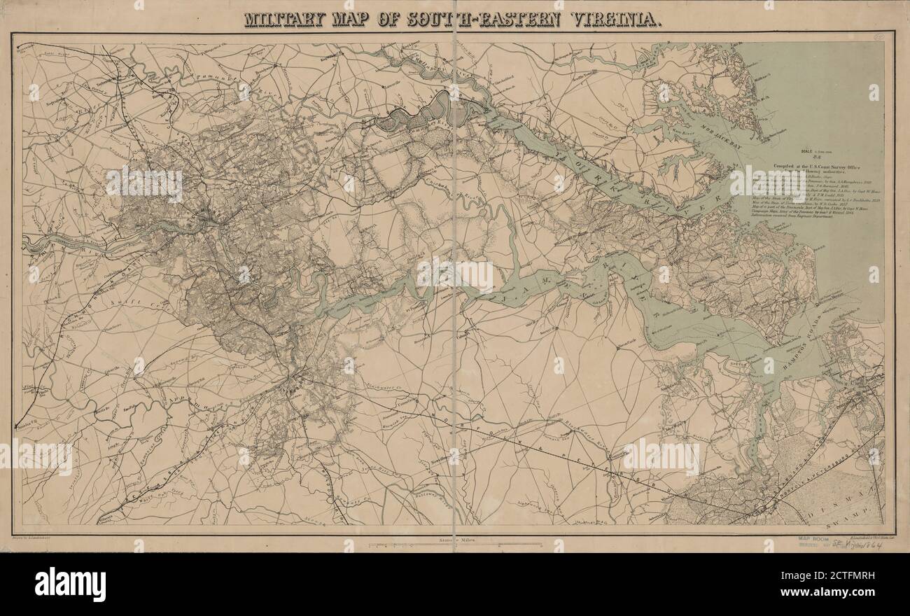 Military map of south-eastern Virginia , cartographic, Maps, 1864, Lindenkohl, H. (Henry), Krebs, Charles G Stock Photohttps://www.alamy.com/image-license-details/?v=1https://www.alamy.com/military-map-of-south-eastern-virginia-cartographic-maps-1864-lindenkohl-h-henry-krebs-charles-g-image376515093.html
RM2CTFMRH–Military map of south-eastern Virginia , cartographic, Maps, 1864, Lindenkohl, H. (Henry), Krebs, Charles G
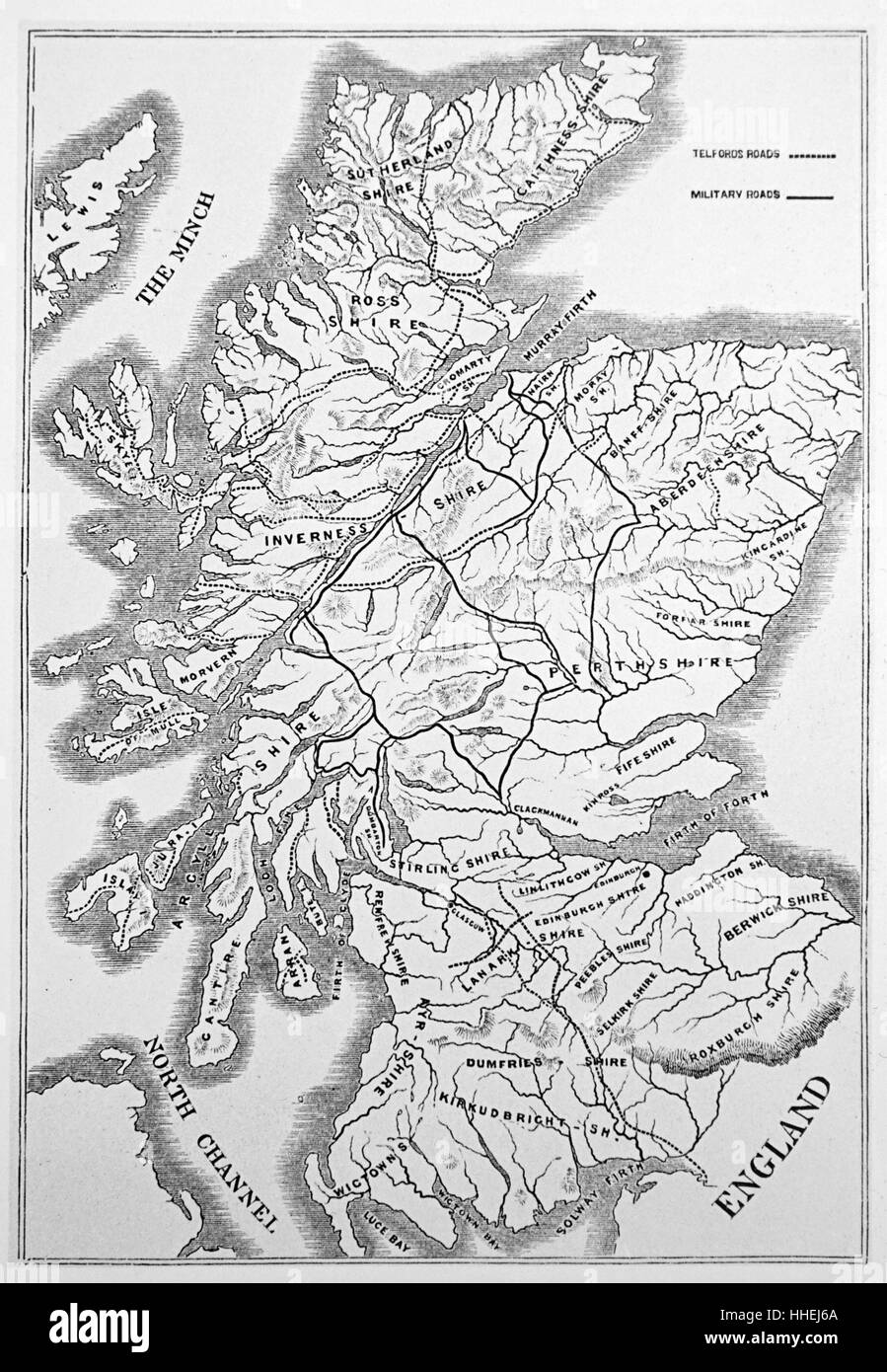 Map of Scotland showing Telford's roads (dotted lines) and military roads (solid lines). Thomas Telford (1757-1834) a Scottish engineer, architect, and stonemason. Dated 19th Century Stock Photohttps://www.alamy.com/image-license-details/?v=1https://www.alamy.com/stock-photo-map-of-scotland-showing-telfords-roads-dotted-lines-and-military-roads-131243346.html
RMHHEJ6A–Map of Scotland showing Telford's roads (dotted lines) and military roads (solid lines). Thomas Telford (1757-1834) a Scottish engineer, architect, and stonemason. Dated 19th Century
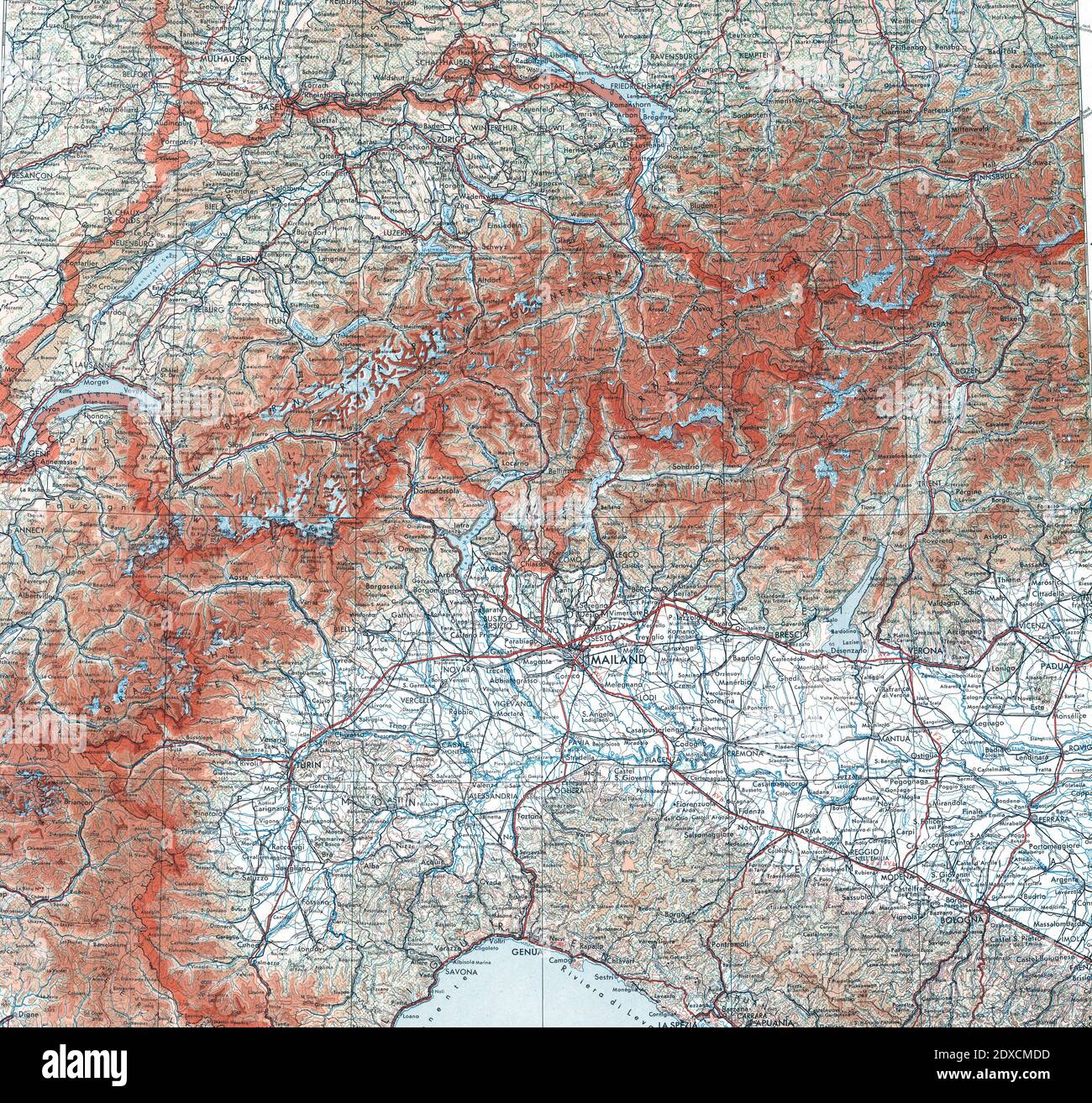 German military map of Switzerland and Northern Italy, scale 1 : 1 000 000, with Austria and Alsace shown as part of Germany, while Liechtenstein got forgotten completely Stock Photohttps://www.alamy.com/image-license-details/?v=1https://www.alamy.com/german-military-map-of-switzerland-and-northern-italy-scale-1-1-000-000-with-austria-and-alsace-shown-as-part-of-germany-while-liechtenstein-got-forgotten-completely-image394888633.html
RM2DXCMDD–German military map of Switzerland and Northern Italy, scale 1 : 1 000 000, with Austria and Alsace shown as part of Germany, while Liechtenstein got forgotten completely
 Map of Havana 1762 Stock Photohttps://www.alamy.com/image-license-details/?v=1https://www.alamy.com/stock-photo-map-of-havana-1762-132198971.html
RFHK253R–Map of Havana 1762
 Military Map of Kiseljak Bosnia, December 1993 Stock Photohttps://www.alamy.com/image-license-details/?v=1https://www.alamy.com/military-map-of-kiseljak-bosnia-december-1993-image454758819.html
RM2HBT1EB–Military Map of Kiseljak Bosnia, December 1993
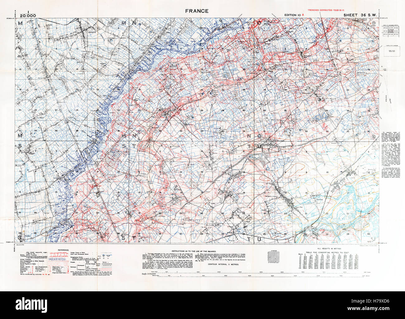 Aubers and Neuve Chapelle Battlefield Map, 1918 January Edition 10A 1:20,000 military map of the British sector between Lens and Lille, with square 36 SW trenches correct at December 1917 Stock Photohttps://www.alamy.com/image-license-details/?v=1https://www.alamy.com/stock-photo-aubers-and-neuve-chapelle-battlefield-map-1918-january-edition-10a-124993490.html
RMH79XD6–Aubers and Neuve Chapelle Battlefield Map, 1918 January Edition 10A 1:20,000 military map of the British sector between Lens and Lille, with square 36 SW trenches correct at December 1917
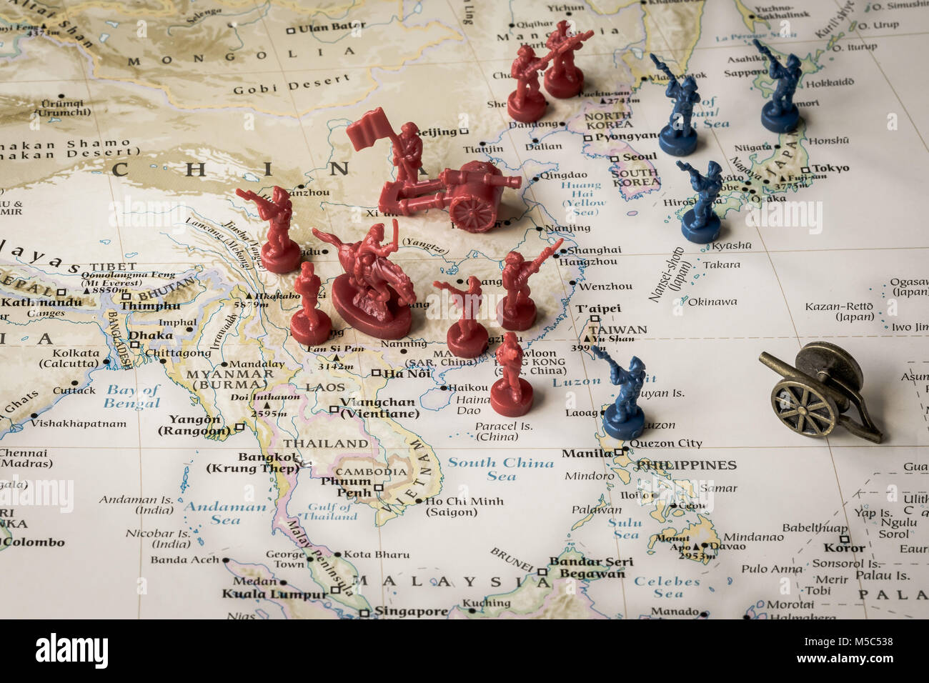 Macro close up of toy soldiers on a map representing conflict and tensions in the South China Sea Stock Photohttps://www.alamy.com/image-license-details/?v=1https://www.alamy.com/stock-photo-macro-close-up-of-toy-soldiers-on-a-map-representing-conflict-and-175444396.html
RFM5C538–Macro close up of toy soldiers on a map representing conflict and tensions in the South China Sea
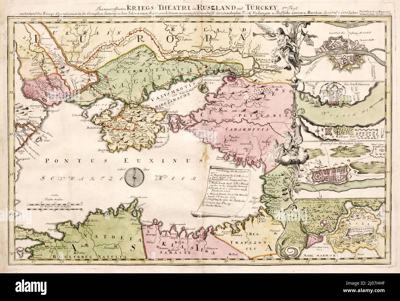 A military map depicting Russo-Turkish War of 1735-1739. Museum: PRIVATE COLLECTION. Author: ANONYMOUS. Stock Photohttps://www.alamy.com/image-license-details/?v=1https://www.alamy.com/a-military-map-depicting-russo-turkish-war-of-1735-1739-museum-private-collection-author-anonymous-image464847419.html
RM2J07HHF–A military map depicting Russo-Turkish War of 1735-1739. Museum: PRIVATE COLLECTION. Author: ANONYMOUS.
